Education
University of Texas at Arlington, MLA, 2023 - 2025
Auburn University, BA, Horticulture, Pre-Landscape Architecture, 2019 - 2023
Minor in Business, Spanish
Work Experience
College of Architecture, Planning, and Public Affairs | Graduate Research Assistant | Arlington, Texas | August 2023 - Present
R&R Landscaping | Landscape Designer, Remote Designer | Auburn, AL |
May 2023 - Aug. 2023, Sept. 2023 - February 2023
Paterson Greenhouses | Facilities Employee | Auburn, AL | May 2021- August 2021
Skills
Adobe Photoshop
Adobe Illustrator
Adobe InDesign
AutoCAD
Rhino
Sketchup
Lumion/ Enscape
ArcGIS Pro
Hand Sketching
Hand Modeling
Beginner Advanced
Languages
English
Spanish
French
Contacts
Beginner Fluent
Email | jah9153@mavs.uta.edu |
johnathan.a.hampton@gmail.com
LinkedIn | www.linkedin.com/in/jahampton0121
3 about

4 TABLE OF CONTENTS table of contents 00
5 table of contents 01 02 03 04 05 CULTIVATING ATTUNEMENTS: TUSKEGEE NATIONAL FOREST p6 p22 p34 p42 p46 CONFLUENCE PARK THEORETICAL STUDY: CHANGE OVER TIME FIGH-PICKETTBARNES SCHOOL HOUSE OTHER WORKS

6
cultivating attunements: tuskegee national forest
01 CULTIVATING ATTUNEMENTS: TUSKEGEE NATIONAL FOREST
Tuskegee National Forest Auburn, AL
January - May 2023
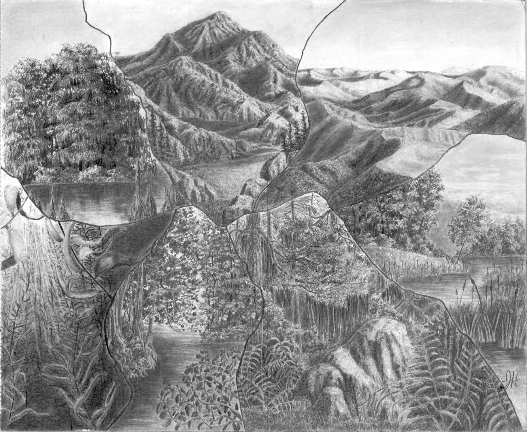
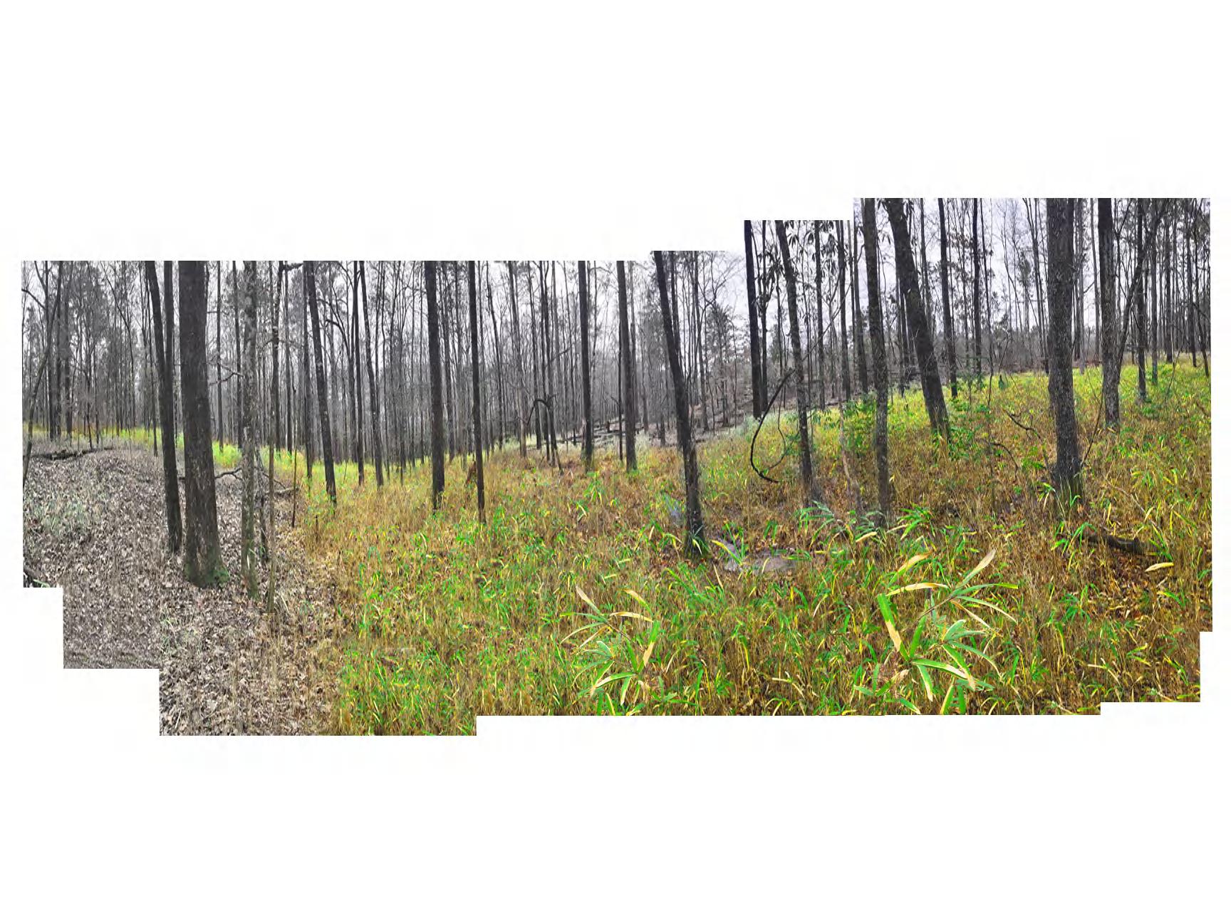
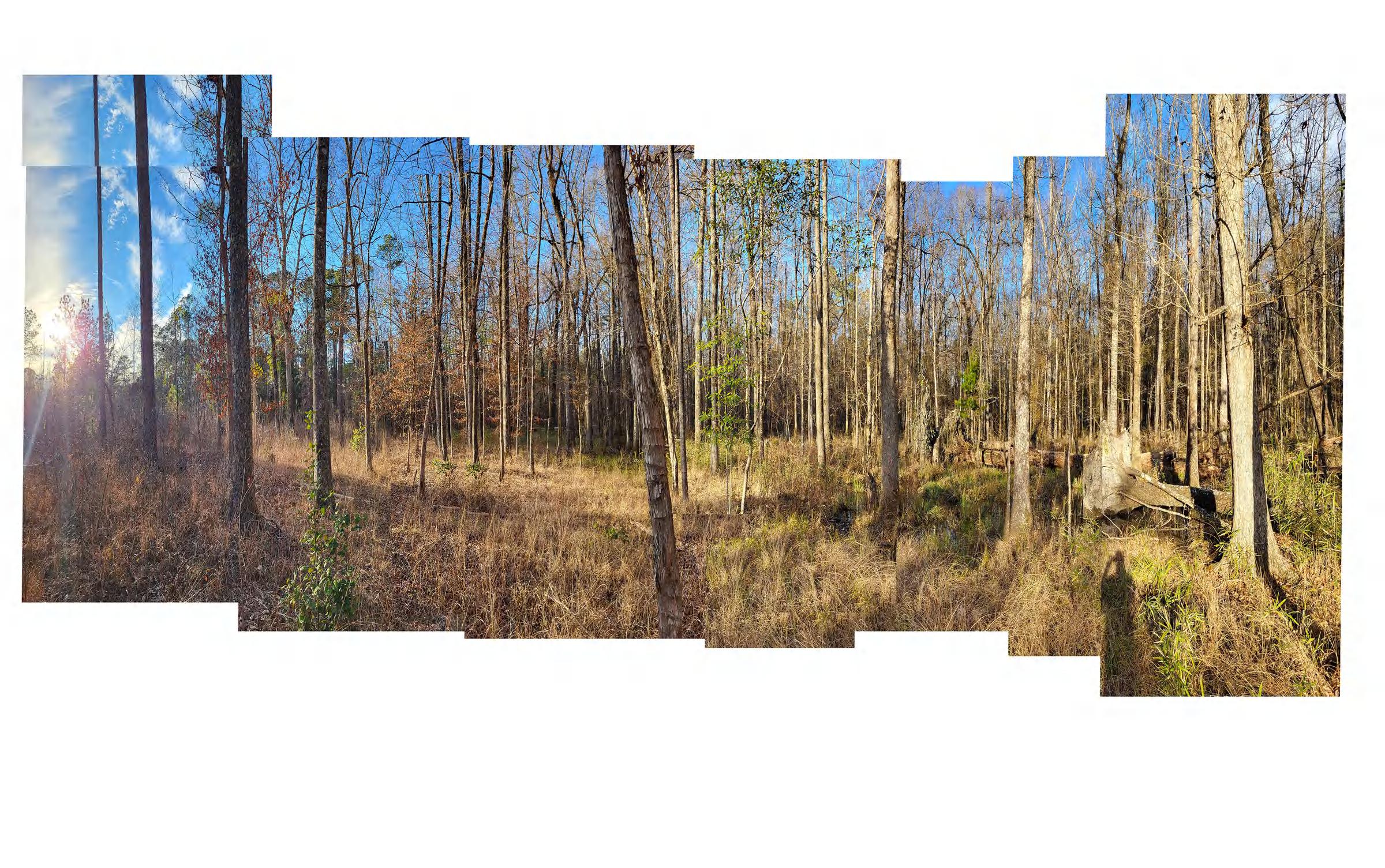
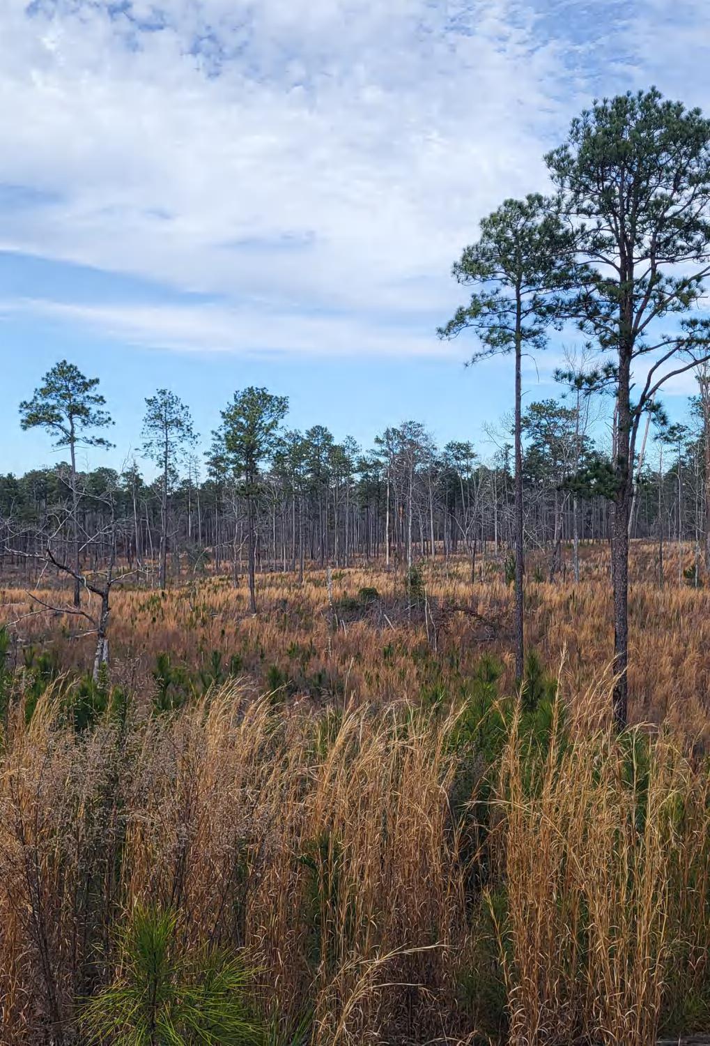
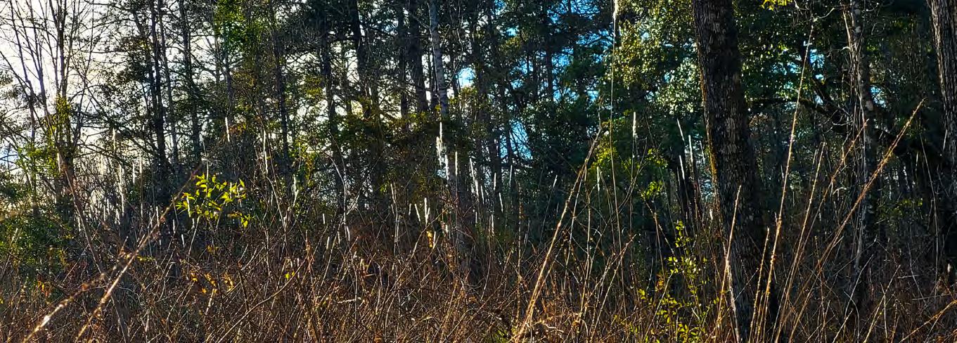
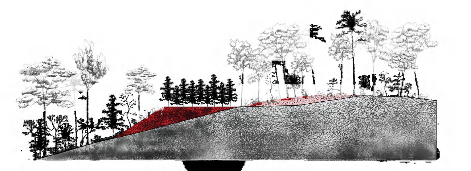
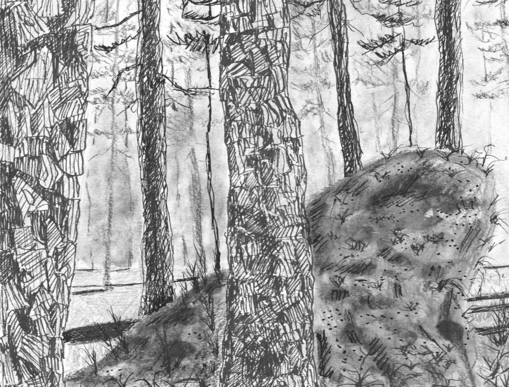
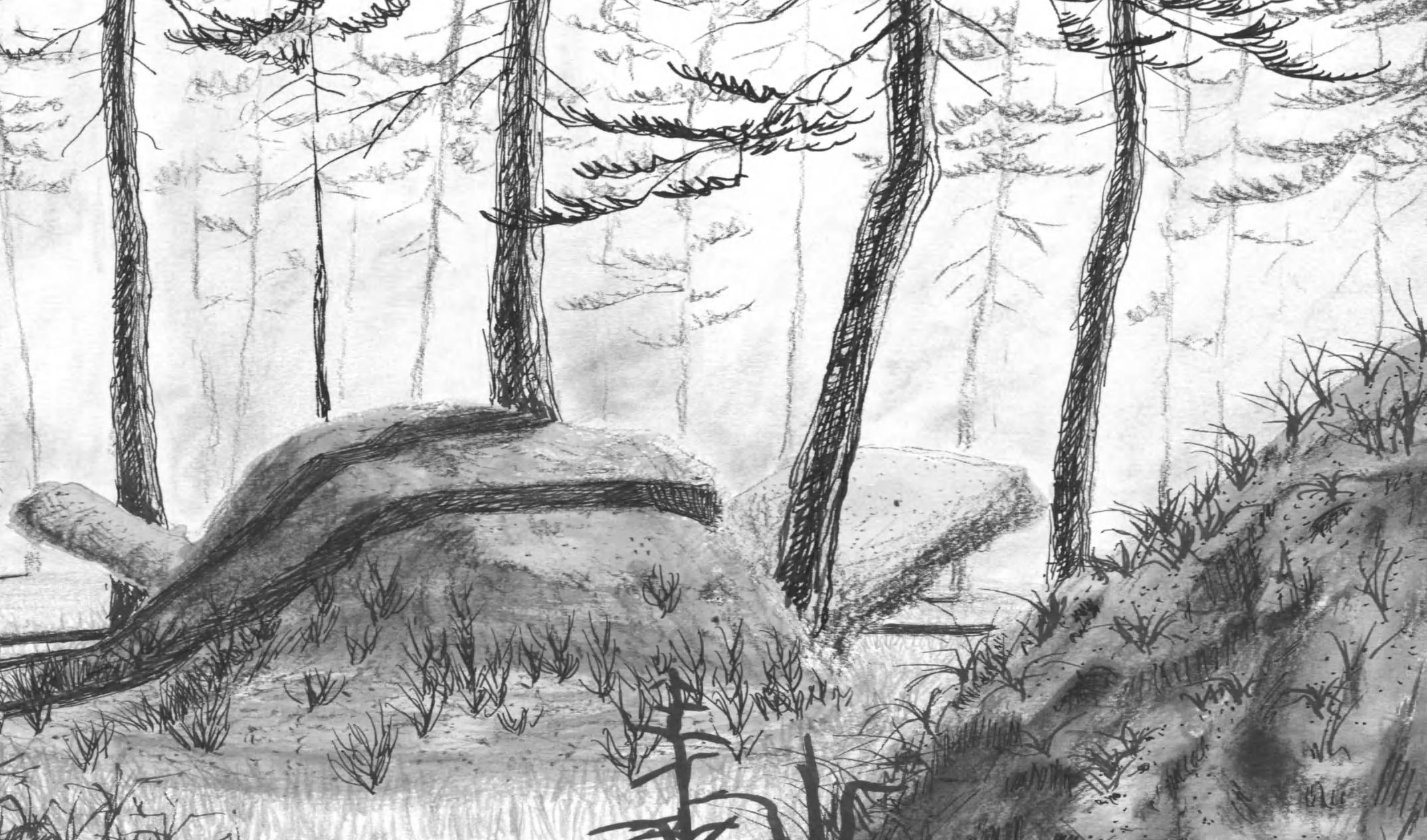
The smallest of the national forests in the United States, Tuskegee National Forest boasts a trove of unexplored and underappreciated design opportunities. Within its 11,000 acre confines lie typologies ranging from dry, vast longleaf pine savannahs to rich, saturated birch-maple-tupelo swamps, each with their own compelling stories to tell. This project seeks to curate and celebrate these narratives in a way that attunes the trailgoer to them, thus revealing the rich complexity of this small national forest.
7
cultivating attunements:
tuskegee national forest
elevation + plant community + atmosphere
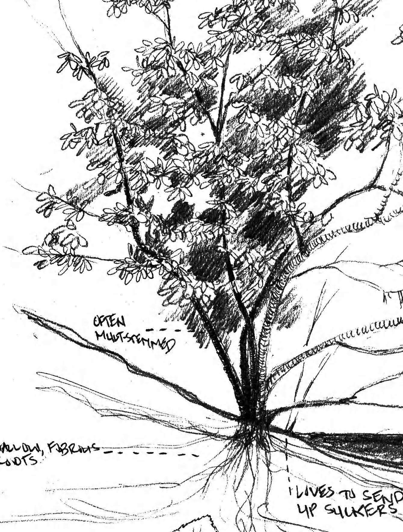
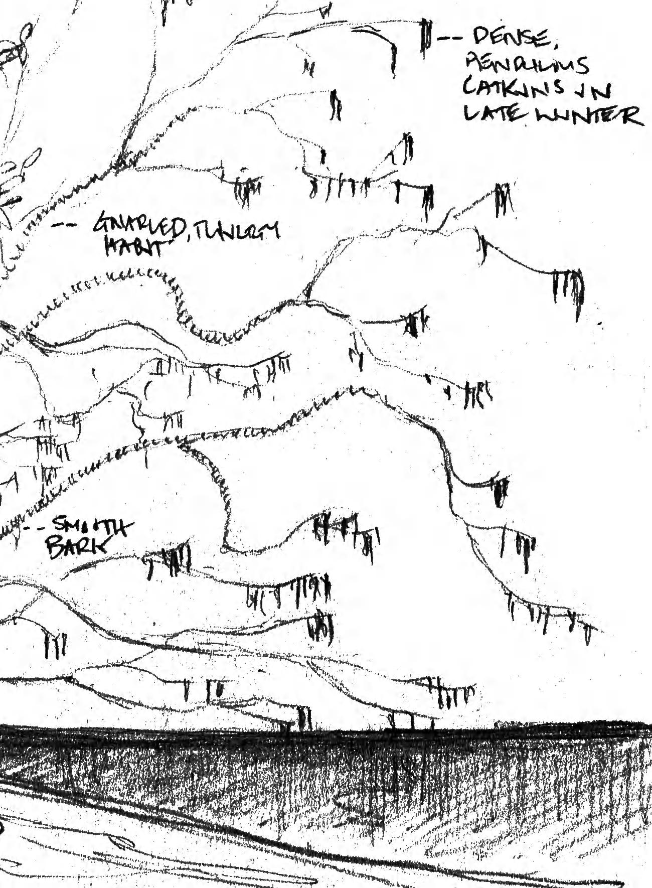
Tuskegee National Forest owes its iconic typologies to both the subtle and stark elevation changes that occur throughout the site. This creates a diverse palette of plant communities, each of which feature distinct and compelling atmospheric qualities.
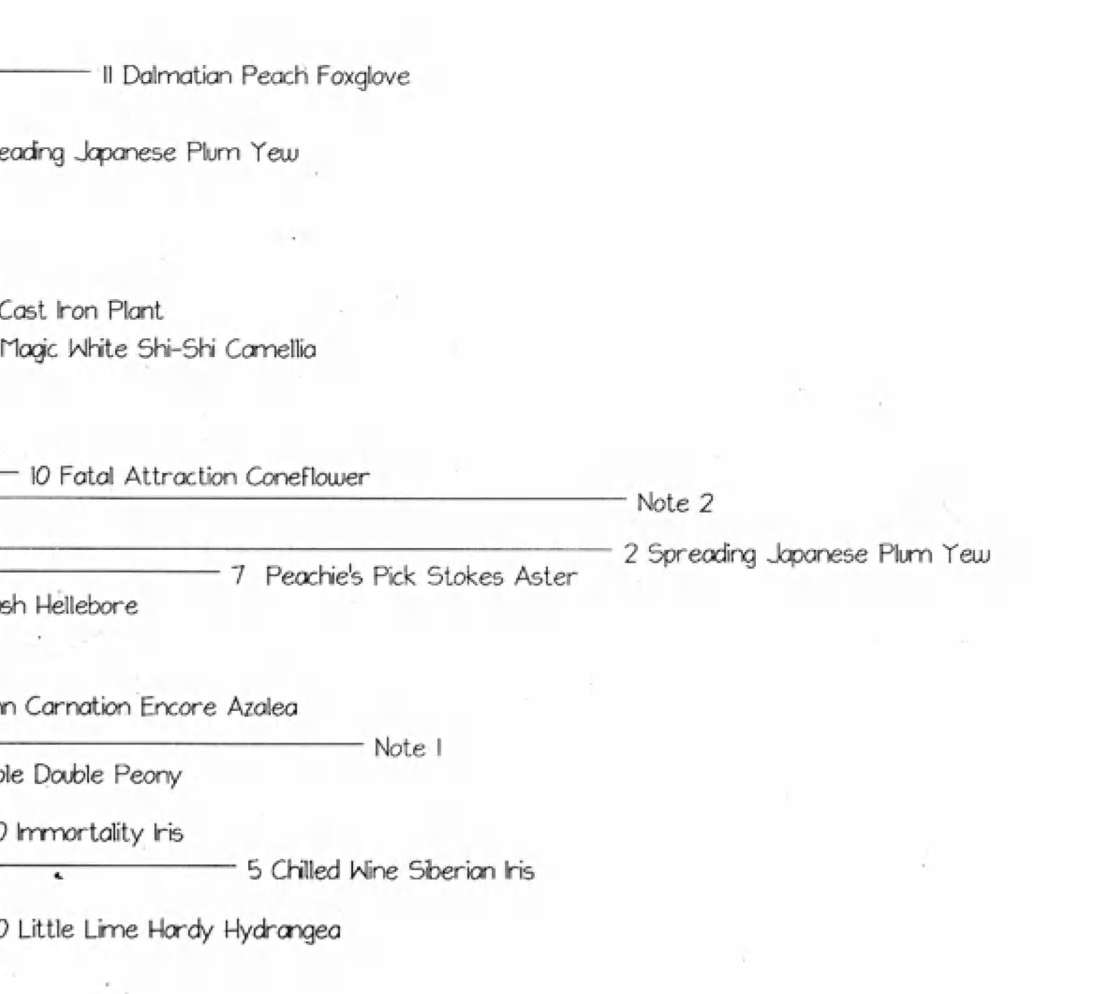
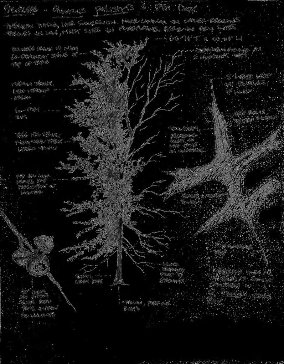
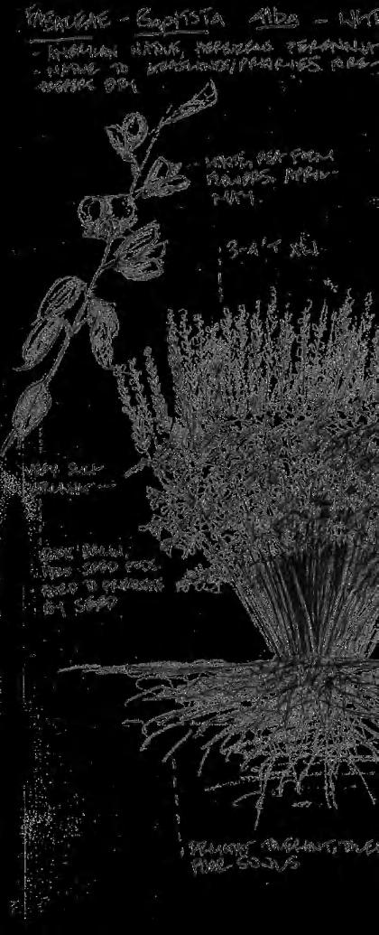
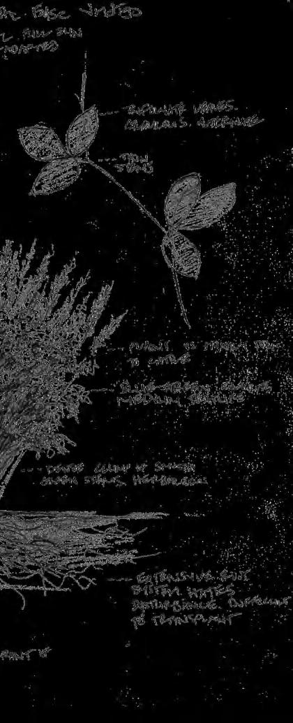
20’ 3-6” 15’ 9-12” >40’ 7.5’ 5’ 10’ 25’ 6’ 2.5’ 5” 0.5” 3” 3” >20’ >20’ 6’ 2.5’ 3” 3” 3.54’ 2”-7” 6’ >30’ 1.5’ >30’ 4 - 7%
pagoda
spp. Cherrybark Oak
sylvatica Black Tupelo
nigra River Birch Acer rubrum Red Maple Bulrush 8 cultivating attunements: tuskegee national forest
Quercus
Scirpus
Nyssa
Betula
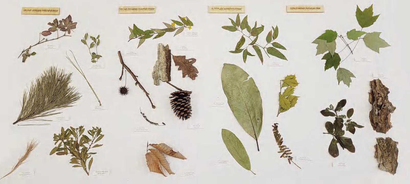
Tuskegee National Forest can be divided into 4 general typologies based on elevation: Upland Longleaf
Pine Savannah, Dry and Dry-Mesic Oak-Pine Forest, Floodplain Hardwood Forest, and Tupleo Swamp/ Riparian Edge.
9
cultivating attunements: tuskegee national forest
10
attunements: tuskegee national forest
cultivating


11
cultivating attunements: tuskegee national forest
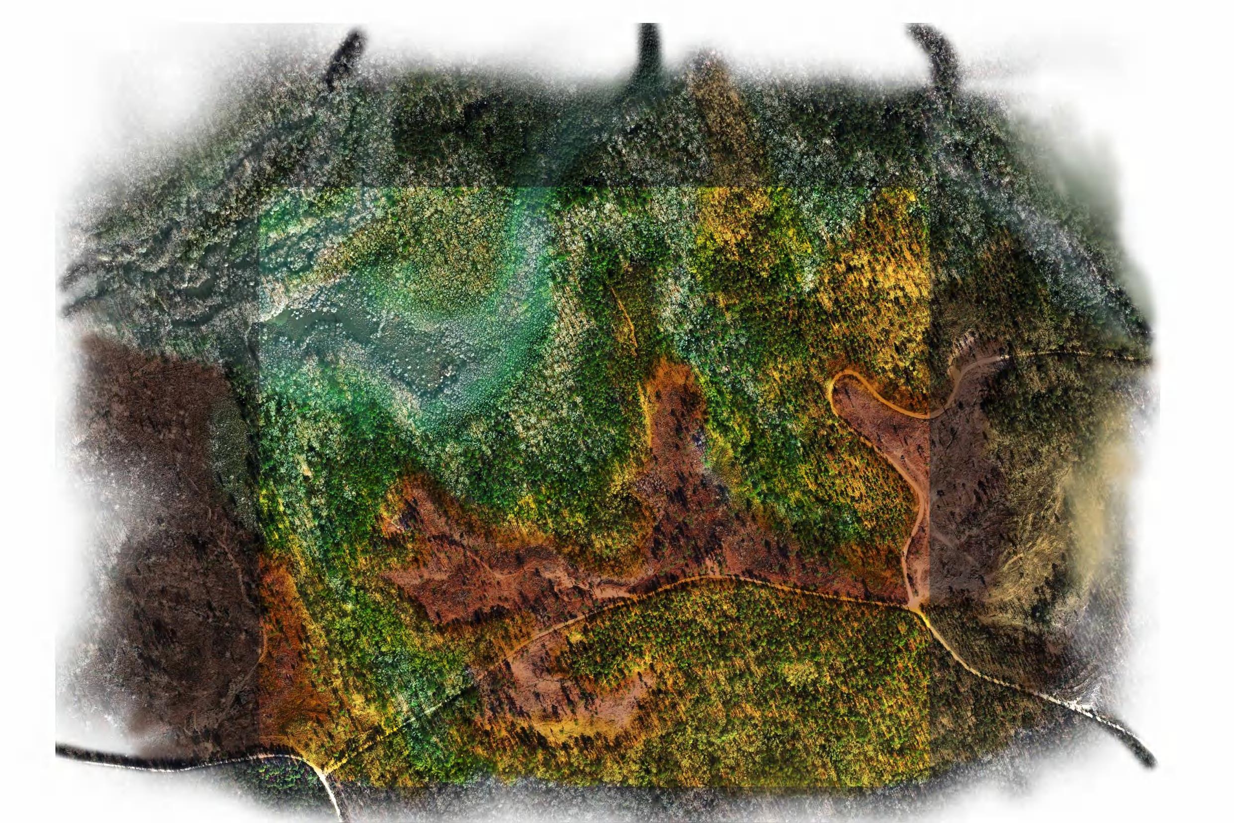
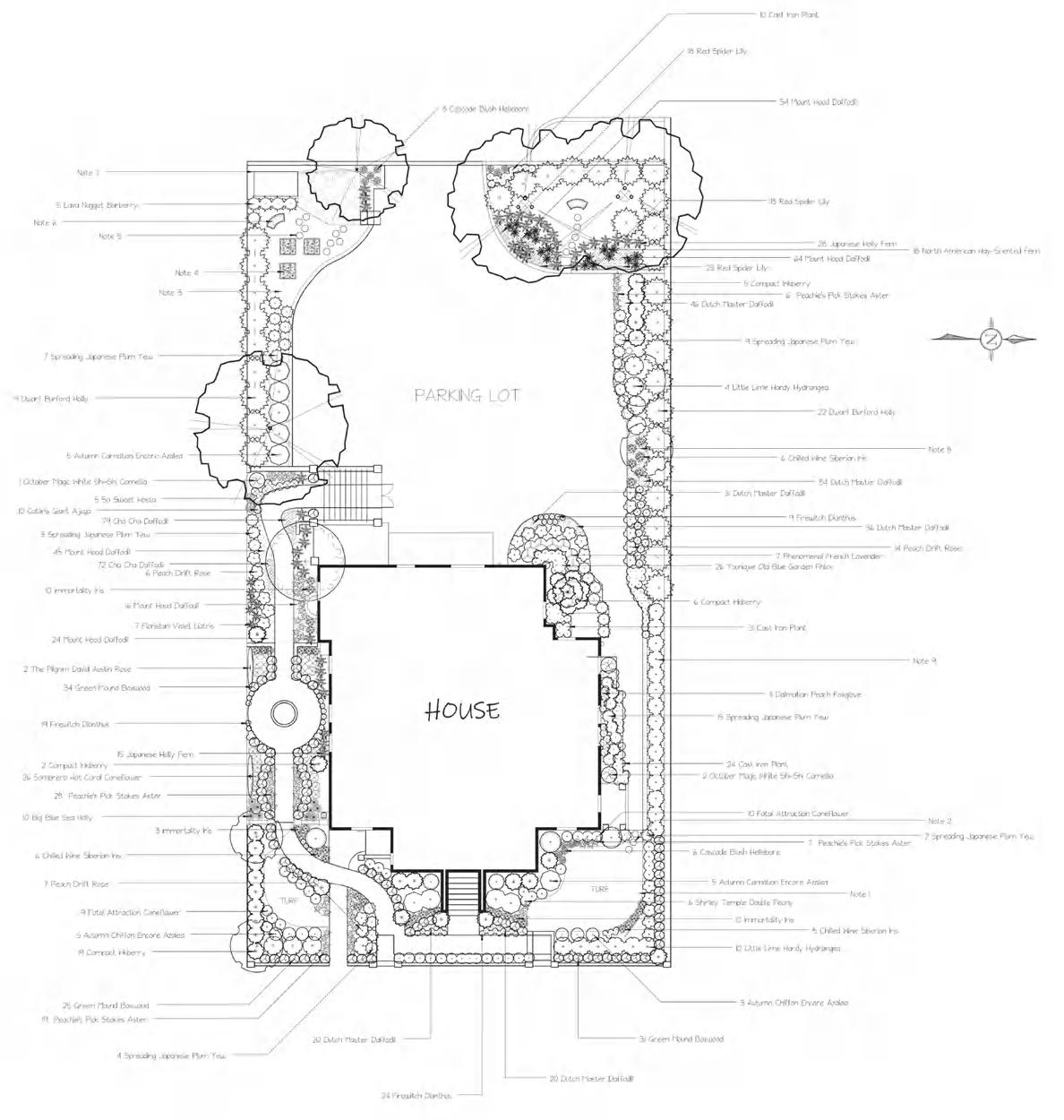
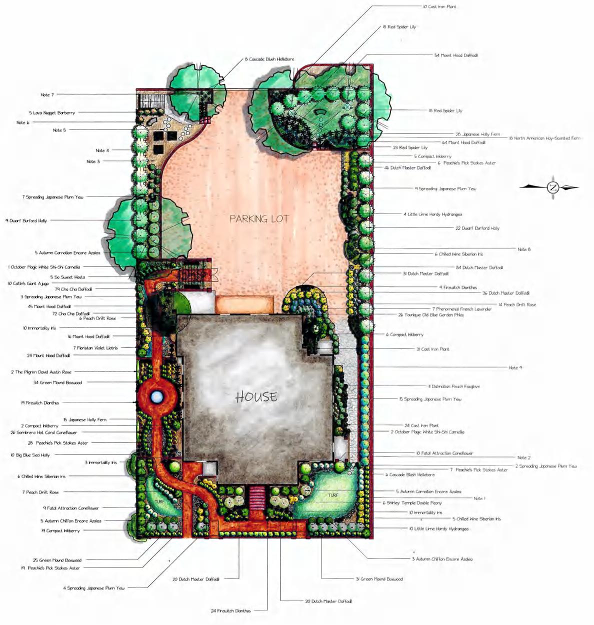
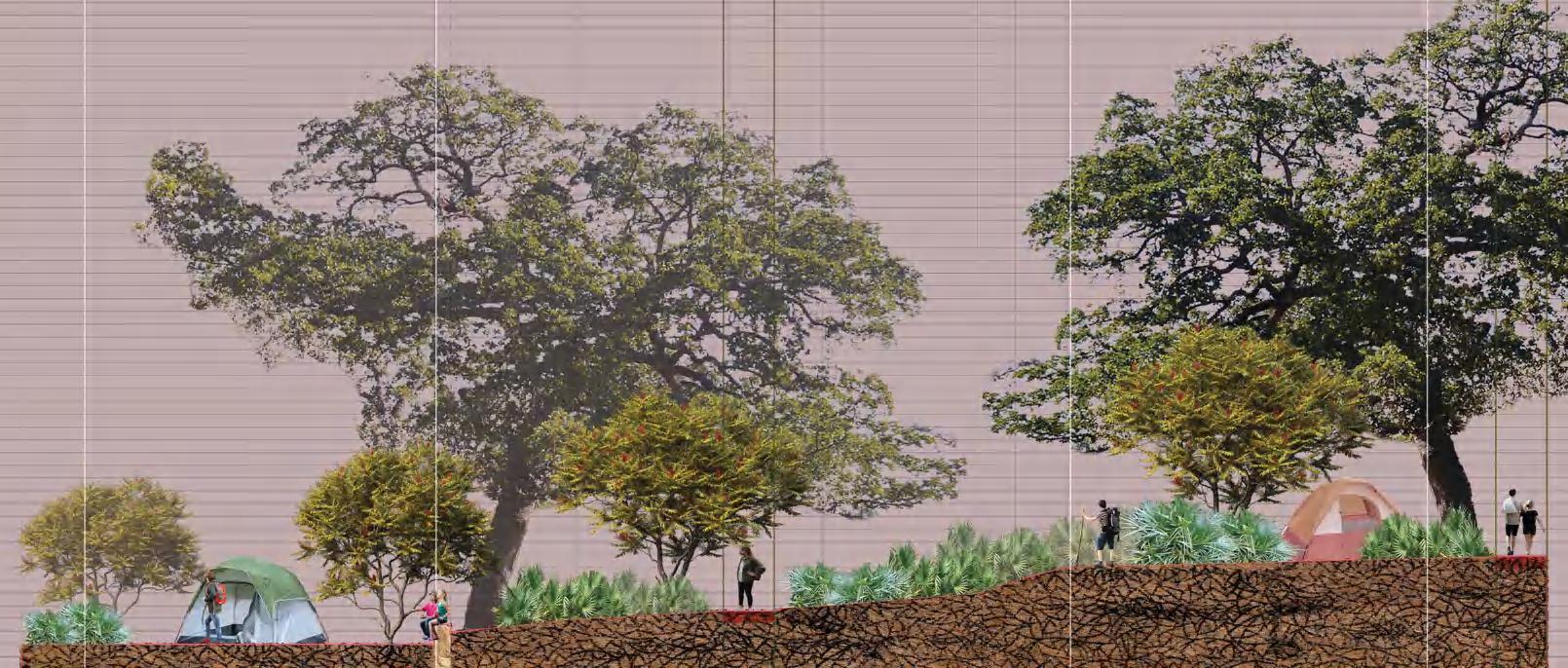
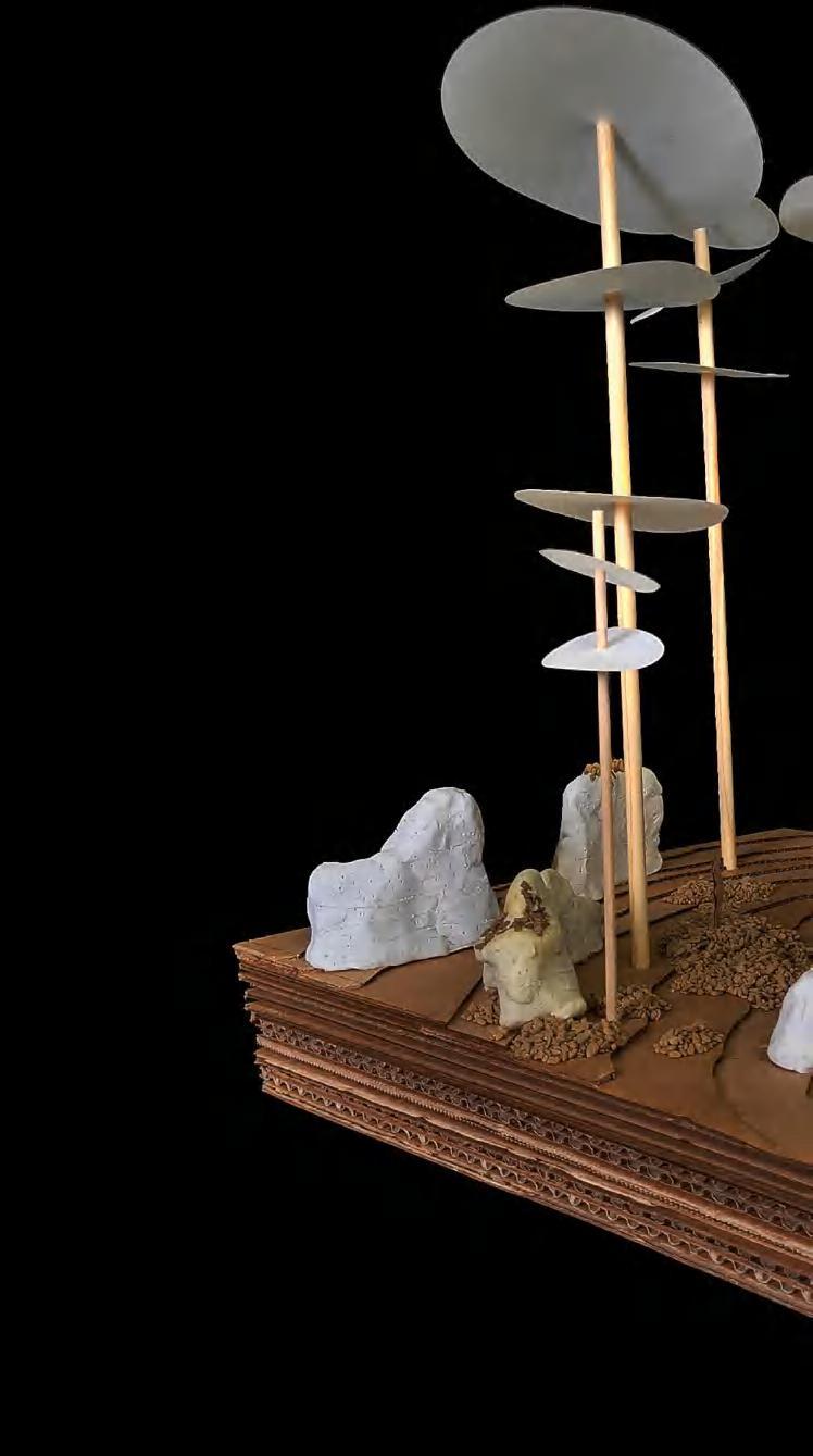
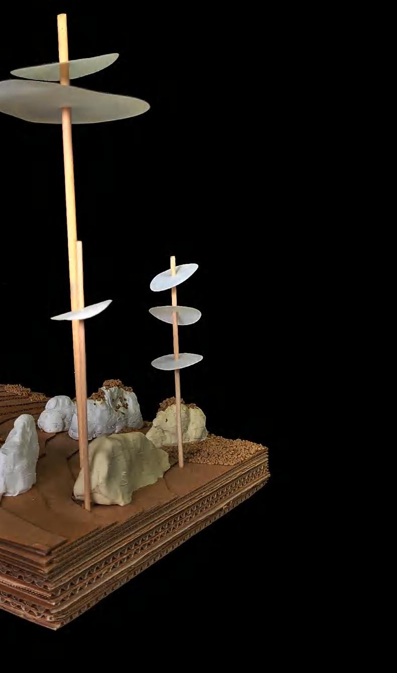
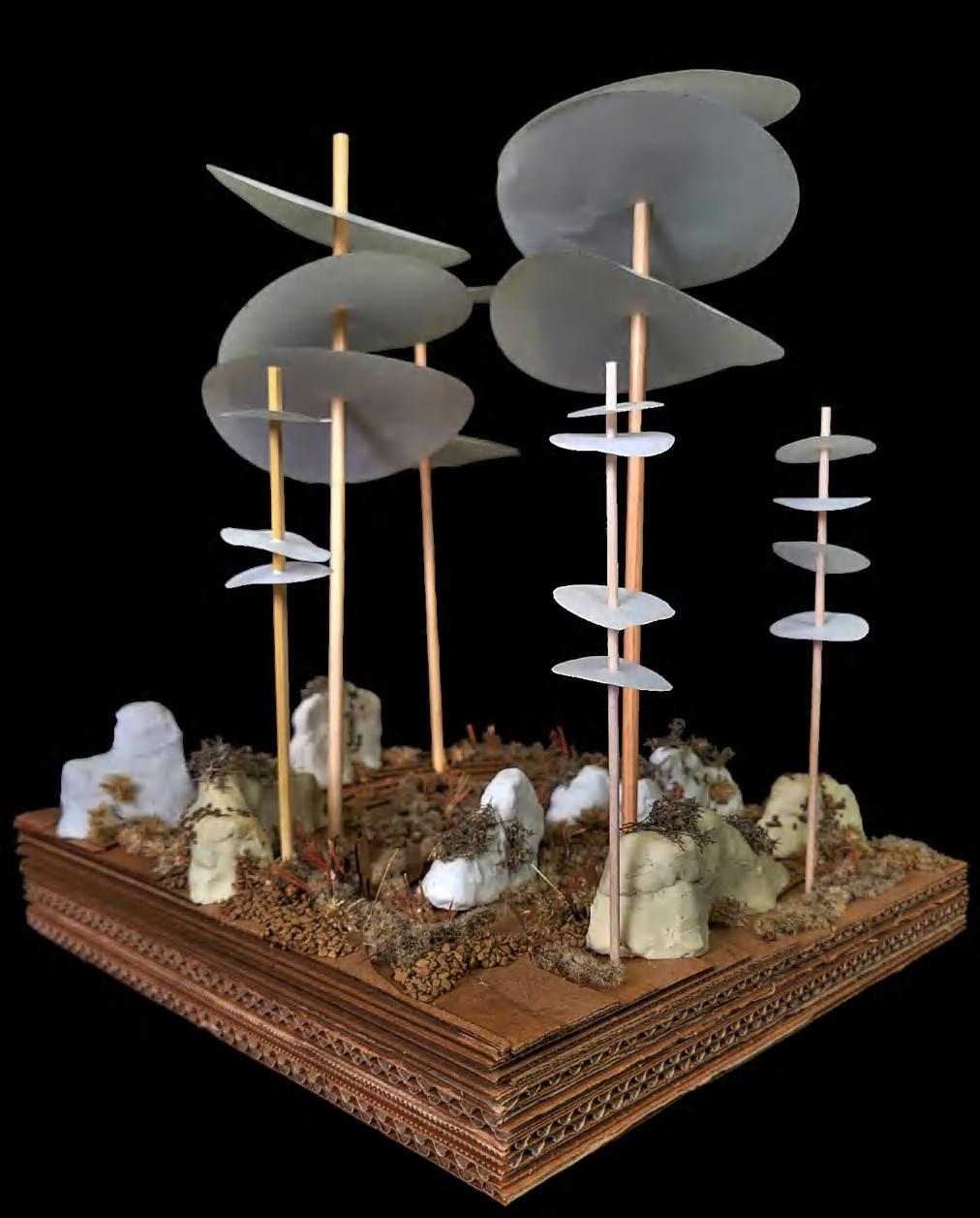
Pond/ Riparian Interface Pond Choctafaula Creek Ridgeland Forest Pine Savannah Road Bottomlands Parking Lot 2 Trailhead 1 Parking Lot 1 Trailhead 2 Large Camp Small Camp 1 Small Camp 2 Dell-Longleaf Interface Planted Ridgeland Corridor Indian grass, little bluestem, broomsedge “sea” Planted Bottomland Corridor Flooded Berm System Cut, Frame (Plant), and Reveal Corridors Trench and Berm System Waymarker Planted Ridgeland Switchbacks N 25’ 100’ 200’ in 200 Section 1 TRAIL PLAN 12 cultivating attunements: tuskegee national forest
day use: trail of attunements
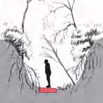
In response to intial site inventory and analysis work, I was tasked with creating a trail within a zone of 300400 acres that would attune hikers to Tuskegee National Forest's aforementioned spatial and atmospheric qualities. The trail responds to topographic and ecological changes across the forest, sometimes straddling and weaving between edges and topographic gradients, sometimes piercing from one typology to another. The trail guides hikers to specific locations that demonstrate my design agenda at a smaller scale.


A’ B A’ B B’ C’ D D’ E’ B’ C’ D D’ E E’ Wooden platform Wooden platforms afford prospect across dell condition Path Stairway allows access into unique dell condition Low-impact path Low-impact path Dell walls, trees, shrubs, and roots create enclosure Viewshed Pine Savannah Magnolia grid Dell Cable/rope
DELL CONDITION Southern Magnolia grid creates screen that frames viewshed 350’ 300’ 400’ Undulating pattern over dell serves as threshold for further down the procession Wooden Steps/ Supports A A Wooden supporting beams Concrete pile cap Ridgeland typology Bottomland typology Dense grid planting of magnolia creates threshold Berm Low-impact path (compacted dirt) Low-impact path (compacted dirt) Deck 310’ 350’ 400’ 440’ ath Overlook Magnolia grid Berm Wooden beam Platform brings individuals out to canopy evel. Heightened prospect Cut operation into the canyon wall creates sequences of enclosure and compression
SECTION 2:
RIDGE AND BOTTOMLAND TRANSITION ree roots cut with air spade 13
SECTION 1:
cultivating attunements: tuskegee national forest
14
cultivating attunements: tuskegee national forest
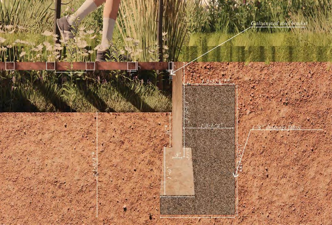
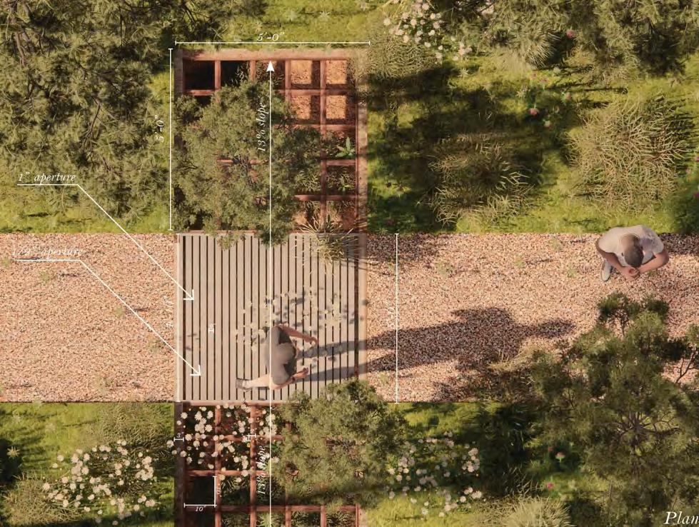
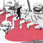
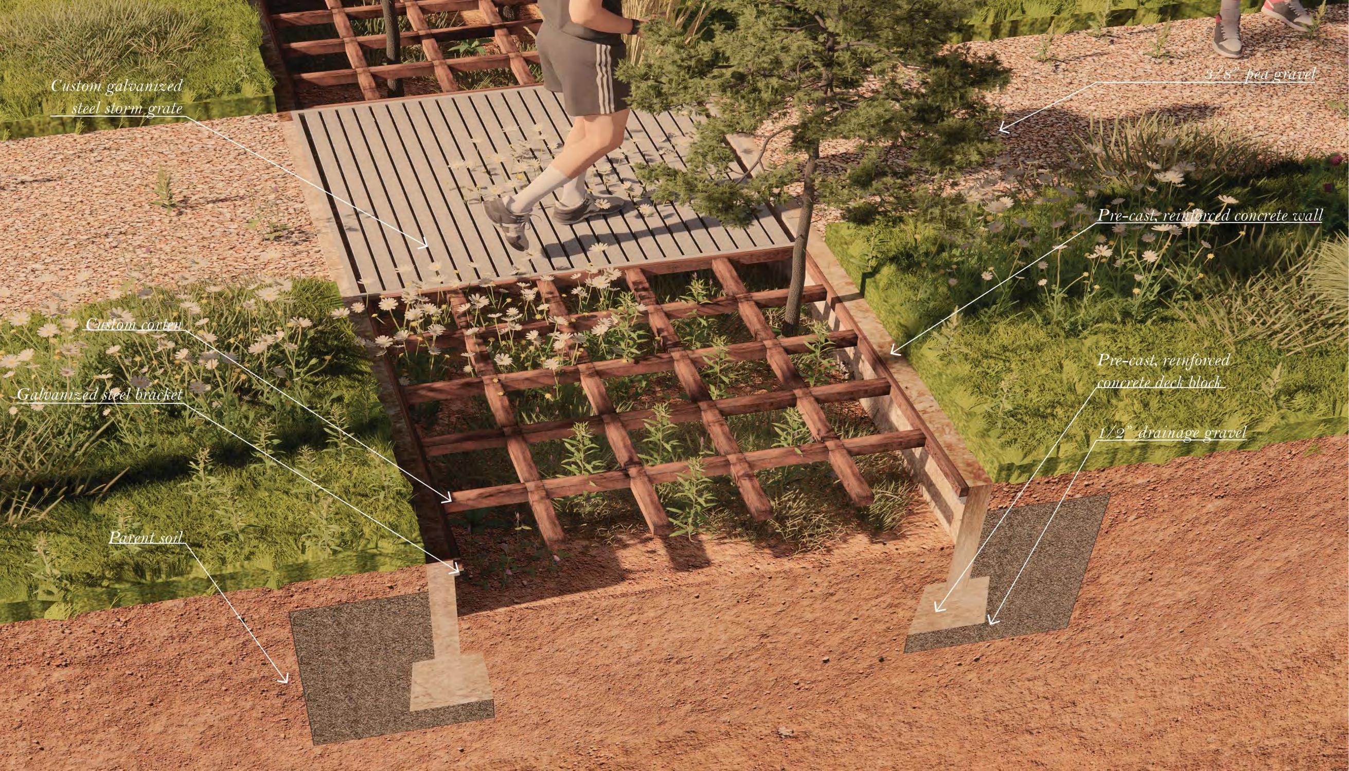
waymarker: differentiation trench
The Differentiation Trench is a human-scale instrument intended to serve both as a set of waymarkers for hikers and as an abstraction of the large-scale topographic relationships present within Tuskegee National Forest. The trenches feature a sloped bottom that allows for uneven water distribution, resulting in a moisture gradient that may lead to the emergence of different plant species along its length. Concrete walls isolate the trench's contents from the surrounding context while also supporting grates intended for walking and plant growth, respectively.
15
cultivating
attunements: tuskegee national forest
Strategic extensions of campsite grade create curated viewing rooms Seatwalls call back to terraced effect of pathing while also responding to existing topography Paths create small terraces that create brief moments of prospect Dense plantings of needle palm conceal space 0.5’ 4’ 1/4 in Campsite footprint Campsite footprint Winged sumac Path Path Rhus copalliunum Needle Palm Rhaphidophyllum hystrix Post Oak Quercus stellata 0.5’ 2’ 1/4 in ft Campsite footprint Winged sumac Gathering site footprint Descent corresponds with increased enclosure and privacy Path Path Rhus copalliunum Little Bluestem Schizachyrium scoparium Needle Palm Rhaphidophyllum hystrix Post Oak Quercus stellata Longleaf Pine Pinus palustris Ascent corresponds with decreased enclosure and privacy Low branching and dense habit of post oak and sumac create intimate enclosure High. thin canopy of pines subtly suggests enclosure Bluestem creates sense of movement which aids in defining gathering space 16 cultivating attunements: tuskegee national forest A' A B' B
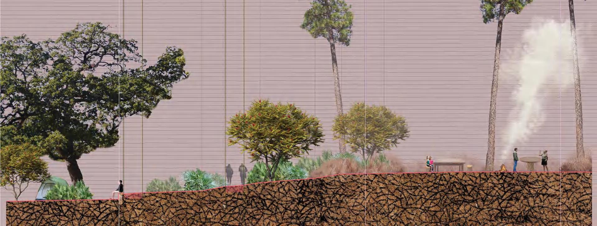
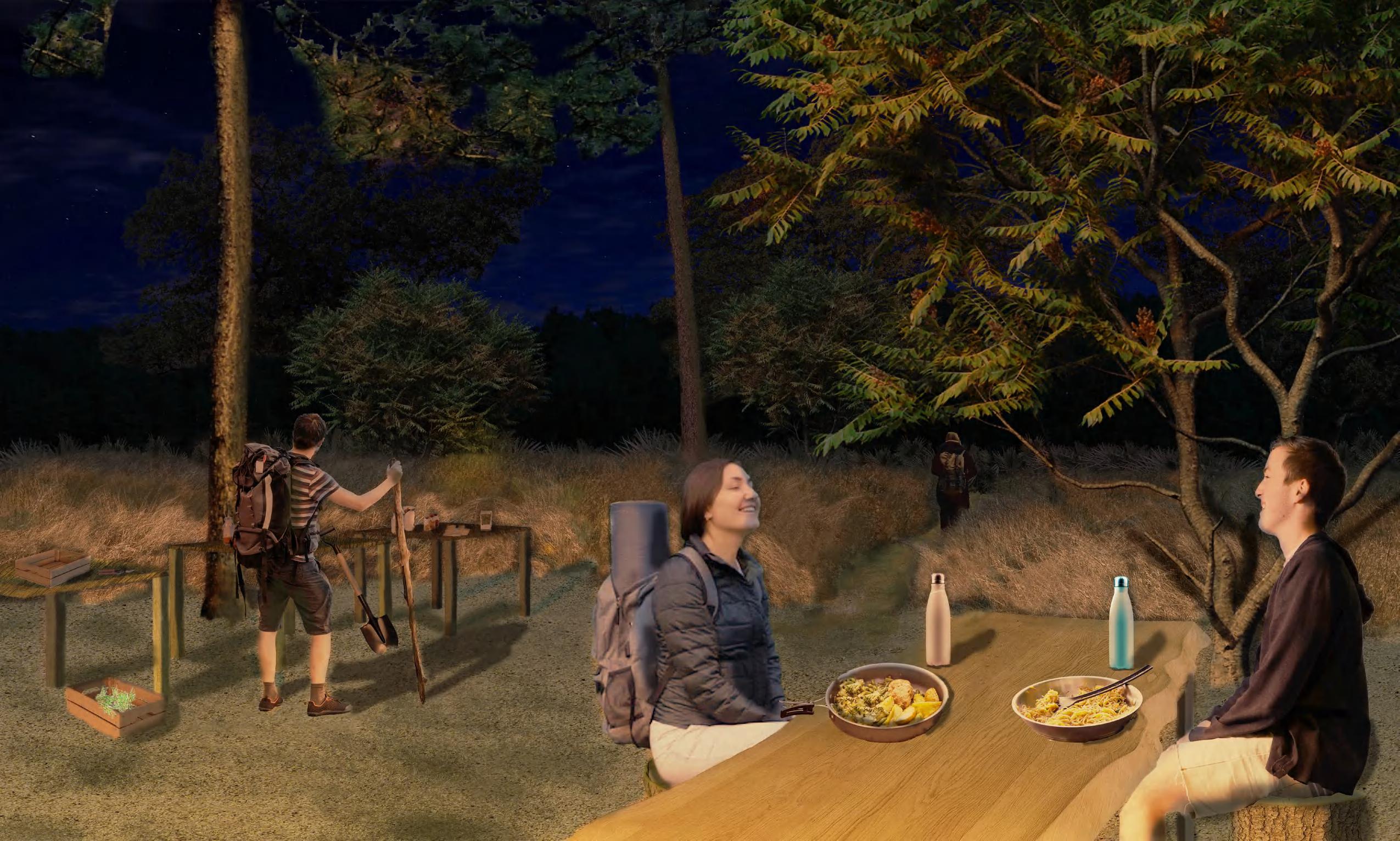
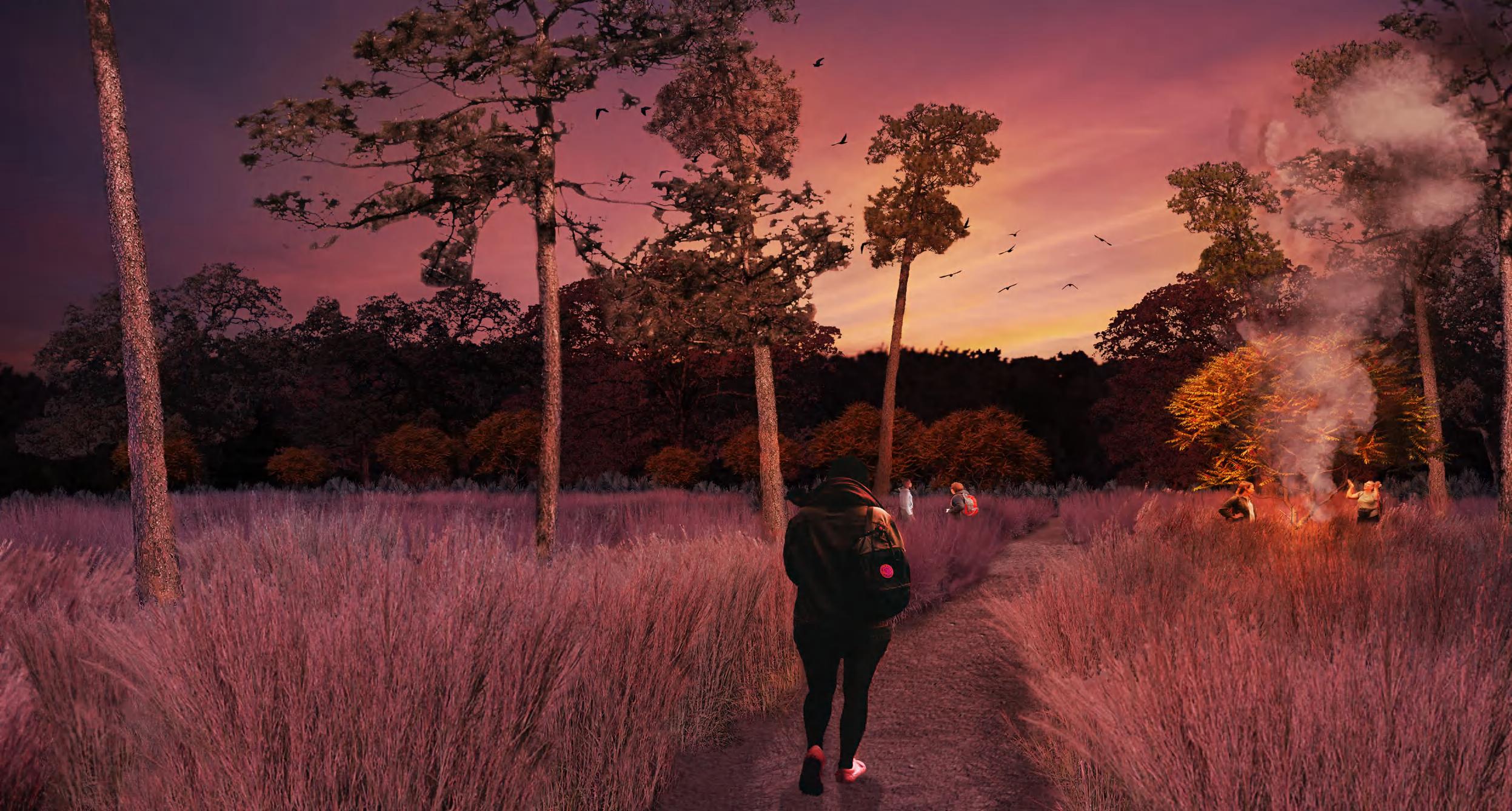
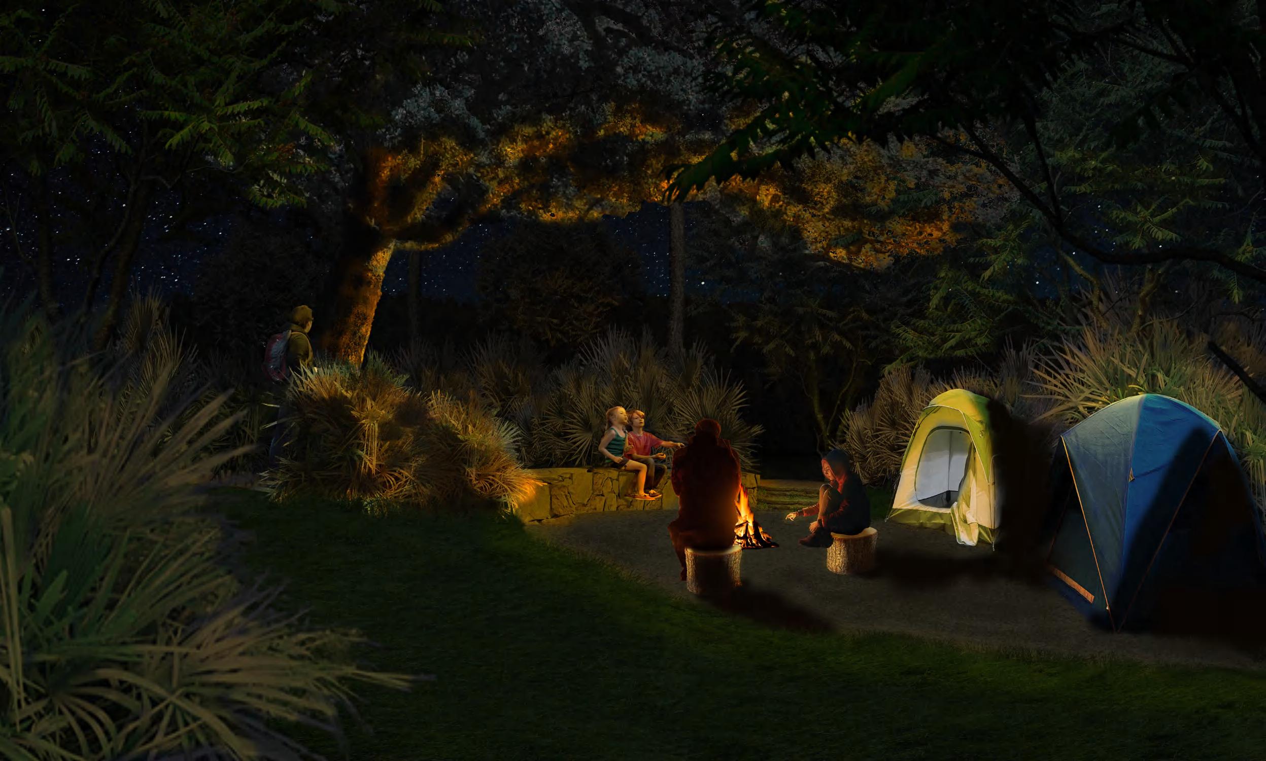
wooded basilica
Along with designing a trail for day use, part of this project addresses creating a space for night use. The "Wooded Basilica" is a large campsite that explores the relationship between topography, plant communities, and space. This site flows along the side of a hill surrounded by a basilica of lowland forest. The public, uppermost portions feature finely textured plants that orchestrate panoramic views of the site. The lower portions house intimate spaces formed by the hill and by plants with low, dense, opaque spatial qualities. The trails mimic the site's fluid topography, while the campsites showcase key views marked during site visits.
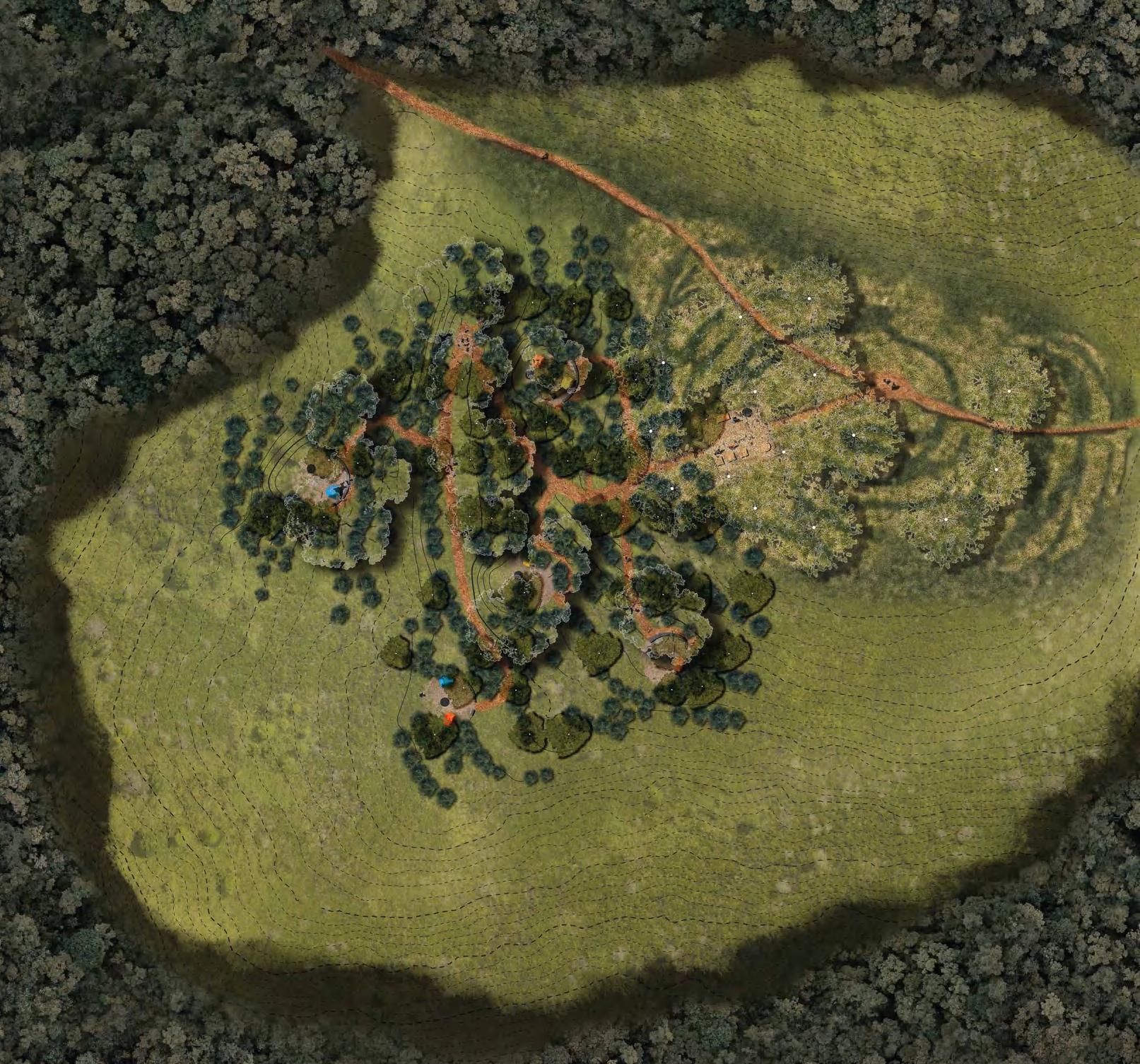
N 2.5’ 10’ 20’ 20 Needle palm Longleaf pine Rhapidophyllum hystrix Pinus palustris Little bluestem Schizachyrium scoparium Winged sumac Rhus copallinum Post oak A B B’ A’ Quercus stellata Outhouse 1 Outhouse 2 Bluestem overlook Pine - Bluestem basilica Meadow trail Hardwood basilica Gathering Site
Oak - Sumac - Needle Palm enclosure 17
Campsite
cultivating attunements: tuskegee national forest
18
cultivating attunements: tuskegee national forest
19
cultivating attunements: tuskegee national forest
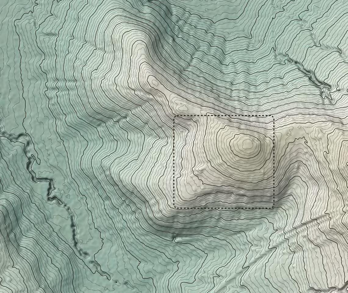
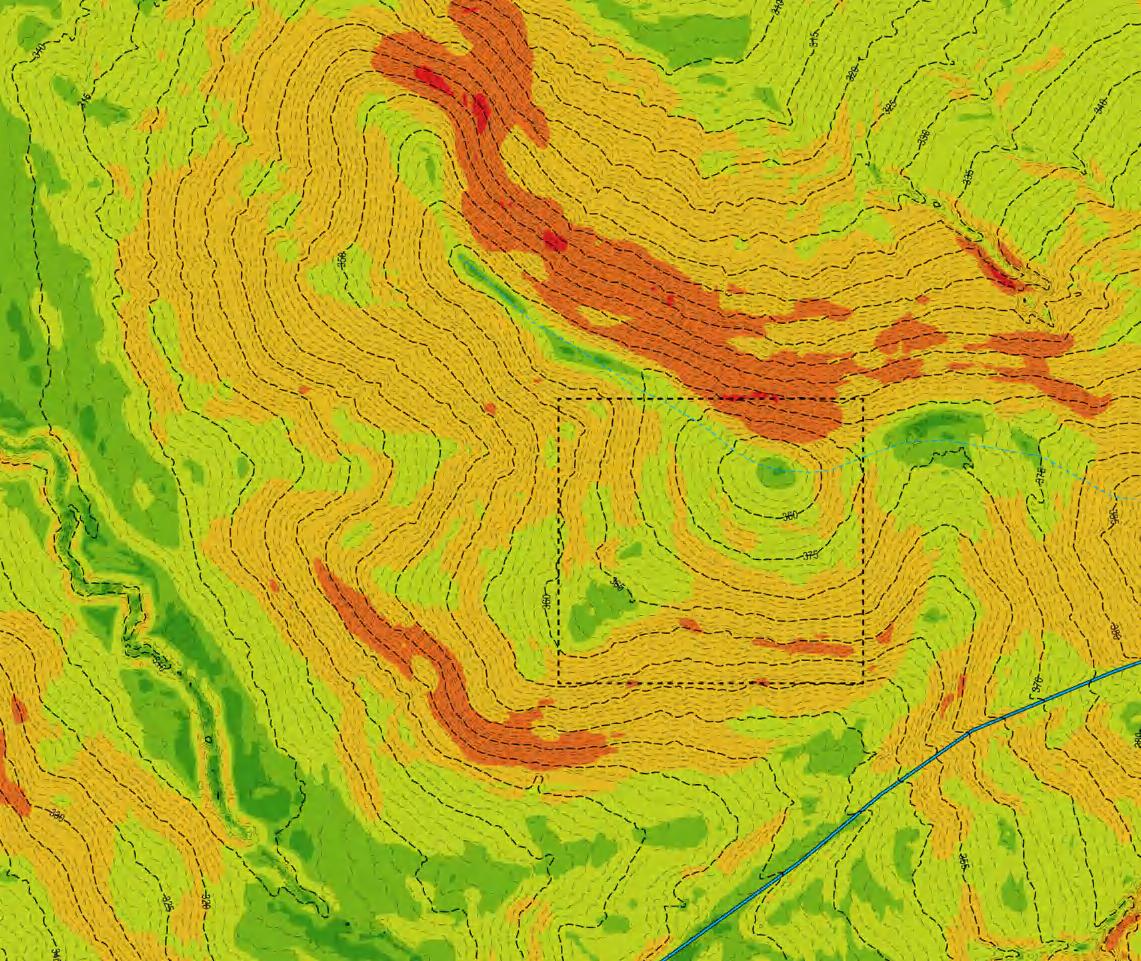
site grading + environmental impact
The final component of this project is a grading plan that examines the feasibility, and environmental impact of the wooded basilica campsite. The site's sloped topography posed a unique set of opportunities with regard to orchestrating views of the surrounding site. The design takes advantage of this by creating a series of flattened spaces throughout the site connected by descending, flowing pathways. Downhill, in private campsite locations, strategic cuts into the existing grade re-orient the path to showcase views of the surrounding basilica. Due to the slope of the site, excessive fill became a notable issue with the overall design, leading to environmental concerns. cultivating
20
0 - 2% 10.1 - 20% 20.1 - 30% >30% 2.1 - 5% 5.1 - 10% % Slope Key
attunements: tuskegee national forest
+383.41 +383.47 +383.53 +381.03 + 379.47 +379.19 +379.125 +379.065 378.78 2% 2% 2% 10% 10% 10% 10% 10% 5% 2% 2% 2% 2% 2% 2% 2% 2% 2% 5% 5% 5% 5% 5% 5% 5% 5% 5% 10% 5% 5% 2% 2% 2% + 377.98 +378.27 +378.33 378.39 + 378.67 +377.33 +377.08 374.5+ +371.85 +371.95 +372.1 +372.8 371.8+ +371.63 +371.47 + 371.59 371.59 +368.79 +368.8 369.24 368.9+ +367.74 +370.6 +370.22 +370.42 +367.34 367.7 371.59 +371.59 + 368.4 376.3 375.6+ +373.2 +373.05 +373.57 +369.8 345 344 346 347 348 349 349 348 347 346 344 343 351 352 353 354 356 357 358 359 361 362 363 364 366 367 368 369 371 372 373 374 376 377 378 378 377 376 374 373 372 371 369 368 367 366 364 363 362 361 359 358 357 356 354 353 352 351 376 379 379 381 381 382 382 383 383 371 369 343 345 350 350 355 355 360 365 370 375 360 365 370 365 360 355 375 380 380 369.8 369.94 373.23+ +372.72 +372.6 372.4 +370.65 370.19 +370.43 +367.02 +366.83 +366.98 +372.62 374.5 371.75+ +371.65 +371.97 +371.75 + 371.49 + 371.49 + 371.33 371.33+ +383.75 +383.35 +383.47 +382.95 +382.95 374.95 369.4 +368.5 +368.4 2% 2% 2% 2% 2% 2% 2% +BS370.8 +BS367.9 +BW367.9 +BW367.4 +BW370.75 +BW 370.8 +TW 372.5 +TW372.25 +TW368.9 +TW369.4 +TS368.9 +BS 368.4 +BS370.75+TS371.75 +TS371.8 21 cultivating attunements: tuskegee national forest
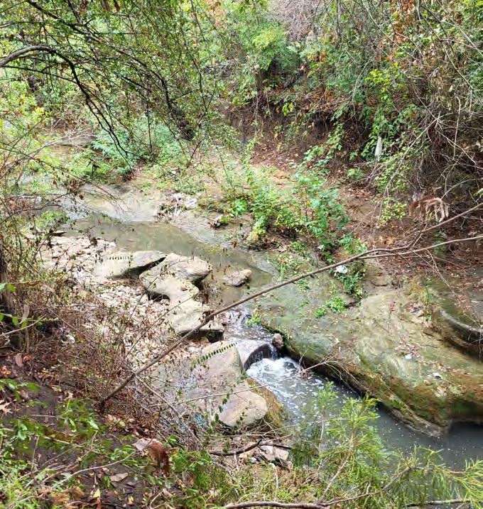
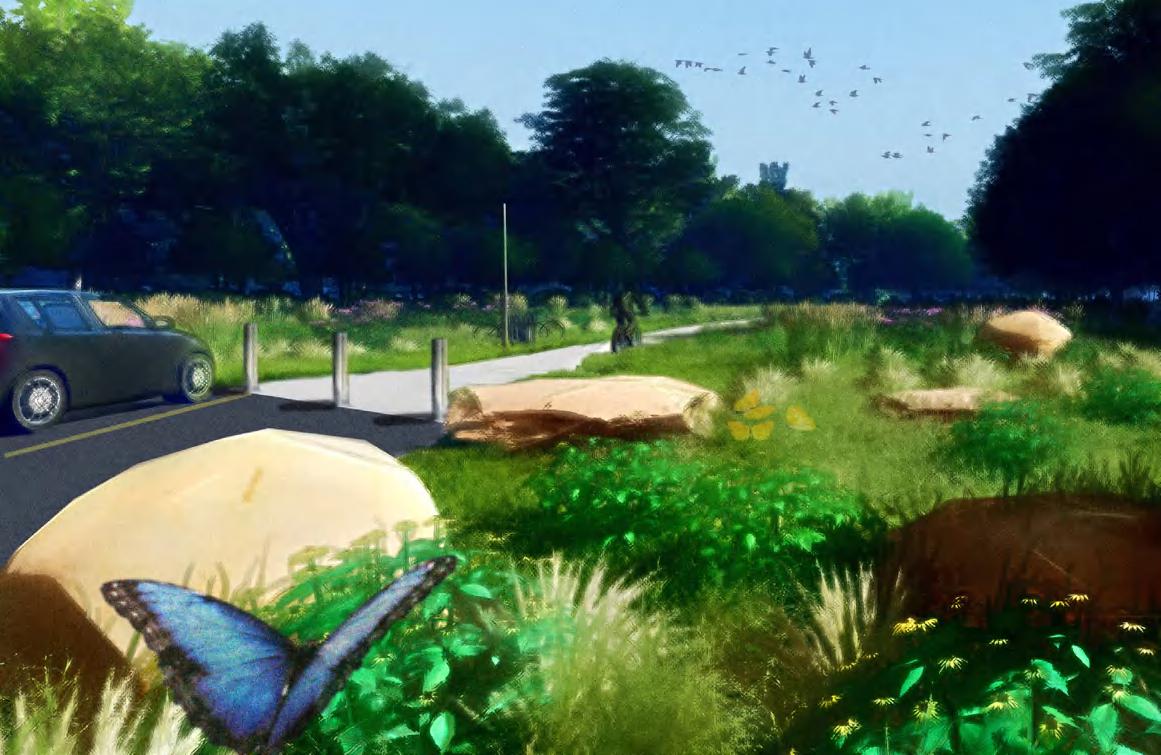
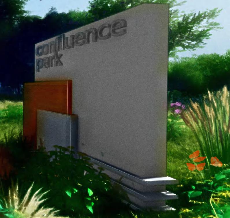
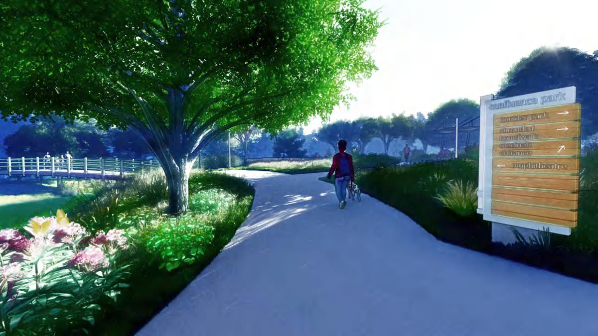
22 02 confluence park CONFLUENCE PARK Johnson Creek Arlington, TX
- December 2023
August
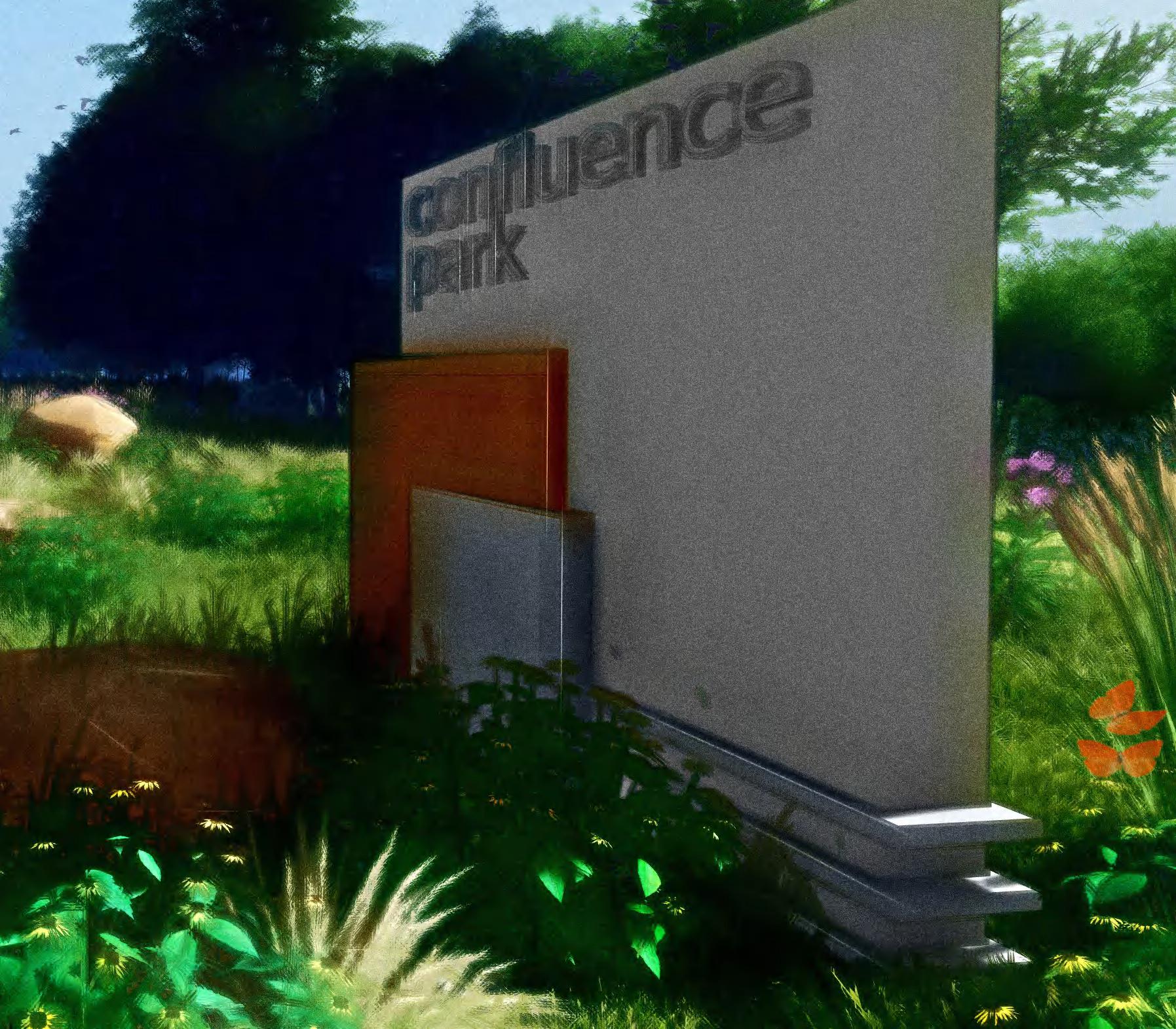
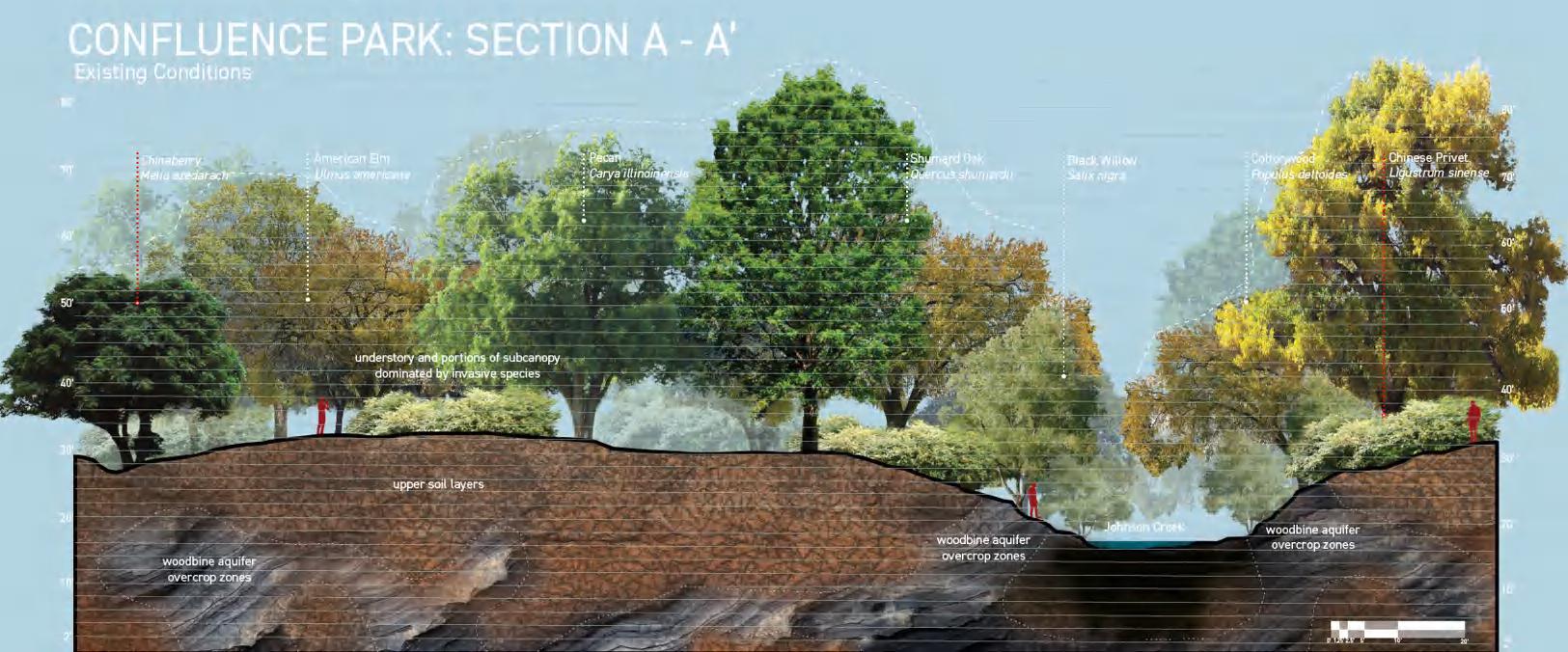
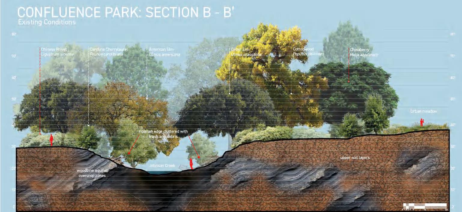
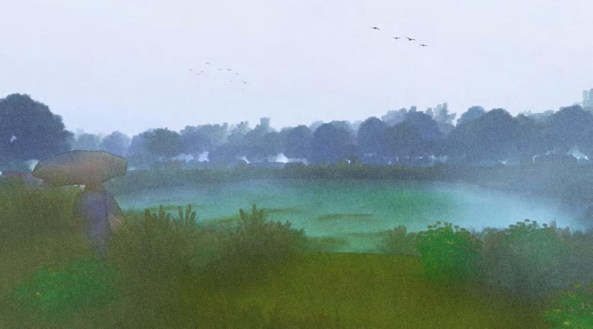
The City of Arlington's relationship with Johnson Creek is complex. Climate change and mass development has increased the frequency and severity of flash flooding, degrading the quality of the creek and endangering individuals within its 100-year floodplain. At the same time, Arlington's vast hardscapes have inhibited recharge of the underlying Woodbine Aquifer, which has historically provided municipal and agricultural water for the city. In response, the City of Arlington has begun purchasing and converting at-risk lots into green spaces in an effort to reduce flood risk. Confluence Park is one such space; it reimagines Johnson Creek as a key site for flood buffering, aquifer recharge, water purification, ecological restoration and community interaction.
23
confluence park
a world beneath our feet
The Woodbine Aquifer, a minor aquifer situated in north Texas, has historically absorbed, sequestered and provided water for the many wells that dot the city of Arlington. According to shapefile analyses gathered from the Texas Water Development Board, over 80% of Arlington's land area sits within the Woodbine Aquifer Zone; roughly 60% of this area is considered an outcrop zone -- areas where an aquifer's geologic composition makes contact with the surface. These areas are key sites of water infiltration and subsequent recharge, which present a unique and underutilized opportunity for the city.
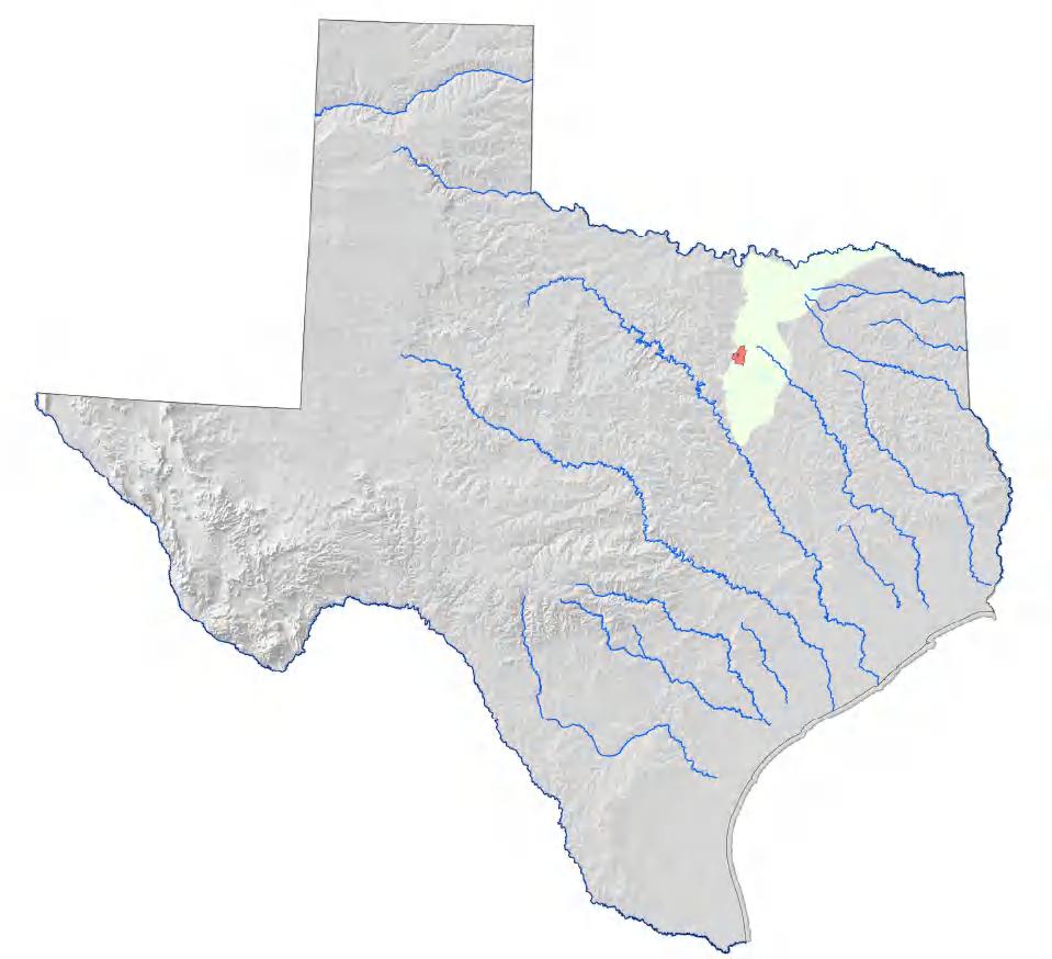
major rivers
woodbine aquifer
arlington, TX
arlington at a glance
selected census tract
well locations
creeks and rivers
trinity aquifer
census tracts of interest
woodbine aquifer (outcrop)
woodbine aquifer (subcrop)
24
confluence park
Arlington's urban context creates large areas of impervious surfaces. This creates conditions conducive to overwhelmed waterways and subsequent flash flooding.
Roughly half of the selected census tract's soil volume falls within Group C (high runoff potential) and Group D (highest runoff potential) collectively. While the east side of the region and creek itself feature low-runoff potential soils, (Groups A and B) the volume and velocity of runoff from the surrounding areas easily overwhelm these permeable zones.
Single family households (yellow) largely comprise the areas surrounding this region of Johnson Creek and are of course within immediate risk of flooding.
Johnson Creek: Land Use Plan Arlington, TX
J. Hampton 9/12/23 25
confluence park A B C D
26 confluence park
3 4 5
1
2
a rich + challenging context
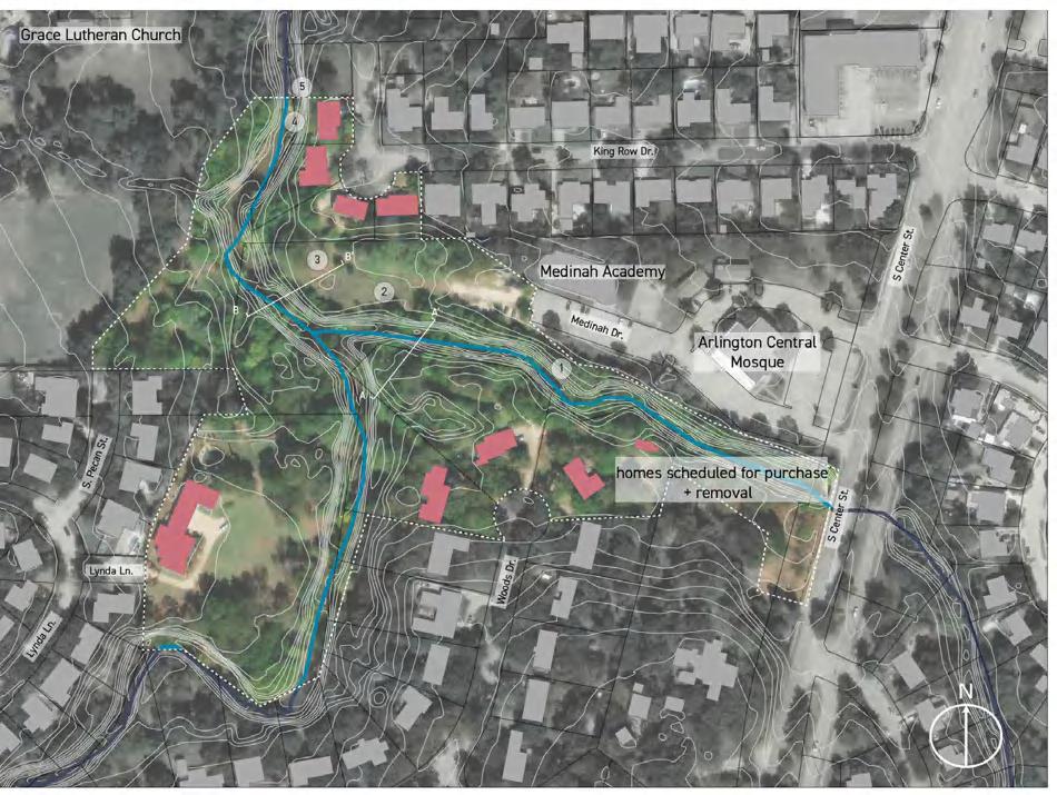
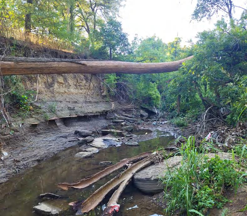
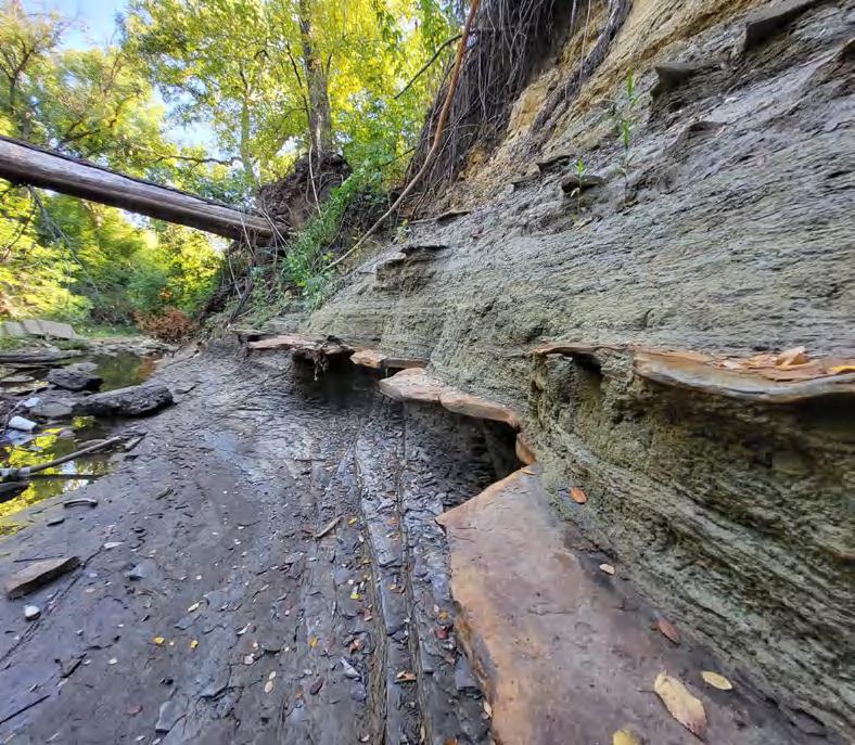
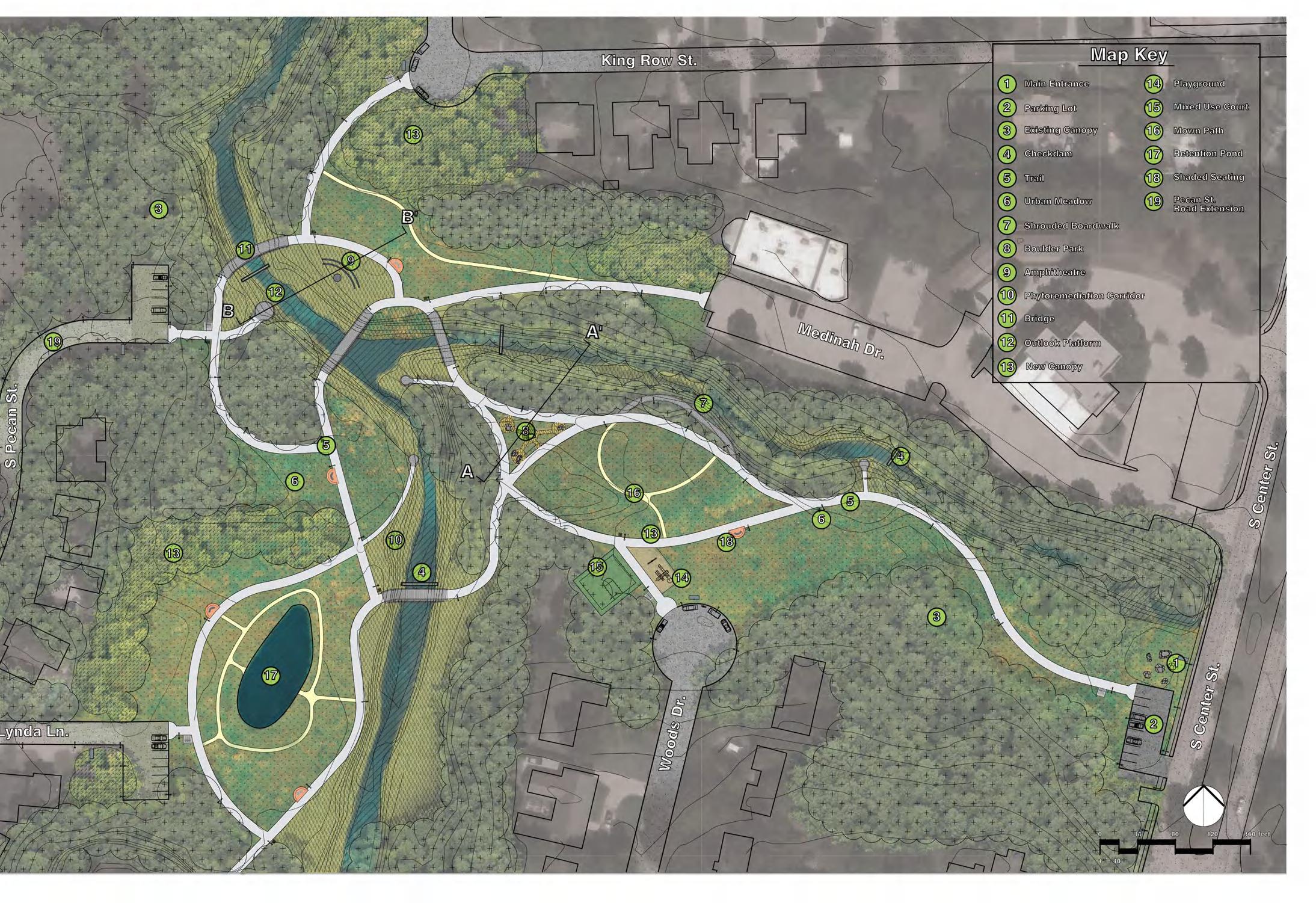
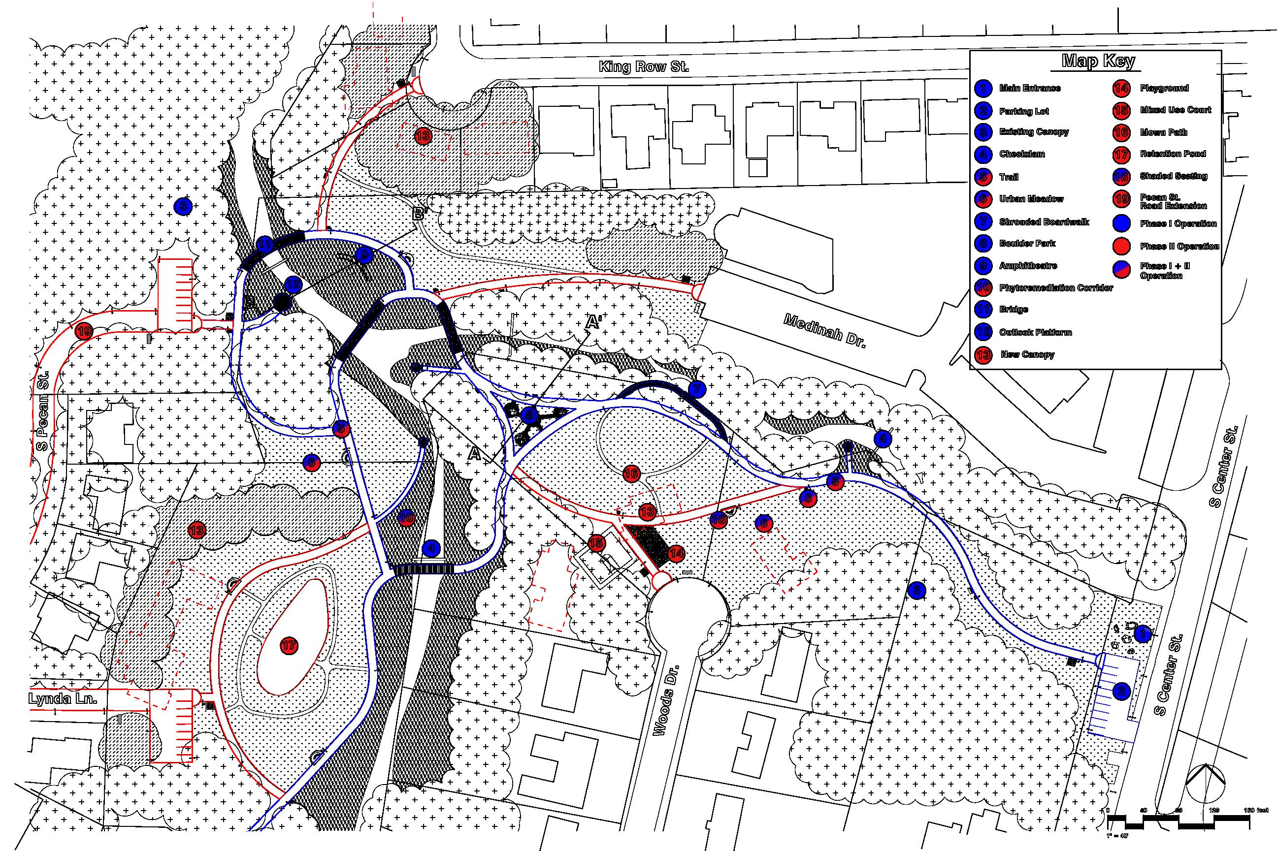
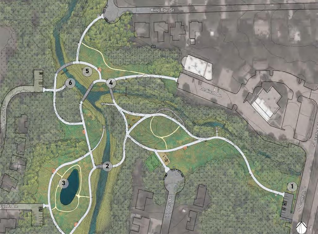
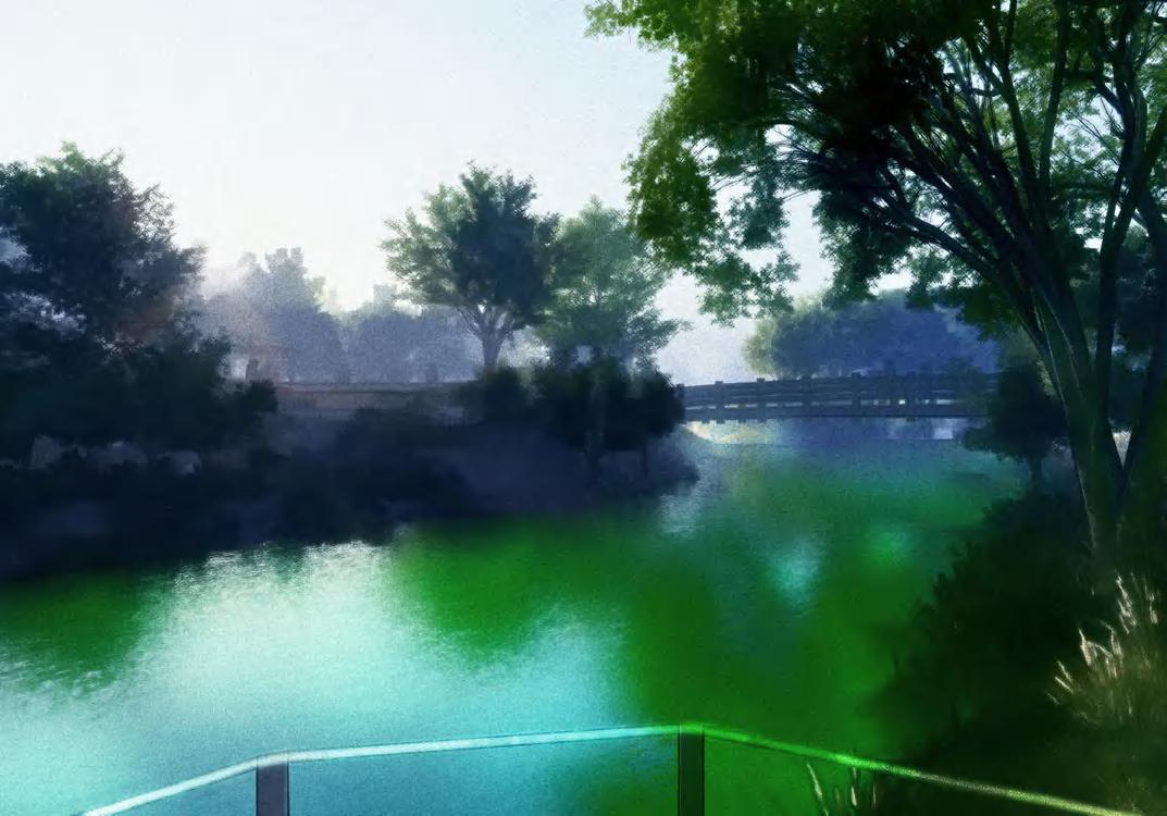
Confluence Park gets its name from the junction of two branches of Johnson Creek that currently split the site into three parts. The site location offers a unique set of opportunities and constraints: its proximity to existing neighborhoods and schools allows for educational and community outreach, and the park could unite the area into a cohesive pedestrian green corridor. The rich array of upland and riparian plant communities, in addition to the exposed geology of the creek offer support this stance. However, key aspects of the site are isolated behind residential lots, requiring careful consideration of phasing and potential impact for homeowners.
27
confluence park
28 confluence park
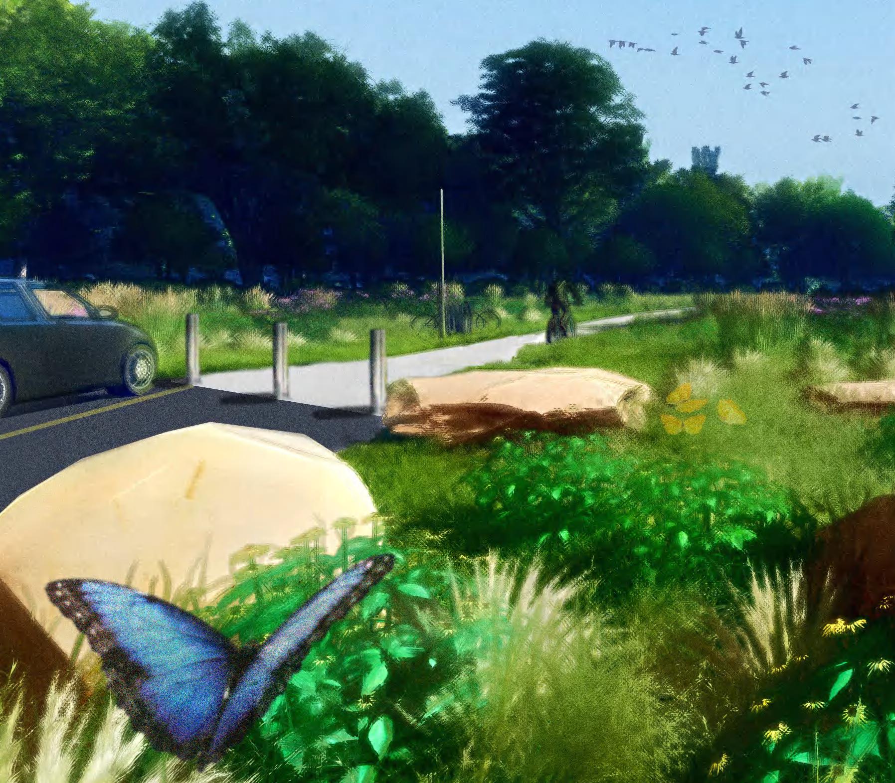
a uniting procession
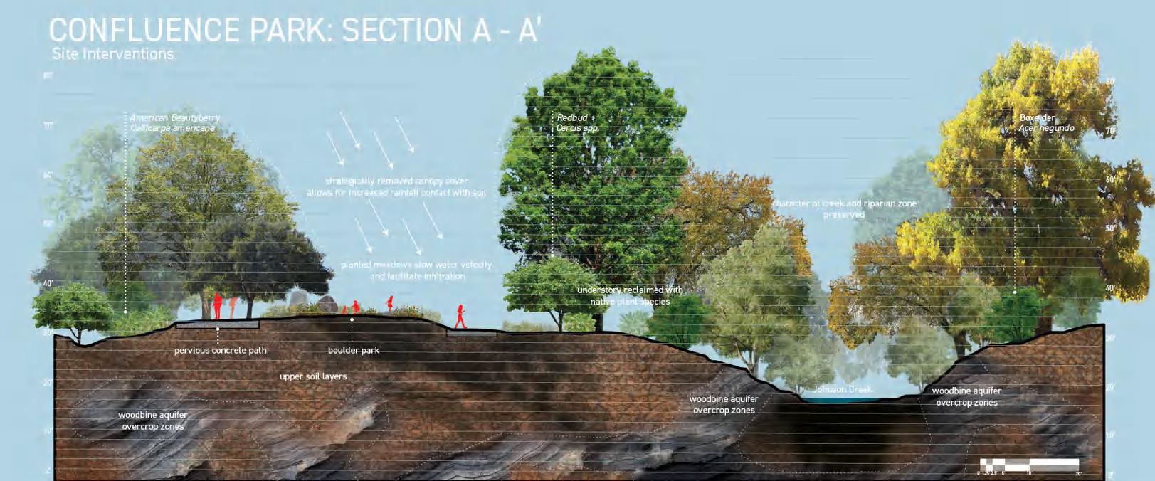
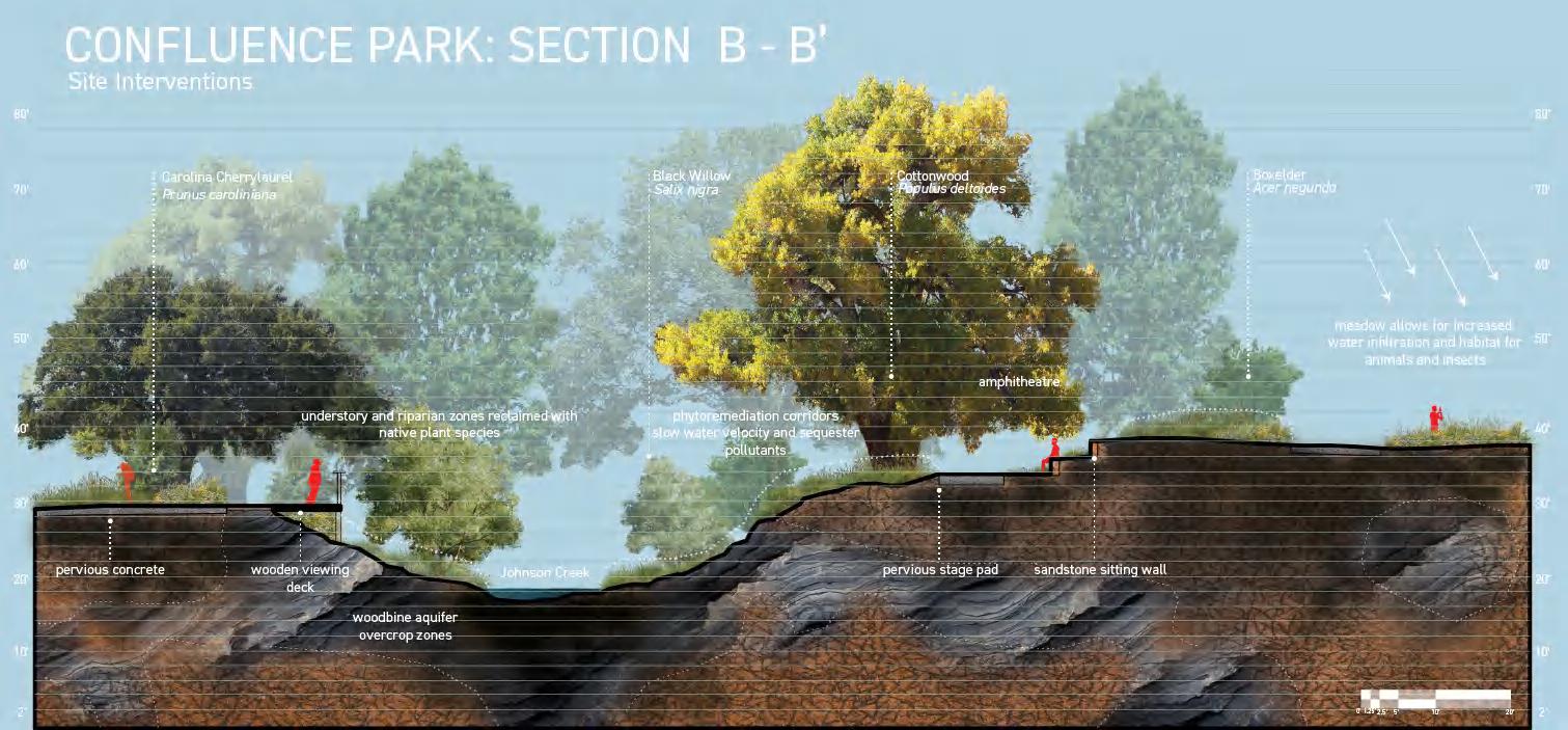
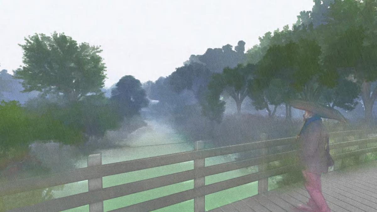
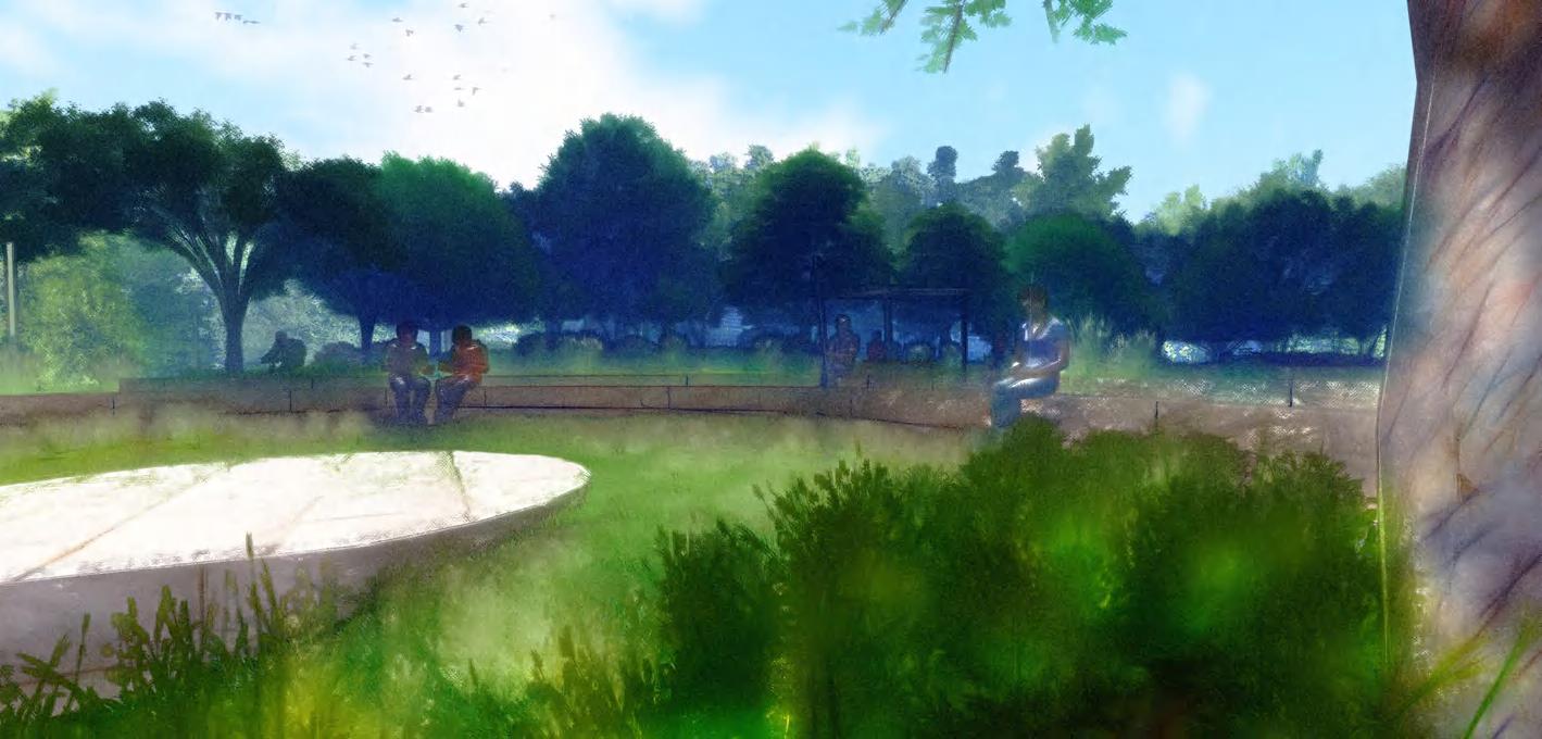
The design for Confluence Park creates an accessible sequence that links the surrounding communities to the isolated interior of the site. The park's permeable paths flow alongside Johnson Creek's banks, at times crossing the stream at curated views, at other times pausing at observation decks furnished with educational signage detailing the history, ecology, and geology of the site. Urban meadows and phytoremediation corridors provide aesthetic and ecologic value while increasing rainwater infiltration, reducing creek erosion, and purifying stormwater. Programming elements such as a boulder park and amphitheatre create additional spaces for community engagement.
29
confluence park
GALVANIZED STEEL POSTS, RAILING, SUPPORTS

CHECKDAM RIP RAP
JOHNSON CREEK COMPACTED SUBGRADE
CONCRETE KEY WITH REINFORCEMENT PILINGS COMPACTED SUBGRADE
PERVIOUS
PHYTOREMEDIATION CORRIDORS TEXAS NATIVES

PERVIOUS
STEEL SUPPORT
SHADE SAIL
BACKLESS WOODEN BENCH
PERVIOUS CONCRETE
PAD
EDUCATIONAL SIGNAGE- NTS
GALVANIZED STEEL POSTS, RAILING, SUPPORTS
8 TYPICAL BRIDGE CONSTRUCTION
SECTION ELEVATION - 3/16" = 1'
EDUCATIONAL SIGNAGE STEEL WIRE MESH
project phasing + details
Confluence Park's construction is intended to occur in two phases. Phase I features the construction of the primary paths and structures (bridges, observation decks, etc) in addition to primary creek restoration infrastructure (checkdams, urban meadows, phytoremediation corridors). Primary programming features (amphitheatre, etc), are also constructed during this phase. Phase II focuses on community engagement and programming. It features road extensions, parking expansion, green infrastructure expansion, and the construction of additional social elements, such as a retention pond, mixed-use court, and playgrounds. Confluence Park is designed so that the primary trail (Phase I) can be constructed without requiring the relocation of residents.
"Lorem ipsum dolor sit amet, consectetur adipiscing elit, sed do eiusmod tempor incididunt ut labore et dolore magna aliqua. Ut enim ad minim veniam, quis nostrud exercitation ullamco laboris nisi ut aliquip ex ea commodo consequat. Duis aute irure dolor in reprehenderit in...” "Lorem ipsum dolor sit amet, consectetur adipiscing elit, sed do eiusmod tempor incididunt ut labore et dolore magna aliqua. Ut enim ad minim veniam, quis nostrud exercitation ullamco laboris nisi ut aliquip ex ea commodo consequat. Duis aute irure dolor in reprehenderit in...
3'4" 1'6"
ABUTMENT
PHYTOREMEDIATION CORRIDOR
CONCRETE
CONCRETE
PATH
URBAN MEADOWS SECTION - 3/8" = 1' CONCRETE PLANK STEEL BRACINGS GRAVEL LAYER GABION TERRACE COMPACTED SUBGRADE CONCRETE FOOTING WITH REINFORCEMENT PILES** **REFER TO STRUCTURAL ENGINEER FOR PILE TYPES AND DEPTH SECTION ELEVATION - 3/8" = 1'
CHECKDAM CONSTRUCTION SECTION B - 1/4" = 1' 4
TERRACE PHYTOREMEDIATION CORRIDOR CHECKDAM RIP
TYPICAL
GABION
RAP
CONCRETE
CONCRETE SUPPORT BLOCK
PAD
STEEL SUPPORT BACKLESS WOODEN BENCH GRAVEL LAYER
CANTILEVER SHADE STRUCTURE SECTION PERSPECTIVE - 3/8" = 1' PLAN - NTS 18 30
COMPACTED SUBGRADE
confluence park
31 confluence park
32 confluence park 1 2 3

33 confluence park
6 4
5
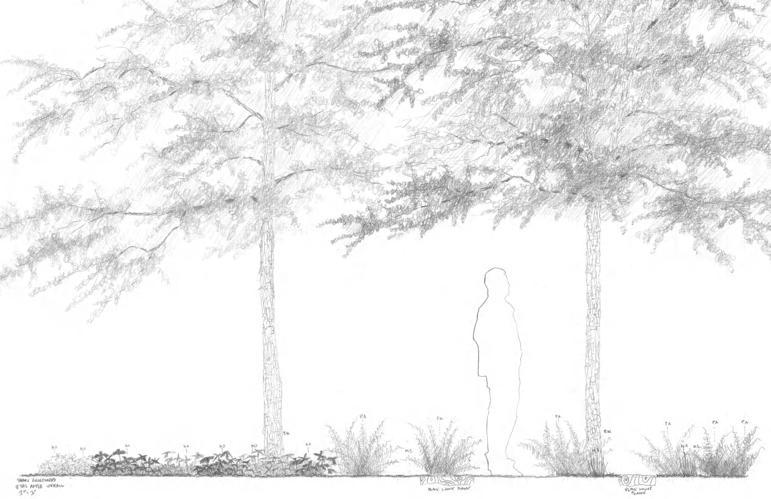
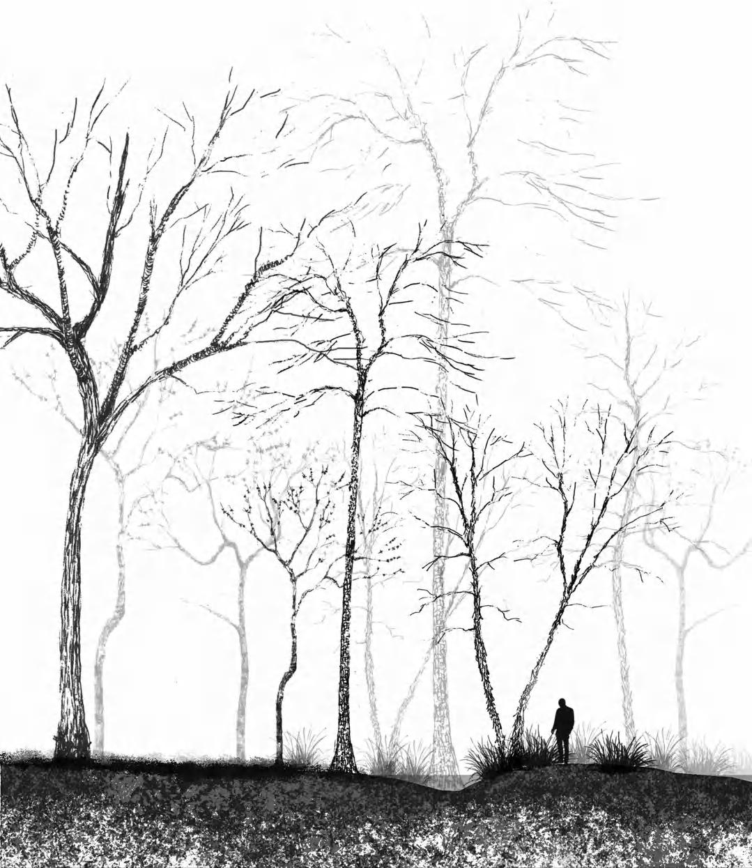
THEORETICAL STUDY: CHANGE OVER TIME
Weagle Woods
Auburn, AL
November - December 2022
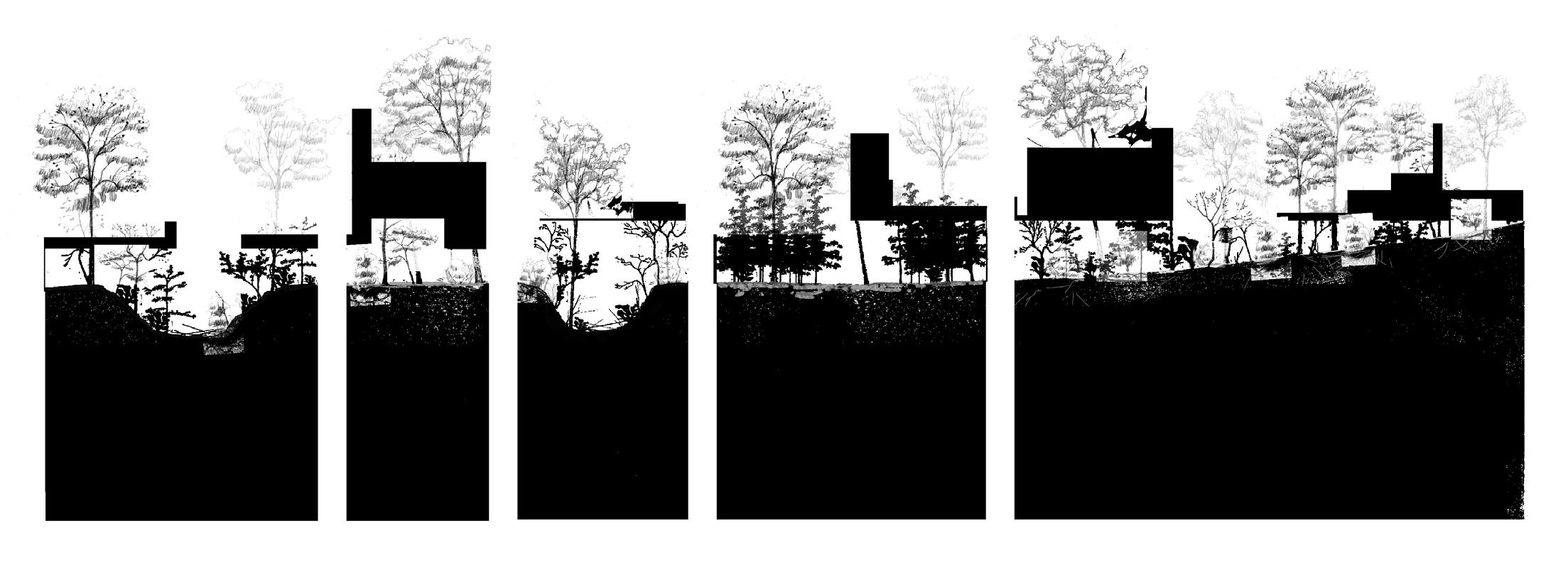
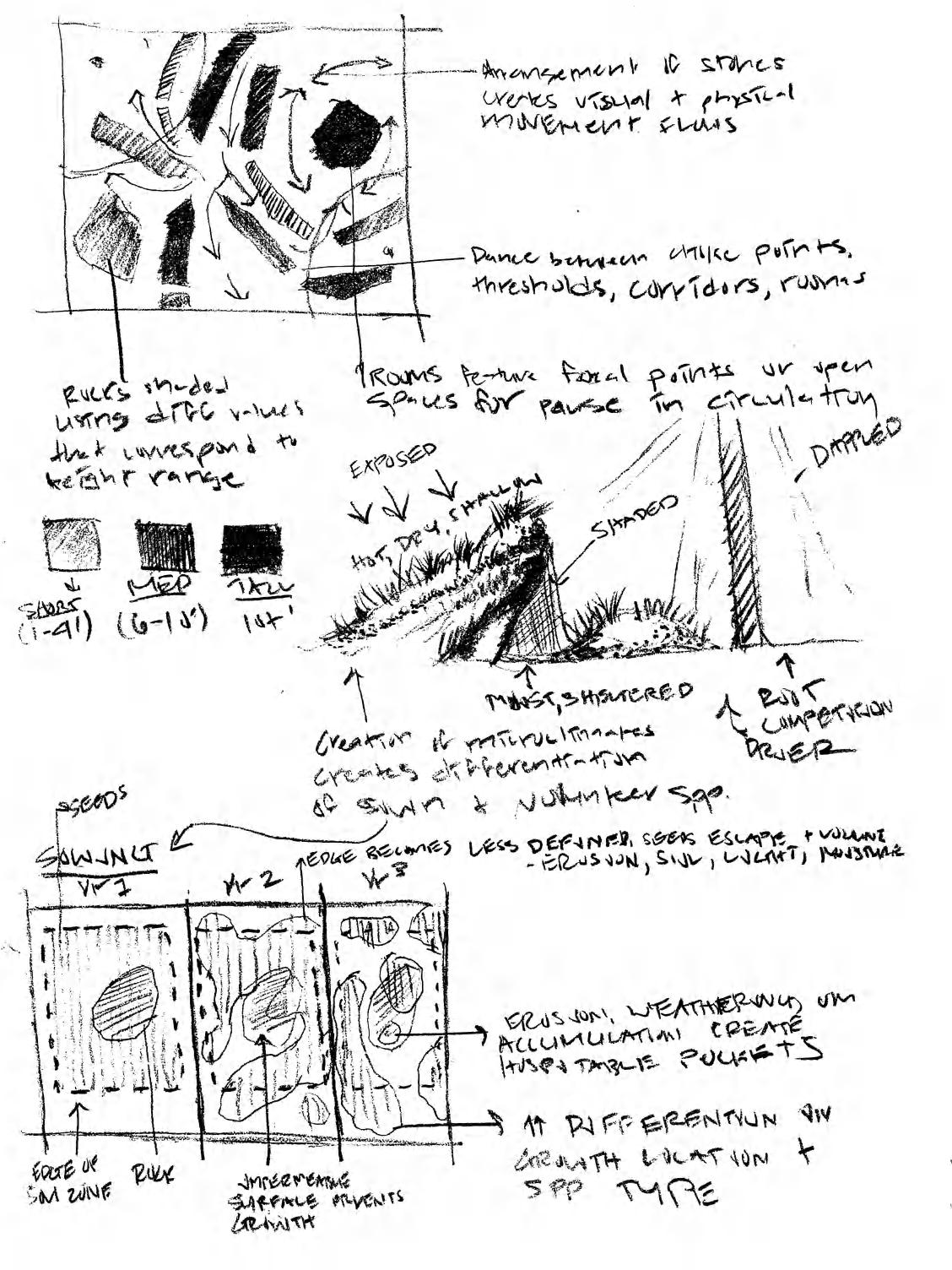
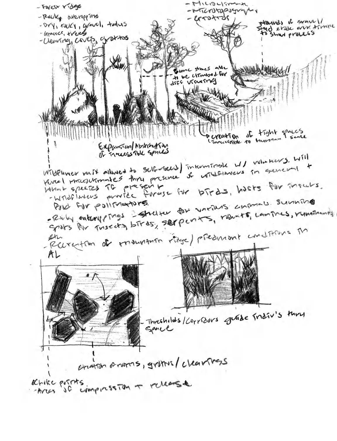
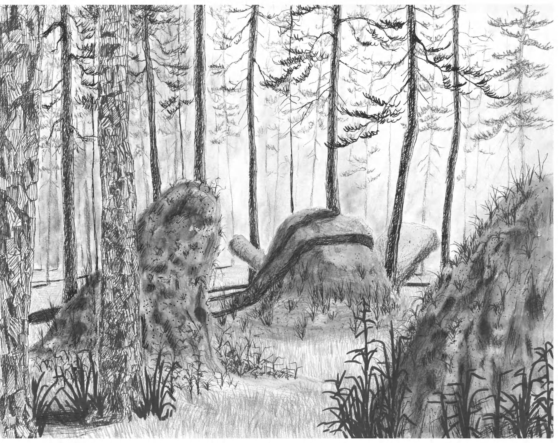
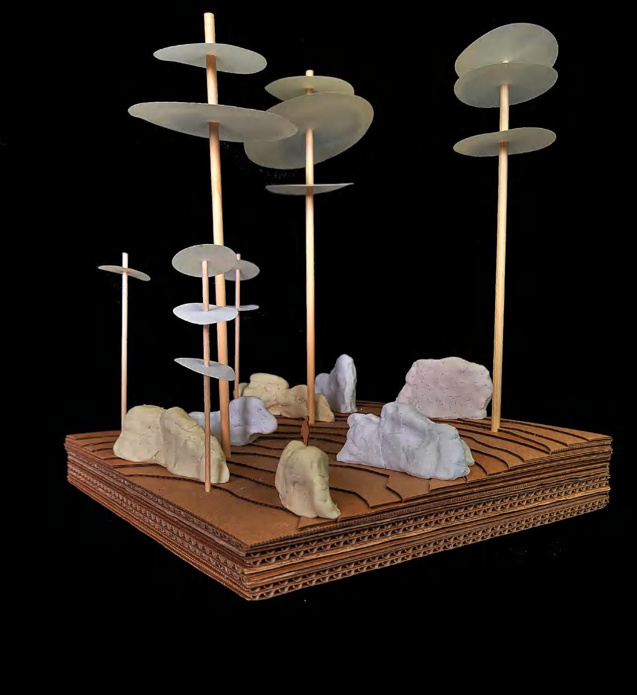
All landscapes convey an animacy that recounts a narrative; this narrative not only varies with each landscape but also with the seasons and even with the years to come. The challenge of embracing change and weaving it into one's design is foundational to landscape architecture. For this project, I was taksed with devising three operations to be applied across an existing site; creating a system of application for each operation; hypothesizing how these operations change over time both individually and in conjunction with one another; and speculating the resulting human experience and ecological outcomes of these processes over time.
theoretical study: change over time
34 03
35 theoretical study: change over time
plan view of all operations 5 years after final operation
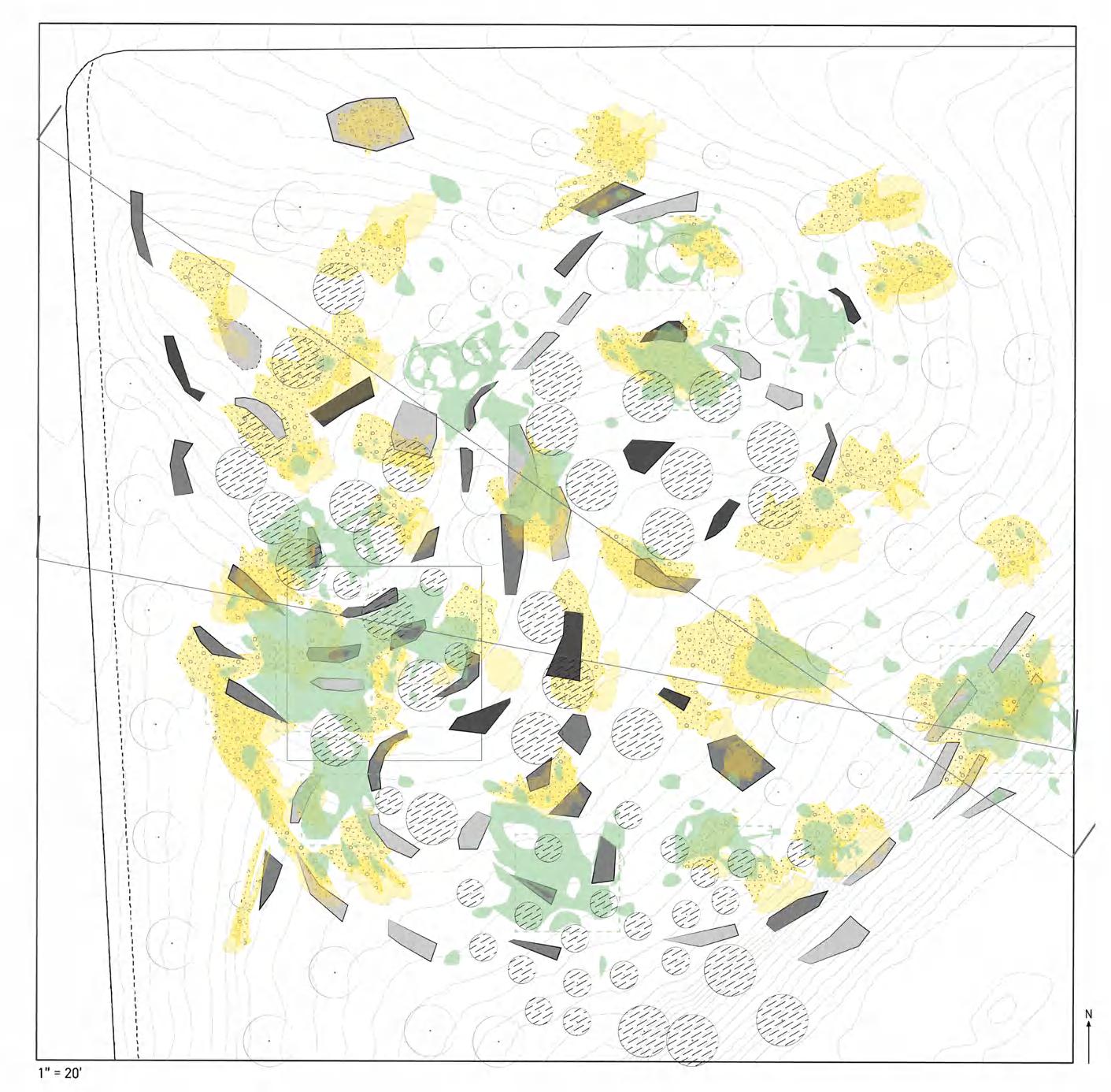
microclimate + species composition
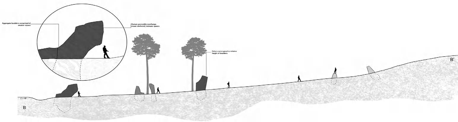
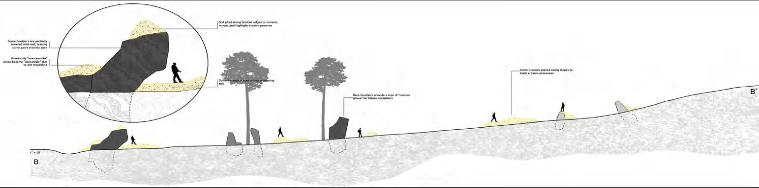
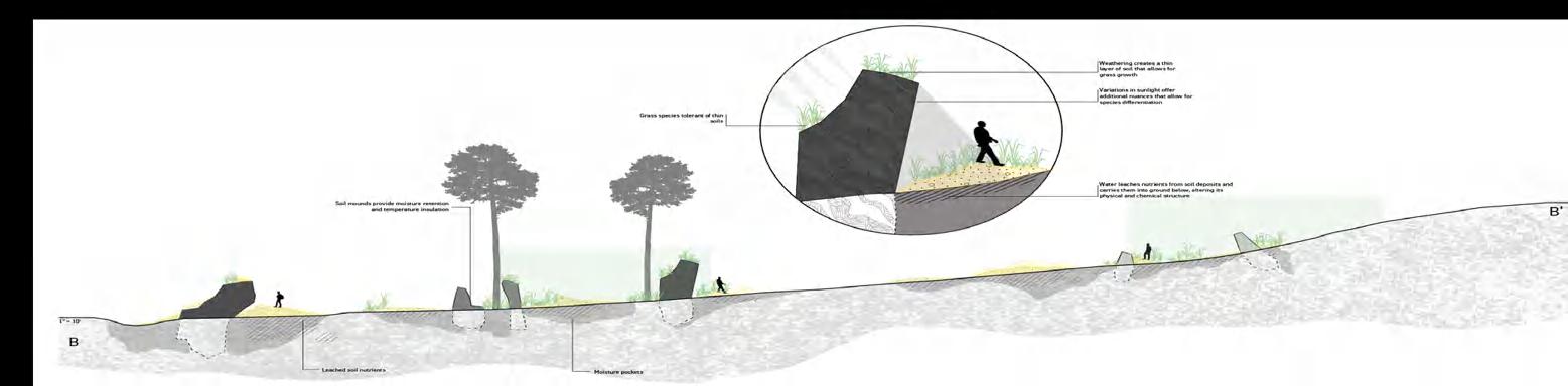
The defining theme of this project centers around the creation of microclimates and the subsequent differentiation of plant species that results from microclimate conditions. The installation of sandstone boulders across the site (Operation 1) simultaneously creates opportunities for human experience (compression/ relief, ledges, overhangs, etc) and the foundation for microclimate instances. Areas of soil deposition in Operation 2 reveal additional nuances in light, topography, and existing soil types. Operation 3 initially follows the compression and relief system of Operation 1 but over time reveals the niches created by both Operations 1 and 2 as the grass seed mix spread and differentiate in unexpected ways across the site. theoretical study:
operation 1 (boulder installation)
operation 2 (soil deposition)
operation 3 (seed application
36
change over time
37 theoretical study: change over time
operation 1
immediately after install
operation 2
immediately after install
operation 3
immediately after install
theoretical study: change over time
38
B B
A A A' A' A' B' B' B'
B
A
6 months after operation 1 6 months after operation
spring operation timing condition expressed in plan
2
39 theoretical study: change over time
spring
operation 1 operation immediately after install immediately
6 months after operation 1
over time
40
study: change
theoretical
operation 3
theoretical study: change over time
6 months after operation 2
5 years after operation 3
41
2 after install
operation

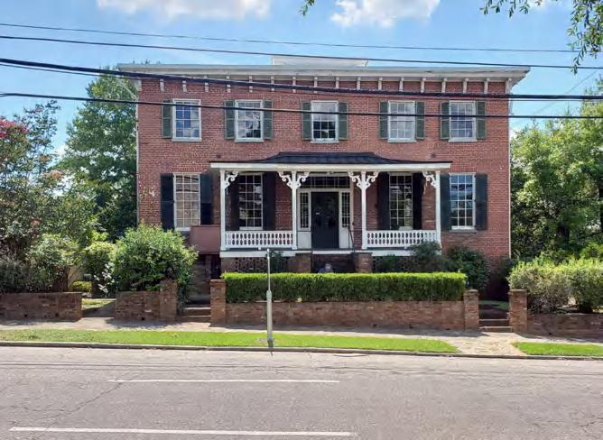
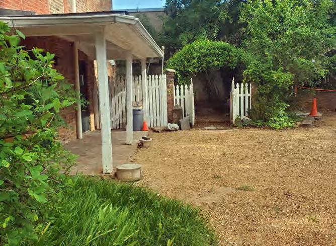
42 figh-pickett-barnes school house