LANDSCAPE ARCHITECTURE
PORTFOLIO

SPRING 2025

ABOUT
Since I my childhood, I have had an interest in the natural world. However, a lack of green industry educational resources in school proved to be an obstacle for me. I learned to forge my own path, operating a landscaping business in high school, and discovering my passion for design and outreach in the process. I cultivated my passion at Auburn University, where I completed a bachelor’s in Horticulture, Pre-Landscape Architecture. As a graduate student at UT Arlington, my commitment to outreach has grown. As Vice-President of the university’s Student ASLA and as an LAF Ignite Scholar, I aspire to engage fellow students, youth, and the greater public with the profession of landscape architecture. My graduate thesis explores high school landscape architecture resources in the Dallas-Fort Worth Metroplex.
EDUCATION
University of Texas at Arlington MLA, 2023 - 2025
Auburn University
BA, Horticulture, Pre-Landscape Architecture, 2019 - 2023
Business Minor
Spanish Minor
WORK EXPERIENCE
EDSA
Design Intern | Dallas, TX | May 2024 - August 2024
College of Architecture, Planning, and Public Affairs
Graduate Research Assistant | Arlington, Texas |
August 2023 - Present
R&R Landscaping | Landscape Designer
Designer | Auburn, AL | May 2023 - Aug. 2023, | Remote | Sept. 2023 - February 2023
SKILLS
SKETCHUP AUTOCAD
RHINO 3D LUMION
PHOTOSHOP
ILLUSTRATOR INDESIGN
LANGUAGES
ENGLISH
SPANISH FRENCH
CONTACT
EMAIL: johnathan.a.hampton@gmail.com
LINKEDIN: https://tinyurl.com/jhamptonlinkedin HAND MODELING
ARCGIS PRO HAND DRAWING

HARMONIZING THE HEART: THE DALLAS CIVIC CENTER
Urban Design
Akard Plaza
Dallas, TX
October - December 2024
PAGES: 4 - 11


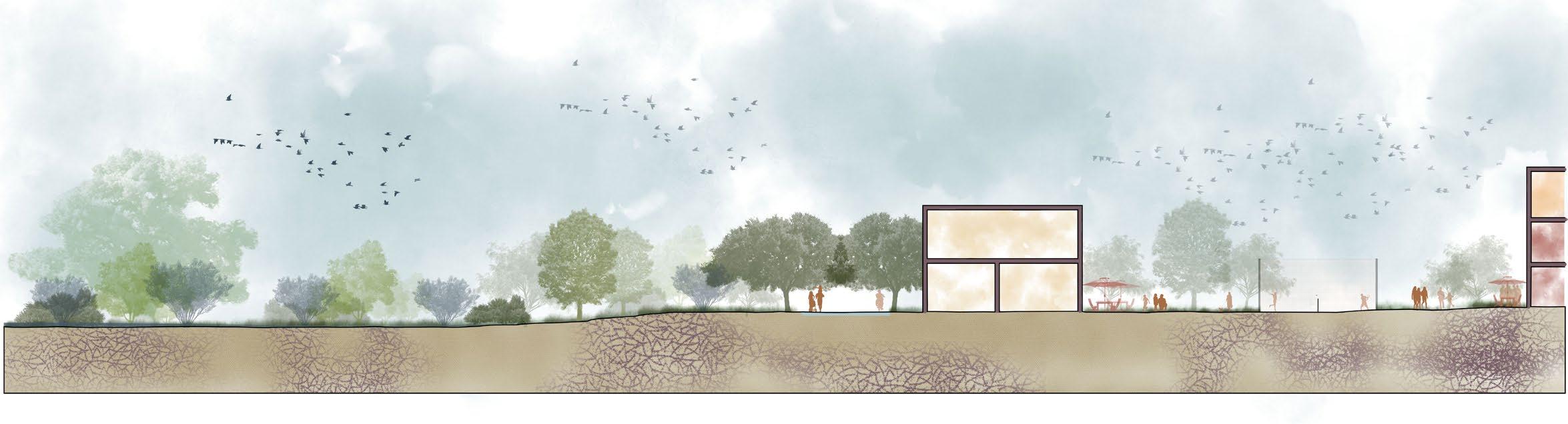
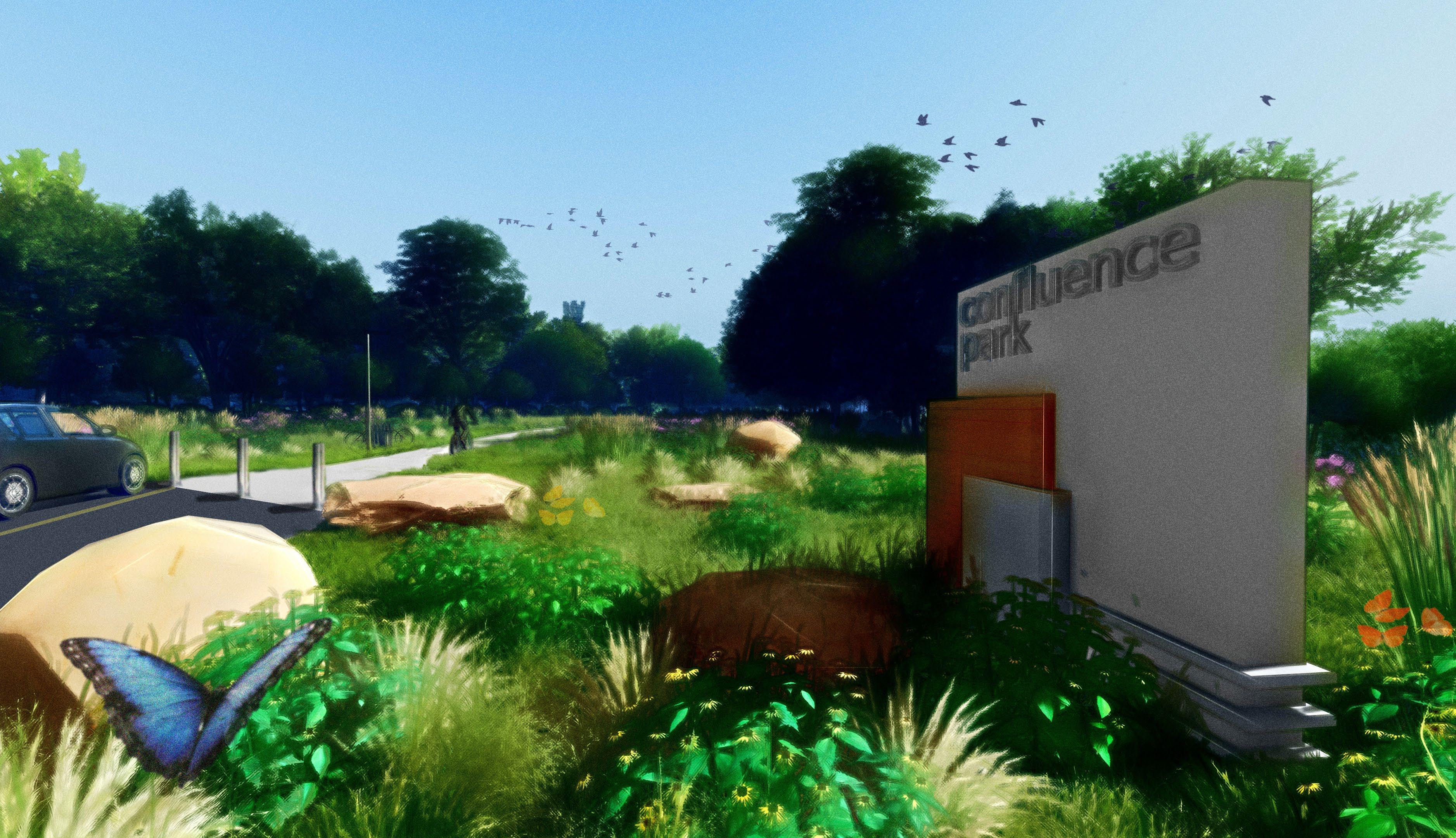
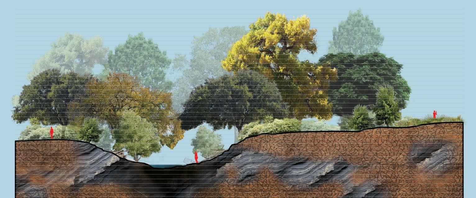
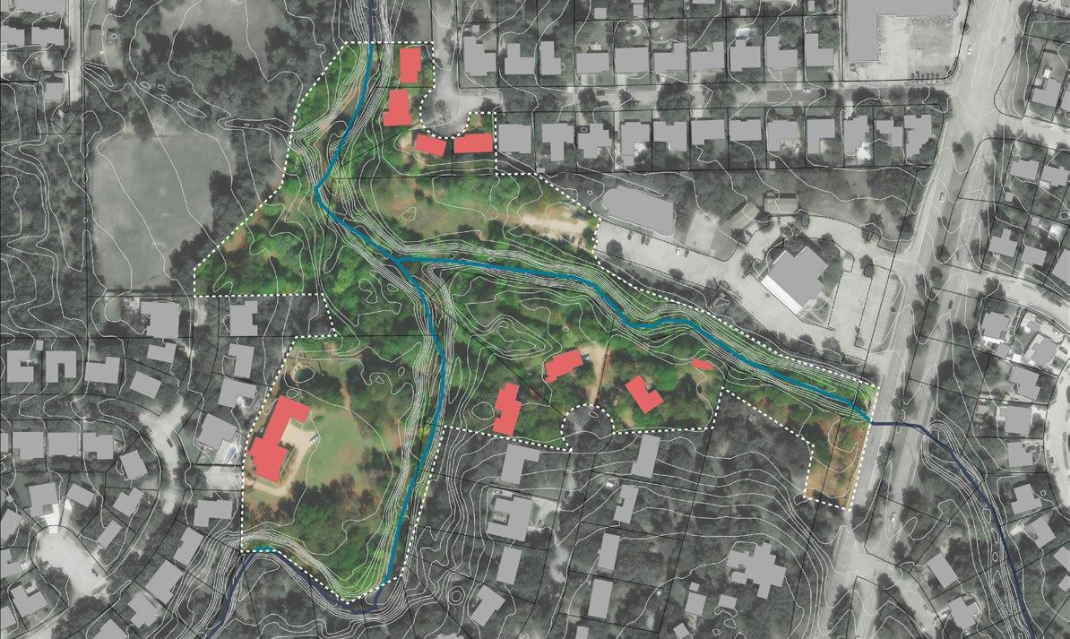
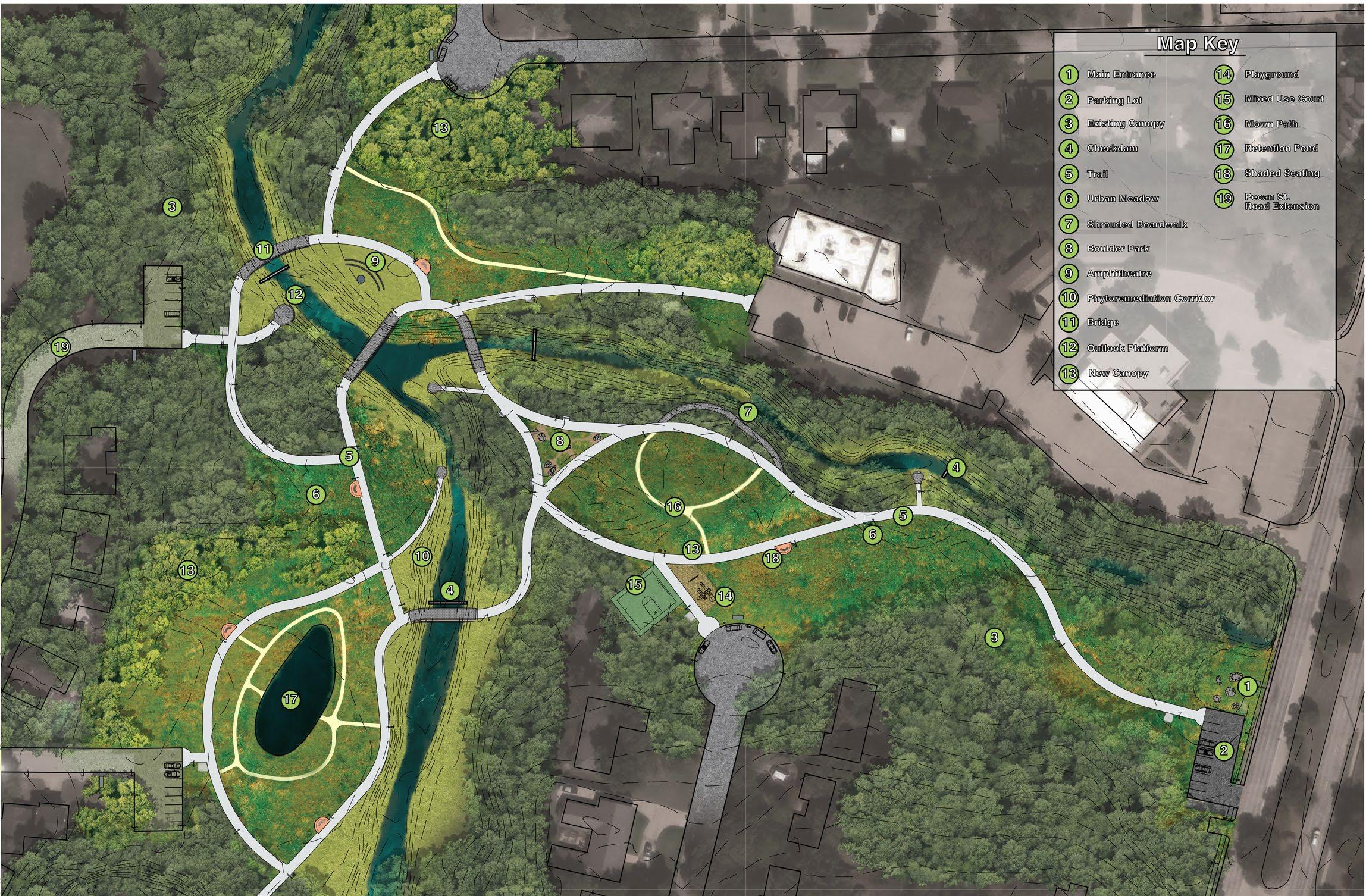
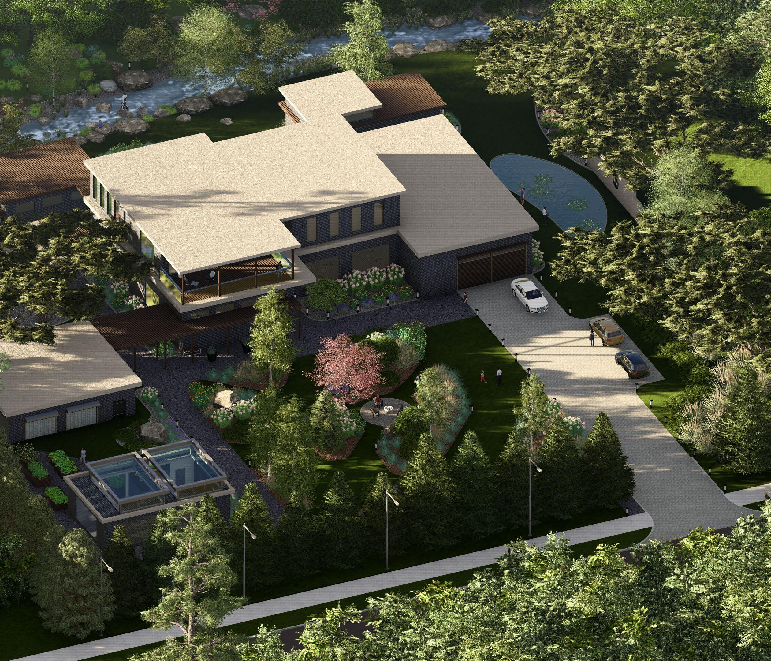
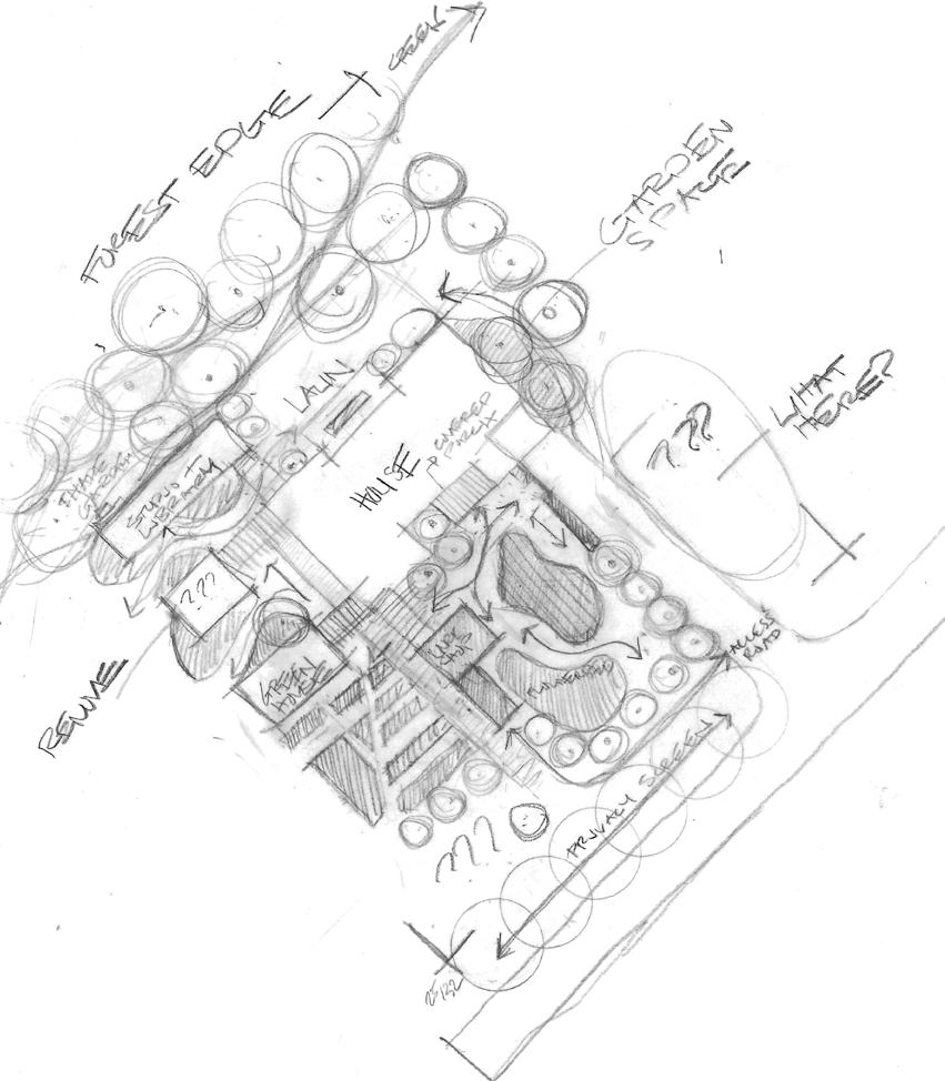
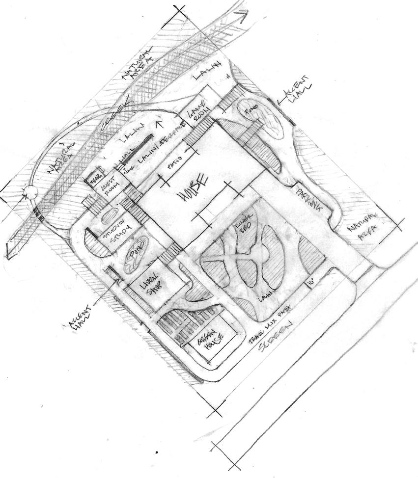
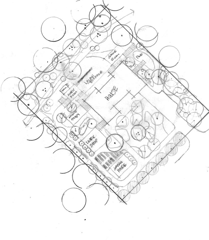
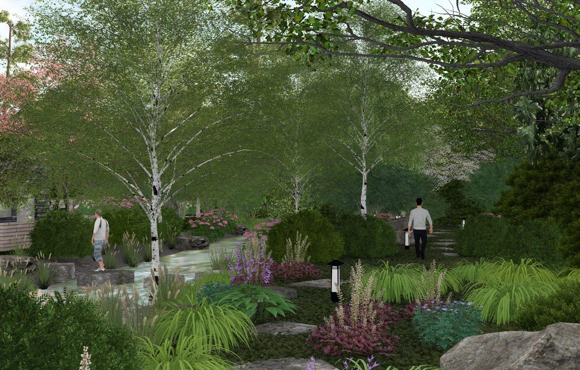
CONFLUENCE PARK
Environmental Planning, Site Design
Johnson Creek
Arlington, TX
August - December 2023
PAGES: 34 - 41
Environmental Planning, Site Design
Tuskegee National Forest Tuskegee, AL
January - May 2023
PAGES: 12 - 23

Site Design
June - August 2024
Planning, Urban Design, Site Design
Garden of Eden
Fort Worth / Haltom City, TX
January - May 2024
PAGES: 24 - 33

PAGES: 42 - 45
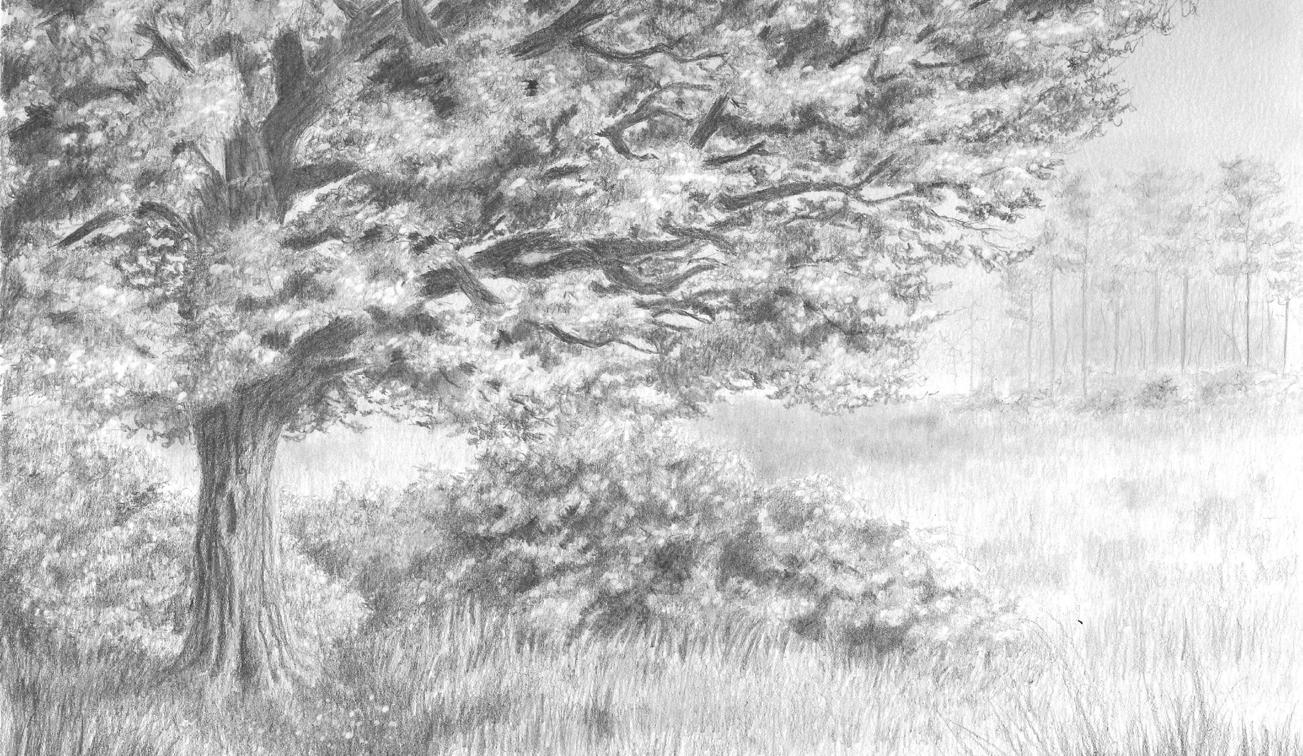
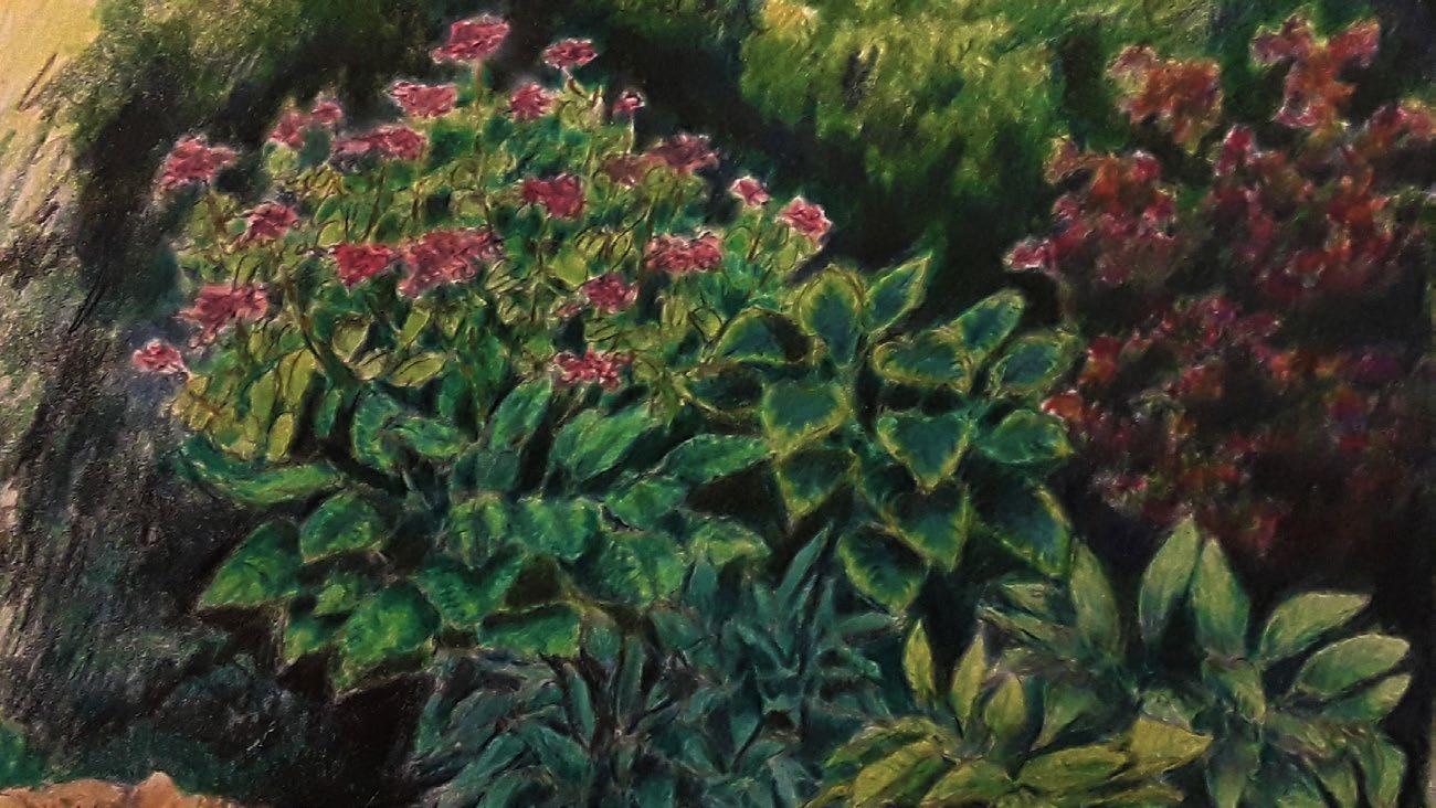
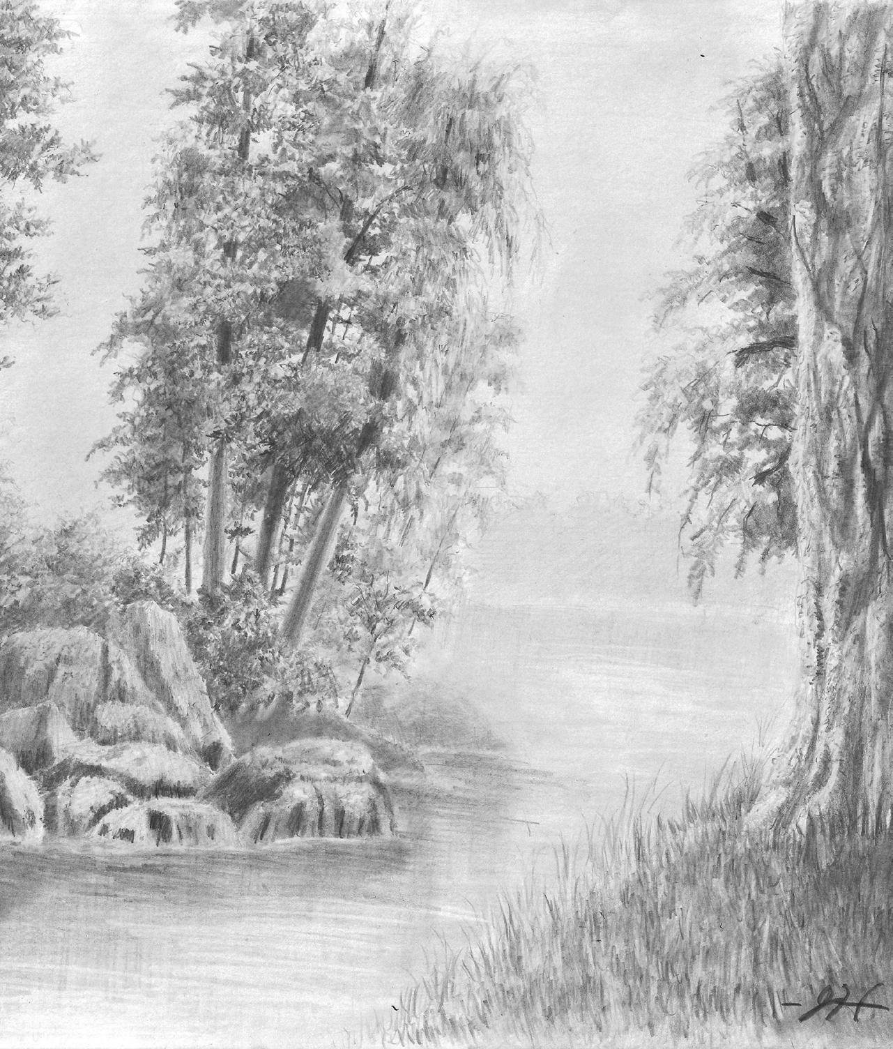
Hand Drawing 2019 - 2024
PAGES: 46 - 49

HARMONIZING THE HEART: THE DALLAS CIVIC CENTER
Akard Plaza
Dallas, TX
October - December 2024
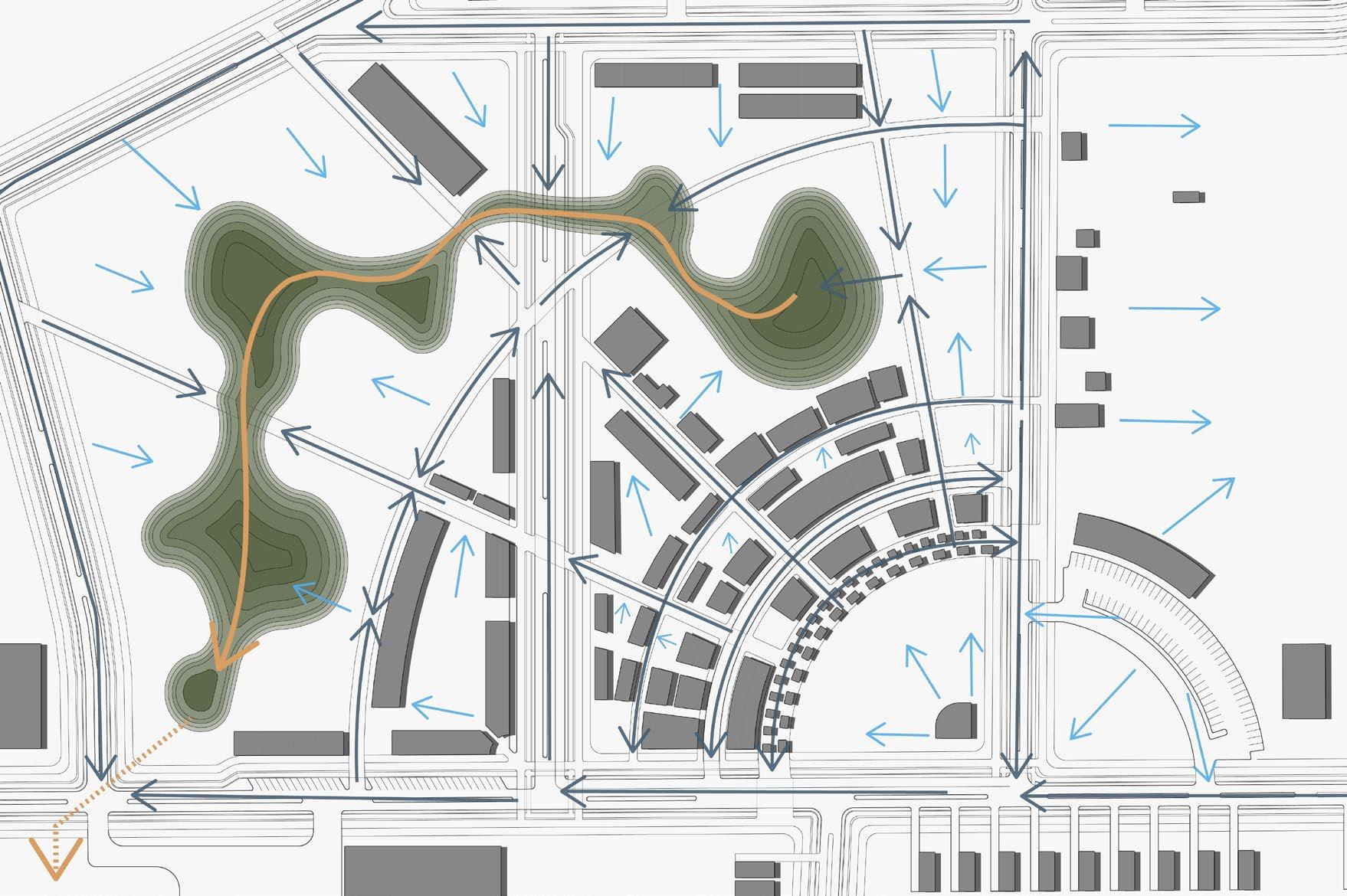
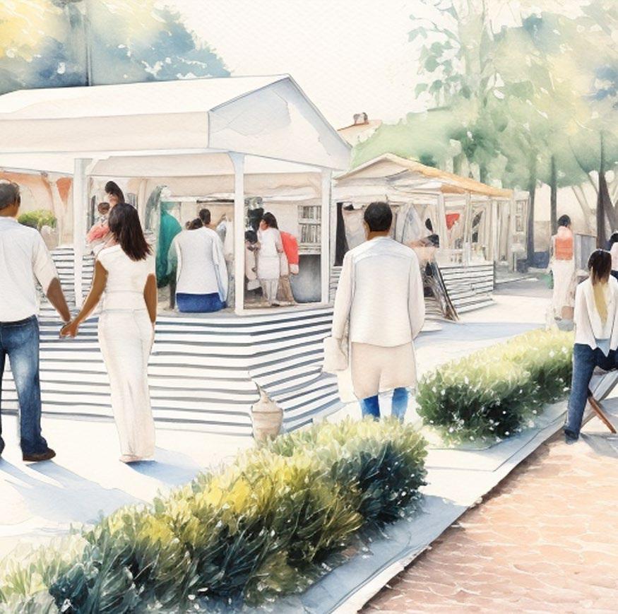
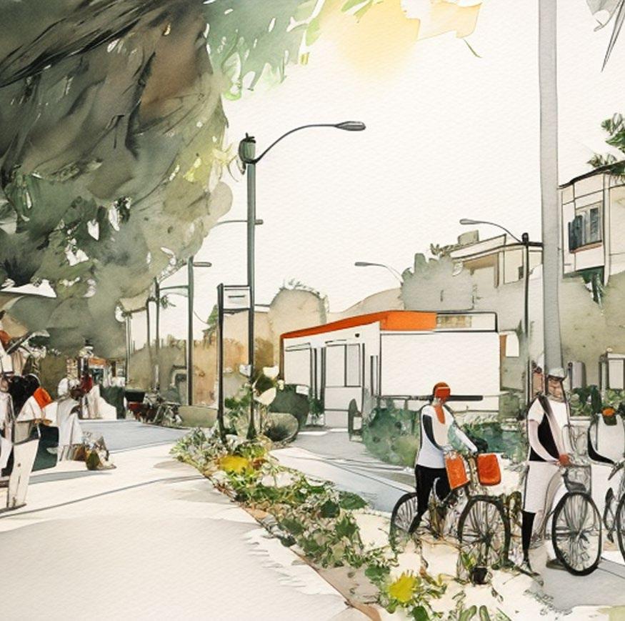
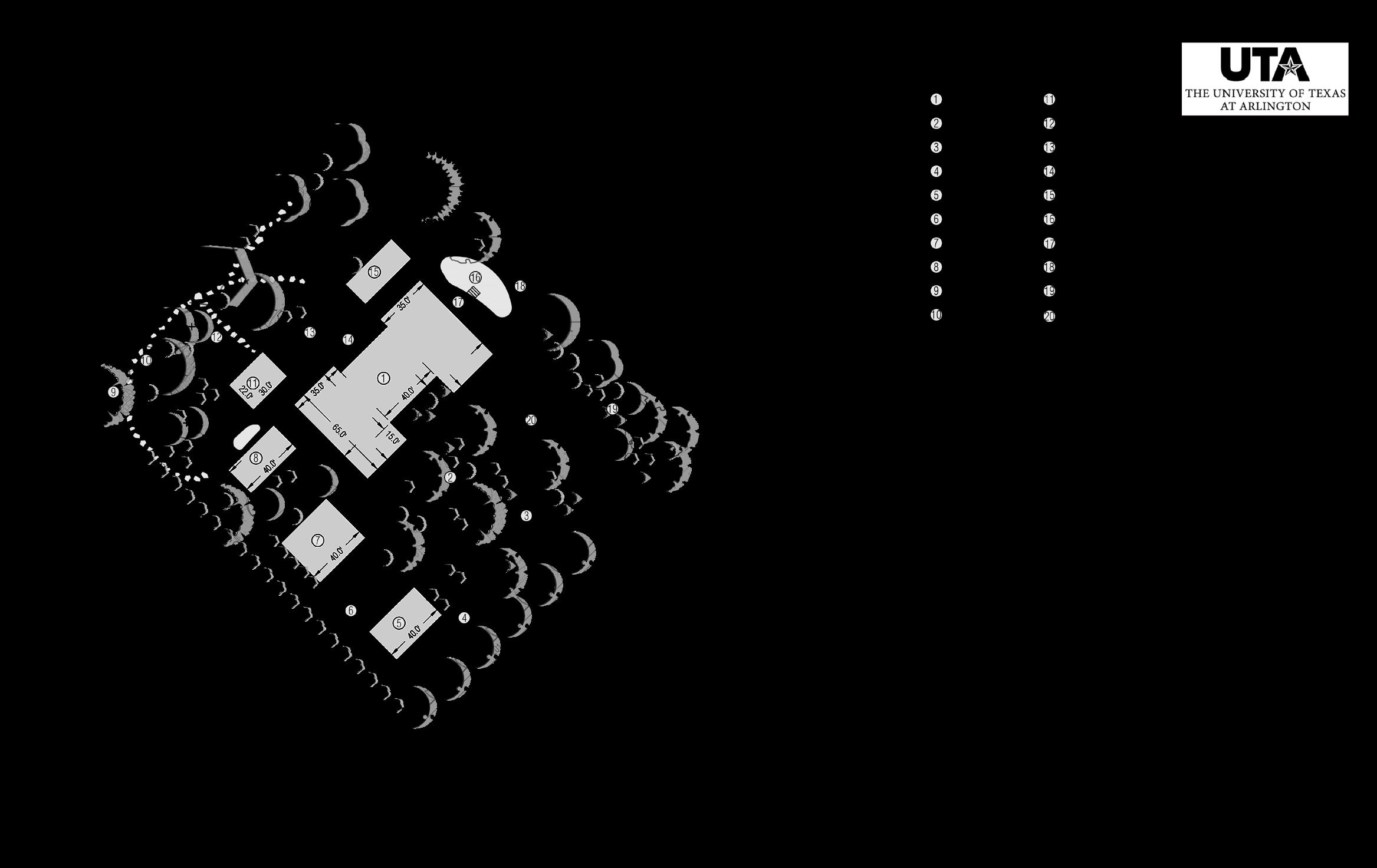
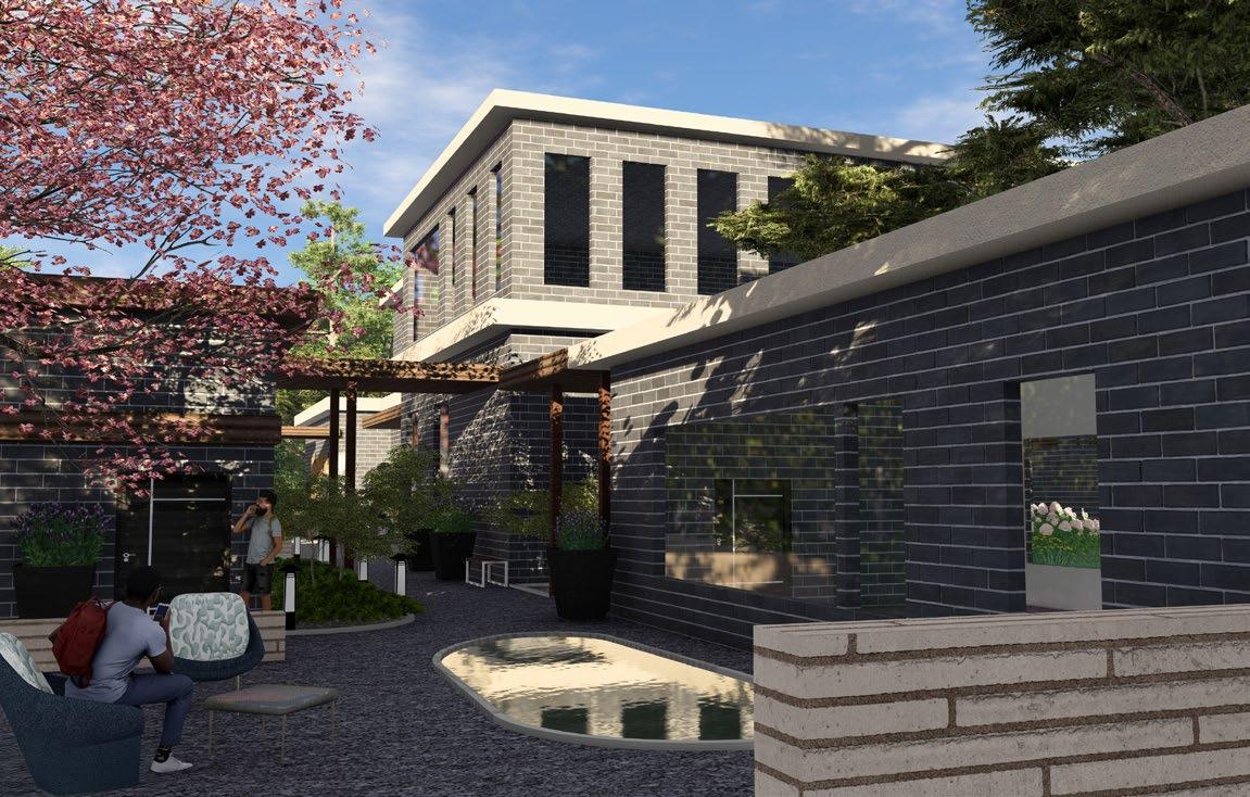
The Dallas Civic Center is a disconnected and underutilized space within the heart of downtown—a fractured link between people and place. A poorly defined urban edge, insufficient programming, and isolation from major public transportation networks have rendered the civic center largely empty. This project aims to restore the Dallas Civic Center’s relevance by reintegrating it into the urban fabric of Dallas’ Central Business District. Through thoughtful design and innovation, the Dallas Civic Center is envisioned as a dynamic confluence of civic, recreational, and technological engagement, elevating the space to where it truly belongs in the city’s urban landscape.
Software + Media: ArcGIS Pro, AutoCAD Civil 3D, Photoshop, Illustrator, InDesign, Sketchup, Lumion
CIVIC CENTER
OPPORTUNITY TO PEDESTRIANIZE SECTION OF ACKARD
CONNECTION

SURROUNDING SITE PROGRAMS NOT CONDUCIVE TO ACTIVATION OF CITY HALL
EXISTING SECTION-ELEVATION: YOUNG ST. TO CITY HALL

PUBLIC, ACCESSIBLE

A REVITALIZED CORE
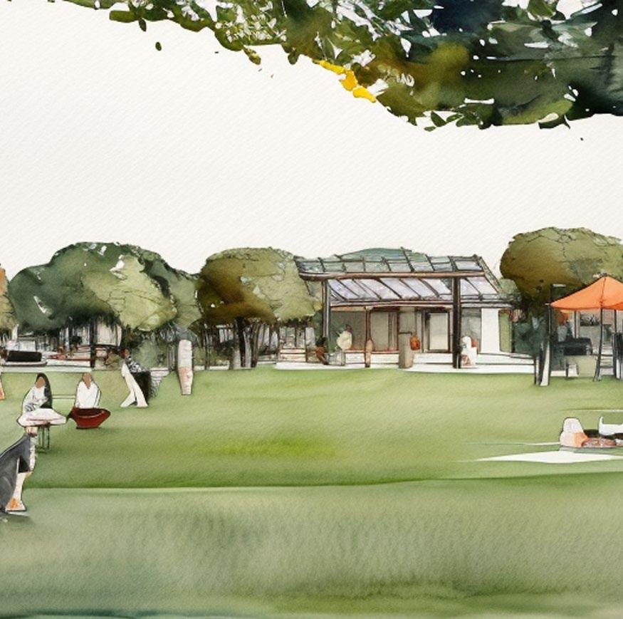
The reimagining of the Dallas Civic Center builds upon design language established by the AT&T Discovery District, extending it into the broader urban fabric. The result is a civic core that integrates art, history, digital innovation, sustainability, and community engagement into a seamless, experiential environment.

PROPOSED
SECTION-ELEVATION: CAFE TO ATRIUM
SHADE STRUCTURE
CAFE
GLASS FACADE BUS STOP
MIXED USE DEVELOPMENT
OUTER SURFACE CAN BE UTILIZED FOR PROJECTIONS
PERVIOUS PAVING
GARAGE ACCESS, RESTRICTED
THE ATRIUM AMPHITHEATER PLANETARIUM EVENT VENUE
DALLAS PUBLIC LIBRARY

RETRACTABLE DIGITAL INTERFACE ALLOWS CONTROL OF NATURAL LIGHT
THE VEIL
DIGITAL ART DISPLAYS
OF AKARD GATEWAY


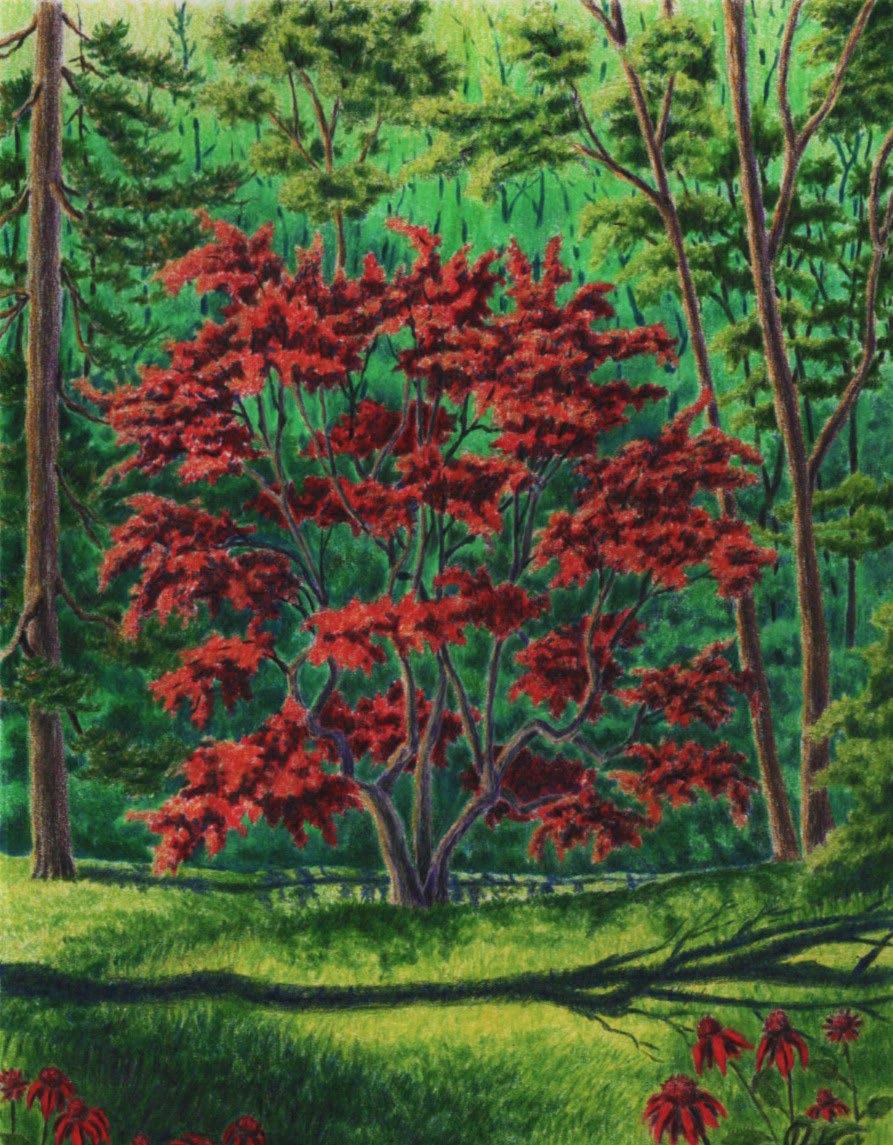
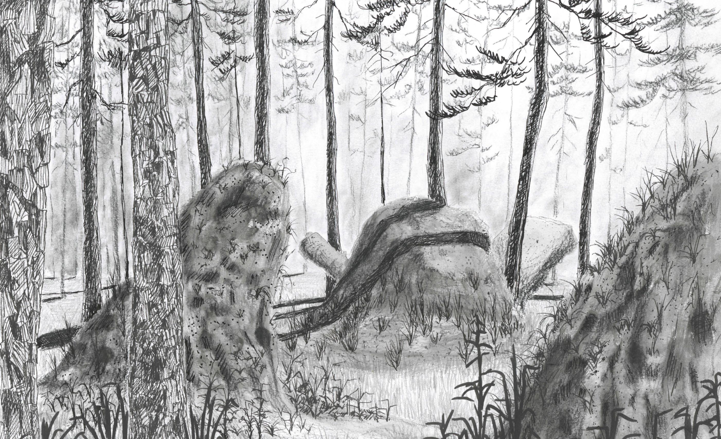
CULTIVATING ATTUNEMENTS: TUSKEGEE NATIONAL FOREST
Tuskegee National Forest Tuskegee, AL
January - May 2023
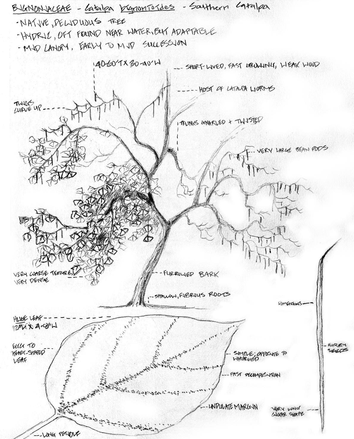
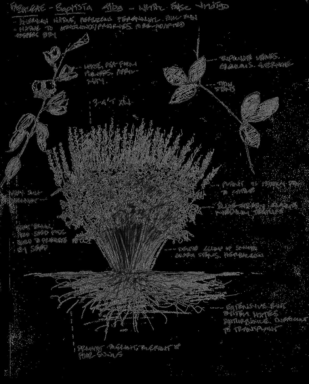
The smallest of the national forests in the United States, Tuskegee National Forest boasts a trove of unexplored and underappreciated design opportunities. Within its 11,000-acre confines lie typologies ranging from dry, vast longleaf pine savannahs to rich, saturated birch-maple-tupelo swamps, each with their own compelling stories to tell. This project seeks to curate and celebrate these narratives in a way that attunes the trailgoer to them, thus revealing the complexity of this small national forest.
Software + Media: Rhino 3D, ArcGIS Pro, Photoshop, Illustrator, InDesign, Hand Drawing, Model-Making
UPLAND LONGLEAF PINE SAVANNAH

DRY AND DRY-MESIC OAK-PINE FOREST
FLOODPLAIN HARDWOOD FOREST
TUPLEO SWAMP/ RIPARIAN EDGE
PLANT COMMUNITIES
Tuskegee National Forest can be divided into 4 general typologies based on elevation: Upland Longleaf Pine Savannah, Dry and Dry-Mesic Oak-Pine Forest, Floodplain Hardwood Forest, and Tupleo Swamp/ Riparian Edge.
ELEVATION + PLANT COMMUNITY
+ ATMOSPHERE
Tuskegee National Forest owes its iconic typologies to both the subtle and stark elevation changes that occur throughout the site. This creates a diverse palette of plant communities, each of which feature distinct and compelling atmospheric qualities.

BROOMSEDGE + BLUESTEM MATRIX
BROOMSEDGE


TUPELO SWAMP/ RIPARIAN EDGE

DAY USE: TRAIL OF ATTUNEMENTS
WAYFINDING “WOODED BASILICA”
FLOODPLAIN HARDWOOD FOREST
NATIONAL FOREST RD 916
In response to intial site inventory and analysis work, I was tasked with creating a trail within a zone of 300-400 acres that would attune hikers to Tuskegee National Forest’s aforementioned spatial and atmospheric qualities. The trail responds to topographic and ecological changes across the forest, sometimes straddling and weaving between edges and topographic gradients, sometimes piercing from one typology to another. The trail guides hikers to specific locations that demonstrate my design agenda.
PINE SAVANNAH
3/8” PEA GRAVEL

WAYFINDING
GALVANIZED
1/2” GRAVEL
REINFORCED CONCRETE, PRE-CAST
The Differentiation Trench is a human-scale instrument intended to serve both as a set of waymarkers for hikers and as an abstraction of the large-scale topographic relationships present within Tuskegee National Forest. The trenches feature a sloped bottom that allows for uneven water distribution, resulting in a moisture gradient that may lead to the emergence of different plant species along its length. Concrete walls isolate the trench’s contents from the surrounding context while also supporting grates intended for walking and plant growth, respectively.

RIDGELAND FOREST

COOL, ENCLOSED, DENSE, HUMID, SHADY
PRIMITIVE TRAIL
SCENIC VIEWSHED
CAMPSITE
LOCATION
EPHEMERAL CREEK
NATIONAL FOREST RD 908
NIGHT USE: WOODED BASILICA
Along with designing a trail for day use, part of this project addresses creating a space for night use. The “Wooded Basilica” explores the relationship between topography, plant communities, and space. This site flows along the side of a hill surrounded by lowland forest typologies. The public, uppermost portions feature finely textured plants that orchestrate panoramic views of the site. Plants with low, dense spatial qualities comprise intimate camping spaces. The trails mimic the site’s fluid topography, while the campsites showcase key views marked during site visits.
PRIMITIVE TRAIL

GATHERING SITE
CAMPING GROUND
OAK-SUMAC-NEEDLE PALM ENCLOSURES
PINE
WINGED SUMAC
PROPOSED SECTION-ELEVATION: CAMPSITE TO GATHERING SPACE

OPEN, FINE TEXTURES CREATE AN AIRY ATMOSPHERE
Low-branching habit of post oak and density of sumac and needle palm create intimate enclosures


SITE GRADING + ENVIRONMENTAL IMPACT
The final component of this project is a grading plan that examines the design’s environmental impact. The site’s topography posed a unique set of opportunities with regard to orchestrating views of the surrounding area. The design creates a series of flattened spaces throughout the site connected by descending, flowing pathways. Downhill, strategic cuts into the existing grade re-orient the path to showcase views of the surrounding basilica. Due to the slope of the site, excessive fill became a notable issue with the overall design, leading to environmental concerns.

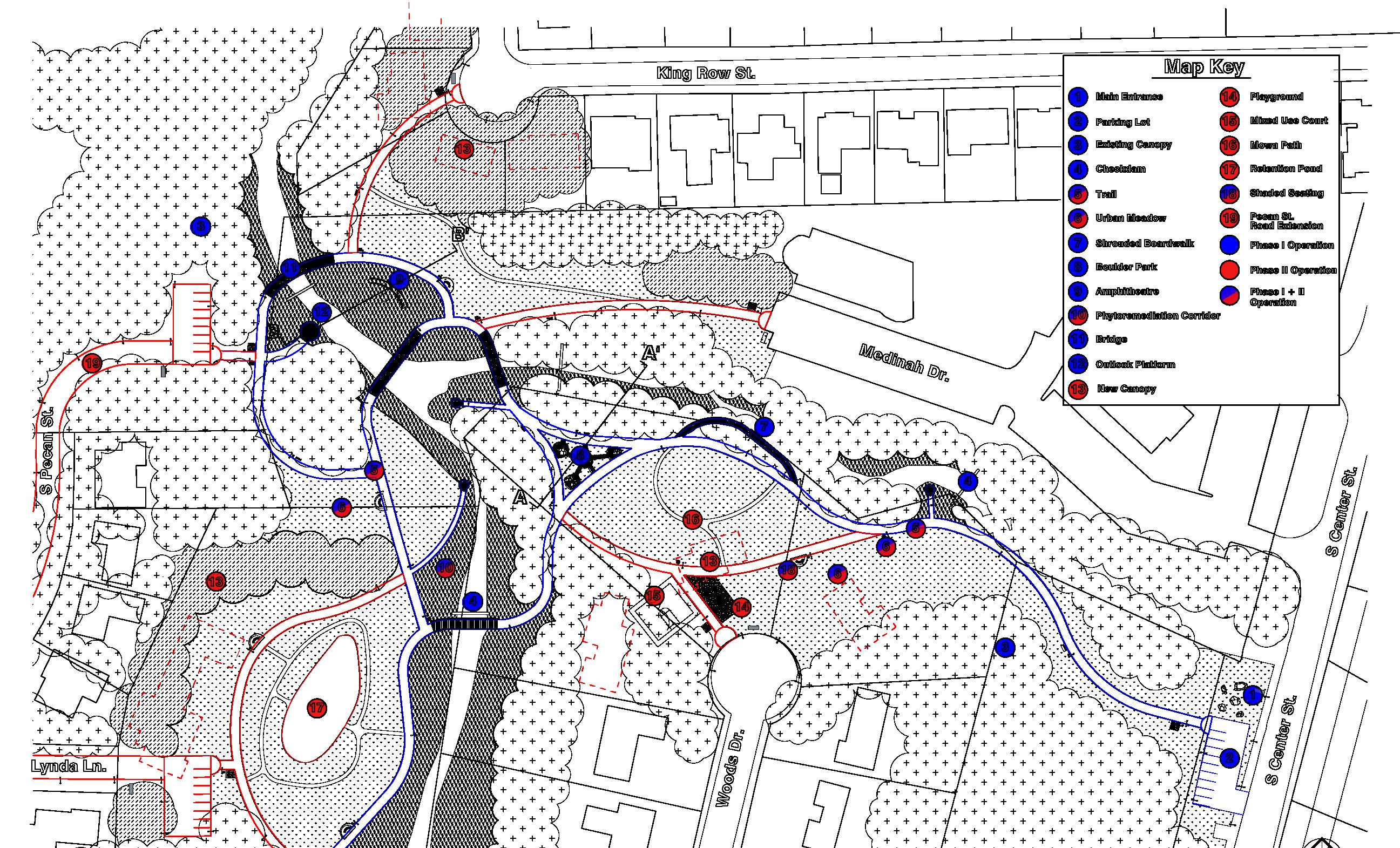
RECLAIMING THE GARDEN OF EDEN
Garden of Eden
Fort Worth / Haltom City, TX
January - May 2024
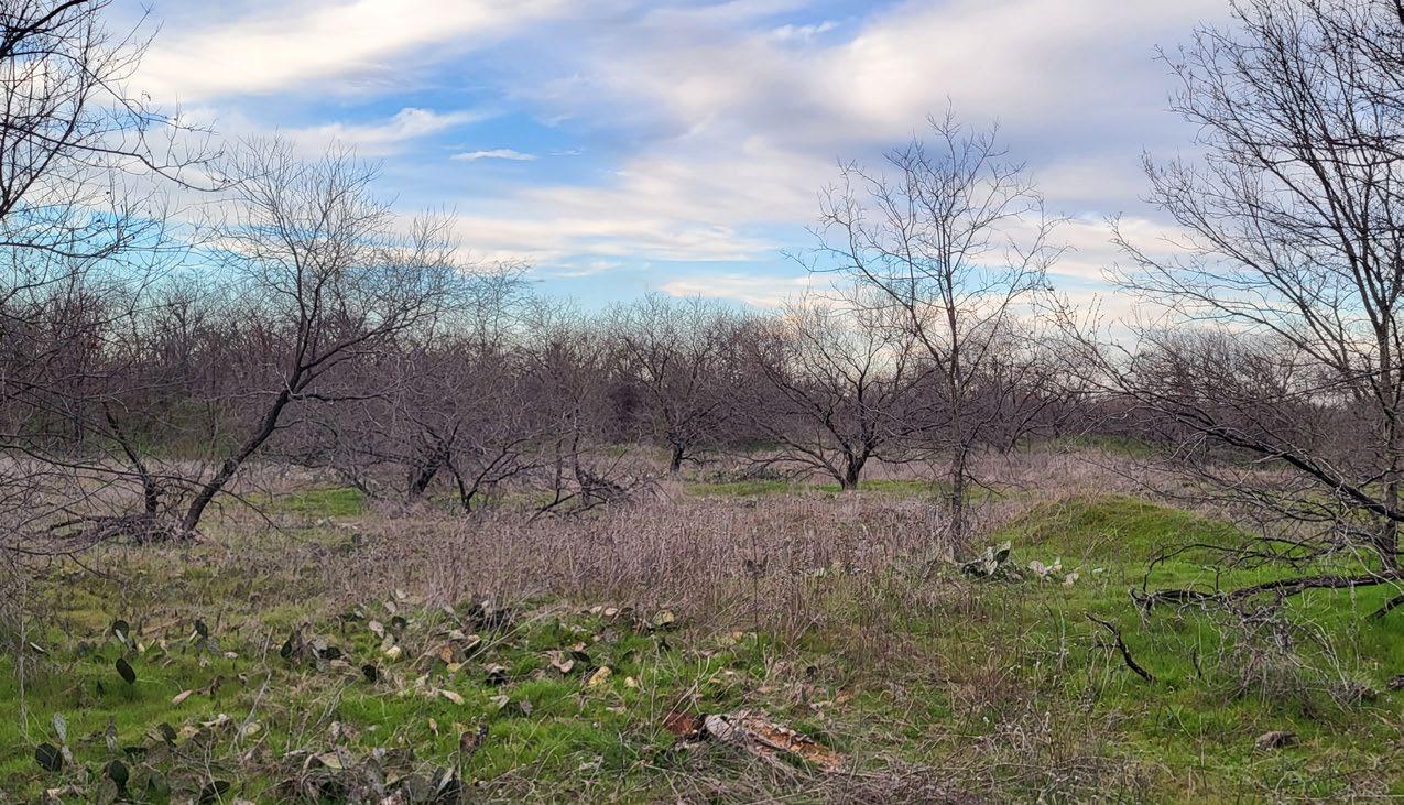
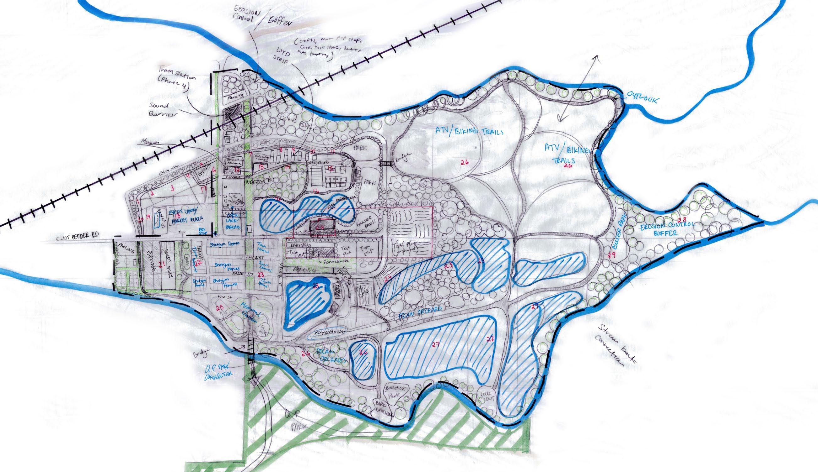
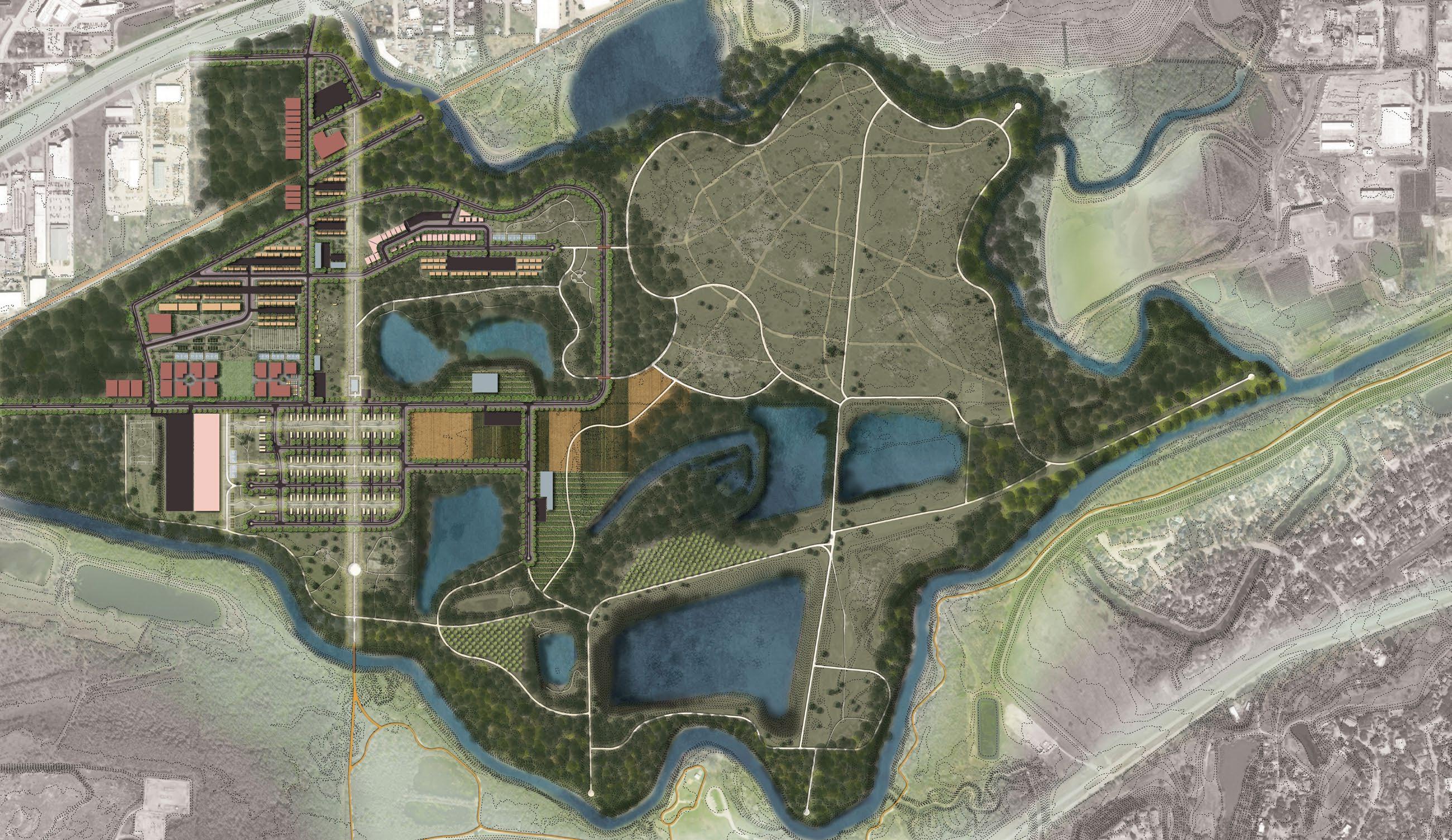
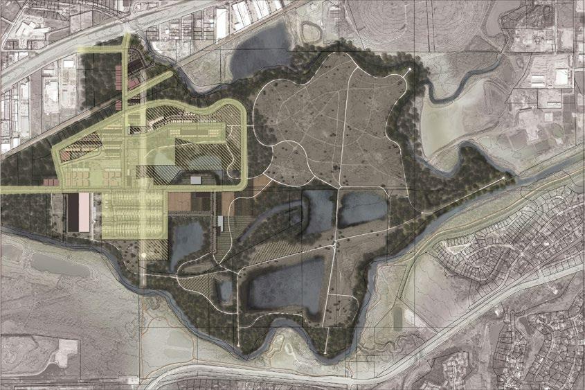
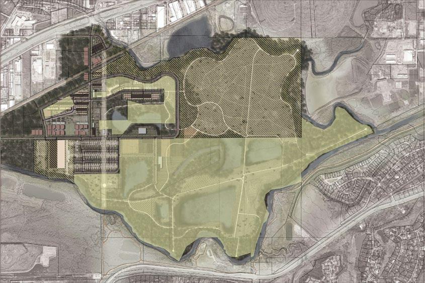
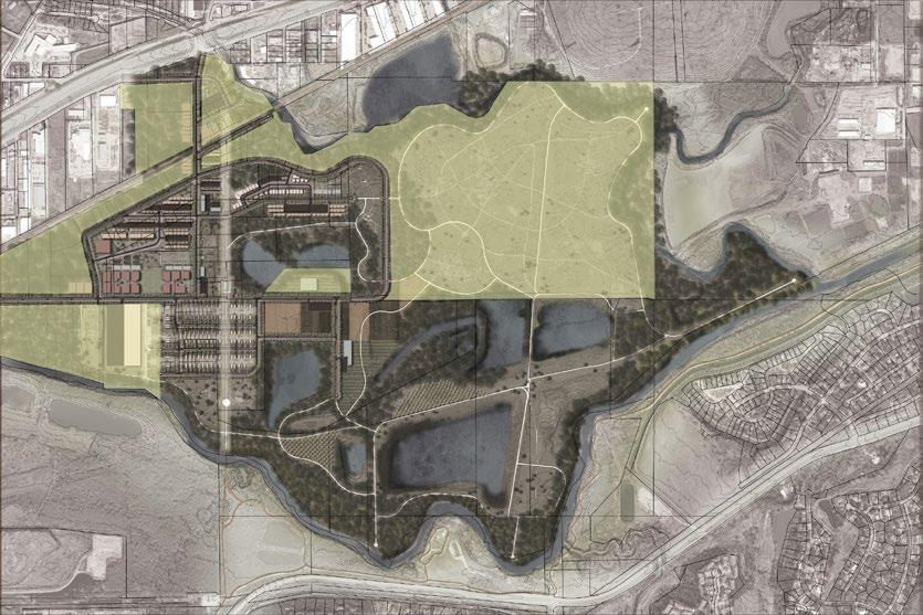
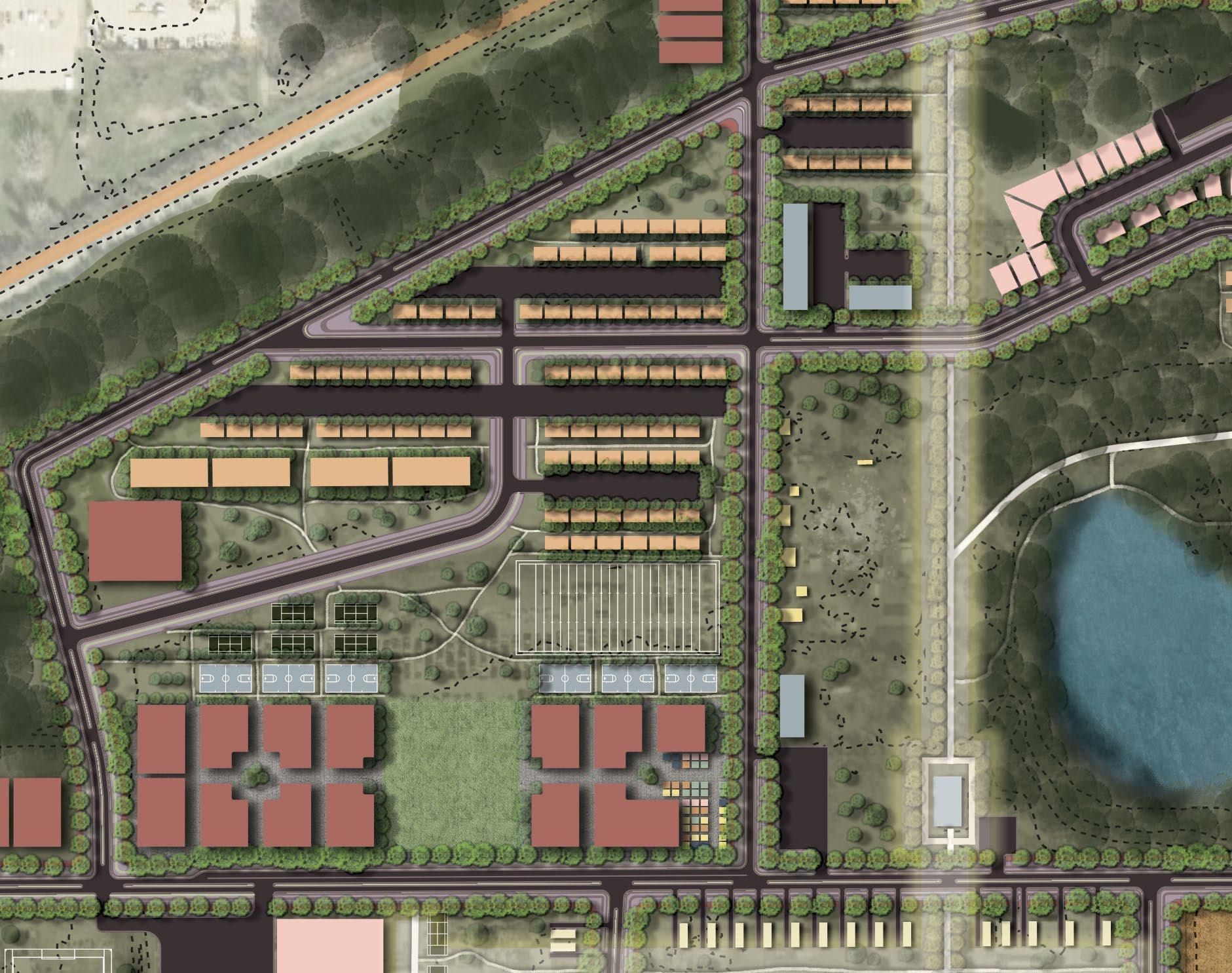
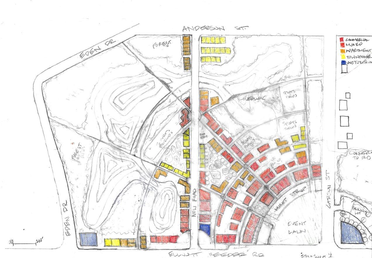
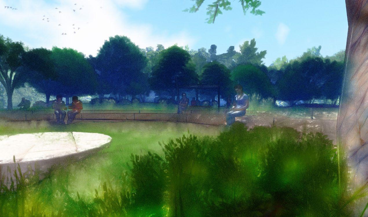
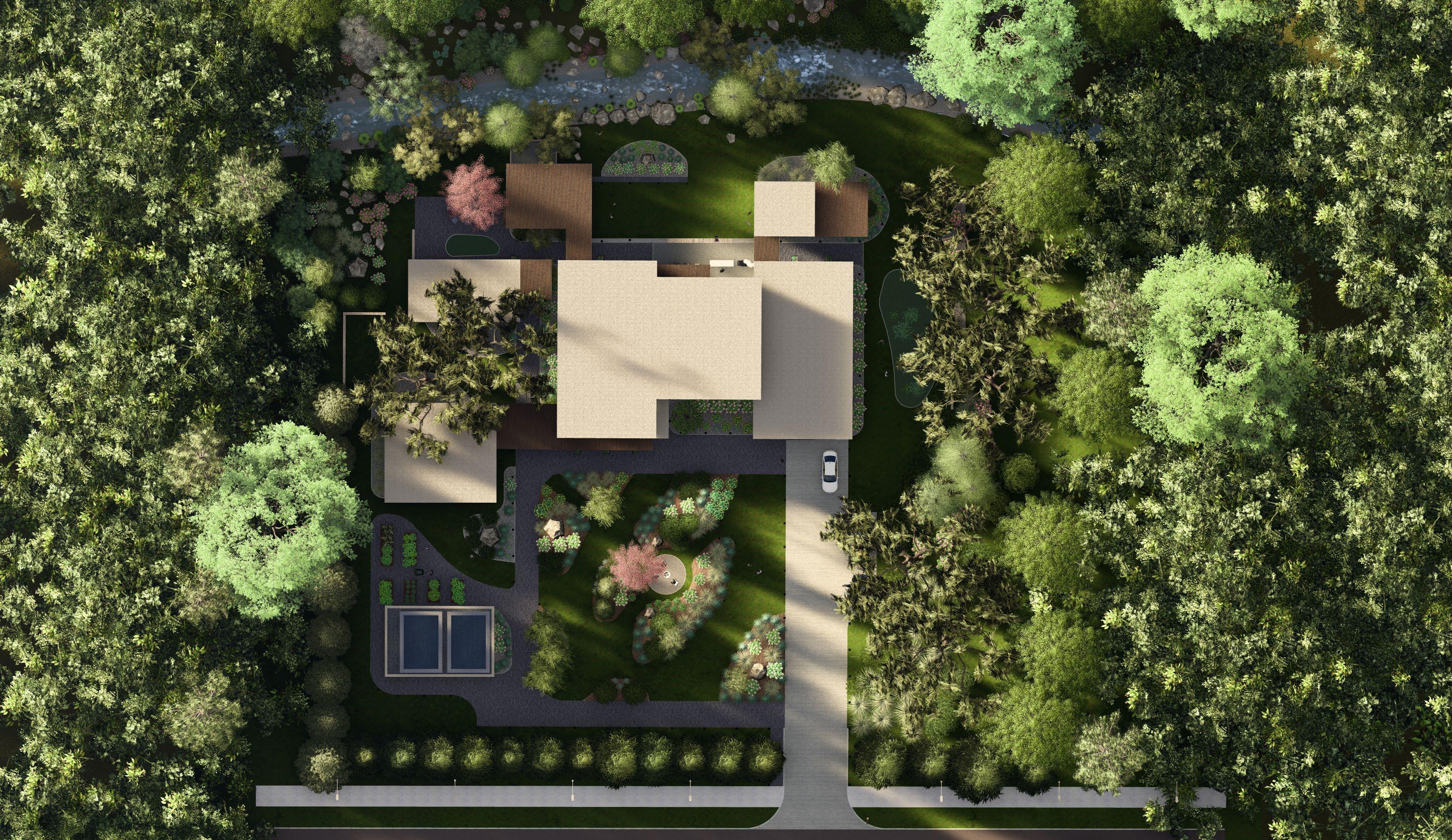
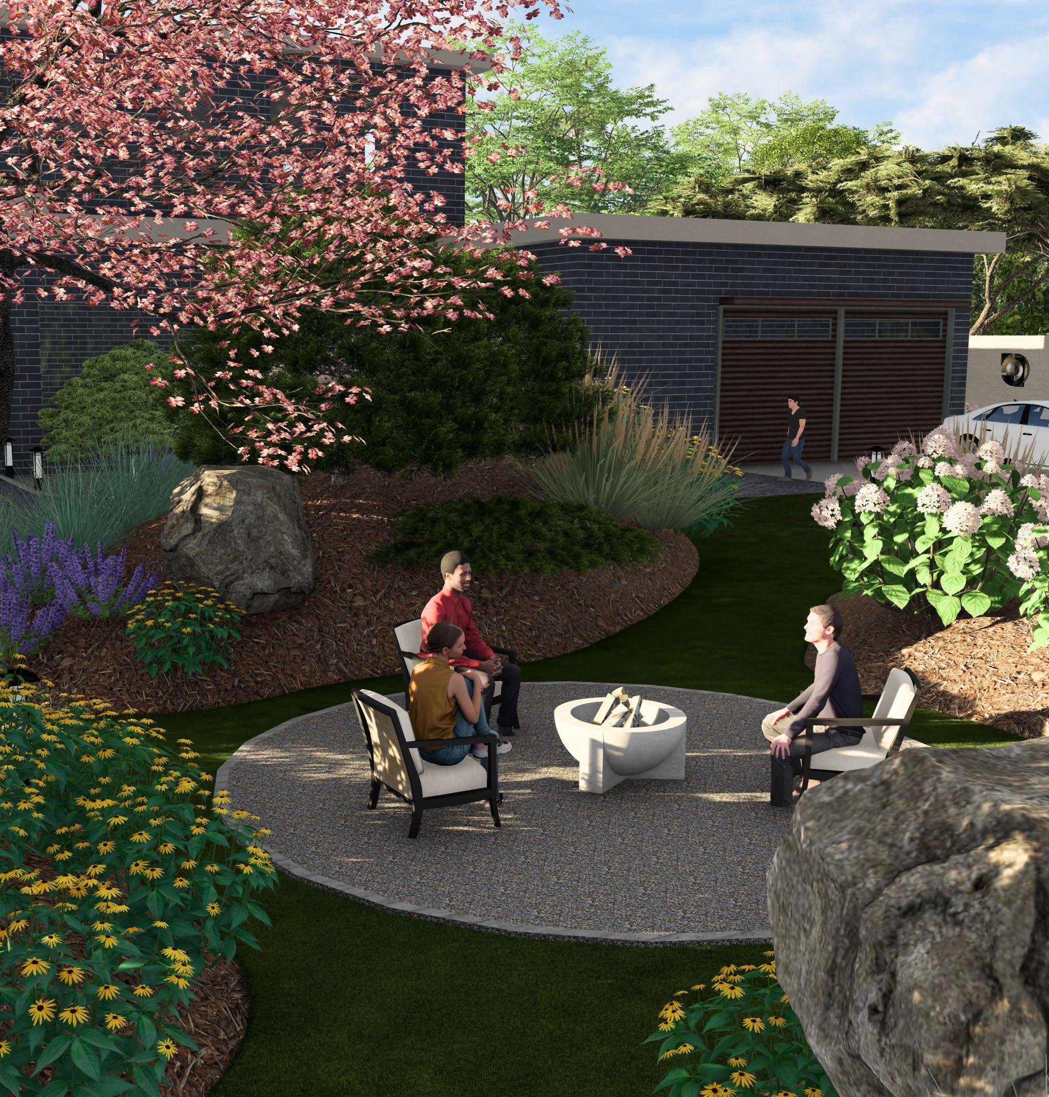
The Garden of Eden, Fort Worth’s first African American cultural district, is a freedman’s community established in the early 1900s. What was once a community of over 50 families has dwindled to fewer than 10 in the face of largely unaddressed social, environmental, and economic pressures. The community envisions the Garden of Eden as an integrated yet distinct space within the city. Their vision balances historical appreciation, economic growth, site accessibility, ecological and hydrological infrastructure. The “Reclaiming the Garden of Eden” Comprehensive Plan represents the collaborative synthesis of a sustainable, resilient, community-centered design model. It promotes ecological stewardship, inter and intra-site connectivity, food security, and social interaction for the community.
Collaborators: Johnathan Hampton, Victor Almaraz, Sowmya Kanaka
Software + Media: ArcGIS Pro, AutoCAD Civil 3D, Photoshop, Illustrator, Indesign, Sketchup, Hand-Drawing

RECYLCING TRUCKS NOISY. DUSTY ENVIRONMENT
LACK OF SIDEWALKS AND SAFE INTERSECTIONS HINDERS
PEDESTRIAN ACCESS

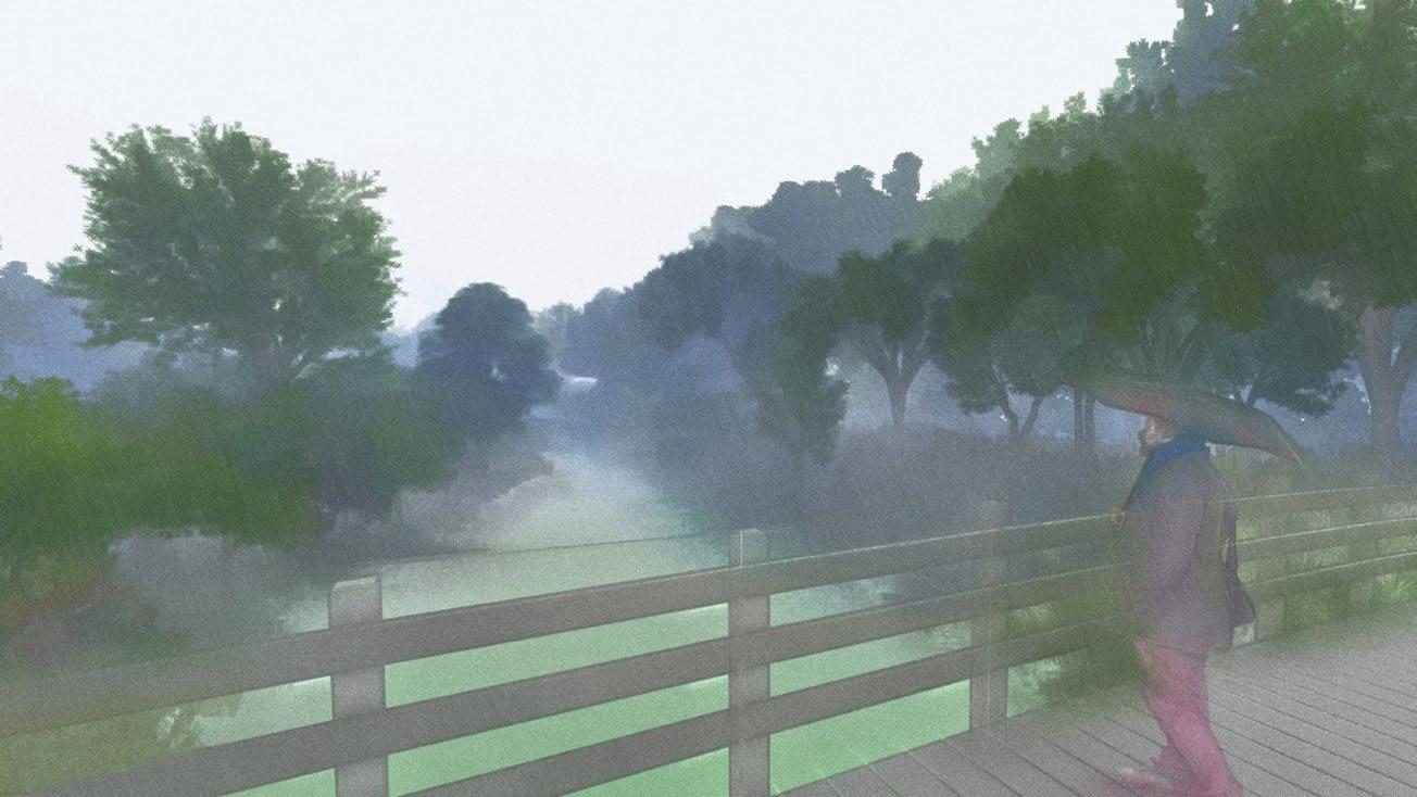
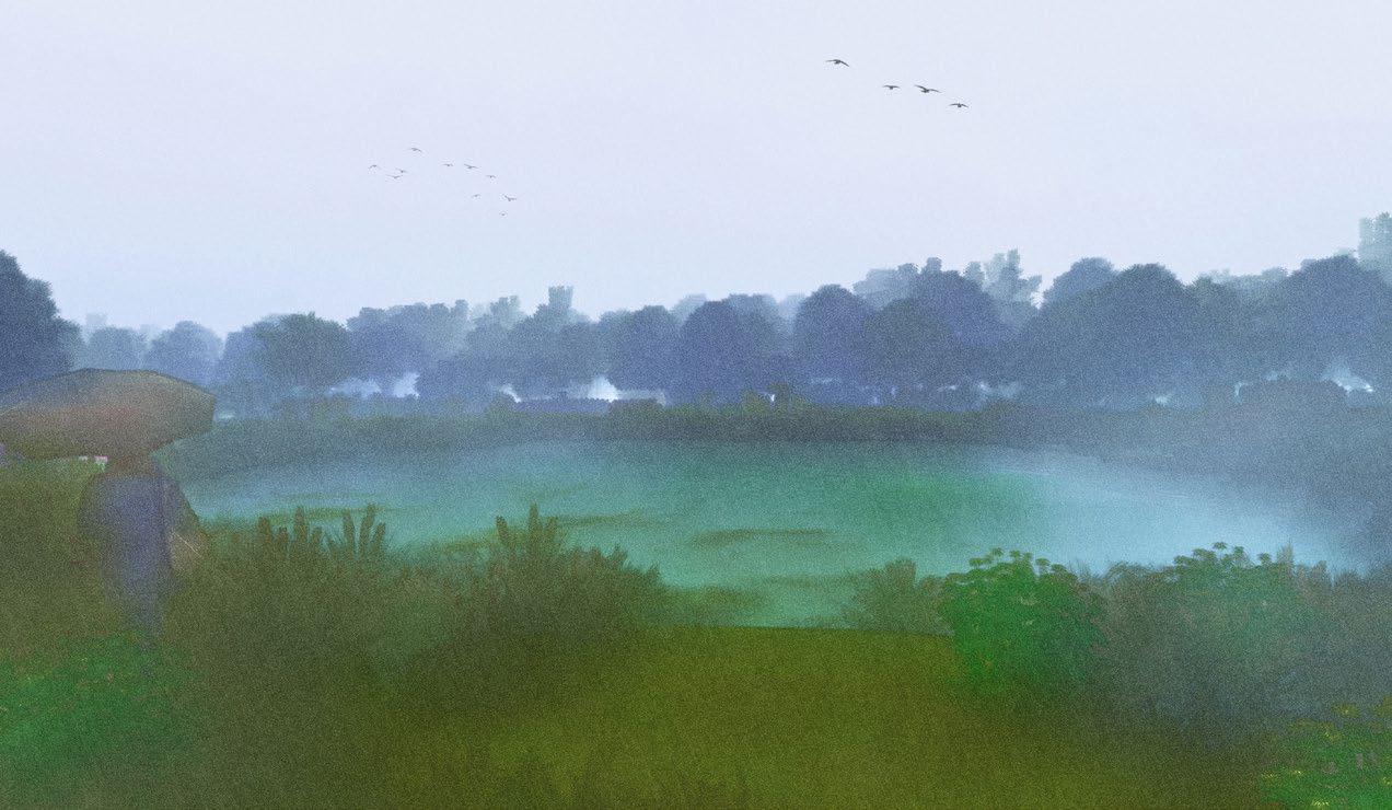
BRAD’S LAKE, ORIGINALLY A GRAVEL EXCAVATION SITE, HOLDS CULTURAL SIGNIFICANCE FOR RESIDENTS

FISHING
SOCIALGATHERING BEAUTYPAGEANTS
THE SITE’S HISTORY OF GRAVEL EXCAVATION AND DEPOSITION HAS CREATED DIVERSE PLANT TYPOLOGIES