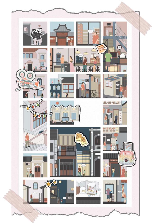
Portfolio Urban planning & design & Architecture 2017-2023 LANWEI WANG JOJO B.Engineer, Dalian University of Technology MUD, Hongkong University wanglanwei2021@163.com +86 18688867113 Daily Life Go to Market Say hi to tourists Eat dumplings Stroll in the blocks Play Games Explore Hidden Clues
01
CONTENTS
Water-loving Carnival
·The renewal and reconstruction of waterfront public space
·Wong Chuk Hang, Hongkong, China
Urban Design
02 River Revival Plan
·Analysis of waterfront spaces and system urban design
·Kallang River, Singapore
Urban Design
03 Flexibility of Urban realm
·Research of flexible spaces and concept design
·Mongkok, Hong kong, China
Place-making Research
04
Retro Game Block
Postgraduate Postgraduate Postgraduate Bachelor
·Transformation and renewal of historical and cultural blocks
·Dalian City , Liaoning Province, China
Urban Design
05
Other Work
·Make manual models & game imagination
Urban Analysis
Model-making
Water-loving Carnival
Individual Work
CATEGORY: Academic Work | TIME: 2022.09-2022.11
LOCATION: Wong Chuk Hang, Hong kong, China
TUTOR: Vera Kleesattel
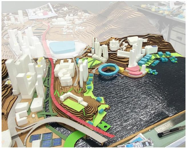
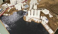
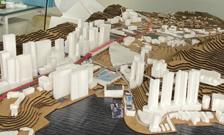
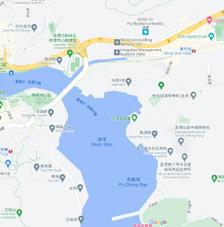
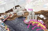
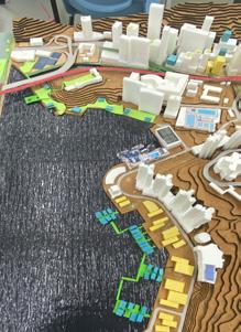
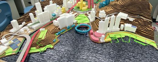
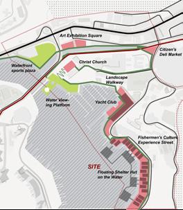
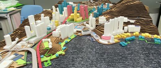
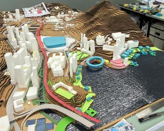
Wong Chuk Hang is a place sandwiched between two mountains. My plot is in the west of Wong Chuk Hang, which is a piece of waterfront. My theme is neighborhood to thewaterfront. The main functions of the area are a new residential area, a yacht club, a group of shipbuilding plants and an office park. There are various kinds of waterfront space within the plot, but the accessibility and continuity of the waterfront area are poor, which is also the most critical problem to be solved in this design. At the same time, the land area that can be used and used for activities is not large, because the slope fluctuation of Wong Chuk Hang is large.
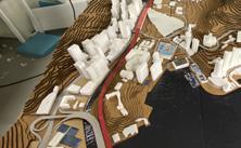
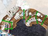
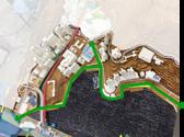
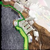
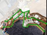
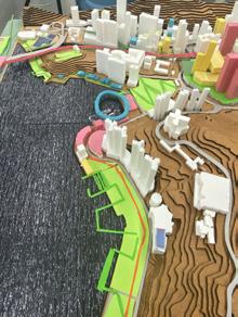
The design idea follows the previous analysis results and is divided into three areas for design. From the subway station follow the new red corridor to enter the Stepped Park, continue down to the water stage. The stage extends the corridor to the waterfront to ensure theaccessibility of the waterfront space. At the same time, the children's amusement wooden bridge is built on the north waterway, supplemented by a small rest park, and the park is connected to the north mountain green corridor. To the south, new educational, entertainment and retail functions will be incorporated to make full use of the existing fisherman's harbor and shipbuilding buildings, which will fully revitalize the waterfront space and attract people.
01


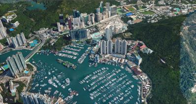
Wong Chuk Hang is a place sandwiched between two mountains. My plot is in the west of Wong Chuk Hang, which is a piece of waterfront. My theme is neighborhood to the waterfront. The main functions of the area are a new residential area, a yacht club, a group of ship building plants and an office park. There are various kinds of waterfront space within the plot, but the accessibility and continuity of the waterfront area are poor, which is also the most critical problem to be solved in this design. At the same time, the land area that can be used and used for activities is not large, because the slope fluctuation of Wong chuk hang is large.













UDBrief




LocationIntroduction UD Introduction LargeInfrastructureCharacter OpenspaceAnalysis&Potentials StudyAreaImpactAssessment
Strategies
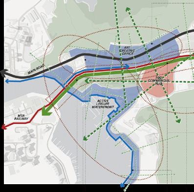
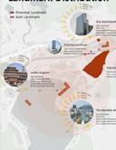
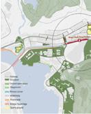
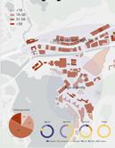
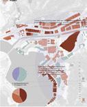
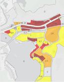
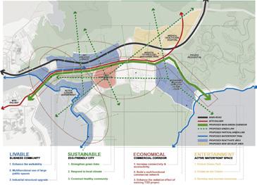
Vision&AAP ACTIVE GREEN CULTURAL ACCESSIBLE WATERFRONT MAIN ROAD MTR RAILWAY PROPOSED MAIN GREEN CORRIDOR PROPSED GREEN LINK PROPOSED PARTICAL GREEN LINK PROPOSED WATERFRONT TRAIL PROPOSED REACTIVATE AREA PROPOSED NEW DEVELOP AREA HK & Shenzhen-GBA – Existing, Planned and Future scenarios – Macro Scale Vision Planning 08 Build Wong Chuk Hang into a commercial center in the southern part of Hong Kong Island. Wong Chuk Hang is rich in natural resources, adding greenways and cleaning the waterfront area to enhence the environment quality Strengthen green links Respond to local climate Fully consider the natural resources and conditions of the site to achieve green development. Re-plan construction land to enhance urban ventilation. Reduce building energy consumption and reduce urban heat island effect. friendly city Cultural and artistic blocks will be set up in the industrial area, and there will be more pedestrian-friendly public facilities for leisure and entertainment. Activating old industrial areas and revitalizing existing buildings. Enhance the walkability Multifunctional use of large public spaces Industrial structural upgrade Relocate logistics companies and introduce art and innovative companies. Introduce specialty businesses such as catering and cultural and creative industries. Build a livable business community Enhance the radiation effect of existing TOD project Establish an economic chain with the tourism industry as the core. Wong Chuk Hang will have abundant tourism resources in the future. Form the commercial network of Ocean Park, Cultural and Creative District and Fishery Culture Park. Enrich the functions of existing TOD project, enhance the connection between public transportation systems, and improve the flexibility of public transportation. corridor Evolve Ocean Park Ocean + Create an Art Centre Strengthen the local cultural atmosphere and build new entertainment venues. Reposition the Ocean Park, keep the site memory and make it a Cultural Tourism commercial town to expand Attract more artists to settle in the art district, drive the development of cultural and creative industries in the whole region, and regularly hold cultural activities. Construct an entertainment zone Framework Industrial Creative Park Technology Industry Coastal Fishermen Culture Residential area There are many The TOD node is a We have created This hospital enjoys Wong Chuk Hang Action Area Action Area Plan Reuse & Re-Purpose The redeveloped and utilized buildings are mainly concentrated in the former industrial areas, marine parks, fishing villages and TOD, redeveloped for residential development, innovative enterprises, health care, cultural tourism planning. The main purpose is to build Wong Chuk Hang into a leisure center and science and technology innovation node in Hong Kong. Strengthen the connectivity of the Wong Chuk Hang business district, emphasizing the connection of the three business center nodes to attract consumers, and the main axis connecting Wong Chuk Hang to external areas for business connections. Appropriately widen the sidewalk along the main road, strengthen the connection between the plot and the north and south mountains, connect five action areas with pedestrians, improve the waterfront space at the same time, build a pedestrian bridge, and combine the different characteristics of each area to form a pedestrian-friendly road that can carry The fishermen culture of Huangzhukeng has a long history, and not only that, but there are also many historical buildings in this site, and the tour route is planned to form a historical site with Business Linkage Walking Friendly Street HK & Shenzhen-GBA – Existing, Planned and Future scenarios – Macro Scale Vision Planning 08 Build Wong Chuk Hang into a commercial center in the southern part of Hong Kong Island. Wong Chuk Hang is rich in natural resources, adding greenways and cleaning the waterfront area to enhence the environment quality Strengthen green links Respond to local climate Fully consider the natural resources and conditions of the site to achieve green development. Re-plan construction land to enhance urban ventilation. Reduce building energy consumption and reduce urban heat island effect. friendly city Cultural and artistic blocks will be set up in the industrial area, and there will be more pedestrian-friendly public facilities for leisure and entertainment. Activating old industrial areas and revitalizing existing buildings. Enhance the walkability Multifunctional use of large public spaces Industrial structural upgrade There are several large-scale public event venues with a single function in the Wong Chuk Hang site. Repurpose these venues with multiple functions to improve their efficiency. Relocate logistics companies and introduce art and innovative companies. Introduce specialty businesses such as catering and cultural and creative industries. business community Enhance the radiation effect of existing TOD project Establish an economic chain with the tourism industry as the core. Wong Chuk Hang will have abundant tourism resources in the future. Form the commercial network of Ocean Park, Cultural and Creative District and Fishery Culture Park. Enrich the functions of existing TOD project, enhance the connection between public transportation systems, and improve the flexibility of public transportation. corridor Evolve Ocean Park Ocean + Create an Art Centre Strengthen the local cultural atmosphere and build new entertainment venues. Reposition the Ocean Park, keep the site memory and make a Cultural Tourism commercial town to expand its target population. Attract more artists to settle in the art district, drive the development of cultural and creative industries in the whole region, and regularly hold cultural activities. Construct an entertainment zone Framework Industrial Creative Park Hospital Technology Industry Commercial Node Coastal Fishermen Culture Residential area There are many The TOD node is a We have created This hospital enjoys Wong Chuk Hang Action Area Action Area Plan Reuse & Re-Purpose The redeveloped and utilized buildings are mainly concentrated in the former industrial areas, marine parks, fishing villages and TOD, redeveloped for residential development, innovative enterprises, health care, cultural tourism planning. The main purpose is to build Wong Chuk Hang into a leisure center and science and technology innovation node in Hong Kong. Strengthen the connectivity of the Wong Chuk Hang business district, emphasizing the connection of the three business center nodes to attract consumers, the main axis connecting Wong Chuk Hang to external areas for business connections. Appropriately widen the sidewalk along the main road, strengthen the connection between the plot and the north and south mountains, connect five action areas with pedestrians, improve the waterfront space at the same time, build a pedestrian bridge, and combine the different characteristics of each area to form a pedestrian-friendly road that can carry The fishermen culture of Huangzhukeng has a long history, and not only that, but there are also many historical buildings in this site, and the tour route is planned to form a historical site with Business Linkage Open Space Network Walking Friendly Street HK & Shenzhen-GBA – Existing, Planned and Future scenarios – Macro Scale Vision Planning 08 Build Wong Chuk Hang into a commercial center in the southern part of Hong Kong Island. Wong Chuk Hang is rich in natural resources, adding greenways and cleaning the waterfront area to enhence the environment quality Strengthen green links Respond to local climate Fully consider the natural resources and conditions of the site to achieve green development. Re-plan construction land to enhance urban ventilation. Reduce building energy consumption and reduce urban heat island effect. friendly city Cultural and artistic blocks will be set up in the industrial area, and there will be more pedestrian-friendly public facilities for leisure and entertainment. Activating old industrial areas and revitalizing existing buildings. Enhance the walkability Multifunctional use of large public spaces Industrial structural upgrade There are several large-scale public event venues with a single function in the Wong Chuk Hang site. Repurpose these venues with multiple functions to improve their efficiency. Relocate logistics companies and introduce art and innovative companies. Introduce specialty businesses such as catering and cultural and creative industries. business community commercial network Enhance the radiation effect of existing TOD project Establish an economic chain with the tourism industry as the core. Wong Chuk Hang will have abundant tourism resources in the future. Form the commercial network of Ocean Park, Cultural and Creative District and Fishery Culture Park. Enrich the functions of existing TOD project, enhance the connection between public transportation systems, and improve the flexibility of public transportation. Develop commercial corridor Evolve Ocean Park Ocean + Create an Art Centre Strengthen the local cultural atmosphere and build new entertainment venues. Reposition the Ocean Park, keep the site memory and make it a Cultural Tourism commercial town to expand its target population. Attract more artists to settle in the art district, drive the development of cultural and creative industries in the whole region, and regularly hold cultural activities. Construct an entertainment zone Framework Industrial Creative Park Hospital Technology Industry Commercial Node Coastal Fishermen Culture Residential area Action Area Action Area Plan Reuse & Re-Purpose The redeveloped and utilized buildings are mainly concentrated in the former industrial areas, marine parks, fishing villages and TOD, redeveloped for residential development, innovative enterprises, health care, cultural tourism planning. The main purpose is to build Wong Chuk Hang into a leisure center and science and technology innovation node in Hong Kong. Strengthen the connectivity of the Wong Chuk Hang business district, emphasizing the connection of the three business center nodes to attract consumers, and the main axis connecting Wong Chuk Hang to external areas for business connections. Appropriately widen the sidewalk along the main road, strengthen the connection between the plot and the north and south mountains, connect five action areas with pedestrians, improve the waterfront space at the same time, build a pedestrian bridge, and combine the different characteristics of each area to form a pedestrian-friendly road that can carry The fishermen culture of Huangzhukeng has a long history, and not only that, but there are also many historical buildings in this site, and the tour route is planned to form a historical site with Business Linkage Open Space Network Walking Friendly Street INDIVIDUAL WORK VISION GROUPWORK VISION There are two landmarks, but Jumbo Kingdom has closed down LANDMARK DISTRIBUTION GREEN & OPEN SPACE PUBLIC BUILDING DISTRIBUTION BUILDING AGE REDEVELOPMENT GRADING There is a big difference in the plot ratio,and mixed functions There are three hills covered with greenery within the plot Most of the buildings within the parcel are young, but still very heterogeneous Plots suitable for redevelopment include fishermen's houses and buildings in OZP WITH FAR DISTRIBUTION Wch has diversified road types. With the construction of WCH Metro Station, the accessibility of the plot will be greatly increased. At the same time, due to the poor terrain of the plot and the existence of subway viaducts, there will be a lot of gray space cut out of the plot for subsequent design. People BASELINE EVALUATION SUMMARY & CONCLUSIONS PROGRAM PLAN STRATEGIES CONCLUSION WCH WCH has rich green land and waterfront resources. By using these resources, we can improve the quality of life of local residents and develop new activities There are mainly kinds of people in wch. Except local residents, there room for other people to improve their experience in WCH. We can transform and design urban space according to the needs of different people. Each area of WCH has typical characteristics, which may be the use of people or building texture geographical location. necessary to divide themes according to different regional characteristics for subsequent design After analyzing the above four aspects, we classified the buildings according to their functions, quality and planning needs. Some old buildings with low utilization rate will be demolished Strengths Landscape Transportation Functions Buildings Vibrant economic activities Unique cultural identity and Wch has diversified road types. With the construction of WCH Metro Station, the accessibility of the plot will be greatly increased. At the same time, due to the poor terrain of the plot and the existence of subway viaducts, there will be lot of gray space cut out of the plot for subsequent design. People 07 DEVELOPMENT POTENTIAL BASELINE EVALUATION SUMMARY & CONCLUSIONS PROGRAM PLAN STRATEGIES WCH | Mountains Sea WCH has rich green land and waterfront resources. By using these resources, we can improve the quality of life of local residents and develop new activities There are mainly kinds of people in wch. Except local residents, there is room for other people to improve their experience in WCH. We can transform and design urban space according to the needs of different people. Each area of WCH has typical characteristics, which may be the use of people or building texture or geographical location. It is necessary to divide themes according to different regional characteristics for subsequent design After analyzing the above four aspects, we classified Residents Elders Tourists Students Creative Artists Fisherman Private residential area Hospital area Ocean park area Civic area Industrial Community TOD area Bay area Main roads Secondary roads Access roads Metro track Landscape Transportation Functions Buildings Wch has diversified road types. With the construction of WCH Metro Station, the accessibility of the plot will be greatly increased. At the same time, due to the poor terrain of the plot and the existence of subway viaducts, there will be lot of gray space cut out of the plot for subsequent design. People 07 DEVELOPMENT POTENTIAL BASELINE EVALUATION SUMMARY & CONCLUSIONS PROGRAM PLAN STRATEGIES WCH | Mountains Sea WCH has rich green land and waterfront resources. By using these resources, we can improve the quality of life of local residents and develop new activities There are mainly kinds of people in wch. Except local residents, there is room for other people to improve their experience in WCH. We can transform and design urban space according to the needs of different people. Each area of WCH has typical characteristics, which may be the use of people or building texture or geographical location. It is necessary to divide themes according to different regional characteristics for subsequent design After analyzing the above four aspects, we classified the buildings according to their functions, quality and planning needs. Some old buildings with Residents Elders Tourists Students Creative Artists Fisherman Private residential area Hospital area Ocean park area Civic area Industrial Community TOD area Bay area Main roads Secondary Access roads Metro track Landscape Transportation Functions Buildings Wch has diversified road types. With the construction of WCH Metro Station, the accessibility of the plot will be greatly increased. At the same time, due to the poor terrain of the plot and the existence of subway viaducts, there will be lot of gray space cut out of the plot for subsequent design. People 07 DEVELOPMENT POTENTIAL BASELINE EVALUATION SUMMARY & CONCLUSIONS PROGRAM PLAN STRATEGIES WCH | Mountains Sea WCH has rich green land and waterfront resources. By using these resources, we can improve the quality of life of local residents and develop new activities There are mainly kinds of people in wch. Except local residents, there is room for other people to improve their experience in WCH. We can transform and design urban space according to the needs of different people. Each area of WCH has typical characteristics, which may be the use of people or building texture or geographical location. It is necessary to divide themes according to different regional characteristics for subsequent design After analyzing the above four aspects, we classified the buildings according to their functions, quality and planning needs. Some old buildings with low utilization rate will be demolished Residents Elders Tourists Students Creative Artists Fisherman Private residential area Hospital area Ocean park area Civic area Industrial Community Bay area Main roads Secondary Access roads Metro track Redevelopment Preservation Landscape Transportation Functions Buildings Wch has diversified road types. With the construction of WCH Metro Station, the accessibility of the plot will be greatly increased. At the same time, due to the poor terrain of the plot and the existence of subway viaducts, there will be lot of gray space cut out of the plot for subsequent design. People 07 DEVELOPMENT POTENTIAL BASELINE EVALUATION SUMMARY & CONCLUSIONS PROGRAM PLAN STRATEGIES WCH | Mountains Sea WCH has rich green land and waterfront resources. By using these resources, we can improve the quality of life of local residents and develop new activities There are mainly kinds of people in wch. Except local residents, there is room for other people to improve their experience in WCH. We can transform and design urban space according to the needs of different people. Each area of WCH has typical characteristics, which may be the use of people or building texture or geographical location. It is necessary to divide themes according to different regional characteristics for subsequent design After analyzing the above four aspects, we classified the buildings according to their functions, quality and planning needs. Some old buildings with low utilization rate will be demolished Residents Elders Tourists Students Creative Artists Fisherman Private residential area Hospital area Ocean park area Civic area Industrial Community TOD area Bay area Main roads Secondary Access roads Metro track Redevelopment Preservation Reprogram Demolition Landscape Transportation Functions Buildings Wch has diversified road types. With the construction of WCH Metro Station, the accessibility of the plot will be greatly increased. At the same time, due to the poor terrain of the plot and the existence of subway viaducts, there will be lot of gray space cut out of the plot for subsequent design. People 07 BASELINE EVALUATION SUMMARY & CONCLUSIONS PROGRAM PLAN STRATEGIES WCH | Mountains Sea WCH has rich green land and waterfront resources. By using these resources, we can improve the quality of life of local residents and develop new activities There are mainly kinds of people in wch. Except local residents, there is room for other people to improve their experience in WCH. We can transform and design urban space according to the needs of different people. Each area of WCH has typical characteristics, which may be the use of people or building texture or geographical location. It is necessary to divide themes according to different regional characteristics for subsequent design After analyzing the above four aspects, we classified the buildings according to their functions, quality and planning needs. Some old buildings with low utilization rate will be demolished Residents Elders Tourists Students Creative Artists Fisherman Private residential area Hospital area Ocean park area Civic area Industrial Community TOD area Bay area Main roads Secondary Access roads Metro track Redevelopment Preservation Reprogram Demolition Landscape Transportation Functions Buildings MACRO SCALE MESO SCALE MICRO SCALE ——Green linkage ——Fishing boat gathering area ——Waterfront Open Space MTR WONG CHUK HANG PO CHONG WAN SHAM WAN boatclub MICRO
MACRO MESO HISTORY MAPS PEOPLE CHARACTER Industrial office area NewWorld First Bus 1928 Fisherman 1952 Family & Kids 1970 Tourists 2020 Officers Nam Long Shan Road Cooked Food Market Heung Yip Path MTR Entrance Bridge
WongChukHang Depot and Residentials
Spirit
MTR
Holy
Seminary
Aberdeen Marina Club Broadview Court Residentials
Pao
Yue Kong Swimming Pool
TERRAIN ANALYSIS
South Mountain with many schools
Middle Area connecting the MTR 3. North hill has square on the top POTENTIALS INTEGRATION The northern part of the site has a large waterfront site for traffic; the waterfront trail has a single function, no connection to the opposite shore and no open space on the opposite shore; the accessibility of the church is low and there are no other functions on the top of the hillside The first floor plaza of the swimming pool has low usage rate and no activity equipment; the Marina Yacht Club is a membership system, and the above two buildings block the connection between the waterfront space and the subway station; meanwhile, the green space can only be seen but not used Several schools on the hill are not connected with the waterfront area, the use of hiking trails is poor, the internal environment of the shipyard in the coastal area is poor, the items are placed in a disorderly manner and the space is irregular, dividing the road and the waterfront space. Fisherman Family & Kids Tourists Officers EXISTING MIX PROPORTION PROPOSED MIX PROPORTION 17.6% 24.2% OPENSPACE BUILDING GREENSPACE ROADS 30% 25% 30% 15%
Brother Shipyard Asia Repair Center
1.
2.
MorphologicalMatrix
1. The Waterfront Promenade at Aker Brygge ,
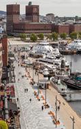
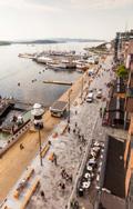
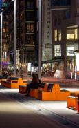
‘Stranden’ is the first of a multi-stage redevelopment of the precinct known as ‘Aker Brygge’ in Oslo, Norway. It is part of a greater effort to reinvigorate Oslo’s post-industrial waterfront by creating a 12km long publically accessible waterfront promenade, connecting the city’s east and west. The precinct’s developer, Norwegian Property (NPRO), aims to reinvigorate Aker Brygge by refurbishing the urban outdoor spaces, transforming the area’s retail concept, and introducing new office space. These include ‘Bryggetorget’, the precinct’s main square and various streetscapes and laneways, which connect Aker Brygge to the waterfront and the city fabric beyond.
1.Waterfront recreational trails and retail dining
2.Boat docking, exhibitions, events


CHINA
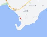
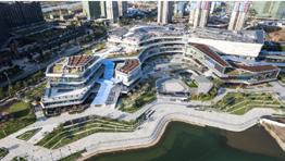
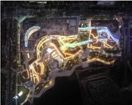
The design for Jinwan Mall transforms the regular shopping mall into an outdoor retail experience closely linked to nature, creating a new paradigm of how people experience retail spaces and bringing a new destination to Zhuhai’s Jinwan District.The retail scheme envisions the integration of a traditional courtyard garden with hypermodern space. The development weaves together the main mall, retail street and the waterside pavilions consisting of F&B and retail spaces, with ample outdoor spaces opening onto the lake. The retail street and the mall are tied together with the glass canopy spine that allows for weather-proof connectivity and use of the amenities.
1.Centralized commercial vending
2.Conform to site elevation differences
3.Water-facing plaza
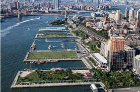
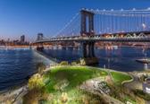
3.Brooklyn Bridge Park BROOKLYN CHINA
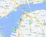
Brooklyn Bridge Park Conservancy plays a vital role in creating and energizing this community-focused, world-class urban oasis on the Brooklyn waterfront.We bring this unique park space to life with more than 500 innovative and engaging educational, cultural, fitness and recreational programs each year. Our free and low-cost events create new and exciting opportunities for tens of thousands of NYC residents and visitors to learn, grow, and experience all that Brooklyn Bridge Park has to offer. Beyond with outdoor movies, arts and culture, recreation and fitness, environmental education, and lots more! Scroll below to access our event calendar with in-person and online offerings.
1.Large plaza extending out over the water
2.A venue for a variety of events
3.Environmental protection embankment

Existing
No green space along the waterfront
Strategy 1
Block green space
Strategy 2
Linear green space
Strategy 3
Linear connected to block green space
Urban Structure
Existing
Four roads extended from MTR
Strategy 1
Waterfront Road
Strategy 2
Mountain road cutting the plot
Strategy 3
New core connecting to the waterfront
Urban Grain
Existing
Low-rise buildings
Strategy 1
Ring-shaped buildings and curved walkway
Strategy 2
Folded walkway and extended platform
Strategy 3
Strips and extensions
Volumetric- Enjoyable
Existing
Yacht club and factory
Strategy 1
Block recreation park
Strategy 2
Cultural revival of floating huts on the sea
Strategy 3
Waterfront walkway and community park
Scale Massing
Existing
High-rise residential area and yacht club
Strategy 1
New commercial and entertainment harbor
Strategy 2
New shopping mall and plaza
Strategy 3
Fishermen's cultural experience street
Waterfront Accessibility
Existing
Low accessibility
Strategy 1
Enhances the connection between the hills and the water
Strategy 2
Enhances the overall connection of water
Strategy 3
Enhances the connection between the


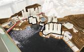
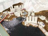
References
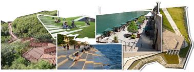
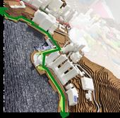





CaseStudy
OPTION 1 OPTION 3 OPTION 3 OPTION 3 OPTION 3 OPTION 2 OPTION 2 OPTION 2 OPTION 1 OPTION 1
2. Jinwan Hall ZHUHAI
EXISTING STRATEGY
STRATEGY 2 STRATEGY 3
1
OPTION 1 OPTION 3 OPTION 1 OPTION 2 OPTION 2 OPTION 2
traffic core and the water
Landscape
Matrix Analysis
















1 ACTIVE WATERFRONT SPACE OPTION 2 HERITAGE REDEVELOPMENT & HIGHLIGHT
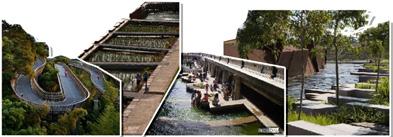
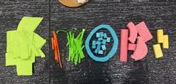
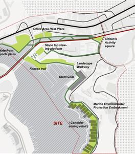
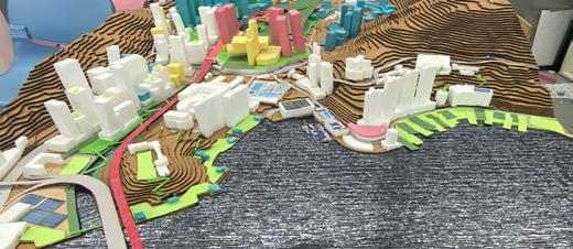
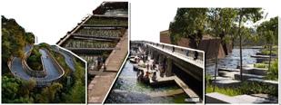
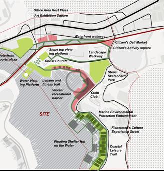
3 ENVIRONMENTAL PROTECTION The vision for the first scheme is an active waterfront space. identified the shortest distance from the subway station to the waterfront space and transformed the swimming pool on this route into a stepped skateboard park so that the view from the subway station can be directly to the waterfront, and at the same time, retail, entertainment, theater, and other functions were placed in the bay adjacent to the park, and a fitness trail was extended along the waterfront with the bay as the core to increase the continuity of the waterfront space. 2D FRAMEWORK VISIONS FOR EACH PART 3D FRAMEWORK EVALUATION Landscape (Mi) Landscape Vol. (Mi) Layout structure (Mi) Layout structure Vol. (Mi) Mix (Mi) Mix Vol. (Mi) Density (Mi) Massing height (Mi) Massing scale (Mi) Local landmark (Mi) Option X Existing Value in Exchange Value in Use MODIFIED GFA CHANGES MODIFIED GFA CHANGES Landscape (Mi) Landscape Vol. (Mi) Layout structure (Mi) Layout structure Vol. (Mi) Mix (Mi) Mix Vol. (Mi) Density (Mi) Massing height (Mi) Massing scale (Mi) Local landmark (Mi) Option X Existing Value Exchange Value in Use The second vision is the revitalization of cultural heritage. marked out the recognizable industries or areas of the site and upgraded and renovated them separately, and then connected them with a landscape trail to enhance the recognition of the whole area. 2D FRAMEWORK VISIONS FOR EACH PART EVALUATION 3D FRAMEWORK MODIFIED GFA CHANGES The third vision is environmental protection will extend and retract the shoreline of the waterfront by means of strips of land, and place stones to create numerous small spaces for microbial colonization, while adding new green areas in different clusters and connecting them with a landscape walkway. 2D FRAMEWORK EVALUATION VISIONS FOR EACH PART 0 1 1 2 2 3 3 4 4 Landscape (Mi) Landscape Vol. (Mi) Layout structure (Mi) Layout structure Vol. (Mi) Mix (Mi) Mix Vol. (Mi) Density (Mi) Massing height (Mi) Massing scale (Mi) Local landmark (Mi) Option X Existing Value in Exchange Value in Use 3D FRAMEWORK 2D COMBINED FRAMEWORK 3D COMBINED OPTION PREFERRED PROGRAMS PROPOSED EVALUATION Landscape (Mi) Landscape Vol. (Mi) Layout structure (Mi) Layout structure Vol. (Mi) Mix (Mi) Mix Vol. (Mi) Density (Mi) Massing height (Mi) Massing scale (Mi) Local landmark (Mi) Option X Existing Value in Exchange Value Use Floating Shelter Hut on the water Water Viewing Platform Steps Skateboard Park Marine Environmental Protection Embarkment PreferencedOption&Evaluation
Option Evaluation OPTION
OPTION
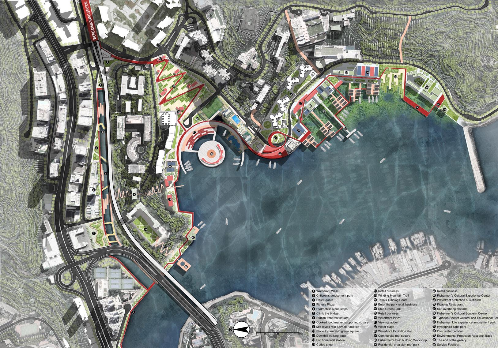
Masterplan
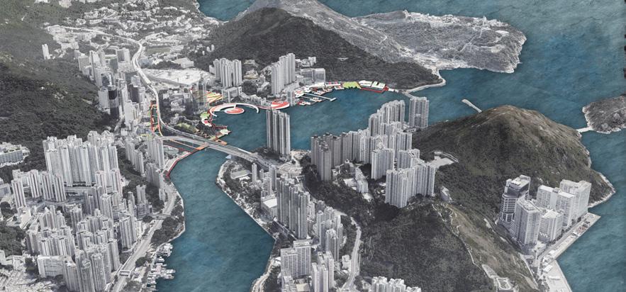


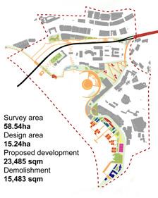




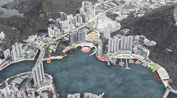
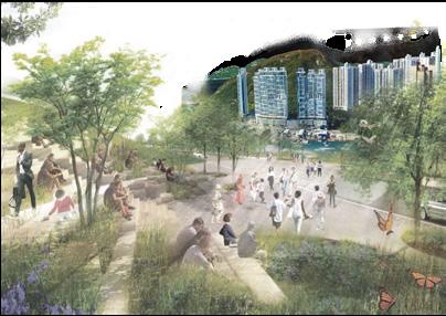
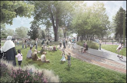
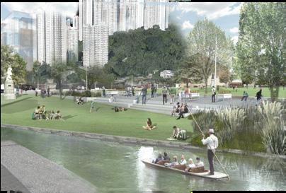
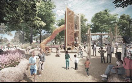
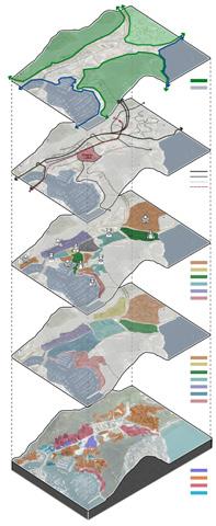
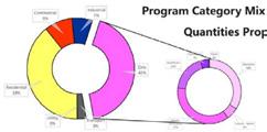
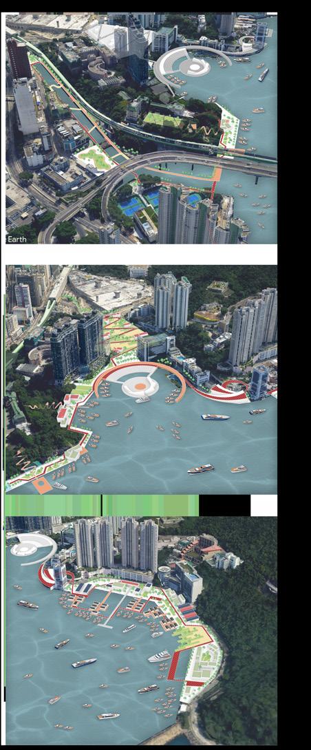
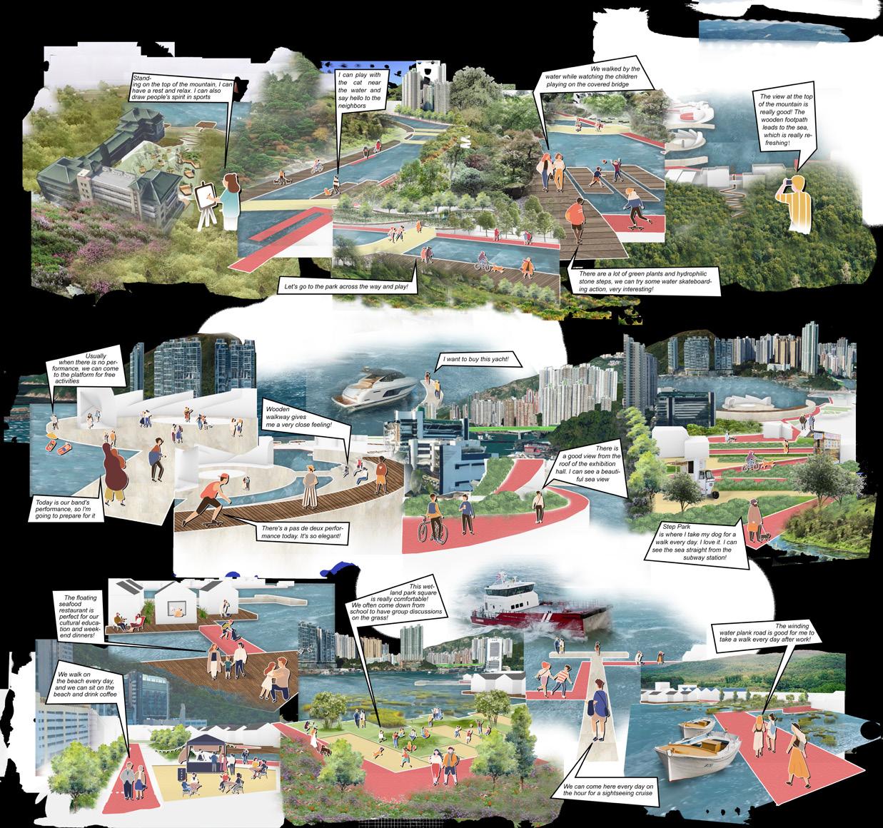
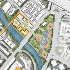
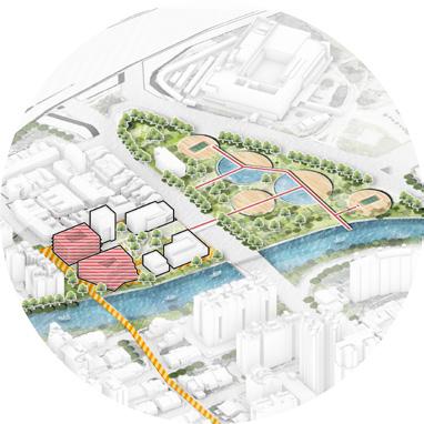
Massing &Volume AerialView Framework DevelopmentVolume Phasing2022-2035 LayersAnalysis HumanScaleView CityScaleView NEW BUILDINGS FUNCTION ANALYSIS LAND USE FUNCTION PROPORTION The design idea follows the previous analysis results and is divided into three areas for design. From the subway station follow the new red corridor to enter the Stepped Park, continue down to the water stage. The stage extends the corridor to the waterfront to ensure the accessibility of the waterfront space. At the same time, the children's amusement wooden bridge is built on the north waterway, supplemented by a small rest park, and the park is connected to the north mountain green corridor. To the south, new educational, entertainment and retail functions will be incorporated to make full use of the existing fisherman's harbor and shipbuilding buildings, which will fully revitalize the waterfront space and attract people. ACTIVE AREA HERITAGE AREA RESERVATION AREA ACCESS TO GREENING ROAD Waterfront Walk Wooden plank road Green axis New construction Preserve the building MTR The road Area of design Family recreation area Commercial vitality area Cultural experience area for fishermen SIMPLE STRUCTURE DRAWING
STEP PARK VIEW
PLAYING PARK VIEW RIVERSIDE OPENSPACE VIEW
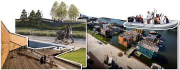
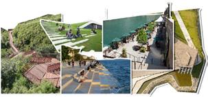
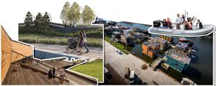
PLAYING PARK VIEW COLLAGERESOURSES:http://livablecitiesstudio.com/projects/ By 2025, wooden walkways and red corridors along the waterfront will be built first, while the first phase of development will be the central bay. Retail and harbor will be built and optimized to attract people to the waterfront. Phase 1 2022-2025 Phase 2026-2030 Phase 2030-2035 By 2030, the reconstruction of the northern family recreational river will be completed, where local residents can enjoy daily entertainment and promote the image of the plot as a strong entertainment. By 2035, the Southern Fishermen's Cultural Experience Street will be completed, and a functional composite block will be formed that is compatible with education, scientific research and cultural innovation. New construction Fun walk Waterfront Walk New green space Wooden plank road
WATERFRONT
FAMILY
KIDS




 KIDS PLAYING WATERFRONT
LEISURE ACTIVE HARBOUR
1 1 7 7 2 2 10 10 11 11 12 12 13 13 14 14 15 15 3 3 8 8 4 4 6 6 5 5 9 9
FISHERMEN HERITAGE STREET
People & Activities BlockView SerialView
02
River Revival Plan
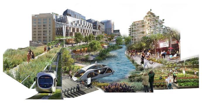
“a sustainable, vibrant, and connective hub and environmental corridor”
Individual Work
CATEGORY: Academic Work | TIME: 2023.02-2023.04
LOCATION: Kallang River, Singapore
TUTOR: Kehrer Jutta Maria
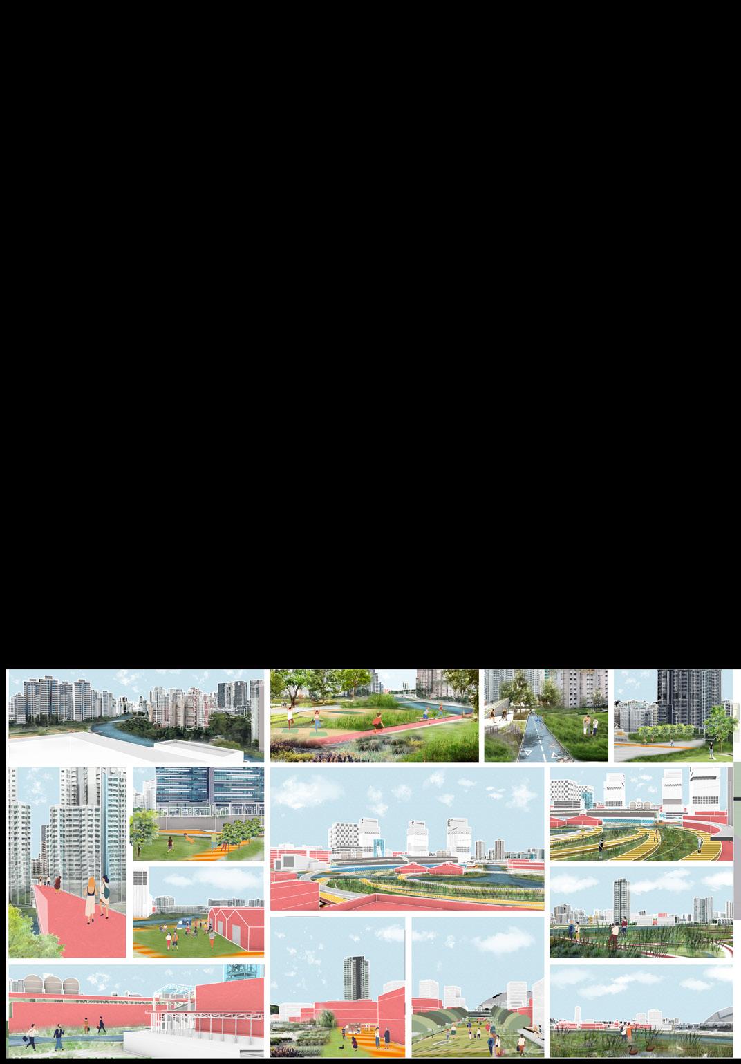
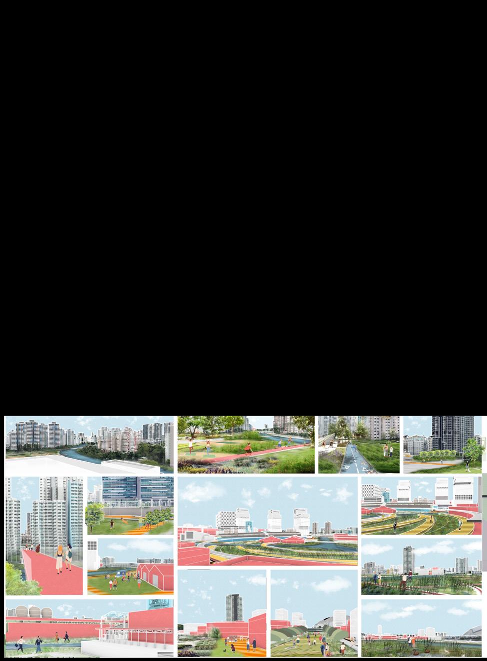
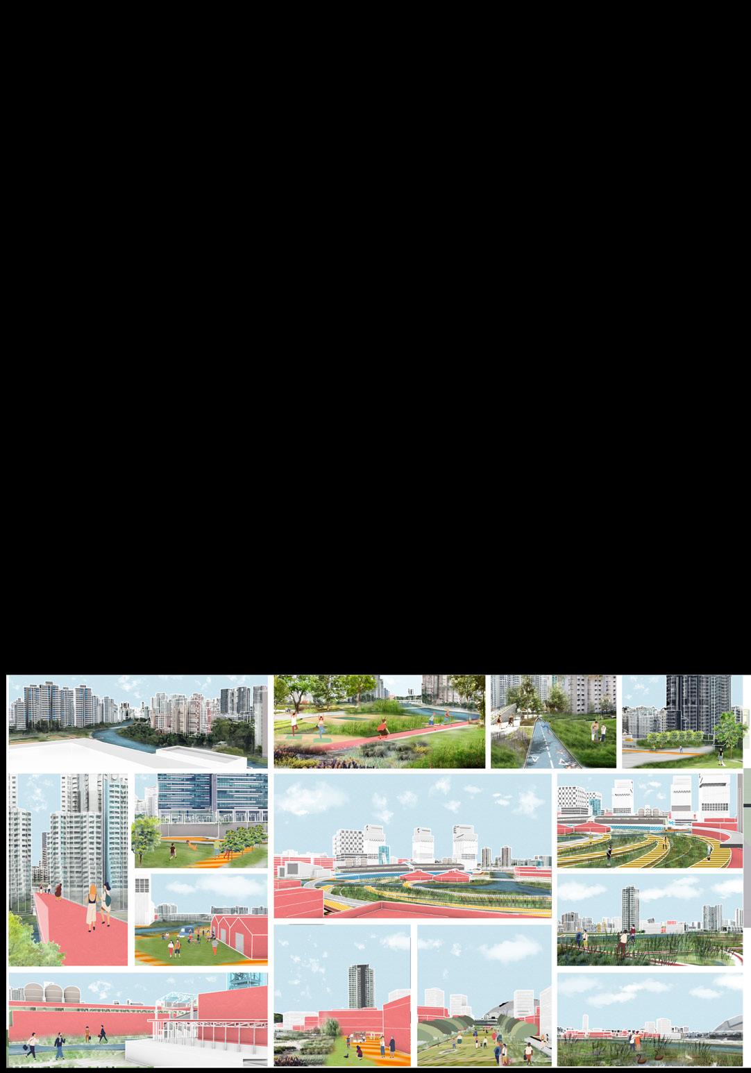
The site is located in the Kallang River, which was historically the second largest industrial area in Singapore, and though it is now closed, the industrial park atmosphere has always been very strong.
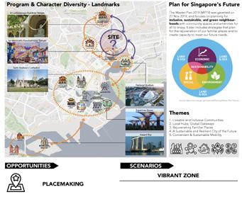
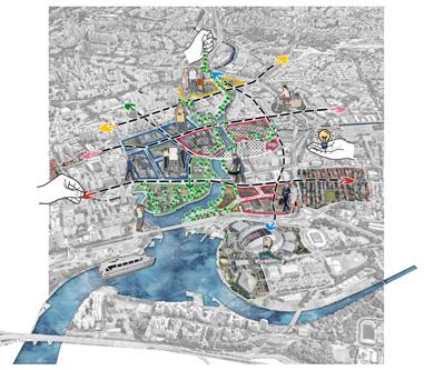
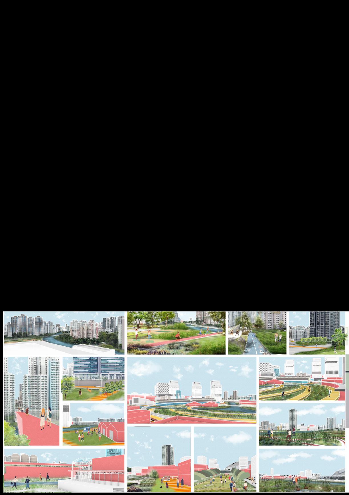
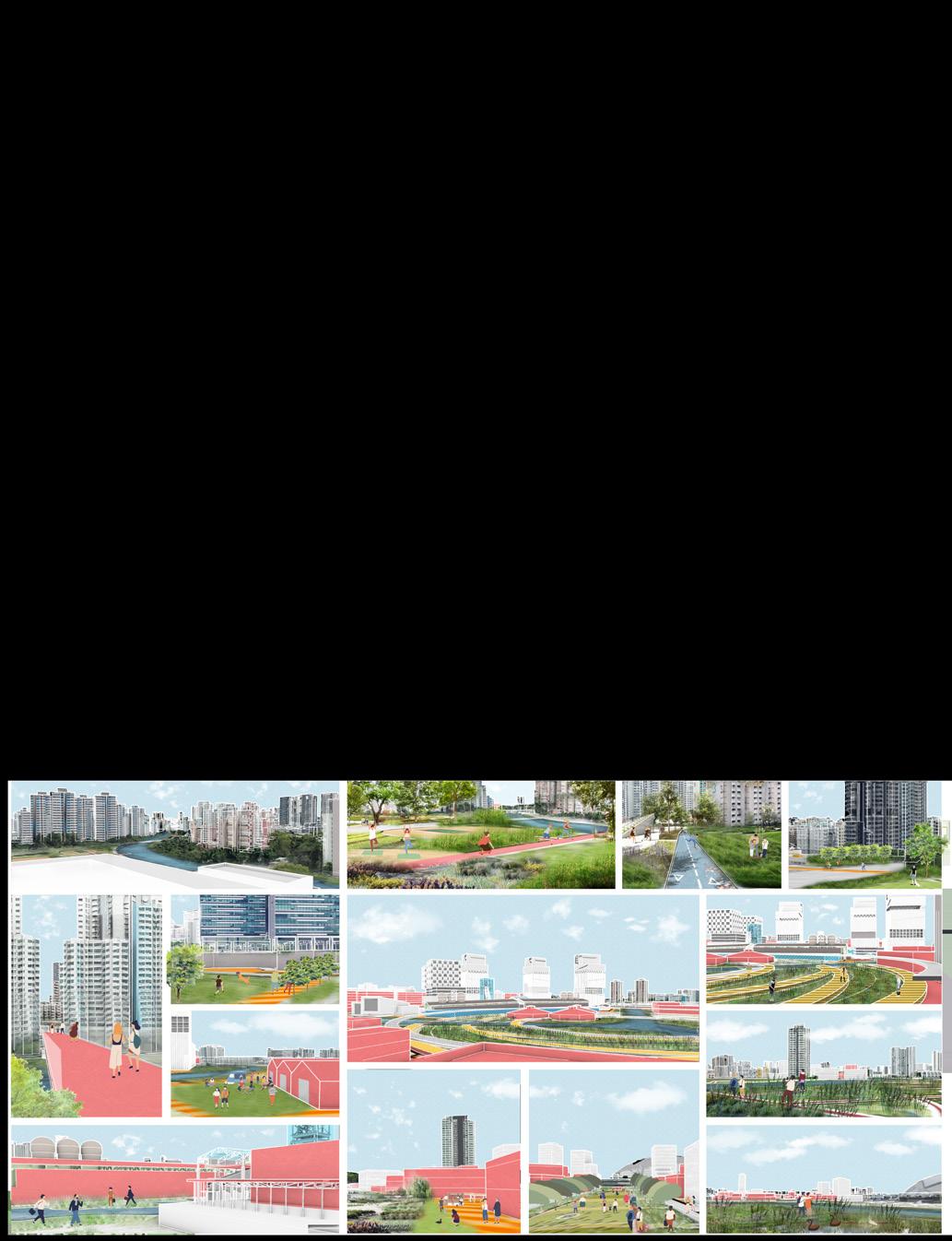
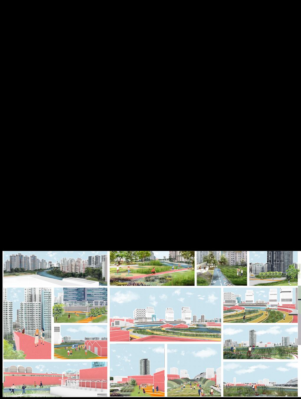
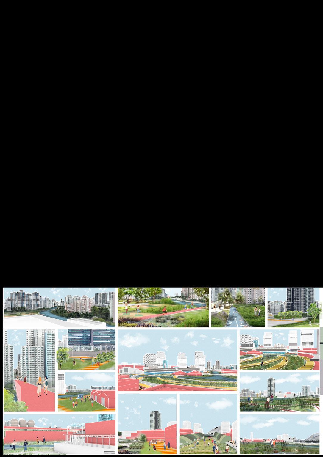
Through the site analysis, I summarized 3 key issues. First is that the site does not fully utilize the river resources and the green space within the site is not connected to the surrounding site green space into a complete system, basically the entire waterfront space within the site is closed with a fence and is not used artificially. The second is that there are few and fragmented slow-moving spaces in the plot, which can be seen in blue, indicating that the accessibility of people is very low. The third is that the site lacks characteristic; the site is adjacent to Singapore Downtown, surrounded by landmarks such as Little India and the International Stadium, but it does not have a signature character itself.
Afterall, I came up with my vision, which is to have three functional areas from north to south and to connect the green areas into a system, and also to add a complete pedestrian system.
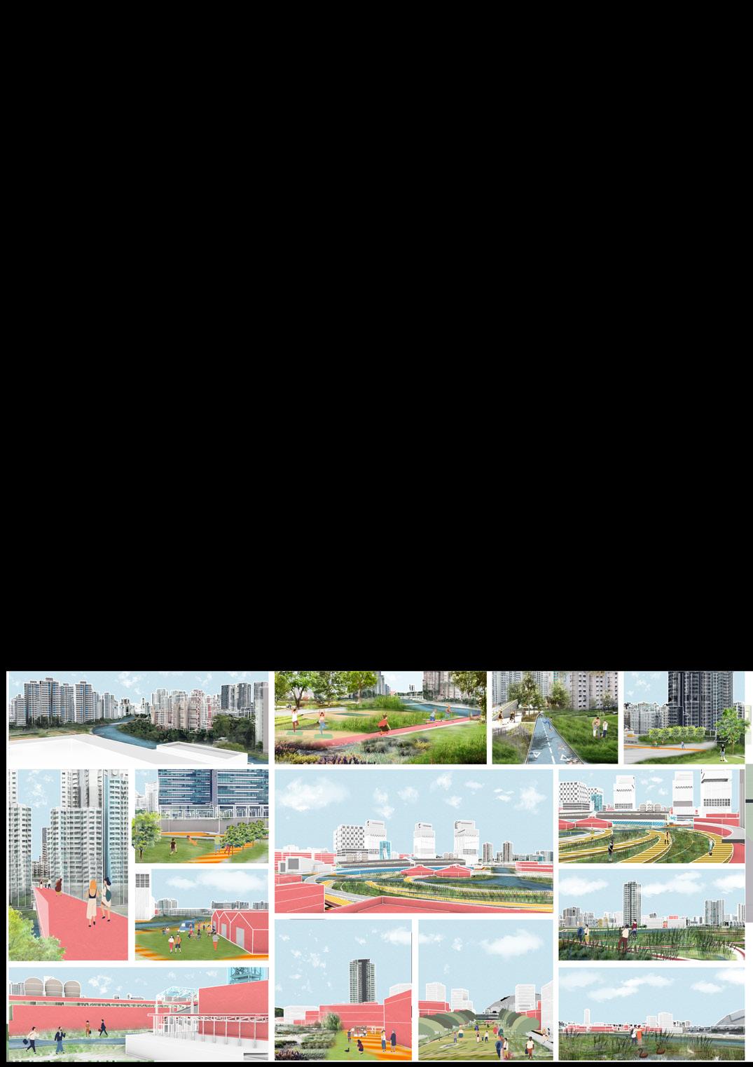
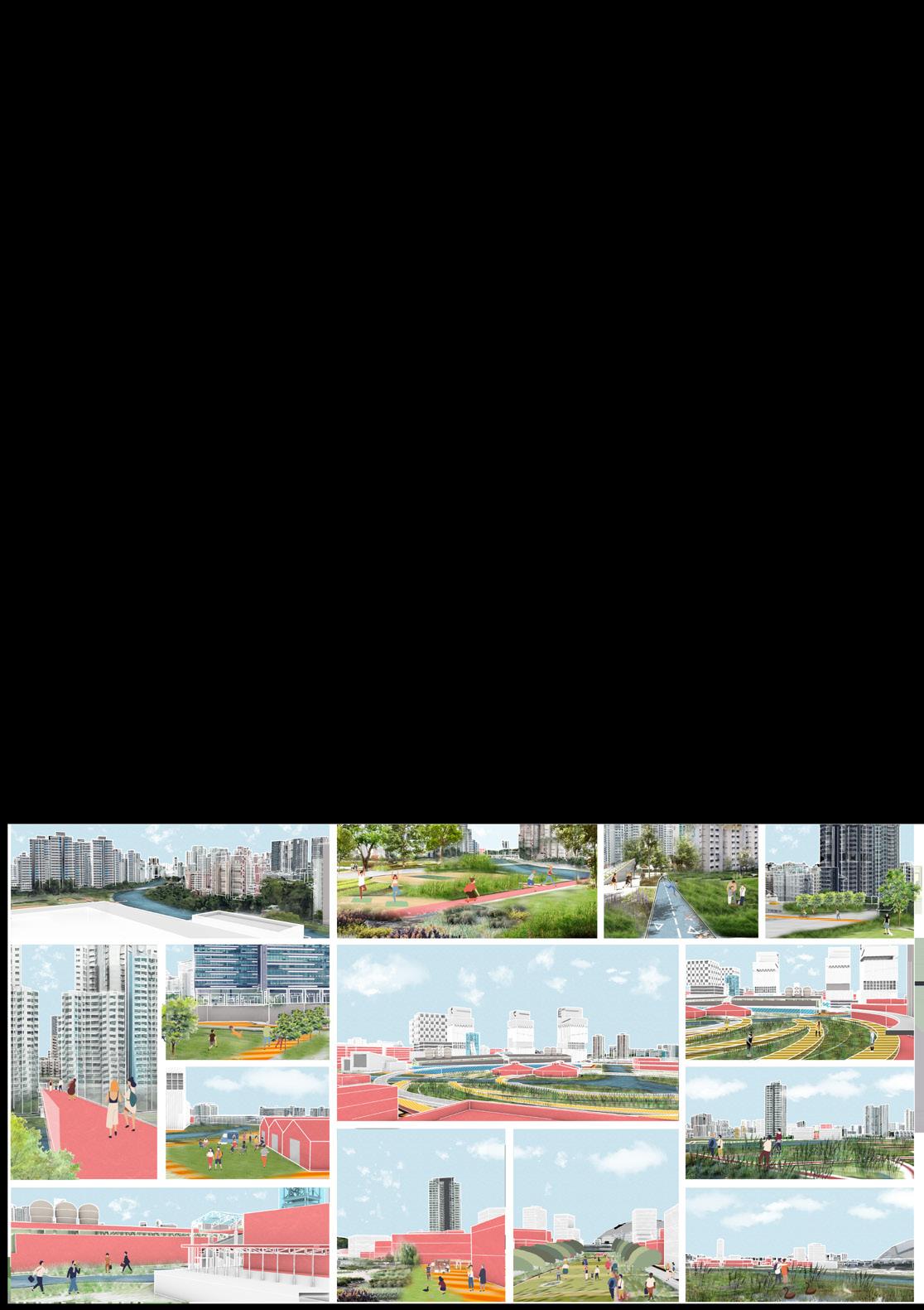
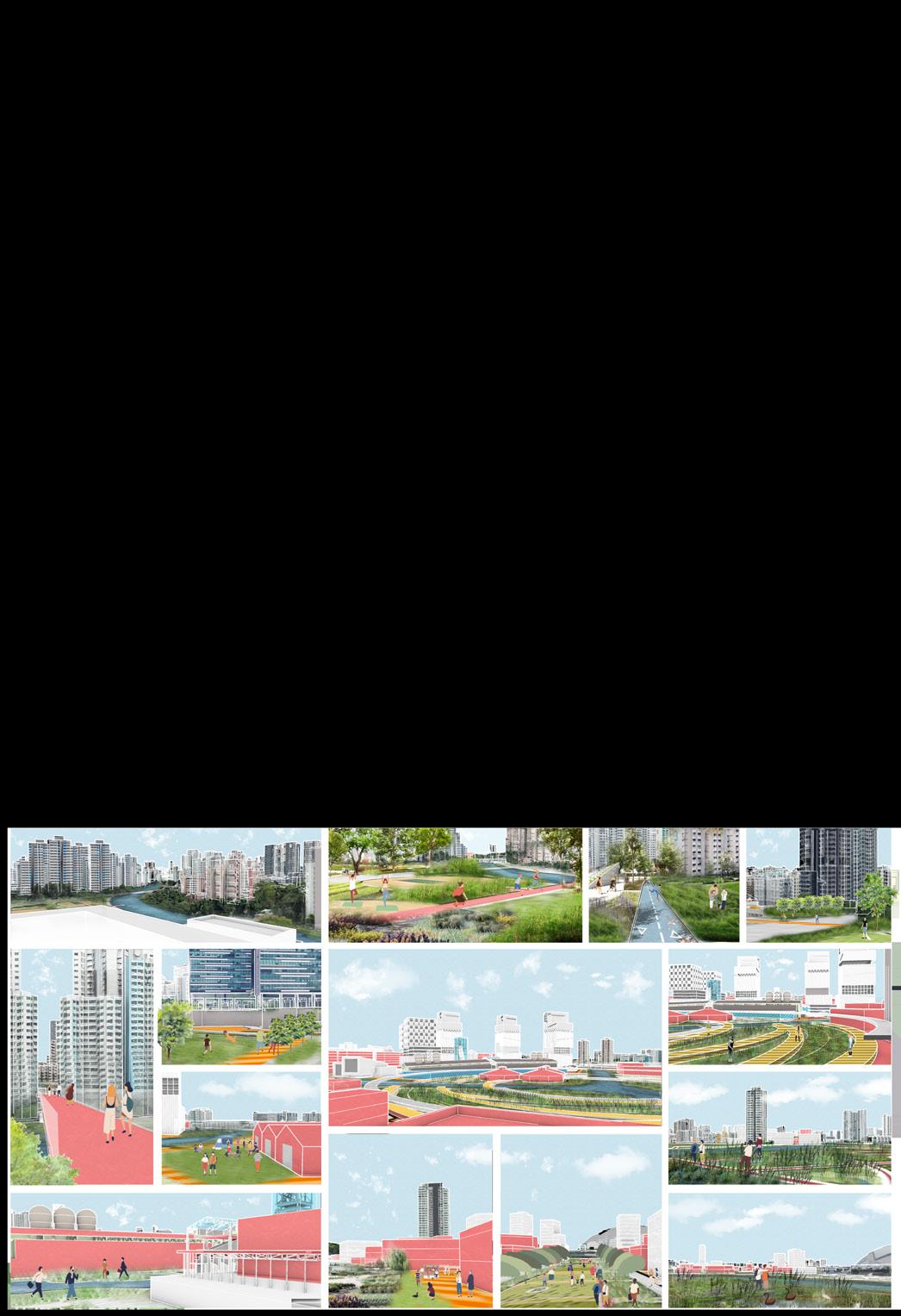
I design a residential activity center and a green park in the north residential area, an urban farm in the central area, and a new technology urban farm R&D office park. In the south I designed two large wetland parks to purify the water and transformed the airport area into a hotel and commercial district.
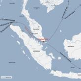

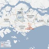

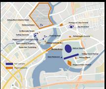

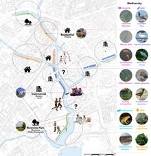

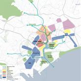
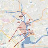

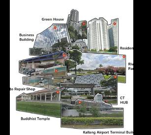


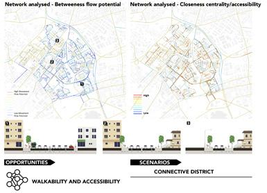

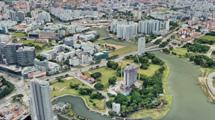
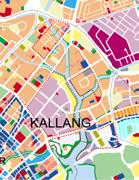
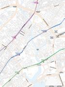
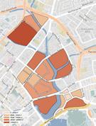


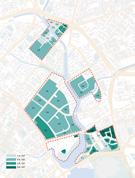

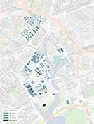


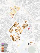

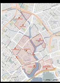
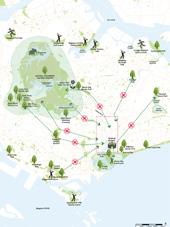

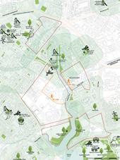
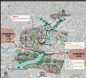





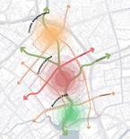
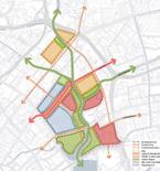
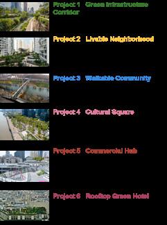

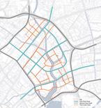
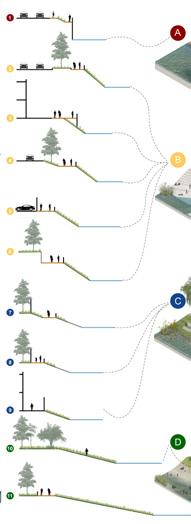


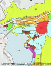
Building Function Building Height Building Function Building Height KALLANG RIVER AROUND HISTORY SITE HUMAN VIEW COLLAGE EXISTING ISSUES Macro Meso Micro URA PLAN 2019 There are many commercial blocks in the east and west of the design plot, and the main functions of the plot are residential areas, business areas, conservation areas and green Spaces Singapore is located at the southern tip of the Malay Peninsula, at the entrance of the Strait of Malacca, adjacent to Malaysia across the Johor Strait to the north, and Indonesia across the Singapore Strait to the south. The base is located in the Central District, positioned as the center of the central financial and business district. The base is located along the Kallang River, northeast of the city center and east of Little India. There are plenty of bus stops throughout the site and three MRT west to east routes going across the site. However, there are no north to south routes, which could be improved in our design. The overall size of the block is large, and there may be problems with the accessibility of the interior of the plot. The FAR in the base is mainly concentrated in 2.2-3.8, and the FAR of the plot in the southeast corner is higher, reaching 4.9. Buildings are generally low, with a concentration of 15-40 meters, some industrial buildings are less than 15 meters high There are many residential buildings in the north of the site, and industrial buildings and business buildings in the south. URA PLAN 2019 Block Size FAR Distribution Building Height Building Function CHALLENGE 2 Disjunctive slow-moving traffic system transportation CHALLENGE 3 Lack of site characteristics CHALLENGE 1 — BLUE Not make full use of the river resources CHALLENGE 1 — GREEN Not in a complete green system Increasing the quality of live by providing citizens more opportunities of nature enjoyment Increasing the quality of live by providing citizens more opportunities of nature enjoyment Increasing the quality of live by providing citizen more opportunities of nature enjoyment Creating a stepped building height from waterfront to the internal area with landmark buildings on the important spots, forming a new image of kallang area Creating a slow-moving transport system(bike lane system and walking system), and multicentre communities. GROUPWORK VISION INDIVIDUAL WORK VISION THREE THEME HUBS VARIOUS FUNCTIONS TWO CONNECTIVE GREEN CORRIDORS MULTI-LEVEL TRANSPORT SYSTEM PROPOSED PROJECTS VIBRANT SUSTAINABLE CONNECTIVE WATERFRONT COMMUNITY SiteLocation StudyAreaHistory&Character SiteChallengesAnalysis SiteConceptMasterplan&Framework RiverSectionAnalysis KeyIssues&Vision StudyAreaImpaceAssessment SITE BACKGROUND & ANALYSIS
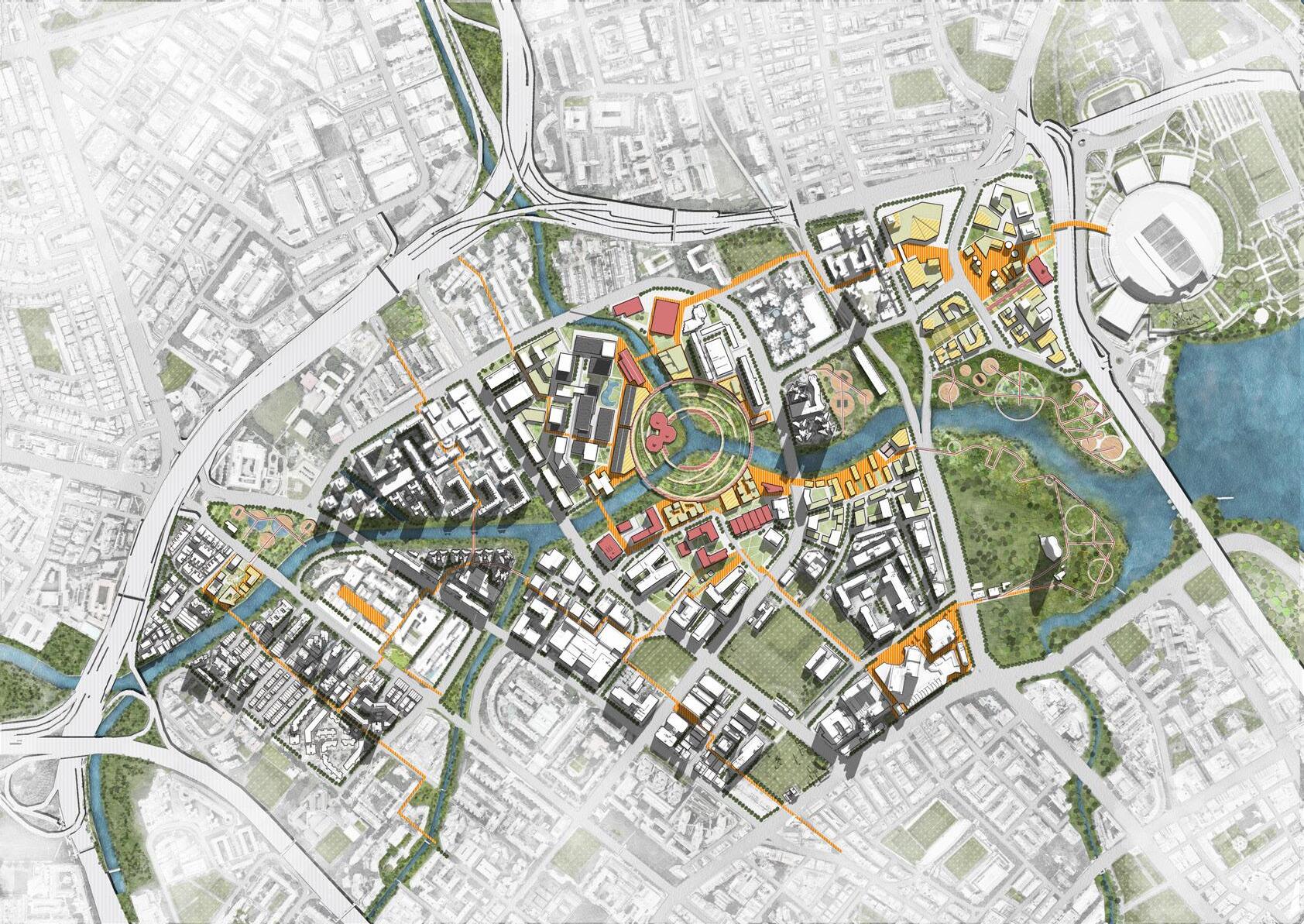
1 2 5 6 7 4 8 9 12 10 11 16 17 18 14 21 28 29 26 31 30 32 33 38 40 41 56 55 47 49 48 51 52 53 50 42 43 44 54 46 45 39 34 35 36 37 25 23 27 22 24 19 20 13 15 3 0 100 250 500 m 33 34 35 36 37 38 39 40 41 42 43 44 45 46 51 52 53 54 55 56 47 48 49 50 Waterfront Sports Park Civic Sports Zone Waterfront Experimental Area Information Technology Office Building Large Shopping Centre Station Square Artistic activity centre Commercial Plaza Hotel shopping centre Cultural and Historical Square Hotel offices Old Airport Building Kallang River Management Office Community Leisure Centre Large waterfront wetland Large Waterfront Activity and Recreation Park Ecological water purification wetland Waterfront Green Corridor Sports Complex Waterfront Recreation Area Water quality testing area Small Rest Park Gymnasium Pedestrian Bridge Community Waterfront Park Football Club Training Ground 1 2 3 4 5 6 7 8 9 10 11 12 13 Riverside Rest Park Ecological Green Space Secondary School Football Pitch Community Activity Green Space Community Vitality Zone Residents' Activity Centre Landscaped Community Leisure Farm Activity space within the community Open Event Plaza Waterfront Green Waterfront Activity Green Elevated pedestrian bridge Office Park Vitality Zone Vibrant retail area entrance Leisure Plaza Transport Technology Office Building Retail Food City Farm Office Building City Farm Office Park Activity Centre Technology and Power Company Retail Leisure Centre Eco-Industry Office Building Kallang River Visual Art Gallery City Farm Crop Processing Plant City Farm Observation Hall Crop Packing Centre City Farm Tourist Education Centre Waterfront Ecological Wetland Community Waterfront Activity Centre Vegetable Farm Waterfront Leisure Plaza 14 15 16 17 18 19 20 21 22 23 24 27 28 29 30 31 32 25 26 LITTLEINDIA NATIONALSTADIUM RESIDENTIALS RESIDENTIALS
Masterplan
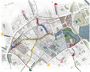
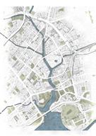
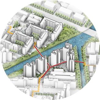
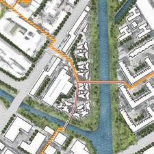
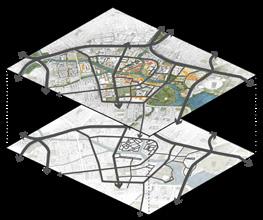
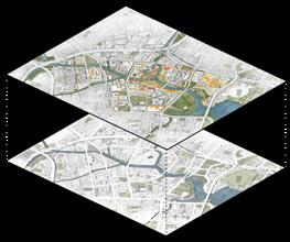

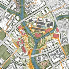
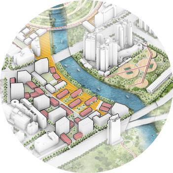
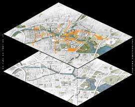


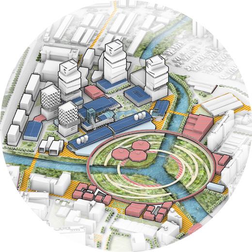

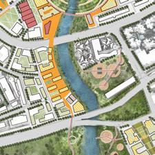

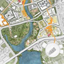
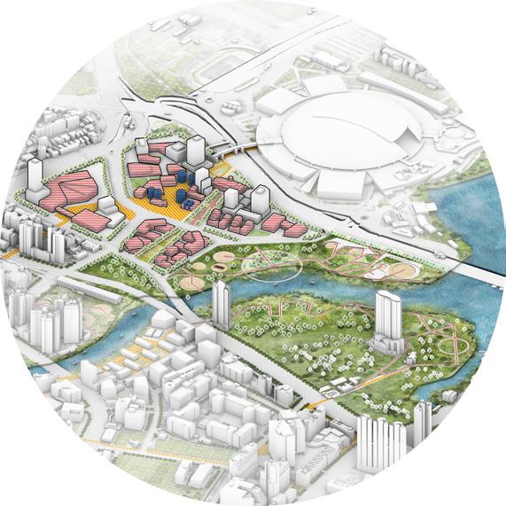

ELEVATED PEDESTRIAN BRIDGE VITALITY ZONE RESIDENTIALS RESIDENTIALS RESIDENTIALS INDUSTRYTRANSPORT AREA RESIDENTIAL WETLAND NATIONALSTADIUM RESIDENTIALS RESIDENTIALS CENTERACTIVITYRESIDENTSRESIDENTIALS R&D INDUSTRYOFFICEAREA RETAIL WATERFRONT STATION PARK INDUSTRY 4.0 OFFICE RIVERPURIFICATION WETLAND PARK RETAIL CULTURALPARK OFFICEOLDAIRPORTBUILDINGHOTEL LEISUREPARK URBAN FARM COMMUNITY CENTER URBAN FARM LAB KALLANG MEMORYARTGALLERY COMMUNITYLEISUREWETLAND PARK BlockViewScale COMMUNITY ACTIVITY AREA RESIDENTIAL VITALITY CORRIDOR UNBAN FARM R&D HUB INDUSTRY 4.0 OFFICE AREA WETLAND PARK CULTURAL RETAIL & HOTEL The site is divided into five plots, starting with a residents' activity centre and a small residents' recreation park from north to south, which will provide an open waterfront open space for residents upstream. The second is a skywalk built between the residential buildings and connected to the plots on the other side of the river, where people can walk between the high-rise residential buildings, increasing accessibility and convenience. The third is an urban farm and supporting research and development offices at the river's trig point. The office buildings in this area are combined with the retained industrial buildings to form a creative park for industrial transformation, embracing the historical flavour of the Garonne River. The fourth is an Industry 4.0 office park with an open pilot site and waterfront retail for staff to relax. The last is a commercial area with a hotel adjacent to the National Stadium. This area retains the old airport buildings and has been designed as a culturally sensitive space where visitors can shop and play and learn about Singapore's history and culture at the same time. ConceptFramework Urban Nodes Massing &Volume The road design reduces the density of the roads, cutting out many minor roads and leaving only the main roads around the commercial buildings and inside the industrial park, leaving more space for recreationalwalking. RoadSystem The green space design section connects the existing surrounding green spaces with green corridors, while the waterfront green space is graded and designed to integrate with the functions of the adjacent areas GreenSystem A vibrant corridor connects the key design areas of the site to the surrounding vibrant nodes and enhances the accessibility of the waterfront public space, allowing different groups of people to get to differentdestinationsmoreeasily VibrantCorridor
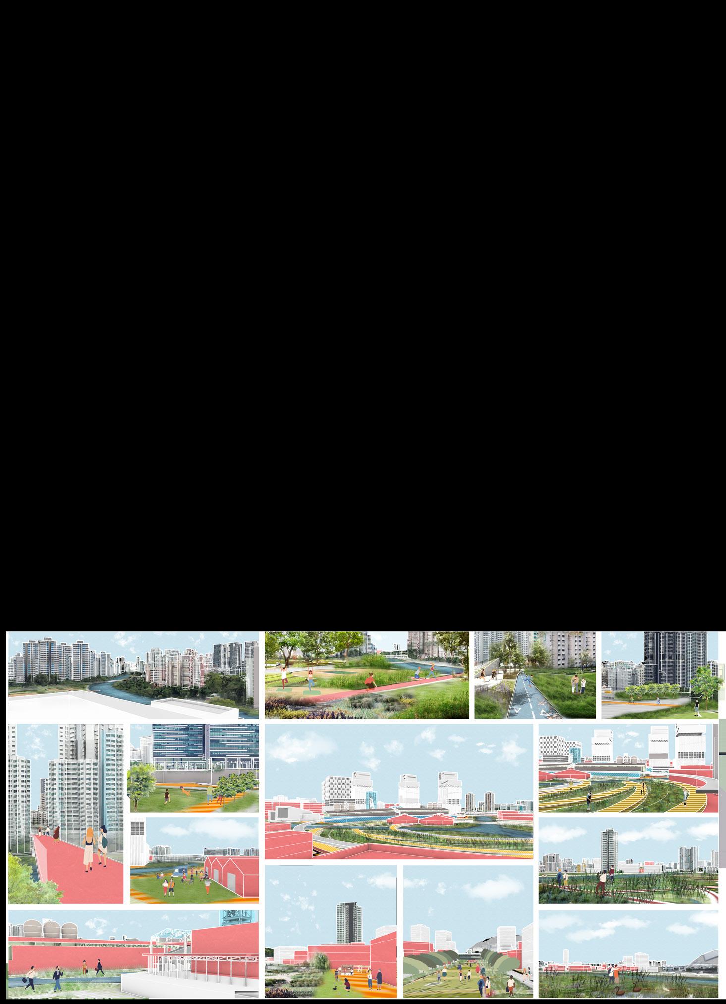
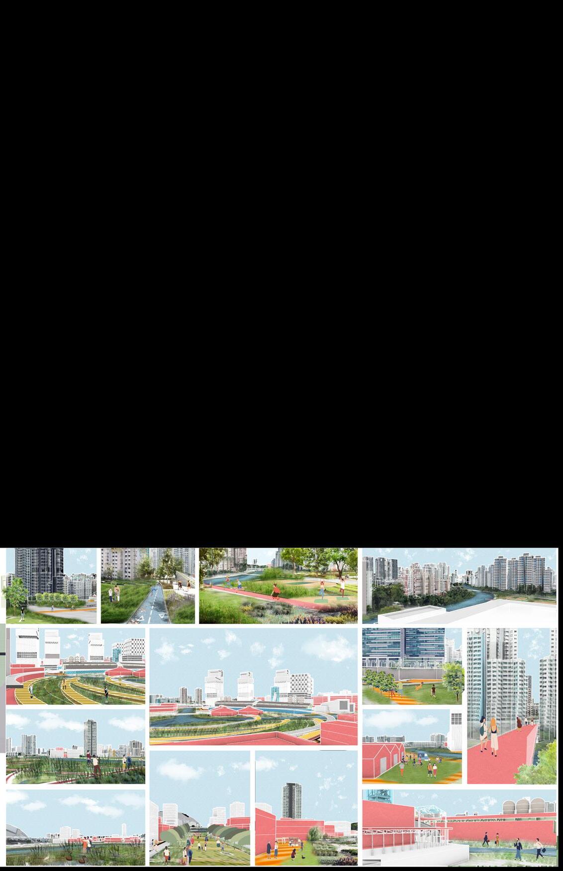

What a great view! can relax here after shopping We have direct access to all areas through this vibrant corridor It's on sale! I can come here every day to rest The urban farm here let me learn a lot of knowledge about crops! Let go to school can walk and play with my dog here every day We are working on an urban farm development The air is sooooo fresh! It s so nice to come here The view on the sky is great work here every da
Whatfactorsaffecttheflexibilityofpublicrealm?
Howtoachieveflexibleopenspacethroughspatialurbanintervention?
LITERATURE REVIEW
Basic factors:
• Permeability
• Versatility
• Legibility
• Reconfigurability
Key factors:
• Positive Outdoor Spaces
• Multimodal Behavior Pattern
• Multifunctional Structures
• Active Frontage
• Fine Amenities
• Facilitate Flexibility of Public realm
• Facilitate Public use
TOOLBOX
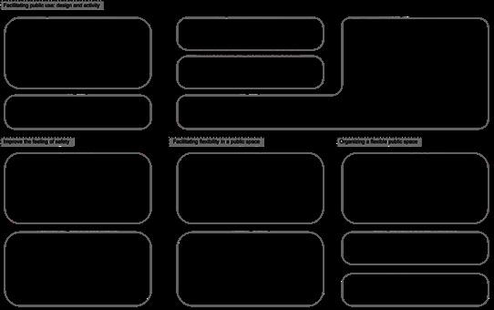
22 tools according to LITERATURE REVIEW
• Improve the feeling of safety
• Facilitating Flexibility of Public realm
• Facilitating Public use: Activity & Design
• Organize flexible public spaces
Key words:
URA PLANNING
• Nano Park System’ Concept
• Exuberant Commercial District
• Walkabilty Strategy
• Street Consolidation
• Quick Proposal for Back Alley & Nano Park
• Land use Analysis
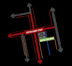
SITE ANALYSIS
• Potential Elements
• Traffic System Analysis
POTENTIAL SPACES SELECTION
The metrics are basic factors from LITERATURE REVIEW
• Permeability —— Number of Entrances & Routes
• Versatility —— Multi-functional uses
• Legibility —— Iconic structures and clear signs
• Reconfigurability —— Space is clean and easy to remodel
CASES STUDY
• City Thread, downtown Chattanooga
• Marathon Plaza, San Francisco
• SPARK Social, San Francisco
• SoFA Pocket Park, San José
• Formosa Pocket Park, Hollywood
• Building Height Analysis
• Building Age Analysis
4 FOCUS NODES DESIGN
• Tools Selection
• Problems & People’s needs
• Diagrams & Framework
• Axonometric Diagram
• Human views
OTHER SUGGESTION
03
Flexibility of Urban realm
Individual Work
CATEGORY: Academic Work | TIME: 2023.05-2023.07
LOCATION: Mong kok, Hong kong, China
TUTOR: Frank Chow
This study was prompted by the realization that, with the rapid population growth of recent years, the load on cities has increased and will continue to do so. Human beings should develop flexible lifestyles to cope with these conditions. Public spaces, especially in high density cities like Hong Kong, are intended to provide respite and bystanders from the hectic urban life, providing a diversity of spaces for people to use.
In my literature review, I found that the topic of flexible design seemed to be gaining popularity, and so I wrote this thesis and provided a toolkit for energizing the public realm through flexible design. The toolkit produces a range of different space typologies, each with different characteristics and matched to urban public spaces with different morphological and functional needs in order to achieve their objectives.
The toolbox was tested in a specific space in a public place in Mongkok West, Hong Kong. There aremanyneglectedpublicspacesthereandtheyareallstruggling,providingavarietyofconditions to test the need for flexible design. Through an analysis of the current state of the site, a comparativeanalysisofallintactpublicspaceswithinthesite,andananalysisofthepossibilitiesof achievingflexibility,combinedwithaspatialanalysisoftheselectedsiteandatoolbox,theauthors chosethreepocketparks,sixurbanbackstreets,andfourstreetspacesasthemaindesignobjects.
Keywords Flexible space, flexibility, public realm, high density city, Hong Kong, Mongkok
the the conceptpolicies however,(Madanipour, 2021).
the towards &
-Carr & Dionisio, 2017 p.3
-Carr & Dionisio, 2017 p.3
a flexible space (Bauer and Reed in Ivers, 2018; Carr & Dionisio, 2017; Sanei et al, 2018).
a flexible space (Bauer and Reed in Ivers, 2018; Carr & Dionisio, 2017; Sanei et al, 2018).
This definition is supported by other authors such as Chris Reed in Ivers (2018) stating that flexible spaces should accommodate for diversity, flexibility adaptability and open-endedness (Ivers, 2018 p.46). This approach would allow for various intensities of use to play out across daily, seasonal and annual cycles whilst promoting change (Ivers, 2018 p.46).
et al. create a comes to conditemporary issues. also temporary turn Neither of happening, but things. over ranging that of
in accommodate for 2018 use to promoting deprovide spacother Studios activainvested in the and (Ivers, programmed ac-
• Strategy: Versatility (Ardeshiri et al, 2016; Carr & Dionisio, 2017; Sanei et al., 2018): Versatility has to do with the different user groups a space can have. Users can range from youth to adults and the elderly. If a place is versatile enough it is accommodating for different behavioral patterns that are distributed between these groups.
This definition is supported by other authors such as Chris Reed in Ivers (2018) stating that flexible spaces should accommodate for diversity flexibility, adaptability and open-endedness (Ivers, 2018 p.46). This approach would allow for various intensities of use to play out across daily, seasonal and annual cycles whilst promoting change (Ivers, 2018 p.46).
Site Analysis & Research
Further principles and strategies that have been identified in the literature have been divided into the two themes, as mentioned be-
Further principles and strategies that have been identified in the literature have been divided into the two themes, as mentioned before and will be elaborated upon in the following sub-chapters.
sub-chapters.
4.2.1 Spatial Oriented
4.2.1 Spatial Oriented
LiteratureReview
Approach: Facilitating flexibility in a public space
Approach: Facilitating flexibility in a public space
The recent work of Bragaglia & Rossignolo (2021) is positioned in the middle of the discussion of temporary urbanism, discussing both the positive and negative aspects. According to the authors the concept of temporary urbanism is linked to self-organized and alternative experiences which take place outside the institutional urban policies & Rossignolo, 2021 p.2). In the last two decades however, temporary uses seem to be increasingly co-opted within city development strategies as new forms of spatial production (Madanipour, 2017; Martin et al. 2020, as cited in Bragaglia & Rossignolo, 2021). Temporary experiences led by local governments are widely celebrated as participatory forms of spatial transformation, but at the same time they are being increasingly criticized for turning towards profit based motifs (Bragaglia & Rossignolo, 2021 p.1-2). Bragaglia &
The recent work of Bragaglia & Rossignolo (2021) is positioned in the middle of the discussion of temporary urbanism, discussing both the positive and negative aspects. According to the authors the concept of temporary urbanism is linked to self-organized and alternative experiences which take place outside the institutional urban policies (Bragaglia & Rossignolo, 2021 p.2). In the last two decades however, temporary uses seem to be increasingly co-opted within city development strategies as new forms of spatial production (Madanipour, 2017; Martin et al. 2020, as cited in Bragaglia & Rossignolo, 2021). Temporary experiences led by local governments are widely celebrated as participatory forms of spatial transformation, but at the same time they are being increasingly criticized for turning towards profit based motifs (Bragaglia Rossignolo, 2021 p.1-2). Bragaglia &
• Strategy Reconfigurability (Carr & Dionisio, 2017; Ivers, 2018; Sanei et al., 2018): Reconfigurability partially plays into the previous principle of flexible elements, but also pertains to the activities that can take place in a public space. Reconfigurability plays into the idea of promoting change over a period of time, allowing for different activities to be hosted during the year.
Carr & Dionisio (2017) also argue that flexible spaces can be designed to benefit and activate a community and the authors provide a regulatory framework for such a space. This idea that flexible spaces can benefit and activate a community is shared between other authors such as Sanei et al. (2018) and Bauer from Aspect Studios in Ivers (2018, p.275-277). Bauer states that for community activation, community buy-in is critical. If the community is invested in a space they should self generate events and programmes for the space. Bauer also warns for over-activation as this can happen and achieve adverse effects, not all places need more activation (Ivers, 2018 p. 176). Success should not depend solely on programmed ac-
1010
• Design principle Fixed and flexible elements (Ivers, 2018; Sanei et al, 2018): A public space can house multiple elements such as furniture and lighting elements. Such elements can be made flexible or fixed in place. Flexible meaning that these elements can be moved around by the public, think of street furniture such as tables and chairs. Fixed elements are those that remain stationary and cannot be moved around, think of certain play furniture, light posts etc. By having a balance between the two a space can invoke interaction with the public.
Carr & Dionisio (2017) also argue that flexible spaces can be designed to benefit and activate a community and the authors provide a regulatory framework for such a space. This idea that flexible spaces can benefit and activate a community is shared between other authors such as Sanei et al. (2018) and Bauer from Aspect Studios in Ivers (2018, p.275-277). Bauer states that for community activation, community buy-in is critical. If the community is invested in a space they should self generate events and programmes for the space. Bauer also warns for over-activation as this can happen and achieve adverse effects, not all places need more activation (Ivers, 2018 p. 176). Success should not depend solely on programmed ac-
• Strategy: Versatility (Ardeshiri et al, 2016; Carr & Dionisio, 2017; Sanei et al., 2018): Versatility has to do with the different user groups a space can have. Users can range from youth to adults and the elderly. If a place is versatile enough it is accommodating for different behavioral patterns that are distributed between these groups.
• Strategy: Versatility (Ardeshiri et al, 2016; Carr & Dionisio, 2017; Sanei et al., 2018): Versatility has to do with the different user groups a space can have. Users can range from youth to adults and the elderly. If a place is versatile enough it is accommodating for different behavioral patterns that are distributed between these groups.
• Strategy: Reconfigurability (Carr & Dionisio, 2017; Ivers, 2018; Sanei et al., 2018): Reconfigurability partially plays into the previous principle of flexible elements, but also pertains to the activities that can take place in a public space. Reconfigurability plays into the idea of promoting change over a period of time, allowing for different activities to be hosted during the year.
Approach: Facilitating public use: design and activity
• Design principle Fixed and flexible elements (Ivers, 2018; Sanei et al, 2018): A public space can house multiple elements such as furniture and lighting elements. Such elements can be made flexible or fixed in place. Flexible meaning that these elements can be moved around by the public, think of street furniture such as tables and chairs. Fixed elements are those that remain stationary and cannot be moved around, think of certain play furniture, light posts etc. By having a balance between the two a space can invoke interaction with the public.
ToolboxForFlexibility
• Strategy: Reconfigurability (Carr & Dionisio, 2017; Ivers,
play out across daily, seasonal and annual cycles whilst promoting change (Ivers, 2018 p.46).
play out across daily, seasonal and annual cycles whilst promoting change (Ivers, 2018 p.46).
activities in a public space need to be organized and planned on a calendar, some events just take place right then and there. A flexible public space should account for this possibility. This also accounts for day to day use of a public space.
Approach: Facilitating public use: design and activity
Approach: Facilitating public use: design and activity
• Design principle: Fixed and flexible elements (Ivers, 2018; Sanei et al, 2018): A public space can house multiple elements such as furniture and lighting elements. Such elements can be made flexible or fixed in place. Flexible meaning that these elements can be moved around by the public, think of street furniture such as tables and chairs. Fixed elements are those that remain stationary and cannot be moved around, think of certain play furniture, light posts etc. By having a balance between the two a space can invoke interaction with the public.
• Strategy Reconfigurability (Carr & Dionisio, 2017; Ivers, 2018; Sanei et al., 2018): Reconfigurability partially plays into the previous principle of flexible elements, but also pertains to the activities that can take place in a public space. Reconfigurability plays into the idea of promoting change over a period of time, allowing for different activities to be hosted during the year.
Carr & Dionisio (2017) also argue that flexible spaces can be designed to benefit and activate a community and the authors provide a regulatory framework for such a space. This idea that flexible spaces can benefit and activate a community is shared between other authors such as Sanei et al. (2018) and Bauer from Aspect Studios in Ivers (2018, p.275-277). Bauer states that for community activation, community buy-in is critical. If the community is invested in a space they should self generate events and programmes for the space. Bauer also warns for over-activation as this can happen and achieve adverse effects, not all places need more activation (Ivers, 2018 p. 176). Success should not depend solely on programmed ac-
Carr & Dionisio (2017) also argue that flexible spaces can be de signed to benefit and activate a community and the authors provide a regulatory framework for such a space. This idea that flexible spac es can benefit and activate a community is shared between other authors such as Sanei et al. (2018) and Bauer from Aspect Studios in Ivers (2018, p.275-277). Bauer states that for community activa tion, community buy-in is critical. If the community is invested in a space they should self generate events and programmes for the space. Bauer also warns for over-activation as this can happen and achieve adverse effects, not all places need more activation (Ivers, 2018 p. 176). Success should not depend solely on programmed ac
4.3 Tactical Urbanism
a space they should self generate events and programmes for the space. Bauer also warns for over-activation as this can happen and achieve adverse effects, not all places need more activation (Ivers, 2018 p. 176). Success should not depend solely on programmed ac1010
• Design principle: Permeability and the right to choose (Ardeshiri et al, 2016; Ivers 2018; Sanei et al., 2018): Permeability is the ability to select how users approach, access and engage a space, how a user can have the choice of how to move through a space.
• Strategy: Segmentation of different activities (Ivers,2018; Sanei et al., 2018): When designing a flexible public space it should be considered that certain activities should be segmented. For example a football game cannot take place on the same field a picknick is being hosted. Such activities should be separated to a degree. This does not mean putting up high borders between the activity spaces, but consideration as to where what activity can take place in the design process.
• Design principle Permeability and the right to choose (Ardeshiri et al, 2016; Ivers 2018; Sanei et al., 2018): Permeability is the ability to select how users approach, access and engage a space, how a user can have the choice of how to move through a space.
• Design principle: Design for unscheduled uses (Ardeshiri et al, 2016; Carr & Dionisio, 2017; Ivers, 2018): By designing for unscheduled use public spaces should allow users to show up unannounced and activate/participate in the space. Not all
• Design principle Design for unscheduled uses (Ardeshiri et al, 2016; Carr & Dionisio, 2017; Ivers, 2018): By designing for unscheduled use public spaces should allow users to show up unannounced and activate/participate in the space. Not all
• Design principle Legibility (Ardeshiri et al, 2016; Ivers 2018): Legibility of a space means how easily it can be recognized how a space can be used. Highly graphic elements allow users to see how a space can be used and activated. As an example brightly colored seating elements invite lingering, whilst interesting play furniture invites playfulness.
4.2.2 Process Oriented
In their work Carr & Dionisio (2017) propose a framework for creating flexible spaces that is minimally regulated, reconfigurable
• Strategy: Reconfigurability (Carr & Dionisio, 2017; Ivers,
Approach:
FourSelectedNodes
Both the works of Lydon & Garcia (2015) and Silva (2016) delve into the subject of tactical urbanism and argue for the active involve ment of citizens in the process. Therefore it is a good addition to support the topic of process oriented strategies and principles. Tac tical urbanism is a movement that provides an approach to neigh borhood building and activation using able interventions definition by stating that the key themes of tactical urbanism are scalable, zen’s involvement
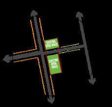
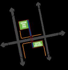
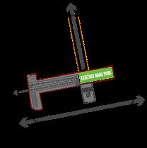
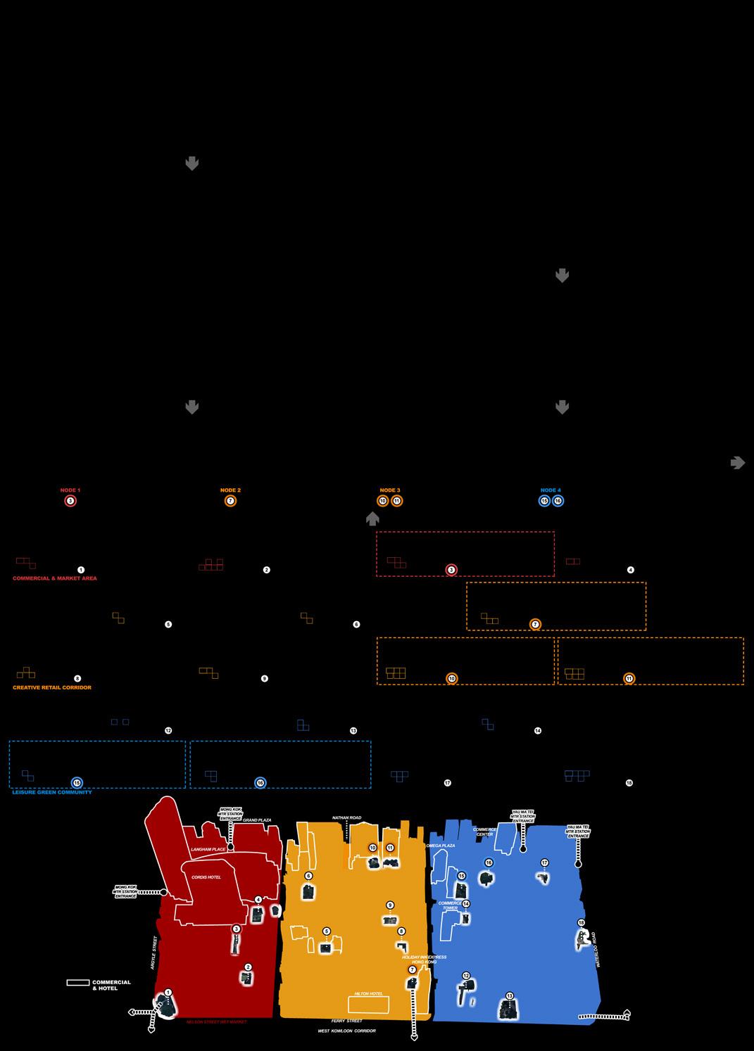
I chose a total of 18 existing stand-alone and designed pocket parks and small green spaces as my study sites, because they comply with the government's plan and have a larger area that can have a greater impact on the surrounding neighborhood, and it would be more efficient to renovate them than to renovate other fragmented spaces.The criteria for measuring whether they have more potential as flexible spaces are the four basic conditions mentioned from the literature review.At the same time, I think that the flexible space will be different in the zones with different characteristics, so I plan to choose one or two nodesineachofthethreezonesanddesignthemseparately.SoIsiftedthemintothreegroupsbyzones
Tactical urbanism is used by a range of stakeholders, including governments, business and non-profits, citizen groups and individ uals (Lydon & Garcia, 2015 p.26). It makes use of open and iter ative development processes, the efficient use of local resources, and the creative potential unleashed by site specific (social) interac tions (Lydon & Garcia, 2015 p.26).
Both works also argue that it is these local actors that are able to spot’ become part of the process and solutions report something (Lydon & Garcia, 2015; Silva, 2016). This is of course in line with the ideas put forward by Carr & Dionisio (2017).
As can be seen from the works of Lydon & Garcia (2015) and Sil va (2016) the ideas they present can be related to those that have been presented in the flexible spaces section above. Especially the community activation focus is interesting and by having locals be the source of this activation, the needs of the community can be easily reflected in activities, events and amenities. By nature tactical urbanism interventions are fleeting and short lived, however for the needs and activation of a flexible space this can be a good fit. Tacti cal urbanism, as well as flexible spaces benefit from including local history, (spatial) conditions and resources. Thus interventions often become very site specific.





a totemporary issues. also temporary turn of but over ranging of in for 2018 to promotingprovideother Studios
in the and
in
-
(Ivers,
fore
and will be elaborated upon in the following
of but of
provide
other Studios
in
-
in for 2018 to promoting -
-
-
the and (Ivers,
and daily uses of a community should be made possible in
Reed
impromptu
not 2015 the
focused
1010
brated as participatory forms of spatial transformation, but at the same time they are being increasingly criticized for turning towards profit based motifs (Bragaglia & Rossignolo, 2021 p.1-2). Bragaglia & 11
Key Nodes Design Process
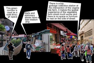
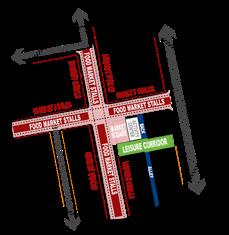
Node1 ActiveMarketArea
PEOPLE'S NEED
TOOLS SELECT


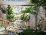
placed the temporary stalls leaning on both sides in the middle of the street to create two sides as the main flow, relocated the dump station to the main curb in the area, and redesigned the existing corridor park.
SELECTED ELEMENTS
· FINE AMENITIES
· ACTIVE FRONTAGE
· POSITIVE OUTDOOR SPACES
· MULTIFUNCITONAL STRUCTURES
· SPACES WITH MULTIMODAL BEHAVIOR PATTERN
HUMAN VIEW

Node2 TransportationRecreationArea
PEOPLE'S NEED
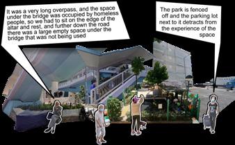
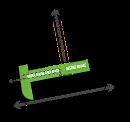
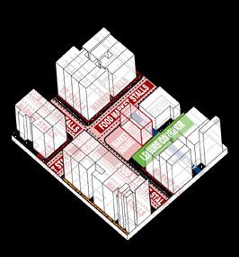
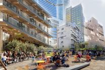
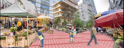
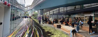
Stepped urban furniture will be arranged under the bridge so that people can freely choose to engage in different activities, as well as creating a greener and more natural environment for the community.
SELECTED ELEMENTS
· FINE AMENITIES
· ACTIVEFRONTAGE
· POSITIVEOUTDOORSPACES
· MULTIFUNCITONAL STRUCTURES
· SPACESWITHMULTIMODALBEHAVIORPATTERN
HUMAN VIEW
Node3 CommunityActivityArea
PEOPLE'S NEED
PEOPLE'S NEED
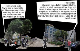
Node4 Commercial&LeisureArea
PEOPLE'S NEED
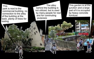


FRAMEWORK
TOOLS SELECT TOOLS SELECT
FRAMEWORK


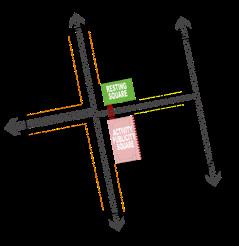
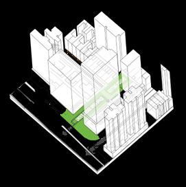
AXONOMETRIC DIAGRAM
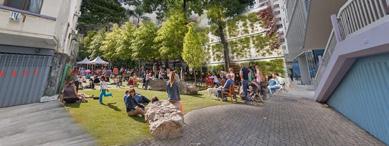
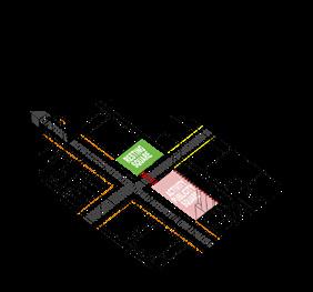
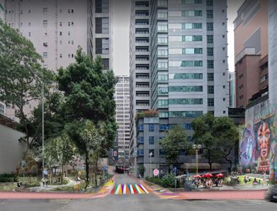
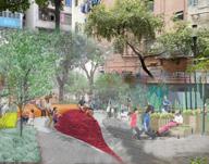
The park to the north will become a community plaza with facilities for children.
The space to the south will provide tables and chairs for relaxation and will be integrated with the adjacent building facade.
SELECTED ELEMENTS
· FINE AMENITIES
· ACTIVEFRONTAGE
· POSITIVEOUTDOORSPACES
· MULTIFUNCITONALSTRUCTURES
· SPACES WITH MULTIMODAL BEHAVIOR PATTERN
HUMAN VIEW

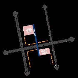
AXONOMETRIC DIAGRAM
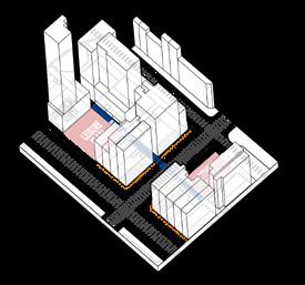
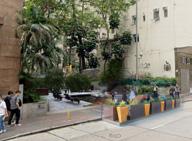
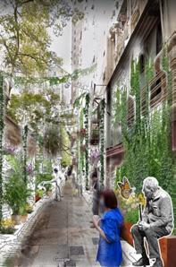
The back alley will have some fixed seating against the wall and greenery to accommodate people, a park with more open views at the intersection will have facilities for children to play, and another will primarily serve the elderly.
SELECTED ELEMENTS
· FINEAMENITIES
· ACTIVE FRONTAGE
· POSITIVEOUTDOORSPACES
· MULTIFUNCITONAL STRUCTURES
· SPACESWITHMULTIMODALBEHAVIORPATTERN
HUMAN VIEW
TOOLS SELECT


 FRAMEWORK
AXONOMETRIC DIAGRAM
AXONOMETRIC DIAGRAM
FRAMEWORK
FRAMEWORK
AXONOMETRIC DIAGRAM
AXONOMETRIC DIAGRAM
Retro Game Block
Individual Work
CATEGORY: Academic Work | TIME: 2020.05-2020.07
LOCATION: Dalian City, Liaoning Province, China
TUTOR: Chunzi Liu, Bin Luan
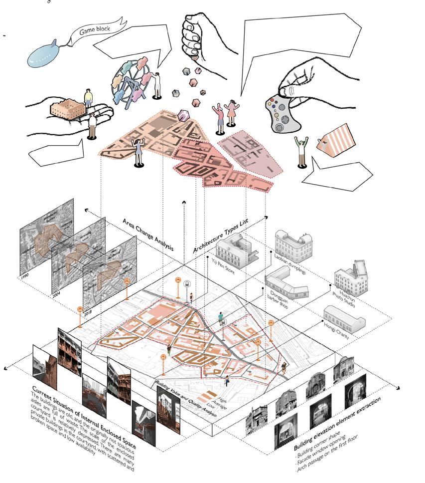
Dongguan Street is a historical block located in the central area of Dalian city. It was a Chinese residential area in Dalian during the colonial period of Japan and tsarist Russia. It was also a prosperous area with frequent commercial and trade exchanges at that time. Many famous chambers of commerce at that time opened shops and workshops in Dongguan Street. Chinese Communists also set up many anti Japanese strongholds in this prosperous area to obtain information. However, with the founding of new China, the role of Dongguan Street has been gradually replaced by the new urban agglomeration. Up to now, Dongguan Street is being invaded by the surrounding urban agglomeration bit by bit, facing the risk of demolition.
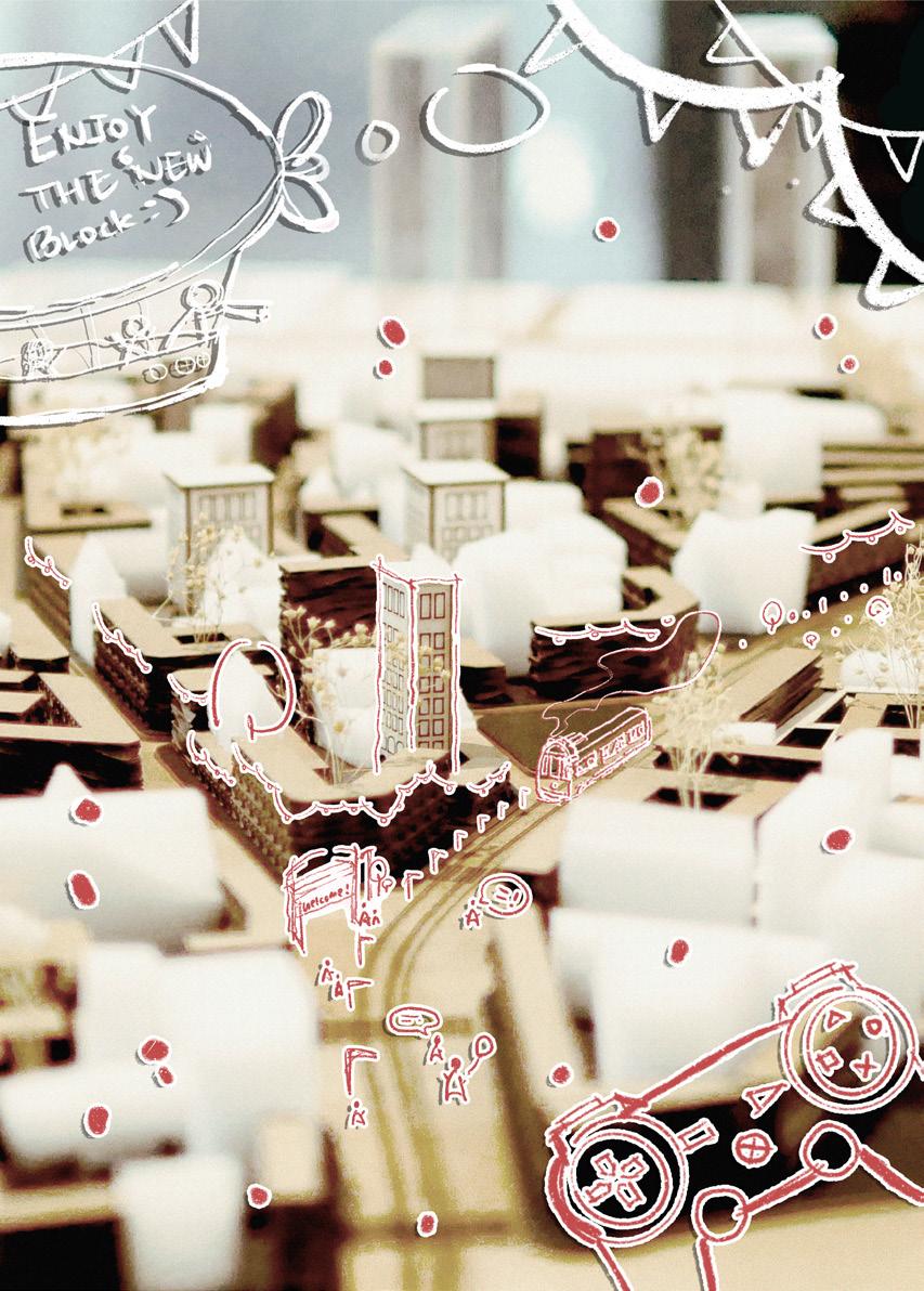
This design will investigate the functions of various shops and interesting and valuable historical events in the most prosperous period of Dongguan Street. On the basis of retaining the buildings with high retention and unique shape in each block as much as possible, the new building and game functions will be added, and the sorted historical events will be connected with the game functions to form a game block with multiple game routes, life routes and work routes, And transform the space above one floor inside the old building into a cheap office rental space, hoping to revitalize Dongguan Street and keep up with the pace of urban development.
04
History Analysis
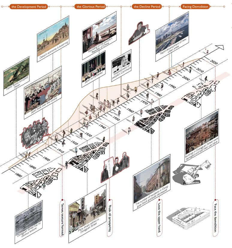
Dongguan Street was a gathering place for Chinese people during the colonial period of tsarist Russia and Japan. Many anti Japanese heroes and the most powerful chamber of commerce at that time gathered here.However, with the founding of new China and the rapid development of new cities, Dongguan Street is gradually forgotten and facing the crisis of demolition
Dongguan Street was a gathering place for Chinese people during the colonial period of tsarist Russia and Japan. Many anti Japanese heroes and the most powerful chamber of commerce at that time gathered here However, with the founding of new China and the rapid development of new cities Dongguan Street is gradually forgotten and facing the crisis of demolition.
Site Analysis
Site Analysis
DongguanTimeline


I am free to explore game clues and get rewards !
protect them ! We should
Dongguan Street is located in the center of Dalian City, surrounded by Dalian high-speed railway station and bus passenger station It is an area where people gather. In recent 30 years, the area of Dongguan Street has been reduced by nearly half. Most buildings in the area surround the central courtyard along the plot, with rich building facades
Dongguan Street is located in the center of Dalian City, surrounded by Dalian high-speed railway station and bus passenger station . It is an area where people gather. In recent 30 years, the area of Dongguan Street has been reduced by nearly half. Most buildings in the area surround the central courtyard along the plot, with rich building facades
There are many places to play in the venue. We can change our clothes and participate in theater activities !
We can camp!
HISTORY ANALYSIS
AbstractFormofBlocks
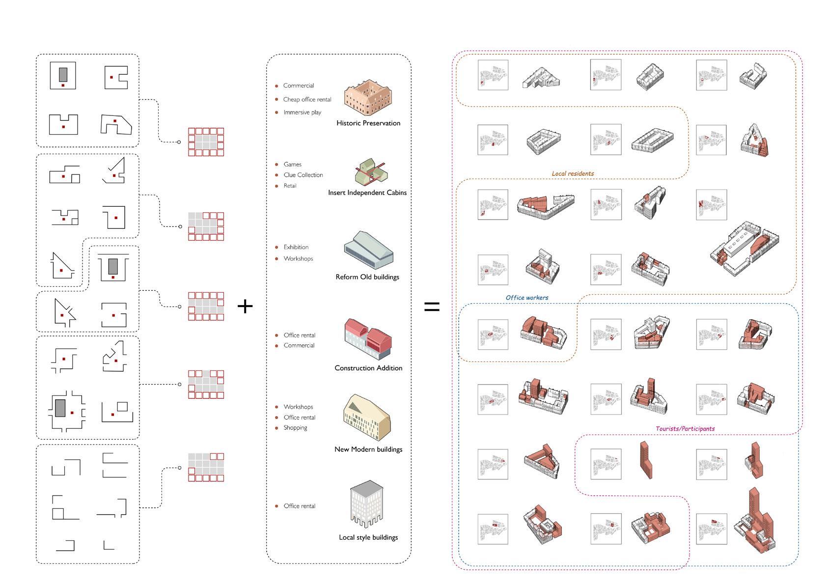
Fully Enclosure
Entrance is hollowed out on the first floor

One Corner Opening
The entrance is single and the courtyard is private

Passage Corridor
For passage or short stay
Multiple Openings
The entrance is narrow, and the courtyard space can be used for long stay

Fully Open
The courtyard space is completely open
& Combination of Architectural Forms
Classification
NewbuiligingsTypes BlockTypologies
TheFinalFormofBlocks
Overall Performance of The Retro Game Block
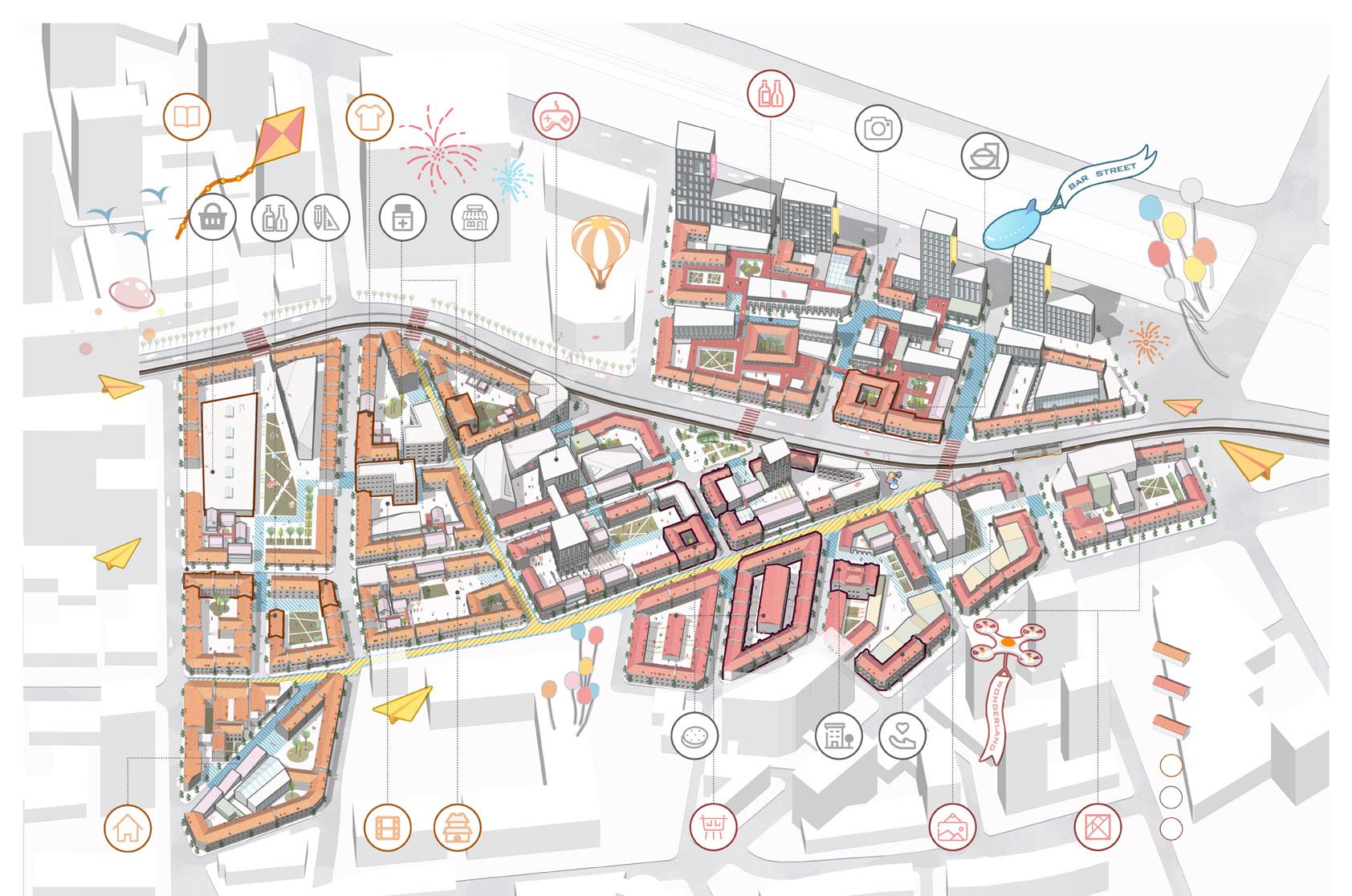


(RETAIN)
Living Block
(RETAIN)
Game Block
(RETAIN)
Business & Bar Block (NEW)
Functions of Living (NEW)
Functions of Game (RETAIN)
Functions of Cultural Reservation
Xigang Market Qingquan Tavern Yiji Pen Store
Public Bookstore Dressing Experience Store
Immersive Game Blocks
Bar Street Changjiang Photography Agency
Taoyuan Village Restaurant
Cultural & Creative Workshops
Art Exhibition Hall
Cultural
Antique Culture Street
Dongguan Theater
Chengxinghe Pastry Shop
Transportation Hotel Hongji Charity
B & B
Kant Renyu Company
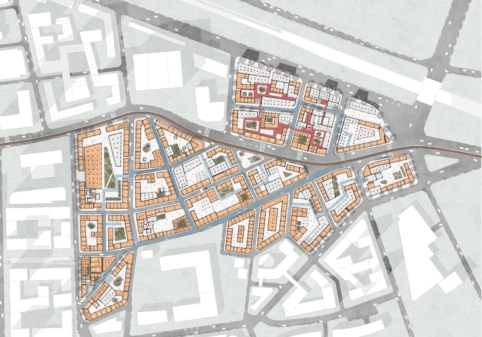
1 1 2 2 3 4 4 5 5 6 6 7 7 8 8 9 9 10 10 11 11 12 12 Office Area Corridor Bridge Arch Leisure Square
View of Office Street Shooting Scene Street Intersection Office Leisure Corridor Xigang Market High Altitude Corridor View Street Corner Between Blocks Game Activity Block Central Green Square Children's Playing Block Ground Floor Plan N 0 10 50 100m
Aerial
Display of Four Group Routes
Office workers can avoid the flow of people in cultural blocks through corridor bridges connecting different buildings, and can see the operation of each block in the building
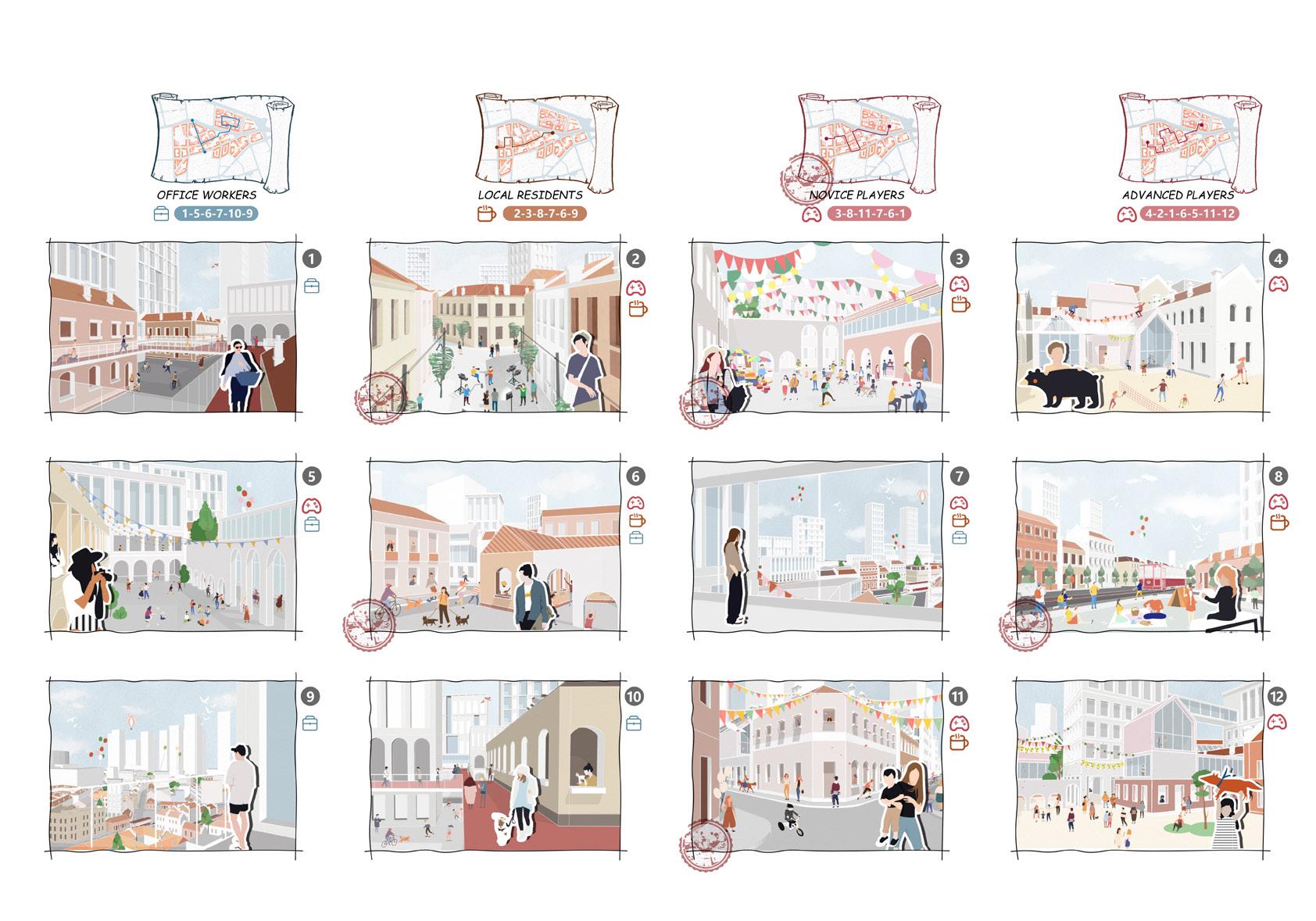
Local residents can meet their daily needs in the living block, or participate in the activities of the game block during the festival Of course, they can also set up shops in the block
Novice players explore famous architectural attractions according to the map, and get a postmark after arriving at each location. Collecting all postmarks can be exchanged for a souvenir of Dongguan Street
High level players can first enter the clothing street to change clothes and go to each small scene to explore the plot At the same time, there are hidden clues waiting to be found in different blocks
Located in bar street, it is used for work, commuting and residents' leisure activities during
Take cultural protection buildings as the shooting background for film shooting
The daily sale of fruits and vegetables can also be used as a holiday market area
It is composed of a small activity square and a game house. People can play games
Standing on the high-altitude walkway, you can see the scenery of Dongguan block
The green square can provide people with a short rest or wait for the tram
Many interesting things can happen in the corner of the building
Children's play area can be used for children's play, and there are also many singer performances for viewing
Office Area Corridor Bridge
Arch Leisure Square
Aerial View of Office
Street Shooting Scene
Street Intersection
Office Leisure Corridor
Xigang Market
High Altitude Corridor View
Street Corner Between Blocks
Game Activity Block
Central Green Square
Children's Playing Block
People can shuttle between the arch corridor and the square for different activities
Office workers standing on the terrace can observe the operation of the block
People practicing skateboarding on the street will also explore hidden rewards
The corridor of the office area can be used for people to stay, rest and exercise. It is also the entrance to the second floor
Urban Analysis
Site Analysis :
Site Analysis :
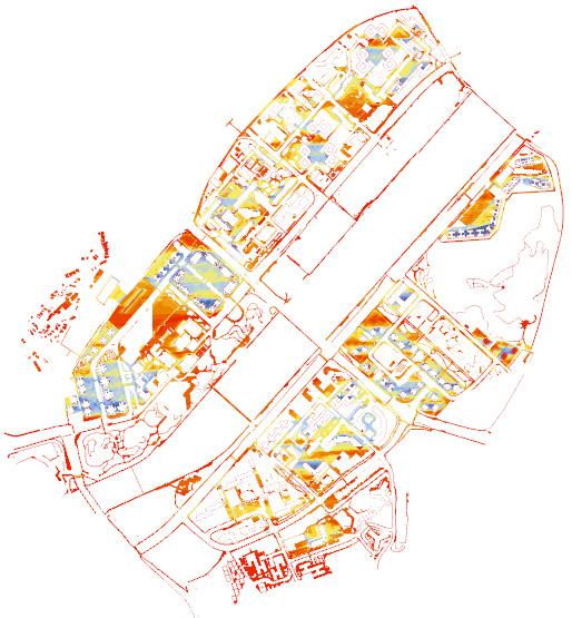
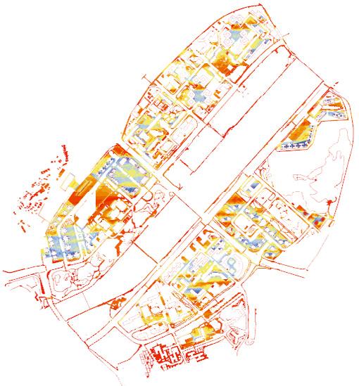
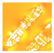
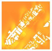
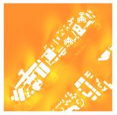
Thermal Comfort Analysis - Sunshine Duration
Site Analysis :
Thermal comfort analysis - sunshine duration
Thermal comfort analysis - sunshine duration
In areas with relatively high buildings, the duration of sunshine is more reasonable, and the walking experience is more comfortable
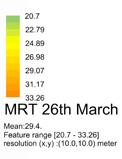
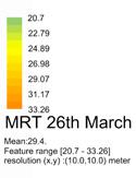
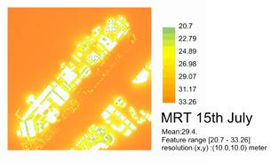
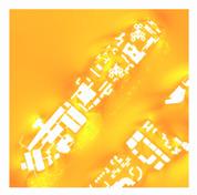
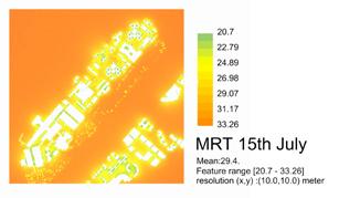
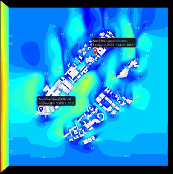
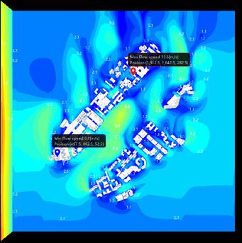
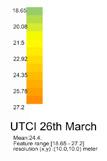
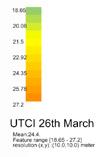
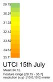
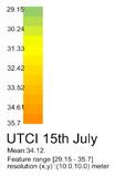
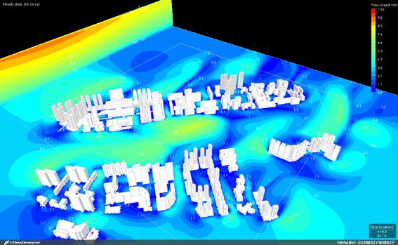
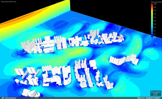
Thermal Comfort Analysis - Wind Flow Thermal Comfort Analysis - MRT & UTCI
Thermal Comfort Analysis - Wind Flow Thermal Comfort Analysis - MRT & UTCI
Thermal Comfort Analysis - Wind Flow Thermal Comfort Analysis - MRT & UTCI
In areas with relatively high buildings, the duration of sunshine is more reasonable, and the walking experience is more comfortable.
Thermal comfort analysis - sunshine duration
In areas with relatively high buildings, the duration of sunshine is more reasonable, and the walking experience is more comfortable.
In areas with relatively high buildings, the duration of sunshine is more reasonable, and the walking experience is more comfortable.



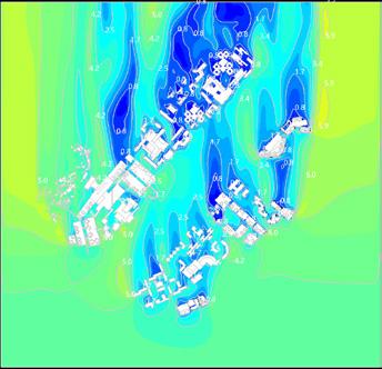

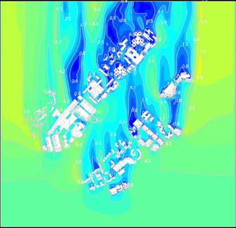


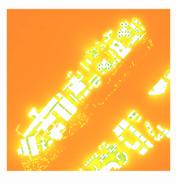
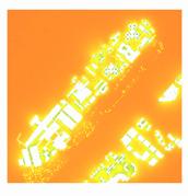

Thermal Comfort Analysis - Wind Flow Thermal Comfort Analysis - MRT & UTCI








05
Otherwork

Calculation of Carbon emission of Street section using parametric design
Framework For the Generative Design
Framework For the Generative Design
Framework For the Generative Design
Research question: Can parametrically thinking and calculate the carbon emission of road network through street section ?
Research question: Can parametrically thinking and calculate the carbon emission of road network through street section ?
Key words: Paramatric, Carbon Emission, Street Section, Road network
Key words: Paramatric, Carbon Emission, Street Section, Road network
Framework:
Framework:



T h e r e a s o n f o r t h e c a r b o n e m i s s i o n r e d u c t o n c o u l d b e t h e c h a n g e o f t h e v e h i c l e s a n d t r e e s n u m b e r s G e n e r a l y, fewer veh cle roads wi l product less carbon d i ox yg e n T h e n , e a d i n g t o t h e r e d u c e o f


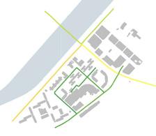


Existing


05 Otherwork
Research Question: Can parametrically thinking and ca culate the carbon emission of road network through street sect on ? Mode Generation • Road network • Mu t street sect ons Rh no AutoCAD Result 1 A road network model of street b ock 6 n Shat n area 2 Street section Comparat on and Option given • Scr pts set • Road network and Street section parameters Traffic System Guidel nes • Traffic F ow • Carbon Emiss ion for each e ement Rhino Grasshopper Streetmix Result 2 Optimizat on of parametric street sect on based on site road network mode P h a s e 1 : D a t a c o l l e c t i o n a n d m o d e l g e n e r a t i o n P h a s e 2 : R o a d n e t w o r k s i m u l a t i o n a n d g u i d e l i n e s
Research Quest on: Can parametrically thinking and ca culate the carbon emission of road network through street sect on ? Mode Generation • Road network • Mu t street sect ons Rh no AutoCAD Result 1 A road network mode of street block 6 in Shat n area 2 Street section Comparat on and Option given
Scr pts set
Road network and Street sect on parameters Traffic System Guidelines
Traff c F ow • Carbon Emission for each e ement Rhino Grasshopper Streetm x Result 2 Optimizat on of parametric street sect on based on site road network mode P h a s e 1 : D a t a c o l l e c t i o n a n d m o d e l g e n e r a t i o n P h a s e 2 : R o a d n e t w o r k s i m u l a t i o n a n d g u i d e l i n e s 4
Vehic e carbon emiss on - Trees carbon absorption Total carbon emission = Average Sing e Veh cle carbon emission (Set Pedestrian and Bicycle carbon emission as 0) Vehic e carbon emission = Road Length Tra fic flow of the road * * Average Sing e Tree carbon absorption Trees carbon absorption = * (kg/h) (kg/per·h) Tree Spacing Road Length / Number of Trees on a single line (km) (km) (km) (kg/per km) (kg/h) (N/h) (N/M) Cars & Motorcycles Goods Vehicles Buses * * * 25% 43% * * 32% * 95% Electric Vehicles * 5% + Number of Lanes (N) * Trees Number Each Sect on (M) * SET DATA SET DATA The red elements need o be manually entered into the formula 5
•
•
•
Carbon emissions calculation logic formula
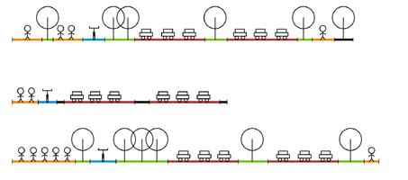
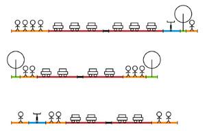
Street Sections Street Sections Options Option 1 Option 3 Option 2 Existing H gh ow H gh ow H gh Low CARBON EMISSION 29.68% VEHICLE SPACE 16000㎡ TREES 0% T h e r e a s o n f o r t h e c a r b o n e m s s i o n r e d u c t o n c o u l d b e t h e c h a n g e o f t h e v e h i c e s a n d t r e e s n u m b e r s G e n e r a y, fewer vehic e roads wi l product less carbon d i ox yg e n T h e n , e a d i n g t o t h e r e d u c e o f carbon emiss on CARBON EMISSION 29.69% VEHICLE SPACE 16000㎡ TREES 35% CARBON EMISSION 0.06% VEHICLE SPACE 0% TREES 200% Option 1 Option 3 Option 2 Existing H gh ow H gh Low n e v e h i c e s a n d t r e e s n u
fewer vehic
roads
carbon emiss on CARBON EMISSION 0.06% VEHICLE SPACE 0% TREES 200% H gh Low Option 1 Option 3 Option 2 Existing H gh ow H gh Low
m b e r s G e n e r a y,
e
wil d l b n d ox yg e n T h e n , e a d i n o f
carbon emiss
CARBON EMISSION 0.06% VEHICLE SPACE 0% TREES 200% H gh
5 Existing Street Sections Street Sections Options Option 1 Option 3 Option 2 Existing H h Low H h Low H gh Low CARBON EMISSION 29.68% VEHICLE SPACE 16000㎡ TREES 0% T h e r e a s o n f o r t h e c a r b o n e m i s s i o n r e d u c t i o n c o u l d b e t h e c h a n g e o f t h e v e h i c l e s a n d t r e e s n u m b e r s G e n e r a l l y, fewer vehicle roads w l product less carbon d ox yg e n T h e n , l e a d n g t o t h e r e d u c e o f carbon em ssion. CARBON EMISSION 29.69% VEHICLE SPACE 16000㎡ TREES 35% CARBON EMISSION 0.06% VEHICLE SPACE 0% TREES 200% H gh Low
Street
on
ow
Carbon Emissions Calculaiton Logic Formula
Sections Options
Urban Analysis Calculation of Carbon emission of Street section using parametric design
Scripts

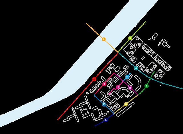



etwork and Too
CARBON

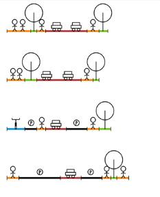

CARBON
CARBON
CARBON
CARBON
7
CARBON EMISSION 1.141 kg/h
EMISSION 1.141 kg/h
EMISSION 1.141 kg/h CARBON EMISSION CARBON CARBON EMISSION 05 Otherwork
CARBON
CARBON
Existing Road Network and Toolkit
8
2=34.5M 5M 3+3+3.5+7+1+7+4.5=29M 2+3+3+3.5+7+1+7+4.5=31M 4+1+1 5+7+2+1 5=17M 3+2+7.5+2+1=15.5M 3+2+1.5+3.5+3.5+2+2=17.5M 2+7+3.5+3.5+1.5+1+2=20.5M 2+7+2=11M 8
4+1.5+4+3+4+10.5+3+10.5+2+3+2.5=48M 3.5+2.5+1+10.5+2+10.5+1=31M 8.5+2+3.5+7+10.5+4+10.5+3.5+2=51.5M 6 5+10 5+1+10 5+3+1+2=34 5M
3+3+3.5+7+1+7+4.5=29M 2+3+3+3.5+7+1+7+4.5=31M 4+1+1.5+7+2+1.5=17M 3+2+7.5+2+1=15.5M 3+2+1.5+3.5+3.5+2+2=17.5M 2+7+3.5+3.5+1.5+1+2=20.5M 2+7+2=11M 1 7 2 8 3 9 4 10 5 11 6 12 CARBON EMISSION 1.141kg/h CARBON EMISSION 1.141kg/h CARBON EMISSION 1.141kg/h CARBON EMISSION 1.141kg/h
EMISSION 0.761kg/h
Toolkit
Toolkit
1.5+3+7+1+7+4+2=25.5M
CARBON
EMISSION 0.761kg/h
EMISSION 0.761kg/h
EMISSION 0.380kg/h
EMISSION 0.380kg/h
EMISSION 0.380kg/h CARBON EMISSION 0.190kg/h
EMISSION 0.190kg/h
CARBON
Urban Analysis
GIS Data Processing Rural Planning
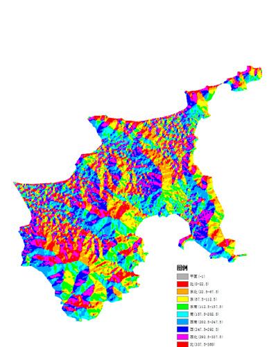
Aspect analysis
Watershed Analysis
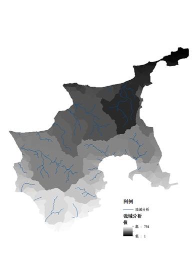
Elevation analysis
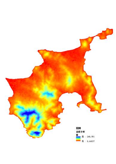
Hydrologic Analysis
Slope Analysis
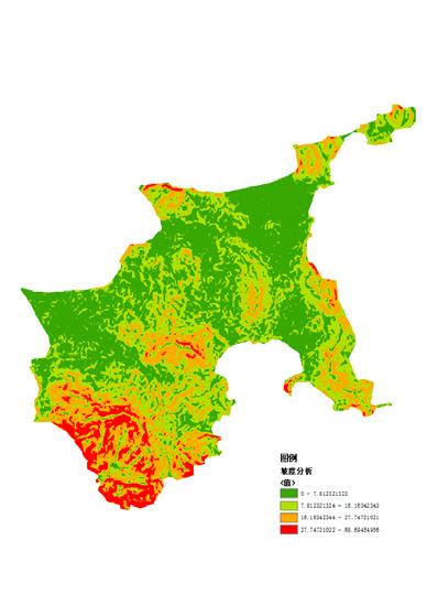
用地适宜性评价
Site Suitability Evaluation
坡向分析 坡度分析
高:10
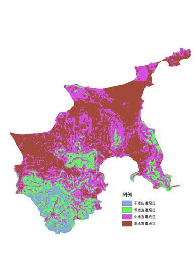
大连市广鹿岛沙尖村村庄规划
Construction Land Classification
用地适宜性评价 高:10 低:3.1
大连市广鹿岛沙尖村村庄规划
广鹿岛三区范围

27
坡向分析 坡度分析 高程分析 径流分析
低:3.1
沙尖村四区划定 05 Otherwork
Model Making
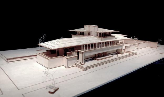
Time: 2018.02
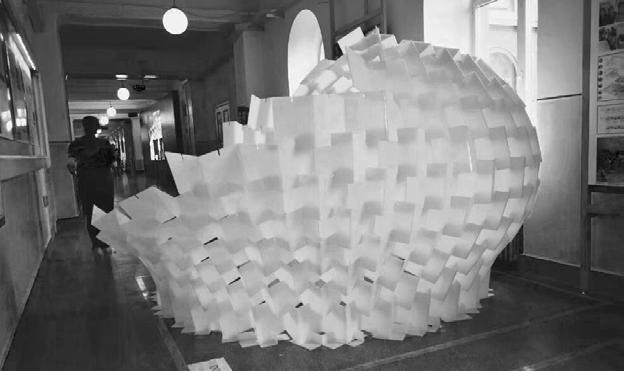
External
Time: 2018.06
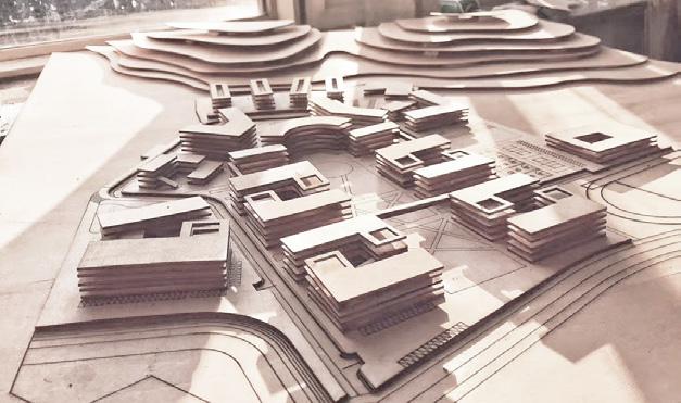
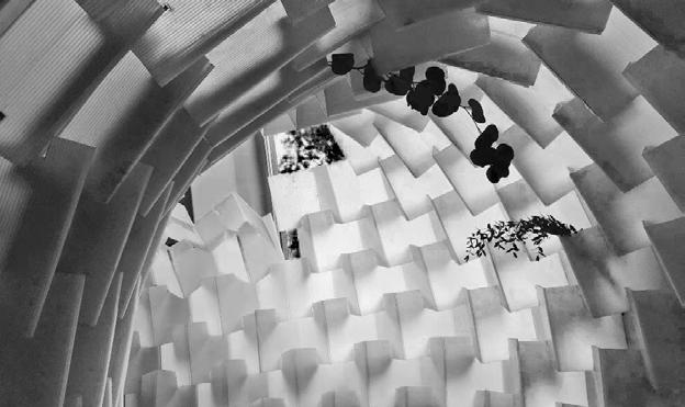
Interior
Time: 2018.06
05 Otherwork
Robin villa research model
SecondprizeofconstructionfestivalofHarbinInstituteofTechnology
View
SecondprizeofconstructionfestivalofHarbinInstituteofTechnology
View
Campusplanning,design&modelmakingofDalianMaritimeUniversity Time: 2019.12
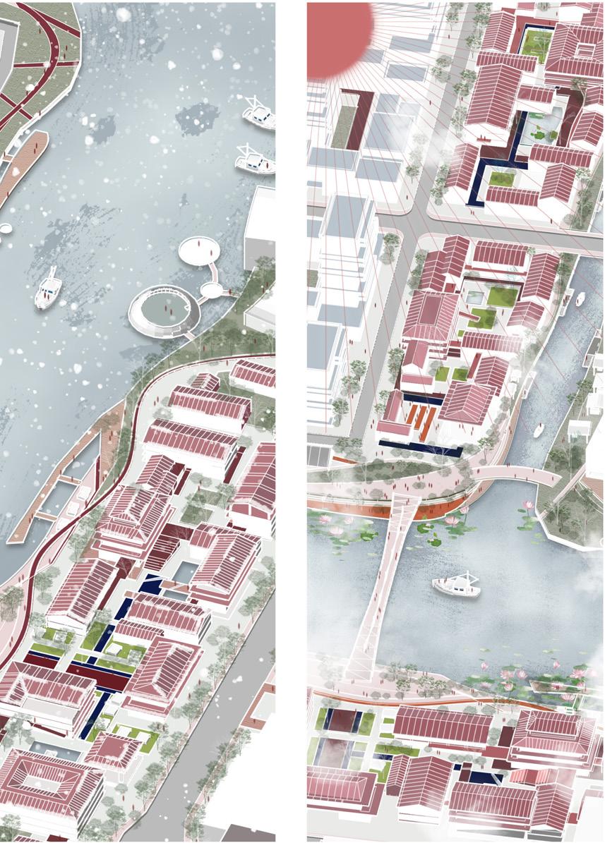


 FRAMEWORK
AXONOMETRIC DIAGRAM
AXONOMETRIC DIAGRAM
FRAMEWORK
FRAMEWORK
AXONOMETRIC DIAGRAM
AXONOMETRIC DIAGRAM


