


Active Transportation Master Plan
City of Kawartha Lakes

May 2024


Table
Table
Table
Figure 1. ATMP Project Plan & Schedule.................................Error! Bookmark not defined.
Figure 2 . Summary of Applicable Policies & Plans at the City of Kawartha Lakes........22
Figure 3 . Sample of Assessment of Conditions Outputs 33
Figure 4 . Active Transportation Demand (Existing)
Figure 5 . Overview of the ATMP Network
Figure 6 . Seven Step
Appendix A: Proposed Facility Types Maps
Appendix B: Proposed Phasing & Priority Project Maps
The City of Kawartha Lakes respectfully acknowledges that we are situated on Mississauga lands and the traditional territory covered by the Williams Treaties.
We are grateful for the opportunity to be here, and we thank all the generations of people who have taken care of this land - for thousands of years. We recognize and deeply appreciate their historic connection to this place. We also recognize the contributions of Métis, Inuit, and other Indigenous peoples, both in shaping and strengthening this community and country as a whole.
This recognition is connected to our collective commitment to make the promise and the challenge of Truth and Reconciliation real in our community.
We want to thank the considerable efforts of the City of Kawartha Lakes staff, City partners and stakeholders, and members of the consultant team who guided the development of the ATMP.
Jonathan Derworiz
Mark Jull
Richard Holy
Maximilian Faulhammer
Leah Barrie
This ATMP is dedicated to the ever passionate and supportive trail and active transportation enthusiast Allan McPherson whose involvement in all things AT and trails has made the City of Kawartha Lakes a better place to live, work and play.
Daryl Broadworth
John Bush
Arthur Hornibrook
Barbara MacPherson
Melissa McFarland
Glenda Morris
Patrick O’Reilly
Peter Petrosoniak
George Pineau
Mary Jean Porteous
Greg Scott
Sajeev Sivayogarajah
Claire Basinski
Brandon Quigley
Anushree Banerjee
Peter Brocks
Samantha Leger
John Spiers
Bill Steffler
Pat Warren
Nick White
Ellen Woodward
Amy Parker
Joy Tigchelaar
We would also like to acknowledge the considerable efforts and meaningful input provided by numerous other stakeholders and residents of Kawartha Lakes.
Starting in 2021, the City of Kawartha Lakes embarked on the development of a long-range City-wide Active Transportation Master Plan (ATMP), branded as Kawartha Moves The plan is driven by past strategic commitments and objectives of the City, including past efforts of active transportation stakeholders and community partners. The ATMP is not intended to be a stand-alone document; it was developed as a flexible and adaptable tool that can be used by all municipal staff who have a role in the planning, design, and implementation of AT-related initiatives. The Kawartha Moves ATMP is also meant to align with other recent and ongoing policies and plansincluding but not limited to City’s Trails Master Plan, new Rural Zoning Bylaw, Growth Management Strategy, and upcoming Transportation Master Plan - and is meant to build on previous work in Kawartha Lakes promoting increased use of active transportation, while providing a path to advance a clearly articulated vision and associated goals.
The intent of developing the KawarthaMovesATMP is to:
> Provide guidance on improving active travel at the City-wide level;
> Identify recommendations to inform future policy development and project delivery;
> Put high-level policy directions from the Official Plan into action; and,
> Provide guidance to inform implementation tools, tactics, policies, and programs.
The Kawartha Moves ATMP was developed using a process that fulfills the engagement and technical requirements of the Municipal Class Environmental Assessment (MCEA) Process, meaning that many of the projects identified as part of the AT network are considered pre-approved and are able to proceed through to implementation at such a time that the City is able to allocate budget to do so.
Kawartha Moves marks a milestone in the City of Kawartha Lakes’ journey to support sustainability, healthy communities, and resilience. It is an optimistic and aspirational document which provides ambitious targets for infrastructure implementation, policy and program development, and capacity building. Section 1.0 of the ATMP contains information regarding the approach and process used to develop the ATMP, how the plan is intended to align with other municipal efforts, and an overview of the content of the report and how it is intended to be used.
The Kawartha Moves ATMP is a functional master plan which has been developed to guide the city-wide planning, design and implementation of active transportation (AT) facilities, policies, and programs. The plan focuses on active modes of travel, including walking, cycling, and other self-propelled modes of transportation, while aiming to maximize their many benefits (as detailed in Section 2.1) in order to contribute to the City’s environmental, societal, economic, and health goals.
The primary goal for the ATMP’s development was…
Tocreatealong-range(20+year)strategicplanningdocument withsupportingpolicies,programs,tools,anddesignsolutions toimprovetheoverallunderstandingofandsupportforactive transportationinKawarthaLakes.
More specifically, throughout the development of Kawartha Moves, the City wished to achieve the following objectives
Improved Behaviour
Feasibility
Connectivity
Seasonality
Integration
Multi-modality
Capacity
Accessibility
Future Focus
Determine the needs of existing and potential AT users in Kawartha Lakes
Create an implementable strategy that aligns with strategic priorities
Create a continuous and connected system of AT facilities across the city
Accommodate for seasonal fluctuations and unique AT needs
Ensure that the ATMP is integrated with the trails plan and other relevant planning projects
Support improvements to the availability of different modes
Support improved capacity through internal structure and external partnerships
Ensure that routes and facilities are designed and promoted in such a way that barriers to access are removed
Provide long-range policy support and support growth targets
Table 1 . Overview of ATMP Project Objectives
At its core, the intent of this plan is to provide the City of Kawartha Lakes with a set of tools and tactics to achieve the City’s multi-modal mobility goals, and to address the unique aspirations and concerns of residents and visitors through a greater focus on active transportation and trails. When developing the ATMP, the project team weaved three key considerations into each component:

The condition of being protected from or unlikely to cause danger, risk, or injury

The quality of being fair and impartial in either the approach or outcome Promoting physical ease and opportunities for relaxation that create an improved user experience
In applying these considerations to the ATMP process… TheCityiscommittedtoanAllAgesandAbilities(AAA)approach toactivetransportationinKawarthaLakes,withagoalof creatinggreaterorimprovedtransportationmobilityforall
Mobility refers to the ability to move seamlessly between destinations, whether that be for the purpose of transportation (e.g., functional day-to-day travel between destinations) or recreation (e.g., trips that are made for enjoyment or exercise). Transportation and recreational mobility should be interchangeable and directly influence each other. For the purposes of the ATMP, the intent is to identify recommendations and solutions that influence transportation mobility.
The following is an overview of the various elements related to transportation mobility which were incorporated into the ATMP process and are considered some of the key components of future AT planning and design considerations.
> Destinations – Where people need and want to go for their common trips
> Accessibility – How accessibility for all is provided within the design constraints of public space
> Inclusivity – How those who live, work, and play within the City are accommodated along with those who need support
> Barriers – Addressing the tangible and intangible aspects of the network that prevent use and participation
> Risk Management – Appropriately monitoring and managing service provided relative to the need
> Demand – How existing demand as well as anticipated demand with improved design is addressed
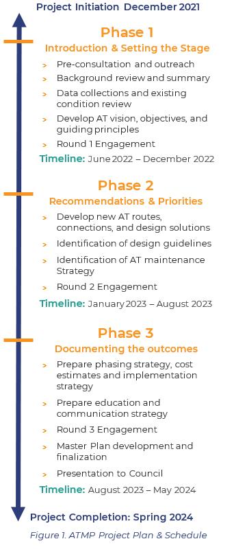
The ATMP was developed using an iterative and coordination-focused process, integrating the technical and engagement components into a responsive and adaptable work program. The project was completed in three phases as illustrated in Error! Reference source not found..
A core component of the work plan is the consideration and integration of opinions, interests and perspectives from community members, stakeholders, and decision-makers. Throughout the project, a number of different points of engagement and outreach were undertaken
The objectives of our engagement program were to…
> Inform audiences of the project’s initiation, including the purposes and desired outcomes of the ATMP.
> Provide information to increase awareness and understanding of the opportunities, challenges, and the best and comparable practices related to AT planning and design.
> Co-create ATMP recommendations and infrastructure improvements to achieve wider municipal aspirations.
> Build relationships with community members and stakeholders to support ongoing efforts related to implementation and engagement.
A detailed summary of the input received has been provided to City staff as part of the consultation record and can be made available if determined to be appropriate However, throughout the ATMP document, the key highlights from the
input received and how it was used to inform outcomes have been presented.
The city-wide Kawartha Moves ATMP was prepared at the same as a number of other strategic planning related initiatives Of particular interest to staff and stakeholders was the coordination of the ATMP with the Trails Master Plan Update (TMPU), which was initiated and completed just prior to the completion of the ATMP.
Throughout the development of the ATMP and the TMPU, questions were raised regarding the rationale for undertaking two separate master plans. Simply put, the plans were developed by two separate departments at the City. Because the ATMP is intended to be more of a policy-driven document, it was the City’s Long-range Planning Department that led its development. However, due to the more recreational focus of the Trails Master Plan update, this project was completed by the Parks and Recreation Department.
While there is some overlap between trails and active transportation, the two terms should not be used interchangeably, as there are important distinctions between them. It is important to recognize that trails and active transportation each have unique aspects and require differing approaches to planning and design.
Trails are a very specific type of facility that are typically found offroad, connecting people to natural areas for primarily recreational purposes. Trails can be used for both active and non-active / motorized forms of transportation.
Active transportation refers to human-powered ways of getting around, such as walking, cycling, or other self-propelled methods of travel. Active transportation planning looks to provide interventions and routing solutions that accommodate and encourage the behaviours and needs of these forms of transportation.
Although active transportation plans sometimes address off-road trails, they primarily focus on on-road or in-boulevard facilities, such as cycling infrastructure (e.g., bike lanes, cycle tracks, signed routes, etc.) or pedestrian improvements (i.e. sidewalks). An ATMP typically provides infrastructure plans, along with recommended policies and programs to encourage different types of active trips in various locations throughout a municipality, including for utilitarian and commuting purposes or recreational purposes.
Throughout the development of the ATMP, there was considerable coordination and integration between the ATMP and the Trails Master Plan update. As functional strategies, they both focus on programming and implementation which will require ongoing annual coordination and alignment.
More specifically, similarities and overlaps in the two projects included:
1. Feedback gathered through engagement activities.
2. Quality of design and accessibility.
3. Coordination of implementation timeline.
4. Leveraging new development opportunities.
5. Policy alignment and support.
6. Education and encouragement of the public.
7. Engage an overall culture shift.
While there are some key similarities between the plans, there are also critical differences. On a day-to-day basis, they are intended to be used as separate documents by two distinct City departments working towards municipal and departmental goals and priorities. Both city-wide projects are intended to influence active mode use in different respects Table 2 provides a more detailed overview of the unique scope elements and aspects of consideration for the ATMP, and trails plan relative to the typical master planning topics.

Components KawarthaMovesATMP Trails Master Plan Update
> Active Transportation modespecific
> Interaction with other road users
> Wider multi-modal priorities
Design
System Development
> Higher density in built-up areas
> Connections to major destinations for day-to-day trips
> Focus on on-road facilities
> Interaction with other road users
> Road Classification assumptions relative to design needs
> First and last mile considerations (i.e. connections to transit)
> Data / safety driven
Process
> Facility recommendations based mostly on quantitative data
> Consideration of AT and other users
> Primarily for recreational rather than utilitarian trips, but these may overlap.
> Environmental impacts more likely to be assessed
> Focus on off-road facilities
> Prioritization of natural spaces
> Primarily off-road, with connectivity through strategic on-road links
Vision
> New Vision
> Alignment with current guidelines
> Policy-driven
> Focused on connectivity
> Multi-modal integration
> Demand-based improvements
> Learning from comparable jurisdictions
> Experience driven
> Consideration and application of design solutions to trail user needs
> User mapping
> Influence of environment on experience
> Update & Re-envision
> Reviewing and revisiting past recommendations
> Re-engaging stakeholders
> Infusing new guidelines
> Asset management focus
> Building on past successes
Table 2. Summary of Master Plan Elements for the ATMP and Trails Master Plan Update
In addition to the ATMP, the City also initiated a Transportation Master Plan (TMP) in the later stages of the ATMP development process. This means that the ATMP was developed with some prior data / information assumptions This does not mean that the recommendations found within the ATMP are not considered accurate or valid, but it highlights that as the City proceeds with the implementation of the ATMP, and as more up-to-date data or other information becomes available, including data collected as part of the TMP or other City initiatives, that it be used to confirm and validate the ATMP’s recommendations prior to design and implementation.
Similar to an ATMP, a TMP provides high-level policy, design and implementation direction related to the overall transportation system, including infrastructure for various modes, such as automobiles and transit, as well as active modes. The outcomes of the ATMP should be integrated and incorporated into TMP recommendations to provide a consistent and comprehensive approach to multi-modal improvements. There will be a number of project outcomes as part of the TMP that will significantly influence and support AT efforts, including but not limited to:
> Complete Streets policies –supporting the consideration and design for all street users with safety and comfort in mind
> Vision Zero / road safety approaches – finding opportunities for strategic improvements to enhance safety for all road users.
> Revisiting of municipal road classifications – investigating how roads are classified throughout the municipality from both a land-use and road function perspective, ensuring that there is consideration for and accommodation of all users.
> Capital project planning – the identification of proposed infrastructure improvements and associated budgeting over the course of a 5-, 10- or 15-year horizon. Opportunities to ensure economies of scale for the implementation of AT infrastructure are critical to facilitating the coordination of municipal project efforts.
The City should continue to advocate for the integration of AT projects and improvements, as well as the prioritization of AT users (where appropriate) as the TMP is developed, and through future implementation and coordination between the ATMP, TMP, and the Trails Master Plan update.
Developing separate plans will provide the City with opportunities for…
> Greater flexibility to address trail development as well as multimodal aspirations through concurrent initiatives.
> Alignment by ensuring that dual support is provided so that the plans receive equal commitment and AT-related initiatives are able to move forward
> Multiple layers of support and opportunities for each plan to address certain aspects or components of multi-modal transportation.
> Greater efficiency with the opportunity to explore various potential routes and corridors for active transportation, including complex conditions and potential quick wins.
> Layers of financial support, including multiple internal and external sources with potential to facilitate implementation.
Last but certainly not least are the considerable land-use planning tools that are being developed and adopted by the City at this time. There are two municipal plans of this nature: the Rural Zoning By-law and the Comprehensive Zoning By-law. Both documents are integral to the decision-making of the City’s planning process. They are implementation tools to help guide where and how the City is built based on the direction included within the City’s Official Plan and as set out by Council and other decision-makers.
The City is committed to building and providing residential, commercial and employment areas, etc. All of the tools noted above work together to establish systems and services that create the safe, resilient, sustainable, and healthy communities that are critical to the future of the City of Kawartha Lakes.
The Kawartha Moves ATMP document has been developed to serve as a flexible and adaptable tool to guide the strategic and day-to-day implementation of active transportation supportive tactics and projects. Kawartha Moves has been organized into five chapters which present the process, rationale, and outcomes of the ATMP. Table 3 provides a summary and overview of the plan’s content and its intended use
Chapter Content Application
Chapter 2
Chapter 3
Chapter 2 provides an overview of the ATMP including the work completed to understand the existing context and conditions, i.e., policies, programs, and best / comparable practices
Chapter 3 presents the information gathered through engagement and outreach and the foundations of the ATMP, i.e., the ATMP vision statement, objectives, and ambitious goals
Information found within Chapter 2 can be used to communicate the existing conditions prior to the implementation of the ATMP and in future assessments of growth or success
Information found within Chapter 3 can be used to validate how the ATMP was informed by public and stakeholder input and to communicate the purpose, intent, and priorities of the plan
Chapter 4
Chapter 5
Chapter 4 highlights the recommendations for the ATMP network, policies, and programs
Chapter 5 details a suggested implementation strategy including phasing, costing, roles and responsibilities, monitoring and evaluation practices, partnerships, and communication tactics
Table 3. Overview of ATMP Content & Application
Information found within Chapter 4 summarizes the “what” is being recommended as part of the ATMP including proposed routes, policy changes and program options
Information found within Chapter 5 is meant to inform the day-today coordination of ATMP implementation by City staff and its partners
The content of Kawartha Moves is built around two core components, the proposed active transportation network, and a series of supportive recommendations. Recommendations are meant to:
> Provide guidance to turn the plan’s vision and goals into specific actions
> Provide guidance to develop new or modify existing policies
> Establish targets for annual decision-making, funding, and phasing
> Set out processes and practices for internal and external coordination
There are six (6) categories of recommendations which are intended to help guide the efforts and actions of staff. The categories and associated recommendations were developed based on best and comparable practices as well as the most effective and impactful approach for the City. The following is an overview of the categories:
> Foundational recommendations that ensure that the ATMP network is being used as the guide for the future planning of active transportation infrastructure.
> Direction to support the design of active transportation facilities and supporting amenities.
> Amendments or enhancements that are needed to support the integration and implementation of the ATMP and to influence future land use and infrastructure planning practices.
> Tactics that influence the way in which people understand AT and change behaviours to encourage more active transportation use.
> Day-to-day practices and processes that guide how staff facilitate the implementation of the ATMP in coordination with external agencies and other partners
> Opportunities to determine the impact and influence of implementation, ensure accountability, and to adapt as needed to fit community needs and interests as they evolve.
The City takes a policy- and planning-based approach to the ATMP but understands that many of the recommendations found within the ATMP have an impact on other municipal departments
> The recommendations are not phased but provide an assessment of the level of effort or degree of ease related to their implementation based on the amount of support
> There are a significant number of recommendations that represent a series of aspirational actions that will occur. To focus efforts, priority recommendations have been identified as the City’s main focus.
> Priority recommendations do not mean that they should be the only focus. Depending on the funding and capacity of the City in a given year, the priority recommendations should be those that the City moves forward with first or continues with.
> Potential partnerships have been identified, representing the potential internal and external groups to support the City in their implementation of specific recommendations. It should be noted that partnerships may change considerably over time, and the City may pursue partnerships with organizations or agencies not identified in the ATMP as opportunities arise.
> There are some overlapping or complementary recommendations within the ATMP and the Trails Master Plan update. These have been highlighted within the ATMP, and where possible implementation is to be coordinated to avoid the duplication of efforts.
> There are some recommendations within the ATMP which have an impact on the outcomes of the TMP. Every effort should be made to ensure that there is continued coordination to facilitate the action of these recommendations.
> The ATMP recommendations are intended to be reviewed on an annual basis to determine progress made and opportunities to identify new tactics and initiatives to work on the following year.
> Recommendations are NOT policy. Unlike the Official Plan which includes municipal statutory policy, functional master plans are only able to provide implementation direction. As noted above, there are policy recommendations which identify implementation next steps which would take the content in the ATMP and embed it into municipal policy, where appropriate.
> Depending on the nature of the recommendation, it may be appropriate to have stronger language to ensure that the recommendation is considered actionable. Where possible, the word “shall” has been used to strengthen recommendations.
The recommendations are dispersed throughout the report, with content and information to support implementation, and to be used as a reference and guide by City staff as they proceed with the implementation of the ATMP.
All recommendations included within the ATMP have been diligently reviewed and considered with information provided to the City to support future implementation. A comprehensive recommendation implementation table has been prepared and provided to the City which includes the following information for each recommendation:
> Timing
> Implementation Leadership
> Internal Involvement
> External Involvement
> Staffing Resources
> Money Resources
> External Funding Opportunities
The table is intended to be used as an internal resource to support the management of ATMP implementation.
The phasing for recommendations is not linked to a specific timeline but are associated with a horizon or year –unlike the proposed projects. Timing has been identified based the ease at which the recommendation is able to proceed. The options include:
Immediate (green): recommendations can be implemented as soon as the plan is adopted
Alternate timing (yellow): recommendations can be implemented once other initiatives or work has been completed
Requires investigation (orange) –recommendation which requires additional research / review to be undertaken to confirm next steps
These categories are consistent with the approach used for the TMPU recommendations. Implementation timing details are provided in Section 5.0, but the intent is for City staff to work together to determine annual priorities and work that can be completed to support implementation of the ATMP year-over-year.
The development of the Kawartha Moves ATMP has been underpinned by a thorough exploration of local active transportation experiences and conditions. As this master plan is meant to be a blueprint and guide to achieve the City’s active transportation vision, it must be reflective of the local context, while also following provincially and nationally accepted planning and design practices.
Active transportation is not a single mode of travel, but includes multiple selfpropelled modes, including walking and cycling, as well as skateboarding, in-line skating, kick scooters, and other sustainable ways to get around. New technologies that supplement human-power with electric-assist devices, such as e-bikes and escooters, are increasing in popularity, helping people replace car trips while carrying more cargo and travelling longer distances, and are also changing the mix of users along local streets and trails. Each of these different modes have various potential users with their own unique needs, desires, and places they want to go.
Effective active transportation master plans provide ambitious directions to achieve wider behaviour change in support of more sustainable and healthy forms of mobility. While this shift in approach can be daunting, the individual and community benefits that can be realized are substantial This approach also allows for a greater degree of flexibility and adaptability when it comes to how a municipality supports the way in which people get to and from their daily activities and reflects overall trends and demographic shifts
To develop a plan that is both progressive and well-tailored to the context of Kawartha Lakes, a thorough understanding of the existing conditions was developed. This understanding was attained through a multi-faceted approach to background review and analysis, including:
> A review and analysis of the City’s current policy framework, including current gaps, future opportunities, and ongoing challenges to establish the basis for future policy enhancements.
> An investigation of the varied benefits of active transportation to the community, including benefits and challenges, with a focus on the unique context of Kawartha Lakes to demonstrate issues for mitigation and opportunities for success.
> An analysis of socio-demographic trends, local trip generators and current active transportation demand to paint a picture of who, how and why people move throughout the City.
> A review of existing and previously planned infrastructure as the foundation for the identification of improvements and enhancements
The findings are documented throughout Section 2.0 of the ATMP.
The intent of the City of Kawartha Lakes was to develop an Active Transportation Master Plan that reflects and responds to the unique societal shifts that are being experienced as it relates to active transportation within the City. Unfortunately, in the past few decades, municipal transportation planning has too often prioritized automotive travel at the expense of other modes, creating car-dependent communities that limit people’s mobility choices, exacerbate social inequality, worsen pollution, create congested roads, and eat up farmland and natural spaces through sprawling and inefficient urban land uses.
In the last 10 years society has seen a shift away from the single occupancy vehicle towards more sustainable and healthy modes of transportation, as new evidence demonstrates the broad benefits of active transportation to help support positive physical and mental health outcomes, make communities more equitable and affordable, combat climate change and protect the environment, support economic development and tourism, to name just a few.
Within the context of the City of Kawartha Lakes, active transportation has not historically been a top priority. However, there is an increasing interest in and demand for the City to make real and tangible commitments to shifting the way people move and their sense of safety and comfort when travelling, especially for short trips
As the demographics of Kawartha Lakes shift, there needs to be a proactive approach to mitigating negative impacts of the current transportation system. There is a significant need for accessible alternatives which meet the needs of people of all ages and abilities – whether they live in the built-up areas of the community or in the rural areas. That said, these efforts do not come without a price tag which can be a departure from what the City is used too. It is important to re-position and re-think what it means to invest in active transportation and frame it as an investment in community, in the future, and in people.
Within the first phase of the project, the team undertook a detailed review of active transportation challenges and opportunities. The results of this review were compelling and helped to inform the development of recommendations – to address major concerns or barriers; or highlight opportunities to enhance and support community benefits. The following is a summary of those findings.
Environmental issues refer to the impacts on the natural and physical environment as a result of carbon emissions, pollution, and other human-made factors.

Climate change poses many risks to human health and prosperity, including extreme weather events (e.g., floods, wildfires), reduced water quality, disruptions to food systems, and poor air quality. The impacts from global warming have already been observed, including locally, where in recent years, Kawartha Lakes has had milder winters with less snow, and hotter summers with longer heat waves.
Kawartha Lakes has more than 51,000 hectares of forest, 11,00 hectares of grasslands, and 37,000 hectares of wetlands. These natural heritage areas provide impressive landscapes, habitats for native species, and protect climate stability. Investing in improvements and programs that replace car trips with walking and cycling trips can help preserve these lands and create a more sustainable community that future generations can continue to enjoy.
> Transportation is the largest source of emissions in the City, accounting for approximately 45% of all greenhouse gas (GHG) emissions.
> Kawartha Lakes will benefit from reduced air pollution and traffic congestion by shifting trips toward active mdoes.
> Active transportation protects natural resources (less gas consumption).
> Navigating the balance between fostering sustainable transportation and preserving Kawartha Lakes' rich natural environments.
> The potential disruption, fragmentation, or alteration of local habitats during infrastructure construction poses concerns, demanding careful consideration of the region's unique biodiversity.
> The choice of construction materials, energy consumption, and emissions during development can impact local environmental integrity.
> The intent of the ATMP is to reduce the impacts of GHG emissions by replacing motor vehicles trips with active modes for day-to-day purposes.
> The plan maximizes the opportunities for various AT trips, both commuting and recreational.
> The impact of active modes on the longevity of roadways and other services have been considered
> The preservation of local natural heritage sites has been prioritised.
Societal issues refer to the values, demographics, and economics within a group of individuals involved in persistent social interaction or who share the same community.
Kawartha Lakes has a diverse population, with people of a range of ages, abilities, backgrounds, and income levels. In addition to its high senior population, individuals and families in Kawartha Lakes have a lower median income than the province as a whole. Designing urban spaces that provide safe and convenient trips, regardless of how people travel is crucial, especially to those who may not be able to afford or have the ability to drive for regular trips. Improved transportation options, including through AT, help ensure everyone is able to access essential services and needs, including food, jobs, education, health care, and more, on a regular basis.
> Active travel opportunities provide basic mobility to those who are less able to afford, own, maintain, or operate a car.
> Walking and cycling facility improvements benefit both existing and new AT users by providing safer, and more comfortable and accessible conditions
> Providing active transportation facilities, especially for walking, helps support transit trips and is vital to achieve a connected, more accessible and attractive transportation network
Challenges
> Ingrained car-oriented habits, and past infrastructure and development make it challenging to shift transportation behaviour. People may resist the adoption of active modes for diverse reasons
> Implementing active transportation facilities can face political challenges rooted in differing priorities, budget constraints, and conflicting interests.
> Balancing the diverse needs of various stakeholders, including local businesses and residents, while ensuring the equitable distribution of resources, can also pose political hurdles.
> The ATMP will be designed to ensure all residents and visitors of Kawartha Lakes have the ability to choose active modes of travel, regardless of their age, ability, or comfort level.
> This ATMP has been developed with all ages and abilities in mind, following guidance from national and provincial guidelines, standards, and best practices. Integration with public transit has been considered.
> Engagement has helped to ensure this ATMP responds to community needs.
Health refers to an individual’s or community’s ability to successfully interact with their biological, physical, and social environments.1 ,

Getting more people to take more trips by walking and cycling, whether for commuting, daily utilitarian trips, or recreation, is an opportunity to get more residents physically active, which has positive impacts on both physical and mental health. This is especially important in Kawartha Lakes, where 28% of the population is aged 65 or older (compared to 18% province-wide)2
Opportunities
> Diabetes rates are lower in municipalities where walking and cycling are practical options.
> People are more active if safe, accessible, and comfortable active transportation infrastructure is available to them.
> Walking to and from public transit can help adults achieve more physical activity each day.
> Regular exercise, including walking, helps improve mental health outcomes, including lower depression and anxiety levels and increase social interactions.
> Improving the daily commuting mode spilt is an opportunity to get more residents experiencing the health benefits of AT.
Challenges
> Currently, 93% of Kawartha Lakes residents drive a car for their daily commute, with only 4% walking and 0.5% cycling.
> There may be an inherent bias favoring car-centric planning in urban development, which can contribute to the marginalization of pedestrian and cyclist needs.
ATMP Application
> Foster a network that makes it easier for residents to choose active modes for everyday trips.
> Through an all ages and abilities approach, this ATMP aims to be inclusive and age-friendly ensuring that the health benefits of active transportation can benefit all users
1 Sartorius Norman, “The meanings of health and its promotion” in Croation medical journal vol. 47,4 (2006): 662-4
2 2021 Census
Economic issues refer to how available resources, services, and goods are organized and distributed across an area, and how funds are distributed.
On average, Kawartha Lakes sees more than 1.6 million tourists annually and has approximately 31,000 seasonal residents. Primary activities for tourists and seasonal residents include outdoor sports activities (53%) and visiting friends and relatives (39%)3. Tourism is an important part of the local economy in Kawartha Lakes, and active transportation investments can help support this by ensuring that the City remains an attractive travel destination through investments in facilities that cater to recreational uses, and help support vibrant, walkable destinations.
> Various types of in-boulevard paths support the trend of recreational travel.
> Active transportation supports eco-tourism and sustainable tourism.
> Multi-use pathways and trails are often destinations for short-term or weekend trips, while rural bicycle routes can attract people for long-distance cycling experiences.
> People on foot and on bike often shop more and spend more money locally than those driving.
> Wider sidewalks, calmer and safer streets, and amenities create pedestrianfriendly shopping experiences that attract more people to visit.
> Allocating funds to AT projects may compete with other budgetary priorities.
> Retrofitting existing urban areas with AT infrastructure can be expensive, requiring careful planning to minimize economic impacts on businesses and residents.
> Despite the potential long-term benefits in terms of improved environmental and health outcomes, and reduced associated costs, municipalities may face resistance due to the perception of higher upfront expenses.
> Given the significance of the tourism industry in Kawartha Lakes, route and facility opportunities that support tourism and economic development have been prioritized in this plan.
> Opportunities to leverage partnerships with local and provincial tourism organizations have been explored as part of the ATMP’s implementation.
3 Data collected from pre-consultation survey.
Policies developed and adopted by a Municipality establish the framework that is used to guide where, how, and what is planned and implemented, including land uses as well as servicing and infrastructure. Within the policy hierarchy there are various tools such as by-laws, guidelines, standards, or other implementation-based documents that guide municipal staff in their decision-making.
Policy provides the blueprint for growth and development of a community, while also addressing critical matters related to mobility, environmental preservation, economic growth, social equity, and infrastructure servicing, among other issues. In recent years there has been considerable enhancement and improvement in the policy support for AT and related infrastructure planning.
However, AT infrastructure implementation mainly relies on the existence of strong functional local plans at the municipal level, such as an ATMP. For widespread and consistent AT planning and infrastructure implementation, there should be policy improvements and amendments that both support and provide guidance for active transportation, including infrastructure, programming, and supportive land use.
The outcomes of the comprehensive policy review are documented in the following sections with additional information shared with the City which forms part of the project record.
The information contained within this section is intended to be used as a guide for future consideration as the City proceeds with updates, amendments, or the development of new policies. Additional recommendations are provided in Chapter 4.0 of the ATMP.
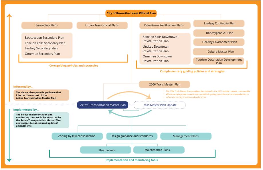
A typical master plan requires a review and understanding of applicable policies and plans that have jurisdiction or influence over potential plan outcomes. For the ATMP policies were reviewed at the provincial and local level to determine the existing support for active transportation.
It is also important to understand where in the policy hierarchy the ATMP will be situated. This helps to better understand what influence the ATMP will have once implemented and where additional support may be needed to facilitate implementation or higher-level policy support. An illustration of the existing policy hierarchy – as it existed at the time the ATMP was developed – was prepared and is provided on the following page.
Ultimately, as the ATMP will serve as a functional master plan, there will need to be updates to the City’s Official Plan to ensure policy consistency and reference within implementation tools to ensure action is undertaken.
Plans and policies were reviewed at the provincial and local levels. The intent of the review was three-fold:
1. To identify existing policies and gaps where there are potential opportunities for policy improvements.
2. To ensure that municipal policies, guidelines, and standards related to active transportation align with and support higher-level policy
3. To strategically embed active transportation into the City’s most impactful policies.
The existing policy review was undertaken in two stages. First, a policy summary was completed for all applicable policies and plans, including statutory policy documents as well as design guidelines and standards. Next, policies and plans were reviewed using a key term search to determine the degree of support within the existing policy framework and to identify opportunities for improvement.
A key term search is a planning tool whereby a series of terms are selected based on project objectives and priorities, as well as best practices. These terms are then used to review each policy and the number of occurrences of the term is noted thus determining the degree of support and the impact of policy influence.
For the Kawartha Lakes ATMP, primary, secondary, and tertiary terms were identified and used to assess the applicability of existing municipal planning documents. The hierarchy of terms was determined best on a best practice whereby it is most critical to have reference to the primary terms
but there may be opportunities for long-term improvement or amendments to incorporate secondary and tertiary terms where possible. The following is an overview of the primary terms that were identified:
> Active Transportation / Recreation
> Cycling / Bicycle / Bike
> Walking / Pedestrian
> Hiking / Hike
> Connectivity
> Waterfront
> Recreation
> Tourism
> Trail / Pathway
> Snowshoe / Snowshoeing
> Canoe / Kayak / Paddling
> Accessibility
> Safety / Comfort
The full list of terms was provided to City staff and can be made available as needed. Results varied, however; with the following highlights to emerge:
Representation of primary terms (e.g., cycling, biking, walking, hiking, trails, etc.) were reflected more often in functional plans, e.g., Destination Development Plan, Cultural Master Plan.
Secondary terms
(e.g., inclusive, multimodal, first/last mile) appeared less often across all the plans reviewed.


Based on the results of the key term assessment the plans with the greatest amount of support for active transportation terminology included:
> City of Kawartha Lakes Official Plan
> Lindsay Official Plan
> Destination Development Plan
> Cultural Master Plan
The plans which have limited support or reference to active transportation include:
> Omemee and Bobcaygeon Secondary Plans
> Fenelon Falls Official Plan
> Omemee Downtown Revitalisation Plan
> City of Kawartha Lakes Strategic Plan
Developing an active transportation master plan driven by municipal policy is critical for fostering sustainable and resilient communities. Active transportation not only contributes to healthier lifestyles but also plays a pivotal role in reducing carbon emissions, alleviating traffic congestion, and promoting social inclusivity.
By embedding active transportation planning, design, implementation, and maintenance directions and recommendations into various policies, Kawartha Lakes will position itself with the necessary frameworks and directions which aim to:
> Establish the necessary policy-based assumptions which can be used to support the planning, design, and implementation of community elements –servicing, infrastructure, and urban form – which are consistent with the principles and vision of the ATMP.
> Incentivize the creation of urban development that prioritizes active transportation For example, by incorporating policies related to urban planning, zoning, and transportation, a city can systematically create an interconnected and accessible network that encourages people to choose walking or cycling as viable modes of transportation.
> Enhance the long-term sustainability of a community by signaling a commitment to creating healthier and more environmentally friendly urban spaces, aligning with broader goals related to public health, climate action, and social equity.
The ATMP is not a policy document. It is a functional master plan which includes recommendations which provide suggested actions which could inform future policy development. As noted above, the ATMP will need to be integrated / reflected
in the overarching Municipal policy framework – more notably the Official Plan and the Zoning By-law – in order for a policy driven approach to be fully realized.
Integrating active transportation measures into these policies ensures that these considerations become integral components of decision-making processes, garnering consistent support from various stakeholders, and facilitating the allocation of resources for their implementation and maintenance. In essence, by ensuring that the ATMP is based in a policy-driven approach, the City is making a commitment to fostering a holistic and enduring approach to urban development that prioritizes the well-being of residents and the environment.
The way in which active transportation facilities are planned and designed inherently prioritizes consideration for the user (i.e., the individual that is engaging in the activity) and the use (i.e., the type of mode or activity they are participating in and the reason for that trip). Prior to embarking on any assessment or the development of recommendations it was important to define appropriately and clearly what is meant by active transportation and what that means in terms of existing as well as future users.
Active transportation can refer to any form of nonmotorized, human-powered transportation.
In most cases, active transportation focuses on two primary users (or modes):
1. Pedestrians - people who travel by foot, whether walking, running, using a wheelchair or other mobility aid, or pushing a stroller.
2. Cyclists - People who travel using a bicycle, either fully self-propelled or assisted by an electric motor.
However, with emerging technology, that there are new types of users and modes that also need to be considered when planning and designing for active transportation, including:
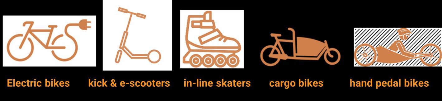
For the purposes of the City of Kawartha Lakes ATMP, the focus was placed on the traditional forms of active transportation as noted above but with a future-focused perspective on providing innovative and proactive recommendations, policies, programs, and facilities to accommodate a wider range of evolving modal choices. Each mode choice has different types of design opportunities and assumptions which impact the way in which routes, facilities and amenities are planned and designed and programs are developed. Table 4 provides an overview of typical considerations for each of the primary users that were considered when developing the Kawartha Lakes ATMP.
> Low travel speeds
Those who travel by foot including walkers, joggers, hikers, and runners.
Those who use a bike for various purposes, including commuting, utilitarian purposes, recreational, and touring / long-distance.
Users that require assistance (e.g. wheelchairs, power chairs) to get around due to mobility limitations.
Other user groups anticipated to use the active transportation network in locations where permitted.
> Minimum 1.0 m operating space
> Pedestrian trips include commuter, recreational and touring / long distance purposes
> Average speed ranges from 10 to 20 km/h; may increase in excess of 30 km/h on downhill roads.
> Typically require 1.5 m of horizontal operating space and 2.5 m of vertical operating space.
> Sections 80.8 and 80.10 of the Accessibility Standards for the Built Environment provide the technical requirements when designing and implementing new trails.
> E-bikes are typically permitted on all roads where conventional bicycles are permitted, but municipalities can limit usage through municipal by-laws
Table 4 . Summary of Typical Active Transportation Users & User Preferences
The above speaks to the mode choices which are typically the main areas of focus when undertaking a plan of this nature. However, an active transportation user has many different considerations that that influence their trip length, location, etc. These can be impacted by age, ability, skill and endurance levels, risk tolerance, and preferences for various types of trip experiences. In addition, users are heavily influenced by the type of trip that is being taken, which is mostly determined by the destination.
Many AT trips are for recreational purposes, whether it be fun or fitness, while others are for more utilitarian purposes, such as to commute to jobs or school, visit friends or family, go shopping, or access other local services. To be successful, an active transportation network should appeal to a range of users looking for various experiences, particularly those that are most common, while providing a continuous network that connects to key recreational and utilitarian destinations.
Designing for active transportation users and uses is not a one-size-fits all approach. An ATMP of this scope and scale and in this geography means that the planning, design, maintenance, and implementation of infrastructure must provide individuals
who live, work, and play within the area with the options and alternatives that are consistent with their lifestyles as well as their evolving habits. While defining the potential users and uses it is also important to determine specific preferences and user profiles within Kawartha Lakes. Through engagement and outreach with the public and stakeholders, a series of user profiles were developed illustrating “typical” active transportation users or individuals who would interact with active transportation users.
The user profiles, along with the mode specific design considerations were the basis for the planning and design of the AT network. A more detailed overview of the user profiles is provided in Section 3.1, summarizing the engagement efforts of this plans development and the input received.
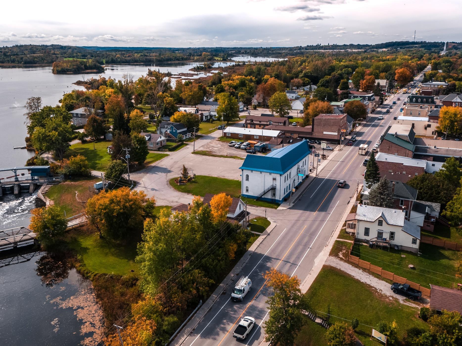
The City of Kawartha Lakes is a fastgrowing community and important tourism destination, with an extensive existing network of trails, sidewalks, and cycling routes in its urbanized communities, and numerous rural routes for touring cyclists to explore. The development of a connected and continuous network of active transportation routes and facilities was one of the primary objectives of the ATMP process.
The goal of the AT network development process, detailed in Section 4.0 of the ATMP, is not intended to “reinvent the wheel” or overstep past efforts. The goal was to leverage the considerable successes of the City of Kawartha Lakes and build upon the existing and previously planned routes and facilities to establish a cohesive system of linkages for users of all ages and abilities.
Establishing a comprehensive understanding of the foundation from which the network was being developed was completed by reviewing and analyzing three components:
> Location and status of existing and planned routes and facilities
> Appropriateness of existing conditions and opportunities
> Existing demand on the system
> Local trip generators, i.e., the major and minor destinations that may be accessed by active modes
The following is a summary of the assessment, the results, and how it was used to inform the development of the ATMP network and other supporting recommendations found within the Kawartha Moves report.
Existing and planned conditions include the active transportation facilities that have been implemented by the City or have been previously approved for future implementation. Mapping of the existing and previously planned conditions are included in the City’s GIS database and through preliminary project mapping which formed the basis for the ATMP network.
The following is a summary of the facilities that are currently found within Kawartha Lakes which accommodate active forms of
transportation. Three (3) types of features were considered: existing, previously planned, and previously promoted. Each of these are different in terms of condition, design, and implementation These are described in Table 5 below
175 km
Sidewalks
350 m
Bike Lanes
530 km
Touring Cycling Routes
300 km
Trails*
*detailed in the Trails Master Plan Update. Off-road trails are not considered part of the scope of the ATMP but are a key consideration in a continuous and connected system of AT routes.
For such a wide geography, the City of Kawartha Lakes has over 1000 km of facilities that accommodate active transportation, providing access to major and minor destinations, areas of natural and cultural significance, and recreational offerings.
> Existing routes and facilities include any active transportation infrastructure that has been built by the City and / or a partner agency which contributes to the overall AT network (including off-road trails).
Existing
> Contextual on-demand information was collected based on publicly available information, data collected through traffic counts and field investigations, including the locations of parks/open spaces, key destinations, and land uses.
> Facilities that have been identified and adopted through current City planning documents but have not yet been implemented.
> Routes and facilities were identified using information collected from a wide variety of documents, including Environmental Assessments, detailed design drawings, and plans such as the Lindsay Continuity Plan and Bobcaygeon Active Transportation Plan, as well as other information such as municipally endorsed routing and routes recommended by stakeholder groups.
> Also considered were planned capital projects that could be leveraged as an opportunity to incorporate AT infrastructure or where infrastructure was identified.
Recommended / promoted cycling routes were determined based on considerable stakeholder input from a local cycling group and cycling enthusiasts and have some alignment with links in the Lindsay Continuity Plan. Notably, these routes are significantly different in urban and rural areas. They include:
> Cycling Touring Routes: Routes which are promoted by Kawartha Lakes Tourism and consist of eight continuous loop/connector routes that connect urban settlement areas via rural roads
> Secondary Cycling Routes: Routes that consist of a series of alternate routes that complement and enhance the main Cycling Touring Routes.
> High Traffic Cycling Routes: Routes that consist of a series of shorter segments identified as having relatively high bicycle traffic. These segments are identified as a Cycling Touring or Secondary Cycling Route.
Table 5. Summary of Exiting and Previously Planned Condition Considerations
Not all information was “created equal” and as noted above, each of the three components of the existing and planned conditions had to be assessed to determine how it would be incorporated into the ATMP network development process. The following is an overview of the various data sets and source information that was used to establish the base conditions for the ATMP and the way in which they were each reviewed / incorporated into the network development process, as documented in Section 4.0 of the ATMP report.
Input
Existing
Trails
Lindsay Continuity Plan – Proposed on-road routes
Development applications / site plan applications
Planned
Promoted
Capital roadway improvements as identified through the budget process
Kawartha Lakes TMPU project recommendations
Bobcaygeon Active Transportation Master Plan –Cycling Routes
“Kawartha Lakes Cycling Routes” created by Kawartha Lakes Tourism
Table 6 . Summary of Source Information for Base Mapping & Network Application
All of the existing and previously planned routes underwent a conditions assessment via a desktop investigation. The assessment leveraged source information from the City’s GIS database, online and app-based mapping and data tools (Stava, Google Earth, Streetview, etc.), Ontario Provincial Parks, Kawartha Conservation Authority, and videos and photos provided by AT users. Information was gathered through this process regarding route length, sightlines, surface types, surrounding context, road width, shoulder conditions, amenities, user types, parking, connectivity, environmental features, ownership, and crossings.
The review was intended to assess the need for improvements to existing and previously planned routes, considering the way in which they were being incorporated into the ATMP network process. It was also used to inform the selection of potential enhancements, identify additional information to be gathered via field work, and provide the foundation for an asset management tool for the existing and future AT network.
Key takeaways of the existing conditions assessment included:
> Identified routes generally had no signage, with the exception of some inconsistent legacy signage (in both urban and rural areas)
> Urban areas currently have almost no on-road cycling facilities
> Urban areas have a good sidewalk network in their central cores, but sidewalks are much more sparse in the urban periphery
> Rural cycling routes mostly consisted of a mix of unpaved shoulders and no shoulders, with some sections of paved shoulders.
Following documenting the locations of existing and planned routes, the project team undertook a more detailed review of AT considerations and conditions to establish an even more fulsome picture of:
1. The condition of the existing and planned routes and facilities
2. The demand by existing users based on publicly sourced data sets
3. The trip generators i.e. the destinations that create interest in or need for AT trips
Approximately 530 kilometres of cycling touring routes and existing conditions were reviewed via a comprehensive desktop review and field investigation. As noted above, the intent was to review relevant information regarding the existing context and conditions to determine the overall facility compatibility. Information was gathered including the length of the facility, sightlines, status, surface type, surrounding context, width / shoulder condition, amenities, demand, user type, parking presence, connectivity, environmental features, ownership, and crossings
The information was summarized in a detailed spreadsheet which has been provided to City staff as part of the overall project record. Once the information had been gathered an assessment of facility compatibility was undertaken. The facility compatibility review included a consideration of the route alignment relative to overall network goals and objectives and a review of Ontario Traffic Manual (OTM) Book 18, specifically the facility selection nomograph which identifies a preliminary level of separation based on road conditions, including average annual daily traffic volumes and posted or operating speed of the roadway. In addition to the two key considerations noted, existing and planned facility types (as identified) were reviewed, and the overall feasibility of the future needs was determined. Three potential results were determined:
> Proceeds – with minor improvements: Alignment is supported, and facility is likely feasible with minor improvements to address guidelines and standards (i.e. traffic calming, signage, extension of facility/route)
> Proceeds – new facility needed: alignment is supported, and new facilities or significant upgrades are needed to address guidelines and standards.
> Does not proceed: Feasibility is challenging and/or the route connectivity is limited in the overall AT network context Alternate routes should be investigated.
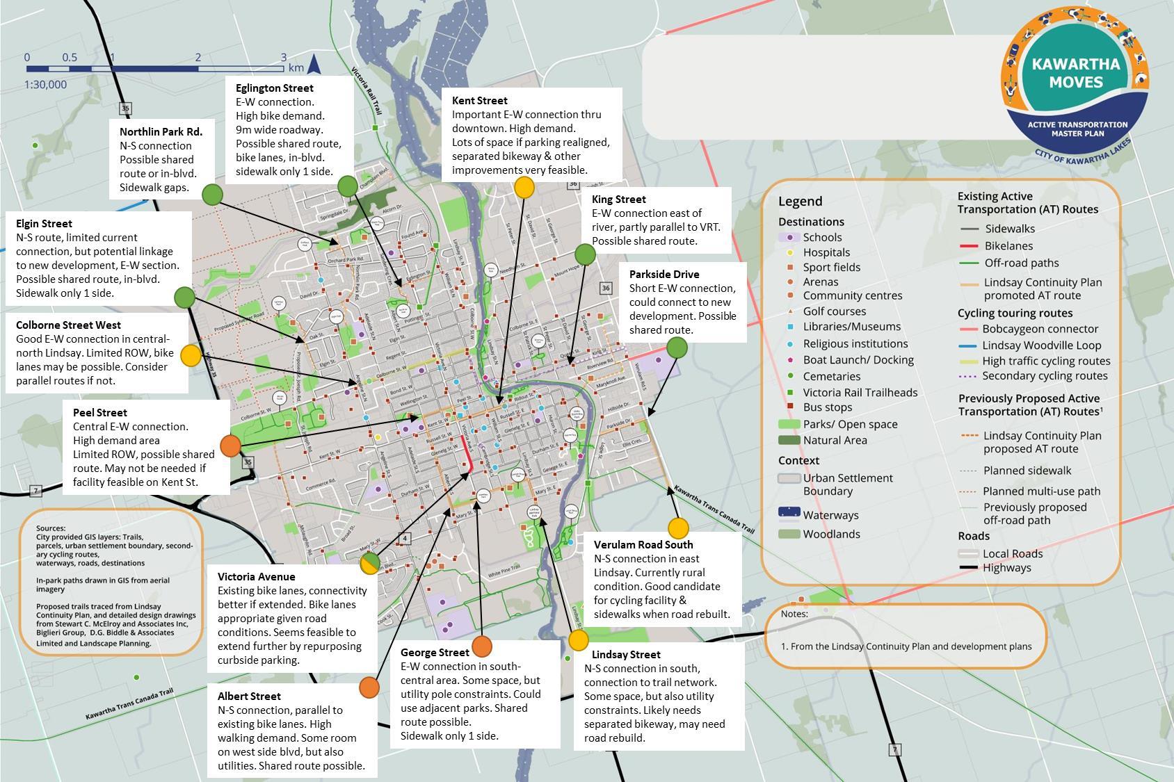
The results of this assessment were mapped as part of Interim Deliverable #1 and presented at Task Force Meeting #4 for commentary and consideration. To successfully implement the plan, it is critical for planned or promoted routes to be feasible and suit the anticipated users, following provincially accepted guidelines, standards, and municipal priorities. A detailed overview of the results is provided as part of the consultation record. An example of the type of output prepared is provided in Figure 3.

Understanding where active transportation users currently bike, walk, roll, etc. can provide a snapshot of the active transportation trends, opportunities and potential improvements that could be addressed through the plan. From the previous assessment we know where the facilities exist, where they are planned, and their condition. Information regarding where people currently make active trips provides further guidance on locations where existing routes could be improved, planned routes could be prioritized and / or missing links could be explored through the development of the AT network.
As part of the project, traffic counts were identified at four locations due to their existing or potential demand for active transportation or other travel, and the potential presence of user conflicts The intent was to use this information as the basis for future data collection and assessment of the impact of ATMP implementation. However, for the purposes of plan development, the information was considered as a means of demonstrating the basis from which improvements can be made, with specific areas identified for improvement prioritization. It is important to note that the traffic counts were completed in September 2021 meaning the data does not capture the full capacity of active transportation in the summer months, nor does it highlight the impacts to AT from winter weather. Counts were completed during peak hours on the weekday as well as the weekend. provides a summary of the traffic count results
The traffic counts were further supplemented by publicly prepared data and information about existing use and route demand populated by Strava. Strava is a popular app and internet service that helps people track, record, and share information about their cycling, running, hiking, and other outdoor activities. Strava provides aggregate data to the public and municipalities, including via a heatmap that visualizes trips. It should be noted that this data only shows certain trips logged by users of the Strava app, and as it reflects voluntary and subjective information, it is not considered statistically valid. However, it does provide some insight about active transportation travel patterns in a given area – especially recreational and fitness-focused trips. As such, it likely overrepresents longer-distance trips, such as touring cycling trips, and underrepresents shorter and more utilitarian urban trips. Key takeaways from the analysis of Strava heat mapping in Kawartha Lakes include:
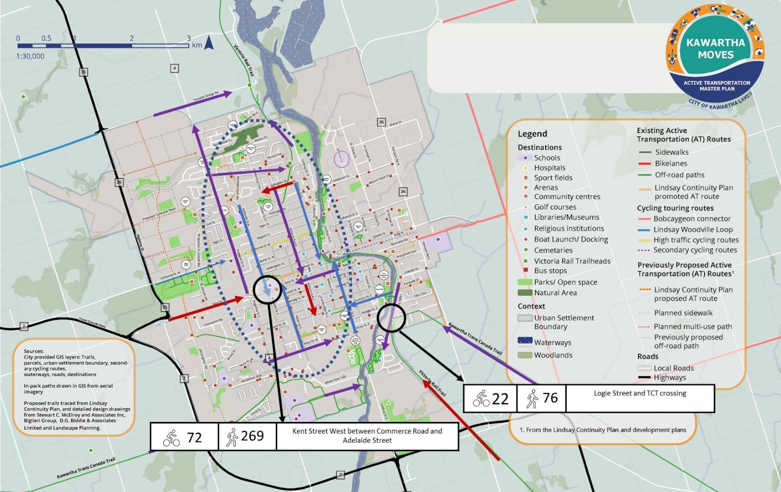
3 . Active Transportation Demand (Existing) in Kawartha Lakes
> High volumes of walking activity occur within the urbanized areas of Kawartha Lakes (e.g., Lindsay, Bobcaygeon, Fenelon Falls, etc.). The TCT has moderate activity, as does the VRT to Lindsay.
> High volumes of cycling activity occur along the Victoria Rail Trail (VRT) from Kinmount to Lindsay and the Kawartha Trans Canada Trail (TCT). Additional high activity clusters include the Lindsay and Bobcaygeon urban areas.
> There is high cycling demand on much of Lindsay’s streets, including significant activity along the local sections of the VRT and TCT.
> There is high to moderate cycling demand on some of Bobcaygeon’s streets as well as high demand on some of the rural roads that connect into Bobcaygeon.
> There is high to moderate cycling demand on some of Fenelon Falls’ streets, including high volumes along the VRT.
The graphics on this page illustrate a combination of the traffic counts and assessment of existing demand based on the available data. The more detailed set of maps that were prepared and presented during the plan’s development are included in the consultation record
Table 7 . Summary of Traffic Count Information Gathered in Kawartha Lakes

Trip generators are locations within an area that are either considered the origin or destination of a trip that is being taken. Each and every day people travel to and from different locations undertaking trips where they are required to move using some form of transportation. For each trip an individual has the choice as to how they plan to get there, i.e., what mode they will use to travel there and the route that they will take.
The type of destination drives the type of trip experience or purposes. Under the users and uses section of the ATMP, there are a number of different types of trips that could occur, including utilitarian trips from home to trip or work, recreational trips for fun or fitness trips for health. These trip purposes are not mutually exclusive, but the categories help to better understand which type of trips could more likely be undertaken by active forms of transportation or in a more multi-modal approach.
Depending on where people live, the travel time and distance to destinations can vary significantly. For a City like Kawartha Lakes, the people who live within the communities of Bobcaygeon, Lindsay and Fenelon Falls have access to many of their day-to-day trip needs locally, whereas the individuals who live within the rural areas require longer distance and time trips to get to where they need to go.
There is an understanding and expectations that for trips that are recreational or fitness-oriented in nature where the destination is for a similar purpose there is a greater capacity and interest for active forms of transportation no matter if the origin is in the communities or within the rural areas. Conversely, due to the time limited nature of utilitarian trips like school and work, if the destination is close enough (e.g. within 5-7 km for cycling and within 1.5 km for walking) there may be a potential to harness more active transportation trips; however, for trips beyond those distances it may be more of a challenge to convert or shift trips by providing more robust, safe, and comfortable infrastructure and amenities.
To help better understand what this looks like in the City of Kawartha Lakes, the entire geographic area of the City was reviewed and major destinations that are appealing / relevant to active transportation mode use were identified and documented. This set the stage for an AT network assessment of areas and locations where AT enhancements could be prioritized because of appropriate trip distances / lengths
The purpose of a long-range strategic master plan such as the Kawartha Moves Active Transportation Master Plan is to establish a guiding document that provides recommendations, strategies, policies, and programs that have been intentionally identified for the purpose of achieving the goals and ambitions of the municipality and its residents. As demonstrated in Section 1.0 and 2.0 of the ATMP, the City of Kawartha Lakes has established a strong foundation of support for and direction around major community priorities, including but not limited to smart growth, environmental sustainability, servicing, and healthy community design. The ATMP aligns with these documents, such as the City’s Official Plan and Strategic Plan, and their goals, recommendations, and policy directions, and aims to complement that work by providing actionable, feasible and policy driven solutions to achieve greater accessibility, mobility, and choice.
Through the ATMP process, the City and the consulting team ensured that public interest and opinion was considered at the forefront and used to determine the preferred outcomes of the process. This meaningful engagement process demonstrates the City’s commitment to working with local residents and stakeholders to drive future initiatives and priorities. Based on the consolidation of background information and the input received, and typical to a master plan process, a vision and series of principles were prepared and adopted. Chapter 3.0 provides a summary of the engagement undertaken, input received and the confirmed vision and principles which serve as the foundation and guideposts for the ATMP.
The information contained within this chapter demonstrates the City’s commitment to residents, decision makers and stakeholders as to the ambition and the potential that can be realized related to active transportation. It marks a shift in thinking around accessibility and mobility and embraces the change that needs to occur in order for the City to evolve from a car dominant location to one that provides options for people of all ages and abilities to move in a range of ways that are accessible, safe, comfortable, and enjoyable.
These ambitions represent what could be achieved in 20 years and beyond, not just within the next year. It will take time, effort, a collaborative spirit, and local champions, but has the potentially to provide positive change for the City.
The ATMP was developed based on an iterative and engagement-focused approach during which, where possible, engagement at major technical milestones was undertaken and used to inform and confirm project outcomes. As noted in Part 1, there were a number of touchpoints for members of the public, stakeholders, agency representatives, decision-makers, and members of the ATMP Task Force.
The following is a summary of the engagement program, including intents, purposes, and milestones which were used to inform the development of the ATMP. In addition to the formal engagement activities, the consultant team served as an ongoing advisor to the Task Force and City staff providing input and guidance on key issues as well as ongoing coordination of the project process.
A more detailed overview of the input received and how it was used is provided on the following pages.
> Public outreach through Jump In webpage
> Emails/letters to agencies and stakeholders
Early Consultation / Round 1
> Survey #1
> Public Input Session #1
> Task Force Meeting #1, #2 and #3
> Stakeholder Workshop #1
> Public outreach through Jump In Page
> Survey #2
Round 2
Round 3
> Promotion and outreach throughout the community
> Task Force Meeting #4 & #5
> Public outreach through Jump in webpage
> Local events and activities through the Task Force
> Individual stakeholder interviews and meetings
> Task Force Meeting #6
Table 8 . Summary of Engagement Milestones
> Address challenges and conflicts between users through design and management
> The integration of ATMP with other existing policies and plans
> Need for education and promotion to drive a wider culture shift
> Confirmation of the proposed AT network.
> Desire for greater coordination and integration of the TMPU and the ATMP
> Providing connections to offroad trails.
> Consideration of new and upcoming developments in the ATMP
> Evaluation of different design interventions
> Exploring various alternatives for priority projects
The purpose of pre-consultation and the first round of engagement was to work with community members and stakeholders to identify the opportunities, challenges, constraints and gaps in the existing active transportation system and municipal offerings. Once the input was received it was used to develop a series of assumptions regarding existing and future potential active transportation users. The first round of engagement was undertaken between August 2021 and August 2022, reflecting a series of pre-consultation activities, online engagement opportunities, promotion, outreach, and relationship building.
Within the first round of engagement three major themes arose related to AT within Kawartha Lakes including a lack of safety, user conflicts, and limited amenities for active transportation users For many participants, investment to improve AT across these three themes was important for daily exercise, encouraging local business, adapting to an increased demand for AT following the COVID-19 pandemic, and supporting active transportation linkages between communities, particularly for those on bike, foot, or canoe/kayak. A brief summary of the major themes and how that input was applied to the ATMP are summarized below:
Keeping safety in mind is a key pillar of the Kawartha Moves ATMP vision. This includes an approach that plans for connectivity between existing trail routes and on-road facilities, as well as the user experiences for on-road facilities.
“In
Fenelon Falls, I would have to tell them that the trail along the east Cameron Lake corridor is not useable for safe active transportation”
> Safety is a key pillar of the plan reflected in planning, design, and phasing
> An all-ages and abilities (AAA) approach will be prioritized
> Commitment to highest order of design where feasible
On-road active transportation facilities both in urban and rural areas face the challenge of interactions with vehicular traffic. Building upon the guidance from provincial transportation guidelines, properly planning for and mitigating unsafe on-road interactions between pedestrians, cyclists and motorists will be a priority of the ATMP.
“County Road 8 between Fenelon and Bobcaygeon has safety concerns - highway speeds, large trucks, narrow pavement”
> Integration with the trails plan to prioritize user comfort
> Identification of more detailed user profile considerations and engagement to refine in Kawartha context
> Re-prioritization of space on municipal roads for vulnerable users

The ATMP recognizes that the active transportation network does not end with just the routing. A fulsome network also addresses amenities such as bike parking, rest areas, and signage. Planning strategically for the entire cycling or walking journey will be incorporated into our network development.
“My wife, an older friend, and the teenager next door are all reluctant to bike around town because they don’t feel safe doing so… Nowhere in the downtown area are there spots to lock-up bicycles.”
> Identification of locations where amenities can be implemented
> Prioritization of locations with highest need
> Range of amenities and information about location
Approximately 530 km of cycling touring routes were reviewed through a desktop investigation to identify their length (start and end points), sightlines, surface type, surrounding context, width / shoulder conditions, demand, user types, parking, connectivity, environmental features, ownership, crossings, and other features To identify these elements, data was sourced from Google Earth/Streetview, the City’s GIS database, Ontario Provincial Parks, Kawartha Conservation Authority, videos and photos by trail users, and Strava heat mapping / data.
The purpose of the desktop review was to:
> Assess the need for improvements to existing routes
> Inform the selection of potential enhancements
> Provide the foundation for the asset management tool of existing and future network
> Identify additional information that should be gathered in the field.
Within the rural areas of the municipality, existing conditions primarily pertain to the promoted touring routes. These previously promoted routes include:
Cycling Touring Routes: These are routes that are promoted by Tourism Kawartha Lakes on their webpage, and through printed copies distributed throughout Ontario and beyond. They are also a layer in the GIS database. There are eight (8) separate loop/connector routes that typically connect urban settlement areas via rural roads.
Secondary Cycling Routes: These routes are identified in the GIS database. They reflect a series of alterative routes to the main Cycling Touring Routes.
High Traffic Cycling Routes: These routes are identified in the GIS data base. They reflect a series of shorter segments identified to have high bicycle traffic. These segments are generally also identified as a cycling touring route, or secondary cycling route.
Key takeaways from the existing conditions assessment:
> No signage advertising the routes, except for limited legacy signage
> Many routes include minor road crossings
> A mix of roads with paved and unpaved shoulders, and no shoulders
Conditions by route:
Carden Ramble: Mostly unpaved shoulders, some sections with no shoulder
Bexley Ramble: Generally no shoulders
Four Village Tour (A & B): Mix of unpaved shoulders or no shoulders
South Sturgeon Route: Mostly unpaved shoulders, some sections with no shoulder
Emily Route: Mostly unpaved shoulder
Farm Country Ramble: Mostly unpaved shoulders
Mariposa Route: Generally paved shoulder
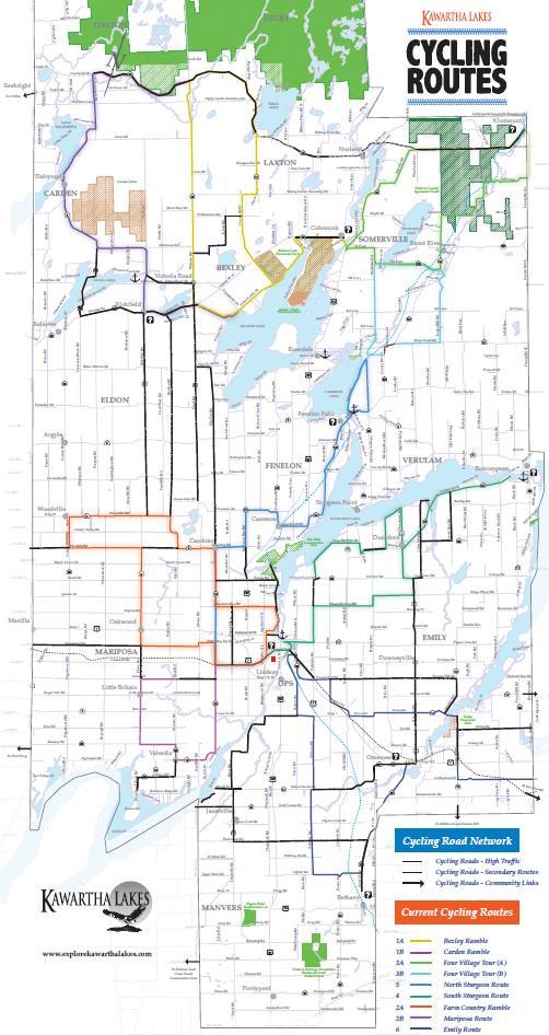
To help illustrate and provide a more holistic outlook on AT trip types and users, six preliminary AT user profiles were developed. These user profiles were developed through discussions and engagement with the community, in order to reflect and illustrate some of the challenges, opportunities, needs, and desires of the various demographics in Kawartha Lakes, and to personalize them. The user profiles do not reflect any particular individuals but are meant to represent and humanize groups of people of varying ages, abilities, needs and desires. During later stages, these user profiles were refined based on input in order to provide a more realistic representation of local mode use and the practical challenges users face.
While the user profiles do provide insights into some local demographics and user groups, it is also recognized that they do not fully reflect the unique experiences of racialized or indigenous populations, nor the impact of systemic racism, classism, and settler-colonialism can have on mode choice. At the time of the plan’s development, the appropriate populations were not engaged enough to refine these user profiles to reflect this level of detail and in-depth equity analysis.
User profiles were applied to identify themes in terms of how and why people use active transportation in Kawartha Lakes, and to inform future design. The process of developing the user profiles not only helped build a more in-depth and real-world representation of AT users, but also helped us to identify underlying issues related to AT travel in Kawartha Lakes, such as the interactions between modes, particularly between AT users and motorists. The user profiles are also meant to be used as a tool during implementation to ensure that AT projects and programs continue to be designed and managed in ways that reflect the lived experiences of a variety of people who walk and bicycle for a variety of reasons. The profiles are also intended to be used as a tool to increase the effectiveness of programs and communication efforts by helping to tell compelling stories about the many different people who make active trips for a variety of reasons and purposes and demonstrating that active transportation serves more than just for a narrow demographic of fit and fearless people, but a wide cross-section of community members. This insight gained from the user profile activity has been used as the basis for developing the education and encouragement strategy.
> From the public survey responses, we were able to further refine and adapt the six preliminary AT users that were developed. Profiles have been reviewed based on a thorough scan of age, gender, and other demographic criteria.
> Option 1 - Realize the Vision: profiles can be used to make generalized AT design more relatable to people’s everyday experiences and articulate how the vision of the plan will be achieved and can impact people’s lives following the implementation of the ATMP after 5, 10, and 20 years.
> Option 2 - Full integration: using the profiles as the basis for all analysis completed, e.g. evaluating and selecting alternatives by assessing and applying the level of comfort of routes and facilities and selecting priorities based on a balance of user needs.
> Option 3 . Hybrid: Integrating the profiles into select key elements and design as well as using it as the basis for developing the education and encouragement strategy
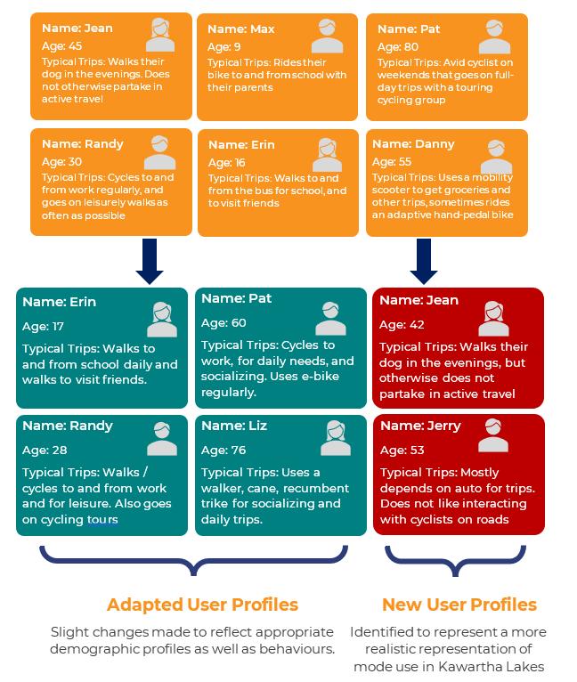
In all cases, it is recommended that Municipal Staff utilize the profiles as the basis for monitoring the success of the ATMP.
The purpose of the second round of engagement was to inform the review and selection of network links, confirm preferred facility design options, and identify phasing and priority preferences. The second round of engagement was undertaken between October 2022 and April 2023 through a series of engagement promotion, outreach, and relationship building opportunities
During Taskforce Meeting #3 in October 2022, members were presented three vision statement options and asked to provide input on and confirm the preferred vision statement as the basis for the development of the ATMP. The options were as follows:
Option #1 - Short and pointed
Active transportation for all, for our future and for fun.
Option
Active transportation in Kawartha Lakes is an accessible option for anyone and everyone who lives, works, and plays within the City. Kawartha Lakes is committed to equitable and feasible solutions that accommodate and provide mobility for people of all ages and abilities
Active Transportation in Kawartha Lakes is planned, designed, and implemented with equity, accessibility and feasibility in mind.
Members of the Task Force confirmed an alternate hybrid option which provided more clarity regarding the City’s priorities and principles. Building upon this input, a public survey was conducted which also presented the three vision options with the majority voting for the “Short and Pointed” option, which was integrated within the recommendation from the Task Force.
In addition to the vision statement, eight (8) principles were identified for the Kawartha Moves ATMP and included as part of the consultation process with the public and the Task Force. The principles are a series of commitments or objectives that are intended to be achieved through the implementatio of the ATMP. The statements are consistent with those used for the TMPU and were presented more for information as opposed to consultation. Small changes were made to some of the wording but as a whole the eight principles were maintained and used to establish a set of four ambitious goals for the City.
> Input helped revise the identified principles
> Informed how the vision and principles could be achieved and measured
> Emphasized how the vision and principles affect residents and their quality of life
> Informed the development of the plan’s ambitious goals which highlight the City’s vision for future success, aligns with its core values, provides multi-pronged commitments, and established the basis for all plan recommendations
When selecting a network approach, there are several considerations at play including user needs, conditions, opportunities, road type and input provided. For example, some of the considerations included building upon existing conditions, focusing on on-road linkages or better reflecting user needs relative to existing or planned routes.
Additionally, while active transportation typically refers to two primary users (or modes) of selfpropelled transportation (walking and cycling), there are a number of other frequently used and emerging technologies that are used such as e-bikes, scooters in-line skaters, and cargo bikes that are important to consider when planning and designing active transportation. No matter the considerations, a network development approach should be an iterative one balancing feasibility with overall plan priorities and input received.
Three network approach options were identified and input from the Task Force and public was solicited. The benefits and drawbacks were noted for each option and a facilitated discussion and public input survey was used to confirm the preferred. The options were as follows
Focus on identifying AT improvements within the built-up areas and communities of the City
A fully continuous and connected system of AT routes will be identified.
Routes and route design will be determined based on the type of road classification, design guidelines and standards with feasibility at the core
A hybrid option between #1 and #2 was selected based on the input received. The benefit is that wide spread connectivity will be achieved for different AT users; however, the cost of the network will be considerable and the implementation will be a challenge even within the timeframe identified.
> The input that was provided and the direction received regarding the network was foundational to the development of the ATMP network. With the confirmed direction, the project team was able to move forward with an iterative network development approach to confirm the proposed AT routes for the City.
> Once the AT routes were confirmed, phasing, costing, prioritization and implementation considerations were developed based on the planning and design assumptions of the network approach.
The purpose of the third round of engagement was to inform the confirmation of the proposed network – including proposed links and design solutions – which were used to identify network phasing and prioritization. In addition, the third round of engagement also focused on the development and confirmation of a series of master plan recommendations which will be used to provide direction on the City’s actions and next steps in support of AT. The third round of engagement was undertaken between April 2023 and January 2024 through a series of engagement, promotion, outreach, and relationship building opportunities.
At the 5th Task Force meeting, the consultant led Task Force members through a workshop activity to review and provide comments on the proposed network and design solutions. A comprehensive presentation was given highlighting the routing selected and the approach used to identify them. In addition, an educational session was provided on the types of design solutions that would be considered based on provincially accepted design guidelines and standards. Large scale maps were placed on the walls and Task Force members were encouraged to provide comments to revise or enhance the recommendations.
How input was used
> Routes were refined including the removal of some routes that had been implemented and some additional routes were considered
> Routes were prioritized based on community needs (comfort and safety) to identify a priority AT network for the City
> Network was confirmed, phased and costed
Recommendations
There are several reasons for providing a set of recommendations for a functional master plan, including the provision of guidance to turn the plan’s vision and goals into specific actions, the development of new or modified policies, establishing targets for annual decision-making, funding, and phasing, and setting out processes and practices for internal and external coordination.
Establishing consistent direction on how to design AT infrastructure, amenities and supportive features
Atotalof15guidelinerecommendationswereconfirmed
Embed AT-supportive directions within existing policy documents and establish new policies to enhance AT planning practice
A total of 7 policy recommendation were confirmed
Processes and practices that integrate AT decision making into day-to-day practices for municipal staff as well as future partnerships
Atotalof13implementationrecommendationwereconfirmed
Initiatives that aim to influence and adapt the behaviours of individuals to generate a greater interest in, and use of, active modes
Atotalof10programmingrecommendationswereconfirmed
Mechanisms to determine the effectiveness of the ATMP’s implementation and opportunities for adaptation and update
Atotalof10monitoringrecommendationwereconfirmed
A series of preliminary recommendations were presented to the Task Force as well as to key stakeholders and agency representatives. Through the Task Force meeting (#6) as well as oneon-one stakeholder meetings and input via email, the recommendations were refined and confirmed. Similar to the proposed network, the recommendations were also prioritized to identify the key initiatives that would be required to achieve success. As part of the process it was determined that an additional category would be needed – “Network” – which will focus on providing direction on when and how the network is to be implemented as part of the ATMP. New recommendations were not developed but some of the previous recommendations were reorganized into the “network” category.
How input was used
> Recommendations were reviewed and refined
> Recommendations were reviewed and re-organized to highlight the network category of recommendations
> Recommendations were prioritized to highlight the top recommendations for success of the ATMP
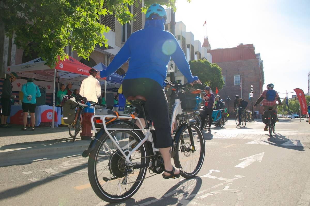
The foundation of the Kawartha Moves ATMP are a series of commitments and statements that articulate the long-term aspirations and goals that are set to be achieved through the implementation of the plan’s recommendations. It is best practice for a vision statement and series of supporting details be established early in a master planning process. Once the statements have been confirmed they are used as the basis for developing, confirming, and prioritizing master plan recommendations. There are three (3) core foundational statements that have been developed as the basis for the Kawartha Lakes ATMP. They are as follows.
A vision is a clear and articulate statement that identifies the aspirations and desired outcomes specific to the master plan topic. In the context of this plan the vision articulates the desired future for the expansion and enhancement of active transportation throughout the entire City of Kawartha Lakes
The Kawartha Lakes ATMP vision statement was developed based on a considerable amount of input from the City’s ATMP Task Force and other stakeholders. Three (3) alternatives were presented for the Task Force’s review and consideration. Based on comments, questions and edits provided, the following statement was selected as the preferred and confirmed as the City of Kawartha Lakes ATMP vision for the future.
ActiveTransportationin KawarthaLakesis planned,designed,and implementedwithequity, sustainabilityaccessibility andfeasibilityinmind.
The vision statement sets the stage for what the City is aiming to achieve through its future efforts. The statement is ambitious and far reaching but does not have specific actions or targets that have been set to guide future work. The Kawartha Moves ATMP is intended to be an action oriented, foundational, policy-informing document which establishes and acts upon Municipal priorities related to sustainable and active transportation.
As such, a series of ambitious goals were identified. The ambitious goals were developed and defined based on a considerable amount of input from the Task Force and other stakeholders as a means of ensuring that there is clarity and communication around what the City wishes to achieve. The ambitious goals provide more details on the vision for future success and align with and support the City’s core values as the basis for the development and prioritization of plan’s recommendations.
Five (5) ambitious goals were identified and confirmed including:
1.
2.
3.
4.
5.
Access to active transportation is provided to all and is ensured no matter the location, trip type or trip purpose.
Urban and built-up areas throughout Kawartha Lakes are walkable places to live or visit.
Cycling is safe, comfortable, and connected throughout all areas of Kawartha Lakes
Consistent and respectful understanding of how to safely use the road between all user groups is prioritized.
A feasible and evergreen master plan is achieved through partnerships, coordination, and internal management / collaboration.
The vision and ambitious goals set the targets for what the City would like to achieve. In addition to those targets, it is also important to define the principles and the values that set the stage for how recommendations are selected and prioritized. Eight (8) principles were identified as the basis for recommendation selection and prioritization. These principles are the same for the ATMP and the City’s Trails Master Plan update (TMPU), however, the way in which they are defined is unique to each plan to ensure that:
> The plans are synchronous and acknowledge they are both pieces of the overall enjoyment and comfort of using active travel in Kawartha Lakes.
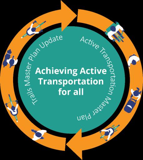
> The plans work together, and are not in conflict, in implementation and phasing.
> User-experience is at the centre of both off-road and on-road facility design. The principles for the City of Kawartha Lakes ATMP are as follows:
By identifying routes and facilities that respond to the unique user needs based on the various mode types as well as user profiles / considerations
By providing solutions to both physical as well as nonphysical barriers to participation in active transportation
By identifying and prioritizing destinations throughout the City and recommending routes or signage linking those destinations in a way that reflects community needs and destination priorities
By considering the environmental, social, health and financial impact of different options to identify those that are the most realistic for the City to implement.
By recommending strategies that address funding, maintenance, management and monitoring as well as achievable, phase-based targets
By identifying unique community conditions and recommending actions to more clearly and effectively encourage AT use and participation.
By addressing the issues of capacity both within and outside of the City and leveraging the involvement of community stakeholders through formal stewardship programs and supports.
By providing guidance on the targets, practices, and methods of monitoring as well as recommended supports to facilitate implementation.

Connecting and communicating refers to two of the major themes that emerged throughout the development of the Kawartha Moves ATMP. Through engagement, outreach and consultation, significant interest and support was provided for improving and enhancing the overall connectivity of the City for those who use active forms of transportation. In addition, a considerable number of opportunities were identified to improve overall communication, education and understanding around AT.
Three of the five ambitious goals of the Kawartha Moves ATMP focus on the long-term goals and objectives which can be achieved through the implementation of a series of recommendations that target infrastructure, design, policies, and programs. The plan has been developed to provide City staff and decision makers with the necessary tools, strategies, recommendations, and resources to allow them to continue to plan, design and implement active transportation infrastructure, work with their partners to explore more ambitious projects, and pursue additional community outreach and education programming. Recommendations have been identified in a series of categories (as noted in Section 1.0).
Section 4.0 of the ATMP provides an overview of the approach used and outcomes generated in the development of four of the six recommendation categories.
The intent is for staff to work together to use the content in this section to:
> Inform the identification of active transportation projects for implementation based on a proposed network of continuous and connected routes and facilities.
> Identify preferred design solutions for recommended facilities and inform a consistent approach to the design of active transportation infrastructure based on provincially and nationally accepted guidelines and standards.
> Inform future updates to municipal policies and plans to ensure that there is sufficient policy support and a framework in place to inform decision-making.
> Identify options and opportunities for enhanced programming, communication and education related to active transportation within the City.
The content contained within this section of the report pertains to the approach and outcomes used to identify the proposed active transportation network. A network is defined as a series of linkages that accommodate AT, providing access to destinations within the City and to surrounding areas. There are three (3) recommendations that are the basis for supporting work on the ATMP network. #
Recommendation
1
2
The active transportation network is to be used as the blueprint for the identification and design of on-road active transportation infrastructure, with a focus on safe and comfortable connectivity between and around communities.
The active transportation network is to be integrated and coordinated with the proposed trail projects and focus areas as identified in the City's Trails Master Plan 2022 to achieve seamless network connectivity and design.
Yes
Yes
3
An assessment of parking needs within the built-up area is to be undertaken and where demand is not demonstrated, consideration should be given to reallocating the space to accommodate active transportation infrastructure.
No
As described in Section 1.4, timing has been identified based the ease at which the recommendation is able to proceed. The options include:
Immediate (green): recommendations can be implemented as soon as the plan is adopted
Alternate timing (yellow): recommendations can be implemented once other initiatives or work has been completed
Requires investigation (orange) – recommendation which requires additional research / review to be undertaken to confirm next steps
One of the core components of this ATMP is the planned active transportation network: a blueprint for a continuous, connected, comfortable and accessible active transportation system is achieved. An active transportation network is not a one size fits all approach and should be developed and tailored to the specific needs of Kawartha Lakes, while keeping the conditions, context, and people of Kawartha Lakes in mind. The City of Kawartha Lakes AT network has a considerable number of opportunities and challenges to address (as documented in Section 3.0), but ultimately has the potential to be a destination for both recreational and utilitarian active transportation purposes.
As noted in Section 3.0, one of the components of the ATMP that the Task Force was able to weigh-in on and confirm was the preferred approach for network development. Three alternatives were presented, with the preferred selection including a hybrid between major area improvements and connectivity – as illustrated with the image to the right. With an understanding of the scope of the AT network, it was important to define the assumptions around how the network would be developed. Assumptions were developed based on the project scope and public input and are accepted as the basis for how routes were identified, and facilities will be designed. Through the ATMP process…
We accept and assume that we are establishing a continuous and connected active transportation network throughout Kawartha lakes by:
1. Focusing on walkability and bikeability improvements within built-up areas.
2. Improving select touring cycling routes in rural areas to align with guidelines and standards.
3. Building upon proposed projects recommended in the TMPU and leveraging existing and planned trails.
4. Leveraging opportunities from planned and future development as well as partnerships with groups and organizations.
5. Providing access, by AT mode, to major and minor destinations within built-up and rural areas.
6. Prioritizing comfort and safety by integrating user profiles that reflect a unique set of trip types, uses, demographics, and destination choices.
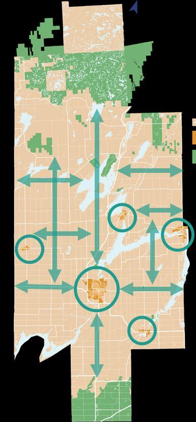
7. Designing feasible solutions that are appropriate for the existing and anticipated users and conditions
Furthermore, to scope the network approach and to ensure that the ATMP’s ambitious goals are being achieved, the following commitments were identified:
> In urban areas, residents should be able to access AT routes from major destinations within 100 m and access minor destinations within 500 m
> Within rural areas, access to AT facilities should be within 5-10 km, with access to trail destinations prioritized
> Access and awareness is further facilitated by providing amenities (e.g. bicycle parking, wayfinding, bike share, etc.) at major destinations and decision points
> Minimal gaps in the sidewalk system
> No dead-end sidewalks
> Sidewalks are at a minimum 1.5 m in width with higher order walking facilities (i.e. wider multi-use pathways) along major corridors
> Prioritize walkways, crosswalks, and other transitionary interventions at major barriers i.e. provincial highways or waterways
> Pedestrianize major corridors by including amenities that improve comfort
> Reduce speeds in areas where there is a high potential for walking, e.g., school zones, commercial core areas
> A spine/primary system of cycling facilities is prioritized on major corridors, and supplemented by secondary routes and trail linkages
> Neighbourhood improvements focus on traffic calming as opportunities for improved bikeability
> Facility design is guided by user comfort and safety, leveraging signage and wayfinding to enhance connectivity
> Design rural connections for touring and long-distance cycling
> Design transitions between facilities and over barriers to remove gaps
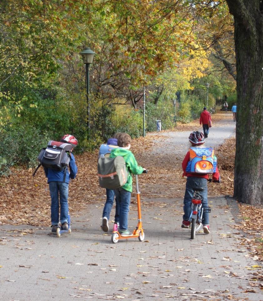
The review of existing and previously planned conditions is summarized previously within the ATMP. Details on the approach and outcomes of the remaining three steps is summarized below
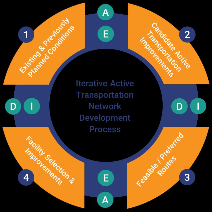
Figure 4 . Overview of the ATMP Network Development Process
Candidate routes are potential new connections that could form part of the City’s active transportation network. Candidate routes typically require additional investigation to confirm their appropriateness relative to the approach and commitments made to support the active transportation network. The identification of candidate routes assumes that the existing and previously planned linkages will continue to be in place but may require improvements and is intended to identify all potential linkages that could ultimately form part of the active transportation network.
The identification of the candidate route system was a two (2) stage approach that integrated the assumptions of the network development approach with the data collection and field investigation findings.
As noted in the existing and previously planned condition review; not all routes and facilities are considered appropriate based on provincially accepted guidelines and standards. As part of the candidate stage, a review of the existing and previously planned facility conditions was undertaken. While all of the existing and previously planned routes will “exist, ” they may not be identified as part of the City’s endorsed AT network due to their context, condition, and ability to meet the safety and comfort needs of users.
Alignment is supported, and the facility likely feasible with minor improvements to the corridor that address current guidelines and standards (e.g., signage, traffic calming, etc.)
To examine compatibility, route alignment was considered relative to network commitments as well as the design guidance provided by the Ontario Traffic Manual (OTM). Based on this, each route was assigned to one of three improvement priority categories –“proceed with minor improvements” , “proceed with new facilities” , or “does not proceed” (see the table below). This information has been provided to City staff as part of the project record
Alignment is supported, and new facilities or significant corridor upgrades are needed to address guidelines and standards
Feasibility is challenging and/or the route connectivity is limited in the overall network context. Alternate routes should be investigated.
The outcome of this review includes a preliminary set of routes and route improvements that act as the basis for the ATMP network. However, these routes do not achieve a continuous and connected system that reflects the commitments and assumptions outlined in the network development process. The next part of this process was to identify potential new routes which could form part of the ATMP network. The details of this approach are presented on the following page.
New potential routes or candidate routes are roadways or corridors that could potentially form part of the future active transportation network for the City of Kawartha Lakes. Candidate routes were identified based on various inputs, including information gathered from the first online survey / interactive mapping tool, input from the Task Force on current conditions, desktop field reviews of conditions, and information gathered through the development of the Trails Master Plan update.
Not all corridors share the same potential to act as an active transportation corridor or offer the same functionality. As such, three types of candidate routes were identified and are described in Table 9. A copy of the mapping that identifies the primary, secondary, and tertiary routes was provided to City staff as part of the project record
Intent
Application
Routes that form a central, connected “spine” system, providing direct north-south and eastwest connections within and between built-up areas and key destinations
Focus in built-up areas, complemented by strategic improvements within rural areas
Routes that provide links to additional features such as offroad trails and minor community destinations
Additional routes that respond to a unique demand but have limited connectivity
Design
Commitment to a greater degree of separation with a minimum of a dedicated facility for cycling (e.g., bike lanes or multi-use pathway), as well as high-quality walkability improvements
Primarily within builtup areas
Various facility types may be considered, including shared or designated cycling facilities, and pedestrian-supportive improvements such as sidewalks or traffic calming
Dependent on the route alignment and destination
Primarily signage or other minor improvements to facilitate access to select destinations
At this stage, it is not the intent that all candidate routes will form part of the AT network due to the overall density and potential cost for such a significant number of projects / improvements. The candidate routes were presented to the Task Force and a considerable amount of input was shared regarding the routes selected, the context-specific considerations, and the personal preferences and priorities of AT users The information gathered was extremely helpful in the next stage of the network development process and has been included as part of the overall consultation record.
As noted above, it is not the goal to accept and recommend all candidate or potential routes as part of the proposed AT network. As such. a thoughtful and diligent approach to the preferred route selection was used to determine which of the candidates would proceed as part of the proposed network. A series of criteria were identified and considered when reviewing the candidate options. The intent of the process was to move routes that were considered “high feasibility” under most criteria to the recommendation stage.
Connectivity
The route provides access to both existing and proposed on and off-road AT facilities
Feasibility
Degree of Support
Economies of Scale
Destination Access
Transition
The route can be designed in such a way that the appropriate design treatment can be accommodated without changes to the cross section
There is both existing demand for the route and it has also been identified throughout the engagement process for improvement
There are opportunities to have the project implemented as part of a planned project or capital project
The route provides access to major destinations within appropriate distances in urban and rural areas
The route has minimal to no transitions of facilities and limited major barrier crossings
Route provides access to minimal to no AT facilities
The desired facility is not achievable within the current context or requires significant economic or environmental impact
There is minimal demand, and it has not been identified throughout the engagement process
There are no alignments with other planning or budgetary initiatives
There are few destinations along the corridor or in close proximity
The conditions require a number of facility transitions, and the route has a number of barriers along it
Table 10 . Criteria used to Determine Preferred AT Routes for Kawartha Lakes
Once a route was moved into the recommendation stage, potential facility types and design enhancements were identified. As part of the refinement process, the project team also determined that it was not necessary to have all three (3) types of routes and selected to remove the tertiary connections and focus more on the primary and secondary linkages.
The next step of the process was the selection of design recommendations and facility types for the proposed routes. With the refinement of the candidate route types; the consultant team worked with staff and stakeholders to clearly define the expectations for the different route types as it relates to the facilities. A summary of these assumptions / expectations is provided in Table 11 and were used to communicate how the process was informed and validate the outcomes of Step 4.
> The spine system of direct north-south and east-west connections within the builtup areas and connecting between community centres
Cycling Improvements
Walking Improvements
> Greater degree of separation for users
> Emphasis on direct access and connectivity to major destinations
> Provide sidewalks on both sides of the roadway if feasible
> Additional enhancements to walkability, e.g., lighting, amenities
> Facility transitions facilitated by controlled crossings
> Linkages that provide connectivity to additional AT features (e.g., trails) and minor community destinations
> Localized design interventions
> Minimum sidewalk on one side of the roadway (urbanized areas)
> Additional access to trail features as appropriate
> Speed reduction / traffic calming measures to enhance conditions for pedestrians
Table 11 . Refined Candidate Route Design Assumptions to inform Step 4
It is important to note that these are aspirations and are intended to help provide guidance on the types of facilities that could be implemented along routes that are considered either a primary or secondary linkage. The information provided is not meant to be prescriptive but act as the basis for future decision-making.
Following the route confirmation (undertaken in Step 3), the study team identified the most appropriate facility and AT improvement types for each route. It was important to ensure that the design of facilities was not limited to cycling but also considered the needs of those most vulnerable, including pedestrians and individuals with disabilities.
Based on a considerable amount of input provided from the Task Force, it was clear that in addition to the routes themselves, the transitions of routes or major conflict points needed to be addressed. By identifying the route locations, the project team also identified potential conflict points that required enhancement to accommodate the safe and comfortable transition of AT travel. The details of the approach for each component are provided below.
For cycling improvements… facilities were selected using the threestep facility selection tool in OTM Book 18: Cycling Facilities. Of note, as per the most recent 2021 update of OTM Book 18, urban and rural contexts for cycling facilities are now assessed using different metrics that reflect the unique considerations for each context The approach takes into consideration the average annual daily traffic volumes (AADT) and the operating or posted speed on the roadways to identify an initial level of separation. This is then refined, and a more specific facility is identified based on context specific conditions and considerations. The result of the review identifies a high-level facility type on a corridor-by-corridor basis which may
change based on roadway conditions and the feasibility of implementation.
For walking improvements… a high-level assessment was undertaken and applied a broad selection of guidelines and best practices in pedestrian safety and walkability planning and design. Walking improvements considered the location of major and minor destinations, the overall experience of the corridor for walking, reducing the need for crossing as much as possible, existing cross section of roadways, and the presence of on-street parking, utilities, and other constraints. It is important to note that walking improvements are only identified within the built-up / urban areas of the city, with the assumption that pedestrians and cyclists would use road shoulders within rural areas or opt for off-road trail destinations.
For transition point and conflict area improvements… best and comparable practices as well as provincially accepted design guidelines were used in the context of the current conditions. It is important to note that the scope of the ATMP does not include recommendations regarding signalization or new controls at these locations. This work would be done through broader road projects and as part of technical transportation analysis. However, potential enhancements were identified based on the current conditions, with a focus on new AT infrastructure that needs to be accommodated.
The recommended and confirmed improvements identified through this process are referred to as the City of Kawartha Lakes Active Transportation Network and are illustrated on the maps that make up Appendix A.
The maps are organized into two categories – cycling improvements and walking improvements / transitional design. The following is a summary of the recommended network components.
There are a total of 763 km of AT routes and facilities proposed throughout the City of Kawartha Lakes in the Kawartha Moves plan.
Table 12 Overview of Proposed AT Network
The goal was to provide cycling facilities that provide safe and comfortable spaces for people to ride no matter their ability and experience. Utilizing the facility selection tool in OTM Book 18 as well as the appropriate commitments and assumptions regarding design solutions, the following facility types were identified as part of the proposed network.
Urban Cycling Facility Summary
Table 13 . Summary of Proposed Urban Cycling Facility Types
Rural Cycling Facility Summary
Table 14 . Summary of Proposed Rural Cycling Facility Types
Pedestrians can at times be an overlooked group when developing active transportation facilities. Unlike cyclists who are using a vehicle to move, pedestrians only need their feet and are not restricted to a certain space or place to move. This sometimes leads to situations where pedestrians are not appropriately accommodated or are provided with sub-par facilities. The goal of the ATMP was to elevate the design opportunities for pedestrians and to think wholistically about how the built environment is designed to accommodate safe and comfortable travel by foot. In doing this, the City is also demonstrating a commitment to accessibility for people of all ages and abilities.
New sidewalks on one side
New sidewalks on both sides
km
km Walkability Improvements
km Traffic Calming Measures
Table 15 . Summary of Proposed Walking Improvements
km
The volume of routes and facilities that are identified as part of the Kawartha Moves ATMP is significant and ambitious. This was the intent of the plan, in order to facilitate a significant mode shift away from motorized vehicles towards sustainable modes of transportation. That said, it is acknowledged that this change cannot happen overnight. Considering the impact of these recommendations and existing municipal capacity, it is likely that not all routes will be able to be implemented and that the City may need to focus on specific routes and corridors with the greatest impact.
In order to ensure a flexible approach that reflects the need for potential future prioritization, as part of the development of the AT network a specific set of priority projects was identified. Priority projects are those
that were assessed to have the greatest potential influence in encouraging active mobility, and in addressing major community concerns regarding multi-modal safety and comfort.
The priority projects form a “minimum grid” system that provides connectivity and continuity throughout the city and its various communities, but not at the total scale of the overall AT network. It includes ambitious facility types and features which maintain the planning and design principles and commitments followed throughout the ATMP. The priority projects are presented on Map 8 through 11 along with the proposed project phasing, with a summary of the total kilometres of projects by facility type presented in Table 16.
Table 16 . Summary of Proposed Priority Projects
All priority projects have been phased similar to the remainder of the network and are presented in Section 5.0 of the ATMP.
Standards and guidelines provide targeted direction to turn the vision and goals for active transportation facility design into specific actions. The guideline recommendations in the following section were developed with these key questions in mind:
> What type of guidelines does the City currently have?
> What are the intended outcomes from these guidelines?
> How can these guidelines be adopted?
The recommendations that have been identified as part of the ATMP provide oversight and direction, as well as specific actions which can be taken with the goal of integrating active transportation facility design into day-to-day decision-making. It is important to note that municipal standards and guidelines are not typically the responsibility of Development Services and Planning to adopt and implement. The majority of this guidance would be most appropriate for the Public Works department to lead as part of wider transportation infrastructure design efforts.
# Recommendation Priority Timing
4 The design guidance provided in the ATMP as well as other provincially accepted design guidelines such as OTM Book 18 shall be used as the primary reference for all AT infrastructure including road retrofits and new developments. No
5
6
Development standards are to be amended to reflect acceptable active transportation facility design standards including the accommodation of both pedestrian and cycling infrastructure on all major arterials and collectors. No
Where the desired active transportation infrastructure cannot be accommodated along the proposed corridor, traffic calming treatments and speed reductions to a maximum of 40km/h are to be implemented to improve active transportation conditions. No
7 The proposed ATMP routing and design solutions including recommended speed reductions on select streets should be reviewed in collaboration with the City's Public Works department, with a focus on developing and implementing an urban area speed reduction campaign.
No
Bicycle parking is to be implemented at all community destinations that encourage AT including libraries, schools, community centres, park spaces, downtown nodes, and bicycle hubs. Specific locations and parking alternatives are to be determined based on the guidelines provided in the ATMP.
The selection of preferred and appropriate bicycle parking solutions in locations throughout the City should be guided by the ATMP bicycle parking design guidance as well as best and comparable practices.
On all rural roadways a min. 1.5 m asphalt shoulder should be provided as part of road rehabilitation and reconstruction projects with a paved shoulder by-law developed and adopted to prioritize future implementation.
Within the urban areas of the City, active transportation facilities should be constructed with asphalt or comparable surface treatment at the appropriate minimum width as per OTM 18 guidance. Sidewalks are to be consistently constructed using a cement treatment at a minimum 1.5m in width.
Bicycle repair stations are to be implemented at bicycle hub locations as well as strategic community locations such as schools, downtown nodes, and major / minor trailheads as identified through the Trails Master Plan update.
Allocate sufficient space to implement bike corral stations within the downtown areas of Lindsay, Bobcaygeon and Fenelon Falls with the opportunity to expand into other communities if demand warrants.
When AT routes and facilities are being implemented or intersections are being reviewed by City staff, every effort should be made to implement crossing enhancements that accommodate pedestrians and cyclists in a safe and comfortable manner consistent with OTM guidance.
When confirming the preferred design solution for active transportation projects along primary corridors, every effort should be made to design a fully separated facility as per the options and alternatives outlined in OTM Book 18, and considerate of the context specific conditions.
Active transportation infrastructure should be designed and implemented based on national and provincial standards and guidelines, while keeping in mind the local context and community needs for a given project. Provincial guidelines and standards are the most applicable and should be the primary resource for any active transportation design.
For the purposes of the Kawartha Moves ATMP, the scope of work included the development of a set of design guidelines. As opposed to developing specific design guidelines for the City, the project team worked with staff to understand existing national and provincial guidelines and standards, their limitations, and the opportunities for enhancement relative to the planning and design recommendations found within the ATMP document. The following guidelines and standards were reviewed as part of the ATMP process:
Provincial
> Accessibility for Ontarians with Disabilities (AODA) Design of Public Spaces in the Built Environment
> Ontario Traffic Manual (OTM) Book 18: Cycling Facilities
> OTM Book 15: Pedestrian Crossing Treatments
> Ministry of Transportation Ontario (MTO) Bikeways Design Guidelines
> Transportation Association of Canada (TAC) Geometric Design Guide for Canadian Roads
> TAC Bikeway Traffic Control Guideline for Canada
> National Association of City Transportation Officials (NACTO) Urban Bikeways Design Guide and Urban Street Design Guide
> American Association of State Highway and Transportation Officials (AASHTO) Guide for the Planning, Design, and Operation of Pedestrian Facilities
> AASHTO Guide for the Development of Bicycle Facilities
The information contained within this section of the ATMP is a consolidation of the most appropriate content from these resources, with an emphasis on the provincial guidelines. It extracts the information that would support decision-making relative to the facility and feature design recommendations identified as part of the proposed AT network.
It is important to note that the information contained within the ATMP reflects the most recent versions of the various design guideline documents. As the City pursues the implementation of the ATMP, consideration should be given as to whether these guidelines have been amended or updated. City staff should strive to have a working knowledge and understanding of the guideline
documents as well as the information contained within the ATMP.
When appropriate, the guideline information should be updated to ensure that it is consistent with any changes to the provincial, national, or international guidance or best design practices.
Guideline Cycling Facilities
Table 17 provides a summary of the most relevant guideline documents and the sections that should be most frequently referenced as the City proceeds with implementation. The details of specific facility deign considerations are on the following pages.
Pedestrian Facilities Intersections and Crossings
Sections:
4.1: Classification of Pedestrian Crossing Facilities
OTM Book 15: Pedestrian Crossing Treatments (2016) N/A N/A
OTM Book 18: Cycling Facilities (2021)
Sections:
4.3: Physically Separated Bikeways
4.4: Bicycle Lanes
4.5: Shared Cycling Facilities N/A
AODA Built Environment Standards N/A
S 2.1.1 (Sidewalks and Walkways)
6: Pedestrian Crossing Facility Design: Controlled Crossings
6.2.1: Geometric Design Components)
6.2.4: Pavement Markings
7: Pedestrian Crossing Facility Design: Uncontrolled Crossings
Sections:
6: Intersections and Crossings
6.1: Intersection Design Principles
6.3: Intersection Approaches and Crossings
6.8: Road Crossing Treatments
6.9: Roundabouts
S. 2.1.5: Curb Ramps
S 2.1.6: Depressed Curbs
S.2.1.7: Accessible Pedestrian Signals at Street Crossings
Table 17 . Summary of Relevant Design Guideline Content
As with the facility selection process described in Section 4.1, design of the ATMP cycling network is primarily guided by OTM Book 18, which provides practical guidance for practitioners on the planning, design, and operation of on-road cycling facilities in Ontario. Table 18 provides an overview of key design and contextual considerations for each facility type included in the City’s proposed cycling network. Facility Type
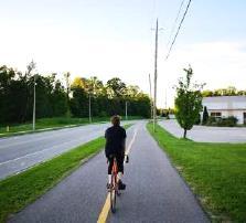
A two-way path that is horizontally and vertically separated from the travelled portion of the roadway by a curb and buffer. Multi-use paths are shared by cyclists, pedestrians, and other active modes.
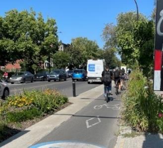
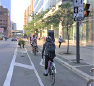
In-boulevard bicycle-only facilities separated from roadway by a curb and buffer. Can be one-way (unidirectional) or two-way (bidirectional)
Constrained sections can be reduced to 2.4 m
> Appropriate for arterial and collector roads
> Appropriate for locations with bus stops and frequent trucks/buses (30+ per hour)
> Appropriate for locations where on-street parking is present
> Best for locations with low to moderate pedestrian volumes
> More appropriate when there are limited or low-volume intersections or driveways
m (two-way)
1.5 m (one-way) & 3.0 m (two-way) minimum
> Appropriate for arterial and collector roads
> Appropriate for locations with bus stops and frequent trucks/buses (30+ per hour)
> Appropriate where there are frequent high-volume driveways, and/or intersections, but may require some design adaptation in these locations
An on-road facility designated for the exclusive use of cyclists, and which is separated from motor vehicle lanes by a horizontal buffer and vertical elements that restrict traffic.
Bicycle Lane (Conventional or Buffered)
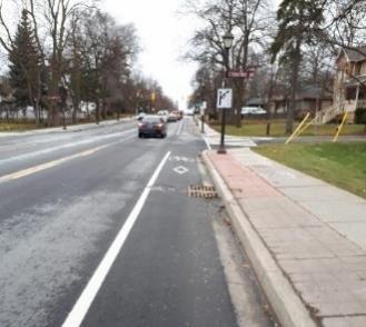
Bike Lane
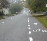
Neighborhood Bikeway / Signed Bike Route
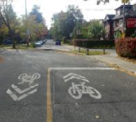

An on-road facility designated by pavement markings and signage for exclusive use by people riding bikes. Can be marked with a single line, or “buffered” pavement markings to create additional horizontal separation.
A shared roadway facility that visually delineates space for cycling by dashed lane lines.
two-way travel lane:
> Appropriate for a range of road functions and classifications, including local, collector, and arterial roads
> Avoid adjacent to on-street parking, but can be accommodated in low turnover locations with appropriate design (e.g., 1 m buffer between bike lane and parking area)
> Most appropriate in locations with limited or low volume driveways or intersections
> Design alternatives include conventional bike lanes, buffered bike lanes, or contraflow bike lanes
> Most appropriate for local streets or minor collectors
> Avoid in locations with on-street parking, but can be accommodated in low turnover locations with appropriate design
> Not appropriate in locations with frequent trucks/buses (30+ per hour)
Low-volume, low-speed streets that are appropriate for bicycle travel and shared use by cyclists and motorists.
A portion of the roadway outside of the traffic lanes that accommodates cyclists, pedestrians, and stopped motor vehicles. Considered "bicycle accessible" if sufficient operating space and pavement markings are provided.
marked buffer:
> Most appropriate for local streets
> Not appropriate in locations with many trucks/buses (30+ per hour)
> If existing conditions do not allow for safe shared use by cyclists and motorists, enhance safety through:
> Traffic calming / speed management
> Traffic reduction
> Intersection treatments
> Signs and pavement markings
> Most appropriate for rural roads with moderate to high volumes and speeds where shared use is not advisable
> In locations with higher traffic speeds and volumes and/or frequent trucks, a buffer should be added to increase horizontal separation between cyclists and motor vehicles
Vibrant streetscapes, including green spaces, public art, and welcoming storefronts, create an engaging and enjoyable environment, encouraging more people to choose walking as their mode of transportation. Walkability features that prioritize the needs and preferences of pedestrians contribute to a community's livability, fostering a sense of community and promoting a healthier, more active lifestyle, and contributing to economic development. Pedestrian features also help provide comfort and safety for people on foot, who are the most vulnerable users of local streets, especially if they are children or seniors.
Everyone is a pedestrian at some point in their journey, whether they are walking for the entirety of their trip, or just walking from where they parked their bicycle or car. Walking is the most inclusive form of travel, as it doesn’t require buying a vehicle or any special skills or experience to participate. Highly walkable places are accessible to people of all ages and abilities, including people who use wheelchairs or other mobility devices.
Creating places that are enjoyable for walking need pathways along with other features. For both sidewalk improvements and walkability improvement corridors, the full pedestrian environment should be considered as projects proceed to implementation, including the following areas (adapted from Transportation Association of Canada guidelines):
> Pedestrian through zones / clearways, including the primary sidewalk or pathway that runs parallel to the street, which is intended to be clear and navigable for pedestrian travel.
> Frontage zones are located adjacent to property lines, and proved an offset from adjacent lands, as well as clearance from building fronts, doors, utilities and architectural features). The width of the frontage zone can vary highly and is influenced by the local conditions.
> Furnishing zones are located between the roadside curb and the sidewalk (or pedestrian through zone) and provides a buffer between motor vehicle traffic and pedestrians, as well as space for elements such as lighting, utility poles, landscaping, and street furniture. As with frontage zones, width can vary, but in the areas designated as “Improved Walkability Corridors” in the ATMP, approximately 3 m is a reasonable width to allow for a wide range of pedestrian amenities and furnishings, including plantings. In locations where street parking is present, the furnishing zone can be extended for brief distances by extending the curb where parking is not permitted to define parking areas.
In addition to these aspects of the pedestrian environment, it is also important to consider intersections and other locations where pedestrians may wish to cross the road and there may be interactions with motor vehicles. Key intersections and other mid-block locations in the built-up areas of Kawartha Lakes, where cyclists and pedestrians are most prone to conflict, have been identified along with associated improvements to ensure a connected AT network.
The chosen pedestrian improvements in this ATMP encompass a range of options, such as sidewalks on one side, sidewalks on both sides, walkability improvements, traffic calming measures, mid-block enhancements, and intersection improvements.
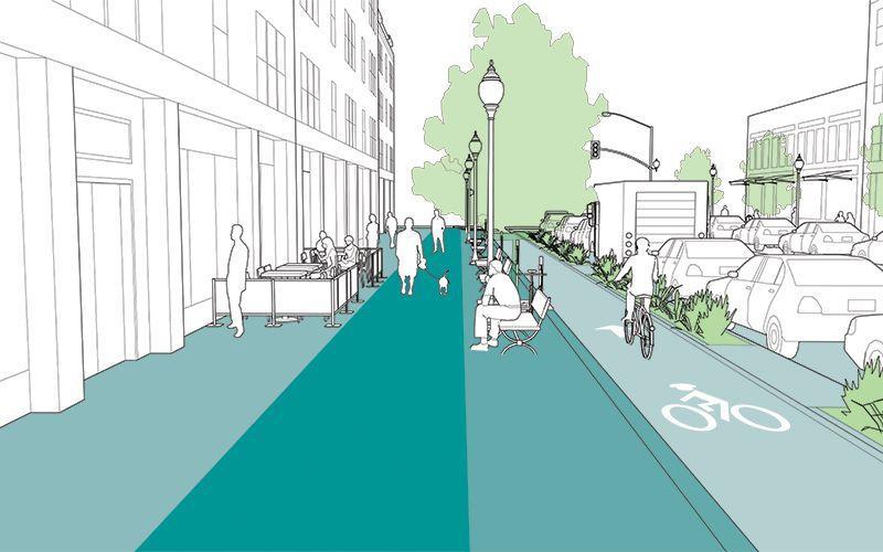


Gaps in the existing sidewalk network that should be addressed through the provision of concrete paths for the use of pedestrians on one or both sides of the road.
> New sidewalks should be built in accordance with relevant standards, e.g., TAC, AODA.
> Sidewalks should have firm, stable, and slip resistant surfaces, and ensure sufficient horizontal and vertical operating space for able-bodied pedestrians of varying ages, as well as people with various disabilities (e.g., users of wheelchairs).
> Sidewalks should consist of a pedestrian through zone, or clear width, of no less than 1.5 m, with no obstructions at any point, and wider (1.8 m +) where feasible, especially where higher numbers of pedestrians are anticipated.
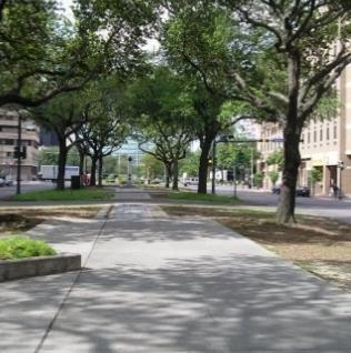
Walkability improvements consist of enhanced design treatments to accommodate the safe and comfortable movement of pedestrians. These features may vary depending on the space that is available and the length of the corridor.
Walkability amenities and enhancements may include:
> Street furniture, e.g, benches, waste bins, bike racks, planters, lighting, signage/ wayfinding, public art
> Landscaping, e.g., trees, grass, other plantings
> Increased separation between sidewalks and roads, wider sidewalks
> Accessibility improvements
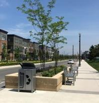
Measures along roadways to manage and slow the speed of motor vehicles. Reduced traffic speeds increase safety for all road users, especially vulnerable pedestrians and cyclists, improving visibility, decreasing the likelihood of serious collisions and injuries, while also contributing to a more comfortable atmosphere for walking and cycling. Traffic calming measures may include:
> Speed humps/cushions/tables
Traffic Calming
Mid-block and Intersection Crossing Improvements
> Reduced speed limits, automated speed enforcement
> Raised crossings / intersections
> Curb extensions to narrow roadway or create chicanes
> Traffic islands or circles
> Pavement markings
> Signage, e.g., dynamic speed signs
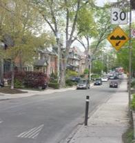
Improvements to facilitate crossings for pedestrians and cyclists. Measures may include:
> Mid-block pedestrian crossovers (PXO) – type A, B, C or D (as per OTM Book 15)
> Enhanced pavement markings, e.g., ladder crosswalks
> Intersection cycling treatments, e.g., crossrides, bicycle signals, conflict zone markings, bike boxes
> Tighter turning radii at corners, curb extensions
> Pedestrian refuges / centre medians / median extensions
> Accessibility features, e.g., tactile surfaces, audible pedestrian signals, curb cuts/ramps, signal timing adjustments
> Identified locations should also be studied for other controlled crossing improvements, based on traffic and other multimodal needs, and implemented as appropriate based on these broader transportation goals.
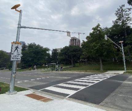
Table 19 . Overview of Design Considerations for Walkability Improvements
There are numerous other features and design elements that will need to be considered at the time a proposed route or facility is implemented. A wholistic look at how a facility interacts with other modes of transportation or built environment is necessary to design, build and maintain a safe and comfortable mobility corridor for people of all ages and abilities. When the City proceeds with the design and implementation of active transportation facilities consideration should be given to:
> Enhancing the overall accessibility of the corridor to establish a built environment that takes into consideration the unique and individual needs of people with disabilities
> Creating safe and secure locations for people to leave their bicycles during trips
> Establishing a clear understanding of where and how to use facilities through the design and implementation of signage and wayfinding
The following sections provide an overview of key design considerations and guidance which are intended to be used in addition to the facility specific design guidance provided above.
The Accessibility for Ontarians with Disabilities Act (AODA) promotes inclusivity and equal access for individuals with disabilities. The Act establishes accessibility standards across key areas of customer service, employment, information and communication, transportation, and the built environment. The Act requires organizations to comply with these standards in order to foster a more accessible and inclusive environment for all Ontarians, ensuring that people with disabilities have the same opportunities as everyone else.
The Act and the associated Design of Public Spaces Standard directs municipalities and transportation authorities to consider the unique needs of people with disabilities when planning and designing public spaces. This involves addressing issues such as curb cuts, accessible crossings, and ensuring that cycling infrastructure is
designed to be inclusive. By incorporating accessibility standards, the AODA strives to create an environment where people of all abilities can navigate public spaces safely and independently, contributing to a more inclusive and equitable transportation system in Ontario.
Ontario Regulation 413/12 (O.Reg 413/12) is the built environment standard which is considered the most applicable series of accessible guidelines and criteria which apply to new construction and extensive renovation of exterior paths of travel. O.Reg 413/12 groups outdoor pedestrian routes into one of three categories as follows:
> Paths of Exterior Travel: which includes sidewalks and exterior walkways that connect to buildings and facilities.
> Beach Access Routes: which are defined as the main connecting
walkway(s) and beaches intended for public use.
> Recreational Trails: which encompass a range of facility types ranging from hard surface multiuse trails in major urban parks to natural surface walking trails in more remote areas.
The most relevant of these categories to the ATMP are Paths of Exterior Travel.
Bicycle parking plays a pivotal role in promoting cycling by offering individuals a sense of security at the conclusion of their journey and enabling stops during their trip. A lack of secure bicycle parking, whether in terms of supply or type, can discourage many from considering cycling for regular trips. Appropriate bicycle parking also contributes to a more orderly arrangement of public space. Recognizing the significance of bicycle parking in fostering an active community, OTM Book 18 and the Association of Pedestrians and Bicycle Professionals (APBP) Bike Parking Guidelines emphasize planning and design considerations including:
> Types of Bicycle Parking: To support bicycle storage and a variety of trip purposes, both short-term and longterm bicycle parking should be provided depending on the context Short-term options, such as bicycle racks, prioritize convenience for people visiting residences, businesses, or other destinations for brief periods. Long-term bicycle parking, including bicycle lockers, enclosed parking areas, and bicycle storage rooms serve employees and
While the pedestrian and cycling design guidelines follow AODA standards broadly, it is important during implementation that all aspects of detailed facility design continue to comply with these standards. It is also important to ensure regular monitoring and maintenance of facilities to promote long-term management of accessibility barriers
residents who need a higher degree of security and weather protection.
> Design of Bicycle Racks and Facilities: Bike racks should be designed to support bicycles upright in at least two places without putting stress on the wheels, accommodate a variety of bicycles and attachments, allow locking of frame and at least one wheel, and be intuitive to use. Consideration should be given to the dimensions (height and width) of bicycle parking racks to ensure the racks are functional and secure, including a height of at least 80 cm. These criteria are generally best accommodated by “Inverted-U” or “Post and Ring” style racks, although other styles may be appropriate depending on context. Some common styles of bike rack, such as “wave” , “spiral,” or “wheel well” racks should be avoided.
> Location of Bicycle Parking: Ensuring visibility and security are paramount for creating a safe environment that encourages individuals to choose cycling. Bicycle parking should be located in areas that are well-lit, have significant foot traffic, and in close proximity to destination entrances.
> Placement and Clearance: Adequate spacing between individual racks is essential to facilitate easy maneuvering and ensure that cyclists can securely lock their bikes. Clearance should also be provided around each bike rack of at least the footprint of a typical bicycle (1.8 x 0.6 m) to allow space for different bicycle types, sizes, and accessories, including recumbent bikes, tricycles, bike trailers, and bike baskets, enhancing the inclusivity and practicality of the parking facilities. When locating bike racks near sidewalks or other pedestrian paths, care should be taken that neither the bike rack nor an attached bicycle impedes on the pedestrian clearway space or cause any other accessibility issues.
> Materials, Finish, and Installation: Bike racks and other bicycle parking facilities should be built using steel or other high-quality materials and include weather and corrosion-
resistant coatings or treatments to enhance their longevity. Racks should be installed on a hard surface and be held firmly in place.
> Other end-of-trip facilities: In addition to bicycle parking, a variety of other end-of-trip amenities can be offered to facilitate trips by bicycle. Repair stations that include tools, an air pump, and a place to hang a bicycle help people do basic maintenance and repair to their bicycles – helping overcome a key barrier to bicycle trips and enhancing the bicycle tourism experience. Rest areas that consist of a variety of amenities such as seating, tables, water fountains, or other features, can provide a stopping point for cyclists as well as pedestrians. Showers and change rooms at destinations can also be an incentive for bicycle use, especially for people who commute or travel longer distances.
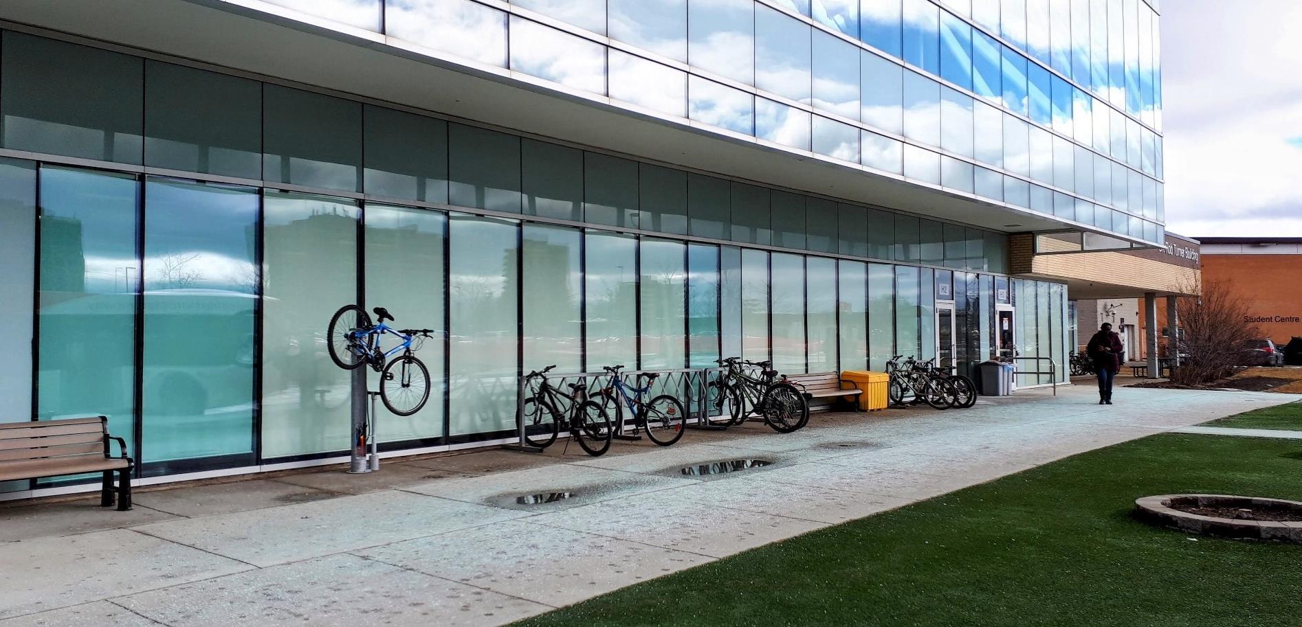
Wayfinding and signage are key design considerations as part of a comprehensive active transportation network. For both the existing as well as any routes that are implemented in the future, directional and route signage should be enhanced for better promotion, education, and awareness of routes and key destinations. At a minimum the City should implement the requisite regulatory signage, and be supplemented by local wayfinding and signage in order to ensure that there is clarity regarding which routes are endorsed by the City, how to use infrastructure and how users should interact with each other safely and appropriately.
Wayfinding helps guide individuals through unfamiliar environments, providing clear and concise information to help them navigate and reach their destinations efficiently. In urban spaces, well-designed wayfinding signage not only enhances the overall experience of pedestrians and cyclists, but also promotes safety and can help highlight key local attractions and destinations. These signs offer a sense of orientation, reducing the likelihood of getting lost –especially for tourists and newcomersand encouraging people to explore and utilize varying modes of travel.
In complex or densely populated areas, effective wayfinding signage contributes to the vitality of public spaces by facilitating seamless movement and accessibility. By establishing a userfriendly navigation system, wayfinding signage plays a pivotal role in fostering a positive and inclusive environment for all individuals, enhancing the overall
functionality and appeal of an active transportation network. Wayfinding is especially useful in a municipality such as Kawartha Lakes that has a large number of visitors who may not be as familiar with how to get around in the area.
For the routes that are being promoted by Kawartha Lakes Tourism, some informal wayfinding and signage has been implemented identifying specific routes; however, a more cohesive approach and renewed effort is recommended to be utilized going forward. The overuse of duplication of signage, or “sign pollution,” which can cause greater confusion than benefit, should be avoided
To start, the City should use the existing database of AT routes to determine where there is missing regulatory signage along a route where the AT network has been identified, especially the cycling network. In these locations the City is recommended to implement the green Bicycle Route Marker sign (M511) and where appropriate a Share the Road sign (Wc-19 or Wc-24), e.g., in locations where the conditions of the roadway and surrounding context change significantly which could impact roadway users and create conflicts between cyclists and motor vehicles. Where appropriate, as the City implements other types of AT infrastructure i.e. multi-use pathways or
bike lanes, the appropriate regulatory signage should be implemented at the time the facility is constructed.
The City’s Trails Master Plan Update has extensive guidance regarding trail signage and wayfinding, including a high-level signage strategy. This guidance should be adopted in a modified manner to assist navigation for active transportation users along City roadways and in urban locations, while maintaining a unified set of design and graphic elements and materials.
The ATMP further supports the development of a branded concept for trail and active transportation signage and wayfinding reflecting the look and feel of municipal branding but with a nod to AT and sustainable transportation. The logo prepared for the ATMP could be a source of inspiration for this concept (see below to the right).
When developing effective wayfinding and signage, the following should be considered:
> Clear and concise messaging should be included;
> Consistent branding and design elements should be included;
> Strategic placement to ensure that the wayfinding is positioned at major decision points;
> A clear information hierarchy is included that prioritizes information based on relevance; and,
> Consideration for the environment by tailoring the design of the signage to match municipal aesthetics or to reflect the uniqueness of the City
All of this should be pursued as a collaborative program between various municipal departments who have a role in the design, placement and maintenance of signage related to on and off-road recreational and utilitarian travel. The following are some of the key steps and stages of a signage and wayfinding program:
1. Planning: reviewing and identifying the AT network specific to the overall user experience – this can be done in the field as well as through desktop analysis and supplemented by findings from the ATMP.
2. Design: which prioritizes and considers the end user, how they experience the community, and how the signage and wayfinding is intended to benefit various trip purposes
3. Collaboration: with both internal and external stakeholders to support buy-in among those responsible for implementation and maintenance as well as use
4. Maintenance – ensuring that any signage that is implemented is monitored and maintained to ensure its effectiveness throughout multi-season weather conditions.
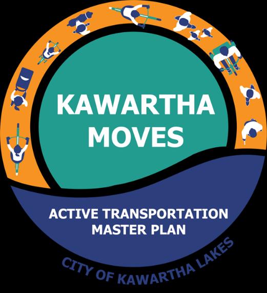
The way in which a community grows and changes over time, including its land use, built form, and use of resources, is driven by planning policy direction adopted and implemented by various levels of government, with municipalities having extensive responsibilities in this area. As noted in Section 2.1, every effort was made to ensure the ATMP was driven by policy, including having AT planning, design, implementation, and maintenance embedded into policies as much as possible and applicable, to ensure the greatest degree of influence and support for AT across the City. The importance of establishing strong policy support is demonstrated through the number of policy recommendations that are included within the ATMP. They are as follows.
16
17
A traffic calming policy is to be developed for both the urban and rural areas of the City and adopted through the City's Transportation Master Plan to complement the ATMP network.
The active transportation network as adopted in the 2024 ATMP is to be incorporated as a schedule as part of the City's Official Plan along with the necessary policy supports to ensure that the ATMP recommendations are reflected in higher level policy
18
19
The active transportation network as adopted in the 2024 ATMP shall be acknowledged and incorporated into the City's Transportation Master Plan with consistent recommendations or additional information to support and facilitate the implementation of traffic calming and similar road condition features.
Where possible, site plan requirements should include the consideration of and design for active transportation users with a focus on strategic place making within parking lots and in between buildings
20
21
Applicable municipal guidelines, standards, and bylaws are to be reviewed and amended / updated to reflect the policy framework and suggested revisions as identified within the Active Transportation Master Plan.
Develop and adopt a Complete Streets policy or guide as the City reviews and adapts road classifications to reflect changes in land use patterns and growth.
22
Emerging and complex policy topics such as e-mobility should continued to be monitored and discussed by the City and its partners to continually adapt and address concerns and opportunities. No
As per the policy review there is already a solid level of support for active transportation in City policies, plans, guidelines, standards, and by-laws related to growth management, housing, community facilities, parks, and open spaces, and as an integrated part of land use and infrastructure provision. However, the degree of detail and type of support provided proves to be inconsistent. Considering the degree of support for AT and the strong interest in enhancement, there are some significant gaps and opportunities which if adopted and implemented would ensure more effective and comprehensive policy support to encourage and foster a wide variety of active trips.
There are a considerable number of possible enhancements, amendments and additions that could be made to existing policies and plans to leverage their role in the existing planning decision making hierarchy relative to future AT needs. A comprehensive policy memo was prepared for City staff detailing the recommended revisions, enhancement, and amendments on a policy-by-policy basis. This memo has been provided to City staff and is to be used as the basis for future work done by the Development Services department as a policy / plan is to be updated or if the amendment or revision is considered important enough to proceed.

There are other emerging trends and policy topics related to active transportation which should continue to be monitored by the City, and be reflected in future policies and practices. These emerging topics are reflective of major issues that are experienced within the City of Kawartha Lakes and beyond, and which may create challenges and concerns between users as well as by those responsible for facility planning, design and implementation. The City should continue to monitor these topics as they evolve, and as local conditions change.
Micromobility refers to the growing trend of using small, lightweight, and usually electric-powered modes of transportation for short-distance travel within urban areas. Common examples include electric scooters, ebikes, and electric skateboards. These modes can blur the lines between human-powered active modes and motorized travel. Some provincial rules are in place to differentiate between different types of micromobility. In the case of e-bikes, only power-assisted bicycles that can travel a maximum of 32 km/h, not weigh more than 120 kg, and which meet other criteria, are allowed to be legally operated on
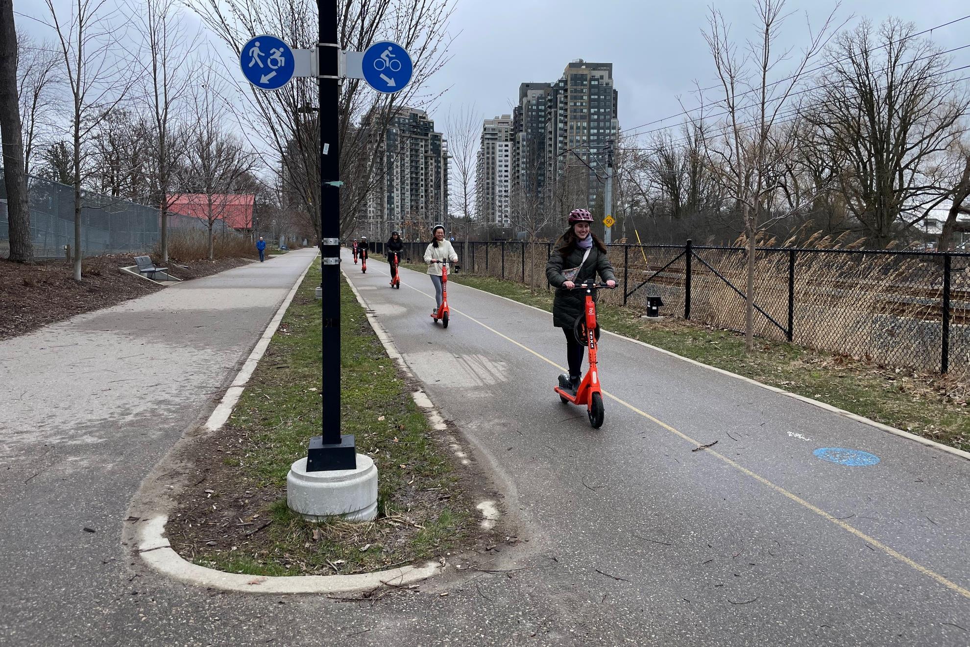
roads in Ontario. Despite this provincial guidance, municipalities need to consider how e-bikes and other forms of micromobility fit within their local multimodal transportation network.
> Monitor evolving best practices (as per ATMP Recommendation #22).
> Consider modifications to municipal policies and by-laws to clarify permissions and restrictions of different types of e-bikes / micromobility.
> Consider how e-bikes / micromobility can be accommodated in the design of AT and road infrastructure
> Engage in targeted education campaigns to explain rules and etiquette related to use of e-bikes and micromobility.
> Consider adding e-bikes or escooters to expand local bike share services
> Examine the growing use of ebikes in food delivery and other courier services, and how this can support local business and economic development
If cycling or pedestrian facilities are improperly designed, constructed, or maintained, the City may be exposed to some level of liability. Many aspects of the ATMP are meant to mitigate liability, including design and maintenance recommendations –highlighting the importance of implementing projects in ways that are consistent with the plan and relevant guidelines.
> Ensure provincial/national design guidelines are followed for the design of AT facilities, especially as they evolve in the future.
> Monitor AT facilities through regular patrols and document conditions.
> Increase public awareness of user rights and obligations.
> Maintain proper insurance coverage.
Complete Streets are based on the principle that streets are meant to be designed for everyone, to allow safe access by all potential users including pedestrians, cyclists, motorists, and transit users of various ages and abilities. Not all Complete Streets look the same, as their design should vary function of the street, while also recognizing the role of streets as public spaces and destinations rather than just transportation corridors.
> Adopt a Complete Streets policy and/or guidelines to guide multimodal transportation decisionmaking (as per ATMP Recommendation #21)
> Ensure that AT improvements are designed with a comprehensive consideration of all road users, the street context, and the role of streets as public spaces.
> In future City policies and road design guidelines and practices, include references to Complete Streets and related concepts that consider multiple modes and recognize the needs of different users, including those of various ages and abilities.
To encourage greater walking, cycling, and other forms of active transportation, building infrastructure and ensuring supportive policies are only part of the overall picture. It is also important to encourage and educate about safe and appropriate use of AT facilities, and influence the behaviour of those who live, work, and play within the City of Kawartha Lakes so that more active trips are made for a variety of purposes.
The following are a series of recommendations that pertain to opportunities for enhanced AT programming for the City of Kawartha Lakes. These recommendations are very much dependent on a strong commitment to coordination and collaboration between municipal staff internally and external stakeholders. The ATMP provides a multi-faceted approach with options and alternatives that could be explored depending on the community interests, educational needs, and funding opportunities available.
# Recommendation
22
23
Provide additional support and maintenance of the existing bike share program within the City's urban and built-up areas in partnership with the community groups and external organizations that are responsible for implementation and management.
The Planning and Development division will support the implementation and coordination of AT education and outreach programs based on the recommended educational strategy outline within the ATMP
No
No
24
25
Programming will be developed and implemented based on a series of target audiences, including a focus on youth and seniors to support a greater degree of culture shift towards active modes.
Active Transportation promotional materials including hard copy mapping are to be updated on an annual or bi-annual basis to accurately reflect existing active transportation facilities, including coordination with the Parks and Recreation department to ensure both on and off-road opportunities are reflected
No
26
The interactive online mapping system should be updated to reflect the existing active transportation and trails network and should continually be monitored and updated as projects are implemented and conditions change to ensure accuracy of information.
No
No
27
28
A comprehensive wayfinding and signage strategyintegrated with the Trails Master Plan Update - should be undertaken by the City based on the loop routes identified by Kawartha Lakes Tourism and routing confirmed through the ATMP with a focus on the builtup areas
An expansion to the Bicycle Friendly Businesses Program should be explored in partnership with Ontario by Bike and local businesses
29
Explore acquiring a Bicycle Friendly Community designation in partnership with Share the Road Cycling Coalition and other applicable organizations
Yes
No
Yes
30
31
Support the development of active and safe routes to school programs based on the framework provided in the ATMP with the intent of having one pilot program launched within the first year of ATMP implementation.
The programs and outreach strategies as identified in the ATMP are to be reviewed and prioritized by Planning in partnership with Parks and Recreation with a minimum of one initiative being undertaken each year in collaboration with local agencies, stakeholders, and other groups.
No
No
To comprehensively accelerate adoption of AT, ensure that the AT network gets used, and overcome ingrained societal norms that assume automotive travel as the default way of making regular trips, it is necessary to change behaviour through targeted programming. Many plans limit programming and education to simply providing information or traditional mass marketing and communications campaigns. However, evidence shows that behaviour change is more effective with an approach that emphasizes direct, personal contact among community members, engages them directly in the desired behaviours, and focuses on identifying and removing barriers people face.
While the AT infrastructure network seeks to overcome physical barriers, programming should look to overcome nonphysical barriers – such as not having safe bike parking at a destination, a lack of weather-appropriate clothing, lack of access to a working bicycle, or perceptions that active trips are more time consuming or difficult than they really are. When considering the implementation of education and encouragement programs, the City should tailor its programs to specific audiences and barriers unique to Kawartha Lakes. Programming should be prioritized based on the audiences that have the greatest potential for active transportation uptake, and where possible focus on areas or locations where new AT facility improvements are made. In the context of the City of Kawartha Lakes, it is recommended that the focus should be placed on youth and seniors within the built-up areas as well as seasonal visitors City-wide.
An emerging practice that has proven effective in influencing behaviours and achieving cultural change is that of Community Based Social Marketing (CBSM). CBSM focuses on developing a deeper understanding of barriers to a behaviour and actively identifies ways to address these barriers. The City of Kawartha Lakes is encouraged to use a CBSM approach when developing and implementing AT-supportive programming A CBSM approach typically includes seven (7) stages, as outlined in Figure 6 The typical CBSM programming process is also outlined and recommended for implementation on page 88 of the City’s Trails Master Plan Update. This process is recommended to be used for both the Trails Master Plan update as well as the ATMP, with every effort being made to coordinate programming initiatives between City staff from Development Services (Planning) and Community Services (Parks and Recreation), as well as with external stakeholders.
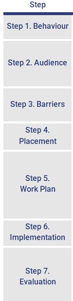
Figure 5 Seven Step CBSM Approach
Similar to the Trails Master Plan update, the intent of Kawartha Moves
ATMP is to provide the City of Kawartha Lakes with the approach to design, implement and monitor AT supportive programming along with a series of suggested programs for future consideration. The programming alternatives outlined within the ATMP build upon those identified within the TMPU, which include:
> Maintaining Trail Information
> Kawartha Lakes Trail Days
> Community Rides & Trail Experiences
> Trail Kiosks
> Trail Clean-up Day
> Rental Offerings
The information contained within the ATMP is intended to provide more specific programming options which complement the TMPU initiatives, with a focus on the challenges and nonphysical barriers that are experienced throughout the City. The alternatives are not intended to be a fulsome prescriptive list of options but the basis upon which discussions can occur regarding what programs the City may wish to explore through future efforts
The information contained within this section build upon the programming recommendations and are intended to provide additional support to be used by staff in the initial stages of program planning and design – should they wish to proceed with implementation.
The Kawartha Lakes bike share program offered in Bobcaygeon, Fenelon Falls, and most recently Lindsay is leading the way and showing that a bike share service can work in smaller communities, and not just big cities.
Since launching a few years ago, the local bike share program has offered an important service to provide residents a practical, flexible, and economical travel option, allowing people to ride a bike without worrying about up-front costs, maintenance, or long-term storage, while also providing an attractive tourist amenity.
To ensure that the service remains viable long-term, it will be necessary to maintain support for the service and ensure that bicycles are maintained and replaced regularly, and potentially expanded with additional bikes and locations to make the program as useful as possible for various users. In addition, enhanced efforts could be made for broader promotion of the bike share program, beyond localized efforts, including a potential seasonal campaign targeted towards tourists and local demographics These efforts could be explored in partnership with Kawartha Lakes Tourism.
The program may also benefit from expanding the bike share system to include different types of bicycles that people can try, such as e-assist or adaptive bikes that allow people with varying abilities and levels of fitness to cycle, or cargo bikes that allow people to carry large items.
Education and outreach programs are an important aspect of the ATMP, as these programs are a cost-effective way to get people to engage in AT and address nonphysical barriers. These types of programs are often most effective when targeted to specific demographics, such as youth, seniors, women, low-income people, or other groups. Below are some programs that have proven effective at municipalities at building a culture shift toward active modes.
When encouraging behaviour change, sometimes small incentives can make a big difference to reinforce people’s decision to walk or bike and help them to establish AT as a more regular habit.
Incentives could involve partnerships with local business, to encourage employees or customers to bike or walk by giving them a small token of appreciation, such as a discount, a free coffee, or other item.
Giveaways can also reinforce education and encouragement messaging – instead of just telling people to be visible and heard on trails and paths, it can be more effective to purchase and give out bike bells, bike lights, or reflective items.
Incentive items can include City branding and web addresses or QR codes that link to relevant online information or be given along with printed maps or literature to help make this information more attractive for people to take and read. These promotional items can be leveraged and cross-promoted with other City initiatives.
Once the City starts to produce print information, maps, and incentives, the information needs to find a way to be distributed effectiveness. Where possible information and incentive materials should be distributed at events with staff who can answer questions about walking and cycling and tell people about upcoming City active transportation projects. A good place to start is to put together a booth or kit that can be deployed either at one of the numerous community events that regularly happen across Kawartha Lakes, or that “pops-up” at busy trail locations at key times. A booth doesn’t have to be a large-scale physical structure - it can be as simple as a kit that includes a table, tent, and promotional information and giveaways, and can be enhanced with things like a bike pump to give cyclists air, or a water station to fill people’s bottles.
At large community events, consideration should be given to enhancing municipal presence with a bike valet service – giving people a safe, supervised place to leave their bike when local racks may be full, and to help encourage people to leave their car at home when car parking may be scarce. These types of offerings
have in the past been coordinated with local interest groups with support from the Municipal, with the City providing equipment and space for the valet, and volunteers providing inkind support in the form of time and effort.
Many people have a bike sitting in their garage that they may use occasionally, but a major barrier that prevents people from cycling more often is the lack of knowledge about cycling, whether that be riding skills, knowledge of safe and legal cycling practices, or repair and maintenance skills to keep their bike functional and enjoyable to ride over time.
There are a variety of ways to implement skills workshops. Local library or recreation programming can
be leveraged by adding specialized AT workshops, kids’ camps, bike rodeos, or fitness classes, or by including cycling or hiking as a theme or aspect of a broader program.
A local businesses or other organization could also be contracted to deliver skills workshops – the B!KE organization in Peterborough offers mobile workshops and could bring this service to Kawartha Lakes. Workshops can be done on a variety of topics and be done in varying lengths and for people of varying skill levels and demographics. The format of these workshops can be flexible and coordinated More formal programming can be explored by the City if there is interest in bringing a CANBike program to one of the local schools or community centres.
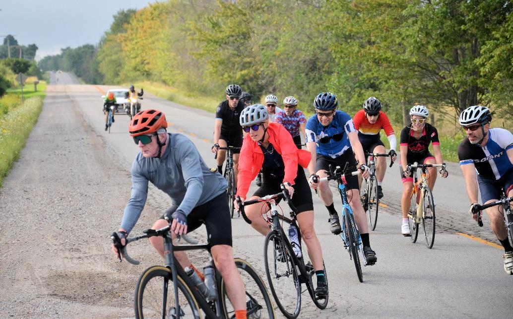
A simple and effective way to encourage AT is by organizing local walks, hikes, bike rides, or other experiences such as longboard or kick scooter rides. These outings can leverage other interests among members of the community, such as natural, historical, or cultural features, while providing people an opportunity for social connection
Walks and rides can be focused on various demographics, such as families, seniors, tourists, or other groups. While there are already some local bike rides organized by the Kawartha Cycling Club, these are generally longer-distance rides that attract experienced touring cyclists. There is interest and room for the City to support shorter, family-friendly rides aimed at the “interested but concerned” group of potential cyclists.
These types of experiences provide people with an opportunity to engage in an enjoyable, social activity that helps build an active transportation culture within a community. Once a series of walking and cycling routes have been developed through organized events, these can be used and promoted through wayfinding and online mapping tools to give people a resource to draw on for their own self-guided trips.
The AT network should be the guidepost for determining which routes would be most appropriate, in addition to leveraging off-road trail linkages for AT use. Rides can explore ‘old favourites’ or be used to highlight new facility types and educate people as to how to navigate or use different types of cycling or walking infrastructure.
The City of Kawartha Lakes currently has a variety of online information about active transportation and trails, including pages on the main municipal site at Kawarthalakes.ca, and on the City’s tourism page at explorekawarthalakes.com.
The City’s tourism department also produces a Cycling Routes Map which focuses on rural touring bike routes and highlights key destinations for touring cyclists. These resources provide a strong base for the City to build upon, and to remain relevant they should be regularly promoted and maintained, with effort made to ensure that the information presented in print or online promotional formats
is up to date and reflective of the appropriate routing, facility and use information
As the ATMP network is implemented, and growth occurs in the municipality, there will be opportunity to update existing maps and resources with new facilities as they are improved, and to provide more resources for localized, utilitarian cycling, such as through the development of a Lindsay cycling map. New and updated mapping and resources should be coordinated between the Planning and the Parks and Recreation departments to ensure they reflect both on and off-road facilities, and for multiple trip purposes, including recreational as well as utilitarian and commuting trips.
Wayfinding signage and other tools that provide information for people to get around via active modes can have multiple benefits for a community such as Kawartha Lakes. The first is providing practical information to help people get around – which is especially important for tourists, newcomers, or when facilities are newly built. While basic wayfinding signage is provided for major communities or destinations, this signage is often focused on drivers. People on foot or on bike often cannot easily see such auto-oriented signage, and the information is often not tailored to them.
Smaller signage that is at eye level for pedestrians and cyclists and that include walkable or bikeable distances, or even walking or biking times, are more useful. In addition, signs also eliminate the need to consult an
electronic device or paper map to get around. The existing promoted touring cycling routes are an ideal place to consider the implementation of initial signage and wayfinding.
In addition to the practical benefits of helping people navigate their communities on foot or bike more easily and confidently, wayfinding signage can also serve as an effective tool for marketing walking and cycling. Similar to posters, billboards, or print media, wayfinding signs are a useful nudge that reminds people that walking or biking is an option to access destinations and helps communicate the importance of active transportation to the City.
Lastly, showing the distances and times to travel on foot or by bike, wayfinding signage can help change those perceptions and encourage new travel patters. The principles and approaches to developing unique and tailored signage and wayfinding is identified in Section 4.3 and should be considered along with a robust promotion and communication campaign once implemented.
The Bicycle Friendly Business program is a province-wide initiative organized by the Ontario By Bike Network. To join the program, a business must meet certain certification criteria, such as providing secure bike parking, local cycling information, water, rest areas, and/or other amenities.
Kawartha Lakes currently has several local businesses that are part of the program, befitting its status as a major
cycling and tourism destination. However, this also points to potential for additional expansion of the program.
The City is encouraged to follow the lead of other municipalities by helping to promote the program, facilitate the application process for businesses, and offering incentives such as promotional materials, bike racks, bike repair kits or stations, or other incentives to businesses who join.
They are also encouraged to leverage this program recognition as part of wider promotional initiatives related to cycling tourism throughout the City. The opportunities for increased economic investment are significant given the robust local seasonal tourism in the area.
The Bicycle Friendly Communities program encourages municipalities improve and evaluate their progress in engineering, education, encouragement, evaluation and planning to foster cycling by awarding various levels of certification: bronze, silver, goal, platinum, and diamond. The program is led by the Share the Road Cycling Coalition, a non-profit organization which provides
municipalities with resources and guidance to work towards and apply for certification. Kawartha Lakes will be well positioned to join the over 50 communities across the country that have achieved Bicycle Friendly Community designation once it begins to implement the recommendations in the ATMP.
Unlike the Bicycle Friendly Business program which specifically acknowledges business within the City, the Community Designation is a more ambitious recognition that could help City staff to determine the degree to which their investment and commitment to AT is being recognized.
As part of the program feedback is provided on potential improvements or areas of focus which the City could use to help prioritize the ATMP recommendations further. Typically, Share the Road Cycling Coalition looks to internal municipal commitment including but not limited to the adoption of a master plan. This combined with investment in education, encouragement, enforcement and evaluation can help contribute to achieving a specific designation through this program

The benefits of kids walking and biking to school are well-documented, including improved physical and mental health, better academic performance, safer local streets, and reduced pollution and traffic, to name a few.
Safe Routes to School programs help create lifelong habits of safe walking and cycling among youth, and to be effective should also involve parents as they are usually the decision makers for family trips.
The City can leverage local schools and boards, a range of partners such as the HKPR District Health Unit, as well as provincial and national resources and programming, such as Ontario Active School Travel and EcoSchools Canada.
Schools can start to get involved by participating in national and provincial promotional events, such as Walk to School Month, Winter Walk Day, or Bike to School Week, and with greater commitment and support, schools can launch a more comprehensive School Travel Planning program – a community-based model that addresses barriers to walking and wheeling to school through a schoolfocused action plan.
All of the potential programs identified as part of the Kawartha Lakes ATMP will take considerable coordination and collaboration to achieve. Municipal departments are encouraged to work together to ensure that programming efforts are maximized and not duplicated. Partnerships will be key to future success. Details regarding potential partnership opportunities are provided in Chapter 5.0 of the ATMP.
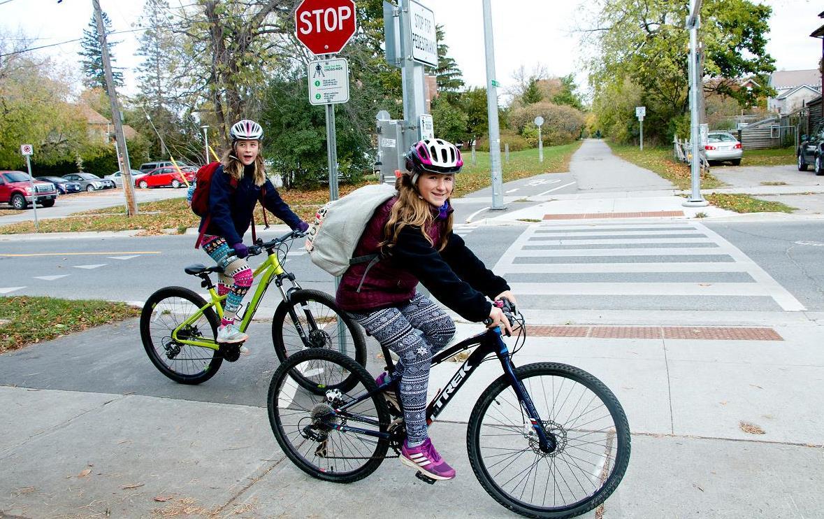
The Kawartha Moves ATMP is a long-range strategic master plan provides direction on how to plan, design and ultimately implement active transportation infrastructure, programming, and policies over the next 20+ years.
The plan aims to be realistic, adaptable, and appropriate for existing local conditions and community needs, while reflecting current processes and practices, and also considering future trends, growth, and technological advances to achieve long-term City priorities and goals. Taking a high-level master plan from planning to action can be a challenge. Clarity, consistency, and communication will be key to the success of the plan in addition to actionable change.
The Kawartha Moves ATMP is unique in that it requires buy-in and investment from a range of municipal departments. Though developed through the Planning division within the Development Services department of the City, the majority of the recommendations found within the ATMP have an impact or are intended to be led by staff in other municipal departments and ongoing coordination by all. Unlike the Trails Master Plan which focused on off-road trail linkages primarily found on municipal lands – which are the responsibility of Community Services – the recommended AT projects, programs and policies will require input from City staff in multiple departments, including, Public Works, Community Services, and other teams.
Considering the amount of growth that the City of Kawartha Lakes is currently experiencing and anticipating, there are a significant number of opportunities to take action to advance the ATMP and its associated projects and recommendations. The City is recommended to take action in a number of ways focusing on implementation of the ATMP over the coming decades That said, there will need to be ongoing efforts to consider how best to improve and enhance the processes and practices related to active transportation throughout the City. Chapter 5.0 provides recommended guidance on how to consider future action through implementation.
Implementation refers to the process of putting a decision or plan into effect through action or execution. The Kawartha Moves ATMP was developed with the purpose of providing City staff with guidance as to how to proceed with implementation. The recommendations found within the ATMP include new policies, protocols and practices which will require a collaborative and coordinated approach to implementation and strategic change management. A series of implementation related recommendations are included within the plan along with supporting information to help guide the City’s next steps and actions related to active transportation.
32
33
Implementation of the AT network is to be monitored and updated relative to new development opportunities to ensure that the development approvals and site plan approval process incorporate active transportation features to the fullest extent possible.
Planning and development (Development Services) should be responsible for the coordination of the ATMP and will meet annually with representatives from the community services department and public works to ensure that there is sufficient coordination between the functional transportation plans adopted by the City.
No
34
35
On an annual basis, seek the input of ATMP partners - as outlined in the partnership strategy - to discuss active transportation infrastructure, programming, and maintenance priorities.
No
36
Yes
Active transportation priorities will be reviewed on an annual basis to determine which projects and programs are to proceed to implementation. Status updates and project recommendations will be summarized in an annual report to Council which will go forward at the same time as the report prepared for the Trails Master Plan. No
A dedicated staff person should be identified to support and coordinated the implementation of the ATMP starting with an existing staff member and expanding to 1.0 additional full-time equivalent (FTE) position in year two. Depending on the level of effort required to implement the plan this may increase to 1.5-2.0 FTE based on future assessment of need.
No
37
38
A partnership strategy will be implemented to support and facilitate the implementation of the ATMP based on the guidance provided within the ATMP document related to appropriate roles and responsibilities
Partnerships with key stakeholders and organizations that are in alignment with, or support active transportation should continue to be supported as part of enhanced community outreach. No
39
40
Within the Public Works / Engineering capital budget, a line item of $500,000 be identified for the implementation of active transportation projects in addition to exploring external funding opportunities as provided within the ATMP.
Within the Public Works division operations budget, the line item for maintenance will be increased to $200,000 with appropriate increases to the budget per annum based on km implemented.
41
42
Within the Planning and Development Division capital budget a line item of $50,000 be identified for the implementation AT related education and encouragement strategies with the potential to increase to $100,000 Yes
Municipal staff should annually explore external funding options and alternatives at the federal and provincial level to determine if there are opportunities to secure monies to support the implementation of the ATMP beyond municipal monies. No
43
44
Donations to support the implementation of the ATMP should be encouraged from community groups and members with the potential for a dedicated account to monitor and track annual donations aligned with municipal planning and budget decision making
The proposed phasing strategy as identified in the ATMP is to be used as the primary reference by City staff to determine annual active transportation projects and priorities and is to be reviewed and updated every 5 years.
No
The City of Kawartha AT network is intended to be implemented over a 20+ year period of time with opportunities for review, revision and adaptation depending on municipal priorities. Within a master plan project phasing is typically included which is the identification of a potential suggested horizon for project implementation. The implementation of the AT network is assumed to be initiated in 2025 and align with the following horizons:
Short term: The first 10 years, 2025 – 2035
Medium-term: 11 – 20-year horizon, 2036 – 2046
Long-term: 20+ year horizon, 2047 and beyond
The routes and projects that make-up the AT network have a specific horizon identified. Phasing was identified using a two (2) stage approach. The first included a review of each project based on a phasing framework which considers community need and project complexity. A similar approach was used for the trails master plan update proposed projects. The following table presents the framework and considerations.
* determined by the input received from public, stakeholder, and staff engagement
Considerable work needed to address physical concerns or issues
Projects may require confirmation of some contextual details prior to design
Can proceed immediately to design and construction
While the phasing horizons are slightly different, coordination and continuity between the two plans has also been a key consideration in the phasing and prioritization process. Furthermore, the initial assessment and recommended phase was further refined based on other influencing factors and consideration including but not limited to:
> The status and outcomes of previously completed or in development environmental assessment projects
> Planning and adoption of existing capital projects as per municipal budgeting processes
> Growth related impacts including plans for future development and growth / expansion of communities
> Municipal priorities in terms of high needs areas or major gaps / improvements that would significantly impact individual and community mobility
> Public and stakeholder input as gathered throughout the project process
The phasing plan does not identify a specific year that a project is recommended to be implemented It is intended to provide a range within which the project is intended to be initiated but not necessarily completed considering the level of complexity and required next steps (see Section 5.1.3. for details about the process and Section 5.2.3 regarding approval requirements)
Priorities should be determined on an annual basis as part of the capital planning process undertaken by the City and with considerable coordination between the various municipal departments to align priorities and leverage opportunities for multi-modal implementation efforts.
The phasing plan is not intended to be a prescriptive series of recommendations on project timing. The information contained within the ATMP and provided to the City is
meant to be used as a resource and starting point from which day-to-day and annual decisions regarding active transportation routing and infrastructure can be made.
As the City proceeds with implementation of the AT network, it is possible that priorities may change, or additional funding may become available, which can change the status of the project or the phase in which it is being implemented. The City is encouraged to undertake ongoing monitoring (see Section 5.3 for more details) of implementation and funding opportunities to ensure that the timing for implementation adapted as needed.
The following is a summary of the proposed projects by phase for the entire AT network for the City of Kawartha Lakes. The proposed facilities and associated phasing are provided in Appendices A and B.
As noted in Chapter 4.0 the AT network represents an ambitious target for route planning and facility design. As part of the development of the ATMP, master plan level costing has been prepared based on a series of assumptions determined at the time of development.
The estimated costing is intended to be reviewed and refined at the time the City decides to proceed with implementation. Considering the scale of improvements identified within the ATMP, the anticipated cost and need for investment will require multiple avenues and options for funding. Both the costing details and funding alternatives are presented in the following sections.
Costing information has been organized into two categories – capital costs and operating costs.
Capital costing represents investments in the design and construction of AT infrastructure. Capital costs could be identified for either individual, standalone AT projects, or AT could be integrated into larger scale capital infrastructure projects. Options are to be identified on a department-bydepartment basis depending on the scope or impact of the project. Capital project funding allocation is set out in the City’s Long-Term Financial Plan, the most recent of which covers the years 2022 – 2031.
Operational costing represents day-today running of municipal business, including staff time and associated activities. Considering the multidepartmental impact of the ATMP there will likely be capital and operational costs that are identified for a number of City departments – as reflected in the implementation recommendations.
Capital costing has been prepared for the proposed pedestrian and cycling infrastructure projects. Capital costs are fixed expenses incurred to purchase or build assets such as infrastructure. The following are the costing assumptions that informed the development of the capital cost estimates for the ATMP:
> Costing was developed using unit prices identified based on best and comparable practice.
> These costs should be the foundation for annual budgetary discussions and decisions made by City staff and be revised as needed.
> The costs are not meant to be prescriptive, but to provide a preliminary estimate of potential capital cost.
> All costing included within the ATMP are intended to be reviewed and refined at the time the City proceeds with next steps.
Based on these assumptions, the capital cost for the implementation of 763 kms
of AT network are estimated at around $88 million, which includes an investment of $31 million in built-up (urban) areas, and $57 million for the City-wide (rural) network. Considering the network is intended to be implemented over a 30-year timeline (approximately), the annual investment in AT infrastructure projects could be around $3 million
As previously presented, the priority network is significantly less investment but still would achieve a considerable amount of connectivity, continuity, and user-friendly facilities. The City may wish to select on the implementation of the priority network as opposed to the full AT network. This represents 424 kms of AT infrastructure at a cost of $63 million which represents an investment of $22 million in built-up (urban) areas and $41 million for the City-wide (rural) network. Over a 30-year timeline this could represent an annual investment of $2.1million in AT infrastructure projects. Details are provided below.
Table 22 . Overview of Proposed Master Plan Costing for ATMP Network
Table 23. Overview of Proposed Master Plan Costing for ATMP Network Priority Projects
The costs included within the ATMP reflect unit costs based on 2023 / 2024 values and monetary assumptions. They are master plan level costing which means that additional costs beyond construction will need to be reflected in the budgets that the City identifies as well as economic influences such as inflation. When the City proceeds with the implementation of a proposed project or identifies funding for projects within a capital budget the following budget adaptations should be considered.
It is important to note that this information is provided to the City of Kawartha Lakes for transparency and information. The value is not meant to intimidate but show what could be built and achieved with long-term investment in sustainable transportation infrastructure, safety and comfort among those most vulnerable road users and community / mobility accessibility.
Operating costs are associated with the maintenance and administration of a business on a day-to-day basis. For the purposes of the ATMP, it has been assumed that operating costs include maintenance, evaluation and enforcement associated with the existing and recommended projects. The following are some of the cost considerations for operating costs that should be reflected by the City:
> Maintenance will be dependent on the type of infrastructure and the expected seasonal use. At a minimum, the following maintenance practices have been assumed for active transportation facilities to be undertaken on a quarterly or bi-annual basis to reflect the changes in season:
o Removing encroaching vegetation
o Mowing
o Map/signage updates
o Trash removal/litter clean-up
o Flood or rain damage repair, silt clean up, culvert clean out, etc.
o Patching, minor re-grading, or concrete panel replacement
o Amenity repair or replacement
> Costs associated with the maintenance of physical infrastructure will vary depending on staff availability as well as weather conditions. Costing does not provide recommendations on the types of maintenance vehicles or tools that would be needed to facilitate seasonal maintenance.
> Maintenance activities may or may not be required if there are environmental compliance requirements but should be reviewed by resource and
environmental compliance staff to determine if maintenance would have an impact on resource protection.
> For winter maintenance, preliminary costs only pertain to operational / staffing efforts and not the acquisition of necessary equipment. Should the City deem it appropriate to purchase a vehicle to support adapted/enhanced maintenance practices, this cost could be upwards of $250,000. Increased funding recommended in the ATMP for the operations budget can be used for this purpose, or it can be sought separately through the City’s capital budget process.
> Enforcement is undertaken by staff as part of the Municipality’s By-law Enforcement. The level of effort may increase because of the recommendations related to the data collection and evaluation and the increased use of AT routes. Additional staffing or budgetary allocations may be required to accommodate these changes.
Both the ATMP and the TMPU provide guidance on potential maintenance practices. The intent is for there to be a coordinated effort between Community Services and Development Services, as well as by-law enforcement to determine the appropriate capacity and level of maintenance service that can be provided. Consideration should be given to identifying potential AT routes as well as trails which could be maintained year-round as part of a winter maintained AT system for recreational and utilitarian seasonal travel.
It is important to ensure that there is continuous coordination, collaboration
and communication regarding trail and AT maintenance efforts to ensure that there is a seamless user experience no matter the season or the location of the route / facility.
In addition to the traditional operations costs identified as part of the ATMP, costs for the implementation of policies
Municipal investments are challenging, and must navigate competing interests and trade-offs in the public interest. The City of Kawartha Lakes – in the past – has not specifically funded or prioritized investments in active transportation infrastructure beyond trails or as part of wider transportation infrastructure capital projects. As such, it is understandable that costing and request for funding within the ATMP represent the need for a significant shift in municipal funding priorities and a multi-faceted approach.
It is appropriate to assume that it may not be possible for the City of achieve full implementation of the proposed network even with a 20-year horizon. To provide the City with a greater degree of flexibility in its implementation approach, it may be decided that implementation should focus on the priority routes. Once the priority routes have been implemented the City may wish to revisit the AT network or continue investing in expanding the system to include additional route opportunities. Funding strategies to support implementation must consider a range of options and alternatives to off-set or
and programs are assumed to be captured as part of annual operational costs along with some external funding. The assumption is that by implementing some of the recommendations related to staffing (recommendation #33) as well as partnerships (recommendation #34) there will be increased capacity to support these operational needs.
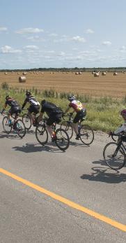
address funding challenges. It is also helpful to identify flexible options beyond the full network or proposed phasing which allows the municipality to adapt to changes in funding opportunities. The following is an overview of potential funding opportunities – both internal and external to the City – which the City of Kawartha Lakes is encouraged to explore.
Staff are encouraged to continually assess, monitor, and adapt their approach to AT investment and coordinate with community services, public works, and engineering to find multiple avenues for financial support but to avoid duplication of efforts.
Internal funding includes monies that are committed by Municipal council and leadership to address the implementation of the ATMP The funding model is an integrated and collaborative approach. There is an expectation and understanding that different elements and aspects of the ATMP will be the responsibility of different municipal departments as outlined in the ATMP implementation recommendations
As per the recommendations noted above, the Development Services department (Planning division) has been identified as the lead coordinator of the ATMP. As the department that developed the master plan report, staff have an understanding of the content and the way in which it is intended to be implemented. As a policy-driven master planning approach, there is a considerable amount of effort that will
need to go into reviewing and updating municipal policies, plans, and planning implementation tools which Development Services staff are well positioned to lead as part of day-to-day work.
That said, these efforts and associated day-to-day coordination will likely be beyond the typical efforts of current staff. Roles and responsibilities will be discussed below but staff time and effort to lead the ATMP implementation will likely include but not be limited to the following:
> Staff leadership related to the prioritization and coordination of ATMP recommendation implementation
> Coordination and management of GIS data as part of a wider asset management tool
> Annual reporting and budget integration of AT initiatives
> Development and release of promotional materials
> Updates and information shared through social media
> Coordination with external partners to pursue programing.
> Identification of external funding sources
> Policy reviews and updates
> Ongoing education regarding emerging areas of AT
> Data collection and monitoring of facility use and public input on AT opportunities and issues
An annual budget of $50,000 has been identified for Development Services which would primarily address the implementation of programming and outreach initiatives; however, there is
an expectation that these monies will be supplemented with external funding opportunities (see below) as well as in-kind support from other organizations and stakeholders.
These efforts will likely require at least 1 full-time equivalent (FTE) position beyond what the City currently has on staff. The City is encouraged to incorporate these tasks into the job descriptions of existing staff in the short-term, but with a goal in future years of finding a dedicated staff person to implement the ATMP and other related master plans / municipal initiatives. Though this isn’t a specific dollar value, there will be budget expectations for this role that will need to be determined once the role has been defined.
The design and construction of AT infrastructure will be the responsibility of the Public Works department, with an annual budget of $500,000 to start initiating stand-alone AT projects from the AT network. In addition to this budget, the Public Works department is encouraged to find opportunities to implement AT infrastructure as part of large-scale infrastructure project e.g. road rehabilitation or new roadways
The maintenance of AT infrastructure will be the responsibility of the Public Works Department with an annual budget of $200,000 to start. Discussions will be required to confirm if this budget solely covers on-road AT infrastructure or if it also includes offroad AT infrastructure i.e. trails dedicated to active use.
As noted above and in the maintenance section below the costs
associated with maintenance vary significantly depending on the type of facility and timing of the maintenance. Consideration should be given to pursuing summer maintenance for onroad AT infrastructure to start, with winter maintenance conducted following Provincial Minimum Maintenance Standards, with the potential for enhanced winter maintenance based on interest expressed by stakeholders and members of the public.
The ATMP assumes that capital and operating costs associated with offroad AT infrastructure (i.e., trails) will be the responsibility of Community Services, with opportunities to explore growth related funding opportunities to address trails in new development areas.
As noted in recommendation 29, an interesting avenue of potential funding support is development. The City of Kawartha Lakes continues to experience a considerable amount of growth especially within the community of Lindsay and communities to the south. Opportunities will continue to arise –depending on provincial direction – to leverage this growth to fund the implementation of AT projects or to incorporate AT into the planning and design of new development area. Development Services should continue to prioritize finding opportunities (where appropriate) for development charges to be used to fund active transportation infrastructure.
Even with dedicated internal funding, the anticipated cost to implement the ATMP will require additional, external funding sources. As per recommendation 39, external funding opportunities should be explored regularly and pursued, whenever feasible, to offset the cost of ATMP implementation
The following are a series of external funding opportunities which could be considered. The requirements and criteria for these funding opportunities will likely change from time to time and new opportunities will arise.
City staff should undertake a review of funding opportunities on an annual basis. It is important to note that not all external funding opportunities may result in monies being provided to the City. “In-kind” support that can be provided, including but not limited to volunteer support, maintenance, data collection, promotion, and event outreach, etc. also provide a significant amount of value when implementing programs or initiatives that are not the construction of infrastructure. These opportunities have also been identified as part of the external funding options outlined.
The information contained within the ATMP is intended to be used to support future funding / grant applications with the intent of securing external funding sources.
> Investing in Canada Program
> Healthy Communities Canada Funding Initiative
> Green Municipal Fund
> Federal Gas Tax
> Federal Active Transportation Fund
> Ontario Municipal Commuter Cycling Fund
> Province-wide Cycling Network Funding
> Provincial Gas Tax
> Ontario Trillium Foundation Community Building Fund
> Ontario Rural Economic Development Fund
> Tourism Development Fund
> Ontario Community Infrastructure Fund
The formal funding opportunities noted above will require a grant or application to be submitted and will have specific requirements. The requirements are typically more stringent and the monies that are provided will need to be used in a specific timeline. That said, depending on the opportunity the values can be significant. Many funding sources require projects to be identified in a previous plan, so the content of the ATMP including the identified network, and associated design guidelines, programming recommendations, and implementation tools – particularly regarding project monitoring and assessment – can help support the content of funding applications.
Some funding options may used to generate funds for the City which may not be specifically tied to a project or
initiative. Should additional funds be generated, the City should establish an account or dedicated holding fund for active transportation. This fund would be used strategically by staff with input from stakeholders as to which projects or priorities would be covered by the monies. This would apply most directly to private citizen donations but may be applicable to others where a specific project isn’t identified or requested.
Organizational support refers to investments made by local clubs and interest groups who are organized but are not formally affiliated with any government organization or private entity. They could include local agency support (in-kind) or service Club or funding from groups whose goals align with active transportation priorities.
There may be local businesses or industry who may wish to provide corporate funding in support of implementation of AT projects or initiatives. The City should explore opportunities for corporate funding through partnerships with local industry to leverage and encourage local investment in community services.
Donations can be accepted at any time; however, the City may wish to target a dedicated fund-raising month whereby opportunities are provided to “name a route”, or “design a sign” which are used to specifically generate monies for implementation.
With a considerable number of areas of natural, cultural, recreational, and seasonal significance the City of Kawartha Lakes is a tourism destination year-round. The City should explore opportunities to leverage existing tourism events to generate monies in support of active transportation. In addition, there may be other opportunities for fundraising events that highlight opportunities to use AT routes e.g. coordinated rides or hikes (either on- or off-road)
For events, there are different scales that can be explored where-by the route could either be part of the overall event or it is the event. Exploring opportunities to activate the space (i.e., art installations, historic tours, etc.) would be encouraged for stand-alone events.
This opportunity is one that has multiple benefits including AT encouragement and education – as per the program recommendations. For the greatest potential benefit to the City, Development Services staff are encouraged to work directly with partners, including the Community Services department as well as external stakeholders who are committed to both trails and AT. Success for trails is a success for AT and programming / events should find opportunities to highlight the benefits to both where possible.
After the ATMP has been adopted and the City moves forward with implementation there will be steps towards construction and implementation that will need to be completed. These steps are referred to as implementation facilitation processes. There are different processes to be undertaken depending on the type of project or initiative The ATMP includes AT network infrastructure projects, as well as education and outreach programs. The following in an overview of two implementation facilitation processes for these two types of initiatives. Not all projects or programs are the same; however, the processes help to define the typical steps that need to be completed which can be adapted – as needed – to reflect the unique conditions or considerations that may arise.
The projects that make up the proposed AT network include different facility types, alignments and contexts which lead to wide range of project types. In the context of the City of Kawartha Lakes, an AT infrastructure project refers to any of the proposed cycling improvements, walking improvements, along with additional improvements that aim to create a safer and more comfortable environment for all vulnerable and active road users. Table 24 is a typical implementation facilitation process that has been developed based on the guidance provided in OTM Book 18.
The process is to be used differently depending on the type of project that is being implemented. There are three general types of AT projects –depending on the level of effort and approval that will be required. A description of the project and their impact on the process is provided below.
Capital projects typically involve significant capital costs and can include reconstruction or resurfacing of roads, improvements to bridges and culverts, streetlights and traffic signals, and other new and improved infrastructure built within road rightsof-way. Capital projects would typically include the design and implementation of AT infrastructure as part of a wider municipal project. Typically, these have a relatively high cost which could trigger an individual EA study under the MCEA (pending Provincial changes to the Act and other legislative documents). The process noted below could be used for capital projects which integrate AT infrastructure but would align with the typical EA and design steps as outlined in the MCEA Act and User Guide.
The City can leverage new development proposals and associated projects as opportunities to ensure they include key links for active transportation, as well as supportive amenities, design features, and built form, and road infrastructure that prioritizes safety and sustainability. This should be discussed during the pre-
consultation process, then pursued as a developer secures the necessary approvals to proceed with a Draft Plan of Subdivision or Condominium, followed by site plan approval. This involves preparing documents that detail the location and width of streets, and the identification of pedestrian and cycling facilities within road rightsof-way, and other public facilities and amenities. Draft Plans of Subdivision
include details at a high level, while site plans provide additional levels of design detail related to AT elements. In these cases, it is the Planning Act and site plan requirements which dictate the process to implementation; however, the steps to determine and confirm routing, design solutions and details are consistent with the process noted below.
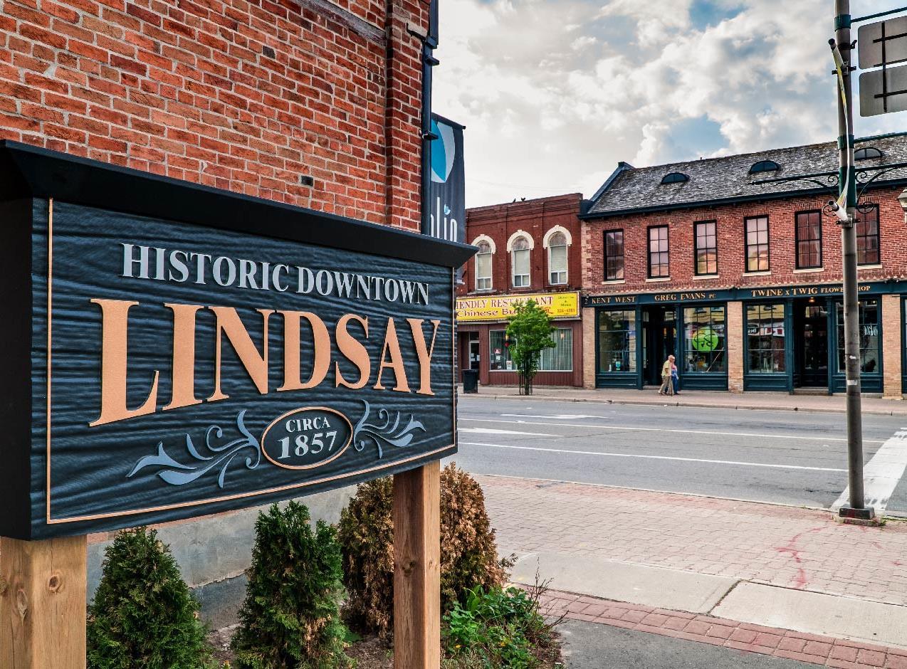
For projects that do not require extensive road reconstruction, further study, and are not associated with any planned development, it may be appropriate to pursue the project as a “stand-alone” or “infill” project. These will tend to be low complexity projects that do not require significant changes to the roadway, and will tend to consist of pavement markings, signage, or other simple, low-cost features. Some of these projects may include shared or designated cycling facilities, simple traffic calming projects, unsignalized pedestrian crossings, or new amenities. For these projects, the steps noted below would apply, depending on the context, conditions and considerations that would impact implementation.
> Review ATMP project details and phasing
Step 1. Planning
Step 2. Site Review
Step 3. Preliminary Design
Step 4. Consultation
Step 5. Detailed Design
Step 6. Schedule
Step 7. Tender
Step 8 Construction
> Determine if the project can be coordinated with other planned road improvements, if further study is required (e.g., EA), or if the project could be coordinated with planned development*
> Prepare report to Council for information and/or endorsement, as appropriate
> Undertake additional review of site conditions
> Collect site specific condition information
> Prepare a preliminary design concept based on ATMP recommendations, while considering applicable design and engineering guidelines
> Present the preliminary design to area residents and other relevant stakeholders to gather input
> Public meeting likely not necessary, communication and information gathering only
> Refine and a prepare detailed design concept of the preferred solution, reflecting any input from consultation activities
> Identify the preferred schedule for construction to occur
> Identify funding sources and allocate budget
> Inform residents in nearby area about construction as needed
> Prepare and release public tender, if appropriate
> Determine and award to preferred candidate
> Construction administration and site inspection through to the completion of the project
All projects
All projects
All projects
Optional
Optional –level of detail will vary
All projects
Optional – as needed
All projects
Table 24 . AT Infrastructure Project Implementation Facilitation Process
In Section 4.5, a series of education and outreach programs are identified for consideration. These potential programs are intended to be pursued by the City and its partners through a collaborative approach that prioritizes programs which complement existing initiatives and address specific desired travel behaviour The process to facilitate the implementation of AT supportive programming is one that has been developed based on a community based social marketing approach that focuses on how to pursue behaviour change through targeted education, encouragement, and outreach. Note that this process is the same as that identified in the City’s TMPU, and programs should be implemented with a holistic consideration of both trails and active transportation needs across Kawartha Lakes.
Step Description
Step 1. Behaviour
Step 2. Audience
Step 3. Barriers
Step 4. Placement
> Identify the behaviour to be influenced and desired outcomes of the program, building on ATMP priorities and objectives
> Identify and confirm the preferred audience(s) to be targeted, including consideration of socio-demographics and AT user groups
> Identify potential limitations or barriers people face in adopting the desired behaviour, and position solutions relative to the program goals and objectives
> Determine a potential pilot location / approach for implementation and initial distribution of materials / information / activities
Step 5. Work Plan
Step 6. Implementation
> Prepare a work plan for the design of the program, including needed capacity among City staff and external partners, materials, media, and communication, equipment, and evaluation metrics / tools
> Identify the preferred program schedule / timeline
> Identify funding sources and allocate budget
> Implement the program
> Review and analyse previously established quantitative and qualitative metrics to evaluate the success of the program
Step 7. Evaluation
> Undertake engagement with select stakeholders to gather input
> Identify lessons learned and improvements
> Modify future implementation based on input
Table 25 . AT Program Implementation Facilitation Process
Depending on the specific location of a given project, and the land uses, land contexts, land ownership and conditions, additional approvals or permits may need to be prepared and submitted prior to or as part of the facilitation implementation process noted above for proposed AT infrastructure. Based on the jurisdiction and context within the City of Kawartha Lakes, there are three (3) potential approvals that may be needed when a project moves through to detailed design and implementation. The intent is for the City to refer to this information and review / confirm the necessary approvals prior to initiating next steps
Under the existing Municipal Class Environmental Assessment Act (MCEA), there are specific projects which require an Environmental Assessment (EA) study to be undertaken. The rationale as to whether an EA would be required is typically determined based on cost thresholds, with EA’s generally being conducted for larger scale infrastructure projects. The City is encouraged to use the master plan level costing included within the ATMP to determine which projects may be appropriate for an EA project, assuming that they would be completed as a stand-alone capital project and not a part of a larger Municipal infrastructure project. It should be noted that projects that include an AT component have been streamlined and exempted under the Municipal Class Environmental Assessment (MCEA) process, and thus are classified as “A” or “A+” projects,
which are considered “pre-approved”. Only basic public consultation and notification is required. Further streamlining of the MCEA has recently been proposed by the province which would further reduce the requirements for EA studies. The City should continue to monitor these requirements relative to the project type and cost to determine the appropriate next steps.
If there is a proposed project within or adjacent to a significant natural area or natural feature within the Municipality which could have a potential adverse affect on those natural areas, an Environmental Impact Study (EIS) may be required to be completed. Should it be determined that an EIS is required for a specific project, information should be provided in such a study, including but not limited to methodology, policy framework, field inventory, existing conditions, significant and sensitivity of natural features, impact analysis and summary of recommendations or defer to an alternate template / approach as identified by the City. Similarly, depending on the location and anticipated impact, a similar EIS may be required to be submitted to the Ministry of the Environment, Conservation and Parks. The content of this study would be developed based on the requirements set out by the Ministry and would be subject to approval by Ministry staff. Depending on the context and conditions an Environmental Monitoring Plan may also be required.
There are several other agencies that have jurisdiction over various areas in the City of Kawartha Lakes. For the ATMP it is likely that Kawartha Conservation would be an approval agency. Any work being done by the City within and around Kawartha Conservation lands must be in alignment with the policies outlines in the Conservation Authority Act, and the processes and protocols outlined in
Ontario Regulation 163/06. Oversight and input may also be provided by Kawartha Conservation staff for development applications within or adjacent to natural areas. Other agencies may also need to be consulted and provide approvals for projects, depending on the project location or other project details, including but not limited to the MTO, Ontario Parks, and Fleming College.
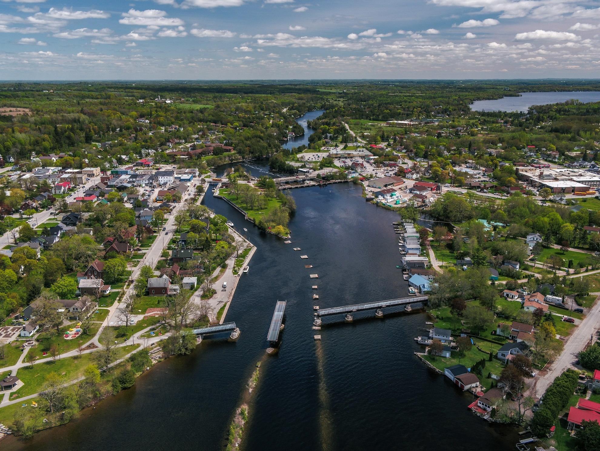
The successful and ongoing implementation of the ATMP will require a considerable amount of oversight and management from internal and external partners. The development of the ATMP involved extensive coordination and consultation with these groups, which served as an opportunity to strengthen partnerships and set the stage for implementation and management.
Effective management practices should take into consideration and establish approaches which guide dayto-day action. A management strategy has been prepared for the City of Kawartha Lakes to support the Implementation of the ATMP. There are three components to the management strategy which provide guidance on day-to-day coordination, partnerships, and communication – all key aspects to facilitate management of implementation. A similar approach and content was developed for the TMPU. Both documents should be referenced when the City proceeds with implementation and will help to streamline coordination.
When implementing the management strategy, the City is encouraged to review the effectiveness of the strategies – every other year – to determine if there are any challenges or lessons learned which could require an amendment or adaptation of an approach.
City staff will be the leaders responsible for the day-to-day implementation and ongoing monitoring and management of the ATMP. As noted throughout the ATMP thus far; there are a number of municipal departments which will be involved in various aspects of the plan’s implementation. The success of the ATMP will hinge on defining clear roles and responsibilities among municipal staff, while also ensuring the City dedicates staffing resources and capacity to the appropriate departments in coordinating the implementation of the ATMP.
The following table provides an overview of the anticipated roles and responsibilities that are recommended for the various departments in the City of Kawartha Lakes related to implementing the ATMP’s recommendations.
> Municipal enforcement as per the updated bylaws/regulations as well as frequency of practice to be undertaken by the Provincial Offences division
> The Planning division will lead the implementation of the ATMP, as per recommendation #24.
> A dedicated staff person should be identified within Development Services to support and coordinate the implementation of the ATMP, starting with an existing staff member and expanding in future years, as per recommendation #27.
> Review development applications to encourage the provision of AT infrastructure, amenities, and supportive built form, and ensure designs are consistent with ATMP guidance
> Provide land use and development information needed for AT infrastructure projects
> Kawartha Lakes Tourism (part of Economic Development) will support updates to online AT and trail information, including at explorekawarthalakes.ca, and support education and outreach programs as appropriate
> The Parks and Recreation division leads the implementation of the TMPU, and will ensure this is done in coordination with ATMP recommendations
> Will meet no less than once per year with staff from Development Services and Public Works to ensure sufficient coordination between the City’s transportation plans, as per recommendation #24.
> Provide guidance on municipally consistent communications and marketing for any AT-related promotional materials
> Provide IT support for the integration of the AT network database into wider municipal asset management and data coordination.
> Provide guidance on development applications, coordinating with Development Services to encourage the provision of AT infrastructure, amenities, and built form consistent with ATMP guidance
> Implement the recommended AT infrastructure network projects, coordinated with broader road and transportation projects
> Will meet no less than once per year with staff from Development Services and Community Services to ensure sufficient coordination between the City’s transportation plans, as per recommendation #24.
> Provide information and guidance regarding road operations and water/wastewater utility infrastructure to support AT infrastructure projects
> Support Education and Outreach programs, as appropriate
In order to foster increased active travel and mobility comprehensively and effectively in Kawartha Lakes, it will take a considerable amount of coordination and collaboration with key external stakeholders and technical agencies. Many of these groups have supported AT in Kawartha Lakes in the past and were involved in the development of the ATMP. The intent is to formalize, maintain and strengthen these relationships, while monitoring and identifying opportunities for new partnerships A partnership strategy is developed to not only identify the potential partners but also to highlight their potential roles, responsibilities and the frequency of engagement and outreach as part of the implementation of the ATMP. A similar approach was used in the development of the TMPU. The intent is not for there to be separate or additional efforts with regard to partnership support, but to work with similar agencies and stakeholders to coordinate both active transportation and trail initiatives. Table 27 provides an overview of the key partners and their suggested roles as part of the implementation of the ATMP.
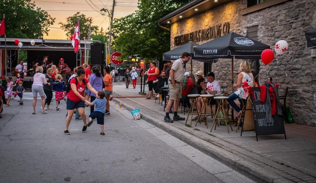
Haliburton, Kawartha, Pine Ridge (HKPR) District Health Unit
Ontario Ministry of Transportation
Ontario Provincial Police
Local School Boards
> Coordination and support for education and outreach initiatives
> Review of policies and plans
> Addressing issues where AT facilities meet roads/highways under provincial jurisdiction
> Enforcement of traffic laws
> Coordination and support for education and outreach initiatives
> Collection of relevant data
> Coordination and support for education and outreach initiatives
> Focus on active and safe routes to school initiatives
> Resources and coordination to support education and outreach initiatives
Annually
Dependent on project
Once or twice per year
Annually
Kawartha Conservation
Adjacent Municipalities
Environmental Action
Bobcaygeon
Local Business Associations
> Implementation of staging areas and connection points to on-road linkages
> Coordination of AT connections at crossboundary locations
> Resources and coordination to support education and outreach programs
> Engagement on local AT projects
> Local advocacy and Strategic involvement by the City in annual prioritization
> Resources and coordination to support education and outreach programs
> Engagement on local AT projects
Table 27 . Summary of Partnership Roles & Responsibilities
Annually
Annually, or dependent on project
Annually
At least once per year
Communication – similar to education and outreach – is vital to increased awareness and up-take of AT. Beyond the potential proposed programs that have been identified for the City’s consideration, there are ongoing communication tactics which should be used to generate a greater degree of awareness. Kawartha Lakes Tourism has established a strong set of communication collateral which speaks to trails and primarily cycling. However, the information is at times disconnected with the information and conditions on-the-ground; or adopted through master and strategic plans.
The intent of the communication strategy is to further enhance and improve the communication efforts of the City regarding walking and cycling and to find new opportunities for enhanced communication tactics. These alternatives are also intended to be reviewed by City staff across all departments in partnership with Kawartha Lakes Tourism on an annual basis to determine potential work as well as document successes and lessons learned.
The information that currently comes up when searching for cycling or walking in Kawartha Lakes brings users to the City of Kawartha Lakes Tourism website – explore Kawartha Lakes. It includes the 2017 Kawartha Lakes Cycling Routes which are recommended / promoted routes that were identified by stakeholders prior to the development of the ATMP as well as a “Cycling and Biking” landing page
with information regarding the touring cycling routes as well as educational information on safe cycling, bicycle friendly businesses as well as cycling friendly trail connections. The Kawartha Lakes Tourism website has seasonal updates which reflect the unique active transportation opportunities that change with the shifts in weather. The information regarding opportunities i.e. routing and facilities is relatively similar. Currently, there is no information regarding active transportation, walking or cycling beyond municipal trails on the City’s municipal home page including a lack of information provided on the City’s maps and apps page (the GIS management and mapping tool coordinated by the City) which means there is significant potential for improvement.
Consistent and up to date information is critical for a municipality to communicate to its residents and visitors for both information and risk management and liability purposes. The City of Kawartha Lakes should use the information generated through the ATMP project to create a dedicated landing page on the Municipal webpage for active transportation and should consider accurate and timely updates to online information to ensure that there is appropriate awareness and documentation of what is available, maintained, and safe to use.
This will be especially important as the City proceeds with the implementation of the ATMP as well as the TMPU. To be useful, the page should be updated on
a regular basis to ensure that all content is relevant, and to promote new projects and initiatives as they are implemented. Website content should be accompanied by complementary content and promoting the website through the City’s social media channels.
While most people look online for information regarding AT routes and opportunities, there is still a role for printed materials. Many people prefer print materials, and not everyone can equitably and reliably access the internet. Print materials can also be a useful way to get information directly into people’s hands and in front of their eyes at in-person events or other outreach activities and can help promote more detailed information available online.
All online content should also be coordinated with printed materials, to ensure that all information, no matter its distribution channel is consistent. Providing maps that illustrate the existing AT linkages found within the City of Kawartha Lakes is a good starting point for printed information.
These hard copy maps should be updated every other year, at minimum, to reflect new projects shortly after they are built. These maps can include or be supplemented with separate flyers or brochures with information on topics such as safe trail practices, trail landmarks, local flora and fauna, ongoing programs, and upcoming events.
To successfully promote AT and encourage use, it is important to have a strategy to target audiences, and to tailor messages that will resonate and be effective. The programming process already reflect a community based social marketing approach for program development, a similar approach should be used for communication and messaging.
Messages should be developed for different demographic groups that are prevalent in the City of Kawartha Lakes as well as those the have been identified as high needs or an opportunity for behaviour change. As part of the ATMP process a series of “user profiles” were developed which are intended to be used as the basis for identifying unique key messages that could help with behaviour change.
While it can be important and useful to include messages about safety, it is also important not to forget to tell people about the benefits of using AT as part of a wider climate change mitigation, healthy lifestyle, and how they provide a fun, environmentally friendly, affordable, flexible way to independently get around and explore the City
Messages should not only be tailored to the audiences that they are intended to reach but should also be adapted based on the platform that they are released on. Depending on the social media platform or media outlet, different formats and message requirements should be closely considered.
New residents are a key audience for active transportation promotion was they are most likely to benefit from and act on information about AT routes / opportunities in the area. The City of Kawartha Lakes is experiencing a considerable amount of growth with new residents coming from more urban areas as well as a continued increase in seasonal visitors.
Once mapping and other printed materials are developed, these can be included in welcome packages for new residents. Such a package can be incorporated into transportation demand management measures that the City can ask of developers through the development approval process. The information can be included along with information regarding other publicly available municipal services and can be combined with other incentives or promotion initiatives.
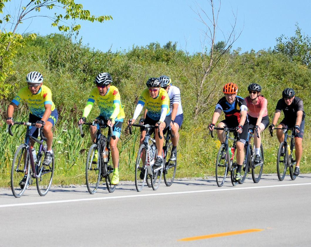
The monitoring, evaluation, and maintenance of existing and future active transportation infrastructure in Kawartha Lakes is critical for ensuring facilities are usable and welcoming throughout all seasons now, and well into the future. Effective monitoring ensures facility upkeep is done in a proactive and timely manner and supports a wider and more predictable infrastructure management and risk management approach, while also helping extend the service life of facilities.
It is acknowledged that strategic and focused efforts related to AT maintenance and management are not the current norm; however, in an effort to bring the City of Kawartha Lakes forward in their priorities and practices the ATMP provides guidance on how to embark on maintenance, evaluation and management of the AT network and AT related initiatives. The content of Section 5.3 is a consolidation of relevant standards, guidelines and best / comparable practices for the City’s review and consideration. It aims to provide the City with an adaptable approach which builds in management and knowledge resiliency which will help to support ongoing implementation of AT policies, programs, and projects over the next 20 years.
45
46
The ATMP is to be revisited every five years, and a support generated on the status of implementation and priorities annually.
The proposed active transportation network is to be reviewed on an annual basis to determine if there are any updates needed, such as additional connections or opportunities that are no longer considered feasible Yes
47
48
Undertake bi-annual walkability audits to inform sidewalk gap identification and the recommendation of amenities and enhancements to improve walkability based on the confirmed framework identified through the ATMP.
Ensure that there is appropriate understanding of the current guidelines and practices relative to active transportation by having relevant City staff undertake annual or bi-annual training provided by Ontario Traffic Council or other relevant organizations.
49
50
Utilize the minimum maintenance standards as the primary reference for the maintenance of active transportation facilities, with additional consideration for the seasonal maintenance practices outlined in the ATMP. No
Review the online reporting tool to ensure that the City’s maintenance issues portal can accommodate active transportation related issues or maintenance requests in a way that appropriately documents the issues.
51
52
Improve and enhance the City’s maintenance practices prioritizing the maintenance of sidewalks on primary corridors and connections to the trial system.
Sidewalk maintenance should be a focus to improve and enhance the maintenance practices prioritizing the maintenance of sidewalks on primary corridors and connections to the trial system.
No
No
53
54
Yes
55
Consider the primary routes identified as part of the ATMP network for enhanced winter maintenance based on the maintenance practices identified within the ATMP. No
Unsafe active transportation (walking and cycling) practices are to be monitored and managed through an integrated enforcement program led by the City in collaboration with OPP and appropriate community partners. No
The existing Kawartha Lakes touring cycling routes should continue to be monitored and when appropriate updated based on public and stakeholder input if they are not identified as part of the ATMP network.
No
There are several best practices that should be considered to ensure effective active transportation maintenance throughout all seasons. The current practice for these types of facilities is to adhere to the Minimum Maintenance Standards (MMS) for Municipal Highways (O. Reg. 239/02). The City is encouraged to continue the use of the MMS for purposes of facility maintenance; however, as new facilities are implemented every effort should be made to ensure that there is appropriate maintenance of those facilities to meet the additional guidance from MMS as well as additional guidance from Ontario Traffic Manual Book 18 (2021).
The following is a summary of the relevant standards from the appropriate documents pertaining to both existing as well as future planned on-road active transportation facilities.
Type
Patrol and inspection
Sweeping (10.2.1)
Surface discontinuities (10.2.21)
Cracking (10.2.2.2)
Surface Drop-off at Shoulders (10.2.2.4)
Vegetation management (10.2.2.3)
Signage (10.2.5) and pavement markings (10.2.6)
Service Level
3 times every 7 days to one every 30 days (0. Reg 238/02 s. 3)
Scheduled sweeping weekly to monthly; deploy resources outside of scheduled sweeping as soon as practicable after becoming aware of debris (O. Reg 239/02 s.9)
Greater than 5cm height within 2 to 21 days after acquiring knowledge (O. Reg 239/02 s.16)
Greater than 5cm wide and 5cm deep (O. Reg 239/02 s.8).
Deeper than 8 cm (O. Reg 239/02 s.7).
Routing mowing including daylight triangles at intersections, annual trimming of bike path trees.
Refreshed as needed
Table 28 . Summary of Relevant Minimum Maintenance Standards Guidance
To demonstrate an ongoing commitment to a comprehensive, equitable, and accessible AT network, it is essential to facilitate use of facilities year-round for various types of trips, especially for pedestrians. The maintenance of on-road active transportation facilities in winter should meet or exceed the minimum maintenance standards. In built-up areas of Kawartha Lakes, sidewalks and cycling facilities, should be maintained to an adequate level of snow removal, as well as ice prevention and treatment – as is the proposed approach for primary trails within the TMPU.
Winter maintenance in Kawartha Lakes is guided by the City’s Winter Control Roadway Level of Service Policy (CP2021-045) and Sidewalk Level of Service Policy (CP2021-046). As per the ATMP recommendations, these policies and associated practices should be reviewed to improve and enhance sidewalk maintenance practices, prioritizing the maintenance of sidewalks on primary corridors and connections to the local trail system, and to consider the primary routes identified as part of the ATMP for enhanced winter maintenance.
The following is a summary of the recommended standards for on-road AT facilities outlined by the Provincial Minimum Maintenance standards that should be followed:
Snow Clearing
Ice Prevention
When snow accumulation on bicycle lanes is greater than 2.5 to 10 cm, “deploy resources as soon as practicable to address the snow accumulation” and within 8 to 24 hours (O. Reg 366/18 s4.2)
Maintain to 8 cm within 48 hours, minimum width of 1 metre (O. Reg 366/18 s16.3)
Ice Treatment
Up to 24 hours preceding the likelihood of ice formation (O. Reg 366/18 s5)
Treat ice within 3 to 16 hours after becoming aware of icy conditions (O. Reg 366/18 s5)
“Treat… if practicable to prevent ice formation or improve traction within 48 hours if the municipality determines that there is a substantial probability of ice forming” (O. Reg 366/18 s15)
Under routine weather events, within 48 hours after becoming aware of icy conditions (O Reg 366/18 s15)
Table 29 . Overview of Winter Maintenance Practices for On-road AT Facilities
Progress in support of AT within the City of Kawartha Lakes will be demonstrated by the changes or improvements that occur because of the implementation of the ATMP. It will be important for the City to evaluate the change in usage of existing and planned routes and facility experiences to determine how best to adapt or enhance the municipal offerings. To understand how implementation is progressing, it is critical to evaluate the successes, challenges, lessons learned and areas of improvement.
Establishing a set of consistent measures and processes to gather and evaluate those measures can help staff prioritize future projects, rationalize investments, and allocate resources. Effective evaluation strategies can help demonstrate the value of AT investments to decision-makers and the public, track the success of a program or project that has been implemented, inform investments through data-driven measures, comply with funding requirements, provide information to engage a broader range of stakeholders, and link to a more comprehensive set of multi-modal transportation data program.
The following are some of the suggested performance measures and evaluation practices that are tailored to the City of Kawartha Lakes to ensure that there is sufficient information gathering to inform ongoing implementation, management, and improvement of projects, programs, and initiatives associated with the ATMP. The information gathered should be used to update annual priorities and budgeting and the plan proceeds towards implementation.
Measure
Economic Development
Number of trail tourists #
Customer by travel mode %
Revenue by travel mode #
Number of campaigns undertaken #
Trail specific promotional materials i.e. maps Y/N
Education
Dedicated trail webpage Y/N
Ticketing for trail restricted use #
Enforcement Citations for poor trail etiquette #
Table 30 . Suggested Evaluation Criteria for ATMP Implementation
City staff should strive to either manually complete or purchase technology to support in the gathering of data/information and evaluation of conditions regarding AT use. This information will help to establish a better understanding of existing use and users with in-person information gathering, allowing for more detailed information regarding user perceptions from tactics like intercept surveys.
Information gathering – using the evaluation framework noted above - could occur concurrently with the maintenance reviews working with committee members and other stakeholders for the manual collection. For technology-based options, the following has been identified as alternatives:
> Individual Smartphone Technology which is a self-drive/self-documented approach using a survey is provided via QR code at the beginning of a trail and trail users can log trips, provide commentary, identify seasonal operational issues, quality of trail experience, etc. This is a low-cost option whereby the City would need to prepare the survey and provide it for public access. The downside is that the information is not consistent and subjective.
> Eco-counters which are point in place documentations of trail use which can be placed at strategic locations to understand the frequency and type of use by all trail users – active or motorized. The information is provided directly to the municipality through user friendly software. A cost for an eco-counter is around $1,500 per counter. It provides a visual que which can serve as an additional promotional tactic and can also include branding consistent with other municipal concepts (i.e., trail signage).
> Tube counter module and technologies are placed along a trail underneath the surface and provide a more permanent solution to gathering data on a day-today basis. MetroCount is one such example which also includes a counter box in proximity. They capture all trail use and typically cost around $5,500 and may need to be replaced about every 5 years.
> Cameras can be placed along the trail, mounted on lighting or utility poles 15 to 25 feet above the ground. Although typically used to monitor on-road traffic, these can also be used for trails and delineate between various users through the video technology and supporting algorithms. There can be issues associated with privacy, but the degree of detail typically addresses these concerns. Costing is dependent on the number of installations and the terms of data collection. This could be around $2,000.
Management refers to the oversight and day to day coordination of ATMP implementation. The roles and responsibilities of specific staff members and external stakeholders has been identified; however, there are additional management practices which will need to be considered and incorporated into existing processes and protocols To ensure that the ATMP is considered applicable over the next 20 years, there are two types of management practices that are recommended to be adopted
A master plan of this nature is wide reaching and can be complex to manage To support the implementation strategy and the ATMP recommendations, management tools which help to inform future decision-making and communication would add considerable value to coordination and collaboration There are two management tools that have been developed for the City of Kawartha Lakes to support ATMP implementation and internal coordination over the next 20 years.
All information pertaining to project recommendations for the ATMP, including project location / alignment, proposed design solutions, and proposed phasing and priority has been included as part of a Geographic Information System (GIS) database.
The database was developed based on data and information provided by the City of Kawartha Lakes and acquired from other publicly available sources.
The GIS database has been provided to City staff and is intended as a tool to:
> Monitor and manage the plan’s implementation by updated relevant information within the database to reflect changes in conditions or status of recommended projects.
> Establish programming and outreach materials including Cityspecific tourism based mapping and online resources.
> An internal asset management tool which can be used to communicate municipal priorities and integrated with wider municipal services.
> Communicate with external partners, including but not limited to surrounding municipalities and local developers
While GIS can be an effective asset management tool, not all practitioners who will be involved in the implementation of the ATMP will have access to or experience with this technology.
The information contained within the database is considered a valuable resource in terms of project recommendation implementation. As such, a Microsoft Excel version has been developed and contains the same information but in a format that can be accessed by a wider range of City staff members.
The management spreadsheet tool is intended to be used to:
> Facilitate a greater degree of coordination between a wide range of City staff members.
> Be easily adaptable to track and monitor the implementation of recommended projects.
The intent is for these tools to be updated annually or when appropriate to ensure that there is accurate and up to date information. The intent is to start integrating AT into City-wide asset management to ensure that the routes and facilities are planned, constructed, and maintained appropriately.
Consultation and outreach will be critical in the management of the ATMP. With passionate and involved community of advocates and enthusiasts; the City of Kawartha Lakes should continue to establish relationships and trust with those who have ben foundational to the plan’s development as well as community members who will use the AT infrastructure in the future.
Consultation and outreach – both form and informal – will help to manage expectations regarding the implementation of the ATMP and to inform the future management of project and plan priorities. This consultation and outreach are considered beyond the internal coordination and management that is expected to occur annually as capital projects and priorities are determined.
The stakeholders engaged as part of the ATMP and those identified in Section 5.2.2 should continue to be involved in the review and assessment of AT routes / facilities. It may be in the best interest of the City to re-visit and re-establish a group which can discuss opportunities for the following year in addition to strategic outreach as projects go forward to implementation.
As part of the development of the ATMP a Task Force was formed to inform the development of recommendations and strategies. The Task Force, though knowledgeable, did not have representation from agencies and interest groups with
jurisdiction over decision-making or specific initiatives. As such, the City is encouraged to establish an ATMP working group and / or a committee to Council made up of stakeholders from public health, school boards, ministries, local businesses, and interest groups who would meet annually.
This group may include representatives from the community, but the focus should be on facilitating annual conversations regarding work that is being done by agency representatives in the space of AT and trails, prioritizing projects, and initiatives for the City to pursue, informing budget discussions and capital planning, and coordinating programming efforts. Members of the public may be invited to select meetings where it is deemed appropriate with the focus being on building a greater degree of trust between City staff and residents.
City staff are encouraged to offer a survey every alternate year – following the summer and after the winter – to gather information on the experiences and perceptions regarding AT routes and facilities. This will help supplement the ongoing documentation of trail maintenance issues and will focus on evaluating successes and opportunities for improvement. The intent of this survey is to provide opportunities for community members to provide input on how the ATMP is being managed and to inform updates to municipal practices and priorities – where appropriate.
The survey could be coordinated through Kawartha Lakes Tourism and promoted through other agency or stakeholder avenues of networking Any survey created should be centrally housed and promoted through a wide range of social and traditional media outlets.

The staff members and stakeholders that work for and within the City of Kawartha Lakes have been working diligently to create a more safe, comfortable, accessible, equitable and sustainable community for those who live, work, and play here.
The next 20 years have the potential to change the way people move and travel significantly. The recommendations found within the ATMP have been developed and designed to be ambitious to respond to the growing needs of the community, and address both local and global issues, while also being feasible to put into action The plan’s recommendations respond to the unique context, conditions and interest of the community, and demonstrate a commitment to continued evolution and evaluation.
As a City with significant anticipated growth in the coming decades, there is both a risk and an opportunity for the future of Kawartha Lakes. If the City and its communities grow in a way that doesn’t consider or prioritize the mobility its most vulnerable residents, including people who walk or bike, those with disabilities, youth, seniors, or lower income people, those individuals will continue to be left behind and a greater divide in equity will be experienced. If the population does not have enough opportunities to be active, the resulting negative health impacts with deteriorate quality of life in the City, and strain local health care resources. If driving continues to dominate the transportation system,
and people do not have more options to get around, traffic congestion and pollution will increase. However, if the City follows the guidance in the ATMP and its other policy and planning documents, the community can achieve a future that is healthier, greener, more equitable, safer, and more prosperous for everyone in Kawartha Lakes.
The Kawartha Moves ATMP sets out a policy driven approach to change which embeds active and sustainable transportation into municipal policies, design, and maintenance. The plan considers the relationship between land use and transportation as part of a healthy community and provides options and alternatives which respond to current processes and practices while aiming to mitigate some of the issues and challenges that have continued to persist.
There is considerable potential to get Kawartha Lakes moving towards a more walkable, bikeable, and active future for everyone. With a continued commitment to collaboration, coordination, and consideration of the desires and needs of people from all walks of life, the City can achieve its vision for a future in which active transportation is planned, designed, and implemented with equity, accessibility and feasibility in mind.