


Alternative Models of Land Ownership seminar led by Joshua Kirk
Winter 2023 : : full term
Individual
ArcGIS Pro
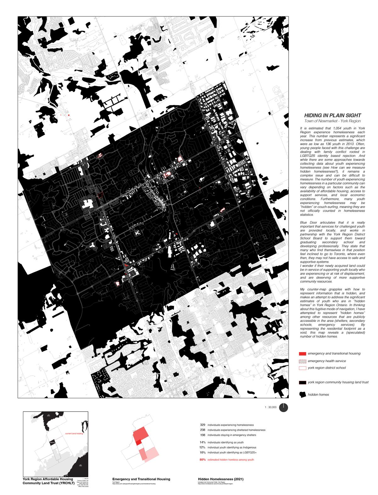
This counter-map grapples with how to represent information that is hidden, and makes an attempt to address the significant estimates of youth who are in “hidden homes” in York Region Ontario In thinking about this fugitive mode of navigation, I have attempted to represent “hidden homes” among other resources that are publicly accessible in the area (shelters, secondary schools, emergency services) By representing the residential footprint as a void, this map reveals a (speculated) number of hidden homes
The York Region Community Housing Land Trust was spearheaded by Blue Door Support Services, an existing emergency housing provider in the town, where they have acquired their first 1 acre of undeveloped land at 17665 Yonge St. Newmarket also has the largest number of emergency housing services in the region, with one Blue Doors program established to shelter unhoused youth, and support their mental and physical well being.
Often, young people faced with this challenge are dealing with family conflict rooted in LGBTQ2S identity based rejection And while there are some approaches towards collecting data about youth experiencing homelessness (see references), it remains a complex issue and can be difficult to measure The number of youth experiencing homelessness in a particular community can vary depending on factors such as the availability of affordable housing, access to support services, and local economic conditions Furthermore, many youth may be “hidden” or couch-surfing, meaning they are not officially counted in our understanding of the scale of the matter.




Integrated Urbanism led by Fadi Masoud
Fall 2021 : : full term
with Chloë Quinn Lauder, Emily McCarthy-Bachetti & Samantha Miotto
Adobe Illustrator - Photoshop - Rhino
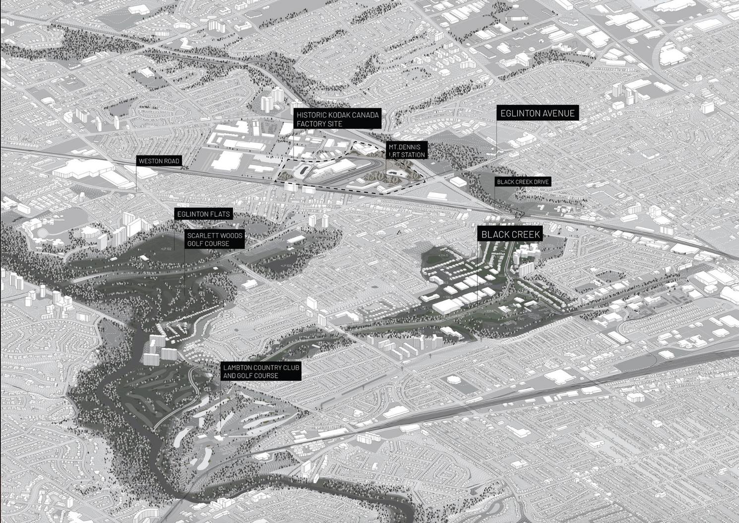
Unearthed is an investigation into soil policy and management framed through the construction of the Eglinton Crosstown LRT After years of development, excavation, and contamination in Toronto, the soils beneath the Eglinton and Black Creek area are much different from the rich life source that they once were. We propose a shift in our relationship with soil, acknowledging it as a living, self contained ecosystem, and one that we are heavily reliant on. It's important to have the knowledge of local and historical geological features when we dig, as the presence of heterogeneous or fractured soils can result in increased permeability and increased rate of soil contamination and greenhouse gas migration.
The intersection of Eglinton Avenue and Black Creek Drive presents a unique set of circumstances that speak to how human activity transforms terrain and geology, making it the ideal site to investigate these shortcomings As phase II of LRT begins and as the areas around it continue to grow, breaking the cycle of fractured soil movement is crucial to improving our cities, both for development potential and its residents Eglinton and Black Creek can be a hub to handle the excavated soils of future infrastructure projects in the city, effectively reducing carbon emissions and contaminant spread from soil transport
We have unearthed the history of Black Creek, and we hope to shift our relationship with soil in Toronto going forward.


on the timescale of human life, soil is a non-renewable resource
where Black Creek meets the Humber


 Soil City
a negotiation of terrain in service of soil
"Until we learn our place at the bountiful table, how to be a guest here, this land will not support us, will not be hospitable, will turn on us "


Visual Communication led by Fadi Masoud
Winter 2021 : : full term
Individual
Adobe Illustrator - Hand Drawing - Rhino - Blender
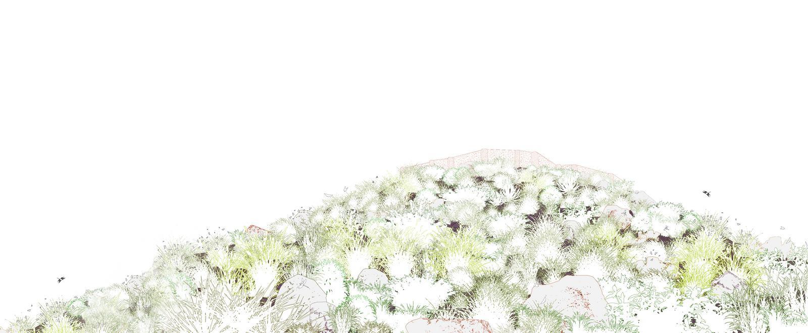
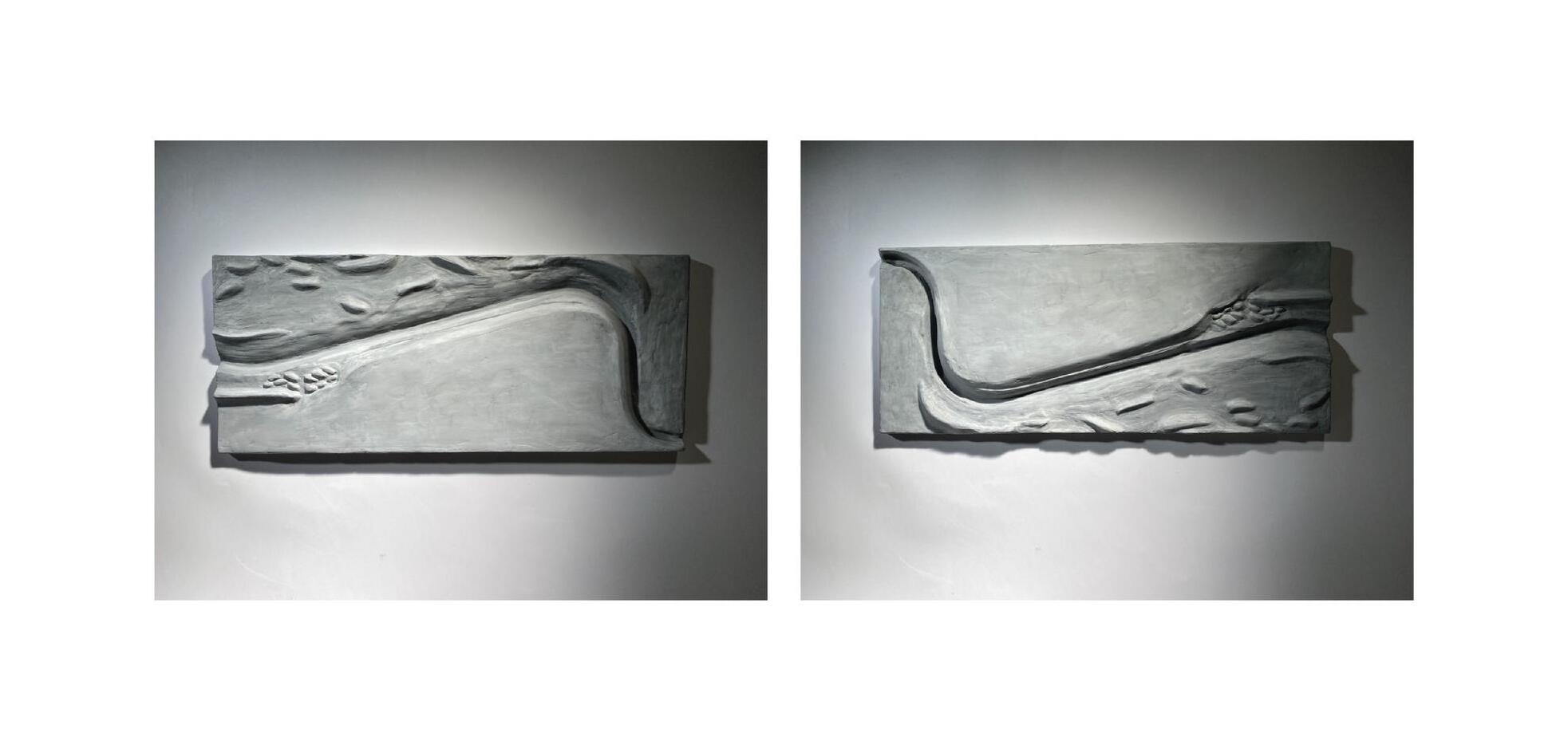
Atop a sandstone ridge, by the crooked water, are the remains of ancient life in the Verde Valley. The settlement, built in the 12th century, was home to around 250 people until it was abandoned. Today, this region remains to be important grounds for birds traveling on the Pacific Flyway.
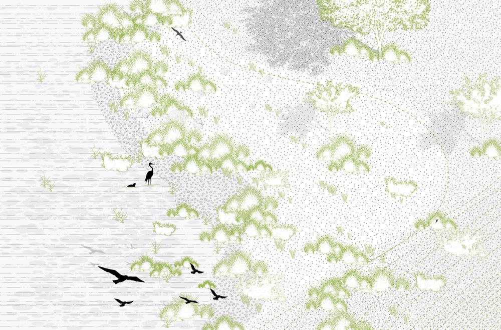
Nearby to the East, is the hook shaped lake - Peck’s Lake - revealing the origin of the settlement’s name, Tuzigoot, meaning “crooked waters” in Apache The dwellings contained many relics of the stories of the people that once lived in the Sonoran Desert The Sinagua were dry farmers, reliant on the rain and nearby Verde River for their livelihood They had a profound love of birds, using their extensive trading connections from California to Mesoamerica to collect and keep exotic birds, such as the scarlet macaw, in their homes
In 2021, it is proposed that these expanses of marshland receive formal protection as a bird reserve, and advocated for rehabilitation of the reservoir. The water quality improves causing changes to the riparian vegetation.The rocky ridges and grasslands become a sanctuary and a resource for migratory birds year round.




Comprehensive Studio led by Alissa North, Todd Douglas & Rui Felix
Winter 2022 : : 6 weeks
in collaboration with Irene Patrinos
AutoCAD - Photoshop - Illustrator
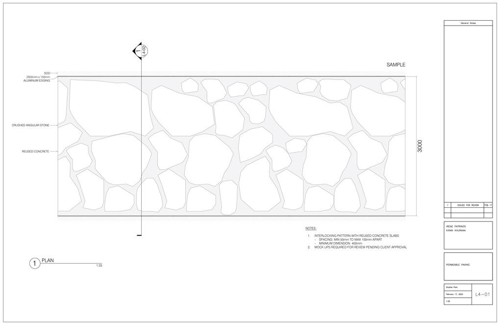
After water, concrete is the most widely used substance on the planet. In Canada, over 9 million tonnes of aggregate comes from construction and demolition alone, which ends up in our landfills. This presents an opportunity to think about the materials we use, and their wider implications. This project is situated where Black Creek flows through Smythe Park, and will pose as a pilot project that can extend to all channelized rivers under the TRCA jurisdiction.
Our central strategy involves breaking up the southern bank of the creek, softening the edge, and reforming concrete to enhance flood protection measures and increase permeability on site Through the preservation and conservation of concrete salvaged from the channel, Smythe Park becomes a sustainable and industrial-strength landscape that will combat flooding while simultaneously restoring native biodiversity, and providing opportunities for recreation, and placemaking even during flood events




 Planting Strategy + Experiential Qualities by Kiran Khurana


 Concept Diagram by Kiran Khurana
Experiential Section by Irene Patrinos

Landscape Memory studio led by Liat Margolis
Winter 2021 : : 6 weeks
in collaboration with Afsah Ali
Adobe Illustrator - Photoshop - Rhino - Google Earth
Of almost 4000 trees living in the campus area, less than 4% are native conifers. This seemed to be a point of disconnection with the readings and the botanical teachings we have engaged with in this studio.
Our project attempts to create spaces on West Campus that can facilitate a transforming relationship with the land through the presence of these trees and engagement with their teachings Our approach is to take responsibility for the future by creating testing grounds to inform how we can go about reintroducing 10 native conifers in an urban context Our planting strategy responds to the gap in knowledge we encountered on how to introduce coniferous species to an urban context outside the bounds of ornamentation or Christmas tree nurseries
We have used Mary Sisip Geniusz work as our primary guiding text to learn about these trees, and we have integrated research about the space, light, water, and soil requirements for each to ensure their best possible health. The design scheme will unfold over the next century and transform approximately 24,000 square meters of the campus into evergreen groves and educational zones.


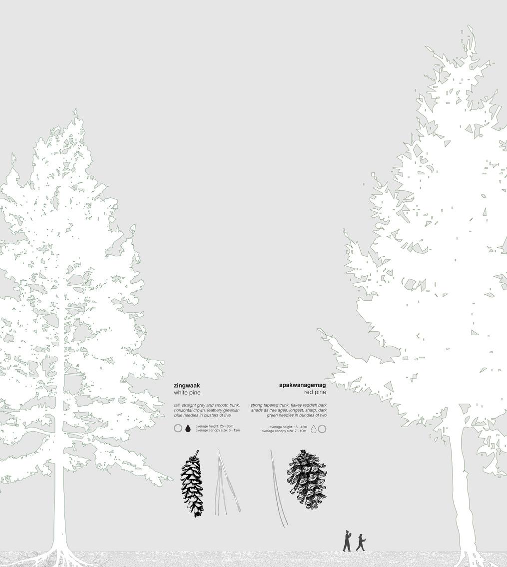

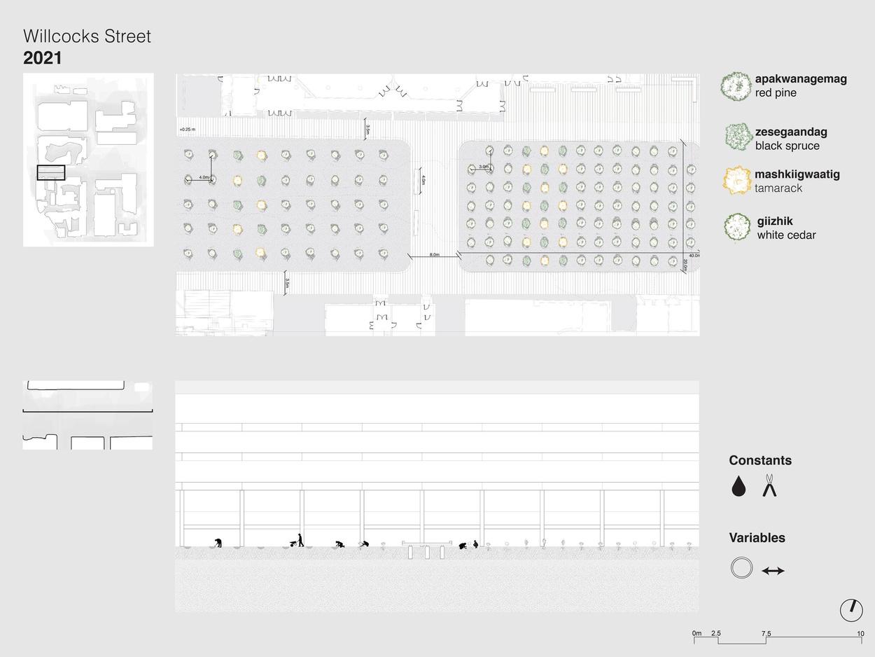


As we do with human life, we must acknowledge the presence of tree life and the erasure of their bodies and their teachings. And we must understand them not as simply symbols of what once was, but rather as familial bodies, teaching bodies, bodies of protection, and of peace.
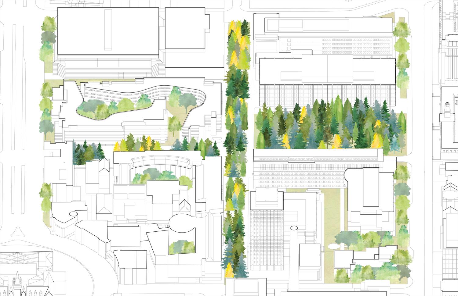 Axonometric Drawing by Afsah Ali
Ho Chi Minh City Studio led by Ivan Valin (University of Hong Kong)
Fall 2022 : : 2 weeks
Individual
Photoshop - Hand Drawing - Dream AI
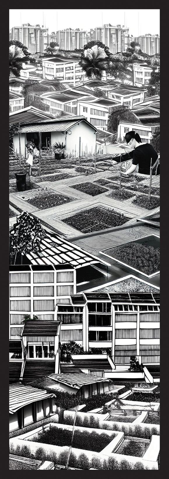
In this imaginary, the river dies of thirst, fewer fish migrate to the delta, and sediment flow downstream has been cut in half causing the building of healthy soils to be increasingly depleted as food insecurity prevails.
Ho Chi Minh, already under pressure of high waters, contamination and now a severe lack of access to food and fresh produce has to deal with the consequences of this loss and develops an infrastructure of urban farms on rooftops amidst the tall city


Language of Landscape Studio led by Behnaz Assadi

Fall 2020 : : full term
Individual
Adobe Illustrator - Rhino - Procreate - Google Earth
Using both native and non-native plants to create educational spaces that support native and non-native plant life, and simple accessible pathways to facilitate this learning, and offer moments to deconstruct. A site of this nature in Toronto can be even more impactful given that Toronto is the most diverse city in the world with more than half of the population born outside of Canada. This park, becomes an opportunity for newcomers to familiarize themselves with the people and knowledge systems that are indigenous to land they live on This park offers us all a moment to reflect on that which holds us outside our bodies And like the plants, find room to grow - so that we might have a shot at coming back to our natural balance


Experience among the plantings


