PORTFOLIO
LANDSCAPE AND ARCHITECTURE

LAIA DÁVILA GARCÍA
Landscape Projects Mountainous
RECONNECTING THE VALLEY
Architectural Projects

Landscape Projects Mountainous
RECONNECTING THE VALLEY
Architectural Projects
ILLUSTRATIONS
MBLandArch
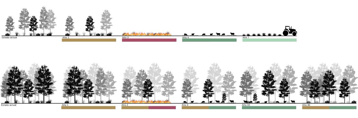
The Masterplan is structured through 3 axes of action. Firstly, the riverside is considered a sanctuary for protection and an ecological enhancer. Next, abandoned or underused farmhouses are addressed, projecting them as a potential network for economic and social connection. Lastly, the importance of forest management is highlighted to ensure the balance and conservation of the territory and its values over time.
In the development of the first phase, the reactivation of 10 abandoned farmhouses in El Brull is proposed. A study was carried out based on the time and specific conditions of each terrain so that each farmhouse could manage its land and reactivate the economy corresponding to each one.


First Phase of the Masterplan

Agricultural Fields + Topography

HABITATS OF COMMUNITY INTEREST
PRODUCTIVE AGRICULTURAL AREAS
PRODUCTIVE FOREST AREAS


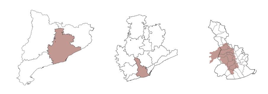
The project is primarily located in the southern part of the Ordal Mountains, between the municipalities of Begues and Torrelles de Llobregat.
Its goal is to address a potential future scenario in response to climate change through a specific proposal for the reactivation of the productive landscape in the mountainous area. To achieve this initiative, the plan includes the revitalization of traditional farmhouses (masías), the restoration of the agricultural mosaic, forest management, and the renaturalization of the Torrelletes stream. All these elements will be connected through a circular itinerary that traverses the area and links the main urban centers.


Detail: Pathways and Dry Stone Walls

Construction Detail: Main Pathway


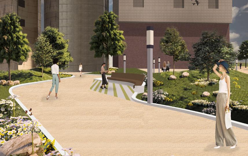
We find ourselves in the city of Sant Adrià, an area currently underutilized due to an increasingly inactive industrial estate, but which was very important years ago. The main objective of the project is to bring this new space to life. In this way, we attempt to connect all existing spaces with a new metropolitan green corridor that runs from the river park of the Besòs River to the sports center of Badalona, thus ascending through the new canal area.
It is structured by extending and connecting the axes of the existing streets, generating both transversal and longitudinal connections. These connections gave rise to a zoning of the space into three parts:
The built-up area, where a tall building is planned, creating a new front to the street and marking a directionality towards the three chimneys.
The second strip is a transitional space between a hard surface and a naturalized space. It is an equipped park, leaving spaces with activities to reactivate and attract users to the park. This part connects from the current activity areas of the river park, through the sports center, to the three chimneys.
Lastly, the large green space in front of the three chimneys, the naturalized area, is a space divided into two parts: the retention pond and the beach area. It could be said that these two spaces are a natural lung that a city as industrial as Sant Adrià del Besòs needs.


Reurbanization of the entire lower part of the highway located above Montcada i Reixac. The Masterplan is structured through 3 axes of action, once the area has been analyzed since the 1950s. On one hand, it used to be farmland, which is why the city has a structure marked by these plots. The aim is to enhance and recover that linearity. On the other hand, in civic terms, after visiting and analyzing the area with the residents, all ideas are collected and distributed along the entire axis. Lastly, water plays a very important role throughout the project, recovering old water routes and redirecting water through infiltration and sustainable water collection systems.


Masterplan. First phase


Orientation of the old 1956 agricultural filds
LARGE-SIZED SHRUBBERY


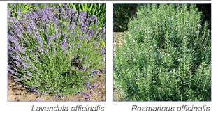

HERBACEOUS
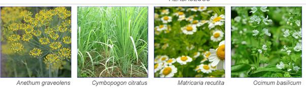
CLIMBING PLANT


Basketball count


The project takes place in a neighborhood on the outskirts of Seville. Various houses are planned after conducting a study of the neighborhood and the individual plots. The main idea was to develop the project by grouping the different houses in such a way that they appear as a single house, to maintain the uniformity of the neighborhood. A total of 5 houses are to be developed. As a requirement, the houses could not exceed 60 square meters.
The project strategy is to design different modules that, when joined together, create various spaces suitable for all types of users, with the idea of maintaining an interior courtyard to bring life to the plots.


This project is located in a city in Denmark and involves the expansion of the existing building. The project allows for the continuation of a seamless urban life plan, with this green space being used by many organizations.
For this reason, the project is divided into two parts: the more private section is located in the tower, which houses offices and workspaces, while the underground part is more public, containing event rooms. It also serves as the connection point to the existing building. The different spaces within the project are connected by a central core with a double staircase.


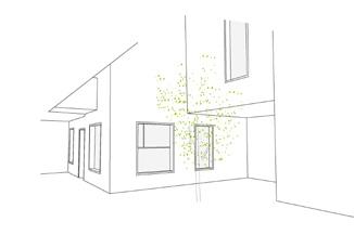
Illustrations Created for the Landscape Science Course at MBLanchArch.


