1 minute read
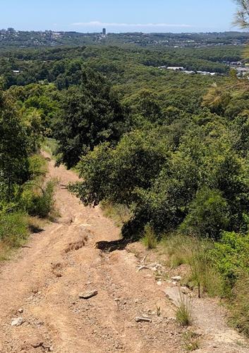
Photo 2.1 Some of the steep and eroded tracks on Munibung Hill
Photo 2.1a Ridge Crest Photo 2.1b Track along northern ridge Photo 2.1c Upper part of main access track from Lucilla Ridge


Photo 2.1 Some of the steep and eroded tracks on Munibung Hill
The Concept Plan seeks to promote passive recreation through:
• Formalising and track upgrades of selected existing tracks to provide for safe passive recreation on defined routes (refer to Figure 2.1).
• Formalising two ‘district level’ trailhead sites that would provide off street parking. Local pedestrian access from the residential areas of Macquarie Hills and Speers Point would be maintained, connecting to the tracks from the trailhead sites. Parking in narrow suburban streets will not be encouraged.
Over the ten-year life of this Concept Plan and the Management Plan, Council will upgrade only the specific tracks shown in Figure 2.1. These tracks are primarily on Council owned and managed land, but the southern track crosses land owned by Munibung Hill Pty Limited which is currently zoned for conservation. Council is not responsible for use of private land on Munibung Hill, except in relation to compliance with zoning or development consent requirements.


