6 minute read
Orla do Guaíba Urban Park
Orla do Guaíba Urban Park A historical riverfront thrives again in the Brazilian City of Porto Alegre
By: Jimena Martignoni
Advertisement
Porto Alegre is the largest metropolis in Southern Brazil, with 4.3 million people living in the metropolitan area and 1.5 million in the city proper.
The city is located at the northern end of the Lagoon of the Ducks, a large coastal lagoon adjacent to the Atlantic Ocean and connected to the junction of five different rivers. This junction forms the Guaíba River which is also referred to as Guaíba Lake by locals. The name Guaíba was given by the aboriginal Guaraní, the first inhabitants of this region, and means “bay of all waters” (baía de todas as águas in Portuguese). Today, after the completion of the waterfront renovation’s first two stages, this urban green piece is the most visited and, especially, the most beloved by both locals and tourists.
Since the early 1940s, when the city was hit by a devastating flood and a wall was built around most part of the natural waterfront as a potential solution, the close connection between the water surface and the green border with the city grid was erased. Locals kept visiting and spontaneously using the remaining natural areas in front of the water for gathering,

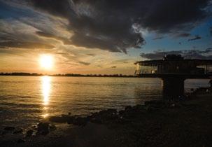
resting and watching the sunset, something that Portoalegrenses (Porto Alegre’s citizens) consider like no other in Brazil.
The City Government of Porto Alegre, with Mayor Fortunati (2010-2016), finally decided to work on a conversion plan which would overcome the state of stagnation and decay of the site; then, the key information for the project was the people’s instinctive behaviors over the decades. The idea for this new plan started in 2011 and in 2016 the government received the funds granted by the Development Bank of Latin America (Banco de Desarrollo de América Latina), which financed 100% of the plan. The completion of the project was under the next city administration, with Mayor Marchezan Júnior, still in office. In this way, two administrations have been responsible for the city waterfront’s turnaround.


Key designers and design keys
The project was commissioned to the world-renowned Brazilian urban planner Jaime Lerner. He was mayor of the City of Curitiba for three terms, where he implemented the first Integrated Mass Transport System and consolidated the city’s urban transformation. Awarded by the United Nations Environmental Program and listed among the 25 most influential thinkers in the world by the Time Magazine, Lerner was chosen by the City Government of Porto Alegre based on his prestige and knowledge. This methodology (“notório saber”) is used in Brazil for exceptional cases, replacing the typical call for entries or competitions. The Porto Alegre City Government created a local coordination base, in charge of architect Oscar Coelho, for all managing tasks and construction stages. “The project crystallized the natural vocation of the site which was that of walking, watching, drinking mate, practicing sports…” says Coelho while explaining the design process and final product – “And, especially, it defined a consistent and comfortable ambiance to watch the sunset: decks extending over the water and linear ergonomic benches in front of it, floating walkways, concrete spectator stands which delineate sitting areas and negotiate the existing elevation changes…, a formal invitation to live the waterfront.”
Site and landscape modeling
The site’s topography and the existing grading were essential pieces of information in the project and made possible the creation of a range of spaces and areas extending along the 1.3 kilometers of the first phase. The total length of the waterfront renovation project is approximately 8 kilometers. The existing elevation change between the street and the water levels is 4.70 meters; this difference was used in favor of a diverse and dynamic project and, more importantly, with many different perspectives and views towards the river. Halfway between the street level and that of the water and as part of the flood protection works carried out by the City Government over the last decades, the site’s profile already presented a wellestablished platform which determines the official local flood stage. At 2.50 meters above water level, this stage was defined in the project as the site’s main pathway; the backslopes were stabilized with gabion retaining walls and when closer to the shore, for the consolidation of the natural soil, the gabions were built as horizontal structures and seeded with indigenous riparian plants.
The landscape plan was differentiated in five areas which coincide with the site’s layout and levels. The first two correspond to the aquatic environment and water edge and focuses only on conservation and management of existing species; the third corresponds to the lower esplanade and incorporates one single kind of native grass (Axonopus repens or Carpet grass); the fourth focuses on the natural slopes and new stepped terraces and includes a series of native shrubs and grasses; finally, the fifth correspond to the sidewalk and bike path level (upper esplanade), and is the one space which incorporates a high amount of trees, all native, including fruit and flowering species. This upper esplanade makes up a green corridor which connects the fauna population, especially birds, between the city and the water edge.
The halfway level is the one which offers cafes, vendors’ stands and restrooms. Housed in a series of

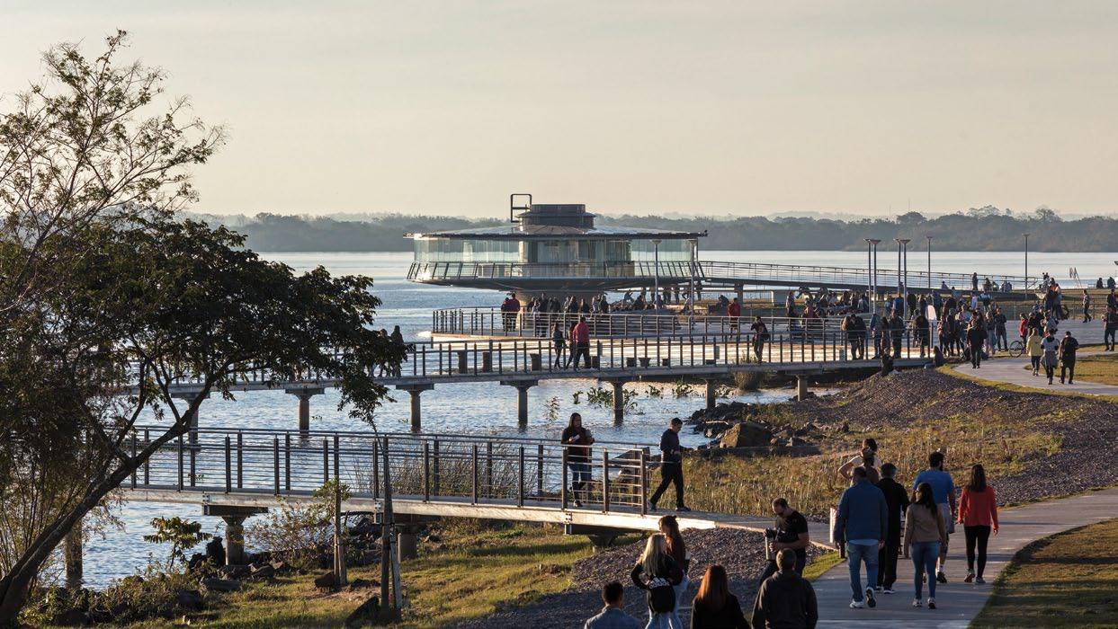
semi-buried constructions with glassed facades facing the park and the waterfront, the commercial spaces and facilities punctuate the linear park and follow the organic forms of decks, paths and overwater walkways. Two walkways of organic lines get into the water and create fantastic aquatic belvederes.
This part of the city is very close to the Historic Centre and some of the oldest and most stately buildings, such as the old gasometer which will be transformed into a cultural center, appear in the site as important landmarks. In turn, a very contemporary restaurant floats over the water and offers 360 degree-views of the area; visitors can get to this new building via a new pathway aligned with an existing traditional avenue of the city, establishing a clear dialogue between past and present times. A number of art works that comprised the outdoor exhibition of the 2005 Biennale of Architecture were restored and some of them relocated; reused as lookouts, playgrounds or open-air museum large objects and installations, these “folies” help to weave art into everyday life.
Completing the proposal for the site, a series of sportive areas and fields were built at the very end of the first 1.3 kilometers.
As part of the lighting plan, a very romantic and captivating effect is incorporated along the first 300 meters of the upper esplanade: as the sun sets over the horizon, thousands of tiny lights suddenly glow on the pavement, inviting visitors to stay at the site for night events and sky watching. This system, known as “star-filled floor” (piso estrelado in Portuguese), integrates fiber optic lights into the concrete and turn on automatically when solar light decreases, at dusk. Adding a final touch of magic to the waterfront, these lights become a sign of the site, inspiring and shaping new local habits, at all hours.
Location: Porto Alegre, Brazil Date of Completion First Stage: 2018 Project Size: 5.70 hectares / Length of First Stage: 1.3 kilometers Designers: Jaime Lerner Arquitetos Associados (Curitiba, Brazil) Project Manager and Construction Consultant: Fernando Canalli Landscape and Environment Consultant: Carlos Oliveira Perna Porto Alegre City Hall’s Coordination / Construction Management: Oscar Coelho Design Team: Architects Kawahara, Bechara, De Rossi, Daher, Guerra, Popp, Roorda. Client: Porto Alegre City Hall (Prefeitura Municipal de Porto Alegre) Construction works: Consórcio Orla Mais Alegre


