3 minute read
Before us


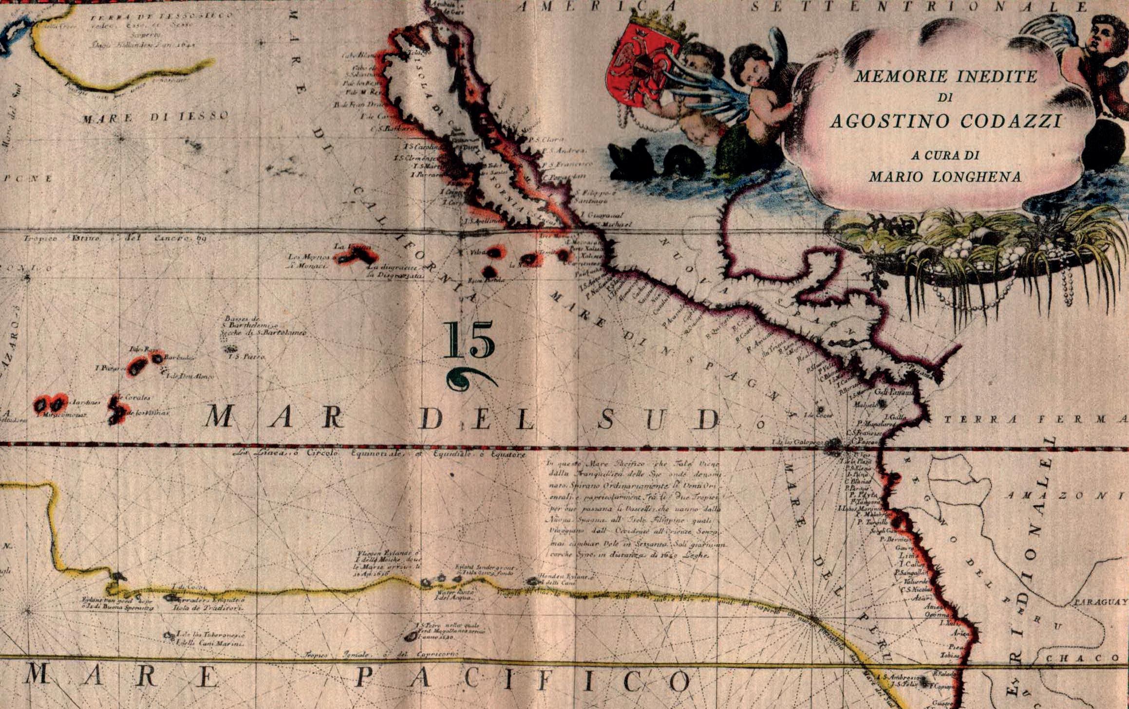
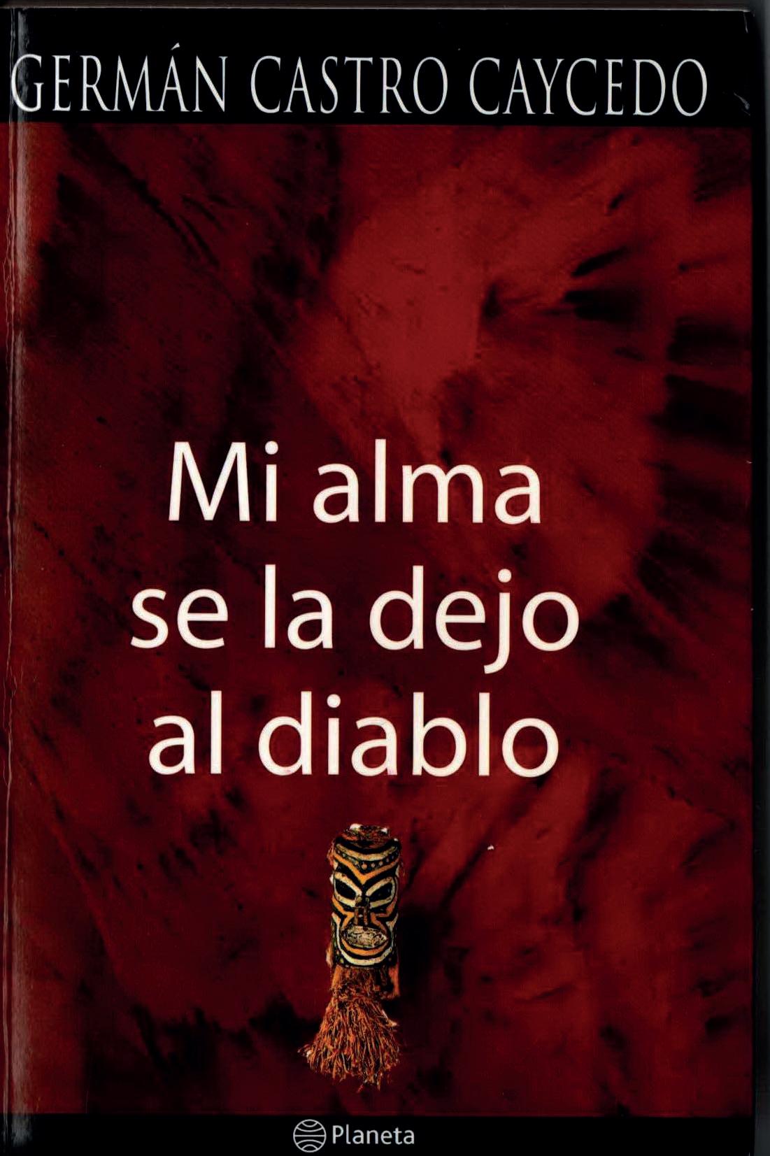
During our expeditions we very often find ourselves exploring remote places in the belief we are the first to tread their, to leave a footprint. Our now customary Google Earth consultations lead us to consider those territories covered by immense forests, occupied by arid deserts or isolated by perennial ice, as still unexplored. But often that’s not the case. In fact, during historiographical research on the expedition area, where we don’t seem to encounter any reliable evidence, we then unexpectedly stumble upon a report, a map or an ancient document in the vast sea of the internet concerning that very place. These “discoveries” sometimes lead to a turning point, proving an invaluable aid for learning more, and not just on the field, about the territories we explore. This was the case for the Philippines, when, on the occasion of the publication of the book A Cave between Land and Sea, we came across the first report on the Underground River written by a British naval commander called Bates in 1850. This was also the case for the Caquetá region and its rivers in Colombia. A great deal has been written about the Colombian Amazon, so much so that when carrying out in-depth research you can lose yourself in an infinite number of documents, reports and treatises on its inhabitants, economy and natural resources. Some interesting information on the area was handed down to us from a fellow Italian, the geographer and mapmaker Agostino Codazzi, who as early as 1857 began exploring Colombia, making his way up the Caquetà river through the “ilimitadas florestas da la vegetacion exuberante inextricable que se veia por todos lados donde la naturaleza offrece tenaz recistencia en reconocer el hombre como rey de la creación”, as described in the fascinating book Memorie Inedite di Agostino Codazzi, which provides an account of the life and adventures of this pioneer, considered a national hero in Colombia, Ecuador and Venezuela. The scientific significance of his research was such that his name often features today alongside that of the famous naturalist Alexander von Humboldt, as like the latter he ventured into large unexplored expanses of Colombia, making the first geographical maps. Another interesting text, useful for learning about the territory, is the more recent Mi alma se la dejo al diablo, written in 1976 by the Colombian author Germán Castro Caycedo. It contains a realistic account of the difficulties of living and surviving in the area of the Caquetá and Yari rivers, in the vain attempt to colonise these territories, amidst hunters and caugheros, harvesters of natural rubber extracted from the bark of the Hevea brasiliensis. This product was publicised in the West by the French explorer and geographer Charles Marie de La Condamine in the mid-1700s, transforming and disrupting the life and economy of the inhabitants of these lands.

Advertisement
Map of Rio Yapurá (Caquetá)
The map
In addition to consulting historical texts of various ages, we also used the means made available to us by today’s technology to learn more about the places: internet research, satellite photos, detailed maps and 3D rendering software. This is all to be expected, but in the Colombia project coming across a map dated 1789 was like receiving an unexpected gift. The “Mapa De una parte de los Rios de los Engaños ò Commiari”, as the Rio Yarí, a tributary of the Caquetá, was known at the time, is perhaps the first to describe the area of these distant offshoots of the Amazon. The Kingdom of Spain commissioned Colonel Francisco Requeña to produce this rare document when establishing the borders with the Portuguese territories neighbouring the Colombian Amazon region. It provides an incredibly precise description, with an abundance of detail, about the entire river network in the Caquetá region with the original names (the River Caquetá is marked on the map as Yapurá). The map includes numerous references to the indigenous ethnic groups, as well as marking natural obstacles and the sequence of rapids (sometimes described as “inacesibile”) along the main watercourses. It will certainly be interesting to compare the information contained in the map in situ with the local people. In short, this valuable document will provide a valid and stimulating method of comparative investigation between the present and the past, comparable to real discovery on a fruitful expedition.
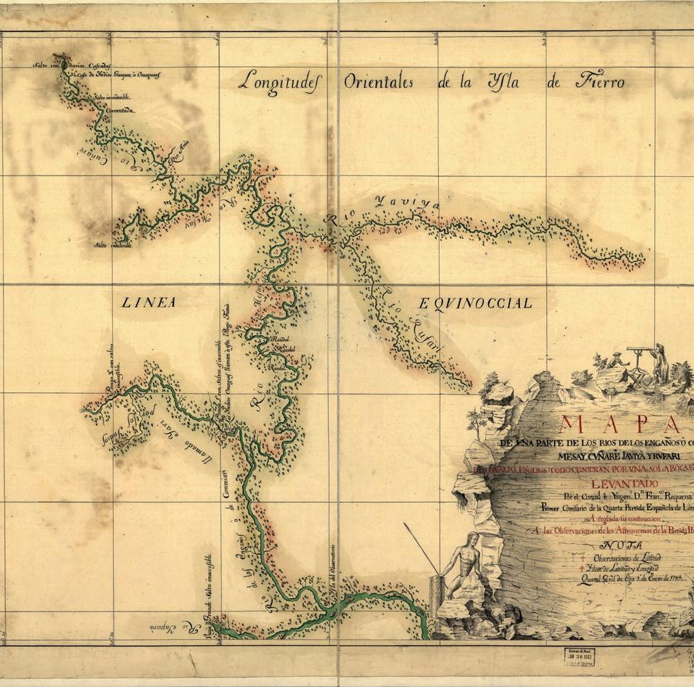
Map of Río Yarí


