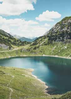
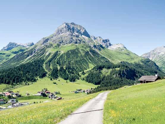
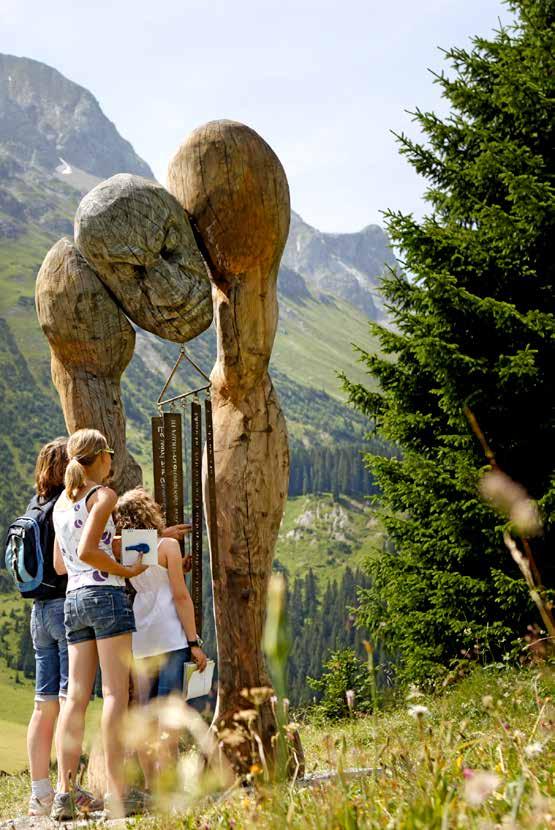
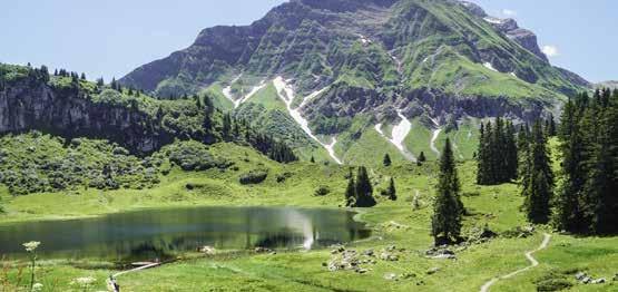
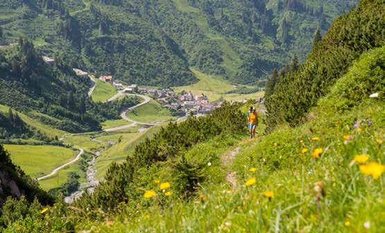
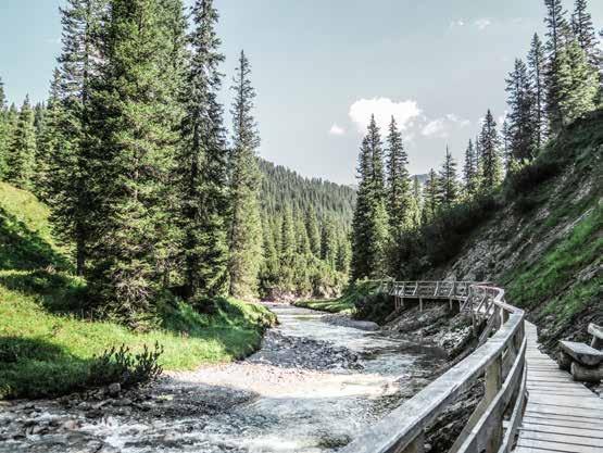
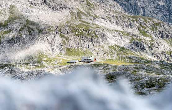
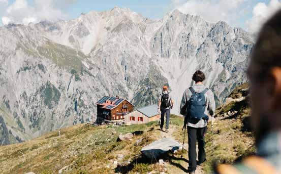
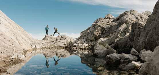
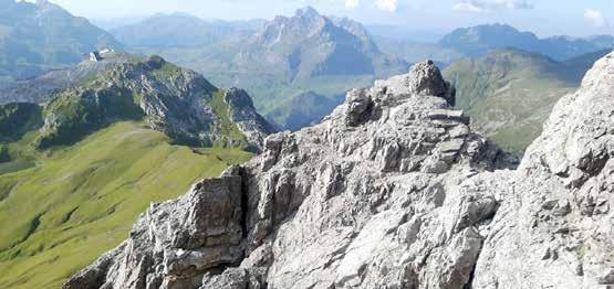
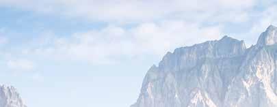
Hiking heaven
MORE TIME, MORE SPACE.
ALL THE INFO FOR YOUR MOUNTAIN HOLIDAY

SUMMER LECHZUERS.COM

MORE TIME, MORE SPACE.
ALL THE INFO FOR YOUR MOUNTAIN HOLIDAY
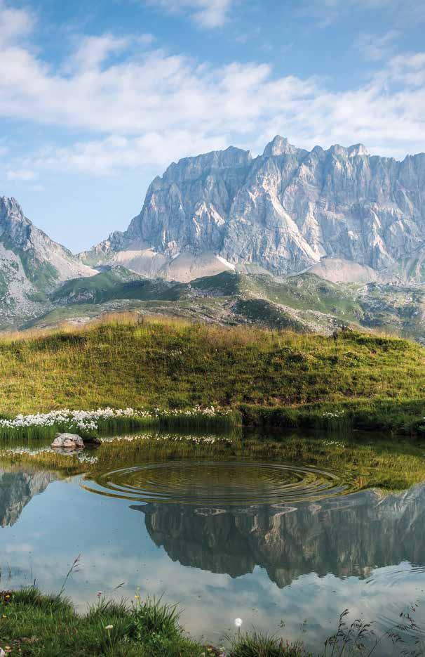
This attractive holiday card places at your fingertips everything that Lech Zürs am Arlberg has to offer in summer. During your summer holiday enjoy the views of the mountains from our cable cars, or visit popular destinations such as the Spullersee and Formarinsee lakes in the Zugertal valley. The children’s activity programme will be at the top of every young visitor’s list. Discover for yourself how varied summer in the Lech mountains can be with the perfect companion - the Lech Card.
Every tip in the “Hiking heaven“ brochure contains information about the difficulty of each tour, shown in different colours: strenuous tours are blue, moderate tours red and the easiest yellow. The colours are also displayed in the elevation profile for the hike in question and on the markings and signs in the hiking area. The graphics below show you the basis for the ratings:
Hikes in Alpine valleys or the uplands
Tours on flat terrain, rather like a long walk. The terrain switches between easy forest and meadow trails, and forestry and farm tracks, without any noticeable difference in altitude.
Mostly unmade, well-marked trails, rarely on steep terrain. There may be short, demanding stretches. The difference in altitude is so moderate that the tour can also be undertaken with fit and active children.
Day tours in the uplands, plus mountain hut hikes
Moderately difficult tours, where easy hiking trails alternate with trails which are sometimes rocky or covered with tree roots. The difference in altitude is only slight and never prolonged, up to a maximum of 300 metres.
Easily walkable, marked mountain trails or mountain hut ascents requiring no climbing, with some steep trails posing no particular danger. No summit climbs. The difference in altitude is strenuous for the inexperienced, but moderate for experienced hikers. Good fitness levels and sure-footedness are required.
Sure-footedness and a head for heights are required at all times
Summit ascents with easy climbing (I), with no particular foreseeable dangers. Routes not always marked, sometimes no obvious trail.
Alpine know-how, sure-footedness and a head for heights are required. Summit tour with maximum grade II difficulty climbs (UIAA). Includes category C+D alpine via ferratas. Important! Mostly unmarked and no obvious trail.
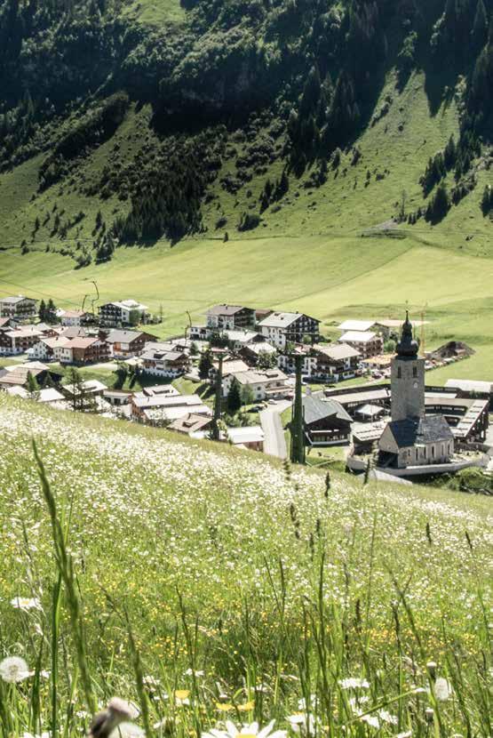
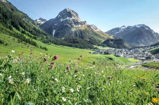
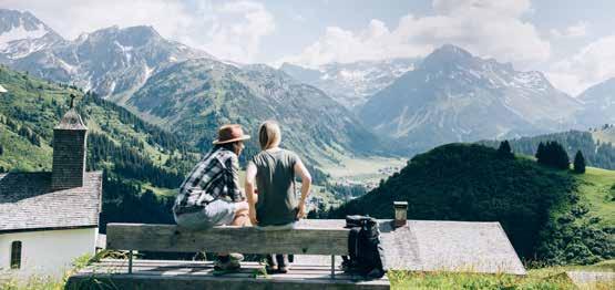
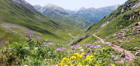
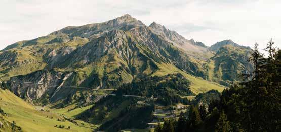
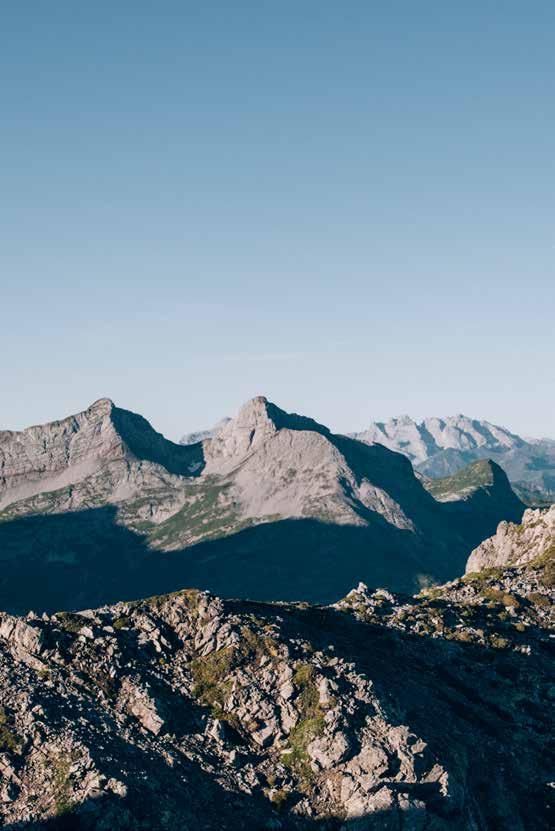
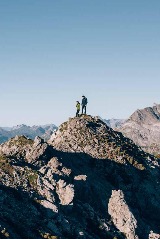
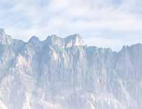
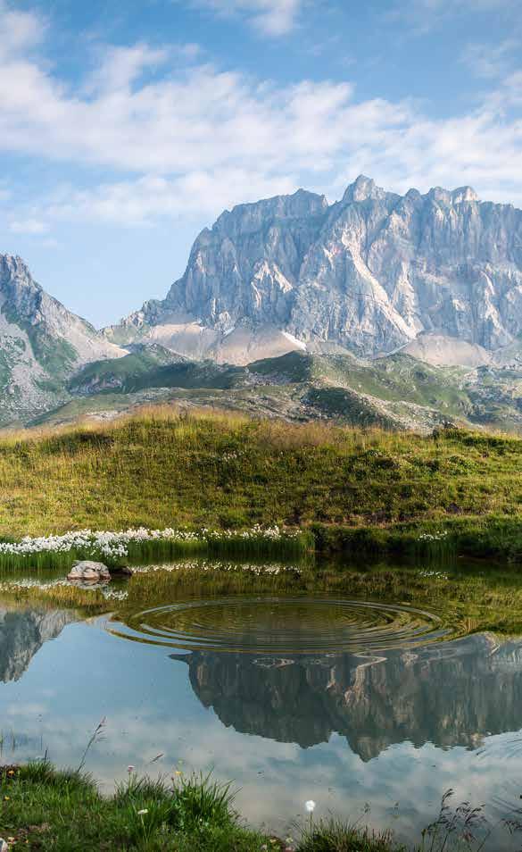
Hikers will be thrilled by the wealth of opportunities offered by Lech Zürs am Arlberg, because the mystical, story-filled landscape is a wonderful place to restore inner peace and contentment.
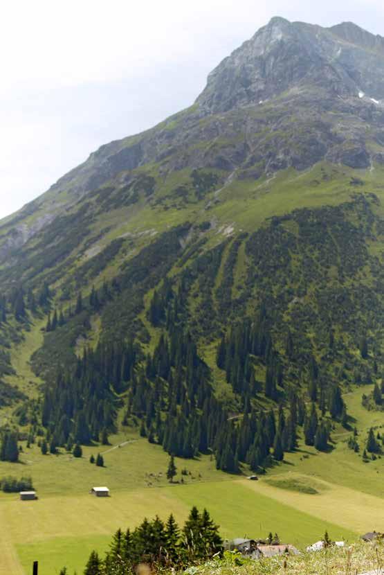
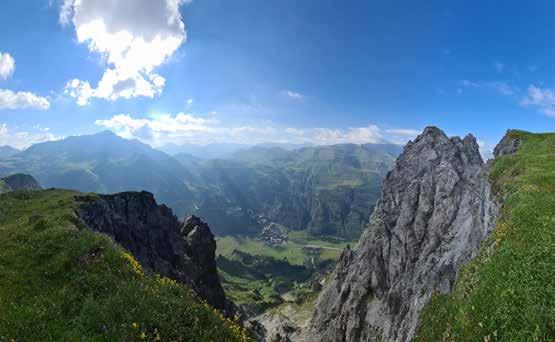
The area around Lech Zürs am Arlberg leaves nothing to be desired where hiking and mountaineering are concerned. The gentle meadows of Tannberg and the Zugertal valley’s lush woods make a gentle, medita tive hike irresistible, whilst the splendid mountain ranges are just waiting to be conquered. Idyllically situated Alpine pasture huts and mountain refuges with amazing views offer rest and refreshment. Regardless of where hikers’ footsteps take them, the Lech Zürs landscape is utterly enchanting, transporting them back in time and enthralling them with its wondrous tales.
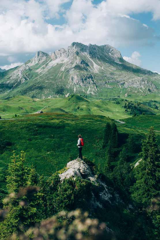
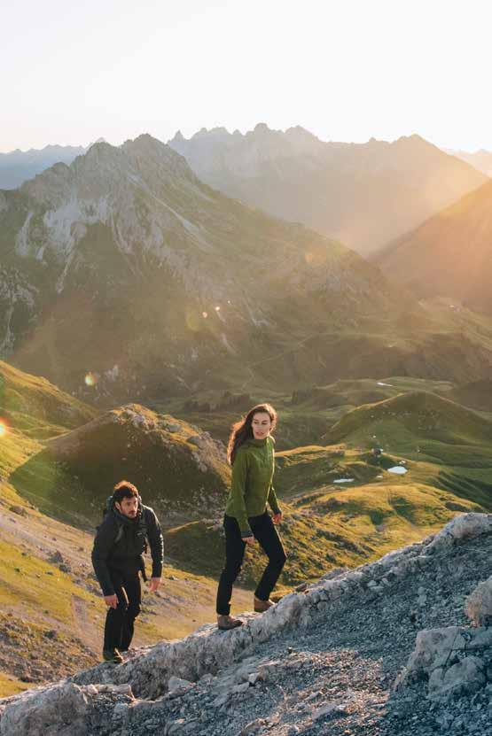
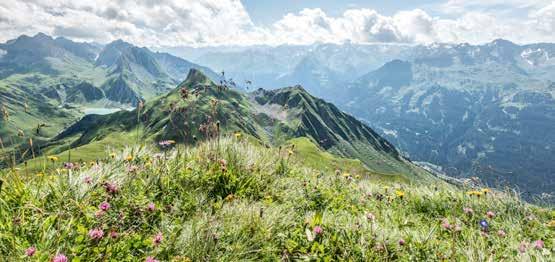
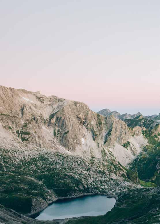
Mountain peak upon mountain peak as far as the eye can see. The Mohnenfluh, Rüfikopf, Omeshorn and Formaletsch mountains, and below them, in the valley, peaceful Oberlech, Tannberg, Lech, Zug and Stuben am Arlberg. Can you just make out the Steinernes Meer karst plateau behind the Formarinsee? So many trails, so many options. Heaven is within touching distance! The excitement mounts.
MARKUS HAHN Product Manager Summer
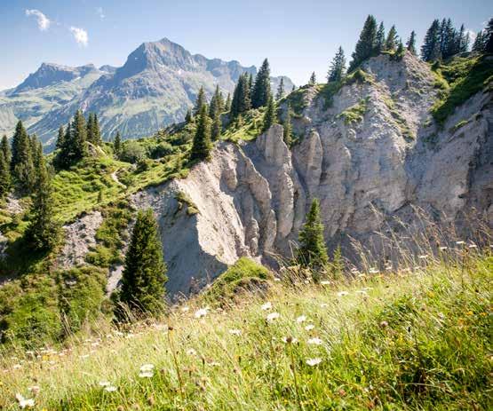
Walking has a very human rhythm and pace. Exercising in the great outdoors stimulates the circulation, is healthy and relaxing. It gives people peace and vitality, allowing them to switch off, to dream, to think, to wind down and just be. The holiday region of Lech Zürs offers a breathtakingly varied landscape and beautiful, well-marked hiking trails to suit all levels.
Duration: 1 h Distance: 3,3 km Difference in altitude: 90 m 90 m Hiking: Fitness:
Special features: the meadows contain numerous medicinal herbs and a rest area at Mesner’s Stall (beside the church).
Places of interest: St Nicholas’ Parish Church.
Refreshment stops: restaurants in Lech am Arlberg.
This circular walk provides superb views of picturesque Lech am Arlberg.
Starting point for the short village circuit is Rüfiplatz Lech. Follow the Lech river promenade upstream until you see the Hotel Pfefferkorn on your left. Walk past the hotel and turn left into a side street that slopes uphill.
The road takes you briefly through the district of Ebra and you soon come to an asphalt trail branching off to the left. Follow this to the edge of the wood where you bear left on a forest trail gently uphill.
Even from here you can marvel at a superb panoramic view of Lech am Arlberg and the [1] ] 3-hole golf course. After a few metres you come to a beautifully equipped [2] barbecue area with everything you need. So why not bring along some food, paperplates and cutlery and enjoy a lovely barbecue?
Continue on the trail until you reach a small wood where there is a very special rest area waiting for you[3] "Seelenbaumler" (rest area) with hammocks. Make yourself comfortable, have a good rest and enjoy the view of the mountains.
The trail continues to the edge of the wood where there's another [4] Rastplatz. Branch off left here and follow the farm track past the stable and across the field till you come to the first houses.
Follow the asphalt minor road through the district of Anger past the back of the church to the church square. This is where you'll find the [5] "Steinplatz" (sculpture garden), a garden with sculptures made from 6 different types of stone. These witnesses to the earth’s early history give you the chance to undertake some geological research.
Alternatively, you can continue to the district of Stubenbach and enjoy a coffee there.
Duration: 1 h 30 m Distance: 3,0 km Difference in altitude: 192m 192 m Hiking: Fitness:
OUR
Special features: the tour can be shortened by taking the Bergbahn Oberlech cable car.
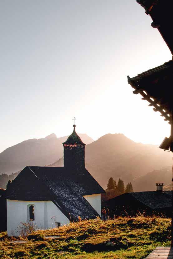
Places of interest: St Martin’s Chapel “an der Straß”
Refreshment stops: restaurants in Lech am Arlberg or Oberlech and Rud-Alpe hut.
This walk is somewhat more demanding, but worth it for the magnificent views.
The walk starts in the village center of Lech. Follow the Lech river promenade upstream to the [1] St Martin’s Chapel. From here follow the moderately steep, uphill forest trail.
There's a [2] rest area after the first climb. The trail continues slightly uphill through the wood.
From the clearings you can enjoy frequent views back towards Lech am Arlberg. You come to a forestry track which you follow left downhill through the wood.
When you come out of the wood, the forestry track winds across extensive mountain meadows.
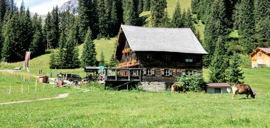
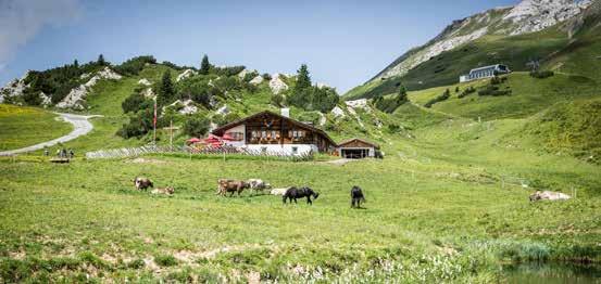
You soon reach the traditional [3] Rud-Alpe, where you can enjoy a wonderful refreshment stop either on the spacious sun terrace or in the homely wood-panelled parlours with an open fire.
Continue downhill past a [4] rest area with lovely views. From here it's just a few metres downhill until you come to an asphalt minor road.
Follow the road to the left and at the next junction take the right-hand fork downhill until you reach the old, covered wooden bridge. From here you follow the Lech river promenade downstream. When you come to the B&B Pension Waldesruh, cross a bridge over the Lech river and you're back at your starting point.
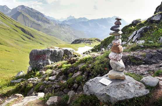
Special features: you can “immortalise” yourself by adding to a cairn on the broad gravel banks.
Places of interest: Forest swimming pool
Refreshment stops: Marend Kiosk, fish pond and restaurants in Lech und Zug
This walk is perfect for families with young children as the trail is suitable for prams and buggies.
Follow the Lech river promenade upstream from the village center Lech. Cross the road at the Chalet Säge when you reach the old, covered bridge. Turn right into the minor road at Hûs Nr. 8.
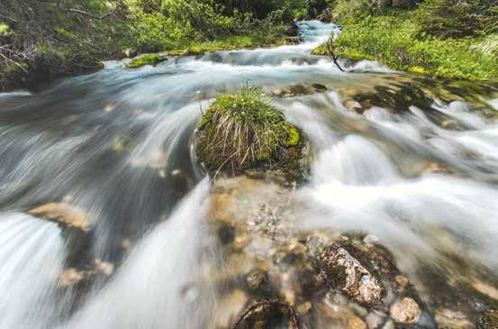
Continue straight ahead along the road, past the [1] St Martin Chapel, at first uphill, then on the flat until the road joins a gravel forest trail. Follow the trail beside the bubbling Lech river.
At the [2] Kneipp facility a wooden bridge crosses the Lech river to the [3] forest swimming pool. Opened in summer of 2020, the forest swimming pool features a 25 m sports pool, an aquafit pool with bubble loungers and massage jets, a children's pool, a baby pool and a wide wave slide. You should take a break there, especially if you have children.
You can take a break here and relax in the warm water, maintained at a constant 25 degrees.
The forest swimming pool with its slide, rock island, paddling pool and playground is a great place for children to chill and have fun.
As alternative, you can also take a break at the wonderful [4] barbecue area, which is located directly at the Lech river.
Shortly before you reach the district of Zug, you come to [5] loungers on the bank.
Continue on the trail until you reach the Zug cable car valley station, and then it’s an asphalt trail from here.
Cross the bridge and the car park to the [6] fish pond. Here you can fish and enjoy your freshly cooked catch.
You can either return via the Lech riverside trail, or continue into Zug village centre and take the hiking bus back to your starting point.
For children from 5-14, there’s the children’s adventure programme and the outdoor activities offered by the “Arlberg Alpin” mountaineering school. Additional adventurous activities include canyoning, climbing, hiking and many other outdoor activities, which can be experienced together with experienced guides and the family. Moreover, there are some hiking tours, which are exciting and show our small guests the wonderful mountain nature of Lech Zürs. 4
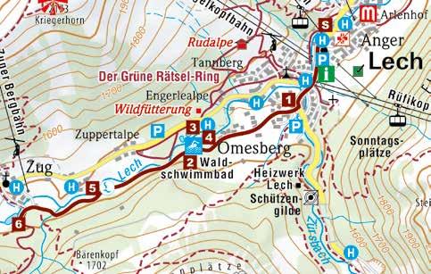
The Green Riddle Ring takes you via 14 fun stops to the Rud-Alpe hut. From there, the Arlenzauberweg continues and leeds towards Oberlech by passing the mystical Libellensee lake. At the end, you will find a petting zoo at Muxelhof (Mohnenfluh).

The [1] Green Riddle Ring leads from Lech to the Rud-Alpe hut – a short but entertaining hike with a puzzle trail to entertain the whole family. You need the “Impossible Workbook” to solve the Green Ring’s puzzles. This guides you through the weird and wonderful stations which test the abilities of detectives young and old. At the end of the trail by the [2] Rud-Alpe, the earth’s most valuable resource can be found in the form of a water playground. There’s also a wonderful terrace and delicious food, and you might even collect an award for your detective skills!
After fortifying yourself, continue across the Schlegelkopf flower meadows, past the 3D archery course on the interesting [3] Arlenzauberweg through Oberlech’s evergreen wood. A small hidden lake in the wood – [4] Libellensee – and its mystical creatures are waiting to be explored. You then reach Oberlech and the lovely sun terraces and refreshment stops. The Hotel Sonnenburg has a playground with a clim-
bing frame and fantastic stream to play in. At little further on, at the Hotel Goldener Berg, there's another playground with a trampoline and volleyball court. At the top of Oberlech you'll find the animals: [5] Muxelhof Petting Zoo is home to donkeys, goats, rabbits, sheep and cows.
At the end of the tour, you can visit [6] Skyspace-Lech – a light show room designed by James Turrell. Next to it, you will find a wonderful barbecue area with a panoramic view.
You can either take the easy way back on the Oberlech cable car, or go through the Burgwald, into the village and back to Lech am Arlberg.
! OUR TIP
Special features: you can buy the Green Puzzle Ring “Impossible Workbook” from Lech Zürs Tourismus for €5.00. You need it to solve the puzzles, and it contains important clues for every detective.
Refreshment stop: Rud-Alpe and all the restaurants in Oberlech with a large sun terrace.
Lots of different options provide this family hike with plenty of variety.
The walk starts from the village center. Follow the Lech river promenade upstream until you see the Pfefferkorn hotel on your left. Walk past the hotel and turn left into a side street that slopes uphill.
Shortly afterwards, an asphalt trail branches off to the left. Follow this to the edge of the wood. Continue on a slightly uphill forest trail on the left and already you can start to enjoy a superb panoramic view of Lech am Arlberg and the [1] 3-hole golf course
The trail continues to the edge of the wood where you come to a [2] rest area. Go downhill to the left here to the stable, and then immediately right again along a forest path. Follow the path through a wood, across a rushing stream to the[3] Lechweg barbecue area. Having reached the wayside cross, take the farm track that climbs to the right. Go past a [4] traditional mountain hut and follow the trail left uphill in the direction of Tristeller Alpe mountain pasture.
You come to a fork where you follow the signpost left down the hill on a forestry track through the wood. Stay on the wide gravel trail until a narrow trail branches off sharply to the left towards the Bodenalpe. Follow the trail which descends step by step to the Lech river.
Cross a wooden bridge to reach the other bank. From there the narrow trail leads upwards across a meadow to the [5] Bodenalpe. After a well-earned rest you can take the same route back to Lech, or take the hiking bus which stops right outside the Bodenalpe.
At the fork to the Tristeller Alpe, follow the signpost downhill to the left on a forestry track. After a few bends a narrow forest trail branches off to the left. This takes you back through the district of Stubenbach and on to the village centre.
Special features: you can also do the trail the other way round.
Places of interest: The Bodenalpe – a 400-year-old building which today attracts hikers with its attractive architecture, charming atmosphere and fortifying refreshments.
Refreshment stop: restaurants in Lech am Arlberg,

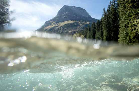
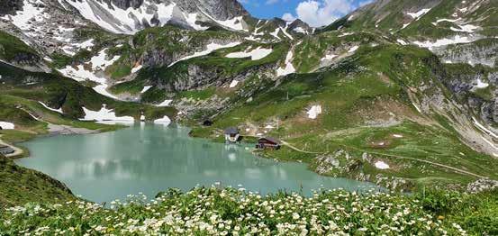
The trail to the Ravensburger Hütte is a great experience for the whole family, with lovely views of the Spullersee.

From the hike starting point at the village center, take the hiking bus towards Spullersee (included in the Lech Card). You get off at the last stop, from where you can walk round the [1] Spullersee on a broad alpine trail.
Cross the southern dam wall and continue round the lake. The trail only starts to rise after you’ve left the lake behind.
You can take a refreshment break at the [2] Ravensburger Hütte and enjoy gorgeous views of the lake. Now fortified, continue uphill on the alpine trail for a short distance. Keep to the left and you come to the [3] Brazer Staffel Alpine pasture. Continue uphill on the trail between the house and stable and, after a few bends, you reach the highest point, the [4] Stierlochjoch (2,009 m).
From here it's a moderately steep downhill descent. After a few metres you leave the wide trail and continue straight on through the stands of pine and then through the forest.
You will reach a forest road. Here you go uphill to the right for a short time and you soon come to a narrow trail signposted to the “Wasserfallweg” trail branching off to the left, which takes you down to the [5] waterfall. Shortly after the waterfall you reach the golf course of Lech.
Follow the trail further downstream towards Zug. You come to a wide footpath and can now either go right, along the banks of the Lech river towards Lech am Arlberg, or left to the [6] fish pond and from there take the hiking bus back to your starting point.
Special features: Spullersee is also suitable for fishing. Fishing permits can be obtained from various places, including Lech Zürs Tourismus.
Places of interest: the waterfall is a beautiful spot to spend some time.
Refreshment stop: Ravensburger Hütte, Brazer Staffel Alpe, fish pond in Zug, restaurants in Lech am Arlberg and Zug.
The very fact that Lech spring water originates from high in the Alps is a guarantee of pure, natural drinking water, as far as possible uncontaminated by manmade pollutants. Even the most stringent of tests have not
detected any heavy metals, pesticides or hydrocarbons in the Schwarzbach spring water. At approximately 1 mg per litre, the absolutely undesirable nitrates are also around fifty times lower than permitted values (this
is, however, exceeded in many other places of intensive farming in Austria).
On this hike you'll discover the source of Lech spring water, also fondly known as “Chateau Madloch” or “Schwarzbach Riesling”.
From the hike starting point at the village center, follow the Lech riverside trail as previously described to Zug, or take the hiking bus (included in the Lech Card). Go past the [1] fish pond and continue upstream on the left bank of the Lech river.
You can cross the Lech by a bridge and soon you come to the [2] Zuger Säge, the site of the unspoilt [3] Weißbach karst spring. Just 100 metres along the asphalt toll road into the valley you'll find the spring of the [4] Schwarzbach.
Return over the bridge to the [5] barbecue area and follow the hiking trail along the course of the river until you can cross the Lech parallel with the [6] Gasthaus Älpele.
You can take a break here and return to your starting point by bus.
Special features: fly fishing is permitted on parts of the Lech river. Contact Lech Zürs Tourismus for further information and fishing permits.
Places of interest: the municipality of Lech’s water supply meets all the criteria for classification as “Suitable for a low-sodium diet” and “Suitable for preparation of baby food”.
Refreshment stop: restaurants in Lech am Arlberg, Zug, the fish pond and Gasthaus Älpele.
Rüfikopf plateau
Duration: 2 h 30 m Distance: 3,4 km Difference in altitude: 165 m 165 m Hiking: Fitness:
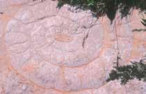
1 Rüfikopf mountain meets Abu Dhabi –the Main Dolomite
2 Stromatolites – fine layers formed by microbial mats
3 Holes and burrows – signs of microscopic life in stone
4 Changing sea levels –lithographic limestone in grey and yellow
5 Cow’s hoof prints on the sea bed –the mystery of the megalodons
6 An enlightening cycle – fluctuations in the sea level and banks
7 From turbulent times – fragments of rock and silt become rocky breccia
8 „Shifting sea” – layers of rock and sea leve
9 Climate change – signalled by dark layers
10 Born in the ocean depths – Rhaetian lias limestone from mussels and corals
11 Fragments of rock embedded in red –of breccia crevices and red lias
12 Colouration by oxidation in the sea –red lias
13 A “living fossil” – 500 million years of existence for the nautilus
14 The ammonite ram’s horn –the ammonite’s beautiful spiral
15 Spines in the rock – the sea urchin’s “pointed” clues in limestone
16 The thunderbolt in the rock – the bizarre world of belemnites
17 Delicate life in stone – sea lily fragments in limestone
18 When geological time stopped –Sedimentation gaps and mineralisation
19 Basis of green mats – shale and fruitful ground
A A mighty collision –the nappe with folding on Rüfikopf mountain
B Eras turned upside down –Rüfispitze mountain as a nappe
C The shaping of the landscape –the power of Ice Age glaciers and the climate
D The beauty of barrenness – karst’s channels and dolinas
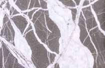
The “stone witnesses” along the geological circular trail take you on a fantastic journey back through thousands of years, unveiling the secrets of a world which conjures up new dimensions of time.
Enormous tectonic forces, fascinating geological processes and far-reaching climatic influences created and shaped over hundreds of millions of years on the Rüfikopf. Its rocks tells the story of the development and disappearance of entire continents and seas, its sediments hold the most valuable relics, its shape tells of the formation of the Alps as well as of the mighty glaciers.
Alternative: If you do not want to hike the entire Geoweg you can take a look at the new SteinZeit Weg Rüfikopf – you will get a glimpse into the fascinating world of geology.
Special features: on the hike, every special geological feature along the trail is signposted with a number or a capital letter. Additionally there is a guided Tour every Wednesday (included in the Lecg Card)
Places of interest: “stone witnesses” – the Geoweg markings follow the chronology of the earth’s history as closely as possible. There’s a wide variety of fossils to admire as well as all sorts of different rock strata.
Refreshment stops: Rüfikopf Panoramarestaurant and restaurants in Lech am Arlberg.
The guide book is available for € 5,00 from the Lech Zürs Tourism, the ticket office of the Rüfikopf cable car and at the Rüfikopf panoramic restaurant.
The SteinZeitWeg Rüfikopf offers on an easy and short route a special selection of geological treasures in the area of Rüfikopf. At the end of the trail there is a stone park with other unique "stone witnesses". The theme trail "BlütenReich Rüfikopf – Path of a Thousand Colours" also starts there.
The alpine plants that hold their own in these zones are among the most inventive that the botanical world has to offer. They can cope with temperature changes of up to 40 °C within a day, endure metre-thick blankets of snow and often use tiny windows of time to sprout, flower and bear fruit.
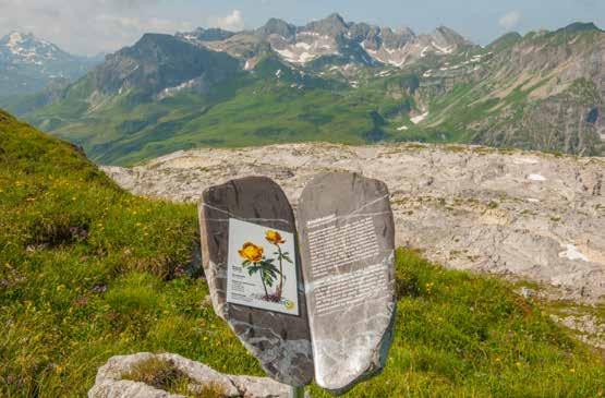
Along the circular trail you will find several information boards about the geological and botanical characteristics.
Special features: Please do not pick the flowers! Most of them are under strict nature protection! Also stay on the natural trail to avoid trampling damage.
For the BlütenReich Rüfikopf – an own alpine flower booklet is available at the Lech Zürs Tourism, the ticket office of the Rüfikopf cable car and at the Rüfikopf panoramic restaurant for € 7,00.
Refreshment stops: Rüfikopf Panoramarestaurant and restaurants in Lech am Arlberg.
Duration: 3 h 30 m Distance: 8,3 km Difference in altitude: 250 m 250 m Hiking: Fitness:
Special features: you can look at and handle fossils up to 200 million years old.
Places of interest: Formarinsee was voted the most beautiful place in Austria in 2015. Steinernes Meer – a huge accumulation of fossils, including fossils of what Austrian hunters call “Steinbockhorn” (ibex horn).
Refreshment stops: restaurants in Lech am Arlberg or Zug, Gasthaus Älpele and Freiburger Hütte.
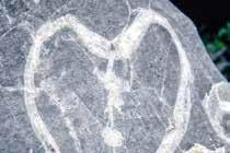
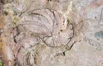
Dive into the petrified sea of corals, mussels, tower snails and ammonites.
Starting at the Rüfiplatz, you take the hiking bus towards Formarinsee (included in the Lech Card).
After travelling through the natural gem that is the Zugertal valley, you get off at the last stop. Follow the road back to the Alpe Formarin.
After the hut, a meadow trail branches off to the right. This takes you across the Alpine meadows, past the [1] Ibex memorial. At the next fork follow the marked trail to the right uphill.
After the climb you come to the first site, a (a) small coral reef, a precursor of the Steinernes Meer. All the sites are identified on the metal casings by the respective letters.
The trail continues along the marked sites across the (b) karst plateau.
At the next fork you bear left to another site (c) where there are countless belemnites, nautili and
[2] ammonites to discover in the red lias. They are regarded as a common predecessor of the squid.
Return to the fork and follow the trail straight ahead.
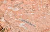
After just a few metres you come across a large accumulation of (d) megalodons in lots of different forms and cross-sections, including the ibex horn. This is a giant mussel whose shell has been partly polished by erosion.
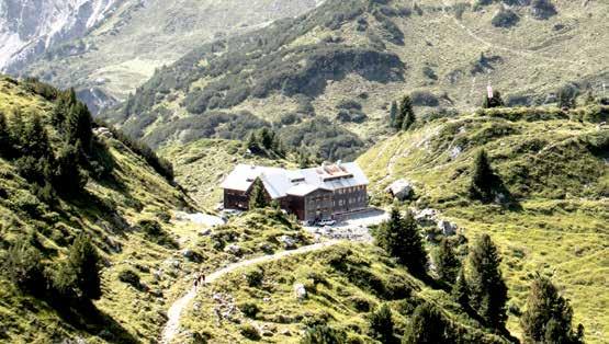
Stay on this trail until you reach the [3] Freiburger Hütte where you can take a break and enjoy the views of the [4] Formarinsee
From here you can either follow the wide farm track left around the lake, or take the shorter, narrower hiking trail on the right. This trail is only recommended, however, for experienced hikers who have the necessary head for heights.

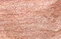
This pale limestone is approximately 220 million years old. It was created in a similar way to the Barrier Reef, corals in front and lagoons behind providing a habitat for snails and mussels. The sea created this sedimentary stone from their shells and chalk deposits.
RED LIAS:
this limestone also gives the Rote Wand (Red Wall) mountain its name, is approximately 200 million years old and contains some iron. The main fossils are ammonites and belemnites.
CALCITE:
A “joint filler” which fills out hollows such as crevices in limestone. Aragonite, which is made up of mussel and snail shells, is crystallised into calcite. Coral branches are also filled with this crystalline white material.
AMMONITE:
Ammonites are cephalopods that became extinct around 70 million years ago, with shallow, spiral shells,
the front of which was used as the living chamber. They are widely regarded as distant predecessors of the squid.
species have been replaced by calcite. People once believed that the patterns in the stone, which look like cow’s hooves, were the print of the devil’s hooves.
These were rod-shaped, squid-like marine creatures with 10 tentacles. The skeletons of these invertebrates have retained their cigar shape as fossils. They became extinct approximately 70 million years ago, but live on in the squid.
NAUTILI:
Are squids with spiral-shaped, rolled up or elongated shells with several chambers, the outermost of which is inhabited by the animal. Unlike ammonites, the shell spirals bend forwards and nautili can still be found in the seas today
! Please don’t strike the stones – you could permanently destroy the fossils!
The mussels stood upright in the sand and could reach considerable sizes. The shells of the extinct
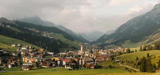
Tannberg is a place with a great deal of history. It not only forms the axis between the Bregenzerwald, Arlberg and the Lechtal valley; this was once the seat of the Walser People court, which gives the region its name. Since the immigration of the Walser People from the
Swiss canton of Valais, Tannberg has linked the three settlements of Lech, Warth and Schröcken. Everyone who travels across this plateau is following in the footsteps of the Walser People and hiking through many centuries of history.

Körbersee lake – Austria’s most beautiful place 2017: Austrian television programme “9 Places, 9 Treasures” voted the hidden mountain lake Austria’s most beautiful place in 2017.
Beginning at the Rüfiplatz, you take the hiking bus to Oberlech. Get off at the “Schlössle” which is also the end of the line. Follow the road uphill and soon an asphalt minor road branches off to the right. Follow this to the[1] Skyspace-Lech - the light art by James Turrell. From here a well-surfaced trail takes you to the right downhill to the bottom of the gully. You now cross to the other side over a wooden bridge and continue steadily uphill to the [2] Gaisbühelalpe
Continue across colourful mountain meadows with extensive [3] fields of chives to the Auenfeldsattel saddle. Branch off to the left here onto the wide alpine trail until you reach the [4] Untere Auenfeldalpe. Continue left on the trail, following the stream out through the Auenfeld valley until a narrow trail branches off to the right towards the Körbersee lake. Follow the trail uphill and you soon have a wonderful view of the [5] Körbersee.
The trail now follows the slope downhill to the lake shore. Continue along the shore to the [6] Hotel Körbersee. Go past the hotel on a much wider trail up and down until you reach the [7] Kalbelesee. From
here it's just a few more metres along the right-hand side of the main road to the bus stop. Take the hiking bus back to your starting point.
Option: instead of following the narrow trail towards the Körbersee, stay on the wide trail which takes you straight to the [8] “uf'm Tannberg” museum and the Batzenalpe hut. After visiting the Alpine museum and perhaps a refreshment stop at the Batzenalpe, you continue uphill on the trail to the right which takes you straight to the Hotel Körbersee. From here follow the route as already described until you reach the end of this hike.
Special features: In the Footsteps of the Walser People on the Tannberg – the guide book is available from Lech Zürs Tourism for € 16,50.
Places of interest: “uf'm Tannberg” Alpine pasture museum – former dairy and ancient legacy of the Walser people
Refreshment stop: restaurants in Lech am Arlberg or Oberlech, Auenfeldhütte and Hotel Körbersee.
This route guides you through numerous places of cultural and natural history significance.
Directly from the village center you take the hiking bus to Oberlech and get out at the end station.
Follow the road uphill until an asphalt minor road branches off to the right. Follow this to the [1] Skyspace-Lech, the light art by James Turrell. From here a well-surfaced trail takes you to the right downhill to the far end of the ravine. Now cross to the other side over a wooden bridge and continue uphill to the [2] Gaisbühelalpe
Continue up and down across colourful mountain meadows with extensive [3] fields of chives to the Auenfeldsattel. Branch off to the right and follow the hiking trail first uphill, then down again until you come to an trail shortly before Bürstegg.
Go left as far as [4] Bürstegg where you can take a break and let the unique landscape and peace and quiet work their magic on you.
If the weather’s nice, it's worth descending via the [5] Wang-Hus. Follow the trail across the fields behind Bürstegg that branches off to the right.
The trail very soon turns into a narrow trail which descends relatively steeply through the wood to the Wang-Hus and ends right next to the bus stop.
If it's raining, it's worth descending from Bürstegg to the Bodenalpe via the trail. You can take a rest a the wonderful restaurant and afterwards, you take the hiking bus back to Lech.
Skyspace-Lech: The Skyspace Lech is a largely underground structure that blends into the landscape at "Tannegg” with great care. The oval main room has an oval opening in the ceiling and a circular bench which, like the floor, is lined with black granite.
After dusk falls, the light installation in the room bathes the walls and ceiling in changing coloured lights, so that the spatial structure, which was previously perceived as clean, seems to dissolve.
Refreshment stop: restaurants in Lech and Oberlech am Arlberg, Bodenalpe.
Around 220 million years ago, during the Triassic period, the Oberlech area was close to the equator and had a very hot, dry climate.
The coastal area at that time consisted of many little lagoons. Floods deposited salt water in the lagoons, which then boiled in the burning heat. The concentration of salts in the solution consequently rose and sulphates (gypsum, anhydrite) were precipitated.
Since the gypsum formed 220 million years ago, the Oberlech area has since migrated northwards on a tectonic plate, which collided with the European plate, causing the Alps to form and the former lagoon sediments to be raised up to a great height.
The gypsum landscape which weathered quickly exhibits varying morphological phenomena. On the one hand, gypsum formation caused the ground to swell and hillocks to form.
Anhydrite, which is a sulphur mineral stable at greater depths, is transformed into gypsum at the surface by the absorption of water. This entails an increase in volume of up to 50%. Conversely, gypsum is dissolved, creating gypsum holes. On average, per m2, around 3 kg of rock are dissolved and carried away every year.
The gypsum holes are also special in botanical terms because every hole becomes a special microclimate for plants.
Special features: the varied landscape also offers marmots perfect protection from predators. From July to mid-August, when the orchids are in bloom, ten different species of orchid can be found right next to the hiking trail.
Places of interest: in terms of number and appearance, the gypsum holes and more than 1,000 sinkholes are geological features unequalled in Europe. The biggest sinkhole’s diameter is 100 metres and it is 35 metres deep.
Refreshment stops: restaurants in Lech and Oberlech.
An impressive themed hike through the nature reserve "Gipslöcher" with informative boards on the geological features and fantastic views of Oberlech.
With more than 1,000 dolines, the gypsum holes are considered as a geological speciality. The largest doline has a diameter of almost 100 m and a crater about 35 m deep.
This area is also a real treasure chest for botanists. 20 different species of orchids grow here. Hikes during the orchid blossoming season from July to mid-August are particularly beautiful. The varied landscape also provides marmots with optimal protection from enemies, and the soft gypsum rock is ideal for building caves.
Information boards along the nature trail provide information about the origins of this doline landscape.
From the [1] Petersboden cable car, head directly next to the gypsum holes in the direction of [2] Grubenalpe, before the trail takes a sharp right into the [3] Nature Reserve Gipslöcher.
Here you can do a circular tour before continuing over the Mohnenfluh past the Goldener Berg to [4] Oberlech cable car where you can either take the cable car down into the valley or hike through the Burgwald or the Rudtobel and Rudalpe back to your starting point.
Discover the history of the small mountain village of Stuben and the Arlberg area on this cultural and historical hiking trail – individual stations invite you to experience the history of the wonderful mountain sports and hiking area using a QR code.
You start in Stuben and follow the village road through the pedestrian zone to the end of town at the avalanche protection wall. Cross the road and follow the Stubner Rundwanderweg (circular hiking trail), slightly uphill towards the Flexenpass, past small alpine huts and shortly after the [1] " Mondschein Hütte " cross again over the stream to the right onto the gravel path. At the end of the gravel path, cross the Flexenbach again at the [2] waterfall and climb steeply up the Franz-Josef-Weg (zigzag path) in the direction of the [3] Flexenpass/Zürs . Up there you already have the first great view of Stuben.
Cross the road and follow the signposted Gafri path, always above the Flexenpass tunnel gallery
– past the [4] Hölltobel (ravine) small mountain huts and alpine stables in the direction of Alpe Rauz. There it is worth stopping at the [5] Rasthaus Valfagehr (kiosk). Now follow the hiking trail through the Rauztobel (ravine) down in the direction of Stuben – at the end of the ravine cross the bridge to the right and you're back at the starting point.
Special features: The Flexenpass road is one of the most spectacular roads in the Alps, having been carved directly into the mountain from Stuben to Lech since more than 125 years.
Places of interest: Flexenpass gallery, European watershed, Flexenpass, Hölltobel (ravine)
Refreshment stop: Flexenhäusl, Rasthaus Valfagehr, restaurants in Stuben
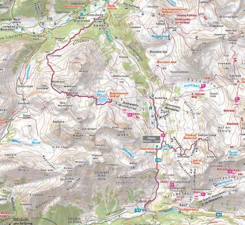
“The Green Ring” hiking trail follows the course of the legendary White Ring ski tour, taking you in three one-day stages through the beautiful Lech Zürs am Arlberg mountain landscape.

“The Green Ring” hiking trail follows the course of the legendary “The White Ring” ski tour in three one-day stages through the beautiful Lech Zürs am Arlberg mountain landscape.
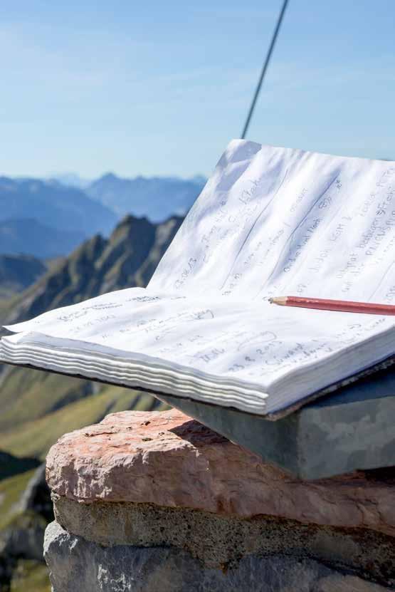
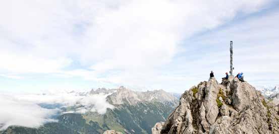
Take the Rüfikopfbahn cable car onto the [1] Rüfikopf mountain (2.362 m). At the top, the [2] summit book is waiting for you to record your experiences.
Now follow the [3] Geoweg Rüfikopf downhill in the direction of the [4] Monzabonsee. From there continue downhill to the [5] Monzabonalpe
Shortly before crossing the Pazüelbach you come to a unique feature, the [6] Mountain Hut Library, where you can choose a good book, have a read and spend some time relaxing. Continue on the wide mountain trail past the Trittalpbahn valley station, then slightly uphill again until the trail descends moderately steeply towards Zürs am Arlberg.
When you reach Zürs, you can return to your starting point on the hiking bus or take a short detour to the European watershed on the Flexen Pass.
At the pass, cross the road and you come straight to this unique and impressive feature right next to the Flexenhäusl restaurant.
Special features: on this three-day hike you can explore a world of humorous and charming contemporary legends. You can get a copy of the book entitled “A Samurai on the Kriegerhorn” for € 12,00 at Lech Zürs Tourism.
Places of interest: the European Watershed is the place from where the water flows either into the Black Sea or the North Sea.
Refreshment stops: restaurants in Lech am Arlberg, Rüfikopf Panoramarestaurant, Monzabonalpe.
Free postcards for you to write and post are available at the [7] Post box by the Monzabonsee. The post is collected and sent on once a year.

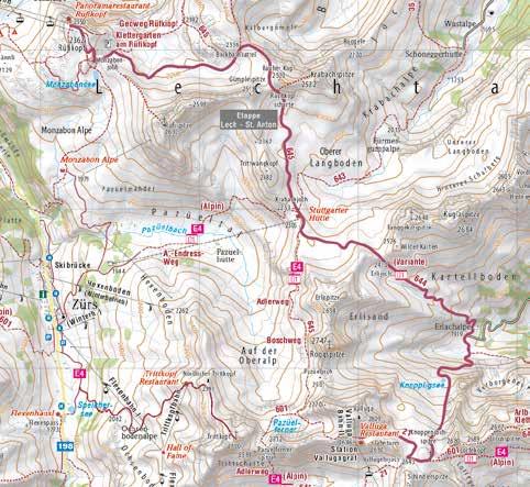
The longest stage of the Green Ring is also the most exciting, as it leads past the Zürsersee over the Madlochjoch into the Zugertal.
Take the hiking bus to Zürs Seekopfbahn. This helps you to save some power. As alternative, you can also hike up from the end of the village Zürs to [1] Zürsersee. There's a jetty on the lake where you can take a break and enjoy the crystal-clear lake in its gorgeous mountain setting. Continue uphill to [2] Taurin’s cave and past the [3] Gate, as the route through the grassy hillocks is known, as far as the [4] Glacier Town by the Madloch and on to the highest point, the Madlochjoch ridge, where there's another [5] summit book in which you can achieve immortality!
From there follow a rather narrow trail across some limestone terrain down onto the saddle between the Stierlochkopf and Zuger Mittagsspitze peaks.
The [6] bivouac is located here on the top. Continue down the hairpin bends past [7] Taurin the Giant until you come to another hiking trail. Keep to the right here, and shortly afterwards branch off down to the left. Continue downhill until you meet the Lechweg trail.
Here you can branch off to the left and take a short diversion to the hidden [8] waterfall
Or you can stay on the trail which leads you past the [9] fish pond and on to the bus stop in Zug village centre. !
Special features: the bivouac provides accommodation for anyone keen to experience something unique, and prepared to cope with rather Spartan facilities.
Places of interest: Taurin the Giant - legend has it that Taurin was greatly displeased when avalanches spoiled the appearance of his beautiful mountain and swore to replace all the rocks and restore the mountain to its former glory. The giant wooden figure represents Taurin standing at a rock fissure and trying to transport the rubble back up to the top again.
Refreshment stops: Seekopf restaurant, restaurants in Lech am Arlberg, Zug and the fish pond.
Free postcards for you to write and post are available at the [10] Post box. The post is collected and sent on once per year.
High above Lech am Arlberg, the third stage leads from scenic Zug over the Balmgrat and across the gentle meadows of Oberlech.
Take the bus from Rüfiplatz to Zug. Get off at the “Kirchle” stop and follow the asphalt road through the village as far as the fork to the [1] Fish pond
From here on the right side, the hiking path starts up opon meadows towards the woods. A trail through the woods then rises steeply through the [2] Sagenwald to the [3] Balmalp. From there continue on a fairly wide trail that is at first quite flat but soon becomes steeper to the right up to the [4] Kriegerhorn (2.173 m).
Continue to the next highlight, the [5] Chluppa (stone wall) and go past the reservoir to the [6] Kriegeralpe. After a fortifying snack, continue on the broad trail. Soon a trail branches off to the right, taking you to the
[7] Der WolfAt the next fork, follow the pretty hiking trail to the left, downhill across the blooming mountain pastures to Oberlech and Bergbahn Oberlech mountain station.
Bear right and follow the farm track through the clearing in the wood to the [8] Libellensee. The
[9] Arlenzauberweg leads you to the extensive meadows on the Schlegelkopf mountain. From here follow the broad farm track down a moderately steep slope to the [10] Rud-Alpe, where you can enjoy a well-earned refreshment stop on the wonderful sun terrace. From the Rud-Alpe you can hike back to the village along the Green Riddle Ring with fantastic views of Lech am Arlberg
Special features: the [2] Sagenwald – in this fairytale forest you'll find carved mythical creatures at every turn.
Places of interest: Libellensee – this peaceful pool lies tucked away in the heart of a wood, with countless fairy-tale creatures residing on its banks.
Refreshment stops: restaurants in Lech am Arlberg, Zug, Oberlech, Der Wolf, Kriegeralpe and Rud-Alpe.
At the [11] Post box, near the Chluppa (Lech stone wall), free postcards are available for you to write and drop in the post box, which is emptied once a year.
This hiking trail, which has been awarded the European “Leading Quality Trails of Europe” certificate, takes you more than 125 km through the Alps and one of Europe’s last wild river landscapes.

The first stage leads directly through the spring area of the famous alpine river Lech.
Take the hiking bus to Formarinsee, which is included in the Lech Card.
At the end of the bus line, follow the farm track gently downhill to the [1] Formarinsee where you can enjoy a wonderful panoramic view of the lake. Turn round and follow the road back to the [2] Alpe Formarin. After the hut, a meadow trail branches off to the right, taking you across the Alpine meadows past the [3] Ibex monument.
At the next fork, follow the marked trail on the left out of the valley, following the Lech river, past the [4] Gasthaus Älpele to the [6] fish pond in Zug. From here, follow the Lech riverside trail, as already described, back to your starting point.
En route you’ll come across some interesting places to take a break such as the [7] Kneipp facility, idyllic [5] barbecue areas and inviting inns.
Special features: further information about the long-distance hiking trail is available from Lech Zürs tourism and at www.lechweg.com
Places of interest: Formarinsee is a natural mountain lake where fishing is also allowed. Fishing permits are available from Lech Zürs tourism.
Refreshment stops: Gasthaus Älpele, fish pond, restaurants in Zug and Lech am Arlberg.

A pleasant section without much altitude difference, which runs above the "Lech Canyon".
Start at the middle of the village, next to the Tannberg bridge. You'll find another pretty Lechweg trail [1] barbecue area above the Stubenbach district.
Follow the “Bodenalpe” hike as already described as far as the steep narrow trail that branches off sharply to the left towards the [2] Bodenalpe
The broad forestry track gradually narrows and leads to a [3] bridge above the “Lechschlucht” gorge, which takes you over the Lech river.
From here the trail first leads uphill via a cart track and later via a narrow asphalt road which ends in [4] Warth village centre.
From here you can take the Wanderbus (hiking bus) back to Lech am Arlberg. If you've enjoyed the Lechweg trail, you can extend your hike to Füssen im Allgäu.
Special features: The short section from Lech to Warth is also suitable as a half-day tour in uncertain weather conditions.
Places of interest: Warth village centre – St. Sebastian Parish Church and the Walserhus are impressive evidence of the Walser Peoples’ craftsmanship.
Refreshment stops: Bodenalpe, restaurants in Warth and Lech am Arlberg.
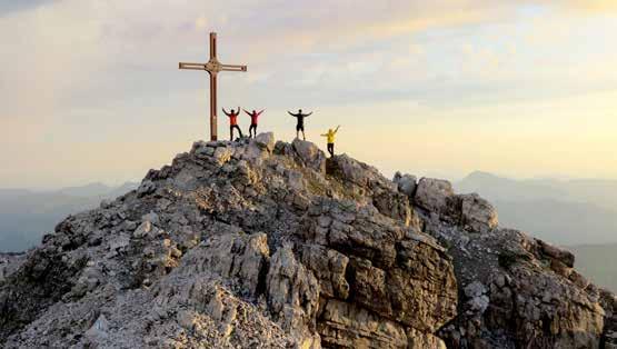
Seeing the world from on high as we hike helps us to distance ourselves from our daily cares and woes. We escape by discovering new perspectives as we walk and gain distance and independence. Everything looks smaller from on high, we forget our everyday problems and so many conflicts are suddenly unimportant. The grandeur of the mountains makes everything seem quite relative, and we can look at insurmountable problems with a new sense of proportion.

You should attempt this long and strenuous tour early in the morning and only in good weather.
From the Rüfiplatz, you take the hiking bus towards Formarinsee, which is included in the Lech Card. Get off at the last stop, [1] Formarinsee.
Proceed to the [2] Alpe Formarin where the trail branches off uphill to the left. There's a short, steep ascent secured by steel cables. The trail soon becomes easier as it leads through a wide hollow to "Schönbühel". From here there's first a slight descent to "Oberes Johannesjoch", then a steep descent into a hollow.
You now come to a steep climb to just below the eastern summit of "Johanneskopf". From here the trail leads on an easy incline to the [3] Göppinger Hütte (2.245 m). After a rest, follow the trail to the right downhill to "Laubegg", from where steep hairpin bends lead down to the [4] Oberes Älpele
The trail becomes a bit wider here and leads gently down to the [5] Gasthaus Älpele
From here you can take the hiking bus back to your starting point.
Special features: very beautiful, scenic and wildly romantic high alpine trail.
Places of interest: Göppinger Hütte natural rock climbing crag, which you’ll find right behind the hut, with around ten different routes for sports climbers.
Refreshment stops: Gasthaus Älpele, Göppinger Hütte and restaurants in Zug and Lech am Arlberg.

This easy mountain hike takes you through unspoiled dells and across ridges with superb views.
Take the gondola up onto the [1] Rüfikopf (2.350 m) and from there the broad trail as far as the signpost.
Here you take the hiking trail to the left up onto a ridge. From there a short, but relatively steep series of hairpin bends takes you down onto a saddle. Keep following the trail downhill to the [2] Ochsengümple
The trail leads to the end of the valley with no significant difference in altitude.
Only from here is the ascent at first moderate and then steeper until you reach a fork. From here continue uphill, to the right, to the [3] Rauhkopfscharte There's now a gentle descent to the [4] Stuttgarter Hütte.
After a refreshment stop, follow the moderately steep trail downhill until you come to a mountain stream. From here the descent is quite steep to the floor of the [5] Pazüeltal
There's now an easy descent to the Trittalpe hut. Continue downhill on a farm track until you come to an asphalt minor road in Zürs am Arlberg.
Continue following the road downhill past the [6] Bergkirche until you reach the main road.
Here you can catch the hiking bus back to your starting point.
Special features: from the Bockbachsattel there's a magnificent view of the Allgäu Alps all the way to the Zugspitze mountain. This hiking tour is also part of the Arlberg Trail – stage Lech to St. Anton. You might notice the special "AT" signs at some rocks.
Places of interest: Bergkirche Zürs – like a fortress, this sacred building rises several stories, and the three-storey tower, like a castle keep, and a large cross are evidence of the church’s importance.
Refreshment stops: Rüfikopf Panoramarestaurant, Stuttgarter Hütte, Hotel Enzian Zürs and restaurants in Lech am Arlberg.
From Rüfiplatz, you take the hiking bus to [1] Spullersee, (inlcuded in the Lech Card). Get off at the last stop and follow the farm track round the lake. After a few bends a hiking trail branches off to the right and leads to a mountain refuge.
The ascent continues across mountain meadows, climbing in very tight bends up to the [2] Gehrengrat (2.439 m). You descend on the other side across rough terrain and in very tight hairpin bends to the [3 Steinernes Meer. There are no major differences in altitude as you follow the trail straight ahead across the limestone plateau to the [4] Freiburger Hütte (1.918 m). After a refreshment break, take the farm track round the lake to the bus stop.
Experienced hikers can take the narrow trail above the east bank which descends gently back to the bus stop.
Special features: this area is home to Europe’s biggest colony of ibex and, with a bit of luck, you might encounter one of these majestic animals.
Places of interest: Steinernes Meer – fossils up to 200 million years old can be found on the high plateau.
Refreshment stops: Freiburger Hütte.

Stubner Alpe
E s c
The Ulmer hut is best known in winter – but also in summer you can enjoy the peace and silence at 2.285 m directly under the roof of the Arlberg: The Valluga mountain.
From Stuben follow the path up through the Rauztobel passing the Albona I lift. This path runs at [1] Alpe Rauz in an asphalt path that leads uphill to the Rasthaus Valfagehr (kiosk). Cross the road there and then follow the Valfagehrbach creek - just above the [2] cable car intersection (Flexenbahn, Albona II, Valfagehrbahn) keep abolutely right at the junction with the ski slopes and do not follow the road. The hiking trail (E4 alpine / Nordalpenweg) now leads along the embankment to the right above the supply road and later joins it. It continues constantly uphill over the Valfagehralpe to the intermediate destination [3] Ulmer hut , where a stop is worthwhile.
Back to Stuben, follow the Adlerweg hiking path for a short while and then turn right below the [4] Arlenmäderbahn chair lift to the junction with
the Jakobsweg (way of St. James). Follow this to the Rasthaus Valfagehr and continue through the Rauztobel ravine to Stuben.
Special features: The Ulmer Hütte is located directly on the border between Tyrol and Vorarlberg and is a popular starting point for the Lechtaler Höhenweg hiking path.

Places of interest: View of the Schindlergrat ridge
Refreshment stops: Ulmer Hütte, Rasthaus Valfagehr, restaurants in Stuben
The Kaltenberg hut at 2.089 m is well known among hikers, as the tour to the hut is particularly scenic.
The tour starts from Stuben via the "Schattahalb" walking path out of the valley past the picturesque
[1] See'le (small pond). Immediately after the next bridge, the path splits and you go left. The first 10 minutes slightly uphill, then it gets a little steeper to [2] Stubner See : this moor lake is a natural biotope in the mountain pine forest at approx. 1650 m with a great view of the Erzberg mountain. From there, the rest of the hike is slightly uphill to the [3] Kaltenberg Hütte . Return via the Albona mountain and the ski run called “Passage” to Stuben am Arlberg. The path can also be walked in the opposite direction.
If you want to extend the tour, you can go from the hut via the hiking path “Berggeistweg”
– which is also a part of the Arlberg Trail – to St. Christoph and via the Jakobsweg (way of St. James) back to Stuben.
Special features: From the Kaltenberg Hütte you can enjoy a unique view of the Klostertal but also of the Flexenpass and in the direction of Zürs.
Places of interest: Stubner See, view of the Klostertal and the Flexenpass
Refreshment stops: Kaltenberg Hütte, restaurants in Stuben
The new, sporty long-distance hiking trail connects all five Arlberg resorts of Lech, Zürs, Stuben, St. Christoph and St. Anton. A total of 40 km of hiking trails are to be surmounted over three stages on this tour amidst spectacular alpine scenery, with convenient cable car assistance. The well sign-posted circular hiking trail comprises a total length of 50 kilometres, almost a fifth of which is covered by cable car.
This beautiful day section from St. Anton am Arlberg leads along the panoramic Berggeistweg trail to Kaltenberghütte and on to Stuben am Arlberg - at the foot of the Arlberg and Flexen passes.
This stage of the Arlberg Trail starts with a climb up the [1] Galzig. A wide path with great views of [2] St. Christoph am Arlberg leads leisurely towards the pass, from where the “Berggeistweg” (Mountain Spirit Trail) begins. Behind Gasthaus Valluga, follow signs to the Kaltenberghütte (trail no. 19).
From the next junction, the Berggeistweg is signposted. The trail leads initially gently uphill, before getting steeper up to a mountain ridge. With views in the direction of Pateriol and Kaltenberg, the trail continues to the Maroiseen near the Albona II lift station.
The path leads along a short supply road to the old [3] Albonagrat mountain station (closed). Accompanied by fantastic views of the valley into Klostertal, the trail finally leads to the 2.089 m high [4] Kaltenberg Hütte. After a stop for refreshments, the trail continues with a direct view of Flexenpass and Zürs across meadows and moorlands towards the valley.
Hidden from view, the trail leads ever more steeply downhill past Lake [4] „Stubener See“ with a magnificent view of the second stage destination village of [5] Stuben am Arlberg
A separate overview map of the Arlberg Trail is available at the tourist offices in Lech am Arlberg, St. Anton am Arlberg and Stuben am Arlberg.
The Arlberg Trail Ticket includes all mountain cable cars along the long-distance trail and is valid for an entire summer season.
Places of interest:
The "Berggeistweg" from St. Christoph to the Kaltenberghütte is one of the most beautiful panorama trails at the Arlberg.
The Kaltenberghütte offers a unique view over the Klostertal valley.
Along the descent to Stuben you will encounter the "Stubner See" – a hidden and mysterious moor lake.
Alternative route: St. Anton – Rosanna gorge –Maienweg – Arlberg Pass – Stuben
Refreshment stops: restaurants at Galzig, St. Christoph am Arlberg, Kaltenberghütte, restaurants in Stuben am Arlberg
Required Lifts: Galzig cable car
The stage between Stuben and Lech is probably the easiest section and delights with views of the Flexengalerie, the discovery of the Zürser See and is rewarded at the end with the arrival in Lech am Arlberg.
From picturesque [1] Stuben am Arlberg, the gateway to the Arlberg, take the village road along a forest path past the E-Trial park in the direction of Flexental. Shortly after the Mondscheinhütte (closed), Flexenbach Stream is crossed, and the route briefly becomes steeper along the Franz Josef Trail in the direction of the [2] Flexen Pass. Soon you will reach the great [3] European watershed
The trail descends gently towards [4] Zürs am Arlberg, where you reach the [5] Seekopfbahn cable car on the village outskirts. This whisks you up to 2.212 metres, where at the top, you not only have a fantastic view of Lake [6] Zürsersee, but also an excellent opportunity for refreshments at Seekopf Panoramarestaurant. Afterwards, the trail goes up to [7] Madlochjoch (2.450 m). From there, the trail follows in the tracks of the White Ring, a famous winter ski circuit, over rocks and alpine meadows with views of [8] Lech am Arlberg and on via Gstütalpe down into the valley.
Before the end of this stage, wonderful views of Lech am Arlberg, 1.450 m above sea level, are particularly inspiring.
The Arlberg Trail is designed as a long-distance hiking trail. Our partner ASI Reisen offers the complete trail with partner hotels and luggage transport. More at www.arlbergtrail.com
Places of interest:
The trail from Stuben leads along the Franz-Josef Trail with impressive views on the opposite side of the Flexen Pass.
The European watershed is located directly at the Flexen Pass.
Zürsersee is a natural mountain lake with an artificial connecting tunnel to Spullersee.
Alternative route: Walk up to the Flexenpass, stay in the valley and walk along the river from Zürs to Lech.
Refreshment stops: Flexenhäusl, Hotel Enzian Zürs, Seekopf Panoramarestaurant, restaurants in Lech am Arlberg
Required Lifts: Seekopf cable car
The so-called king's stage of the Arlberg Trail is the most challenging along the long-distance trail. Over 1.000 metres in altitude uphill and downhill, the trail leads between Vorarlberg and Tyrol through wild natural landscapes through various ridges and valleys.
Right at the start of the tour, [1] Rüfikopf cable car provides valuable assistance in surmounting the first 900 metres in elevation, where the most challenging stage of the Arlberg Trail begins at 2.350 m above sea level. Accompanied by views of Rüfispitze Peak, the route descends initially just above Lake Monzabonsee into [2] Ochsengümple.
At [3] Rauhkopfscharte, you then cross the border between Vorarlberg and Tyrol. With [4] Stuttgarter Hütte at 2.310 m in your sights and surrounded by fantastic mountain scenery of the Arlberg, you head towards your lunch break.
This is followed by a descent to [5] Erlachalpe at 1.922 m, before heading steeply uphill again through the hidden hollow to [6] Knoppenkarsee
From there it is only a few metres in altitude to the mountain station of the [7] Vallugabahn I, with fabulous views towards the first stage designation village of St. Anton am Arlberg. The 1.300 m downhill journey is covered by the [7] Vallugabahn I and Galzigbahn cable cars.
Be sure to observe the operating times of the cable cars and start the Lech – St. Anton stage with the first possible ascent of the Rüfikopf cable car at 08:30!
The last descent of the Valluga I is at 4:30 p.m.
The Arlberg Trail Ticket includes all cable cars along the long-distance trail and is valid for an entire summer season.
Places of interest:
Rauhkopfscharte: This is the border between Vorarlberg and Tyrol.
Almajurtal: The Almajurtal is a natural side valley of the Lechtal and is practically undiscovered.
Knoppenkarsee: The hidden meltwater lake in the Knoppenkar is a natural jewel with a unique view to th 2.747 m high Roggspitze.
Alternative route: Rüfikopf – Stuttgarter Hütte – Zürs – going to St. Anton by postbus.
Refreshment stops: Rüfikopf Panoramarestaurant, Stuttgarter Hütte, Valluga I, restaurants in St. Anton am Arlberg
Required Lifts: Rüfikopf cable car, Valluga I & Galzig cable car.
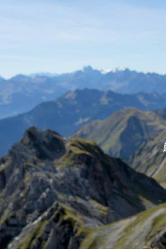
From the summit a fabulous, 360-degree view opens up of Zug and Lech, the imperious Omeshorn and the imposing Rüfikopf mountains, the Zuger Tobel gorge, the Tälispitze and the Steinmähder mountains. There’s no greater reward than the superb view from one of our mountain summits
This hike is particularly rewarding at sunrise when you cross the dew-drenched, mistwreathed meadows towards the summit and enjoy the first rays of sunshine as day breaks.
Take the hiking bus towards Oberlech until you reach the final stop, “Schlössle”. A minor road branches off to the right at the Hotel Mohnenfluh; this takes you to the [1] Skyspcace-Lech, the light art by James Turrell. Follow a gravel hiking trail that takes you down into the ravine and across a wooden bridge. From here it's a moderate ascent to [2] Untere Gaisbühelalpe
Branch off to the left and hike across the valley floor through the sometimes boggy mountain meadows. There's then a fairly steep climb via a bridle trail to "Obere Gaisbühelalpe" hut and on to the Mohnenfluh saddle. It’s now uphill in steep hairpin bends across rocks and scree to the summit. There's a fantastic panoramic view from [3] Mohnenfluh’s summit (2.542 m). You now follow the trail back to the Mohnenfluh saddle and on to the Steinmähderbahn mountain station. Here the trail joins a farm track which you follow down to the [4] Kriegeralpe. Then continue following the farm track downhill as far as
“Der Wolf” mountain hut. Turn left onto the meadow trail and descend to the [5] Oberlech cable car mountain station in Oberlech. Taking the cable car is the easy way down into the valley and back to your starting point.
Special features: you can also do this tour the other way round and shorten it by taking the Petersbodenbahn chairlift.
Places of interest: summit view – the 360-degree panorama as far as Lake Constance is indescribably beautiful.
Refreshment stops: Kriegeralpe, Der Wolf and restaurants in Oberlech and Lech.
Beautiful tour to one of Lech’s mountains with some of the best views.
Take the gondola up to the [1] Rüfikopf mountain station (2.350 m). Follow the wide trail straight ahead down to the signpost. There's a short climb to a ridge. From there steep hairpin bends first lead down onto the saddle to the north-west ridge of the Rüfispitze. From there you hike along the ridge.
At the end of the grass ridge there's a short climb up the crag, secured with steel cables. You now continue across rocks and scree to the [2] Rüfispitze (2.632 m). From here you can enjoy a wonderful view of the [3] Monzabonsee glittering below. Return on the same trail to the saddle where a trail branches off to the right, taking you downhill to the [4] Ochsengümple.
After crossing a stream, the trail continues along the spine of a hill, ascending slightly, until you come to the fork where the trail meets the Friedrich-Mayer-trail.
Follow the trail to the left below the Wösterspitze as far as the [5] Wöstersattel where the trail widens and loops down to the Tälialpe hut. Continue following the trail downhill to the left until you come to an asphalt side road in the [6] Stubenbach.
Follow the road as far as the bus stop from where you can return to your starting point on the hiking bus, or walk back to Lech am Arlberg village centre via the previously described Flühenweg trail.
Special features: the tour can be extended by 2 hours by ascending via the Schwarzwand mountain.
Places of interest: Geoweg Rüfikopf trail – a journey through earth’s early history: this interesting and informative tour walks you through a wonderful Alpine “stone garden”, in which gorgeous flowers and herbs create an enchanting contrast to the different rock forms.
Refreshment stops: Rüfikopf Panoramarestaurant, “Zit lo” restaurant in Stubenbach and restaurants in Lech am Arlberg.
As this via ferrata is not too long or difficult, it’s suitable for novices, although access and exit do require a certain level of fitness. If you're not 100% sure, experienced mountain guides are there to help.
From Rüfiplatz, you take the hiking bus to Warth (included in the Lech Card). The [1] Steffisalp-Express cable car takes you up to the mountain station where a trail branches off uphill to the left.
The trail runs uphill along the left-hand side of a hollow to the saddle.
Before taking the trail to the right here to enter the via ferrata, you can take in the summit of the [2] Warther Horn (2.256 m) almost in passing. To do so, branch off left at the saddle and follow the marked trail to the summit.
Return to the start of the via ferrata and climb to the summit of the [3] Karhorn (2.416 m).
In addition to a lovely climb with a difficulty index of II and III, you can also enjoy ever-changing panoramic views as far as Valluga, Säntis and the Allgäu Alps.
Descend via the normal route until the trail on the Karbühel joins a wider trail where you can either go left towards [4] Bürstegg and continue downhill to the [5] Bodenalpe, or bear right heading for the Auenfeldsattel and from there continue to Oberlech.
In both cases you can take the hiking bus back to your starting point in Lech am Arlberg.
Special features: in addition to the usual hiking equipment, it’s absolutely essential that you bring a via ferrata kit and helmet.
Places of interest: the first via ferrata in Vorarlberg was installed on the east ridge of the striking Karhorn mountain.
Refreshment stops: restaurants in Warth, Bodenalpe and restaurants in Lech am Arlberg.
A lonely presummit with a spectacular view of Stuben and the Flexenpass road.
You start in Stuben and follow the village road (pedestrian zone) to the end of the village. Continue along the road to the first hairpin bend – cross the road here and follow the gravel path uphill past the [1] E-Trial Park in the direction of Flexentäli towards the Flexenpass road. Cross there and take the Franz-Josef-Weg (zigzag path uphill) in the direction of Zürs. Cross the road at the top and turn left across the stream in the direction of the [2] Flexenpass . Shortly before the [2] Flexenhäusl, cross the street again and then relatively straight up in a small furrow towards the gravel path. Follow this to the left until the hiking trail branches off – also to the left. Past the Rosskopf mountain, the path then leads through rocky terrain directly to the Erzberg mountain saddle and the [3] Stuben summit cross with a sensational view of Stuben. The way back is the same way.
Alternatively, the tour can also be started directly from Zürs.
Special features: The Erzberg mountain is otherwise only known to skiers as a touring descent. You can often enjoy this summit hike and the view of Stuben all to yourself.
Places of interest: European watershed, Flexenpass, view of Stuben
Refreshment stops: Flexenhäusl, restaurants in Stuben
[ 1 ] Never undertake a mountain tour or extended mountain hikes alone. Before you set out on the tour, make sure you know about the route conditions, possible hazardous places and how long the tour will take.
[
2 ] If you've little experience of tours in the mountains, join a hike organised by Lech Zürs Tourismus or contact a qualified hiking or mountain guide.
[
3 ] Tell the hotel or B&B owner about the route you plan to take, your destination and the time you expect to return, and keep to it. This means that, in an emergency, a search is likely to succeed more quickly.
[ 4 ] Always consider the prevailing conditions when choosing equipment. Weather in the mountains can change very quickly so, in addition to ankle-high hiking boots with a profiled sole, your equipment should include the following: rucksack with provisions, first aid kit, waterproofs and clothing to protect against the cold. We recommend taking a mobile phone with you for emergencies.
[ 5 ] Don’t start off too late and don’t take any shortcuts en route. For your own safety, follow signs and markings.
[ 6 ] Stay calm if there's an accident. For emergency assistance, dial 144 for mountain rescue and 112 for the European emergency number. If you don’t have a mobile phone with you or don’t have a signal, draw attention to yourself with audible (shouting, whistling) or visible signals (reflecting light with a mirror, torch, waving a large item of clothing).
[ 7 ] The number of holidaymakers increases the pressure on nature. Sadly, far too often cigarette ends, plastic bottles, energy bar wrappers, fruit peel and paper tissues end up in the countryside. Please keep the mountains clean.
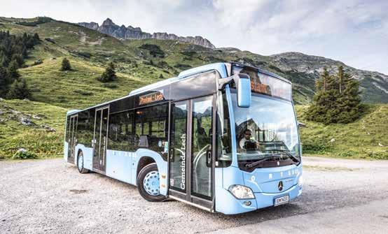
Localities are not included in the „Lech Card“.
Responsible for content: Lech Zürs Tourismus GmbH / Graphic and layout: © Werbeagentur, Imst Translation into English: Die Sprachdienstleister - Covi, Wurzer & Partner Photos: Lech Zürs Tourismus, Hanno Mackowitz, Christoph Schöch, Josef Mallaun, Daniel Zangerl, Maria Muxel, riopatuca/shutterstock.com
mit Kinderwagen begehbare Wege
mit Kinderwagen
mit Kinderwagen begehbare Wege mit Kinderwagen begehbare Wege
mit Kinderwagen begehbare Wege
mit Kinderwagen begehbare Wege


Hiking at the Arlberg is getting even more exciting with the digital hiking pass. Many summits, huts and hikes in the Lech Zürs region will be rewarded with points. From a certain number of total points, various hiking pins can be achieved. In the age of digitalisation, the points are collected exclusively via smartphone with the free "SummitLynx" app.


For more information: www.lechzuers.com/en/arlberghikingpass

LECH ZÜRS TOURISMUS GMBH
Dorf 2 · 6764 Lech am Arlberg
T. + 43 5583 2161 - 0
info@lechzuers.com