4 minute read
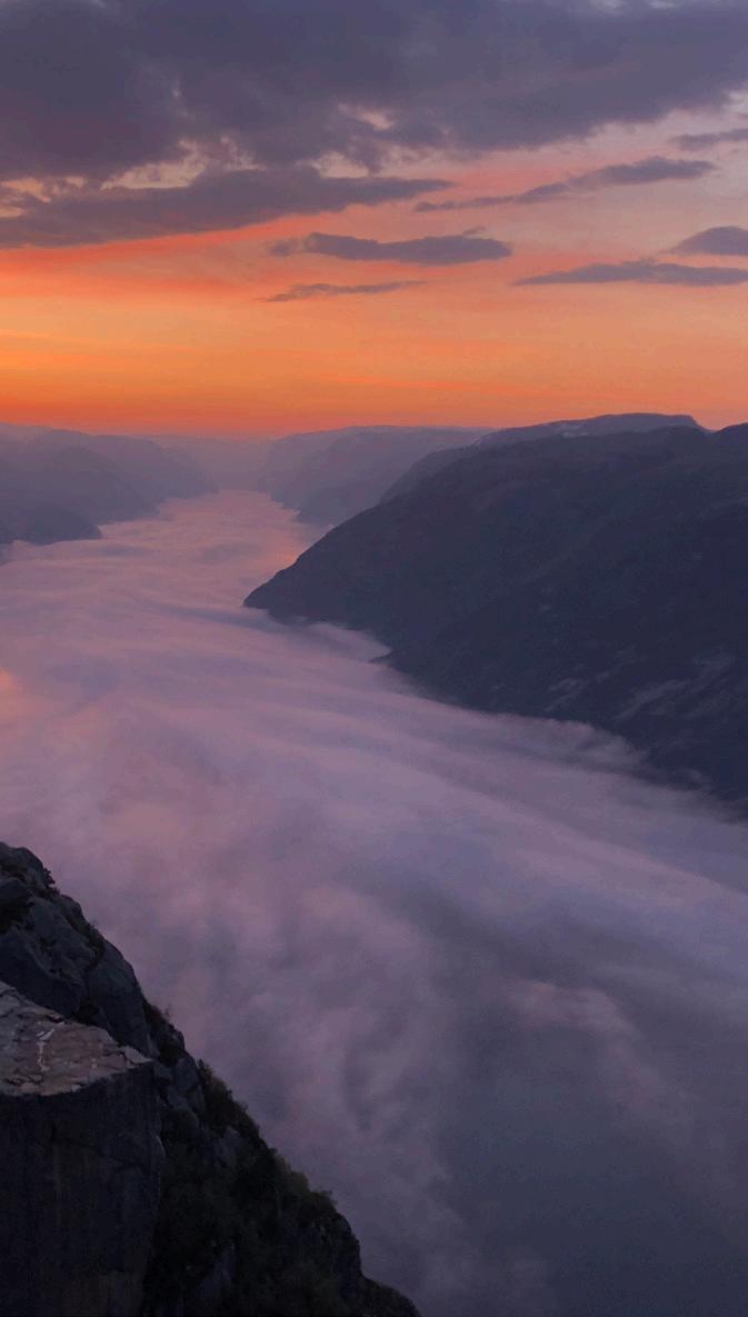
PUSH THE EDGE


Nature’s genius surpasses most. Are you ready for something to write home about? On a mountain’s edge, unnerving high above the fjord, experience The Edge of Norway in a spectacular manner. You decide, here you can go high, low, long, wide – and everything is on your terms. We guarantee; you will feel that life is breathing.
1
Advertisement
2
Preikestolen
– the most iconic of them all.
If Norway had been designed by landscape architects, Preikestolen would have been an award-winning work of genius. No other mountain better sums up the thrilling beauty that is the hallmark of Norwegian nature. Such a famous trek creates high expectations. Is Preikestolen really that good? It might be sunny or rainy, windy, or foggy –but that is part of the charm. You know when you approach the end of the steep trail through the birch forest: The landscape opens up and you sense the depth around Preikestolen’s surprisingly small plateau.
• Starting point: Preikestolen Basecamp (parking fee)
• Season: April–October (winter season with guide)
• 8 km, 4 hours return
• Bus tickets are sold at the tourist office
Kjerag
– the big brother of attractions.
It is not just higher than Preikestolen, it also has a grand finale with the boulder, Kjeragbolten: the large, round boulder stuck high up in the air in between two mountainsides. Nature must have been feeling playful when it wedged the boulder into the crack. Kjerag attracts the daring. Even though you can’t see the edge when you first arrive, you sense the abyss that awaits you. Perhaps it’s the way it towers over the fjord? 1,000 meters of vertical granite does something to us humans. Kjerag is a demanding trip, with an unbelievable view offering memories for a lifetime. Do a bit of preparation in advance and make sure you have a safe hike to Kjerag.
• Starting point: Øygardstøl
• Season: June–September
• 10 km, 6 hours return
• Bus tickets are sold at the tourist office
3
Fl Rli
– the world’s longest wooden staircase
Let’s get some action in the 4444 steps up the mountainside! The wooden staircase follows the watergates supplying the hydropower station at the marina in the Lysefjord. This is where hydropower history meets muscle power!
While you’re sweating away up the steps, contemplate how it was to live and work here in the first half of the century. At the top, you’ll see why the muscle ache was worthwhile. In addition to the 4444 steps, there are many opportunities for longer stays. With Flørli as your holiday base, you can do several distances per day.
• Starting point: Stavanger, Lauvvik, Forsand or Lysebotn
• Season: All year (The Flørli stairs June–October)
• 9,7 km, 4 ½ hours return
• Tickets for ferries and cruises to Flørli are sold at the tourist office


Dalsnuten
4 5
– an easy hike with views of cities, fjords and mountains
At 324 m.a.s.l., you have splendid views, both of Stavanger and Sandnes, as well as of the mountainous area facing east. The easiest hike to Dalsnuten is on a path passing lake Gramstadtjørn and through a small forest with available shelters. Pram-friendly hiking trails from Gramstad (charging facilities for electric bikes) to Kubbetjørn and lake Revholstjørn.
• Starting point: Gramstad
• Season: All year
• 3,9 km, 1 ½ hours return
• Bus no. 29 to Gramstad (1,5 km to the starting point for the hike)
TROLLPIKKEN – a potent rock formation
Be amused by Trollpikken, a phallus-shaped rock formation that has become the most light-hearted symbol of the potency of Norwegian nature. In June 2017, somebody destroyed Trollpikken by cutting it off with heavy tools. The local people worked hard to put it back in place with lifts, steel rods and epoxy. The landscape that surrounds Trollpikken resembles a scene from a Tolkien book with rolling hills, small mountains, rocks and shifting cloud cover. The last ice age carved out Trollpikken 10,000 years ago.
• Starting point: Parking at the FV62, follow the road Kjervallveien up the hill Kjervallbakken 900 m
• Season: all year (weather conditions permitting)
• 4,2 km, 2 hours return
Activity level:
Easy hike
Medium hike
Demanding hike
Expert hike
6
M Nafossen
– a world-class waterfall!
From the path up to Rogaland’s highest waterfall, it is about 30 minutes to walk. There are several vantage points along the way, find yourself a place to observe the spectacular waterfall. From here, you can return to the car park or choose to continue to farm Mån in the Fidjadalen valley. The walk is quite steep, but there are stairs and chains to help you. Open heated shelter by the farm. Accommodation possible (booking in advance).
• Starting point: Månafossen parking (fee) at Eikeskog
• Season: All year
• 2,6 km, 2 hours return to Mån

7
Ramnstoknuten
– the new Instagram favourite!
The hike to Ramnstoknuten is signposted from the Dirdal marina. The summit is at 562 m.a.s.l. The actual hike is not that far in length, however, there are some altitude metres to climb! You’ll need to cross the river Dirdalsåna via a footbridge. After the bridge, it’s signposted to the top. Along the way, you’ll have two alternatives for the hike; Via Skaret or Via Padlane. Via Skaret is the shortest, but also the steepest route. After the first climb, you are rewarded with a view of the Høgsfjord, where the two fjords Frafjord and Høgsfjord meet.
• Starting point: Dirdal marina
• Season: All year
• 6,5 km, 5 hours return
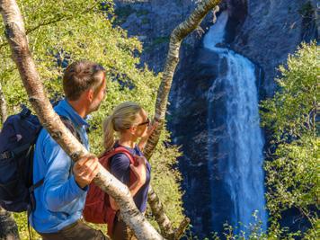
GUIDED TOURS TO OUR FAMOUS ICONS
The experience becomes even better, and above all safer, if you do the hike with an experienced nature guide.
Guiding is offered by: Explore Lysefjorden, Get Guided Norway, Guidecompaniet, Lysefjorden Adventure, Magma Geopark, Nordic Paddling, Stavanger Adventure. More information and booking of tours:


