
7 minute read
Maps | Lots 236-249
Lots 236-249

Advertisement


*236 [AMERICAS] -- MUENSTER, Sebastian (1489-1552). Tavola dell’isole noue. Basel, ca 1550.
Engraved map of the Americas with later hand-coloring, 306 x 407 mm sheet, framed. “Cum privilegio 1550” printed lower margin, Ferdinand Magellan’s ship, the fl ag of the kingdoms of Castile, title in Italian, place names in Latin, no text verso. (5-in. tear crossing image repaired verso, some overall browning.)
The fi rst map to use “Mare pacifi cum,” one of the earliest maps depicting North and South America, and one of the earliest depictions of Japan.
Property from the Estate of W.M. Bogdanowicz, Madison, Wisconsin and Naples, Florida $1,000 - 2,000
237 [ASIA & AMERICA] -- ORTELIUS, Abraham (1527-1598). Tartariae sive Magni Chami Regni typus. [Antwerp: ca 1570].
Engraved map with later hand-coloring of Asia including the west coast of North America, 403 x 518 mm sheet, matted and framed. Strapwork cartouches, one fl anked by a woman and a man, ships, and fl ying fi sh, Latin text verso.
An early depiction of the Kingdom of Tartary, and one of the earliest obtainable maps showing California as an island. $500 - 700
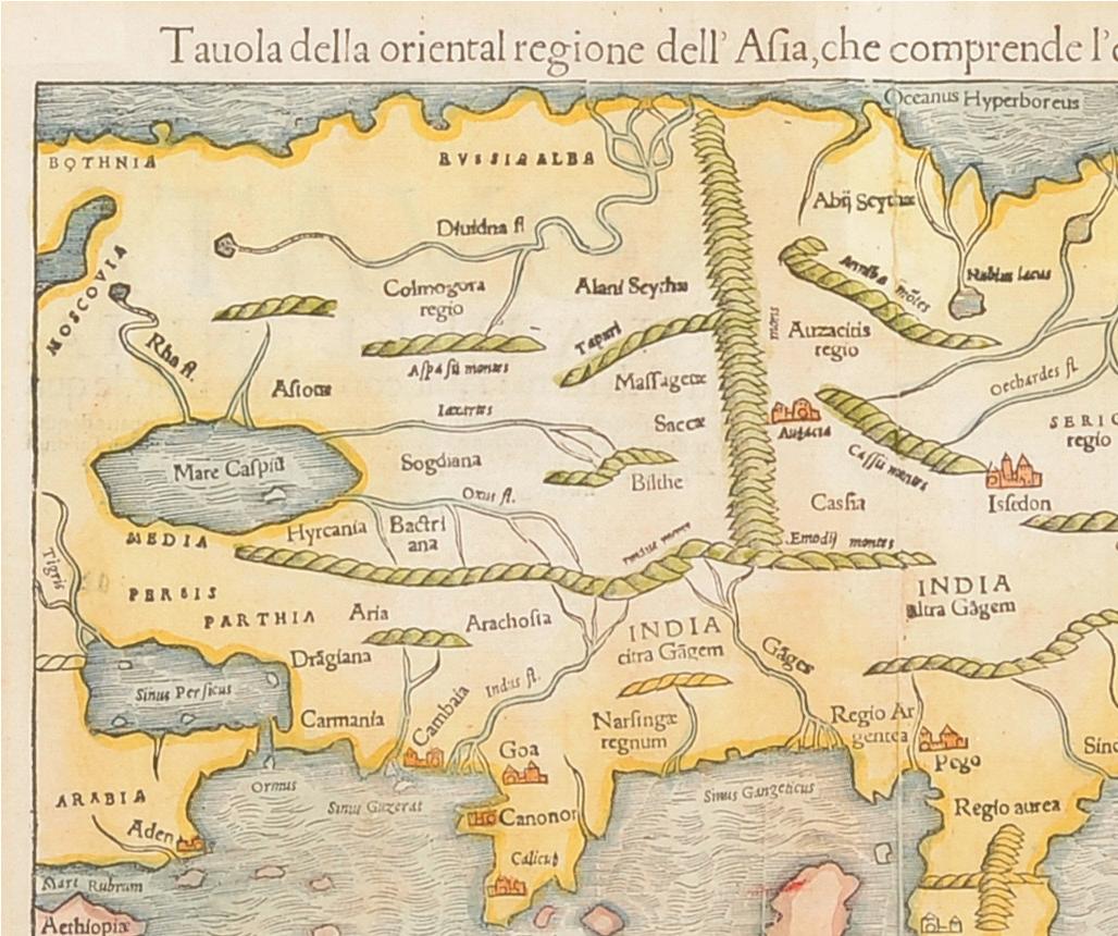
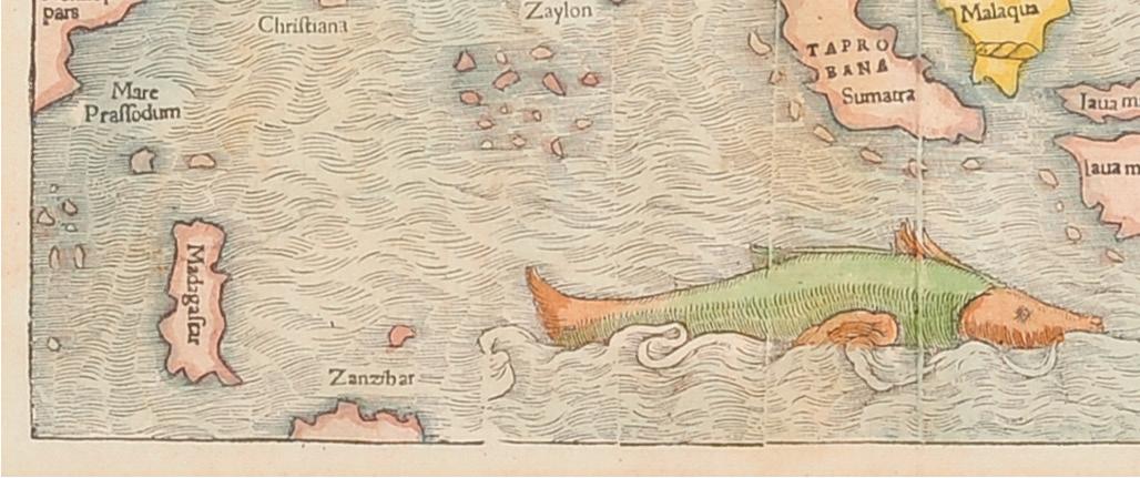
238 [ASIA] -- MUENSTER, Sebastian (1489-1552). Tavola della Oriental Regione dell’Asia, che Comprende l’Estreme Terre, & Regni di Quella. [Basel, ca 1550].
Woodcut map of Asian with hand-coloring, 278 x 352 mm sight, matted and framed (unexamined out of frame). Mermaid creature and sea monster. Provenance: The Asian Collector (gallery label on back of frame).
One of the earliest maps of China based on the geographical discoveries of Portuguese navigators. $600 - 800
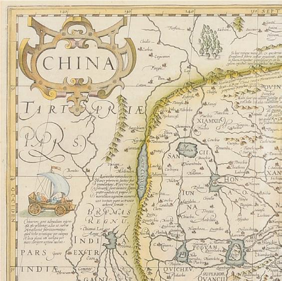
239 [CHINA] -- HONDIUS, Jodocus (1563-1611). China. [Amsterdam, 1606 or later].
Engraved map of China, 351 x 470 mm sight, matted and framed (unexamined out of frame). Strapwork cartouche, inset depicting a crucifi xion, ships, and sea creatures. Provenance: The Asian Collector (gallery label on back of frame).
An early map of China, depicting Korea as an island, and showing a small portion of the northwest coast of North America. $1,200 - 1,800


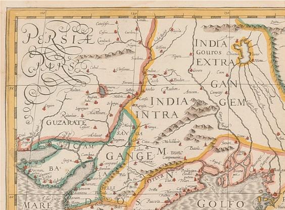
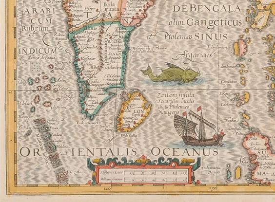
241 [CHINA & SOUTHEAST ASIA] -- HONDIUS, Jodocus (1563-1611). India Orientalis. [Amsterdam, ca 1606-27].
Engraved map with later hand-coloring, 370 x 498 mm sight, matted and framed (unexamined out of frame). Strapwork cartouches, galleons and a sea monster, Latin text verso. Provenance: The Asian Collector (gallery label on back of frame).
An early Dutch map depicting China and Southeast Asia engraved for Hondius’ expanded Mercator Atlas. $1,000 - 1,500 *240 [CHINA] -- BLAEU, Willem (1571-1638) and Jan BLAEU (1596-1673). China Veteribus Sinarum Regio. Amsterdam, ca 1640.
Engraved map of China, Korea and Japan with hand-coloring in wash and outline, 451 x 593 mm sheet. Figural cartouche showing a woman and a man, Coat of arms, sampans and galleons, French text verso. (Short tear to lower margin, some overall browning from old framing.)
Property from the Estate of W.M. Bogdanowicz, Madison, Wisconsin and Naples, Florida
$300 - 400



242 [CHICAGO] --Park & Guide Map of Chicago. Chicago: Jas. Van Vechten, 1873.
Engraved wall map with hand coloring, 1150 x 820 mm sight, matted and framed (unexamined out of frame, some minor crackling with small losses to top portion of map.)
A RARE MAP DEPICTING THE GREAT REBUILDING, published just two years after the Chicago fi re, and showing the boundaries of the “burnt district” in red. Lithographed by Jerome T. Gouget, and colored and mounted by G. W. Terry in Chicago (with his ticket). With a street index in accordance with “an ordinance [that] was passed November 25, 1972, naming streets, avenues, courts and places.”
VERY SCARCE: We do not trace any other copy of this exceedingly rare map at auction in the last 100 years; OCLC locates only two copies, at the Newberry Library and the William Clements Library at the University of Michigan. $2,000 - 3,000
244 [CHICAGO] -- THRASHER, Frederic M. (1892-1962). Chicago’s Gangland. Chicago: University of Chicago Press, 1926.
Printed in red and grey, 683 x 4656 mm (some minor offsetting, a few tiny separations to folds, a few short marginal tears); folding into original envelope (a few separations to folds).
Issued to accompany Sociologist Frederic Thrasher’s seminal 1927 study, The Gang: A Study of 1,313 Gangs in Chicago, the map depicts the locations of youth gangs in the “poverty belt,” rather than focusing on Capone’s Mob. $500 - 700 243 [CHICAGO] -- New Cyclists’ Map of Chicago. Chicago: Rand, McNally & Co., 1896.
Engraved map, matted and framed (unexamined out of frame).
Printed at the height of America’s cycling craze of the 1890s, identifying “fi ne,” “good,” “fair,” and “bad” cycling roads. RARE: OCLC does not locate any examples of this map in institutional collections. $200 - 300


245 [EUROPE -- NETHERLANDS] -- ORTELIUS, Abraham (1527-1598). Belgii Veteris Typus. [Antwerp], 1584.
Engraved map with later hand-coloring, 298 x 506 mm sight, matted and framed (unexamined out of frame). 4 cartouches, compass rose, Latin text verso. Provenance: Schoonheim B. V. (gallery label on back of frame).
Depicting the historic part of Belgium, and showing the English Channel and part of Britain. $300 - 400
246 [LONDON] -- A New Prospect of ye North-Side of ye City of London with New Bedlam & Moore-Fields. London: henry Overton, ca 1710.
Engraved birds-eye view on three sheets, 645 x 1475 mm sight, framed (unexamined out of frame). Three cartouches.
Reissued ca 1710 by Henry Overton, and fi rst published 1689 by James Walker (this edition still with his dedication). The bird’s-eye view depicts gardens and buildings of New Bethlem in the foreground and the City of London in the background.
Property from Lawry’s The Prime Rib, located in the historic L. Hamilton McCormick Mansion, Chicago, Illinois, offered without reserve $1,500 - 2,500
*248 [PARIS] -- PICHON, M. Nouveau Plan Routier de la Ville et Faubourgs de Paris. Paris, ca 1805 [“l’An 13”].
Engraved map hand-colored in outline, dissected in 45 sections and mounted on original linen, 1023 x 1480 mm sheet, folding into original paste-paper-covered board slipcase gilt, red lettering-piece gilt.
later edition of this fi ne plan of Paris showing the city as it was reconstructed after the French Revolution. The plan was published at least 10 times between 1780 and 1805.
Property from the Collection of Steven Huffi nes, San Francisco, California $300 - 400 *247 [PARIS] -- DE LISLE, Guillaume (1675-1726). Le Plan de Paris, ses Faubourgs et ses Environs | Platte Grond van Parys, zyn Voorburgen en Omleggende Plaatse. Amsterdam: Covens & Mortier, ca 1730.

Engraved map of Paris on two sheets with later hand-coloring, 582 x 765 mm sight, matted and framed (unexamined out of frame). Two decorative cartouches, the French Royal Coat of Arms, compass rose.
Based on an earlier map by Nicolas de Fer, and including the Louvre Castle, Notre Dame, Place de Vosges, and Luxembourg Gardens.
Property from the Collection of Steven Huffi nes, San Francisco, California $2,000 - 3,000

*249 [ROME] -- DU PÉRAC, Etienne (ca 1525-1604). Urbis Romae Sciographia ex Antiquis Monumentis Accuratiss Delineata Descrizione. Rome: Giovanni Giacomo de Rossi, ca 1730
Engraved view of Rome on 8 sheets, 1041 x 1549 mm image, matted and framed (unexamined out of frame).
The fourth state, identifi able by the addition of “Calcografi a Camerale” newly engraved below the cartouche. Du Perac studied engraving under the direction of Antonio Lafreri.
Property from the Estate of Maria Teresa Magliocco, Sierra Vista, Arizona $600 - 900


