3 minute read
Walks by Tracy
The Intak and Canal, Fochabers
This walk is close to home for Tracy taking her only approx 8 miles from her home in Keith to Fochabers. Tracy undertakes lovely walks all over our beautiful country and we are delighted she has agreed to provide Lifestyle readers with the inside knowledge that she has gleaned from her many adventures. I hope you enjoy Tracy’s walks? Please do let us know and send us some photos. Follow Tracy goes outside on Facebook (www.facebook.com/tracygoesoutside)
Advertisement
This is a beautiful trail that not only takes you along a section of the River Spey it gives you a chance to see the remains of a very interesting hydro scheme that was way ahead of its time dating back to the early 20th century, the initiative came from the Duke of
Distance: 2 ¾ miles
Time: 1hr
Level: Easy low-level walk
Terrain: Well walked woodland paths with some tarred and pavement walking.
Access: Arrive by car, parking is available at the Speyside Way car park opposite the opening of Gordon Castle at IV32 7EH. There are also good bus links from Stagecoach with a bus stop near the start of the walk.18 Richmond and Gordon who for some years envisaged his Castle being lit by electricity.
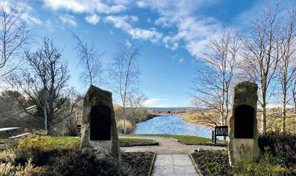
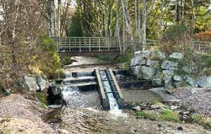
At the car park take a left and head towards the memorial gardens where you get an amazing, framed view of the River Spey. To the left you will see some steps, go down them and follow the path along. There is a small opening if you want to get a good view of the fish ladder. Back on the path go over the footbridge at the fish ladder you will see the signpost to the Intak (local name for intake).


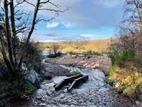
Once over the footbridge you will pass some big houses, then there is a fork in the road, take the right fork towards the wooded area. Once on the wood track you will see a wayward marker post, just after you pass it take the opening to the right on the narrower path. This is where you will first see the derelict canal. The path can be quite uneven here and wet but well worth walking and getting dubby boots for.

Keep on this path, it will eventually come to the edge of the river where you will get some great views of Ben Aigan in the distance. Follow the path right along the river and you will come to some steps and a bench. This is a great place to stop for a picnic and do some bird spotting on the river.

Footbridge at the fish ladder.
Just beyond the bench you will see a wee opening and a little overgrown path where you will find an information board and the intake where the water came in to power the scheme. You still see the grid that was put there to keep fish and debris out. The water ran along the lade (known as the ‘Canal’) to the power station to drive the turbines to produce the electricity.
Head back to the bench there is a path at the right that will take you along beside the edge of the canal. Keep your eyes peeled along here as there are several scrap cars buried in the undergrowth in the canal which were dumped many years ago. Keep on the same path it will take you back to the wayward marker post where you turned off.
Once back on to the tarred road, at the fork keep right, when you get to the shed at the end of the road turn right on to West St. Halfway along you will see a waterfall on the Burn of Fochabers and a wooden foot bridge running over it. Go over the bridge then take the next right on to George St. This will take you to Fochabers Square. On the other side of the road opposite the fountain you will see a large streetlamp that commemorates the opening of the scheme. Which is a great way to finish the walk. From the square you can just go along the High St past the traffic lights and bowling green and you will return to the carpark. There are a few cafes on the High St and a lovely ice-cream shop if you fancy some refreshments after your adventure.


