CHINA TOWN COMMUNITY RECONNECTION AND REVITALIZATION
RIVERSIDE INDUSTRIAL BROWN FIELD RENOVATION MAKE SHKODER A PLAY CITY
REVITALIZATION OF SLATE BELT
MIX-USE HOUSING COMPLEX PROJECT
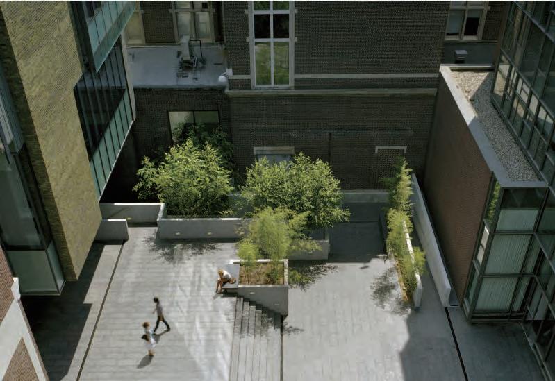
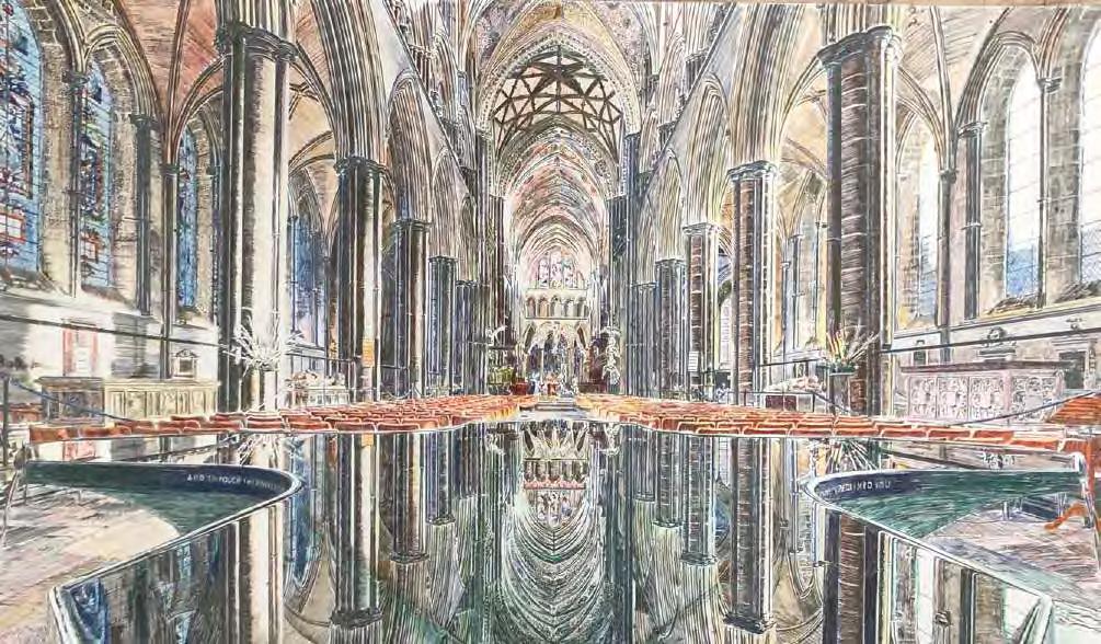
SKIRKANICH HALL COURTYARD DETAIL VIGNETTE PEN DRAWING AND WATERCOLOR
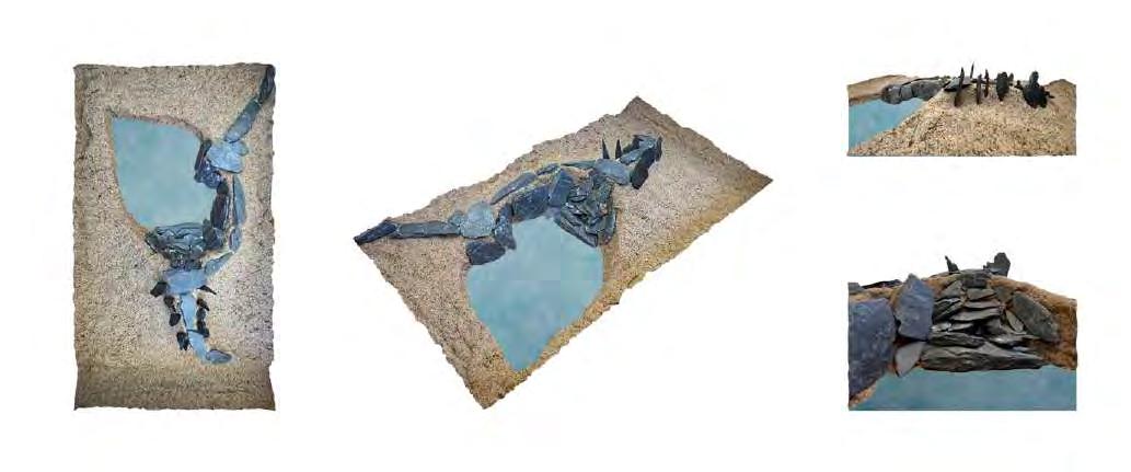
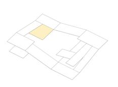
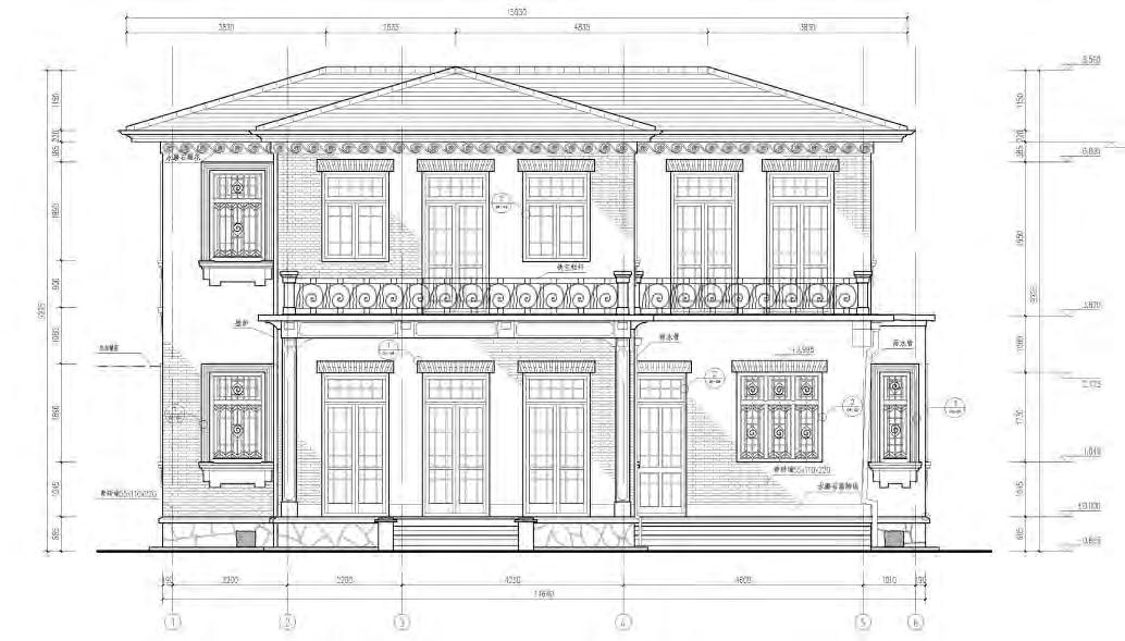
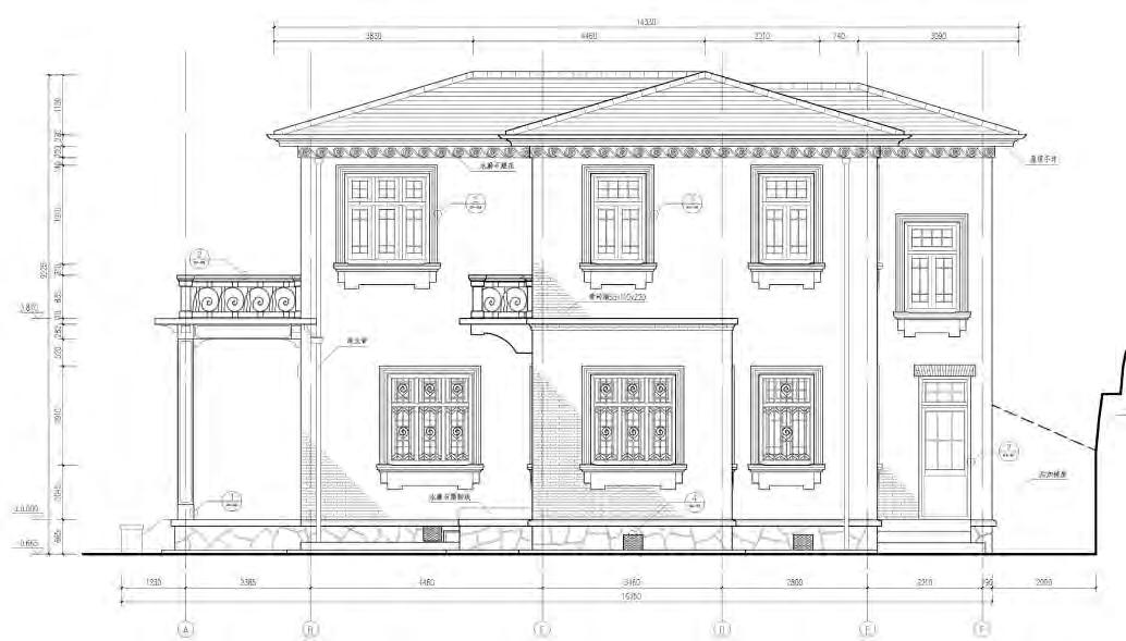
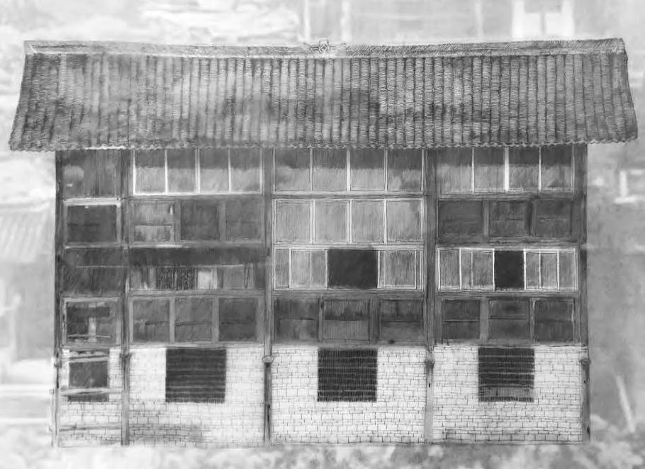
MEASUREMENT OF NO.76 VILLA
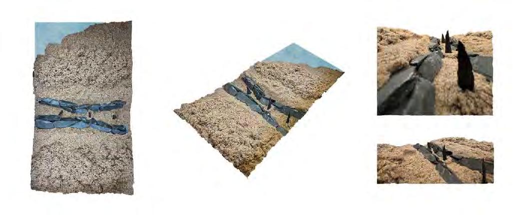
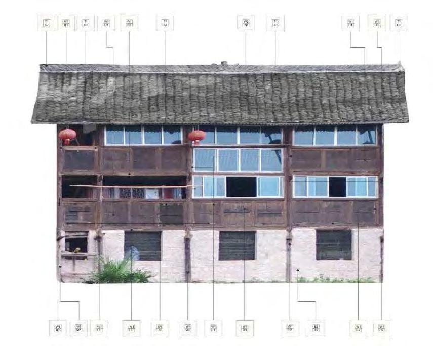
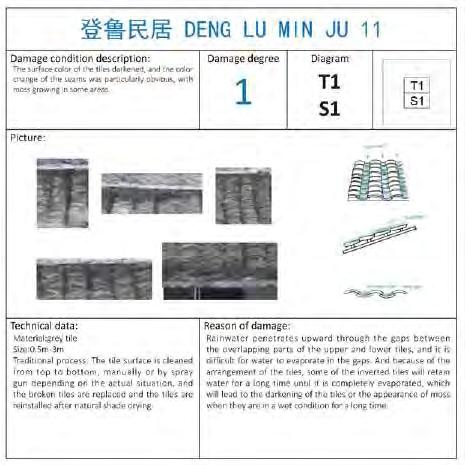
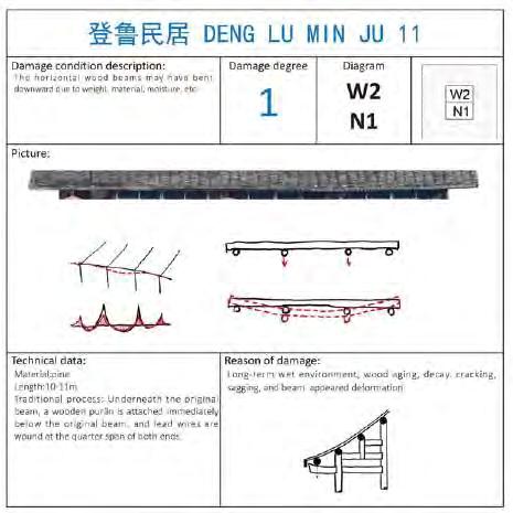
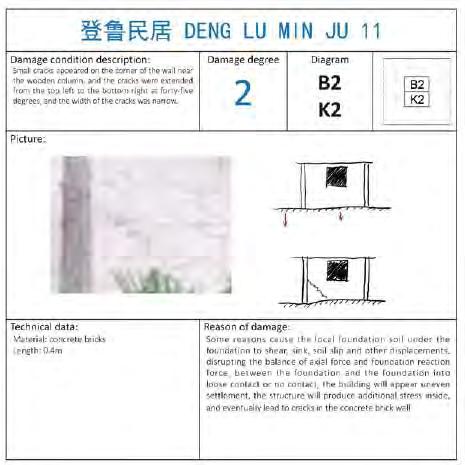
RESTORATION OF RESIDENTIAL IN DENGLU
Philadelphia, PA, 19104
Tel: (267) 432-2198
E-mail: liuyq@upenn.edu
01 THE RED THREAD
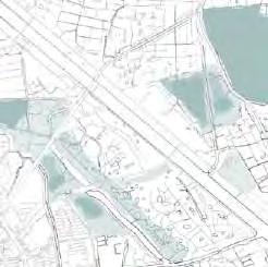
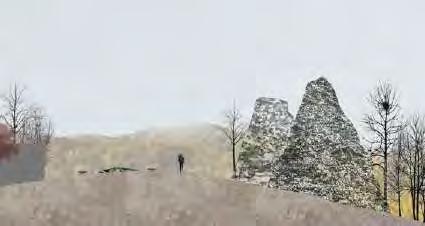
Make Shkodër a play city, Shkodër, Albania
[LOCATION] SHKODER, ALBANIA
[DURATION] 16 WEEKS
[ACADEMIC] MASTER PROGRAM YEAR 2 SEMESTER 1
[TUTOR] NICHOLAS JABS & MEGHAN TALARAOWSKI
[TEAM WORK]
[COLLABORATOR] FANYIN XU
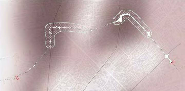
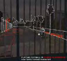
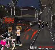
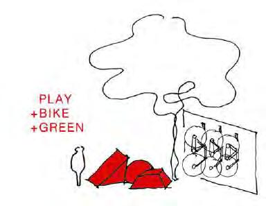
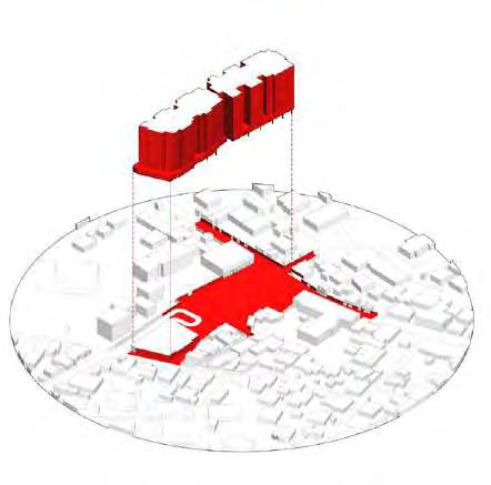
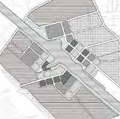
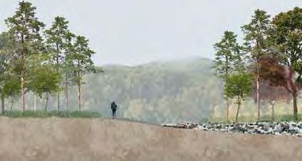
The “Red Thread Corridor” is a visionary urban design initiative that addresses Shkodër’s critical urban challenges, including air pollution, fragmented public spaces, and limited accessibility to areas for recreation and play. The project envisions a continuous eastwest corridor that reconnects neighborhoods, bridges accessibility gaps, and transforms underutilized spaces into vibrant hubs for community interaction and play.
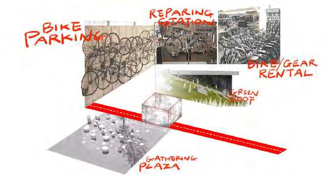
At its core, the corridor seeks to reclaim the right to play in the city by creating safe, inclusive spaces where residents of all ages can engage in unstructured, everyday activities. By prioritizing pedestrian and biking infrastructure, the project promotes a healthier, carfree environment while integrating features such as linear parks, pocket parks, and public play areas. These interventions aim to spark creativity and encourage playful interactions, revitalizing the city’s public realm.
In addition to enhancing urban mobility and environmental quality, the corridor serves as a catalyst for community cohesion. Vacant spaces are reimagined as hubs for biking, gathering, and recreation, fostering a playful and welcoming atmosphere. The initiative aspires to reshape Shkodër’s urban fabric, making it a city where people are free to explore, play, and connect in their everyday lives, creating a lasting legacy of vibrancy and resilience for future generations.
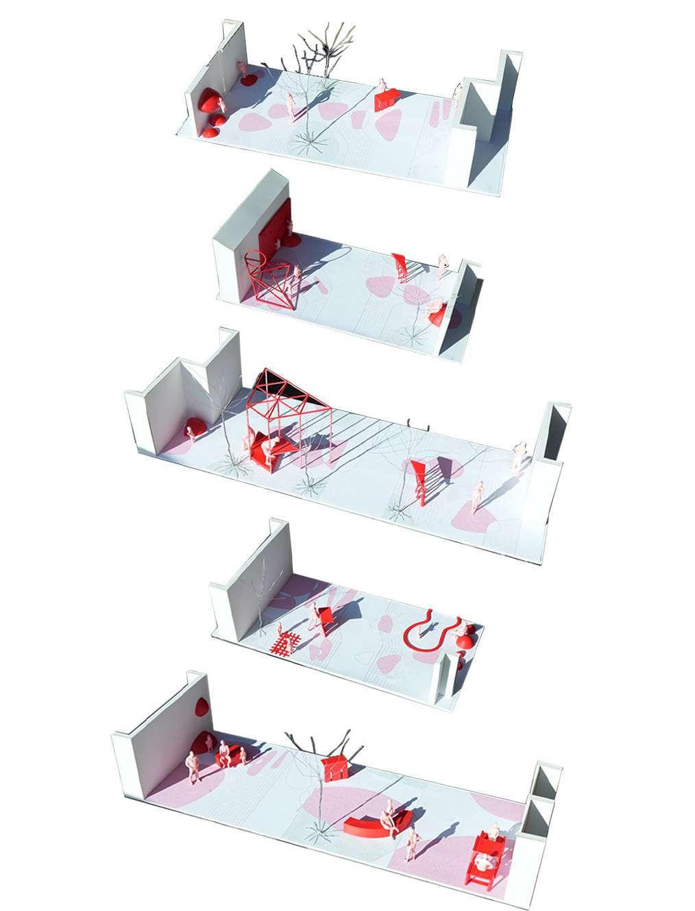
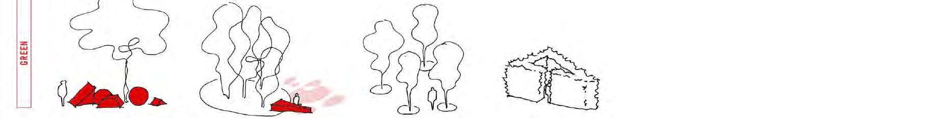
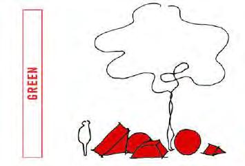
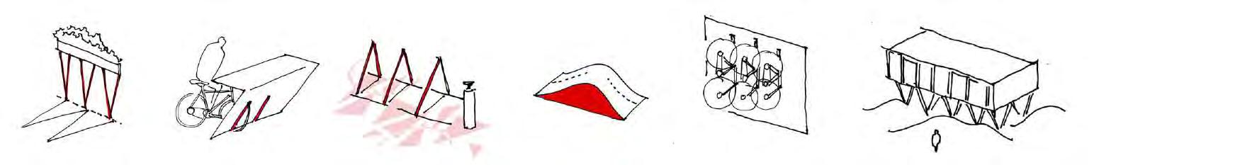
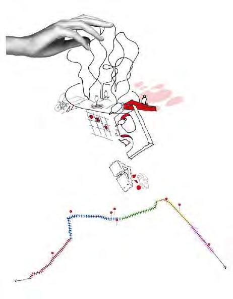
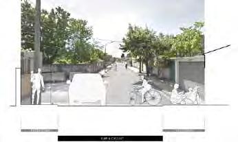
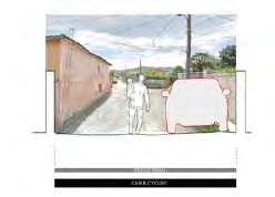
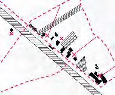
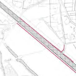
Prototypes of Corridor Street Typology
In the first Strategy, we envision transforming the street into a carfree public space for recreation. Four strategies guide this change.
The second strategy prioritizes creating a healthier environment along the corridor. By introducing green zones in areas with the highest air pollution, we aim to improve air quality through the use of carbon-sequestering plants.
ALONG
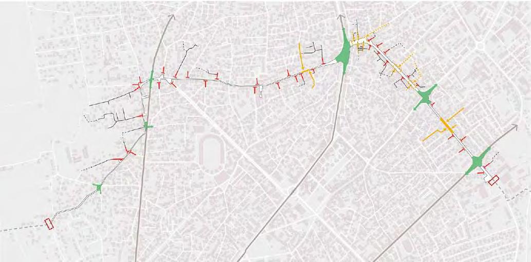
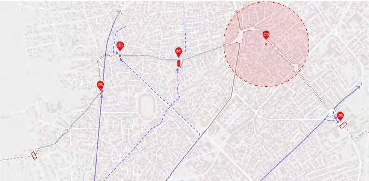
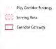
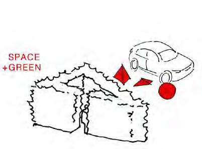
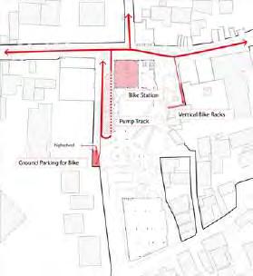
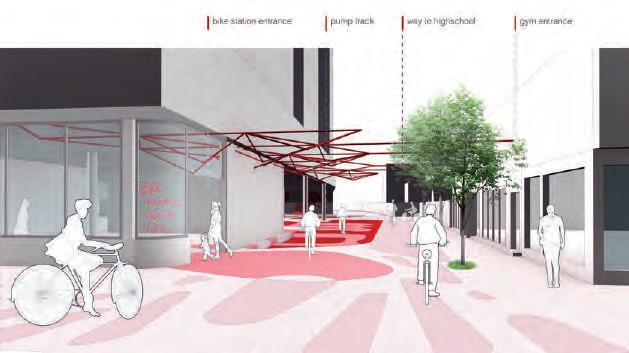
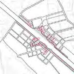
To align with Shkodër's rich bike culture, we aim to make the corridor accessible for everyone. We have designated four easily accessible locations along the city's main roads and one within a high-density residential area as bike stations. These stations will serve both locals and tourists, providing facilities to borrow or park bikes and offering basic bike maintenance services, fostering a cyclingfriendly environment.
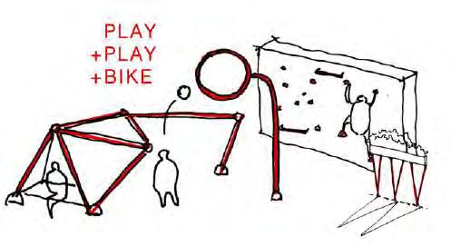
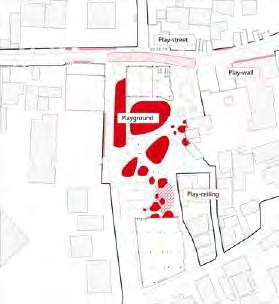
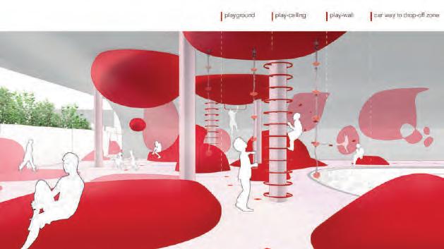
We designed playgrounds based on serving areas: Neighborhood, High School, Kindergarten, and Bike StationOriented. Each caters to specific user needs, from community play and youth sports to early childhood activities and cycling integration. This network enhances connectivity, recreation, and urban life.
Strategy for Bike Stations
Strategy for Corridor Hubs
Sketch Strategy for Playground
Strategy to Car-free Street
Strategy to Most Air-pollluted Area
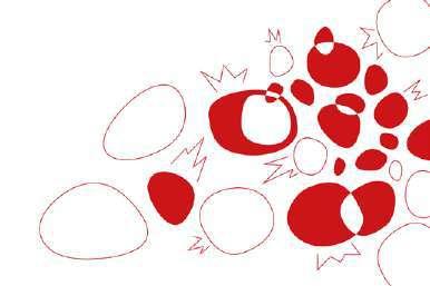
Vocabulary Matrix
Vocabulary/ Strategy Overlap
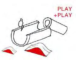
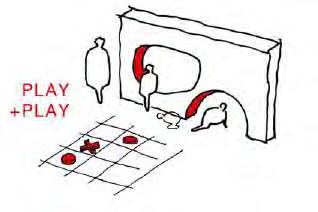
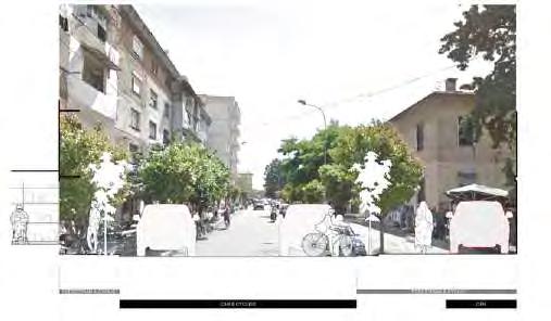
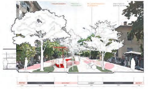
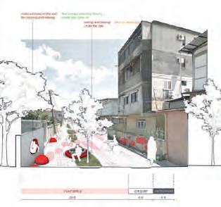
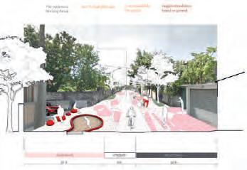
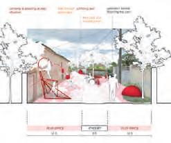
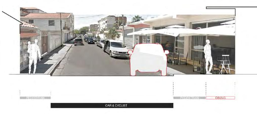
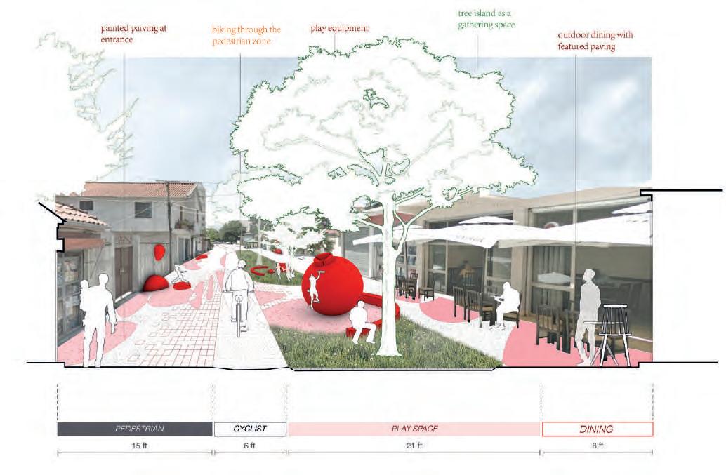
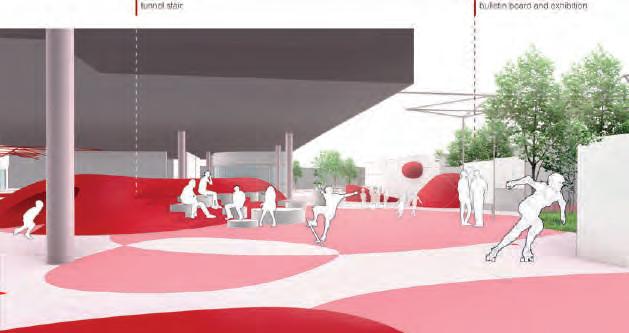
We aim to transform the once cluttered, deteriorated, and trash-filled streets into a vibrant, car-free public space where people of all ages can find their own way to play. By integrating site-specific landscape elements that align with our design language, we create an inviting and dynamic environment that fosters social interaction, recreation, and urban revitalization.
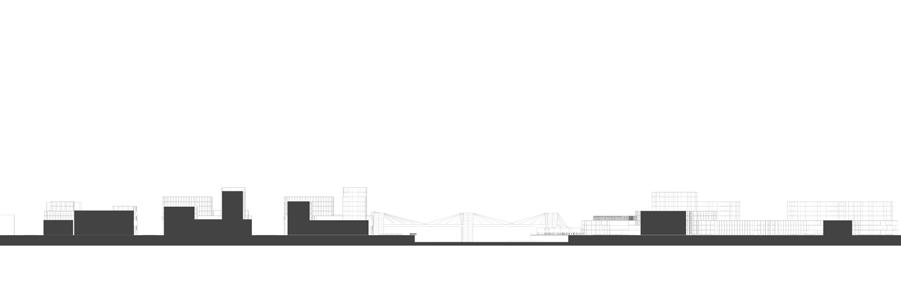
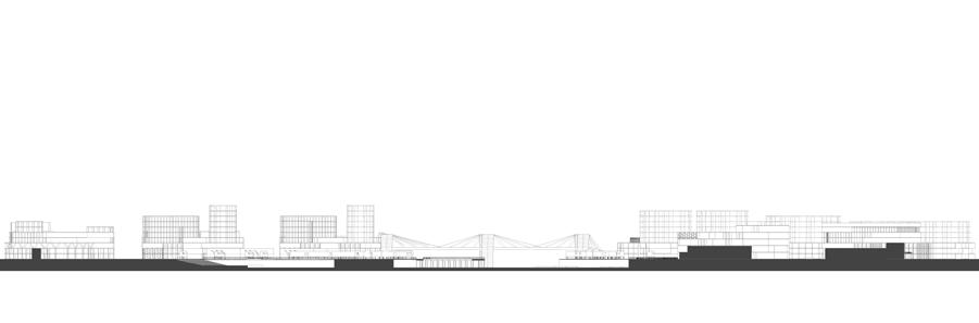
Section Perspective Before Design
Section Perspective After Design
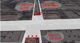
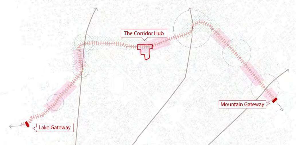
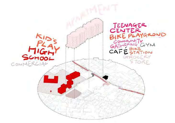
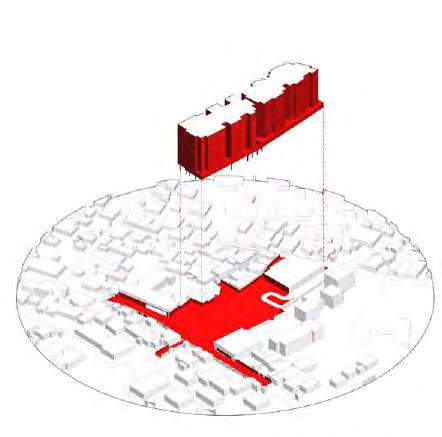
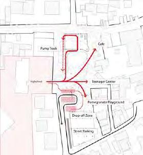
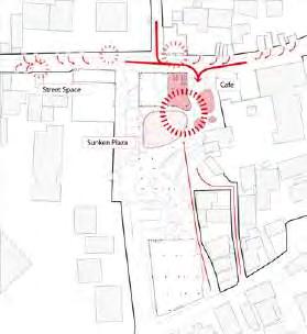
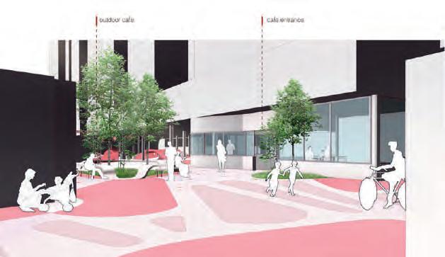
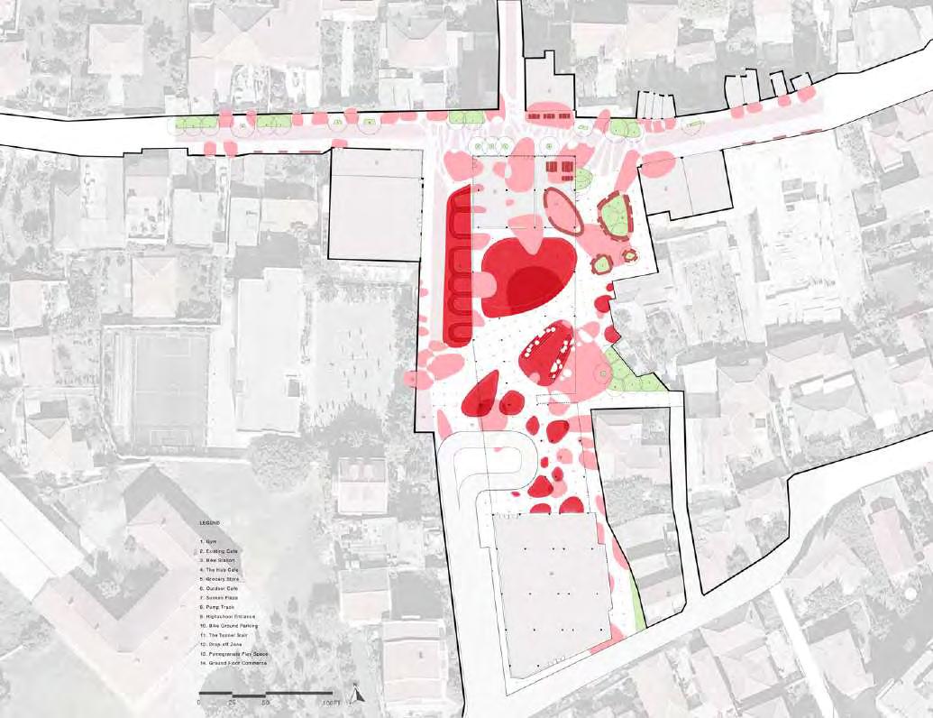
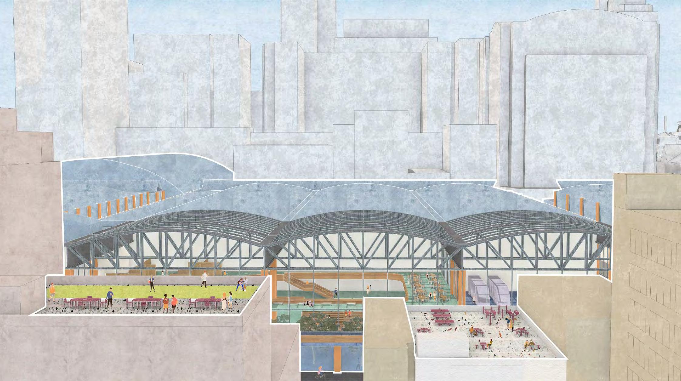
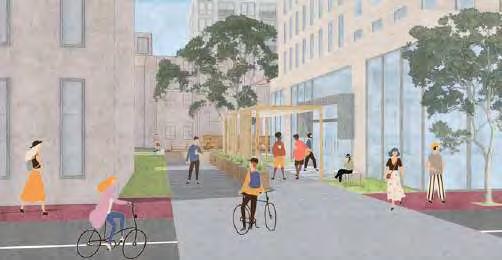
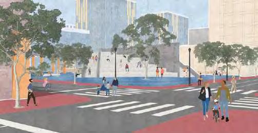
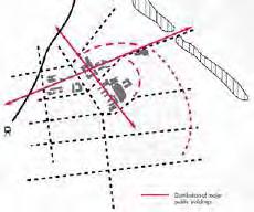
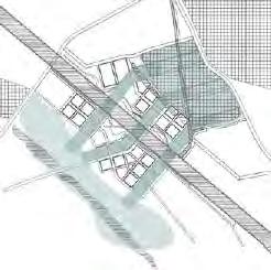
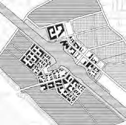
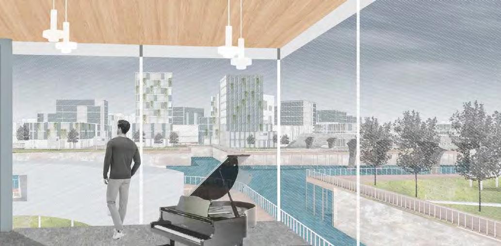
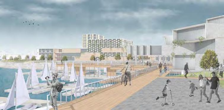
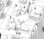
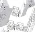
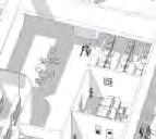
The corridor hub is a dynamic community space surrounded by apartments, schools, and local businesses. It includes areas for kids’ play, a teenager center, and a bike playground, along with amenities like a café, grocery store, and bike station. These features make it a lively gathering spot, encouraging social interaction and supporting everyday activities for residents and visitors alike.
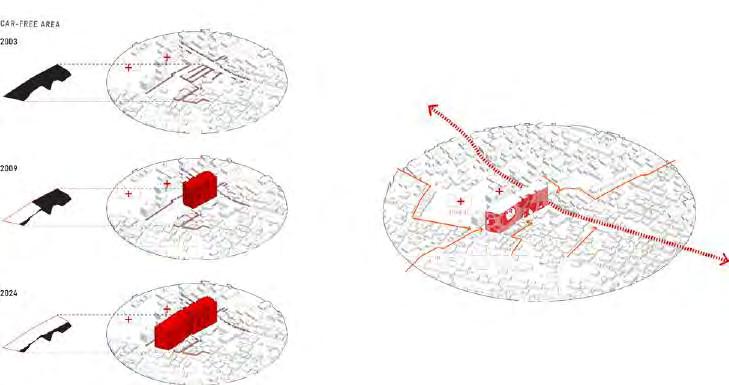
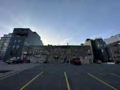
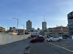
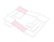
The chosen corridor hub stands out not only for its unique geographical location but also for its significant historical and urban development. In 2003, the site was an unremarkable empty lot used primarily for parking, serving no substantial purpose. By 2009, the construction of the tallest building within the corridor transformed the area, marking it as a prominent landmark that visually defined the site. This transformation continued in 2024 with the addition of another high-rise, further cementing its role as a key urban node.
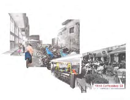
Surrounded by two schools and a coffee shop, the site sees a steady flow of pedestrians and cyclists, making it a bustling part of the city.
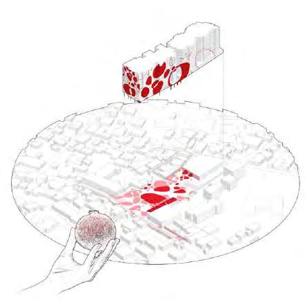
To enhance its identity, we plan to use graffiti art to transform the two buildings into iconic landmarks, attracting local residents, tourists, and visitors along the corridor, and creating a lively, inclusive gathering space.
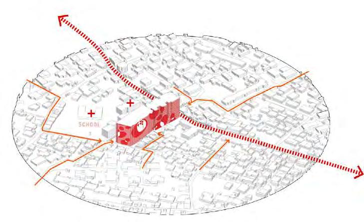
Important Corridor Hub Selection
New Landmark on Corridor Grafic Design in Hub
Grabbing the Territory
A Major Stop for Cyclist
A Cool After-school Space to Hang Out
A Community Gathering Space where People Meet, Chat and Bond
A Safe Play Space for Daily Visit
of
02 REOPENING A NEIGHBORHOOD
Chinatown community reconnection and revitalization, Philadelphia, United States
[LOCATION] PHILADELPHIA, UNITED STATES
[DURATION] 16 WEEKS
[ACADEMIC] MASTER PROGRAM YEAR 1 SEMESTER 2
[TUTOR] JAE SHIN
[TEAM WORK]
[COLLABORATOR] YI ZHANG
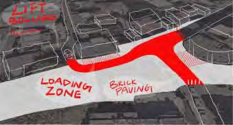
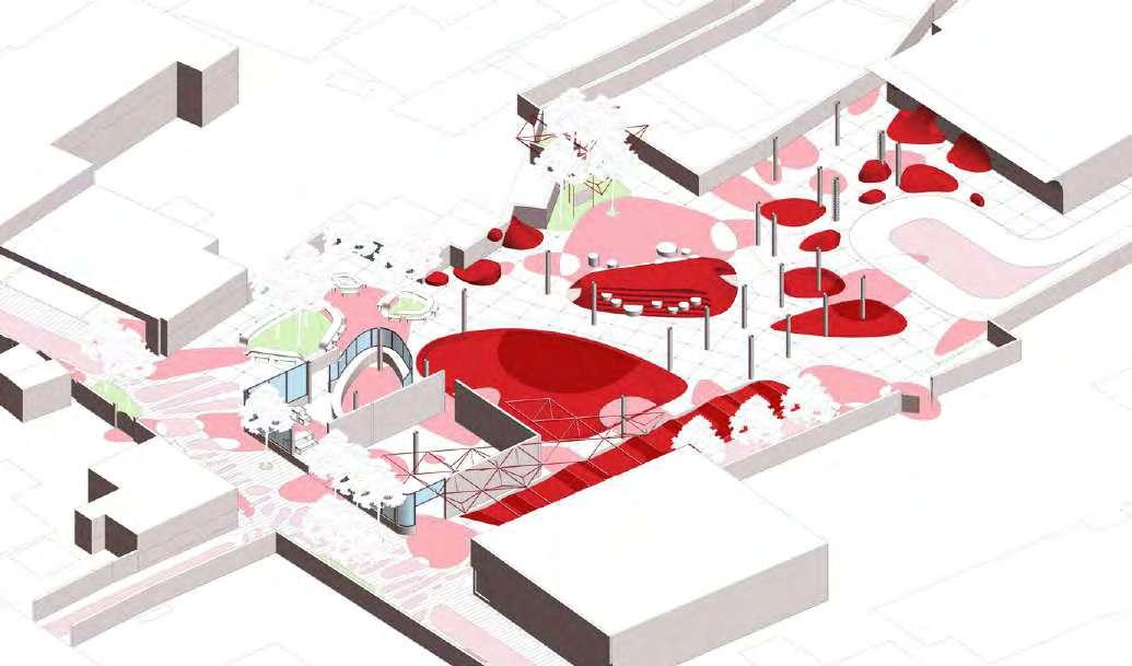
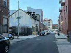
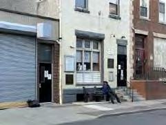
The "Chinatown Community Reconnection and Revitalization" is an ambitious landscape design initiative that seeks to mend the fractures caused by urban infrastructure near Philadelphia's Chinatown. By addressing the challenges of community disconnection, population decline, and deteriorating public spaces, the project places a special focus on meeting the needs of unhoused individuals and undocumented immigrants.
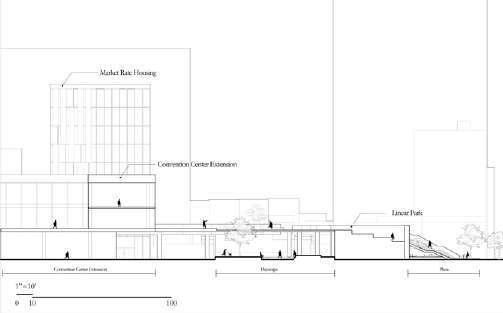
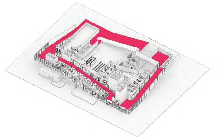
This proposal reconfigures the Convention Center by opening its interior spaces and incorporating community-oriented functions, creating a new model of spatial and social integration across divided neighborhoods. Additionally, through the design of linear parks, pocket parks, and community parks, the project enhances pedestrian experiences and fosters vibrant, inclusive public realms.
At its core, the initiative aims to establish a harmonious relationship between the built environment and community life while promoting economic revitalization. Through strategic collaboration with the Convention Center Authority, government subsidies, and nonprofit organizations, the plan not only provides housing and support services for vulnerable populations but also rejuvenates the neighborhood as a whole.
As this vision takes shape, the project goes beyond spatial and architectural interventions, offering a blueprint for sustainable urban development. It aspires to create a lasting legacy of social and ecological resilience for future generations.
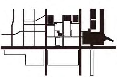
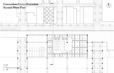
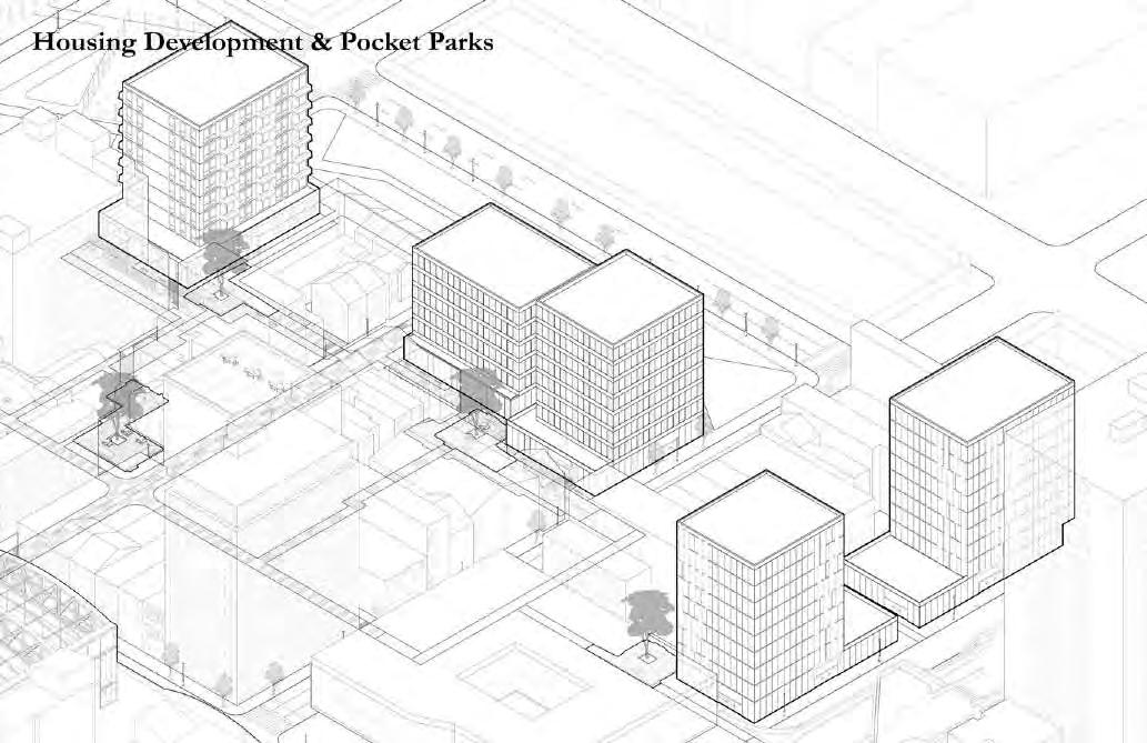
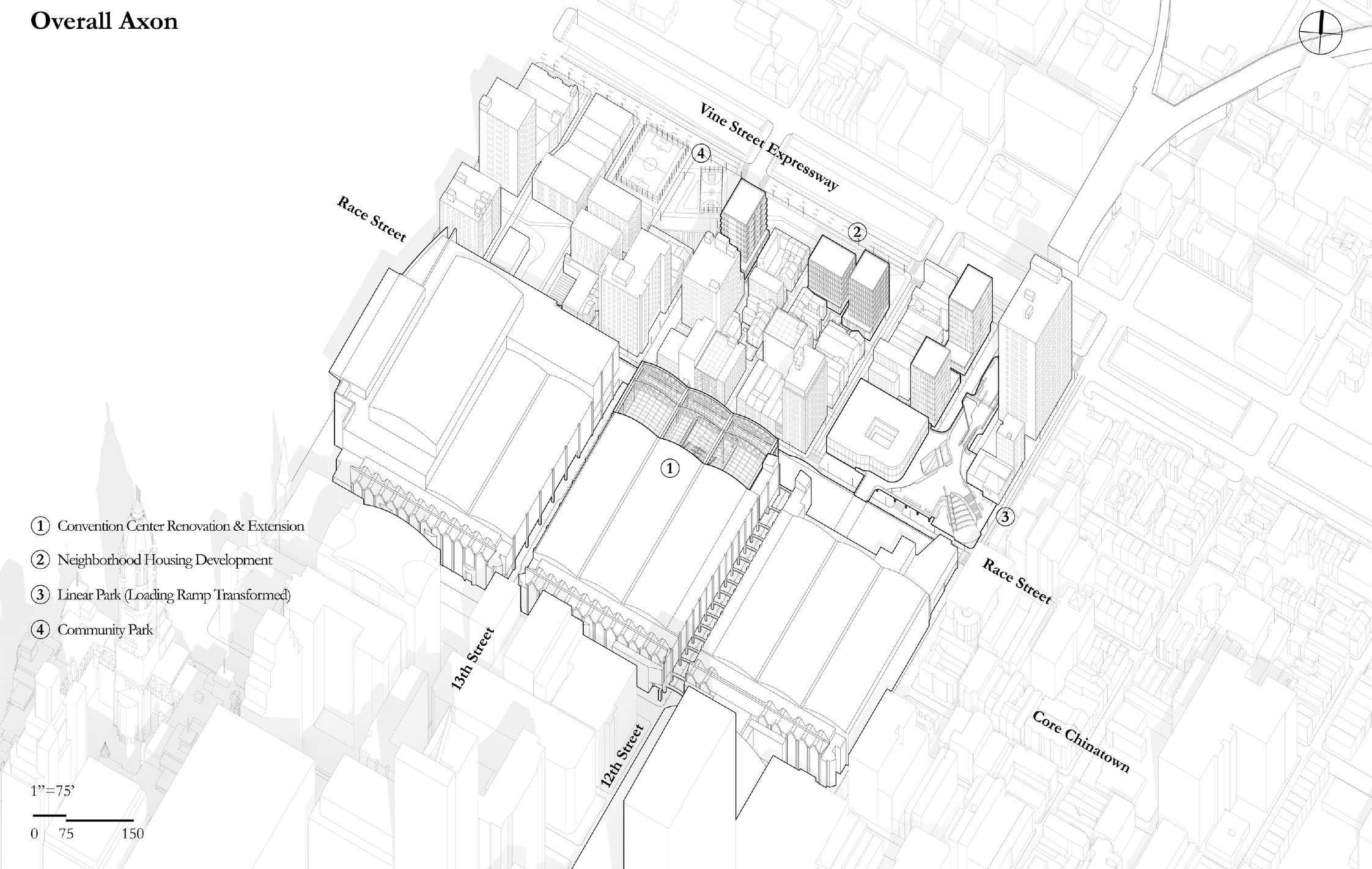
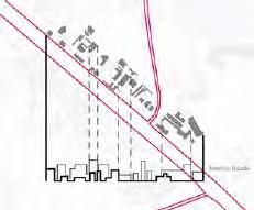
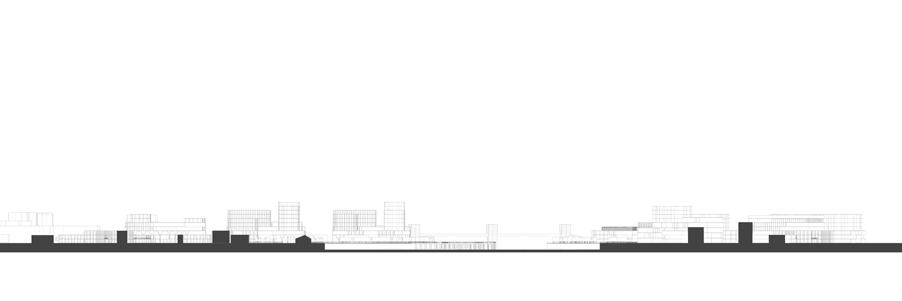
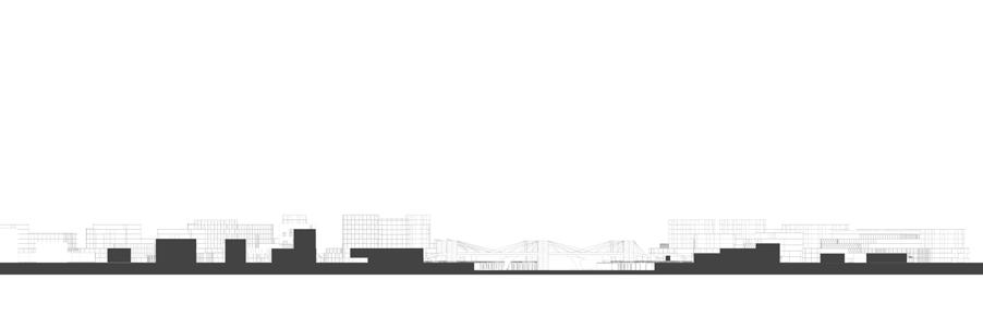
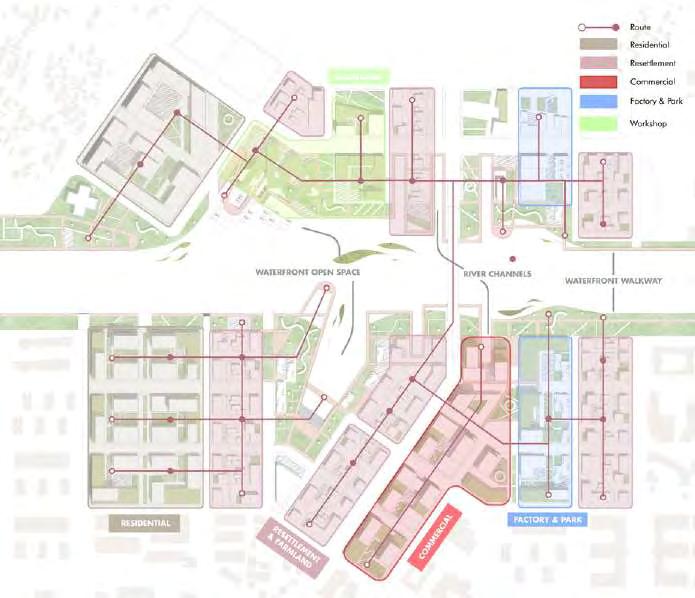
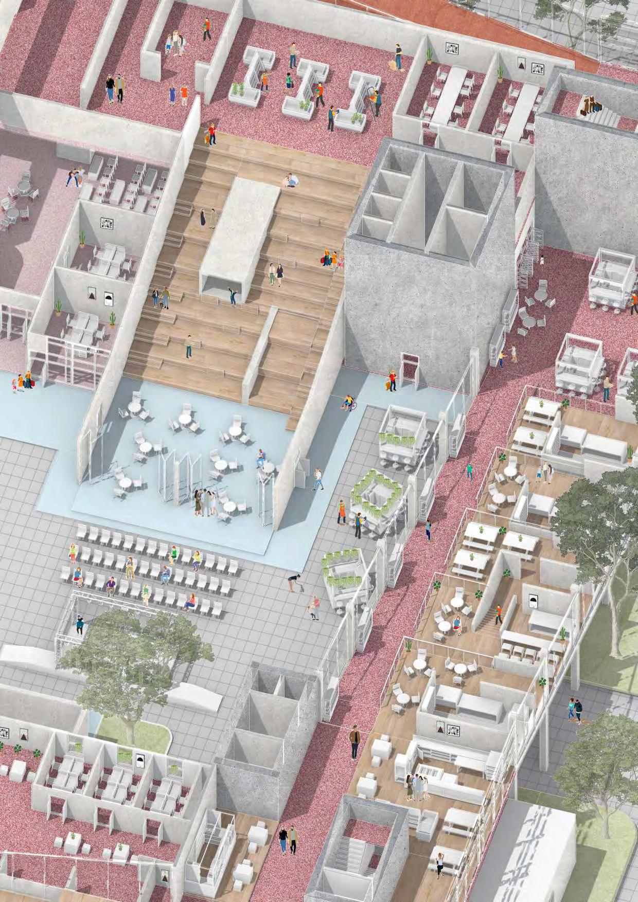
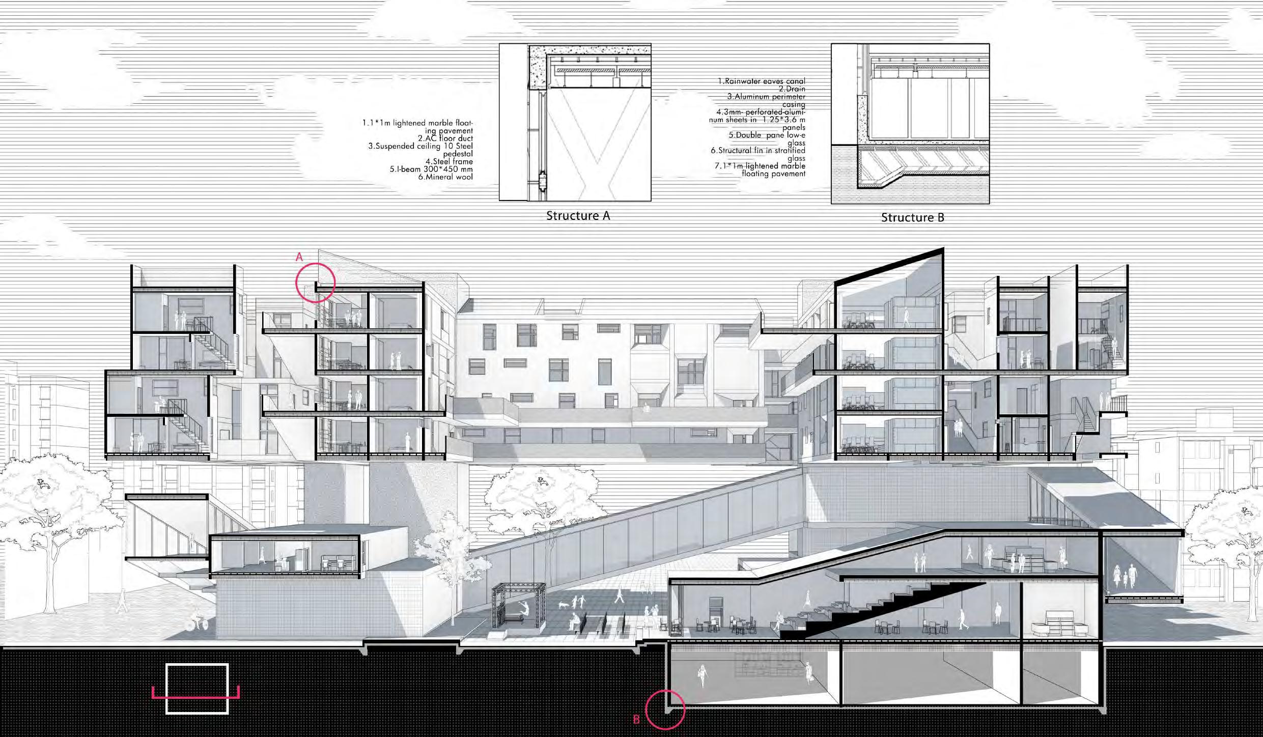
This is the redesigned neighborhood model. The white areas represent the original buildings on the site, none of which have been demolished. The black areas indicate newly constructed or renovated buildings. The orange areas represent the renovated convention center, including its newly opened interfaces facing the neighborhood and the necessary structural elements for the tunnel. The gray areas depict newly created parks utilizing the parking lots and the convention center ramp, designed to connect with the neighborhood, the convention center, and Chinatown. This model illustrates how we have reopened the neighborhood and how the system functions as a whole.
Neighborhood Model
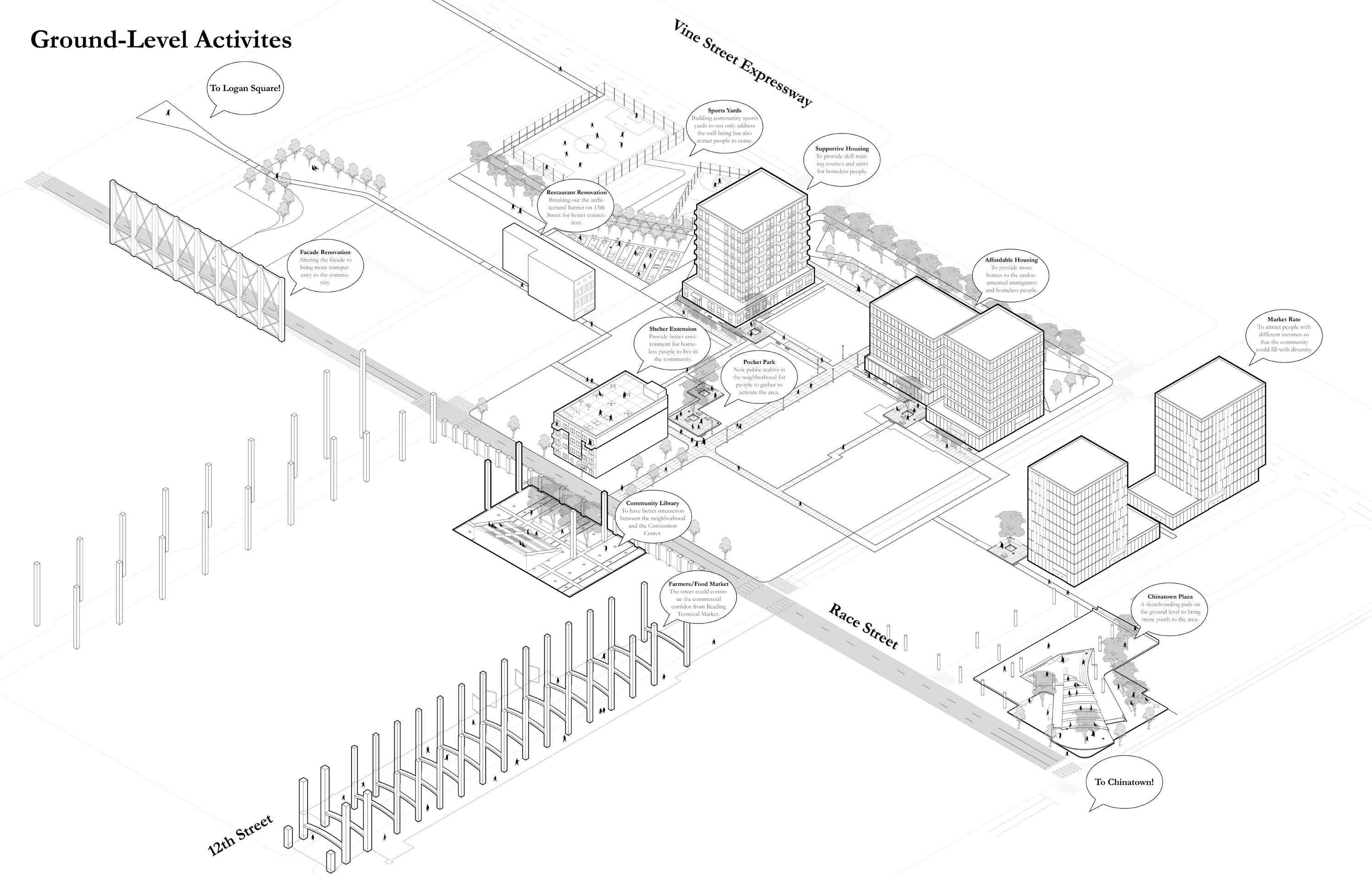
Ground-Level Interaction
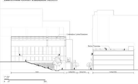
We propose enhancing the perception of the two existing shelters by introducing an upper-level extension, allowing residents to engage more actively with the surrounding community. We believe that this intervention, combined with other design strategies, will significantly improve the pedestrian experience and foster a more vibrant and dynamic streetscape.
Views from Proposed Public Housing
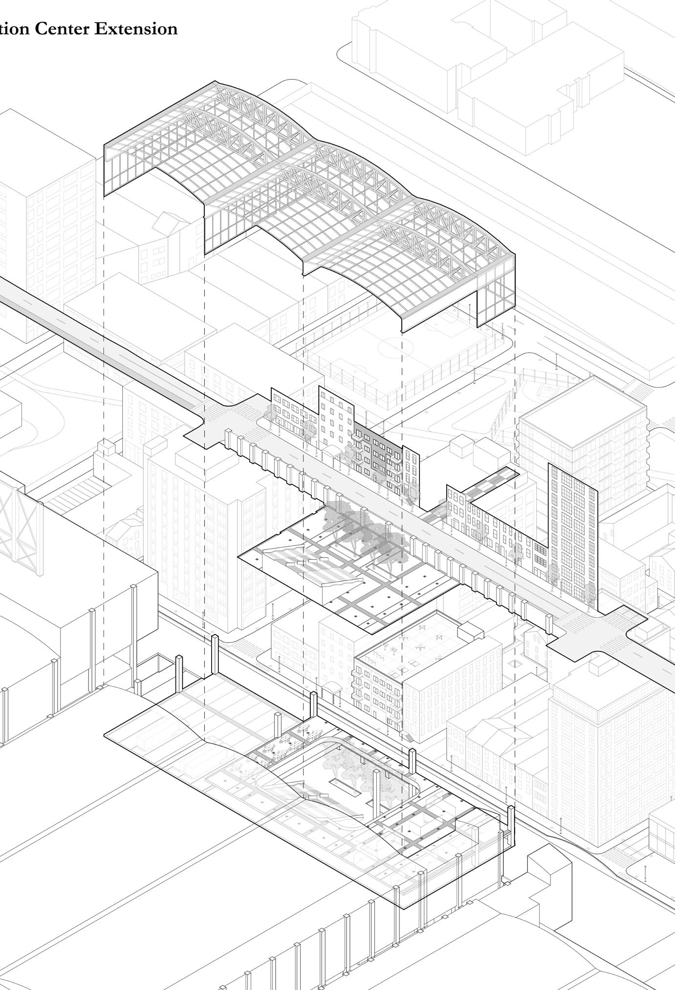
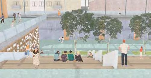
The Convention Center extension provides additional activity space for the community while preventing it from feeling like a massive barrier. Additionally, merging the rooftops of two shelters creates extra space for people without homes.
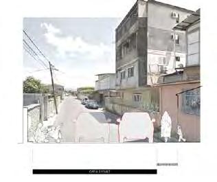
According to our interviews in the community, most of the residents are undocumented immigrants and unhoused people. In addition, the roads in the community are narrow and the buildings are old. People dare not go out at night.
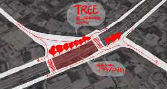
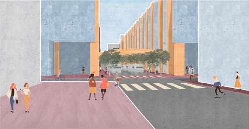
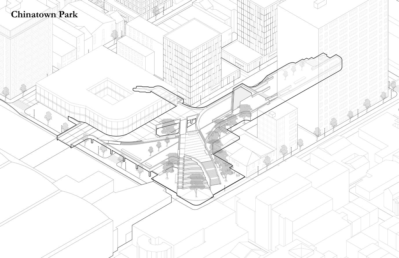
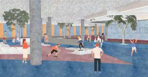
The old ramp blocked urban and neighborhood connections to Core Chinatown. Removing its lower section allows a children's playscape and a direct path through the Convention Center to Reading Terminal Market.
Views inside the Neighborhood
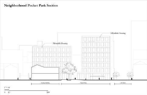
Axon of Housing Development & Pocket Parks
Section of Pocket Park
Views inside the Original Community
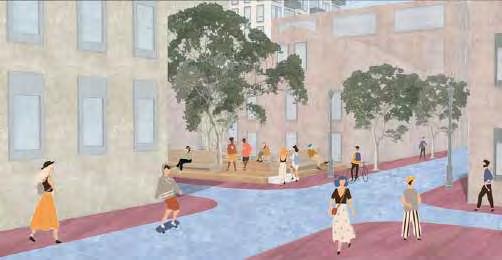
CHINATOWN LINEAR PARK
Views of Chinatown Park
Section of Linear Park
Views of the Original Ramp
Axon of Chinatown Park
There are mainly 4 key components in our design proposal, the Convention Center renovation and extension, the neighborhood housing development, the Ramp transformed park connecting to Chinatown, and a community park.
Axon of Four Key Elements
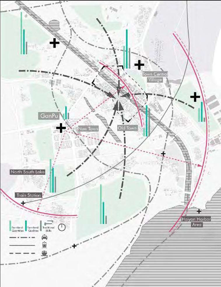
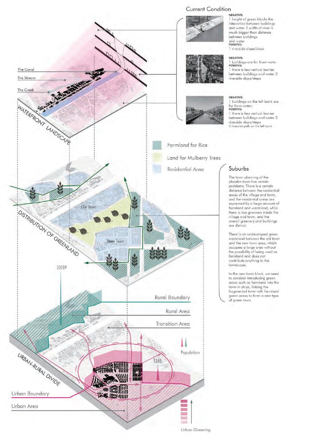
INJUSTICE DISTRIBUTION of FARMLAND QUALITY AND QUANTITY
By analyzing the history of the site, the space and the current state of the resources, a series of spatial archetypes and a complete story line have been presented, with the spatial sequence unfolding along the river and three green belts entering the site from inland to the riverbank. Then gradually refine the open space to the interior and finally to the building forms.
The site is intended to be designed as a low to medium density community, with the connection between people and water enhanced by landscape improvements along the river, and the introduction of farmland to improve greenery.
WHAT IS THE REGION FACING?
By analyzing the river interface, resource distribution and population distribution of the site, which are the three most important problems, I propose different strategies to solve them. It is hoped that this will improve the landscape and walking experience along the river, enhance the penetration of greenery into the site, introduce the farmland around the site into the neighborhood and redistribute the population.
Industrial Sites
Public Facilities
Riverfront Facade
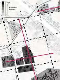
Population Distribution
Image of Ganpu
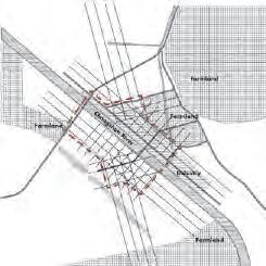
According to the problems derived from the preliminary analysis, we solved them one by one, and carried out the reconstruction of the road network and the block & quartyard, finally completed the renovation of the whole blockforms.
Strategy
The new road network abolished the original cut-off road and reset the axis network according to the river bank line and the original traffic main road, finally rebuilt some nodes after optimization.
There is no connection between the original greenery in the town and the site, so three green belts were created to bring in farmland, and affordable houses were set up here to resettle the indigenous people. The original site has almost no view along the river. By setting up a walkway along the river and bringing some of the water into the site as a way to attract residents to the site along the river and thus enliven the site along the river.
Eventually, new block and quartyard are created based on the abovementioned trail network and greenery
Greenery-introductin
Grid Redesign
Waterfront Landscape Renovation
Block and Quartyard
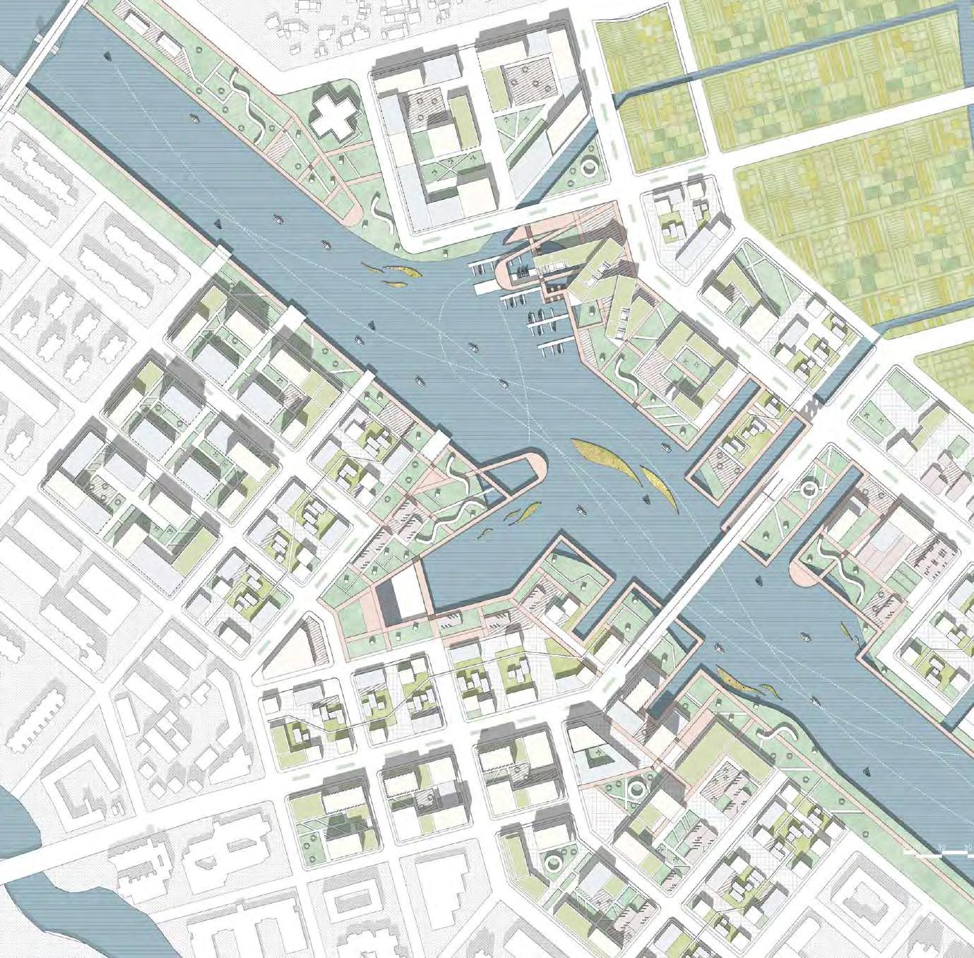
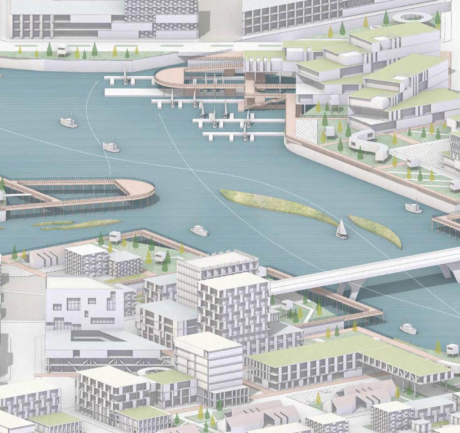
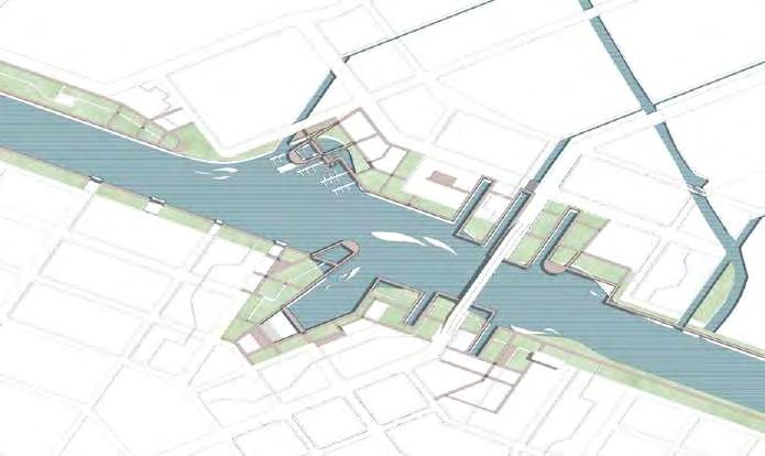
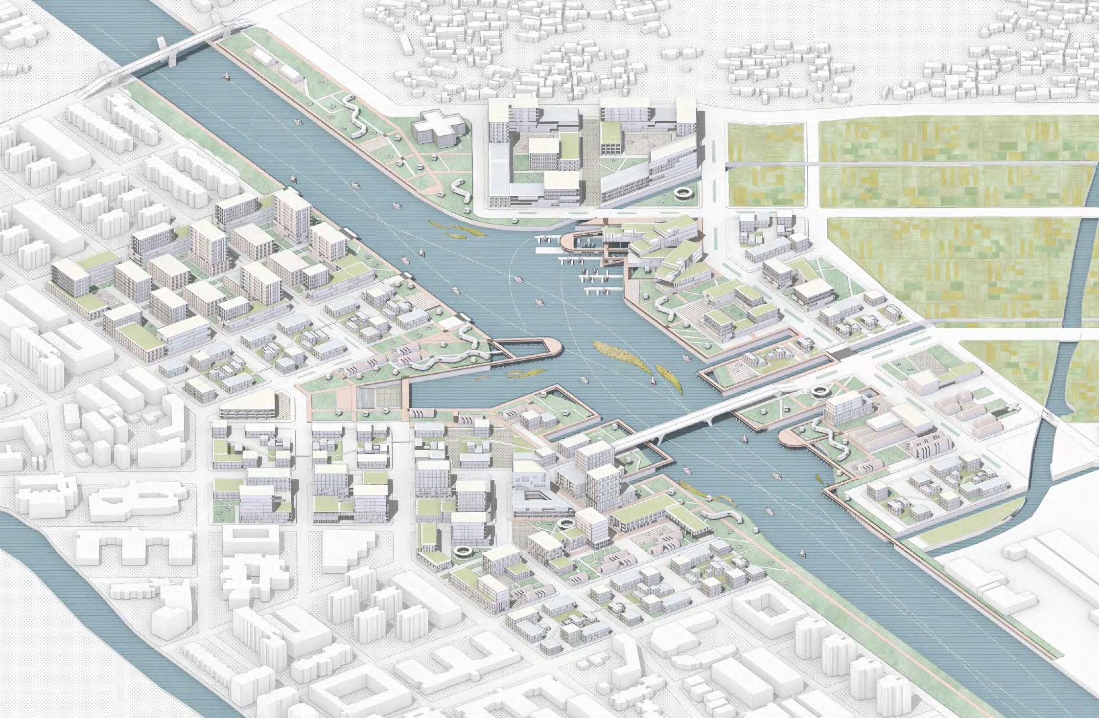
Masterplan of Ganpu
The different neighborhoods unfold along the river according to their function perpendicular to the river bank, and then present different forms in the profile. The density of the residential area is relatively high. The waterfront harbor and the walkway have the lowest density, and the building height difference is small. resettlement area The unit repetition is high, and the profile form is more neat. The density of commercial and office blocks is relatively moderate, and the profile pattern is rich. The profile also shows that the overall site favors a low to medium density block design, and the site is closely related to the canal, with a large number of water systems introduced to increase the hydrophilicity of the trail.
Section1
Section2
URBAN GREENWAY & WATERFRONT WALKWAY
In order to improve the monotonous waterfront landscape and the lack of greenery, the landscape system of the site is completed by the infiltration of water system, waterfront walkway and urban green space. Three ornamental agricultural zones are introduced into the town to enrich the open space inside the site.
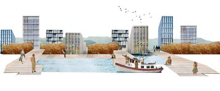
People in the buildings along the water will have a very good view, and marinas of different sizes will break the monotonous line of the river.
The waterfront walkway provides an excellent experience for people to walk, run and ride according to their preference, and also to enter the pier via the trail to experience the cruise ship.
Main Road
Differentiate roads at different levels, including waterfront walkways.
Waterfront Walkway
Refine the landscape road, divide two large waterfront public places and intake five channels.
Greenland
Replan urban green space and introduce ornamental farmland.
Water Infiltration
Develop appropriate landscape strategies on water levels.
The Future of The Coastline
The landscape system of the riverbank is replaced by a composite system of open spaces, greenery, waterfront platforms, piers and waterfront walkway from the original single greenery.The trail and greenery along the river will be extended into the interior of the town so as to attract residents living and working in the interior of the town to come closer to the riverbank and enliven the space along the river.
Combination Between Greenland and Waterfront Space
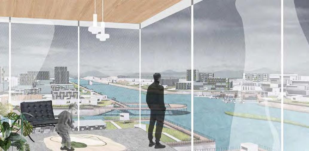
The View in The Office building
The View in The Workshop
The View of The Waterfront Walkway
Water & Greenland-infiltrate Urban Clusters Conncetd with Changshan River
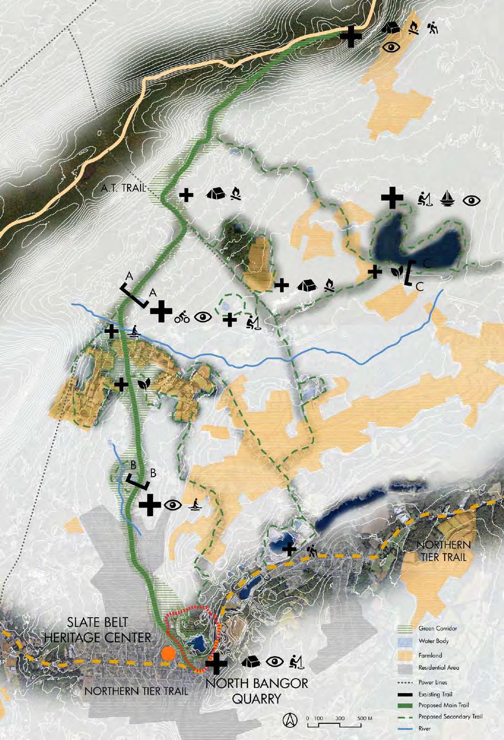
04 HARMONY TRAIL LOOPS
Revitalization of Slate Belt, Bangor, United States
[LOCATION] PENNSYLVANIA, US
[DURATION] 16 WEEKS
[ACADEMIC] MASTER PROGRAM YEAR 1 SEMESTER 1
[TUTOR] ELLEN NEISES
[TEAM WORK]
[COLLABORATOR] FANYIN XU
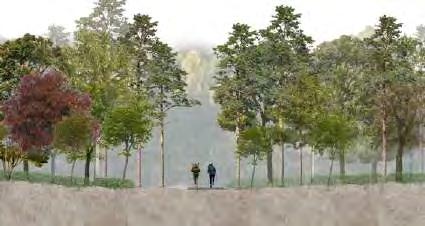
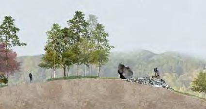
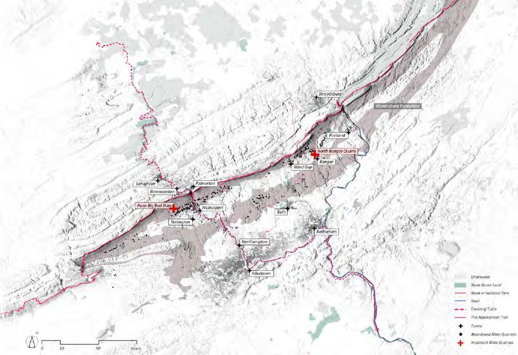
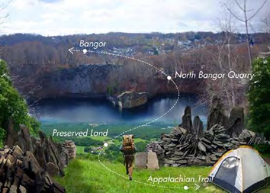
“Harmony Trails” initiative is a visionary endeavor aimed at forging an unbreakable bond between the majestic Appalachian Trail and the tranquil Northern Tier Trail, nestled near the heart of Bangor in the picturesque Lehigh Valley. This ambitious landscape design endeavors to seamlessly integrate these two iconic trails with the pristine beauty of preserved lands, the quaint charm of towns dotting the Slate Belt region, and the rugged allure of abandoned quarries. By weaving together these disparate elements, the initiative not only opens up boundless opportunities for day-trippers from bustling urban centers but also serves as a catalyst for a renaissance in small-town living.
At its core, this multifaceted project seeks to create a symbiotic relationship between nature's grandeur and the warmth of community life. By meticulously planning and executing trail connections and amenities, it aims to breathe new life into the region's economic landscape. Through strategic promotion of tourism, it endeavors to
attract visitors from far and wide, infusing local businesses with vitality and prosperity. Moreover, by reviving neglected areas and infusing them with the spirit of adventure and exploration, the initiative hopes to instill a renewed sense of pride and identity in the residents of these towns.
As the vision of “Harmony Trails” takes shape, it promises to be more than just a network of interconnected pathways—it embodies a holistic approach to community development. By fostering a harmonious relationship between the natural environment and human habitation, it seeks to create a blueprint for sustainable growth and prosperity. With every step along these trails, visitors are invited to immerse themselves in the rich tapestry of history, culture, and natural beauty that defines the Lehigh Valley. Through collaboration and innovation, the project aspires to create a legacy that transcends generations, ensuring that the spirit of harmony and unity continues to thrive for years to come.
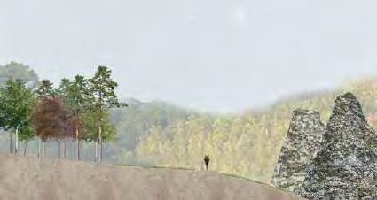
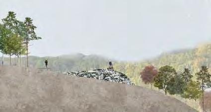
Prototypes of Slate Landscape Design
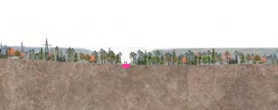
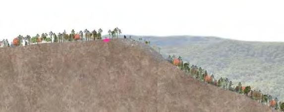
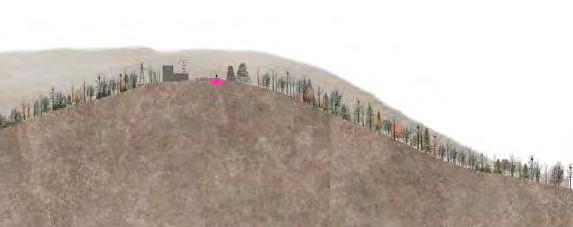
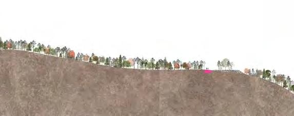
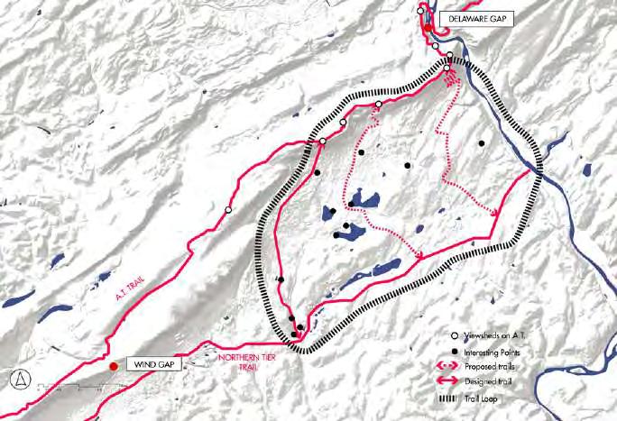
Recognizing the limited panoramic viewpoints along the Appalachian Trail (A.T.), the project seeks to enhance the trail experience by strategically identifying and developing two key points with expansive views of the valley. However, these locations lack awareness and direct access from
the A.T. Our initiative aims to address this by implementing signage, pathways, and information hubs to seamlessly integrate these attractions into the A.T. experience. Finally complete the entire trail loop.
Slate Trail Network Connecting Quarries and Landscapes
Forming Trail Loops
IMPORTANT POINTS ON THE PROPOSED TRAIL
The “Harmony Trails” initiative aims to create a seamless connection between the Appalachian Trail and the Northern Tier Trail near Bangor in Lehigh Valley. This landscape design seeks to link these renowned trails with preserved lands, towns in the Slate Belt region, and abandoned quarries. By doing so, it not only provides day-trip opportunities for urban dwellers but also encourages a return to smalltown living. The project envisions fostering economic growth in the area by promoting tourism, creating a synergy between nature and community, and revitalizing the charm of local towns.
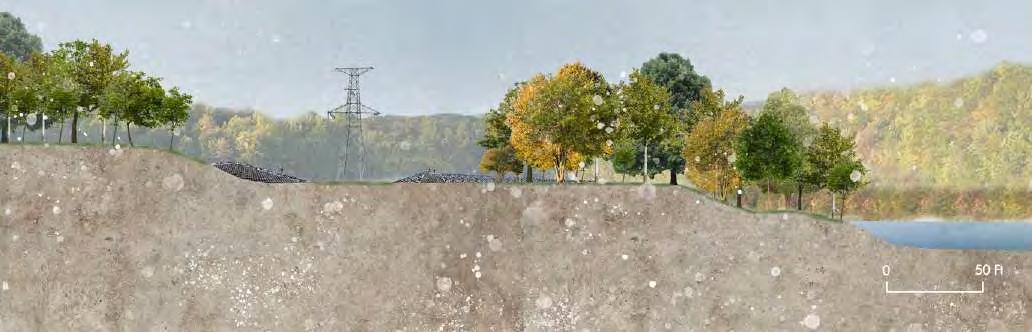
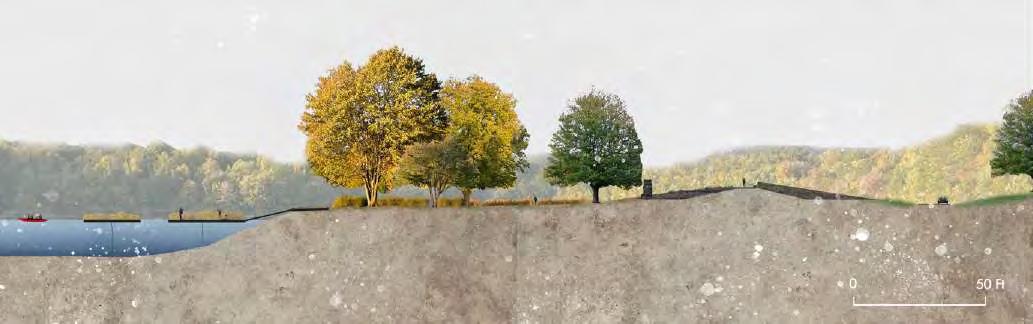
Section A-A
Section B-B
Section C-C
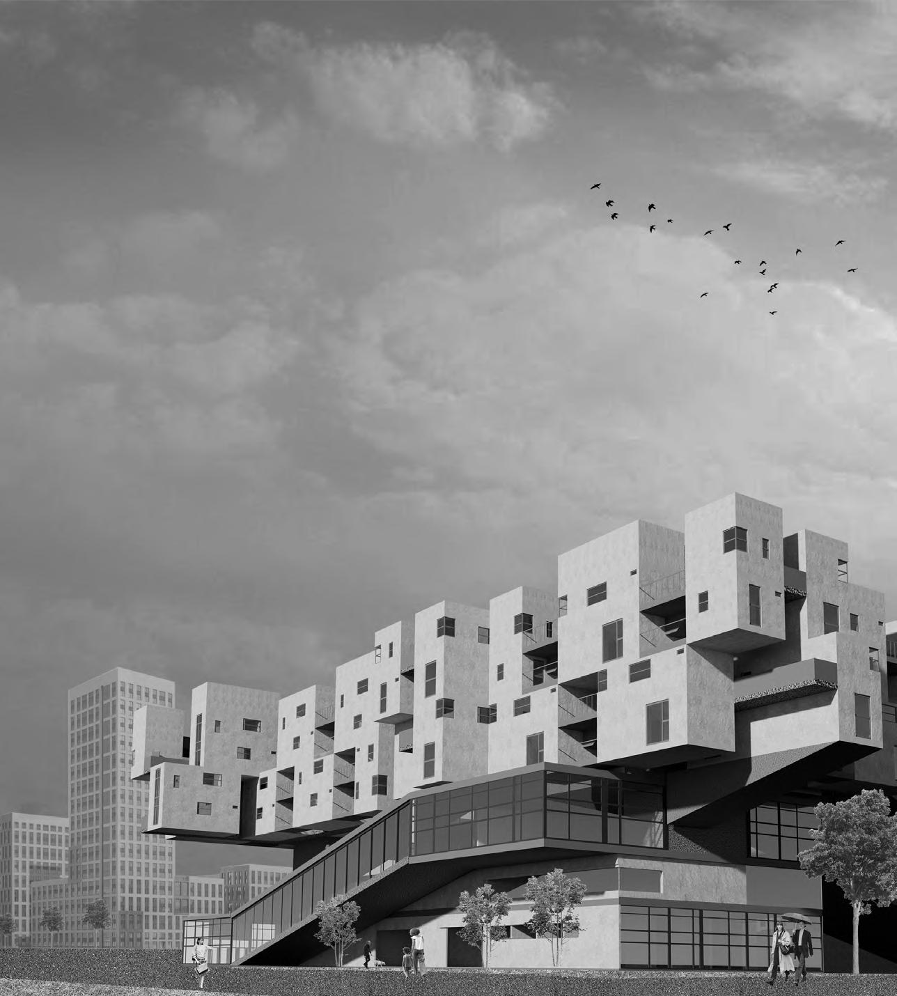
05 DOUBLE LOOPS
Mix-use Housing complex Project, Hangzhou, China
[LOCATION] HANG ZHOU, CHINA
[DURATION] 8 WEEKS
[ACADEMIC] YEAR 5 SEMESTER 1
[TUTOR] HAOYU DONG
[TEAM WORK]
[COLLABORATOR] YANG YINGXUAN
Ganpu Town, which belongs to Haiyan County, Jiaxing City, Zhejiang Province, is located in the south of Haiyan County, bordering Hangzhou Bay to the east and south. It is an industrial town as well as the administrative center of the district. The town is located at the eastern mouth of the Yangtze Delta Plain, connecting the East China Sea with the Beijing-Hangzhou Grand Canal.
In 717, Ganpu built the town. The town has a salt farm, taxation, navy, inspector, city port division, town school and other institutions, with a population of more than 5,000, and a heavy taxation area. In 1250, it served as a cantonment site for the Song Dynasty's border defense. In 1949, it became the administrative center of the district. In 1958, with the Changsan canal excavation beginning, the industrial output value and population of the city have increased rapidly.
The history of Ganpo has been marked by the city in different historical periods and under the influence of different forms of industry. The land parcel of this renewable project is located on the Changshan River, showing the texture of China cities in the 1980s from inland to river bank. Because of the industrial properties of the site, the building of the old town on the opposite side of the site, and the quartyard typology of the site is completely different from that under the transformation of the River Side New Area. The landscape belt and the waterfront walkway along the river are set up to enrich the original monotonous and boring inside along the river and enhance the fun of walking along the river to attract people to enter. The three landscape green belt that runs through the whole site is intended to introduce farmland to re-accommodate the original site residents while also bringing in greenery that was originally out of place in the site.
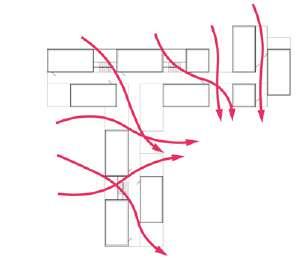
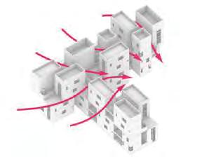
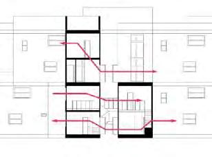
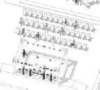
The construction of a community system is completed with two loops to meet the usage needs of different people in it.
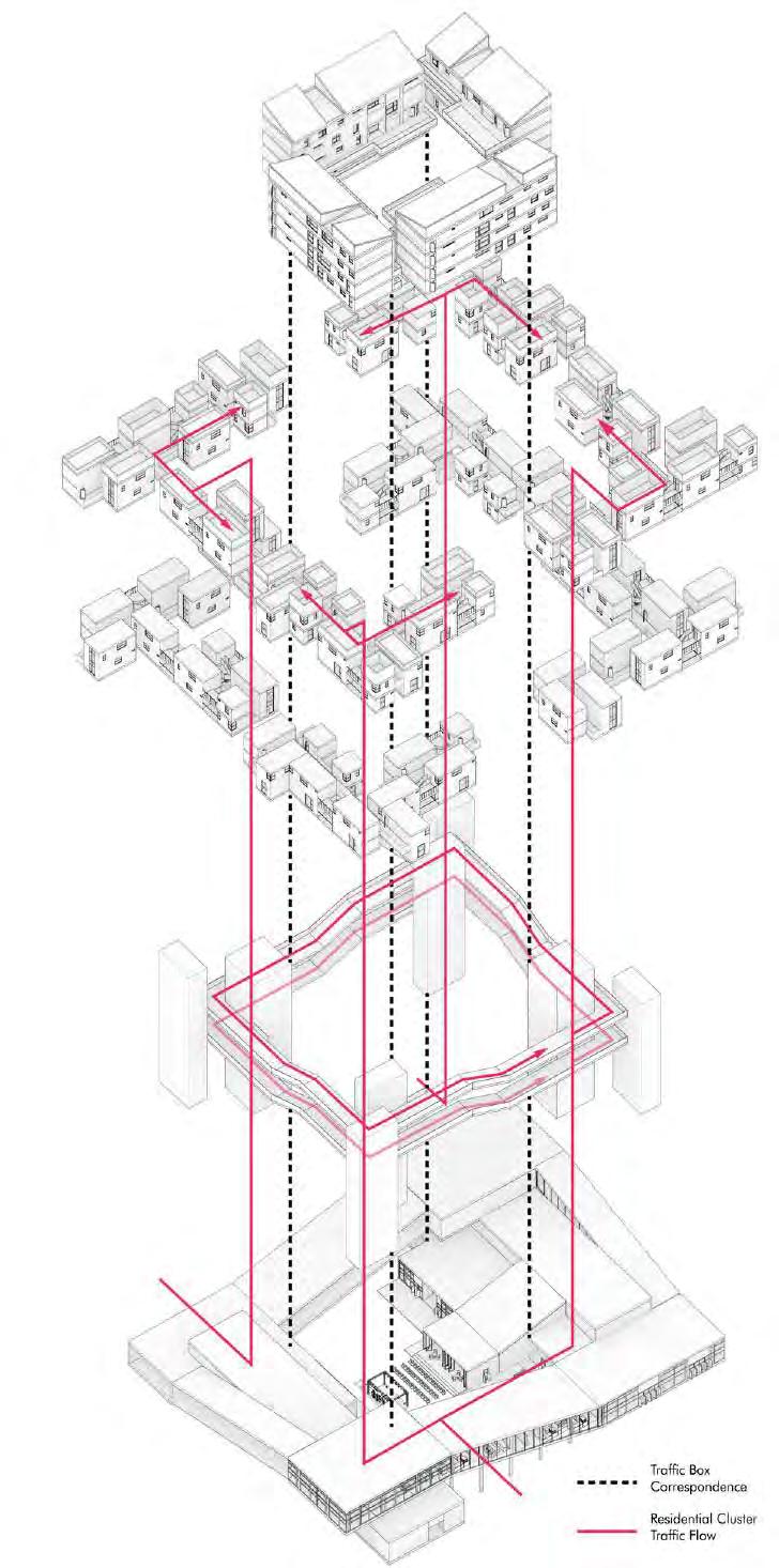
The public facilities in the lower part of the building form a loop with each other, and the upper residential group is formed into a second loop through the indigenous group and the tenant group, which are connected to each other by vertical traffic boxes.
The air circulation requirement is satisfied by staggering the adjacent units in the residential group.
Moreover, each unit has a certain degree of air permeability through appropriate window openings on the wall to improve the quality of life of the residents.
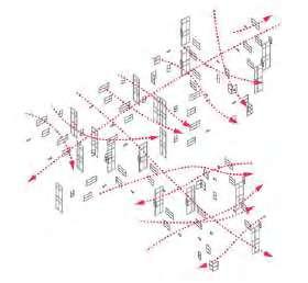
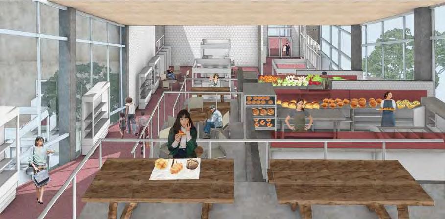
The underlying public service cluster organizes the restaurant, market, clinic, retail, kid area and other functions through a loop to form a public facility system of the community. It is also connected to the residential clusters through the traffic boxes at the four corners. The upper and lower clusters each form a loop and are stacked together to form a
and
Credit by Yang Yingxuan
Functional Scenarios
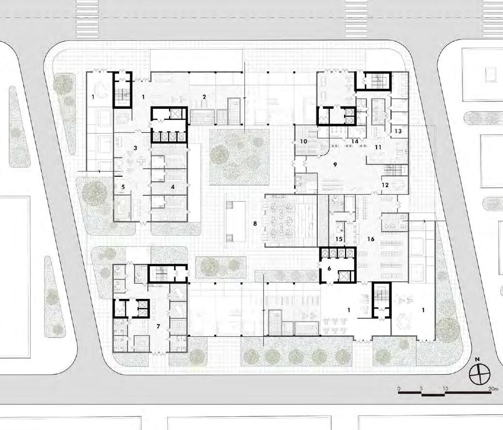
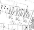
The public facilities group consists of a ring nested in several cubic blocks. The main internal functions consist of market, clinic, stage, restaurant, pharmacy house, etc. The open-air stage and restaurant in the central courtyard provide an inwardlooking space for people to meet the social needs of the older residents, while the clinic provides a convenient access experience for the elderly. market caters to the needs of different groups of people at different times of the day, providing grocery shopping for the elderly in the morning and consumption for the young in the evening and night. The whole public facilities group basically solves the adjustment of commercial business in this small community.
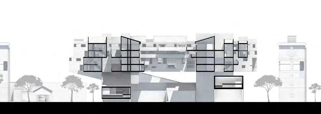
Perspective
Social equality is this historic concession Hangzhou, for the government and developers will demolish those disadvantaged local houses just for interest ,which is pervasive in the nation.So what we designed is to avoid dispel this disadvantaged people. On the contray, we need them stay to preserve the original Wulian community tradition that can serve as the reminder of the intrinsic of the city. This project aims at two kinds of users: original local residents, tenants. The co-exist Utopia is inspired by the people's commune in1960s in China, we design a community with highly-sharing lifestyle to protect local previour life, with profabricated units to lower the budget and give possibilities for the architecture to grow in the future