

Edgware Road Placemaking Strategy
DRAFT
June 2024
Introduction
Purpose of the Report
Project Team
Strategy Development Process
Executive Summary
Local Context
Edgware Road
History and Development
Current Uses
Local Demography
Previous Studies and Policy Context
Engagement Process
Engagement Workshops
Westminster City Council High Streets Programme
Our Engagement Findings


Business and Economic Strategies
Shopfronts
Forecourts and Pavements
Loading and Servicing
Meanwhile Uses
Partnership Working
Placemaking Projects
Implementation Nutford Place
Stourcliffe Street
Seymour Street
Sussex Gardens
Projects Matrix
Next Steps
Delivery Matrix
All drawings, images and photographs contained within this document are presented for information purposes. DSDHA retains all Intellectual Property Rights and copyright associated with its work. Further publication or use of images will require copyright usage approval and a licence for any third party images. Contact DSDHA for further information.
This publication and its contents are © DSDHA Ltd 2024, all
report has been produced by DSDHA and commissioned by: Edgware Road Placemaking Strategy — June 2024
rights reserved. This
Placemaking Vision Vision Statement Placemaking Objectives Placemaking Principles Vision Overview 1.0 1.1 1.2 1.3 1.4 2.0 2.1 2.2 2.3 2.4 2.5
3.1 3.2 3.3 3.4 4.0 4.1 4.2 4.3 4.4 Placemaking Strategy
Framework Placemaking Overview
Strategies Gateways and Junctions
Summary of Priorities
3.0
Placemaking
Community and Cultural
Public Spaces
Young
Diverse
Public Art Environmental Strategies Green Infrastructure Corners and Side Streets Footways Lighting Active Travel EV Charging 5.0 5.1 5.2 5.3 5.4 5.5 5.6 5.7 5.8 5.9 5.10 5.11 5.12 5.13 5.14 5.15 5.16 5.17
Access and Inclusion Wayfinding Seating Activation and Programming
People Safety of Women, Girls and Gender
People
5.18 5.19 5.20 5.21 5.22 6.0 6.1 6.2 6.3 6.4 6.5 6.6 7.0
Contents DRAFT ONLY
Appendices Evidence Base
7.1 8.0
1.0 Introduction
1.1 Purpose of the Report
Edgware Road and its neighbouring area is a unique place in the heart of London. It has an incredibly rich history as one of the London’s oldest roads and enjoys a vibrant and diverse cultural identity because of the people who call it home, as well as those who come to visit, work, study, shop, and eat out. With its mix of business, residential, educational, and cultural communities, the area has the ingredients essential to a vibrant neighbourhood.
An Edgware Road Placemaking Strategy has been commissioned to help guide future investment towards the protection and enhancement of that vibrant neighbourhood long into the future.
Edgware Road forms the central spine that runs the length of the Marble Arch BID area and is bounded by The Portman Estate to the east and The Church Commissioners’ Hyde Park Estate to the west. As such, it benefits from proactive stewardship and long-term custodianship.
Commissioned jointly by the Marble Arch BID, The Portman Estate, and The Church Commissioners, the Placemaking Strategy sets out priorities for public realm improvements, what sort of uses people would like to see on the high street, and what the high street should look like. It will direct investment and provide a framework for physical improvements as well as a template for frontage design enhancements.
This work has been undertaken by DSDHA, an architecture, urban design, and research studio based on London. DSDHA has worked closely with both Neighbourhood Forums and the Edgware Road Strategy Group throughout the development of the Placemaking Strategy to ensure that the local community can shape the future of Edgware Road.


Long-term Custodianship
of London’s great streets Responsible Stewardship Globally Renowned Enduring Cultural Identity Vibrant Nighttime Economy 3 Edgware Road Placemaking Strategy — June 2024 DRAFT ONLY
One
1.2 Project Team
In May 2023, Westminster City Council committed £10m to support the resilience and vibrancy of Westminster’s high streets outside of the West End. The programme is underpinned by three primary themes: connected communities, vibrant and resilient economy, and inclusive, sustainable, and safe places, which together form a framework for successful high streets.
To complement the work being undertaken by the Council, a partnership has been established between the Marble Arch BID, The Portman Estate, and The Church Commissioners. These project partners have jointly funded this Placemaking Strategy and have facilitated public engagement to ensure that local priorities are met.
The development of the Placemaking Strategy has been guided by a Strategy Group, which includes representatives from Westminster City Council and TfL, as well as the project partners, to ensure that the work produced supports the strategic objectives of both the local authority and the Mayor of London.

STREET
SUSSEX GARDENS
EDGWARE ROAD
ROAD
1.0 Introduction
BAYSWATER
MARYLEBONE PRAED
Marble Arch Hyde Park The Hyde Park Estate The Portman Estate FLYOVER Marble Arch BID Study area for the Edgware Road Placemaking Strategy Study area 4 Edgware Road Placemaking Strategy — June 2024 DRAFT ONLY
1.0 Introduction
1.3 Strategy Development Process
The Placemaking Strategy has been through a rigorous, 12-month development process to ensure that it responds to the needs, desires, and concerns of local people, and addresses the opportunities and challenges that currently exist.
The brief for the Placemaking Strategy was developed collaboratively between the Marble Arch BID, The Portman Estate, and The Church Commissioners, alongside DSDHA. This was followed by extensive desktop research that included a review of all relevant local, regional, and national policies as well as all previous studies that have been undertaken for the Edgware Road area. This review was augmented with further mapping, site analysis, grounded research, and on-site observation by DSDHA to develop a comprehensive evidence base, which is included in the appendix of this document.
Following this, a period of public engagement was carried out that comprised meetings with key statutory stakeholders, including Westminster City Council and TfL; a series of engagement workshops with the local community through their neighbourhood forums; and one-to-one meetings with land and building owners. The process of engagement was facilitated by our engagement specialist, Christina Norton, and the findings are summarised in section 3.0 of this document.
Our engagement findings have been complemented by those of Westminster City Council, who carried out concurrent engagement as part of their PaddingtonBayswater High Streets Programme, the results of which have been assimilated into this work.
Based on the extensive evidence base, the findings from the engagement process, and discussions with the project Strategy Group, DSDHA have drafted a Vision Statement and Placemaking Strategy for Edgware Road.
Whilst the Placemaking Strategy will have no formal or statutory status in terms of planning, it is hoped that it will be used by all those with an interest in the area to inform decisions regarding its future.
Brief Development
Project commenced: May 2023
Analysis: May – Nov 23
Engagement: Jun 23 – May 24
FUTURE PLANS, DESIGN CODES & PROPOSALS
Publish draft strategy for consultation: June 2024
Desktop ResearchPLACEMAKING STRATEGY VISION Project Stakeholder Engagement Local Community Engagement Landowner Engagement WCC High Streets Research 5 Edgware Road Placemaking Strategy — June 2024 DRAFT ONLY
Commissioned jointly by the Marble Arch BID, The Portman Estate, and The Church Commissioners, the Placemaking Strategy has been commissioned to help guide future investment long into the future. It sets out priorities for public realm improvements, what sort of uses people would like to see on the high street, and what the high street should look like. It will direct investment and provide a framework for physical improvements as well as a template for frontage design enhancements.
The Placemaking Strategy has been informed by comprehensive mapping, analysis, and research, as well as an extensive engagement process that sought to gather the views of the widest possible range of people, from local residents, land and building owners, workers, visitors, local community organisations and schools.
Whilst a range of views have been expressed, there is consensus that Edgware Road needs to change its image, be cleaner, less cluttered, have improved shop fronts and displays with a consistent and higher quality public realm to communicate a shared ambition, to enable economic resilience, and to retain vibrancy. Along with the above it was agreed that there needs to be a wider mix of uses, with a better-quality food offer and a wider range of things for the residents and communities to use and enjoy.
The resultant vision is to:
Reaffirm Edgware Road’s status as one of London’s great historic streets and a sociable place to live, work, sho, eat out, study, and visit, throughout the day and night.
This is an approach – driven by local people – towards the creation of an active, inclusive, safe, and resilient neighbourhood that celebrates and enhances the area’s sociable and multicultural character.
The vision statement is expanded upon with three key objectives:
• Create a welcoming a neighbourly street that celebrates cultural diversity.
• Prioritise health and sustainability in all future proposals.
• Build a thriving and resilient local economy that operates day and night.
Together, these three objectives contribute to creation of a sociable street that is active, inclusive, safe, and resilient to future climate and economic challenges.
To achieve the three objectives, a total of 20 strategies are provided, each of which is broken down into a number of tactics and recommendations.
The Placemaking Strategy is also underscored by three Placemaking Principles. These principles inform how the various strategies and recommendations come together to provide a coherent, holistic vision for the street. As with the key objectives, they offer a cultural, environmental, and economic lens through which successful placemaking is achieved.
The report is structured into the following sections:
1.0 Introduction
A summary of the purpose of the Placemaking Strategy, the project team, and the process of development.
2.0 Local Context
A high-level overview of the extent of the study area, key ownership and uses, and demographic data. This is expanded further in the evidence base included as appendices.
3.0 Engagement Process
A summary of the engagement process and findings, as well as those resulting from engagement carried out by Westminster City Council as part of the PaddingtonBayswater High Streets Programme.
4.0 Placemaking Vision
This section provides the Vision Statement, the three Placemaking Objectives, the aspirations of the Placemaking Strategy, and outlines the Placemaking Principles that underscore the strategy.
5.0 Placemaking Strategies
A Placemaking Framework is provided, comprising a total of 20 strategies, each of which is broken down into a number of tactics and recommendations.
6.0 Placemaking Projects
A series of illustrated examples are provided that demonstrate the ways in which the proposed strategies could be implemented.
7.0 Next Steps
Recommendations for ways in which the Placemaking Strategy can be implemented.
8.0 Appendices
An evidence base of analysis, research, and mapping of the study area.
One
of London’s Great Streets Environmental Objective
Prioritise health and sustainability in all future proposals.
Create a welcoming and neighbourly street that celebrates cultural diversity.
Build a thriving and resilient local economy that operates day and night.
1.0 Introduction 1.4 Executive
Summary A Sociable Street
Businessand Econo m i c jbOevitce inummoC ty
Culture Objective
a n d
Day Night 6 Edgware Road Placemaking Strategy — June 2024 DRAFT ONLY

2.0 Local Context
Famous as one of the oldest roads in Britain, Edgware Road has an extensive and important part in London’s history and continues to hold a certain attraction for its present-day inhabitants. From ancient times when the area was covered by Middlesex Forest to today’s bustling stretch of restaurants, shops, offices, and a significant number of homes, many different histories and cultures have made up the ever-changing face of this area. This is illustrated by the 18th century French Huguenots that settled in Paddington village; the opening of the first ever Indian restaurant in 1810; the Jewish reformers who founded the West London synagogue in 1870; and to the present day Middle Eastern community that began to settle in earnest in the 1970’s, driven by the Gulf oil boom and the Lebanese Civil War, the road and its surrounding area has emerged as a composite of different cultures and religions that have thrived in recent years.
The origins of modern-day Edgware Road can be traced back to its sylvan beginnings when the Celtic Britons used it as a forest track. This was long before the Romans appropriated the route to create what was to become Watling Street. The present-day road is upheld as one of the most important feats of pre-Victorian engineering. As testament to this, today’s thoroughfare follows much the same path as chief engineer Telford’s original 1811 design.
As a road, it runs north-west from Marble Arch, and as the A5 road, passes underneath Marylebone Road, through Maida Vale, Kilburn and Cricklewood (as Cricklewood Broadway). It is joined by the North Circular Road before West Hendon at Staples Corner. After this, the road continues even further north, through The Hyde, Colindale, Burnt Oak, and finally, to Edgware.
This Placemaking Strategy, however, focuses on the stretch of Edgware Road from Marble Arch at the south to the junction with the Marylebone flyover at the north, bounded on the east to a large extent by The Portman Estate, and on the west to a large extent by the Church Commissioner’s Hyde Park Estate. The road is part of London’s Strategic Road Network (SRN) and, as such, is owned and managed by TfL.
 Aerial photograph showing the study area for the Edgware Road Placemaking Strategy
8 Edgware Road Placemaking Strategy — June 2024 2.0 Local Context DRAFT ONLY
2.1 Edgware Road
2.0 Local Context
2.2 History and Development
Edgware Road is one of the oldest streets in the nation, and as such has a long and rich history. In the past few hundred years the street has turned from being rural to a highly urban area. The street has has a well established middle eastern population since the 1800s which has grown and developed over time. Understanding the street’s unique history and identity is pivotal in maintaining its character.


1700s
Since Classical Antiquity there has been a track along the route of the now Edgware Road. During Roman rule the track way incorporated into Watling Street, which later marked the border between Danelaw with Anglo-Saxon Wessex and Mercia in the middle ages, one of England’s most historically significant roads.
Edgware Road was on the rural fringe of London until the start of the 19th century. From the middle ages to the turn of the 19th century the southern junction of Edgware Road was home to one of the country’s most infamous gallows - the Tyburn Tree.


1800s
The 1800s saw London rapidly expanding due to the industrial Revolution. Increased trade attracted Arab migrants from across the Ottoman Empire, beginning the streets identity as an Arab area.
In 1829, the area was the location of the Cato Street Conspirators, who’s plan to kill the cabinet and turn Britain into a republic was foiled by police.
20th Century
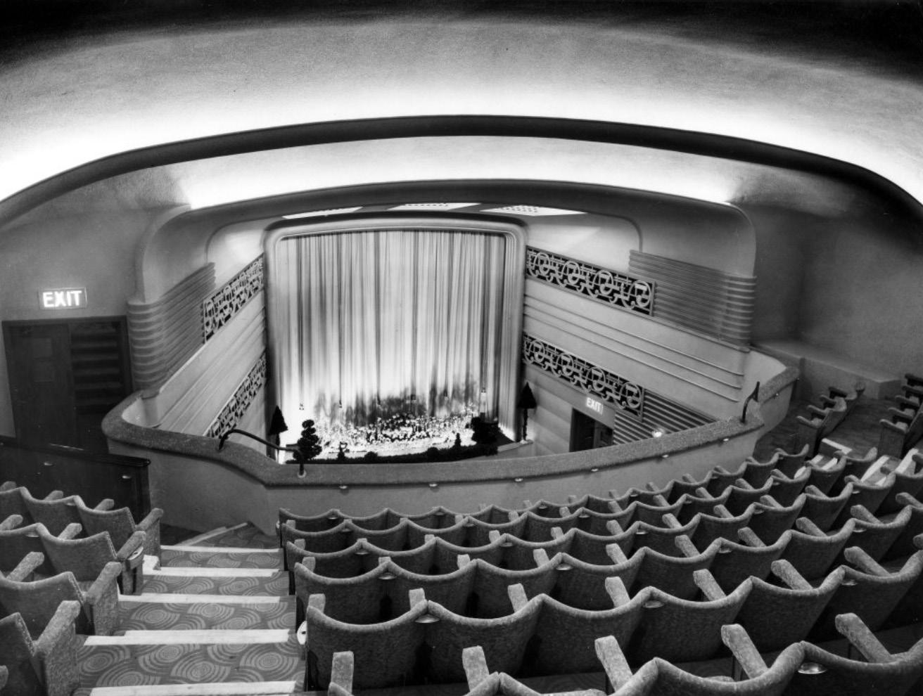
The early 20th century saw some large development on the Edgware Road, including Portsea Hall. During this time the street became a hotspot for cinema, with several notable theatres along the road. The street saw the transition from silent films to talkies, and was home to one of the first continental and art house cinemas in London.
Ancient
Times
9
June 2024
Edgware Road Placemaking Strategy —
DRAFT ONLY
2.0 Local Context
2.2 History and Development (continued)


21st Century
The latter half of the 20th Century saw big changes on Edgware Road with several large blocks being redeveloped in a modernist style. The 1970s saw the growth of the middle eastern community in the area, partially due to unrest in the region including the Lebanese Civil War. This era saw major redevelopments on the street including Capital House, the Hilton London Metropole and the flyover.
The 21st century has seen many changes on the street with previous stalwarts like Woolworths closing, but several major new developments such as Hyde Park House and Regents House.
Whilst it remains a busy street, overall traffic flows have reduced significantly over time with the implementation of the congestion zone and Ultra Low Emission Zone, as well as travel behaviour changing towards active travel, especially in the wake of the Covid-19 pandemic.
10 Edgware Road Placemaking Strategy — June 2024
Postwar
DRAFT ONLY
These maps show the ground floor and upper floor uses along the street and highlight the contrast between uses at different levels.
The ground floor is dominated by retail, food and beverage and services. There is one key exception with the Hilton London Metropole at the north of the street.
On the upper floor the street is split with about half residential, particularly in the large mansion blocks on the west of the street. There are also large blocks of commercial space including Capital House at the north, and mixed use developments such as York House at the south. There are a few exceptions on the upper floors with the Grosvenor Casino and the Victory Services Club.
Understanding these splits helps us understand that the Placemaking Strategy needs to cater to residents, workers, business owners, customers and visitors/ tourists.


Street Level Use Upper Floor Use Commercial Mixed use Residential Hotel Food and Beverage Retail Services No information 11 Edgware Road Placemaking Strategy — June 2024 2.0 Local Context DRAFT ONLY
2.3 Current Uses
2.4 Local Demography
Edgware Road is surrounded by five wards - Little Venice and Church Street to the north, Hyde Park to the west, and Marylebone and West End to the east.
The wards represent a large cross section of the wider borough with the highest and lowest income wardsMarylebone and Church Street respectively. The average household income in Church Street (£34,853) is almost half that of Marylebone (£61,711). There is also a 20% discrepancy in residents with very good health between these two wards. Similarly, average house prices vary enormously with the average house price in West End (£4,542.399) is over 8.5 times more than that of Church Street (£530,899).
Some factors are fairly consistent across the wards, such as households with children which are mostly between 20-25%. However, the figure is slightly higher in Marylebone and lower in West End.
The ethnic makeup of the wards also varies greatly, with 33% in Church Street identifying as white compared to 65% in Marylebone. Collectively the area is 53.1% white, 18.9% Asian/British Asian, 15.5% other, 6.3% black/African British and 6.1% mixed.


Ward Demographic Data
24% households with children Average houshold income £60,197 Little Venice Residents in very good health 56.6% 25% households with children Average houshold income £34,853 Church Street Residents in very good health 44.6% Marylebone 22% households with children Average houshold income £59,117 Hyde Park Residents in very good health 58.6% 34% households with children Average houshold income £61,711 Residents in very good health 64.2% 13% households with children Average houshold income £55,902 West End Residents in very good health 58% 24% households with children Average houshold income £60,197 £1,600,419 average house price Little Venice Residents in very good health 56.6% 25% households with children Average houshold income £34,853 £530,899 average house price Church Street Residents in very good health 44.6% Marylebone 22% households with children Average houshold income £59,117 £1,665,126 average house price Hyde Park Residents in very good health 58.6% 34% households with children £1,990,740 average house price Average houshold income £61,711 Residents in very good health 64.2% 13% households with children Average houshold income £55,902 £4,542,399 average house price West End Residents in very good health 58% 24% households with children Average houshold income £60,197 £1,600,419 average house price Little Venice Residents in very good health 56.6% 25% households with children Average houshold income £34,853 £530,899 average house price Church Street Residents in very good health 44.6% Marylebone 22% households with children Average houshold income £59,117 £1,665,126 average house price Hyde Park Residents in very good health 58.6% 34% households with children £1,990,740 average house price Average houshold income £61,711 Residents in very good health 64.2% 13% households with children West End Residents in very good health 58% 24% households with children Average houshold income £60,197 £1,600,419 average Little Venice Residents in very good health 56.6% 25% households with children Average houshold income £34,853 £530,899 average house price Church Street Residents in very good health 44.6% Marylebone 22% households with children Average houshold income £59,117 £1,665,126 average Hyde Park Residents in very good health 58.6% 34% households with children £1,990,740 average house price Average houshold income £61,711 Residents in very good health 64.2% 13% households with children Average houshold income £55,902 £4,542,399 average house price West End Residents in very good health 58% 24% households with children Average houshold income £60,197 £1,600,419 average house price Little Venice Residents in very good health 56.6% 25% households with children Average houshold income £34,853 £530,899 average house price Church Street Residents in very good health 44.6% Marylebone 22% households with children Average houshold income £59,117 £1,665,126 average house price Hyde Park Residents in very good health 58.6% 34% households with children £1,990,740 average house price Average houshold income £61,711 Residents in very good health 64.2% 13% households with children Average houshold income £55,902 £4,542,399 average house price West End Residents in very good health 58% White Asian/Asian British Black/African British Mixed Other 12 Edgware Road Placemaking Strategy — June 2024 2.0 Local Context DRAFT ONLY
2.5 Previous Studies and Policy Context
The development of the Placemaking Strategy has benefited from a wealth of previous studies that have been undertaken for Edgware Road and neighbouring areas.
The initial stage of this commission involved a period of desktop analysis, which included a review of all previous work in order to ensure that the research, findings, and recommendations from these studies were assimilated into the evidence base for the Placemaking Strategy. A ‘gap analysis’ was carried out to identify areas that had not previously benefited from studies and grounded research undertaken to fill these gaps.
The Placemaking Strategy also acknowledges the local, regional, and national policy context for the work and has been developed to align with relevant policies. In particular, the Placemaking Strategy has been guided by Westminster City Council’s and TfL’s strategic priorities and supports the ambitious targets set by both the council and the Mayor of London. The following documents are of particular relevance to the work:
Labour’s Plan for a Fairer Westminster, 2022
The manifesto published by the Labor leadership of Westminster Council, which sets out their strategy to “Clean and green our streets with action on air quality, sustainable transport, and a vision for 15-minute neighbourhoods”.
Zero Carbon City 2040, 2019
This document established Westminster City Council’s strategic priorities and supports the ambitious targets the council has set, in particular the commitment by the council to be net carbon zero by 2040. This will impact transport policy, which could have significant implications for Edgware Road.
Mayor’s Transport Policy, 2018
The overarching aim of the Mayor’s Transport Strategy is to reduce Londoners’ dependency on cars and to increase the active, efficient, and sustainable (walking, cycling and public transport) mode share of trips in London to an ambitious 80 per cent by 2041. This strategy involves improving walking infrastructure by providing suitable footways and better crossings; making streets more accessible and enjoyable for all;
encouraging a range of local land uses, retail types and local services to reduce the need to travel longer distances; and enhancing the interchange experience around buses and rail and underground stations. Again, these strategies could have considerable implications for Edgware Road.
Healthy Streets
Healthy Streets is the approach adopted by TfL to improve air quality, reduce congestion, and help make London’s neighbourhoods greener, healthier and more attractive places to live, work, play, and do business.
Vision Zero
An action plan developed by TfL to achieve the Mayor of London’s goal that, by 2041, all deaths and serious injuries will be eliminated from London’s transport network. The action plan sets out strategies for safe speeds, safe streets, safe vehicles, safe behaviours, and post-collision response.


 Relevant local policies
13 Edgware Road Placemaking Strategy — June 2024 2.0 Local Context DRAFT ONLY
Collection of relevant previous reports

3.0 Engagement Process
3.1 Engagement Workshops
The development of the Placemaking Strategy has been informed by extensive engagement. To facilitate the engagement process, we worked with engagement specialist Christina Norton. A summary of the finding from our engagement is included in this section of the document.
A series of engagement workshops have been held with the following groups:
• Workshop 1: Hyde Park Paddington Neighbourhood Forum
• Workshop 2: Marylebone Neighbourhood Forum
• Workshop 3: Local Councillors and Westminster City Council Officers
• Workshop 4: Local Schools, Businesses, and Community Organisations
In addition to these workshops, one-to-one meetings were held with key land and property owners. These sessions provided valuable insight into the experiences of tenants, workers, and visitors to complement the insights from residents gained through the workshops. These sessions also provided us with information on future development plans and aspirations for various sites and the challenges and opportunities that land and property owners foresaw.
Invitations to meet regarding the Placemaking Strategy were issued to owners of all buildings on Edgware Road. The following accepted the offer and attended meetings:
• British Land
• Fordgate Management
• Berkeley Group
• Hilton London Metropole
• Almacantar
The postcodes of workshop attendees were requested to allow analysis of representation in these sessions. This analysis is shown on the adjacent map.

Workshop 2 Workshop 4


Ownership of land/building owners engaged through one-to-one sessions (exc. The Portman Estate & the Church Commissioners)
Workshop
SUSSEX GARDENS BURWOODPL KENDALST CONNAUGHT ST BAYSWATER ROAD OXFORD STREET SEYMOUR STREET UPPER BERKELEY STREET GEORGE STREET NUTFORD PLACE HARROWBYSTREET CRAWFORDPL CHAPEL ST PRAED STREET Marble Arch Hyde Park OLDMARY L E B O N E RD M A R Y L EBONE FLYOVER
1
15 Edgware Road Placemaking Strategy — June 2024 3.0 Engagement
Process
DRAFT ONLY
Hyde Park Paddington Neighbourhood Forum engagement workshop
3.0 Engagement Process
3.2 Westminster City Council High Streets Programme
In 2023, Westminster City Council launched the Westminster High Streets Programme and committed £10 million of capital funding to improve local High Streets outside of the West End. Their vision is to make High Streets the backbone of thriving neighbourhoods where goods, services and green spaces are a walking distance from residents’ doorsteps.
The Westminster High Streets Framework is organised according to 3 primary themes: ‘Connected Communities’, ‘Safe, Sustainable & Welcoming Places’, and ‘Vibrant and Resilient Economy’ which are underpinned by 14 strategic objectives. The Framework is designed to be adapted to each area based on an area-specific analysis and public engagement with local communities and stakeholders.
The first location to apply the Westminster High Streets Framework is Paddington- Bayswater, north of Hyde Park. After a rigorous context analysis in early 2023, Westminster City Council conducted a public engagement exercise in the summer of 2023 to identify the local communities’ priorities according to the Framework themes and objectives. This engagement happened concurrently with the development of the Placemaking Strategy, and we have worked closely with Westminster City Council to share findings from engagement sessions to avoid duplication and to maximise mutual benefit.
Three methods were used by Westminster City Council to engage the public and solicit their feedback: 1) pop-up engagement hubs, 2) digital surveys, and 3) in-person on-street surveys. The feedback gathered throughout the engagement identified the core priorities for PaddingtonBayswater as being to 1) create welcoming and safe street environments, 2) improve the High Street offer and uses, and 3) increase opportunities for social interactions and cultural activity.
In addition to some strengths, challenges and priorities that are shared across Paddington-Bayswater’s main High Streets, feedback specific to Edgware Road highlighted its cultural diversity and accessibility that complement a distinct retail and leisure offer, especially at night. However, safety issues and overall quality of the street environment are affecting people’s everyday experience.
The following strengths and challenges were identified through Westminster City Council’s engagement:
Strengths
• Accessibility and convenient location. Distinct and attractive street character.
• Diversity of shops and products. Culturally diverse food options. Vibrant night-time activity.
• Distinct Middle Eastern community which contributes to unique sense of place.
Challenges
• Unpleasant, car-dominated public realm with insufficient greenery street furniture or public art. Safety concerns around theft.
• Lack of diversity among businesses making it hard to find everyday products and services,
• Lack of cultural activities. Sense of monocultural identity.

Westminster City Council’s High Streets Framework
16 Edgware Road Placemaking Strategy — June 2024
DRAFT ONLY
3.0 Engagement Process
On the basis of these findings, Westminster City Council have identified the following priorities for Edgware Road:
Creating a welcoming and safe street environment
• Prioritise safety during the day and night
• Improve cleanliness levels
• Increase greenery and planting
• Provide comfortable and inclusive spaces to dwell and socialise
• Improve walking experience
• Improve street aesthetics and maintain shopfronts
Diversifying the high street’s uses and improving its retail offer
• Diversify uses and retail offer to include health and well-being facilities
• Support a mix of chain and independent shops
• Enhance the range of essential products and services to cater to varying income
• Introduce markets and festivals
• Support existing businesses
• Offer more business support
Creating opportunities for social interactions and cultural activity
• Create family-friendly spaces and spaces for the youth
• Support social cohesion through social initiatives and services
• Introduce and sustain cultural and artistic spaces
• Improve communication channels with the Council
• Promote cultural diversity and richness


Westminster City Council’s Paddington-Bayswater High Streets Engagement Report is available here:
https://www.westminster.gov.uk/media/document/paddington-bayswater-high-streets-engagement-report-0pdf


17 Edgware Road Placemaking Strategy — June 2024
DRAFT ONLY
Extract from Westminster City Council’s High Streets Engagement Report, March 2024
3.0 Engagement Process
Our Engagement Findings
Four workshops attended by over fifty stakeholders were held at various locations around Edgware Road as part of the process of developing the Placemaking Strategy. The workshops focused on three discussion points:
1. Big Ideas: Three approaches to Edgware Road
• A civic boulevard and unified identity
• Enlivened side streets
• Distinct character areas
2. Three themes: Different aspects of the street
• Physical environment, appearance and greening
• Community, culture and the social life of the street
• Economic purpose, resilience and vibrancy
3. Meanwhile uses
• What to do in the short term to kick start transformation, test ideas, and deliver quick wins
The key findings from the workshops are summarised below under a series of themes. For each, the consensus of what we should keep, change and add is provided.
Identity
Edgware Road needs to change its image by being cleaner and less cluttered while enjoying better quality shop fronts and cafe or restaurant forecourts set within a consistent public realm. It was felt that a new campaign for Edgware Road would help promote the enhanced identity and that this could be tied to temporary uses for vacant units that could incorporate artworks and graphics.
• Keep: Enhance and celebrate the existing Middle Eastern/Mediterranean identity and vibrancy.
• Change: Welcome everyone by changing the mix of uses, especially in the daytime.
• Add: Colour and seasonal attractions, markets and food hubs, better visual merchandising.
Public Realm
• Keep: Spaces like Nutford Place but needs a focus and a public realm scheme to improve it.
• Change: Enhance forecourts, including greening and seating for people with mobility issues.
• Add: Pocket parks, a play street (in a side street), space for markets and street food.
Uses
There is a desire to see a more diverse and a broader cultural/leisure offer and to fill the gap left by well-loved restaurants and cafes that have left the Edgware Road.
• Keep: Valued and well used retailers such as Waitrose, Green Valley and Argos as well as restaurants such as Al Arez.
• Change: Attract higher quality restaurants, as part of the changes in identity and the public realm, and develop a retail strategy to curate a branded Edgware Road Food Hub.
• Add: Community, cultural, sport and leisure activities to serve the large number of residents living here.
Community
Edgware Road needs to feel more inclusive, focusing on young people, women, those with disabilities and older people by providing more things to do such as community fairs, and a wider range of uses to enhance the community and cultural life of the street.
• Keep: Christmas fairs at Connaught Village (and Ramadan installations)
Edgware Road needs to improve the quality and experience of the public realm (footways and spaces) and address the lack of public spaces where people can meet and socialise. Forecourts, where the pavements widen, are poorly used and a missed opportunity.
• Change: Perceptions of male dominated cafes being intimidating. Work with local businesses to change signage, improve management of outdoor seating, and care for the public realm.
• Add: New community uses such as a cinema or theatre, spaces and events for cultural exchange such as food and film festivals, space for education and training and play streets for the young.
Safety
Safety remains an issue for locals, especially women and young people, who will avoid Edgware Road after dark. Side streets provide access for deliveries to the retailers


Edgware Road Placemaking Strategy — June 2024 18
3.3
Workshop 2: Marylebone Neighbourhood Forum
DRAFT ONLY
Workshop 1: Hyde Park Paddington Neighbourhood Forum
3.0 Engagement Process
on the street and create safety issues for pedestrians and especially children.
• Keep: Existing security measures such as the Marble Arch Team and private security companies who are effective at reducing crime and antisocial behaviour.
• Change: Better lighting on side streets, including decorative / public art lighting where appropriate, to link to destinations such as Connaught Village, and to combat antisocial behaviour. Better manage the way goods are delivered to high street retailers, for example, either by timed restrictions or by looking at access from the High Street.
• Add: More community and cultural uses on the street to make it feel safer.
Greening
Edgware Road does benefit from a large number of trees, but the section from Harrowby Street to the Marylebone Flyover on the eastern side is sparse, due to underground utilities.
• Keep: Existing trees and celebrate these through signage and lighting.
• Change: Trees planted in the ground are preferable to the use of planters, as these can be misused for littering and hanging around.
• Add: A green corridor of trees and low-level planting including rain gardens such as those proposed for the Joe Strummer subway network would help to increase biodiversity, reduce flooding and meet sustainability goals. Consider culturally reflective planting specification to contribute to unique identity.
Seating
Seating was one of the most contentious areas, with some considering seating areas essential to promote more inclusive uses of the street by all age groups and to allow visitors to pause, appreciate the street and become involved in its economic life. Others felt that the seating could attract antisocial behaviour and lead to local residents avoiding the street. When asked whether seating was desirable in an ideal situation where current issues of antisocial behaviour had been eradicated, the vast majority agreed that public seating is an important aspect of a welcoming, inclusive and high-quality place.
Meanwhile Uses
Meanwhile uses were acknowledged to offer means of providing and testing activation and promotion of the street in a number of ways. The following ideas were suggested to bring Edgware Road to life in the short term, to prototype and test future uses, and to bring communities together:
• Vacant shops used to trial new uses and independent retail outlets on short term lets, including pop-up restaurants, mini-markets and seasonal events to quickly improve the image of the street.
• Public art (like the ‘tree of love’ in Connaught Village) to create a splash, draw publicity and explore aspects of identity.
• Wayfinding through public art installations, lighting features or signage to help navigation to destinations on and off the High Street.
• Offering a temporary community facility - for instance to address the temporary closure of the Seymour Leisure Centre while it is redeveloped. This would also provide an opportunity to trial a community hub and programme on the Edgware Road.
• The flyover is seen as a good location for public art, which is a space in need of ‘humanising’ while providing safe linkage of Edgware Road north south.
• Residents are wary of short-term seating projects, and planters that could be used for litter and to attract unknown people to linger in the area.

 Workshop 4: Local Schools, Businesses, and Community Organisations
Edgware Road Placemaking Strategy — June 2024 19 DRAFT ONLY
Workshop 3: Local Councillors and Westminster City Council Officers
3.4 Summary of Priorities
The engagement process has sought to gather the views of the widest possible range of people, from local residents, land and building owners, workers, visitors, local community organisations and schools. Whilst a range of views have been expressed, there is consensus that Edgware Road needs to change its image, be cleaner, less cluttered, have improved shop fronts and displays with a consistent and higher quality public realm to communicate a shared ambition, to enable economic resilience, and to retain vibrancy. Along with the above it was agreed that there needs to be a wider mix of uses, with a better-quality food offer and a wider range of things for the residents and communities to use and enjoy.
The intention of the Placemaking Strategy is to provide a consensus-driven approach to improving the street that has the support of all users – particularly the local residential communities.
The feedback received has been assimilated into a series of priorities that can broadly be categorised into the three themes: Community and Cultural aspirations, Business and Economic aspirations, and aspirations for the physical environment of the street, as shown on the adjacent diagram.
The Placemaking Strategy has used these three themes as the starting point for developing key placemaking objectives and strategies to ensure that the concerns and requests of local people are prioritised in future decisions regarding Edgware Road.
Improved wayfinding
Increased biodiversity
Better noise, wind and air quality
More greening
Sustainable drainage and rain gardens
Improved public spaces
More consistent lighting between street and surrounding areas
Environmental Aspirations Businessand
Improved accessibility A plan for forecourts
Well placed seating
Places for young people
Events and temporary installations
A safe street for women and girls
Community spaces like a Library of Things
Embrace the middle eastern identity
Fewer subdivided units
Improved shop fronts
Better managed deliveries
Strategy for vacant units
More diverse retail offer
Econo m i c psA snoitari inummoC ty a n d Cu lture Aspirations
20 Edgware Road Placemaking Strategy — June 2024 3.0 Engagement Process DRAFT ONLY

4.0 Placemaking Vision
Our vision is to...
Reaffirm Edgware Road’s status as one of London’s great historic streets and a sociable place to live, work, shop, eat out, study, and visit, throughout the day and night.
An approach – driven by local people – towards the creation of an active, inclusive, safe, and resilient neighbourhood that celebrates and enhances the area’s sociable and multicultural character.
4.1 Vision Statement 22 4.0 Placemaking Vision
Edgware Road Placemaking Strategy — June 2024 DRAFT ONLY
4.2 Placemaking Objectives
The Vision Statement developed for Edgware Road is the result of extensive conversations with local people and stakeholders; careful study of the street and surround areas; and a detailed review of relevant local, regional, and national policy.
The Vision has established three key objectives – a community and cultural objective, an environmental objective, and a business and economic objective. The categorisation of the objectives in this way ensures that a holistic approach towards placemaking is adopted that considers cultural, environmental, and economic imperatives.
The three key objectives are:
• Create a welcoming a neighbourly street that celebrates cultural diversity.
• Prioritise health and sustainability in all future proposals.
• Build a thriving and resilient local economy that operates day and night.
Together, these three objectives contribute to creation of a sociable street that is active, inclusive, safe, and resilient to future climate and economic challenges.
Each of the three objectives is accompanied by a series of goals and ambitions that the delivery of the Placemaking Strategy aims to achieve.
Improve the health and wellbeing of the local residential and business community.
Create green and clean spaces that support different uses and users.
Create a unified identity for the street through green infrastructure.
Build resilience against future climate challenges.
Strengthen the existing identity of the street.
Make a place in which everyone feels safe and welcome.
Provide for the needs of local people need as well as cater for visitors.
Enhance the cultural and community offer.
Prioritise health and sustainability in all future proposals.
Create a welcoming and neighbourly street that celebrates cultural diversity.
Build a thriving and resilient local economy that operates day and night.
Sociable Street
Support existing businesses to improve and thrive.
Maintain the existing night-time economy.
Create a more diverse retail offer that meets the needs of local people.
Improve the overall appearance, coherence, and legibility of the street through design.
Environmental
Businessand Econo
jbOevitce inummoC
Culture Objective
A
Objective
m i c
ty a n d
23 Edgware Road Placemaking Strategy — June 2024 4.0 Placemaking Vision DRAFT ONLY
The Placemaking Strategy is underscored by three Placemaking Principles. These principles inform how the various strategies and recommendations come together to provide a coherent, holistic vision for the street. As with the key objectives, they offer a cultural, environmental, and economic lens through which successful placemaking is achieved.

A ‘Civic Boulevard’ with a strong unified identity that promotes sociability, health, and sustainability.

Enlivened corners and enhanced junctions to improve
and

A high-quality retail environment that provides for the needs of local residents and visitors, both day and night.
SUSSEX GARDENS BURWOODPL KENDALST CONNAUGHT SQ BAYSWATER ROAD SEYMOUR STREET UPPER BERKELEY STREET GEORGE STREET NUTFORD PLACE HARROWBY CRAWFORD PL CHAPEL ST PRAED STREET Marble Arch Hyde Park OLD MARYLEB O N E R D M A R Y LEBONE FLYOVER 01
SUSSEX GARDENS BURWOODPL KENDALST CONNAUGHT SQ BAYSWATER ROAD SEYMOUR STREET UPPER BERKELEY STREET GEORGE STREET NUTFORD PLACE HARROWBYST CRAWFORD PL CHAPEL ST PRAED STREET Marble Arch Hyde Park OLD MARY L E B O N E RD M A RYLEBONE FLYOVER 02
SUSSEX GARDENS BURWOODPL KENDALST CONNAUGHT SQ BAYSWATER ROAD SEYMOUR STREET UPPER BERKELEY STREET GEORGE STREET NUTFORD PLACE HARROWBYST CRAWFORD PL CHAPEL ST PRAED STREET Marble Arch Hyde Park OLD MARYLEB O N E R D M A R Y LEBONE FLYOVER 03
accessibility, legibility,
connectivity to surrounding areas.
24 Edgware Road Placemaking Strategy — June 2024 4.0 Placemaking Vision
DRAFT ONLY
4.3 Placemaking Principles
The strategies outlined in the following section of this document concern both ‘soft’ aspects of placemaking, such as management, maintenance, governance, and stewardship, and also ‘hard’ aspects, such as improvements to the physical environment including public space, infrastructure, buildings, and planting.
The adjacent map illustrates how the various strategies come together to inform the delivery of:
• Streetscape projects
• Gateway projects
• Public Spaces
• Green Infrastructure
As shown, improvements are proposed for the entire length of the study area, ensuring that investment is equitably distributed and that public benefits can be enjoyed by all.
PADDINGTONBASIN

CONNAUGHT SQUARE PORTMAN SQUARE GLOUCESTER SQUARE HYDE PARK
Flyover Marble Arch Hampden Gurney Primary School West London Synagogue Sylvia Young Shishawi Seymour Leisure Centre Svenska Kyrkan St Mary’s Hospital Masjid Salahuddin CONNAUGHTV OXFORD ST SEYMOUR PL PRAEDST 01 02 03 04 05 06 08 07
01 02 03 04 05 06 07 08 25 Edgware Road Placemaking Strategy — June 2024 Flyover / Chapel Street Sussex Gardens (NW Corner) Nutford Place Kendal Street Stourcliffe Street Seymour Street (west corner) Bryanston Street Connaught Place Streetscape Projects Gateway Projects Public Spaces Green Infrastructure 4.4 Vision Overview 4.0 Placemaking Vision DRAFT ONLY

5.0 Placemaking Strategy
5.1 Placemaking Framework
The Vision Statement developed for Edgware Road is supported by a detailed ‘Placemaking Framework’ that provides a number of strategies. Collectively, these strategies work towards the delivery of the vision and the achievement of the key objectives established for the street.
These strategies are grouped around the three key objectives and comprise a series of community and cultural strategies, environmental strategies, and business and economic strategies. Each strategies includes a number of recommendations that are to be considered in future proposals for the street.
Together, these strategies and recommendations enable a holistic approach that can be implemented incrementally and by various stakeholders. As indicated on the map on the following page, they seek to deliver:
• Improvements to the streetscape of Edgware Road.
• Improvements to the streetscape of connecting streets.
• Gateway public realm projects at either end of the study area.
• Junction improvements along the length of the street.
• Green infrastructure projects at appropriate key locations.
• New public spaces at a number of locations on Edgware Road.
• Complementary public space projects located nearby.
Prioritise health and sustainability in all future proposals.
Create a welcoming and neighbourly street that celebrates cultural diversity.
Build a thriving and resilient local economy that operates day and night.
Environmental Objective Businessand Econo m i c jbOevitce inummoC ty a n d Culture Objective
Environmental Strategies B u s i n e s s a n d monocEci getartSsei A Sociable Street C mo inum ty a n d C u l t u r e Po l ic ies Environmental Policies B u s i n e s s a n d monocEci oP lcisei Cinummo ty a n d C u l t u r e S t r a teg ies Active Travel Footways Seating Corners & Side Streets Gateways & Junctions Green Infrastructure Lighting Shopfronts Forecourts & Pavements Loading & Servicing Public Art Young People Public Spaces Activation & Programming Wayfinding Accessibility & inclusion Meanwhile Uses Partnership Working EV Charging Female Safety 27 Edgware Road Placemaking Strategy — June 2024 5.0 Placemaking Strategy DRAFT ONLY
Gateway
Junction
Green
Complementary

01 02 03 04 05 06 08 07 Flyover / Chapel Street Sussex Gardens (NW Corner) Nutford Place Kendal Street Stourcliffe Street Seymour Street (west corner) Bryanston Street
Place
Village Green
Place Marble Arch
Projects
Connaught
Connaught
Wallenberg
Streetscape
Connections
Projects
Projects
Infrastructure
Spaces
Public
Projects
BURWOODPL KENDALST CONNAUGHT ST BAYSWATER ROAD OXFORD STREET SEYMOUR STREET UPPER BERKELEY STREET GEORGE STREET NUTFORD PLACE HARROWBYSTREET CRAWFORD PL CHAPEL ST PRAED STREET Marble Arch Hyde Park OLDMARY L E B O N E RD M A R Y L EBONE FLYOVER 11 10 09 An illustrated map providing an overview of the Placemaking Strategy The Placemaking Strategy provides a comprehensive and holistic approach to delivering the vision for Edgware Road. The following section of this document provides guidance on how this strategy can be achieved. 10 11 09 01 02 03 04 05 06 07 08 28 Edgware Road Placemaking Strategy — June 2024 5.2 Placemaking Overview 5.0 Placemaking Strategy DRAFT ONLY
SUSSEX GARDENS

Community & Cultural Strategies
5.0 Placemaking Strategy
5.3 Gateways and Junctions
One of the core principles of the Edgware Road Placemaking Strategy is the creation of a strong, unified identity for the street. To achieve this, improvements to the key junctions along Edgware Road are proposed, plus two significant ‘gateway’ projects – at the junction with Marble Arch and at the junction with the Marylebone Flyover.
Proposals have already been developed for these two gateways:
1. Public realm and highways improvements around Marble Arch by Publica.
2. Site-specific lighting installation for Marylebone Flyover by BDP and Loop.ph.
The Placemaking Strategy for Edgware Road supports these proposals and integrates them within a wider collection of improvements at each of the key junctions, including:
3. Bryanston Street
4. Seymour Street
5. Upper Berkeley Street / Connaught Street
6. George Street / Kendal Street
7. Harrowby Street / Burwood Place
8. Sussex Gardens
9. Praed Street
At each of these key junctions, the following recommendations should be considered:
• Widen footways where possible.
• Ensure accessible pedestrian crossings are provided on each arm of the junction.
• Narrow carriageway on the side streets of junctions to slow traffic and to reduce width of pedestrian crossings.
• Remove feeder lanes (continuing the strategy that is already underway by TfL).
• Investigate the potential for street tree planting in any areas of widened or reclaimed footway.
• Alternative surfacing on the junction to reduce the primacy of Edgware Road.
• Introduce raised and/or paved carriageway areas on side streets to enhance pedestrian experience.
• Consider safety improvements for cyclists at junctions.


Public realm proposals for Marble Arch, by Publica Gateway and junction projects Seymour
an
a typical junction project
Street as
example of
30
Lighting proposals for Marylebone Flyover, by BDP Lighting and Loop.ph
Road
Strategy — June 2024
Edgware
Placemaking
02 01 01 02 04 04 03 05 06 07 08 09 SUSSEX GARDENS BURWOODPL KENDALST CONNAUGHT ST BAYSWATER ROAD OXFORD STREET SEYMOUR STREET UPPER BERKELEY STREET GEORGE STREET NUTFORD PLACE HARROWBYSTREET CRAWFORD PL CHAPEL ST PRAED STREET Marble Arch Hyde Park OLDMARY L E B O N E RD M A R Y LEBONE FLYOVER
DRAFT ONLY
5.4
Public Spaces
Engagement workshops carried out as part of the development of this Placemaking Strategy, as well as a number of previous studies, show that Edgware Road is perceived to be a busy, car-dominated street that is lacking in greenery and places to rest. To address this, a series of locations along the street have been identified that could be transformed into new public spaces. These spaces have the potential to complement the public space project currently being developed for the area around Marble Arch at the southern end of the street, and the new public spaces created as part of the West End Gate development adjacent to the flyover at the northern end of the study area.
It is recommended that extensive public engagement be undertaken as part of the brief writing and design development process for all new public spaces. Opportunities for co-design with the local community should also be considered. The opportunities for creating new public spaces include:
01 Nutford Place
This pedestrianised area has the potential to be enhanced by new greenery, seating, and lighting to support its continued use as a space for temporary installation, events, and cultural celebrations. Given its proximity to Hampden Gurney Primary School, the inclusion of playable street furniture should also be considered in the development of the project.
02 Connaught Place
A small public space currently exists at the end of Connaught Place where the road historically met Edgware Road. The space currently benefits from two mature London plane trees. The potential exists to enhance this space with further greening, lighting, and potentially seating, to provide a space for pause and respite at the southern end of the street, close to Marble Arch and Hyde Park.


public space at Nutford Place
Existing
public space at Connaught Place Public space projects Ramadan light installation – a positive example of how Nutford Place is already used SUSSEX GARDENS BURWOODPL KENDALSTCONNAUGHT ST BAYSWATER ROAD OXFORD STREET SEYMOUR STREET UPPER BERKELEY STREET GEORGE STREET NUTFORD PLACE HARROWBYSTREET CRAWFORD PL CHAPEL ST PRAED STREET Marble Arch Hyde Park OLDMARY L E B O N E RD M A R Y LEBONE FLYOVER 01 01 02 02 03 04 05 31 Edgware Road Placemaking Strategy — June 2024
DRAFT ONLY
Existing
5.0 Placemaking Strategy
03 Stourcliffe Street
The junction of Stourcliffe Street and Edgware Road has been identified as a location with the potential to enhance public space. This would be subject to traffic assessments to explore different traffic options to reduce traffic associated with rat running along Stourcliffe Street. This scheme has the potential to enhance the environment for residents of Stourcliffe Street, allow better management of deliveries and refuse associated with adjacent businesses, and complement improvements to Forset Street that are proposed as part of the future redevelopment of Garfield House (86 Edgware Road). The enhancement of the public space in this location could provide a better environment for nearby food and beverage retailers.
In addition to these potential new public spaces, the Placemaking Strategy also recognises the benefit of public realm schemes that are being developed for nearby locations. These include:
04
Connaught Village Green
Public realm improvements at the heart of Connaught Village that have been championed by the Church Commissioners. This scheme, located at the junction of Connaught Street, Kendal Street and Titchborne Row, will create new planting, seating, and lighting as well as an improved crossing for pedestrians and a safer junction for cyclists. The scheme has been handed over to Westminster City Council for delivery and is due to commence construction in 2024.
05 Wallenberg Place
A scheme to uplift an existing public space on Wallenberg Place, adjacent to Great Cumberland Place. This raised public space already contains seating and benefits from a number of mature trees, however, there are issues with inaccessibility and defects with the existing paving. The Portman Estate has commissioned initial studies to explore options for the enhancement of this space, working in conjunction with the Montcalm Hotel and the West Marble Arch Synagogue, both of which front on to the space.


 Initial ideas for improvements to Nutford Place
Proposed improvements to Connaught Village Green
Initial ideas for improvements to Stourcliffe Street
Initial ideas for improvements to Nutford Place
Proposed improvements to Connaught Village Green
Initial ideas for improvements to Stourcliffe Street
01 04 03 05 32 Edgware Road Placemaking Strategy — June 2024 5.0 Placemaking Strategy DRAFT ONLY
Initial ideas for improvments to Wallenberg Place
5.5 Access and Inclusion
The Placemaking Strategy prioritises the creation of a safe, inclusive, and fully accessible environment. An accessibility audit commissioned by Westminster City Council has identified a number of issues on Edgware Road and the surrounding areas that have informed the following recommendations:
Junctions
Build on TfL’s recent junction improvements which have made the street significantly more accessible and walkable. There is still room for improvement with controlled crossing on Seymour Street, as well as improving and adding new raised tables at crossings.
Stations
Work with TfL on station accessibility at Edgware Road Stations and Marble Arch. Edgware Road Stations as a particular focus with Hilton Metropole as Europe’s biggest convention hotel.
Retail Units
During any future shopfront improvements, looking into entrance accessibility with permanent or moveable ramped entrances.
Blue Badge Parking
Ensure Blue Badge parking facilities are maintained and where possible provide loading bays on the carriageway instead of on pavements.
Street Furniture
Reducing clutter and ensuring street furniture is correctly placed will improve accessibility for blind and partially sighted people. This can be achieved through limiting A-boards and providing Sheffield stands with tapping rails (for cane users) and contrast strips.


TfL Crossing Improvements Step-free shop entrance
shop entrance
Ramped
Existing accessibility
New lifts added to existing
station
Stepped station Step free station Step free access Temporary/other step free access Stepped access SUSSEX GARDENS BURWOODPL KENDALSTCONNAUGHT ST BAYSWATER ROAD OXFORD STREET SEYMOUR STREET UPPER BERKELEY STREET GEORGE STREET NUTFORD PLACE HARROWBYSTREET CRAWFORD PL CHAPEL ST PRAED STREET Marble Arch OLD MARYL E B O N E R D M A R Y L EBONE FLYOVER 33 Edgware Road Placemaking Strategy — June 2024 5.0 Placemaking
DRAFT ONLY
Sheffield stands with tap rails and contrast strips
Strategy
5.6 Wayfinding
Edgware Road is highly accessible with very good transport connections. As part of TfL’s Strategic Road Network, it serves an important movement function for vehicles. However, the width of the road combined with the volume of traffic means that it creates a significant boundary between communities to the east and the west of the street and is commented to represent ‘the boundary of the West End’. Furthermore, its spatial characteristics contribute to the perception that distances up and down the road and between various destinations along the road are greater (or take longer to walk) than they do in reality.
Improved wayfinding has the potential to address these misconceptions and create more legible connections between Edgware Road and surrounding areas. This would bring the associated benefits of encouraging walking and other forms of active travel, and revealing the greater diversity of amenities and the broader retail offer that are available close by.
The Placemaking Strategy offers the following recommendations:
Public Space Naming
The new public spaces proposed by the Placemaking Strategy provide the potential for place-specific naming opportunities along the length of Edgware Road. The naming of these space offers a chance to celebrate the unique history and culture of the street. In doing so, a series of new destinations are created that provide meaningful wayfinding landmarks, help to build the identity of the street, and highlight the creation of new places to meet and dwell.
The integration of wayfinding should be considered during the design development of these public spaces.
Signposting at Junctions
The public realm improvements that are proposed at each of the key junctions are intended to breakdown the perceived length of Edgware Road. They also provide the opportunity to signpost local amenities that lie within close proximity. New wayfinding at the junction of Edgware Road with both Connaught Street and Kendal Street could highlight the route to Connaught Village, supporting the retail offer located there. Similarly,
wayfinding at the junction with Seymour Street could highlight the route to the retail and public spaces on Old Quebec Street and New Quebec Street.
Public Art as Wayfinding
Commissioned artworks, murals or signage by artists or designers with a connection or relevance to Edgware Road would contribute to the identity and could celebrate local history and culture.
Accessible and Inclusive Wayfinding
Consideration for accessible and inclusive forms of signage should be considered in appropriate locations, such as the two ‘gateway’ locations and new public spaces. These might include tactile maps.
In-ground Wayfinding
Bespoke and location specific wayfinding could be integrated into areas of new paving, particularly at key junctions as part of a strategy to highlight routes and connection to local amenities.
Legible London
The Legible London signage scheme by TfL offers a consistent experience throughout the city and provides information about walking distances between areas. This scheme is designed to be as inclusive as possible and offers a variety of types of signs including wall-mounted signs and finger posts that point the way to destinations. Additional Legible London signs should be considered along Edgware Road, particularly at key junctions and new public spaces.


 Incorporating seating and wayfinding on Tooley Street
Various types of Legible London signage
In-ground signage marking historic location of Tyburn Tree
Special wayfinding at junction to St Christopher’s Place
Incorporating seating and wayfinding on Tooley Street
Various types of Legible London signage
In-ground signage marking historic location of Tyburn Tree
Special wayfinding at junction to St Christopher’s Place
34 Edgware Road Placemaking Strategy — June 2024 5.0 Placemaking Strategy DRAFT ONLY
Tactile orientation map at MoreLondon
5.7 Seating
Sociable Seating
The provision of public seating is essential to the creation of sociable, healthy, and inclusive streets. A lack of seating can discourage certain groups of people or even exclude them from being able to use a place, such as older people and people with disabilities. However, it is acknowledged that poorly designed, poorly located, and insufficient provision of seating can cause conflicts between different groups, leading to antisocial behaviour.
Edgware Road currently suffers from a lack of public seating, affecting overall accessibility and sense of welcome. Where seating is provided, it is in the form of solitary benches, set back from the footway. Consequently, these seats do little to contribute to the life of the street, can feel unsafe, and can be colonised by certain groups. Well designed seating in considered locations should be a priority to create an welcoming and inclusive public realm.
The provision of new seating should adhere to the following:
• Seating should be fully accessible and inclusive, and meet inclusive design criteria. This includes the provision of backrests and armrests, and space for a wheelchair user to sit alongside.
• Seating should be high-quality, sustainable and robust in its materials and detailing allowing for easy maintenance and cleaning.
• Seating should be located so as not to disrupt pedestrian flows.
• Seating should be located in visible locations to naturally deter antisocial behaviour.
• Seating should be well lit, with additional lighting provided where necessary.
• Where possible, seating should be located adjacent to street trees to provide shelter and shade.
• Opportunities for new planting should be explored in locations where seating be being considered.
• A robust management plan should be in implemented for seating.


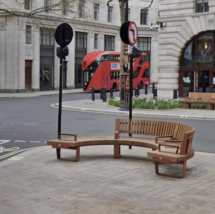

 Facing benches, Uxbrudge Road, Southall
Staggered facing benches with planting
Semi-circular bench, Aldwych
Facing benches, Uxbrudge Road, Southall
Facing benches, Uxbrudge Road, Southall
Staggered facing benches with planting
Semi-circular bench, Aldwych
35 Edgware Road Placemaking Strategy — June 2024 5.0 Placemaking Strategy DRAFT ONLY
Clusters of facing seating with planting and surfacing Art benches – Jeppe Hein, Southbank
It is recommended that place-specific factors be used to inform the type, layout and quantity of seating provided in different parts of Edgware Road, but that provision should include:
Footway Seating
Locate fixed seating perpendicular to the carriageway in facing arrangements in locations where footway width permits.
Seating in this arrangement is intended to promote conviviality and reduce the sense of observation for pedestrians as they pass.
Seating in Dwell Spaces
New or additional seating should be considered in all spaces identified as public spaces for dwelling. A series of such spaces are identified along the length of Edgware Road to provide places to pause, dwell, gather, and for temporary/seasonal activation.
Similar to footway locations, seating in these spaces should promote sociability. Facing seats, groupings of seats, and curved benches should be considered based on size, location and character of the space.
Seating as Art/Play
Seating can be used as an opportunity for public art and play in order to build a unified identity for the street. These could also become local landmarks and help with wayfinding.
Feedback from engagement suggests that the long, linear and wide nature of Edgware Road creates a sense of greater distance. Considering seating art/play features could help create recognisable intervals along the street, breaking down its perceived length.

Connaught
Seating along the footway
5.0
36 Edgware Road Placemaking Strategy — June 2024 DRAFT ONLY
Seating in the dwell spaces
Placemaking Strategy
5.8 Activation and Programming
The current programme of temporary/seasonal events and installations makes a significant contribution to the experience of Edgware Road for local people, workers, and visitors. Through the creation of new public spaces and an expansion of the activities that already take place in existing spaces, there is scope to further enhance the identity of Edgware Road. Expanding the current programme has the potential to:
• Celebrate the cultural diversity of the street.
• Increase/diversity the retail offer.
• Make the street feel more welcoming for a greater diversity of people.
• Increase the sense of safety, particularly after dark.
• Support existing businesses through complementary activities.
The Placemaking Strategy offers the following recommendations:
Community Spaces
Consider events and activities that provide amenities for the local residential community as well as those that support existing businesses.
Pop-up Spaces
Explore opportunities for vacant shops to be used for pop-up events and community functions. This strategy could be considered in conjunction with Westminster City Council’s emerging proposals for a meanwhile use strategy.
Cultural Celebration
Continue the programme of installations in public spaces that celebrate the cultural identity of the street, such as the Christmas lights and the illuminated Ramadan crescent. Consider developing a programme of events to complement these installations. Ensure a diversity of cultural programming by engaging with, and reflecting, the full diversity of local communities in the area. This should be informed by a Cultural Strategy developed for the street.
Seasonal Activations
Identify spaces with the potential to increase the variety of temporary and seasonal events, such as the parking space adjacent to Cambridge Court at the junction
of Edgware Road and Sussex Gardens. Work with landowners and business owners to develop strategies for such spaces, which might include markets, food stalls, performances, and community events. Proposals should seek to create welcoming, safe, inclusive environments, both during the day and nighttime.
Support Cultural Anchors
Frameless – the immersive art experience – and the (soon-to-open) Moco Museum provide two cultural anchors at the southern end of the street. Cultural programming of Edgware Road should seek to support and complement their work so as to build on this emerging cultural offering. Activations should seek to extend the cultural programming further north on the street. Explore opportunities for collaboration with these and other local cultural partners.


Ideas for NW corner of Sussex Gardens – Market Ideas for NW corner of Sussex Gardens – Food Festival Ideas for NW corner of Sussex Gardens – Performance 37 Edgware Road Placemaking Strategy — June 2024 5.0 Placemaking Strategy DRAFT ONLY
Royal Coronation installation, Marble Arch
5.9 Young People
A significant number of young people live or go to school in close proximity to Edgware Road, yet there is a lack of amenities that cater to their specific needs.
A welcoming and inclusive street must cater for the needs of all people and of all ages. Providing facilities for play and physical activity offers many benefits in terms of physical and mental health and can increase the diversity of users of the street.
As such, the Placemaking Strategy offers the following recommendations:
Play Streets and School Streets
Enhance existing areas that are temporarily designated for children’s play, such as the School Street on Forset Street adjacent to Hampden Gurney Primary School. Explore opportunities to permanently remove vehicular traffic from these areas (rather than on a time-based arrangement) and investigate the potential for similar provision close to other facilities used by young people.
Where possible, introduce dedicated play equipment, playable street furniture, planting, and alternative hard landscaping materials.
Incidental Play
Seek opportunities for incidental play in streets closer to schools and residential areas, such as playable features through planting, children’s paths through rain gardens, and playable street furniture.
Youth Spaces
Consider opportunities for public spaces that are designed for and with teenagers.
Meanwhile Uses
Consider young people when developing ideas for meanwhile uses, both inside vacant shops units and in the public realm.


 Incidental play through rain garden, Fulham
Road markings for ‘play on the way’
Children’s scooters at Hampden Gurney
School street at Hampden Gurney
A specially designed play street in Hackney
Incidental play through rain garden, Fulham
Road markings for ‘play on the way’
Children’s scooters at Hampden Gurney
School street at Hampden Gurney
A specially designed play street in Hackney
38 Edgware Road Placemaking Strategy — June 2024 5.0
DRAFT ONLY
A specially designed play street in Hackney
Placemaking Strategy
5.10 Safety of Women, Girls and Gender Diverse People
The creation of a safe, welcoming, and inclusive environment is a fundamental objective of the Placemaking Strategy. Crucial to this is the consideration of safety for women, girls, and gender diverse people.
Guidance published by the Mayor of London – Safety in Public Space: Women, Girls and Gender Diverse People – provides excellent recommendations that should be followed in the development of any proposals for the public space of Edgware Road. These recommendations cover all stages – from the writing of the brief, through the design and construction processes, to the use, management and maintenance of spaces.
In addition to the guidance provided, the Placemaking Strategy provides the following recommendations:
Women’s Safety Audit
Work with the local community to undertake safety audits and implement any recommendations made through this audit, such as better lighting on dimly lit streets.
Celebrate Female-led Businesses
Edgware Road is already home to a number of successful female-led businesses, including Feya, Café Helen, and Townhouse. Opportunities should be sought to support and celebrate such businesses on order to attract other female-led businesses to consider Edgware Road as a location. This has the potential to increase the diversity of the retail offer and make the street more welcoming and inclusive.
Time-based Considerations
The mix of uses on and close by to Edgware Road means that that the demographic of people on the street varies throughout the day. The start and end of the school day, for example, has a significant impact. The design of public spaces should, therefore, seek to accommodate the wide variety of requirements associated with different ages and genders, as well as those of families living locally.
Time-based strategies that recognise variations in daily routines should be considered in the development of future designs as well as in the diversity of the retail offer.
Inclusive Events
The programme of events and installations, as well as opportunities for meanwhile uses, offers an opportunity to respond to the needs of a greater diversity of people, which will result in a more welcoming and inclusive atmosphere.
For example, feedback has revealed that young people are currently under-provided for on Edgware Road, suggesting that events aimed at younger ages could offer significant benefits.


 Social media posts highlighting the experiences of women and girls on Edgware Road
Examples of successful, female-led businesses on Edgware Road – Feya, Cafe Helen and Townhouse
GLA guidance on Safety in Public Space
Social media posts highlighting the experiences of women and girls on Edgware Road
Examples of successful, female-led businesses on Edgware Road – Feya, Cafe Helen and Townhouse
GLA guidance on Safety in Public Space
39 Edgware Road Placemaking Strategy — June 2024 5.0 Placemaking Strategy DRAFT ONLY
5.11 Public Art
A lack of public art on the street was a recurring comment made at engagement events held during the development of this Placemaking Strategy.
Commissioning new public art has the potential to enhance the identity and cultural offer of the street. The following considerations are recommended:
• Prioritise artists and artworks that are have a relationship with Edgware Road.
• Consider the representation of women and minority groups in the commissioning process.
• Identify appropriate locations where the artwork can contribute to wayfinding.
• Ensure that artworks are inclusive and engaging of different groups, i.e. artworks that are accessible and well-integrated into public spaces.
• Explore opportunities for additional seating and planting in conjunction with public art.
• Light-based artworks have the potential to enhance the experience after dark and transform the character of the wider environment.
• Work closely with Westminster City Council and TfL on proposals for public art, which will require certain statutory approvals.
• Seek collaborations with local cultural partners, such as Frameless and Moco Museum.


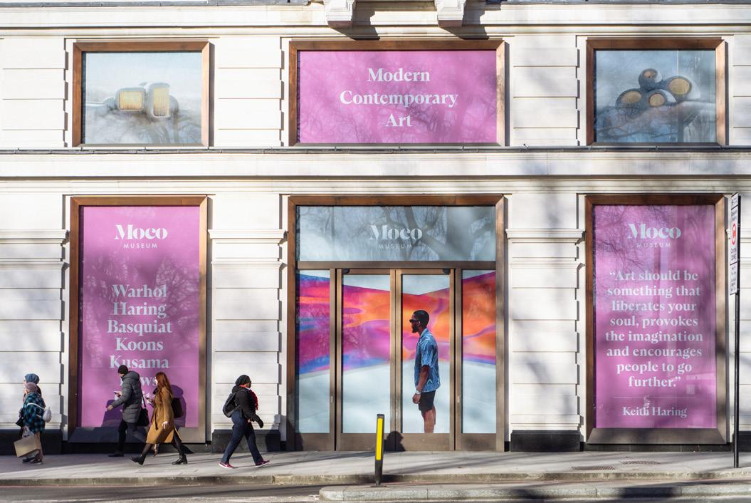


 ‘The Window Cleaner’ by Allan Sly, Capital House
Moco Museum, 1-4 Marble Arch – Open Summer 2024
Sculptures along Park Lane
Immersive art experience, Frameless, Marble Arch Place
‘Stop and Smell the Flowers’ by Holly Graham Curated by Up Projects for Barnet Council Curated by Up Projects for London Gallery Weekend
‘Heat Generation (prayer)’ by Minh Lan Tran
‘Wrapper’ by Jacqueline Poncelet, Edgware Road Tube
‘The Window Cleaner’ by Allan Sly, Capital House
Moco Museum, 1-4 Marble Arch – Open Summer 2024
Sculptures along Park Lane
Immersive art experience, Frameless, Marble Arch Place
‘Stop and Smell the Flowers’ by Holly Graham Curated by Up Projects for Barnet Council Curated by Up Projects for London Gallery Weekend
‘Heat Generation (prayer)’ by Minh Lan Tran
‘Wrapper’ by Jacqueline Poncelet, Edgware Road Tube
40 Edgware Road Placemaking Strategy — June 2024 5.0 Placemaking Strategy DRAFT ONLY
‘Circadian’ by Lee Simmons, Marble Arch Place Platinum Jubilee celebrations, Marble Arch

Environmental Strategies
5.12 Green Infrastructure
The Placemaking Strategy recognises sustainability and biodiversity as key priorities in the creation of a healthy street that is resilient to future climate challenges.
Green infrastructure offers countless benefits to health and wellbeing, as well as helping to improve air quality, enhance biodiversity and build resilience against the impacts of a changing climate.
The creation of more green infrastructure is proposed to be achieved through a number of means, which will require a collaborative approach and working partnerships between freeholders, leaseholders, the local authority and transport authority.
The specification of new trees and planting should be informed by local biodiversity action plans and strategies, such as the ‘Wild West End’, developed by a partnership of key west end landowners (including The Portman Estate and the Church Commissioners), to ensure meaningful biodiversity enhancement as well as prioritising pollinating species.
Ambitious schemes by TfL are already bringing about significant improvements, such as the creation of rain gardens in the Joe Strummer underpass – one of the biggest SUDS schemes in London – and the soon-to-be implemented rain gardens in the footway adjacent to the Water Gardens.
Building on the ambitions set by these projects, the Placemaking Strategy provides the following recommendations:
Rain Gardens and Sustainable Urban Drainage
Continue to implement and – wherever possible – extend TfL’s ongoing sustainable urban drainage systems (SUDS) programme. Opportunities for consolidating parking and loading bays should be explored in order to identify further locations for such schemes. Opportunities should also be sought for SUDS and rain gardens on side streets.
Street Trees
Seek opportunities for new tree planting wherever possible. It is acknowledged that existing utilities as well as other below ground obstacles limit the locations where


 TfL’s ongoing works to install SUDS at the Joe Strummer underpass
The green wall on Edgware Road Station
TfL proposals for street trees and SUDS adjacent to the Water Gardens
TfL’s ongoing works to install SUDS at the Joe Strummer underpass
The green wall on Edgware Road Station
TfL proposals for street trees and SUDS adjacent to the Water Gardens
42 Edgware Road Placemaking Strategy — June 2024 5.0 Placemaking Strategy DRAFT ONLY
Example rain garden scheme on side street
new planting is possible, however, footway buildouts the removal of feeder lanes (as part of proposed junction improvements) may offer locations in areas that were previously carriageway and, therefore, less likely to contain services.
New trees and planting should be located so as not to obstruct footways, block sightlines or compromise accessibility.
Pocket Gardens
Additional planting should be considered in all public realm spaces identified in this Placemaking Strategy. In these spaces, planting should be combined with new seating to offer shade, shelter and a sense of calm away from Edgware Road. In-ground planting should be prioritised as it offers greater benefits in terms of water attenuation and longevity of planting, whilst also removing the opportunity for planters to collect rubbish, but where this is not possible, raised planters should be proposed.
Green Roofs
A number of the buildings on Edgware Road offer the opportunity for significant areas of green roof to be installed, particularly on the west side of the street (as shown adjacent). Green roofs would provide visual amenity to both residents and people on the street as well as enhancing biodiversity, increasing water attenuation, and improving air quality.
Temporary Greening
Greening should be considered as part of any temporary installation or activation of the public realm.
Forecourt Greening
Businesses are encouraged to integrate planting as part of the use of their forecourt areas. Planters should be used as an alternative to barriers or screens to protect seating areas. Real planting should be used, artificial planting should be actively discouraged.


 Potential green roofs on the Water Gardens
Planting and lighting on Old Quebec Street to separate external dining areas
Potential green roofs on the Water Gardens
Planting and lighting on Old Quebec Street to separate external dining areas
43 Edgware Road Placemaking Strategy — June 2024 5.0 Placemaking Strategy DRAFT ONLY
Potential for significant green roofs to Portsea Hall, Park West and the Water Gardens Planting integrated into temporary seating, Broadgate London
5.13 Corners and Side Streets
The many side streets that connect to Edgware Road have the potential to greatly enhance the character of the street and reduce the sense of vehicular speed and traffic dominance. Focusing improvements at the key junctions could help to break down the perceived length of the street and improve the legibility of routes to nearby amenities.
Crossings
Improve controlled pedestrian crossings by minimising waiting time where possible. Provide additional crossings where required to achieve greater accessibility. Consider the use of alternative surfacing, such as a buff-coloured road topping at major junctions to highlight the crossings and to suite with the approach adopted as part of the Baker Street two-way working scheme, which has greatly enhanced the pedestrian experience and created a better setting for Portman Square.
Buildouts
Create buildouts at the junctions of the side streets with Edgware Road to narrow the crossings, help to slow turning traffic, and give the sense of greater pedestrian priority. Explore the potential to include street tree planting and wayfinding in the areas of additional footway created.
These recommendations align with TfL’s ‘Safer Junctions Scheme’, which has already considered improvements at the Sussex Gardens junction.


 Example of how contrast road surface could be used
Junction with George Street
Junction with Kendal Street Junction with Praed Street
Buff road surface at Portman Square
Example of how contrast road surface could be used
Junction with George Street
Junction with Kendal Street Junction with Praed Street
Buff road surface at Portman Square
44 Edgware Road Placemaking Strategy — June 2024 5.0
DRAFT ONLY
Buff road surface at Portman Square
Placemaking Strategy
5.14 Footways
Edgware Road is one of London’s great historic streets. There is significant scope to reaffirm this identity through improvements to the footways in order to achieve a public realm that is accessible, inclusive, and welcoming.
Paving
Develop a high-quality and robust paving strategy for the street that allows the incremental replacement of areas of tarmac footway with natural stone. Introduce raised and/ or paved carriageway areas at appropriate junctions with side streets to create more pedestrian friendly streets.
Decluttering
Declutter and widen footways to maximise area for pedestrian movement, trees and seating.
Loading bays
Pave loading bays with stone setts to create parking pads. Raising these to the level of the footway would allow the future potential for additional/alternative uses outside loading hours.
Waste and Recycling Bins
Ensure adequate number and appropriate positioning of waste and recycling bins on the footway. Ensure that these do not cause obstructions.
Maintenance
Maintain existing maintenance and cleaning regimes and consult with maintenance teams during the design of any future public realm schemes to identify challenges.


 High-quality paving and decluttered footway around Townhouse, Nutford Place
High-quality paving and decluttered footway around Portman Square
High-quality paving and decluttered footway around Townhouse, Nutford Place
High-quality paving and decluttered footway around Portman Square
45 Edgware Road Placemaking Strategy — June 2024 5.0
DRAFT ONLY
Marble Arch BID Street Team undertaking footway cleaning
Placemaking Strategy
5.15 Lighting
The nighttime economy of Edgware Road makes a significant contribution to the identity of the street. As such, lighting is considered to be an important component of the Placemaking Strategy not only to maintain and support this economy, but also to ensure that the experience after dark feels safe, welcoming, and inclusive for all. A series of lighting recommendations are proposed that have been informed by findings from Westminster City Council’s After Dark surveys and that are intended to support the After Dark campaign’s ambitions to create a safe and dynamic city. Furthermore, lighting is seen as an opportunity to celebrate cultural diversity through temporary and seasonal installations.
Feature Lighting
Opportunities for feature lighting should be considered at the gateway sites identified (Marble Arch and Marylebone Flyover) as part of wider public realm improvements. The implementation of current and previous proposals for these locations is encouraged. Feature lighting should also be considered for a number of the public space projects proposed in this Placemaking Strategy. Catenary or festoon lighting is within Nutford Place, for example, could contribute to the enjoyment of this space after dark and provide a more human scale environment.
Festive Lighting
The success of Marble Arch BID’s Ramadan crescent installation has demonstrated the potential of using light as part of temporary, seasonal, and festive celebrations. The cultural significance of lighting as part of Ramadan celebrations makes this an appropriate way to celebrate the cultural identity of Edgware Road, which received significant support during engagement workshops for the Placemaking Strategy.
Street Lighting


It is recommended that street lighting at junctions and on side streets is considered in conjunction with any improvements to Edgware Road to avoid the sense that these are under-lit and less safe. The introduction of human scale lighting should be considered alongside statutory street lighting to mitigate the contrast in light levels that can result from carriageway lighting.


 Decorative street lighting
46 Edgware Road Placemaking Strategy — June 2024 5.0 Placemaking Strategy
Idea for decorative lighting to Nutford Place
Lighting as a local landmark, King’s Cross
Lighting proposal for the Marylebone Flyover
Tree of Love, Connaught Village
Ramadan lights at Nutford Place
Ramadan lights at Nutford Place
DRAFT ONLY
Christmas lights on Edgware Road
A series of potential improvements have already been identified following lighting surveys that have assessed the illumination of Edgware Road in comparison to side streets as well as in locations associated with antisocial behaviour, as follows:
01 Stourcliffe Street
Install potentially two new lighting columns on the north footway off Edgware Road junction to enhance lighting levels.
02 Nutford Place/Brown Street
Consider replacing existing lighting columns due to age and look to increase the number of columns opposite existing to improve footway lighting around trees.
03 Harrowby Street
Consider options to relocate the lighting column that is currently being partially blocked by the tree, bearing in mind that utilities cabinets and cycle stands by impact possible locations.
04 Forset Street
Due to the narrow footway on the west side, it is not possible to install additional light columns. Instead, review the existing lights on east side and consider a different lantern optic to throw more light across the road.
05 Crawford Place
Due to the ongoing issues with lighting and trees, assess options to relocate two columns to the south footway to stagger column arrangement and provide general lighting improvements.
06 Cabbell Street/Transept Street
Trees are impacting lighting levels dark building facades are absorbing light. It is understood that a shallow footway may be impacting locations for lighting columns. Consider additional buildouts, that do not impact parking, to improve lighting. Make use EV satellite bollards using newly approved devices that remove need for earth mats that shallow footway cannot allow, to discuss further with EV team.
07 Saint Michael’s Street
When columns are at end of life and due for replacement, lower height of columns to six meters and increase number of columns to be a better fit for the road dimensions.
08 Kendal Street
Consider relocation of two lighting columns to opposite footway to stagger column arrangement to provide general lighting improvements.
09 Burwood Place
Westminster City Council’s ‘Lighting Against Crime’ scheme is being undertaken in 2024 to introduce additional columns due to road width, trees, and widened footway area near Edgware Road junction.
10 Portsea Mews
Consider the installation of new wall lights to Westminster City Council specification under the vaulted section when road entrance is reopened. This will require wayleave agreements with building owners.
11 Connaught Square
As part of the cycling improvement scheme proposed, build out park side kerb to allow cable network and new lighting columns to match appearance of those opposite, to improve light levels on this side of the road due to the trees absorbing rather than reflecting light.
12 Sussex Gardens
Consider installation of additional lamp over the footway on the existing column closest to Sussex Gardens.


Areas identified for lighting improvements SUSSEX GARDENS BURWOODPL KENDALST CONNAUGHT ST BAYSWATER ROAD OXFORD STREET SEYMOUR STREET UPPER BERKELEY STREET GEORGE STREET NUTFORD PLACE HARROWBYSTREET CRAWFORD PL CHAPEL ST PRAED STREET Marble Arch Hyde Park OLDMARY L E B O N E RD M A R Y L EBONE FLYOVER 01 02 04 03 05 09 08 10 11 12 07 06 47 Edgware Road Placemaking Strategy — June 2024 5.0 Placemaking Strategy DRAFT ONLY
Illuminated shop front signage can have a positive impact on the character of the street but can also create areas of high contrast in lighting levels, which can be challenging for some users
5.16 Active Travel
Edgware Road benefits from strong transport connections and excellent access to public transport. However, active travel should be promoted through improving the environment for pedestrians and cyclists.
The Placemaking Strategy makes a series of recommendations that work towards this ambition, such as strategies to declutter the footways and improve accessibility, and also better wayfinding to highlight pedestrian routes and distances between stations and key destinations. The further additional recommendations are provided:
Cycle Parking
Seek opportunities for additional cycle stands throughout the area. Ensure these are conveniently located and appropriately positioned to avoid causing obstructions. Consider the potential for additional cycle stands in each of the gateway and public space projects identified.
Bike Maintenance
Explore locations for the installation of a public bike pump, particularly in one of the new public spaces identified.
Water Fountains
Provision of public water fountains provides sustainable, accessible nourishment, reducing plastic waste and expenditure. They also encourage public activity, active travel, and are an opportunity for a form of public sculpture.
Geofencing Electric Bikes
The increasing popularity of electric hire bikes is placing significant demands on footways and causing a number of conflicts between users. To ensure that footways and public spaces remain safe, accessible and free of obstructions, suitable locations for ‘geofencing’ should be identified with Westminster City Council to better control the locations that electric hire bikes can be dropped-off.
Parking Review
A review of the provision of parking and loading bays along Edgware Road should be undertaken to identify opportunities for consolidation. There is no intention to remove any controlled parking, however, the timed designation of loading bays currently allows parking in certain areas beyond controlled hours, leading to conflicts with out-of-hours deliveries and servicing.


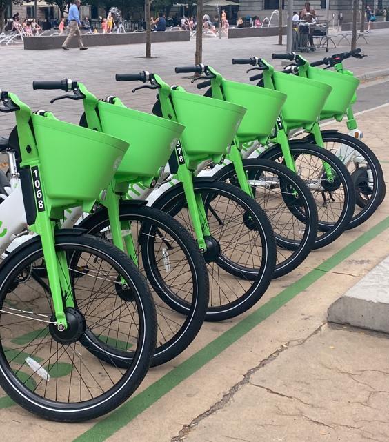


 Thames Water drinking fountains
Public water fountain outside Portman Square
‘Wallace fountain’ outside the Wallace Collection – one of the fountains donated by Sir Richard Wallace
Public bike maintenance facilities
Junction works to improve safety for cyclists
Thames Water drinking fountains
Public water fountain outside Portman Square
‘Wallace fountain’ outside the Wallace Collection – one of the fountains donated by Sir Richard Wallace
Public bike maintenance facilities
Junction works to improve safety for cyclists
48 Edgware Road Placemaking Strategy — June 2024 5.0 Placemaking Strategy DRAFT ONLY
Geofencing electric hire bikes
5.0 Placemaking Strategy
5.17 EV Charging
The growing use of electric vehicles (rather than petrol and diesel vehicles) for both personal and commercial use is positive in terms of the environment, air pollution, and sound pollution. The provision of EV charging points along Edgware Road and surrounding streets should be encouraged to support the use of electric vehicles. The following considerations are recommended:
• EV charging locations should not remove areas of footway in order to create new parking spaces.
• Charging infrastructure should be integrated with lamp columns where possible in order to minimise street furniture.
• Footway buildouts should be considered in locations where additional charging pillars/boxes are required, particularly for rapid charging stations, to avoid the loss of footway capacity or the introduction of obstacles on the footway.
• Side streets may offer better locations than Edgware Road, where movement of traffic rather than parking should be prioritised.
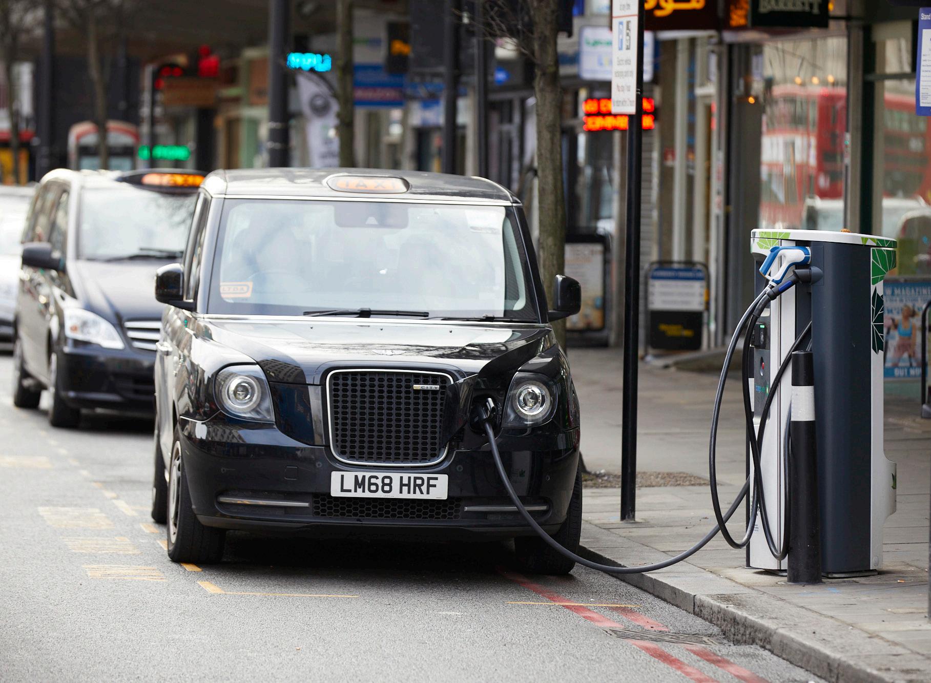


49 Edgware Road Placemaking Strategy — June 2024
EV charging point, Edgware Road
EV charging point integrated with lighting column
EV charging point on pavement buildout to avoid creating obstacle on footway
EV charging point, Edgware Road/Marylebone Flyover
DRAFT ONLY

Business & Economic Strategies
5.18 Shopfronts
Edgware Road is recognised as one of Westminster City Council’s three Central Activity Zone (CAZ) Shopping Centres, alongside Oxford Street and Regent Street, as designated by the Westminster City Plan 2019-2024. This designation is due to its scale, with Edgware Road having 205 units compared to Oxford Street’s 269. As such, the quality, appearance, and approach to visual merchandising of these units (as well as their associated forecourts) has a large impact on the overall character and identity of the street.
Feedback from engagement workshops has revealed a widespread concern regarding the appearance of shops on Edgware Road. The Placemaking Strategy, therefore, seeks to provide a series of recommendations for addressing these concerns.
Shopfront Improvements
As part of the Westminster High Streets work, a Shopfront Improvement programme is proposed. Westminster City Council plans to introduce a tailored scheme to provide grants and free architectural services to independent businesses and property owners, which is supported by the Placemaking Strategy.
Subdivision of Units
The subdivision of units should be actively discouraged as it creates an incoherent streetscape, confusion around the retail offer and ownership, and a disconnect between the character at street level and that of the buildings above. Subdivision also reduces the proportional extent of the shopfront in relation to the area of the shop behind resulting in units that lack visual permeability to the interior, which makes them feel unwelcoming or even unsafe.
Visual Merchandising
Retail tenants should be encouraged not to use visual merchandising strategies that limit views into the shop from the street. Visible active and visually permeable interiors are considered to create more welcoming retail environments and offer greater clarity of the retail offer.
Awnings
Awnings are encouraged, particularly for food and beverage retailers, as they enliven the street as well as providing shade to customers. The design of awnings should seek to avoid limiting visibility into units by being too low and should be adequately cleaned and maintained so as not to detract from the quality of the street.
Unopen Shop Strategy
Due to the nighttime economy of the street, businesses have different operating hours. Businesses that are closed during the earlier part of the day can create the impression that units are vacant, disused, or neglected. This has a knock-on impact for neighbouring businesses. To address this, an ‘unopen shop strategy’ should be developed. The use of roller shutters should be discouraged but when considered unavoidable, a strategy might include the application of artwork, graphics, or a street-wide identity scheme for roller shutters when closed outside of business hours.
Vacant Shop Strategy
Vacant shops have a disproportionate impact on the appearance and character of a street. Through engagement workshops, it is apparent that people perceive there to be a greater number of vacant units than there often are (9% vacancy according to Westminster City Council figures, March 2024).
Building on strategies already utilised by The Portman Estate, it is recommended that vacant units are enlivened through graphic signage or meanwhile uses to avoid the appearance of neglect and to encourage faster reletting.


 Poor quality shopfronts create the impression of neglect Unwelcoming appearance due to subdivision
Public art strategy developed for closed roller shutters referencing local fabric trade
Poor quality shopfronts create the impression of neglect Unwelcoming appearance due to subdivision
Public art strategy developed for closed roller shutters referencing local fabric trade
51 Edgware Road Placemaking Strategy — June 2024 5.0 Placemaking Strategy DRAFT ONLY
Visability into the shop enhances character of the street Positive activation of vacant unit enhances street corner
5.0 Placemaking Strategy
5.19 Forecourts and Pavements
Many shops on Edgware Road benefit from private forecourt space to use for outside seating or visual merchandising. However, the ways in which these spaces are used varies in terms of quality and appearance and can contributes to the sense that the street is incoherent, poorly maintained, and unneighbourly. In some instances, the placement and orientation of external seating can feel oppressive for pedestrians on the footway.
The use and activation of the street by retailers is, however, encouraged as it creates vitality and, if managed successfully, can contribute to a positive sense of place and a welcoming atmosphere. To achieve this, the following recommendations are made:
External Seating
Seating and tables are considered to work most effectively when arranged perpendicular to the shopfront and, ideally, in groups of four (rather than two) seats to create conversational arrangements rather than arrangements that overlook the footway. This is a key strategy to address safety concerns raised by women. Where the dimensions of privately-owned forecourt space limits this arrangement, a study should be undertaken to identify whether there is sufficient footway width to consider an extension to the forecourt space, licensed from Westminster City Council.
Barriers
Solid/opaque screens and barriers used to segregate forecourt space from the public footway are discouraged as they limit visual permeability and introduce more clutter to the street. The use of planters to create separation is supported to increase greening on the street.
Product displays
External retail displays have the potential to increase the vitality of the street through activity, if managed appropriately. It is encouraged that this be achieved through suitable display systems. These should avoid restricting views into the shops. The display of bulk items, particularly when displayed on pallets, should be actively discouraged.
Accessible Thresholds
Private forecourts provide a threshold between the public footway and the shops and are outside of the control of the highways authority. These zones frequently create barriers to access for certain users as they are not level, and do not provide step-free access to shops. Landowners and tenants are, therefore, encouraged to make reasonable adjustments to these privately-owned spaces to make them accessible and inclusive in line with the ambitions of the Placemaking Strategy.
Privately Owned Space versus Licensed Space
Street life is vital to the creation of successful, resilient, and welcoming high streets. The Placemaking Strategy encourages the adoption of a collaborative, partnership approach between landowners, the BID, and the local authority to assist retailers to activate external spaces adjacent to their shops wherever possible. In locations where there is no private forecourt, studies should be undertaken to assess the suitability of granting licensed space. Where forecourt space is present, it should be considered whether additional space (granted through license) would help maximise the potential of existing space to create a more positive threshold. A street-wide survey should be undertaken to develop a coherent approach to the provision of external space to support retailers.


52 Edgware Road Placemaking Strategy — June 2024
Positive use of footway through licensed space
use of private forecourt space with awning
use of forecourt for storage
DRAFT ONLY
Poor use of forecourt that impact accessibility
Positive
Poor
5.0 Placemaking Strategy
5.20 Loading and Servicing
Edgware Road’s status as one of Westminster’s three Central Activity Zone (CAZ) Shopping Centres means that there are considerable loading and servicing requirements. The management of incoming deliveries and servicing is made more challenging by the significant number of delivery bikes and cycles associated with the many food and beverage businesses. The following considerations are recommended:
Loading Bays
Review the provision of loading areas as well as the timed control of these areas to ensure they are appropriate to the nature of businesses on Edgware Road. Introduce raised loading pads and prohibit the use of these for parking outside of loading hours.
Delivery Bikes and Cycle Couriers
The introduction of designated zones for parking/ waiting by delivery bikes and cycle couriers should be considered in various locations to better manage the conflict that can be created when the footway is used for this purpose. These should be appropriately distributed to ensure convenience and encourage use. Management strategies should be implemented to protect the footway for pedestrian use and prevent obstructions.
Consolidation
Logistical consolidation should be encouraged to reduce the number of delivery vehicles servicing businesses on Edgware Road. Such schemes could be explored and trialled with the support of the major landowners and the BID.
Refuse and Recycling
Better management of refuse and recycling is required to enhance the physical appearance of the street and, therefore, the business environment. A refuse and recycling audit should be undertaken to assess whether a number of different collection services are being used, allowing strategies to be developed for consolidating these services.


53 Edgware Road Placemaking Strategy — June 2024
Existing problems of delivery and courier bikes
Use of electric and non-motorised transport for refuse collection
Well-designed loading bay that doesn’t detract from the quality of the street
Regent Street delivery consolidation
DRAFT ONLY
5.21 Meanwhile Uses
Following feedback from Westminster City Council’s High Streets engagement, a meanwhile use strategy is being developed that will promote the use of vacant units by new businesses with the support of Westminster City Council.
This will be complemented by the rolling-out of the Council’s business support programmes including business resilience toolkits, ‘Start up to Scale up’ among others.
The Placemaking Strategy offers the following recommendations for consideration:
Community Uses and Needs
A vibrate and resilient high street requires a mix of uses and users. Community uses should be considered alongside retail uses in the development of meanwhile strategies. Edgware Road is dominated by food and beverage retailers. Meanwhile uses might explore more everyday necessities that support the local residential community.
Enhanced Quality
Edgware Road should aspire to provide the best of what it offers. As such, the quality of the offer should be considered as much as the diversity of the offer. Consider retailers that complement the existing as well as those that diversify the offer.
Cultural Programming
Depending on the length of vacancy, cultural programming may offer a better strategy than a shortterm retail pop-up.
Diverse Representation
As suggested previously, meanwhile uses may provide the opportunity to promote or pilot locally run or femaleled businesses.


 Open Doors - Bradford, Kettering, Rochford, Slough & Stoke-on-Trent
The Parklet, Washington, D.C, Gensler
Pop-up parklet, Connaught Village
Open Doors - Bradford, Kettering, Rochford, Slough & Stoke-on-Trent
The Parklet, Washington, D.C, Gensler
Pop-up parklet, Connaught Village
54 Edgware Road Placemaking Strategy — June 2024 5.0 Placemaking Strategy DRAFT ONLY
Vacancy Atlas pop-up shop unit
5.0 Placemaking Strategy
5.22 Partnership Working
The success of this Placemaking Strategy will be dependent on collaborative, partnership working between all parties – landowners, tenants, Marble Arch BID, Westminster City Council, and TfL. Working groups have already been established to support the development, engagement, and implementation of the Placemaking Strategy, building on existing, successful relationships with a proven track record. The continuation and expansion of such groups and working methodologies should be agreed in order to realise the collective vision for an improved Edgware Road.
Complementary work has been undertaken previously by Marble Arch BID, The Portman Estate, The Church Commissioners, TfL, and Westminster City Council. This strategy was developed in conjunction with Westminster City Council’s High Streets Programme and supports its ambitions for improvements.


 Proactive and friendly stewardship of the street
Demonstrations of pride in Edgware Road
Working to overcome the challenges of a strong nighttime economy
Proactive and friendly stewardship of the street
Demonstrations of pride in Edgware Road
Working to overcome the challenges of a strong nighttime economy
55 Edgware Road Placemaking Strategy — June 2024
DRAFT ONLY
Recognising the contributions of those who work on Edgware Road

6.0 Placemaking Projects
6.0 Placemaking Projects
6.1 Implementation
There are challenges to delivering a comprehensive Placemaking Strategy for any street. In the case of Edgware Road, this is no different. This document has no statutory status but intends to provide a guide and recommendations that can be adopted by Westminster City Council, TfL, landowners, Marble Arch BID, developers, and even tenants.
The adjacent map indicates the key public spaces that have been identified as having the potential for public realm enhancements. On the following pages, a some of these spaces have been used to demonstrate how the various placemaking strategies and recommendations could be applied to a to achieve the vision.
SUSSEX GARDENS
02 03 01 05 06 04 08 Flyover
Chapel Street Sussex
Place Kendal
/
Gardens (NW Corner) Nutford
Street Stourcliffe Street Seymour Street (west corner) Bryanston Street
Connaught Place
CONNAUGHT ST BAYSWATER ROAD OXFORD STREET SEYMOUR
BRYANSTON
UPPER BERKELEY STREET GEORGE STREET NUTFORD PLACE HARROWBYSTREET CRAWFORD PL CHAPEL ST PRAED STREET Marble Arch Hyde Park OLDMARY L E B O N E RD M A R Y L EBONE FLYOVER Map identifying the locations of potential public space projects
BURWOODPL KENDALST
STREET
STREET
07
01 02 03 04 05 06 07 08 57 Edgware Road Placemaking Strategy — June 2024 DRAFT ONLY
This illustration shows how the placemaking strategies and recommendations could be implemented to achieve the vision.
A welcoming public space created with new sociable seating to create a place to meet, rest, and dwell set back from Edgware Road. Seating positioned so as to maintain open space for temporary activities and events or community uses.
Space identified for temporary public installations, including lighting and sculpture.
Enhanced and enlivened public space creates a better environment for the adjacent retail units, encouraging greater use of forecourt space. As a result, natural surveillance is provided, minimising the risk of anti-social behaviour.
Increased planting and greening to create a more welcoming character as well as providing shade, shelter and improved air quality. Potential for sustainable urban drainage or rain gardens as part of planting.
Improvements to the ‘school street’ outside Hampden Gurney Primary School to include playful features and additional street furniture for scooter parking.
Installation of new festoon feature lighting across the space to improve the character of the space and the sense of safety after dark.


6.3 Nutford Place 6.2
5 6 4 1 2 3
1 2 3 4 5 6
58 Edgware Road Placemaking Strategy — June 2024 DRAFT ONLY
Illustration of ideas for Nutford Place after dark Illustration of ideas for Nutford Place
6.0 Placemaking Projects
6.0 Placemaking Projects
6.4 Sourcliffe StreetStourcliffe Street
This illustration shows how the placemaking strategies and recommendations could be implemented to achieve the vision.
Improved junction with Edgware Road to make more pedestrian friendly.
Potential for new planting and seating close to the junction to support local businesses.
Variety of new sociable seating on the footway, located close to street trees where possible to provide shelter and shade.
New seating placed outside amenities such as dessert shops and cafés to support local businesses and create a sociable environment.
Additional street lighting to provide more illumination to side street to increase sense of safety and accessibility.
Increased planting to Stourcliffe Street to continue the greening strategy on Edgware Road and enhance the public realm for residents.
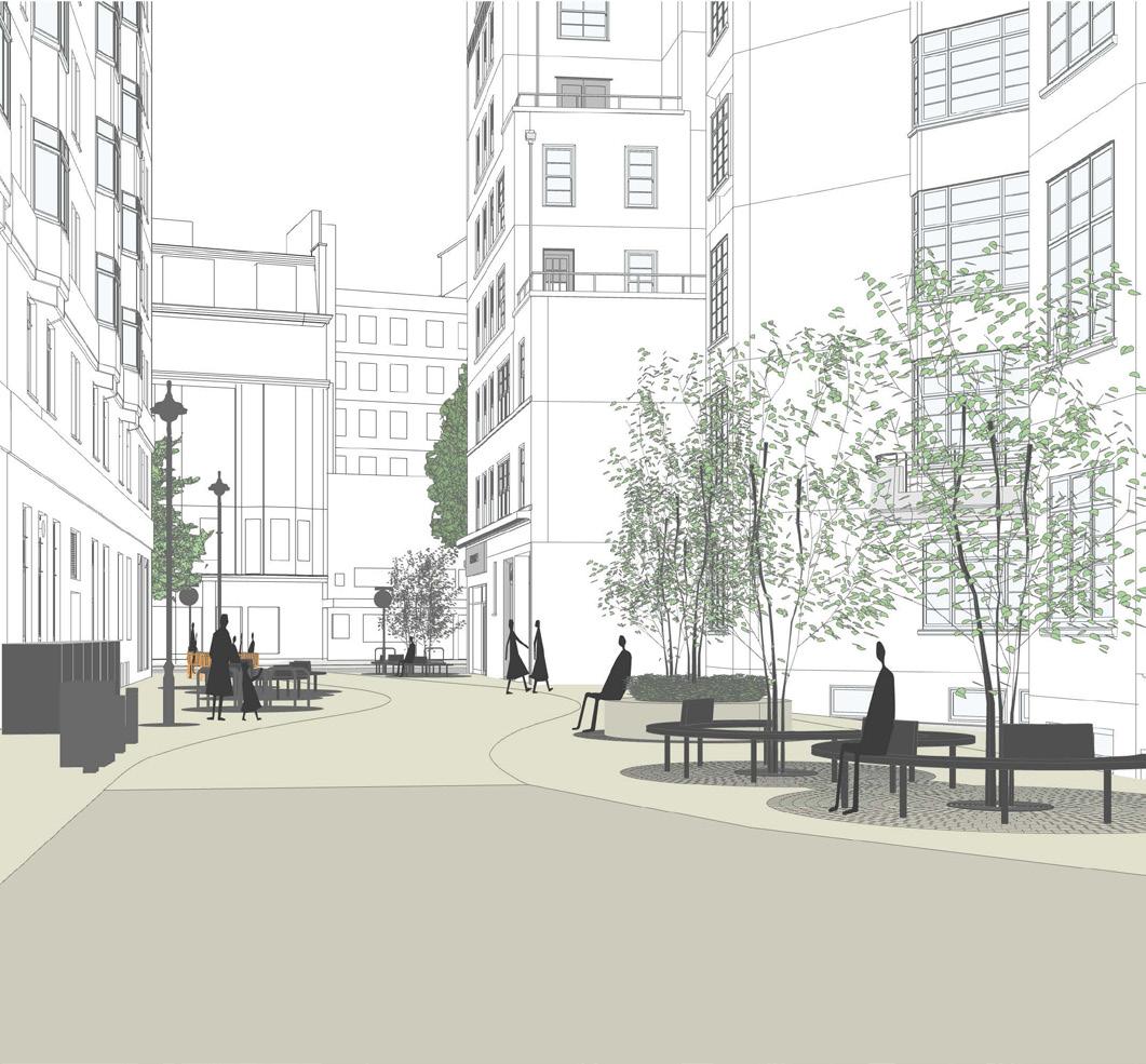 Illustration of ideas for Stourcliffe Street
 (looking towards Edgware Road)
Illustration of ideas for Stourcliffe Street
Illustration of ideas for Stourcliffe Street (looking towards Edgware Road)
59 Edgware Road Placemaking Strategy — June 2024 Connaught
5 6 4 1 2 3 1 2 3 4 5 6 DRAFT ONLY
6.0 Placemaking Projects
6.4 Seymour Street
This illustration shows how the placemaking strategies and recommendations could be implemented to achieve the vision.
New sociable footway seating provided to maximise the benefit of the existing wide footways. Where possible, seating is placed close to street trees to provide shade and shelter.
Pavement widths maximised at junctions to reduce crossing widths, slow turning vehicles, and improve the pedestrian experience. Rain gardens installed in built out areas to provide sustainable urban drainage and greening, continuing the strategy adopted by TfL.
Alternative surfacing to the carriageway at key junctions, such as buff coloured shell-grip topping, to break down the length of the street and assist wayfinding through highlighting side streets.
60 Edgware Road Placemaking Strategy — June 2024
Illustration of ideas for Seymour Street
1 2 3 1 2 3
DRAFT ONLY
6.0 Placemaking Projects
6.5 Sussex Gardens
This illustration shows how the placemaking strategies and recommendations could be implemented to achieve the vision.
Bench seating along brick wall to provide a rest stop to pedestrians. Potential to include tree and planter to improve experience of this intersection and provide passive shading.
Alternative surfacing to the carriageway at key junctions, such as buff coloured shell-grip topping, to break down the length of the street and assist wayfinding through highlighting side streets.
Shopfront improvements to Cambridge Court to provide a more unified, coherent, and higher quality streetscape, which can be delivered as part of Westminster City Council’s High Streets programme.
Existing car park identified as a potential space for temporary events and activations (a market is illustrated as an example).
61 Edgware Road Placemaking Strategy — June 2024
1 2 3 4 1 2 3 4
Illustration of ideas for Sussex Gardens
DRAFT ONLY

7.0 Next Steps
The Delivery Matrix below demonstrates that improvements can either be brought forwards as ‘projects’ (i.e. a complete public realm scheme for Nutford Place) or as components (i.e. a lighting scheme for the whole of Edgware Road). The matrix indicates which strategies from the document are applicable to each of the key project spaces.
Gateways & Junctions
Access & Inclusion
Wayfinding
Public Spaces
Seating
Activation & Programming
Young People
Female Safety
Public Art
Green Infrastructure
Corners & Side Streets
Footways
Lighting
Active Travel
EV Charging
Shop Fronts
Forecourts & Pavements
Loading & Servicing
Meanwhile Uses 7.1 Delivery Matrix
63 Edgware Road Placemaking Strategy — June 2024
Flyover/Chapel St Sussex Gardens Nutford Place Stourcliffe Street Bryanston Street Connaught Place Seymour Street Kendal Street
7.0 Next Steps DRAFT ONLY

8.0 Appendicies
The following pages of this document include mapping, research and analysis undertaken at the initial stage of the Placemaking Strategy.
65 Edgware Road Placemaking Strategy — June 2024
8.0 Appendices DRAFT ONLY
Independents and Chains


66 Edgware Road Placemaking Strategy – June 2024
Independent Local chain National chain Urban Analysis
B - Independents
A B
A - Large national chains
Retail streets


67 Edgware Road Placemaking Strategy – June 2024
Small/local shopping streets
Main shopping streets
Urban Analysis
Edgware Road
B - Main shopping streets - photo: Drapers
A B
A - Small/local shopping streets - photo: Marble Arch BID
Pavement comfort audit


68 Edgware Road Placemaking Strategy – June 2024
B - Wide pavements with no forecourts
A
A - Narrow pavements with forecourts
B
Pedestrianised/dwell spaces
1-1.5m >1m
>2.5m 1.5-2.5m Urban Analysis


69 Edgware Road Placemaking Strategy – June 2024 Deliveries Loading areas Urban Analysis
B - Nutford Place
A B
A - Parking on pavement

70 Edgware Road Placemaking Strategy – June 2024
Passive
Food
Active
Active
Urban Analysis
Active and passive frontages
Frontage
and Beverage Active Frontage
Retail Frontage
Other Frontage

71 Edgware Road Placemaking Strategy – June 2024
All-vehicle Lane
No Lane Markings
Bus Lane
Cycle Lane
Movement Urban Analysis
Proposed Cycle Lane
Businesses with Arabic representation


Middle-Eastern/Arabic Food and Beverage
Arabic Retail or Retail with Arabic Signage

72 Edgware Road Placemaking Strategy – June 2024
Urban Analysis
B - Arabic food and beverage
A
A - Arabic businesses
B

73 Edgware Road Placemaking Strategy – June 2024 Businesses Open - 6am - 12pm Urban Analysis 12 3 9 Open No data

74 Edgware Road Placemaking Strategy – June 2024 12 6 3 9 Businesses Open - 12pm - 6pm Urban Analysis Open No data

75 Edgware Road Placemaking Strategy – June 2024 12 6 3 9 Businesses Open - 6pm - 12am Urban Analysis Open No data

76 Edgware Road Placemaking Strategy – June 2024 12 6 3 9 Businesses Open - 12am - 6am Open No data Urban Analysis

77 Edgware Road Placemaking Strategy – June 2024
Urban Analysis
Less Severe More Severe Road
Traffic Accidents
Roughly half of accidents happen at night
Roughly half of casualties are cyclists
There was 1 fatal incident in the last 5 years

Most incidents happen at junctions
https://www.crashmap.co.uk, https://www.think.gov.uk/thinkmap/
Most incidents happen in inclement weather
6 incidents had child casualties none serious or fatal
78 Edgware Road Placemaking Strategy – June 2024
Urban Analysis
Road Traffic Accidents
The architecture of Edgware Road is extremely varied, owing to both the pattern of land ownership and the extent of bomb damage. This has resulted in the emergence of a number of distinct Character Areas, loosely defined by ownership boundaries.
A summary of the character area boundaries are detailed opposite, with detailed analysis on the following pages.
A1 Marble Arch Place
A2 Upper Berkeley Street Cluster
A3 Nutford Place Cluster
B1 Grosvenor Court Mansions & Connaught Cluster
B2 Portsea, Park West & Water Gardens
C Harrowby Street & Crawford Place Cluster
D Winchester House Cluster
E Old Marylebone Road Historic Cluster
F Star Street Cluster
G Chapel Street Cluster
H Praed Street-Edgware Road Gateway

79 Edgware Road Placemaking Strategy – June 2024
A1 B1 B2 A2 A3 C D E G H F Block Audit


• Recent 8-storey-plus modern developments completed in the past decade mark the corner between Edgware Road, Marble Arch and Oxford Street.
• Large and tall frontages with deep commercial units with mid to high-end offer at ground level. Frontages toward south side tend to be passive.
• Sculpture marks the beginning of green passage to Bryanston Street; green passage does not seep past corners onto forecourt areas.
• Some outdoor dining licensed areas towards York House.

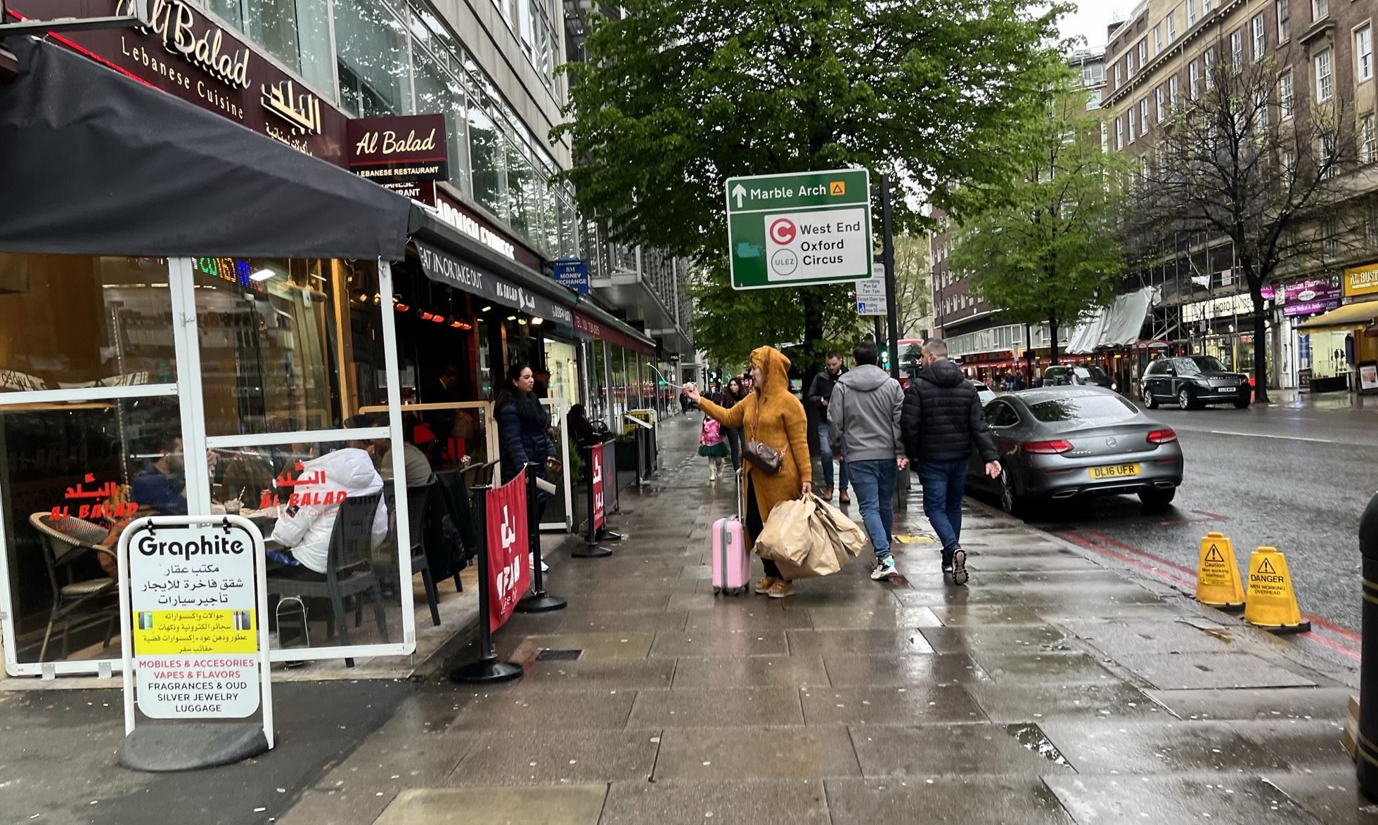
• The architecture of this cluster ranges from post-war developments to the north (i.e. Garfield House), interwar developments (i.e. Evelyn Court) and recent developments (i.e. Marble Arch House) to the south.
• Most developments are around 8 storeys tall; the permitted development for Garfield House will meet the 8-storey datum.
• Continuous stretch of active frontages ranging from high to lower-end offers, with a range of multiples (e.g. Tesco Express) and independents, including the famous Maroush Express.
• Some outdoor licensed areas, with tables that sit two covers.
• Most small to medium units have awnings, although these vary in size, colour and quality.
• Some forecourts are being used to advertise goods; presence of A-boards.
• Variety of furniture used to delineate licensed boundaries, e.g. cafe banners and rope barriers.


• Two mixed-use blocks bank onto an important public realm area – Nutford Place – a rare space for pause along Edgware Road, with the newly completed Regent House to the south, and Forset Court to the north from the interwar period.
• Corner units of Forset Court have significant draw; the southern corner (currently Al Arez) has a generous licensed area facing onto Nutford Place, generating positive activity and providing passive surveillance on public space.
• Fascia treatments differ significantly on both blocks, with standardised fascias along Regent House, and independent treatments for Forset Court.
• No forecourt activation for Regent House; unlike other character areas, only food and beverage occupiers use forecourts at Forset Court. Other businesses do not use them.
• Visual connectivity towards Seymour Place and the heart of the Portman Estate.
80 Edgware Road Placemaking Strategy – June 2024
A1 A2 A3
Street Scene
Typical Shop Front
A1: Marble Arch Place
A2: Upper Berkeley Street Cluster
A3: Nutford Place Cluster
Block Audit

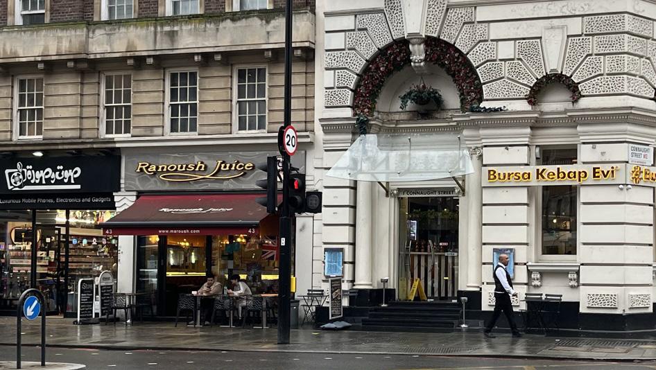
• This cluster marks the development associated with the ‘Connaught area’ north of Hyde Park. It is mainly characterised by Georgian architecture, with the exception of Grosvenor Court Mansions and the Victory Services Club (VSC) building.
• Active frontages are concentrated towards the north, with notably the Grade II listed former bank building marking the end of Connaught Street.
• Presence of coordinated forecourt planting, but forecourt use varies.
• Inactive vacant units (at time of survey) due to Maroush’s departure.


• This stretch of Edgware Road is marked by the three post-war major mansion blocks, which were consecutively completed from south to north and are stylistically distinct – Art Deco, Art Moderne and Brutalist.
• Some forecourts are being used to advertise goods; presence of A-boards.
• Variety of furniture used to delineate licensed boundaries, e.g. plastic sheets, cafe banners and rope barriers. There are different floor treatments for forecourts. Diwan Damas has significant forecourt activity due to fridge stall setup.
• With the exception of a few (e.g. Shishawi), most outdoor licensed areas are laid out to accommodate two covers per table.
• Mostly occupied by independents, with a few that are subdivided internally for different businesses.
• Since the closure of the Arabic Centre (site of Shisawi), many of its functions and services have distributed and multiplied along the street.


• Constant loading and servicing activity due to the number of independents.
• Most small to medium units have awnings, although these vary in size, colour and quality.
• Corner units at Connaught Street and Kendal Street junctions are positive contributors to streetscape but have been vacant; corner unit at Burwood Place has dead frontage facing the public realm area.
• Burwood Place and Sussex Gardens corners, book-ending The Water Gardens, have important amenities for the road but public realm enhancements stop at the corners.
• The overhang of Water Gardens, whilst providing shade and shelter, impacts on visual engagement with businesses across the street.
• Illuminated wall-mounted signs abound along the Water Gardens stretch.
• Tree-lined, but relatively narrower pavements at Water Gardens; constant parked cars and loading activity along frontages.
81 Edgware Road Placemaking Strategy – June 2024
B1
B2
Street Scene
Typical Shop Front
B1: Grosvenor Court Mansions & Connaught Cluster
B2: Portsea, Park West & Water Gardens
B2: Portsea, Park West & Water Gardens (continued)
Block Audit


• The stretch is characterised by low-rise buildings from interwar and postwar eras, notably with the central Art Deco former Woolworth’s building, currently occupied by Waitrose. The exception is a narrow corner building (184A) at the Crawford Place junction.
• Forecourt use is minimal on this stretch.
• Footfall is higher on this side of the street due to light direction and width.
• No awnings present, due to nature of buildings and businesses.


• This urban block consists of two significantly taller modern developments –the tiered 1-3 Crawford Place building with bay windows, and Winchester House.
• The corner at 1-3 Crawford Place is activated by business activity by the occupier (Alvina), regularly drawing onlookers.
• Similar to other clusters primarily characterised by modern development, forecourts are not delineated by different ground treatments.
• There is modest forecourt use along this stretch. A-board displays are present.
• There is generous paving space outside Halifax on the corner of Old Marylebone Road, which is currently under-used.

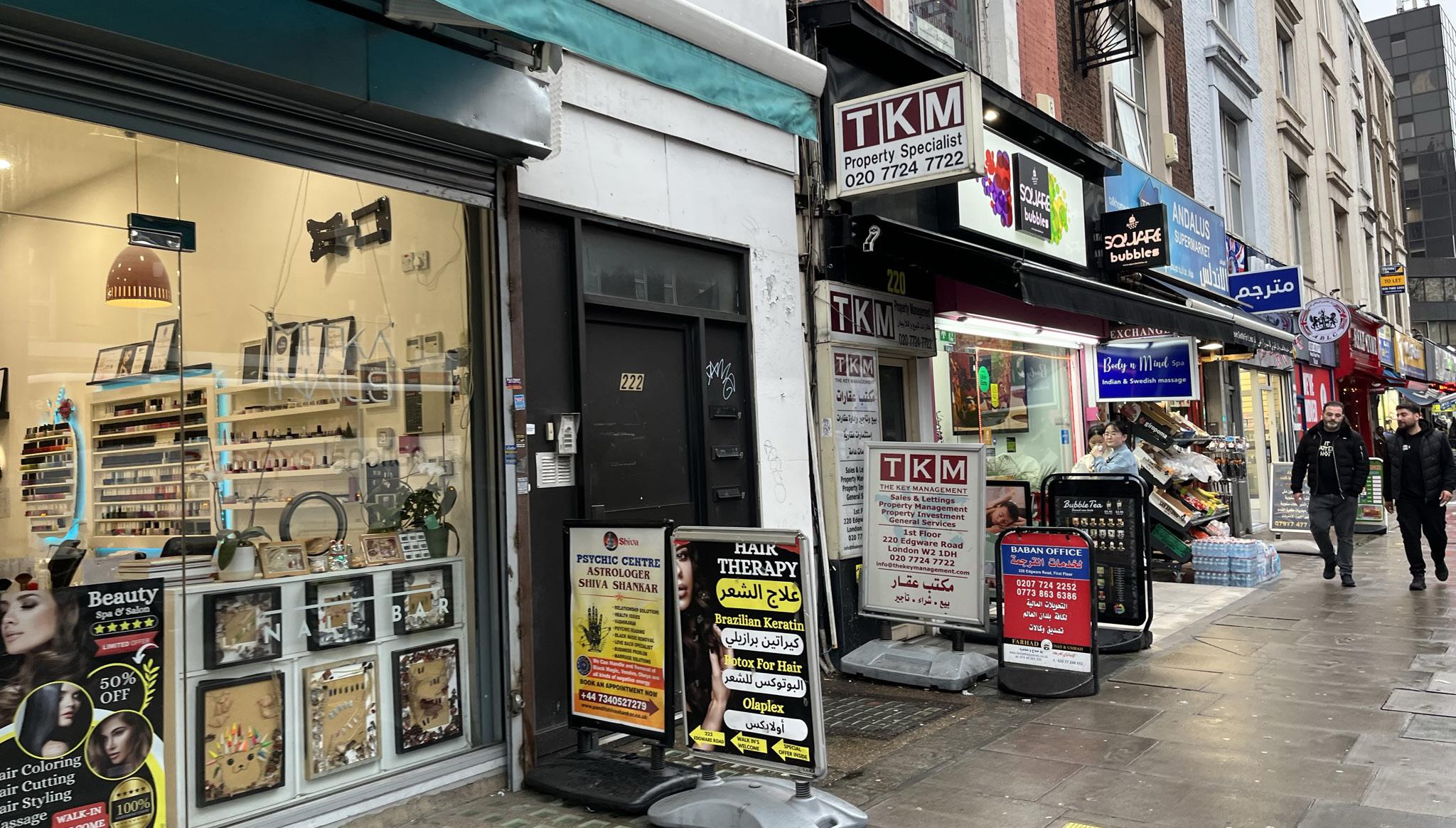
• This cluster consists of some of the oldest buildings along Edgware Road, reflecting a range of architectural styles and typologies with different datums – this particularly distinguishes it from other active frontages.
• The south side is primarily occupied by independents; the north side, closer to the three stations, has a few multiples.
• The two junctions – Old Marylebone Road and Chapel Street – are marked by businesses that continue the active frontage down to the side street (Noor Supermarket and Maison Du Sultan).
• Awnings are usually only present for food-related businesses, adding to the heterogeneity of the streetscape.
• A-boards and forecourt activation abound, whether for storage, display, and dining.
• There is some business activity on first floors, although their physical presence is discreet.
82 Edgware Road Placemaking Strategy – June 2024
C D E
Street Scene
Typical Shop Front
C: Harrowby Street and Crawford Place Cluster
D: Winchester House Cluster
E: Old Marylebone Road Historic Cluster
Audit
Block


• Anchored by the Cambridge Court mansion block to the south, the cluster is characterised by a variety of Georgian and mock-Georgian buildings.
• Robertsons is particularly significant as one of the most enduring occupiers of the street, with wall-mounted signs and fixtures that contribute to the character of the cluster.


• This character consists of three blocks of very different styles and ages. Capital House built 1991 on Edgware to the east, the Victorian Edgware Road Underground Station, a tiled TFL operational building completed in 2012, and the Art Deco Griffith House to the east.
• Building heights range from Capital House’s tower to single storey garages.
• Apart from Marks and Spencer store windows and the entrance to Edgware Road Station, the area is all passive facades, BOH spaces and high wall protecting the uncovered TfL tube lines.
• There are no areas of forecourt activation and limited F&B supply.
• There is limited visual connection or way finding to direct pedestrians from Edgware Road to the TfL station.


• This cluster is dominated by post modern and contemporary blocks, including the Hilton London Metropole which opened in 1972. There is one surviving historic building on the corner of Praed Street and Harbet Road (no.10).
• The character area is dominated by tall blocks (10+ storeys) with some 2-4 storey stepped facades along Praed Street.
• Although the Hilton provides a generous entrance space with some potted plants on Edgware Road, the corner of Praed Street mainly consists of passive facades.
• The area provides pedestrian links to Paddington Basin and other open public spaces, but lacks clear wayfinding from Edgware Road.
• Praed Street provides the predominant link for commuters and tourists travelling from Paddington into Edgware Road and central London.
83 Edgware Road Placemaking Strategy – June 2024
G H F
Street Scene
Typical Shop Front
F: Star Street Cluster
G: Chapel Street Cluster
H: Praed Street-Edgware Road Gateway
Block Audit
The character areas across Edgware Road contain multiple different building typologies. These consist of; historic terraces and corner blocks, mansion blocks, post-war commercial / mixed-use blocks and 21st century developments. The following pages provide an overview of the characteristics found in these main typologies.
Post-war Commercial/Mixed-use Blocks
21st Century
Other

84 Edgware Road Placemaking Strategy – June 2024
Historic Terrace and Corner Blocks
Mansion Blocks
Built Typologies


85 Edgware Road Placemaking Strategy – June 2024
Mansion Block Post-war Commercial / Mixed-used Blocks
Historic Terraces & Corner Blocks
Built Typologies
21st Century New Builds

• Ownership: Complex leasehold structures on upper residential floors.
• Size: Generally occupy entire urban blocks, ranging from 6 to 8-storeys tall.
• Period: Most mansions blocks were built during the interwar period.
• Style and architectural presence: Most mansion blocks have strong street frontages. The majority featured on Edgware Road have defined architectural languages (e.g. Art Deco, Art Moderne, Brutalist), and usually follow a consistent ground-to-first floor datum, with a commercial ground floor and residential upper floors. The corner units tend to have large floorplates; currently not all have active frontages on either side.
• Entrances: Some have residential entrances facing onto Edgware Road, others are orientated to side / back roads.
• Greening: Minimal presence of management-led greening, with the exception of Grosvenor Court Mansions.


86 Edgware Road Placemaking Strategy – June 2024
Mansion Block
Above: Grosvenor Court Mansions, with Salt Bar occupying corner unit at Seymour Street junction.
Below: Park West, with small the mid-sized commercial units at ground floor.
Above: Portsea Hall and Royal Cinema, photo taken in the 1930s.
Below: Portsea Hall, with corner unit at Kendal Street junction.
Above: Sainsbury’s at Forset Court, 136 Edgware Road, photo taken in 1953.
Below: Mindels at same unit at Forset Court, 136 Edgware Road today.
Built Typologies

Post-war commercial / mixed-used blocks
• Ownership: Mostly owned by individual owners towards the north end of Edgware Road. Some within TPE and CC towards the south.
• Size: Generally occupy a significant stretch of a urban block, if not in its entirety, with a range of low (3-storeys), mid (7-storeys) to high rise (24-storeys) developments.
• Period: Mostly built post 1945.
• Style and architectural presence: There are a variety of styles and range of architectural merit for post-war development (e.g. low-rise department stores to Richard Seifert’s hotel). Most maintain a commercial ground floor for Class E uses.
• Entrances: Most entrances to upper-floors usually located off Edgware Road.
• Ground-floor frontages: Longest commercial frontages and fascias on Edgware Road (for supermarkets and Marks and Spencer); smaller frontages for small-mid-sized units.
• Greening: Minimal presence of greening.


87 Edgware Road Placemaking Strategy – June 2024
Above: Corner of 1-3 Crawford Place. Below: Waitrose, 168-176 Edgware Road, ex Woolworth .
Above: Corner of Victory Services Club, at Seymour Street junction.
Below: Marks and Spencer, leading to Chapel Street junction.
Built Typologies
Above: Corner of Meridien House, at Upper Berkeley Street junction. Below: Garfield House.

21st Century New Builds
• Ownership: Generally simpler leasehold structures, with head leases sold to developer.
• Size: Generally occupy entire urban blocks, ranging from 8-storeys tall (street-facing), to 17-storeys tall (set-back from street).
• Period: Built in the 21st century.
• Style and architectural presence: Proportionally these blocks tend to reference the mansion blocks, although there are taller developments set back from the immediate street line. Most maintain a commercial ground floor for Class E and F uses, although not all are active frontages.
• Entrances: Most upper-floor entrances located off Edgware Road.
• Ground floor frontages: Units generally have consistent fascia treatment. Unlike other typologies, units typically have larger closed glazed surfaces.
• Greening: Greening limited to some forecourt planting.


88 Edgware Road Placemaking Strategy – June 2024
Above: Marble Arch Place, consisting of two mixed-used buildings and residential tower The Bryanston. Below: Corner units leading onto passage between the two buildings.
Above: Marble Arch House.
Below: Ground floor unit of Marble Arch House, currently occupied by Paul with licensed outdoor area.
Above: Corner of Regent House, at George Street junction.
Built Typologies
Below: Ground floor frontages of Regent House.

• Ownership: Mostly owned by individual owners towards the north end of Edgware Road. Some within CC ownership towards the south.
• Size: Generally follow historic urban grain, ranging from 4 to 6-storeys tall.
• Period: Most date from the 18th-19th century.
• Style and architectural presence: The historic terraces towards the north preserve the finer historic urban grain, with small ground floor units contributing to a more eclectic and heterogenous streetscape. Corner blocks, especially the ones in the CC area are architecturally significant and mark the transition between Edgware Road and the Hyde Park Estate.
• Ground floor frontage: Small ground floor frontages, following rhythm of traditional high streets.
• Greening: Greening limited to some hanging baskets in CC’s area.
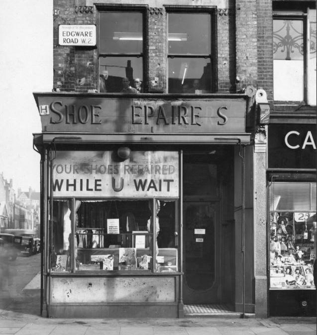


89 Edgware Road Placemaking Strategy – June 2024
Historic Terraces & Corner Blocks
Above: 228 Edgware Road, home to M&S, in the 1912s. Below: 228 Edgware Road today. M&S previously took over 230 in 1920s, but the merged unit has been reconverted to two units.
Above: 1 Connaught Street c.1850-60, hosting Westminster Bank. Rich Italianate arcaded casino design.
Below: 1 Connaught Street today, till recently hosting Maroush Gardens.
Above: 2 Crawford Place hosting shoe repairers, photo taken by Elliott & Fryin 1950.
Built Typologies
Below: 2 Crawford Place today, remaining historic building in otherwise redeveloped block.
Post-war Commercial / Mixed-used Blocks
Characteristics
• Ownership: Complex leasehold structures on upper residential floors.
• Size: Generally occupy entire urban blocks, ranging from 6 to 8-storeys tall.
• Style and architectural presence: Most mansion blocks have strong street frontages. Most on the road have defined architectural languages (e.g. Art Deco, Art Moderne, Brutalist), and usually follow a consistent ground-to-first floor datum along Edgware Road, with a commercial ground floor and residential upper floors. The corner units tend to have large floorplates; currently not all have active frontages on either side.
• Greening: Minimal presence of management-led greening, with the exception of Grosvenor Court Mansions.
• Ownership: Mostly owned by individual owners towards the north end of Edgware Road. Some within TPE and CC towards the south.
• Size: Generally occupy a significant stretch of a urban block, if not in its entirety, with a range of low (3-storeys), mid (7-storeys) to high rise (24-storeys) developments.
• Style and architectural presence: There are a variety of styles and range of architectural merit for post-war development (e.g. low-rise department stores to Richard Seifert’s hotel). Most maintain a commercial ground floor for Class E uses.
• Greening: No greening.
• Ownership: Generally simpler leasehold structures, with head leases sold to developer.
• Size: Generally occupy entire urban blocks, ranging from 8-storeys tall (street-facing), to 17-storeys tall (set-back from street).
• Style and architectural presence: Proportionally these blocks tend to reference the mansion blocks, although there are taller developments set back from the immediate street line. Most maintain a commercial ground floor for Class E and F uses, although not all are active frontages.
• Greening: Greening limited to some forecourt planting.
• Ownership: Mostly owned by individual owners towards the north end of Edgware Road. Some within CC ownership towards the south.
• Size: Generally follow historic urban grain, ranging from 4 to 6-storeys tall.
• Style and architectural presence: The historic terraces towards the north preserve the finer historic urban grain, with small ground floor units contributing to a more eclectic and heterogenous streetscape. Corner blocks, especially the ones in the CC area are architecturally significant and mark the transition between Edgware Road and the Hyde Park Estate.
• Greening: Greening limited to some hanging baskets in CC’s area.
Challenges and Opportunities
Redevelopment opportunity low due to complex ownership structures. Wholesale retail curation is challenging.
Corner ground floor units, which tend to have large floorplates, have huge potential for enhancing junction corners on Edgware Road.
Opportunity to establish business incubators in vacant units to nurture businesses that share the values and aspirations of project partners.
Opportunity to strengthen each mansion’s block identity (e.g. awnings, fascia), whilst respecting each block’s architectural style and features. Opportunity to explore greening enhancements at podium level for mansion blocks such as Portsea Place and Water Gardens.
Reduced opportunity for large-scale redevelopment. Wholesale retail curation is challenging.
Some blocks have low architectural merit (e.g. poor servicing strategy). Large floorplate units, some of the buildings have deep floorplates suitable for multiples or major independent occupiers; the future of these units need to be safeguarded.
Opportunity to establish business incubators in vacant units to nurture businesses that share the values and aspirations of project partners. Opportunity to identify future facade enhancement projects (e.g. window replacement, recladding with high-quality materials).
Opportunity for roof greening projects to boost biodiversity.
Character of ground floor commercial activity has yet to be established. Retail curation is challenging given disparity in offer across the street. Large floorplate units, some of the buildings have substantial floorplates suitable for multiples or major independent occupiers; these will can become main attractors.
Opportunity to develop strategy for forecourt activation and greening. Opportunity to develop associated public realm areas (e.g. Nutford Place outside Regent House) and strengthen their connection with the rest of the street.
Opportunity for more ambitious owner-led multi-level planting enhancements.
Conservation and maintenance opportunity low due to disparate ownership and lack of planning protection.
Long-term vacancies and lack of investment due to large capital costs associated with renovating and upkeeping building stock.
Corner blocks have huge potential to strengthen transversal connections on Edgware Road, especially to the Connaught Village.
Opportunity to explore greening enhancements at roof and balcony levels.
Opportunity to commission art and wayfinding pieces to mark corner and route to associated destinations.
90 Edgware Road Placemaking Strategy – June 2024
Mansion Blocks
Historic Terraces & Corner Blocks
21st Century New Builds
Built Typologies


» Grosvenor Court Gardens (Architect: North Robin and Wilsdon)
» Portsea Hall (Architect: T. P. Bennett & Son)
» Dudley Court
» Evelyn Court
» Park West
» Forset Court (Architect: F J Wills, and Goldsmith and Osburn)
» Water Gardens
» Cambridge Court (Architect: Marshall and Tweedy)
Continuous ground floor plinth, with consistent datum.
Substantial roof surfaces, potential for introducing greening (likely low-weight and extensive) and biodiversity.
Corner units with two frontages; potential for uplift, refurbishment and alterations to create more accommodating thresholds and support corner activation.
Some units are occupied by service providers who do not have active frontages. Future leasing strategy can provide guidance on frontage treatment to offer higher quality passive/semi-active frontages.
Some businesses occupy two or more units.
• Forecourt areas consistent along the length of mansion block.
• Existing pavement lights could be continued to create a consistent approach across the area.
• Potential for forecourt paving material to be reviewed.
• Shopfront and awning design sometimes at odds with planning policy.
• Forecourt use sometimes generates additional boundaries on the street and do not always consider impact on immediate neighbours.
• Advertisements abound and contribute to the character of the street.
• Potential for consistent lighting strategy.
91 Edgware Road Placemaking Strategy – June 2024
Mansion Blocks
B C E D A A B C D E
Characteristics Opportunities
Built Typologies
Examples on Edgware Road
Post-war Commercial / Mixed-used Blocks
» Victory Services Club
» Meridien House
» Garfield House (Architects: Foster Wheeler Limited, Henry J Mein, and T P Bennett and Son)
» Winchester House
» Hilton London Metropole
» Mark and Spencer
» Waitrose, 68-176 Edgware Road (ex Woolworths, Architect: J William Stevens)
» Grosvenor Casinos, 150-162 Edgware Road (Architects: Arthur Swift and Partners, Hildebrand and Glicker, J Reeve Young, and Paton Pitt and Associates)

Continuous ground floor & first floor plinth, with consistent datum. Podiums have potential for greening (likely low-weight and extensive) and biodiversity.
Corner units with two frontages.
Some businesses occupy two or more units.
Limited greening.

• Forecourt areas consistent along the length of the block.
• Potential for forecourt paving material to be reviewed/repaired.
• Opportunity for shopfront and awning design to align with planning policy.
• Potential for forecourt use to remove additional boundaries on the street and consider impact on immediate neighbours.
• Advertisements abound and contribute to the character of the street.
• Projecting signs above shops to be clearer.
• Potential for consistent lighting strategy.
• Potential for planters/greening strategy.
92 Edgware Road Placemaking Strategy – June 2024
A A B B C C D D E E
Characteristics
Opportunities
Typologies
Examples on Edgware Road
Built
Post-war Commercial / Mixed-used Blocks (continued)


Continuous ground floor commercial use.
Long frontages for large commercial floorplates.
No or very limited forecourt use for large occupiers (e.g. supermarkets).
• Forecourt areas consistent along the length of the block.
• Potential for forecourt paving material to be reviewed/repaired.
• Opportunity for shopfront and awning design to align with planning policy.
• Potential for forecourt use to remove additional boundaries on the street and consider impact on immediate neighbours.
• Advertisements abound and contribute to the character of the street.
• Projecting signs above shops to be clearer.
• Potential for consistent lighting strategy.
• Potential for planters/greening strategy.
93 Edgware Road Placemaking Strategy – June 2024
A B C
A B C Built Typologies
Characteristics Opportunities


» Marble Arch Place
» York House
» Marble Arch House
» Regent House
Ground floor commercial use.
Units tend to be bigger and have taller ceiling heights.
• Wide new pavements have potential for forecourt activity.
• Currently blank shop frontage creates the opportunity for curated and cohesive inhabitation.
• Potential for consistent lighting strategy.
• Potential for planters/greening strategy.
• Potential for trees on median.
Limited use of forecourt.
94 Edgware Road Placemaking Strategy – June 2024
21st Century New Builds
Unified fascia treatment.
Large glazed surfaces.
A B C D E
Characteristics
Opportunities
A B C D E Built Typologies
Examples on Edgware Road


Ground floor commercial use.
Corner units have long or multiple frontages and forecourts.
Smaller independent or local chain businesses.
Corners provide opportunities to become links to the surrounding areas, such as Connaught Village.
• Wide forecourts enable four person seating.
• Current planters with fake flowers could be replaced with living greenery.
• Consistent forecourt widths with the potential for cohesive floor surface.
• Opportunity for shopfront and awning design to align with planning policy.
• Potential for consistent lighting strategy.
• Potential for street trees on central median.
95 Edgware Road Placemaking Strategy – June 2024
Historic Terraces & Corner Blocks
» 45-47 Edgware Road
A B C D
Characteristics Opportunities
A
Built Typologies
Examples on Edgware Road
B D

357 Kennington Lane London, SE11 5QY
T 020 7703 3555
E info@dsdha.co.uk
W www.dsdha.co.uk