2 minute read
BELLE ISLE INFRASTRUCTURE


[in]visibility table of contents:
In many ways, the complexity of infrastructure systems hides right under our noses. Many of these systems aren’t clearly visible, unless sought out. Which makes them left unseen and potentially unknown to the users. This series of postcards are meant to bring attention to complex infrastructure by focusing on more granular details to make them seen. We use a mix of informative narratives, as well as questions to get the reader to reflect upon the space of Belle Isle, the infrastructure it holds within, and their own connections to it.
I 00 :: Abstract
I 01 :: [in]visibility
ANISHINAABE
I 02 :: History of Infrastructure
I 03 :: 70 years apart
I 04 :: Paved Paths
I 05 :: Unpaved Trails
I 06 :: Sidewalks + Crosswalks
I 09 :: Public Transit means Bus
POTOWATOMI
I 11 :: Parkways: Built for Cars
I 12 :: Closed Roads
I 13 :: Potable Water
I 14 :: Storm Water
I 15 :: Standing Water
I 16 :: Green Infrastructure
OLMSTED’S BELLE ISLE: THE MAKING OF URBAN NATURE
an original vision, flawed
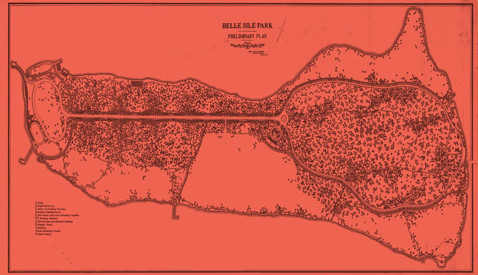
Belle Isle was originally envisioned as a place of relief from the mechanisms of urban life. Frederick Olmsted’s original vision for Belle Isle can be seen on the front of this postcard. However, this dream was cut short, as the city did not provide enough funding for his continued work on the project. While Olmsted’s conception can only be seen on the plans of what never was, the result of the implementation and ongoing transformation of the park both diverges and aspires to the ideals that inspired his original intention .
Does infrastructure contribute to the identity of the island today?
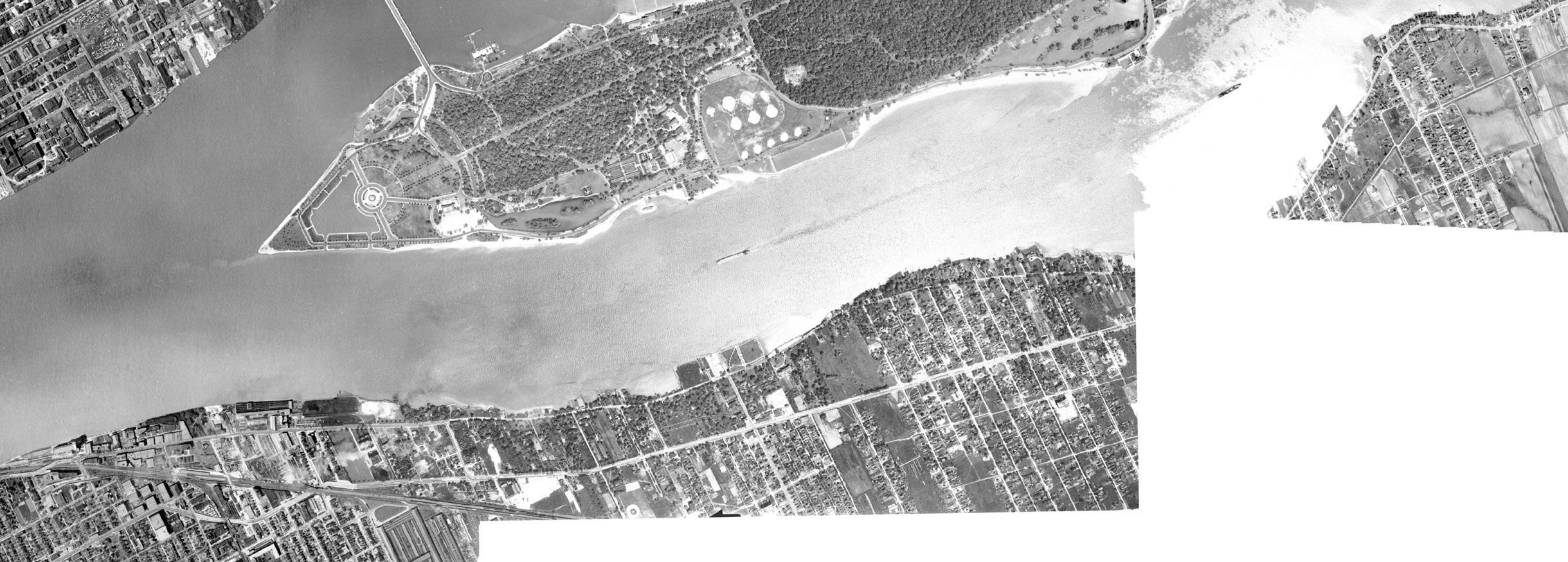

Before and After
The island has changed significantly since the early 20th century. Since then, there has been a significant investment and expansion of roadways on the island. In some places there are 4 lanes. New parking lots and additional roads have also been added on the island. Is the space allocated for roads and cars needed, or can it be considered excessive?
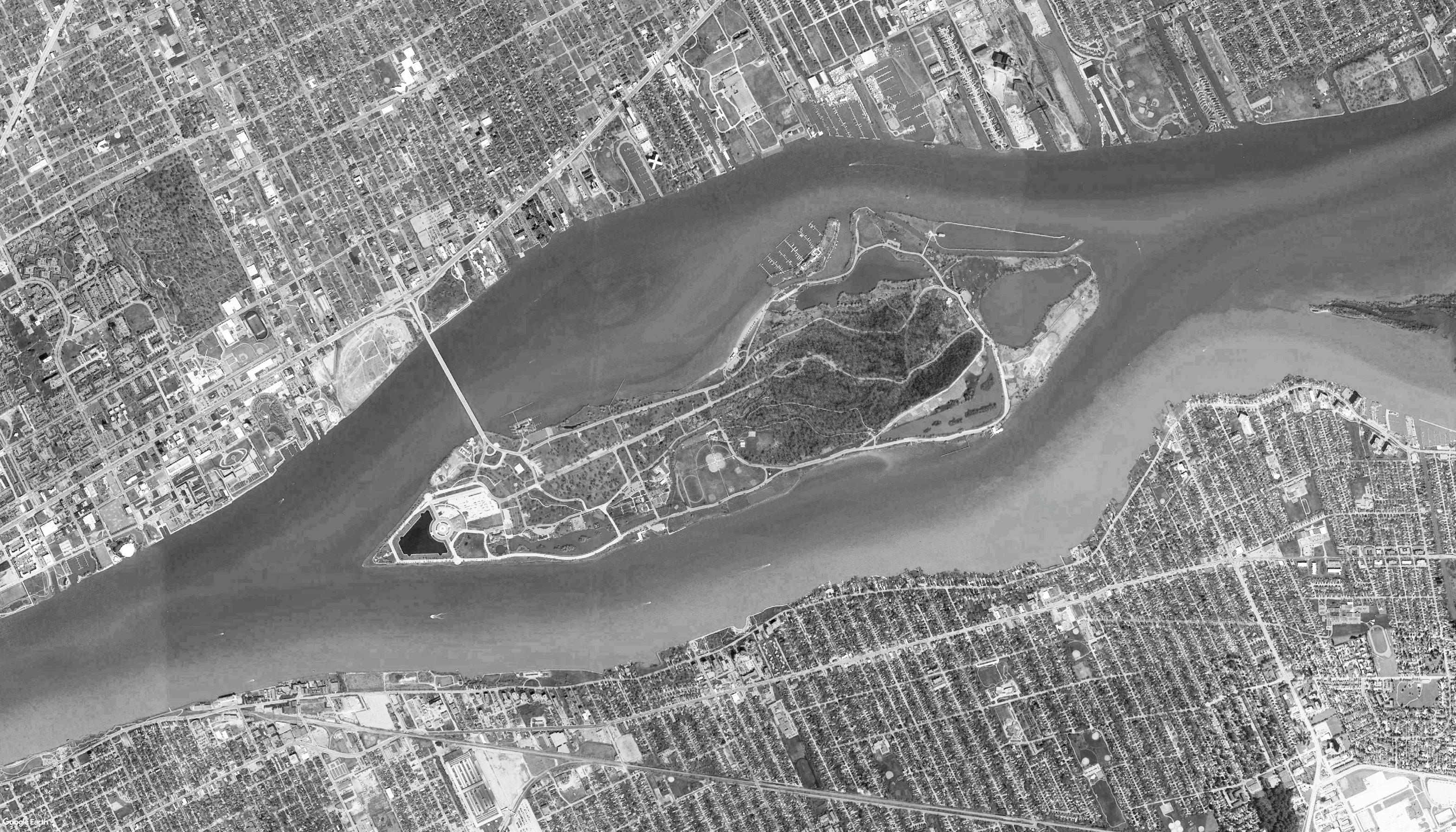
What differences can you spot between these images?
Key: Paved Trails
Unpaved Trails
THE IRON BELLE
1km paved paths

There is one paved path that circumnavigates the island. This path features a trail head that will serve as one of the termini of the Belle Iron Trail.
Paved paths are 8 feet in width and have an asphalt surface. These paths are physically separated from the road by a grass buffer. These paths are the most comfortable on the island, but do not allow for interior access.
Do these trails allow for easy access to desired destinations?

GETTING AWAY FROM IT ALL

Unpaved Trails
Smaller sections of unpaved trails at the eastern part of the island enabled access to forested areas. Their design vary in material, width, and visibility..
These trails are less accessible than the paved trails as they vary in roughness and become slippery and muddy after rain events. Additionally, these trails are quite isolated from the rest of the island making them difficult to access. However, they offer the best glimpse into some of the unique ecosystems on Belle Isle, its forests and marshes.

Key: Sidewalks
Crosswalks


