2 minute read
ONCE UPON A TIME

![SIDEWALK [DIS]CONNECTIONS](https://assets.isu.pub/document-structure/230815184501-0f88306a4af546b5bfd0bda5ff78d59c/v1/fcbed23f91d668cab8d6e76079be3a62.jpeg)
no bus, no car, no way to get there
Years ago, there was a public transit line called the Conant Line that would take riders all over the expanse of the island. Today, this line is defunct and those coming on the bus can only be dropped off near the front section of the island. How can the island be made more accessible to those who do not own a car? Why do those with cars seem to get priority use of the island?
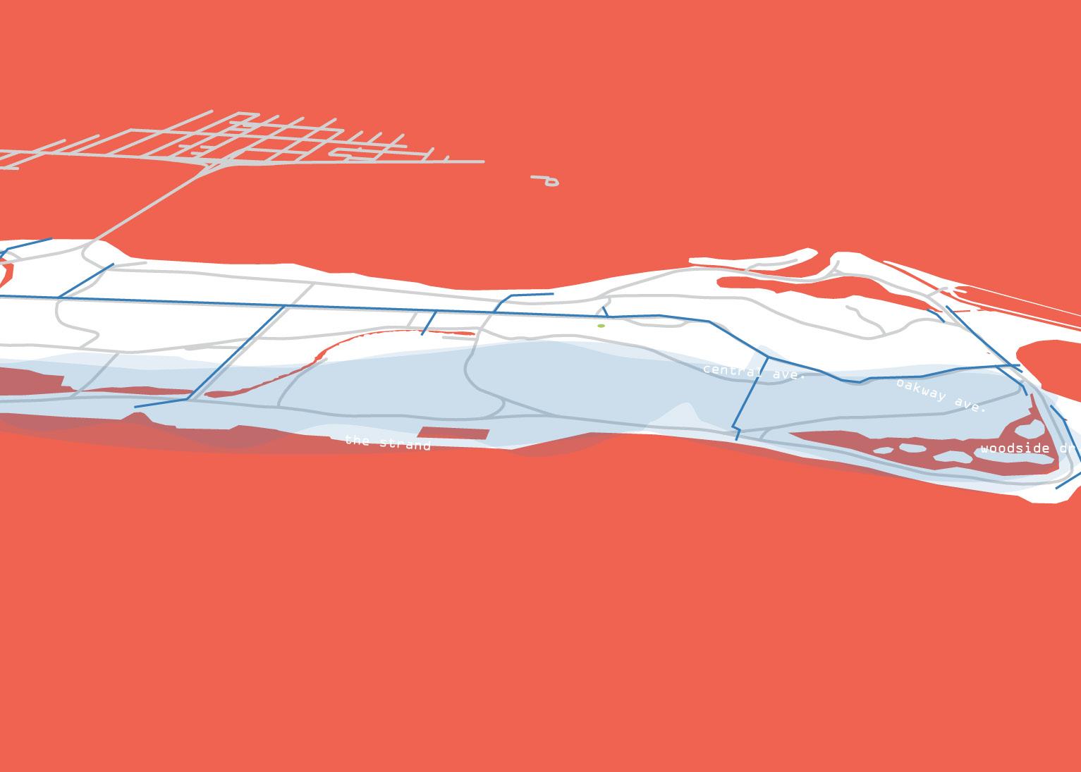
PARKWAYS: BUILT FOR CARS
Key: Poor Pavement Conditions Roads
1km

A Driving Paradise
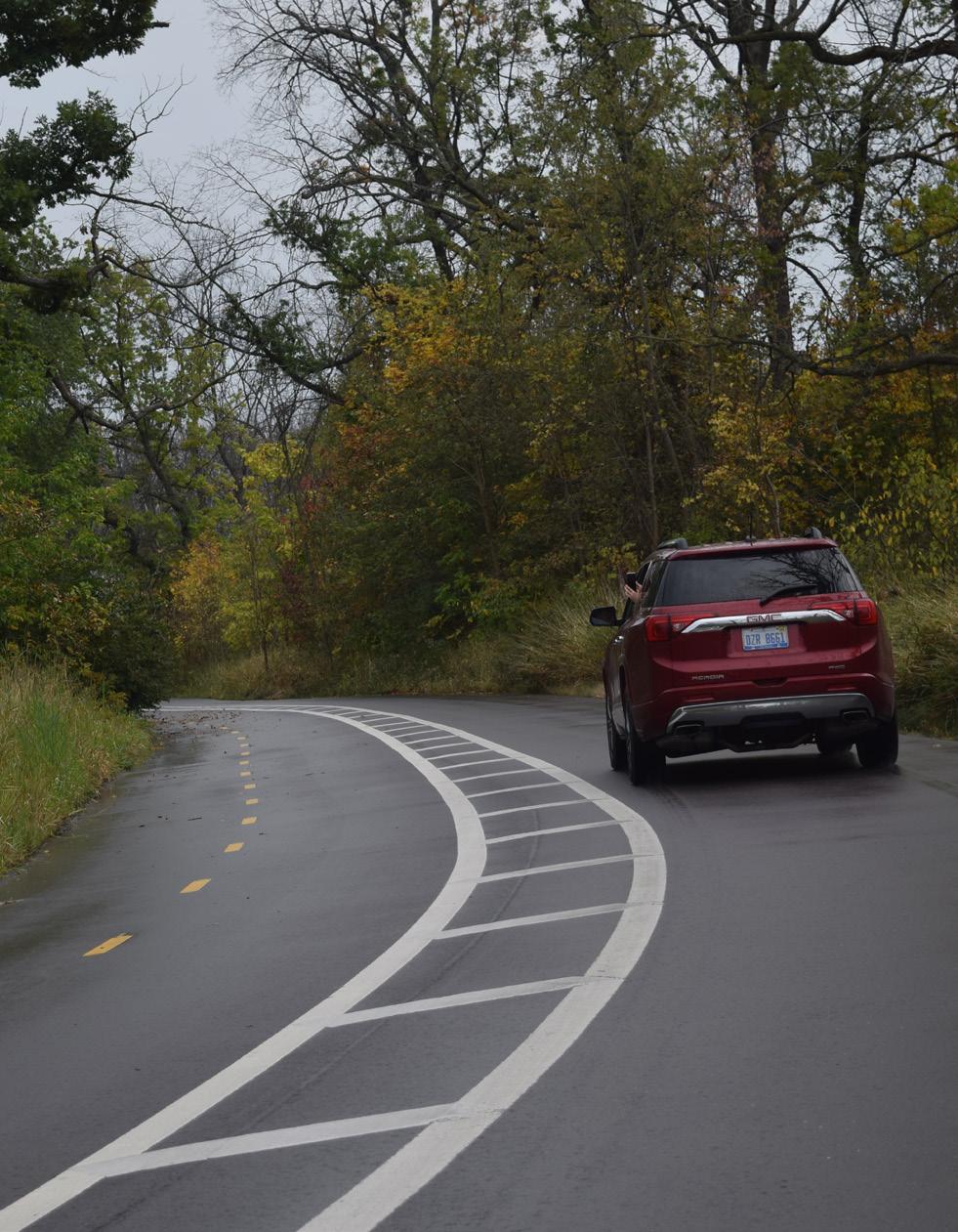
Parkways connect almost most of the areas on the island, and a significant amount of space is built to serve the car, including roadways and parking lots. Their conditions and dimensions vary. Most roads have bike lanes but few have continuous sidewalks which forces both pedestrians and cyclists to share the shoulder of the road. Central Avenue is Belle Isle’s main central southeast-northwest axis. It transverses the civic areas and the wet-mesic forest and features a buffered bike lane.
CLOSED ROAD AHEAD
Key: Flooding Areas
Road Closures
1km shoulda brought a boat

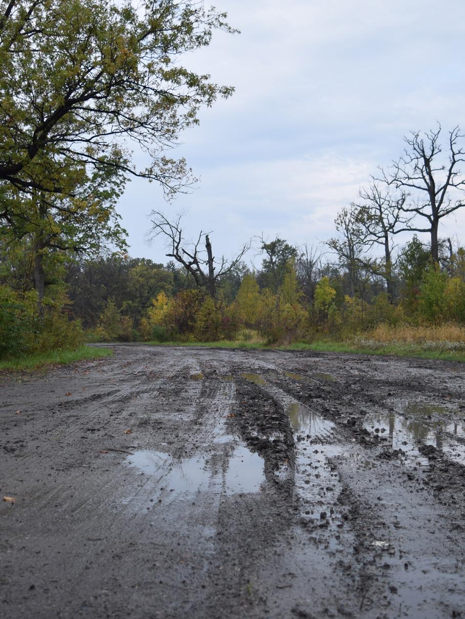
Due to the flat island topography, poor stormwater management, and recent Great Lakes high water levels, roads on Belle Isle are frequently inundated even after only small amounts of rainfall.
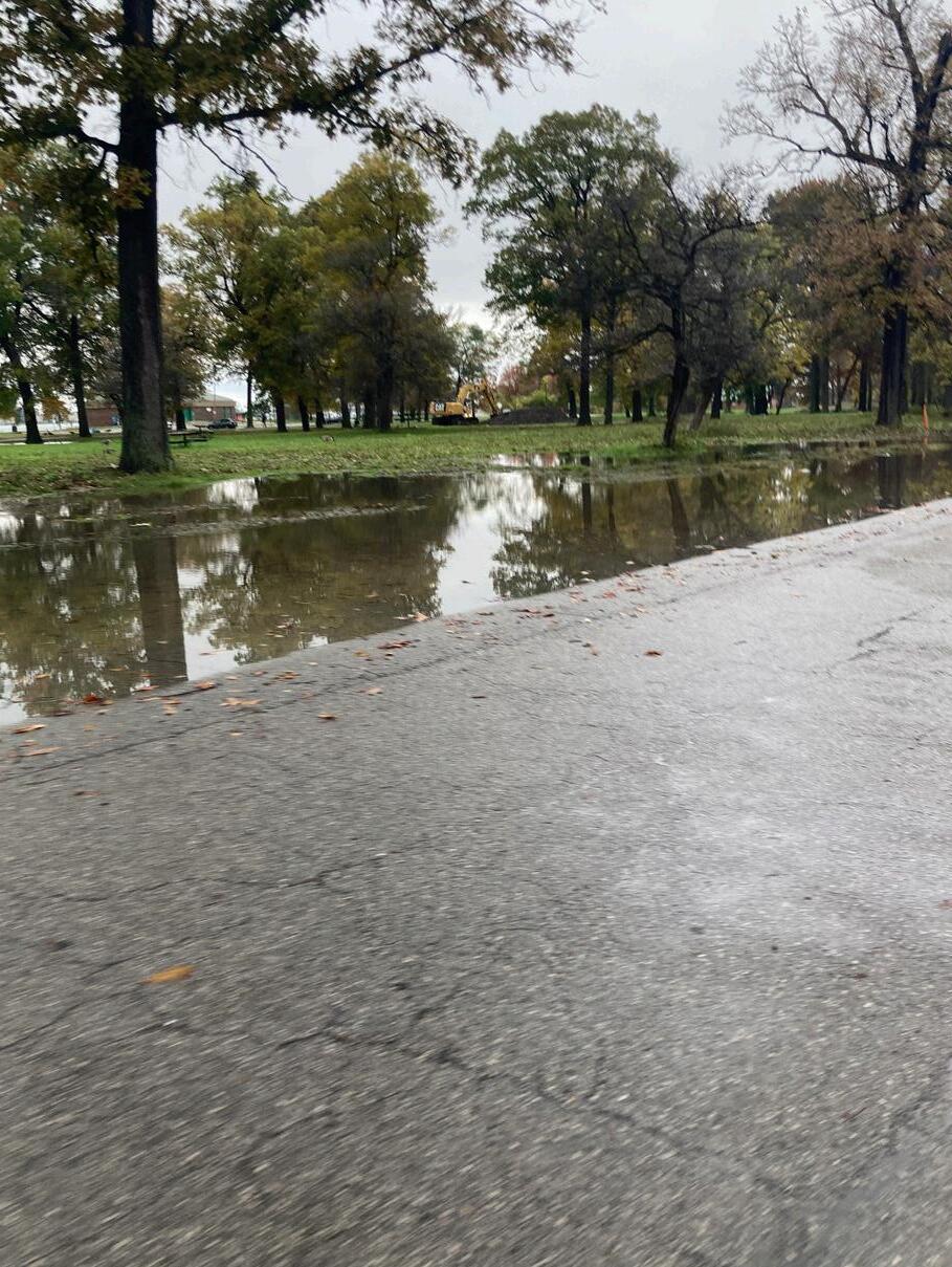
Flooding is especially bad on the eastern side of the island on Woodside Drive, Oakway Road, and Lakeside Drive.
Flooded and closed roads make use of the island unpredictable. Damaged roads and stalled construction can close roads for long periods while rainy weather make roads impassable.
POTABLE WATER
Key: Potable Water Pipes Water Intake
1km drinking from the river
A network of invisible water pipes deliver water to the amenities and buildings and in the island. But the island also holds the entry to a much larger regional infrastructure.
The primary source of potable water for the City of Detroit is located in a long inlet on the northeastern shore of Belle Isle. The intake building takes in raw water from the river and sends it to treatment plants on the mainland before it is redistributed regionally.

Key:
Overflow Events
SEWER + STORMWATER
1km when it rains it pours

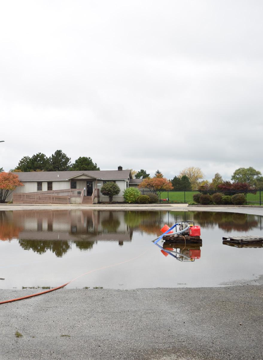
Existing stormwater systems are aging and require costly maintenance and replacement. In 2017 the state began a project to reconnect the island’s interior lakes and canals with the Detroit River with a dual purpose of creating supportive habitats for native species and managing stormwater. However, high water levels in recent years have thwarted the effectiveness of this approach. As an interim solution, the state has invested in a series of temporary pumps and dams (shown right) that can be moved around the island to deal with floods as they arise.

Key:
Sewer + Stormwater Pipes
Flooding Areas
Standing Water
bring your waders
After rain events, picnic areas are often mucky and parking lots (right) can become completely submerged with water. Aside from some mobile pumps, the park is not well equipped to deal with storm water. Resulting in temporary, ad hoc measures being used to control surface flooding.
Too much standing water on the island threatens the wet-mesic forest which houses a unique native ecosystem and provides natural flood control.