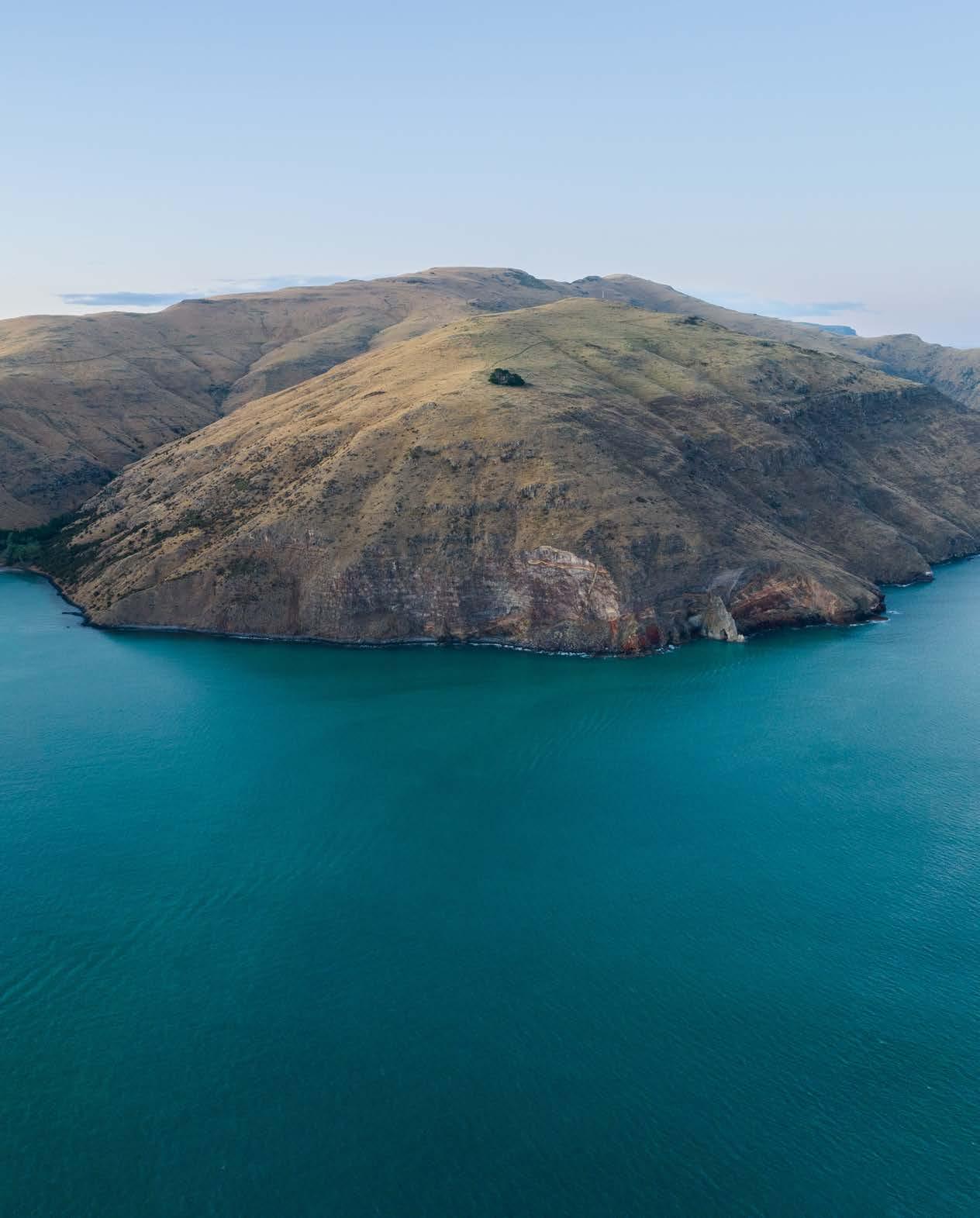
The bays of Whakaraupō
Lyttelton Harbour


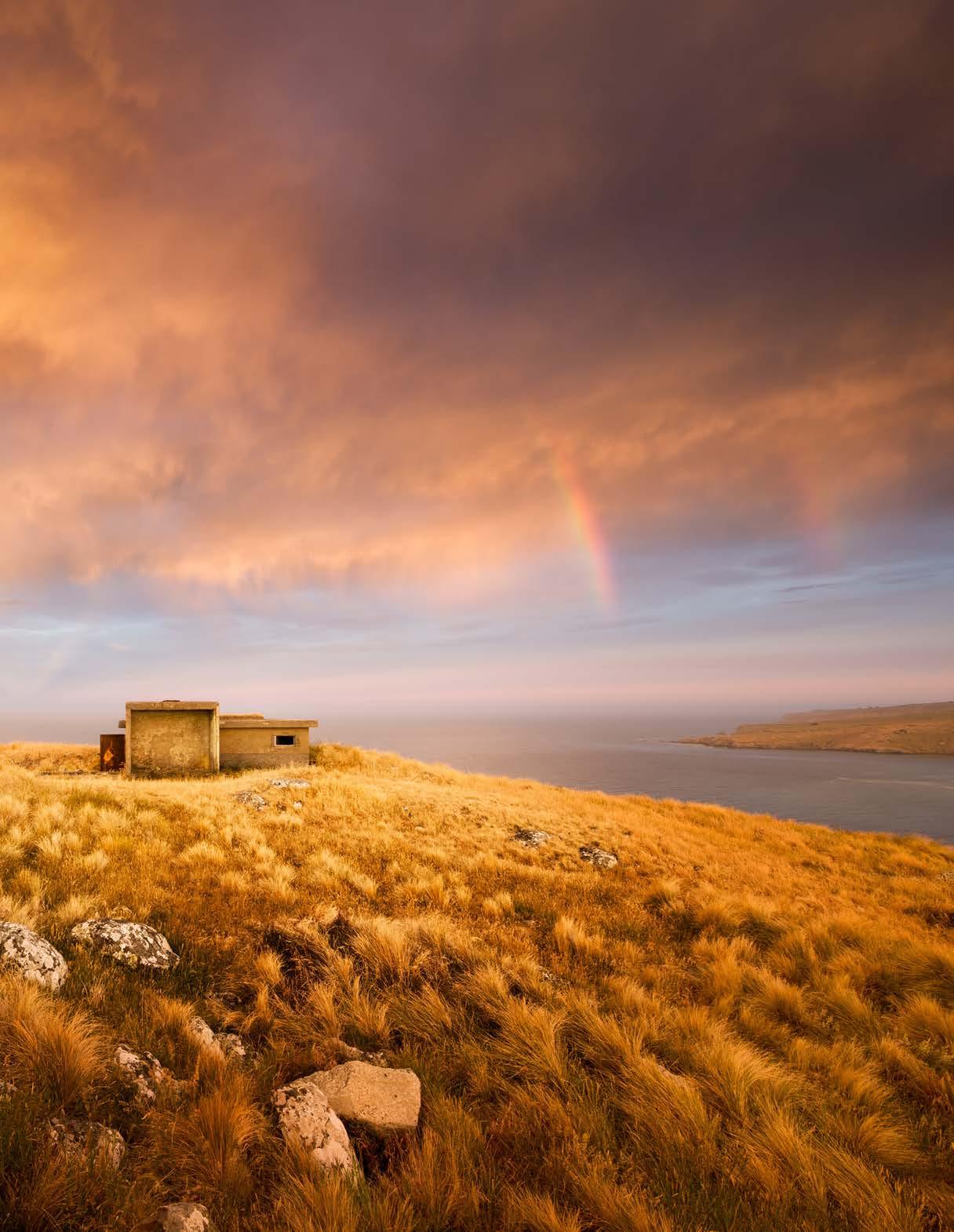
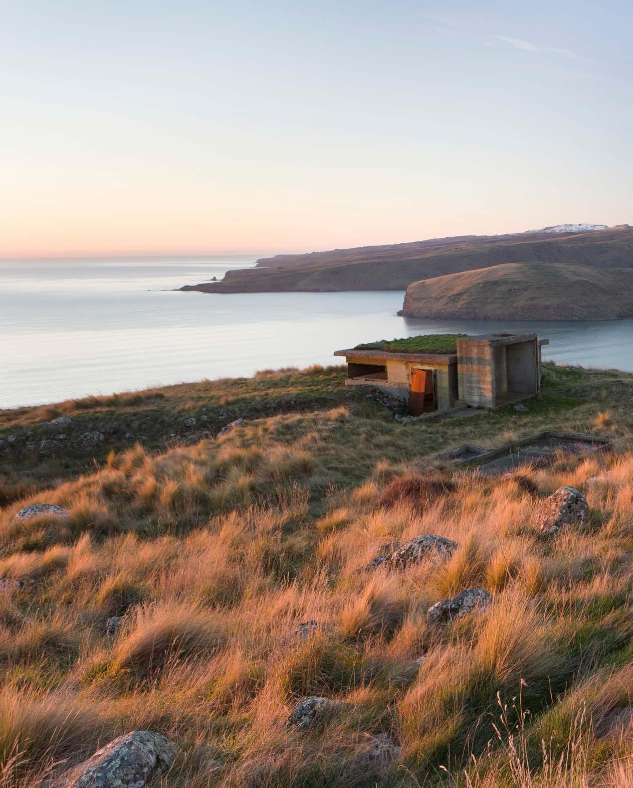


This book began life as a blog in which I wrote and posted images about the jetties of Whakaraupō Lyttelton Harbour and the small settlements serviced by those jetties. The blog posts went out on local social media, triggering responses from those who lived — or used to live — in the harbour. Those responses and other conversations with harbour residents fed into what was to become this book.
The focus on jetties grew out of my research for Head of the Harbour: A History of Governors Bay, Ōhinetahi, Allandale and Teddington. While working on that book I found myself particularly engaged in, and challenged by, the mysteries of the various jetty structures, past and present. I decided to extend my research to embrace all the jetties in Whakaraupō.
The tidal zone or takutai moana, which jetties inhabit, is both land and sea, a place where the two coexist in an intimate relationship. The sea constantly caresses or pounds the edge of the land, changing it slowly and relentlessly or, sometimes (and increasingly), suddenly and devastatingly. In this zone of ebb and flow we build structures that enable easier access to the ever-shifting sea. Jetties, wharves, piers, quays, slipways — such projections shape ‘a relationship of familiar into unfamiliar . . . making an inaccessible environment accessible’.1 The sea becomes a highway, an extension of land routes, with those coastal structures acting as a hinge or threshold between land and sea.
I like jetties, particularly those in varying states of decay. I find them both beautiful and poignant — beautiful because of their wonderful textures and shapes, poignant because they represent a way of life that is largely gone. Throughout Whakaraupō there are jetties in various states of dereliction: some have been reduced to piles or dismantled, others have been swallowed by the sea. While jetties denote settlement and suggest a degree of permanence, they are, in themselves, anything but permanent. Without maintenance, such sea structures degrade inexorably in their unforgiving marine environment.
Although jetties were the physical starting point for this book, it rapidly
Three boats tied up at the Bradley/Charteris Bay jetty with what is now known as ‘Traffic Cops Bay’ behind. The jetty still stands but has been closed to the public since the 2010/11 Canterbury earthquakes.
CANTERBURY MUSEUM, W. A. TAYLOR COLLECTION, 1968.213.392
became clear that these pathways over the water were just a portal — a way of stepping back into harbour communities whose reliance on the sea was so much greater than ours is today. I wanted to write more broadly about the relationship between land and sea and how that relationship changed over time for those who made the harbour their home.
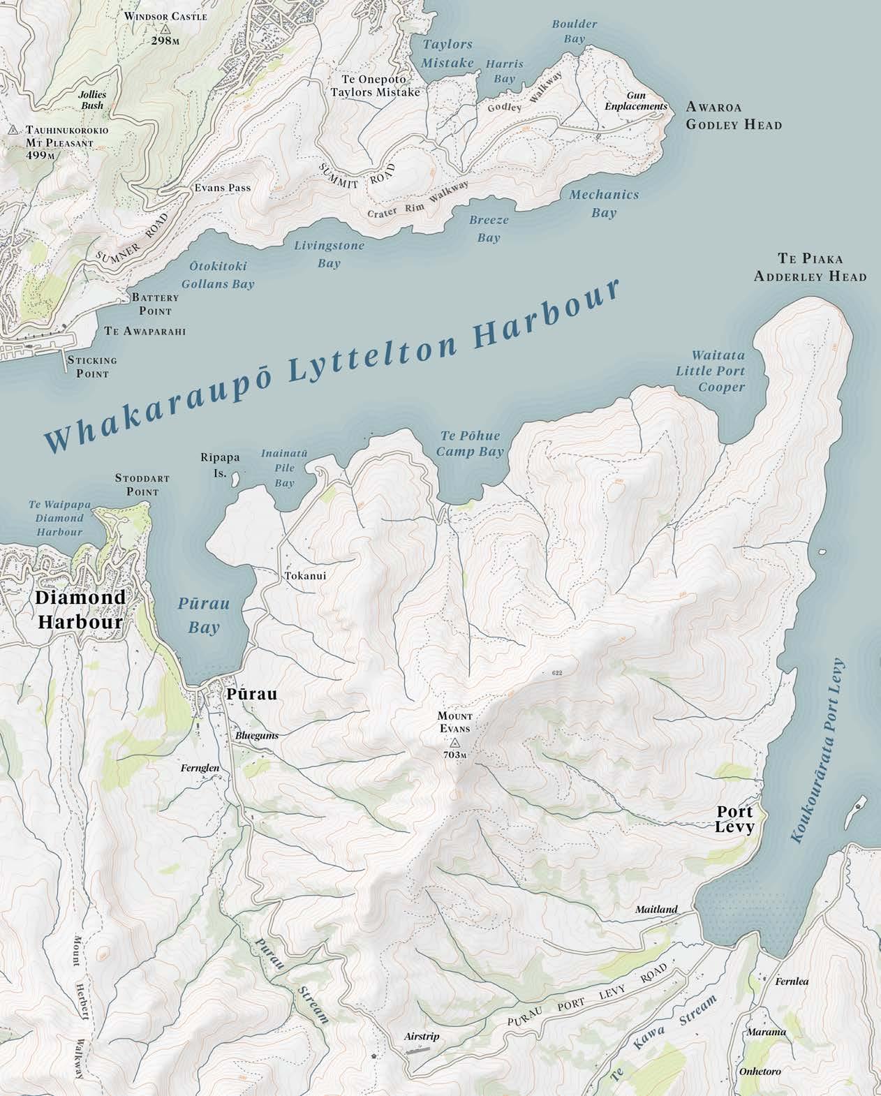
Each chapter in this book tells the story of one settlement or a small cluster of settlements. Structurally, I have followed the U shape of Whakaraupō’s shoreline, starting in the south-east adjacent to Te Piaka Adderley Head and working in a clockwise direction. The settlements are: Waitata Little Port Cooper, Te Pōhue Camp Bay, Rīpapa Island, Pūrau, Te Waipapa Diamond Harbour, Kaioruru Church Bay, Te Wharau Charteris Bay (including Hays Bay), Tauwharepaka Teddington, Allandale, Ōhinetahi, Ōtoromiro Governors Bay, Pukekaroro Sandy Bay, Māori Gardens, Ōtamahua Quail Island, Te Rāpaki-o-Te Rakiwhakaputa, Motukauatirahi Cass Bay, Motukauatiiti Corsair Bay, Magazine Bay, Te Awaparahi Buckleys Bay, Ōtokitoki Gollans Bay and Awaroa Godley Head. I have not included the port of Lyttelton except where it affects neighbouring settlements. That would be a project in its own right and awaits another author.
Long before any jetties were built in Whakaraupō, Māori navigated its bays, selected sites for settlement, understood the vagaries of the harbour weather and gathered the plentiful kaimoana to feed whānau and manuhiri (visitors). Every part of the harbour bore a Māori name which described its role or significance within te ao Māori. Since colonisation, many harbour settlements and features have been better known to all but a few by their European titles, which supplanted the earlier Waitaha, Ngāti Māmoe and Ngāi Tahu names. In this book, when a place name is introduced for the first time I use both its Māori and English names, regardless of whether the dual naming is official or not. Thereafter I use either name, with context generally determining my choice. Over the years in which a place would generally have been referred to by its European name, I follow that convention. However, I hope this book will contribute to the growing use by all of us of the beautifully descriptive Māori names that graced our harbour for centuries and are increasingly receiving official recognition.
The terms ‘jetty’ and ‘wharf’ tend to be used interchangeably to refer to fixed structures that project out from the land into water. ‘Jetty’ is derived from the French word jetée or ‘thrown’. ‘Wharf’ comes from the Old English hwearf, meaning ‘bank’ or ‘shore’. Both terms are used for such structures in Whakaraupō.
I have chosen to use the term ‘jetty’ throughout the book, referring to ‘wharf’ only when it is quoted in source material.
The first jetties in Whakaraupō were built by private individuals to facilitate the transport of farm produce to Lyttelton and markets further afield. Household supplies were carried on the return journey. Such jetties were essential to surviving and thriving in the eroded caldera of an ancient volcano, flooded by the sea. As the nineteenth century gave way to the twentieth, and more public jetties were built by the Lyttelton Harbour Board, their recreational value increased, with motor launches criss-crossing the harbour bringing day trippers and holidaymakers to ‘resorts’ such as Corsair Bay, Governors Bay and Diamond Harbour. Thereafter the construction of better roads around the harbour, the use of trucks to transport farm produce and the growth in private vehicle ownership meant a slow decline in the use of jetties, although they continued to serve yachties and other boat owners.
The foreshore, with its marine structures, was and is a gathering place, a site of community activity and identity, a place of arrivals and departures, a liminal space. It was also a contested political space. As the need for facilities increased and privately built jetties gave way to publicly funded structures, the Lyttelton Harbour Board and the Mount Herbert County Council locked horns over the ownership, construction and maintenance of jetties. Farmers and boat owners were caught in the financial crossfire. The continual silting of the harbour, which
Mark Stoddart arrived in Port Cooper (Lyttelton Harbour) in January 1851 and purchased land in Diamond Harbour. In the late 1850s he built one of the first private jetties. The present-day Diamond Harbour Jetty is the direct descendent of the Stoddart Jetty seen in this pre-First World War photo.
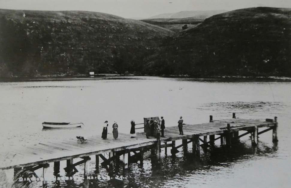

increasingly impeded access, was often blamed, fairly or not, on the actions of the harbour board. In the twenty-first century, climate change with its associated sea-level rise may alter familiar shorelines and pose further political challenges.
The stories of the harbour settlements and their jetties are also the stories of the dinghies, whaleboats, ballast craft, lighters, barges, yachts and steam launches that carried people and produce around the harbour. These tough little craft provided a vital service for isolated harbour families and a much-anticipated recreational opportunity for townies. They were involved in accidents and rescues. Some craft, like the steamer John Anderson, were in service for decades and were much loved by harbour residents. Boats and jetties enjoyed a symbiotic relationship. As reliance on the former decreased, so, too, did the need for the latter. This book is also a tribute to all those hard-working harbour craft and those who skippered them.
When people asked me how ‘the jetty book’ was going, I wanted to say, ‘It’s not just about jetties.’ But generally I didn’t, because that’s where it started. Tracing the stories of the jetties has required a lot of fruitful and fruitless archival work. Some mysteries, especially around the Teddington jetties, remain. The longdisappeared ghost jetties, especially, have been both challenging and exciting to ‘surface’. The discoveries that surprised and delighted me most were perhaps the long jetty built for the signal station settlement at Little Port Cooper and the very short jetty in Mechanics Bay that, incredibly, serviced the lighthouse at Godley Head. Neither of those I knew about before beginning this book. I tried to visit the site of every jetty, whether extant or in skeleton or ghost form. Two were beyond my reach: the jetty at Godley Head, inaccessible except to amphibious mountain goats because of its location at the bottom of a much-eroded cliff, and the jetty at Buckleys Bay, since the bay has long since disappeared beneath rubble quarried from the crater wall to form Cashin Quay.
In recent years, the Department of Conservation and the Lyttelton Harbour Board (subsequently the Lyttelton Port Company) have partnered to rebuild or restore jetties on Ōtamahua Quail Island and Rīpapa Island. Te Hapū o Ngāti Wheke at Te Rāpaki-o-Te Rakiwhakaputa carried out extensive repairs to their Gallipoli Jetty in the 1970s, and after the 2010/11 Canterbury earthquakes Church Bay residents worked hard, using voluntary labour and expertise, to restore their jetty. A private jetty in Charteris Bay remains in excellent repair. The Governors Bay long jetty, built initially as a short jetty in 1874, is being rebuilt by a community that sees historical, cultural and recreational value in retaining such a structure. Perhaps we might even, one day, see launches return, on special occasions, to the upper harbour.
Passengers disembark from the steam pinnace Canterbury at Governors Bay, c.1905. This was the second public jetty in the bay, built in 1874 and extended significantly in 1913. Despite the remarkable length of the jetty — 300 metres — silting in the upper harbour meant that access at low tide continued to be a problem.
F.C. BISHOP COLLECTION, CANTERBURY MUSEUM, 1923.86.2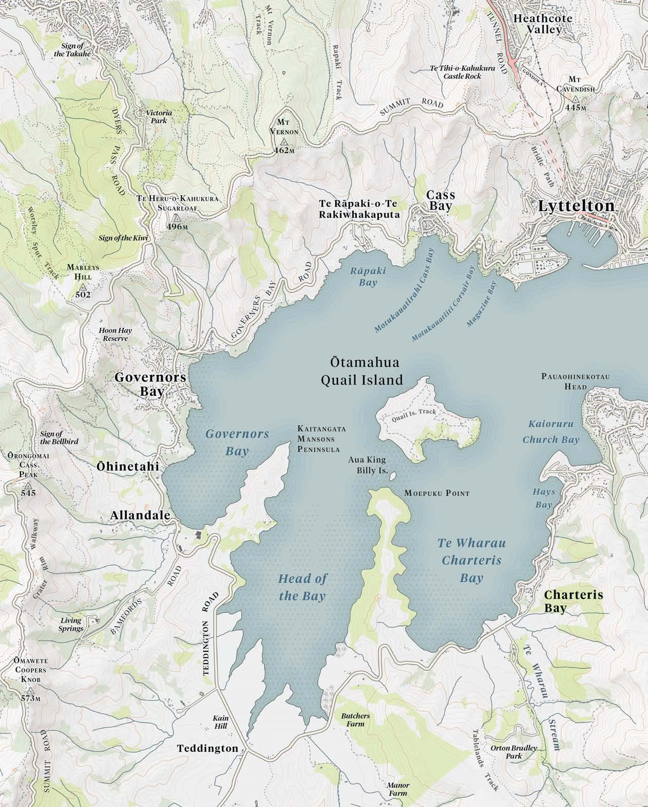
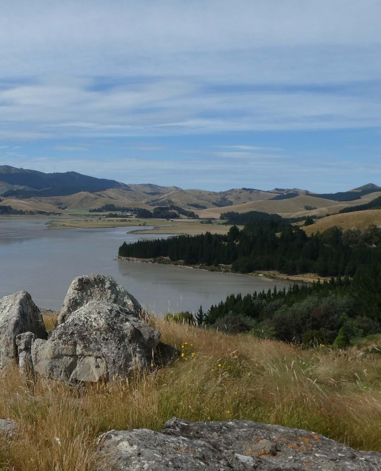
In Aotearoa New Zealand we are never far from the sea. Most of us live on, or very near, bodies of water that connect to the huge expanses of the Tasman Sea or Pacific Ocean. We swim, fish, sail, kayak on the sea, holiday beside it and gain sustenance from it in terms of kaimoana and spiritual renewal. We all, tangata whenua and those of us who arrived later, came to Aotearoa by or over sea. Even in an age of flight when most parts of the globe are accessible, New Zealand remains somewhat isolated in the swirl of the southern oceans. Were our planet flat, we would be clinging to a watery edge.
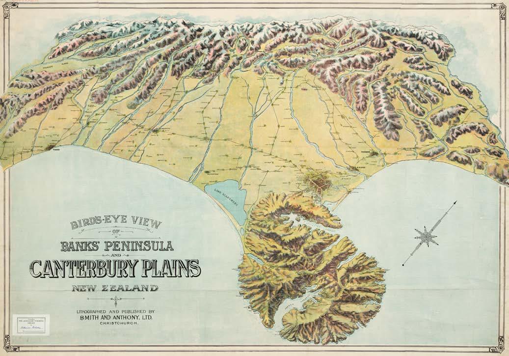
On the otherwise fairly featureless east coast of Te Waipounamu the South Island, backed by Kā Pākihi Whakatekateka o Waitaha (‘the great flat lands of the Waitaha’, or Canterbury Plains), a bulbous nose protrudes into the South Pacific Ocean. This is Te Pātaka o Rākaihautū or Horomaka, commonly known today as Banks Peninsula. If Aotearoa is on the edge, then Te Pātaka o Rākaihautū is the edge of the edge. For most of its existence the peninsula was an island, formed between eleven and eight million years ago by the violent eruptions of two main volcanoes. At its tallest, the island towered some 1500 metres above sea level. Gradually the volcanic complex eroded and deep valleys formed. Over time, huge quantities of outwash debris flowed down from the Southern Alps and coalesced in shingle fans, eventually joining Te Pātaka o Rākaihautū to Te Waipounamu. Windblown silt (loess) from the west covered the peninsula hills and valley floors. As the sea level rose, the low-lying terrain flooded, creating the natural harbours that now serve Akaroa and Lyttelton. Even when it finally became a part of the mainland, the mountainous peninsula remained all but cut off from the plains by swamps, lagoons and streams.
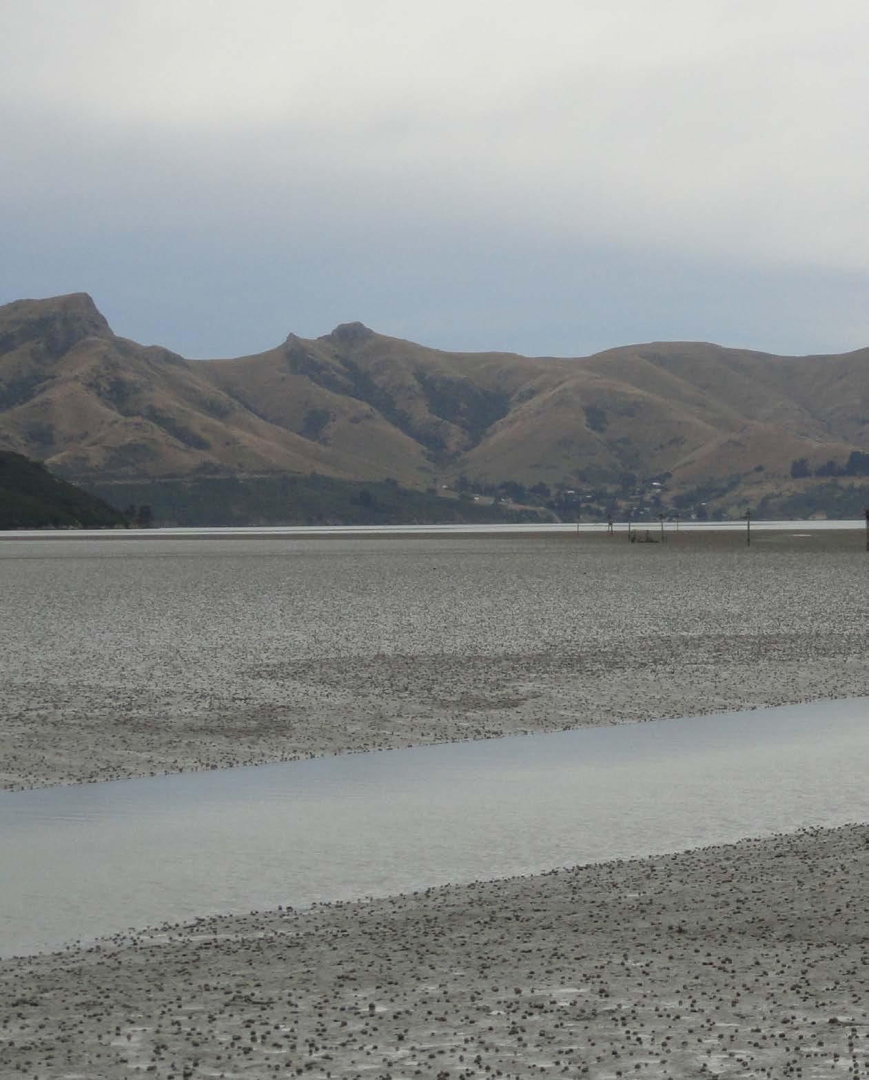
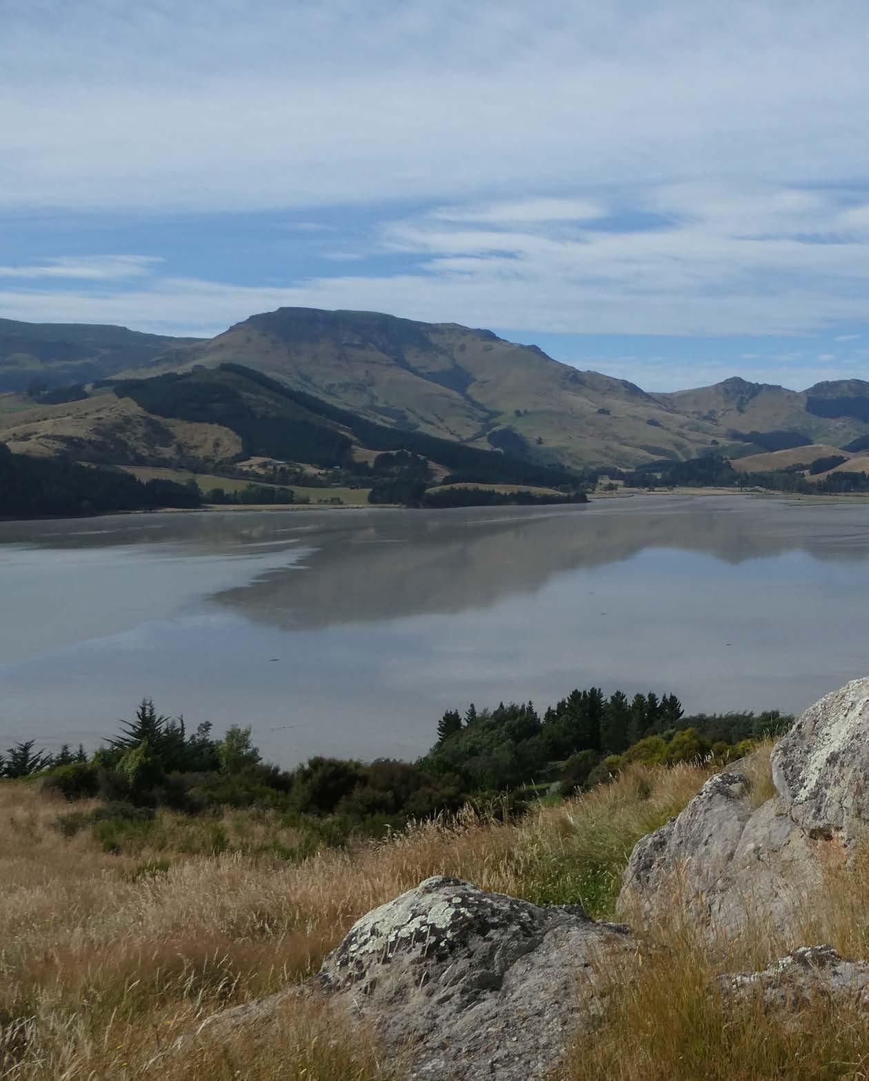
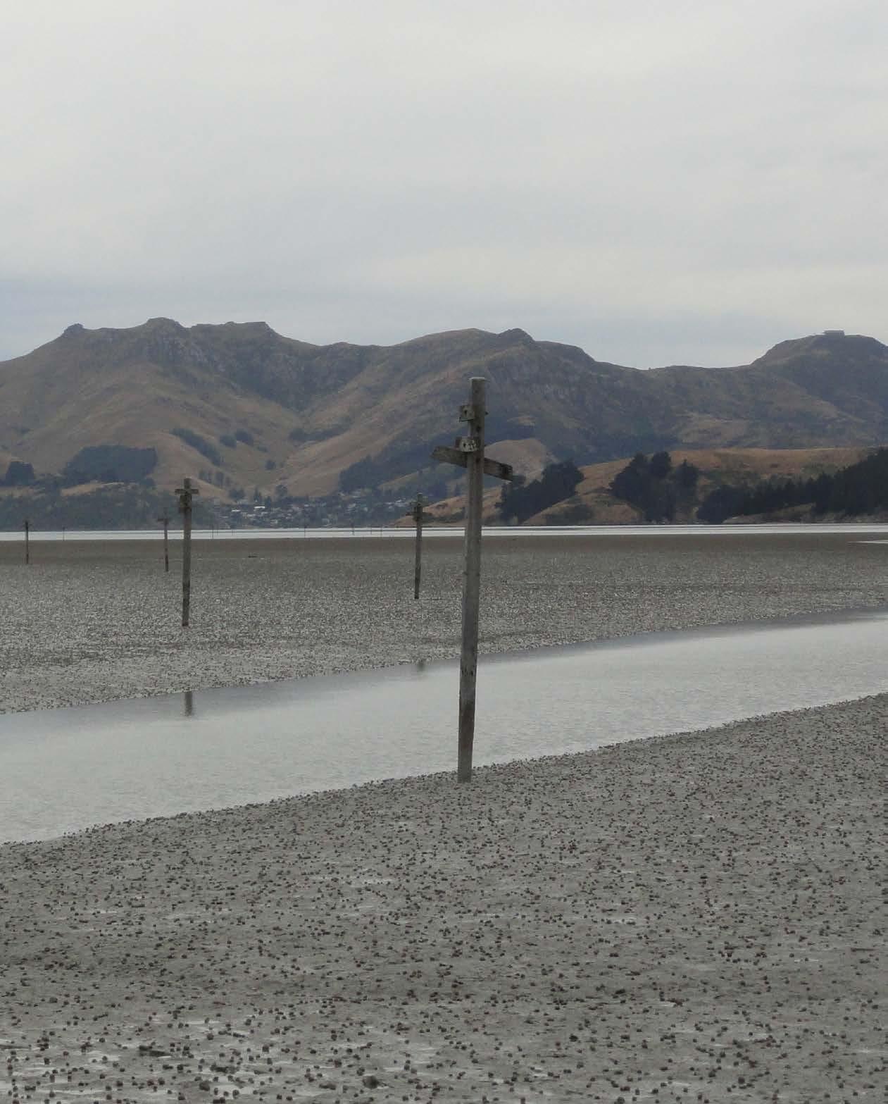
Today, the volcanic rocks of the peninsula are covered by deposits of loess up to 20 metres thick, blown from the Canterbury Plains. This fine sediment is easily and constantly eroded from the hill slopes around Whakaraupō Lyttelton Harbour. The eroded material has infilled the harbour basin to depths of up to 47 metres, creating extensive tidal flats in Governors Bay, Head of the Bay and Charteris Bay.1 This natural geological process, speeded up by human intervention, plays a part in the stories of the harbour settlements.
In the Māori legends of Te Waipounamu, Rākaihautū (a Polynesian ariki or high chief, and captain of the canoe Uruao which brought the Waitaha tribe to Aotearoa) and his son Rokohouia explored the southern island and named its lakes and lagoons. When Rākaihautū first saw Banks Peninsula, almost all parts of it were covered in dense podocarp forest, home to many native birds. The mudflats were fringed with salt-grass, jointed rush and shrubby ribbonwood, while native flax flourished in wet areas and on shady rocky spurs. The bays and harbours teemed with fish and shellfish. Rākaihautū named the peninsula his pātaka, or great food storehouse.

Tamatea Pōkai Whenua, descendant of Tamatea Ariki Nui, who commanded Tākitimu from Hawaiki to Aotearoa, also explored Te Waipounamu. When Tamatea came to Te Pātaka o Rākaihautū he named the large and relatively sheltered harbour on its north-eastern side Whakaraupō, after the raupō reeds that were once plentiful at the head of the long bay. This harbour was to sustain, in succession, Waitaha, Ngāti Māmoe and Ngāi Tahu, with its kaimoana and native birds providing an intricate network of mahinga kai (food resources and locations).2
But the impact of human occupation on Te Pātaka o Rākaihautū generally, and on Whakaraupō in particular, was devastating. About a third of the peninsula’s forest cover was lost during the period of Polynesian settlement. The rapid removal of almost all the remaining blanket of vegetation following European occupation opened up the deep layers of loess covering the hills to the erosive effects of wind and rain. The silting of Whakaraupō, already a natural phenomenon, increased.
Before the development of reasonable road access — or any roads at all — the sea was a highway on which Māori and, later, early European settlers depended. Māori used a variety of waka to traverse ara moana (water-based trails) within Whakaraupō, between peninsula settlements and along the east coast. Tauranga waka (canoe landing points) were common and were associated with nohoanga (temporary settlements), linking a sea trail to a land trail. Māori could easily beach their waka on sandy shores or flat, rocky platforms. However, by the early 1840s Assistant Protector of Aborigines Edward Shortland reported that for Māori, ‘whaling and sealing boats have superseded canoes, in the management of which they show great skill and boldness’. In addition, ‘they have become expert whalers, and obtain employment at the fisheries often on the same terms as Europeans’.3 According to Charlotte Godley, early colonist, astute observer and author, the whaleboats had five, seven, nine or eleven oars, were peaked and high at both ends, and were steered by a man standing with an 18-foot oar.4
The waters around Banks Peninsula attracted whaling ships from the 1820s onwards. By the mid-1830s, Port Cooper (as Lyttelton Harbour was known then),5 with its sheltered anchorages at Little Port Cooper, Camp Bay and Pūrau, had become a significant rendezvous point for the whalers, evidenced by the nine whaling ships using Little Port Cooper as a base or a refuge in 1836. A Prussian whaler, Captain George Hempleman, brought the brig Bee into Little Port Cooper and beached her for much-needed repairs in February 1836. Boats were sent up the harbour, probably to the Māori settlement at Rāpaki, for potatoes.
In his role as the first surveyor general for the New Zealand Company, Captain
ABOVE The unusual aspect of this map illustrates the island-like nature of Banks Peninsula and how the Port Hills isolate Lyttelton Harbour from the Canterbury Plains.
ALEXANDER TURNBULL LIBRARY, 834.44A/ACC.6638
BELOW Whakaraupō Lyttelton Harbour looking west from the heads, with Awaroa Godley Head in the foreground, Te Waihora Lake Ellesmere and the Canterbury Plains in the distance. The volcanic crater rim of the Port Hills is also visible.
VC BROWNE & SON, UNDATED, PB0904-7
William Mein Smith was tasked in September 1842 with mapping the harbours on the South Island’s east coast. He favoured the inlet of Koukourārata Port Ashley (later Port Levy) over Port Cooper ‘because the most prevailing and violent winds draw through it [Port Cooper], producing a considerable swell’.6 Despite this disadvantage, the 1840s saw the arrival of the Greenwood brothers, followed by the Rhodes brothers at Pūrau and the Gebbie and Manson families at Head of the Bay (Teddington). The Deans brothers were farming at P ūtaringamotu Riccarton on the Canterbury Plains, while the Hay and Sinclair families settled at Wakaroa Pigeon Bay. These men and their families used the waters of Port Cooper as a roadway. The Deanses crossed the harbour to Pūrau and walked or rode to Port Levy to collect mail. The Greenwoods, Rhodeses, Gebbies and Mansons took their farm produce across the water to provision visiting ships. The ships then took the butter and cheese produced in Port Cooper to the new settlement in Wellington and further afield to markets in Australia. In fact, until the early decades of the twentieth century, many farmers and families in the bays around Banks Peninsula relied almost wholly on sea transport to get their produce to market.7
Thomas Cass arrived at the end of 1848 to take up the role of assistant surveyor for the Canterbury Association. He was joined by Charles Torlesse and Henry Cridland, the three young surveyors initially camping out at what became known as Cass Bay. While permanent settlers built or acquired their own boats, the surveyors were dependent on hired transport. For four or five shillings, Māori at Rāpaki would take Cass, Torlesse or Cridland across the harbour to Pūrau or up to the Manson and Gebbie farms at Head of the Bay. By 1851 the Ward brothers added to the growing harbour traffic as they rowed or sailed to Ōtamahua Quail Island, where they were developing a farm and building a house.
In Lyttelton Harbour, the first jetties were built by private individuals of some means. The Rhodes brothers built a jetty (now just a scatter of piles) on the east side of Pūrau Bay. Mark Stoddart’s private jetty in Diamond Harbour, built about 1856, eventually became the public jetty still in use today. The Bradley family built a jetty in Charteris Bay, and the Manson and Gebbie families in Teddington constructed a 300-foot jetty (on account of the mudflats) that was promptly destroyed in the tsunami of 1868. (On 15 August that year, a powerful earthquake off the Pacific coast of Peru and Chile generated the largest recorded distant tsunami to strike New Zealand.) Governors Bay had a scattering of private jetties and also two very early public jetties, one built in Sandy Bay in 1860 and the other, where the long jetty now stands, in 1874. In the absence of a jetty, goods could travel by lighters, which would run up onto the beach to be offloaded, then refloat on the next high tide.
The behaviour of the waters in Lyttelton Harbour vexed early settlers. The harbour was open to the ocean swell that swept around Banks Peninsula. This
swell, from the east and north-east, could at times travel up the harbour ‘with great violence and in very long undulations’.8 The harbour was also subject to sou’westerly gales which, in only two or three fathoms of water, could raise a short, choppy sea. In between the nor’easterlies and the sou’westerlies was the northwest wind, which blew down off the hills ‘in furious eddying squalls or “williewas”’.9 Criss-crossing the harbour in small vessels was frequently challenging and sometimes fatal.
Land transport gradually supplanted transport by sea as the road network around the harbour improved and trucks capable of carrying large loads came into service. As sea transport declined, jetties took on a more recreational purpose.
Launch trips to Corsair Bay, Governors Bay, Charteris Bay, Diamond Harbour and Pūrau had always been popular. In the early decades of the twentieth century, hundreds of day trippers might disembark daily at any one of these bays. As yacht and motor boat ownership increased, the jetties became popular with boaties.
The annual Lyttelton regatta attracted sailors from all around the harbour and well beyond. The first, held in May 1851 to celebrate the Queen’s Birthday, included a race for vessels from 8 to 15 tons; a rowing match for four-oared boats; a rowing match for five-oared whaleboats; a race for open sailing boats under 5 tons; and a sculling dinghy match. There was also a ‘duck hunt’, with a dinghy to be chased by two four-oared boats without a steersman. The duck had a five-minute start and had to be caught by the bow oarsman.
By 1858 the regatta had been shifted to New Year’s Day, when the weather was more settled and people were in holiday mode. It became Lyttelton’s big show day when city folk visited the harbour, and it grew so popular that by 1896 approximately 25,000 people travelled to the port for the day by road or rail. Festivities continued into the evening when, about 9.00 p.m., the popular steamer John Anderson left the wharf crowded with excursionists. ‘She was illuminated with coloured lanterns, and after making a round of the inner harbour, she took a procession of boats in tow, all of which were brilliantly illuminated with Roman candles.’10
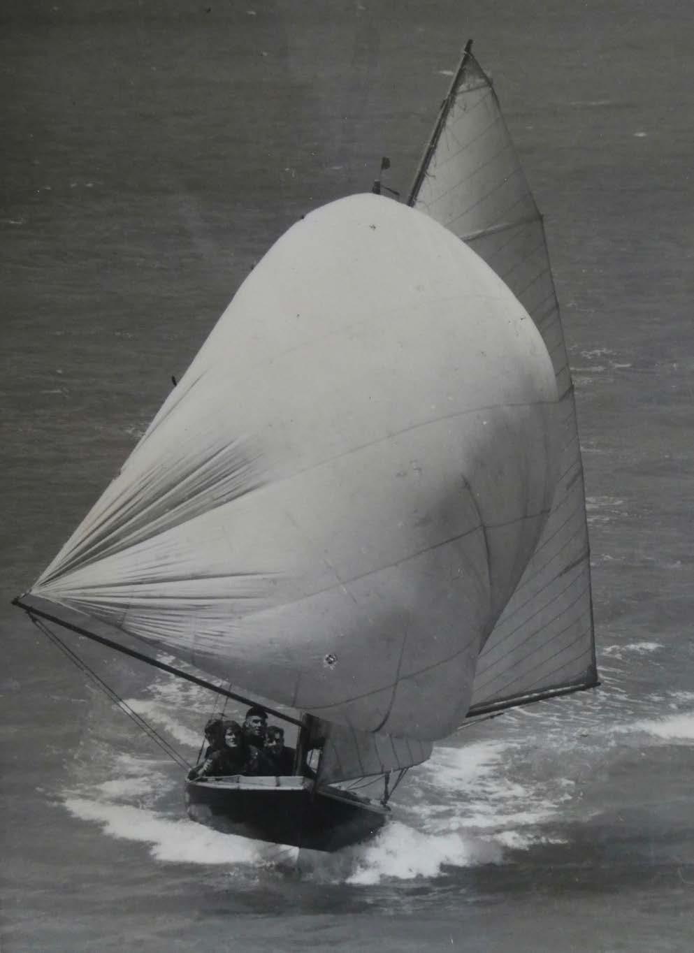
Yacht clubs at Lyttelton/Magazine Bay and Charteris Bay gave generations of children their introduction to sailing. The development of a 14-foot centreboard, clinker-built, dinghy-style yacht suitable for younger sailors coincided with the arrival in 1920 of Admiral Lord Jellicoe, who had been appointed Governor General. A keen yachtsman, Jellicoe championed the new design, which came to be known as the Jellicoe Class or X-class.
When the Sanders Memorial Cup was donated in memory of Lieutenant Commander W. E. Sanders, VC, DSO, for interprovincial competition amongst boats of the 14-foot, one-design class, interest really took off. Only one entry was allowed from each province and competition was intense.11
While the harbour was a popular playground, its foreshore was politically contentious. It was an area of interest to both the Lyttelton Harbour Board, established in 1877 with a responsibility for the management of the harbour’s commercial and recreational facilities, and the Mount Herbert County Council, formed in 1902 with a particular focus on the county’s roads and infrastructure.
Jetties in particular were objects of dispute. Initially, the port of Lyttelton and any outlying public jetties came under the control of the Provincial Government of Canterbury, but the provincial governments were disestablished in 1876 and jurisdiction passed to the fledgling harbour board. One of the sticking points for the harbour board was the fact that the foreshore was not vested in the board — meaning it could not recoup the cost of constructing and maintaining jetties by charging for their use. In April 1880 the harbour board first discussed the desirability of its gaining jurisdiction over the beach or foreshore reserve around the harbour. In 1905 the Lyttelton Harbour Board Land Act vested ‘certain parcels of land being portions of the foreshore in the Port of Lyttelton used as sites for jetties and wharves’ in the harbour board.12 The New Brighton and Sumner Borough Councils and the Heathcote Road Board raised no objection. The Mount Herbert County Council, within whose jurisdiction Lyttelton Harbour fell, unsuccessfully opposed the Act, believing that the harbour board was really seeking to control privately owned wharves, which would then be charged levies.
The Harbour Board Land Act gave the Lyttelton Harbour Board jurisdiction over foreshore land in Governors Bay, Sandy Bay (Percivals Point), Heathcote, Port Levy, New Brighton, Charteris Bay, Sumner, Diamond Harbour, Pūrau (two areas) and Rāpaki. This legislation eased the way for the construction of further outlying jetties and the maintenance of existing structures. Between 1905 and 1915 new jetties were built, rebuilt or significantly altered at Little Port Cooper, Pūrau, Diamond Harbour, Church Bay, Charteris Bay, Governors Bay and Corsair Bay. Rāpaki, Camp Bay and probably Teddington followed, during and after the First World War. It was a golden age for public water transport in Lyttelton Harbour.
The Lyttelton Harbour Board, seeking to recoup costs from jetty users, had to decide on a revenue-raising mechanism. Its engineer, Cyrus Williams, outlined the options in a 1909 memo. The ‘outlying’ jetties in Lyttelton Harbour under the board’s jurisdiction included those listed above plus two at Governors Bay and an extra one at Pūrau. Williams estimated the lifespan of the older jetties at about 30 years, since they were constructed of ‘inferior timbers which had previously been used for temporary purposes in connection with the Dock etc.’13 The more recently built jetties could be expected to survive at least 40 years. Several of the older jetties were nearing the end of their useful lives.
Williams calculated that the amount of revenue that would accrue to the harbour board from wharf charges would not justify any elaborate collection
mechanism. He consulted other harbour boards to see how they were handling the matter. Mr Clibborn, the Lyttelton Harbour Board’s watchhouseman and collector, suggested that ‘shipmasters or owners when collecting their freight be asked to collect the wharfage on goods, at a commission of, say, 2½ percent’. Williams thought this would not be a ‘vexatious charge’ and that it would establish the custom and principle that ‘special conveniences should be paid for by those benefiting by them’.14
Maintenance of the outlying jetties continued to be an issue for the Lyttelton Harbour Board. ‘It was to be regretted that the local bodies interested had met with legal difficulties in the way of contributing towards the cost of the upkeep of these, to them, great conveniences.’15 In August 1912 the Lyttelton Harbour Board adopted the Outlying Jetties By-law, which required all licensed vessels using the outlying jetties to pay one shilling per ton on cargo landed or shipped from the jetties and one penny per head on each passenger landing or embarking. The harbour community was having none of it. Farmers already paid wharf fees when their produce was offloaded in Lyttelton. This additional fee would mean they were taxed twice. A stand-off ensued. Port Levy farmer R. J. Fleming told the harbour board that if the charge went ahead he would ship his wool clip out ‘the old way’, by lighter run up onto the beach, rather than via the jetty. ‘I have already told the agents of the SS John Anderson that if they pay wharfage on any of my stuff at this end that they do so at their own risk for I shall strike it off my bills
The Lyttelton Harbour Board sent out reminders to launch operators regarding charges due for the use of outlying jetties. This also met with passive resistance. Launch owners simply refused to submit their freight lists. The harbour board referred to the ‘deliberate evasion’ of the payment of charges, but was at a loss to do anything about it. Eventually, in November 1920, the system of charging goods and passengers was replaced by a scale of annual fees. The annual rates for boats plying the harbour would be: John Anderson £75 10s, Onawe £32 10s, Toi Toi £15, Matariki £15, Zephyr £10.17
In 1913, a bill was tabled which would give the harbour board complete control of the foreshore and surrounding bays of the harbour. In the end the board was granted authority over the beach up to the high-water mark. In May 1914, a deputation from the Mount Herbert County Council requested that the harbour board remit its charges for the use of outlying jetties. The council ‘would be quite happy to pay for maintenance and repairs if the wharfage rates were abolished’.18 In response to a board question, the deputation spokesman said he considered it fair that the residents of the bays should pay for the construction of their own wharves.
Eight years later, in September 1921, the Harbour Improvement Committee recommended that the harbour board pass control of the outlying jetties to the various local bodies concerned. The local bodies (in the case of Lyttelton Harbour,
the Mount Herbert County Council) would be responsible for maintenance and minor repairs, while major repairs resulting from weather conditions and general depreciation would be carried out by the harbour board. The jetties would be brought up to scratch and, where necessary (Pūrau, Charteris Bay and Camp Bay), equipped with cranes by the harbour board before the handover. The troubled saga of ownership and revenue collection suggests that the harbour board would have been mightily relieved to relinquish day-to-day management of the jetties. In February 1922, the county council resolved that, under the agreed conditions, it would take charge of all wharves and jetties within the county for a term of three years. Whether this change in jurisdiction continued beyond the agreed three years is unclear but, in light of later events, it seems the harbour board retained control.
As more farmers took advantage of trucking services, subsequent years saw a gradual decline in the harbour launch fleet.19 This meant that passenger traffic became the main income-earner for the launch operators, especially on public holidays, when the launches could be overwhelmed by excited day trippers. The harbour board decided in 1933 to abolish licences for use of the outlying jetties
and instead to increase general harbour passenger licences to between £1 and £5 per annum. Another ongoing frustration for the harbour board was the vandalism or theft of life-saving gear placed on jetties for the safety of the public. Offenders could be fined up to £200 or imprisoned for up to a year.
One of the biggest problems for harbour residents and the harbour board was the gradual silting of the harbour, caused primarily by topsoil washing into the sea from the surrounding catchment. Over time, once-functional jetties were left high and dry at low tide. A graphic example was the ‘long’ jetty at Governors Bay. Beginning life in 1874 as a ‘short’ jetty, it was extended in 1913 to accommodate launches bringing holidaymakers. A second jetty was built in the bay in 1883 to provide launch access at all tides.
The jetty built at Little Port Cooper in 1909 to service the Adderley Head Signal Station was built exceptionally long to deal with the gently sloping beach and the fact that the harbour board had been dumping dredged sediment there for many years. In Charteris Bay access to the official jetty at low tide became increasingly uncertain, and a second jetty was built in deeper water to enable golfers from Lyttelton to play at the Charteris Bay Golf Course. At Teddington the effectiveness of any jetty was dependent on a channel winding across the mudflats. Dredging would have enabled easier sea access to many harbour settlements, but it was a process deemed too expensive for servicing only small numbers of residents.
Arguments about the cause of silting in the upper harbour seem never to have been fully resolved. Locals regularly wrote to the papers blaming Lyttelton Harbour Board’s dredging and dumping of spoil in the lower harbour. They claimed that this spoil was redistributed around the harbour by tidal action. Charteris Bay resident Robert Anderson pointed out in 1897 that he and others used to dredge for oysters in a line between Church Bay and Cass Bay when the harbour bottom was hard live shell. ‘But soon after dredging began the bottom gradually got softer, and at the present time it is a dungeon of soft mud.’20 Head of the Bay resident Bruce Gebbie recalled ‘an often repeated comment from around the late 1800s–early 1900s . . . that the silt beat the dredge back to port’.21 Writing to the Press in 1930, John Hadfield was ‘astonished to see the mud-flats extending almost to the long jetty that was built by the Harbour Board some years ago and which now can only be used by a launch at high tide’.22
The harbour board vigorously denied these anecdotal claims. In 1934 its chairman, W. G. Gallagher, reported that engineer Percy Fryer’s plans of soundings taken in Governors Bay in 1849, 1903, 1927 and 1934 indicated no changes in the depth of water.
Claims from residents continue to this day. Some believe the construction of the breakwater at Cashin Quay in the 1960s altered the flow of water in the harbour and contributed to further silting in certain areas.23 Certainly, the altered flow of water meant that the foreshore at Pūrau was much more actively eroded. However, Bruce Gebbie does not believe that silting has got worse, nor that the upper reaches of the harbour have become shallower since the 1960s. ‘I’ve always been aware of how long you have each side of high tide to launch or retrieve at both Sandy Beach and Charteris Bay. Back in the seventies we considered it safe to water-ski for two hours either side of high tide between Walkers Beach and King Billy Island.’24 Today, it seems that the mudflats at Allandale and Governors Bay may in fact be in retreat.25
Lyttelton Port Company’s engineering services manager Neil McLennan observed that when he started at the harbour board in 1975 and for much of the decade after, Malcolm Jones, resident engineer at the port company’s Lyttelton office, managed the outlying boatsheds with associated slipways and often small jetties. ‘Many of these were in serious disrepair and a safety issue, but Malcolm took a constructive approach to assisting the owners to make them safe.’26 Nevertheless, underused and disused public jetties continued to deteriorate.
In 1989, the creation of the commercially driven Lyttelton Port Company saw control of the outlying jetties pass to the newly formed Banks Peninsula District Council. When this council amalgamated with the Christchurch City Council in 2006, the city council took over management of the jetties in Lyttelton Harbour. An assessment of the condition of marine structures in 2009 revealed that many of the jetties were in poor condition, reflecting years of limited, reactive maintenance and renewal. Following the Christchurch earthquakes of 2010 and 2011, the jetties at Church Bay, Charteris Bay and Governors Bay were deemed unsafe and closed to the public. In 2013/14 the amount of deferred work totalled roughly a million dollars.
In 2014, the Christchurch City Council published an Activity Management Plan for its harbours and marine structures.27 The council’s user survey revealed that boating, sightseeing, walking, jumping and swimming were common jetty activities. Over the long term, the council aimed to rationalise the number of marine structures that it provided to an ‘affordable level’. This meant reducing reactive work with a steady programme of maintenance and renewal. Funding constraints meant that some structures could be closed and not renewed. Others might be renewed in a form different to their current design. Still others could benefit from a different model of ownership and management. Community involvement could relieve the council of unsustainable expense while extending the life of marine structures valued by their communities. Historically, self-reliance and resilience have been hallmarks of communities
in Lyttelton Harbour and on the peninsula generally. So it is not surprising that the residents of Te Rāpaki-o-Te Rakiwhakaputa, Church Bay and Governors Bay have, in turn, taken on the restoration of their bay’s jetty. The latest, and most ambitious, project is the virtual rebuild of the 300-metre Governors Bay jetty, spearheaded by the locally constituted Governors Bay Jetty Restoration Trust and drawing on a wide range of local expertise. A common thread running through harbour community projects over time has been the recycling and repurposing of materials, and this is very evident in jetty restoration.
Currently Black Cat operates a regular and popular launch service between Lyttelton and Diamond Harbour, enabling day trippers from Christchurch to enjoy the seaside. During summer, Black Cat also runs a daily launch service to Ōtamahua Quail Island, now a Department of Conservation (DOC) reserve and the site of a major ecological restoration project, popular with swimmers, walkers and those interested in harbour history. Rīpapa Island, also a DOC reserve with a colourful history, is once again accessible by sea following the repair of its jetty after the 2010/11 earthquakes. Perhaps, in the future, launches might also operate between Lyttelton and some of the other harbour bays, linking with the Head-to-Head Walkway (under construction at the time of writing) and offering a recreational experience that recalls the harbour’s early history.


