Nga - tokimatawhaorua


the biography of a waka


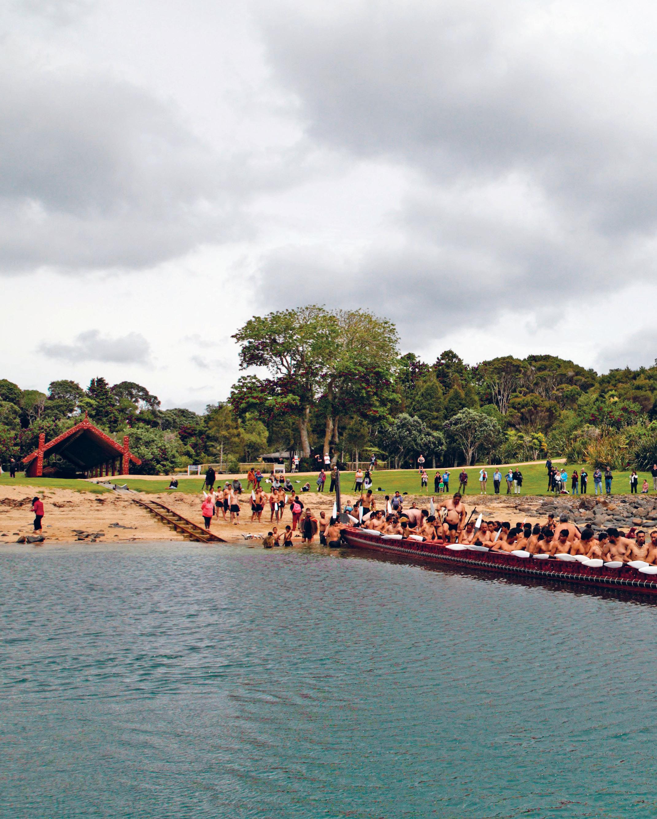


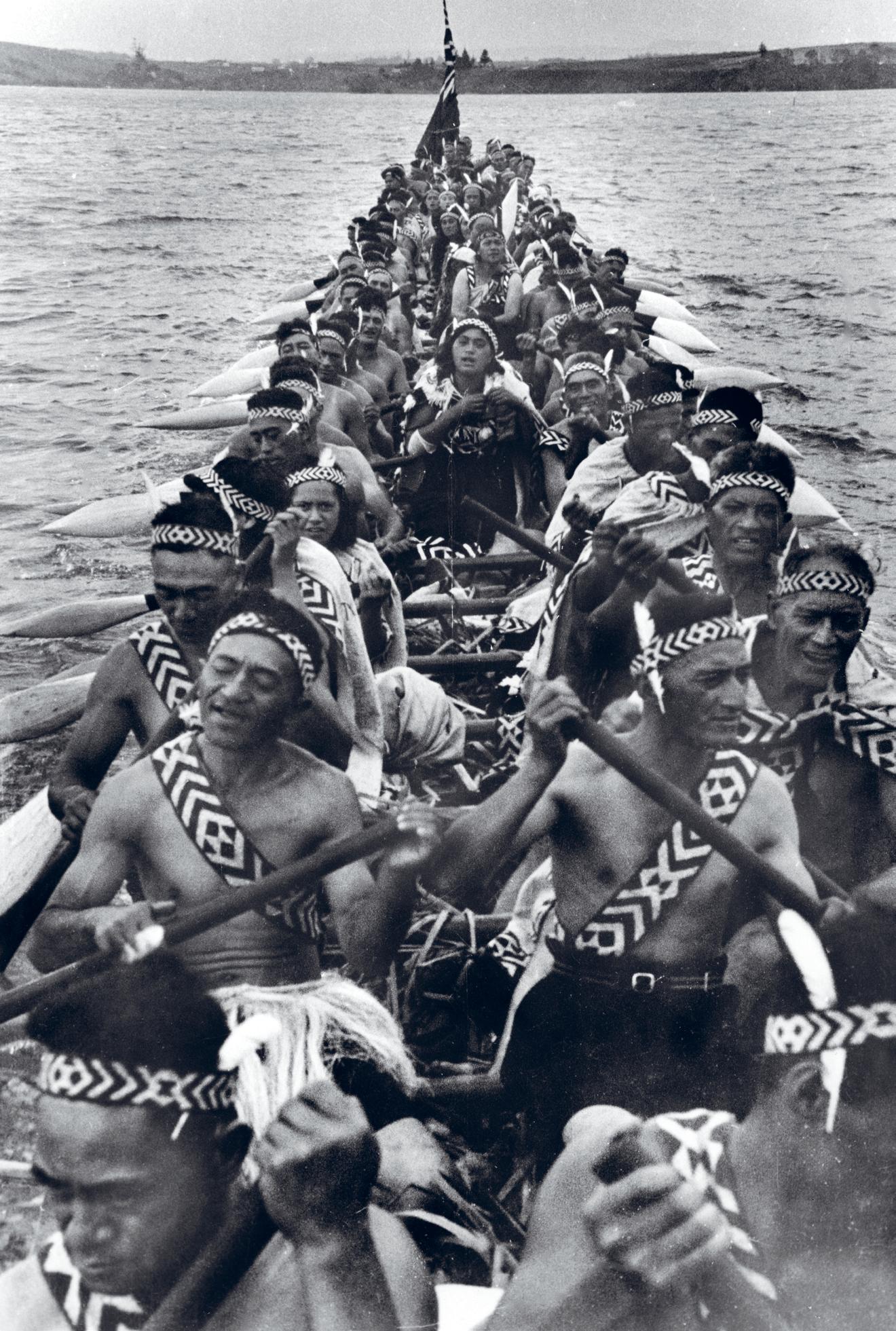
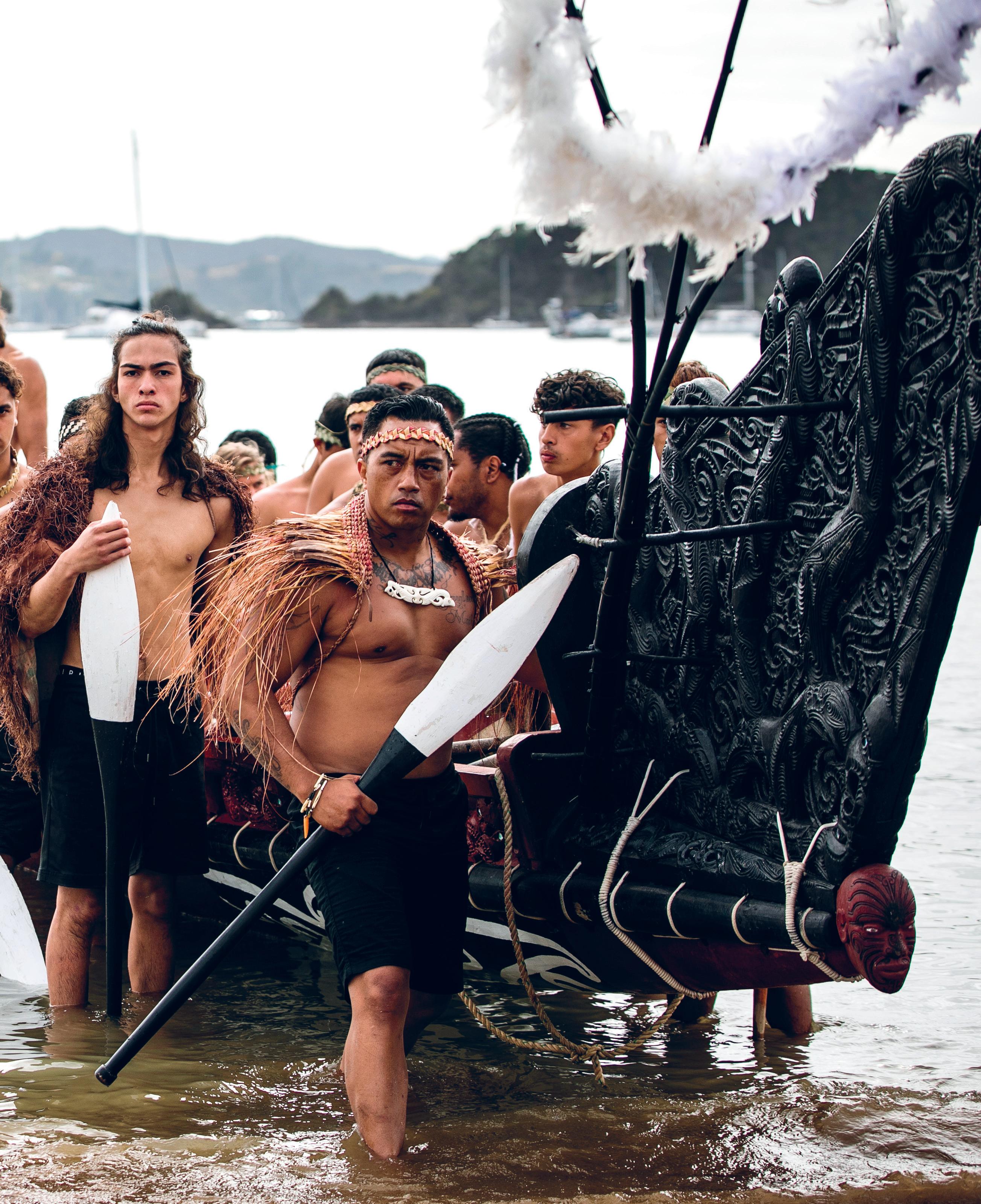
Photographer and film-maker Jim Manley was able to take some stunning footage of Ngātokimatawhaorua being built and, later, once it had been launched. Clearly visible in this image are a number of women, including one paddling (left, fifth from the front). Courtesy of the Manley faMily
Ka mahi au, ka inoi au, ka moe au, ka mahi ano.
Kōia tēnei tētahi kōrero nā Te Puea Hērangi, i a ia e amo ana i te kaupapa e pā ana ki te waka o Ngātokimatawhaorua . E rapa mai ana ēnei kupu i te pātu o te whare tūpuna, o Manu Koroki ki Mōtatau, hei mahara āke i ōna mahi nui kia tutuki pai te kaupapa.
Ngātokimatawhaorua is the pre-eminent waka of Tai Tokerau iwi. It is the largest ceremonial waka in existence and of national significance. For such an important taonga and with its history, it is a mystery why there is so little written information about this storied waka.
It is also why it gives me pleasure to introduce Jeff Evans’ new volume on Ngātokimatawhaorua . The book fills this gap admirably and provides us with a deeply researched and layered history of the waka and the people connected to it. In compiling this book, Jeff builds on his earlier foundational work over the past two decades, including volumes on waka and Tā Heke-nuku-mai-ngā-iwi Busby.
Ngātokimatawhaorua has dual lines of history and significance for Northern iwi/Māori. The original Ngātokimatawhaorua was an ancestral waka, the waka Kupe re-adzed to complete the return trip to Hawaiki, following his arrival in Aotearoa. Its re-incarnation draws from this whakapapa. The modern waka then also represents a tupuna and it is right, in writing and producing the first book on Ngātokimatawhaorua , that it is referred to as a biography, rather than a history.
The story of Ngātokimatawhaorua is inextricably tied to the Waitangi Treaty Grounds. As Jeff outlines, it was the vision of Princess Te Puea Hērangi that led to the construction of the majestic vessel in all its 35.7-metre length. It was carved for the centennial of the signing of Te Tiriti o Waitangi in 1940 and was completed just prior.
Many were debating the price of citizenship and whether to join the war effort in the Second World War, and so in this context Ngātokimatawhaorua , a waka taua, stood as a gift to the nation from an iwi that had declined to join the conflict. It was carved as a partner to the whare rūnanga at the Waitangi Treaty Grounds, by many of the same carvers.
Jeff Evans skilfully traces back the origins of the waka from the depths of Puketi Forest through its construction and, later, its renovation for the visit of Queen Elizabeth II to the Treaty Grounds in 1974. In his diligent craft and engaging story-telling he carefully binds together the different parts, people and time periods into a coherent whole. There is a notable similarity to the way in which the waka builders worked to shape, bind and lash together the three different sections of kauri tree to form a strong single hull: Whano, whano! Haramai te toki! Haumi ē! Hui ē! Tāiki ē!
Ngātokimatawhaorua today takes its place proudly near the foreshore at Te Ana o Maikuku. It stands as a symbol of the past and is an integral part of the future vision of the Waitangi National Trust as we look to the bicentennial of the signing of Te Tiriti in 2040.
Kia kōtahi te hoe!
Pita Tipene Chair Waitangi National TrustFoR mosT V I sIToR s a trip to the Treaty Grounds at Waitangi is an opportunity to learn something about Aotearoa New Zealand’s founding document, Te Tiriti o Waitangi (the Treaty of Waitangi), to look through the world-class museums, and to bask in the glorious views over Pēwhairangi Bay of Islands. They invariably wander through the Treaty House and beneath the shadow of the towering flagstaff on the lawn before it and, if they have the time, take in a cultural show in the ornately carved meeting house, the Whare Rūnanga. They might even stop to gaze up at the giant Norfolk pine planted by Agnes Busby, wife of the first British Resident, James Busby, in 1836. But there is another must-see attraction — one that many don’t know about before seeing it in person. It is the giant war canoe Ngātokimatawhaorua. Built for the 1940 centennial commemoration of the signing of Te Tiriti o Waitangi, in a project championed by Te Kirihaehae Te Puea Hērangi (Princess Te Puea), the 35.7-metre-long waka taua remains a powerful symbol of māori identity, strength and pride. such was the pulling power of the waka that the Auckland Star noted:
All who were present at the Waitangi Centennial celebrations on February 6 [1940] agree that though the re-enactment of the signing of the treaty and the opening of the whare runanga were deeply impressive, the feature which made the occasion real from the historic sense and provided a tangible link between past and present was the presence of the mighty war canoe Nga-toki-matawhao-rua.
many who went to Waitangi, both maori and pakeha, had heard they would see there a maori canoe, but until they arrived they did not realise the beauty, grace and even majesty of this craft nearly 120ft long, in the building of which the best of Polynesian culture found expression.1
Now, two decades into the twenty-first century, there are no surviving kaihoe from that glorious summer morning on 6 February 1940 to tell us what it was like to paddle the waka taua under the gaze of thousands of spectators, but they must surely have relished the opportunity to follow their ancestors onto the waters of Pēwhairangi.
As compelling as Ngātokimatawhaorua’s participation was, its future after the event was anything but assured. Dismantled within days of the commemoration finishing, the waka was relocated to the upper Treaty Grounds, where it would sit, landlocked beside the Whare Rūnanga, for the next 34 years. And that may have been where it stayed, a curio for tourists to wonder at, were it not for the resolve of a group of kaumātua who argued successfully for it to be refurbished and relaunched for the 1974 visit of Queen Elizabeth II.
Today, waka taua are a potent window into the past. Durable, reliable and built to withstand the rough and unpredictable seas surrounding Aotearoa, these war canoes sit at the pinnacle of traditional māori waka design. With a lineage stretching back to the Polynesian ancestors of today’s māori, the design of these single-hulled waka was only possible because of what those explorers found when they arrived in Aotearoa — an abundance of very large, very tall trees, particularly kauri and tōtara.
Access to such massive trees gave the canoe builders in Aotearoa a considerable advantage over their counterparts in large parts of central and eastern Polynesia. Island-based canoe builders were restricted to building
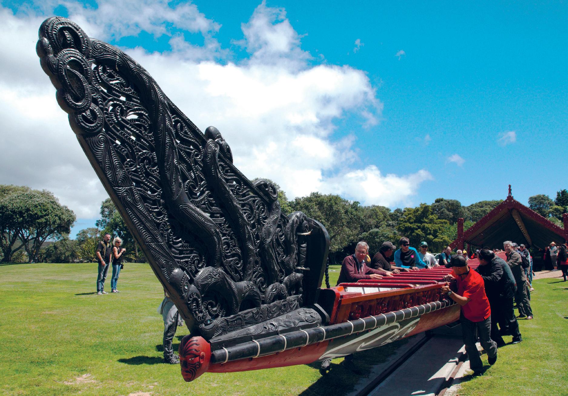
helped by willing tourists, Ngātokimatawhaorua is pushed from its shelter, te Korowai ō Maikuku, along railway tracks toward the shore. it’s a far cry from the early days, when the waka was rolled across logs in the traditional manner and then pulled back up to the canoe house with the help of a winch. Jeff evans
up their larger waka by securing hand-hewn planks together, edge on edge, resulting in a canoe that usually required a second hull, or an outrigger, to help stabilise it.
Canoe builders in Aotearoa, however, were able to source trees so big in circumference that when the logs were hollowed out, a thick, heavy ‘backbone’ could be left at the bottom of the hull. This extra weight lowered the waka’s centre of gravity and drastically reduced the degree of side-to-side roll that the craft might otherwise experience in anything but the calmest of seas. The benefit of that was twofold. Waka could be built without a second hull or outrigger, and, just as importantly, the inherent strength afforded by the backbone allowed craftsmen to build extremely long waka.
The place of Ngātokimatawhaorua as a cultural icon has been cemented over the years by the hundreds of thousands of visitors who have spent time with it at the Treaty Grounds or witnessed it being paddled on the water. But more so, its status is due to the mana of those who designed and built it, and those who have crewed it over the decades. Add to this list the names of the foreign princes and princesses, politicians and dignitaries who have been entranced while riding in the waka and you begin to understand its special place in the story of Aotearoa.
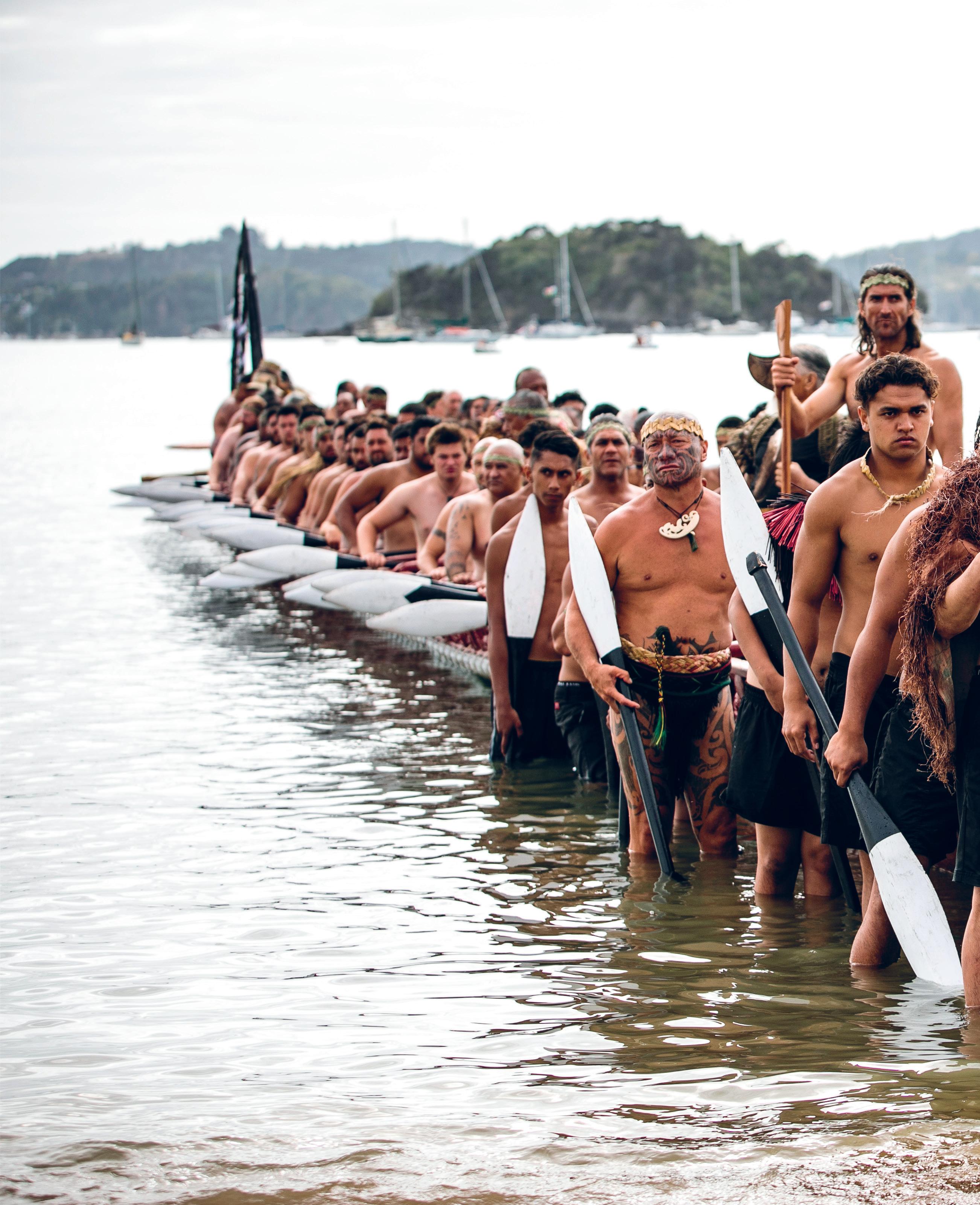
at 35.7 metres long, Ngātokimatawhaorua carries a crew of 88, and has room for another 40 passengers seated down the centre. launched for the 1940 centennial of the signing of te tiriti o waitangi, the cultural icon remains a drawcard for kaihoe and tourists alike. rawhitiroa PhotograPhy
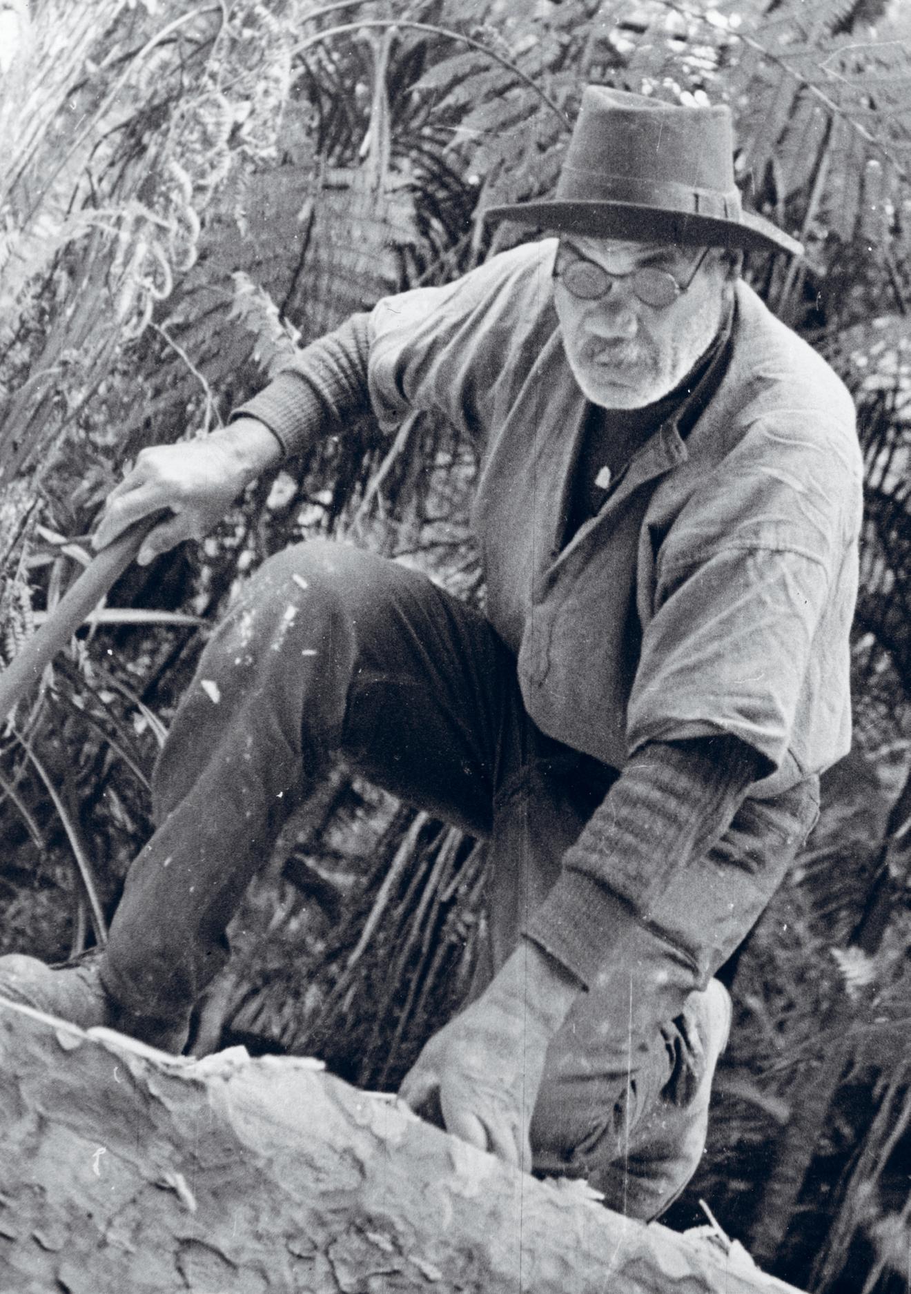
NGā Pu HI HEARTLAND, o ctober 1937. Rānui maupakanga, possibly the last master waka builder of his generation and by then in his seventies, enters Puketi Forest. Heir to the skills and knowledge required to build waka taua, he will prove to be a vital link to the tohunga tārai waka of years gone by. He will also be a key figure in the revival of the m āori war canoe.
Born in the small settlement of Hauturu near the eastern shores of the Kawhia Harbour, maupakanga is solidly built, his face oval and his eyes deep set. A wide moustache covers his upper lip. He has a habit of wearing a short-sleeved bush shirt over his woollen jumper, and on sunny days a well-worn fedora and a pair of round-framed sunglasses complete the picture. He has made the long trip north into Ngāpuhi territory from Waikato, at the request of Te Puea Hērangi, to oversee the building of a massive waka taua.
At a planned 120 feet (35.7 metres) long and 6 feet (2 metres) wide, the waka will be the largest ever built, and will represent northern māori during the 1940 centennial commemoration of the signing of Te Tiriti o Waitangi. m aupakanga is in the forest to locate a pair of kauri trees suitable for the task. stands of the tree dot the forest, but his challenge is to find two large enough to meet Princess Te Puea’s requirements. Even with the help of knowledgeable local guides, the search takes him a full two weeks.
The week before I travelled to Puketi Forest, a low-pressure system had settled over much of the country, bringing with it the late onset of winter. After weeks of good weather, the days had suddenly turned wet and cold and dreary. The one saving grace was that the day I had chosen to explore the forest looked likely to be the driest day of the week, perhaps of the coming fortnight. Even so, the growing intensity of the showers dancing in my headlights began to make me nervous the further I drove. By daybreak I had passed Whangārei and the low-hanging clouds that hid mount Hikurangi; ahead, the sky seemed to be darkening.
That I was driving north, alone and before daybreak, was thanks in large part to a couple of innocuous words I had seen handwritten on an old topographical map of Puketi Forest. spelt out in black ink next to a minor forest trail were the words ‘Canoe Track’. I hadn’t quite believed it when I first saw the notation, but over the course of several years I had come to suspect that the logs used to build Ngātokimatawhaorua may have been taken from somewhere near the end of that track under the supervision of Te Puea’s experts.
Te Puea, a granddaughter of the second māori king, Tāwhiao Te Wherowhero, was in her mid-fifties when she sent maupakanga north. Renowned for being warm and generous and able to connect with people of all backgrounds, she had devoted much of her life to improving the welfare of her people.
In Te Puea: A life, historian michael King contended she wanted ‘to raise and sustain Waikato morale; she sought to give people confidence in the present and future by drawing from the assurance of a maori past’.1 Able to call on learned kaumātua from within her iwi, she engaged experts in language, in music and in the oral traditions to help uplift her people, before extending the programme to support what King described as ‘more ambitious and more visible cultural projects’.2 These included several carved meeting houses and plans for seven waka taua, each representing one of the canoes that had brought a major tribal group to Aotearoa.
tasked with locating two suitable kauri for the construction of the massive waka, rānui Maupakanga, seen here climbing over one of the felled trees, also oversaw the initial shaping of the three hull sections before they were extracted from Puketi state forest.
 Courtesy of the Manley faMily
michael King suggested that Te Puea’s desire to build a fleet of waka stemmed directly from watching the waka taua Taheretikitiki being paddled on the Waikato River as a child. ‘Nothing,’ he wrote, ‘had moved Te Puea more in her youth than the sight of a team of paddlers ferrying guests from Huntly to Waahi in mahuta’s ornately decorated canoe Taheretikitiki, and then it going through its paces and manoeuvres afterwards to salute and entertain the visitors.’3
Te Puea wanted to share that sense of awe. she instinctively understood that anyone, māori or Pākehā, who saw waka taua on the water were enthralled by them. And that is what she wanted to create: a symbol to make māori feel proud, and for Pākehā to admire.
I too have been transfixed by the power and majesty of waka taua. In the mid-1990s I attended the annual Tūrangawaewae regatta at Ngāruawāhia for the first time. The spectacle of several fully crewed waka taua gliding along the river, white-tipped hoe flashing in perfect time, is one not easily forgotten. When I visited the Treaty Grounds at Waitangi a few years later, and had the opportunity to spend time with Ngātokimatawhaorua , I found myself entranced anew. Everything about the giant waka seemed to speak to me. Its graceful design, particularly evident while it was sitting in its open-sided canoe shed, was mesmerising, and its mystique was reinforced when I ran my fingers over the carved figures that adorn much of the canoe, and even more so when I took a close look at how it was put together.
The more I saw, the more it drew me in. How many other people, I wondered, had asked themselves what it must have been like to paddle such a waka into battle? Would the muscle-burning effort required to race the final 200 metres to shore, to where your enemy was waiting,
have aided or hindered your fighting ability once you got there?
I was eager to read about the waka, to learn something of its construction and its history, but precious little was available. All I could find were a few clippings from old newspaper articles, mostly from the late 1930s and 1940, and some from the mid-1970s. Then, in early 1999, I met the canoe’s long-time kaitiaki, Heke-nuku-mai-ngā-iwi (Hec) Busby.
o n the day we met, Busby was overseeing the launch of Ngātokimatawhaorua at Waitangi. He was in his late sixties, with thinning grey hair and the thick-set physique of a man who was slowing down. He wore a T-shirt and black shorts, a cap and a pair of old sandshoes that were fine for walking into the tide. A tattoo of his voyaging canoe, Te Aurere, was visible from under his left sleeve, and a carved whale tooth hung from his neck. He was there to ensure that the waka was moved with care. When he spoke, he did so with the authority of a man in charge.
once the waka had been launched, I walked over and introduced myself.
I asked him a couple of questions about Ngātokimatawhaorua, and then I asked whether he was interested in having his biography written. I don’t know what gave me the confidence to put the question to him, but I had already written about waka, māori weapons and migration traditions, and it seemed that all those subjects converged in this one man. To my delight he said he was open to the idea, so we set a date for me to travel to his home at Aurere in the Far North to discuss the project further.
over the course of several dozen interviews I gradually learnt that Busby was a remarkable man. Committed to the survival of his culture, he was an expert in many aspects of māoritanga, including the use of the taiaha, and ancient karakia, and he’d become a sought-after authority on land matters within his rohe. He was also a giant within the contemporary waka world. After teaching himself to build waka in the late 1980s, he would ultimately oversee the construction of 23 canoes, including five waka taua and two double-hulled voyaging canoes — the type that still sail from island group to island group throughout the Pacific. Part-way
through a traditional navigation apprenticeship when we first met, he would later be capped a master navigator by the legendary satawalese navigator mau Piailug.
on the occasions we discussed Ngātokimatawhaorua, Busby told me much about the canoe’s story post-1974, but his knowledge of the waka’s earliest days was limited to what he had learnt from one or two of his kaumātua, as well as the little he had been able to find in māori Land Court records. Asked where the trees for the waka had been taken from, he readily admitted he didn’t know for sure. All he could tell me was that they were from Puketi Forest.
Busby’s reply reinforced what I thought I knew, but it didn’t get me any closer to pinpointing exactly where the kauri had once stood. It also left me with an uneasy realisation: if Busby didn’t know where the trees had been felled, it was likely no one knew. It seemed that my only choice was to pull together a small team and go looking for any evidence that might remain at the end of ‘Canoe Track’.
Because we were all converging on the forest from different towns and cities, we had agreed to rendezvous at the Department of Conservation (D o C) headquarters in Kerikeri before making our way inland to the forest. I was familiar with the building, having visited it half a dozen years earlier when I had first learnt of the existence of the topographical map we would be following. I’d heard about the map in a roundabout way. I was visiting Ewen Cameron, curator of botany at Tāmaki Paenga Hira Auckland War memorial museum, to find out about the habitat of the kauri tree. specifically, I wanted to know why kauri are only found north of the 38th parallel south. Cameron told me he suspected it had something to do with a past mini ice age limiting the trees’ dispersal,
and as we were finishing up, he suggested that if I wanted to learn more about kauri in the north, I should contact stephen King of the Waipoua Forest Trust.
King, it turned out, was a fount of knowledge, and during our correspondence he put me in touch with John Beachman, a retired environmental management officer for the New Zealand Forest service who had worked in Puketi Forest during the 1970s. When I got to speak to Beachman a few weeks later, I asked him if by any chance he knew where the logs for Ngātokimatawhaorua had been taken from. His reply stunned me — he said he knew almost to the exact spot. What’s more, he was pretty sure the location had been marked on an official map, a copy of which was held in the DoC office in Kerikeri.
Things were starting to get interesting. If the map still existed, this was an incredible stroke of luck. The few published eyewitness accounts from the 1930s offered no clues, and there were no living survivors from among the bushmen who had felled the great kauri. Even the few photos I had seen of the felling were unhelpful, as the surrounding forest was too closed in to divulge any landmarks.
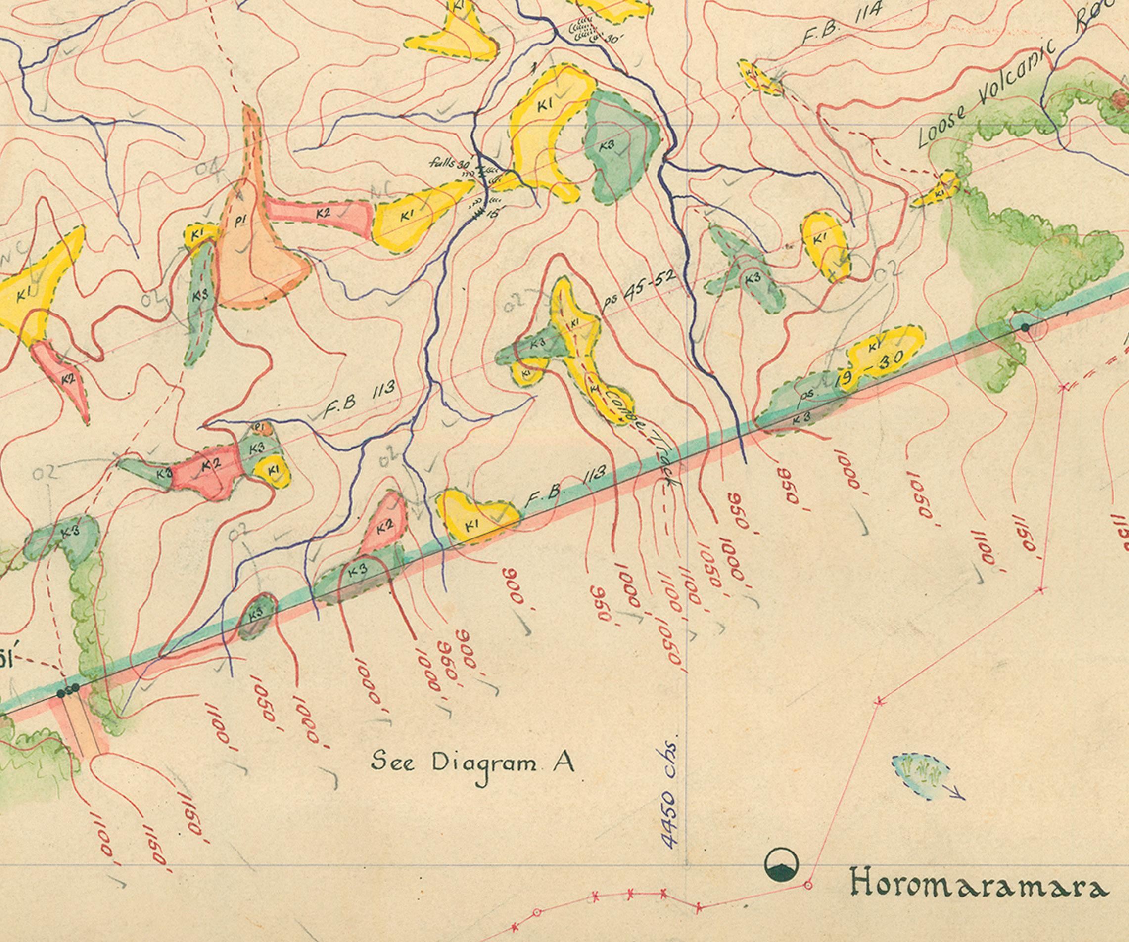
I made an appointment to visit DoC’s Kerikeri office the following week, where I was met at reception by Adrian Walker, a friendly and helpful ranger with the rugged look of a man who spent plenty of time outdoors. After brief introductions he led me down a long corridor to his office, where he flicked on his dated computer and opened a folder containing several files. Double-clicking one of them, Walker turned the screen towards me and we both watched as a map slowly appeared. scrolling to the bottom of it, he pointed out a small area coloured in yellow, just left of centre. Written in fine lettering within a finger-shaped sliver were the two unmistakable words ‘Canoe Track’. 1.1 so there is was, lit up in so many pixels — a possible key to locating a small but significant part of the story I was now chasing. With a copy of the map saved to a memory stick, I raced home to study it. The first thing to
catch my eye was the incredible amount of detail. Everything imaginable seemed to have been included. The rivers and streams were predictably depicted in blue ink, while the fine brown contour lines, as distinctive as fingerprints, detailed the relief of the land, allowing the viewer to build a three-dimensional world consisting of valleys, hills and ridgelines.
Even the tree species were delineated. The stands of kauri I was interested in were divided into three groups: mature kauri were coloured yellow, kauri between 10 and 30 feet tall (3–9 metres) were red, and immature kauri were green. Elsewhere, light-brown patches depicted stands of podocarps, mostly rimu, kahikatea, miro, mataī and tōtara. Various shadings marked the position of nearby roads and outlined the boundaries of the forest. A legend to help unlock the rest of the map’s coded knowledge completed the picture.
Just a few minutes’ drive northeast of Kerikeri’s town centre, the D o C office looked much the same as when I had last been there. Hidden behind a wall of trees, the single-storey building housed a reception area and offices where the rangers did their paperwork. A fenced-in compound secured their work vehicles overnight.
This time I was greeted by Kipa munro, DoC’s cultural adviser for Northland and chair of Te Rūnanga o Ngāti Rēhia. He had agreed to accompany me into Puketi Forest. of Ngāti Rēhia, Ngāti Kuri and Ngāpuhi ancestry, munro and his forebears had been guardians of the forest for generations, so it was more than appropriate that he form part of the expedition. It was also important to me that we had iwi approval to enter the forest.
munro was in his early fifties and fiercely proud of his heritage. Aside from representing his people through the rūnanga, he taught mau rākau
to anyone interested — māori or Pākehā — free of charge. He did it, he told me, because mau rākau is an effective vehicle to teach māori language, culture and history. munro was also, I found out soon enough, quick to correct the slightest mispronunciation of his native tongue, reinforcing his displeasure through none-too-subtle grimaces at the offending individual.
After signing in at reception, I followed munro to the staff cafeteria for a cup of tea and to await the rest of our party. master waka builder Heemi Eruera was travelling down from Kaitaia with two of his workers to join us for the day. I had first met him a decade earlier when I interviewed him for the biography of Hec Busby, his long-time mentor, and we had kept in sporadic contact since. Quiet and observant, Eruera was the type who only joined a conversation when he had something important to say, and his input was always concise and insightful. In his forties, he had been heavily involved in the 2009 refit of Ngātokimatawhaorua and now runs his own waka-building operation from an old dairy company building in Awanui, a 15-minute commute from his Kaitaia home. Accompanying him would be his nephew and new hire, Jacob Eruera, and his long-time right-hand man, Billy Harrison.
While we waited, munro introduced me to one of his colleagues. Dan o’Halloran was a 20-year veteran of the department, and munro had invited him to join us and to act as our guide. on the face of it, ours would be a fairly straightforward excursion into the forest, but o’Halloran would be the only one among us who had walked the ridge before, so it was reassuring to have him along. That he was bringing a GPs unit and first aid kit was also comforting. Clearly built for tramping, he was a compact, supremely fit-looking man who seemed to radiate energy. Perhaps because of his sun-weathered skin, I found it hard to estimate his age. That he wore three earrings in his left ear and a ponytail further confused things.
When Eruera and his crew arrived a quarter of an hour later, I learnt that he and munro knew each other well. In fact, munro had recently
the section of the department of Conservation map showing ‘Canoe track’ (centre). Prepared by a. n. sexton in the 1920s, the original map encompassed all of Puketi state forest and was part of a new Zealand forest service survey to identify the remaining kauri stands. new Zealand forest serviCe (sexton, C. 1920), Courtesy of the dePartMent of Conservation
commissioned Eruera to build a waka for Ngāti Rēhia, and the pair of them had been in a forest bordering our destination the previous weekend.
After munro had formally welcomed us all, we huddled around a laminated copy of the map as o’Halloran explained the colour coding for the kauri, then pointed to the dotted line marking the ridgeline we would be exploring.
my mind began to wander as he described what we could expect to see. I had obsessed over the map for months — years, really — but even with all the detail it held, it was still unclear exactly where our target trees had stood. There was no way to know how accurate these dotted lines were. Had the map-maker actually visited the site or was there guesswork involved? And how much had the forest changed over the years? Would the old photos we had be helpful or had decades of plant growth hidden what might once have been useful clues?
The morning cloud cover had disappeared by the time we made our way to our vehicles, pushed out over the Pacific by strong westerlies that unveiled a brilliant blue sky. Led by o’Halloran, our convoy of two 4 × 4s headed inland, past lifestyle blocks and orchards until we reached the intersection with state Highway 10 at Waipapa. From there, we travelled north for a few minutes before again turning inland to where paddocks of green flanked us.
At the top of a hill, o’Halloran brought our vehicle to a stop so we could take in the view. A hundred shades of green seemed to be floating before us, like a cloud hovering 10, 20, 30 metres off the ground. It was as if all 25,000 hectares of the forest were filling our view. Far to our right, a majestic kauri, standing alone like a sentinel, pierced the canopy.
In truth, what we were looking at was only a thin snapshot of the
forest’s southern border. I was beginning to reassess the challenge the canoe builders faced when they began their search for suitable kauri: the forest was immense. What, I wondered as o’Halloran gently accelerated, were the chances of us actually finding the site where the two kauri had once stood?
A little further along the road we stopped at a padlocked gate. Public access to the forest had been restricted after the recent discovery of kauri dieback. A microscopic, fungus-like pathogen that lives in the soil, kauri dieback infects the tree’s roots, effectively damaging the tissues that feed the tree its nutrients and water. stricken kauri, some of them hundreds of years old, were starving to death.
munro jumped out and opened the gate, allowing both vehicles to pass through before he secured it behind us. Just inside the gate stood a recently introduced hygiene station, built to allow visitors to clean their footwear when entering and leaving the forest. DoC was doing everything it could — short of actually closing the forest — to restrict the transfer of the disease.
The station was of a utilitarian design, not totally dissimilar, I thought, to a cattle race for drenching. A hand-held spray-gun allowed me to moisten my boots with rainwater collected from the station’s roof, before I ran each of them over a stiff upturned brush to dislodge any dirt. Then I stepped onto a foot pump that lowered under my weight and watched as an industrial-strength disinfectant was sprayed onto the soles of both boots. It was a simple, three-step process that gave kauri a fighting chance.
Back in the trucks, we set out again along the forestry road. Recent rain had washed away the shingle in several places, exposing its clay base, and the further we travelled, the more obvious it became that this would have been no place for a city car. As we crested one rise, munro pointed out mount Hikurangi, a sacred maunga, far to the south. I had passed it earlier in the day, but the significance of seeing it from here in Puketi
Forest only dawned on me later when I read a short piece written in 1940. It included one of the few descriptions I could find about the area the trees had come from.
The said Kauri trees grew on Ngapuhi watershed midway between two coasts and their tops were in sight of all the mountains beloved by the maoris of the North. Hence the choice of these trees for the canoe. 4
The author, Frank Acheson, was an interesting character. Born in Riverton, southland, he arrived in the Tai Tokerau district in 1924 with five years’ experience as a Native Land Court judge and continued in that role until 1943. He was a serious-looking man with a long face and a closely cropped moustache, and he wore the sort of small, black-rimmed glasses you might imagine would be favoured by an intellectual of the period.
over the course of his career, Acheson became friendly with many māori leaders, including Princess Te Puea and Dame Whina Cooper, and he often lent an empathetic ear to their concerns. He is particularly remembered for several rulings related to lakebeds and the foreshore that were considered innovative at the time. He was also supportive of māori land-development projects. And while his description wasn’t specific enough to help us with our search, it did give a wonderful insight into the consideration given by kaumātua when choosing where the trees would come from.
Ten minutes after passing through the gate we pulled over into a layby of sorts and climbed out of our vehicles. o’Halloran, who would be leading us along the overgrown track, strapped on his protective gaiters, then grabbed his backpack and a pair of forestry loppers. once the rest of us were ready, he led us the 100 metres or so back along the road to the start of the track. There munro recited a karakia to the māori deity Io, seeking guidance and protection for the period we would be here. once he had finished, the group turned and entered the forest.
We started our expedition on the eastern side of a wide ridgeline. It seemed as though o’Halloran knew the territory like the back of his hand. Leading off at a cracking pace, he navigated the track with the assurance and speed with which I would walk a city footpath — despite the ground being slippery from the recent downpours that had drenched the country. Initially the only plant growth we had to deal with was kanono and karamu shrubs, with some kiokio fern and tātarāmoa vines encroaching on the path, but things got trickier the deeper into the forest we ventured. Before long we found ourselves regularly stepping over or skipping around the many juvenile mānuka that had taken root along the track.
our sharp-eyed and knowledgeable guide provided occasional commentary along the way, and there was plenty to take in. A bowl-sized hole in the earth was the result of a pig rooting for food, and a peculiar miniature forest, spotted just off the track, turned out to be Dawsonia superba. Appropriately named giant moss, it is the tallest self-supporting moss in the world, growing to a height of 60 centimetres. From above, it looked remarkably like a plantation of tiny Christmas trees. Further down the track, o’Halloran pointed out the broken and empty shell of the giant carnivorous kauri snail known to the māori as pūpūrangi. The shell was large — 6–7 centimetres across, and the unfortunate snail that had once inhabited it had probably been eaten by a wild pig, possibly the very one that had been foraging nearby. 1.2
Nature enveloped us. After 20 minutes or so of mostly downhill walking, I stepped off the track to let a couple of my companions pass by. I wanted to take a moment to absorb the forest’s ambiance. It felt good to be here, away from civilisation. The air was fresh, clean and crisp after the rain, and the chilly westerly we had experienced when getting out of the trucks was
absent, blocked by the close bush. A miromiro sang nearby, hidden from view among the trees, but there was precious little else to hear.
When I caught back up to the group, o’Halloran was using his loppers to clear a couple of overhanging branches. After he finished, I asked him to take a minute to describe what he could see around us. He began by pointing out the 4–5-metre-wide forestry road that our track overlaid. Now disused, the flattened road was covered in low-growing bush and young mānuka. I had missed it altogether, focused as I was on the twin challenges of keeping up and not falling down.
o’Halloran thought it probably marked the route loggers had used to drag trees out of the forest, but exactly how long ago he couldn’t say. Did it date from the bullock train days we were interested in, back in 1937, or was it more recent? It was impossible to tell. But o’Halloran thought it was likely the logs for Ngātokimatawhaorua had come out along this road, if they had in fact been taken from this part of the forest. It would make more sense that later drivers would follow the same route rather than make a new one. He then pointed out a couple of ‘young’ kauri trees that were busy establishing themselves 20–30 metres off the track. They had probably been too small to harvest when the area was last picked over, and now had a chance to mature — at least if kauri dieback was held at bay.
The forebears of these young kauri were well known to northern iwi, who had quickly settled upon them as the tree of choice when it came to constructing their largest waka. usually found in stands, and often in poor soil where other species struggle to establish themselves, kauri provided early māori with a comparatively lightweight yet durable timber that was renowned for being straight-grained and free from knots. Importantly, it was relatively easy to work using stone adzes.
With mature kauri easily reaching 30–40 metres or more in height — the famous Tāne mahuta, which is still standing in Northland’s Waipoua Forest, tops out at an impressive 51.2 metres (half the length of a rugby field) — their circumference is large enough that waka builders could dispense with the second hull or the outrigger that was relied on for stability back in their ancestral homelands. The kauri canoe’s width would deliver the balance they needed, and with a thick hull (keeping most of the weight below water level), they could maintain excellent stability on the water.
It is clear from the ships’ logs and diaries of early European explorers that māori waka builders were not the only admirers of the impressive tree. When Captain James Cook inspected them during his first visit to New Zealand in 1769, he judged them likely to provide fine masts and spars. Three years later Ambroise Bernard-marie Le Jar du Clesmeur, sailing on the Marquis de Castries, made mention of the quality and size of the trees when the French sailed into the Bay of Islands to refit their ships:
Now that our vessels were in a harbour sheltered from all winds, we thought only of refitting them. The Mascarin , having almost her whole port side unsheathed and the forepart unfastened, was making a lot of water. m ine was deficient only in the masts: in order to repair her, I searched up and down the coast, sometimes with m r marion and sometimes independently. Finally, after a lot of difficulty, some natives who had been made to understand what we wanted took us to a big cove about a league and a half from our vessels, where we found the finest timber. I do not exaggerate when I say that I saw trees more than 90 feet tall, without branches or knots.5
In fact, so enamoured were early explorers with the kauri that, once their reports reached the northern hemisphere, ships were sent specifically
to obtain logs, in many cases for the Royal Navy shipyards. The first of these vessels arrived in 1794, and they kept coming. When naval demand eventually dropped away, the timber began to be exported for house, boat and furniture making. It was a financial bonanza for those involved in the industry, but the near-insatiable hunger for kauri devastated the native forests. Today, only around 7455 hectares of kauri forest remain from an estimated 1.2 million hectares.
As we got deeper into the forest, the bush immediately either side of the track began to thin out. Any mature trees that had once grown where the forestry road now lay had long been replaced by shrubs and spindly mānuka. so far, we had not seen any mature kauri close up, but it wasn’t long before o’Halloran, some 30 metres ahead, slowed just long enough to call out over his shoulder that we should be seeing kauri any minute now. ‘How can you tell?’ I asked, but he was back in full flight by the time the words left my mouth. When I finally managed to catch up, he was pointing out clusters of cutty grass (Carex geminate) and kauri grass (Astelia trinervia). Both are known to grow near our target species, he explained, confirming that kauri are, or at least were, nearby.
The two grasses may have looked very much alike to my untrained eye (so much so that I still can’t separate them with any confidence unless I have a guidebook with me), but they nevertheless turned out to be excellent indicators. Having made our way along the bush track for the best part of an hour, kauri came into view around the next corner. There, towering above us, were a half dozen majestic trees grouped at the base of a short rise, their spectacularly straight trunks reaching up to the heavens. more led up the slope and several were dotted about the summit.
We were only a short walk from the road, but we might as well have
been a week’s hard march from it. Civilisation was a distant memory now that these trees surrounded us. somehow it felt as if we had stumbled on a prehistoric landscape, and I took a minute to take it all in. Then, as if to bring me back into the present, a pīwakawaka began fluttering among nearby branches, curious about who was invading its domain.
o’Halloran pulled out his GPs unit and confirmed that we were nearing the end of ‘Canoe Track’. We agreed that this would be as good a place as any to begin our search, so we spread out and started looking for any sign of where the trees might have been felled, as there was a chance that either a stump or crown was still here. Eruera and his team started looking on the flat either side of the group of kauri we had first seen, while I followed o’Halloran up the incline in front of us to search among the other trees. Nothing up there caught our attention, but as we were returning, munro called us over. He had found the remains of a huge kauri crown, partly sunk into the earth and covered with years of forest growth. The dank aroma of the decaying forest litter packed around it hung in the air.
I dug in my backpack for a photo I’d brought of the tree used to build the two end sections of the waka. Looking at the circumference of the crown in the photo, I thought the one before us certainly looked big enough, and the shape and angle of the branches raised our hopes further. Even after lying unprotected in the elements for over 80 years, munro’s find looked remarkably like the crown in the picture. one by one we pored over the photo, comparing it with what lay before us, trying to superimpose one image onto the other. There seemed to be little doubt that the shape and position of the branches matched, as did the terrain, sloping up to the right. It looked promising, but I needed more proof. I wanted to find the tree’s stump.
Newspapers at the time reported that the trunk measured 67 feet (20.4 metres) from the ground to the first branch, so we had an idea of how far away the stump should be from the crown. Given the immense size of the crown, I could see that there was little chance it had been moved from
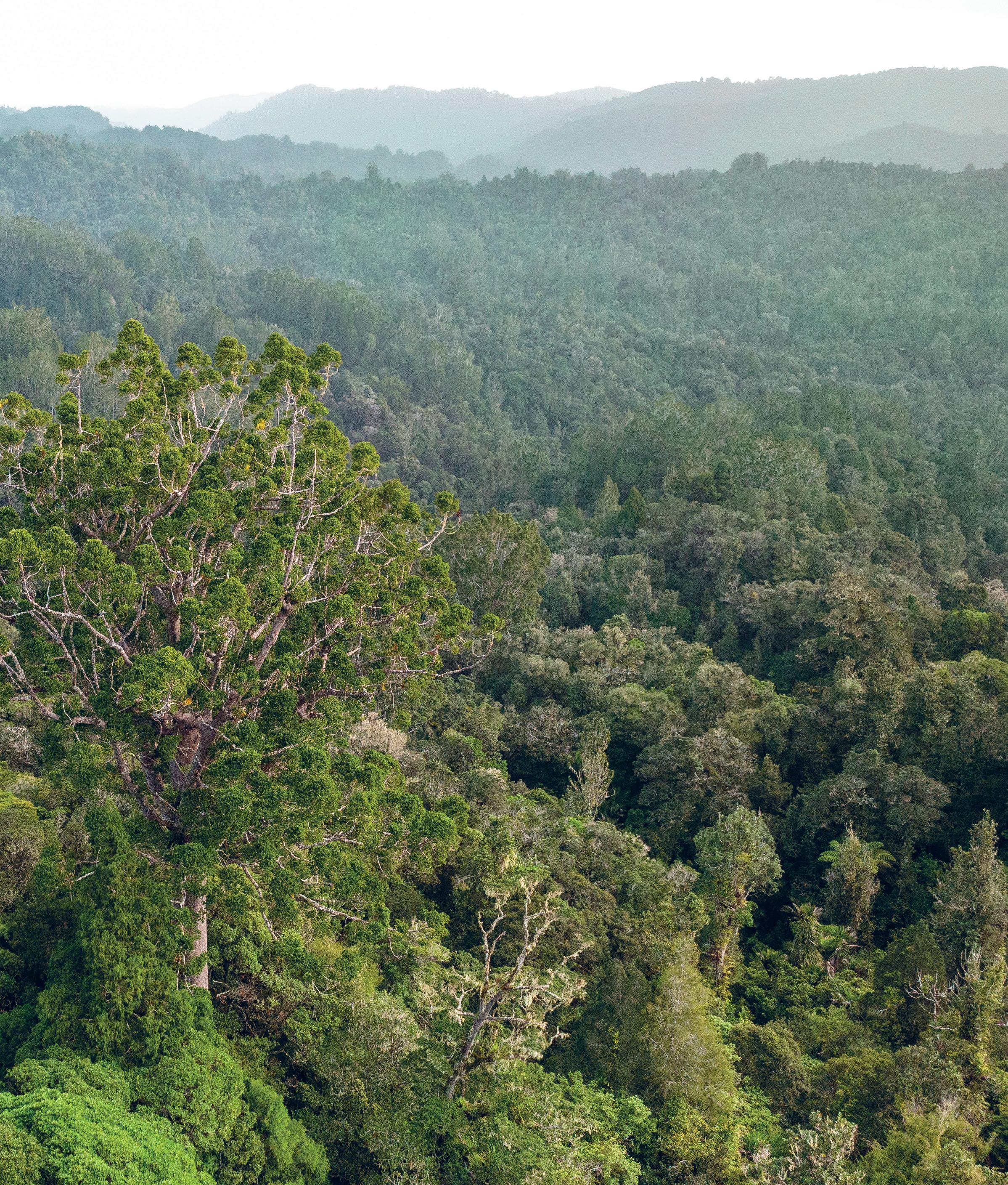
Puketi forest and neighbouring omahuta forest comprise one of the largest tracts of native forest in northland, at a combined 15,000 hectares (37,000 acres).
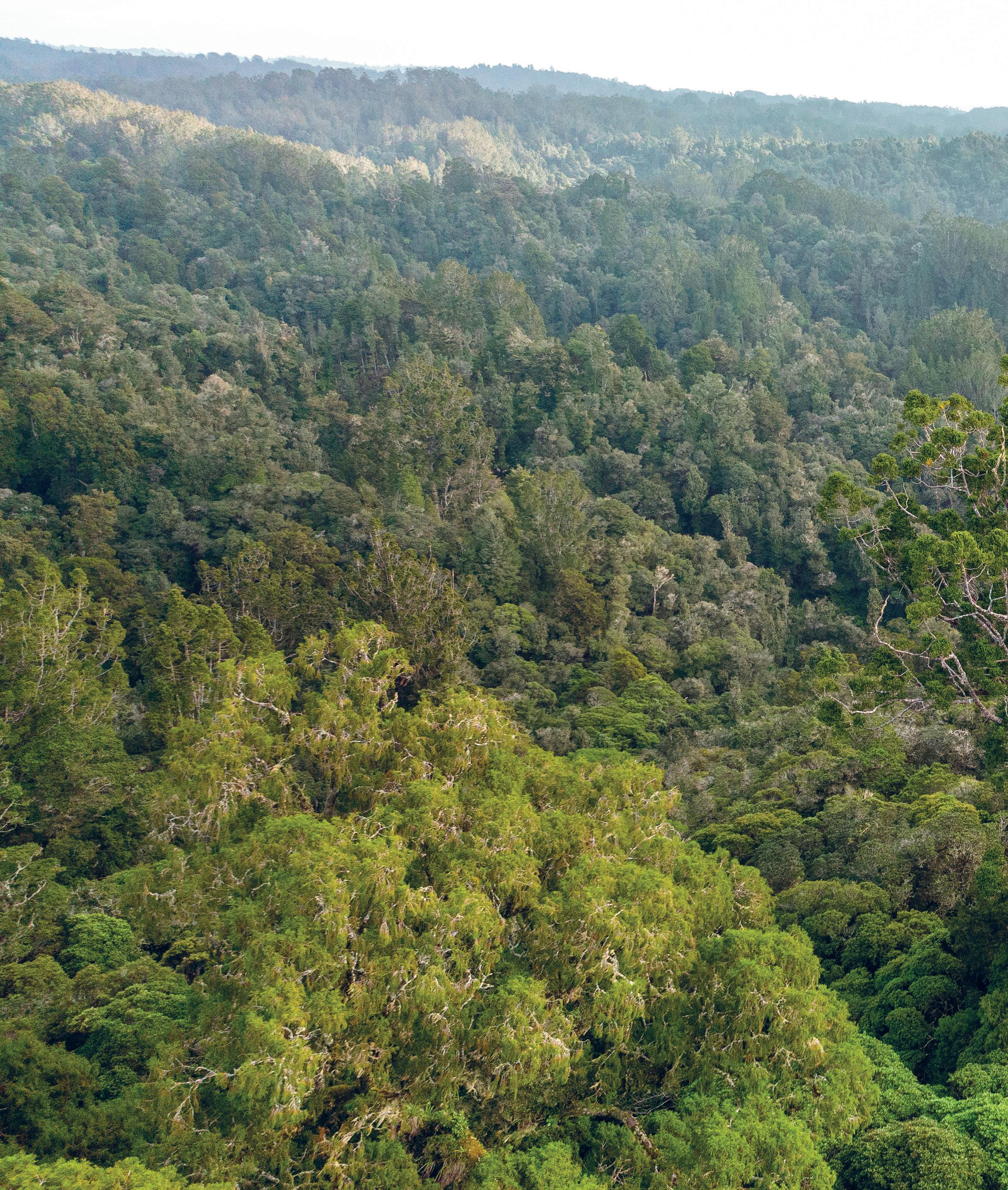
it was in this forest that the two massive kauri trees used to construct Ngātokimatawhaorua were felled. rawhitiroa PhotograPhy
where it had first crashed to the ground. We should be able to locate the stump without too much trouble. The only real impediments were the tall grasses, and the decades of forest debris that had accumulated around the base of many of the stumps. often piled as high as the stumps themselves, the debris effectively hid much of what remained.
Initially, I had trouble making out any stumps at all, but the much more experienced o’Halloran, munro and Eruera could see through the camouflage to pick them out easily. We searched the whole area but nothing we found seemed a match for maupakanga’s kauri. This didn’t make sense. There had to be a stump here to pair with the crown munro found, even if it ended up not being the kauri we were looking for. so where was it?
I could think of only one possibility. There was a sizeable kauri stump on display at the Treaty Grounds in Waitangi that was supposedly associated with the construction of the waka. It was certainly large enough to be the one we were seeking, but the label stated that it originated in nearby omahuta Forest. Could the provenance given to the Waitangi Trust when it was donated have been inaccurate? Could that stump have come from Puketi Forest instead? It was a long shot, and for the moment there was no way of telling.
unsure how to proceed, I suggested that we take a break. The next closest stand of mature kauri was an hour’s tramp to our north and we wouldn’t be able to get there and back in the time we had left. There were also areas we wanted to avoid. Clearly marked on the map was a stream to our west. I had been told that warriors used its waters to cleanse themselves when they returned from battle, back when they fought to the death with taiaha and patu. The waters were still highly tapu and we wouldn’t be venturing anywhere near them. For today, this section of forest would mark the limits of our expedition.
I looked for a place to rest, and, using my rolled-up jacket as a buffer from the damp forest floor, I sat and gazed at the bush that surrounded us. I wondered what it must have been like here before the first Polynesian
explorers arrived in Aotearoa, when kauri dominated the northern landscape and birdsong rang out across the land. Then my thoughts drifted to those involved in building Ngātokimatawhaorua. Hardy and resourceful, these men had knowledge about how things were done when waka were still the main form of long-distance transport for māori.
When Te Puea decided to build a fleet of waka taua, she found herself with a unique challenge. Before she could start, she first needed to find a tohunga tārai waka, an expert canoe builder, capable of building waka taua. The problem was that no waka taua had been built for the best part of 40 years. In Piri Poutapu — who would later play a major role in finishing Ngātokimatawhaorua — she had a skilled carver who learnt his craft at the s chool of m āori Arts at ohinemutu in Rotorua, but he had no experience building war canoes. He was in his mid-thirties with the calloused hands of a man familiar with holding woodworking tools; but as gifted as Poutapu was, entrusting the project to him would have been risky at best. The construction of a massive war canoe was no job for a novice. s o Te Puea went searching, raising the subject at every opportunity until, after either a tangi or a hui (accounts differ) at Rākaunui (near Kawhia) in 1936, Rānui m aupakanga presented himself. The elderly man rose to his feet and announced to those in the meeting house that he had built a waka taua for Te Puea’s grandfather, Tāwhiao. Te Puea had found her man.
The first task Te Puea entrusted to him was to salvage and restore the old waka taua Te Winika. It had been dismantled by Gustavus von Tempsky’s Forest Rangers during the Waikato War and, remarkably, the central section of the canoe was still intact, lying abandoned near Port Waikato. Work began almost immediately. under maupakanga’s
direction, the section of hull was recovered and transported to Ngāruawāhia, where it was received with an emotional pōwhiri. Poutapu then set to work shaping replacement haumi (the fore and aft sections, sometimes referred to as haumi kokomo) from freshly cut tōtara, under the old tohunga’s supervision.
The refurbishment of Te Winika would turn into a masterclass for Poutapu. Not only did he learn the intricacies of adzing hulls directly from an expert, but he also acquired an encyclopaedia’s worth of other knowledge about building waka; knowledge that would equip him well when he began work on Ngātokimatawhaorua. He learnt, for instance, the importance of submerging adzed timber in water (preferably salt water, but fresh would do) to draw out any sap. It was an old trick, maupakanga explained, that greatly reduced the chances of the timber splitting. Poutapu also witnessed maupakanga using an ember to draw the outline of the slot-end of a mortice-and-tenon join on the first of the new tōtara logs. so sure was the old man’s hand that when the join was cut it fit perfectly with the existing central section. Later still, maupakanga showed the younger man how to caulk and lash the joins. To complete the build, Poutapu, fellow carver Waka Kereama, and Poutapu’s pupil and future opera singer Īnia Te Wīata, carved new rauawa, tauihu and taurapa (top boards, figurehead and sternpost) for the canoe.
Te Puea could only have been delighted when she inspected the restored waka. Encouraged, and confident now in the skills of maupakanga and Poutapu, she dispatched a party to oruanui Forest, near mōkai in the central North Island, with instructions to search for suitable tōtara with which to construct the first of her new waka taua. Her dream was taking shape, but it had been a close-run thing. Had she delayed her search for a tohunga, or had maupakanga not been at Rākaunui on the day of her visit, it’s almost certain the direct line of knowledge of the ancient craft of waka building would have been lost forever.