4 minute read
Triage Project Update


The quality of any map or model is dependent upon that of the data used to build it. Oftentimes, maps and models lie at the core of public health and safety decisions surrounding water use, contamination, and protection. In 2019, as a result of data needs related to PFAs contamination concerns across Michigan, MGS performed a detailed evaluation of water well location data for several pilot townships within the state’s water well database, Wellogic. It was found that roughly 36% of well locations were in error by at least a 200ft distance, while often being placed in the wrong township or county entirely. Having an accurate location is critical for glacial depositional systems like the Michigan basin, where the geology can vary greatly over just a few hundred feet, therefore affecting how water (and contaminants) move in the subsurface. Further investigation revealed that in addition to significant errors in well locations, several other essential data fields needed review, including static water level, lithology, and screen depth. These findings gave rise to the grant funded Triage Project; an effort to correct the existing Wellogic database errors and digitize a large volume of unincluded historic data in the State of Michigan
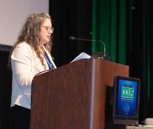
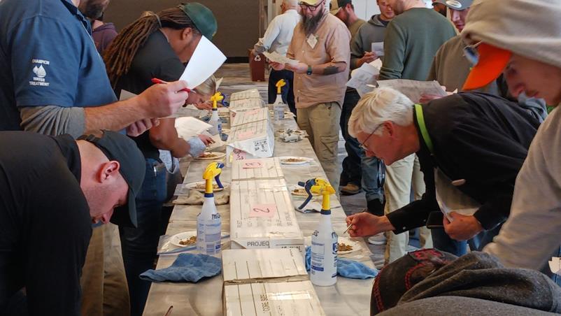
Water well drillers from around the state examining core and sediments to practice geologic classification at the MGS Mud and Cores Interpretation Workshop as part of the Michigan Ground Water Association Meeting, 2023, in collaboration with EGLE water divisions.
These errors can be attributed to a complication of factors including but not limited to contribution to the database by multiple entities (water well drillers, local county health departments, EGLE staff, various university students and interns), all with their own variations in procedure, inaccuracies in latitude and longitude acquisition or use of low precision methods, and misinterpretation of geology. It’s important to remember that while geologists and other scientists use this data regularly, there is seldom a trained geologist on a household well drill site, and the people that actually collect the data are often not trained in best recording practices for scientific use. To help remedy this, MGS has been offering a workshop and training program at the annual Michigan Ground Water Association Conference, since 2015. In this program, drillers learn how to properly interpret their mud and cores and how to be mindful of common mistakes. This training program was also be offered at MGRRE.
Having worked on the Triage Project for three years, the team has reviewed, entered, and validated data for nearly 800,000 water well logs. Results thus far show that an average of 39% of well locations across 46 different counties were inaccurate, with an average correction distance of approximately 1,300ft. When reviewing both the location and other fields deemed essential for mapping and modeling purposes, in historic well records the correction rate jumps to 93% of all preexisting well records across those same counties; meaning at least one of those essential fields was incorrect in some capacity, referencing the scan of the original driller’s log in comparison with statewide parcel data.
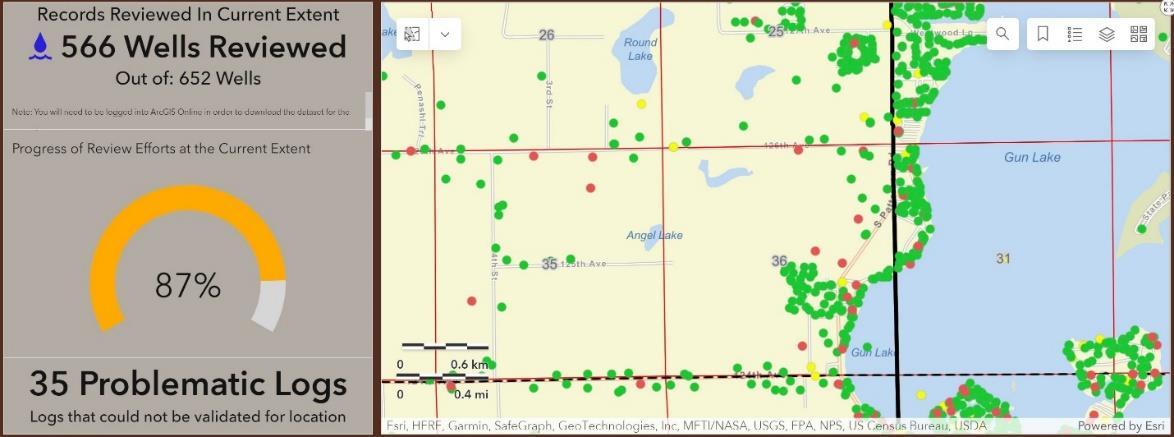
Anyone can now view a spatial display of the Triage Project status. With the recent release of our new ESRI Dashboard web application, the public can download validated water well data for spatial joins to other datasets, ensuring that only validated data is used in a given project. The dashboard is updated with new data and corrections on the 1st of each month.
Triage Progress Dashboard: https://wmugeography.maps.arcgis.com/apps/dashboards/5f808d7f6ef74b10b90b4adadb3d0ba4
Instructional Video on How to Use the Dashboard: https://youtu.be/MA0Zl28IUtA
While a lot of ground has been covered in the last three years, there is still plenty of work to be done, with 37 counties still in need of review. We are now hiring Research Assistants to work on the Triage Project. This is a great position for students and recent graduates looking to work between 15-25 hours, remotely with a flexible schedule. You can learn more about this opportunity and details on how to apply here: