2 minute read
Introducing Enhanced Accessibility Maps: Empowering Inclusive Outdoor Exploration

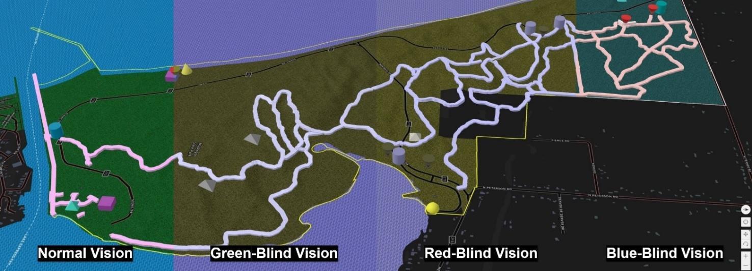
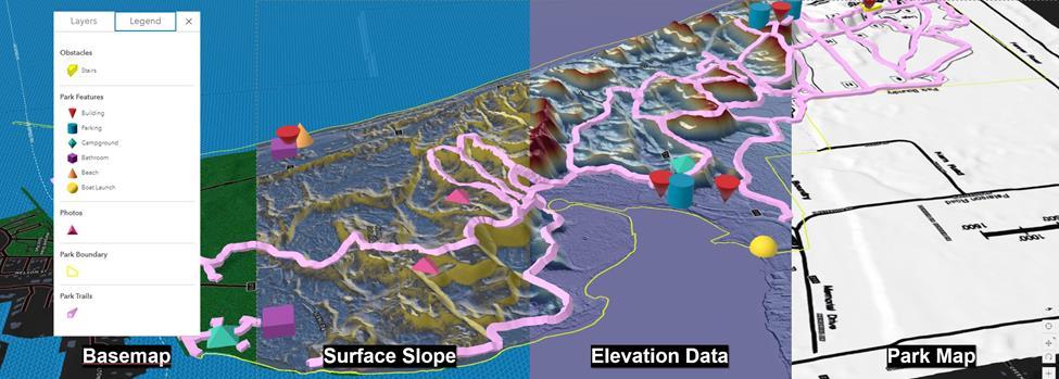
MGS is proud to unveil an initiative specifically designed to enhance accessibility to Michigan's captivating parks and recreation areas. The pilot program offers 3-dimensional topographic maps that provide a deeper understanding of the physical terrain and potential obstacles, enabling visitors to make informed decisions based on their individual capabilities. This reduces the user’s need to rely solely on general accessibility information or one-size-fits-all trail difficulty ratings. With these enhanced maps, users can better plan their routes and manage their expectations to ensure a rewarding and enjoyable outdoor experience.
The release of these maps is already underway, with Muskegon State Park being the first location to offer the publicly available enhanced accessibility map via MGS. Park management is actively involved, piloting the use of QR codes placed at various trail entrances. By scanning these codes, visitors can access the map, gaining insights into the terrain and features that lie ahead. In pairing, park management can receive data on user interaction, unmarked trails, and any potential hazards.
Inclusivity lies at the heart of this initiative, and our partnership with WMU’s Department of Blindness and Low Vision Services assists in ensuring that individuals with visual impairments can also benefit from these enhanced maps. Preliminary development of a complimentary, tactile version of these maps and addition of an audio navigation feature to the application is underway, further improving accessibility for all visitors.
MGS envisions expanding the availability of enhanced accessibility maps to cover more state parks and recreation areas across Michigan. The Porcupine Mountains State Wilderness Park, Tahquamenon Falls State Park, and the Pigeon River Country State Forest are among the locations targeted for inclusion. The ultimate goal is to provide comprehensive access to enhanced accessibility maps, ensuring that visitors can explore Michigan's natural wonders with confidence, regardless of their abilities.
Muskegon State Park Enhanced Accessibility Map: https://experience.arcgis.com/experience/281585a9ebf4443ea9f06445ed06a0a4
The project team is currently seeking support. If interested, contact Evie Murgia - Evangelia.M.Murgia@wmich.edu


