MIT-UTM MALAYSIA SUSTAINABLE CITIES PROGRAM


 Figure 1. Street life in Kuala Lumpur, Malaysia. Photo credit: Mirette Khorshed
Students and faculty from the Massachusetts Institute of Technology (MIT) and the Universiti Teknologi Malaysia (UTM) joined in a twoweek Practicum in Malaysia from January 9 – January 21, 2016.
One goal of the Practicum was to produce a Research Agenda for the ten Visiting Scholars who will participate in the MIT-UTM Malaysia Sustainable Cities Program (MSCP) in 2016–2017. The Agenda should help to focus their research and forge relationships with agencies, communities and organizations that can serve as research partners. MIT-UTM student-faculty teams met with public agencies, NGOs, private companies and community-action groups in Kuala Lumpur, Johor Bahru, Penang, Pahang and East Malaysia to identify questions related to sustainable urban development that might be the subject of scholarly inquiry. Our larger goal is to ensure that the work of the MSCP contributes to improvements in Malaysia as well as to sustainable development efforts throughout the developing world.
Students and faculty in the Practicum worked hard to formulate questions that will be of shared interest to urban planners, engineers, public managers, corporate leaders, community activists and elected officials. In our view, Malaysia’s successful efforts to transform itself from a developing to a developed country deserve close scrutiny. In framing questions, we have tried to be mindful of what a single scholar (from outside the country) can accomplish in just four to five months. In each instance, after spelling out a question, we have tried to suggest a possible research strategy for pursuing that question. We have also listed agencies and organizations -- with which we met directly -- which may serve as research partners. In conjunction with faculty advisors at UTM and MIT, the 2016-2017 Visiting Scholars will have the option of modifying our questions and proposing a different research strategy. During the Fall 2016 the scholars will be gathering and processing data and collecting video footage in Malaysia. During their spring semester at MIT, they will convert their findings to video teaching materials that will be disseminated worldwide through MIT’s free, online platforms.
The MIT-UTM Malaysia Sustainable Cities Program (MSCP) focuses on sustainable urban development as seen through the lenses of social, economic and environmental well-being. This Research Agenda was developed by MIT and UTM urban planning graduate students and faculty following site visits to Johor Bahru, Kuala Lumpur, George Town (Penang), Pahang, and Kuching (Sarawak). In addition to location-specific questions, the research teams identified architecture and urban identity and immigration as cross-cutting themes. These are described separately from the place-based questions listed under each city so that interested scholars can pair with other scholars to do comparative studies.
Kuala Lumpur is the largest city, federal capital and the preeminent economic and cultural center of Malaysia. Seated at the heart of a 6.9 million person metropolitan area, the city is at the nexus of rapid development and modernization.
The students divided into two “KL groups”. The first focused on transportation, infrastructure and entrepreneurship in Kuala Lumpur and Putrajaya. The second focused on urban villages and development—specifically, Kampung Bharu, Kampung Chubadak, and Kampung Datuk Karamat.
Transportation, Infrastructure and Entrepreneurship
• What demographic characteristics, behavioral motivations, policy incentives, and marketing strategies influence public transit ridership in Kuala Lumpur?
• How are increases in revenue, caused by rising property values around transit corridors, distributed among different stakeholders in Kuala Lumpur?
• How severely has rapid development eroded catchment areas along the river corridor in Kuala Lumpur, and how has this erosion reduced the natural protection that would otherwise reduce stormwater damage?
• What are the cultural or policy mechanisms that support or challenge the ability of entrepreneurs to conceive, commercialize and scale solar energy and energy efficient technologies and/or ventures?
Planners and policymakers are striving to establish Kuala Lumpur as a “World Class City.” This vision is at times in tension with the lifestyles within the city’s kampungs (traditional Malay villages).
Urban Villages and Development
• Using an Eviction Impact Assessment method of analysis, what are the social and economic costs of displacement to commercial and residential owners, renters, and informal occupants of Kampung Bharu?
• What values or assumptions about cultural identity are reflected in the Kampung Bharu redevelopment plan? What is emphasized and what is not included? How does this compare with the way community members think about their identity?
• What kinds of judicial protection are available for kampungs in which land tenure is contested? How effective is the judiciary as a means for civil society to resist development-induced displacement?
Located at the southernmost boundary of peninsular Malaysia (and therefore the southernmost tip of mainland Asia) Johor Baharu sits just across the narrow Straits of Johor from Singapore. Over the past decade, JB has worked hard to enhance its international reputation, embarking on ambitious plans to expand its ports, attract foreign real estate investment, and develop its shoreline, partly through massive land reclamation projects. One such land reclamation project is the Forest City development, currently underway. Questions in this section are focused on the impact of international real estate investment and the survival of traditional kampungs.
• To what extent are kampungs able to control their own physical planning and/or economic development? What factors or conditions undermine their autonomy?
• What factors make Forest City acquisitions attractive to foreign investors? Over what time horizon do investors and developers anticipate returns on investment? What are buyers’ expectations about unit occupancy? How have bilateral discussions, ecological studies, and project alterations affected investors’ perceptions of the Forest City project?
• What are the characteristic material and financial flows used for land reclamation at Forest City? How does the energy required to undertake large scale reclamation projects compare with traditional development projects? What are Forest City’s expected demands likely to be on inland infrastructure capacity (e.g. water, roads, networked infrastructure), and how are the costs involved being distributed?
• How do Singaporean and Malaysian regional planners see Forest City within the context of regional development plans? What ongoing revenue and public benefit will the project generate? How do the reclamation techniques being used at Forest City compare to previous reclamation projects in Singapore? How will the project be integrated with the large container ports in Tuas and Tanjung Pelepas?
Sarawak is one of two Malaysian states located on the island of Borneo in East Malaysia. As a center of eco-tourism, warehousing, and material export, Kuching’s growth is linked to ecological and environmental change throughout the region. Thus, sustainable urbanization in Sarawak depends on multi-scale questions of environmental governance, ecosystem management, and land rights.
• How does designation of national parkland redistribute the economic value of ecosystem services among the parkland’s local users?
• To what extent do existing protected-areas schemes prevent forest loss and fragmentation in East Malaysia? What management and governance practices can improve local capacity to monitor drivers of forest change and prevent deforestation?
• What are the prospects and precedents for a legally mandated social impact assessment requirement for new development projects in East Malaysia? How do Sabah and Sarawak’s relationships with the central government enhance or inhibit these prospects?
• How are indigenous groups in Sarawak engaging in modern cultural and economic practices? How does this differ from the Orang Asli on the peninsula, in light of their more conditional claim on indigeneity?
Pahang is the third largest state by land area in Malaysia and the largest in Peninsular Malaysia. The state encompasses the Pahang River basin, originating at the confluence of the Jelai and Tembeling rivers on the Titiwangsa Mountains and draining into the South China Sea. Cities in Pahang include Kuantan (the state capital, on the eastern coast of peninsular Malaysia) and Temerloh (the midpoint between Kuala Lumpur and the eastern coast). Pahang’s economy relies on several industries, such as timber, oil palm, fishing, and tourism.
In December 2014 and January 2015, Pahang experienced significant flooding along the river basin between Temerloh and Pekan, resulting in the evacuation of approximately 29,000 people and significant property damage.
The research questions in this section focus on governmental disaster response efforts, local flood management practices, and land use conversion dynamics.
• Using the 1971 and 2014-15 Pahang floods as case studies, what have federal, state, and local governments and civil society learned from previous responses to flood disasters, and what actions have been taken to ensure better flood management capabilities in the future?
• What social, architectural, and agricultural practices have communities used to increase their resilience to flood risks, and to what extent have government agencies incorporated these practices into formal flood management efforts?
• Based on a study of community cooperatives such as the Temerloh and Ulu Palai, what institutions, information, technical resources, funding sources, and/or policy incentives turn out to be most important in decision-making about the use of local wetlands?
The state of Penang includes Penang Island and Sebarang Pri (part of the mainland) on the northwestern coast of Peninsular Malaysia. Penang is set apart from many other states because of its strong civil society, state leadership by the national opposition party, and its ethnically and racially diverse population. Penang offers a unique setting for research related to decentralized service delivery; the role of civil society; participatory planning; challenges related to intra- and intergovernmental coordination; tourism as an economic growth strategy; historic preservation; solid waste management; and water management.
The research questions in this section focus on the role of civil society in service delivery:
• How, and to what extent, does the federal government engage the local population in transportation planning in Penang?
• What strategies have nonprofit civil society organizations adopted to influence planning and increase government accountability with regard to urban development projects? How do these organizations deal with the challenges of political representation and inclusiveness in an ethnically and culturally diverse society?
Kuala Lumpur is the largest city, federal capital and the preeminent economic and cultural center of Malaysia. Seated at the heart of a 6.9 million person metropolitan area, the city is a nexus of rapid development and modernization. In many ways it epitomizes the tension between tradition and globalization that is affecting many world cities; alleys lined with street-food stalls and peaked-roof Malay houses lie in the shadow of the futuristic Petronas Towers and a modern financial district. The city’s rapid change and increasing globalization raise many questions about the sustainability of its growth and how the benefits of development ought to be distributed.
What demographic characteristics, behavioral motivations, policy incentives, and marketing strategies influence public transit ridership in Kuala Lumpur?


Malaysia has witnessed an explosive rise in the demand for transport in recent decades in conjunction with its rapid economic growth. The country is heavily dependent on private vehicles, especially in Kuala Lumpur (KL). In the Klang Valley, the region in KL that has the highest rate of vehicle ownership, there are 6 million people, 11 million cars, and 9 million motorcycles. The average car ownership is 1.83 per capita. As the population climbs and private vehicle adoption rates continue, it will become increasingly difficult to reduce congestion, which is already widespread.
The public transit alternatives do not appear sufficient to reduce the demand for private vehicles. The Klang Valley’s present rail network is only 15km per 1 million people, while most large global cities have more than 40km per 1 million people. With an expected population increase from 6 million to 10 million people in the Klang Valley by 2020, the current rail network will be challenged to accommodate the additional population. Moreover, public transit ridership in Kuala Lumpur has remained relatively low. Currently, only 20% of the trips in the Klang Valley region are by public transit.
Public opinion appears favorable towards private car trips, even though congestion is already severe. The purpose of this research is to uncover the reasons for people’s attitudes towards vehicle ownership and public transit. The reasons people prefer private vehicle use could be related to demographic characteristics, culture, economy development strategies, natural environment, or the quality of public transit service.
The demographic characteristics and public opinion on private car and public transit could be documented through surveys. Most other characteristics, including culture, economy development strategy, natural environment, and the quality of public transit service could be documented through literature review, statistical analysis, and interviews with local experts and transportation officials.
Understanding the reasons why public transit is not viewed favorably in KL is the first step in discovering successful strategies for promoting public transit. Moreover, since the MRT is seeking to enhance its public promotion efforts, the outcomes of this research could contribute to that organization’s efforts.

• MassRapidTransitCorporationSdnBhd (MRT). Owned by the Ministry of Finance Malaysia, MRT is the developer and the asset owner of transit lines.
• Suruhanjaya Pengangkutan Awam Darat (SPAD). SPAD is responsible for planning, regulating and enforcing all matters related to public transport in Peninsular Malaysia.
• Shariff, Noresah Mohd. “Private vehicle ownership and transportation planning in Malaysia.” In International Conference on Traffic and Transportation Engineering. 2012.
• Mohamad, Jamilah, and Amin T. Kiggundu. “The rise of the private car in Kuala Lumpur, Malaysia: assessing the policy options.” IATSS research 31, no. 1 (2007): 69-77.
• Presentation on the Klang Valley MRT Line. MRT Corporation. munities seeking to negotiate for more sustainable practices and outcomes?
• HO w ARE PROPERT y vALUES IN f LUENCED B y PRO x IMIT y TO TRANSIT LINES ?
• w HO ARE THE POSSIBLE STAKEHOLDERS IN TRANSIT DE v ELOPMENT ?
• w HAT IS THE DISTRIBUTION O f BENE f ITS AND COSTS ASSOCIATED w ITH TRANSIT DE v ELOPMENT AND IS IT EQUITABLE ?
• HO w DO PUBLIC POLIC y MECHANISMS INTERNALI
Transportation infrastructure, economic development, real estate economics
?
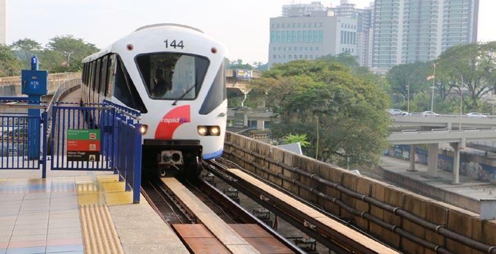
The Klang Valley metropolitan area has become more congested because of automobile dependence. With 6 million people, 11 million automobiles, and 9 million motorcycles, there is an average of 1.8 automobiles per person (World Bank, 2015). To tackle congestion and mitigate the impacts of automobile growth, the local government has built eight transit lines. The government intends to build additional public transit lines in the next few years to achieve its ambitious goal of 40% modal share for public transit in Klang Valley area.
The rapid construction of transit lines poses the following question: who gains and who loses from transportation development? One critical benefit of transit development is the increased property values associated with proximity to public transit. While some people may benefit from an increase in property value, others may suffer economic losses. It is worth exploring how the increase in property values is distributed and who gains and who loses in light of the aggressive transportation expansion planning in the Klang Valley.
In the face of such development pressures, many villages have struggled to negotiate for more sustainable outcomes that reflect their development priorities. Serina Rahman of the University of Malaya, started an environmental club for the youth of the area so that the local community could gain awareness about the importance of their habitats and earn an alternative income from ecotourism guiding in the area. The group had little traction in engaging with PTP but have recently had positive progress in consultations with Country Gardens. With the support of IRDA, the group is now able to provide some input into the direction and implementation of the Forest City project, and at the very least might be able to ensure some community benefits as a result of the development.
How are the increases in revenue caused by rising property values around transit corridors distributed among different stakeholders in Kuala Lumpur?
This research calls for a quantitative approach to analyzing the impacts of transit lines on property values. The unit of analysis can be land parcels or households. The dependent variable could be land value, housing prices, or rents. The independent variables could include demographic factors, characteristics of transit lines, or proximity to transit stations.
Obtaining high quality data will be a challenge. Official data may or may not have the resolution required, and researchers may need to initiate new surveys to collect the required data. Online surveys are possible as long as appropriate measures are taken to ensure the reliability of responses. By using a combination of official data and survey data, a scholar could run regressions to determine the impacts of transit lines on property values.
This research could evaluate the impacts of existing transit lines on surrounding properties, and try to predict how property values might trend along future transit corridors. It could help to determine whether the distribution of benefits and costs is equitable. A deeper understanding of benefits and costs could help decision-makers find ways to internalize the spillover effects of transit lines.
• MassRapidTransitCorporationSdnBhd (MRT). Owned by the Ministry of Finance Malaysia, MRT is the developer and the asset owner of transit lines.
• Suruhanjaya Pengangkutan Awam Darat (SPAD). SPAD is responsible for planning, regulating and enforcing all matters related to public transport in Peninsular Malaysia.
• MMC Gamuda KVMRT. MMC Gamuda KVMRT is the project delivery partner responsible for ensuring that the project is completed on schedule.
• Kuala Lumpur Property Management & Valuation Department. This agency may have the data that could support this analysis.
• World Bank. Jun, 2015, “World Bank Malaysia Economic Monitor Report”, http://www-wds.worldbank.org/external/default/WDSContentServer/WDSP/IB/2015/06/18/090224b082f3c367/1_0/ Rendered/PDF/Malaysia0econo0ming0urban0transport.pdf
How severely has rapid development eroded catchment areas along the river corridor in Kuala Lumpur, and how has this erosion reduced the natural protection that would otherwise reduce stormwater damage?

Ecological and/or constructed infrastructure, storm management, water resource management, environmental engineering
Kuala Lumpur’s urbanization has eroded catchment areas, altering natural vegetation and ecological habitats that lower infiltration capacity of soil, thereby increasing runoff volume. Higher runoff volume can increase flooding as well as natural and constructed habitat destruction. In some instances, experts have described the increased real estate activity as uncontrolled, damaging the natural resources that absorb water during periods of severe rain or flood. The impact of this erosion has not been studied in depth, but has caused ecologists, water resource experts and storm mitigation managers to question the extent to which it has worsened the impacts of heavy rain on the city’s infrastructure.
Understanding the severity of the erosion of catchment areas is linked to three phenomena. First, Kuala Lumpur and Malaysia are urbanizing rapidly. According to some studies, approximately 65% of Malaysia is expected to be urban by 2020, and Kuala Lumpur is expected to experience continued development. This development activity in the catchment areas of the Klang River exceed the projections developed during the early planning of the flood mitigation program, and the capacity of the Klang River is unable to accommodate the excess flood flow. Second, studies by the Department of Irrigation and Drainage Malaysia show that the number of rivers with capacity to handle surface runoff is decreasing, putting urban infrastructure under duress during times of severe rain or water overflow. Last, flash floods have become increasingly common. In the last decade, six major floods occurred which resulted in loss of life, substantial property damage, and disruption of economic activity. More floods, increased impervious area and population growth will converge to create extreme demands on city infrastructure.
The main dataset for documenting erosion are topographical maps. These can be obtained from archival or digital sources. A more complex environmental engineering task would involve determining how eroded areas may or may not provide continuing protection against severe flood or stormwater damage. Engineering modeling may offer some insight. Lastly, a researcher could benefit from focusing on a specific site along the river corridor. Ideally, it should offer a geographical unit that has experienced both development and erosion, and can therefore provide a test case regarding the interaction of the two.
This question aims to deepen our understanding of how development may have the unintended effect of damaging the social and physical functioning of the built environment. Findings may provide ideas about planning future development more responsibly.
• Storm Management & Road Tunnel Bhd Smart Tunnel Control Centre (SMART). The SMART Stormwater Control Center activates a stormwater diversion system in coordination with multiple municipal departments in Kuala Lumpur.
• Humid Tropics Centre. The Humid Tropics Centre works to promote collaboration between Southeast Asian countries in understanding technical knowledge about hydrological cycles.
• Zakaria, N.A., A. Ab. Ghani, R. Abdullah et al. “MSMA – A new urban stormwater management manual for Malaysia.” Advances inHydro-ScienceandEngineering6
• Ho, Carrie, Tan Yee Yong. 2013. “Pollutant Loads of Urban Runoff from a Mixed residential-commercial catchment.” InternationalJournalof Environmental,Chemical,ecological,GeologicalandGeophysicalengineering 7 (12): 837-839.
Green infrastructure entrepreneurship, innovation economics, energy technology
Malaysia has expanded its entrepreneurial capacity over the past twenty years and experts that to continue. For example, the number of businesses registered with the Ministry of Entrepreneur Development (an agency responsible for the development of Bumiputera entrepreneurs) nearly doubled in the early 1990s – an indication, in part, of the forward-thinking efforts of entrepreneurs. In 1992, the national government conceived the Malaysian Technology Development Corporation to provide technical advice, risk capital and incubators throughout the country. In 1995, the national government conceived the Ministry of Entrepreneurship to support all matters related to entrepreneurship.
Despite these early successes, Malaysian entrepreneurship faces challenges. For example, small and medium industries have been slow to grow, successful entrepreneurship is showing signs of favoring certain racial and gender categories, intellectual property protections need to be improved, government regulations could be less complex and financing resources could be more diversified. A confluence of these factors may explain why many businesses do not survive more than ten years, despite a strong financial system and improving governance practices.
While Malaysian entrepreneurship has grown, particularly in the software and information spaces, green technology (solar and efficiency) has not seen the same success. This is concerning when one considers the strong solar potential in Malaysian geography and an architectural tradition that incorporates passive solar design.

Interviews with or surveys distributed to entrepreneurs may offer the best insight into the barriers – cultural or structural – to green entrepreneurship. A study could look generally at the patent filing process, access to capital, compliance and regulation, and the availability of quality legal services and then offer a deep dive into the most promising areas. While data will certainly need to be collected from entrepreneurs, government program managers (particularly those close to incubators), will surely have meaningful insights to offer.
What are the cultural or policy mechanisms that support or challenge the ability of entrepreneurs to conceive, commercialize and scale solar energy and energy efficient technologies and/or ventures?Figure 7. One of the world’s few solar panel projects controlled by automated movement, from the National University of Malaysia’s Solar Energy Research Institute (SERI). Photo credit: Adler Prioly 2016
Uncovering the reasons why entrepreneurs in the solar and efficiency technology space may not be bringing products to market quickly could unlock significant value. Entrepreneurs seeking to commercialize and scale-up ideas, as well as the government officials who are championing a low-carbon vision for the future, would both stand to benefit from the findings of this research.
• Solar Energy Research Institute – SERI (affiliated with National University of Malaysia). SERI is an institute that focuses on researching, commercializing and scaling renewable energy, building efficiency and sustainability technologies.
• Centre for Entrepreneur Development and Research (CEDAR). CEDAR is an entrepreneur development entity that offers services throughout the life cycle of small and medium enterprises in order to support their success.
• Zakaria, N.A., A. Ab. Ghani, R. Abdullah et al. “MSMA – A new urban stormwater management manual for Malaysia.” Advances inHydro-ScienceandEngineering6.
• Ho, Carrie, Tan Yee Yong. 2013. “Pollutant Loads of Urban Runoff from a Mixed residential-commercial catchment.” InternationalJournalof Environmental,Chemical,ecological,GeologicalandGeophysicalengineering 7 (12): 837-839.
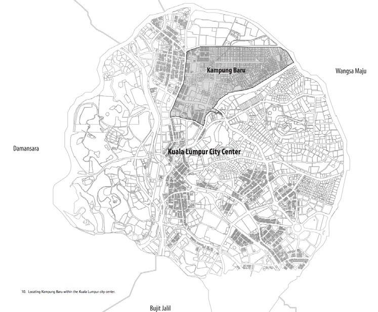
Kampung is a term used in Malaysia for “a Malay hamlet or village in a Malay-speaking country.” Kampungs predate both British colonization and the formation of the modern Malay natistate and are often characterized by strong social networks, traditional Malay architecture, and agrarian lifestyles. Over the past thirty years, rapid urbanization has surrounded several kampungs, including Kampung Bharu, with high-rise residential and commercial skyscrapers. Urban kampungs have thus become both symbols of traditional Malay identity and targets for urban renewal and increased density.
In 1900, Kampung Bharu became the only Malay Reserve Area established by a gift from His Royal Highness YMM Sultan Abdul Samad. As a result of this gift, there is deference to maintaining the sultan’s terms: that the land remains in perpetual Malay ownership. At the same time, a self-governing authority for the seven villages called the Malay Agricultural Settlement (MAS) was formed, with representation from each village through an elected village head.
Over a century later, land in the Kampung is largely under the same family ownership, due to Islamic inheritance laws (Hukum Faraid), in which title is passed from generation to generation and shared among family members. As a result, small parcels are frequently held by multiple titleholders; one parcel in Kampung Bharu is held by 208 individuals. However, the Kampung is currently under intense development pressure due to its proximity (1.2 kilometers and one LRT stop) to the Petronas Towers. Kuala Lumpur’s controversial development plan for the area calls for mass densification, increasing the number of housing units from 3,840 in 2010 to 17,500 by 2035. Though the neighborhood today is primarily residential, under the current redevelopment plan, residential uses will occupy only 5.11% of the land within Kampung Bharu.
• HO w MIGHT LESSONS f ROM THIS ASSESSMENT BE INCORPORATED INTO RELOCATION POLIC y AT THE CIT y LE v EL ?
• w HAT DO THE RESULTS SUGGEST ABOUT POTENTIAL GAPS IN THE REPRESENTATION O f CERTAIN GROUPS DURING DE v ELOPMENT NEGOTIATIONS ?
• HO w MIGHT THESE BE MITIGATED , IN KAMPUNG BHARU SPECI f ICALLy ?
Displacement, impact assessment, participatory action research, human rights
In order to facilitate development in Kampung Bharu, the City of Kuala Lumpur launched the Kampung Bharu Development Corporation (PKB) in 2012 to replace the resident’s board of management, MAS seeks to mediate between developers and landowners. PKB works solely with landowners, and focuses on compensation for land. The owners are able to negotiate with developers on either price or space in a new development, although few have yet to reach agreement.
Negotiations based only on land value ignore a myriad of other impacts of development, such as psycho-social, environmental, and quality of life changes. In addition, these negotiations are not inclusive of all stakeholders whose livelihoods are based in Kampung Bharu. Currently, a majority of residents in the Kampung are renters, a large portion of which are immigrants from Indonesia. Commercial interests are also overlooked in a neighborhood known as a “foodie village” (due to the street-front restaurants and market stalls, many of which operate out of rented space). These formal and informal renters and businesses have not yet been given a voice in negotiations over redevelopment or planning, nor do they have recognized claims to damages.
Several frameworks for eviction impact assessments (EIA) have already been tested, so a researcher working on this issue would not need to start from scratch. The researcher (and Kampung Bharu community, where possible) should consider frameworks such as:
• Economic valuation, which estimates the monetary costs of changes in housing and other living costs, employment and earnings, and moving costs;
• The Housing Rights Violation Loss matrix which quantifies both personal and social costs
• The Impoverishment Risks and Reconstruction model which focuses on the risks of resettlement and ways of mitigating them.
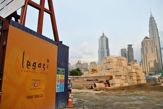
Using an Eviction Impact Assessment method of analysis, what are the social and economic costs of displacement to commercial and residential owners, renters, and informal occupants of Kampung Bharu?Figure 9. The Legasi condominium project occurs on the site of Kampung Bharu’s former Sunday night market. Photo credit: April Ognibene, 2016
Each of these models is described in further detail in “Losing Your Home: Assessing the Impact of Eviction,” cited below. The chosen framework should be tweaked to fit the needs of Kampung Bharu, and the researcher should implement only a portion of the framework. For example, the economic ramifications of resettlement in terms of housing, transportation, and employment might be more relevant to Kampung Bharu than questions about food security or education. A meeting with community members would help to narrow the project’s focus.
The EIA could be applied to a number of different populations in Kampung Bharu, including residential owners and renters, commercial owners and renters, and informal residents. The researcher may need to narrow the target population, but should be aware that the renting population (both businesses and residential) has long been overlooked.
Pressures of forced displacement are a global phenomenon. Thus, this study should provide insights relevant to neighborhood contexts in many countries. However, because the research will also involve immense time and energy on the part of Kampung Bharu residents and businesses who may be suffering from “research exhaustion,” the outcome of the research must be useful to people in the area, first and foremost. The research should assist residents in formulating a response to proposed development in areas where it still may not adequately address or encompass the needs of the all the various key stakeholders. Participatory action research (i.e. where the researcher works directly with community members to formulate a plan that contributes to progressive social change) is appropriate for this project. MAS might be a helpful first connection to the community.
• DisplacementResearch&ActionNetwork (displacement.mit.edu) - DRAN is an MIT research lab that builds a global network of researchers and activists to influence policy.
• MAS - MAS is implementing a resident census at the beginning of 2016 that will, for the first time, include renters. MAS has made efforts to reach out to the renting and immigrant populations in Kampung Bharu, however the organization currently works largely with landowners. Individual: En. Shamsuri Suradi (Sam) Honorable Secretary, Members Board of Management (maskgbaharu1900@gmail.com, shamsuri51@gmail.com).
• Khazanah Research Institute – The Khazanah Research Institute conducts country-wide research in order to provide policy recommendations to the state. The Institute maintains a focus on inequality and cities, and might have helpful data especially related to the availability of alternative housing for Kampung Bharu residents. Individual: Intan Nadia Jalil, Deputy Director of Research (Cities) (nadia.jalil@krinstitute.org)
• “United Nation’s Basic Principles and Guidelines on Development-Based Evictions and Displacement.” OHCHR, 2016. http:// www.ohchr.org/EN/Issues/Housing/Pages/ForcedEvictions.aspx
• Du Plessis, Jean, Claudio C. Acioly, and Roman Rollnick. Losingyourhome:assessingtheimpactof eviction.UnitedNations Human Settlements Programme (UN-HABITAT), 2011. http://hrbaportal.org/wp-content/files/Losing-your-Home-Assessingthe-impact-of-eviction-UN-Habitat-OHCHR.pdf)
• Kampong Baru Master Development Plan, available from PKB.
• The researcher may choose to involve leaders from other kampungs facing forced evictions, such as Kampung Chubadak Tambahan and Kampung Datuk Karamat.
What values or assumptions about cultural identity are reflected in the Kampung Bharu redevelopment plan? What is emphasized and what is not included? How does this compare with the way community members think about their identity?
• HO w CAN COMMUNIT y - LE v EL vALUES BE INCLUDED IN A MODERN v ISION O f THE KAMPUNG BHARU ?
Participatory planning, identity, architecture, heritage
As mentioned previously, Kampung Bharu is facing extreme development pressure. Recently the City of Kuala Lumpur created a Development Corporation (PKB) to promote Kampung Bharu as the “the Centre of Malay Culture and as a New Economic Enclave for the City of Kuala Lumpur and Greater Kuala Lumpur.” One of PKB’s key objectives is to ensure that all future development in the area is “based on the preservation of Malay culture and heritage as well as Islamic virtues.” Some residents, however, argue that the primary objective of the effort is to exploit untapped real estate value and provide housing for wealthy expats, not to preserve Malay identity.
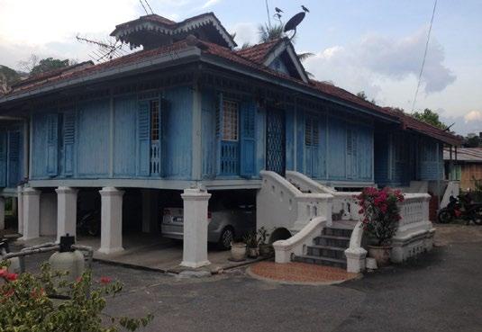
The PKB allows for individual decision-making about the development of land. It provides an opportunity to propose alternative designs that reflect community values in Kampung Bharu. The visual contrast between traditional houses and renderings of future redevelopment raises many questions, first and foremost about the lack of commitment to preserve a national historical site.
We suggest that a scholar interested in this topic should follow a four-step process:
• An analysis of the visual and value guidelines in the Kuala Lumpur and Kampung Bharu redevelopment plans.

• Interviews with community residents of Kampung Bharu about their personal concerns and the perceived identity of the Kampung, and/or analysis of photographs taken by Kampung Bharu residents that show the features of the community that have been valued in the past.
• Social media analysis to understand the current “brand” associated with Kampung Bharu by residents and visitors.
• Cross-comparison of findings from interviews and social media with the values highlighted in the plan. Additionally, it would also be helpful to conduct interviews with prominent developers and architecture firms in Kuala Lumpur to get their opinions about Kampung Bharu’s redevelopment.
The findings of this research could empower the community to advocate for implementation of revised urban design guidelines regulating development of their land as well as government-owned spaces in the Kampung. While redevelopment may be inevitable for Kampung Bharu, there is the potential for the Kampung to be a global model of physical redevelopment that is inclusive and respectful of historical, cultural, and social values.
• MAS - MAS has established trust and communication with owners and residents of the Kampong Bharu. They helped KBC coordinate public meetings with the community in the presentation of the Kampong Bharu redevelopment proposal.
• Dr.NorsidahUjang, MSCP Scholar 2015-2016
• KampongBharuDevelopmentCorporation (pkb.gov.my). Individual: Zamri Bin Mohd Saharin, Principal Assistant Director of Urban Planning; Phone: +60 (3) 2693-5733; Email: zamri@pkb.gov.my.
• Kuala Lumpur City Hall (dbkl.gov.my). Individual: Nik Masura Diyana Nik Mohamad, Deputy Director, Physical Planning Department; Phone: 03-2617 9551/ 03-2617 9553.
• Architecture firms in Malaysia
• Veritas Arkitek (http://theveritasdesigngroup.com/)
• GDP Architects (http://gdparchitects.com/2015/)
• Main developer firms in Malaysia:
• SpSetia (http://gdparchitects.com/2015/)
• SimeDarby (http://www.simedarby.com/)
• UTM’s Architecture Department. The Department is currently working on exploring the architecture and housing typologies of Malay houses.
• Fujita, Maria Anna. “Forays into Building Identity: Kampung to Kampong in the Kuala Lumpur Metropolitan Area.”
• Hashim Rasidah, Nor and Yaacob Mohd, Naziaty. “Urban Landscape Changes in Kampung Baru, Kuala Lumpur,from 1969 to 2004 as observed on maps.”
• Alhabshi, Sharifah Mariam. “Urban Renewal of Traditional Settlements in Singapore and Malaysia: The Cases of Geylang Seria and Kampung Bharu.”
• City of Kuala Lumpur. “Kuala Lumpur Structure Plan 2020.”

•
What kinds of judicial protection are available for kampungs in which land tenure is contested? How effective is the judiciary as a means for civil society to resist development-induced displacement?
•
Civil society engagement, development-induced displacement, judicial activism
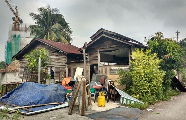
Kampung Chubadak Tambahan is an urban village in Kuala Lumpur that lies on former mining land. Initially recognized as a Malay Reserve Land (in 1916), the area was de-gazetted in June 1932. Despite plans in the 1960’s to divide the land into individual sub-lots for residents, it was transferred to a private developer in July 1990. Since the early 1990’s, the residents of the Kampung have been in a legal battle with the private developer. The developer argues that the residents are trespassers and sued for damages. An initial judgment in 1998 concluded that the residents of the Kampung were not squatters or trespassers, but were indeed residents who have been in occupation of the land with the explicit approval of the Dewan Bandaraya Kuala Lumpur (DBKL), the Kuala Lumpur City Hall. The court pointed to over three decades of improvements in infrastructure and service delivery by DBKL, including the construction of a town hall, water and electricity services, a health clinic and telephone services. While recognizing the private developer as the legal owner of the land, the court ordered the payment of fair compensation to any residents displaced by development.
In 2008, DBKL listed Kampung Chubadak Tambahan as a squatter settlement under the 2020 Kuala Lumpur Plan. In June 2014, the city decided to demolish homes on the site and move some of the displaced residents to a nearby public housing project. This triggered protests by the residents of the Kampung, local non-governmental organizations and student groups. Conversations we had with the PPKCT, the local residents’ association and activist group, revealed that the private developer has not paid the full compensation due residents and that the number of affordable housing units the developer promised to build has been reduced. The developer continues to negotiate individually with households. The future of the Kampung remains uncertain.
Research on this question should be designed in consultation with the PPKCT, the residents’ association and activist group in Kampung Chubadak Tambahan. The PPKCT is a well-organized group of individuals with systematic record keeping of judicial orders related to the development. It can also serve as a starting point of contact with local NGOs, student groups, lawyers, and professors of the International
Islamic University, who have all been active in supporting the residents against displacement. The research design could be comprised of two complementary parts. First, an analysis of the judicial orders and court judgments related to Kampung Chubadak Tambahan and the verdicts reached in each case. Such an analysis would pave the way for a broader study of legal challenges to displacement in the rest of Malaysia. The researcher should expect to use the case of Kampung Chubadak Tambahan as a starting point for a wider, historical analysis of development-induced displacement. Second, a set of interviews with relevant stakeholders including the residents, the DBKL, the private developer, and local civil society organizations active in the area would reveal the dynamics of the underlying conflict.
Kampung Chubadak Tambahan could serve as a unique case for examining the effectiveness of using the Malaysian judiciary as a pathway for civil society activism. This study could be of larger relevance, especially to other Kampungs in Kuala Lumpur (Kampung Bharu and Kampung Dato Keramat) facing similar threats of development-induced displacement. We envisage a critical output of this study being a toolkit to help civil society organizations working in kampungs to understand their legal status rights.
• PPKCT - The local activist group PPKCT would be a key partner for this study. As mentioned above, the organization maintains systematic records of court verdicts over the past 20 years. The group can help in establishing contacts with local civil society organizations, academics, and student groups that are active in resisting displacement.
Located at the southernmost boundary of peninsular Malaysia (and therefore the southernmost tip of mainland Asia) Johor Baharu sits just across the narrow Straits of Johor from Singapore. As such, Johor Bahru (JB) is a common entry point into Malaysia for tourists and businesspeople, and is becoming attractive as an affordable alternative to Singapore where the cost of living is much higher. Over the past decade, JB has worked hard to enhance its international reputation, embarking on ambitious plans to expand its ports, attract foreign real estate investment, and develop its shoreline through massive land reclamation projects. Some policies are in place to ensure that rural fishery-dependent villages on the outskirts of the city benefit from this development. However, tensions remain between large-scale development goals and preservation of the livelihoods of villagers who depend on shrinking and deteriorating coastal ecosystems.
To what extent are kampungs able to control their own physical planning and/or economic development? What factors or conditions undermine their autonomy?
Community Empowerment, Community and Economic Development, Rural Development, Collective Governance

Kampungs in JB are headed by “Ketua Kampungs” or “Penghulus” (village heads) who assist the state government in implementing community and economic development projects in the village. Traditionally Ketua Kampungs (village leaders) were elected by the public and ratified by the sultan; now, however, they are frequently appointed by state government officials.
In the rural areas surrounding Johor Bahru, several kampungs have pursued ways of sharing in the benefits of the rapid urbanization

and increased tourism in the region. In Kampung Pandas Laut for example, a community club is developing a mangrove tourism and ecological education initiative. In Kampung Ulu Pulai, village leaders have developed a proposal for an ecotourism venture. Although these villages appear to offer self-determination over specific community development initiatives, they do not give local leaders any way to influence large-scale projects such as Forest City that adversely affect them.
Researchers could study a major project or initiative led by a kampung facing development pressure. (Kampung Pandas Laut and Kampung Ulu Pulai would both make interesting case studies.) Using an “n of 1 plus some” methodology that integrates the examples of other kampungs, the research could assess the level of self-determination and control that residents have over their land, and the role of the kampung governing organization in that process. Analysis should probably include a study of the inception, financing, and community engagement process for each project, as well as the external influences that have shaped its success or failure.
Based on this case study, the researcher should develop an analysis of the conditions that appear to promote or inhibit community control over development of their land. Examples might include: strong local leadership, collective governance, political connections, and access to additional resources, etc.
The conclusions of this analysis should highlight best practices and strategies for community empowerment that could be shared with communities throughout the world that face development-induced displacement.

• w HAT fACTORS MAKE f OREST CIT y ACQUISITIONS ATTRACTI v E TO f OREIGN IN v ESTORS ?
• O v ER w HAT TIME HORI z ON DO IN v ESTORS AND DE v ELOPERS ANTICIPATE RETURNS ON IN v ESTMENT ?
• w HAT ARE BU y ERS ’ E x PECTATIONS ABOUT UNIT OCCUPANC y ?
• HO w HAv E BILATERAL DISCUSSIONS , ECOLOGICAL STUDIES , AND PRO j ECT ALTERATIONS A ff ECTED IN v ESTORS ’ PERCEPTIONS O f THE f OREST CIT y PRO j ECT ?
• w HAT ARE THE CHARACTERISTIC MATERIAL AND f INANCIAL f LO w S USED f OR LAND RECLAMATION AT f OREST CIT y ?
• HO w DOES THE ENERG y REQUIRED TO UNDERTAKE LARGE SCALE RECLAMATION PRO j ECTS COMPARE w ITH TRADITIONAL DE v ELOPMENT PRO j ECTS ?
• w HAT ARE f OREST CIT y ’ S E x PECTED DEMANDS LIKELy TO BE ON INLAND IN f RASTRUCTURE CAPACIT y ( E . G . w ATER , ROADS , NET w ORKED IN f RASTRUCTURE )?
• HO w ARE THE COSTS IN v OLv ED BEING DISTRIBUTED ?
SUBQUESTIONS
• HO w DO SINGAPOREAN AND MALAy SIAN REGIONAL PLANNERS SEE f OREST CIT y w ITHIN THE CONTE x T O f REGIONAL DE v ELOPMENT PLANS ?
• w HAT ONGOING RE v ENUE AND PUBLIC BENE f IT w ILL THE PRO j ECT GENERATE ?
• HO w DO THE RECLAMATION TECHNIQUES BEING USED AT f OREST CIT y COMPARE TO PRE v IOUS RECLAMATION PRO j ECTS IN SINGAPORE ?
• HO w w ILL THE PRO j ECT BE INTEGRATED w ITH THE LARGE CONTAINER PORTS IN TUAS AND TAN j UNG PELEPAS ?
Foreign investment has been influential in Malaysia’s urban development, fed by successive waves of liberalization since the early 1990’s. Enticed by high domestic growth rates, regional economic linkages, and favorable taxation and title arrangements, foreign developers have established beachhead projects across Malaysia, especially in regions close to Singapore. While achieving impressive scale and rapid completion times, these projects frequently strain regulatory protocols and international treaties intended to safeguard critical ecosystems, human livelihoods, and democratic norms.
One example is Forest City. It is being constructed rapidly on artificial islands in the Straits of Johor. Built, owned, and operated by a China-based developer and significantly financed by Chinese investors, it typifies the recent pivot of Chinese private equity toward the acquisition of offshore real assets. Despite significant regional impacts, the fast-tracked project has been insulated from regulatory supervision because of its unique governing and financial arrangements. This concerns Johor’s regional development authority, Straits ecologists, local fishermen, and Singaporeans sharing the causeway. While many features of the project—land reclamation, master-planned enclave development, and blended foreign investment—are familiar in mainland Southeast Asia, rarely have they been compressed into such an ambitious, massive vision. As Malaysia develops its coastal land resources and invites greater foreign investment, such projects must be carefully assessed to ensure their compatibility with sustainable development goals.

Foreign private developers play an increasingly outsized role in urban development around the world. Anchored at the confluence of international real estate investment and Malaysian planning practice, projects like Forest City can produce major insights into sustainable pathways for the internationalized process of urban development.
• MIT Forest City Research Team
• Professor Tommy Koh, Special Adviser at Lee Kwan Yew School of Public Policy, National University of Singapore. Also the Ambassador-At-Large for the Singapore Ministry of Foreign Affairs, Tommy Koh is an internationally-recognized expert in international law and negotiation, and would be an excellent resource for more information about the transboundary issues between Singapore and Malaysia.
• Serina Rahman, Community Engagement Manager at the University of Malaya. Has been working in the communities affected by the Forest City development.
• Topalovic, Milica, Hans Hortig, and Stefanie Krautzig, eds. 2015. Sea Region: Singapore, Johor, Riau Archipelago. ETH Zurich.
Sarawak is one of two Malaysian states located on the island of Borneo in East Malaysia. It is bordered by the Malaysian state of Sabah and the nation-state of Brunei in the north and the Indonesian region of Kalimantan to the south. Kuching, the capital city, has a population of 330,000. Sarawak is home to more than 40 sub-ethnic groups, with indigenous Ibans making up 30%, of the population.
The state’s separation from peninsular Malaysia and distinct political history produce a unique legal context for environmental management. Not least of these differences are the possession of non-titled, customary land rights by indigenous groups and restrictions on nonnative land ownership and use rights. Because of Borneo’s resource richness in timber, petroleum, and cultivable land, customary subsistence strategies and legal prerogatives often conflict with extractive activities. This comprises the largest economic sector in East Malaysia and a longstanding source of federal fiscal receipts.
As a center of eco-tourism, warehousing, and material export, Kuching’s agglomeration and growth is linked to ecological and environmental change throughout the region. Thus, the process of sustainable urbanization in Sarawak raises questions about environmental governance, ecosystem management, and land rights at multiple scales.
How does designation of national parkland redistribute the economic value of ecosystem services among the parkland’s local users?

Ecosystem services, environmental conservation, social choice theory
The principal strategy for forest preservation in East Malaysia is through a “totally protected area” designation, encompassing land
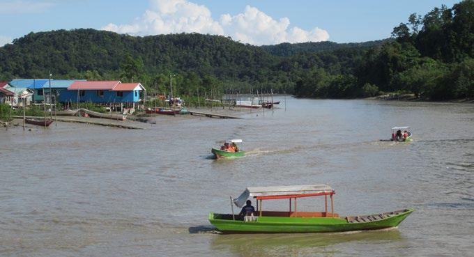
Figure 19. Fishing boats of Kampung Bako, converted to ferry tourists to Bako National Park.allocated for national parks, nature reserves, and wildlife sanctuaries. By 2020, Malaysia hopes to designate more than 1,000,000 hectares (2,470,000 acres) of forested land as protected areas. Once conferred, this legal status prohibits land use changes, such as clear-cutting for settled agriculture, plantation development, or timber extraction. Though primarily targeted at permanent conversions of forest ecosystems, protected areas also exclude low-impact, regenerative human uses such as foraging, hunting, and shifting cultivation. By treating all resource-harvest strategies as harbingers of forest destruction, protected area designation interrupts longstanding relationships between forests and human users.

While excluding local resource users, many protected areas invite “non-consumptive” human users. Because tourists provide local employment and entrance fee revenue, ecotourism is often touted as a way to capture the value of ecosystem non-use value while compensating the livelihood deprivation arising from use exclusion. For example, the creation of Sarawak’s Bako National Park in 1957 caused many residents of the park’s adjacent village, Kampung Bako, to shift occupations from fishing and foraging to ecotourism and park management. The park’s creation has also produced economic linkages to primary cities via travel coordination and transportation markets for 35,000 annual visitors, creating more complex regional economic transactions and a greater spatial distribution of the parkland’s economic benefits.
Ecosystem service valuation has shown that the aggregate value of ecotourism and protected ecosystem services can outweigh the economic value of forest conversion (Gössling 1999). However, the distribution of benefits derived from protected area conversion in Sarawak is not well understood. Do only a few households prosper from park-related employment? Do ecotourism revenues remain locally invested, or are they remitted to urban centers? Such questions are essential to a nuanced understanding of how environmental conservation strategies affect stakeholder livelihoods. Ultimately, the goal is assure that forest conservation policy is, to the greatest extent possible, environmentally protective and fair.
Two survey methods may be appropriate to answering this question. One approach would be to identify a settlement recently affected by protected area designation and gather information about livelihood changes. Another approach would compare Kampong Bako’s mature relationship to Bako National Park with a coastal village more distant from protected areas. In both cases, structured surveys and semi-structured interviews would provide complementary quantitative and qualitative data on village economic structure, household occupations, and human-environment relationships.
• Gössling, Stefan. 1999. “Ecotourism: A Means to Safeguard Biodiversity and Ecosystem Functions?” Ecological Economics 29 (2): 303–20.
To what extent do existing protected areas schemes prevent forest loss and fragmentation in East Malaysia? What management and governance practices can improve local capacity to monitor drivers of forest change and prevent deforestation?
Environmental performance assessment, environmental monitoring, resource co-management, geospatial analysis, multiscalar governance
Over the past five years, Malaysia’s environmental monitoring strategy has introduced national-scale metrics of environmental performance, most notably the Malaysia Environmental Performance Index initiative launched by UTM in 2015. These efforts have introduced systematic, unbiased datasets into federal environmental monitoring, increased public data disclosure, and routinized annual evaluation of government environmental protection efforts. As data collection and dissemination have become more systematic, the ability to identify local ecosystem changes have become more precise.
Many of the synoptic datasets used for environmental monitoring reveal that Malaysia’s land mass is experiencing some of the highest rates of deforestation worldwide, with losses concentrated in lowland regions of East Malaysia (Hansen et al. 2013). Previous studies have suggested that forest loss in Borneo regularly occurs within protected areas (Curran et al. 2004), suggesting that current land management practices are not adequate to protect against clearance pressures. This observation suggests two linked research topics:

• To what extent do protected area programs prevent forest loss and fragmentation in East Malaysia?
• What management and governance practices might improve local capacity to monitor and prevent deforestation?
A wide variety of studies indicate that co-management between authorized government agencies and vested local stakeholders can provide a robust basis for monitoring environmental change, managing common-pool resources, and protecting ecosystem functions (Heber Dunning 2015). Although most of these studies have focused on coastal ecosystems and fisheries, forest ecosystems may benefit in the same way. In areas where traditional conservation strategies have proved inadequate to safeguard forests, there may be opportunities to connect local knowledge and management practices to synoptic assessments of forest loss.
A researcher might choose to engage one or both of these questions. Data collection would involve locating or digitizing high-resolution
information on totally protected areas and differencing with multi-temporal, satellite-derived forest change estimates (e.g. Hansen et al. 2013). An area recently gazetted for protection could also be evaluated to track changes in forest cover before and after.
Once protected sites of high forest loss are identified, the researcher could work with a partner organization to identify an affected settlement near the protected site. Drawing on interviews with villagers and forest managers, the researcher could try to assess local forest management techniques, the capacity for co-management, and the utility of external datasets in supporting local monitoring practices.
Examples of Proposed Sites
Sitesshouldbechoseninconsultationwithlocalpartnersordataanalysis.
• Bako National Park (gazetted 1957)
• Maludam National Park
POTENTIAL PARTNERS
• World Wildlife Fund Sarawak Office
ADDITIONAL CONTACTS
• CynthiaChin, WWF Sarawak Community Engagement Officer
• AgnesAgama, Sabah-based environmental anthropologist
ADDITIONAL RESOURCES
• Curran, L. M., S. N. Trigg, A. K. McDonald, D. Astiani, Y. M. Hardiono, P. Siregar, I. Caniago, and E. Kasischke. 2004. “Lowland Forest Loss in Protected Areas of Indonesian Borneo.” Science 303 (5660): 1000–1003. doi:10.1126/science.1091714.
• Hansen, M. C., P. V. Potapov, R. Moore, M. Hancher, S. A. Turubanova, A. Tyukavina, D. Thau, et al. 2013. “High-Resolution Global Maps of 21st-Century Forest Cover Change.” Science 342 (6160): 850–53. doi:10.1126/science.1244693.
• Heber Dunning, K. 2015. “Ecosystem Services and Community Based Coral Reef Management Institutions in Post BlastFishing Indonesia.” EcosystemServices 16: 319–32. doi:10.1016/j.ecoser.2014.11.010.
What are the prospects and precedents for a legally-mandated social impact assessment requirement for new development projects in East Malaysia? How do Sabah and Sarawak’s relationships with the central government enhance or inhibit these prospects?

Social impact assessments, Federalism and polycentric governance, Political sociology, Legal studies
Although indigenous groups are regularly impacted by new development projects in East Malaysia, the process for assessing and mitigating these impacts is informal and inconsistent. Developers negotiate with communities or government officials on an ad-hoc basis. There is wide variance in the social sustainability of the resulting projects. While environmental impact assessments are commonly used to inform development decisions in Sarawak and Sabah, social impact assessments (SIA) are not legally mandated. Even if developers choose to conduct them, no governmental standards exist that specify unacceptable levels of social impact.
While indigenous communities in East Malaysia are guaranteed customary land rights, development-induced conflicts in Sarawak and Sabah still result in displacement and loss of livelihood. Existing international, federal, and state law in East Malaysia provide potential mechanisms for codifying social impact assessment standards. Recent changes in state political leadership may provide another. Sabah and Sarawak have a unique relationship with the federal government, enjoying relatively more autonomy than other Malaysian states. This may create opportunities for East Malaysia to lead the way in SIA adoption.
Archival and field research can illuminate the prospects for institutionalizing SIA in East Malaysia. A scholar could focus on existing statutes and common law precedent that would support requiring minimum standards in an SIA. The scholar could conduct an analysis of federal and state compliance with international law surrounding the rights (to Free, Prior Informed Consent) of indigenous peoples. We recommend pairing this analysis with in-depth interviews. Interviews with key informants on indigenous rights in East Malaysia, the land conflict adjudication process, and current impact assessment would all be relevant. Potential sub-questions to explore include:
• What are the prospects for the implementation of global standards like the Voluntary Guidelines on the Responsible Governance of Tenure?
• What are the legal and political obstacles to such a change in policy?
• What might serve as the basis for a minimum standard or “red line” in SIA undertaken in this context?
Social impact assessments are a simple and internationally recognized tool for ensuring the social sustainability of development projects. This research could help promote the implementation of minimum social impact standards and provide SIA benchmarks of importance elsewhere in the world.
Sarawak
• Professor Reazul Ahsan, MSCP Scholar 2015-2016
• Louise Macul, Friends of the Sarawak Museum
• CynthiaChin, WWF Community Engagement & Education
• BemenWinKeongWong, UMS
• FORMADAT, Alliance of the Indigenous Peoples of the Highlands of Borneo
Sabah
• Forever Sabah (NGO)
• Dr.GaimLunkapis
• Dr.AgnesAgama
• SabahForestDepartment
• BoydJoeman of Iskander Regional Development Authority has relevant contact information
• Guidelines and Procedures for Social Impact Assessment and Monitoring of Forest Management Operations (Peninsular Malaysia). Institute of Tropical Forestry and Forest Products Universiti Putra Malaysia, 2012.
How are indigenous groups in Sarawak engaging in modern cultural and economic practices? How does this differ from the Orang Asli on the peninsula, in light of their more conditional claim on indigeneity?

Indigenous peoples, Political construction of modernity, Political and legal anthropology
Indigenous designation in Malaysia carries distinct benefits and protections, particularly regarding land rights. However, political categories of indigeneity are constructed very differently in East and Peninsular Malaysia. Sabah and Sarawak in East Malaysia each use their own definition of “customary land rights.” In these states, indigenous groups enjoy bumiputera status and the benefits that entails.
In peninsular Malaysia, however, the Orang Asli communities are explicitly not bumiputera. These categories are plastic—certain livelihood or lifestyle choices may cause an individual to lose their indigenous designation, and their land rights, as a result. In peninsular Malaysia, individual compliance with notions of modernity and Malay identity determine which category of citizenship applies to Orang Asli. Indigenous communities on the peninsula are forced to choose between binary conceptions of modern and native.
The aim of this research question is to encourage a comparative analysis of how the designation of legal categories affect indigenous persons and shape their behavior. Using semi-structured interviews and participant observation, the researcher could compare a community in Sarawak or Sabah with an Orang Asli community on the peninsula. The researcher would need to examine how lifestyles and livelihood strategies have evolved at each site. How do younger generations’ aspirations compare with older generations’? Second, the researcher would need to examine the ways that people perceive their legal designation, relationship with modernity, and the importance of land rights.
When governments define multiple categories of citizenship, the people in those categories may modify or restrict their behaviors based on the incentives associated with being a member of a particular group. This research should compare the impacts of different indigenous designations.
• Dr.GaimLunkapis, Sabah
• Dr.AgnesAgama, Sabah-based environmental anthropologist
• Louise Macul, Friends of Sarawak Museum, Sarawak
• Dr. Reazul Ahsan, indigenous group contacts in Sarawak and Johor Bahru
• BoydDionysusJoeman, Iskandar Regional Development Authority, Johor Bahru
• Daniel Goh, Associate Professor of Sociology, National University of Singapore
• Performing Indigeneity: Global Histories and Contemporary Experiences. Ed. Laura R. Graham and H. Glenn Penny
• Dourish, Paul. 2008. “Points of Persuasion: Strategic Essentialism and Environmental Sustainability”. University of California.
Pahang is the third largest state by land area in Malaysia and the largest in Peninsular Malaysia. The state encompasses the Pahang River basin, originating at the confluence of Jelai and Tembeling rivers on the Titiwangsa Mountains and draining into the South China Sea. Cities in Pahang include Kuantan (the state capital, on the eastern coast of peninsular Malaysia) and Temerloh (the mid-point between Kuala Lumpur and the eastern coast). Pahang’s economy relies on several industries, such as timber, oil palm, fishing, and tourism.
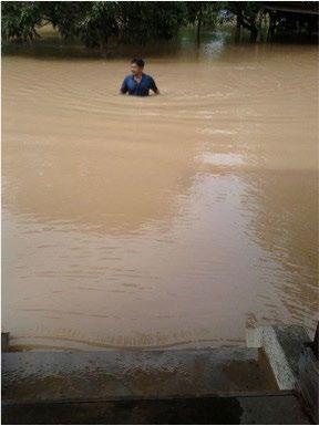
In December 2014 and January 2015, Pahang experienced significant flooding along the river basin between Temerloh and Pekan, resulting in the evacuation of approximately 29,000 people and significant property damage.

Using the 1971 and 2014-15 Pahang floods as case studies, what have federal, state, and local governments and civil society learned from previous responses to flood disasters, and what actions have been taken to ensure better flood management capabilities in the future?
• w HAT fACTORS LED TO SUCCESS f UL ORGANI z ATIONAL LEARNING BET w EEN THE 1971 AND 2014-2015 f LOODS ?
• w HAT CHANGES HAv E TAKEN PLACE , INCLUDING IMPRO v ED COMMUNICATION , EDUCATION , INSURANCE SCHEMES AND MORE E ff ICIENT ALLOCATION
O f f EDERAL AND STATE RESOURCES ?
• w HAT APPROACHES TO MANAGING URBAN AND f LASH f LOOD E v ENTS ( IE . KUALA LUMPUR AND j OHOR BAHRU ) MIGHT BE APPLICABLE TO RURAL AND PERI - URBAN f LOOD MANAGEMENT PRACTICES ?
• TO w HAT E x TENT DOES STATE - DESIGNATED LAND USE AND z ONING TAKE INTO ACCOUNT f LOOD RISKS IN LO w - Ly ING AREAS ?
Disaster Response, Flood, Resilience, multi-level governance

Malaysia has a history of periodic flooding, with the central-east state of Pahang often the worst affected. The last two significant flood events in the state have been the 1971 and 2014-15 floods. The 1971 Malaysian flood left more than 38,000 people homeless in Pahang, with several towns running critically short of food supplies. The more recent floods of 2014-15, which lasted for a total of 23 days, resulted in the evacuation of more than 29,000 people and significant damage to property. In both cases, disaster management and rescue operations were managed by federal, state and local government, with help from civil society actors. Ideally, agencies should support each other; however, lack of coordination and communication among agencies has sometimes led to gaps or redundancy in rescue and relief efforts.
Some key challenges in flood disaster response in Pahang include:
• Inadequate water and air transportation
• Water level monitoring and timely communication
• Quality, siting and number of evacuation centers
• Flooding extending beyond district and state jurisdiction
It is unclear to what extent learning from earlier floods, such as the 1971 case, has been used to better manage the recent floods of 2014-15 and strengthen disaster response capabilities. These lessons range from changes in standard procedures and better coordination, to more efficient allocation of resources to meet recovery needs. For example, use of social media by district governments to communicate flood and evacuation information in the 2014-15 floods demonstrates one way in which the government has worked to improve disaster management in the state.
With significant efforts focused on disaster response, the impact of land-use and zoning on flood risk may have been neglected. Zoning maps appear not to designate and plan for low-lying zones. Altering land-use and zoning designations to better reflect flood risk might be explored as a potential lesson from past flood events in Pahang.
This research would require a comparative study of the 1971 and 2014-15 floods in Pahang, including the extent of the flooding, affected populations, economic, social and environmental costs and an assessment of flood preparedness and response in each case. Through an in-depth study of existing and past disaster management plans and protocols, accompanied by interviews with relevant federal, state, local level agencies and victims, a researcher should be able to develop an in-depth understanding of local and regional disaster management capabilities, and document what was learned between the 1971 and 2014-15 floods. which may have led to meaningful improvements in rescue and relief efforts on the ground as well as to longer-term flood resilience.
Seasonal floods are a distinct category of natural disaster with a relatively high degree of predictability. Flood-prone areas are often well known because they have a history of flooding; this provides a unique opportunity to improve flood preparedness and response through a study of past flood events and response. There is a high potential for cross-cutting learning from flood management and response in Pahang that might be applied in flood-prone areas in other developing countries, including those with limited resources.
• Temerloh District and Land Office (Pejabat Daerah dan Tanah Temerloh) - Responsible for flood disaster response at the local level.
• National Disaster Management Agency - New agency formed under the Prime Minister’s Department and in charge of managing natural disasters
• UKM LESTARI Institute - http://www.ukm.my/lestari/en/
What social, architectural, and agricultural practices have communities used to increase their resilience to flood risks, and to what extent have government agencies incorporated these practices into formal flood management efforts?
• TO w HAT E x TENT IS THE GO v ERNMENT w ORKING TO BUILD f LOOD RESPONSE CAPABILITIES w ITHIN COMMUNITIES , IN ADDITION TO PURSUING A TOP - DO w N APPROACH ?
• HO w HAv E LOCAL RESIDENTS BEEN TRAINED , ORGANI z ED AND IN v OLv ED IN f LOOD MANAGEMENT ?
resilience, disaster response
Communities in Pahang faced river flooding long before the government developed its formal flood disaster response system of evacuation centers and multi-level governmental communication. These communities bootstrapped strategies for managing the impact of flooding. For example, houses were built on stilts, protecting the second story (where people spent most of their time) from flooding. Communities planted certain crops in upland area in order to have a food source in case the lowland areas flooded. They also developed social arrangements to support community members in times of flooding.
It is unclear which of these strategies have persisted as the government has strengthened its disaster response capabilities. Stilted houses, for instance, have been largely replaced by “modern” houses in which people live on the ground floor. The local government’s flood disaster response practices focus on moving people to evacuation centers during floods. There does not seem to be an emphasis on building the capacity within communities to cope with flooding.
A researcher could try to answer the question of what practices communities have historically used to increase their flood resilience and whether these practices persist today. An architectural historian could visit several kampungs (for instance, a rural area, an Orang Asli settlement, and a more urban area) to evaluate the types of houses that have been built (and determine how many are on stilts or employ other flood prevention measures). They could also assess, either through observation or interviews, whether the newer houses have the same features as older ones.
An anthropologist or sociologist could approach this question from a different perspective by focusing on the social arrangements that communities have adopted to cope with flooding. Through semi-structured interviews with community members including fishermen

in several kampungs, a researcher could develop an understanding of the flood prevention and coping strategies each community has employed over time. This could be supplemented with interviews with districtlevel officials in the Temerloh District to determine if any of these strategies have been integrated into formal flood management practices, or if the government is considering supporting any community-level flood prevention efforts, in addition to their top-down efforts.
Recognizing traditional methods of addressing natural disasters and integrating them into government practice can help communities become better equipped to cope with and bounce back from disasters. The practices that communities in Pahang have used to address flooding could be applied to other areas in Malaysia or even to parts of the developing world that face flooding.

• Temerloh District and Land Office (Pejabat Daerah dan Tanah Temerloh) - Responsible for flood disaster response at the local level.
• National Disaster Management Agency - New agency formed under the Prime Minister’s Department and in charge of managing natural disasters.
• PenghuluJamaluddin - Local leader with connections in villages near Temerloh. Also manages a flood evacuation center.
• Dr.TejKumarKarki – 2015-2016 MCSP scholar working on issues related to flood prevention and response and land use in the Johor Bahru region.
• UKM LESTARI Institute
Based on a study of community cooperatives such as the Temerloh and Ulu Palai, what institutions, information, technical resources, funding sources, and/or policy incentives turn out to be most important in decision-making about the use of local wetlands?
• w HAT LAND USES AND SUPPORTING POLICIES MIGHT PRODUCE ECOLOGICAL , SOCIAL , AND ECONOMIC BENE f ITS f OR COMMUNITIES CONSIDERING
CON v ERSION O f NATIONAL ECOS y STEMS TO MONO - CULTURAL AGRICULTURAL PRODUCTION ?
• ARE AGRO - TOURISM OR ECO - TOURISM v IABLE INCOME GENERATION ALTERNATI v ES AS COMPARED TO MONOCULTURE ?
• TO w HAT E x TENT HAS ECOS y STEM SER v ICES , PARTICULARLy f LOOD MITIGATION BENE f ITS , O f INTACT w ETLANDS BEEN QUANTI f IED AND INTEGRATED INTO COMMUNIT y DECISION - MAKING PROCESSES ?
Governance, economic development, ecosystem services
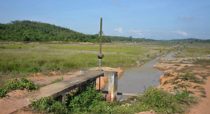
Across Malaysia, conversion of natural ecosystems to mono-cultural agricultural and industrial production is being carried out by a number of institutional actors, including large corporate land managers, smallholders, and community cooperatives. In the instance of community–controlled resources, some cooperatives have invested in draining and converting natural wetlands to oil palm production, while others have employed alternative strategies such as ecotourism in order to generate local revenue while leaving the ecosystem relatively intact.
In the case of the Temerloh cooperative, community members reached a decision to petition the state government for the right to drain a local wetland, convert the land to oil palm production, and develop an income sharing approach to generating wealth for all local cooperative members. In the case of Ulu Palai, community members also formed an income-sharing cooperative, deciding to use the local mangrove resource as an ecotourism attraction, proposing the development of floating lodging and a boardwalk for tours through the mangroves.
Interrogating these varied approaches to local economic development, this research should explore the variety of community institutions, information, technical resources, funding sources, and policy incentives that influence community decision-making about the use of local wetland resources.
Understanding the drivers and dynamics of community decision-making around land use can be used to inform public policy seeking
to support both rural economic development and ecological conservation. Through a comparative case study of the Temerloh and Ulu Palai cooperatives, this research could reveal some of the many factors contributing to important land use decisions by communitymanaged resources.
In order to capture community interests, a researcher could complete interviews with community leaders, cooperative managers, and individual community members involved in the cooperatives and the specific decision-making process used by these two projects.
A Bahasa Malaysia-speaking researcher or research assistant willl be required for some interviews, especially with Kampung residents (but such help is available through UTM or another university). Ideally the interviews would be recorded for future reference, although the researcher should respect the wishes of each interviewee regarding confidentiality. The researcher should also aim to interview a large cross-section of residents to survey a varied set of perspectives. The interviews should be open-ended, although it might be helpful to use standardized questions in order to better compare responses from disparate groups.
For rural communities across Malaysia and the tropics, identifying sustainable economic development strategies will be critical for improving community livelihood, as well as increasing resilience to climate change. Viable alternatives to extractive industries, policy incentives, and appropriate technical support for community-based management decisions must be identified and scaled to support local economic development that both generates income and protects critical ecosystems.
• TemerlohCooperative
• UluPalaiCooperative
• UKM LESTARI Institute
• Iskandar Regional Development Authority (IRDA) - funded and has helped develop the ecotourism project in the Ulu Palai cooperative
• PenghuluJamaluddin- local leader with connections in villages near Temerloh. Interested in community economic development strategies.
An anthropologist or sociologist could approach this question from a different perspective by focusing on the social arrangements that communities have adopted to cope with flooding. Through semi-structured interviews with community members including fishermen in several kampungs, a researcher could develop an understanding of the flood prevention and coping strategies each community has
Penang state is located in Peninsular Malaysia and is one of the most urbanized and economically developed states in the country. The state is divided between Penang Island and Sebarang Perai (the mainland), each governed by its own municipal council: Majlis Bandaraya Pulau Pinang (MBPP) in the Island and Majlis Perbandaran Seberang Perai (MPSP) on the mainland.

Compensating for a lack of natural resources, Penang’s economy is heavily based on manufacturing - the state is home to a thriving semiconductor industry - and tourism (driven by George Town’s status as a UNESCO World Heritage Site in conjunction with Malacca). Because Penang was historically a free port (until 1969), the island has developed into an ethnically and racially diverse community, with 41.7% ethnic Chinese, 41.3% Malay, and 9.8% Indian Malaysian. The state’s total population is currently estimated at 1.6 million.
Since 2008, Penang’s state government and local municipal councils have been controlled by the Democratic Action Party (DAP), a center-left political party. DAP is a minority party in the national parliament, which is ruled by the United Malays National Organization and its coalition. The political and ethnic differences between Penang, its surrounding states, and the national government, as well as Penang’s strong civil society, present a unique environment for the implementation of public policy innovations. Some of the most relevant ongoing policy issues in the state include the development and implementation of a new transportation master plan--with critics questioning its scale and priorities; development on the Penang Hill--raising questions about its environmental and social impact; and housing affordability and displacement--with a number of communities facing evictions to give way to new development. Challenges related to limited revenue sources, inadequate state planning capacity, and constrained collaboration with the federal government crosscut all these policy discussions.

How, and to what extent, does the federal government engage the local population in transportation planning in Penang?
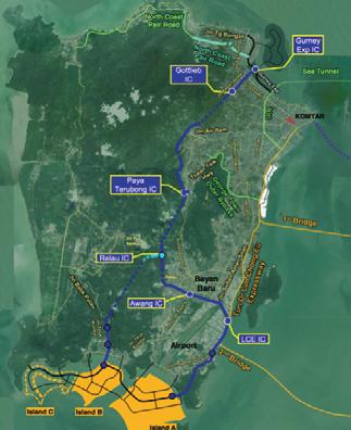
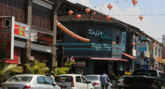
Disaster Response, Flood, Resilience, multi-level governance
Malaysian states have limited revenue sources available to them since they can only raise funds through real estate taxes, licensing, hotel taxes, and forestry. The state government has a limited annual budget of approximately RM1bn. The centralized nature of planning in Malaysia makes local planning very challenging. For instance, the state has almost no jurisdiction over the planning and operations of public transit systems (e.g. Rapid Penang) or major roads. This imposes additional constraints on efforts to coordinate local land use changes through Transit-Oriented Development. In addition, the state does not have the authority to add, reduce or relocate bus stops or lines, or modify service frequencies to match local travel patterns and demands. Larger scale projects such as the Penang Airport expansion and Light Rail Transit (LRT) that have been talked about as a way to facilitate economic development have yet to receive federal funding.
In 2010, the state government employed Halcrow to produce the Transport Master Plan (TMP), which was finalized in 2012. Components of the TMP were tendered out, and the winning tender for the public transit system proposed monorail, rather than trams (as suggested by the Halcrow TMP), partly to avoid reducing road capacity. Due to the state’s budgetary constraints and the inherent challenges of intergovernmental relations related to being led by the opposition party, the government plans to self-fund projects under the TMP through selling development rights for three reclaimed islands to the south of Penang Island for RM27 billion.
Questions have been raised regarding the plan’s population forecast and travel demand estimates, as well as its emphasis on private automobile travel over public transit. In addition, the TMP does not provide an evaluation of the proposal based on accessibility measures or last-mile connections. Nor does it consider other low-emission options such as Bus Rapid Transit (BRT), electric vehicles or shared-vehicles.
A scholar could consider several other questions as off-shoots of the main research question:
• How can the experience of land reclamation to the north of the island help inform
planned reclamation to the south? For example, are there mechanisms or processes that can be put in place to reduce detrimental environmental impacts of reclamation or help reduce any negative social and economic impacts to local fishing communities along the coast.
• Might developing on the mainland or other fundraising methods become a viable substitute for developing on the three reclaimed islands?
Begin the research by understanding the inception, process and stakeholder involvement in the Transportation Master Plan. Collect articles and blog posts written by local NGOs on the Transport Master Plan. Interview a member of the City Council, its involvement in setting local policies, land use decisions and land-swap negotiations, as well as its relationship with the state government. Interview officials from the state government to understand the assumptions and influences behind the reclamation proposal, and determine if alternative scenarios exist or were considered. Map various stakeholder groups across both public and private sectors, along with their core interests, ties and shared priorities. Look especially for affiliations between government agencies and contractors and developers.
• Penang Institute (http://penanginstitute.org/v3/home/) The Penang Institute is the state government’s public policy think tank.
• Penang Forum (http://penangforum.net/) The Penang Forum is a loose coalition of civil society groups based in Penang, Malaysia that advocates for a broad range of issues related to sustainable urban planning and development.
What strategies have nonprofit civil society organizations adopted to influence planning and increase government accountability with regard to urban development projects? How do these organizations deal with the challenges of political representation and inclusiveness in an ethnically and culturally diverse society?
Civil society participation and planning
Fueled by a generally more liberal and progressive sociopolitical environment, civil society organizations have a strong history of political participation in Penang relative to other regions in Malaysia. Particularly since the 1940’s and 1950’s, when the Penang’s secession movement spurred a new wave of political activism, a variety of Non-Governmental Organizations (NGOs), political coalitions, and social movements have established roots in the region, including international organizations such as Amnesty International and Friends of the Earth, which maintain branches in Penang. Non-profit organizations such as the Penang Heritage Trust, the Consumers’ Association of Penang (CAP), and Aliran have demonstrated in the past their ability to influence decision-making and shape political priorities through coordinated efforts—most notably in the 1990s Penang Hill Campaign, which successfully stopped the development of an environmentally and culturally hazardous tourist resort on the Hill.

Penang’s robust civil society and current political and economic context offer a unique setting to explore how the nonprofit sector can contribute to enhanced governance arrangements for policy-making and implementation, as well as pressure for greater government accountability and responsiveness. Although civil society groups played an important role in helping the opposition party (the Democratic Action Party) win the elections in 2008 (Weiss 2009), the relationship between the nonprofit sector and the new government has been ambiguous.
On the one hand, non-profit organizations have been collaborating with the state government to deliver services and provide support in areas where government capacity is lacking. Examples of such governance arrangements include:
• Community-led solid waste management and recycling initiatives such as the volunteer-run initiative by the Tzu Chi Merit Society Recycling Center (Butterworth).ii
• A collaboration between the CAP and the state government to preserve and restore mangroves around Penang Island. In the latter case, however, collaboration was short-lived. The government tapped the CAP for its know-how, but later decided to outsource restoration efforts to the private sector rather than relying on community-based efforts. These examples provide an opportunity to investigate what factors facilitate or constrain collaboration between the nonprofit sector and local government, especially in the long term.
On the other hand, the current government, while better than the previous State administration at engaging civil society organizations, is still ambivalent over the process and has a long way to go to achieve genuine public consultation and participatory decision-making on pressing issues such as new proposed hill development, reclamation, and improvements in mobility. Groups such as Aliran, the CAP, and the Penang Forum coalition have been organizing around plans to help affected communities voice their concerns, systematize the environmental and social impact assessments of projects, and pressing the state government for greater accountability. The ongoing debates about these developments offer an opportunity to learn about the strategies civil society groups have adopted to pressure for greater accountability as well as to represent or empower different community voices.
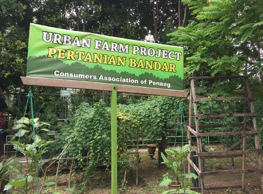
A scholar could focus on ongoing civil society engagement in the new Transportation Master Plan and the Penang Hill development to tease out different strategies for pressuring the government and amplifying community voices. Which channels or spaces do NGOs and other nonprofit groups find most effective for voicing demands and exerting pressure on the state government? How do they work with communities affected by development to amplify their voices? The scholar could start by mapping and interviewing the relevant nonprofit organizations and groups involved in the discussions surrounding the transportation master plan and development on the Penang Hill. The CAP and Aliran, two of the oldest and most influential civil society organizations in Penang, could serve as starting points and indicate other relevant actors who ought to be contacted (i.e., snowball sampling strategy). The research would also benefit from a historical analysis of civil society activism in Penang, particularly focusing on how the relationship between state government and civil society has changed over the decades and how past relationships are affecting current organizational strategies. This analysis can also draw on the literature about collective action and civil society, as well as political representation.
• Aliran (http://aliran.com/) - Aliran is a non-profit organization formed in the 1970s to raise awareness and mobilize people around diverse issues, including human rights, sustainability, and Malaysian politics. In addition to organizing campaigns, they maintain an active online forum with opinion articles, newsletters, and public statements on social justice issues in Penang.
• Consumers’ Association of Penang (http://www.consumer.org.my/) - The CAP is one of the oldest and most influential civil society organizations in Penang. Their work currently extends beyond consumer rights, encompassing issues of environmental protection and social justice. One of the main topics on their agenda at the moment is climate change adaptation. Their work also involves assisting communities adversely affected by development in voicing their concerns and needs.
• PenangMonthly. “A city status and its civil society.” http://penangmonthly.com/a-citys-status-and-its-civil-society/
• Brinkerhoff and Brinkerhoff. 2002. “Government-nonprofit relations in comparative perspective: evolutions, themes and new directions.” Public Admin. Dev. 22, 3–18.
• Meredith Weiss. 2009. “Edging towards a new politics in Malaysia?” http://www.jstor.org/stable/10.1525/ as.2009.49.5.741?seq=1#page_scan_tab_contents
• Garry Rodan. 2013. “Civil society activism and political parties in Malaysia: differences over local representation.” http://www. tandfonline.com/doi/abs/10.1080/13510347.2013.878331?journalCode=fdem20
• James Jesudason. 2008. “Statist democracy and the limits to civil society in Malaysia.” http://www.tandfonline.com/doi/ abs/10.1080/14662049508447708?journalCode=fccp19http://www.wccpenang.org/about/
What does it mean to create architecture with a Malaysian identity in a new place? (example: in new developments, or new locations such as Putrajaya)
What does it mean to redefine or create a Malaysian architectural identity amidst a pre-existing context filled with existing architectural heritage? (example: how can urban design respond to the diversity of cultures, identities and changing needs while respecting architectural heritage)
Who creates the architectural and urban design values by which urban development is taking place?
Who are the decision-makers and main players shaping the rapid development of Malaysia? Is it urban planners, urban designers or architects? Or, can the character of development and architectural identity be traced primarily to real estate developers and constructions companies?
Colonial architecture in George Town and Melaka is strictly protected by UNESCO designation. What urban design lessons can be learned from the UNESCO protected zones that could be applied to other important heritage sites that are not protected by UNESCO designation?
Development in Malaysia is happening at a rapid pace. Construction seems to be outrunning efforts to determine what architectural modernity and development ought to mean in a Malaysian context.
There appears to be a misconception across the design disciplines worldwide. People’s general perception of modernity appears to hinge on the construction of high-rise steel structures and glass-facades. This, of course, is not a necessity. In a country rich in architectural history and heritage, architectural heritage and modernity could be represented in many possible ways. Since the destruction of preexisting historic buildings is the price that has often been paid to enable the construction of “modern” buildings, a deeper understanding

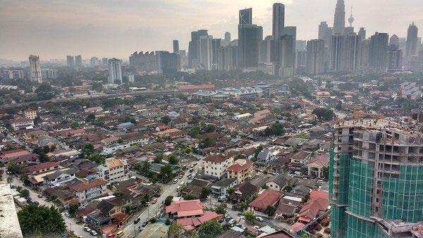
of how modern and contemporary architecture in Malaysia can proceed while simultaneously preventing further loss of some of the country’s irreplaceable heritage is crucial.


• Melaka Historic City Council (http://www. mbmb.gov.my/en/jabatan-perancangbandar)
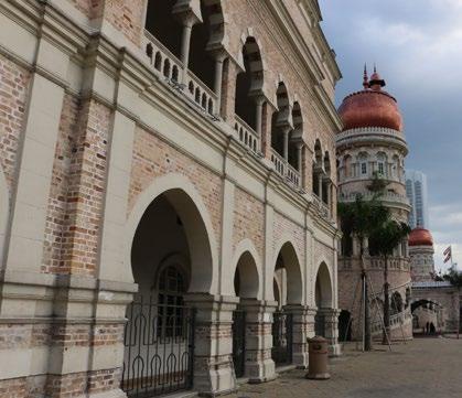
• George Town World Heritage Inc. (http:// www.gtwhi.com.my/)
• ThinkCity (http://thinkcity.com.my/)
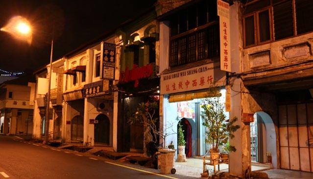
Does the Trans-Pacific Partnership (TPP) Agreement provide any enforceable protection for migrant workers in Malaysia? What are other strategies (nationally or internationally) for improving the conditions of Malaysia’s migrant labor force and/or refugee populations?
The growth of the Malaysian economy has largely depended on the 4–5 million migrant workers employed in palm oil production, electronic manufacturing, construction, and domestic or service work. Migrant workers, who primarily emigrate from other Asian countries, face various workplace abuses including wage withholdings, restrictions on movement, document confiscation, and physical or sexual abuse. Under Malaysian immigration law, low-skilled foreign workers are not allowed to have families, and children of immigrants are not eligible to enter public school.
Malaysia also has a large refugee population from Aceh, Myanmar, and Nepal. According to the International Federation for Human Rights, there is no special protection or procedures for asylum seekers, refugees, or trafficked persons. Nor are there special provisions for children or women, including pregnant women.” Thus, refugees and asylum seekers who unlawfully enter or remain in Malaysia may be imprisoned, whipped, detained and/or removed.
The treatment of both migrant workers and refugees has received international attention. Trading partners like the United States have expressed concerns over the lack of anti-trafficking protections in the county. Recently, Malaysia has become one of 12 countries participating in the controversial Trans-Pacific Partnership Agreement, the largest free-trade agreement in history. Although most of the agreement is classified and not shared with the public, the Obama Administration says the trade agreement will include mandatory anti-trafficking provisions to protect migrant workers in Malaysia and establish greater workplace protections.
Interviews with migrant workers, government officials, civil society organizations, and others

This research should provide relevant policy suggestions aimed at improving the living conditions of migrants workers and refugees in Malaysia. Issues that merit attention include: access to education, access to health care, workplace protections, and citizenship rights for migrants.
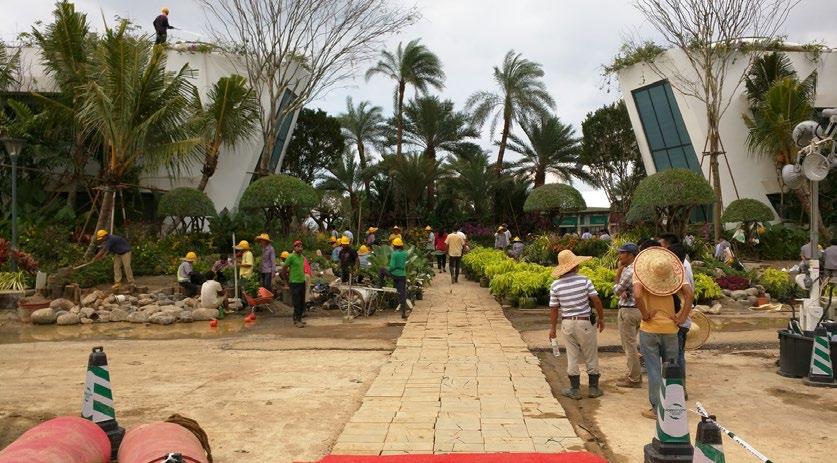
Furthermore, this research should critically examine how multilateral free trade agreements (like the TPP) can be leveraged to advance human rights standards. Conclusions resulting from this research should help with the formulation of implementable strategies for civil society organizations, labor unions, and government agencies to better meet the needs of low-wage workers both in Malaysia and beyond.
The 2016-2017 Research Agenda was created as part of the MIT-UTM Malaysia Sustainable Cities Program.
MIT fACULTy
• Dr. Lawrence Susskind, Ford Professor of Urban and Environmental Planning
• Dr. Gabriella Carolini, Ford Career Development Assistant Professor of Urban Studies and Planning
• Dr. Miho Mazereeuw, Ford International Career Development Assistant Professor of Architecture and Urbanism
• Dr. Balakrishnan Rajagopal, Associate Professor of Law and Development, Head of International Development Group
• Dr. J. Phillip Thompson, Associate Professor of Urban Politics and Community Development
UTM fACULTy
• Dr. Mohd Hamdan bin Ahmad, Professor and Executive Director of Institute Sultan Iskandar
• Dr. Syed Ahmad Iskandar bin Syed Ariffin, Associate Professor and Deputy Director of Institute Sultan Iskandar
• Dr. Zulkifli bin Yusop, Professor of Civil Engineering and Dean of Water Research Alliance
• Dr. Ho Chin Siong, Professor of Urban Regional Planning and Director of International Staff and International Relations
• Dr. Amran b. Hamzah, Professor of Urban Regional Planning (Tourism) and Director of Centre for Innovative Planning and Development (CIPD)
• Dr. Ahmad Nazri bin Muhamad Ludin, Professor of Urban Regional Planning
• Dr. Ibrahim bin Ngah, Faculty of Built Environment
2015-2016 MIT-UTM MSCP SCHOLARS
• Dr. Abdul-Azeez Isiaka Adeyemi
• Dr. Nor Aishah Saidina Amin
• Mr. Carlos de la Torre
• Dr. Gurupiah Mursib
• Dr. Jose A. Puppim de Oliveria
• Dr. Norsidah Ujang
• Dr. SM Reazul Ahsan
• Dr. Tej Kumar Karki
• Dr. Wesam Ahmed AlMadhoun
• Dr. Soriya Yin
2016 MIT STUDENTS
• Kelly Heber Dunning, PhD Candidate
• Jessica Gordon, PhD Candidate
• Yasmin Zaerpoor, PhD Candidate
• Maya Abood
• Nicholas Allen
• Kenny Chan
• Isadora Araujo Cruxen
• Anna Doty
• Mirette Khorshed
• Zelin Li
• Anthony Medeiros
• April Ognibene
• Amy Plovnick
• Vishnu Prasad
• Adler Prioly
• Phil Cheng (Tinn)
• Sabah Usmani
• Valeria Vidal Alvarado
• Shenhao Wang
• Marcel Williams
UTM STUDENTS
• Ashad Azizz
• Fahim Anuar bin Abdul Gudos
• Siti Mariam Bt Ismail
• Nurul Iqlima Che Omar
• Azalia Bt Mohd Yusop
• Khasrul Hanif Hazirin M. Yusof
• Muhamad Nur Hamdi bin Zainir
• Ainee Khatijah binti Zainudin
• Kamarul Zaman bin Zulkifi
• Muhammad Haziq bin Rosli
UKM FACULTY AND STAFF
• Nurul Ashikin bt. Alias
• Lim Liang Chun
• Dr. Anizan Isahak
• Dr. Mohammad Reza
• Shagufta Tazin Shathy
• Dr. Raihan Taha
• Mohd Syukri bin Zainuddin
MIT-UTM MSCP ADMINISTRATION
• Bettina Urcuioli, MIT
• Takeo Kuwabara, MIT
• Shahilah Hamdan, UTM
• Faizal Salleh, UTM
GRAPHIC DESIGN
• Takeo Kuwabara, MIT