URBAN DESIGN STRATEGIES FOR THE JUTE MILLS OF KOLKATA
15
2020
URBAN DESIGN STUDIO, MIT SA+P
MAY
Massachusetts Institute of Technology School of Architecture and Planning
Urban Design Studio Spring 2020
Xio Alvarez Adiel Benitez Patricia Cafferky Somala Diby Angelica Door Nynika Jhaveri Eytan Levi Yanchao Li Tess McCann Alberto Meouchi Blanche Shao Gabriela Zayas del Rio
Arindam Dutta Brent Ryan Professors
Carmelo Ignaccolo Teaching Assistant
Copyright 2020 1
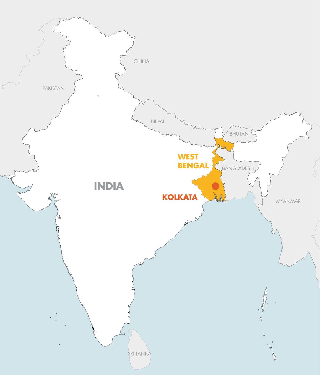
Figure 1. Map of India, showing the state of West Bengal, and Kolkata, its capital. Source: Open Street Map.
2
3
Photo: Alex Sanyal
TABLE OF CONTENTS
PROJECTS
Antizoning 5 New Economic Engine for Sustainable Jute Industry in Kolkata27 Jute Mill Conditions 37 Gold on Silt 51 Redefining a Twin City 69 Phased Exchange 85
4 4
Angelica Door, Architecture
Tess McCann, DUSP Gabriela Zayas del Rio, DUSP

Antizoning
Finding a balance between density and space at Surah Jute Mill
JUTE MILLS LEGEND 0 - 347 348 - 637 638 - 874 Open Closed 875 - 1675 STATUS SIZE (# Looms) ABCDEF JUTE MILL Closed 2019: 0% Production Level: Jute Mill Name % of Months the Mill was Closed, Nov ‘18 to Nov ’19 Measured by Annual Government Purchases, Nov ‘18 to Nov ’19 5
TYPE 3
From 1874 to 2006, the Surah Jute Mill was part of the sprawling network of jute production in Kolkata. Since then, it has been sitting vacant in an otherwise centric and lively neighborhood. With land being in high demand and low supply in the city, we view the site as an opportunitiy to provide much needed relief to this land pressure. However, we propose to do so through an antizoning experiment that resists to newer, more retrictive, forms of development that result in costly land use misallocation and sprawling. This proposal will instead embrace Kolkata’s dense and dynamic urban fabric by building flexibility and organic growth into its design.
The proposal has three goals: encourage density and mixed use; protect open space; and provide access to essential services. Development will occur in phases. The first phase sets three foundational systems of “the void”–street grid, economic anchor, and water infrastructure. Future phases will react to this phase under the guidance of three equity and design principles.

 Figure 1. This drawing shows our proposition to design the void –systems like streets, economic activity, and infrastructure.
6
Form Void
MOTIVATION
Can the Surah site retain the density & organic form of an unzoned area like Barabazar, while also protecting the void spaces where life flourishes?
The lack of a formal master plan in Barabazar has resulted in a diversity of activities, a fine-grained system of land use, oftentimes overlapping mixed uses, and a vibrant economic street life. Its urban morphology is organic street patterns, dense and dynamic building patterns, and lots of flexibility from unregulated use.
Salt Lake City and New Town, on the other hand, are the result of a formalized, top-down planning scheme, which has resulted in limited spatial diversity and much less density. Morphologically, its straight street patterns, straight building patterns, leave little room for flexibility.


We see potential in the organic density of Barabazar to address some of the main challenges arising from India’s high pace of urbanization, primarily, the unrestricted expansion of cities. This proposal is an opportunity to reduce that pressure by building more densely on existing underutilized and undervalued land. Yet, we are hesitant to fully embrace Barabazar as a formal model. Given the density of activity, common goods, and the open spaces they reside within, are subject to immense pressures and often encroached upon.

As such, we will design what we are calling the void –meaning systems like streets, economic activity, and infrastructure– rather than the form (actual physical buildings) as a measure to ensure the protection of open space.
vs. vs.
 Barabazar
Void
New townships
Form
7
PROPOSAL
This drawing represents the Surah site after 20 years of “anti-zoned” growth and development.
Part of the mill building has been retailed as a center of MSME manufacturing. The rest of the mill building has been carved out, creating a protected open space at the center of the site.
Density was brought to the site through the introduction of a street grid, which was drawn based on patterns of the streets in the surrounding neighborhood, and on the footprints of the buildings we

were retaining on the site.
The site is connected via a system of bridges and roofs. The central artery connects the factory to the export hub, which is placed in an existing building at the southwest corner of the site. These connective elements act as anti-zoning elements, physically restricting future growth.
The site is serviced by a decentralized and dispersed water system, the centerpiece of which are three treatment tanks and a pond in the center of the former mill. The pond
celebrates the city’s heritage as a wetland region, and the treatment tanks filter water that is collected on the building’s roofs.
Taken together, our proposal experiments with how to create a vibrant and dynamic area of a city, leave room for flexibility and change, and also ensure that public spaces are protected.
The following pages show the three systems of our anti-zoning proposal, the site phasing, and other details of our proposal.
Figure tk. Surah, 20 years after acquisition. New density has been brought into the site, blurring the boundaries between Surah and the surrounding neighborhood
8
DEVELOPMENT PHASES
Acquisition 1 year Intervention 1 - 5 years
Figure tk. In the first phase, the city purchases the Surah site, which currently sits vacant and undervalued
Figure tk. In the second phase, the city funds the implementation of the three “anti-zoning systems” outlined in our proposal; they also sell and lease buildings to the tenants who are introduced along with these systems, namely an MSME manufacturing cluster and an export hub. These programs are located in the existing buildings on the site.

9
Growth 5 - 20 years
Figure tk. In the third phase, the city sells the remaining parcels at Surah to developers over the course of 15 years. Developers are free to develop these parcels how they choose, but are constrained by the systems established in the Implementation phase, and by a series of equity and design guidelines set out and enforced by the city. 70% of the land is sold at this time.
We don’t fully know what the Surah will look like at the end of 20 years, and this is largely the point of the development approach: by not fully preconceiving what the end-state of the site look like, we avoid locking the project into a design and development plan that cannot accommodate future uses of space.

10
EXISTING CONDITIONS
The mill building sits vacant right in the middle of the compound, which is approximately the size of Harvard Yard.
We got interested in this mill, first, because we believe it is the one that best encapsulates Kolkata as a dense and dynamic city.
Density can be seen in the compact street design to the north and east of the compound.
The dynamism is evident in the diversity of building type and type of commercial activity: both busy commercial activity and quiet residential area to the west, historic cemetery to the south, and mixed use
ranging from residential to industrial to the east.
Its location is also cantral, being near Sealdah station which connects the logistics sector from north to south, including to the two ports in Kolkata, and near cultural attractions like the Salt Lake stadium.

N .25KM
11
IMPLEMENTATION PHASE SITE PLAN OF PROGRAM AND SYSTEMS
Housing Street grid +open space

MSME textile manufacturing cluster
Export hub
Water infrastructure
Connection between export hub and manufacturing hub
GROWTH PHASE EQUITY AND DESIGN PRINCIPLES
1.Inclusionary and equitable development
25% of a development parcel’s total square footage, regardless of whether it’s for renting or selling, must be below market rates to meet low-income people’s housing needs. Development reflects the social and economic conditions of the neighborhood.
2.Public health
Given the proximity of MSME to residential areas and open “natural” areas, sustainable practices must be put in place to protect the health of residents and the ecosystems upon which residents depend for water and air.
3.Formal guidelines
General guidelines that ensure formal diversity and flexibility, including guidance on building heights, arcades, balconies, and other design elements to protect open space and promote street life.
12
SYSTEM 1: ACCESSIBILITY
Figure tk. Survey of the surrounding streets.

Figure tk. The site’s new street grid was drawn based on existing buildings and on a survey of the patterns of the surrounding street and their hierarchy.

13
A FORMAL PARADIGM
Fuzzying boundaries • Site-neigh borhood integration • Street heirarchy • Placemaking • Flow of goods and people
Figure tk. To protect the newlydensified site from overcrowding, we introduce an open space

We chose to place the open space at the mill for two reasons
First, its location at the center made it ideal—the density around the perimeter of the site blurs the border between Surah and neighborhood… and having an open space at the center made sense given this new density.
Second, the physicality of the mill—its massive structure, its already-existing footprint, can be leveraged to give this open space definition and therefore protect it.
There’s also a nice tie-in here to Surah’s history by preserving the remnants of the mill structure.
THAT DENSIFIES THE SITE WHILE PROTECTING PUBLIC SPACE.
14
Figure tk. The view cuts through existing housing that will remain, and is surrounded by new housing and mixed-use development. Here you can see how the water system that permeates the site provides water to these buildings. The view shows several parts of the water system: pumps along the street, pitched roofs and water towers, all comprising the dispersed but connected system.

VIGNETTE 1 15
Figure tk. Here you can see the mixed-use nature of the new and existing buildings, with residential units above and commercial activity on the ground floor. The public bridge in the upper right of the view both limits building heights and regulates the secondary public space that rooftops provide in the city.

16
SYSTEM 2: CONNECTIVITY
Figure tk. Numerous local and regional multimodal transit corridors run close to Surah, like the eastern railway line, Sealdah Station, two Metro Lines, and a major road, Narkeldanga to the south.

Figure tk. Kolkata itself sits at the nexus of national and international flows of goods like transnational freight corridors and transshipping routes. Our proposal takes advantage of Surah’s location by establishing an export hub and an MSME manufacturing cluster at Surah in the implementation phase. The connectivity system begins by physically joining these two areas of the site, which allows goods produced at Surah to flow into these global and regional commercial routes.
 N 1KM
N 1KM
17
AN ECONOMIC PROGRAM THAT TAKES ADVANTAGE OF THE SITE’S STRATEGIC LOCATION.
Connections between buildings •Defining new spaces • Harmonizing different scales
CONNECTIVITY SYSTEM ROOFS AND BRIDGES
Figure tk. This central corridor between the economic anchors represents one of two typologies of connectivity: Bridges are used to connect buildings Roofs are used as communal space shared between buildings These two typologies both act as anti-zoning elements by limiting further building and protecting open space
Figure tk. Two of our anti-zoning systems are activated on the roofs. Here, the purple roofs are connective elements that join the site. Design details like these are covered in the formal guidelines.


ROOFTOPS BRIDGES

18
Figure tk. This view shows the existing building that will be turned into an export hub due to its proximity to Narkeldanga road. Again, the export hub is connected to the manufacturing building through the bridge highlighted in gray. This circulation infrastructure supports the movement of goods from the MSME cluster.

VIGNETTE 2 19

20
Figure tk. This is a view of the export hub from narkeldanga road, with the bridge connection and water infrastructure shown above.
SYSTEM 3: UTILITIES
Figure tk. Kolkata is a wetland region, and our site sits between the wetlands and the hoogly river

Contemporary development paradigms have tried to hold the water at bay—Salt Lake City and New Town are both built on former wetlands. But we want to bring water back to Surah in a way that embraces its role in the city’s landscape, and responds to key needs of the site’s future residents.
Figure tk. We propose a water collection, filtration, and storage network that would run through the whole site and service residents and businesses.

21
Figure tk. Two of our anti-zoning systems are activated on the roofs. Here, water collection will happen on the roofs marked with blue. Design details like these are covered in the formal guidelines.


Figure tk. We envision a system of water pumps that would allow passersby to easily retrieve safe and clean water. The buildings themselves would be part of this functional system: water would be collected on buildings’ roofs, and stored in water towers that dot the site.

The water would be treated in a series of treatment tanks that would be placed in Surah’s central open space.

WATER COLLECTION ROOFS
SITE SERVICE THAT ADDRESSES LOCAL
AS ESTABLISHES A CONNECTION TO THE SITE’S HISTORY. Clean + accessibile water • Disaggregated + dispersed system •Ecological remediation • Cultural heritage ROOFTOP COLLECTION TREATMENT TANKS PUMPS STORAGE 22
A
NEEDS AS WELL
Figure tk. Though there are some ponds nearby, their number in the city has dwindled as the value of land has skyrocketed and development pressures increase. This central landscape feature mostly suits aesthetic and recreational purposes, but it is also an anti-zoning element, as it prevents any building in this central area.

VIGNETTE 3 23
Figure tk. The trees and plants have grown inside the mill-turned-greenspace. Surrounding the site are more mixed-use buildings, with bridges and connecting rooftops limiting unchecked growth. These typologies feed each other to sustain a dynamic and functional system.

24
CITY INVESTMENTS AND EXPECTED REVENUE

There is a dearth of land available for development in Kolkata. This mill compound offers a large tract of open land that is currently undervalued and can be developed with high returns.
We expect the land value to increase by $20 million over the course of the development—that is nearly 50% of the original value of the land.
The city will front the up-front costs of this ambitious project, leaving developers who buy Development Parcels in the Growth phase to make returns more quickly than in traditional development models.
KEY TO VIEWS AND SECTIONS

25
OUR PITCH TO DEVELOPERS
Compared to prevailing development patterns in Kolkata, most notably townships, which are new formally designed development on former wetlands in the peripheries of Kolkata– we believe our anti-zoning approach is a better approach.
First, it provides a quicker return on investment, reducing fiscal costs in the long-term.
Anti-zoning allows for more
flexibility in uses, whereas the new township approach relies on restrictive zoning that locks the developer into one specific and permanent use. Studies have

shown that that approach results in costly land use misallocation and overconsumption of resources.
Second, the city will have delineated clear market roles through an economic anchor in the form of an
MSME manufacturing and exports hub.
MSME is a growing industry that accounts for 30% of India’s GDP and is expected to employ 10 million people by 2022.
The city will also provide essential amenities such as water infrastructure for industry, households, and public use.
Figure tk. Surah, 20 years after acquisition. New density has been brought into the site, blurring the boundaries between Surah and the surrounding neighborhood
26
LI, DUSP

New Economic Engine for Sustainable Jute Industry in
:
Kolkata
JUTE MILLS LEGEND 0 - 347 348 - 637 638 - 874 Open Closed 875 - 1675 STATUS SIZE (# Looms) ABCDEF JUTE MILL Closed 2019: 0% Production Level: Jute Mill Name % of Months the Mill was Closed, Nov ‘18 to Nov ’19 Measured by Annual Government Purchases, Nov ‘18 to Nov ’19 Tourism-facilitated Micro-and Small Enterprises (MSME) 27
Yanchao
Kolkata’s jute industry is in an urgent need of economic transformation. After conducting research on the current economy substitutes-tourism, it is found that the jute mills of Kolkata are uniquely positioned to address tourism challenges, and this in turn would be a clear opportunity to enable sustainable jute industry development.

The scheme proposed a new economic engine for the jute industry: tourism-facilitated market. The engine was proposed in the form of MSME, composed of jute processing sectors for producing biodegradable ritual materials and water purification sectors for improving ritual immersion experience. The great market for ritual materials and pilgrimage activities present as a stable base to finance this ambitious industrial transformation development.
Baranagar Jute Mill was selected for detailed design to demonstrate how the mill sites could be sustainably used, and how the urban systems like transportation and water access could be improved at the same time.



TYPE 3
2 28
Figure 1. This graph shows the proposed MSMEs as the redevelop solution for sustainable jute industries.
Current Situation of Jute Industry

Facing the severe decline of the local economy and ensuing social problems, Kolkata's jute industry is in an urgent need of economic transformation.

Kolkata is considering tourism as a substitute for boosting the local economy.

Tourism indeed brings economic potential to Kolkata, while also causes drastic pollution to the sacred Hooghly River.

 Figure 2 (above): As a culturally significant place of Hindu pilgrimage, Kolkata meets an average of 12.3 million tourists (91% comes domestically) every year.
Table1 : Annually tourism in Kolkata
Temple waste and religious materials
Idol immersion
29
Mass religious bath
Opportunities for Sustainable Jute Industry
The Hooghly district is in the shortage of land for improving tourism amenities such as hotels and clean water pools, while the Compounds host large tracts of vacant land.
Materials for ritual activities cause water pollution, while the versatility and biodegradable jute fabric is in low awareness among people.

Tourism market and products are lacking diversification, and so the tourists spend very limited money when they stay at Kolkata. While on the other hand, thousands of skilled jute-craft workers are suffering from losing jobs, which are the people who are capable to make the creative jute crafts.
Tourism is stuck with transportation connections in Kolkata, while the majority of jute mill compounds can become possible landing points for crossriver connectivity because of their prime proximity of the Hooghly River.
30
Figure 3 : The jute mill compounds have a deep connection with the predicament situations in Kolkata’s tourism development.
Strategies
1.Improve tourists’ travel quality— overnight stay, food eating, cultural experience, etc.;
2.Protect the local environment— decrease water pollution, maintain tourism sustainability;
3.Encourage consumptions for tourism revenue expansion.
Site Selection
Baranagar Jute Mill Compound stands out with the standards of developing tourism amenities and improving ritual experiences.
Figure 4 (above): General strategies to revitalize jute mill for boost local economy and protect local environment.

Figure 5 (right): Site selection preocess: choosing the proper jute mill based on weighted-factors.

31
Site-specific Strategies
01
Zoning special permits on lands for tourism amenities such as hotels/ restaurants
02
Connect transit systems on site and beyond
-site-scale connections -KMC-scale connections
03
Redevelop part of the site to provide clean water for ritual use
04
Remain jute industry use with jutecultural innovation
-produce & process biodegradable ritual materials -help people to raise awareness of jute fabric
Figure 6 (above): Master plan for the Baranagar jute compounds with site-based strategies.

Figure 7 (right):Linking 15 frequent visited spots by running a new bus line. The goal is to encoruage tourists to spend more for overnight stay and other travel activities.

32
Figure 8 (left): Proposed site roof plan for the Baranagar jute compounds.
Figure 9 (right):Proposed site master plan for the Baranagar jute compounds.


Treating jute mill owners as the main client, the projects aim to make revenue in a sustainable way.
01 Improve jute manufactory
-Consolidate jute manufacture, keep ~50% its capacity with 450 looms; -Improve inner working condition; -Integrate locak skillked people to redevelope jute culture. 02
Project 01
Build
ritual
Install purification systems for drinkable water 33
clean pools for
use 03
filtration
osmosis)
Figure 10 : Clean water pools for ritual use.


Redevelop part of jute mill land to integrate state-of-the-art technology to produce drinkable water --has stable market due to great ritual needs from local people and tourists.
Figure11 : Water purification installations for drinkable water.


private bath room open space water strainer bars open space ferry station private bath room clean pool jute mill compounds stores
1.Dirty water intake 2.Dirty water tank 3.Clarification 4.First filtration 5.Second filtration (pressurized filters) 6.Third filtration (cartridge filters) 7.Fourth
(reversed
8.Clean water tank 9.Purified water Project 02 -Use water strainer to filter river water ready for ritual use. -Functioned as a new public space including ferry stops, bars, stalls, etc.
Project 03
34
Revenue Estimation (per month)

The total revenue for jute mill owners is around INR 8 million ($ 105,000), with 64% comes as drinkable water revenue.

Land rents for stalls Bio-degradable jutes
Clean pool member fees
Land rents for hotels
Drinkable water
Governance
Jute mill owners, together with New jute SPV, are the main stakeholders to support the implement of the projects.

35
36
edge of the Hooghly
Xiomara Alvarez, Architecture & DUSP Alberto Meouchi, Architecture

Gold On Silt
systemic
life
the
A
approach to
on
JUTE MILLS LEGEND 0 - 347 348 - 637 638 - 874 Open Closed 875 - 1675 STATUS SIZE (# Looms) ABCDEF JUTE MILL Closed 2019: 0% Production Level: Jute Mill Name % of Months the Mill was Closed, Nov ‘18 to Nov ’19 Measured by Annual Government Purchases, Nov ‘18 to Nov ’19 37
System
Kolkata was built by the river, both in terms of its geographic location and the foundations of its economic power. The silt of the Ganga river system, today an impediment to trade, is integral to the productivity of the agricultural hinterland. Located on a wide-sweeping delta, Kolkata’s urban development has been one of intervention in the deltic system, one that attempts to counter natural flows while simultaneously depending on them. In this project, we attempt to harness some of the wasted energy of resisting the river in order to create new landscapes of urban life along the river’s edge.

38
Figure 1. The proposed new river’s edge condition with cottage industry
THE HOOGHLY RIVER
For the purposes of the project, it is useful to begin at the scale of the Ganges river.
Rivers are dynamic landscape actors, and the dual geological processes of erosion and sedimentation translate into movements that in turn influence human patterns of development. Natural and agricultural products of the river are brought downstream and industrial products trace the path of the river back inland from the port.

The Gangetic plain is the agricultural hinterland of not only Kolkata but of greater India. This land is largely made fertile through the transmission of siltation over the plains during cycles of monsoon and drought. These same processes build new land throughout the river system. The Hooghly branch, where Kolkata is located, is subject to these productive forces in two directions -- daily tides bring sand in from the sea while alluvial flows deposit silt from the Himalayans.
The river itself is federal property which, due to the changing nature of the river’s edge, is simultaneously an incredibly formal and an incredibly ambiguous condition. Land ownership along the river bank reflected in different characters of edge conditions in how private property meets this ambiguity. A number of programs are captured along the edge, bringing industry and people out and down to the water.
39
Figure tk. The Ganges River network
Figure tk. The ebb and flow of the Hooghly river through cycles of monsoon and drought. These processes result in a changing boundary condition between river and land, as well as the production of new land through processes of aggregation and retreat

40
Figure tk. In section, we observe that the edge of the river, and therefore the dividing line between federal and private properties, vary up to 10m in places
41
Figure tk. Land ownership along the river is expressed through varying conditions, largely resulting in a hard edge at which the city comes down to meet the water


42
THE PROPOSAL
Kolkata’s history of urban development has been one that fights the river’s natural processes. The project proposes using the jute mill sites as testing grounds for a river-scale intervention in the liminal space between the river and its edge. If the current dredging process carves a shipping channel down the center of the river by hastening the movement of sediment downstream to the bay, our project looks to harness some of the wasted energy of that longitudinal movement by instead proposing small scale, rivers edge cottage industries that might find themselves in the space between the federal land of the river and the private land of the mills.

Mill sites are organized around two priorities -- improving logistics connections for the mill buildings and creating new connections for smaller programs along the river’s edge. Using existing public access axes and mill buildings as starting points, the major moves on the site are primarily creating infrastructures for moving people and goods.
Reflecting existing urban morphologies of property along the river, these scales are replicated in the jetties along the waterfront. Cottage scale and industrial scale uses push out to meet the river at its changing edge, aggregating and collecting in multiple ways. As temporary structures and lessees of the land along the rivers edge, these actors change over time and leave behind fragments just as the river deposits sediment among them. In these spaces, the river’s urban neighbors find places to gather and wander in relative solitude.
Figure tk. State-scale environmental engineering projects currently attempt to accelerate the movement of debris downstream to the delta in an attempt to maintain the central channel navigable to barges
Figure tk. The project imagines a coproductive machine of economic, social, and natural collection, where the aggregation of silt at the river’s edge produces new land

43
Figure tk. Working with existing roads on-site, the site strategy connects existing eastwest public access routes along the edge of the river, creating a north-south connection
Figure tk. Site strategy develops a more purposeful laying out of the industrial/ commercial axis that intersects with the river, streamlining and modernizing the relationship between the mills and the navigation channels that feed it


44
Figure tk. The site plans hold existing land for the processing of jute while creating new land at the edge for the urban inland to meet the river

45
Figure tk. Subleasing of the land abutting the river occupies the territory of the changing river boundary and the jute mill. Jute mill owners manage the agglomeration of leases; different operations require different portions of land, but because it is merely a lease they are constantly being reconfigured


46
Figure tk. Cottage industry-scale jetties focus on navigation channel and water’s edge access
Figure tk. Industrial-scale jetties are scaled to mechanical tools of dredging and logistics


47
Figure tk. The aggregation of jetties on the river’s edge increases the surface area in terms of spaces for silt and people

48

 Figure tk. River’s edge 2025
49
Figure tk. River’s edge 2040
Figure tk. As the river rises and falls through tides and monsoons, the characters either close for a dry spell or extend out and down to reach the changing edge

Figure tk. The characters of these businesses on the riverfront and the infrastructure they leave behind creates a new urban space

50
Adiel Benitez, Architecture Somala Diby, DUSP

Redefining a Twin City A proposal to unlock land value in Howrah’s
mills
jute
JUTE MILLS LEGEND 0 - 347 348 - 637 638 - 874 Open Closed 875 - 1675 STATUS SIZE (# Looms) ABCDEF JUTE MILL Closed 2019: 0% Production Level: Jute Mill Name % of Months the Mill was Closed, Nov ‘18 to Nov ’19 Measured by Annual Government Purchases, Nov ‘18 to Nov ’19 51
Howrah is a city of enormous but undervalued economic potential. As one of the most rapidly growing cities in India, Howrah is a hub of connectivity through which millions of people move every day. But Howrah’s identity has been systematically eclipsed by its twin city Kolkata, due to a historic east-bank bias in formal and strategic planning activities. As a result, Howrah’s most valuable land assets—which include over 100 acres of underproductive industrial on and around its waterfront—lay fallow and inaccessible in the absence of a vision for Howrah’s future.
This project proposes a new vision for Howrah that celebrates and amplifies the city’s urbanism and industrial assets. Embracing the role of the New Jute SPV, we put forth a master plan for the downtown neighborhood of Shibpur that combines ongoing industrial production with 21st-century enhancements in three jute mills: Fort William, Bengal, and Howrah. We also design, and offer to finance, street and connectivity improvements to incentivize the adaptive reuse of industrial land according to our master plan vision. We believe redevelopment in Shibpur will serve as a billboard for Howrah’s new and distinct identity.

3
TYPE 1 +
52
Figure 1. A master plan for the jute mills of Shibpur, a neighborhood in downtown Howrah that spans the Hooghly River.
Howrah: the vanishing twin
Once called the “Sheffield of the East,” Howrah has a rich industrial history rooted primarily in engineering, shipbuilding, steel production, and jute manufacturing. This history has stimulated the city’s growth and shaped its character.

Due to a historic east-bank-bias that privileges Kolkata as the center of urban growth and economic activity in the region, formal planning activities to anticipate and strategize development have largely escaped Howrah. This is due in part to the lack of elect local government between the mid-1960s and the constitution of the Howrah Municipal Corporation (HMC) in August 1984. Furthermore, urban development in the Kolkata Metropolitan Area tended to follow a north-south, rather than east-west pattern, with the Hooghly River functioning as a psychological barrier.
In addition, contemporary patterns of development in Kolkata that prioritize new luxury real estate are failing and ignore industrial assets. But this strategy is failing, as most real estate demand is at the lower end of the market. Redevelopment in Howrah must follow its own path.
Figure 2 (above). This diagram abstracts the current relationship between Howrah and Kolkata.

Figure 3 (bottom left). Howrah Station in 1905
Figure 4 (bottom right). Entrance to Howrah Jute Mills in Shibpur.

53
Shibpur: a well-connected neighborhood
In the downtown neighborhood of Shibpur, where our jute mills are located, industry and transportation infrastructure dominate the urban landscape.
Flanked by two major passenger and logistics railway stations and two of three major vehicular bridges in the metropolitan area, this centrallylocated industrial belt dominates the Hooghly River waterfront directly facing Kolkata.
The state government of West Bengal has also relocated Howrah at the Nabanna Bhavan building, signaling the symbolic importance of this area.
Figure 5 (left). Shibpur context map highlighting key points of interest, including the future station of the new east-west Metro between Howrah and Kolkata at Howrah Maidan, and Avani Riverside Mall, a major shopping destination.

Figure 6 (bottom left). Entrance to Howrah Jute Mills in Shibpur.

Figure 7 (bottom right). Inside a Shibpur jute mill.

54
A vision for a new industrial city in Shibpur

Given its growth trajectory and development potential, Howrah must seize this critical moment to redefine its identify. We believe Howrah derives its competitive edge from its industrial assets. Therefore, re-programming the mills is critical to incentivizing investment in this area.
Our vision for Howrah, and specifically Shibpur is, a city that distinguishes itself by embracing its industrial assets and revitalizing its waterfront to serve as a symbol for Howrah’s future.
55
To this end, we plan to consolidate and enhance jute operations across all three jute mills at Fort William Jute Mill. At the newly vacated Bengal and Howrah jute mills, we will convert and construct buildilngs to serve jute-adjacent industries including MSME manufacturing, educational institutions aimed at reskilling jute mill workers, and mixed-use, mixed-income social housing for workers and students.
Figure 8. In this master plan, mills are reprogrammed and streets are redesigned as part of a larger pedestrian- and cycle-friendly network.

56
Studying movement in Shibpur
Street life is a major feature of Shibpur’s urbanism, so redesigning streets will be key to guiding development. Millions of motorists and pedestrians cross bridges into and out of Howrah every day, with a dense network of transit infrastructure to serve these users. Despite the density and vibrancy of street life, pedestrians—the most common road user—must constantly compete with motorized vehicles, which are competing against each other with very little room. This competition makes it difficult to access the most attractive features of this area, namely, the waterfront.
Figure 9. This collage shows a sampling of the wide range of street users and vehicles whose needs must be serviced by connectivity improvements.

Figure 10 (below). In this diagram, left-hand axons simulate existing street conditions common to Shibpur that inhibit pedestrian navigatbility. Right-hand axons demonstrate how these conditions could be resolved with street improvements.


57
8 ft
Figure 12. This area is part of an industrial compound bounded by the Hooghly River and an arterial road. The wall impedes a potential access rout to the waterfront and ferry ghat that lie directly beyond the wall.

Excerpt from Basu, Anasuya, and Amrita Ghosh. 2014. “Grand Old Road on the Mend Howrah Stretch of GT Road Repaired.” The Telegraph, June 5, 2014.
 Figure 11. On Grand Trunk Road, buses intensify competition between road users traveling by different modes and in both directions
“
Mayhem is an understatement here: pedestrians hopscotch through narrow passages because barricades for the East West Metro project have shrunk most of the road space and whatever little was left has been taken over by hawkers peddling underwear to Benarasi.”
58
Existing conditions
Currently, our planning area is bounded by major highways and arterial roads, as well as by large, underutilized industrial tracts that block pedestrians from the waterfront and limit pedestrian navigability throughout the site.
Pedestrian-friendly spaces and local roads are interspersed between these arteries. Unlike the jute mills, most city blocks in this area are highly permeable, with lots of active pedestrian pathways that are located within blocks.
Overall, despite its central location, Shibpur lacks incentives and amenities to attract new investment, leading mostly one-way movement out of Howrah and towards Kolkata.
Therefore, Howrah needs a transportation plan that will foster two-way travel between Howrah and Kolkata; celebrates and amplifies Howrah’s urbanism, and strengthens connectivity.
Figure 13. This map diagrams the distinct navigation networks that exist for different road users in Shibpur. As illustrated here, nearly all roads leading to the waterfront primarily service trucks for freight purposes, effectively cutting off other users from the waterfront.

59
Proposed changes
We propose street redesign, especially streets approaching the waterfront, to better accommodate pedestrians. We also propose cutting through the large impenetrable mill blocks to restore the mills to the street network. Additionally, we also plan to invest in revitalizing the ferry system to offer alternative forms of passage between Howrah and Kolkata. Finally, we will redesign one of the major multimodal arteries in our planning area—Upper Foreshore Road—taking advantage of a large amount of underutilized land running along the artery.

60
Figure 14. This map outlines our proposed connectivity enhancements.
Tactic 1: Reconnecting non-motorized users to the waterfront
Given the proximity between Howrah Jute Mill and a preexisting ferry ghat, we propose opening up access to the waterfront while creating a novel pedestrian experience.

One idea is to build a pedestrian footbridge/linear park over a street that is currently a dead-end abutting the waterfront. As we know from studying Shibpur, pedestrian space on streets is vulnerable to encroachment by hawkers and other uses. By building vertically, we could reduce this vulnerability and offer pedestrians new vantage points from which to experience the neighborhood, while allowing for the continuation of existing truck parking and traffic.

61
Figure 15. This rendering illustrates a potential new experience of the Hooghly River.
Figure 16. This drawing shows a potential view of the pedestrian bridge, which offers a new open space amenity while connecting pedestrians directly to the ferry ghat.

Figure 17 (below). This section cuts longitudinally along the site of the Howrah Jute Mill. It highlights the variety of urban spaces that are created by the opeing up of the jute mill site, and through the introduction of new programs. The spaces are created throught the dissolving of the jute mill walls, and the introduction of public spaces that cut accros the width of the site, and connect pedestrian networks at either side.

62
Tactic 2: Restoring pedestrian-friendly street networks
At Bengal Jute mill, we are demoing, slicing through, and renovating buildings to create new open pedestrian spaces that connect to a larger pedestrian-oriented network.
Recognizing that these areas will still need to accommodate freight traffic, street redesign will encourages the shared usage by many users.
Figure 18. One strategy we propose is the utilization of the jute mill building to create pedestrians connections across the large jute mill sites with new pedestrian corridors. These are created by cutting through Bengal Jute MIll’s massive building, anticipating a greater flexibility of interior space when the buildings are repurposed to accomodate a mix of MSME units.

63
Figure 19. This drawing illustrates our plan to bolster pedestrian and cycle navigatbility both in and around jute mill sites. We envision enacting interventions across all three sites in our master plan.

64
Connectivity improvements can facilitate novel street experiences, improve efficiency and reduce competition among users, and make it easier for people to visit and navigate Shibpur. The hope is for these improvements not only to attract people to Shibpur, but to incentivize owners of jute mills and other underutilized industrial land to redevelop their parcels to support Shibpur’s—and Howrah’s– thriving industrial economy.

65
Governance
Goal
Support adaptive reuse of jute mills in Howrah by strengthening connectivity to the sites and across the wider neighborhood
New Jute SPV
Objectives
A new master plan to redevelop jute mills in downtown Howrah, with parameters for future programming
Suggestions for transportation and street improvements that will serve as the foundation for the master plan
borrows 200-300 crores from GDB
Government receives ROI through property and sales tax revenue from new development
Develop parameters for new master plan to guide future develop of Howrah jute mill sites
Designs and finance connectivity and public realm improvements
Take advantage of new connectivity and public realm improvements to redevelop sites according to master plan criteria
incentives and criteria for redevelopment are passed on
mill owners
Jute
66
Image credits
Figure 3. Howrah Station in 1905. “Navrang India: Howrah Oldest Railroad Station Built by East Indian Railway1854.” n.d. Navrang India (blog). Accessed May 5, 2020. http://navrangindia.blogspot.com/2016/07/howraholdest-railroad-station-built-by.html.
Figure 4. Howrah Station in 1940. “Navrang India: Howrah Oldest Railroad Station Built by East Indian Railway1854.” n.d. Navrang India (blog). Accessed May 5, 2020. http://navrangindia.blogspot.com/2016/07/howraholdest-railroad-station-built-by.html.
Figure 6. Entrance to Howrah Jute Mills in Shibpur. Singh, G. 2016. “West Bengal’s Sunset Industry.” Governance Now, May 13, 2016. https://www.governancenow.com/news/regular-story/west-bengal-sunset-industry-jute-textile.
Figure 7. Inside a Shibpur jute mill Chauduri, Moumita. 2020. “In a Viral, a Revival.” The Telegraph, April 26, 2020. https://www.telegraphindia.com/india/in-a-viral-a-revival-jute-mills-telangana-and-punjab/cid/1768026.
Figure 11. Wonobo.com
Figure 12. Wonobo.com
67
68
Eytan Levi, Architecture + Center for Real Estate
Exchange The Bengali movie industry as a driver for Tirupati’s repositioning
Phased
JUTE MILLS LEGEND 0 - 347 348 - 637 638 - 874 Open Closed 875 - 1675 STATUS SIZE (# Looms) ABCDEF JUTE MILL Closed 2019: 0% Production Level: Jute Mill Name % of Months the Mill was Closed, Nov ‘18 to Nov ’19 Measured by Annual Government Purchases, Nov ‘18 to Nov ’19 69
TYPE 3
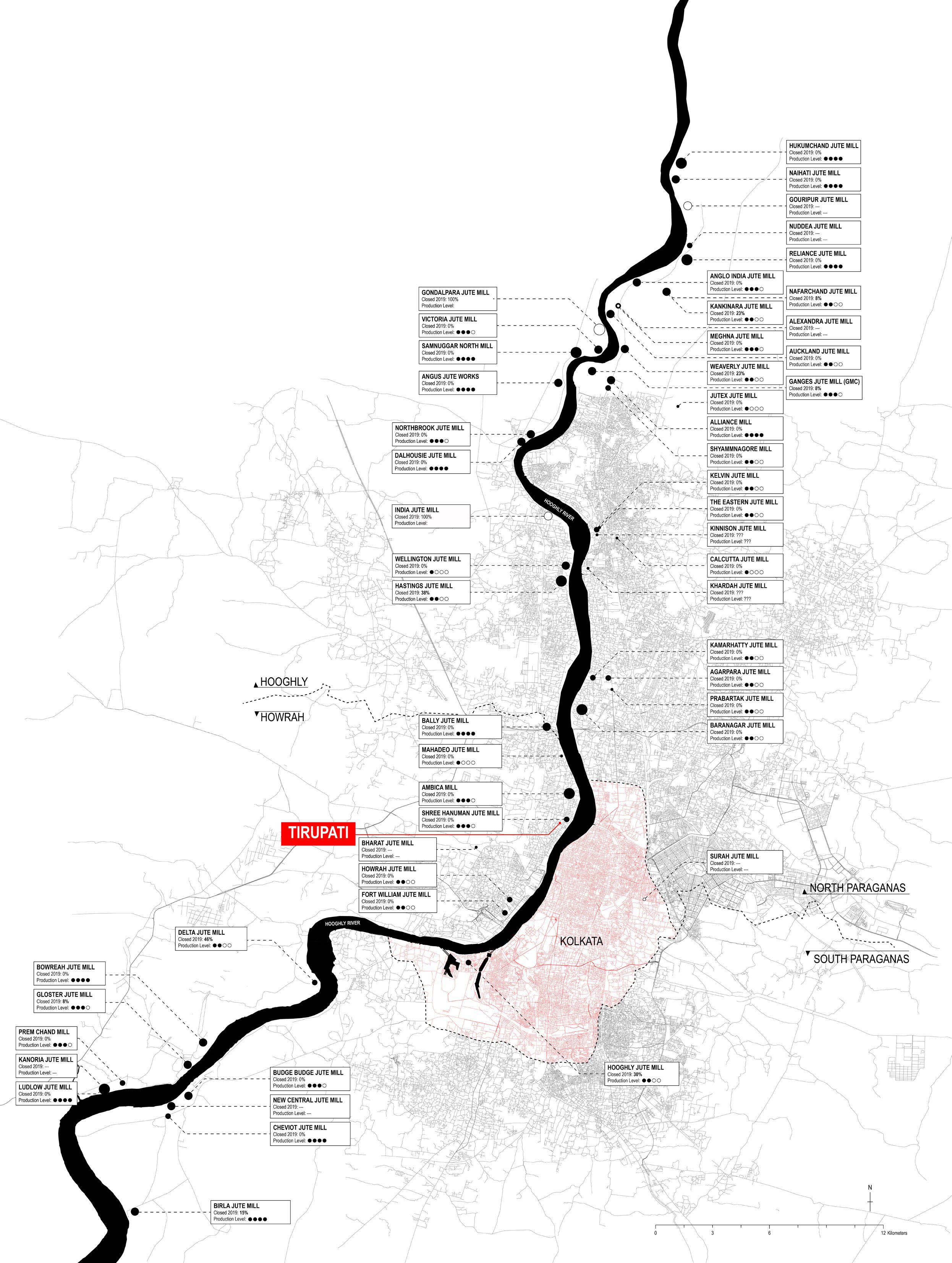
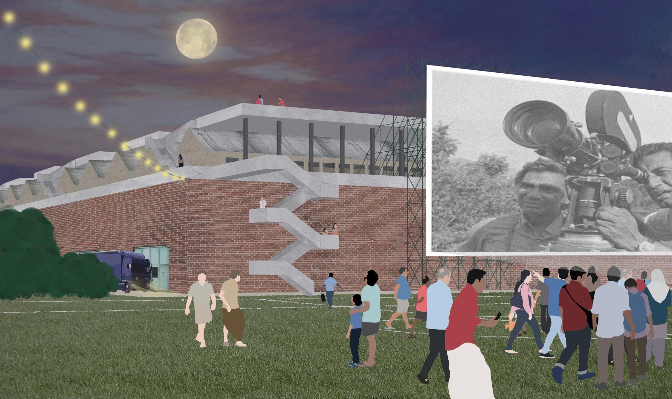
This proposal explores the potential of turning the poorly-performing Tirupati jute mill into a new base for the Bengali movie industry. It attempts to create a sort of commercial activity that would benefit neighbors while engaging wider networks that the site’s immediate context. Building on the premise that loans from New Jute SPV need to be reimbursed, three questions served as a guideline for the project’s development. How can revenue be generated when few people in the area have disposable income? What types of programs would stimulate the existing fabric without displacing neighbors? What can convince the mill owner that the highest and best use of the site is not residential development? The mill undergoes a three-step phased renovation, which ultimately culminates in using derelict jute production spaces for film shooting studios and their supporting infrastructure. Minimal prescription, maximal adaptation, and juxtaposed usages serve public/private spatial overlaps as neighbors and the movie industry penetrate each other.
70
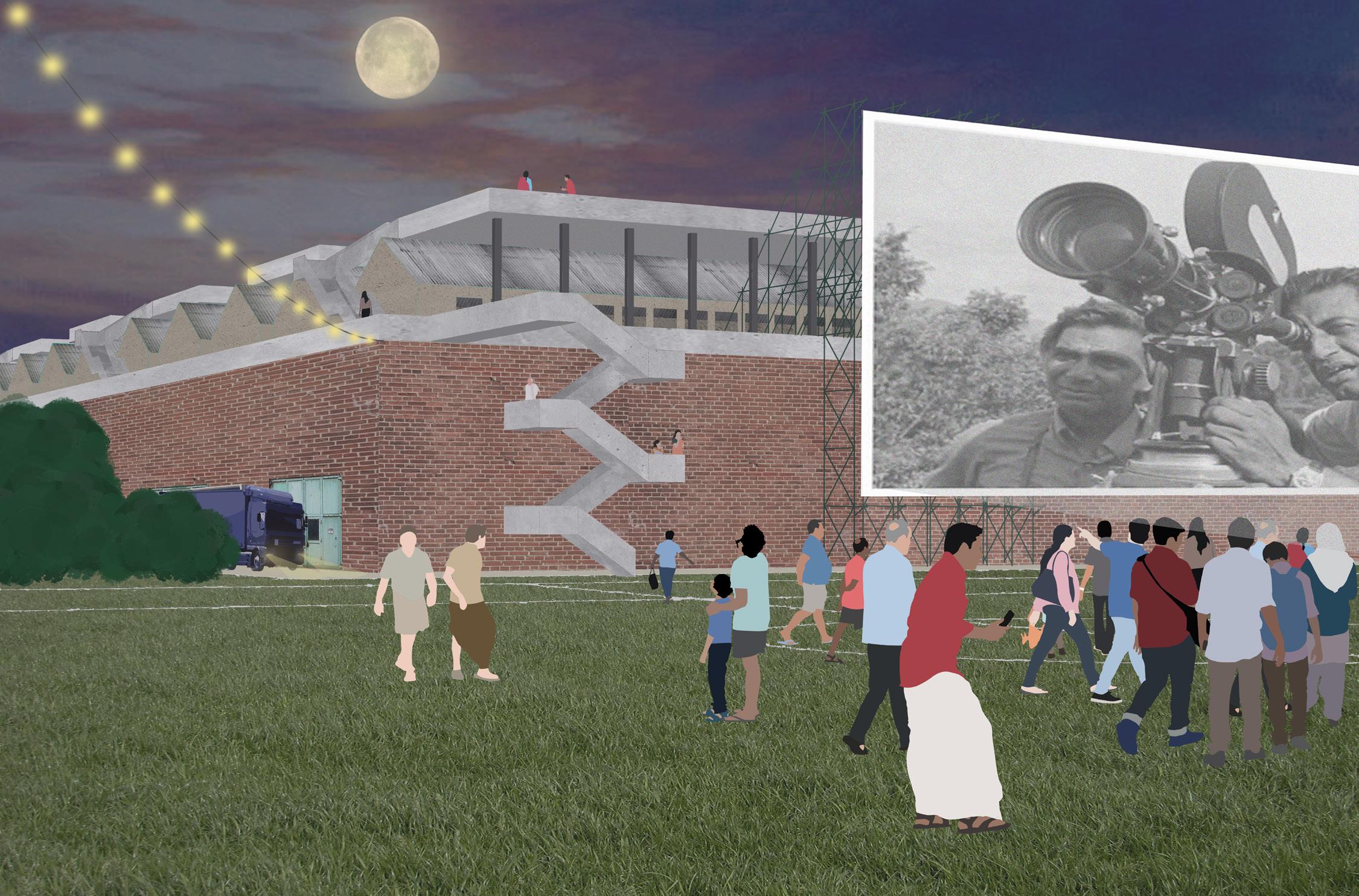
Figure 1. Night view from the south field showing an outdoor movie screen
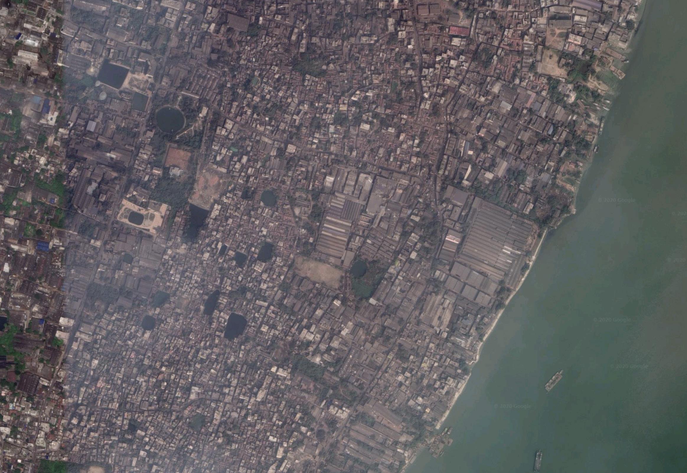
7 SITE 8 DIMENSIONS 0m100m200m N
PROPERTY Figure 2. Site dimensions 71
31.6 acres 480m 390m
18
N 0m50m100m
72
BOUNDARIES HOUSING INDUSTRIAL PROPERTY
Figure 3. Current ground use
WEST BENGAL MOVIE INDUSTRY
Lumière Brothers’ first motion picture
INTERNATIONAL CINEMA INDIAN CINEMA
1913 Phalke’s Raja Harishchandra, produced in Bombay, is the first full-lenght Indian movie 1895
Hiralal Sen sets up the Royal Bioscope Company in Kolkata, India’s first film production company
BENGALI CINEMA
2018 2.6 billion tickets sold for Hollywood movies
2018 $41.7 billion global box office 2018 3.5 billion tickets sold for Indian movies
2015 $2.1 billion Indian box office
1919 Dhotiwala’s Bilwamangal is the first Bengali feature film
1912 US filmmakers settle in Hollywood to escape the enforcement of Edison motion picture patents RISE
1959
Satyajit Ray’s Aparjito first movie to win two awards at the Venice Film Festival
2018 1,813 Indian films released
2014 120 Bengali films released 2005 40 Bengali films released
2014 Bengali film industry produces 8% of Indian movies
2000s Bengali
movie Figure 4.
Timeline of the West Bengal movie industry
GOLDEN AGE OF BENGALI CINEMA
90%
Bollywood 2010s Bengali movies specialize in low budget productions
of Bengali movies are box office flops
25
1900 1920 1895
193019401950196019701980199020002010 2030 1910 1890
2020
OF THE TALKIE SILENT ERA
1930s Bengali movie industry based in South Kolkata’s Tollygunge and more elite inclined than other Indian cinemas
1970s Rise of the masala movie
directors leave to 73
2014
2018 $18 million Bengali box office
32 PHASING SHORT TERM MID TERM LONG TERM JUTE MILL OWNER NEW
BENGALI MOVIE INDUSTRY Poorly performing jute mill REVENUES NEIGHBORS 2020 2022 2025 2021 2024 2023 2032 202620272028202920302031 New Jute SPV Planning Area Council Bengali Movie Industry Purchase or rent out site for 99 years Master Plan Fencing Offered 1/3 of construction jobs during renovation Building retrofit and demolition Infrastructural follies, open space access, sports fields New
open space
rooftop
Marketing
jobs
SITE ASSESSMENT + PROGRAM DEFINITION FOCUS REHABILITATION + MARKETING OPERATIONS + LOAN REPAYMENT Collects rent if land ownership has not been transfered to movie producers A base for the Bengali movie industry Loan repayment over 12 years Land Value $18 million + Structure Value $7 million Annual Rent $250k Infrastructure $5 million Rehabilitation $10 million Equipment $20 million Cultural tax credits, grants and subsidies Loan repayment over 12 years Shooting fees 50 movies per year outreach highest and best use proposals approval execution linkage package #1 labor linkage package #2 labor income operation Figure 5. Proposed phasing for the site 74
JUTE SPV
housing, hidden infrastructure, rotating
access,
access
Offered 1/4 of permanent
on site
40 GROUND USE N AMENITIES PARKING SERVICES PRODUCTION SPACES MOVIE STUDIOS 0m50m100m Welcome Set Construction Set Dressing Outdoor Filming Digital Post-Production Audio Post-Production External Storage Film Restoration and Archives Administration Staff Housing Cafeteria PARKING Figure 6. Envisioned ground use 75
PARKING
39
N PUBLIC ROADS PRIVATE ROADS GREEN SPACE HOUSING CINEMA AREA 0m50m100m BOUNDARY MAIN ENTRANCE EGRESS SHIFTING USE PRIVATE ROAD FOR PUBLIC USE
CIRCULATION MAP
Figure 7. Circulation map 76
Partial Demolition
Secondary industrial buildings are demolished to make way for open space and infrastructure
Partial Demolition
Derelict worker housing is demolished to make way for open space and infrastructure
SHORT TERM
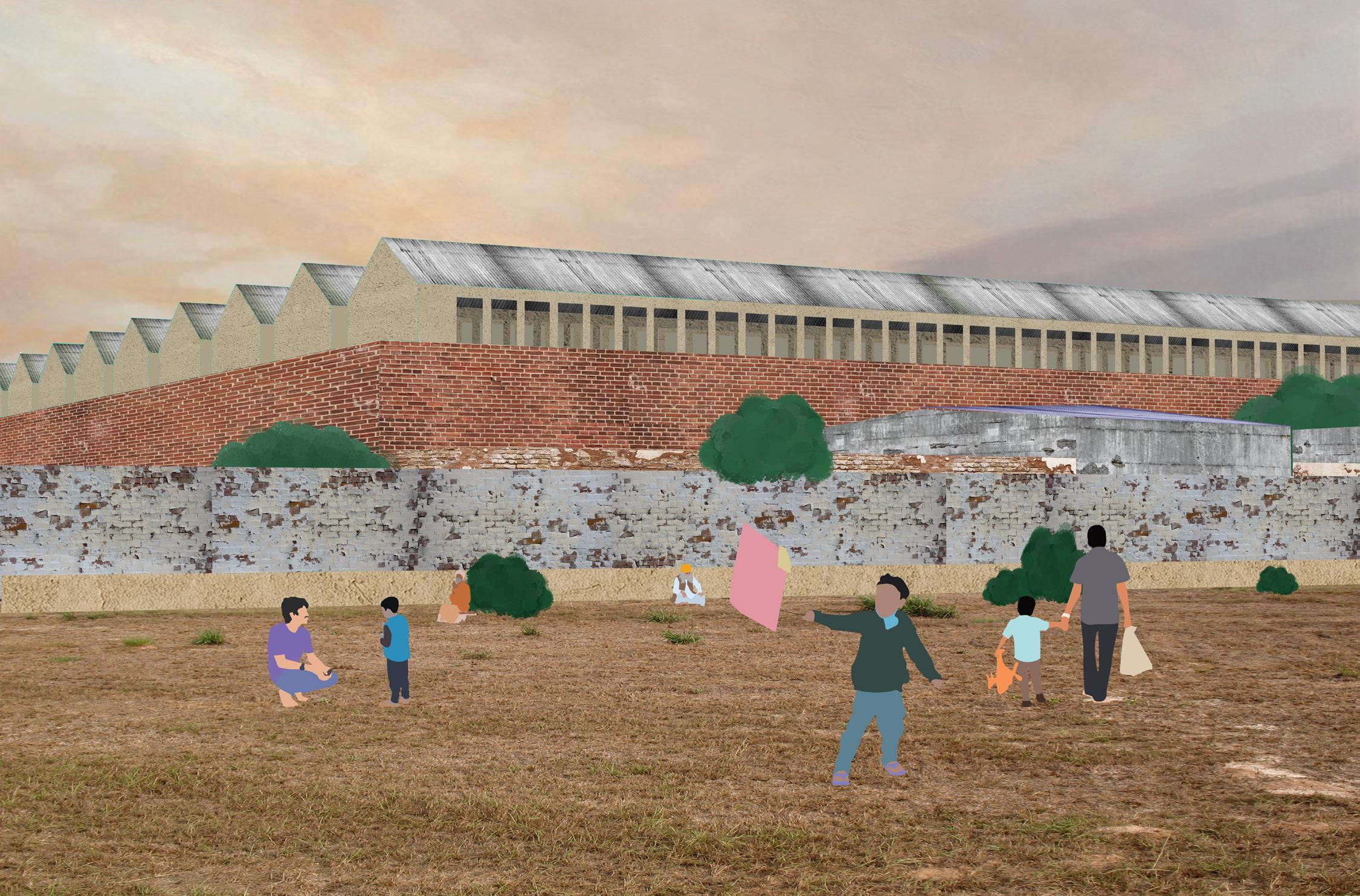
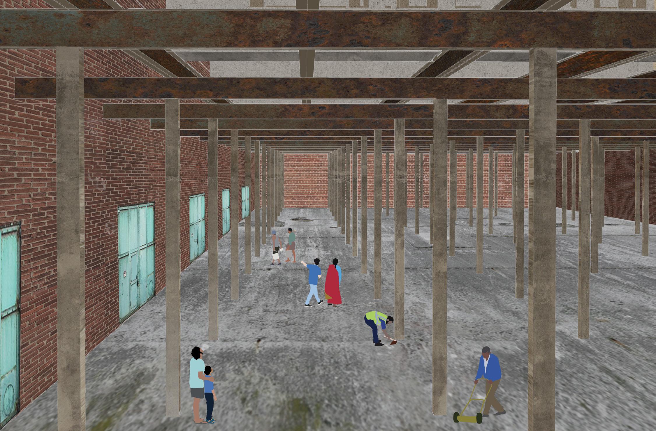
Production Spaces
Secondary industrial buildings are used to store all what’s needed to shoot movies in the main studios
Movie Studios
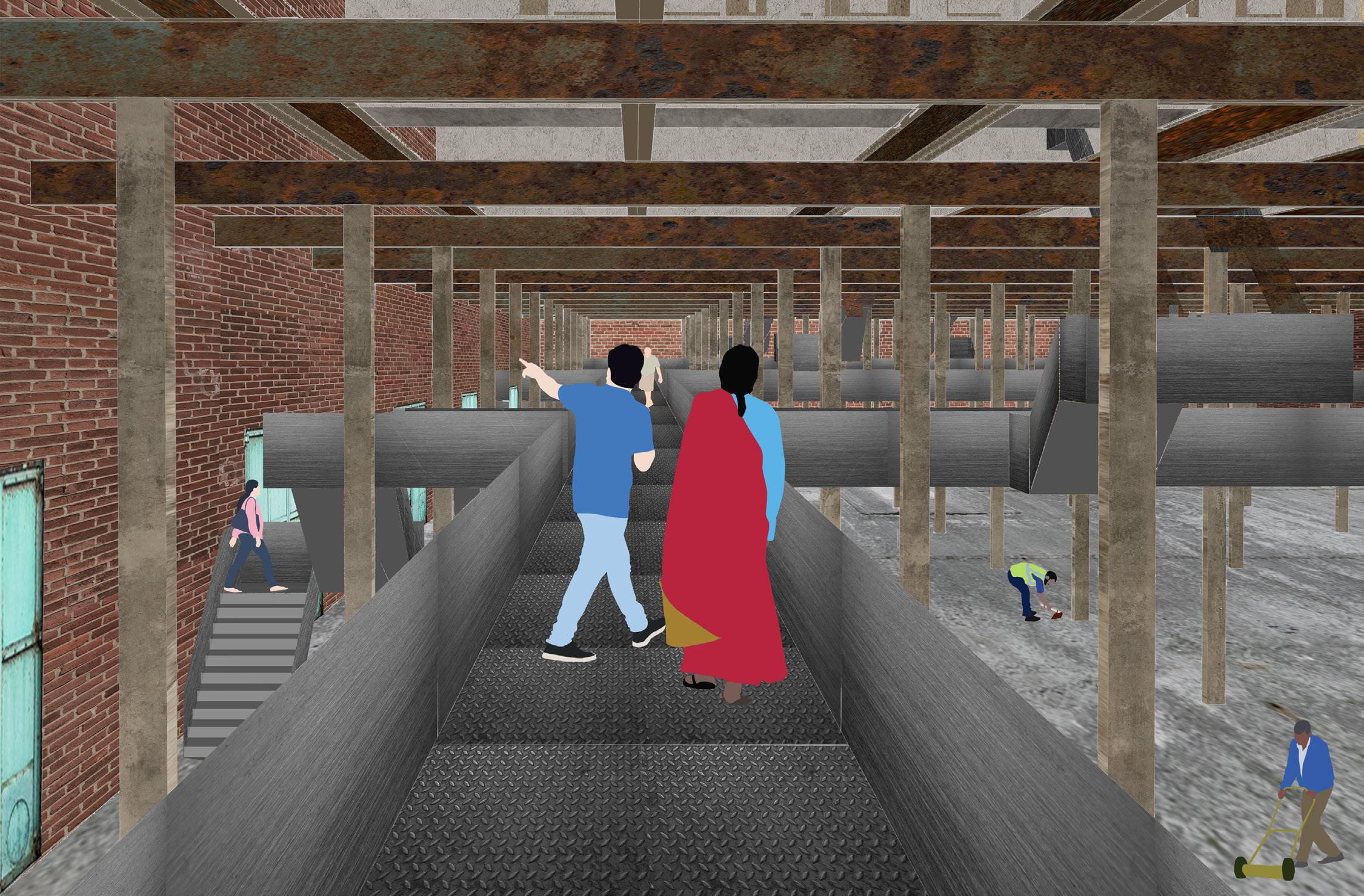
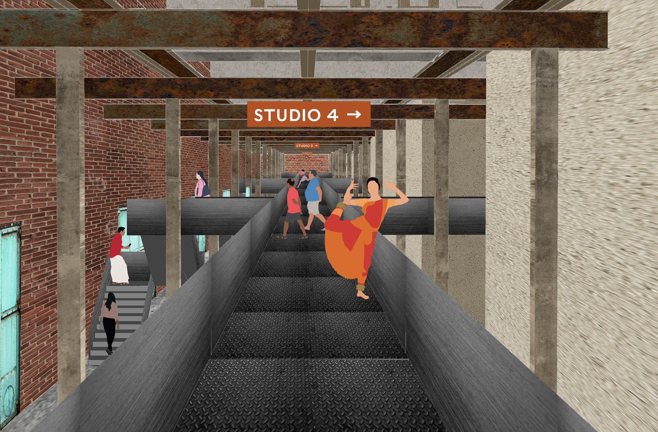
The former jute mill is re-purposed into the vibrant heart of the Bengali movie industry
33
77
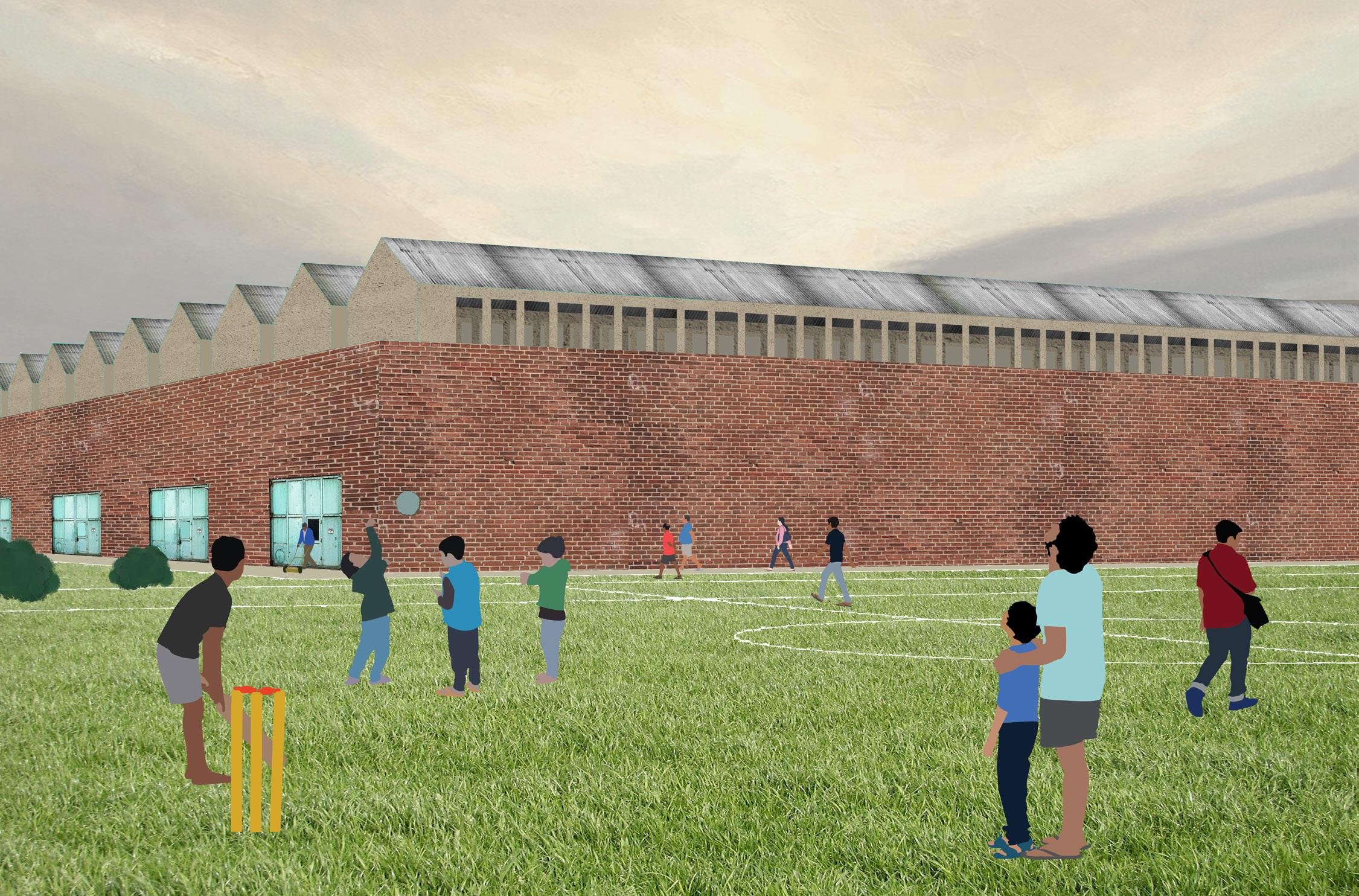
Figures 8, 9, 10. Envisioned short term state of the site
78
Infrastructural Follies
Visible and invisible infrastructures are provided to the neighborhood as a form of linkage
Mobility
New roads are established to provde accessibility around the site
Figures 11, 12, 13. Envisioned mid term state of the site
MID TERM
Housing
People whose house has been taken over by the land repositioning are granted residential units in two new buildings
Open Space
A cricket field and a football field are created in the erstwhile wasteland
35
79
80
Communities
Each of the two residential settlements on the site benefits from a new communal space, an approach that can be replicated throughout the neighborhood
Ruins
A few structurally valuable buildings are kept as ruins to be used as movie sets
LONG TERM
Interpenetration
Untapped parts of the main building rooftop are made accessible for the neighbors, and a large screen is deployed for outdoor movie projections
Shifting use
Two large open spaces are used as outdoor movie studios, and can be publicly accessed when filming is not happening
37
Figures 14,
81
15, 16. Envisioned long term state of the site
82
INTERPENETRATION

SECTION
VIEW
Property Line
Publicly-accessible rooftops over the erstwhile jute mill
Water collection infrastructure under the soccer field as linkage to the neighborhood
Outdoor movie broadcast on a giant screen
Typical movie studio taking advantage of the building height
42
Figure 17.
83
Public/private interpenetration in section
INTERPENETRATION PLAN

VIEW Neighborhood soccer field
Property Line
Outdoor movie broadcast on a giant screen
Open space with shifting access
Typical movie studio with lateral galleries for optimal filming
Figure 18. Public/private interpenetration in plan
41
84
Nynika Jhaveri, Architecture Patricia Cafferky, DUSP
Temporal Efficiencies A Programmatic Scheduling and Design Proposal for
the Jute Mills of Kolkata
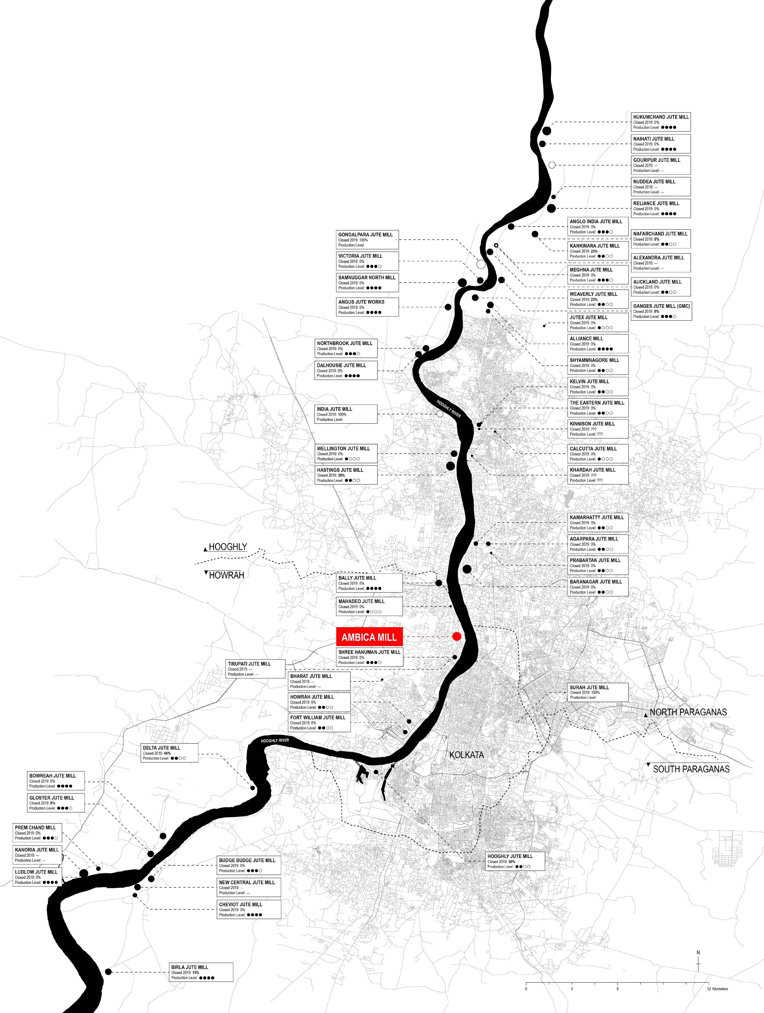
JUTE MILLS LEGEND 0 - 347 348 - 637 638 - 874 Open Closed 875 - 1675 STATUS SIZE (# Looms) ABCDEF JUTE MILL Closed 2019: 0% Production Level: Jute Mill Name % of Months the Mill was Closed, Nov ‘18 to Nov ’19 Measured by Annual Government Purchases, Nov ‘18 to Nov ’19 85
TYPE 1&2
In a city as densely populated as Kolkata, any space that is empty of program for any length of time is being underutilized socially, culturally, and economically. It is to the benefit of both the people of the city and to the owner of a space to ensure that it’s utility is maximized, whether that be over the course of a week, a month, or a year. The jute mills of the Kolkata metro region offer large swaths of under-programmed and underutilized land, infrastructure, and built forms. Additionally, the mill compounds themselves typically include large open spaces, river access, housing, and amenities, all of which have greater potential for both social benefit and personal profit if they were to be efficiently planned, programmatically and temporally.
This project seeks to demonstrate how condensing existing jute activities, introducing new programs with specific spatial and temporal variations, and redesigning mill interiors and compounds to be adaptable to these various uses can increase the potential social utility and profitability of the mills.
86
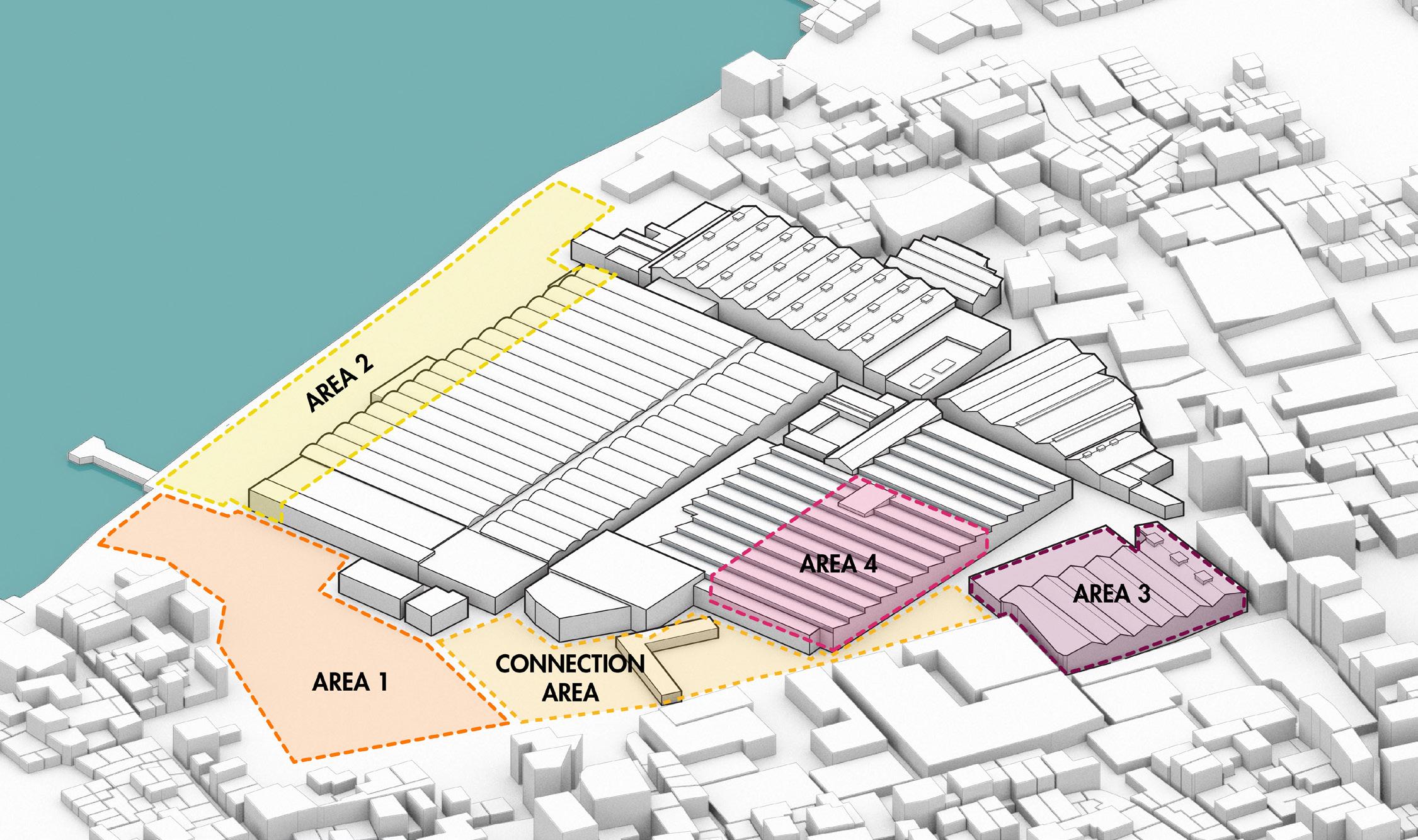
Figure 1. Axon showing the distinct areas at Ambica Jute Mill identified for programmatic intervention.
Figure 2. Calendar comparing jute activity in the mills to the religious and festical calendar of West Bengal.
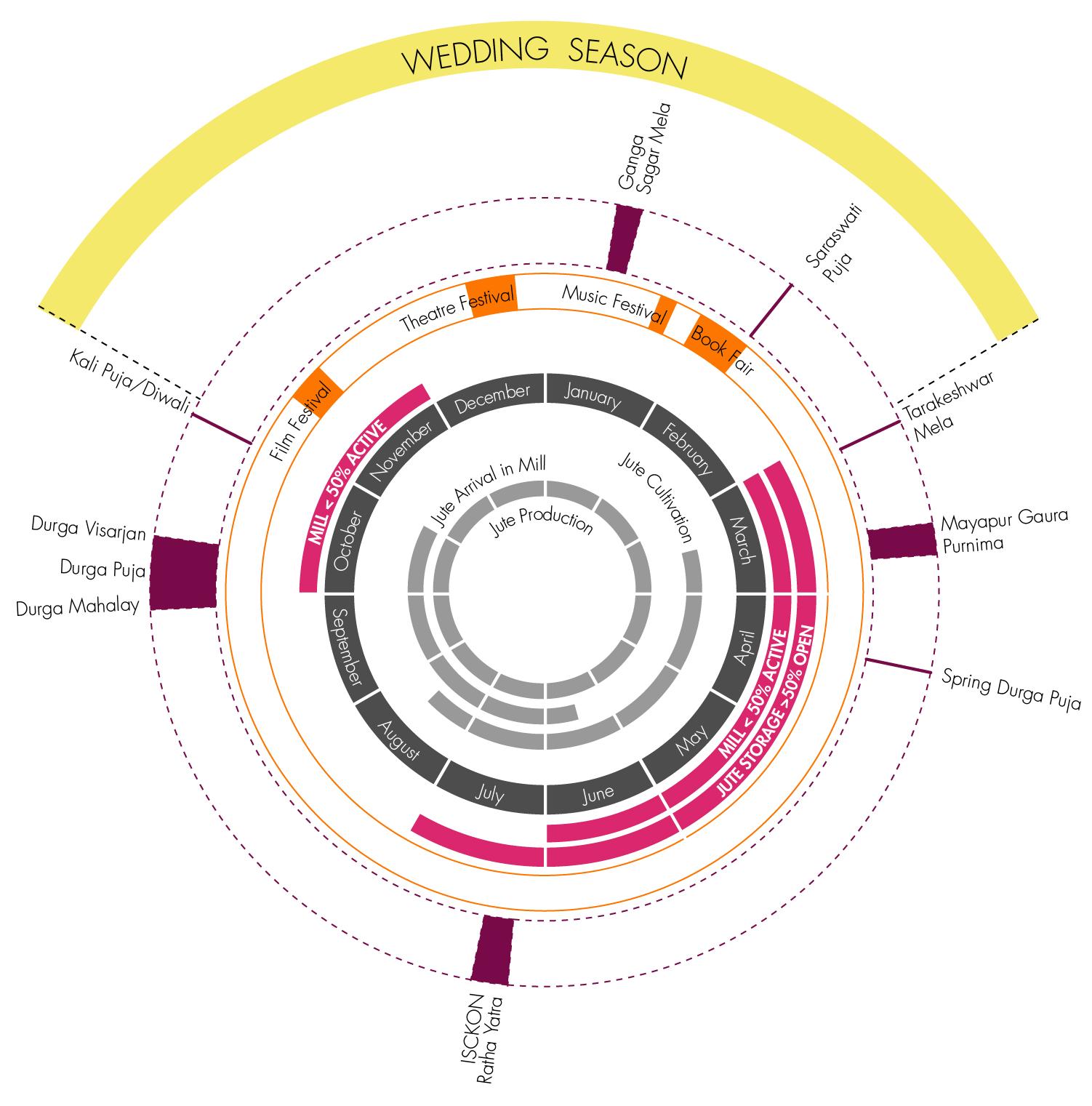
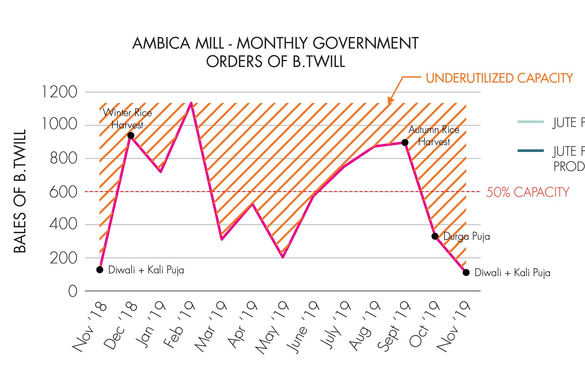
Figure 3. Graph of jute orders/production at Amiba over the course of a year, highlighting underutilized potential.
87
Figure 4. Program Selection.
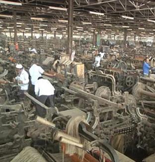
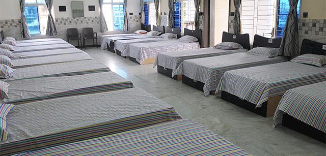
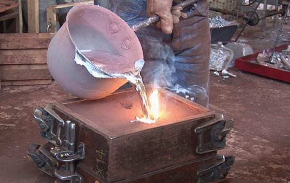
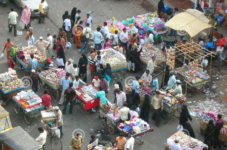

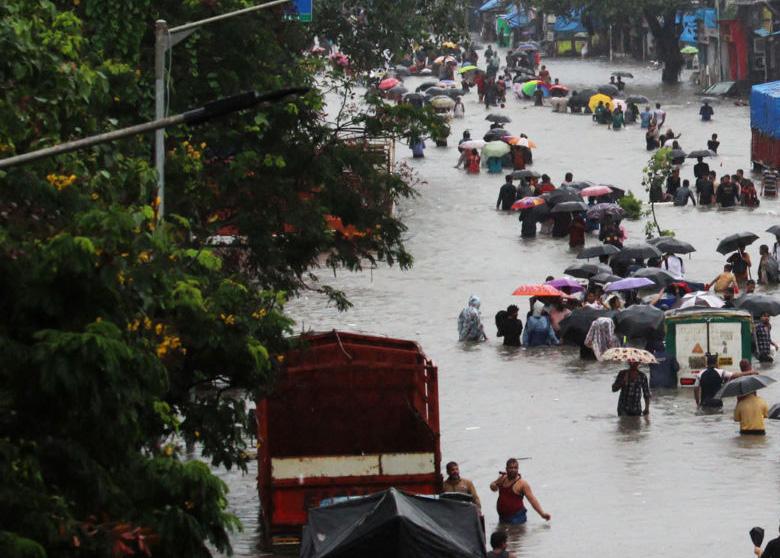
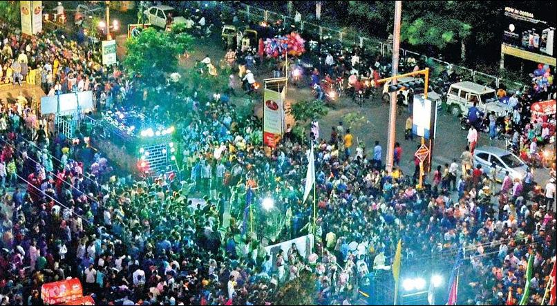
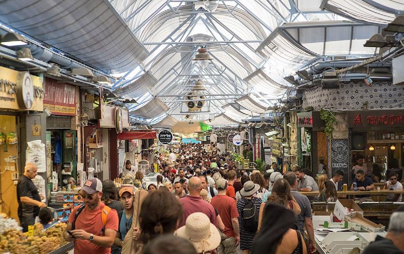
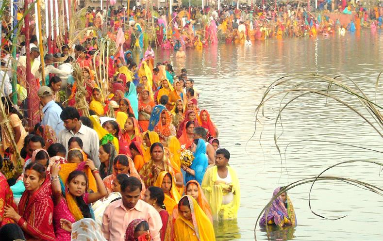
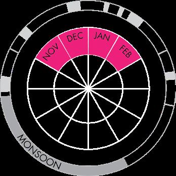
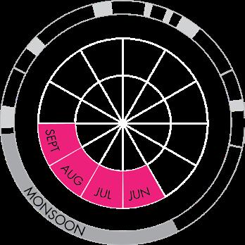
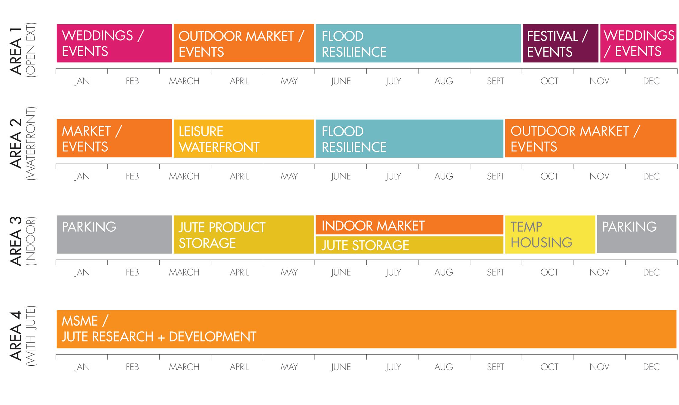 Figure 5. Programatic calendar of the 4 opportunity areas identified at Ambica.
PILGRIMAGE FESTIVAL / EVENTS
WEDDINGS TEMP HOUSING
OUTDOOR MARKET INDOOR MARKET
JUTE MILL
MONSOON FLOODS
88
MSME CLUSTER
Transit
Schools
Figure 6. Context analysis, locating cultural amenities in proximity to the Ambica Jute Mill.
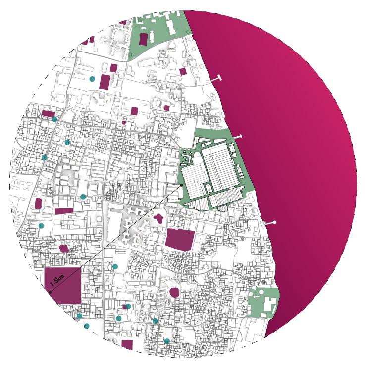
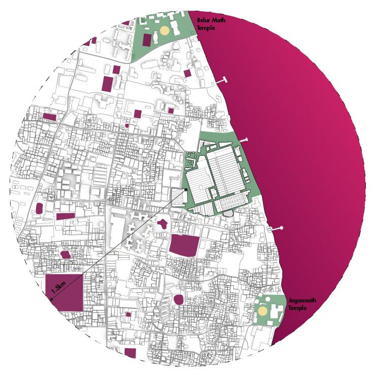
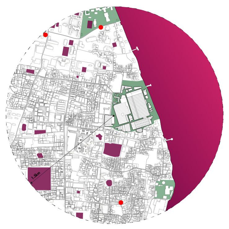
Sanitation Cultural
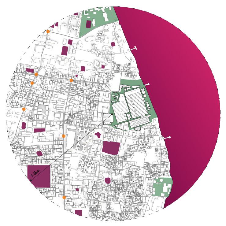
89
Public Amenities
Figure 7. Context plan showing the relationship of new urban amenities proposed at Ambica to those nearby.
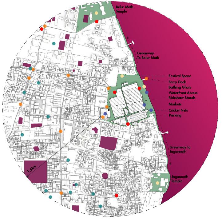
90
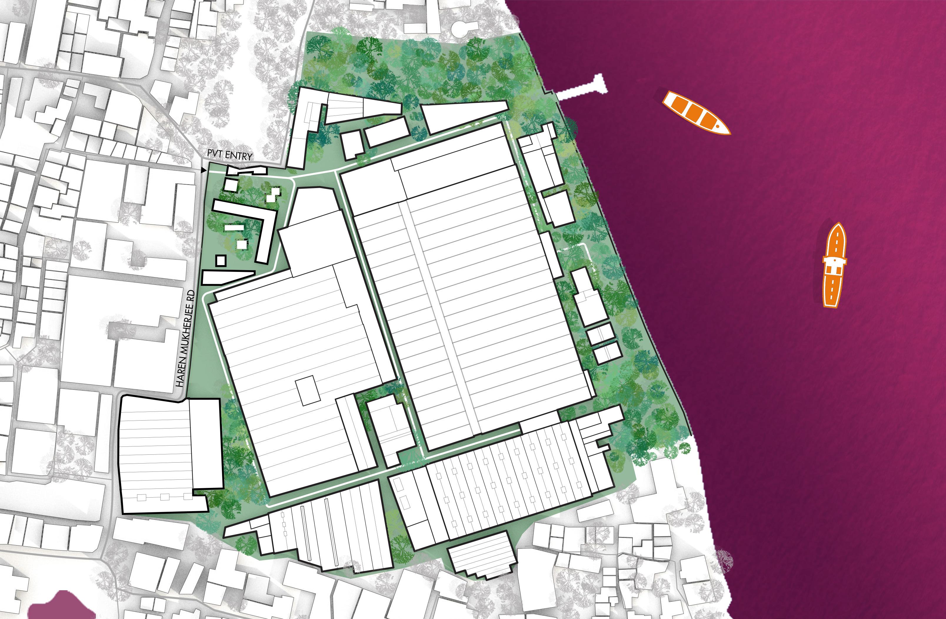
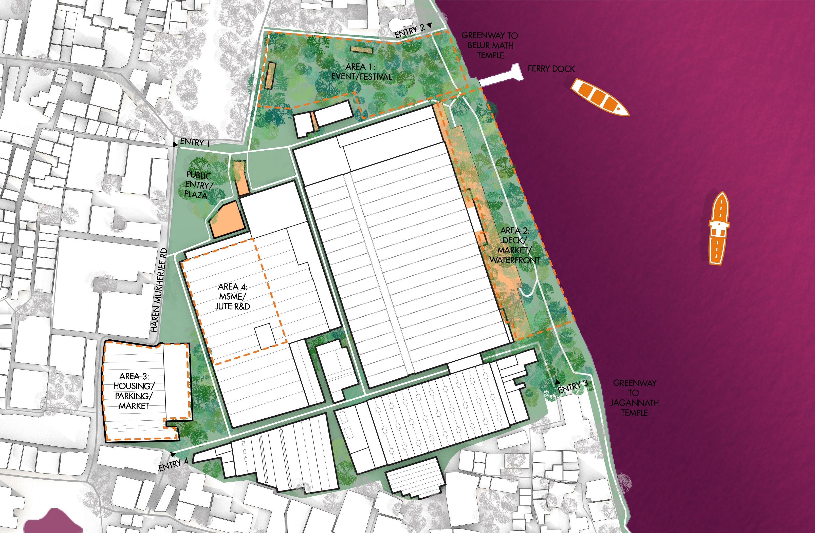
20 50 100
0 10
0 10 20 50 100
Figure 9. Proposed Ambica site plan.
91
Figure 8. Existing Ambica site plan.
Figure 10. Enlarged plans and section at entry plaza.


MAIN ENTRY (PEDESTRIAN)
Figure 11. Entry circulation by different modes of transit at Ambica.


PROPOSED EXISTING
EVENT LOADING TRUCK ACCESS FEATURE ENTRY ROAD EVENT AREA PLAZA SECURITY PLAZA SIDEWALK ROAD ROAD MILL BUFFER MILL BUFFER ENLARGED PLAN B B
92




24’180’ 115’ 339’ BUILDING 2 ( JUTE & MSME ) BUILDING 1 ( MIX ) STREET PROPERTY LINE AREA 3 AREA 4 60’ STREET ATRIUM INDOOR MARKET / JUTE STORAGE MSME PROPERTY LINE 60’ STREET ATRIUM EVENT PARKING 24’20’ BLDG ROAD RICKSHAW & BUS STAND 60’ STREET ATRIUM EVENT PARKING 24’20’ BLDG ROAD RICKSHAW & BUS STAND PROPERTY LINE
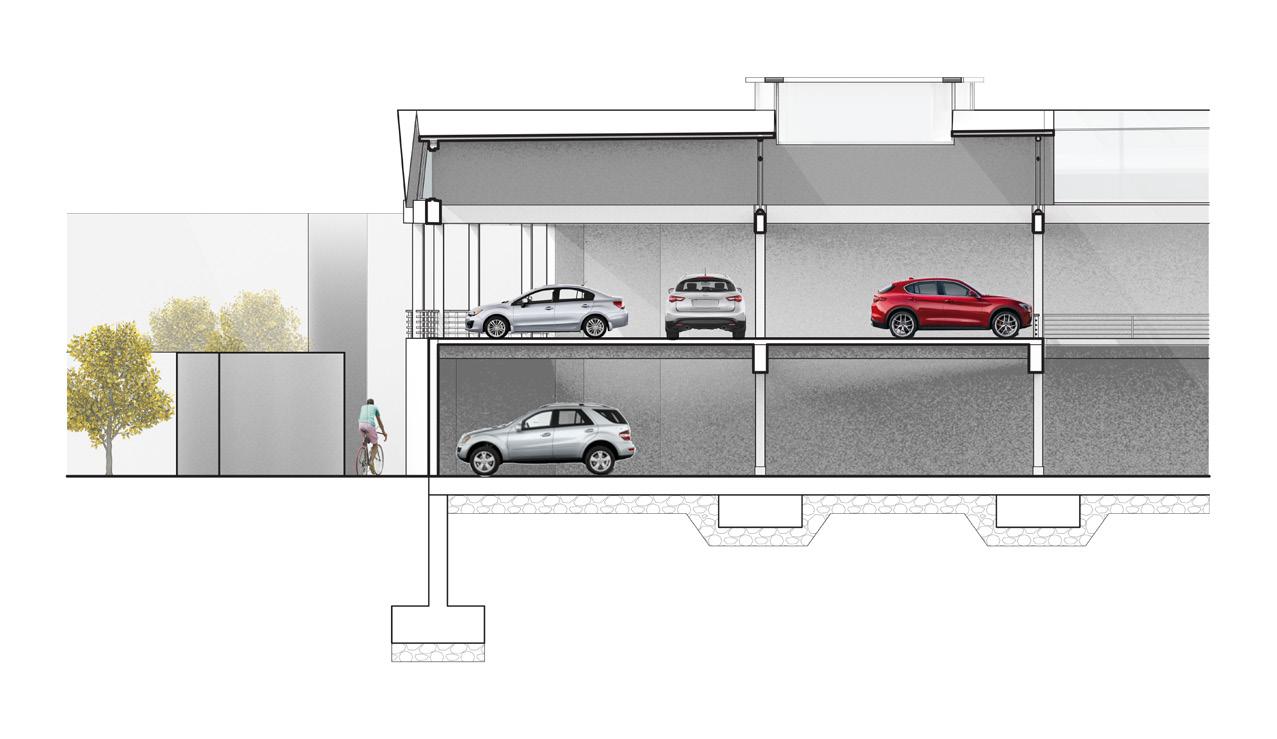
14. Section at Area 3 during wedding season. Program: Event Parking Figure 13. Section at Area 3 during monsoon season. Programs: Jute Storage + Market Figure 12. Site section at Ambica with program areas highlighted. 93
Figure



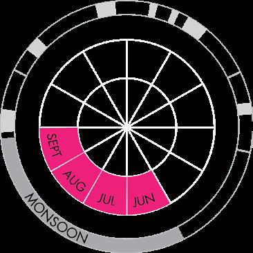
58’ 30’ 30’ 25’ 18’ 50’ 20’ 30’ JUTE MILL MARKET DECK PATH PLANTING PLANTING MARKET EXTENSION MARKET EXTENSION 30’ 30’ 133’ JUTE MILL PUBLIC DECK FLOOD MANAGEMENT AMENITY BALCONY EXISTING GRADE EXISTING GRADE 30’ 30’ 25’ 18’ 50’ 20’ 30’ JUTE MILL MARKET DECK PATH PLANTING PLANTING MARKET EXTENSION MARKET EXTENSION EXISTING GRADE
94
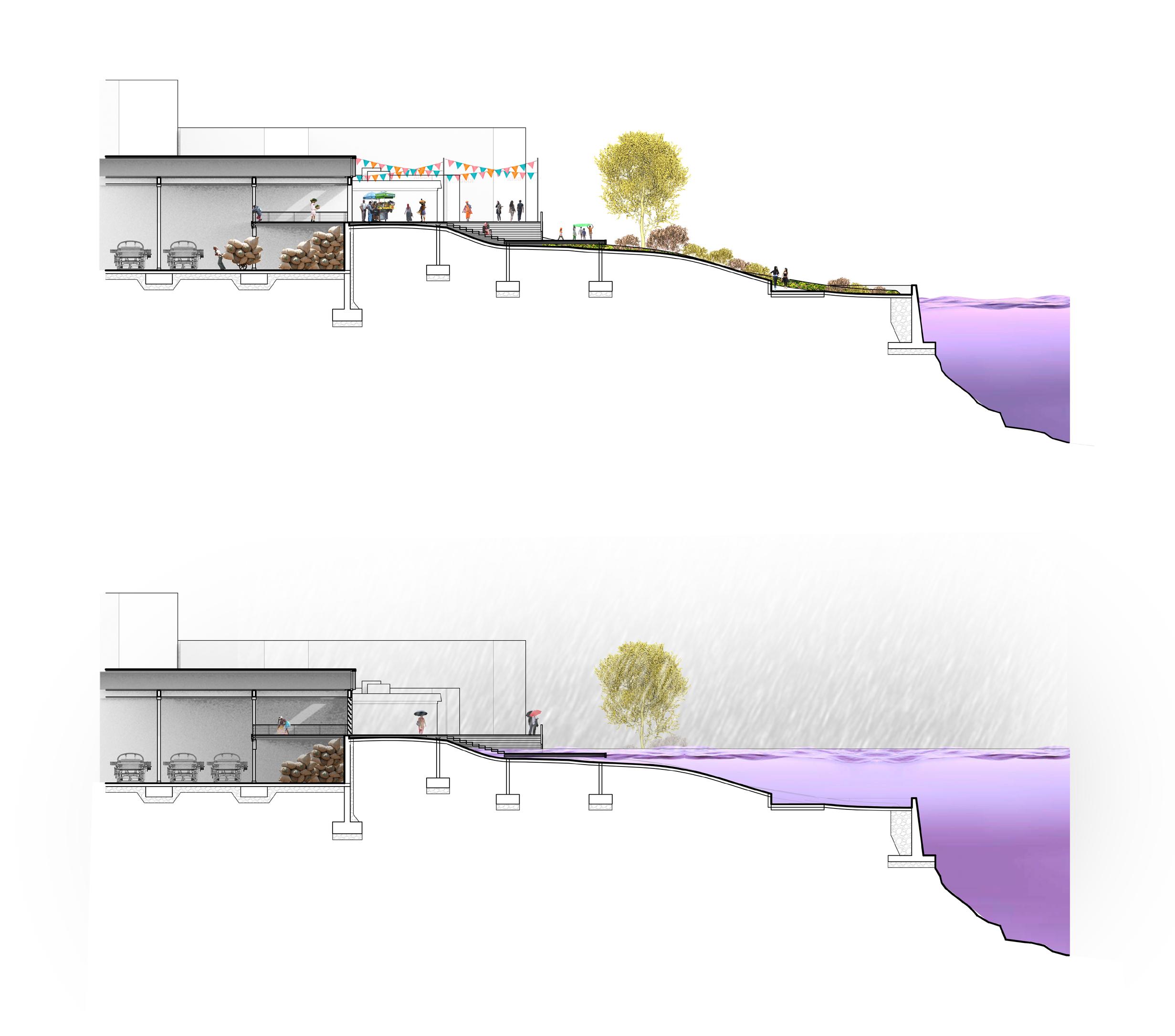
Figure 16. Section at Area 2, October - May. Programs: Market + Leisure Waterfront. Figure 15. Section at Area 2 during monsoon. Program: Flood Resilience.
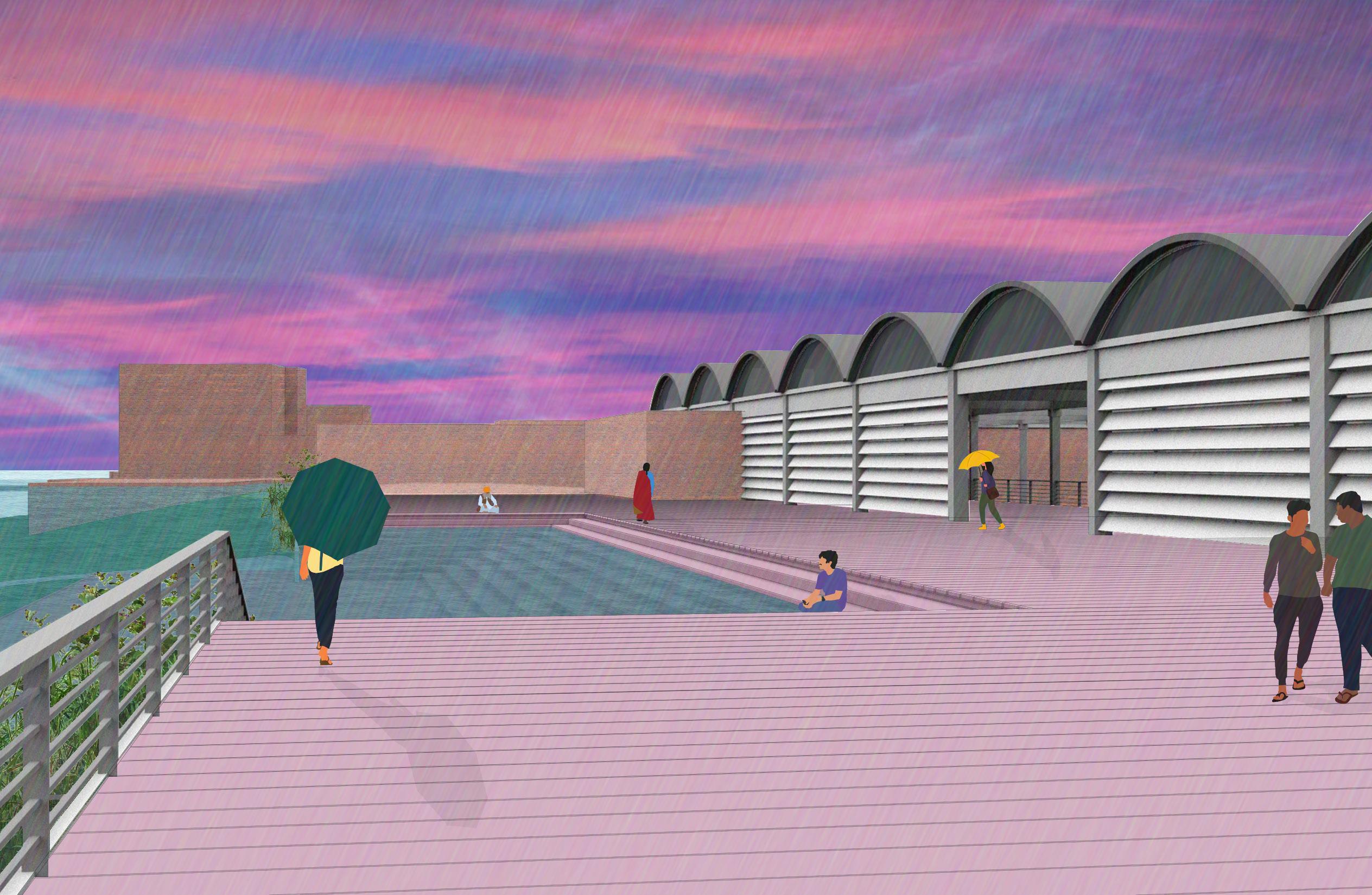
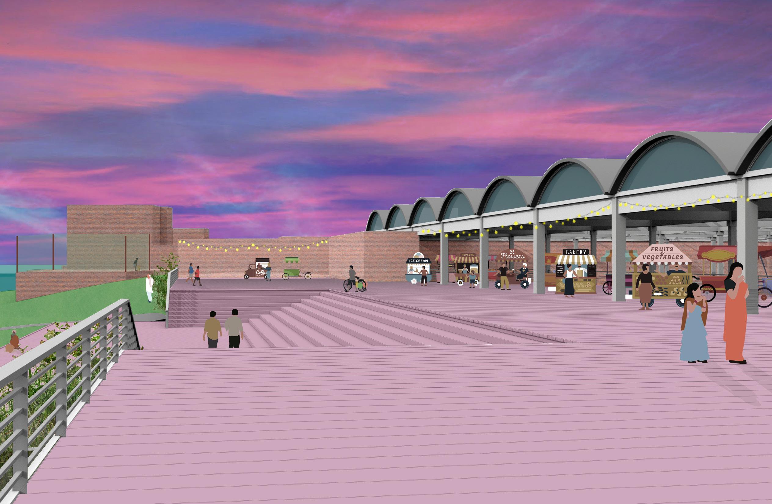

 Figure 17. Area 2 rendering, October - May. Programs: Market and Waterfront Leisure.
Figure 18. Area 2 rendering, June - September. Program: Flood Resilience.
95
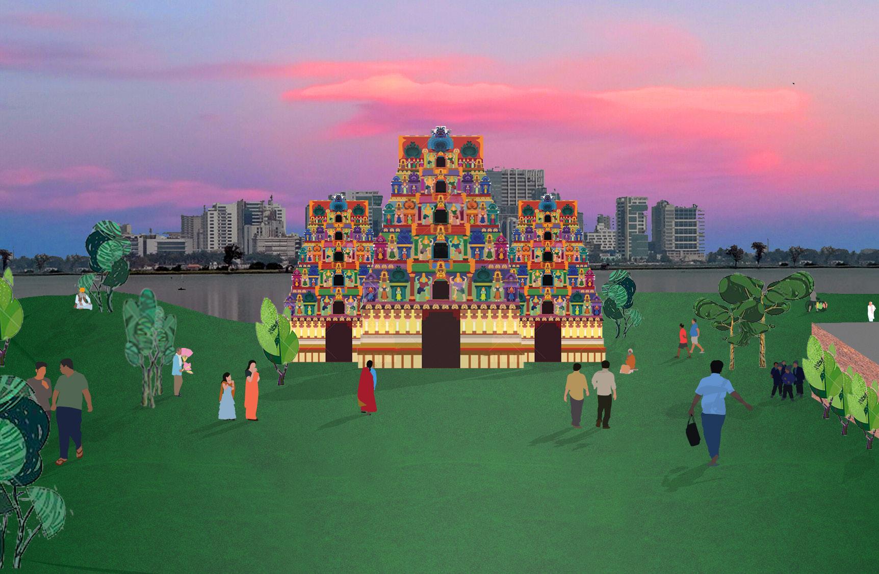

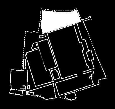
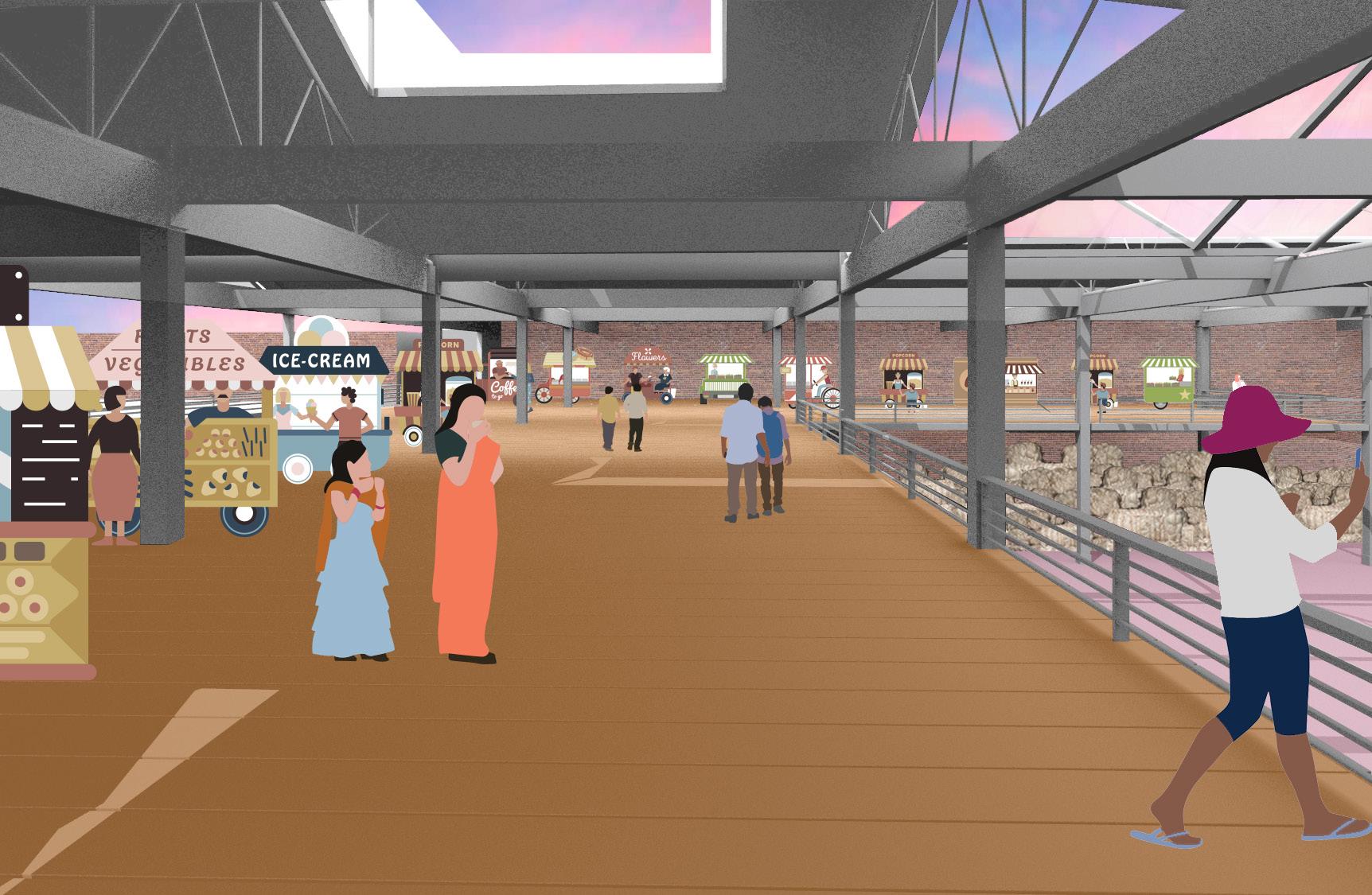
 Figure 20. Area 1 rendering, October - November. Program: Festival
96
Figure 19. Area 3 rendering, June - September. Programs: Jute Storage + Market.
Figure 21. Diagram of application of proposal to generic site.
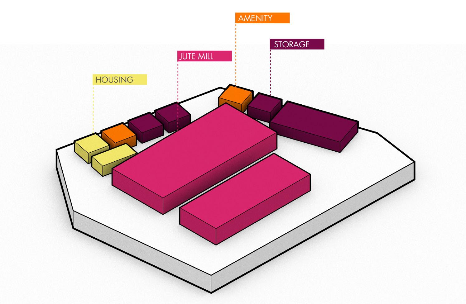
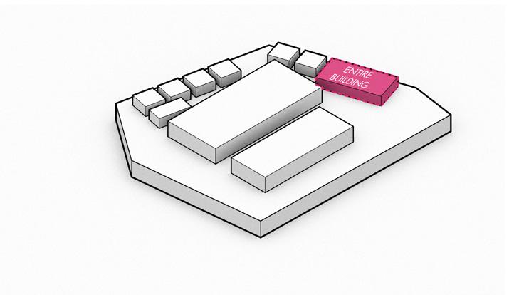
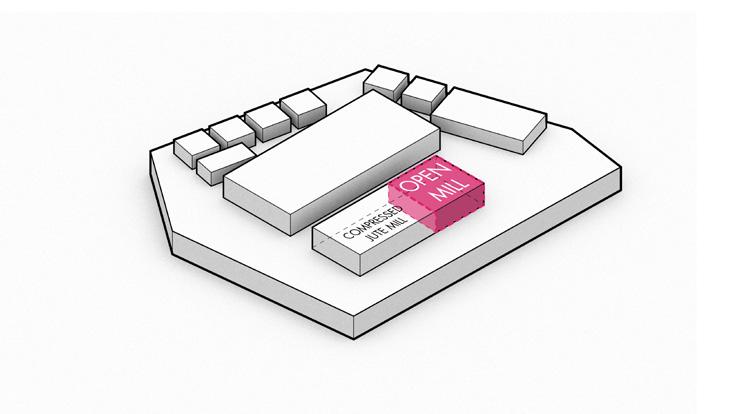
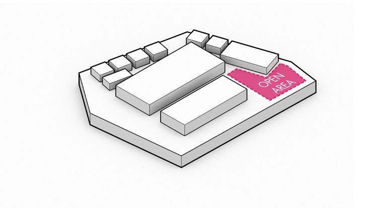
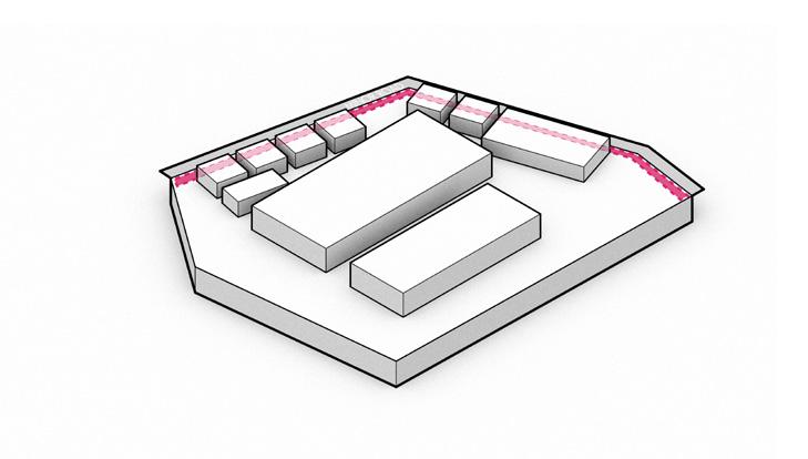
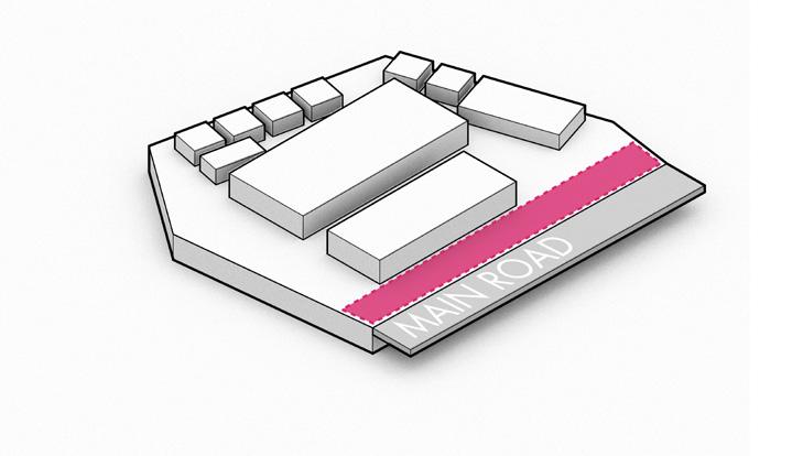
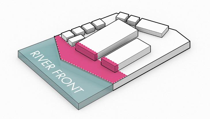
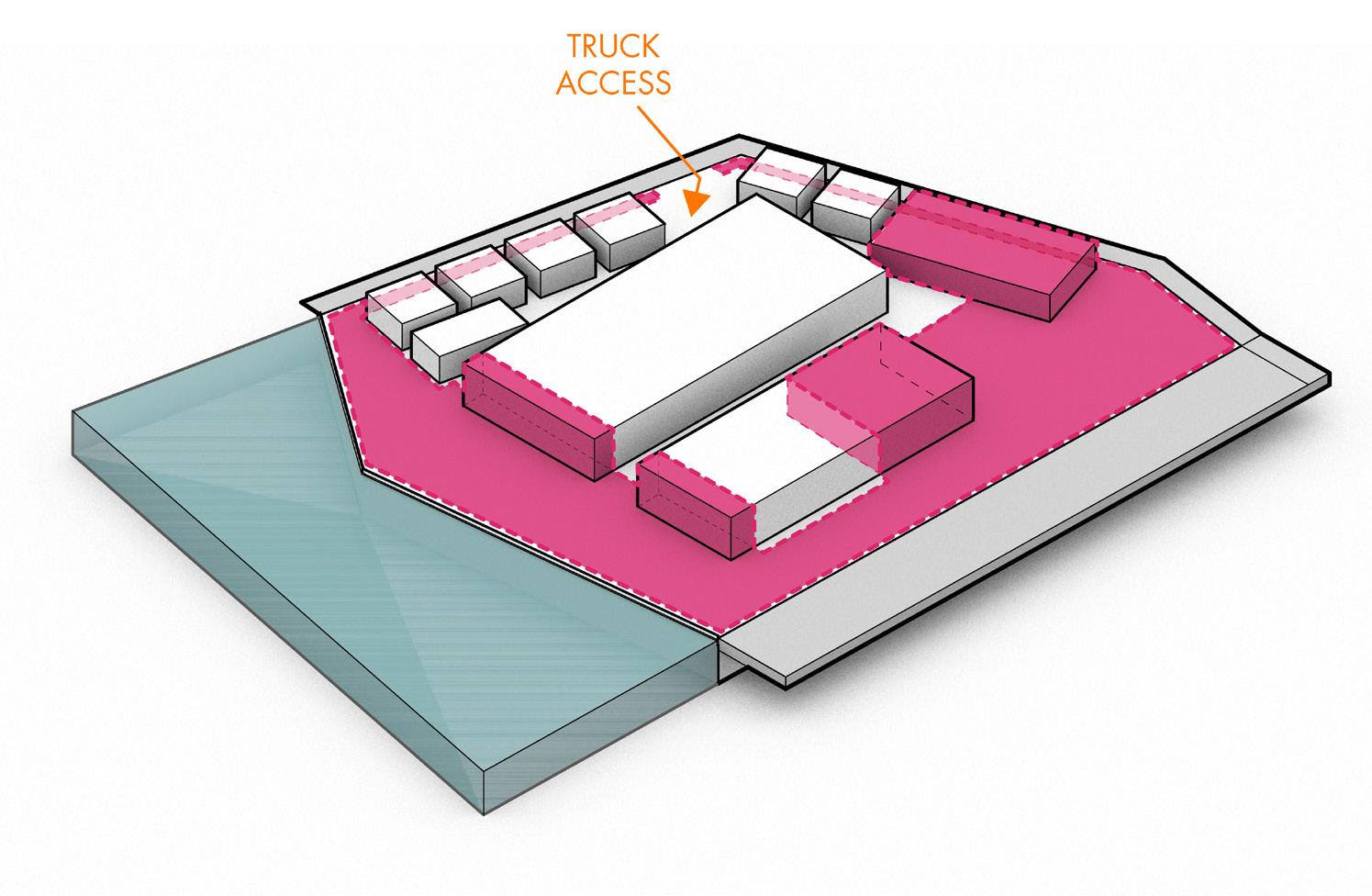
STEP 2: MAIN STREET FRONTAGE STEP 1: WATER FRONTAGE STEP 3: MINOR STREET FRONTAGE STEP 4: OPEN AREAS STEP 5: TAKE MILL SPACE STEP 6: TAKE UNDERUTILIZED BLDGS STEP 7: JUTE ACCESS GENERIC MILL Jute Mill Jute + Product Storage Worker Amenity Housing Area for Reprogramming
97
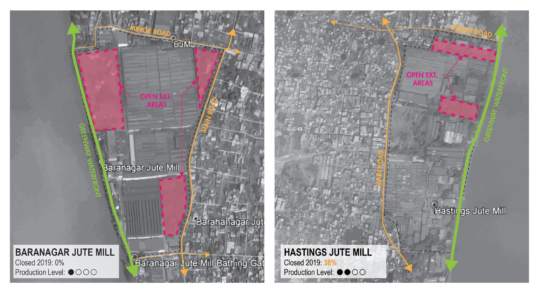
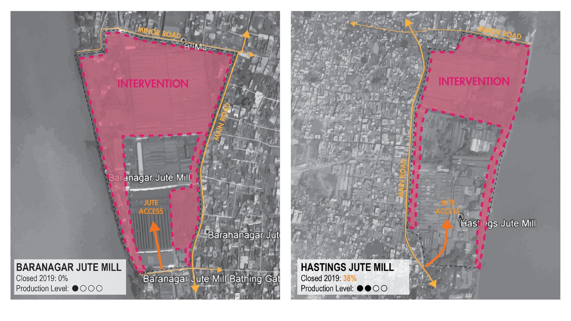
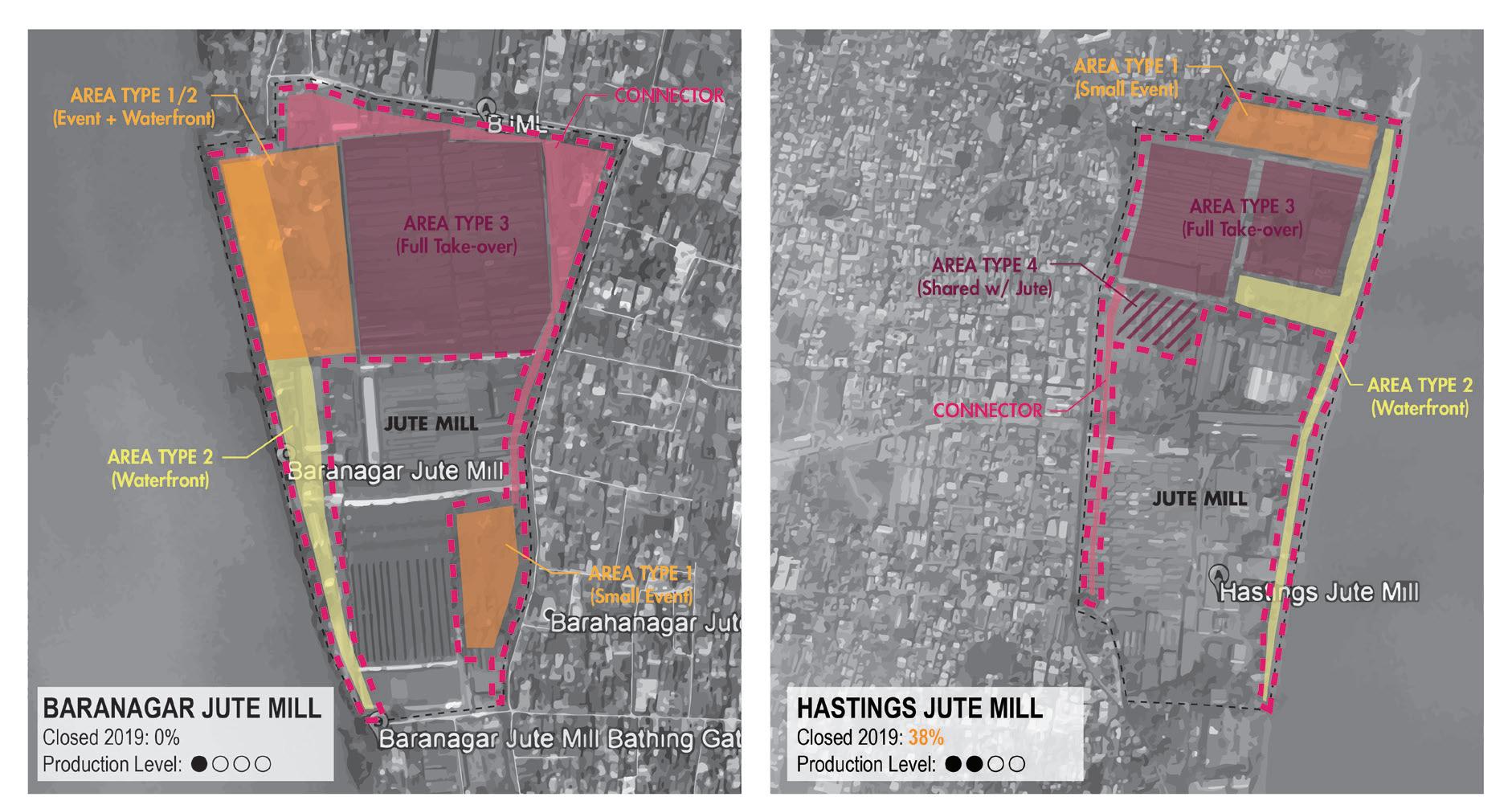 Figure 22. Diagram of proposal to two additional case study sites.
98
EXCHANGE: Mill + New Jute + Municipality
JUTE MILL OWNER
Funds for: 1.New Machinery, 2.Worker training, 3.New Electricity & Water Infrastructure
NEW JUTE SPV
Goals: Preserve Jute, Increase Jute Mill Productivity, Improve Economy
Figure
Goals: Increase Profit & Keep Mill Ownership
1.Allows Uses outside those site is zoned for 2. Supports on-site festivals
1.Keeps jute on-site 2.Increased Production 3.R&D of Jute Uses
1.New jobs 2.New public uses (festivals, parks, etc) 3.Provides local sanitation amenities
LOCAL MUNICIPALITY
Goals: Improve Local Economy, Create Jobs, Improve Local Amenities
PROPOSAL PROCESS
1.Mill Owner Decides to Increase Revenue
2.Mill Owner Hires Event Coordinator and Designer
3.Mill is Evaluated for Potential Programmatic Opportunites
4.Infrastructure Required for Programs is Determined and Evaulated for Implementation
5.Potential Costs and Profits are Calculated. Mill Owner Applies for Site Use Variance and Gov’t Funding if Applicable.
6.Site is Re-designed to Accomodate New Uses
Figure 24. Diagram of proposed project process by site.
Re-evaluate Selected Programs If Needed
23. Diagram of proposed exchange between Mill owners, New Jute, and local municipality.
99
100


 Figure 1. This drawing shows our proposition to design the void –systems like streets, economic activity, and infrastructure.


 Barabazar


 N 1KM
N 1KM


 Figure 2 (above): As a culturally significant place of Hindu pilgrimage, Kolkata meets an average of 12.3 million tourists (91% comes domestically) every year.
Table1 : Annually tourism in Kolkata
Temple waste and religious materials
Idol immersion


 Figure tk. River’s edge 2025


 Figure 11. On Grand Trunk Road, buses intensify competition between road users traveling by different modes and in both directions


 Figure 5. Programatic calendar of the 4 opportunity areas identified at Ambica.
PILGRIMAGE FESTIVAL / EVENTS
WEDDINGS TEMP HOUSING


 Figure 17. Area 2 rendering, October - May. Programs: Market and Waterfront Leisure.
Figure 18. Area 2 rendering, June - September. Program: Flood Resilience.


 Figure 22. Diagram of proposal to two additional case study sites.