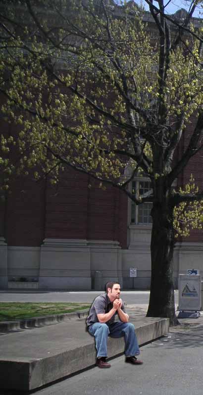
MODE SHIFT
Rethinking Boston’s Biking Streets

Massachusetts Institute of Technology

Rethinking Boston’s Biking Streets
MIT School of Architecture and Planning
City Design and Development Group
Site and Urban Systems Planning Workshop
The MIT students and instructor directly involved in the workshop assume full responsibility for the content of this report and any errors therein. The work does not represent intentions or policies of the city of Boston or its officials but only of the students and the instructor.
Website: To download this report in digital form and to view interactive simulation see: http://web.mit.edu/11.304j/www/mode-shift/
We are extremely grateful to the following individuals for their inputs and valuable contributions:
Nicole Freedman
Director of Bicycle Programs, Boston
Nick Jackson
Senior Planner, Toole Design Group
Peter Furth
Professor, Department of Civil & Environmental Engineering, Northeastern University
Steve Miller
Board of Directors, LivableStreets Alliance
Dan Sorger
The Dutch Bicycle Company
Maria Salve
The Dutch Bicycle Company
Ryan Sullivan
Utile Inc. Architecture + Planning
Chris Zegras
Professor of Transportation Planning, DUSP MIT
Professor
Eran Ben-Joseph Students
Holly Bellocchio
Holly Chase
Vig Krishnamurthy
Eugene Siong Aun Lee
Sarah J. Spicer
Praveen Subramani
James Ira Winder
Jaime Young
Report Design + Editing:
James Ira Winder
Holly Chase
This report is the product of the Spring 2010 Site and Urban Systems Planning Workshop course at the MIT School of Architecture + Planning. The course focused on reimagining the city of Boston with an emphasis on mode shift, particularly through the development of bicycle and pedestrian access paths.
With growing enthusiasm for transportation alternatives from the Mayor’s Office through the Boston Bikes initiative, there is a critical opportunity to present compelling design interventions to the city and the public.
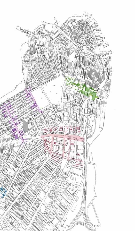
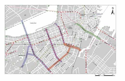
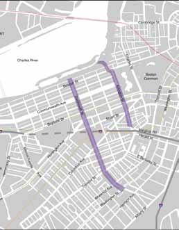
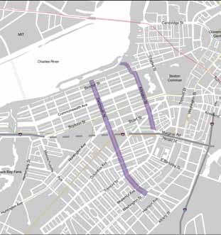
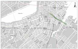
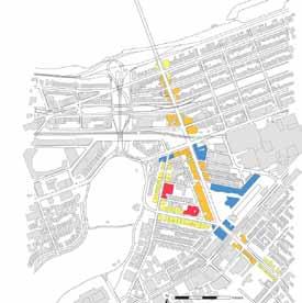
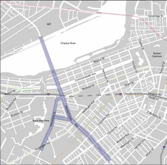
The interventions in this report target four areas of the city of Boston that have been identified as promising sites for improvement of intermodal access based on land use, topography, existing connections, and transportation facilities. The four target areas are:
• Massachusetts Avenue from Harvard Bridge to Symphony Hall
• South End along Shawmut Ave and Herald Street
• Back Bay East edge, and
• Downtown’s Summer Street.
We hope that these proposed designs will serve as a resource to the city of Boston in the development and improvement of the bicycle network over the next several years.
To provide specific design solutions and planning ideas for the construction and implementation of Boston’s bicycle plan components.
To suggest interventions that focus on the design and incorporation of bicycle lanes, bicycle facilities, and street elements that enhance the bicycling experience and promote the development of complete street realm.
To accommodate a variety of modes of travel including pedestrians, motorists, bicyclists, transit riders, and persons with disabilities.
To link existing sections of bike routes within the city such as the Charles River Esplanade and the Southwest Corridor Park and to draw from successful solutions in other cities.
Completeness
Realign traffic to provide space for all modes
Remove barriers between people and places
Amenity
Create a welcoming environment for all
Provide dedicated facilities where space already exists
Intermodalilty
A seamless transition from transit to walking and cycling
Convenience
Integrate bike share system with open space plans
Safety
Create space suitable for users at varying levels of experience
Vibrancy
Mix public space and private amenities
Ecology
Integrate ecological features such as shading and stormwater infiltration
Integrate treatments that can be deployed rapidly
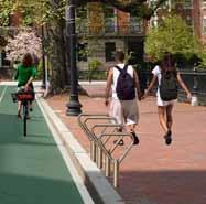
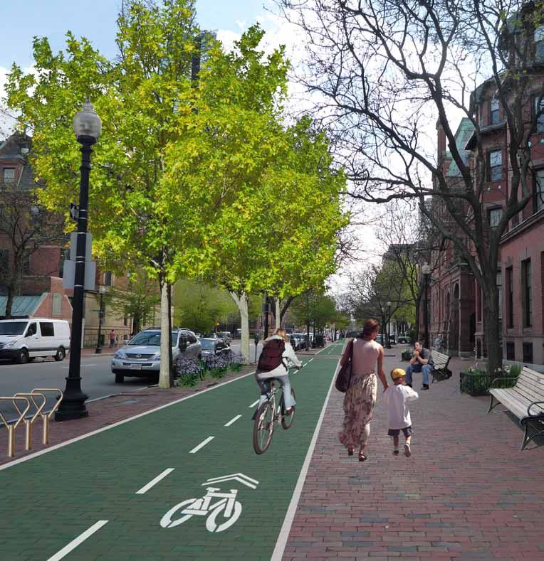
For years, Boston has been considered one of the most difficult cities to bike in due to the absence of viable linkages and access paths for cyclists. In a city that offers a variety of other transit amenities including an extensive subway and commuter rail system, a sizeable bus network, and a highly compact and walkable urban core, cyclists have long been ignored by infrastructural developments. The city has appeared thrice on Bicycling magazine’s list of worst US cities for bicyclists, most recently in 2006. However, significant effort and political capital have since been invested in the improvement of Boston’s bicycle network. This collection of interventions is intended not to replace city-led design initiatives but rather to support and contribute to a comprehensive bicycle and intermodal transportation plan for the city of Boston.
The overarching goal for this project and resulting report is to provide specific design solutions and planning ideas for the construction and implementation of Boston’s bicycle plan components. The interventions focus on the design and incorporation of bicycle lanes, bicycle facilities, and street elements that enhance the presence and visibility of bikers. Where possible, the strategies promote development of shared street realms that accommodate a variety of modes of travel including pedestrians, motorists, bicyclists, transit riders, and persons with disabilities. Careful attention has been paid to linking existing sections of bike routes within the city such as the Charles River Esplanade and the Southwest Corridor Park. The interventions have also drawn from successful solutions in other
urban areas such as Portland and Manhattan that have greatly improved bicycle and pedestrian access strategies through effective design and planning.
The suggested planning and design solutions build on four major street planning concepts: complete streets, shared streets, green streets, and context sensitive engineering.
Complete Streets is an initiative by which cities, states, and other jurisdictions make a policy decision that all future roadway projects will be designed to safely accommodate all userspedestrians, bicyclists, motorists, transit riders and vehicles, and people of all ages and abilities, including children, older adults, and people with disabilities. The cause has been taken up by the National Complete Streets Coalition, formed in 2005 by a number of transportation user and practitioner groups, including AARP, the American Planning Association, and America Bike.
Shared Streets establish a pedestrian orientation by giving pedestrians primary rights in the street space and making the driver feel like an intruder. Continuous pavement of both sidewalks and roadway is the most common design feature of the shared street. Elimination of curb and grade changes provides one surface, which enhances the sense of one continuous space. Such features have a powerful effect on drivers. Without the entrenched familiarity of two curb lines and an asphalt runway, a driver’s psychology is affected and deceleration occurs. Even when a curb is needed for drainage purposes, it is common practice to use the same paving material for the entire space. Further, driver inhibition is achieved by directional changes of the route and the placement of planting beds. Planting beds are usually low, and are made of materials that allow large vehicles, such as fire trucks, to drive over
them in case of an emergency. While the term Shared Street is commonly used in English, its origins are based in the concept of a “woonerf,” which is a Dutch term loosely meaning “residential yards.”
Green Streets use vegetated facilities to manage stormwater runoff at its source. A Green Street is a sustainable stormwater strategy that meets regulatory compliance and resource protection goals by using a natural systems approach to manage stormwater, reduce flows, improve water quality, and enhance watershed health.
Context Sensitive Engineering is a collaborative, interdisciplinary approach to develop transportation facilities that fit their physical settings, preserve resources, and maintain safety and mobility. It is an approach that considers the total context within which a transportation improvement project will exist. Context Sensitive Engineering principles include the employment of early, continuous and meaningful involvement of the public and all stakeholders throughout the project development process.
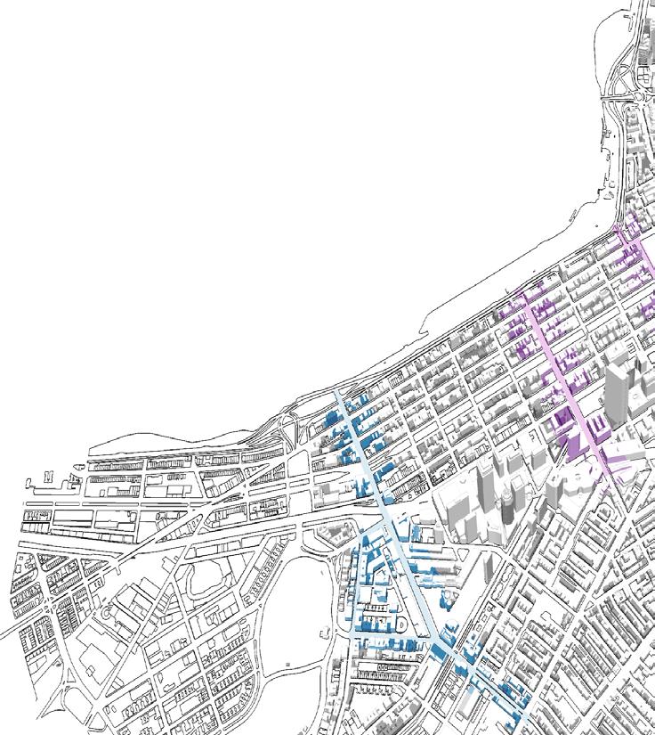
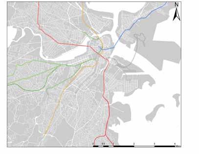
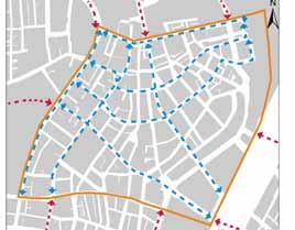
Boston has a relatively extensive network of existing bike routes. Some of these are found along the Southwest Corridor Park, Charles River, and Emerald Necklace.

Many of these routes are well used by people today, but the usage level can be further increased by joining up these individual disconnected path segments into a larger continuous network of paths.
Since many of these routes either end at the fringe or within downtown Boston, the city has the opportunity to develop the missing links around the city and create a continuous network. Legend
Existing/planned bike routes
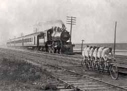
Man on a bicycle ranks first in efficiency among traveling animals and machines in terms of energy consumed in moving a certain distance as a function of body weight. The rate of energy consumption for bicyclist (about .15 calorie per gram per kilometer) is approximately a fifth of that of an unaided walking man (about .75 calories per gram per kilometer).
Scientific American, March 1973
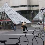
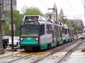
The five lines of the subway system converge in downtown Boston.
Many of these lines meet bike routes in downtown Boston, making it ideal to develop intermodal connections at these meeting points.
Combining an extensive subway system with a network of bike routes caters to the needs of a variety of cyclists covering varying distances. People can cover shorter distances within the city on bicycles while using the subway system to reach places further from the city.
MBTA Red Line
MBTA Blue Line
MBTA Green Line
MBTA Orange Line
MBTA Silver Line
The U.S. could save 262 millions of gallons of gasoline a year by increasing bicycling from 1% to 1.5% of all trips.
Chicago Bicycle Federation
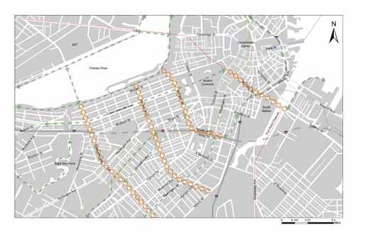
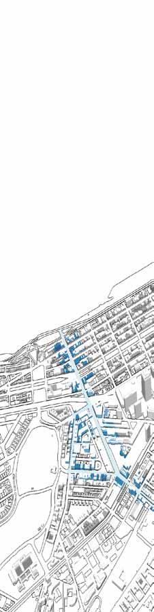
The existing bike routes are well utilized, but there is room to extend them to cater to a larger catchment of people in Boston.
Legend
Existing routes
Missing links
MBTA Red Line
MBTA Blue Line
Identifying major missing links helps prioritize routes that will form a continuous network.
MBTA Green Line
MBTA Orange Line
MBTA Silver Line
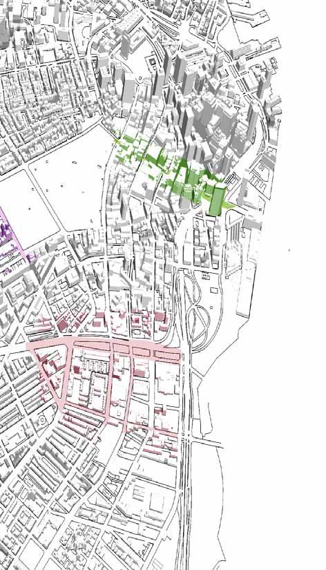
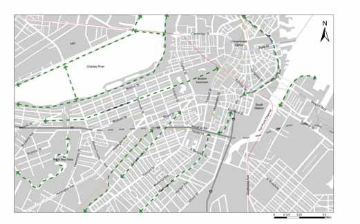
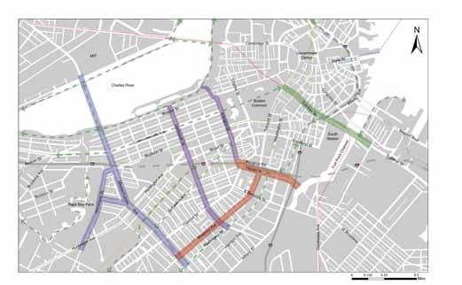
Four intervention areas were identified for detailed study: Massachusetts Avenue, Back Bay, South End, and Downtown. Specific design solutions and planning ideas were worked out to complement existing routes, facilitate Boston’s bicycle plan, and develop complete streets.
Legend
Mass Ave
Back Bay
South End
Downtown
Existing routes
Future routes
MBTA Red Line
MBTA Blue Line
MBTA Green Line
MBTA Orange Line
MBTA Silver Line
Combining the proposed plans in the intervention areas with the existing routes and the city’s future routes would provide an extensive continuous network, bringing Boston one step closer to being a world class cycling city.
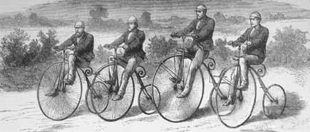
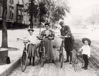
“Bicycling has done more to emancipate women than anything else in the world. I stand and rejoice every time I see a woman ride by on a wheel. It gives women a feeling of freedom and self-reliance.”

Susan B. Anthony (1896) US Suffragette
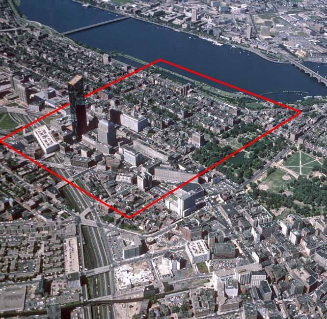
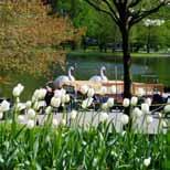
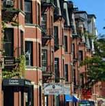
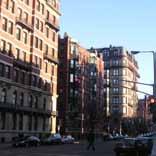
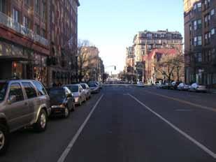
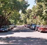
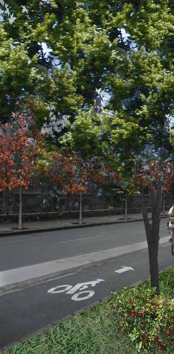
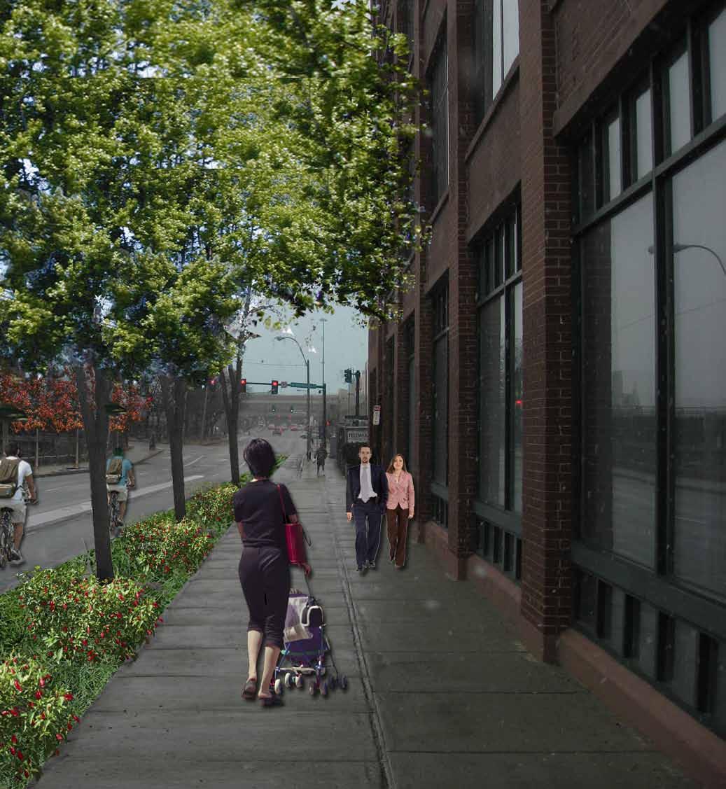
Boston’s Back Bay is a lively neighborhood that is frequented by locals and tourists for its pedestrianfriendly streets. The land use is well mixed, with many popular shopping destinations and restaurants built on the ground floor of historic homes and apartments.
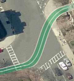
Today in Boston’s Back Bay, cyclists have few options for safely riding between the existing bike-path corridors of the Charles River Esplanade, the Commonwealth Avenue Mall, and the Southwest Corridor. By utilizing the existing pedestrian bridges across Storrow Dr., two-way North-South bicycle paths can be implemented on Dartmouth St. and Arlington St. with no reduction of street parking or number of driving lanes.
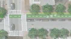
On Dartmouth St., a street-level bicycle lane will run from the Southwest Corridor on the west side of the street and transition to a buffered bike path at sidewalk grade north of Boylston Street. A redesigned intersection of Arlington St. and Beacon St. will provide a safe route for bikers between the Esplanade and a two-way bike lane on the east side of Arlington.
Existing Condition
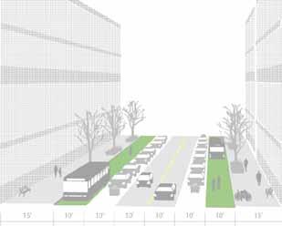
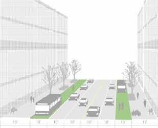
This northbound street presents a spacious, 40’ sidewalk on the west side, which is currently divided into two areas with trees and benches. The leftmost pedestrian corridor is directly alongside commercial developments and is better suited for pedestrian-only use due to foot traffic entering and exiting nearby buildings.


This southbound street lacks the ample sidewalk space of Dartmouth St. but benefits from a surplus of space in the rightmost driving lane. Currently parking is prohibited on the east side of the street, so nine feet can be reclaimed for different modes of transport while maintaining three ten-foot driving lanes. The proximity to the Boston Public Garden accounts for heavy pedestrian traffic along and across Arlington, which is sheltered on the east side of the street by an arboreal buffer.

Opportunities for connectivity with existing bike networks and public transportation nodes are facilitated by the grid layout of the Back Bay. Due to the heavy vehicular traffic in both proposed intervention areas, designated bike lanes are critical for biker safety. Both Arlington and Dartmouth are currently categorized as “advanced” routes, suitable only for experienced and traffic-comfortable cyclists.
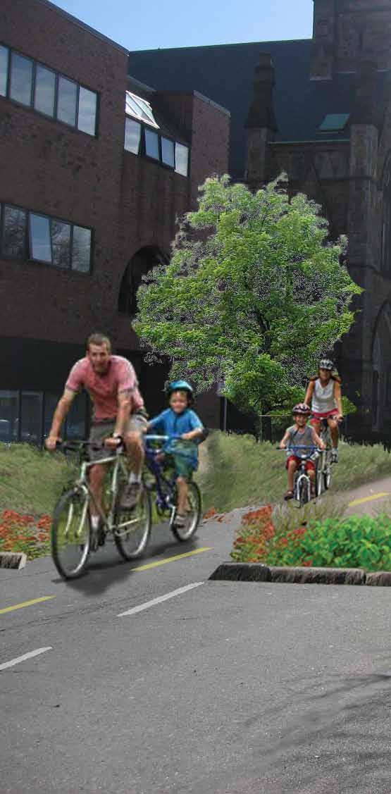
This unique and expansive parkway linking the Fens to the Public Garden is divided by a 100’ greenway that is frequented by bikers and pedestrians. This east-west linkage is the backbone of the proposed interventions.
The unusually large sidewalks of this street type present an opportunity for multi-modal movement shielded from vehicular traffic.
The streets of the Back Bay are more regular in form than most parts of Boston, but convoluted intersections, variations in right-of-way sizes, and mixed-use real estate add character and variety to the street system. This area receives heavy pedestrian traffic due to its historic value and abundance of upscale shops, restaurants, and cultural attractions. Furthermore, dense distribution of subway stations on the MBTA green line connect this gridded street network to greater Boston through subterranean connections. These four street typologies seek to capture the character and physical form of streetscapes in Boston’s Back Bay.
Surplus room in the left most driving lane can be reclaimed for a two-way bike lane while maintaining three driving lanes for cars.
These narrower streets are challenging for bikers to navigate due to both-side parking. Meanwhile, many sidewalks on this street type have planters and are heavy pedestrian thoroughfares.

Dartmouth Street runs along a NorthSouth corridor in the central Back Bay, connecting the Mass Turnpike to the Charles River waterfront. The street is frequented by pedestrians for its spacious sidewalks and is used as a thoroughfare between major destinations such as Newbury Street, Copley Square, and the Commonwealth Avenue Mall. Meanwhile, heavy vehicular traffic enters Dartmouth from a Mass Turnpike exit near the South End, creating hazards and difficult conditions for bikers and pedestrians from the Southwest Corridor Parkway.
Connection to new Commonwealth Ave. bike lanes (proposed intervention areas shown)
Where western sidewalk widens after Copley T Station, bike lane moves from street to sidewalk
Raised two-way bike lane on western 40’ wide sidewalk; bike crossings with bike lights timed to pedestrian crossing lights
Connection to Southwest Corridor bike path
On street twoway bike lane on western side of road
This northbound street presents a spacious, 40’ sidewalk on the west side, which is currently divided into two areas with trees and benches. The leftmost pedestrian corridor is directly alongside commercial developments and is better suited for pedestrian-only use due to foot traffic entering and exiting nearby buildings.
Using only 10’ of the spacious sidewalk, a two-way bike lane will be placed on the sidewalk level with a buffer from vehicles provided by parked cars and trees. Pedestrians are still left with two ample walking corridors on either side of the inner plantings. South of Boylston St. where the sidewalk is not as wide, a “left side” bike lane will be placed on street level connecting the Southwest Corridor bike path to the central Back Bay linkages such as the Commonwealth Ave mall.
This improved streetscape will facilitate mobility for cyclists, while the roadbed is untouched and pedestrians are still left with ample sidewalk space, divided by new plantings and bench seating. Urban swale plantings between the road and the sidewalk will create an additional buffer between parked cars and the bike lane while providing absorptive capability for snow and rain during inclement weather. These swales will help to keep the bike lane functional and clear after plowing in the winter.

Arlington Street runs along the west side of the Boston Public Garden and provides a valuable linkage between the city core and the Charles River Esplanade. Vehicular traffic is heavy and high-speed due to its connection to the Storrow Drive Parkway and its role as a feeder artery for the Mass Turnpike. Arlington Street bounds the eastern edge of the Back Bay grid and serves as an entryway to the heart of the city from major transit corridors.
BeforeThis southbound street lacks the ample sidewalk space of Dartmouth St. but benefits from a surplus of space in the leftmost driving lane. Currently parking is prohibited on the east side of the street, so nine feet can be reclaimed for different modes of transport while maintaining three ten-foot driving lanes. The proximity to the Boston Public Garden accounts for heavy pedestrian traffic along and across Arlington, which is sheltered on the east side of the street by an arboreal buffer.
AfterThe surplus nine feet will be designated for a two-way bicycle lane with the lane adjacent to the street moving in the same direction as vehicular traffic. With improved access through the redesigned intersection and bridge to the Esplanade, bikers can easily make their way into the bike lane from the North. The bike lane will be designated with green surface paint to clearly designate the bike-only corridor.
A centrally placed crossing at Comm. Ave will enable twoway access to the Comm. Ave Mall and improve safety for pedestrians and cyclists at the intersection. Meanwhile, new plantings and bench seating on the west side of Arlington will add character to the street and ease the sharp contrast between the natural beauty of the Public Garden and the dense urban grid to the west.
The improved Arlington streetscape will provide a more fluid connection between the Charles River Esplanade, the Public Garden/Boston Common, and the Commonwealth Avenue Mall. Safety for cyclists will be greatly enhanced and the increase of intermodal traffic will bring new life to the area. Furthermore, the installation of new facilities including bicycle racks and public seating will allow people to safely secure their equipment and maintain peace of mind while enjoying a tranquil stroll through the picturesque Public Gardens.
Legend
Opportunities for connectivity with existing bike system
Intervention Areas
MBTA Subway Stations
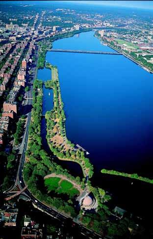
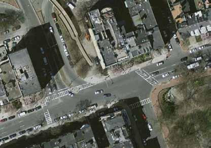
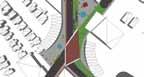
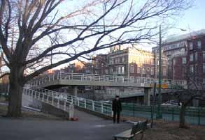
Currently, the Charles River Esplanade provides a beautiful and unique recreational area for pedestrians and cyclists along Boston’s riverfront. Yet there is little connection between the heart of the city and the Esplanade because of the congested Storrow Drive parkway, which acts as a barrier for foot and bicycle traffic.
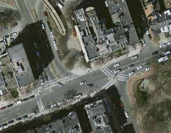
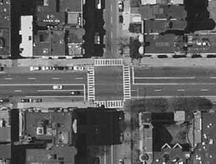
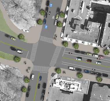
The existing pedestrian ramp across Storrow Drive is sharply angled and cumbersome for cyclists. Similarly, the intersection at Arlington and Beacon, with an exit ramp from Storrow Drive, is dangerous and confusing for non-vehicular traffic.
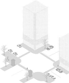
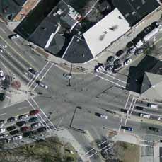
Before This dangerous and congested intersection is a nightmare for pedestrians and bikers alike. While the traffic island is intended to reduce the amount of time pedestrians spend in the roadway, it convolutes the traffic flow and provides no clear access path for bikers between the Esplanade and the Boston Common area. Furthermore, the pedestrian footbridge ramp is sharply angled to maintain a low grade, making disembarkation difficult for bikers.
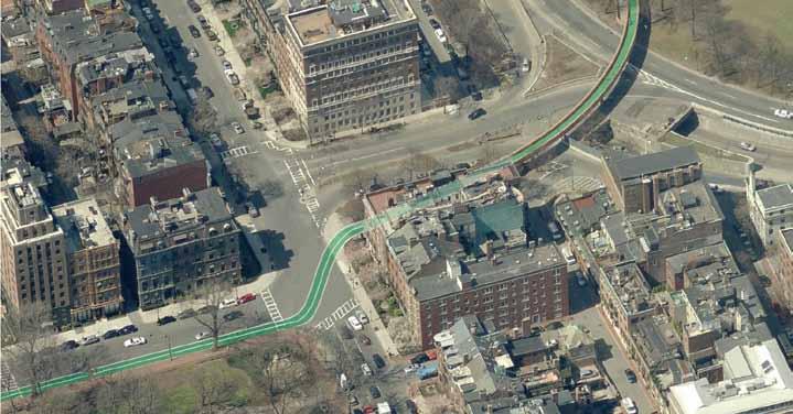
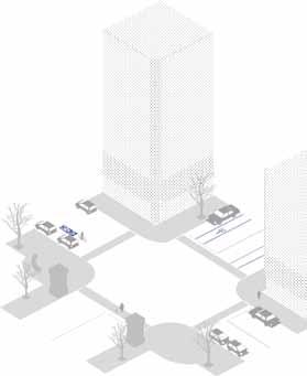
After A bike-only extension of the pedestrian bridge at a steeper grade will permit bikers to exit the bridge from the Esplanade with greater ease while pedestrians will use the existing shallow-grade ramp. With the traffic island removed and the pedestrian crossings greatly simplified into standard junctions, bikers can make a signal-mediated left turn from either side of the intersection with the exiting traffic from Storrow Drive. By placing the bike lane on the left side of the vehicle traffic, cyclists moving to and from the bridge are safely buffered from vehicles and the traffic flow down Arlington Street is streamlined.
1 2 3 4
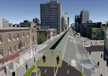
All roads lead to downtown, but few bike paths do. The heart of the city is re-imagined as the hub that stitches together a regional newtork of open spaces and bike paths.
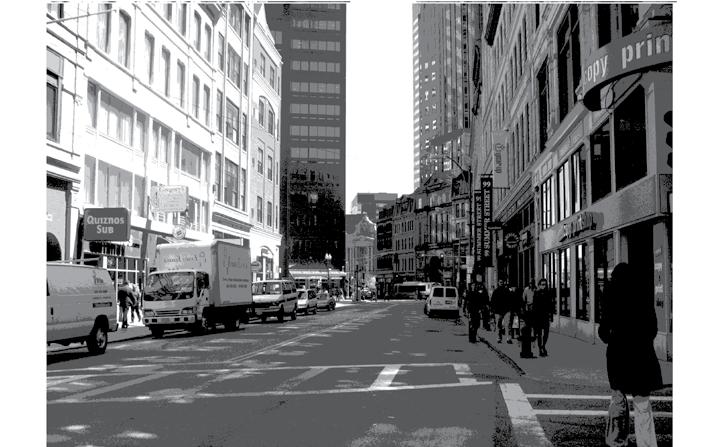
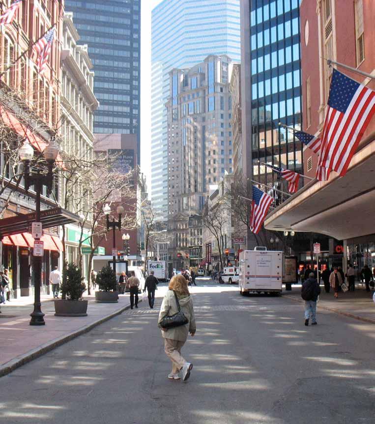
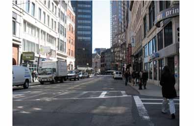
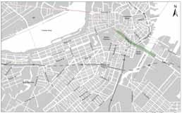
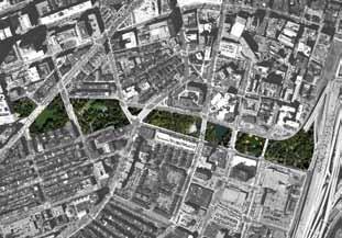
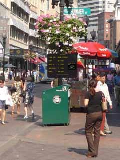
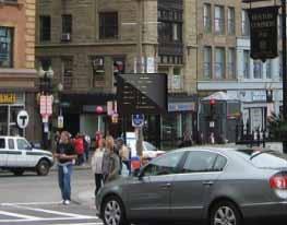
The Summer Street corridor is situated in the heart of downtown Boston, between the Boston Common and the Rose Kennedy Greenway. Part of this corridor around the intersection with Washington Street is currently a pedestrianized walkway. The corridor is also well-served by Boston’s subway system. Summer Street corridor’s excellent connections with a larger network of greenway and transit systems, and its proximity to major destinations in the city presents the city with an opportunity to create a vibrant hub for both Bostonians and tourists.
Introducing facilities promoting intermodal connections to facilitate seamless transitions between transit to walking/cycling and provide a variety of access options.
Introducing a safe environment for pedestrians and bicyclists of varying levels of experience
Integrating ecological initiatives such as shading through tree planting and stormwater infiltration through biotopes that will provide users with a green connector between the Common and the Greenway
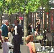
Creating large public spaces along the corridor to facilitate interaction between the public and private sphere supporting activities such as outdoor dining and outdoor events.
Summer Street corridor is located within proximity of two large tracts of open and green space – the Boston Common and Rose Kennedy Greenway. The Common and the Greenway are currently both popular destinations for Bostonians and tourists alike. Creating a green link along Summer Street completes a missing link to provide a continuous network of green and open space running through prominent destinations in downtown Boston.
The five lines of the T system converge along the Summer Street corridor, giving it a direct and rapid connection with an extensive transit system. This excellent linkage increases the catchment of the corridor to include people within the larger Boston metropolitan area. The convergence of many transit lines makes this an excellent location for the creation of an intermodal transport hub facilitating seamless transition between various modes such as transit, walking and bicycling.
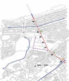
The major bicycle gateways into downtown Boston are identified and represented by the red lines. The blue lines are the possible stretches where the bicycle lanes can be introduced to promote leisure and commuter cycling. The Summer Street corridor has been identified for illustration in this proposal because it links Summer Street with the larger open and green space network through the Boston Common and Rose Kennedy Greenway.
Possible circulation flows to facilitate bike commuting into downtown.
Vehicular Arterials
• high volumes of traffic and high speeds
• environment may not be suitable for less confident cyclists
Shared Streets
• generally already too constrained to implement significant changes
- Downtown
Commerical streets
• less and slower traffic
• a mix of land uses that provides the diversity necessary to create a lively street environment
• potential to consider one-way conversions to create space for bicycle and pedestrian facilities
Before
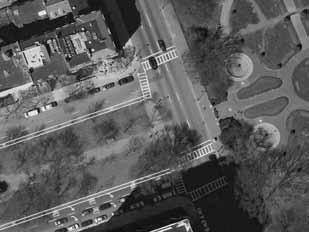
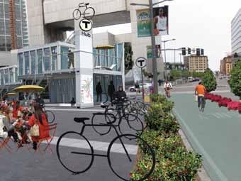
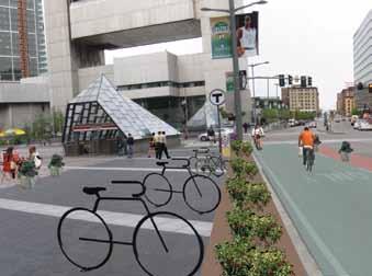
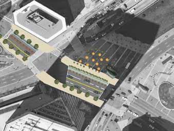
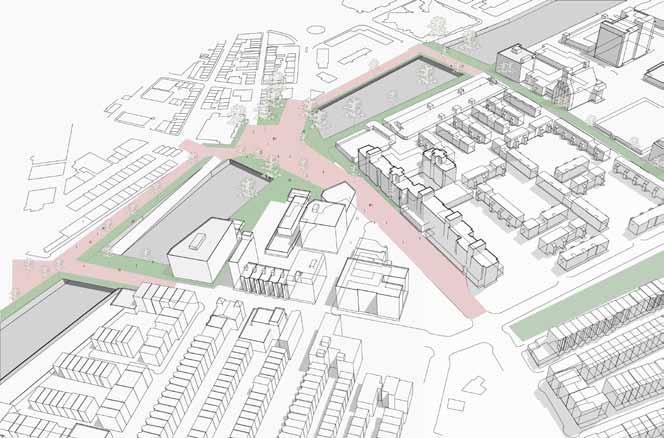
Everyday, few people stop to use Dewey Square as a gathering space. They merely pass through it to get to other destinations. The Square has a tremendous potential; the location is a major crossroads with people coming from South Station, the business district, Downtown Crossing, and the greenway.
After
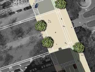
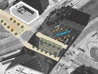
A quick way to make the place more vibrant is to introduce outdoor dining and seating facilities for people to gather and hang out. Given its prime location right beside the train station as well as the proposed bike path along Summer Street, many people are likely to choose this as a convenient place to meet. Installing bike parking stands would increase the attractiveness of this place as a gathering point for cyclists. The mobile nature of the outdoor dining furniture also makes it easier for cyclists to shift the tables to accommodate their bicycles right beside where they sit. The area will also be interspersed with planters which softens the existing harsh concrete landscape. These planters also provide a physical separation between the cyclists and traffic along Summer Street.
Once the level of activitiy picks up, more permanent structures can be introduced on the periphery of the square, while the center still contains tables and chairs which can be moved to make way for big events. The structures could include a variety of services: tourism information counters, dining and retail outlets, and bike stations that integrate with the surrounding subway system and provide rental, parking and changing facilities. This would be an ideal location for a bike sharing station as well. The square can also be the start or end point of city races.
Some pushcarts and outdoor dining facilities can be introduced to generate activities for this large space. Bike stands can be introduced to encourage people to cycle here.
Multi-purpose buildings housing restaurants, tourist information counters and bike sharing stations can be built at the site. These activities can be seamlessly linked to the subway station underground, making this an attractive node for lifestyle activities and a transport hub facilitating intermodal transfers.
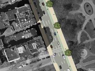
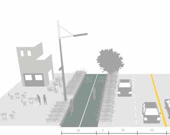
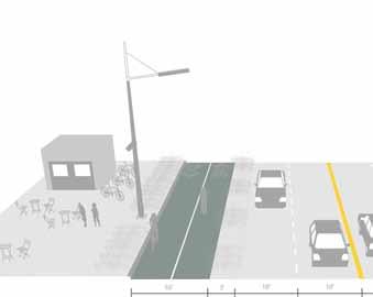
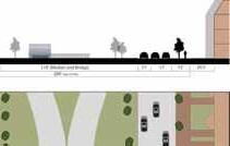
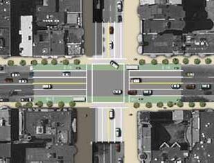
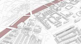
Due to the existing Downtown Crossing pedestrian zone, Summer Street no longer serves a through traffic function for vehicles, especially in the westbound direction. Current vehicular traffic consists largely of delivery and service vehicles that spend most of their time parked at the curb rather than using the travel lane. This usage profile no longer warrants so much road space for vehicles, and provides an opportunity to enhance facilities for cyclists and pedestrians and bicyclists who can use the street as an important connection through the core of the city.
The street can rapidly be transformed to connect the Boston Common to the Rose Kennedy Greenway by providing a two way cycle track on the north-side of the street. Eastbound traffic flow can still be maintained to provide access and delivery space. Vegetation is provided through low maintenance planters and small caliper trees that will not interfere with underground utilities.
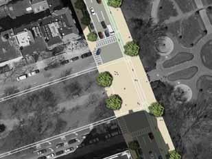
By re-routing and re-scheduling deliveries and services, the entire street can be transformed into a shared space for all active transportation modes. The provision of outdoor cafe tables and chairs is used to define Summer Street not just as a place to pass through, but as a place to come to meet friends, grab lunch or just take in the city. More structural ecological features are included such as large trees and bioswales to capture stormwater.
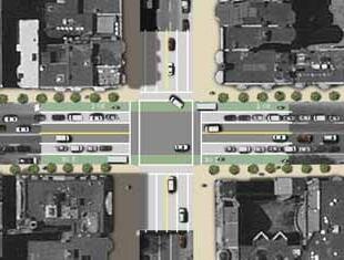
• Allocation of space unbalanced
• Pedestrians congested and spill out on to the street
• Street no longer essential through traffic route for vehicles
• Two-way cycle track on north-side
• Connect Boston Common to the Rose Kennedy Greenway
• Eastbound traffic and parking
• Vegetation and low-maintenance planters
• Street transformed into a shared space for active transportation
• Structural ecological features: large trees and bioswales
• High quality of both public space and private services
By re-routing and re-scheduling deliveries and services, the entire street can be transformed into a shared space for all active transportation modes. The provision of outdoor cafe tables and chairs is used to define Summer Street not just as a place to pass through, but as a place to come to meet friends, grab lunch or just take in the city. More structural ecological features are included such as large trees and bioswales to capture stormwater.
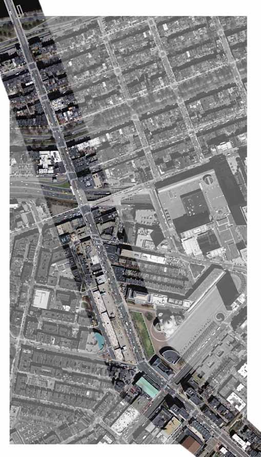
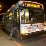
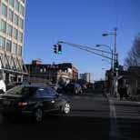
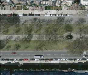
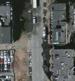
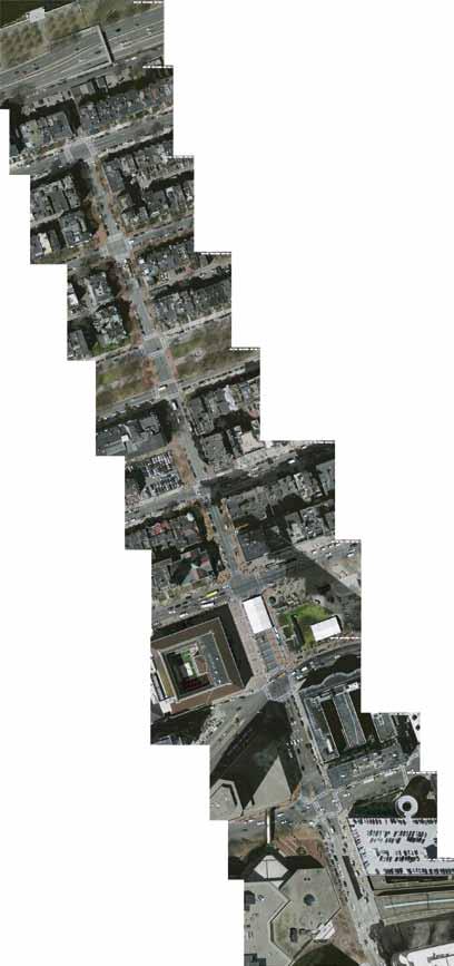
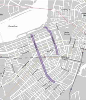
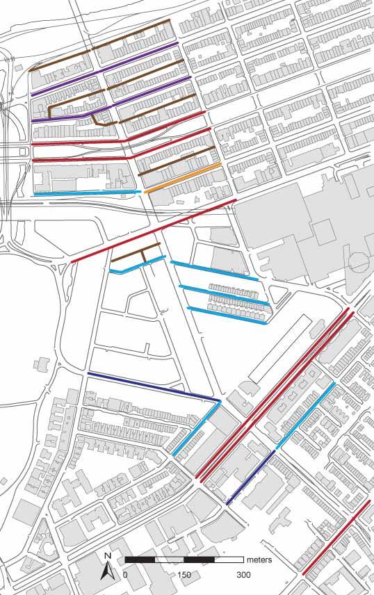
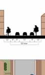
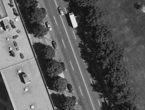
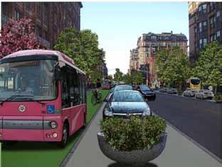
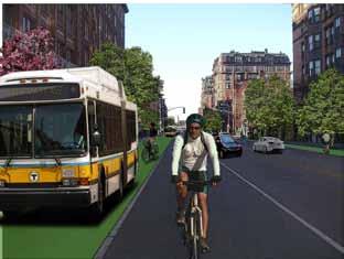
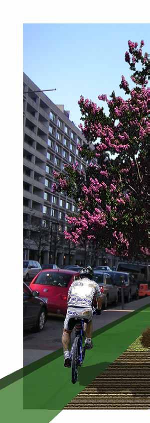
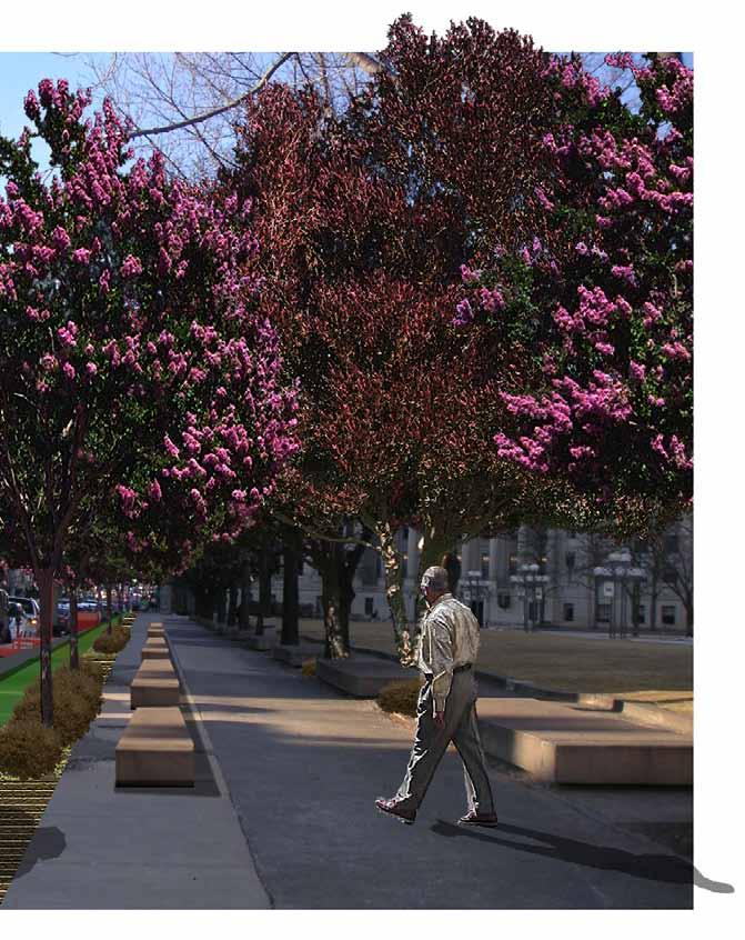
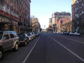
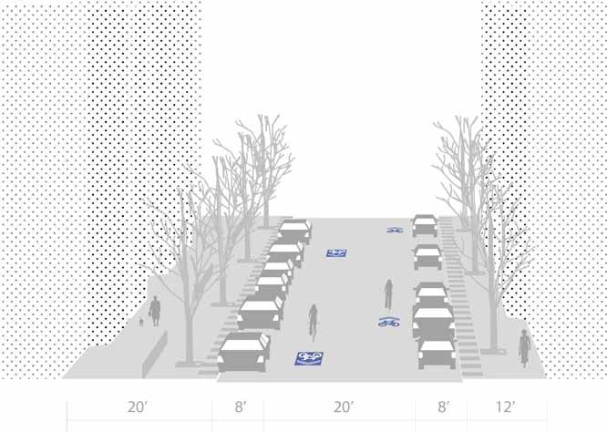
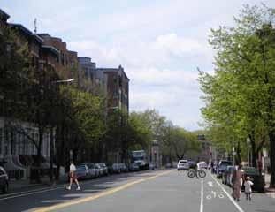
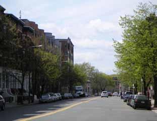
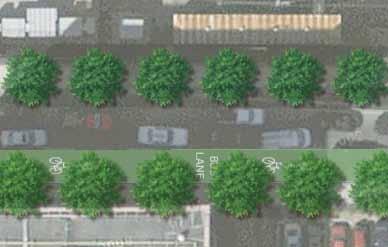
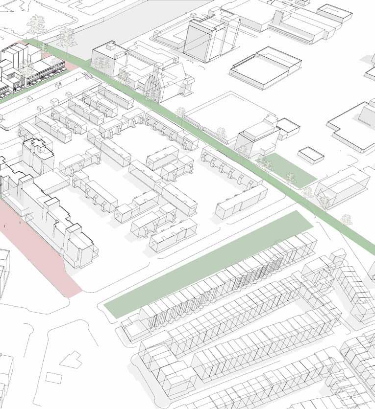
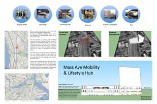
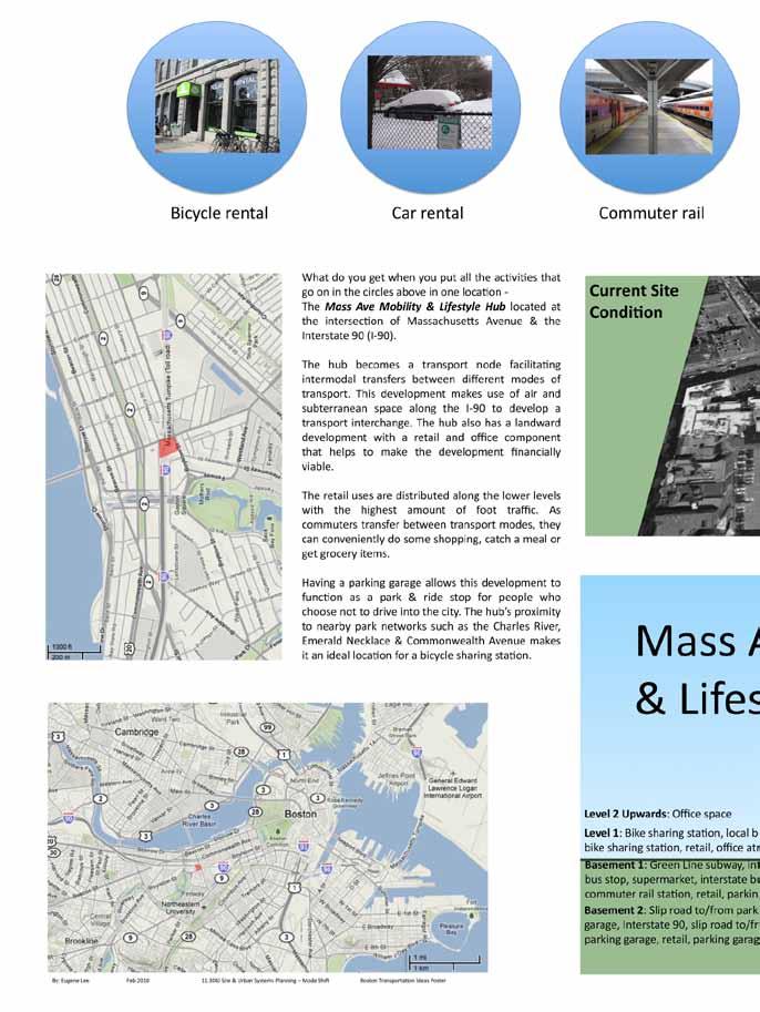
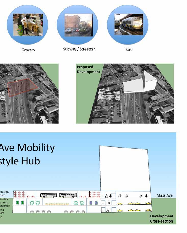
Massachusetts Avenue is a critical transportation corridor with a constant flow of cars, trucks, and buses. Green and Orange Line T stations are located on Mass Ave, and the 1 and CT1 buses run its length. Despite heavy traffic, Mass Ave is regularly traveled by drivers and cyclists because of its function as a direct north-south route. Massachusetts Avenue presents opportunities for more than one intervention to improve the streetscape for all modes.
Land Use
Mix of residential, commercial, and institutional uses
Notable destinations include Newbury Street, Berklee School of Music, Symphony Hall, and Christian Science Center
Americans use their bicycles for less than one percent of all urban trips. Europeans bike in cities a lot more often—in Italy 5 percent of all trips are on bicycle, 30 percent in the Netherlands, and seven out of eight Dutch people over age 15 have a bike.
The World Almanac Book of Records
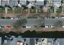
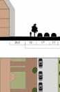
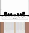
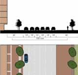
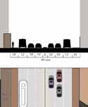
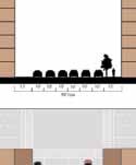
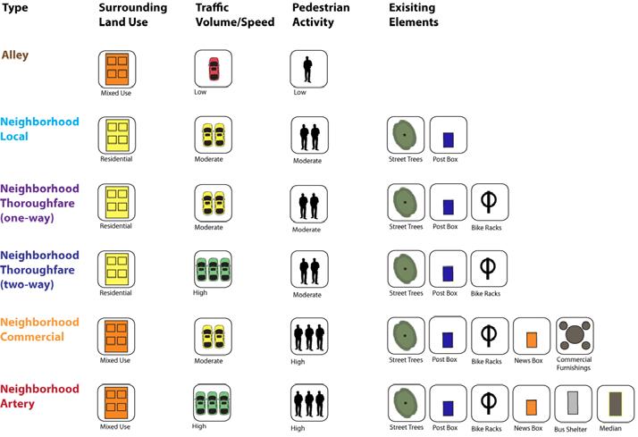
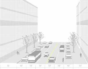
Mass Ave is characterized by a 90’ right of way, but conditions around this right of way vary along the corridor. We identified multiple typologies along Mass Ave, illustrated to the far left, ranging from extensive setbacks or open space to those with little swing space. Sidewalks are typically 15’ wide but vary in appointment, as seen by the streetscape elements listed here.
Facades range from 5 to 10+ stories, adding to the densely packed and heavily used corridor. Cross streets range from small alleys to one-way neighborhood streets to four-lane thoroughfares. Some streets may be similar in dimensions, such as Beacon and Newbury, but characterized by very different uses and features. The variety of cross streets adds to the changing atmosphere as one travels the length of the corridor. These inconsistencies point to a need for flexible or multiple interventions for improvement

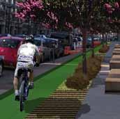
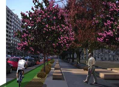
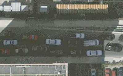
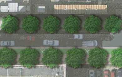
This scheme illustrates the concept of taking advantage of space and opportunity where available along Mass Ave. At the Christian Science Center, between Clearway Street and Westland Avenue, wide sidewalks present an opportunity for intervention.
In areas where there is currently unused sidewalk space, adding separate bike lanes, street planting, and street furniture will dramatically improve the environment for cyclists, pedestrians, and even drivers.
The bike path, shielded by the street by an oversized curb, can be utilized as a park feature, activating the currently underutilized sidewalk. Trees and benches separate the bike lane from the pedestrian area. The area can be greened with additional allees of trees, permeable pavers, and small swales which will receive storm water from the street.
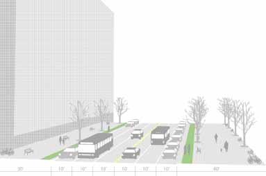
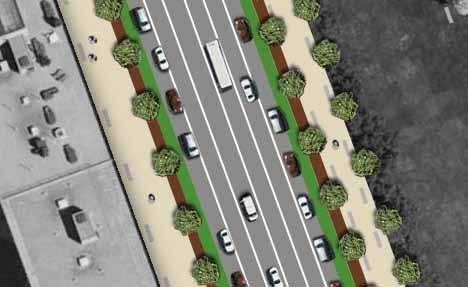
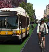
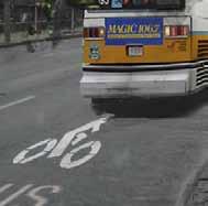
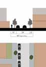
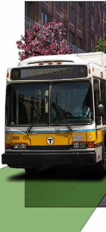
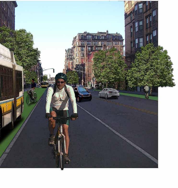
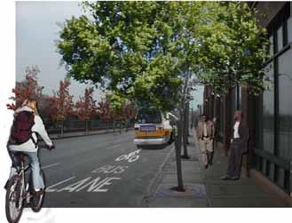
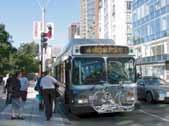
More advanced interventions along the corridor involve realigning traffic patterns to accommodate buses and cyclists as much as automobile traffic. Using a lane for a shared bus/bike lane, similar to the Silver Line route along Washington street, will improve safety for cyclists and efficiency for bus riders. The #1 bus is one of the most heavily used MBTA bus lines and is notoriously difficult to schedule because of traffic issues. It is hoped that improving this bus line in frequency and reliability may boost its use further and reduce other vehicular traffic. Smaller, more frequent buses, similar to styles currently found in Japan, may allow more frequent service to run with greater fuel efficiency.
Although a shared lane is not completely ideal, it is safer and more efficient than the current situation. Buses and bikes overall travel at similar speeds, and so outside of stopping zones the two are more compatible than they appear. In the example in the middle column, cyclists can pass the bus by merging into traffic lanes.
In addition to the designated bike/bus lane, additional street trees, street furniture, bike facilities, and permeable pavers are suggested for this intervention.
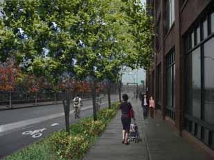
Initial bicycle and overall street improvements can be implemented along Mass Ave without significantly changing traffic patterns. Currently, this area is an wide expanse of unattractive concrete next to a windswept lawn. Adding street planting, small bioswales, and permeable pavement will improve the environment for all users; a bike lane integrated with landscaping and sheltered from traffic will form an unusual amenity similar to the intervention on Vassar Street in Cambridge. Pedestrians will enjoy a wide sidewalk sheltered from both bike and road traffic and featuring added street furniture, activating both the streetscape and the bordering park.
The Christian Science Center is unusual in the amount of room available for improvements, but similar concepts, particularly permeable pavers and street furniture, are equally appropriate for tighter spaces and can be implemented throughout the corridor. Such small interventions can make a large difference when implemented over the course of the corridor, and should be considered in the upcoming plans for the Christian Science Center and the southern part of Mass Ave.
Further in the future, opportunities to improve and even dramatically alter traffic patterns should be considered for streetscape interventions. This example removes the parking along Mass Ave and reuses it as a shared bike/bus lane. The impacts of removing parking will have to be studied further; however, it has been hypothesized that it would be preferable to removing a lane of traffic. Back Bay and the Mass Ave corridor are very well served by public transportation; this implies less need for parking in this area. The current issue of double-parking may be acknowledged by strictly enforcing the bike-bus designated lane. Experimenting with different bus capacities may further improve transit efficiency.
If use of the improved bus system reduces through traffic to a lower level, it may be possible to introduce a parking lane that will separate the regular traffic lane from the designated bus/bike lane. This parking area could be greened and beautified with planters, which could also be removed or shifted if necessary. Using parked cars as a shield for cyclists has worked well in sections of Manhattan.
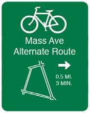
Although many cyclists will continue to use Mass Ave, others will seek out quieter routes with more moderate traffic flows. Hemenway Street has the potential to be one such alternative.
Currently, the 300 meter length of Hemenway to the north of Westland Avenue is one-way northbound. Although this effectively prevents vehicle cut-throughs, it also impedes bicycle use. Contra-flow shared lane markings along the one-way portion would connect users to the longer two-way stretch of Hemenway to the south, forming a viable Mass Ave alternative.
Low traffic volumes and speeds as well as primarily residential uses make Hemenway Street suitable for a contra-flow lane. Key elements would include shared lane markings placed at the alleys entrances opposite Haviland and Burbank Street.
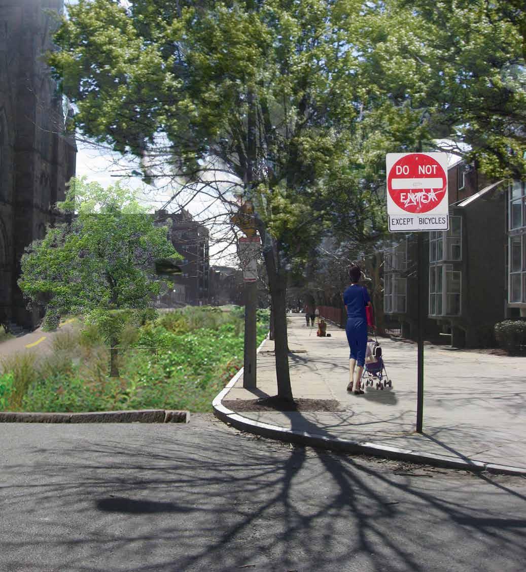
Wayfinding signs along Mass Ave would increase bicyclist awareness of this alternative route. Signs like “Do Not Enter Except Bicycles” at Boylston Street and “No Right Turn on Red” at the southwest corner of the Westland Avenue intersection would also be necessary to alert drivers to the possibility of southbound bicycle traffic.
Westland Avenue’s current dimensions make the street a prime candidate for an immediate bicycle retrofit. Decreasing the width of the two travel lanes from 17 to 11 feet would allow for 6 foot striped bike lanes in both directions. These changes could take place immediately, increasing bicyclist priority without affecting on-street parking or motorist traffic patterns.
Westland Avenue is an example of a street with ample width to stripe lanes while still providing enough room to ride at a safe distance from on-street parking. Taken in isolation, segments like Hemenway and Westland seem unlikely candidates for bicycle infrastructure. However, these streets can help create links in the larger network and increase overall connectivity and choice along the Mass Ave corridor.
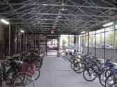
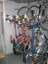
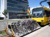
Integrating bicycling with transit is one way to improve the utility and attractiveness of both modes. The city can further bike-transit integration by making it easier for riders to bring bikes on buses and on the T, as well as providing ample bike parking at transit stops. These steps give users the opportunity to seamlessly shift modes and extend their trips.
As a major transit corridor, Mass Ave is a strategic location for coordination. Riders of the 1 bus could transfer at a newly established Christian Science Plaza bike-share station, checking out a bike to complete the final leg of their journey.

A four-mile commute round trip by bicycle (instead of automobile) keeps about 15 pounds of pollutants out of the air we breathe. (World Watch Institute)
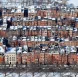
Above Left The South End sports a rich character unique to Boston, along with one of the city’s first extensively planned streetscapes. The relatively dense, narrow blocks of townhouses provide more miles of road per land area than most other parts of Boston, and the orthogonal layout makes it easy to enhance a continuous stretch of roadway. Except for the more heavily traveled roads, most streets operate without lane markings.
Center Left The Massachusetts Turnpike interrupts the connectivity of the South End to the greater downtown area. Long term planning should consider the mitigation of this ‘transit canyon’ to potentially add public open space. The enhancement of this area will make pedestrian and biking trips through this connection zone more appealing, therefore increasing ridership.
Major South End streets are retrofitted to encourage through-bike traffic into Boston’s downtown. Prime areas of concern are the creation of efficient connector streets and more desirable pedestrian walking areas.
Shawmut Avenue provides the most pleasant ride for a cyclist although it has a section that goes in the opposite direction form downtown. This condition throws encourages illegal wrong-way bicycle riding.
The streets that border the Turnpike are unfriendly and provide a sterile pedestrian environment. With the lack of residential land use pedestrian and cyclists feel too exposed.
Opport unity for Bike Connection, Complete Street
Existing Fastest Route
Confusing
Poor Pedestrian Environment
Existing Bike Route
The bus lane on Washington Street allows for bike sharing lane. However it is not the most friendly and accommodating situation for cyclists.
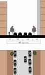
The South End has proportionally more street area for its traffic than most other parts of Boston, leaving plenty of room for expansion into other mode types. The major thoroughfares illustrated to the right have high average daily traffic values, limiting the possibility of incorporating shared or independent bicycle lanes. However, nearly all of the side streets parallel and in between Mass Ave and the Massachusetts Turnpike have widths large enough and average daily traffic low enough to warrant substantial mode shift for cyclists.
Measurements To quantitatively demonstrate this, the calculations using right-of-way width and average daily traffic reveals that a typical side street significantly underutilizes its width compared to major thoroughfares.
The periphery of the South End is very accessible to transit lines, yet it lacks a route connecting its heart to the rest of the MBTA rail system, especially along Washington Street.
A dedicated North-South route for bikes originating from either the South End or further south could greatly help cyclists make the connection to not only downtown, but the transit lines of Boston.
Additionally, the T-stop at Back Bay Station along the Orange Line has the potential for connecting commuters to future landscape enhancements and development along the Massachusetts Turnpike.
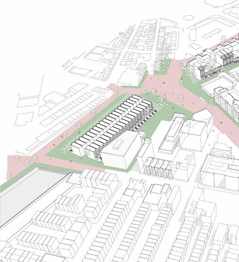
South End townhouses are organized into long, narrow blocks, a pattern that contributes to the area’s high density of street network. Thoroughfares constitute every other crossstreet, while service streets provide private access.

Shawmut Avenue presents a unique opportunity in the South End for a safe bike route into downtown. There is generally good access to and from downtown in this district but the traffic volume on surrounding streets render the existing bike route best suited to more experienced urban cyclists.
Shawmut Avenue is characterized by 3 - 5 story buildings mainly residential in nature, but also with some civic and commercial sprinkled in. It is not a main thoroughfare for vehicles as its sudden change in direction makes it inconvenient for drivers but serves to keep the quiet feel of the neighborhood for the residents.
A long straight street perfectly situated in the middle of the South End and a direct route to downtown, Shawmut is the best opportunity to create a family-friendly bicycle route. Its traffic is mainly local so its volume is not set to increase. As it exists, it is a pleasant and convenient bike ride, but the change in direction is unsafe and illegal. A dedicated cycle track that goes two directions adjacent to a still one-way street can keep the street quiet while making a safe, direct bike route for all riders, including children.
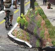
With low traffic volume and wide sidewalks, Shawmut Avenue is a fantastic site for a stormwater infiltration project. Bioswales can serve to capture runoff from both the street and sidewalk impervious surfaces before being discharged. Bioswales can also enhance the pedestrian realm by providing a soft landscape to compliment the built, interesting plants and features, as well as special identity to the neighborhood.
Ample sidewalks and parking on both sides of the street as buffers to moving traffic make this street a pleasant one for the pedestrian and cyclist. The cyclist must choose between a busier parallel street like Washington which is not suitable for novice riders or travel the wrong direction for a portion of Shawmut, which is neither entirely safe nor legal.
A two-way cycle track next to a raised median adjacent to parked cars means room for car doors to open without interfering in the path of cyclists. One lane of traffic is removed but two lanes of parking remain for the convenience of the residents. The width of the bioswale varies by block depending on available sidewalk space.
Motor vehicles are removed entirely and the street is reclaimed by the residents. As a parallel street to many thoroughfares into downtown, the neighborhood may decides vehicular traffic is no longer necessary here. Wide sidewalks flank large stormwater filtration swales and a multi-use twoway trail runs through the middle.

Motor vehicles are removed entirely and the street is reclaimed by the residents. As a parallel street to many thoroughfares into downtown, the neighborhood may decides that vehicular traffic is no longer necessary here. Wide sidewalks flank large stormwater filtration swales and a multi-use two-way trail runs through the middle.
Herald Street is the main crosstown eastbound thoroughfare in this district. East-west routes are generally difficult and less than straightforward in this area but these streets with some enhancements could provide important linkages for the surrounding neighborhoods.
Together with its westbound counterpart Marginal Road, the pair represent an important opportunity to join the South End and Chinatown over the great divide of the turnpike. Making the cross over the turnpike more seamless would better serve pedestrians and create a stronger link between two distinct neighborhoods.
Street trees could bring the atmosphere into scale with the pedestrian and cyclist as well as provide shelter and shade. Narrow sidewalks and fast traffic make for an unpleasant experience for those outside of cars; trees can bridge the gap in scale between the human and wide streets, tall buildings, and sunken turnpike. Two different schemes presented here both address the aforementioned issues and safety needs of the cyclist in going from downtown to South Boston and beyond.
Herald Street is characterized by narrow sidewalks next to 25 story buildings on one side and a chain link fence separating the pedestrian from the canyon on the other. Adjacent land uses do not include residential or retail, rendering the environment even more barren. When not in a car, a person feels extremely exposed and somewhat unsafe due to scale and lack of street life. Some simple additions of greenery could make the experience on Herald Street infinitely more pleasant.
Three lanes of travel is ample for the volume of traffic this street holds. Transforming the right lane to a bus/bike lane as is currently practiced on Washington Street would be a boon to cyclists and improve bus on-time performance without causing significant delays for other vehicles Street trees with grates provide scale and shelter without taking away much of the walking space. This scheme is simple and quick to install as it does not require changing the sidewalk or street widths. Paint in the road and the addition of street trees complete the street for both the pedestrian and cyclist.
A dedicated one-way cycle track is separated by a divider from motor vehicles and the south sidewalk is widened. With the expanded sidewalk width, a landscaped buffer makes for a pleasant walk away from noisy traffic. This green space could also be an infiltration swale to further the ecological function of the intervention. The north sidewalk remains the same width and the south sidewalk shown here becomes the preferred route. As the street does not have many pedestrian-oriented land uses, two improved sidewalks are less necessary.
A dedicated one-way cycle track is separated by a divider from motor vehicles and the south sidewalk is widened. With the expanded sidewalk width, a landscaped buffer makes for a pleasant walk away from noisy traffic. This green space could also be an infiltration swale to further the ecological function of the intervention. The north sidewalk remains the same width and the south sidewalk shown here becomes the preferred route. As the street does not have many pedestrian-oriented land uses, two improved sidewalks are less necessary.
A lack of visible and enticing bicycle infrastructure is often the only deterrent standing in the way of someone utilizing an otherwise safe and effective bike transit route. Such is the case for the South End, structured with many redundant, neighborhood street ways with relatively little traffic, but having no clear indication or encouragement that it is indeed bike-friendly. What most hinders pedestrians and cyclists in the South End is not simply a lack of direct connectively, but rather the severe austerity of the edge defined by the Massachusetts Turnpike.
A bold vehicular cyclist might claim that the South End is one of the better places to ride in Boston, but a truly complete street caters to all those who may have a stake in its use. In our case, these stakeholders include recreational cyclists, very young students commuting to school, and of course, pedestrians.
While enhancing the connector streets of Shawmut and Herald is key for encouraging safe and sustainable bike ridership in the South End, there is still much to be desired in the transition across the turnpike and into Chinatown.
Our proposal seeks to transform the turnpike fringe into an enticing greenway for both pedestrians and cyclists, with the capacity to handle future built projects.
Before: Urban Transit Canyon The Massachusetts Turnpike inhibits the connectivity of the South End to the greater downtown area. Long term planning should mitigate this obstacle and try to utilize it for public space and housing development. The enhancement of this area will make pedestrian and biking trips through this connection zone more appealing, therefore increasing ridership.
Planner’s Note Investing in the beautification of the turnpike area will not only provide immediate benefits to the neighborhood and desirability, but the increased flow of pedestrian traffic and foundational structures will make the area much more appealing to future air-ride developments.
Engineer’s Note When installing the supports for any deck structure that may span across the turnpike, it might be wise to over design their load capacity, such that one could conceivably construct multistory buildings in response to an increase in the area’s real estate demands.
Woonerf Plaza at Herald and Tremont
Herald, Secondary Cycle Connector Street
Shawmut, Primary Bike Connector Street
Real Estate DevelopmentAir rights projects take root as local desirability increases.

In 2009 SHIFTboston, a forum associated with Boston Society of Architects, held an ideas competition which called on architects, artists, landscape architects, urban designers, engineers and anyone else to submit their most provocative wild visions for the City of Boston:


As the competition statement indicated “We want to inspire and engage the city community while encouraging positive awareness and a hunger for change. We believe a collective desire to push boundaries and challenge the familiar are the necessary seeds with which to grow a more dynamic city!”
To view the wining entry and as well as other short listed proposals see:


http://www.shiftboston.org/outcome.html

Surprisingly, only few entries addressed transportation alternatives or the drastic rethinking of streets and public ways.
To address the lack of transportation‐related ideas, and to help in evaluating the current status of Boston’s streets, each student devised an idea that:
A. Imagines what transporation related spaces, facilities, streets, mobility systems should be and what they should provide.

B. Avoids stereotypes and envisioned what deserves to be there and how it can be enhanced.
C. Uses a specific site or a larger area.

D. Chooses a specific design intervention or a larger vision/plan.


What if one could appreciate Boston through an iconic network of specialty aerial transports? Boston residents can finally emerge from their dank underground corridors and take to the skies. Balloon Boston is a new civic attraction, rivaling the gondoliers of Venice in its ability to provide passengers with a truly revealing city experience. Not only are passengers delighted by the cityscape, balloons themselves are a wonderful addition to the skyline, a site to see by the public for miles around.
The city is gifted with Boston Commons, providing a green space large enough for the daily inflation of large hot air balloons. From The Commons, balloons begin their circuit of the city, ending at any number of destinations. For the tourist, this is the perfect way to traverse the city, even if they’re looking for an interesting way to get to Harvard Yard.
By selling advertising space on the balloons, Boston can expect to make a tidy profit on such a venture, while keeping fare relatively low. Balloon Boston is nothing but a boon to the city: businesses have more advertising space, passengers have a new way to experience Boston, and the public enjoys an intriguing addition to a once monotonous skyline.

Boston City Hall

Today, many of the squares semblance to their former more asphalt than amenity. the tarmac crreates enormous build the types of fun, inviting ing public spaces only possible
The squares will once again people, both as neighborhood regional desitnations.
STREETCAR NETWORK 1940

STRETCAR NETWORK 1940 MBTA NETWORK 2010
Boston developed as a city squares. However, the collapse of the cityʼs streetcar networ k has left many of the regionʼs great squares cut off.
What if we reintroduced the streetcar service that once connected squares? This could provide the stimulus to reinvent the squares able places for sustainable urban living once again. The network would also provide the circumfrential link that in the MBTA system.
squares bear little former glory, and offer amenity. But,tearing up enormous canvas to inviting and engagpossible in cities.
again s erve the hborhood hubs and
connected these squares as desirethat is badly needed
The network is aligned completely along streets that used to have streetcar service as recently as 1940!


AdvAncing A dynAmic urbAn vision for the city of boston, the circuitboArd city is A lAyered, intermodAl trAnsportAtion network connecting the resources of the city. designed for mAximum convenience And mobility, the circuitboArd city cAn move power, informAtion, And resources Around boston At high speeds through A system of discrete lAyers. eAch lAyer is optimized for peAk efficiency of its intended use And informAtion systems cAn mAke educAted recommendAtions for new trAnsit nodes And connections bAsed on A growing pool of dAtA And stAtistics. while boston todAy is AlreAdy physicAlly lAyered, the hAllmArk of the circuitboArd city is its Ability to AdApt its trAnsportAtion resources to reAl-time conditions. in inclement weAther, more electricity is AllocAted to personAl, shAreduse electric vehicles And subwAy frequency increAses. Airport delAys Are instAntly relAyed to commuters in trAnsit through mobile ApplicAtions And A public informAtion system. mode shift is fAcilitAted through viAs which provide prominent And Accessible points of interconnect between the city’s lAyers. with every element of the city collecting And AnAlyzing dAtA, the circuitboArd city cAn mAke intelligent recommendAtions for optimized trip routing bAsed on user preferences.
Power/Infrastructure Plane Regenerative

The VIA provides access between layers of the Circuitboard City. VIAs can take the form of simple staircases for access from road level to subway stations, tunnels for vehicles, or dense bundles of electric and infrastructural connections to provide power and information to all levels of the city. The Circuitboard City generates power at multiple levels - regenerative braking from subway cars, wind/solar on buildings, traditional power plants - and distributes it to areas of peak demand through the power plane and electric power VIAs. Compact utility VIAs replace sprawling networks of decaying electric, sewage, and telecommunications lines. With planar separation of utilities, maintenance will be greatly facilitated as VIAs provide targeted access to any layer.
Thanks to the availability of real-time the circuitboard city can provide optimization based on availability vehicles, weather conditions, local and user preferences. Updates can wirelessly on mobile phones or at transportation hubs in each layer of the city.
Increased electricity demand from vehicles and the power-intensive information infrastructure will be generated by renewable power sources such as solar cells and turbines. new buildings will connect information and power system through VIAs. A complementary system of elevated bike paths will be linked through VIAs to level and the subterranean bike paths.

The ground level of the city integrates comprehensive bike-share program, a seasonal water taxi to take advantage of Boston’s waterways such as the Charles River and Harbor, and numerous charging stations electric vehicles linked to the power Charged vehicles can provide reserve storage for the power plane and stations will become new hotspots for social interaction, real-estate development, and commercial activity.
A ubiquitous power, infrastructure, information plane lies below the ground to connect the city and provide up-to-date information on traffic, weather, availability of shared vehicles, and optimized times. Unlike traditional underground infrastructure, this plane can reroute excess power capacity where needed (i.e. for a recharge of an EV) and is equipped with monitoring technology for easy maintenance.
The Subterranean level includes the belowground lengths of MBTA Subway lines underground roadways such as the rerouted Central Artery which have dedicated lanes lightweight electric vehicles in the Circuitboard City. Electric vehicle charging stations can be placed below ground in place of traditional underground parking structures. A new system of underground pedestrian and bike paths be constructed to facilitate linkages between existing stations.

and ground level up-to-date availability optimized trip underground city excess a rapid with selfmaintenance.
& Pathways belowlines and rerouted lanes for Circuitboard can also traditional system paths will between

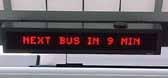
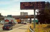
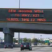
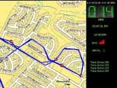
The Move Smart system enables people in transit to make mation will be dispirsed Through the use of electronic tion and guidance is dispersed to a wide range of users. modes of transit, including driving, MBTA, cycling, or walking. acterized by heavy volume in one or more modes, and destinations. The signs will change periodically to other be remotely input by traffic and congestion monitors like grams. For transit, the various MBTA lines will be tracked upgrading the information currently available on their weather and any other applicable delays caused by construction

Uses will learn about the website from seeing it advertised on the streetsigns. The website will display the same information as the signs, but with additional links, maps, and interactive features. The user will here be able to input their specific origin and destination to learn their optimal route. The website will provide a database of maps for all modes, containing routes and time estimates of trip duration. Finally, the website will also direct users to the mobile app.
The mobile app, designed for smartphones such as the nology with that of the Move Smart mode comparison. the user; by entering a destination, the program will there.

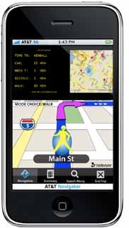
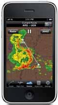
make more time-efficient choices in mode and route. Inforstreet signs, a website, and a mobile application, informausers. The street signs will offer information on all available walking. The signs will be offered at nodes of the city charand will give real-time estimates of travel time to common other destinations. The real time information for driving will like those used for Google Maps Directions and similar protracked by GPS for their estimated arrival and destination times, website with real-time tracking. For walking and biking, construction or other congestions, tracked by the same traffic sensors as auto traffic. In addition to displaying comparative mode information, the signs display the website URL for additional information and a free mobile application. The cost for these signs could be offset by including small, revolving advertisements. This system will have an empowering effect for users. Instead of guessing at the quickest route from origin to destination, this system clearly shows the best option. If there is heavy traffic, for example, or delayed train service, it will instantly affect the trip time displayed and possibly show another mode as a better option. It may eliminate misconceptions, such as the overestimation of car efficacy in the city. It will encourage a more active lifestyle and environmentally-friendly behavior by reducing the car as the go-to quickest option. It may reduce congestion by encouraging users to employ a spread of different modes. It will also subtly hold the City accountable for the improvement of all modes of transport.
Movesmart combines existing systems to empower and inform.
the iPhone, will combine personal GPS techcomparison. The application will track the location of determine the best mode and route to travel
An Online Mapping Tool to Allow Maximum Choice and Flexibility

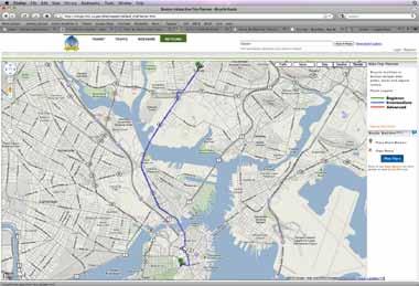
● Could be an option on Google Maps or powered by Boston
● Address or pins let cyclists choose origin and destination

● Route is mapped and visualized based on preferences thereby eliminating confusion and wrong-way roads in the midst


● Cyclist can choose route red, blue, or green based on desired level of difficulty, automobile conflict, and desired speed
● Trip planner tool can link bike route with T stations
Boston has great “bones” to be a bike city - it is compact, relatively flat, and has an active population. Gaps in connectivity, last mile deficiencies, and difficulty in switching between modes deters many would-be cyclists. Confusion over one-way streets and fear of unknown cycling conditions can be alleviated with the interactive bike trip planner. Access to information regarding best routes and transit connections can help cyclists know what lies ahead and plan accordingly. Simple detail improvements in facilities can bolster bike ridership by completing fragmented networks and changing the perception of poor conditions.
Boston Bikes
destination thereby midst of riding desired speed
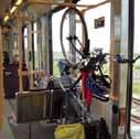
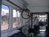
Amenity information and real-time data at T stations are linked to route mapper to help cyclists choose when to use transit and which station will best suit their needs. Information would be available for each individual station and would include each facility’s features:
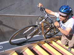
● Cage or covered parking at all suburban stations
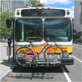
● Racks on all buses, including Silver Line
● Bike platforms on Green Line
● Real-time crowd rating on each rapid transit line
● Racks or hooks to save space on subway cars
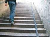
● Elevator or bike rail/ramp on steps
Safe/Secure/Efficient
Problems with roads and personal transport in Boston and many other American cities include:

• traffic congestion
• unsafe and unpleasant conditions for bikes and pedestrians
• danger at night and in inclement weather
• outdated infrastructure
• high maintenance costs
• environmental damage
• overuse of resources
What if we could address multiple problems with one bright solution?
What if Boston was the city to pioneer this innovative new system?
Implementing this intelligent infrastructure now holds great potential for the future, including:
• integration with GPS technology to direct traffic in vidual vehicle, minimizing driving time and unncessary
• sensing the presence of wildlife, erratic drivers, and order to guide other drivers out of harm’s way
• providing power for new forms of public transportation
• the development of electric or solar-powered cars

• if all 25,000 square miles of impervious road surface solar roads, we could generate more than enough electricity needs
Around the world, we are beginning to turn to solar-powered lighting to make our roads and public spaces safer, more dynamic, and more environmentally and economically sustainable
What if we took these ideas one step further and instead invested in a new system of solar powered roads?
Basic benefits of a solar roads system include:
• road markings, signs, and traffic signals can be lit, self-powered, and can change according to road conditions and traffic flows, improving visibility and overall road safety
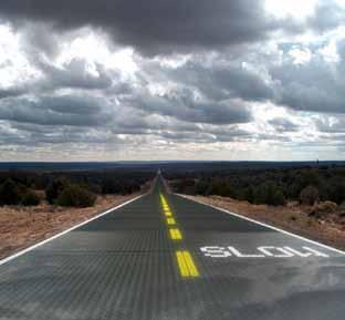
• the temperature of road surfaces can be selfregulated so that they stay dry and free of snow and ice (no more plowing!); melted water can be channeled into an environmentally-friendly runoff system for reuse

• configuration of lanes and traffic patterns can easily be changed to more safely accommodate bikes, pedestrians, and public transit
• little surface maintenance (no more potholes!)
• telephone, cable, and other services could be integrated and streamlined into one efficient, secure, and self-managed underground system (no more telephone poles, power lines, or power outages!)
A prototype solar road panel is currently being developed by Solar Roadways (the business that invented the concept) with funding from the United States Department of Transportation
in real-time at the scale of an indiunncessary carbon emissions and other hazards on roadways in transportation cars that can charge while driving surface in the U.S. were replaced with power to meet the entire world’s
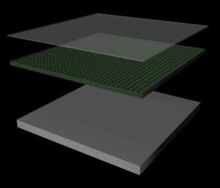
Electronics Layer - composed of collecting cells which store solar energy and are equipped with LEDs for “painting” the road’s surface; also includes a microprocessor that controls lighting, communications, monitoring, and self-heating
Base Plate Layer - distributes power and signals (eg internet, phone, cable) to adjoining road panels and buildings in a streamlined network so that even places that never see sun are fully solar-powered
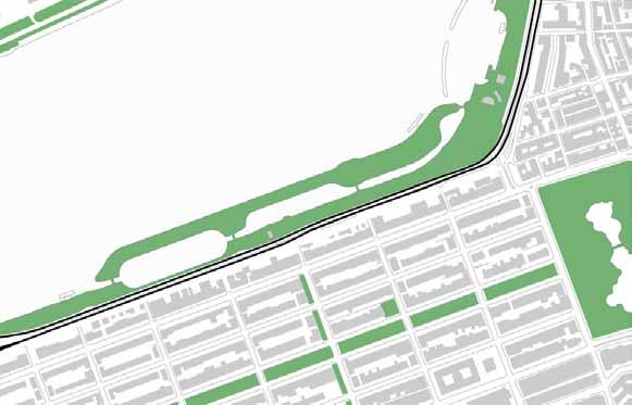
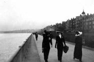
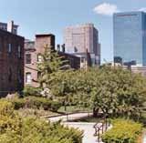
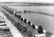
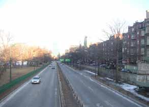
The Boston Esplanade is a vital piece of the city’s park system. Created in 1910 with the damming of the Charles River, the Esplanade served as a linear promenade between Massachusetts Avenue and the Longfellow Bridge. Expanded in the 1930’s by landscape architect Arthur Shurcliff, the Esplanade linked the Back Bay neighborhood directly to the River, with vistas and pedestrian paths extending from Dartmouth and Gloucester Streets.
The 1951 construction of Storrow Drive drastically altered the design and use of the Esplanade. The Massachusetts legislature mandated that parkland lost to construction be replaced with newly created land, but the highway destroyed the Esplanade’s connection to Back Bay, the Public Garden, the Common, and the Emerald Necklace. Inadequate pedestrian overpasses prevent circulation between the Esplanade and the rest of the city.
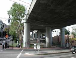
Currently, the Storrow Drive tunnel is in disrepair. Reconstruction dollars, and the state has postponed its decision on presents a unique opportunity to reconfigure Storrow Esplanade to the city. Examples around the world prove can reduce travel demand and create healthier, livable
A redesigned Storrow Drive would feature two lanes at-grade crossings, and traffic calming features. These Esplanade and the overall accessibility of Boston residents. advocate for nothing less.
- Cheonggye Stream: Seoul, South Korea (2006)
- Central Freeway/Octavia Boulevard: San Francisco, CA (2005)
- Embarcadero Freeway: San Francisco, CA (1991)
- Harbor Drive/McCall Waterfront Park: Portland, OR (1978)
“Storrow Drive is perceived to be a burden to the parkland, contributing to noise and environmental pollution that render portions of the Esplanade unusable.” Community Input Session, January 2010
Reconstruction will cost millions of how to move forward. This situation Storrow Drive and reconnect the prove that highway removal and “road diets” livable environments.
lanes of car traffic, on-street parking, bike lanes, These changes would enhance both the residents. James Storrow would
“It was the Charles River…which was curiously isolated from…the adjoining Back Bay. People were at loss as to how to move from one to the other. We can speculate that this was not true before Storrow Drive cut off pedestrian access at the foot of each cross street.”
Kevin Lynch, The Image of the City
American Association of State Highway Transportation Officials. Guide for the Development of Bicycle Facilities, 1999. (currently being updated).
City of Copenhagen, Denmark. Copenhagen: City of Cyclists: Bicycle Account, Available online, http://www.vejpark2.kk.dk/publikationer/pdf/464_ Cykelregnskab_UK.202006.pdf, 2006.
City of Portland, OR. Portland Bicycle Counts 2008, Available online: http://www.portlandonline. com/shared/cfm/image.cfm?id=217489, November 2008.
Clifton, K.J., A.D. Livi Smith, and D. Rodriguez. “The Development and Testing of an Audit for the Pedestrian Environment,” Landscape and Urban Planning, Volume 80, pp. 95–110, 2007.
Dowling, R., D. Reinke, A. Flannery, P. Ryus, M. Vandehey, T. Petritsch, B. Landis, N. Rouphail, and J. Bonneson. Multimodal Level of Service Analysis for Urban Streets, National Cooperative Highway Research Program Report 616, Transportation Research Board, , 2008. Available online: http://onlinepubs.trb.org/onlinepubs/nchrp/ nchrp_rpt_616.pdf
Gehl, J. Public Spaces & Public Life Studies, City of Adelaide, City Council, Australia, 2002. Available Online http://www.adelaidecitycouncil.com/adccwr/ publications/reports_plans/public_spaces_public_ life.pdf
Gotschi, T., and K. Mills. Active Transportation for America: The Case for Increased Federal Investment in Bicycling and Walking, Rails‐to‐Trails Conservancy and Bikes Belong, 2008.
ITE (Institute of Transportation Engineers) web site at: Traffic calming: http://www.ite.org/traffic/
Jacobsen, P.L. “Safety in Numbers: More Walkers and Bicyclists, Safer Walking and Bicycling,” Injury Prevention, Volume 9, pp. 205‐209, 2003.
Landis, Bruce W., Venkat R. Vattikuti, Russell M. Ottenberg, Theodore A. Petritsch, Martin Guttenplan, and Linda B. Crider. “Intersection Level of Service for the Bicycle Through Movement.” Transportation Research Record 1828, Transportation Research Board, Washington, DC, 2003.
League of American Bicyclists and Bikes Belong Coalition. Bicycle Friendly America Yearbook, Available online: http://www.bikeleague.org/ programs/bicyclefriendlyamerica/pdfs/bfa_ yearbook09.pdf
Mionske, B., JD. (2007). Bicycling and the Law ‐Your Rights as a Cyclist. Boulder, CO: VeloPress.
National Highway Traffic Safety Administration. Traffic Safety Facts: 2008 Data for Pedestrians, DOT‐HS‐811‐163, , 2009. Available online: http:// www‐nrd.nhtsa.dot.gov/Pubs/811163.pdf
National Highway Traffic Safety Administration. Traffic Safety Facts: 2008 Data for Bicyclists and Other Cyclists. DOT‐HS‐811‐156, Available online: http://www‐nrd.nhtsa.dot.gov/ Pubs/811156.PDF
The Federal Highway Administration (FHWA) inaugurated a new website dedicated to all the known and/or electronically publicized transportation programs and studies that pertain to traffic calming: www.fhwa.dot.gov/environment/ tcalm/index.htm
United States Department of Housing and Urban Development, Department of Transportation, and Environmental Protection Agency. HUD, DOT, and EPA Partnership: Sustainable Communities, , June 16, 2009. Available online: http://www.epa. gov/dced/pdf/dot‐hud‐epa‐partnership‐agreement. pdf
US Department of Transportation Federal Highway Administration and National Highway Traffic Safety Administration. National Bicycling and Walking Study: Ten Year Status Report, October 2004. http://www.fhwa.dot.gov/
environment/bikeped/study/index.htm
US Department of Transportation, Federal Highway Administration. How to Develop a Pedestrian Safety Action Plan, March 2009. Available online: http://safety.fhwa.dot.gov/ped_ bike/docs/fhwasa0512.pdf
US Department of Transportation, Federal Highway Administration. Pedestrian and Bicyclist Intersection Safety Indices: Final Report, Authors: D.L. Carter, W.W. Hunter, C.V. Zegeer, R. Stewart, and H. F. Huang, Pedestrian and Bicycle Information Center, 2006. Available online: http:// www.tfhrc.gov/safety/pedbike/pubs/06125/06125. pdf
US Department of Transportation, Federal Highway Administration. Pedestrian and Bicycle Data Collection in United States Communities: Quantifying Use, Surveying Users, and Documenting Facility Extent, Authors: R. Schneider, R. Patten, J. Toole, and C. Raborn, , January 2005. Available online: http://www. walkinginfo.org/rd/planning.cfm#data
US Department of Transportation, Federal Highway Administration. Safety Effects of Marked Versus Unmarked Crosswalks at Uncontrolled Locations, FHWA‐RD‐04‐100, Authors: Zegeer, Charles V., J. Richard Stewart, Herman Huang, and Peter Lagerwey, , 2001. Available online: http://www.tfhrc.gov/safety/pubs/04100/index.htm
US Department of Transportation, Federal Highway Administration. Designing Sidewalks and Trails for Access, Part I of II: Review of Existing Guidelines and Practices, 1999. Available online: http://www.fhwa.dot.gov/environment/bikeped/ Access‐1.htm.
US Department of Transportation, Federal Highway Administration. University Course on Pedestrian and Bicycle Transportation, Lesson 23: International Approaches to Bicycle and Pedestrian Facility Design, Available Online:
http://www.tfhrc.gov/safety/pedbike/pubs/05085/ chapt23.htm, 1999.
US Department of Transportation. Accommodating Bicycle and Pedestrian Travel: A Recommended Approach, A US DOT Policy Statement on Integrating Bicycling and Walking into Transportation Infrastructure. 2000. Available online: http://www.fhwa.dot.gov/environment/ bikeped/Design.htm
Other Resources
Boston Bikes: http://www.cityofboston.gov/bikes/ default.asp
Baltimore, MD Bicycle Master Plan http:// www.liveearnplaylearn.com/Publications/ BaltimoreCityBicycleMasterPlan/tabid/98/Default. aspx
Charlotte NC Complete Street Guidelines http:// www.charmeck.org/Departments/Transportation/ Urban+Street+Design+Guidelines.htm
Complete Streets Program http://www. completestreets.org/
Context Sensitive Solutions http://www.ite.org/css/
Great Streets http://www.greatstreets.org/
Greensboro, NC Bicycle, Pedestrian, and Greenway Plan http://www.greensboronc. gov/ Departments/GDOT/divisions/planning/bicycle/ BiPed.htm
Home Zones (UK)</http://www.homezones.org/
Livable Streets Initiative http://www.livablestreets. com/
Louisville Metro Complete Streets http://www. louisvilleky.gov/BikeLouisville/Complete+Streets/
sfgov.org/site/uploadedfiles/planning/Citywide/ Better_Streets/index.htm
Seattle Street Edge Alternatives Project http://www.ci.seattle.wa.us/Util/About_SPU/ Drainage_&_Sewer_System/Natural_Drainage_ Systems/Street_Edge_Alternatives/index.asp
Street Films http://www.streetfilms.org/
Streets for People http://www.architectureweek. com/2004/0505/building_1-1.html
Transportation Enhancement Activities http://www. fhwa.dot.gov/environment/te/
NYC Street Design Manual http://www.nyc.gov/ html/dot/html/about/streetdesignmanual.shtml
Pedestrian and Bicycle Information Center (PBIC) http://www.walkinginfo.org/about/
Portland OR Green Street Program http://www. portlandonline.com/BES/index.cfm?c=44407
San Francisco Better Streets Plan http://www.
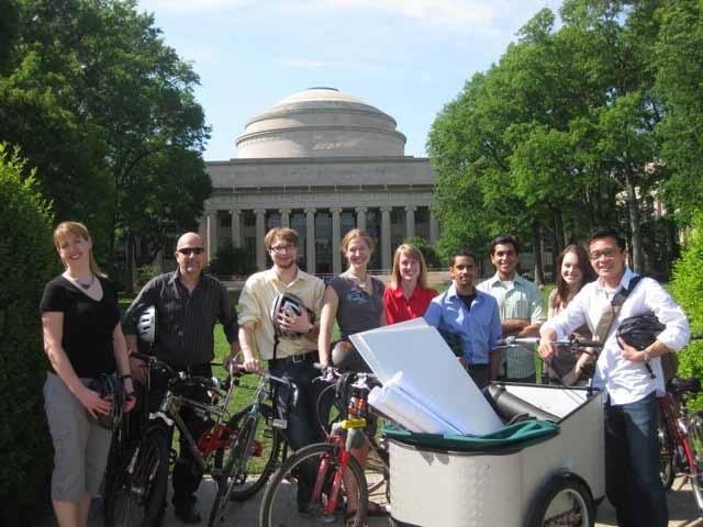
 1 Sarah J. Spicer
2 Prof. Eran Ben-Joseph
3 James Ira Winder
4 Jaime Young
5 Holly Chase
6 Vig Krishnamurthy
7 Praveen Subramani
8 Holly Bellocchio
9 Eugene Siong Aun Lee
1 Sarah J. Spicer
2 Prof. Eran Ben-Joseph
3 James Ira Winder
4 Jaime Young
5 Holly Chase
6 Vig Krishnamurthy
7 Praveen Subramani
8 Holly Bellocchio
9 Eugene Siong Aun Lee
School of Architecture + Planning
City Design and Development Group
Massachusetts Institute of Technology
Site and Urban Systems Planning Workshop