
CONTACT INFORMATION

CONTACT INFORMATION
mohamad.sinjab@mail.utoronto.ca
Bachelor of Arts in Architectural Studies, Urban Studies Minor University of Toronto, St. George, Canada
John H. Daniels Faculty of Architecture, Landscape, and Design 2021 - 2025 (Expected Graduation)
Workshop and Building Services Facilities Assistant University of Toronto, Canada Sept 2023 - Present
Design Research Intern architects–Alliance Toronto, Canada May 2024- June 2024
Media and Marketing Director shiftmagtoronto | Scaffold Journal University of Toronto, Canada 2022 - Present
Applied Architecture Landscape & Design Instructor Architecture and Visual Studies Student Union University of Toronto, Canada Sept 2024 - Present
LANGUAGES
Arabic (Native)
English (Native)
French (Intermediate)
SOFTWARE
Rhino
Grasshopper
AutoCAD
Adobe Illustrator
Adobe Photoshop
Adobe Lightroom
Adobe Indesign
Blender 3D
V-Ray Render
Enscape Render
SKILLS
Lasercutting CNC Milling Woodworking 3D Printing Power & Hand Tools Proficiency Spray Painting

Landscape Restoration - MoMa Gardens
Instructor: Behnaz Assadi
ARC363 | Landscape Architecture Studio I
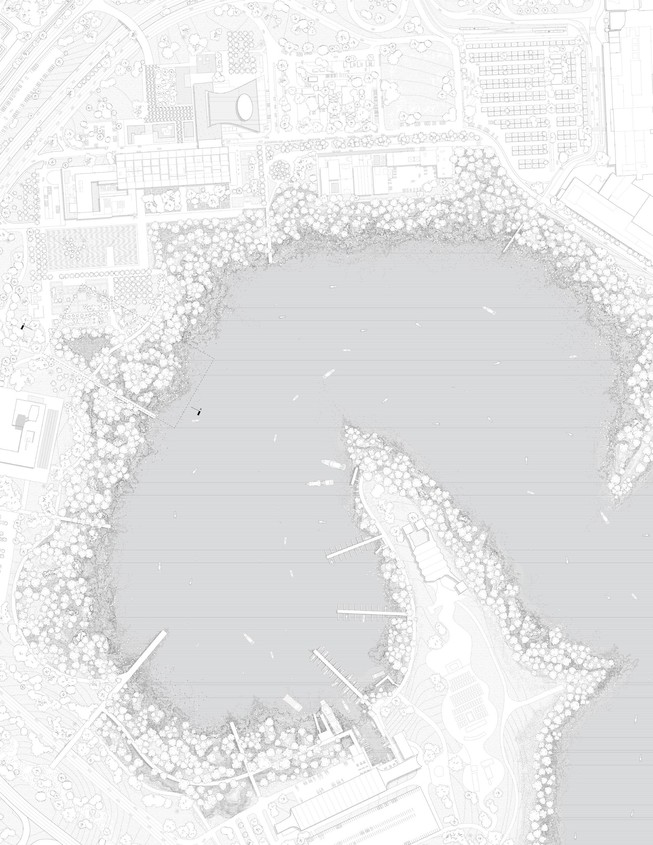
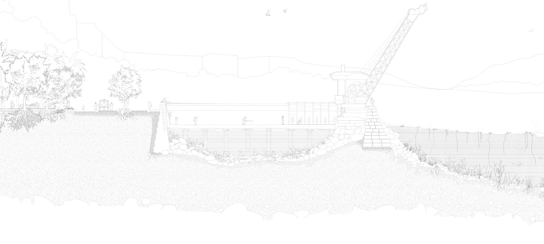
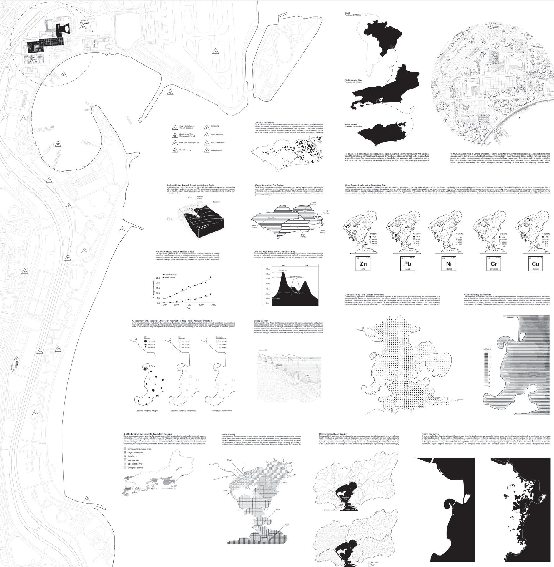
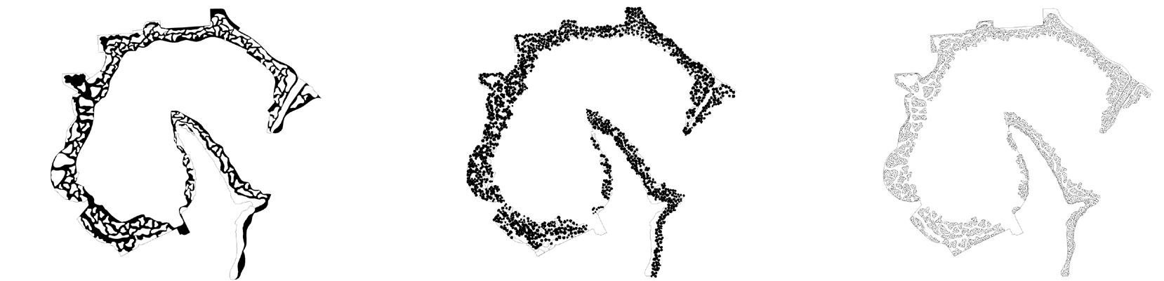
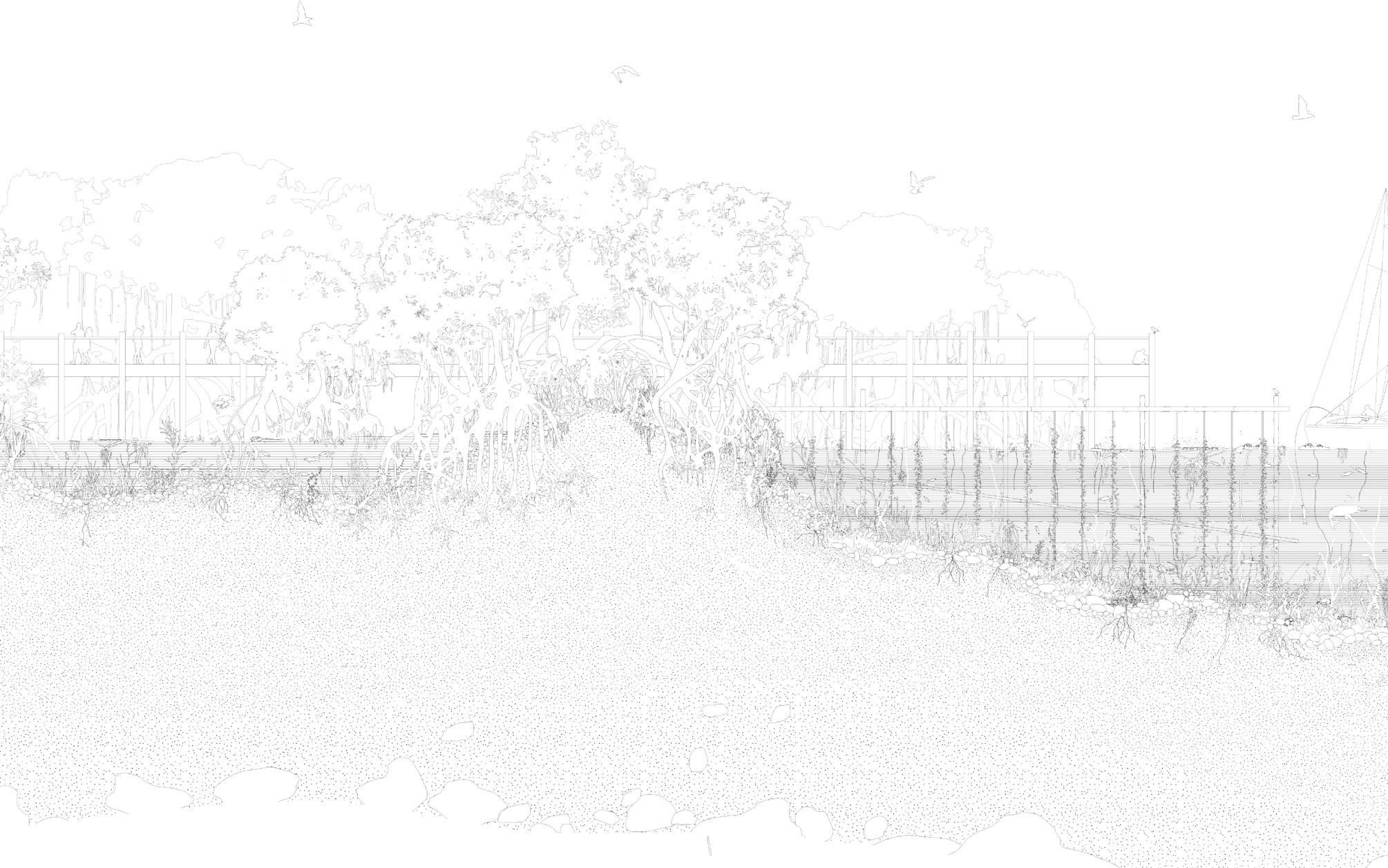
The Guanabara Bay’s cove, adjacent to the MoMa Gardens and Flamengo Park in Rio de Janeiro, once valued for its biodiversity and richness to the Tupinamba people of Brazil, wounded up being severely impacted by pollution. It is situated on expanded landfill grounds, once home to rich marshes. Its proximity to the airport and dense favelas contribute to its contamination with heavy metals, waste, and excessive dissolved nutrients, leading to eutrophication and algal blooms.
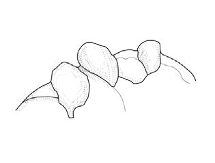
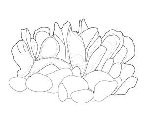
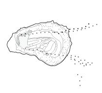
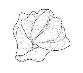
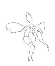
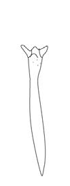
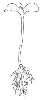
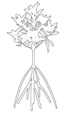
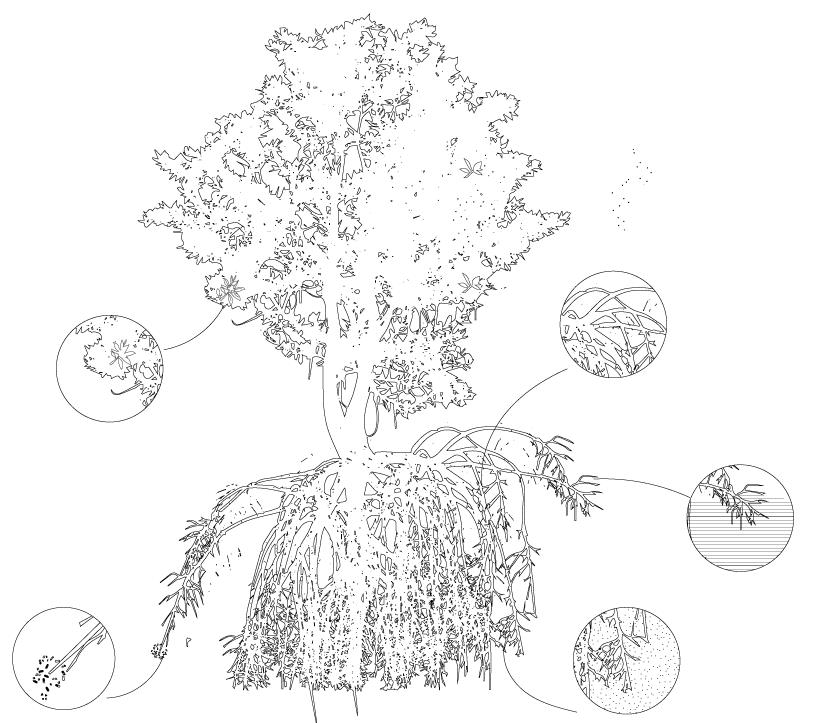
The restoration process involves deploying long-line oyster systems, paired with mangroves. While the mangroves are responsible for cleaning the heavy metal contaminants, the oysters and aquatic plants aid in removing excessive nutrients. This controlled oyster setup leads to the expansion of natural reefs, spreading over the seabed, rocks, mini-archipelagos, and mangrove roots.
The resulting ecosystem, designed to be safe in the face of failure, creates. a protective barrier against soil erosion, and aids in the bay’s restoration, while maintaining the site’s touristic and urban nature.
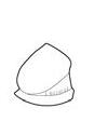
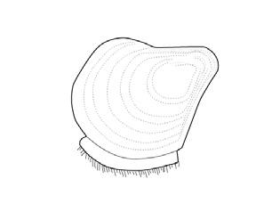
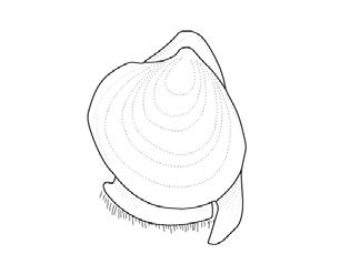
LEFT: 1960 Historic Site Plan of the Aterro do Flamengo landfill, using transported dirt to create large dirt mounds on site.
TOP RIGHT: BOTTOM RIGHT: 1872 Existing Hills Pre-Demolising 1920 & 1960 Sections of Landfill Expansion
The two major hills demolished are part of the Europeanization of Rio De Janeiro. The rubble is used to expand the Aterro do Flamingo, and to create the future airport grounds
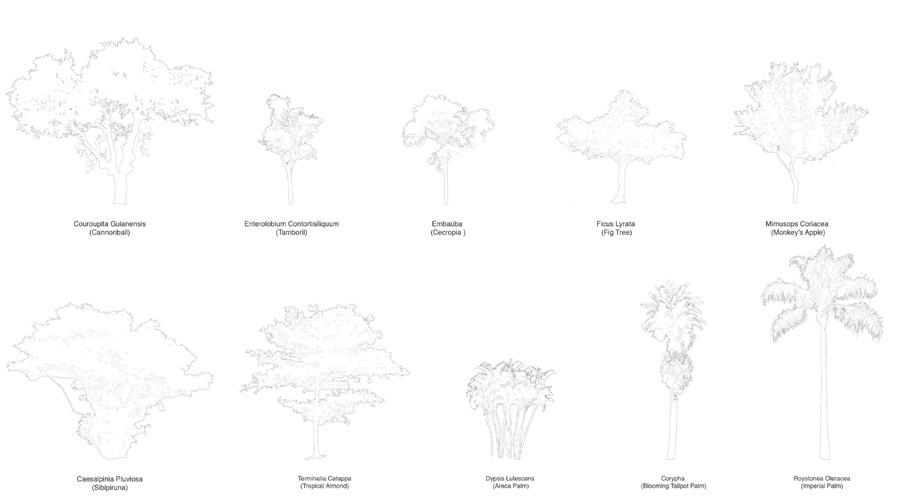
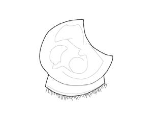
RIGHT: Annotated site plan, including species index, water contaminants and natural disasters
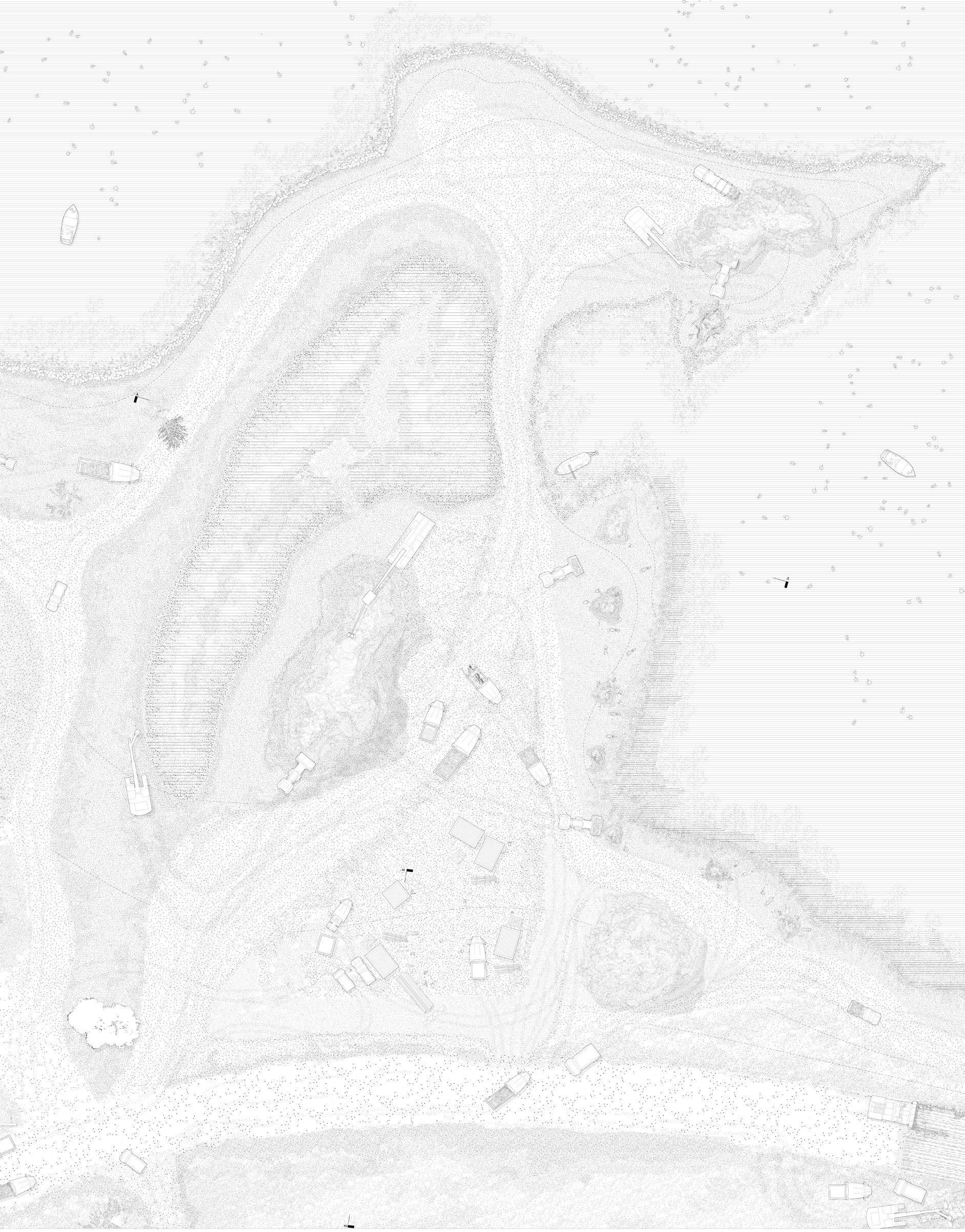
The diagram highlights the intensity of currents in Guanabara Bay, showing that the cove near the MoMA Gardens experiences low current activity. This makes it an ideal location for a longline oyster system, which thrives in calmer waters. The reduced water movement allows oysters to grow steadily without the risk of detachment or damage.


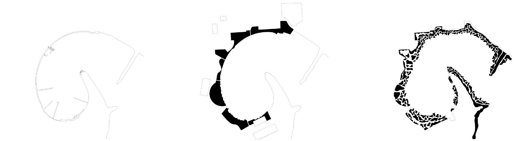
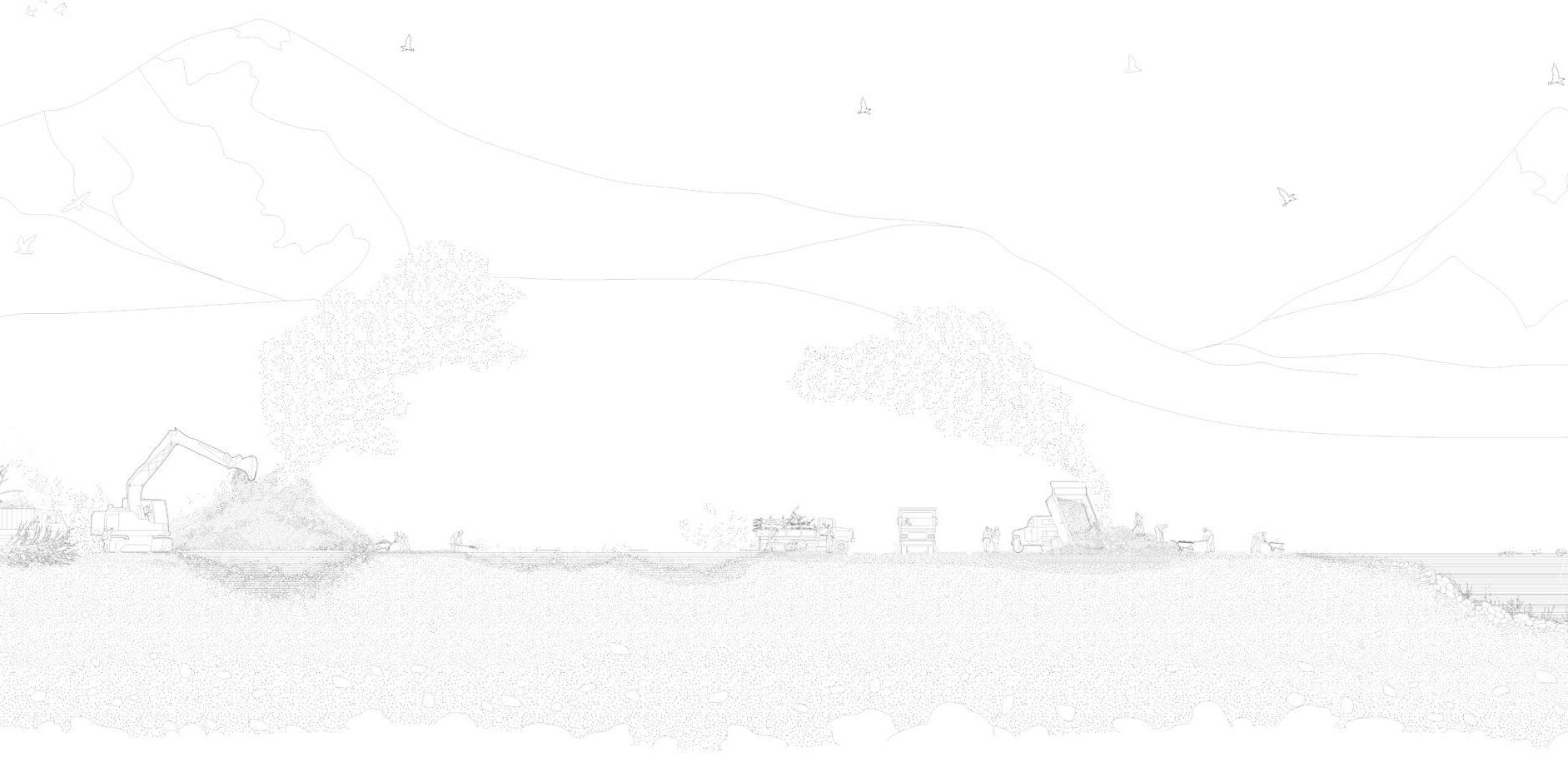
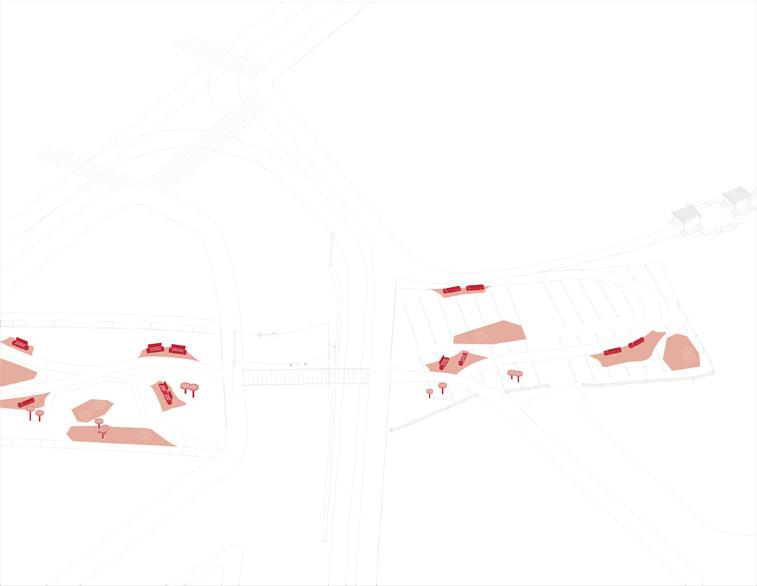
Existing Site:
Deconstruct shoreline, retaining wall, and remove rocks
Land Reclamation:
Claiming targeted areas within context of large parking lots and boat club
Creating Dirt Mound Archipelago’s
Using the dirt and rocks from transforming the existing shoreline smaller mounds are created
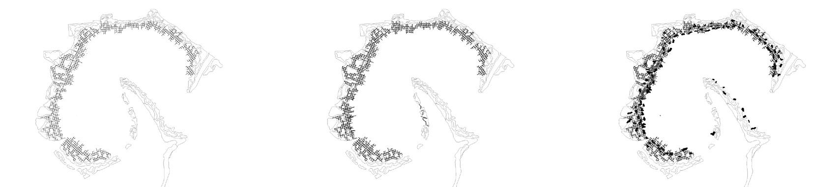
Phase 1: Longline Rack Deployment
A proposed grid subital and intertidal frames are placed extending into the cove
Phase 2: Introduce Oyster Spats to Longline Grid
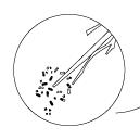
Young oyster spats are attached to recycled shells tensioned to strings to provide rigid growing conditions
Phase 3: Natural Oyster Settlement Oysters naturally reproduce and expand onto mounds and rocks
Phase 1: Water Remediation
Introducing aquatic plants to help oysters diminish surplus nutrients and algae
Phase 2: Introduce Grey Mangrove System
Planting mangroves on mounds for stability and optimal depth to tackle heavy metals.
Phase 3: Phytoremediation
Introducing perennial plants to aid mangroves in soil stability and phytoremediation
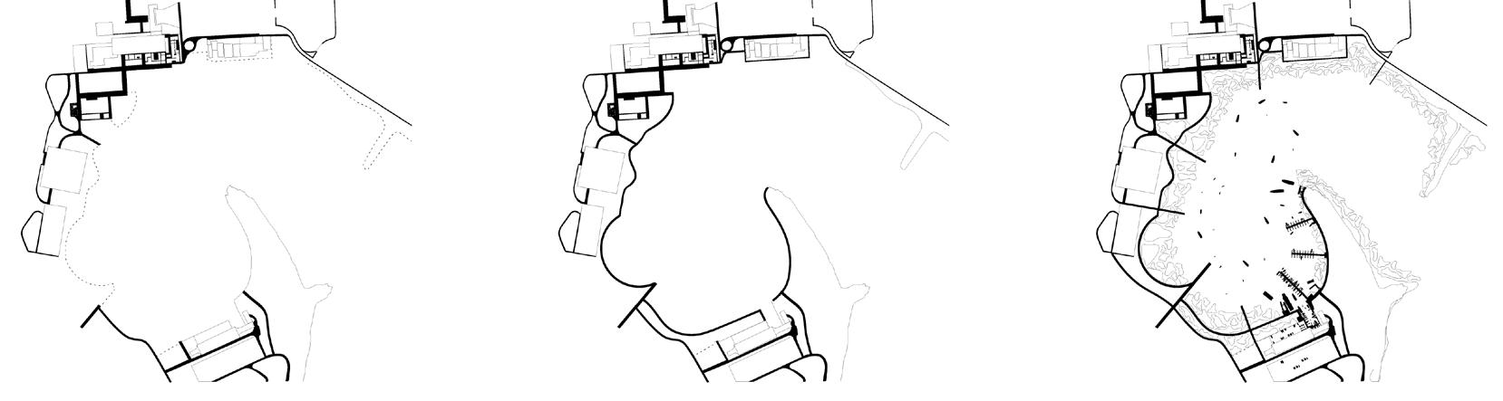
Visitor Access : Existing
Land reclamation disrupts walkways, limiting visitor access
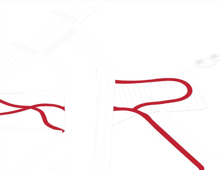
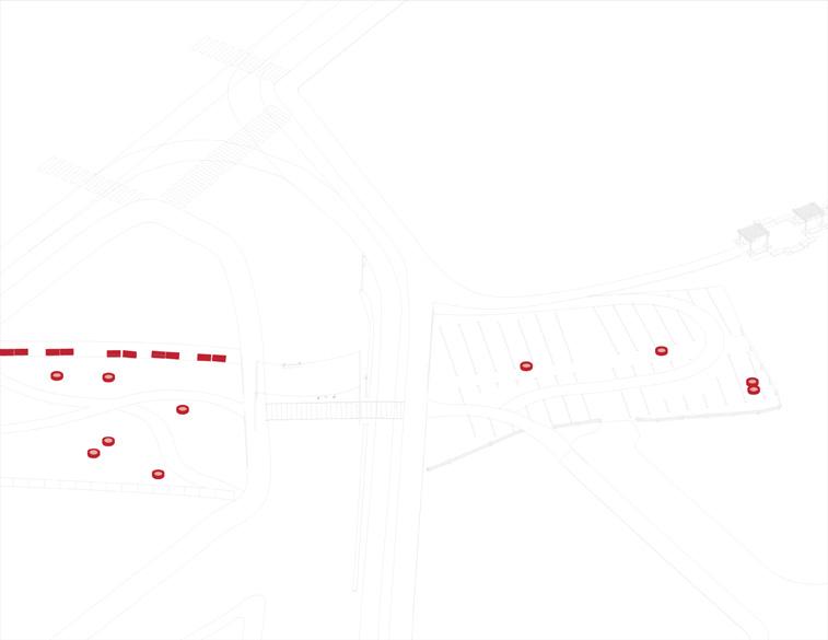
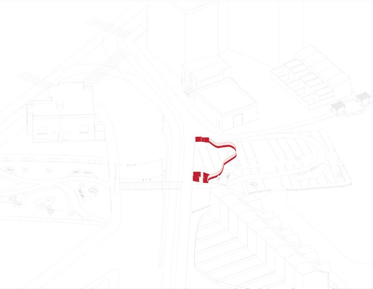
Extending Perimeter Boardwalk
Perimeter boardwalk constructed to enahnce interaction with landscape
Connecting the Harbour A harbour is established to account for the boat club and original cargo transportation


Weeks


Years


Instructor: Mauricio Quirós
ARC362 | Housing Studio II
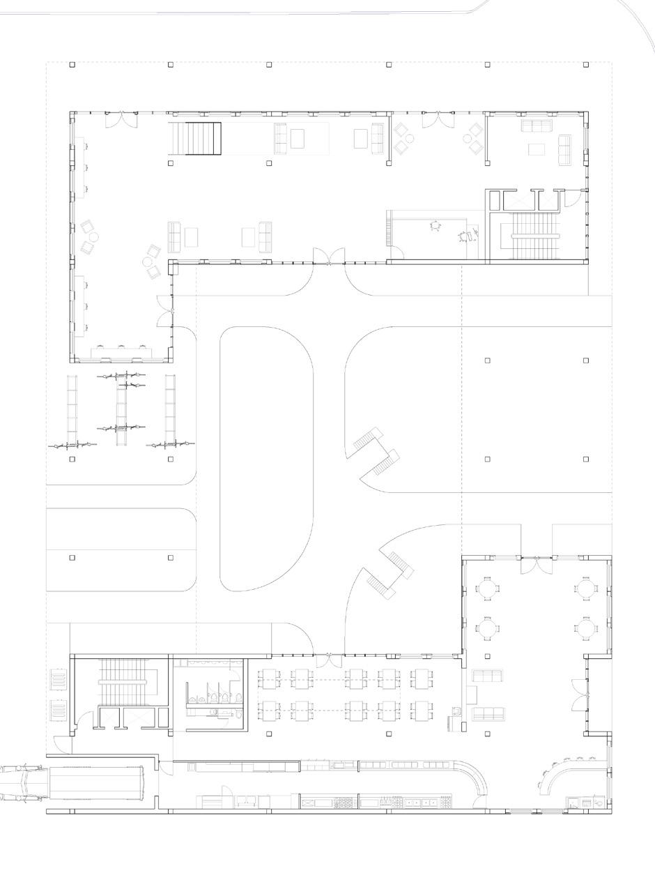
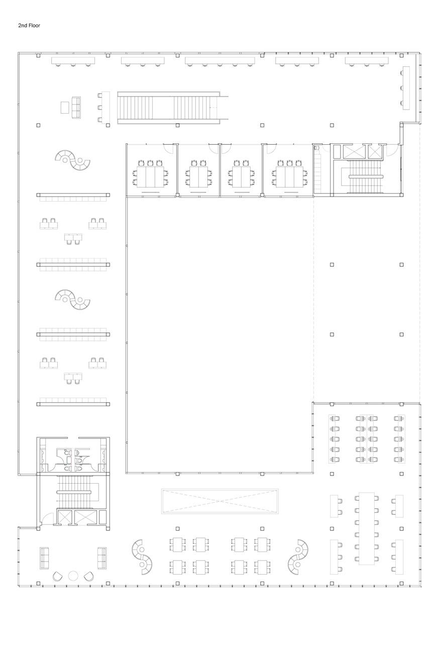
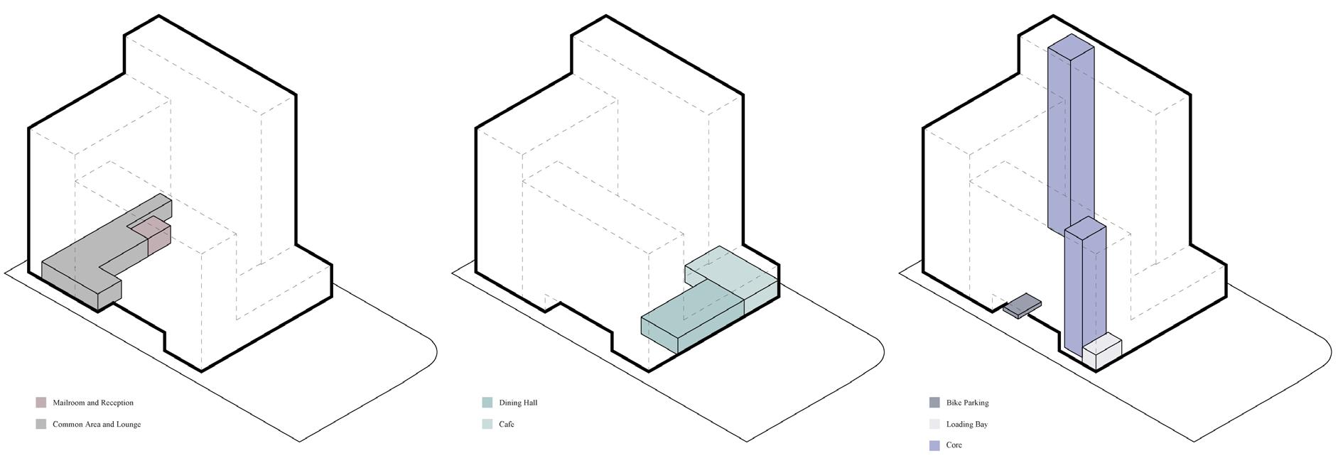
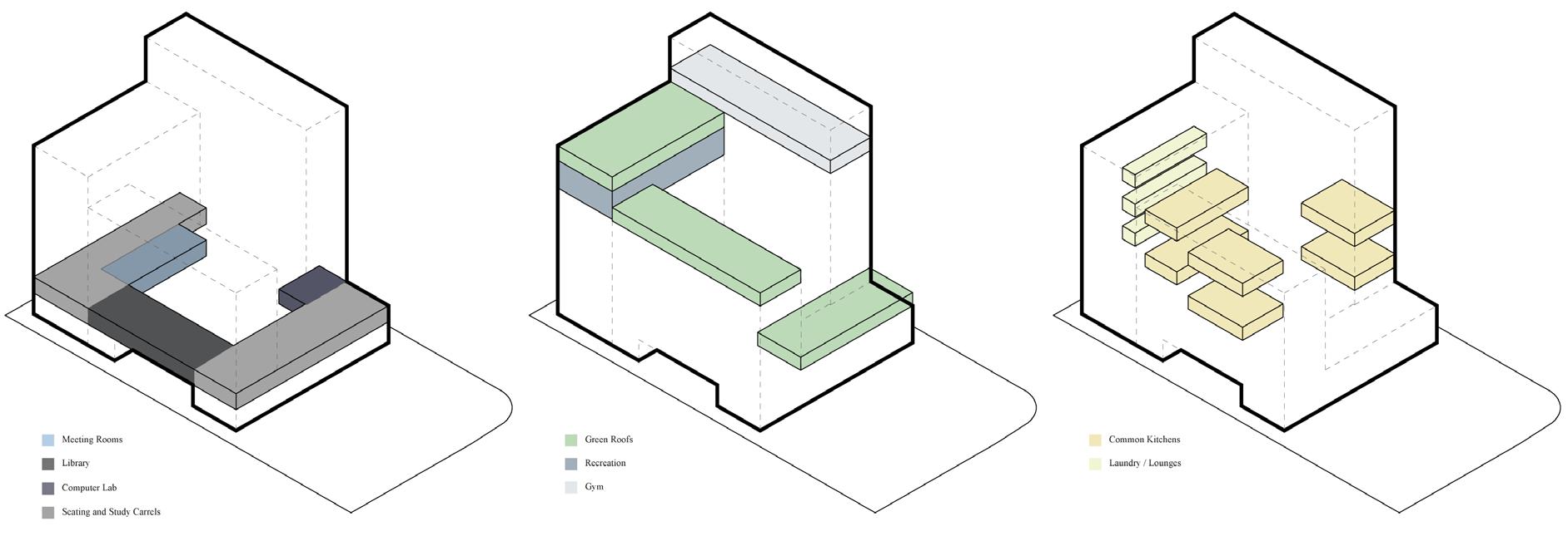
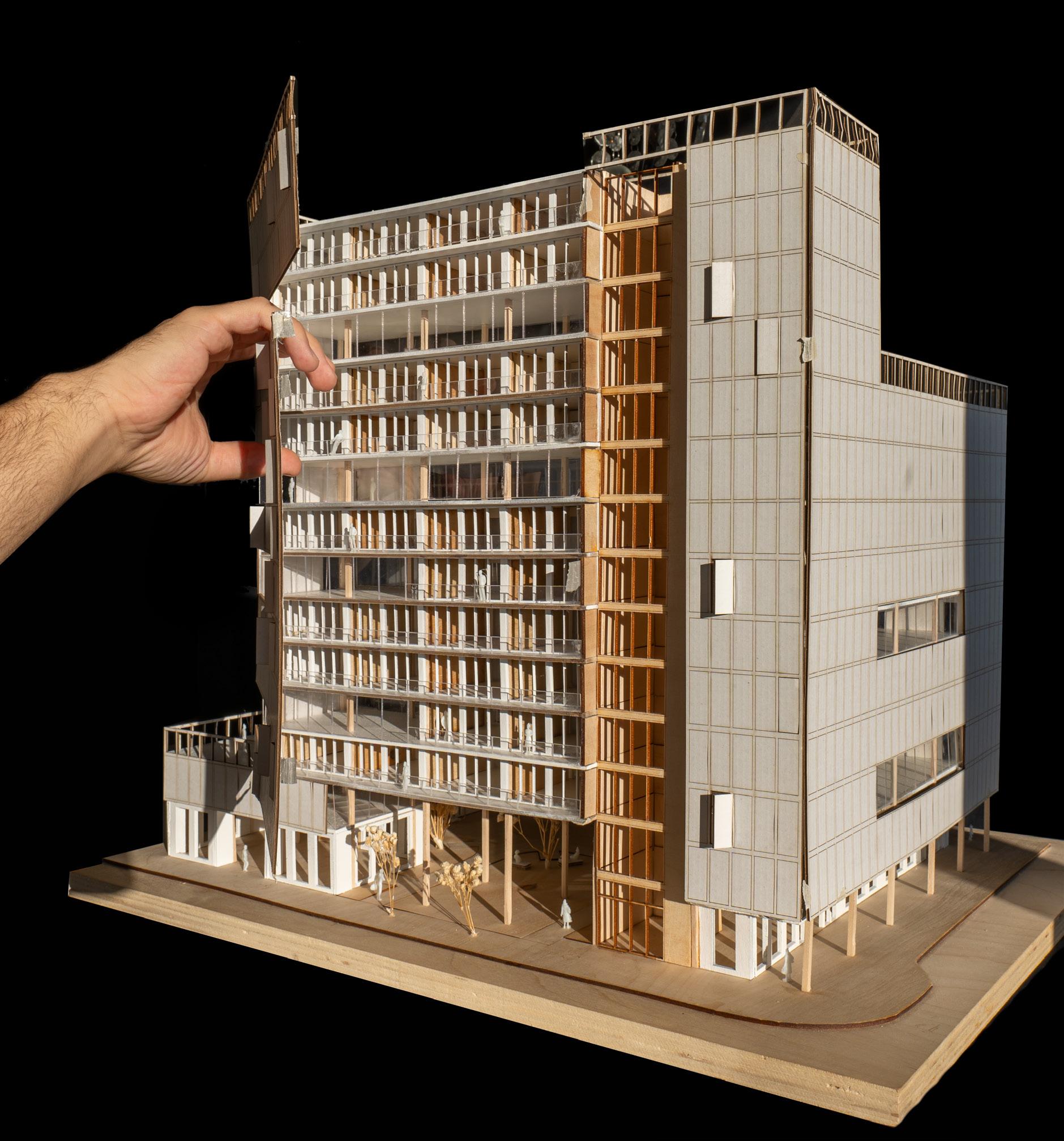
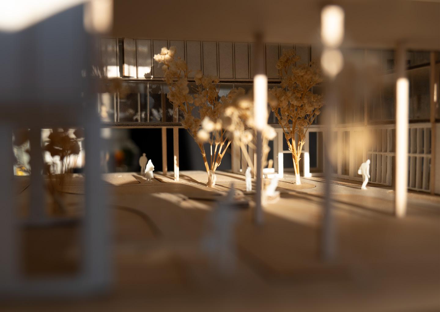
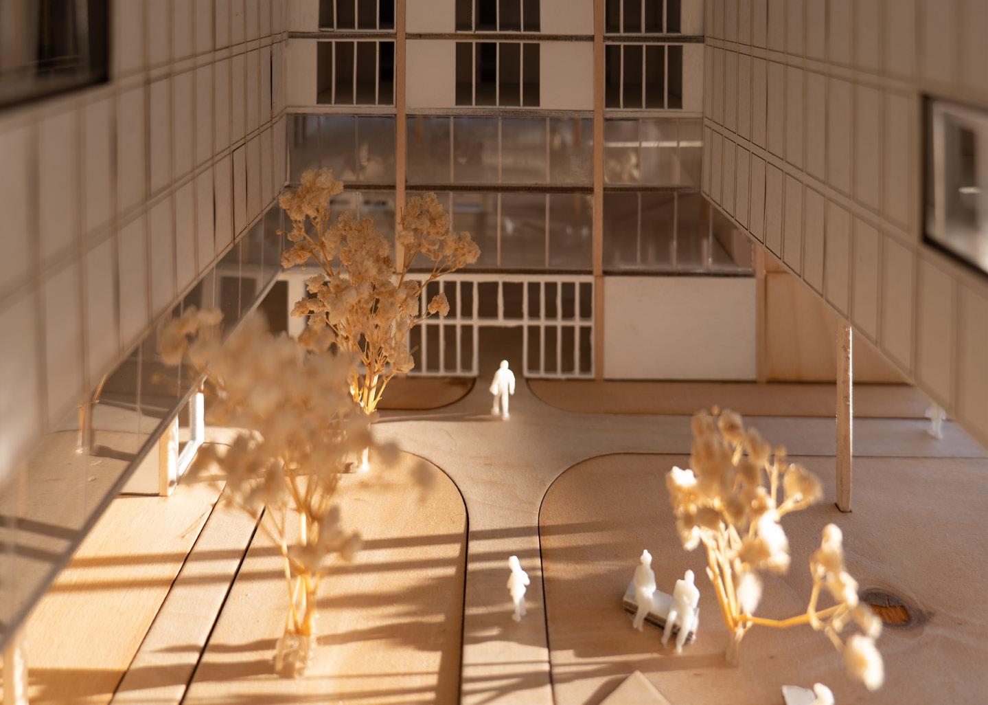
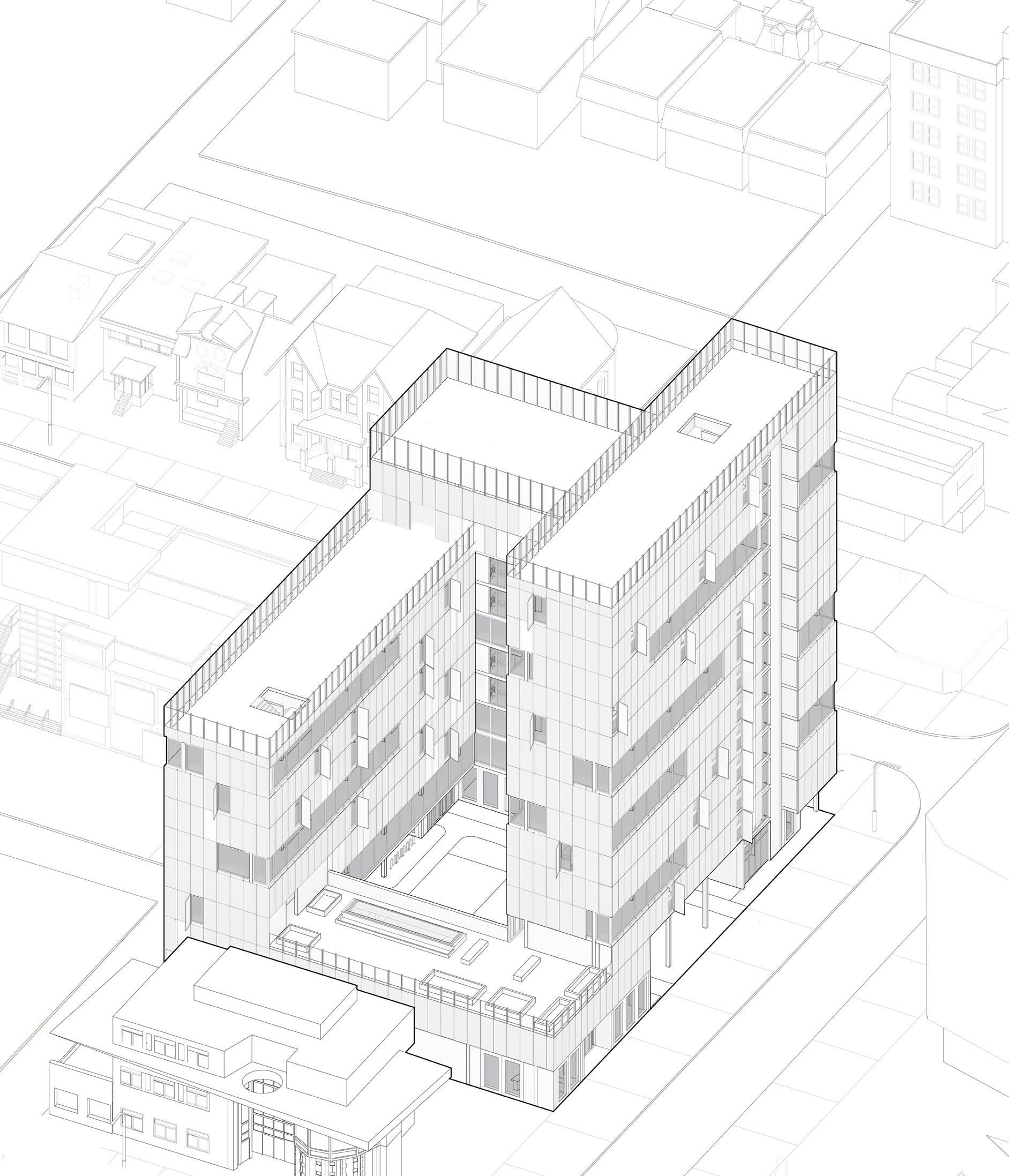
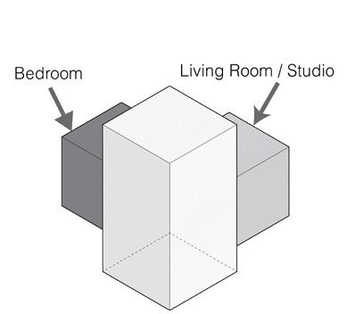
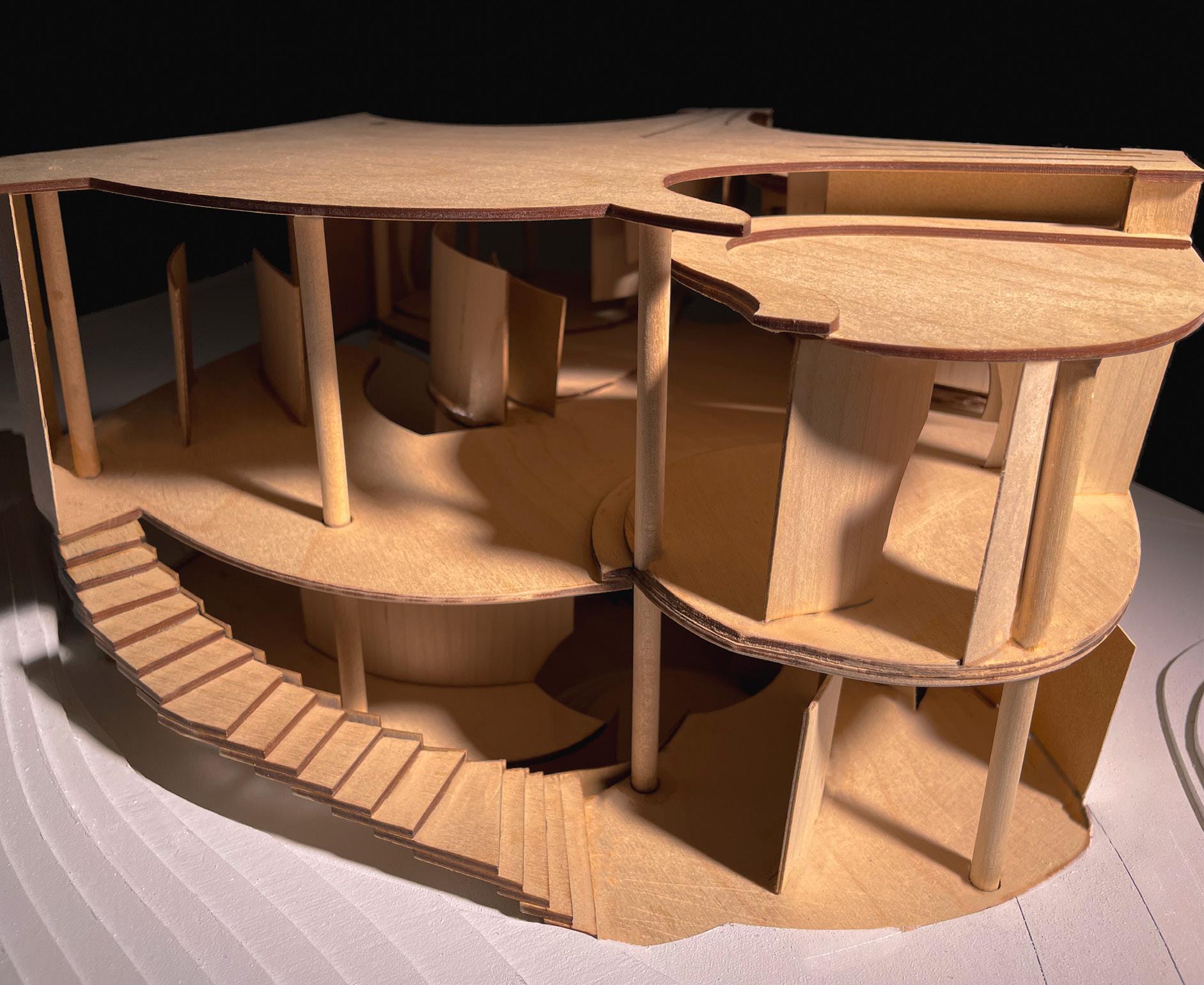
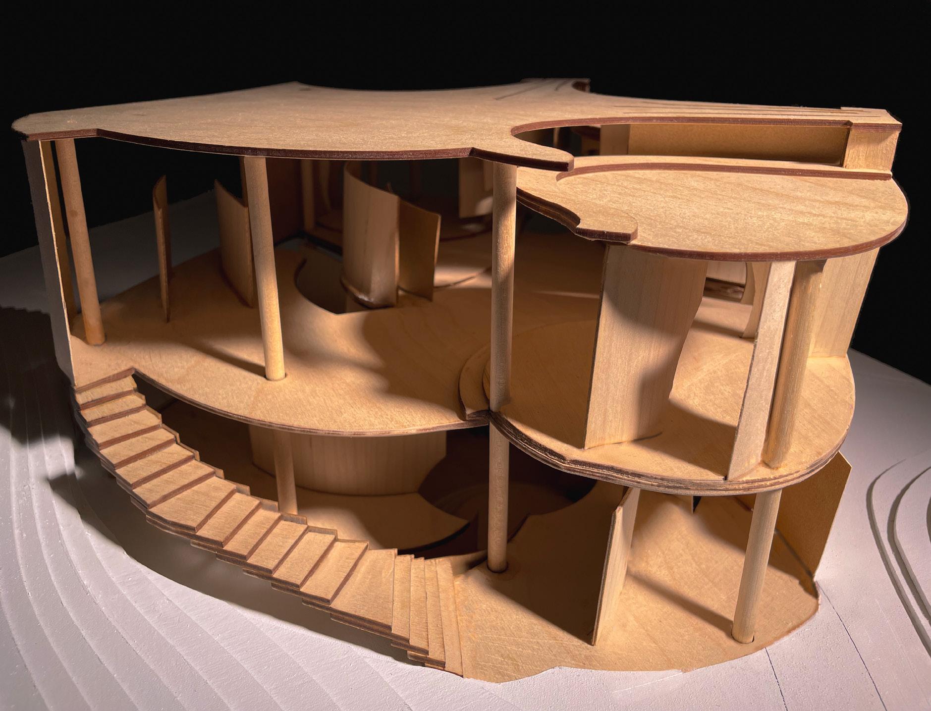
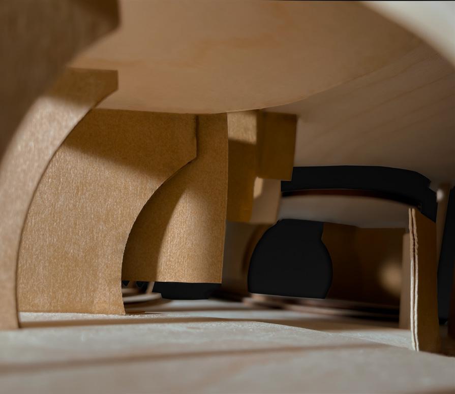
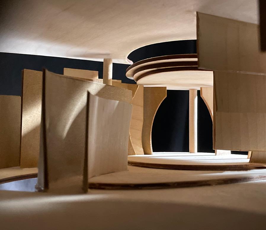
Cascading Harmony, a student residence located at the intersection of Huron and Glen Morris beside Robarts Commons, imagines student living by prioritizing social interaction and spatial hierarchy. The design organizes its programming into distinct layers: a public ground floor, semi-public spaces on the first and second levels, and private living quarters for students on the upper floors. The cascading form staggers social spaces across floors, creating voids where exterior façade panels recede, emphasizing openness and natural light.
These staggered spaces house communal amenities and incorporates two circulation cores, optimizing single-loaded corridors for sunlight exposure while encouraging active movement and engagement.
At the heart of the project lies a hollowed-out central courtyard, a fully public space accessible from east and west entrances. This courtyard features accessible walkways, benches, and exposed columns that form temporary shelters for bike racks, subtly delineating thresholds.
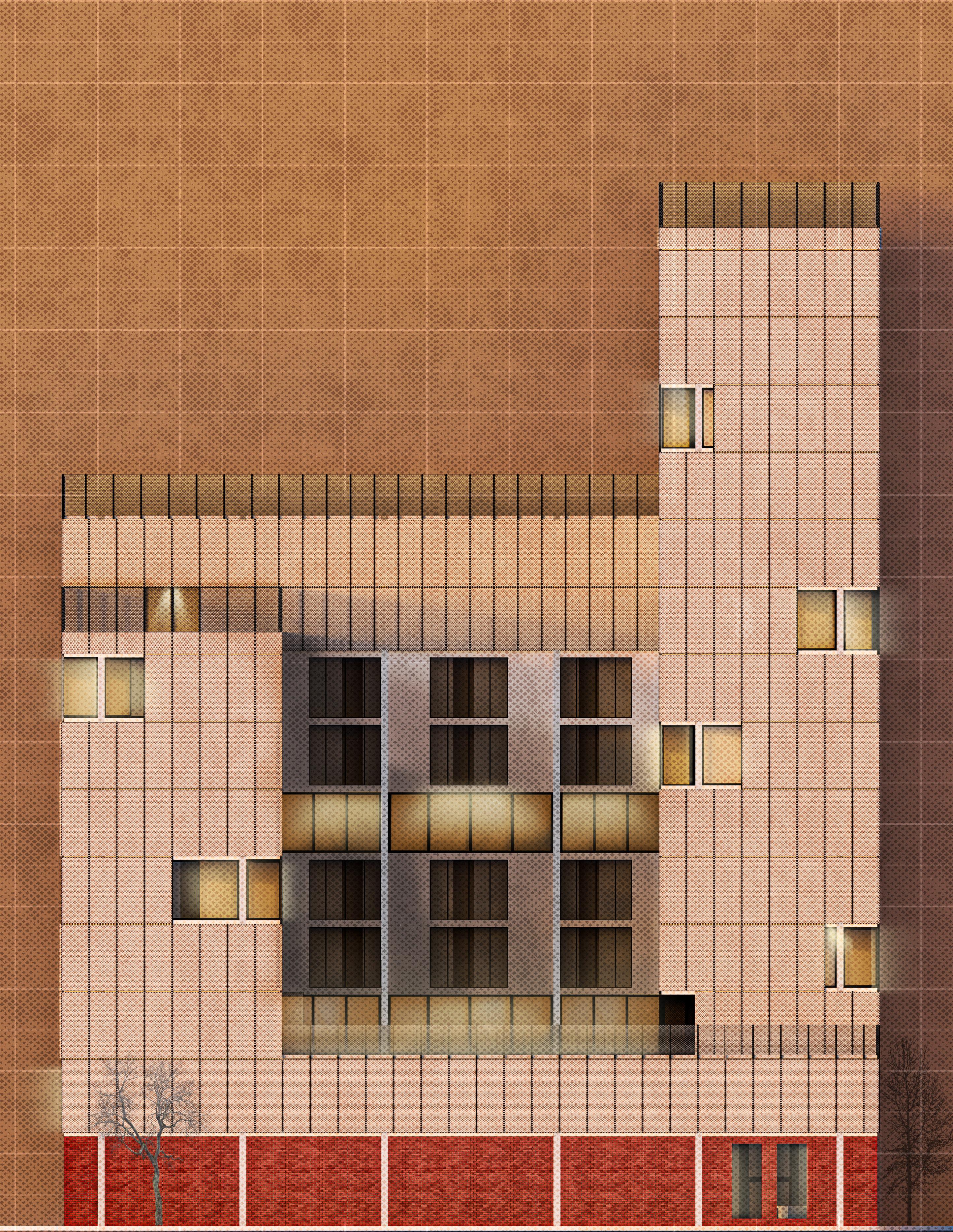
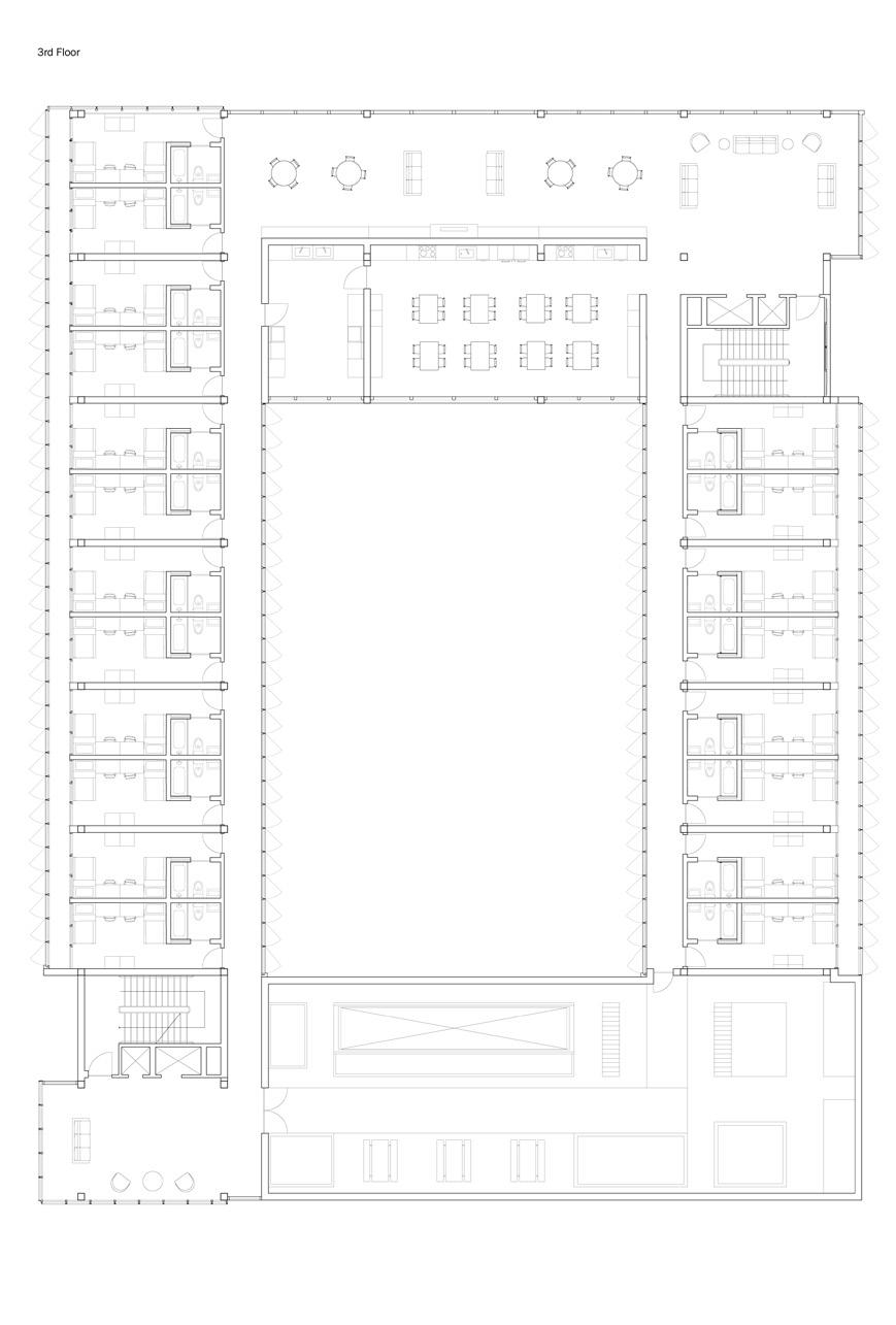
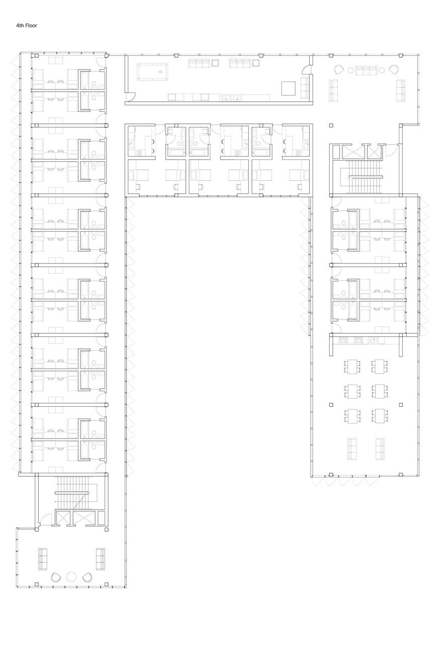
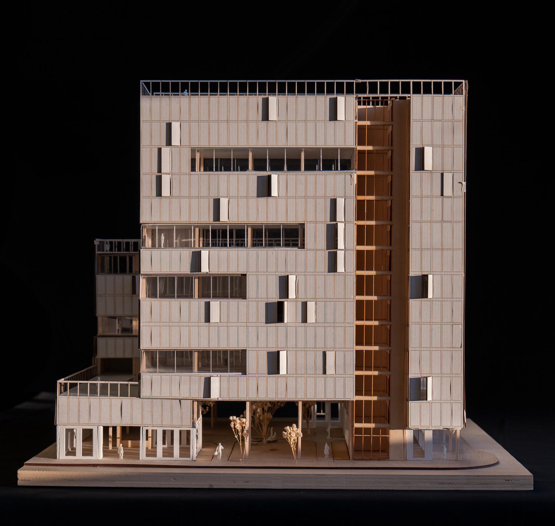
BOTTOM RIGHT: Site Isometric


A Parkette Proposal
Partner Project with Augustine Wong
Instructor: Michael Piper
ARC200 | Drawing and Representation II
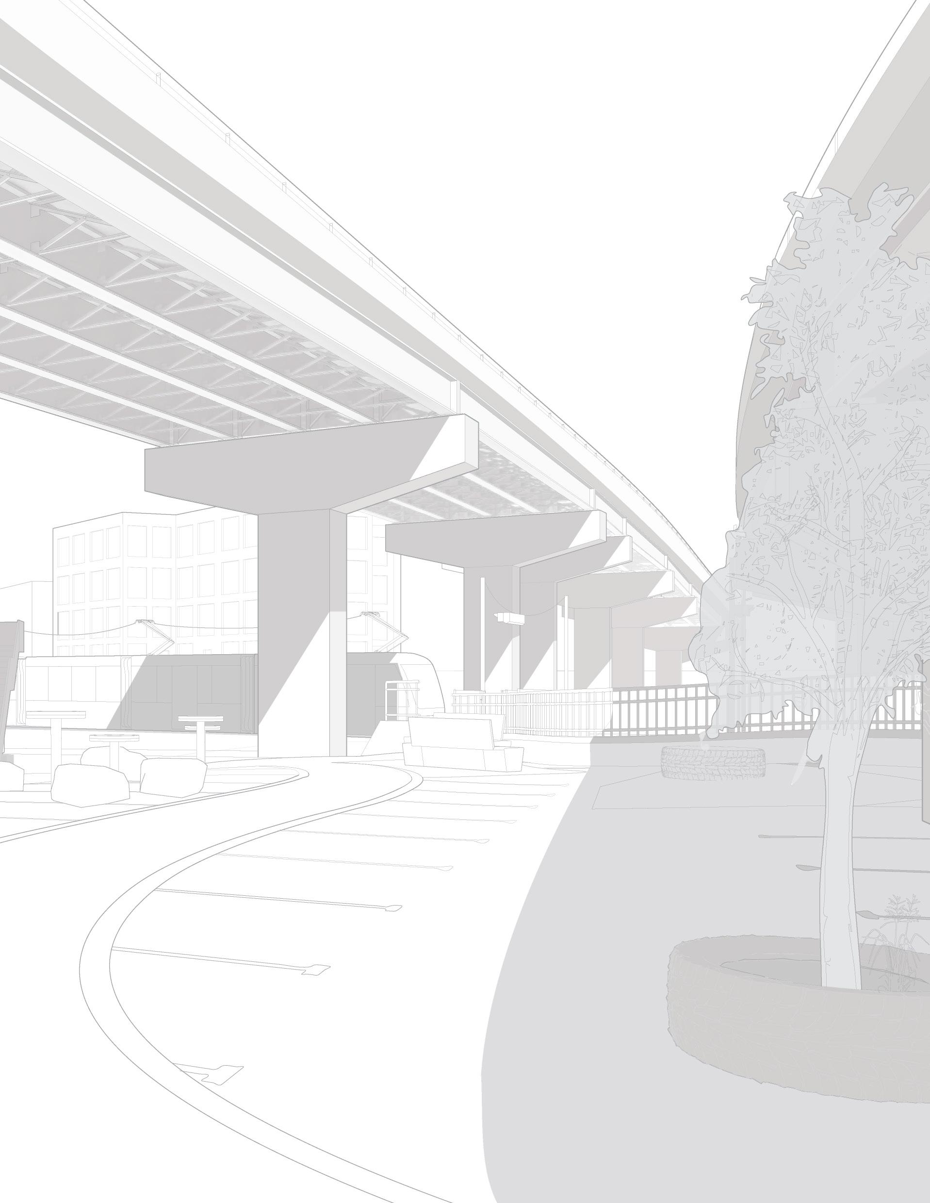
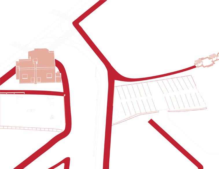
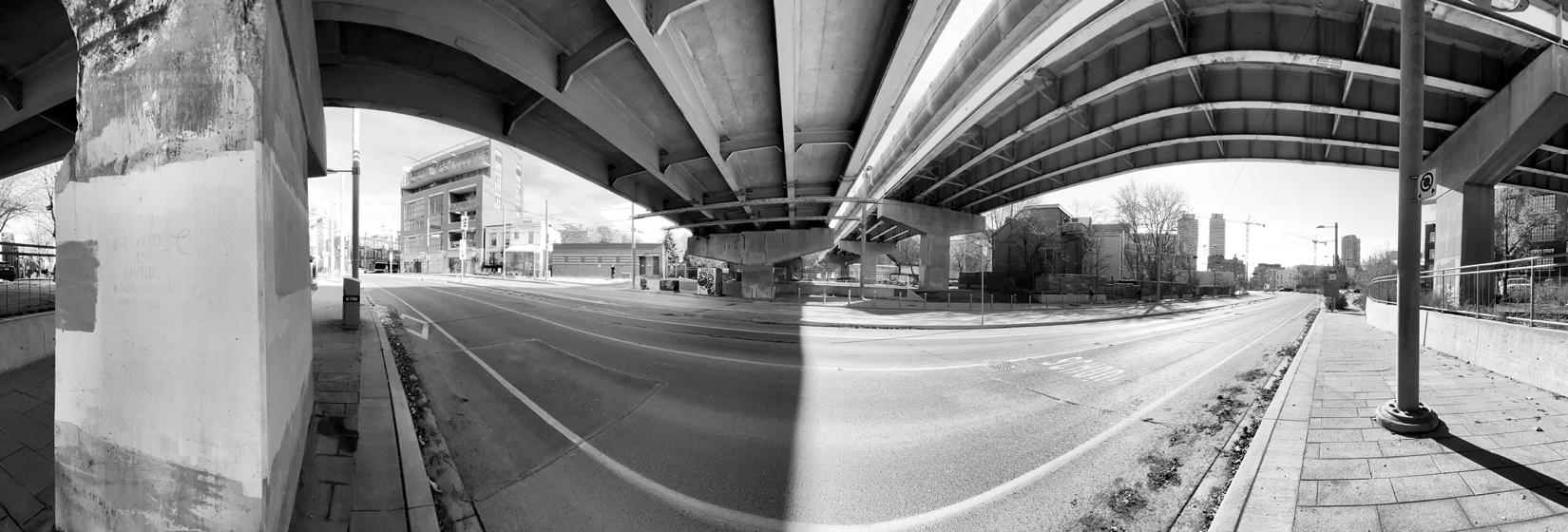
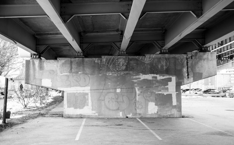
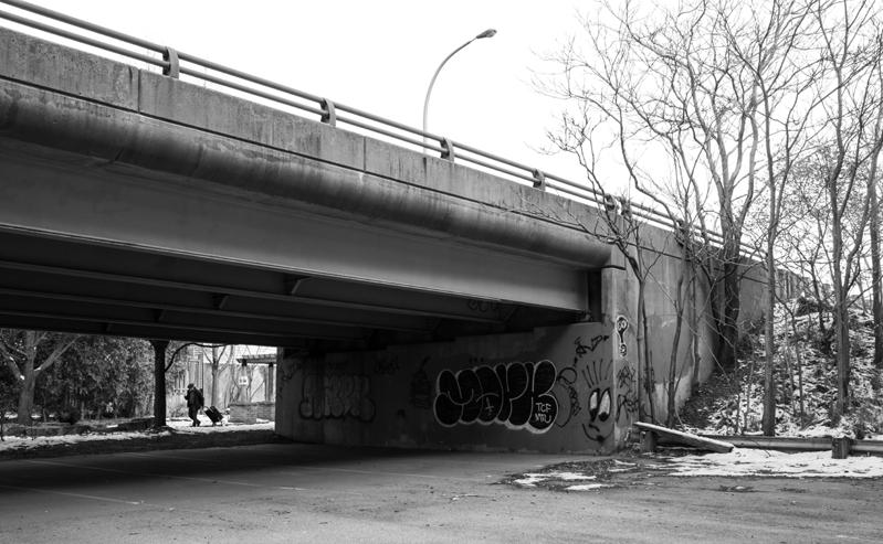
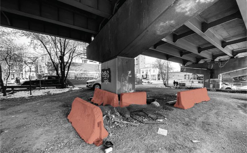
The urban intervention addresses dead spaces caused by the highway overpass of Adelaide St. and Richmond St. E, at the intersection with Sumach St. This overpass creates noise, mobility barriers, obstructs views and natural light, and results in unproductive land usage, such as parking lots in this case.
Therefore, the objective of this project was to revitalize the space beneath the intrusive highway by creating a lively parkette, leveraging the existing topographies and site features of the abandoned parking lots.
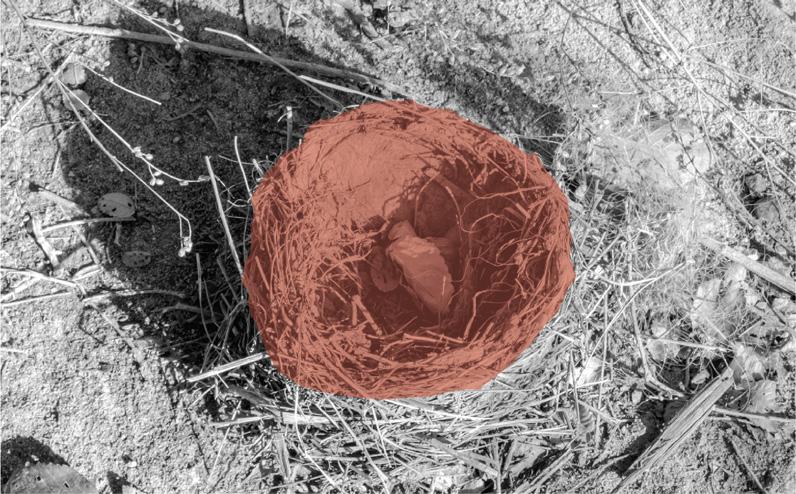
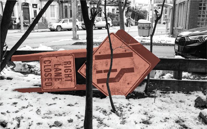
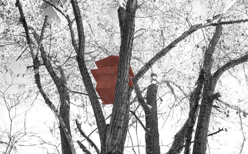
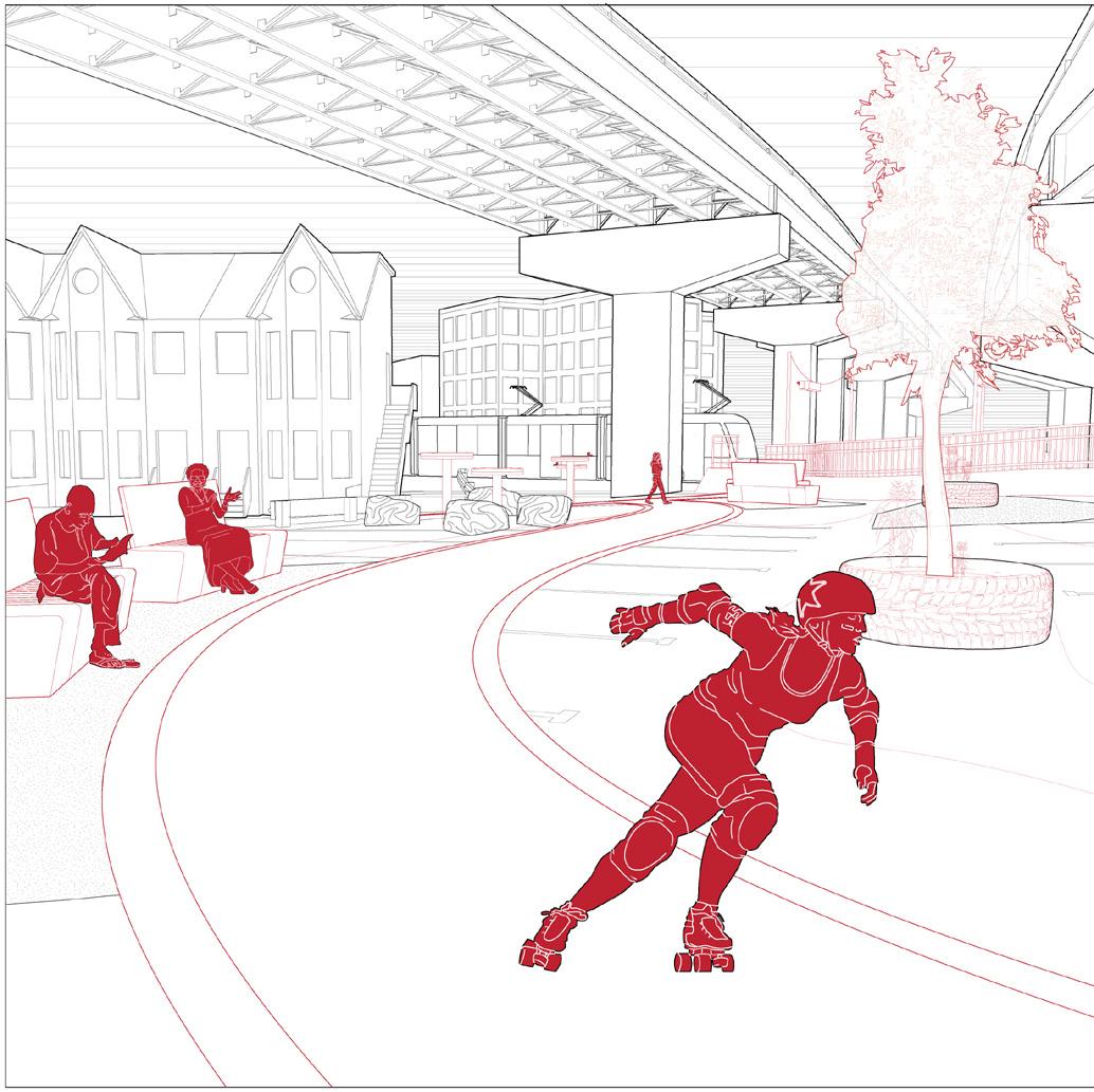
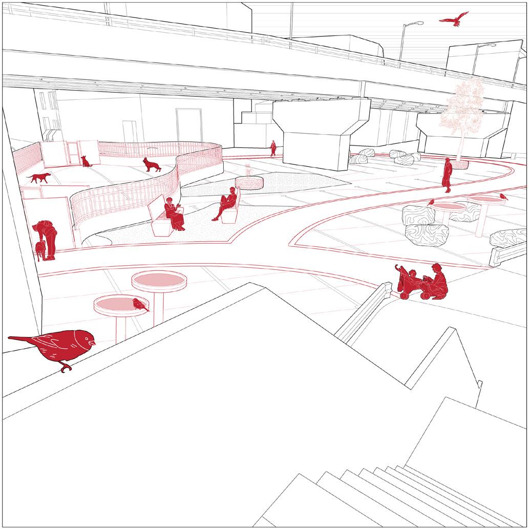
The project integrates the local ecosystem by incorporating bird baths for sparrows and repurposed tires as containers for birch trees. The West parking lot’s flat dirt surface was transformed into a gentle slope, connecting it to the East end’s concrete paved parking lot through a blinking pedestrian crossway.
* Work done in collaboration involved the 3D modelling of city detailed buildings, the proposed intervention, & site visit photos.
Existing Site Context
The site is adjacent to an animal hospital, Percy Park, and fencing, resulting in unconventional and awkward barriers
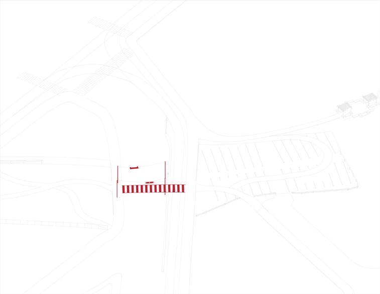
Connecting the Parkettes Via Crosswalk
A blinking crossway is included to directly access both parkettes amidst the streetcar rails and street divider
Introduce Supporting Features
Park benches, bird fountains, and small fields are created to enhance visitor experience
Creating Meandering Paths
Enhancing access by adding entryways and removing fencing to create new pathways
Repurpose Existing Elements
Dividers, rubber tires, and abandoned elements are repurposed to divide a bikelane, and serve as tree planters
Create Supporting Dog Park
A dog park is created using the existing fencing parking lot to compliment the animal hospital across the street
TOP LEFT: West Parkette Entrance
BOTTOM LEFT: Blinking Crossway Connecting the Parkettes
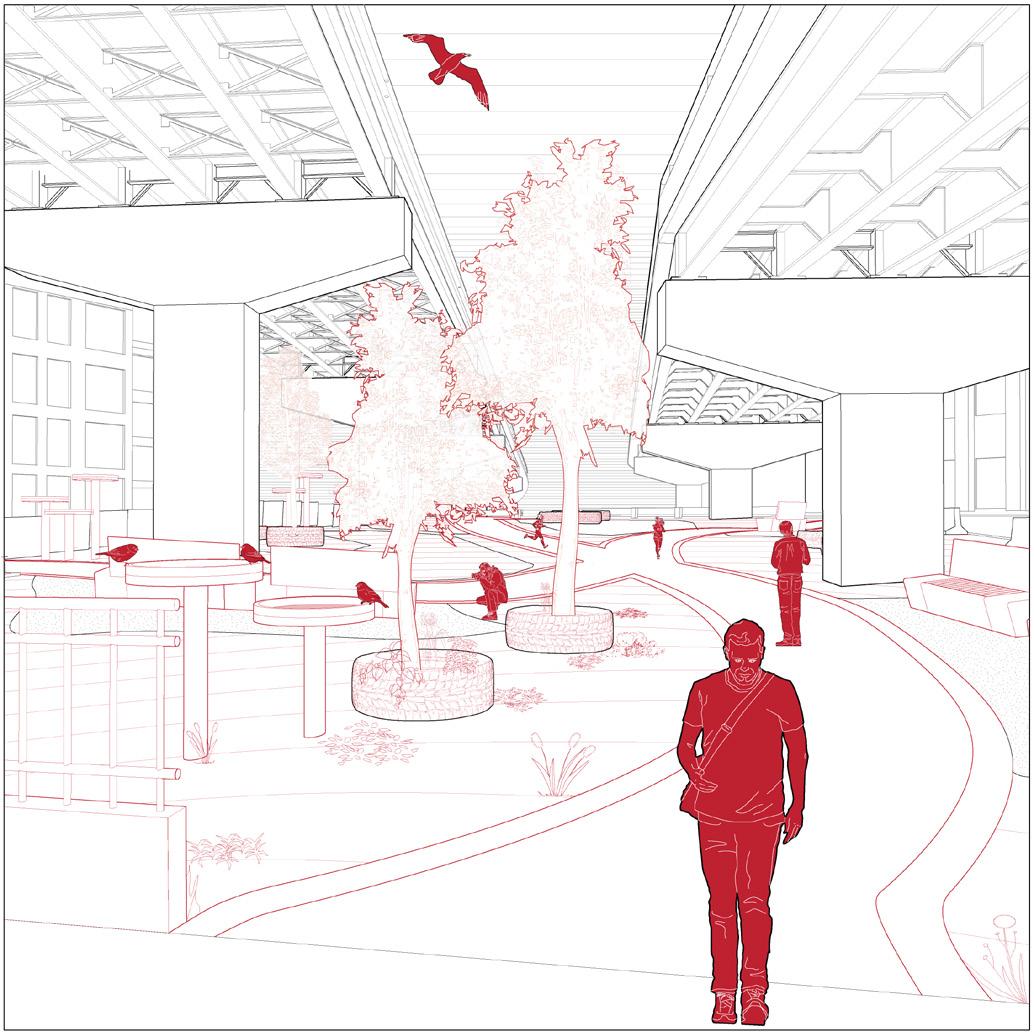
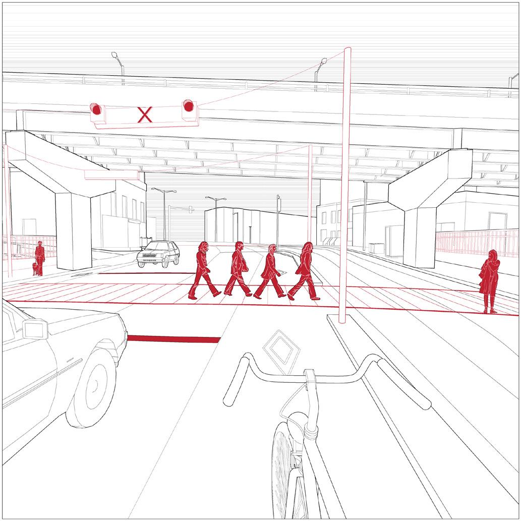
TOP RIGHT: Displayed Parkette Activity and Interactions
BOTTOM RIGHT: East Parkette Activity as Veiwed from Neigbhouring Home
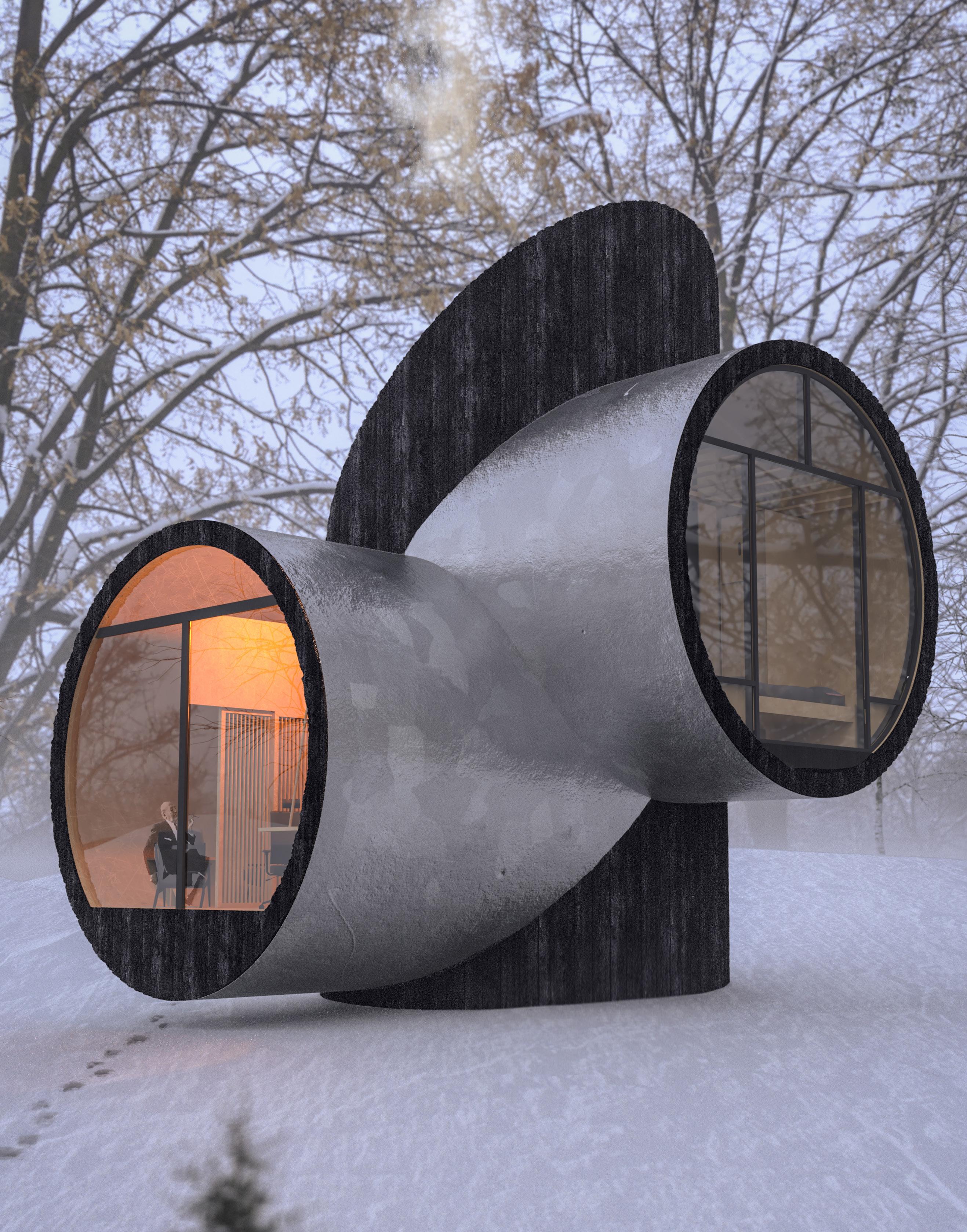
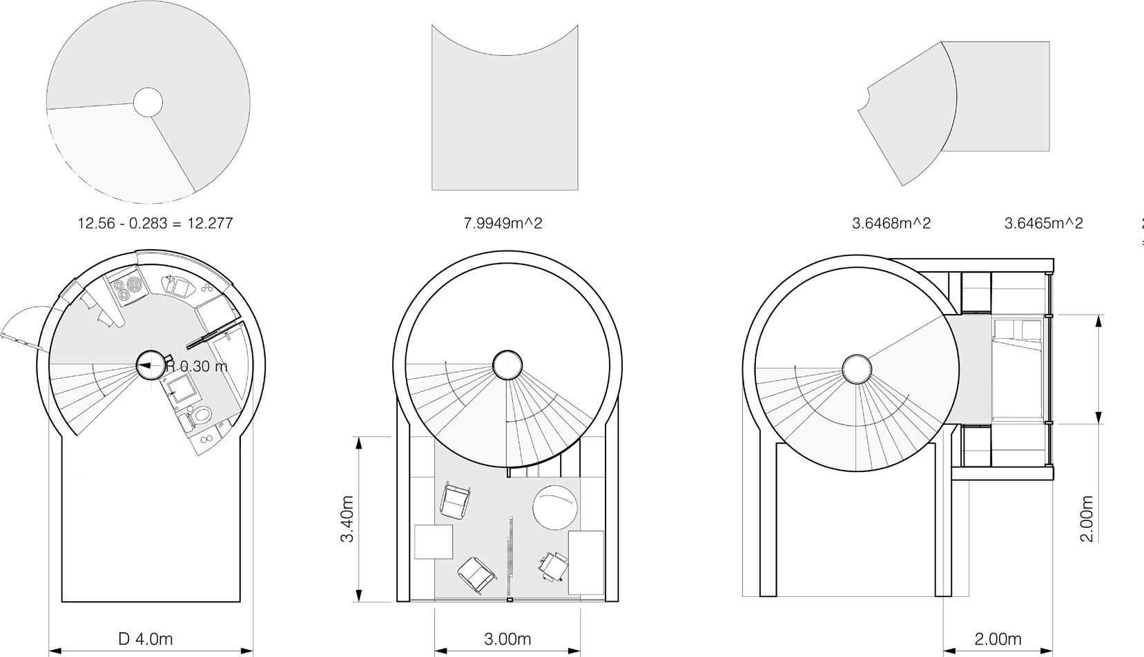
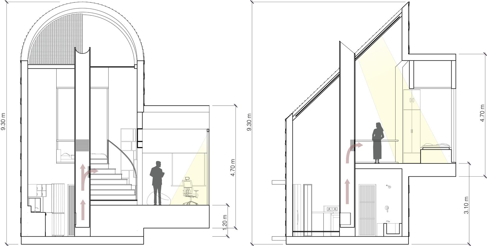
Tiny House 2022 ~ Top 20 Entry
Collaboration with Joseph Cheng & Kenny Vo
The Get Away Studio Home is a compact, multi-storey tiny home built to fit under 300 sq.ft and designed as a retreat for creative individuals. This sanctuary is home for nurturing the creativity of its inhabitants.
With separate amenities on each floor and a central fireplace, it offers comfort and warmth in the colder climate of South Bay, Prince Edward County. The facade features black wood cladding and treated galvanized steel sheets, while the incorporation of spacious windows in the pod-like rooms stands as a testament to this principle. By inviting ample natural light and panoramic views, these windows not only evoke a sense of tranquillity but also minimize the need for artificial lighting, thus reducing energy consumption supported by the solar panel rooftop.
* Work done in collaboration involved the 3D modelling of the structure by all group members. The submission large render was done by Kenny Vo and section drawings by Joseph Cheng.
BOTTOM LEFT: Deign Methodology
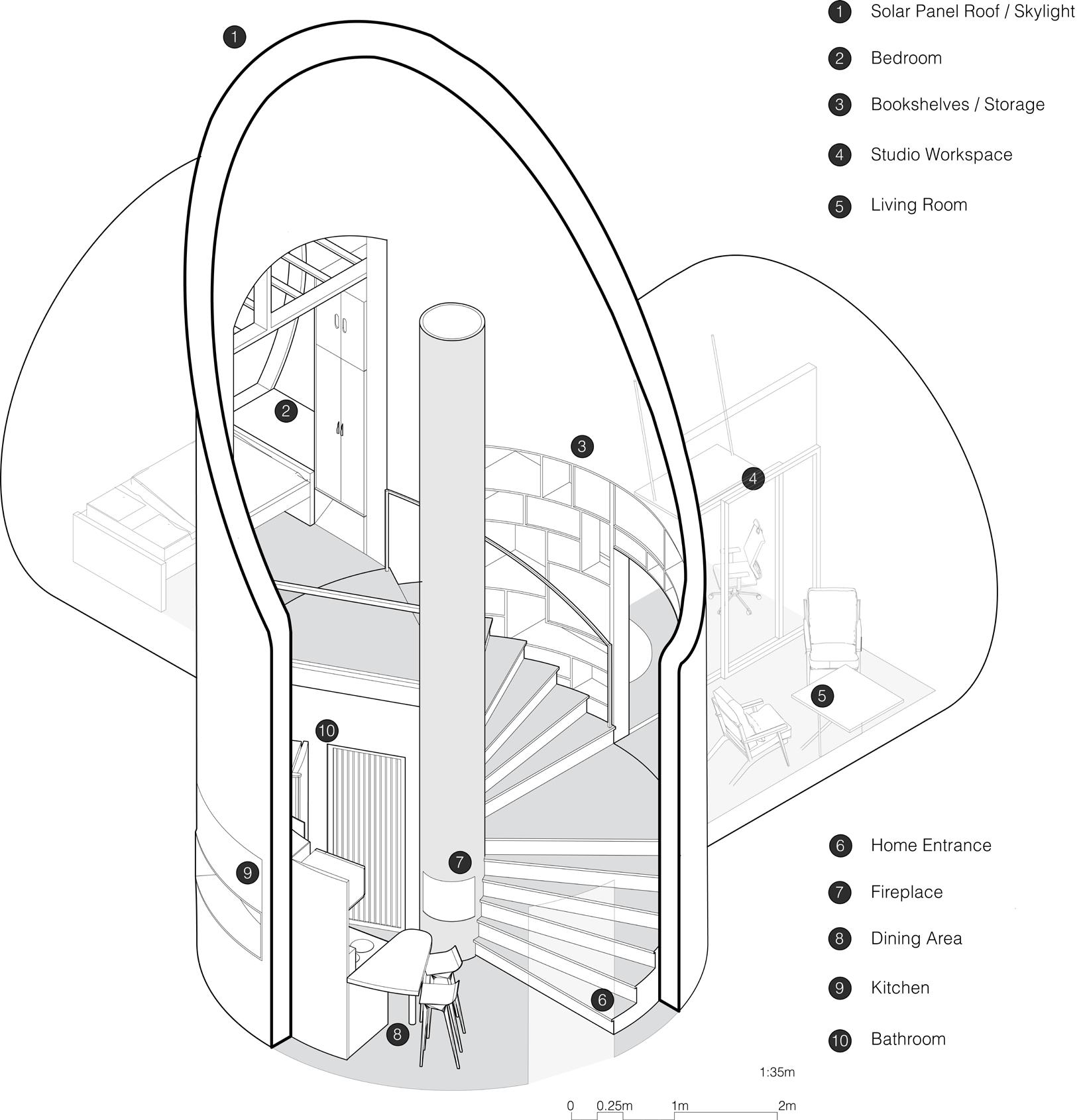
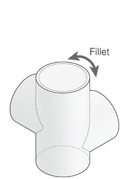
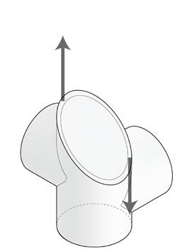
TOP RIGHT: Floor Plans and Considered Floor Areas
BOTTOM RIGHT: Sections A and B
University of Toronto
Student Study Center
Instructor: Nova Tayona
ARC201 | How to Design Almost Nothing
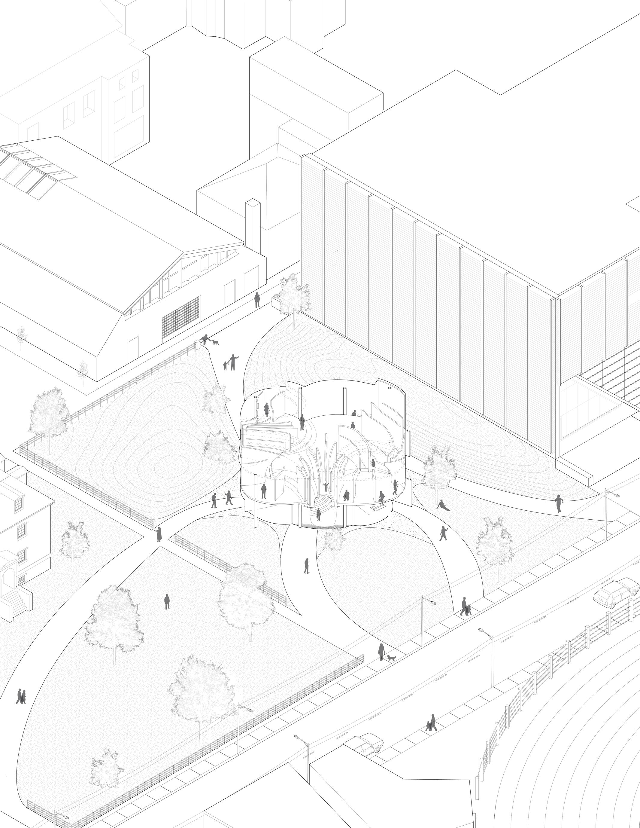
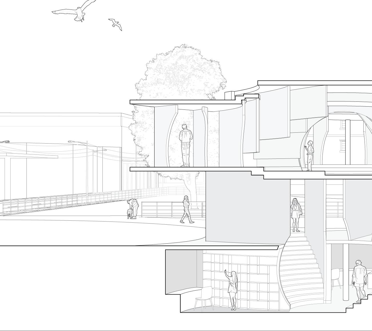
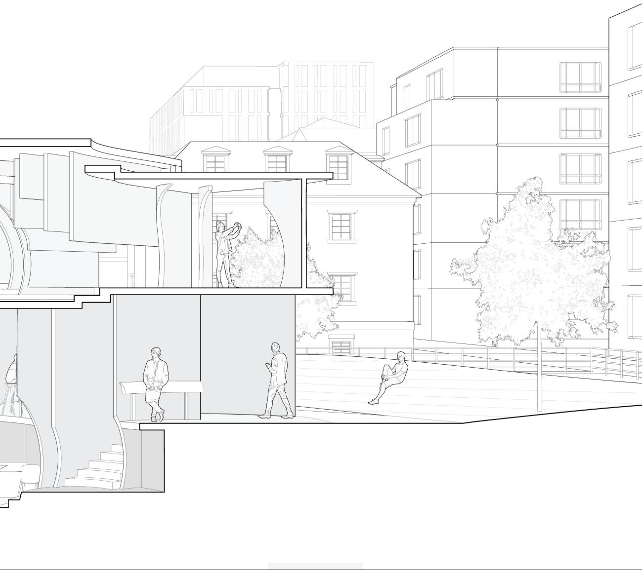
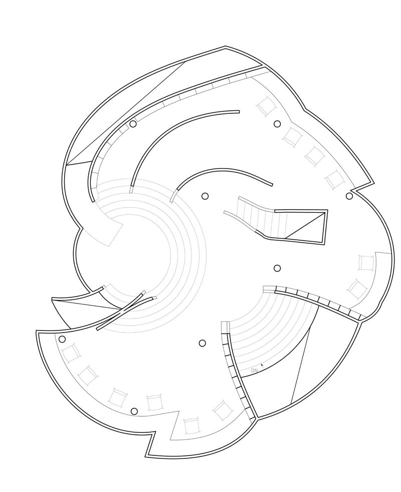
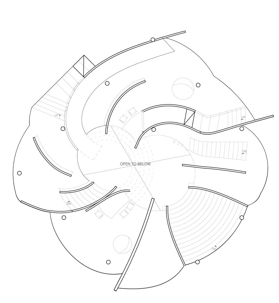
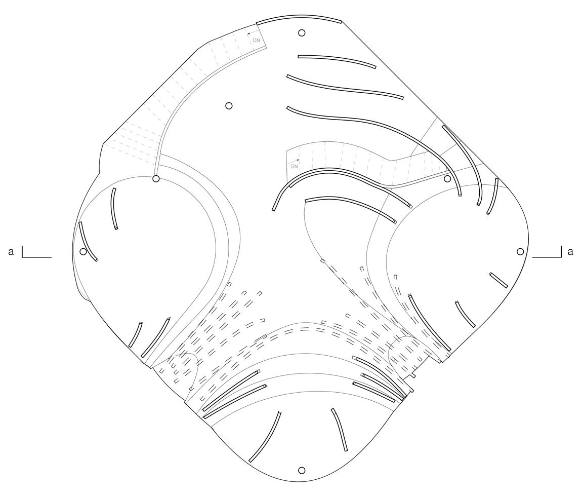
“To gravitate” means to be drawn toward a place, person, or thing. In this case, it’s the student center, a gravitational center for individuals and students to explore and experience. The center’s design utilizes gravitational forces to direct visitors through a series of engaging spaces.
Drawing from an earlier exercise focused on vertical planes, each floor of the center is crafted to lead visitors towards a unique focal point. The ground floor and basement direct attention to seating areas and the library, respectively, using these spaces as enclosed, inviting areas. The third floor, meanwhile, guides visitors toward strategically placed viewing areas.
The thoughtful placement of walls creates a dual experience of privacy and discovery, fostering intimate moments while revealing intriguing spaces at every turn, smoothly guiding visitors onward.

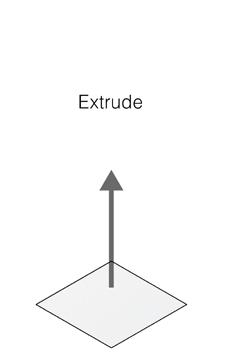
Precedent Exercise Design Methodology
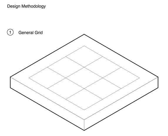
General Grid
A grid of 16m x 16m is provided
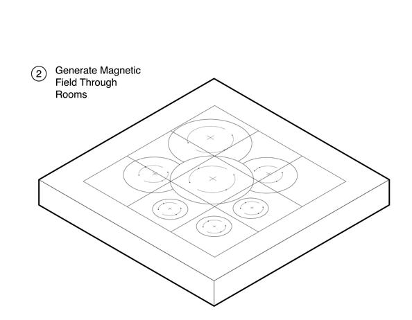
Create Seven Individual Spaces A field is generated at each individual location
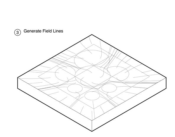
Generating Field Lines Using the rooms as the center of gravitational pull, field lines are created
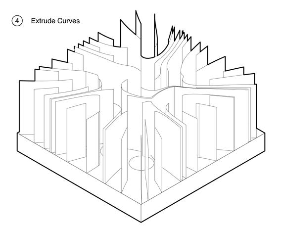
Extruding Geometry
The curves are all extruded at equal heights to create a set of walls
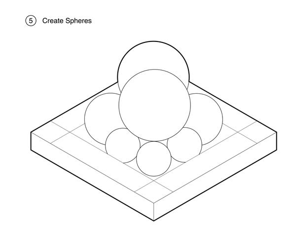
Creating Spheres
At the 7 locations, a sphere varying from small, medium, and large is created
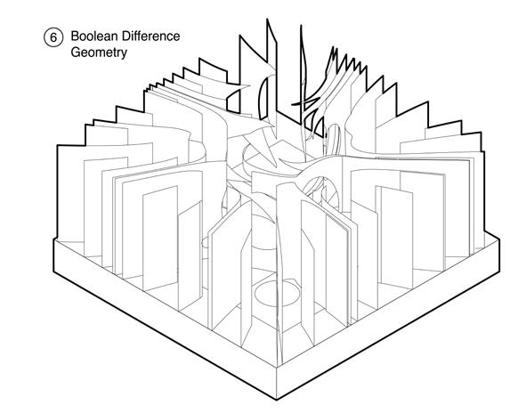
Subtracting Geometry
The spheres and walls are subtracted from each other to create a void
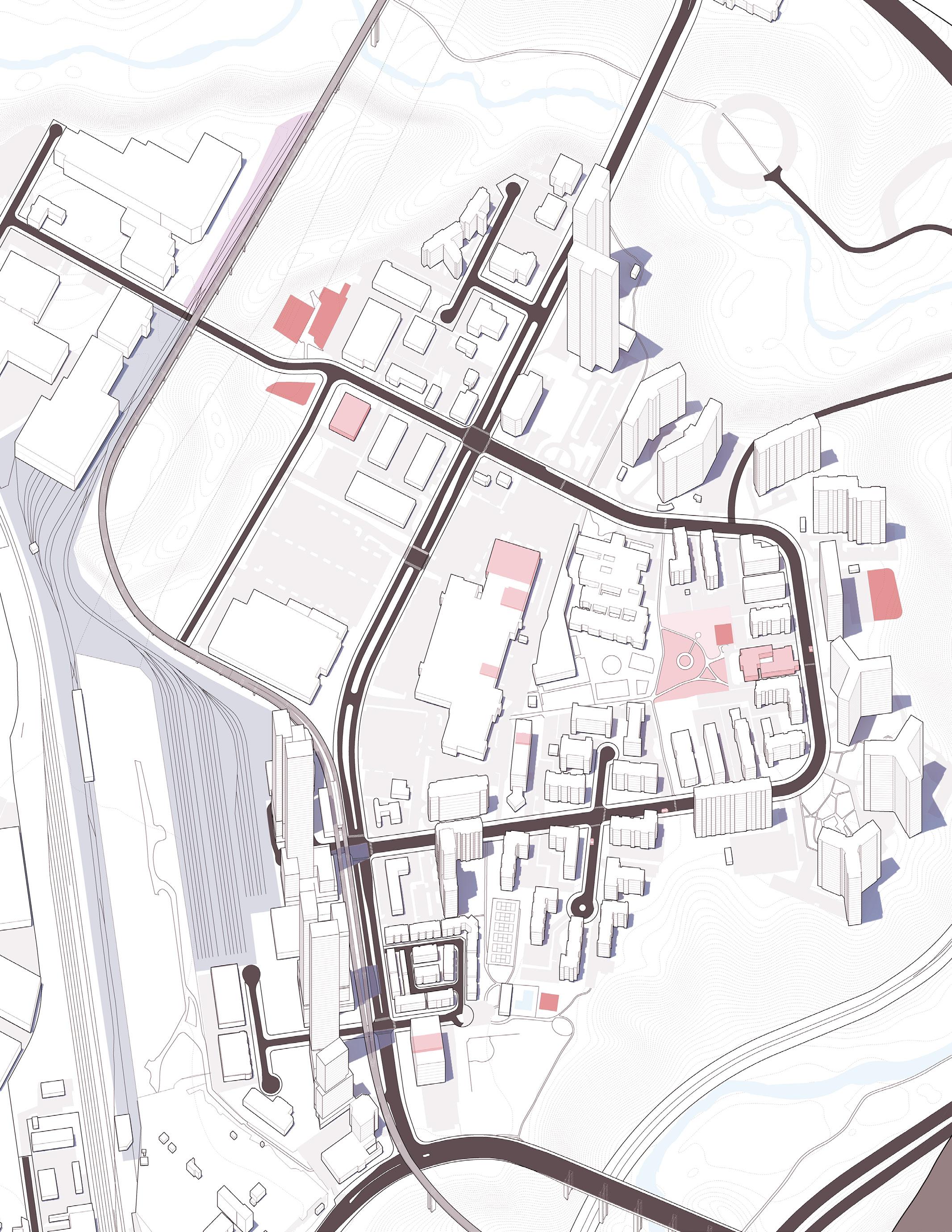
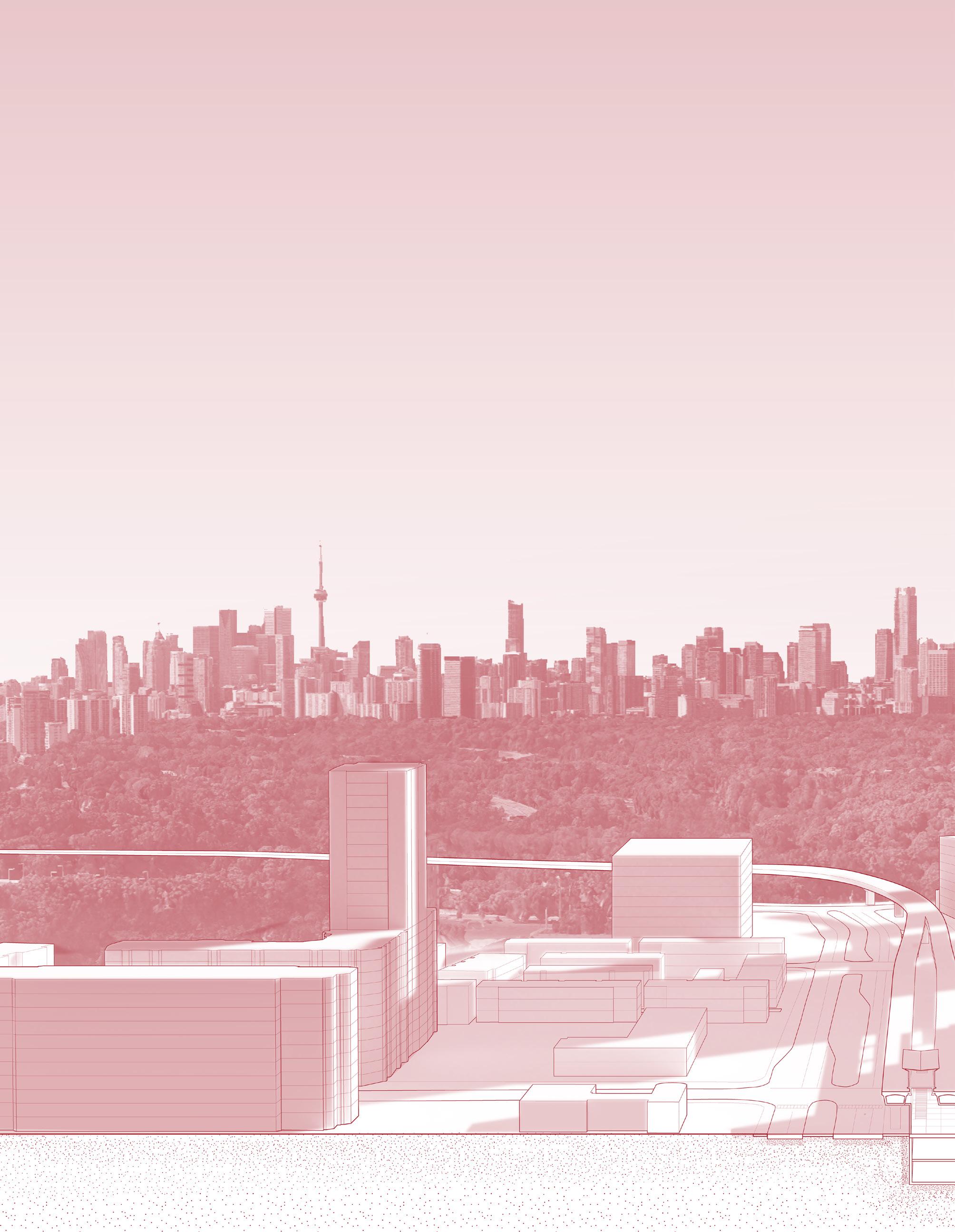
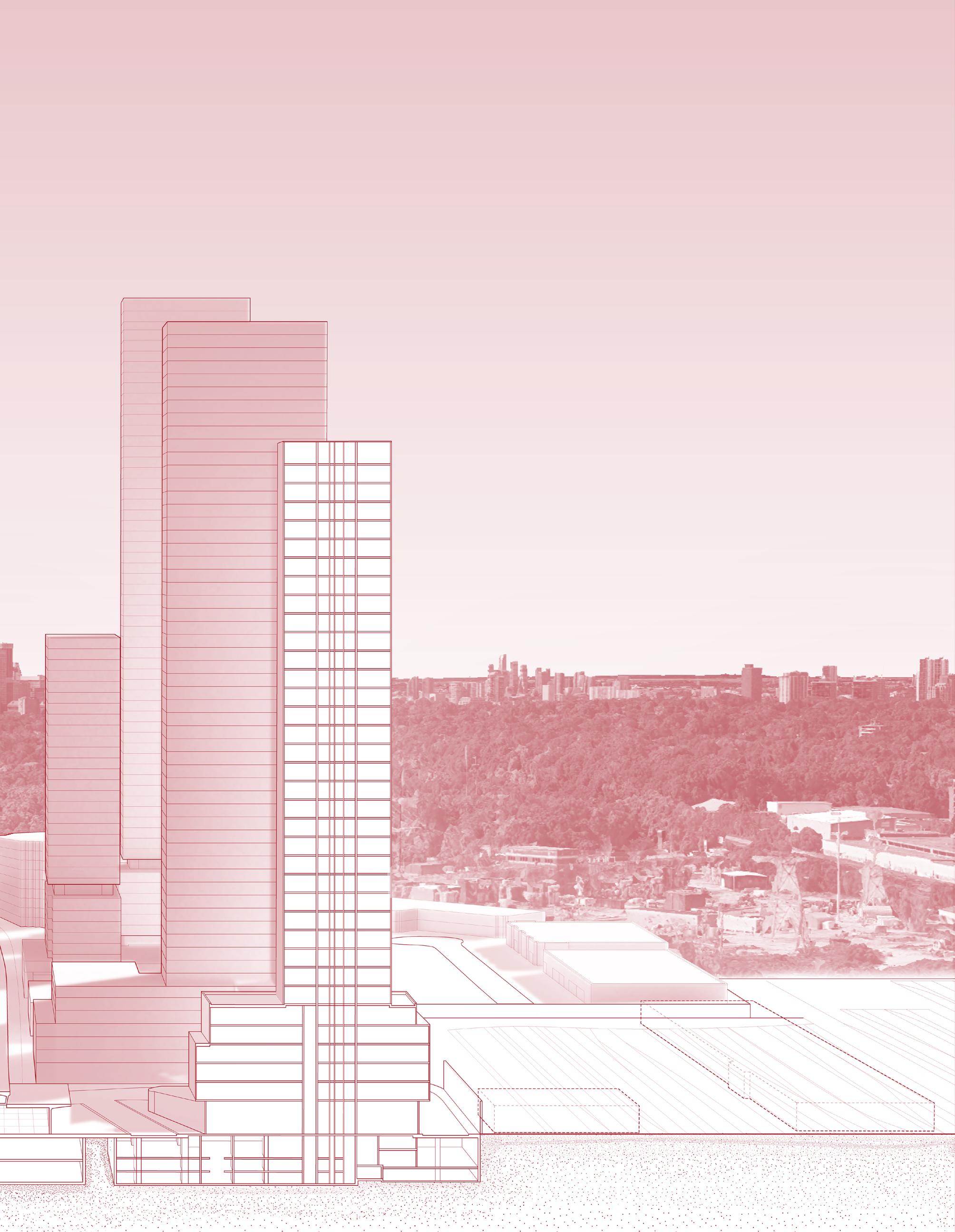
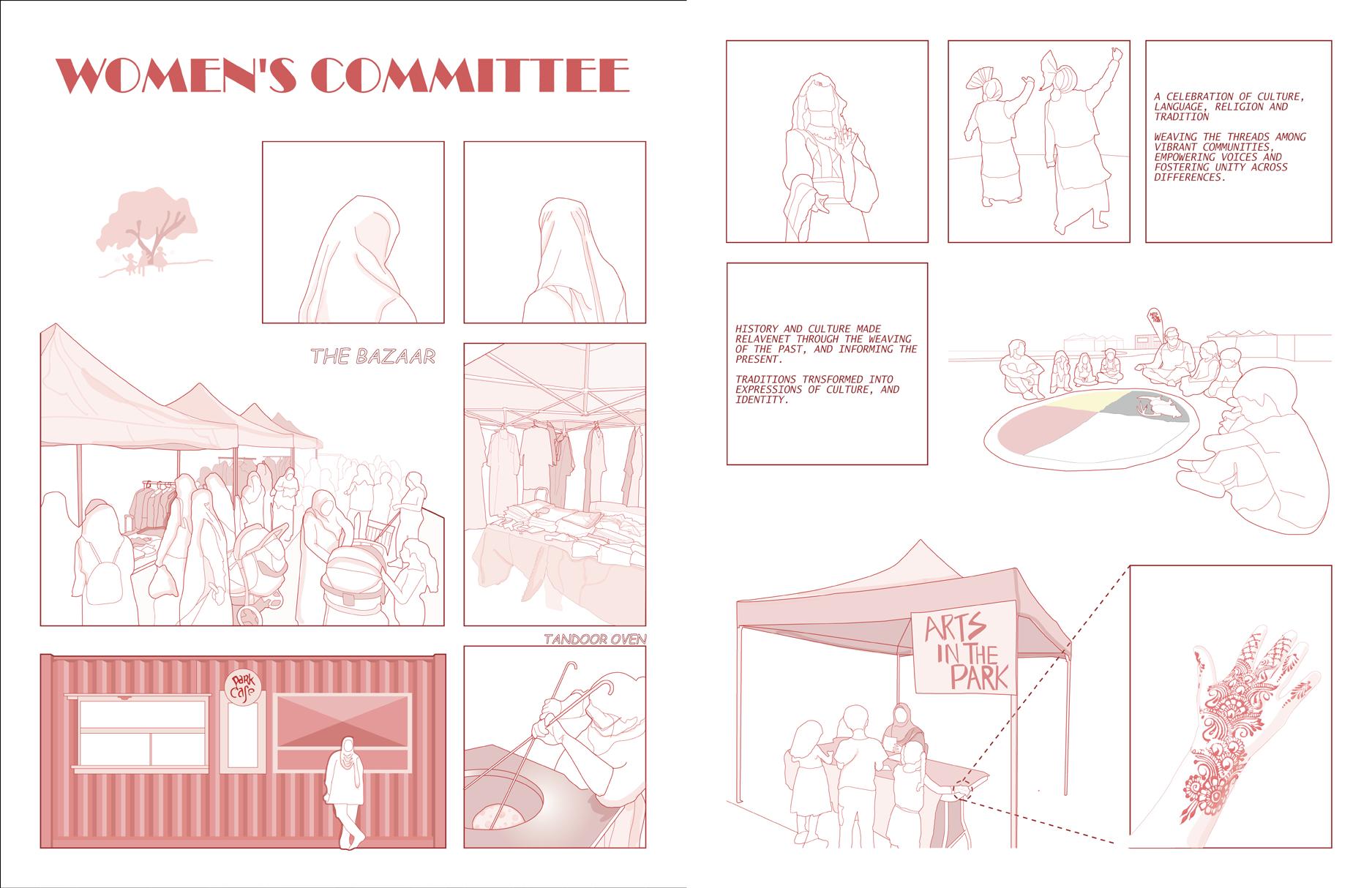
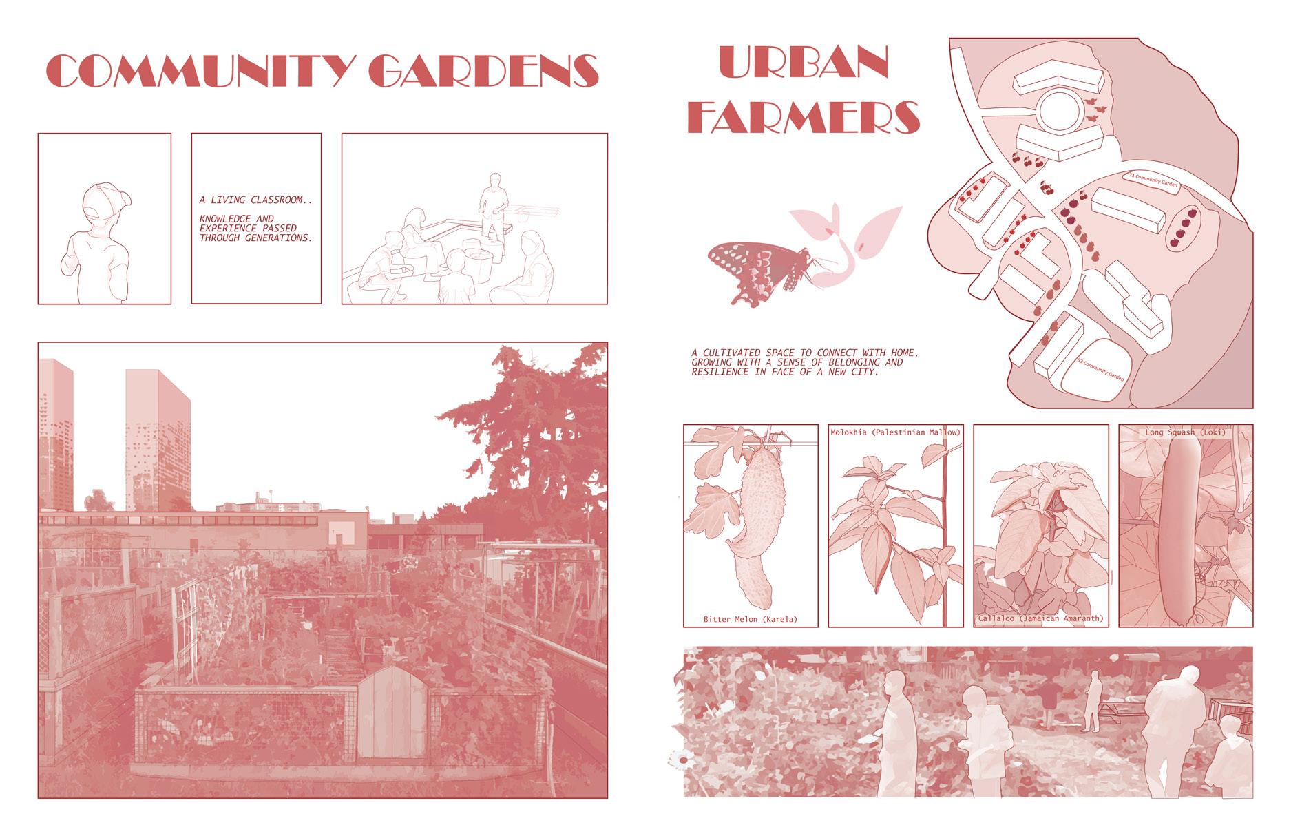
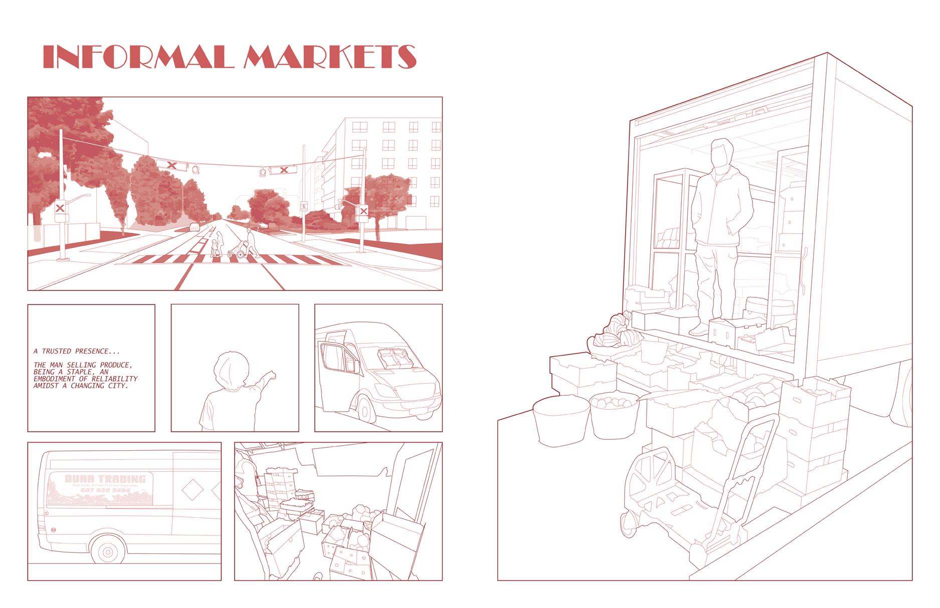
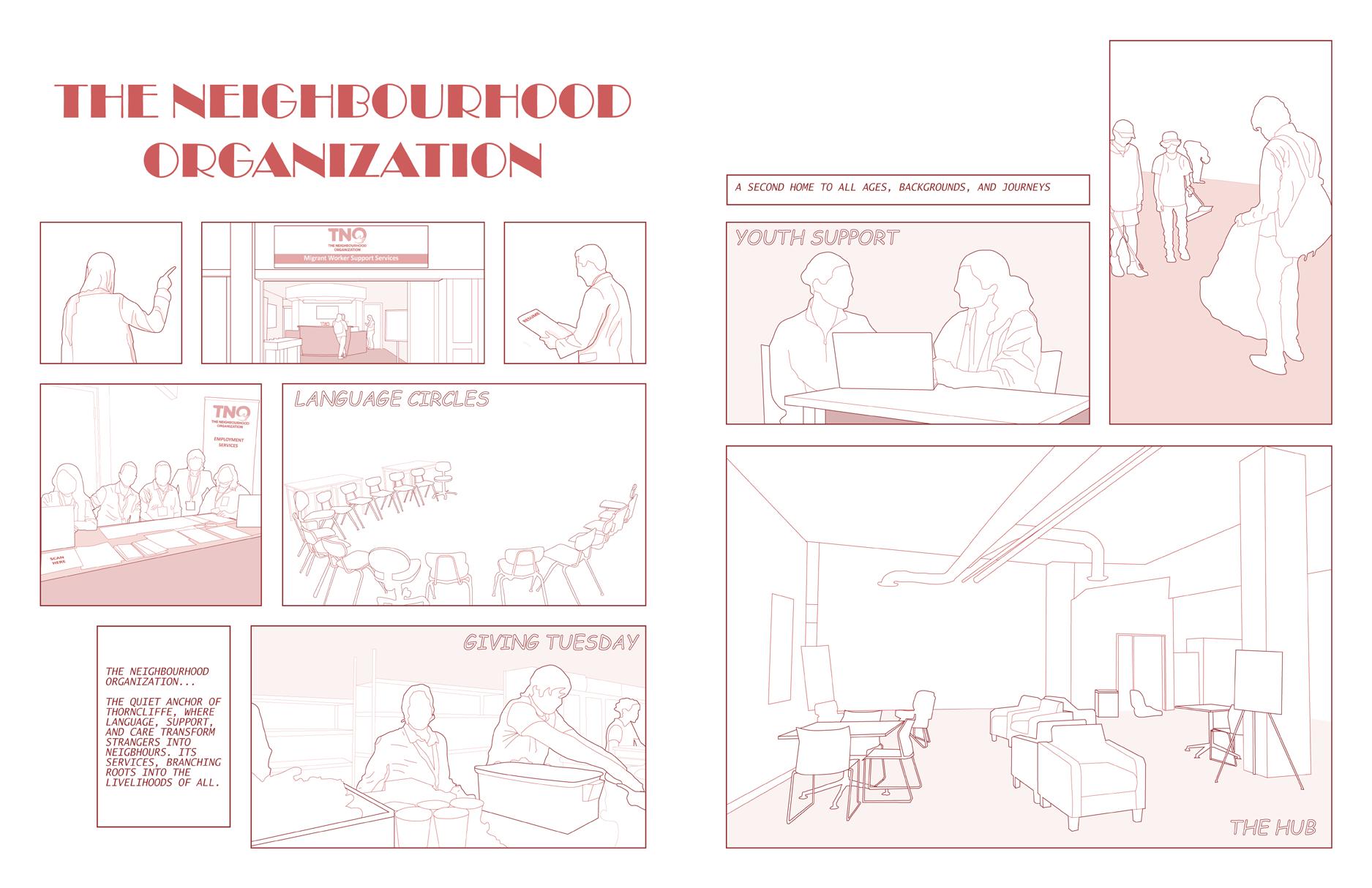
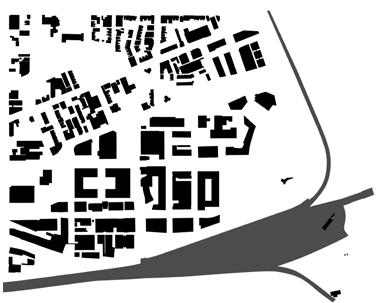
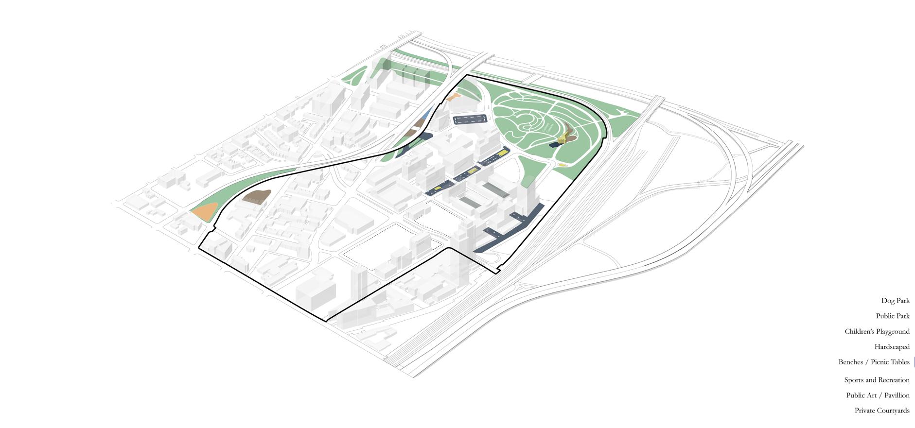
Thorncliffe Park’s Future Transit Community Advisor: Jeannie Kim
ARC461 | Senior Seminar in Design, Research
The Transit-Oriented Community (TOC) proposed for Thorncliffe Park is part of a broader effort to address housing demand by integrating high-density developments around transit hubs. It involves large-scale podium-and-tower condominiums with limited retail at grade, prioritizing density and transit accessibility over community integration. While it maximizes land use and transit benefits, the TOC risks gentrifying the neighborhood, displacing Thorncliffe Park’s vibrant ethnic enclave, informal markets, and grassroots organizations.
The TOC’s top-down approach, with minimal community engagement, further disconnects the development from the area’s existing fabric. I am exploring how to find a middle ground— reimagining intensification building from the ground up with the intent of balancing increased transit and housing access with strategies to preserve affordability, cultural identity, and community resilience. My research focuses on design solutions that ensure intensification supports, rather than displaces, the people and networks central to Thorncliffe Park’s identity.
Design Research
Advisors: Julia Di Castri & Elizabeth George
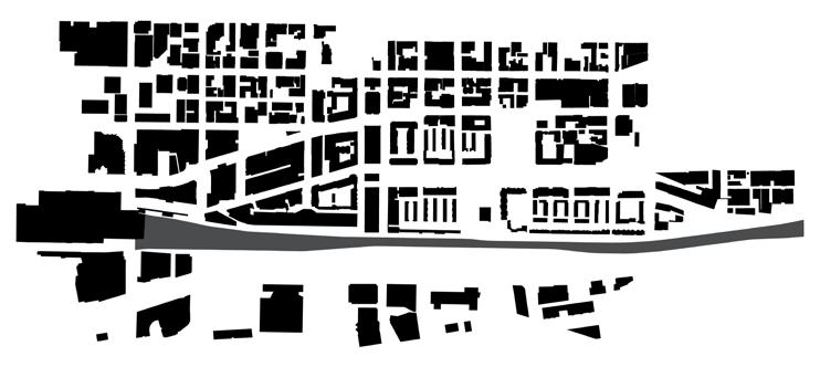
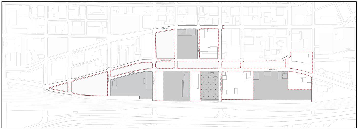
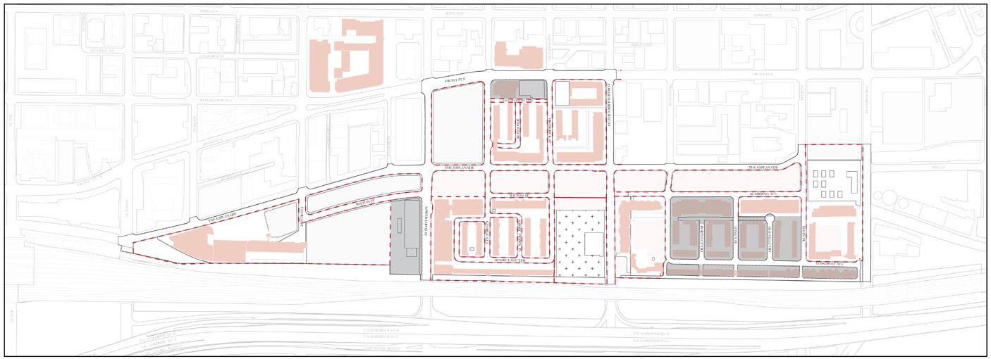
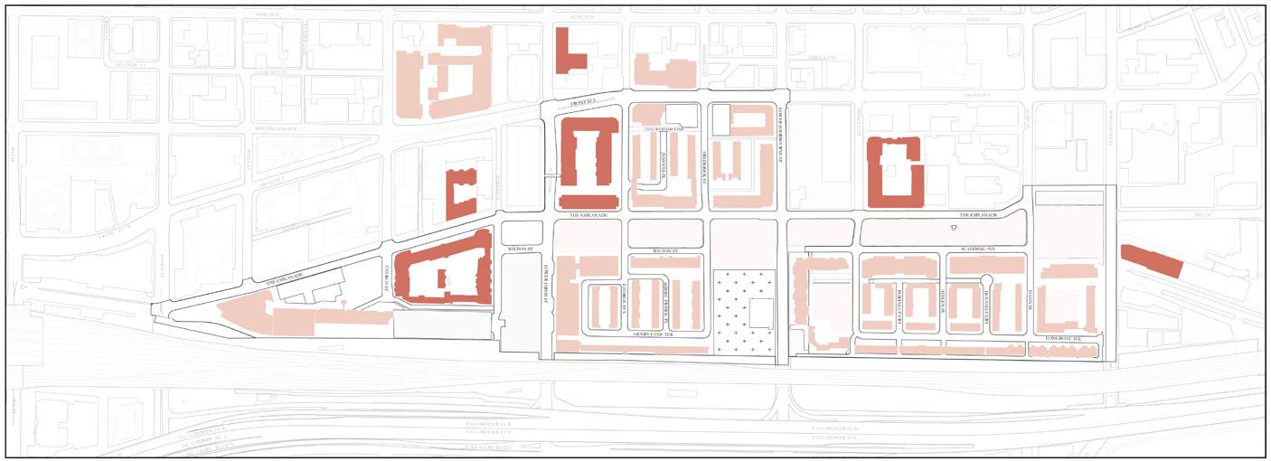
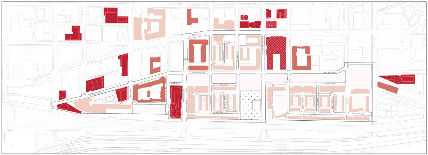
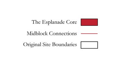
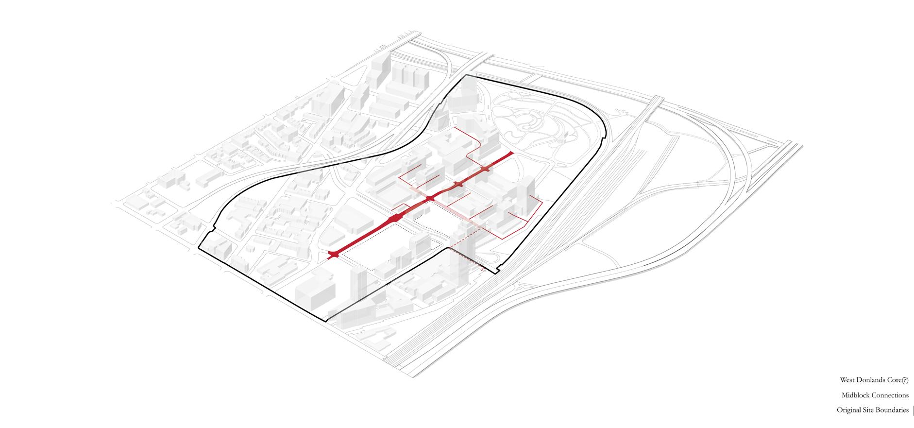
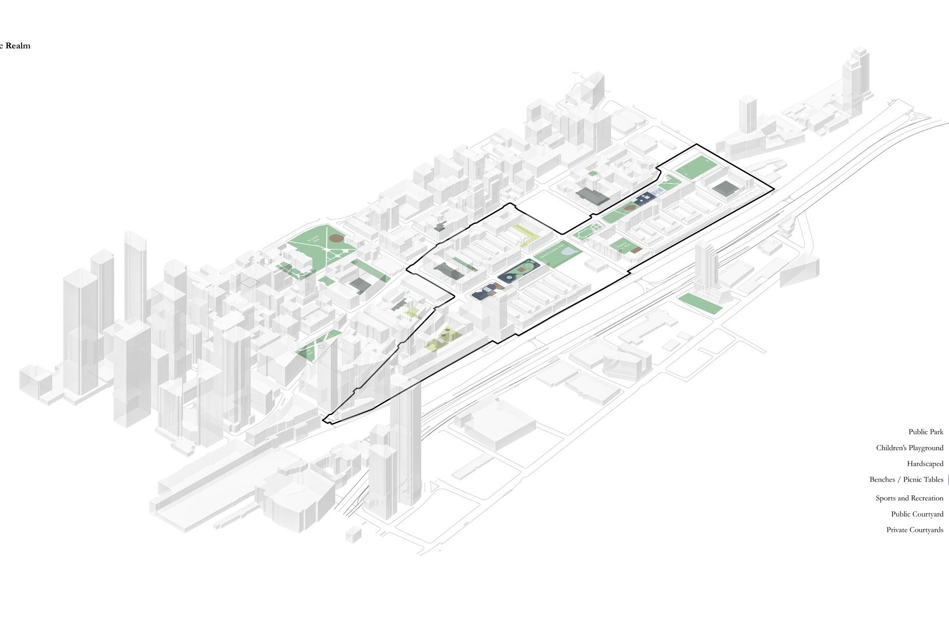
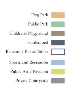
During my internship at architectsAlliance, I conducted a detailed comparative analysis of Toronto’s St. Lawrence Neighbourhood and the West Don Lands, focusing on methods of intensification. The project began with programmatic and land-use diagrams, setting the foundation for a block study analysis that examined transitional densities, ownership flexibility, and the integration of civic programs.
The scope extended beyond built form to include public realm design and its role in fostering connectivity within blocks. The goal was to understand successful neighbourhood frameworks and apply these insights to future projects, highlighting the potential for thoughtful urban development.
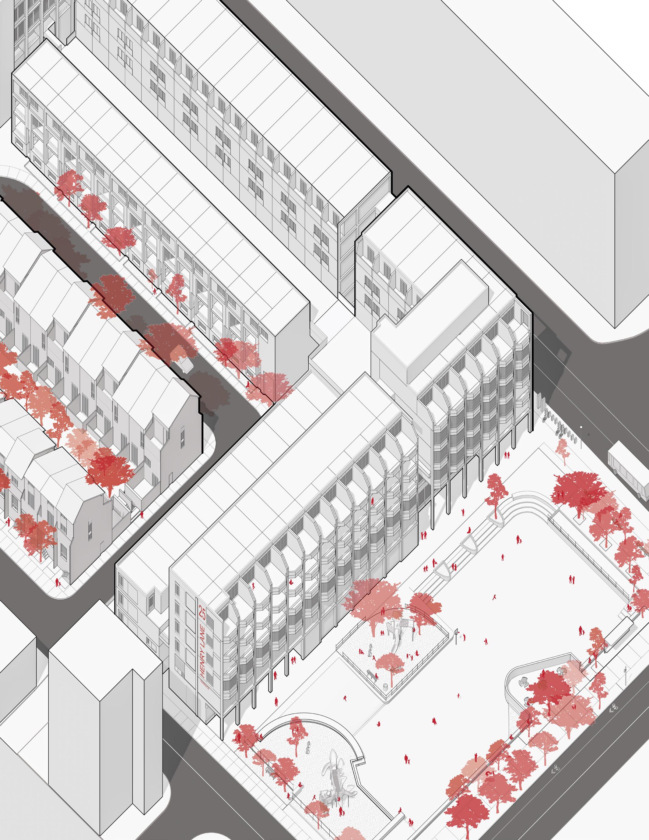
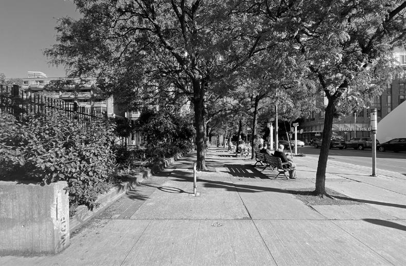
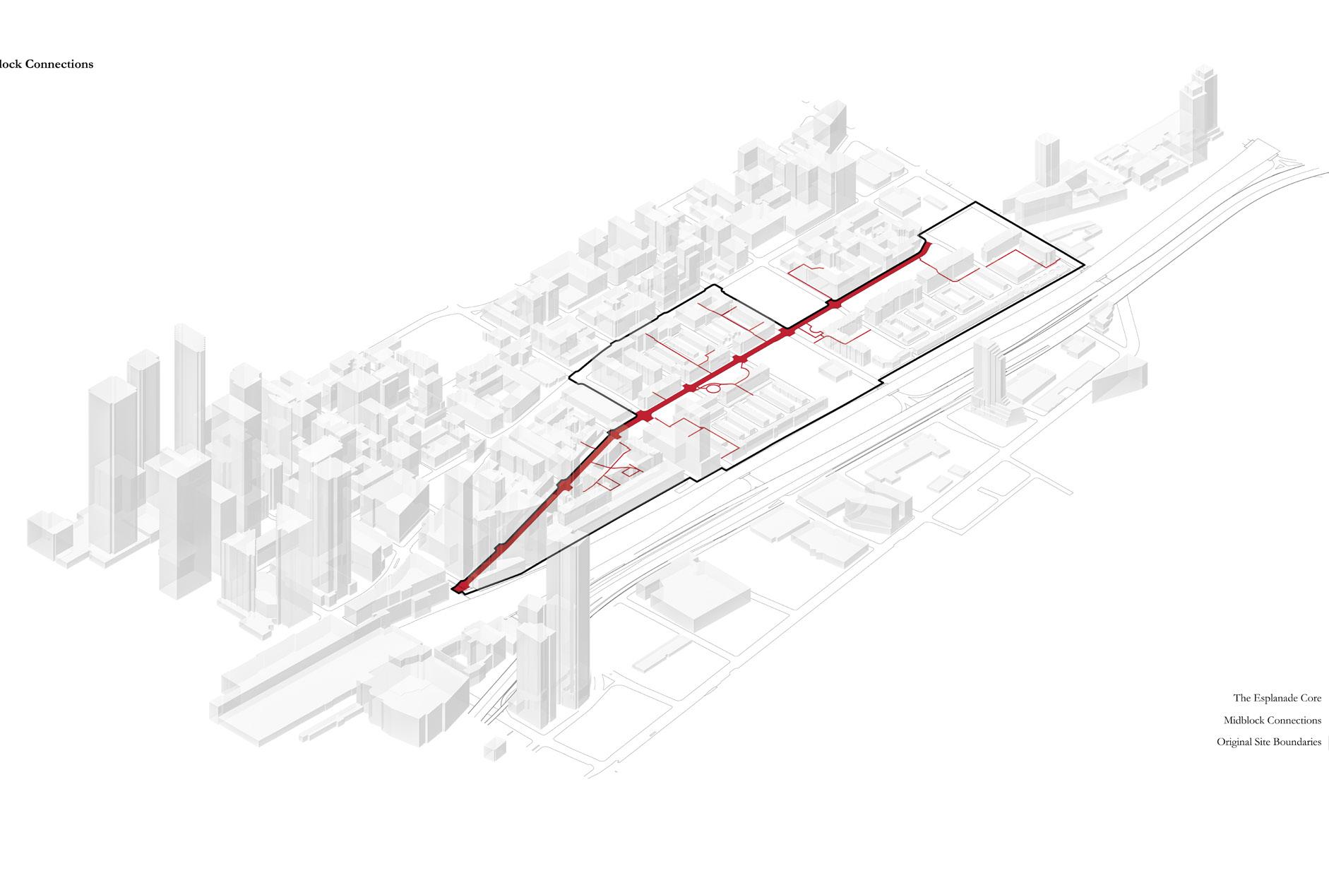
A: West Sidewalk Along Jarvis St.
Surrounding the playground, the hierarchy of public space is shown in the generous set-backs, allowing for the introduction of public seating along bus stops, shading from trees, and prviacy for the school grounds.
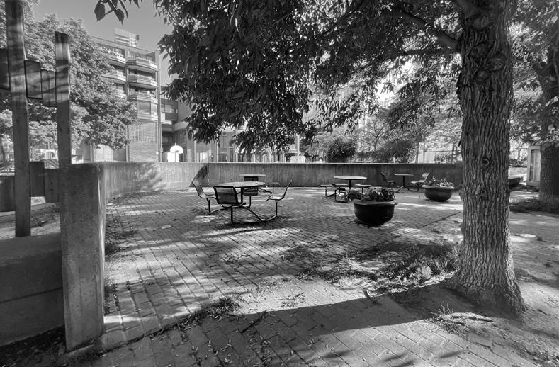
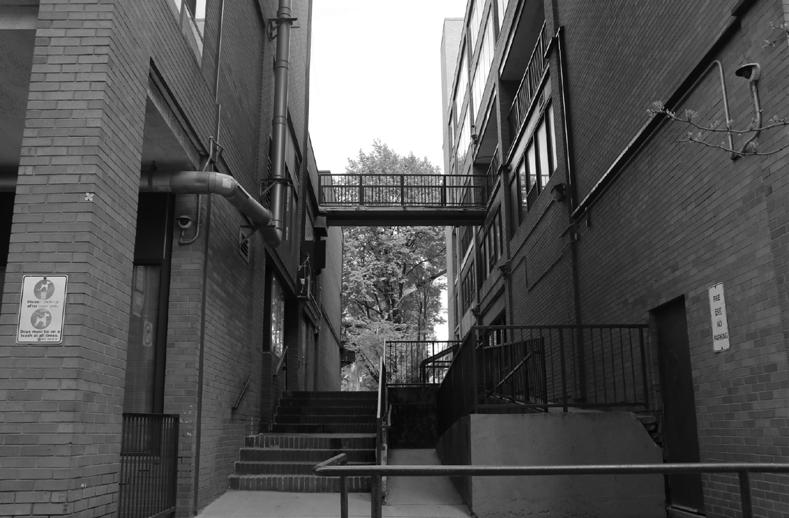
B: North Enclave Along the Esplanade
Burrowed within the playground itself, elevated walls, large trees, and picnic tables, provide moments for semi-intimacy without interrupting activity to the remainder of the block.
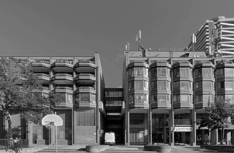
C: Downtown Alternative Playground
The David Crombie Apartments and Stacked Townhouses, part of the city’s non-profit, are cleverly organized atop the Downtown Alternative, St. Michael’s Catholic school, and corner for commrecial activity.
D: Midblock Connection Along Jarvis
The apartments along the block make use of open space with thoroughfares and mid-block connections, allowing for a transition into the private realm and block centre.
1965 | Existing Conditions
Selected Works
mohamad.sinjab@mail.utoronto.ca