Montana Outdoors (ISSN 0027-0016) is published bimonthly by Montana Fish, Wildlife & Parks in partnership with our subscribers. Subscription rates are $15 for one year, $25 for two years, and $30 for three years. (Please add $3 per year for Canadian subscriptions. All other foreign subscriptions, airmail only, are $50 for one year.) Individual copies and back issues cost $5.50 each (includes postage). Although Montana Outdoors is copyrighted, permission to reprint articles is available by writing our office or phoning us at (406) 495-3257. All correspondence should be addressed to: Montana Outdoors, Montana Fish, Wildlife & Parks, 930
Photo by Steve Leitner.
Photo by Stephen Simpson, Getty Images.
Introduction
I drove past the sign next to the ranch driveway, stopped, slowly backed up, then looked again: “Registered Polled Herefords.” Huh?
For more than two decades, I’ve lived in Montana—a state where cattle rule—and until recently I knew nothing about livestock.
I’m also embarrassed to admit I didn’t know how a grain elevator worked, the difference between hard and soft wheat, or why some hay bales are square and others are round.
Or what “hay” even is, for that matter.
My cluelessness included entire systems of working lands, like sheep farming, logging, highways, energy, and the process of converting Pondera County wheat into Japanese udon noodles.
I’m not alone. Many friends and colleagues, especially those who grew up in suburbs or cities as I did, admit they don’t understand how much of Montana operates. Exceptions include the many Montana Fish, Wildlife &
Parks employees closely familiar with ag life, often having grown up on farms or ranches themselves.
As for the rest of us, if we lived in Chicago or Boston it might be okay not to know what a steer or a windrow or a pivot irrigator is. But Montana is a rural state. All of us who live here should be familiar with at least the basics of rural life.
This issue is an attempt to do that.
About a year ago, I began jotting down everything I couldn’t identify or didn’t understand as I drove around Montana. For explanations, I visited with ranchers, farmers, Montana State University extension agents, and others, and I dove deep into books, publications, and websites. I boiled all that information down and ran the results past more experts to ensure accuracy.
Finally, I handed the text to our art director, Luke Duran, who put it all together, as he does with each issue, into the beautiful magazine you hold in your hands.
You’ve heard of “An Insider’s Guide” to some place or another? Think of this as “An Outsider’s Guide” to rural Montana.
We produced this unique issue of Montana Outdoors because we believe there is a need for basic information about rural life ordinarily not found in this magazine—or in any other publication. Information that helps
FROM LEFT: PHOTO COMPOSITES: LUKE DURAN; NICHOLAS DANIELSON
put the state’s renowned rivers, reservoirs, state parks, wildlife management areas, national forests, and other recreational sites into the context of a larger landscape.
Why this magazine? One reason is that much of Montana Fish, Wildlife & Parks’ public information, including many Montana Outdoors articles, comes under what I would characterize as “What Landowners Need to Understand”—about protecting wetlands, saving sagebrush, conserving uplands, protecting riparian areas, allowing public access, and on and on. FWP has so many messages it wants to get across to landowners.
This issue of Montana Outdoors turns that around and focuses on some of what the rest of us need to understand.
Many people, including quite a few of us
who live here, think of Montana as the scenes featured in tourism calendars and coffee table books—the mountain goat in Glacier National Park, drift boats floating along the Big Hole, a bull elk bugling in the morning mist, the underground wonders of Lewis and Clark Caverns. Which is fine. These and other depictions are true and scenic aspects of our state.
But they don’t represent most of Montana, the places in between the glossy calendar pages. The ordinary working lands.
We hope that reading this issue will help you see and appreciate those in-between places and the people living there. To understand the strong ties so many rural residents have with the land where they live and work each day. And to comprehend why they are so determined to keep their
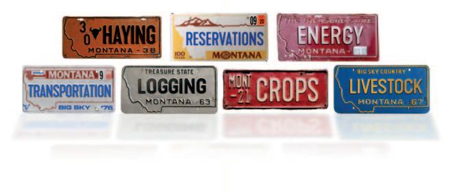
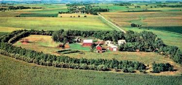
This special issue is broken into nine main articles—Crops, Hay, Reservations, Livestock, Logging, Ground Transportation, Energy, Semi-Rural Housing, and Rural Wildlife—summarizing major operations or features of Montana’s working lands. Scattered throughout are also 40 smaller “Through the Windshield” pieces that explain aspects of working lands that a person might encounter anywhere in rural Montana.
operations afloat when it would be far easier to sell.
As one Cascade County rancher wrote of hanging onto his family’s multi-generational operation, “To sell the ranch would be akin to losing an arm or a leg, or more accurately, a big chunk of our soul.”
This summer, as you drive around Montana exploring the state’s many recreational sites, keep this issue handy to help explain at least some of that sentiment. Toss it in the glove box. Use it whenever you or a passenger see something you don’t recognize or understand. Our hope is that it will not only explain how working lands and infrastructure function, but also why they matter.
—Tom Dickson, Editor
Rush hour in Broadview, Yellowstone County. Photograph by John Warner.
Background
Rural Montana’s history is as vast as the landscape itself, yet three developments in particular—geography, the homestead era, and mechanization—go a long way toward explaining why much of the state is so sparsely populated and what that means to residents, communities, and the state’s economy.
The first development occurred millions of years ago when geological plates pushed up Earth’s upper surface and created the Rocky Mountains, which run north-south from British Columbia to New Mexico. As warm, moist air moves east from the Pacific coast, it hits the mountains and rises, losing heat as it goes. The cooling moisture condenses and creates clouds, which eventually become so heavy with water that they drop rain or snow. That’s why there’s always more precipitation at high elevations.
But by the time the air passes over the
Rockies, it has been wrung dry, leaving little moisture for areas east of the Continental Divide.
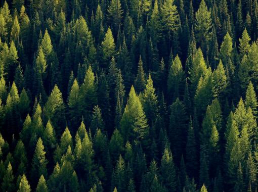
The difference in rainfall affects vegetation. West of the Divide are vast forests of tall pines, firs, spruce, and other conifers that require cool mountain temperatures and steady precipitation.
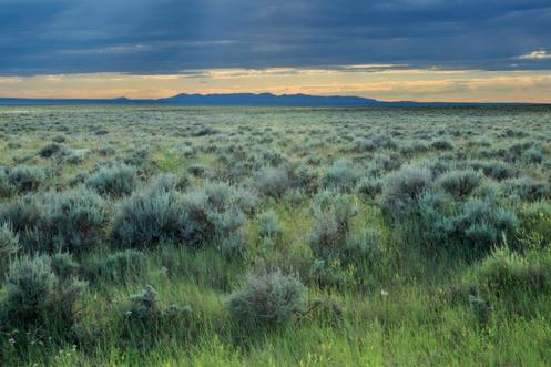
Compare that to the dry, windswept east, historically blanketed mostly by shortgrass (ankle- to knee-high), mixed-grass (knee- to waist-high), and sagebrush prairie.
FIRST PEOPLES
The lack of rain and snow was no hardship for the people who lived east of the Rockies
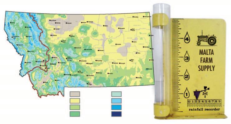
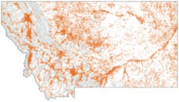
Montana Average Annual Precipitation
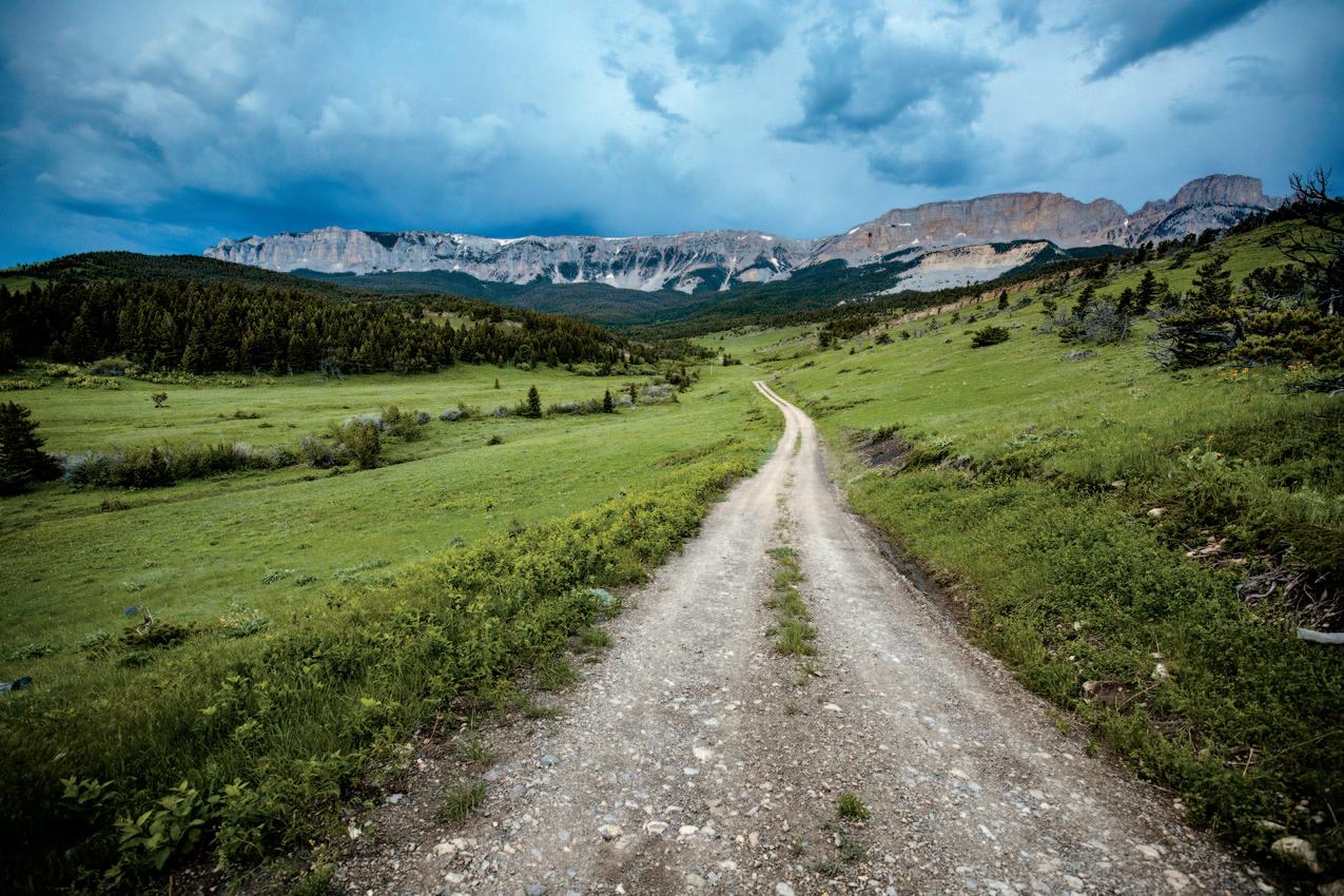
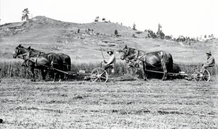
A two-track road runs through a ranch along the Rocky Mountain Front. Several factors account for why so few people live in Montana east of the Divide.
FROM TOP: LAURA VERHAEGHE; WIKIPEDIA
for thousands of years before European settlement. The Great Plains were rich in wildlife, with bison being especially important for making tools, clothing, shelter, food, and containers. Indian bands moved seasonally around the region, following bison herds while harvesting and processing native plants like prairie turnips, bitterroot, arrowleaf balsamroot, and wild fruits such as chokecherries, buffaloberries, and wild plums. The native plants had adapted to the dry conditions of the northern Great Plains and thrived even during regular cycles of drought.
Indigenous people also “worked” the landscape by setting fires that reinvigorated prairie grasses, creating green pastures of new growth attractive to bison, pronghorn, elk, and deer. They invented and refined new weapons—first the atlatl, which used lever physics to project spears faster and farther than a person could throw, and then the more versatile bow and arrow. They also developed sophisticated ways of hunting, especially the complex, multi-person operation of moving a bison herd along V-shaped drive lines marked with stone cairns to their death off cliffs.
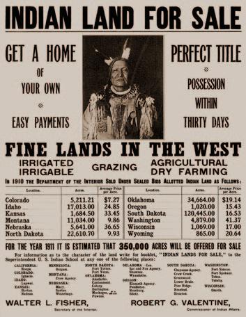
THE HOMESTEAD ERA
It was not until the early 1900s—when settlers began moving here by the thousands and tried to cultivate domestic plants like alfalfa, corn, barley, and wheat—that the arid climate of central and eastern Montana posed a problem.
The second development shaping much of today’s rural Montana had begun a half-century earlier. In 1862 Congress had passed the first Homestead Act, which gave citizens 160 acres of surveyed government land if they were able to “prove up”: build a house, plant crops, and stay on the land for five years. This federal legislation—which also involved removing Indian tribes—set off a tidal wave of land seekers. Initially, homesteaders settled on the rich soils of the Midwest, which sees abundant rain from warm, moist air moving north from the Gulf of Mexico. But in dry states like Montana, 160 acres usually didn’t produce enough grain per acre to make farming worthwhile.
Desert.” No matter, said members of Congress. First they passed bills that funded irrigation projects like those that drew water from the Yellowstone, Milk, and Sun rivers. Then in 1909, the Enlarged Homestead Act doubled the size of a homestead to 320 acres. Especially to poor European immigrants, very few of whom could ever own property in their home countries, the prospect of free land was too good to pass up.
At the time the Great Plains, including eastern Montana, was labeled in maps and schoolbooks as “The Great American
Encouraging the wide-eyed homesteaders were railroads that had recently laid lines across Montana. The Milwaukee Road, Northern Pacific, and Great Northern were eager for people to settle the emerging state. New residents would pay to travel, import goods and supplies, and grow grain to ship to eastern markets. The railroads widely distributed posters and brochures depicting Montana as an agricultural paradise. Federal and state agencies, local chambers of commerce, and other civic booster groups published ads and flyers promoting free land in “lush, fertile” Montana.
HOPE AND HEARTBREAK
With visions of Montana’s fruited plains, thousands of people flocked to the Treasure State. Between 1909 and 1919 more than 82,000 homesteaders filed claims on 25 million acres. They came from states like Missouri, Pennsylvania, and Minnesota and as far as Scandinavia, the British Isles, Germany, and Russia.
Many arrived at newly built towns growing around rail depots built every 15 miles along tracks to provide water for steam engines.
As luck—both good and bad—would have it, starting in 1909 eastern Montana entered a rainy period just as homesteaders were pouring in. For several years, counties that averaged 8 inches of rain per year received twice that. Newly planted fields of grain looked as green and lush as the railroad posters promised. Immigrants wrote to
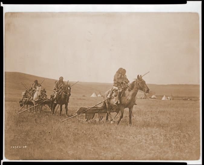
In this 1909 Edward S. Curtis photo, Indigenous men on horses drag travois past an encampment in eastern Montana. For thousands of years, people lived in this dry region, hunting bison and harvesting native vegetation adapted to the semi-arid landscape.
family members urging them to come at once and stake their claim. Montana, they exclaimed, was a farmer’s dream come true.
Then, in 1917, the rain stopped.
By the fall of 1918, drought gripped all of eastern and central Montana. In 1919 it extended as far west as the Bitterroot and Flathead valleys. Farmers who had been getting 25 bushels of grain per acre now were harvesting less than 3 bushels. To make matters worse, the end of World War I caused grain prices to collapse starting in 1918.
Of the 82,000 immigrants who came to Montana to homestead, 70,000 left before
1925. Montana was the only state in the entire country to lose population between 1920 and 1930.
From 1919 to 1925, roughly 11,000 farms were vacated, 20,000 mortgages were foreclosed, and half the state’s banks failed, erasing the life savings of thousands of Montanans. All this came before the Crash of 1929, the Dust Bowl, and the Great Depression that hit Montana along with the rest of the country in the 1930s.
Many farms west of the Divide suffered, too, though not to the same extent. Drought often stretched statewide, and rising costs
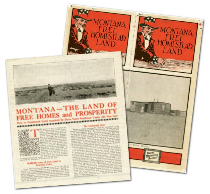
Articles, posters, and flyers in the early 1900s produced by government agencies, railroads, and local boosters touted Montana as a fertile land of plenty. A series of rainy years starting in 1909 seemed to substantiate the claim. Then came two decades of drought.
and low commodity prices hit farmers throughout Montana. But the floodplain farmland in the state’s western one-third was more fertile and the rain more generous, allowing more homesteaders and successive generations there to make it through the tough times.
East of the Divide, however, many newly formed towns shrank or even disappeared as residents packed up and left.
MACHINES REPLACE PEOPLE
The third major development depopulating rural areas was advances in machinery like combines and log harvesters that do the work of multiple skilled laborers. With specialized seeds, fertilizers, and pesticides, Montana’s 27,000 farms today produce twice as much grain as the 58,000 farms operating at the peak in 1920—but with a fraction of the agricultural workforce.
Evidence of boom-and-bust cycles and agricultural mechanization is especially visible along eastern Montana highways. Abandoned rail lines and grain elevators. Towns that no longer exist except as names on old railway maps. Vacant one-room schoolhouses.
Not everyone was forced off their farm. Combinations of smarts, luck, and inner fortitude allowed many farmers to survive— and even thrive—through droughts and fluctuating grain and energy prices. One Chouteau County farmer-rancher summed up his family’s perseverance: “I think Dad was just more determined to make it work than his neighbors were.”
Many of those who survived diversified their crops, sometimes adding cattle or sheep to their operations. Others bought their neighbors’ farms at foreclosure sales to expand their holdings, having learned that even 320 acres in eastern Montana was not the same as 320 acres in Iowa. Many changed farming techniques to better suit the dry climate, letting fields lie fallow in alternating years, planting soil-holding cover crops, using no-till planting, and drilling wells or running pumps and water lines to irrigate dryland.
More than anything, they recognized
Evelyn Cameron photograph of mowing hay at Fiddleback Ranch near Knowlton, 1909. During the 1910s, rain fell abundantly across Montana, creating a false impression of the state’s agricultural potential.
IMAGES: MONTANA HISTORICAL
that, with exceptions like growing organics and specialty crops, farming in the northern Great Plains required ever-larger operations run by fewer people.
Results of that success and grit are also visible today. Boundless fields of wheat and barley. Monumental concrete grain elevators along railways at regional transportation hubs. Expansive herds of cattle.
But bigger combines, genetically modified crops that grow in dry or cold conditions, yield-boosting fertilizers, and other advances have come at the expense of local jobs. Montana’s agricultural economy hums along with far fewer laborers and farm owners than in years past.
As a result, most farming communities are shrinking. A century ago, homestead
Farm numbers peaked in the early 1920s then steadily declined over the next half-century as farmers succumbed to rising costs, falling commodity prices, and, most of all, eastern Montana’s chronic lack of rainfall.
The average size of farms grew rapidly after the 1920s as banks and counties sold off foreclosed and tax-forfeited properties that farmers couldn’t keep afloat.
The average size of farms has decreased over the past 40 years with the increase in smallacreage hobby farms.
Average size of farms (acres)
towns looked like “beads on a string” as one geographer put it, popping up every 15 miles or so along railroad lines. Today, many are empty or nearly so.
Sure, a few larger, regional towns are thriving. That’s where the banks are, the vehicle and agricultural implement dealers, drilling companies, medical facilities, and box stores. But there’s no denying the empty main street furniture stores, clothing emporiums, restaurants, and movie theaters in the small towns between regional hubs.
It’s no one’s fault. That’s just how the economics played out.
A LOVE OF THE LAND
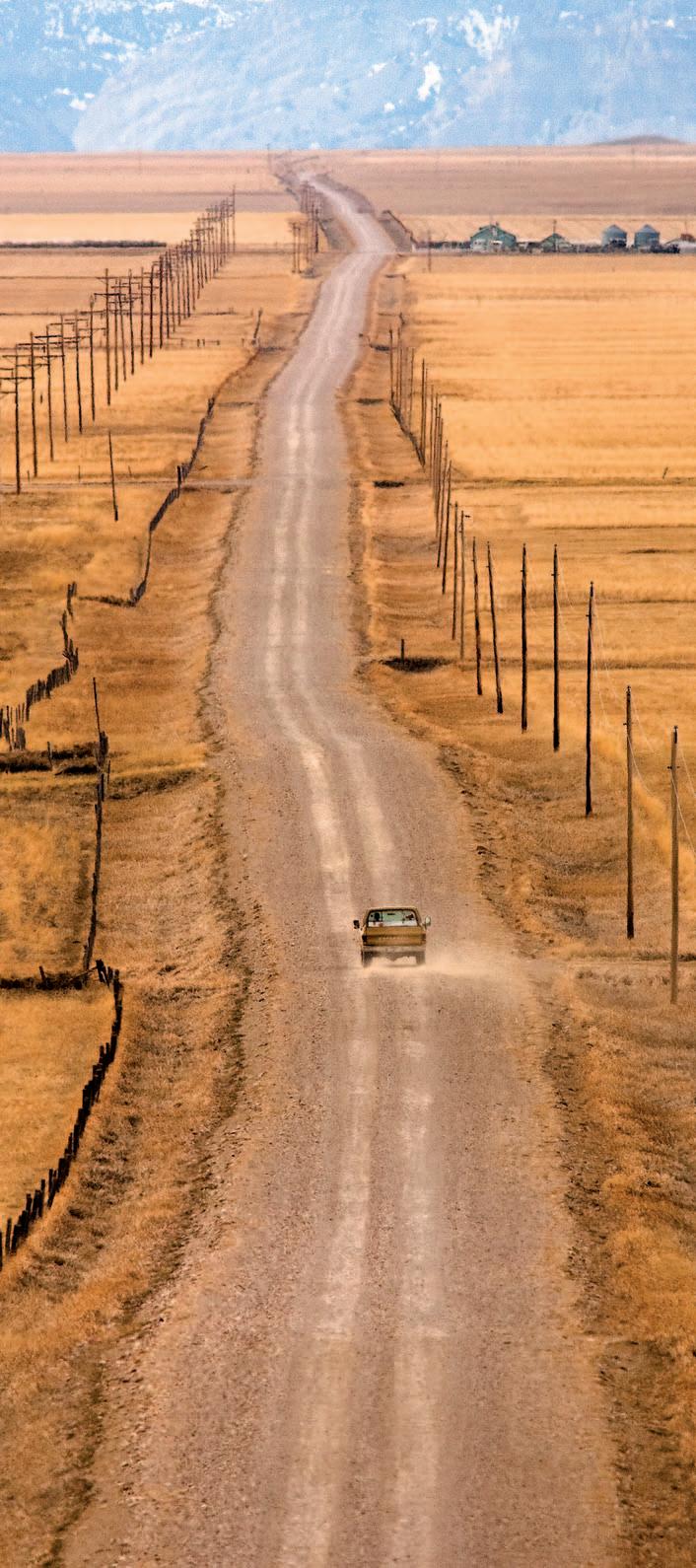
Today the most distinctive thing about rural Montana, other than its panoramic beauty, is the lack of people amid all that open space. Montana is the fourth-largest state in the nation yet has fewer residents than 42 other states. On some remote county roads and highways, you can drive an hour without passing another vehicle or seeing a mailbox.
Even so, rural Montanans are trying to find ways to reinvigorate their towns, lure young families to their communities, encourage new businesses and industries, and give their kids hope for the future.
Their efforts hold promise, if the histories, operations, and features of the state’s working landscapes highlighted in this issue of
Montana Outdoors are any guide. Over the years, many families and communities have survived and overcome hardship caused by drought, technological changes, and economic stagnation. The very presence of rural Montanans today is proof of what’s possible when you combine perseverence, cooperation, and a deep love of the land.
Founded in 2006 in White Sulphur Springs, population 2,170, Red Ants Pants clothing brand produces rugged apparel designed for women who work outdoors. Business proceeds fund a charitable foundation, and the company sponsors the annual Red Ants Pants Music Festival. The four-day festival features major country and Americana musicians, attracts up to 15,000 spectators, and injects millions of dollars into the regional economy each summer.
Crops
Combining soil, seeds, and water to make food
Editor’s note: Agriculture is the practice of cultivating soil to produce food crops. The term sometimes includes raising cattle and other livestock. Those operations are covered separately starting on page 32.
For thousands of years, people living in what we now call Montana harvested native plants for food and medicine, including camas root, bitterroot, horse mint, wild plums, huckleberries, and serviceberries. Knowledge of historical plant locations and use continues to be passed down from generation to generation.
Evidence of planted crops dates back a thousand years or more in some regions of the United States. But people living in Montana did not grow plants for food until the mid-19th
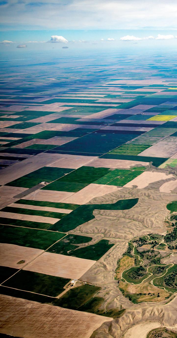
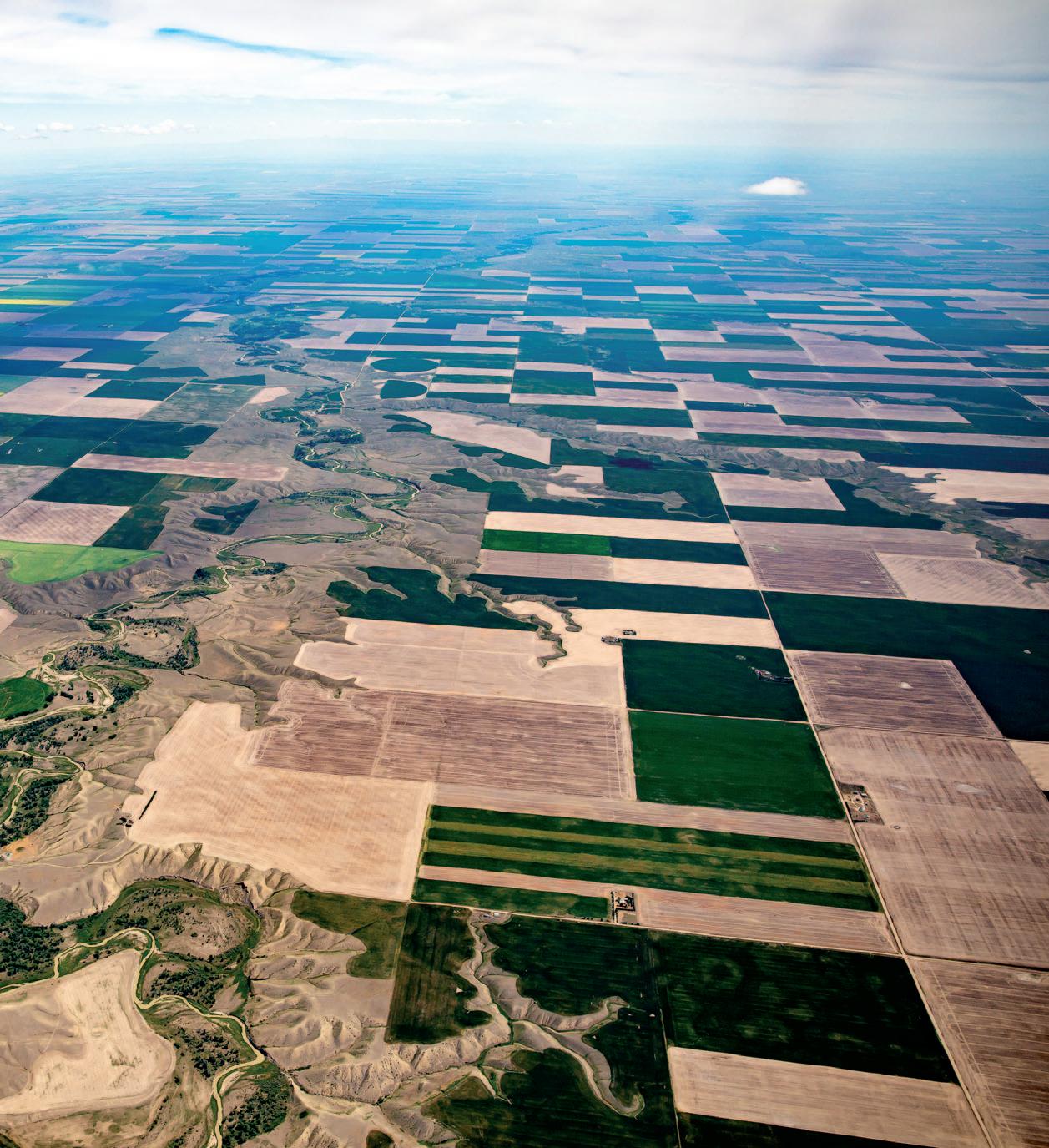
Above: The Teton River winds through Teton County across a patchwork of wheat, barley, alfalfa, canola, and other crop fields. Most of the acreage in north-central Montana is dryland (not irrigated), putting it at risk of low yields during drought conditions.
PHOTO BY CHRIS BOYER/KESTREL AERIAL IMAGES
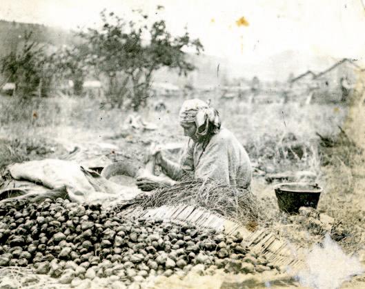
Left: Historic photo of a Nez Perce woman in what is now Idaho sorting and cleaning camas root similar to how the Salish of western Montana processed the plant for thousands of years.
PUBLIC DOMAIN. STEPHEN D. SHAWLEY COLLECTION, UNIVERSITY OF IDAHO LIBRARY SPECIAL COLLECTIONS AND ARCHIVES
Montana is among the nation’s top producers of “pulse” crops, which include dried peas, dried beans, lentils, and chickpeas.
The word is derived from the Latin puls, meaning “thick soup,” like split pea soup.
century, when missionaries and early farmers planted garden plots and oat fields. Farming as a commercial enterprise started in the mountain valleys of southwestern Montana to feed prospectors and others drawn to the gold rush in the early 1860s.
Since then, farming has gone through a series of boom-and-bust cycles. The number of farms and farmers grew during the homesteading era, with a peak in the early 20th century. But years of severe drought starting in 1917 forced many to sell and move to towns or other states. Montana agriculture saw temporary booms in the 1940s due to war-time demand, and in the early 1970s with massive wheat sales to the Soviet Union.
Some producers, having followed the U.S. Department of Agriculture’s advice to “get big or get out,” in the ’70s, over-purchased land and equipment and couldn’t make payments when prices dropped in the 1980s. They then had to sell their land or forfeit it to the county if property taxes went unpaid.
CONCERNS AND REWARDS
The major challenge facing farmers has always been the lack of control over major elements of their operations, from unpredictable weather to fluctuating global markets.
Farmers always have an eye on the sky. They hope for snow in winter, though not in
Above left: Earl Butz, USDA secretary during the Nixon and Ford administrations, urged farmers to plant “fencerow to fencerow” to increase harvest to meet booming global demand in the 1970s. Many farmers followed his “Get big or get out” advice and over-purchased land and equipment, saddling themselves with crippling debt once demand and prices fell in the ’80s. Above right: Adding to farmers’ woes are constantly fluctuating global markets, harvests, and energy prices as well as drought, insects, and the looming threat of summer hail storms. Top: Most ranchers balance the hardships with rewards like raising their kids in the outdoors, knowing they are helping feed the world, and maintaining their family’s land stewardship tradition.
CLOCKWISE FROM TOP: TODD KLASSY; DOUGLAS ROANE; ASSOCIATED PRESS
amounts that impede travel. As the ground thaws in spring, they keep their fingers crossed for rain, but not so much that it floods fields and prevents planting. After July 1, they bank on drier conditions through the end of summer so ripened crops can be harvested, and cross their fingers that hail won’t wipe out an entire harvest.
Farmers also use plenty of electricity and fuel, making energy prices a constant concern. Other Montanans may wince when they fill their gas tank, but farmers often have to fuel a half-dozen or more vehicles.
Then there’s the rising or dropping demand in major global markets su ch as China, or fluctuations in other global grain producers like India that can alter prices that Montana farmers receive for their harvest.
That’s a lot to manage. Yet for most farmers, outweighing these challenges are rewards like turning seeds into food, knowing their work sustains communities, continuing the family’s land stewardship, raising their kids in fresh air and sunshine, and looking up each night and seeing millions of stars from the back porch.
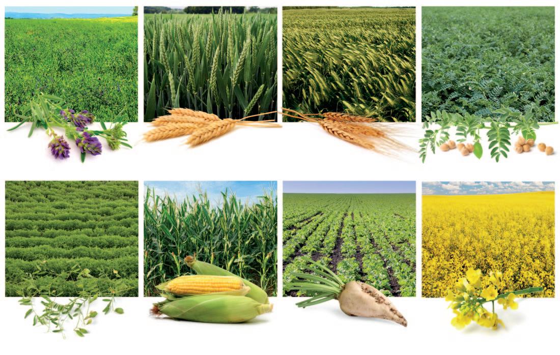
CROP TYPES
Montana’s major field crops are categorized as grains (wheat, barley, and corn, also known as cereals) and legumes: alfalfa, soybeans, and “pulses” (dry peas, dry beans, lentils, and chickpeas).
Producers water these crops either by counting on nature or doing it themselves. Dryland farming, used mainly for wheat, barley, pulse crops, and oilseeds, relies only on moisture from rain and snow. Irrigated farming—used mostly for alfalfa, dry beans, sugar
beets, and potatoes—involves flooding or spraying fields with water pumped from underground or diverted from rivers or reservoirs.
Montana’s top moneymaker is wheat (spring, winter, and durum), accounting for about 45 percent of the state’s total crop revenue. Hay, mainly an alfalfa–wheatgrass mix, is the next highest revenue producer, followed by pulses, then barley (used to make hay, beer, and “sweet meal” for baked goods).
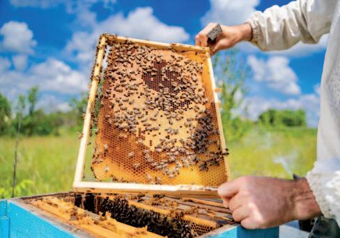
Treasure State farmers also produce oilseeds (canola, flax, sunflower, and safflower), sugar beets, and seed potatoes. The Flathead region’s moderate climate makes it ideal for growing cherries and melons. Honey production is considered a part of agriculture, too (see page 42).
Montana is the nation’s top producer of durum wheat, lentils, and dry peas, and is ranked number two for barley production.
Some farmers grow just one crop, like hard red wheat or malting barley. But others plant a half-dozen or more types, hedging bets on rainfall and global prices, and rotating crops
Total Revenue Generated by Montana Crops
to reduce insects, weeds, and disease. Many farmers also raise cattle, another way of diversifying income and reducing risk.
FOUR-SEASON WORK
Planting cool-season crops like spring wheat, sugar beets, and barley begins as soon as soil temperatures allow in April or May. That’s also when lentils and peas are sown. Warm-season crops like safflower, sunflower, and corn are planted in June. Alfalfa and grass hay are perennials and only need to be planted every 6 to 15 years.
During summer, crops are fertilized and sprayed for weeds and pest insects.
Typically, harvest season begins in July with lentils and dry peas, then winter wheat in late July, spring wheat and barley in midAugust, and corn in September. Sugar beet harvest comes in October.
During winter and between planting and harvest, farmers purchase seed, fertilizer, insecticides, and other necessities for the coming year. They also meet with state and federal ag agency employees who provide advice and assistance with grants, loans, and insurance. Winter is also a time for repairing machinery and vehicles.
A pickup truck is indispensible for hauling everything from fence posts to bags of seed to hay bales. Then there are UTVs (utility vehicles like four-wheelers) and tractors, along with attachments like plows, manure spreaders, seeders, drills (which punch seeds down into dirt without plowing), and hay balers. For wheat and barley farmers, the most important (and costly) machine is the combine harvester (or simply combine, see page 13.) Another piece of equipment
Harvesting wheat near Chinook. Because of the harsh climate, which creates more protein in wheat, Montana’s Hi-Line is one of the nation’s top durum-producing regions.
you might see is the grain auger—a gigantic screw encased in a long metal tube installed at the base of a grain bin. As the auger turns, it moves grain through the tube to either empty a truck’s contents into the grain bin or fill a bin or a rail car headed to market.
FERTILIZING
Producing grain year after year demands a lot from soil, which eventually gets depleted of nitrogen, phosphorus, and potassium. To compensate for the loss, farmers treat soil with natural or commercial fertilizers, much the same as homeowners do with house and garden plants.
Most farmers add nitrogen, phosphorus, potassium (potash), and other nutrients to the soil either in pellet, powder, or liquid form. Application rates depend on the particular crop and soil fertility, measured by testing pH (acidity) and soil nutrient levels.
Though they allow farmers to continue producing crops, nitrogen- and phosphorusrich commercial fertilizers can cause environmental problems. Some wash off the soil
surface with rain into nearby rivers and streams, fueling excess algae and aquatic plant growth harmful to trout and other fish. Some nitrogen seeps into the aquifer, where it can increase levels of harmful nitrates in drinking water. Repeated use of commercial
fertilizers can also cause soil to acidify and stop plant growth altogether.
Farmers may instead spread natural fertilizers such as cattle, swine, or poultry manure across their fields or plant a “cover crop” of peas or other legumes after harvest rather than let a field sit fallow (unsown). In addition to providing a harvest, a cover crop can “fix,” or connect, nitrogen in the soil.
Nitrogen enables photosynthesis, which allows plants to use sunlight energy to produce plant tissue. Most plants can only derive nitrogen from the soil. But bacteria on legume roots can convert nitrogen gas into nitrogen available to plants. After beans or peas are harvested, the nitrogen-rich stems and roots are left to decompose and enrich the soil for future wheat or barley plantings. Some fields may be intentionally left “in fallow” (not planted) to regenerate nutrients and help retain ground moisture. Traditionally, fallow fields are plowed to kill weeds. But because this increases soil and moisture loss, many cereal crop producers are now killing weeds with herbicides,
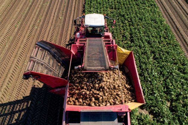
Though wheat, hay, pulses, and barley are Montana’s top moneymakers, farmers also grow a wide range of other crops including, clockwise from top left: canola, sugar beets, cherries, and potatoes.
Farmers often plant “cover crops” of peas and other legumes that “fix” nitrogen in the soil, adding to its fertility. Bacteria on the plants’ roots convert nitrogen in the air into nitrogen that wheat and other crops can use later.
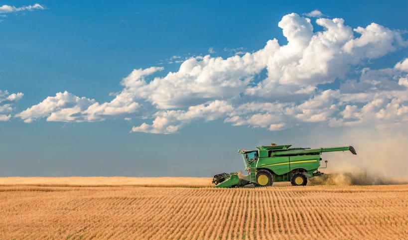
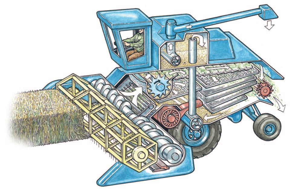
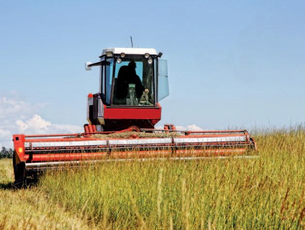
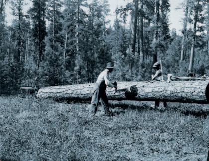
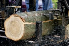
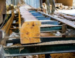
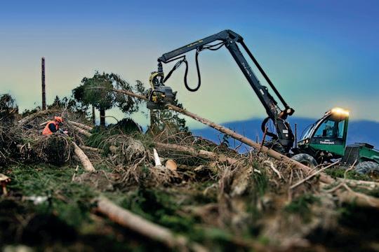
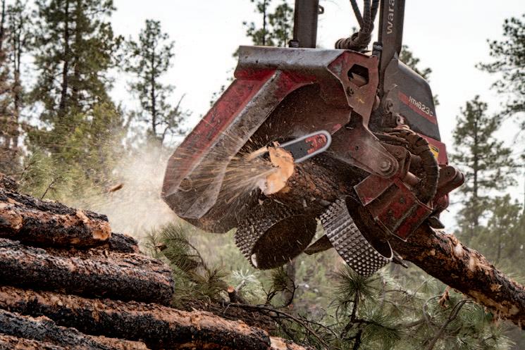
Combine harvesters
The only palatable part of crops such as wheat and barley are the seeds (grains) at the top of each plant. The inedible dry seed husks (chaff) are discarded with the stalks and leaves. Separating the seeds from the chaff is one of grain farming’s major operations.
Two hundred years ago, people cut wheat or barley with big, curved knives called scythes. Then they separated grain from the chaff by beating (threshing) the cut stalks. Finally, workers cleaned the remaining debris away from the seeds. Because this work required a lot of time and labor, farms required a lot of laborers. Today, far fewer people are needed to work the land due to the mechanization of farm work.
The most revolutionary device was the combine harvester, which “combines” four separate harvesting operations—reaping, threshing, gathering, and winnowing—into a single process.
Combines were invented in the United States in 1835. The first models were drawn by teams of up to 30 horses, which were eventually replaced with steam and diesel engines. The largest combines today have 700-plus-horsepower engines and are fitted with “headers” that gather a swatch of standing crop up to 60 feet wide.
Combines are expensive, and depending on header width may cost up to $750,000 each. The driver sits in a cab fitted with digital displays on a touch-screen monitor and a joystick covered in buttons. Lasers guide the cutter bar from dropping too low and hitting rocks or dirt mounds.
Some farmers don’t own combines but instead contract with seasonal crews, who start harvest in Texas in May and move north. Peak combining in Montana is in August. Other farmers use their own combines or share with family members or neighbors.
A combine consists of the wide header , or draper, which gathers the standing crop. On it is a rotating reel with horizontal bars and tines that pull the stalks down to a cutter . The cutter bar’s razor-sharp teeth rapidly open and close to cut the crops at the base.
Cut crops are then carried into the heart of the combine, where a threshing cylinder (rotor) rolls the crops over and over to separate the wheat seeds from the husks (chaff). The grains fall through sieves into a collecting tank while the chaff, leaves, and stalks are carried by conveyors to the back of the machine, where they are chopped into smaller pieces and blown onto the ground.
Meanwhile, an auger carries the grain up from the collecting tank. Then it goes into a grain truck traveling alongside the combine. The truck hauls the grain to bins for storage or to commercial elevators along railroad lines.
Left in the field are rows of cut stems, called stubble, visible in fall and winter. Cut stem shafts, called wheat straw, are packed into bales and used for animal bedding, cat litter, biofuels, biomass, paper and packaging, and even house construction. Straw left on fields adds organic matter to the soil.
known as “chem fallow.”
Some cropland may be “retired” from crop production and put into conservation use. The Conservation Reserve Program (CRP) is one of the best-known and most substantial federally authorized and funded conservation programs. Introduced in 1985 and reauthorized in every U.S. Farm Bill since, CRP pays producers to retire erosion-prone farmland for 10 or 15 years, planting perennial grasses and legumes instead of annual crops.
The vegetation keeps soil from eroding and provides habitat for grassland birds like pheasants and sharp-tailed grouse as well as
white-tailed deer, mule deer, and waterfowl.
In Montana, amounts of CRP-enrolled land decreased from more than 4 million acres in the 1990s to less than 2 million acres in the 2020s. With rising grain prices, some landowners could earn more per acre farming than from CRP payments, so they returned land to crop production.
SUPPORT AND SUBSIDIES
Raising crops is a complex enterprise, requiring knowledge of soil science, weather, botany, insects, plant disease, crop genetics, plant nutrition, hydrology, mechanical
machinery, computers, and world markets.
To help farmers manage that information and stay financially afloat, federal and state agencies and public universities offer scientific and marketing advice as well as grants, loans, cost-sharing, and disaster assistance. One federal program pays subsidies to farmers if their revenue per acre falls below a benchmark or guaranteed level. Another gives farmers a loan at harvest time so they can hold their crops to sell at a higher price later. Farmers may be covered for losses if conditions during spring, such as flooded fields, prevent them from planting some
Illustration by Ed Jenne
areas. Government-subsidized insurance often covers crop losses due to drought, disease, and other natural events.
Some critics of farm subsidies point out that they pay disproportionately to large agribusinesses over small farmers. But without subsidies, many small Montana operations couldn’t turn a profit each year. That, in turn, might force land to be sold to housing, industrial, or commercial developers who may not understand the high value that Montanans place on wide-open spaces that provide wildlife habitat, hunting, and scenic views, and add to the state’s quality of life.
FWP and farmers
FWP helps farmers prevent or reduce damage to crops or fences by elk, deer, and other game animals if the landowners allow public hunting. Assistance includes hazing the wildlife, providing stackyard fencing, holding public “damage” hunts to reduce numbers, and providing landowners with special permits to kill wildlife.
FWP also provides technical assistance and shares costs for protecting wetlands, grasslands, nesting cover, shelterbelts, food plots, and streamside areas. The department can also pay most of the costs to treat weeds and restore native vegetation.
FWP and the state provide cash and tax credit incentives to farmers and other landowners who increase public hunting access on their land or allow travel across their property to otherwise inaccessible federal lands. The incentives compensate for road degradation and other effects of providing access.
MSU Extension
Farmers and others living in rural Montana who need practical information often find it at a Montana State University (MSU) Extension office, found in every county and Indian reservation in the state.
MSU is one of roughly 100 land-grant colleges and universities nationwide. The institutions were established in the 1860s to ensure that instruction in agriculture, mechanical arts, and classical studies was available for working-class Americans. Landgrant universities are so named because major funding comes from revenue generated by federal lands given to each state.
A key component of land grant universities is the agricultural experiment stations, where scientists and ag experts study crop genetics, soil science, livestock breeding, and related fields. Extension services—named for extending their work beyond the campus— disseminate the information to farmers, ranchers, gardeners, and others.
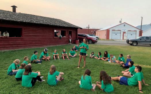
MSU Extension works with counties and reservations to identify local needs. Over the past 130 years, the service has expanded to provide information on personal finance, caregiving, landscaping, nutrition, food safety, housing, forestry, and community development. MSU Extension also runs the 4-H Youth Development (page 76) and Master Gardener programs.
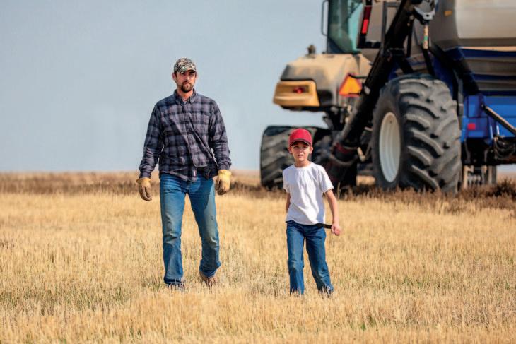
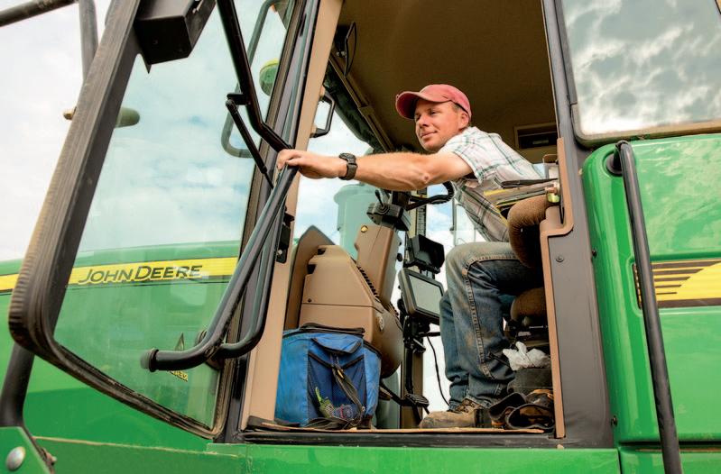
A farmer heads out for a day of harvesting wheat on a field near Havre, Hill County.
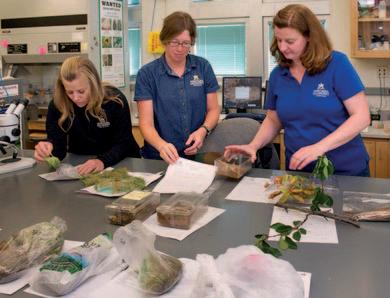
MSU extension agents conduct a plant ID workshop.
TOP: TODD KLASSY; JUDY WANTULOK; MONTANA FWP; MSU NEWS SERVICE
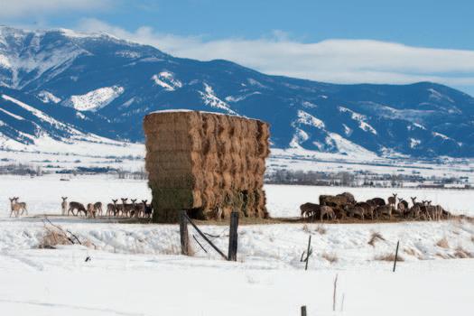
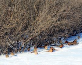
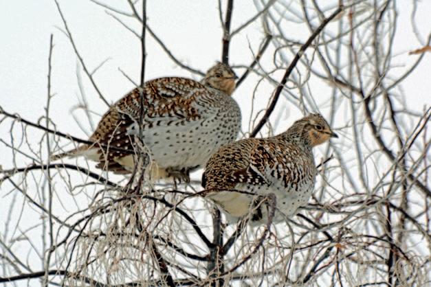
Above: White-tailed deer feed on a haystack in the Gallatin Valley. If farmers are willing to provide public hunting access on their property to help reduce overabundant deer and elk numbers, FWP will help fence off haystacks in winter and provide special “kill” permits. Right: Pheasants take cover in a shelterbelt. Wildlife biologists work with landowners to plant more of these and other habitats on private land.
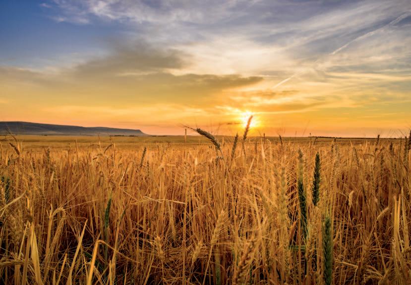
Montana farmers produce more than a dozen different crops, but wheat is by far the top revenue producer, accounting for nearly 45 percent of total crop sales. Wheat does best in dry climates, and is grown throughout the Great Plains. In Montana, the grain thrives in the arid north-central region, the Golden Triangle (roughly bordered by Great Falls, Havre, and Conrad), and in the state’s northeastern corner.
Montana ranks third among all states in total wheat production (behind North Dakota and Kansas), first in certified organic wheat production, and second or third, depending on the year, in spring wheat and durum wheat.
Roughly 80 percent of Montana’s durum wheat is shipped to West Coast ports and on to Japan, Taiwan, and South Korea, where it is made into flour for noodles. Wheat is categorized as red or white (red has more protein), hard or soft (hard has more protein), and winter or spring (for when the grain is planted).
Hard wheats are named for the force required to grind them. These wheats are milled for flour used mainly in baking breads and rolls. The hardness of wheat comes from the amount of protein and gluten it contains.
Protein levels increase when wheat is stressed by weather extremes, common in eastern Montana’s summers.
Durum, the hardest wheat of all, is used to make the coarsely ground semolina flour and the finer semola. Both are use for pizza and pasta and are high in gluten, which helps pasta keep its shape when boiled. Durum thrives in a climate with cool summer nights, long warm days, adequate but not excessive rainfall, and a dry harvest season—conditions typical north of the Hi-Line, where most of this variety is grown.
Soft wheats, not common in Montana, have lower protein and gluten content and are used for cakes, cookies, and crackers.
Winter wheat is a hard red wheat planted in September or October that usually sprouts before going dormant when cold weather arrives. If there’s little snow in November and December and it’s warm, you may see the green sprouts coming up in fields. The advantage of winter wheat is that it benefits from overwinter moisture in snow. The risk is that cold, wet weather can foster plant diseases. In spring, the plants resume growth and grow rapidly until the summertime harvest. Spring wheat and durum wheat are planted in spring and harvested in summer or early fall. The commercial Gold Medal and other all-purpose flours that people buy in grocery stores are made of mixes of red and white winter and spring wheat. n
Organic farming
Organic farming uses few or no synthetic fertilizers, herbicides, or pesticides and instead relies on natural processes. The idea is to promote practices that are better for the environment and human health. To be U.S. Department of Agriculture (USDA) “certified organic,” crops and produce must be grown on soil that had no synthetic fertilizers and pesticides applied for three years before harvest and meet other strict standards for growing, processing, and handling.
As of 2021, Montana had 206 certified organic farms and was among the top states in certified organic acres (mostly spring wheat). Though that represents only about 2 percent of the total farm acreage in the state, Montana ranks first in the nation in certified organic wheat production.
Some organic farms are large-scale operations. Others are modest operations, often run by young people who grew up on a farm or ranch, may have gone to college elsewhere, and then returned to Montana to manage the family property with new approaches and ideas.
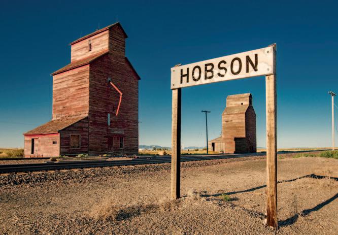
Grain elevators
Wooden grain elevators rising above railroad tracks are landmarks across Montana. For decades, these handsome structures stored harvested wheat and barley before the grains were shipped to distant markets. The name comes from a device inside the tall, slope-shouldered structures that elevates grain to the top of the building.
According to Bruce Selyem of Bozeman, founder of the Country Grain Elevator Historical Society, Montana had roughly 360 sites with grain elevators in 1929. Today only about 130 sites still have elevators, some of them newer concrete versions shaped like silos. Owned by corporations or farmer co-ops, modern elevators still purchase wheat and barley from farmers after harvest and hold it, often for months, while monitoring fluctuating global grain prices. Or farmers may pay the elevator to store their grain until deciding to sell.
Very few of the old wooden elevators are still operating, Selyem says.
As in years past, modern elevator operators check the quality of the grain they buy, paying more for higher grades like durum. They also regularly measure grain moisture levels, monitor markets and prices, and arrange to ship the grain by truck or rail to wherever it has been sold.
The first elevators built in Montana in the early 1900s were all wood and stood about 10 stories high. Many burned when sparks from trains ignited nearby grasses or machinery in the structures caught fire. Owners added galvanized steel siding to protect the buildings and eliminate the need for costly repainting. Every elevator had an attached office that served as the operator’s headquarters and housed the engine that drove the grainelevating machinery.
Grain elevators were both physical and social centerpieces of rural prairie communities. Farmers gathered at the elevator even when they weren’t unloading grain because it was the heart of the area’s economic activity.
Some communities have restored and even repurposed these “prairie skyscrapers.” But most wooden elevators deteriorated and were abandoned when rail spurs were discontinued or railroad towns dried up. As commercial trucking increased following construction of the federal interstate highway system, grain elevator construction waned.
To tell if a grain elevator is still in use, pull over and look for flying or roosting pigeons. The birds hang out looking for spilled grain.
How a traditional grain elevator worked
1. Grain elevators consisted of a main structure, called the house , and an upper unit known as the headhouse
2. Trucks carrying farmers’ grain pulled into a covered building to be weighed on a floor scale
3. The grain was then dumped from the truck into the “pit” and carried in buckets attached to a conveyor belt up to the headhouse.
4. From there grain was gravity fed into one of a dozen or more vertical bins , each holding grain of various types and quality.
5. When it was time to transport the grain, it was again elevated to the headhouse and gravity fed down a spout that emptied into a rail car or truck.
PHOTO:
TODD KLASSY
Two abandoned grain elevators along the railroad tracks at Hobson, Judith Basin County.
Illustration by Ed Jenne
Crop identification
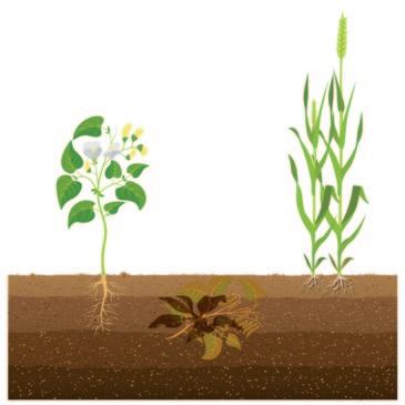
Most crops you see in river valleys and near streams are alfalfa. This clover-like species, a member of the pea family, requires large quantities of irrigation water. Look for fields of thick, green, waist-high vegetation with purple flowers in summer.
Farther from rivers and streams, especially in the state’s middle and northern tiers, the crops are usually wheat or barley.
Wheat can be identified by its short “beard” (the bristly material protecting the kernels), which stands straight up from the stiff stem. When ready for harvesting, it has a golden-brown color. In the wind, fields of ripe wheat quiver but do not make “waves” (like barley does). After harvest, rows of wheat stubble (cut stems) stand up straight from the ground like millions of straws in long, even rows. From late fall to early spring, if there’s no snow on the ground, fields of newly planted winter wheat can be identifiable as vast expanses of green (or brown, when it’s cold) shoots.
Barley has a longer “beard” than wheat, giving a ripe field a fuzzy appearance. And because the plants are more flexible, the whole spike bends, forming “waves” in the wind.
Lentils and chickpeas: Lentils and chickpeas are shorter plants, 12 to 15 inches tall, with small paired leaflets that give fields a more tangled appearance than other crops.
Corn: This grain is easy to identify by the tall (4 to 8 feet) green stalks and large husk-covered ears.
Sugar beets: This vegetable is identified by the rows of 15-inch-tall plants sporting numerous bright green leaves that look the same as those on red beets sold in grocery stores.
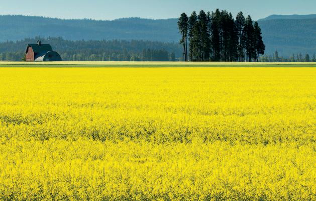
Canola: Grown for seeds processed to make cooking oil, canola plants are tough to distinguish from most crops in the early stage. But by summer, fields stretching for miles are covered in bright yellow flowers.
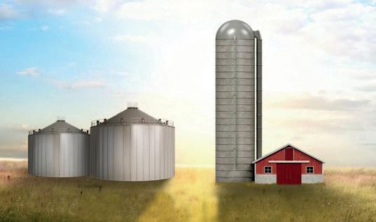
Grain bins or grain silos?
Glinting in the distance on sunny days, grain bins are the round, galvanized steel structures found on farms and ranches. Grain bins are sometimes called silos, but silos are slightly different storage buildings made to store silage—fermented hay or corn used to feed cattle in winter.
Silos are taller, thinner, topped with a rounded roof, and kept airtight to hold moisture.
Bins are far shorter, squatter, topped with a peaked roof, and fitted with fans and vents to keep grain dry.
BARLEY WHEAT
ALFALFA
CANOLA
SUGAR BEETS
CORN LENTILS
CHICKPEAS
GRAIN BINS SILO
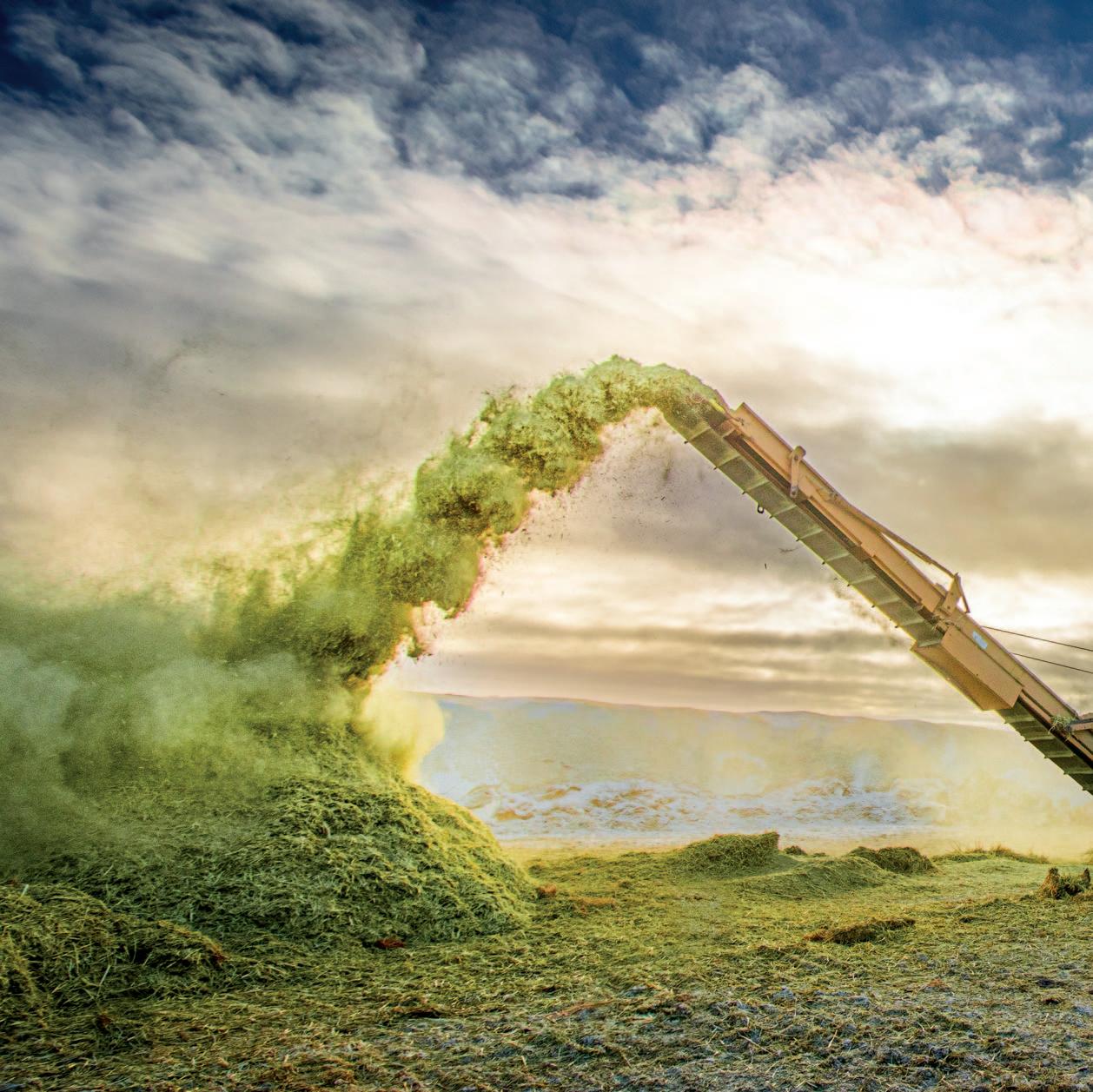
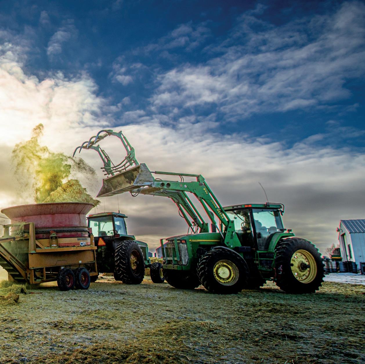
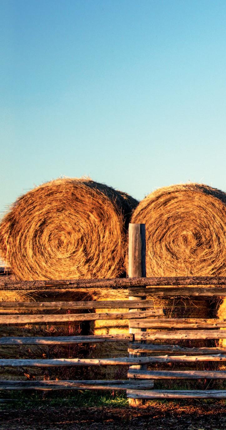
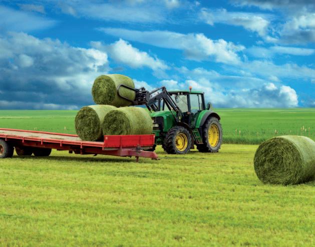
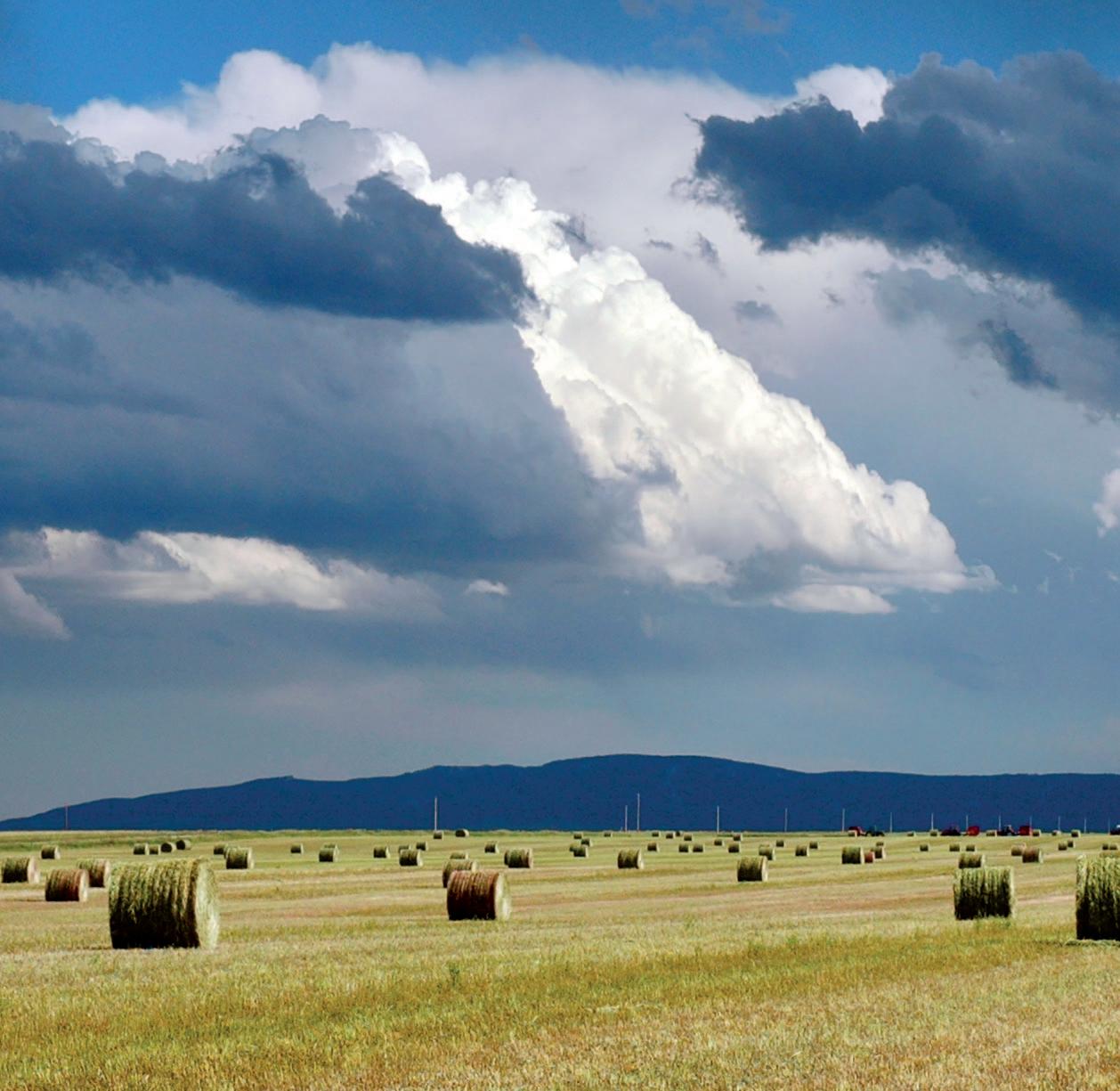
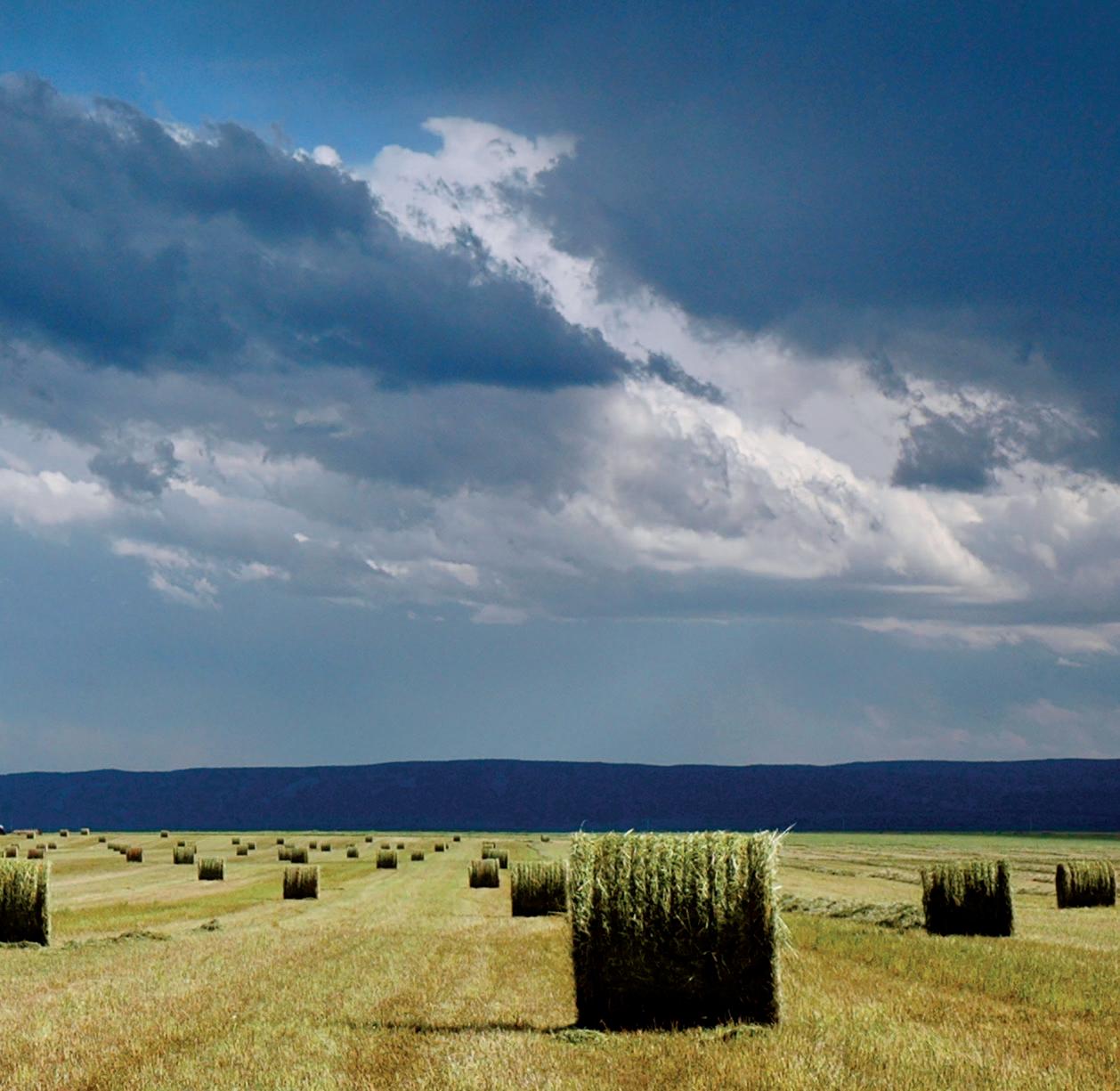
Hay
Cutting, curing, and baling plants for livestock feed
Hay sits at the intersection of growing crops and raising livestock. It’s both a cash crop and a dense, highly nutritious food essential for cattle, horses, and sheep in winter.
Hay is any vegetation from which the stem tops, leaves, flowers, and seeds are cut, dried (cured), and baled for livestock feed. It can be wheat, oats, barley, or pea plants, but most Montana hay is a mix of alfalfa (a relative of wild clover) and wheatgrass.
Hay, which is pale green when baled, is different from straw, which is mostly used for animal bedding. Golden tan straw, the cut-and-baled stems of harvested grain, has little nutritional value, though it is sometimes mixed with hay or silage to add fiber to cattle or horse feed.
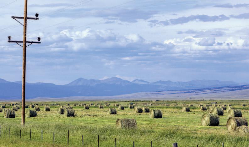
Montana is among the top five hayproducing states in the country, and hay is second only to wheat as a revenue-generating
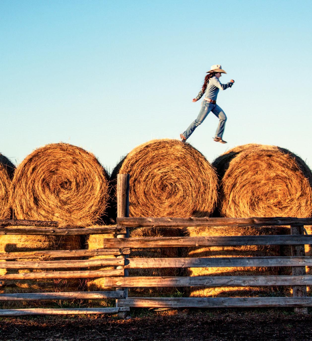
Above: Running across round bales on a ranch near Fort Belknap, Blaine County.
PHOTO BY TODD KLASSY
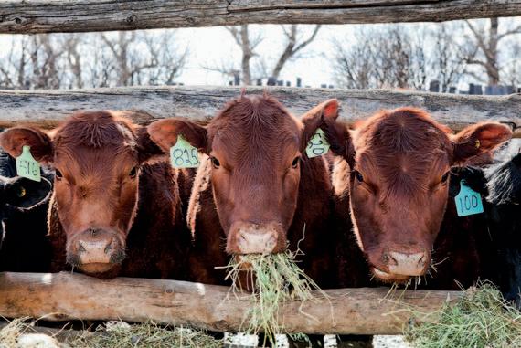
Left: Red Angus eating hay in winter. SHUTTERSTOCK
The process of harvesting, baling, and stacking is known as “putting up” hay. The term comes from when all hay was literally “put up” with pitchforks and later beaverslides onto tall stacks that kept the hay relatively dry due to the small surface area exposed to rain and snow.
crop. The state’s second-biggest moneymaker after wheat is livestock, which rely on hay.
Ranchers tend to grow their own hay and keep it for their cattle. Excess is sold to other Montana ranchers or those in other states where hay crops have been damaged by drought or flooding. Some years, Montana sells more hay than it buys, and in drought years when alfalfa harvest is low, it buys more than it sells.
Alfalfa is a perennial that produces well for about six years before it needs to be reseeded. Each summer alfalfa is usually harvested once or twice —known as a second cutting—or, if warm and dry weather allows, a third time.
Alfalfa is a thirsty plant, requiring more water per acre than any other crop in Montana and consuming roughly 40 percent of the irrigated water in the state. It’s often grown in valleys next to rivers and streams that have flows diverted or pumped for irrigation.
IRRIGATION
Irrigation is an ancient watering method developed by the Navajo in the southwestern United States one thousand years ago, and by Mesopotamians thousands of years b efore that. Montana pioneers began irrigating as soon as they arrived, often digging ditches by hand from nearby streams and rivers to funnel water to small plots.
To encourage farming in the arid West, the federal government built reservoirs, like Fort Peck, installed diversion dams on major rivers, such as the Yellowstone, and funded irrigation projects. Farmers then established
Total Water Withdrawals in Montana
Public supply
Thermoelectric
Mining
Livestock
Other
All types of hay combined account for roughly 40 percent of all irrigation in Montana.
SOURCE: USGS
complex systems of ditches and canals, with pumps, headgates, and diversions that direct water from rivers and reservoirs onto fields.
What’s known as “flood irrigation” uses gravity to move water through a web of canals and ditches out onto crop fields. Some standing water evaporates, but most seeps into the soil, where it hydrates plant roots before percolating down and recharging the aquifer and nearby streams.
Flood irrigation requires a lot of manual labor to open and close ditch gates and diversion dams, but it’s otherwise relatively inexpensive.
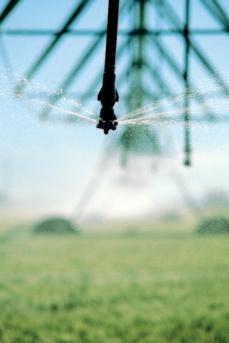
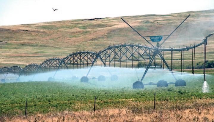
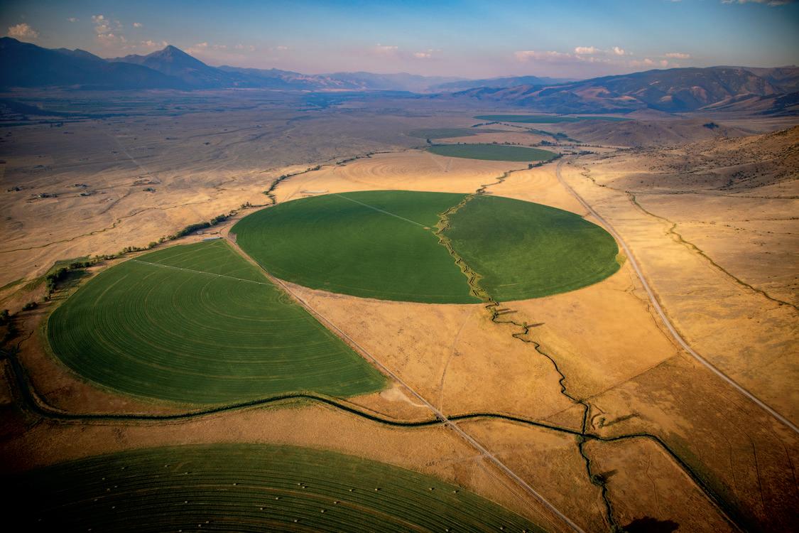
“Sprinkler irrigation” sprays water over the top of crops much like rainfall. One of the most common irrigation devices is a center-pivot sprinkler, with aluminum tubes on metal frames that revolve around a central pump and engine. The frames circle the field as sprinklers spray water. A single tube can be as long as half a mile, dispersing hundreds of gallons per minute, typically from a well. Pivots can be operated from a smartphone miles away.
Low-pressure (drip) sprinklers are a recent variation of pivots that use flexible tubing to deliver water directly to the plants instead of shooting it into the air, where much can evaporate before reaching the crops.
Wheel line sprinklers may be seen on
Pivot irrigators spray water onto plants like rain as the sprinklers wheel around a central pump and engine. Traditional flood irrigation, on the other hand, floods fields with water that soaks down to the roots and then the aquifer.
Round hay bales during harvest season in the Big Hole Valley near Wisdom.
Alfalfa hay
Other hay
Grassland/ pasture Barley, wheat, corn, canola, sugar beets, potatoes, etc.
smaller hay farms irrigating alfalfa. Wheel lines consist of large metal wheels, powered by an engine in the middle, that slowly move a lateral pipe with sprinkler heads spaced 30 to 40 feet apart in a straight line across a field.
Over the past 50 years, increasing numbers of farmers have replaced flood irrigation systems with center-pivots or started using pivots on newly farmed land. The shift is based on the accepted wisdom that pivots make more efficient use of water, leading to greater crop yields and better water conservation.
But in recent years, scientists have found that some pivot systems end up conserving less water than previously believed. The complex reasons are spelled out in a 2020 Montana Water Center report (montanawatercenter.org/irriga tion-efficiency-landing-page).
S cientists at the center have also found that reduced flood irrigation may result in less underground aquifer recharge, which is needed to help maintain stream flows during late summer. Because water is so precious in dry
Montana, most irrigation is managed by irrigation districts or public or private ditch companies. Employees called ditch riders monitor water use to ensure everyone is using their legally allotted amount. Disputes are resolved through district courts.
CUTTING AND BALING
For thousands of years in Europe and the Middle East, hay was cut by hand using a
curved blade called a scythe or sickle, then gathered and “put up” in tall piles to dry. Modern mechanized haying starts with a swather (windrower) that cuts the alfalfa or grass. A large rotating reel pulls the plant into oscillating blades like those on a hedge trimmer that sever the stems. The crop falls onto a conveyor, which feeds it out in a row behind the machine. Long lines of cut alfalfa are called “windrows” because they resemble the rows of uprooted aquatic plants that form along windswept lakeshores in summer.
In wet conditions, windrows are raked and flipped using a rake attachment on the tractor, to allow the bottom layers to dry (cure) for a few days before a baler machine picks up the cut alfalfa and compresses it into compact bales.
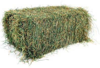
There are two main baler types, both pulled behind a tractor. A square baler gathers the cut crop and compacts it into rectangular-shaped bales, wrapped with two or three strands of knotted baling twine. Small bales, known as “squares,” weigh 45 to 70 pounds, light enough for a strong person to carry. Squares are usually produced on smaller hay fields and are mainly sold to
Center-pivot irrigation allows Montana hay farmers to grow alfalfa in regions that historically were far too dry for the water-hungry crop.
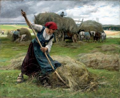
The Haymakers, by Julien Dupré, 1892, depicts the traditional method of gathering and loading cut hay before mechanization.
horse owners with only a few head of horses or to hobby farmers. Large rectangle bales weigh around 1,000 pounds and may be seen stacked on semi-trailers for transport.
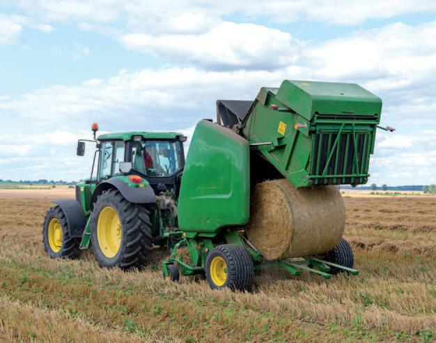
A round baler rolls cut alfalfa inside the machine and wraps it with twine or netting to hold its shape. In winter, rounds are trucked onto rangeland and unrolled, providing hungry cattle with a long carpet of cured grass or alfalfa.
The advantages of round bales are they take less labor to move around and their shape sheds snow and rain better than flattopped bales. The disadvantage is weight, up to a ton, and the need for special hydraulic arms to lift them onto truck beds for transport.
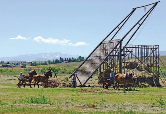
A few hay producers still use the beaver-
slide hay stacker, invented in Montana’s Beaverhead region in the early 1900s.
Loose hay is loaded onto a 30-foot-tall lodgepole pine rack. Then, using ropes and pulleys powered by horses or a tractor, the load is pulled up and over another lodgepole pine rack and dropped into a wooden bin. When the bin is full, the frames are removed, revealing a two-story-high haystack. Hay stacked like this is less likely to
rot because there is relatively little surface area on which water and snow can collect.
Beaverslides are still used in the Big Hole, Beaverhead, and Little Blackfoot valleys, and a few other areas.
Because deer and elk also like eating hay, particularly in winter, ranchers surround their stacks, bales, and rounds with wood or wire fences. For landowners who provide public hunting, FWP crews may install temporary plastic fencing to protect hay from deer and elk.
Most hay is used or sold within a year or two. Hay exposed to outdoor weathering can lose its nutritional value and become moldy. One reason Montana is such a successful hay state is that its dry climate keeps hay bales in good condition.
Clockwise from above left: A swather (windrower) cuts hay with a rotating wheel that pulls the plants into a cutter that resembles a long hedge trimmer; to dry hay in wet conditions, a hay rake fluffs and flips the long rows left behind the swather; a round baler rolls the cut crop into rounds that weigh up to a ton; bales are then loaded with hydraulic lifts onto truck trailers or stored in stacks. Bottom: a standard 60-pound hay bale produced by a square baler.
Water rights
As far back as the late 1800s, demand for water by farmers, ranchers, miners, municipalities, and others began outstripping supply. Most western states responded by adopting a legal framework for water rights, called the Prior Appropriation Doctrine, commonly summarized as “first in time, first in right.” This means water users with the oldest claims have the first (senior) priority for water.
Let’s say there are two different ranches along a stream. The one by the mouth has a senior 1890 water right, and the one farther upstream has a junior 1910 water right. If, during a summer when water levels are low and the downstream ranch is not getting enough water to meet its needs, the owner can insist the upstream rancher stop irrigating.
Another element of prior appropriation is “use it or lose it.” This means water rights holders must put water to a “beneficial use” or risk losing the rights altogether. This was originally meant to prevent senior water rights holders from allowing their water to “uselessly”—the thinking at the time—flow down into rivers while neighbors with junior rights who needed the water received none.
Traditional beaverslide hay stackers are still used in some areas. Left: Horses pull ropes attached to pulleys that pull the hayladen rack. Right: a finished haystack. See a beaverslide in action at:
Work crews place steel rebar over wooden forms to create a diversion dam on the Yellowstone River, 1934.
For decades, Montana law only recognized “consumptive” uses, such as irrigation, as a beneficial water use. Not until 1973 did the state recognize the “non-consumptive” use of instream flow for trout habitat. That allowed conservation-minded landowners to lease some of their water to FWP, Trout Unlimited, and other groups so that young trout in spawning tributaries have enough water to survive the summer.
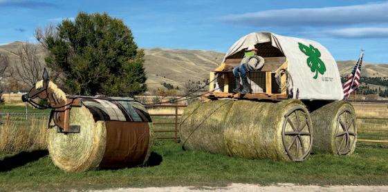
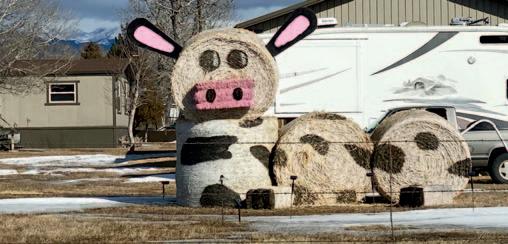
Hay sculptures
A rural fall tradition in Montana’s hay country is for students, especially those belonging to 4-H or FFA, to make sculptures from bales and rounds. The biggest concentration is along the 21-mile Montana Bale Trail from Hobson to Utica to Windham, part of the yearly What the Hay contest. Students vie for top prizes in the sculpture competition, with entrants from all over Montana and even other states. The sculptures must be made mostly of hay or straw and titled with an appropriate pun, such as “Wild Bale Hickok,” “Will-Hay Nelson,” or “Wizard of Strawz.”
Indian Reservations
Understanding autonomous nations within Montana’s borders
The seven Indian reservations in Montana make up nearly 10 percent of the state. It’s understandable that anyone traveling to or through these lands might want to know how reservations came about and what life there is like. After all, it’s not every day you drive into a sovereign nation.
Before European-Americans arrived, Indigenous tribes claimed all this region. For millennia they had told stories centered on the land and water, raised their families, honored forebears, buried loved ones, and established sacred sites. They didn’t “own” the land as we use the word—with legal claims, titles, and deeds. Instead, tribal nations recognized territorial boundaries marked by buttes, rivers, and other landmarks. And they fought to protect these places
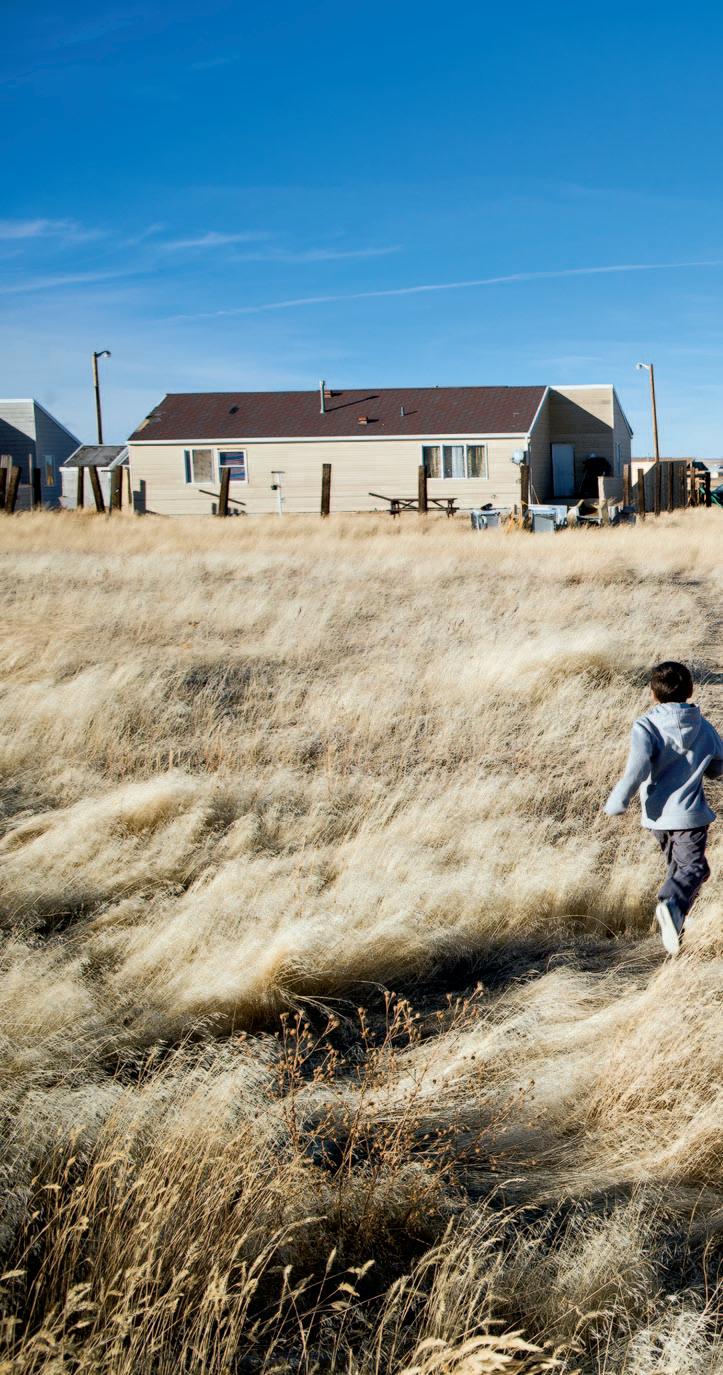
Above: Children play near their homes in Browning, on the Blackfeet Indian Reservation. In many ways, life on reservations resembles that in much of rural Montana, though with tribal cultures and languages still a part of everyday life.
PHOTO BY REBECCA DROBIS
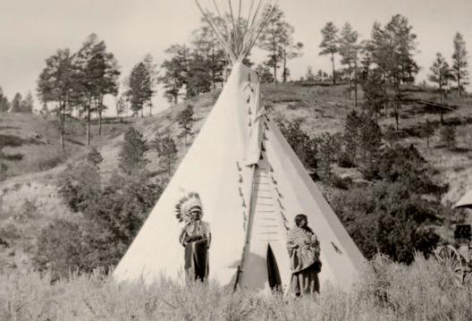
Left: A Cheyenne couple in front of a tepee near Billings in 1918.
PHOTO FROM BILLINGS PUBLIC LIBRARY
According to the Smithsonian’s Museum of the American Indian, “Native Americans,” “American Indians,” and “Native people” are all acceptable names for the people living in Montana whose forebears are the original inhabitants of this land. But Native people prefer to be called by their tribal name, such as “She is Kootenai,” whenever possible.
and their way of life.
While some tribal nations elsewhere created permanent settlements, the people living in what is now Montana moved with the seasons, returning each year to the same places to trap bull trout, hunt bison, dig camas root, and collect berries.
The European-American settlers who poured into the region in the 19th and early 20th centuries claimed and fenced the land, disrupting Indians’ long-standing way of life. As the vast bison herds were killed off, Indians lost their primary source of meat and hides. They negotiated and then fought to retain
their homelands but eventually were overwhelmed by encroaching white settlers, U.S. military actions, and government policies aimed at taking away their lands and lifeways.
SOVEREIGN LANDS
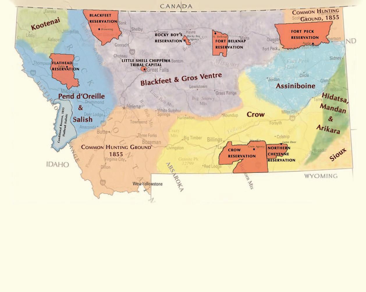
Government-to-government agreements such as the Fort Laramie Treaties of 1851 and 1868 and the Hellgate Treaty of 1855 recognized Indian tribes as sovereign (independent and self-governing) nations that legally owned their lands. Other U.S. treaties identified the traditional territories that the Salish, Blackfeet, Crow, Assiniboine, and
Tribal territories in Montana
H tribal capital current reservation boundaries
Current and historic boundaries as defined by the Fort Laramie Treaty of 1851 and the Flathead and Blackfeet Treaties of 1855*
*Boundaries on this map were made by non-Indian officials at treaty time and do not necessarily represent accurate tribal territories occupied in the 1850s.
other tribes controlled or lived in. The federal government promised to pay the tribal nations with goods and services in exchange for their agreeing to give up territory or allow railroads and trails to cross their land.
These promises were rarely kept. And after the Indian Wars of the 1860s and ’70s, other treaties, legislative actions, and executive orders forced Indians onto reservations. Almost all reservations are smaller today than they were under original treaties and much smaller than tribes’ ancestral homelands. In the late 19th century, Montana’s political leaders, railroad companies, and
PRESENT-DAY RESERVATION
Flathead Reservation
TRIBAL CAPITAL TRIBES LOCATED ON THESE LANDS
Pablo Salish, Pend d’Orielle, Kootenai
Blackfeet Reservation Browning Blackfeet
Rocky Boy’s Reservation
Rocky Boy Agency Chippewa Cree
Fort Belknap Reservation Ft. Belknap Gros Ventre and Assiniboine
Little Shell Chippewa Tribal Capital Landless, but Little Shell Band of Chippewa headquartered in Cascade County
cattle and sheep ranchers regularly petitioned Congress to further reduce the size of existing reservation lands and open up more acreage for rail lines and white-owned ranches, farms, and settlements.
Even lands within Indian reservations were up for grabs. The General Allotment Act of 1887 aimed to weaken tribal structures by breaking up collectively owned reservations into individually owned Native farms. The process of dividing up the land provided opportunities for non-Indian ownership and settlement. For instance, the most productive land was often identified by the federal government as “surplus to Indian needs” and then sold
These maps show how allotments affected land ownership in the Flathead Reservation. The General Allotment Act of 1887 intentionally weakened tribal structures by breaking up collective reservation land into individually owned Native American farms. The process of dividing up the land provided opportunities for non-Indian ownership and settlement. The most productive land was often identified as “surplus to Indian needs” and sold off to white settlers or business interests.
After allotments, Indians owned just 30 percent of the lands on the Flathead Reservation. In recent years the Confederated Salish and Kootenai Tribes (CSKT) have been buying land back. A land exchange provision of the Montana-U.S.-CSKT Water Compact provides for Montana to give state school trust parcels back to the tribes in exchange for gaining federal properties as trust lands off the reservation.
off to white settlers or business interests.
Between 1908 and 1926 the Flathead, Fort Peck, and Blackfeet reservations together lost millions of acres as their reservations (land which Indians had “reserved” by treaty) became a checkerboard of tribal and private (Indian and non-Indian) ownership. After “allotments” and the sale of so-called surplus land, Indians owned only 30 percent of the land on the Flathead Reservation. For years, the Confederated Salish and Kootenai Tribes have been trying to reverse that trend by buying back land.
Today, non-Indians, as well as Indians from other tribes, reside on all the reservations in Montana to varying degrees. For
Flathead Reservation Land Ownership
1855
example, while about 95 percent of the inhabitants of the Rocky Boy’s Reservation are tribal members, non-Indians make up nearly 75 percent of the Flathead Reservation’s population.
LIVING ON RESERVATIONS
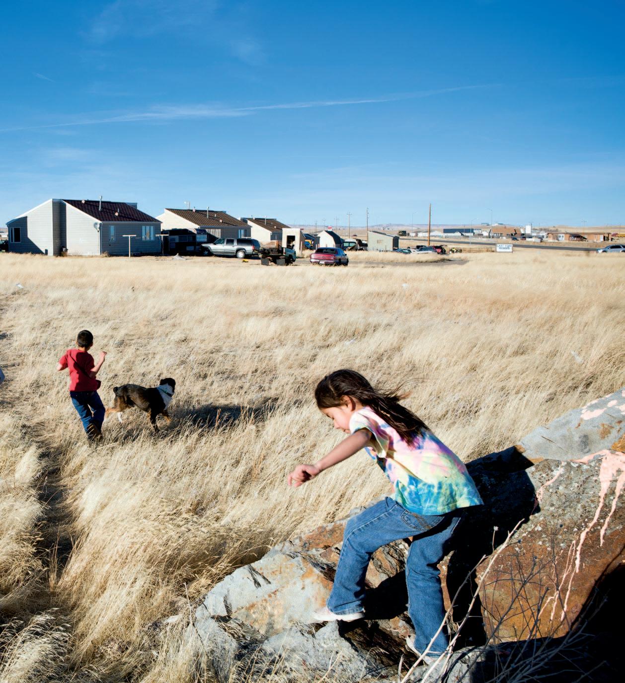
Life on reservations is similar to that in other parts of rural Montana, except that tribal cultures and languages are still an integral part of daily life. Tribal governments are fully functioning governments that provide an array of services similar to those of federal, state, and local governments—from police and courts to schools and health centers. Like elsewhere, adults head off to work each day. Kids go to school then come home and play video games or shoot hoops. On weekends Native people fish, hunt, watch TV, or spend time with friends and family members. As in any Montana community, high school sports bring entire tribal communities together. Powwows, held by tribes each summer, are important for gathering and sharing songs, dances, and other cultural traditions.
TRIBAL FISH AND WILDLIFE
Under the treaties, tribal leaders ceded lands, but some tribes retained the right to hunt, fish, gather, and travel on their traditional territories, with their own seasons and limits. These are known as usufructuary rights.
Tribes also have the right and authority to manage fish and wildlife on their reservations. Most have tribal hunting committees that meet to develop harvest regulations and management strategies. Several have staff biologists who advise on management strategies and plans. Tribal nations have taken the lead in several research projects, such as with black-footed ferrets, gathering data required to improve management both on and off reservations.
On most reservations, nontribal members may fish or hunt upland birds with a reservation license. Reservation and federal seasons and limits apply. Permission is required to access tribal lands, with requirements varying by reservation, so a hunter or angler should always check at tribal offices.
RENT PAYMENTS
As in so many Montana communities statewide, jobs in Indian Country are limited
and concentrated mainly in government, education, and health services. On reservations, those jobs are funded mainly by federal funds secured under treaty arrangements. Services and payments the federal government provides to Indians in Montana and nationwide are like a lease or rent—rent for use of the entire country of the United States that was previously occupied.
Federal payments are not so different from Montana’s state budget as a whole in recent years. According to the Montana Budget and Policy Center, federal funds accounted for 49 percent of the Montana state budget for 2022 and 2023.
Other reservation revenue comes from tourism, arts, food services, timber harvest, transportation, construction, manufacturing, and utilities.
Some Montana reservations operate modest casinos. But because they compete with roughly 16,000 non-reservation video keno, bingo, and poker machines in gas stations and restaurants across gambling-
friendly Montana, tribal casinos struggle to make much money.
Despite limited employment opportunities, many tribal members say they prefer reservation life with its deep relationship
Above: Montana State University graduate student Kendall Rae Edmo, a member of the Blackfeet Nation, earned a National Science Foundation Graduate Research Fellowship to study a high-elevation bison drive line on the Rocky Mountain Front. Historically, Blackfeet tribes constructed these complex drive line systems, using rock cairns to funnel the animals toward cliffs and embankments where the large mammals could be killed.
FROM TOP: ALLEN RUSSELL; REBECCA DROBIS
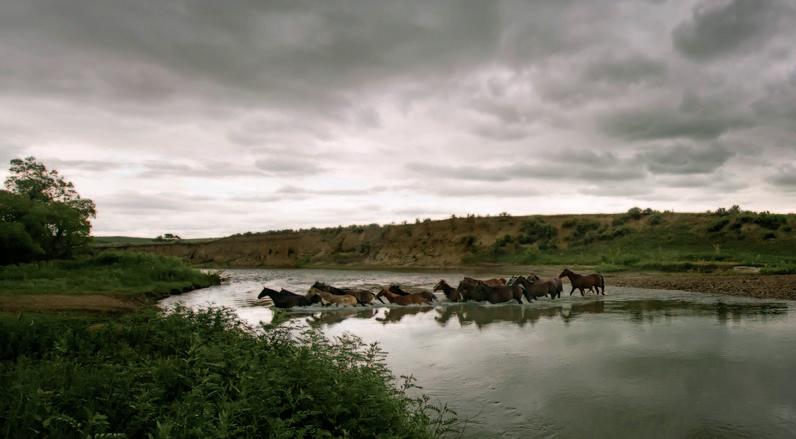
Above: A herd of horses crosses the Little Bighorn River on the Crow Indian Reservation.
with the land and cultural strongholds, where traditional beliefs, ceremonies, and languages that are thousands of years old are still in practice.
Perhaps most important for tribal residents is that reservations are places of self-rule, though with some limits. Tribes are autonomous nations that make laws, hold elections, administer funds, and interact with other governments. Each tribal nation has its own unique culture, language, identity, and history. Tribes have some powers that supersede those of state government, such as the right to operate casinos. But they are subject to laws passed by the U.S. Congress and regulations administered by the Bureau of Indian Affairs.
That sovereignty, even with limitations, means that tribes must be treated by states and the U.S. government as equals. Tribal leaders say this gives Indigenous people an immeasurable sense of pride and independence.
FWP and tribes
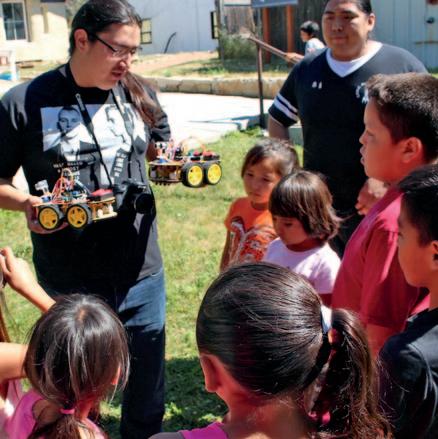
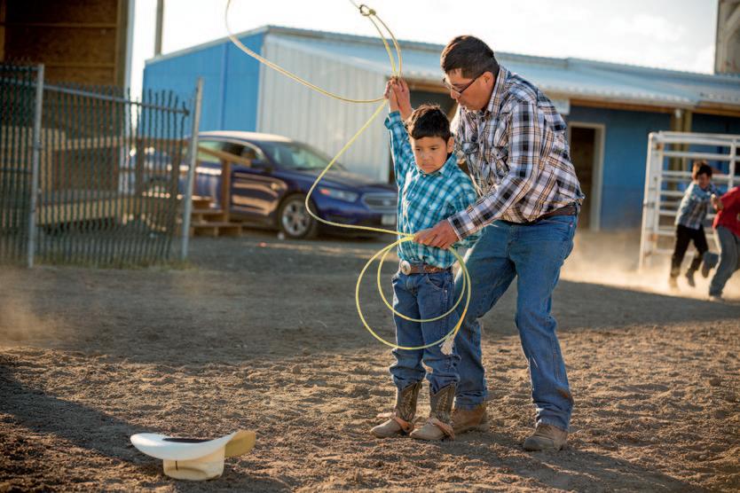
Above left: Leading a robotics class at the Boys & Girls Club of the Northern Cheyenne Nation in Lame Deer. Above right: Members of the Arlee Warriors basketball team on the Flathead Reservation embrace their heritage on and off the court. Below: Ethan David, Blackfeet, helps his son, Josh, prepare for the dummy roping competition at the summer youth rodeo. Children compete in events such as roping, sheep riding, and goat tying held on the reservation throughout the summer.
Because fish and wildlife don’t recognize borders between state and tribal land, managing those resources can be complicated. Tribes often partner with FWP to share information and help cooperatively manage fish and wildlife. For instance, the department works with the Confederated Salish and Kootenai Tribes to restore native bull trout and westslope cutthroat trout in Flathead Lake and with the Blackfeet Tribe on swift fox restorations and reducing conflicts between people and grizzly bears. FWP also partners with the Crow Tribe on managing Chief Plenty Coups State Park.
In 2021, FWP created a tribal liaison position to improve relations between the state and tribes. The liaison helps bring Native voices into state government, assists in partnerships and projects between tribal fish and wildlife departments and Montana, and finds ways to bridge cultural gaps between FWP staff and tribal officials.
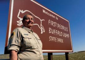
Left: Kqyn Kuka, FWP tribal liaison and descendant of the Blackfeet Nation. Right: Karlene Faulkner, a member of the Little Shell Band of Chippewa, is an interpreter at First Peoples Buffalo Jump State Park.
Barns
After the family house, barns once were the most important structures on farms and ranches. Barns house livestock, animal feed, grain, and machinery. In recent years, four-wheelers have taken over for horses and steel grain bins have replaced barn storage areas, creating less need for barns. Though most wooden barns were built more than 100 years ago and are deteriorating, they remain as beautiful architectural features of rural Montana.
Older barns are usually timber framed, meaning they are built on a large frame of thick posts and beams held together with dovetail, peg, or mortise-and-tenon joints. Because it doesn’t need interior walls for support, timber framing creates large, open spaces that farmers and ranchers need.
Barn roof materials have advanced from wood planks, to wood shingles (shakes), to galvanized tin or aluminum.
Atop many barns sit small metal cupolas or ventilators that allow moisture from hay to escape so it can cure and increase its nutritional value. Vents also allow humidity from cattle and other livestock and noxious gasses from animal dung and moisture to rise up and escape. And they bring in fresh air without having to open the main doors and lose heat in winter.
After Montana’s rural electrification began in the 1940s and ’50s, farmers began installing electric ventilation systems in their barns, reducing the need for cupolas.
Barns are traditionally painted red because years ago the only paint affordable in large quantities was made with iron oxide. After other colored paints became more affordable, many barn owners continued using the traditional red.
Barns come in a range of shapes and designs. The most basic is the gable roof, with two flat roof sides rising up at 45 degrees to a peak with triangular ends. The roundish gambrel roof creates extra space on a top level to store hay. The broken gable and the broken gambrel extend horizontally partway down to create a roof for an attached shed. The monitor roof barn raises the central roof and adds another set of vertical walls for windows and ventilation. The tall, handsome Gothic-arch (or rainbow-arch) barn has curved rafters. The roof may extend to the ground, making the roof and walls a complete arch, or is built with an arched roof atop traditionally framed or stone walls.
PHOTO: TODD KLASSY; ILLUSTRATIONS BY ED JENNE
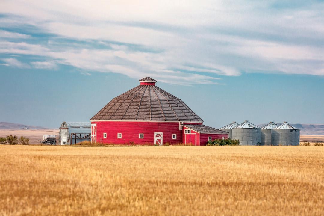
A round barn south of Brady, Teton County. Built mainly for dairy operations, round barns often contain a central silo around which cattle feed on silage. The circular structures are rare in Montana, where farmers favor square and rectangular barns that are easier to build and wire for electricity.
Gambrel Gable
Broken Gambrel
Gothic Arch Monitor
CUPOLA
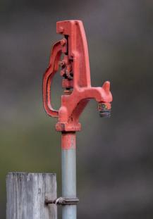
Old wind pumps
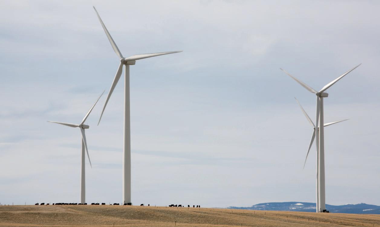
Montana is home to more than 1,000 industrial wind turbines that produce electricity (see page 64) and hundreds more smaller, private turbines on rural homesteads across the state.
These machines differ from the dilapidated windmills (technically wind pumps) found on many old homesteads. Wind pumps use wind energy to rotate blades that cause a rod to move up and down, raising and lowering a piston in an underground pump to bring water to the surface.
Modern wind turbines have no direct connection to any mechanical process other than turning a drive shaft in a generator that produces electricity.
Wind pumps were used mainly in Montana from the 1880s to 1930s. The number declined as rural electrification programs extended power lines to farms and ranches to run electricpowered water pumps. Some ranches still use wind pumps to supply water for livestock in remote areas where stringing a power line is too expensive.
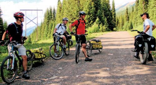
Touring bicyclists
In summer, you’ll often see adventure cyclists (bike tourers) along Montana highways, especially U.S. Highway 287 between Yellowstone and Glacier national parks and scenic Montana Highway 200 west of Lincoln. These cyclists carry panniers (nylon saddle bags on either side of the wheels) or pull a burley (trailer) filled with gear.
A growing number of mountain bikers have also taken up “bikepacking” on the Great Divide Mountain Bike Route. Developed and mapped by the Missoula-based Adventure Cycling Association, the route is 90 percent off-road. Bikepackers ride mountain bikes and carry small packs that fit on handlebars, atop a rear rack, and within the bike frame, allowing them to navigate narrow routes of the Continental Divide Trail.
Law enforcement
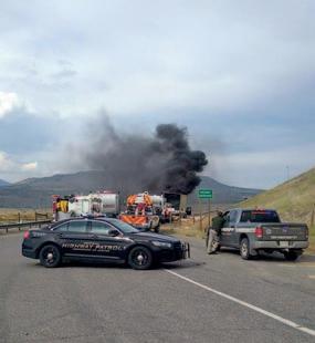
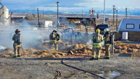
Montana Highway Patrol and Park County sheriffs and firefighters respond to a truck fire on I-90 near Livingston.
If you speed, litter, or otherwise break the law while driving through rural Montana, you could get pulled over by a country sheriff’s deputy, tribal police officer, town police officer, or state highway patrol officer. Sheriff’s deputies, who patrol entire counties, are hired by the county sheriff, an elected official. Tribal police enforce laws on reservations. Police officers’ jurisdictions are the much smaller town limits. Many rural Montana towns are too small to hire even a single police officer, so they contract with the county or nearby larger town for their law enforcement needs. Highway patrol officers enforce highway traffic laws statewide as well as all state criminal, commercial, and wildlife laws.
Another enforcement officer you might spot is an FWP game warden Wardens are responsible for enforcing hunting, fishing, and boating regulations and helping with the stewardship of Montana’s fisheries, wildlife populations, state parks, and other types of outdoor recreation.
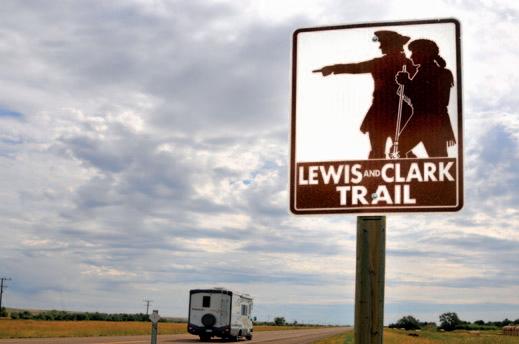
Lewis & Clark Historic Trail
Marked with brown highway signs showing the two explorers in buckskin, Meriweather pointing the way, the Lewis and Clark National Historic Trail is roughly 5,000 miles long, extending from Pennsylvania to the mouth of the Columbia River, near Astoria, Oregon.
The trail, administered by the National Park Service, follows the historic outbound and inbound routes of the Lewis and Clark Expedition as well as the preparatory section in eastern states. The park service maintains rest stops with information kiosks and a website with information on sites in each state. Visit nps.gov/lecl/index.htm.
Lewis and Clark auto tours are a series of driving loops within regions explored by the Corps of Discovery. Four tours exist in Montana, and you’ll see signs for them occasionally on highways. For information on these routes, visit experiencelewisandclark.travel/rocky-mountains/ auto-tours/.
A Lewis and Clark Trail highway sign along U.S. Highway 2
Old wind pump on a ranch near Hobson.
Adventure cyclists on the Great Divide Mountain Bike Route meet near the Canada-U.S. border.
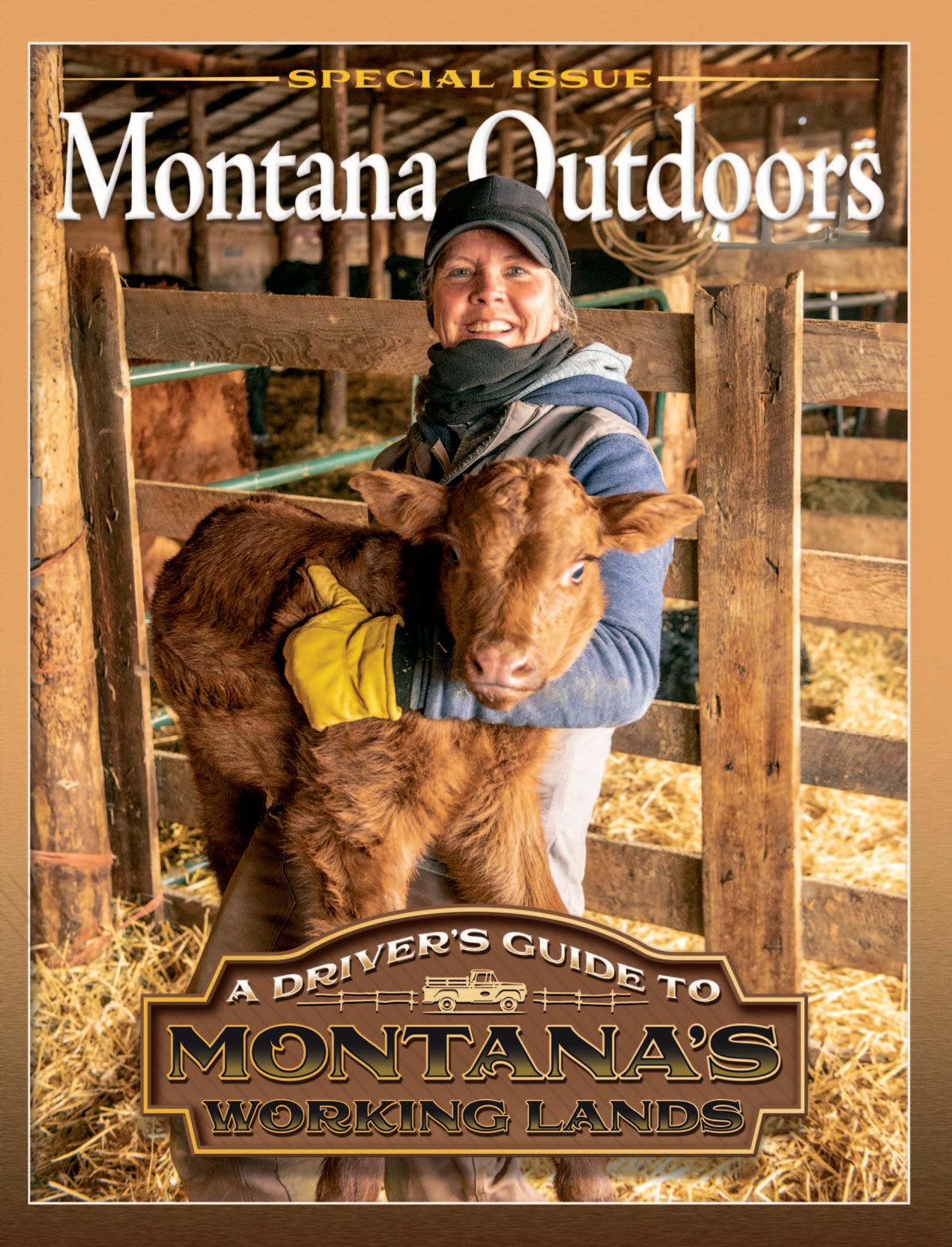
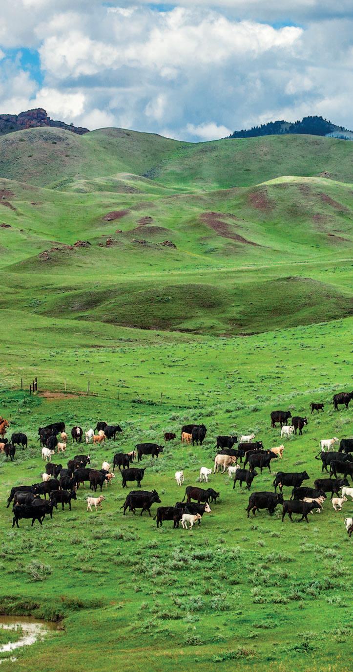
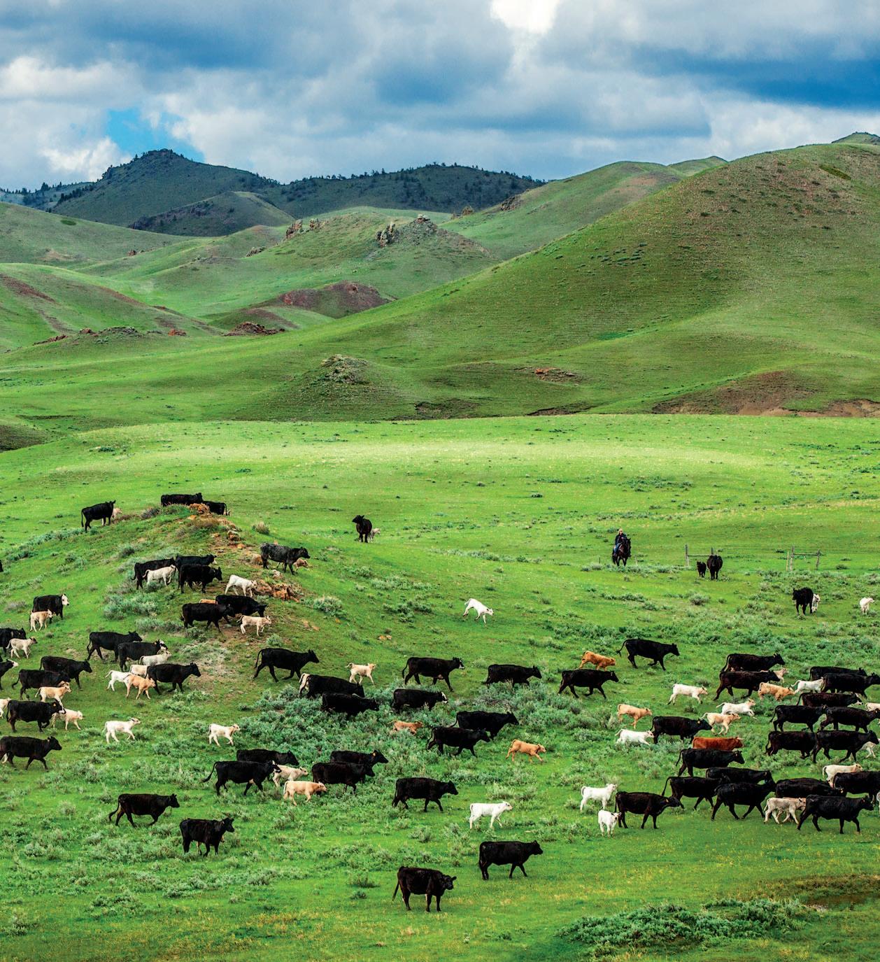
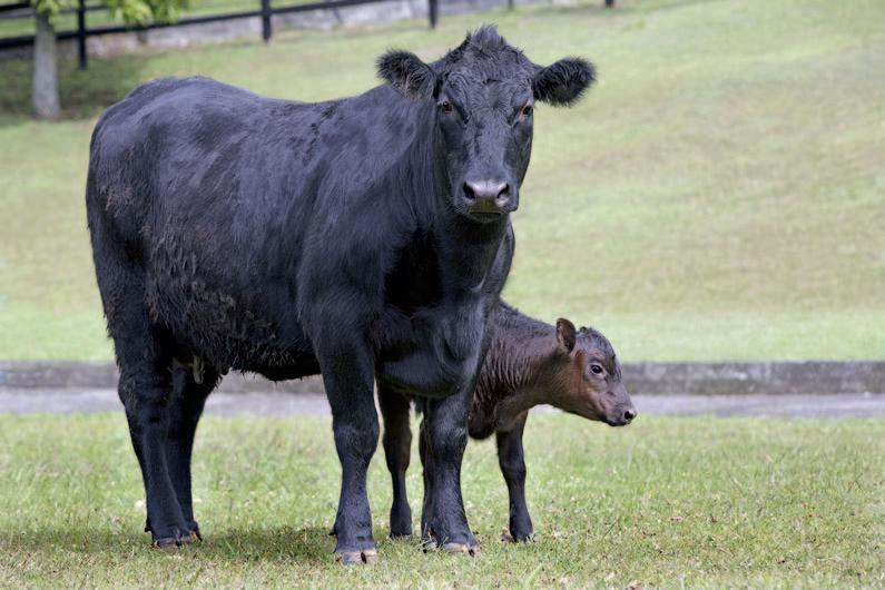
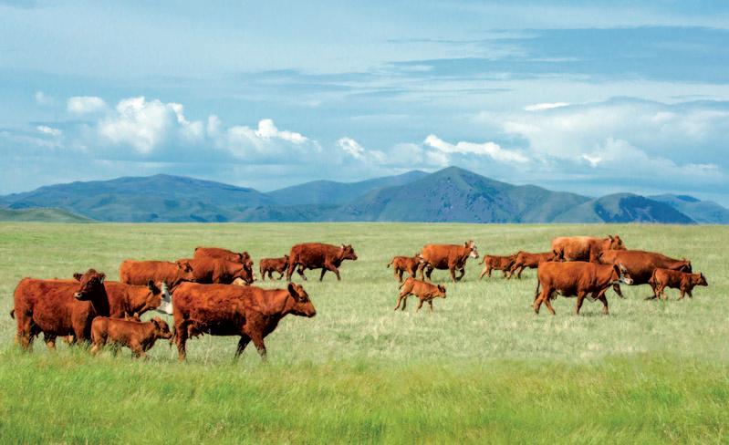
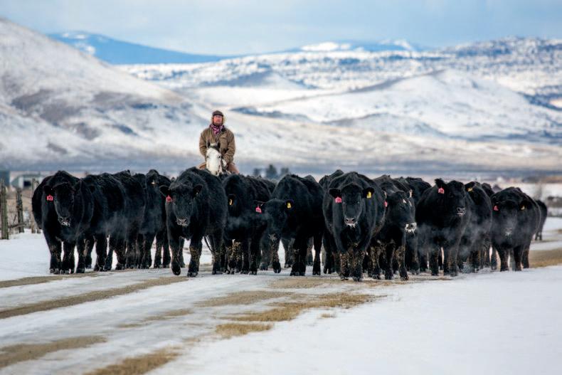
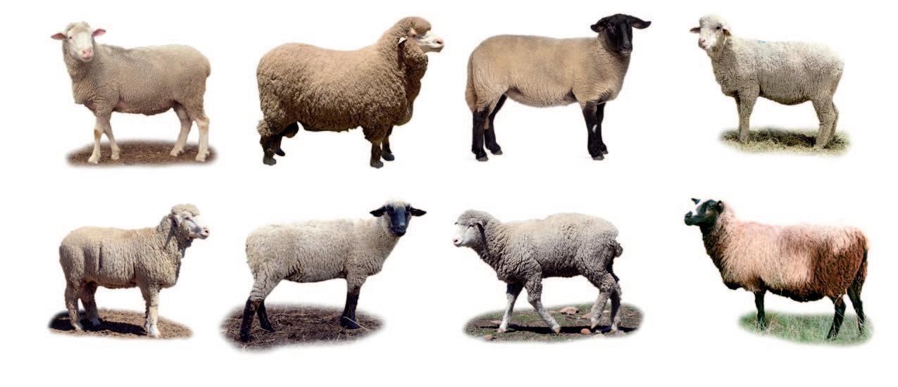
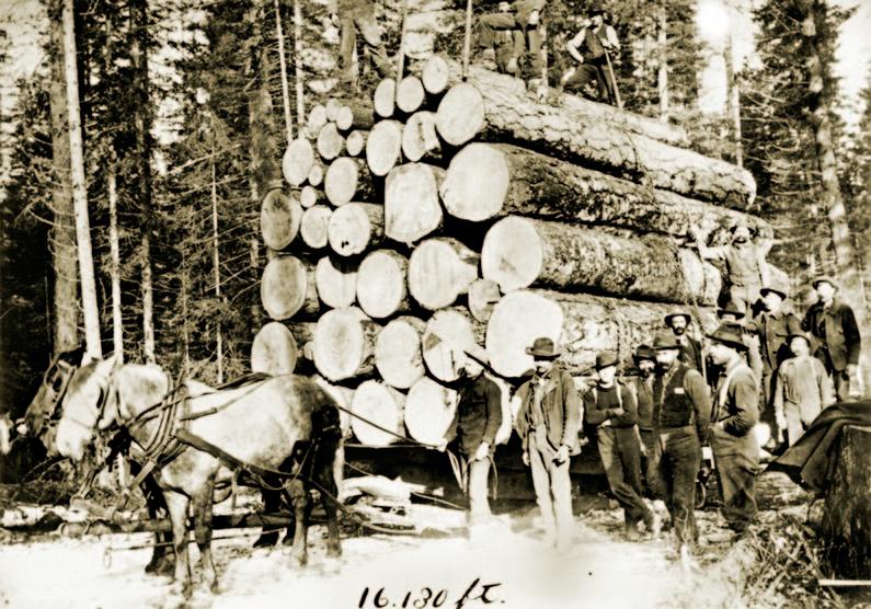
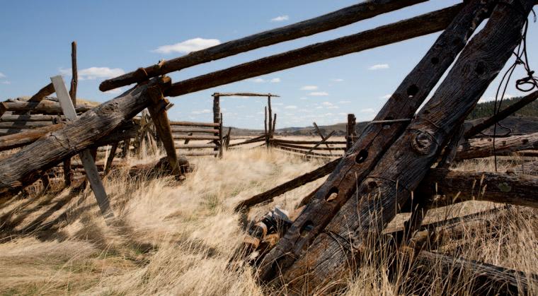
Livestock
Raising cattle, sheep, and other domestic animals for meat and other uses
Much of what a person sees while driving through rural Montana east of the Continental Divide is rangeland—unplowed mixed-grass prairie used for grazing livestock, predominantly cattle. Rangelands are generally too arid, rocky, or steep to farm, but their buffalograss, western wheatgrass, and other proteinpacked native prairie plants are ideal for domestic grazers.
Foremost among those livestock are Montana’s roughly 2.2 million beef cattle, the state’s top livestock moneymakers. Montana ranks 13th nationwide in cattle numbers. Texas’s 13 million head put the Lone Star State at number one.
The next most numerous livestock here are the roughly 225,000 hogs (mostly north-central Montana) and 180,000 sheep. Montana is not
Above: Cowboys round up a herd of black Angus, red Angus, and Charolais cattle near Cleveland, Blaine County. PHOTO BY TODD KLASSY
Left: Loading lambs onto a train car at the Lolo spur, 1937. PUBLIC DOMAIN. KENNETH D. SWAN, U.S. FOREST SERVICE
“Cow” is a generic name for bovines of all ages and genders. But technically, a cow is a female that has borne a calf, while a female that hasn’t given birth is a “heifer.” A castrated young male cow is a “steer.” An intact male is known as a “bull.”
a major hog producer, but the state ranks eighth in the nation for sheep numbers and is among the top 10 for wool production. The Treasure State also has about 15 billion honeybees that produce 7.5 million pounds of honey each year, making it one of the nation’s largest producers.
FLUCTUATING CONSUMPTION
Montana’s livestock operations began in the early 1860s to provide meat for the growing number of prospectors, miners, and others drawn to newly discovered gold strikes at Bannack, Alder Gulch, and Helena. Over the next few decades, after bison herds were wiped out by market hunters and Indians were forced onto reservations, Montana’s rich grasslands were converted to livestock operations.
Some cattle were longhorns driven north from Texas during the free range era, when grazing lands were there for the taking by both cattle and sheep operations. By the early 1900s, Montana had become the nation’s top producer of wool, and in many parts of the state sheep dominated the landscape.
With the arrival of thousands of dryland farmers after the second Homestead Act in 1909, sheep ranchers had to reduce the size of their flocks because so much previously accessible land was fenced and deeded. Meanwhile, cattle operations grew, as ranchers bought up large tracts of rangeland in Montana (and nationwide), partly in response to higher beef prices during World Wars I and II.
As America’s post-war economy boomed, so did beef consumption. But after peaking in the 1960s and ’70s, beef sales began declining in response to changing consumer tastes. In the mid-1970s, the average American ate roughly 90 pounds of beef each year. That’s down to about 55 pounds per person today.
Increased exports to China during the 2010s and advances in beef genetics and feed nutrition have helped the industry, but lingering drought and steep hay, energy, and land prices have forced many Montana ranchers to reduce the size of their herds.
Drought also hurts sheep ranchers, still reeling from the loss of government wool subsidies in the mid-1990s, the boom in synthetic fabrics, and cheaper imported lamb from New Zealand and Australia.
Almost all cattle in the United States, including Montana, are processed in indus-
trial slaughterhouses owned by four multinational corporations that greatly influence the prices paid for beef. Only a small amount of Montana beef returns to Big Sky Country restaurants and grocery stores.
A growing number of Montana cattle and sheep ranchers are trying direct-to-consumer sales, marketing their homegrown meat online and at farmer’s markets and local restaurants. Some locally owned meatpacking facilities operate in Montana, and a few processing cooperatives are in development as more consumers ask for locally grown meat. Some woolgrowers are raising Merino sheep and making their own high-end clothing lines from the strong, soft yarns.
Top: Cattle are herded past an Indian camp in Hell Gate Canyon, just east of Missoula, in the 1890s. By that time, bison had virtually been eliminated from Montana, opening grasslands to domestic livestock. Above: A herd of sheep graze sagebrush prairie in the Powder River region, 1907.
CATTLE
Various cattle breeds raised in Montana originated in Spain, Scotland, England, France, Switzerland, India, and elsewhere and have benefited from cross-breeding to develop desired traits. By far the most numerous are black Angus, a hornless breed. Angus were originally a cross between the smaller Aberdeen Angus from Scotland and the larger Texas longhorn, a Spanish breed with a higher tolerance for drought. Black and closely related red Angus are popular with Montana ranchers due to a thick coat that allows them to survive cold weather, and their ability to gain weight on less food and produce well-marbled meat.
The occasional white-faced Angus, known as a baldy, is the offspring of a black Angus and a polled Hereford.
The polled Hereford is another hearty, thick-coated cow common to Montana. Originally from England, this rust-brown, whitefaced bovine was bred to be hornless, or “polled,” which makes it safer around ranch hands and other cattle. A “registered” polled Hereford has papers from the breed association, just as a purebred golden retriever might be registered with the American Kennel Club.
Other Montana beef cattle breeds are the Charolais, Simmental, and Limousin (all known as European breeds). Occasionally
you’ll spot Highland cattle, distinguished by their long horns and thick, shaggy coats. Originally from northern Scotland, Highlands are unfazed by Montana’s winter weather.
Cow-calf operations
Almost all cattle ranches in Montana are cow-calf operations, in which a permanent herd of mostly females is maintained to produce calves for sale each year. Every summer, bulls are bred with cows, timed so that calves will be born nine months later, between January and April.
Some ranchers prefer their cows to calve earlier during that four-month period so the young animals have more time to put on weight before being sold in October. But that risks cold, wet weather that can kill the newborns. Others prefer to wait for warmer weather, though the delay results in smaller calves come sale time.
When ready to calve, pregnant heifers (female cows that haven’t yet borne young) are herded into smaller pastures next to a calving shed. There, out of the elements, ranchers and hired hands help with difficult deliveries that often take place with a heifer’s first calf and provide straw beds for newborn calves.
Pregnant cows that have calved previously are often left on their own but checked daily for labor complications.
Black Angus
Red Angus
Polled Hereford
Charolais
Simmental
Limousin
Highland
Most Montana ranches are “cow-calf operations” that sell the young cows to feedlots in October.
Newborn calves, after being licked clean of mucus by their mother, usually stand within an hour and begin suckling in less than two hours. Calves drink milk during their first six or seven months, then “wean” (leave their mother) and transition to eating fresh forage.
A bull calf not destined for breeding is castrated and is then called a steer. Neutering makes steers more docile, and the lack of testosterone results in improved meat tenderness and marbling.
When grown, an “intact” (unneutered) male bovine is known as a bull. Bulls, which have much larger shoulders than cows and steers, are solitary and usually seen by themselves in a pasture. Some cow-calf operations generally don’t keep bulls because they are an extra hassle to manage.
Forage and fodder
Feeding cattle is the biggest challenge and cost for ranchers.
The most economical way is to turn the animals loose on range or “pasture” (often native rangeland, plowed and planted specifically for livestock) to graze on plants, known as forage. Typically, cattle are turned out in late spring until late summer or early fall, either on private property, Montana State School Trust lands, or lands leased from the U.S. Forest Service or the Bureau of Land Management. Many Montana ranchers have far more leased acres, sometimes called “government land,” than privately owned land.
After crop harvest in August, some cattle are herded onto fields to eat spent grain, standing stubble, and other crop residue. In early fall, cattle are rounded up and the steers are separated from the heifers. Most cattle shipped for processing are steers, because ranches often keep the females to produce more calves.
Steers are shipped in fall by truck to feedlots in Nebraska, Kansas, or Colorado, where they are fattened on corn or barley for three to seven months before being sold for slaughter. Some ranchers over-winter their steers then run them on grass the following summer before selling them the next fall.
During winters with little snow, cattle can forage on range or pasture. But usually by January there’s so much snow on the ground that cattle need to be fed fodder— hay, silage, or supplemental food. Silage is harvested and chopped alfalfa, corn, or bar-
ley allowed to ferment and produce sugars and proteins that increase caloric content. Like trainers feeding athletes, ranchers constantly experiment with various types and combinations of winter fodder and supplements to get the right mix of protein and calories at the right time to their cattle.
“Grass-fed” beef means that a cow has grazed on grass for part of its life. Most cattle raised in Montana are grass fed and then shipped to stockyards to be grain finished.
“Grass-finished” generally means the cattle eat only grass and hay their entire lives. This beef is more expensive because it takes longer for a steer to reach ideal processing weight eating only grass and hay. A growing number of consumers are willing to pay the extra cost because they prefer leaner beef and like knowing that grass-fed cattle are typically subjected to less stress and fewer antibiotics because they aren’t trucked to crowded feedlots. However, some “grassfinished” cows are fed hay in feedlots, which can make the terminology confusing and even misleading to consumers. And some livestock scientists maintain that a varied diet that includes some grain is better for cow health than just grass.
Often discussed among both ranchers and chefs is beef marbling—visible fat lacing the red meat. More marbling results
in juicier, moister, and more tender and flavorful beef. USDA beef inspectors consider marbling when assigning quality grades: select (less marbling), choice, or prime (most marbling). Beef graded below select is made into hamburger.
Cool, fresh water is as important for cattle as food. A cow needs 10 to 20 gallons of water each day, depending on the time of year and whether it’s producing milk for calves. Ranchers “water” their cattle in streams, rivers, and small reservoirs called stock ponds, or from troughs and tanks filled by a well or water pumped from streams, rivers, or reservoirs. To prevent their cattle from trampling stream banks, urinating and defecating in streams, and silting trout spawning gravel, a growing number of ranchers are installing water tanks away from riparian areas. Keeping tanks and other water sources clear of ice and full of water in winter is a constant chore.
Moving cattle
The cowboy era romanticized in movie Westerns lasted only a few decades in the late 1800s, but ranches today still need to move cattle from one rangeland or pasture to another and round up livestock for branding or shipment. These days, some cattle “wranglers” ride four-wheelers or side-by-
A herd of red Angus graze in the foothills of the Bear Paws Mountains near Chinook. Like the more numerous black Angus, this hardy, thick-coated breed is prized by ranchers for its well-marbled meat.
TODD KLASSY
sides, which are easier to maintain than horses. But because so much terrain is inaccessible to vehicles of any type, many wranglers still move cattle on horseback, often wearing traditional chaps and silk bandanas.
Cattle wranglers are usually accompanied by working dogs, mainly border collies, kelpies, and heeler breeds. Collies and kelpies get out in front of cattle, while heelers nip at cows’ heels to keep them moving. Some cattle dogs are also household pets, but most spend their lives outdoors.
Seedstock operations
Though Montana is not among the top 10 cattle-producing states, it’s number one in the United States for the sale of black Angus bulls and is the nation’s top producer of other quality “seedstock,” or registered breeding cattle.
Cattle breeders, or registered breeders, produce purebred breeding bulls, bull semen, and heifers with desired genetic traits and sell them to cow-calf operations. This “seeds” better genetics that produce higher-quality, more profitable beef cattle.
Relatively small compared to most cowcalf ranches, breeding operations experiment by mating bulls and cows with different genetic traits to improve characteristics like heat tolerance, growth rates, calving ease, retail beef yield, and fat marbling.
Though breeders sell both male and female cattle, bulls are the most valuable. Because one bull can breed 10 to 20 cows per year, quality bulls are expensive. A Montana registered Angus bull sells for an average of $9,000, compared to $1,250 for a steer heading to a feedlot. Some registered bulls
that show impressive size and weight gain can sell for $50,000 or more.
Dairy cattle
For much of the 20th century, western Montana was home to more than 100 dairy operations. Dairy cows (mainly Holsteins) thrived on the lush grass that grew in the Flathead, Bitterroot, and Swan valleys and other rain-blessed areas. Today only about 50 dairy farms remain—many of them part of Hutterite colonies—and only a few dairies (milk processing plants) are still open.
The decline is due to rising costs of fuel and feed and declining milk prices. Dairy farming also requires a lot of labor, which is increasingly harder to find. Though the twice-a-day milking is now done by machines, which use a vacuum to draw milk from each teat, the devices must be hooked up to each cow by hand.
As a result of the economic squeeze, many small and mid-size dairy farms have sold to larger farms, dairy corporations, or housing developers. Though the number of dairy operations has declined, the total amount of milk produced in Montana over the past 20 years has remained stable, due to the cost advantages of larger operations.
Montana is unique among states in requiring that all milk be sold within 12 days of pasteurization, compared to the industry standard of 14 to 21 days. That means that almost all milk sold in Montana is produced by Montana cows and processing plants. It’s not cost-effective to ship milk from California and other top milk-producing states if it’s only available for a week or so in Montana grocery stores.
Branding
A cattle brand is an ownership mark that allows ranchers to differentiate their cows from their neighbors’. It also prevents theft.
Brandings occur throughout Montana in spring. Many are social events where family members and neighboring ranchers help out during the day before sitting down to a supper put on by the host family.
Typically, calves are branded with a red-hot iron that creates a scar on their flank or side shaped in a symbol or letter registered and owned by the rancher. This is the rancher’s proof of ownership.
Not all ranchers brand this way. Some use electronic tags. Others rely on plastic ear tags, though the tags can fall off or be removed and replaced by thieves.
Another option is freeze branding, which uses liquid nitrogen or dry ice to freeze a branding iron before it’s applied to the animal’s hide. Rather than burning the skin, freeze branding alters the pigmentation of hair on the branded area so that it grows back white in the shape of the brand and identifying numbers.
There are more than 53,000 different brands registered with the Montana Department of Livestock.
Most brands include capital letters or numerals, often combined with other symbols such as a slash, circle, half circle, cross, or bar. For instance, a bar over the letter S would be the Bar S brand. A circle around a B would be Circle B. A leaning letter or character is “tumbling.” A letter on its side is “lazy,” so the Lazy J brand is a J on its side. Short curved strokes or wings added at the top of the letter R, for example, make it a Flying R. Short bars at the bottom of a symbol makes it “walking,” and curved lines makes it “running.”
A wrangler herds black Angus in winter on a rural road near Toston, Broadwater County.
Historic Montana brand symbols
O-Bar-O Two Buckle
Box K Lazy Rail H Pot Hook Seven D T Fork Diamond T
A cow with a small freeze brand
SHEEP
At one time there were more sheep than cattle in Montana, and the state was ranked number one in total number of animals and wool production.
But that was more than 100 years ago. Since then, the cattle trade has far surpassed the sheep industry. Still, Montana remains a major sheep wool and meat producer, ranking eighth in the nation for sheep numbers.
Most Montana sheep are raised east of the Continental Divide. Rambouillet, Targhee, polypay, and Merino sheep are raised for both meat and wool. Hampshire and Suffolk sheep are meat breeds that produce fast-growing lambs. Icelandic sheep are famous for their strong wool that is dyed, spun, and knit into thick sweaters. East Friesian and Assaf breeds are best for milk products like cheese.
The sheep year begins in fall when rams with specialized traits are brought in to mate with ewes, a process called “joining.” Five months later, in late winter or early spring, pregnant ewes are brought to lambing sheds where they bear one, two, or occasionally three baby lambs.
The “lamber,” a ranch hand, regularly checks pregnant ewes to make sure they are not having birthing difficulties, assists delivery if necessary, and tries to make sure newborn lambs survive. Ewes and their young are housed in a small pen known as a “jug,”
a small space separate but still near the flock where the mothers and their lambs stay warm and bond for a while before joining the others.
At about 80 days old, lambs are weaned and turned loose on pasture to feed with their mothers until September. Some weaned lambs are given grain or other supplemental feed to help them put on weight faster.
Ranchers keep some female lambs as breeding stock, but the rest, along with the male lambs, are sold to feedlots. There they are fed grain and hay to add weight before being sold for meat. Meat from animals younger than one year is called “lamb,” while that from older sheep is known as “mutton.”
Sheep will eat almost any type of grass or forb (wildflower), as well as weeds such as thistles, leafy spurge, spotted knapweed, and other invasive plants. Some operations lease their sheep to organic farmers, who can’t use herbicides without losing their certification, to graze down weeds.
Sheep bred for wool are sheared in early spring using electric clippers. The backbreaking work of shaving all of a sheep’s wool in one piece takes 3 to 5 minutes, depending on the shearer’s skill. Weighing roughly 8 to 12 pounds apiece, each fleece is then cleaned, combed (“carded”) with wire brushes to separate and straighten the fibers, sorted into piles based on fiber qual-
ity—the finer, the better—then baled for transport to a wool-processing plant to be spun into yarn and dyed. The colored yarn goes to a factory to be woven into sweaters, socks, blankets, upholstery, and carpets.
Oil (lanolin) from the wool is made into lotion. Sheepskin, often referred to as lambskin, is the pelt and fleece and is used to make bags and gloves, as well as rugs and car seat coverings.
Because sheep are vulnerable to attacks by coyotes, wolves, and bears, ranchers protect their flocks with 100-plus-pound guardian dogs such as Great Pyrenees, Anatolian shepherds, Maremma, and Akbash. Border collies and Australian shepherds are used to move and hold sheep.
HOGS
Montana has roughly 225,000 hogs, putting it at roughly 23rd among states. The nation’s top hog producer is Iowa, with 23.5 million. Hogs are raised for meat and by-products including heart valve replacements for humans and insulin for people with diabetes. Most of Montana’s roughly 300 hog farms are small operations averaging about 50 hogs. Only a few dozen farms have more than 2,000 hogs. This differs from much of the industry elsewhere in the United States, where the trend has been fewer and larger operations that, while efficient, create s evere air and water pollution.
Targhee Hampshire Columbia Finn
Polypay Merino Suffolk Rambouillet
“Idle” land
Much land in rural Montana seems vacant, with no visible crops or livestock. Some is rangeland owned and managed by the federal Bureau of Land Management or Bureau of Reclamation and leased to livestock producers, who have already grazed cattle there when you drive by or will do so later. Other seemingly abandoned lands are “fallow” fields— croplands plowed but then not planted for a year or two so the land can “rest.” This lets organic matter break down and enhance the soil while giving it time to retain moisture.
Auction houses
Auction houses, or sales barns, are where cattle are bought and sold. Buyers include ranchers and feedlot operations. Increasingly, online sales systems allow people to buy and sell cattle by computer or cell phone, but many still prefer to see the animals in person.
Held weekly or every other week across the state, cattle auctions typically involve sellers bringing their cattle to designated corrals, where potential buyers can inspect the animals. Most auction houses also sell sheep and horses.
Unoccupied farmsteads
The number of farms and ranches in Montana peaked more than a century ago, and people have been moving away ever since. The apex came during the second homestead era, with 58,000 farms and ranches in 1920. Today fewer than half that—27,000—remain.
The many abandoned farmsteads you drive past, often marked by densely planted windbreaks or old wind pumps visible from miles away, are signs of how hard it was and continues to be to make a living farming or ranching. Because profit margins are so slim, operators either had to “get big or get out,” and far more failed than “proved up.” These days, when Farmer Johnson retires and sells the land to Farmer Smith, that’s one less active farm in the county and one more abandoned homestead.
Most homestead buildings were pulled down and the land converted to crop fields. Some buildings still stand, unoccupied, with caved-in wooden sheds and glassless windows. A few even contain a satellite dish, indicating just how recently occupants moved away, maybe to be closer to town for medical facilities or a second job.
FWP and livestock producers
Because FWP is responsible for conserving and managing large carnivores, the department works with ranchers to find ways to reduce livestock depredation. FWP wolf and bear specialists put up electric fencing, install fladry (flagging) around cattle and sheep corrals, participate in range rider programs, and help remove livestock carcasses that can attract predators.
Department biologists also work with ranchers to reduce contact between cattle and elk and the bison that exit Yellowstone National Park some winters. Both wildlife species can carry brucellosis, a disease that causes cows to abort.
Fisheries biologists work with ranchers to find ways to keep cattle away from riparian (streamside) areas, where livestock can damage vegetation, trample banks, increase siltation, and foul the water.
FWP staff also coordinate with wool growers to keep bighorns and domestic sheep apart so that pneumonia is not transmitted between herds and flocks.
Installing fladry to scare away wolves from a western Montana cattle ranch.
Abandoned farmstead in northeastern Montana
Auctioneers watch for bids at Holden Herefords near Valier.
Billings Livestock & Public Auction Yards preparing for a horse sale.
A split rail fence on BLM land. Cattle may be here soon.
The hog reproductive process begins when a gilt (a female hog that has not given birth) is artificially inseminated with semen from a boar (uncastrated male) with desired characteristics, such as fast weight gain.
Pigs commonly farrow (give birth) to litters of 8 to 12 piglets in a small enclosure called a farrowing crate. This allows the 300-pound female to move—barely, in some industrial operations, and a fair bit on smaller farms—but not roll onto her tiny piglets, which weigh just 2.5 pounds at birth. A sow (a female that has borne young at least once) will produce two litters each year.
Piglets are weaned, or separated from their mother, at age three weeks in industrial operations but allowed to suckle up to six weeks on smaller farms. The baby pigs are then taken to a weaning barn and fed high-protein food. Pigs grow quickly, and after just six months, a pig weighs about 265 pounds and is shipped to a processing facility for slaughter.
Smaller operations often raise their pigs “from farrow to finish,” meaning from birth to butcher, and sell whole and half hogs as well as specialty cuts directly to customers.
Male pigs not kept for breeding are castrated at about two weeks old. This reduces aggression and prevents the “barrows” from developing “boar taint”—a stench in the meat found in intact adult males.
Hogs mainly eat feed made of grains mixed with mineral and vitamin supplements. Because Montana produces so much wheat and barley, those grains are favored by the larger operations here. Smaller farms often
pasture their hogs, feed them table scraps, and provide organic and other special feed.
The most popular swine breeds raised in Montana are Hampshire, Duroc, Yorkshire, Landrace, white China, Poland China, spotted, and Berkshire. These breeds are often crossbred to provide the best traits from each, but some farmers specialize in selling pork from purebred “heritage” hogs raised for their distinctive flavor.
HORSES
Horses have been part of people’s lives here since the 1700s. Indians adapted horses brought from Spain via Mexico for carrying tepees and food, hunting buffalo, and riding into combat. Homesteaders used them for pulling plows and for transportation, and wranglers rode horses to move cattle.
Some of today’s ranchers still raise horses along with their cattle and sheep. Native American ranchers have long preferred raising horses over cattle, and today you will see large herds on any reservation.
Roughly 130,000 horses are registered with breed associations in Montana, and thousands more are unregistered.
Breeds in Montana include quarter horses, appaloosas, Arabians, paints, Morgans, thoroughbreds, Tennessee walkers, miniature horses, Norwegian fjords, mustangs, warmbloods, Shetland ponies, Andalusians, paso finos, and draft breeds like Percherons, Clydesdales, and Belgians.
Quarter horses are a favorite with ranchers because they are easier to maneuver
page: Three
when moving cattle and learn cow behavior quickly. They’re also raced competitively, usually at shorter distances—often a quarter-mile, thus the name. Paint horses are prized for their even temperament. Draft horses are used for pulling equipment or other heavy loads. Thoroughbreds are bred for jumping and racing over longer distances, like the 1.25 miles run at the Kentucky Derby.
Most horses these days are kept as companion animals or used only for day riding, carrying camping gear into the backcountry, or packing out an elk from the mountains. But some ranchers still use horse teams to pull hay wagons in the winter to feed cattle or ride horses to gather and move cattle between pastures.
Domestic horses eat grass most of the year and are fed hay, grain, and pellets in winter. They also require a lot of water, drinking about 10 gallons each day in summer.
The two parts of a horse requiring the most care are its hooves and teeth. Most horses get their hooves trimmed and a new set of horseshoes every few months to protect the hooves from hard surfaces. Horses wear down their teeth by chewing feed from side to side rather than up and down. This can create sharp points that make it hard for a horse to eat. A veterinarian uses a large file called a “float” to smooth the points.
Hampshire
Duroc
Yorkshire Landrace
Opposite
cowboys ride quarter horses out to a corral at the base of Bird Tail Butte to begin herding cattle in Cascade County.
Hutterite colonies
Hutterites are German-speaking farmers and ranchers. Like the Amish and Mennonites, with whom they share similar origins, they are Anabaptist Christians, meaning they believe their members should not be baptized until they can freely choose to do so as adults. Hutterites live and work communally, share possessions, and follow strict religious commitments.
Their colonies are usually visible from miles away as a large collection of tall steel sheds and grain bins.
Named after Jakob Hutter, their 16th-century founder, Hutterites have suffered persecution for much of their history. Originating in Tyrol, Austria, they sought refuge in Moravia, Romania, and Ukraine. In the 1870s they came to the United States to escape conscription into the Russian army, which was contrary to their pacifist beliefs. In this country they were persecuted during World War I for the same reason, and many fled to Canada’s prairie provinces. Starting in the 1930s, families moved back south into the Dakotas and Montana. Today the Treasure State is home to roughly 50 of the 450 colonies in the United States and Canada. Montana Hutterites frequently travel to Canada to visit friends and relatives, and cross-border marriages are common.
Each colony typically consists of 10 to 20 families, around 60 to 150 people, living in modest apartments. When the colony’s population nears the upper limit and its leadership determines that branching off is economically and spiritually necessary, additional land is purchased and some members volunteer to establish a new “daughter” colony.
Hutterites do not shun modern technology but often limit some uses. For instance, they widely use cell phones for business and social purposes but not TV or, in some colonies, the internet.
Hutterites dress in distinctive but conservative clothes of sturdy fabric, which they make themselves. This reflects an acceptance of traditional gender roles, modesty, communal identity, and separation from the everchanging fashions of the world. Men generally wear black trousers held up by suspenders and black wide-shouldered jackets over a button-down long-sleeve shirt. Women favor a capelike jumper over a blouse and a cap or other head covering. Unlike the uniformly plain dress of the Amish, the clothing of Hutterite women can be brightly patterned. Colorful eyeglasses are also a way that some colony members, especially young women, express their personality.
Above: Martinsdale Hutterite Colony in Wheatland County, which once had the state’s largest wind farm. Below: Hutterite women pose for a photo.
Among themselves, Hutterites speak a distinct dialect of German known as Hutterite German, or Hutterisch. In their religious exercises, they use a classic Lutheran German, and in relations with the outside world they speak English.
Hutterites favor diversified agricultural operations. A single colony will often grow wheat, barley, and alfalfa; raise cattle, sheep, hogs, chickens, ducks, turkeys, and geese; and sell milk, eggs, vegetables, and honey.
Montana’s colonies contribute significantly to the state’s economy. Like all property owners, Hutterites pay state property taxes and state and federal corporation income taxes and excise taxes.
Beehive boxes
It’s common to see several dozen wooden boxes—usually white but occasionally painted different colors—stacked in a field, sometimes surrounded by a solarpowered electric fence to deter bears. These are beehive boxes, and a grouping of them is known as an apiary or bee yard, usually located in fields near flowering crops or native plants.
Inside are European honeybees, a non-native insect introduced to North America by English settlers in the late 1600s. European honeybees pollinate alfalfa, vegetable crops, and native forbs, flying from one plant to another carrying dustlike pollen on their bodies. They also produce honey and beeswax.
Hundreds of Montana’s native insect species, including native bees, also are important for crop pollination.
Inside the beehIve boxes are vertical frames on which bees construct their honeycombs of wax, secreted from glands on their body. Bees produce honey from plant nectar and store it in the hexagonal cells of the honeycombs.
Montana is a major beekeeping state, with roughly 650 registered beekeepers statewide who manage 280,000 registered colonies spread across about 6,600 locations. In addition to using bees for honey production and local crop pollination, most beekeepers “rent” their apiaries to other states’ farmers for pollination. Roughly 90 percent of Montana’s honey bees are trucked to California each year to pollinate almond and citrus trees, and some go to Washington, Oregon, and Idaho to pollinate apple, cherry, and other fruits. before being returned in the winter.
Some landowners raise their own bees, but most apiaries are owned by beekeepers who get permission to set up the bee boxes.
Top right: Beehive boxes in the Highwood Mountains, Chouteau County.
Right: A beekeeper pulls a frame filled with honey out of a beehive box.
Fencing
Most rural fences exist to mark property boundaries and prevent livestock from going where they shouldn’t.
By far the most common fencing is five-strand barbed (sometimes called “bob”) wire. It’s relatively easy and cheap to install, and it does a good job of containing cattle.
Invented in the late 1800s, barbed-wire fencing transformed Montana and other western states from lands of open range to demarcated private properties, ending the era of long-distance cattle drives romanticized in Western movies and novels.
Barbed-wire consists of two lines of galvanized wire pulled tight around regularly spaced barbs. It’s sold in rolls, and the wire is strung on posts spaced 8 to 10 feet apart. Metal posts are pounded into the ground with a heavy iron two-handled “post driver,” while wood posts require holes drilled by a backhoe with an auger attachment.
Hex signs and barn quilts
In Meagher County, the Bitterroot Valley, and a few other areas, you might spot hex signs or barn quilts adorning fences and farm buildings. Hex signs, of Pennsylvania Dutch origin, consist of a star motif inside a circle. Barn quilts, an Americana folk-art staple, are simple geometric quilting patterns painted on wood.
Both colorful displays are meant to beautify farms and ranches, pay homage to the owners’ Dutch or German heritage, or both.
Another type of wire fence is woven-wire or sheep fence, constructed of both horizontal and vertical wires to create a grid of 8-inch squares. It’s designed to contain sheep, which can slip under or through barbed-wire fence. The Montana Department of Transportation also installs 8-foot-tall woven-wire fencing along portions of highways to keep wildlife off the road or funnel animals toward safer crossings.
Wooden fences are more expensive and labor-intensive than wire. The most common types are
• post and rail: two vertical rails between posts dug into ground;
• split rail: made of rough-hewn timber logs split lengthwise into rails that rest in holes in the posts;
• worm (also called zigzag and snake): used in especially rocky or wet soil where post holes aren’t feasible. The zigzag structure keeps the rails from toppling over; and
• buck and rail (jackleg): a series of two poles in an "x" pattern (the buck) onto which are hammered rails running parallel to the ground.
Quilt patterns on a ranch near White Sulphur Springs.
Barbed-wire
Bluebird boxes
Bluebird boxes can be seen nailed to wooden fence posts across western and central Montana. Many were built and installed by the Ronanbased Mountain Bluebird Trails.
Montana is home to three bluebird species: mountain, western, and eastern. Numbers of all three declined in Montana following the invasion of starlings and English sparrows from Europe, which muscled the native birds from their homes. Declines increased as people removed dead trees— bluebirds nest in the cavities— to build homes or to “beautify” the countryside.
In the mid-1970s, concerned Montanans formed Mountain Bluebird Trails, a group that has built and maintained thousands of nesting boxes that have produced several hundred thousand bluebirds. Many other boxes are put up by conservation-minded landowners who love seeing bluebirds.
Old farm machinery
Farmers often keep old tractors, plows, rakes, trucks, and other farm machinery around for parts or as reminders of when their parents or grandparents used the rudimentary machinery. The old devices are often a source of pride, like a hunter hanging Grandpa’s old Winchester model 94 over the mantel, or a knitter displaying Great Aunt June’s antique spinning wheel.
License plates
Montana vehicles display a dizzying number of different license plates. A few bits of information to help drivers “read” those metal rectangles:
Numbers: Standard Montana passenger plates include a number followed by random letters. The numbers correspond to counties and are roughly based on the population during the 1930 census. For instance, 1 is Silver Bow County, which was not the most populous county at the time but had the most political clout. Here is a full list of Montana counties and corresponding license plate numbers.
Standard plates: Montana offers several standard plates. The most current, first issued in 2010 (right), features a white state outline, numbers, and letters on a blue background. Drivers can also request any of the older styles shown here:
Sponsored plates: Montana offers roughly 235 different specialty plates sponsored by nonprofit organizations. Every two years, plates that are not generating money are removed from the lineup and a few new ones are added. The plates generate more than $5 million for nonprofits each year.
Frame and wheels from an old farm wagon near Clyde Park.
Logging
Converting trees into wood products
Rural Montana west of the Continental Divide is mainly forested mountains. One of the most significant economic activities in those forests is something that Montanans and visitors rarely see: logging. The only clues are “Trucks Entering” signs (indicating nearby logging activity), an occasional sawmill surrounded by piles of logs, or a glimpse of a logged mountainside in the distance.
Otherwise, it’s easy to drive throughout this forested region and have no idea that timber harvest is taking place behind the tall conifers lining the roads.
As in farm and ranch country elsewhere in the state, most jobs in rural northwestern Montana are in the service, health care, and government sectors. But the timber industry is vital to the culture and identity of many communities and still plays a role in the region’s economy.
Above: Loading a logging truck in northwestern Montana. SHUTTERSTOCK
Left: Signs are often the only indication that logging activity may be going on in the area. SHUTTERSTOCK
“Timber” is typically used to refer to trees—or the wood of standing trees—that have yet to be cut or processed. “Lumber” usually refers to wood that has been milled to make building materials (boards and planks).
EARLY YEARS
The forests of what is now western Montana have been managed by people for thousands of years. Native Americans regularly set fires that killed small trees encroaching mountain meadows, thereby maintaining lush open grasslands used by elk, deer, and other huntable wildlife. The low-intensity fires also cleaned out forest undergrowth, creating park-like landscapes that allowed for easier travel amid the towering ponderosa pines, Douglas firs, and lodgepole pines. Indigenous people also set fires to encourage certain medicinal or food plants to grow, and cut lodgepole pines for tepee poles.
But not until the arrival of EuropeanAmericans and their steel crosscut saws did logging begin to shape western Mon tana forests.
In the mid-1800s Montana’s fledgling timber industry was fueled by the mining industry’s demand for sluice boxes, fire wood, cabins, stores, wagons, and bridges. Shortly after that, with the arrival of rail roads and copper mining, the timber indus try boomed. The railroads laid millions of wood ties beneath their tracks and used timbers to brace tunnels and support trestles and bridges. Mines required timber to support miles of underground tunnels and shafts, and smelters burned thousands of cords of wood daily to fuel the ovens that converted ore into copper.
CHANGING ATTITUDES
Above: a horse team with a large load of timber in northwestern Montana, 1900.
Left: Cutting a ponderosa pine with a twoperson crosscut saw on the bench north of the Kootenai River near Libby, 1921.
Below: Logging and milling operations on the Blackfoot River at Bonner, 1950.
After a decline during the Great Depression, Montana’s logging industry rebounded and grew over the next 40 years with increasing demand for lumber during World War II and the post-war housing boom.
Americans’ attitudes toward logging began to change in the 1960s, as images of clear-cut forests were shown in news reports. Vast forestlands had been shorn to bare soil, and an increasingly “green” public began demanding conservation measures. In the early 1970s, that pressure intensified with passage of the Endangered Species and National Environmental Protection acts.
Then as now, concerns about logging in-
cluded threats to imperiled wildlife species, the loss of old-growth forests, trucks and other heavy equipment compacting soil and spreading noxious weeds, and silt washing down from dirt logging roads and clogging fragile streams.
In response, the federal government began to impose ever-stricter rules on how and where logging could be done.
Other factors too were changing the logging industry. Introduced in the late 1980s, timber harvest mechanisms began to replace human loggers. For instance, the harvester machine, operated by just one person, could cut, delimb, and segment a 100-foot tree in less than a minute. Modern sawmills also became highly mechanized and computerized, using lasers, scanners, and sensors that increased the precision of cuts with fewer
Timber is harvested in Montana from both public and private lands. Since the peak in the late 1980s, total harvest has declined by 85 percent. Since 2009, timber harvests have stabilized, but at levels not seen since the 1940s.
FWP and timber harvest
The U.S. Forest Service (USFS) regularly updates management plans for each national forest. It also prepares a plan for each “timber sale,” in which commercial logging companies bid on a contract to cut and remove specified timber in certain areas under certain conditions. In Montana, FWP biologists recommend to USFS teams ways for management and timber sale cuts to best benefit wildlife and do as little harm as possible to bull trout and other native species.
Examples include creating more open areas for elk grazing habitat, protecting streamside areas, leaving snags for cavity-nesting birds, and
conserving stands of dense conifers that block snowfall and provide essential winter cover for elk and deer.
On some forested state wildlife management areas, FWP uses timber harvest to improve wildlife habitat, reduce hazardous fuels, and decrease insect infestations.
The department also works directly with timber companies to purchase conservation easements for properties with critical wildlife habitat.
In this 2015 photo, an FWP staff member, timber company representative, and the mayor of Whitefish review the Haskill Basin and Trumbull Creek conservation easements. In addition to helping keep the town’s water supply clean, the easements protect spawning habitat for cutthroat trout, preserve scenic vistas, and allow sustainable logging.
Turning trees into boards
For decades, trees were felled by sawyers using two-person crosscut saws, then stacked on large wood “skids” pulled by teams of horses or mules for transport. By the mid-1950s, chainsaws had replaced hand saws, and trucks were hauling the downed timber.
Since the late 1980s, tree felling, limbing (cutting off branches), and bucking (cutting trunks into segments) have become increasingly mechanized. Nowadays, a logging operation might begin with a feller-buncher machine grabbing several trees at a time with a robot arm (boom), cutting them at ground level, and stacking them in piles for skidding. The delimber picks up each tree and runs it through a log processor with blades that cut the branches off.
Once at the sawmill, the round logs are first placed on conveyor belts and
Above: Initial cuts to square off a log. Below: Machining logs into planks. Left: Marks Lumber in Clancy manufactures circle-sawn lumber (showing arched blade marks), timbers, flooring, and siding.
carried to a machine that strips the bark, which is sold as mulch or used to fuel kilns at the mill. Each log then goes through a metal detector to check for wire fencing, nails, or other metal that can ruin sawmill blades. Next, the logs are clamped on a conveyor belt and cut it in half lengthwise with the head rig saw. The sections are then milled—run through a bandsaw and trimmed—to create boards of various dimensions and lengths.
The lumber is either air dried or dried in a kiln to increase stability and reduce shrinkage during manufacturing.
Wood chips are sold as mulch, biofuel, and animal bedding, while sawdust is collected for making particle board.
workers required. Meanwhile, competition has increased from Canada’s massive timber industry, which faces fewer federal or provincial laws protecting forest ecosystems and wildlife, and from fast-growing tree plantations in the southern United States.
All of these factors led to a major decline in logging in northwestern Montana. While tourism and the health and service sectors have filled some employment gaps, many one-time logging towns continue to struggle.
IMPROVED PRACTICES
Though it contributed to job loss in logging communities, the nation’s growing environmental ethic resulted in timber harvest that does less harm to forest ecosystems.
Standard now are voluntary best management practices that protect water quality and wildlife habitat. In addition, federal and state laws and regulations now require the U.S. Forest Service (USFS) to write forest management plans and environmental assessments that identify how policies and timber sales will protect ecosystems and imperiled fish and wildlife species.
Despite those improvements, however, environmental groups often sue the USFS over proposed timber sales, contending that the agency hasn’t adequately addressed harm to old-growth forest and federally protected bull trout, whitebark pine, Canada lynx, and grizzly bears. When federal courts agree, the sales are stopped.
Right and below right: Harvester machines have replaced entire teams of loggers who once cut, delimbed, and loaded logs onto trucks—and in turn supported local businesses with their paychecks. See a timber harvester in action:
The American public weighs in
Though not the only factor, a major reason for Montana’s declining timber industry has been restrictions and delays caused by environmental regulations.
Much logging in Montana is done on publicly owned national forests, and the American public has a large say in how those lands are managed. For instance, the Endangered Species Act continues to see overwhelming national public support, even though its requirements cause economic hardship in places like northwestern Montana.
A federal court ruling that nixes a proposed timber sale on the Flathead National Forest because it hasn’t adequately considered the health of bull trout, grizzly bears, or Canada lynx may help those protected species. But that decision also can spell bad economic news for a Kalispell sawmill.
Canada lynx
Trees
The most common trees you’ll see while driving around western rural Montana:
u Ponderosa pine: Look for longer needles arranged in big melon-size balls or clumps. The trunks of larger, older ponderosa pines are dark orange. The bark resembles jigsaw puzzle pieces.
u Douglas fir: These conifers have a scraggly look and darker trunks than most others.
u Lodgepole pine: Look for straight, uniform trunks, which make good telephone poles, fence posts, and tepee poles.
u Western larch: Locally known as tamaracks, these conifers are deciduous, meaning they lose their needles each winter. Larch are hard to identify from a distance in summer, but in late fall the needles turn gold, making them stand out from other conifer species.
u Rocky Mountain juniper: In drier areas you’ll see these smaller, scrubby trees that grow 10 to 40 feet tall.
u Quaking aspen and black cottonwood: These are the most common trees along western Montana rivers. Aspens have smooth white bark and smallish heartshaped leaves that flutter in the wind and turn yellow in the fall. Black cottonwoods, usually the tallest trees along rivers, have rough, dark-colored bark.
Trees are far less prevalent in drier eastern Montana. You’ll find ponderosa pines and Douglas firs in the island ranges. Along rivers and streams, look for peachleaf willow, cottonwood, American plum, chokecherry, box elder, quaking aspen, and green ash.
Beetle-killed forests
From the late 1990s through the early 2010s, Montana forests were hit by a massive infestation of mountain pine and Douglas fir beetles. Dying rust-red trees and dead gray trees are still visible. More than 1 million acres of Montana forestland was wiped out by the tiny bugs.
The beetle epidemic was greatest in century-old lodgepole pine stands near the end of their natural lifespan. Intense heat and drought further weakened conifer stands, and a series of mild winters allowed beetles to thrive during colder months when they are usually killed off.
Healthy trees fight back by producing a resin that drowns the bark-boring insects. But old, weakened trees cannot produce enough resin to fight the invaders.
Standing dead trees provide habitat for woodpeckers and other tree-cavity dwellers before falling to the forest floor and decomposing into soil. But the massive beetle infestations also increased the risk of intense wildfires, killed off whitebark pines vital for grizzly bears, and reduced usable timber supply for mills.
Infestations have slowed considerably in recent years due to cold winters and beetles running out of new trees to infest.
State trust lands
After the Louisiana Purchase of 1803, America had a lot of land but not much money. To generate revenue, the new nation began to sell land in its western territories to settlers. These lands were mapped in checkerboard grids, with one centrally located “section”—640 acres, or 1 square mile—in each 36-square-mile township reserved to support public schools.
As in other states with trust lands, Montana funds schools and land grant colleges with revenue from grazing, farming, timber, mineral, and energy leases on these tracts.
Montana’s state trust lands are managed by the Department of Natural Resources and Conservation (DNRC). While their primary purpose is to produce education revenue, many also provide exceptional hunting opportunities and contain important wildlife habitat. Almost all are open to public hunting, fishing, and other outdoor recreation with a Conservation License. Some are marked with small blue or white signs indicating public ownership and the public’s right to recreational use, but most require a land ownership map or app to find.
Rocky Mountain juniper
Western larch
Quaking aspen Lodgepole pine Douglas fir
Ponderosa pine
White crosses
Montana’s most sobering roadside markers are the white metal crosses that indicate where people have died in traffic accidents. Established in 1953, volunteers with the Montana American Legion’s Fatality Marker Program have installed roughly 2,500 markers, with the families’ permission, to alert drivers of potentially dangerous curves or other hazardous highway stretches.
Friends and family members often place plastic flowers and other memorials at the fatality markers. If the decorations become traffic hazards, Montana Department of Transportation crews have to remove them. The American Legion discourages placing any decorations that obscure the markers because that defeats the crosses’ main purpose of highway safety education.
One-room schools
Cemeteries
Rural cemeteries, open to respectful visitors, are typically located next to a church or just outside of town. They often have a decorative stone or iron archway at the entrance. Some well-established ranches and farms also have small, private family graveyards. Cemeteries were often situated on hills, where the deceased could be “closer to heaven” and the land was less likely to be disturbed by flooding. In prairie cemeteries you’ll often see a few trees, which had to be watered by hand for years before taking root. The simple inscriptions on the gravestones, sometimes written in Norwegian, German, or other languages, often memorialize children or women who died in childbirth, and give a glimpse into the harsh life of Montana’s homestead era.
At one time most rural Montana kids attended one-room schoolhouses. During the early 1900s, the state had 2,600 of these modest educational buildings. Students walked sometimes 3 miles or more each way or rode horses in a group with their siblings and neighbors. A single teacher often taught all grades, K through 8. Younger children listened to older students’ lessons, and the older kids tutored the younger ones.
Today a few dozen oneroom schoolhouses still hold classes. The rest closed following population declines in most rural counties. Some of the buildings survived longer than surrounding abandoned homesteads because they were repurposed as communal town halls or meeting places.
At some you can still see the single swing, metal slide, or net-less basketball hoop that served as the playground, as well as the lone outhouse that served the students and the teacher.
Nathanael Lutheran pioneer cemetery in Dagmar
The Savoy schoolhouse in Blaine County operated from the early 1920s until it was abandoned in 1974.
Placed by volunteers with the American Legion, the markers indicate where people have died in traffic accidents.
High school sports
The pride of many rural towns is the entrance sign announcing the state championships won by their high school sports teams over the years. High school sports are a big deal across Montana but especially in rural areas. As church and community club attendance has declined during past decades, gymnasiums and playing fields are among the few places left where people gather and unite in a common purpose.
So that bigger schools don’t dominate smaller schools, the Montana High School Association has established four sports categories based on enrollment: Class AA: 801 or more students; Class A: 301-800; Class B: 101-300; Class C: 1-100. Most rural high schools are Class C.
Teams in each class are also grouped geographically so they don’t have to cross the state to play each other. Top teams in each geographical division compete to determine state champions.
Football is also broken down into Class AA, Class A, and Class B for 11-person squads, and 8-person class and 6-person class for smaller rural schools.
Because many shrinking communities no longer have enough high school kids to field sports teams, nearby towns may form sports “co-ops,” where two, three, and even four schools join forces to field teams, like the Malta-Whitewater-Saco-Dodson Mustangs in northeastern Montana. When a co-op is formed, the students in all the schools vote on a new team name and mascot.
Rock piles
Anyone who walks around rural Montana fields will eventually come upon large piles of melon-sized rocks—stark reminders of the hard labor required to farm in the early days.
Most of Montana has rocky soil, and larger rocks had to be removed so they didn’t damage metal plows. It was usually a teenager’s job to pick up (grub) rocks, load them on a wagon or skid, haul the load to the edge of the field, and dump them. Larger boulders were pulled out and dragged off by horses or tractors.
Quonset huts
Nuclear missile silos
The scariest—or most reassuring, depending on your perspective— aspects of rural Montana are the roughly 150 nuclear missile silos and launch facilities in the state’s central region.
Marked by concrete platforms the size of a large garage foundation and surrounded by a tall fence, the underground sites have no signs or other indications of the lethality beneath. Motion sensors detect any movement within 100 yards and military helicopters patrol overhead for suspicious activity.
The weapons are Minutemen III intercontinental ballistic missiles, or ICBMs, first installed during the height of the Cold War in the 1950s and ’60s. Malmstrom Air Force Base 341st Missile Wing, in Great Falls, maintains and operates the missile sites in Montana. Other ICBM silos are located in Wyoming, the Dakotas, and other low-population states.
Quonset huts are rounded metal structures shaped like half-cylinders lying on their sides. These lightweight prefabricated buildings are made of corrugated steel that adds strength and are galvanized (zinc-coated for corrosion resistance). Quonset huts are relatively inexpensive and can be erected quickly and used to store tractors, other machinery, or livestock.
Each ICBM is buried beneath a 110-ton concrete and steel door. The 60-foot-long missiles each weigh about 80,000 pounds and are at least 20 times more powerful than the atomic bomb dropped over Hiroshima. No one is stationed in the missile bunkers. Each is operated by two members of the Air Force, known as missileers, who are stationed in an underground bunker several miles away, ready to fire the missiles at a moment’s notice if so ordered by the president. The comings and goings of missile personnel are classified and take place mainly at night.
In early 2024, the U.S. Air Force announced it would start replacing the half-century-old weapons system with new Sentinel ICBMs. The upgrade is estimated to cost over $130 billion and take around 10 years to complete.
The Browning Lady Indians play the East Helena Vigilantes in a Class A girls basketball game.
Installing an ICBM silo near Great Falls.
Ground Transportation
Moving goods and people throughout Montana
It’s easy to take roads for granted; they’re just there. Yet Montana could not function without the county roads, state highways, and freeways that move people, products, and materials across the state.
The first routes in this region were wildlife trails made by generations of large mammals: initially now-extinct camels, wild horses, and mastodons, and then today’s deer, elk, and bison. Over time, wildlife herds established the safest and most efficient routes over mountains, along streams, and across shallow fords of large rivers.
Indigenous people followed these same trails plus established routes of their own.
One of the most heavily traveled of these ancient “highways,” today called the Old North Trail, stretched for thousands of miles along the Rocky Mountain Front between northern Alberta and Mexico.
Above: BNSF trestle bridge over the Teton River, Teton County.
PHOTO BY CHRIS BOYER/KESTREL AERIAL IMAGES
Left: Mammoths on the move, forming some of the first routes along the Rocky Mountain Front.
PAINTING BY CHARLES M. KNIGHT, 1909
“Highways” are major roadways, especially those that run between towns or cities. A “freeway” is a type of highway designed for high-speed traffic. “Interstates,” like I-90, are freeways that are part of the National Highway System.
European trappers, miners, cattle drivers, and pioneers followed game trails and Native routes while also establishing new thoroughfares like the Bozeman Road and the Corrine (Utah) Road to Bannack and Virginia City. The region’s first engineered route—surveyed and graded—was the Mullan Road, built in the 1850s to link Fort Benton to the northwest coast of the Pacific Ocean via Walla Walla, Washington, along the Columbia River.
Over the next century, thousands of miles of dirt, gravel, and paved roads were engineered to move freight, people, and goods within Montana. Freeways linking Montana more closely with the rest of the nation came with development of the interstate highway system. Starting in the late 1950s, the Eisenhower-era project produced the east-west Interstate 90-94 and north-south Interstate 15.
ROADS
A “freeway” is a type of highway designed for high-speed traffic. Access is allowed only from ramps at areas where it is safe for vehi-
U.S. Highways in Montana
The first engineered route in Montana, Mullan Road, was built to deliver goods from steamboats that traveled up the Missouri River to Fort Benton, the continent’s farthest inland port. The cargo and travelers were trucked by ox cart over Mullan Pass a few miles northwest of Helena, then past Missoula up to Lake Coeur d’Alene, down to Walla Walla, Washington, and then by barge down the Columbia River to the Pacific Ocean and West Coast ports.
cles to enter and exit the streaming flow of vehicles (that’s what the “controlled access freeway” signs on entrance ramps mean).
Traffic traveling in opposite directions is usually separated by a median or concrete barrier, for safety, and vehicles wanting to cross
U.S. Interstate highway
U.S. highway route
Montana state highway
Montana secondary highway
When snow starts covering Montana highways, MDT crews head out in snowplows, including “double-winged juice trucks” (fitted with a pair of 11-foot plows and carrying tanks of salt-sandmagnesium chloride solution to spray on roads).
a freeway must use an overpass or underpass.
Unlike in most states, bicycle travel is legal along the shoulders of freeways running through Montana.
“Highways” are major roads, especially those that run between towns or cities. U.S. highways, also known as U.S. routes and signed with a number within a shield design, were built to facilitate vehicle movement throughout the nation, predating the interstate system. States also have their own highway systems, which in Montana are signed with a number in a box (primary routes) or a number within an inverted arrowhead (secondary routes).
Typically, there are no exit or entrance ramps on a highway. Highways have crosstraffic, traffic signals, and sometimes pedestrian crossings. They also have lower speed limits than freeways.
County, or local, roads are paved or gravel and maintained by a county. Travel on roads that are “not maintained” (meaning no grading or snow removal) can be difficult or impossible in winter or muddy conditions.
Construction and maintenance
Most Montana roads are built and maintained by the Montana Department of Transportation (MDT) using 87 percent federal funds and 13 percent state funds (gasoline, diesel, and other taxes). MDT distributes about $50 million each year to towns and counties for local road building and upkeep.
A long-haul semi makes its way up an icy stretch on I-90 in western Montana. Drivers are required to put chains on their truck tires when traversing especially slippery mountain passes.
State and county road crews extend the life of pavement with regular chip sealing. They spray a thin layer of heated liquid asphalt on deteriorating road sections, then place gravel (chips) on top. The gravel is imbedded into the liquid asphalt by steam rollers and further compacted over the next few months by road traffic.
Regular road maintenance saves money. Once a road deteriorates to the point of having to be rebuilt, the cost per mile is astronomical.
Traffic safety is a major concern for the state, so crews regularly plow, sand, and de-ice in winter. During the rest of the year, they inspect and repair signs and lights, remove vegetation and road-killed wildlife, and clean drainage culverts to prevent road flooding.
MDT also manages 35 rest areas along highways and freeways where travelers can find picnic tables, places for walking and pet exercise, restrooms, highway maps, and current weather information.
Gravel pits
As new roads, highways, and subdivisions are built to accommodate Montana’s growing population, more and more gravel pits, also called open-pit mines, pop up across the state. Gravel deposits are usually found in ancient riverbeds near the Yellowstone, upper Missouri, Bitterroot, Clark Fork, Musselshell, and other major rivers, close enough to the surface to make extraction easier. After gravel is mined, it is dumped onto screens to remove large rocks and then is crushed, sorted, and washed. The fine gravel is used as drainage material, pipe bedding, and road foundations, and to make concrete.
DOT weather stations
“Weather Info. Tune Radio to…” These electronic messages appearing on highway signs throughout Montana come from the state’s Road Weather Information System (RWIS), which collects current weather and road conditions from 73 sites across the state and relays it to a Montana Department of Transportation (MDT) website and app.
MDT’s Travel Info mobile app gives travelers access to a state map showing current road conditions, live video, or recent photographs of most mountain passes and other treacherous highway sections; travel alerts; and construction details.
The information also allows MDT maintenance crews to schedule staff and equipment based on the latest weather and pavement surface conditions. Current weather information improves response time and winter maintenance, and reduces the public’s exposure to hazardous roadway conditions.
FWP, highways, and railways
Highways and high-speed highway traffic can be major barriers to wildlife migrations. Because animals try to cross anyway, many are killed, causing dangerous accidents and costly vehicle damage.
Montana maintenance crews collect several thousand dead animals—mostly deer but also coyotes, elk, bears, and even moose—from state roadways each year to prevent the carcasses from attracting scavengers and causing additional accidents. Countless additional animals are fatally wounded and die away from the roads.
FWP works with MDT to identify major migration crossings and install “WILDLIFE X-ING” signs, fencing, and off-road animal crossings.
In recent years, Montana has received several million dollars in federal
Adopt-A-Highway Program
The Montana Department of Transportation’s Adopt-A-Highway Program encourages people to help pick up litter and trash along highways to maintain the state’s scenic beauty and reduce environmental contaminants washing into streams and rivers. Sponsors such as Boy Scout troops, local businesses, or families “adopt” 2 miles of highway for two years and agree to pick up litter twice annually. MDT provides safety vests, trash bags, and bag pick up and disposal.
funding to plan and build wildlife crossings and fencing on busy roads, mainly in western Montana, where collisions with grizzly bears and other migrating wildlife are most common.
FWP also works with BNSF railway to find ways to reduce grizzly mortality along lines near Glacier National Park, in the Cabinet-Yaak Ecosystem, and, in cooperation with the Blackfeet Tribe, on the Blackfeet Reservation. Bears are drawn to tracks by grain spills and dead livestock struck by trains. Environmental groups have called for the railway to install warning lights and sirens to keep bears away from high-risk rail stretches like narrow train bridges and to quickly remove spilled grain and train-killed livestock carcasses.
Most recently, FWP, the U.S. Fish and Wildlife Service, BNSF, and the Blackfeet Nation have been working cooperatively on a habitat conservation plan that would help fund grizzly bear conservation.
Left: Seemingly oblivious to traffic, a mule deer buck crosses a highway in central Montana. Above: Grizzly bears use rail lines as travel corridors and are attracted to spilled grain and train-killed livestock carcasses.
RAILROADS
Because they were often built on the same historic routes used by wildlife then Indigenous people, railroads run along every major highway throughout Montana. Though not as prevalent as a century ago, rail is still a major form of transportation and essential to the state’s economy.
In the late 19th and early 20th centuries, railroads shaped the newly formed state of Montana more than any other technology. They sped up everything—immigration, mining development, and shipping of livestock, grain, timber, and coal to distant markets.
Completed in 1881, the first line ran north to Butte from Corrine, Utah, off the Union Pacific’s newly built transcontinental line. It and subsequent routes were built by Chinese, Japanese, Irish, Norwegian, Bulgarian, and Italian laborers. The work was difficult, dangerous, and poorly paid.
Next, the Northern Pacific, Great Northern, Milwaukee Road, and Burlington railways built major lines through Montana. Smaller railways constructed shorter routes to fill in the gaps. By 1910 more than 4,000 miles of railroad tracks crisscrossed the state.
Above: A Northern Pacific rail map from 1940 depicts all stations along the route in Montana. Today most stations are no longer active and many towns built around depots have shrunk or disappeared altogether. The Great Northern built a similar route with dozens of stations along the Hi-Line as part of its Chicago-to-Seattle line. Today that route has only 12 stops in Montana.
Below: A postcard of the Northern Pacific Railroad Depot in Livingston, the largest passenger depot on the Northern Pacific between St. Paul and Seattle. The depot was a major tourism hub until NP discontinued passenger trains in 1971.
Because rail freight can’t be moved easily beyond the tracks, railroads lost much of their freight business to road transport over the years, especially after establishment of the nation’s interstate system. On the other hand, rail transport is more energy efficient and environmentally friendly than road transport. For some materials, like coal, grain, and lumber, rails is usually the least expensive option.
Rail today
Currently, there are 3,300 miles of active rail in Montana, about 25 percent less than during the boom era. Just 10 companies operate these lines compared to more than three dozen a century ago. An even bigger difference from the railroad’s heyday is the 85 percent decline in the number of stations. These days, passenger service is provided only by Amtrak, with 12 stops along its 700mile route across northern Montana.
The major rail line today is BNSF
(Burlington Northern Santa Fe), operating roughly 60 percent of the rail miles. The Great Northern consolidated with Burlington in 1969 to be Burlington Northern, which later merged with the Santa Fe. BNSF trains are distinguished by the Omaha Orange and Pullman Green color combination on the engines, a tribute to the original colors of early Great Northern engines.
Also commonly seen these days are the dark blue engines of Montana Rail Link (recently acquired by BNSF), which runs on roughly 25 percent of the active rails today.
About half the freight moved through Montana is coal, carried in open-top hoppers. The coal is mined in southeastern Montana and transported to power plants in Washington, Japan, and South Korea. The other half is grain carried in closed-top hoppers, lumber and other wood building materials in centerbeam rail cars, petroleum products in tank cars, and shipping containers on flatbed cars.
Noise and blockages
The two biggest concerns people have with trains are horn noise and traffic blockages. Because there are thousands of fatalities at train crossings each year across the nation, federal law requires trains approaching road crossings to sound their horn. Communities may apply to the Federal Railroad Administration to establish a quiet zone, where the railroad is not required to automatically sound the horn at each crossing.
Trains need to stop at rail yards to load and unload freight or remove cars destined for different locations. Because trains are longer than ever—some stretching over 1 mile—the stoppages can block multiple intersections in a town. This can delay ambulances, firefighters, and police officers in emergencies. Though many states have passed laws limiting the time a train can stop, federal law governs much of the railroad industry, including stoppages, and supersedes state law.
Freight trains are loaded with wheat and barley at a regional grain elevator hub in Fairfield. Though railways had to discontinue passenger service following construction of the interstate highway system in the 1950s and ’60s, they are still the least expansive way to ship coal, lumber, and grain.
Driver’s wave
Done with a single index finger, two fingers, or a quick hand raise, the driver’s wave is how many rural residents acknowledge each other while passing on the road. Done primarily on dirt or gravel roads far from cities and towns, this subtle gesture reinforces solidarity among people living in remote areas. It says, “Out here in the blizzards and gumbo, miles from help, we stick together. If you need assistance, I’ll be there.”
Borrow pits
Also spelled and pronounced “barrow,” and also known as borrow ditches or barrow ditches, these shallow drainage ditches along both sides of highways and county roads keep water from pooling on the roadways. No one knows for sure, but the word may come from how road builders “borrowed” dirt and gravel from the ditch to construct the road base.
Snow gathers in a borrow pit along Highway 287 near Cameron.
Snow fences
Wind is a constant in rural Montana east of the Divide. One of the many problems it can cause is formation of snowdrifts on roads. In especially windy areas, the Montana Department of Transportation erects 6- to 20-foot-tall wooden snow fences. The fence slats slow the wind, causing it to drop much of the snow it’s carrying and helping prevent roads from drifting over.
Historical highway markers
Montana has one of the most extensive systems of historical highway signs in the United States. The original signs, erected in the 1930s, were envisioned by Robert H. Fletcher, an engineer and unofficial tourism booster with the then-called Montana Department of Highways. Fletcher wrote the text for the first 98 signs using colorful language and imagery that reinforced Hollywood notions of the Wild West. Consider this one on Highway 2 in Havre: “Cowpunchers, miners, and soldiers are tolerably virile persons as a rule. When they went to town in the frontier days seeking surcease from vocational cares and solace in the cup that cheers, it was just as well for the urbanites to either brace themselves or take to cover. The citizens of any town willing and able to be host city for a combination of the above diamonds in the rough had to be quick on the draw and used to inhaling powder smoke. Havre came into existence as a division point when the Great Northern Railroad was built and purveyed pastime to cowboys, doughboys and miners on the side. It is hard to believe now, but as a frontier camp, she was wild and hard to curry.”
Many of those signs have since been edited to reflect modern sensibilities, correct spelling errors, and improve historical accuracy. More signs have been added over the years. Today there are 298 Montana Department of Transportation highway signs that explain historical events and sites, geological and paleontological wonders, and other places of interest.
Though today made with modern materials, most still replicate the classic design of a large brown sign hanging from a wooden crossbeam set on tall posts beside a paved pullout, announced beforehand with a brown trapezoidal-shaped “Historical Point Ahead” sign along the highway.
Hundreds of other historical signs are written and funded by the National Park Service, Montana Fish, Wildlife & Parks, the Montana Historical Society, local historical societies, and the Daughters of the American Revolution. See a list of all Montana historical markers, including text and location, at hmdb.org.
Through the windshield
Energy
Making the electricity needed to run almost everything
Electricity runs much of Montana’s working landscape. It powers the calving shed light bulb, the grain bin blower, the irrigation pump, and the electric vehicle driven by family members visiting from Seattle.
Most electrical power begins at a power plant. Some type of force spins electrical generators that convert that force into electrical energy. Those forces might be coal, oil, or natural gas burned to convert water to steam, flowing water moving a wheel in a hydroelectric dam, or wind turning the blades of a turbine.
Montana currently has five coal-fired
houses and
measure the amount of electricity used each month, in
so utility companies can bill for the energy use. The cost of running any electrical device can be calculated by multiplying its power consumption in kilowatts by the operating time in hours by the price per kilowatt-hour. SHUTTERSTOCK
Above: Built in 1915, Ryan Dam is a hydroelectric dam on the Missouri River, 10 miles downstream from Great Falls. PHOTO BY CRAIG & LIZ LARCOM
Left: Electrical meters on
barns
kilowatt-hours,
A “kilowatt-hour” (kWh) is a measure of electricity defined as 1 kilowatt (1,000 watts) of power expended for 1 hour. “Watts” are the measure of power that an electrical item like a light bulb uses. “Voltage” measures the power coming through power lines.
plants, eight natural gas- and oil-fired plants, one biomass-powered plant, 23 hydropower plants, more than 1,000 wind turbines, and a scattering of small solar stations. The state exports about one-half of the electricity generated by its power plants over high-voltage transmission lines to other western states.
The size of the power lines, power poles, towers, substations, and other infrastructure— known as the power grid—indicates how much electricity the lines are capable of carrying. The high-voltage lines coming from the plant run several hundred feet off the ground, carried by monstrous steel towers that appear to march across the landscape. As it nears energy customers, high-voltage power gets “stepped down” in stages so it can be distributed to and used by businesses and homes. This is usually done at smaller substations, often seen along highways, paved in gravel and ringed with wire fencing.
It’s similar to how water starts in a massive reservoir or river and then flows into increasingly smaller pipes until it comes out
Power transmission
Montana Electricity Generation
SOURCE: 2022, U.S. ENERGY INFORMATION ADMINISTRATION
your tap to fill a glass.
Where a power line reaches a house or other building is a transformer drum attached to a pole. The transformer’s job is to reduce the 7,200 volts in the line down to the 240 volts that make up normal household electrical service so people can use both heavy-duty 240-volt appliances (like electric dryers and water heaters) and 120-volt appliances (most everything else).
ENERGY SOURCES
For decades, hydroelectricity was the state’s most significant energy source. But starting in the 1980s with completion of the Colstrip Power Plant, coal became the top energy producer. Most extraction occurs in large, private surface mines in the Powder River Basin south and east of Billings on federal land leases. Some also comes from the Crow Reservation and private land.
Roughly 75 percent of the coal mined in Montana is shipped by rail to power plants in Washington and Oregon and overseas to Japan and South Korea. The rest is burned to generate electricity in Montana power plants and currently accounts for 42 percent of the state’s power supply.
Despite declines in coal prices and tax rates since the highs of the 1980s, taxes on coal are still a major source of revenue for economic development, drinking water, schools, and other state programs. A major concern for Montana coal producers and state budget officials is that Washington and Oregon are increasingly switching to renewable energy sources.
The second-biggest energy source, accounting for 38 percent of Montana’s in-state net generation, is hydropower. Most hydropower plants are in the western half of the state, though Yellowtail Dam on the Bighorn River and Fort Peck Dam on the Missouri River are two of the biggest.
Natural gas is also burned to generate electricity from turbines. Montana ranks 20th among the 50 states in natural gas production, with over 6,000 active wells. Most are in the north-central and far northeastern parts of the state. Natural gas production has increased over the past decade as U.S. drillers unlocked vast reserves from shale
Illustration by Ed Jenne
Above: The Colstrip Power Plant, 80 miles east of Billings. Though the plant burns low-sulfur coal and employs state-of-the-art scrubbers to restrict sulfur dioxide emissions to less than levels required by the Clean Air Act, concerns about carbon dixode and global warming have caused Oregon, a major customer, to scale back purchases of electricity generated by the facility. Below: Montana’s four oil refineries, including this one of two in Billings, refine crude oil mainly from Canada and Wyoming into gasoline, ultra-low-sulfur diesel fuels, aviation fuels, butane, and propane.
rock by the use of hydraulic fracking. Fracking involves injecting water under high pressure into underground bedrock to open up gaps that allow gas and oil to flow more freely, unlocking reserves previously inaccessible to drilling companies.
Montana’s roughly 5,000 active oil wells, most in the Bakken Formation of northeastern Montana, put the state 12th nationally in oil production.
Montana has four petroleum refineries, two in Billings, one in Laurel, and one in Great Falls. The refineries receive crude oil mainly from Canada and Wyoming and produce a wide range of refined products, including gasoline, ultra-low-sulfur diesel fuel, aviation fuel, butane, and propane.
Wind power ranks third in Montana electricity generation and is growing rapidly. Montana has more than 1,000 commercial wind turbines, concentrated mainly along the Rocky Mountain Front, central Montana, and north of Miles City (location of the state’s largest wind farm, Clearwater Wind Energy Center).
The wind turbines’ 250- to 300-foot towers and their 100- to 150-foot blades can be seen from miles away.
A herd of cattle provides scale to enormous wind turbines, standing 262 feet high, in the Judith Gap Wind Energy Center in central Montana. Below, hydroelectric generators in the powerhouse at Ryan Dam on the Missouri River at Great Falls create energy from the power of water flowing from the upstream impoundment. The five hydropower facilities in and near Great Falls earned it the nickname Electric City.
FROM TOP: CRAIG & LIZ LARCOM; TODD KLASSY
FWP and energy
FWP biologists regularly work with Northwestern Energy staff to find ways to reduce the electrocution of ospreys and other raptors by power lines. Among the solutions are perching deterrents as well as nesting platforms installed away from power poles and towers so the birds aren’t tempted to nest near the dangerous lines.
Biologists also advise Northwestern and other wind energy developers on locating and operating wind turbines in ways that do the least harm to bald eagles, bats, and other flying wildlife killed by the spinning blades.
With hydropower, FWP fisheries biologists consult with dam operators to find ways to increase flows in spring to flush silt out of trout spawning gravel, and in late summer when rivers drop and rising water temperatures imperil coldwater fish.
FWP wildlife biologists also raise concerns that roads, power lines, and other infrastructure built in grasslands by coal, gas, and oil companies fragment habitat essential for sage-grouse and other ground-nesting birds, disrupt ancient migration routes used by pronghorn and mule deer, and, in the case of power poles, give golden eagles perching areas from which they can prey on sage-grouse
Volunteer fire departments
One of the most important structures in any rural community is the volunteer fire department and emergency services building, usually found on the outskirts of town. No one is in the building until volunteers, working their day jobs or at home at night, are paged and arrive to suit up and head out to an emergency.
More than 350 such departments are spread across rural Montana. The county or town buys the engine or ambulance, but community members donate their time and service.
Many volunteers are trained as “community first responders,” with specialized medical skills to assist before an ambulance arrives and in hazardous materials operations, traffic incident management, and wildfire assessment. Volunteer fire crews also respond to vehicle accidents, natural disasters, hazardous material spills, and water rescues.
Water towers
Town water towers are another feature visible from miles away. Most are made of steel and concrete, stand 130 to 165 feet tall, and store potable water. The towers are built on high ground to provide enough pressure to supply all the customers in the area.
The water originates in reservoirs, rivers, or wells and is piped to a treatment plant to remove sediments, microorganisms, and other pollutants before being pumped up into the water tower.
Grasshopper pumps
Also known as jack or donkey pumps, these devices extract crude oil from relatively shallow wells where there’s not enough pressure to drive the fossil fuel to the surface.
An electric or fuel-powered motor turns a crank arm that lifts and lowers the “donkey head,” which is connected to underground rods, valves, and pistons that pump 1 to 10 gallons of oil per stroke. Grasshopper pumps are found mainly from Great Falls north to the Canada border, in far eastern Montana, and along the Wyoming border. Immobile pumps usually signal wells that have run dry.
Blankenship volunteer fire department in northwestern Montana.
Three Forks volunteer firefighters respond to a vehicle fire.
Semi-rural housing
Reviewing the pros and cons of increased home development
Over the past several decades, increasing numbers of homes, residential subdivisions, and hobby farms and ranches have sprouted on the outskirts of Montana’s cities and towns. This semi-rural or “exurban” housing accommodates people who want to live in the country—but not too far from town— with a view of mountains, rivers, or lakes, and near parks, forests, wilderness, or other protected areas that offer hiking, fishing, and other outdoor recreation. The new residents also value the privacy that comes from not living right next door to their neighbors, and enjoy seeing farms and ranches and feeling part of a rural lifestyle, with its slower pace and small-town vibe.
Some of the most extensive residential growth, known as “sprawl” to detractors, is
Above: New home construction continues to boom near Bozeman and surrounding parts of Gallatin County, Montana’s fastest-growing area.
PHOTO BY CHRIS BOYER/KESTREL AERIAL IMAGES
Left: A Billings subdivision selling lots. Statewide, monthly housing permits have tripled over the past 15 years in response to growing demand.
PHOTO: ZILLOW
“Zoning” is a way cities and counties manage their growth, promoting economic development while protecting the common good. With this land-use regulation, communities decide that certain developments, such as multi-family housing, can be built in some “zones” but not others.
around Bozeman, Billings, and Kalispell and in the Bitterroot, Flathead, and Paradise valleys, though new homes are also popping up near more remote places like Augusta, Eureka, Roundup, and Sidney.
For people happily living in these areas, and the businesses and workers building and servicing the homes, this is all good news. The booming building trade creates well-paying jobs and adds to the state’s coffers. But all that growth comes with a cost.
CONCERNS
Subdivisions use land that could grow crops, feed cattle, or provide wildlife habitat. New access roads allow vehicles to spread weeds lodged in undercarriages. Property fences block historic elk and other wildlife migration routes. Houses and ranchettes tucked into forests increase the likelihood of conflicts with bears when owners don’t secure their garbage and other food lures, and add to wildfire suppression costs.
Roads and driveways increase impermeable surfaces that, with each rain, wash more gas, oil, and other pollutants into nearby trout streams. Household effluent can leak from poorly maintained septic systems into those same waters.
For many Montanans and visitors, the
growing number of homes built on hilltops mar the state’s renowned scenic vistas.
To top it off, most of the new housing is unaffordable to a growing number of Montanans, in part because zoning restrictions don’t allow multi-family units.
WHY NOT MONTANA?
The expansion of modern semi-rural housing followed the dot-com boom of the late 1990s and early 2000s that spurred software and related companies to relocate or start up in scenic Montana. Next came the Covid pandemic. Many professionals working from home realized they could do their
jobs anywhere in the world—so why not Montana, where a trout stream or national forest is right down the road?
Many Montana counties have tried to contain rural sprawl with zoning restrictions that limit new homes to lots of 10 acres or larger. This reduces the number of underground septic systems, miles of new asphalt, and wells drawing water from dwindling aquifers.
But “lot size minimums” don’t help migrating wildlife that struggle to bypass increased fencing, nor do they prevent houses being built on bluffs that degrade the “viewshed”—the visual landscape with which people form emotional connections. Lot-size
$207,573
Rigs drill water wells for new housing developments in Butte-Silverbow County. A major concern in many counties is the depletion of groundwater sources, which is one reason that lots have been zoned for 10 acres or more—to restrict the number of units on the landscape. Unfortunately, this just pushes development farther into the countryside, requiring new roads and water infrastructure.
Rural sewage
Just as drinking water goes into rural homes and communities, wastewater comes out. Most towns have wastewater treatment plants and sewage systems similar to those in cities. But rural residents outside of town use septic systems.
How a septic system works
Wastewater and solids from bathrooms, kitchen, and laundry flow underground in a pipe to a watertight tank.
The heavier solid wastes, known as “sludge,” sink to the bottom of the tank. The liquid flows downhill into a drainfield, where it percolates into the ground.
Microbes in the soil digest and remove most contaminants from wastewater before it eventually reaches groundwater.
Every three years, a homeowner hires a septic pumper to inspect the system and extract the sludge.
The sludge is taken to a treatment facility, mixed with sawdust to create nitrogen-rich garden fertilizer, or applied directly to farm fields.
Windbreaks
Rural drinking water
Many early Montana homesteaders hauled their water in barrels from nearby creeks or rivers and stored it next to the house in cisterns—large, jug-shaped underground pits they dug and lined with plaster. When groundwater was relatively close to the surface, they dug wells by hand.
Now wells can be machine-drilled several hundreds of feet deep.
Because much of eastern Montana was twice under vast seas, where salt and sulphate concentrated on the bottom, many water sources have a strong sulphur (rotten egg) smell and can cause diarrhea. Many residents must buy drinking and cooking water from commercial sources and use groundwater to shower and do laundry and dishes. In some cases, ultra-deep (1,000 feet) wells may be dug to reach better-tasting water, which is piped to nearby towns.
Recently, the state of Montana, regional water authorities, tribes, and other partners have been coordinating in north-central, northeastern, and central Montana to treat water from the Missouri River, Tiber Reservoir, Fort Peck Reservoir, and the aquifer below the Little Belt Mountains and deliver it to nearby communities.
The only trees in some parts of eastern Montana are those planted to serve as windbreaks. Also known as shelterbelts, these rows of trees and shrubs along the north and west side of homesteads protect residents and livestock from wind and snow. They also conserve energy, reduce drifting on roads and fields, enhance wildlife populations, and provide visual screening and dust control.
Most windbreaks consist of three to eight rows of Colorado spruce, Rocky Mountain juniper, caragana, Russian olive, or other drought-tolerant species. They are also planted in the middle of fields, sometimes stretching a mile or longer.
Early homesteaders watered shelterbelt trees and shrubs by hand for years until the plants were established. Fabric mats placed between trees and shrubs keep other plants from growing and competing for precious water.
Illustration by Ed Jenne
minimums also push new development further into the countryside.
NEW IDEAS
In recent years there’s been pressure on counties to reduce minimum lot sizes to allow for denser multi-family housing in places currently zoned for single-family homes on large lots. That was a key recommendation of Governor Greg Gianforte’s Housing Task Force, which submitted its final report in 2022. Among the recommendations was “infilling”—building houses between existing developments rather than on new open lands. When done right, infilling can provide affordable mu lti-plex accommodations and starter homes for young families and lower-income workers while preserving open space for parks, walking trails, and wildlife habitat.
Also helping protect the state’s ranches, farms, and open spaces are land trusts, wildlife agencies, and nonprofit organizations like the Montana Land Reliance. Their most effective tools are conservation easements, legal agreements in which a landowner sells development rights to the agency or organization while still maintaining ownership of the property.
The easement, which becomes a permanent part of the deed, restricts current and future owners from subdividing. For many landowners, a conversation easement provides peace of mind with the knowledge that their family property will remain intact for future generations. What’s more, the landowner receives a check for selling the
The 959-acre Toohey Farm near Bozeman is under a land conservation easement with the Gallatin Valley Land Trust. The agreement pays the landowners to not sell for housing subdivisions and allows them to continue farming and pasturing livestock. Opposite page: Conservation easements when combined with clustered housing can give people quality places to live while still preserving the open space—like the foothills of the Flint Creek Range near Philipsburg—that makes Montana such an attractive place to live and visit.
Home Locations in Montana
1950
Over the past 50 years, much new home development has been in and near river valleys like the Bitterroot, Flathead, Gallatin, Missouri, and Yellowstone.
easement, allowing families who may be “land rich and cash poor” to maintain their ranching or farming operations.
As one landowner whose family sold an easement to the Montana Land Reliance noted, “We sleep better at night knowing that this land will be protected—forever.”
One of the best examples of open space protected with conservation easements is the Blackfoot Valley. Though only a half-hour from bustling Missoula, the pastoral, mountain-framed setting hardly differs from what Norman Maclean described in his famous novella set there a century ago.
The housing boom across many parts of semi-rural Montana creates well-paying skilled-labor jobs and economic development for local communities.
2021
SOURCE: HEADWATERS ECONOMICS
Right:
Working Lands Wildlife
Recognizing how altered landscapes can both harm and help wildlife
Wildlife conservationists have long decried the loss of wildlife habitat to the plow. Especially imperiled, they note, are grassland songbird species, whose populations have declined in some cases by more than 90 percent over the past half-century. The wild tangles of prairie grasses and wildflowers where the birds nest and raise their young have been converted to neat rows of wheat or barley, where birds can’t find nesting shelter or escape predators. The same is true for sage-grouse, as their sagebrush habitat is burned and plowed under to expand crop fields or grazing lands.
But what often goes unmentioned by wildlife advocates is how much prime habi-
ELIZABETH
Above: A herd of pronghorn on a stubble field watch a flock of snow geese and pintails near Great Falls. The wildlife feed on wheat and barley left over from the fall harvest.
PHOTO BY
MOORE
Left: The Sprague’s pipit is among the grassland species most harmed by the conversion of prairies to row crops
PHOTO BY JOHN CARLSON
“Habitat” is the places and conditions where animals drink, feed, breed, raise young, hide from predators, migrate, and anything else needed for survival. Sometimes developed lands, like flooded crop fields or logged areas, can provide habitat for certain species.
tat has been retained by farmers and ranchers—sometimes due to a strong conservation ethic, sometimes from the inability to convert lands to more profitable uses (such as hillsides too steep for tractors or cattle), and sometimes both.
Farmers and ranchers need to make a living off their land. But that doesn’t mean they don’t appreciate wildlife as much as everyone else.
Many landowners retain wetlands even though they could add profitable acreage by draining soggy basins. Some adjust fencing so migrating wildlife can pass through, and others enroll land into Conservation Reserve or other federal and state grasslandretention programs.
Nearly 80 percent of Montana’s native grasslands are privately owned. The main reason Montana retains the most intact native prairie in the nation is stewardship of those lands by ranchers and other landowners.
For instance, rotational grazing, practiced by a growing number of Montana cattle operations, allows some grasses and wildflowers to grow while trimming others short, just as bison herds did for hundreds of thousands of years. This creates a diverse, biologically rich mosaic of native vegetation valuable for ground-nesting birds.
Hedgerows and windbreaks planted to protect homesteads give songbirds, raptors, sharp-tailed grouse, and deer essential
protection from winter storms. Floodirrigated fields in spring can provide a rich stew of aquatic insects for hungry ducks, cranes, shorebirds, and other migrants.
Leftover grain in harvested fields feeds deer, pronghorn, pheasants, and gray partridge—food for owls, foxes, and other predators—enough to survive Montana’s oftenbrutal winters.
Some of these wildlife conservation benefits come via state or federal programs. But often they are the result of farmers and ranchers embracing a stewardship ethic to make their land healthier than they found it.
LOGGED FORESTS
Logging during Montana’s first century focused on cutting and removing timber for sale. Little thought went into how large-
scale harvest affected wildlife, fish, and forest ecosystems. Clear-cuts removed oldgrowth trees needed by many species and deprived cavity nesters of standing snags. Silt from freshly logged areas and logging roads washed into streams downstream, clogging trout-spawning gravel with silt.
“In the 1960s and ’70s, many wildlife biologists thought logging was the enemy of wildlife,” says one retired FWP senior manager. Then biologists saw that forests not being logged were sold for residential subdivisions, creating more roads, spreading noxious weeds, and closing public access for hunting and other recreation. “That’s when we realized a working forest with logging was perhaps our best partner in conservation for the future,” the manager says.
Despite the problems it caused for some
Above: Sharp-tailed grouse roost in a Russian olive tree, a common shelterbelt plant. Over the past century, landowners have planted thousands of shelterbelts that provide essential winter habitat. A mountain bluebird nests in a cavity of a dead standing tree. Snags (dead trees) are now left in some logged areas to provide habitat for cavity-dependent birds and mammals.
An elk cow and calf rest in a formerly logged mountain meadow. Though it creates problems for some wildlife, timber harvest opens areas to sunlight, creating grasslands and brushlands favored by other species.
CLOCKWISE FROM TOP: LON E. LAUBER; DONALD M. JONES; LISA BALLARD
wildlife, logging benefited other species. Elk and deer grazed in the sunny, grass-rich clear-cuts, and moose browsed on alder, willow, and other shrubs that grew in cut areas. Many grassland songbirds thrived in the sunny openings.
A recent Montana Outdoors article (“More Mountain Meadows,” November-December 2023) attributed western Montana elk population declines in part to the lack of open grassy parklands such as those created by logging half a century ago. FWP has even begun timber harvest on portions of some wildlife management areas in part to benefit deer, elk, and other species.
MIMICKING WILDFIRES
On national forests, some logging is done to replicate the effects of the low-intensity fires that for thousands of years swept through today’s western Montana. Sparked by lightning, or set by Native Americans to promote grass growth, the fires rarely burned too hot because “fuels”—thick understory vegetation or toppled dead trees—hadn’t grown to dangerous levels. In dry stands on westand south-facing slopes, fires would snake through a forest every few decades, creating biologically rich mosaics of charred, partially scorched, and unburned trees.
Today, in some cases, wildlife and forest managers use “prescribed” burning to clear understory below older trees. But in forests thick with accumulated fuels, this can put nearby houses at risk. Often a safer and more cost-effective option is mechanical forest management that cuts out the undergrowth that for thousands of years was kept contained by periodic wildfires.
Meanwhile, the combination of environmental regulations and best management practices (BMPs) that timber companies logging public and private lands voluntarily embrace has greatly reduced stream siltation and other damage from logging. BMPs include runoff diversions, silt barriers, stream vegetation buffers, and groundcover planted over bare soil to reduce erosion. Forest managers also leave standing dead trees for cavity nesters, reduce soil compaction from heavy equipment, design roads so runoff doesn’t flow directly into streams, and engineer drainage culverts to allow trout to swim upstream to spawning areas.
A Montana Department of Transportation worker based in Wolf Point picks up a dead deer along Montana Highway 24 about 15 miles north of Glasgow.
Roadkill
Roadkill is a fact of life—or death—on Montana highways. Each year, Montana Department of Transportation maintenance crews collect 6,000 to 7,000 wild animal carcasses. Thousands more wild animals are fatally wounded and limp off to die elsewhere. The state has the secondhighest incidence of wildlife-vehicle collisions per capita in the nation due to our abundant wildlife and the thousands of miles of rural roads that run right through their habitat. The most common casualties are white-tailed deer, but mule deer, elk, bears, pronghorn, moose, bighorn sheep, mountain lions, and smaller animals also are killed on roads.
FWP and MDT staff work together to identify areas that are especially dangerous to crossing wildlife and motorists. Biologists know where animals go by tracking movements with GPS collars. Traffic specialists track wildlife collision sites.
With the number of wildlife collisions increasing due to a growing population and more tourists, MDT is installing underground tunnels on new highway projects, 8-foot-high woven-wire fencing that keeps animals off highways, and deer-crossing signs on local roads.
FWP and rural wildlife
With 65 percent of Montana’s land base privately owned, FWP staff members spend more time meeting with, thinking about, and responding to landowners than any other group in Montana. Biologists and others work to understand the concerns of farmers and ranchers so they can provide advice and funding to protect fish and wildlife habitat, increase public hunting access on private land, and help landowners solve problems caused by wildlife.
To learn how the department partners with farmers, ranchers, and other landowners to enhance working lands to produce crops and livestock along with abundant wildlife, visit https://fwp.mt.gov/landowner.
Working with landowners in the Musselshell Valley.
Original prairie vegetation
Before European settlement, most of eastern Montana was covered in mixed-grass prairie containing hundreds of grass and forb (wildflower) species. Short and medium-tall grasses included Western wheatgrass, green needlegrass, blue grama, rough fescue, and needle-and-thread. Wildflowers like yarrow, scarlet globemallow, and Missouri goldenrod bloomed here. Among the shrubs were serviceberry, western snowberry, buffaloberry, creeping juniper, and Wyoming big sagebrush.
Because so much of eastern Montana has been plowed or grazed, relatively few examples of original plant communities remain. Look for them in places where plows, cattle, and invasive plant species haven’t taken over, such as prairie hillsides, butte tops, and ridges.
FFA and 4-H
Almost every rural community in Montana has a 4-H club, Future Farmers of America (FFA) club, or both.
FFA kids (age 12 to 21) are recognizable at county fairs and other events by their dark blue corduroy jackets with yellow logo and name stitching. The organization is mainly for high school students who want to become leaders in agriculture and is part of most rural high schools’ curricula. Instruction includes lessons on leadership, communication, and interpersonal skills; supervised ag projects; and community involvement. Montana FFA has 6,600 student members in 109 chapters.
Recognizable by its green 4-leaf clover logo, 4-H (“head, heart, hands,
White rock letters dot hillsides outside more than 100 communities across rural Montana. Though found in some other states, the letters are especially common here, where it’s easier to find a high point on which a high school or town can project its pride. Most are arrangements of whitewashed rocks, often with the current year added by the high school graduating class. A few are built of poured concrete.
The practice isn’t new. Inhabitants of Britain, Europe, Mexico, and Central America built or carved massive symbols on cliffs, mountainsides, and plains thousands of years ago. Modern letters are believed to have started in the early 1900s.
and health”) is the largest out-of-school youth development organization in Montana, reaching roughly 19,000 kids in all 56 counties. The 4-H motto is “To make the best better,” while its slogan is “Learn by doing.” Many of the more than 200 project categories and experiences for kids age 5 to 18 are related to livestock and other domestic animals, but some cover earth science conservation, nutrition, plant science, community service, and leadership. Trained adult volunteers guide and assist.
Both programs stress skills like public speaking, leadership, and giving presentations. And both are ways to bring communities together to cheer on the kids and their projects. The main difference is that 4-H is open to grade-schoolers and includes broader topics like aerospace, sewing, photography, and other programs, so it attracts more than farm kids.
This native sagebrush prairie east of the Little Rocky Mountains in Phillips County is prime sage-grouse habitat.
CLOCKWISE FROM TOP LEFT: JOHN LAMBING; WAYMARKING; KELLY CARTER HALLE; LUKE DURAN; MONTANA FFA
Wearing their trademark blue corduroy jackets, FFA members compete in a floriculture competition at a career development event in Miles City.
A 4-H teen models leadership in a team-building exercise, engaging a group of 4-Hers at the Lewis & Clark County Fairgrounds in Helena.
Old wooden structures
Scattered across rural Montana are thousands of old wooden “out” buildings, many of them miles from homesteads. Some were built in sheep pastures and used for spring lambing or fall shearing. Others were—and may still be—used as calving sheds in late winter. Pregnant cows are herded to the sheds to give birth. The small structures provide newborn calves some warmth and shelter from the wind and provide a place for ranching crews to assist with births or help a newborn onto its feet to nurse.
Wood structures with a roof but no sides were used for keeping rain or snow off hay bales. Old wood-fenced corrals were used for shipping. Livestock would be herded into these circular pens, then individually led up the loading chute, indicated by the diagonal rails, and into the bed of a shipping truck.
Rodeos and O-Mok-See
Dozens of rural Montana towns have their own rodeo grounds, which consist of spectator stands, an announcer’s booth, livestock pens, bucking and roping chutes, and an arena.
The structures stand empty most of the year, but for a few days in midsummer they house outdoor riding and roping competitions that include bareback bronc riding, saddle bronc riding, bull riding, steer wrestling (bull dogging), calf roping, team roping, and, for women riders, barrel racing.
In events sanctioned by the Professional Rodeo Cowboys Association or the Northern Rodeo Association, winners take home big cash prizes. “Open” rodeos don’t require participants to be certified with a professional outfit to compete but have smaller purses. Towns also may hold old-timer rodeos, Indian rodeos, and youth rodeos (college and high school). Many are summer celebrations that include parades, car shows, carnivals, kids events, and vendor fairs.
Related to rodeos are O-Mok-See events, derived from a Blackfeet phrase meaning “riding big.” It refers to a ceremony performed by warriors before mounting an attack on an enemy. Historically, warriors mounted their horses and raced around their encampment while the women, children, and old men sang songs and beat drums to help build courage for the battle ahead.
Also known as gymkhana and pattern horse races, modern O-Mok-See events are held across Montana, often sponsored by local saddle clubs like the Helena Trail Riders. Timed races, held with contestants simultaneously running in four separate lanes, demonstrate controlled actions and tight teamwork between horse and rider as well as riding skills such as sliding stops. Most events have categories for different ages and abilities.
Above: An annual event for more than 70 years, the Wilsall Rodeo in Park County features bareback bronc riding, barrel racing, calf roping, team roping, bull riding, and steer wrestling. Right: Riders compete simultaneously in a barrel race at a national O-Mok-See competition.
An old corral hints at livelier days gone by on the abandoned Bell Bottom homestead, now located in the Charles M. Russell National Wildlife Refuge.
Afterword
There you have it—our take on rural Montana.
Of course, this special issue of Montana Outdoors is by no means comprehensive, even if it’s the biggest one we’ve ever
published. And it likely contains a few errors, despite our best efforts to double-check facts and run stories past experts.
Yet warts and all, this issue represents a sincere attempt to understand and explain Montana’s working lands. It was produced so that more people who live in and visit this state can recognize and respect what many of us cluelessly drive past or
through while heading to our favorite trout stream or hunting area, trailhead or state park.
As for what’s in store for this rural landscape you’ve just learned about—no one can say for certain.
One thing we do know is that for decades, Montana’s rural population has been getting grayer and sparser. The Treasure State has the most residents over 65 per capita west of the Mississippi and the nation’s ninth-oldest
population. Meanwhile, resident numbers in most rural counties are dwindling, except in the Bakken oil fields and areas close to the state’s western cities.
Will those demographic trends continue? It seems likely but, again, no one knows.
Because another trend is that more people are coming to Montana—visitors and new residents—at rates not seen since the homestead era more than a century ago. Mostly
they’ve flocked to cities and major towns, but increasingly that influx is also being felt in rural communities and on working lands.
It’s too early to tell if this is good news or bad for rural residents and communities. But as I drive through our state, with its unique and wonderful mix of wild and domestic landscapes, I realize that everyone here—apart from Montana’s Indigenous residents—is essentially a newcomer. All of us, or our ances-
tors, came to this place to begin a new life. Recent arrivals are likely doing the same.
My welcoming advice to them would be to learn a bit about Montana’s working lands. This is a wide and varied place. The more we know about it, the more we can appreciate not only the many facets of Montana, but also the diversity of people who call this place home.
Tom Dickson, Editor
Montana is a unique blend of the wild and the domestic, both equally important to the state’s culture, identify, and quality of life.
PHOTO BY DAVE RUMMANS
ACKNOWLEDGMENTS
Special thanks for insight, expertise, and review to Clay Scott, Karin Ronnow, Andrew McKean, Julie Lue, Ann Seifert, Chase Hibbard (Sieben Livestock Company), Mike O’Hara (O’Hara Land and Cattle), Tim Dusenberry (XX Bar Farm & Ranch), Cindy and Jim Kittredge (Bird Creek Ranch), Zach Hawkins and Mike Jetty (Montana Office of Public Instruction, Indian Education for All), Martha Kohl and Christine Brown (Montana Historical Society), Doris Hruska, staff of Montana State University Extension, Zach Zipfel (Confederated Salish & Kootenai Tribes), Jon Axline and Dwane Kailey (Montana Department of Transportation), Alyssa Piccolomini (Montana Department of Agriculture), Jeff Blend (Montana Department of Environmental Quality), Gary Burnett and Jim Williams (Heart of the Rockies), Dr. Andrew Larson (University of Montana Department of Forest Management), staff of Montana Fish, Wildlife & Parks, and especially Angie Howell, for single-handedly keeping all other aspects of Montana Outdoors operating while this issue was being produced.
RESOURCES
GENERAL
Montana: The Lay of the Land, Ed Kemmick and contributors to Last Best News (2019)
Montana: A Contemporary Profile, Michael P. Malone (1996) Fifty-Six Counties: A Montana Journey, Russell Rowland (2016) 406mtsports.com
HISTORY
Montana: Stories of the Land, Martha Kohl, editor (Montana Historical Society’s 22-chapter middle school textbook covering, among other topics, agriculture, livestock, logging, transportation, and Native Americans)
Montana: A History of Two Centuries, Michael P. Malone, Richard B. Roeder, William L. Lang Montana’s Historical Highway Markers, Jon Axline (ed.) Montana High, Wide, and Handsome, Joseph Kinsey Howard AGRICULTURE
USDA National Agricultural Statistics Service, 2023 Montana Department of Agriculture
USDA Wheat Sector at a Glance Montana State University Extension Montana University System Water Center
NATIVE AMERICANS
Montana Office of Public Instruction, Indian Education for All Program
Everything You Wanted to Know about Indians but Were Afraid to Ask, Anton Treuer
TRANSPORTATION
Montana Department of Transportation 2022 Fact Book ENERGY
“Montana, State Profile and Energy Estimates,” U.S. Energy Information Administration
Understanding Energy in Montana, Montana Department of Environmental Quality
“How Power Grids Work,” Clark Science Center at Smith College “Hydropower in Montana,” NorthWestern Energy Federal Energy Regulatory Commission
LOGGING
“Montana Timber Harvest,” Bureau of Business and Economic Research, University of Montana
OTHER
Hutterites of Montana, by Laura Wilson
Mountain West Voices, Montana Public Radio
Websites: Montana Departments of Agriculture, Livestock, Transportation, and National Resources and Conservation.
THE OUTSIDE IS IN US ALL.
Whether it’s by boating, fishing, camping, mountain biking, hunting, bird watching, or balancing a hay bale on a sculpture near Goldstone, Montana is a state where everyone can find their own way to connect with the natural world. Around here, the outside is in us all.