CITY OF PARK FALLS Safe Streets & Roads for All Action Plan


Common Council
Tara Tervort – Mayor
Daniel Greenwood
Dennis Wartgow
Terry A. Wilson
James Corbett
Anthony Thier
Dixie Weidman
Dina Bukachek
Michael Mader
City Staff
Brentt Michalek - City Administrator
Bill Hoffman - Director of Public Works
Parks and Recreation Director - Scott Schultz
by:
This page is left intentionally blank for Resolution.

This Safe Streets & Roads for All study was commissioned by the City of Park Falls. The purpose of this study is to help the City better understand its transportation and mobility network and ways to make it safer for all users.
There are multiple parts to a healthy and safe transportation and mobility system. Users tend to consider the streets and roads as the dominion of vehicular traffic, while sidewalks and trails are created for pedestrians. Bicycles and other forms of micromobility such as scooters straddle a tight line between being road users, or sidewalk and trail users, depending on whether the viewpoint is held by vehicle drivers or proponents of more active forms of transportation. However, all users of sidewalks and trails also use the roadway network when crossing the street and traveling from Point A to Point B. For these reasons, it is important to consider all users and forms of mobility that interact with the transportation network when focusing on user safety and comfort.
This study uses a variety of methods and data to understand the transportation and mobility system. Objective, measurable data were collected from the City, Price County, the State of Wisconsin, and the U.S. Census Bureau. The City also conducted an online survey to gather input from the community.
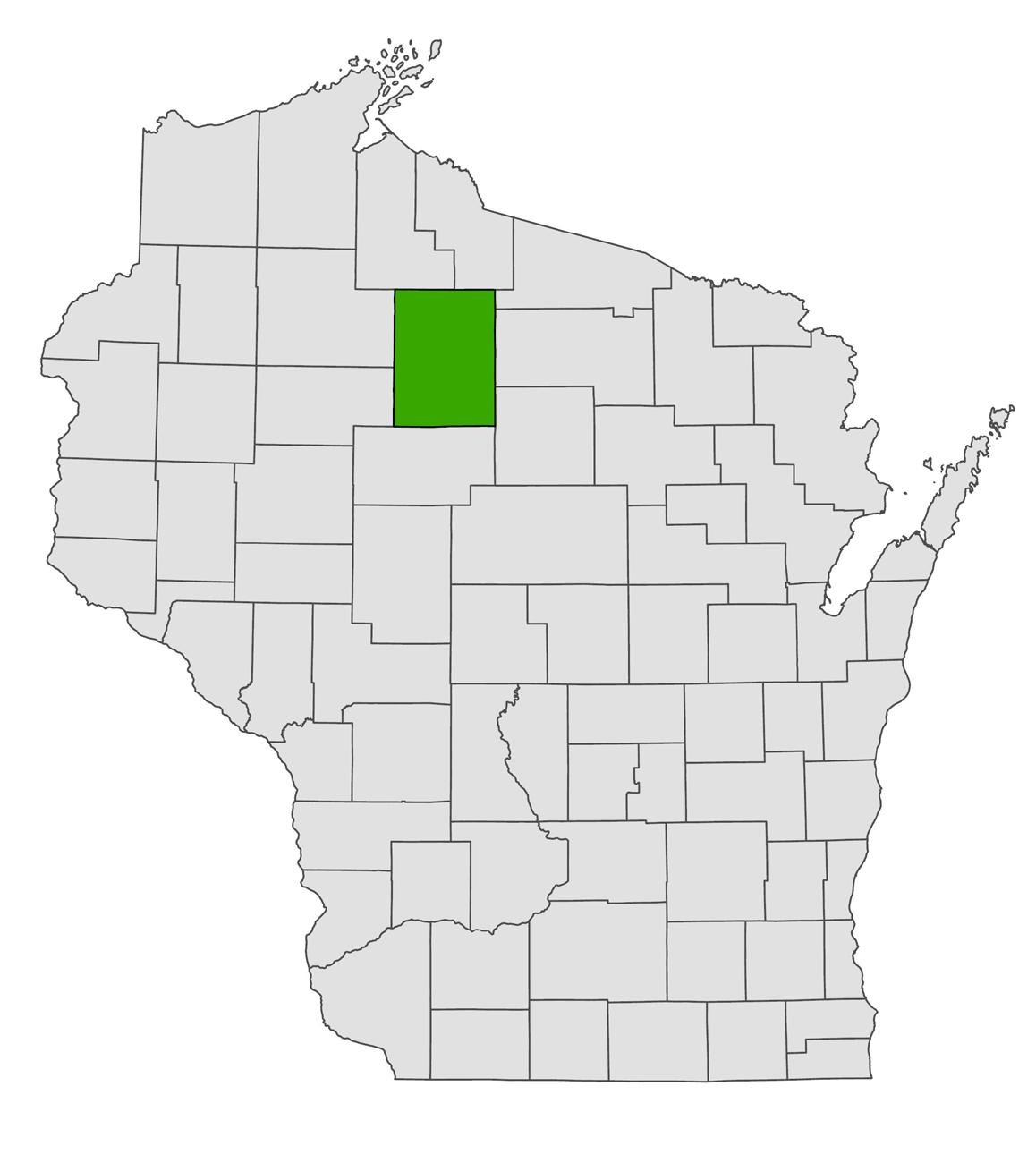
Price County, Wisconsin
May, 2023
June, 2023
July, 2023
August, 2023
September, 2023
October, 2023
November, 2023
December, 2023
January, 2024
February, 2024
March, 2024
April, 2024
• Project Kick-Off
• Exising conditions analysis
• Data gathering
• Community engagement (survey and crowdsource map)
• Community Meeting
• Data analysis
• Draft recommendations
• Draft action plan
• Review draft action plan
• Revise draft action plan
• Community Meeting
• City Council Adoption
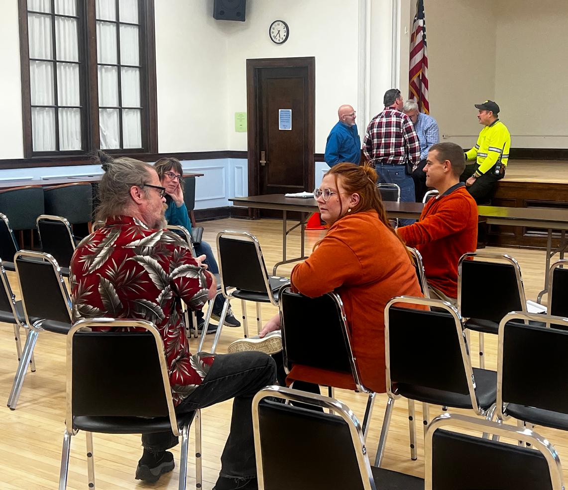
City Staff met with the consulting team throughout the development of the Action Plan to manage progress and ensure the final plan best reflects community needs. Key meetings include the kick-off discussion in May of 2023 to fiscuss the issues and opportunities facing Park Falls and the region, then in January 2024 to review the collected stakeholder input. This was followed in February with a presentation and discussion of the first draft of the action plan. The final public meeting was held in March of 2024.

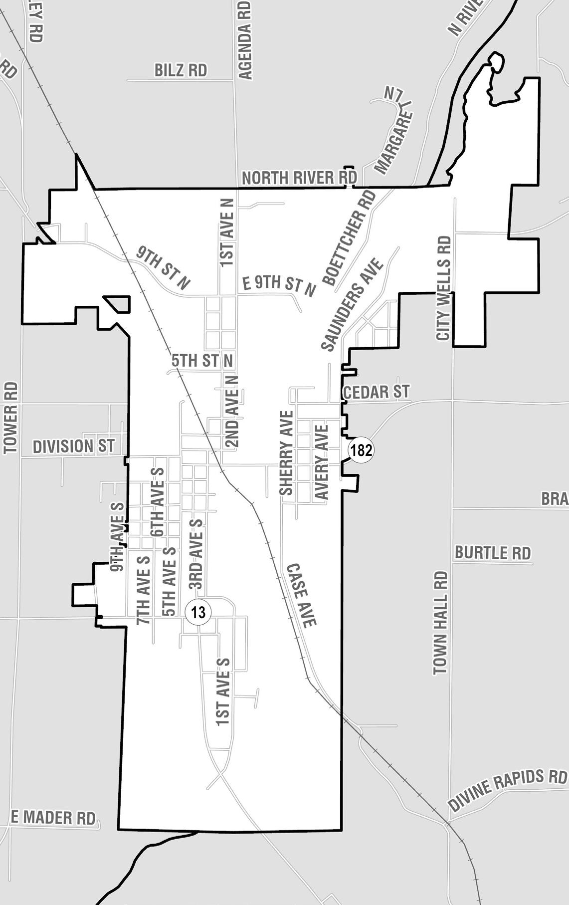
Jurisdiction Map of Park Falls, WI
Park Falls is a city located in Price County, in the Wisconsin Northwoods and Chequamegon-Nicolet National Forest. Settlement began in the late 1800s as a small river village. The town grew with its pulp and paper milling industry, and was incorporated in 1912. It is divided by the North Fork of the Flambeau River, which runs north to south through the community.
Geographically, the Chequamegon School District is the largest in the state. Park Falls Elementary School and Chequamegon High School are located in north Park Falls.
The geographic size and scope of the school district makes safe routes to school a priorty both in town and regionally.
The city is bisected north to south by Wisconsin Highway 13, and Wisconsin Highway 182 branches off to the east.

Park Falls in State-wide Context
The following plans have been adopted by the City of Park Falls and were used to guide the development of the Action Plan.
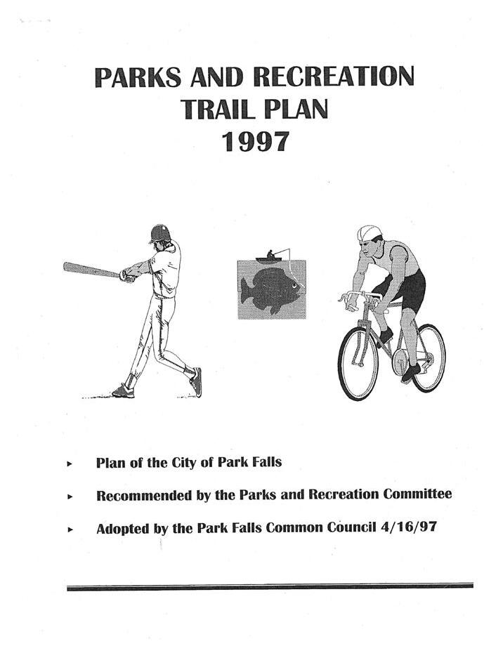
In 1997, the City of Park Falls adopted their Parks and Recreation Trail plan. Notably, the ultimate goal of this planning effort was a series of trails, primarily off-road, which could connect all recreation areas in Park Falls. This includes a network of motorized trails for ATVs and snowmobiles, as well as non-motorized trails for bicyclists and pedestrians.
Created by the Price County Forestry and Parks Department, the plan includes a vision for a county-wide system of connected trails for motorized off-road vehicles as well as cyclists and pedestrians. Increased opportunities for trail usage are highlighted as an important way to improve community health and welfare.
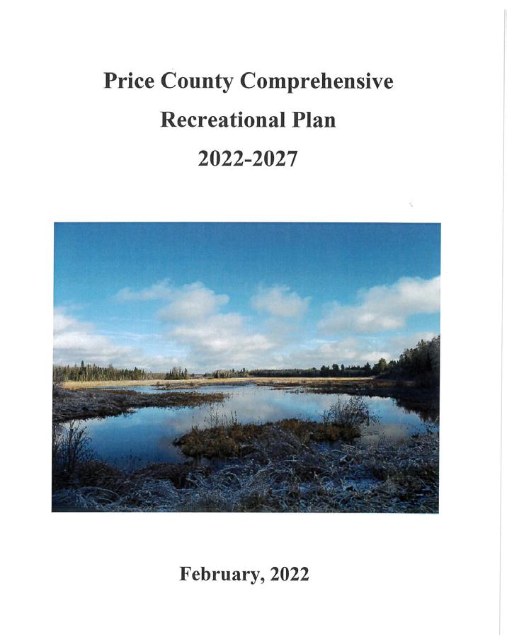
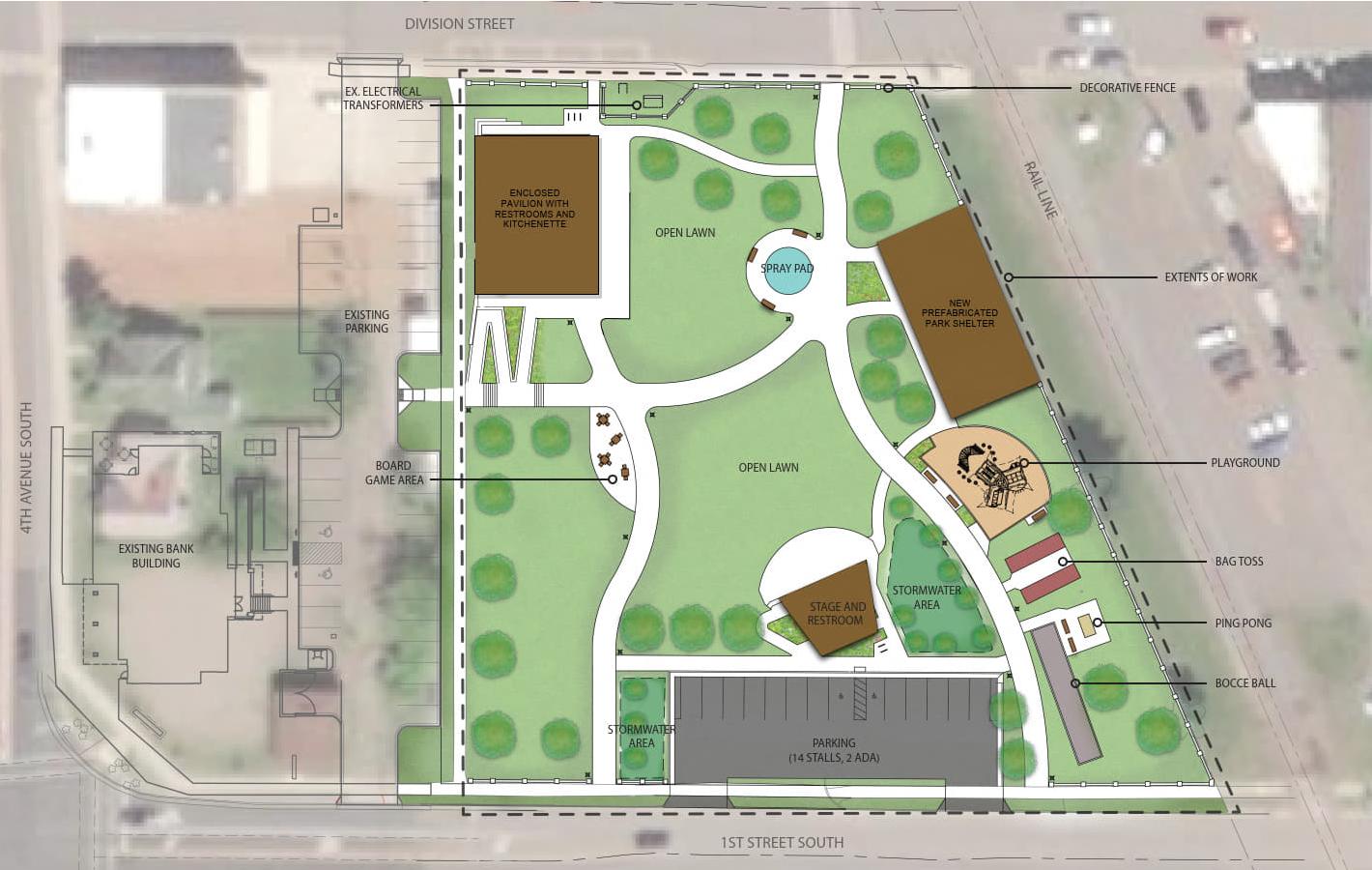
Old Abe Memorial Park
From 2022-2023, MSA Professional Services, Inc. and Plunkett Rayich Architects, LLP were hired to produce a Master Plan and Schematic Design for Old Abe Memorial Park in downtown Park Falls. As of early 2024, completion of the development is late 2024 to early 2025.
A population pyramid ideally looks like a triangle with a wide base and a narrow peak. The narrowing at ages 19-24 is common in places without a large college/ university. However, the width at the top indicates an aging community that may need to rely on more options for senior transportation.
2,368
MEDIAN AGE
44.3
The City of Park Falls has a median household income that falls 55% below the statewide median. According to 2021 data from the U.S. Census Bureau, over half of the population of Park falls has an income that is below $50 thousand annually.
MEDIAN HOUSEHOLD INCOME
$39,125
This is 55% of the statewide median household income of $70,996 POVERTY RATE 30.3% This is nearly 3 times the statewide poverty rate of 10.7%.
Sources: US Census Bureau, American Community Survey 2021 5-year estimates, Wisconsin DOA Population Projections
In 2022, the median home value in park falls was $74,200, which is below the neighboring Town of Einstein, and the county median. Futher housing data shows a correlation between the year a house was built and the median value, with newer homes being valued above older homes. For rental properties, the target vacancy rate that is considered “healthy” is at 7%-- meaning that rental properties can meet the demand, but not produce an oversupply leaving empty rentals unoccupied. Since 2013, Park Falls has seen a fluctuating vacancy rate, which went above 11% from 20172018, before coming back down to 8% in 2018. In 2020, the vacancy rate was 8.1%, which technically sits slightly above “healthy” but is still in the target range to meet supply/ demand.
According to the U.S. Census Bureau, the primary industries for those who are employed in Park Falls are manufacturing and educational/healthcare/social services-- which combined represent a quarter of all employment in the community. However, between 2010 and 2021, nearly all sectors have declined in employment. The only growth industries identified are “Professional, scientific, and management, and administrative and waste management services,” “Finance and insurance, and real estate and rental and leasing,” and “Arts, entertainment, and recreation, and accomodation and food services.”
Sources: US Census Bureau, American Community Survey 2021 5-year
Commute times can be skewed by increasing abilities to work from home, or more traditionally in places where people live near where they work.
AVERAGE COMMUTE TIME TO WORK 14.4 minutes
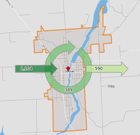
Park Falls is a net-importer of employees. Approximately 389 stay in town for work, 1,104 come in to Park Falls from other communities, and 590 leave the city for work.
Sources: US Census Bureau, American Community Survey 2021 5-year estimates, Wisconsin DOA Population Projections
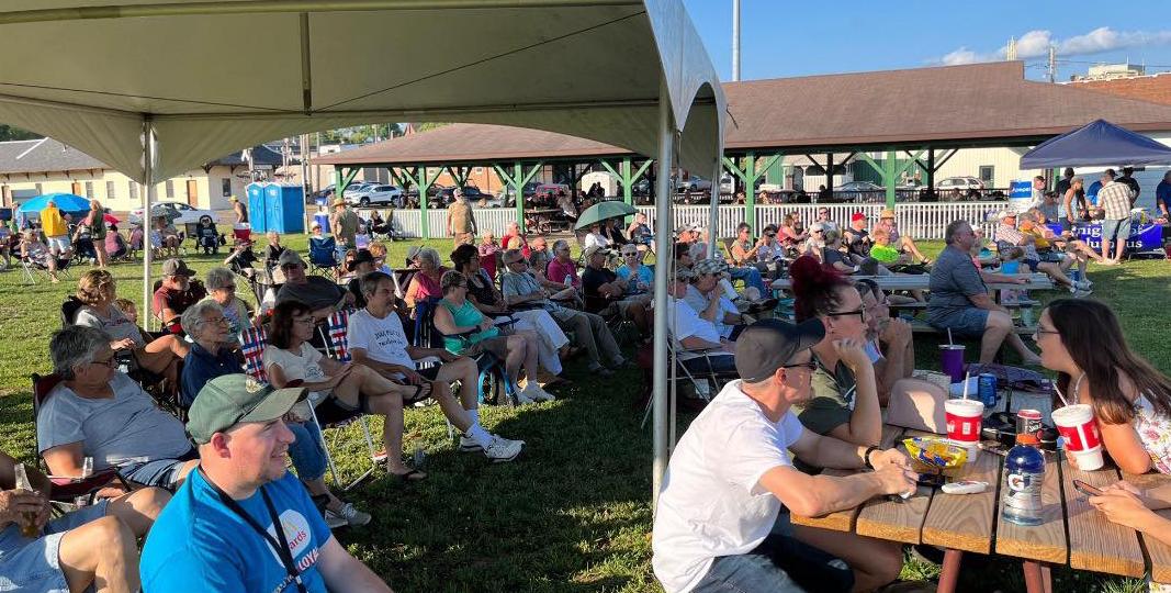
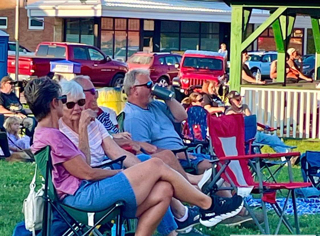
During the summer months, Wednesday Night Live is a free live music event held at Ols Abe Memorial Park in the heart of Park Falls’ downtown. Featuring local food and drink vendors, and sponsored by community businesses, Wednesday Night Live brings together community members of all ages and abilities.
Events like Wednesday Night Live create opportunities for engagement with local, downtown Park Falls businesses to receive additional patronage. Increased foot traffic through events can flow into local businesses, especially on a weekday, which may normally see low patronage.

This section of the Action Plan describes the types of public engagement and collaboration with staff that came together to bring this plan to life.
This includes meetings with City staff, public input meetings, and a comprehensive online survey with an optional interactive map.
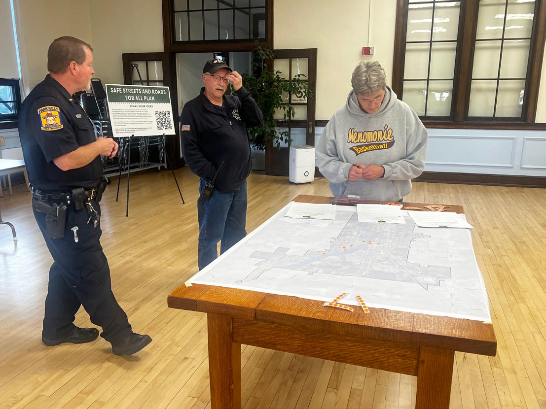
Two public meetings were held to engage citizens in the effort to reach vision zero. The first meeting was hosted on September 13, 2023. This meeting served dual-purposes. It was an informational session to educate citizens about the project, and an opportunity for participants to provide input about their experiences with the transportation system of Park Falls. The second community meeting was held on March 27, 2024 to present the draft plan for community feedback.
A community survey was developed in cooperation with project planners and City staff to gather local knowledge regarding the usage, perceptions, and needs of the Park Falls transportation system. Respondents were asked about roadway, sidewalk, and trail usage; levels of safety for various system users; and issues related to both policy and infrastructure. The survey was distributed online and remained open for responses for approximately two months.
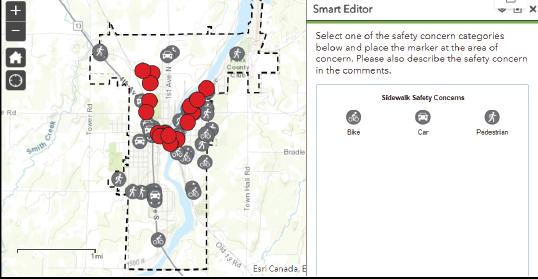
Citizen involvement was solicited through an interactive mapping tool that enabled residents to identify general and location-specific safety concerns and improvement ideas throughout the City.
The map was hosted on the same website as the community survey to give visitors the opportunity to engage with both the online survey and interactive map in one convenient place.
31 Questions
106 Respondents
49 Interactive Map Comments
Personal vehicles are the primary mode of transportation for nearly 60% of Park Falls residents.
76 % of respondents use the roadways in Park Falls on a daily basis.
Alternative forms of transportation in Park Falls include bicycles, walking, motorcycles/motorized scooters, ATV/UTV/snowmobiles, and Price County Elderly and Disabled Transportation.
18% of respondents utilize sidewalks for transportation or recreational purposes daily.
Another 56% do so weekly or monthly.
40% of respondents expressed concerns with intersections and crosswalks in Park Falls.
When asked about overall concerns, respondents indicated that speeding vehicles, pavement markings, signs covered by trees or landscaping, and ATV/UTV road use as the most prevalent issues.
Primary means of school transportation for children K-5 are personal vehicles and buses. Approximately 10% of respondents reported allowing their K-5 child to walk or ride a bike to school occasionally.
Grocery stores, Downtown Park Falls, and restaurants are the primary destinations for travelers in Park Falls.
16% of respondents believe the roads and crossings near schools to be unsafe for students who walk or bike. Specific concerns included lack of infrastructure, speeding, and reduced sightlines.
10% of survey respondents utilize streets and on-street bike facilities on a daily basis. 48% use the facilities either weekly or monthly, and 42% indicated they use the facilities a few times each eyear.
The majority of respondents reported that the roads in Park Falls are “somewhat safe”, indicating that there may be room for improvement to increase overall safety.
A community survey was developed in cooperation with project planners and City staff to gather local knowledge regarding the usage, perceptions, and needs of the Park Falls transportation system. Respondents were asked about roadway, sidewalk, and trail usage; levels of safety for various system users; and issues related to both policy and infrastructure. The survey was distributed online and remained open for responses for approximately two months.
Q1: Personal vehicles are the primary mode of transportation for nearly 60% of Park Falls residents. Alternative forms of transportation that are sometimes used include bicycles, walking, motorcycles/motorized scooters, ATV/UTV/snowmobiles, and Price County Elderly and Disabled Transportation.
Q2: Grocery stores, Downtown Park Falls, and restaurants are the primary destinations for travelers in Park Falls.
Q3: 76% of respondents use the roadways in Park Falls daily.
Q4: 10% of survey respondents utilize streets and on-street bike facilities on a daily basis. Many respondents (42%) indicated that they use these facilities a few times each year, the majority (48%) reported using the facilities either weekly or monthly.
Q5: 18% of respondents utilize sidewalks for transportation or recreational purposes daily. Another 56% of respondents reported using sidewalks for transportation or recreation either weekly or monthly.
Q8: The majority of respondents reported that the roads in Park Falls are “somewhat safe,” indicating that there may be room for improvement to increase the overall safety.
Q9: 16% of respondents believe the roads and road crossing near schools to be unsafe for students who walk or bike. Concerns include lack of infrastructure (specifically sidewalks), speeding, and visual impairments.
Q13: 40% of respondents expressed concerns with intersections and crosswalks in Park Falls. Primary concerns include markings, visibility, and speeding vehicles.
Q14: When asked about overall concerns, respondents indicated that speeding vehicles, pavement markings, signs covered by trees or landscaping, and ATV/UTV road use as the most prevalent issues.
Q21: Primary means of school transportation for children K-5 are personal vehicles and buses. Approximately 10% of respondents reported allowing their K-5 child to walk or ride a bike to school occasionally.
HOW SAFE DO YOU CONSIDER THE ROADS AND SIDEWALKS IN THE CITY FOR WALKING?
I BELIEVE IT IS EASY TO REPORT A MAINTENANCE OR SAFETY ISSUE TO THE CITY
IN YOUR OPINION, DO ANY OF THE FOLLOWING ISSUES CURRENTLY EXIST IN PARK FALLS? (TOP 5 ANSWERS)
IN YOUR OPINION, DO ANY OF THE FOLLOWING ISSUES EXIST WITH SIDEWALKS OR BIKE PATHS IN PARK FALLS? (TOP 5 ANSWERS)

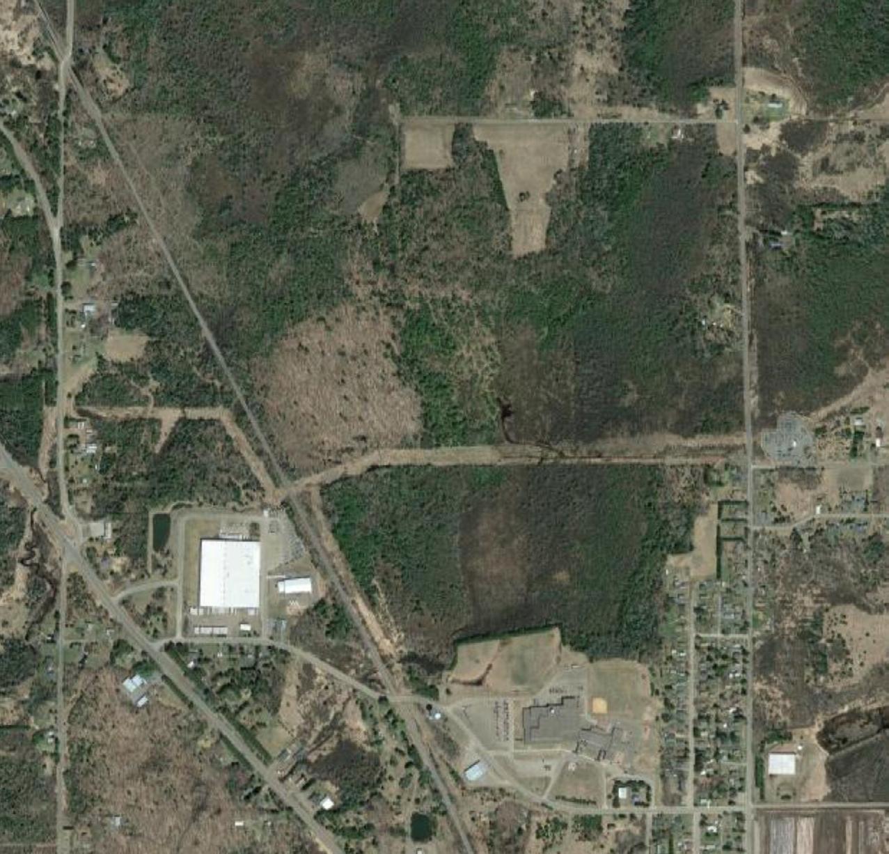

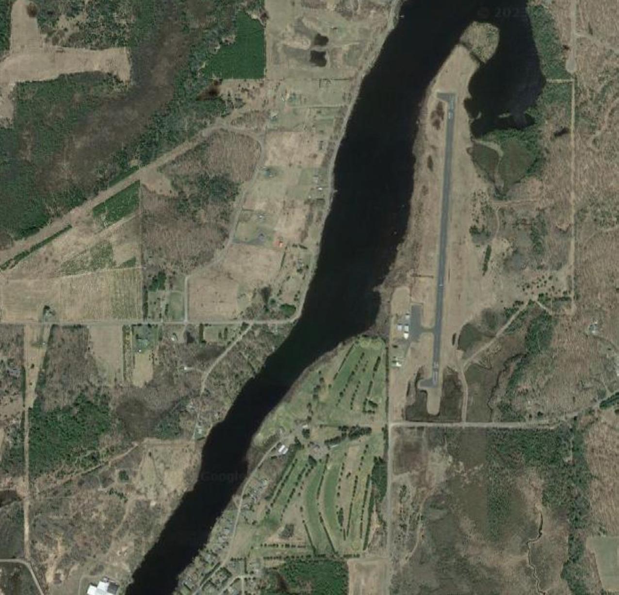


The roadway network of Park Falls accommodates a range of differing users. Analysis of conditions identified primary concerns, include pedestrian and bicycle connectivity and accessibility, infrastructure improvements and maintenance.
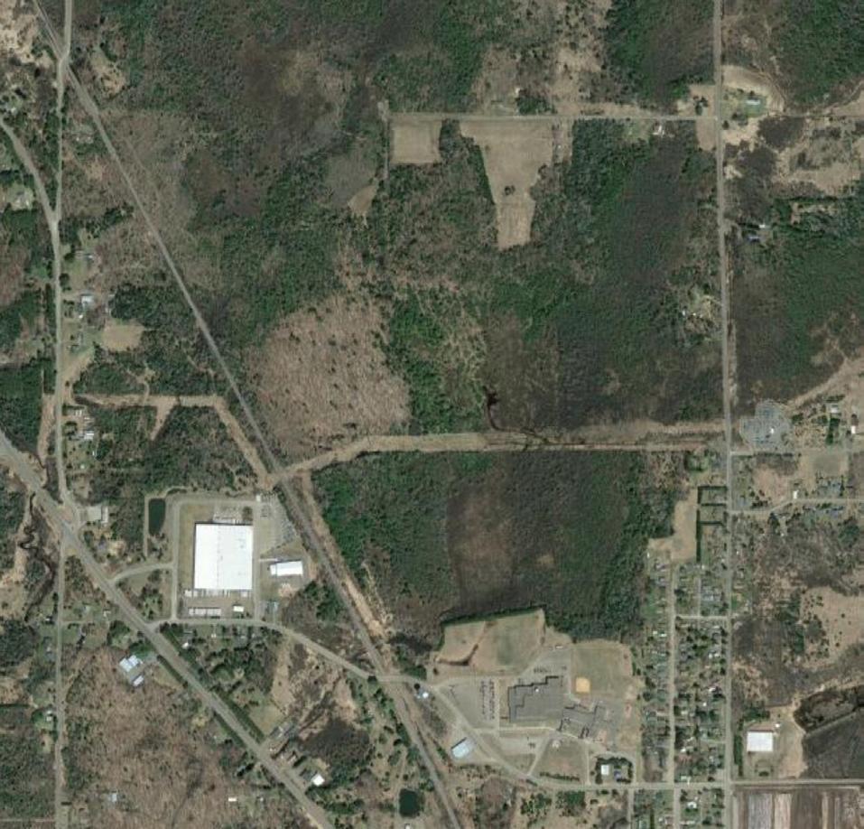


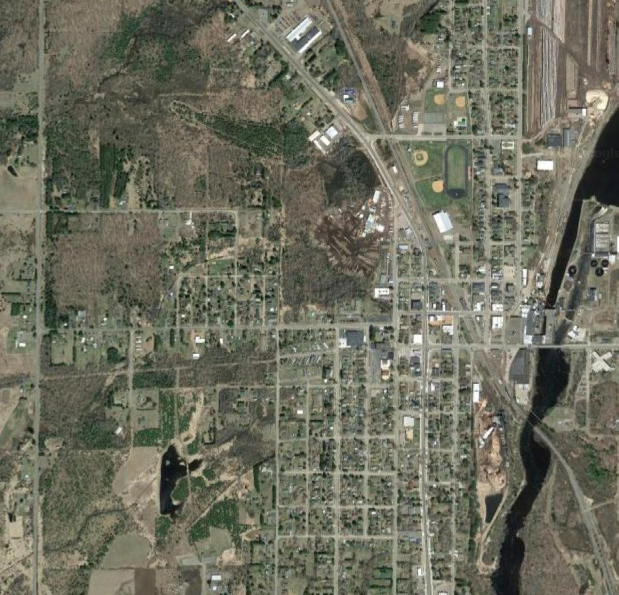


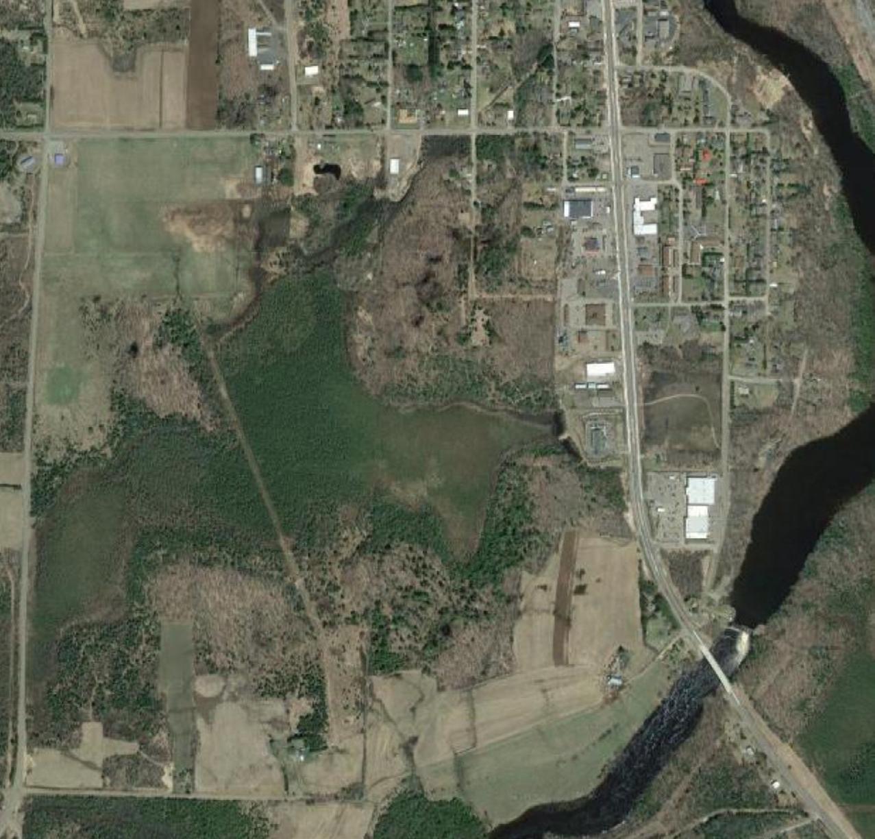
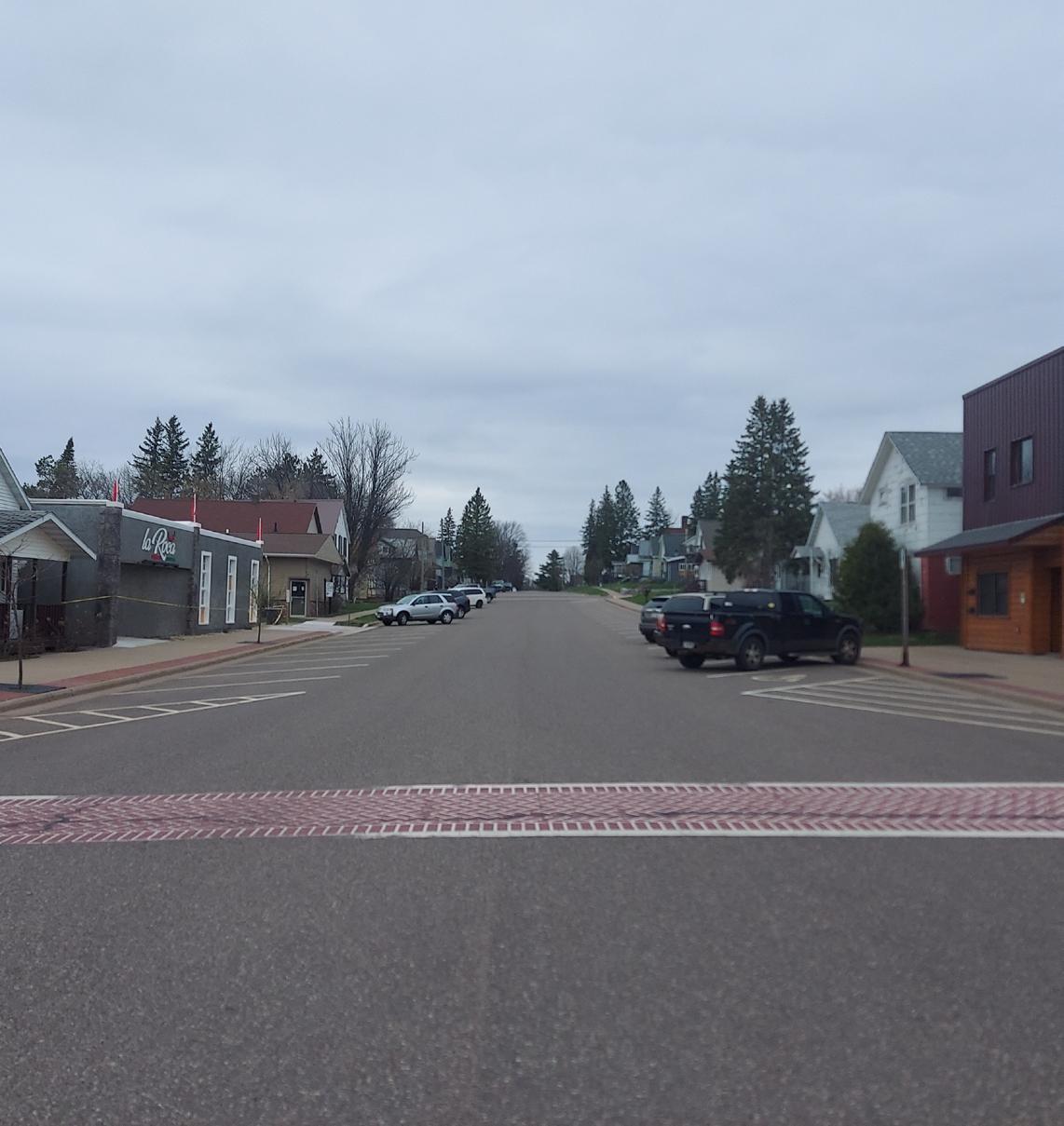
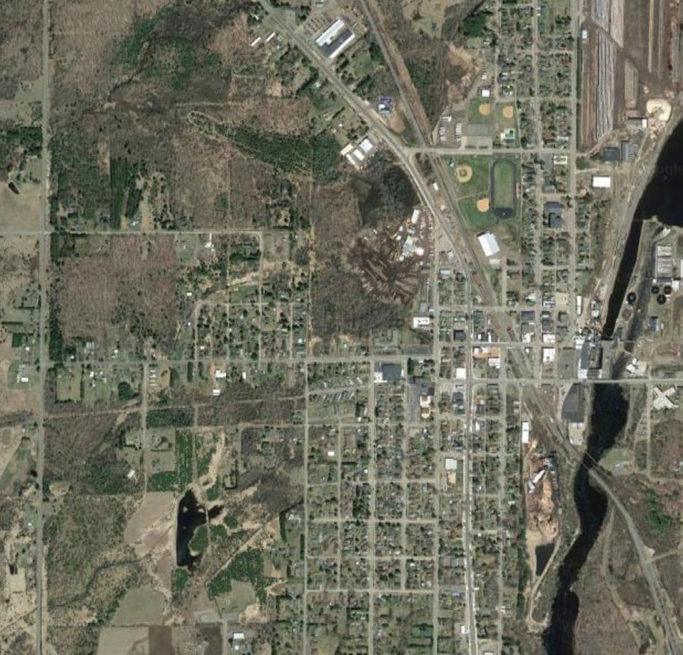
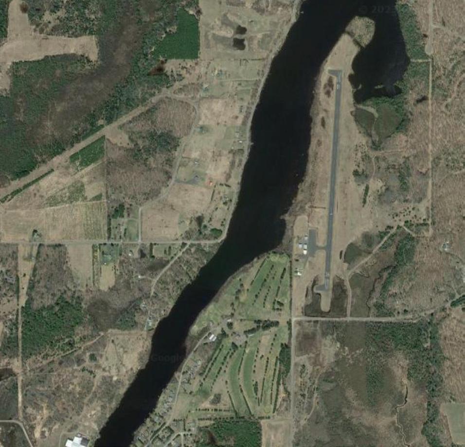

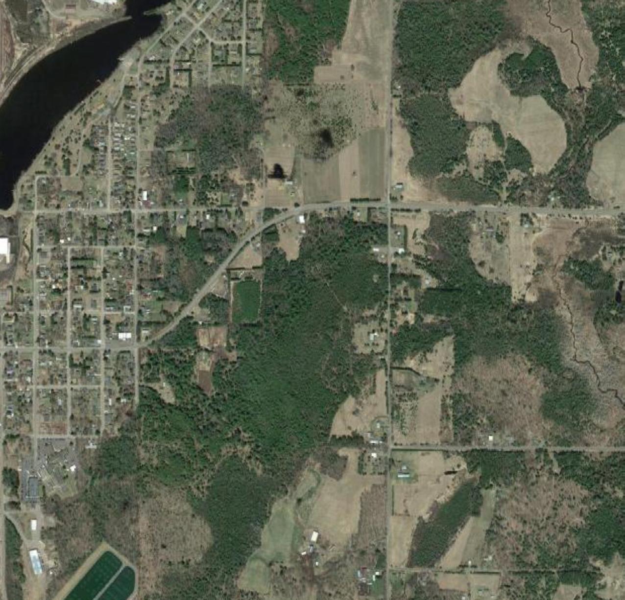

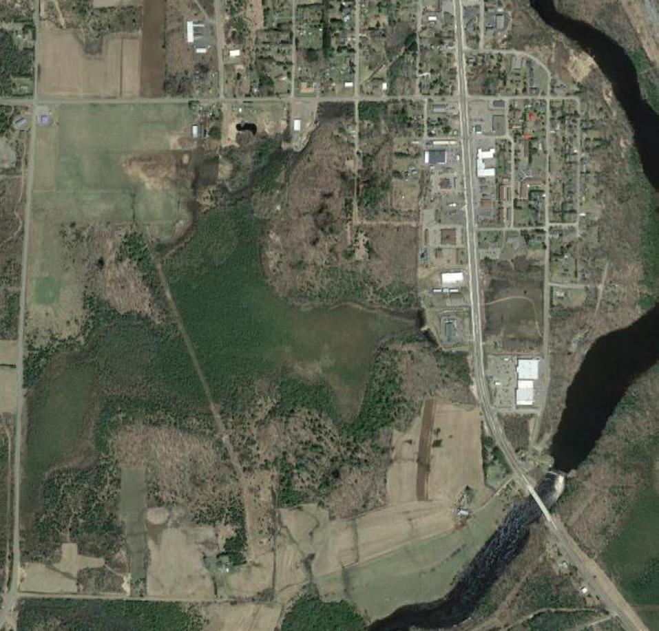


This study uses a variety of methods and data to understand the housing market. Objective, measurable data were collected from the City, Price County, the Multiple Listing Service (real estate listings and sales), the State of Wisconsin, the U.S. Department of Housing and Urban Development and the U.S. Census Bureau. The City was compared to surrounding communities and wider context (county, state, nation) in a variety of ways, and also compared to itself in the form of time-series data. This study also incorporated a series of interviews with people familiar with the housing market- the housing experts, and a community survey of area residents.
MSA traffic engineers coordinated with the City to collect turning movement data at the most critical intersections. Seven locations were selected, targeting signalized intersections and intersections near key features, such as Park Falls Elementary, Weather Shield Windows, and the medical center. Data was collected during the Friday and Saturday mid-day peak hours of the Flambeau Rama event, as well as an average weekday AM and PM peak hours while school was in session (October 18, 2023).
PM peak hour data collection was expanded from the typical period to account for any school-related influx of traffic. With the exception of traffic volumes adjacent to the school, traffic volumes were generally lower during the average weekday than during the Flambeau Rama event. This phenomenon is to be expected, as the event has a regional draw. Typically, Weekday traffic sees AM/PM peak periods, while weekend traffic usually only has a mid-day peak, except in highly commercial areas. The traffic volume data was also used in the calculation of crash rates for the same intersections, including STH 13 and STH 182.


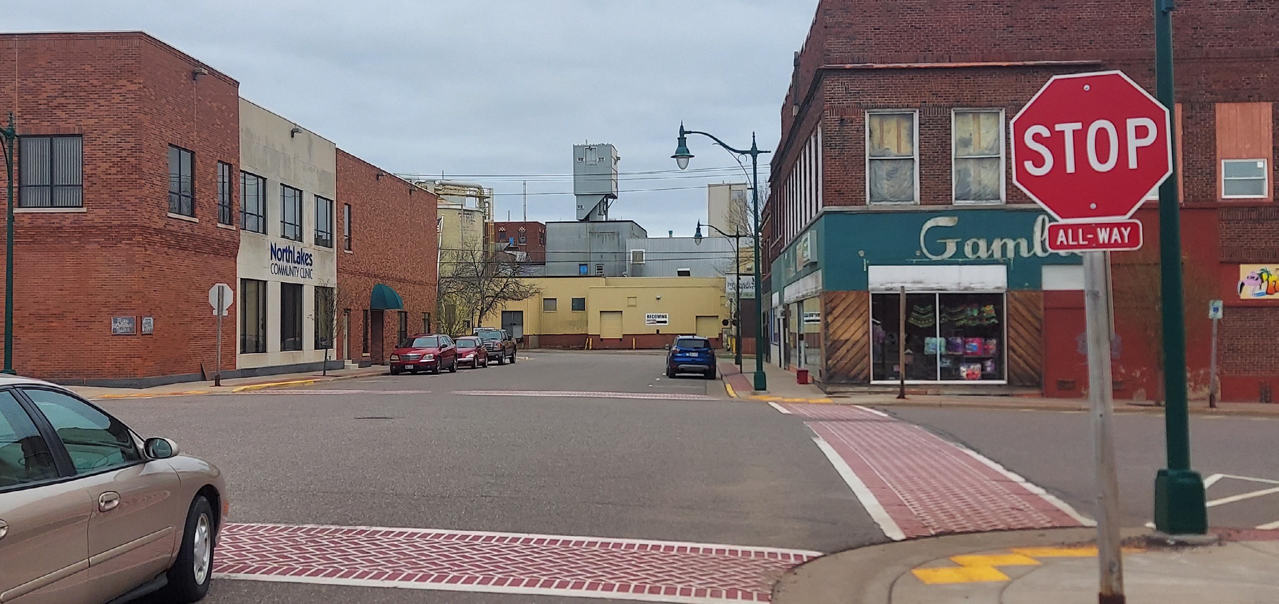
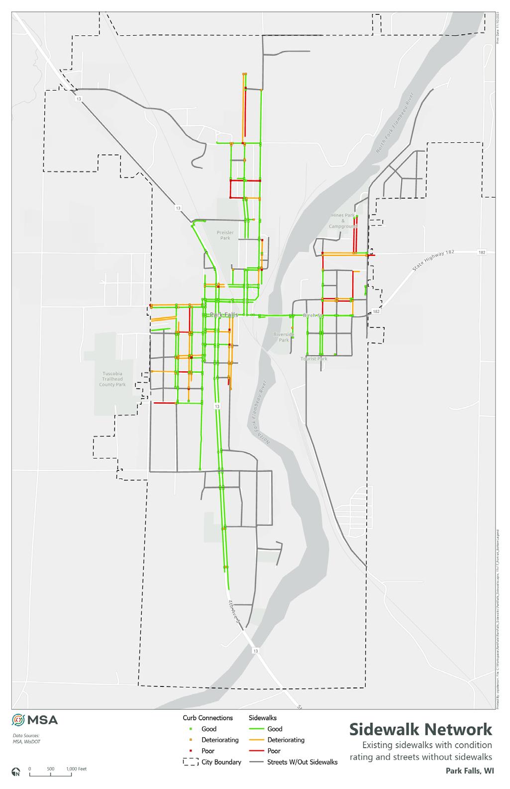
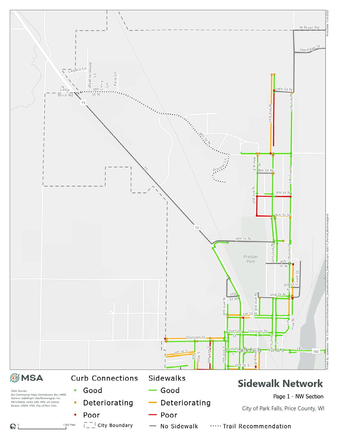
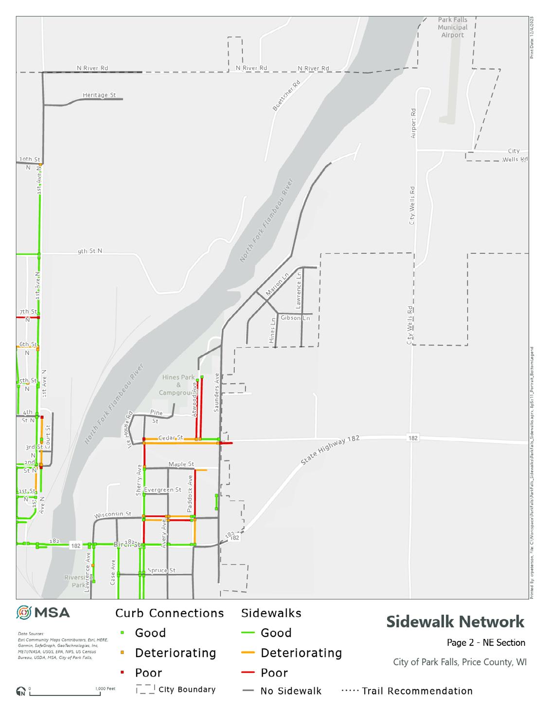
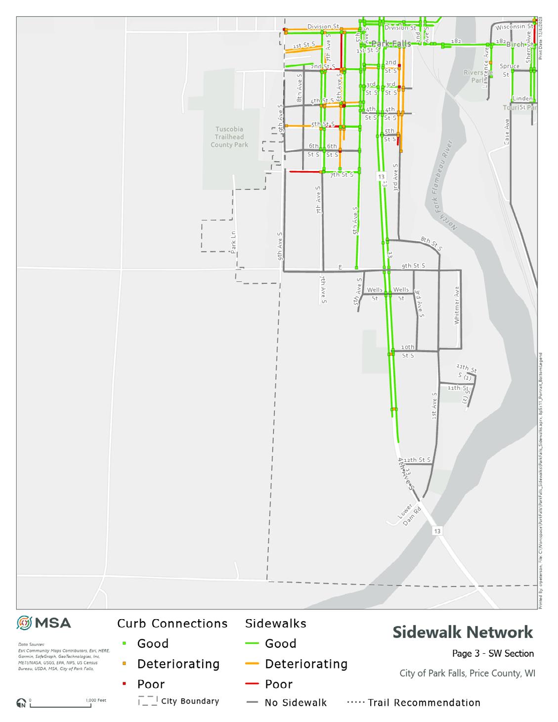
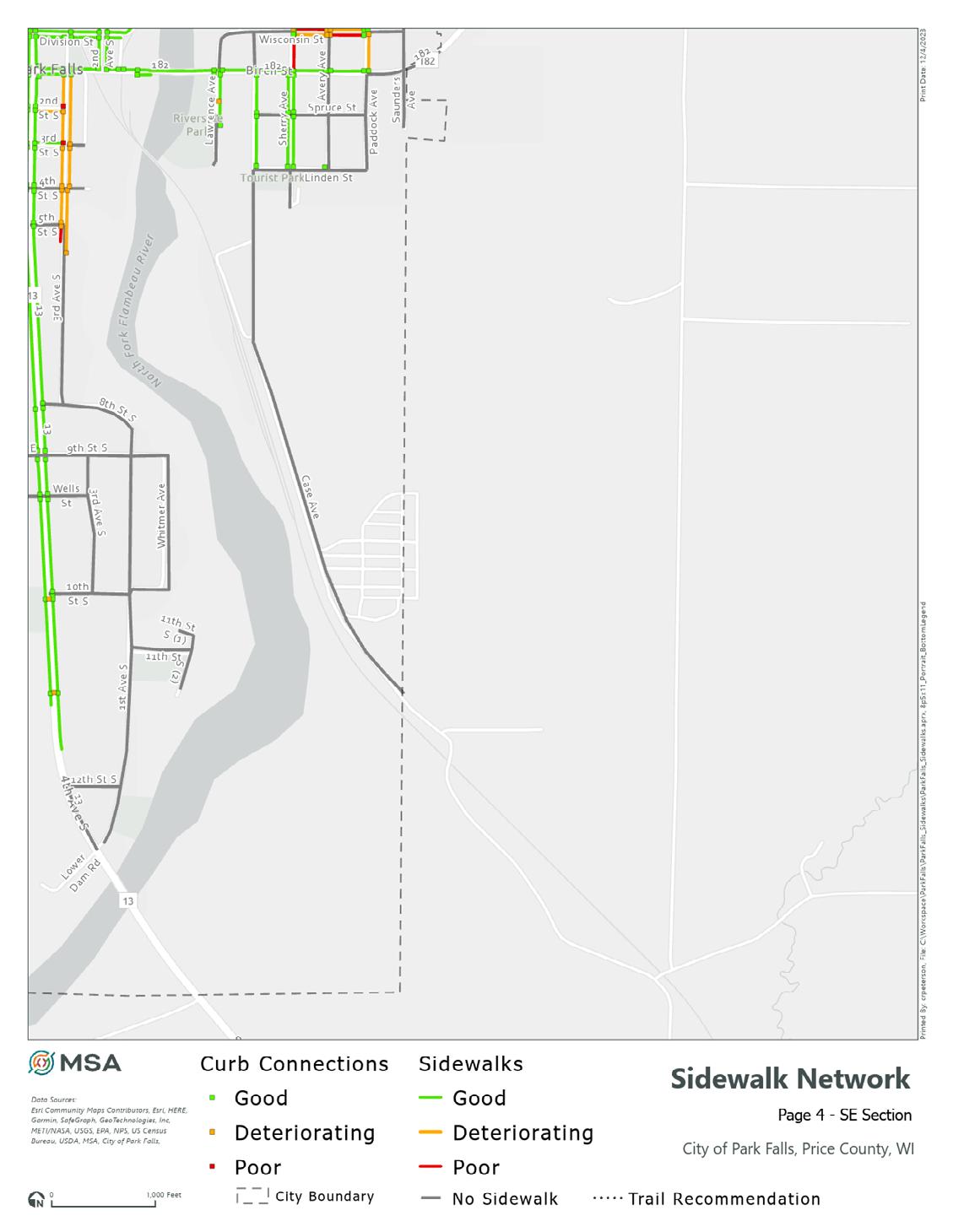
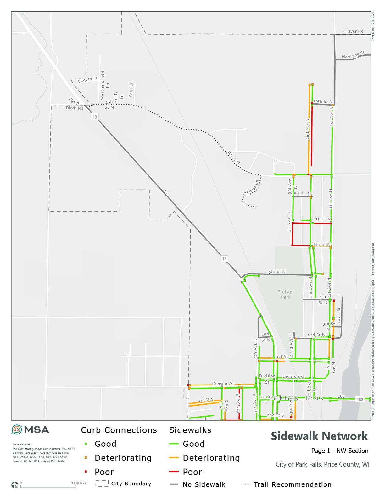
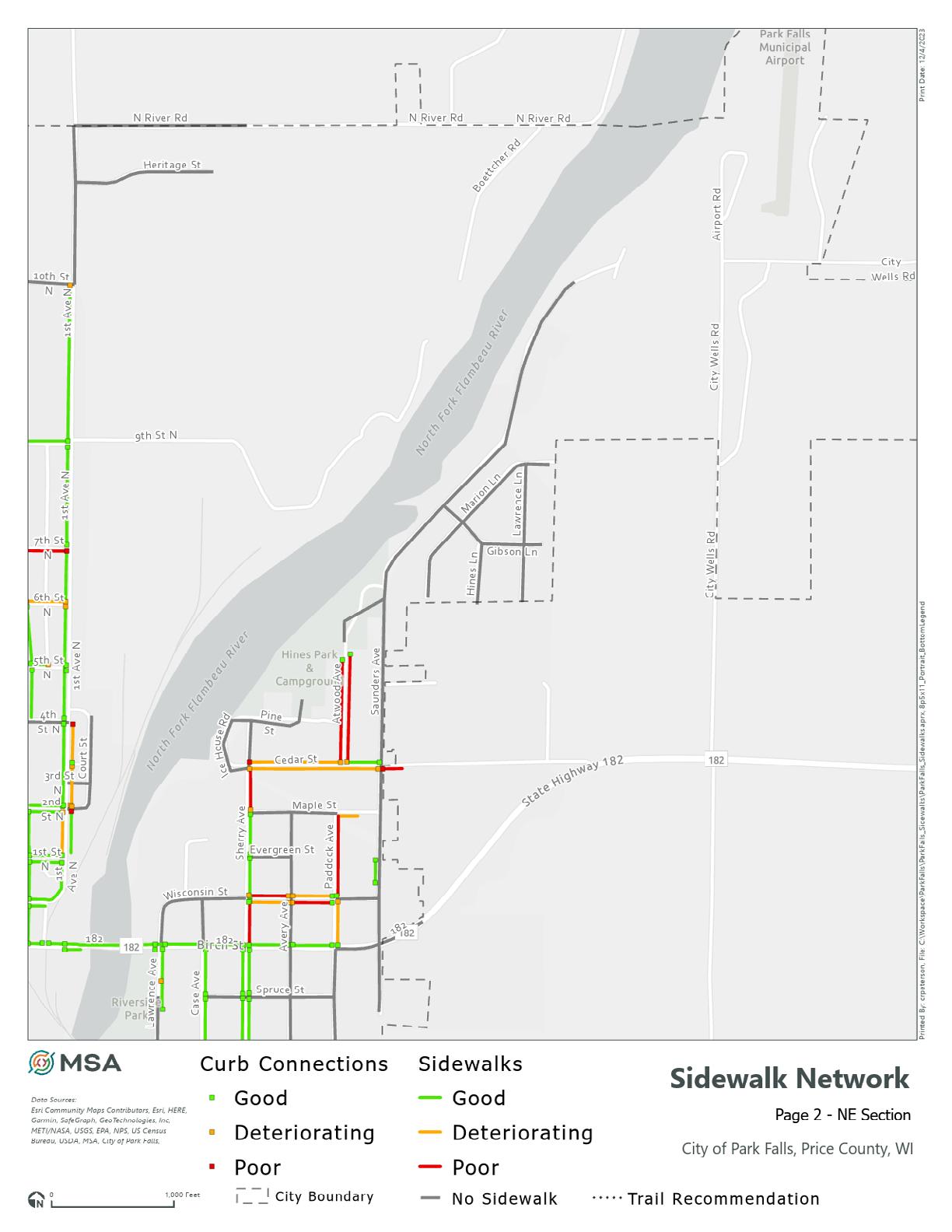
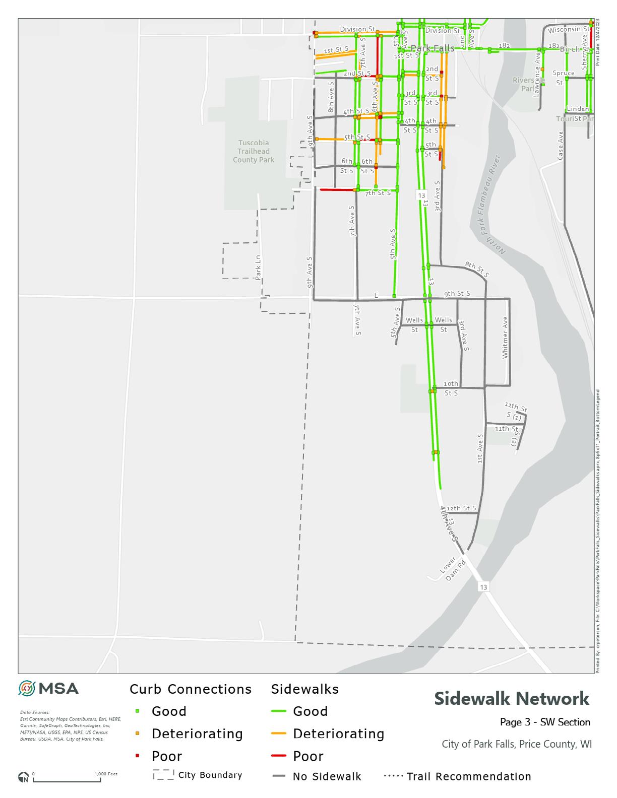
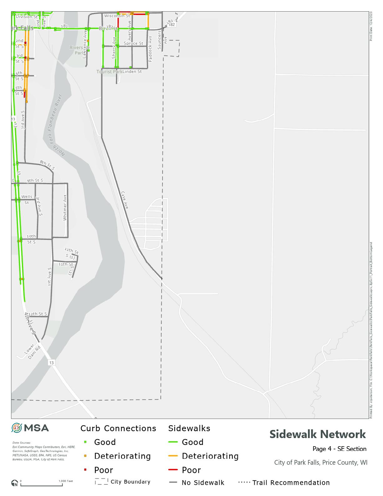
The project team gathered all transportation network GIS data to create a comprehensive map of existing and planned facilities. The result is an asset mapping database of City sidewalks based on aerial photography and visual inspections. This database served as the foundation for the existing conditions maps, was used to help the project team understand the current state of the transportation network, and serves as a base map for online and inperson community engagement activities.
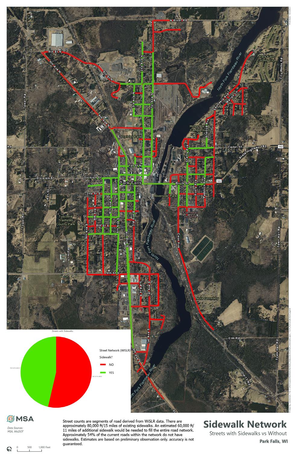
The sidewalk inventory also acts as an initial ADA audit, showing where existing sidewalks and curbs are not in compliance with the Americans with Disabilities Act. However, 55% of the community has street footage with no adjacent sidewalk.
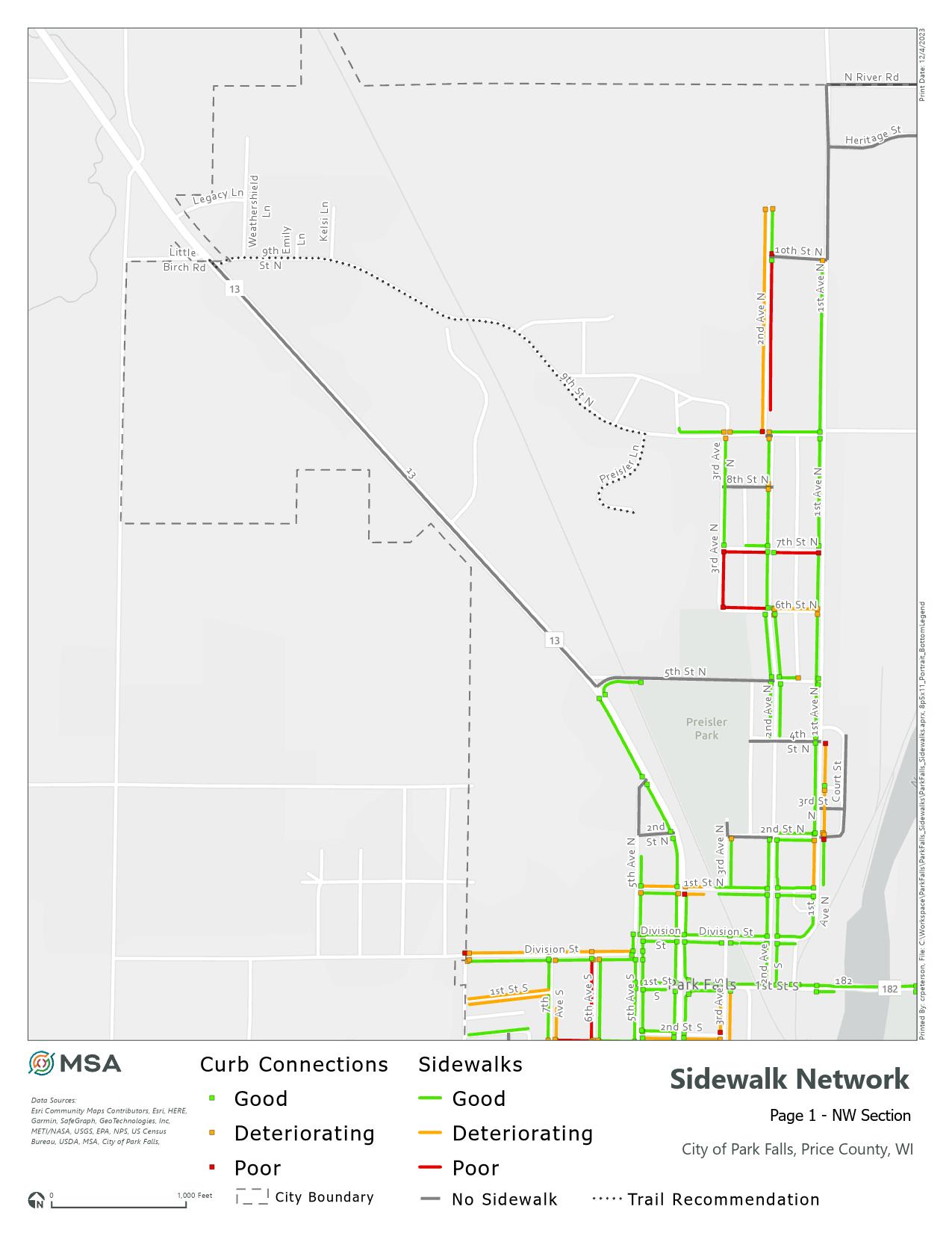
“No walk ways. Unclear as to where a pedestrian should walk to be safe”
(along 9th Street N)
“Just an unsafe corner - perfect place for a round-a-bout or traffic lights”
(corner of 9th St N and Hwy 13)

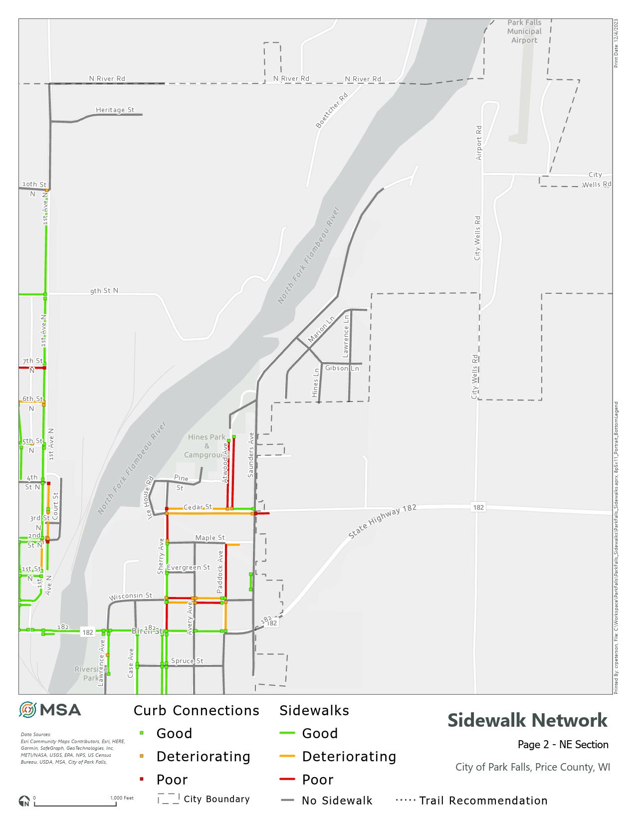

“Saunders is very busy with no sidewalks available. Traffic busy with Golf Course at the end of street.”
“Along entire road on Saunders challenging to walk - must stop and get off road or single file especiallly when two opposing vehicles in proximity. Especially at curve and all times at night. Poor lighting and inoperable street lights or blocked by limbs.”
“Uneven pavement” (on street and trail)
“Gravel spillage onto path from gravel road, and also not regularly plowed in winter.” (south end of Hines Park)
“All cycling approaches to Hwy 182 should be better marked”
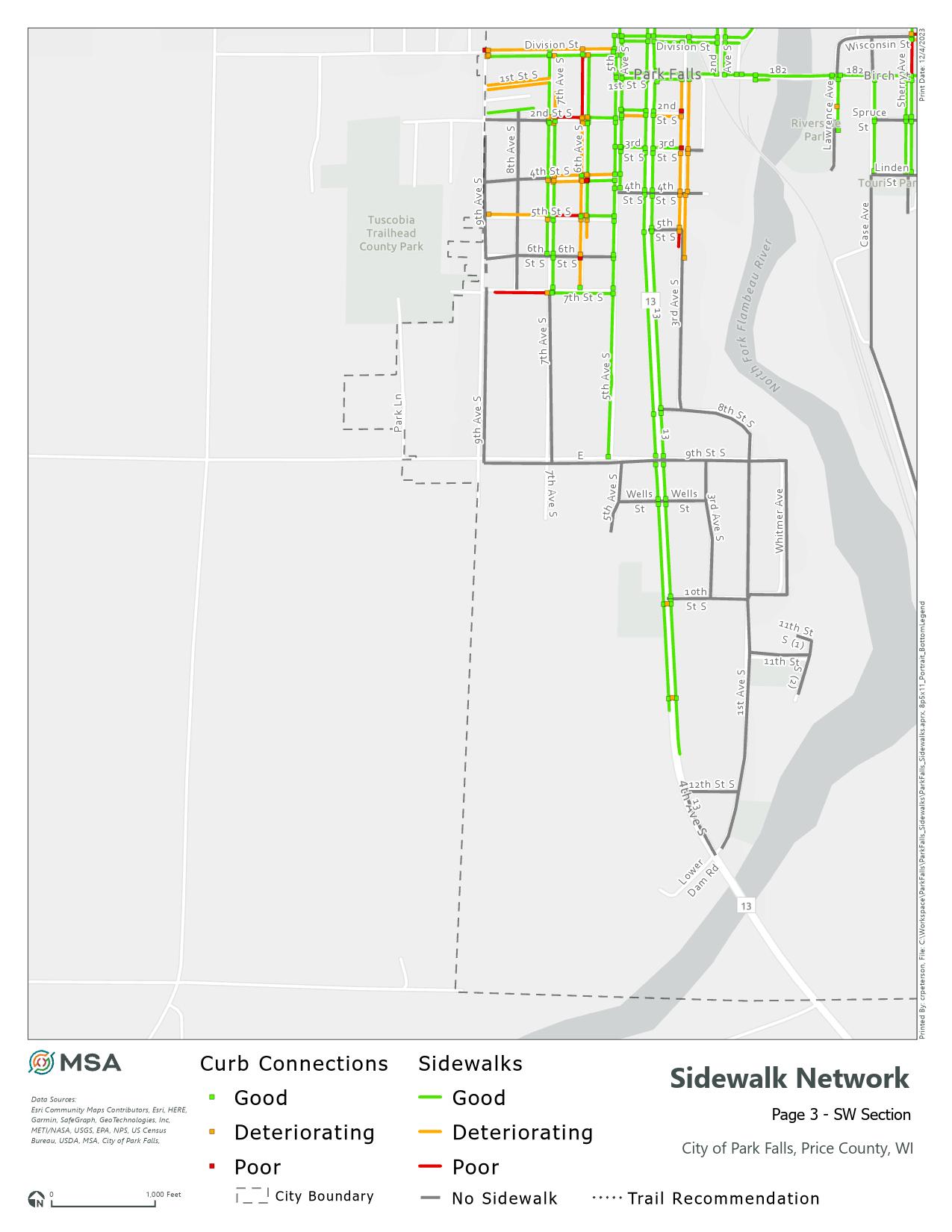

“Need to look at vehicle and ATV/UTV speeds. There is a lot of speeding that happens on this street... Would also be nice to see some signs warning that there is children in the area.” (5th Ave N)
“Alley on both sides of the road is a hazard when all the parking spots are filled... hard to see vehicles and pedestrians coming in and out of the alley” (Division Street by Public Library)
“Branches are hanging down low over the road”
“Bike riders do not trigger the traffic light”
“Cars coming from the north can’t safely turn into Kwik Trip without blocking traffic.”
“Lane division creates hazard for north bound cyclists.”
“No sidewalks or trail to walk your dog to the park.”
“No sidewalks or trails.”
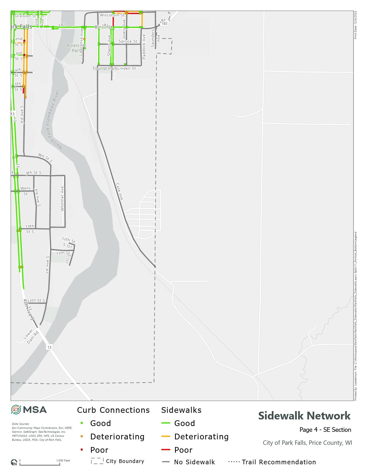

“Uneven surface and bumps in trail pavement.”
“Rec trail goes near sewer plant, occasional signs warning of raw sewerage.”
“Steep hill where trail comes down from the hospital and crosses road towards the river/ nursing home. Very difficult for cars and trail users to see each other and especially difficult for bikes to slow down safely and stop before crossing.”
“No sidewalks”
Increasing safety in Park Falls cannot happen or succeed without considering the impacts that the transportation network can have on different identifying communities such as school-aged, senior, and disabled.
Park Falls has a relatively high median age compared to the state (44.3 years in Park Falls to 40.4 in Wisconsin).
This correlates to an older than average community, which is shown in the population metrics. 25.3% of the population is aged 65 or older. Seniors tend to rely on alternate forms of transportation than those aged 25-64, generally walking, motorized and traditional mobility devices, and public transportation.
Additionally, more than 22% of Park Falls residents are 18 years old or younger. This population relies on walking, bike riding and scooters, school bussing, and public transportation.
Equity also requires attention to potentially negative social effects on human health and prosperty, including:
■ Socioeconomic status,
■ Cultural barriers,
■ Language barriers,
■ Housing type, and
■ Transportation options.
The U.S. Census and American Community Survey define those with disabilities as having one or more of the following:
■ hearing difficulty,
■ vision difficulty,
■ cognitive dificulty,
■ ambulatory difficulty,
■ self-care difficulty, or
■ an independent living difficulty.
Most holistic transportation plans take into account ambulatory and vision difficulties, at a minimum, because this is the population that certain engineering design standards have been created for (namely, the Americans with Disabilities Act).
This plan considers all potential users of the active and traditional transportation network throughout Park Falls, taking in account the unique challenges faced by people with disabilities.
Sources: US Census Bureau, American Community Survey 2021 5-year estimates, Wisconsin DOA Population Projections

The SS4A Action Plan must contain effective strategies and project recommendations to achieve vision zero - the goal of eliminating traffic fatalities and serious injuries in the community. Investments in engagement, education, and infrastructure all play a critical role in reaching this goal and improving the safety for all road users in Park Falls.
This section is divided into the various issues identified throughout the planning process, and the recommendations suggested to address them. The recommendations are further divided into demonstration and Implementation actions.
Demonstration actions are recommendations that have been completed, already in the implementation phase, and/ or are policy-oriented.
Implementation actions are more robust recommendations that will require large capital outlays, and will rely on additional grant funding to complete.
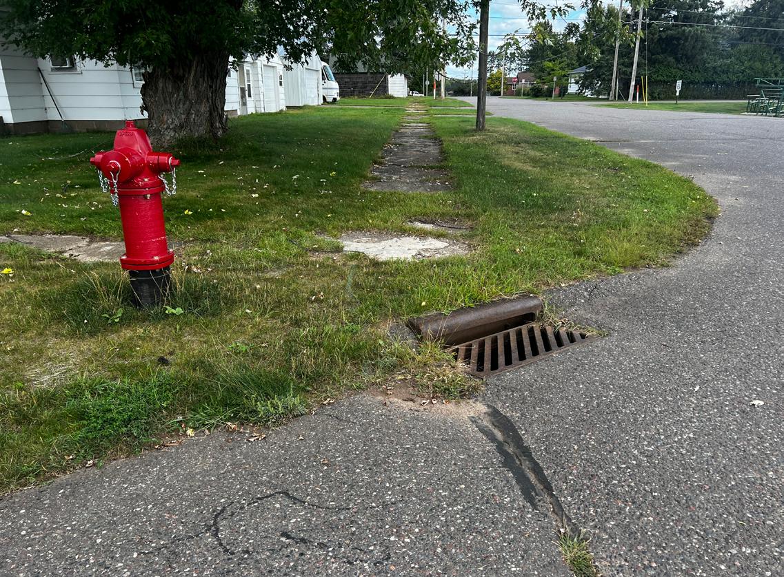
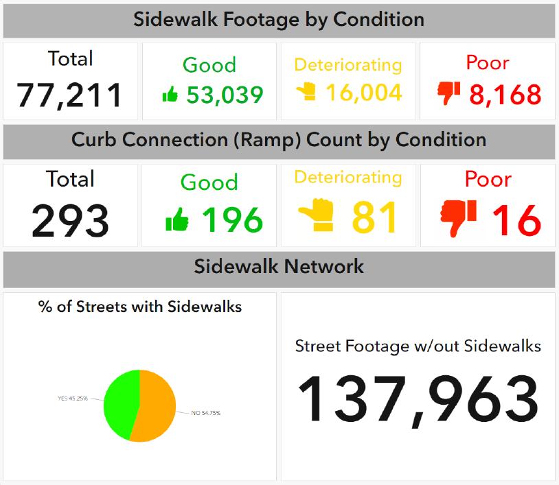
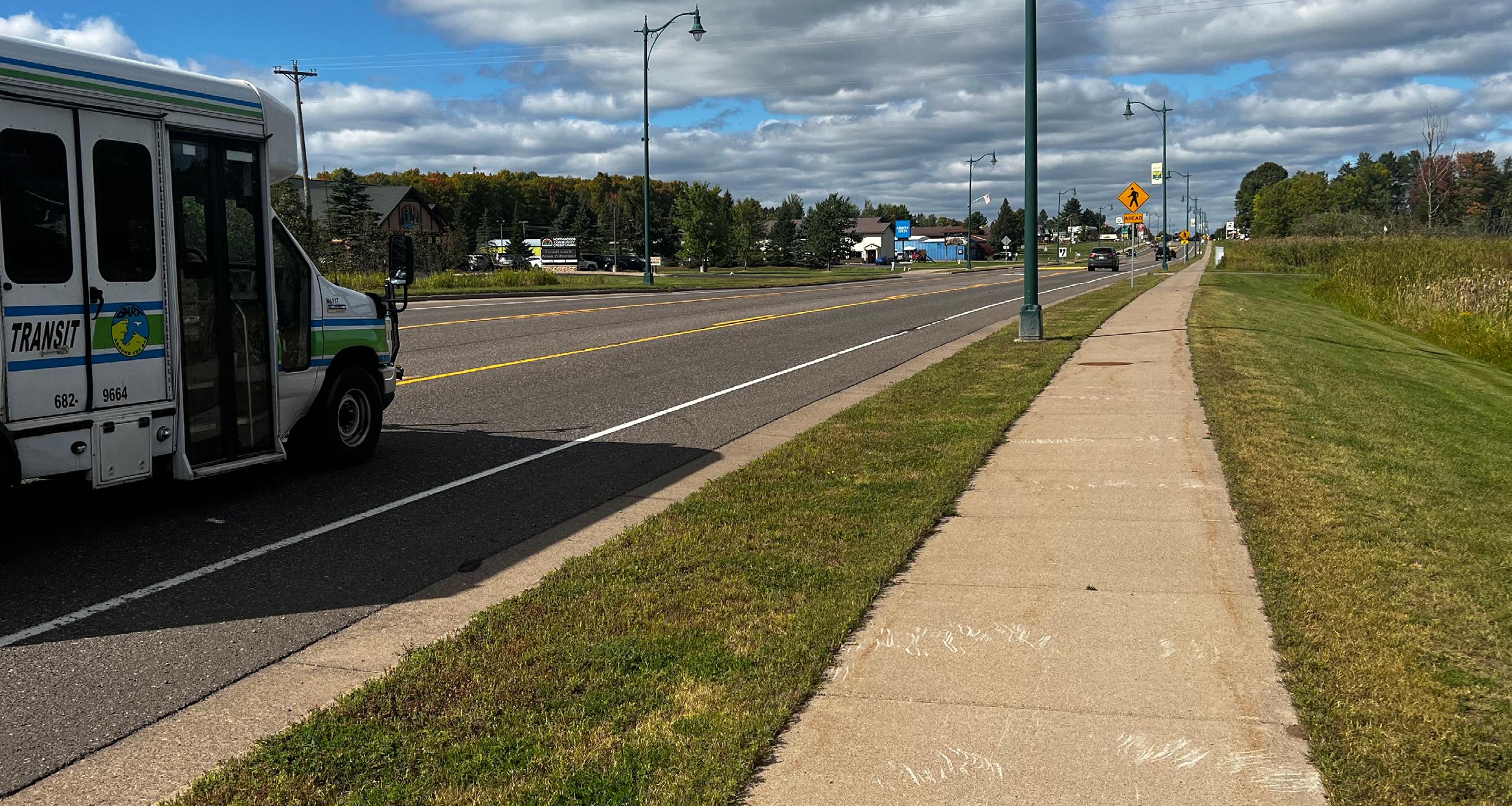
Roughly 50% of City streets do not include a safe walking route.
Strategy 1:
Construct new sidewalks and shared-use paths, with priority to streets with higher vehicle traffic. High priority locations include, in this order: 9th St. N, 5th St. N, Hwy 13, Saunders Ave.
Demonstration Actions
1 Maintain an annual expense in the 5-year Capital Improvement Plan for new sidewalks and trails.
2 Update the Park Falls Trails Plan to include a shareduse path on the north side of 9th Street N between the Chequamegon/Park Falls school campus and Highway 13.
3 Update the Park Falls Trails Plan to show safe walking and biking routes to all existing parks and trails in and adjacent to the City.
Implementation Actions
1 Apply for a Safe Streets and Roads for All (SS4A) Implementation grant to construct up to two miles of ADA-compliant sidewalks and/or paths in high priority locations. Highest priority is a shared-use path along the north side of 9th Street N between the school and Highway 13.
2 Apply for a Wisconsin DNR Knowles-Nelson Stewardship Grant to fund the construction of a shared-use path.
3 Apply for TAP funding for a shared-use path.
Strategy 2:
Connect shared-use paths prioritizing routes that connect destinations and existing shared-use paths in the City.
Demonstration Actions
1 Update Park Falls Trails Plan to show connections of the shared-use path along the river and from the Depot to the Park Falls High School.
Implementation Actions
1 Apply for a Safe Streets and Roads for All (SS4A) Implementation grant to construct up to three miles of off-road, shared-use paths along the Flambeau River and connecting essential destinations throughout town.
2 Pursue funding from Rail Trail Conservancy to assist with the expansion of the shared-us path system.
3 Apply for TAP funding for a shared-use path.
Many existing sidewalks and ramps are not ADA compliant.
Reconstruct existing sidewalks that are not ADA compliant.
Demonstration Actions
1 A preliminary ADA audit was completed as part of this Action Plan which identified the location of existing sidewalks and curb ramps and classified them as good, deteriorating, or poor.
Implementation Actions
1 Apply for a Safe Streets and Roads for All (SS4A) Implementation grant to replace up to one-half mile of non-compliant sidewalks and up to 30 deficient or missing curb ramps.
Strategy 2:
Improve and enhance City maintenance procedures.
Demonstration Actions
1 Conduct a comprehensive ADA audit of all sidewalks and trails to evaluate condition and identify ADA compliance issues at least once every 5 years.
2 Maintain an annual expense in the 5-year Capital Improvement Plan for sidewalk and ramp repair or replacement.
3
To lessen the extra burden on corner properties, the City should create a policy that all curb ramps are the maintenance responsibility of the City of Park Falls.
Implementation
1 Take ownership of the maintenance for all curb ramps, and include ADA ramps and crossings in an SS4A Implementation grant application.
Inconsistent enforcement of City ordinances regarding sidewalk construction and maintenance.
Strategy 1:
Strengthen City staff resources for identifying and addressing sidewalk issues.
Demonstration Actions
1 Identify a City staff person as the main point of contact for sidewalk issues in the City.
2 Implement an online reporting system that provides an opportunity for infrastructure users to easily report safety and maintenance issues to the City.
Strategy 2:
Ensure the sidewalk construction ordinances are enforced on all new site plans and developments.
Demonstration Actions
1 Review each site plan, regardless of zoning district, for the inclusion of ADA-compliant sidewalks and connectivity to adjacent properties.
On-street bicycle lanes on 4th Avenue S / Hwy 13 abruptly end between 2nd Street S and Division Street.
Strategy:
Until widening of the street becomes feasible, either enhance curb ramps and sidewalks in these two blocks to accommodate bike traffic, OR provide signage diverting
riders 1 block east (northbound riders) or one block west (southbound riders) between 2nd Street S and Diversion Street.
Implementation Actions
1 Work with the DOT to expand the sidewalk into an 8-foot wide shared-use path between 2nd Street S and Division Street.
2 Seek SS4A Implementation grant assistance to construct these improvements.
Pedestrians crossings at signalized intersections of Hwy 13 may not provide ample time for crossing.
Strategy:
Work with the Wisconsin DOT to update signal timing.
Demonstration Actions
1 Contact the Wisconsin DOT to discuss studying and changing signal timings to better accommodate pedestrians.
2 Consider applying for a Traffic Safety Improvement Program study to determine appropriate signal timing and location of any new protected crossings.
Existing on-street bicycle paths are not marked.
Strategy:
Mark existing on-street bicycle facilities with Wisconsin DOT-compliant signs and pavement markings.
Implementation Actions
1 Apply for an SS4A Implementation grant to purchase and install bicycle route signs and pavement marking supplies.
2 Repaint pavement markings regularly to ensure visibility.
Roadway pavement quality is deterioriating in some areas.
Strategy 1:
Commission a pavement management study to determine 5-, 10-, and 20-year needs and costs for pavement maintenance and replacement.
Implementation Actions
1 Reference the recommendations of the pavement management study when updating the Capital Improvement Plan.
Strategy 2:
Rehab, overlay, or reconstruct streets east of the Flambeau River.
Implementation Actions
1 Apply for an SS4A Implementation grant to help pay for pavement improvements needed in the next 2-5 years, and include sidewalk construction with any major improvements.
Strategy 3:
Improve winter maintenance of pedestrian and bicycle infrastructure.
Demonstration Actions
1 Develop a City policy and procedure for addressing snow and debris removal on publicly owned sidewalks and trails.
2 Enforce sidewalk snow removal ordinances on adjoining property owners.
Implementation Actions
1 Purchase mechanical snow and debris removal equipment such as brush rollers or rotary brooms
2 Purchase an additional maintenance vehicle if necessary to accommodate the winter maintenance tasks.
The southbound left turn from Hwy 13 into Kwik Trip is a traffic conflict point.
Strategy:
Evaluate and address conflict points throughout the Hwy 13 corridor within the City.
Demonstration Actions
1 Commission a traffic study to examine access management throughout the central highway corridor.
2 Contact the Wisconsin DOT to discuss the location and placement of the median separating the northbound turn lane at 9th Street S.
3 Consider applying for a Traffic Safety Improvement Program study to analyze and address the placement of driveways and the growing left turn conflict.
4 If applying for a TSIP, combine it with other TSIPeligible items.
Vehicles speeding on roads throughout the City.
Strategy:
Implement passive speed management techniques to calm traffic.
Implementation Actions
1 Apply for an SS4A Implementation grant to purchase radar feedback signs.
2 Install radar feedback signs in areas prone to speeding.
3 Implement traffic calming techniques, such as narrowing of roadway geometry, pavement marking, curb bulb-outs at pedestrian crossings.
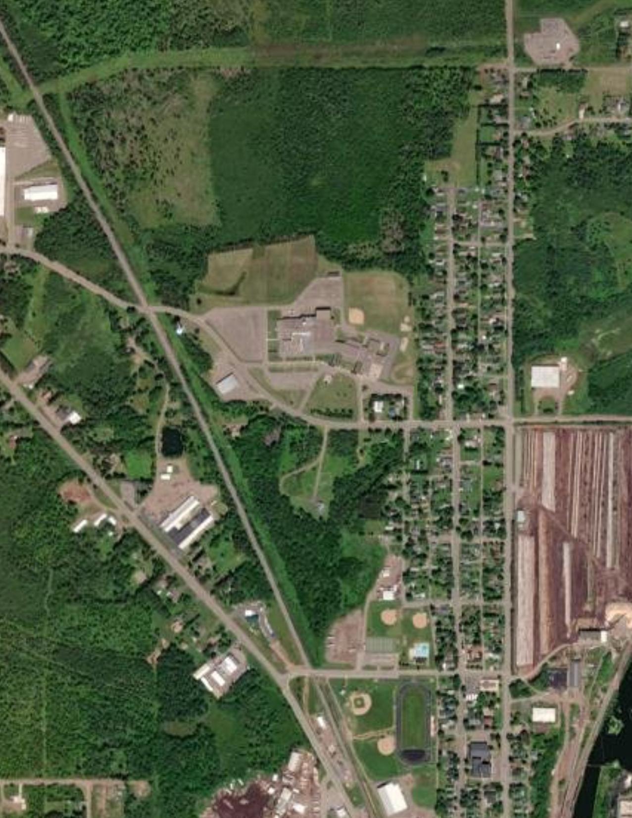


Chequamegon High School and Park Falls Elementary School


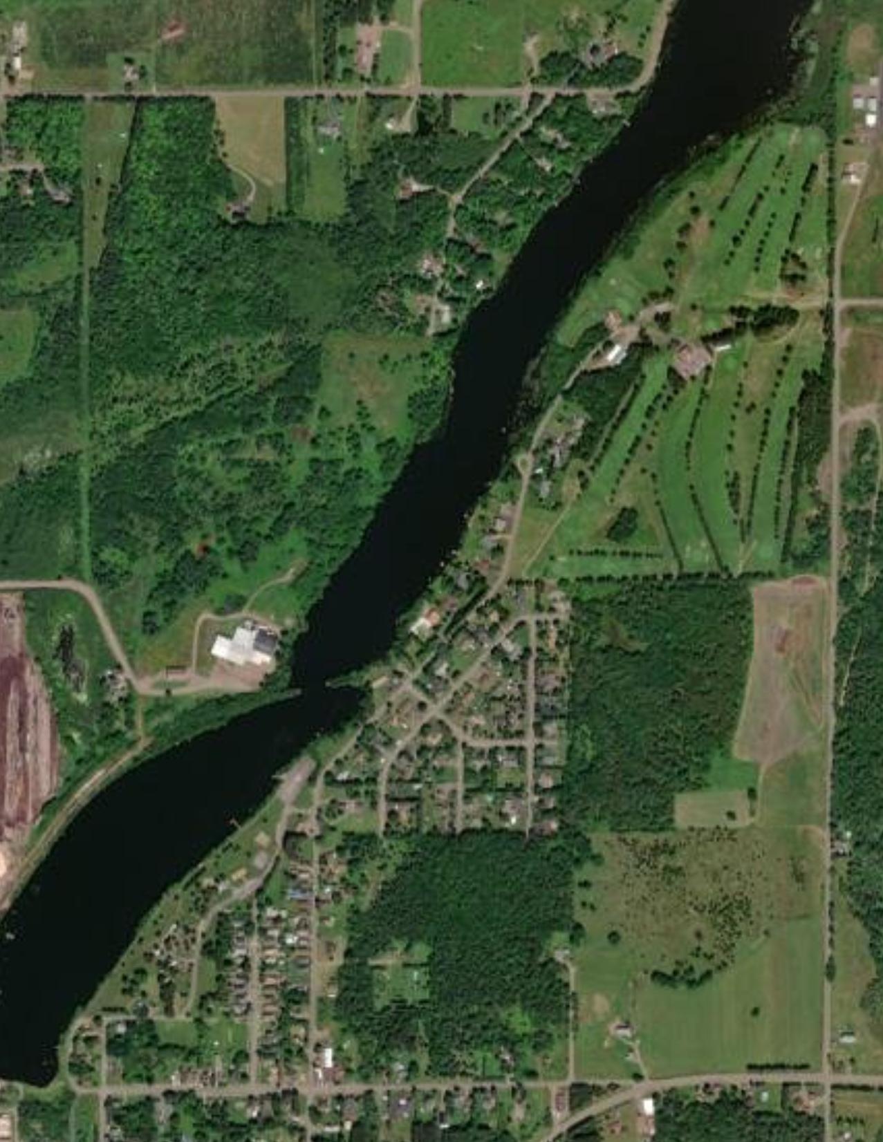


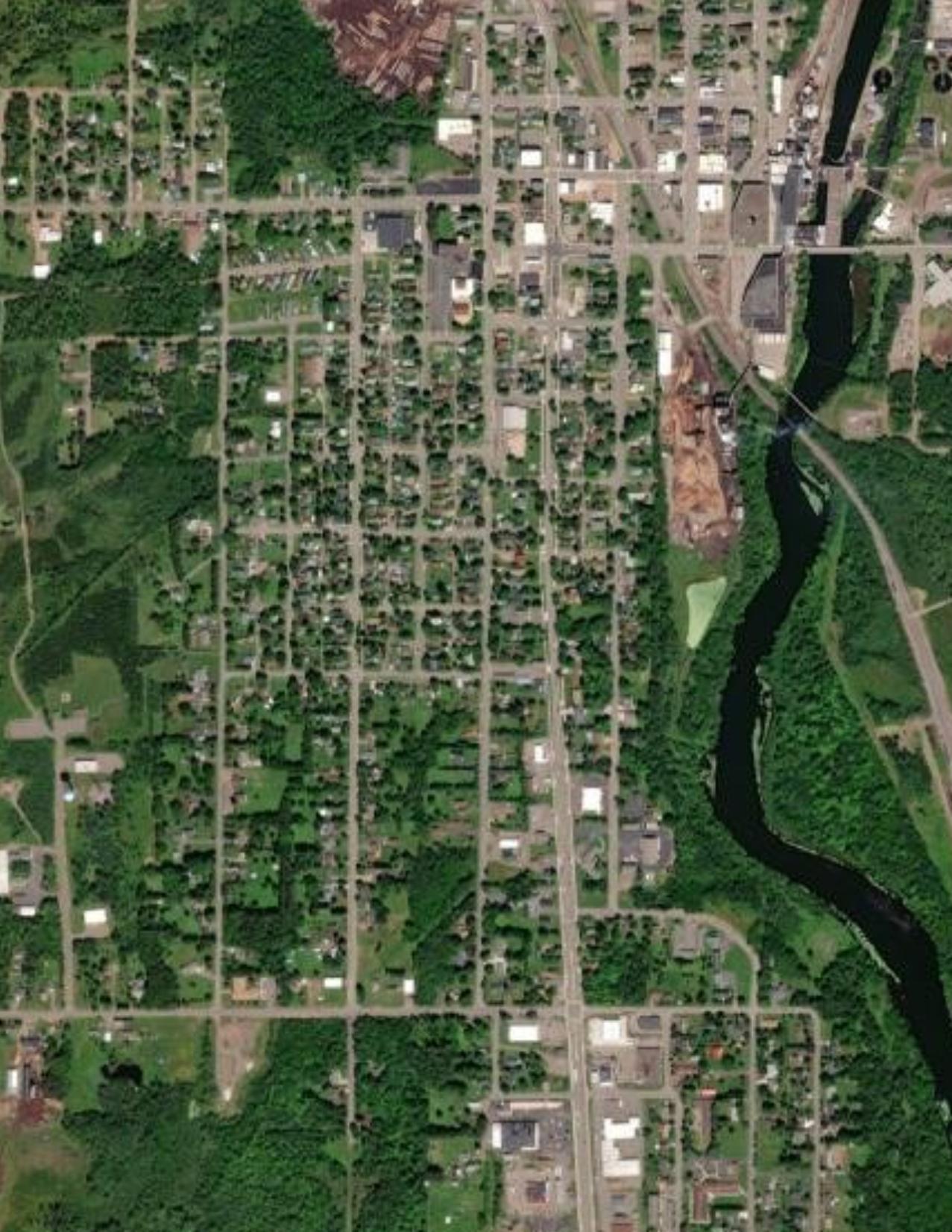
Issue 1, Strategy 1 identifies three key areas for sidewalk connections to improve safety and walkability in Park Falls. These include the north side of 9th St. N from the eastern most school entrance to State Highway 13, 5th St. N from State Highway 13 to 2nd Ave N., and Saunders Ave. from State Highway 182 to the public parking of the Flambeau River Access.




■ Shared-use path: A complementary system of off-road transportation routes for bicyclists and others.


Park Falls City Boundary


■ Sidewalk: A paved path alongside a road for pedestrians.


Shared-use paths and sidewalks both play an integral role in ensuring a community has a complete and safe transportation network. Sidewalks provide pedestrian and bicycle transportation along transportation corridors, allowing non-vehicle users equal access to amenities as vehicle-users. Shared-use paths can act alone to provide recreational transportation or enhance the sidewalk network of a community by providing increased opportunities for pedestriam and bicycle travel and often times more user-friendly options for non-vehicle users.


Park
Park
City
Park Falls


The Action Plan detailed on the following pages is designed as a guide to help City officials and community leaders prioritize opportunities and address issues that impact roadway safety in Park Falls. Vision zero cannot be created overnight. However, by incrementally implementing the recommendations within this plan, the City can achieve the vision zero and the desired outcomes set forth in this action plan.
Implementation of this action plan will depend on a network of partners, yet primary responsibility for implemention lies with the City Staff. Some responsible, non-municipal parties that the City may collaborates with include:
■ Price County
■ Wisconsin Department of Transportation
■ Wisconsin Department of Natural Resources
It is necessary to engage these entities to be active partners in the implementation of this action plan. The following City activities can support this effort:
■ Share this plan with each organization, including a memo highlighting sections of the plan that anticipate collaboration between the City and the organization.
■ Take the lead role in establishing a collaboration for key or crucial initiatives of the City that require regional collaboration.
■ Utilize the vision, goals, and data from the plan to support requests for monetary support.
Cost estimates for the following Implementation Matrix are based on high/level dollar per mile for improvements. These figures are subject to change, and should not be considered the final cost.
Roughly 50% of City streets do not include a safe walking route.
Construct new sidewalks and shared-use paths, with priority to streets with higher vehicle traffic. High priority locations include, in this order: 9th St. N, 5th St. N, Hwy 13, Saunders Ave.
Maintain an annual expense in the 5-year Capital Improvement Plan for new sidewalks and trails.
Update the Park Falls Trails Plan to include a shared-use path on the north side of 9th Street N between the Chequamegon/Park Falls school campus and Highway 13.
Update the Park Falls Trails Plan to show safe walking and biking routes to all existing parks and trails in and adjacent to the City.
Apply for a Safe Streets and Roads for All (SS4A) Implementation grant to construct up to two miles of ADA-compliant sidewalks and/or paths in high priority locations. Highest priority is a shared-use path along the north side of 9th Street N between the school and Highway 13.
Apply for a Wisconsin DNR Knowles-Nelson Stewardship Grant to fund the construction of a shared-use path.
shared-use paths prioritizing routes that connect destinations and existing shared-use paths in the City.
Apply for a Safe Streets and Roads for All (SS4A) Implementation grant to construct up to three miles of off-road, shared-use paths along the Flambeau River and connecting essential destinations throughout town.
Pursue funding from Rail Trail Conservancy to assist with the expansion of the shared-us path system.
A preliminary ADA audit was completed as part of this Action Plan which identified the location of existing sidewalks and curb ramps and classified them as good, deteriorating, or poor.
Apply for a Safe Streets and Roads for All (SS4A) Implementation grant to replace up to one-half mile of non-compliant sidewalks and up to 30 deficient or missing curb ramps.
Action 1
2
Action 4
Issue 3
Take ownership of the maintenance for all curb ramps, and include ADA ramps and crossings in an SS4A Implementation grant application.
Conduct a comprehensive ADA audit of all sidewalks and trails to evaluate condition and identify ADA compliance issues at least once every 5 years.
Maintain an annual expense in the 5-year Capital Improvement Plan for sidewalk and ramp repair or replacement.
To lessen the extra burden on corner properties, the City should create a policy that all curb ramps are the maintenance responsibility of the City of Park Falls.
Inconsistent enforcement of City ordinances regarding sidewalk construction and maintenance. Strategy 1 Strengthen City staff resources for identifying and addressing sidewalk issues.
1 Identify a City staff person as the main point of contact for sidewalk issues in the City.
2
Implement an online reporting system that provides an opportunity for infrastructure users to easily report safety and maintenance issues to the City.
Ensure the sidewalk construction ordinances are enforced on all new site plans and developments.
Review each site plan, regardless of zoning district, for the inclusion of ADA-compliant sidewalks and connectivity to adjacent properties.
On-street bicycle lanes on 4th Avenue S / Hwy 13 abruptly end between 2nd Street S and Division Street. Strategy
Until widening of the street becomes feasible, either enhance curb ramps and sidewalks in these two blocks to accommodate bike traffic, OR provide signage diverting riders 1 block east (northbound riders) or one block west (southbound riders) between 2nd Street S and Division Street.
Action 1
Work with the DOT to expand the sidewalk into an 8-foot wide shared-use path between 2nd Street S and Division Street. Implementation
Action 2 Seek SS4A Implementation grant assistance to construct these improvements. Implementation
Issue 5
Pedestrians crossings at signalized intersections of Hwy 13 may not be afforded enough time for the crossing.
Strategy Work with the Wisconsin DOT to update signal timing.
Action 1
Action 2
Issue 6
Contact the Wisconsin DOT to discuss studying and changing signal timings to better accommodate pedestrians.
Consider applying for a Traffic Safety Improvement Program study to determine appropriate signal timing and location of any new protected crossings.
Existing on-street bicycle paths are not marked.
Strategy Mark existing on-street bicycle facilities with Wisconsin DOT-compliant signs and pavement markings.
Action 1
Action 2
Apply for an SS4A Implementation grant to purchase and install bicycle route signs and pavement marking supplies. Implementation
Repaint pavement markings regularly to ensure visibility. Implementation
Issue 7
Strategy 1
Action 1
Roadway pavement quality is deteriorating in some areas.
Commission a pavement management study to determine 5-, 10-, and 20-year needs and costs for pavement maintenance and replacement.
Reference the recommendations of the pavement management study when updating the Capital Improvement Plan. Implementation
Strategy 2 Rehab, overlay, or reconstruct streets east of the Flambeau River.
Action 1
Strategy 3
Action 1
Action 2
Action 3
Issue 8
Strategy
Action 1
Action 2
Action 3
Apply for an SS4A Implementation grant to help pay for pavement improvements needed in the next 2-5 years, and include sidewalk and curb ramp construction with any major improvements. Implementation
Improve winter maintenance of pedestrian and bicycle infrastructure.
Purchase mechanical snow and debris removal equipment such as brush rollers or rotary brooms. Purchase an additional maintenance vehicle if necessary to accommodate the winter maintenance tasks. Implementation
Develop a City policy and procedure for addressing snow and debris removal on publicly owned sidewalks and trails.
Enforce sidewalk snow removal ordinances on adjoining property owners.
The southbound left turn from Hwy 13 into Kwik Trip is a traffic conflict point.
Evaluate and address conflict points throughout the Hwy 13 corridor within the City.
Commission a traffic study to examine access management throughout the central highway corridor.
Contact the Wisconsin DOT to discuss the location and placement of the median separating the northbound turn lane at 9th Street S.
Consider applying for a Traffic Safety Improvement Program study to analyze and address the placement of driveways and the growing left turn conflict.
Action If applying for a TSIP, combine it with other TSIP-eligible items.
Issue 9
Vehicles speeding on roads throughout the City.
Strategy Implement passive speed management techniques to calm traffic.
Action
Item 1
Apply for an SS4A Implementation grant to purchase radar feedback signs. Implementation
Action Install radar feedback signs in areas prone to speeding. Implementation
Action Item 3
Implement traffic calming techniques, such as narrowing of roadway geometry, pavement marking, curb bulb-outs at pedestrian crossings. Implementation
The Safe Streets for All Action Plan is not just a static document; it’s a dynamic commitment backed by strategies and actions aimed at achieving zero fatal and serious injuries on the streets of Park Falls. To ensure its effectiveness, this plan must be actively discussed and reinforced daily, becoming a living document that fosters collaboration across departments, organizations, and the entire city to prioritize safety and drive progress.
To facilitate this cross-departmental effort and address issues comprehensively, the Vision Zero Network recommends forming sub-committees or work groups dedicated to the specific issues outlined in the Plan.
Regular evaluation and reporting are crucial to sustaining the Safe Streets for All Action Plan. Therefore, the city must issue an annual report to update the public on progress, holding itself accountable for its commitment to reducing traffic fatalities and severe injuries. The primary responsibility for implementing this plan rests with the City Council and City Staff. They will conduct an annual review, assessing progress against the goals outlined in the Action Plan Strategies & Actions. Additionally, the City Council will oversee updates to the Action Plan and approve infrastructure projects under the Safe Streets program, as well as other reconstruction and resurfacing initiatives.
Issue #1: Roughly 50% of the community is currently not served by a sidewalk on at least one side of the road.
■ Linear feet of sidewalks and shared-use paths constructed
■ Summary of annual expense for sidewalks and trails in the 5-year CIP
■ Summary of trail plan updates
■ Grant applications status report
Issue #2: Many existing sidewalks and ramps are not ADA compliant.
■ Linear feet of non-compliant sidewalks replaced
■ Number of curb ramps installed/replaced
■ Summary of most recent ADA compliance report
■ Resolution (or progress towards) for City of Park Falls ownership for curb ramp maintenance
Issue #3: Inconsistent enforcement of sidewalk construction and maintenance.
■ Summary of safety and maintenance reports from online reporting system
■ Summary of ordinance enforcement measures including citations
■ Summary of site plans approved including ADA compliance measures implemented
Issue #4: On-street bicycle lanes on 4th Avenue S / Hwy 13 abruptly end between 2nd Street S and Division Street.
■ Update progress of safety measures implemented on 4th Avenue S / Hwy 13 between 2nd Street S and Division Street.
■ Grant application status report
Issue #5: Pedestrians report not having enough time to cross the highway at signalized intersections.
■ Status report of signal timing updates
Issue #6: Existing on-street bicycle paths are not marked.
■ Grant application status report
■ Pavement marking activity summary
Issue #7: Roadway pavement quality is deteriorating in some areas.
■ Grant application status report
■ Pavement management study report
■ Summary of snow ordinance enforcement measures
Issue #8: The southbound left turn into Kwik Trip is a traffic conflict point.
■ Access Management Report summary
Issue #9: Vehicles speeding on roads throughout the City.
■ Grant application status report
■ Traffic management report summary
The following are a series of terms used throughout the plan:
■ Action Plan: Commonly used municipal planning tool for issues such as economic development, urban design, and other existing problems. Action plans identify a target goal and create a series of recommendations for meeting that goal.
■ Capital outlays: Funding allocated for acquiring and/or maintaining long-term assets.
■ Crash rates: A crash rate is the number of crashes that occur at a given location during a specified time period (usually three to five years) divided by a measure of exposure for the same period.
■ Crash statistics: Analysis conducted on information that comes from a reportable crash.
■ Geographic Information System (GIS): a system that creates, manages, analyzes, and maps all types of data.
■ Heat map: A map which represents data in the form of colors, where each color represents the magnitude of individuals within a dataset.
■ Mobility: In urban planning, mobility is the accessibility of movement, including different modes of transportation.
■ Micromobility: any small, low-speed, humanor electric-powered transportation device, including bicycles, scooters, electric-assist bicycles, electric scooters (e-scooters), and other small, lightweight, wheeled conveyances.
■ Turning Movement Count: The number of vehicles making each movement is referred to as an intersection turning movement (TM) count.
■ Pavement markings: any kind of device or material that is used on a road surface to convey official information.
■ Population pyramid: A graphical illustration of the distribution of a population by age groups and sex.
■ Shared-use path: A complementary system of offroad transportation routes for bicyclists and others.
■ Sidewalk: A paved path alongside a road for pedestrians.














Park Falls, WI Safe Streets Survey
Other (please specify)
Other (please specify)
Nursing
Nursing Home, Library
Aimless meandering
Hospital
Medical Appointments
petrol
Aimless meandering Gas stations
Medical Appointments
Marshfield
Petrol convenience
Scouts
Trails,
Marshfield
How often do you use roads in Park Falls for transportation?
I, and/or my family, have participated in the following road user safety activities…
in a “bike rodeo” (i.e. safety day) to learn bike
Other (please specify)
Atv / Snowmobile Safety
Where is information for these activities available?!
Removing hazards from streets and/or trails
EMS safety driving class
do you consider the roads in the city for driving?
If you chose Somewhat Unsafe or Very Unsafe, please explain...
If you chose Somewhat Unsafe or Very Unsafe, please explain...
Walkers don't always move out of the way. On 3rd Avenue diagonally parked extended cab trucks block view from oncoming traffic.
In winter it is very hard to get around with all the snow in the middle of the road and no openings to help people who have to be out
People just need to slow down!!!
Snow removal - the mounds get too high
Many UTVs/ATVs use excessive speeds
Would have built roundabouts instead of installing stop lights. Limited turn lane into Kwik Trip. Turn lanes on south side of town are sometimes used as a third lane or passing lane. Not marked as turning lanes.
I do not drive but as a pedestrian have noticed areas where there are frequent conflicts with drivers, especially near the busier business areas
Mainly some of the stop signs are hidden with tree branches.
Some city streets are to narrow when there are people that park their vehicles on the streets in front of their homes.
Speeding
Heavy Traffic onto 13 or 182 can sometime make it dangerous to drive onto them
People don't stop st Stop sighs.
need stop signs on some of them
Certain areas have more kids and with speed limits being 25 mph on short streets causes concern and safety for the kids.
The alley by the pool averages over 100 cars daily and 2ndcsr n has lits of speeding and very fast utvs
Roads have potholes and cracks. Especially unsafe for smaller transportation other then a car
Apparently no one knows how to use turn lanes correctly. Was better/more safe with two lanes each direction
Lately there’s been an increase of tailgating and people running the stop sign
Trees over hanging, to much signage and parking in some traffic lanes aloud on heavy traveled roads.
There are potholes in some places throughout the year that seem to get bigger and bigger before they are repaired. Water gathers where drains are higher than the road creating icy conditions in the winter/spring and flooding in the summer.
Kwik trip left turn at median is very unsafe
Most roads in Park Falls are very safe. However, I have observed that Highway E did deteriorate to the point that cars had to swerve out of the driving lane to avoid potholes or cracked asphalt.
Potholes cracks slippery in winter which I understand can be unavoidable
Basic ice and snow issues.
How safe do you consider the roads and road crossings near schools, for students who are walking or biking?
If you
or Very Unsafe, please explain...
If you chose Somewhat Unsafe or Very Unsafe, please explain...
13 by the school should have a crossing
Drivers come too close to bikers
Same as above
There is no such thing as stopping for a pedestrian in a crosswalk.
The kids are going too fast
Speeding
Vehicles do not always slow down or allow pedestrians right of way
Don’t know. Not around those areas when school is in session.
No sidewalk along the road in front of the school (could make a good trail location)
Blind areas, not enough designated trails for bicycles to avoid traffic
Speeding traffic
Sidewalks on both side of the street are needed by the school
No sidewalks on some streets near school
All school crossings should have lighted signs during the hours school starts and dismisses
Often the crosswalk area by the school has fast traffic. I think the intersection of 13 and 9th is unsafe at bus dismissal, particularly in the winter.
Could brush back areas of cross walks better visual and better signage or warning lights etc...
walkers have an unsafe route/ no sidewalks or foot paths
Through traffic travels fast and there are several hidden curves on the road in front of the school.
This could be enhanced quite a bit to encourage more bike riders and walkers
There is a road designed for motor vehicles to to the school students may be allowed to use the road for walking or biking, but the road design does encourage those uses.
The roads are safe; however, bikers need to know the rules - you bike with traffic, not against it.
Poor drivers are always an issue.
If you chose Somewhat Unsafe or Very Unsafe, please explain...
Bikers don't always follow the rules of the road.
They are always in the way of cars and no room for 2 cars to drive down the road at once when moving over for a biker
Some of the country roads are too narrow for bikes and trucks
Not enough bike lanes or alternative bike paths; city drivers do not respect bicyclists' right to the road
Of course Hwy 13 can be hazardous for bike riding. I believe the problem is related more to cell phone usage than the roads. Bike safety, is necessary to ride on any heavily traveled road.
Riding a bike is a challenge on PF streets.
Little to no designated and marked cycling paths/lanes, numerous business entrances where cars do not respect cyclists, traffic lights are not trigger by cyclists and there is no cyclist accessible crossing button on the road side, sidewalk buttons often malfunction
Need designated routes/bike lanes.
There isn’t anywhere bikes can go that they aren’t competing with traffic. Designated bicycle and walking trails would help so much more. The only trail still has competition for atv’s
No real bike lane
No bike lanes, incosistant sidewalk placement,
No great places to be out of traffic
Roads conditions on some streets are on bad shape to ride a bike
No designated bike lanes
No bike lanes and no body watches for bicycles
Heavy traffic traveling too fast, poor intersection design
Should have some painted bike lanes.
No dedicated bike lanes or trails through the city
Frequently observe bicycle users not using rules of the road or driving on sidewalks throughout city.
parts of the city are for motor only, making it unsafe for bikers/walkers
Areas of concern-example-County Road E
There is not a lot of biking paths for us.
There are not designated bike lanes.
More designated lanes/trails could be established and lighting improved
More designated bike trails would make it safer
Most motor vehicle drivers are courteous and attentive, but many believe people on bicycles don't belong on the roads, including some law enforcement officers. In winter normal snow removal from the main travelway restricts the road width, making passing a bike rider more dificult.
Places where sidewalks are not properly maintained / portions of the sidewalks are non-existent. They’re barely done. A few designated sidewalks the rest are crappy rundown or non existent dirt trails
Some really need to be replaced
Some of the sidewalks are very uneven for walking purposes. Alleys also have a lot of potholes.
Bad sidewalks, too dark at night
No sidewalks in some areas or poorly maintained sidewalks; roads in some areas to narrow for walkers or slippery during winter weather
Where there are no sidewalk vehicles pass pedestrians too fast and/or come too close
Why would we need to walk on the road? That would be unsafe. Sidewalks are in very poor condition in many areas and unsafe, especially at night with limited street lighting.
Crossing buttons at lights don’t always work, lack of sidewalks and places existing sidewalks abruptly end, uneven surfaces make only useable by extremely able bodied citizens
sidewalks have trip hazards, are in poor condition in areas. Snow/ ice removal ordinances are not followed or enforced. sidewalks need to be maintained more than half in this city are not
There are several areas where the sidewalks are in disrepair and are a safely hazard.
There is decent sidewalks in most areas, but it would be really nice to have designated trails for biking and walking speeding
Sidewalks are often in disrepair. Sometimes they’re sidewalks and sometimes not, overgrown trees and bushes near sidewalks make it difficult to navigate. In the winter the snow plows dump all the snow on the sidewalks and they then turn to ice
Pot holes
Sidewalks are incredibly bumpy and in poor shape
The sidewalks are ridiculous. Cracked , heaved, broken cement from overgrown trees. Walking in Park Falls is a challenge and the town should be embarrassed by there condition.
Several street lights need replaced or added
Sidewalks are very unlevel and full of weeds
Some sidewalks need quite a bit of repair throughout the City.
Lots of grass on sidewalks. Not all people have sodewalks
Really some bad areas, broke or missing connecting walks etc.
There are streets in which the sidewalks are terrible and hazardous. Tripping and falling is a concern
Walking on some streets is challenging without sidewalks (Saunders Ave area specifically).
same as above
Some sidewalks not easy to walk on may need to be redone. In the winter, not everyone shovels their sidewalks, which makes it difficult. Our sidewalks are in decent condition and are on most roads.
Older sidewalks have tripping hazards from uneven sidewalk sections.
Walking in winter is often unsafe because plowed snow narrows the roads and side walks are intermitent and where they exist are not all maintained.
Please consider adding signage to look out for pedestrians on 9th Avenue South near the foot trail leading to Tuscobia Trailhead Park.
There are many sidewalks that need repair and driver's do not seem to understand that walkers have the right of way in a cross walk.
There are a lot of decent sidewalks in Park Falls but there's also a lot that are unsafe uneven
Many streets have broken or heaved sidewalks which are trip hazards.
I have fallen twice because of uneven sidewalks.
Have you ever been involved in a crash in Park Falls while on a public street, sidewalk or trail?
If yes, please explain
I have witnessed them, but I haven’t been involved
A car ran into the back of me when making a turn into my driveway.
9th st by turning toward the school. The sharp turn when coming from her south
No but have watch a few at my intersection over the years.
Minor accident near BP station.
Both of us, backing at the same time, although I did not realize the vehicle next to me was backing up, also.. I was more concerned about the pedestrian on my other side than I was the vehicle next to me to the left.. mild fender, bender
A vehicle slid through a stop sign on Division street.
Some intersections have obstructed views
One morning in early March 2023, intersection of Division Street and Tower Road was untreated after an inch of snow had fallen overnight. Vehicle A slid through stop sign, colliding with Vehicle B.
At an intersection- stop sign was installed at the intersection within a week after the accident. The other driver was traveling too fast for icy roads, slid through the stop sign, and hit us.
If yes, please explain
Main intersection crossing Hwy 13 and 1st Street South don't allow enough time for older people to walk across. In the winter especially.
The cross walk where St. A's and Division bysect is a deathtrap. Never has a car yielded for me in any direction. Never!
There should be a left turn lane after the stoplights when traveling South on 13 so that you have to go all the way to the road between Kwik Trip and the motel to turn into Kwik trip. No one understands how to get their car in the turning lane and it gets too congested at the intersection.
The intersection to the school off the highway is bad. The hill at the lights on the corner by Forward Bank is dicey in the winter.
Hwy 13 crosswalks and drivers failing to yield
Stop and go lights are consistently getting knocked down
If yes, please explain
Need more crossing markers and vehicles should learn to stop BEHIND crosswalk markers allowing pedestrians the right of way Cars don’t pay attention to most crosswalks.
The city should consider updating crosswalk signals to be audible as well as visual, ensure the buttons remain operable, and add additional street side buttons for cyclists that do not trigger the lights on their own. Consider a curb/bump out at intersections to separate cyclists from cars at the light for additional safety.
"electrical boxex blocking view on highway u have to practactilly be in the highway to see cars and im in a suv also vehicles parked in yard by alley blocking sightline also
"
Division and 5th. The differences in widths seems to throw people off.
speeding
13 and 182 13 county e not big enough for big trucks
Intersection of Avery Ave and Wisconsin Street needs to be a stop on both sides on Wisconsin. People fly through that intersection. At a time there 20 kids that live in that intersection area. Time for a change. Delivery trucks are the worst and after school hours.
Cars do not stop for people in crosswalks
Vehicles don’t always stop to let pedestrians cross.
Hard to see oncoming traffic at some intersections because of parked cars.
Intersection of 182 and 13 is horrible turning left from 182 so many people have hit the stoplight. Many roads near the schools do not have crosswalks.
Grunerwald at 13, 182 at 13 Northbound, 12th ST S at 13, All street approaches to HWY 182, Trail intersection at 182 to Hines Park
There is a stop sign near me blocked by a tree part of the year.
I think 13 and 182 and 13 and E should have been traffic circles. Trucks don't fit very well with the current design.
Trim trees back or cut them.
Better painted cross walks and signage.
The 182/13 intersection going west or south from east 182 needs better signage for what the lanes are for. Too many people go straight from the left lane which is only a turn lane
Some are not well marked
Saunders and Hwy 182; turning onto 182 when fast moving traffic approaches from the east causes a fast closure rate. Also traffic from west onto Saunders cuts the corner considerably.
We do not have enough citizens that stop for pedestrians.
Those crossing HWY 13 could be further highlighted, especially the crossing near the city pool.
Coming into the city from the south its 40 mph, but coming into the city from the north its 45 mph. There is weathershield traffic, school traffic, Rich Peterson logging trucks, Schubert plumbing, Supportive Home , Pieter Powe, Kyle’s, St. Croissant, multiple residents. It seems like 40 or even 35 for that short distance to the 30 mph sign would make a sensible safety environment.
The intersection of 9th street and hiway 13 the highway traffic is going 50 miles per hour with all the school and Weathershield traffic.
The signalized intersections have beg buttons that don't work sometimes and bicyclists are not detected on the road.
Tall piles of snow obscure corners annually from January until spring thaw in March. Two notable intersections include 9th Avenue South/ Division Street and Tower Road/Highway 13. The piles make it difficult to decide if it is safe to make the turn onto the next road.
I have marked them on the interactive map.
Driver's for the most part DO NOT stop for pedestrians.
Intersections need to be marked better so vehicles yield to pedestrians when in the cross walk.
I think this is mostly in the winter obviously we had an exceptional exceptional one this year and it was difficult to see around snowbanks roads for icy and slippery as well as sidewalks
I’ve seen many people drive right through intersections even though there’s a stop sign in place.
Where
Kwik Trip turn from 13 is dangerous. not sure where the bike paths are.
Bad sidewalks and grassy
Specifically concerning path at the mill overhead next to the river - no transition to a sidewalk on south side of 182 or a crosswalk right at the trail (is also an issue if used as a snowmobile trail in winter).
Discontinuous sidewalks
At an intersection- stop sign was installed at the intersection within a week after the accident.
The other driver was traveling too fast for icy roads, slid through the stop sign, and hit us.


Peak Hour Volume Summary
STH 13 (4th Ave N) & 5th St N Peak Hour Volumes, Truck Percentages, and PHFs


Peak Hour Volume Summary
STH 13 (4th Ave N) & 5th St N Peak Hour Volumes, Truck Percentages, and PHFs


Peak Hour Volume Summary STH 13 (4th Ave S) & CTH E (9th St S)


Peak Hour Volume Summary STH 13 (4th Ave S) & CTH E (9th St S)


Peak Hour Volume Summary
STH 13 (4th Ave N) & 5th St N Peak Hour Volumes, Truck Percentages, and PHFs


STH 13 (4th Ave N) & 5th St N Peak Hour Volumes, Truck Percentages, and PHFs


Peak Hour Volume Summary STH 13 (4th Ave S) & CTH E (9th St S)


Peak Hour Volume Summary STH 13 (4th Ave S) & CTH E (9th St S)


