


Gary Wieczorek, Chairperson
Greg Frutiger
Arnie Evensen
David Riesop
Jeff Quamme
Chris Frutiger
Elizabeth Dollar
PREPARED BY:
This document was prepared by MSA Professional Services, Inc. with assistance from Village of Deerfield
Greg Frutiger, President
Arnie Evensen, Trustee
Scott Tebon, Trustee
Tessa Dunnington, Trustee
Gary Wieczorek, Trustee
Kerri Hewitt, Trustee
Tracy Curtis, Trustee
VILLAGE STAFF:
Todd Willis, Administrator/ Treasurer
Marissa Aravena, Clerk/ Deputy Treasurer

The Introduction chapter features an overview of the comprehensive plan structure as well as an introduction to the community planning area and relevant data and information used in this plan.
The Comprehensive Plan is intended to guide decisions and actions affecting Village budgets, ordinances, and growth. The 2045 Plan looks 20 years into the future to describe what the Village would like to achieve over time, offering goals and strategies for implementation in order to realize its long-term vision. As a broad-based plan, it sometimes relies on other, more detailed plans or budget processes to determine when or how implementation will occur.
Deerfield’s vision statement is intended to set the general tone for the rest of the plan. It encapsulates the major themes woven throughout the plan and provides a goalpost for the future of the community. The vision statement was developed through stakeholder interviews, the community visioning workshop, pop-up booth, and discussion with Village staff.

2045 VISION: “ The Village of Deerfield’s vision is to preserve its small town and rural heritage, to assure a safe and quality way of life, and to promote its excellent education system and allowing for vibrant economic opportunities to thrive, while focusing on the dynamic relationship of creating pleasing neighborhoods and a diverse range of leisure activities to cultivate a vibrant community.”
The Plan’s recommendations are intended to:
• Create a collective vision for the future of Deerfield.
• Establish priorities for public investment, including the Village’s Capital and Operating Budgets.
• Provide or inform policies that guide Village decision-making.
• Align the work of the Village around the issues that matter most to our residents and stakeholders.
• Create a framework for topicspecific plans and initiatives that will expand on the Comprehensive Plan’s recommendations.
• Guide private development through the Future Land Use map and policies.
• Foster partnerships with other entities to address shared goals.
Under Wisconsin’s comprehensive planning statute, a comprehensive plan must receive a public hearing and be approved by resolution by the Plan Commission, and adopted by ordinance by the Village Board.
Wisconsin’s comprehensive planning law requires that if a local government unit enacts or amends any of the following ordinances, the ordinance must be consistent with the comprehensive plan:
• Official maps
• Local subdivision regulations
• General zoning ordinances
• Shoreland/wetland zoning ordinance
Though adopted by ordinance, the plan itself is not an ordinance. This plan is not intended to be a literal “road map” for the Village that provides a clear path from the present to a point twenty years into the future. Rather, it is intended to guide decision making in the years to come toward a unified vision expressed in this plan. Over the course of time many factors will arise that will significantly influence local decisions. This plan should continue to be consulted to ensure that such decisions contribute to the vision established by this plan.
This plan is organized around the nine required plan elements as outlined in state statutes:
1. Introduction (P. 4-8)
2. Public Engagement (P. 10-13)
3. Agricultural, Natural & Cultural Resources (P. 14-19)
4. Utilities & Community Facilities (P. 20-23)
5. Intergovernmental Cooperation (P. 24-26)
6. Economic Development (P. 28-33)
7. Housing (P. 34-37)
8. Mobility & Transportation (P. 38-41)
9. Land Use (P. 42-56)
10. Implementation (P. 58-59)
Each section includes Issues and Opportunities (identified during the process), Voices from the Community (public input gathered), 2023 Snapshot (of existing conditions), and Goals and Strategies.
Appendix A: Plan Adoption & Amendments
Appendix B: Action Plan
Appendix C: Public Engagement Results
Appendix D: Maps
The policy content of this plan is organized into Goals and Strategies.
A goal is a general statement about a desired future outcome. Goals provide the big idea and direction but do not indicate how they will be achieved.
Strategies are the methods by which the goals are achieved. Some are policy statements intended to guide decisions. Others are actions - specific activities that someone within the Village government needs to actively pursue.
The purpose of this plan is to establish a shared vision for Deerfield that will guide future actions and decisions. This guidance improves the Village’s ability to work cohesively and consistently over time.
The Comprehensive Plan is a resource for managing the growth of the Village of Deerfield. It is designed to be a working document used by Village officials to direct community development decisions, to assist with capital and operational budgeting, and as a tool to focus and stimulate private housing, business and industrial investment.
A Comprehensive Plan functions as an umbrella document that considers most issues affected by Village government, and it is to be used in coordination with other documents and ordinances. The plan refers to other plans and studies that address specific topics in greater detail.
The plan is implemented through the use of ordinances, especially the zoning and subdivision ordinances. This plan is intended to help the Plan Commission and Village Board apply those ordinances; in fact, State statutes require that certain decisions must be consistent with this Plan.
The plan represents the Village’s best effort to address current issues and anticipate future needs, but it can and should be amended as conditions warrant reconsideration of policies. The plan can and should be amended from time to time to adjust to changing conditions, and it should be fully updated with new data every 10 years.
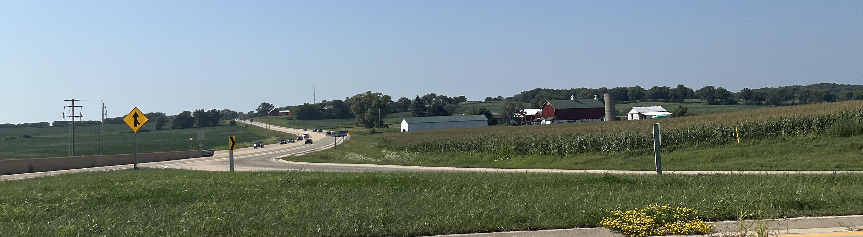
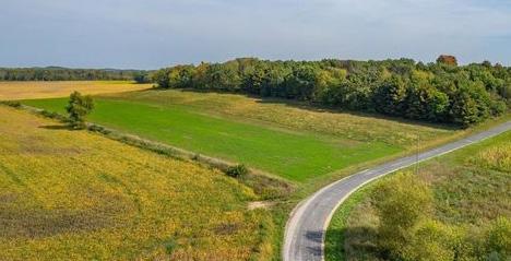
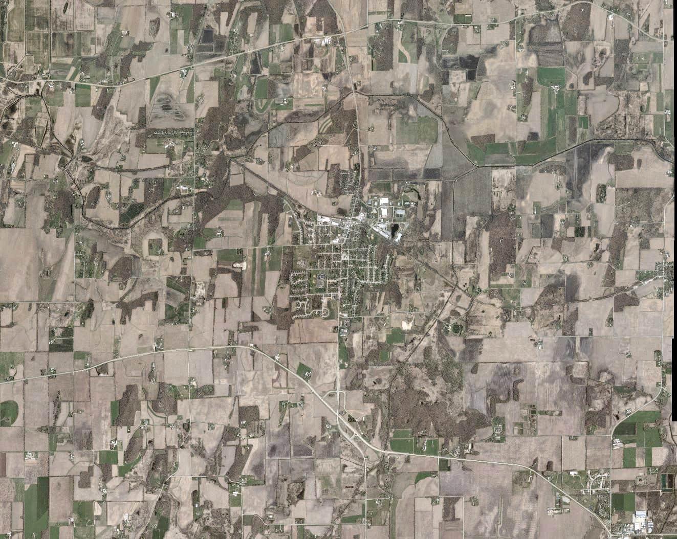
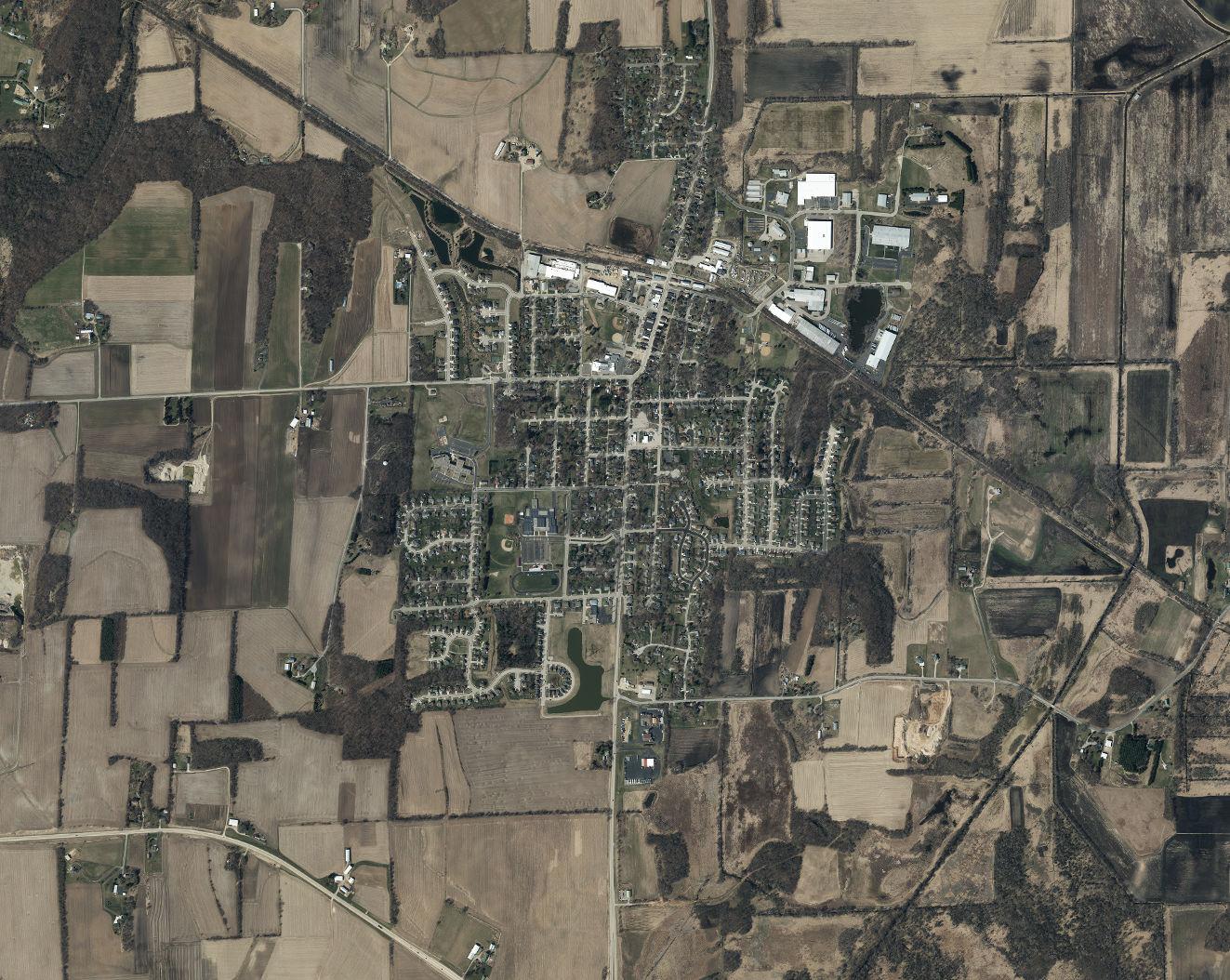
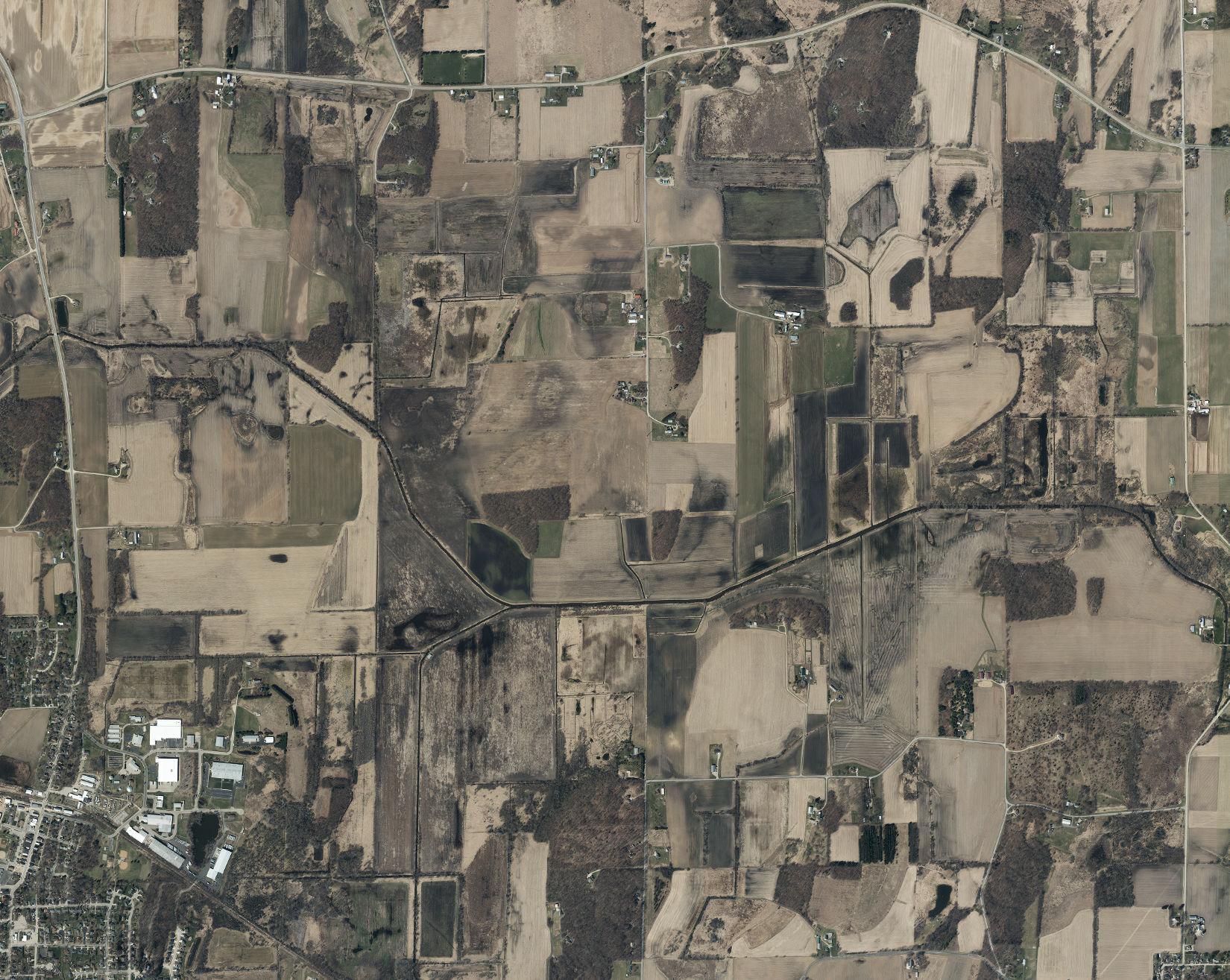
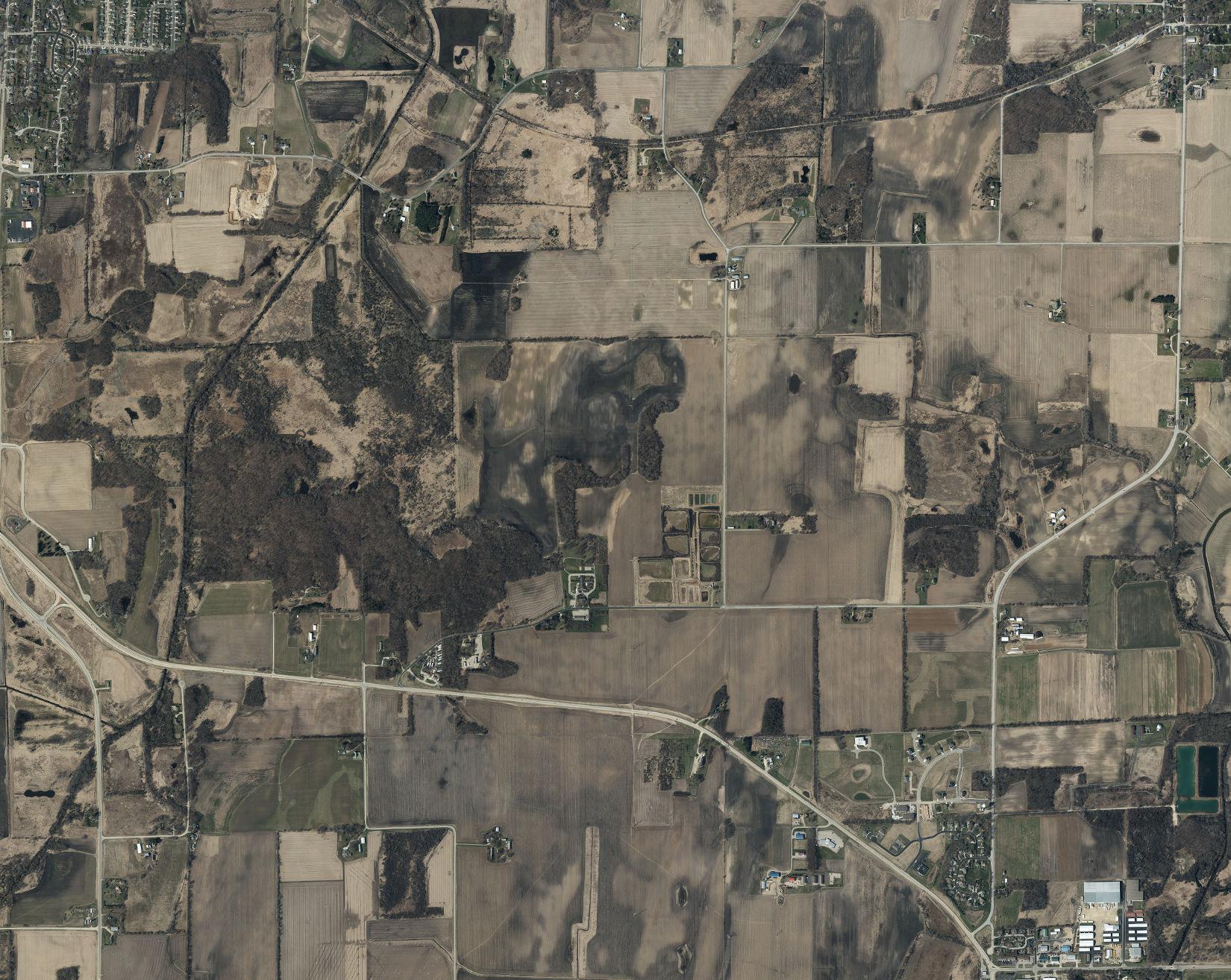
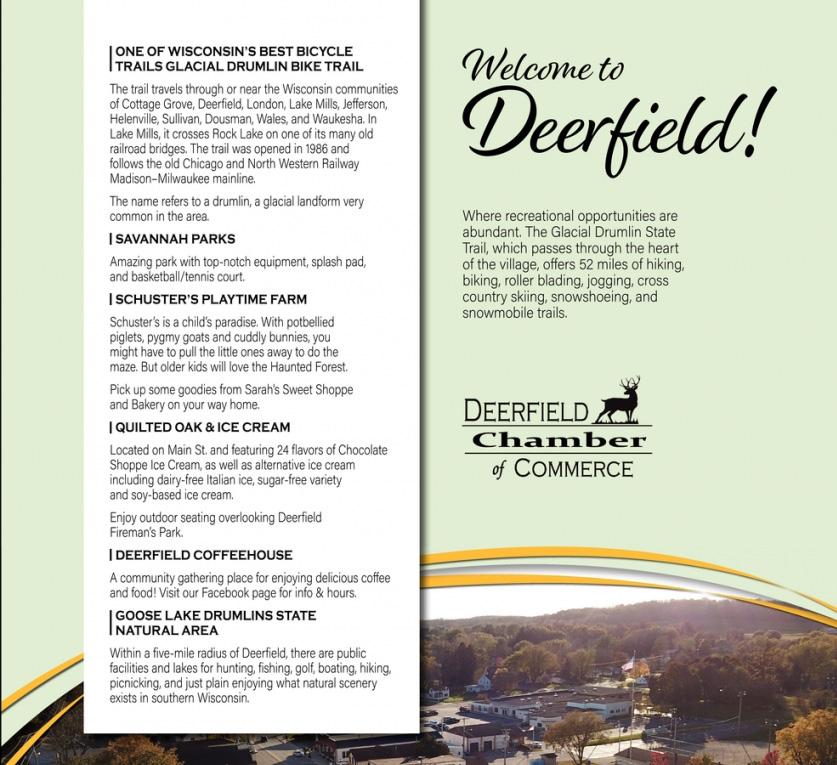
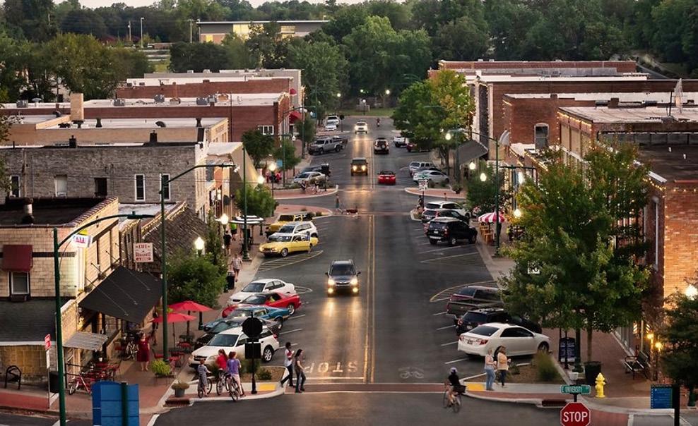
Deerfield is a community of about 2,507 people sitting 20 minutes by car southeast of Madison in Dane County. Milwaukee, Janesville, and Chicago are also easily accessible destinations. The rural Village consists of a historic downtown, a ring of housing mixed with community amenities, and agricultural land on the outskirts. The Glacial Drumlin State Trail runs through just north of the downtown providing connectivity and
recreational opportunities to residents and trail travelers. The cozy downtown is lined with historic buildings housing shops, restaurants, and a mix of residential units. Various community non-profits and residents are active in Village events and festivals year-round and aid in preserving the small town feel of Deerfield.


Sources: Dane County GIS (2023), DNR Latest Leaf Off Imagery (2018-2020)
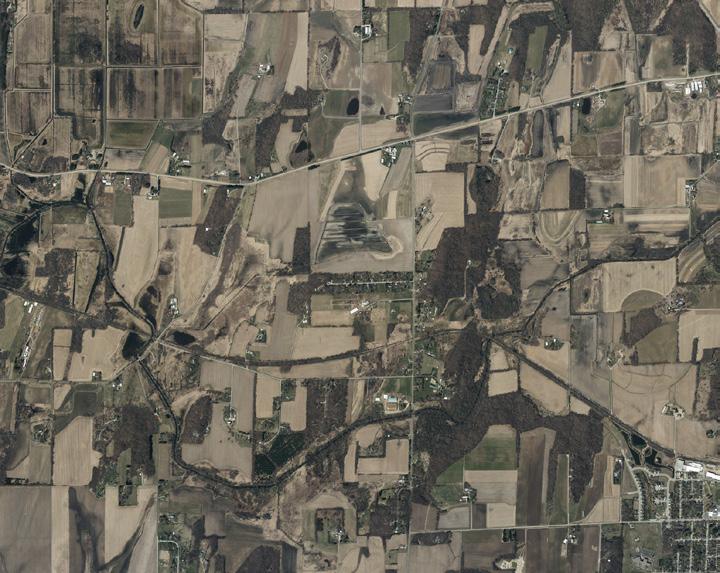
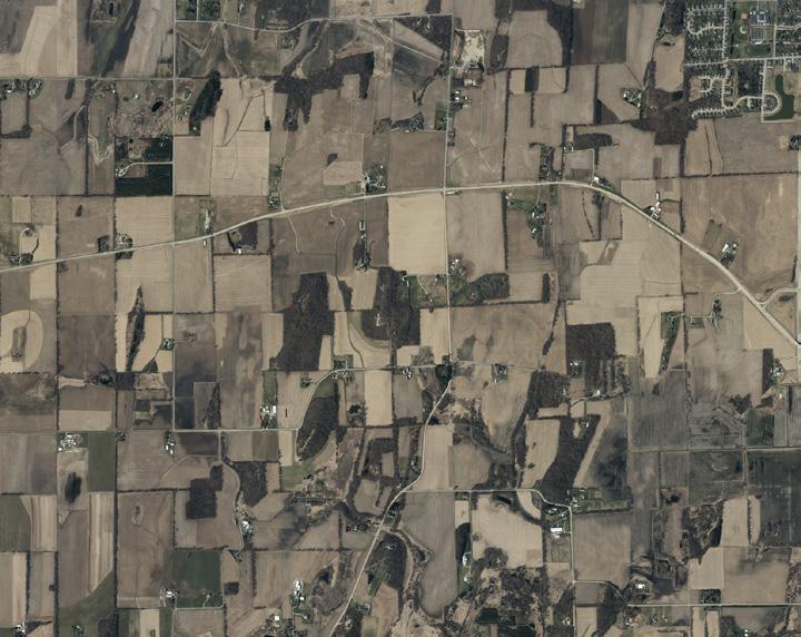
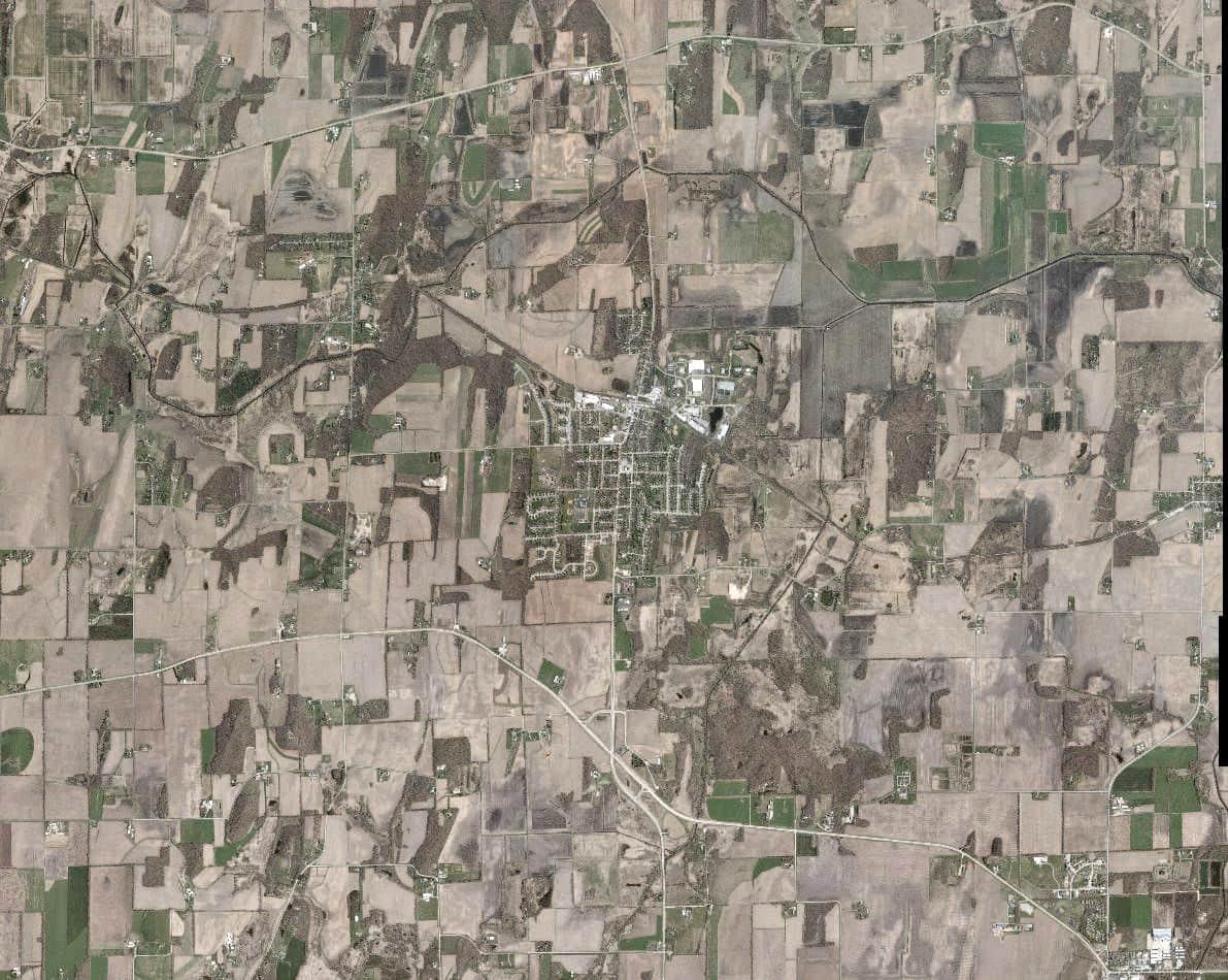
The study area for this plan includes all lands in which the Village has both a short-and long-term interest in planning and development activity.
Wisconsin law divides cities into four classes relating to government administration and local governmental power.
Deerfield is a Village, which corresponds to a 1.5-mile extraterritorial jurisdiction. The Village itself is approximately 2.16 square miles in size with the planning jurisdiction covering approximately 20.25 square miles.
3,015
In recent history, the most significant increase in population came during the period of 1990-2000 when the population grew from 1,617 to 1,971 or an average of 2.2% per year. It is projected that population growth will continue, though not as substantial as previous periods. By 2040, the Village can expect to add 500 new residents or 21% growth over that time period. The massive growth seen by Dane County over the past few decades will continue to influence the growth seen in the Village. Additionally, shifts in national migration to more northern states like Wisconsin due to adverse climatic conditions may bring greater growth.
The Census Bureau collects basic data every 10 years as part of the federal population census, but it also collects much more information every year through the American Community Survey (ACS). That data is collected using a relatively small sample of the local population, which is then reported not as a snapshot in time, but as a reflection of conditions over a five-year sampling period. The data are reported as “estimates” and every estimate has a certain amount of error calculated based on the number of responses in the sample.
• Village of Deerfield Comprehensive Plan (2007)
• Deerfield Facilities Needs Assessment and Parks Impact Fee Study (2013)
• Deerfield Masterplan (1980)
• Town of Deerfield Comprehensive Plan (2022)
• Village of Cambridge 2045 Comprehensive Plan (2023)
• Jefferson County Bicycle and Pedestrian Plan (2010)
• Bicycle Transportation Plan for Madison Metropolitan Area and Dane County (2015)
• Dane County Comprehensive Plan (2012)
Based on State of Wisconsin projections, the Village will experience growth of about 200 households by 2040. Household size is expected to increase somewhat due to the Millennial generation having children and then fall back to current levels over that period. Compared to state and county levels, Deerfield has a larger household size.
In 2020, approximately 12% of the Village’s population were nonwhite. 5% of the total population was Hispanic or Latino, while Black residents accounted for 2% of the population. Compared to the county and state, Deerfield is slightly less diverse with Wisconsin and Dane County showing 21% and 24% of their total population as non-white.
Over 7 out of 10 residents over 25 (71%) have at least some college education, including associate, bachelor’s, or master’s degrees. Deerfield exceeds Wisconsin average for population with college education attainment (61%) and falls slightly short of the Dane County level (77%). This matches the trend for high school graduate attainment.
The 2021 ACS data shows that about 38% of households earned over $100,000, while only about 21% earned less than $50,000. Comparatively, Deerfield has a larger percentage of higher income earners than Dane County and Wisconsin households as a whole.
The median age in the Village trended upwards through the first half of the 2010s before declining back to the current median age of 33.2. This is at odds with the county statistic with median age consistently increasing over the same period. The trend of an aging population will continue as the Baby Boomer generation becomes older.
The most common occupational industry among Village residents is Educational Services and Health Care and Social Assistance. Compared to the County, the Village appears to have a regional advantage in the construction, manufacturing, and wholesale and retail trade. These statistics will be explored in the Economic Development chapter.
The Public Engagement chapter details the efforts to engage community members throughout the comprehensive planning process.
The public inclusion plan was broken down as follows:
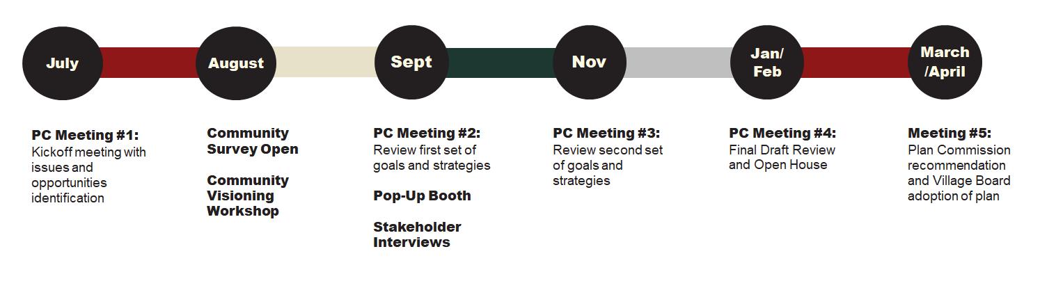
A project kick-off meeting was held on July 17, 2023 at the Village Hall. The discussion was about the current issues and opportunities in Deerfield that the Village hoped to be addressed by the Comprehensive Plan.
The results of the discussion included:
ISSUES:
• Housing: Need for more affordable lots, greater housing mix, and rental affordability concerns.
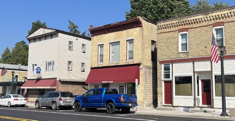
• Downtown Revitalization: Buildings are vacant or in poor condition in the downtown area. Streetscaping and design guidelines needed. Identify direction for revitalizing the downtown.
• Poor Utilities: Existing problems with energy utilities. Developable areas for growth are not currently serviced by utilities.
• Seniors: Ability to age in place at an affordable price.
• Public Spaces: Additional investment is needed for public spaces within Deerfield including parks and community gathering locations.
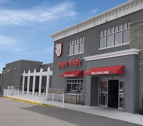
• Grocery Store: Addressing the need for a local grocery store within the Village.
OPPORTUNITIES:
• Recreation: The Glacial Drumlin Trail is a high trafficked path for bikers, pedestrians, and snowmobilers alike for the possibility of fourseason activity from visitors into the Village. The Village can capitalize on trail travelers with amenities like restaurants, equipment shops, and seating areas located just off the path. Goose Lake State Wildlife Area is located just north of the Village and remains a popular destination for hikers and nature lovers.
• Location: Continue to promote the proximity of the Village to the major employer hubs of Madison and Milwaukee. I-94, Hwy 73, 12 and 18 provide ample access to surrounding communities.
• Deerfield Community Center: The presence of the community center offers opportunities for collaboration on community event planning and fostering strong social bonds. The community center’s expanded services and commitment to the Village have brought numerous benefits over its history.
• Business Development: Local businesses are invested into the community and are committed to giving back. The Deerfield Chamber of Commerce is a strong partner to local businesses and supports marketing efforts to foster future economic development. Continued collaboration can establish the Village as destination for businesses, tourists, and potential investors.
• School District, Public Library, and other public utilities: A strong school system and services available to the public creates a desirable place for families to live.
The online community survey was active August 3, 2023, through September 6, 2023, and received 372 responses. A total of 31 questions were included in the survey with some open-ended responses. A link to the survey was provided on the Village’s website, posted on the Village Facebook, included in utility bills, and posted on flyers around the Village. A paper copy was available at the Village Hall. As compared to the community, the survey respondents were generally more female and mostly homeowners. Overall, the responses reflect a desire for growth, increased amenities, better services, and an improved quality of life in the village while preserving its small-town feel.
Full survey results can be found in Appendix C. Some of the major themes in survey responses included:
Most responses identified that they lived in Deerfield because of the small-town character, safety, and affordability that the community provides. Overall, responses agreed that Deerfield has good schools, residents feel connected one another, and that Deerfield is safe and affordable. Personal safety, Village parks, and safe walking and biking routes were highly rated. Respondents were not satisfied with high public utilities cost and the appearance of downtown.
The responses show strong support for duplexes, townhomes, apartments and single-family homes. This corroborates with the poor rating of both rental and ownership housing supply in the Village.
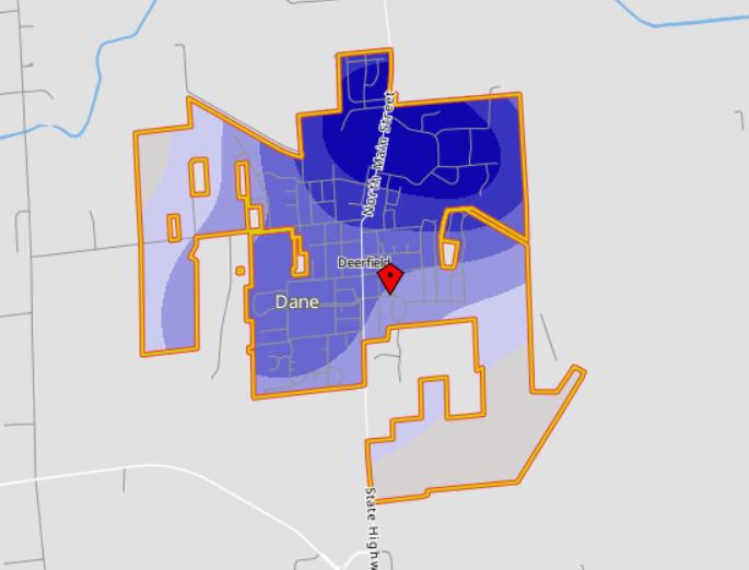
Employment share response indicates 49% work in the greater Madison area, 17% work within the Village, and almost 10% work in a nearby community. 45% of survey respondents work remotely at least once a week which aligns with the national trend of hybrid employment. Responses identify that better internet connectivity is needed to improve ability to work from home.
Park and recreation facilities, public safety and street repair are the highest priority of additional Village investment. Property improvement and development in Deerfield are favored for downtown buildings, existing homes, new retail sites, and greater energy efficiency.
Respondents are satisfied with the existing development in gas-station/convenience stores and pharmacy; however, they are dissatisfied in the lack of a grocery store, restaurants, and retail shopping mix.
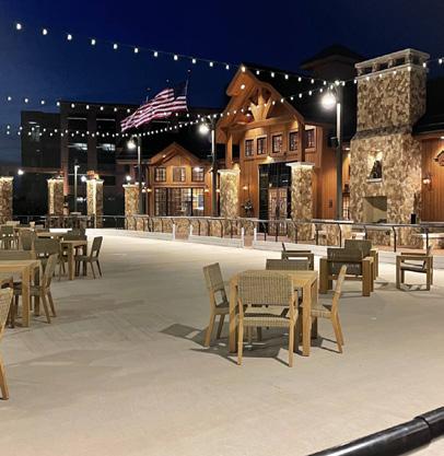
Popular amenities desired for the Main St/ Downtown Corridor include outdoor seating, benches, a public plaza, trees/planters, green space, and additional parking.

August 23, 2023 5:00 - 7:00 pm Village Hall - 23 W Nelson
In this activity, community members indicated their preferences for various amenities envisioned for Downtown Deerfield. Outdoor dining, walkability, small lot homes, and streetscaping were popular amenities.

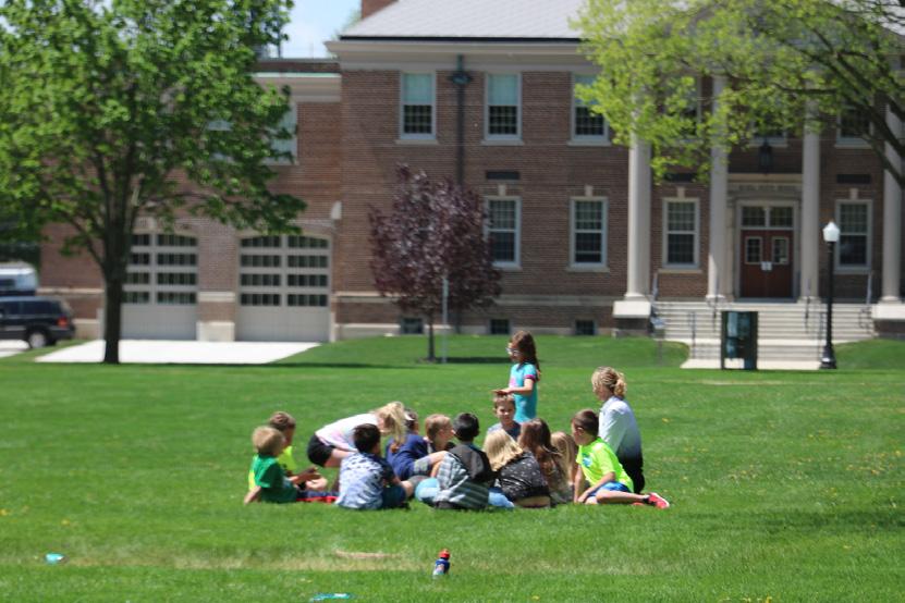
The community visioning workshop was held on August 23rd featuring a presentation to community members along with various charrette activities. The workshop was well attended with nearly 30 residents showing up to share their voice on the comprehensive plan process. A summary of the results are shown here, full responses can be seen in the appendix.
What do you like best about Deerfield?
• Small community
• Safe
• Walkable
• Affordable
What makes Deerfield unique?
• Rural town feeling
What do you like least about Deerfield?
• No grocery store
• Not enough amenities
• No restaurants that aren’t just a bar
• Lack of activities
What are your big ideas and aspirations for our community? What would you change or improve?
• More events for all ages
• Affordable housing
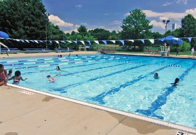
• Community pool
• More vibrant downtown
• Community garden
• Places for the community to gather
A community pop-up booth was held at the Lions Club annual Chili Fest on September 30th to get additional feedback on both the comprehensive plan and Comprehensive Outdoor Recreation Plan. Community identified issues are listed below.

Over the course of the planning process, multiple stakeholders were contacted to give their input on the issues, opportunities, and vision of the community. These stakeholders included business owners, residential developers, residents, a member of the parks committee, and representatives from Deerfield Historical Society, Deerfield Community Center, Deerfield Community School District. Feedback was collected through 30-minute interviews and is summarized through the key themes below.
Village Vision
• Emphasis on growing the community for families, recreation, and businesses.
Housing
• Need for senior and affordable housing.
• Develop housing options for younger families.
Economic Development
• Desire for a bustling downtown with shops, restaurants, art, and culture.
• Concerns about vacant storefronts, Main Street traffic, and the lack of amenities.
• Facilitate more training programs for connecting students with career opportunities.
Through the visioning workshop and pop-up booth residents had the opportunity to identify input spatially on a map of the Village. Four of the comments are called out on the map to the right. Full map and comments are found in Appendix C.
Engaging with the Public
• The importance of active community organizations and understanding the challenges they face.
• Increased support for the Community Center.
• Building trust through communication and transparency.
Historic Preservation
• Deerfield Historical Society serves as a hub for learning, research and curiosity.
• Suggestion for community-based funding to preserve Deerfield’s history.
• Emphasis on repurposing and preserving historic buildings on Main Street
Community Facilities
• Utilization and promotion of the Glacial Drumlin State Trail.
• Opportunities for economic growth through bike trails, parks, and community gathering places.
• Continued financial investment in solar
• Focus on managing water, especially in wetland areas that provide ecosystem services.
The Agriculture, Natural & Cultural Resources chapter of the Village’s comprehensive plan focuses on preserving and enhancing the Village’s valuable resources. It addresses key aspects such as agriculture, natural resource conservation, and cultural heritage preservation.
Deerfield is home to rich agricultural tradition that continues to this day. Effective planning can support farmland preservation efforts and ensure this tradition continues for years to come.
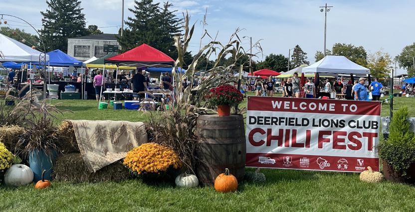
Residents value the existing local events and how they engage the larger Deerfield community. The Lions Club Chili Fest is held annually at Firemen’s Park.
Preserve productive agricultural lands in balance with development of the Village.
#1- Promote infill and redevelopment initiatives in under-utilized sites within the Village limits to help reduce the pressure to expand into surrounding agricultural areas through the Village website and local realtors.
#2- Protect and preserve wetlands and streams, surface and groundwater sources and other existing natural features in the Village.
#3- Limit development in prime agricultural areas identified by Dane County in the planning area and apply land use policies in Farmland Preservation, Non-Farm Development and Resource Protection Corridor Overly Areas. Consider preservation zoning techniques within the zoning ordinance to protect these areas.
#4- Coordinate with the Town of Deerfield to develop selection criteria to help determine appropriate areas to be included in the Urban Service Area.
Preserve and celebrate cultural heritage and arts.
#5- Create a historic preservation program that outlines, creates, and defines the role of a Historic Preservation Commission and the local historic designation process. Guidelines and standards for the preservation and restoration of cultural assets should be created. This program should include architectural guidelines, conservation techniques, and methods for maintaining the historical integrity of the assets. Evaluate any funding opportunities through the State Historical Society.
#6- Conduct a comprehensive architectural and historical intensive survey of significant sites, buildings, and landmarks within the Village. Engage with local historians, cultural experts, and community members to identify these assets and their cultural significance.
#7- Coordinate historical and cultural activities with the Deerfield School District, Community Center, Public Library, Deerfield Historical Society and other stakeholders as needed.
#8- Consider the adoption of an ordinance for the designation and protection of historic properties.
#9- Welcome and encourage events that foster community interaction and visitor spending, such as parades, festivals, and annual traditions.
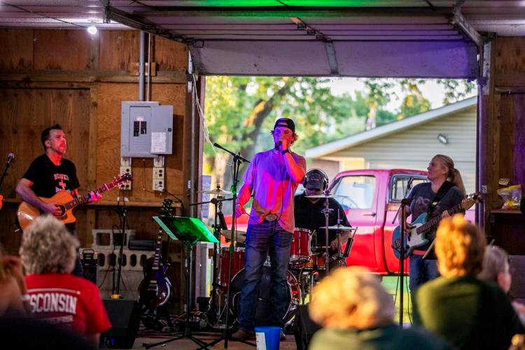
Residents would like to see more family friendly activities taking place in the Village such as Music in the Park or the Ice Cream Social. Both of these events have historically been hosted by the Deerfield Chamber of Commerce.
Runoff and watershed concerns of residents cite the increasing frequency of heavy rainfall events. With a large portion of land in agriculture, bodies of water are susceptible to nutrient runoff from farm fields after large storm events. The Village should re-evaluate its stormwater management strategies, work with farmers to identify best practices, and introduce green infrastructure to reduce impact of runoff on waterways and natural areas.
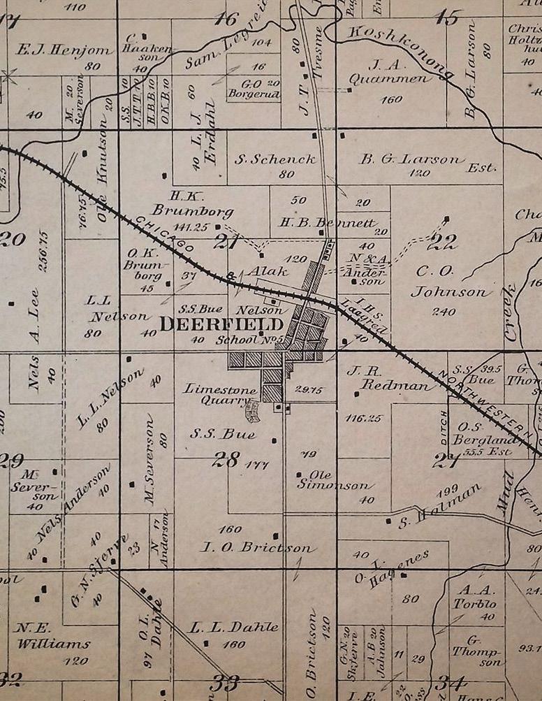
There are currently 240 acres of agricultural lands in production within the Village of Deerfield. The planning area includes additional agricultural lands on the outskirts of the Village. The Village Zoning map, last amended in 1989, identifies three Agriculture zoning districts located along the northern and southern border of the Village. Much of this area was planned for residential use in the 2007 Future Land Use Map.
Across the county, nearly 100,000 acres of farmland have been removed from production in the last 20 years, mostly due to residential expansion. Accommodating growth often means productive agricultural land going out of production. This can be counteracted by directing growth to infill within existing developed areas and creating greater residential densities. Additionally, setting aside agricultural land in preservation areas can ensure that these lands continue to be productive and contribute to the agricultural atmosphere of the community. There are no farmland preservation areas within the Village limits currently, but there is an opportunity to establish such areas using zoning ordinance or creating a Farmland Preservation plan to acknowledge the importance of agriculture to the community’s future.
Geology:
Around the Village there are several geologic features shaped by glaciers. Drumlins, till surfaces, as well as glacial stream deposits all can be found within the vicinity of Deerfield. The glaciers are responsible for the productive agricultural soil left behind after the glaciers retreated during the last ice age. The flat outwash of the downtown is flanked by drumlin hills to the east and west.
The topography of the Village is characterized by gently rolling hills with some steeper slopes along the Koshkonong Creek and farmland.
In the southwestern portion of the planning area is the Village’s sole mineral extraction site. Forever Sandfill and Limestone Inc. provides sand and gravel to construction contractors with extraction pits across Dane County.
Regulation:
Water resources are regulated by the Village’s Wellhead Protection, Floodplain Regulations, Shoreland-Wetland, and Erosion, Sediment and Water Runoff Control. Other local, state, and federal laws and regulations may apply.
Groundwater:
Deerfield has significant groundwater resources from the aquifer that runs below the Village. The Deerfield Water Utility serves the Village with two (2) active community wells.
Deerfield is located within the Upper Koshkonong Creek Watershed. Koshkonong Creek is a tributary of the Rock River, which ultimately flows into the Mississippi River. The watershed, combined with the adjacent Lower Koshkonong Creek Watershed, includes a large area of southern Wisconsin, with Koshkonong Creek running through several counties, including Dane County.
Wetlands are defined as those areas between terrestrial and aquatic systems where the water table is at, near, or above the land surface for a significant part of most years, and include marshes, mudflats, wooded swamps, and wet meadows. The presence of wetlands in an area can limit the type of development that can occur. Developments in wetland areas are regulated by the Wisconsin Department of Natural Resources and in some cases, the U.S. Army Corps of Engineers. Wetlands are located in several areas throughout the Village’s planning area. The greatest concentration of wetlands is along the eastern border at the shoreline of Mud Creek and various streams and drainage ditches.
Cultural Resources
Register of Historic Places:
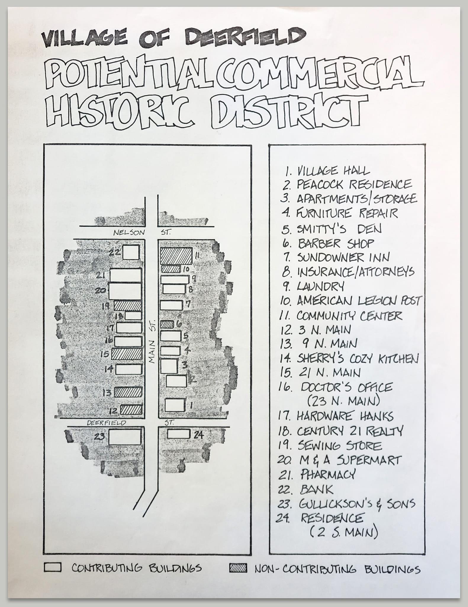
While there are no Deerfield property records on the State and National Registry of Historic Places, 133 (one hundred thirtythree) properties are listed on the Wisconsin Historical Society’s Architecture and History Inventory (AHI). Many of the properties are concentrated along Main Street through downtown. Historic properties include churches, barns, residences, and commercial store fronts.
The process for a property being listed on the National or State registry involves a nomination application being submitted to the State Historical Preservation Office (SHPO) by property owners, historical societies, preservation organizations, governmental agencies, and other individuals or groups citing both the age and historical significance of the place. The State registry application is reviewed by the SHPO and Historic Preservation Review Board and if approved, will go on to the National registry review process. For a National registry nomination, the National Register Review Board reviews the application and then ultimately a decision is made by the National Park Service. Since its inception in 1966, the National Park Service has designated more than 80,000 listings; approximately 2400 are in Wisconsin. More information on the nomination process can be found at https://www.wisconsinhistory.org/.
Funding options should be explored for restoring historic buildings within the community. State level historic preservation programs that may apply to these buildings include:
• The Wisconsin Economic Development Corporation in conjunction with the Wisconsin Historical Society’s State Historic Preservation Office provides Historic Tax Credits to income producing historic buildings to assist in renovation costs. If approved, the program provides 20% of rehabilitation costs as a state tax credit.
• The Wisconsin Historical Society’s State Historic Preservation Office administers a Historic Homeowners’ Tax Credit program that returns 25% of approved renovation costs of historic homes deemed eligible as an income tax credit. Homeowners must apply to the program through a tax credit application with the Historical Society.
Major Community Events:
Lions Club Chili Fest
Deerfield Great Pumpkin Hunt
Liberty Fest
Deerfield Farmers Market
Bittersweet Blessings Farm’s Apple Fest
Christmas in the Country Craft and Art Show
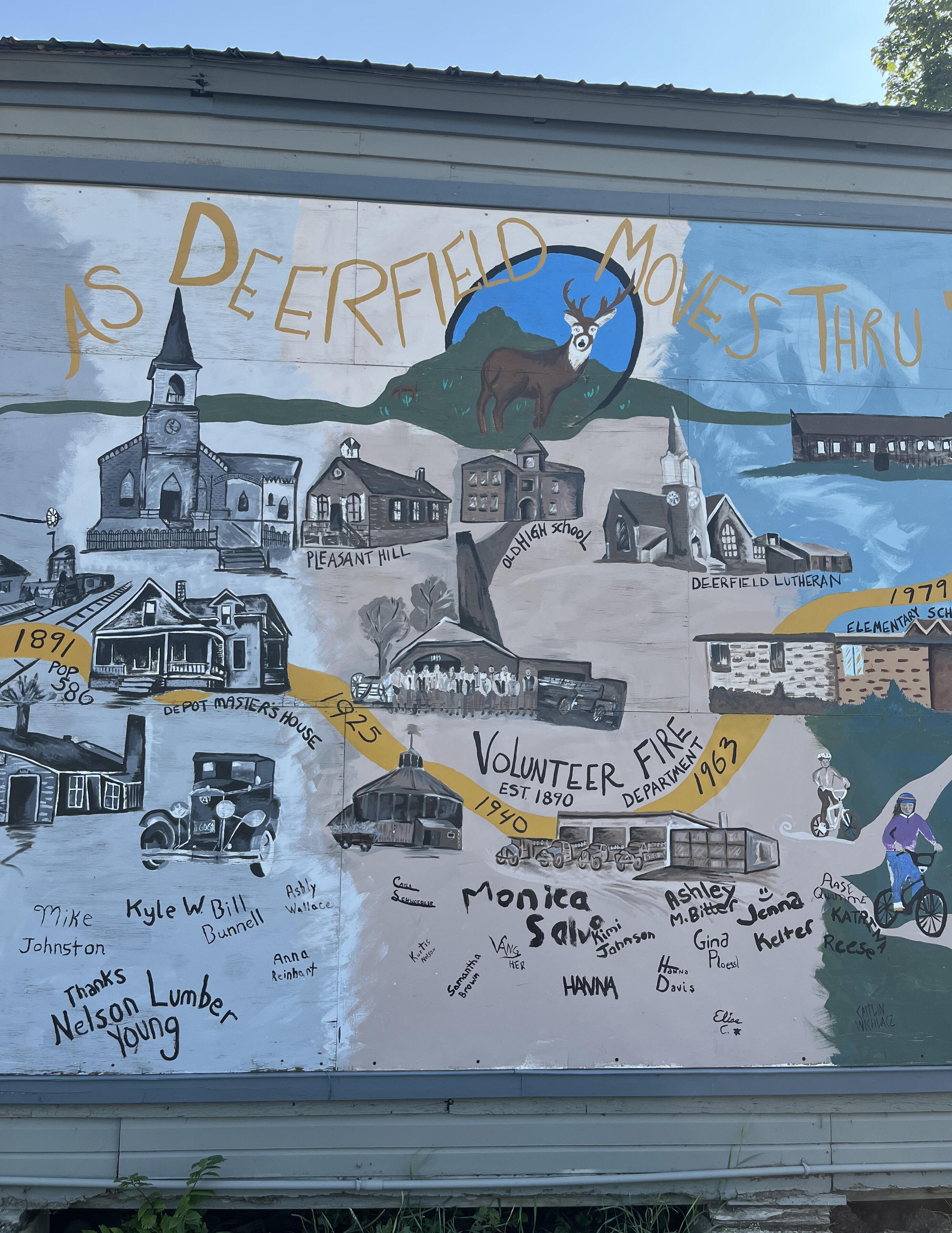
The Deerfield Historical Society is an active group of community members who work to preserve places of historic significance in the Village. The Historical Society’s main home is at the old Village Hall located at 4 N Main St. An ongoing renovation effort is being led by the Historical Society to restore the building to its original condition, while providing a new space to celebrate the history of Deerfield.
The Historical Society envisions themselves as a hub for learning, research and curiosity - open and welcome to anyone who has an interest in the history of the Village. This volunteer driven organization is active within the community attending events and doing outreach all year long.
Built
VILLAGE
(see Appendix D)
The Utilities and Community Facilities chapter of the comprehensive plan focuses on ensuring the efficient provision of essential services and the development of necessary infrastructure to support the needs of the Village of Deerfield.
The digital divide remains an issue in Deerfield as with many rural communities. Expanding broadband access and options is crucial.

Solar panels have sprouted up on buildings and facilities across the Village in partnerships with the Village, Couillard Solar Foundation, and the school district. Expansion of the solar network will reduce costs for the Village in the long run and promote sustainable energy production.

Maintain modern, affordable, and reliable public services that promote health, safety, and welfare.
#1- Ensure the maintenance and enhancement of utility infrastructure to meet the needs of both current and future residents and businesses.
Emphasis will be placed on preserving the reliability of existing systems while also planning for necessary upgrades to accommodate future growth and expansion.
#2- Conduct regular inspections and maintenance of existing utility systems, including water, sewer, and stormwater management, to ensure their integrity and reliability.
#3- Use asset management tools and maintain a five-year capital improvement plan to prioritize maintenance and replacement projects and minimize disruptions in service.
#4- Discourage inefficient “leap frog” development that results in infrastructure constructed before there is adequate customer base in place to support its maintenance.
#5- Continue sustaining high quality public safety services and facilities (police, fire, and EMS) in balance with budget constraints through regional partnerships with neighboring jurisdictions.
#6- Study the creation of a stormwater utility.
#7- Explore opportunities to improve internet connectivity through state and federal grant programs as awarded by the Wisconsin Public Service Commission.
#8- Work with community energy providers to receive better service for Village residents.
Enhance community wellbeing through access to excellent community facilities.
#9- Support partnerships with nearby municipalities and community organizations to provide parks, recreational facilities, public buildings, public spaces, and programming for use by all who wish to take part. Continue support and collaboration with the Community Center and explore additional recreational program partnerships.
#10- Require developers to dedicate community trails and paths in new developments that connect residents to amenities like schools, businesses, parks, and other community trails. Ensure connectivity to these amenities with the existing trail system.
#11- Continuously maintain and improve parks and recreational spaces, ensuring they remain safe, attractive, and accessible for leisure activities and community gatherings as guided by the Comprehensive Outdoor Recreation Plan.
#12- Utilize the Comprehensive Outdoor Recreation Plan to obtain funding through the Knowles-Nelson Stewardship Grant in pursuit of parks and recreation improvements.
#13- Consider an adjusted impact fee ordinance for new development to account for new Village needs.
#14- Re-evaluate the parkland dedication ordinance to ensure new parkland in Village subdivisions of land.
#15- Provide necessary resources and funding to the Deerfield Public Library to ensure it can continue offering a wide range of educational materials, programs, and services to residents, fostering lifelong learning and community enrichment.
#16- Explore possible reuse of Ag Building near to Firemen’s Park into a community space rentable for events.
Many residents complain of the expense of utilities with poor service provided. 40% rank utility cost as “Poor” or “Unsatisfactory.” 61% are dissatisfied with broadband internet options. Park and Open Space Dedication
85% of survey respondents support a parkland dedication requirement for new development.
Schools & Education
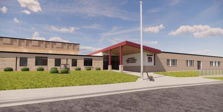
Deerfield Community School District:
Deerfield Elementary School (grades K-6) and Deerfield Middle-High School (grades 7-12).
Day Care: 2 Grandmas & A Bunch of Kids, Holland’s Hearts & Hands, and Kids Count, Inc.
Parks/Recreation
Parks:
Alex Nelson Memorial Park
Drumlin Park
Dream Depot Park
Meadow Wood Park
Savannah Park
Unnamed Soccer Fields
Community Park Firemen’s Park
Trails:
Glacial Drumlin State Trail
Recreation:
Deerfield Community Center Youth Sports Programs
Deerfield Rod and Gun Club
Deerfield Youth Wrestling Club
Deerfield High Schools Clubs and Athletics
Public Safety, Health & Welfare
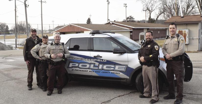
Police Department:
Deerfield/Cambridge Police Department contracted through Dane County Sheriff’s Department. Department is located in Downtown Deerfield.
Fire:
Deerfield Volunteer Fire Department serves both the Village and Town of Deerfield out of a shared facility in the Deerfield Industrial Park.
EMS:
Deer-Grove EMS District serves over 16,000 people in the Town and Village of Cottage Grove, the Town and Village of Deerfield, and portions of the Town of Pleasant Springs in Dane County, Wisconsin. DGEMS provides 911 Emergency Medical response 24 hours a day, 365 days of the year, by a staff that includes both paid and volunteer professionals.
Healthcare Facilities:
General healthcare services are located at the Dean Medical Clinic, part of the SSM Healthcare system.
Senior Care:
There are senior living facilities in the neighboring Village of Cambridge. The Deerfield Community Center provides senior programming during the week.
RSVP of Dane County is a volunteer based community assistance program for retired and senior citizens in Dane County. Through this program, senior residents have access to transportation, meal services, and other support.
Utilities
Natural Gas & Electric:
Alliant Energy and We Energies maintain electric and natural gas distribution systems to the Village of Deerfield.
Refuse/Recycling Collection:
Badgerland Disposal, an LRS Company, is the Village’s contracted trash and recycling hauler. Leaf and compost services are also available to village residents throughout the year. There is a compost drop-off site in both the Town and Village of Deerfield that allow for small brush drop off/ free compost pickup/ wood chips.
Telecommunications:
Cellular and mobile service is provided to residents throughout the Village by Verizon, T-Mobile, AT&T, and U.S. Cellular. Satellite high-speed internet can be obtained through HughesNet, Viasat, and Starlink, while traditional wired and wireless broadband internet access is available through Frontier and Spectrum.
Water:
Deerfield Water Utility provides the village drinking water. The Village has two wells, which draw water from the bedrock sandstone aquifer that lies below the village.
Wastewater:
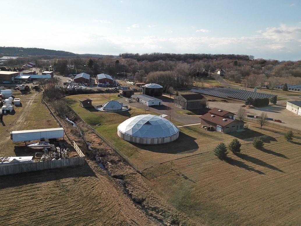
Deerfield Wastewater Treatment Plant collects, carries, and treats the wastewater within the Village.
Other Community Facilities Library:
Deerfield Public Library is a resource for not only library books but also public computer access and WI-FI, printing and scanning, youth and adult year-round programming, community meeting spaces, and online research database services.
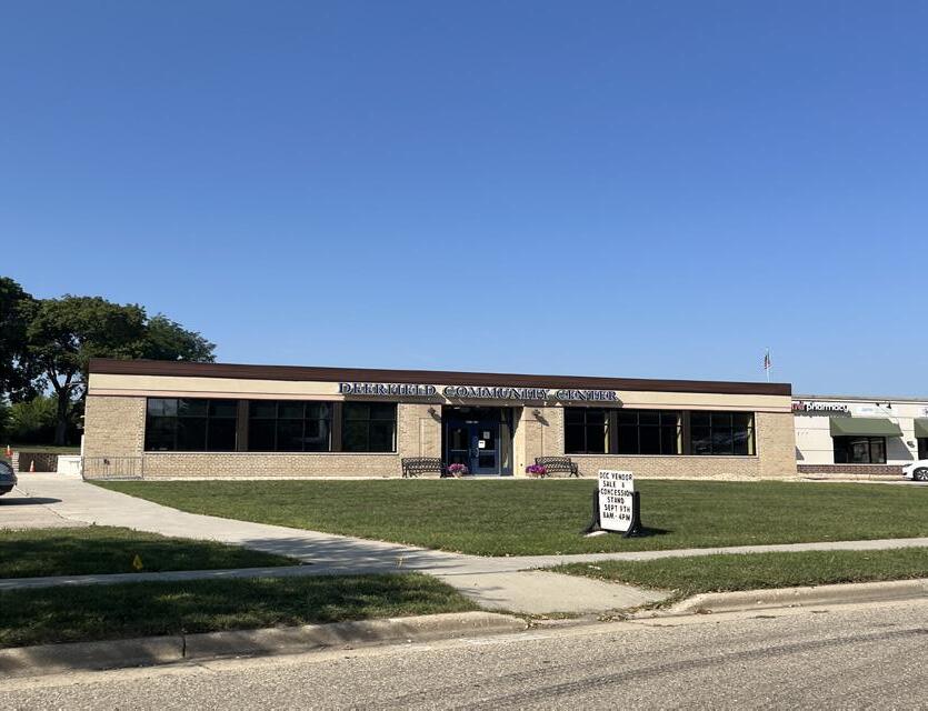
Community Center:
The Deerfield Community Center provides a variety of resources to community members including a food pantry, youth and recreation programming, and senior services.
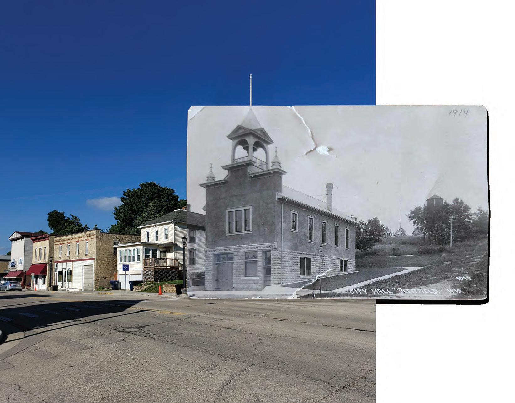
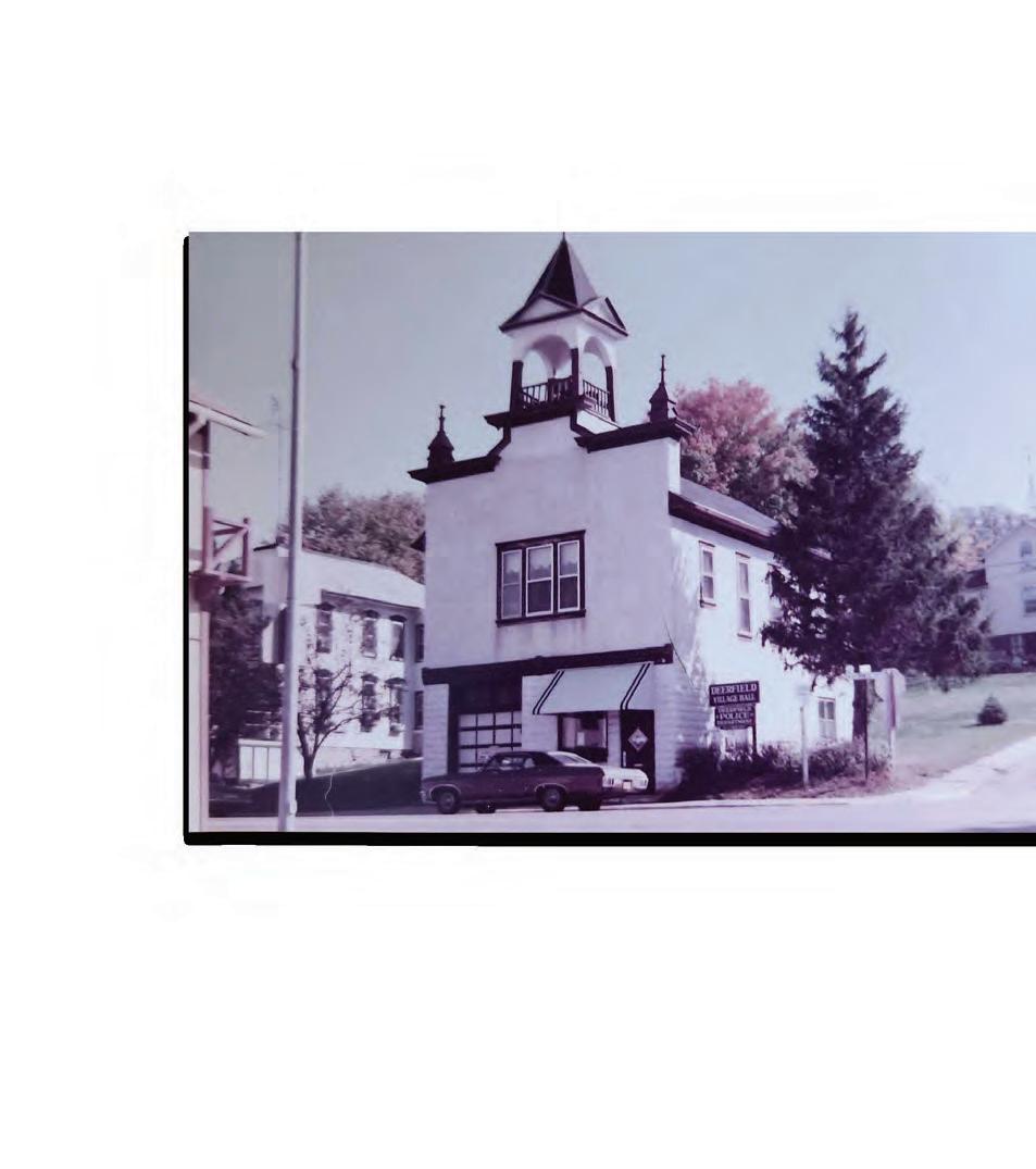
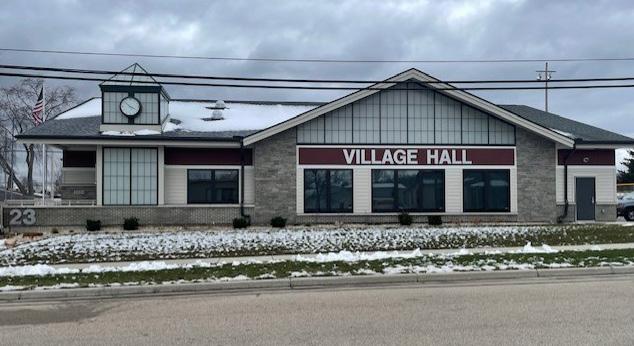
Village Hall:
The Village recently moved into its new home of the New Village Hall at 23 W. Nelson Street.
Deerfield Historical Society:
The Deerfield Historical Society works in preserving the stories and buildings of Deerfield’s history. The Historical Society has now moved into the Old Village Hall.
(see Appendix D)
Sources: Dane County GIS (2023), DNR Latest Leaf Off Imagery (2018-2020)
This chapter emphasizes the vital role of collaboration and partnership between the Village of Deerfield and other government entities to maximize resources, coordinate planning efforts, and pursue shared goals.
The Village already has developed partnerships and shared service agreements with several jurisdictions that ensure quality public services at a lower cost. One example is the Deerfield/Cambridge police force.
The school district provides tremendous value to the community. Recent expansion has been successful with the new Elementary School. Middle-High School expansion will start in 2024.
Enhance coordination and collaboration with local, regional and statewide governmental organizations to promote Village interests.
#1- Enforce, abide by and maintain existing intergovernmental/cooperative agreements with neighboring jurisdictions to provide predictability for property owners, avoid municipal boundary disputes, and plan for efficient provision of public facilities and services.
#2- Convene with the Town of Deerfield officials to discuss intersecting community development goals, intergovernmental boundaries, and future cooperation on planning efforts.
#3- Work closely with the Deerfield Community School District, Deerfield Community Center, and other community stakeholders to foster communication, relationships, and knowledge about facility planning and other activities/efforts that impact Deerfield residents.
#4- Work with other governmental entities (e.g. Dane County, CARPC, Wisconsin Department of Transportation, and Department of Natural Resources, etc.) to advance Village interests as identified in Village plans.
#5- Schedule a working session with the School District, involving elected officials and key staff for the Village, Town of Deerfield, and the School District, no less than annually to discuss issues of concern and opportunities for collaboration.
#6- Village staff will meet with representatives from each adjacent jurisdiction during the annual process to update the Village’s Capital Improvement Plan and to coordinate projects as appropriate.
#7- Coordinate with all adjoining jurisdictions during outdoor recreation planning to identify complementary recreation investments where service areas overlap and work to avoid duplication of unique amenities.
#8- Work with neighboring jurisdictions to identify and resolve conflicts and inconsistencies between local plans and resolve key countywide issues affecting the Village.
#9- Consider the possibility of conducting joint planning with the Town of Deerfield in an effort to reduce duplication, address common issues and provide for residents and businesses in the most efficient and cost-effective manner.
#10- Consider an update to the Village website to ensure greater information access to residents and potential residents and businesses.
#11- Discuss opportunities of partnerships and collaboration with neighboring jurisdiciton Fire Departments.
Local Jurisdictions
• Town of Deerfield
• Village of Cambridge
• Village of Marshall
• Village of Cottage Grove
• Town of Medina
• Town of Christiana
County Jurisdictions
• Dane County
Regional Jurisdictions
• Capital Area Regional Planning Commission (CARPC)
School Districts
• Deerfield Community School District
Cooperative Agreements
• Town of Deerfield and Village of Deerfield shared Fire Department
• Village of Cottage Grove, Town of Cottage Grove, Town of Deerfield, and Village of Deerfield shared EMS services
• Village of Cambridge, Town of Deerfield, and Village of Deerfield shared Police Department
• Dane County Department of Land and Water Resources provides stormwater and erosion control technical assistance
• Village of Deerfield, Village of Cambridge, and Village of Rockdale shared joint municipal court
Residents would like to see greater cooperation between Deerfield Community Center and the Village to extend village services and meet community needs.
Residents are calling for more promotion of community events, public participation opportunities, and Village information. Updates to website or communication methods may be considered to ensure greater access to community information.


Sources: Dane County GIS (2023), DNR Latest Leaf Off Imagery (2018-2020)
The Economic Development chapter focuses on fostering a vibrant local economy. It outlines strategies to support entrepreneurship, attract investments, and create a favorable business environment.
The community needs more diverse types of businesses to attract new residents and visitors. Currently, the downtown is dominated by bars and vacant storefronts.
Promote the growth and success of local businesses.
#1- Conduct periodic visits with local businesses (e.g. once every 1-2 years) to show interest in their success and identify any needs with which the Village may be able to assist.
#2- Determine if there are barriers in the process to establish a new business. Simplify and expedite the permitting and licensing processes for businesses, as feasible. Implement an efficient online system that allows businesses to easily apply for permits and licenses, ensuring a streamlined and user-friendly experience.
#3- Facilitate partnerships between local businesses, the Chamber of Commerce and Village government to leverage resources and expertise. Collaborate with businesses to identify opportunities for joint initiatives, such as infrastructure development, marketing campaigns, or community programs, that benefit both the business community and the Village as a whole. Work with partners to extend job training opportunities to residents that create a more skilled workforce.
#4- Support proactive communication between educational institutions (Deerfield Community School District, local UW-Extension, tech colleges, etc.) and area employers in determining and filling appropriate local skills and needs. Offer training and programs for skill development through various methods.
#5- Promote and encourage a mixture of housing options to attract a variety of businesses and ensure there is sufficient housing to support the workforce.
#6- Complete review of ordinances pertaining to economic development. Enforce property maintenance ordinances to ensure aesthetically pleasing business corridors and commercial areas.
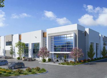
Maintain a healthy business mix in the Downtown area and the Deerfield Industrial Park.
Strategies
#7- Recruit entrepreneurs who plan to start-up or expand retail or personal service businesses.
#8- Establish and implement a building rehab loan program, with assistance from the Economic Development Committee.
#9- Develop a coordinated streetscape plan with the Business Improvement District (BID) Board to enhance the aesthetic appeal of the downtown corridor.
#10- Solicit a grocery market analysis to provide an independent evaluation of grocery store viability in Deerfield, including optimal location for success.
#11- Use TIF strategically to create development opportunities for the Village. Prioritize PAYGO, conservative projections to ensure anticipated results, and the creation of a checklist for elected and non-elected officials of TIF requests.
Foster and attract new commercial development within the Village.
Strategies
#12- Identify and promote development sites with clear communication on the Village’s website, social media, and signage.
#13- Recruit businesses that will meet the needs of Village residents that currently are not being met. Continue to engage with community members to understand their needs and concerns.
#14- Explore financing options, including loans, grants, or partnerships, to support potential development projects and reduce risk.
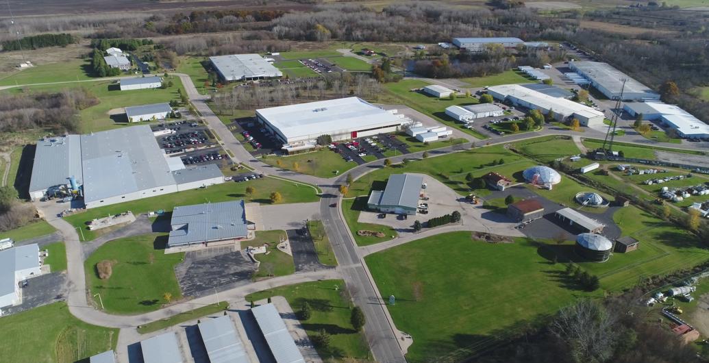
#15- Promote the cluster of transportation, manufacturing, and construction related companies already located within the Village.
#16- Update and maintain the Village’s website platform, in order to make finding relevant information (i.e. available space, village demographics, upcoming projects, etc) easier for developers, entrepreneurs, and site selectors.
VOICES FROM THE COMMUNITY
Community members would like to see more collaboration between the Village and business community to support business needs and promote the local economy.
80% of residents are dissatisfied with the retail shopping mix in the Village. This is echoed in residents voicing need for developments like a grocery store, shops, fitness center, car wash, and restaurants.
80% of survey respondents are dissatisfied with the retail shopping mix in Deerfield.
Economic development activities play a key role in the quality of life of the community and the long term viability of the Village. This economic development snapshot explores the Village's current environment, and inventories efforts that support economic development in the community.
This table shows the change in employment from 2010 to 2021. Agriculture, forestry, fishing and hunting, and mining industries show a significant percent increase; however, the actual number of employees in this category went from 4 to 14. The construction sector grew the most in actual employees with an increase of 145. Educational services, healthcare, and social assistance industries have the largest number of employees in the Village with 244. Both nationally and at the state level, employment in the agriculture industry has suffered with farm buyouts and volatile agricultural markets. The free fall of dairy farms continues in Wisconsin with just over 6,000 operations remaining.
With the largest influx of federal dollars in decades for infrastructure spending taking place in recent years, employment in the construction industry has seen substantial growth which is projected to continue for the foreseeable future.
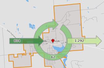
In Arrow = workers commuting into Deerfield Out Arrow = residents commuting out of Deerfield Circle = residents working in Deerfield
There are many local, county, regional, and state programs available to provide incentives or financial help for attracting businesses. The most common are listed below.
• WEDC
• CBDG
• Community Development Zones
• Rural Economic Development (RED) Early Planning Grant Program
• WI Development Fund (WDF)
• Transportation Facilities Economic Assistance and Development Program
• Opportunity Zones
• Focus On Energy
• Industrial Revenue Bonds
• TIF Districts
• Downtown Loan Programs
• Business Improvement Districts
Educational services, healthcare, and social assistance industries have the highest percentage of employees in both the Village and County in 2021. Given the county is home to a number of health care facilities and higher education institutions including the University of Wisconsin – Madison, a major employer in the state, it is no surprise that employment is dominant in these industries. Deerfield has a significantly larger percentage of construction sector employees compared to the county indicating an area concentration in this industry. The manufacturing sector also has a greater Village concentration than the county owing to the cluster of manufacturing-related companies located in the Deerfield Industrial Park and along Nelson Street.
With established manufacturing and construction business clusters, it will be important to double down on efforts to provide excellent training programs and early exposure opportunities for students looking towards their future employment in these career paths. Additional partnerships with local businesses to promote careers in education, healthcare, and professional services should be prioritized with young people, given the specialization of the county in these industries.
What is a living wage?
The living wage identifies the necessary income (minus payroll taxes) to cover an individual’s or family’s likely food, childcare, health insurance, housing, transportation and other basic necessities (e.g. clothing, personal care items, etc.). Based on MIT’s Department of Urban Studies and Planning, Deerfield’s 2023 annual living wages are shown below. Note that a “living wage” is just above poverty level.
1 Adult: $18.37 w/ 1 Child: $37.52 w/ 2 Kids: $48.94 w/ 3 Kids: $66.19
2 Adults: $13.87 w/ 1 Child: $20.50 w/ 2 Kids: $27.40 w/ 3 Kids: $33.50
Source: https://livingwage.mit.edu
(see Appendix D)
The Village has four active Tax Incremental Financing (TIF) Districts (TIDs). TID 3, created in 2005, is the largest and oldest TID in the Village. As of 2023 the total value in TIDs (and the value in TID 3 by itself) exceeds 12%, meaning the Village will not be able to create or expand a TID until TID 3 is closed.
The equalized value limit is the maximum property value a municipality can have within Tax Incremental Districts (TIDs). It is calculated by adding the equalized value of the new TID’s taxable property as of January 1 and the value increment of all existing TIDs (for that municipality). This value cannot exceed 12% of the municipality’s total equalized value. Deerfield will need to continue using TIF as a way to incentivize the types of development the Village would like to achieve, but will need to remain mindful of its limitations. Village officials and financial consultants should use conservative project valuations and increments to help determine the length of time (15-17 years) a TID needs to remain open in order to remain under the 12% valuation test. With a conservative approach to TID based on: life, payback, community outcomes, and need, it will remain one of the most useful tools the Village has to ensure continued growth in residential, retail, office, and industrial.
Sources: Dane County GIS (2023), Village of Deerfield Data, DNR Latest Leaf Off Imagery (2018-2020)
The Housing chapter focuses on ensuring accessible and diverse housing options for Village residents. It addresses challenges and strategies to promote affordability, availability, and quality. By encouraging a range of housing types and revitalizing older properties, the Village aims to meet the needs of its residents while preserving its unique character.

Ensuring affordable housing options for working families is a key priority for residents in the Village. By prioritizing policies and actions that promote affordability, such as incentivizing affordable housing developments, residents aim to preserve housing options that are within reach for
Attracting and retaining families is important to the local economy, the community's future, and to maintain the quality of life present in Deerfield.
Retain and attract residents by supporting a range of housing options.
#1- Promote development patterns that combine residential, commercial, and recreational uses. This approach creates vibrant and walkable neighborhoods, providing residents with convenient access to amenities, services, and employment opportunities.
#2- Foster collaboration with developers to provide housing that meets the demand and needs of the Village.
#3- Ensure developments are carefully designed to accommodate traffic and stormwater management.
#4- Review and update zoning and land use regulations to accommodate a range of housing options, including accessory dwelling units (ADU). Allow for increased density, where appropriate, to encourage the development of multifamily housing and mixed-income developments.
#5- Continue to assess housing needs and issues within the community, including the need for affordable housing.
#6- Collaborate with experienced rental housing developers to actively pursue State and Federal 4% tax credit-funded renovations of aging units. This partnership will enable the reinvestment in these units while ensuring their continued affordability and accessibility.
The Village will maintain quality housing options as part of safe and healthy neighborhoods for all residents.
#7- Review and approve housing development proposals based on consistency with the Land Use chapter of this Plan, including the Future Land Use Map and associated policies.
#8- Complete review of property maintenance ordinances pertaining to housing. Enforce property maintenance ordinances to ensure aesthetically pleasing neighborhoods and properties.
#9- Ensure both homeowners and landlords are aware of program and financing options for upkeep on properties, including energy efficiency.
#10- Infill development should respect the scale, proportion and architectural style of nearby homes to a reasonable extent. The Village should consider strategies to actively protect areas that have been locally identified as historically important.
#11- Investigate implementing programs and incentives to preserve and rehabilitate existing housing stock, particularly historic homes or buildings.
Consider using Tax Incremental Financing to offer financial assistance for repairs and renovations, especially for older homes with desirable character.
#12- Update the Village website to promote local, neighborhood level events in support of neighborhood groups.
#13- Develop and share resources on green/sustainable design strategies in conjunction with the permit process (e.g., educational pamphlets that summarizes energy and water consumption strategies and provides information on Local/State energy and sustainability programs).
Create a diverse mix of residential densities with strategies around efforts of community diversity in neighborhood planning.
#14- Identify which neighborhoods should be targeted for a neighborhood planning effort directed at sustaining diversity.
#15- Assemble a neighborhood planning group composed of local leaders in Deerfield who represent the diversity of the neighborhoods.
#16- Increase public awareness for neighborhood diversity and mix of residential densities through community engagement.
#17- Develop and implement a neighborhood plan through a collaborative planning effort that is complete with design guidelines, identified regulatory reforms, and recommended public investment.
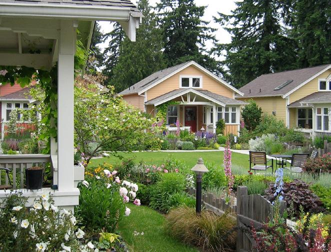
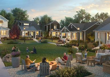
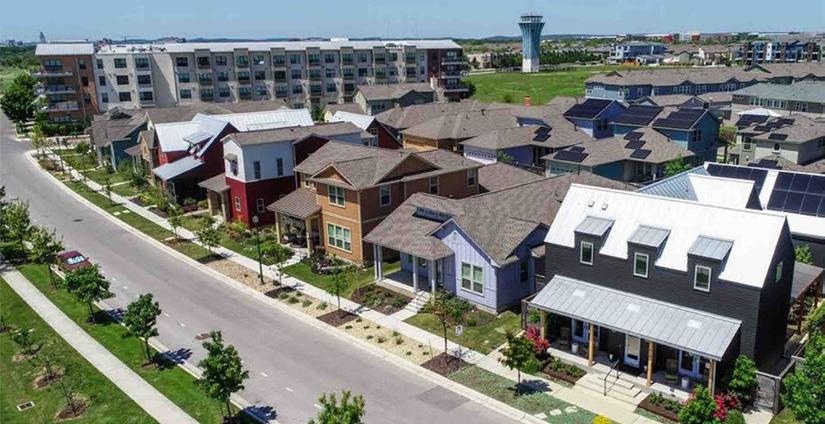
Many community members voiced concern about the ability to stay in the community as they age. Senior housing provides the flexibility and comfort of remaining in Deerfield. This type of housing can come in many forms such as assisted living facilities, apartments, townhomes, or these senior cottages shown below.
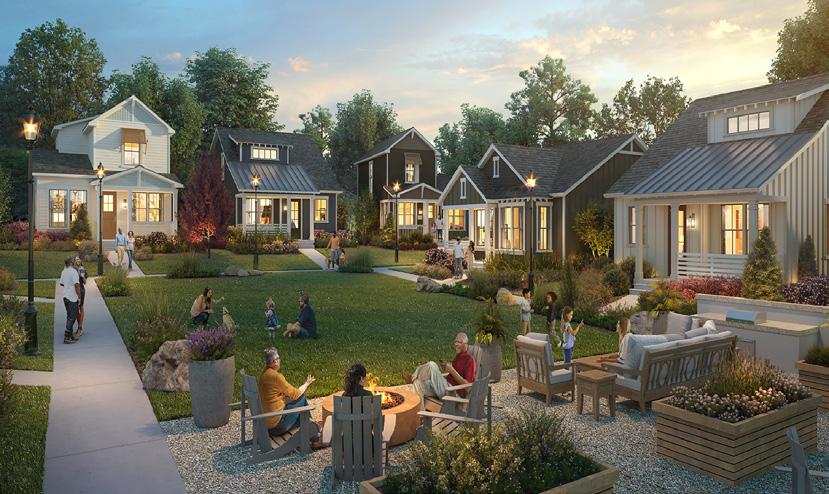
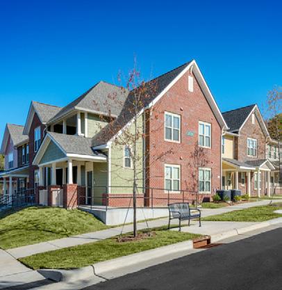
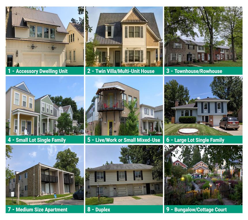
There is strong support for a variety of housing types including small-lot single family homes, townhomes, apartments, duplexes, and accessory dwelling units. The best way to alleviate the housing affordability crisis is to build more housing!
The following numbers illustrate conditions in Deerfield most relevant to the formation of housing goals and policies for the next 10 years.
982 - The total number of housing units as of 2021
79% -The percentage of units that are single-family detached housing, compared to 52% for Dane County. As costs continue to rise for new construction, these unit types may become increasingly unaffordable and households may need to look for new options in the housing market.
77% -The percentage of all households that are living in units that are owneroccupied, based on the American Community Survey (ACS). This is unchanged over the past decade.
5% -The percentage of all units that are attached units (e.g. townhomes, twinhomes), based on ACS surveys. Attached and two-unit building forms are becoming more common, and are important to adding gradual density in land use decisions.
34% -The percentage increase in the median owner-occupied home value since the market bottom in 2012 representing a strong sellers real estate market for all types of homes in the Village. This indicates nearly double the growth rate of the statewide housing valuation of 19% over the same time period.
23% - The percentage of rental households in Deerfield
0% - The rental vacancy rate in 2021. This is an extremely tight rental market. While owner-occupied housing is seeing tighter markets and less available units, increasing desirable rental choices is important to offer options within the housing market. Incoming units may increase rental vacancy rate, but the increasing number of households in the community will continue to put upward pressure on rental prices.
$300,000
$290,000
$280,000
$270,000
Healthy rental vacancy rates are considered to be between 5% and 7% for all units. This falls within the assumed vacancy for new development (5%), allows turnover and growth in population, keeps market rental cost increases to appropriate amounts, and provides a general balance between landlord and tenant.
Sources: 2017-2021 ACS 5-Year Estimates
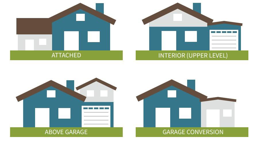
ADUs for increasing density within existing neighborhoods
Accessory Dwelling Units (ADUs) can respectfully increase density in built environments without changing the character of the neighborhood. ADUs can be a separate cottage in side/rear yard, apartment in the basement, a space above a garage or a unit attached to the home. While financing can be difficult, ADUs allow homeowners to create an additional dwelling unit on their own property for family members, caretakers, and friends who are in need of housing. They are also commonly used by aging households to “downsize” their own housing, while maintaining ownership of the property as either an income-generating rental, or housing for family members serving as caretakers later in age.
Village households that are cost burdened represent over 1/3 of renters and 1/5 of owners. A household is considered cost burdened when spending over 30% of their income on housing costs.
The Mobility & Transportation chapter focuses on the importance in having a safe, accessible, and costeffective transportation system in the Village of Deerfield for residents and visitors.
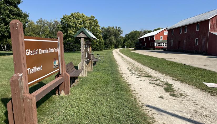
Glacial Drumlin State Trail
This trail is used by 1,000s of people each year and provides a wonderful asset to the community.
The location of the Village provides easy access to the I-94 and Beltline highways.
Maintain safe transportation infrastructure that meets the needs of all users.
#1- Monitor the quality of sidewalk infrastructure and provide assistance to property owners for maintenance and replacement.
#2- Proactively monitor the quality of public surface infrastructure such as streets and any Village-owned parking areas and trails.
#3- Develop and maintain annually a capital improvement plan to manage the Village’s streets, sidewalks, and trails. Integrate new and planned infrastructure into the improvement plan, annual budget and inspection schedule.
#4- Maintain an inventory of public infrastructure and develop a regular inspection schedule.
#5- Track and share progress of annual capital improvement projects to build public support.
MOBILITY & TRANSPORTATION
Create an integrated and accessible mobility system that connects various transportation options and promotes active recreation throughout the Village.
Strategies
#6- Move toward implementation of a complete streets network that is safe, convenient and attractive for everyone regardless of age, ability or mode of transportation.
#7- Conduct a bike and pedestrian study to evaluate the existing conditions of bike and pedestrian facilities in the Village. Apply for a TAP grant to fund the production of a Bike and Pedestrian Masterplan including a bike and pedestrian network map with existing and proposed facilities and recommendations for greater connectivity.
#8- Discourage cul-de-sac streets in favor of connected streets that provide transportation flexibility and increased safety in case of an obstructed street. Additionally consider mid-block sidewalks/multi-use trail connections for pedestrians for interior streets/cul-de-sacs.
#9- Collaborate with the Deerfield Community School District on safe transportation for students, including walking, biking, and busing, both in neighborhoods and near the school sites. Consider applying for Safe Routes to School and TAP grant funding sources through WisDOT.
#10- Collaborate with responsible jurisdictions to ensure roadway improvements (including County and State highways) have multi-modal aspects integrated into planning and development, or appropriate alternatives developed.
#11- Review the Village’s off-street parking requirements periodically to assess their effectiveness in making efficient use of land for vehicle parking. When appropriate, reduce minimums and consider enacting maximums to avoid excess parking spaces.
#12- Prepare a conceptual neighborhood plan in areas slated for growth prior to any development in that area in order to ensure good street connectivity and any critical bike or pedestrian routes through the area are included.
16% of survey respondents rank street repair and maintenance as their top investment priority.
10% of residents rate the bike routes as unsatisfactory or poor. Many residents are supportive of new bike and pedestrian facilities including community trails that connect with the Glacial Drumlin State Trail.

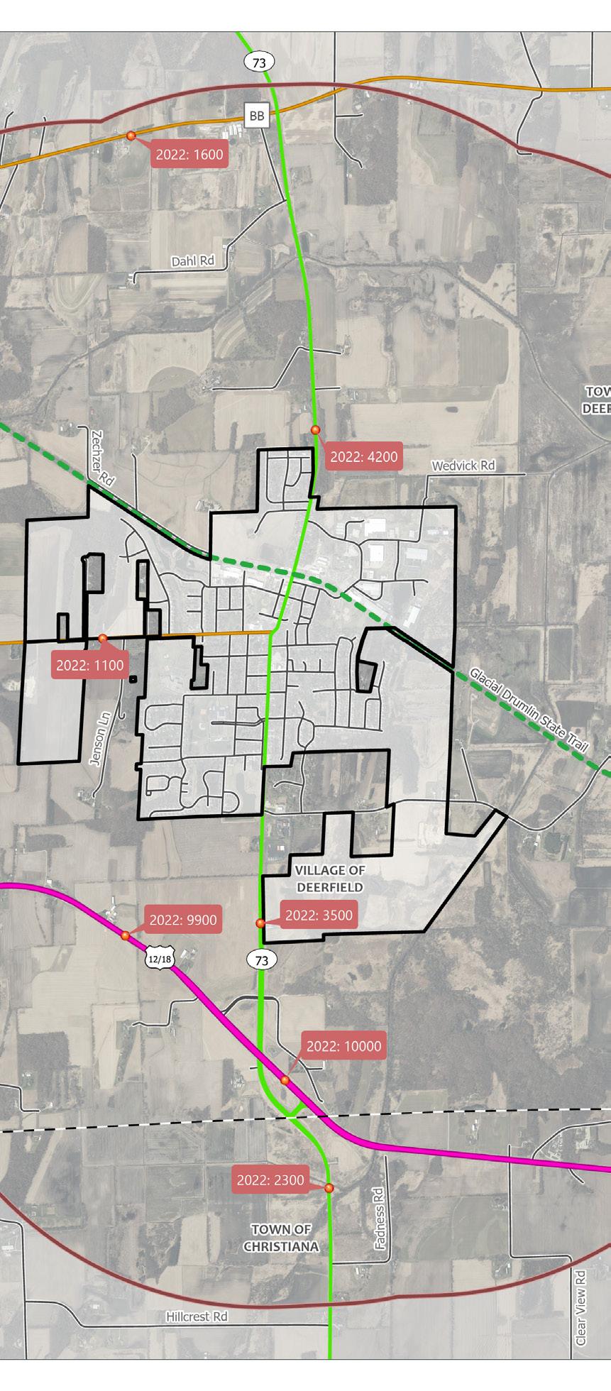
Mobility and transportation activities play a key role in the quality of life of the community and the long term viability of the Village. This mobility and transportation snapshot explores the Village's current facilities and efforts to improve daily life in the community.
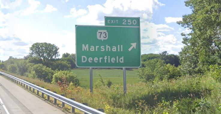
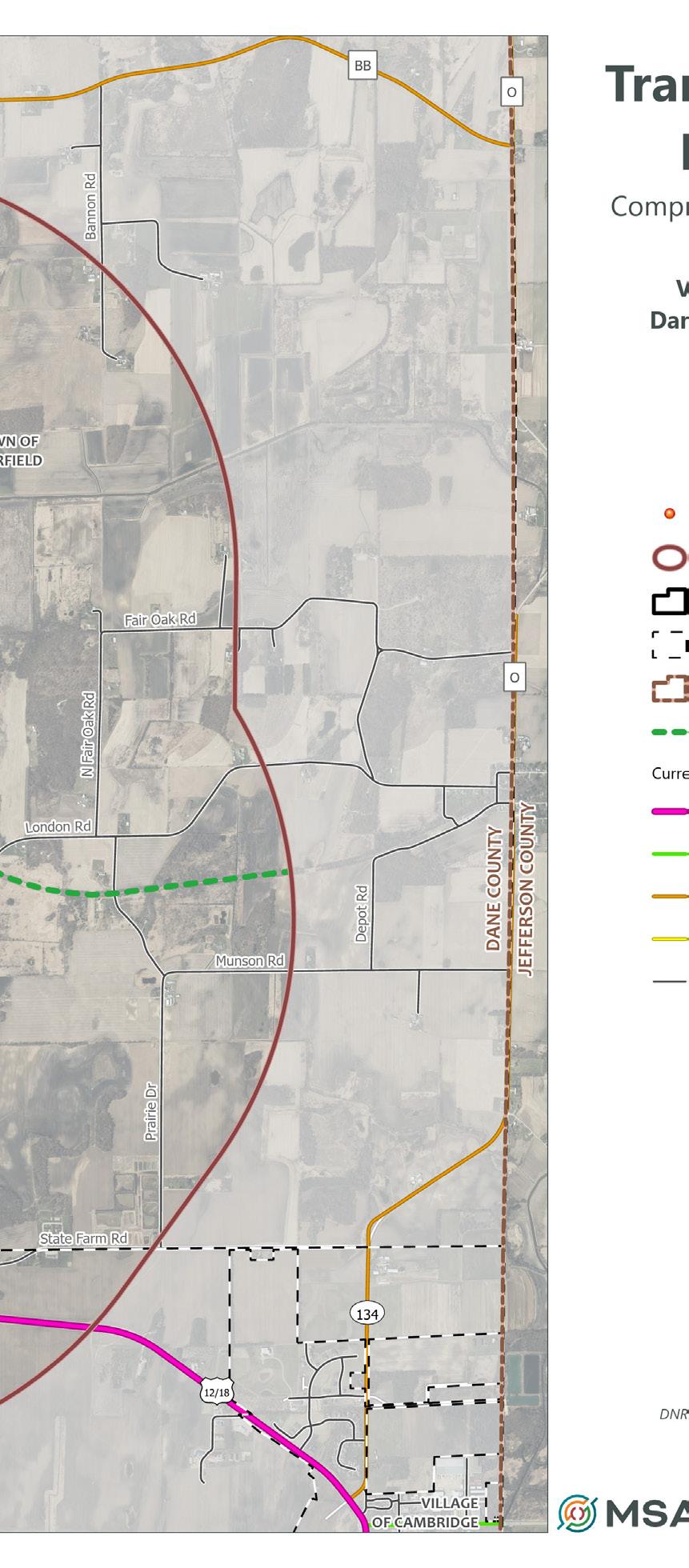
Regional Highway System: Major highways located in Deerfield include State Highway 73 that runs directly through the Village on its Main Street. US Highway 94 and US Highway 12/18 sandwich the Village from the north and south, respectively. County Highway BB runs north of the planning area and County Highway W runs just west of the Village.
Local Roads System: Local roads are owned and maintained by the Village of Deerfield. Many local roads have curb and gutter. Main Street was recently resurfaced and there is ongoing work on reconstruction of other local roads in the community. Liberty Street is also a major thoroughfare.
Many of the local roads have sidewalks that link neighborhoods in the Village and create connections to the downtown Main Street area. Some streets have sidewalks on one side of the street and others on both sides. There are several neighborhoods with no sidewalks. All new roads or streets require sidewalks on both sides by Village ordinance.
The Glacial Drumlin Trail runs east and west through the Village intersecting with Main Street. The Glacial Drumlin Trail stretches 52 miles, providing connection to adjacent communities such as Cottage Grove and Cambridge and communities as far as Waukesha.
Jefferson County Bicycle and Pedestrian Plan Update (2010) plans to connect the multi-county Glacial River Trail to the Glacial Drumlin State Trail.
Bicycle Transportation Plan for Madison Metropolitan Area and Dane County (2015) shows a future shared-use path loop connecting through the Village of Deerfield, Village of Cambridge south to Village of Rockdale to City of Edgerton and then back west to City of Stoughton.
Capital City Trail Extension is planned for the last remaining segment in Cottage Grove that will connect the trail to the Glacial Drumlin State Trail. A Transportation Alternative Program (TAP) grant was applied for by the City of Madison in spring 2023. Once connected, Deerfield will be joined with the 100+ mile Capital City Trail.
The Land Use chapter of the comprehensive plan outlines the Village of Deerfield vision for sustainable development and community well-being through effective land use planning. It aims to strike a balance between residential, commercial, industrial, and recreational land uses while preserving open spaces and protecting environmentally sensitive areas.
The Village is seeking healthy, balanced neighborhoods that feature a mix of housing types and price points.
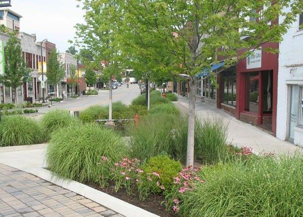
Streetscaping elements such as brick or colored concrete crosswalks, bump-outs, landscaping, lighting, outdoor patios, and angled parking can calm traffic and make the downtown core a more inviting place to visit.
Promote balanced neighborhoods throughout the Village.
#1- Provide a mix of housing types to accommodate every stage of life (see also Housing goals and strategies).
#2- Use the Village review processes to encourage design for land use compatibility.
#3- Develop and implement landscaping and building design standards that encourage efficient and sustainable development patterns incorporating interconnected street patterns and limited use of cul-de-sac streets.
#4- Encourage building and neighborhood design to enable passive solar heating and photovoltaic power generation.
#5- Explore funding opportunities for housing development utilizing public/ private partnerships, TIF funds, state and federal housing incentives.
Encourage development through effective collaboration and efficient development review.
#6- Promote successful development and property investment by fostering collaboration with property owners and developers, facilitating streamlined processes, and providing necessary support and resources to ensure sustainable and beneficial outcomes for both the community and developers.
#7- Continuously improve the development review process for new land uses to ensure compliance with design standards and safety for all modes of transportation. Streamline the process to enhance efficiency, effectiveness, and consistency in reviewing and approving new development proposals.
#8- Provide up-to-date online application and guidance materials for residents and developers.
#9- Conduct regular reviews and updates of the development review process, taking into account feedback from stakeholders, including developers, residents, and professionals involved in the planning and construction industry.
#10- Identify areas for improvement, such as simplifying application procedures, reducing processing timeframes, and enhancing clarity in design standards and traffic safety requirements.
#11- Complete full update of the zoning code and establish an interactive GIS database to track zoning districts and parcel information.
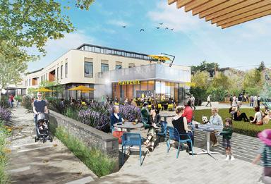
Create places that are vibrant, attractive, and unique, especially along the Village’s Main Street Corridor and Downtown.
Strategies
#12- Continue Village efforts toward strengthening and enhancing the downtown.
#13- Encourage the development of compact, carefully planned, mixed-use activity centers that include shopping, employment, housing, recreation, and community gathering opportunities.
#14- Encourage infill development of vacant or underutilized lands or buildings.
#15- Consider development of a community plaza in the area of the new Village Hall, Firemen’s Park, and downtown. Consider updates to Firemen’s Park.
#16- Develop a marketing plan to aid in the recruitment of downtown businesses and visitors. Create additional programming of community activities for all ages that attract residents to events year-round.
#17- Encourage and facilitate placemaking strategies to make neighborhoods and commercial areas unique, memorable, and attractive.
#18- Evaluate current zoning policies to ensure that traditional design concepts are promoted and observed with preservation of architecturally, historically, and culturally significant sites, buildings and structures in the Village.
#19- Identify potential funding sources to assist with planning and implementing downtown improvements such as Dane County Commercial Revitalization and Economic Development Revolving Loan Funds, TIF funds, Main Street Bounceback or Vibrant Spaces Grants (WEDC), and public/private partnerships.
Ensure new development is consistent with community character and vision and protects natural and cultural resources.
#20- Adopt policies to ensure development of a good network of pedestrian routes between new neighborhoods and the existing Village amenities.
#21- New development within the Village’s jurisdiction should support the efficient use of public services and infrastructure.
#22- Encourage development formats and building designs that support adaptive reuse as markets shift and demand changes.
#23- Protect and respect natural resources and systems in all development decisions. Create landscaping and stormwater management guidelines for future development that ensure responsible consideration of natural resources.
#24- Work cooperatively with the Town of Deerfield to adopt policies for future development at the fringe of the Village to protect future Village growth areas.
Downtown and Main Street needs identified include outdoor seating (54%), benches (41%), public plaza (33%), and trees/planters (32%).
30% of residents ranked reinvestment in downtown buildings, many of them historic, as their top priority for development in the Village. A prosperous downtown will bring prosperity to the whole community.


The future land use categories identify areas by their primary intended uses, character and densities (herein described as “Statement of Intent & Typical Uses”). These classifications are not zoning districts they do not establish binding performance criteria for land uses (i.e. setbacks, height restrictions, etc.) nor are they intended to list every possible use that may be permitted within the future land use class classification. Parcels on the Future Land Use Map are identified by their primary intended uses; however, some of the parcels on the map have yet to be platted or subdivided. The Village recognizes that detailed site planning to identify precisely how larger unplatted parent parcels (herein referred to as “unplatted new development areas”) may be subdivided, zoned, and developed is outside of the scope of this plan.
The Village may create neighborhood plans for these areas as part of future amendments to this Comprehensive Plan to further illustrate and guide development with-in these areas. The Village may also require that developers create neighborhood plans and parks for these areas prior to submitting requests for rezonings or preliminary plats.
The future land use classifications identify those existing Village of Deerfield Zoning Districts that are “consistent” within each future land use category (herein described as “Potentially Acceptable Zoning Districts”). The list of potentially acceptable zoning districts will be used by the Village to confirm whether requests for rezoning of property are generally consistent with this plan.
Land use and design policies in this plan should be considered during all development processes, especially in land division and rezoning or zoning ordinance amendment processes when consistency with the plan is a statutory requirement. Where development is proposed under existing zoning regulations, including
any Planned Unit Development districts, the regulations of existing zoning supersede policies in this plan.
The Best Practice Design Strategies listed within each category are provided to help developers and Village officials make design decisions during the development process consistent with the intent of the future land use category and the general desire for high quality site and building design. These strategies may be used to help determine whether to approve rezoning, conditional use permit, site plan, or planned unit developments. The illustrations and photos are not an exhaustive list of best planning practice and do not constitute the whole means by which high quality site and building design can occur.
The identification of future land use categories and potentially acceptable zoning districts does not compel the Village to approve development or rezoning petitions consistent with the future land use category or map. Other factors will have to be considered, such as the quality of the proposed development, its potential effect on adjacent properties, its potential effect on Village transportation infrastructure, Village resources and ability to provide services to the site, and the phasing of development, before any development applications are approved. In addition, it is not anticipated that all areas suggested for future (re)development on the Future Land Use Map will develop or be rezoned for development immediately following adoption of this Comprehensive Plan. In some cases it may be years or decades before (re)development envisioned in the plan occurs due to market conditions, property owner intentions, and Village capability to serve new (re)development.
• Maintain adequate physical separation between residential areas and uses that tend to produce excessive noise or odors, without sacrificing active mobility connections.
• Locate community facilities such as schools, churches, libraries, parks, etc. in strategic locations that enhance and are safely accessible from the surrounding neighborhoods.
• Direct traffic from higher-volume uses to collector and arterial streets, away from neighborhood streets.
• Use landscaping-based screening to create separation when distance alone is not possible or sufficient between land uses.
• Design the site so that major activity areas such as building entrances, service and loading areas, and parking lots are oriented away from less intensive land uses (to the greatest extent possible).
• Reduce the impact of parking areas with physical separation, physical barriers, and landscaping elements.
• Encourage building and site design techniques to make larger buildings more compatible with smaller residential uses—such as increased setbacks, stepped-back upper stories, and architectural strategies to break up the apparent volume of the building (in accordance with the local design character).
• Require building design and materials standards for all multi-family uses and nonresidential uses in neighborhood settings.
• Encourage underground parking facilities when feasible to prioritize nearby land for future development.
• Outdoor lighting of parking, storage, and service areas should be designed to minimize spillover of light onto adjacent properties and public rights-of-way.
It may from time to time be appropriate to consider amendments to the Future Land Use Map, usually in response to a type of development not originally envisioned for an area when this plan was adopted. See Implementation section for a description of the procedural steps for amending any aspect of this plan. The following criteria should be considered before amending the map.
The proposed amendment/development will not have a substantial adverse effect upon adjacent property or the character of the area, with a particular emphasis on existing residential neighborhoods. A petitioner may indicate approaches that will minimize incompatibilities between uses.
The land does not include natural features such as wetlands, floodplains, steep slopes, scenic vistas or mature woodlands (1 or more acres, especially those consisting of heritage trees), which will be adversely affected by the proposed amendment/development. Any proposed building envelopes are not located within the setback of Shoreland-Wetland and Floodplain zones (or is raised above regional flood line). The proposed development will not result in undue water, air, light, noise pollution or soil erosion. Petitioners may indicate those approaches they intend to use to preserve or enhance the most important and sensitive natural features of the proposed site and mitigate impacts to surrounding properties.
The lay of the land will allow for construction of appropriate roads and/or driveways that are suitable for travel or access by emergency vehicles. The proposed amendment/ development will not create a significant detriment to the condition of adjacent transportation facilities or cause significant safety concerns for motorists, bicyclists, or pedestrians. Petitioners may indicate those approaches they intend to use to mitigate transportation compatibility concerns.
Provision of public facilities and services will not place an unreasonable financial burden on the Village. Petitioners may demonstrate to the Village that the current level of services in the Village, or region, including but not limited to school capacity, emergency services capacity (police, fire, EMS), parks and recreation, library services, and water and/or sewer services, are adequate to serve the proposed use. Petitioners may also demonstrate how they will assist the Village with any shortcomings in public services or facilities.
There is a clear public need for the proposed change or unanticipated circumstances have resulted in a need for the change. The proposed development is likely to have a positive social and fiscal impact on the Village. The Village may require that the property owner, or their agent, fund the preparation of a fiscal impact analysis by an independent professional.
The proposed amendment/development is consistent with the general vision for the Village, and the other goals, policies and actions of this plan.
This section includes a description of each of the Future Land Use Plan categories. These categories include recommended land uses (e.g. residential, commercial, industrial), and land use densities (i.e. dwelling units per net acre). All zoning decisions, land divisions, utility extensions, capital improvement projects, and related land development activities and decisions should be consistent with the recommendations of the Future Land Use Plan.
• Neighborhood Residential (NR)
• High-Intensity Residential Overlay (HIR)
• Neighborhood Mixed-Use (NMU)
• Downtown Mixed-Use (DMU)
• General Commercial (GC)
• Civic/Institutional (CI)
• Business Park (BP)
• Industrial (I)
• Parks & Open Space (POS)
• Rural Lands (RL)
Potentially Acceptable Zoning Districts: Residential Districts (R-1 through R-4), Planned Unit Development (PUD), and Planned Unit Development Residential (PUD-1)
NR areas provide a mix of housing types, civic uses (e.g., place of worship, social service clubs, etc.), existing neighborhood commercial, and daycare facilities.
Most of the area designated as NR is or will be used for single family homes, but a variety of other housing types are appropriate within this designation, including duplex, townhome, and small multi-unit apartments/condos. Mixed use areas often serve as a buffer between residential neighborhoods and higher intensity commercial, industrial, or transportation areas.
The purpose of the NR designation is to achieve balanced neighborhoods while also ensuring compatibility between differing housing types and forms.
The following policies include design guidelines to ensure compatibility:
1. Housing will be one to two-and-a-half stories in height with residential densities in most places of 3-10 units per net acre (excluding streets, parks, outlots, etc.).
2. In new neighborhoods, the creation of a detailed neighborhood plan and/or Planned Unit Development Zoning is strongly encouraged to identify specific locations for various housing types and densities.
3. When integrating housing forms other than single-family detached, whether in new or existing neighborhoods, the following policies should inform neighborhood design and/or infill redevelopment design and approval. If more detailed neighborhood plans are prepared and adopted for specific neighborhoods (either new or existing), additional site-specific designations in those plans may supersede these policies.
4. Although each of these uses have distinct qualities, they are grouped together because they function in a comparable manner and seamlessly blend to create cohesive residential areas. Future development in single-family residential areas should promote gentle density that focuses on increasing the number and variety of homes in existing neighborhoods, and infill development that ensures the changes are sensitive to and reflective of the existing neighborhood character through district standards.
e. Accessory dwelling units should be permitted in any singlefamily attached or detached housing district of the following conditions are met:
i. Maintains or improves the architectural features of the surrounding neighborhood.
ii. Is able to conform to the base zoning district standards (i.e. height, lot coverage, setbacks, and offsets).
c. Duplex units are appropriate for a neighborhood under the following conditions:
i. On any corner lot, if each unit faces and is addressed to a separate street and meets the standard setback requirements and pattern typical along the street.
ii. In the middle of a block between single family detached homes, if substantially similar to other homes along the street in massing, architectural character, total garage doors, garage door spacing, and driveway width.
iii. As a transitional use when facing or next to a more intensive institutional, residential or commercial use. In this case there should be some general consistency of form and style with other homes in the neighborhood, but also more flexibility in design as compared to sites surrounded by single family homes.
iv. Does not create a need for upgrades to village infrastructure outside of normal replacement or upgrade cycles.
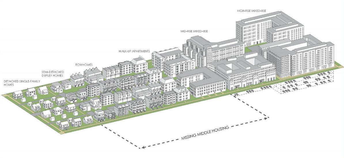
v. Is able to conform to the base zoning district standards (i.e. height, lot coverage, setbacks, and offsets).
vi. A deed restriction with owner occupation enforced by the Village would be viewed more favorably than those that are not.
c. Townhomes or rowhouses with up to 4 contiguous units are appropriate in any neighborhood, as follows:
i. When facing or adjacent to a commercial use, large institutional use, or residential use of equal or greater intensity.
ii. When facing a public park or permanent green space.
d. Small multi-unit buildings with up to 4 units per building or Cottage Cluster may be appropriate in any neighborhood, evaluated on a case-by-case basis, if ALL the following apply:
i. As a transitional use, if any of the facing or adjacent uses are commercial, large institutional, or residential of equal or greater intensity.
ii. Where facing or adjacent to single-family homes along the same street, the setbacks will be no less than the minimum allowed in the facing or adjacent single-family zoning district and the buildings will employ architectural techniques to reduce the apparent size of the building.
iii. There must be off-street parking consistent with Village ordinance and on-street parking adjacent to the lot to accommodate visitors.
iv. If approved either through the Planned Unit Development (PUD) zoning process or Conditional Use Permit (CUP) process.
e. Larger multi-unit buildings exceeding 4 units or 10 units per net acre have a place in balanced neighborhoods. These more intensive forms are generally most appropriate close to major streets, mixed-use areas, or commercial areas to provide convenient, walkable access to shopping, restaurants, and other amenities. This plan identifies specific sites for such housing. Properties that are either already intensely developed, or are suitable for more intensive development, have been identified as High-Intensity Residential (HIR) Overlay on the Future Land Use Map, and additional policies apply.
Potentially Acceptable Zoning Districts: Multi-Family Residential District (R-4), Planned Unit Development (PUD), and Planned Unit Development Residential (PUD-1)
HIR Overlay identifies properties or areas in the Neighborhood Residential future land use areas that are suitable for higher-intensity residential development. The objective is to provide a mix of housing types to provide for balanced neighborhoods, while mitigating negative impacts to existing or planned low-intensity residential areas.
For the purposes of this overlay, low-intensity residential includes singlefamily and duplex. In general, higher-intensity residential use consists of townhomes, cottage clusters, and small multi-unit buildings. It is closer to major streets, mixed-use areas, or commercial/employment areas to provide convenient, walkable access to shopping, restaurants, and other amenities.
1. This classification is intended to function as an overlay district with Neighborhood Residential (NR) as the underlying future land use classification.
2. HIR development in the NR areas are expected to range 10-40 units per net acres (excluding streets, parks, outlots, etc.).
Intensive residential development will require special attention to the design where the use adjoins less intense residential development per the recommended Compatibility Standards outlined, or as required in the Village’s zoning ordinance (should the ordinance be amended to include standards). Standards identified in the zoning ordinance shall supersede the Compantibilty Standards noted here.
A. Applicability.These residential compatibility standards shall apply to all new multi-unit residential and/or mixed-use development of three-stories or larger and/or any development requiring a Planned Unit Development (PUD) zoning approval located on land abutting or across a street or alley from low-intensity residential. These standards do not apply to development governed by an existing General Development Plan (GDP), but they may be considered if a GDP is amended, especially as they pertain to aspects of the development that are proposed for revision in the amendment.
B. Compatibility Standards. All development subject to this section shall comply with the following standards:
1. Use Intensity. In developments with multiple buildings/uses with varying intensities, the development shall locate buildings/ uses with the least intense character (e.g., lower heights, fewer units, parks) nearest to the abutting low-intensity residential development.
2. Building Height. The height of the proposed structure(s) shall not exceed thirty-five (35) feet in height adjacent to a low-intensity lot for a distance of:
a. Fifty (50) feet of a single-family or duplex lot.
b. Twenty-Five (25) feet of any other low-intensify residential lot (i.e., structures with 3+ units).
3. Bulk and Mass. Primary facades abutting or across a street or alley from low-intensity residential development shall be in scale with that housing by employing the following strategies:
a. Varying the building plane setback, a minimum of two (2) feet at an interval equal or less than the average lot width of the applicable low-intensity residential uses. For example, if a block of single-family lots is across the street from the development with an average lot width of 50 feet, the applicable facade shall vary its building plane, at a minimum, every 50 feet.
b. Providing a gable, dormer, or other change in roof plane at an interval equal or less than the average lot width of the applicable low-intensity residential uses. For example, if a block of single-family lots is across the street from the development with an average lot width of 50 feet, the applicable roofline shall vary, at a minimum, every 50 feet (measured at the roof eave).
4. Architectural Features. At least two (2) of the following categories of architectural features shall be incorporated into street-facing facades:
a. Porches or porticoes
b. Balconies
c. Dormers
d. Gables
e. Bay Windows
f. Door and Window Ornamentation which may include surrounds, pediments, lintels and sills, hoods, and/or shutters.
5. Garages. Attached garages shall not face or open towards the street. If this is not attainable, garages shall be sufficiently screened and face the street with the highest intensity of adjacent uses (if on a corner lot).
6. Parking. Parking areas that are visible from the street and located in the building front lot setback shall provide buffering at a minimum height of thirty-six (36) inches above the parking surface. Buffering can consist of landscaping, berms, fences/walls, or a combination of these.
7. Refuse Areas. Dumpsters shall be placed behind the building with opaque or semi-opaque screening (at a minimum, a chain link with fabric screening). If the refuse area cannot be placed behind the building, a wood fence or wall, at least six (6) feet in height, shall be required. Additional landscaping around trash enclosures is encouraged.
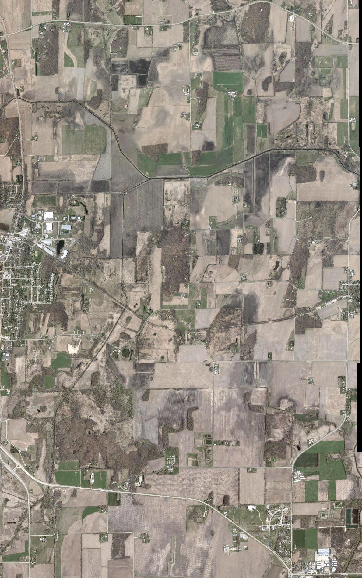
• Mix of housing types, civic uses, existing neighborhood commercial, and daycare facilities
• Mostly SF home - duplex, town home, and small multiunit apartments/condos also acceptable
• In new developments, a neighborhood plan/PUD is strongly encouraged
• Recommended Density : 3-10 units per net acre with 1-2.5 stories in height
• Identifies locations within NR that are suitable for higherintensity development
• Higher-intensity residential use consists of townhomes, cottage clusters, and multiunit buildings
• Recommended Density : 1040 units per net acre, height should not exceed 35 feet
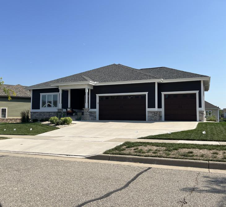
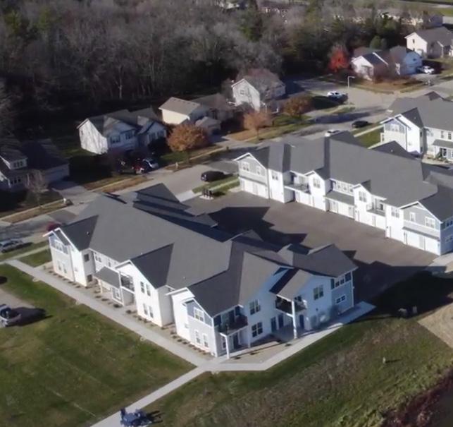
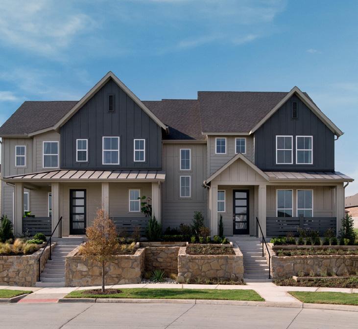
Potentially Acceptable Zoning Districts: Residential Districts (R-1 through R-4), Planned Unit Development (PUD), Planned Unit Development Residential (PUD-1), Community Business (C-1), Central Business (C-3), and Conservancy (Co)
NMU areas are intended to provide a unique mix of neighborhood commercial, medium- to higher-density residential, institutional and park uses. Areas identified as NMU often serve as a buffer between residential neighborhoods and higher intensity commercial, industrial, or transportation areas. Residential is also a component of the NMU district - both in mixed use developments and as stand-alone multiunit residential developments. These parcels usually are located along or adjacent to a local arterial or collector street. The purpose of the NMU category is to provide flexibility in determining the most appropriate mix of complementary land uses near single-family neighborhoods.
1. As part of the zoning approval process, the appropriate mix of land uses, densities, and intensities will be determined with consideration of market conditions and compatibility with adjacent neighborhoods. Typically, residential densities in NMU areas will be 12-40 units per net acre (excluding streets, parks, outlots, etc.).
2. While both residential and nonresidential uses are accommodated within this mixed-use district, not every building in a mixed-use district needs to include both residential and non-residential uses. Non-residential development within NMU areas should be service and retail to support surrounding residential use.
3. A building footprint should not be more than 15,000 square feet, except buildings providing a community use (e.g., library). When larger commercial uses are present, the building should still be designed with extra care to ensure compatibility with the surrounding neighborhood. Commercial spaces should be constructed in a range of sizes to add variety and encourage a mix of different commercial uses.
4. Uses requiring heavy semi-truck deliveries or those that would generate significant traffic, odor, or noise nuisances for surrounding properties, particularly during early mornings, evenings or weekends, should be prohibited.
5. New buildings in NMU areas are expected to be one to four stories in height with a preference towards multi-story buildings.
6. Gas stations are discouraged in NMU areas. If proposed, the development shall be designed in a manner that does not impede or substantially detract from the existing or planned development in the surrounding area (e.g., placing gas canopy behind the building, substantially screening parking and paved areas, etc.).
7. Buildings in NMU areas should be oriented towards streets with minimal setback from the public sidewalks.
8. Private off-street parking should be located primarily behind buildings, underground, or shielded from public streets by liner buildings or substantially landscaped.
9. Outdoor storage of raw materials should be prohibited, and outdoor display of retail merchandise should be minimized.
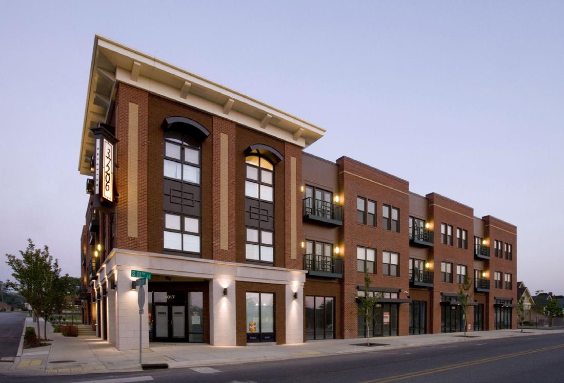
Potentially Acceptable Zoning Districts: Multi-Family Residential District (M-4), Community Business District (C-1), Central Business District (C-3), and Planned Unit Development (PUD)
The DMU category represents the entirety of Downtown Deerfield, and accommodates a wide variety of employment, service, retail, government, entertainment and residential uses mostly in multi-story buildings. The general intent of the DMU area is to preserve the architectural character of the historic commercial district, while providing opportunities for increased activity and density. The core blocks fronting on Main Street should continue to maintain buildings with their front facades built to the edge of the public sidewalk.
1. As part of the zoning approval process, the appropriate mix of land uses, densities, and intensities will be determined with consideration of market conditions and compatibility with adjacent neighborhoods.
2. Typically residential densities in DMU areas will be 20-40 units per net acre (excluding streets, parks, outlots, etc.), and building heights ranging from two to eight stories tall.
3. DMU is best suited for mixed use developments with first-floor retail, service and office users, and destination businesses (e.g., restaurants, bars and entertainment venues). Office users may locate on the street level; however, upper-level office use is preferred on the Main Street.
4. Continue to require the architecture of any new development in the downtown to be compatible in terms of architectural character and materials within the corresponding block face.
5. New drive-thru and gas station establishments may be allowed in such areas if designed to mitigate the typical auto-centric design, including placing the building close to the street with a public entrance from the public sidewalk and placing the majority of the parking and drive-thru lane facility along the back or side of the building.
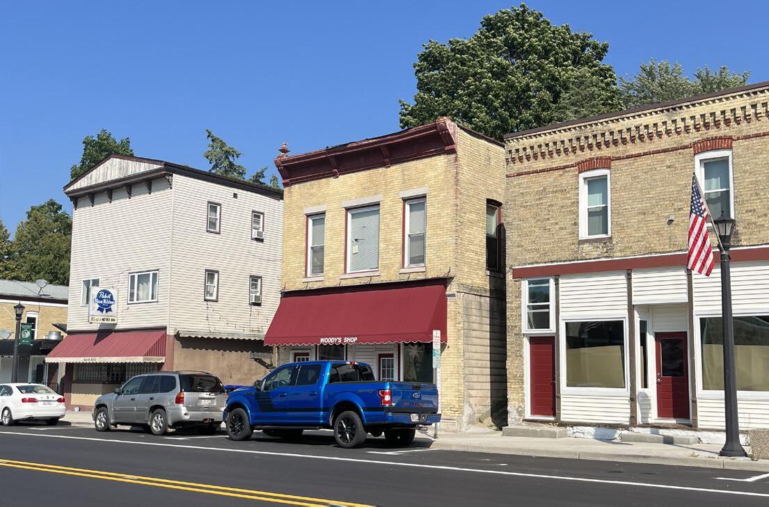
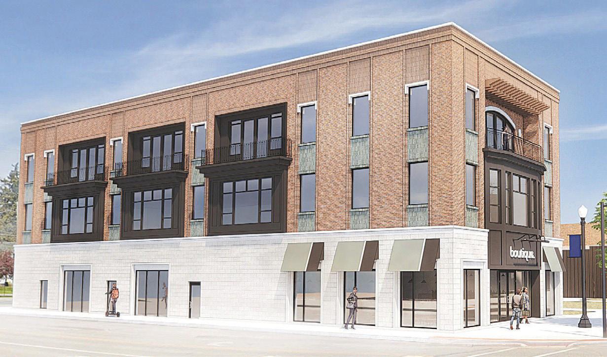
Potentially Acceptable Zoning Districts: Central Business District (C3), Highway Business District (C-2) and Planned Unit Development (PUD)
GC areas provide the Village’s population with a wide range of retail goods and services, including professional offices and daycare facilities. GC areas include highway-oriented uses and “heavy” commercial uses with the appearance or operational characteristics not generally compatible with residential or small-scale commercial activities. The type and size of use will be determined by location and business characteristics (e.g. size, hours of operation, traffic impacts, etc.).
1. GC areas are not generally recommended for residential uses, though such uses may be considered as part of a conditional use under relevant zoning districts.
2. While GC areas tend to be auto-oriented, changes to commercial development that improve walking, biking, and transit access are encouraged.
3. Outdoor storage of raw materials is discouraged particularly if materials are not screened by a solid wall fence or landscaping.
4. There is no limit on the size of establishments that may be constructed within a GC area, but all uses should be compatible with the density and scale of the surrounding development.
a. For example, areas along an arterial roadway or near a highway intersection are generally better suited for larger retail uses. Those areas located along local streets or adjacent to residential neighborhoods are better suited for smaller commercial uses that serve neighborhood needs. Such uses typically require smaller building footprints and parking lots and are less likely to have intensive truck and delivery needs.
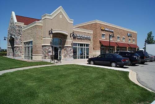
Potentially Acceptable Zoning Districts: Central Business District (C-3), Community Business District (C-1), Permitted or Conditional use in most of the Village’s residential and commercial zoning districts.
CI areas include schools, community centers, cemeteries, government facilities, railroads, utilities and other parcels that are owned by a public, quasi-public, utility, or religious entity. Park and recreational uses are sometimes a primary or secondary use on these sites.
1. Larger uses should be located on or near an arterial or collector street and be designed so that high volumes of traffic will not be drawn through local neighborhood streets.
2. Streets, walkways, and multi-use paths and trails should provide strong pedestrian and bicycle linkages adjacent to and within larger public & institutional areas.
3. If a parcel planned for Institutional use is vacated by that use and another use is proposed, the Village may approve an alternative use without amending this plan if the proposed use is similar to and compatible with adjacent uses.
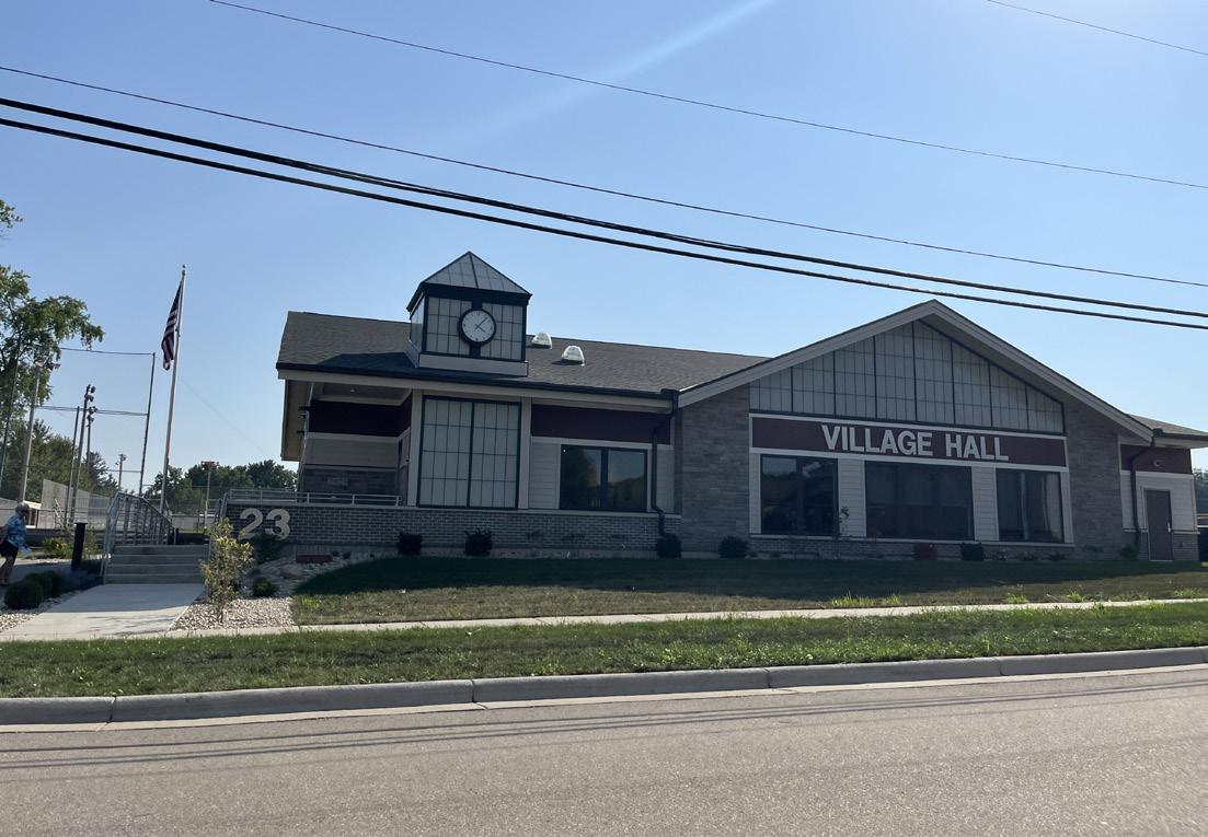
Potentially Acceptable Zoning Districts: Highway Business District (B-H), Industrial District (I) and Planned Unit Development District (PUD)
BP areas provide the Village’s population with a wide range of employment opportunities, including heavy commercial and light industrial uses. These include corporate offices, business offices, research facilities, laboratories, medical clinics/hospitals, light manufacturing, wholesale, storage, distribution, transportation, and repair/maintenance uses. Though not considered detrimental to the surrounding area or to the community as a whole, they are high-traffic areas that are not generally compatible with residential or small-scale commercial activities.
1. BP areas are not generally recommended for residential uses, though such uses may be considered as part of a conditional use under relevant zoning districts.
2. BP areas are high-traffic, including freight vehicles, but generally lack the nuisance odors, sounds, etc. that are typical of heavy industrial land uses. As such, they can often be buffered from lessintense uses through large yards and landscaping.
3. Entrance, parking, loading, and storage areas should be screened from public streets and directed away from residential and other less-intense land uses.
4. There is no limit on the size of establishments that may be constructed within a BP area, but all uses should be compatible with the density and scale of the surrounding development.
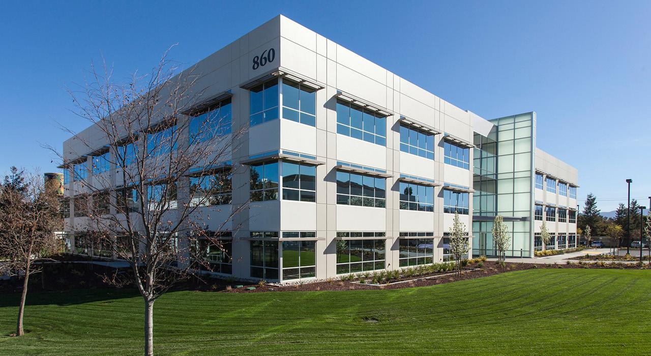
Potentially Acceptable Zoning Districts: Highway Business District (B-H), Industrial District (I) and Planned Unit Development District (PUD)
I areas accommodate manufacturing, wholesale, storage, distribution, transportation, and repair/ maintenance uses. The designation may also be used for landfills and gravel or mineral extraction activities. Industrial areas can include “nuisance” uses that should not be located in proximity to residential, mixed-use, or some other types of nonresidential uses due to noise, odor, appearance, traffic, or other impacts. The Industrial designation is not intended for retail or office uses not related to an industrial use, except for limited retail goods and services provided primarily to employees and users of businesses within the area. Compared to the BP designation, I areas generally have a relatively smaller workforce (for a given area), an emphasis on truck or rail traffic, and other characteristics such as outdoor work areas and outdoor equipment and materials storage.).
1. Areas may provide a variety of flexible sites for small, local, or startup businesses and sites for large regional or national businesses.
2. Architectural, site design, and landscaping features within I areas may be less extensive than in BP areas, though properties should be well-buffered and screened from adjacent land uses that may not be compatible and parking/storage areas should be screened from public streets.
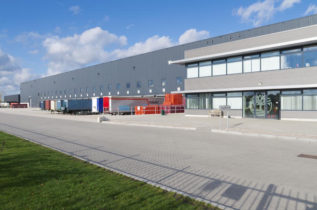
Potentially Acceptable Zoning Districts: Conservancy (C), Public District (P), Residential Districts (R-L through R-H); Village’s natural resource protection zoning standards apply to most of these areas. This category includes public parks, conservation areas, recreation areas, private recreation uses (e.g., golf courses), stormwater management facilities, greenways, major public trails, and other natural features and lands with a park-like character that are recommended for preservation.
1. These uses allowed uses in all other land use categories, regardless of whether the area is mapped as POS. As the Future Land Use Map is general in nature, smaller parks may be shown as an adjoining land use.
2. Parks often serve as important community gathering places and should be designed to have frontages on public streets that make them both visible and accessible by local residents.
3. Greenways and stormwater conveyances provide opportunities to link otherwise separate open spaces with both habitat corridors and bicycle and pedestrian connection.
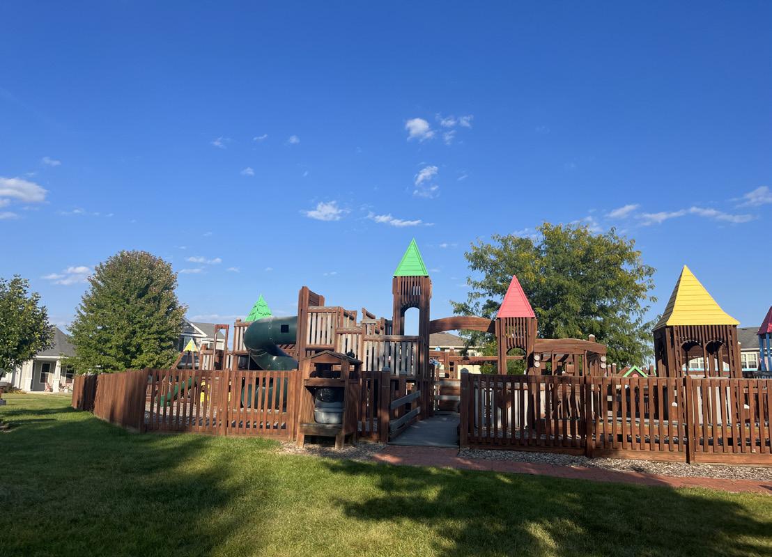
RL areas are within the Village's 1.5-mile extraterritorial area that likely will not develop in the present 20-year planning period. Typical uses in these areas include open space, farming, farmsteads, agricultural businesses, forestry, quarries, and limited rural residential on well and septic systems. Premature exurban development and premature utility extensions should not be promoted in these areas. Even if urban development eventually reaches these areas, some of the land in this designation may be appropriate for consideration as permanent agricultural-related uses.
1. Recommended land uses in the rural area land use district are longterm agriculture and related agri-business uses and existing nonfarm residential uses with private, on-site septic systems.
2. The development of residential subdivisions is prohibited in areas designated as RL. Proposals for residential subdivisions shall require an amendment to the Future Land Use Map.
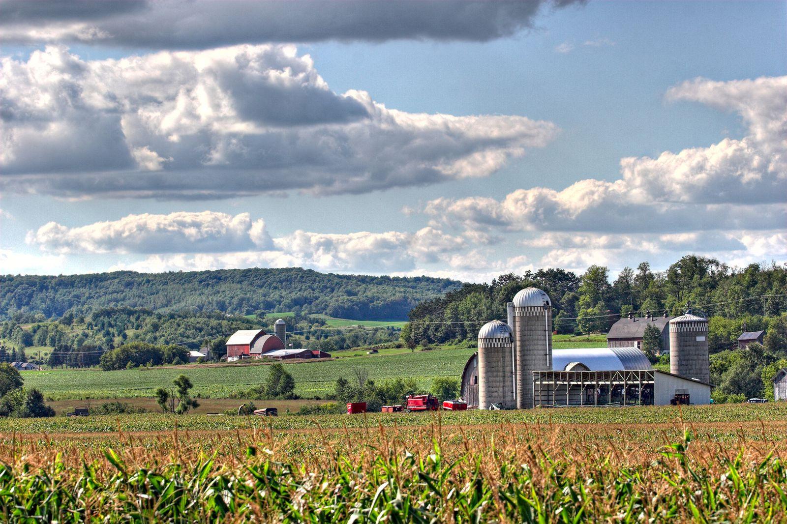
Land use outlines the vision for the strategic development and management of land within the community. It provides a framework to guide future land use decisions that support a thriving and sustainable village.
508 - The increase in population projected between 2020 and 2040, which equates to a 20.3% increase over that time.
48% - The percentage of Village land area not in development, including vacant/undeveloped, agricultural, and woodlands, reflecting the availability of future development opportunities with continued preservation of natural resources.
24% - The percentage of land area developed as Single Family Residential in the Village of Deerfield. This is the largest developed use type in the Village.
71.4 - The number acres of land within the Village projected to be needed for development by 2040. EXISTING LAND USE MAP - VILLAGE LIMITS (see Appendix D)
What is the methodology in establishing the land use projections?
Residential land use projections were calculated by projecting forward the current acreages and average densities for residential uses.
Projections for commercial and industrial acreage assume that these land uses will grow at a similar rate and keep pace with land for residential use.
Actual needs and development outcomes may differ based on market conditions and local policy decisions.
PROJECTED LAND DEMAND
*These projections use current land use percentages and projected new housing demand to estimate land needed for other uses.
1. Single-family residential is the largest land use category in terms of the number of acres.
2. There do not appear to be significant conflicts between land uses.
3. Based on projections of modest growth in population by 2040, there are just 71 additional acres of developable residential, commercial and industrial land projected to be needed during the life of this plan. This plan identifies much more acreage than that which could be developed, but significant increases in the projected population should trigger an update to this Comprehensive Plan.
The acreage of the areas shown as future residential, commercial, and industrial on the Future Land Use Map may differ from the projected acreage. Where and how much development will actually occur will depend on the market for the land uses and the developers and property owners that choose to respond to the market demand. This plan includes additional acreage for the three major land uses in the event of better-than-anticipated growth.
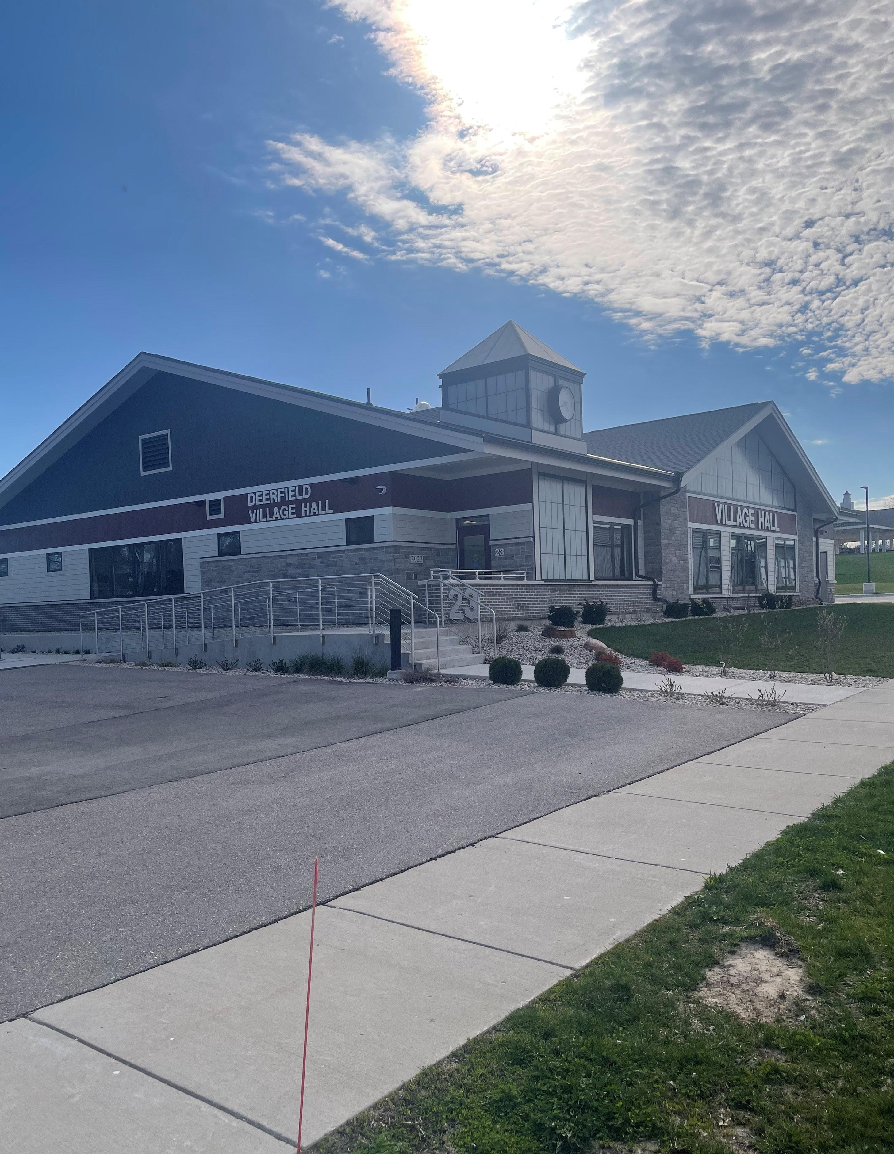
The Implementation chapter identifies strategies for putting this plan into action. Responsibility for implementing this plan lies primarily with Village Board, several Village committees and commissions—including the Plan Commission, and Village Staff.
Key Village staff have a significant influence on capital projects, operational initiatives, and regulatory decisions. It is imperative that individuals in key roles know about, support, and actively work to implement the various policies and actions in this plan. Specifically, the following people should consult and reference the Comprehensive Plan during goal-setting and budgeting processes, during planning for major public projects, and in the review of private development projects:
• Village Administrator/Clerk/Treasurer
• Public Works Staff
Village Board sets priorities, controls budgets and tax rates, and typically has the final say on key aspects of public and private development projects. Each board member should know where to find this plan and should be familiar with the major goals described herein. Board members should expect and require that staff recommendations and actions both reference and remain consistent with this plan.
Land use and development recommendations are a core component of this plan, and the Plan Commission has a major role in guiding those decisions. Plan Commission members must each have access to this plan and must be familiar with its content, especially Chapter 9: Land Use. It is the responsibility of Plan Commission to determine whether proposed projects are consistent with this plan, and to make decisions and recommendations that are consistent with this plan. In cases where actions that are inconsistent with this plan are believed to be in the best interest of the Village, the Plan Commission should seek public feedback before recommending amendments to the Plan.
All committees, boards and commissions that serve as an extension of the Village of Deerfield should treat this Plan as relevant to their activities in service to the Community, and should seek outcomes consistent with the goals and policies herein.
These key staff members should be familiar with and track the various goals, policies and actions laid out in this plan, and should reference that content as appropriate in communications with residents and elected and appointed officials. Other division heads should also be aware of the plan and the connections between the plan and Village projects. The purpose of this extra effort is to strengthen staff recommendations and reinforce the plan as a relevant tool integral to Village functions.
The Village Administrator, as lead administrative official of the Village, is responsible to ensure that other key staff members are actively working to implement this Comprehensive Plan.
Implementation of this plan also depends, to a great degree, on the actions and decisions of entities other than Village government. The Action Plan (see appendix B) references several parties that the Village of Deerfield does not control or direct.
It is necessary to persuade these entities to be active partners in the implementation of the goals, objectives, and strategies of this plan. The following Village activities can support this effort:
• Share this plan with each organization, including a memo highlighting sections of the plan that anticipate collaboration between the Village and the organization.
• Take the lead role in establishing collaboration with these organizations.
• Know and communicate the intent of relevant objectives and strategies - partner organizations need to understand and buy in to the rationale before they will act.
Many of the strategies identified in this plan presume the use of existing Village ordinances and programs. The Village's key implementation tools include:
• Annual Budget Process
• Capital Improvement Program
Regulatory Tools
• Building and Housing Codes (Title 15)
• Historic Preservation Ordinance (15.56)
• Official Map (15.08)
• Subdivision Ordinances (Title 16)
• Zoning Ordinance (Title 17)
• Site Plan Requirements (17.100.050)
Funding Tools
• Tax Incremental Financing (TIF) Districts
• State and Federal Grant Programs
To provide lasting value and influence, this plan must be used and referenced regularly, especially during budgeting processes. To inform these annual processes, the Village Administrator will prepare and present to Plan Commission and Village Board, in the third quarter of each year, a concise Comprehensive Plan Annual Report with the following information:
• Action items in progress or completed during the prior 12 months. Celebrate success!
• Staff recommendations for action items to pursue during the next 12 months.
The most important opportunity for this plan to influence the growth and improvement of the Village is through the annual budgeting and capital planning processes. These existing annual efforts determine what projects will and will not be pursued by the Village, and so it is very important to integrate this plan into those processes every year.
The compilation of actions in Appendix B is a resource to support decisions about how and where to invest the Village's limited resources. The Annual Report should draw from this Action Plan. Plan Commission should make formal recommendations for Board consideration, identifying those choices and commitments most likely to further the goals and objectives identified in this plan.