HIAWATHA TRAILS MASTER PLAN 2022

Adopted: July 2022
City of Hiawatha
Linn County, Iowa
Acknowledgments
Hiawatha City Council
Bill Bennett, Mayor
Aime Wichtendahl, City Council Member
Jerr y Mohwinkle, City Council Member
Rob Archibald, City Council Member
Dick Olson, City Council Member
Steve Dodson, City Council Member
Hiawatha Parks and Recreation Board
Charles Uthe, Board Member
Heather Gibson, Board Member
Michelle McIllece, Board Member
Dan Wilkes, Board Member
Chris Klostermann, Board Member
Hiawatha Steering Committee

Kelly Willadsen, Parks and Recreation Director
Rod Jasa, Public Works Superintendent
Jon Fitch, City Engineer
Pat Parsley, Buildings Official
Kim Downs, City Administrator
MSA Professional Services, Inc.

Shawn O’Shea, Project Manager
Shannon Gapp, Project Planner
Chris Janson, QA/QC
Maddie Adkins, Project Engineer
Table of Contents
Chapter 1: Introduction of Hiawatha’s Trails System
1-2 Project Introduction
1-3 The Planning Process
1-4 Regional Context
1-6 Existing Area Trail Plans
1-8 Park + Trail Inventory
Chapter 2: Community Input
2-2 Overview of the Process
2-4 Feedback Carryover from the Previous Park Plan
2-4 Crowdsource Map Comments
2-6 Trail Connection Survey Comments
Chapter 3: Vision, Master Plan & Cost Estimates
3-2 Vision of Hiawatha’s Trail System
3-3 Hiawatha Trail System Goals
3-4 Hiawatha Trails Master Plan
3-6 Cost Estimates & Funding Sources

Chapter 1
Hiawatha’s Trail System
•Project Introduction
•Regional Context
•Existing Plan Review
•Park + Trail Inventory
Project Introduction
Parks and trails provide a safe and healthy place for recreation all while beautifying and protecting the natural environment of the area. The connections linking the residents and visitors alike to outdoor spaces as well as other essential amenities is vital to quality of life in Hiawatha. This document provides insight on the connectivity of the trail and pedestrian network in the City of Hiawatha. The purpose of the plan is to guide the continual improvement of the City’s trail system and direct policy for parks and open space in general. It envisions a connected system of parks, and open spaces throughout the community. All together the plan provides a framework to guide long and short term decision making and investments in the system.
The Hiawatha Trails Master Plan 2022 complements the directions established in the Hiawatha Parks and Recreation Vision 2029 Plan, which found trail connections and improved accessibility as a high priority for residents. It provides detailed guidance on the development,

management and operation of the trail system. The direction is also based on the community’s expressed needs and desires from public engagement during the planning process.
Specifically, the plan provides:
• Information regarding the existing trail plans of surrounding communities that do or will link to Hiawatha

• An inventory of existing park, open space and recreational facilities
• An analysis of recreation trail needs and demands
• Implementation Strategies
• Recommendations for new or improved connections

This plan identifies existing and future trail connections in the City of Hiawatha. In nearly every case more detailed planning, engineering, budgeting, and discussions will be necessary before decisions are made to construct new or improve existing recreational trails.
The City is Growing
The population in Hiawatha continues to increase adding 159 residents from 2010 to 2020, with additional growth expected, especially in the northern part of the City. As the City continues to expand, the need to address any connections missing or needing improvement should be evaluated and addressed on an annual basis. This plan is intended to help with that annual review and goal setting process.
1-2
HIAWATHA PARKS AND RECREATION VISION 2029
Adopted:June19th,2019
City of Hiawatha Linn County, Iowa
The Planning Process
The Importance of Trails and Recreation

Trails and recreation are often the source of civic pride and are essential to the physical, economic, environmental and social health of a community and it’s citizens. Trails in particular can positively impact property values of the surrounding area and are vital to connecting residents as growth continues to happen in Hiawatha. Visitors often remember a place by its access, contributing to a positive community image. As a community continues to change and grow it is important to keep in mind the variety of benefits the trails and recreation add to the community.
Help us plan Hiawatha’s Future Trails!
The City of Hiawatha is currently working on a Trails Plan for the community’s continued success and we need your thoughts!
Please use the QR codes below or visit the City’s Website or Facebook Page to access our survey.


h�ps://bit.ly/3HPnq4g
Assessment Planning Process
Step 1
Project Kickoff & Existing Conditions
- Prior Planning Documents


- Existing Conditions Analysis


- Existing Systems Maps
Step 2
Community Engagement
- Online Trail Connection Survey
- Crowdsource Map Survey
Step 3
Trails Master Plan 2022 Document
h�ps://arcg.is/zbrLu0
- Draft Plan Development
- Finalize Parks and Trails Needs
- City Council Review and Consideration
Introduction | 1-3 Hiawatha Trails Master Plan 2022
Use a QR Scanner applica�on on your smartphone to go straight to the survey by scanning this image! Use a QR Scanner applica�on on your smartphone to go straight to the crowdsource map by scanning this image! Have you experienced an issue accessing the local and regional trail system or feel there is a missing connection? We are here to listen! Take this short survey. Please give your feedback on Hiawatha’s trail system or parks system by visiting this visual crowdsource map survey.
Regional Context
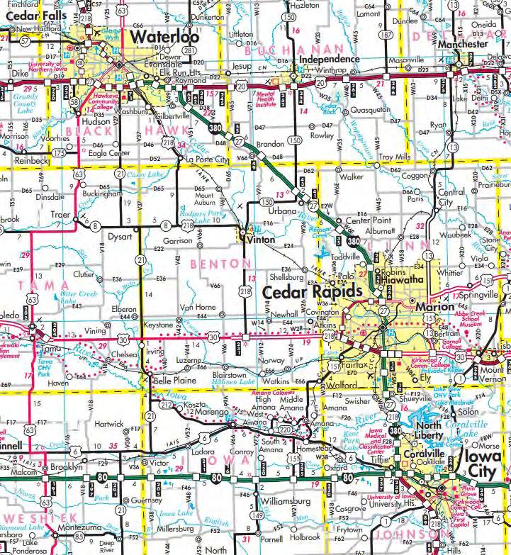
The City of Hiawatha (pop. 7,183) is located in Linn County. Approximately 70 miles southwest of Dubuque Iowa, and 132 miles northeast of the Capital, Des Moines, Iowa. The City is in close proximity to three other municipalities, City of Cedar Rapids, population of 132,228, the City of Marion, population of 39,400 and the City of Robins, population of 3,470. Hiawatha, along with its surrounding cities have experienced growth and are expected to continue that trend into the future. Cedar Rapids is the Linn County seat and a large economic driver of the area. The entire Cedar Rapids Metropolitan Statistical Area consists of three counties and has an estimated population of 270,293.
Creative Corridor
Iowa’s Creative Corridor, in Eastern Iowa, is anchored by the crossroads of Interstates 80 and 380, and includes the seven counties of Linn, Johnson, Benton, Jones, Iowa, Cedar and Washington.
The naming of the corridor was created to build sense of place, access, opportunity, and belonging among people who live in the corridor region, as well as enhance economic development through out the region.
1-4
Regional Trail
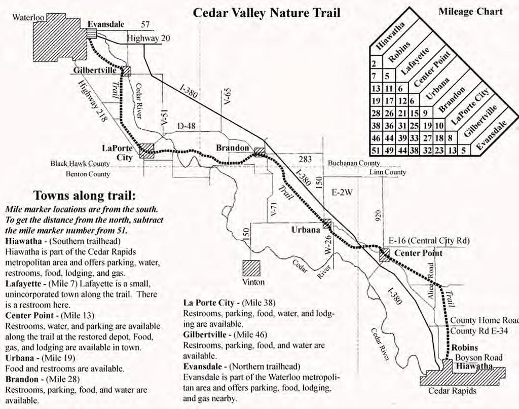
The Cedar Valley Nature Trail is one of the pioneer “linear parks” in Iowa. It was built on the abandoned Waterloo, Cedar Falls and Northern (WCF&N) railroad right-of-way in the early 1980s. Spanning four counties, the 52-mile trail meanders between Waterloo and Cedar Rapids.
The trail follows the Cedar River bottomlands, along forested banks and open vistas. The northern part of the trail is a designated Important Bird Area.
Regional Context | 1-5 Hiawatha Trails Master Plan 2022
Existing Area Trail Plans City of Cedar Rapids

The Cedar Rapids Comprehensive Trails Plan was completed January 2012. The key strategy of the plan was to create a network of trails accessible within 10 minutes of walking for every household in Cedar Rapids. The overarching goal of the trail network is to increase walking and biking to school, work, shopping, church and other community activities.
Edgewood Rd Trail (proposed 5.1 mile North Edgewood Rd Segment)
Tower Terrace Rd Trail (proposed 12.3 mile trail, with 2.5 miles in C.R., along existing and future Tower Terrace Rd.)

ProposedTrailHeadattheintersectionofEdgewoodandTowerTerrace
TrailsBoysonRd(proposedconnectionfrom3.9mileDryCreekTrail)
January 2012
1-6 Æ m k k k k k k k k k k k k k k k k k k k k k k k k k k k k k ! ! ! ! ! ! opportunities.
-
establish a policy of best management practices and consistent funding guidelines for the development of bicycle and multi-use facilities. or right-of-way easements along primary Connectivity network routes. projects into the current Cip.
Cedar rapids Comprehensive Trails plan
1 1 2 2 3 3 4 4
Proposed Cedar Rapids to Hiawatha Trail Connections:
City of Robins
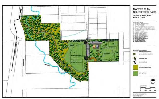
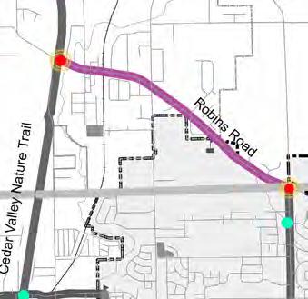
Cedar Valley Nature Trail is a connection to and from Hiawatha. The Cedar Valley Nature Trail can be accessed from several points in Robins. Four miles of the trail run through the City, north to south, County Home Road to Tower Terrace Road. Trail heads with parking can be accessed just off of Boyson Road as well as just off County Home Road. The trail in South Troy Park will be expanded and will connect to the Cedar Valley Nature Trail near Robins Road.
Linn County Conservation, along with other entities are actively working together to develop and connect trails within the region. These include the Corridor Metro Planning Organization (CMPO), various Linn County municipalities, and the Linn County Trails Association (LCTA). The map below is from the Linn County Trails Association. The proposed trails within this map are from the Cedar Rapids Comprehensive Trail Plan.

Proposed Hiawatha Trails:


Hiawatha Boyson Rd Trail
A 10 ft trail along the south side of Boyson Rd. connects to the Cedar Valley nature Trail and future Edgewood Trail. A 14 ft wide Cantilever bridge will cross I-380 1.3 miles long.

Edgewood Rd Trail
Along Edgewood and Miller Rds from Rodgers Rd to Tower Terrace Rd 5.2 miles long.
Existing Area Trail Plans | 1-7 Hiawatha Trails Master Plan 2022
90
C Avenue
roBins road seGmenT
Park + Trail Inventory
City of Hiawatha Parks and Service Areas
This map shows the existing parks in the City of Hiawatha. The darker blue rings represent areas within a 1/4 mile distance of the park and the lighter blue rings represent areas within a 1/2 mile distance of the park. The 1/4 mile ring represents a 5 minute walk and the 1/2 mile ring represents a 10 minute walk. A recommendation of this plan is to evaluate the areas that are outside of these service areas to determine what steps can be taken to better serve these areas.
1-8 Guthridge Park Fay M. Clark Memorial Park Turtle Creek Park Tucker Park 12th Ave Gazebo Dave Wright Family Dog Park Source: Esri, DigitalGlobe, GeoEye, Earthstar Geographics, CNES/Airbus DS, USDA, USGS, AeroGRID, IGN, and the GIS User Community Printed By: soshea, File: C:\Users\soshea\Desktop\GIS\Hiawatha Existing Trail Map 11x 17.mxd Print Date: 3/15/2022 Data Sources:CMPO, Linn County GIS CITY OF HIAWATHA LINN COUNTY, IOWA
Trails half mile park radius quarter mile park radius Hiawatha_Parks Hiawatha_Boundary MPO Master 2022
Hiawatha
Hiawatha Existing Trails Plan
!! Planned, Sharrow
!! Planned, Paved Shoulder
Hiawatha Trails Master Plan 2022
!! Planned, Paved Multi-use Trail
!! Planned, Sidepath
!! Planned, Unknown
Funded, Bike Lane
Funded, Bicycle Boulevard
Funded, Sharrow
Funded, Paved Multi-use Trail
The Hiawatha Trails Master Plan illustrates current and future trail plans across the community. There are four connection projects that were planned at the time of this plan. The projects on the following page are aimed at addressing some of the access issues that were discussed in other areas of this plan.
Hiawatha
Funded, Sidepath
Park + Trail Inventory | 1-9
! ! ! ! ! ! ! ! ! ! ! ! ! ! ! ! ! ! ! ! ! ! ! ! ! ! ! ! ! ! ! ! ! ! ! ! ! ! ! ! ! ! ! ! ! ! ! ! ! ! ! ! ! ! ! ! ! ! ! ! ! ! ! ! ! ! ! ! ! ! ! ! ! ! ! ! ! ! ! ! ! ! ! ! ! ! ! ! ! ! ! ! ! ! ! ! ! ! ! ! ! ! ! !! ! ! ! ! ! ! ! ! ! ! ! ! ! ! ! ! ! ! ! ! ! ! ! ! ! ! ! ! ! ! ! ! ! ! ! ! ! ! ! ! ! ! ! ! ! ! ! ! ! ! ! ! ! ! ! ! ! ! ! ! ! ! ! ! ! ! ! ! ! ! ! !! !! !! !! !! !! ! ! ! ! ! ! ! ! ! ! ! ! ! ! ! ! ! ! ! ! ! ! ! ! ! ! ! ! ! ! ! ! ! ! ! ! ! ! ! ! ! ! ! ! ! ! ! ! ! ! ! ! ! ! ! ! ! ! ! ! ! ! ! ! ! ! ! ! ! ! ! ! ! ! ! ! ! !
Robins
Open, Super Sharrow Open, Sharrow Open, Paved Shoulder Open, Marked Bike Open, Mountain Open, Unpaved Open, Paved Multi-use Open, Sidepath Open, Walking or ! ! ! ! ! ! ! ! ! ! ! ! ! ! ! ! ! ! ! ! ! ! ! ! ! ! ! ! ! ! ! ! ! ! ! ! ! ! ! ! ! ! ! ! ! ! ! ! ! ! ! ! ! ! ! ! ! ! ! ! ! ! ! ! ! ! ! ! ! ! ! ! ! ! ! ! ! ! ! ! ! ! ! ! ! ! ! ! ! ! ! ! ! ! ! ! ! ! ! ! ! ! ! ! ! ! ! ! ! ! ! ! !! ! ! ! ! ! ! ! ! ! ! ! ! ! ! ! ! ! ! ! ! ! ! ! ! ! ! ! ! ! ! ! ! ! ! ! ! ! ! ! ! ! ! ! ! ! ! ! ! ! ! ! ! ! ! ! ! ! ! ! ! ! !! !! !! !! !! !! ! ! ! ! ! ! ! ! ! ! ! ! ! ! ! ! ! ! ! ! ! ! ! ! ! ! ! ! ! ! ! ! ! ! ! ! ! ! ! ! ! ! ! ! ! ! ! ! ! ! ! ! ! ! ! ! ! ! ! ! ! ! ! ! ! ! ! ! ! ! ! ! ! ! ! ! ! ! ! ! ! ! ! ! ! ! ! ! ! ! ! ! ! ! ! ! ! ! ! ! ! ! ! ! ! ! Robins Hiawatha Marion Marion CMPO Trails Master STATUS, TYPE_FACIL !! Planned, Bike Lane !! Planned, Bicycle Boulevard !! Planned, Super Sharrow !! Planned, Sharrow !! Planned, Paved Shoulder !! Planned, Paved Multi-use Trail !! Planned, Sidepath !! Planned, Unknown Funded, Bike Lane Funded, Bicycle Boulevard Funded, Sharrow Funded, Paved Multi-use Trail Funded, Sidepath Open, Protected Bike Lane Open, Cycle Track Open, Buffered Bike Lane Open, Bike Lane Open, Bicycle Boulevard Open, Super Sharrow Open, Sharrow Open, Paved Shoulder Open, Marked Bike Route Open, Mountain Bike Trail Open, Unpaved Multi-use Trail Open, Paved Multi-use Trail Open, Sidepath Open, Walking or Jogging Trail
Parks + Recreation Inventory
Hiawatha Park Inventory
1-10
City Parks Guthridge Park 704EmmonsSt.19.5xxxxxxxxxxx Tucker Park 101BAvenue8.1xxxxxx Fay M. Clark Memorial Park 1200N18thAve31.5xxxxxx Turtle Creek Park Fitzroy Road 18 Total 77.5111 4 331 44 211 Additional Facilities not City Owned Saint Elizabeth Ann Seton Parish 1385LyndhurstDrive3xxx Church of Jesus Christ Latter Day Saints 4150BlueJayDriveNE3xx Hiawatha Elementary School 603EmmonsStreet5xxxx Nixon Elementary 200NixonDrive6.2xxxx Viola Gibson Elementary 6101GibsonDrive2.5xxx Total 19.8 Acres Basketball Court Tennis Court Ball Fields Open Field Rental Shelter Restroom Facilities Frisbee Golf Playground Equipment Trail Splash Pad Sand Volleyball Horseshoe Pits Acres Basketball Court Tennis Court Ball Fields Open Field Rental Shelter Restroom Facilities Frisbee Golf Playground Equipment Trail Splash Pad Sand Volleyball Horseshoe Pits xxx
Private & Regional Facilities
Parks + Recreation Inventory | 1-11 Hiawatha Trails Master Plan 2022
Private & Regional FacilitiesLocation Cedar River Trail Extends from Cedar Valley Nature Trai 10.8 Miles x Twin Rivers Golf Course3800 42nd Street, Cedar Rapids 18 Hole x Ellis Park and Golf Course1401 Zika Ave NW, Cedar Rapids 18 Hole x Noelridge Park 4900 Council Street, Cedar Rapids xx xx Noelridge Aquatic Center1248 42nd Street, Cedar Rapids x Pierce Park 4228 Wenig Road NE, Cedar Rapids xx Pleasant Creek State Recreation Are 4530 McClintock Rd, Palo x xxx Hanging Bog State Reserve2380 Ross Rd, Palo 16 Acre x Cedar Valley Nature TrailLinn County 52 Miles xx Grant Wood Trail 305 62nd Street, Marion 10 Mile x Rock Island Botanical Preserve 450 Preserve Ln, Cedar Rapids 100 Acres x Otter Creek Nature Area2283 Park Rd, Toledo37 Acres x Chain Lakes Nature Area4247 Chain Bridge Rd, Palo 373 Acres xxx Wickiup Hill Nature Area10260 Morris Hill Rd, Cedar Rapids 730 Acres xx Squaw Creek Park and Golf Course 5101 Golf Course, Rd Marion 692 Acres xxx Palo Marsh Natural Area2935 Palo Marsh Rd, Palo 144 Acres xxxx Morgan Creek Park7515 Worcester Rd, Palo 230 Acres xxxxx Size Water Activities Tennis Court Ball Fields Open Field Rental Shelter Restroom Facilities Frisbee Golf Playground Equipment Trail Pool Sand Volleyball Golf Course

Chapter 2
Community Input
•Overview of the Process
•Feedback Carryover from Park Plan
•Crowdsource Map Comments
•Trail Connection Survey Comments
Overview of the Process
The overarching goal of this planning process is to identify the current trail systems issues and opportunities as well as future connections or expansions. This planning process started with a brainstorming session to discuss any known issues and opportunities. A simple survey was used to address any trail access or connection issues from the trail users. This process was used as a platform for any new ideas for park and recreation spaces and amenities as well as to better understand the park system and the connections to that system and the community as a whole.
Project Kickoff Brain Storming
The project kick off meeting was held on February 16, 2022 at Hiawatha City Hall. This meeting allowed us to review progress from the Hiawatha Parks and Recreation Vision 2029 adopted June 19, 2019. We also discussed and reviewed known issues and opportunities in the current trails system, as well as the current CMPO Trails Master Plan (see page 1-7). This meeting provided a good snapshot in time of the existing trail system in Hiawatha.
Trail Connection Survey
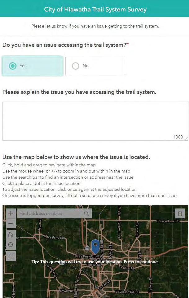
A simple survey was created to allow residents the opportunity to share any trail connection issues they have had or experience in the current state. This was available online through Survey123 and was advertised in the City Newsletter and website, social media pages and a postcard that was mailed out to all Hiawatha residents. A QR code was on the advertising material so that residents could easily scan their smart phone directly to the survey.

Crowdsource Map Application
This application allows people to geographically point their thoughts about the trail and park systems on a map. This is an easy to use application that allows the project team to visualize the feed back. The link to this application was provided though the same means as the Trail Connection Survey.
2-2
Feedback Carryover from the Previous Park Plan
Overview
The overall findings gathered from the survey provide guidelines and a framework for how parks and recreation amenities should be allocated to best serve the communities needs and interests. This input is essential to help the City determine the next steps for the future of the parks system as Hiawatha grows and the new park location is developed.
Key Takeaways and Priorities
Trail Connections
90% of Hiawatha residents use recreation amenities for walking, 55% for biking
Priority
City’s Trail Connection Comments:
Trail Connection Opportunities
- Trail/sidewalk connecting Fay and Guthridge parks. Continue wide walk-way in front of Mercy Urgent Care, run trail/ walkway the perimeter of this open field

-Tucker Park to Cedar Valley Nature Trail
• North Center Point Road can be hard to cross
• Boyson Road is congested
• Designated bike lane on Emmons
• Continue Edgewood Road lanes northerly
• Generally prefer trails over bike lanes
Completed Planned Access Improvements from Park Plan
Cedar River Trail Access
Emmons St from Miller Rd to Center Point Rd. - Install Share the Road signs and pavement markings.
Clark Park Access
Miller Rd and Boyson Rd. - Move Boyson Rd stop bar east, paint crosswalk, install curb ramp and sidewalk on south side. Sidewalk north of intersection is not yet completed because of vacant lot.
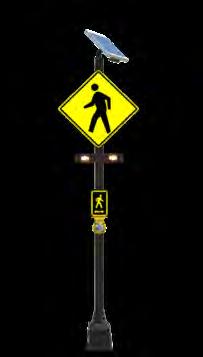
Boyson Rd by 1770 Boyson Rd, Kirkwood Campus - Install RRFB(Rectangular Rapid Flash Beacon) system at existing crossing.
Edgewood Rd/Progress Dr/Grey Wolf - Install RRFB, paint crosswalks at this intersection.
Overview of the Process | 2-3 Hiawatha Trails Master Plan 2022
L OW HIG H
Crowdsource Map Comments

2-4
The Crowdsource Map was one way to solicit feedback from the trail users as a whole. Below are the comments collected during the period the survey was open to the public.
Trail Concern:
• Mountain bike and hiking trails need to be put along the paved trails, so there can be a much broader use that can boost the trails usage and help divert some of the traffic from the main trail.
• PLEASE fix the bridge to La Fayette ASAP!
• Being able to cross Boyson at 380 would be nice
Crossing I-380 at Boyson Road would accommodate a large population and be beneficial to riders and businesses. The 380 crossing should be considered a high priority. Either here or at Tower Terrace.
• Straighten the route (Edgewood Rd) north to near Christian school.
• Need sidewalk along Miller Road. Blairs Ferry Crossing neighborhood are isolated from the rest of Hiawatha. There are a lot of walkers in this neighborhood.
• Trail in front of Mercy medical center. Run the perimeter of open field to connect to Guthridge Park.
• Connect Boyson section of trail on West side of I-380 to East Side.
Suggest New Park:
• Edgewood Road will be a major street with a lot of residential homes. Safe bike and walking trails should be installed to help with making Hiawatha pedestrian friendly.
• As dense residential neighborhoods are built, there needs to be a trail system to support these areas other than a shoulder on Edgewood Rd which will certainly become more traveled and dangerous.
• Space for a splash pad to provide residents of rental properties a public space to enjoy the weather and the community. (Comment references area north of Cedar Valley Trailhead on Boyson Rd.)
• New park with playground, splashpad. (Comment references area north of Cedar Valley Trailhead on Boyson Rd.)
Suggest New Trail:
• Gravel trail for hiking and extension to Guthridge park loop; but this trail should loop all of the way around this open area and re-connect to Guthridge trail.
• Trail should connect to the end of the existing Guthridge Park trail and extend out around the open area for a circular extension.
• Trail in front of Mercy medical center. Run the perimeter of open field to connect to Guthridge Park.
• More than a sidepath is needed - multi-use including bike access. (Comment references a trail connection along County Home Rd. to the Cedar Valley Nature Trail to the east.)
Comment on Existing Assests:
• ADA concern at Turtle Creek Park
• It is currently not safe to cross the Emmons 380 bridge on a bike with young kids. It is very difficult to ride on the narrow sidewalk - especially when only one side is open and there is no way to avoid walkers. I hope we can create a safe area for bikes.
• I would love this trail connection!! (Comment references a trail connection north of the ballfields in Guthridge Park along Boyson and I380.)
Crowdsource Map Comments | 2-5 Hiawatha Trails Master Plan 2022
Trail Connection Survey Comments
A simple trail survey was used to solicit feedback from the trail users as a whole. Below are the comments collected during period the survey was open to the public.
Explain the issue you have accessing the trail system:
• We live on Fitzroy Road and there is no way to ride to the trail without being on (very busy) Edgewood and Tower Terrace, which are not safe to ride on.
• Crossing over I-380 At Emmons St to get to the CVN Trail.
• Crossing over I-380 at Boyson Rd to get to the CVN Trail.
• I would like to see safer (not mixed use) connections between the Cedar Valley Nature Trail and the residences west of I-380.
• Boyson road is very dangerous for road cycling. No trail or sidewalk between the Prairie Woods and the parking lot by Dave Wright.
• The north sidewalk on the Emmons bridge over I 380 has been closed for several years. This forces runners and walkers into the street or makes them cross over to the other side only to recross after they get over bridge.
• No access except to walk on shoulder of Edgewood Dr. There are no trails, only streets.
• Need more west-east routes over I-380. Via Boyson Road would be ideal to get to the Nature Trail trailhead, but the current bridge clearly won’t accommodate bike lanes. It would be great to have a bike trail running up the Edgewood Road extension to County Home Road as that project progresses.
• From 3528 Reed Road there is no route that has an adequate bike lane, in fact a portion of Edgewood going south toward Tower Terrace there is no shoulder at all.
• There is no safe way for us to get to trail system unless we load up and drive. There are sidewalks and great parks in the area but would love to be able to leave home and access trails without driving in busy roads. The roads are only going to get busier with the expansion of housing in the area.
• It’s difficult accessing the trail if you live in Hiawatha/Toddville west of 380. There is no SAFE bike lanes to use to get to trails.
• It’s dangerous trying to access the bike trail if you live in the Hiawatha/Toddville are west of I 380. There are no SAFE bike lanes available.
2-6
Please share your thoughts on the current trail system:
• Love the current trail system. I can leave my house and go either north or south and ride for miles and not deal with cars.
• Very nice walking and bike trail. Big fan of Clark Park walking trail.
• Seems to be closed too often. Parking closed off with cables. Folks may want to cross country ski. Who knows.
• I like the Cedar Valley Nature trail but it would be nice if there were more trails around and through Hiawatha.
• There are no good ways to travel across Boyson Rd.
• Love it. Use it often during good weather. More is better when it comes to bike trails!
It’s an investment in a healthy Iowa!!!
• It would be nice to have a connection between Hiawatha and Marion. A link between the CVNT and the trail starting in downtown Marion would be great!
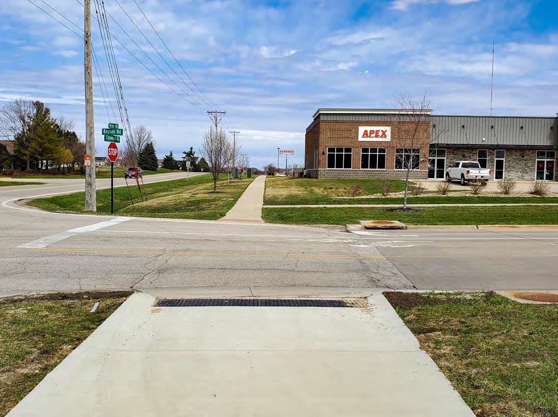
• Would like to have more designated paths leading to it- especially over the 380 Boyson Rd bridge.
• Very well maintained!!
• I love the trails for bicycling. So much safer when away from cars!!!! Really appreciate the restrooms on Boyson. Hope to see more trails in the future.
• Would like off-road trail system connecting Guthridge Park to Faye Clark Park.
Trail Connection Survey Comments | 2-7 Hiawatha Trails Master Plan 2022
Chapter 3
Vision and Action Plan
•Vision of Hiawatha’s Trail System
•Hiawatha Trail System Goals
•Trails Master Plan
•Cost Estimates & Funding Sources
Vision of Hiawatha’s Trail System
Overview
The City of Hiawatha understands the need to maintain and improve the trail system not only for walkability and bicycling purposes but to promote a better quality of life overall. Successful implementation of this plan is attained when recommendations are attainable and align with the capacity of the Parks and Recreation Department as well as other affected city departments. This is to be a collaborative process involving city staff and community members.
Plan Objective
Develop a comprehensive, usable, living document which outlines the current assets and improvements of the trail system. Through this analysis and process Hiawatha will be able to better understand any missing connections or trail expansions needed. This plan should be reviewed annually in conjunction with the City’s Capital Improvements Plan.
Hiawatha
Trails Master Plan Vision
The City of Hiawatha will provide a connected network of multi-use trails, sidewalks and shared use paths to allow residents and visitors to access all the amenities

Hiawatha and the surrounding metro communities have to offer.
3-2
Hiawatha Trail System Goals
Plan Goals
A goal is a long-term objective that states what the community wants to accomplish. Written in general terms, the statement offers a desired condition. Below are four overarching goals that will help guide the City of Hiawatha and the Hiawatha Park and Recreation Department with trail and connection decisions as the community continues to grow to ensure a continuing high level of service and quality of life.
1 2 3 4
Provide a framework for short, mid, and long-term improvements and growth opportunities for the existing and future trails.
Connect Hiawatha trails within the community and surrounding areas.

Ensure that new development’s recreational needs are serviced.
Promote and improve safety and accessibility within Hiawatha’s Trail System.
Goals and Policies | 3-3 Hiawatha Trails Master Plan 2022
Hiawatha Trails Master Plan
Trail Master Plan
The Hiawatha Trails Master Plan is divided into segments that allow for phasing and planning of future connections in a realistic and priority-based approach. Cost estimates from May of 2022 are associated with each trail segment. The estimates of these trail improvements and some alternate configurations can be found in the table below. Detailed cost estimates can be found on the pages to follow. Note: Interchanges at Tower Terrace and Boyson are not included in these cost estimates because they will be part of the overall larger interchange projects. The connection on Emmons crossing I380 will be completed in 2022 and the trail segments designated “Beyond 2037” are too far into the future to establish estimates in this planning process.
Trails Master Plan Map Legend
3-4
I 380 ROBINS RD CENTER POINT RD MILBURN RD BOYSON RD BLAIRS FERRY RD TOWER TERRACE RD W MAIN ST EMMONS ST 18TH AVE HUNT RD MILLER RD PROP EDGEWOOD RD STAMY RD 12TH AVE 15TH AVE 10TH AVE MILLER RD NE KACENA RD PROGRESS DR GIBSON DR NE RANEY ST S TROY RD B AVE HUNTTRL 6TH AVE HAY LN SERAMP TOWER DR BOWLER ST DINA CT CARPENTER RD NE RAINBOW BLVD WILLMAN ST WOLF RUN HAWKEYE DR METZGER DR MICHAEL DR NE PIRIE DR MUSTANG RD NE NE RAMP 14TH AVE WHITE GREY WOLF DR SWRAMP WOODLAND DR RIDGERD SHERMAN RD WOLF CREEK TRL NWRAMP SINGER HILL LN S 2ND ST NORTHWOOD DR WELLS LN MILSTEAD DR 20TH AVE 7TH AVE CREEKSIDE DR SHILOH LN NE 8TH AVE 9TH AVE TWINLEAF RD HUNT RIDGE DR SANDEN RD NE ROBINWOOD DR TOWNE LN NE OAK ST WINDY MEADOW LN NE COUNTRY LN NE CLYMER RD RIVER VIEW RD NE KAINZDR MITCHELL DR COMPTON DR SUNDANCE RD PATS DR 17TH AVE 16TH AVE 19TH AVE A AVE FISHER ST MORRISON DR MORGAN CT CHAFFEE DR MARION ST PARK CT BOYSON CT SE RAMP SW RAMP HAWKEYE DR Source: Esri, DigitalGlobe, GeoEye, Earthstar Geographics, CNES/Airbus IGN, and the GIS User Community Data Sources:CMPO, Linn County GIS Hiawatha Cedar Valley Nature Trail Cedar Valley Trailhead Library Private Recreation School Sites Hiawatha Parks Hiawatha Boundary 0 2,0004,000 1,000 Feet Robins Rd Connection Completed Trail Tower Terrace Interchange Edgewood Rd 2nd Phase Edgewood Rd 1st Phase Clark St Sidewalk Connection Beyond 2037 Emmons Connection Future Edgewood Rd Route Boyson Rd Interchange Boyson Rd Connection Tower Terrace Extension Proposed Trail Segment Cost/LF Hiawatha Cost Outside Hiawatha Cost Total Project Cost % Share Hiawatha Robins Road Connection $110 $286,000 N/A $286,000 100% Edgewood Road 1st Phase - On-Road Bike Lane $79 $314,760 $201,240 $516,000 61% Edgewood Road 1st Phase - On-Road Trail $114 $457,500 $296,400 $750,000 61% Edgewood Road 1st Phase - Separated Trail $118 $471,530 $301,470 $773,000 61% Edgewood Road 2nd Phase - On-Road Bike Lane $78 $339,570 $353,430 $693,000 49% Edgewood Road 2nd Phase - On-Road Trail $115 $500,780 $521,220 $1,022,000 49% Edgewood Road 2nd Phase - Separated Trail $119 $516,460 $537,540 $1,054,000 49% Boyson Road Connection $104 $249,400 $330,600 $580,000 43% Tower Terrace Road Extension $97 $446,200 N/A $446,200 100% Clark Street Sidewalk Connection $117 $76,000 N/A $76,000 100% Hiawatha
Hiawatha Trails Master Plan | 3-5 Hiawatha Trails Master Plan 2022 I 380 ROBINS RD CENTER POINT RD MILBURN RD BOYSON RD EDGEWOOD RD BLAIRS FERRY RD N TROY RD COUNCIL ST NE TOWER TERRACE RD W MAIN ST COUNTY HOME RD EMMONS ST QUASS RD 18TH AVE HUNT RD MILLER RD OTTER VIEW RD PROP EDGEWOOD RD EMAINST STAMY RD 12TH AVE 15TH AVE 10TH AVE MILLER RD NE N MENTZER RD NORTH CENTER POINT RD KACENA RD OTTER BLAIRS FERRY RD NE TODD HILLS RD PROGRESS DR GIBSON DR NE BOYSON RD NE RANEY ST S TROY RD B AVE HUNTTRL PROP TOWER TERRACE RD 6TH AVE FRONT ST HAY LN SERAMP TOWER DR BOWLER ST DINA CT CARPENTER RD NE GYPSY LN RAINBOW BLVD FOX TRAIL DR NE WILLMAN ST WOLF RUN HAWKEYE DR METZGER DR MICHAEL DR NE PIRIE DR MUSTANG RD NE NE RAMP 14TH AVE WHITE PINE ST GREY WOLF DR C AVE SWRAMP WOODLAND DR RIDGERD TODDVILLE RD SHERMAN RD WOLF CREEK TRL NWRAMP SINGER HILL LN S 2ND ST SHANNON DR NORTHWOOD DR FREESEWAY DR WELLS LN MILSTEAD DR GRAND CT AMY DR BEVERLY ST 20TH AVE 7TH AVE CREEKSIDE DR 5TH ST SHILOH LN NE 8TH AVE 9TH AVE TWINLEAF RD WEST PARK RD NE HUNT RIDGE DR SANDEN RD NE ROBINWOOD DR WUBBENS TOWNE LN NE OAK ST WINDY MEADOW LN NE COUNTRY LN NE JENNIFER DR WOODCREST ST NE CLYMER RD RIVER VIEW RD NE CHARLOTTE AVE KAINZDR MITCHELL DR COMPTON DR 60TH ST NE BRITTANY CIR SUNDANCE RD PATS DR 17TH AVE 16TH AVE 19TH AVE NORMAN DR A AVE TIMBER LN FISHER ST MORRISON DR SHELLY DR MICHELLE AVE MORGAN CT CHAFFEE DR MARION ST PARK CT BOYSON CT COUNCIL ST NE SW RAMP SE RAMP FRONT ST SE RAMP SW RAMP HAWKEYE DR NE RAMP COUNTYHOMERD NW RAMP Source: Esri, DigitalGlobe, GeoEye, Earthstar Geographics, CNES/Airbus DS, USDA, USGS, AeroGRID, IGN, and the GIS User Community Printed By: soshea, File: C:\Users\soshea\Desktop\GIS\Hiawatha Existing Trail Map 11x 17.mxd Print Date: Data Sources:CMPO, Hiawatha Trails Cedar Valley Nature Trail Cedar Valley Trailhead Private Recreation School Sites Robins Rd Connection Tower Terrace Interchange Boyson Rd Interchange Boyson Rd Connection
Cost Estimates
The following cost estimates are based on the segments identified in the Hiawatha Trails Master Plan and are based on the available cost data May 2022 to establish the following estimates. This dataset should be updated annually to adjust for future cost increases and fluctuations. These cost estimates do not include Right-of-Way purchase, easements or major structures.
Boyson Road Connection
Clark Street Sidewalk Connection
3-6
ITEM NO. DESCRIPTION QTY. UNIT UNIT PRICE TOTAL PRICE ITEMS 1.1 Subbase, Modified, 6-Inch 5600 LF $8 $44,800 1.2 PCC Trail, 5-Inch 5600 LF $45 $252,000 1.3 Detectable Warnings 26 EA $1,000 $26,000 PERCENTAGE BASED ITEMS 2.1 Mobilization $29,052 2.2 Construction Survey $4,842 2.3 Traffic Control $16,140 CONSTRUCTION SUBTOTAL $373,000 Contingency 30% $112,000 Design Engineering & Bidding 10% $38,000 Construction Engineering 10% $38,000 Legal 5% $19,000 TOTAL COST: $580,000 ITEM NO. DESCRIPTION QTY. UNIT UNIT PRICE TOTAL PRICE ITEMS 1.1 Subbase, Modified, 6-Inch 700 LF $8 $5,600 1.2 PCC Trail, 5-Inch 700 LF $45 $31,500 1.3 Detectable Warnings 4 EA $1,000 $4,000 PERCENTAGE BASED ITEMS 2.1 Mobilization $3,699 2.2 Construction Survey $617 2.3 Traffic Control $2,055 CONSTRUCTION SUBTOTAL $48,000 Contingency 30% $15,000 Design Engineering & Bidding 10% $5,000 Construction Engineering 10% $5,000 Legal 5% $3,000 TOTAL COST: $76,000
Edgewood Road 1st Phase - On-Road Bike Lane
Edgewood Road 1st Phase - On-Road Trail

Cost Estimates | 3-7 Hiawatha Trails Master Plan 2022
ITEM NO. DESCRIPTION QTY. UNIT UNIT PRICE TOTAL PRICE ITEMS 1.1 Subbase, Modified, 12-Inch 6600 LF $16 $105,600 1.2 Paved Shoulder, HMA, 6” 4400 SY $35 $154,000 1.3 Embankment-In-Place 6600 LF $4 $26,400 PERCENTAGE BASED ITEMS 2.1 Mobilization $25,740 2.2 Construction Survey $4,290 2.3 Traffic Control $14,300 CONSTRUCTION SUBTOTAL $331,000 Contingency 30% $100,000 Design Engineering & Bidding 10% $34,000 Construction Engineering 10% $34,000 Legal 5% $17,000 TOTAL COST: $516,000 ITEM NO. DESCRIPTION QTY. UNIT UNIT PRICE TOTAL PRICE ITEMS 1.1 Subbase, Modified, 6-Inch 6600 LF $8 $52,800 1.2 PCC Trail, 5-Inch 6600 LF $45 $297,000 1.3 Detectable Warnings 2 EA $1,000 $2,000 1.4 Embankment-In-Place 6600 LF $12 $79,200 PERCENTAGE BASED ITEMS 2.1 Mobilization $38,790 2.2 Construction Survey $6,465 2.3 Traffic Control $21,550 CONSTRUCTION SUBTOTAL $498,000 Contingency 30% $150,000 Design Engineering & Bidding 10% $50,000 Construction Engineering 10% $50,000 Legal 5% $25,000 TOTAL COST: $773,000
Edgewood Road 1st Phase - Separated Trail
Edgewood Road 2nd Phase - On-Road Bike Lane

3-8
ITEM NO. DESCRIPTION QTY. UNIT UNIT PRICE TOTAL PRICE ITEMS 1.1 Subbase, Modified, 12-Inch 6600 LF $16 $105,600 1.2 Paved Shoulder, HMA, 6” 7333.333 SY $35 $256,667 1.3 Detectable Warnings 2 EA $1,000 $2,000 1.4 Embankment-In-Place 6600 LF $8 $52,800 PERCENTAGE BASED ITEMS 2.1 Mobilization $37,536 2.2 Construction Survey $6,256 2.3 Traffic Control $20,853 CONSTRUCTION SUBTOTAL $482,000 Contingency 30% $145,000 Design Engineering & Bidding 10% $49,000 Construction Engineering 10% $49,000 Legal 5% $25,000 TOTAL COST: $750,000
ITEM NO. DESCRIPTION QTY. UNIT UNIT PRICE TOTAL PRICE ITEMS 1.1 Subbase, Modified, 12-Inch 8900 LF $16 $142,400 1.2 Paved Shoulder, HMA, 6” 5933.333 SY $35 $207,667 1.3 Embankment-In-Place 8900 LF $4 $35,600 PERCENTAGE BASED ITEMS 2.1 Mobilization $34,710 2.2 Construction Survey $5,785 2.3 Traffic Control $19,283 CONSTRUCTION SUBTOTAL $446,000 Contingency 30% $134,000 Design Engineering & Bidding 10% $45,000 Construction Engineering 10% $45,000 Legal 5% $23,000 TOTAL COST: $693,000
Edgewood Road 2nd Phase - On-Road Trail
Edgewood Road 2nd Phase - Separated Trail

Cost Estimates | 3-9 Hiawatha Trails Master Plan 2022
ITEM NO. DESCRIPTION QTY. UNIT UNIT PRICE TOTAL PRICE ITEMS 1.1 Subbase, Modified, 12-Inch 8900 LF $16 $142,400 1.2 Paved Shoulder, HMA, 6” 9888.889 SY $35 $346,111 1.3 Detectable Warnings 10 EA $1,000 $10,000 1.4 Embankment-In-Place 8900 LF $8 $71,200 PERCENTAGE BASED ITEMS 2.1 Mobilization $51,274 2.2 Construction Survey $8,546 2.3 Traffic Control $28,486 CONSTRUCTION SUBTOTAL $659,000 Contingency 30% $198,000 Design Engineering & Bidding 10% $66,000 Construction Engineering 10% $66,000 Legal 5% $33,000 TOTAL COST: $1,022,000
ITEM NO. DESCRIPTION QTY. UNIT UNIT PRICE TOTAL PRICE ITEMS 1.1 Subbase, Modified, 6-Inch 8900 LF $8 $71,200 1.2 PCC Trail, 5-Inch 8900 LF $45 $400,500 1.3 Detectable Warnings 10 EA $1,000 $10,000 1.4 Embankment-In-Place 8900 LF $12 $106,800 PERCENTAGE BASED ITEMS 2.1 Mobilization $52,965 2.2 Construction Survey $8,828 2.3 Traffic Control $29,425 CONSTRUCTION SUBTOTAL $680,000 Contingency 30% $204,000 Design Engineering & Bidding 10% $68,000 Construction Engineering 10% $68,000 Legal 5% $34,000 TOTAL COST: $1,054,000
Robins Road Connection
Tower Terrace Road Extension

3-10
ITEM NO. DESCRIPTION QTY. UNIT UNIT PRICE TOTAL PRICE ITEMS 1.1 Subbase, Modified, 6-Inch 2600 LF $8 $20,800 1.2 PCC Trail, 5-Inch 2600 LF $45 $117,000 1.3 Detectable Warnings 20 EA $1,000 $20,000 PERCENTAGE BASED ITEMS 2.1 Mobilization $14,202 2.2 Construction Survey $2,367 2.3 Traffic Control $7,890 CONSTRUCTION SUBTOTAL $183,000 Contingency 30% $55,000 Design Engineering & Bidding 10% $19,000 Construction Engineering 10% $19,000 Legal 5% $10,000 TOTAL COST: $286,000
ITEM NO. DESCRIPTION QTY. UNIT UNIT PRICE TOTAL PRICE ITEMS 1.1 Subbase, Modified, 6-Inch 4600 LF $8 $36,800 1.2 PCC Trail, 5-Inch 4600 LF $45 $207,000 1.3 Detectable Warnings 2 EA $1,000 $2,000 PERCENTAGE BASED ITEMS 2.1 Mobilization $22,122 2.2 Construction Survey $3,687 2.3 Traffic Control $12,290 CONSTRUCTION SUBTOTAL ( 2022 ) $284,000 Contingency 30% $86,000 Design Engineering & Bidding 10% $29,000 Construction Engineering 10% $29,000 Legal 5% $15,000 TOTAL COST: $443,000
Funding Sources
There are six broad funding sources available to help offset costs to complete the projects listed in this Plan, as described below.
▶ General Municipal Funding – It is assumed that some general municipal funds/borrowing will be required to assist with the completion of projects or as a matching source for state or federal grants (e.g. wayfinding signage, or land acquisition).
▶ Special Assessments – Particular projects that benefit individual properties (e.g. sidewalk/trail installations) could be funded through special assessments whereby the City recoups initial design and construction costs through increased real estate taxes on those properties for a set period of time.
▶ Private Donations – Some of the wayfinding projects could be partially or fully funded through private donations or public fundraising.
▶ State and Federal Grants – There are many different state or federal grants that may be able to offset the costs of some of the identified projects. Only those programs most likely to award funding to Hiawatha are listed.
▶ Tax Increment Financing (TIF) – Tax increment financing (TIF) is a program where the additional taxes generated from development in a TIF district would go towards specified public improvements in a community. This program helps waylay the impacts of new development on a community while improving the attractiveness of the City. Hiawatha has designated areas of the town as an Urban Renewal Area and created a TIF District.
▶ Grant Resources - Grants can be a great way to offset project costs. When trying to identify grant opportunities for large multi-year strategies such as the Edgewood Road extension, it is important to know and understand grant objectives, application cycles and identify components of your plan that fit the grant purposes. The list below is not an exhaustive list of programs and resources available on any given project, but it can be used as a reference for potential funding for projects.
• Community Attraction & Tourism (CAT)
• Iowa Clean Air Attainment Program (ICAAP)
• Linn County Super visors Witwer Trust
• Resource Enhancement and Protection (REAP)
• Revitalize Iowa’s Sound Economy (RISE)
• Safe Routes to School
• State & Federal Rec Trail
• Transportation Alternative Program (TAP)
Other Initiatives to Consider
Update Ordinance Code to Include Parkland Dedication and Trail Requirements in New Development
Consider Future Park Area in Under Served Areas (see map page 1-8)
Consider Future Trailhead(s) as New Trail Sections Are Added
Evaluate the need to improve crossing at North Center Point Road
Funding Sources | 3-11 Hiawatha Trails Master Plan 2022
