


With special thanks to: The participants who provided feedback to help define the final recommendations of this document.
Prepared for:
City of Norwalk
City Hall
705 North Ave
Norwalk, IA 50211
Prepared by:
MSA Professional Services, Inc.
1555 SE Delaware Ave
Suite F
Ankeny, Iowa
50021
Confluence | Landscape Architecture, Planning + Urban Design
525 17th Street
Des Moines, IA 50309
MSA Project Team
Chris Janson, AICP
Shannon Gapp, AICP
Shawn Oshea, AICP
Claire Michelson
Lauren Dietz
Confluence Project Team
Chris Shires, AICP
Jane Reasoner, AICP
City Council
Tom Phillips - Mayor
Jaki Livingston - Mayor Pro Tem
Stephanie Riva - Council Member
Ed Kuhl - Council Member
David Lester - Council Member
Brian Baker - Council Member
City Staff
Luke Nelson - City Manager
Luke Parris - Community Development Director
Elliot Klimowski - City Planner
Steering Committee
Chad Smith
Jeanna Dankle
Jason Brown
Duane (D.T.) Magee
Josh DeBower
David Albrecht
Andy Boerjan
Brian Baker
Michael Foss
Eric Simon
Judy McConnell
Katherine Thorson
Jim Lane
Kate Baldwin
Travis Stanley

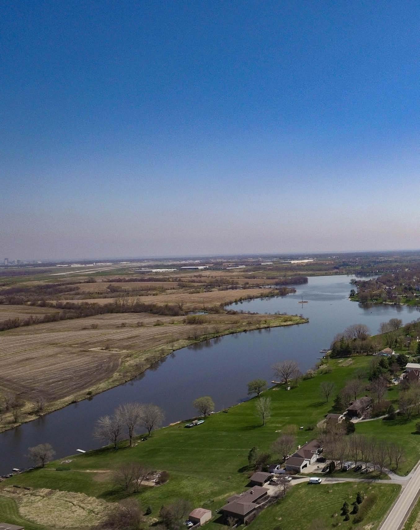
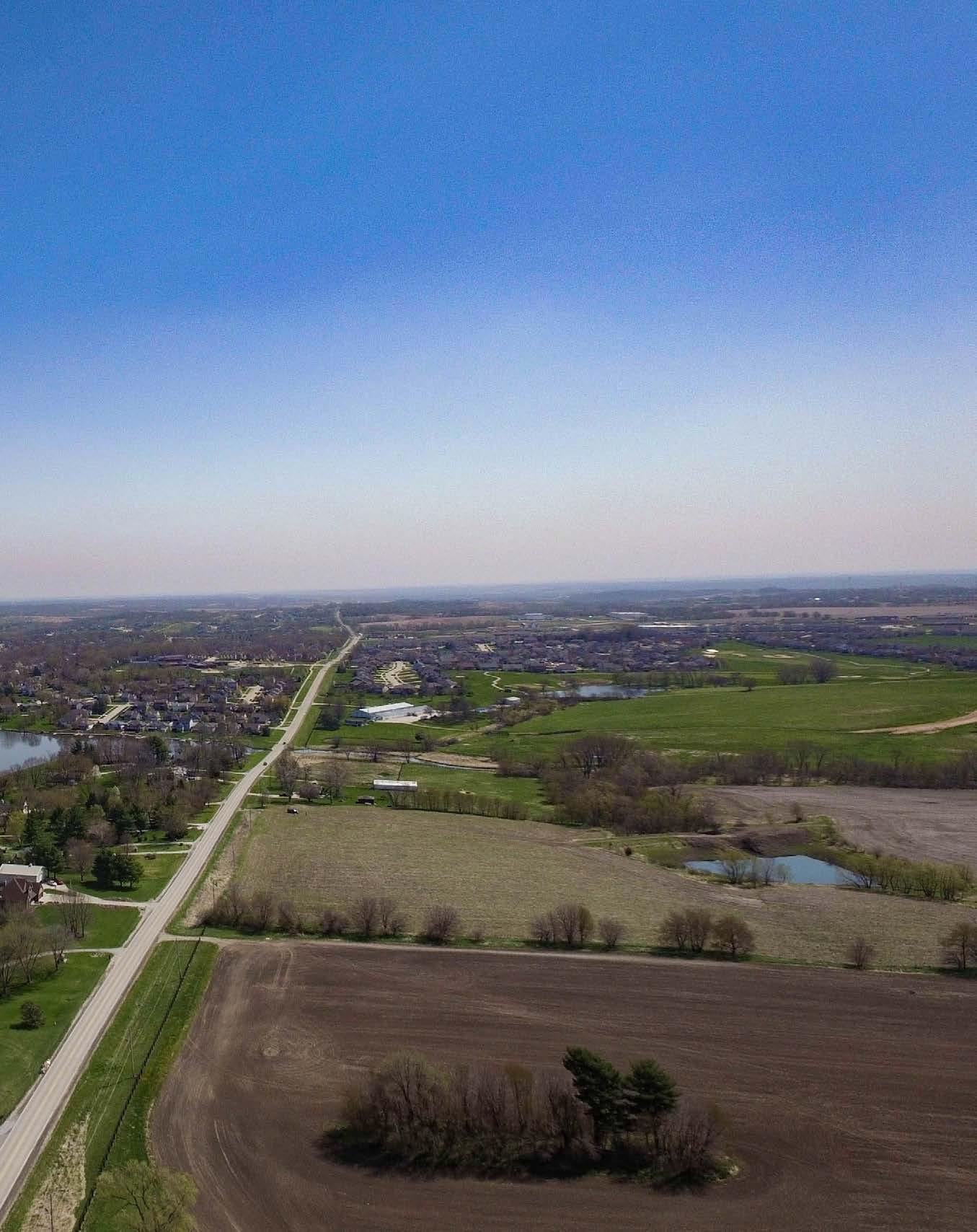
Norwalk is a well-planned, safe, prosperous, and growing community built by citizens and businesses who value education, health, and public safety. People enjoy its natural beauty, rural character, and location in the region. As residents and businesses come and go, and economic trends rise and fall, changes will occur. Norwalk continues to place value on long-range planning to ensure the community of today effectively evolves to meet the anticipated needs of the future.

The purpose of this 2042 Comprehensive Plan is to establish a shared vision for the community, to guide future decisions and actions, and to assist in projecting and managing growth, change, public improvements, and development in the community. This guidance provides predictability and consistency over time to help encourage investment. We plan so that we can act and react in a changing world with a confident understanding of our common values and goals.
The difference between this Comprehensive Plan and a zoning ordinance is that the former sets forth the objectives and goals of the community with respect to land use, while the latter is a regulatory device through which the plan’s goals and policies are carried out or achieved. Other ordinances, such as subdivision regulations, are also utilized to carry out the goals of a Comprehensive Plan.
This plan will address annexation. Annexation is the act of adding to something larger, especially the incorporation of new territory into the domain of a city, country, or state. Annexation is not eminent domain - the power of the state to take private property for public use with payment of compensation to the owner. The consideration of annexation is to accommodate City services to future growth. The City of Norwalk has no intent for involuntary annexation of any property.
The City’s future growth, to be guided by this Comprehensive Plan, will be driven by the City’s reputation as a leader in K-12 education as well as its proximity to services, higher education, commerce, innovation and the Des Moines Metro Area. The region’s abundance of quality recreation and business growth opportunities also adds to the quality of life experienced by residents.
This plan is an active part of the community’s efforts to attract people and businesses to the City’s unique small town feel and development opportunities. The content within this plan sets to create the best version of the City for future generations to live, work, play, and learn.
The organization of the plan is based on the planning process described in Chapter 2, and is divided into five chapters plus relevant appendices.
This chapter examines the role of the plan, the planning area boundaries, regional context and key community indicators.
This chapter provides an outline of the planning process, a description of public participation methods and a summary of feedback from all engagement activities. Public engagement is a key component of the comprehensive planning process.
This chapter presents a vision for the future of the City of Norwalk and describes the goals and strategies to achieve that vision. The elements of community infrastructure, housing, recreation, transportation, employment & economy, agricultural & natural resources, and intergovernmental collaboration are all addressed.
This chapter considers the City of Norwalk’s future growth forecast, existing land use, land use goals and strategies, the future land use map, how to amend the future land use map, design recommendations, and guidelines for buildings and sites.
This chapter outlines how the vision and goals of the plan are implemented in everyday decisions and annual goal setting and budgeting, and how the Plan should be amended when necessary.
This appendix incorporates a summary of current conditions and recent trends in the City of Norwalk.
This appendix consists of the full results of two community-wide surveys included in the community engagement step of the planning process and contains the crowdsource map application results and information from community input workshops.
This appendix includes several maps created during the planning process for the 2040 Norwalk Comprehensive Plan.
This appendix includes action items from the implementation matrix in Chapter 5. These action items were identified as urgent, immediate, or both.

This Comprehensive Plan update is an effort to reinforce the long-standing planning priorities of the City, while recognizing changing conditions, trends, and new issues. The City’s Comprehensive Plan reflects a shared vision for the future of Norwalk.
Comprehensive Plans are a general and broad analysis of the interconnections between cultural, geographical, and natural components within the City. They also provide guidelines for continued development. Technology, economic drivers, and demographic changes affect how land is managed and utilized in the City. Although this Comprehensive Plan attempts to address many possible future uses, it may not capture all of them.
As new land uses are introduced, the City will be in a great position to better review land use proposals. This plan will help citizens and local leaders work together more efficiently to facilitate future growth and development within the City by providing broad recommendations that guide and manage growth and development. These recommendations come in the form of goals and objectives which express the community’s aspirations for the future.
This planning document is a “living” guide for growth and change in Norwalk. It is intended that the plan will grow and change with the community. Therefore, it should be reviewed and updated regularly. The plan provides specific recommendations that directly manage community growth and development. To utilize the full potential of the plan, it should be used to:
Guide City officials and staff to assist with a variety of land use planning and growth planning tasks.
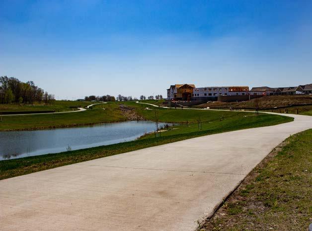
Guide businesses, property owners, and residents in determining potential property use, understanding future land use changes in the surrounding area, and understanding infrastructure improvements.

Assist developers interested in property acquisition in coordinating development plans with City goals, regulations, and infrastructure plans.
Assist in coordinating with neighboring jurisdictions on issues and topics of mutual interest.
In approximately 1846, the first settlers arrived in Norwalk. Among the settlers, Samuel Crow established a homestead near the North River. The community that is now known as Norwalk began with the construction of a log cabin built by Samuel Snyder. In the coming years more families settled in the town, called Pyra, and by 1856 a post office was established. George W. Swan laid out the town, established a hotel, and changed the town’s name to Norwalk—after his hometown of Norwalk, Connecticut. The first railroad to be built in Norwalk, Iowa was a narrow-gauge line between Des Moines and Cainsville, Missouri, constructed in 1882. By the 1890s the railroad was acquired and widened by Burlington Railroad. The line was initially used for shipping livestock; however it was abandoned in 1947 due to flood damage at the North River Bridge.
In 1900 Norwalk, Iowa was incorporated and served by its first mayor, Adam Stiffler. Initially, the town was one square mile in size. Phone service was introduced in 1903. Over time many additions through land acquisitions have contributed to Norwalk’s overall growth. Two major triangles shaped Norwalk’s growth patterns. The first was the intersections of Highway 28, High Road, and Cherry Parkway in November of 1969. The second took place in a location that now contains the Norwalk United Methodist Church and Regency Nursing Home. A number of farm annexations in the 70s and 80s contributed to the growth of the city’s development footprint. Presently, Norwalk is regionally notable for its golf courses, school district, proximity to the Des Moines Metro, and the bountiful opportunities for housing, parks and recreation, and new business development.
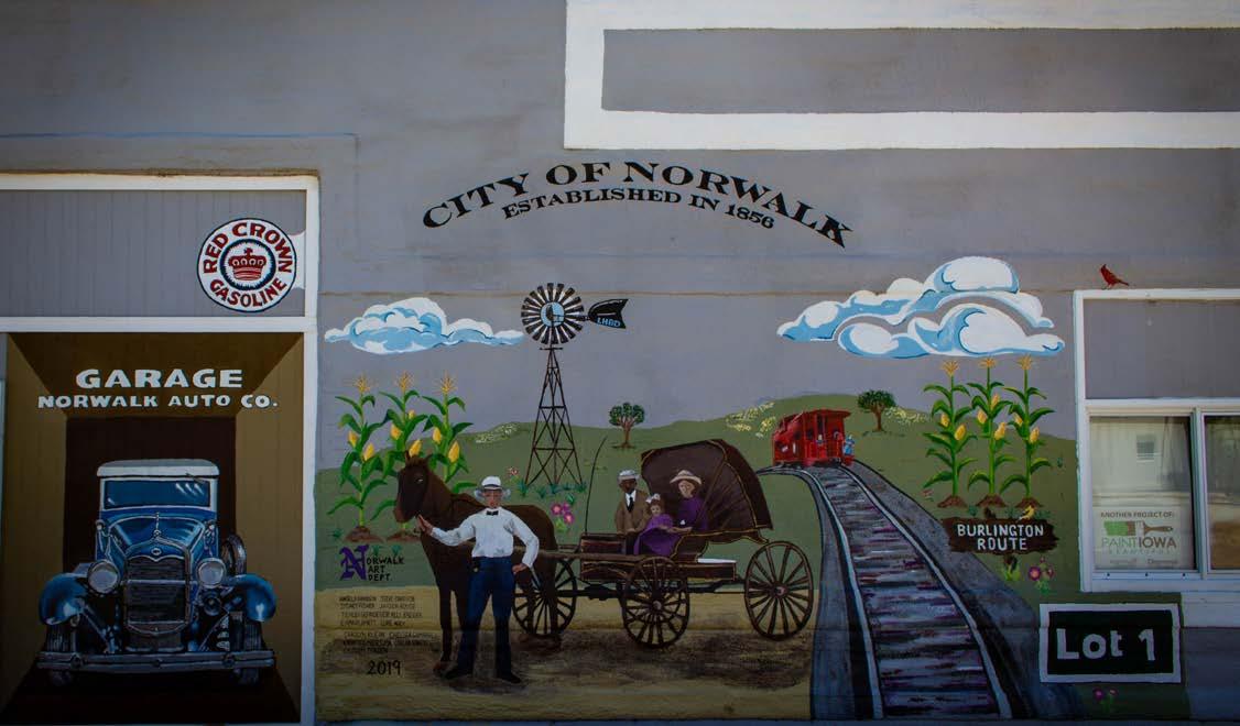
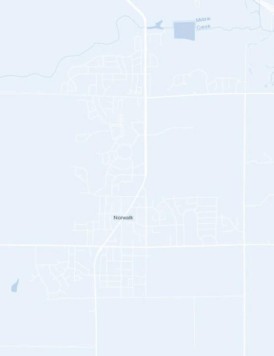
The City of Norwalk is located in Warren County, IA. It is situated just south of Des Moines and West Des Moines, IA.
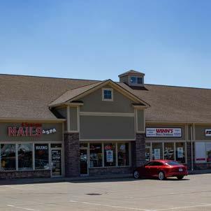
Norwalk is in a great location for residents who want a rural feel and an easy commute to nearby larger communities for work, leisure, entertainment, and services. Norwalk strives to provide a high quality of life and remain a safe and attractive community.

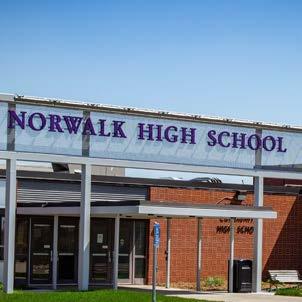
The community will continue to be a vibrant, safe, and healthy environment that evokes community pride and supports a prosperous life for those who chose to make Norwalk their home.
The planning area for this Comprehensive Plan includes all lands in the City and is outlined on the map to the right.
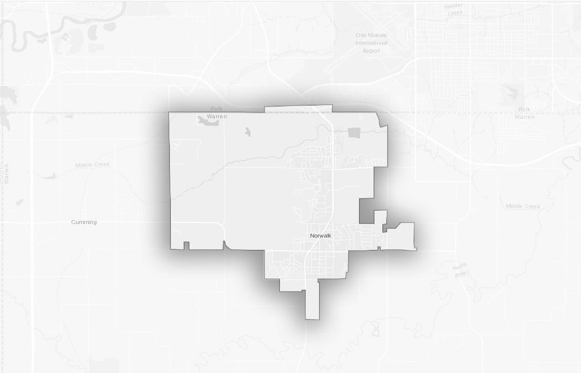
Norwalk is located in central Iowa at the northern part of Warren County, Iowa, immediately south of Des Moines. It is in a great location for residents to reside in a small town and easily commute to the nearby Metro area for work, leisure, entertainment, and professional services. Norwalk strives to provide a high quality of life and remain a great location to live and do business within the greater Des Moines Metro Area. Norwalk borders the City of Des Moines which has a population of approximately 215,000.
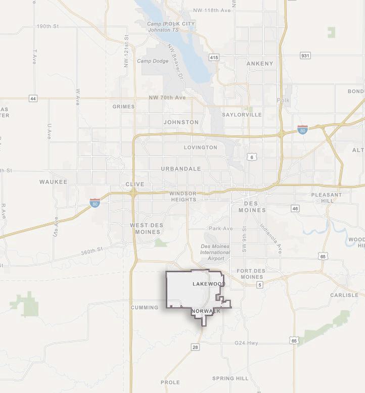


Regional Location and Proximity:

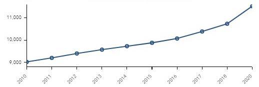
A careful examination of population trends in Norwalk provides a foundation for the land use planning process and implementation of the plan. Understanding past and future population growth is an important step towards appropriate resource allocation. The City’s population and number of households are projected to continue growing through 2024 as shown in the chart below.
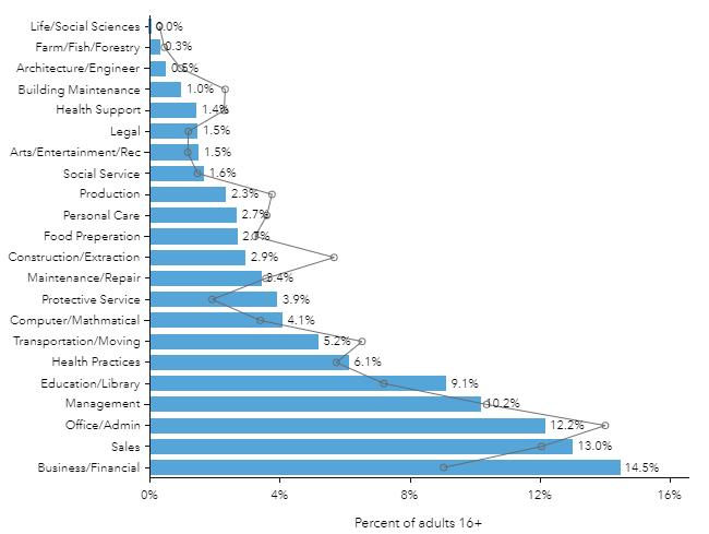
Employment information is an important indicator of current economic conditions and potential economic growth opportunities for the residents and businesses of Norwalk. The majority of Norwalk’s residents have jobs classified as white collar positions, followed by blue collar and services. The unemployment rate is estimated to be a modest 12%. The largest labor force category is Business/Financial followed by Sales. The chart below shows a comparison with Warren County, and there are many categories that show high variability such as Construction/Extraction and Education. It is also known that many workers commute to the surrounding region for work.
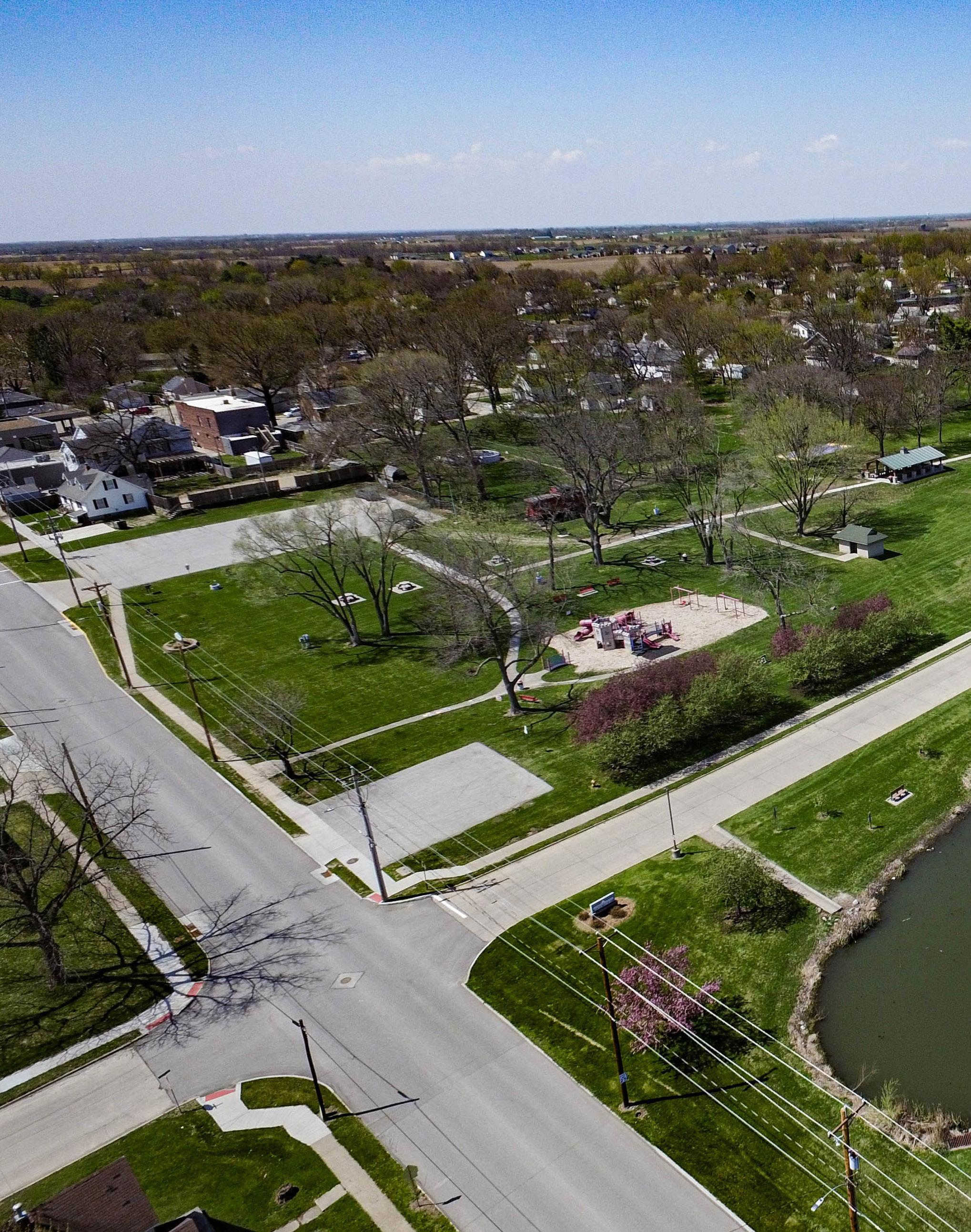
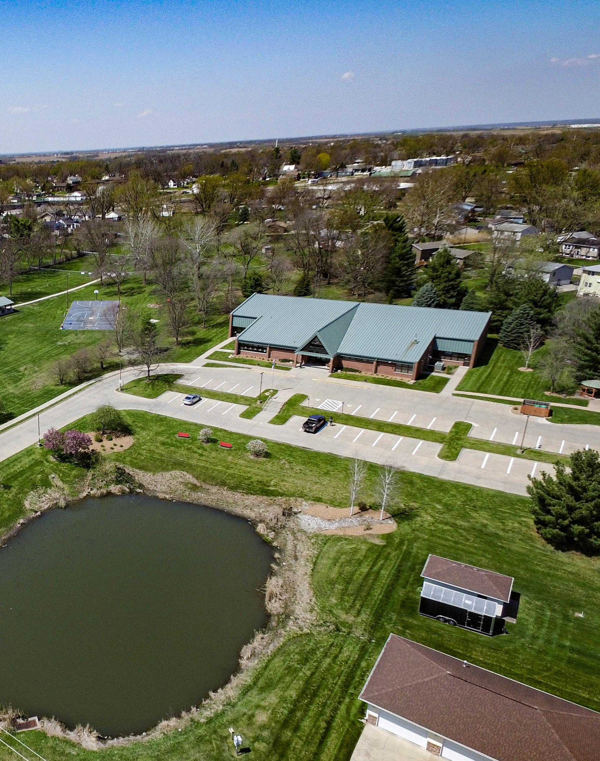

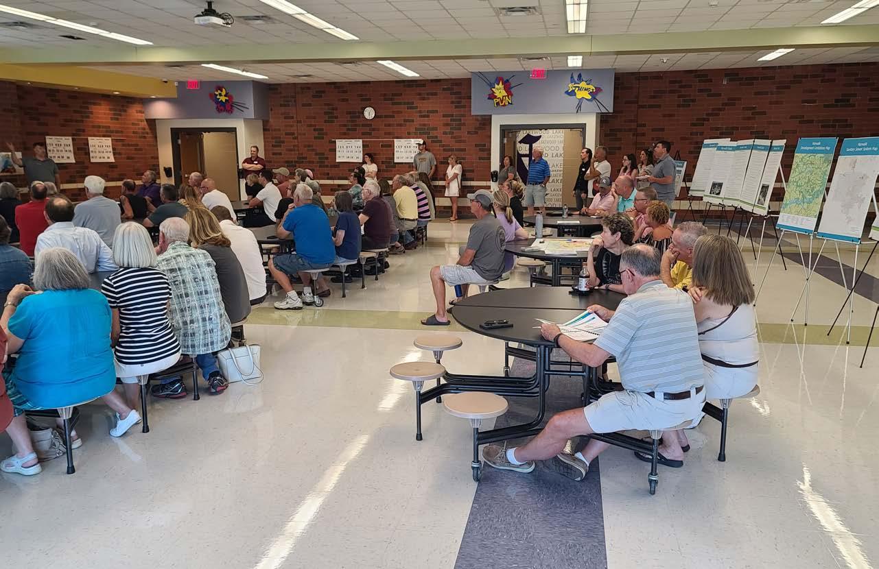
A transparent public participation process is the foundation to a successful plan. The planning process for the development of the 2042 Norwalk Comprehensive Plan included seeking the involvement of residents, business owners, and other stakeholders across the community to create a vision and set goals for growth and improvement. Great engagement is essential to creating a plan and gathering support for successful implementation of a plan’s goals and actions.
The development of the 2042 Norwalk Comprehensive Plan included the following engagement activities to help develop a vision, establish goals, and develop actions for implementation:
• Comprehensive Plan Steering Committee
• Public Workshop with SWOT (Strengths Weaknesses Opportunities Threats) Analysis
• SWOT Community Survey
• Pop-Up Meeting At National Night Out
• Feedback Session at Senior Luncheon
• Key Stakeholder Interviews
• Draft Plan Review Open House
• Draft Plan Review Survey
Community Engagement
1
Soliciting input over the planning process via online and traditional engagement activities.
Input will be gathered from: Public Planning & Zoning Commission City Council & Staff Other Stakeholders
Summary of analysis of existing conditions to establish an overall vision for Norwalk.
Existing plans, conditions and goals will be reviewed and analyzed for use in Steps 3 and 4.
Community Profile, Vision, and Framework 3
Creation of New Norwalk Comprehensive Plan 2 4
Establish a “Vision” for Norwalk to provide focus for the creation of the Comprehensive Plan.


Vision and associated goals will be developed through the feedback received in Step 1 & 2.
Plan will include all information developed in Steps 1, 2 & 3.
The newly created Comprehensive Plan and its Action Plan for Implementation will serve as a tool and guide for future development.
The public engagement process is integral to the results of the plan and guides future implementation of the goals and policies recommended in this document. Although the Covid-19 Pandemic created an nontraditional situation with limited in person meetings, we were still able to gather feedback. Various engagement methods were performed to provide multiple opportunities for stakeholders to provide quality feedback online. The methods ranged from an online community survey, hybrid in-person/ virtual community meetings via Zoom, a pop-up meeting at a socially distanced football game, media postings, and online stakeholder focused group interviews. In the beginning word of the project was spread to create awareness and excitement. From that momentum feedback was gathered in various types to help form the Plan’s goals and policies
The Comprehensive Plan Steering Committee was the primary review and advisory body throughout the planning process, tasked with ensuring that the established goals and objectives were being accomplished. Four meetings of the Committee were held during the planning process and all were open to the public. All presentation materials were posted on the project website for public access.
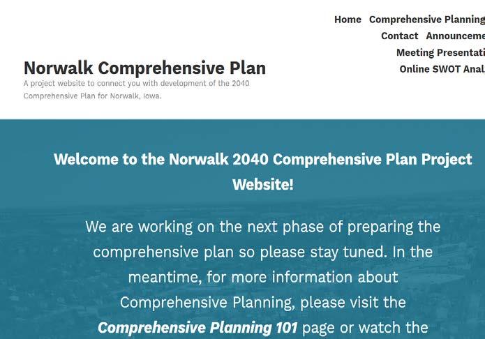
A project website was developed to share relevant project information such as the project schedule, draft documents, meeting notices and copies of presentation materials. The website also provided a venue for the public to share comments throughout the planning process and contact the project team with questions. This aspect of the communication and participation strategy was important for transparency, as well as sharing information with stakeholders.


A community survey was created and available to community members. This was a gathering tool in the form of a SWOT (Strength, Weaknesses, Opportunities, and Threats) analysis. The broad questions allowed the project team to collect community members’ views and thoughts on Norwalk in the three categories of beautification, development and mobility. This was administered through ESRI’s Survey123, which is formatted to allow users to take via computer, tablet or smartphone. Participants were invited to respond via a link through the project website as well as flyers that were distributed via City social media sites.
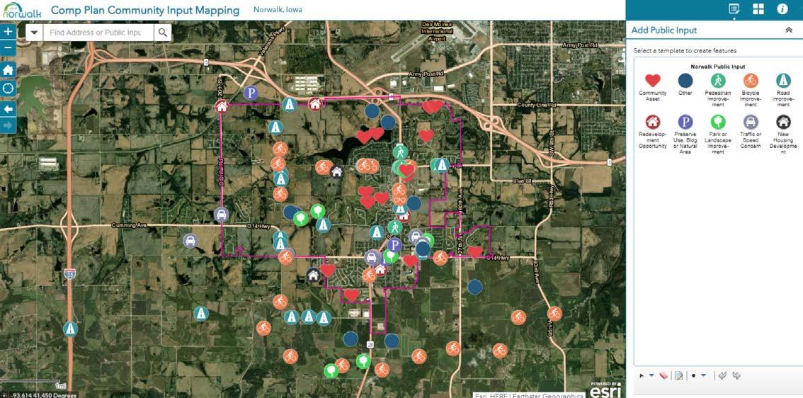
An interactive map is unique mapping application that allows a community to collaboratively map assets, issues, opportunities and questions related to the community and growth. This application helped the project team identify potential expansion areas as Norwalk’s population and housing demand grows. Many residents offered suggestions for new development locations within the community.
The project website included a section that provided an overview of the following:
https://norwalk2040plan.com/blog/comprehensive-planning-101/

A B C D
Essentially, the comprehensive plan, also known as a general plan, master plan or land use plan, is a document designed to guide the future actions of a community. It presents a vision for the future; with long-range goals and objectives. Planning helps to ensure that future land use and growth is consistent with the vision the citizens of the township have on important issues. Furthermore, it is not a Zoning Ordinance or Subdivision Regulations.
Plan? Planning is important and makes a positive impact on quality of life.
Planning is an organized way to anticipate and shape changes for the benefit of the community. A well planned community is attractive, has reasonable taxes/fees, adequate public services, and is a good place to live and work.
To form a good basis for plan implementation – design guidelines, funding and capital improvements programming.
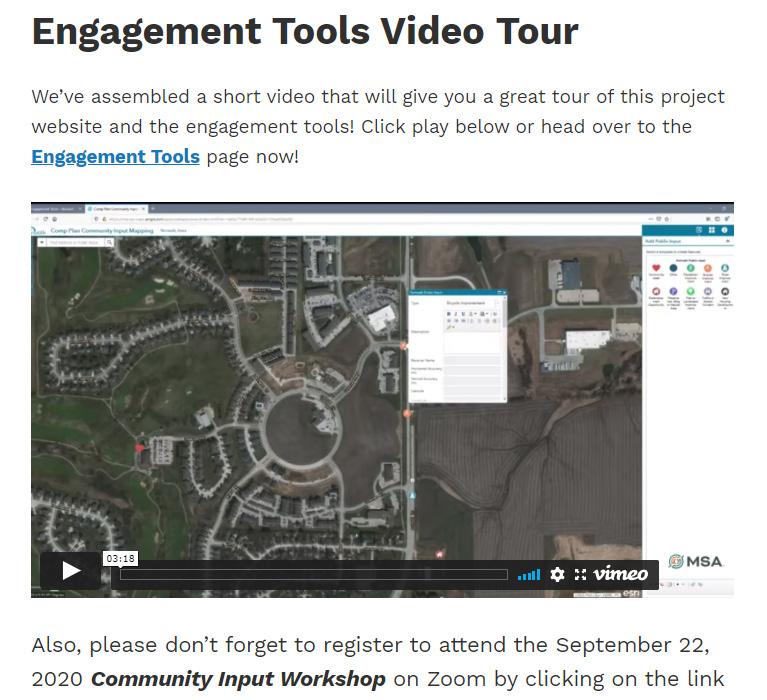
Public Engagement is crucial for planning processes, and the need for effective engagement was critical even with social distancing practices in effect. Throughout the project, the team successfully made adjustments to comply with public health restrictions on face-to-face meetings. Overall, digital engagement provided equally robust responses to that completed fully in-person. The hybrid approach proved to be beneficial to capturing a broad range of community feedback.


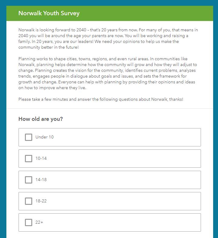
A youth survey was also administered to obtain meaningful feedback from Norwalk’s younger residents and students. The survey focused on a variety of subjects pertaining to the creation of the Plan but focused more on likes and dislikes, how they perceive the community, how they describe the community to others, and if it has been a good place to grow up. Full survey results can be found in Appendix B, however, a summary of key findings is provided within this section as well.
The youth survey also provided the opportunity for a younger demographic to weigh in on strengths and weaknesses relating to beautification, development, and mobility. This provided a different perspective and outlet for many generations to provide feedback on what they currently value, as well as would like to see change in the future for Norwalk.
This Plan is grounded in opportunities for positive change which was identified by citizens, staff, and stakeholders. The Plan seeks to address citizens’percieved deficiencies and capitalize on opportunities for positive change. A SWOT analysis exercise was used to gather this information from the Planning and Zoning Commission, Project Team, Steering Committee and from the general public at each community engagement and visioning session.
Strengths - characteristics that give the community an advantage over others.
Weaknesses - characteristics that place the community at a disadvantage relative to others. Opportunities - elements the community could leverage to advantage the community.
Threats - elements in the environment that could cause trouble for the community in the future.
Summaries from Website, Survey, Meetings, and Interviews
Participants considered the following questions that relate to the comprehensive planning process:
• Which areas of Norwalk do you see growing in 20 years and how and what are the challenges to that growth?
• Which areas of Norwalk provide an opportunity for redevelopment?
• What do you envision the community character will be in 20 years?
• What will be great about Norwalk in 20 years? What obstacles will it have to overcome?
• In 20 years what will attract families to the area?
• What needs to be protected as Norwalk grows?
The following pages summarize the feedback received relating to the three categories:

• Elizabeth Holland Park
• Continue updating existing parks
• Mature trees around the city
• Natural landscape
• The parks are in good condition and up-kept
• Golf courses
• Opportunity-Improve the downtown area
• Opportunity-Add attractive signage as you enter Norwalk
• Opportunity-Increase trails and connections
• Development has taken away the rural landscape of Norwalk
• Not a welcoming entrance to the city
• Not a priority for residents
• Outdated and people are resistant to change
• Apartment complexes
• No consistent “theme” to the city
• Threat – Over-expansion before setting aside land for parks and trails
Strengths / Opportunities Weaknesses / Threats
• Gained and continue to gain new businesses
• Good schools and housing that attract people
• Current business and economic development efforts
• Room for development
• Opportunity-There are a lot of options for new businesses
• Opportunity-Create a town square or main street
• Opportunity – Available land on Highway 28
• Need more businesses
• No uniformity in new commercial buildings
• Growth seems slow
• Need more growth
• High Density Residential
• Growing too much
• Low rent or subsidized housing
• No community center or pool
• Only one corridor for development
• Location/Proximity to the Metro
• Light traffic/easy to get around town
• Great access to I-35
• Existing bike and walking trails
• Opportunity - more bike trails and connections
• Opportunity - focus on walkability
• Opportunity – wider sidewalks to connect neighborhoods
• Opportunity - through streets in new developments
• Many intersections are difficult for ped/bike crossing
• Highway 28 “splitting” the city
• No large network of trails… limited connections
• Infrastructure is not ready for the increased volume
• Many sidewalks are in poor condition
• As growth continues traffic congestion will grow
• No bus service to DM Metro
How many people are in your household?
Highest percentage had 4 people in their household
How many years have you lived in the City of Norwalk?
Many either new to the community or long-time residents
(Full survey results can be found in Appendix B)
How would you rate the quality of life in Norwalk?
Most
What would have the greatest impact on quality of life?
What
What is the approximate distance of your commute to work (each way)?
What are the most important aspects of housing improvement for the City of Norwalk?
(Full survey results can be found in Appendix B)
85% of respondents indicated that location is a primary quality that makes the City of Norwalk a great place to live.
78% of respondents identified the school district as a primary quality that makes the City of Norwalk a great place to live.
47% of respondents designated the friendly and welcoming nature of the community as a primary quality that makes the City of Norwalk a great place to live.

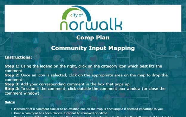
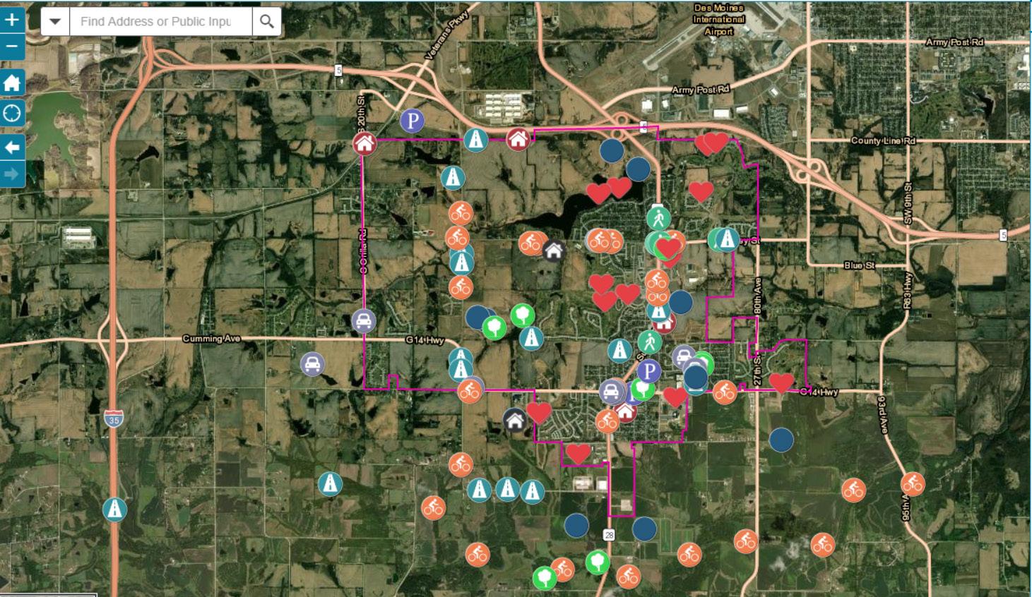
• Several Community Assets (Heart Icon)
- Echo Valley Golf Club
- Lake and Surrounding Neighborhood
- Warrior Park
- McAninch Ball fields
- Warrior Run Golf Course
- Norwalk School Campus
- Legacy Area
• Great Ideas
- Lakefront Restaurant
- Pedestrian and Bicycle Improvements
- Preserve Old Town Area
- Housing Opportunities
• Concerns:
- Road Improvements Needed
- Flooding Concerns
- Desire for More Developed Parks
- Housing Density and Land Use Transitions
- Traffic and Speed Concerns


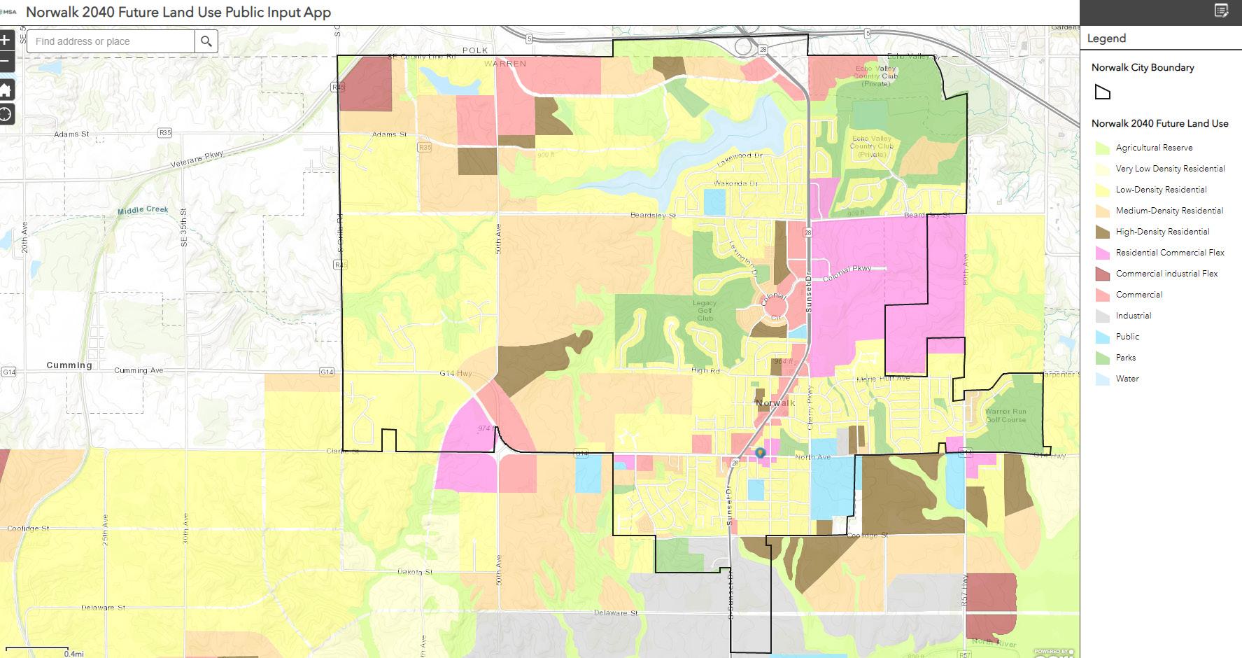
• Likes:
- Parks and Golf Courses
- Opportunities for medium density
- Appropriately located higher density
• Dislikes:
- Certain intersections
- Land use categories that could be left as green space
- Potential for higher density and traffic
• Ideas:
- Park enhancements
- Roundabouts
- Commercial opportunities
• Questions:
- Concerns relating to existing uses and how things might change
• Other:
- Ways to highlight the scenery in the North Shore area
• 1 idea leads to several
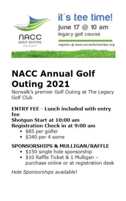
MSA hosted booths at local community events to engage the public and gather feedback to create the 2042 Comprehensive Plan.
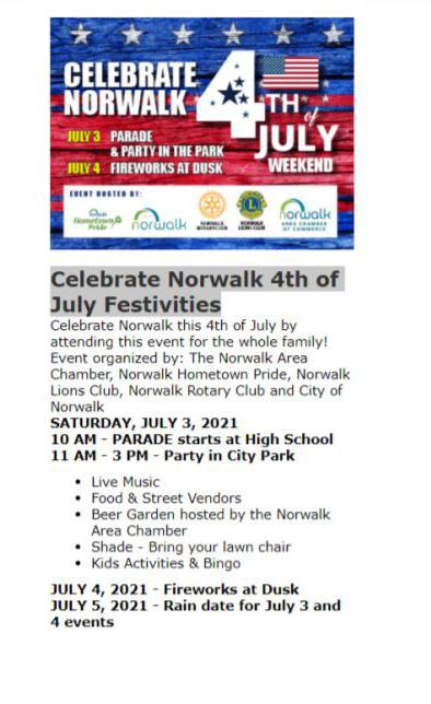
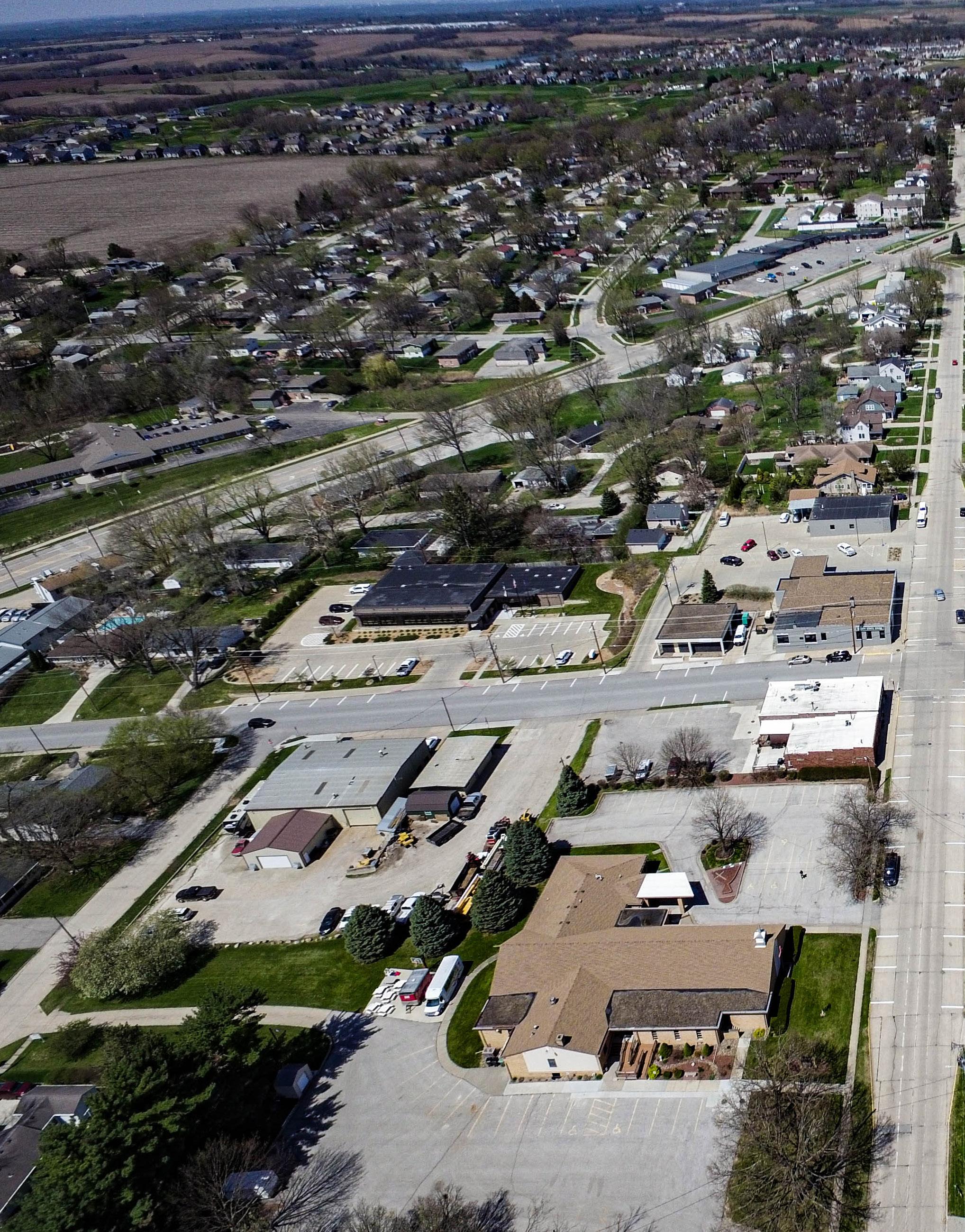
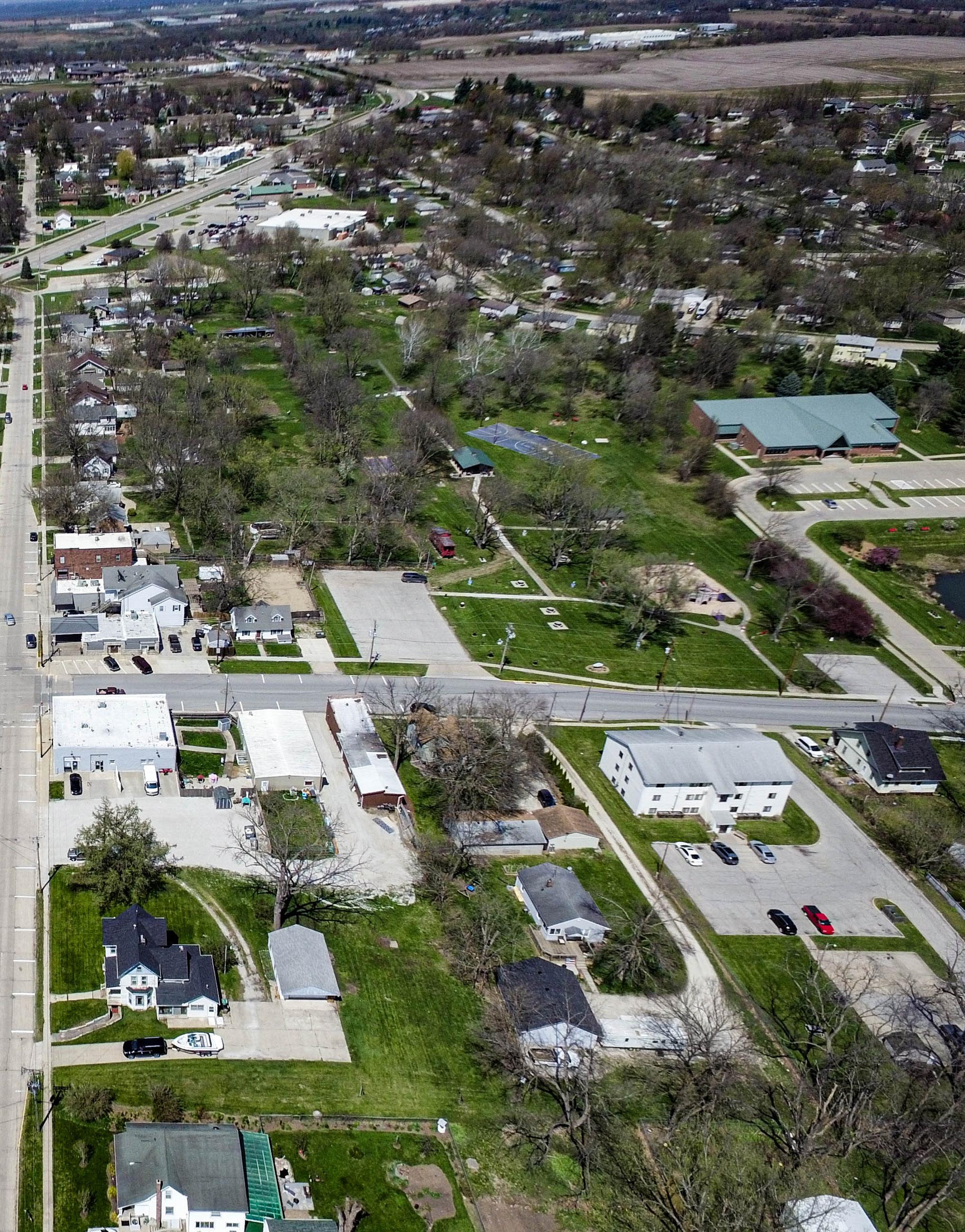

This chapter contains goals and strategies established through the planning process, public engagement activities, Steering Committee input, and the Community Profile. The goals and strategies have been divided into the following categories: community facilities and services, transportation, parks and recreation, agriculture and natural resources, housing, economy and employment, intergovernmental cooperation, and resilience.
This section defines goals and strategies as follows:
Goals:
A long term target that states what the community wants to accomplish. Written in general terms, the statement offers a desired condition through implementation.
Strategies:
A strategy is a statement that identifies a course of action to achieve a goal. They are more specific than goals and are usually attainable through planning and implementation through direct action.
An overview of the goals are listed on the following page. Each goal has at least two strategies for achieving the goal, these are listed throughout this chapter. For action items that can be used to implement these goals and strategies, please refer to Chapter 5.
These goals and strategies are designed to facilitate the implementation of Norwalk’s vision statement:
1. Maintain reliable, quality services, utilities, and facilities to encourage growth and reinvestment.
2. Ensure that public facilities and City provided services meet the needs of residents and businesses, especially as new development increases demand for those facilities and services.
1. Develop and support a comprehensive system of safe, aesthetically pleasing, and useful open spaces and trails that serve the entire community.
2. Provide a robust recreation system for all residents and visitors.
1. Retain and attract residents including young professionals, families, and retirees by supporting a range of housing options.
2. Maintain quality housing and community character by encouraging the maintenance and improvement of the existing housing stock and properties throughout the community.
1. Coordinate with Warren County, neighboring counties, and neighboring municipalities to optimize regional planning efforts.
2. Partner with local, state, and federal agencies to enhance the culture and resources of Norwalk.
1. Develop a comprehensive system that provide accessibility to traditional and alternative modes of transportation effectively throughout Norwalk.
2. Provide guidance for safe, efficient, coordinated, and convenient multi-modal transportation system that is integrated with land use and development plans, and that protects and enhances natural resources.
1. Manage, enhance and preserve land and water resources and the natural environment by avoiding development on high value wetlands and floodplains.
2. Protect and enhance the natural settings unique to the character of Norwalk.
1. Strengthen the local economy of Norwalk.
2. Prioritize development of the physical environment that supports local businesses and increases accessibility to local businesses.
1. Encourage sustainable practices throughout the community including development and infrastructure practices.
2. Establish and promote a unique and welcoming community culture.
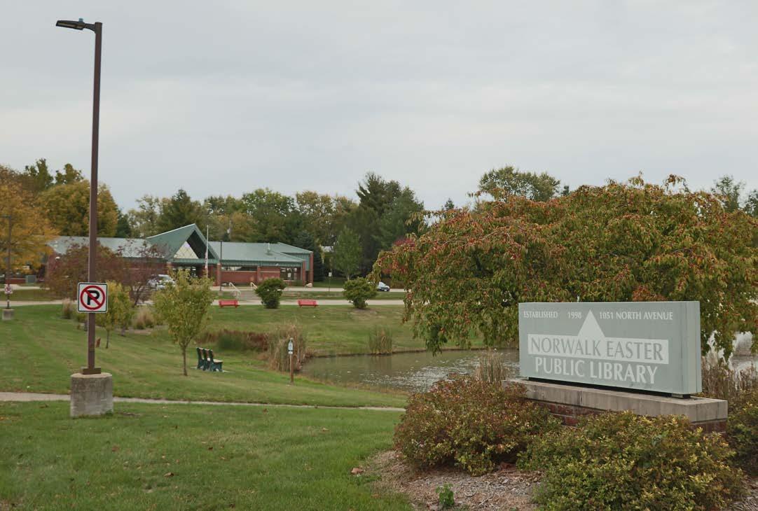
Public and private utilities are a fundamental need for growing and sustaining a community, and important to the residents of Norwalk. Without comprehensive public and private infrastructure, facilities, and services, the continued suburban growth of the community would stall. Below are some goals and strategies to help overcome these challenges and others related to the community’s infrastructure.
1. Support policies that enhance natural areas through the development process.
2. Develop design guidelines for community gateways and wayfinding signage that welcomes visitors and coheres future and existing aesthetics.
3. Encourage connectivity among new and existing developments through pedestrian and bicycle facilities.
4. Explore development incentives that prioritize infill development/redevelopment and utilize existing public infrastructure.
Goal #2 Ensure that public facilities and services meet the needs of residents and businesses, especially as new development increases demand for those facilities and ser vices.

Strategies:
1. Develop a first responders and essential services expansion plan to accommodate anticipated growth.
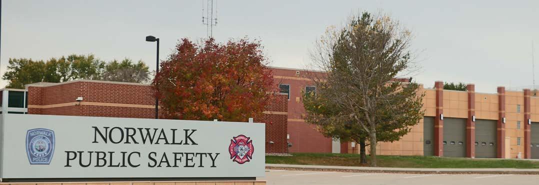
2. Maintain maintenance and replacement schedule.
3. Adopt community engagement procedures into City Code.
A community’s mobility network is a vital community feature and should be able to facilitate all modes of movement. Transportation is about the ability to readily and safely gain access to work, school, shopping, recreation, medical care and social gatherings. Norwalk is fortunate to have easy access to Interstate 35, Highway 5, and the greater Des Moines Metro region. The City’s future transportation network should anticipate the needs of users of different types of transportation methods and ensure efficiency and safety across the system.
Goal #1 Develop a comprehensive system that provides accessibility to traditional and alternative modes of transportation effectively throughout Norwalk.
Strategies:
1. Prioritize maintenance and improvement of transportation infrastructure to support business and employment growth.
2. Maintain and utilize pavement repair/replacement schedule.
3. Maximize traffic efficiency along Iowa 28 corridor.
4. Coordinate transportation plans with other city and regional plans.
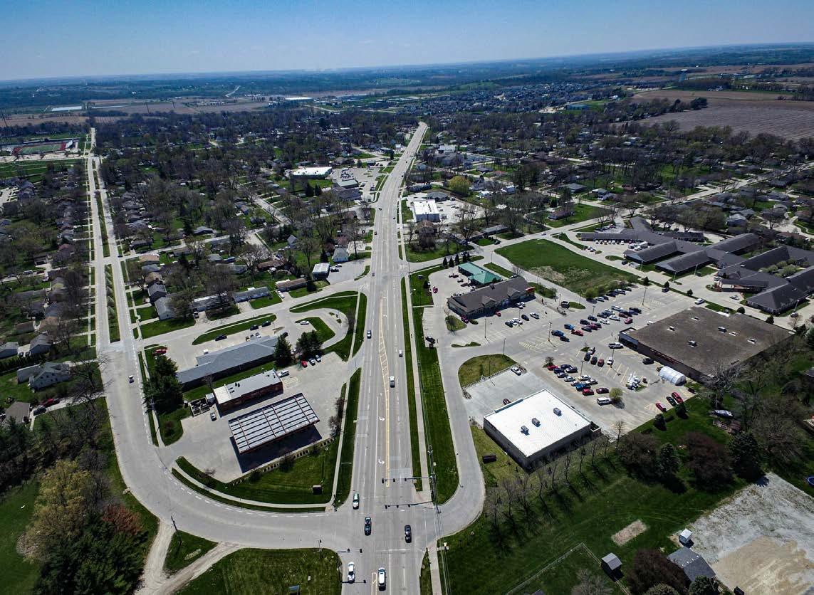
Goal #2 Provide guidance for a safe, efficient, coordinated, and convenient multi-modal transportation system that is integrated with anticipated land use and development plans, and that protects and enhances natural resources.
Strategies:
1. Encourage development of environmentally-friendly multi-modal transportation facilities.
2. Encourage non-vehicular transportation options and overall connectivity.
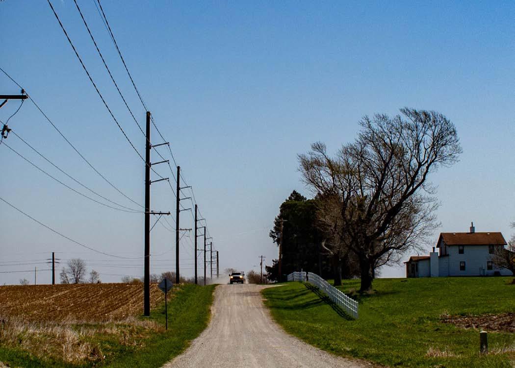
3. Prioritize safety in multi-modal transportation development.
4. Explore alternative parking space requirements that reduce the need for large parking lots.
5. Explore opportunities for more comprehensive multi-modal transportation within the City and throughout the region.
Norwalk’s easy access to recreation ranks very high on the list of contributions towards an improved quality of life. These recreational amenities provide residents and visitors with a higher quality of life and will help keep the community growing and thriving. Additionally, recreational opportunities add economic value and positively affect property value, tourism, and commerce. Below are some goals and strategies to support recreation, parks, and trails in Norwalk.
Goal #1 Develop and support a comprehensive system of safe, aesthetically pleasing, and useful open spaces and trails that serve the entire community.
Strategies:
1. Increase accessibility to trails, parks, and open spaces.
2. Prioritize distribution of adequate green space in future development.
3. Collaborate with regional governments, agencies, and organizations to connect Norwalk’s recreational trails to the Central Iowa Trails system.
4. Establish a trail system which enhances the community’s walkabilty, and provides safe access to community parks, schools, and regional trail systems.

Goal #2 Provide a robust recreation system for all residents and visitors.
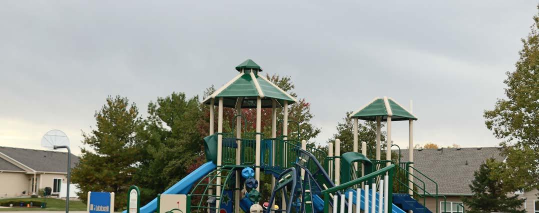

Strategies:
1. Collaborate with adjacent municipalities and agencies for recreation facilities and programs.
2. Improve accessibility of recreation facilities and programs for residents and visitors.
3. Diversify recreational facilities to expand opportunities for numerous activities.
Norwalk has many natural areas that are vital to the well being of the community and the health of the regional ecosystems. There is also productive agriculture surrounding the community that provides current and future economic growth and wealth. This section outlines the goals and strategies for preserving, protecting and restoring natural and agricultural resources. These systems are often interconnected and these strategies address water, land, wildlife, air, vegetation, food systems, and the welfare of the City’s resources.
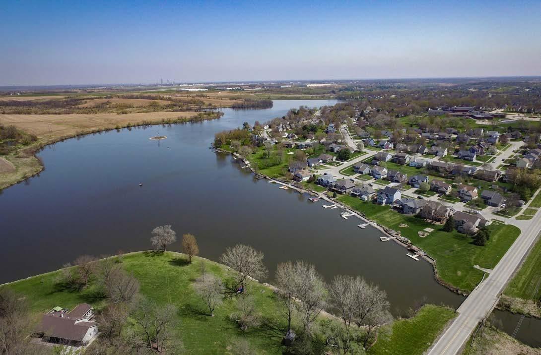
Goal #1 Manage, enhance, and preserve land and water resources and the natural environment by avoiding development on high value wetlands and floodplains.
Strategies:
1. Protect wetlands from unmitigated negative impacts.
2. Support healthy watersheds.
3. Enhance existing natural areas.
Goal #2 Protect and enhance the natural settings unique to the character of Norwalk.
Strategies:
1. Encourage use of greens pace in new developments.
2. Conserve and restore natural features such as trees and natural waterways.
3. Support community gardens, farmers markets, and other similar community based food projects.
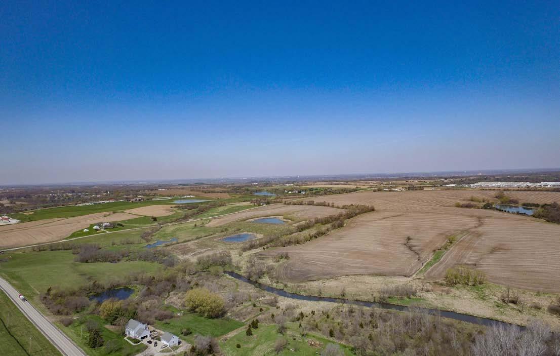
Successful and economically vital communities are built from collaborative efforts among the City, local school district, businesses, and organizations. They also form relationships with regional organizations, for example Warren County, the nearby cities, the State of Iowa, and federal agencies. This section helps inform the City’s strategy on collaboration with those entities and provides guidance on reaching out to new partners and maintaining existing relationships.
Goal #1 Retain and attract residents including young professionals, families, and retirees by supporting a range of housing options.
Strategies:
1. Encourage development and redevelopment of mixed-density neighborhoods.
2. Produce and maintain community facilities, utilities, and infrastructure that are attractive to developers, current residents, and future residents.
3. Support the development of homes that serve a diverse population.
4. Reduce barriers to housing development opportunities.
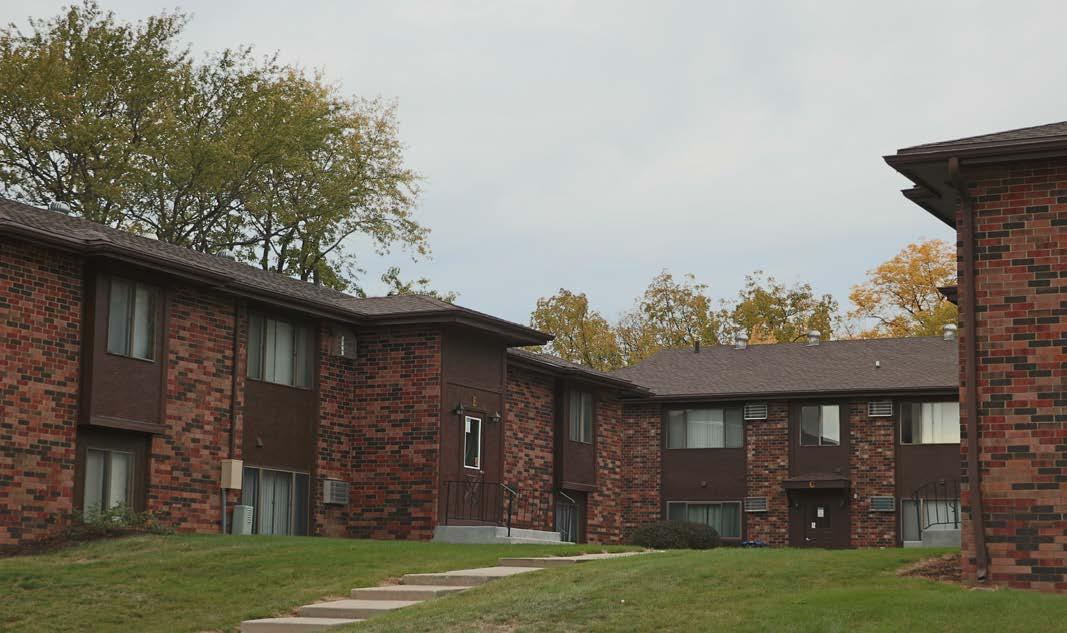
Goal #2 Maintain quality housing and community character by encouraging the maintenance and improvement of the existing housing stock and properties throughout the community.
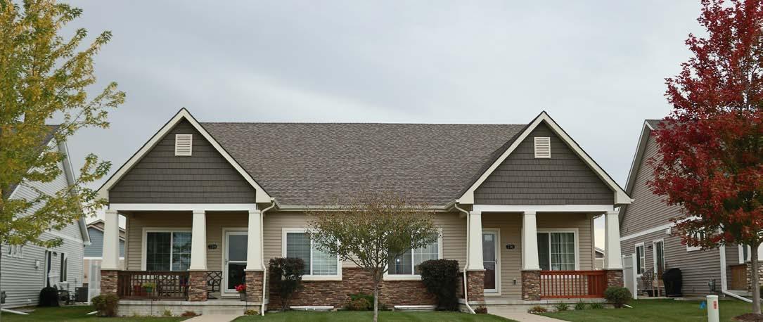

Strategies:
1. Reduce barriers to housing opportunities for current and future residents.
2. Pursue opportunities to improve existing housing stock.
3. Improve the local rental process for both renters and tenants.
Economic development is realized through the growth and retention of jobs, a diversity of business types, and subsequent increases in buying power, investment in the built environment, and a general improvement in the community’s quality of life. Creating economic prosperity requires the collaborative efforts of public and private entities and the support of the community overall.

Norwalk recognizes the economic success and a focus on workforce development requires extensive collaboration with other public entities - the City will be an active partner in these efforts and will avoid duplication of services for efficiency purposes. Support for these efforts may include staff time, funding, policies, endorsement and promotion of projects.
1. Support the development of public and private partnerships that aid existing and potential businesses.
2. Provide guidance for future economic growth.
3. Coordinate exisitng community plans to direct development incentives, annual budgets, and capital improvement planning
4. Improve neighborhood resilience and market Norwalk as a premier place to grow families and businesses.
Goal #2 Prioritize development of the physical environment that supports local businesses and increases accessibility to local businesses.
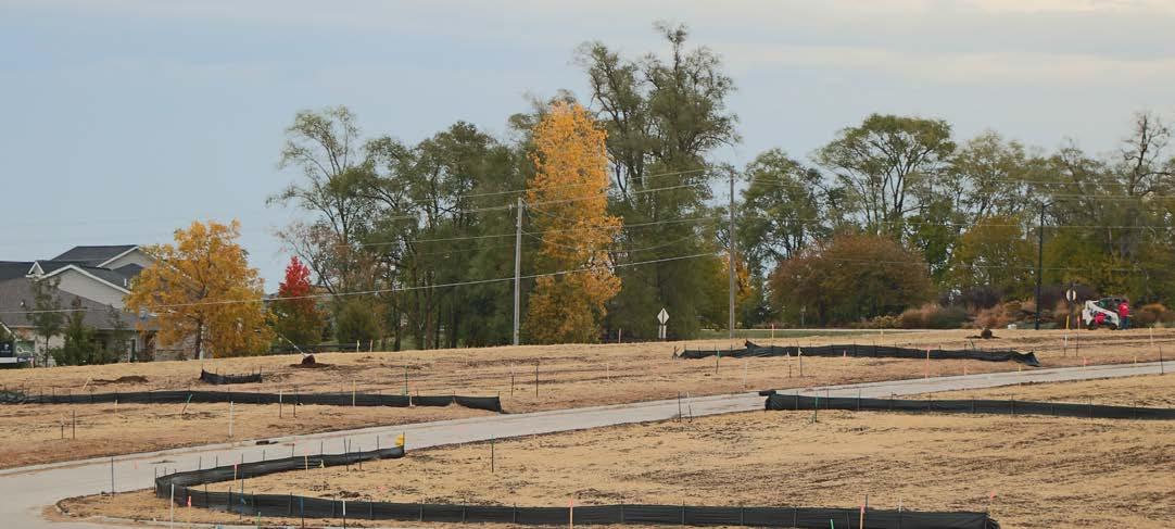
Strategies:
1. Improve visibility of and access to businesses in Norwalk.
2. Create walkable, people-centered places that are enjoyable to inhabit and that enable people to walk between businesses.
3. Focus on revitalization and accessibility of business districts.
Successful and economically vital communities are built from collaborative efforts among the City, local school district, businesses, and organizations. They also form relationships with regional organizations like Warren County, nearby cities, the State of Iowa, and federal agencies. This section helps inform the City’s strategy on collaboration with those entities and provides guidance on reaching out to new partners and maintaining existing relationships.
Goal #1 Coordinate with Warren County, neighboring counties, and neighboring municipalities to optimize regional planning efforts.
Strategies:
1. Coordinate with Warren County and surrounding municipalities to develop mutually beneficial land use plans.
2. Coordinate with local partners to develop a cohesive, convenient transportation system.
3. Communicate and coordinate any changes that may impact Norwalk and its 28E agreements.
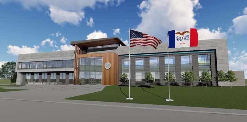
indianola-ia.com
Goal #2 Partner with local, state, and federal agencies to enhance the culture and resources of Norwalk.

Strategies:
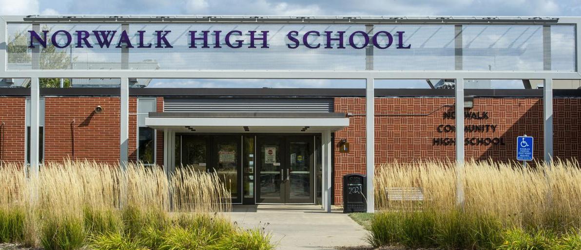
1. Support the Norwalk Community School District in their growth and community engagement activities.
2. Partner with the Norwalk Community School District on land use, utility, and transportation improvement planning.
3. Partner with the Iowa Department of Natural Resources to advance planning efforts for natural resources, green space, and trail development.


Resilience is the ability of a system to respond to, adapt to, and recover from negative events. Resilience has three major components: social, economic, and environmental. Strong social networks, efficient economies and thoughtful government budgets, and the protection of vital natural resources all have a positive impact on a community’s ability to bounce back after unexpected disruptions like natural disasters.
Goal #1 Encourage sustainable practices throughout the community including development and infrastructure practices.

Strategies:
1. Promote environmental sustainability.
2. Engage in maintaining and advertising the Warren County Hazard Mitigation Plan.
3. Support economic sustainability.
Goal #2 Establish and promote a unique and welcoming community culture.
Strategies:
1. Collaborate with local leaders to improve residents’ connections to City departments, local nonprofit organizations, and each other.
2. Encourage interaction among residents through community-wide events and small-scale gatherings such as neighborhood block parties.
3. Encourage neighborhood involvement to increase safety through active participation of residents.
The intent of the Land Use Chapter is to provide a guide to the growth and development of land uses within a community. Decisions over the future land use of a community take into consideration factors relating to the existing land use composition of a community, the location of natural features, the ability to provide adequate water and sanitary services to an area, the proposed alignment of future streets, and the desired character of the community.
The Future Land Use Plan included in this chapter lays out a future vision for Norwalk through the year 2040 and beyond. Land uses have been proposed for more area than is likely needed to create numerous options and provide flexibility for the city and development community. Land uses have been laid out to avoid conflict and promote a harmonious layout in the community.
Goals and strategies related to land use and growth management have been outlined at the end of the chapter.
One of the most important purposes of the Future Land Use Plan is to serve as the basis for determining the appropriate zoning for property being developed or annexed into the City. Chapter 414 of the Code of Iowa, which grants cities the authority to enact city zoning regulations, requires that said zoning regulations, “…be made in accordance with a comprehensive plan…” Therefore, this Comprehensive Plan should be consulted whenever a city zoning code regulation is amended and every time a property is rezoned to ensure that the action is consistent with both the goals and policy recommendations of this plan and with the land use designations as proposed by the Future Land Use Map.
Included within this chapter is a Zoning Compatibility Matrix to provide assistance and guidance on zoning districts that are compatible or partially compatible with each of the future land use classifications.
While the Future Land Use Plan within this chapter represents Norwalk’s preferred future land use layout, the land use plan does not need to remain stagnant or unchanging. If circumstances create an environment in which a conflicting land use is best for the community, the Future Land Use Plan should be amended appropriately to reflect the updated conditions of the community. Should the City find it justified and appropriate to rezone a property in a manner that is not consistent with this plan, the Future Land Use Map (and any impacted policies) should be amended as a part of the rezoning action the ensure consistency with the Comprehensive Plan. Care should be taken to carefully document the justifications for an amendment to this plan and findings adopted as part of the official record.
The intent of the Future Land Use Plan is to build upon the existing community character that exists within Norwalk today. While the Future Land Use Plan does provide opportunity for expanded commercial, industrial, and multi-family growth, the proposed plan affirms the importance of the existing open space, low-density residential, and parks and recreation land throughout Norwalk today.
While single-family homes play a dominant role in Norwalk’s built environment and will continue to do so in the future, areas for a more diverse set of housing types have been shown in the Future Land Use Plan. This will provide more choice to current and future residents and help create opportunities for additional tax base in the community.
Norwalk is conveniently located just south of Highway 5 and in near proximity to Interstate 35. Access to these major arterial roadways have and will continue to contribute to the growth pressures in Norwalk. The Future Land Use Plan takes strategic advantage of this access by expanding proposed areas of commercial, industrial, and residential growth.
The Future Land Use Plan shows a vision for the community with a significant increase in land available for employment land such as industrial, flex and commercial uses. These land uses will help continue to diversify the tax base for the community.
Norwalk has an excellent public and private recreation system available for residents and visitors. Open Space, parks, and recreation continue to be priorities within the community in the Future Land Use Plan. Natural features such as North Creek and its floodplain are preserved within the Future Land Use Plan.
Even within the existing city limits, Norwalk has significant room for new growth and development. The Future Land Use Plan takes full advantage of this opportunity and provides proposed land uses throughout the Norwalk area.
Norwalk is a well-planned, safe, prosperous and growing community, built by citizens and businesses who value education, health, public safety and who enjoy its natural beauty, rural character, and location in the region. As residents and businesses come and go, and economic trends rise and fall, changes will occur. Norwalk continues to place value on long-range planning to ensure the community of today evolves to meet the anticipated needs of the future. The purpose of this 2042 Comprehensive Plan for Norwalk is to establish a shared vision for the community to guide future actions and decisions and assist in projecting and managing growth, change, public improvements and development in the community. This guidance provides predictability and consistency over time, which encourages investment. We plan so that we can act and react in a changing world with a confident understanding of our common values and goals.
The City’s future growth, to be guided by this Comprehensive Plan, will be driven by the Township’s reputation as a leader in K-12 education as well as its proximity to services, higher education, commerce, innovation and proximity to the Des Moines Metro Area. The region’s abundance of quality recreation and business growth opportunities also adds to the quality of life experienced by residents.
This plan is an active part of the community’s efforts to attract people and businesses to the City’s unique small town feel and development opportunities. The content within this plan sets to create the best version of the City for future generations to live, work, play, stay, and learn.
Figure 4.1 breaks down the percentage of each land use category by total acres. Nearly 60% of existing land within the city limits is open space, agriculture or undeveloped. Figure 4.2 breaks down the existing land use of the developed land within Norwalk. Doing so better reflects the built environment in Norwalk. Over half of all built land in Norwalk is low-density residential, which mainly includes single-family detached homes. Nearly one-quarter of the community is parks and recreation land and another 8.5% is public / semi-public, which includes governmentowned land, schools, churches, and other institutions. Typical employment land, both commercial and industrial, represent 5.5% and 2.3%, respectively. Medium and highdensity residential land collectively represent less than 5% of existing land uses.
The map below shows the geographic distribution of existing land use in Norwalk. Most of this land is located in west Norwalk as shown in light green. Around 22% of the remaining land is low-density residential, shown in light yellow. The next largest land use category by total acres is parks and recreation, shown in darker green, which includes park facilities as well as golf courses. The large amount of open space, agriculture and undeveloped land leaves only small percentages for the remaining land use categories.
Existing Land Use Map - Norwalk, IA
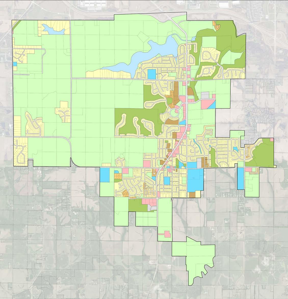
Norwalk City Limits
Open Space / Undeveloped
Low-Density Residential
Medium-Density Residential
High-Density Residential
Parks & Recreation
Public / Semi-Public
Commercial
Industrial
Developing
Water
The Future Land Use Plan was created using a set of Future Land Use categories, which are defined below with general purpose and typical uses.
General Purpose:
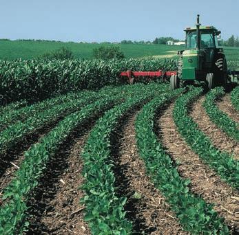
This land use category is designated for those areas that: are located within the floodplain; may have steep topography; are large areas of wetlands or significant trees; or may consist of high value farmland. As within most of Iowa, the Corn Suitability Ratio (CSR) should be considered but is not intended to be a factor in slowing future growth within Norwalk’s planning area. Land being zoned or developed that includes area designated as Agricultural Reserve/Open Space should preserve these areas as natural open space, park land or buffers.
Typical Uses:
1. Crop production, including grazing lands
2. Private grain storage
3. Residential structures in connection with farming operations
4. Renewable energy equipment
5. Tourism activities such as hunting preserves, fishing, etc.
General Purpose:
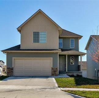
This is the future land use category is dominated by single-family detached dwellings with a typical density of 1 to 5 dwelling units per acre. Typical lot sizes will range from 7,500 to 15,000 sq. ft. Lots should include public or private street frontage and driveway access and may also include an alleyway.
Typical Uses:
1. Single-family detached residential structures (7,000 sq. ft. to 3-acre lot sizes)
2. Accessory structures that are subordinate to the primary structures
3. Religious uses and structures
4. Educational uses and structures
5. Community/Recreational Center
6. Parks
7. Mobile home parks provided the facilities meet a specific set of design criteria.
General Purpose:
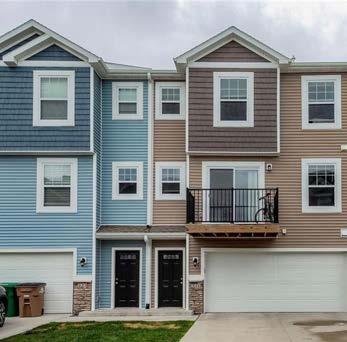
This future land use category consists of a mix of small-lot single-family residential dwellings, row houses, and townhomes with a typical density of 5 to 12 dwelling units per acre. Lots should include public or private street frontage and driveway access and may also include an alleyway.
Typical Uses:
1. Single-family residential dwellings
2. Two-family residential dwellings
3. Single-family horizontally attached residential dwellings, townhouses
4. Necessary accessory uses and structures that are subordinate to the primary structure
5. Religious uses and structures
6. Educational uses and structures
7. Community/recreational center
8. Parks
9. Mobile home parks, provided the facilities meet a specific set of design criteria.
General Purpose:
The High Density Residential land use category typically contains denser areas of residential rather than the standard single-family development that has occurred in Norwalk for the past 30 to 40 years. This category will include items such as smaller single-family lots and denser development types such as multi-family and apartment structures. Density will range between 5 to 18 dwelling units per acre.
Typical Uses:
1. Single-family horizontally attached residential dwellings, townhouses
2. Condominiums
3. Multi-family dwellings including apartments

4. Necessary accessory uses and structures that are subordinate to the primary structure
5. Parks
6. Religious uses and structures
7. Educational uses and structures
8. Community / Recreational Center
New Urbanism
General Purpose:
This specific “Flex” category is intended to be used in locations where a mixture of residential use (Medium to High Density) and General/Neighborhood Commercial uses would be appropriate. These areas should be located along major arterials and at the intersections of major arterials. These areas could also contain a mixture of uses directly within the same building.
Typical Uses:
1. Single-family horizontally attached residential dwellings, townhouses

2. Condominiums
3. Multi-family dwellings including apartments (horizontal design versus vertical)
4. Necessary accessory uses and structures that are subordinate to the primary structure
5. Religious uses and structures
6. Educational uses and structures
7. Community/Recreational Center

8. General and Neighborhood level commercial and office uses
9. Mixed Uses by Planned Unit Development
Commercial / Industrial Flex
General Purpose:
These areas are similar in concept to the New Urbanism Land Use. This is an area where mixtures of commercial and lighter industrial uses are allowed to coexist.
Typical Uses:
1. General commercial uses
2. Wholesale businesses
3. Necessary accessory uses and structures that are subordinate to the primary structure
4. Religious uses and structures
5. Educational uses and structures
Parks & Recreation
General Purpose:
The Parks & Recreation future land use category is set aside for public, private and semi-private recreational land such as parks, trails, golf courses, greenways, and recreation fields. Ownership may be private but is often public and available for use by all residents and visitors.


Typical Uses:
1. City park or recreation land
2. Greenway or trails
3. Golf courses
4. Recreational playing fields or complexes
Public / Semi-Public
General Purpose:
This land use category is set aside for public and semi-public land such as city / county / state owned land, institutional land such as schools or libraries, as well as land set aside for utilities.
The Public / Semi Public future land use category includes publicly owned land such as City Hall, the library, and police/fire facilities. It also includes semi-public land such as cemeteries. Institutional facilities such as schools and universities land also fall into this category.
Typical Uses:
1. City, County, State or Federally owned properties
2. Institutional uses such as schools or libraries
3. Semi-public land such as cemeteries
General Purpose:
This land use category is intended to provide an area for basic commercial/retail/office uses to occur. These areas may be groupings of buildings and structures or individual buildings. These areas are intended to provide goods and services as well as a small employment center for the immediate area in Norwalk.
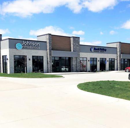
Typical Uses:
1. General and neighborhood level commercial and office uses
2. Necessary accessory uses and structures that are subordinate to the primary structure
3. Religious uses and structures
4. Educational uses and structures
5. Community/recreational center
General Purpose:
This land use category is intended to provide an area for basic industrial uses to occur. These areas may be developed with groupings of buildings and structures or individual buildings. The ideal situation would be a mixture of light and moderate industrial uses. These areas are intended to act as an employment center for the immediate area in Norwalk.
Typical Uses:
1. Warehousing and storage
2. Self-service storage facilities
3. Adult entertainment when the required guidelines are met
4. Light manufacturing
5. Necessary accessory uses and structure
6. Religious uses and structures
7. Educational uses and structures
8. Community/recreational center
The map below shows the planning boundary created for the Norwalk Comprehensive Plan Update. The planning boundary extends far beyond the existing city limits for several reasons. While not all areas of the planning boundary will develop within the planning horizon year, the large planning boundary provides flexibility with several new areas proposed for different land use types. The map can also be referenced when reviewing proposed development outside of existing city limits within the community’s two-mile extraterritorial review area to see if the proposed land use is consistent with planned future uses for the area. This large planning boundary works to preserve the long-term boundaries of the community by limiting incompatible land development and preserving right-of-way for proposed future streets.

Planning Boundary - Norwalk, IA
Planning Boundary
Norwalk City Limits
Nearby Cities
Floodplain
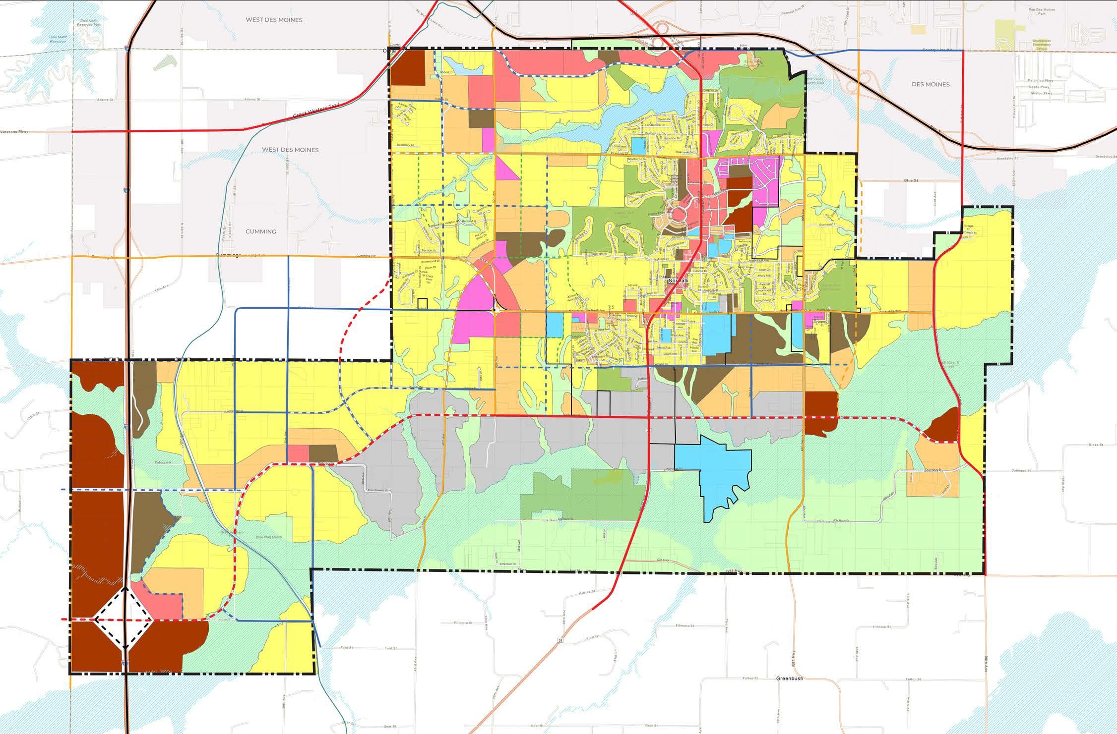
The following pages contain the Future Land Use Map for Norwalk. This map will help guide growth and development through 2040 and beyond. The Future Land Use Plan creates opportunities throughout the community for additional residential, commercial, and industrial land. The Land Use Plan shows a large expansion of residential land at all density levels. While low-density residential remains the dominant land use type, the plan shows a significant increase in the amount of proposed mediumdensity residential land, which provides more diverse housing types at density levels that match the look and feel of the community. High-density residential has also been proposed at key intersections throughout the planning boundary.
The plan shows a large, proposed expansion of Industrial land in Norwalk, south of existing city limits and north of North Creek. Commercial industrial flex, general commercial, and higher density residential land is shown along the Interstate 35 corridor. Several proposed arterial and collector streets are shown in dashed lines on the map. Also included is a proposed additional interchange on Interstate 35 near the intersection with Filmore Street. This new interchange would greatly improve Norwalk’s ability to utilize its proximity to Interstate 35 for commercial and industrial / flex land uses.
The chart below shows the breakdown by total acres for each future land use category. Over 30% of land is shown as Agricultural Reserve - mainly areas with floodplain. The dominant built land use is lowdensity residential followed by medium-density residential. Employment land (industrial, commercial industrial flex, and commercial land uses) account for just over 16% of the future land use area.
Planning Boundary
Norwalk
Nearby Cities
Parcel
Floodplain
Great Western Trail
Future Greenbelt Corridor
Future Land Use + Streets Draft 11-16-2022
Existing Highway
Existing Major Arterial
Existing Minor Arterial
Proposed Minor Arterial
Existing Major Collector
Proposed Major Collector
Proposed Minor Collector
Agriculture Reserve
Low-Density Residential
Medium-Density Residential
High-Density Residential
New Urbanism
Commercial
Commercial Industrial Flex
Industrial Public / Semi-Public Parks & Recreation Water
0 .50 miles .25

The zoning compatibility matrix shows the relationship between the future land use categories and the City of Norwalk’s existing zoning districts. Zoning districts have been listed as either compatible (“C”) or partially compatible (“PC”) within each of the corresponding land use categories.
This matrix should be used as the basis for determining the appropriate zoning district(s) for land that is annexed into the City or as a property rezoning is being considered. As noted at the beginning of this chapter, if the zoning desired for a given property is incompatible with its land use designation, the designation on future land use map should be first amended accordingly. In certain situations, an update or amendment to this matrix may be warranted to address changes in development patterns or revisions to the City’s zoning code regulations.
The figure below identifies the annexation priorities for the City of Norwalk. In order to protect the City’s potential growth boundary, Areas “A” should be very high priority for voluntary annexation and infrastructure investment necessary to secure voluntary annexations petitions. Annexation within Areas “B” are secondary priorities, and Areas “C” should occur as development warrants and infrastructure extensions are completed. Due to their limited development potential, the areas not identified on this map should be low priority for annexation. All annexations should be voluntary in nature following the provisions of Iowa Code Section 368.7. The City of Norwalk has no intention to conduct involuntary annexations of territory as further prescribed in the Iowa Code Section 368.11.
Annexation Priority Plan

Strategies:
1. Consult the Comprehensive Plan when reviewing rezoning requests and development proposals (including subdivisions within the City’s 2-mile extra-territorial review area) to determine if they are consistent with the Comprehensive Plan’s Future Land Use Plan and related goals and strategies.
2. Require new development connect and extend street, water, and sanitary sewer infrastructure necessary to both serve their project and allow for future development of the neighboring properties.
3. Require new developments and subdivisions (including rural development) have public streets built to City design standards and have at least one access point to a paved street network.
4. Consider prohibiting or discouraging private streets.
5. Require any proposed development that cannot connect to City sewer and/or water provide dry sewer mains, easements, plans, and agreements to connect at some point in the future when service is available.

6. Preserve right-of-way and easement corridors for future streets and utilities.
Goal #2 Promote walkable and interconnected neighborhoods to maintain the small town feel of Norwalk.
Strategies:
1. Limit the use of cul-de-sacs and dead-end streets and require collector streets connect through proposed developments to provide multiple streets in which to circulate traffic.
2. Require new development construct sidewalks and trails and connect these trails and sidewalks to existing and future adjoining developments.
Goal #1 Grow Norwalk in a manner that is financially sustainable and maintains and improves the community’s quality of life.
Goal #1 Conserve Norwalk’s natural resources and protect property from flooding and erosion.
Strategies:
1. Consider adoption of stream buffer, slope preservation, and tree canopy preservation ordinances to protect the natural areas and City’s watersheds from over-development.
2. Prohibit development within the floodplain.
Strategies:
1. Develop an annexation and infrastructure investment priority plan and work with area property owners within those areas to annex into the City of Norwalk when appropriate to make land available for development.

2. Discourage rural subdivisions within the City’s 2-mile extra territorial review area that either do not meet the City’s subdivision regulations or are not consistent with the Comprehensive Plan.
3. Create an infrastructure extension plan to provide the backbone for major infrastructure, including streets, bridges, sanitary sewers and water service, as necessary to prepare areas for future annexation and development.

Responsibility for implementing this plan lies primarily with the Planning and Zoning Commission and City Staff.
City Council sets priorities, approves budgets and tax rates, and often has the final say on key aspects of public and private development projects. The value and legitimacy of this plan is directly related to the degree to which Council members are aware of the plan and expect City actions to be consistent with this plan. Each Council member should have a copy of this plan and be familiar with the major goals and objectives described herein. The City Council should expect and require that staff recommendations and actions both reference and remain consistent with this plan, or that the plan is amended as needed to fit changing conditions.
Land use and development recommendations are a core component of this plan, and the Planning and Zoning Commission has a major role in guiding those decisions. Planning and Zoning Commission members shall each have a copy of this plan and shall be familiar with the content, especially Chapter 4: Land Use. It is generally the responsibility of the Planning and Zoning Commission to determine whether proposed projects are consistent with this plan, and to make decisions and recommendations that are consistent with this plan. In cases where actions that are inconsistent with this plan are deemed to be in the best interest of the City, the Planning and Zoning Commission should initiate efforts to amend the plan to better reflect City interests. This will help to reinforce the legitimacy of the plan as an important tool in guiding City decision making.
City staff have a significant influence on the selection and completion of all kinds of capital and operational projects. It is imperative that City staff know about, support, and actively work to implement the various strategies and actions in this plan.
Specifically, the following people should consult and reference the comprehensive plan during goal-setting processes, annual budgeting, planning for major public projects, and in the review of private development projects:
• City Manager
• Community Development Staff
• Economic Development Staff
• Public Works Staff
These key staff members are expected to know and track the various goals, strategies, and vision laid out in this plan, and to reference that content as appropriate in communications with residents, business owners, and elected and appointed officials. All other staff members should be aware of the plan and the connections between the plan and City projects. The purpose of this extra effort is to strengthen staff recommendations and reinforce the plan as a relevant tool integral to City functions and decision making.
Implementation of this plan also depends on the actions and decisions of entities other than City government. Some responsible, non-municipal parties that the City collaborates with include:
• Norwalk Community School District
• Warren County
• Iowa Department of Transportation
• Iowa Department of Natural Resources
• Des Moines Area Metropolitan Planning Organization
It is necessary to persuade these entities to be active partners in the implementation of the vision, goals, and strategies of this plan.
The following City activities can support this effort:
• Share this plan with each organization, including a memo highlighting sections of the plan that anticipate collaboration between the City and the organization.
• Take the lead role in establishing a collaboration for key or crucial initiatives of the City that require regional collaboration
• Know and communicate the intent of relevant objectives and strategies—partner organizations need to understand and buy into the rationale before they will act.
• Utilize the goals and vision from the plan to support requests for monetary support for City efforts.
Many of the strategies identified in this plan presume the use of existing City ordinances, regulations, and programs. The City’s key implementation tools include:
Operational Tools
• Annual Goal-Setting Process
• Annual Budget Process
• Capital Improvement Plan
Regulatory Tools
• Building and Housing Codes
• Zoning Ordinance
• Subdivision Regulations
• Warren County Ordinances
• State Regulations
• Federal Regulations
Funding Tools
• User Fees
• Tax Abatement
• Tax Increment Financing (TIF) Districts
• Development Fees
• State, Federal, and Private Grant Programs
Surrounding Area Comprehensive Plans
• Warren County Comprehensive Plan
• Madison County Comprehensive Plan
• Des Moines Metropolitan Area Plans
• City of West Des Moines Comprehensive Plan
• City of Cumming Comprehensive Plan
• City of Des Moines Comprehensive Plan
• Iowa DOT Future Improvement Plans
The Action Plan detailed on the following pages is designed as a guide to help City officials, community leaders, and private investors prioritize opportunities and address issues with the City and the surrounding area. The desired vision for the City cannot be created over night. However, by incrementally implemented the recommendations within this plan, the City can achieve the desired outcomes set forth in this comprehensive plan.
To provide lasting value and influence, this plan must be used and referenced regularly, especially during budgeting and goal setting processes. To inform the annual processes, City staff will prepare a concise Comprehensive Plan Annual Report for the City Council with input from the Planning and Zoning Commission, including the following information.
• Action items in progress or completed during the prior 12 months (celebrate successes!)
• Staff recommendations for action items to pursue during the next 12 months, including removing or adding items.
• City actions and decisions during the past 12 months not consistent with the plan (if any).
• Staff recommendations for any amendments to the adopted plan.
The most important opportunity for this plan to influence the growth and improvement of the City is through the annual goal-setting, budgeting and capital planning processes. These existing annual efforts determine what projects will and will not be pursued by the City, so it is very important to integrate this plan into those processes every year.
The compilation of actions in the next section is a resource to support decisions about how and where to invest the City’s limited resources. The Annual Report should draw from these actions and decisions. The Planning Commission should make formal recommendations for the Council’s consideration, identifying those choices and commitments most likely to further the goals and objectives identified in this plan.
The following process and schedule is recommended.
Step 1 - Staff completes the Comprehensive Plan Annual Report.
Step 2 - Planning Commission considers Annual Report and makes formal recommendation to Council regarding action items to pursue any comprehensive plan amendments.
Step 3 - Department Directors consider Annual Report and Planning Commission recommendations and complete goal setting exercises. Council holds a public hearing and considers adoption of any comprehensive plan amendments.
Step 4 - City Council goal setting
Step 5 - Budget preparation process
Step 6 - Budget Adopted
Below are several of the broad funding sources available to help offset costs to complete the projects listed in this plan.
It is assumed that some general funds and/or general obligation bonds will be required to assist with the completion of projects or as a matching sources for state or federal grants.
Particular projects that benefit individual properties (e.g. water, sewer, or sidewalk installations) could be funded through special assessments whereby the City recoups initial design and construction costs through increased property tax assessments on those properties for a set period of time.
Projects related to drinking water, sanitary sewer, and storm water could be funded using system revenues, bonds, or fees collected from system users across the community.
Donations, Grants - Some of the wayfinding projects could be partially or fully funded through private donations or public fund raising. Funding for other infrastructure projects can also be offset by using funds from impact fees the City collects as part of the approval of new development.
There are many different state or federal grants and programs that many be able to offset the costs of some of the identified projects. Only those programs most likely to award funding to are listed.
Tax increment financing is a program where the additional taxes generated from a development in a TIF district would go towards specified public improvements in a community. This program helps the impacts of new development on a community while improving the attractiveness of the City.
Norwalk Iowa Chamber of Commerce
Des Moines Area Metropolitan Planning Organization
Warren County Conservation
Warren County Soil and Water Conservation District
Iowa Department of Natural Resources
Iowa Department of Transportation
Norwalk Police Department
Norwalk Fire Department
Norwalk Public Library
Heart of iowa Regional Transportation Agency
Norwalk Community School District
Goal 1: Maintain reliable, quality services, utilities, and facilities to encourage growth and reinvestment. Support policies that enhance natural areas through the development process.
Develop design guidelines for community gateways and wayfinding signage that welcomes visitors and coheres future and existing aesthetics.
Review
and
Identify areas where infill or redevelopment are feasible and prioritize design standards and development incentives that utilize infill and redevelopment areas
Establish a dangerous and dilapidated program to identify and address dangerous and dilapidated areas.
immediate City of
Norwalk
3 ongoing City of Norwalk
3 ongoing City of Norwalk
Goal 2: Ensure that public facilities and City provided services meet the needs of residents and businesses, especially as new development increases demand for those facilities and services
Develop a first responders and essential services expansion plan to accommodate anticipated growth.
Maintain maintenance and replacement schedule.
Conduct community wide first responder needs assessment to determine future needs of fire and police.
Identify and secure a location for new library facility and support library expansion plans.
1 immediate City of Norwalk, NPD, NFD
2 immediate City of Norwalk, NPL
Identify facilities and services that warrant regular feedback. 5 ongoing City of Norwalk
Develop community communication strategy to gather feedback. 2 ongoing City of Norwalk
Identify processes which warrant community feedback. 3 immediate City of Norwalk
Adopt community engagement procedures into City Code.
Establish procedures to conduct community outreach for necessary processes.
3 ongoing City of Norwalk
Goal 1: Develop a comprehensive system that provides accessibility to traditional and alternative modes of transportation effectively throughout Norwalk.
maintenance and improvement of transportation infrastructure to support business and employment growth.
Goal 2: Provide guidance for safe, efficient, coordinate, and convenient multi-modal transportation system that is integrated with land use and development plans and that protects and enhances natural resources. Encourage development of environmentally-friendly multi-modal transportation facilities.
Goal
Prioritize distribution of adequate green space in future development.
with regional governments, agencies, and organizations to connect Norwalk’s recreational trails to the Central Iowa Trails system.
a trail system which enhances the community’s walkabilty, and provides safe access to community parks, schools, and regional
Goal 2: Provide a robust recreation system for all residents and visitors.
for residents
Diversify recreational facilities to expand opportunities for numerous activities.
Goal 1: Retain and attract residents including young professionals, families, and retirees by supporting a range of housing options.
Support the inclusion of rental housing in neighborhood planning efforts to meet the community’s business and employment growth needs.
2 immediate City of Norwalk
Encourage development and redevelopment of mixed-density neighborhoods.
Produce and maintain community facilities, utilities, and infrastructure that are attractive to developers, current residents, and future residents.
Utilize development and land use plans to guide development and placement of a variety of housing units including single-family detached, townhome, duplex, multifamily apartment buildings, and mixed-use buildings, and other forms of housing sought out by home buyers and renters.
Adopt development standards that cohere the community and enhance the built environment.
Engage residents in community development plans to align new development with the needs of residents.
Incentivize mixed-density housing developments.
2 immediate City of Norwalk
Support the development of homes that serve a diverse population.
Encourage and adopt policies and regulations aimed to integrate housing types and density.
5 ongoing City of Norwalk
2 ongoing City of Norwalk
2 immediate City of Norwalk
2 immediate City of Norwalk
Reduce barriers to housing development opportunities.
Regularly review zoning and subdivision codes to ensure they are not a primary barrier to development.
Provide flexibility for desired development opportunities.
2 ongoing City of Norwalk
2 ongoing City of Norwalk
Goal 2: Maintain quality housing and community character by encouraging the maintenance and improvement of the existing housing stock and properties throughout the community.
Reduce barriers to housing opportunities for current and future residents.
Encourage development of a diverse range of housing opportunities.
Increase accessibility of community services (City of Norwalk, Warren County, and regional housing programs) that aid in housing needs.
2 ongoing City of Norwalk
2 immediate City of Norwalk
Pursue opportunities to improve existing housing stock.
Evaluate need and opportunity for dedicated City funding focused towards housing improvements.
Coordinate existing funding including local organizations and grant opportunities to help improve housing stock.
Increase accessibility of rental information for tenants by including information on City website and various public spaces.
3 mid-term City of Norwalk
3 mid-term City of Norwalk
3 immediate City of Norwalk
Improve the local rental process for both renters and tenants.
Provide renters information regarding rental inspection programs and best practices through the City website and various public spaces.
3 immediate City of Norwalk
Goal 1: Strengthen the local economy of Norwalk.
Support the development of public and private partnerships that aid existing and potential businesses.
Support the Norwalk Area Chamber of Commerce and provide resources for businesses to engage with the Chamber via the City website and various public spaces.
Develop City-sponsored events to increase awareness of local businesses.
Engage with the Norwalk community to understand economic needs of businesses and residents.
2 ongoing City of Norwalk, NCC
3 ongoing City of Norwalk, NCC
3 ongoing City of Norwalk, NCC
Provide guidance for future economic growth.
Create a Comprehensive Economic Development Strategy (CEDS) plan to help guide future economic growth.
2 immediate City of Norwalk
Coordinate existing community plans to direct development incentives, annual budgets, and capital improvement planning.
Establish procedures to review, revise, and track implementation of all local community plans.
Incentivize involvement of local businesses and organizations to help improve coordination of local plan implementation.
Improve neighborhood resilience and market Norwalk as a premier place to grow families and businesses.
Direct public and private resource investment into business and residential areas that are in early decline to maximize impact and minimize the potential for blight.
Promote community engagement through opportunities such as events and marketing of said opportunities.
2 immediate City of Norwalk
2 mid-term City of Norwalk, NCC
3 long-term City of Norwalk
3 ongoing City of Norwalk
Goal 2: Prioritize development of the physical environment that supports local businesses and increases accessibility to local businesses.
Improve visibility of and access to businesses in Norwalk. Develop signage regulations that support business advertising. 4 long-term City of Norwalk
Support transportation infrastructure that provides intuitive access to business centers.
2 ongoing City of Norwalk
Create walkable, people-centered places that are enjoyable to inhabit and that enable people to walk between businesses.
Use wayfinding signage throughout the community to direct traffic to local businesses.
Analyze parking regulations to optimize parking availability for customers and employees, minimize unused parking, and promote walkable areas.
Ensure that all land uses are connected by safe and efficient vehicular and non-vehicular transportation infrastructure.
3 immediate City of Norwalk
4 long-term City of Norwalk
2 ongoing City of Norwalk
General City Funding, State and Federal Grants and Programs
Focus on revitalization and accessibility of business districts.
Incentivize beautification methods in business districts (such as plantings, murals, and facade improvements) that create an enjoyable space for residents and visitors to walk.
3 ongoing City of Norwalk
General City Funding, State and Federal Grants and Programs
General City Funding, TIF, Private Funding, State and Federal Grants
Goal 1: Goal 1: Coordinate with Warren County, neighboring counties, and neighboring municipalities to optimize regional planning efforts.
with Warren County and surrounding municipalities to develop mutually beneficial land use plans.
Coordinate with local partners to develop a cohesive, convenient transportation system.
Communicate and coordinate any changes that may impact Norwalk and its 28E agreements.
Be present and active in decisions that impact adjacent and overlapping municipalities. 2
Goal 2: Partner with local, state, and federal agencies to enhance the culture and resources of Norwalk
Support the Norwalk Community School District in their growth and community engagement activities.
Partner with the Norwalk Community School District for land use, utility, and transportation improvement planning.
Partner with the Iowa Department of Natural Resources to advance planning efforts for natural resources, green space, and trail development.
with the school district in their plans for mutually beneficial building and site improvements.
representatives from Warren County Conservation, Warren County Soil and Water Conservation District, and other state agencies to help guide planning efforts and implementation.
Engage in maintaining and advertising the Warren County Hazard Mitigation Plan.
Encourage energy efficiency in buildings, lighting, and infrastructure. 4
Goal 1: Encourage sustainable practices throughout the community including development and infrastructure practices. Promote environmental sustainability.
Support development practices that allow for the capture and use of clean energy that does not negatively impact neighboring properties or future growth opportunities.
Continually monitor local changes that may affect the Warren County Hazard Mitigation Plan. 3
Promote education and awareness regarding hazards and risks in the community.
Establish general cost/benefit analysis procedures to evaluate efficiency of public expenditures and improvements.
Support economic sustainability.
Utilize CEDS, Norwalk Comprehensive Plan, Long Range Transportation Plan, and other local plans to help prioritize future activities and maximize funding strategies for projects.
Goal 2: Establish and promote a unique and welcoming community culture.
Collaborate with local leaders to improve residents’ connections to City departments, local nonprofit organizations, and each other.
Increase opportunities to engage with the local government.
Continue providing and promoting educational opportunities for residents to meet local leaders and better understand processes of local government. 3
Reduce barriers to gatherings by providing temporary exceptions to regulations such as noise ordinances. 4
Norwalk
of Norwalk
immediate
City
City of Norwalk
Goal 1: Grow Norwalk in a manner that is financially sustainable and maintains and improves the community’s quality of life. Consult the Comprehensive Plan when reviewing rezoning requests and development proposals (including subdivisions within the City’s 2-mile extraterritorial review area) to determine if they are consistent with the Comprehensive Plan’s Future Land Use Plan and related goals and strategies.
Require new development connect and extend street, water, and sanitary sewer infrastructure necessary
Require new developments and subdivisions (including rural development) have public streets built to City design standards and have at least one access point to a paved street network.
Adopt and enforce regulations that preserves and enhances community character through the built environment.
Require any proposed development that cannot connect to City sewer and/or water provide dry sewer mains, easements, plans, and agreements to connect at some point in the future when service is available.
corridors for future streets and utilities.
Goal 2: Promote walkable and interconnected neighborhoods to maintain the small town feel of Norwalk.
Require that collector streets connect through proposed developments to provide multiple streets in which to circulate traffic
mobility/connectivity policy that limits the use of cul-desacs and dead-end roads.
Require new development construct sidewalks and trails and connect these trails and sidewalks to existing and future adjoining developments.
Goal 3: Conserve Norwalk’s natural resources and protect property from flooding and erosion.
Consider adoption of stream buffer, slope preservation, and tree canopy preservation ordinances to protect the natural areas and City’s watersheds from over development.
Prohibit development within established floodplains.
Adopt development standards that include appropriate setbacks and mitigation for natural waterways including the analysis and stabilization of waterways adjacent to new development.
Support floodplain delineation studies when floodplain-adjacent development occurs.
Encourage a local culture that promotes and enhances natural spaces including greenbelt preservation along the North River.
Goal 4: Implement a Strategic Annexation Plan
Develop an annexation and infrastructure investment priority plan and work with area property owners.
Discourage rural subdivisions within the City’s 2-mile extra territorial review area that either do not meet the City’s subdivision regulations or are not consistent with the Comprehensive Plan.
Consider coordinating with the county to develop local policies that encourage growth within the City’s 2-mile extra territorial review area to be congruent with the City’s Comprehensive Plan.
Promote development that adheres to the Comprehensive Plan.
Create an infrastructure extension plan to provide the backbone for major infrastructure, including streets, bridges, sanitary sewers and water service, as necessary to prepare areas for future annexation and development.

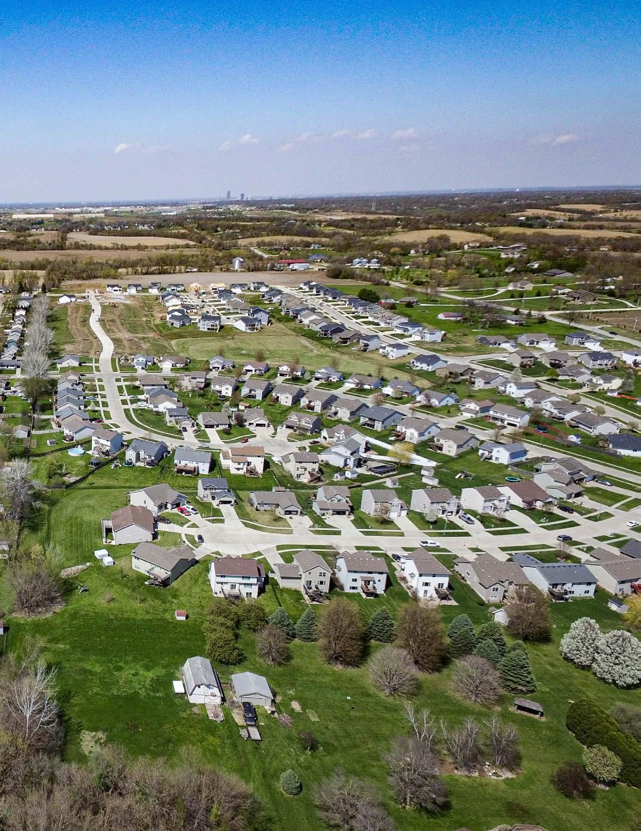
The Community Profile is a summary of current conditions and recent trends in Norwalk, based on the best available data from the City of Norwalk, Warren County, Iowa Department of Natural Resources, Iowa Department of Transportation, United States Department or Agriculture, National Resources Conservation Services, ESRI Business Analyst, United State Census Department, and other resources.
The purpose of the Community Profile is to enable readers of the plan to identify current conditions in Norwalk and with that information make informed choices about the future of the community. This report is included as an appendix to the Norwalk 2042 Comprehensive Plan so that it may be easily updated from time to time as new data becomes available.


The Comprehensive Plan created for Norwalk in 2013 was designed to promote orderly growth and development for the community, as well as provide policy guidelines to enable citizens and elected officials to make informed decisions about the future of the community. The overarching purpose and components of the plan are listed below:
The Purpose of the Plan:
• Guide Future Development
• Encourage a Strong Economic Base
• Serve as an Information / Management Tool
• Analyze Existing Conditions
• Evolve as the Community Changes
• Establish Goals
• Guide with Recommendations
• Encourage Community Engagement
• Identify and Build Upon Community Character
Plan Components:
• Introduction
• Public Participation and Collaboration
• Natural Resources

• Community Character and Redevelopment

• Land Use
• Transportation
• Housing
• Economic Development
• Hazard
• Demographics
• Community Facilities
• Implementation
Identification of Sub Areas
The 2013 Comprehensive Plan also identifies three sub areas within the community that require further study, including the creation of a detailed master plan.
To review the full plan please visit: https://p1cdn4static.civiclive.com/UserFiles/Servers/ Server_6519743/File/Government/Departments/ Economic%20Development/2013_CompPlan5946.pdf
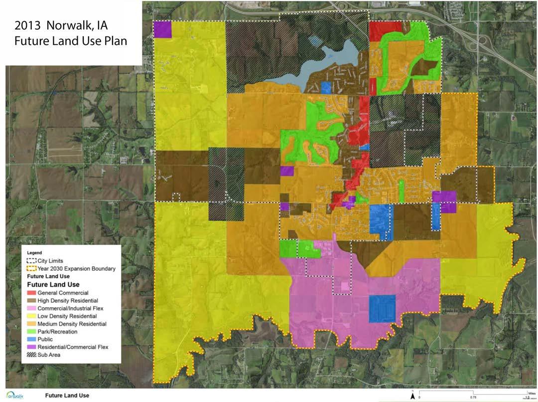


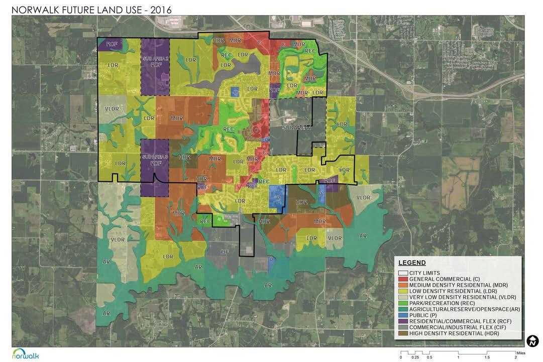
Sub Area 1, located in the Northeast region of Norwalk, has been identified as a quickly growing section of the City’s planning area demonstrating strong potential for development. In addition, the area’s capacity and demand for continued growth serve as key opportunities to create and build upon a cohesive community vision. The community has a desire to plan for and accommodate growth while retaining Norwalk’s small-town atmosphere that makes it an attractive place to live, work and play.
As the population has continued to grow, the city has seen an increased demand for diversity within the transportation network.
The City of Norwalk received a grant from the Greater Des Moines Metro Planning Organization (DMAMPO) to create a plan for Sub Area 1 as a viable and recognizable urban development node. In the Fall of 2015, the City of Norwalk began the process to develop a detailed master plan for the area identified on the Future Land Use Plan as Sub Area 1 with the goal of creating a vibrant and walkable urban center for the community that provides a diverse range of options for housing, retail, recreation, and employment. The Sub Area 1 Master Plan is intended to promote new urbanism concepts and focus on the following:
To review the full plan please visit:
https://p1cdn4static.civiclive.com/UserFiles/Servers/Server_6519743/File/Government/Boards%20and%20 Commissions/Planning%20and%20Zoning/Norwalk%20Sub%20Area%201%20Booklet%20Draft_02152017.pdf


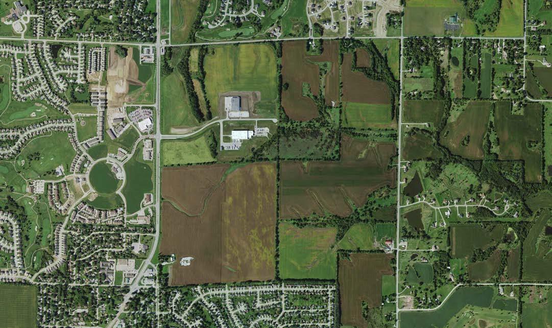
The Comprehensive Park and Open Space Plan is a planning document used to guide future Norwalk park system improvements and acquisitions. The planning process was a joint effort between the City of Norwalk and Snyder & Associates, Inc. The concept was to have a stand-alone plan that aligned with the Comprehensive Plan adopted in 2013 and updated in 2016.
The planning process included an inventory of existing facilities and amenities, public input, geographic review, and service coverage analysis. From this, the following goals were defined:
1. Establish a comprehensive plan to guide the acquisition and development of park and recreation facilities and amenities.
2. Determine a park classification system to evaluate park types and establish service area criteria.
3. Identify potential park locations in areas that have been identified as deficient in the park system as future development occurs.
4. Provide a diversity of recreational facilities to allow for equal opportunities for all residents and visitors.
5. Establish accessible facilities which are compliant with current ADA regulations and guidelines.

6. Establish a trail system which enhances the community’s walkabilty, and provides safe access to community parks, schools, and regional trail systems.
7. Establish a list of improvements to existing park sites and estimates of cost so priorities can be established by City staff and the Parks and Recreation Advisory Commission.
8. Establish a set of needs, priorities, and potential costs for key future park improvements.
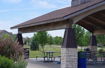
The plan was adopted in January 2018 and remains the guiding document for parks and open space planning in Norwalk.
To review the full plan please visit: https://p1cdn4static.civiclive.com/UserFiles/Servers/Server_6519743/File/Government/Departments/Parks%20 and%20Rec/Norwalk%20Comprehensive%20Park%20and%20Open%20Space%20Plan%20final.pdf

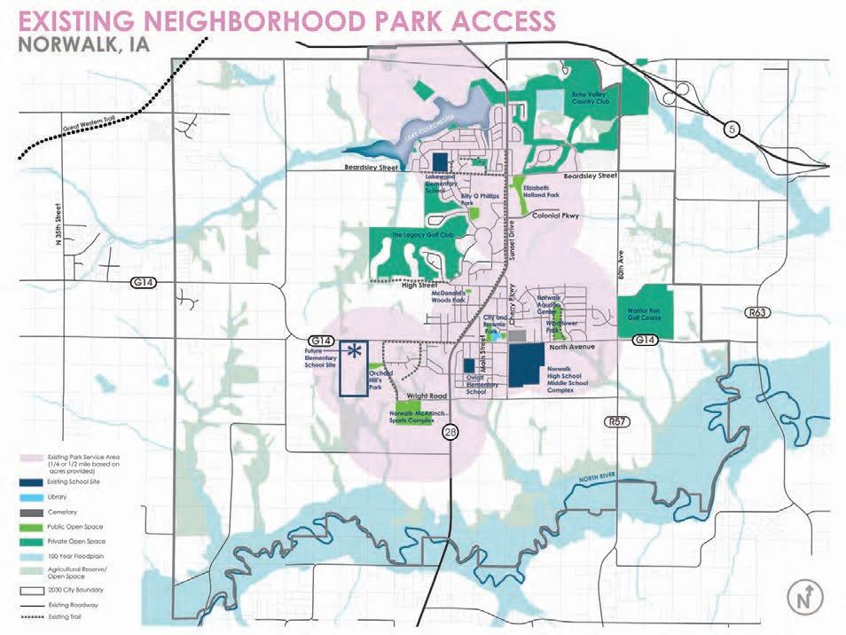

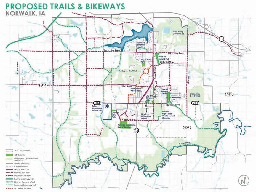

The City of Norwalk has experienced growth over the last several years and needs improved connectivity of established and new neighborhoods to local amenities, community resources, and nearby regional trail systems.
After meeting with the city and gaining an understanding of their vision, Bolton & Menk prepared an approach that allowed the city to use a custom created data collector application through ESRI ArcGIS and complete a focused data collection exercise with volunteers. The Norwalk Greenways Work-group inventoried all sidewalks and trails in the community and evaluated the pavement condition, width, and locations and descriptions of trip hazards encountered.
Through an in-depth analysis of the collected field data and discussions with community members at multiple community outreach events, Bolton & Menk formulated a series of improvement recommendations that created manageable projects the city could implement over the next 10 years. Recommendations focused on establishing significant trail connections, improving pedestrian amenities at key intersections, and filling existing sidewalk gaps.
The master plan seeks to establish a functioning trail system in Norwalk, create safe routes to schools, and reconnect community members to amenities. The master plan describes strategic implementation strategies, project budgets, funding resources, and information pertaining to construction standards.
To review the full plan please visit: https://p1cdn4static.civiclive.com/UserFiles/Servers/Server_6519743/File/Government/Departments/Parks%20
and%20Rec/Parks/Greenways%20Master%20Plan%20Report-reduced%20(1).pdf


The following information is useful and is utilized in determining future land use needs. Growth forecasting predicts outcomes of when, where and how much population and household growth Norwalk can expect in the next 20 years.
According to United States Census, between 2010 and 2020 the population of Norwalk increased by 3,854 people to 12,799 people. This is an increase of about 4.31% per year or 43.1% over the 10 year timespan. Historically, the cumulative annual growth rate of the community is 45.1% every 10 year. Growth projections can also be made using linear growth calculations and exponential growth calculations as show in the table below.
To assist in future land use planning, this plan uses the average of the linear growth projections, exponential growth projections, and the cumulative annual growth rate of 4.31%. The table below shows that Norwalk is projected to have a population of 14,960 people in 2030, 20,461 people in 2040 and 28,262 people in 2050.
These chart below shows the observed and projected growth of Norwalk and the Des Moines Metropolitan Area from 1960 through 2050. The City’s rate of historical and projected growth tracks the metro area’s historical and projected rate of growth, but at a slightly lower rate.
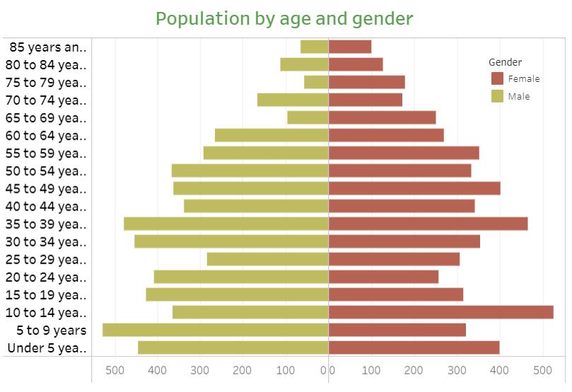
The chart below shows the distribution by 5 year age cohorts of Norwalk’s populace. The chart shows a healthy distribution across the age ranges and gender that usually include working age adults and their families. A good distribution of both young and established families supports a community’s ability to continue supporting existing businesses, schools and organizations. Additional economic and household growth can also be support by a healthy distribution of ages and genders.
Median Age
Norwalk
37.4
Warren County State of Iowa
39.3
38.1

Employment information is an important indicator of current economic conditions and potential economic growth opportunities for the residents and businesses of Norwalk. The majority of Norwalk’s residents have jobs classified as white collar positions, followed by blue collar and services. The unemployment rate is medium and estimated 12 %. The largest labor force is Business/Financial followed by Sales. The chart below shows a comparison with Warren County and there are many categories that are much smaller and larger in the category such as Construction/Extraction and Education. It is also known that many workers commute to the surrounding region for work.
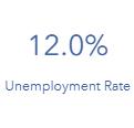
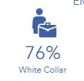
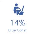
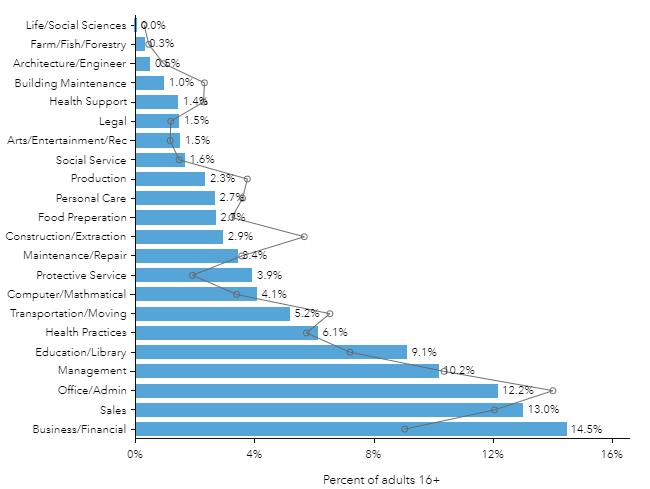
The median household income in Norwalk is estimated at $81,610, and the per capita income is $35,678. Per capita income (PCI) or average income measures the average income earned per person in a given area (city, region, country, etc.) in a specified year. It is calculated by dividing the area’s total income by its total population. Median income is the amount that divides the income distribution into two equal groups, half having income above that amount, and half having income below that amount.

Both are increasing as Norwalk’s population continues to grow and the City’s economy continues expanding.

Norwalk, circled in green on the maps above, is located directly south of the City of Des Moines, central to the Des Moines Metro Area. Norwalk is easily accessed by State Highway 28 (north-south), State Highway 5/US Highway 65 to the north (east-west), and County Road G14 (east-west).
Norwalk’s citizens and business are serviced by Heart of Iowa Regional Transit Agency’s (HIRTA) public transit service which include student transportation, general public transit, non-emergency medical transportation, senior transportation, and the Job-Link Commuter Shuttle - serving Michael Food, Produce Innovations, Windsor Windows and Doors, Capital City Fruit, Rowe Electronics and La Quercia.
Previous planning efforts have laid out potential pathways for future arterials, collectors, trails and improved intersections in Norwalk, which are shown on the follow map.


According to the State of Iowa Data Center and the 2010 United States Census. The mean travel time to work has decreased in the past 18 years by half a minute to 22 minutes. This is not surprising as the drive to popular business areas in Des Moines is about 20 minutes. The majority of workers in Norwalk commute from outside of city limits, only a small amount of residents stay in town for work. According to 2018 data from the US Census Bureau, there is a large portion of workers coming into Norwalk from outside communities as well.


Below is feedback from the projects community input survey on residence commute information.


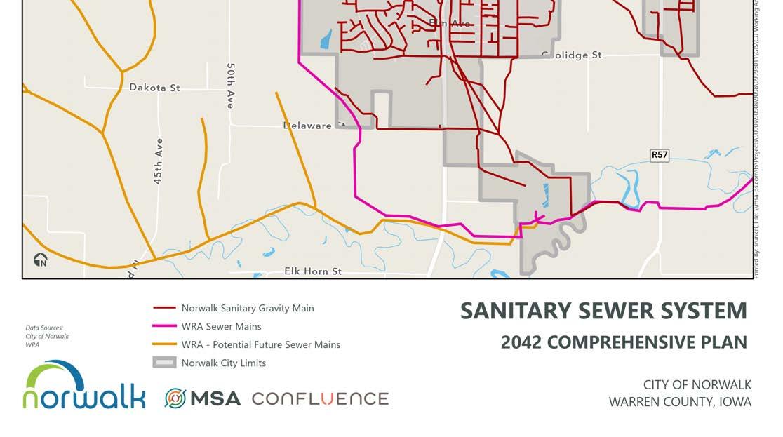


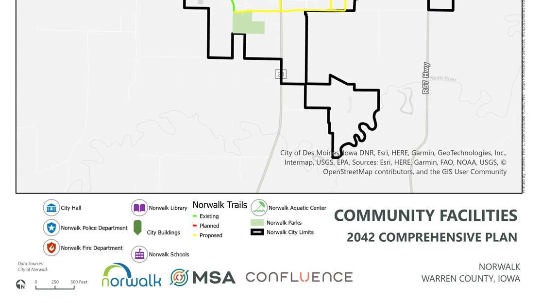

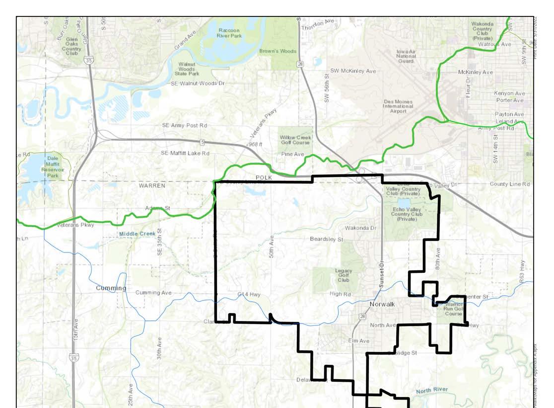


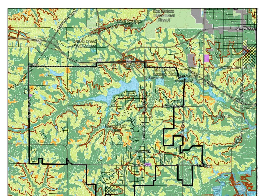
The majority of the City of Norwalk is located in Warren County. Warren County last updated their Future Land Use map as part of a Comprehensive Plan update in May of 2002.
The County’s Future Land Use plan proposes mostly Low Density Residential Uses and some Medium Density Residential growth around Norwalk. Because the County’s plan is 20 years old, and the other surrounding jurisdictions have updated their plans more recently, the information provided in the County’s plan will not have a significant impact on Norwalk’s Future Land Use planning efforts.
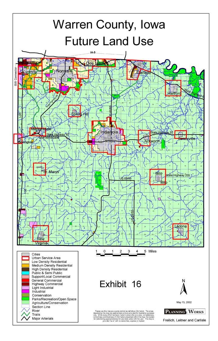
The City of West Des Moines lies North, Northwest, and West of Norwalk. The two cities share a border. The City of West Des Moines Future Land Use map was last updated in 2021 and shows considerable growth west along Veteran’s Parkway, north of Cumming. The proposed land uses around Norwalk’s boundary include Office, Regional Commercial, Single Family Residential, and Medium Density Residential Use.

The City of Cumming lies west of the City of Norwalk and the two cities share a border. The City of Cumming’s Future Land Use map was last updated in 2021 and shows additional Low Density Residential growth along the western edge of the City of Norwalk. The map also shows some small commercial develoment along G14, just west of the border between the two cities. Cumming’s Future Land Use map also shows considerable planned commercial and industrial growth around the City’s interchange at Interstate 35 and G14.
Madison County neighbors Warren County to the west, sharing a border with the proposed annexation area for the City of Norwalk. Madison County’s Land Use Map and ordinance were last updated in 2002. Since then, the County has experienced significant growth in the northern-most part of the county. The area along Interstate 35, which will be adjacent to the City of Norwalk, is primarily reserved for agricultural uses. This proposed land use will not have an impact on the future of Norwalk.

How many people are in your household?
How many years have you lived in the City of Norwalk?
8/5/2021 Norwalk Comprehensive Plan
Please select the top three qualities you believe make the City of Norwalk a great place to live today
https://survey123.arcgis.com/surveys/a0a4849e4c3c49b8bf69652315393b54/analyze?position=0.field_11
How would you rate the quality of life in Norwalk?
8/5/2021
Norwalk Comprehensive Plan
Please select the top three changes you think would have the greatest impact on improving the quality…
https://survey123.arcgis.com/surveys/a0a4849e4c3c49b8bf69652315393b54/analyze?position=0.field_11 4/13
What type of dwelling do you live in?
Please select up to four factors influenced your decision to live where you live right now.
If you could open a successful business in Norwalk what and where would it be?
Please list the Weakness and Threats you see for the community related to Beautification.


Norwalk City Limits
Open Space / Undeveloped
Low-Density Residential
Medium-Density Residential
High-Density Residential
Parks & Recreation
Public / Semi-Public Commercial Industrial
Developing Water
Planning Boundary
Norwalk
Nearby Cities
Parcel
Floodplain
Great Western Trail
Future Greenbelt Corridor
Future Land Use + Streets Draft 10-17-2022

Existing Highway
Existing Major Arterial
Existing Minor Arterial
Proposed Minor Arterial
Existing Major Collector
Proposed Major Collector
Proposed Minor Collector
Agriculture Reserve
Low-Density Residential
Medium-Density Residential
High-Density Residential
New Urbanism
Commercial
Commercial Industrial Flex Industrial Public / Semi-Public
Parks & Recreation Water
0 .50 miles .25
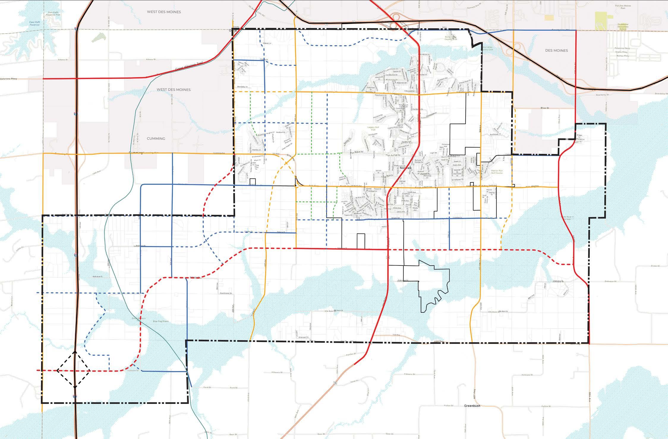


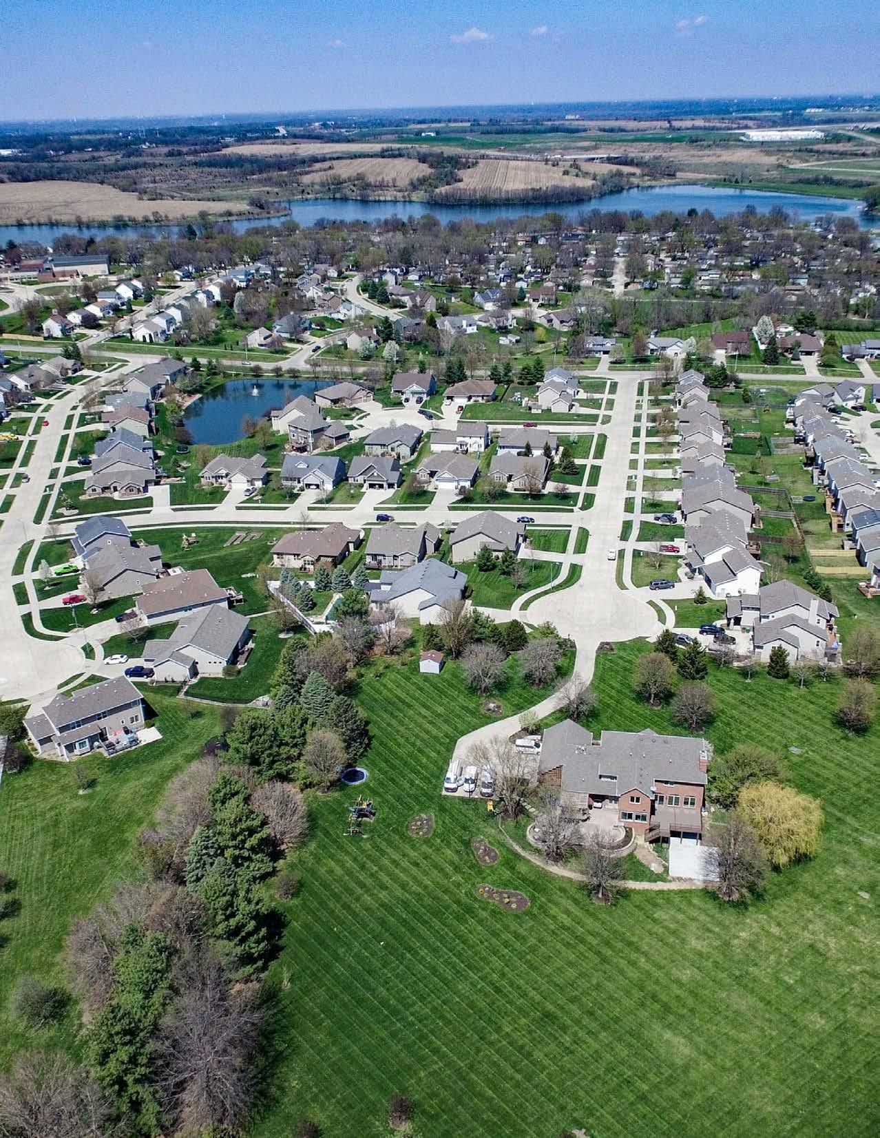

a formal Future Land Use Plan compliance review process for new development and rezoning requests.
coordinating with the county to develop local policies that ensure any growth within the City’s 2-mile extra territorial review area to be congruent with the City’s Comprehensive Plan.