Mayor Tim Swadley
City Staff
Tony King – Parks & Recreation Superintendent
Mark Edwards – Parks Supervisor
John Kemppainen – City Forester
Parks & Recreation Committee
Phil Caravello – Chair
Daniel Payton – Vice Chair
Regina Hirsch
Patrick Butler
Ethan Scheiwe
Jim Brandt
Tim Swadley
Prepared By
This document was prepared by MSA Professional Services, Inc. in collaboration with City of Stoughton staff.
Project No. 09360034
Photo Credits: unless stated otherwise, all photos were provided by MSA or the City of Stoughton.

City of Stoughton, 207 S. Forrest Street, Stoughton WI 53589
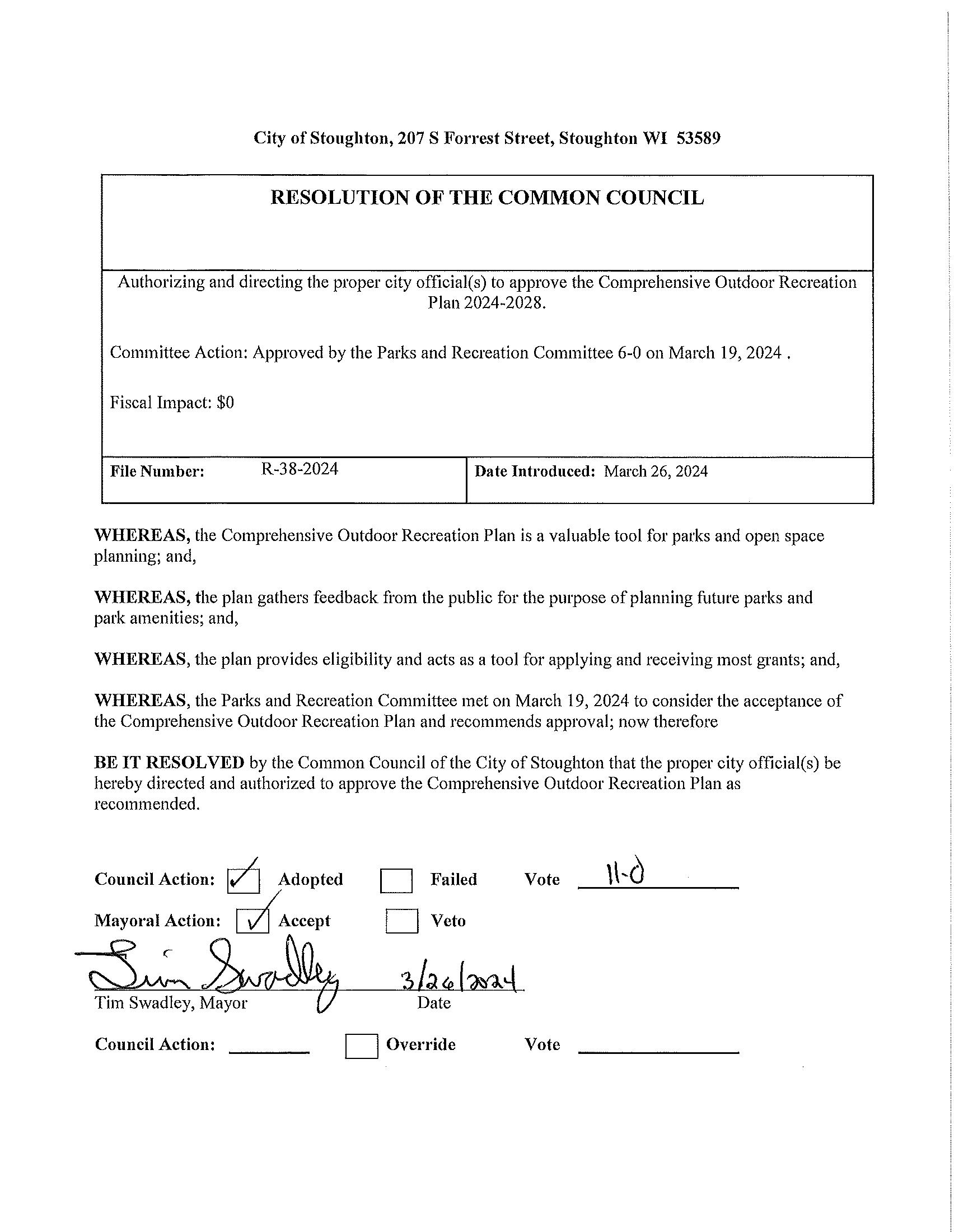
A RESOLUTION TO ADOPT THE AMENDED TEIGEN FARMS PARK MASTER PLAN
Committee Action: Parks & Recreation Committee approved 4-1 on 4/16/2023
Fiscal Impact: None
File Number:
R-68-2024
Date Introduced:
April 23, 2024
WHEREAS, City of Stoughton staff recognized a need for a Teigen Farms Park Master Plan, “the Plan”, to provide recommendations for implementation to address issues and future improvements within Teigen Farms Park; and,
WHEREAS, the primary objective of “the Plan” is to provide recreational services desired by the neighbors of Teigen Farms Park; and,
WHEREAS, public input for the project included neighborhood survey, neighborhood meetings, and a survey review of the draft master plan; and,
WHEREAS, the Teigen Farms Park Master Plan contains existing conditions, maps, and phased improvements for the park; and,
WHEREAS, the Parks & Recreation Committee approved recommending “the Plan” to be adopted by City Council; and,
WHEREAS, the Common Council of the City of Stoughton, have taken into consideration the results conducted by City staff and the recommendation of the Parks & Recreation Committee, determines that “the Plan” should be adopted.
NOW, THEREFORE, BE IT RESOLVED BY THE COMMON COUNCIL OF THE CITY OF STOUGHTON:
That the Teigen Farms Park Master Plan for the City of Stoughton is hereby official adopted, as attached hereto and incorporated herein for all intents and purposes; and,
Adoption of the Teigen Farms Park Master Plan shall not commit the City of Stoughton to specific funding levels or implementation strategies, but shall provide a guidance plan for the City’s vision for available and growth of park and recreational services.
Council Action: Adopted Failed Vote

Tony King, Superintendent of Parks & Recreation 2439 County Hwy A Stoughton, WI 53589 (608) 646-0432
Date: April 17, 2024
From: Tony King, Superintendent of Parks & Recreation
To: City Council
Subject: Teigen Farms Park Master Plan Adoption
Teigen Farms Park will be a new neighborhood park space that will be developed as part of the Magnolia Springs residential development. Located on the southern side of Stoughton, southwest of the intersection of Isham Street and S. 4th Street, this park will serve the residents of the immediate neighborhood. The existing extents of the park make up 5.5 acres of space. Within this Master Plan process, being mindful of keeping natural areas and using existing elements was an important aspect.
Sincerely,
Tony King Stoughton Parks & Recreation Department
O1
CHAPTER 1: INTRODUCTION
1.1 Plan Purpose
1.2 Planning Process
1.3 Why Plan for Parks?
05
CHAPTER 2: ABOUT STOUGHTON
2.1 Local & Regional Context
2.2 Demographics
2.3 Natural Features
2.4 Existing Parks & Open Space
2.5 Other Parks & Recreation Facilities
2.6 Other Relevant Planning Efforts
13
CHAPTER 3: GOALS & OBJECTIVES
3.1 Goals, Objectives, & Policies
25
CHAPTER 5: RECOMMENDATIONS
5.1 Existing Park Facilities
5.2 Planned Parks in Development
5.3 Proposed Trails
17
CHAPTER 4: PARK NEEDS & DEMANDS
4.1 Quantitative Analysis
4.2 Geographic Analysis
4.3 Qualitative Analysis
4.4 Regional & State Trends
63
CHAPTER 6: IMPLEMENTATION
6.1 Funding Opportunities
6.2 Adoption & Amendment Process
A APPENDIX A: SURVEY RESULTS
B
C
APPENDIX B: PARKS AND RECREATION MAPS
APPENDIX C: TEIGEN FARM PARK MASTER PLAN
Planning for parks helps ensure the City of Stoughton will continue to provide high-quality outdoor recreational facilities and services now and into the future. This plan is intended to support Stoughton’s other long-range plans and local ordinances that guide healthy land use and development throughout the community. Additionally, a comprehensive outdoor recreation plan is a critical component of many grant applications used to fund parks and recreation projects in the state of Wisconsin.
This plan follows the Guidelines for the Development of Local Comprehensive Outdoor Recreation Plans from the Wisconsin Department of Natural Resources (WDNR) and describes:
• Information regarding demographic trends,
• An inventory of existing park and recreational facilities,
• An analysis of parkland needs and demands,
• General policy direction regarding park, open space, bicycle and pedestrian facility planning and maintenance,
• Recommendations for improving existing park, bicycle, and pedestrian facilities,
• Recommendations for new park, bicycle and pedestrian facilities, and
• Implementation strategies.
In many cases, this plan identifies conceptual locations and recommendations that will require more detailed and specific planning, engineering, budgeting, and discussions to acquire land and/or construct facilities.
The City of Stoughton appreciates the local support its parks receive and the benefit that they have on the community’s character and quality of life. It is committed to meeting the active and passive recreational needs of current and future residents and visitors of all ages and abilities.
In July 2023, the City of Stoughton contracted with MSA Professional Services to update its previous CORP, last adopted in 2018. The City previously updated its CORP in 2007 and 2014. Like its predecessors, this plan reaffirms the City’s goals and objectives, inventories existing park and recreational facilities, identifies needs and opportunities, and presents an action plan for implementing its recommendations.
Key milestones for this project include:
• Project Kick-Off with Parks & Recreation Department Staff: July 2023
• Pop-Up at Gazebo Musikk Community Event: August 2023
• Teigen Farms Master Plan Focus Group: September 2023
• Online Survey: Fall 2023
• Parkland Inventory & Site Visits: November 2023
• Parks & Recreation Committee Review Meeting: February 2024
• City Council Adoption: February 2024
Parks are some of the only truly free, accessible, multi-functional public spaces. They contribute to the physical and mental health of individuals and communities, and provide public safety, environmental, and social equity and resilience benefits. The COVID-19 pandemic put parks in the spotlight as more people sought opportunities for safe recreation and engagement opportunities outdoors. Now, as more cities are focusing on sustainability and resilience, parks offer a range of health, fiscal, and environmental benefits including:
Before the COVID-19 pandemic, children and adults were spending less and less time outside. Research from the Henry J. Kaiser Family Foundation showed that young children were engaging in less active play and unstructured outdoor exploration, which are critical activities for developing social and academic skills, as well as building personal resilience. The NRPA reports that physical activity at any age can reduce the risk of depression, heart disease, obesity, osteoporosis, stroke, and Type 2 diabetes.
Healthy communities have a range of active and passive options for people of all ages and abilities to spend time outdoors. While many people initially think of parks as places for playgrounds, trails, and ball courts and fields, they are also places where people can enjoy more passive activities like picnicking, wildlife watching, and leisurely enjoying the fresh air. According to a 2022 report from the Urban Institute, research has suggested a link between measures of park access (proximity to parks and park quality) and higher rates of park use and physical activity. The City Parks Alliance reports that maintaining a healthy lifestyle can save more than $1,800 annually in healthcare costs per person.
The Wisconsin Legislature created the Knowles-Nelson Stewardship Program (Stewardship) in 1989. Named for two of Wisconsin’s most revered conservation leaders, Warren Knowles (Governor 1965-1971) and Gaylord Nelson (Governor 1959-1963, U.S. Senator 1964-1981), the purpose of the program is to preserve valuable natural areas and wildlife habitat, protect water quality and fisheries, and expand opportunities for outdoor recreation. The conservation and recreation goals of the Stewardship Program are achieved through the acquisition of land and easements, development of recreational facilities, and restoration of wildlife habitat.
The Stewardship grant program is the most widely used recreational grant program in the state. Eligibility for the program requires that a community maintain a local comprehensive outdoor recreation plan (CORP), updated every five years, and that the project for which grant funding is sought is described in the CORP. Many other similar state and federal recreational grant programs have similar requirements or have shown a tendency to favor those grant applications which are supported through previous community planning efforts.
Leisure time is an important component of everyone’s lifestyle, and increasingly people are choosing locations to live based on quality-of life factors that include recreational amenities. According to the NRPA’s Engagement with Parks Report, four out of five adults in the US sought high-quality parks and recreation when choosing a place to live. The ability to retain and attract new residents has direct economic benefits to the local community. For this reason, a great park, recreation, and trail system can contribute directly to a community’s economic development.
In a study completed by NRPA and George Mason University, 72% of 70 studied communities use parks and recreation images in their economic development materials. The study notes that parks and recreation contribute to economic development through business and talent attraction, retention, and expansion. If a park system is designed with connections to regional destinations, additional visitors can also be brought into a community. This additional tourism can be a significant benefit to local businesses. This plan aligns with other regional and state plans to promote outdoor recreation across the greater area.
Parks are an excellent source of place-based planning and identity for communities. Park and recreation facility designs are highly responsive to local wants and needs. The most recent example is the transition of tennis and basketball courts into multi-functional ‘sport courts’ to respond to the explosion in popularity of pickleball. Public parks are also a place for community interaction and neighborhood activity. They can be places where residents gather for social events, recreational activities, and meetings about local issues, increasing social interaction and creating an overall sense of community. An additional benefit is that this ‘social resilience’ is a key component of responding to and recovering from natural disasters.
Information from the City Parks Alliance indicates that community involvement in the greening of vacant land has been shown to decrease crime and generate additional support for nearby park projects. Research from bicycle and trails advocacy organizations like the League of American Bicyclists and People4Bikes further suggests that the increase in trail traffic also has a depressing effect on crime.
While parks, forests, and trails create opportunities to improve the health of individuals, they also contribute to the greater ecological health of a community. Parks are often tied together with environmentally sensitive areas such as wetlands, floodplains, surface waters, or significant woodlands. Additionally, parks are a convenient place to introduce new stormwater retention and infiltration areas into the built environment, helping to manage stormwater runoff and mitigate localized flooding. These natural areas provide food and shelter for local wildlife and naturally retain stormwater. Individual parks can provide important “rooms” of natural resource activity; however, they become even more functional when they can be linked together through environmental corridors. Wildlife, plants, and water all depend on the ability to move freely within the environment, or from “room to room.” The City Parks Alliance reports that urban trees remove up to 711,000 tons of toxins from the air and reduce urban “heat island” effects, equating to $3.8 billion in national savings.
In addition to being public open spaces, parks and recreational facilities are excellent places for local engagement. Many communities utilize park funding and infrastructure to revitalize blighted areas and rectify historic disinvestments in lower-income neighborhoods. This comes through reinvigoration of existing parks, and the addition of new parks in underserved areas. Coincidentally, as cities and villages across the United States see shifts in the ethnic makeup of their communities, more and more are investing in multilingual signs and rental forms to improve cultural inclusion.
Two key parts of any parks and recreation plan includes physical accessibility through ADA-compliant design and walkability to the park. The Americans with Disabilities Act and statewide design guidelines ensure that people of any age and physical ability are able to access many activities throughout a park, from well-maintained paths and curb ramps to inclusive playgrounds. The walkability factor is defined by the NRPA as ensuring that no one lives farther than a 10-minute walk from a park.
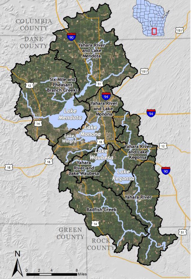
The City of Stoughton is located on the southeast edge of Dane County, roughly 15 miles from central Madison. Stoughton is less than 3 miles from Lake Kegonsa, which is the southernmost lake in the Yahara chain of lakes and a popular regional recreation destination. Development patterns in Stoughton have been heavily shaped by the presence of the Yahara river, which runs through the city, and its floodplain.
State Highway 51 cuts east-west through the city before veering north towards Madison. Though Stoughton is primarily suburban, the city has a historic downtown with well known attractions such as the Stoughton Opera House. According to the Wisconsin Historical Society, the City of Stoughton was founded in 1847 by Luke Stoughton and was largely settled by immigrants from Norway. Today, Stoughton is known its annual Syttende Mai festival celebrating the city’s Norwegian Heritage.
Population
Stoughton is a rapidly growing community in Dane County, Wisconsin. Stoughton’s population has increased 73.6% since 1980 and is projected to grow another 7.2% by 2040 to just over 14,000 residents (See Table 2.1). Dane County as a whole is expected to add an estimated 78,000 people between 2020 and 2040. Many new developments in Stoughton are in the planning, design, and construction phases as the city continues to grow and attract new residents and families.
Age cohorts are an important consideration when determining park facilities because different age groups utilize different recreation facilities. For example, in 2021 there were an estimated 2,518 people over the age of 65 (19% of the population)—a 40% increase since 2010. Facilities such as hiking trails, pickleball courts, and park shelters are more likely to be used by this age group. By comparison, the portion of Stoughton’s population under the age of 20 grew by 14% between 2010 and 2021; these park users are more likely to use playgrounds, sports fields, and courts.
As seen in Table 2.2, Stoughton saw a 16% increase in the total number of households from 2000 to 2021. During the same period however, households with individuals under the age of 18 decreased by 25%. The total number of households saw a greater increase between 2000 and 2010 than between 2010 and 2021. Average household size declined slightly between 2000 and 2021 despite the total number of households increasing. These findings are consistent with national and regional trends as the number of single person households increases and members of Millennial generation delay childbearing into their thirties or forego it altogether.
The Yahara River runs north to south through the City of Stoughton. It drains 5 area lakes (Kegonsa, Mendota, Monona, Waubesa, and Wingra) into the Rock River.
Stoughton’s topography is defined by the migration of glacial sheets, resulting in woodland-covered drumlins in the northern and western parts of the city, and riparian woodlands along the Yahara River floodplain in the city center. Stoughton is also home to many natural and man-made wetlands that act as important wildlife habitat. The Capital Area Regional Planning Commission (CARPC) has designated the kettle wetlands plus a 75-foot buffer as an Environmental Corridor. This designation is intended to provide an additional layer of protection for land deemed environmentally sensitive from potential adverse impact.
Stoughton’s park system is comprised of 25 parks totaling over 280 acres. The system is broken into six classification types as detailed below and summarized in Table 2.3:
Mini parks include specialized facilities that serve a concentrated population or specific group such as young children or senior citizens. Typical size is 1 acre or less but parks may be categorized as mini parks simply based on the type and quantity of facilities they offer.
• Criddle Park
• Division Street Park
• Riverside Park
• Roby/Page Park
Neighborhood Parks
Neighborhood parks are areas for multiple and sometimes intensive recreational activities. Facilities may include athletic fields, sports courts, playgrounds, skate parks, trails, picnic areas and splash pads. Typical size is between 3 to 10 acres.
• Bjoin Park
• Dunkirk Avenue Park
• East Side Park
• Lowell Street Park
• Nordic Ridge Park
• Norse Park
• Schefelker Park
• Veteran’s Memorial Park
• Virgin Lake Park
• Westview Ridge Park
t Map 2.2 Yahara River Watershed
Source: Clean Lakes Alliance
Community Parks
Community parks are areas of diverse recreational activity and may include amenities such as athletic complexes, trails and large swimming pools. Community parks are typically 10 acres or larger but may vary depending on facilities offered.
• Mandt Park
• Racetrack Park
Special-Use Park
Special use parks are areas for specialized or single purpose recreational activities such as golf courses, campgrounds, nature centers and skate parks. They may also be used to designate areas that are primarily used as event space, general gathering areas, expanded trail corridors or plaza space.
• Heggestad Park
• Stoughton Rotary Park
• Victorian Garden
Conservancy, Open Space and Natural Areas
Conservancy parks and natural areas are established for protection and management of the natural or cultural environment with recreational facilities as a secondary objective. Open spaces are areas that currently offer no recreational facilities but have been reserved as future active or passive park lands.
• AJ Amundson Park
• Nottingham Park
• Roby/Page Conservancy
• Settler’s Point Parkland
• Virgin Lake Natural Area
• Yahara River Natural Area
Mini Park Specialized facilities that serve a concentrated or limited population or specific group such as tots or senior citizens.
Neighborhood Park
Community Park
Areas for intense recreational activities, such as field games, court games, crafts, playground apparatus area, skating, picnicking, wading pools, etc.
Areas of diverse environmental quality. May include areas suited for intense recreational facilities, such as athletic complexes and large swimming pools. May be an area of natural quality for outdoor recreation, such as walking, viewing, sitting, picnicking. May be any combination of the above.
Less than ¼ mile radius 1 acre or less
¼ to ½ mile radius to serve a population up to 5,000 (a neighborhood) 3-10 acres
Special Use
Several neighborhoods. 1 to 2-mile radius 10+ acres
Areas for specialized or single purpose recreational activities, such as golf courses, nature centers, skateparks, marinas, zoos, conservatories, arboreta, display gardens, arenas, outdoor theaters, gun ranges, or downhill ski areas, or areas that preserve, maintain, and interpret buildings, sites, and objects of archeological significance. Also, plazas or squares in or near commercial centers, boulevards, parkways. None
Conservancy Protection and management of the natural/cultural environment with recreational use as a secondary objective.
None
Sufficient to protect the resource
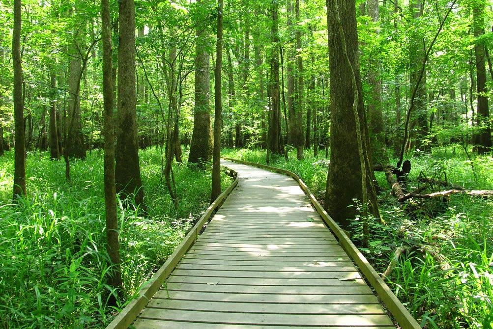
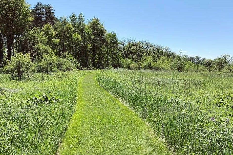
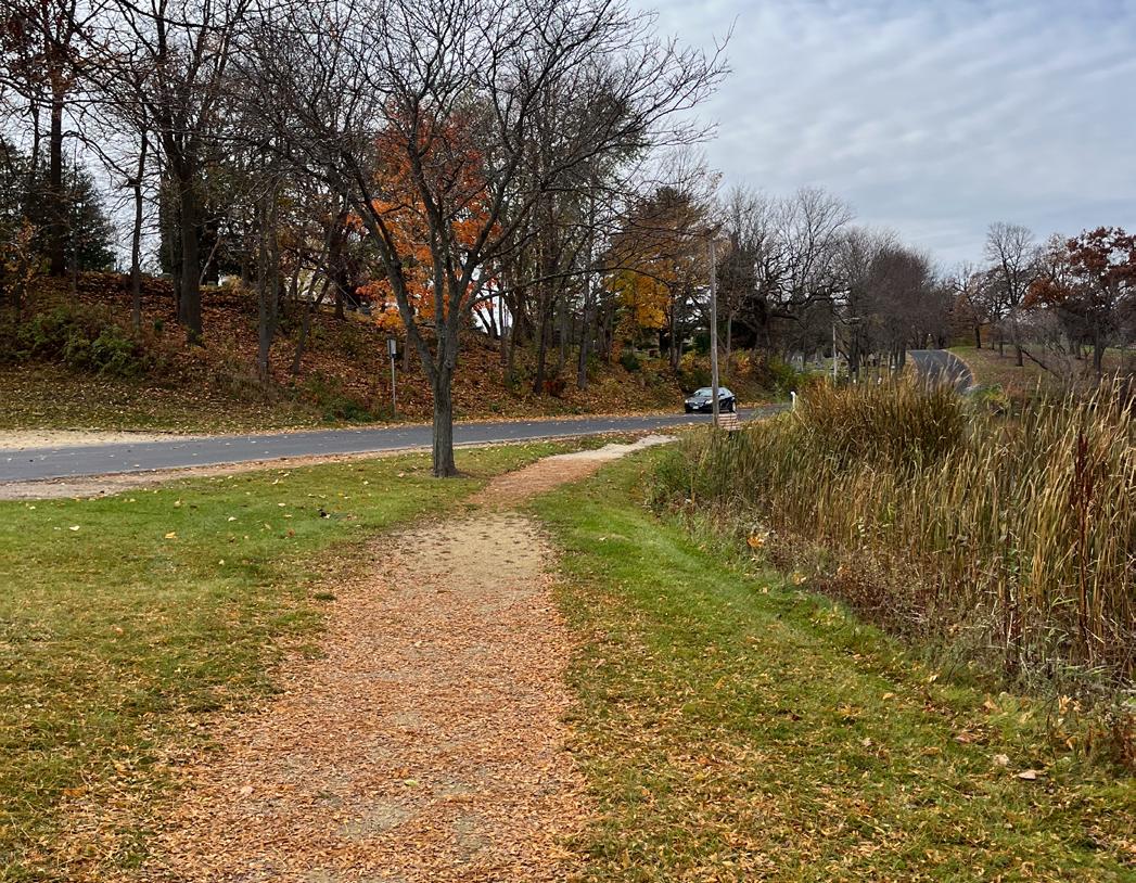
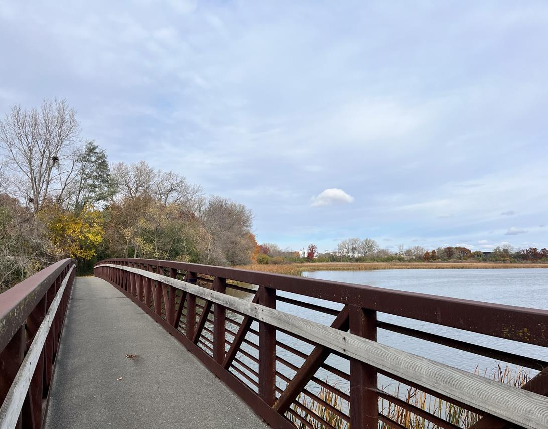
A linear park or trail corridor is an area designated for one or more modes of recreational travel such as hiking, biking, snowmobiling, etc. See Map 2.1 on page 9 or in Appendix B for existing trail locations.
The Yahara River Trail is the longest trail system in the City with 3 miles of trails on both sides of the river. The two segments of trail are connected by onstreet bike routes via Amundson Parkway, East Main Street and Ridge Street. A proposed extension of the western trail segment would connect with the eastern segment and complete a recreational loop. A planned County trail would connect this trail system to destinations to the north including Lake Kegonsa State Park, Fish Camp County Park, the Village of McFarland and the Capital City Trail in Madison.
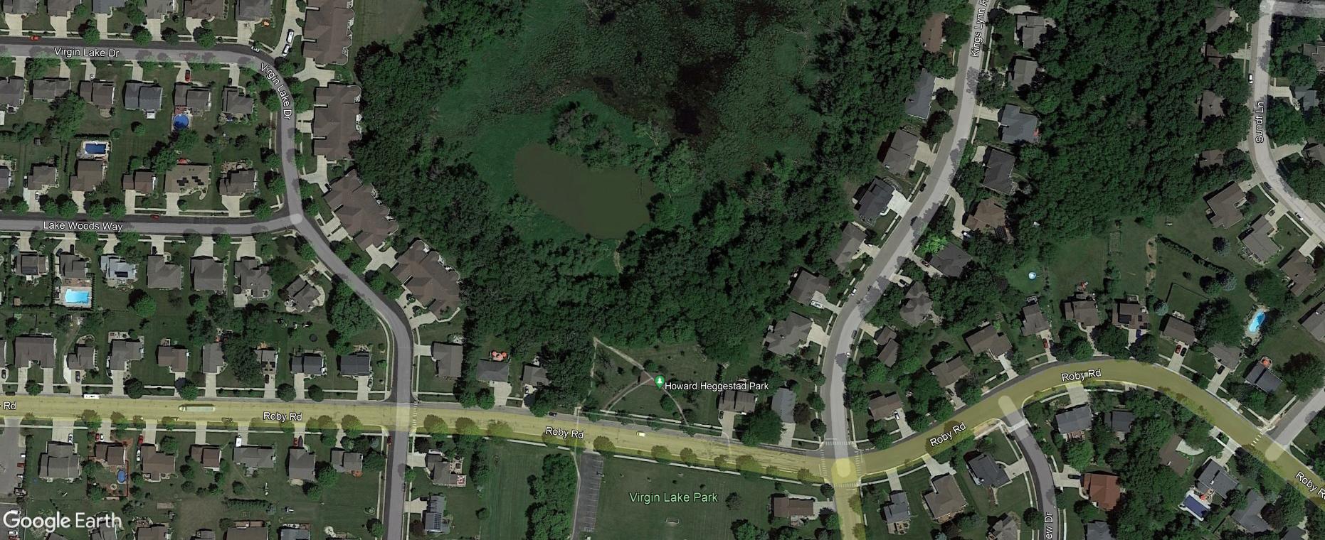
On the west side of the City, the Virgin Lake Trail runs north-south for 0.8 miles between Jackson Street and Heggestad Park.
Although not maintained by the city, school facilities offer community residents with additional outdoor recreation activities. School parks often contain structured play equipment, open space, and athletic fields. While they are outside the city’s jurisdiction for maintenance and improvements, they should be considered when analyzing facilities availability within the community. The Stoughton Area School District maintains the recreation facilities of five schools in the area that are open for public use
• Fox Prairie Elementary
• Kegonsa Elementary
• River Bluff Middle School
• Sandhill Elementary School
• Stoughton High School
Additionally, Viking County Park is the only Dane county-owned park property within Stoughton city limits. Facilities include: a dog park, multi-use trails, fishing areas, and a reservable shelter. Like school recreational facilities, no recommendations will be made in this plan for Viking County Park, but their facilities should be included when considering outdoor recreation facilities available to City residents.
City of Stoughton Comprehensive Plan (2019)
A city-wide Comprehensive Plan was last adopted in 2017 and amended in 2019. The plan’s Future Land Use Map establishes a Planned Urban Development Area to guide future development beyond it’s current boundary. Much of this planned area is devoted to the development of residential neighborhoods with a mix of single-family, two-family, multi-family, and other mixed-use residential districts. Additionally, a large area along Hwy 51, a major transportation corridor, is recommended for mixed use development, including a variety of commercial, recreational, and residential uses. These future developments are relevant to parks planning since the platting of new subdivisions requires setting aside a certain portion of land for parkland (see page 65 for more information) to ensure future resident’s park and recreation needs are met.
In 2020, MSA Professional Services was hired to conduct an ADA Audit plan for the City of Stoughton. Professional architects and landscape architects conducted an audit of Stoughton’s 25 parks using national standards set by the 2010 ADA Standards for Accessible Design, and the Accessibility Guidelines of the Americans with Disabilities Act (ADAAG). This planning process resulted in a detailed action plan for improving and upgrading many facilities throughout the park system and is available upon request from the city. Each year the city selects recommendations from this action plan to include in its 5-year capitol improvement budget, which is available via the city website.
Goal 1: Establish and maintain high quality parks and recreational services.
Objectives:
1. Ensure the number of parks and recreational facilities is reflective of community population needs.
2. Upgrade and improve existing parks and facilities.
i. Develop bi-annual inspections and inventory of existing park facilities to maintain an active log of facility improvements.
ii. Continue funding the replacement of old and deteriorating equipment in all City parks to ensure the health, safety, and welfare of visitors.
3. Pursue funding for park and recreation development and land acquisition.
4. Pursue the development of revenue generating recreational facilities and activities, which can aid in the development of new facilities and/or the maintenance of existing facilities.
5. Work towards 100% sustainable energy sourced utilities within City parks.
6. Create a park development and establishment ordinance.
7. Continue implementation of the City of Stoughton Turf Management Policy using Integrated Pest Management (IPM).
Goal 2: Offer recreational services in an efficient, effective, and economical manner.
Objectives
1. Cooperatively work with surrounding municipalities, the school district, and other partners.
2. Conduct periodic reviews of programs and services and analyze their benefit to the community.
Goal 3: Establish avenues for ongoing community input into the Parks & Recreation services.
Objectives:
1. Develop committees when needed to address specific/special needs.
i. Encourage citizen involvement and input in these committees.
Goal 4: Promote bicycle and pedestrian facilities throughout Stoughton and the surrounding area.
Objectives:
1. Improve local route connectivity throughout the area to parks, conservancies, schools, local businesses, and regional trails.
2. Improve/establish wayfinding signage to allow new residents or visitors to effectively travel throughout the City on foot or bicycle.
3. Increase the availability and accessibility of bicycle parking.
4. Expand the nature trail system.
Goal 5: Ensure that the community’s existing open space, recreational facilities, and programs are designed to meet the specific needs of all residents regardless of age, gender, or ability.
Objectives:
1. Prepare a site Master Plan prior to improvement and/or development of any public park to assure the best use of existing resources.
2. Provide barrier-free access in all new park facility construction and play areas.
3. Ensure accessibility requirements are in line with our active transition plan for existing facilities.
4. Encourage participation and accommodation of all interested participants at park and recreational meetings and in recreational programs.
5. Continue to comply with the Americans with Disabilities Act as it applies to communication with the public; this is in reference to the standard language that government agencies should use on their agendas and other public meeting documents stating accommodation of those with disabilities who wish to attend the meeting.
Goal 6: Coordinate subdivision review with all departments responsible for providing or maintaining adequate park facilities.
Objectives:
1. Consult and incorporate the needs identified in the CORP before subdivision plats are approved.
2. Evaluate land dedicated for parks to differentiate between land appropriate for active park use, land appropriate for open space only, and land requiring protection from development. Land requiring protection from development should be protected via development codes.
3. Continually evaluate and update local zoning and subdivision ordinances so that they adequately address the recreational needs of residents.
4. Preserve any proposed trail corridors in any review of new development.
Goal 7: Promote water recreation throughout the community.
Objectives:
1. Utilize riverfront parks for potential water based recreational improvements.
2. Improve visibility and awareness of existing water based recreational opportunities at Division Street Park, Riverside Park, and Mandt Park.
3. Promote and maintain canoe/kayak launches and fishing areas.
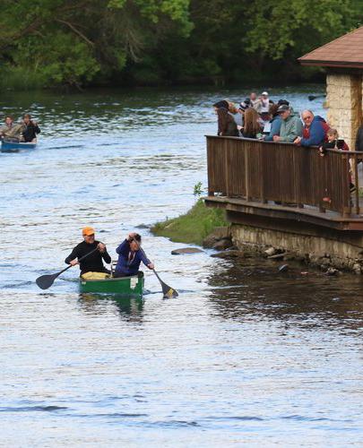
4. Continue to support community events that support water activity such as the Syttende Mai Canoe Race.
5. Identify ways to reduce goose impact.
The ADA, enacted in 1990, clearly states the right of equal access for persons to local government services, including parks. On September 15, 2010 the Department of Justice published revised final regulations implementing the Americans with Disabilities Act. The 2010 Standards included new provisions for accessible design for recreational facilities such as playgrounds, swimming pools, fishing and golf facilities. Similar to when the original 1991 ADA Standards were adopted for public buildings, a community is required to complete a self-evaluation of their recreational facilities for ADA compliance by March 15, 2012. Those communities with 50 or more full or part-time employees are also required to develop a Transition Plan, which identifies what corrective work will be completed, when it will be completed, and the individual responsible for the corrective work. Any new recreational facilities designed, constructed, or shaped after March 15, 2012 are subject to the 2010 Standards. Any alteration (not simple maintenance, but something that changes the way the site is used) must make the element altered accessible and must create an accessible path of travel through the site or facility to that element.
There are some fundamental differences in how accessibility in the outdoors is accommodated compared to indoors or the built environment. While restrooms, shelters, interpretive centers, and parking lots, for example, need to follow detailed ADA guidelines, other improvements such as trails or swimming beach areas, for example, do not necessarily need to follow indoor or built environment ramp grades or surfacing requirements. A good rule of thumb for the City to follow is that anything constructed must not make the outdoor experience anymore difficult than what occurs naturally. Mother Nature does not have to comply with ADA, but the City does.
The New England ADA Center is a good resource to use and offers checklists to evaluate accessibility at existing park facilities. The fillable checklist forms can be found here: http://www.adachecklist.org/checklist. html#rec
Goal 8: Stress the benefits of larger neighborhood and community parks that provide a wide range of facilities over small playground and “tot lot” facilities.
Objectives:
1. Analyze the location, size, and function of existing and proposed parks as annexations, residential development, or land use changes occur.
2. Communicate the importance of dynamic, multipurpose parks and recreational facilities as a component of Stoughton’s regional draw and economic development potential.
3. Use Park Service Area Criteria to help determine the location of future park sites (see Chapter 4).
4. Develop design guidelines and standards for future parkland.
5. Stress connectivity of natural corridors and park open spaces to allow for wildlife and user movement.
Goal 9: Recognize the importance of an adequate park budget, which can financially address existing park hazards and allow for future parkland acquisition and facility development.
Objectives:
1. Use the CORP as a guide to establish yearly park budgets and funding for the Stoughton Park system.
2. Invest funds for the development of facilities that will maximize existing parks and recreation areas.
3. Provide recreational programs with the intention of increasing park prominence, community visibility, and use.
Goal 10: Use all available resources to further enhance the quality of the City park system.
Objectives:
1. Continually pursue state and federal funding programs, which can aid in the purchase and/or development of desired park system improvements.
2. Nurture positive relationships with public and private organizations for donations and volunteer-help to aid in park system development.
3. Update the CORP every five years to maintain grant eligibility.
4. Pursue the development of revenue generating recreational facilities and activities, which can aid in the development of new facilities and/or the maintenance of existing facilities
Goal 11: Increase the ecological value of park lands and the ecological awareness of park visitors.
Objectives:
1. Convert underutilized mowed turf areas to native, natural habitats and increase tree canopy.
2. Create ecological corridors & connections, in conjunction with trails where feasible, on new park lands in future city growth areas.
3. Buffer park waterways & wetlands with strips of native, natural vegetation where mowing & herbicide use are minimized to the greatest extent possible.
4. Naturalize park stormwater management areas by reducing mowing and/or establishing native vegetation.
5. Continue to implement interpretive signage to educate the public on the benefits and importance of ecological restoration.
Goal 12: Promote environmental sustainability and minimal environmental impacts when making park improvements.
Objectives:
1. Minimize new pavement and/or use porous pavement options where possible.
2. Utilize dark sky light posts.
3. Ensure bicycle racks are clearly labeled and recycling bins are accessible in all city parks.
4. Strive to purchase playground equipment that uses recycled materials and/or uses natural materials.
This chapter presents an analysis of how well the city’s existing park and recreation facilities satisfy current needs. The adequacy of the city’s existing park and recreation systems are evaluated using the following methods:
• Quantitative Analysis - a comparison of existing parkland acreage and population projections versus park and recreational agencies across the US, including a review of the amount of parkland available to city residents.
• Geographic Analysis - an analysis of the geographic distribution of park facilities within the City.
• Qualitative Analysis - a summary of public input regarding City parks and recreational facilities gathered through the community survey, public involvement meetings, and feedback from community organizations that use the city’s parks.
• Regional & State Insights - a summary of the demand trends in recreational amenities at the regional and state level.
An analysis of existing recreational land area is provided to determine if the recreational needs of residents are being met. This analysis is limited to space, or land, devoted to recreational uses owned by the City of Stoughton. Currently, the city is providing approximately 286.7 acres of parkland in total, not counting school facilities, county facilities, or private facilities. This translates to 0.0218 acres of parkland per person, or 21.8 acres per 1,000 residents.
Table 4.1 summarizes the current and projected supply and demand for total parkland acreage based on the city’s current and projected population. For the purpose of calculating anticipated parkland demand, a service level of 10.5 acres per 1,000 residents was assumed. This standard is promoted by the National Recreation and Park Association (NRPA) and is derived from the sum of the following standards for mini, neighborhood, and community parks:
Mini Parks: 0.5 acres/1,000 people
Neighborhood Parks: 2 acres/1,000 people
Community Parks: 8 acres/1,000 people
TOTAL: 10.5 acres/1,000 people
Using a level of service standard of 10.5 acres of parkland per 1,000 residents, Stoughton currently has a total surplus of 148.4 acres. Assuming the population projections are accurate, and the city does not add additional parkland, a total surplus of parkland will remain through 2040.
Figure 4.1 shows the existing acreage per 1,000 residents for the City of Stoughton in comparison to other jurisdictions of similar size across the United States. The graph shows that the city is slightly above the upper quartile for parkland availability nationally among jurisdictions with less than 20,000 people.
While the total acreage of parkland is an easy indicator of the presence of parks and recreational space, it is not the only indicator of how well a community is meeting the park and recreation needs of its residents. The NRPA advocates that the location of parkland, and the types of recreational facilities offered on that land, are just as important as the total acres available. Fortunately, Stoughton residents have access to a wide range of recreational facilities and park types.
The NRPA, in partnership with the Trust for Public Land and the Urban Land Institute, promotes the 10-Minute Walk Campaign https://10minutewalk.org, advocating for “a great park within a 10-minute walk of every person, in every neighborhood, in every city across America.”
This service area standard assesses how equitably parkland is distributed geographically throughout a community.
Using the 10-Minute Walk standard, the green area in Map 4.1 (page 19 and Appendix B) shows where city residents live within a 10-minute walk (approximately ¼ to ½ mile) of a city-owned park. This area is the aggregate of each park’s individual 10-minute walk
radius. For areas outside the green 10-minute walk radius, the underlying residential zoning district is displayed. This is intended to represent areas where people live but are not within a 10-minute walk of a city-owned park.
Map 4.1 shows that the majority of Stoughton residents are able to access parkland within a roughly 10-minute walk of their residence. The two most notable excepts are found at western edge of the city near Jackson St and the eastern edge of the City (east of County Rd N). The future Tee Nasaak Park (see Appendix C) will serve residents located along Jackson St that currently do not have walkable access to a cityowned park.
An online survey was available to residents during fall 2023 to provide input and feedback for the parks system. Many of the questions were the same as the survey provided during the previous CORP planning process in 2018, enabling a comparison of changes in sentiment over the last 5 years. Approximately 537 people took the online survey in 2023 and the full results are provided in Appendix A1 .
Figure 4.2 Survey Question: How much are you willing to pay annually on parks and recreation improvements?
1 Survey questions were not required; therefore, the response rate varies question by question. 537 people answered the first survey question while 392 people answered the last one. There was a total of 27 questions.
Figure 4.3 Potential Recreation or Aquatics Facility Preferences from Community Survey
The online survey asked folks to chose their preference between the following two options for a future community recreation center or aqautics facility:
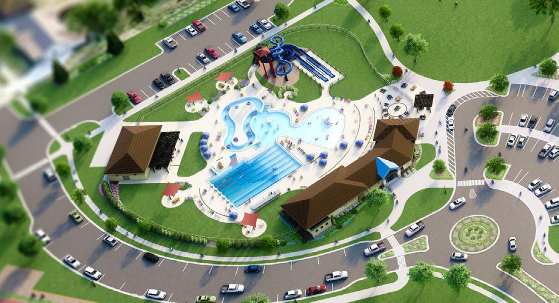
Option A: Community Recreation Center - a 65,000 square foot indoor facility featuring basketball/tennis courts, a fitness facility, elevated walking track, and a leisure pool with zerodepth entry and 4, 25-yard lanes. This facility would cost an estimated $33 million with a $469,000 operational subsidy.
50% of survey takes prefered Option B. 34% prefered Option A, and 16% preferred neither.
Option B: Outdoor Aquatics Center - a 7,000 square foot outdoor heated pool with a zero-depth entry, children’s play features, and dual waterslide tower, as well as a 3,400 square foot heated lap pool with 6, 25-yard lap lanes and a waterslide. This facility would cost an estimated $11 million with a $50,000 operational subsidy.
Both facilities would be paid for through a combination of fundraising and property taxes; if more of the total project cost can be fundraised, the less property taxes would need to be raised to cover the cost. Survey takers were asked the following questions regarding their prefered combination of fundraising and property taxes for Option A and B:
Option A - how much additional property taxes would you be willing to pay to fund the development of this facility?
Option B - how much additional property taxes would you be willing to pay to fund the development of this facility?
1. None of the above
2. 0% fundraised- $1,262 property tax increase
3. 25% fundraised - $1,019 property tax increase
4. 50% fundraised - $773 property tax increase
5. 75% fundraised - $531 property tax increase
6. 100% fundraised - $288 property tax increase
1. None of the above 2. 0% fundraised- $474 property tax increase 3. 25% fundraised - $392 property tax increase 4. 50% fundraised - $310 property tax increase
5. 75% fundraised - $228 property tax increase
6. 100% fundraised - $149 property tax increase
According to the 2023 survey, the most visited park and recreation facilities in Stoughton are Mandt Park, Multi-Use Pedestrian Trails, and Nordic Ridge Park. In the 2018, the most visited parks were Mandt Park, Multi-Use Pedestrian Trails, and Norse Park. When asked the top reasons why folks visit these parks, over 60% of survey takers said proximity to their home.
45% of survey respondents reported that they visit city parks weekly during the summer months but only 15% during the winter; 35% of survey takes “seldom” visited parks during the winter.
When asked the question “Compared to other city priorities how important do you think it is to maintain and improve parks, trails, open spaces, recreation facilities, and services?” 42% of respondents replied, “extremely important,” and another 42% replied “important.” In 2018, over 50% of respondents replied, “extremely important” and over 40% replied “important.”
The pie charts (Figure 4.2 on page 20) show the 2023 and 2018 responses to the question: Costs for acquiring open space and constructing new trails, wildlife habitats, and recreation facilities may require some additional tax support. What is the maximum additional amount you would be willing to pay, on an annual basis, for the parks and recreation improvements that are most important to your household?
Insights from the Dane County Parks And Open Space Plan (POSP), 2018-2023
The Dane County Parks and Open Space Plan identifies significant cultural, historical and natural resources that should be considered for possible protection, preservation or restoration through 2023. The plan also identifies county-wide recreation needs and Dane County’s role in providing facilities to meet anticipated demands.
The primary goals of the plan include:
• Provide sufficient park land and recreation facilities to meet the demand of Dane County residents without adversely affecting existing natural and cultural resources.
• Preserve for posterity the characteristics and diversity of the natural, cultural and historical resources of Dane County.
• Preserve large tracts of natural and agricultural rural landscapes at urban fringe areas that will provide regional resource protection and recreation benefits.
• Provide volunteer opportunities and stewardship education to all county residents.
• Protect lakes, rivers and streams, shorelines, wetlands, high infiltration areas and associated vegetative buffers to maintain high water quality and sustain water related recreation throughout Dane County.
• Provide an inclusive parks system for all Dane County residents, regardless of age, race, gender or gender identity, national origin, ethnicity, culture, religion, sexual orientation, political affiliation, place of residence, veteran status, physical ability, cognitive capacity, or family, marital, or economic status.
• General recommendations of the plan include:
• Expansion of existing park boundaries to establish future park facilities and to create buffers from adjacent land uses.
• Development of “in demand” facilities including disc golf courses, dog parks, trails, mountain biking facilities and campgrounds.
• Repair and replacement of aging park infrastructure including the update of park signage throughout the system.
• Maintaining a consistent design style of park improvements to brand the Dane County Parks system and improve public recognition.
Insights from the State Comprehensive Outdoor Recreation Plan (CORP), 2019-2023
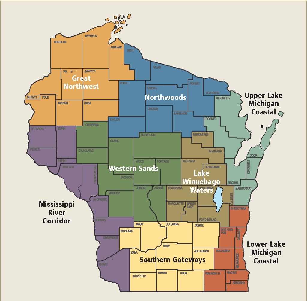
Stoughton is located within the Southern Gateways Region, which contains a variety of environments - rolling hills in the south, the centrally located Wisconsin River, and large marshes in the eastthe combination of which provides a wide array of recreational opportunities. The region also has a number of important geologic features, including Devil’s Lake, a craggy glacial lake surrounded by high cliffs and scenic overlooks that is one of Wisconsin’s most popular recreation destinations. The rapid development around Madison has also increased demand for urban-based recreation opportunities such as dog parks, bicycle trails and developed sports facilities.
According to their survey, the top recreational needs identified by residents in the Southern Gateways region are:
• Trails for motorized recreation
• Hiking/walking/running trails
• Bicycle trails – both paved and natural surface
• Camping – rustic/quiet campgrounds
Figure 2.4 Statewide DNR Regions (2022)
Source: Wisconsin Department of Natural Resources
This section discusses more detailed recommendations for each park throughout the Stoughton park system. These recommendations are based on issues identified in site visits, comments from residents, the community survey, and discussions with local officials.
Recommendations are organized by each park, or the park system as a whole. The recommended improvements are also compiled into a single table at the end of Chapter 6.
The quantitative, qualitative, and geographic analysis discussed in Chapter 4 reveals the need for improvements to existing facilities, as well as the potential acquisition and development of new sites for future recreational use. It should be noted that some of the recommendations may require considerable cooperation with others, including the residents of Stoughton, local civic and business associations, neighboring municipalities, Dane County, and State agencies. In nearly every case, more detailed planning,
engineering, study, budgeting, and/or discussion will be necessary before decisions are made to actually acquire land or construct recreational facilities. The recommendations of this plan are divided into three major sections:
1. Recommendations for existing park facilities
2. Recommendations for new park facilities
3. Recommendations for recreational trails
The timeline for completion of the recommendations is within the next five years, or the life of this plan. Due to budgetary constraints, it is unlikely that all of the recommendations within this chapter will be implemented in the next five years. Maintenance and improvement projects will be prioritized on an annual basis by the Parks & Recreation Superintendent in conjunction with the City Council as part of the city’s annual budget. Any of the recommendations regarding locating new park facilities will be coordinated with land annexation and/or approval of development proposals; therefore, the timing is much more variable.
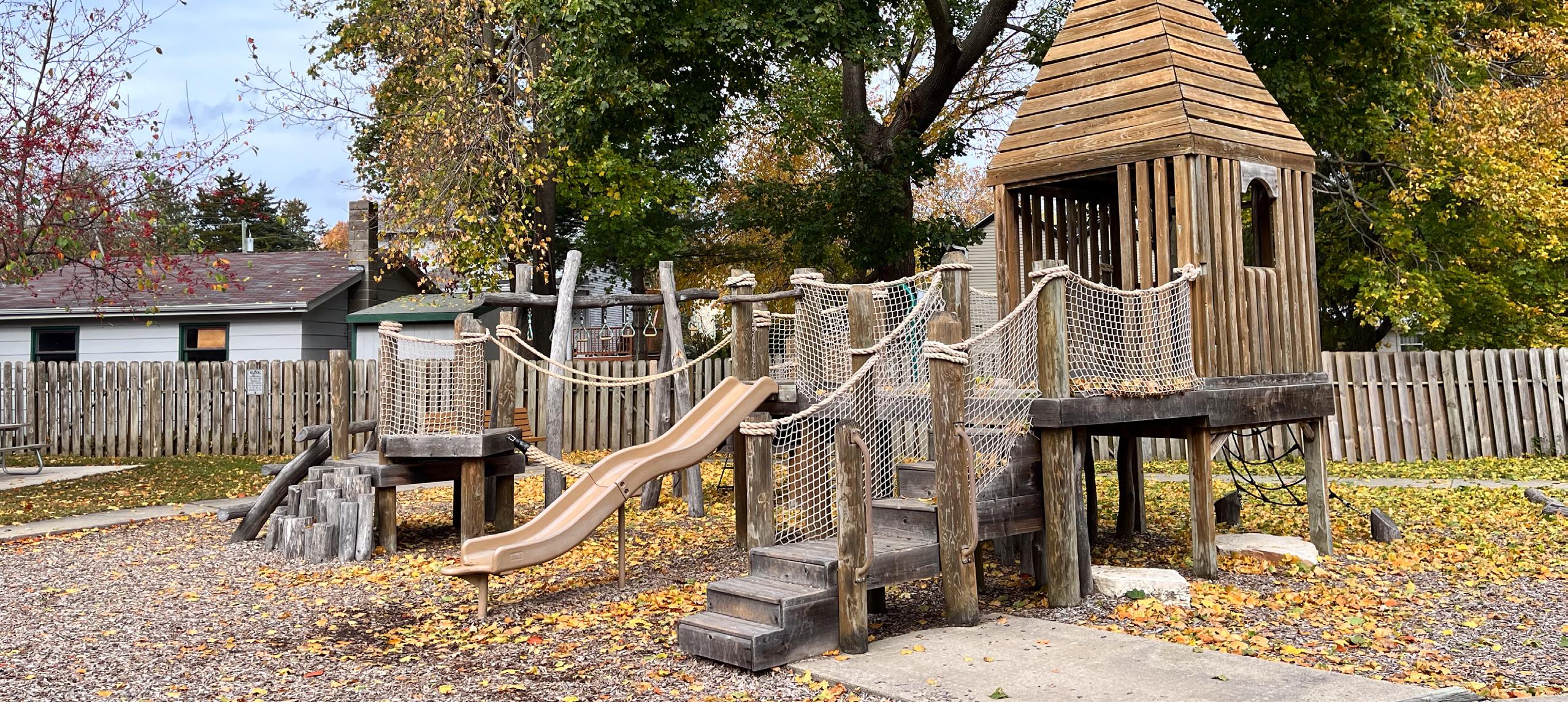
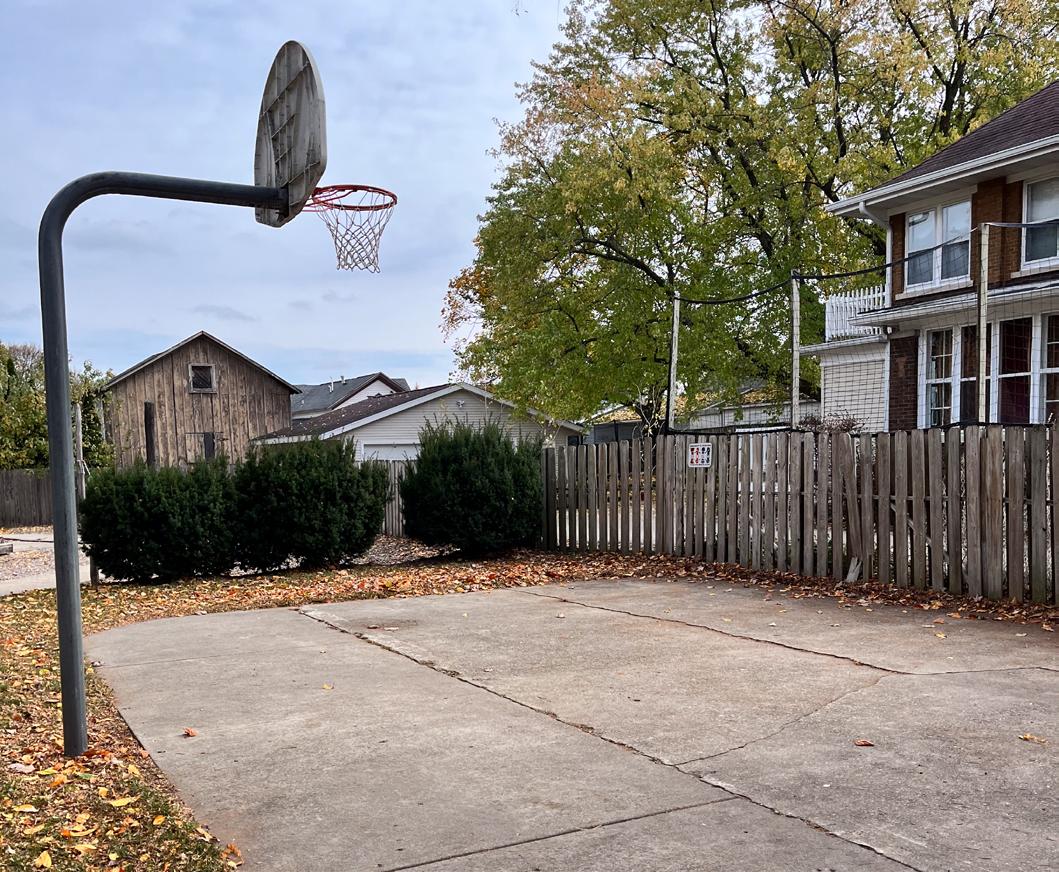
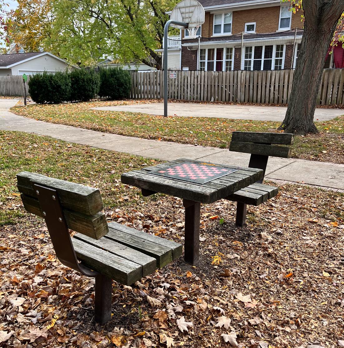
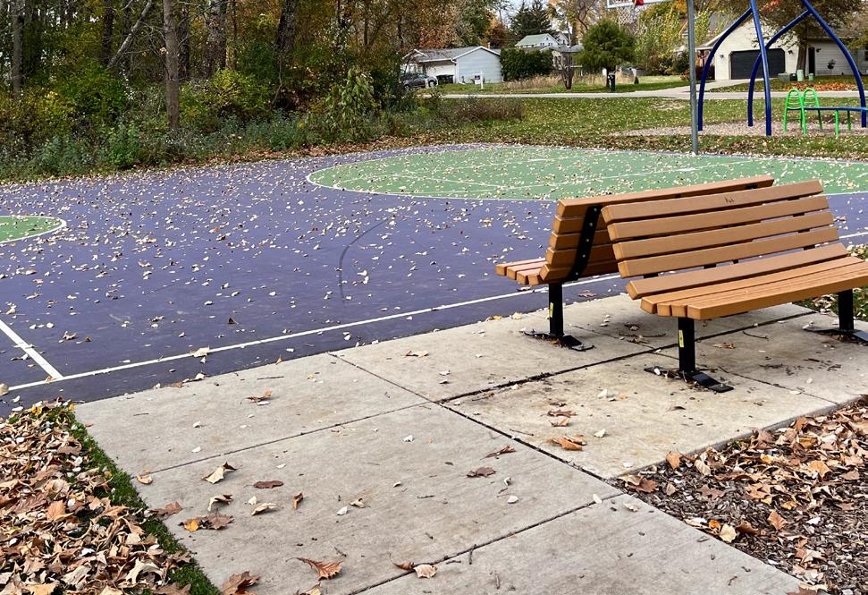
Park Address: 117 S Monroe St
Criddle Park is a 0.2-acre mini park on South Monroe Street between Hamilton Street and Patterson Street. Park features include a playground, gazebo, and a half basketball court.
• Play structure (5 to 12 year old)
• Balance beam & jungle gym
• Teeter totter
• Half basketball court
• Maze
• Gazebo
• Chess/checkers table
• Benches
• ADA Bench
• Trash receptacle
• Donor pavers
• Park sign
Division Street Park is a 0.8-acre mini park on the Yahara River at the intersection of Forton Street and Division Street. Park amenities include a fishing platform, decorative plantings and benches. A small area on the south side of the park is owned by the school district and used by River Bluff Middle School.
• Picnic Tables
• Benches
• Planters
• Park Sign
• Trash Receptacles
• Storage receptacles
• Storage building
• Fishing platform
• Canoe/kayak launch
• Small parking area
Improve the school operated area of the park with native plants and grasses. Include interpretive signage and a mowed path to create an outdoor classroom/nature area
Investigate strategies for managing geese access to all parts of the park (Habitat modification, frightening methods, repellents, etc.) Potentially limit geese access to the north part of the park
Construct asphalt or concrete path from the sidewalk on Division St south of Forton St to park bench and picnic table.
Park Address: 200 Riverside
This is a 1.4-acre mini park on the Yahara River near the intersection of 4th Street and Riverside Drive. Park amenities include a fishing pier, picnic tables and a gravel path. A proposed whitewater park in the area would occupy much of what is now Riverside Park.
• Fishing pier
• Trash receptacle
• Picnic tables
• Bench
• Park sign
• Gravel path
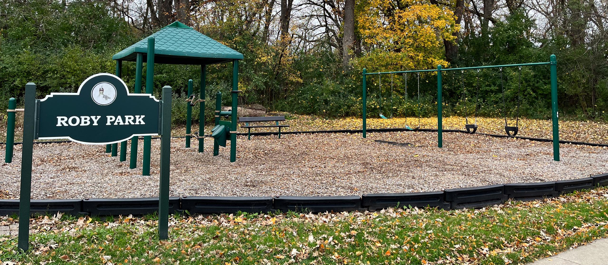
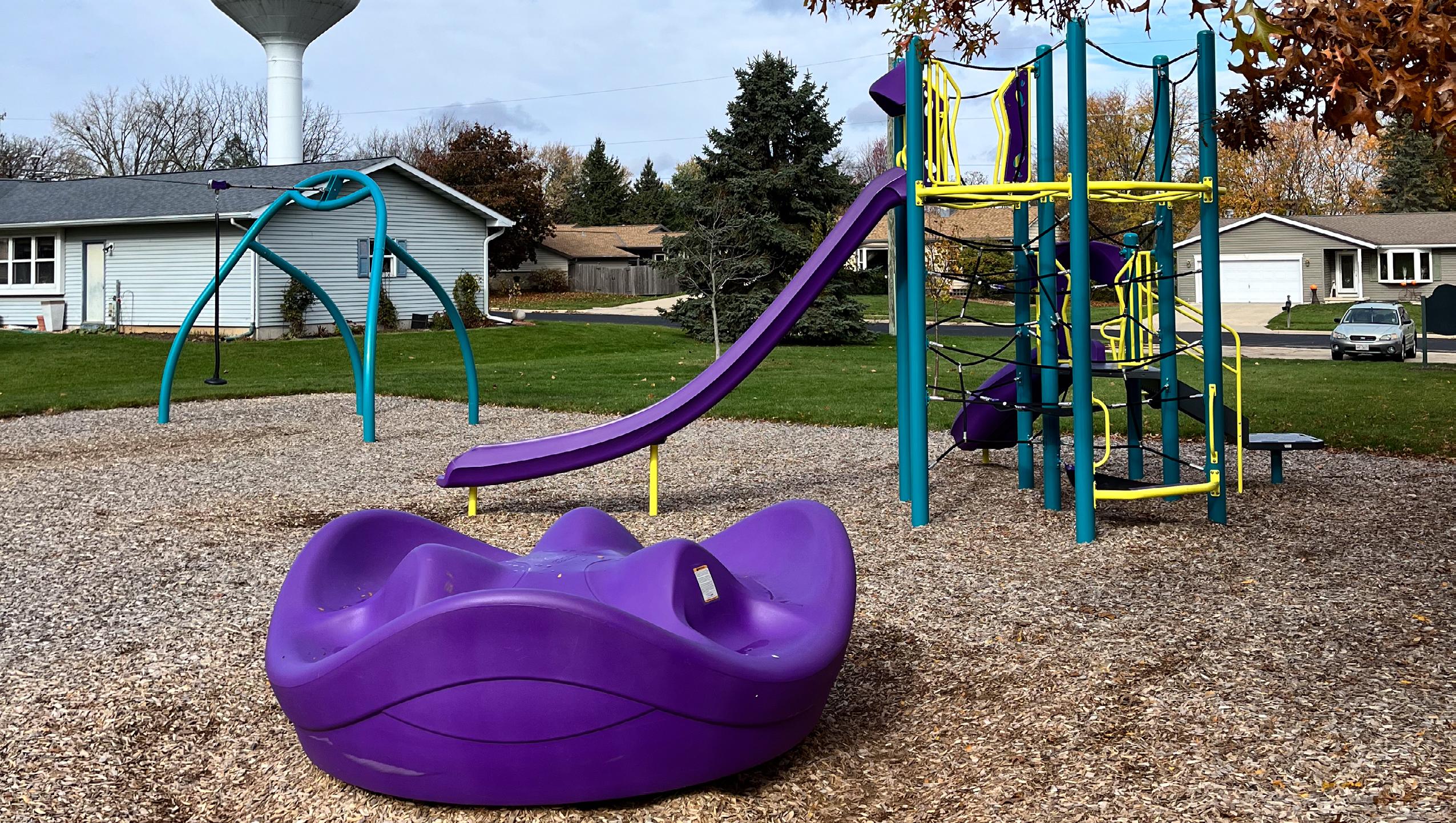
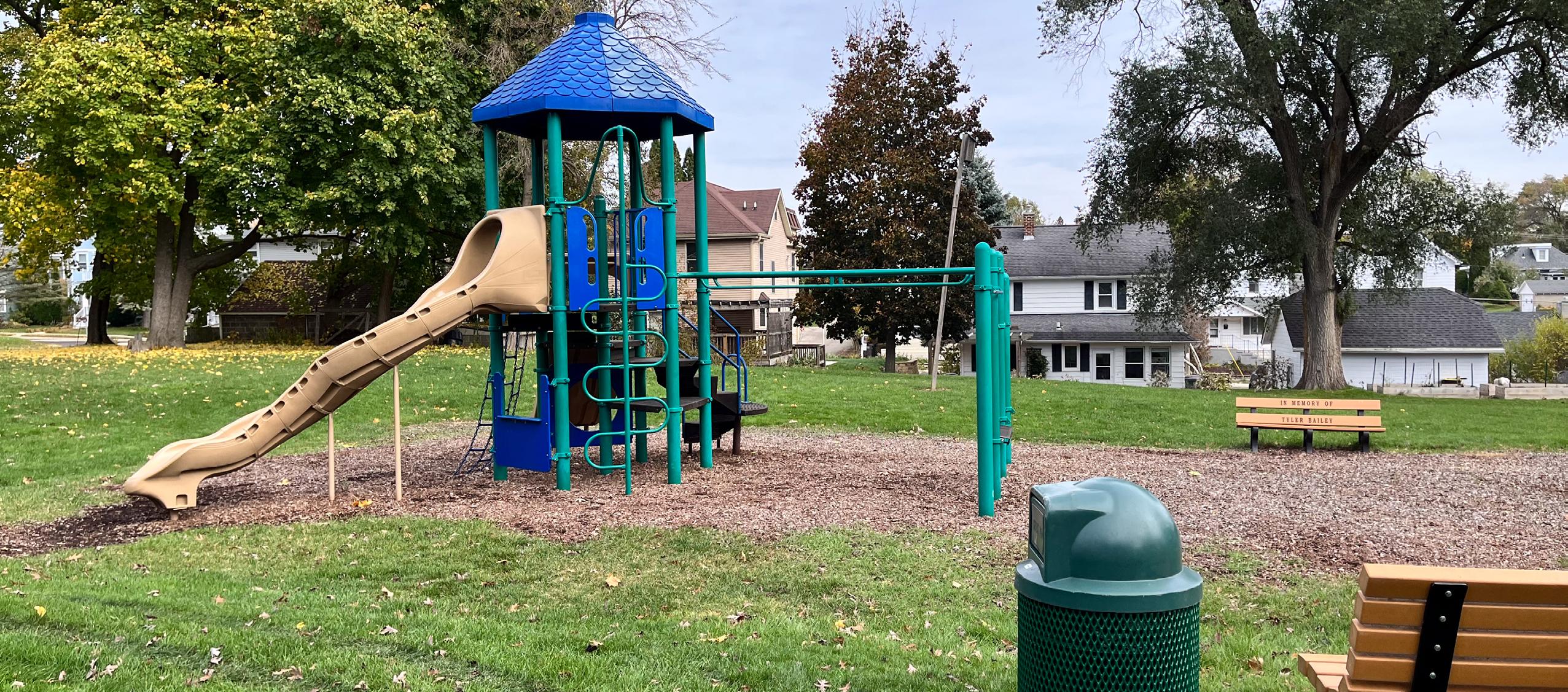
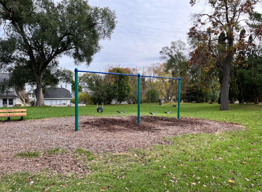
Roby/Page Park is an approximately 0.1-acre mini park within the larger Roby/Page Conservancy Park. The park is located on Roby Road between Madison Street and Page Street and contains a play structure and swings.
• Play structure (2- to 12-year old)
• Swings (2 belt, 2 bucket)
• Bench with ADA seating
• Trash receptacle
• Picnic Table
Bjoin Park is a 7.2-acre neighborhood park at the intersection of East Wilson Street and Grant Street. Park facilities include a baseball field, play equipment and a restroom building.
• Park shelter/restroom building
• Tennis/pickleball court
• Half basketball court
• Play structure (2- to 12-year old)
• Jungle gym
• Climber
• Drinking fountain
• Open Space
• Lighting
• Horseshoe pits
• Park sign
• Park dedication monument
• Picnic table
• Benches
• Trash receptacles
safety mats under play equipment to provide safe fall zones and ADA access to play equipment.
Add accessible paths connecting all park features.
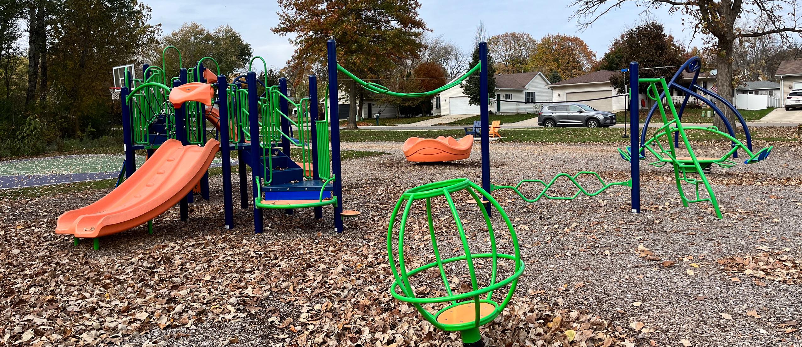
Dunkirk Avenue Park is a 1.3-acre neighborhood park at the intersection of Dunkirk Avenue and Garden Avenue and adjacent to the Yahara River. Park facilities include play equipment, a sandlot backstop and a basketball court.
• Sandlot backstop
• Play structure (2- to 12-year old)
• Swings (3 belt, 1 bucket)
• Half basketball court
• Open space
Replace playground and court.
Construct asphalt or concrete path to relocated park facilities and between all park amenities.
Investigate goose management strategies (Habitat modification, frightening methods, repellents, etc.)
Install trash & recycling receptacles.
Install bike rack on hardscape surface.
$25,000
$5,000 - $7,000
$3,000 - $5,000
$2,000 - $3,000
$1,500 - $2,500
Park Address: 225 South Lynn Street
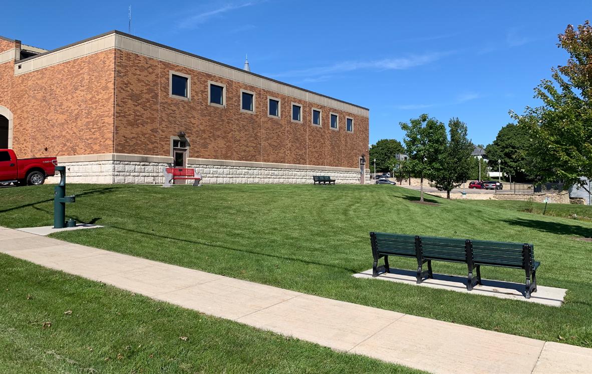
East Side Park is a 2.0-acre neighborhood park at the intersection of Park Street and South Lynn Street. Park facilities include a playground, a tennis court and a park shelter.
• Park shelter/restroom building
• Play structure (5- to 12-year old)
• Swings (3 belt, 1 bucket)
• Tennis/pickleball court
• Half basketball court
• Sand volleyball court
• Horseshoe pits
• Storage shed
• Open space
• Lighting
• Drinking fountain
• Concrete path
• Park sign
• Historical marker
• Benches
asphalt or concrete path from sidewalk on Park St to playground, tennis court and basketball court.
- $2,500
Park Address: 308 W Milwaukee St
Lowell Street Park is a 15.0-acre neighborhood park located at the intersection of South Page Street and West Milwaukee Avenue. Park facilities include a baseball field, a community garden and a bike park.
• Youth baseball field (with dugouts and bleachers)
• Storage shed
• Small shelter/restroom building
• Community garden
• Play structure (2- to 12-year old)
• Basketball court
• BMX bike park (ramps, obstacles, & dirt course)
• Trash receptacles
• Benches
• Bat house
• Bridge
• Park sign
• Mel Bakke Bike Park sign
• Drinking fountain
• Picnic table
or replace damage bike ramps. 2027 $17,250 Install recycling receptacles. 2024 $2,000 - $3,000
Add trail connection through park from Milwaukee St to Isham St. 2026 TBD
Long-term, relocate the ball diamond to a Community Park. 2026 TBD
Replace drinking fountain with an ADA approval model. 2026 TBD
Improve accessibility of restroom facilities (See ADA Audit Plan). 2025 TBD
Park Address: 630 Kriedeman Dr
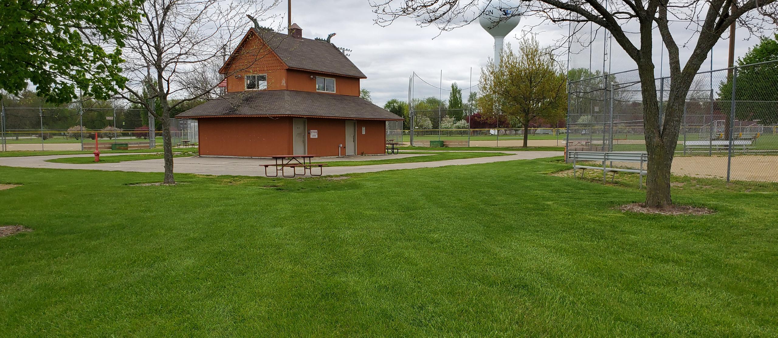
Norse Park is a 8.0-acre neighborhood park on Kriedeman Drive located between Norse Parkway and North Page Street. Park facilities include a baseball field, tennis courts and a basketball court.
• Baseball field (with scoreboard, dugouts, & bleachers)
• Batting cage
• Concession building (with pressbox and restrooms)
• Storage shed
• Play structure (5- to 12-year old)
• Swings (2 belt, 2 bucket)
• Shelter/restroom building
• Basketball court
• Tennis courts (with return wall)
• Ice skating rink
• Open space
• Parking lot
• Drinking fountains
• Park sign
• Benches
• Picnic tables
• Trash receptacles
• Flagpole
Stripe parking stalls along Kriedeman Dr. (Including ADA accessible stalls).
- $9,000
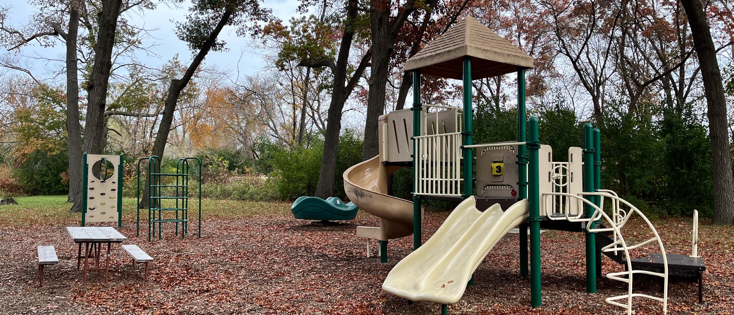
Schefelcker Park is a 10.4-acre neighborhood park on Furseth Road between Sundt Lane and Lincoln Avenue. Park amenities include a playground, natural area and trails.
• Asphalt path
• “Born Learning” trail signs
• Natural area
• Play structure (2- to 12-year old)
• Swings (1 belt, 1 bucket)
• Sandlot backstop
• Natural surface trail
• Parking
• Park signs
• Bench
• Picnic tables
• Trash receptacle
• Dog waste station
• Open space
Address: 625 S Page St
Veteran’s Memorial Park is a 3.9-acre neighborhood park on South Page Street north of Riverside Drive. Park facilities include a playground, pickleball courts and veteran’s memorial monuments.
• Memorial monuments
• Flagpole
• Shelter
• Play structure (5- to 12-year old)
• Web climber
• Balance beam
• Pickleball courts
• Sledding hill
• Open space
• Parking lot
• Lighting
• Park sign
• Picnic table
• Bench
• Trash receptacles
asphalt path connecting park facilities to parking lot on Riverside Drive and sidewalk near tennis courts on S Page
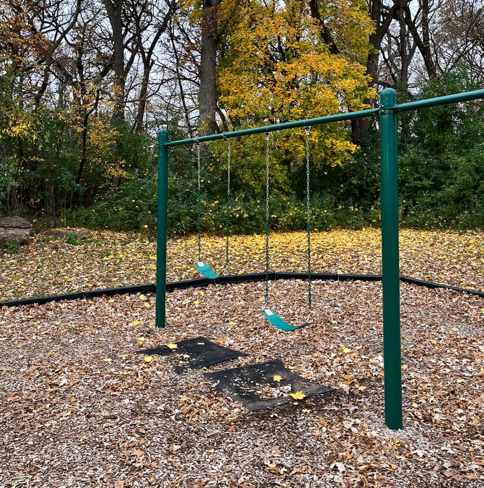
Virgin Lake Park is a 7.0-acre neighborhood park on Roby Road between Virgin Lake Drive and Kings Lynn Road. Park facilities include a shelter/restroom building, play equipment and a soccer field.
• Park shelter/restrooms/utility building
• Half basketball court
• Soccer field
• Gravel trail
• Play structure (5- to 12-year old)
• Swings (1 seat, 1 bucket)
• Drinking fountains
• Storage shed
• Lighting
• Parking lot
• Benches
• Park sign
• Picnic tables
Westview Ridge Park is a 5.1-acre neighborhood park located at the intersection of Hilldale Lane and Valley View Drive. Park facilities include a playground, a basketball court and a gazebo.
• Gazebo
• Play structure (2- to 5-year old)
• Play structure (5- to 12-year old)
• Web climber
• Swings (2 belt, 2 bucket)
• Half basketball court
• Park sign
• Benches
• ADA bench
• Picnic tables
• Trash receptacles
• Open space
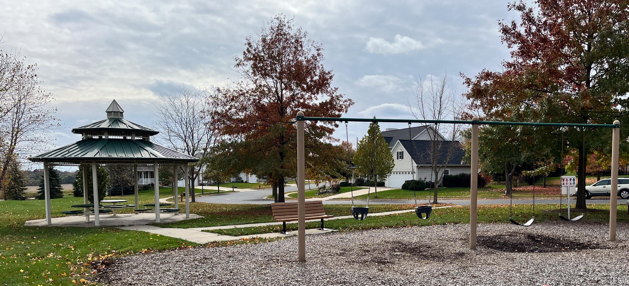
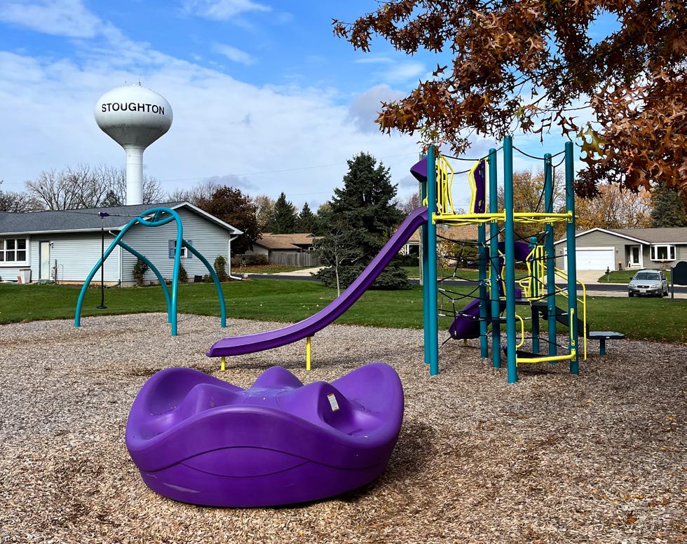
Nordic Ridge Park is a 6.6-acre neighborhood park in the new Nordic Ridge development on Hoel Drive between Korgen Drive and Valberg Drive. Park facilities include a splashpad, open space and a large park shelter.
• Park shelter/restroom/concession building
• Solar panels at shelter
• Splashpad
• Parking lot
• Drinking fountains
• Picnic tables
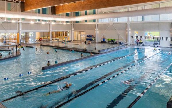
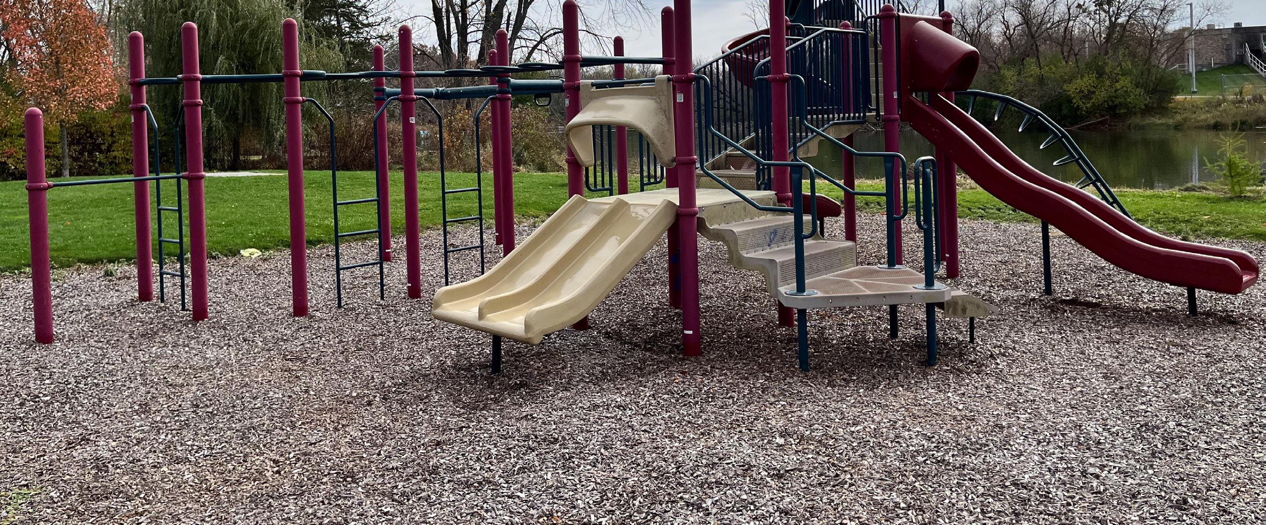
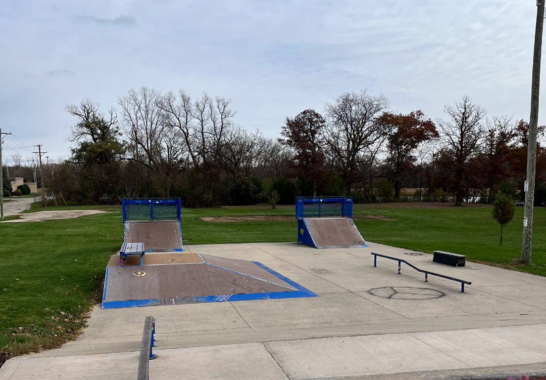
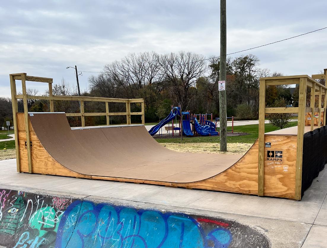
Mandt Park is a 33.2-acre community park adjacent to the Yahara River on South 4th Street. The park is home to the Stoughton Fairgrounds with several buildings and event areas dedicated to fair activities. Other park facilities include the Troll Beach aquatic park, a softball/youth baseball field and the Mandt Skate Park.
• Community Center
• Troll Beach (with inflatable water features)
• Fairgrounds
• Fair/event buildings
• Grandstand
• Tractor pull/event area
• Skatepark
• Lighting
• Parking lots
• Softball/youth baseball field (with lights, bleachers, and team benches)
• Agricultural education buildings
• Park shelters
• Storage building
• Basketball court
• Asphalt path
• Speaker system
• Play structure (5- to 12-year old)
• Park sign with Stoughton Fair sign
• Park sign with manual message board
• Skatepark sign
• Picnic tables
• Drinking fountain
• Benches
• Bike racks
• Portable toilet
• Trash receptacles
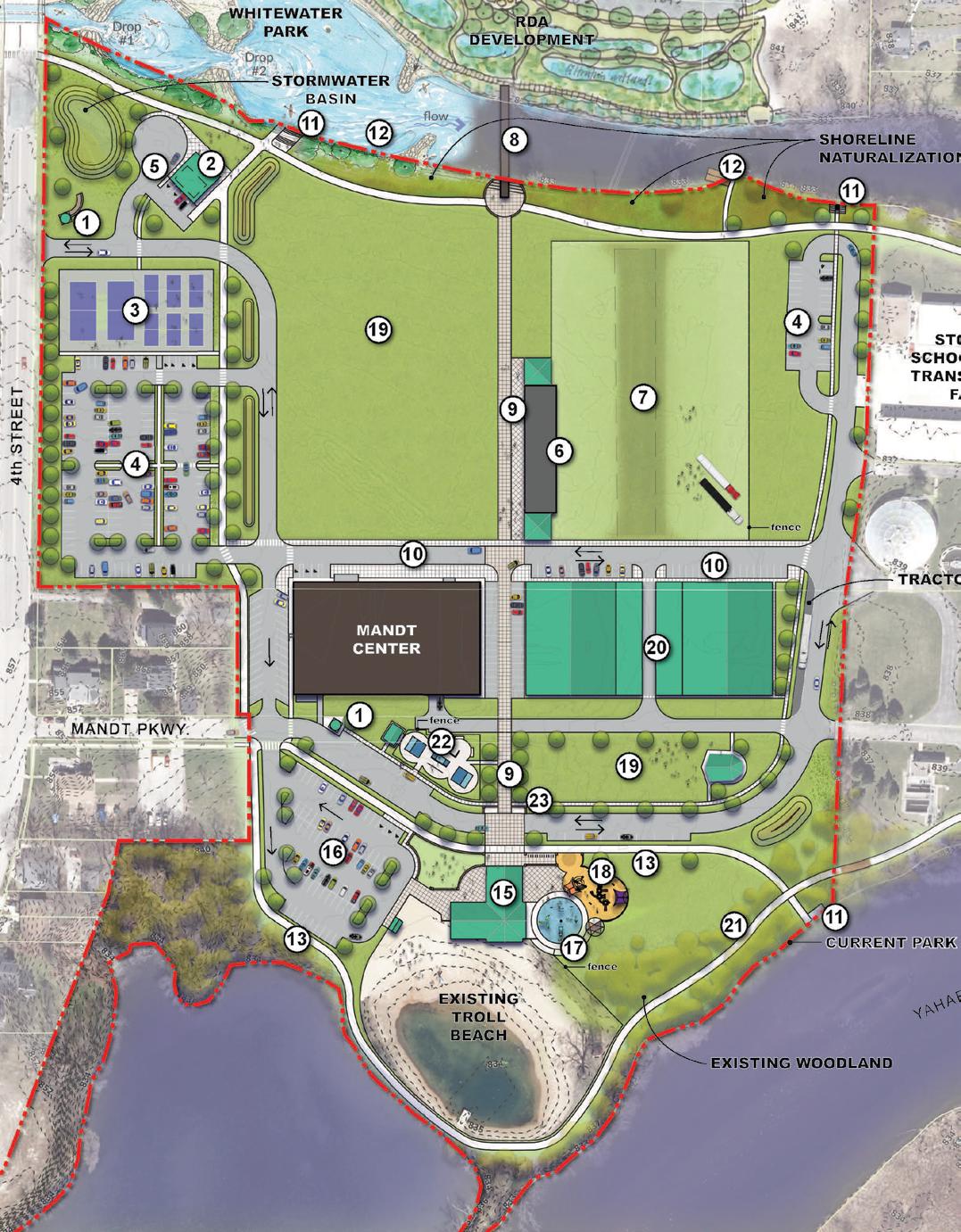
See Mandt Park Master Plan for full map
The master planning process for Mandt Park was completed in May 2020 by MSA Professional Services. During this master planning process, community members were surveyed about their current usage of the park and what changes they’d like to see in the park. Additionally, multiple stakeholder groups were interviewed about their park usage, such as youth sports groups and City recreation committees. Three unique park concepts were developed, and after meeting with the City and holding public input sessions, one concept was developed as the final master plan for Mandt Park.
The final Mandt Park master plan combines the most preferred elements from each preliminary concept, including replacing the existing ballfield with a parking lot to serve both the park and Mandt Community Center, replacing the existing bathhouse with a new multipurpose shelter/bathhouse, relocating the grandstand, a splash pad, a large play area, a new trail system, new exhibit buildings/barns, a new restroom/ concessions building, and a realigned entrance road. Since the full master plan likely cannot be implemented in a single project, a four-phase process was recommended for implementation to minimize costs and reworking of already-completed projects. Phase I includes realigning the entrance road into the park, replacing the existing ballfield with a parking lot, building a new shelter, adding multi-use paths around the perimeter of the park, and adding fishing nodes and an overlook along the Yahara River. Phase II includes the realignment of Southern Mandt Parkway and the additions of a splash pad, large playground, skate park, and a new shelter/bathhouse building. Phase III involves the construction of new pickleball and tennis courts. Finally, Phase IV involves relocating the grandstand, constructing a new restroom/ concessions building, and completing the Mandt Parkway loop.
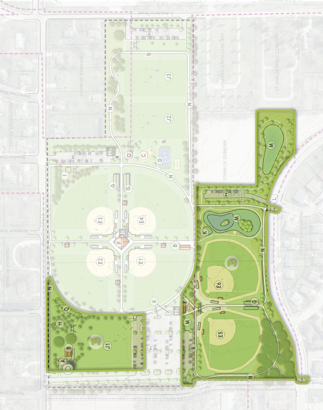
Racetrack Park is a 28.6-acre community park on Racetrack Road north of East Academy Street. Park facilities include baseball/softball fields, a basketball court, and the Crabapple Tree Arboretum.
• Type
• Baseball/softball fields (4 with lights, scoreboards, bleachers, & team benches)
• Concessions building (with pressbox and restrooms)
• Batting cages
• Basketball court
• Soccer fields
• Play structure (2- to 12-year old)
• Crabapple Tree Arboretum
• Crabapple Tree Arboretum sign
• Barn
• Asphalt path
• Parking lots
• Picnic tables
• Bench
• Flagpole
• Trash receptacles
• Storage shed
• Open space
• Park sign
The master planning process for Racetrack Park was completed in August 2021 by MSA Professional Services. During this master planning process, community members were surveyed about their current usage of the park and what changes they’d like to see in the park. Additionally, multiple stakeholder groups were interviewed about their park usage, such as youth sports groups and City recreation committees. Three unique park concepts were developed, and after meeting with the City and holding public input sessions, one concept was developed as the final master plan for Racetrack Park.
The final Racetrack Park master plan combines the most preferred elements from each preliminary concept, including adding two new ballfields, a new shelter and playground area near the east parking lot, a looping multi-use trail system connecting park elements, natural areas and improved stormwater management, and improving ADA accessibility around the park. Since the full master plan likely cannot be implemented in a single project, a three-phase process was recommended for implementation to minimize costs and reworking of already-completed projects. Phase I includes land acquisition for the south parcel, an expanded south parking lot, existing
ballfield improvements, a new north driveway and parking lot, and new entry signage. Phase II includes the construction of a new “neighborhood park” with a shelter, permanent restrooms, playground, and sport courts, the addition of a looping multi-use trail around the park, an additional north parking lot and driveway, replacing the existing concessions building, and new ballfield lighting. Lastly, Phase III includes additional land acquisition, a new western driveway entrance and parking lot, improved stormwater facilities and native planting areas, an expanded looping multi-use trail section, two new ballfields, a new concessions/ restroom building, an expanded north parking lot, and a landscaped seating berm.
Park Master Plan - Phase 1
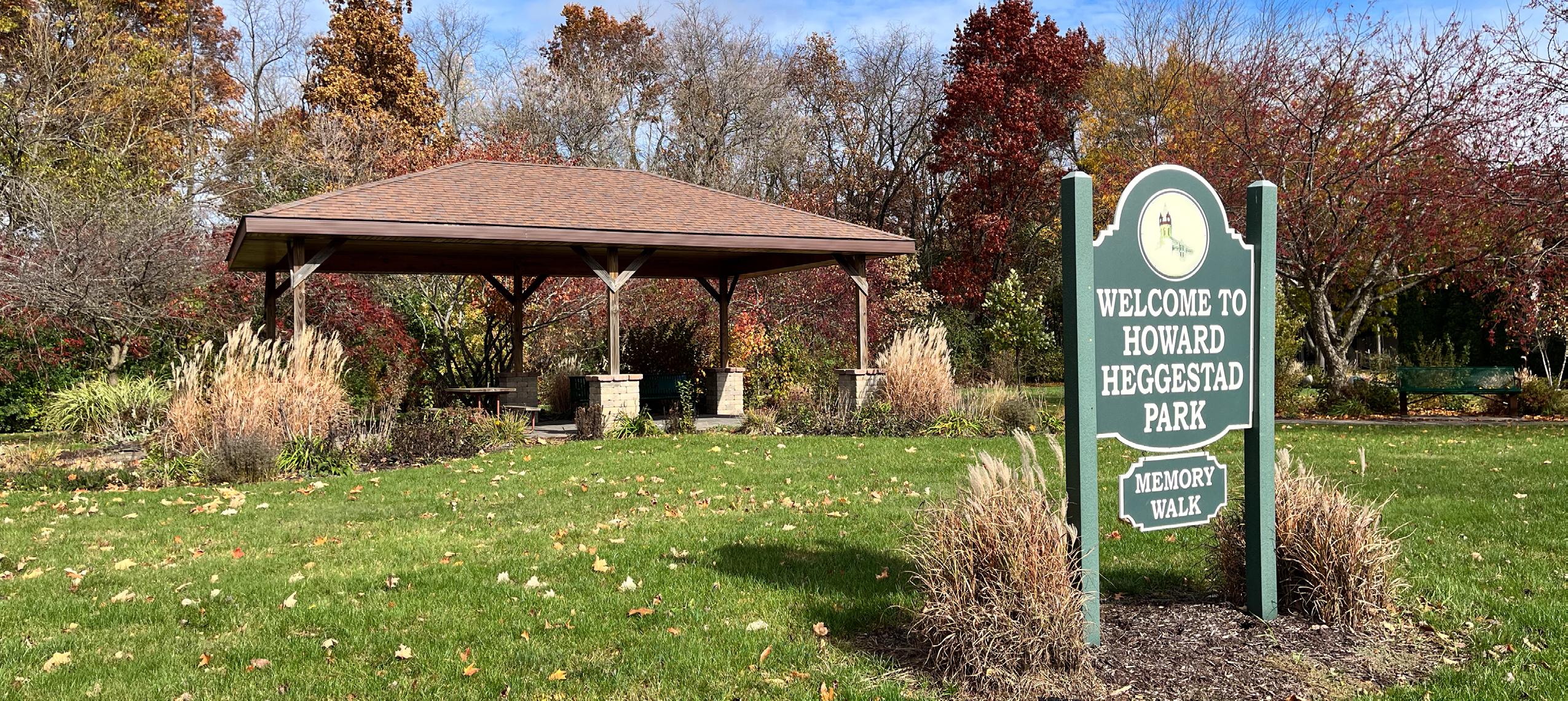
Heggestad Park is a 1.3-acre special-use park on Roby Road west of Kings Lynn Road and across the street from Virgin Lake Park. Park facilities include a paver Memory Walk, a park shelter and a connection to the Virgin Lake Trail.
• Shelter
• Paver “Memory Walk”
• Path lighting
• Planting beds
• Benches
• Trash receptacle
• Bat house
• Gravel trail (Virgin Lake Trail)
• Park sign
Park Address: 324 S 6th St
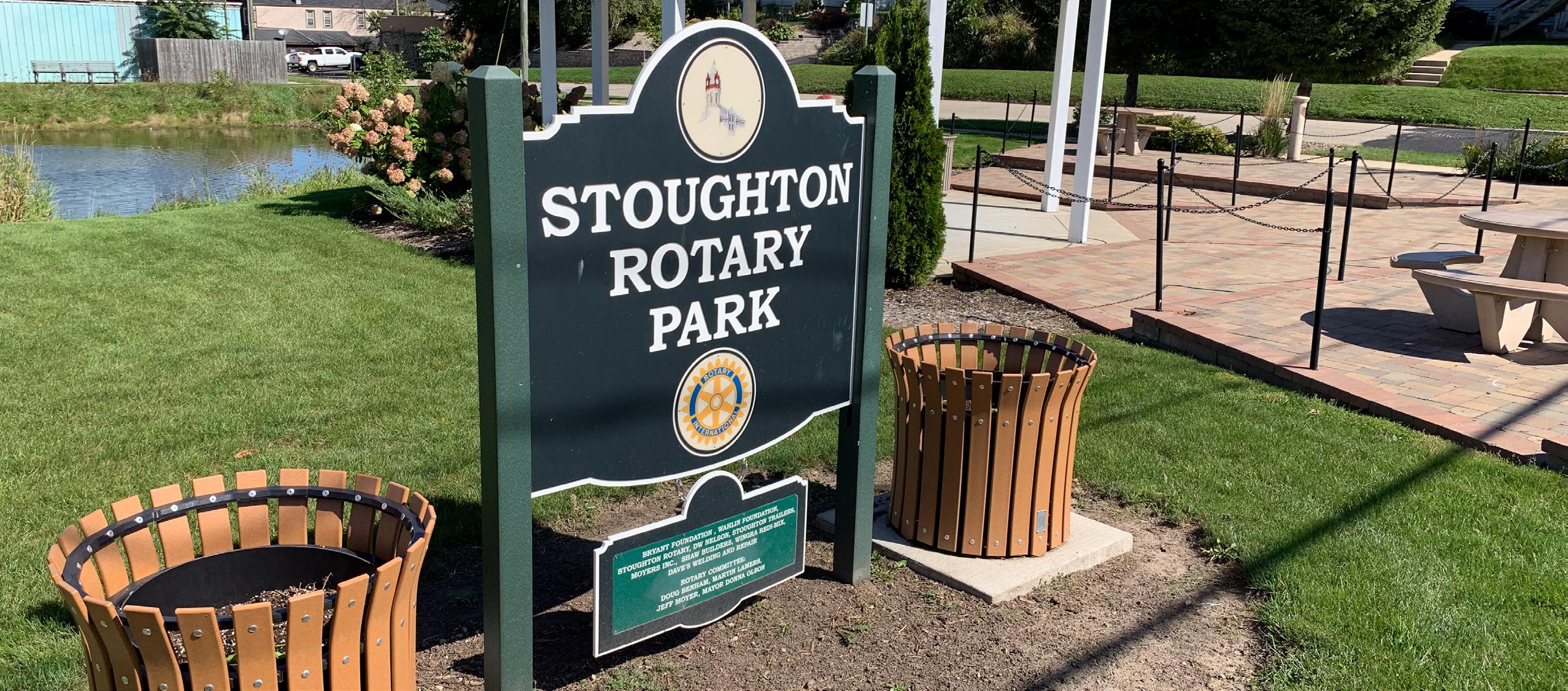
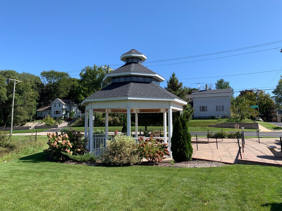
Stoughton Rotary Park is a recently improved, 0.7-acre special-use park at the corner of East Jefferson Street and South 6th Street. Park amenities include a paver plaza, ADA picnic tables, and a gazebo.
• Pond
• Gazebo
• Benches
• Picnic tables
• Memorial monument
• Trash receptacles
• Lighted bollards
• Planting beds
• Park sign
• Drinking fountain
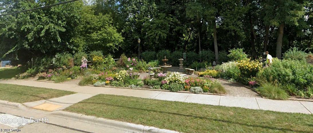
The Victorian Garden is a 0.4-acre special-use park on South Page Street near the intersection of West South Street. The park features a paver walkway through maintained plantings and a central fountain. Recommendations
• Paver path
• Planting beds
• Fountain
• Benches
• Birdhouses
• Memory Garden sign
• Miscellaneous decorations
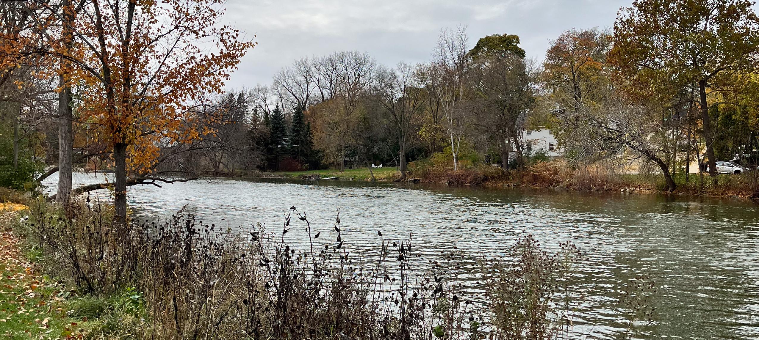
AJ Amundson Park is a 52.6-acre park adjacent to the Yahara River and north of Skogdalen Drive. Park amenities include the Yahara River Trailhead, a disc golf course and interpretive signage. Park Address: Amundson Parkway
• Disc golf course
• Gravel trail
• Dog waste station
• Native prairie
• Shed
• Benches
• Gravel parking lot
• Dane County Parks map signage
• Trailhead signage
• Yahara River Trail sign
• Plant interpretive signage
• Disc golf course sign
• Trash receptacles
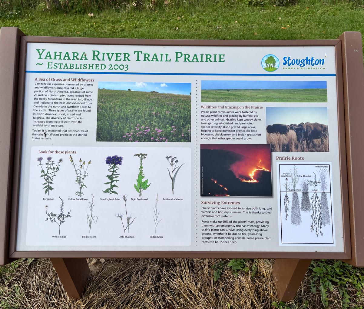
• Open space
• Asphalt driveway
Park Address: 708 Nottingham Rd
• Utility pads Nottingham Park is a 1.1-acre park on Nottingham Road east of Kings Lynn Road. The park consists of open space, a driveway and utility pads. Recommendations
Park Address: 341 Roby Rd
The Roby/Page Conservancy is a 5.7-acre conservancy area on Roby Road west of North Page Street. The park includes a natural area and mowed trail.
• Natural area
• Mowed/natural surface trail
Park Address: County Road N
Settler’s Point Parkland is a 41.7-acre natural area adjacent to the Yahara River and northwest of the intersection of County Highway B and County Highway N.
• Natural Area
Park Address: 1901 Roby Rd
This 10.5-acre natural area north of Heggestad Park contains Virgin Lake and a natural surface trail.
• Virgin Lake Trail • Boardwalk

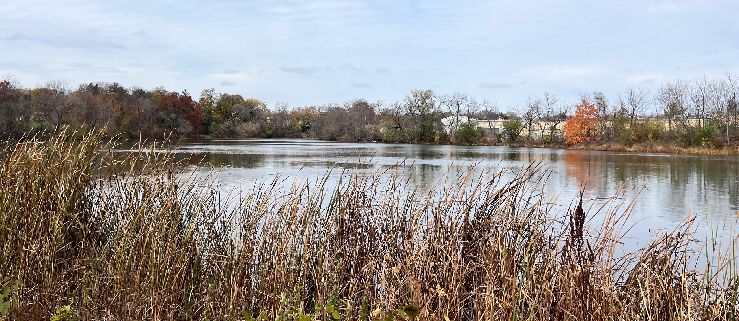
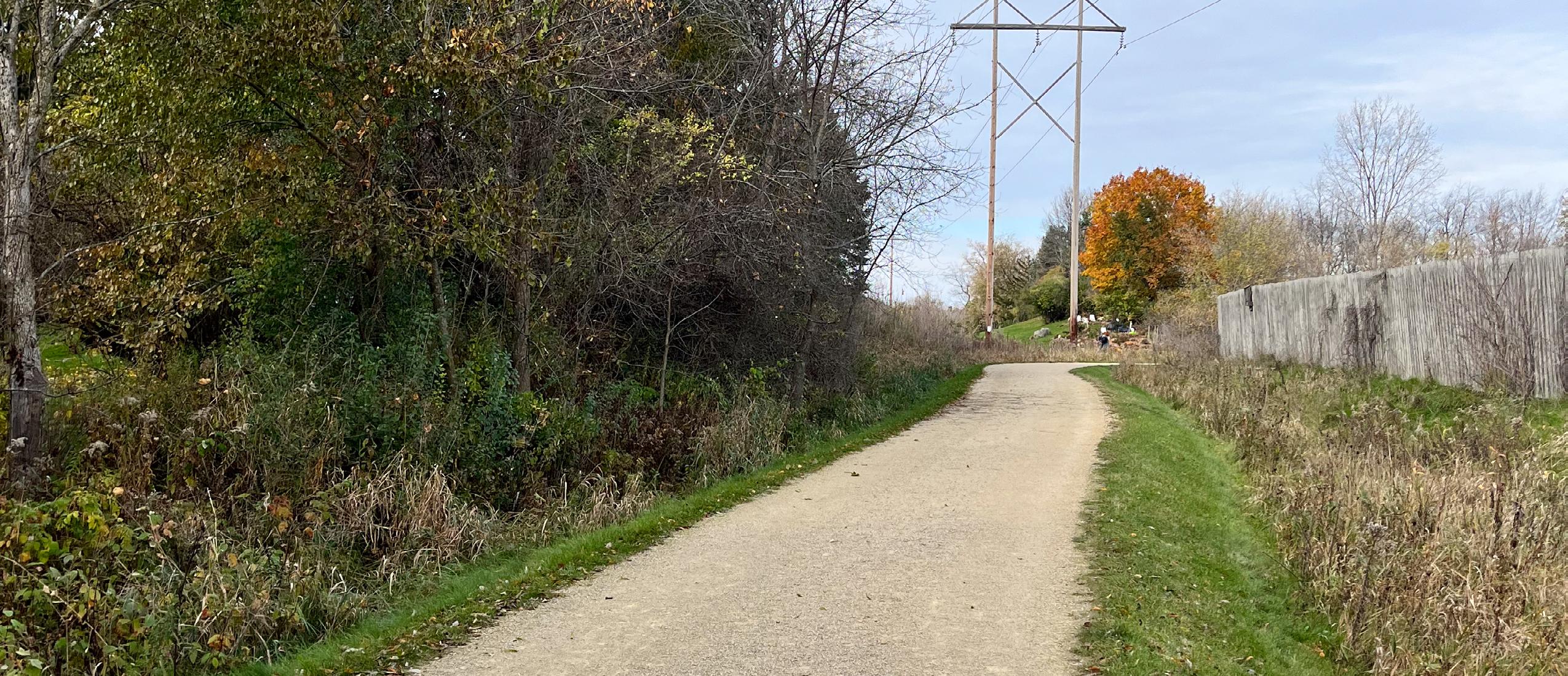
This 42.1-acre natural area is located east of the railroad between Industrial Circle and the Yahara River. Segments of the Yahara River Trail run through the park.
• Yahara River Trail
Recommendations
Eggelson’s Woods
Eggelson’s Woods is the first proposed neighborhood park within the 51 West Subdivision Development. This park will be located on the east side of US Highway 51 on an eight-acre lot, already owned by the City of Stoughton. The master plan for Eggelson’s Woods was developed by MSA Professional Services and approved by the City in December 2022. Public engagement throughout this park master planning process included an online public survey, open house presentations at Stoughton Music Night, stakeholder group meetings, and public information meetings. The information and insights gathered from these public engagement activities were used to develop two unique concepts for Eggelson’s Woods. These two concepts were then combined into a final master plan, incorporating the most preferred elements from each preliminary concept. The master plan for Eggelson’s Woods has a heavy emphasis on passive recreation, incorporating multi-use walking/biking trails connected to the Virgin Lake Trail, dedicated native planting areas, and multiple outdoor fitness stations. Other key elements within the park include stormwater ponds, a small shelter with a permanent restroom, benches, a natural playground area, bike racks, and a bike repair station.
Standard Legacy Park is the second proposed neighborhood park within the 51 West Subdivision Development. This park will be located on former farmland, west of US Highway 51 on a five-acre lot. The master plan for Standard Legacy Park was developed by MSA Professional Services and approved by the City in December 2022. Public engagement throughout this park master planning process included an online public survey, open house presentations at Stoughton Music Night, stakeholder group meetings, and public information meetings. The information and insights gathered from these public engagement activities were used to develop two unique concepts for Standard Legacy Park. These two concepts were then combined into a final master plan, incorporating the most preferred elements from each preliminary concept.
The master plan for Standard Legacy Park incorporates both active and passive recreation opportunities, including an accessible playground, basketball and pickleball courts, multi-use paved paths, and three multi-purpose athletic fields. Other key elements within the park include bike racks, a shaded picnic area, a shelter with permanent restrooms, and open green space for yard games and other outdoor activities.
Tee Naasak Park is a proposed neighborhood park within the Kettle Park West Subdivision Development. This park will be located on a ten-acre site on the western side of Stoughton, just north of Highway 138. The master plan for Tee Naasak Park was developed by MSA Professional Services and was approved by the City in December 2023. Public engagement throughout this park master planning process included interviews with individual bike enthusiast contacts and stakeholder group meetings with representatives from Kettle Park West Senior Living, Forward Development Group, Lennar Homes, and the Stoughton Rivers and Trails Taskforce. The information and insights gathered from these interviews, stakeholder meetings, and conversations with the City were used to develop two unique concepts for Tee Naasak Park. These two concepts were then combined into a final master plan, incorporating the most preferred elements from each preliminary concept.
The master plan for Tee Naasak Park includes a shelter with permanent restrooms, a playground area, a multi-sport court, open green space, a bike pump track, a bike skills area, a woodland bike path, a sledding hill, a paved multi-use path, mown prairie walking paths, and a parking lot. The implementation process for this park includes two phases; the first phase, set to begin in 2024, includes the construction of the shelter/restroom building, playground area, sport court, open green space, parking lot, stormwater management areas, and native prairie plantings with mown walking paths. The second phase is dependent on neighborhood development and will include the paved multi-use path, bike pump track, bike skills area, woodland bike path, and sledding hill.
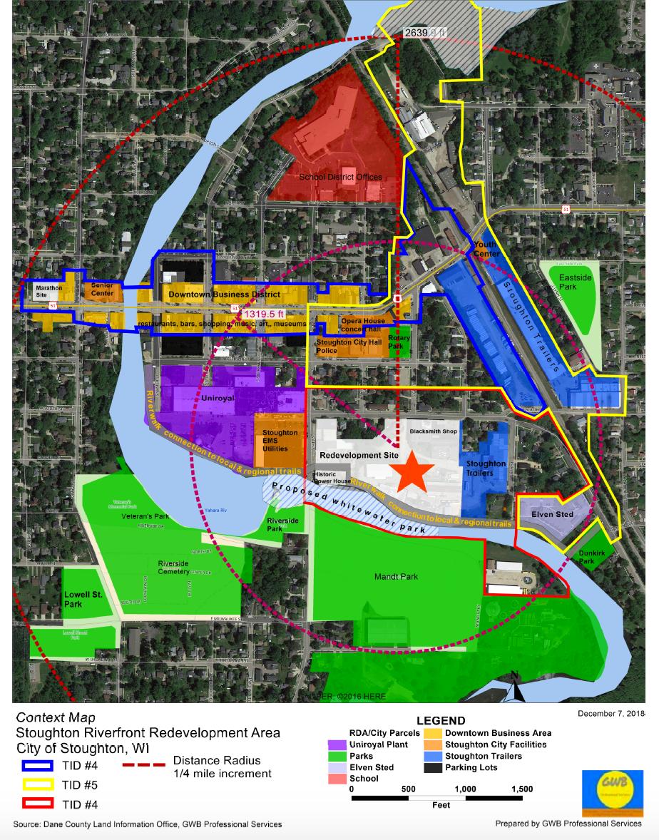
Yahara River Park is a proposed whitewater park intended to repurpose the Yahara River Dam site into the first free, public river recreation park in the state of Wisconsin. The master plan for Yahara River Park is being developed by Recreation Engineering & Planning and has been in the process of development since January 2018. Public engagement throughout this park master planning process has consisted of multiple steering committee meetings, public information meetings, and stakeholder group meetings.
Proposed park elements include a series of five drop pools for tubers and kayakers, a natural “surf wave” feature for kayakers, open green space for fishing and picnicking on the site of the current millpond, and a riverside pedestrian trail. Currently, there are limited opportunities for river access in the project area; there are no launch points for watercraft, no pedestrian trails, and the existing site conditions do not encourage visitors to spend much time near the river. With the construction of this park, however, the City seeks to transform this site into an active, thriving regional recreation destination for paddlers, anglers, bikers, and pedestrians. As of November 2023, grant funding has been secured for various components of Yahara River Park; in addition, a pedestrian bridge,
riverside trail, and rock embankments have already been installed downstream of the park.
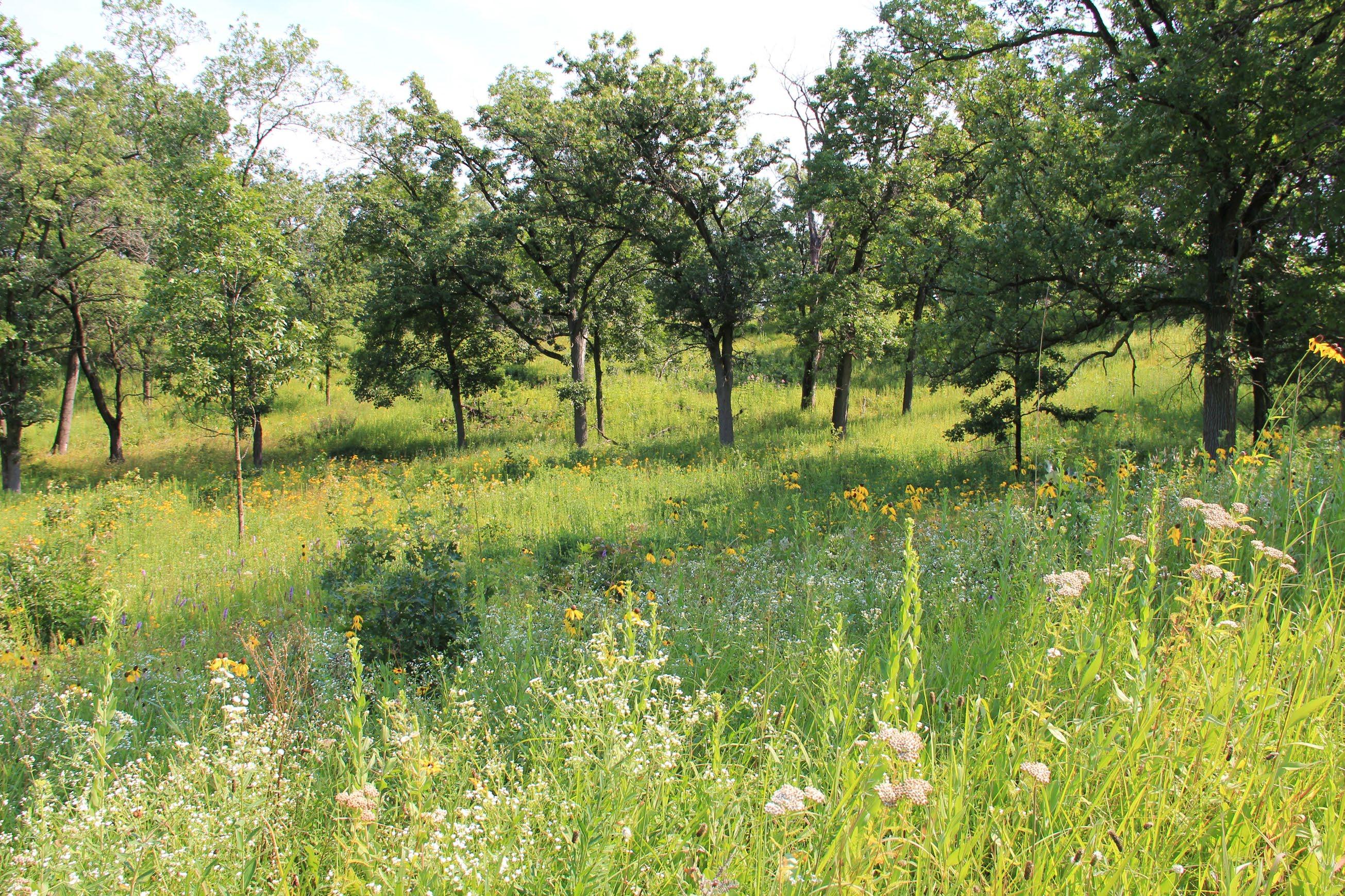
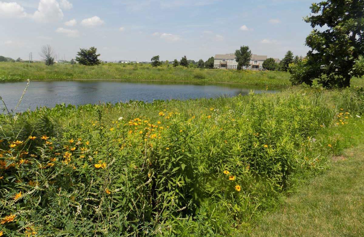
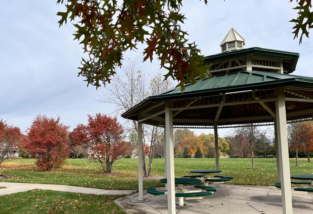
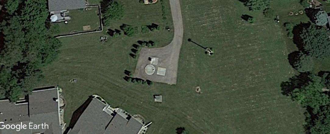
Teigen Farm Park is a proposed neighborhood park within the Magnolia Springs Subdivision Development. This park will be located on former farmland, west of South 4th Street on a four-acre site. The master plan for Teigen Farm Park was developed by MSA Professional Services and was developed and approved in conjunction with this plan. Public engagement throughout this park master planning process consisted of a focus group meeting with immediate neighbors of the project site. The information and insights gathered from this focus group meeting and from conversations with the City were used to develop two unique concepts for Teigen Farm Park. These two concepts were then combined into a final master plan, incorporating the most preferred elements from each preliminary concept. The master plan for Teigen Farm Park (see Appendix C) includes walking trails around a delineated wetland area, a multi-use trail, an open-air shelter, a natural play area, open green space, a wet pond for stormwater management, and native prairie plantings throughout.
South Loop Trail
• Engineering and construction for an off-road paved path between Isham St to the Magnolia Springs Development is set to begin in 2024-2025.
Jefferson Street Pedestrian Bridge
• Construction for this pedestrian bridge over Jefferson St [and what crossroad or nearby road] is set to begin in 2025.
Highway 51 Underpass
• Construction of a pedestrian underpass will begin in 2026. It’s location is noted on Map 3 in Appendix A.
North Loop Trail
• Engineering and construction for an off-road paved path along Lincoln Ave to the future STI Development site is set to begin in 2026-2027.
Ridge St to Cooper’s Causeway
• Trail design and construction for an off-road paved path connecting Ridge St to Cooper’s Causeway is set to begin in 2025-2025.
Maintenance and operational expenses of the city’s Parks & Recreation Departments are generally funded through property taxes and user fees. As the park system grows, the funding needed to meet the basic maintenance and operational costs also grows. Often there are insufficient funds to undertake major capital improvement projects. There are a wide variety of potential funding sources to assist with up-front capital costs, including acquisition of land and the development of new recreational facilities.
An important source of funding are grant programs offered by state and federal agencies, especially the Wisconsin Department of Natural Resources. Table 6.1 [provided separately] provides a summary of common state and federal park and recreation grant programs. The table is not an exhaustive list of grant programs, rather those that are typically used by municipalities. Other grant programs may exist and information regarding funding details shown in Table 6.1 should be verified with grant providers prior to seeking grant funding.
Community groups and civic organizations are sometimes willing to organize fundraising efforts to assist with costs, and they may also be able to marshal volunteer labor to assist with small development projects such as trail creation or playground installations. Local business and corporate support should also be sought. Funders can be acknowledged with plaques, signs, or walkway bricks, including the option of park or feature naming rights for major donors.
The City can set up an endowment fund as an additional means of providing continual financial support for park acquisition and development. An endowment fund works like a permanent savings account. The amount individuals give, which is the principal, is never spent. Only the interest income is spent, thereby providing a continual source of monies. A park endowment fund can provide a means for residents to make gifts of any size (including estate bequests), with the certainty that the money donated will only be used for the advancement of recreation in the community. Gifts to an endowment fund are typically tax deductible under federal and state law.
As part of a broader plan to redevelop an area, the City can use tax increment financing to assist with parkland or trail acquisition and development. There are some limitations to what revenues from a TIF district can be used to pay for, generally the costs of constructing public buildings cannot be funded with TIF. TID’s are typically created for the purpose stimulating redevelopment and new public and private investments. There are currently 3 active tax increment districts in the City: TID #4 - Downtown, TID #5- Rail Corridor, and TID #8 – Riverfront.
Per the City’s Ordinances, parkland is to be set aside when new subdivisions are platted in Stoughton. Where land is to be dedicated, 1,468 square feet of land shall be dedicated for each single-family dwelling, 1,019 square feet of land shall be dedicated for each dwelling unit in a two-family or multi-family development, and 528 square feet of land shall be dedicated for each dwelling unit in a group quarters.
When it is determined by the Plan Commission that a proposed subdivision cannot set aside land at the rates described above, fees in lieu of land dedication can be provided to the City to help fund future park, trail, and recreation needs. The 2024 rates for fees in lieu of land dedication are noted in Table 6.2.
Regardless of whether land dedication or fees in lieu of land dedication are required, a park improvement fee shall be paid for each dwelling unit proposed. Any developer creating or constructing additional residential dwelling units within the city shall pay a fee to provide for capital costs necessary to accommodate the parks, playgrounds, and land for athletic fields. The following fees are effective January 1, 2023, representing a construction cost increase from 2023 of 2.7%.
Prior to adopting this plan, or plan amendment, the county can hold at least one public hearing to discuss the proposed plan or plan amendment; however, a public hearing is not required by the DNR to adopt this plan. If a public hearing is held, at least 30 days prior to the hearing a Class 1 notice must be published that contains, at minimum, the following:
• The date, time, and location of the hearing.
• A summary of the proposed plan or plan amendment.
• The local government staff who may be contacted for additional information.
• Where to inspect and how to obtain a copy of the proposed plan or amendment before the hearing.
The notice should also provide a method for submitting written comments, and those comments should be read or summarized at the public hearing.
The plan and any future amendments become official City policy when the City Council passes, by a majority vote of all elected members, an adoption resolution. The City Council may choose to revise the plan after it has been recommended by the Parks and Recreation Committee, and after a public hearing (optional).
The Committee should meet to review the plan and pass a motion to recommend approval of the plan or plan amendment by the City Council.
Amendments can be made at any time, but it is best practice that the City should not amend the plan more than once per year. A common recommended approach is to establish a consistent annual schedule for consideration of minor plan amendments as needed. This plan should be updated every five years in order to maintain eligibility the WDNR KnowlesNelson Stewardship grant funding program. Unlike an amendment, a plan update should revisit the entirety of the plan content and include more robust opportunities for public participation.


Improve the school operated area of the park with native plants and grasses. Include interpretive signage and a mowed path to create an outdoor classroom/ nature area
Investigate strategies for managing geese access to all parts of the park (Habitat modification, frightening methods, repellents, etc.) Potentially limit geese access to the north part of the park
Construct asphalt or concrete path from the sidewalk on Division St south of Forton St to park bench and picnic table.
- $5,000
Replace drinking fountain with an ADA approval model.
Improve accessibility of restroom facilities (See ADA Audit Plan).
*Full survey results withheld to reduce document size
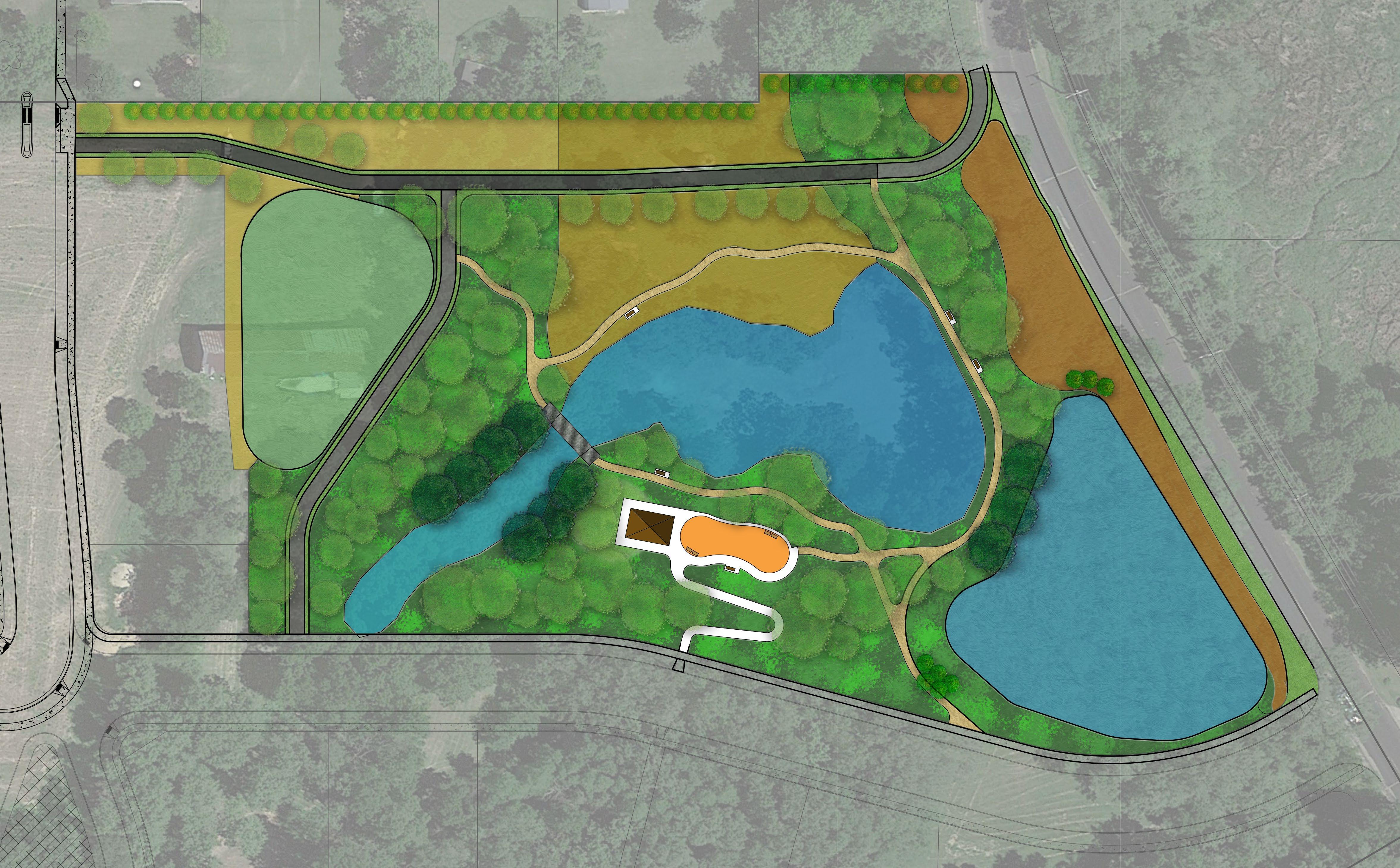


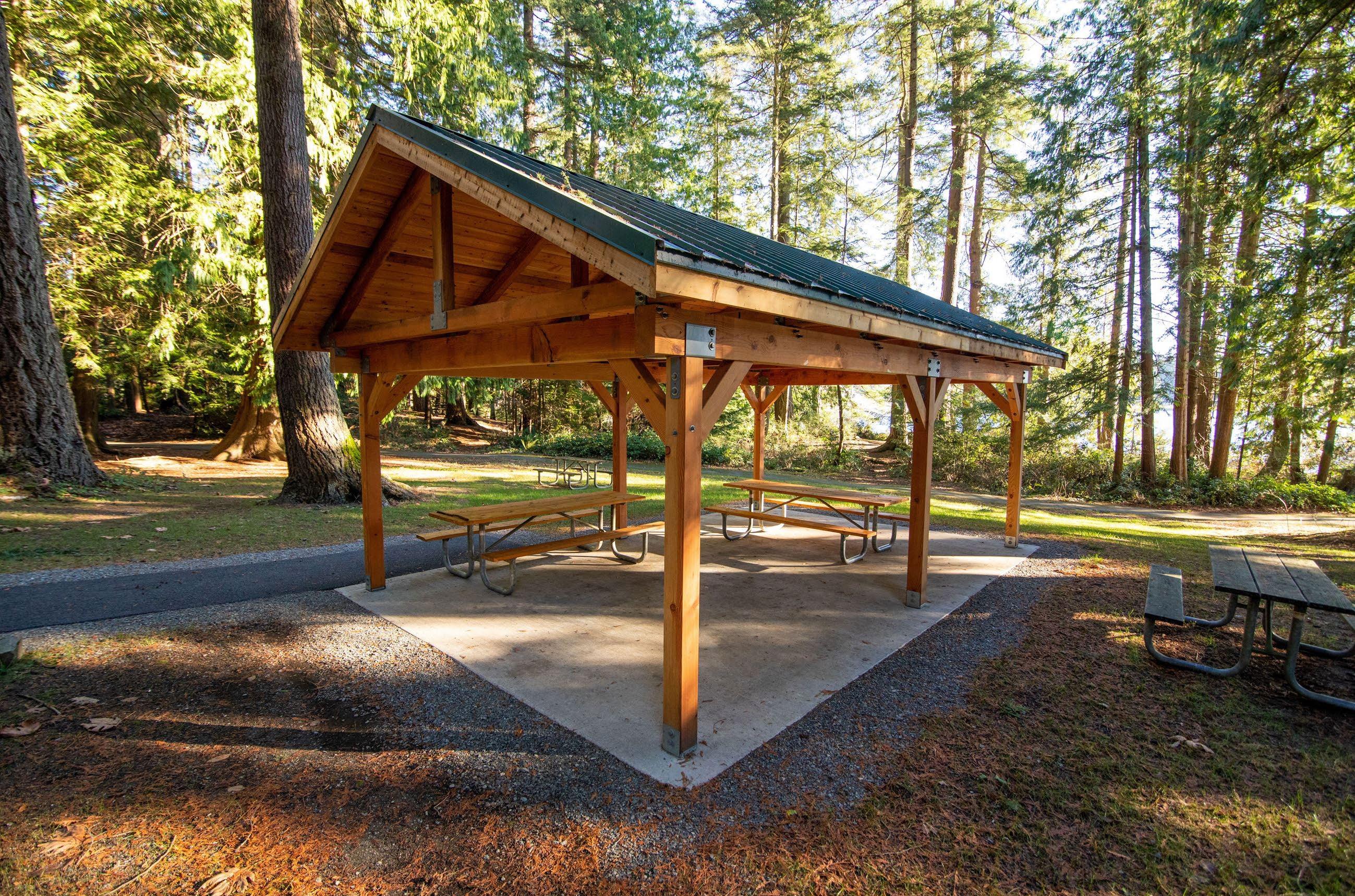
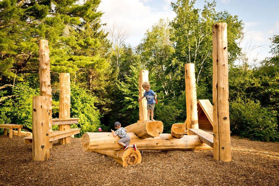
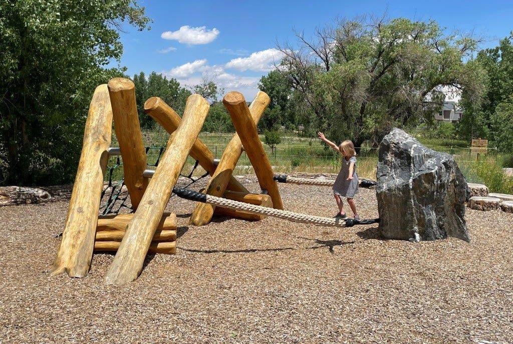
City of Stoughton, Wisconsin
December, 4th 2023