The purpose of this plan is to establish a shared vision for the Village of Howard that will guide future actions and decisions. This guidance improves the Village's ability to work cohesively and consistently over time.
PURPOSE & INTENT
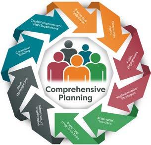
The Comprehensive Plan is a resource for managing the growth of the Village of Howard. It is designed to be a working document used by Village officials to direct community development decisions, to assist with capital and operational budgeting, and as a tool to focus and stimulate private housing, business, and industrial investment.
A Comprehensive Plan functions as an umbrella document that considers most issues affected by Village government, and it is to be used in coordination with other documents and ordinances. The plan refers to other plans and studies that address specific topics in greater detail.
The plan is implemented through the use of ordinances, especially the zoning and subdivision ordinances. This plan is intended to help the Plan Commission and Village Board apply those ordinances; in fact, State statutes require that certain decisions must be consistent with this Plan.
PLAN MAINTENANCE
The plan represents the Village’s best effort to address current issues and anticipate future needs, but it can and should be amended as conditions warrant reconsideration of policies. The plan can and should be amended from time to time to adjust to changing conditions, and it should be fully updated with new data every 10 years.
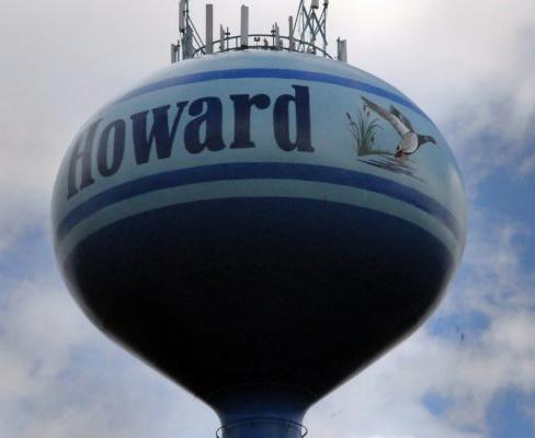
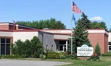
WELCOME TO THE VILLAGE OF HOWARD COMPREHENSIVE PLAN!
The Comprehensive Plan is intended to guide decisions and actions affecting Village budgets, ordinances and growth. The Plan looks 20 years into the future, but focuses on action steps to guide the Village's near-term efforts to help realize the long-term goal. As a broad based plan, it relies on other more detailed plans, budgets and other processes that bring more clarity and specifics to everyday decisions.
The Plan's recommendations are intended to:
» Create a collective vision for the future of Howard.
» Establish priorities for public investment, including the Village's Operating Budget, Capital Budget, and 5-year Capital Improvement Program.
» Inform policies that guide Village decision-making.
» Align the work of Village agencies around the issues that matter most to our residents and stakeholders.
» Create a framework for topic-specific plans and initiatives that will expand on the Comprehensive Plan's recommendations.
» Guide private development through the Future Land Use map and policies.
» Foster partnerships with other entities to address shared goals.
Plan Adoption and the Consistency Requirement
Under Wisconsin’s comprehensive planning statute, a comprehensive plan must receive a public hearing and be approved by resolution by the Plan Commission, and adopted by ordinance by the Village Board.
Wisconsin’s Comprehensive Planning law requires that if a local government unit enacts or amends any of the following ordinances, the ordinance must be consistent with the comprehensive plan:
» Official maps
» Local subdivision regulations
» General zoning ordinances
» Shoreland/wetland zoning ordinance
Though adopted by ordinance, the plan itself is not an ordinance. This plan is not intended to be a literal “road map” for the Village that provides a clear path from the present to a point twenty years into the future. Rather, it is intended to guide decision making in the years to come toward a unified vision expressed in this plan. Over the course of time many factors will arise that will significantly influence the day-to-day decision making that occurs at the local government level, and in the community in general. This plan should continue to be consulted to ensure that such decisions contribute to the established vision in this plan. As this is a living document, it may need to be amended from time to time to adapt to unexpected changes.
OVERALL VISION
Howard's vision statement is intended to set the general tone for the rest of the plan. It was taken from the Village's 2020-2025 Strategic Plan in order to align both documents' vision and priorities.
2042 VISION:
“Delivering extraordinary results for a vibrant, thriving, and growing community”
Plan Organization
This plan is organized around the nine required plan elements as outlined in state statutes:
1. Introduction (P.2-5)
2. Public Engagement (P.6-7)
3. Agricultural, Natural & Cultural Resources (P.811)
4. Utilities & Community Facilities (P.12-19)
5. Intergovernmental Cooperation (P.20-23)
6. Economic Development (P.24-27)
7. Housing (P.28-33)
8. Transportation (P.34-37)
9. Land Use (P.38-57)
10. Implementation (P.58-67)
Each section includes issues and opportunities (identified during the process), voices from the community (public input gathered), 2020 snapshot (of existing conditions), and goals, policies and actions.
Goals, Policies & Actions
The policy content of this plan is organized into Goals, Policies and Actions.
Goals
A goal is a general statement about a desired future outcome. Goals provide the big idea and direction but do not indicate how they will be achieved.
Policies
Policies are rules of conduct to be used to achieve the goals of the plan. They are intended to be used regularly to guide Village decisions. Some of the policies in the plan could also be stated as actions, but have not yet been assigned to anyone to pursue action.
Actions
Actions are specific activities that someone within village government should actively pursue, sometimes in coordination with non-governmental agencies. All actions are repeated in Section 10 (Implementation) with approximate deadlines and responsible parties assigned.
INTRODUCTION
CENSUS DATA
The Census Bureau collects basic data every 10 years as part of the federal population census, but it also collects much more information every year through the American Community Survey (ACS). That data is collected using a relatively small sample of the local population, which is then reported not as a snapshot in time, but as a reflection of conditions over a five-year sampling period. The data are reported as estimates and every estimate has a certain margin of error based on the number of responses in the sample. The most recent federal census took place in 2020.
Regional Context
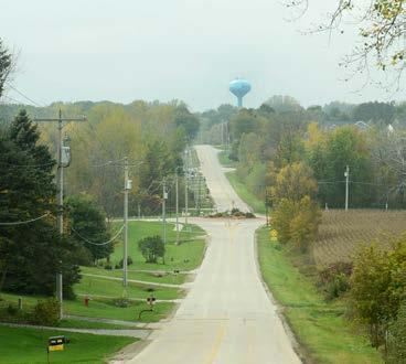
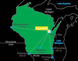
The Village of Howard is a community of over 20,000 located in Brown County along the western shore of the Bay of Green Bay.
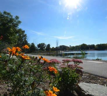
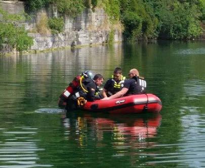
One of the fastest growing communities in Wisconsin, Howard has a well-deserved reputation as a family friendly community, with numerous well-maintained parks and trails. The newly constructed Howard Commons public space features a multi-use pavilion that serves as a covered ice rink in the winter. A splash pad, old-style beer garden, amphitheater, and a year-round activity building round out the amenities. In summer months the Duck Creek Quarry
provides a place to cool off on warm sunny days.
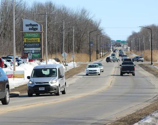
Howard is also the home of the highly respected Howard-Suamico School District and several other private school choices. In addition, Howard is the home of the West Side YMCA, a full-service Y with an indoor pool, indoor track and fitness center, basketball courts, and outdoor playing fields with a summer camp. Shopping is convenient in Howard, with major retailers Meijer, Menards, Woodman’s Food Market, and Fleet Farm all rising to meet the demand created by the rapid growth of the community.
Planning Jurisdiction
The study area for this plan includes all lands in which the Village has both a shortand long-term interest in planning and development activity.
The village’s growth and authority are impacted by natural limitations, as well as through current or future intergovernmental agreement. As a result, there are areas in which growth would otherwise be possible but are not designated as planned growth areas, such as other incorporated villages or the Bay of Green Bay.
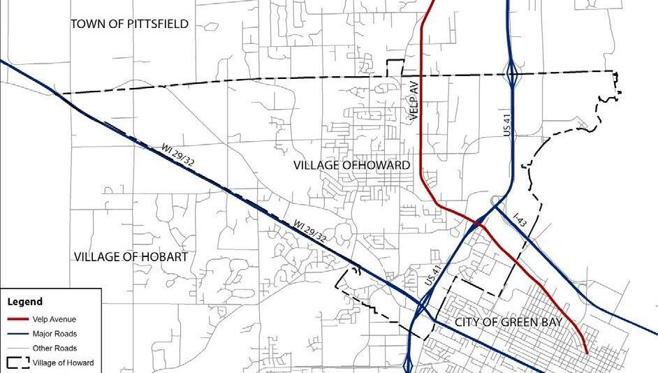
Wisconsin state law divides cities into four classes relating to government administration and local governmental power. Howard is considered a third class village, which corresponds to a 1.5-mile extraterritorial jurisdiction (ETJ).
The Village itself is approximately 23.09 square miles in size. The 1.5-mile ETJ covers 113.09 square miles, of which 6.4 square miles is available unincorporated town for planning and annexation in the Towns of Pittsfield and Seymour.
2022 SNAPSHOT OVERVIEW
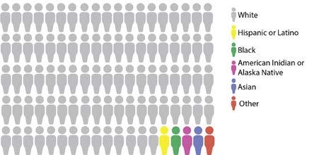
RACE AND ETHNICITY
EDUCATIONAL ATTAINMENT
Nearly 8 in 10 residents over age 25 (77.9%) have at least an Associate's degree; 97.7% graduated high school.
HOUSEHOLD INCOME DISTRIBUTION
HOUSEHOLD GROWTH AND PROJECTIONS
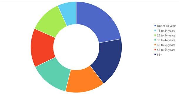
PERCENT POPULATION CHANGE BY DECADE
POPULATION GROWTH AND PROJECTIONS
Sources: 2016-2020 ACS 5-Year Estimates, Decennial Census, DOA Population and Household Projections
PUBLIC ENGAGEMENT
PLAN ENGAGEMENT OVERVIEW
This plan was drafted through a collaboration among Village staff, Plan Commission, elected officials, MSA, and most importantly residents of the community. See Appendix for more information.
COMMUNITY SURVEY
The Village of Howard partnered with the University of Wisconsin-River Falls Survey Research Center in 2021 to conduct a community survey. The key findings are listed below; the full survey document is available on the Village of Howard website (https://www.villageofhoward.com/DocumentCenter/View/8058/2021-Village-of-Howard-Consumer-Survey)
• The primary reasons for choosing to live in Village of Howard were the HowardSuamico school district, family ties, and cost of housing. Other important reasons included the availability of housing, safety and low crime rate, and quality of neighborhoods.
• Residents ranked the quality of parks as highest and the quality of streets as lowest. This result was consistent across all demographic groups that were tested for statistical significance.
• Respondents were most satisfied with the K-12 education in the village of Howard and the safety of the community and least satisfied with recreational opportunities for senior citizens and entertainment options.
• Maintaining and improving existing roadways was in the top three investment priorities for the largest proportion of respondents. In general, residents ranked improving existing sidewalks and beautification of village corridors as low priority
• Residents are most likely to support tax increases for maintaining and improving existing roadways and least likely to support tax increases for developing additional sidewalks.
• Respondents are very likely to support the spending of funds to preserve green spaces, somewhat likely to support the continued development of Howard Commons as a gathering place, and unlikely to support the relocation of the Brown County Highway Department and mixed-use development around the quarries.
• Fire protection, garbage and recycling collection, ambulance service, and police protection were ranked an “excellent” by at least a third of all respondents. Events for senior citizens were ranked “fair” or “poor” by about half of all respondents.
• Respondents are most likely to support tax increases for fire protection, police protection, and road maintenance, and least likely to support tax increases for zoning and building inspections and events for senior citizens.
• Residents are generally satisfied with the frequency with which the Village of Howard collects different types of household and yard waste.
• Among recreational facilities that should receive investment and improvement during the next 5 years, the Duck Creek Quarry and Beach was ranked highest by respondents. Other highly ranked facilities included outdoor gathering space, outdoor music venue, and outdoor pool.
• Among retail stores needed in the Village of Howard, an overwhelming majority of respondents agree that family restaurants are needed, while a smaller but still substantial proportion of respondents agree that department stores are needed. Respondents did not seem to feel the need for additional fast-food restaurants and furniture and appliance stores in Howard.
• Among private sector businesses needed in the Village of Howard, close to half of all respondents ranked entertainment as the top priority. There was least amount of support for caterers and food services establishments and senior day facilities.
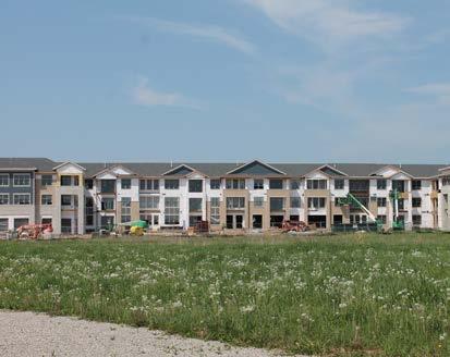
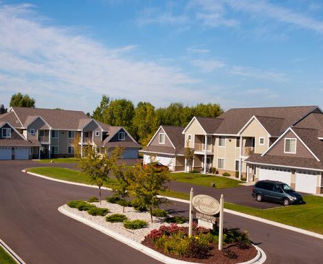
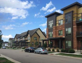
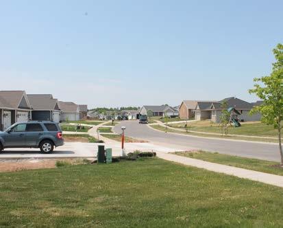
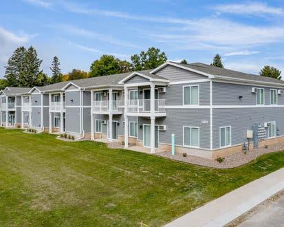
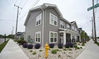
• Large proportions of respondents agree that more mid-level single-family homes and affordable owner-occupied housing are needed in the Village of Howard. The smallest proportion of respondents agree that more large apartment complexes are needed.
• Most residents agree that the Village of Howard has a good mix of housing types, openness to new residents from different backgrounds, neighborhoods with a mix of incomes, and adequate housing for the elderly and disabled. Most residents disagree, however, that the Village of Howard has racial and ethnic diversity in its neighborhoods.
• Well over three-quarters of all respondents visited the Village of Howard website in the past year and found the website useful. Most residents are aware of E-Notify and over half are currently signed up. While over two-thirds of all respondents are aware of the autopay option for water and sewer payments, only a third are currently signed up for it.
STAKEHOLDER INTERVIEWS
Village staff identified local stakeholders to be interviewed for input into the Comprehensive Plan update. Those interviewed include landowners, developers, school district officials, and community leaders. The range of stakeholders allowed for a variety of complementary and contrasting viewpoints.
The following strengths, opportunities, and concerns were noted from the interviews.
Strengths Opportunities
• Great school system with engaged staff
• Good relationships between Village and school district
• Village staff is knowlegeable and helpful
• Robust local park system & sidewalk connectivity
• Village builds partnerships that drive success
• Village staff consider the long-term financial impact of decisions
• Lower property taxes than some neighboring cities/villages/towns
• Development opportunity around new Hwy 29 interchange
• Mixed use & multifamily development
• Public support for another grocery store on west side
• Interest in developing office parks and professional services offices
• Opportunity to make commercial and industrial development in west Howard a regional employment draw
Concerns
• Running out of infill land, both ready-tobuild and greenfield
• Not enough medium- and high-density multifamily development ("missing middle" housing) to meet demand
• Village policy requires developer to construct more public infrastructure and utilities compared to nearby communities; increases costs
• Long-time residents worried about pace of urbanization and loss of small-town character
• Empty United Health building; needs updating
• Some developers prefer working with governments that offer more TIF and land incentives; Howard has lowest TIF in the Green Bay area
• Possible difficulty gaining landowner support for annexing in Pittsfield
• Some single-family homeowners do not want to see more multi-family housing
PUBLIC MEETINGS
The Village hosted multiple meetings to provide the public an opportunity to give feedback on the plan prior to its adoption.
• A public information meeting on August 15, 2022
• An Open House on September 12, 2022
• Plan Commission adoption meeting on September 19, 2022
• Village Board adoption meeting on November 14, 2022
The Village also encouraged stakeholders to share their thoughts via the Village of Howard Facebook page and emailing staff. Common concerns were incorporated into the development of the final plan.
AG, NATURAL, & CULTURAL RESOURCES
AGRICULTURAL RESOURCES GOAL #1
Preserve productive agricultural lands in balance with development of the Village.
Policies
#1- Promote infill and redevelopment initiatives on under-utilized sites within the Village limits to help reduce the pressure to expand into surrounding agricultural areas.
AGRICULTURAL RESOURCES GOAL #2
Cooperate with neighboring municipalities on land development within the planning area to avoid developing on prime productive farm land.
Policies
#2- Engage local landowners in the planning area prior to annexation.
Actions
a. Coordinate with Brown County when reviewing annexation requests.
NATURAL RESOURCES GOAL #1
Manage, enhance, and preserve land and water resources and the natural environment.
Policies
#1- Preserve and protect key environmental corridors, native vegetation, and wildlife species.
#2- Site development and infrastructure improvements in areas with least possible impact to natural environments.
#3- Partner with neighboring jurisdictions on key restoration initiatives that will protect natural environments and proactively address flood mitigation.
#4- Encourage landscaping practices on public and private property that help to mitigate, filter, and infiltrate rainwater.
#5- Encourage minimizing impervious surfaces through site planning and development review.
Actions
b. Amend Village ordinances to require site plans and land divisions to accurately depict all natural resource features located on the property proposed for development or division (e.g., waterways, floodplain, wetlands, steep slopes, groundwater recharge areas, mature woodlands, etc.).
c. Review and consider implementation of recommendations in the County's Hazard Mitigation Plan.
d. Actively acquire properties within the floodplain as they become available, and restore properties to natural vegetation for stormwater management and flood mitigation.
AG, NATURAL, & CULTURAL RESOURCES
CULTURAL RESOURCES GOAL #1
Preserve and invest in places, structures, and activities that enhance the village's cultural heritage.
Policies
#1- Invest in ongoing placemaking initiatives in key corridors and Howard Commons that activate spaces and engage residents, patrons and visitors.
#2- When investing in new and existing neighborhoods, the Village will collaborate with developers to create unique features and great public spaces, and encourage public art in public and quasi-public spaces. This is especially important in the Howard Commons area.
#3- Continue to support community organizations and events.
#4- Encourage rehabilitation of culturally, historically, and architecturally significant buildings that contribute to the character of the Village.
#5- Increase public awareness of and civic pride in the Village's cultural and historic resources.
Actions
e. In coordination with other community organizations, develop branding and marketing that promote civic pride and clarify the village's identity as a great place to live, work and experience community.
f. Support community events and programming year-round that activate key destinations, attracting residents, patrons and visitors alike, especially programming that appeals to all members of the community including youth and communities of color.
g. Maintain an inventory of historic, architecturally, and culturally significant structures.
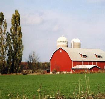
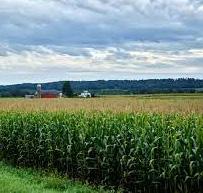
2022 SNAPSHOT: Agricultural, Natural & Cultural Resources
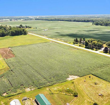
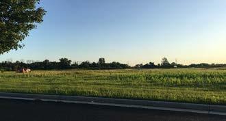
Planning Area Farmland
There are approximately 1187 acres of farmland contained or partially contained within the Village.
Physical Characteristics
Geology : Howard sits upon the Galena and Platteville formations which are comprised of sandy dolomite and glacial till.
Topography: Howard has a level to rolling topography with relatively few distinctive features. The elevation ranges from approximately 580 feet above sea level along the shore of the Bay of Green Bay to 776.5 feet at the highest point in the village.
Soils: Prime agricultural soils are locatedin two areas in Howard: 1) the region between Pinecrest Road and Cardinal Lane in the central part of the Village, which is almost entirely developed and out of agricultural use; 2) the region west of Greenfield Avenue, which is mostly undeveloped and still in agricultural use. Efforts to preserve the Village’s prime farmland resources have focused on the westernmost portion of this region, since it is farthest from the developing portion of Howard. However, within the 20 year horizon of this plan, predicted population growth indicates that virtually all of Howard’s existing vacant developable land will be developed, and significant farmland presevation is unlikely.
Water Resources
Regulation: Water resources are regulated by Village and the Wisconsin DNR.
Groundwater: The village was built upon sandstone and dolomite acquifers. The quality of the acquifer is generally good, but localized problems do occur, including high levels of radium in 2 of 3 public wells. The village receives its drinking water from surface water from Lake Michigan.
Watersheds: The village is in the watershed of the Bay of Green Bay and the Lower Fox River.
Wetlands: Due to the village's location in the watershed, there are many identified wetlands scattered throughout the community. The greatest density is near the bay and along Duck Creek and its smaller tributaries.
Lakes: The Bay of Green Bay is part of Lake Michigan and the Great Lakes.
Cultural Resources
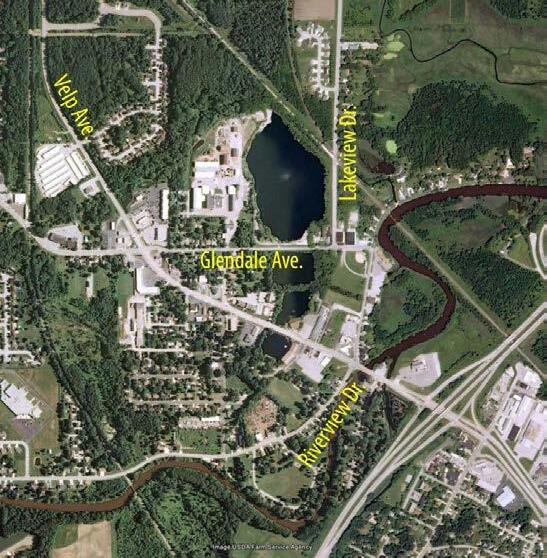
Register of Historic Places: The village has one property listed on the National Historic Register and State Historic Register of Places. The Angeline Champeau Rioux House on Glendale Avenue was added to the Registers in 1994 for its Late Victorian architecture.
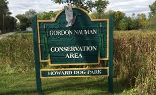
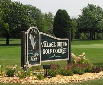
Community Parks: In addition to many pocket and neighborhood parks, Howard is home to the Gordon Nauman Conservation Area, Howard Dog Park, Spring Green Park, Meadowbrook Park, various Brown County parks, and specialized parks such as the Nouryon Sports Complex. These are detailed in the Consolidated Outdoor Recreation Plan.
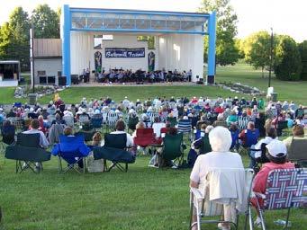
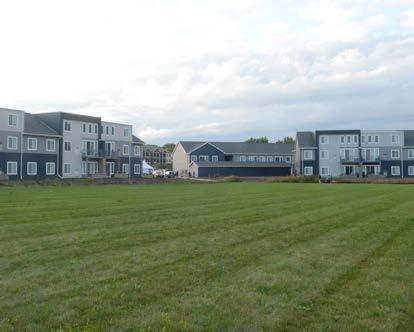
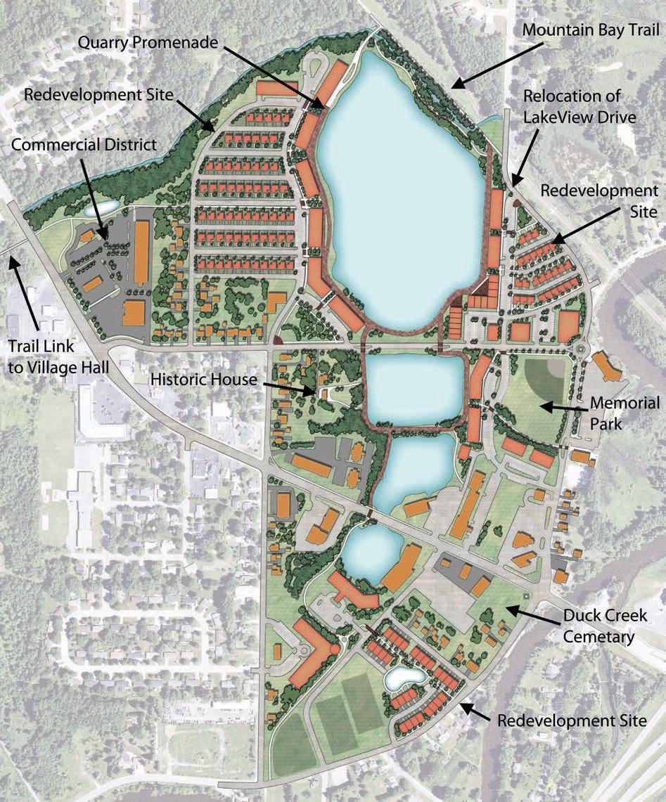
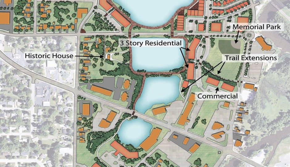
Howard Commons: The Howard Commons was identified in the 2002 Comprehensive Plan as a necessary place to define the character and community of Howard, and provide a community gathering space. A Master Plan was completed in 2005, and construction is expected to be completed before 2022.
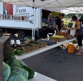
Farmers Markets: Produce, flowers, baked goods, local meats, and cheeses are available during the summer growing season at Howard Commons every Tuesday evening.
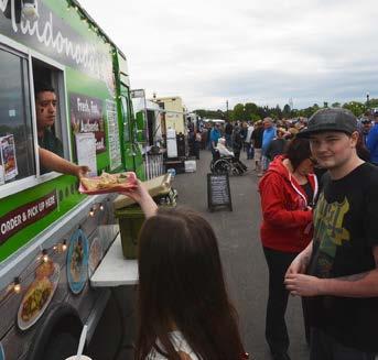
Major Events: Howard Farmer's Market, Community Fireworks, Rock the Commons, No Mow May
UTILITIES & COMMUNITY FACILITIES
ISSUES & OPPORTUNITIES
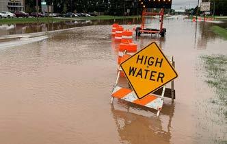
Flooding & Stormwater Management
Weather patterns are shifting toward more frequent storms with heavy rainfalls. The Village's regulations on stormwater management systems should be regularly revisited to ensure they are based on the best available data and can adequately address rapidly changing conditions.
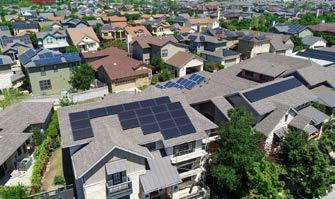
Sustainability and Renewable Energy
The Village's greatest opportunity to implement change are in its own facilities, services and infrastructure. Sustainability initiatives in the private market will largely be achieved by cost reduction and savings through market forces, but can be encouraged incrementally through zoning and other regulations.
UTILITIES GOAL #1
Use the annual budget process and Capital Improvement Plan to promote development that corresponds with available and planned infrastructure.
Policies
#1- Serve all urban development within the Village of Howard with the full array of urban services including municipal sewer, water, and electric, stormwater management facilities, municipal police and fire protection, refuse removal, urban street and bicycle/pedestrian facilities, etc.
#2- Maintain and improve the utility infrastructure to ensure adequate capacity and integrity to serve existing users and accommodate new service areas. The first priority will be maintaining the reliability of existing systems and services.
#3- Make efficient use of Village funds by applying standardized criteria to each spending decision. Ask: What is the goal of the investment? Is spending money going to achieve that goal? Are there any other sources of funding available?
#4- Avoid environmentally sensitive areas when planning the location of utilities to minimize adverse impacts, to the greatest extent possible.
Actions
a. Promote available incentives, energy audits, and appliance recycling offered through Focus on Energy, WeEnergy, or other sources to encourage individuals and businesses to take advantage of energy efficiency and renewable energy measures.
UTILITIES GOAL #2
Utility system planning and implementation will occur in coordination with land use and transportation plans and projects.
Policies
Land Development
#5- Maximize the use of existing utility systems by encouraging infill development that uses existing infrastructure investments.
#6- Discourage suburban development served by septic systems (i.e. residential densities greater than one unit per 35 acres, non-agricultural commercial, industrial and institutional) within the Planning Area, unless allowed by an adopted cooperative plan.
#7- Consider methods to recover the costs of new Village utility facilities necessitated by new growth. In general, the Village shall require new growth to pay its fair share of the costs associated with providing essential Village utility infrastructure.
#8- Discourage inefficient “leap frog” development that results in infrastructure constructed before there is adequate customer base in place to support its maintenance.
#9- Adhere to the Village’s annexation policies and consider the Brown County Long Range Transportation Plan when determining the feasibility of serving possible annexation lands with utilities.
Electrical System
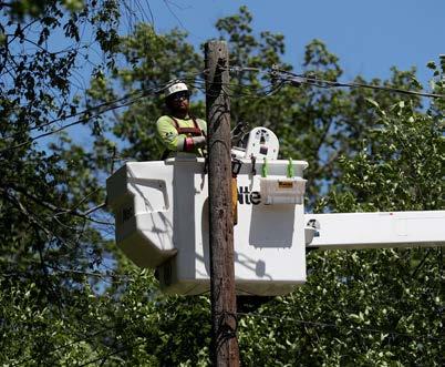
#10- Bury existing utilities, where feasible, as redevelopment and street reconstruction occurs, and continue to require utilities in new developments to be underground.
#11- Continue to support public/private partnerships to co-locate telecommunication facilities (e.g., antennas on a water tower, small cells on street lights, etc.).
#12- Encourage private use of renewable energy systems to reduce demand on public utilities and the need for expansion.
Water Supply
#13- Consider the location and design of municipal wells to minimize impact on groundwater and groundwater recharge.
#14- Encourage private developments to use efficient construction practices and materials to reduce water consumption, discourage extraneous impervious surfaces.
Sanitary Sewer
#15- Parcels within the Village on septic systems shall be connected to the public sewer system in accordance with the Village’s ordinances when such utilities are made available.
#16- Properly abandon unused septic tanks and private wells that are not permitted, maintained, or used.
UTILITIES & COMMUNITY FACILITIES
ISSUES & OPPORTUNITIES
Access to Amenities
Residents see opportunities for increased access to parks, trails, youth and community centers, and other community-wide facilities in neighborhoods throughout the village.
Park Preservation vs. Expansion
Preservation of historic features and landscapes can come into conflict with resident desires for enhanced facilities, programming, and economic development initiatives in and near public parks.
Surface Water & Stormwater Management
#17- Improve the quality of surface water runoff by continuing to implement stormwater best management practices.
#18- Continue to encourage residential and nonresidential properties to implement additional stormwater management techniques to reduce the impacts of stormwater discharge (e.g. rain gardens, rain barrels, green roofs, bioretention basins, oil and grease filters) on surface and groundwater resources.
#19- Encourage the protection of existing vegetation on new development sites to the greatest degree possible in order to minimize soil erosion during and after construction.
#20- Continue to explore and consider alternative winter maintenance methods to reduce rock salt usage (e.g., salt brine) to protect water quality and the natural environment.
#21- Encourage down spout disconnection from storm sewers in favor of draining runoff across lawns to improve groundwater recharge.
UTILITIES GOAL #3
Facilitate the installation of quality broadband internet options.
Policies
#22- Utilize state and federal funding opportunities to entice broadband providers to expand throughout Howard.
#23- Utilize findings from the 2022 New North Broadband Study to determine local needs, resources, and action items.
Actions
b. Conduct a GIS survey of Village-owned utility infrastructure to track age, condition, and capacity to help determine maintenance and replacement schedules.
COMMUNITY FACILITIES GOAL #1
Maintain reliable, quality services and facilities to encourage growth and reinvestment.
Policies
General
#1- Require all new development proposals to be reviewed by all Village departments and agencies so that essential Village services and facilities can be provided to new developments in a timely and efficient manner.
#2- Require new development to pay for the costs associated with the Village providing or expanding utility infrastructure to the development.
#4- Promote the co-location of facilities and services to maximize the efficient provision of services, reduce capital costs and operation costs, and improve public access.
#5- Prioritize the incorporation of green building technologies, energy saving measures and renewable/alternative energy technologies into all new and remodeled Village-owned buildings. Seek grant opportunities to support this.
Parks & Trails
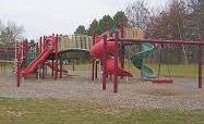
#6- Develop and maintain parks facilities that meet a wide range of recreational needs, both passive and active.
#7- Consider the recommendations of the CORP when planning and budgeting for future infrastructure improvements. The Village will also support the periodic update of the plan to maintain grant eligibility.
#8- Continue to work closely with the school district to identify and explore options for sharing recreation facilities.
#9- Consider the use of renewable energy systems at park facilities, including (but not limited to) solar lighting and heating.
#10- Preserve and improve water-related recreational opportunities and facilities.
THE FUTURE OF WORK
Broadband Internet
The COVID-19 pandemic brought into focus the necessity and benefits of flexible options for work and school. As work and school became remote, the gaps in internet availability and access became more apparent. Toward the end of the pandemic, many businesses maintained a remote or hybrid workforce. Access to quality broadband internet went from a luxury to a necessity for homes and businesses. It is also a key driver of entrepreneurship. More information on broadband development in Brown County is available in the New North Broadband Study.
UTILITIES & COMMUNITY FACILITIES
Emergency Services
#11- Continue to evaluate the need for expanded public safety services and facilities (police, fire and EMS) to respond to the needs of the community as it grows.
#12- Ensure that public safety facilities are located to provide acceptable response times to existing development and can accommodate future growth areas.
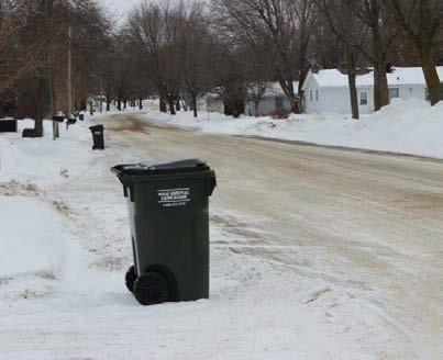
Waste Management Services
#13- Continue to manage solid waste disposal and recycling in a manner that is environmentally sound and cost-effective.
#14- Consider additional opportunities to reuse waste materials generated by Village processes as new options and uses become available.
#15- Continue to provide public education and awareness of recycling opportunities for all waste streams, including computers, electronics and appliances (e.g. hazardous waste and e-cycle pickup).
Coordination with Non-Government Organizations
#16- Encourage and support the provision of private recreation, daycare and other facilities and services to serve the needs of the youth, the elderly and those with special needs.
#17- Continue to be supportive of charitable organizations in the community that provide services and programs for families, seniors, and individuals needing assistance.
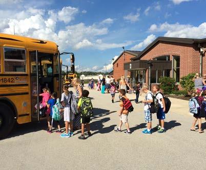
#18- Strive to maintain strong communication between the Village and the Howard Area School District regarding development within the village. Ensure coordination of school facilities planning with land use and utility planning.
Actions
c. Investigate incorporating sustainability criteria in Village purchasing policies that place a priority on sustainable business practices.
d. Adopt the best practice of encouraging recycling of construction waste materials on publicly funded construction projects.
e. During the annual capital improvement planning process, consider budgeting for implementation of the recommendations of adopted Village plans.
UTILITIES & COMMUNITY FACILITIES
2022 SNAPSHOT: Utilities and Community Facilities
Schools & Education
Public Schools: The Howard-Suamico School District serves nearly 6,000 students in the villages of Howard and Suamico. The District covers 58 square miles and has five elementary schools for Grades K through 4, one intermediate school serving students in Grades 5 and 6, one middle school for Grades 7 and 8, and one high school for Grades 9 through 12. The District partners with communty organizations for early childhood education. The village is home to Meadowbrook, Forest Glen, and Howard Elementary Schools, Lineville Intermediate School, Bay View Middle School, and Bay Port High School.
Private Schools: In addition to public schools, Howard is home to St. John the Baptist Catholic School, Providence Academy, and New Leaf Prep Academy, as well as multiple childcare centers that provide early childhood education. There are also numerous private school options in the greater Green Bay Metro area.
Technical College: The Universal Driving Facility for Northeast Wisconsin Technical College is located in Howard. It provides classes and training in law enforcement, EMS, and firefighting.
Parks/Recreation
Village Parks: The Village of Howard has more than 500 acres of total parkland and open space spread out among 22 parks. This is in addition to County parks located within the village.
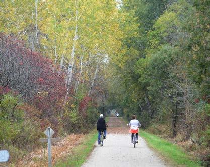
Village Trails: The Village has walking and biking trails within parks, but does not have a widespread system of connected facilities for active mobility. The Mountain Bay State Trail is a former railroad corridor-turned-trail that connects Howard Memorial Park to Rib Mountain in Weston, WI.
Public Safety, Health & Welfare
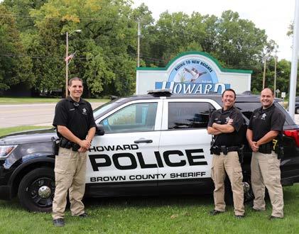
Police Department: The Village of Howard contracts law enforcement services through the Brown County Sheriff's Department. Three Directed Enforcement Officers are responsible for the administration of police servcies in Howard.
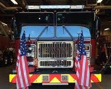
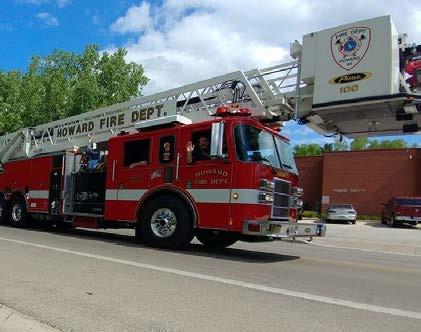
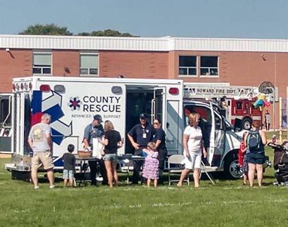
Fire / Rescue: The Howard Fire Department is a paid-on-call department with a full-time Chief and Assistant Fire Chief, plus up to 45 trained professional firefighters. The department also provides emergency medical services dispatched through a contracted private company.
Healthcare Facilities: There are two healthcare systems that serve the Village of Howard, SSM Agnesian and Aurora Healthcare. 24-hour, seven day a week emergency medical services are provided at St. Agnes Hospital of SSM Agnesian Healthcare, Bellin, and Prevea.
Senior Facilities: There are currently five private facilities providing a range of independent, assisted, and skilled care. As more of the village's population ages, more facilities may be needed.
Library: The Weyers-Hilliard Branchof the Brown County Public Library system is located inHoward. It services Howard, Suamico, and surrounding communities.
Utilities
Electric & Natural Gas: Village electric and natural gas services are provided by We Energies.
Refuse/Recycling Collection: Waste disposal and refuse collection is contracted to a private company—providing curbside collection for residents.
Telecommunications: Cellular and mobile service is provided to residents throughout the Village by Verizon, Sprint, T-Mobile, AT&T, Cellcom, Google Fi, and U.S. Cellular. High-speed and broadband internet is available through Spectrum, AT&T Fiber, TDS, Nsight, and EarthLink. Satellite and DSL internet are available through AT&T, HughesNet, and Viasat.
Stormwater: The Village operates a stormwater utility and handles maintenance through the capital improvement plan–guided by village ordinance.
Sewer & Water: Sewer and water service are both provided by the Vilage of Howard, and managed by the Public Works staff. Billing is handled through the Administrative Services Department.
UTILITIES & COMMUNITY FACILITIES
INTERGOVERNMENTAL COOPERATION
ISSUES & OPPORTUNITIES
School Districts
The success of the Village as a desirable place to live is tied to the success and reputation of the school districts, and there are many ways that the Village and the School District depend on each other and collaborate with each other to meet community needs.
Growth into Townships
This Comprehensive Plan outlines potential growth areas. When Howard annexes existing Town lands, it will inherit responsibility for many streets and properties built to rural standards. Streets without curbs, storm sewers, or sidewalks will gradually be improved to include those features, over decades. Homes built without public sewer or water service will gradually be converted to include public services. In some cases it may make sense to pursue street reconstruction to urban standards, or sewer and water extensions, prior to annexation.
Intergovernmental Cooperation Goal #1
Work closely with neighboring jurisdictions and other governmental entities to achieve sustainable development patterns, and enhance the efficiency and quality of public services.
Policies
#1- Enforce, abide by and maintain existing intergovernmental/cooperative agreements with neighboring jurisdictions to provide predictability for property owners, avoid municipal boundary disputes, and plan for efficient provision of public facilities and services.
#2- Work closely with the Howard-Suamico School District and surrounding school districts.
What school districts serve Village of Howard residents?
School districts are separate governmental entities with their own boundaries and taxing authority. The Howard-Suamico School District covers the majority of the planning area and serves residents in Howard and Suamico. The planning area also includes the Pulaski Community School District in Pittsfield, and the Seymour Community School District in Seymour.
#3- Work with other governmental entities (e.g. Bay-Lake Planning Commission, Wisconsin Department of Transportation, Department of Natural resources, Brown County, Oneida Nation, etc.) to implement policies that further Village objectives and reinforce Village plans.
Intergovernmental Cooperation Goal #2
Work closely with neighboring jurisdictions to develop long-range goals for development and annexation.
Policies
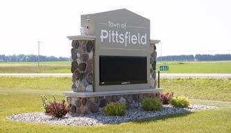
#4- Build relationships with the Town of Pittsfield to understand local attitudes toward future development.
#5- Work closely with the Town of Pittsfield and local landowners to determine the feasibility of infrastructure expansion and future annexation.
#6- Maintain a relationship with the Oneida Nation for development and future land use plans.
Actions
a . Schedule a working session with the School District, involving elected officials and key staff for both the Village and the School District, no less than annually to discuss issues of concern and opportunities for collaboration.
b. Village staff should meet with representatives from each adjacent jurisdiction during the annual process to coordinate shared/adjacent projects as appropriate.
c. Meet with the Brown County Planning Commission as necessary to expand the urban service area consistent with this Comprehensive Plan and when considering major land use planning updates to this plan.
d. Coordinate with all adjoining jurisdictions during outdoor recreation planning to seek complementary recreation investments where service areas overlap and work to avoid duplication of unique amenities.
ISSUES & OPPORTUNITIES
Coordination and Efficiency
The proximity of urbanized areas in other communities raises the importance of, and opportunity for, cooperative planning and resource sharing. Investments in parks and recreation amenities and emergency services are especially ripe for finding solutions that improve lives and neighborhoods in multiple communities. Inadequate communication can result in missed opportunities to leverage projects for the benefit of residents across the region.
2022 SNAPSHOT: Intergovernmental Cooperation
Brown County: The Village maintains an ongoing relationship with the County—communicating frequently on joint efforts, emergency preparedness, and county-wide initiatives.
Howard-Suamico School District: The school district serves all of the Villages of Howard and Suamico. The Villages and the School District work closely on community development and events.
Green Bay Metropolitan Planning Organization (MPO): The village is located in one of 14 federally designated MPOs in Wisconsin. The Brown County Planning Commission/MPO allocates state and federal resources for improving passenger, freight, and active transportation throughout the Green Bay Urbanized Area and the Green Bay Metropolitan Planning Area.
Brown County Planning Commission (BCPC): The Brown County Planning Commission coordinates planning initiatives in the Green Bay metro area. The Commission undertakes planning activities in six general categories: economic development, transportation, land use, local assistance, natural resources, and housing.
Oneida Nation: The Oneida Nation is a local tribal government, the original boundaries of which cover parts of the Town of Oneida, the Village of Hobart, the Village of Ashwaubenon, the Village of Green Bay, the Town of Pittsfield, and a couple parcels in the Village of Howard.
Extraterritorial Planning Jurisdiction
The 1.5-mile extraterritorial jurisdiction includes all or portions of:
• City of Green Bay
• Village of Ashwaubenon
• Village of Hobart
• Village of Suamico
• Town of Pittsfield
• Town of Seymour
• Oneida Nation
It is important to foster relationships with each community's government to coordinate orderly future development, especially in the transitional areas along governmental boundaries. However, incorporated villages and cities are autonomous municipal governments that have their own priorities for community and economic development. Their decisions are generally not affected by other local governments in the area absent any formal intergovernmental agreements. The same goes for the Oneida Nation territory in the Town of Oneida and the Village of Hobart.
As such, the planning area for future land use has been reduced to the yellow area of the Planning Area map to show the available land annexation. As this planning area overlaps with the Village of Suamico's extraterritorial plat review jurisdiction, it would be prudent for the Village to discuss their plans in these areas with the Village of Suamico prior to beginning any annexation procedures.
Town of Pittsfield Bay of Green Bay
Town of Seymour
ECONOMIC DEVELOPMENT
ISSUES & OPPORTUNITIES
Attracting Workforce
Prior to COVID-19, unemployment rate was extremely low and local employers reported have unfilled roles. Given these conditions, economic development professionals have been focused on workforce attraction and workforce development. This focus is consistent with a strong national economic development trend towards attracting people first and businesses second.
ECONOMIC DEVELOPMENT GOAL #1
Village residents will have the skills to achieve personal success and financial stability, and employers will have access to skilled staff to maintain and expand business development initiatives.
Policies
#1- Residents will have access to a variety of training and support resources to support employment skills and job preparedness.
#2- Employers will be actively engaged in career-advancement and workforce development efforts including internships, apprenticeships and workshops.
Actions
a. Encourage local development organizations to conduct an annual survey of employers and entrepreneurs to identify hiring and retention needs as well as business support needs. The Village will identify areas to provide assistance, including sharing this information with the community and support/training institutions.
b. Facilitate enhanced partnerships with the Howard-Suamico School District, Howard Suamico Business and Professional Association, and other community organizations to coordinate activities in support of the local economy.
Attracting and Retaining Business
Many stakeholders have noted a desire to increase the local workforce and mitigate the population aging by promoting more medium-density development to attract young professionals to the area.
INCubatorEDU - A national program that provides a specialized curriculum to hundreds of member schools in over a dozen states - will provide online instruction materials, consultation on how the classroom is designed, a coaching and mentoring framework, and professional development resources for the year-long course.
ECONOMIC DEVELOPMENT GOAL #2
The Village will attract, expand, and diversify the local economy.
Policies
#3- The Village should have a supply of development and redevelopment sites ready for new business investment. This should include infill sites that have been cleared and cleaned (if necessary) and growth area sites that are already served with public utilities.
#4- Continue to develop and manage industrial and business parks to promote employer retention and expansion, as well as provide opportunities for new development.
#5- The Village of Howard, in reviewing development projects, will seek to maintain a balance between the needs of the community and the needs of the developer.
#6- Promote programs and initiatives that support entrepreneurship and remote/freelance employment (e.g, home-based businesses, co-working spaces, business incubators, business accelerators and makerspaces).
#7- The Village's identity and positioning within the region will be consistent, clearly defined and marketed to promote local economic development initiatives.
#8 - The Village will be an active partner with regional economic development entities, with particular focus on affordable housing expansion and workforce training initiatives and efforts to help local employers gain access to new markets.
Actions
c. Collaborate with community organizations to proactively communicate, discuss needs, and receive feedback from area businesses. Use these conversations to continually refine services and resource referrals.
d. Create and maintain an inventory of available sites for development and redevelopment, updated on a regular annual or biannual schedule.
e. Continue regular community and business surveys to provide regular, benchmarked community data that can be used in marketing toward target businesses that provide living-wage employment opportunities.
ISSUES & OPPORTUNITIES
Room for Growth
Howard has exceptional highway access, and some agricultural and undeveloped land for future development. However, with the neighboring incorporated villages and cities, as well as the Oneida Nation Reservation, there are limited expansion opportunities. Such opportunities exist primarily on the west side of Howard and northwest into the Town of Pittsfield.
ECONOMIC DEVELOPMENT
What is a living wage?
The living wage identifies the necessary income (minus payroll taxes) to cover an individual’s or family’s likely food, childcare, health insurance, housing, transportation and other basic necessities (e.g. clothing, personal care items, etc.). Based on MIT’s Department of Urban Studies and Planning, Green Bay's 2019 annual living wages are shown below.
Business investment will support the health and vitality of the Howard community.
Policies
#9- Support business development initiatives that increase diversity of entrepreneurs, business types and the workforce, as well including access to culturally-specific needs.
#10- Encourage new business development within areas easily accessible by the Village's transportation network, including future considerations for public transit access.
#11- The Village may acquire property in order to control and accelerate redevelopment of key sites.
#12- Where necessary to advance redevelopment initiatives, the Village may actively facilitate and consider funding assistance to help relocate a willing business to a more suitable location within the village.
#13- The Village will support new commercial and industrial development by expanding and extending access to utility and transportation infrastructure, where needed.
#14- Financial incentives for business development will support one or more of the following criteria:
• Increases the tax base without adding significant service costs.
• Improves existing neighborhoods through redevelopment and/or expanded access to employment and services.
• Adds affordable and workforce housing units.
• Creates new living-wage jobs at or above MIT’s living wage calculation for the Green Bay metro area.
• Supports small businesses.
• Improves conditions that will attract future quality development, such as a catalytic project in a new redevelopment area.
• Provides public amenities in a relevant location, such as pocket parks
Actions
f. Review and revise Tax Increment Finance policy to prioritize business attraction, retention, and expansion that is consistent with this and other Village plans.
g. Continue to implement plans that further economic and neighborhood vitality consistent with the Village's vision and existing plans.
2022 SNAPSHOT: ECONOMIC DEVELOPMENT
Economic development activities play a key role in the quality of life of the community and the long term viability of the Village. This economic development snapshot explores the current environment, and inventories efforts that support economic development in the community.
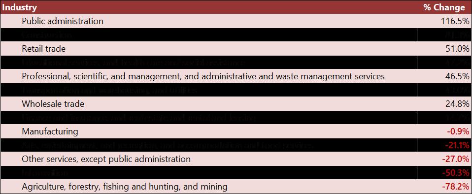
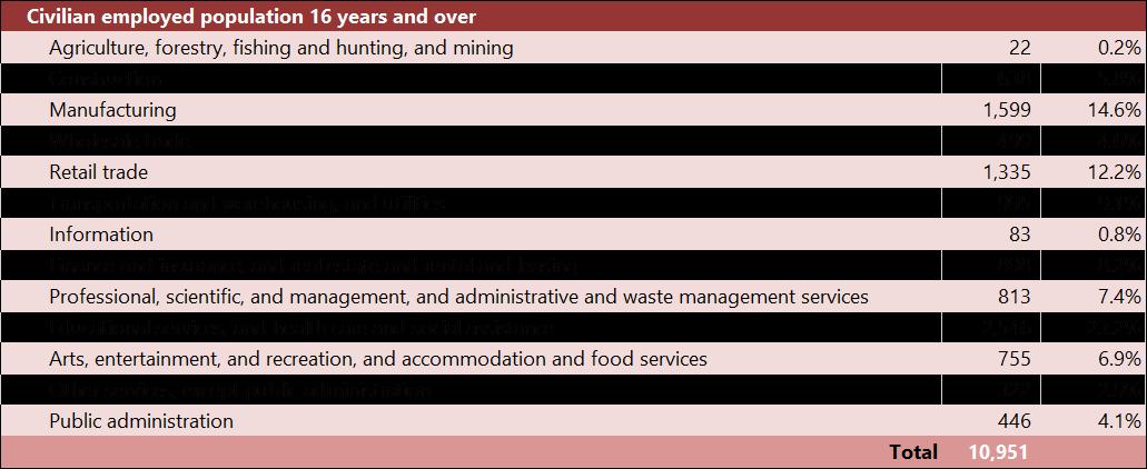
INDUSTRIES BY GROWTH (2010-2020)
EMPLOYMENT BY INDUSTRY, 2020
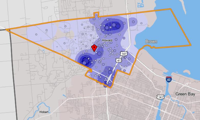
EMPLOYMENT DENSITY (JOBS/SQ MI)
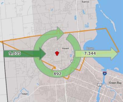
COMMUTING PATTERNS
HOUSING
ISSUES & OPPORTUNITIES
Home Affordability
Large-scale economic trends are bringing housing affordability into focus. Over the last 50 years middle income households have seen 10% increase, while inflation-adjusted housing costs have risen roughly 50% for rental housing and 70% for homeownership in that period. Specific information about the local housing market can be found in the 2020 Green Bay Housing Market Study.
HOUSING GOAL #1
The Village will achieve balanced neighborhoods with a mix of housing types and price-points that provide suitable housing for everyone.
Policies
#1- New neighborhood and subdivision development should include a wide mix of housing types and densities.
#2- Support gradual increases in density that allow homeowners to age in place and homebuyers to generate additional income (e.g., twinhomes, accessory dwelling units, and other split owner-occupancy/tenancy dwelling types).
What is the benefit of increasing density within existing neighborhoods?
Accessory Dwelling Units (ADUs) can respectfully increase density in built environments without changing the character of the neighborhood. ADUs can be a separate cottage in side/rear yard, apartment in the basement, a space above a garage or a unit attached to the home. While financing can be difficult, ADUs allow homeowners to create an additional dwelling unit on their own property for family members, caretakers, and friends who are in need of housing. They are also commonly used by aging households to “downsize” their own housing, while maintaining ownership of the property as either an income-generating rental, or housing for family members serving as caretakers later in age.
Attracting Young Adults and Families
Attracting families is important to the local economy and to maintain the quality of life present in Howard. Having a variety of available housing stock will be a key driver to population growth and retention over the next 20 years.
#3- Locate workforce and affordable "middle" housing in places with good walking access to jobs, shopping, and recreation. It should not be concentrated in any single neighborhood.
#4- Pursue opportunities to purchase and assemble property, as appropriate, to support the housing needs of the community.
#5- Encourage the development of housing in every neighborhood for people of all abilities. This includes, for example, the use of universal design principles in new housing.
What is Universal Design?
Universal Design is an approach to the design of the physical environment that allows access and use by anyone, of any ability. It includes accessibility features as required by the American Disabilities Act, such as wider doorways, door openers, at-grade entries and grab bars in bathrooms, with a focus on having one set of features for everyone. It also includes design for intuitive use without the need for instructions and elements helpful to people with limited hand dexterity such as lever door handles and rocker light switches. Universal design principles can be applied to any housing unit, even if not required by law or specifically intended for senior residents.
#6- Encourage facilities that allow residents to age-in-place, including neighborhood-based senior living communities of all assistance levels and second unit options/additions on owner-occupied property.
#7- Encourage owner-occupied (multi-tenant) rental properties, including providing them with new landlord and property maintenance resources.
What are owner occupied units?
One of the best tools to generate wealth is through homeownership, but low- and moderate-income earners seeing housing become less affordable as costs to enter the ownership market are rising. Owner-occupied rentals help fill some of that financing gap by allowing purchasers to buy a small multi-unit home (4 units or less), and lease out the other units to generate income and offset housing costs.
Actions
a. Utilize the 2020 Green Bay Housing Market Study to understand trends in the greater Green Bay area and develop an action plan to address housing in Howard.
b. Address housing affordability by reviewing and amend the zoning ordinance as appropriate to enable the development of housing formats that limit cost, including smaller lots, smaller homes, attached units and “cottage court” clusters of detached homes. Identify locations for these formats in neighborhood plans for new and existing neighborhoods.
c
. Encourage and support reinvestment in existing housing, including:
• As housing needs evolve, continue to assess revolving loan fund needs for housing rehabilitation as well as potential funding streams. The funds can be used to support reinvestment in single- and multi-unit buildings.
• Work with developers experienced with rental housing renovation to pursue State and Federal tax credit-funded renovation of aging units to reinvest in units while protecting their affordability.
• Look for opportunities to work with partners/owners of Low-Income Housing Tax Credit (LIHTC) developments that are nearing the end of their affordability period, partnering to extend affordability for longer timeframes.
HOUSING
ISSUES & OPPORTUNITIES
Diversity of Housing Stock
Having a diverse mix of housing types with well-designed buildings and developments within each neighborhood is vital to the long-term health of the neighborhood and the Village as a whole. This includes low- to high-density units inclusive of rental and homeownership.
Neighborhood Revitalization
The distribution of housing types in a community and the design of individual projects have a huge impact on the quality of life and equity in the community. Infill redevelopment projects need careful design to achieve a comfortable fit for the new uses within existing neighborhoods.
HOUSING GOAL #2
The Village will maintain quality housing options as part of safe and healthy neighborhoods for all residents.
Policies
#8- Review and approve housing development proposals based on consistency with the Land Use chapter of this Plan, including the Future Land Use Map and associated policies.
#9- Support a clear and cohesive network of agencies that can assist all users of the housing market – whether lenders, tenants, landlords, or homebuyers.
#10- Enforce property maintenance and nuisance codes to maintain neighborhood quality and prevent blight. If a neighborhood area develops frequent property maintenance problems it may be a result of a mix of underlying conditions. The Village will consider a multifaceted response that includes not only code enforcement but also Village and community-based supportive services to address underlying conditions.
#11- Continue to actively foster neighborhood engagement and upkeep in neighborhoods, especially those with less capital, while also investing resources to rehabilitate and revitalize housing stock in strategic areas.
#12- Infill development should respect the scale, proportion and architectural style of nearby homes to a reasonable extent. The Village should consider strategies to actively protect areas that have been locally identified as historically important.
Actions
d. The Village will develop and share resources on green/sustainable design strategies in conjunction with the permit process (e.g., educational pamphlets that summarizes energy and water consumption strategies and provides information on Local/State energy and sustainability programs).
HOUSING GOAL #3
Housing policies will complement economic development goals of the Village—growing business and population in tandem.
Policies
#13- Everyone who works in the Village will be able to find adequate housing in the Village, whether entry-level or executive.
#14- New housing will be located in areas with adequate access to jobs, transportation, or other daily-need amenities.
Actions
e. Consider code amendments to enable development of lower-cost housing types and forms in all neighborhoods (e.g. smaller lot sizes, small homes, attached-unit housing, “cottage courts”, and other styles of development) that meet the needs of the workforce.
f. Amend the Village's ordinances to allow accessory dwelling units (with appropriate standards), for the purpose of increasing housing choice, increasing density, accommodating different household types and increasing affordability. Encourage this as part of new neighborhood development, during initial unit construction and site design.
g. Continue to be innovative in developing local housing opportunities through local investment and public-private partnerships.
HOUSING
2022
SNAPSHOT: HOUSING
The following numbers illustrate those conditions in Howard most relevant to the formation of housing goals and policies for the next 10 years.
8,693 - The number of housing units as of 2018.
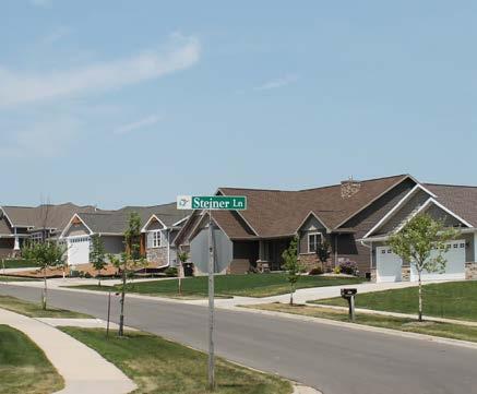
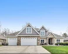
64% - The percentage of units that are single-family detached housing. As costs continue to rise for new construction, these unit types may become increasingly unaffordable and households may need to look for new options in the housing market.
62% - The percentage of all units that are owner-occupied, based on the American Community Survey (ACS). This is unchanged over the past decade—and indicates stability in unit occupancy types year-to-year.
7.5% - The percentage of all units that are attached units (e.g. townhomes, twinhomes), based on ACS surveys. Attached and two-unit building forms are becoming more common, and are important to adding gradual density in land use decisions.
35% - The percentage increase in the median owner-occupied home value since the market bottom in 2012 - representing a strong sellers real estate market for all types of homes in the village.
2.8% - The overall vacancy rate in 2020, which is a decrease from the 3.3% vacancy recorded in 2010. While owner-occupied housing is seeing tighter markets and less available units, increasing desirable rental choices is important to offer options within the housing market for current and future residents.
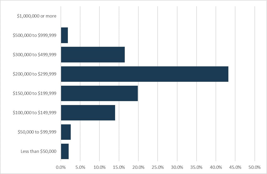
20% - The percentages of households that pay more than 30% of their annual income on housing costs. 30% is the generally recognized housing "affordability limit" for households before budgets are cut for other essentials - food, healthcare, childcare, etc. These can be thought of as "families that cannot afford" housing in Howard.
TOTAL NUMBER OF UNITS BY STRUCTURE , 2018
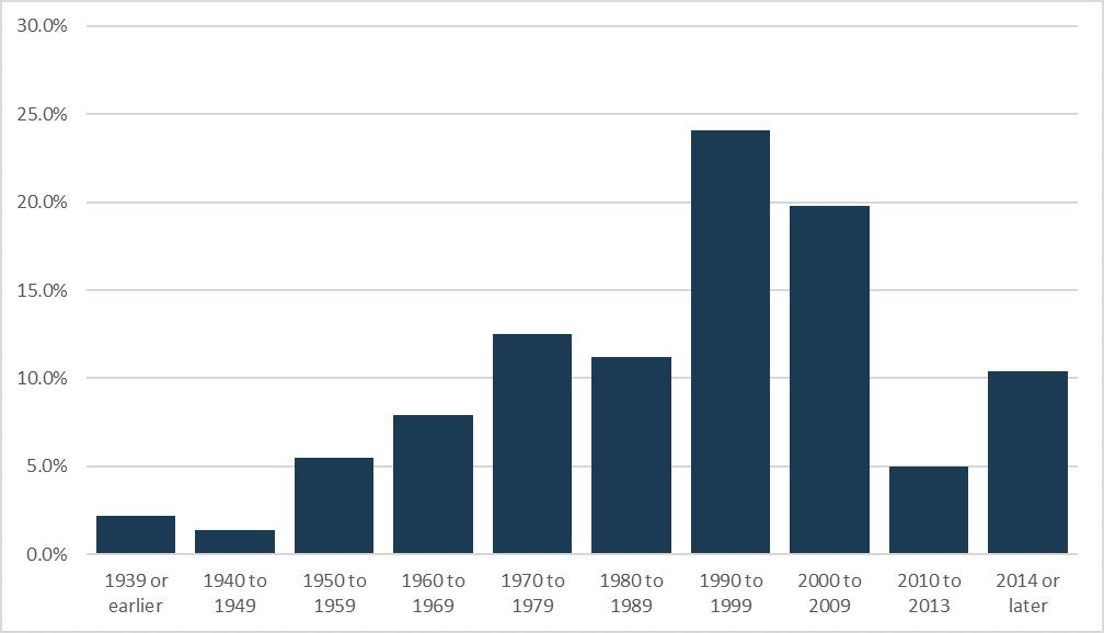
AGE OF HOUSING STOCK, 2020
OWNER-OCCUPIED HOME VALUES, 2020
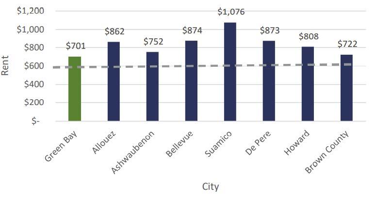
AREA MEDIAN RENT, 2018
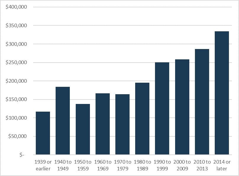
MEDIAN VALUE BY YEAR BUILT, 2020
MOBILITY & TRANSPORTATION
ISSUES & OPPORTUNITIES
Public Transportation
Public transportation can be an important part of an overall multi-modal transportation network—providing an alternative to personal vehicles. However, this can be an expensive undertaking for communities, and the costs must be weighed against the benefits.
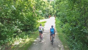
Bicycle & Pedestrian Facilities
The Village has pieces of a strong walking and biking network; however, there are still gaps in the network. These facilities are a desired amenity both for recreational benefits and as an alternative to using a motor vehicle. Additionally, the Village’s biking network includes very little on-street infrastructure such as marked bike lanes, route signage or bike detection at signalized intersections.
MOBILITY AND TRANSPORTATION GOAL #1
Create connected, livable neighborhoods that have multi-modal transportation options for all residents.
Policies
#1- Continue the implementation of a complete streets network that is safe, convenient and attractive for everyone regardless of age, ability or mode of transportation.
What are complete streets?
Complete Streets are streets that provide safe, convenient, and comfortable routes for all users, regardless of age, ability, or mode of transportation. A network of complete streets makes the transportation network safer and more efficient for everyone, including pedestrians, bicyclists, motorists and transit riders of all ages and abilities. A “Complete Street” right-sizes infrastructure based on functional classification and traffic volumes and may include the following features: sidewalks, multi-use paths, bicycle lanes, automobile lanes, street trees, public transportation facilities, and traffic calming devices.
#2- Continue to promote walkable neighborhoods that provide transportation choices and convenient access in existing and future sections of the Village.
#3- Discourage cul-de-sac streets in favor of connected streets that provide transportation flexibility and increased safety in case of an obstructed street. Additionally consider mid-block sidewalks/multi-use trail connections for pedestrians for interior streets/cul-de-sacs.
Actions
a. Continue to implement a program to identify and repair broken and substandard sidewalks throughout the Village.
b. Track and share progress annually of achievements of bicycle and pedestrian projects. Provide annual update to Plan Commission on progress; tie updates to Village’s yearly Capital Improvement Program budget/programming schedule.
c. Regularly revisit the Complete Streets policy to guide development that is both walkable and bikable for residents and visitors.
MOBILITY AND TRANSPORTATION GOAL #2
Link Village residents to jobs, services, and other regional amenities through a multi-modal transportation system.
Policies
#4- Continue to work cooperatively with the Wisconsin Department of Transportation, Bay-Lake Wisconsin Regional Planning Commission, Brown County and adjoining units of government in planning for improvements.
#5- Maintain good access from regional highway system to business/ employment districts within the village, especially maintaining access from Interstate 41/USH 4 and State Hwy 29.
#6- Ensure transportation systems meet the needs of local businesses and industries.
#7- Connect gaps in multi-modal transportation networks that connect Howard to neighboring communities, for both off- and on-street facilities.
Actions
d. Annually plan for new connections that increase resident access to regional connections in the bike and trail network. Work with neighboring jurisdictions, WisDOT, the DNR, and other invested partners to continually expand and integrate the network.
e. Continue to collaborate with the Green Bay MPO and Brown County Planning Commission in updating the Long Range Transportation Plan.
f. Annually evaluate the Village’s potential for participation in Metro Transit, making sure the system is efficient and cost effective in meeting the demands of all Village residents before entering into agreements to extend service into the Village of Howard.
What is active transportation?
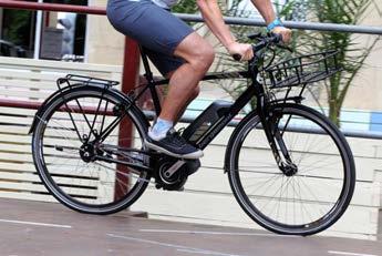
Active transportation, or active mobility, is any self-propelled, human-powered mode of transportation, such as walking and biking. These facilities can also be utilized by Other Power-Driven Mobility Devices (OPDMDs) for people with disabilities, and for increasingly popular forms of micromobility such as e-bikes and scooters.
MOBILITY & TRANSPORTATION
ISSUES & OPPORTUNITIES
Shifting Transportation Technology
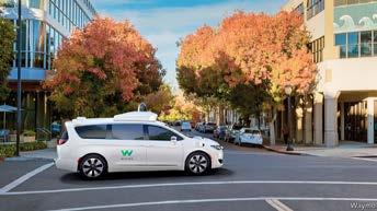
All communities are beginning to wrestle with the impacts of changes in technology that may change how people travel. One change that is already occurring is the growth of electric motor-assisted devices such as bikes, scooters and skateboards. These devices expand the range and speed of travel for users, but they also present a regulatory challenge – where can they be safely used? The other, more significant change on the way is he growth of autonomous vehicles. By most accounts we are on the cusp of a new era in which vehicles will gradually be able to drive themselves with limited input from riders. This could start to change things like parking needs (less), curbside pick-up/drop-off space (more), drive lane width (less), and acceptable commute distances (longer).
MOBILITY AND TRANSPORTATION GOAL #3
Design and construct a safe, accessible transportation network.
Policies
#8 - Seek to minimize conflicts between motorized and non-motorized traffic by improving street crossings, using off-street paths, and implementing protected lanes where appropriate. Prioritize investment where they will serve the daily needs and interests of residents by improving access to daily destinations such as jobs, schools, grocers, medical services, etc.
#9- Manage access to existing and future major arterials (per Village Official Map) to maintain safety and operational efficiency.
#10- Design, build, and operate the Village’s transportation system to support safe and timely response to emergencies.
#11- Design and retrofit local streets with traffic calming features, where necessary and appropriate.
#12- Collaborate with Howard School District on safe transportation for students, including walking, biking, and busing, both in neighborhoods and near each school site.
#13- Seek compliance with the Americans with Disabilities (ADA) Act whenever an existing facility is reconstructed.
Actions
g. Update the Village’s Capital Improvement Plan on an annual basis to plan for near-term transportation improvements.
h. Update the Official Map as need/appropriate to show long-term transportation improvements and development into new growth areas.
i. Consider an ADA compliance audit of public transportation and recreation facilities to inform Capital Improvement Planning and ensure the Village provides safe and accessible facilities for all users.
2022 SNAPSHOT: Mobility & Transportation
Road Network
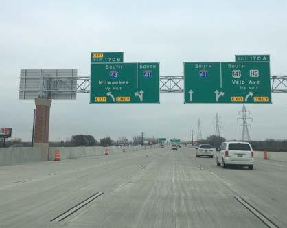
Regional Highway System: Major highways located in Howard include Interstate 41, Interstate 43, US Highway 41, State Route 29, State Route 32, and US Highway 141/Velp Avenue.
Workforce Commuting Data: Based on 2019 Census Bureau data, the Village of Howard has roughly 7,344 residents commuting out of the village for work (89% of employed residents) and about 9,035 people commuting into Howard for work. The majority of workers live in the greater Green Bay metro area.
Existing Transportation Infrastructure (see Appendix X)
LAND USE
ISSUES & OPPORTUNITIES
Balanced Growth
An important dynamic of community growth is the linkage between housing and employment, especially multi-unit housing and industrial growth. Multi-unit housing projects are often controversial because they are replacing a single-story building with multi-story development. While larger developments can have some negative impacts (e.g., increase in traffic, light and noise), they offer more affordable housing types, use utility infrastructure more affordably, and are desired by those looking for an alternative to single-unit housing.
Balanced Neighborhoods
The Village is seeking healthy, balanced neighborhoods that feature a mix of housing types and price points. Balanced neighborhoods also tend to have convenient access to some form of smaller-scale commercial uses, such as a restaurant or coffee shop, day care facilities, small service businesses, etc.
LAND USE GOAL #1
Create an economically and environmentally sustainable development pattern.
Policies
#1- New development within the Village’s jurisdiction should support the efficient use of public services and infrastructure.
a. Land development will be coordinated with planning for efficient public facilities and services.
b. Infill development that uses existing infrastructure is strongly encouraged. Leapfrog development that requires costly infrastructure extensions through undeveloped lands is discouraged when avoidable.
c. The Village will collaborate with Brown County, and adjacent townships to enable new development within the Village’s Growth Areas The Village will seek outcomes that are compatible with future urban development and could someday be served efficiently by the full array of urban services. Any development in the planning area should be consistent with the Village Subdivision Ordinance.
#2- Encourage development that uses land efficiently.
a. Encourage infill development and higher density redevelopment on sites already surrounded by urban uses. Development incentives such as flexibility with standards and/or TIF assistance should be focused mostly on infill and redevelopment, not greenfield development at the edge of the Village.
b. Promote the inclusion of a variety of residence types in every neighborhood that minimize land consumption, including small lots and attached units.
c. Enable and encourage well-planned, mixed-use development areas in all parts of the Village, including the integration of small-scale commercial uses into neighborhoods and mixed-use buildings where economically viable.
#3- Encourage development formats and building designs that support adaptive reuse as markets shift and demand changes.
While unique building design is encouraged, designs that render the building hard to use for other occupants in the future are discouraged. Large-format commercial buildings should be reasonably divisible into multi-tenant buildings.
#4- Protect and respect natural resources and systems in all development decisions.
a. Preserve environmental corridor features including waterways, floodplains, wetlands, ground water recharge areas, steep slopes (greater than 20%), wildlife habitat, scenic vistas, and mature woodlands through the enforcement of the Village’s Subdivision Ordinance, Zoning Ordinance and Official Map.
b. Encourage landscaping practices in new and existing neighborhoods that protect ground water and surface water resources.
c. Foster the protection of natural resource features from development by requiring those features to be accurately depicted on all site plans, certified survey maps, preliminary plats, and final plats.
#5- Require consistency with this Comprehensive Plan in all zoning and land division decisions.
Maintaining consistency with this plan is required by state law and serves to make the development process more predictable for all participants. There will be times that uses are proposed that do not align with the plan, but that most participants see as reasonable and appropriate. In such cases the vision and goals of the plan should still be applied, but the plan can be amended to allow the desired use.
Actions
a. Work closely with the Brown County Planning Commission to protect water resources while ensuring an adequate supply of land in the sanitary sewer service area to accommodate growth as anticipated in this plan.
b. Continue to exercise extraterritorial plat review powers.
c. Consider developing a boundary agreement with neighboring jurisdictions to ensure orderly annexation and development.
d. Pursue an extraterritorial zoning and subdivision agreement with the Town of Pittsfield to ensure that zoning and land use decisions are consistent in areas that are likely to be annexed by the Village.
e. Require conservation easements for dedication of environmental corridor features as part of land development projects.
ISSUES & OPPORTUNITIES
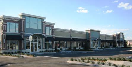
Due to the location of Howard relative to the city of Green Bay, and the historical development patterns of the area, the east side of the village is well-served by retail and service businesses. It will be important to balance this when planning new development to the west. The public input process identified the need for a grocery store to serve residents in the west side of the village.
LAND USE
ISSUES & OPPORTUNITIES
Retail Volatility
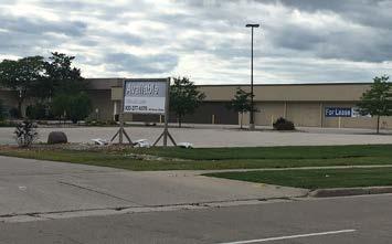
Volatility in the retail market due to the growth of online shopping and ever-faster delivery systems such as Amazon. This volatility is a risk both to large and small retailers. The greatest concern to the Village should be the risk that larger retailers, even those that currently appear strong, could close a local store due to a recession or a change in their market sector, and leave behind a large, empty building.
LAND USE GOAL #2
Establish balanced neighborhoods throughout the Village.
Policies
#6- Provide a mix of housing types to accommodate every stage of life in every neighborhood (see also Housing goals and policies).
#7- Use the Village review processes to encourage design for land use compatibility. Consider the following design guidelines in these reviews:
a. Land Use Planning. Maintain adequate physical separation between residential areas and uses that tend to produce excessive noise or odors, without sacrificing pedestrian and bicycle connectivity. Locate community facilities such as schools, churches, libraries, museums, parks and community centers in strategic locations that enhance and are safely accessible from the surrounding neighborhoods.
b. Site Design. Direct traffic from higher-volume uses to collector and arterial streets, away from neighborhood streets. Use screening (walls, landscaping, berms) to create separation when distance alone is not possible or sufficient. Design the site so that major activity areas such as building entrances, service and loading areas, parking lots and trash receptacle storage areas are oriented away from less intensive land uses to the greatest degree possible. Reduce the impact of parking areas with physical separation and visual barriers.
c. Building Design. Encourage building and site design techniques to make larger buildings more compatible with smaller residential uses, such as increased setbacks, stepped-back upper stories, and architectural strategies to break up the apparent volume of the building. Establish building design and materials standards for all multi-family uses and nonresidential uses in neighborhood settings. Encourage underground parking facilities when feasible.
d. Lighting Design. Outdoor lighting of parking, storage and service areas shall be designed to minimize spillover of light onto adjacent properties and public rights-of-way.
#8- Promote quality neighborhood development that includes an appropriate mix of uses by requiring the adoption of conceptual development plans prior to plat approvals, unless detailed land use plans are adopted as a component of this plan.
Neighborhood plans should address compatibility with adjacent land uses, transportation connectivity, and provision of various village services and utilities. Neighborhood plans should be adopted into this Comprehensive Plan, including revisions to the future land use maps as appropriate.
#9- Enforce property maintenance codes to maintain neighborhood quality and prevent blight.
Actions
f. Update the Zoning and Subdivision Ordinances, considering the following possible changes:
1. Consider the use of density bonuses as an incentive to encourage more efficient land use, housing availability, and housing affordability.
2. Consider the adoption of form-based zoning districts for mixed-use areas that provide more detailed building and site design requirements than the traditional zoning districts.
3. Review and strengthen landscaping, signage, lighting and building design standards in the Village’s Zoning Ordinance, including standards for employment areas, commercial uses, multi-unit housing and along key corridors and community entries. Maintain basic design standards for buildings and landscaping to protect aesthetic quality within neighborhoods. Consider the design guidance offered within each of the land use areas described on the future land use plan in this Comprehensive Plan. Design guidelines should address the following items (whenever applicable to the use):
i. Relationship of the building and other site features to the street
ii. Standards for building placement on corner lots
iii. Location and screening of parking, loading areas, dumpsters, and utility equipment
iv. Location and canopy design for drive-through facilities, gas pumps, service bays, and car washes
v. Treatment of outdoor display and sales areas
vi. Building architecture and materials, including the use of windows
vii. Landscaping, signage, and lighting
viii. Pedestrian and vehicle access and circulation; both on-site and between sites, as well as adjacent to sites and the street
ix. Parking lot location, design and layout
COMPREHENSIVE PLANNING VS ZONING
Comprehensive Plans are broad, integrative documents that establish official land use policies specific to a community. It is based on current conditions and a future visioning, using goals, policies, and actions to guide official decision-making such as zoning and subdivision ordinances. It provides a community-wide view, and is a "living document", designed to be flexible and adaptable to chanigng conditions.
Zoning and Subdivision ordinances are tools a community can use to implement its comprehensive plan. They are specific, local laws and regulations that govern how property can and cannot be used in certain geographical areas.
Zoning regulations often include use restrictions (e.g. residential, commercial, industrial, public/institutional) and area restrictions (e.g. setbacks, building size, massing, landscaping, etc.).
Subdivision ordinances guide how land is platted, subdivided, and developed.
LAND USE
ISSUES & OPPORTUNITIES
Urban Design Guidance
As the Village grows and changes, some of this change involves redevelopment of existing sites. This “infill” development typically replaces a low-value building, often vacant, with new value and activity, boosting the tax base and the appearance of the area. For decades after the post-war explosion in automobile ownership, commercial buildings were set back behind parking lots. As the buildings moved further from the street, and got larger, they often featured fewer windows. The net result of these changes has been places with much weaker connection between the private realm inside the building and the public realm of the street. In recent years local plans and national trends have helped move commercial buildings closer to the street, making the street corridor more attractive and lively and making the activities in the buildings more visible and inviting.
LAND USE GOAL #3
Create places that are vibrant, attractive and unique, especially along the Village's main corridors and around Howard Commons.
Policies
#10- Encourage the development of compact, carefully planned, mixeduse activity centers that include shopping, employment, housing, recreation, and community gathering opportunities.
Mixed-use buildings and developments that include residential units with commercial uses are desirable and often necessary to achieve redevelopment.
#11- Work to achieve a balance among various commercial areas (and throughout the Village) with design formats and business mixes that allow each area to compete successfully and sustainably in the market.
#12- Identify commercial development opportunities in neighborhood settings that fit the site, both in terms of specific use and building and site design. Discourage the development of uncoordinated strip commercial land uses.
#13- Encourage infill development of vacant or underutilized lands or buildings.
#14- The Village recognizes that strong public-private partnerships are often the key to successful redevelopment efforts, and shall continue working to establish and foster such relationships.
#15- Continue Village efforts toward strengthening and enhancing the Howard Commons area.
#16- Encourage the preservation of architecturally, historically, and culturally significant sites, buildings and structures in the Village and its environs. Encourage continued use, maintenance and adaptive reuse of existing buildings with historic value.
#17- Continue to provide good public access to the Bay of Green Bay and Duck Creek.
Actions
g. Monitor parking supply and demand to seek efficient use of parking investments and a good balance between total cost and user satisfaction. Review signage, pricing, and management intervention options periodically (i.e. every 2-3 years) to maximize efficiency.
h. Consider reducing the amount of required parking for residential and commercial developments, and allow for on-street parking to count toward parking space requirements to increase the amount of infill development area.
i. Utilize the 2012 Comprehensive Plan area plans included in Appendix B to guide development and redevelopment in these neighborhoods.
FORM-BASED ZONING
Traditional Zoning regulates the permittd land uses for specific properties within a geographical area. It is base don the separation of uses as the organizing principal.
Form-Based Zoning ordinances regulate land development based on form. These types of codes control the configuration, features, and functions of buildings. They are used by many communities to guide development through aesthetics and building massing. Form-based zoning codes are employed to encourage the creation of walkable, complete mixed-use neighborhoods built around public spaces.
The Future Land Use Map (above) contains different land use categories that together illustrate the Village’s land use vision. These categories, including explanation of the Village’s intent, zoning, design and development strategies for each, are described in this section.
The Future Land Use Map presents recommended future land uses for the Village of Howard and its extraterritorial jurisdiction. This map and the associated policies forms the basis for land development decisions and are to be consulted whenever development is proposed, especially when a zoning change or land division is requested. Zoning changes and development shall be consistent with the future land use
category shown on the map and the corresponding plan text.
Statement of Intent & Typical Use
The future land use categories identify areas by their primary intended uses, character and densities (herein described as “Statement of Intent & Typical Uses”). These classifications are not zoning districts— they do not establish binding performance criteria for land uses (i.e. setbacks, height restrictions, etc.) nor are they intended to list every possible use that may be permitted within the future land use class classification.
Parcels on the Future Land Use Map are identified by their primary intended uses; however, some of the parcels on the Future Land Use Map have yet to be platted or
subdivided. The Village recognizes that detailed site planning to identify precisely how larger unplatted parent parcels (herein referred to as “unplatted new development areas”) may be subdivided, zoned and developed is outside of the scope of a comprehensive plan. The Village may create neighborhood plans for these areas as part of future amendments to this Comprehensive Plan to further illustrate and guide development within these areas. The Village may also require that developers create neighborhood plans and parks for these areas prior to submitting requests for rezonings or preliminary plats.
Potentially Acceptable Zoning Districts
The future land use classifications identify those existing Village of Howard Zoning Districts that are “consistent” within each future land use category (herein described as “Potentially Acceptable Zoning Districts”). The list of potentially acceptable zoning districts will be used by the Village to confirm whether requests for rezoning of property are generally consistent with this plan. Areas subject to Village zoning districts include all lands located within the Village of Howard municipal boundary.
Effect on Zoning
Land use and design policies in this plan should be considered during all development processes, especially in land division and rezoning or zoning ordinance amendment processes when consistency with the plan is a statutory requirement. Where development is proposed under existing zoning regulations, including any Planned Unit Development districts, the regulations of existing zoning supersede policies in this plan.
Best Practice Design Strategies
The Best Practice Design Strategies listed within each category are provided to help developers and Village officials make design decisions during the development process consistent with the intent of the future land use category and the general desire for high quality site and building design. These strategies may be used to help determine whether to approve rezoning, conditional use permit, site plan, or planned unit developments. The illustrations and photos are not an exhaustive list of best planning practice and do not constitute the whole means by which high quality site and building design can occur.
The identification of future land use categories and potentially acceptable zoning districts does not compel the Village to approve development or rezoning petitions consistent with the future land use category or map. Other factors will have to be considered, such as the quality of the proposed development, its potential effect on adjacent properties, its potential effect on Village transportation infrastruc-
ture, Village resources and ability to provide services to the site, and the phasing of development, before any development applications are approved. In addition, it is not anticipated that all areas suggested for future (re)development on the Future Land Use Map will develop or be rezoned for development immediately following adoption of this Comprehensive Plan. In some cases it may be years or decades before (re)development envisioned in the plan occurs due to market conditions, property owner intentions, and Village cabability to serve new (re)development.
LAND USE
AMENDING THE FUTURE LAND USE MAP
It may from time to time be appropriate to consider amendments to the Future Land Use Map, usually in response to a type of development not originally envisioned for an area when this plan was adopted. See Implementation section for a description of the procedural steps for amending any aspect of this plan. The following criteria should be considered before amending the map.
Compatibility— The proposed amendment/development will not have a substantial adverse effect upon adjacent property or the character of the area, with a particular emphasis on existing residential neighborhoods. A petitioner may indicate approaches that will minimize incompatibilities between uses.
Natural Resources—The land does not include natural features such as wetlands, floodplains, steep slopes, scenic vistas or mature woodlands (1 or more acres, especially those consisting of heritage trees), which will be adversely affected by the proposed amendment/development. Any proposed building envelopes are not located within the setback of Shoreland-Wetland and Floodplain zones (or is raised above regional flood line). The proposed development will not
result in undue water, air, light, noise pollution or soil erosion. Petitioners may indicate those approaches they intend to use to preserve or enhance the most important and sensitive natural features of the proposed site and mitigate impacts to surrounding properties.
Transportation—The lay of the land will allow for construction of appropriate roads and/or driveways that are suitable for travel or access by emergency vehicles. The proposed amendment/development will not create a significant detriment to the condition of adjacent transportation facilities or cause significant safety concerns for motorists, bicyclists, or pedestrians. Petitioners may indicate those approaches they intend to use to mitigate transportation compatibility concerns.
Ability to Provide Services
- Provision of public facilities and services will not place an unreasonable financial burden on the Village. Petitioners may demonstrate to the Village that the current level of services in the Village, or region, including but not limited to school capacity, emergency services capacity (police, fire, EMS), parks and recreation, library services, and water and/or sewer services, are adequate to serve the proposed use. Petitioners may also demonstrate how they will assist the Village with any shortcomings in public services or facilities.
Public Need - There is a clear public need for the proposed change or unanticipated circumstances have resulted in a need for the change. The proposed development is likely to have a positive social and fiscal impact on the Village. The Village may require that the property owner, or their agent, fund the preparation of a fiscal impact analysis by an independent professional.
Adherence to Other Portions
of this Plan - The proposed amendment/development is consistent with the general vision for the Village, and the other goals, policies and actions of this plan.
INTERPRETING BOUNDARIES
Where uncertainty exists as to the boundaries of future land use categories shown on the Future Land Use Map, the following rules will apply. If uncertainty still exists, the Village Board shall decide any inquires related to map boundaries upon recommendation of the Plan Commission.
1. Boundaries indicated as approximately following the center lines of streets, highways, or alleys will be construed to follow such center lines.
2. Boundaries indicated as approximately following platted lot lines or U.S. Public Land Survey lines will be construed as following such lot lines.
3. Boundaries indicated as approximately following municipal boundaries will be construed as following such boundaries.
4. Boundaries indicated as following railroad lines will be construed to be midway between the main tracks.
5. Boundaries indicated as following shorelines and floodplains, will be construed to follow such shorelines and floodplains, and in the event of change in the shorelines and floodplains, it will be construed as moving the mapped boundary.
6. Boundaries indicated as following the center lines of streams, rivers, canals, or other bodies of water will be construed to follow such center lines.
7. Boundaries indicated as parallel to extension of features indicated above will be so construed. The scale of the map will determine distances not specifically indicated on the map.
FUTURE LAND USE CATEGORIES
This section includes a description of each of the Future Land Use Plan categories. These categories include recommended land uses (e.g. residential, commercial, industrial), and land use densities (i.e. dwelling units per net acre). All zoning decisions, land divisions, utility extensions, capital improvement projects, and related land development activities and decisions should be consistent with the recommendations of the Future Land Use Plan.
FLU Categories:
• Neighborhood Residential (R)
• Business Park (BP)
• Industrial (I)
• Public/Institutional (PI)
• Parks & Open Space (POS)
• Urban Reserve (UR)
LAND USE
Neighborhood Residential (NR)
NR areas provide a mix of housing types, civic uses (e.g., place of worship, social service clubs, etc.), neighborhood commercial, and daycare facilities.
Most of the area designated as NR is or will be used for single family homes, but a variety of other housing types are appropriate within this designation, including duplex, town home, small multi-unit aparments/ condos, and larger multi-family buildings. Mixed use areas often serve as a buffer between residential neighborhoods and higher intensity commercial, industrial, or transportation areas.
The purpose of the NR designation is to achieve balanced neighborhoods while also ensuring compatibility between differing housing types and forms.
The following policies include design guidelines to ensure compatibility:
1. In new neighborhoods, the creation of a detailed neighborhood plan and/ or Planned Development Zoning is strongly encouraged to identify specific locations for various housing types and densities.
2. When integrating housing forms other than single-family detached,
whether in new or existing neighborhoods, the following policies should inform neighborhood design and/ or infill redevelopment design and approval.
If more detailed neighborhood plans are prepared and adopted for specific neighborhoods (either new or existing), additional site-specific designations in those plans may supersede these policies.
a. Accessory dwelling units should be permitted in any single-family housing district
b. Duplex units are appropriate just about anywhere within a neighborhood.
c. Townhomes or rowhouses with up to contiguous units are appropriate in any neighborhood, as follows:
i. When facing or adjacent to a commercial use, large institutional use, or residential use of equal or greater intensity.
ii. When facing a public park or permanent green space.
d. Small multi-unit buildings with up to 6 units per building or Cottage
Cluster may be appropriate in any neighborhood, evaluated on a case-by-case basis, if ALL the following apply:
i. As a transitional use, if any of the facing or adjacent uses are commercial, large institutional, or residential of equal or greater intensity.
ii. Where facing or adjacent to single-family homes along the same street, the setbacks will be no less than the minimum allowed in the facing or adjacent single-family zoning district and the buildings will employ architectural techniques to reduce the apparent size of the building.
iii. There must be offstreet parkingconsistent with Village ordinanceand on-street parking adjacent to the lot to accommodate visitors.
iv. If approved either through the Planned Development (PD) zoning process or Conditional Use Permit (CUP) process.
e. Larger multi-unit buildings exceeding 4 units or 10 units per net acre have a place in balanced neighborhoods. These more intensive forms are generally most appropriate close to major streets, mixed-use areas, or commercial areas to provide convenient, walkable access to shopping, restau-
MULTI-UNIT BUILDINGS
A. The front door should face the street and there should be a clear route to the door from the street or sidewalk.
rants, and other amenities. This plan identifies specific sites for such housing.
B. The mix of architectural themes or styles should generally be consistent within a neighborhood or development, but there should be variation in floor plan, facade design, and color choice to avoid monotony. When adjacent to lower density residential buildings, larger buildings should incorporate strategies to minimize the apparent size of the building, including flat roofs instead of pitched roofs, deeper setbacks for upper stories, and/ or variation in the depth of the setback along the building facade. Large, undifferentiated building walls and rooflines are strongly discouraged. Desired architectural details include projecting bays/porches and upper-level set-backs and offsets to the primary facade(s).
C. Building setbacks will vary according to building type and lot size but should generally not exceed 40 feet.
D. Utilize low fences, hedges or other landscaping to establish a layer of privacy behind the sidewalk.
E. Off-street parking is located in the side and rear yard.
F. Service areas and refuse containers should be located at the rear end of the site and screened from public view. Also ground mounted or wall mounted mechanical equipment shall be screened.
G. Garage doors facing the primary street are discouraged. If unavoidable, recess them from the front facade(s) to minimize their visual impact on the design.
Potentially Acceptable Zoning Districts
• R-1 Single Family
• R-2 Single Family— Duplex Subdivision
• R-3 Duplex
• R-4 Multifamily
• R-5 Rural Estate
• PD Planned Development
COTTAGE CLUSTERS
This housing type provides a community-oriented option with a group of detached homes (typically smaller than the average home, approx. 800-1,200 SF) grouped together around a common green space. Units are typically offered under condominium ownership or as rentals. These are increasingly common among retirement communities and popular with seniors looking to downsize their homes.
LAND USE
The images and text below describe design strategies for Business Park buildings and sites.
The images above illustrate techniques used to vary the facade heights along a long facade.
Left, retail building with primary facade using fiber cement siding with stone as an accent material. Right, retail building with primary facade using stone and brick with EIFS as an accent material. Both meeting a desired natural color palette.
The example above shows a raised parapet wall and cornice that extends back to give the perception of three-dimensional facade (desirable). The example on the right shows a “fake” parapet wall and cornice that is not three-dimensional (as it lacks depth).
This example shows an office building with a primary facade using brick with stone as an accent material, meeting desired natural color palette.
Desired design for a retail building. The color palette includes natural and earth tones. Building uses brick (primary) and EIFS (secondary), and architectural details that breakdown the facade to human scale. There are varying building planes and heights.
An example of a commercial building using earth tones as the primary color with brighter accent color for awnings and roofing.
An example of a high quality office building using variations in building color, projections and windows to break up long walls.
Business (B)
B areas provide the village's population with a wide range of retail goods and services, including professional offices and daycare facilities. Commercial areas include automobile-oriented uses and “heavy” commercial uses with the appearance or operational characteristics not generally compatible with residential or small-scale commercial activities. The type and size of use will be determined by location and business characteristics (e.g. size, hours of operation, traffic impacts, etc.).
1. B areas are not generally recommended for residential uses, though such uses may be considered as part of a conditional use under relevant zoning districts.
2. While B areas tend to be auto-oriented, changes to B development that
improve walking, biking, and transit access are encouraged.
3. Outdoor storage of raw materials is discouraged particularly if materials are not screened by a solid wall fence or landscaping.
4. There is no limit on the size of establishments that may be constructed within a B area, but all uses should be compatible with the density and scale of the surrounding development.
a. For example, areas along an arterial roadway or near a highway intersection are generally better suited for larger retail uses (e.g. exceeding 15,000 square feet in size). Those areas located along local streets or adjacent to residen-
tial neighborhoods are better suited for smaller commercial uses that serve neighborhood needs. Such uses typically require smaller building footprints and parking lots and are less likely to have intensive truck and delivery needs.
Potentially Acceptable Zoning Districts
• B-1 Business
• B-2 Highway Commercial
• B-3 Neighborhood Commercial
• PD Planned Development
LAND USE
Industrial (I)
I areas accommodate corporate and business offices, research facilities, laboratories, medical clinics/hospitals, manufacturing, wholesale, storage, distribution, transportation, and repair/maintenance uses. The I designation is not intended for retail or office uses not related to an industrial use, except for limited retail goods and services provided primarily to employees and users of businesses within the area.
1. While there are no fixed limits on size of an establishment or development intensity within I areas, all uses should be compatible with the density and scale of surrounding development. The intensity
of development may vary significantly depending on the location and surrounding context.
2. “Nuisance” uses (noise, odor, appearance, traffic, or other impacts) should not be located in proximity to residential, mixeduse, or some other types of non-residential uses.
3. Architectural, site design, and landscaping features within I areas may be less extensive than in BP areas, though properties should be well-buffered and screened from adjacent land uses that may not be compatible and parking/storage areas should be screened from public streets.
Potentially Acceptable Zoning Districts
• I-1 General industrial
• I-2 Industrial Park-Business
• I-3 Industrial Park-Light Industry
• I-4 Industrial Park-Heavy Industry
• I-5 Existing Industrial
• I-6 Industrial Park-Corporate Headquarters
Monument signs are encouraged in all settings instead of
Variations in facade depth and heights for industrial buildings to break up long monotonous walls.
Left, a metal-faced (or concrete panel) building devoid of any architectural merit or character. Right, an industrial building using stone as a base material and metal siding making up to 75% of the remaining facade.
Using generous amounts of landscaping to screen large industrial buildings from street view.
pole signs.
The images and text below describe design strategies for Industrial sites and buildings.
Parks & Open Space (POS)
POS category includes public parks, conservation areas, recreation areas, private recreation uses (e.g., golf courses), stormwater management facilities, greenways, major public trails, and other natural features and lands with a park-like character that are recommended for preservation.
1. Parks and open space uses are allowed uses in all other land use categories, regardless of whether the area is mapped as Parks and Open Space. As the Future Land Use Map is general in nature, smaller parks (generally less than an acre) may be shown as an adjoining land use.
2. Parks often serve as important community gathering places and should be designed to have frontages on public streets that make them both visible and accessible by neighborhood and Village residents.
3. Greenways and stormwater conveyances provide opportunities to link otherwise separate open spaces with both habitat corridors and bicycle and pedestrian connections when multiple uses are compatible.
Public & Institutional (PI)
PI areas include schools, community centers, cemeteries, government facilities, railroads, utilities and other parcels that are owned by a public, quasi-public, utility, or religious entity. Park and recreational uses are sometimes a primary or secondary use on these sites.
1. Larger PI uses should be located on or near an arterial or collector street and be designed so that high volumes of traffic will not be drawn through local neighborhood streets.
2. Streets, walkways, and multi-use paths and trails should provide strong pedestrian and bicycle linkages adjacent to and within larger PI areas.
3. If a parcel planned for Institutional use is vacated by that use and another use is proposed, the Village may approve an alternative use without amending this plan if the proposed use is similar to and compatible with adjacent uses.
Potentially Acceptable
Zoning Districts for POS and PI
Permitted or Conditional use in most of the Village's residential and commercial zoning districts.
Rural Lands (RL)
RL category areas are within the Village's 1.5-mile extraterritorial area that likely will not develop in the present 20-year planning period
Typical uses in these areas include open space, farming, farmsteads, agricultural businesses, forestry, quarries, and limited rural residential on well and septic systems. Premature exurban development and premature utility extensions should not be promoted in these areas.
Even if urban development eventually reaches these areas, some of the land in the RL area may be appropriate for consideration as permanent agricultural uses.
1. Recommended land uses in the rural area land use district are longterm agriculture and related agri-business uses and existing non-farm residential uses served with private, on-site septic systems.
2. The development of residential subdivisions is prohibited in areas designated as RL. Proposals for residential subdivisions shall require an amendment to the Future Land Use Map.
LAND USE
2020 SNAPSHOT: LAND USE
EXISTING LAND USE MAP - PLANNING JURISDICTION
(see Appendix E)
Existing Land Use
Vacant/Undeveloped
Key Statistics
9,420 - The increase in population projected between 2020 and 2040, which equates to a 47.2% increase over that time.
24% - The percentage of land developed as residential in the Village of Howard. Single Family Residential accounts for 88% of residential land use acres.
1,479 - The number of residential dwellings constructed over the last decade (ranging from 74 units in 2012 to 423 units in 2021).
54.24% - The percent increase in single family home construction value between 2012 and 2021 (outpacing the 2.5% average inflation rate over the same period).
2,455 - The undeveloped acres of land in the planning jurisdiction projected to be needed for development by 2040.
EXISTING LAND USE, 2020
What is the methodology in establishing the land use projections?
Residential land use projections were calculated by projecting forward the current acreages and average densities for residential uses.
Projections for commercial and industrial acreage assume that these land uses will grow at a similar rate and keep pace with land for residential use.
Actual needs and development outcomes may differ based on market conditions and local policy decisions.
PROJECTED LAND DEMAND
Key Findings
1. Residential is by far the largest land use category in terms of the number of acres. Transportation is second and Parks & Open Space land is third. No other land use category is more than 10% of the total.
2. Topography and wetlands might create limitations to development due to the village's location on the Bay of Green Bay
3. There do not appear to be significant conflicts between land uses due the the extensive network of parks and open space creating buffers between land use intensities.
4. Based solely on population projections and existing acreage an additional 1,685 acres of land are projected to be needed for residential use by 2040.
5. It is projected that an additional 307 acres of commercial will be needed by 2040.
6. Industrial land uses are projected to require an additional 463 acres by 2040.
The acreage of the areas shown as future residential, commercial, and industrial on the Future Land Use Map may differ from the projected acreage. Where and how much development will actually occur will depend on the market for the land uses and the developers and property owners that choose to respond to the market demand.
LAND USE
Development
Considerations
(redevelopment & new growth)
Natural Features
Natural features are one of the main factors limiting where and how future development may occur. For example, new development adjacent to wetlands, floodplains, creeks, wooded areas, steep slopes, and so on, need to be designed with consideration for these features. There are some environmental corridors in the growth ares to the south and east that will primarily impact road network connectivity (see Development Limitations Map).
Soil Contamination
Prior commercial or industrial use can also impede development by adding cleanup cost to any new investment. Sites with such challenges are generally in the older part of the Village where chemicals and petroleum products were in use decades ago before modern environmental regulation.
Land Use Regulations
Local land use regulations help define the character of cities to achieve compatibility of land uses within each district. The Village of Howard employs zoning and subdivision ordinances, an official map, architectural and site design guidelines and standards, as well as other environmental and water resource related ordinances as required by law, to regulate the use of land within its corporate and extraterritorial jurisdiction boundaries. Zoning and subdivision ordinances are designed to implement the Village of Howard Comprehensive Plan.
Zoning
The Village of Howard adopted the Zoning Ordinance under authority granted in the Wisconsin Statutes Section 62.23(7), which allows for the establishment and enforcement of land use regulations based on zones created by the adoption of the Official Zoning Map, as well as for the overall purpose of implementing the Village’s Comprehensive Plan. Generally, the Zoning Ordinance is adopted for the purpose of protecting the public health, safety, morals, comfort, convenience and general welfare by implementing certain goals and objectives of the Comprehensive Plan.
Extraterritorial Plat Review Jurisdiction
In addition to review of subdivision plats and land divisions within the Village, the Village also has approval authority over some subdivision plats and land divisions for areas located outside of the Village limits, but within the Howard extraterritorial jurisdiction as allowed under Wisconsin State Statute Chapter 236. The extraterritorial jurisdiction (ETJ) includes those areas outside of the Village within one and one-half miles of the current municipal boundaries, excluding those lands in plat review jurisdiction of the Village of Suamico, Village of Hobart, Village of Ashwaubenon, and the City of Green Bay.
Key Findings
1. Residential is by far the largest land use category in terms of the number of acres. Transportation is second and Parks & Open Space land is third. No other land use category is more than 10% of the total.
2. Topography and wetlands might create limitations to development due to the village's location on the Bay of Green Bay
3. There do not appear to be significant conflicts between land uses due the the extensive network of parks and open space creating buffers between land use intensities.
4. Based solely on population projections, household size projections and average density, an additional 1,685 acres of land are projected to be developed for residential use by 2040.
5. It is projected an additional 307 acres of commercial will be needed by 2040.
6. Industrial land uses are projected to require an additional 463 acres by 2040.
7. The acreage of the areas shown as future residential, commercial, and industrial on the Future Land Use Map may the projected acreage. Where and how much development will actually occur will depend on the market for the land uses and the developers and property owners that choose to respond to the market demand.
IMPLEMENTATION
UTILIZING EXISTING TOOLS
Many of the strategies identified in this plan presume the use of existing Village ordinances and programs. The Village’s key implementation tools include:
Operational Tools
» Annual Budget Process Capital Improvement Program
Regulatory Tools
» Zoning & Subdivision of Land Ordinances
» Site Plan Requirements
» Historic Preservation Ordinance
» Building and Housing Codes
» Official Map
Funding tools
» Tax Incremental Financing (TIF) Districts
» State and Federal Grant Programs
» Site Plan Requirements
» Historic Preservation Ordinance
» Building and Housing Codes
» Official Map
» Tax Incremental Financing (TIF) Districts
GUIDING ANNUAL DECISIONS
ANNUAL UPDATE
To provide lasting value and influence, this plan must be used and referenced regularly, especially during budgeting processes. To inform these annual processes, the Community Development Department will prepare, with input from other departments and the Village Manager, a concise Comprehensive Plan Annual Update with the following information:
» Action items in progress or completed during the prior 12 months. Celebrate success!
» Staff recommendations for action items to pursue during the next 12 months.
LINK TO ANNUAL BUDGET PROCESS
The most important opportunity for this plan to influence the growth and improvement of the Village is through the annual budgeting and capital planning processes. These existing annual efforts determine what projects will and will not be pursued by the Village, and so it is very important to integrate this plan into those processes every year.
The compilation of actions at the end of this chapter is a resource to support decisions about how and where to invest the Village’s limited resources. The Annual Update should draw from these actions. Plan Commission should make formal recommendations for Board consideration, identifying those choices and commitments most likely to further the goals and objectives identified in this plan.
GUIDING DAILY DECISIONS
VILLAGE ROLES & RESPONSIBILITIES
Responsibility for implementing this plan lies primarily with Village Board, several village boards and commissions, including the Plan Commission, and Village Staff.
Village Board
Village Board sets priorities, controls budgets and tax rates, and typically has the final say on key aspects of public and private development projects. Each village trustee should know where to find this plan and should be familiar with the major goals described herein. The Village Board should expect and require that staff recommendations and actions both reference and remain consistent with this plan.
Village Plan Commission
Land use and development recommendations are a core component of this plan, and the Plan Commission has a major role in guiding those decisions. Plan Commission members must each have access to this plan and must be familiar with its content, especially Chapter 9: Land Use. It is the responsibility of Plan Commission to determine whether proposed projects are consistent with this plan, and to make decisions and recommendations that are consistent with this plan. In cases where actions that are inconsistent with this plan are believed to be in the best interest of the Village, the Plan Commission should seek public feedback before recommending amendments to the Plan.
Other Committees, Boards and Commissions
All committees, boards and commissions that serve as an extension of the Village of Howard should treat
this Plan as relevant to their activities in service to the Community, and should seek outcomes consistent with the goals and policies herein.
Village Staff
Key Village staff have a significant influence on capital projects, operational initiatives and regulatory decisions. It is imperative that individuals in key roles know about, support, and actively work to implement the various policies and actions in this plan. Specifically, the following people should consult and reference the comprehensive plan during goal-setting and budgeting processes, during planning for major public projects, and in the review of private development projects:
» Village Administrator
» Community Development Director
» Director of Public Works
» Village Engineer
» Parks and Forestry Superintendent
These key staff members should be familiar with and track the various goals, policies and actions laid out in this plan, and should reference that content as appropriate in communications with residents and elected and appointed officials. Other division heads should also be aware of the plan and the connections between the plan and Village projects. The purpose of this extra effort is to strengthen staff recommendations and reinforce the plan as a relevant tool integral to Village functions.
The Village Manager, as lead administrative official of the Village, is responsible to ensure that other key staff members are actively working to implement this Comprehensive Plan.
EDUCATION & ADVOCACY
Implementation of this plan also depends, to a great degree, on the actions and decisions of entities other than Village government. The Action Plan (see page XX) indicates a few responsible parties that the Village of Howard does not control or direct.
It is necessary to persuade these entities to be active partners in the implementation of the goals, objectives, and strategies of this plan. The following Village activities can support this effort:
» Share this plan with each organization, including a memo highlighting sections of the plan that anticipate collaboration between the Village and the organization.
» Take the lead role in establishing collaboration with these organizations.
» Know and communicate the intent of relevant objectives and strategies - partner organizations need to understand and buy in to the rationale before they will act.
IMPLEMENTATION
AMENDING THE PLAN
Although this Plan is intended to guide decisions and actions by the Village over the next 10 to 20 years, it is impossible to accurately predict future conditions in the Village. Amendments may be appropriate from time to time, particularly if emerging issues or trends render aspects of the plan irrelevant or inappropriate. The Village may be faced with an opportunity, such as a development proposal, that does not fit the plan but is widely viewed to be appropriate for the Village. Should the Village wish to approve such an opportunity, it must first amend the plan so that the decision is consistent with the plan. Such amendments should be carefully considered and should not become the standard response to proposals that do not fit the plan. Frequent amendments to meet individual development proposals threaten the integrity of the plan and the planning process and should be avoided.
Any changes to the plan text or maps constitute amendments to the plan and should follow a standard process as described in the following section. Amendments may be proposed by either the Village Board or the Plan Commission, though a land owner or developer is also allowed to apply and initiate this process.
UPDATING THE PLAN
The 20-year horizon of this plan defines the time period used to consider potential growth and change. However, over time market conditions and priorities change, community preferences shift, and technology evolves. The community’s Comprehensive Plan needs to be amended and adjusted at times to keep pace with these changes to remain relevant.
AMENDMENT PROCESS
In the years between major plan updates it may be necessary or desirable to amend this plan. A straightforward amendment, such as a strategy or future land use map revision for which there is broad support, can be completed through the following process.
Step One
Amendments can be initiated by referral by the Plan Commission or Village Board, or may be requested by application from a member of the public. For amendments affecting a large geographical area of the Village or proposing major changes to plan policies, a more involved public input process should be considered to ensure that proposed amendments are in the best interest of and are well supported by the community.
Step Two
Plan Commission holds a public hearing on the proposed amendment, preceded by a 30-day public notice. Notice of the proposed amendment should also be transmitted as appropriate to other governmental entities that may be affected by or interested in the change, such as a neighboring jurisdiction.
After holding the public hearing, Plan Commission can approve or deny a resolution to adopt the plan as amended, or recommend adjustments to the proposed amendment. The Commission may request more information before taking action on any proposed amendment.
Step Three
Village Board hears a report from Plan Commission on the amendment and considers adoption of the amended plan, by ordinance. The Village Board may choose to revise the Plan after it has been recommended by Plan Commission on such changes prior to adoption, but depending on the significance of the revision, further consultation with Plan Commission may be advisable.
Step Four
Staff completes the plan amendment as approved, including an entry in an amendment log. A revised PDF copy of the plan is posted to the Village website.
ACTION PLAN
Appendix A feature a compilation of actions identified in Sections 3-9 to help the Village achieve its various goals and objectives.
“Target Completion” Deadlines
The deadlines identified to achieve these actions are not firm - rather they are indications of when the Village may choose to pursue an action based on its importance or difficulty. The general timelines identified are:
• Short-Term
• Mid-Term
• Long-Term
• On-going (or repeating activity)
Lead Agencies
Most of these actions require leadership and effort by multiple people and organizations. These tables indicate the lead agency (or agencies) necessary to initiate and sponsor the action. Other Village departments, Village officials and (in some cases) external organizations/agencies will likely be involved in implementing each action.
Plan Consistency
Once formally adopted, the Plan becomes a tool for communicating the Village’s land use policy and for coordinating legislative decisions. Per the requirements of Wisconsin’s Comprehensive Planning Law, after January 1, 2010, if a local government unit enacts or amends any of the following ordinances, the ordinance must be consistent with that local governmental unit’s Comprehensive Plan:
» Official maps
» Local subdivision regulations
» General zoning ordinances
» Shoreland/wetland zoning ordinances
An action will be deemed consistent if:
1. It furthers, or at least does not interfere with, the goals, objectives, and policies of this Plan,
2. It is compatible with the proposed future land uses and densities/intensities contained in this Plan,
3. It carries out, as applicable, any specific proposals for community facilities, including transportation facilities, that are contained in the Plan.
The State of Wisconsin planning legislation requires that the implementation element describe how each of the nine-elements will be integrated and made consistent with the other elements of the Plan. Prior to adoption of the Plan, the Village reviewed, updated, and completed all elements of this Plan together, and no inconsistencies were found.
Severability
If any provision of this Comprehensive Plan is found to be invalid or unconstitutional, or if the application of this Comprehensive Plan to any person or circumstances is found to be invalid or unconstitutional, such invalidity or unconstitutionality will not affect the other provisions or applications of this Comprehensive Plan, which can be given effect without the invalid or unconstitutional provision or application. If any requirement or limitation attached to an authorization given under this Comprehensive Plan is found invalid, it shall be presumed that the authorization would not have been granted without the requirement or limitation and, therefore, said authorization shall also be invalid.
IMPLEMENTATION
3a Coordinate with Brown County when reviewing annexation requests.
3b Amend Village ordinances to require site plans and land divisions to accurately depict all natural resource features located on the property proposed for development or division (e.g., waterways, floodplain, wetlands, steep slopes, groundwater recharge areas, mature woodlands, etc.).
3c Review and consider implementation of recommendations in the County's Hazard Mitigation Plan.
3d Actively purchase properties within the floodplain as they become available, and restore properties to natural vegetation for stormwater management and flood mitigation.
3e In coordination with other community organizations, develop branding and marketing that promote civic pride and clarify the village's identity as a great place to live, work and experience community.
3f Support community events and programming year-round that activate key destinations, attracting residents, patrons and visitors alike, especially programming that appeals to all m embers of the community including youth and communities of color.
3g Maintain an inventory of historic, architecturally, and culturally significant structures.
(as
(annually)
(as needed)
4a Promote available incentives, energy audits, and appliance recycling offered through Focus on Energy, WeEnergy, or other sources to encourage individuals and businesses to take advantage of energy efficiency and renewable energy measures.
4b Conduct a GIS survey of Village-owned utility infrastructure to track age, condition, and capacity to help determine maintenance and replacement schedules.
4c Investigate incorporating sustainability criteria in Village purchasing policies that place a priority on sustainable business practices.
4d Codify the practice of encouraging recycling of construction waste materials on publicly funded construction projects.
4e During the annual capital improvement planning process, consider budgeting for implementation of the recommendations of adopted Village plans. Ongoing (annually)
5a
Intergovernmental Cooperation
Schedule a working session with the School District, involving elected officials and key staff for both the Village and the School District, no less than annually to discuss issues of concern and opportunities for collaboration.
5b Village staff should meet with representatives from each adjacent jurisdiction during the annual process to coordinate shared/adjacent projects as appropriate
5c
5d
Meet with the Brown County Planning Commission as necessary to expand the urban service area consistent with this Comprehensive Plan and when considering major land use planning updates to this plan.
Coordinate with all adjoining jurisdictions during outdoor recreation planning to seek complementary recreation investments where service areas overlap and work to avoid d uplication of unique amenities.
Economic Development
6a
6b
6c
6d
6e
Encourage local development organizations to conduct an annual survey of employers and entrepreneurs to identify hiring and retention needs as well as business support needs. The Village will identify areas to provide assistance, including sharing this information with the community and support/training institutions.
Facilitate enhanced partnerships with the Howard-Suamico School District, Howard Suamico Business and Professional Association, and other community organizations to coordinate activities in support of the local economy.
Collaborate with community organizations to proactively communicate, discuss needs, and receive feedback from area businesses. Use these conversations to continually refine services and resource referrals.
Create and maintain an inventory of available sites for development and redevelopment, updated on a regular annual or biannual schedule.
Continue regular community and business surveys to provide regular, benchmarked community data that can be used in marketing toward target businesses that provide living-wage employment opportunities.
6f Review and revise Tax Increment Finance policy to prioritize business attraction, retention, and expansion that is consistent with this and other Village plans.
6g
Continue to implement plans that further economic and neighborhood vitality consistent with the Village's vision and existing plans.
Ongoing (annually)
Ongoing (annually)
Ongoing (as needed)
Ongoing (as needed)
Ongoing (annually)
Ongoing (continual)
Ongoing (every 2-3 years)
Ongoing (continual)
IMPLEMENTATION
Housing
7a
Utilize the 2020 Green Bay Housing Market Study to understand trends in the greater Green Bay area and develop an action plan to address housing in Howard.
7b
Address housing affordability by reviewing and amend the zoning ordinance as appropriate to enable the development of housing formats that limit cost, including smaller lots, smaller homes, attached units and “cottage court” clusters of detached homes. Identify locations for these formats in neighborhood plans for new and existing neighborhoods.
7c Encourage and support reinvestment in existing housing, including:
As housing needs evolve, continue to assess revolving loan fund needs for housing rehabilitation as well as potential funding streams. The funds can be used to support reinvestment in single- and multi-unit buildings.
Work with developers experienced with rental housing renovation to pursue State and Federal tax credit-funded renovation of aging units to reinvest in units while protecting their affordability.
Look for opportunities to work with partners/owners of Low-Income Housing Tax Credit (LIHTC) developments that are nearing the end of their affordability period, partnering to extend affordability for longer timeframes.
7d
The Village will develop and share resources on green/sustainable design strategies in conjunction with the permit process (e.g., educational pamphlets that summarizes energy and water consumption strategies and provides information on Local/State energy and sustainability programs).
7e
Consider code amendments to enable development of lower-cost housing types and forms in all neighborhoods (e.g. smaller lot sizes, small homes, attached unit housing, “cottage courts”, and other styles of development) that meet the needs of the workforce.
7f
Amend the Village's ordinances to allow accessory dwelling units (with appropriate standards), for the purpose of increasing housing choice, increasing density, accommodating different household types and increasing affordability. Encourage this as part of new neighborhood development, during initial unit construction and site design.
7g Continue to be innovative in developing local housing opportunities through local investment and public-private partnerships.
Ongoing (continual) Ongoing (as needed)
Ongoing (as needed)
Mobility & Transportation
8a Continue to implement a program to identify and repair broken and substandard sidewalks throughout the Village.
8b Track and share progress annually of achievements of bicycle and pedestrian projects. Provide annual update to Plan Commission on progress; tie updates to Village’s yearly Capital Improvement Program budget/programming schedule.
8c Regularly revisit the Complete Streets policy to guide development that is both walkable and bikable for residents and visitors.
8d Annually plan for new connections that increase resident access to regional connections in the bike and trail network. Work with neighboring jurisdictions, WisDOT, the DNR, and other invested partners to continually expand and integrate the network.
8e Continue to collaborate with the Green Bay MPO and Brown County Planning Commission in updating the Long Range Transportation Plan.
8f Annually evaluate the Village’s potential for participation in Metro Transit, making sure the system is efficient and cost effective in meeting the demands of all Village residents before entering into agreements to extend service into the Village of Howard.
8g Update the Village’s Capital Improvement Plan on an annual basis to plan for near-term transportation improvements.
8h Update the Official Map as need/appropriate to show long-term transportation improvements and development into new growth areas.
8i Consider an ADA compliance audit of public transportation and recreation facilities to inform Capital Improvement Planning and ensure the Village provides safe and accessible facilities for all users.
Work closely with the Brown County Planning Commission to protect water resources while ensuring an adequate supply of land in the sanitary sewer service area to accommodate growth as anticipated in this plan.
9b Continue to exercise extraterritorial plat review powers.
9c Consider developing a boundary agreement with neighboring jurisdictions to ensure orderly annexation and development.
9d Pursue an extraterritorial zoning and subdivision agreement with the Town of Pittsfield to ensure that zoning and land use decisions are consistent in areas that are likely to be annexed by the Village.
9e Require conservation easements for dedication of environmental corridor features as part of land development projects
9f Update the Zoning and Subdivision Ordinances with suggestions in Land Use Goal #2.
9g
Monitor local parking supply and demand to seek efficient use of parking investments and a good balance between total cost and user satisfaction. Review signage, pricing, and m anagement intervention options periodically (i.e. every 2-3 years) to maximize efficiency.
9h Consider reducing the amount of required parking for residential and commercial developments, and allow for on-street parking to count toward parking space requirements to increase the amount of infill development area.
9i Utilize the 2012 Comprehensive Plan area plans.
Hold Page for Board Resolution: Public Inclusion Plan
PLAN ADOPTION & AMENDMENTS
Plan Adoption Procedures:
» The Plan Commission shall, by majority vote, adopt a resolution recommending that the Village Board pass an ordinance to adopt the Comprehensive Plan (Wis. Stat. 66.1001(4)b).
» Prior to adopting the Comprehensive Plan the Village will hold at least one Public Hearing on the plan. As stated in Wis. Stat. 66.1001(4)d, the hearing must be preceded by a Class 1 notice under ch.985. a minimum of 30 days prior to the hearing. Said notice shall contain at least the following information:
• The date, time and place of the hearing.
• 66.1001(4)(d)2.A summary, which may include a map, of the proposed comprehensive plan or amendment to such a plan.
• 66.1001(4)(d)3.The name of an individual employed by the local governmental unit who may provide additional information regarding the proposed ordinance.
• 66.1001(4)(d)4.Information relating to where and when the proposed comprehensive plan or amendment to such a plan may be inspected before the hearing, and how a copy of the plan or amendment may be obtained.
» At least 30 days before the public hearing is held the Village shall provide written notice to all of the following, as stated in Wis. Stat. 66.1001(4)e:
• An operator who has obtained, or made application for, a permit that is described under s. 295.12(3)d, within the jurisdiction of the Village.
• A person who has registered a marketable nonmetallic mineral deposit under s. 295.20 within the jurisdiction of the Village.
• Any other property owner or leaseholder who has an interest in property pursuant to which the person may extract nonmetallic mineral resources, if the property owner or leaseholder requests in writing that the
PLAN ADOPTION & AMENDMENTS
Hold Page for Council Resolution Comprehensive Plan
Hold Page for Council Resolution Comprehensive Plan
Chapter Nine of the Howard Comprehensive Plan identified three special areas within the built-up village for more detailed consideration: the Duck Creek Quarry, the Velp Avenue Corridor, and the Village Center district first proposed in the village’s 2002 plan. This chapter provides this more specific discussion of these three significant opportunity areas. The concepts presented here should be viewed more as illustrations of possibilities based on recommended policies rather than as highly specific redevelopment plans. They are intended as guides to future decision making by property owners, private developers, and public sector officials. Yet, these areas present opportunities that the Village should take advantage of. They have major benefits for increased investment and tax base, accommodation of new people, economic development, and community image and marketability.
THE DUCK CREEK QUARRY: HOWARD’S HISTORIC HEART
The Duck Creek area has a strong historical significance for Howard. The area’s earliest settlement was a Menominee Indian village along the banks of Duck Creek, which drew its food supply from the wild rice fields along the west bank. Later, Duck Creek fishing and hunting opportunities led to the establishment of a thriving French-Creole fur trading settlement along the creek. A sawmill on Duck Creek, built in 1827, was one of the earliest in the state. The first Duck Creek quarry was established around 1835 and provided employment for many early settlers.
As a result, the Duck Creek/Quarry area (Figure 10.1) is often considered the historic heart of Howard. This area has the potential to be a central development focus and recreational resource for Howard, but it is currently underused and underappreciated. Few businesses take advantage of the quarry lakes and many people are unaware of the history of potential of this resource.
This discussion presents a long-term vision for how the historic heart of the Village can become an integrated, central feature of the Village. This vision would evolve during the plan’s 20-year horizon, and may take different form. But the concept illustrates the area’s intriguing potential,
PRINCIPLES AND ASSUMPTIONS
The Development Concept for the Quarry District incorporates the following concepts. Many of these concepts overlap directly with the goals of this comprehensive plan, as outlined in chapter 8, and the land use principles outlined in Chapter Nine.
Economic Development
The proposed development will provide economic benefit to the Village by attracting private investment. Amenities proposed in the concept are important elements for encouraging business and community growth.
Quarry Area Utilization
The quarry areas are currently employed for uses such as the Brown County road maintenance operation, a public facility with industrial characteristics. However, the quarries’ great potential as a community resource should encourage more intensive public use and private reinvestment. As viable alternatives emerge for quarry area development, the village should work with current users to relocate to more appropriate locations.
Water and History
Many successful urban revitalization projects have demonstrated that water is a significant catalyst for recreation, commerce, and housing. The scenic quarries are close to the Velp and Glendale commercial node and convenient to US 41. This feature, in a strategic location with excellent regional transportation access, can stimulate substantial private investment. The rich history of this area will add a unique dimension to new development. The development plan should showcase both the industrial and Native American history.
Linkage of Area Resources
The plan should contribute to linkages among existing resources and amenities, such as the trail system. The trailhead of the Mountain Bay State Trail is located near the northeast corner of the quarry and connects the area to the greenway network proposed by this plan.
Figure 10.1: The Duck Creek Quarry and Surroundings
PLANS
HOWARD COMPREHENSIVE PLAN
Increased Housing Choice
The historic heart of Howard can provide an alternative, urban living style that complements the village’s more prevalent low-density single-family character, especially important for both younger and older housing consumers. The quarries can capitalize on this growing market for smaller, quality detached and attached dwellings that are linked to urban services, quality pedestrian facilities and other amenities. Higher density mixed use development here takes advantage of existing infrastructure and can help Howard achieve its ultimate growth goals.
Compatibility with Existing and Planned Development
The development concept should be compatible with existing development and provide opportunities to improve linkages to the rest of the Village, including existing commercial development.. Planned private developments that are consistent with the goal of revitalization will also be incorporated into the overall concept.
Major Recreation
In addition to encouraging private development, the quarries open important recreation possibilities, ranging from a waterfront promenade and pathways to a beach. These can further add to the quality of living in Howard.
DEVELOPMENT CONCEPT OVERVIEW
Figure 10.2 illustrates existing and proposed features of the Duck Creek Quarry concept plan. Existing resources include:
• Duck Creek and the chain of four quarries
• Mountain Bay Trail
• Memorial Park
• Historic Angeline Champeau Rioux House at 2183 Glendale Ave, listed on the National Register of Historic Places.
• Duck Creek Cemetery
• Barney Williams Park (not shown - located directly south of the map)
The concept plan illustrates how these community amenities can be improved by linking them together and to the rest of the community. The major features of the concept include:
• Quarry Promenade
• Major Residential and Commercial Redevelopment
• Relocation of Lakeview Drive to connect to Riverview Drive
• Trail linkage west to the Glendale/Velp commercial node and Village Hall
• Trail connection to Duck Creek.
SPECIAL DEVELOPMENT AREAS | CHAPTER 10
Figure 10.2 - Duck Creek Quarry Concept. Existing buildings are shown in orange, with proposed buildings in pink.
PLANS
HOWARD COMPREHENSIVE PLAN
The development concept will be discussed by subarea in the sections below.
North Subarea
Figure 10.3 illustrates the north subarea, north of Glendale Avenue. The quarry lake north of Glendale is the largest of the four bodies of water, and represents the best opportunity for new development. The Brown County highway yard is currently using a large site on the west bank for its maintenance center and material storage. The high potential value of this waterfront site suggests that both the village and county would ultimately benefit from relocation of this quasi-industrial facility to a more appropriate site. Major components of the north subarea include:
Quarry Promenade. The central public feature of the north subarea is a promenade circling the quarries. The promenade could become a regional attraction that could also encourage investment in the area. It is conceived as a lighted, continuous walkway with attractive pedestrian amenities. A portion of the Quarry Promenade could become a “Howard History Walk” interpreting the stories of the Village.
Multi-family Lakefront Buildings. Buildings along the promenade and the west side of the quarry lake are planned as three story residential structures over parking. Non-residential uses, such as office or commercial, could be integrated into the promenade level. Lakefront buildings are served on the non-quarry side by an access road, with parking provided beneath residential levels at street level. Commercial and/or visitor parking is provided off the access road.
The Quarry development concept includes space for small-lot single-family homes. Above: a small-lot single-family neighborhood in Raytown, Missouri. Garages are located behind the house, with access from an alley.
Urban Village. The majority of the Brown County site would be developed by smalllot single family homes. Alley loaded lots allow for narrower lot width in the 40-45 foot range, achieving higher residential densities in detached housing. This smalllot product, increasingly popular in American cities with empty nesters and young families, is not currently offered in Howard. A local street loop extending from Ardennes Street to Maywood Avenue would serve the residential area, with east-west streets and alleys providing access to individual homes.
Connection to Glendale/Velp Commercial Node. Trail and street connections to the west can link new development to the substantial community commercial district at the Glendale/Velp intersection and to Village Hall. These direct connections make the Glendale/Velp Center the natural business center for a Quarry community, thereby increasing its customer base.
Lakeview-Riverview Link and Adjacent Development. A new street alignment would connect Lakeview Drive to Riverview Drive, opening up a second development site on the east side of the quarry. The two northern buildings in this second site are three-story residential buildings, with townhouses to the east. Existing commercial/office buildings fronting Glendale Avenue at Lakeview Drive could provide neighborhood uses for the new residential areas around the Quarry.
Figure 10.3 - Duck Creek Quarry Development Area - North Subarea, North of Glendale Avenue
PLANS
HOWARD COMPREHENSIVE PLAN
Middle Subarea
Between Glendale and Velp, the Quarry Promenade continues around the two middle quarry lakes (Figure 10.4). The promenade links to the historic Rioux House, the only Howard property listed on the National Register of Historic Places.
Two new 3-story residential buildings are sited to the east of the middle quarry lakes. Adequate parking and a new access point from Glendale can connect to the existing AmericInn hotel and Julie’s Restaurant off Velp. New commercial/office buildings could also be developed south of Memorial Park, with access from Riverview Drive, Glendale Avenue and Velp Avenue.
The Quarry Promenade should extend south from Memorial Park, crossing Riverview Drive safely by way of pedestrian refuge median. This trail would then extend to Duck Creek, and its existing and proposed trail. Consideration may also be given to the closure of Glendale Avenue between the two quarry lakes. Closing greatly improves the connection of the north and south loops of the Promenade, and could provide space for such special amenities as a pier or beach. These advantages would have to be weighed against the cost of less direct access to housing and businesses on the east side of the development area. An alternative might be traffic calming improvements on Glendale, including pedestrian refuge medians, roundabouts, and/or pedestrian signals.
Figure 10.4 - Duck Creek Quarry Development Area – Middle Subarea between Glendale and Velp
SPECIAL DEVELOPMENT AREAS | CHAPTER 10
South Subarea
The Quarry Promenade continues south under the Velp Avenue bridge on the west side of Quarry (Figure 10.5). Here, the Promenade becomes a multi-use trail, continuing south to Riverview Drive. This trail could then cross Riverview Drive to connect to nearby Duck Creek. The links between the Quarry Walk and Duck Creek are important for providing recreational continuity, and should be completed as part of trail planning and construction along this section of the stream.
The south end of the quarry area includes two development opportunities. A local developer has proposed an extended stay lodging facility on the lake with senior housing project to the southwest. These projects would enjoy easy access to the Quarry Walk Promenade and Velp Avenue commercial along the proposed multiuse trail.
Another concept plan has already been submitted for property (including a salvage yard) on the southeast corner of the south quarry lake. To access this development site, Elmwood Court loops around the new development, connecting back to Riverview at Valley Lane. The current plan suggests reuse of the salvage yard as a privately-owned sports park.
Figure 10.5 - Duck Creek Quarry Development Area – South Subarea south of Velp
PLANS
HOWARD COMPREHENSIVE PLAN
Development Yield
The Duck Creek Quarry concept includes seven new commercial/office buildings, a new extended-stay hotel, eleven three-story multi-family residential structures, a new single-family urban village, senior housing, and a townhouse development. Approximate yield includes:
• 80,000 square feet of commercial/office development (assuming one-story)
• 425 multi-family units
• 28 townhouses
• 88 small-lot single-family homes
• 50 senior living units (assuming one-story)
• 45 extended stay hotel units (assuming one-story)
Total potential value of this private development (2012 estimate) is $105 million. (This estimate does not consider site improvements and utilities.)
This concept plan illustrates development and amenity potentials. Actual development may vary, depending on market conditions and funding availability. The next step in the process is to undertake a more thorough development concept that investigates the feasibility of specific projects and includes conceptual design and statements of probable cost of public amenities.
THE VILLAGE CENTER
T he Village Center concept included in the 2002 plan and 2005 concept recommended a mixed use new urban center between Cardinal and Shawano north of Riverview Drive to Meadowbrook Park. Its study area also included the Cardinal Lane corridor to Duck Creek. Since 2002, some progress has been made consistent with the Village Center concept, including construction of the village’s public library; and a mixed use building featuring apartments over commercial development and new townhouses on Cardinal south of Riverview.
However, other development, including freestanding office buildings along the north side of Riverview and single-purpose multi-tenant commercial space on the east side of Cardinal respond to market demands but are not completely consistent with the Village Center’s downtown-like diagram. Further, the development of Lineville as a significant commercial corridor, the likely growth of retail development along US 41 and STH 29, and changes in markets after 2008 including the re-emergence of multi-family development as a strong demand, require revisiting the 2005 concept plan. Figure 10.6 displays a revised concept for this potentially important development area. The goal of the the Village Center is to establish a mixed-use neighborhood with offices, limited commercial, civic and public space, and a variety of housing choices. These include single family houses, apartments, and urban housing types that include single-family attached and townhouse units. The revised plan proposes:
• A local street network, extending DNR Drive as an east-west boulevard across the Village Center, desirably continuing all the way east to Cardinal Lane north of the YMCA.
SPECIAL DEVELOPMENT AREAS | CHAPTER 10
The boulevard provides a common boundary for office/commercial uses on the south and residential uses on the north, and continues through a potential civic complex that features a central civic park. The boulevard is complemented by a system of local streets that serve development in the area. Rhine Street and Riverwood Lane continue north of Riverview to DNR Boulevard, continuing north into the residential portions of the Village Center.
• An emphasis on office and residential development over substantial downtown-style retailing. Office development is focused between Riverview and the extended DNR Boulevard, and incorporates existing new office development along Riverview. The plan includes free-standing small and larger office projects, with buildings defining the two east-west streets and parking located toward the center of the block. Retail and service uses, including restaurants, can be incorporated into this office sector.
• Residential development is located between DNR Boulevard and Meadowbrook Park, and includes a mix of densities and configurations. The concept proposes a neighborhood of urban density housing, including attached and small-lot detached concepts within a loop formed by the continuation of Rhine and Riverwood, and a peripheral residential collector. High density housing, including a possible independent living senior development, surround a semicircular Village Commons, a reconcepting of the town square envisioned in the 2005 Village Center plan.
Figure 10.6 - Village Center Concept
HOWARD COMPREHENSIVE PLAN
• A civic and office campus, including Howard’s public library, is proposed between Riverwood Lane and a continuation of the existing entrance boulevard into the library. This campus fronts the Village Commons along DNR Boulevard and could include sites for both substantial private office structures and a possible new municipal building in the long-term future.
• Finally, mixed use residential/commercial development would occur along Cardinal north of the YMCA property. This site accommodates a small box, free-standing retail building, two multi-tenant retail structures, and smaller multi-family residential buildings. Retail development is substantially scaled back from earlier concepts because of the growth of development along Lineville on both the Howard and Suamico sides of the street, and the likelihood of other major commercial growth near the upgraded US 41 and STH 29 corridors.
• An extensive pedestrian and bicycle system, with a complete (multi-modal) street treatment of the east-west boulevard, a continuous sidewalk system, greenways and paths that connect the Village Center area to the Meadowbrook Park Trail and the cross-Village system proposed by other sections of this plan. The major northwest to southeast greenway uses a major utility easement through the site, enhanced by storm management features that can be designed as site amenities.
In general, the revised Village Center concept responds to current market demands for the area, trending toward higher-density residential and offices, and away from major retailing; and, without compromising on the connectedness and pedestrian scale of the New Urban concepts of the 2002 and 2005 plans, responds to the type of development that builders active in Howard are more likely to build.
VELP AVENUE CORRIDOR
Velp Avenue is a major arterial in the older sector of the Village, extending from Howard’s eastern border with Green Bay to its northern border (Figure 10.8). East of US 41, Velp ts designated as US Highway 141, reflecting its importance as a major link from US 41 to Green Bay. Planned improvements to The US 41/Interstate 43 interchange will increase Velp Avenue’s importance,, as local access from the interstate will become more limited, directing more local traffic onto Velp.
Redevelopment of the Velp Avenue Corridor was stated as a primary objective of the 2008 Howard Strategic Plan. The plan set forth the following goals for Velp Avenue:
• Aesthetically improve the Velp Avenue Corridor
• Improve operational safety.
• Encourage multi-modal transportation along the street.
This section assesses the Velp Avenue Corridor and recommends opportunities and strategies to develop the corridor in ways that advance these goals.
Velp Avenue has an important relationship to many major corridors in Howard and plays a significant part in the local Howard street system. Figure 10.9 shows how Velp Avenue, along with sections of Cardinal Lane, Glendale Avenue, US 41, and STH 29 forms a civic loop that incorporates key entrance corridors into Howard from the east and south, and the Village Hall site on Glendale Avenue just off its intersection with Velp Avenue.