E ast S ide P lan 2023

ADOPTED: APRIL 25, 2023

 This page intentionally left blank.
ACKNOWLEDGEMENTS
VILLAGE BOARD
Carolyn Clow, Village President
Stephanie Brassington, Trustee
Mike Flaherty, Trustee
Carrie Nelson, Trustee
TJ Jerke, Trustee
Hilary Brandt, Trustee
Ed Wreh, Trustee
PLAN COMMISSION
Village President Carolyn Clow, Chairperson
Trustee Stephanie Brassington
Peter Bloechl-Anderson, Citizen Member
Kathleen Pakes, Citizen Member
Scott Peters, Citizen Member
Christopher Reynolds, Citizen Member
Austen Conrad, Citizen Member
COMMUNITY DEVELOPMENT AUTHORITY
Stephanie Brassington, Chairperson - Village Trustee
TJ Jerke, Village Trustee
Ken Brost, Commissioner
Kristin Ellis, Commissioner
Dan Kolk, Commissioner
Anthony Hennes, Commissioner
Benjamin Tanko, Commissioner
VILLAGE STAFF
Andrew Bremer, AICP, Community & Economic Development Director
Kong Thao, Associate Planner
MSA PROFESSIONAL SERVICES, INC
Stephen Tremlett, AICP, CNU-A, Project Manager
Brad Vowels-Katter, Associate Planner
Becky Binz, AICP, Housing and Recreational Specialist
Amy Bennett, AICP, Senior Planner
Brian Wiedenfeld, Planning Intern
REDEVELOPMENT RESOURCES
Kristen Fish-Peterson, CEcD, EDFP. Principal and CEO
Dayna Sarver, Development Specialist
This page intentionally left blank.
CONTENTS
7 Chapter 1: Intro & Public Input
Chapter 1 discusses the plan’s purpose and objectives, and summarizes the planning process, and public feedback.
23 C hapter 2: Vision, P olicies & Implementation
Chapter 2 establishes the policies and strategies to guide development proposals in the East Side planning area, as well as Village-directed initiatives.
47 Chapter 3: Existing Conditions
Chapter 3 looks at a variety of factors that impact the current supply and future demand in the East Side planning area, including existing development conditions, infrastructure, etc
59 Chapter 4: Master Plan & Scenario Planning
Chapter 4 presents the development scenarios prepared to facilitate discussion about land use preferences, and the preferred land use pattern for the planning area.
79 Chapter 5 : Business Park Development Plan
Chapter 5 provides more conceptual detail on alternative land use and road network layouts for a proposed business park location identified within the East Side Plan.

A1 Appendix A: Input Summaries
B1 Appendix B: M aps
C1 Appendix C: A ction Plan by Ti meframe
This page intentionally left blank.
CHAPTER 1
INTRODUCTION & PUBLIC INPUT
8 Plan Purpose, Principles, & Process
This section outlines the overall purpose, principles and planning process for this Plan.
10 Regional Context & P lanning Area Description
This section defines the geographic boundaries of the study area, and its significance in the larger regional context.
11 Relevant Plan Summaries
There are several plans and studies that had been completed over the years that provide insights into past understanding and visions for the East Side area. These include the original 2008 East Side Plan, and the housing and economic development studies completed as a part of this process.
18 Public Input Summary
There were several opportunities for stakeholders and the general public to provide feedback from surveys to input forums to open house meeting. This section summarizes their responses. See Appendix A for more public input details.
7 Chapter 1 | Introduction & Public Input
Plan Purpose, Principles & Process
PLAN PURPOSE
This is an update to the 2008 East Side Neighborhood Growth Area Plan. This 2022/2023 planning effort will help the Village of McFarland attract and manage continued, sustainable and responsible growth of the Village’s East Side Neighborhood – as well as balance that growth with quality of life investments.

As described in the 2008 Plan, this guidebook will focus on a sustainable mixed use / balanced neighborhood, housing for all, interconnected multimodal transportation network, and range of protected and established outdoor recreational opportunities. However, there is need to update this 2008 Plan to provide for a resilient, unique neighborhood that responds to and meets economic, social and environmental changes over the last decade.
PLAN PRINCIPLES
The East Side Plan will establish an ambitious community-oriented guidebook that is economically practical, environmentally focused and locally sustainable following these six key principles.
1. 2. 3. 4.


The Plan will balance environmental protection, mobility, economic development, and local social objectives.
The local economy will be expanded through this growth area to support existing and future residents of the Village of McFarland.
Housing developments will provide a variety of options that focus on diverse and affordable price points consistent with regionally representative incomes within sustainable walkable neighborhoods.
The transportation system will be designed for efficiency and convenience with multimodal transportation options interwoven throughout the East Side.
8 Village of McFarland | East Side Plan
Project Preparation • Village Staff/Consultant Team Kick-off Meeting • Gather Data and Existing Conditions Existing Conditions (cont.) • Village Staff/Consultant Team Meeting • Plan Commission Meeting #1 • Interviews Neighborhood Concept Stakeholders Input • Neighborhood Forum 1 • Neighborhood Forum 2 Existing Conditions • Existing Conditions Summary & Maps • Market-Related Interviews Market Analysis | Business Park Development Plan • Village Staff/Consultant Team Meeting • CDA Meeting • Plan Commission Meeting #2 MARCH 2022 APRIL 2022 MAY 2022 JUNE 2022 JULY 2022 Start KEY Public Engagement Activity AUGUST 2022 Neighborhood Concept Community Input • Development Focus Group • Design Preference Survey
Milestones
Project
The public realm is an essential component of the neighborhood, featuring welcoming, enjoyable, walkable, and multi-functional spaces that integrates green infrastructure and ease of mobility.
Promote environmental stewardship throughout the East Side planning area to increase the overall efficiency, sustainability, and resiliency of the McFarland community.
PLAN PROCESS
This plan was developed over approximately twelve months, beginning in March 2022. The process included the following activities.
Staff Meetings
MSA planners met with staff at every stage of the planning process to review and discuss draft materials.
Review Meetings
MSA presented planning process updates and plan draft material, and sought feedback on that material, from the following:
• Planning Commission (Plan Steering Committee)
• Community Development Authority (CDA), and
• Village Board.
Public Engagement
During this planning process, MSA and Redevelopment Resources collected public input through a variety of methods including two online surveys, stakeholder interviews, development focus group, two online public forums, and a public open house.
The three public information/forum meetings were publicized through several avenues including:
• The Village Website
• “Notify Me” Village listserv emails
• Flyers distributed by the Library, Food Pantry, and Local Businesses
• Advertisement in the newspaper
• The Village Community Newsletter (Physical and digital)
• Social Media Posts

• Coordinating announcements with the Chamber of Commerce/School District
A public hearing was also held by the Village Plan Commission prior to the East Side Plan being adopted.
9 Chapter 1 | Introduction & Public Input
Master Plan + Implementation • Village Staff/Consultant Team Meeting
Plan Commission (CDA/ Board) Meeting #4 Plan Approval Recommendation and Adoption
CDA Meeting
Plan Commission Meeting #6
Village Board Meeting Draft Plan Review
Village Staff/Consultant Team Meeting
Plan Commission (CDA/ Board) Meeting #5 SEPTEMBER 2022 NOVEMBER 2022 April 2023 Draft Plan Public Review • Draft Plan Available to the Public FEBRUARY 2023 JANUARY 2023 Completion Master Plan + Policies • Village Staff/Consultant Team Meeting • Plan Commission Meeting #3 Draft Plan Public Review (cont.) • Plan Commission Public Hearing MARCH 2023 OCTOBER DECEMBER
•
•
•
•
•
•
5. 6.
Regional Context & Planning Area
REGIONAL CONTEXT & PLANNING AREA DESCRIPTION
The Village of McFarland (2020 pop. 8,991) is located along U.S. Highway 51 and the east shore of Lake Waubesa. It is directly southeast of Madison, 90 miles west of Milwaukee, 150 miles northwest of Chicago, and 250 miles southeast of Minneapolis. McFarland is located in an expanding urban area in Dane County, where growth and development has outpaced most other metropolitan areas in Wisconsin. A strong regional economy and higher educational opportunities have spurred much of this growth.


McFarland’s East Side Plan area is approximately 1,545 acres and includes primarily undeveloped lands already within the Village and other areas immediately adjacent thereto. Interstate 39/90 divides a portion of the east side planning area, and establishes the northern limits of the Village (west of the interstate). The Wisconsin & Southern Railroad also bisects a portion of the study area near Elvehjem Road. The planning area can be further defined as follow:
• North : The City of Madison, as well as the Towns of Blooming Grove and Cottage Grove.
• East: Town of Cottage Grove
• South: Towns of Pleasant Springs and Dunn with properties protected from development through a purchase of development rights (PDR) and/or an extensive system of wetlands.

• West: Developed portions of the Village of McFarland and the City of Madison.
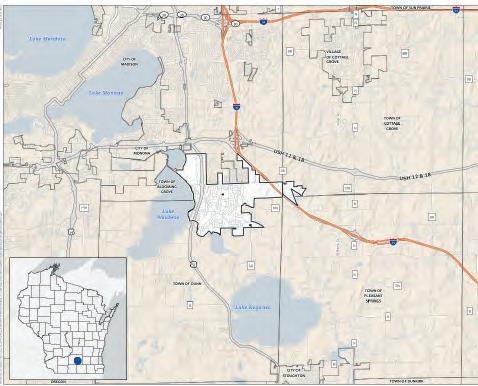
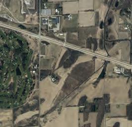
The planning area exhibits considerable topographic relief, with high points generally located to the north, and lower elevations in the south and closer to Lower Mud Lake. Notable environmental features include small ponds near I-39/90, some small isolated wetlands in addition to the larger wetland on the eastern and southern border of the planning area, and pockets of woodlands. A majority of the land area is presently used for farming and open space or for rural residential development.
McFarland Location Context Sources: Dane County (2022), CARPC (2022)

McFarland’s East Side Plan Study Area*

Sources: Dane County (2022), CARPC (2022), Basemap Aerial: ESRI
*East Side Plan Study Area outlined in red.
10 Village of McFarland | East Side Plan
City of Madison Town of Blooming Grove Town of Cottage Grove Town of Dunn Town of Pleasant Springs DoorCreek 39 39 39 39 39 USH12&18 Storck Rd HolscherR Siggelkow Rd D oorCreekRd Long Dr Millpond Rd Catalin a Pkwy FemriteDr N eni n ula Way Canyon Pkwy BautistaDr Tuscobia Trl Kuehling Dr Sledd ngPk y Eagle CaveDr PerrotP Country Walk P airie WoodDr B ellingrathSt SecretGa rdenDr Jenness Ave Chestnut Ln L ttleBluestemDr Jensen Dr Pierce Rd Longview Dr RoidtDr Vilas Rd Elvehjem Rd McConnell Rd PetersonRd MN MN MN AB AB AB AB AB Printed By: smorrison, File: \\msa-ps.com\fs\Project\09\09361\0 9361025\GIS\6_Pro_McFarland_NeighborhoodPlan\6_Pro_McFarland_NeighborhoodPlan.aprx Print Date: 1/5/2023 Data Sources: Dane County (2022) CARPC (2022) Basemap: ESRI Village of McFarland Dane County, Wisconsin East Side Plan Study Area Village of McFarland Parcel Boundary Study Area (2022) Surrounding Municipalities City of Madison Town of Blooming Grove Town of Cottage Grove Town of Dunn Town of Pleasant Springs 0 0.25 0.5Miles
RELEVANT PLAN SUMMARIES
This study included a review of relevant Village and regional documents to identify issues, concerns, policies, and recommendations that should be considered in developing a long-term vision and policies for McFarland’s east side growth area. The following pages highlight different aspects of these relevant documents.
2023 MCFARLAND ECONOMIC DEVELOPMENT STRATEGY
Existing Conditions Snapshot
• McFarland’s population is expected to increase significantly between 2020 and 2040. Estimates place the 2040 population between 12,150 and 14,434 total residents, an increase of 35% to 60%.
• The data indicate an aging population through 2040, with a projected increase of 92% in those aged 55-64 and increase of 132% in those aged 65-84.
• In the population over 25 years old in McFarland, about 28% have achieved a bachelor’s degree, while 19% of the population has a high school diploma, 19% have some college and just over 15% have an advanced degree.
• The Village has higher concentration in occupational categories such as Professional, Transportation / Materials Moving, and Management/Business/ Financial occupations compared to peer communities.
• Major employers in McFarland are primarily local services including the school district, banks, and the grocery store. Only five employers with over 50 employees are considered to be importing revenue into the community.
Key Takeways
• Median Household Income projections for the Village of McFarland are competitive with peer communities and reflect the somewhat higher income levels of the Professional and Management/Business/Financial occupations.
• Th e steady increases in household income are projected to continue over the next 20 years.
• Nearly 43% of McFarland residents work in Madison, although of those responding to the resident survey, 58% reported working in Madison.
Relevant Plan Summaries
• Nearly 60% of residents report shopping for nongrocery items in Madison.
• The greater Madison metro area is short on available industrial properties.
• McFarland has a small number of employers which fall within the region’s (MadREP) targeted industries. Those industries include Advanced Manufacturing; Ag, Food, & Beverage; Healthcare; Information Communications Technology; and Bioscience.
Recommendations
• The Village should facilitate development of infrastructure to serve future industrial development /business park sites. Sites of six to ten acres each, with interstate visibility will be highly sought and meet the needs of industrial expansions/site searches which are being conducted in the area. Another opportunity for the Village is to offer space to businesses which will complement the development of the Dane County Sustainability Campus being planned in conjunction with the expansion of the County landfill.
• McFarland should work closely with Madison Region Economic Partnership (MadREP) to make available property for development that is in-demand and meets the needs of site searches which come to MadREP from the Wisconsin Economic Development Corporation (WEDC).
• Commer cial and retail business recruitment is recommended but often retail and commercial businesses follow residential density. Because of this, development of housing will do much to create a demand for retail and commercial businesses.
• Business retention of existing businesses is a priority recommendation. A majority of development in every community comes from its existing businesses. Understanding the needs of businesses already located in the community supports the business recruitment efforts. Meet with local businesses annually as part of a Business Retention & Expansion Visits (BREV) program.
• Impr ove the overall Quality of Life within the community by increasing access to community amenities such as recreational facilities, cultural activities, and excellent public services can enhance overall business growth and retention.
11 Chapter 1 | Introduction & Public Input
2023 MCFARLAND HOUSING NEEDS ASSESSMENT
Housing Gaps & Opportunities
Using both conservative and high growth scenarios to arrive at a range, the Village will need the following to meet projected housing demand by 2030:
• 21-153 rental units (3 - 19 / year)
This equates to approximately the following per year, based on current rental price points and HUD FY2020 income categories:
• 5-38 units with monthly rent of $801- $1,300
• 3-25 units with monthly rent of $1,301 - $2,000
• 8-55 units priced greater than $2,700
• 612 - 865 owner-occupied units (77 - 108/year)
This includes attached and detached units and equates to the following per year, based on current ownership price points and HUD FY2020 income categories:
• 31-43 units priced up to $220,000
• 92-130 units priced between $221,000-$330,000
• 398-562 units priced greater than $400,000
Goals
The Village’s primary housing goal is to Build Healthy Neighborhoods. Healthy neighborhoods have:
• Varied housing types, sizes and price points, including both owner- and renter-occupied units. This enables more people to stay in the neighborhood as housing needs shift, and it limits future instability due to changes in the housing market.
• Sid ewalks and urban design features that make walking pleasant and safe (whether for transportation or for pleasure).
• Convenient access to public transit and daily needs retail and services.
• Quality parks and open space.
• Communit y gather places, including both public venues (e.g. community center) and private venues (e.g. coffee shops).
• Ac tive neighborhood associations and public or quasi-public places to meet within or near the neighborhood.
Strategies to Improve Housing Options
Communication Strategies
1. Establish a Housing Committee—The Housing Committee can be the driving force to implement this plan, provide oversight on the development and administration of funding programs, support public outreach about the Village’s programs, and support updates to this plan as the market shifts and outside funding programs change.
2. Improve Staff & Developer Communications & Processes—Improve the experience for developers by evaluating the review process and the number of required public meetings. Increasing efficiency should also decrease costs to developers.
3. Assist & Grow Neighborhood Associations— Promote neighborhood identity and social cohesion through neighborhood associations. Use neighborhood associations as a way to engage residents in planning efforts and developments.
4. Retain Inventory of and Market Village-Owned Redevelopment Properties. Establish and continue to maintain a repository of properties owned by the Village and incentives offered for residential and other types of development.
Regulation
5. Examine Waiving or Reducing Development Fees— Consider waiving or reducing fees on a case-by-case basis to encourage affordable housing and reduce costs to developers.
6. Streamline Approval Process for Affordable Housing— Streamline approval process for housing projects that include affordable units to offer an incentive to include these types of units in developments.
7. Reduce Parking Requirements for Affordable Housing—Consider reducing parking requirements for affordable multi-family developments, especially onebedroom units.
8. Adopt Policies That Encourage Accessory Dwelling Units (ADUs)—Consider permitting ADUs by right in all residential areas. A requirement could be added that the property owner live on-site.
12 Village of McFarland | East Side Plan
9. Enable Cottage Courts Through PUDs—Explore areas where cottage courts could be possible in the Village and assemble and promote these areas to developers through the RDA.
Funding
10. Promote the Dane County Affordable Housing Development Fund (AHDF) - Encourage housing developers to learn about and apply for the Dane County AHDF.
11. Utilize Tax Increment Financing for Affordable Housing Incentives—Use TIF to directly or indirectly support the development of housing with incomequalified units.
12. Utilize Tax Increment Financing-Affordable Housing One-Year Extension—Hold open TIF Districts that are about to be closed for one additional year beyond their planned or maximum duration to generate funds that can be used anywhere in the Village for affordable housing.
Sources: Dane County (2022) Village of McFarland (2020) Basemap: ESRI
13. Promote the Use of the Federal and State Low Income Housing Tax Credit (LIHTC) Program — Support and encourage developer use of LIHTC. Affordable Housing Trust Funds could be used as local match for LIHTC.
Partnerships
14. Support Habitat for Humanity, NeighborWorks Southwest Wisconsin, Inc. and Other Affordable Housing Providers—Maintain supply of lots for new homes.
15. Form Working Groups with Major Employers— Facilitate meetings with major employers annually to discuss workforce housing needs as part of BREV meetings.
13 Chapter 1 | Introduction & Public Input
39 39 USH12 & 18 Tower Rd Marsh Rd Paulson Rd Bl ackWaln u rDt V a l l e yD r Storck Rd H id d e nF a r mR d Ho ls che r R d D o o rC r ee k Rd T e rmi n al D r Burma Rd ExchangeSt MillpondRd Voges Rd Catalina Pkwy StarSpang l ed Tlr B remer Rd Siggelkow Rd Agriculture Dr Brugger Pl N P ine n s ula Way CanyonPkwy M ai n St Eagle Cave Dr Jo hnson St Branden burg Way Linde nPkwy Leanne Ln OsbornDr Country Walk RedOak Trl Glenway St Prairie WoodDr Valor Way Bellingrath St LaniLn Milwaukee St Dennis D r TaylorRd S H o peRd CreameryRd Flla i ngLeav e sLn TradewindsPkwy Swinburne Dr BibleCam pRd KippSt Tria n gleSt FemriteDr LongviewDr Elvehjem Rd McConnell Rd SDutchMill Rd Peterson Rd Vilas Rd MN MN MN AB AB AB AB AB 51 51 Printed By: smorrison, File: \\msa-ps.com\fs\Project\09\09361\09361025\GIS\6_Pro_McFarland_NeighborhoodPlan\6_Pro_McFarland_NeighborhoodPlan.aprx Print Date: 6/8/2022 39 39 USH12 & 18 Marsh Rd Paulson Rd Bl ackWaln u rDt V a eyDr Storck Rd Rd Ho ls che r R d T e rmina Dr Burma Rd ExchangeSt MillpondRd Voges Rd Catalina Pkwy StarSpangled Tlr B remer Rd Siggelkow Rd Agriculture Dr Brugger Pl N P nie n s ula Way CanyonPkwy M ain St Eagle Cave Dr Jo hnson St Branden burg Way Linde nPkwy Leanne Ln OsbornDr Country Walk RedOak Trl Glenway St Prairie WoodDr Valor Way Bellingrath St LaniLn Milwaukee St Dennis D r TaylorRd S H o peRd CreameryRd Flla ngLeav e sLn Tradewinds Pkwy Swinburne Dr KippSt Tria n gleSt FemriteDr gviewDr Elvehjem Rd McConnell Rd S Dutch Mill Rd Vilas Rd MN MN MN AB AB AB AB 51 Village of McFarland Dane County, Wisconsin Property Occupancy Rivers & Streams Lakes & Ponds Village of McFarland Surrounding Municipal Boundary Property Occupancy Owner Renter Mixed Under Construction Non-Residential Properties Village Housing Study
McFarland Property Occupancy
2021 MCFARLAND SUSTAINABILITY PLAN
The Sustainability Plan addresses six separate, yet interconnected aspects of life within the Village of McFarland: Energy, Transportation, Solid Waste, Water, Land Use & Development, and Community Health. For each of these six categories, the Village created a vision statement; identified indicators by which performance can be measured; selected desired performance trends; and prioritized a list of possible actions to accomplish these objectives.
Energy
Village government, residents and businesses embrace energy efficiency strategies and renewable energy sources. Efforts are aimed at reducing the local use of energy derived from fossil fuels each year, making steady progress toward a 100% clean energy future.
Transportation
McFarland has an extensive multi-modal transportation network that is accommodating to the needs of all people, regardless of age, ability or income. Community members are enabled to make sustainable transportation choices when traveling to and from work, school, and other daily activities. Village transportation infrastructure is sustainably designed and integrated with a regional system that combines timely, costeffective public transportation options, like buses and light rail, with a safe and ubiquitous network of routes for walking and bicycling.
Solid Waste
The residents, businesses, and government of McFarland utilize the most efficient and effective methods available to reduce, reuse, compost, and recycle waste. Village government uses incentives and policies to limit unnecessary waste and promote the lesser use and safe disposal of hazardous materials. Village residents and businesses are knowledgeable and responsible about waste management methods, and they value and celebrate the creative reuse of goods and materials.
Water
McFarland has an abundance of clean water, including surface water and groundwater, for both recreation and drinking. Public and private users limit their use of groundwater while also seeking to optimize infiltration of stormwater through best practices. Village government, residents and businesses endeavor to keep groundwater
and local waterways free of chemicals, salt, trash, soil, and excess nutrients.
Land Use & Development
The Village of McFarland prioritizes the protection of environmentally sensitive areas and biodiversity in land use decisions and preserves land strategically for those purposes. The Village encourages diversity in both the built and business environments, seeking mixed-use developments, neighborhoods with a mix of housing types and price points, and a variety of business types in order to expand access to housing, jobs, services, recreation, social interaction, and other basic needs. Higher density and infill developments are encouraged so that land and infrastructure resources are used efficiently. Streets and development sites utilize resilient, native landscaping that enhances the aesthetic appearance and ecological health of the Village.
Community Health
McFarland, including its government, residents, and businesses, embraces community health and wellbeing as an integral part of sustainability. McFarland is intentional about embracing diversity and inclusivity, such that all residents are able to live happy and satisfying lives. Healthy food, clean water, housing, jobs, recreation opportunities and health care are available and accessible to all residents regardless of age, ability, gender identity, sexual-orientation, income, or ethnicity. The community values social connections and civic participation and works together to meet the needs of its most vulnerable residents.
Conclusion
The Sustainability Plan is a living document and continual improvement and annual updates are an integral part of the system. This living Plan is designed to help the Village adapt and improve performance each year through incremental changes that will cumulatively result in increased efficiency, cost-savings, environmental benefits, and long-term resilience. Each year the Village will evaluate performance, adjust the desired targets if appropriate, and revise the action plan.
14 Village of McFarland | East Side Plan
2008 EAST SIDE NEIGHBORHOOD GROWTH AREA PLAN
The East Side Neighborhood Growth Area Plan describes the planned development for the eastern half of the Village of McFarland. The project area boundaries consist of Siggelkow Road to the north. The City of Madison extends to Siggelkow Road adjacent to much of the planning area. Interstate Highway 39/90, properties located in the Town of Dunn that are protected from development through a purchase of development rights (PDR) and an extensive system of wetlands comprise the eastern boundary. These wetlands also from the southern boundary of the planning area.
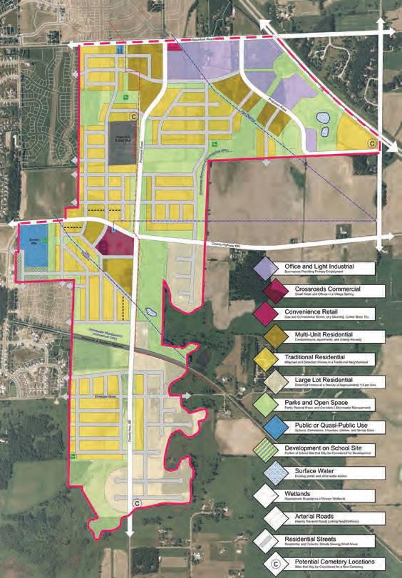
Growth and Land Use Goals
Housing, institutional, retail and service, and office and light industrial land uses are identified within the project area. Housing makes up a majority of land use in the Concept Development Plan. Planned housing type includes mostly low density residential with pockets of multi-unit residential. Office and light industrial use are planned for the north boundary of the site along Siggelkow Road and Highway 39. One commercial retail center is identified off County Highway MN. An institution land use is planned for the west boundary as a school. A large of portion of land is set aside as parks and open space land use.
Sustainability
Seeks to identify several sustainable development strategies and not just through high density land use. The plan emphasizes conservation development strategy of preserving open space with cluster development. Walkability, street safety, and diverse transportation modes are prioritized. The plan aims to provide housing affordability through many differing housing types and densities in the neighborhood.
Land Use Summary
Development objectives include a total of 1,644 new residential units. The composition of housing units will be 328 in multi-unit residential (at least 8 units per acre), 1,148 in traditional residential (mostly detached single family, at least 4 units per acre) , and 168 in large lot/cluster residential (detached single family, less than 2 units per acre).
The approximate mix of uses is 55% residential, 31% open space, 10% office and light industrial, 3% public/civil facilities, and 1% commercial.
15 Chapter 1 | Introduction & Public Input
2008 East Side Neighborhood Growth Area Sources: Dane County (2022), CARPC (2022), Basemap Aerial: ESRI
Sources:
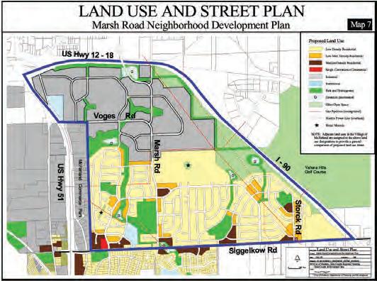
CITY OF MADISON MARSH ROAD
NEIGHBORHOOD PLAN (1999)
Transitioning industrial uses to residential uses. Establishes traditional neighborhood development (TND) character for City of Madison with a mix of housing styles and densities to minimize automobile presence. Higher density is planned near Siggelkow Road. Very little commercial land is dedicated to this project area.
CITY OF MADISON YAHARA HILLS
NEIGHBORHOOD DEVELOPMENT PLAN (2017)
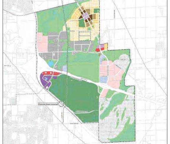
Planned neighborhood development north east of I-90/39. Proposed conversion of agricultural and vacant lands to open and green space, industrial and employment sites, mixed use, commercial, institution and civil facilities, and diverse housing mixes. In 2022, the City updated this plan as part of the new Dane County Landfill and Sustainability Campus project proposal.
DANE COUNTY PARKS AND OPEN SPACE PLAN (2005)
Gives recommendation to acquire lands to expand Lower Mud Lake Natural Resource Area and construct off-road bicycle and pedestrian trail through the Natural Resource Area as a segment to the Lower Yahara River Trail.
2050 REGIONAL TRANSPORTATION PLAN (2022)
Highway 12/18 planned conversion from expressway to freeway. Planned interchange at Highway 12/18 and County Highway AB with pedestrian/bicycle path to be completed in 2023. Proposed additional transit service to the Village of McFarland.
DANE COUNTY BICYCLE TRANSPORTATION PLAN (2000)
Planned bicycle lane or paved shoulder on County Highway MN and AB. This project was completed in 2022.
16 Village of McFarland | East Side Plan
Marsh Road Neighborhood Development Plan
City of Madison (1999)
Yahara Hills Neighborhood Future Land Use Sources: City of Madison (2017)
YAHARA HILLS SUSTAINABLE CAMPUS AND LANDFILL (2022)
Proposed new Dane County Landfill and Sustainability Campus project on Yahara Hills Golf Course property.

CAPITAL AREA RPC (CARPC) REGIONAL DEVELOPMENT FRAMEWORK (2022)
The CARPC 2050 Regional Development Framework replaces the Vision 2020: Dane County Land Use and Transportation Plan as the region’s recommended land use guide. The Framework draws on public priorities, local government input, and future growth projections to establish overarching regional goals, objectives, and strategies for accommodating future growth within the Dane County region. McFarland’s East Side Plan supports the goals and objectives of the 2050 Regional Development Framework including the following:
Goals
• Reduce greenhouse gas emissions and foster community resilience to climate change
• Increase access to jobs, housing and services for all people
• Conser ve farmland, water resources, natural areas, and fiscal resources
Objectives
• Increase the amount of compact, mixed-use, walkable urban development throughout the region and support transportation oriented development where feasible

• Prioritize infill growth in already developed areas while increasing density and increasing good connectivity among existing developments
• Plan for targeted sector-specific business and job growth throughout the region
• Provide and support developments which provide ample housing demand to meet market needs
• Increase intermodal to improve access to jobs and services for local residents
• Enhance and protect new and existing stewardship and natural resource conservation areas/corridors
• Designate and promote the protection of regionally significant farmland to secure food resources for future generations
Yahara Hills Sustainabilty Campus Plan
Sources: Dane County (2022)
DEVELOPMENT PATTERNS Focus growth in centers and corridors

Focused Regional Development Patterns
Sources: CARPC (2022)
• Increase the urban tree canopy and encourage best management practices for stormwater management to increase infiltration and reduce runoff
The Framework recommends locating about 40% of all future growth within centers and along corridors. Centers are vibrant places where people can live, work, shop, be entertained, and meet and connect with others. Corridors connect centers. They provide a variety of ways to travel including walking, biking, and, where possible, transit. Along many stretches, they also offer similar combinations of activities found in centers.
• Support eff orts that reduce pavement and impervious surfaces that increase the urban heat island effect
• Apply an Equity Lens to all development efforts to reduce racial disparities
17 Chapter 1 | Introduction & Public Input
metro center regional center community center existing planned corridors resource protection areas cities and villages resource stewardship areas farmland preservation areas farmland transition areas 2050 urban growth 2050 employment districts potential complete neighborhood 2020 development ++++ land surface temperature +++ + percent tree canopy cover tier 1 environmental justice areas tier 2 environmental justice areas metro center regional center community center existing planned corridors resource protection areas cities and villages resource stewardship areas farmland preservation areas farmland transition areas 2050 urban growth 2050 employment districts potential complete neighborhood 2020 development ++++ land surface temperature +++ + percent tree canopy cover tier 1 environmental justice areas tier 2 environmental justice areas metro center regional center community center existing planned corridors resource protection areas cities and villages resource stewardship areas farmland preservation areas farmland transition areas 2050 urban growth 2050 employment districts potential complete neighborhood 2020 development ++++ land surface temperature +++ + percent tree canopy cover tier 1 environmental justice areas tier 2 environmental justice areas metro center regional center community center existing planned corridors resource protection areas cities and villages resource stewardship areas farmland preservation areas farmland transition areas 2050 urban growth 2050 employment districts potential complete neighborhood 2020 development ++++ land surface temperature +++ + percent tree canopy cover tier 1 environmental justice areas tier 2 environmental justice areas metro center regional center community center existing planned corridors resource protection areas cities and villages resource stewardship areas farmland preservation areas farmland transition areas 2050 urban growth 2050 employment districts potential complete neighborhood 2020 development ++++ land surface temperature +++ + percent tree canopy cover tier 1 environmental justice areas tier 2 environmental justice areas metro center regional center community center existing planned corridors resource protection areas cities and villages resource stewardship areas farmland preservation areas farmland transition areas 2050 urban growth 2050 employment districts potential complete neighborhood 2020 development ++++ land surface temperature +++ + percent tree canopy cover tier 1 environmental justice areas tier 2 environmental justice areas * These are conceptual maps intended to convey approaches to regional development. They are not prescriptive and may not fully reflect actual, local conditions. They do not show all areas of potential growth and may not align with local planned growth areas or community Future Land Use Maps. Data Sources: CARPC GIS, CARPC Staff analysis, Dane County GIS, UrbanFootprint, USDA, USGS, WDNR and WDOA. 25 Greater Madison grows together Regional Development Framework 02: The Regional Development Framework
Public Input Summaries
PUBLIC INPUT SUMMARIES
COMMUNITY SURVEY
An abbreviated summary of the community survey findings follows. It is important to understand that this is only a partial snapshot of stakeholder opinions about the East Side Plan study area.
General Community Survey Information. 760 responses, 599 from McFarland residents. The survey asked respondents to identify their individual and household characteristics including broad demographic categories, socio-economic status, and place of residence and employment. Respondents were also asked to provide information related to their choice of housing type, form of occupancy, and assessed property values.
Survey Responses
• General Respondent Information. Over 750 total sur vey responses were collected with 599 responses (79%) coming from Village of McFarland residents. Most other responses came from residents of other adjacent communities.
• Business Climat e. Business owner respondents were asked to further clarify their operational status 53 out of 760 responses (7%). Professional services made up the bulk of business category owners (greater than 50%) and over 75% had been in operation more than 4 years. Of the businesses represented, 33 (63%) reported increasing their business activity within the last 6 months. Other questions asked of business owners did not receive a significant number of responses (less than 2%).
• Em ployment Climate. Many respondents (76%) were salaried or hourly employees and most responding households (73%) had incomes greater than $100k. Respondents worked primarily in the City of Madison (n=308, 53%), followed by Village of McFarland (n=130, 23%). Over 323(51%) employed respondents had worked for their current employer for more than 7 years. When commuting to work, 508 respondents drove individually with less than 3% carpooling with others. However, 22% (n=138) employed respondents indicated they currently worked from home.
• Housing Characteristics. Most respondents lived in single-family detached housing (n=635, 87%) with attached, side-by-side units composing about 8% (n=55) of responses. The most popular unit types were 3- and 4+-bedrooms at 47% (n=350) and 42% (n=311), respectively. Of the many factors considered when deciding where to live, the top five were schools (75%), neighborhood quiet and safety (61%), dwelling/unit type (46%), neighborhood character (44%), and cost of living (43%). An overwhelming majority of respondents owned their place of residence (n=672, 91%). Many homeowners reported having invested or planning to invest more than $10,000 to improve an existing home.
• Housing Densit y and Affordability. A small percentage of respondents indicated that they had to forego other needs such as food and healthcare to afford stable housing. This reflects the growing trend of housing insecurity throughout communities in the City of Madison metropolitan area. Overall, smaller lots, accessory dwelling units, and other development styles that promote denser, more affordable housing were not preferred by respondents. Overall, this response misalignment can be attributed to the limited respondents from housing insecure households. More details about the current status of housing affordability and fair market values is available in the companion report, Village of McFarland Housing Needs Assessment. Also, most of the respondents listed affordable rent, affordable home ownership, and senior housing as the greatest unmet housing need in McFarland.
• Business and Shopping Preferences. Respondents indicated that they do a majority of their non-grocery shopping in the City of Madison. Convenience, price, quality, and selection were at the top of the list in terms of how and why these consumers chose to shop outside the village. Many of the responses highlighted the need for more restaurants and food related businesses in the Village. When respondents considered what shopping gaps exist in McFarland, they identified Restaurants, both fast food and sitdown, bakeries/coffee shops, delis/butcher shops were included in the top eight shopping categories that need more options. Clothing/apparel, home furnishings, and arts and craft supply stores were listed as needing increased shopping options.
18 Village of McFarland | East Side Plan
LAND USE PREFERENCE SURVEY
General Survey Information. Eighty-six responses were received for the East Side Plan Land Use Survey. 70 respondents (81%) had a primary residence within the Village of McFarland; other response were from residents living in other municipalities directly adjacent to the East Side Plan study area. The survey asked respondents to provide comments and preferences related to 3 different preliminary plan concepts. Some questions asked respondents to compare the different land use layouts based on the location and overall proportion of that land use distributed throughout the East Side Plan. Additionally, the survey covered general neighborhood design characteristics for the land uses discussed in each concept. Images of comparable developments in other communities were used to assess the appropriateness of specific architectural layouts and styles that should be considered when developing design standards for the East Side Plan.
East Side Plan Concept Preferences. Respondents were shown three different preliminary land use concepts that proposed a different proportion and location of land uses across the study area. Comments collected about each concept are summarized below.
• Co ncept 1. Overall respondents thought Commercial/Mixed Use (including High-Density Residential) and Parks and Conservation areas would be expanded throughout the East Side Plan. Preferences leaned toward having a smaller portion of the plan dedicated to the Business Park and Lowand Medium-Density Residential land uses. This plan had the biggest difference between land use category preferences among how each category was sized proportionally throughout the East Side Plan. Open-ended comments reflected a wider variety of views on potential changes that should be made when refining this plan.
• Concept 2. Respondents thought land use categories in this layout were more proportionally appropriate for the East Side Plan. Most of the land use categories were thought to be appropriately represented in scale and location in this plan with a few comments regarding some specific neighborhood layouts. However, a subset of respondents thought more Parks and Conservation areas could be added to improve more park access within individual neighborhoods.
• Co ncept 3. This concept drew mostly similar responses illustrating the more balanced size and layout of land uses throughout the East Side Plan. Compared to Concept 2, this version was thought to have too much Business Park and Low-Density Residential while also needing more Parks and Conservation areas
Recurring Themes. The open-ended comments provided a deeper dive into the views and preferences of the total size and location of each land use as laid out for each concept. Common themes were present across the responses to the three concepts. The main themes present are:
• Too much commercial in some areas may conflict with adjacent land uses depending upon the type of service/retail provided.
• Incompatible uses without an appropriate buffer zone that are located directly adjacent to the Gun Club that may pose a potential health risk.
• The need for a variety of housing styles and types beyond the ‘stamped, cookie-cutter’ developments with little variation between homes in neighborhoods and across communities.
• Need for mor e dispersed ‘neighborhood-scale’ open space with an interconnected trail network. Additionally, including the existing high-quality open-space and woodland areas as conservation and park spaces.
• Increased traffic due to new road connections and growing population. Particularly some of the traffic and land use conflicts when considering the location of schools and residential neighborhoods
Concept Choice Survey. Responses show an overall preference for Concept 2 and 3 as those that should be refined for further discussion regarding land use category size and placement within the East Side Plan. When considering reasons these two concepts were ranked first, the overall location and distribution of land uses and the amount of Parks and Open Space were the main decision drivers. Other considerations such as the amount of other land use categories was not as impactful with road network layout as the least important factor for ranking concepts.
19 Chapter 1 | Introduction & Public Input
Overall Land Use Design Preferences.
Respondents expressed their preferences for each initial concept based on the location and percentage of land use in each design. Respondents were shown an array of photos and asked to provide a preference rating based on typical regional architectural styles often represented in each land use category presented in the East Side Plan. Comments mainly addressed the amount of land devoted to each category and if residents thought that the location of each land use was appropriate. Other images were also shown and asked where each environment would belong when considering neighborhood layout. Below is a summary of the image preferences portion of the survey.
• Commercial. When considering architectural styles, respondents overwhelmingly preferred more traditional, smaller scale commercial development that mix uses vertically. A blend of modern materials blended with local stone and brick was used in a smaller undulating building footprint to create a more desirable, human-scale commercial environment.
• Business Park. When considering the scale and style of buildings that should be developed as part of a business park, responses favored buildings in the range of three to four stories. The buildings shown used more natural tones with a more prairiestyle aesthetic.
• Residential. When considering the appropriate location for different styles and scales of residential development, respondents indicated that singleand small 2 to 4 unit multiplexes were appropriate across all areas of a neighborhood. Everyone generally agreed that all residential areas should be relatively close to park areas, if not immediately adjacent, and that larger multifamily developments would be more appropriate only when adjacent to other multi-unit housing at the neighborhood periphery, or designed to blend in with single-unit housing.
• Multi-Use Trails & Biking Amenities. Respondents overwhelmingly preferred wider, paved, curvilinear trails that were located in more natural settings off of main roadways such as conservation areas and environmental corridors throughout the East Side area. Of the trails located along roadways, respondents preferred placing the trail corridors along quieter neighborhood streets with wider
road aprons as bike lanes and sidewalks on either side. On-road trail sections with more auto-centric characteristics such as those along wider collector streets with dedicated bike lakes were not preferred.
PUBLIC INFORMATIONAL MEETINGS (PIM)
The steering committee for this project is the Plan Commission. Some of these meetings were held inconjunction with the Community Development Authority (CDA). All of the meetings were public meetings open to attendance by any interested stakeholders. However there were three meetings specifically designed and promoted to inform and involve the general public.
Neighborhood Forum #1 (July 14, 2022)
Forum # 1 was hosted in an online format between 6:00 and 8:00pm. The meeting featured a short introduction by McFarland’s Community & Economic Development Director followed by a presentation from MSA’s project manager. The main discussion topics included the current housing market, local business climate, and updates to the East Side Plan area. Attendees were invited to participate in three separate 20-minute breakout sessions. Each breakout group included a small group of resident participants who provided their views on the discussion topics directly after each topic’s presentation. Those in attendance were also encouraged to complete an online survey and visit McFarland’s East Side Plan website for more information.
Attendees were mostly residents of McFarland who live close to McFarland’s eastern municipal edge and from communities directly east of the Village that would most likely be impacted by the plan. Those in attendance gave their views on housing affordability and increased McFarland’s residential density; current and future business needs and employment opportunities; and the size and type of development suitable for the East Side planning area. Preferences were varied but overall included comments about including a mixture of housing types and densities that increase housing affordability and promote more compact development. One recurring theme discussed across groups included the need for more parks, paved multi-use trails, and recreational amenities to be located within McFarland’s East Side.
20 Village of McFarland | East Side Plan
Neighborhood Forum #2 (July 28, 2022)
The second forum was held in an online format between 6:00 and 8:00pm. Most attendees were from the Village of McFarland with most others coming from City of Madison with a few attendees from smaller adjacent municipalities. The meeting featured a project overview and introduction by McFarland’s Community & Economic Development Director. The goals and policies that were guiding the plan were presented along with three preliminary concepts (See Chapter 4). After each concept was presented, those in attendance were asked to participate in small breakout sessions where groups were asked to answer a set of semi-formal questions regarding their thoughts and preferences related to each concept’s land use. Some basic planning concepts and techniques were discussed along with general land use categories to introduce attendees to the breakout exercise.
A variety of general viewpoints were represented across each of the three groups and between each concept. Below is a summarized list of recurring themes that were discussed by each breakout group.
• Questions ar ose of plans regarding the new Community Park and potential for a school east of I-39/90. Most comments sought to address the traffic conflicts that would occur when high intensity, carcentric development is directly adjacent to a primary school.
• Conc erns were voiced about potential land use conflicts that would impact development of the local Gun Club located on the south side of Siggelkow Road.
• Assisted living complexes, condominiums, accessory dwelling units, and other more compact housing styles could be used to address housing affordability and increase opportunities to age in place.
• Popula tion growth and road development as proposed in several concepts has the potential to significantly impact homeowners directly adjacent to more intensive uses.
• More neighborhood parks and conservation areas should provide a network of natural areas and multiuse trails to better interconnect neighborhoods with universally accessible multi-modal transportation options.
Other concerns brought forward by the community that relate to existing site conditions include:
• Lack of municipal services east of I-39/90 and the East Side Plan will address development phasing.
• High voltage electric line and high pressure natural gas pipeline easements provide some development limitations that could divide neighborhoods built within the study area.
• A large por tion of land directly east of the study area is preserved as agricultural land as part of a purchase of development rights (PDR) program and will impact development potential for the area directly adjacent.
• Road conditions along some proposed arterial and collector streets are not suitable for increased traffic and should be improved prior to any major Village expansion. Gun club, buffer zone easements around the area.
• New development in the study area should consider increased traffic resulting from the AB – US Hwy 12/18 interchange improvements.
Development Focus Group (August 17, 2022)
MSA staff interviewed five local experts including developers, real estate agents, and financial service partners to collect targeted information related to regional development trends. Those in attendance highlighted the need for more light industrial facilities that provide multiple flexible production spaces in the same building within short distances to interstate corridors. General retail space is still sitting vacant but continues to fill up steadily. Respondents supported developing a 50- to 100-acre business park site in the East Side Plan study area. Optimal sites would include areas that could be subdivided into areas that are sized 5-6 acres and 10-15 acres to support general office campuses and flexible light industrial spaces, respectively.
Most responses preferred a business park site clustered around the Siggelkow Road corridor, running both north and south of the road toward I-39/90. Comments regarding the three neighborhood design alternatives
21 Chapter 1 | Introduction & Public Input
and business park site considerations included the following:
• Synergy of complementary industries and associated businesses
• Reliable power supply and capacity near existing substation
• Only niche industrial sites use rail services, there is currently not a big market for rail-based industry
• New landfill expansion poses a r isk for housing development and certain industries locating in the business park due to close proximity to landfill
• The land northeast of the CTH AB/Siggelkow intersection could support an alternative business park location with the planned 12/18 interchange improvements.
Residential development appears to be plateauing but there are not many developable lots available in the area. A small number of buyers are driving a market for expensive homes ($1 million+) in the region. Overall, there is a new interest in more compact residential development that allow smaller lots with carriageways or alley-loaded designs that allow for smaller, more affordable lots. Residents would consider alternatives to single-family housing (ie triplex, fourplex, townhomes, detached condominiums, etc.) if those options were available. Additionally, the region has a need to support senior housing that allows residents to age in place. Most recently constructed residential subdivision developments are larger than 40 acres.
East Side Plan Public Meeting (November 29, 2022)

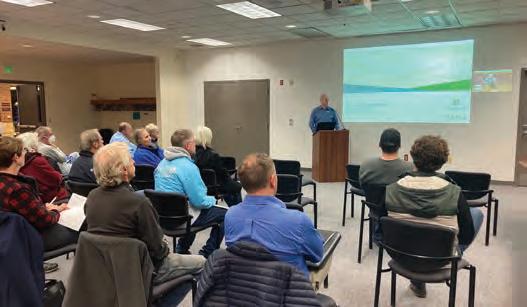
The last public meeting in the plan development process was held in person at McFarland’s Municipal Center. A brief introduction was provided by the Village and followed by a presentation of a refined plan with a preferred land use concept and more developed overarching goals and policies that would be used to guide development within the study area. Most of the 23 attendees were from the Village of McFarland or a smaller municipality that would be impacted by the proposed East Side Plan.
Roadway development concerns regarding the potential to utilize imminent domain for transportation infrastructure improvement projects and a few other questions were addressed at the end of the presentation by the Village and MSA staff. Although an opportunity was provided to provide written comments, only a few participants gave a written response. Alternatively, the informal discussion groups that formed around the presentation summary boards provided an outlet for stakeholders to voice their questions and concerns. Most of the comments and questions explored Village expansion beyond the interstate into agricultural areas. The lack of municipal utility access east of the interstate was discussed in as far as how the Village’s expansion would be phased and what would happen in the interim.
Sources: MSA (2022)
22 Village of McFarland | East Side Plan
Stakeholders attend a public meeting in November
CHAPTER 2
PLAN VISION, POLICIES & IMPLEMENTATION
24 V ison, Goals & Policies
This section presents the overall long-term vision for McFarland’s East Side, and states the goals and policies to reach this stated vision.
32 D esign Guidelines
This section presents design-related guidelines to inform property owners / developers, and support Village staff in reviewing development projects.
38 I mplementation Plan
This section outlines action steps to improve the planning area as it redevelops, and offers potential funding opportunities that will assist in implementing the action plan in order to achieve the plan’s longterm vision for McFarland’s East Side.
23 Chapter 2 | Vision, Policies, & Implementation
Vision, Goals & Policies
This section is intended to establish goals and policies to guide the development of McFarland’s East Side area. These supplement the design standards in this chapter and the Development Land Use policies in Chapter 4.
VISION STATEMENT
McFarland’s east side will balance growth opportunities while facilitating sustainable initiatives, expanding job opportunities, and promoting housing diversity and affordability, and social equity.
Housing: There will be a variety of housing options dispersed across the east side in vibrant neighborhoods inclusive of public open spaces and mobility options.


Economy/Job Growth: Employment options will be located and connected to residential areas, supporting the local economy and providing job opportunities for residents.


Quality of Life / Social Equity : Create healthier and more equitable environments for those who work and live in the East Side area.
Sustainability: The Plan embraces sustainable development practices including minimal site disturbance, preservation of existing natural features and habitats, restoration of native plant communities, and implementation of energy-efficient and low-impact development techniques for infrastructure design.


24 Village of McFarland | East Side Plan
Looking down a collector roadway with a blend of housing products from single-family to townhomes to multi-unit apartment/condo buildings.
Looking over the business park that is seamlessly connected to adjacent residential neighborhoods.
HOUSING GOAL & POLICIES
Goal 1 – Integrate a diversity of housing types to accommodate a variety of lifestyles, age groups, and income levels.

Policy #1.1
Ensure that a variety of housing types are included within the East Side growth area, including requiring each subdivision to consider 2-4 housing types/forms and encouraging every development to provide a unit mix that supports varying household sizes.
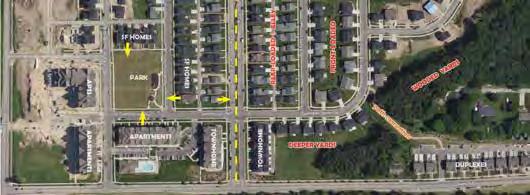
Balanced neighborhoods include a variety of housing options that support varying interests and demographics. To be equitable, the Village should encourage all subdivisions meet this policy. If varied housing types cannot be achieved, there shall be variety of home formats provided such as front-loaded garages, rear-loaded garages (carriageway), and varying homes sizes.

Policy #1.2
Use the design guidelines in this Plan to encourage building and site design that provides transition and compatibility between low-intensity residential development and more intensive multi-unit residential, office and mixed-use developments.
Incorporating diversity of housing types with varying density and massing can be achieved through careful design considerations. Design guidelines/standards can help achieve compatibility between uses.
Policy #1.3
Promote senior housing developments of varying sizes, unit types and occupancy type.
It is important to support the aging population with housing choice from independent living (in small unit buildings and larger multi-story buildings) to assisted living to memory care. This can be achieved

25 Chapter 2 | Vision, Policies, & Implementation
This neighborhood incorporates varied housing types, using uses and building orientation to mitigate compatibility issues.
This apartment building steps down the building adjacent to a neighboring lower-density residential use.
1. HOUSING GOAL & POLICIES (cont.)

Policy #1.4
Encourage site and building design strategies that provides comfortable, safe and attractive walking environments (e.g., decreased setbacks, front porches, balconies, etc.).
All housing developments no matter the size can provide a welcoming street frontage through reduced setbacks, individual entries and porches. This creates a sense of place that increases social interaction and leads to safer and more attractive neighborhoods.

Policy #1.5
The Village encourages developments that incorporate “missing middle” (3- to 8-unit buildings) development types supporting both rental and homeownership.
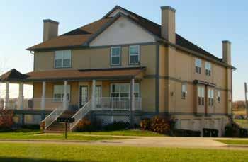
Missing Middle is a range of home types that are compatible in scale and form with detached singlefamily homes. These building types, such as duplexes, fourplexes, cottage courts and courtyard buildings, is in the “middle” of spectrum between detached singlefamily and mid- / high-rise apartments. These unit types have been “missing” from neighborhoods for the last several decades as they have mostly been prohibitive to build in residential zoned areas. These building types support housing affordability and diversity, as well as support locally-serving retail and public transportation
The above developments include reduced setbacks and porches that provides a welcoming frontage. The building types also fit the “missing middle” development.

26 Village of McFarland | East Side Plan
2. MOBILITY GOAL & POLICIES
GOAL 4: Policy #1
Goal 2 – Blend multi-modal transportation options into neighborhood design.

Provide sidewalks along all streets and multi-use trails in the environmental corridors and parks.
Policy #2.1
Provide sidewalks along all streets and multi-use trails in the environmental corridors and parks.
Policy #2
Develop a comprehensive system of pedestrian and bicycle facilities that connects the East Side area to the other sections of the Village and to the greater Dane County trail system.
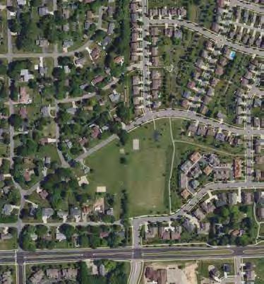
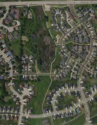
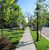
Walkability has become increasingly important in residential development in urban and suburban areas. Sidewalks provides safe and comfortable mobility for passive use. Multi-use trails provide for both passive and active use that can be designed through linear parks (as shown on the right) or along streets with increased buffering from the drive lanes.
Policy #2.2
Develop a comprehensive system of pedestrian and bicycle facilities that connects the East Side area to the other sections of the Village and to the greater Dane County trail system.
GOAL 4: Policy #3
Trails provide opportunities for passive and active recreation, support healthy living, increase the value of adjacent neighborhoods, and provide alternatives to motorized transportation connecting people to civic and employment areas. These benefits are multiplied when local trails are linked together and to regional trail systems.
Require proposed streets to connect to existing streets and intersections, wherever practical.
Policy #2.3
Require proposed streets to connect to existing streets and intersections, wherever practical.
Dead-end street and non-continuous trail networks limit options when moving about a community. This reduced mobility increases the distance one is required to travel, increases traffic on primary roadways, can frustrate drivers/pedestrians, and discourages non-mortorized travel. Development shall make every effort to connect to existing facilities (trails, roadways and intersections).
27 Chapter 2 | Vision, Policies, & Implementation
2022 EAST SIDE PLAN PARK
2022 EAST SIDE PLAN
New neighborhoods making road and pedestrian connections that were established in older subdivisions.
2. MOBILITY GOAL & POLICIES (cont.)
Policy #2.4
narrower streets to increase safety and to develop land sustainably. providing on-street parking side of the street in lowresidential blocks.
Promote narrower streets to increase pedestrian safety and to develop land more sustainably.
Roads provide access and parking storage. The wider the road the greater cost to maintain (e.g., street sweep, plow and repair). Right-sizing roadways has safety, financial and sustainable impacts.

Roadway widths can also impact development density and indirectly lot/housing affordability. Residential blocks are established based on lot depth and right-ofway widths. If right-of-way widths are reduced, there may be opportunities to increase the number of blocks (and/or size of lots) within the development. More (or larger) lots can result in lower individual lot pricing, as lot revenues are established in part by dividing the construction cost by the revenues from the lots.
calming measures (e.g., traffic circles, speed tables) appropriate to create a better environment for pedestrians and

Policy #2.5
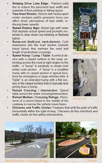
Utilize traffic calming measures (e.g., bump-outs, traffic circles, speed tables, rectangular rapid flash beacons) where appropriate to create a better street environment for pedestrians and cyclists.
The frequency and speed of vehicles can greatly impact road safety, especially for pedestrians/bicyclists. There are variety of “traffic calming” measures that can be designed or retrofitted into a roadway that can reduce vehicle speeds, and some cases discourage vehicle usage (cut-through traffic).
Policy #2.6
GOAL 4: Policy #6
Encourage intensive development, where practical, along primary corridors to support future a sustainable public transit route(s).
Encourage intensive development, where practical, along primary corridors to support future sustainable public transit route(s).
Public transit provides social, environmental, and economic benefits to communities. The most sustainable transit route will be along higher-density residential and commercial corridors (increased ridership).
28 Village of McFarland | East Side Plan
2022 EAST SIDE PLAN PARK & RIDE LOWDENSITY COMMERCIAL
The initial bus route in Sun Prairie incorporated a route through this neighborhood as it incorporated significant levels of highdensity housing inclusive of home-ownership and rental units.
3. ECONOMY GOAL & POLICIES
Goal 3 – Provide housing within walking distance of shops, services, and jobs.

GOAL 3: Policy #1
Policy #3.1
Employment areas should be compatible with the density and scale of surrounding development with safe pedestrian and vehicle connections established with neighboring residential subdivisions.
Employment areas should be compatible with the density and scale of surrounding development with safe pedestrian and vehicle connections established with neighboring residential subdivisions.
Employment options shall be available in close proximity to where you live. The scale, massing and uses within the employment area shall consider design solutions to minimize its impact on the surrounding neighborhoods. Pedestrian and vehicle connections shall be provided between residential and the employment area(s).
Policy #3.2
GOAL 3: Policy #2
Integrate neighborhood-scale commercial and community facilities in appropriate locations, generally along collector/arterial roadways – specifically at intersection nodes to draw on broader markets.
Integrate neighborhood-scale commercial and community facilities in appropriate locations, generally along collector/arterial roadways –specifically at intersection nodes to draw on broader markets.
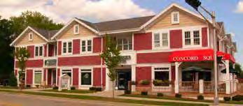

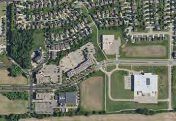
Balanced neighborhoods includes walkable neighborhood commercial. Design choices can provide compatibility between residential and the commercial. As shown in this example, townhomes front the side or backs of commercial lots with varying levels of landscaping treatments to reduce the impacts of parking lots.
Policy #3.3
Commercial uses and building forms will be compatible with general neighborhood context and enhance the overall character of the community.
Commercial / Mixed Use nodes shall be designed to be compatible with the surrounding residential. Consider the compatibility standards outlined in page 38.
well-established neighborhood.
29 Chapter 2 | Vision, Policies, & Implementation
2022 EAST SIDE PLAN Smaller Building
This example ties the business park to the neighborhood along a side street, as well as by an off-street trail. Building scale in the
2022 EAST SIDE PLAN
This two-story mixed use building has a pitched roof and gables compatible with single-story ranch homes in the surrounding
community squares, community ranging community needs
4. QUALITY OF LIFE / SOCIAL GOAL & POLICIES
Goal 4 –Ensure the long-term preservation of community character and high quality of life.

Policy #4.1
Design neighborhoods around community gathering places (e.g., parks, public squares, schools, churches, and other community facilities).

Public/community facilities are the activity hubs within a neighborhood. Historically these facilities were placed on the premiere site within a neighborhood/district/ community. These facilities should be planned for and located in areas that are accessible and visible within the neighborhood.
Policy #4.2
A variety of park types and sizes, ranging from small pocket parks to a community park, should be planned to meet the needs of East Side residents.
Parks should be within 1/4- to 1/3-mile from residents with at least one neighborhood park within a 10 minute walk. Larger neighborhoods should consider more than one park with varying programs, where practical.
Policy #4.3
Integrate environmental features as common open spaces for active/passive recreation and public gathering spots.
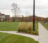
Environmental features offer a break from the urbanized environments we live in. Trails and/or park amenities should take advantage of these features.
Policy #4.4
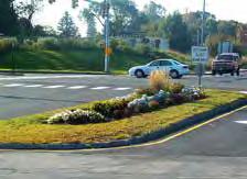
Design attractive arterial/collector road streetscapes with street trees and/or landscaping clusters, as well as other streetscape enhancements where practical.
Themed median/terrace treatments - landscaping or paving design - along primary roadways can establish or enhance a community/district identity. For example, along Siggelkow Road, Broadhead Street, and proposed Collector “A”.
GOAL 2: Policy #4
Design attractive arterial/collector road streetscapes with street trees and/or landscaping clusters, as well as other streetscape enhancements where practical.
This Sun Prairie neighborhood includes a variety of open spaces that provides for diversity of uses and amenities, including a plaza (red circle), boulevard street (yellow circle), and traditional neighborhood park (green circle).

30 Village of McFarland | East Side Plan
2022 EAST SIDE PLAN
5. SUSTAINABILITY GOAL & POLICIES

Goal 5 – Preserve environmental systems that define, sustain, and connect neighborhoods and communities.
Policy #5.1
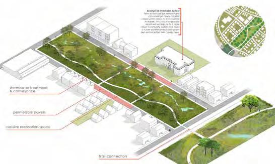
Integrate environmental features into the neighborhood as common open spaces for active or passive recreation, public gathering spots, or flood protection and stormwater management.
Policy #5.2
Provide adequate vegetated buffers between development and natural features.


Vegetated buffers (i.e.,dense growth of shrubs, trees, high grasses, perennials, and other plants) can help slow, capture and filter stormwater runoff.
Policy #5.3
Integrate environmental corridors and open space into a comprehensive stormwater management system that provides key ecosystem services on a regional scale where appropriate.
Stormwater management areas can expand the open space corridor. Dry ponds can be seeded as a prairie and wet ponds can become a “pond” feature.

Policy #5.4
Orient streets and homes to maximize available sunlight exposure for the installation of rooftop solar panels.
Home ridgelines should run east-west to maximize the length of the southern side. This orientation may be adjusted to accommodate other factors by up to 20 degrees with only a minimal impact on heat gain.
31 Chapter 2 | Vision, Policies, & Implementation
Design Guidelines
This section is intended to create memorable and desirable buildings and spaces within the East Side of McFarland. The objective is to create unique neighborhoods that residents will love and continue to invest in for many decades. Nonresidential and multifamily developments are encouraged to meet these guidelines.
1. Eco / Sustainable
A. Orient buildings on the site to maximize natural light, ventilation, and solar energy opportunities.
B. Consider using green roof technologies.

C. Use “dark sky” friendly exterior lighting and LED technologies.

D. Consider using mechanical systems that utilize renewable energy (solar, wind, geothermal) and minimize greenhouse emissions.
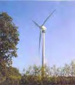

E. Utilize rain water collection, storage and distribution for irrigation systems.
F. Consider reusing “grey” water (wastewater generated from domestic activities such as laundry, dishwashing, and bathing) for irrigation and other non-potable uses.
G. Include bio-filtration basins and swales as a part of the stormwater systems on site to promote infiltration and groundwater recharge and reduce sediment runoff.
H. Include oil, grease, and sediment traps for parking lots.


I. Consider using porous paving materials (asphalt, concrete and pavers) in parking areas, walkways, etc.
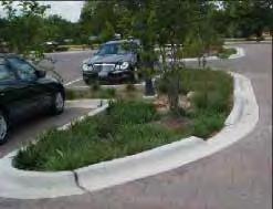

J. Use drought tolerant landscaping materials to limit water use.
K. Consider using low-flow plumbing fixtures.
L. Consider establishing Transportation Demand Management (TDM) programs that promote the use of carpools, vanpools, buses, bicycling, walking, compressed work hours, or working from home.
M. Incorporate Level 2 or 3 electric vehicle charging stations within exterior and covered parking areas.
32 Village of McFarland | East Side Plan
2. Site Planning
A. Minimize the amount of disturbance to the existing terrain. Sites and buildings should be designed to fit within the existing topography to the extent possible, while still providing an inter-connected street grid and the desired composition of land uses.
B. Design sites to preserve large native trees and other significant vegetation, including prairie remnants, wetlands, and similar features.
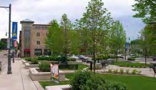
C. Public spaces and plazas are encouraged, where appropriate.
D. Building setbacks should be similar to setbacks of adjacent building within a given block.

E. Buildings and the primary entrance should front the public street.
3. Signage & Lighting



A. Appropriately-scaled signage is critical and should complement the building and site. Wall, projecting, and ground signs should be integrated within the overall building design in color, style and articulation.
B. Were freestanding ground signs are proposed, the use of monument signs is preferred over pole or post mounted signs. Shrubs and/or perennial planting beds should be planted around freestanding signs.
C. Lighting on exterior signs is encouraged to be mounted externally, above the sign, and directed downward, or internally light for freestanding signs..


33 Chapter 2 | Vision, Policies, & Implementation
Examples of full cutoff fixtures that minimize glare and light pollution.
The ADA ramp is incorporated in the stair entrance and meets the needs of all users.
An example of a public space that provides outdoor space for customers/employees and provides a buffer between the parking lot and the public street.
4. Architecture & Design
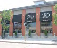
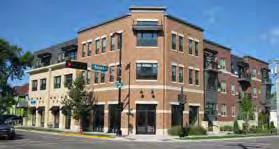
A. Buildings should utilize details or changes in materials to create a discernible base, middle and top. Multi-storied buildings should have a horizontal expression line between the first and upper floors.

Cap Body Base
B. Buildings should establish vertical proportions for the street facade (e.g., expression of structural bays, variation in material, and/ or variation in building plane), and for the elements within that facade (e.g., windows, doors, structural expressions, etc).
C. Avoid large, undifferentiated building walls and roof lines. Desired design features include variation in materials and colors, projecting and recessed bays, and variation in building heights.
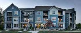
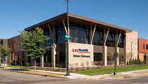
D. Street-facing facades should use durable and high-quality building materials. All sides of the building should include materials and design characteristics consistent with the front facade. Use of lesser quality materials for the sides and rear facades should be minimized. Vulnerable materials, such as EIFS, should not be used at the base of the building (minimum of 3 feet).

34 Village of McFarland | East Side Plan
Examples of various techniques in use to break down the apparent mass of a large building, including canopies, recessed decks, recessed top story, and variations in materials and wall plane.
4. Architecture & Design (cont.)
E. Awnings and canopies are strongly encouraged on ground floor facades of commercial, mixed use and apartment buildings. Awning colors should relate to and complement the primary colors of the building facade. Glowing awnings (backlit, light shows through the material) are discouraged.

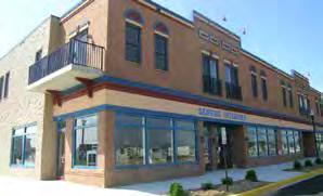
F. All buildings should have clearly-defined and welcoming entrances. Canopies, awnings, covered porches, and/or gable roof projections should be provided along facades that give access to the building to accentuate entrances and give shelter to visitors.

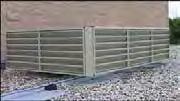
G. All service, refuse, garage doors, mechanical equipment and loading dock areas should be screened from public view through strategic placement, landscaping, and/or architectural design integration. For sites with dual frontage configurations, such as those along Siggelkow Road, these features should generally be located along a side yard, and not prominently visible from either the collector/arterial road or the local street.
H. While all buildings should be close to the street, most residential buildings should use a first floor elevation at least three feet higher than the adjacent public sidewalk to maintain comfort and privacy for residents. Look for opportunities to use grade changes across the site to also provide accessible entrances to the building.

35 Chapter 2 | Vision, Policies, & Implementation
This example shows the use of a recessed entry to identify its location, and changes in material and wall plane to break up the side facade.
Example of a building facade screening rooftop mechanical from ground view.
5. Parking, Screening & Landscaping

A. Shared parking between uses is encouraged, to make more efficient use of land for parking.
B. Parking is encouraged to be located in the side yard and rear yard, or beneath buildings.
C. Parking and loading areas visible from the public street should be screened with berming, landscaping, fencing or a combination of these three.

D. Construct pedestrian walkways between the sidewalk and primary building entries. On-site walkways should be separated from traffic and designed to connect the building to parking lots and other destinations on the site.
E. Parking lots should be landscaped along their edges and within each parking island. The incorporation of required stormwater detention and infiltration devices into the design of the parking area is encouraged.

F. All parking areas should have concrete curbs to protect landscaping areas, excluding those areas dedicated for snow storage. The curbs may contain gaps to allow stormwater flow into infiltration basins.


G. Fencing and screening should be of similar materials as primary building(s).
H. Landscape design should use native plant species to the region, especially buffering wetlands and other significant natural features.


36 Village of McFarland | East Side Plan
Development #1
Development #2
This illustration shows two developments on adjoining lots sharing parking and an access drive. A sidewalk connects the two developments through the parking area.
Examples of desired stormwater management designs within parking lots.
Example of well landscaped parking edges.
6. Density Bonus
The Village maintains discretion on building heights and densities, through the zoning ordinance. If considering requests for additional height or density as described in the Commercial, Mixed Use and Medium-Density Residential future land use areas in this Plan (refer to Chapter 4), there will be an expectation for high-quality design consistent with all of the design guidelines in this plan, including the following features and techniques.
A. High-quality landscaping and site design to hide parking and utility areas.
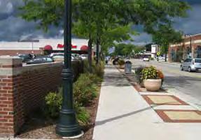

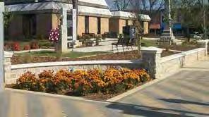
B. Excellent bike amenities, including bike parking and storage.

C. Excellent pedestrian amenities, including wide sidewalks and robust pedestrian connections between sidewalks and building entrances.
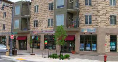
D. Unique public spaces and enhancements, such as plazas, outdoor seating areas, public art installations, etc.
E. Decorative, dark-sky compliant exterior lighting.



F. Muted colors and non-reflective siding and glazing, especially above the ground floor.
G. Installation of renewable energy systems (e.g., electric vehicle with Level 2/3 charging station).
H. Includes affordable housing units (e.g., 20% reserved for households at or below 50% AMI or 40% reserved for households at or below 60% AMI).
I. Meeting the Compatibility Standards outlined on the next page.
37 Chapter 2 | Vision, Policies, & Implementation
B.
A.
C. D. E.
F.
7. Compatibility Guidelines (adjacent to low-intensity residential)
These compatibility guidelines should apply to all new multi-unit residential, office and/or mixed use development of three-stories or larger and/or any development requiring a Planned Development (PD) zoning approval located on land abutting or across a street or alley from low-intensity residential. For purposes of this section, low-intensity residential development should mean single-family, duplex, townhomes (6 or less units), and small multi-unit buildings (8 or less units).
A. Use Intensity. In developments with multiple buildings with varying intensities, the development should locate buildings with the least intense character (e.g., lower heights, fewer units) nearest to the abutting lowintensity residential development.
B. Building Height. To ensure that new buildings are compatible in scale with surrounding properties, building height is limited to four (4) stories above ground level, except the height of the proposed structure(s) should not exceed thirty-five (35) feet in height in the following locations:
1. Portion of the structure within sixty (60) feet of a single-family or duplex lot.
2. Portion of the structure within thirty (30) feet of any other low-intensity residential lot (i.e., structures with 3+ units).
C. Bulk and Mass. Primary facades abutting or across a street or alley from low-intensity residential development should be in scale with that housing by employing the following strategies:
1. Varying the building plane setback a minimum of two (2) feet at an interval equal or less than the average lot width of the applicable low-intensity residential uses. For example, if a block of single-family lots is across the street from the development with an average lot width of 50 feet, the applicable facade shall vary its building plane, at a minimum, every 50 feet.
2. Providing a gable, dormer, or other change in roof plane at an interval equal or less than the average lot width of the applicable low-intensity residential uses. For example, if a block of single-family lots is across the street from the development with an average lot width of 50 feet, the applicable roofline shall vary, at a minimum, every 50 feet (measured at the roof eave).
D. Roof Pitch. The roof pitch of new residential buildings should range between 6:12 and 12:12. The roof pitch of porches shall not exceed that of the residential building to which it is attached.
E. Architectural Features. At least two (2) of the following categories of architectural features should be incorporated into street-facing facades:
1. Porches or porticos
2. Balconies
3. Dormers and Gables
4. Bay Windows
5. Door and Window Ornamentation which may include surrounds, pediments, lintels and sills, hoods, and/or shutters.
38 Village of McFarland | East Side Plan
F. Entrances. Street-facing facades providing direct access to first story dwelling units through individual entrances are encouraged. Preference is at least twenty-five (25) percent of ground units having direct access.
G. Garages. Attached garages shall not face or open towards the street. If this is not attainable, garages shall be sufficiently screened and face the street with the highest intensity of adjacent uses.
H. Parking. Parking areas that are visible from the street and located in the building front lot setback should provide buffering at a minimum height of thirty-six (36) inches above the parking surface. Buffering can consist of landscaping, berms, fences/walls, or a combination of these.
I. Refuse Areas. Dumpsters should be placed either in the underground garage or behind the building with opaque or semi-opaque screening (at a minimum, a chain link with fabric screening). If the refuse area cannot be placed behind the building, a wood fence or wall, at least six (6) feet in height, with landscaping around trash enclosures is encouraged.
39 Chapter 2 | Vision, Policies, & Implementation
Implementation Plan
IMPLEMENTATION PLAN Action Plan
This section identifies the various actions necessary to translate the plan’s vision into reality. The actions are organized by type and include recommended timeframes for completion. Timing and sequence may shift due to changes in regional transportation projects, landowner needs, or real estate market demand.
Plan Adoption (PA) Action
Action PA.1: Adopt this plan as an amendment to the Village of McFarland Comprehensive Plan. Amend the Future Land Use (FLU) map.
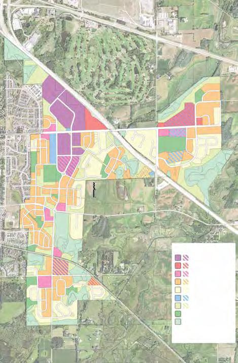
See Chapter 4 for intent of the recommended land use policy map revisions, including potential flexibility in where the FLU boundaries and transitions occur.
- Timeframe: Short Term (2023-2025)
- Responsible Parties: Community and Economic Development Department, Plan Commission, Village Board.
40 Village of McFarland | East Side Plan
Recommended Future Land Use Map Revision Sources: MSA Professional Services
BROADHEAD ST ELVEHJEM RD CTH AB PIERCE RD CTH AB SIGGELKOW RD CTH AB COLLECTOR “A” (or Neighborhood) MAP 6 FUTURE LAND USE £ ¤ £ ¤ £ § § £ Village of McFarland Town of Dunn Town of Pleasant Springs " AB " MN Town of Dunn Town of Cottage Grove Yahara Hills Golf Course Lower Mud Lake Fishery Area Upper Waubesa Fishery Area (Or Neighborhood) (Or Neighborhood) Door Creek Wetlands Wildlife Area Lower Mud Lake Natural Resource Area Siggelkow Road Elvehjem Road Burma Road D o o r C r e e k Ro a d Voges Road Dream Lane ExchangeStreet ErlingAvenue Brian Street East Tower Road Ridge Road Church Street CreameryRoad Crescent D r ive Jensen Drive S w n b u r n e D r v e Bible Camp Road Triangle Street Storck Road Peterson R o ad Mahoney Road Elvehjem Road H o s c h e R o a d Terminal Drive Siggelkow Road TaylorRoad J o hnson Street OrchardStreet Leanne L a n e L i n d en Parkway Country Walk Glenway S t r e e Valor W a y Longview Drive Mud Lake Upper Mud Lake Lake Waubesa 90 39 12 18 51 51 Legend Future Land Use Single Family Residential Two Family and Townhouse Residential Multiple Family Residential Neighborhood Downtown Highway and General Commercial Commercial Park Industrial Mixed Use/Flex Commercial Institutional and Governmental Public Lands, Recreation, and Environmental Corridor DNR Wetlands and Potential Wetland Indicators over Undeveloped Lands Agricultural Preservation Urban Reserve Water Rights-of-Way Village of McFarland Extraterritorial Jurisdiction Boundary Village of McFarland Limits (8/18) Other Municipal Limits (2018) COMPREHENSIVE PLAN Shapes on this map represent the Village's vision for future land use within the Village and its extraterritorial jurisdiction. For such lands, this map is not intended to represent existing land use or zoning, or to compel property owners to change the use of their land. For example, owners of agricultural or other rural land may maintain their current land use. Actual boundaries between different future use categories and implementing zoning districts may vary somewhat from representations on this map. This map also identifies the City's Marsh Road Neighborhood Plan west of the Interstate and north of Siggelkow Road, and existing land use elsewhere beyond the FUTURE LAND
USE EAST SIDE AREA
Mobility (M) Actions
Action M.1: The Village should add the Proposed Collector “A” north of Elvehjem Road (as discussed in Chapter 4 ) to the Village’s official map.
- Timeframe: Short Term (2023-2025)
- Responsible Parties: Community and Economic Development Department, Engineering Consultant, Puble Works & Utilities Committee, Plan Commission, Village Board.
Action M.2: Discuss Siggelkow Road expansion east of Catilna Parkway (to CTH AB) with the City of Madison, including timing, phasing design and cost sharing.
- Timeframe: Short-Term (2023-2025)
- Responsible Parties: Village Administrator, Engineering consultant, Public Works Department, Community and Economic Development Department.
Action M.3: Acquire/Reserve the following right-of-way, as discussed in Chapter 4 , to facilitate future transportation investments envisioned in this Plan.
1. Siggelkow Road, east of Catalina Parkway to Pierce Road (expand roadway)
2. C TH AB / Elvehjem intersection (line up east/west legs)
3. Potential future roundabout intersections illustrated on Future Transportation Network Map.
4. P roposed Collector “A” from Broadhead Street to Siggelkow Road.
- Timeframe: Ongoing, as development is proposed on adjacent lands)
- Responsible Parties: Land Owners/Developers, Engineering consultant, Village Board
Action M.4: Reconstruct Siggelkow Road east of Catalina to a 4-lane boulevard with multi-use trail connecting to the new Community Park on CTH AB. As proposed this project may occur in multiple phases or one phase depending on development activity and available financial resources. See Proposed Transportation Network Map.
1. Catalina Parkway to Interstate 90
2. Interstate 90 to CTH AB
- Timeframe:
1. Mid Term (2026-2030)
2. Long Term (2031-2040)
- Responsible Parties: Village Administrator, Engineering consultant, Community and Economic Development Department, Public Works Department, Village Board.
Action M.5: The Village will meet and/or discuss with Madison Metro Transit opportunities to extend bus service into the Village - likely along Siggelkow Road.
- Timeframe: Annually Review
- Responsible Parties: Village Administrator, Community and Economic Development Department.
Action M.6: Build multi-use trail along School District athletic field between Broadhead Street and Prairie Wood Drive. See Future Transportation System Map.
- Timeframe: Mid Term (2026-2030)
- Responsible Parties: Village Administrator, Engineering, Public Works Department, Consultant, Land Owners/Developers, School District.
Action M.7: Build other offstreet multi-use trail segments envisioned in this Plan. See Future Transportation System Map.
- Timeframe: ongiong as development is proposed.
- Responsible Parties: Land Owners/Developers, Engineering consultant, Public Works Department, Community & Economic Development Department.
Utility Systems (US) Actions
Action US.1: Establish a utilities expansion strategy (and phasing plan) to serve east of Interstate 90. This will support budgeting for future expansion ahead of development and support any future urban service area amendment.
- Timeframe: Mid Term (2026-2030)
-Responsible Parties: Village Administrator, Engineering Consultant,Community and Economic Development, Public Works Department, Public Works & Utilities Committee..
41 Chapter 2 | Vision, Policies, & Implementation
Action US.2: Submit an urban service area amendment to CARPC to support the next growth area within the East Side planning area (especially to support a business park creation - see Chapter 5).
- Timeframe: Short Term (2023-2025)
- Responsible Parties: Community & Economic Development Department, Engineering Consultant, Public Works & Utilities Committee, Plan Commission, Village Board.
Action US.3: Work with Wisconsin Power & Light Company to install a small solar farm connected to their substation located on Siggelkow Road.
- Timeframe: Short Term (2023-2025)
- Responsible Parties: Village Administrator, Community & Economic Development Department, School District, Village Board.
Action US.4: Amend the Village Stormwater Management Ordinance to meet or exceed new Dane County requirements for peak rate control for the 200-year 24-hour storm events.
Timeframe: Short Term (20232025)
Responsible Party : Engineering consultant, Public Works Department, C&ED, Public Works & Utilities Committee, Plan Commission, Village Board.
Economic Development & Housing (EDH) Actions
Action EDH.1: Meet with (or at least reach out to) property owners on high priority development sites annually to understand their future intentions for their site.
- Timeframe: On-going
- Responsible Parties: Community & Economic Development Department.
Action EDH.2: Consider use of density bonuses and financial incentives, with Tax Increment District financing being one, where the Village Board determines that the benefits provided by land use, economic development, and/or public goals and objectives weigh in favor of a contribution.
- Timeframe: On-going
- Responsible Parties: Community & Economic Development Department, CDA, Plan Commission, Village Board.
Action EDH.3: Implement the actions outlined in Chapter 5 for the proposed business park areas.
- Timeframe: ongoing
- Responsible Parties: Village Administrator, Community & Economic Development Department, CDA, Plan Commission, Village Board.
Action EDH.4: Annually review and develop a plan to implement the actions outlined in the 2023 McFarland Housing Needs Assessment and 2023 McFarland Economic Strategic Plan.
- Timeframe: On-Going
- Responsible Parties: Village Administrator, Community & Economic Development Department, CDA, Plan Commission, Village Board.
‘
Urban Design (UD) Actions
Action UD.1: Apply the Design Guidelines within this Plan to all proposals / applications.
- Timeframe: On-going
- Responsible Parties: Community & Economic Development Department, Plan Commission.
Action UD.2: Update the Village Zoning Code to implement the recommendations in this Plan and the McFarland Housing Assessment, including consideration of the following:
• Codifying the design guidelines, especially the Compatibility Guidelines.
• Conditionally allow triplex and fourplex in R-2 zoning district per the policies in this Plan.
• Permit accessory dwelling units (ADUs) in all residential districts.
• A llow Cottage Courts either through Planned Development or conditionally in R-3.
- Timeframe: Short Term (2023-2025)
- Responsible Parties: Community & Economic Development Department, Plan Commission, Village Board.
42 Village of McFarland | East Side Plan
Funding Toolbox
There are several possible sources of funding to help develop the East Side area as a vibrant addition to McFarland’s community fabric.
Tax Incremental Financing (TIF)
As of January 2023, about 6% of the Village’s tax base is in a TIF district, indicating that there is capacity within the 12% statutory limit to create more districts. The Village has the option to create a new TIF district to support desired development in the planning area, especially for the Business Park and other commercial areas along major collector streets such as Siggelkow Road.
Business Development Tax Credits (WEDC Program)
The Business Development Tax Credit (BTC) Program supports job creation, capital investment, training and the location or retention of corporate headquarters by providing companies with refundable tax credits. A business located in, or relocating to, Wisconsin may be eligible for tax credits if the business’s net employment in the state increases each year for which the business claims tax credits. Businesses not eligible, except in extraordinary circumstances, include but are not limited to: payday loan and title loan companies; telemarketing, other than inbound call centers; pawn shops; media outlets; retail; farms; primary care medical facilities;
financial institutions; and businesses in the hospitality industry.
Eligible Activities
1. Job Creation – The amount of Tax Credits awarded for job creation may equal up to 10% of the annual wages for Eligible Employees in Full-Time Jobs. In an Economically Distressed area, the amount of Tax Credits may equal up to an additional 5% of the annual wages for Eligible Employees. Tax Credits may not be earned for wages over $100,000 per year.
2. Capital Investment – The amount of Tax Credits awarded for new capital investment may equal up to 3% of the business’ personal property investment and up to 5% of its new real property investment. To qualify for Capital Investment tax credits, the project must involve a total capital investment of at least $1,000,000 or for projects that involve a total capital investment of less than $1,000,000, the total investment must be equal to at least $10,000 per Eligible Employee employed on the project.
3. Employee Training – The amount of Tax Credits awarded for training may equal up to 50% of Eligible Training Costs incurred to undertake activities to enhance an Eligible Employee’s general knowledge, employability, and flexibility in the workplace; to develop skills unique to the business’s
workplace or equipment; or to develop skills that will increase the quality of the business’s product. Those activities must be related to the project that is the subject of the application for Tax Credits, and not for those activities that allow an employee to function within the day-to-day operations of the business or for the general, organic growth of the business. Examples of ineligible activities include orientation, or training on a business process management system.
4. Corporate Headquarters – The amount of Tax Credits awarded for the location or retention of a Corporate Headquarters may equal up to 10% of the annual wages of positions created or retained for Eligible Employees if the position in which the Eligible Employee was employed was created or retained in connection with the location or retention of the Corporate Headquarters in Wisconsin, and the job duties associated with the Eligible Employee’s position involve the performance of Corporate Headquarters functions. Tax Credits may not be earned for wages over $100,000 per year. Generally, a business will be initially certified for amounts for Corporate Headquarters job creation based on projected Full-Time Jobs to be created over three years.
43 Chapter 2 | Vision, Policies, & Implementation
Enterprise Zone (EZ) Tax Credit (WEDC Program)
Wisconsin’s Enterprise Zone Tax Credits are available to assist Wisconsin businesses that have significant expansion projects or are relocating major business operations from other states to Wisconsin. Eligible activities must take place within a WEDC designated Enterprise Zone based on evaluation of a wide range of community and business specific factors. Refundable tax credits can be earned through eligible activities such as job creation, job retention, capital investment, employee training and supply chain purchases from Wisconsin vendors. A business may qualify for this tax credit if the following criteria are met: 1) starts operation; 2) relocates from out of state; 3) expands operations; 4) retains/ creates jobs; and/or 5) utilizes Wisconsin supply chains, vendors, or services.
Eligible Activities
1. Job Creation – A Tax Credit equal to no more than 7% of the net increase in EZ payroll from base in a Tier I county or municipality, less 150% times the Federal Minimum Wage per new, Full-Time Employee and up to $100,000 per employee, or a 7% Tax Credit against the lesser of the net increase in state payroll and EZ payroll from base in a Tier II county or municipality, less $30,000 per
new, Full Time Employee and up to $100,000 per employee. Calculations are relative to a base year which is fixed as the year before the EZ takes effect. This benefit may be awarded for up to 12 years.
2. Job Retention – A Tax Credit equal to no more than 7% of the taxpayer’s EZ payroll in a Tier I county or municipality that is paid to full-time employees who earn more than 150% times the Federal Minimum Wage, but less than $100,000, in annual wages, less the amount paid to new full-time employees, or no more than 7% of the taxpayer’s EZ payroll in a Tier II county or municipality that is paid to full-time employees who earn more than $30,000, but less than $100,000, in annual wages, less the amount paid to new full-time employees. This benefit may be awarded for no more than five consecutive years.
3. Capital Investment Credit –The eligible business may also claim up to 10% of its Significant Capital Expenditures. This benefit may be awarded for up to 12 years.
4. Employee Training – The amount of Tax Credits for employee training for a Certified Business may equal up to 100% of the total eligible training costs. Eligible training costs include the amount paid
to upgrade or improve skills of full-time employees, expenses paid to train any full-time employees on new technology, and costs to train full-time employees who are in their first full-time job.
5. Wisconsin Supply Chain Credit – The business may also claim up to 1% of the amount it paid to purchase tangible personal property, items, property, goods or services from Wisconsin vendors. Businesses may not claim the Wisconsin Supply Chain Credit and the Investment Credit for the same expenditures. This benefit may be awarded for up to 12 years.
Manufacturing and
Agriculture
Credit (WEDC Program)
The Manufacturing and Agriculture Credit is available to individuals and entities for income derived from manufacturing or agricultural property located in Wisconsin and offsets a significant share of Wisconsin income taxes. This nonrefundable credit is equal to 7.5% of eligible qualified production activities income and may be used to offset state income or franchise taxes. The annual tax credit reduces the company’s effective state corporate income tax rate to 0.4%. Unused credits may be carried forward for up to 15 years.
44 Village of McFarland | East Side Plan
Qualified New Business Venture (WEDC Program)
Wisconsin’s Qualified New Business Venture (QNBV) Program offers incentives for investment in early-stage Wisconsin businesses with the potential for significant economic impact and job growth. The program provides transferable tax credits to eligible angel and venture fund investors who make equity investments in early-stage businesses with potential for significant economic impact and job growth. Tax credits are equivalent to 25% of the value of the equity investment made. To qualify, the early-stage business must be headquartered in the state, have more than half its employees in the state, and be engaged in a qualifying industry sector.
Workforce Training Grants (WEDC Program)
The state offers various training programs available for businesses relocating or expanding in Wisconsin, including a customized training program for businesses implementing new technology or production processes. The Workforce Training Grant offers grant reimbursements of up to 50% of eligible training costs up to $5,000 per job.
Urban Water Quality Grant Program (Dane County)
The Dane County Urban Water Quality Grant Program supports projects that improve the quality of urban stormwater runoff entering Dane County lakes, rivers, and streams, increase public awareness of urban water quality issues, and provide public education about urban stormwater quality improvement practices. These goals are commonly achieved by the improvement and retrofitting of old stormwater outlets that dump untreated urban runoff into the lakes. Financial assistance is available to municipalities in the form of cost sharing up to 50% of the total project cost, not to exceed $500,000. To be considered for funding, all practices must meet the following eligibility requirements:
• Constructed and fully functional within 2 years of grant being awarded.
• Designed to improve the quality or reduce the volume of stormwater runoff from a developed drainage areas that don’t meet current standards.
• Treat urban runoff draining to a lake, river, or stream.
Urban Nonpoint Source & Stormwater Management Grant Program (DNR)
The Urban Nonpoint Source & Storm Water (UNPS&SW) Management Grant Program offers competitive grants to local governments for the control of pollution from diffuse urban sources that is carried by storm water runoff. The cost-sharing grants reimburse costs of eligible planning or construction projects controlling urban nonpoint source and storm water runoff pollution. Eligible areas are urban lands with a population density of at least 1,000 people per square mile or non-permitted commercial or municipally-owned industrial use sites. Projects may be in areas that are expected to become urban within 20 years. Planning grants cannot exceed $85,000, and construction grants with additional land acquisition costs cannot exceed $200,000. Certain grant criteria may exclude new development and construction from being eligible for cost-sharing. However, demonstration projects and other statewide or regionally significant projects may qualify under some circumstances.
Surface Water Grant Program (DNR)
Local governments and qualified organizations can apply for variety of grant funds to improve surface waters or restore wetlands either on behalf of several property owners
45 Chapter 2 | Vision, Policies, & Implementation
or as an individual applicant. A variety of small grant programs are available and range from relatively small, providing up to $1,000 per best management practice and up to $25,000 per applicant but do include support for larger management plan and project implementation costsharing funds. However, these grants must be directly related to improvements in surface water quality. Since much of the East Side Plan area drains into the Yahara Lakes watershed, smaller grants could potentially support minor distributed wetland restoration projects within the study area.
Wisconsin Housing and Economic Development Authority Grants (WHEDA)
WHEDA Foundation and the Wisconsin Housing and Economic Development Authority (WHEDA) provided competitive housing grant funds to support the development or improvement of public housing facilities in Wisconsin for those with special needs such as low-income families, elderly persons, disabled residents, and Veterans. Local governmental units, community development or housing authorities, and some nonprofit organizations are eligible to apply to the program which provides up to $50,000 in grant awards per project with no minimum grant award. In 2022, over $2 million was awarded to 54 projects. If a grant recipient
received three consecutive years of funding, the organization is not eligible to apply for a fourth year of grant funding through this program.
Section 202 Supportive Housing for the Elderly Program (HUD)
The US Department of Housing and Urban Development (HUD) provides interest-free capital advances to private, nonprofit sponsors to finance the development of supportive housing for the very low-income elderly persons. The program is meant to support and expand the supply of affordable housing and supportive services available for this at-risk population. The capital advance does not have to be repaid if the project serves very low-income elderly persons for at least 40 years. Project rental assistance funds are provided to cover the difference between the HUD-approved operating cost for the project and the tenants’ contribution towards rent. Project rental assistance contracts are approved initially for 3 years and are renewable based on the availability of funds.
46 Village of McFarland | East Side Plan
CHAPTER 3
EXISTING CONDITIONS
48 Planning Area
This section describes the East Side Plan study area.
49 Organizational Agreements
This section looks at a variety of intergovernmental agreements that will impact development in the East Side Plan area.
49 Natural Resources
This section reviews the natural resource and other environmental limatations within the East Side Plan area.
51 Transportation Networks
This section reviews existing and proposed transportation networks included within the East Side Plan area.
52 Utility Infrastructure
This section discusses the existing and planned public and private utility infrastructure (sanitary sewer, storm sewer and water).
56 Recent Development Review
This section highlights the recent developments and the trends of development in the study area.
47 Chapter 3 | Existing Conditions
Planning Area
Developing McFarland’s East Side Plan meant looking holistically at existing conditions, past plans, socioeconomic analysis, input from public and private sector stakeholders. This chapter is a summary of the information used to better inform the creation of the East Side Plan.
PLANNING AREA
McFarland’s East Side Plan area is approximately 1,545 acres and includes primarily undeveloped lands already within the Village and other areas immediately adjacent thereto. Interstate 39/90 divides a portion of the east side planning area, and establishes the northern limits of the Village (west of the interstate). A portion of the Wisconsin & Southern Railroad also bisects a portion of the study area near Elvehjem Road. The planning area can be further defined as follow:
• North : The City of Madison, as well as the Towns of Blooming Grove and Cottage Grove.
• East: Town of Cottage Grove
• South: Town of Pleasant Springs and Town of Dunn with properties protected from development through a purchase of development rights (PDR) and/or an extensive system of wetlands.


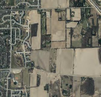


• Wes t: Developed portions of the Village of McFarland and the City of Madison.
The planning area exhibits considerable topographic relief, with high points generally located to the north, and lower elevations
Study Area
Sources: Dane County (2022), CARPC (2022), Basemap Aerial: ESRI
in the south and closer to Lower Mud Lake. Notable environmental features include small ponds near I-39/90, some small isolated wetlands in addition to the larger wetland on the eastern and


southern border of the planning area, and pockets of woodlands. A majority of the land area is presently used for farming and open space or for rural residential development.

48 Village of McFarland | East Side Plan
City of Madison Town of Blooming Grove Town of Cottage Grove Town of Dunn 39 39 USH12&18 Storck Rd HolscherR d Siggelkow Rd Long Dr Millpond Rd Catalin a Pkwy FemriteDr N P eni n sula Way Canyon Pkwy BautistaDr Tuscobia Trl Kuehling Dr Sledd ngPkwy Eagle Cave Dr PerrotP Coun ry Walk Prairie WoodDr B ellingrathSt SecretGa rdenDr Jenness Ave Chestnut Ln Li ttleBluestemDr Jensen Dr Ro Elvehjem Rd PetersonRd MN AB AB AB Printed By: smorrison, File: \\msa-ps.com\fs\Project\09\09361\0 Print Date: 1/5/2023 Data Sources: Dane County (2022) CARPC (2022) Basemap: ESRI Village of McFarland Dane County, Wisconsin East Side Plan Study Area Village of McFarland Parcel Boundary Study Area (2022) Surrounding Municipalities City of Madison Town of Blooming Grove Town of Cottage Grove Town of Dunn Town of Pleasant Springs 0 0.25 0.5Miles City of Madison Town of Blooming Grove Town of Cottage Grove Town of Dunn Town of Pleasant Springs DoorCreek 39 39 39 39 39 USH12&18 Storck Rd HolscherR Siggelkow Rd D oorCreekRd Long Dr Millpond Rd Catalin Pkwy FemriteDr N P eni n s ula Way Canyon Pkwy BautistaDr Tuscobia Trl Kuehling Dr Sledd ngPk Eagle CaveDr PerrotP Coun ry Walk Prairie WoodDr B ellingrathSt SecretGa rdenDr Jenness Ave Chestnut Ln L ttleBluestemDr Jensen Dr Pierce Rd Longview Dr RoidtDr Elvehjem Rd McConnell PetersonRd MN MN MN AB AB AB AB AB Data Sources: Dane County (2022) CARPC (2022) Basemap: ESRI Village of McFarland Dane County, Wisconsin East Side Plan Study Area Village of McFarland Parcel Boundary Study Area (2022) Surrounding Municipalities City of Madison Town of Blooming Grove Town of Cottage Grove Town of Dunn Town of Pleasant Springs 0 0.25 0.5Miles
Organizational Agreements
ORGANIZATIONAL AGREEMENTS
The East Side planning area is impacted by two existing intergovernmental agreements with neighboring municipalities and local government agencies.
City of Madison and Town of Blooming Grove
Annexations within and surrounding the East Neighborhood Growth Area are impacted by a boundary agreement between the Town of Blooming Grove and the City of Madison. This agreement is in effect through October 31, 2027. At that time, the Town of Blooming Grove will be dissolved and any of the Town’s land area that has not been annexed either to the City of Madison or the Village of McFarland will become a part of the City of Madison. Until that time, the Village of McFarland may annex land located within the Town of Blooming Grove in accordance with state law.
Village of McFarland and Town of Dunn
The Village of McFarland and the Town of Dunn entered an intermunicipal cooperation agreement related to their respective borders in 2005. In general terms, as it relates to this planning effort, the agreement prohibits the Village from annexing lands in the Town of Dunn that are located south of the Yahara River. In return, the Town of Dunn has agreed not to oppose annexations by the Village of McFarland in the 2008 East Side Neighborhood Growth Area, and has further agreed not to purchase development rights within the 2008 East Side Neighborhood Growth Area. This agreement is in effect through December 31, 2025.
Village of McFarland and City of Madison
There had been an agreement in place with the City of Madison that shaped each municipality’s respective growth boundaries from 1997 to 2017. Over that 20 years, this agreement precluded McFarland from annexing property north of Siggelkow Road and the same for Madison south of Siggelkow Road. Since this agreement expired, the Village has annexed land north of Siggelkow Road, except for a couple properties that still reside in the City of Madison along the I-39/90 corridor.
McFarland School District
In 2020/2021, the School District collaborated on a land swap with the Village of McFarland, providing the Village with a five-acre site at the corner of Holscher and Broadhead for their new Public Safety Center and the School District received 9 acres of land for a future school site adjacent to the planned 25-acre Village Community Park near CTH AB and Siggelkow intersection (east of the Interstate).
The Guidelines and Best Practices for School Site Selection developed by Council of Educational Facility Planners International (CEFPI) recommends an elementary school site should be at least 10 acres. Additionally, a minimum of 1 acre is needed for every 100 students. Thus, an elementary school with 300 students would be at least 13 acres. The proposed Siggelkow Road school site is only 9 acres but will rely on land cost savings by being located adjacent to McFarland’s Community Park along County Hwy AB. The joint venture by the Village
and the School District was to help both entities with their needs and avoid adding more tax burden for the district’s taxpayers.
The construction of a new school by the McFarland School District depends on residential growth described in this Plan and Madison’s Yahara Hills Neighborhood Development Plan (located north of the current Dane County Landfill and south of Buckeye Road). Growth in these two planing areas hinge on developers and current landowners’ decisions. Based on the school district’s current projections the site would likely not need to be developed for at least 7 to 10 years.
NATURAL RESOURCES
Development of the East Side Plan will be impacted by the location of important natural resources and other environmental limitations as outlined in the following land development agreements.
Capital Area Regional Planning Commission (CAPRC) Environmental Corridors
Environmental corridors are continuous systems of open space in urban and urbanizing areas. These corridors include environmentally sensitive lands, natural resources requiring protection from disturbance and development, and lands needed for open space and recreational use. Environmental corridors in Dane County are defined by CARPC to include major areas unsuitable for installation of waste treatment systems because of physical or environmental constraints and are excluded from the East Side planning area development.
49 Chapter 3 | Existing Conditions
Town of Dunn Conservation Areas




The Town of Dunn’s Purchase of Development Rights (PDR) program created the first development rights transaction in Wisconsin when it was established in 1997. PDR programs are a voluntary farmland protection technique that compensates landowners for limiting future development on their land into perpetuity. Under a PDR program, an entity, such as a town or a private organization, purchases development rights to a piece of property. By doing so, the organization or government agency is essentially buying the landowner’s right to develop that land. The land itself remains in private ownership and the landowner still retains all other rights and responsibilities associated with being a property owner.
When a landowner sells his or her development rights, a legal document known as a conservation easement is created to restrict the use of land to farming or open space. A conservation easement permanently limits residential, commercial, or industrial development of a property to protect its conservation or agricultural values. Conservation easements typically restrict nonfarm development and subdivisions.
Groundswell Conservancy works


with the Town of Dunn to manage the development rights of more than 10 parcels with a total of 325 acres (+/-) of mostly prime farmland. The conservation easement is located due east approximately 0.6 miles from the current Village of McFarland municipal boundary and is bisected by County Highway MN.


Natural Features and Conservation Areas


Sources: Dane County (2022), Wetlands/Wet Spots: WDNR, Flood Hazard Zones: FEMA, Slopes & Contours: Dane County DEM (2017) Aerial: Dane County (2020)


50 Village of McFarland | East Side Plan
Town of Cottage 39 39 Storck Rd HolscherR d Siggelkow Rd Long Dr Millpond Rd Catalina Pkwy N P eni n su a W ay Canyon Pkwy BautistaDr Tuscobia Trl Kuehling Dr SleddingPkwy Eagle CaveDr PerrotP Country Walk Prairie WoodDr B ellingrathSt SecretGa rdenDr Jenness Ave Chestnut Ln Li ttleBluestemDr dtD Elvehjem Rd PetersonRd MN AB AB County of Dane, Esri, HERE, Garmin, GeoTechnologies, Inc., USGS, EPA Printed By: smorrison, File: \\msa-ps.com\fs\Project\09\09361\0 Data Sources: Dane County (2022) Wetlands/Wet Spots: WDNR, Flood Hazard Zones: FEMA Slopes & Contours: Dane County DEM (2017) Aerial: Dane County (2020) Village of McFarland Dane County, Wisconsin East Side Plan Development Limitations Village of McFarland Parcels Hazardous Liquid Pipeline Gas Trasmission Pipeline ATC Line Lakes & Ponds Rivers & Streams Wetland Area (DNR) USDA Wetspots Wetland Area Buffer (75-ft) Steep Slopes (20+%) Conservation Easement Regulatory Floodway Special Floodway Area of Undetermined Flood Hazard 0.2% Annual Chance Flood Hazard Future Conditions 1% Annual Chance Flood Hazard Area with Risk Due to Levee 0300600Feet City of Madison Town of Dunn Town Pleasant Springs Door Creek 39 39 39 39 USH12&18 Storck Rd HolscherR d Siggelkow Rd Long Dr Millpond Rd Catalina Pkwy N P eni n su a W ay Canyon Pkwy BautistaDr Tuscobia Trl Kuehling Dr SleddingPkwy Eagle CaveDr PerrotP Country Walk Prairie WoodDr B ellingrathSt SecretGa rdenDr Jenness Ave Chestnut Ln Li ttleBluestemDr Pierce Rd Longview Dr Elvehjem Rd PetersonRd MN MN AB AB AB AB AB County of Dane, Esri, HERE, Garmin, Data Sources: Dane County (2022) Wetlands/Wet Spots: WDNR, Flood Hazard Zones: FEMA Slopes & Contours: Dane County DEM (2017) Aerial: Dane County (2020)
Village of McFarland Parcels Hazardous Liquid Pipeline Gas Trasmission Pipeline ATC Line Rivers & Streams Environmental Corridors Wetland Area (DNR) USDA Wetspots Wetland Area Buffer (75-ft) Steep Slopes (20+%) Conservation Easement Flood Hazard Zones 1% Annual Chance Flood Hazard Regulatory Floodway Special Floodway 0.2% Annual Chance Flood Hazard Future Conditions 1% Annual Chance Flood Hazard Area with Reduced Risk Due to Levee Area with Risk Due to Levee 0300600Feet
Development
Transportation Networks

TRANSPORTATION NETWORKS Local Roads and Highways

The existing road network within the East Side Plan area is not developed much past major arterial and collector roadway access. Siggelkow Road forms the main arterial east to west road corridor into the East Side Plan area. County Highway MN also extends east to west through the area. Elvehjem Road enters from the west, and dead-ends east of County Highway AB after crossing the railroad. Entering the planning area from the south, County Highway AB intersects with County Highway MN and follows that road to the east before branching off east of the neighborhood to continue north to U.S. Highway 12/18.
The City of Madison has undertaken recent efforts to widen Siggelkow Road to Catalina Parkway for better access to the Secret Places subdivision. The wider portion of Siggelkow road is maintained as predominantly 120-foot right of way with 4 driving lanes, a 30-foot median with intermittent turn lanes, and a 6 foot multi use path with an extended terrace area on the north side of Siggelkow Road.
Commuter Bus and Transit Services
McFarland is presently served by limited public transportation options, although it is in the planning area in the Greater Madison MPO. The 2050 Regional Transportation Plan, and public discussions have centered on expansion of an existing transit system serving Madison and suburban communities such as Middleton, Monona, and Fitchburg.

Recent discussions with Madison
Metro Transit centered on a future extension of an existing bus route that serves areas just north of the

Existing Transportation Networks
Sources: Dane County (2022), WisDOT (Railroads/Traffic Counts)

Madison MPO Aerial: Dane County (2022)
Rail Service
Wisconsin and Southern Railroad tracks cross into the East Side Plan area north of Elvehjem Road. The tracks form a barrier between the southern portion of the study area and the anticipated development that will happen to the north.
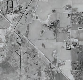
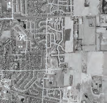


County Highway AB crosses these tracks, and will be the only road crossing permitted by the railroad
Railroad traffic in this corridor is minimal and dedicated to freight. Expansion of freight rail service within this right-of-way has been limited and no safety, nuisance, or traffic conflicts are expected. There are no universal or locally enforceable standards when


51 Chapter 3 | Existing Conditions
City of Madison Town of Blooming Grove Town of Cottage Grove Town of Dunn Town of Pleasant Springs Door Creek Penitto Creek YaharaRiver Mud Lake 39 39 39 39 USH 12 & 18 USH12&18 Marsh Rd Elvehjem Rd BlackWa rutDn Storck Rd Hidden Farm Rd CarncrossDr Holscher Rd Siggelkow Rd Long Dr M llpondRd CatalinaPkwy Dream Ln Brugger Pl NPe ninsulaWay CanyonPkwy BautistaDr Hope Rd MainSt SleddingPkwy Eag eCave Dr LindenP k wy Leanne Ln PerrotP OsbornDr Country Walk RedOak Trl Glenway St Prairie Wood Dr Bellingrath St SecretGa rden Dr Milwaukee St Jenness Ave AnthonySt Creamery dR FemriteDr Swinburne Dr KippSt Longview Dr Running DeerTrl OakHollow Dr Peterson Rd MN MN MN AB AB AB AB AB AB Siggelkow Rd Siggelkow Rd AADT NA AADT NA AADT NA AADT NA 2021: 56000 2018: 2200 2021: 1200 2009: 1900 2009: 2100 2009: 1200 2021: 15500 2018: 16300 2009: 1200 2009: 850 2009: 530 2010: 3700 Printed By: smorrison, File: \\msa-ps.com\fs\Project\09\09361\0 9361025\GIS\6_Pro_McFarland_NeighborhoodPlan\6_Pro_McFarland_NeighborhoodPlan.aprx Print Date: 1/5/2023 Data Sources: Dane County (2022) WisDOT (Railroads/Traffic Counts) Madison MPO Aerial: Dane County (2022) Village of McFarland Dane County, Wisconsin East Side Plan Existing Transportation Network 0 0.25 0.5Miles Traffic Count Sites Interstate Highway US Highway Collector Ramp Local & Private Roads Existing Boulevard Existing Trail Village of McFarland Municipal Boundary Study Area (2022) Parcel Boundary
developing adjacent to railroad corridors. However, McFarland may want to consider developing in such a way that creates vegetative buffers between the railroad and other proposed land uses. Parks, stormwater facilities, multi-use trail corridors, and landscaped berms are some features that can be used as buffers.
Commuter rail serviced to Madison has been discussed and studied numerous occasions. Given current State law and funding limitations, the establishment of commuter rail within the East Side planning area is unlikely to occur during the life of this plan.
Trail Network
In or near the planning areas there are both on-street bike lanes and offstreet multi-use trails. The on-street bike lanes on Siggelkow Road west of Catalina Parkway, along Holscher Road, and Broadhead Street west of Holscher Road. Off-street multiuse trails exist adjacent to Elevhjem Road, along sections of the recent Siggelkow expansion, and in the linear park through the Juniper Ridge subdivision.
Dane County Parks opened Phase 1 of the Lower Yahara River Trail to the public on August 27, 2017. This nearly 2.5-mile trail provides an off-road trail connection between the City of Madison and the Village of McFarland. Phase 2 is currently underway for a new trail segment. This phase will include a trailhead at Fish Camp County Park and extend south along Lake Kegonsa’s eastern shore through Lake Kegonsa State Park to Williams Drive. Future plans including connections to the City of Stoughton.
Lower Yahara River Trail Sources: Dane County (2023)

and capacity of interceptor sewers serving development areas on the Village’s east side.
The McFarland East Basin Utility Service Study recommends using gravity flow sewers to serve the East Side Plan area. These would flow south and west to Lift Station No. 2 and the Countrywood Interceptor, located near the intersection of Marsh Woods Drive and Fox Run. This routing would necessitate extension of sanitary sewers northward from this location, forcing growth to occur from south to north in the project area. With improvements to both the lift station and to the Countrywood Interceptor, new housing units could be supported on the Village’s east side.
UTILITIES
Utility service and infrastructure information was collected and used throughout the planning process to identify existing capacity and future needs of infrastructure systems that will serve future development within the East Side Plan area.
Municipal Sanitary Sewers and Wastewater Treatment
The Village finalized the East Basin Utility Service Study in April 2018 – which followed a similar plan, McFarland East Basin Capacity Study, completed in November 2000 – to evaluate existing wastewater and public water utility service capabilities that include areas within the East Side Plan (excluding some areas east of Interstate 90/39) along with additional land in the Town of Dunn, where development is permanently restricted due to purchase of development rights programs. The study examines potential routing
Subsequent construction of an interceptor sewer northeast of the East Side Plan Area has raised the possibility of routing sewage from a part of the project area through this sewer instead. County Highway MN would be the approximate dividing point, with development to the north served by the new interceptor, while development to the south would flow to Lift Station No. 2. This approach will create a greater sewer capacity for development within the project area and permit the northern part of the neighborhood to develop sooner than if the sewer were to be extended from the south.
Some basins within the East Side Plan area to the east of Interstate 90/39 were not analyzed as part of the 2018 study. However, there are likely two ways that services may be extended to include areas east of the interstate. Extending sanitary mains with a lift station east along
52 Village of McFarland | East Side Plan
Utilities
Siggelkow Road seems to be the most feasible route. An alternative option is to work with Madison Metropolitan Sewerage District and/or City of Madison to provide potential sewer connections along the US 12/18 corridor.


On-site Wastewater Treatment Systems (OWTS)
Currently there are no public utilities east of I-39/90, and it will be extremely cost prohibitive to extend service until such time that substantial development has been approved/built in this area. The primary option for development in the near - to short-term would be to install septic tanks and private wells. There is an existing unsewered subdivision (Freeway Manor) east of I-90/39 that uses private wells and OWTS. This scenario is the result of a Village annexation of the preexisting subdivision.
The Village currently requires a variance subdivision developments which rely on OWTS and private wells to supply water needs for a residence within their jurisdiction. It is recommended that the restrictions on unsewered development within the Village continue with the East Side Plan area for the following reasons.


• All of the soils within the East Side Plan area have at least some OWTS limitations according to the USDA Web Soil Survey. Historic unsewered development trends have seen changes in recent decades as issues resulting from high septic system density in rural subdivisions on limited soils have become a more apparent statewide issue.

• overcome with community septic systems. However, cost to retrofit existing subdivisions from septic to a centralized municipal system is usually difficult and expensive due to the significant plumbing
some public backlash will be nearly certain as homes with relatively new septic systems (less than 10 years) will be forced to convert to municipal utilities once they are available.
Chapter 3 | Existing Conditions
Town of Dunn D oo r Cree k Rd PerrotP Jensen Dr Longview Dr Vilas Rd Elvehjem Rd McConnel Rd PetersonRd AB AB Printed By: smorrison, File: \\msa-ps.com\fs\Project\09\09361\0 9361025\GIS\6_Pro_McFarland_NeighborhoodPlan\6_Pro_McFarland_NeighborhoodPlan.aprx Print Date: 1/5/2023 Village of McFarland Study Area (2022) Urban Service Area Data Sources: Dane County (2022) Madison MPO Town and Country Engineers (prev. map) Basemap: Dane County Aerial (2022) Village of McFarland Dane County, Wisconsin East Side Plan Existing Utilities 0 0.25 0.5Miles Sanitary Constrained Sewage Lift Station Countrywood Interceptor MMSD Force Main MMSD Gravity Main MMSD Siphon Main Sanitary Force Main Sanitary Sewer Water Existing Well Existing Storage Tank Stormwater Storm Pipe Type ATC Line Gas Trasmission Pipeline Hazardous Liquid Pipeline Town of Blooming Grove Town of Cottage Grove Town of Dunn Town of Pleasant Springs City of Madison Door Creek 39 39 39 39 39 USH 12& 18 USH12&18 Storck Rd HolscherR d Siggelkow Rd D oo Cree k Rd Long Dr Millpond Rd Catalina Pkwy N P eni n su a W ay Canyon Pkwy FemriteDr Bautista Dr Tuscobia Trl Kuehling Dr SleddingPkwy Eagle Cave Dr PerrotP Country Walk Prairie WoodDr B ellingrathSt SecretGa rdenDr Jenness Ave Chestnut Ln Li ttleBluestemDr Jensen Dr Pierce Rd Longview Dr RoidtDr Vilas Rd Elvehjem Rd McConnel Rd PetersonRd MN MN MN AB AB AB AB AB Printed By: smorrison, File: \\msa-ps.com\fs\Project\09\09361\0 9361025\GIS\6_Pro_McFarland_NeighborhoodPlan\6_Pro_McFarland_NeighborhoodPlan.aprx Print Date: 1/5/2023 Village of McFarland Study Area (2022) Urban Service Area Data Sources: Dane County (2022) Madison MPO Town and Country Engineers (prev. map) Basemap: Dane County Aerial (2022) Village of McFarland Dane County, Wisconsin East Side Plan Existing Utilities 0 0.25 0.5Miles Sanitary Constrained Sewage Lift Station Countrywood Interceptor MMSD Force Main MMSD Gravity Main MMSD Siphon Main Sanitary Force Main Sanitary Sewer Water Existing Well Existing Storage Tank Stormwater Storm Pipe Type ATC Line Gas Trasmission Pipeline Hazardous Liquid Pipeline
Madison MPO (2022), Basemap Aerial: ESRI
Municipal Water Supply and Storage
The Village of McFarland has extended water service to the western edge of the East Side Plan area. There is currently an elevated storage tank at the corner of Sigglekow and Holscher Roads. McFarland’s current growth projections and analysis of current water supply capacity indicate that a new well will be needed by 2030. Current well pumping capacity indicate that approximately 350 new homes can be added with current water demand. Since there is no immediate need, the Village should continue monitoring peak water use and plan for the installation of a fifth municipal well by 2030. Planning and installation of new municipal wells takes an average of 3 years. Therefore, McFarland should reevaluate their municipal well and consider planning for a well installation starting in 2026/27.
Due to existing water storage capacity needs, it is recommended that the Village construct a new water tower due to the distance and potential disconnectedness within the East Side Plan area. A new storage tank can add better system wide pressure and increase backup capacity. Two potential sites for a third storage reservoir have been identified in the 2018 Utility Study based on topographic elevation relative to McFarland’s expected growth area.
• Site #1 is located north of Siggelkow Road, near the intersection with I-39. It should also be noted that this zone is the only area within the East Side Plan area that is unserviceable by the existing


Gravity Collector Sewer Boundary: Limits & Route Options Sources: Town & Country Engineering (2018)


Figure 3-2:
Gravity Collector Sewer Boundary Limits and Route Options
Figure 3-2:


Gravity Collector Sewer Boundary Limits and Route Options


water storage reservoirs based on elevation.
• Site #2 is south of Siggelkow Road, approximately 1,400 feet due south of the end of the culdu-sac at Lee South Court. It is recommended that the Village

take these potential locations into account when planning for new developments around these sites.

54 Village of McFarland | East Side Plan
J5 J3 F A D E C K1 J4 J1 J6 J7 J2 B J8 K2 6" Force Main 8" Force Main H ol s c her R o ad M a r s h R o a d C o u n t y H g h w a y A B L e a n n e L a n e Interstate39 Broadhead Street County Highway MN M a i n S t r e e t Elveh em Road CreameryRoad Siggelkow Road RedOakTrail OsbornDrive S t o c k R o a d GlenwayStreet Country Walk a ce H d d e n F a r m R o a d M ilw a u k e e St r e e t L a n e S w n b u r n e D r v e Bautista Drive Lani Lane Rank n Road Eagle Cave Drive J e n n e s s A v e n u e Tuscobia Trail DennisDrive Sledding Parkway AnthonyStreet Eighmy Road North Pass Curtis Street L nden Parkway Perrot Place C h e s n u t L a n e RunningDeerTrail CarncrossDrive LongStreet Calico D S pl i n Ro a d Ph e a s a n t R u n Be l l n g a t h S r e e t D u s n L a n e Roanne Lane PineRidgeWay Timber Lane Secret Garden Drive K u e h l n g D r v e Scott Street Sauk Lane EastRedOakTrail P e n n s u l a W a y Cook Street Alb e n A v e n u e Lodg ec l i f fe Lane B tner Lane C a r d n a D r i v e L t e B u e s e m D i v e Wi l d C h e r y L a n e Hough Street Church Street SchutteDrive Calico Court N or di c Lan e Sc a n d a L a n e T r e c h e l S t r e e Ambrosia Terrace Juniper Ridge W i o u w a s h W a y Sp r n g P on d C our t J o h n s o n S r e e Peterson Road W i l d R y e C o u t SmithRidgeRoad Gran te Way Prairie Stone Drive Pac fic Crest Road L e e S o u t h C o u r t Arrowpoint Way Fo r e st R dg e Cou r t East Open Meadow Shooting Star Court Hawk Crossi n g Fo r est L awn C i r cl e Shooting Star Trail W e n t w o r t h C r c l e Cedar Court CanyonLane Siggelkow Road Elvehjem Road
Potential Sewer Routes Lift Station #2 Relief Sewer Northeast Interceptor Northeast Interceptor Bury Depth Limits 15' 6' Future Drainage Basins Streets Parcels ! Manhole " Wet Well ! Pumping Station % <all other values> % Unknown % 4" % 6" % 8" % 10" % 12" % 14" % 15" % 18" % 24" % 27" % 30" % Force Mains MMSD Structures % MMSD Mains COUNTRYWOOD INTERCEPTOR HIGHLAND DRIVE INTERCEPTOR LIFT STATION #2 FORCE MAIN Town & Country Engineering, Inc. makes no representation regarding the accuracy or completeness of this map and its underlying data. Any use or reuse of this map will be at your own risk and without liability or legal exposure to Town & Country Engineering, Inc. Not to be used for utility marking for purposes of Digger's Hotline. ¯ 1,240 Feet 2912 Marketplace Drive 2912 Marketplace Drive Suite 103 Suite 103 Madison, WI 53719 Madison, WI 53719 (608) 273-3350 (608) 273-3350 www.tcengineers.net www.tcengineers.net J5 J3 F A D E C K1 J4 J1 J2 B K2 6" Force Main 8" Force Main H ol s c her R o ad M a r s h R o a d C o u n y H g h w a y A B L e a n n e L a n e Interstate Broadhead Street County Highway MN M a i n S t r e e t Elvehjem Road CreameryRoad Siggelkow Road RedOakTrail OsbornDrive S o c k R o a d GlenwayStreet Country Walk B r u g g e r P a ce H i d d e n F a r m R o a d M ilw a u k e e St r e e t D re a m L a n e S w n b u n e D i v e Bautista Drive Lani Lane Rankin Road Eagle Cave Dr ve J e n n e s s A v e n u e Tuscobia Trail DennisDrive Sledding Parkway AnthonyStreet Eighmy Road North Pass Curtis Street Linden Parkway Perrot Place C h e s t n u t L a n e RunningDeerTrail CarncrossDrive LongStreet Calico Drive S p i n t Ro a d Ph e a s a n t R u n Be l n g r a t h S r e e t D u s i n L a n e Roanne Lane PineRidgeWay Timber Lane Secret Garden Drive K u e h n g D r v e Scott Street Sauk Lane EastRedOakTrail P e n n s u l a W a y Cook Street Alb e n A v e n u e Lodg ec l i f fe Lane Bitner Lane C a r d n a l D r i v e L i t e B u e s t e m D i v e Wi d C h e r r y L a n e Hough Street Church Street SchutteDrive Calico Court N or di c Lan e Sc a n d i a L a n e T r e c h e l S t r e e t Ambrosia Terrace Juniper Ridge W i o u w a s h W a y Sp r n g P on d C our t J o h n s o n S r e e Peterson Road W l d R y e C o u t SmithRidgeRoad Granite Way Prairie Stone Drive Pacific Crest Road L e e S o u t h C o u r Arrowpoint Way Fo r e st R i dg e Cou r t East Open Meadow Shooting Star Court Hawk Crossi n g Fo r est L awn C i r cl e Shooting Star Trail W e n t w o r t h C r c e Cedar Court CanyonLane Siggelkow Road Elvehjem Road
Potential Sewer Routes Lift Station #2 Relief Sewer Northeast Interceptor Northeast Interceptor Bury Depth Limits 15' 6' Future Drainage Basins Streets Parcels ! Manhole " ª Wet Well ! Pumping Station % <all other values> % Unknown % 4" % 6" % 8" % 10" % 12" % 14" % 15" % 18" % 24" % 27" % 30" % Force Mains MMSD Structures % MMSD Mains COUNTRYWOOD INTERCEPTOR HIGHLAND DRIVE INTERCEPTOR LIFT STATION #2 FORCE MAIN Town & Country Engineering, Inc. makes no representation regarding the accuracy or completeness of this map and its underlying data. Any use or reuse of this map will be at your own risk and without liability or legal exposure to Town & Country Engineering, Inc. Not to be used for utility marking for purposes of Digger's Hotline. ¯ 0 620 1,240 310 Feet 2912 Marketplace Drive 2912 Marketplace Drive Suite 103 Suite 103 Madison, WI 53719 Madison, WI 53719 (608) 273-3350 (608) 273-3350 www.tcengineers.net www.tcengineers.net
Electrical Power
Alliant Energy provides electrical power service to existing and new development within the East Side planning area. The company maintains an electrical substation within the area, on the south side of Siggelkow Road. Alliant Energy has indicated that it has excess capacity and the required facilities to meet the power needs of any development in the area.
American Transmission Company has a 138 KV electrical transmission line located within the planning area, entering the East Side Plan area near the US Highway 12/18 and Interstate 90 interchange, and heading south along the City of Madison municipal boundary. The transmission line crosses Siggelkow Road at the Alliant Energy substation (Approximately 3445 Siggelkow Rd) and continues south to County Highway MN. It then follows County Highway AB south to the Wisconsin and Southern Railroad tracks, where it turns east and follows the tracks out of the planning area. This transmission line is located within a typical 80-foot easement. The ability to develop within this easement will be limited.
Natural Gas
There is sufficient natural gas capacity to serve the East Side Plan area. Two major natural gas pipelines cross through the planning area. Development opportunities will be limited within the 50-foot easements for both pipelines.
The first of these is owned by Citgo/ Westshore Pipeline. It is located within a 50-foot easement entering the East Side Plan area along county Highway MN east of Holscher Road,
Recent Development Review
then running diagonally southeast to the Wisconsin and Southern Railroad track, following the tracks out of the planning area.
The second pipeline is owned by ANR Pipeline. This pipeline extends southeast and due south on either side of the US Highway 12/18 and Interstate 90 interchange and merging at a substation immediately prior to crossing Siggelkow Rd between Storck Road and Lee South Court (Approximately 3400 Siggelkow Road). Eventually the ANR Pipeline intersects County Highway AB north of County Highway MN, where there is a substation. It then runs due west, parallel to County Highway MN, turning south to end at a substation on the south side of County Highway MN a few hundred feet west of County Highway AB.
Stormwater Management
Most of the area within McFarland’s East Side Plan area lie within the Yahara River and Lake Kegonsa Watershed. The area north of Siggelkow Road and west of I-39/90, in the northeastern corner of the plan area, drains into the Yahara River and Lake Monona Watershed.
Town & Country Engineering was commissioned to complete a study for a portion of the East Side Plan area in 2000. The study suggested a regional approach to manage stormwater and identified preferred locations for stormwater management facilities in the planning area. Areas dedicated to regional stormwater infrastructure are estimated to be larger than usual because of the area’s high water table and low infiltration rates.
A more regional approach to stormwater management in the East Side Plan will include both regional and site-based stormwater management facilities, as may be appropriate given site conditions, development timing, Village resources, and cooperation among adjoining property owners. Areas have been dedicated on a regional basis in all of the land use concepts. Additionally, those lands that would most likely be set aside for CARPC’s environmental corridor program have been included in the stormwater management and conservation easements. Development of more site-specific stormwater facilities should be considered based on site conditions, timing of development, property owner/developer cooperation, and municipal resources.
55 Chapter 3 | Existing Conditions
Recent Developments Review
RECENT DEVELOPMENTS REVIEW
This section discusses recently completed or under construction developments in the Village or within neighboring lands to identify current market trends and guiding principles. The development table below outlines the size and density of each development.
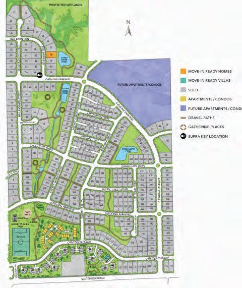
The density is presented in both gross density (i.e., units divided by the total subdivision area) and net density (i.e., units divided by developed lot area).
Secret Places
Secret Places is a 140-acre subdivision located north of Siggelkow Rd and Catalina Parkway, in the City of Madison. It adds 483 housing units at a density of 6.6 units per acre of developable land. The housing composition is mostly single-family homes with a mix of condos, apartments, and villas. Construction was completed in 2022.
56 Village of McFarland | East Side Plan
GrossNet Juniper Ridge 71.71932.74.7 Prairie Place 31.11344.38.1 Rosewood Fields34.61173.47.2 Parkview Estates32.51273.95.8 Secret Places 139.74833.56.6 Acres Units Density (Units per Acre) Development Name
Parkview Estates
Parkview Estates is a 33-acre subdivision located at Elvehjem Rd and Holscher Rd. It adds 127 housing units at a density of 5.8 units per acre of developable land. The housing composition is all single-family homes. Construction was completed in 2022.

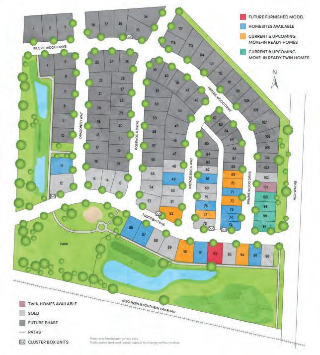
Rosewood Fields
Rosewood Fields is a 35-acre subdivision located at Hwy AB and Tuscobia Trl. It will add 117 housing units at a density of 7.2 units per acre of developable land. The housing composition is mostly single-family homes with 10 units of duplexes. Approximately 30 lots were developed at the time this plan was completed.
57 Chapter 3 | Existing Conditions
Juniper Ridge
Juniper Ridge is a 72-acre subdivision located at the intersection of Siggelkow Rd and Holscher Rd. It adds 193 total housing units at a density of 4.7 units per acre of developable land. The housing composition is all single-family homes with ample green space. Construction was completed in 2022.
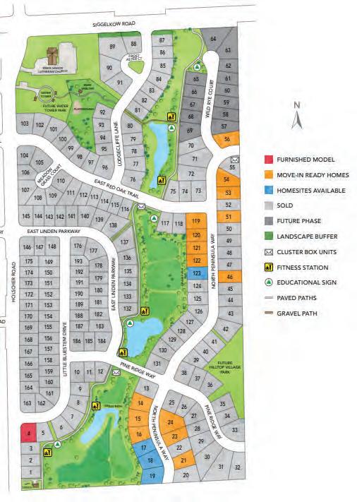
Prairie Place is a 31-acre subdivision located at Broadhead St and N Peninsula Way. It adds 134 housing units at a density of 8.1 units per acre of developable land. The housing composition is mostly single-family homes with a mix of multifamily units. Located within Prairie Place is Prairie Creek which includes townhomes and a senior living apartment building. This development features a mix of market rate and affordable units. Construction was completed in 2022.

58 Village of McFarland | East Side Plan
Prairie Place
CHAPTER 4
MASTER PLAN & SCENARIO PLANNING
96 Backg round
This section discusses the original plan for this area, as well as assumptions going into developing this 2023 Plan.
98 Master Plan
This section describes the preferred concept, and development land use policies to consider when reviewing development proposals. This is in addition to the policies in Chapter 2.
109 Land Use Scenario Pl anning Process
This section discusses the concept development process, and feedback received during each set of development scenarios.
59 Chapter 4 | Master Plan & Scenario Planning
The purpose of this chapter is to establish land use policies to guide development in the East Side planning area, and to project general phasing of new development.
This chapter describes the factors and iterative process that informed the final policy land use maps.
BACKGROUND
2008 East Side Plan
The Village of McFarland developed a plan for the East Side back in 2008, which envisioned traditional neighborhood patterns with a desire to set aside a significant portion of the growth area as open space, parks, and greenway corridors. The plan embraces sustainable development practices including minimal site disturbance, preservation of existing natural features and habitat, restoration of native plant communities, and implementation of energy-efficient and low-impact development techniques for infrastructure design.
As illustrated in the 2008 Concept (on the right), the plan provided a mix of uses as follows:
• 55% - Residen tial (MUR: 10%, TND: 33%, large lot:16%)
• 31% - Open Space
• 10% - Office/Light Industrial
• 3% - Public/Civic Facilities
• 1% - Commercial
Since approval of this 2008 Plan, there have been several changes in the planning area, including:
• annexa tions expanding the Village north of Siggelkow (west of Interstate 90) and south of
Siggelkow Road (east and west of Interstate 90);
• a new residen tial subdivision (Rosewood Fields) and additional housing and school developments; and,
• expansion east of the Village’s urban service area.
There has also been proposals/ plans for areas just outside of the Village’s East Side that may impact the growth of the area, including:
• Dane Coun ty discussing potentially converting 18 holes of the Yahara Hills golf course to a landfill and sustainability

60 Village of McFarland | East Side Plan
Background
2008 Preferred Concept Sources:2008 McFarland East Side Neighborhood Growth Plan
business cluster; and,
• WisDO T constructing a diamond interchange at CTH AB and USH 12/18.
These changes, coupled with local and regional market shifts, have prompted the Village to consider taking a fresh look at the strategies and recommendations in the 2008 Plan.
Assumptions & Limitations
• There is significant amount of land in floodplain, wetlands or covered by mature woodlands. There are regulatory restrictions on some of this land, as well as Village interest to preserve these natural features.
• Municipal boundar ies, intergovernmental agreements and conservation easements restrict the Village’s long-term growth potential. Outside of infill redevelopment, new development will be likely focused east of the currently municipal limits.
• Pr ior to developing these concepts, the project team conducted a Village-wide housing study and economic development strategy. Both of these studies evaluated the current markets and projected future needs to identify opportunities not only in the East Side but throughout the Village.
» Business park uses ar e severely limited in the Village, primarily along the USH 51 corridor, which
includes primarily small lot configurations. The 2023 Economic Development Strategy recommends over 100 acres of business park demand in the Village with lots generally 6-10+ acres.
» Demand for commercial will likely be limited to small- to mid-size retail that provides goods and services that meet the needs of the local demographic. This suggests promoting commercial development at intersection nodes and/ or along Siggelkow Road.
» Residen tial is needed of all types with interest in supporting the growth of the Village for the next 20+ years due to limitations to grow in any other direction.
• In terstate 90 and natural features will greatly impact utility service expansion. The development (and future tax base) will need to offset the cost to extend service into these areas. The Village may need to consider higher density development than traditional development patterns of the past in order offset infrastructure costs and provide a more efficient use of developable lands.
• The Village has indicated a preference for sub-regional stormwater management designed by subdivision. There may be opportunities to consider regional stormwater
management systems, depending on characteristics of the site, timing of development, and coordination between neighboring property owners.
• Ther e is currently no public bus service in the Village. Public transit provides social, environmental, and economic benefits to the Village. Future growth along the East Side’s primary transportation corridors will be important to provide a sustainable level of ridership for a future transit route. It may be beneficial to consider higher-density residential and employment areas along Siggelkow Road and County roadways to support the future feasibility of bus service.
• As described in the 2008 Plan, this Plan update shall focus on a sustainable, mixed use (balanced neighborhoods) with housing for all; supporting interconnected multi-modal transportation network; protecting natural features; and, establishing a variety of outdoor recreational opportunities.
61 Chapter 4 | Master Plan & Scenario Planning
Master Plan
MASTER PLAN
The intent of this Plan is to proactively establish a vision for the East Side to guide development as its being proposed. Development plans will be proposed by property owners, and subject to Village review and approval using this plan as guidance for that approval. The Village may contact property owner’s about interest in developing land and/or consider easements/ acquisition to support Village-wide initiatives; however, this Plan is not intended to force development.
Master Plan Concept
This chapter contains a Master Plan concept that is meant to provide a vision for how the East Side planning area may develop. While the general pattern of land uses and major streets shown in this concept should be reflected in actual development, it is recognized that more detailed elements within the concept, such as the locations of minor streets, location/ sizing of stormwater management areas, precise boundaries of land uses, or the specific dimensions of blocks, are only concepts. Development within the East Side planning area will, however, be in accordance with the development land use policies contained in this chapter, as well as meet the East Side Plan vision (shown below), goals and policies set in Chapter 2.
VISION STATEMENT
McFarland’s east side will balance growth opportunities while facilitating sustainable initiatives, expanding job opportunities, and promoting housing diversity and affordability, and social equity.
Housing: There will be a variety of housing options dispersed across the east side in vibrant neighborhoods inclusive of public open spaces and mobility options.


Economy/Job Growth: Employment options will be located and connected to residential areas, supporting the local economy and providing job opportunities for residents.


Quality of Life / Social Equity : Create healthier and more equitable environments for those who work and live in the East Side area.
Sustainability: The Plan embraces sustainable development practices including minimal site disturbance, preservation of existing natural features and habitats, restoration of native plant communities, and implementation of energy-efficient and low-impact development techniques for infrastructure design.


62 Village of McFarland | East Side Plan
EAST SIDE PLAN PREFERRED CONCEPT
Design Themes
New collector road from Broadhead to Siggelkow veers northeast away from the Gun Club.
Business Park clustered around Siggelkow with a potential second business park area near CTH AB east of Interstate.
Housing throughout the planning area with medium- and highdensity adjacent to major roadways with low-density along the edges of the growth area.
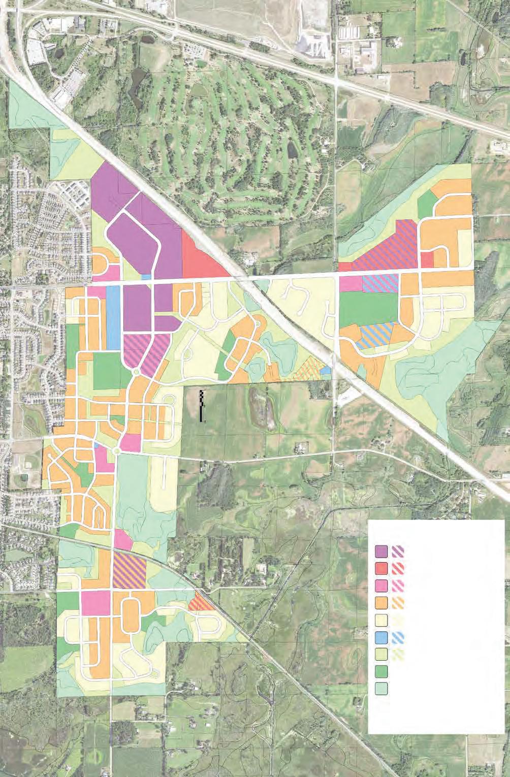
Smaller commercial nodes along Siggelkow w/ larger mixed use pockets south of Siggelkow.
Some connecting open spaces, but greater focus on smaller neighborhood parks.
Continuous trail network connecting the entire East Side planning to the existing Village trail network and adjacent regional trails.
NOTE: This is a conceptual development illustration. None of the above developments are being considered at the time of the planning process. Development plans will be proposed by property owners, and subject to Village review and approval using this plan as guidance for that approval.
63 Chapter 4 | Master Plan & Scenario Planning
BROADHEAD ST ELVEHJEM RD CTH AB PIERCE RD CTH AB SIGGELKOW RD CTH AB COLLECTOR “A” Gun Club Business Park Commercial Mixed Use (High Density Res. and/or Commercial) Low Density Residential Civic / Institutional / Utilities Gas Line Park & Recreation Stormwater/Conservation (Trail Corridor) Wetland Multi-Use Trail (Proposed) Multi-Use Trail (Existing) Medium Density Residential LEGEND ALT
1 2 3 4 5 6 7
Design Intent
The Master Plan Concept (shown on the previous page) embraces sustainable development practices including minimal site disturbance, preservation of existing natural features and habitat, restoration of native plant communities, and implementation of energy-efficient and low-impact development techniques for infrastructure design. Additional design themes are identified on the next page.
Alternate Land Use
It is the intent of this Plan to allow some flexibility in use in key locations dependent on property owner’s interests, Village interests and the current marketplace. These locations are identified by a hatching (and numbered) on the Master Plan concept and are further explained below.
1. Business P ark / Mixed Use: Lands abutting the proposed north/south collector has potential to support additional job growth through business park type uses, or it can provide a unique mixed use node. Business Park growth is targeted north of Siggelkow Road (east of interstate) in the short-term; however, there may be enough market to consider further expansion south of Siggelkow Road. Alternatively, increasing residential density and provide neighborhood commercial could be marketable around the primary north/south collector.
2. Business Pa rk / MediumDensity Residential: This 22-acre parcel is adjacent to an existing rail corridor, which offers an opportunity for a niche rail-supported industrial. The
East Side Plan Statistics:
42-44% Residential Uses *
• 16% Low-Density Residential (183 acres)
• 24% Medium-Density Residential (277-322 acres)
2-4% Mixed Use / High-Density Residential (21-28 acres)
2%-4% Commercial (21-54 acres)
9%-12% Business Park (103-166 acres)
* Supports 3,100 – 3,500 housing units
40% Park, Stormwater Management & Conservation (538 acres)
property is uniquely buffered by wetlands and a major road. Siting an industrial use should take advantage of these buffers, as well as use building architecture to minimize it’s impact on adjacent uses. If a niche industrial use is not found, medium-density residential is preferred.
3. Commercial / Medium-Density Residential: A 5-acre site on Elvehjem Road is bordered by wetlands and the rail corridor. The size and location along the rail may deter potential development options. This property could support a niche commercial business (e.g., storage units); otherwise, medium-density residential is preferred.
4. Medium-D ensity Residential / Stormwater/Conservation: This expansive area is severely impacted by wetlands and lack of road access. Lands to the south are restricted through a conservation easement, so development would require access to CTH AB near the bridge over Interstate 90. If access cannot be established at this location, there may be limited opportunities to develop these lands.
5. Business Pa rk / Commercial: This 50-acre parcel is adjacent to Siggelkow Road and is near
WIS 12/18 interchange (which provides access to Interstate 90). The size of the lot and proximity to the regional transportation network could make this property marketable to either highway-commercial or business park once utilities are extended to this area. Since development of this area is years away (due to lack of utilities), the ideal use will be market-driven at the time of development.
6. Institutional / Mixe d Use: This 9-acre site could be a site of a future elementary school. However, it’s location along Siggelkow Road could be better served as mixed use (i.e., high-density residential and/or commercial), especially if lands north of Siggelkow Road develop more intensively. An alternative site has been identified as #7 on the Master Plan Concept, which would still take advantage of the community park for recreational needs of the school.
7. Institutional / Medium-Density Residential: This site could be an alternative site for a future elementary school should the current property to the north be sold off for another use (see #6 above). Alternatively, this land is ideal for mediumdensity residential served by public utilities.
64 Village of McFarland | East Side Plan
Master Plan Concept - Land Use Policies
This section describes the land use categories and densities in the Master Plan Concept (shown on page 63). These policies shall be enforceable through the generalized future land map in the Village’s Comprehensive Plan.
STORMWATER & CONSERVATION (SC) areas includes conservation areas, cemeteries, stormwater management, greenways, major public trails, and lands recommended for preservation.
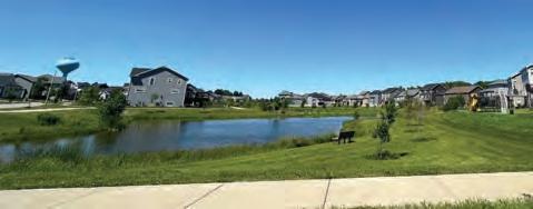
Policies
1. Typical Implementing Zoning Districts includes CO Conservancy; however, stormwater and conservancy areas are permitted uses in most of the Village’s zoning districts (except cemeteries which are conditional uses).
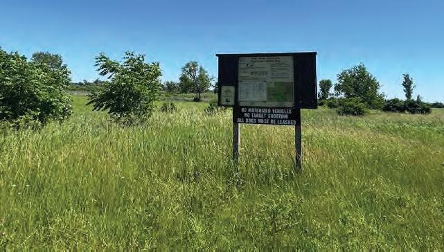

2. Areas mapped as SC are preliminary and may be refined as plats are submitted. Adjacent development land uses may be allowed in areas mapped as SC without a map amendment if stormwater management, open space and trail corridors are established within the plat to the satisfaction of the Village.
PARK & RECREATION (PR) areas includes public parks, conservation and recreation areas, private recreation uses (e.g., gun club), cemeteries, stormwater management, greenways, major public trails, and other natural features.


Policies
1. Permitted use in most of the Village’s zoning districts (except cemeteries are a conditional use).
2. Areas mapped as PR are preliminary and may be refined as plats are submitted.
3. While areas are mapped for PR, smaller parks (generally less than an acre) may be required in areas designated as LDR, MDR and MU.
4. Parks often serve as important community gathering places, and should be designed to have frontages on public streets that make them both visible and accessible by neighborhood and Village residents.
INSTITUTIONAL & UTILITIES (IU) include cemeteries, schools, community centers, government facilities, railroads, utilities and other parcels that are owned by a public, quasi-public, utility, or religious entity. Park and recreational uses are sometimes a primary or secondary use on these sites.

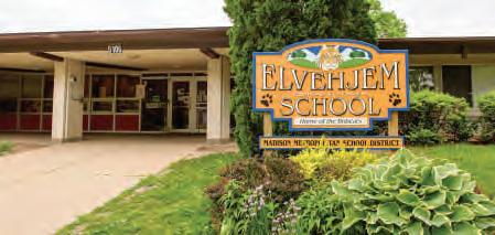
Policies

1. Permitted use in most of the Village’s zoning districts (except cemeteries are a conditional use).
2. Larger IU uses should be located on or near an arterial or collector street, and be designed so that high volumes of traffic will not be drawn through local neighborhood streets.
3. Streets, walkways, and multi-use paths and trails should provide strong pedestrian and bicycle linkages adjacent to and within larger IU areas.

65 Chapter 4 | Master Plan & Scenario Planning
I U
P R
C
S
LOW DENSITY RESIDENTIAL (LDR) primarily consists of single-unit detached homes with strategically located 2-unit attached, 3-/4-unit buildings (triplex and fourplex, respectively).


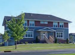
Policies
1. Typical implementing zoning districts include: Single-Family Residence Districts (R-1, R-1A), Single- and TwoFamily Residence District (R-2), General Residence District (R-3) , Elderly Residence District (R-E), and Rural Homes (RH-1).
2. Typical net densities in the LDR areas should average 2-5 units per acre, with individual developments up to 10 units per acre.
3. Typical single -unit residential lots are 1/4 to 1/2 acre in size.


4. 2-unit structures are most appropriate on any corner lot. Preference is for each unit to be faced and addressed to a separate street each meeting the standard setback requirements and pattern typical along the street. In some cases, these structures can be in the middle of a block between single-unit detached homes, if substantially similar to other homes along the street in massing, architectural character, total garage doors, and driveway width.
5. 3- and 4-unit structures are most appropriate as a transitional use when facing or next to a more intensive institutional, residential or commercial use.
MEDIUM DENSITY RESIDENTIAL (MDR) includes detached single-unit homes and attached housing units such as duplexes, triplexes, townhouses, small and mid-sized multi-unit buildings. Developments in MDR areas should provide the greatest diversity of housing unit types, forms, and prices.
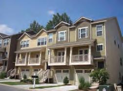
Policies
1. Typical implementing zoning districts include: Single-Family Residence Districts (R-1, R-1A), Single- and TwoFamily Residence District (R-2), General Residence District (R-3), and Elderly Residence District (R-E). Planned Development Districts may be used for larger or affordable housing developments where more flexibility is needed.

2. Typical net densities in the MDR areas should average 5-15 units per acre, with individual developments up to 20 dwelling units/acre. The Plan Commission may consider individual development densities greater than 20 DU/AC for legally restricted affordable housing projects , or for developments along future transit corridors.
3. Typical single -unit residential lots are 1/4 to 1/12 acre in size.
4. 2-unit structures are most appropriate on any corner lot. Preference is for each unit to be faced and addressed to a separate street each meeting the standard setback requirements and pattern typical along the street. In some cases, these structures can be in the middle of a block between single-unit detached homes, if substantially similar to other homes along the street in massing, architectural character, total garage doors, and driveway width.
5. Multi-unit structures are most appropriate along the entry and edge of the neighborhood (i.e., along collector/ arterial roadways), but may also be appropriate as a transitional use when facing or next to a more intensive institutional, residential or commercial use, or when facing a public park or permanent green space.
66 Village of McFarland | East Side Plan
L D R
M D R
MIXED USE (MU) provides densely compacted developments or districts that provide a variety of housing, commercial and/or blend of these two uses.

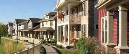
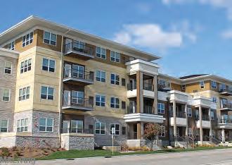
Policies
1. Typical implementing zoning districts include: General Commercial (C-G), Commercial Limited (C-L), Planned Development District (PD) or Planned Development Infill District (PD-I).
2. The net densities for the MU areas should be over 15 units per acre.
3. The development shall be context-sensitive in scale, massing and design. Site design should create walkable environments catering to the pedestrian more than the automobile. All buildings are set close to the sidewalk with doors and windows facing the street with parking located behind the building. See additional design guidelines in Chapter 2
4. Individual multi-unit residential developments are allowed, as well as blocks or groupings of duplex/townhome lots and single-unit homes on alleys (typically 1/8-1/12 acre lots).
5. Individual neighborhood commercial developments are allowed. Typically this allows up to 25,000 square foot multi-tenant buildings, but may also include small-scale single-tenant buildings.
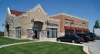
6. Mini-storage facilities is not compatible with this land use pattern, and is prohibited in MU areas.
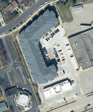
7. Mixed use buildings shall have retail on the ground floor with offices and/or residential units above.
8. Large development sites with frontage on Siggelkow Road, Proposed Collector A, and CTH AB & MN shall include commercial space based on the minimums outlined below. To count towards this requirement, the commercial space must be on the ground-floor either in a mixed-use building or in a separate commercial building (attached or detached to the residential building as part of the development site). The Plan Commission reverses the right to modify the amount of commercial square footage based on market conditions and neighborhood needs at the time development is proposed. The Plan Commission may also consider counting ground floor residential common spaces (e.g. resident fitness areas) as part of, but not a complete replacement, of the required commercial square footage.
a. Adjacent to Siggelkow Road: minimum of 2,500 square feet with 25 units, plus 1,500 square feet for every additional 15 units up to 10,000 square feet.
APARTMENTS
b. Adjacent to Proposed Collector “A” CTH AB & MN: a minimum of 1,500 square feet with 25 units, plus 1,000 square feet for every additional 25 units up to 4,500 square feet.
Vertical Mixed-Use combines different uses in the same building. Lower floors generally have more public uses (such as retail) with private uses on the upper floors (professional offices, residential, or hotel).
Horizontal Mixed-Use combines single-use buildings on distinct parcels in a range of land uses within one block, providing a mix of uses within a walkable block.
67 Chapter 4 | Master Plan & Scenario Planning
COM
COMMERCIAL (COM) areas provide a range of retail goods and services, including professional offices and daycare facilities. Commercial areas include automobile-oriented uses and “heavy” commercial uses with the appearance or operational characteristics not generally compatible with residential or small-scale commercial activities. Typical implementing zoning districts include: R-3 General Residence, General Commercial (C-G), Highway-Commercial (C-H), and Limited Commercial (C-L).

Policies
1. There is no limit on the size of establishments that may be constructed within a COM area, but all uses should be compatible with the density and scale of the surrounding development. For example, areas along an arterial roadway or near a major intersection are generally better suited for larger retail uses (e.g. exceeding 15,000 square feet in size). Those areas located along local streets or adjacent to residential neighborhoods are better suited for smaller commercial uses that serve neighborhood needs. Such uses typically require smaller building footprints and parking lots and are less likely to have intensive truck and delivery needs.

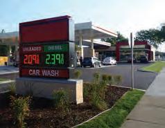
2. Mini-storage and other storage facilities may be permitted in limited quantities, but extra architectural considerations or screening measures shall be required adjacent to residential properties.

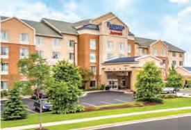
3. Design buildings with architectural character similar to surrounding developments with extra attention when adjacent to residentially-zoned properties. See additional design guidelines in Chapter 2.

BUSINESS (BUS) includes office buildings, office-showrooms, warehouses, and light industrial buildings that offer retail, trade, or services for individuals or businesses. Typical implementing zoning districts include: General Commercial (C-G), Commercial Park (C-P), Highway-Commercial (C-H), Limited Commercial (C-L), and Manufactured-Intensive Commercial (M-IC).
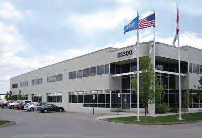
Policies
1. The intensity of development may vary significantly depending on the location and surrounding context. Individual site layout should locate the building(s), loading area(s) and access drive(s) to minimize traffic issues and land use conflicts. See additional design guidelines in Chapter 2.
2. “Nuisance” uses (noise, odor, appearance, traffic, or other impacts) shall be designed to mitigate potential impacts on adjacent residentially zoned properties or other non-residential zoned lots with similar character.
3. Mini-storage facilities are prohibited in BUS areas. Other storage facility/buildings are encouraged to be sited away from residential, or heavily screened along the street or rear frontages adjacent to residential.
68 Village of McFarland | East Side Plan C O M
B
U S
Public and Quasi-Public Uses
A number of public or quasipublic uses have been identified for possible inclusion in the East Side planning area. Some of these have been specifically sited within the Master Plan Concept, while others have been addressed more tentatively.
Elementary School Site
The School District owns a 10-acre future school site adjacent to the planned 25-acre Village Community Park near CTH AB and Siggelkow intersection (east of the Interstate).
The construction of a new school by the McFarland School District depends on residential growth described in this Plan and Madison’s Yahara Hills Neighborhood Development Plan (located north of the current Dane County Landfill and north of Buckeye Road). Based on our current projections the site would likely not need to be developed prior to 2030. The Master Plan describes a potential relocation of this school site to the south side of the planned community park.
Cemetery
Cemetery space is nearing capacity in the Village of McFarland. As a important community need, the Village will work with the McFarland Cemetery Association to find a suitable future location. While there is no specific site identified in this Plan, there are ample locations that could support a 3+ acre future site - preferably near the edges of the East Side planning area on a property with minimal to no internal tree canopy, and good depth from the water table and bedrock. Cemeteries are a conditional use in all residential zoning districts in the Village.
Hope Rod & Gun Club
The Hope Rod & Gun Club operates a private shooting range on a wooded site south of Siggelkow Road. The club acknowledges that additional urban development is planned around the Gun Club but does not anticipate relocating asby doing so it would lose some of the protections it now enjoys under state laws. For this reason, it is unlikely that the club will move, so new development will need to take this into account.
A new collector road has been planned along the east side of the site with a potential community solar facility planned to the north. Residential development (illustrated west and south of the site) should consider using internal streets, stormwater facilities, and other features to buffer residential uses from the club.
The Hope Rod & Gun Club site is an attractive, wooded property. If the club were to relocate, the site might be considered for residential or a park space.
Public Utilities
As discussed in Chapter 3, all new development shall be on municipal utility systems. Wherever possible, municipal and private utility services should be buried underground. Transformers, pedestals, boxes, and other utility components should be located on private property where they are screened from view from public spaces, including the sidewalks. The intent is to minimize the encroachment of unsightly clutter into the public right-of-way. There area utility needs and limitations within the planning as described below.
Gas & Electrical Utility Corridors
Numerous gas and electric utility corridors cross the East Side planning area and pose an obstacle to orderly development. Most of the corridors vary between 50 and 100 feet in width and include restrictions on the activities that may occur within the corridor. While no structures may be constructed in these corridors, some of them may permit roads, parking, stormwater management, bicycle and pedestrail paths, and similar activities.
A majority of these corridors have been shown as greenspace corridors in the plan. Where large pavement areas are necessary (e.g., Business Park and Commercial uses), it may be appropriate to include the utility
Municipal Sanitary System
The McFarland East Basin Utility Service Study recommends using gravity flow sewers to serve the East Side Plan area. These would flow south and west to Lift Station No. 2 and the Countrywood Interceptor, located near the intersection of Marsh Woods Drive and Fox Run.
As shown in the Proposed Utility Systems Map (on the next page), this routing would necessitate extension of sanitary sewers northward from this location, forcing growth to occur from south to north in the project area. With improvements to both the lift station and to the Countrywood Interceptor, new housing units could be supported on the Village’s east side. Subsequent construction of an interceptor sewer northeast of the East Side Plan Area has raised the possibility of routing sewage from a part of the project area through this sewer instead.
69 Chapter 4 | Master Plan & Scenario Planning
County Highway possibility of routing sewage from a part of the project area through this sewer instead. County Highway MN would be the approximate dividing point, with development to the north served by the new interceptor, while development to the south would flow to Lift Station No. 2. See Chapter 3 and the East Basin Utility Study for more details.
Municipal Water System
The Village of McFarland has extended water service to the western edge of the East Side Plan area. There is currently an elevated storage tank at the corner of Siggelkow and Holscher Roads. McFarland’s current growth projections and analysis of current water supply capacity indicate that a new well will be needed by 2030. Current well pumping capacity indicate that approximately 350 new homes can be added with current water demand.
Due to existing water storage capacity needs, it is recommended that the Village construct a new water tower due to the distance and potential disconnectedness within the East Side Plan area. A new storage tank can add better system-wide pressure and increase backup capacity. Per the 2018 Utility Study, there are two potential sites for a third storage reservoir based on topographic elevation relative to McFarland’s expected growth area. See the map on the right for potential locations.

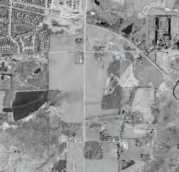


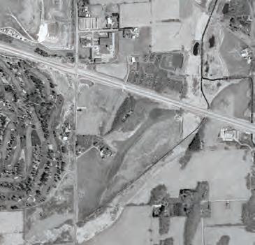

70 Village of McFarland | East Side Plan
Master Plan Concept - Proposed Utility Systems Town of Blooming Grove Town of Cottage Grove Town of Dunn Town of Pleasant Springs City of Madison Door Creek 39 39 39 39 39 USH 12& 18 USH12&18 Storck Rd HolscherR d Siggelkow Rd D oorC r e e kRd Long Dr Millpond Rd Catalina Pkwy N PeninsulaWay Canyon Pkwy FemriteDr BautistaDr Tuscobia Trl Kuehling Dr SleddingPkwy Eagle CaveDr PerrotP Country Walk Prairie Wood Dr B e ll ngr at h St SecretGa rdenDr Jenness Ave Chestnut Ln Li ttleBluestemDr Jensen Dr Pierce Rd Longview Dr RoidtDr Vilas Rd Elvehjem Rd McConnel Rd PetersonRd MN MN MN AB AB AB AB AB Option #2 Option #1 Printed By: smorrison, File: \\msa-ps.com\fs\Project\09\09361\0 9361025\GIS\6_Pro_McFarland_NeighborhoodPlan\6_Pro_McFarland_NeighborhoodPlan.aprx Print Date: 1/5/2023 Sanitary Constrained Sewage Lift Station Northeast Interceptor Lift Station #2 Relief Countrywood Interceptor MMSD Force Main MMSD Gravity Main MMSD Siphon Main Sanitary Force Main Sanitary Sewer Water Existing Well Proposed Well Existing Storage Tank Potential Storage Tank Water Main Stormwater Storm Pipe Other Utilities ATC Line Gas Trasmission Pipeline Hazardous Liquid Pipeline Data Sources: Dane County (2022) Madison MPO Town and Country Engineers (prev. map) Basemap: Dane County Aerial (2022) Village of McFarland Dane County, Wisconsin East Side Plan Future Utility Systems 0 0.25 0.5Miles Village of McFarland Study Area (2022) Urban Service Area
extended terrace area on the north side of Siggelkow Road.
A divided roadway is a safer design with four travel lanes, so extending the boulevard design is recommended when improving the corridor between Catalina Parkway and CTH AB. There is an opportunity to consider a bioswale in the median to reduce maintenance, improve
stormwater management and to enhance the overall aesthetic of the corridor (if native plantings are introduced).
Additionally, this corridor will provide a multi-use trail that connects the East Side planning area on both sides of Interstate 90 and the Village’s new community
Future Transportation Network
East Side Plan
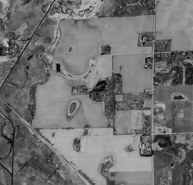

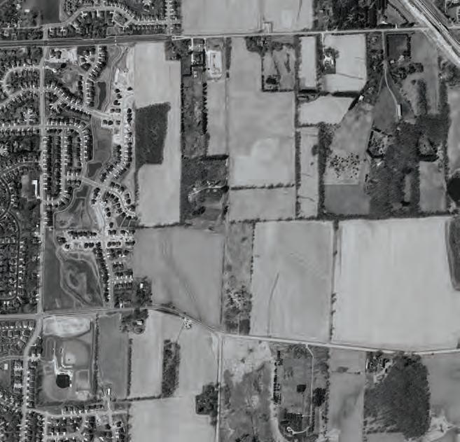
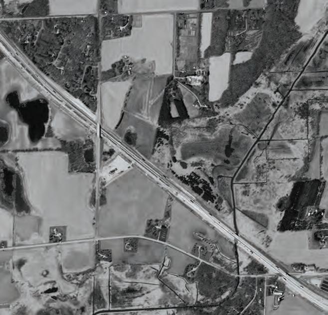


park. It will be important to provide a comfortable and aestheticallypleasing environment adjacent to the four-lane roadway. As shown in the section and images below, a 120-foot right-of-way is desired with an 18-foot terrace (with lowbranching columnar trees) between the trail and the road.
71 Chapter 4 | Master Plan & Scenario Planning
39 Tuscobia Trl a WoodDr OakTr McConnell Rd FemriteDr Siggelkow Rd Printed By: smorrison, File: \\msa-ps.com\fs\Project\09\09361\0 9361025\GIS\6_Pro_McFarland_NeighborhoodPlan\6_Pro_McFarland_NeighborhoodPlan.aprx Print Date: 1/5/2023 Data Sources: Dane County (2022) WisDOT (Railroads/Traffic Counts) Madison MPO Aerial: Dane County (2022) Village of McFarland Dane County, Wisconsin East Side Plan Future Transportation Network Village of McFarland Municipal Boundary Study Area (2022) Parcel Boundary 00.10.2Miles Proposed Collector Potential Roundabout Intersection Improvement Town of Dunn Town of Pleasant Springs Door Creek 39 39 D oorC r e e k R d y Jensen Dr McConnell Rd Longview Dr RoidtDr Elvehjem Rd PetersonRd MN MN MN AB AB AB Siggelkow Printed By: smorrison, File: \\msa-ps.com\fs\Project\09\09361\0 9361025\GIS\6_Pro_McFarland_NeighborhoodPlan\6_Pro_McFarland_NeighborhoodPlan.aprx Counts)
of McFarland
Wisconsin
Village
Dane County,
0.2Miles Arterial Existing Boulevard Proposed Boulevard Collector Existing Collector Proposed Collector Trail Proposed Trail Existing Trail Intersection Potential Roundabout Intersection Improvement
Village of McFarland Municipal Boundary Study Area (2022) Parcel Boundary
Collector Roads
Collector roads disperse traffic off arterial roads and provide access to activity areas within neighborhoods. Three major collector roads are shown within the East Side Neighborhood, beginning with the existing County Highways MN and AB. In addition, the neighborhood will include an extension of a new collector road (Collector A) north from County Highway MN to Siggelkow Road, as well as further extension into the Business Park north of Siggelkow Road.
The basic profile for a major collector street in the East Side planning area is designed to fit within a 60-foot right of way. It consists of a 36-foot wide street
(curb face-to-face), with a eightfoot terrace and five-foot sidewalk on each side. The street is wide enough to accommodate parking on both sides (8-foot parking lanes, inclusive of gutter), or turn lanes at intersections. Where bike lanes are desired, the ROW should increase to 70-foot with two 5-foot stripped bike lanes between the drive aisles and on-street parking areas.
Major collectors with many driveway openings (especially those providing access to commercial and office), shall consider a 75-foot rightof-way that provides a two-way left turn lane (TWLTL). This can also include landscaped median in areas planned for no driveway openings
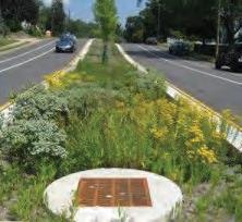
and/or for pedestrian crossings. The 74-foot design is likely desired for the Proposed Collector “A” extending CTH AB to Siggelkow Road.
Local Access Streets
Typical residential streets require a 60-foot right-of-way to accommodate a 32-foot wide street (curb face-to-face) with eight-foot terrace and five-foot sidewalk on each side of the street. This profile might be necessary on the primary residential street within a subdivisions; however, other local access streets may consider a reduced 52-foot right-of-way and road profile as shown on the next page.

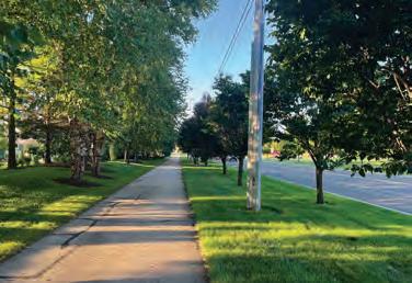


Village of McFarland | East Side Plan
5851111 10 111151810 R.O.W. 120 31 31 13
Curb face to Curb Face
Existing Boulevard
Potential Boulevard Treatment (Native Plantings & Bioswale)
Potential Terrace Treatment with Trail (Widened terrace with tree plantings)
COLLECTOR ROADWAYS
The 52-foot right-of-way and road design helps to reduce impervious area (a sustainability measure) and in some cases offer opportunities for additional blocks within a subdivision (an affordability measure). Two road profiles fit within the 52-foot right-of-way. Profile “A” has a 30-foot street width (inclusive of two drive lanes and parking on one side) with five-foot terraces and five-foot sidewalks on each side of the street. Profile “B” provides parking on both sides in a 32-foot street width, requiring passing cars to wait for others to pass each other. This should be used where on-street parking demand is low.
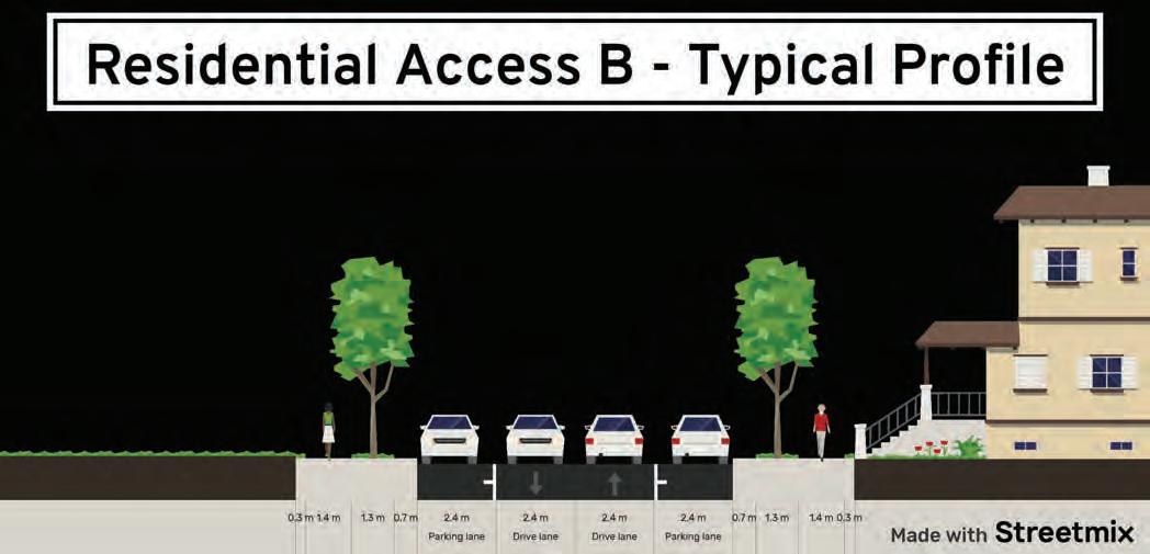
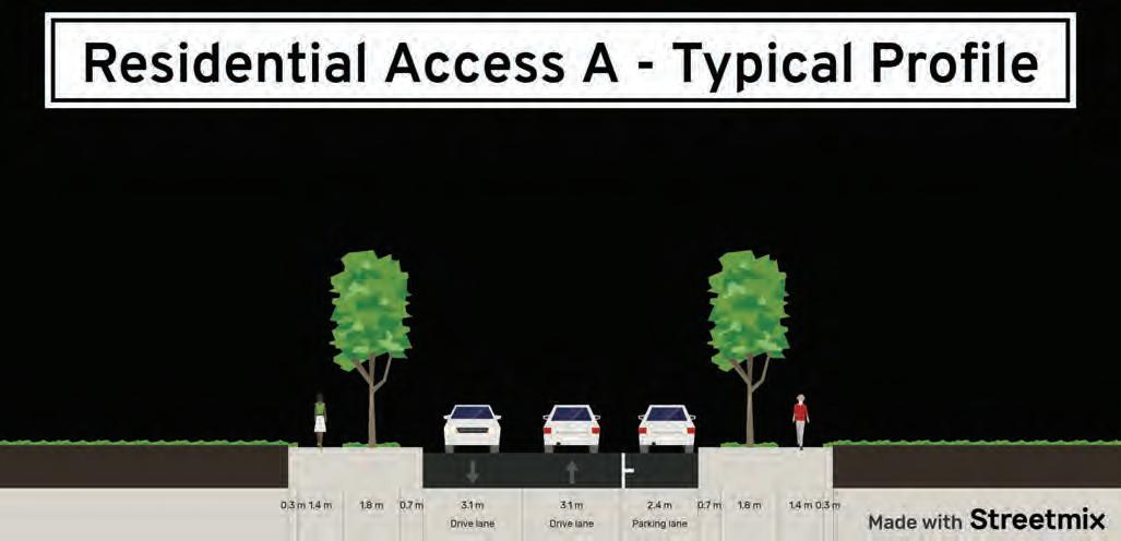
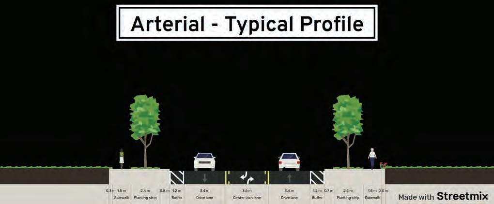
Bicycle and Pedestrian Paths
The East Side planning area’s greenspace system, with park and open space nodes, provides a location for bicycle and pedestrian paths connecting destinations in and out of the planning area. The Proposed Transportation Map (on page 73) conceptually lays out a continuous trail network connecting both sides of Interstate 90 to the existing Village trail network. While the specific trail routes can change, the plan should be to expand from the existing trail network, extend to the east of Interstate 90, and create trail corridors and loops that provide for a recreational amenity serving all areas of the East Side planning area, as well as connect to the Village and regional trail system.
Bike lanes may be included on major collector streets, and may replace on-street parking. As collector and local access streets do not carry heavy volumes of traffic, on-street bike lanes are not required.
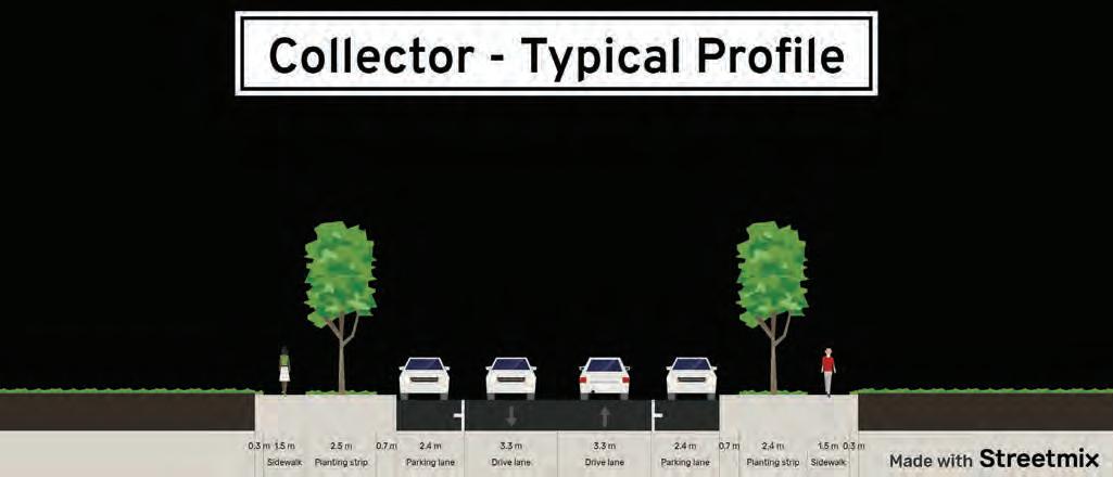
73 Chapter 4 | Master Plan & Scenario Planning
56.5610 6.55 R.O.W. 60 36 Curb face to Curb Face 10 6
54.5 R.O.W. 52 32 Curb face to Curb Face 16 6 54.5 6 Profile “A” Profile “B”
LAND USE & DEVELOPMENT SCENARIO PLANNING
Preliminary Concepts
MSA developed three preliminary land use concepts to support community discussion on development pattern, road network and open space preservation. Each concept was based on a general theme with varying land uses. While roads are presented in each concept, it is understood that there would be additional local streets designed to provide access to individual developments.
This section will highlight general feedback received through the below engagement activities.
• Public Input Forum
• Developer Focus Group
• Community Survey
• Plan Commission / CDA meetings
See Chapter 1 for more information from these and other public engagement activities.
Initial Concept “1”
Primary Design Themes

• Builds a residential neighborhood just west of the business park in the northwest quadrant.
• Establishes a commercial node at Siggelkow and CTH AB with medium-density residential transitioning to low-density and then to conservation/open space.

Land Use & Development Scenario Planning
Initial Concept “1”
• Business Park (more industrial) along rail corridor along Elvehjem Rd.
Engagement Feedback
Forum:
• Did not prefer commercial adjacent to planned school.
Survey:
• Not enough Commercial/Mixed Use and Parks and Conservation.
• Ranked last of the three concepts.
Focus Group:
• Industrial land along rail requires a niche business. Prefer industrial near Siggelkow.
• Too much low-density residential density.
74 Village of McFarland | East Side Plan
Initial Concept “2”
Primary Design Themes

• Greater focus on creating a continuous open space corridors (for off-road trails and conservation).
• Business Park stretching north/ south of Siggelkow Road (with mixed use node).
• Establish commercial nodes at Siggelkow and CTH AB and along new north/south collector at CTH MN and Elvehjem.
Engagement Feedback
Forum:
• Did not prefer commercial adjacent to planned school.
• Liked the focus on green space corridors.
Survey:
• All use types were considered just right by the majority of responders.
• Preferred concept (of the three).
Focus Group:
• Liked the clustering of business park north/south of Siggelkow.
• Questioning the amount of commercial shown south of Siggelkow.
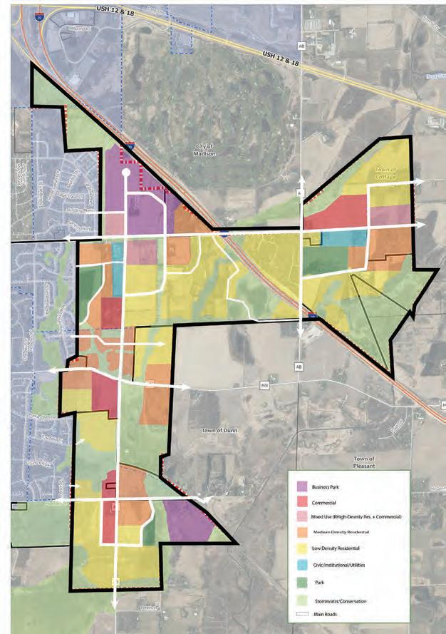
75 Chapter 4 | Master Plan & Scenario Planning
“2”
Initial Concept
Initial Concept “3”
Initial Concept “3”
Primary Design Themes
• Smaller neighborhood around the business park in the northwest quadrant.
• Second business park near Siggelkow and CTH AB (east of Interstate 90).
• Commercial district along new north/south collector from Siggelkow Road towards Broadhead St).
• Mixed use nodes along new north/ south collector at Broadhead and Elvehjem.
Engagement Feedback
Forum:
• Did not prefer industrial adjacent to planned school.
• Need for commercial on Siggelkow.
Survey:
• All use types were considered just right by the majority, except roughly evenly split on Commercial/Mixed Use.

• Ranked 2nd (of the three concepts).
Focus Group:
• Liked potential next phase of business park east of Interstate 90.
• Liked increase in residential density and reduction in singlefamily near landfill expansion.
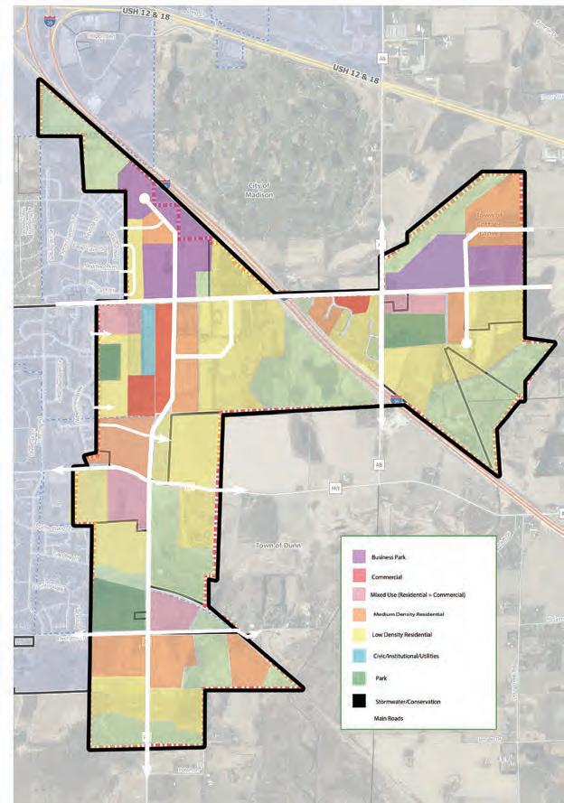
76 Village of McFarland | East Side Plan
Detailed Concepts
Based on preliminary land use scenario feedback, MSA developed two detailed concepts that reallocates land uses and considers the local street network (including, block depths) and stormwater management areas. While the amount of each use is similar in both concepts, there is variety in road network and placement of uses as outlined below.
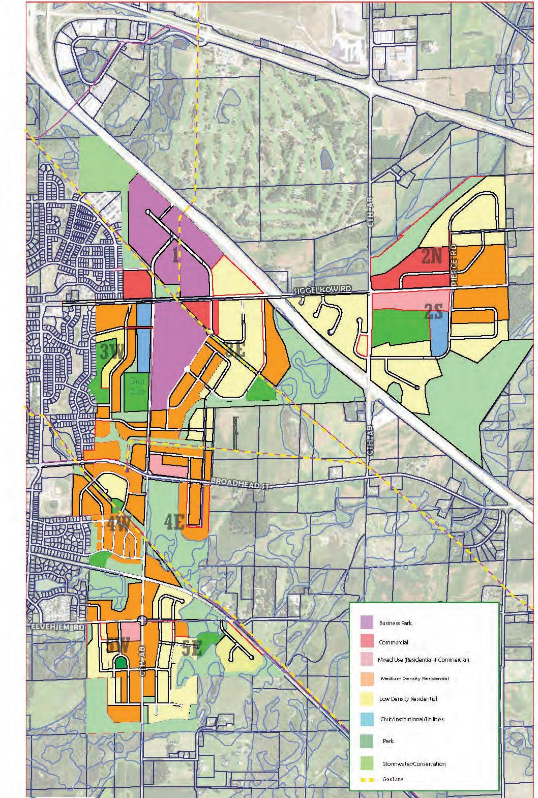
These detailed concepts were vetted by Plan Commission and the Community Development Authority (CDA).
Detailed Concept “1”
Primary Design Themes

• New collector road from Broadhead to Siggelkow along edge of Gun Club and the utility substation.
• Business Park clustered around Siggelkow (all west of the interstate).
• Establish a commercial/ mixed use node on Siggelkow east of CTH AB, suggesting school moves to the eastern side of the planned park.
• Focus on connecting green spaces.
• Primarily medium-density residential with pockets of low-density.
77 Chapter 4 | Master Plan & Scenario Planning
Detailed Concept “1”
Detailed Concept “2”
Primary Design Themes

• New collector road from Broadhead to Siggelkow veers northeast away from the Gun Club.
• Business Park clustered around Siggelkow with a second business park area near CTH AB east of Interstate.
• Includes housing adjacent to Madison directly west of business park.
• Smaller commercial nodes along Siggelkow w/ larger mixed use pockets south of Siggelkow.
• Some connecting open spaces, but greater focus on smaller neighborhood parks.
Plan Commission / CDA Feedback
After presenting both detailed concepts, there were support for the following:
• West of Int erstate 90: Expanding the business park south of Siggelkow Road and maximizing the land north of Siggelkow Road (with some consideration on how it ties into Secret Places Neighborhood in Madison).
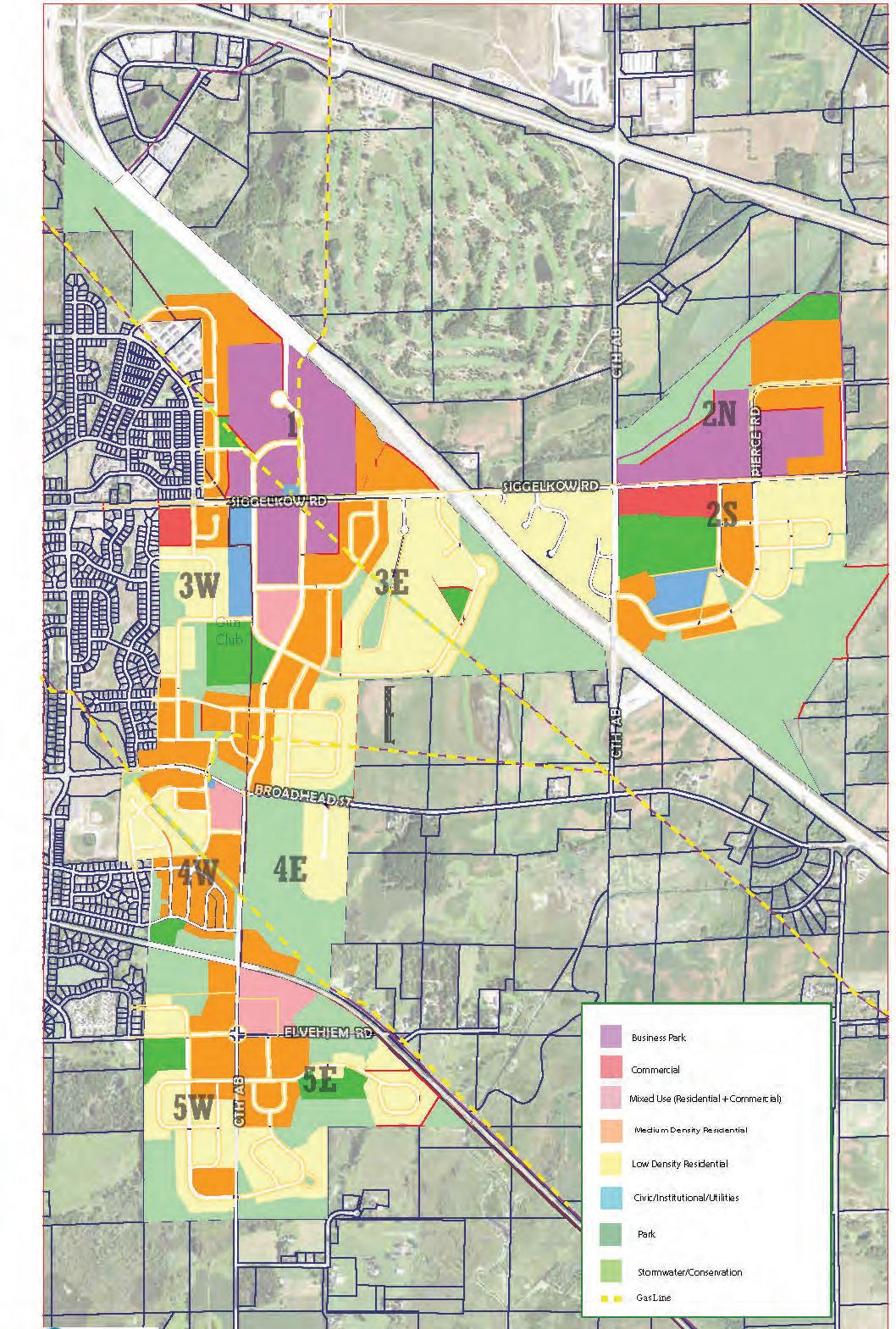
• Ea st of Interstate 90: Interest in tax base to suppor t extending municipal utilities. Consider commercial or business park north of Siggelkow Road.
• A c ontiguous preserved open space with a trail network that connects east and west of Interstate 90.
78 Village of McFarland | East Side Plan
Detailed Concept “2”
CHAPTER 5
BUSINESS PARK DEVELOPMENT PLAN
80 Business Par k Review
This section outlines the criteria used to decide the ideal size and location for a business park within the East Side planning area. Additional review describes infrastructure needs and contextual considerations.
84 Business Par k Concept
This section describes the preferred concept and design themes to consider in a final design for the business park.
86 Implementation Plan
This section outlines actions the Village can take to pursue business park development as part of the East Side Plan, including a phasing plan.
79 Chapter 5 | Business Park Development Plan
Business Park Location

The purpose of this chapter is to present concepts and an action plan for the pro posed business park areas located south and north of Siggelkow Road. This chapter discusses business park site considerations, the process for concept development, and the phasing plan for build out of the preferred concept.


BUSINESS PARK REVIEW


Site




Selection
There is little developable business park space available in Dane County to accommodate industrial development at a scale currently in demand. The 2023 McFarland Economic Development Strategic Plan recommends creating a business park with at least 100 acres of developable lots. More intensive office and light industrial uses were also proposed as part of the 2008 East Side Neighborhood Growth Area Plan.
When considering property in this location for business park development, the following criteria were important factors:

• Between 40 and 100+ acres of developable land that can be subdivided into lots of six to ten acres to accommodate a variety of business needs. Larger lots may be considered to meet the needs of specific businesses.







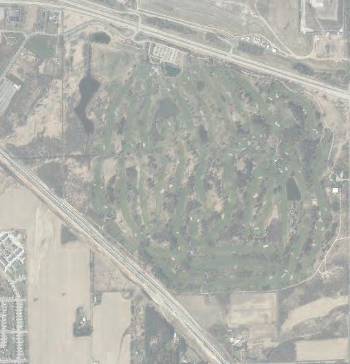
• Ease of access to the regional transportation network. Plus, local road access that will not travel through residential neighborhoods.
• Potential visibility from Interstate 39/90.





• Proximity to public utilities.


• The Village of McFarland recently annexed approximately 120 acres of developable land north of Siggelkow Road directly west of I-39/90 (see orange boundary in the above map). Also there is land south of Siggelkow Road that is currently for sale, as of January 2023 These areas meet the identified locational requirements.

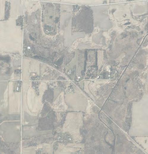


Site Infrastructure Review


These two areas (shown in the map above), has been the focused area for a business park through the East Side planning process. This section evaluates impacts and requirements to create a successful business park in this location.

Study Area
Truck Routing


Truck access to the US Highway 12/18 and I-39/90 interchange can be facilitated either east or west along Siggelkow Road. Currently Siggelkow Road in front of the proposed business park area is a rural 2-lane roadway in a 66-foot right-of-way. The segment west of this site has been urbanized to a divided 4-lane in 120-foot rightof-way. It is anticipated that further development of the East Side planning area will be accompanied by similar, concurrent 4-lane divided roadway expansion to I-39/90 and beyond.

Study Area

The western route from this site can currently allow for increased traffic with relatively minor road improvements. As the East Side area develops it is anticipated traffic volumes will increase along

80 Village of McFarland | East Side Plan
City of Madison Town of Cottage Grove Town of Pleasant Springs Town of Dunn Town of Blooming Grove DoorCreek 39 39 39 HolscherR d Siggelkow Rd D oo rC e e kR d FemriteDr Tuscobia Trl PerrotP Country Walk Prairie Wood Dr Jenness Ave Chestnut Ln Jensen Dr eiPrdR Longview Dr RoidtDr dRsaliV Elvehjem Rd McConne Rd PetersonRd MN MN MN AB AB AB AB Printed By: smorrison, File: \\msa-ps.com\fs\Project\09\09361\09361025\GIS\6_Pro_McFarland_NeighborhoodPlan\6_Pro_McFarland_NeighborhoodPlan.aprx Print Date: 12/8/2022 Data Sources: Dane County (2022) CARPC (2022) Basemap: ESRI Village of McFarland Dane County, Wisconsin
Village of McFarland Municipal Boundary Town of Blooming Grove Parcel Boundary Study Area (2022) Study Area (2008) Urban Service Area Conservation Easement East Side Plan 0 0.25 0.5Miles Business Park Site Town of Pleasant Springs DoorCreek D oo rC e e kR d Tuscobia Trl PerrotP Country Walk Jensen Dr Longview Dr Elvehjem Rd McConnell Rd PetersonRd AB AB Printed By: smorrison, File: \\msa-ps.com\fs\Project\09\09361\09361025\GIS\6_Pro_McFarland_NeighborhoodPlan\6_Pro_McFarland_NeighborhoodPlan.aprx Data Sources: Dane County (2022) CARPC (2022) Basemap: ESRI Village of McFarland Dane County, Wisconsin
Village of McFarland Municipal Boundary Town of Blooming Grove Parcel Boundary Study Area (2022) Study Area (2008) Urban Service Area Conservation Easement East Side Plan 0 0.25 0.5Miles Business Park Site Business Park (Area B) Business Park (Area A)
Project overview
New interchange with direct access to US 12/18
US 12/18 and CTH AB Reconstruction Project
Source: WisDOT Siggelkow Road Conditions
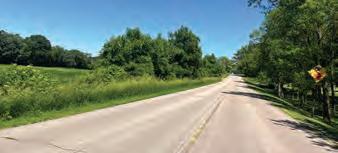
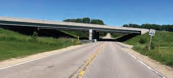
Siggelkow Road, which will require a greater focus on urbanizing Siggelkow Road east to better accommodate growth of the Village.
Long term the route east along Siggelkow Road provides the most time and fuel efficient access to the interstate, especially with the planned interchange improvements at US 12/18 and CTH AB that will be completed in 2023 (see the exhibit above). However, this route will require several capital improvements projects to adapt to the anticipated higher traffic volumes.
Recommendation: It is expected that early phases of the business park development can be supported by the existing road network. However, increasing access eastward to CTH
AB may provide route redundancy, absorb heavier traffic loads, and provide more convenient access as McFarland expands eastward.

Highway Emergency Access
An existing roadway (i.e., Stork Road) provides an emergency route to Interstate 90. This road received a minor resurfacing in 2022, but is generally too narrow for a business park roadway. Madison’s Yahara Hills Neighborhood Development Plan (2017) envisions a new roadway connecting Storck Road to a planned roadway extension of Evan Acres Road to CTH AB around the proposed Landfill/ Sustainability campus expansion, including on-street bicycle lanes. This roadway is likely not necessary given the proximity of the planned business park areas to the proposed
access points at CTH AB. The cost to study, design and construct this roadway, over/under pass would be more efficiently applied toward improving Siggeklow Road from Catalina Parkway to CTH AB.
81 Chapter 5 | Business Park Development Plan
Map 11: Transportation PlanPedestrian/Bicycle Facilities Yahara Hills Neighborhood Development Plan City of Madison Planning Division Pedestrian/Bicycle Facilities Proposed Shared-Use Path Proposed Bicycle Lane Existing Shared-Use Path USH12&18 SAVANNAHRD MILLPOND RD LUD'S LN CTH AB I-39/90 SIGGELKOW RD STORCK RD FEMRITEDR FEMRITE DR RELOCATED CTH AB MEIER RD USH 12 & 18 VILAS HOPE RD POTENTIAL LOOP ROAD POTENTIALLOOPROAD Proposed Bicycle/Pedestrian Grade-Separated Crossing Low density residential development contingent upon vehicular crossing of railroad tracks. Map 11: Transportation PlanPedestrian/Bicycle Facilities Yahara Hills Neighborhood Development Plan City of Madison Planning Division Pedestrian/Bicycle Facilities Proposed Shared-Use Path Proposed Bicycle Lane Existing Shared-Use Path USH12&18 I-39/90 SIGGELKOW RD STORCK RD FEMRITE DR I-39/90 CTHAB SPRECHER RD OLER C A T ED SPRECHERRD E BUCKEYE RD POTENTIAL LOOP ROAD Proposed Bicycle/Pedestrian Grade-Separated Crossing Low density residential development contingent upon vehicular crossing of railroad tracks. Transportation Plan Source: Yahara Hills Neighborhood Development Plan (2017)
Recommendation: Should a future design eliminate this roadway, an alternative connection shall be established to maintain this
Stormwater

The proposed location drains into the Monona Lake/Yahara River watershed. The site is generally
limitations, the site will need to have approximately 15% (~18 acres) of total area dedicated to stormwater management facilities.
Most of the site drains to the northwest, making the mostly inaccessible portion of the property north of Secret Places the most suitable location for stormwater management. Areas south of Siggelkow but outside of the larger Business Park watershed will drain southeast into other regional subbasins within the East Side Plan area.
existing rail corridor impractical.
Recommendation: business require rail service, there are potential opportunities south of the existing tracks (east of CTH AB). However, adjacent land uses and environmental limitations preclude development of larger business park in this area


82 Village of McFarland | East Side Plan
Printed By: aconverse, File: G:\09\09361\09361025\GIS\7_Pro_McFarlandBusinessPark\7_Pro_McFarlandBusinessPark.aprx Data Sources: Aerial: Dane County (2020) Contours: Dane County LiDAR (2017) Stormwater System: City of Madison and Village of McFarland Village of McFarland Dane County, WI Preliminary Watersheds Business Park Major Watershed Subwatershed Storm Pipe Flowline McFarland Business Park 0275550Feet
Recommendation: A preferred business park layout should take advantage of this natural drainageway and treat stormwater regionally mostly in the northwest quadrant.
Water Service
Business parks provide flexibility in land uses ranging from general offices and distribution centers to light industrial and manufacturing. Determining approximate water use under a proposed build out scenario will not be accurate due to the variation in water uses across the business types that could potentially develop facilities on the selected site. Approximations place office building use somewhere between 10 and 20 gallons per day per employee. However, light industrial and manufacturing facilities may use additional water as part of their fabrication processes.
Water service access and demand is assumed to be similar for either business park option. However, both areas will benefit from already planned community well and water storage capacity improvements.
Recommendation: The Village should evaluate the site’s overall water use as compared to current residential capacity considering that municipal water pumping capacities are expected to be exceeded within the next 10 years.
Sewer Service
The business park site north of Siggelkow Road is adjacent to areas served by the Madison Metropolitan Sewerage District (MMSD). The most economical service route is to extend gravity flow infrastructure from the north end of the site where existing sewer pipes cross under
I-39/90 just south of the US 12/18 interchange. The business park site south of Siggelkow Road can gravity flow to planned interceptor as outlined in Chapter 2.
Recommendation: Current capacity and anticipated flows from proposed land uses should be considered in a variety of build out scenarios when approaching the Madison Metropolitan Sewerage District for sewer service extension agreements.
Fiber Optic
TDS Telecom recently completed a fiber optic build out project that connected nearly 6,000 residential and business addresses. It is anticipated that fiber optic telecommunication networks would be extended with any rightof-way expansions in the project area using current local internet service providers.
Recommendation: Work with service providers to incorporate fiber optic infrastructure along Siggelkow Road and along internal business park roadways.
Natural Gas
There is sufficient natural gas capacity to serve the East Side Plan area. There area two major gas transmission pipelines crossing through the business park site, including a gasline substation in the northeast corner of the Stork and Siggelkow intersection. Development opportunities will be limited within the 50-foot easements for both pipelines.
Recommendation: Future business park development should include updates to landscaping and fencing to improve the screening of the
natural gas station and the electrical substation at 3451 Siggelkow Road.
Contextual Review
The business park site north of Siggelkow Road is adjacent to a mixed residential neighborhood in the City of Madison (i.e., Secret Places Neighborhood), which provides unique design challenges as outlined below.
Use Compatibility
The majority of the residential along this shared edge consists of single-family homes with a multi-family apartment complex in the northern section. It will be important to consider a variety of site and building techniques to buffer single family residential developments from future business park developments.
Recommendation: Consider a higher-intensity residential format between the neighborhood and the business park (i.e., transitional use). Otherwise, consider open space buffering (e.g., stormwater, park, trail corridor) or intensive screening along the back of developable lots.
Road (& Trail) Access
There are five local streets that are stubbed to the end of the neighborhood. A final plan for this site should consider how best to connect and buffer the neighborhood from the business park development.
Recommendation: Consider making pedestrian and/or vehicle connections at the five stubbed streets from the Secret Places Neighborhood. Any neighborhood street connecting to the business park should be designed to dissuade through semi traffic.
83 Chapter 5 | Business Park Development Plan
Business Park Concept
BUSINESS PARK CONCEPT
The preferred concept was developed through a series of East Side planning area concepts reviewed by Village staff, Village officials and the general public as outlined in Chapter 4. This section will provide greater detail of the proposed concept for the lands north and south of Siggelkow Road.
Land Use Vision & Policies

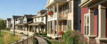
This plan, and the McFarland Economic Strategic Plan, identify at a high level the typical land uses that may be developed within the business park areas. This includes alignment with MadREP’s Advance 2.0 targeted industries (listed below) and potential synergies with the proposed Dane County Landfill Sustainability Campus. While some last mile warehousing uses may be part of the future business park, preference is for businesses that including office and light manufacturing where warehousing and truck distribution is ancillary to the business. Preference is for the indoor storage and processing of raw materials, and uses that do not generate excessive noise or odors. The business park should be developed with sustainability as a central component. This includes the utilization of geothermal energy systems, solar photovoltaic systems, electric vehicle charging stations and other sustainable site and building design features to achieve net-zero developments/business park.
The land use categories in the Business Park concept are outlined below with greater detail provided in Chapter 4. Development design guidelines may be found in Chapter 2
Preference is generally for larger lots of at least 6-10 acres as these are in short supply elsewhere within the Village and align with typical needs of businesses identified in MadREP’s


Advance 2.0 target industries. This will enable the development of larger buildings capable of attracting larger employers to the Village or buildings which can be designed to include flexibility to accommodate multiple tenants offering a mix of start-up, growth, and established business spaces.


84 Village of McFarland | East Side Plan
1. Advanced Manufacturing
2. Agriculture, Food, and Beverage
3. Healtcare
4. Information Communications Technology
5. Bioscience
MIXED USE (MU) provides densely compacted developments or districts that provide a variety of housing, commercial and/or blend of these two uses.
MEDIUM DENSITY RESIDENTIAL (MDR) includes detached single-unit homes and attached housing units such as duplexes, triplexes, townhouses, small and mid-sized multiunit buildings.
M D R
B U S
BUSINESS (BUS) includes office buildings, office-showrooms, warehouses, and light industrial buildings that offer retail, trade, or services for individuals or businesses.
C O M
Land Use Categories (excerpt from Chapter 4)
COMMERCIAL (COM) include automobile-oriented uses and “heavy” commercial uses with the appearance or operational characteristics not generally compatible with residential or small-scale commercial activities.
Preferred Concept
The preferred business park concept is illustrated below. This concept is meant to provide a vision for how it may develop. While the general pattern of land uses and major roads shown should be reflected in actual development, it is recognized that more detailed elements within the concept, such as the locations of minor streets, location/sizing of stormwater management areas precise boundaries of land uses, or the specific dimensions of blocks, are only concepts. Development
within the business park, as well as in the entire East Side planning area, will be in accordance with the development land use policies contained in this chapter, as well as meet the goals and policies set in Chapter 2.


The are two triangular parcels owned by the City of Madison shown as part of the Village’s business park. If this land cannot be acquired, the road layout may need to change to better accommodate large format


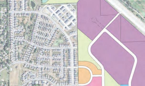

building layouts in the remaining lands.

Design Themes


• Transitional land uses (i.e., medium densit y residential and mixed use areas) coupled with open space with multi-use trails and stormwater facilities provide a buffer between the business park and the residential neighborhood.

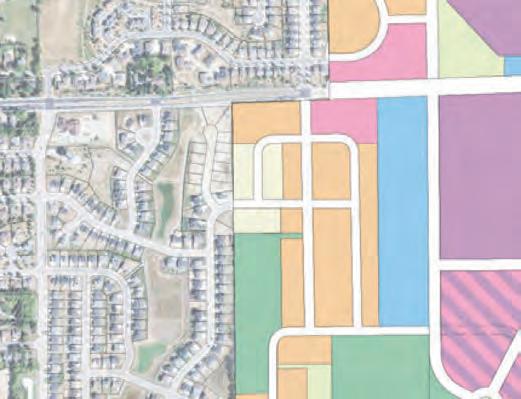
• A l ooped road connects Siggelkow Road to the business park with a wider access road for business park traffic while also providing more indirect connections to the west. An optional cul-de-sac street is dashed in to further subdivide the land if smaller lots are desired.
• The r oad network provides large business park lots with opportunities to further subdivide should smaller developments become the primary market.

• Stormwater management can be managed regionally primarily in the northwest quadrant prior to the wetland area. Additional facilities can be incorporated in the buffer area north/east of the proposed residential/ mixed use area. Regional stormwater management areas for the business park south of Siggelkow Road would primarily be located in the southeast corner of the park.
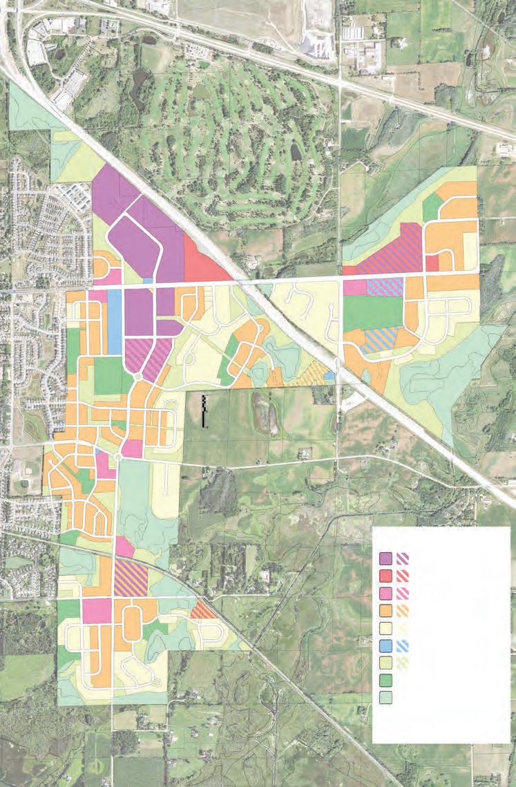


• A t rail network connects Siggelkow Road, the Secret Places Neighborhood and potential Interstate 90 trail crossing.

85 Chapter 5 | Business Park Development Plan G Gun A T B SI SIGGGELELKOW O RD CO C LL EC C E TO T R “ O L L O A ” “A EAST SIDE PREFERRED DRAFT SW 18.75 BP 27.88 A** BP 24.85 A SW 4.42 A MU 3.99 A MDR 6.16 A SW 7.23 A BP 20.64 A* BP 7.08 A BP 5.15 A BP 17.82 A BP/MU 8.98 A BP/MU 8.88 A 2N 2S CTH AB PIERCE RD SIGGELKOW RD CTH AB Business Park Commercial Mixed Use (High Density Res. and/or Commercial) Low Density Residential Civic / Institutional / Utilities Gas Line Park & Recreation Stormwater/Conservation (Trail Corridor) Wetland Multi-Use Trail (Proposed) Multi-Use Trail (Existing) Medium Density Residential LEGEND ALT EAST SIDE PLAN PREFERRED CONCEPT
IMPLEMENTATION PLAN Action Plan
This section identifies the various actions necessary to translate the business park vision into reality. The actions are organized by type and include recommended timeframes for completion.
This implementation strategy assumes the business park is built and managed by the Village of McFarland. This will require the Village to acquire properties. The Village can support many of these action steps should a developer come forward to acquire property and build a business park in this location matching the vision in this Plan.
Action 1: Approach the City of Madison to discuss the following topics.
• Directly west of the proposed business park is a mixeddensity residential district. The City should be approached when considering the design and implementation of connections to existing road infrastructure in a way that does not interfere or cause a nuisance for existing neighborhood residents.
• The C ity currently owns two triangular parcels south west of I-39/90 totalling 11.53 acres+/-. As the parcels are isolated from the City, McFarland should approach Madison to seek a land-swap or outright purchase agreement that will add these
parcels to the proposed Business Park development/ Village.
• City of Madison plan documents proposes a pedestrian crossing (bridge or tunnel) across I-39/90, connecting the Secret Places neighborhood to Evans Acres Road. Now that this land is in the Village there is mutual benefit to making this trail connection. Discussions on cost sharing and timing will be beneficial in determining the feasibility to plan and reserve room for these improvements. The precise location and design of this trail will require further study.
• Future expansion of Siggelkow Road will be required east of Catalina Parkway with portions under Village of McFarland and City of Madison control. Coordination on design, timing/phasing and cost sharing should be discussed.
The Village may also seek out other agreements with City of Madison to extend municipal services, (e.g. gravity fed sewer infrastructure) from alternative routes beyond the Siggelkow Road corridor.
Timeframe: Short Term (2023-2025)
Responsible Parties: Community & Economic Development Department, Engineer consultant, and Village Administrator.
Action 2: Evaluate potential land purchase(s) through the following steps.
While this chapter is recommending the land north of Siggelkow Road, a 60- acre south of Siggelkow Road is currently for sale. The phasing plan suggest potential review of lands north (option ‘A’) and south (option ‘B’) of Siggelkow Road.
1. Co mplete a site assessment report inclusive of ALTA survey, wetland delineations, soil borings and utility capacity evaluation.
2. Dev elop a pro forma to analyze land acquisition costs, transportation and infrastructure improvement costs, and anticipated land sale and property tax revenues from future development.
3. Cr eate a Tax Incremental Financing (TIF) district to support land purchase, improvements and potential incentive packages.
Timeframe: : Short Term (2023-2025)
Responsible Parties: Village Administrator, Community & Economic Development Department, Engineering Consultant, CDA, and Village Board.
86 Village of McFarland | East Side Plan
Implementation
Action 3: Negotiate land purchase(s).
Timeframe: Short Term (2023-2025)
Responsible Parties: Village Administrator, Community & Economic Development Department, CDA, and Village Board.
Action 4: Consider creating a new business park zoning district, including codifying site and building design guidelines in Chapter 2.
The Village’s existing zoning districts may not be suitable for promoting the types of land uses it desires within the new business park while minimizing the types of uses it does not want located in the business park.
Timeframe: Short Term (2023-2025)
Responsible Parties: Community & Economic Development Director, CDA, Plan Commission, and Village Board.
Action 5: Obtain entitlements to allow construction of the business park through the following steps.
1. Pr oduce preliminary engineering to evaluate stormwater management and utility infrastructure based on the preferred concept.
2. Submit an Urban Service Area (USA) amendment through Capital Area Regional Planning Commission (CARPC).
3. Pr epare land division and rezone applications. Consider maintaining larger lot areas with minimal subdivisions initially with the option to further subdivide maintaining at least 6-10 acre lots.
4. Wor k with Wisconsin Department of Transportation (WisDOT) to redesign emergency access to Interstate 90 to better align with proposed business park lot and road layout.
Timeframe: Short Term (2023-2025)
Responsible Parties: Village Administrator, Engineering consultant, Community & Economic Development Department, Fire and Police Chiefs, CDA, Plan Commission, Public Works and Utilities Committee, and Village Board.
Action 6: Bid and construct the business park area - likely in phases.
1. Prepare final construction plans.
2. Bid the project to complete mass grading, construct roadways and necessary utilities.
3. Construc t the business parklikely in phases.
Timeframe: Mid Term (2026-2030)
Responsible Parties: Village Administrator, Engineering consultant, Community & Economic Development Department, Fire and Police Chiefs, CDA, Plan Commission, Public Works and Utilities Committee, and Village Board
Action 7: Market and promote the business park lots.
1. Follow economic development strategies outlined in the 2023 Economic Strategic Plan.
2. Submit for ‘shovel-ready’ status through MadREP (Gold Shovel) and/or WEDC (Certified in Wisconsin).
3. Market business park property through local brokers and collaboration with MadREP.
Timeframe: Mid Term (2026-2030)
Responsible Parties: Community and Economic Development Department, Communications & Technology Department, and CDA.
87 Chapter 5 | Business Park Development Plan
Phasing Plan
Build-out of the planned improvements is expected to occur over 5-12 years. The projected timing of new private expansions and development is based on a combination of three factors:
1. Projections offered by business owners.
2. Timing of necessary infrastructure improvements.
3. Expected market demand for new lots.
As explained below, the build-out period is divided into three, 3-year phases (Phase 1: 2025-2028, Phase 2: 2029-2032, Phase 3: 2033-2036); however, individual projects may occur sooner or later than suggested in the estimated Phase Map (on page 89).
Phase 1 (2025-2028)
A1/B1 Build-out of the business park area should start with areas with immediate access to Siggelkow Road using existing transportation networks with relatively minimal improvements.
T1 Siggelkow Road will need improvements as the East Side Plan is implemented similar to improvements recently constructed immediately west of the study area. Both T1 and A1/B1 are assumed to happen simultaneously to promote more convenient business park access.
B1* A portion of the property further southeast has been identified for regional stormwater management for the initial and future phases of development south of Siggelkow Road. Final location of stormwater
management requirements may suggest a different location after engineering has been conducted.
Phase 2 (2029-2032)
A2/B2 These areas are identified as a second phase (if not built out in one phase) due to the additional infrastructure required.
Phase 3 (2032-2035)
A3 It may be beneficial to wait on building the residential component until the business park is established to reduce negative reactions to the business park development adjacency to residential homes. Once the business park is established it will be apparent to all homebuyers of the surrounding uses.
B3 These lands are currently not for sale, so it is identified as phase 3. Should these lands become available, it may be easier to build out this section prior to B2.
Infrastructure Improvements
The study area already has an existing road network that will become even stronger once Wisconsin’s Department of Transportation (WISDOT) completes the CTH AB interchange on US 12/18. It will be important to reconstruct Siggelkow Road into a 4-lane divided roadway east of Catalina Parkway to the farthest business park entrance in the initial phase with future expansions east to CTH AB as needed to maintain safe and efficient transportation corridors.
Pedestrian and bike trails suggested in this plan can move forward once there are dedicated
funds to complete the project (establish easement, purchase land, construct path). It’s plausible that these improvements could be completed prior to reconstruction of the roadway if development of the business park is slow as the Village desires to provide an offstreet path connection to the new community park on the east side of CTH AB.
Utility infrastructure will be planned and designed based on the anticipated phase in coordination with the Village of McFarland and private utility companies.
Funding Strategies & Partners
There are opportunities to partner with other entities to move forward the business park action plan. Primary partners include Dane County - Sustainability Campus, MadREP, and WEDC. This may provide additional financial capital (likely through grants and loan programs) to support the development of the park. See the 2023 Economic Strategic Plan and this Plan’s Chapter 2 Implementation Plan.
88 Village of McFarland | East Side Plan


SIGGELKOW COLLECTOR “A” Gun Club 4W 4E 5W 5E BROADHEAD ST ELVEHJEM RD CTH AB CTH AB Business Park Commercial Mixed Use (High Density Res. and/or Commercial) Low Density Residential Civic / Institutional / Utilities Gas Line Park & Recreation Stormwater/Conservation (Trail Corridor) Wetland Multi-Use Trail (Proposed) Multi-Use Trail (Existing) Medium Density Residential LEGEND ALT A2 A1 A3 B1 B1 B2 T2 T1 * B3
Average Assessed Value per Lot Size and Use
To assess revenue potential of the business park areas, MSA inventoried recently completed developments in business parks with lots sizes between under 5 acres, 6-9.9 acres and 10-15 acres. We have categorized the preferred uses based on lot size, building size, and combined total assessed values (i.e., land and improvements values combined). These average values were used to estimate the potential tax revenue based on an overall average of $17,930 per acre. This information is further defined in the next section.
90 Village of McFarland | East Side Plan
Land Use Type Lot Size (Acre) Building Size (Sq Ft) Total Assessed Value / Acre Light Industrial 3.55 31,683508,239.51 $ General Office Space 3.44 39,9391,264,622.48 $ Gas Station 3.13 10,0751,114,672.36 $ Hotel 4.08 88,6661,648,910.36 $ Finance 3.63 21,618961,840.90 $ Land Use Type Lot Size (Acre) Building Size (Sq Ft) Total Assessed Value / Acre Industrial Flex 9.10 133,382893,841.10 $ Light Industrial 5.27 25,400370,383.14 $ General Office Space 6.62 77,9071,283,917.99 $ Corporate Headquarters 6.97 101,3484,097,652.57 $ Land Use Type Lot Size (Acre) Building Size (Sq Ft) Total Assessed Value / Acre Industrial Flex 10.08 145,289 802,223.24 $ Light Industrial 12.22 92,730 699,605.70 $ Corporate Headquarters 11.48 62,705 1,568,406.97 $ Less Than 5 Acres 5 to 9.99 acres 10 to 15 acres
Phase Cost & Tax Revenue Estimates
Property tax revenue estimates based on assumed continuation of 2022 mill rate of 0.017355 ($17.35 per $1,000 property value). Local tax revenue assumed to be 36.4% of total taxes. Property value estimates gathered from tax assessments on other similar properties in the region used to calculate an average acre value by assumed future use. Based on the mix of uses, we would anticipate a total estimated land plus improvement property value average of approximately $1,033,600 per acre with a total tax revenue at $17,930 per acre; local estimated tax revenue at $6,530 per acre.
91 Chapter 5 | Business Park Development Plan Major Collector Improvements Siggelkow Rd (T1) $2,382,664 Collector ‘A’ to 1st Roundabout $2,557,042 Siggelkow Rd (T2) $1,623,882 Total Ancillary Infrastructure $6,563,588 A1 24.85acres Regional Stormwater 1 $291,265 Local Roads w/ Infrastructure $907,954 Estimated Total Costs $1,199,219 Estimated Annual Local Tax Revenue $162,270.50 A2 48.32acres Regional Stormwater 2 $468,821 Local Roads w/ Infrastructure $1,705,894 Estimated Total Costs $2,174,715 Estimated Annual Local Tax Revenue $315,529.60 Full Build Out Developable Area 73.17 acres Total A Costs $3,373,933 Estimated Annual Local Tax Revenue $477,800.10 B1 17.82 acres Regional Stormwater $250,975 Local Roads w/ Infrastructure $1,330,367 Estimated Total B1 Costs $1,581,341 Estimated Annual Local Tax Revenue $116,364.60 B2 17.86acres Local Roads w/ Infrastructure $1,572,074 Estimated Annual B2 Local Tax Revenue $116,625.80 B3 12.23acres Local Roads w/ Infrastructure $624,668 Estimated Annual B3 Local Tax Revenue $79,861.90 Full Build Out Developable Area 47.91 acres Total B Costs $3,778,084 Estimated Annual Local Tax Revenue $312,852


 This page intentionally left blank.


