What is the Comprehensive Land Use Plan 2024-2044?
The Comprehensive Land Use Plan 2024-2044 is a 20-year framework to guide Warren County’s future, providing policy and direction related to future growth and development, transportation, housing, county services, and other important aspects of the community. The Plan will inform current and future decision-makers about where we’ve been, where we are today, where we want to go, and how we intend to get there.
How will the Plan be Used?
The Comprehensive Land Use Plan 2024-2044 will be used by elected officials, staff, and a variety of stakeholders to make important decisions about how to invest in the county and enhance the quality of life for residents. Warren County staff, the Board of Supervisors, and the Zoning Commission will use the Plan to make decisions about development proposals and where to best invest county resources to achieve the community’s vision for the future. Warren County residents can use the Plan to see how the county intends to guide growth and redevelopment in ways that meet their needs and aspirations; land owners can use the Plan when considering improvements to their property; businesses can use the Plan when deciding to reinvest or relocate to Warren County.
What are the Major Changes?
The Comprehensive Land Use Plan 2024-2044 was developed as an update to the previous Warren County Comprehensive Plan that was adopted in 2002. Warren County has experienced significant growth since the last update and the goals and strategies developed reflect those changes and the future needs of the County. Guiding principles include population growth, development practices, and preservation of rural character, historic places, and natural and agricultural resources. These factors are reflected in goals that aim to reduce development sprawl in rural areas, increase opportunities for niche and smal agricultural practices, and build upon the recreational and agricultural character of Warren County.
Acknowledgements
Steering Committee
Alfonso ValenzuelaGumucio
Bart Brummer
Bob Darr
Brandon Lane
Brodie Wubben
Chad Daniels
Charlie Dissell
Craig Boldman
Dan Smith
David Bentz
Dianne Hall
Donna Bahun
Doug McCasland
Douglas Rooney
Drew Merrifield
Emily Rizvic
Hugh Cain
Jackie Squier
Janet Bunce
Joe Carico
Joelle Stolte
Jordyn Hill
Julia McGuire
Kandi Petry
Karey Bishop
Keisha Thompson
Luke Parris
Mark Wilson
Marvin Mahr
Rachel Gocken
Stephany Goodhue
Tim Hill
Toby Vanderpool
Tom Nicholson
Traci VanderLinden
Troy Bass
Warren County Planning Commission
Douglas Rooney, Carlisle
Hugh Cain, Norwalk
Laura Oliver, Milo
Mary Jo Ohnemus, Milo
Sean Westrum, Norwalk
Warren County Board of Supervisors
Mark Snell (Chair, District 1 Supervisor)
Darren Heater (Vice-Chair, District 3 Supervisor)
Crystal McIntyre (District 2 Supervisor)
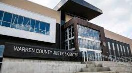
Warren County Staff
Lindsey Baughman, Zoning Director
Miranda Bailey, Zoning Administrator
Becky Schultz, Administrative Assistant
Dawn Bowman, Assistant County Attorney
Consultant Team
Chris Janson, AICP - MSA
Sarah Runkel, AICP - MSA
Emily Huston - MSA
Chris Shires, AICP - Confluence
Jane Reasoner, AICP - Confluence
Abbey Eckberg AICP - Confluence
Teva Dawson - Group Creative Services
Lorin Ditzler - Group Creative Services
Adoption Resolution Placeholder
“Planning is bringing the future into the present so that you can do something about it now.”
- Alan Lakein
Welcome!
Welcome to Wonderful Warren! Warren County’s Comprehensive Land Use Plan 2024 - 2044. This document serves as a guide for preservation, development, and growth patterns throughout the planning timeframe, and beyond.
This plan is organized into four section: Current Conditions, Planning Process, Looking Ahead, and Implementation.
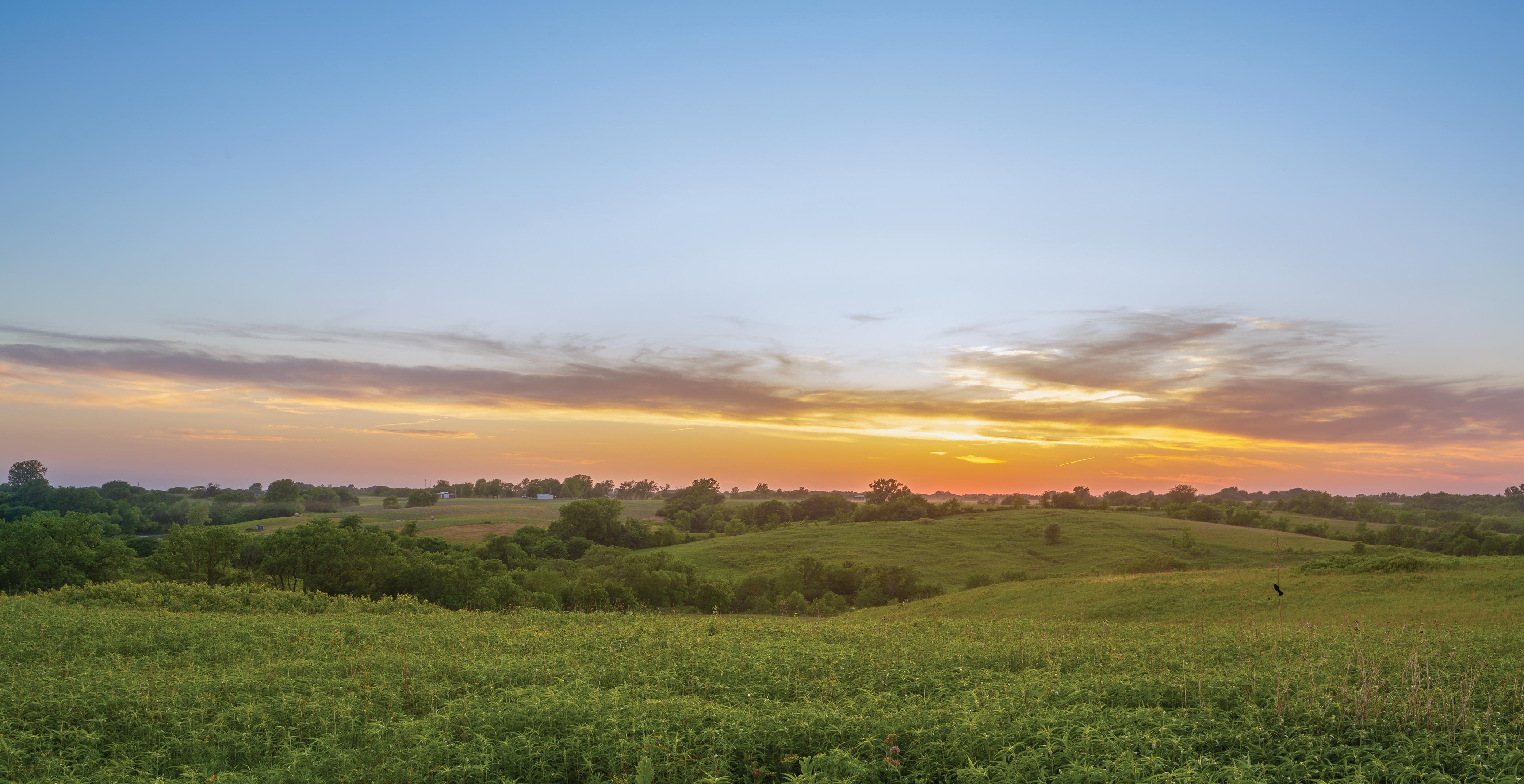
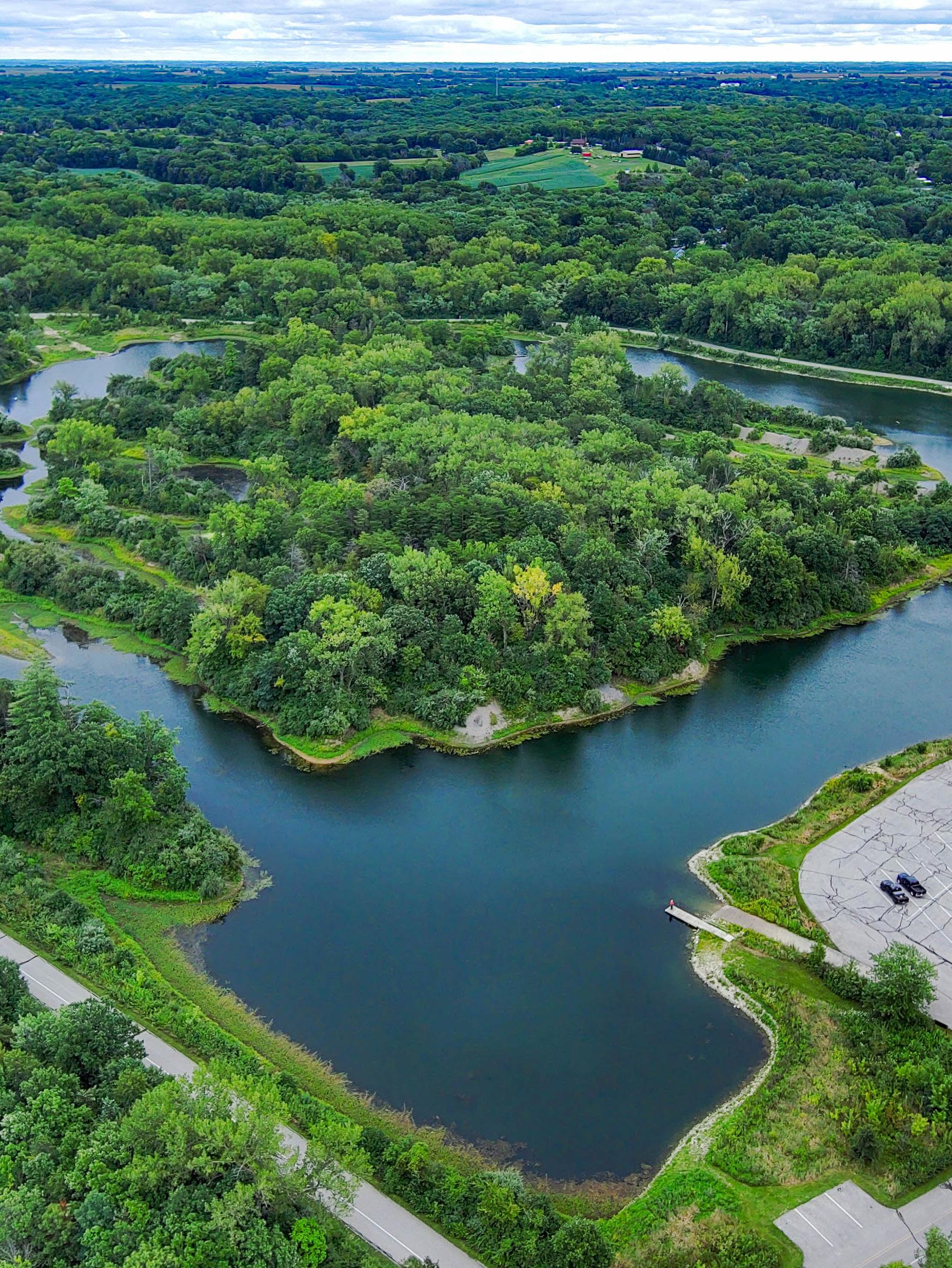
North River and HWY 65 South
ABOUT THE PLAN
The Comprehensive Land Use Plan, also known as a general plan, master plan or land use plan, is a document designed to guide the future actions of a city or county. The Iowa Supreme Court has stated that the legal purpose of the Comprehensive Land Use Plan is to “direct use and development of property by dividing it into districts according to present and potential uses.” The Comprehensive Land Use Plan also presents a vision for the future with long-range goals and objectives for all
activities that affect the local government. This includes guidance on how to make decisions on public and private land development proposals, the expenditure of public funds, and issues of pressing concern (such as farmland preservation for counties or the rehabilitation of older neighborhoods in cities). Most plans are written to provide direction for ten to twenty years after their adoption. Plans should receive a considered review and possible update every five years.
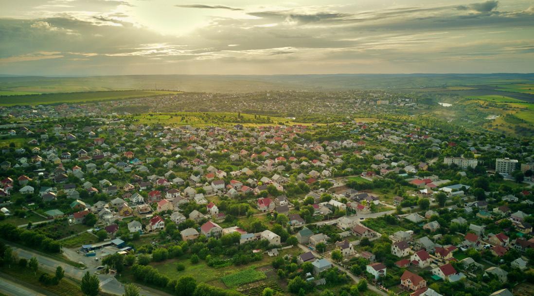
About Warren County
Warren County is a unique county located in Central Iowa. Its neighbor to the north, Polk County, encompasses the state capital of Des Moines, the metropolitan area that permeates the county’s border to encapsulate portions of northern Warren County. This proximity to the metro provides residents of Warren County with amenities not readily available in rural areas. To the south, Warren County shares boundaries with Clarke County and Lucas County, both rural counties. The gradient transition from urban to rural, with Indianola serving as a tethering point, provides Warren County an abundance of cultural, natural, and economic assets not found in other areas of the region. The diverse population shares values of safety, community, agriculture, and individuality. People enjoy the County’s natural beauty and rural character. The County intends to preserve these values as the physical and metaphorical landscape changes and economic trends rise and fall. Warren County values long-range planning as a tool to ensure the community of today effectively evolves to meet the anticipated needs of the future.
The purpose of this 2024 Comprehensive Land Use Plan is to establish a shared vision for the community,
to guide future decisions and actions, and to assist in projecting and managing growth, change, public improvements, and development in the County. This guidance provides predictability and consistency over time to help encourage investment where appropriate and preservation where necessary. Communities plan so that we can act and react in a changing world with a confident understanding of our common values and goals.
Implementation of the Comprehensive Land Use Plan is dependent on elected officials, County staff, and the businesses and residents of the County. The official document that guides implementation is the Zoning Ordinance. The difference between this Comprehensive Land Use Plan and the Zoning Ordinance is that the former sets forth the objectives and goals of the community with respect to land use, while the latter is a regulatory device through which the plan’s goals and policies are carried out or achieved. Other ordinances, such as subdivision regulations, are also utilized to carry out the goals of a Comprehensive Land Use Plan.
Fairfax St. and Summerset Winery
CURRENT CONDITIONS
“Even if you are on the right track, you will get run over if you just sit there.”
— Will Rogers
Where are we now?
Current conditions provides an overview of Warren County as it is today. This section is divided into two parts, Warren County Profile and Warren County Elements. The Warren County Profile provides data about the current population and geography, as well as a brief history of the County. The Warren County Elements introduces subjects of focus for planning, including those required by the Iowa Smart Planning Act. Combined, these elements shape the overall culture of Warren County. Current conditions of each element is outlined in this section, with future needs and goals following the section “Looking Ahead.”
Interchange of HWY 5 and HWY 65
WARREN COUNTY PROFILE
Warren County is a rapidly-growing County in Central Iowa. Topography differs in Warren County from that found throughout Iowa, with an abundance of rolling hills and
intricate waterways. Agriculture, conservation, and rural character are strong values that Warren County seeks to uphold and expand upon through our continued growth.
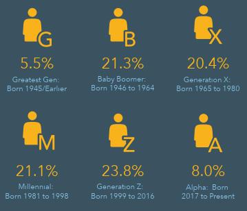
Population Data
WHAT DOES THE DATA TELL US?
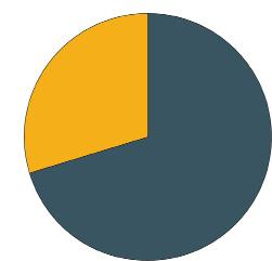
Warren County has experienced steady growth since the second half of the 20th century. An estimated 70% of the population lives in cities and towns, with approximately 30% of residents occupying unincorporated areas.
Esri Business Analyst, 2023
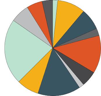
County Population by Race
Black or African American Alone
American Indian and Alaska Native Alone
Asian Alone
Native Hawaiian and Other Pacific Islander Alone
Some Other Race Alone
Two or More Races
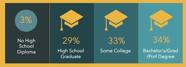
Education in Warren County
WHAT DOES THE DATA TELL US?
The majority of residents in Warren County are white, with the next highest race being that being a mix of two or more races.
96% of residents have completed at least a High School level of education, while 67% have attended some sort of College level of education.
Esri Business Analyst, 2023
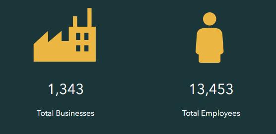
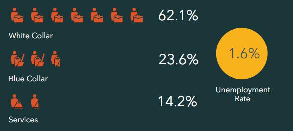
Economy and Employment
Employment by Industry
WHAT DOES THE DATA TELL US?
Over 60% of the population works in what would be considered a ‘White Collar’ job.
The industries within Warren County that employ the highest percentages of the population are:
Esri Business Analyst, 2023
County-wide Housing
Year of Structure Built
WHAT DOES THE DATA TELL US?
The majority of homes in Warren County were built between the years of 1960 and 2009.
Over the past decade, Warren County has seen a decrease in the construction of housing structures, despite the rising demand.
Most of the housing structures in the County are detached, single-family.
Type of Housing Structure
Esri Business Analyst, 2023
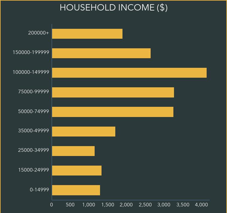
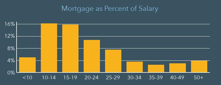
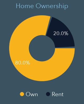
Home Values
Less than $50,000
$99,999 $100,000$299,999
With a mortgage Without a mortgage
$499,999 $500,000$749,999 $750,000$999,999
$1,000,000 or more
WHAT DOES THE DATA TELL US?
Over 80% of residents in Warren County own their current residence, as opposed to renting it.
Residents both with and without a mortgage on average own a home valued between $100,000 and $500,000.
Esri Business Analyst, 2023
Thirty percent of the population within Warren County come from unincorporated areas. Warren County has 16 townships and 6 unincorporated communities. Data for the communitites in regards to population was calculated to create an estimation by subtracting the populations of municipalities from the total population of Warren County.
Thirty percent of the households within Warren County are located in unincorporated areas.
Data for the unincorporated housing areas is an estimate, calculated by subtracting the population of municipalities from the total household number of Warren County.
Warren County Geography
Warren County is located in Central Iowa. Its neighboring counties include Polk County (north), Clarke County and Lucas County (south), Madison County (west), and Marion County (east).
The County contains 573 square miles of land and is the 45th largest County in Iowa in size.
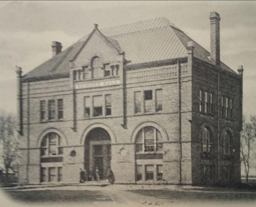
Warren County History
Warren County was formed in 1846. It was named after General Joseph Warren, a hero in the American Revolutionary War. Warren County became a Certified Local Government (CLG) in 2020.
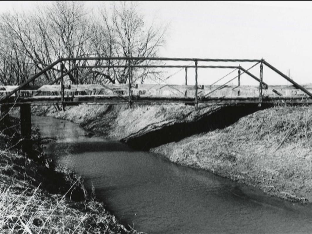
Warren County currently has 12 properties named on the National Register of Historic Places.
• Coal Creek Bridge
• Hoosier Row Community Center
• Indianola Carnegie Library (Des Moines Metro Opera Offices)
• Indianola High School (Administration Building)
• Lake Ahquabi State Park, Picnic Area (Area S)
• Lake Ahquabi State Park, Bathhouse Area (Area B)
• Lake Ahquabi State Park, Refectory Area (Area C)
This section will identify characteristics and qualities that make Warren County unique and that are important to Warren County’s heritage and quality of life.
County Character
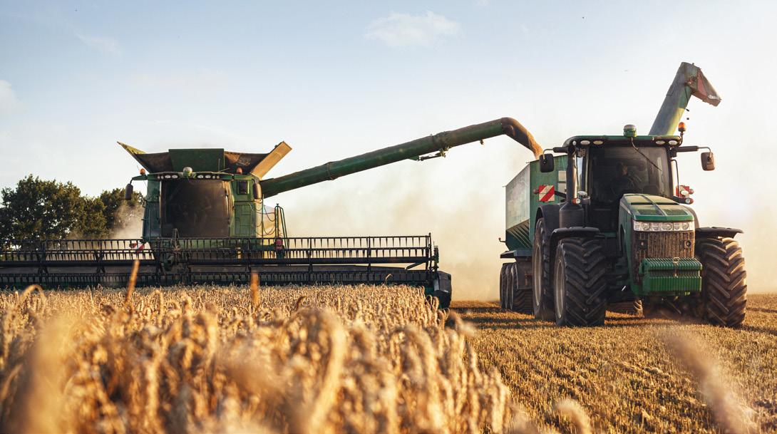
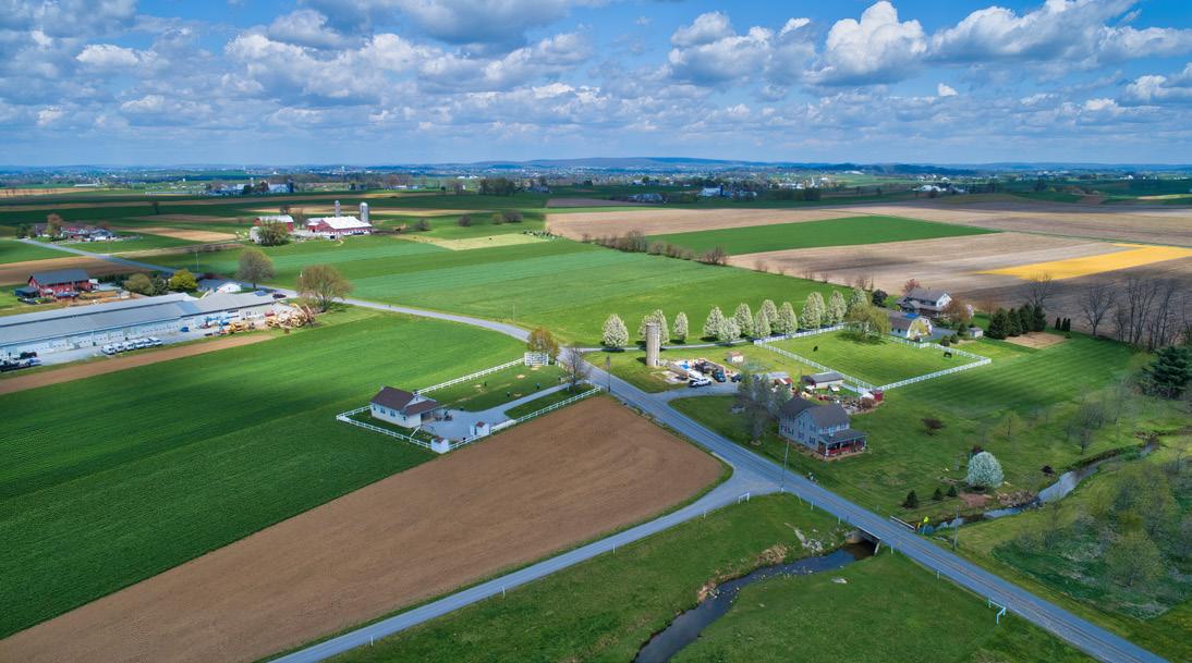
Agriculture and Natural Resources
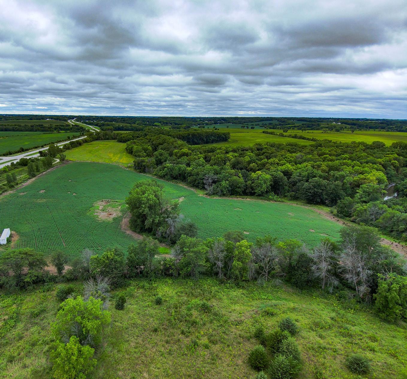
Agriculture is a primary industry and important cultural component of Warren County. Agriculture impacts myriad aspects of life in Warren County, comprising approximately two percent of total employment and accounting for almost eighty percent of the land use throughout the County.
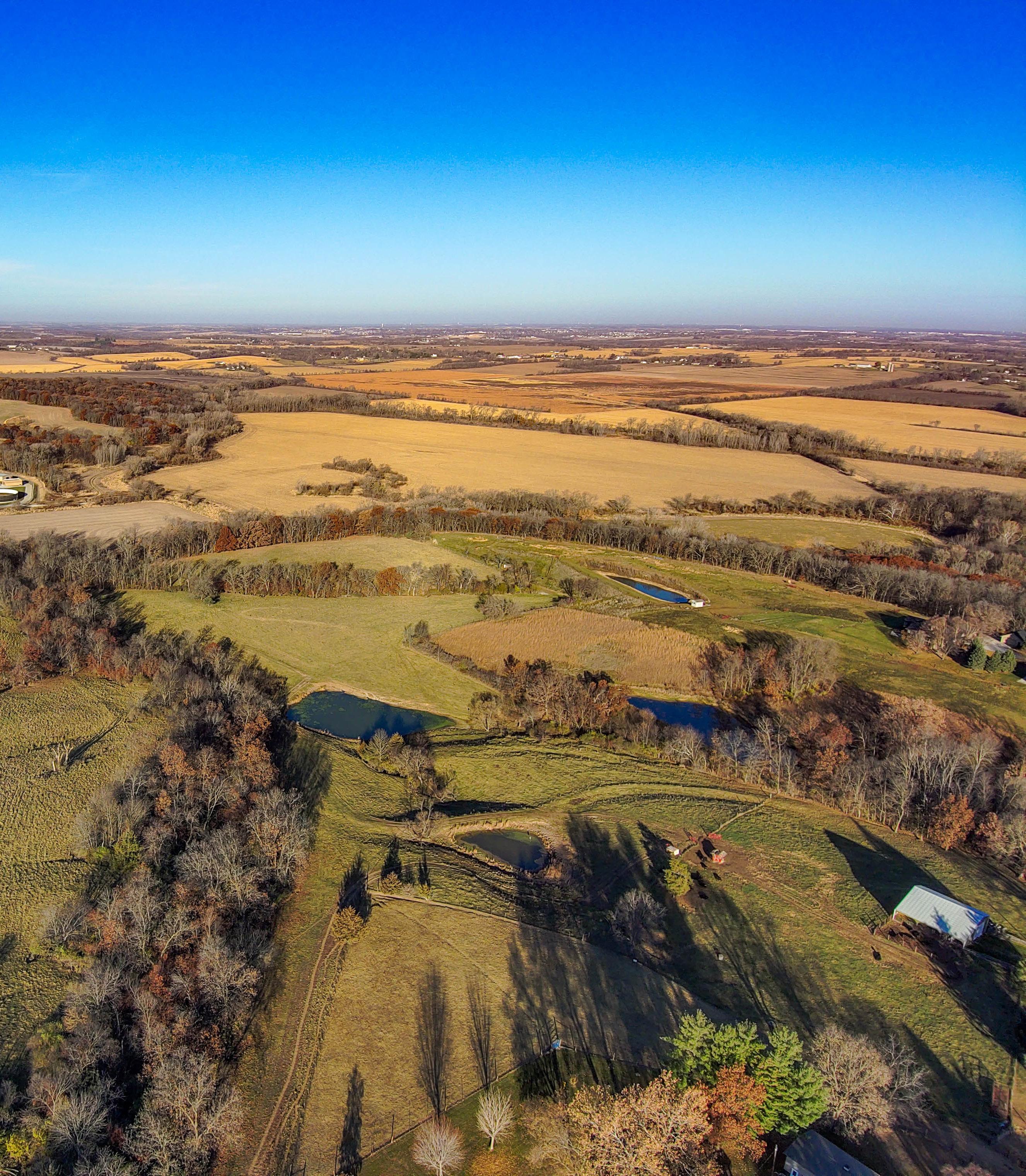
Natural resources lend to the character of Warren County. The rolling hills and topography are unique for the state and provide destinations for residents across the region. This section will include objectives, policies, and programs addressing preservation and protection of agricultural and natural resources.
Highway 65 South, Warren County, IA
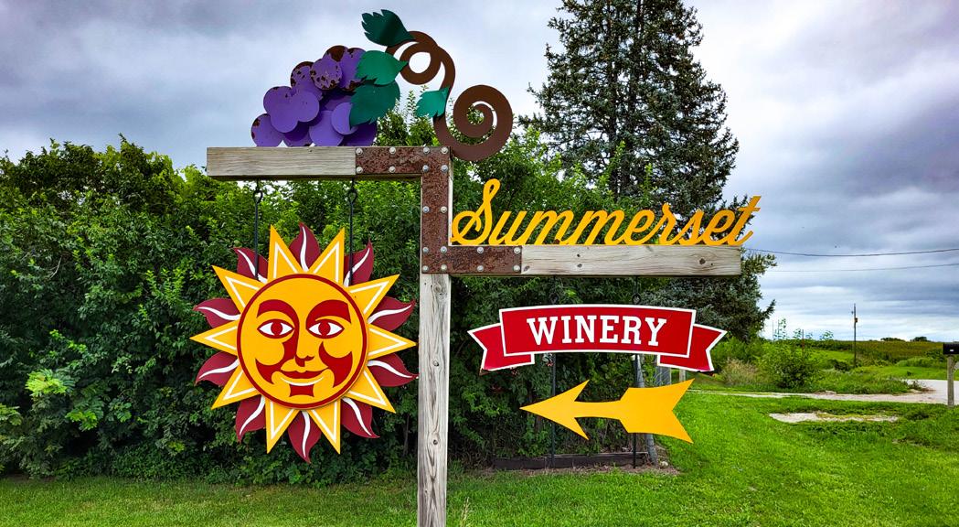
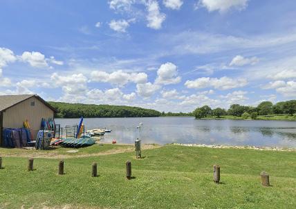
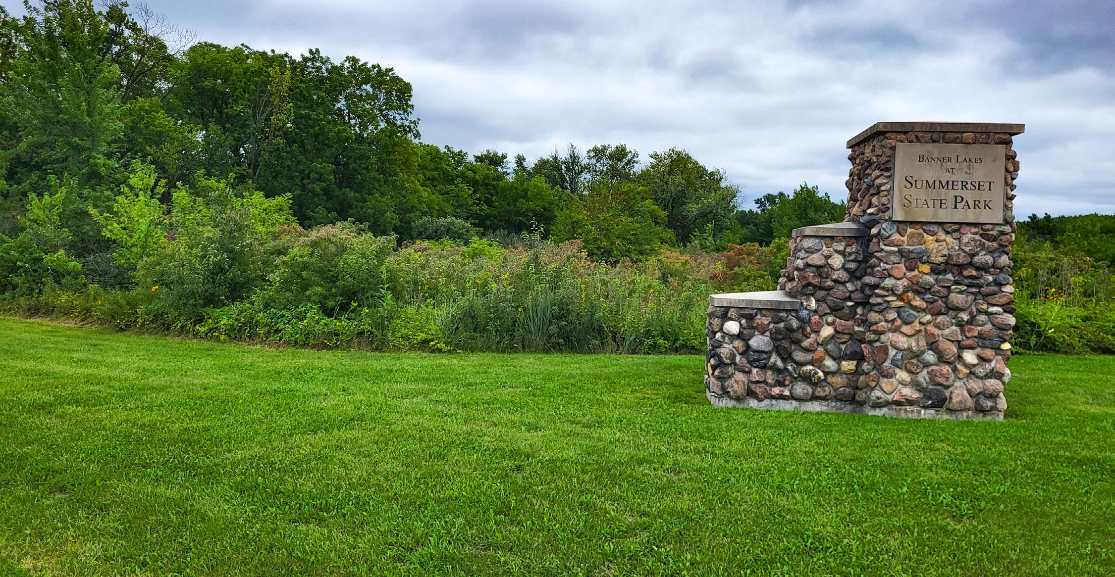
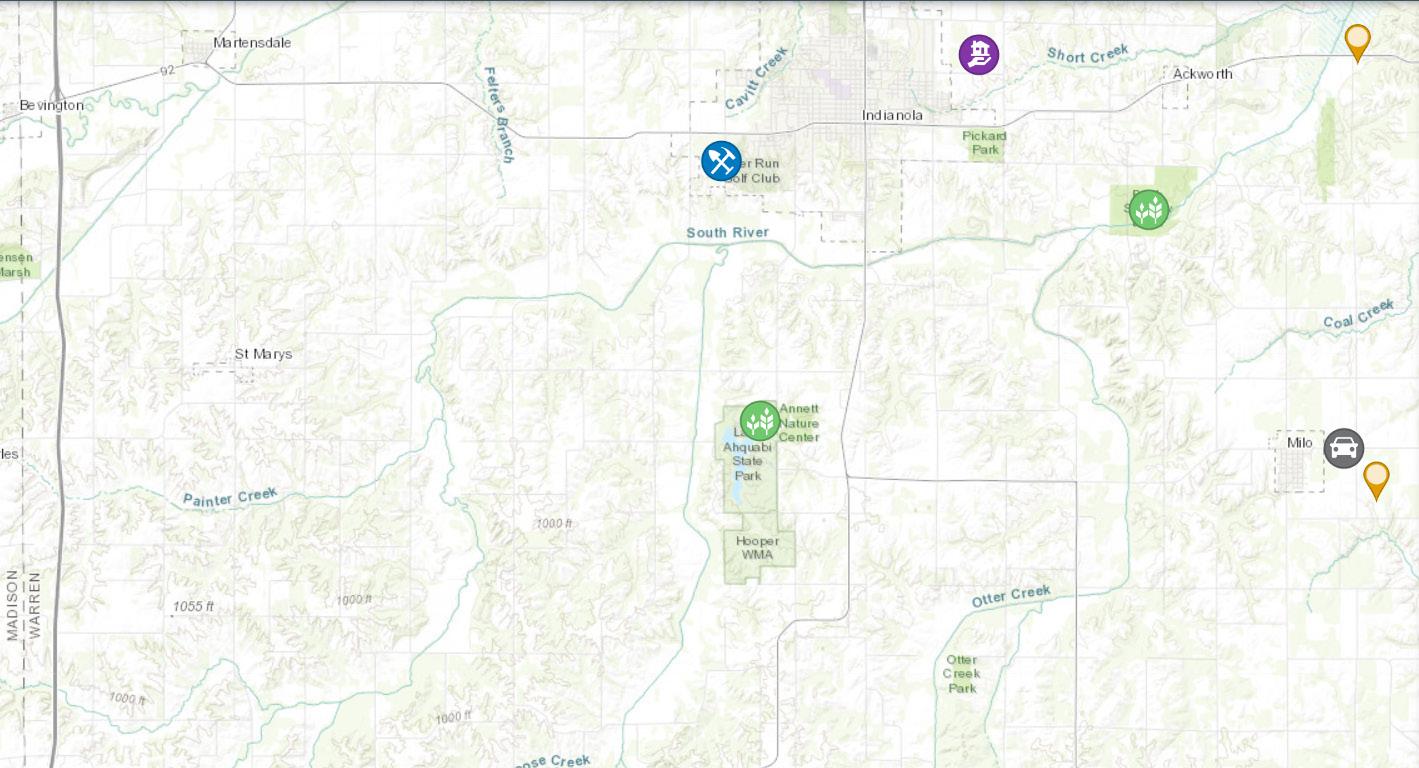
Recreation, Conservation, and Tourism
County to explore. Trap shooting is one of many notably rising activities in the County. This section provides goals and strategies for addressing Warren County’s future needs for recreational and tourist activities.
Warren County is rich in recreational opportunities, with 17 county parks, prairies, trails, and preserves, and two state parks. There is also ample opportunity for tourist activities including equestrian facilities, wineries,
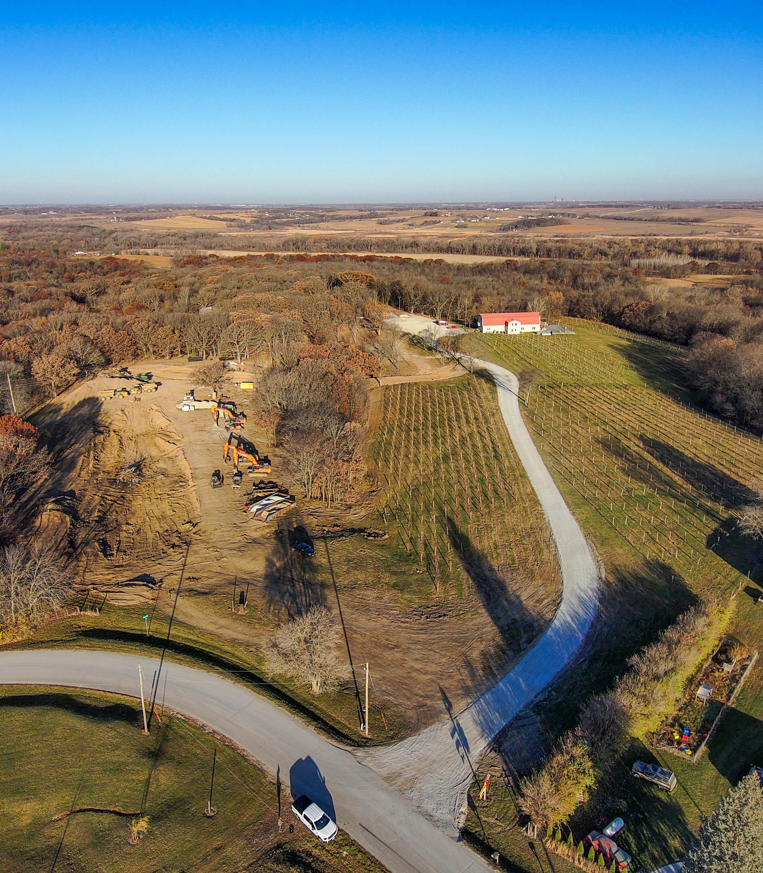
Summerset Winery, Indianola, IA
Norwalk
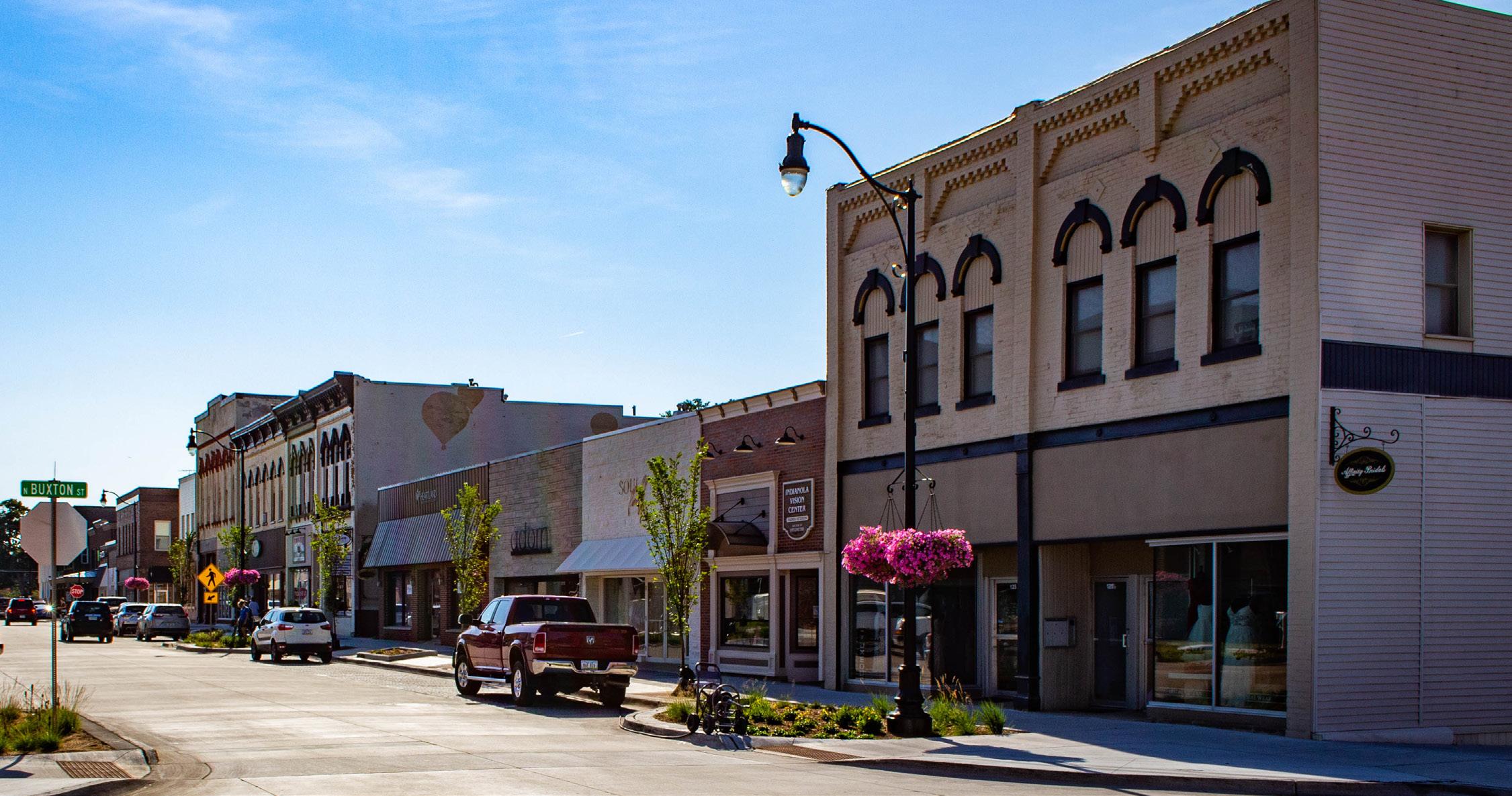
Indianola
Cumming
Des Moines
Carlisle
Hartford
Ackworth
Martensdale
Bevington
St Marys
New Virginia
Milo
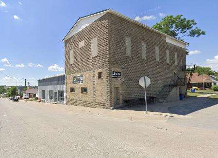
Lacona
Spring Hill
Intergovernmental Collaboration
This section will identify goals and strategies for joint planning and joint decision-making with municipalities or governmental entities, including school districts, for siting and constructing public facilities and sharing public services. We may identify existing or potential conflicts between Warren County and other local governments related to future development and may include recommendations for resolving such conflicts. This section will also identify opportunities to collaborate and partner with neighboring jurisdictions and other entities in the region for projects of mutual interest.
Livability
Economy & Employment
This section will include goals and strategies to guide future economic development in Warren County. These plans will be coordinated with state and regional economic development plans and take into consideration the need for various land uses in creating a robust economic condition for Warren County.
Lacona, IA
Indianola, IA
Transportation
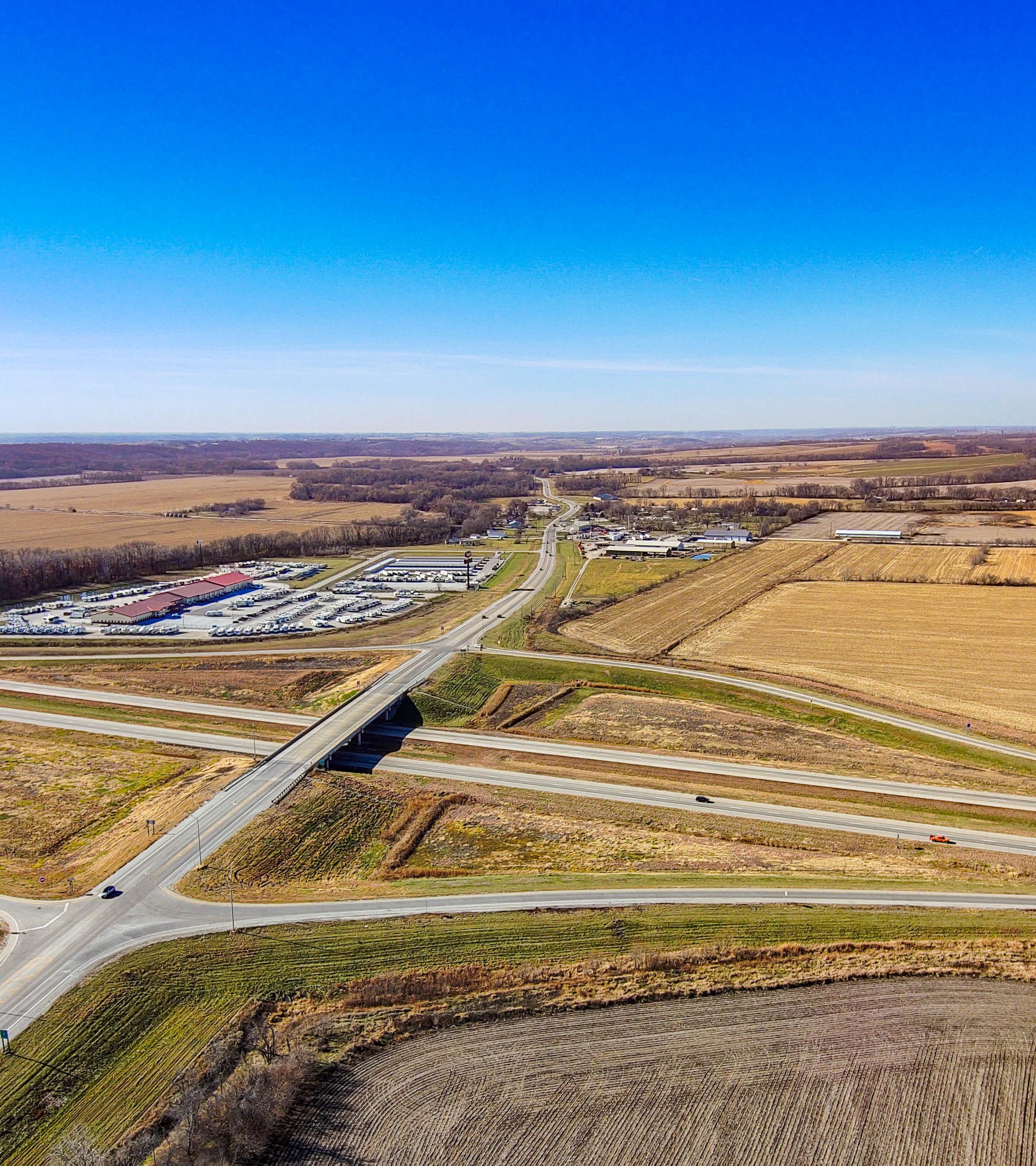
A well-planned transportation network provides access for people and goods to move freely throughout the County. An efficient transportation network allows for connectivity and includes a variety of uses including highways, local roads, and recreational/pedestrian and bike trails. This section provides information about the current state of Warren County’s transportation system. In the Looking Forward section of this plan, transportation goals aim to provide the County with a safe, convenient, efficient, and economical transportation system. These plans will be coordinated with state and regional transportation plans and take into consideration the need
for diverse modes of transportation, accessibility, and interconnectivity of the various modes of transportation. Annual Average Daily Traffic (AADT) for primary corridors are shown in Map 2.2. The AADT expresses the total volume of vehicle travel on a road for one year, divided by 365.
This section will provide guidance to further the vitality and character of both new and established communities and plans to ensure an adequate housing supply that meets both the existing and forecasted housing demand. This will include a brief inventory and analysis of the local housing stock. The implementation portion of this section will identify programs that promote the development of new housing and maintenance or rehabilitation of existing housing and that provide a range of housing choices that meet the needs of the residents of Warren County.
Health and Safety
Resilience
This section will address various potential hazards that have the greatest likelihood of impacting Warren County or that pose a risk of catastrophic damage as such hazards related to land use and development decisions, as well as the steps necessary to mitigate risk after considering the local hazard mitigation plan approved by the Federal Emergency Management Agency.
County Facilities & Services
This section will provide an inventory and guidance to assist future development of public facilities that are necessary or desirable to meet the projected needs of Warren County. This section will also include information and goals to guide future development of public utilities such as sanitary sewer service and storm water management.
Lake Ahquabi
New Virginia, IA
Indianola, IA
Public Health
Public health is the science of protecting and improving the health of individuals and communities through myriad methods. Sanitation and hygiene, access to resources, and disease prevention are all aspects of public health that impact every resident of communities large and small. Warren County is consistently working to improve conditions and opportunities for residents through access to quality water, sanitation services, and food stability, among other factors that impact an individual’s health. In this section of the plan, we will identify goals and strategies to continue public health improvements for current and future residents of Warren County.
LAND USE
The Land Use Chapter provides a guide to the growth and development within the unincorporated areas of Warren County through the year 2044 and beyond. A new Future Land Use Plan is a key feature of this chapter and was created based upon an analysis of existing land use,
recent development trends, the location of natural/culture resources, and growth projections. Land use and growth management goals and strategies are provided at the end of the chapter.
Land Use Overview
Future Land Use Plan
The Future Land Use Plan lays out the preferred ultimate development for unincorporated Warren County that includes both new development and preserved land
for agriculture and open space. More land than is likely needed for future growth in the County has been identified in the plan to allow for some flexibility in the location of new development. As a longstanding rural County, special emphasis has been placed on the preservation of agricultural land and open space.
Indianola, IA
There are many factors that impact the Future Land Use Plan of an area including the existing land use pattern, the location of existing and proposed major roadways, the presence of natural features, the ability to provide necessary infrastructure for development, as well as the desires of the residents. For a County, the growth and development plans of incorporated cities also play a huge role, especially in the fringe areas between more urban and rural areas. While the Future Land Use Plan identifies a vision for new growth, it is not a zoning map and does not hold any legal authority. Rather, it is meant to guide decision-making regarding annexation and zoning.
Basis for Zoning
A key purpose of the Future Land Use Plan is to serve as the basis for determining the appropriate zoning for property in the unincorporated parts of the County. Chapter 335 of the Code of Iowa, which grants counties the authority to enact zoning regulations, requires that said zoning regulations, “…be made in accordance with a comprehensive plan and designed to preserve the availability of agricultural land...”
The Comprehensive Plan should be consulted whenever the County is amending a zoning code regulation and every time a property is rezoned. This is to ensure the change is
consistent with the goals, policy recommendations, and land use designations of this plan. Included within the Land Use Chapter is a Zoning Compatibility Matrix. This matrix provides the County assistance and guidance on Zoning Districts that are compatible or partially compatible with each of the Future Land Use classifications.
When to Update
The Future Land Use Plan shows the preferred future land use layout for Warren County’s unincorporated areas. However, the Future Land Use Plan does not need to remain stagnant or unchanging. If situations or the environment change significantly and the County wants to re-zone a property in a way that is inconsistent with the Future Land Use Plan, the Future Land Use Plan should be amended appropriately to reflect the updated conditions of the County. If or when that happens, the County should review the document to identify the justifications for an amendment to this plan and the findings adopted as part of the official record.
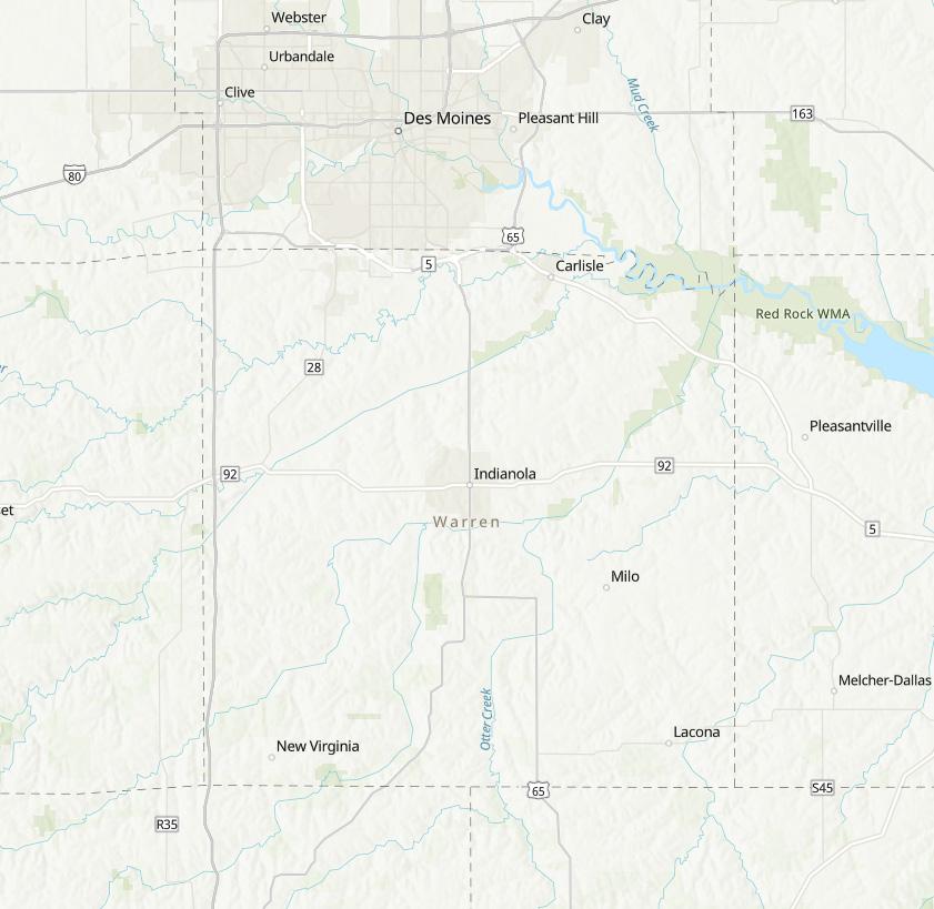
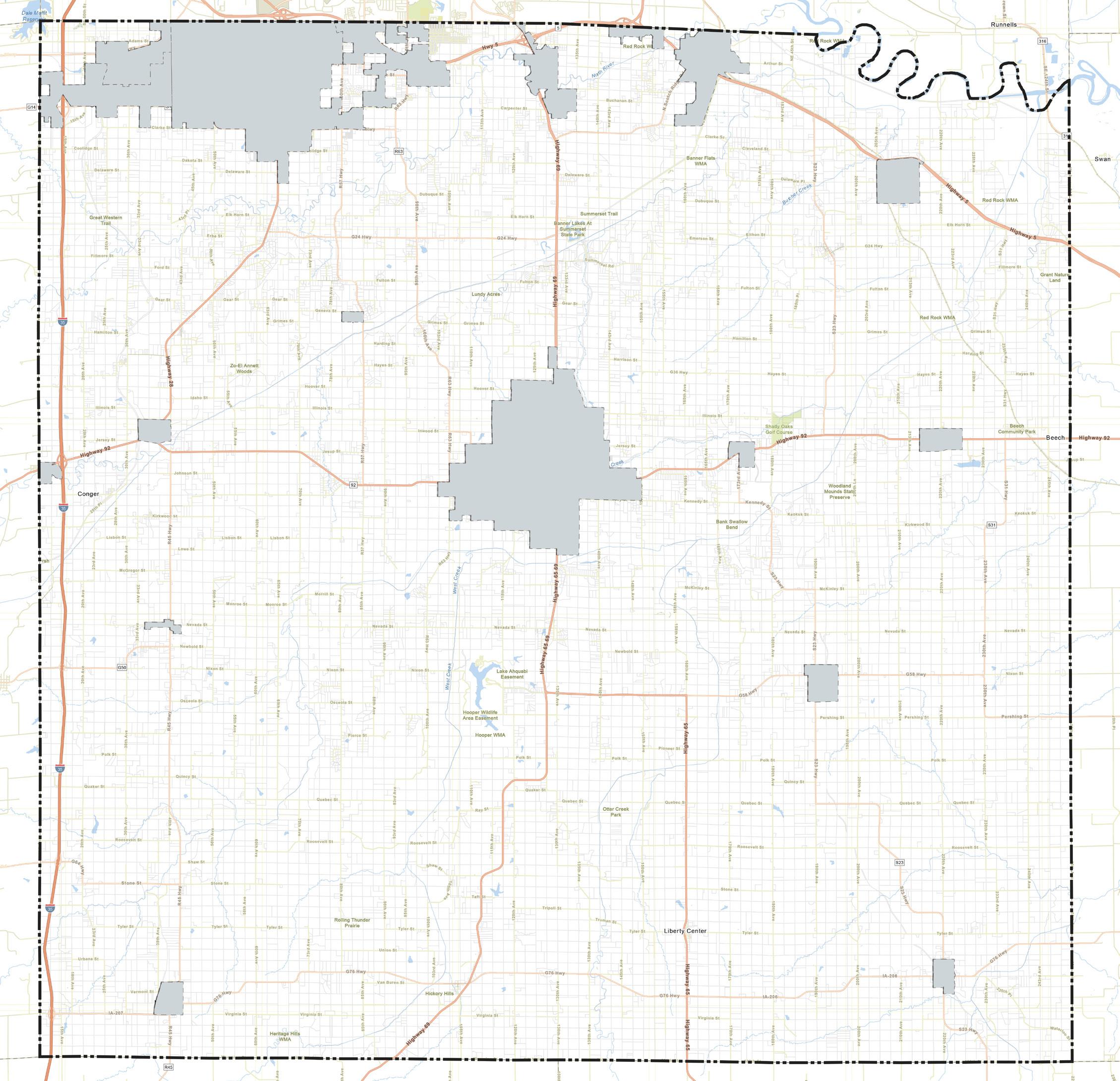
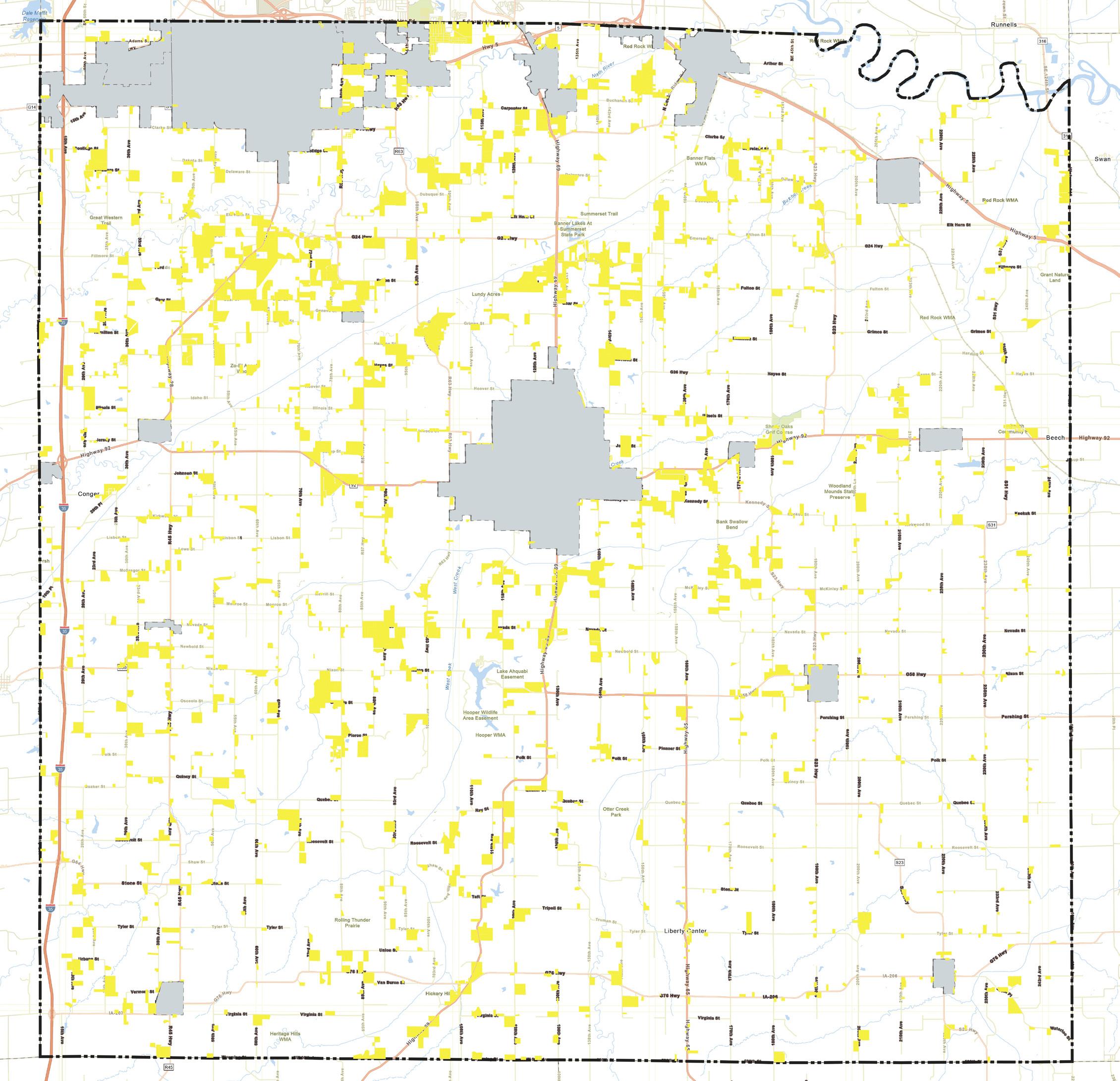
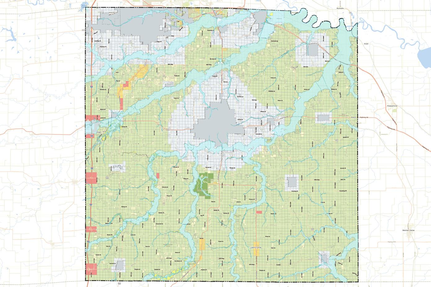
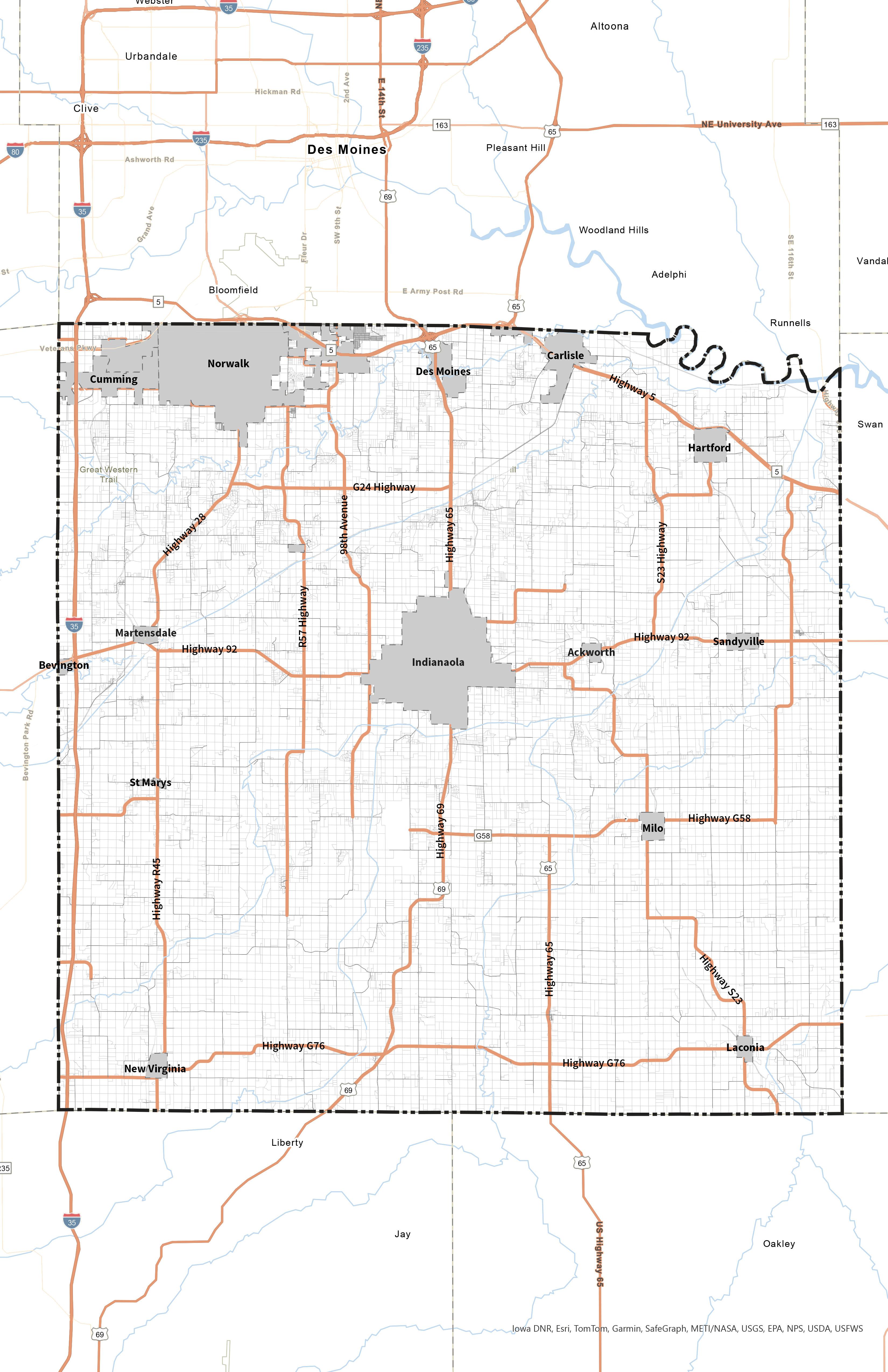
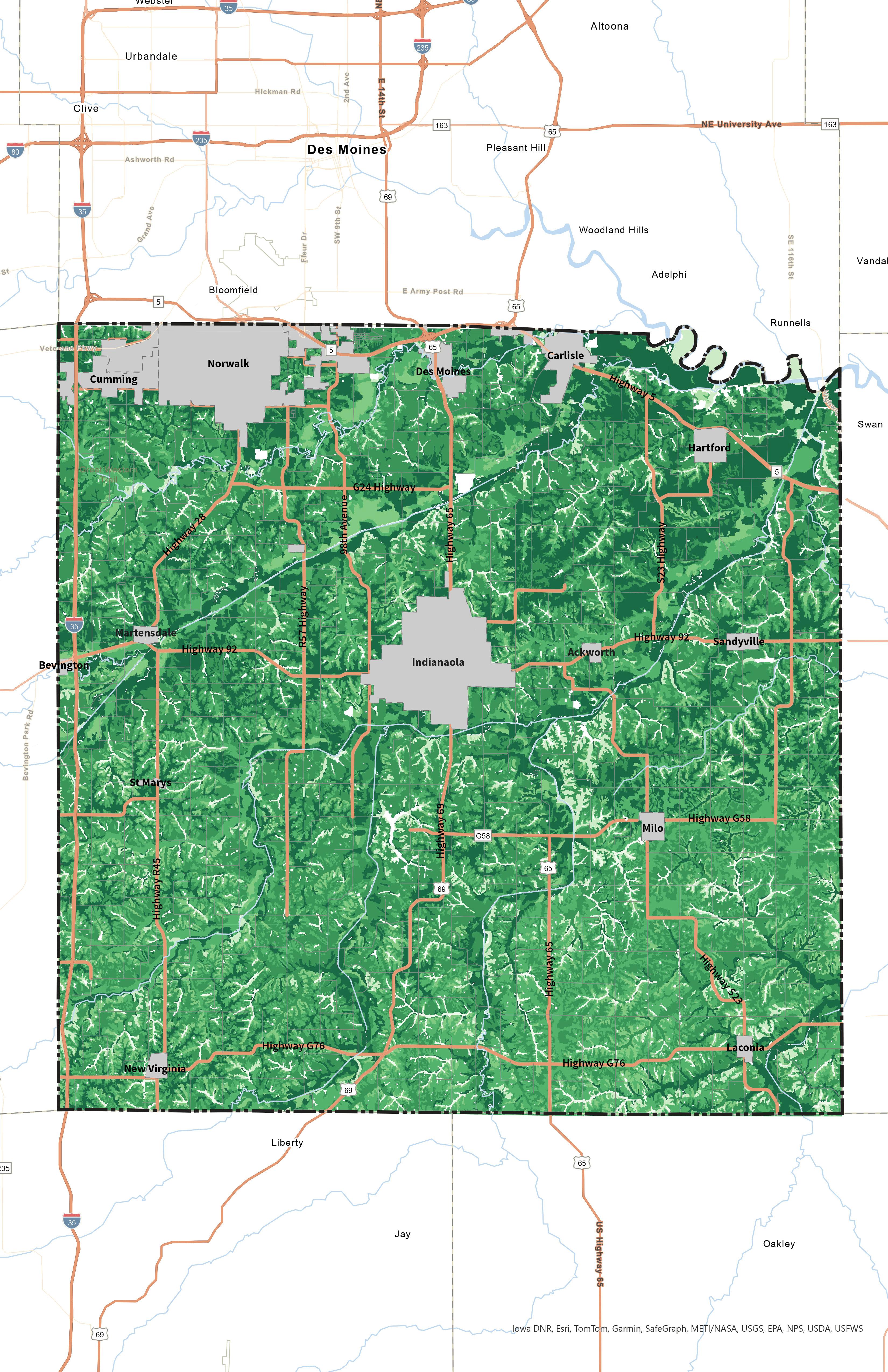
Planning Boundary
Map 2.3 shows the planning boundary for the Wonderful Warren Comprehensive Plan. Warren County is responsible for the unincorporated areas of the County. Incorporated areas are shown in gray in the figure below. Every year, more of Warren County is annexed by cities – mainly
Norwalk, Indianola, or the City of Des Moines. Generally, this growth has been more driven by the expanding Des Moines metropolitan area. This chapter will plan for all of the unincorporated areas as of the time of this plan. However, it recognizes certain areas that will likely fall under city control within the horizon year of the plan.
Warren County Boundary Incorporated Area
Map 2.3 - Planning Boundary Map
Norwalk
Indianola Cumming
Des Moines
Carlisle
Hartford Ackworth
Sandyville
Martensdale
Bevington
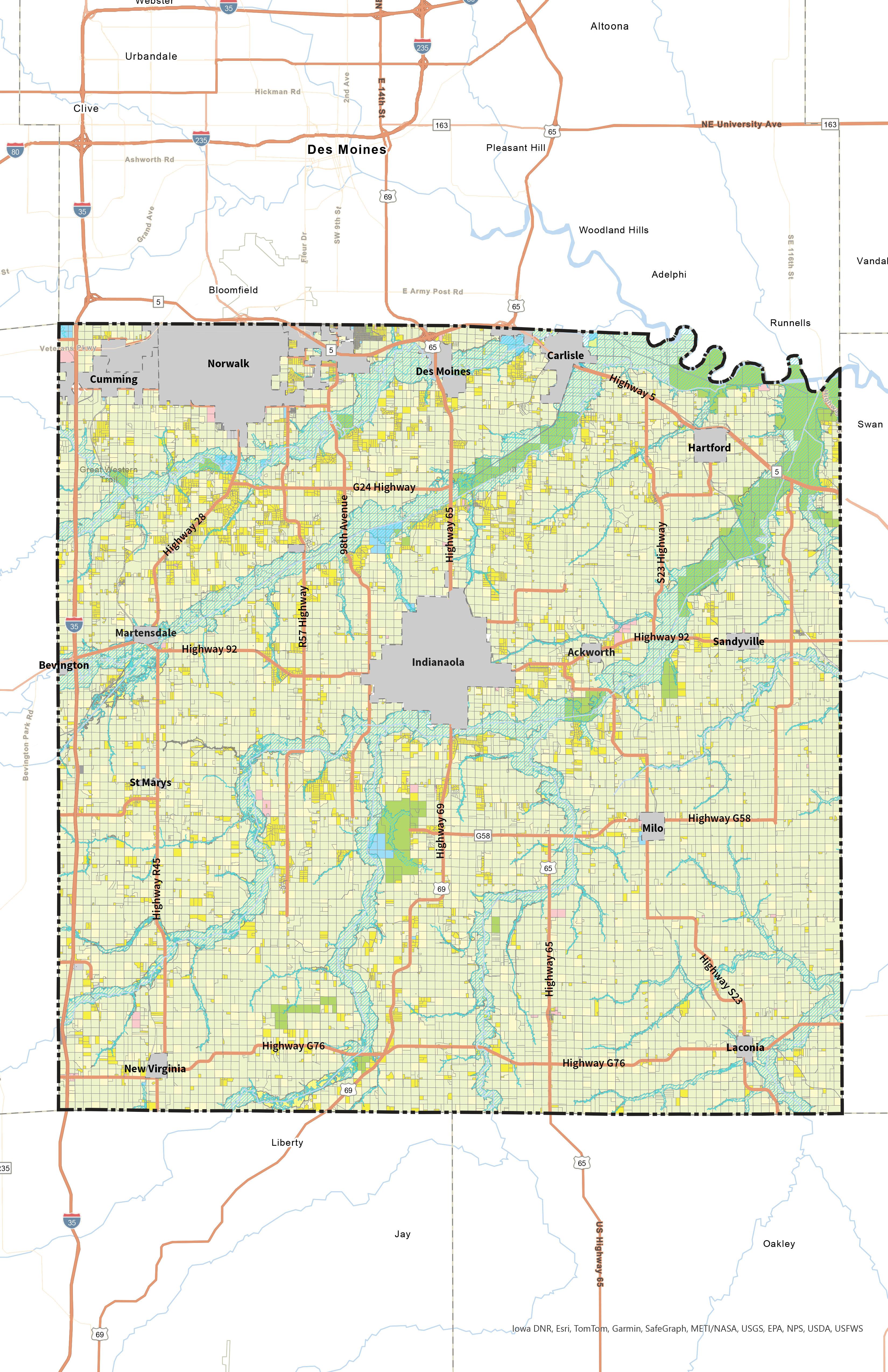
Existing Land Use
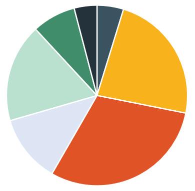
The existing land use in the unincorporated areas of Warren County is shown in Map 2.4 on the following page. Each land use category is described below and the land use totals by acre are shown in Table X.X below.
Agricultural/Undeveloped
This includes all ongoing agricultural activity such as cropland and livestock operations. The category also includes all otherwise undeveloped land and open space. Collectively, there are over 267,000 acres of agricultural/ undeveloped land, which accounts for nearly 80% of the total unincorporated land in Warren County.
Agricultural Residential
Agricultural Residential includes all ag-dwellings in Warren County. This typically includes a single-family dwelling located on and used in direct connection with a farm or where agriculture provides income to the occupant. In total, this accounts for over 40,000 acres, or nearly 12% of all unincorporated land uses.
Low-Density Residential
Low-Density Residential includes all single-family detached homes built to a typical density of between 1 to 4 units per acre. Approximately 7.7% of Warren County’s unincorporated land area is made up of single-family parcels, which equates to just over 26,000 acres.
Table X.X - Existing Land Use Breakdown
Public/Institutional
Public/Institutional land uses include all public or semipublicly owned land such as Warren County administration buildings, police, fire, schools, churches, and fraternal/ civic organizations. This land is typically tax exempt and in unincorporated Warren County accounts for just over 3,200 acres, or 1.0% of total land use.
Parks and Conservation
Parks and Conservation land includes all parks and recreation land, which can include both public and private recreation. Typical park and conservation land could be County parks, state parks, national parks, natural areas, golf courses, and land for other recreating activities. Fewer than 1,500 acres of unincorporated Warren County is Parks and Conservation.
Commercial
Commercial is another minor land use category in Warren County, accounting for just under 1,500 acres or 0.4%. Commercial uses include retail, restaurant, gas stations, offices, and other revenue generating land uses.
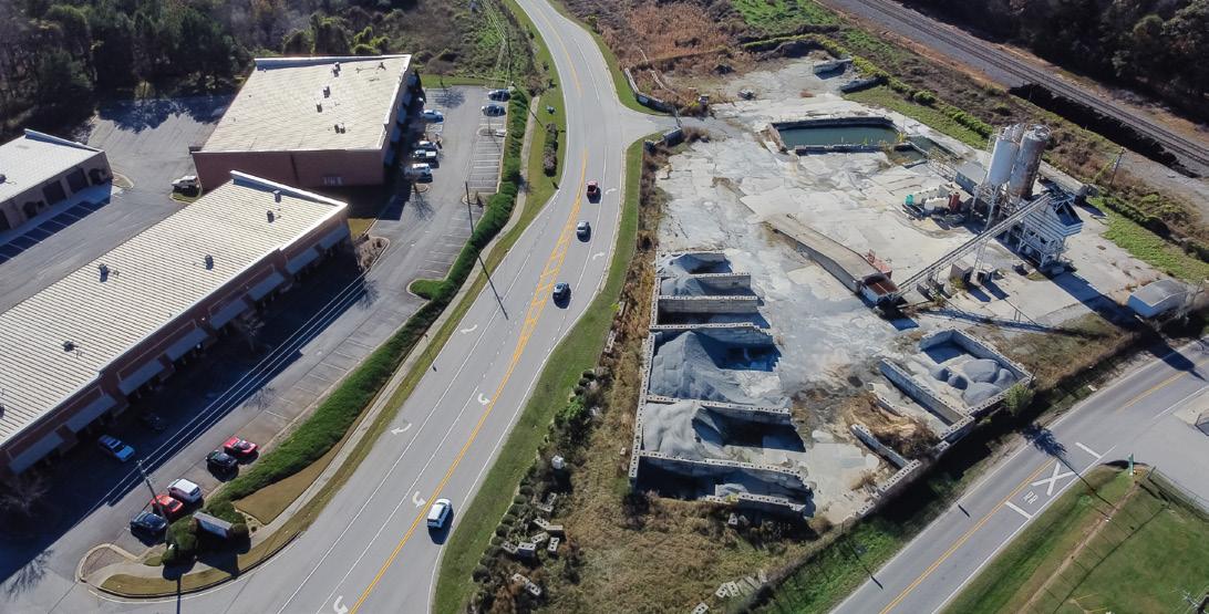
Industrial
Industrial is the least dominant land use in Warren County today. In total, only around 142 acres of land in Warren County is set aside for industrial/ light industrial uses such as manufacturing, warehouse, logistics, or distribution. This accounts for only 0.04% of all the land use in unincorporated Warren County. Existing Land Use
Agriculture is by far the most dominant land use type in Warren County, accounting for nearly 80% of all land uses.
Map 2.4 - Existing Land Use Map
Key Future Land Use
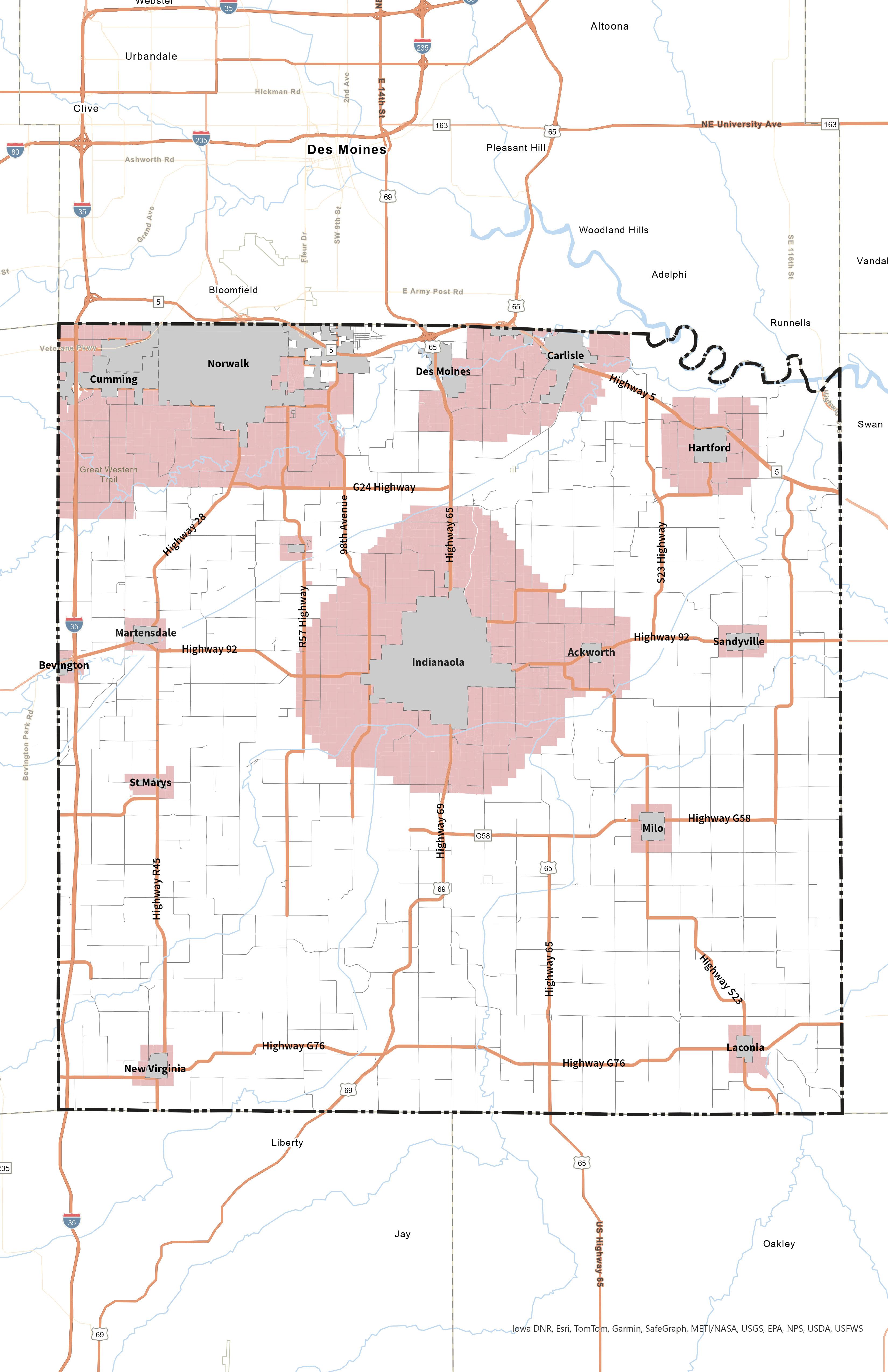
City Growth Areas
Several cities in Warren County are and will likely continue to experience steady population growth. Norwalk, Indianola, Cumming, and Carlisle are prime locations suitable for new development in an expanding Des Moines metro. These four communities
have a recently completed Comprehensive Plans which outlines their potential growth areas (Map 2.5).
Other incorporated cities in Warren County are shown with a growth buffer of around 1/2-mile to account for limited population growth and annexation.
Norwalk
Map 2.5 - City Growth Areas
Agriculture + Open Space Preservation
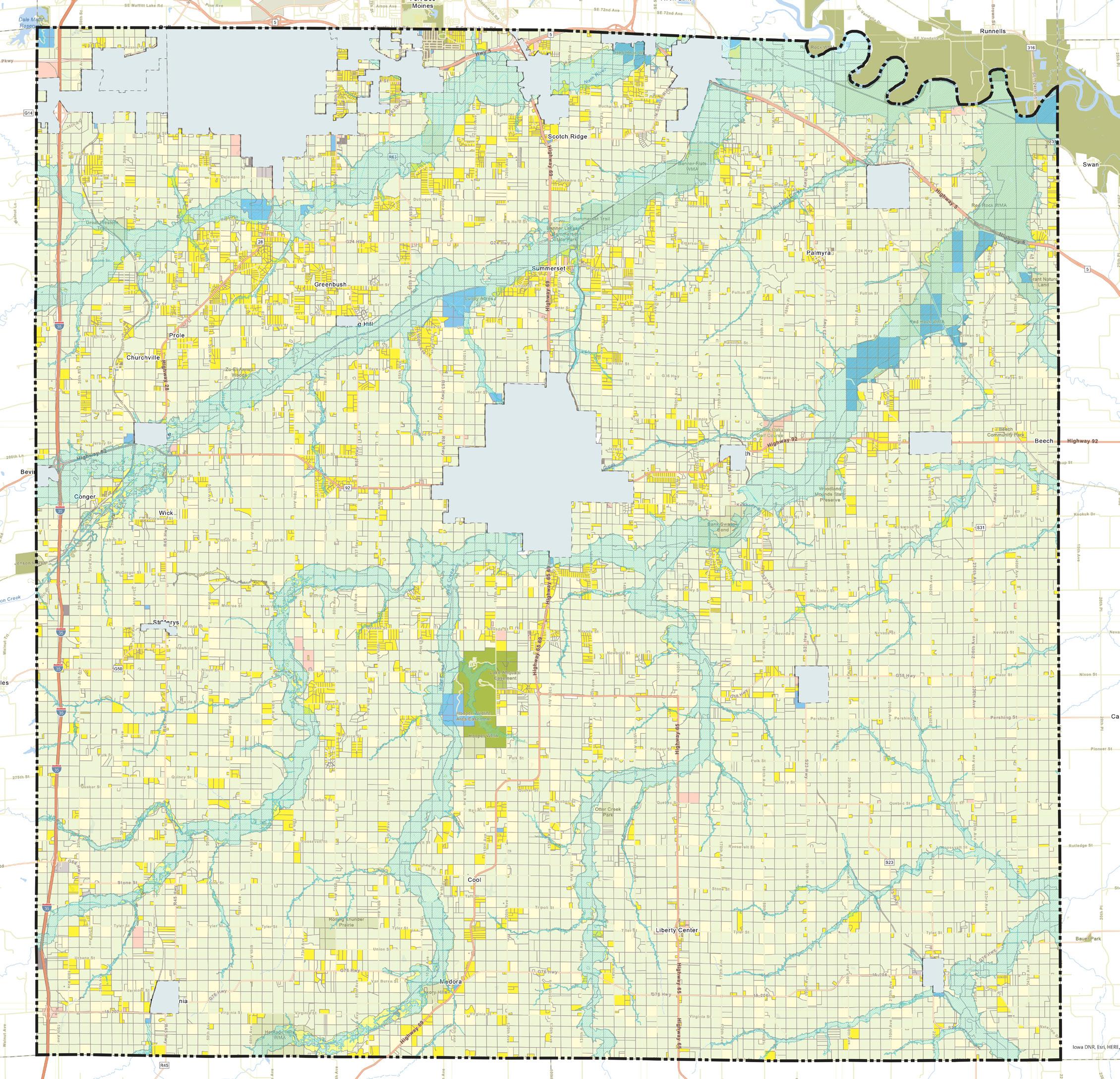
The existing land use analysis revealed a large amount of agricultural land in Warren County. Not only is agriculture and farming an important part of Warren County’s economy and history, the soils in Warren County are highly productive. Map 2.6 below shows the crop suitability rating by soil types for Warren County as of 2022. The National Commodity Crop Productivity Index
ranks the inherent capability of soils to produce agricultural crops without irrigation. Values will range from 0.0 to 1.0. This data is provided through Esri using data from the Natural Resources Conservation Service in the U.S. Department of Agriculture. The darker the green the higher the predicted productivity. Northern Warren County has the highest concentration of the darkest green color but the entire County is quite suitable. Agricultural land is a critical piece of the state’s economy and Warren County’s culture and should be preserved whenever possible.
Des
Productivity Index
Map 2.6 - Crop Productivity Index
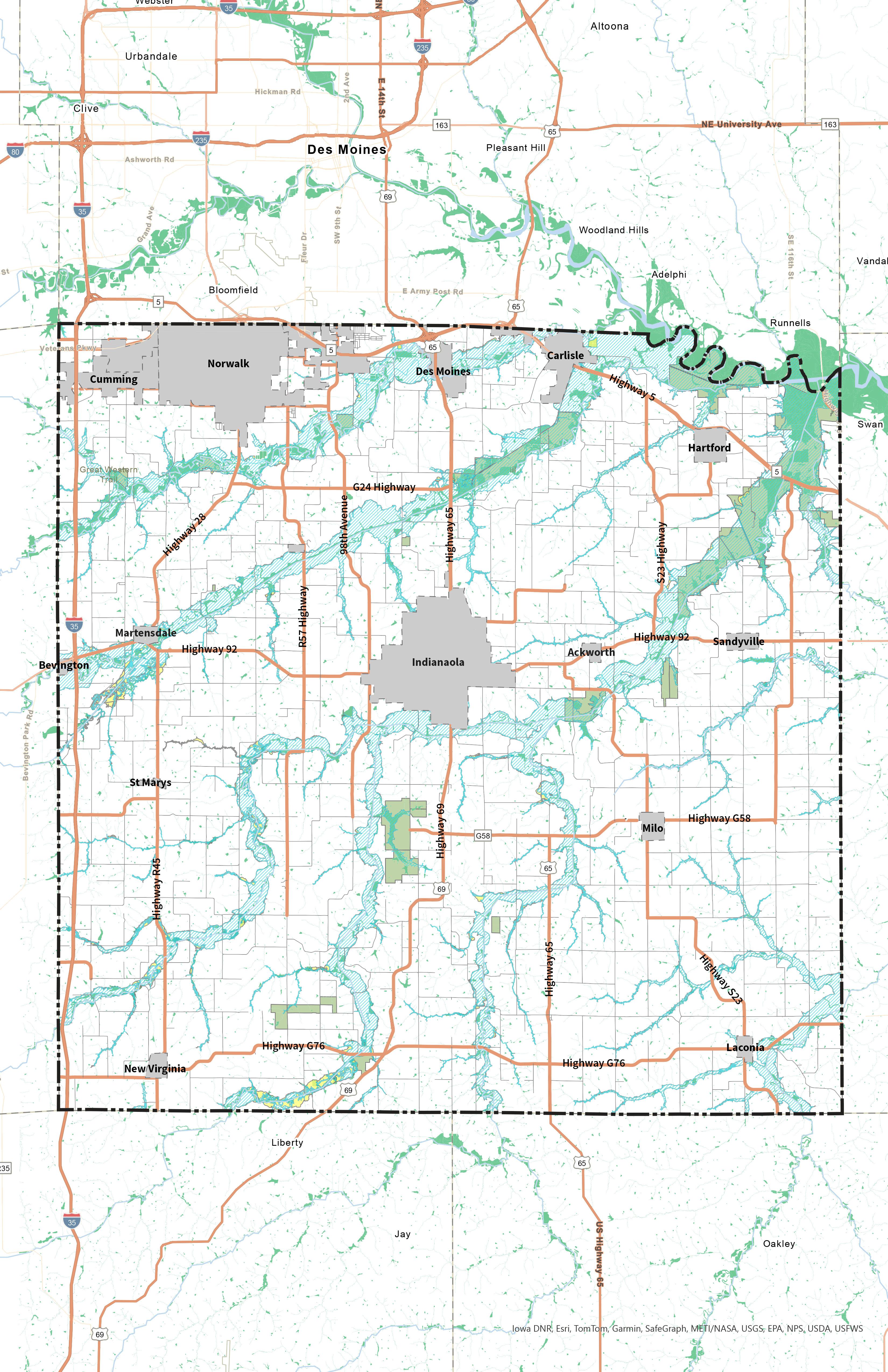
Natural Resource Conservation + Protection
In addition to ongoing agricultural practices, two critical natural resources in Warren County are floodplain and wetlands (Map 2.7). Floodplain, which is generally divided into 100-year and 500-year floodplain, are areas where there is a chance of flooding in any given year. Development and impermeable surfaces such as pavement or structures can be threatened due to flood events. They
may also exacerbate flood events by prolonging water inundation and preventing it from filtering underground, ultimately increasing stormwater runoff. Generally, development should be avoided in this area.
Wetlands are sensitive ecological land that is inundated with water at least part of the year. Wetlands help to naturally reduce pollutants in water, slow flooding, help with reabsorption of floodwater, and are important habitats for wildlife. Development should avoid wetland areas whenever possible to maintain this natural asset.
Map 2.7 - Wetlands + Floodplain
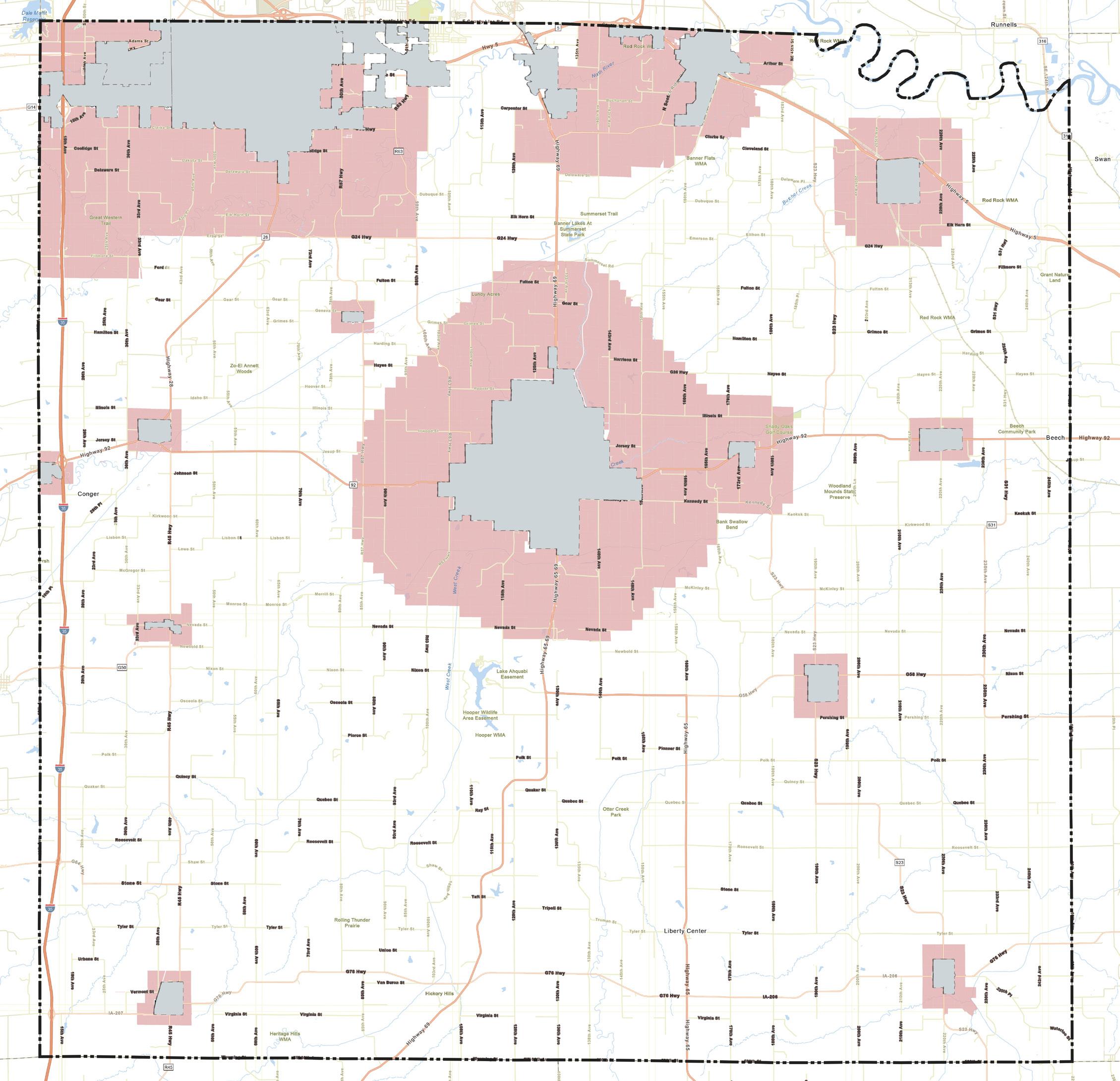
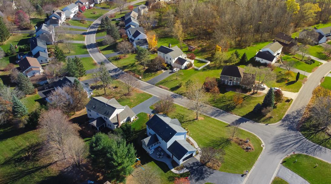
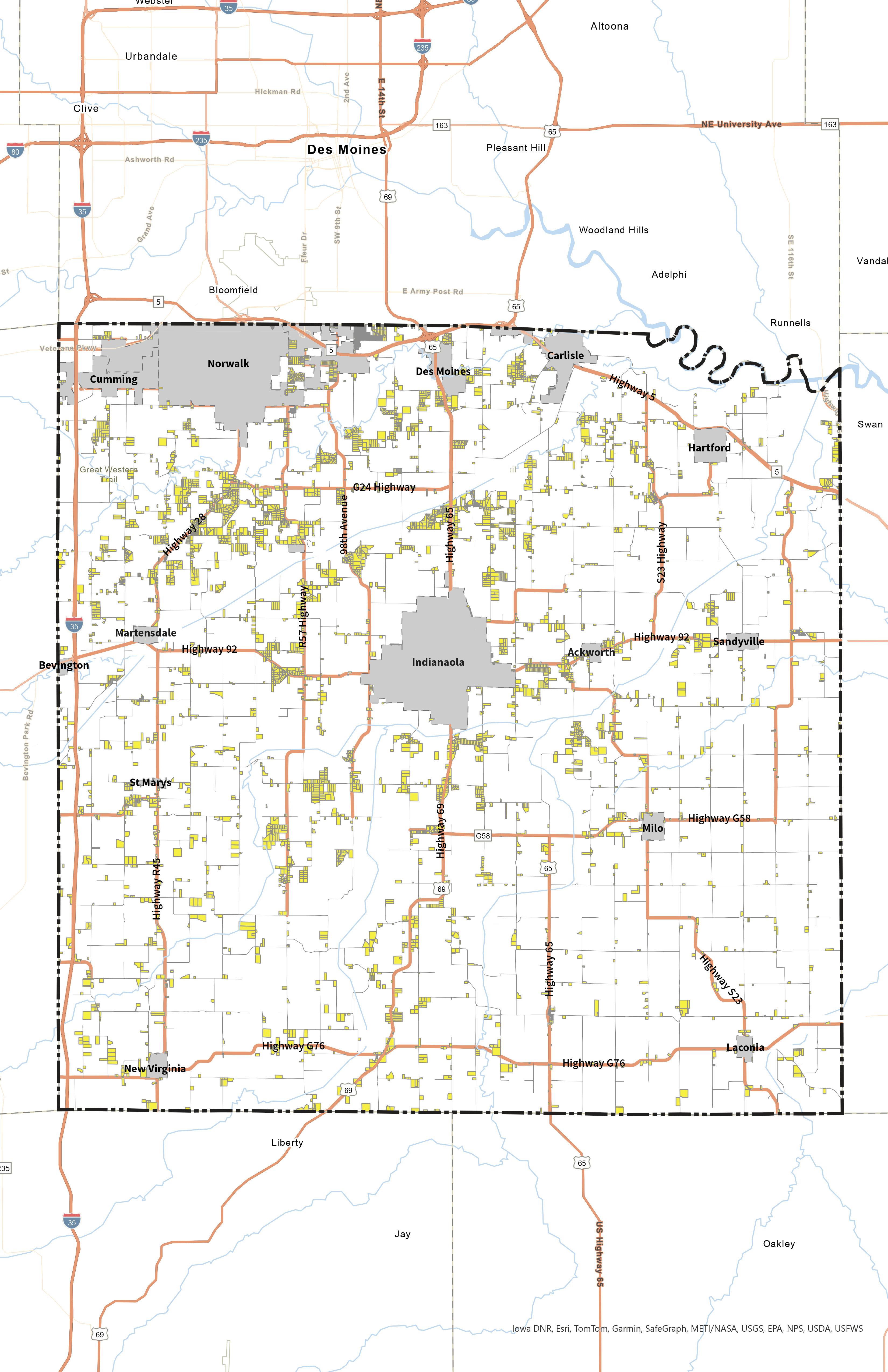
Rural Residential Growth
Warren County has a considerable amount of rural residential growth occurring in the unincorporated areas, especially in the area south of Norwalk and north of Indianola in northwest Warren County. Northeast and southwest Warren County have some rural residential as well, especially compared to the southeast corner, which is mainly agriculture or ag dwellings (Map 2.8 below).
Rural residential growth can be viewed as incompatible with the long-term sustainability of agricultural activity in an area. As more residents cluster in an area, there may be some negative externalities of agricultural land such as dust, odor, or noise that lead to conflicts. As land becomes more valuable for rural subdivision growth, ongoing agricultural land can also be threatened. Once agricultural land is turned to the built environment, it is difficult, if not impossible to revert.
Norwalk
Cumming
Des Moines Carlisle
Map 2.8 - Low-Density Residential Areas
Spring Hill
ENGAGEMENT& PLANNING PROCESS
“If you can’t describe what you are doing as a process, you don’t know what you’re doing.”
- W. Edwards Deming
Who was involved?
Every plan has a process. This chapter provides an outline of the planning process and a description of public participation methods. Public engagement is imperative to the Comprehensive Future Land Use Planning process. Wonderful Warren was developed by members of Warren County. Staff, elected officials, residents, and stakeholders provided diverse and valuable perspectives from which the goals and strategies were derived. Portions of these perspectives including summaries of the feedback received are included here.
COUNTY PLANNING OVERVIEW
The Comprehensive Land Use Plan is intended to guide the future actions of a city or county. The Iowa Supreme Court has stated that the legal purpose of the Comprehensive Land Use Plan is to “direct use and development of property by dividing it into districts according to present and potential uses.”
The Comprehensive Land Use Plan also illustrates a vision for the future of a place, providing goals and strategies
for achieving all activities related to the local government. This includes guidance on how to make decisions on public and private land development proposals and areas of preservation such as agricultural and historic preservation. Most plans are written to provide direction for ten to twenty years after their adoption. Plans should receive a considered review and possible update every five years.
Iowa’s Smart Planning Law
Iowa Code 2023, 18B.2
Subsection 2: A municipality [meaning a city or County] shall consider the smart planning principles under section 18B.1 and may include the following information, if applicable, when developing or amending a Comprehensive Land Use Plan under chapter 335 or chapter 414 or when developing or amending other local land development regulations:
PLANNING PROCESS
Development of a Comprehensive Land Use Plan begins with identification of the needs. Needs are as unique as each community and their current situation. Preservation of land, resources, and culture are often instigators of the need for a Comprehensive Land Use Plan. Once the need for a plan is identified, the process to develop a plan begins.
Warren County released a request for proposals on August 1, 2022, for consultants to provide a work plan and estimated cost by August 31, 2022. After review of proposals and interviews, a team of consultants from MSA Professional Services, Inc., Confluence, and Group Creative Services was selected to develop the Warren County Comprehensive Land Use Plan 2044.
The consultant team proposed a 14 - 18 month project consisting of research, outreach, and collaboration among stakeholders, community leaders, and residents. Great engagement is essential for creating a plan and gathering support for successful implementation of a plan’s goals and actions. The team used feedback from these engagement opportunities along with research about the population, geography, and economic trends of both the County and the surrounding region to develop a plan that will help Warren County thrive over the next 20 years.
Following the adoption of Wonderful Warren, the consultants worked with the Zoning Commission to adjust the Warren County Zoning and Subdivision Ordinances to help reach the goals set forth in the plan.
Engagement Activities
Development of Wonderful Warren included the following engagement activities which helped the consultant team identify the vision, establish goals, and develop actions for implementation:
• 6 Comprehensive Land Use Plan and Codes Steering Committee (CPCSC) Meetings
• Public Workshops (2)
• Community Survey/Online SWOT Analysis
• Crowdsource Mapping
• Stakeholder Interviews
• Zoning Commission Workshops (3)
• Warren County Board of Supervisors Workshops (2)
Project Timeline
The Comprehensive Land Use Planning Process
Public Engagement
Existing Conditions Analysis
Plan Development
Month Activities
Month 1 (March, 2023)
Month 2 (April, 2023)
Month 3 (May, 2023)
Month 4 (June, 2023)
Month 5 (July, 2023)
Month 6 (August, 2023)
Month 7
(September, 2023)
Month 8 (October, 2023)
Month 9 (November, 2023)
Month 10 (December, 2023)
Month 11 (January, 2024)
Month 12 (February, 2024)
Month 13 (March, 2022)
Month 14 (April, 2024)
• CPCSC Kickoff Meeting
• Online Engagement Tools Released
• Public Engagement Open House
• Existing Conditions Analysis
Plan Adoption
• CPCSC Meeting #2 - Community Mapping & Existing Land Use Review
• Draft Existing Conditions
• CPCSC Meeting #3 - Recreation and Cultural Needs
• County Staff and Board of Supervisors Check-in
• CPCSC Meeting #4 - Review of Goals and Strategies
• Zoning Commission Workshop #1 - Review of Revision Needs
• Draft Plan (Internal)
• Draft Plan Release
• CPCSC Meeting # 5 - Review Draft Plan
• Draft Plan Open House
• CPCSC Meeting #6 / Zoning Commission Workshop #3 - Review Plan and Ordinance Revisions
• Adoption Process Finalized
PUBLIC OUTREACH
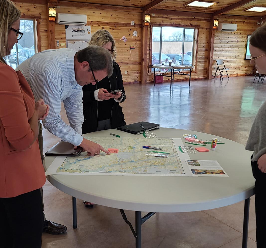
Development of the Warren County Comprehensive Land Use Plan was led by a steering committee known as the Warren County Comprehensive Land Use Plan and Codes Steering Committee (CPCSC). Members of the CPCSC were identified by County leaders and the consultant team. Participants joined in a variety of wayssome called with questions and wanted to stay involved, others joined after the public workshop.
Members included representatives from real estate, developers, department directors, and agriculture, amongst many other backgrounds. Each individual brought unique knowledge and a skill set that helped balance the needs of Warren County. The diverse
CPCSC Meetings:
February 28, 2023
June 6, 2023
August 22, 2023
October 24, 2023
January 30, 2024
February 27 , 2024
perspectives of the CPCSC provided rich conversations regarding resource allocation and preservation, recreation and livability needs, design standards, and cultural aspirations for the County.
Activities that led discussion in the CPCSC meetings included a SWOT (Strengths, Weaknesses, Opportunities, and Threats) analysis, existing land use review, recreation and cultural visioning, and review of the proposed goals and strategies. The CPCSC reviewed the plan template and the draft plan prior to public review or that of the Zoning Commission and Board of Supervisors. The group acted as a sounding board for the consultant team and staff.
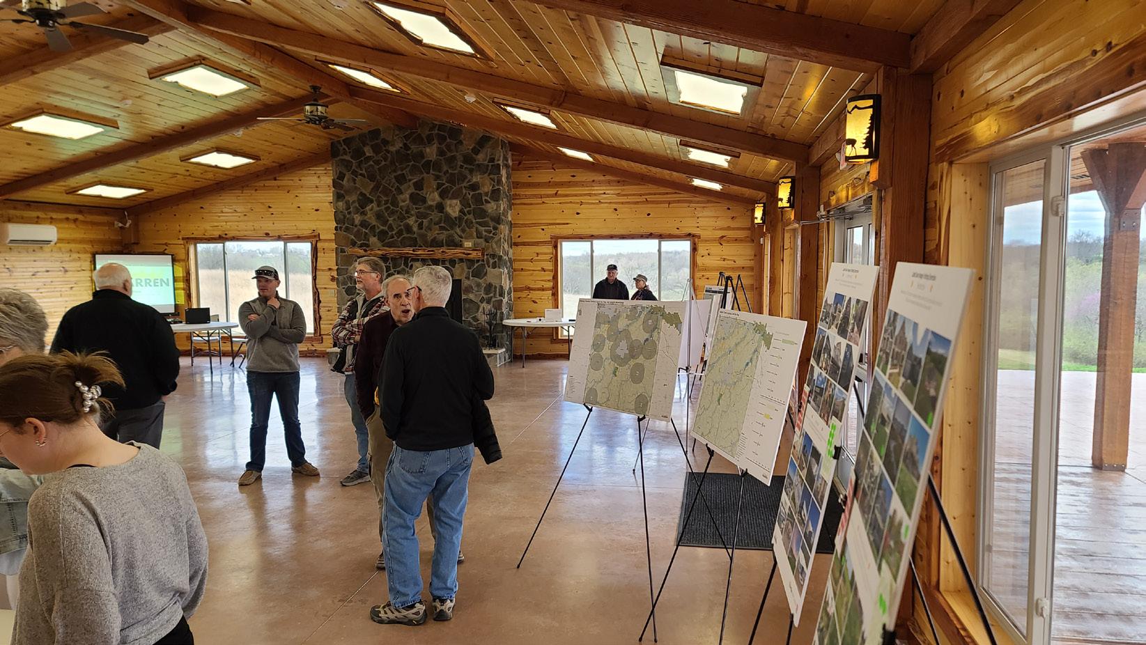
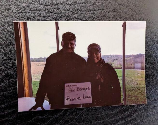
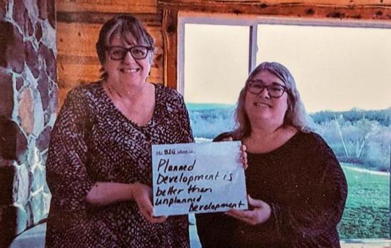
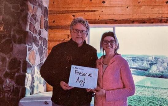
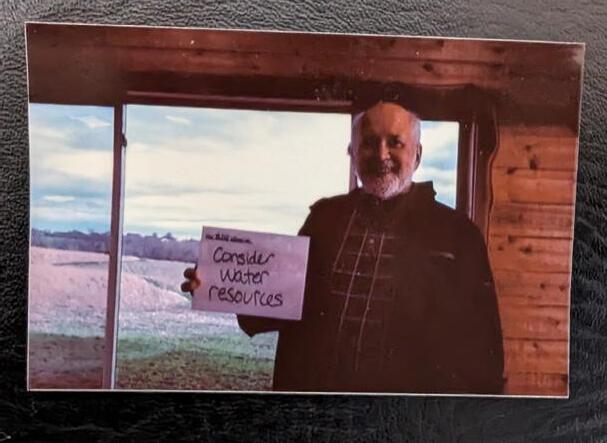
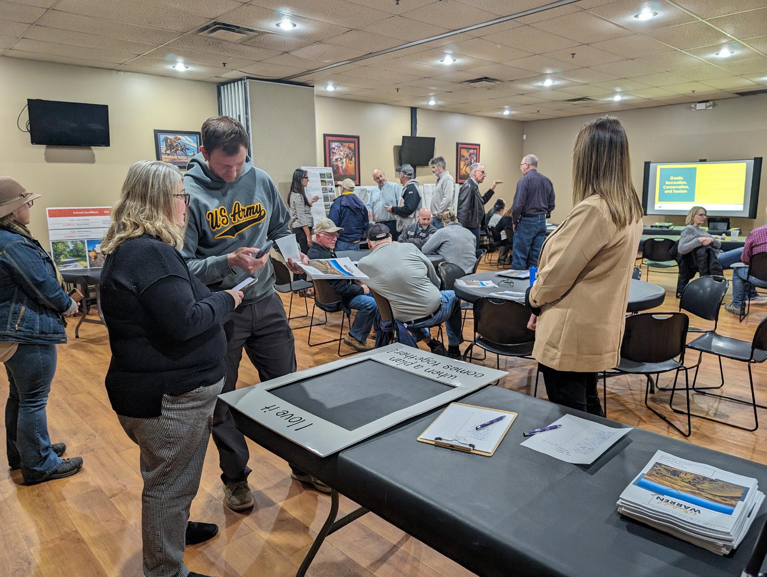
Warren County hosted a public input workshop on April 20, 2023. The event took place at Warren County Conservation’s Middleswart Lodge from 5 pm to 7 pm. Attendees participated in various activities to provide information about the current state of the County and inspire ideas for the future. Approximately 24 residents attended the event.
Activities included a land use puzzle station where participants could learn about the current land uses and identify what the future land use plan should include. Another mapping activity asked users to identify assets
Public Input
and opportunity areas throughout the County. A selfie station asked participants to share their big ideas for the future of Warren County.
A SWOT Analysis asked people to share the strengths, weaknesses, opportunities, and threats that may impact the County moving forward. And finally, the consultant team shared the online engagement tools including the project website, crowdsource map, and survey - all of which are addressed individually later in this chapter.
Stakeholder Interviews
Stakeholder interviews are a valuable means to gain insight through the perspectives of people who know their community in a unique way. Elected officials, real estate agents, land owners, business owners, development professionals, department directors, and
agency representatives were invited to participate in a one-on-one interview to provide their specific ideas about the current and future needs of Warren County.The interviews were guided by a series of questions included below.
Stakeholder Interview Questions
1) Describe your connection to Warren County – What does your business/organization do? What is your role in the business/organization?
2) Why are you located in Warren County and what do you like about the area?
3) What changes would you like to see in the transportation system in Warren County?
4) What types of development and businesses would you like to see in Warren County?
a.Where would you like to see this?
5) What are your ideas about design standards?
6) What strengths do you see in Warren County?
. How are they being capitalized upon?
7) What are Warren County’s weaknesses?
. a. Are they currently being addressed?
. b. What do you think should be done?
8) If you were promoting Warren County, what elements would be important to include?
9) Are there any specific areas of Warren County that need reinvestment?
10) Is there anything else you would like us to know about – information or ideas for the Warren County 2024 Comprehensive Land Use Plan?
Summary of Stakeholder Feedback
1) Many stakeholders have lived in Warren County for their entire lives or more than 20 years!
2) Respondents reported loving the County and the culture and environment that it provides including recreation, agriculture, and great people.
3) Separation of uses was the most commonly discussed transportation need.
4) Local businesses including small agricultural operations are the top priority in Warren County.
5) Design that supports the culture of Warren County.
6) Opportunities, community, and proximity to amenities are the top strengths discussed.
7) Unplanned development and division of prime agricultural land are two primary weaknesses that face Warren County.
8) Agriculture, recreation, and small-town feel with proximity to the Des Moines Metro.
9) Highway corridors.
10) Respondents shared personal testimony to the greatness of Warren County and their hope for the future.
Draft Plan Open House
Warren County hosted a Draft Plan Open House on February 13, 2024. The event took place at Sports Page of Indianola from 5 pm to 7 pm. Attendees reviewed drafts of the Comprehensive Land Use Plan, enjoyed refreshments, and discussed key pieces of the Plan that were presented by the consultant team as posters and a PowerPoint presentation. Approximately 40 residents attended the event.
The Wonderful Warren project website provided a space to share project information and a venue for public comments throughout the planning process. Here, the project team shared information about planning, event notices, and draft plan documents.
Project Website Survey
Online Engagement
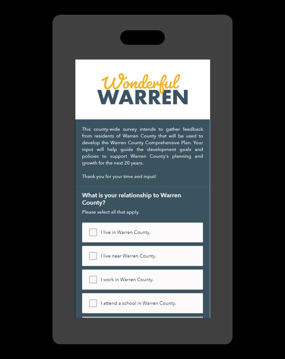
A community survey was created and available to community members. This included general questions and a SWOT (Strengths, Weaknesses, Opportunities, and Threats) analysis.
Broad questions allowed the project team to collect community members’ views and thoughts about Warren County in four categories: County character, development, mobility, and conservation. This input opportunity was hosted through ESRI and allowed users to participate via computer, tablet or smartphone. It was also available in printed copies at the Warren County Zoning Office. Three hundred and three individuals completed the survey.
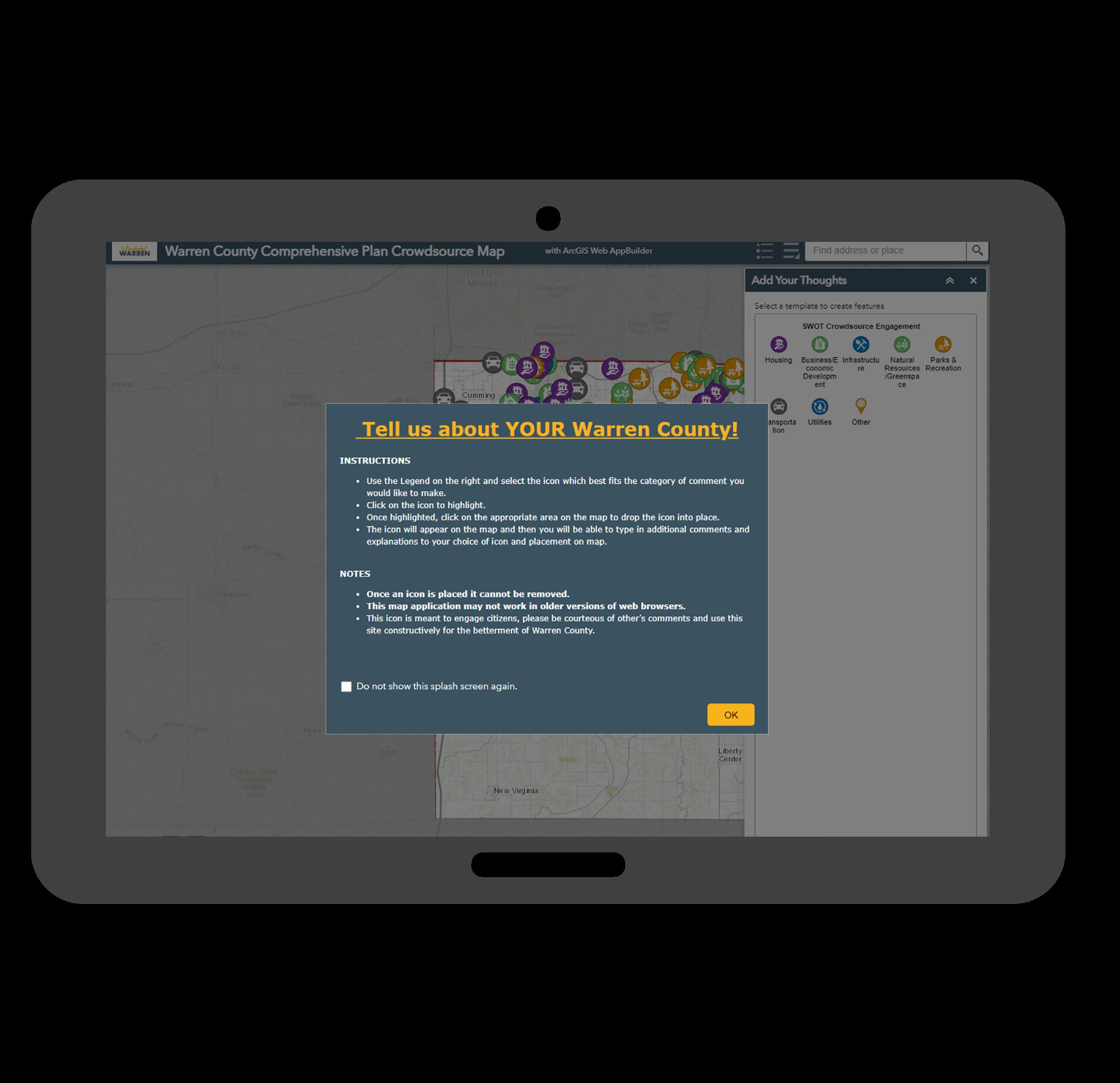
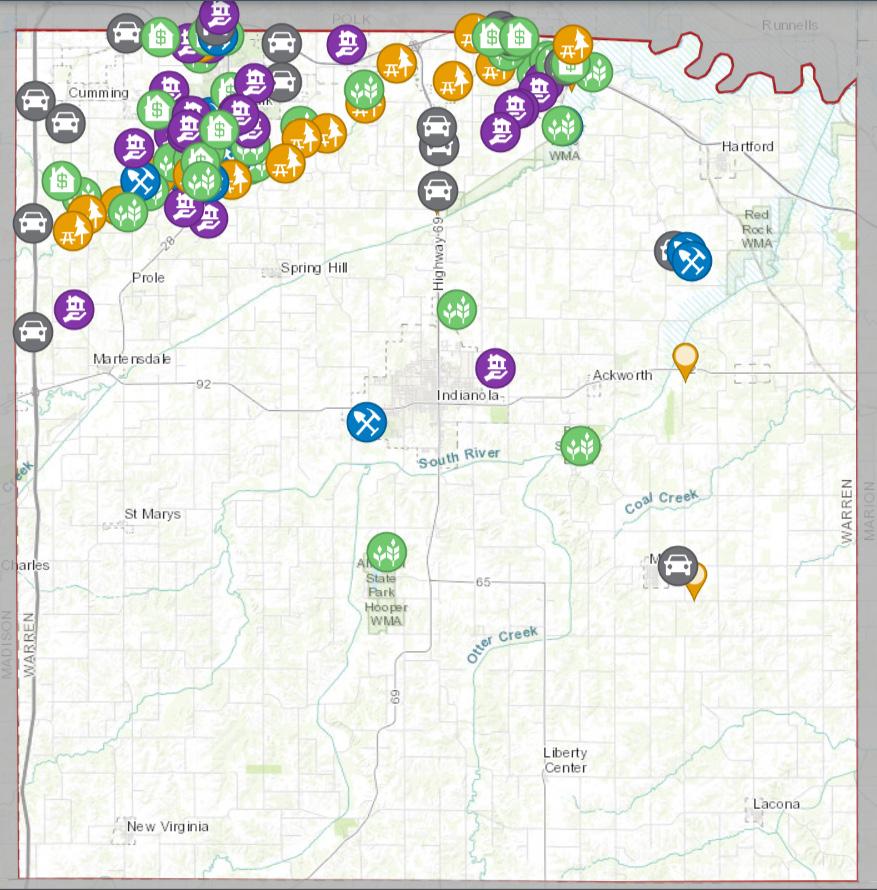
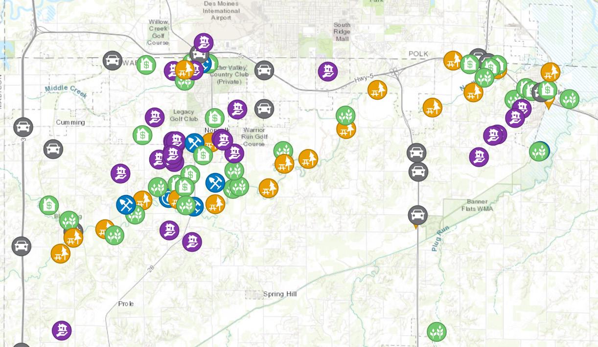
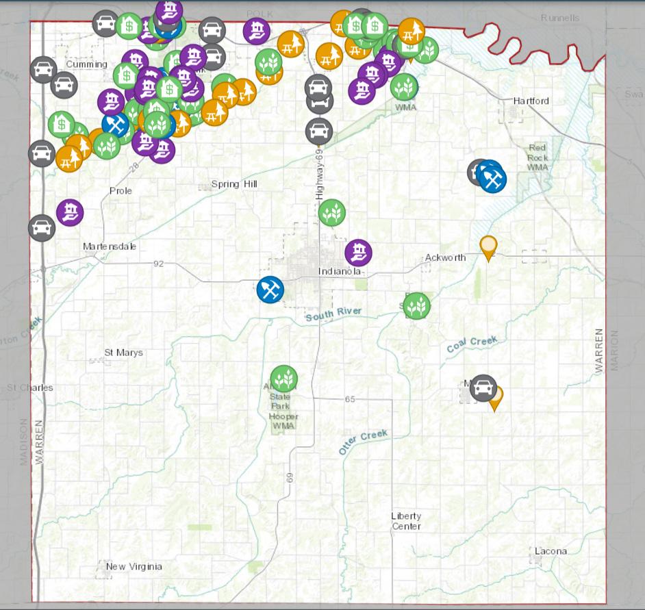
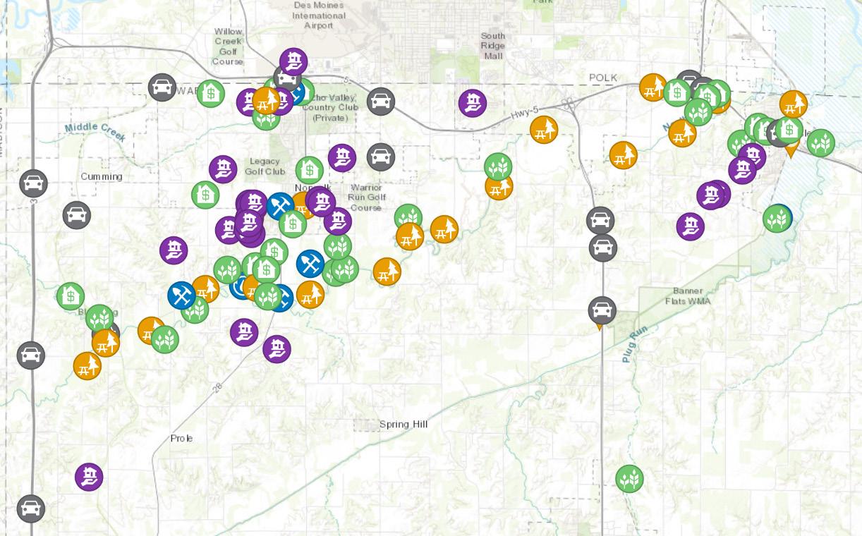
Crowdsource Map
A crowdsource map is an interactive mapping tool that allows community members to collaboratively map strengths, opportunities, weaknesses, and threats for community elements related to the Iowa Smart Planning Law including housing, economic development, infrastructure, natural resources, parks and recreation, transportation, and utilities. Each element included options to identify a selection as a strength, weakness, opportunity, or threat. Participants could also provide comments to provide more insight into their ideas identified on the map. Since the application was open
source and available to the public, feedback was visible to anyone throughout the collection period. Although feedback was visible, participation was anonymous.
This tool was also hosted by ESRI. It was available on various devices. One hundred and thirteen community members participated in the crowdsource map.
PUBLIC INPUT
The goals and strategies developed through the planning process were constructed from the input and ideas of stakeholders, community members, staff,
and elected officials. Summaries of important themes and distinctive data are included here. Additional information can be found in Appendix A.
Community Survey
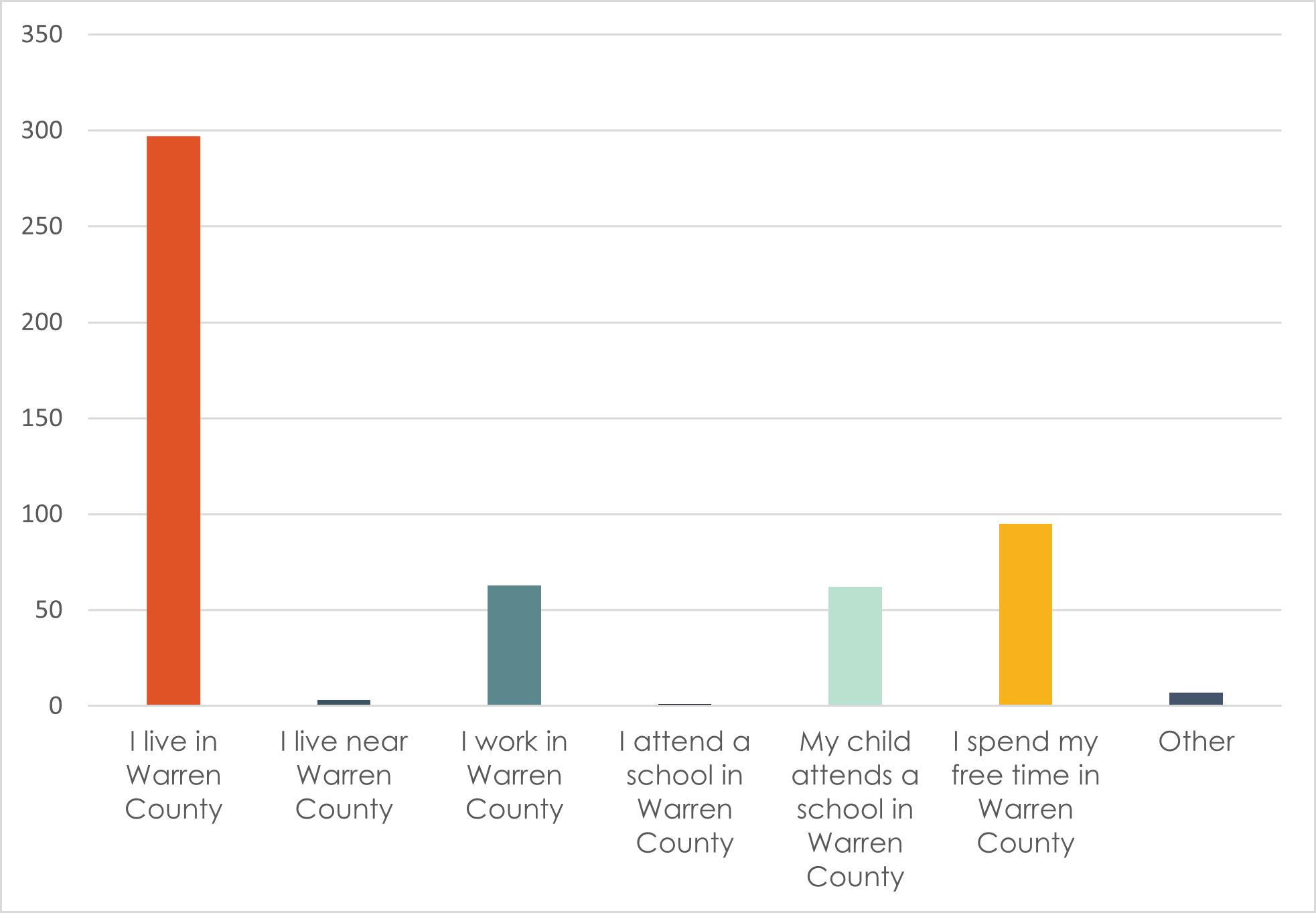
What is your relationship to Warren County?
98% of survey respondents live in Warren County
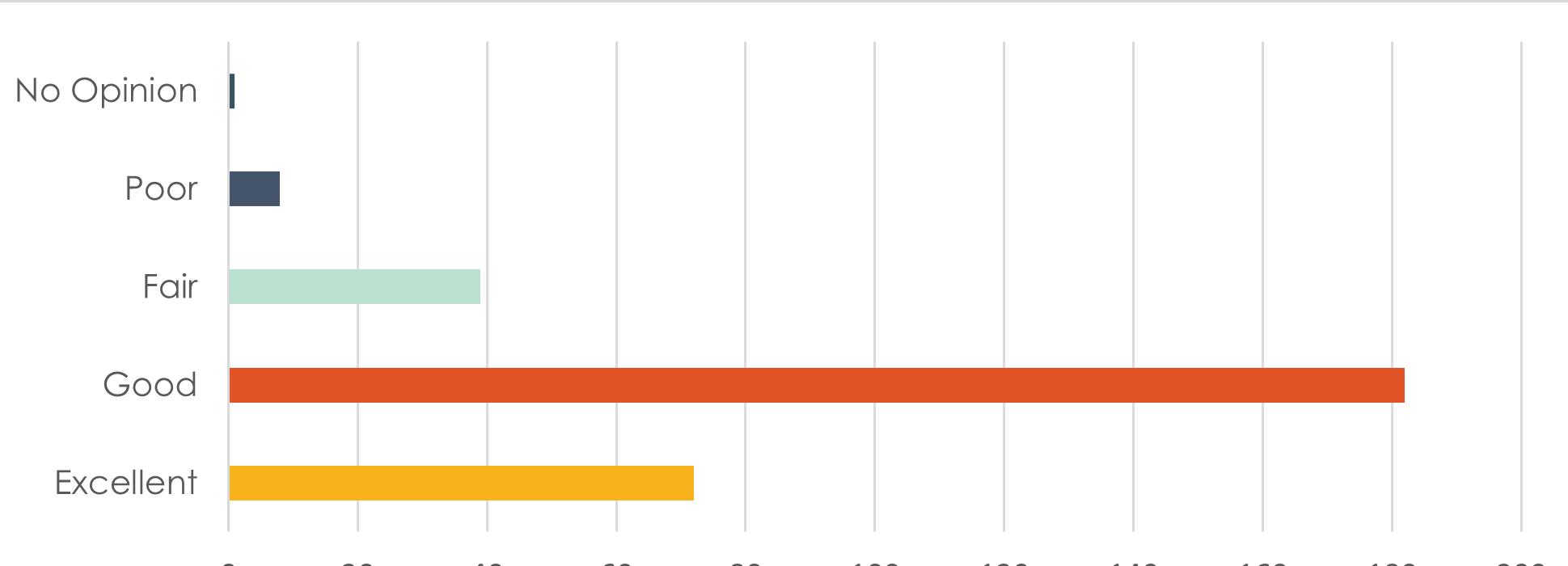
How would you rate the overall quality of life in Warren County?
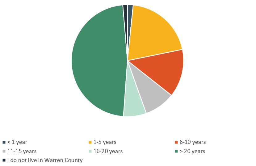
How long have you lived in Warren County?
48% of respondents have lived in Warren County for 20 years or more
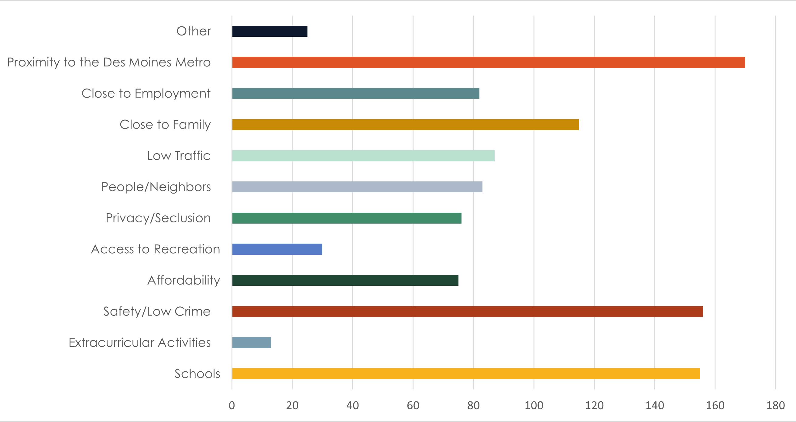
What are four factors that influenced your decision to live where you live?
A SWOT analysis within the survey asked respondents to rate their overall perception of 4 aspects of community development in Warren County.
Development
Community Character
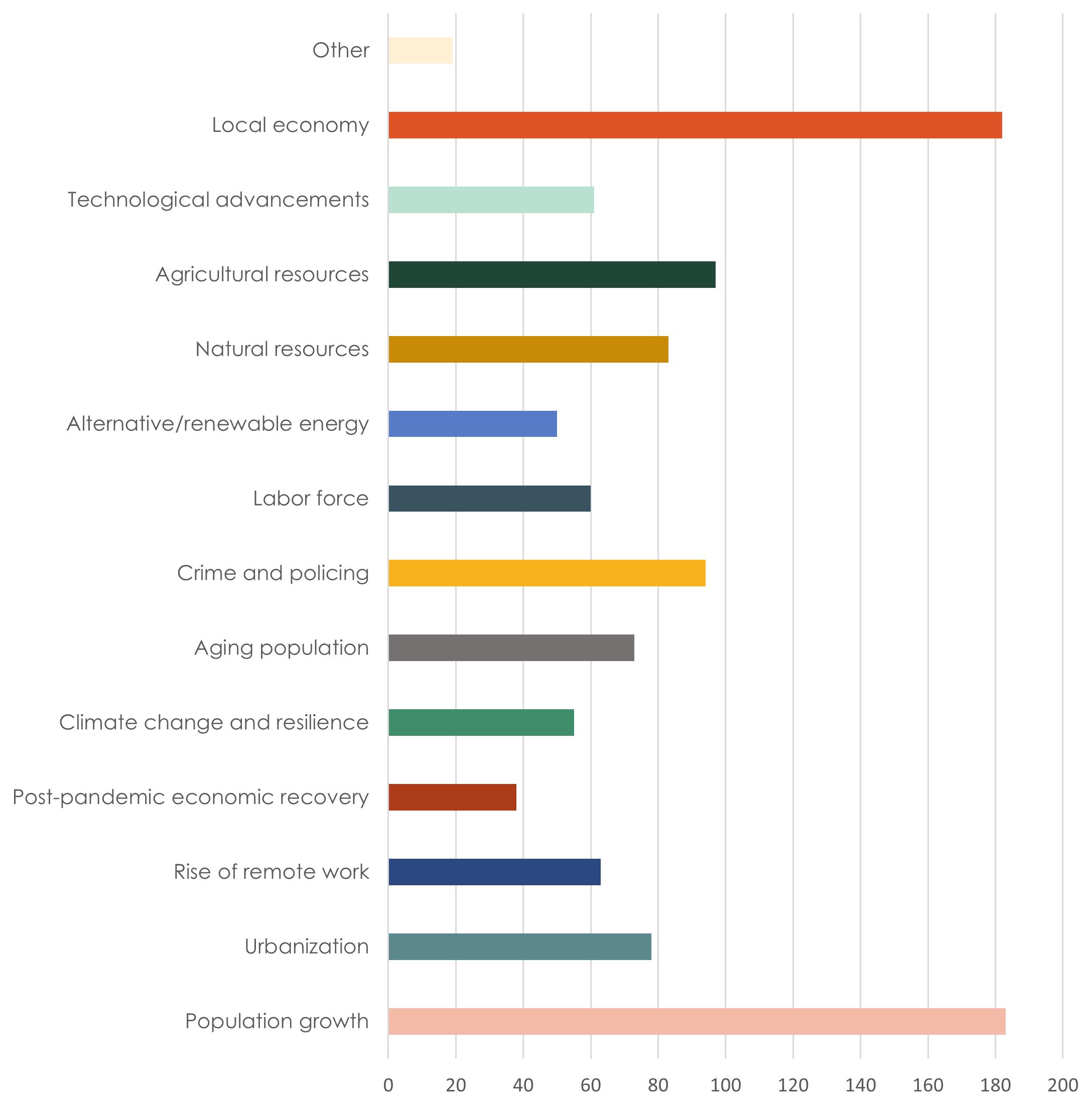
The Comprehensive Land Use Plan will need to consider future trends that will drive changes in our community over the next 20 years. Below are some national and regional trends that are facing communities. Which do you think are most important for Warren County to plan for now?
Crowdsource Map
ADOPTION PROCESS
The Warren County Comprehensive Land Use Plan was recommended for adoption by the Warren County Zoning Commission on October 7th, 2024. The Board of Supervisors adopted the Plan by resolution on October 15th, 2024.
Plan Development (March 2023February 2024)
Zoning Commission Public Hearing & Recommendation (October 7, 2024)
CPCSC Review (March 2024)
Board of Supervisors Public Hearing & Adoption (October 15, 2024)
LOOKING AHEAD
“All things are created twice; first mentally; then physically. The key to creativity is to begin with the end in mind, with a vision and a blue print of the desired result.”
— Stephen Covey
Where
are we
headed?
The intent of the this chapter is to provide a guide to the growth and development of land uses within Warren County. Decisions over the Future Land Use of a County take into consideration factors relating to the existing land use composition, the location of natural features, the ability to provide adequate services to an area, and the desired character of the County.
The Goals and Strategies, as well as the Future Land Use Plan included in this chapter, lays out a future vision for Warren County through the year 2044 and beyond.
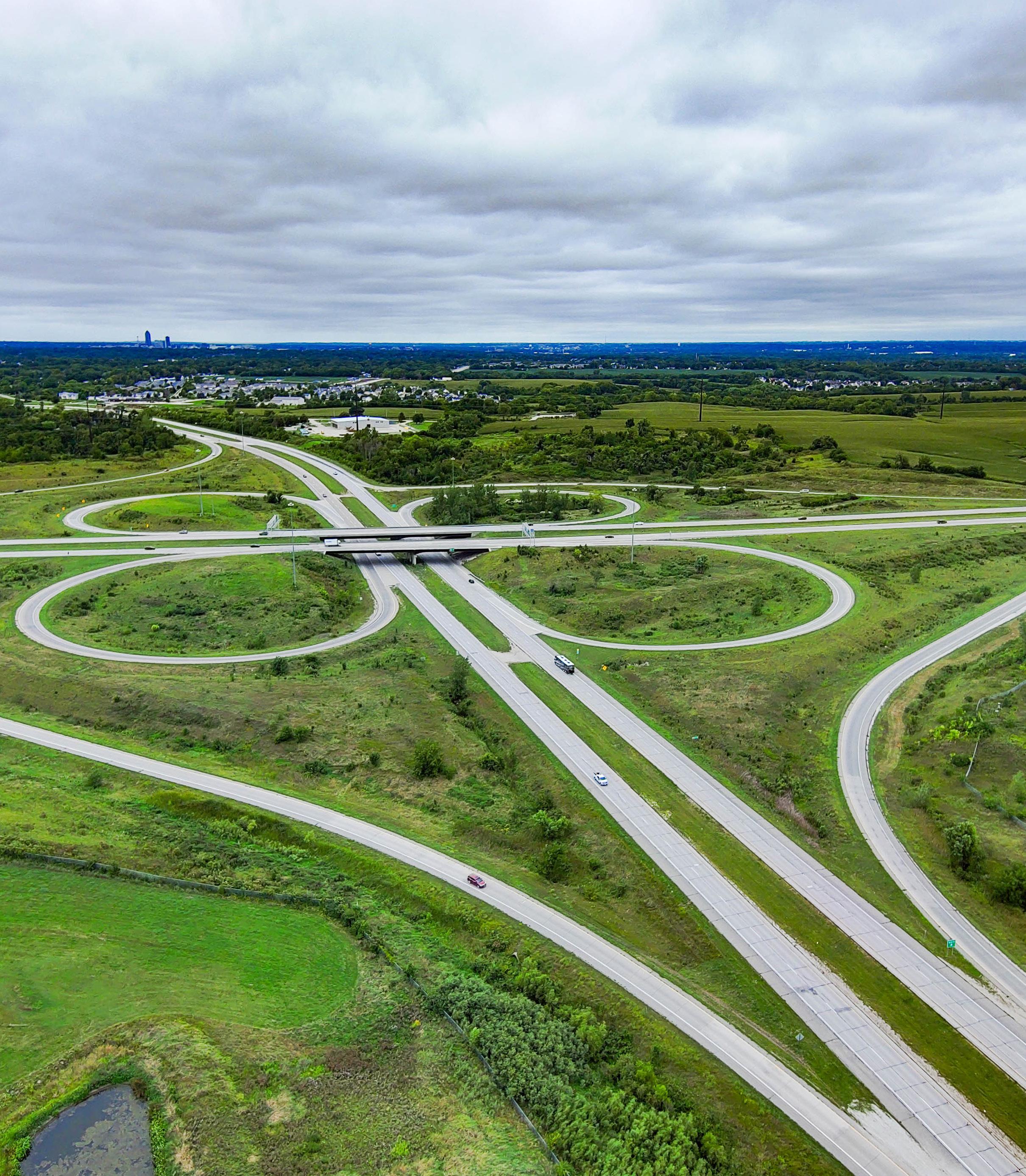
Highway 92 and Interstate 35
PROJECTIONS
The following information is useful and utilized in determining future land use needs. Growth forecasting predicts outcomes of when, where and
how much population and household growth Warren County can expect in the next 20 to 30 years.
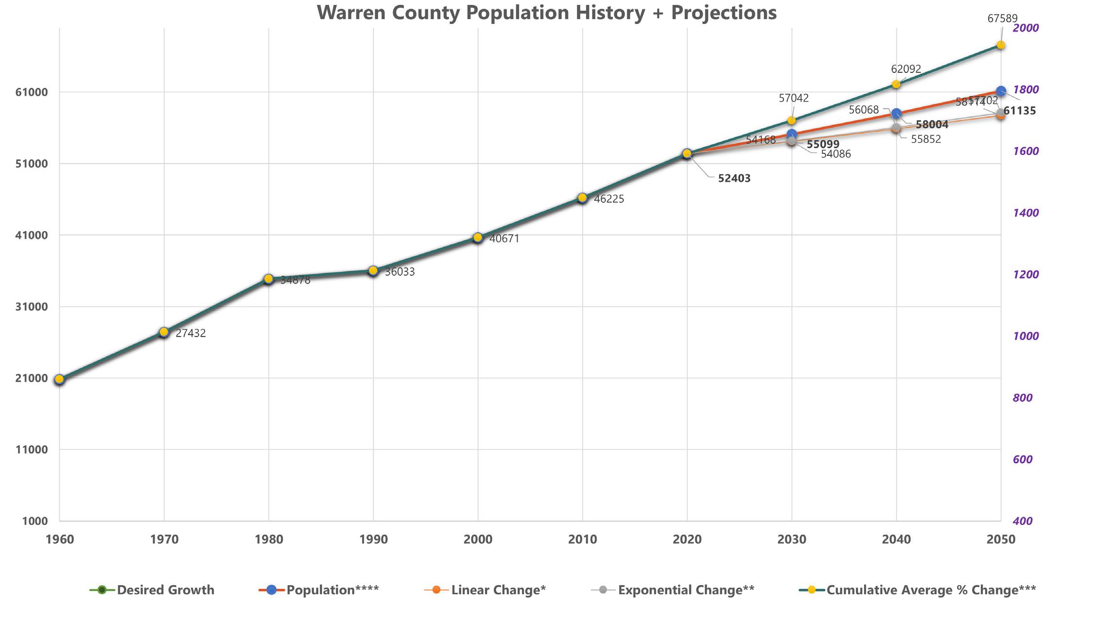
Warren County Population
According to United States Census, between 2010 and 2020 the population of Warren County increased by 6,178 people. This is an increase of about 1.3% per year or 13.7% over the 10 year timespan. Historically, the cumulative annual growth rate of the community is 7.5% every 10 years. Projections are made using linear growth calculations and exponential growth calculations as show in the table below. The graph below shows that Warren County has a projected population of 57,042 people in 2030,
62,092 people in 2040, and 67,589 people in 2050.The population of Warren County has seen growth over the past few decades and is projected to continue this trend. The change in population for Warren Couny is expected to remain relatively the same, so the exponential change and population (average of all) lines will dip. The population will continue to rise, but at a slower, steadier rate than previously, where it jumped significantly or decreased.
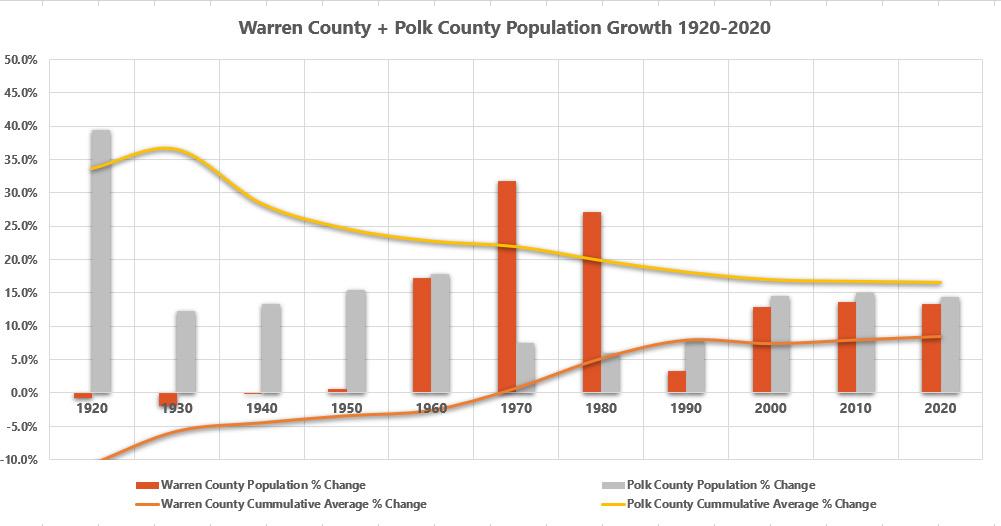
The graph below shows the observed growth of Warren County and its northern neighbor, Polk County, from 1920 to 2020.
With the State Capital and largest city in Iowa both partially located within and next door to Warren County, it is important to know its growth, as it will have an impact on Warren County.
By being aware of both Warren County and Polk County growth and population change, we are better able to predict the coming needs for housing, commercial, and industrial infrastructure.
Impacts of Growth
Factors such as employment opportunities, housing prices, housing variety, and housing availability play a large role in where people decide to live. As Polk County continues to see growth, residents may look elsewhere and by having adequate infrastructure and development plans in place, Warren County can be seen as an attractive option.
These numbers should be considered and paired with the following goals and strategies and the Future Land Use Plan when considering new development.
Warren County has seen a continual positive change in population from 1920 to 2020. Polk County in comparison has seen a decrease in extreme change in
population and has begun to plateau, but is expected to continue growing steadily over the next twenty years.
WARREN COUNTY ELEMENTS
This chapter presents a vision for the future of Warren County and contains goals and strategies to achieve the County’s vision. The goals and strategies described throughout the chapter were established through the planning process, public engagement activities, and Steering Committee input.
An overview of the goals are listed on the following page. Each goal has strategies for achieving the goal, that are listed throughout this chapter. For action items that can be used to implement these goals and strategies, please refer to the Implementation chapter.
County Character
Recreation, Conservation, and Tourism
Goal 1
Expand recreational opportunities to improve quality of life and attract tourism.
Strategy A Expand recreational trails across Warren County.
Strategy B Enhance and promote recreational tourism to potential visitors (fishing, RV parks, snowmobiling, biking).
Strategy C
Goal 2
Encourage development that provides opportunities to enhance County culture such as community events, live music, and public speaking.
Protect park land, waterways and floodplains to provide space for nature and recreation.
Strategy A Identify priority park land in the land use plan.
Strategy B Identify floodplain land in Land Use Plan and restrict development in these areas.
Strategy C
Goal 3
Strategy A
Strategy B
Expand river-centric infrastructure and programming (river walking, community floats, clean-ups, paddling access points).
Support and promote tourism opportunities, especially those that embrace the culture of Warren County.
Drive tourism by promoting the Warren County Fair to urbanites that seek connection with Iowa’s Ag heritage.
Promote ag tourism through County-wide activities such as farm crawls, farm to table events, markets.
Strategy C Support Hot Air Ballooning as a central tourism attractor for the region.
Goal 4 Preserve Warren County's rural views.
Strategy A
Implement code updates that help preserve views such as cluster development, scenic easements/overlays, or signage requirements.
Agriculture
Goal 1 Preserve and protect prime farmland.
Strategy A Develop land use and zoning systems that protect agricultural resources.
Strategy B
Goal 2
Strategy A
Support sustainable farming practices that preserve soil and water quality for the next generation of farmers.
Support small/niche agricultural operations that contribute to agriculture, economy, and character of Warren County.
Encourage infrastructure that enhances rural/agricultural connectivity and programming.
Intergovernmental Coordination
Goal 1
Strategy A
Strategy B
Goal 2
Strategy A
Strategy B
Partner with local, state, and federal agencies to increase and optimize resources available to Warren County.
Work with area municipalities to identify opportunities for shared services or other cooperative planning efforts, and pursue funding from State and Federal agencies to implement projects that address shared goals and objectives.
Request that school district officials and State and Federal agencies keep Warren County apprised of any plans for new facilities or other land use activities that could affect Future Land Use within the County.
Coordinate with surrounding and regional municipalities and agencies to improve efficiency and efficacy of planning efforts and funding opportunities.
Identify existing and potential conflicts, especially regarding land use planning, and establish procedures to address them.
Request feedback from area school district officials and municipalities within the County regarding planning efforts and ordinance updates.
Livability Transportation
Goal 1
Strategy A
Strategy B
Goal 2
Provide a safe, efficient, multi-modal, and well-maintained transportation network for all residents and visitors.
Increase connectivity of municipalities, recreational ammenities, public and natrual spaces, and multimodal trails throughout the County.
Enhance multi-modal opportunities for regional travel for Warren County residents and visitors.
Prioritize accessibility for industry vehicles essential to the well-being of the County including agricultural and emergency vehicles.
Strategy A
Determine manners in which to safely separate incompatible transportation uses such as recreational and agricultural modes to reduce potential incidents and provide safe conditions for residents to work and play.
Strategy B
Goal 3
Strategy A
Housing
Goal 1
Strategy A
Manage the access and design of the transportation network in order to effectively maintain the safe and functional integrity of roads and bridges within the County’s jurisdiction.
Encourage sustainability, connectivity, and accessibility in the Warren County transportation system.
Coordinate road improvement and maintenance plans with development policies including the Warren County Zoning and Subdivision Ordinances.
Strategy B
Goal 2
Strategy A
Plan for safe, attractive, and affordable housing to meet existing needs and forecasted housing demands of all residents of the County.
Plan for a range of housing that meets the needs of residents of various income levels, age groups, abilities, and health conditions.
Promote the incorporation of safe and health-conscious building materials, clean indoor air systems, pest-free environments, energy and water efficiency measures, as well as inclusive design that prevents injuries and ensures universal accessibility for people of all abilities, in new residential constructions or retrofit projects.
Plan for housing types and densities that reinforce the predominantly rural character of the unincorporated areas of the County.
Manage residential development to prevent conflicts between incompatible land uses and to minimize the negative environmental impact of residential growth.
Economy &Employment
Goal 1
Enhance the local economy of Warren County by promoting stable, diverse development that supports the needs of existing and future residents.
Strategy A Support the efforts of Warren County Economic Development.
Strategy B Provide diverse and flexible land use and zoning strategies that expand opportunities for economic growth in Warren County.
Goal 2
Maintain a rate and pattern of economic growth sufficient to sustain reasonable employment rates in the County, balance the real property tax base of the local cities, and strengthen local economic bases.
Strategy A Explore opportunities for an agricultural-focused industrial park.
Strategy B Support the development of a County comprehensive economic development strategy (CEDS).
Health and Safety
Resilience
Goal 1 Reduce human and property impacts resulting from hazards.
Strategy A Prepare residents and businesses in Warren County for potential disasters.
Strategy B Continue to prepare readiness plans to establish procedures for responding to natural disasters.
Goal 2 Ensure successful and efficient recovery from disasters.
Strategy A Aim to provide prompt access to recovery resources to disaster victims throughout the recovery process.
Strategy B Develop strategies to ensure that post-disaster reconstruction and recovery efforts will be quick, safe, and collaborative.
Public Health
Goal 1
Improve access to fundamental human needs to increase general stability for Warren County Residents.
Strategy A Provide support and advocacy for mental health resources in Warren County.
Strategy B Improve food security and healthy food access for Warren County residents.
Goal 2
Strategy A
Improve quality of life, safety, and livability of rural communities and households in Warren County.
Maximize the impact of available funding sources to create better housing and health outcomes through a coordinated and integrated approach among housing, environmental health, and public health agencies.
County Facilities & Services
Goal 1
Strategy A
Strategy B
Goal 2
Invest in core infrastructure improvements that benefit agricultural activity: roads, water, and broadband.
Support transportation for primary economic and cultural activities including agriculture.
Develop a broadband connectivity plan to ensure that all communities and rural areas have access to highspeed internet.
Support coordination of inter-agency and inter-jurisdictional facilities and services (both public and private) to increase accessibility and reduce economic and environmental impacts of procedures, infrastructure, and maintenance.
Strategy A
Strategy B
Continually evaluate the needs of County departments and opportunities for partnerships across agencies to increase efficiency and efficacy of County resources and projects.
Support consolidation of city, County, and state administrative offices, public health, safety and welfare buildings, and community cultural facilities as opportunities that will promote energy conservation, provide convenient, centralized services and attractive building and open space groupings.
LAND USE
Future Land Use Categories
The Future Land Use Plan for Warren County is comprised of seven land use categories described below with an image for each.
Agriculture and Open Space
The Agriculture and Open Space land use category is set aside for agricultural land, undeveloped land, floodplain, stream corridors and buffers, and areas with significant tree cover. Warren County has existing farmland and areas with significant natural features, including floodplain, wetlands, and areas with steep topography, that limit development. Single family residential development should be limited with no more than 1 dwelling unit per 40 acres to accommodate farm homesteads.
Parks and Recreation
The Parks and Recreation land use category is set aside for public, private, and semi-private recreational land such as parks, trails, golf courses, greenways, recreational fields, and shooting ranges.
Public / Semi-Public
The Public / Semi-Public land use category includes land owned or operated by a public or semi-public entity. This includes land located outside an incorporated area that is owned by the County or any city, school district, university, fire department, or similar public agency. Cemeteries, airports, and public utility facilities are included in this category. This definition does not include parks and recreation land.
Urban Fringe
The Urban Fringe land use category includes land within a city’s identified growth area. Existing land use and zoning within this category consists primarily of agricultural and rural/ estate residential. These areas should remain in their current use with no further development or division until annexed and served by municipal utilities/services. Splits or minor divisions of agricultural land into a limited number of new parcels or lots for residential development may be appropriate and may require approval of adjoining jurisdiction(s) under their 2-mile review authority for subdivision plats.
Rural Acreage
The Rural Acreage land use category is designed for singlefamily residential development with a minimum 5-acre lot size.
Rural Residential Cluster
The Rural Residential land use category is designed for traditional low-density, single-family with lot sizes ranging from 1 to 6 dwelling units per acre in areas with adequate public infrastructure including paved roadways, water service, and means for wastewater collection and treatment. This land use will be predominantly single-family detached homes with some duplexes and single-family homes. Developments within this category may also include religious, educational, institutional uses, child daycare centers, and public and private recreational areas.
Rural Commercial and Business
The Rural Commercial and Business land use category accommodates development of commercial and industrial developed property typical in rural, unincorporated areas such as retail that supports highway traffic, agricultural related retail, agricultural related manufacturing, shipping and distribution facilities, and other business and industrial uses that may be best located in a rural setting outside an urbanized area. Development should be limited to areas with the paved roadway network, water service, and means for wastewater collection and treatment that is adequate to support the proposed uses.
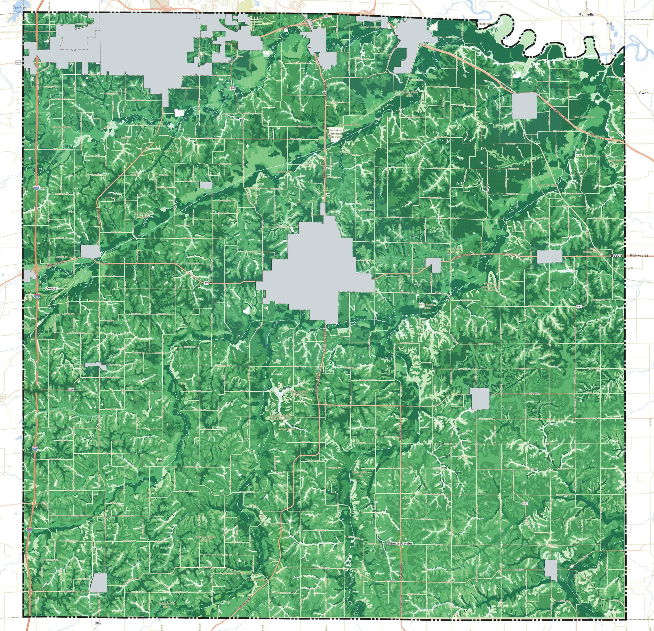
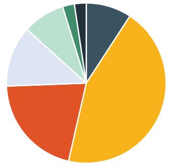
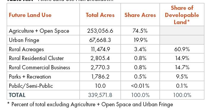
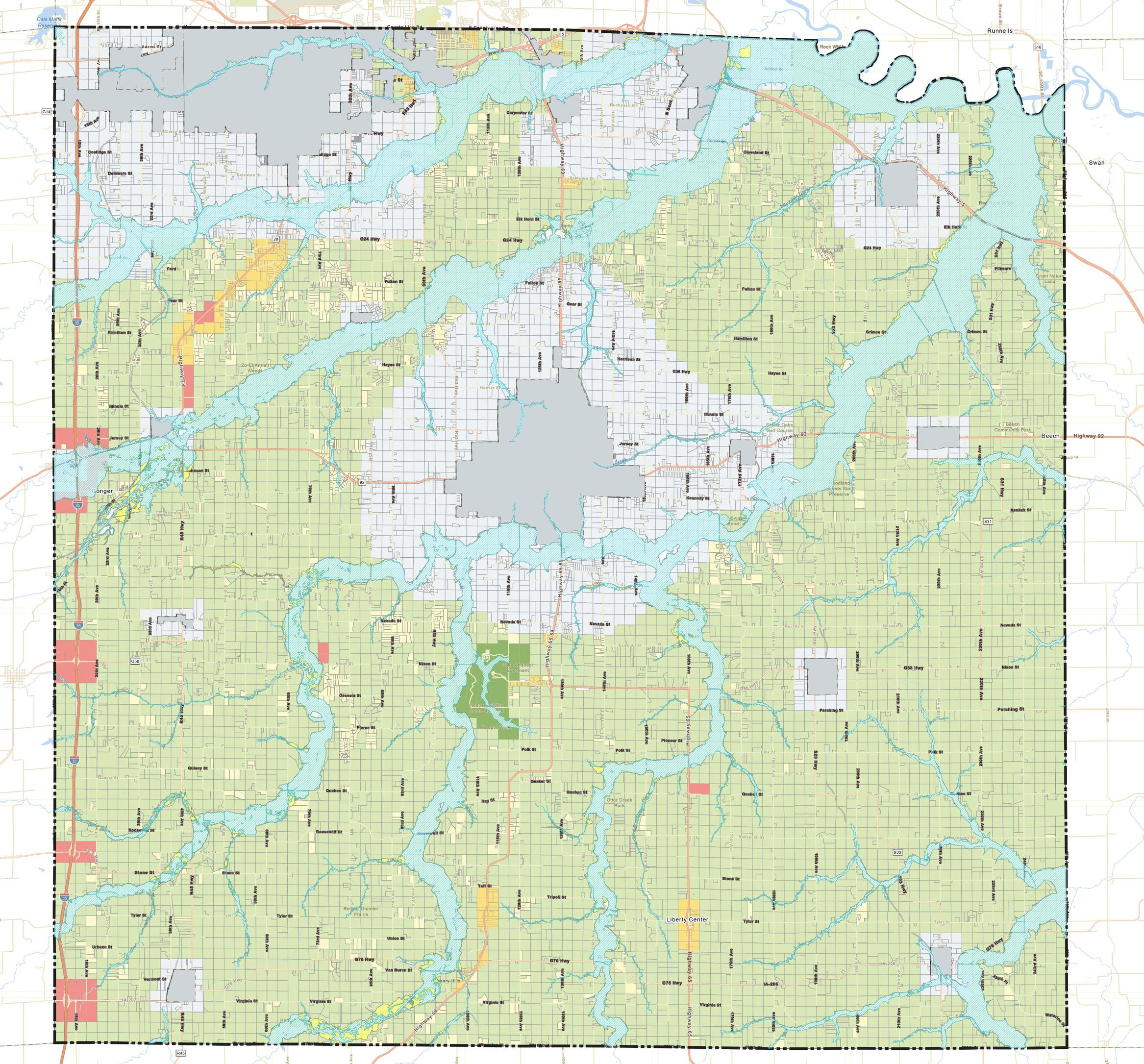
Future Land Use Plan
Map 4.1 on the following page shows the Future Land Use Plan for Warren County. All of the incorporated areas have been excluded from the plan. The table below summarizes the Future Land Use breakdown by total acres. The dominant land use in the Future Land Use Plan remains Agriculture + Open Space with just over 80% of the planning boundary. The second most dominant land use category is the Urban Fringe Land Use, this represents land that should remain as-is until annexed by the nearby municipality
where it should then be developed in accordance with their Future Land Use Plan. Rural Acreages and Rural Residential Cluster account for a combined 4%. When Agriculture + Open Space and the Urban Fringe area is excluded, the dominant land use on the Future Land Use Plan is Rural Acres at 70.0%. Rural Residential Cluster and Parks + Recreation account for a combined 23%.
Future Land Use Plan Breakdown
* Percent of total excluding Agriculture + Open Space and Urban Fringe
Agriculture + Open Space remains the dominant land use type in Warren County
Map 4.1 - Future Land
Plan
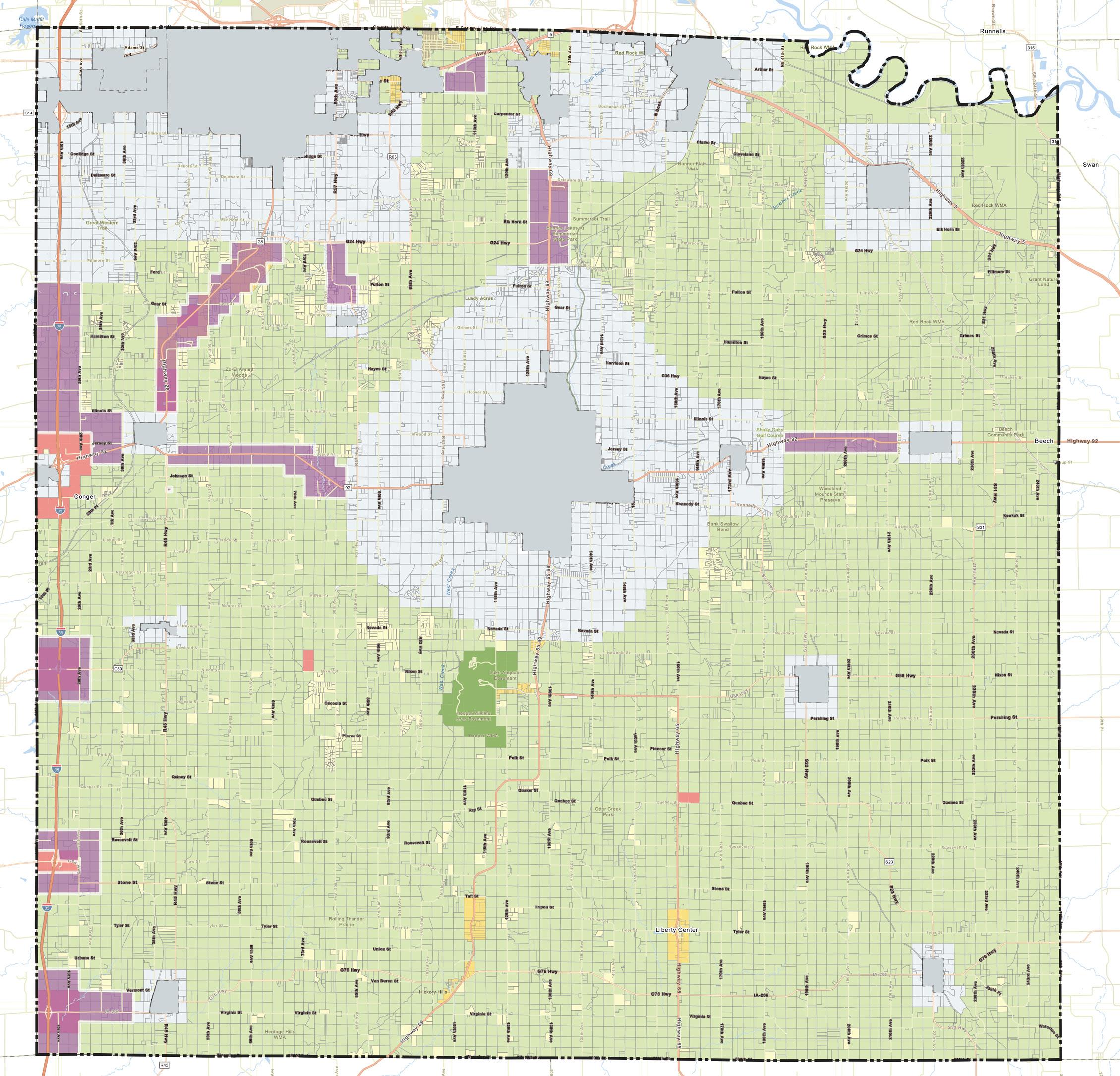
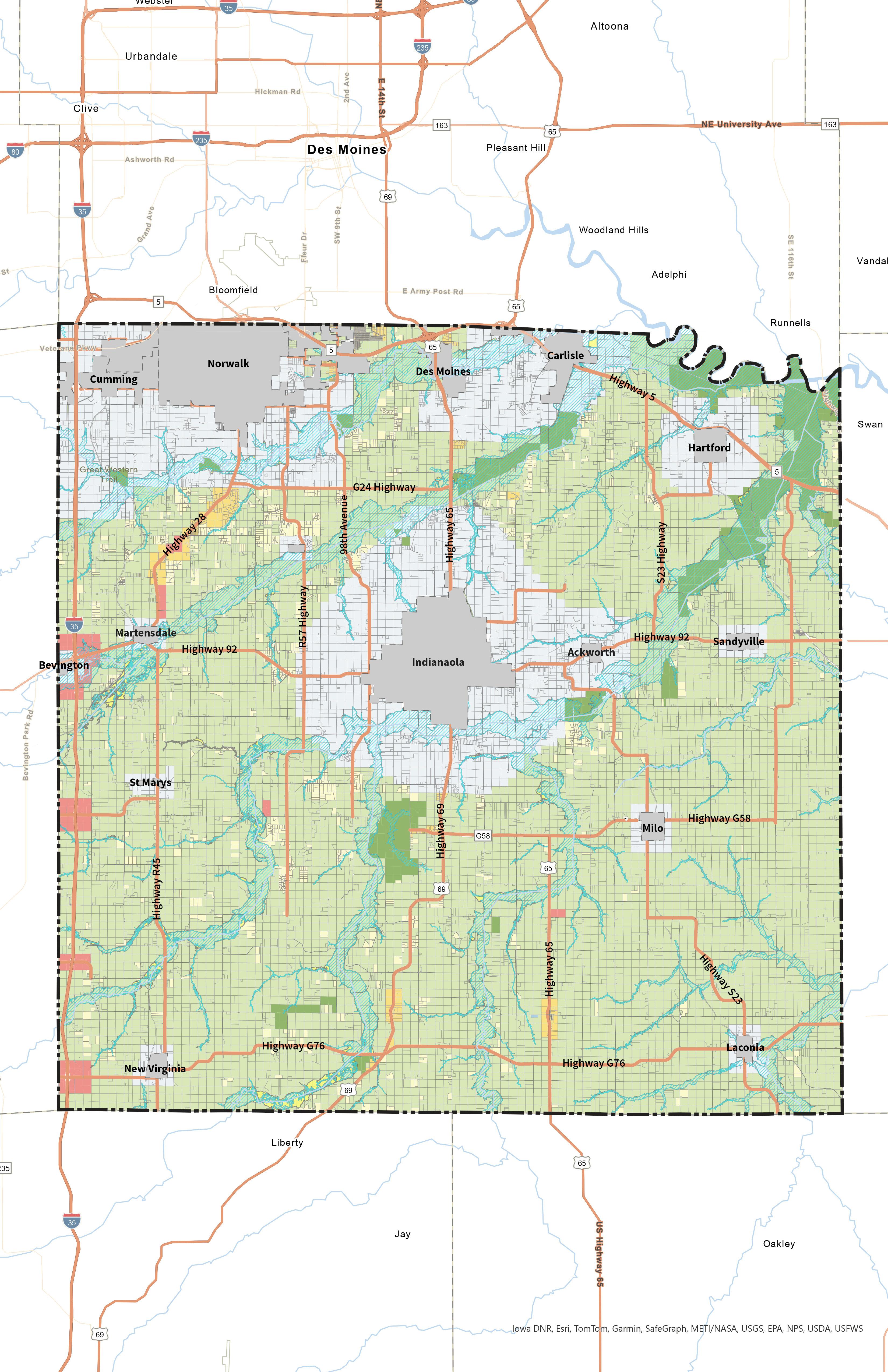
Opportunity Overlay Corridors
The Future Land Use Plan identifies the preferred development pattern Warren County would like to see in the future for its unincorporated areas. However, the County also recognizes that circumstances are not static and certain changes or opportunities may warrant updates to the Future Land Use Plan over time. Certain areas and
corridors of Warren County are more likely to experience change due to new opportunities based on their location. This mainly includes interstate interchanges, larger state/ County roads, and areas outside of faster growing incorporated areas especially in the northwest quadrant of Warren County. These opportunity corridors are identified in Map 4.2. The location of the overlay indicates areas more suitable for Future Land Use Plan amendments for the right opportunity assuming other factors such as utilities are available for roadway improvements or job creation.
Map 4.2 - Future Land Use Plan
Spring Hill
Zoning Compatibility Matrix
The zoning compatibility matrix shows the relationship between the future land use categories and Warren County’s existing zoning districts. Zoning districts have been listed as either compatible (“C”) or partially compatible (“PC”) within each of the corresponding land use categories. This matrix should be used as the basis for determining the appropriate zoning district(s) for land as property rezoning is being considered. If the zoning desired for a given property is incompatible with its future Land Use designation, the parcel’s Future Land Use should be amended first.
Zoning Districts
Future Land Uses
Land Use Goals & Strategies
Goal 1 Encourage development in strategic areas of Warren County.
Strategy A
Discourage urban sprawl in Warren County by limiting leapfrog development, promoting orderly growth within incorporated cities, and adhering to the Future Land Use Plan when reviewing re-zoning requests.
Strategy B Promote orderly, sustainable growth that aligns with the vision and character of Warren County.
Goal 2
Ensure preservation and conservation of environmental and historic land uses in Warren County.
Strategy A Protect and preserve ecologically sensitive land uses and historic sites and landforms throughout the county.
Strategy B
Discourage development near ecologically sensitive land uses through the use of stream and wetland buffers and avoiding development within the floodplain.
Strategy C Discourage greenfield development in unincorporated Warren County.
Goal 3 Preserve the rural character of Warren County.
Strategy A
Maintain Agriculture + Open Space as the dominant land use type within Unincorporated Warren County outside of the Urban Fringe areas.
Strategy B Reduce conflicts between agricultural land uses and other incompatible land uses through buffering, setbacks, or other creative strategies.
Highway 92 and Interstate 35
IMPLEMENTATION
“Planning without action is futile, action without planning is fatal.”
- Cornelius Fitchner
How to use the plan?
A Comprehensive Plan is a valuable tool to help comunities achieve their goals for the future. The success of a plan is dependent on the implementation tactics that bring the goals and visions to fruition. This section is your guide for implementing the goals, strategies, and visions illustrated through the Wonderful Warren Comprehensive Plan.
IMPLEMENTATION STRATEGIES
Responsibilities
Board of Supervisors
The Board of Supervisors sets priorities, approves budgets and tax rates, and often has the final say on key aspects of public and private development projects. The value and legitimacy of this plan is directly related to the degree to which the Board of Supervisors are aware of the plan and expect County actions to be consistent with this plan. Each Board member should have a copy of this plan and be familiar with the major goals and objectives described herein. The Board of Supervisors should expect and require that staff recommendations and actions both reference and remain consistent with this plan, or that the plan is amended as needed to fit changing conditions.
Warren County Staff
County staff have a significant influence on the selection and completion of all kinds of capital and operational projects. It is imperative that County staff know about, support, and actively work to implement the various strategies and actions in this plan.
Specifically, the following people should consult and reference the comprehensive plan during goal-setting processes, annual budgeting, planning for major public projects, and in the review of private development projects:
• Warren County Zoning Director
• Warren County Engineer
• Warren County Director of Public Health
These key staff members are expected to know and track the various goals, strategies, and vision laid out in this plan, and to reference that content as appropriate in communications with residents, business owners, and elected and appointed officials. All other staff members should be aware of the plan and the connections between the plan and County projects. The purpose of this extra effort is to strengthen staff recommendations and reinforce the plan as a relevant tool integral to County functions and decision making.
Zoning Commission
Land use and development recommendations are a core component of this plan, and the Zoning Commission has a major role in guiding those decisions. Zoning Commission members shall each have a copy of this plan and shall be
familiar with the content, especially section 4.3 - Land Use. It is generally the responsibility of the Zoning Commission to determine whether proposed projects are consistent with this plan, and to make decisions and recommendations that are consistent with this plan. In cases where actions
that are inconsistent with this plan are deemed to be in the best interest of the County, the Zoning Commission should initiate efforts to amend the plan to better reflect County interests. This will help to reinforce the legitimacy of the plan as an important tool in guiding County decision making.
Procedures
Education & Advocacy
Implementation of this plan also depends on actions and decisions of partner entities including:
• City of Norwalk
• City of Indianola
• Iowa Department of Transportation
• Iowa Department of Natural Resources
• Des Moines Area Metropolitan Planning Organization
It is necessary to persuade these entities to be active partners in the implementation of this plan. The following County activities can support this effort:
• Share this plan with each organization, including a memo highlighting sections of the plan that anticipate collaboration between the County and the organization.
• Take the lead role in implementation for crucial initiatives of the County that require regional collaboration.
• Know and communicate the intent of relevant objectives and strategies.
• Utilize the goals and vision from the plan to support requests for monetary support for County efforts.
Implementation
Tools
Many of the strategies identified in this plan presume the use of existing County ordinances, regulations, and programs. The County’s key implementation tools include:
Operational Tools
• Annual Goal-Setting Process
• Annual Budget Process
Regulatory Tools
• Warren County Code of Ordinances
• State Regulations
• Federal Regulations
Funding Tools
• User Fees
• Tax Abatement
• Tax Increment Financing (TIF) Districts
• Development Fees
• State, Federal, and Private Grant Programs
Annual Reporting
To provide lasting value and influence, this plan must be used and referenced regularly, especially during budgeting and goal setting processes. To inform the annual processes, County staff will prepare a Comprehensive Plan Annual Report for the Board of Supervisors with input from the Zoning Commission, including the following information.
• Action items in progress or completed during the prior 12 months (celebrate successes!).
• Staff recommendations for action items to pursue during the next 12 months, including removing or adding items.
• County actions and decisions during the past 12 months not consistent with the plan (if any).
• Staff recommendations for amendments to the plan.
Implementation Matrix
The Implementaton Matrix outlines all of the goals and strategies for each element discussed in the plan. It also provides recommendations for actions to complete these strategies and goals, recommended partnerships, and a resource to impact ratio. The resource to impact ratio indicates how easily the action
may be completed and the impact that it will have on the county. Actions with low impact to resource ratios should be prioritized for implementation, while those with a rating of 4 or 5 are items that may be addressed further in the future, or are ongoing actions.
How to Use the Matrix
Goal : An object of ambition or effort; an aim or desired result.
Goals help communities to articulate desired outcomes of plans, policies, and action.
Strategy:
A plan of action or policy designed to achieve a goal.
Action Item:
An action item is a documented event, task, activity, or action that needs to take place to enact the strategy and reach the goal.
Strategies help to envision what needs to happen to reach our goals.
Each strategy has multiple action items that can be used to help accomplish the goal.
Potential Partners:
One associated with another especially in an action.
Priority:
Superiority in rank, position, or privilege.
Potential partners provides community leaders with ideas about who should be responsible for, and who may be able to help with each action item.
All action items will be given a priority based on the urgency to community well-being.
Warren County WC
Warren County Zoning Department WCZD
Warren County Board of Supervisors WCBOS
Warren County Zoning Commission WCZC
Warren County Economic Development Corp. WCEDC
Warren County Conservation Board WCCB
Warren County Conservation WCC
Warren County Fair Board WCFB Farm Bureau FB
Des Moines Partnership DSMP
Des Moines Metropolitan Planning Organization DSMMPO
National Balloon Classic NBC
Iowa State University Extension ISUE Future Farmers of America FFA
Natural Resources Conservation Services NRCS
United States Department of Agriculture USDA
Soil and Water Conservation District SWCD
Farm Service Agency FSA
Warren County Historic Preservation WCHP
IMPLEMENTATION MATRIX
Livability Transportation
Housing
Promote the incorporation of safe and health-conscious building materials, clean indoor air systems, pest-free environments, energy and water efficiency measures, as well as inclusive design that prevents injuries and ensures universal accessibility for people of all abilities, in new residential constructions or retrofit projects.
Resilience
Support coordination of inter-agency and inter-jurisdictional facilities and services (both public and private) to increase accessibility and reduce economic and environmental impacts of procedures, infrastructure, and maintenance.
Continually evaluate the needs of County departments and opportunities for partnerships across agencies to increase efficiency and efficacy of County resources and projects.
Support consolidation of city, county, and state administrative offices, public health, safety and welfare buildings, and community cultural facilities as opportunities that will promote energy conservation, provide convenient, centralized services and attractive building and open space groupings.
Discourage urban sprawl in Warren County by limiting leapfrog development, promoting orderly growth within incorporated cities, and adhering to the Future Land Use Plan when reviewing re-zoning requests.
WCZD, WCZC, WCBOS
Discourage the unnecessary conversion of agricultural land to the built environment throughout the county (especially in those areas identified as Agriculture + Open Space on the Future Land Use Plan) by directing development to Urban Fringe areas through policy and decision making.
Appendix A: Survey and Crowdsource Results
Community Survey
Q1. What is your relationship to
County?
Q2. How long have you lived in Warren County?
Warren
Q3. How would you rate the overall quality of life in Warren County?
How would you rate the overall quality of life in Warren County?
Q4. What three words would you use to describe the character of Warren County as it is today?
What three words would you use to describe the character of Warren County as it is today?
Q5. Please select up to four factors that influenced your decision to live where you live now.
Please select up to four factors that influenced your decision to live where you live now.
Q6. What is your overall perception of development in Warren County?
What is your overall perception of development in Warren County?
Q9. What is your overall perception of mobility in Warren County?
What is your overall perception of mobility in Warren County?
Q11. Please list weaknesses and threats you see for Warren County related to mobility. Please list weaknesses and threats you see for Warren County
Q12. What is your overall perception of community character in Warren County?
Q13. Please list strengths and opportunities you see for Warren County related to community character.
Q14. Please
Q15. What is your overall perception of conservation in Warren County?
Q19. The comprehensive plan will need to consider future trends that will drive changes in our community over the next 20 years. Below are some national and regional trends that are facing communities. Which do you think are most important for Warren County to plan for now?
Which do you think are the most important for Warren County to plan for now?
Q20. What is your age?
Q21. How many people are in your household?
Q22. What is your estimated annual household income?
Q24. If you commute for work, how many miles is your commute (each way)?
If you commute for work, how many miles is your commute (each way)?