WAVERLY, IOWA COMPREHENSIVE PLAN UPDATE


+
ACKNOWLEDGMENTS
PREPARED FOR: WAVERLY PLANNING AND ZONING COMMISSION


Douglas Benschoter
Stephanie Garner
David Huser
David Larson
John Meyer
Kathy Olson
Kathryn Payne
Tim Kangas, Council Liaison
MAYOR AND CITY COUNCIL
Adam Hoffman - Mayor
Brian Birgen, 1st Ward
Julie Meyers, 2nd Ward
Rodney Drenkow, 3rd Ward
Heather Beaufore, 4th Ward
Tim Kangas, 5th Ward
Ann Rathe, At-LArge
Matthew Schneider, At-Large
CITY STAFF
James Bronner
Garret Riordan
Connie Tolan
Bill Werger
Paige Yoder
PREPARED BY:
+
TABLE
CONTENTS INTRODUCTION | P. 4 PUBLIC ENGAGEMENT | P. 11 AGRICULTURAL AND NATURAL RESOURCES | P. 24 UTILITIES & COMMUNITY FACILITIES | P. 28 INTERGOVERNMENTAL COOPERATION | P. 33 ECONOMIC DEVELOPMENT | P. 37 HOUSING | P. 42 MOBILITY & TRANSPORTATION | P. 46 COMMUNITY CHARACTER | P. 51 TRANSFORMATIVE PROJECTS | P. 70 LAND USE | P. 55 IMPLEMENTATION | P. 76 01 02 03 04 05 06 07 08 09 10 11 12
OF
01 | INTRODUCTION
PLANNING 101
Comprehensive planning is an ordered process that determines community goals and aspirations in terms of community development. The end product is called a Comprehensive Plan, also known as a general plan, or master plan. This resulting document expresses and regulates public policies on transportation, utilities, land use, recreation, and housing. Comprehensive plans typically encompass large geographical areas, a broad range of topics, and cover a long-term time horizon. The term Comprehensive Plan is most often used by urban planners in the United States.
IOWA SMART PLANNING ELEMENTS
In 2010, the State of Iowa adopted guidelines as part of the Iowa Smart Planning Act that encouraged local governments to address the following elements when planning:
Public Participation
Issues and Opportunities
Land Use
Housing
Public Infrastructure and Utilities
Transportation
Economic Development
Agricultural and Natural Resources
Community Facilities
Community Character
Hazards
Intergovernmental Collaboration
Implementation
THE PLAN AS A LIVING GUIDE
This Comprehensive Plan update is an effort to reinforce the longstanding planning priorities of the City, while recognizing changing conditions, trends, and new issues. The City’s Comprehensive Plan reflects a shared vision for the future of Waverly.
Comprehensive plans provide a broad analysis of the interconnections between cultural, geographical, and natural components within the City. They also provide guidelines for continued development, technology, economic drivers, and demographic changes that affect how land is managed and utilized in the City. Although this Comprehensive Plan attempts to address many possible future uses, it may not capture all of them.
As new land uses are introduced, the City will be in a great position to better review land use proposals. This Plan will offer broad recommendations to help citizens and local leaders work together more effectively to facilitate future growth and development within the City. These recommendations come in the form of goals and objectives which express the community’s aspirations for the future.
This planning document is a “living” guide for growth and change in Waverly. The Plan provides specific recommendations that directly manage community growth and development. To utilize the full potential of the Plan, it should be used to:
Guide City officials and staff to assist with a variety of land use planning and growth planning tasks.
Guide businesses, property owners, and residents by assisting them in determining potential property use, understanding future land use changes in the surrounding area, and understanding infrastructure improvements.
Assist developers interested in property acquisition in coordinating development plans with City goals, regulations, and infrastructure plans.
Assist in coordinating with neighboring jurisdictions on issues and topics of mutual interest.
5 • COMPREHENSIVE PLAN INTRODUCTION | 1
OVERALL VISION
Waverly's vision statement is intended to set the general tone for the rest of the Plan. It encapsulates the major themes woven throughout the Plan.
1. Public Engagement
2. Agricultural, Natural & Cultural Resources
3. Utilities & Community Facilities
4. Intergovernmental Cooperation
5. Economic Development
6. Housing
7. Transportation
8. Community Character
9. Land Use
10. Transformative Projects
11. Implementation
Each section includes issues and opportunities (identified during the process), voices from the community (public input gathered), 2022 snapshot (of existing conditions), and goals, policies and actions.
Goals, Policies & Actions
The policy content of this Plan is organized into goals, policies and actions.
Goals
A goal is a general statement about a desired future outcome. Goals
provide the big idea and direction but do not indicate how they will be achieved.
Policies
Policies are rules of conduct to be used to achieve the goals of the Plan. They are intended to be used regularly to guide City decisions. Some of the policies in the Plan could also be stated as actions, but have not yet been assigned to anyone to pursue action.
Actions
Actions are specific activities that someone within City government should actively pursue, sometimes in coordination with non-governmental agencies. All actions are repeated in Section 12 (Implementation) with approximate deadlines and responsible parties assigned.
Sustainability in Waverly
Sustainability is a relatively new focus in community planning and development, but the balancing of various impacts in community decision-making is not a new practice – Waverly has been doing this for many, many years.
Communities have often achieved sustainable outcomes through a focus on efficiency, including the efficient use of land, infrastructure and energy. Those efforts have improved their capacity to sustain their way of life in case of future changes such as energy cost spikes or a period of prolonged economic hardship.
This Plan features many specific actions and policies intended to improve Waverly’s sustainability and resilience. These are identified in each section with this sustainability icon:
In cases where the goal is identified as sustainable, the underlying policies and actions are also sustainable.
6 INTRODUCTION
VISION STATEMENT: "The City seeks balanced and sustainable growth, safe and healthy neighborhoods, and opportunity for all residents to pursue their dreams and live full lives.”
INTRODUCTION
WHY PLAN
The purpose of this Plan is to establish a shared vision for Waverly that will guide future actions and decisions. This guidance improves the City’s ability to work cohesively and consistently over time.
PURPOSE & INTENT
The Comprehensive Plan is a resource for managing the growth of the City. It is designed to be a working document used by City officials to direct community development decisions, to assist with capital and operational budgeting, and as a tool to focus and stimulate private housing, business and industrial investment.
A Comprehensive Plan functions as an umbrella document that considers most issues affected by City government, and it is to be used in coordination with other documents and ordinances. The Plan refers to other plans and studies that address specific topics in greater detail.
The Plan is implemented through the use of ordinances, especially the zoning and subdivision ordinances. This Plan is intended to help the Planning and Zoning Commission and City Council apply those ordinances; in fact, State statutes require that certain decisions be consistent with this Plan.

PLAN MAINTENANCE
The Plan represents the City’s best effort to address current issues and anticipate future needs, but it can and should be amended as conditions warrant reconsideration of policies. The Plan can and should be amended from time to time to adjust to changing conditions, and it should be fully updated with new data every 10 years.
BACKGROUND ON THE CITY'S COMPREHENSIVE PLAN
The Comprehensive Plan is intended to guide decisions and actions affecting City budgets, ordinances and growth. The Plan looks 20 years into the future, but focuses on action steps to guide the City's near-term efforts to help realize the long-term goal. As a broad based plan, it relies on other more detailed plans, budgets and other processes that bring more clarity and specifics to everyday decisions.
The Plan's recommendations are intended to:
» Create a collective vision for the future of Waverly.
» Establish priorities for public investment, including the City's Operating Budget, Capital Budget, and 5-year Capital Improvement Program.
» Inform policies that guide City decision-making.
» Align the work of City agencies around the issues that matter most to our residents and stakeholders.
» Create a framework for topic-specific Plans and initiatives that will expand on the Comprehensive Plan's recommendations.
» Guide private development through the Future Land Use map and policies.
» Foster partnerships with other entities to address shared goals.
Plan Adoption and the Consistency Requirement
Under Iowa’s comprehensive planning statute, a comprehensive plan must be adopted by the City Council.
Iowa’s Comprehensive Planning law requires that if a local government unit enacts or amends any of the following ordinances, the ordinance must be consistent with the Comprehensive Plan:
» Official maps
» Local subdivision regulations
» General zoning ordinances
» Shoreland/wetland zoning ordinance
7 • COMPREHENSIVE PLAN INTRODUCTION | 1
DEMOGRAPHICS AND GROWTH
The future will be built on the foundation of Waverly as it exists today. Waverly has evolved over time, shaped by a variety of forces such as infrastructure priorities, socioeconomic standings, and others. These forces will continue to shape the community into the future and must be considered when planning for growth and maintenance.
This section of the Comprehensive Plan describes how Waverly’s population and demographics have changed over the past several decades and forecasts population changes for the next 20 years.
It examines a variety of forces and factors affecting current and future development in Waverly. A clear understanding of these influences provides the context for community planning decisions.
POPULATION TRENDS AND KEY INDICATORS
*The wealth index is compiled from a number of indicators of affluence including average household income and average net worth. The concept of wealth is defined by more than just above-average household income. Wealth also includes the value of material possessions and resources. The index represents the wealth of the area relative to the national level. Values exceeding 100 represent above-average wealth. This is a neutral number for Waverly as it indicates that the household wealth is currently below average at the time this data was collected, but should not be cause for concern, as this is a constantly fluctuating number.

**The housing affordability index has a base of 100, representing an area where the median income is sufficient to qualify for a loan on a home valued at the median home price and not be cost-burdened. Values greater than 100 indicate increasing affordability. This is a positive for Waverly as it indicates that homes in Waverly are considered to be relatively affordable.
***The diversity index summarizes racial and ethnic diversity. The index shows the likelihood that two persons, chosen at random from the same area, belong to different race or ethnic groups. The index ranges from 0 (no diversity) to 100 (complete diversity). This is a neutral number for Waverly, but is something to consider when furthering growth in the community. Since the number for Waverly is on the lower end of the spectrum, there is certainly room to grow and encourage diversity.
8 INTRODUCTION
10,403 Population 3,861 Households 2.33 Avg Size Household 37.3 Median Age $73,365 Median Household Income $218,368 Median Home Value 77 Wealth Index 141 Housing Affordability 21 Diversity Index MORTGAGE INDICATORS $10,436 Avg Spent on Mortgage & Basics 15.7% Percent of Income for Mortgage POPULATION BY GENERATION 15.8% Generation X: Born 1965 to 1980 20.9% Baby Boomer: Born 1946 to 1964 8.4% Greatest Gen: Born 1945/Earlier 6.1% Alpha: Born 2017 to Present 28.8% Generation Z: Born 1999 to 2016 20.1% Millennial: Born 1981 to 1998 10,400 10,440 10,480 10,520 Historical Trends: Population Home Value <$50,000$150,000$250,000$400,000$750,000$1,000,000+ 0% 4% 8% 12% 16% Housing: Year Built <1939 1950-591970-791990-992010-2013 0% 4% 8% 12% 16% 20% POPULATION BY AGE Under 18(19%) Ages 18 to 64(60%) Aged 65+(21%) Source: Esri, Esri-U.S. BLS, ACS Esri forecasts for 2022, 2027, 2016-2020 © 2023 Esri Waverly City, IA 2 Geography: Place
This infographic contains data
Esri-U.S.
vintage of
Source:
provided by Esri,
BLS, ACS. The
the data is 2022, 2027, 2016-2020.
* ** ***
10,394 3,689 2.33 37.3 $73,365 $218,368 77 141 21
INTRODUCTION
POPULATION GROWTH
The identification of trends in population growth and other demographic data is a critical part of the Comprehensive Planning process. This information can provide potential future growth patterns and indicate what types of future needs the community may have regarding housing, public facilities, and more.
The following information is useful in determining future land use needs. Growth forecasting predicts outcomes of when, where and how much population growth Waverly can expect in the next 20 years.
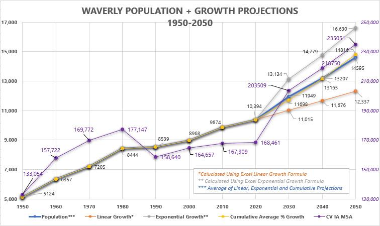
Historically, the cumulative annual growth rate of the community is .092% or 9.2% every 10 years. Projections can also be made using linear growth calculations and exponential growth calculations as show in the table below.

9 • COMPREHENSIVE PLAN INTRODUCTION | 1
WAVERLY + WATERLOO/CEDAR FALLS MSA GROWTH RATES 1940-2020
HISTORY
Waverly 10yr Growth Rates
Waverly Cummulative Average Growth Rate


Waterloo/Cedar Falls MSA 10yr Growth Rates
Waterloo/Cedar Falls MSA Cummulative Average Growth
In 1852, the founder of Waverly, William Patterson Harmon, chanced upon a site that fired his imagination. The area that would become Bremer County was an undeveloped prairie, home to wildlife and the remnants of three Native American tribes and a small scattering of pioneers. Harmon was at once captivated by a spot where the fall of the Red Cedar River offered prospects of excellent water power and dense timber on the eastern bank, ready at hand for building material.
Early pioneers began arriving in the area as early as 1850. Although others arrived before him, Harmon was the initial visionary. While the others had been content with cabins and gardens, Harmon beheld the land and the river and envisioned a city.
By 1853, male voters in Bremer County had risen to 68, which was considered a sufficient population for the county to be organized for civil purposes. Harmon had been campaigning to gain the distinction of county seat for the fledgling town and by May the commissioners chosen by the State General Assembly drove a red cedar stake just north of the present courthouse to indicate their decision to make this town the new county seat.
It was not known for certain when the name of “Waverly” was officially bestowed upon the community, but the daughter of William P. Harmon, Jennie Harmon Case later wrote “… he named the town from the Waverley novels which he was reading at the time.” Others thought that because the stories were of a chivalrous nature, it is supposed that Harmon adopted their name with the hope that his town would embody the same spirit of honor, courtesy and generosity.
Waverly’s business district began in 1853 and the first mill (White Swan Mill) was constructed by Harmon during the winter of 1853-54. The White Swan Mill served the community for many years. By 1855 Waverly’s population grew to 450 while business and residential development expanded on both sides of the river.
10 INTRODUCTION
-11.0% -6.0% -1.0% 4.0% 9.0% 14.0% 19.0% 24.0% 1940 1950 1960 1970 1980 1990 2000 2010 2020
02 | PUBLIC ENGAGEMENT
PUBLIC ENGAGEMENT

PUBLIC ENGAGEMENT METHODS
PLAN ENGAGEMENT OVERVIEW
This Plan was drafted through a collaboration among City staff, Planning and Zoning Commission, elected officials, MSA, and most importantly, residents of the community.
The public engagement process is integral to the results of the Plan and guides future implementation of the goals and policies recommended in this document. Various engagement methods were performed to provide multiple opportunities for stakeholders to provide quality feedback online and in-person. The methods ranged from an online community survey available to all, hybrid in-person/virtual community meetings via Zoom, media postings, online stakeholder focused group interviews, and in-person popup events. There were multiple stages of input varying in type in order to receive quality feedback. In the beginning, word of the project was spread to create awareness and excitement. From that momentum feedback was gathered in various types to help form the Plan goals and policies.
COMPREHENSIVE PLAN STEERING COMMITTEE

The Steering Committee was chosen to oversee the process and ensure that the established goals and objectives of the process are being accomplished. The committee was the primary review and advisory body throughout the planning process. All meetings of the committee were held during the planning process and all presentation materials were posted on the project website for public access.
PROJECT WEBSITE
A project website was developed to share posts and feedback were shared such as the project schedule, draft documents, meeting notices, and copies of presentation materials. The website also provided a venue to share comments and participate in surveys and crowdsource mapping throughout the planning process, as well as provide an easy way for citizens to contact the project team with questions. This aspect of the communication and participation strategy was important for transparency, as well as sharing information with stakeholders.
COMMUNITY SURVEY
A community survey was created created as a gathering tool in the form. This was a gathering tool in the form of a SWOT (Strength, Weaknesses, Opportunities, and Threats) analysis. The broadness of the questions allowed us to analyze analyze community members’ views and thoughts of the City in the three categories of beautification, development, and mobility. This was administered through ESRI’s Survey123, which is formatted to allow users to take via computer, tablet or smartphone. Participants were invited to respond via a link through the project website as well as flyers that were distributed via City social media sites. PublicInput. com was used to collect and organize all surveys and outreach administered during this project.
12 PUBLIC ENGAGEMENT


13 • COMPREHENSIVE PLAN PUBLIC ENGAGEMENT | 2


14 PUBLIC ENGAGEMENT Community Plans Update • Tell us your ideas • Follow plan development • Find project resources • Visit the project website to... Use A QR Scanner application on your smartphone to go straight to the project website by scanning this image! • Take surveys • Map for growth • Get involved • waverlyplanning.com PUBLIC ENGAGEMENT Community Planning Update Plan Timeline March - May June - August September - November Comprehensive Plan Phase 2: Draft Plan Development Phase 2: Draft Plan Development Phase 2: Draft Plan Review and Final Plan Development Park and Open Space Plan Phase 4 Phase 5 Phase 6 Bike and Pedestrian Plan Task 4 Task 5 Task 6 For more information about community planning in Waverly, visit our project website at: waverlyplanning.com Future Land Use Map 2017
PUBLIC ENGAGEMENT PLAN
JANUARY 2022 – FEBRUARY 2022
STAGE 1: LAUNCH ENGAGEMENT – WHAT DOES THE COMMUNITY WANT?
• Project Launch Meeting
• Launch Online Engagement Platform
• Formation of “Engage Waverly”
• City Council Kickoff Workshop
• Planning & Zoning, Waverly Leisure Services, and Golf
Commission Meetings
• Community Input Workshop
Comprehensive Plan | Phase 1: Tasks 1-4
Bike and Pedestrian Trail Plan | Tasks 1-3
Park and Open Space Plan | Phases 1-3
Memorial Park Master Plan | Task 1
MARCH 2022 – MAY 2022
STAGE 2: DISCUSSING KEY DIRECTIONS
• Stakeholder Group Interviews
• Pop-Up Meeting #1
• Facilitated Walking and Biking Tours
• Project Team Meetings
• Online Engagement Platform Updates
• Engage Waverly Meetings
• Planning & Zoning, Waverly Leisure Services, and Golf
Commission Meetings
• City Council Update Presentation
Comprehensive Plan | Phase 2: Draft Plan Development
Bike and Pedestrian Trail Plan | Task 4
Park and Open Space Plan | Phase 4
Memorial Park Master Plan | Task 2
JUNE 2022 – AUGUST 2022
STAGE 3: DISCUSSING DRAFT APPROACHES AND PRIORITIES
• Project Team Meetings
• Online Engagement Platform Updates
• Engage Waverly Meetings
• Planning & Zoning, Waverly Leisure Services, and Golf


Commission Meetings
• Pop-Up Meeting #2
• Community Policies and Future Growth Workshop
• City Council Update Presentation
Comprehensive Plan | Continue Phase 2: Draft Plan Development
15 • COMPREHENSIVE PLAN PUBLIC ENGAGEMENT | 2
PUBLIC ENGAGEMENT
Bike and Pedestrian Trail Plan | Task 5
Park and Open Space Plan | Phase 5
Memorial Park Master Plan | Task 3 - 4
OCTOBER2022 – FEBRUARY 2023
STAGE 4: FINAL PLAN REVIEW DISCUSSIONS AND ADOPTION
• Project Team Meetings
• Online Engagement Platform Updates
• Engage Waverly Meetings
• Draft Plans Open House
• Pop-Up Meeting #3
• City Council Workshop #2
• Planning & Zoning, Waverly Leisure Services, and Golf Commission Meetings
• City Council Approval Meeting
Comprehensive Plan | Continue Phase 2: Draft Plan Review and Final Plan Development
Bike and Pedestrian Trail Plan | Task 6
Park and Open Space Plan | Phase 6
Memorial Park Master Plan | Task 5
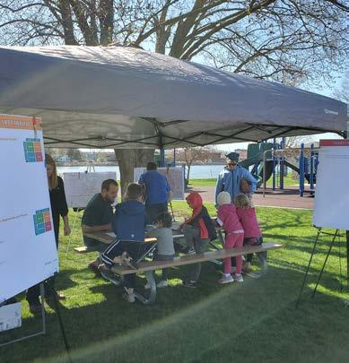
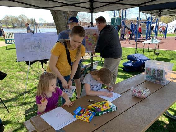
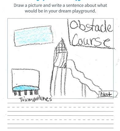
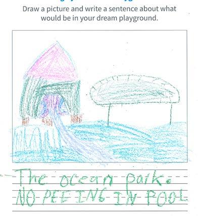
Children that attended the Waverly Art Walk with their families were asked to draw their dream parks.


16 PUBLIC ENGAGEMENT
COMMUNITY INPUT WORKSHOP
The first community input workshop was held on April 27, 2022, at the Waverly Civic Center. The event included a short presentation to introduce the projects and process. Following the presentation, participants had the opportunity to visit different stations for the different plans around the room. The event was well attended and the project team received a great deal of feedback via conversations, dot voting, sticky notes, and discussions regarding strengths, weaknesses, opportunities, and threats.
JOINT WORKSHOP 1
The first pop-up event was at the Art Walk event held on May 7, 2022, at Kohlmann Park. The booth had a number of boards for visitors to review some of the existing plans and conditions relating to future land use, parks and recreation, trails, and Memorial Park. There was also a children’s activity for youth to sketch their ideal future park and use stickers for a childrenfriendly visual preference study with play equipment imagery.
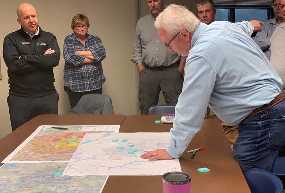
The first joint workshop was held on May 25, 2022 at the Waverly Civic Center and included the Planning and Zoning Commission, Board of Adjustment, and Economic Development Commission. While reviewing the draft future land use maps, findings were noted relating to Waverly’s parks and potentially underserved areas throughout the City.

17 • COMPREHENSIVE PLAN PUBLIC ENGAGEMENT | 2
PUBLIC ENGAGEMENT
POP-UP EVENT 2 | HERITAGE DAYS
The second pop-up event was at the Heritage Days event held on July 13, 2022, at Memorial Park. This event booth had several boards showing preliminary concepts for each of the planning projects. This included two concepts for Memorial Park, three concepts for the pool, the draft trails plan, a board for the Parks and Open Space plan and opportunities for dot voting and discussions about each of the plans.

JOINT WORKSHOP 2
The second joint workshop was held on September 27, 2022, at the Waverly Civic Center. The meeting once again included the Planning and Zoning Commission, Board of Adjustment, and Economic Development Commission.

POP-UP EVENT 3 | OKTOBERFEST
The third pop-up event was at the Oktoberfest event held on October 8, 2022. At this event the project team displayed the draft future land use map, the concept for Memorial Park, imagery of park amenities, pool layout options, park plan recommendations, and bicycle and pedestrian trail plans. Attendees provided significant feedback through dot voting and discussions with the team.

18 PUBLIC ENGAGEMENT
SWOT ANALYSIS - CITY COUNCIL
Objectives:
• Identify areas for housing growth (particularly affordable housing)
• Identify connector roads
• Trails Plan needs to look at bridges
• Prioritization of goals and needs
• Opportunities for children and families
• Park spaces accessible to all
• Industrial park space (tech, identify areas)
• Diversification of the economy
• Welcoming entrances, more organized and attractive
• Leverage high-tech capabilities and infrastructure
• Bike and pedestrian-friendly – plan at the forefront and retrofit system into one cohesive unit
• Placemaking, especially for Memorial Park – capitalize on the space
• New highway bridge integrated in the Plan
• Engage the right groups at the right times (parks plan especially)

• Get trails connected with larger regional trails
SWOT Analysis
Beautification
• Enhance the river – Accessibility and utilization
• Rail Trail (Opportunity and Threat)
• Cedar River loop trail strength
• Weakness and Threat – community buy-in
• Value in parks and rec, that beautification isn’t a waste
• Show that change doesn’t have to be a threat
• Incidents on the trail a concern
Development
• Weakness – lack of different types of housing/diversity
• Weakness – communication with the county
• Acreages along corridors where it makes sense for commercial
• Southwest area – what type of development is desired
• Northwest – where growth and schools will be
Mobility
• Issue – Rail Trail
• Bridge over the Cedar River (replaced or not)
• Pedestrian light between the ballfields and recommendations
• Highway 3 crosswalk
19 • COMPREHENSIVE PLAN PUBLIC ENGAGEMENT | 2
PUBLIC ENGAGEMENT
SWOT ANALYSIS - PLANNING & ZONING COMMISSION
Objectives:
• Another name for “Project Team” – transparency as a potential concern
• 2 new schools to change growth patterns
• Engagement Plan is key – match what the community wants
• Connectivity in the community – looking into allowing the plans to work together
• Best uses for existing amenities
• How do we get others involved? Especially those involved in growth like economic development
• Show it’s not a top-down process – get feedback from underrepresented groups
• Kiwanis group, parent groups, youth engagement, service clubs/groups, etc.
• How to get arterials in place and increase safety
• Balance between what the landowners and the community want
• Bring everyone together and remove divisiveness
SWOT Analysis
Beautification
• Strengths - River (strength and opportunity)
• Weaknesses – City Center – fear of loss, what keeps the businesses, Maintain areas of the community, how do you keep the City center/core strong, hodgepodge look and feel of 4th street – design guidelines would help and consistent signage and sidewalk for corridor
• Opportunities – Apartments above retail, buildings downtown, historic neighborhoods to bring back a core, do something similar to what downtown Waterloo has done or 63 to Allen (Planned and designed roadway like in Downtown Des Moines.
• Threats – Tree canopy, Segment of the community who feel beautification is not significant, Bridge concerns
Development
• Strengths – Development and growth of the schools, resources like the Hospital, Wartburg College, Industry and manufacturing, developing a wider scope of housing
• Weaknesses – Development can also be a weakness from an employment side to bringing people into the community, struggle to offer lower housing options, not many options for dining/limited restaurants currently
• Opportunities – Sustain and build housing, opportunities to work from home and size of community,
• Threats – 4-lane to Cedar Falls is a threat to retail
Mobility
• Strengths - Accessibility to downtown
• Weaknesses – Speeds and arterials
• Opportunities – North/south connector could be a big change
• Threats – Rail trail bridge, Adams Parkway bridge
20 PUBLIC ENGAGEMENT
STAKEHOLDER INTERVIEW QUESTIONS
Describe your connection to the City – what does your business/organization do and what is your role in the business/organization?
We heard from individuals and groups from across the community. Interviewees included council members, commission members, business owners, historic preservation specialists, design professionals, recreation enthusiasts, Chamber of Commerce, Main Street, realtors, retirees, medical providers, school district representatives, Wartburg faculty and students.
Why are you located in Waverly and what do you like about the area and community?
Interviewees discussed that they are in Waverly on account of employment, past-employment, near family, school, cost-of-living, regional opportunities, athletic opportunities (for kids) and that they love Waverly! People indicated they like the small-town character, downtown, people, river, parks, trails, businesses, schools, Wartburg College, healthcare, distance to regional attractions, historic character, high-quality of life, and community.
What do you see as the strengths of the community and how are they being capitalized upon?
Strengths mentioned include:
• Downtown
• The river
• Schools
• Wartburg College
• Small-town character
• Business community
• Festivals
• Athletics
• Historic character
• Trails
• Parks
• Regional recreation
• Accessibility to Cedar Falls/Waterloo
• Reasonable cost of living
• Good reputation
• Community involvement
• Entrepreneurial opportunities
• Great community
People love Waverly and believe the community does a great job of capitalizing on the community’s strengths; particularly the smalltown character, economic opportunity, downtown, educational opportunities, access to/from, medical facilities and recreational assets.
What are Waverly’s weaknesses? What is being done to address these? What do you think should be done? Several reoccurring perceived weaknesses were mentioned by the interviewees and included the following:
• Complacency
• Follow-through by City
• Lack of workforce housing
• Lack of housing diversity
• Lack of housing availability
• Recreational facility upkeep/updates
• Lack of business recruitment
• Old pool
• Vacant storefronts
• Regulatory restrictions
• Not enough focus on connecting to river
• Underutilized riverfront,
• Missing trail connections
• Incomplete sidewalks
• Unsafe pedestrian crossings
• Newer street markings and land configurations
Interviewees welcomed the opportunity to express their concerns through the Planning process and want the implementation sections of the Plans to address their concerns.
How do you describe/define Waverly to someone from outside of the community?
Waverly is described as a college town in northeast Iowa near Cedar Falls/Waterloo that offers great schools, great parks, access to great local healthcare, and a healthy historic downtown. The community is a great place to raise a family, a great place to retire, and has plenty of business and employment opportunities.
21 • COMPREHENSIVE PLAN PUBLIC ENGAGEMENT | 2
PUBLIC ENGAGEMENT
STAKEHOLDER INTERVIEW QUESTIONS
If you were promoting Waverly, what elements of the community would be important to include?
Wartburg College, downtown, schools, hospital and clinics, parks, trails, community, people, cleanliness, and opportunity.
What type of development is needed or missing from the community?
Interviewees discussed that Waverly needs more housing opportunity, in all types but especially in workforce and retiree categories. The community also needs more variety in dining options and needs to continue reinvesting in recreation facilities like the pool and trail connections/expansion.
Are there any particular areas that need reinvestment?
Downtown, the riverfront, Memorial Park, eastside Highway 3 corridor, and older neighborhoods were all mentioned as areas that could benefit from additional reinvestment.
What challenges do you see to starting, running, and/or expanding a business in Waverly?
Several interviewees mentioned that finding available space and attracting customers were the biggest concerns for starting, running, and expanding businesses.
What are some of the major projects in the community in the last 5 years? Were they successful? What could have been done differently?
Major projects mentioned by interviewees included improvements to Bremer Avenue/Highway 3, trail extensions, Cedar River Park, South Riverside Park, and new schools.
Aside from some complaints about Bremer Avenue and the removal and non-replacement of the 3rd Street Bridge (south of downtown) most of the interviewees felt the community had continued to grow successfully and were happy with the community’s progress.
If given $10 million for the betterment of Waverly, how would you spend it?
$10 million improvements mentioned by interviewees included
• New pool at Memorial Park
• New inclusive playground at Memorial Park
• Spray park(s)
• Rebuild Rail Trail Bridge
• Rebuild 3rd Street Bridge
• Make a trail connection to Janesville and Cedar Falls
• Create business recruitment program with incentives
• Museum renovations
• Build a golf learning center
• Assist with workforce housing development
• Build a kayak course
• Improve Bremer Ave Bridge character
• More riverfront improvement near parks and downtown
If given $100,000 for the betterment of Waverly, how would you spend it?
$100,000 improvements included planting more trees, open a coffee shop/bookstore downtown, donate for museum renovations, more kayak launches, business improvement grants, create a sidewalk improvement program, install a splashpad at South Riverside Park, and expand trails to new schools.
22 PUBLIC
ENGAGEMENT


2022 SNAPSHOT OVERVIEW 10,394 3,689 2.33 37.3 $73,365 $218,368 77 141 21
03 | AGRICULTURAL & NATURAL RESOURCES
ISSUES & OPPORTUNITIES
The natural environment is among Waverly’s most important assets because it provides natural and economic opportunities as well as habitat for wildlife. In fact, since Waverly is in the heart of Iowa, it’s no surprise that natural resources are strong assets for the area. Protection and enhancement of natural resources can directly benefit people through protection of drinking water sources and supporting industries such as agricultural, forestry and tourism.
Local Food Access
Residents see local food access as an important cultural amenity with many noting a lack of culturally-specific foods and desire for a public market.

Through preserving and enhancing natural resources, quality of life is also better, which is attractive to potential residents and increases land values. The challenge for the community is to adopt and implement regulations and programs that accommodate land uses while conserving the quality of the natural environment. The overall goal of the City is to protect and enhance natural resources such as prairies, agricultural land, and wildlife.
NATURAL RESOURCES GOAL #1
Balance conservation of and increased access to natural resource amenities.
Activating Downtown
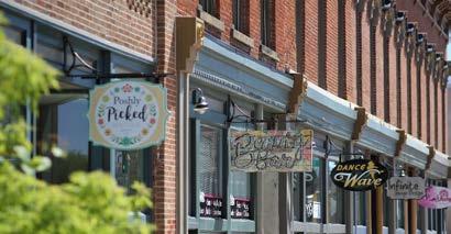
There is interest in further activating the downtown through more pop-up stores, events, public art, parklets, etc.
Strategies
#1- Preserve and protect key environmental corridors, native vegetation, and wildlife species.
#2- Promote site development and infrastructure improvements in areas with least possible impact to natural environments.
#3- Partner with other regional governments on key restoration initiatives that will protect natural environments.
Flood Risk
Increase in severe weather and flood events have impacted people's homes and businesses.

#4- Restrict development in the floodplain and wetlands through the City’s development review process.
#5- Promote landscaping practices that incorporate a variety of noninvasive, native species, especially within private stormwater facilities.
Community Events
Residents value the existing local events and how they engage the larger community.

25 • COMPREHENSIVE PLAN AGRICULTURE & NATURAL RESOURCES | 3
AGRICULTURAL & NATURAL RESOURCES
AGRICULTURAL RESOURCES GOAL #1
Preserve productive agricultural lands in balance with development of the City.
Strategies
#1- Promote infill and redevelopment initiatives on under-utilized sites within the City limits to help reduce the pressure to expand into surrounding agricultural areas.

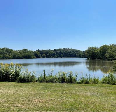
#2- Limit development in agricultural areas identified within this Plan’s Future Land Use Map.

AGRICULTURE & NATURAL RESOURCES
2022 SNAPSHOT: AGRICULTURAL & NATURAL RESOURCES
Urban Agriculture
Community Gardens:
As a result of the 2008 flood, Waverly owns many lots where houses were lost and that are now restricted from further development. The City established areas where community garden plots are available for rent by residents. The City has created an orchard on several lots and a community garden on other lots where groups and individuals of all ages volunteer to plant, tend and harvest produce that is donated to individuals in need and local free meal programs.
Farmers Markets: Produce, flowers, baked goods, local meats and eggs are available. Seasonal markets are Saturday mornings in the winter and summer, as well as Tuesday evenings in the summer months.
Physical Characteristics
Topography:
Waverly is generally flat along the Cedar River. The river flood plain is flanked on both sides with gentle sloping hills that frame the winding river valley. The river and several dry run branches can be prone to flooding, although the City has spent millions of dollars in flood mitigation, including converting the Cedar River dam to an inflatable (movable) structure as well as the widening and deepening of the central dry run corridor. These projects have improved the flood plain and reduced the chance of damaging flood events.
Water Resources
Drinking Water:
The City provides drinking water to the public through four City wells, three towers, and over 70 miles of public water mains. Water is drawn from the SilurianDevonian aquifer. Water is continually monitored for safety and quality.
Water Pollution Control:
The Water Pollution Control is responsible for treating wastewater generated by industrial and residential users. WPC maintains the treatment plant, main lift station, and eight smaller lift stations. There are approximately 60 miles of sanitary sewer main within Waverly and 1,200 manholes. The testing and monitoring of industrial discharges plus disposal of sludge are also the responsibility of the WPC Division. The efficient operation and maintenance of these facilities are required by permits and monitored by state and Federal agencies, DNR and EPA. The City is currently involved in a major project to update its treatment plant to meet the latest DNR and EPA requirements and accomodate for future growth.
Stormwater Sewer System:
The City maintains a stormwater system that collects and diverts stormwater to detention and retention areas, into dry run stream corridors and ultimately to the Cedar River. The City requires compliance with DNR regulations on stormwater drainage, enforces the protection of improper
discharges into system intakes and encourages the discharge of stormwater onto vegetated areas for infiltration and evaporation.
Wetlands:
Wetlands and waterways in the City are generally found along the Cedar River and adjacent to several dry run corridors that meander through town and drain to the Cedar River.
Cultural Resources
Register of Historic Places:
The City has four individual properties and five historic districts on the National Register. The Historic Preservation Commission has awarded over 24 Historic Preservation Awards in recognition of work undertaken by recipients with a commitment to preservation. The Commission also maintains a Waverly Historic Register that includes 11 properties at this time.
Riverside Parks:
The City maintains several parks along the Cedar River, including Ridgewood, Three Rivers, Kohlmann, S. Riverside, Brookwood and Red Cedar that include various assets and community space for residents.
Major Events:
Waverly Heritage Days, Waverly Farmers Market, Waverly Artwalk, Oktoberfest, Bremer County Fair and Christmas Greetings on Main.
27 • COMPREHENSIVE PLAN APPENDIX A
04 | UTILITIES & COMMUNITY FACILITIES
The purpose of the Utility section is to prepare for existing system needs while planning for potential future growth and development. Public utilities that provide water resources and sanitation collection are essential in community life and future community development. As the population, industry, and commercial services develop and the community’s needs increase, it is important to ensure that demand for these services does not exceed the supply.
UTILITIES GOAL #1
Have a high-quality, cost-effective, well-planned and efficient system of public utilities.
Strategies
#1- Serve all urban development within the City with a full array of urban services, including water, sewer, electric, natural gas, stormwater management, police, fire/EMS, refuse/recycling collection, internet, cable TV, telephone, streets/trails and recreation.
#2- Maintain and improve the utility infrastructure to ensure adequate capacity and integrity to serve existing users and accommodate new service areas. The priority will be maintaining the reliability of existing systems and services.
#3- All new development proposals shall be reviewed by all City departments to ensure that essential utilities can be provided to the subject development area in a timely and efficient manner.
#4- Avoid environmentally sensitive areas when planning the location of utilities to minimize adverse impacts, to the greatest extent possible.
#5- As feasible, locate public-use community facilities where they are accessible to a majority of their expected users by walking, bicycling, and-or public transit.
ISSUES & OPPORTUNITIES
Flooding & Stormwater Management

Weather patterns are shifting toward more frequent storms with heavy rainfalls. The City’s regulations on stormwater management systems may not be adequate to protect people and property from these large storms, as they are based on data from a time with fewer such storms.
Sustainability and Renewable Energy
The City’s greatest opportunity to implement change are in its own facilities, services and infrastructure. Sustainability initiatives in the private market will largely be achieved by cost reduction and savings through market forces, but can be encouraged incrementally through zoning and other regulations.

29 • COMPREHENSIVE PLAN UTILITIES AND COMMUNITY FACILITIES | 4
UTILITIES & COMMUNITY FACILITIES

UTILITIES GOAL #2
Utility system planning and implementation will occur in coordination with land use and transportation plans and projects.
Strategies
Land Development
#1- Maximize the use of existing utility systems by encouraging infill development that uses existing infrastructure investments.
#2- Discourage inefficient “leap frog” development that results in infrastructure constructed before there is adequate customer base in place to support its maintenance.
Surface Water & Stormwater Management

#3- Require residential and nonresidential properties to implement stormwater management techniques, including detentions, retentions, daylighting downspouts and sump discharges. Encourage more creative techniques such as rain gardens, rain barrels, green roofs, bioretention basins, oil and grease filters on surface and groundwater resources.
#4- Encourage the protection of existing vegetation on new development sites to the greatest degree possible in order to minimize soil erosion during and after construction.
Electrical Systems
#5- Bury existing utilities, where feasible, as redevelopment and street reconstruction occurs, and continue to require utilities in new developments to be underground.
#6- Consider the implementation of electric vehicle charging stations.

30 UTILITIES AND COMMUNITY FACILITIES
2022 SNAPSHOT: UTILITIES AND COMMUNITY FACILITIES
PUBLIC LIBRARIES
Waverly Public Library: The mission of the Waverly Public Library is to be an open door to information, recreation, and community. It’s long range strategic plan emphasizes four main focus areas: inviting spaces; beloved programming; community-valued resources and services; and an engaged community. The library is in the process of acquiring a “Bookmobile” to extend its services beyond the library walls. It is in the early stages of a significant renovation that will add updated spaces for young children, teens and mature readers. The Butterfly Garden adjacent to the building, is a beautiful and unique feature of the Waverly Public Library; ideal for photography, quiet reading, or picnics.
SCHOOLS & EDUCATION
K-12 Public Schools: The Waverly-Shell Rock School District consists of three elementary schools in Waverly and one in Shell Rock. The district has one middle school and one high school, both located in Waverly. The 2022 enrollment includes 2209 students, 771 elementary, 685 middle, 725 high school and 28 Greenview Alternative students. The district is involved in the construction of two new elementary schools in Waverly, renovations at the high school and renovations at the elementary school in Shell Rock. The new schools will replace the current elementary schools now in Waverly.
K-12 Private Schools: St. Paul’s Lutheran School is the only elementary school in Iowa affiliated with the Evangelical Lutheran Church in America
(ELCA) and is fully accredited to provide preschool and K-6 classes in a faith-based curriculum. The 2022 enrollment for K-6 is 119 students.
Technical Colleges: Hawkeye Community College serves Waverly residents in education and training for students seeking an associate degree, basic education, community services, technical diploma, or vocational adult classes.
COMMUNITY FACILITIES
Colleges / Universities: Waverly is home to Wartburg College, a selective liberal arts college of the Evangelical Lutheran Church in America (ELCA), internationally recognized for community engagement. It maintains an additional campus, Wartburg West, in Denver, Colorado. The college has a 2022 student enrollment of 1444 students. Wartburg and Waverly jointly constructed and share the “W”, a 200,000 square foot sports and wellness center on its campus, which allows residents memberships and use of the facilities. Wartburg also provides various sports programs to members of the community.
PARKS/RECREATION
City Parks:
The City has 21 parks with various amenities to serve the recreational needs of its residents. The Municipal Pool is located in Memorial Park and is in need of replacement. The Waverly Golf Course is a historic, challenging and beautiful tree-lined 18 hole course in great condition located in the middle of town. The building
facilities are in need of repair and replacement. The 8 acre Waverly Dog Park is fully fenced, supplied with water, shade features public seating, paved walking paths, and dog play structures. In 2023, the City will complete a new youth ball complex, Cedar River Park, that will include 7 ball fields, a walking trail, a miracle field and an inclusive playground. The new park is located across the Cedar River Parkway from the Waverly Soccer Complex, which has 16 variously sized soccer fields, including one fully lighted competitive field.
City Trails:
The City has various trails throughout the park system and the community. The Waverly Rail Trail starts near Kohlmann Park in downtown Waverly, extending east for 7 miles, over 8 bridges and under two roads. The trail hosts a variety of events each year, including the Candlelight Walk and Ski. The Rolling Prairie Trail enters Waverly from the west along Hwy 3. Waverly is in the process of connecting this trail to the Waverly Rail Trail, once a section along 10th Avenue SW is completed.
Prairie Links Golf Course:
The 18-hole, public course has been consistently rated as one of the best golf courses in Iowa. The facility is also home to an event center that can be rented out for weddings and a clubhouse full of amenities such as various dining options, indoor golf simulation, banquet rooms, locker rooms, and a new zero-entry pool.
31 • COMPREHENSIVE PLAN UTILITIES AND COMMUNITY FACILITIES | 4
HEALTHCARE FACILITIES
Medical Care:
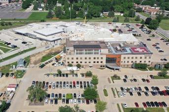
There are three health care systems operating in Waverly as well as a number of independent medical providers. Waverly Health Center, a municipal hospital, operates a newly expanded and state of the art medical facility that includes emergency services and ambulance teams. WHC includes the Christophel Clinic and space for various other medical providers, including the UnityPoint Rohlf Clinic. UnityPoint operates a separate urgent care office in the community. Mercy One also operates a family medicine clinic in Waverly.
Senior Care:
Bartels Lutheran Retirement Community has a long term and large presence in Waverly providing nursing care, assisted living, various independent living options, skilled/ rehab care, memory care and inhome care.

PUBLIC SAFETY
Waverly Fire Department:
The Waverly Fire Department serves Waverly and the surrounding areas with fire protection and emergency response coverage. The department consists of approximately 3040 citizens of the City who are professionally trained volunteers dedicated to protecting the community through public service.

Waverly Police Department:
The police department is a professional organization that has well-trained employees who truly care about their jobs and the community that they serve, while accepting tremendous responsibility entrusted to them as public servants. The department consists of 15 sworn officers and 4 essential support
personnel that provide safety and law enforcement services.
Court and County Services:
The Bremer County Courthouse in Waverly provides courts services for state matters and local matters, as well as for county governmental services. The combined Bremer/ Waverly Law Center located, adjacent to the Courthouse, houses both departments and the County jail.
UTILITIES
Waverly Utilities: WU is an award-winning national leader in electric reliability, safety and renewable energy that has provided electric service to Waverly since 1904. In 2016, Waverly Utilities became a telecommunications utility offering gigabit speed internet, enhanced cable, and digital telephone services.
City:
The City provides water, sewer and refuse collection services to the residents of Waverly. The City operates a recycling center for free disposal of recyclable materials, collection and disposal of large refuse items at a nominal cost, and offers curbside recycling collection. The City maintains a yard waste site that generates free mulch for residents.
MidAmerican Energy: MidAmerican Energy provides natural gas service to Waverly and serves some designated areas of the community with electric services.
Other Providers:
Mediacom and CenturyLink offer telecommunication, cable TV and internet services to residents of Waverly.
Other Municipal Facilities:
• Waverly Civic Center
• Waverly Public Services Center
• Waverly Pollution Control
• Waverly Parks Facilities
• Waverly Parking Lots
32 UTILITIES AND COMMUNITY FACILITIES
Waverly Fire Department
Waverly Utilities
Waverly Public Library Waverly Health Center
05 | INTERGOVERNMENTAL
COOPERATION
INTERGOVERNMENTAL COOPERATION
ISSUES & OPPORTUNITIES
Although the City government is the main adopter, keeper, and implementer of the Plan, it is hoped that several community partners will utilize this Plan as a guiding document. Waverly has a long tradition of excellence in City governance. The City will continue to approach its governing responsibility with transparency, cooperation, and a positive attitude of service.

INTERGOVERNMENTAL COOPERATION GOAL #1
Work closely with neighboring jurisdictions and other governmental entities to achieve sustainable development and enhance the efficiency and quality of public services.
Strategies
School District
The success of the City as a desirable place to live is tied to the success and reputation of the school districts, and there are many ways that the City and the School Districts depend on each other and collaborate with each other to meet community needs.
#1- Enforce, abide by and maintain existing intergovernmental/ cooperative agreements with neighboring jurisdictions to provide predictability for property owners, avoid municipal boundary disputes, and plan for efficient provision of public facilities and services.
#2- Work closely with the community and school districts to foster communication, relationships, and knowledge about facility planning and other district activities/efforts that impact Waverly residents.

#3- Work with other governmental entities to implement policies that further City objectives and reinforce City plans.
Growth
The Plan outlines the City's growth areas. Streets without curbs, storm sewers, or sidewalks will gradually be improved to include those features that may not already be in place. Homes built without public sewer or water service will gradually be converted to include public services. In some cases it may make sense to pursue street reconstruction to urban standards, or sewer and water extensions.
34 INTERGOVERNMENTAL COOPERATION
INTERGOVERNMENTAL COOPERATION GOAL #2
Partner with local, state, and federal agencies to enhance the culture and resources of Waverly.
Strategies
#1- Support the school district in their growth and community engagement activities.
#2- Partner with the school district on land use, utility, and transportation improvement planning.
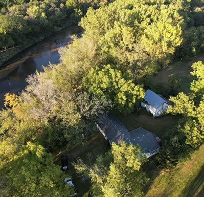
#3- Partner with the Iowa Department of Natural Resources and Bremer County Conservation to advance planning efforts for natural resources, green space, and trail development.


35 • COMPREHENSIVE PLAN INTERGOVERNMENTAL COOPERATION | 5
2022 SNAPSHOT: INTERGOVERNMENTAL COOPERATION
Surrounding Units of Government
Bremer County:
Waverly is the county seat and is located in the southeast corner of Bremer County. Waverly had more than 40% of the county population of 24,988 in the 2020 census. The county has a three member Board of Supervisors where each member serves one of three districts. District 1 is comprised of four fifths of Waverly residents from Waverly Wards 2, 3, 4 and 5. District 2 includes one fifth of Waverly residents from Ward 1 with the remaining residents of District 2 including residents of Lafayette, Washington, Jackson and Jefferson Townships, including the cities of Janesville and Denver.
City of Shell Rock:
Shell Rock is a neighboring city with a population of 1,271 located in nearby Butler County. It is adjacent to the rapidly growing Butler Logistics Park which provides the region with many employment opportunities. Shell Rock shares a school district with Waverly.
City of Janesville: Janesville is located just south of Waverly along US 218 and is located in Black Hawk County. It has a growing population of 1,048, largely due to its location between Waverly and the Waterloo/Cedar Falls metro area. Students at Janesville High School are able to take advanced courses at WaverlyShell Rock High School.
City of Cedar Falls and Waterloo: Cedar Falls and Waterloo are the
two largest cities in the Cedar Valley Area that includes three counties and more than 20 cities. Waverly is the third largest city in Cedar Valley. Cedar Falls is home to the University of Northern Iowa and Waterloo is home to Hawkeye Community College. Both institutions are important educational assets to the area. Cedar Falls and Waterloo are home to many businesses and industries that provide the area with a great variety of employment opportunities and retail options.
Other Jurisdictions
Waverly-Shell Rock School District: The school district serves Waverly, Shell Rock, and portions of several surrounding communities. The school district and the City have each invited someone representing the other jurisdiction into critical planning processes, including this Comprehensive Plan.
Iowa Northland Regional Transportation Authority (RTA): The City coordinates regularly with the Iowa Northland Regional Council of Governments on a variety of regional transportation planning issues, including long range transportation and land use plans.
Iowa Northland Regional Council of Governments (INRCOG): INRCOG serves as a planning organization, responsible for coordinating, assisting and facilitating programs in Community and Economic Development that will benefit all governmental bodies in the
INRCOG region. Emphasis is placed on intergovernmental communication and cooperation, accessing of funds, and the need for continuing Comprehensive Planning. INRCOG facilitates the planning efforts of Bremer, Black Hawk, Buchanan, Butler, Chickasaw, and Grundy Counties through the Cedar Valley Regional Economic Development Partnership, the Iowa Northland Regional Economic Development Partnership and the Cedar Valley Legislative Coalition.
Emergency Management Agreements
Bremer County has 8 Fire and Emergency Response Departments that serve all areas of the county. There are currently two Emergency Medical facilities that serve the county, located in Waverly and Sumner. Residents from neighboring communities travel to these locations or other counties for medical attention. The Bremer County Sheriff ’s Office contracts law enforcement for all of the unincorporated areas of the County along with providing assistance to the cities that have their own police force. Bremer County Emergency Management, led by the County Coordinator, is a coordinated effort between local, state, and federal government agencies, as well as individuals, businesses, and volunteer organizations. Since all disasters begin and end at the local level, coordinated preparedness and response efforts are critically important.
36 INTERGOVERNMENTAL COOPERATION
06 | ECONOMIC DEVELOPMENT
ECONOMIC DEVELOPMENT
ISSUES & OPPORTUNITIES
Economy and employment are a key part of any thriving community. Waverly’s economy is an integral component of the regional economy. This economic connection will continue to be based on commuting and regional economic factors. This chapter of the Comprehensive Plan is intended to report on the local economic and employment issues and opportunities.
Attracting Workforce
Prior to COVID-19, the unemployment rate was extremely low and local employers reported having unfilled roles. Given these conditions, economic development professionals have been focused on workforce attraction and workforce development. This focus is consistent with a strong national economic development trend towards attracting people first and businesses second.
Economic development generally consists of those public and private efforts which promote and develop business enterprises within a community, plus the housing development that serves commuters to Cedar Falls-Waterloo or the Cedar Valley. The City’s regulatory climate can have an impact on the retention, expansion, and attraction of business. Zoning regulations can provide development standards which ensure that business development adds to the quality of neighborhoods and overall community life. Such standards can protect property values of homes and whole neighborhoods and can minimize undesirable off-site impacts from business activities. Such standards can also protect businesses from nuisance complaints and negative image situations. The Comprehensive Plan, along with zoning, provide standards which ensure land use compatibility within the community and as tools to attract business.

ECONOMIC DEVELOPMENT GOAL #1
Support an increase in the number and type of child care slots in Waverly, as evidenced by semi-annual reporting from Child Care Resource and Referral (CCR&R).
Strategy:
#1 - Assist existing child care providers with expansions by connecting them to appropriate resources.
ECONOMIC DEVELOPMENT GOAL #2
Attracting & Retaining Business
Many stakeholders have noted a desire to attract and grow industries that are growing in the wider economy, especially those with higher-paying jobs. While the challenge of workforce availability is currently inhibiting a focus on employer-attraction, economic shifts will likely change this perspective.
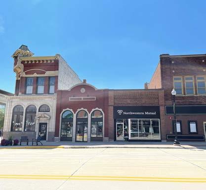
Advocacy and marketing result in the completion of community placemaking projects, which supports resident attraction and retention, and increased tourism in the area.
Strategy:
#1 - Remain engaged and active in the planning and development of community amenities.
38 ECONOMIC DEVELOPMENT
ECONOMIC DEVELOPMENT GOAL #3
Efforts to assist new and existing businesses in Waverly result in a net gain in the number of businesses each year.


Strategies
#1- Maintain a robust business retention and expansion program.
Action:
a. Conduct business visits.
b. Maintain updated resource, technical assistance, and incentive list.
c. Assist businesses with issues or expansion needs.
d. Share common community issues with City partners.
e. Report business visit findings to stakeholders.
#2- Engage in business attraction efforts.
Action:
a. Continue ongoing marketing efforts to recruit new businesses (website, LOIS, etc.)
b. Respond to RFP’s as appropriate.
c. Serve as business liason to available and relevant incentive programs.
d. Provide permitting and other City code guidance to new business projects.
e. Actively participate in the Cedar Valley Regional Partnership.
#3- Cultivate and support the growth of small business operations and entrepreneurs.
Action:
a. Collaborate with Waverly Chamber and Main Street to offer technical assistance to small businesses.
b. Connect and promote start-up and/or growth RLF funds available for small businesses.
39 • COMPREHENSIVE PLAN ECONOMIC DEVELOPMENT | 6
ECONOMIC DEVELOPMENT
ISSUES & OPPORTUNITIES
ECONOMIC DEVELOPMENT GOAL #4
Talent attraction efforts and workforce development initiatives support a population growth of 1% per year.
Strategies
#1- Implement and maintain programs to attract new people to Waverly.
Action:
Room for Growth
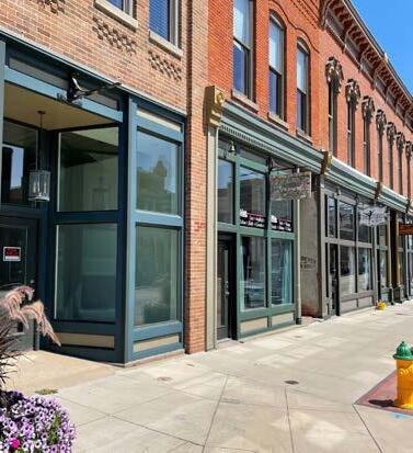
Highway access and space to grow gives Waverly an advantage in business growth. The City has great land opportunity available for development
a. Continue to maintain and champion the Waverly Welcome Home website.
b. Continue to implement the whole Community Marketing Initiative.
c. Continue to promote the Cedar Valley Region Jobs search platform to employers and workers.
d. Support the Cedar Valley Regional Partnership’s refugee/immigrant attraction efforts by helping to connect new Americans with job opportunities.

#2- Partner with educators and businesses to connect and inform local students about the potential of local job opportunities.
Action:
a. Remain engaged with Hawkeye Community College Sector Boards.
b. Support student engagement (work-based learning opportunities, pre-apprenticeships, etc.) with industry sectors (K-12 into businesses).
40 ECONOMIC DEVELOPMENT
2022 SNAPSHOT: ECONOMIC DEVELOPMENT
Economic development activities play a key role in the quality of life of the community and the long term viability of the City. This economic development snapshot explores the City's current environment, and inventories efforts that support economic development in the community.
TOP EMPLOYERS, 2021
EMPLOYMENT BY INDUSTRY
LOCAL RESOURCES
• Industrial Revenue Bonds
• TIF Districts
• Downtown Loan Programs
EDUCATIONAL TRAINING
• Waverly-Shell Rock School District
• Wartburg College
• Hawkeye Community College
• University of Northern Iowa
• Allen College of Nursing
• Upper Iowa University
STATE/FEDERAL PROGRAMS
• High Quality Jobs
• Industrial New Jobs Training260E
• Iowa Jobs Training - 260F
• Iowa Economic Development Authority (IEDA)
• United Way
• Bremer County Family Services
• NICA
41 • COMPREHENSIVE PLAN
Iowa DNR, Esri Canada, Esri, HERE, Garmin, SafeGraph, GeoTechnologies, Inc, METI/NASA, USGS, EPA, NPS, USDA ¯ Office District Industrial District Commercial District Waverly City Limits ECONOMIC DEVELOPMENT SITES AND DISTRICTS EDUCATION ATTAINMENT White Black Asian Hispanic/Latino High School Graduate Some College or Associate’s Bachelor’s or Higher No High School Diploma
Major Employers CUNA Mutual Group 545 Wartburg College 500 Waverly Health Group 479 Waverly-Shell Rock Schools 434 GMT Corporation 317 Bartels Lutheran Retirement Community 220 Walmart 209 Nestle, USA 194 Bremer County 175 Industry Waverly Bremer County Agriculture, forestry, fishing and hunting, mining .9% 4% Construction 4% 5.2% Manufacturing 13.9% 18.2% Wholesale Trade 1.8% 2.2% Retail Trade 8.7% 9.1% Transportation and warehousing, utilities 4.7% 5% Information .4% 1.3% Finance/insurance, real estate, and rental/ leasing 7.7% 7.5% Professional, scientific, management, administrative and waste management services 6.8% 5.8% Educational services, health care/social assistance 35.7% 29.4% Arts, entertainment, recreation, & accomodation/food services 8.9% 4.8% Other services, including public administration 6.7% 7.3%
07 | HOUSING
Home affordability
Large-scale economic trends are bringing housing affordability into focus. Over the last 50 years, middle income households have seen an increase, while inflationadjusted housing costs have risen for rental housing and for homeownership in that period.
This chapter includes an analysis of housing across the community of Waverly that leads to the development of a plan to promote the availability of land for a full range of housing choices including low and moderate income housing. Waverly has opportunities to expand their housing efforts as the community continues to see growth and the need for new stock increases.

HOUSING GOAL #1
The City will achieve balanced neighborhoods with a mix of housing types and price-points that provide suitable housing for everyone.
Strategies
#1- New neighborhood and subdivision development should include a mix of housing types and densities.
#2- Support gradual increases in density that allow homeowners to age in place and homebuyers to generate additional income (e.g., twinhomes, accessory dwelling units, and other split owneroccupancy/tenancy dwelling types).
#3- Locate workforce and affordable housing in places with good walking access to jobs and shopping and/or where public transportation is available or planned. It should not be concentrated in any single neighborhood.
#4- Pursue opportunities to purchase and assemble property, as appropriate, to support the housing needs of the community.
#5- Encourage the development of housing in every neighborhood for people of all abilities. This includes, for example, the use of universal design principles in new housing.
What is the benefit of increasing density within existing neighborhoods?
Attracting Young Adults and Families
Attracting families and maintaining the quality of life present in Waverly is important to the local economy.
Accessory Dwelling Units (ADUs) can respectfully increase density in built environments without changing the character of the neighborhood. ADUs can be a separate cottage in side/rear yard, apartment in the basement, a space above a garage, or a unit attached to the home. While financing can be difficult, ADUs allow homeowners to create an additional dwelling unit on their own property for family members, caretakers, and friends who are in need of housing. They are also commonly used by aging households to “downsize” their own housing, while maintaining ownership of the property as either an income-generating rental, or housing for family members serving as caretakers later in age.

43 • COMPREHENSIVE PLAN HOUSING | 7
ISSUES & OPPORTUNITIES
HOUSING
HOUSING GOAL #2
Retain and attract residents including young professionals, families, and retirees by supporting a range of housing options.
Strategies
#1- Encourage development and redevelopment of mixed-density neighborhoods.
#2- Produce and maintain community facilities, utilities, and infrastructure that are attractive to developers, current residents, and future residents.
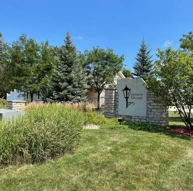
#3- Diversify housing opportunities that attract a diverse array of demographic populations.
#4- Reduce barriers to housing development opportunities.
#5. Encourage owner-occupied (multi-tenant) rental properties.
What are owner occupied units?
One of the best tools to generate wealth is through homeownership, but low and moderate income earners are seeing housing become less affordable as costs to enter the ownership market are rising. Owner-occupied rentals help fill some of that financing gap by allowing purchasers to buy a small multi-unit home (4 units or less) and lease out the other units to generate income and offset housing cost.
HOUSING GOAL #3
Housing policies will complement economic development goals of the City, growing business and population in tandem.
Strategies
#1- Everyone who works in the City will be able to find adequate housing in the City, whether entry-level or executive.
#2- New housing will be located in areas with adequate access to jobs, transportation, or other daily-need amenities.
#3- Encourage high-density development in areas in and near downtown where there is adequate access to transit, commercial nodes, and other daily-need amenities.
#4- Efforts to encourage new and rehabilitated housing will result in the addition of livable units each year in Waverly.

ISSUES & OPPORTUNITIES
Diversity of Housing Stock
Having a diverse mix of housing types with well-designed buildings and developments within each neighborhood is vital to the long-term health of the neighborhood and the City as a whole. This includes low- to high-density units inclusive of rental and homeownership.
Neighborhood Revitalization
The distribution of housing types in a community and the design of individual projects have a huge impact on the quality of life and equity in the community. Infill redevelopment projects need careful design to achieve a comfortable fit for the new uses within existing neighborhoods.
44 HOUSING
SNAPSHOT: HOUSING
4,166 - The number of housing units as of 2020.

76% - The percentage of units that are single-family detached housing, compared to 85% for the County. As costs continue to rise for new construction, these unit types may become increasingly unaffordable and households may need to look for new options in the housing market.
78% - The percentage of all units that are owner-occupied, based on the American Community Survey (ACS). This is unchanged over the past decade, indicating stability in unit occupancy types year-to-year.
8% - The percentage of all units that are attached units (e.g. townhomes, twinhomes), based on ACS survery. Attached and two-unit building forms are becoming more common, and are important to adding gradual density in land use decisions.
22% - The percentage increase in the median owner-occupied home value since the market bottom in 2012, representing a strong sellers’ real estate market for all types of homes in the City.
8.2% - The vacancy rate in 2020, which is an increase from the 5% vacancy recorded in 2010. While owner-occupied housing is seeing tighter markets and less available units, increasing desirable rental choices is important to offer options within the housing market.
10%, 24% - The percentage of owner households and renter households, respectively, that pay more than 30% of their annual income on housing costs. 30% is the generally recognized housing “affordability limit” for households before budgets are cut for other essentials such as food, healthcare, childcare, etc. These can be thought of as “families that cannot afford” housing in Waverly.

45 • COMPREHENSIVE PLAN HOUSING | 7 2022
The following numbers illustrate those conditions in Waverly most relevant to the formation of housing goals and policies for the next 10 years.
Year Built Number of Units 2014 or later 85 2010 to 2013 114 2000 to 2009 564 1980 to 1999 837 1960 to 1979 950 1940 to 1959 419 1939 or earlier 691
NUMBER OF UNITS BY YEAR BUILT Single-Unit Detached Single-Unit Attached 2-4 Apartments 5-9 Apartments 10 or more Mobile Home 0 500 1000 1500 2000 2500 3000
NUMBER OF UNITS BY STRUCTURE, 2019 Waverly Bremer County Shell Rock $0 $20,000 $40,000 $60,000 $80,000 $100,000 $120,000 $140,000 $160,000 $180,000 $179,600 $132,000 $110,000 MEDIAN HOME VALUE, 2022 HOUSEHOLDS, TENURE 83% Owner 17% Renter
2020 American Community Survey 5-Year Estimates
TOTAL
TOTAL
Source:
08 | MOBILITY
TRANSPORTATION
&
The purpose of the transportation element is to provide guidance to the City for decisions regarding the nature of roadway infrastructure improvements necessary to achieve safety, adequate access, mobility, and performance of the existing and future roadway system. The goal of this plan is to establish local policies, standards, and guidelines to guide major transportation investments and policy decisions. To accomplish these objectives, the transportation plan provides information about the functional hierarchy of streets and roads, non-motorized transportation, and transit.
MOBILITY & TRANSPORTATION GOAL #1
Create connected, livable neighborhoods that have a variety of transportation options for all residents.
Strategies
#1- Move toward implementation of a complete streets network that is safe, convenient and attractive for everyone regardless of age, ability, or mode of transportation.
#2- Continue to promote walkable neighborhoods that provide transportation choices and convenient access in existing and future sections of the City.
#3- Discourage cul-de-sac streets in favor of connected streets that provide transportation flexibility and increased safety in case of an obstructed street. Additionally, consider mid-block sidewalks/multi-use trail connections for pedestrians for interior streets/cul-de-sacs.
#4- Require active transportation connections to every development project, and encourage additional amenities (e.g., bike racks, bike repair stands, hydration stations, etc.) in developments, public parks and other public facilities where feasible/appropriate.
What are complete streets?
Complete Streets are streets that provide safe, convenient, and comfortable routes for all users, regardless of age, ability, or mode of transportation. A network of complete streets makes the transportation network safer and more efficient for everyone, including pedestrians, bicyclists, motorists, and transit riders of all ages and abilities. A “complete street” right-sizes infrastructure based on functional classification and traffic volumes and may include the following features: sidewalks, multi-use paths, bicycle lanes, automobile lanes, street trees, public transportation facilities, and traffic calming devices.
ISSUES & OPPORTUNITIES
Public Transportation
Public transportation is integral to the overall multi-modal transportation network, providing an alternative to personal vehicles.

Bicycle & Pedestrian Facilities
The City has pieces of a strong walking and biking network; however, there are still gaps in the network. These facilities are a desired amenity both for recreational benefits and as an alternative to using a motor vehicle.

47 • COMPREHENSIVE PLAN MOBILITY AND TRANSPORTATION | 8
MOBILITY & TRANSPORTATION
What is active transportation and how do we plan for it?
Active transportation is any self-propelled, human-powered mode of transportation, such as walking and biking.
MOBILITY & TRANSPORTATION GOAL #2
Develop a comprehensive system that provides accessibility to traditional and alternative modes of transportation effectively throughout Waverly.
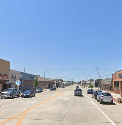
Strategies
#1- Prioritize maintenance and improvement of transportation infrastructure similar to recent projects like Cedar River Parkway, 20th Street NW, 4th Street SW, 1st Street NE, Eagle Ridge Drive, 10th Street SW, etc.


#2- Maintain annual sealcoat program for residential streets by area.
#3- Maximize traffic efficiency along major roadways.
#4- Coordinate transportation plans with other City and regional plans.
48 MOBILITY AND TRANSPORTATION
2022 SNAPSHOT: MOBILITY AND TRANSPORTATION
Road Network
Regional Highway System:
US Highway 218 and State Highway 3 are the most direct access to and from Waverly. US 218 provides access to US Highway 20 and Interstate 380 to the south, and Interstate 35 to the northwest, and US Highway 63 to the east.
Workforce Commuting Data:
Based on 2020 Census Bureau data, roughly 31% of Waverly residents commute out of Bremer County for work and the average travel time is 15 minutes. These commutes are generally for those traveling to and from work in Waterloo and Cedar Falls. 62% of Waverly residents work within the City of Waverly, while 38% work outside of the City. The total number of people commuting into Bremer County (minus those 7,667 from Bremer County) is 4,281. Because Waverly is the largest community in Bremer County, and the County seat, a majority of people commuting into Bremer County for work, from outside Bremer County, would be working in Waverly.
Bicycle & Pedestrian Network
Regional Trails
The Rolling Prairie Trail:
A non-motorized hiking and biking trail that traverses Shell Rock, Clarksville, Allison, and Bristow. It encompasses the three trails listed below and will eventually expand to include nine communities, three counties, and two state parks. The trail is complete to Waverly along the shoulder of Hwy 3. The City is planning to complete the trail connection along 10th Ave. SW to 16th Street SW.
Waverly Rail Trail:
Starts at the Cedar River Bridge in downtown Waverly and proceeds southeast for about 7 miles and terminates on the east side of US Highway 63.
Denver Jefferson Trail: Picks up on the east side of Highway 63 where the Waverly Rail Trail ends and travels into Denver about 2 miles south.
Readlyn Grump Trail:
Connects to Highway 63 a little south of where the Waverly Rail Trail ends and travels to Readlyn, about 6 miles east. City Bike System:
The City has both on- and off-street bike routes. These facilities provide strong connections both east-west and south to Denver.
Sidewalks:
The City is divided into seven districts and a Sidewalk Repair Program was created in 2014 to replace needed sidewalks. The abutting property owner is responsible for maintaining the sidewalk according to the Iowa Code. The program was placed on hold in 2019.
Transit Service
Waverly Area Transit
OnBoard Public Transit:
This service provides public transit to general public in Black Hawk, Bremer, Buchanan, Butler, Chickasaw, and Grundy Counties. Rides are provided at a cost for medical appointments, food pantries, libraries, grocery stores, and other locations.
Shared Ride Taxi:
Careful Carrier, Curt’s Cab & Services, LLC, and Dolly’s Taxi are regional taxi services that provide transportation within the City.
49 • COMPREHENSIVE PLAN MOBILITY AND TRANSPORTATION | 8
2022 SNAPSHOT: MOBILITY AND TRANSPORTATION

Saints Avenue Shuttle:
The shuttle bus will transport passengers to the University of Iowa Hospitals and Clinics twice a week at a cost of $10 one-way or $20 round-trip. Reservations are required and must be scheduled one day in advance.
Air Service:
The Waverly Municipal Airport provides private aircrafts a 3,200 foot runway and additional services, located northeast of Waverly off of Business Hwy. 218. Waterloo Regional Airport provides twice-daily flights to Chicago and Minneapolis.
Freight Rail:
Rail service to Waverly is provided by Cedar River Railroad (CEDR) a shortline subsidiary of Canadian National Railway (CN).
Waverly Wayfinding
• The City is working to implement a wayfinding signage master plan. This project will install multiple signs on arterials and downtown locations to assist visitors in discovering local attractions and amenities, as well as replacing welcome signs on major entrances to town. Phased implementation will begin in 2023.
Waverly’s current transportation corridors provide strong connections to various highways and trails, making it a convenient place to live. By improving the bike and pedestrian trails both within the City and those connecting to neighboring communities, accessibility to, from, and around Waverly will be greatly improved. These changes are important, as they create more opportunities for visitors to enter the community through non-vehicular travel in safe ways.
50 MOBILITY AND TRANSPORTATION
9 | COMMUNITY CHARACTER
ISSUES & OPPORTUNITIES
Historic Districts


Community character can be defined as the distinct identity of a place. This identity is found in the history, culture, and personality that can be found in a City and it’s residents. Both the physical and cultural environment play a large role in the way a City is perceived by outsiders and visitors. By creating a strong character, a City is able to set a standard to follow in all areas of decision making.
COMMUNITY CHARACTER GOAL #1
Preserve existing and create new places and events that contribute to the identity of Waverly.

Strategies
#1- Invest in on-going placemaking initiatives in key corridors and the downtown that activate spaces and engage residents and visitors.
#2 - When investing in new and existing neighborhoods, the City will collaborate with developers to create unique features and great public spaces, and encourage public art in public and quasi-public spaces. This is especially important in the Downtown District.
#3 - Continue to support community organizations and events.
#4 - Establish design standards for upkeep of current infrastructure and proposed new developments.
52 COMMUNITY CHARACTER COMMUNITY
CHARACTER
Waverly has strong Historic Districts with a variety of contributing houses and buildings.
COMMUNITY CHARACTER GOAL #2
Preserve and promote the City’s historic structures and sites, especially in the Downtown District.
Strategies
#1- Encourage the preservation of architecturally, historically, and culturally significant sites, buildings, and structures in the City and its environment. Encourage continued use, maintenance, and adaptive reuse of existing buildings with historic value.

#2- Increase public awareness of and promote civic pride in the City’s character.
#3- Continue City efforts toward strengthening and enhancing the downtown.


COMMUNITY CHARACTER | 9 53 • COMPREHENSIVE PLAN
2022 SNAPSHOT: COMMUNITY CHARACTER
Historic Districts
Waverly is home to 5 historic districts, as well as 4 individual properties listed on the National Historic Register.
• Harmon & LeValley NW Historic District - a residential district extending 31 blocks and containing 326 primary and secondary resources.
• Old Fourth Ward SE Historic District - a residential district full of homes ranging in architectural style from craftsman to Queen Anne. The district contains over 25 notable homes.
• Sturdevant SW Historic District - a residential district containing 103 primary resources and 80 secondary resources. It contains a variety of homes preserved from the late 19th to early 20th century.
• East Bremer Avenue Commercial Historic District - this commercial district includes 53 resources and 40 contributing buildings. The buildings were influenced by popular architectural styles ranging from Italianate, Colonial Revival, to Queen Anne.

• Wartburg College Historic District - The historic core of the Wartburg College campus was added to the National Register of Historic Places in 2022. Old Main, on the college’s central campus, has been on the Historic Registry since 1978.

Historical Society Museum
The Bremer County Historical Society Museum is housed in the old Daily House Hotel (Waverly Hotel), built in 1862. The Museum is open May through October and run by volunteers. Each room is decorated with artifacts from all towns within Bremer County.

Wartburg College Events
Wartburg is a substantial asset to the Waverly community. Through music, art, drama, culture, lectures and sports activities on and off campus, the residents of Waverly are invited to participate in unique, educational and enjoyable experiences offered by students and staff at Wartburg.
Waverly Art Walk
The first Saturday of May is reserved for the annual Art Walk event in Kohlmann Park. Local artists from Iowa and surrounding states set up tents along the Cedar River and sell their work.


Oktoberfest
The annual weekend event takes place in October and is a familyfriendly event featuring live music, food and beverage garden, and fun games for youth and adults alike.
Heritage Days
A community volunteer committee organizes and runs this weekend festival in July that includes family activities, concerts and fireworks that also promotes the City’s heritage, talents and honors its citizens.
54 COMMUNITY CHARACTER
10 | LAND USE
LAND USE
The Land Use Plan consists of two elements: existing land use and future land use. The Existing Land Use Map provides a snapshot of the current land uses in Waverly, while the Future Land Use Map provides a description and explanation of the character and qualities of each future land use designation. These descriptions provide the framework for evaluating land use decisions and guiding public actions. The Future Land Use Map shows how these land uses are assigned to each parcel of land.
The Land Use Plan places every parcel of land in the City into a classification. Future land use classifications and zoning districts are not one in the same. Land use classifications reflect the desired future development pattern in a given area. Zoning districts, on the other hand, more specifically define and regulate what kinds of uses are allowed on specific parcels and outline design and development requirements and guidelines. The Comprehensive Plan encompasses three broad categories of land use to guide the growth and redevelopment of Waverly. Residential land uses provide areas for people to live. Non-residential land uses represent the locations dedicated to the sale of goods and services to the community, and to centers of employment for the community and the region. Public land uses encompass government facilities, public parks, public schools, cemeteries, and public-owned and managed natural areas.
The Land Use Plan is a central focus of a Comprehensive Plan. It provides direction and guidance for how land uses, infrastructure, and related elements fit within the geographic context of the community. It also provides direction for how growth should be accommodated, including: character, scale, and intensity. Additionally, it serves as a guide for new development proposals and investments.
Planning for land uses allows Waverly to determine the best locations for future growth and development within the City. Good land use planning involves community engagement, wise natural resource planning, and accurate projections in relation to how and where growth will and should occur. It is also important to establish unique characteristics of the area, themes to implement, and types of land use strategies that build upon that character. The following goals and objectives help guide the decision making process as Waverly continues to grow and prosper.
56 LAND USE
Using the Future Land Use Map
The Future Land Use Map contains different land use categories that together illustrate the City’s land use vision. These categories, including explanations of the City’s intent, zoning, design, and development strategies for each, are described in this section.
This Plan includes one Future Land Use Map. The Future Land Use Map presents recommended future land uses for the City and its extraterritorial jusidiction. This map and the associated policies form the basis for land development decisions and are to be consulted whenever development is proposed, especially when a zoning change or land division is requested. Zoning changes and development shall be consistent with the future land use category shown on the map and the corresponding Plan text.

57 • COMPREHENSIVE PLAN LAND USE | 10 Printed By: eherold, File: G:\12\12200\12200007\GIS\6_ARCGIS Pro\Waverly_test\Waverly_test.aprx Print Date: 9/28/2022 Data Sources: City of Waverly Comprehensive Plan Update (2017) WAVERLY BREMER COUNTY, IOWA FUTURE LAND USE Maxar 00.250.5Miles Residential Commercial Residential/Commercial Commercial/Industrial Industrial Parks/Green Space Public and Non-Taxable Institutions/Structures Agriculture/Open Space Proposed Roads Water Bodies Floodplain Planning Boundary City Boundary
Data Sources: City of Waverly Comprehensie Plan update (2023)
LAND USE
Statement of Intent & Typical Use
The future land use categories identify areas by their primary intended uses, character, and densities (herein described as “Statements of Intent & Typical Uses”).
These classifications are not zoning districts. They do not establish performance criteria for land uses (i.e. setbacks, height restrictions, etc.) nor are they intended to list every possible use that may be permited within the future land use classification.
Parcels on the Future Land Use Map are identified by their primary intended uses; however, some of the parcels on the Future Land Use Map have yet to be platted or subdivided. The City recognizes that detailed site planning to identify precisely how larger unplatted parent parcels (herein referred to as “unplatted new development areas”) may be subdivided, zoned, and developed outside of the scope of a Comprehensive Plan.
The City may create neighborhood plans for these areas as part of future amendments to this Comprehensive Plan to further illustrate and guide development within these areas. The City may also require that developers create neighborhood plans for these areas prior to submitting requests for rezonings or preliminary plats.
Potentially Acceptable Zoning Districts
The future land use classifications identify those existing City zoning districts that are consistent within each future land use category (herein described as “Potentially Acceptable Zoning Districts”). The list of potentially acceptable zoning districts will be used by the City to confirm whether requests for rezoning of property are generally consistent with this Plan. Areas subject to City zoning districts include all lands located within the City limits. Areas outside the City limits, but within the City’s extraterritorial plat review jurisdiction, are subject to the City’s Subdivision Ordinance, in addition to applicable county zoning and land division regulations.
Effect on Zoning
Land use and design policies in this Plan should be considered during all development processes, especially in land division and rezoning. Where development is proposed under existing zoning regulations, including any Planned Development districts, the regulations of existing zoning supersede policies of this Plan.
Best Practice Design Strategies
The best practice design strategies listed within each category are provided to help developers and City officials make design decisions during the development process that are consistent with the intent of the future land use category and the general desire for high quality site and building design. These strategies may be used to help determine whether to approve rezoning, special provisional use permit, site plan, or planned unit developments. The illustrations and photos are not an exhaustive list of best planning practice and do not constitute the whole means by which high quality site and building design can occur.
The identification of future land use categories and potentially acceptable zoning districts does not compel the City to approve development or rezoning petitions consistent with the future land use category or map. Other factors will have to be considered, such as the quality of the proposed development, its potential effect on adjacent properties, its potential effect on City transportation infrastructure, the capacity and ability to provide services to the site, and the phasing of development, before any development applications are approved. In addition, it is not anticipated that all areas suggested for future (re)development on the Future Land Use Map will develop or be rezoned for development immediately following adoption of this Comprehensive Plan. In some cases it may be years or decades before (re) development envisioned in the Plan occurs due to market conditions, property owner intentions, and City capacity to serve new (re)development.
58 LAND USE
Amending the Future Land Use Map
From time to time, it may be appropriate to consider amendments to the Future Land Use Map, usually in response to a type of development not originally envisioned for an area when this Plan was adopted. See Implementation section for a description of the procedural steps for amending any aspect of this Plan. The following criteria should be considered before amending the map.
Compatibility - The proposed amendment/development will not have a substantial adverse effect upon adjacent property of the character of the area, with a particular emphasis on existing residential neighborhoods. A petitioner may indicate approaches that will minimize incompatibilities between uses.
Natural Resources - The land does not include natural features such as wetlands, floodplains, steep slopes, scenic vistas, or mature woodlands (1 or more acres, especially those consisting of heritage trees), which will be adversely affected by the proposed amendment/development. Any proposed building envelopes are not located within the setback of Shoreland-Wetland and Floodplain zones (or is raised above regional flood line). The proposed development will not result in undue water, air, light, noise pollution, or soil erosion. Petitioners may indicate the approaches they intend to use to preserve or enhance the most important and sensitive natural features of the proposed site and mitigate impacts to surrounding properties.
Transportation - The lay of the land will allow for construction of appropriate roads and/or driveways that are suitable for travel or accesss by emergeny vehicles. The proposed amendment/development will not create a significant detriment to the condition of adjacent transportation facilities or cause significant safety concerns for motorists, bicyclists, or pedestrians. Petitioners may indicate those approaches they intend to use to mitigate transportation compatibility concerns.
Ability to Provide Services - Provision of public facilities and services will not place an unreasonable financial burden on the City. Petitioners may demonstrate to the City that thecurrent level of servives in the City or region –including but not limited to school capacity, emergency services capacity (police, fire, EMS), parks and recreation, library services, and water and/or sewer services – are adequate to serve the proposed use. Petitioners may also demonstrate how they will assist the City with any shortcomings in public services or facilities.
Public Need - There will be a clear public need for the proposed change or unanticipated circumstances have resulted in a need for the change. The proposed development is likely to have a positive social and fiscal impact on the City. The City may require that the property owner, or their agent, fund the preparation of a fiscal impact analysis by an independent professional.
Adherence to Other Portions of this Plan - The proposed amendment/development is consistent with the general vision for the City, and the other goals, policies, and actions of this Plan.
59 • COMPREHENSIVE PLAN LAND USE | 10
Interpreting Boundaries
Where uncertainty exists as to the boundaries of future land use categories shown on the Future Land Use Map, the following rules will apply. If uncertainty still exists, the City Council shall decide any inquiries related to map boundaries upon recommendation of the Planning and Zoning Commission.
1. Boundaries indicated as approximately following the center lines of streets, highways, or alleys will be construed to follow such center lines.
2. Boundaries indicated as approximately following platted lot lines or U.S. Public Land Survey lines will be construed as following such lot lines.
3. Boundaries indicated as approximately following municipal boundaries will be construed as following such boundaries.
4. Boundaries indicated as following railroad lines will be construed to be midway between the main tracks.
5. Boundaries indicated as following shorelines and floodplains, will be construed to follow such shorelines and floodplains; in the event of change in the shorelines and floodplains, it will be construed as moving the mapped boundary.
6. Boundaries indicated as following the center lines of streams, rivers, canals, or other bodies of water will be construed to follow such center lines.
7. Boundaries indicated as parallel to extension of features indicated above will be so construed. The scale of the map will determine distances not specifically indicated on the map.
60 LAND USE
LAND USE
Future Land Use Categories
This section includes a description of each of the Future Land Use categories. These categories include recommended land uses (e.g. residential, commercial, industrial, and land use densities (i.e. dwelling units per net acre). All zoning decisions, land divisions, utility extensions, capital improvement projects, and related land development activities and decisions should be consistent with the recommendations of the Comprehensive Plan.
This section includes descriptions for the following categories:
R Residential
Residential areas are located within Waverly and are intended for low to medium density housing developments and redevelopment in Waverly. The primary districts are R-1 Residential, R1-A Residential, R-2 Residential, to R-3 Multiple Family Residential.

C Commercial
Commercial areas of the community are located along major thoroughfares and downtown Waverly. The primary zoning districts for the City’s commercial areas are S-1 Shopping Center, C-1 Commercial, C-2 Commercial, C-2A Commercial, and C-3 Commercial.

61 • COMPREHENSIVE PLAN LAND USE | 10
LAND USE
This category provides for a mix of medium to higher density housing development and commercial development. The primary zoning districts are to be R-2 Residential, R-3 Multiple Family Residential, R-4 Multiple Family Residential – Transitional, R-FBH Planned Factory Built Homes, S-1 Shopping Center, C-1 Commercial, and C-2 Commercial, to C-2A Commercial.
CI Commercial/Industrial

The Commercial/Industrial Flex areas are found primarily on the undeveloped edges of the community along major thoroughfares. The intent of this designation is to provide a flexible-zoning concept that encourages the market to assist in determining the end use of these future commerce focused development areas. The primary zoning districts for these areas are S-1 Shopping Center, C-1 Commercial, C-2 Commercial, C-2A Commercial, and M-1 Light Industrial.
I Industrial
The Industrial areas are intended for industrial, manufacturing, wholesaling, office-industrial, transportation, warehousing, storage and other manufacturing based industrial uses. The primary zoning districts for these areas are M-1 Light Industrial, and M-2 Heavy Industrial.


62 LAND USE RC Residential/Commercial
PGS Parks/Green Space
This future land use designation includes active or passive parks such as playing fields, playgrounds, open space, community parks, and other appropriate recreational uses as well as undeveloped lands, trails, water areas and environmentally sensitives areas, including mapped floodplain areas.

PI Public and Non-Taxable Institutions/Structures
This land designation includes public or semi-public facilities including but not limited to governmental offices, airport areas, police and fire facilites, medical facilities, community facilities, educational institutions, utility facilities, and places of worship.

AOS Agriculture/Open Space
This category includes larger tracts of property that are likely to remain in agricultural production and/or remain as undeveloped open space through 2042. If incorporated into the City, the primary zoning districts are A-1 Agricultural or R-1 Residential District.

63 • COMPREHENSIVE PLAN LAND USE | 10
ISSUES & OPPORTUNITIES
LAND USE GOAL #1
Create an economically and environmentally sustainable development pattern.
Strategies
#1- New development within the City’s jurisdiction should support the efficient use of public services and infrastructure.
a. Land development will be coordinated with planning for efficient public facilities and services.
b. Infill development that uses existing infrastructure is strongly encouraged. Leapfrog development that requires costly infrastructure extensions through undeveloped lands is discouraged.

Balanced Growth
An important dynamic of community growth is the linkage between housing and employment, especially multi-unit housing and industrial growth. Multi-unit housing projects are often controversial because they are replacing a single-story building with multi-story development.
Balanced Neighborhoods
The City is seeking healthy, balanced neighborhoods that feature a mix of housing types and price points. Balanced neighborhoods also tend to have convenient access to some form of smaller-scale commercial uses, such as a restaurant or coffee shop, day care facilities, small service businesses, etc.
#2 - Encourage development that uses land efficiently.
a. Encourage infill development and higher density redevelopment on sites already surrounded by urban uses. Development incentives such as flexibility with standards and/or TIF assistance should be focused mostly on infill and redevelopment, not greenfield development at the edge of the City.
b. Promote the inclusion of residential formats in every neighborhood to minimize land consumption, including smalls lots and attached units.

c. Enable and encourage well-planned, mixed-use development areas in all parts of the City, including the integration of small-scale commercial uses into neighborhoods and mixed-use buildings where economically viable.
#3 - Encourage development formats and building designs that support adaptive reuse as markets shift and demand changes. While unique building design is encouraged, designs that render the building hard to use for other occupants in the future are discouraged. Large-format commercial buildings should be reasonally divisible into multi-tenant buildings.
64 LAND USE
LAND USE
#4 - Protect and respect natural resources and systems in all development decisions.
a. Preserve environmental corridor features including waterways, floodplains, wetlands, ground water recharge areas, steep slopes (greater than 20%), wildlife habitat, scenic vistas, and mature woodlands through the enforcement of the City’s Subdivision Ordinance, Zoning Ordinance, and Zoning Map.
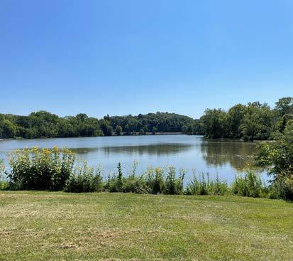
b. Encourage landscaping practices in new and existing neighborhoods that protect ground water and surface water resources.
c. Foster the protection of natural resource features from development by requiring those features to be accurately depicted on all site plans, certified survey maps, preliminary plats, and final plats.
d. Encourage the clean-up of contaminated sites to foster redevelopment of brownfields.
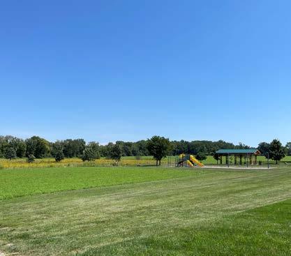
#5 - Require consistency with this Comprehensive Plan in all zoning and land division decisions.

Maintaining consistency with this Plan is required by state law and serves to make the development process more predictable for all participants. There will be times that uses are proposed that do not align with the Plan, but that most participants see as reasonable and appropriate. In such cases, the vision and goals of the Plan should still be applied, but the Plan can be amended to allow the desired use.
VOICES FROM THE COMMUNITY Improvement Needs
• Affordable housing
• Retail development with a focus on new restaurants
• Land for growth and development
65 • COMPREHENSIVE PLAN LAND USE | 10
LAND USE
LAND USE GOAL #2
Create places that are vibrant, attractive and unique, especially along the City’s Downtown.
Strategies
#1- Encourage the development of compact, carefully planned, mixed-use activity centers that include shopping, employment, housing, recreation, and community gathering opportunities. Mixed-use buildings and developments that include residential units with commercial uses are desirable and often necessary to achieve redevelopment.
#2- Work to achieve a balance among various commercial areas along Bremer Avenue (and throughout the City) with design formats and business mixes that allow each area to compete successfully and sustainably in the market.
#3- Identify commercial development opportunities in neighborhood settings that fit the site, both in terms of specific use and building and site design. Discourage the development of uncoordinated strip commercial land uses.

#4- Encourage and facilitate placemaking strategies to make neighborhoods and commercial areas unique, memorable, and attractive. These strategies can be implemented quickly during new development or incrementally over time in existing developed areas.

#5- Encourage infill development of vacant or underutilized lands or buildings. Work with property owners along Bremer Avenue to bring forward projects consistent with this Comprehensive Plan, Bike & Pedestrian Plan, and Parks & Open Spaces Plan.
ISSUES & OPPORTUNITIES
Urban Design Guidance
As the City grows and changes, some of this change involves redevelopment of existing sites. This “infill” development typically replaces a low-value building, often vacant, with new value and activity, boosting the tax base and the appearance of the area. For decades after the post-war explosion in automobile ownership, commercial buildings were set back behind parking lots. As the buildings moved further from the street, and got larger, they often featured fewer windows. The net result of these changes has been places with much weaker connection between the private realm inside the building and the public realm of the street. In recent years, local plans and national trends have helped move commercial buildings closer to the street, making the street corridor more attractive and lively, and making the activities in the buildings more visible and inviting.
Retail Volatility
Volatility in the retail market is due to the growth of online shopping and ever-faster delivery systems such as Amazon. This volatility is a risk to both large and small retailers, as well as downtown and shopping districts. The greatest concern to the City should be the risk that larger retailers, even those that currently appear strong could close a local store due to a recession or a change in their market sector, and leave behind a large, empty building.
66 LAND USE
2022 SNAPSHOT: LAND USE


Printed By: eherold, File: G:\12\12200\12200007\GIS\6_ARCGIS Pro\Waverly IA Comp Plan Mapping.aprx Print Date: 7/11/2022 Data Sources: City of Waverly Comprehensive Plan Update (2011) WAVERLY BREMER COUNTY, IOWA EXISTING LAND USE Maxar Agriculture / Open Space Low-Density Residential High-Density Residential Commercial Parks / Green Space Semi-Public / Institutional Industrial City Boundary 00.250.5Miles Data Sources: City of Waverly Comprehensie Plan update (2023)
FUTURE LAND USE

WAVERLY BREMER COUNTY, IOWA
Residential Commercial
Residential/Commercial
Commercial/Industrial
Industrial
Parks/Green Space
Public and Non-Taxable Institutions/Structures
Agriculture/Open Space
Proposed Roads
Water Bodies
Floodplain
Planning Boundary City Boundary
Data Sources: City of Waverly Comprehensive Plan Update (2017)
Data Sources: City of Waverly Comprehensie Plan update (2023)
Printed By: eherold, File: G:\12\12200\12200007\GIS\6_ARCGIS Pro\Waverly_test\Waverly_test.aprx Print Date: 9/28/2022
Maxar 00.250.5Miles
11 | TRANSFORMATIVE PROJECTS
TRANSFORMATIVE PROJECTS
New Schools

The Waverly-Shell Rock Community School District started the construction of two new elementary schools totaling $38.87 million. Two kindergarten through fourth-grade facilities will replace the current Margeretta Carey, southeast, and West Cedar elementaries. The site location for the new northeast school on Horton Road and the West site will be adjacent to 2915 Fifth Ave. N.W. in Waverly. Invision Architects are the designers of the schools and made public the renderings below of what each school will look like. Planned improvements to the current high school and Shell Rock Elementary are underway, with the elementary school currently in the bidding process for renovations.

Red Fox Inn
The Former Red Fox Inn has been rehabilitated and renamed the Red Fox Hotel and Event Center. It has 54 hotel rooms and 34 market-rental apartment units. The hotel and bar are both now open, apartments are completed and filling with tenants. The Event Center will begin accepting bookings starting in February of 2023.


70 TRANSFORMATIVE PROJECTS
Rail Trail Bridge
The Waverly Rail Trail Bridge is a steel beam bridge built by the railroad and retrofitted with wood deck and railings as a “repurpose” project, across the Cedar River. Due to the age and condition of the bridge, important decisions will have to be made regarding the replacement of the bridge in the near future.


Transformative Bridges in Iowa

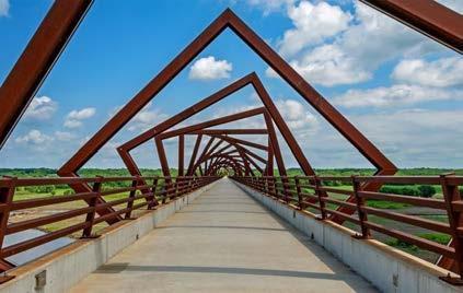
Cedar River Park Complex
The Cedar River Park Complex is a new and updated facility that will be completed in 2023. The Complex provides new youth baseball and softball fields and facilities. It consists of eight fields, bathrooms, concessions building, bike trail, and a playground structure.

71 • COMPREHENSIVE PLAN TRANSFORAMTIVE PROJECTS | 11
Mill Pond Pedestrian Bridge, Nora Springs, Iowa
Gray’s Lake Bridge, Des Moines, Iowa
High Trestle Trail Bridge, Madrid, Iowa
TRANSFORMATIVE PROJECTS


Bremer Avenue Bridge
The Iowa Department of Transportation will replace the Bremer Avenue Bridge, which stretches over the Cedar River and connects both sides of the downtown. The bridge is nearing the end of its life and it was considered to be more cost effective to replace it than to repair it. Construction is expected to start in late 2023 and be finished by the end of 2024. The bridge will contain a thin veneer brick siding to separate vehicular traffic from pedestrian traffic.


US 218
The Iowa Department of Transportation will remove all side road and driveway accesses from Janesville to Waverly, making the US 218 highway corridor similar to an interstate.


72 TRANSFORMATIVE PROJECTS
These conceptual images illustrate project features that are being considered for further development and possible inclusion in the project plans. The exact features to be incorporated into the project have not been determined. Final selections must meet the schedule, cost, and constructability criteria established for the project. The finished project may be different than shown in conceptual views. Bremer Avenue Bridge Aesthetics: Basic Bridge Structure & Features
Memorial Park
This well-loved park near downtown Waverly will undergo changes that can be found in the Memorial Park Plan.


73 • COMPREHENSIVE PLAN TRANSFORAMTIVE PROJECTS | 11
TRANSFORMATIVE PROJECTS
Waverly Municipal Hydroelectric Powerhouse
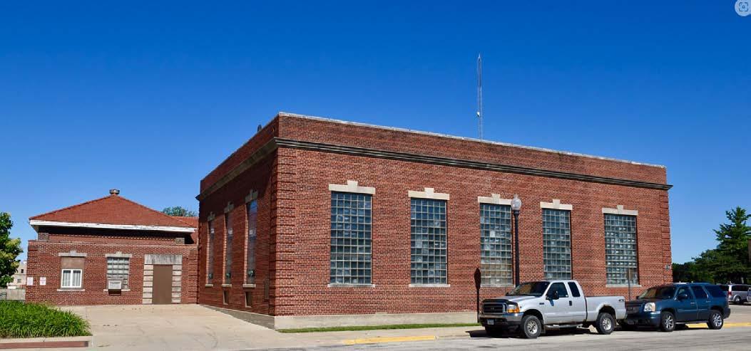
The Waverly Utilities Board voted to decomission the historic Waverly Municipal Hydroelectric Powerhouse and removed the three hydroelectric generations in the summer of 2022. The building recently underwent investigation and the City recieved the results of the Asbestos Survey Report, Underwater Assessment (Concrete) Report, and Geotechnical Report, along with a cost estimate for renovations and dam repairs approaching $3,000,000.
South Riverside River Wall
Waverly is looking to connect the South Riverside river wall and trail connection from the Bremer Avenue Bridge to South Riverside Park. This connection would create better trail access along the Cedar River.

74 TRANSFORMATIVE PROJECTS
12
| IMPLEMENTATION
IMPLEMENTATION
GUIDING DAILY DECISIONS
CITY ROLES & RESPONSIBILITIES
Responsibility for implementing this Plan lies primarily with City Council, several City boards and commissions, (including the Waverly Planning and Zoning Commission), and City Staff
City Council
City Council sets priorities, controls budgets and tax rates, and typically has the final say on key aspects of public and private development projects. Each council member should know where to find this Plan and should be familiar with the major goals described herein. City Council should expect and require that staff recommendations and actions both reference and remain consistent with this Plan.
Waverly Planning & Zoning Commission
Land use and development recommendations are a core component of this plan, and the Planning and Zoning Commission plays a major role in guiding those decisions. Planning and Zoning Commission members shall each own a copy of this plan and shall be familiar with the content, especially Chapter 10: Land Use. It is generally the responsibility of the Planning and Zoning Commission to determine whether proposed projects are consistent with this Plan, and to make decisions and recommendations that are deemed to be in the best interest of the City. The Planning and Zoning Commission should initiate efforts to amend the Plan to better reflect City interests. This will help to reinforce the legitimacy of the Plan as an important tool in guiding City decision making.
Other Committees, Boards and Commissions
All committees, boards and commissions that serve as an extension of the City should treat this Plan as relevant to their activities in service to the community, and should seek outcomes consistent with the goals and policies herein.
City Staff
Key City staff have a significant influence on capital projects, operational initiatives and regulatory decisions. It is imperative that individuals in key roles know about, support, and actively work to implement the various policies and actions in this Plan. Specifically, the following people should consult and reference the Comprehensive Plan during goal-setting and budgeting processes, during planning for major public projects, and in the review of private development projects:
• City Administrator
• Public Services Director
• City Engineer
• Community Development Director
• Leisure Services Director
These key staff members should be familiar with and track the various goals, policies and actions laid out in this Plan, and should reference that content as appropriate in communications with residents and elected and appointed officials.
Other department heads should also be aware of the Plan and the connections between the Plan and City projects. The purpose of this extra effort is to strengthen staff recommendations and reinforce the
Plan as a relevant tool integral to City functions.
The City Administrator, as lead administrative official of the City, is responsible to ensure that other key staff members are actively working to implement this Comprehensive Plan.
EDUCATION & ADVOCACY
Implementation of this Plan also depends, to a great degree, on the actions and decisions of entities other than City government. The Action Plan indicates a few responsible parties that the City does not control or direct.
It is necessary to persuade these entities to be active partners in the implementation of the goals, objectives, and strategies of this Plan. The following City activities can support this effort:
• Share this Plan with each organization, including a memo highlighting sections of the Plan that anticipate collaboration between the City and the organization.
• Take the lead role in establishing collaboration with these organizations.
• Know and communicate the intent of relevant objectives and strategies. Partner organizations need to understand and buy in to the rationale before they will act.
76 IMPLEMENTATION
UTILIZING EXISTING TOOLS
Many of the strategies identified in this Plan presume the use of existing City ordinances and programs. The City’s key implementation tools include:
Operational Tools
• Annual Budget Process
• Annual Goal-Setting Process
• Capital Improvement Plan
Regulatory Tools
• Zoning & Subdivision of Land Ordinances
• Site Plan Requirements
• Historic Preservation Ordinance
• Building and Housing Codes
• Zoning Map
Funding tools
• Tax Incremental Financing (TIF) Districts
• State and Federal Grant Programs
ANNUAL REPORT
To provide lasting value and influence, this Plan must be used and referenced regularly, especially during budgeting processes. To inform these annual processes, the City staff will prepare, with input from other departments and the City Administrator, a concise Waverly, Iowa Comprehensive Plan Update Annual Report including the following information:
• Action items in progress or completed during the prior 12 months. Celebrate success!
• Staff recommendations for action items to pursue during the next 12 months.
• City actions and decisions during the past 12 months not consistent with the Plan (if any).
• Staff recommendations for any amendments to the adopted Plan.
REFERENCE TO ANNUAL GOALS AND BUDGET PROCESS
The most important opportunity for this Plan to influence the growth and improvement of the City is through the annual goal-setting. budgeting, and capital planning processes. These annual efforts determine what projects will and will not be pursued by the City, so it is very important to integrate this plan into those processes every year.
The compilation of actions at the end of this chapter is a resource to support decisions about how and where to invest the City’s limited resources. The annual update should draw from these actions. The Planning and Zoning Commission should make formal recommendations for Council consideration, identifying those choices and commitments most likely to further the goals and objectives identified in this Plan.
The following process and schedule is recommended.
Step 1 - Staff completes the Waverly, Iowa Comprehensive Plan Update Annual Report.
Step 2 - Planning and Zoning Commission considers Waverly, Iowa Comprehensive Plan Update Annual Report and makes formal
recommendations to City Council regarding action items to pursue and Comprehensive Plan amendments.
Step 3- Department directors consider Waverly, Iowa Comprehensive Plan Update Annual Report and Planning and Zoning Commission recommendations, then complete goal setting exercises. City Council holds a public hearing and considers adoption of any comprehensive plan amendments.
Step 4 - City Council uses the Waverly, Iowa Comprehensive Plan Update during their annual goal setting workshops.
Step 5 - Budget preparation process.
Step 6 - Budget adoption.
UPDATING THE PLAN
The 20-year horizon of this Plan defines the time period used to consider potential growth and change. However, over time market conditions and priorities change, community preferences shift, and technology evolves. The community’s Comprehensive Plan needs to be amended and adjusted at times to keep pace with these changes to remain relevant.
AMENDING THE PLAN
The legal procedure is the same for amending the Comprehensive Plan as it is for its initial adoption. It is important that amendments are compatible, both with the other elements of the Plan and with the implementing ordinances (zoning, subdivision, etc).
77 • COMPREHENSIVE PLAN IMPLEMENTATION | 12
IMPLEMENTATION
ACTION PLAN
The action plan detailed on the following pages is designed as a guide to help City officials, community leaders, and private investors prioritize opportunities and address issues with the City and surrounding areas. The desired vision for the City cannot be created over night. However, by incrementally implementing the recommendations within this plan, the City can achieve the desired outcomes set forth in this Comprehensive Plan.
Potential Funding Sources
There are five broad funding sources available to help offset costs to complete the projects listed in this Plan, as described below.
General Municipal Funding
It is assumed that some general municipal funds/borrowing will be required to assist with the completion of projects or as a matching source for state or federal grants (e.g. wayfinding, signage, or park land acquisition).
Special Assessments
Particular projects that benefit individual properties (e.g. sidewalk/trail installations) could be funded through special assessments whereby the City recoups initial design and construction costs through increased real estate taxes on those properties for a set period of time.
Private Donations
Some of the projects could be partially or fully funded through private donations or public fundraising.
State and Federal Grants
There are many different state or federal grants that may be able to offset the costs of some of the identified projects. Only those programs most likely to award funding to Waverly are listed.
Tax Increment Financing (TIF)
Tax increment financing (TIF) is a program where the additional taxes generated from development in a TIF district would go towards specified public improvements in a community. This program helps waylay the impacts of new development on a community while improving the attractiveness of the City. Waverly has designated areas of the town as an Urban Renewal Area and created a TIF District.
“Target Completion” Deadlines
The deadlines identified to achieve these actions are not firm, rather they are indications of when the City may choose to pursue an action based on its importance or difficulty. The general timelines identified are:
» Short-Term (2024-2026)
» Mid-Term (2026-2028)
» Long-Term (2028-2035)
» On-going (or repeating activity)
Lead Agencies
Most of these actions require leadership and effort by multiple people and organizations. These tables indicate the lead agency (or agencies) necessary to initiate and sponsor the action. Other City departments, City officials and (in some cases) external organizations/ agencies will likely be involved in implementing each action.
78 IMPLEMENTATION
Agriculture and Natural Resources
Strategy Description
Goal 1: Balance conservation of and increased access to natural resource amenities.
1.1
Preserve and protect key environmental corridors, native vegetation, and wildlife species.
Identify natural areas for preservation and restoration projects. On-going Provide public information and guidance on the new Weeds Ordinance and maintaining stormwater detentions, green spaces, and environmental corridors.
Potential Champions/Partners
1.2
1.3
Site development and infrastructure improvements in areas with least possible impact to natural environments.
Partner with other regional governments on key restoration initiatives that will protect natural environments.
City engineering, public services, and community development staff will continue to participate in reviewing private and municipal development to protect and enhance natural environments.
Review and consider implementation of recommendations in the County’s Hazard Mitigation Plan.
1.4 Restrict development in the floodplain and wetlands through the City’s development review process. Purchase properties within the floodplain as necessary.
1.5
Promote landscaping practices that incorporate a variety of noninvasive, native species, especially within private stormwater facilities.
Goal 2: Preserve productive agricultural lands in balance with development of the City.
2.1
Promote infill and redevelopment initiatives on under-utilized sites within the City limits to help reduce the pressure to expand into surrounding agricultural areas.
2.2 Limit development in agricultural areas identified within this Plan’s Future Land Use Map and the Cooperative Plan.
Develop and maintain a list of preferred native plants and trees for landscaping to be used in development review and project planning.
City engineering, public services, and community development staff will continue to participate in reviewing private and municipal development by promoting infill development and limiting development in agricultural areas outside of city limits.
Promote development opportunities in similarly categorized land use areas recognized within the Future Land Use Map.
Vegetation Management staff
Vegetation Management staff
79 • COMPREHENSIVE PLAN IMPLEMENTATION | 12
Action Item Priority Timeline (Short-term, Long-term, On-going)
On-going
On-going
On-going
Long-term
Short-term
On-going
On-going
ACTION PLAN MATRIX
Utilities and Community Facilities
Goal 1: Have a high-quality, cost-effective, well-planned and efficient system of public utilities.
1.1
Serve all urban development within the city of Waverly with a full array of urban services, including water, sewer, electric, natural gas, stormwater management, police, fire/EMS, refuse/recycling collection, internet, cable TV, telephone, streets/trails and recreation.
Strive to serve all urban development with a full array of city services, whenever practical. This would include requiring public services including water, sewer and streets to be extended through current development to adjacent property for the benefit of future development.
1.2
Maintain and improve the utility infrastructure to ensure adequate capacity and integrity to serve existing users and accommodate new service areas. The first priority will be maintaining the reliability of existing systems and services.
Monitor public satisfaction with public services through community outreach efforts. On-going
1.3
1.4
1.5
All new development proposals shall be reviewed by all City departments to ensure that essential utilities can be provided to the subject development area in a timely and efficient manner.
Avoid environmentally sensitive areas when planning the location of utilities to minimize adverse impacts, to the greatest extent possible.
As feasible, locate public-use community facilities where they are accessible to a majority of their expected users by walking, bicycling, and-or public transit.
Provide public input opportunities prior to utility expansion decisions whenever possible. On-going
Identify links between community facilities and accessibility and transportation routes to pinpoint areas still in need of proper accomodations. On-going
Goal 2: Utility system planning and implementation will occur in coordination with land use and transportation plans and projects.
2.1
2.2
Maximize the use of existing utility systems by encouraging infill development that uses existing infrastructure investments.
Discourage inefficient “leap frog” development that results in infrastructure constructed before there is adequate customer base in place to support its maintenance.
2.3
Require residential and nonresidential properties to implement stormwater management techniques, including detentions, retentions, daylighting downspouts and sump discharges and encouraging more creative techniques such as rain gardens, rain barrels, green roofs, bioretention basins, oil and grease filters on surface and groundwater resources.
2.4
Encourage the protection of existing vegetation on new development sites to the greatest degree possible in order to minimize soil erosion during and after construction.
2.5
Bury existing utilities, where feasible, as redevelopment and street reconstruction occurs, and continue to require utilities in new developments to be underground.
2.6 Consider the implementation of Electric Vehicle charging stations.
Encourage infill development to facilitate the orderly extension of public services; require stormwater management techniques to improve surface and groundwater quality; and require utility lines to be buried during development and bury existing lines when possible.
Develop a strategy for creating public Electric Vehicle charging stations and the necessary electric infrastructure to allow charging such vehicles in residential settings.
On-going
Short-term Waverly Utilities and MidAmerican Energy
80 IMPLEMENTATION
Strategy Description Action Item Priority Timeline (Short-term, Long-term, On-going) Potential Champions/Partners
On-going
Intergovernmental Cooperation
Goal 1: Work closely with neighboring jurisdictions and other governmental entities to achieve sustainable development and enhance the efficiency and quality of public services.
1.1
Enforce, abide by and maintain existing intergovernmental/cooperative agreements with neighboring jurisdictions to provide predictability for property owners, avoid municipal boundary disputes, and plan for efficient provision of public facilities and services.
1.2
1.3
Work closely with the community and School Districts to foster communication, relationships, and knowledge about facility planning and other district activities/efforts that impact Waverly residents.
Work with other governmental entities to implement policies that further City objectives and reinforce City plans.
Be present and active in decisions that impact adjacent and overlapping municipalities.
Goal 2: Partner with local, state, and federal agencies to enhance the culture and resources of Waverly.
2.1
Support the School District in their growth and community engagement activities.
Work with Bremer County and the city of Shell Rock to consider a 2-Mile Agreement regarding land use development within the two-mile radius of both jurisdictions.
Partner with Bremer County on the improvement of 39th Street NE/ Grand Avenue to serve the new Bremer County Fairgrounds and Bremer County Health and EMS Building.
Partner with the Waverly-Shell Rock School District to complete sidewalks and trails to link current and new school buildings to existing city sidewalk and trail systems.
Short-term Bremer County and City of Shell Rock
Short-term Bremer County and Bremer County Fair Association
Short-term Waverly-Shell Rock School District
2.2
Partner with the School District and local goverment entities on land use, utility, and transportation improvement planning.
2.3
Partner with the Iowa Department of Natural Resources and Bremer County Conservation to advance planning efforts for natural resources, green space, and trail development.
Seek funding opportunities to repair and replace bridges and trail surfaces along the regional Rail Trail between Waverly and Readlyn.
Long-term Bremer County, State of Iowa, City of Readlyn Connect Waverly with Janesville and Cedar Falls using a multi-purpose trail, adjacent to the new access roads along US 218 through Janesville and along Waverly Road to Cedar Falls.
Long-term IDOT, INRCOG, Bremer County, City of Janesville, and City of Cedar Falls. City will work with school district as existing elementary school sites (3) are transitioned from active schools into new uses; focusing on rehabilitation and/or reuse of the structures and/or sites that address the growth needs of the community and positively impact the surrounding established neighborhoods.
81 • COMPREHENSIVE PLAN IMPLEMENTATION | 12
Item
Timeline (Short-term, Long-term, On-going)
Strategy Description Action
Priority
Potential Champions/Partners
On-going
ACTION PLAN MATRIX
Economic Development
Goal 1: Support an increase in the number and type of child care slots in Waverly, as evidenced by semi-annual reporting from Child Care Resource and Referral (CCR&R).
1.1 Assist existing child care providers with expansions. Connecti them to appropriate resources.
Goal 2: Advocacy and marketing result in the completion of the community placemaking projects, which supports resident attraction and retention, and increased tourism in the area.
2.1 Remain engaged and active in the planning and development of community amenities.
Develop regular outreach practices to engage with the Waverly community to better understand economic needs of businesses and residents.
Goal 3: Efforts to assist new and existing businesses in Waverly result in a net gain in the number of businesses each year.
3.1 Maintain a robust business, retention, and expansion program.
Conduct business visits; maintain updated resource, technical assistance, and incentive lists; assist businesses with issues or expansion needs; share common community issues with City partners; and report business visit findings to stakeholders. On-going
Economic Development Commission and Cedar Valley Regional Partnership.
3.2 Engage in business attraction efforts.
Continue on-going marketing efforts to recruit new businesses (website, LOIS, etc.); responding to RFP’s as appropriate; serving as business liaisons to available and relevant incentive programs; providing permitting and other City code guidance to new business projects; and actively participating in the Cedar Valley Regional Partnership.
On-going
Economic Development Commission and Cedar Valley Regional Partnership.
3.3 Cultivate and support the growth of small business operations and entrepreneurs.
Collaborate with the Waverly Chamber and Main Street to offer technical assistance; connecting and promoting start-up and/or growth Revolving Loan funds available for small businesses.
Goal 4: Talent attraction efforts and workforce development initiatives to support a population growth of 1% per year.
4.1 Implement and maintain programs to attract new people to Waverly.
Maintain and champion the Waverly Welcome Home website; implementing the community marketing initiative; promoting the Cedar Valley Regional Job Board for employers and workers; and supporting the Cedar Valley Regional Partnership’s refugee/immigrant attraction efforts to help connect new Americans with job opportunities.
On-going
4.2 Partner with educators and businesses to connect and inform local students about the potential of local job opportunities.
On-going
Economic Development Commission and Cedar Valley Regional Partnership.
Remain engaged with Hawkeye Community College Sector Boards. On-going Waverly-Shell Rock Schools, Hawkeye Community College, Iowa Workforce Development. Support student engagment (work-based learning opportunities, preapprenticeships. etc.) with industry sectors (K-12 into businesses) On-going
82
IMPLEMENTATION
Description
Item Priority Timeline (Short-term, Long-term, On-going) Potential
Strategy
Action
Champions/Partners
On-going
On-going
Goal 1: The City will achieve balanced neighborhoods with a mix of housing types and price-points that provide suitable housing for everyone.
Disperse affordable housing throughout the community rather than being concentrated in specific areas.
1.1
New neighborhood and subdivision development should include a wide mix of housing types and densities.
On-going Developers, INRCOG, Economic Development Commission; Iowa Economic Development Authority Educate the public about the need for affordable housing, pursue developers willing to develop affordable housing and partner with developers using state grants for affordable housing.
1.2
Support gradual increases in density that allow homeowners to age in place and homebuyers to generate additional income (e.g., twinhomes, accessory dwelling units, and other split owner-occupancy/tenancy dwelling types).
1.3
Locate workforce and affordable housing in places with good walking access to jobs and shopping and/or where public transportation is available or planned. It should not be concentrated in any single neighborhood.
Prepare a detailed housing study that evaluates all aspects of local housing market conditions as a tool to better understand specific needs (cost, age, structure type, location).
1.4
Pursue opportunities to purchase and assemble property, as appropriate, to support the housing needs of the community.
Participate in a housing project on the city-owned Irving School site that can show the community the value of the development of affordable housing on an infill property near the downtown district.
Short-term
Developers; Economic Development Commission; Iowa Economic Development Authority programs and grants.
1.5
Encourage the development of housing in every neighborhood for people of all abilities. This includes, for example, the use of universal design principles in new housing.
Goal 2: Advocacy and marketing result in the completion of the community placemaking projects, which supports resident attraction and retention, and increased tourism in the area.
2.1
Encourage development and redevelopment of mixed-density neighborhoods.
Use development and land use plans to ensure that each neighborhood has an appropriate ratio of owner occupied and rental housing units. Short-term
2.2 Produce and maintain community facilities, utilities, and infrastructure that are attractive to developers, current residents, and future residents. Support housing repair and housing maintenance programs. On-going
2.3
Diversify housing opportunities that attract a diverse array of demographic populations.
2.4 Reduce barriers to housing development opportunities.
2.5 Encourage owner-occupied (multi-tenant) rental properties.
Facilitate the development of a housing project at the Irving School site to construct owner-occupied workforce housing to demonstrate the value of mixed-density neighborhoods.
Short-term
83 • COMPREHENSIVE PLAN IMPLEMENTATION | 12
Strategy Description Action Item Priority Timeline (Short-term, Long-term, On-going)
Housing
Potential Champions/Partners
On-going
Goal 3: Housing policies will complement economic development goals of the City, growing business and population in tandem.
3.1
Everyone who works in the City will be able to find adequate housing in the City, whether entry-level or executive.
3.2 New housing will be located in areas with adequate access to jobs, transportation, or other daily-need amenities.
Review and revise existing ordinances for zoning and subdivisions; review and update municipal design standards; and incorporate new and updated review processes for building and subdivision projects in a team approach of development review by staff.
Recommend the consideration of some city funding of development infrastructure to encourage housing development in infill areas, especially adjacent to the new elementary schools.
Short-term
Zoning, Community Development, Engineering, Vegetation Management, Public Services and Administration.
3.3
Encourage high-density development in areas in and near downtown where there is adequate access to transit, commercial nodes, and other daily-need amenities.
3.4 Encourage the development of a variety of housing options.
Short-term Support redevelopment of the Croell Concrete location on 7th Street NW into housing after Croell has moved its operation.
Encourage the continued development of high-density housing
Encourage both new and rehabilitated housing and strive to add housing units averaging 35 units per year over 5 years.
Short-term
On-going
On-going
84 IMPLEMENTATION
Strategy Description Action Item Priority Timeline (Short-term, Long-term, On-going)
ACTION PLAN MATRIX
Housing
Potential Champions/Partners
Mobility and Transportation
Strategy Description
Goal 1: Create connected, livable neighborhoods that have a variety of transportation options for all residents.
1.1
Move toward implementation of a complete streets network that is safe, convenient and attractive for everyone regardless of age, ability, or mode of transportation.
1.2 Continue to promote walkable neighborhoods that provide transportation choices and convenient access in existing and future sections of the City.
1.3
Discourage cul-de-sac streets in favor of connected streets that provide transportation flexibility and increased safety in case of an obstructed street. Additionally, consider mid-block sidewalks/multi-use trail connections for pedestrians for interior streets/cul-de-sacs.
Action Item
In considering public or private planning and development, strive to consider “complete streets” principles in providing safe and convenient environments for various modes of transportation, and walkable and connected neighborhoods.
Priority Timeline (Short-term, Long-term, On-going)
Potential Champions/Partners
On-going
1.4
Require active transportation connections to every development project, and encourage additional amenities (e.g., bike racks, bike repair stands, hydration stations, etc.) in developments, public parks and other public facilities where feasible/appropriate.
Goal 2: Develop a comprehensive well-maintained system of transportation that maximizes efficiency and safety for all modes, including traditional vehicle traffic, pedestrian movement, and new alternative modes of transportation.
Prioritize maintenance and new construction of transportation infrastructure, including streets and highways and adjacent and intersecting sidewalks and trails.
Extension of the north-south collector street, 30th Street NW, from 5th Avenue NW south to future westerly extensions of Park 2nd Avenue, 1st Avenue NW and W. Bremer Avenue.
On-going
Long-term
2.1
Prioritize maintenance and improvement of transportation infrastructure similar to recent projects like Cedar River Parkway, 20th Street NW, 4th Street SW, 1st Street NE, Eagle Ridge Drive, 10th Street SW, etc.
Extension of a new east-west collector street currently under construction, not yet named, accessing the new northeast elementary school, from Horton Road east to Bremer Road, with possible connections from the northerly extensions of Evans Street, Thistle Lane, Wild Rose Lane, Prairie Drive and Clover Lane.
Long-term Complete phase 1 of the planned wayfinding sign project in 2023 and replace existing city welcome signs over time on the east, south, west, and north entrances to Waverly with new signs consistent with the designs included in the Wayfinding Master Plan completed in 2022.
Short-term and Long-term
Waverly Chamber of Commerce and Main Street
Pave extension of the north-south collector street, 20th Street NW, from Knight Avenue north to County Road T77 (extension of 12th Street NW).
Long-term Pave extension of the north-south collector street, 16th Street SW (Dusty Avenue), from 10th Avenue SW south to County Road 240th Street (extension of 29th Avenue SW).
Long-term
Long-term Bremer County, State of Iowa, City of Readlyn
85 • COMPREHENSIVE PLAN
| 12
IMPLEMENTATION
2.2 Maintain annual sealcoat program for residential streets by area.
2.3 Maximize traffic efficiency along major roadways.
2.4 Coordinate transportation plans with other city and regional plans. Seek funding opportunities to repair and replace bridges and trail surfaces along the regional Rail Trail between Waverly and Readlyn.
ACTION PLAN MATRIX
Community
Goal 1: Preserve and create new places and events that contribute to the identity of Waverly.
1.1
Invest in on-going placemaking initiatives in key corridors and the downtown that activate spaces and engage residents, patrons, and visitors.
Continue to enhance and maintain public spaces, including park amenities, streetscape decoration, and public art with unique and inspiring features.
1.2
When investing in new and existing neighborhoods, the City will collaborate with developers to create unique features and great public spaces, and encourage public art in public and quasi-public spaces. This is especially important in the Downtown District.
In coordination with other community organizations, continue developing branding and marketing that promote civic pride and clarify the city’s cultural identity as a great place to live, work, and experience community.
1.3 Continue to support community organizations and events.
1.4
Establish design standards for upkeep of current infrastructure and proposed new developments.
Goal 2: Preserve and promote the City’s historic structures and sites, especially in the Downtown.
Continued support for community events such as Heritage Days, Oktoberfest, Christmas Greetings on Main, Art Walk and other events as appropriate.
2.1
Encourage the preservation of architecturally, historically, and culturally significant sites, buildings, and structures in the City and its environment. Encourage continued use, maintenance, and adaptive reuse of existing buildings with historic value.
2.2 Increase public awareness of and promote civic pride in the City’s character.
2.3 Continue City efforts toward strengthening and enhancing the downtown.
Continue to maintain inventory of historic, architecturally significant and culturally significant buildings and structures.
Support the redevelopment of historic buildings through city partnership with private developers, including the use of TIF and other public funding.
Support the activities of the Waverly Historic Preservation Commission in recognizing and celebrating Waverly’s historic past.
Determine the viability of redevelopment of the Powerhouse for commercial or civic purposes.
State and federal agencies.
86 IMPLEMENTATION
Item Priority Timeline (Short-term, Long-term, On-going) Potential Champions/Partners
Character Strategy Description Action
On-going
On-going
On-going
On-going
On-going
On-going
Short-term
Land Use
Goal 1: Create an economically and environmentally sustainable development pattern.
1.1
New development within the City’s jurisdiction should support the efficient use of public services and infrastructure.
1.2 Encourage development that uses land efficiently.
1.3 Encourage development formats and building designs that support adaptive reuse as markets shift and demand changes.
1.4 Protect and respect natural resources and systems in all development decisions.
1.5 Require consistency with this Comprehensive Plan in all zoning and land division decisions.
Goal 2: Create places that are vibrant, attractive and unique, especially along the City’s Downtown.
Through a thorough design review process, maintain an efficient development of public services and infrastructure through an emphasis on infill and the proper extension of city services in an incremental and orderly manner.
Review and revise existing ordinances for zoning and subdivisions; review and update municipal design standards; and incorporate new and updated review processes for building and subdivision projects in a team approach of development review by staff.
Require consistency with the Comprehensive Plan in zoning and subdivision decisions and require amendment of the map where appropriate changes are approved.
2.1
Encourage the development of compact, carefully planned, mixed-use activity centers that include shopping, employment, housing, recreation, and community gathering opportunities. Mixed-use buildings and developments that include residential units with commercial uses are desirable and often necessary to achieve redevelopment.
Encourage the development of the downtown as a mixed-use activity center that includes shopping, employment, housing, recreation, and community gathering opportunities, with limited personal service establishments.
2.2
Work to achieve a balance among various commercial areas along Main Street (and throughout the City) with design formats and business mixes that allow each area to compete successfully and sustainably in the market.
2.3
Identify commercial development opportunities in neighborhood settings that fit the site, both in terms of specific use and building and site design. Discourage the development of uncoordinated strip commercial land uses.
Encourage private infill development and redevelopment and promote the use of well-planned mixed-use areas in all parts of the city including the integration of small-scale commercial into neighborhoods where possible.
2.4
Encourage and facilitate placemaking strategies to make neighborhoods and commercial areas unique, memorable, and attractive. These strategies can be implemented quickly during new development or incrementally over time in existing developed areas.
2.5
Encourage infill development of vacant or underutilized lands or buildings. Work with property owners along Main Street to bring forward projects consistent with this Comprehensive Plan, Bike & Pedestrian Plan, and Park & Open Space Plan.
87 • COMPREHENSIVE PLAN IMPLEMENTATION | 12
Strategy Description Action Item Priority Timeline (Short-term, Long-term, On-going) Potential Champions/Partners
On-going
Short-term
On-going
On-going
On-going
ACTION PLAN MATRIX
Transformative Projects
Strategy Description
Goal 1: Memorial Park Project, including City Pool and Golf Course Improvements.
1.1
A new plan for Memorial Park, the pool, and the golf course has been created and the City must now begin implementing the changes addressed in the plan.
Goal 2: Rail Trail Bridge.
2.1
The bridge is deteriorating and will have to be closed when deemed unsafe for pedestrian use by one of the future periodic bridge inspections.
Goal 3: Bremer Avenue Bridge Replacement.
3.1
The Iowa Department of Transporation will replace the bridge in 2024. While the bridge is being replaced, a number of related city projects involving the bridge or riverbanks and channels could be completed.
Goal 4: Powerhouse (Water) Building.
4.1
This building is not being used for permanent city purposes and needs repairs and asbestos abatement. The building is attached to a section of the river dam that is no longer used for hydro-electric generation after removal of the 3 turbines. The building is on the National Historic Register and houses the controls for the inflatable dam that was completed in 2012. The city has an estimate of repairs necessary for repair and abatement for the building.
Goal 5: US 218 Reconstruction south of Waverly
5.1
The IDOT will be reconfiguring US 218 south of Waverly starting in 2024. This will remove all at grade crossings and create one new interchange just south of Waverly.
Goal 6: Rail Trail Bridge Repairs and Replacement.
6.1
Several bridges along the regional Rail Trail east of Waverly are in need of important repairs or replacement to avoid closure of the bridges.
Finalize master plans for development and move forward with the first phases of the project. Short-term
Develop a planning process and timeline that ssesses the needs and wants of a replacement bridge across the Cedar River and that also explores the practical challenges of replacing a bridge in the same location.
Remove the deteriorating tailrace all, vegetation and rock materials from the river channel, and reinforce the east river wall. Short-term
Create a river wall adjacent to the southwest corner of the bridge behind Four Queens that would be attached to the new bridge abutment and allow for the creation of a trail extension from the bridge to the South Riverside Park trail.
Assess the extent of repairs and estimated cost necessary to complete those repairs to the former hydro-electric section of the dam, including river walls.
Short-term
Determine the viability of redevelopment of the Powerhouse for commercial or civic purposes.
Short-term
Advocate for the DOT to include a bicycle and pedestrian trail across the overpass and along the new frontage roads on both sides of the highway from 250th Street to Janesville and for an additional frontage road and trail from 205th Street north to 29th Avenue SW in Waverly on the east side of US 218.
Long-term
Secure funding from various sources, including state or federal programs to make necessary repairs or replacements.
Bremer County; INRCOG; State or Federal Funding agencies
88
IMPLEMENTATION
Long-term,
Potential
Action Item Priority Timeline (Short-term,
On-going)
Champions/Partners
Short-term
Short-term
APPENDIX A
A
The Multi-Jurisdictional Hazard Mitigation Plan
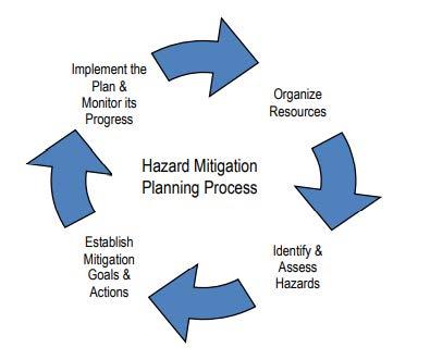
In 2022, Bremer County updated their Hazard Mitigation Plan to provide updated information on how the to assist the City’s in the area less susceptible to natural hazards. A hazard mitigation Plan is created to lessen the impact that future disasters will have on people and property in a community.
The information in the following pages was taken directly from the Bremer County, IA 2022 Updated MultiJurisdictional Hazard Mitigation Plan. The full document can be found at http://www.inrcog.org/pdf/2022_Bremer_MJ-HMP_Final.pdf


APPENDIX A 90 APPENDIX


91 • COMPREHENSIVE PLAN APPENDIX A


APPENDIX A 92
APPENDIX A
APPENDIX B

PLAN MAPS & POSTERS 94 APPENDIX B Printed By: eherold, File: G:\12\12200\12200007\GIS\6_ARCGIS Pro\Waverly IA Comp Plan Mapping.aprx Print Date: 7/11/2022 Data Sources: City of Waverly Comprehensive Plan Update (2011) WAVERLY BREMER COUNTY, IOWA EXISTING LAND USE Maxar Agriculture / Open Space Low-Density Residential High-Density Residential Commercial Parks / Green Space Semi-Public / Institutional Industrial City Boundary 00.250.5Miles
FUTURE LAND USE
Parks/Green Space Public and Non-Taxable Institutions/Structures Agriculture/Open Space Proposed Roads Water Bodies Floodplain

95 • COMPREHENSIVE PLAN APPENDIX B Printed By: eherold, File: G:\12\12200\12200007\GIS\6_ARCGIS Pro\Waverly_test\Waverly_test.aprx Print Date: 9/28/2022
Data Sources: City of Waverly Comprehensive Plan Update (2017)
Maxar 00.250.5Miles Residential Commercial Residential/Commercial Commercial/Industrial Industrial
Planning
WAVERLY BREMER COUNTY, IOWA City
Boundary
Boundary
NEW DEVELOPMENT
Land Use Categories
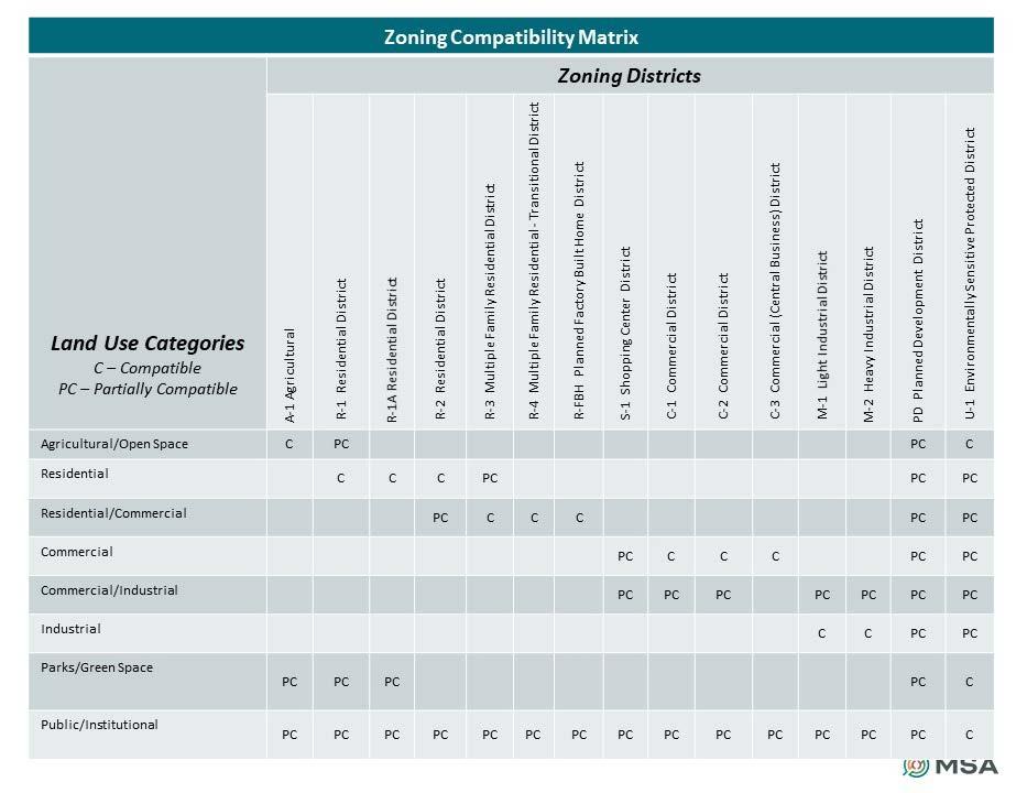
Residential
Residential areas are located within Waverly and are intended for low to medium density housing developments and redevelopment in Waverly. The primary districts are R-1 Residential, R1-A Residential, R-2 Residential, R-3 Multiple Family Residential.
Commercial
Commercial areas of the community are located along major throughfares and Downtown Waverly. The primary zoning districts are City’s commercial areas are S-1 Shopping Center, C-1 Commercial, C-2 Commercial, C-2A Commercial, and C-3 Commercial.
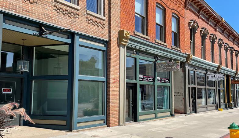
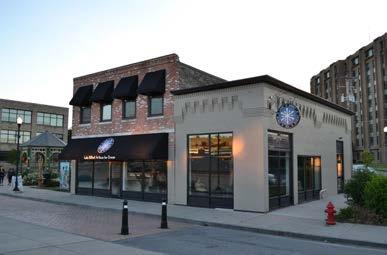
Parks/Green Space
This future land use designation includes active or passive parks such as playing fields, playgrounds, open space, community parks, and other appropriate recreational uses as well as undeveloped lands, trails, water areas and environmentally sensitives areas, including mapped floodplain areas.

Public and Non-Taxable Institutions/Structures
This land use designation includes public or semi-public facilities including but not limited to governmental offices, airports areas, police and fire facilities, medical facilities, community facilities educational institutions, utility facilities, and places of worship.
Process of Development
Residential/Commercial
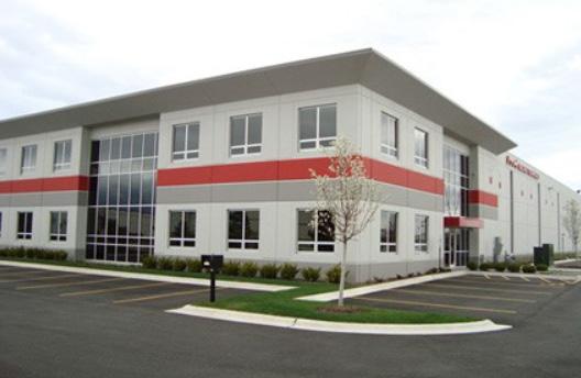

This category provides for a mix of medium to higher density housing development and commercial development. The primary zoning districts are be R-2 Residential, R-3 Multiple Family Residential, R-4 Multiple Family Residential – Transitional, R-FBH Planned Factory Built Homes, S-1 Shopping Center, C-1 Commercial, and
Commercial/Industrial
The Commercial/Industrial Flex areas are found primarily on the undeveloped edges of the community along major thoroughfares. The intent of this designation is to provide a flexible-zoning concept that encourages the market to assist in determining the end use of these future commerce focused development area. The primary zoning districts for these areas are S-1 Shopping Center, C-1 Commercial, C-2 Commercial, C-2A Commercial, and M-1 Light Industrial.
Industrial
The Industrial areas are intended for industrial, manufacturing, wholesaling, officeindustrial, transportation, warehousing, storage and other manufacturing based industrial uses. The primary zoning districts for these areas are M-1 Light Industrial, and M-2 Heavy Industrial.
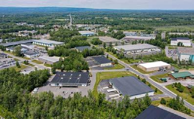
Agriculture/Open Space

This category includes larger tracts of property that are likely to remain in agricultural production and/or remain as undeveloped open space through 2042. If incorporated into the City, the primary zoning districts are A-1 Agricultural or R-1 Residential District.

1. PREAPPLICATION: Prior to the subdivision of any land, the subdivider or subdivider’s agent shall prepare a sketch plan and shall discuss informally with the Community Development Director the property proposed for subdivision, with reference to these subdivision regulations and procedures, zoning regulations and controls, and the city’s comprehensive and major street plans.
2. PRELIMINARY PLAT APPROVAL: The subdivider shall cause to be prepared a preliminary plat of any proposed subdivision and shall submit paper and electronic copies of the preliminary plat to the commission for its study and approval.

3. FINAL PLAT APPROVAL: Prior to submitting the final plat to the commission for its approval, the subdivider shall furnish all data and information necessary for a detailed engineering consideration of the improvements required. A plat meeting the minor subdivision requirements will be required to provide only such information as required by the city administrator.
4. FINAL PLAT ACCEPTANCE Rezoning - The term “rezone” shall mean a change in the regulations governing how a property and structures may be used, a text change in zone requirements, or a change in the boundaries of zoning districts as shone in the zoning map. An application for rezoning will be considered by the planning and zoning comission at its next regular meeting, held consistent with the notice requirements of the hearing (found at www.waverlyia.com)
For more information, please contact: Waverly Community Development (319) 352 -9208


Printed By: eherold, File: G:\12\12200\12200007\GIS\6_ARCGIS Pro\Waverly_test\Waverly_test.aprx Print Date: 9/28/2022 Data Sources: City of Waverly Comprehensive Plan Update (2017) WAVERLY BREMER COUNTY, IOWA FUTURE
Maxar 00.250.5Miles Residential Commercial Residential/Commercial Commercial/Industrial Industrial Parks/Green Space Public and Non-Taxable Institutions/Structures Agriculture/Open Space Proposed Roads Water Bodies Floodplain Planning Boundary City Boundary
LAND USE
Data Sources: City of Waverly Comprehensive Plan Update (2023)
Design Guidelines for Buildings & Sites
Street Relationship
Design the building such that the primary building facade is orientated towards the street and built to the front property line. Minor setbacks may be allowed if space created provides an outdoor seating area, a hardscape plaza, or similar pedestrian space. Provide a public entrance on the primary facade.
Lighting


Pick fixtures that complement the character of the building. Illunimate parking lots and pedestrian walkways uniformly and to the minimum level necessary to ensure safety. Lighting should be energy efficient and should render colors as accurately as possible. Preferred light types include: LED, fluorescent, and high-pressure sodium.
Parking
Place parking on the side or back of the building, wherever feasible. Provide shared parking and access between properties to minimize the number of curb cuts. Provide vegetative buffers between pedestrian circulation routes and vehicular parking/circulation. Access drive lanes should have adequate throat depths to allow for proper vehicle stacking.

Landscaping
Provide generous landscaping, with an emphasis on native plant species. Landscaping should be placed along street frontages, between incompatible land uses, along parking areas, and in islands of larger parking lots.
Stormwater

Use rain gardens and bioretention basins on-site (i.e. in parking islands) in order to filter pollutants and infiltrate runoff, wherever feasible. Consider using permeable surfaces, pervious asphalt, pervious concrete, and/or special paving blocks.

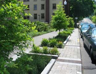
Building Projections
Canopies and awnings should be provided along facades that give access to the building.


Streetscape Guidelines
Clear path: No obstructions within areas of travel. avel.

Accessible to all citizens: ADA-compliant sidewalks and building entrances.
Clear connections: Pedestrian pathways to building entrances.
At human scale: Establish a 1:3 - 1:2 street width to building height ratio.
Limit automobile/truck traffic issues: Lower vehicle speed limits Provide traffic calming devices

Adequate height clearance: Well-maintained landscaping Adequate awning heights

Signage
Soften the urban hardscape: Add planters, street trees, landscaped spaces, etc.


Provide pedestrian amenities: Add benches, table and chairs, bike racks, etc.


Well-maintained infrastructure: Well-maintained sidewalks, streets, street fixtures, and street trees.
Building designed with pedestrian friendly features: Awnings, large and clear windows (70% of ground floor), building entrances, view of products/ activities, etc.

Good sight distiance: Limit obstructions at crossing (newspaper/advertising & electrical boxes, over vegetation, etc.)
Separation & buffering from other modes of travel:
Use pedestrian-scaled sign types: buildingmounted, window, projecting, monument, and awnin. Signs should not be excessive in height or square footage.
Colors & Materials
Use high-quality, long-lasting finish materials such as kiln-fired brick, stucco, and wood. All explosed sides of the building should have similar or complementary materials and paint colors as used on the front facade.
DOWNTOWN 1 2 3 5
Wide
Parking
Limit
Minimum adequate
sidewalks
areas Sidewalk terrace
cub-cuts Pedestrian visibility:
lighting
Limit crossing
Provide bump outs Reduce corner radii Provide refuge medians at pedestrian crossings
distances:
SAFETY MOBILITY COMFORT For more information, please contact: Waverly Community Development (319) 352 -9208 4 Wartburg College Historic District Harmon & Levalley NW Historic District Sturdevont SW Historic District Old Fourth Ward SE Historic District East Bremer Avenue Commercial Historic District 1 2 3 4 5 Waverly Historic Districts
REDEVELOPMENT
Transformative Projects
Waverly Rail Trail Bridge
The Waverly Rail Trail Bridge is a steel beam bridge built by the railroad and retrofitted with wood deck and railings as a “repurpose” project, across the Cedar River. Due to the age and condition of the bridge, important decisions will have to be made regarding the replacement of the bridge in the near future.
Cedar River Park Complex
The Cedar River Park Complex is a new and updated facility that has been under construction. The Complex provides new youth baseball and softball fields and facilities. It consists of eight fields, bathrooms, concessions building, bike trail, and a playground structure.


Memorial Park

This well-loved park near downtown Waverly is undergoing changes that can be found in the Memorial Park

Red Fox Inn
The Former Red Fox Inn has been rehabilitated and renamed the Red Fox Hotel and Event Center. It has 54 hotel rooms and 34 market-rental apartment units. The hotel and bar are both now open, apartments are completed and filling with tenants.
Bremer Avenue Bridge
The Iowa Department of Transportation will replace Bremer Avenue Bridge, which stretches over the Cedar River and connects the downtown. Construction is expected to start in late 2023 and be finished by the end of 2024.

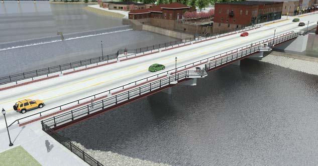


Hydroelectric Powerhouse
Waverly voted to decomission the historic Waverly Municipal Hydroelectric Powerhouse. While there is no plan at the moment, the opportunity to remove and/or redevelop is there. Reparation of the section of dam used to house the hydro unit is also a consideration.


The Waverly-Shell Rock Community School District
The Waverly-Shell Rock Community School District started the construction of two new elementary schools totaling $38.87 million. Two kindergarten through fourth-grade facilities will replace the current Margeretta Carey, southeast, and West Cedar elementaries. The site location for the new northeast school on Horton Road and the West site will be adjacent to 2915 Fifth Ave. N.W. in Waverly. Planned improvements to the current high school and Shell Rock Elementary are underway, with the elementary school currently in the bidding process for renovations.
South Riverside River Wall Waverly is looking to connect the South Riverside River wall and trail connection from Bremer bridge to South Riverside Park. This connection would create better access along the Cedar River.
Waverly Goals
Preserve and create new places and events that contribute to the identity of Waverly.

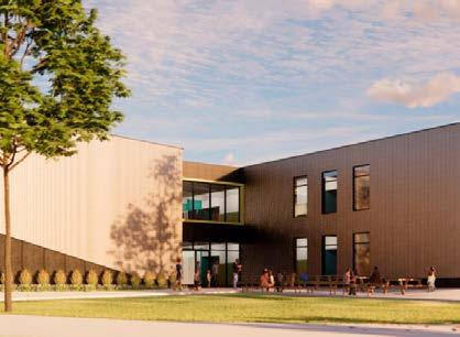
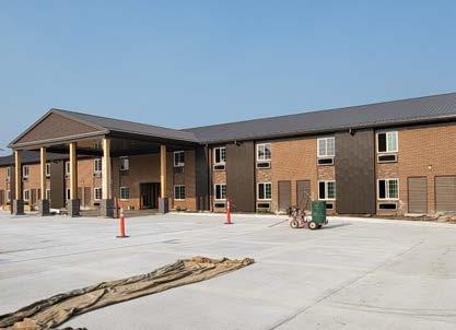
Preserve and promote the City’s historic structures and sites, especially in the downtown.
Retain and attract residents including young professionals, families, and retirees by supporting a range of housing options.
Printed By: eherold, File: G:\12\12200\12200007\GIS\6_ARCGIS Pro\Waverly_test\Waverly_test.aprx Print Date: 9/28/2022 Data Sources: City of Waverly Comprehensive Plan Update (2017)
FUTURE
Maxar 00.250.5Miles Residential Commercial Residential/Commercial Commercial/Industrial Industrial Parks/Green Space Public and Non-Taxable Institutions/Structures Agriculture/Open Space Proposed Roads Water Bodies Floodplain Planning Boundary City Boundary
WAVERLY BREMER COUNTY, IOWA
LAND USE
1 8 7 4 3 6 9 5 2
1 2 3 4 Bridge Structure Details The new Iowa 3 Bremer Avenue bridge over the Cedar River will be 349 feet long and 74 feet wide with 54-foot wide roadway, a 10foot wide trail along the north, and an -foot wide sidewalk along the south. The east abutdisturbing the existing riverbank support system. underneath the bridge, and the fascia beams 5 6 7 8 9
For more
Waverly
(319)
information, please contact:
Community Development
352 -9208
Data Sources: City Waverly Comprehensive Plan Update (2023)
WAVERLY, IOWA COMPREHENSIVE PLAN UPDATE


