Webster County Comprehensive Plan 2043

Prepared for:
Webster County, IA
Webster County Courthouse
701 Central Avenue
Fort Dodge, Iowa 50501

Webster County Comprehensive Plan 2043
Prepared for:
Webster County, IA
Webster County Courthouse
701 Central Avenue
Fort Dodge, Iowa 50501
Planning and Zoning Commission:
Margo Knippel
Tyler Lane
Laura Kelley
Gary Nelson
Tommy Coleman
Tommy Smith
Arlyn Goraczkowski
MSA Project Team: Webster County Staff
Chris Janson, AICP
Sarah Runkel, AICP
Emily Herold
Emily Huston
Elected Officials:
Austin Hayek, Board of Supervisors
Mark Campbell, Board of Supervisors
Bob Thode, Board of Supervisors
Niki Conrad, Board of Supervisors
Nick Carlson, Board of Supervisors
Jeffrey Johnson, Planning and Zoning Administrator
Allison Roderick, Planning and Zoning Assistant
A special thanks to the Webster County residents that provided guidance and feedback throughout the planning process. Your participation was important to the development of this document.
Chapter 1 • Introduction
• Planning 101
• Plan Overview
• Elements Overview
• Elements Organization
• Implementation Overview
Chapter 2 • Planning Process
• Introduction to the Planning Process
• Community Engagement
• Survey Results
• Project Oversight
Chapter 3 • County Elements
• Elements Overview
• Webster County Goals
• County Facilities
• Parks and Recreation
• Agriculture and Natural Resources
• Economy and Employment
• Housing
• Intergovernmental Cooperation
• Resilience
Chapter 4 • Land Use and Growth
• Introduction to Land Use
• Key Indicators
• Existing Land Use
• Future Land Use Definitions
• Future Land Use Map
• Land Use Goals and Strategies
Chapter 5 • Transportation Corridors
• Transportation Planning 101
• Webster County Transportation Overview
• Current Transportation Conditions
• Transportation Overlay Zones
• Corridor Overlay Zones
• Transportation Goals and Strategies
Chapter 6 • Implementation
• Implementation Overview
• Implementation Process
• Implementation Matrix
Appendices
• Appendix A: County Profile
• Appendix B: Survey Results
*Adoption Placeholder*
It is difficult to know what the future may bring for Webster County, or for any county. As residents and businesses come and go, and economic trends rise and fall, changes will occur. The purpose of the Webster County Comprehensive Plan is to establish a shared vision for Webster County to guide future actions and decisions. This guidance provides predictability and consistency over time, which encourages investment. We plan so that we can act and react in a changing world with a confident understanding of our common values and goals.
The Iowa Smart Planning Act (State Code Chapter 18B), signed into law on April 26, 2010, includes three primary components:
1. Ten Iowa Smart Planning Principles;
2. Comprehensive Planning Guidance and 13 plan elements;
3. Establishment of the Iowa Smart Planning Task Force.
The Ten Smart Planning Principles:
1. Collaboration
2. Efficiency, Transparency, and Consistency
3. Clean, Renewable and Efficient Energy
4. Occupational Diversity
5. Revitalization
6. Housing Diversity
7. Community Character
8. Natural Resources and Agricultural Protection 9. Sustainable Design
Transportation Diversity
The development of the Webster County Comprehensive Plan, as well as its ongoing maintenance, considers these elements and incorporates, as applicable, the Ten Smart Planning principles of the Iowa Smart Planning Act. The Iowa Smart Planning Act dictates the Ten Iowa Smart Planning Principles must be considered and may be applied when local governments and state agencies deliberate all appropriate planning, zoning, development and resource management decisions.
The Iowa Smart Planning Act outlines 13 elements that may be included in a city or county’s comprehensive plan.
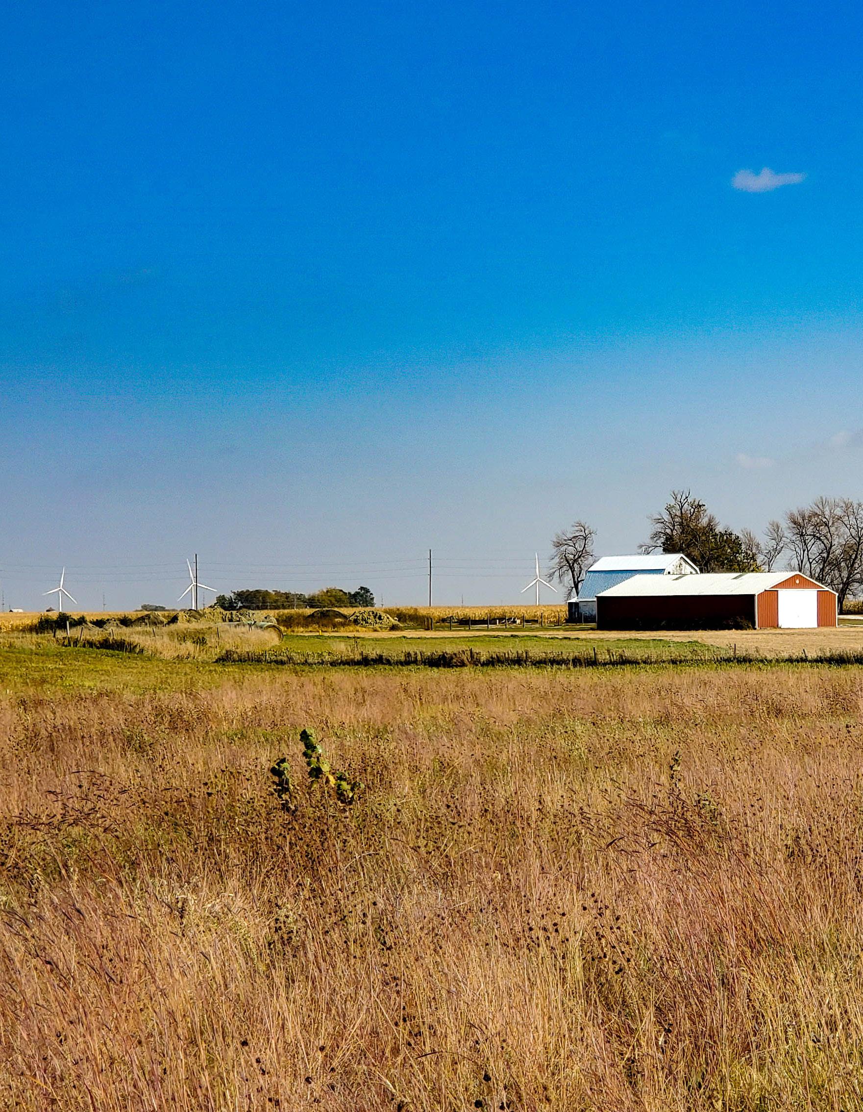
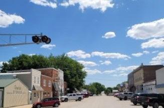
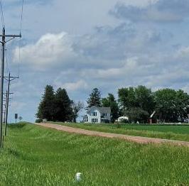
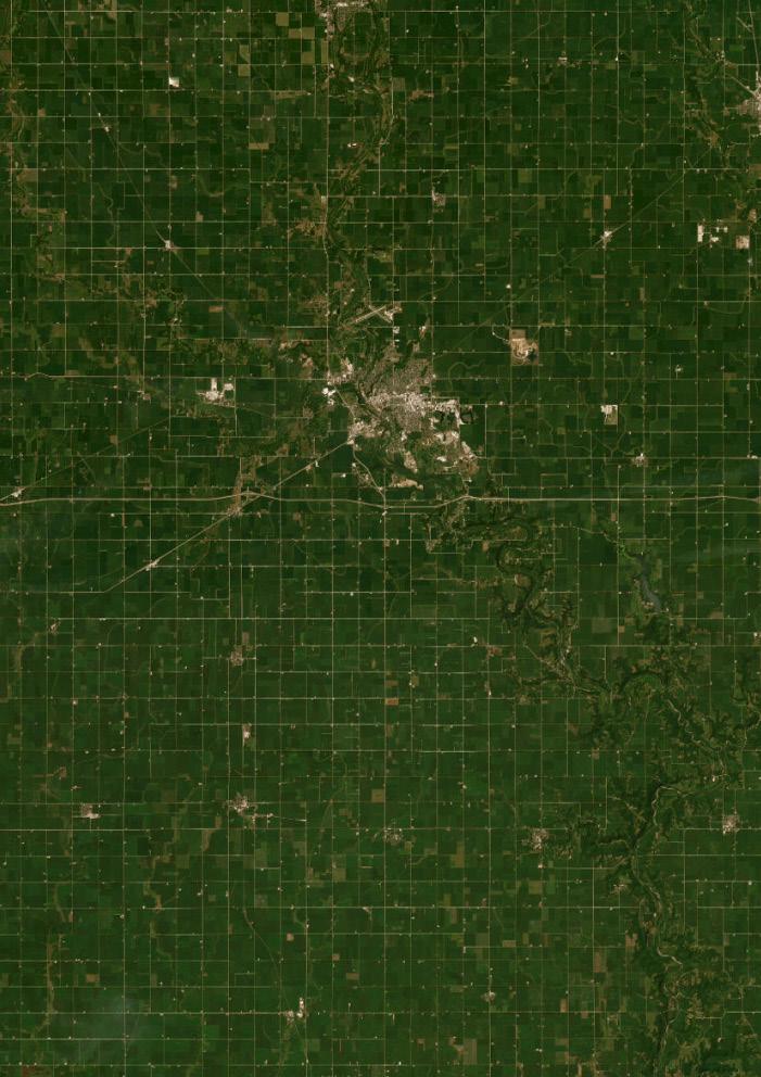
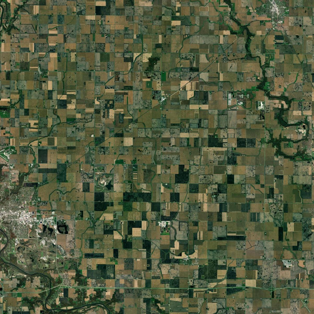
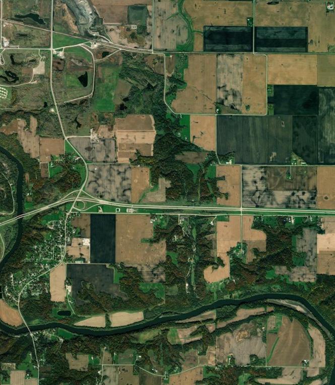
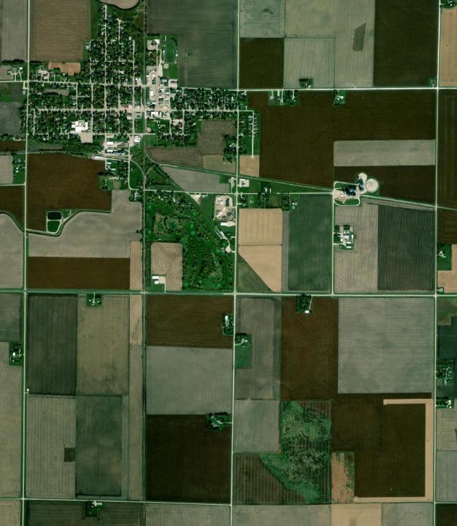
Webster County is a rural, Central-Iowa county know for its beautiful natural areas and rich agriculture. Webster County is 718 square miles in area, with a population of 36,999. The county seat of Webster County is Fort Dodge with a population of 24,168.
The previous Webster County Comprehensive Plan was adopted in 2008. It was organized into the following categories which formed a foundation of the updated goals and strategies.
• General Land Use
• Industrial Land Use
• Agricultural Land Use
• Commercial Land Use
• Residential Land Use/Housing
• Public Facilities and Taxes
• Infrastructure (Public Works and Transportation)
• Economic Development
• Parks and Recreation
• Health and Safety
• Environment/Water Resources
• Implementation, Evaluation, and Review
Comprehensive Development Plan 2008

This planning document is a “living” guide for growth and change in Webster County. The Plan represents the County’s best effort to address current issues and anticipate future needs; however, it can and should be amended from time to time if conditions warrant reconsideration of strategies in the Webster County Comprehensive Plan. If decisions are being made that are not consistent with the Plan, then the Plan has lost its relevance and should be amended. The process of amending the Plan should not be onerous, but it should trigger a brief pause to consider again the long term vision for the county. The Plan’s value is dependent upon frequent use and occasional updates. The implementation matrix included within the Plan should guide development and investment decisions for the future of Webster County.
The organization of the Webster County Comprehensive Plan is based both on the planning process and the guidance provided by the Iowa Smart Planning Act. The Plan is divided into six chapters plus several important appendices, as described below:
Chapter 1:
Chapter 1 discusses the role of this Plan, the planning process, the planning area, and key community indicators.
Chapter 2:
Chapter 2 describes the public participation methods and feedback.
Chapter 3:
Chapter 3 defines various county elements and outlines the goals and strategies for each individual element.
Chapter 4:
Chapter 4 establishes the goals, objectives and strategies pertaining to land use decisions, describes current land use characteristics, defines future land use categories (and strategies), and presents the future land use map.
Chapter 5:
Chapter 5 establishes the goals and strategies pertaining to transportation planning and improvements.
Chapter 6:
Chapter 6 provides guidance for implementation of the Webster County Comprehensive Plan. This chapter includes an implementation matrix that outlines the goals, strategies, and action items as well as potential partners and funding opportunities for achieving the County’s goals.
Appendix A:
Appendix A is a compilation of data that describes the existing conditions, trends, and projections for Webster County. This data informs the planning process and should be updated from time to time to track progress and change in Webster County.
Appendix B:
Appendix B includes the complete results from the public surveys conducted as a part of this planning process.
The County Elements chapter organizes goals and strategies that will help guide Webster County’s growth into the following elements:
Public and private utilities are a fundamental need for growing and sustaining a community, and important to the residents of Webster County.
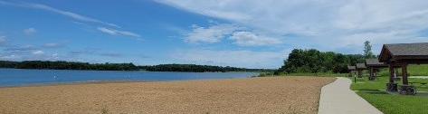
Webster County’s recreation ranks very high on the list of contributions towards an improved quality of life. These recreational amenities provide residents and visitors with a higher quality of life and will help keep the county growing and thriving.
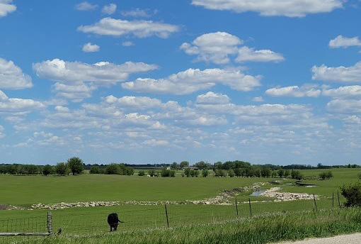
Webster County has many natural areas that are vital to the well-being of the county and the health of the regional ecosystems. There is also productive agriculture throughout the county that provides current and future economic growth and wealth.
Economic development is realized through the growth and retention of jobs, a diversity of business types, and subsequent increases in buying power, investment in the built environment, and a general improvement in the County’s quality of life.
Housing
Housing is integral to the well-being and economic prosperity of any community. This section identifies means of supporting diverse housing opportunities in Webster County.
This section helps inform the County’s strategy on collaboration with those entities and provides guidance on reaching out to new partners and maintaining existing relationships.
Resilience is the ability of a system to respond to, adapt to, and recover from negative events. Resilience has three major components: social, economic, and environmental. Strong social networks, efficient economies and thoughtful government budgets, and the protection of vital natural resources all have a positive impact on a community’s ability to bounce back after unexpected disruptions like natural disasters.
Each element of the comprehensive plan contains goals, objectives, and strategies established during the planning process based on public input and the information contained in Appendix A: County Profile.
This section defines goals, strategies, and action items as follows:
Goal:
A goal is a long-term target that states what the community wants to accomplish. Written in general terms, the statement offers a desired condition.
Strategy:
A strategy is a specific rule of conduct or course of action intended to help the County achieve the goals and objectives of the Plan. All future actions and decisions made by the County should be consistent with these strategies, unless unforeseen reasons arise which make following a strategy impractical. Such occasions should be rare and probably indicate a need to amend this Plan.
Action Item:
An action item is a single, clearly defined task that must be completed in order to accomplish the more broad goal.
The Webster County Comprehensive Plan is designed to be an active tool that helps shape development throughout the County. The goals, strategies, and action items for each element are organized in an implementation matrix in Chapter 6. This matrix provides resources for potential partners and funding sources, priority level, timeline, and related action items.
Goal: An object of ambition or effort; an aim or desired result.
Goals help communities to articulate desired outcomes of plans, policies, and action.
Strategy:
A plan of action or policy designed to achieve a goal.
Strategies help to envision what needs to happen to reach our goals.
Action Item:
An action item is a documented event, task, activity, or action that needs to take place to enact the strategy and reach the goal.
Priority: Superiority in rank, position, or privilege.
Timeline: A schedule of events and procedures. Potential Partners: One associated with another especially in an action.
Each strategy has multiple action items that can be used to help accomplish the goal.
All action items will be given a priority based on the urgency to community wellbeing.
The plan’s timeline will provide information about when the action item should take place based on urgency and funding opportunities.
Potential partners provides community leaders with ideas about who should be responsible for, and who may be able to help with each action item.
A transparent public participation process is the foundation to a successful plan. The planning process for the Webster County Comprehensive Plan 2043 update included seeking the involvement of residents, business owners, and other stakeholders across the county to create a vision and set goals for growth and improvement. Great engagement is essential to creating a plan and gathering support for successful implementation of the plan’s goals and actions.
Public Participation in the Planning Process
The Webster County Comprehensive Plan 2043 update included the following engagement activities to help develop a vision, establish goals, and develop actions for implementation:
• Planning and Zoning Commission Workshops
• Public Workshop
• Community Survey
• Online SWOT Analysis
• Crowdsource Mapping
• Stakeholder Interviews
• Draft Plan Review Open House
A SWOT analysis is a study undertaken to identify strengths and weaknesses, as well as its opportunities and threats.
This Plan is grounded in opportunities for positive change which was identified by citizens, staff, and stakeholders. The Plan seeks to address citizens’ perceived deficiencies and capitalize on opportunities for positive change. A SWOT analysis exercise was used to gather this information from the Planning and Zoning Commission and through the community survey.
Strengths - characteristics that give the community an advantage over others.
Weaknesses - characteristics that place the community at a disadvantage relative to others. Opportunities - elements the community could leverage to advantage the community.
Threats - elements in the environment that could cause trouble for the community in the future.
A crowdsource map is a unique mapping application that allows a community to collaboratively map assets, issues, opportunities, and ideas related to the community and it’s needs. Residents of Webster County provided valuable feedback about the addition of the corridor overlay district and opportunities for new economic growth throughout the County.


Interviews with stakeholders consisted of one-on-one conversations about the Webster County Comprehensive Plan 2043 update, or a specific topic or issue that the stakeholder seeks to address. The primary purpose of these interviews is to obtain project-relevant information and to gain insight to the needs of Webster County leaders. Twelve participants were involved in the stakeholder interviews over the course of six weeks.
1. Describe your connection to Webster County – what does your business/organization do and what is your role in the business/organization?
2. Why are you located in Webster County and what do you like about the area?
3. What changes would you like to see in the transportation system in Webster County?
4. If development were to occur along major transportation corridors, what types of businesses would you like to see? What are your ideas about design standards?
5. What strengths do you see in Webster County and how are they being capitalized upon?
6. What are Webster County’s weaknesses? Are they currently being addressed? What do you think should be done?
7. If you were promoting Webster County, what elements of the county would be important to include?
8. What type of development is needed or missing from the county?
9. Are there any specific areas that need reinvestment?
10. Is there anything else you would like us to know about – information or ideas for the Webster County 2043 Comprehensive Plan?
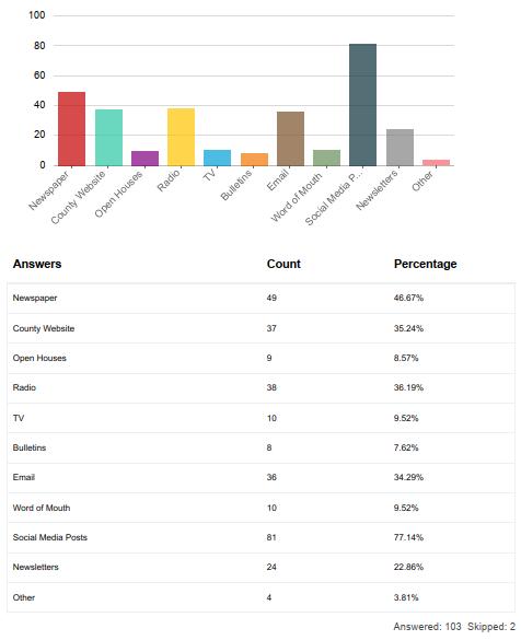
A community survey was used to gather input and ideas that impacted the goals and strategies developed for the Webster County Comprehensive Plan 2043 update. The survey was made available to all of the residents of Webster County, as well as neighboring counties and nearby municipalities. Along with general questions about what residents want to see for the future of Webster County. A SWOT analysis was included to instigate creative thinking and derive deeper insights in to the needs of the County. The SWOT analysis was divided into three sections: quality of life, mobility, and development. The tool was hosted through ESRI’s Survey123, which is formatted to allow users to take via computer, tablet, or smartphone. Participants were invited to respond through the project website, via County social media sites, and through posters that were distributed to towns and businesses throughout the County.
The following pages contain graphics of some of the survey responses that influenced the Webster County Comprehensive Plan 2043 plan update. Complete results can be found in Appendix B.
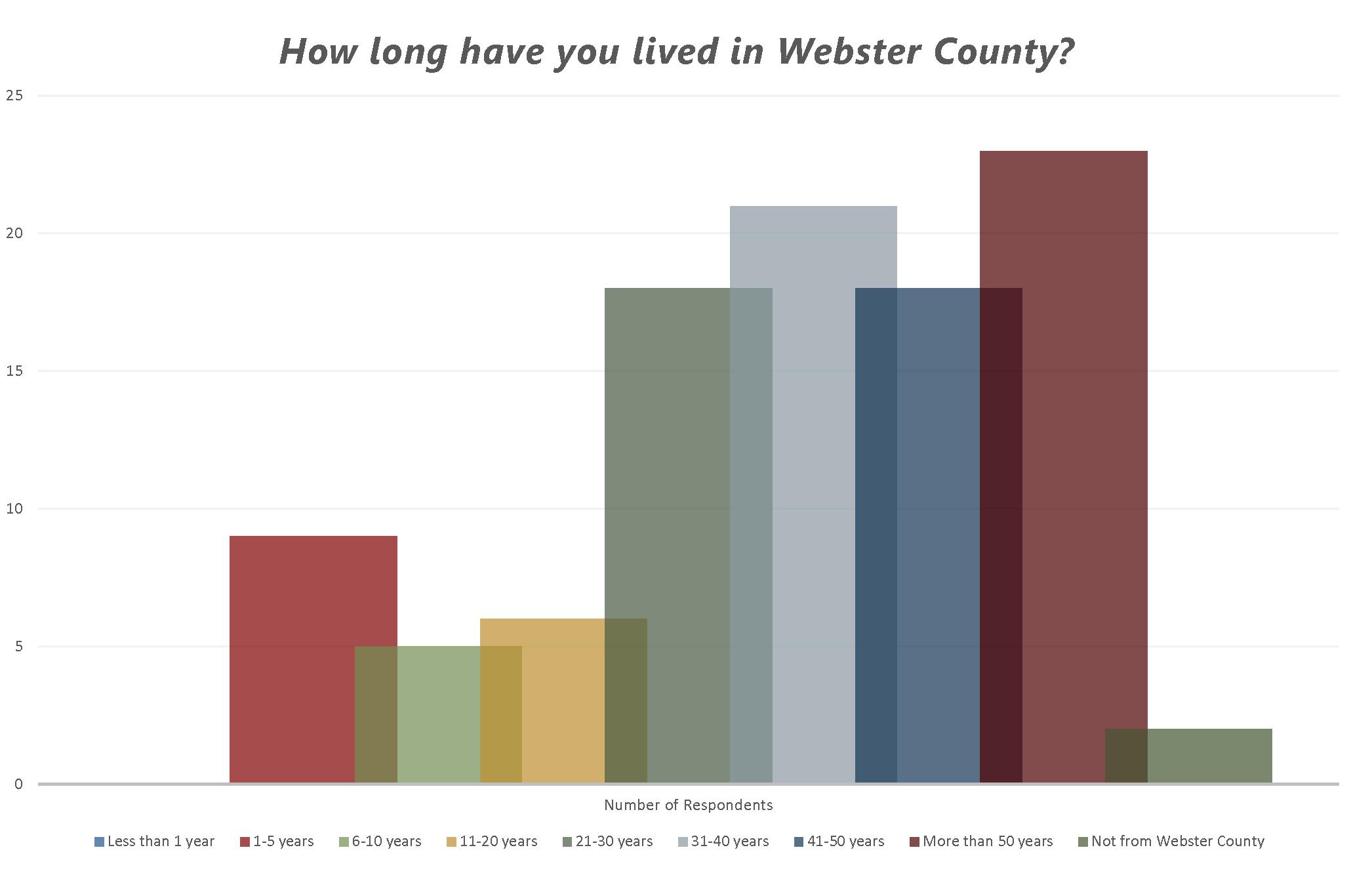

A series of questions asked about the importance of safety, aesthetics, and accessibility regardng the primary transportation corridors in Webster County. Below are summaries of the importance of each aspect according to survey respondents.
The Webster County Comprehensive Plan 2043 update was led by the Webster County Planning and Zoning Commission. The Commission acted as the primary review and advisory body throughout the planning process, ensuring that the established goals and objectives were being accomplished. The Commission participated in five workshops throughout the planning process, all of which were open to the public.
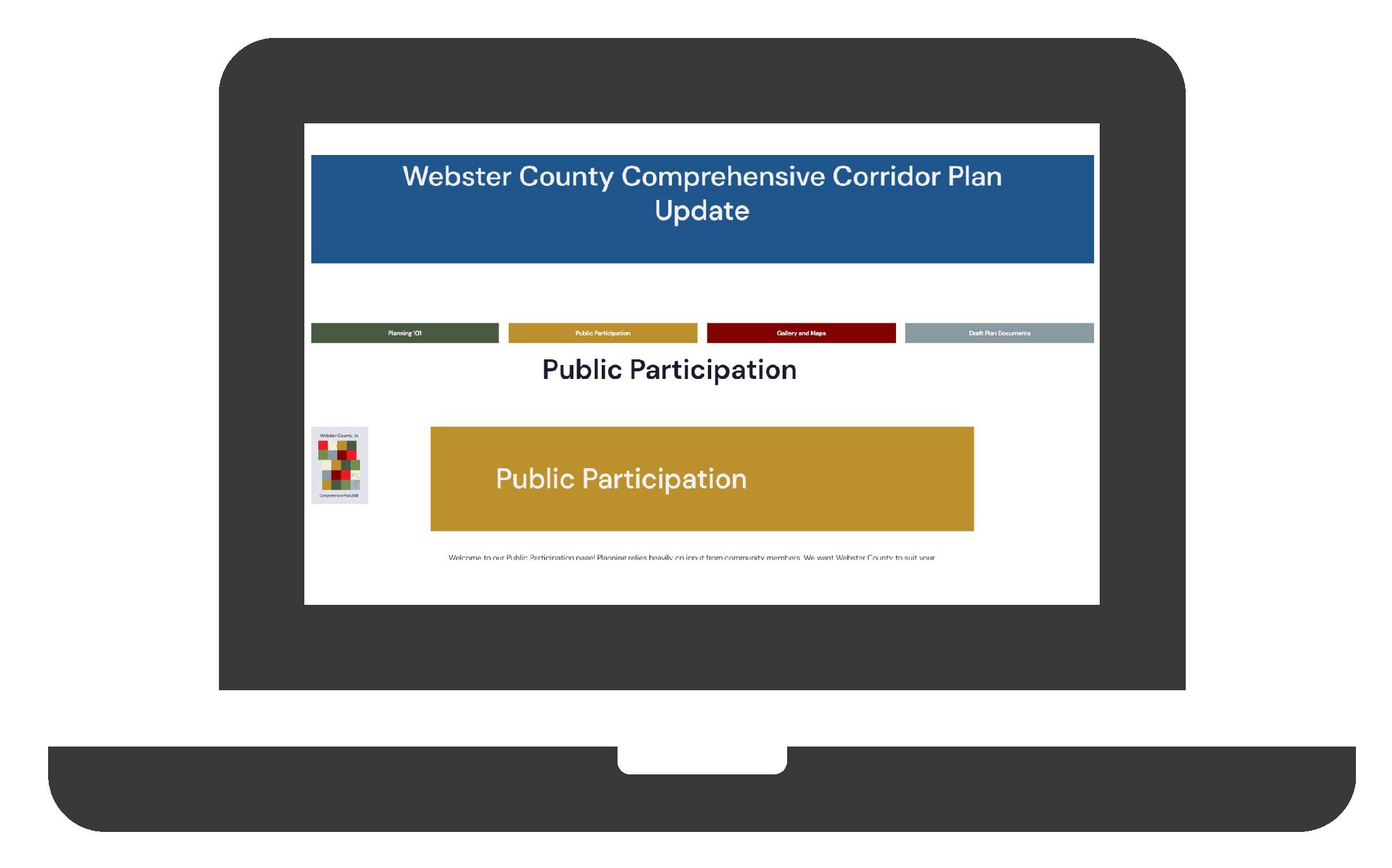
A project website was developed to share relevant project information such as the project schedule, draft documents, meeting notices and copies of presentation materials. The website also provided a venue for the public to participate in the community survey and crowdsource map. This aspect of the communication and participation strategy was important for transparency, as well as sharing information with the project team, the public, and stakeholders.
www.webstercountyplan.com
This chapter presents a vision for the future of Webster County. It also contains goals and strategies to achieve the vision. The goals and strategies described throughout the chapter were established through the planning process, public engagement activities, Steering Committee input, and the County Profile.
The goals and strategies have been divided into the following categories:
• County Facilities
• Parks and Recreation
• Agriculture and Natural Resources
• Economy and Employment
• Housing
• Intergovernmental Cooperation
• Resilience
This section defines goals and strategies as follows:
A long term target that states what the community wants to accomplish. Written in general terms, the statement offers a desired condition through implementation.
A strategy is a statement that identifies a course of action to achieve a goal. They are more specific than goals and are usually attainable through planning and implementation through direct action.
An overview of the goals are listed on the following page. Each goal has at least two strategies for achieving the goal, these are listed throughout this chapter. For action items that can be used to implement these goals and strategies, please refer to Chapter 6. Land use and transportation goals are located in their respective chapters.
These goals and strategies are designed to facilitate the implementation of Webster County’s vision of health, sustainable growth and development.
Goal 1: Provide safe, reliable facilities throughout Webster County.
Goal 2: Support coordination of inter-agency and inter-jurisdictional facilities and services (both public and private) to increase accessibility and reduce economic and environmental impacts of procedures, infrastructure, and maintenance.
Goal 3: Strategically locate public facilities in Webster County to provide cost-effective, efficient, and timely services to all.
Goal 1: Continue to provide new recreational opportunities and enhance existing facilities for residents of Webster County, visitors, and the all of Iowa.
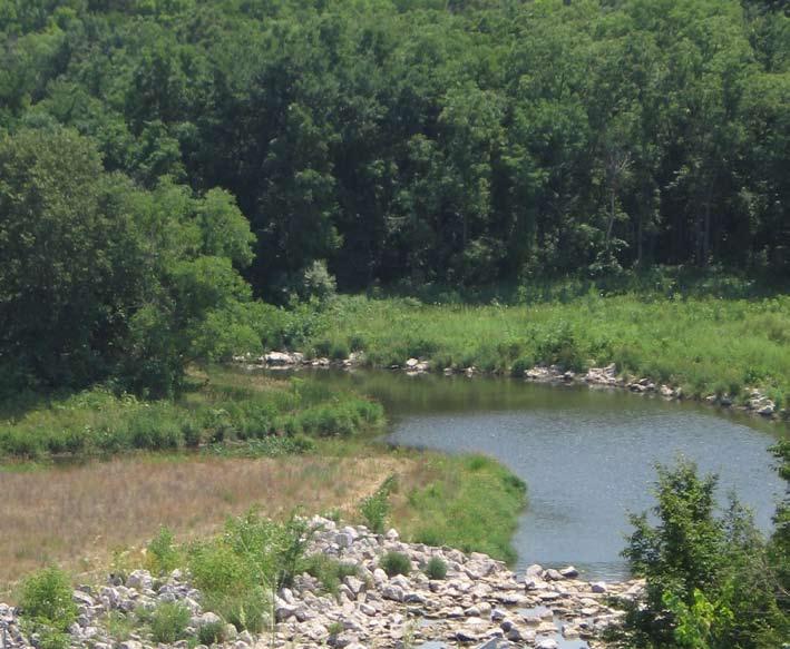
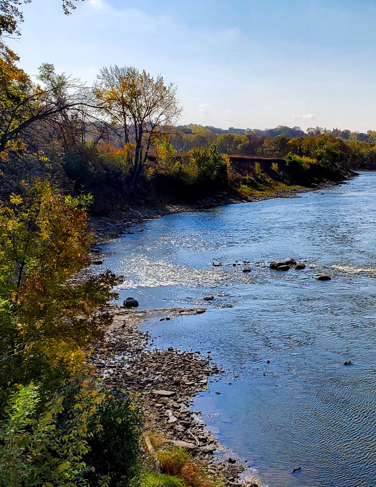
Goal 2: Seek to offer greater opportunities for waterbased recreation on the Des Moines River and its tributaries.
Goal 1: Continue to establish Webster County as a leader in agricultural and environmental practices and policies in the State of Iowa.
Goal 2: Protect and enhance prime agricultural land as a cultural and economic asset of Webster County.
Goal 3: Guide development in a manner that protects and enhances environmental and water resources of Webster County.
Goal 1: Promote and encourage economic development necessary to support the needs of existing and future residents such that the economy is stable and diverse.
Goal 2: Maintain a rate and pattern of economic growth sufficient to sustain reasonable employment rates in the county, balance the real property tax base of the various cities, and strengthen local economic bases.
Goal 1: Plan for safe, attractive, and affordable housing to meet existing needs and forecasted housing demands of all residents of the County.
Goal 2: Plan for housing types and densities that reinforce the predominately rural character of the unincorporated areas of the County.
Goal 1: Maintain mutually-beneficial relationships and partnerships with neighboring jurisdictions and other governmental agencies.
Goal 2: Seek to reduce costs and improve the quality of service for County operations, partner municipalities, and organizations through sound partnerships.
Goal 3: Coordinate County planning efforts with local school districts, County departments, and State and Federal agencies, to allow those entities to properly plan for facility needs.
Goal 1: Mitigate the risk of impacts before a disaster.
Goal 2: Protect Webster County’s residents and property during a disaster.
Goal 3: Ensure successful and efficient recovery from disasters.
Public and private utilities are a fundamental need for growing and sustaining a community, and important to the residents of Webster County. Without comprehensive public and private infrastructure, facilities, and services, the continued growth of the community would stall. The following page contains goals and strategies to help overcome these challenges and others related to the community’s infrastructure.
Goal 1: Provide safe, reliable facilities throughout Webster County.
Strategy A
Strategy B
The development of sanitary sewer systems will be supported where such systems conform to all applicable federal and state standards pertinent to the collection, treatment, and final disposal of effluent.
Encourage the dedication of major drainage-ways such as wetlands, swales, intermittent creek basins and roadside depressions for the purpose of non-structural storm water collection.
Goal 2: Support coordination of inter-agency and inter-jurisdictional facilities and services (both public and private) to increase accessibility and reduce economic and environmental impacts of procedures, infrastructure, and maintenance.
Strategy A
Strategy B
Continually evaluate the needs of County departments and opportunities for partnerships across agencies to increase efficiency and efficacy of County resources and projects.
Support consolidation of city, county, and state administrative offices, public health, safety and welfare buildings, and community cultural facilities as opportunities that will promote energy conservation, provide convenient, centralized services and attractive building and open space groupings.
Strategy C
Support development of Xenia Rural Water District or water control districts to efficiently serve rural residents throughout the County.
Goal 3: Strategically locate public facilities in Webster County to provide costeffective, efficient, and timely services to all.
Strategy A
Strategy B
Assist in the organization of special purpose districts such as sanitary districts, sanitary authorities, and county service districts which would be able to utilize federal and state funds to build collection and treatment facilities and provide the necessary services to their respective communities or clientele. The County will work to ensure that these districts are created in a manner that promotes planned growth patterns in communities within and surrounding the County.
Support any consolidation of water and sewer facilities to secure the potential economies of scale and organizations, provided their potential environmental impacts are consistent with existing land-use plans, related urban growth goals and policies, established water quality standards, and where separate local facilities are shown to be more expensive.
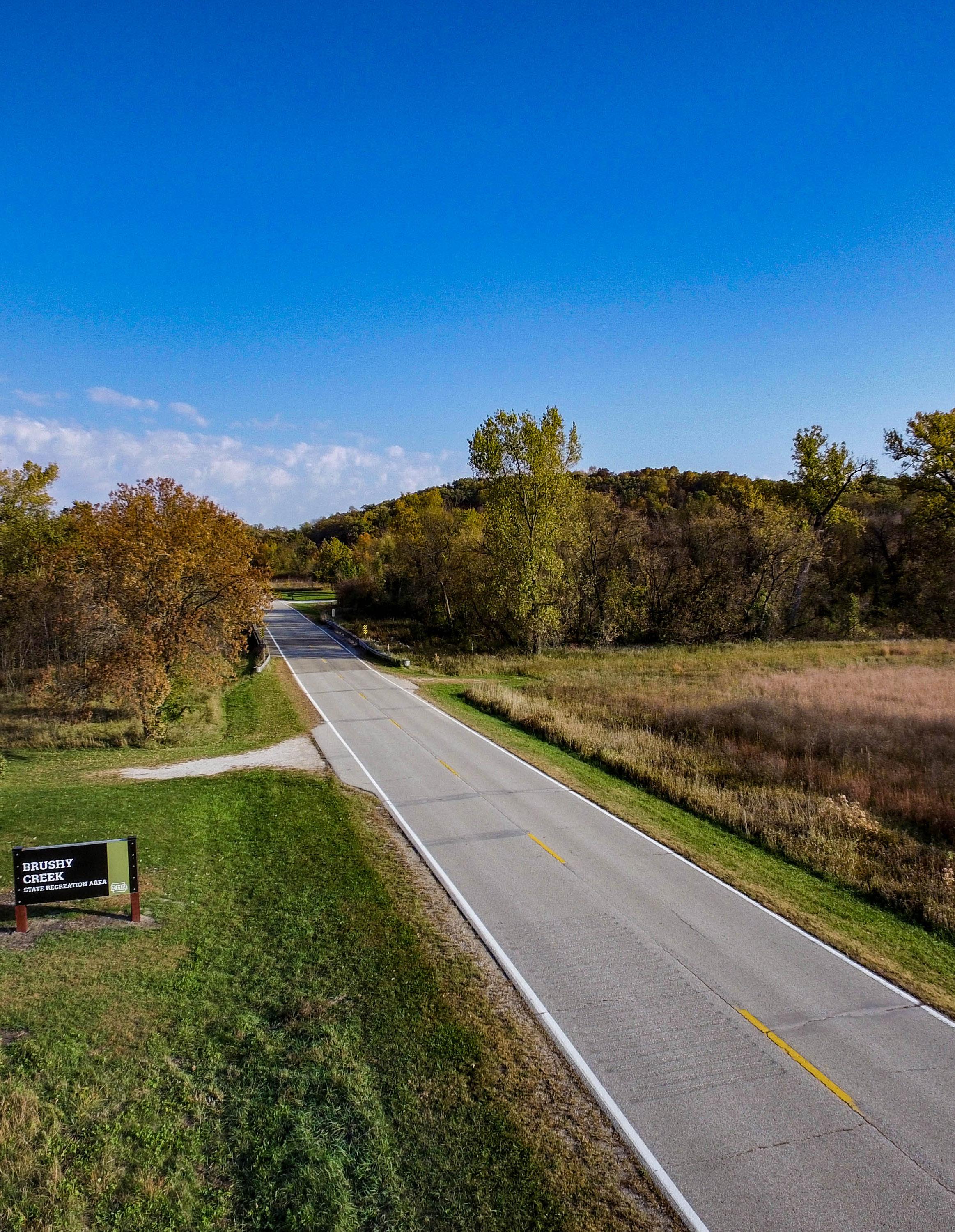
Webster County’s recreation ranks very high on the list of contributions towards an improved quality of life. These recreational amenities provide residents and visitors with a higher quality of life and will help keep the county growing and thriving. Additionally, recreational opportunities add economic value and positively affect property value, tourism, and commerce. The following are goals and strategies to support recreation, parks, and trails throughout Webster County.
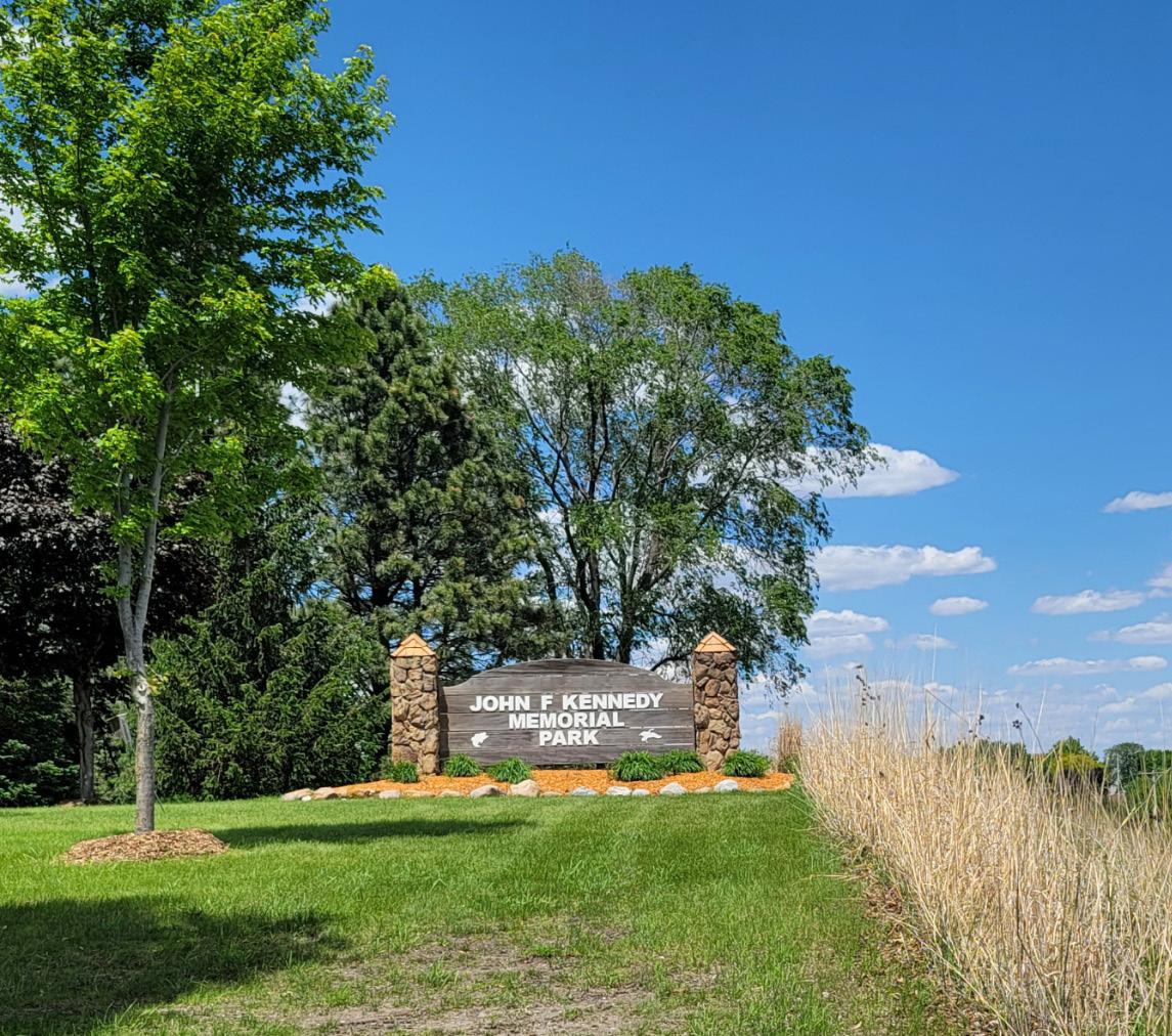
Goal 1: Continue to provide new recreational opportunities and enhance existing facilities for the residents of Webster County, visitors, and the all of Iowa.
Strategy A
Provide reasonably accessible, year-round park and recreational facilities for Webster County residents and visitors.
Strategy B
Strategy C
Work with interested cities within Webster County and regional partners to develop and expand recreation trails and corridors that one day connect communities within and surrounding Webster County.
Adopt recreational design standards for park and recreation facilities that protect, preserve, and conserve the environmental character and quality of the area.
Goal 2: Seek to offer greater opportunities for water-based recreation on the Des Moines River and its tributaries.
Strategy A
Support water quality initiatives in Webster County, the region, and the State of Iowa to provide healthy recreational opportunities for residents and visitors.
Strategy B
Consider expanding County recreational equipment rental programs to improve access to recreational opportunities for residents and visitors.
Webster County has many natural areas that are vital to the well-being of the county and the health of the regional ecosystems. There is also productive agricultural land throughout the county that provides current and future economic growth and wealth. This section outlines the goals and strategies for preserving, protecting, and restoring natural and agricultural resources. These systems are often interconnected and these strategies address various aspects such as water, land, wildlife, air, vegetation, food systems, and the overall welfare of the County’s resources.

Goal 1: Continue to establish Webster County as a leader in agricultural and environmental practices and policies in the State of Iowa.
Strategy A
Strategy B
Promote quality land management through the development of erosion control design standards for rural subdivisions and larger commercial and industrial developments.
Strategy C
Continue to develop land use regulations and design standards based on federal requirements and regulations.
Develop local regulations that, at a minimum, are as strict as federal standards, and where necessary, may be enforced in a manner stricter than federal guidelines.
Goal 2: Protect and enhance prime agricultural land as a cultural and economic asset of Webster County.
Strategy A
Discourage conversion of designated prime agricultural land and soils to non-agricultural uses by targeting less productive agricultural soils (crops) for urban or non-farm uses.
Strategy B
Establish a hierarchy of minimum lot sizes to encourage non-farm growth in the appropriate locations.
Goal 3: Guide development in a manner that protects and enhances environmental and water resources of Webster County.
Strategy A
Strategy B
Strategy C
Support zoning regulations and design standards that protect the environmental and natural resources of Webster County through the encouragement of preservation and conservation practices in environmentally sensitive areas.
Coordinate with and support city, regional, state, and federal waterquality plans and programs to achieve high water quality amongst Webster County’s communities, ensure sound watershed management practices occur, and strive for improved treatment of point and non-point sources of water pollution.
Support soil and water conservation efforts to aid in erosion, sediment, and run-off control.
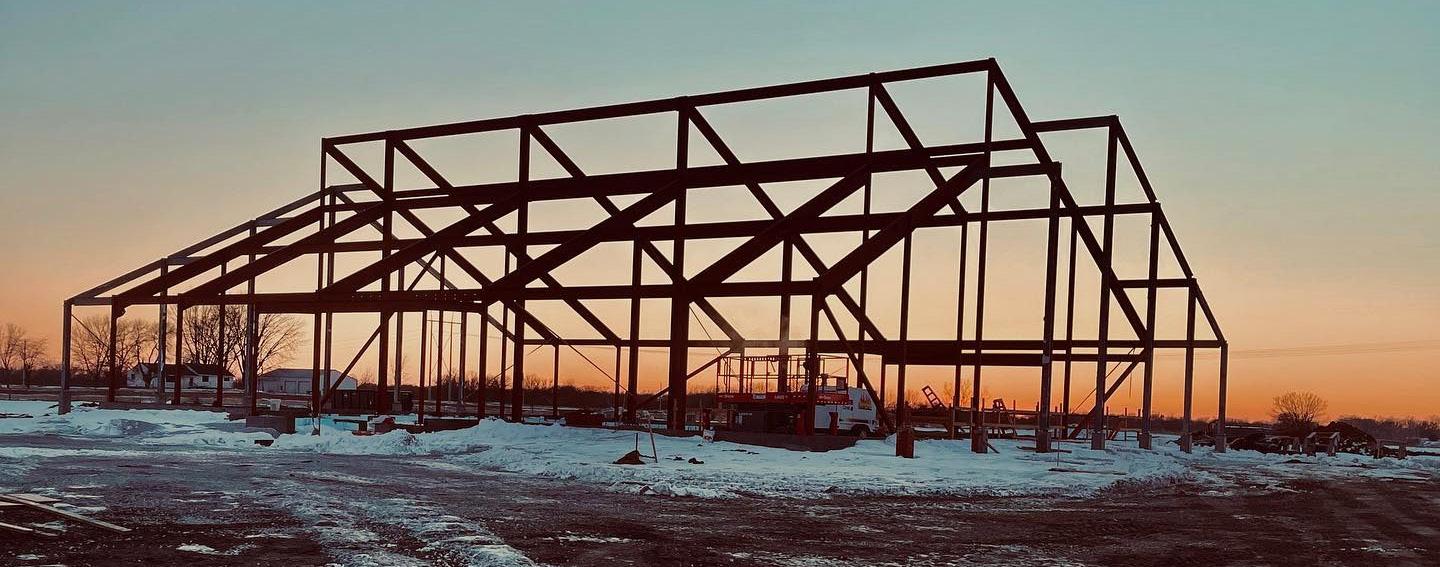
Economic development is realized through the expansion and retention of jobs, diversity of businesses, subsequent increases in buying power, and investments in the built environment. Achieving economic prosperity requires collaboration between public and private entities along with community support. Webster County recognizes that economic success requires collaboration with other public entities and will continue to be an active support for these efforts.
Goal 1: Promote and encourage economic development necessary to support the needs of existing and future residents such that the economy is stable and diverse.
Strategy A
Strategy B
Strategy C
Utilize local Economic Development Corporations to encourage, promote, and develop economic development partnerships between local entities, including all communities in Webster County, and private companies to assist existing and expanding business enterprises.
Expand upon existing recreational opportunities, including those along the Des Moines River, to promote recreational tourism for activities such as water trails, camping, fishing, and hunting.
Encourage and promote the development of home-based businesses and telecommuting based upon a commitment to providing a high level of technology and communication infrastructure.
Goal 2: Maintain a rate and pattern of economic growth sufficient to sustain reasonable employment rates in the county, balance the real property tax base of the various cities, and strengthen local economic bases.
Strategy A
Strategy B
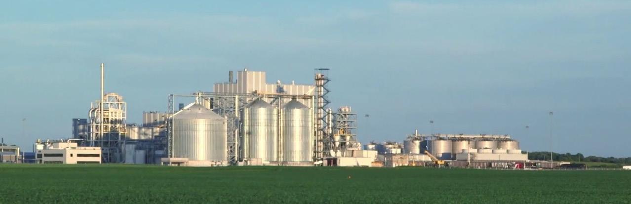
Continue to support existing agricultural businesses and gypsum mining operations.
Continue coordinating with area communities and adjacent counties to implement a joint economic development strategy that supports existing businesses, promotes new businesses in coming to the area (including industrial), and seeks to develop new attractions and amenities for the public at a local and regional level.
As Webster County grows and changes, its housing must change to meet the needs of the population. Housing is included in a comprehensive plan to provide guidance for decision-makers and developers when considering additions to and renovations of the housing stock throughout Webster County.
Goal 1: Plan for safe, attractive, and affordable housing to meet existing needs and forecasted housing demands of all residents of the County.
Strategy A
Strategy B
Strategy C
Plan for a range of housing that meets the needs of residents of various income levels, age groups, abilities, and health conditions.
Promote the incorporation of safe and health-conscious building materials, clean indoor air systems, pest-free environments, energy and water efficiency measures, as well as inclusive design that prevents injuries and ensures universal accessibility for people of all abilities, in new residential constructions or retrofit projects.
Maximize the impact of available funding sources to create better housing and health outcomes through a coordinated and integrated approach among housing, environmental health, and public health agencies.
Goal 2: Plan for housing types and densities that reinforce the predominately rural character of the unincorporated areas of the County.
Strategy A
Manage residential development to prevent conflicts between incompatible land uses and to minimize the negative environmental impact of residential growth.
Strategy B
Support programs that maintain or rehabilitate the local housing stock.
Strategy C
Encourage planned unit developments where applicable.
Successful and economically vital communities are built from collaborative efforts among municipalities,, local school districts, businesses, and organizations. They also form relationships with regional organizations like incorporated cities, neighboring counties and municipalities, the State of Iowa, and federal agencies. This section helps inform the County’s strategy on collaboration with those entities and provides guidance on reaching out to new partners and maintaining existing relationships.
Goal 1: Maintain mutually-beneficial relationships and partnerships with neighboring jurisdictions and other governmental agencies.
Strategy A
Identify existing and potential conflicts, especially regarding land use planning, and establish procedures to address them.
Strategy B Consider the recommendations of municipal Comprehensive Plans when amending and updating other, more detailed County plans.
Strategy C Request feedback from area school district officials and municipalities within the County regarding planning efforts and ordinance updates.
Goal 2: Seek to reduce costs and improve the quality of service for County operations, partner municipalities, and organizations through sound partnerships.
Strategy A
Strategy B
Strategy C
Encourage the adoption of common planning regulations and standards among jurisdictions in the county whenever possible in order to reduce confusion for local residents and developers.
Encourage an efficient and compatible land use pattern that minimizes conflicts between incompatible land uses across municipal boundaries and preserves agriculture and natural resources in mutually agreed upon areas.
Coordinate the Future Land Use Plan and zoning regulations with those of municipalities within the county and neighboring counties to the greatest extent possible.
Goal 3: Coordinate County planning efforts with local school districts, County departments, and State and Federal agencies, to allow those entities to properly plan for facility needs.
Strategy A
Strategy B
Work with area municipalities to identify opportunities for shared services or other cooperative planning efforts, and pursue funding from State and Federal agencies to implement projects that address shared goals and objectives.
Request that school district officials and State and Federal agencies keep Webster County apprised of any plans for new facilities or other land use activities that could affect future land use within the county.
Resilience is the ability of a system to respond to, adapt to, and recover from negative events. Resilience has three major components: social, economic, and environmental. Strong social networks, efficient economies and thoughtful government budgets, and the protection of vital natural resources all have a positive impact on a community’s ability to bounce back after unexpected disruptions like natural disasters.
Goal 1: Mitigate the risk of impacts before a disaster.
Strategy A Prepare residents and businesses in Webster County for potential disasters.
Strategy B
Strategy C
Implement sound development practices to effectively reduce the adverse impacts of disasters, primarily caused by flooding, on new development.
Continue to prepare readiness plans to establish procedures for responding to natural disasters.
Goal 2: Protect Webster County’s residents and property during a disaster.
Strategy A
Meet the basic human needs of Webster County residents during a disaster.
Strategy B Protect Webster County assets and infrastructure during a disaster.
Strategy C
Seek to maintain and enhance emergency communications strategies including social media updates and text notifications for Webster County residents.
Goal 3: Ensure successful and efficient recovery from disasters.
Strategy A
Aim to provide prompt access to recovery resources to disaster victims throughout the recovery process.
Strategy B
Develop strategies to ensure that post-disaster reconstruction and recovery efforts will be quick, safe, and collaborative.
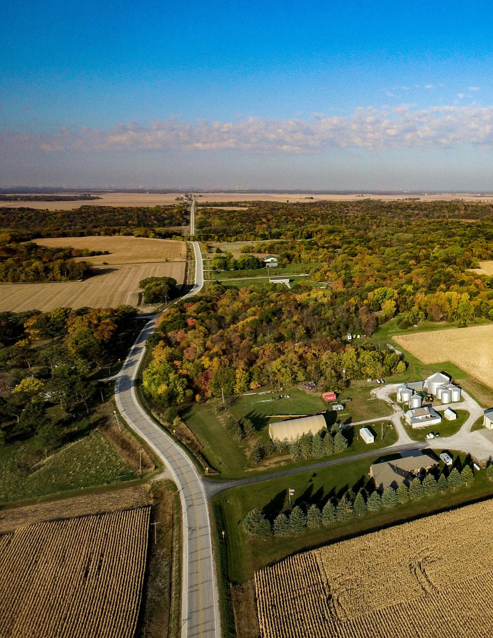
Land use involves the modification and management of the natural environment into the built environment. While we often consider the built environment as cities and towns, any modified and managed land including managed wetlands and woods; and agricultural land such as crop fields and pastures are also considered intentional land uses. Planning for the cultural and economic activities for which we use our land assists in healthy, sustainable growth. This chapter will outline methods for maintaining and adapting Webster County’s land uses for the future.
The intent of the Land Use Chapter is to provide a guide to the growth and development of land uses within Webster County. Decisions over the future land use of a county take into consideration factors relating to the existing land use composition, the location of natural features, the ability to provide adequate services to an area, the proposed alignment of future streets, and the desired character of the county.
The Future Land Use Plan included in this chapter lays out a future vision for Webster County through the year 2043 and beyond. Land uses have been proposed in a manner that provides flexibility for the county and development community. Land uses have been laid out to avoid conflict and promote a harmonious layout throughout Webster County. Goals and strategies related to land use and growth management have been outlined at the end of the chapter.
One of the most important purposes of the Future Land Use Plan is to serve as the basis for determining the appropriate zoning for property being developed or annexed into the City. Chapter 414 of the Code of Iowa, which grants cities the authority to enact city zoning regulations, requires that said zoning regulations, “…be made in accordance with a comprehensive plan…” Therefore, this Comprehensive Plan should be consulted whenever a city zoning code regulation is amended and every time a property is rezoned to ensure that the action is consistent with both the goals and policy recommendations of this plan and with the land use designations as proposed by the Future Land Use Map.
Included within this chapter is a Zoning Compatibility Matrix to provide assistance and guidance on zoning districts that are compatible with each of the future land use classifications.
While the Future Land Use Plan within this chapter represents Webster County’s preferred future land use layout, the land use plan does not need to remain stagnant or unchanging. If circumstances create an environment in which a conflicting land use is best for the county, the Future Land Use Plan should be amended appropriately to reflect the updated conditions of the county. Should the County find it justified and appropriate to rezone a property in a manner that is not consistent with this plan, the Future Land Use Map (and any impacted policies) should be amended as a part of the rezoning action the ensure consistency with the Comprehensive Plan. Care should be taken to carefully document the justifications for an amendment to this plan and findings adopted as part of the official record.


The intent of the Future Land Use Plan is to build upon the existing county character of Webster County today. While the Future Land Use Plan provides opportunities for growth, it affirms the importance of agricultural and recreational spaces as key components of Webster County.
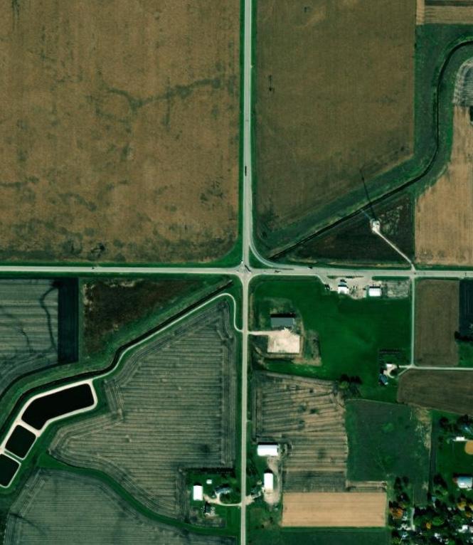
Webster County is bisected by Highway 20, a major arterial roadway that continuously transports residents, commuters, and travelers through the county from across the region and state. The Future Land Use Plan strategically utilizes this access by expanding proposed areas of growth along this and other primary corridors.
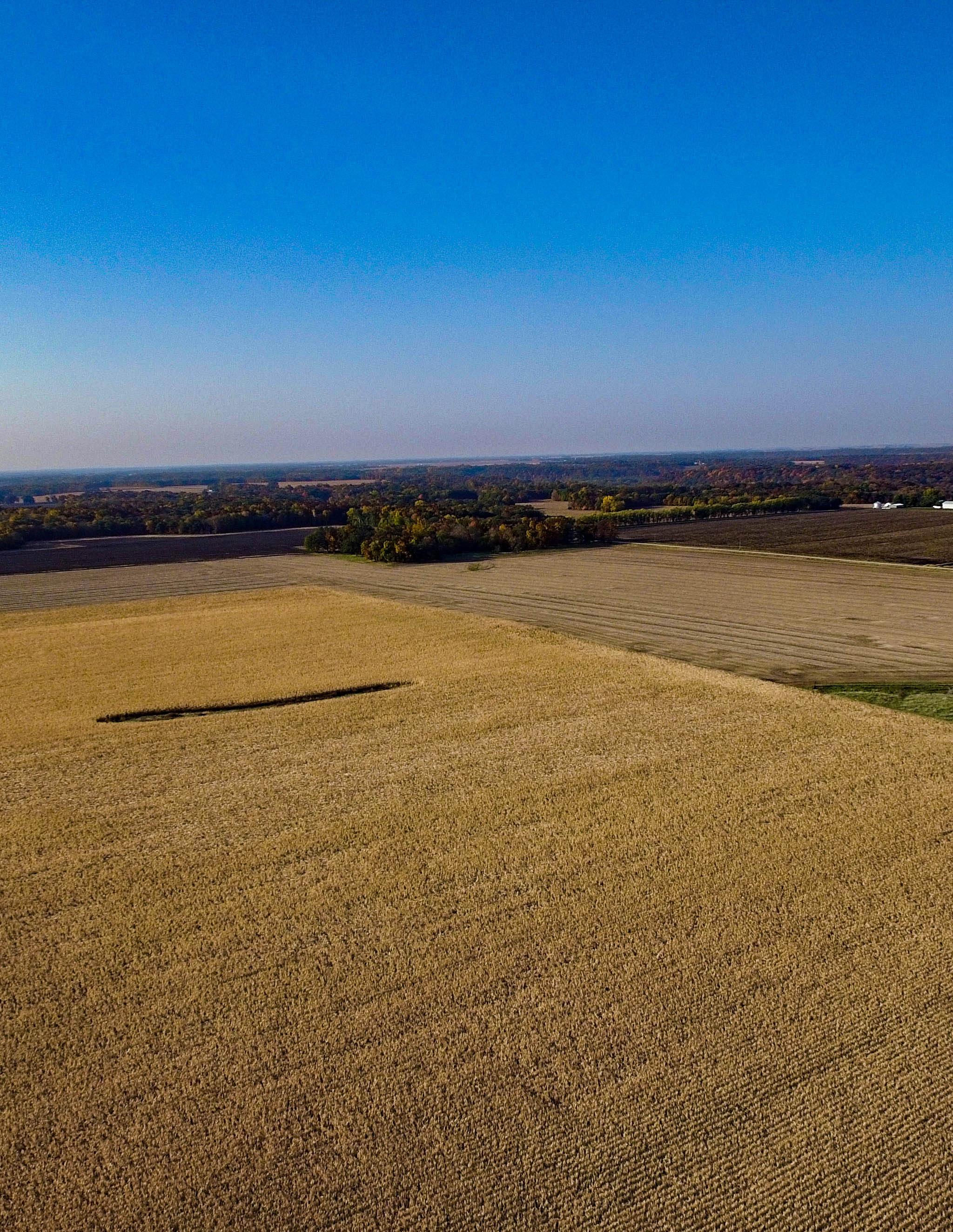
The culture and economy of Webster County are dependent on agriculture. The Future Land Use Plan seeks to protect and enhance agricultural areas to ensure the maintenance and protection of the culture and economy of Webster County.
The Des Moines River runs laterally through Webster County, providing unique, scenic landscapes and along with the beautiful parks, provides opportunities for recreation including water trails, recreational trails, and camping. The Future Land Use Plan intends to preserve these unique features as assets to Webster County.
The Future Land Use Plan shows a vision for the county with a significant increase in land available for commercial and industrial development along primary transportation corridors, providing increased opportunities for economic development throughout Webster County.
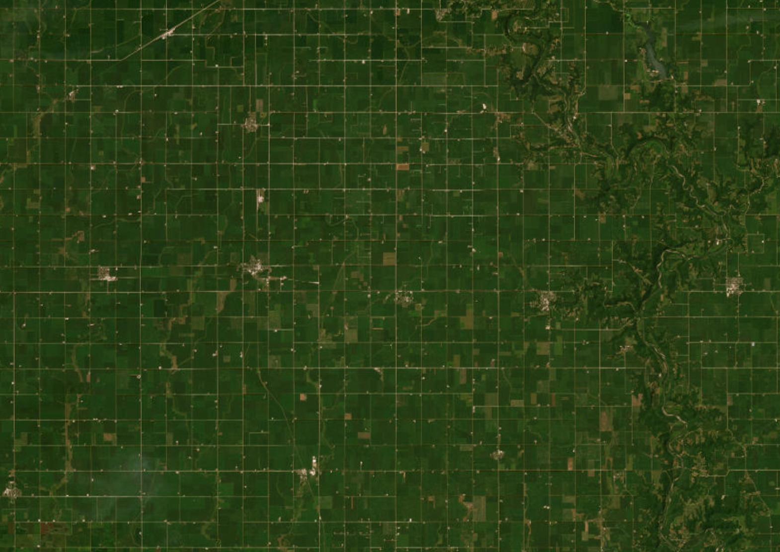
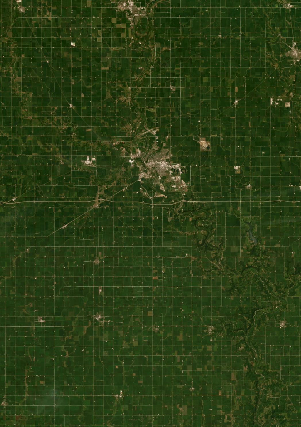
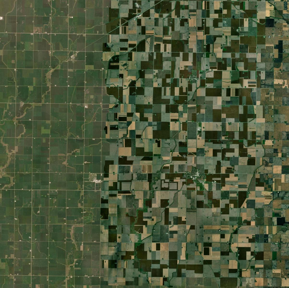
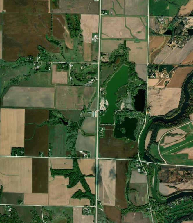
Evaluating the land uses that presently exist within Webster County is critical to the formulation of the Comprehensive Plan. The analysis of land including location, size, and characteristics of existing uses is an important process to understand the pattern of development, past land use trends, and other significant factors shaping the existing layout of Webster County. This analysis is essential to the preparation of the future land use plan. In order to realistically plan for future growth and development in Webster County, the starting point is the existing shape, form, and amount of land presently used to provide for county functions. It also assists in the formulation of workable zoning regulations to protect existing uses.
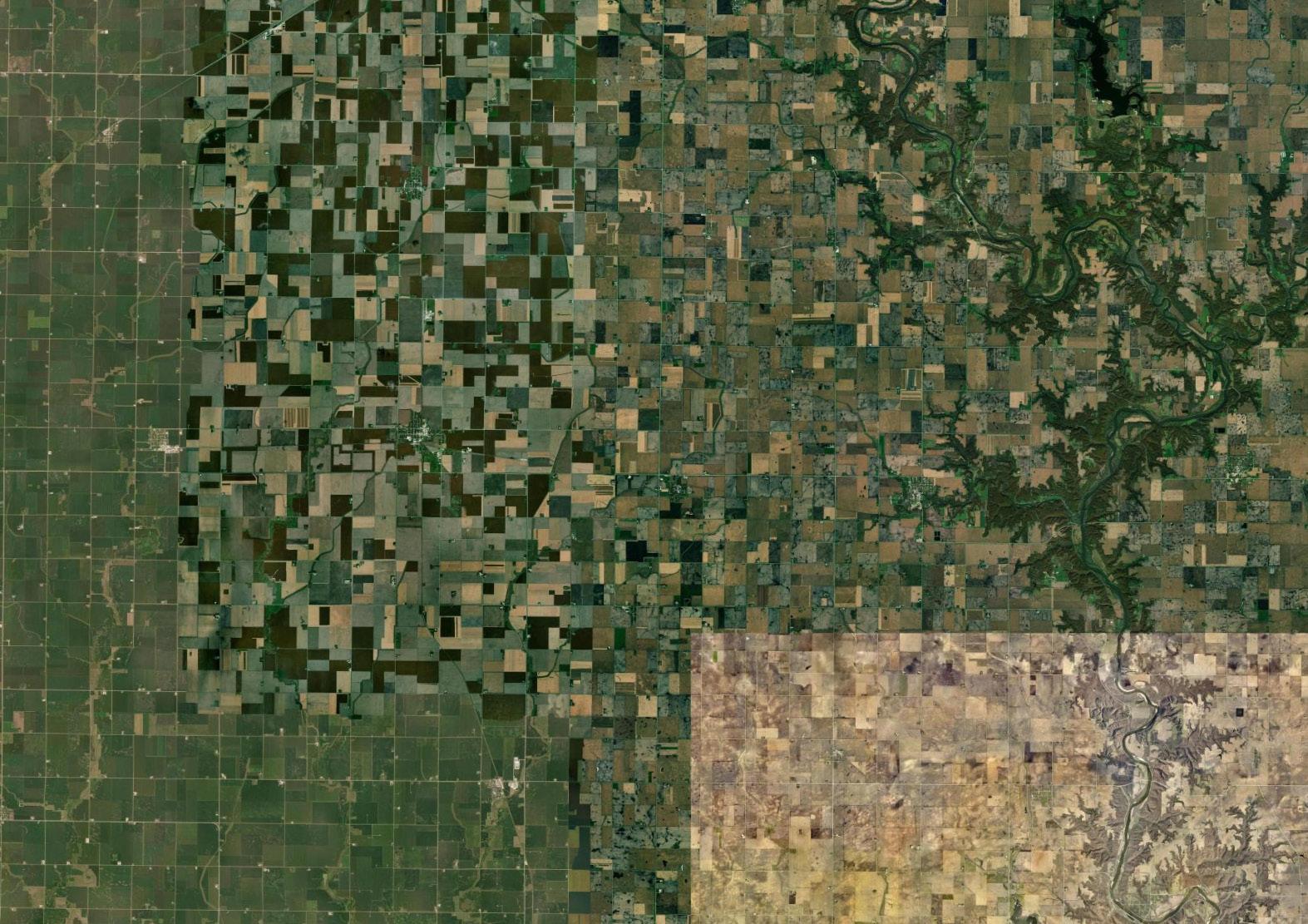
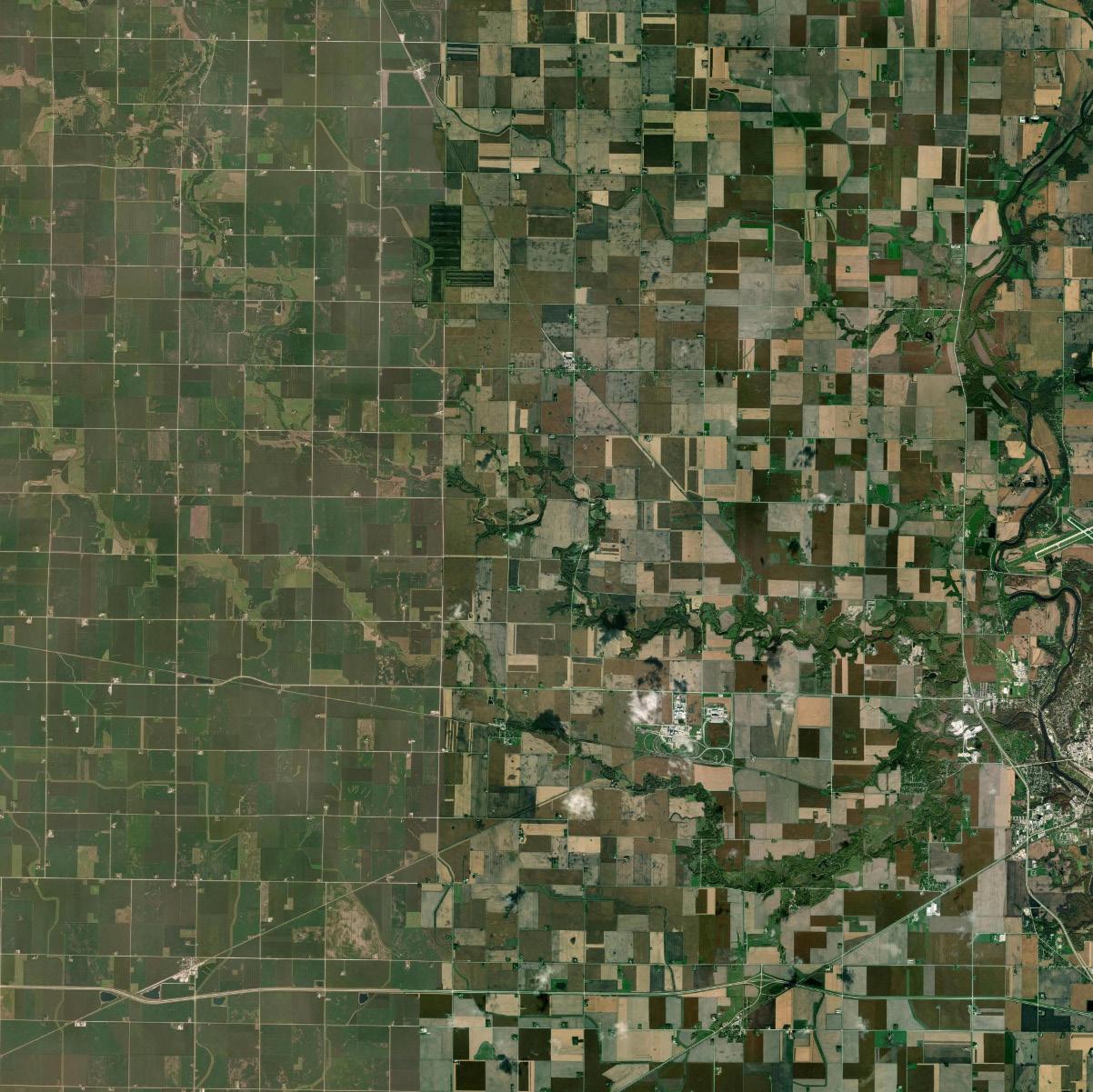
The existing land use map was developed in 2008. This update was created through visual interpretation of a county wide 2005 aerial photo using ArcGIS. In addition, information from the Iowa Department of Natural Resources, such as non-coal mining operations, major transportation routes, confined animal feeding operations, agricultural processing facilities, and conservation lands was used. Information created for the evaluation includes locations of non-farm residences and farmsteads, as well as areas of residential subdivisions. Farmstead locations were identified by the presence of other structures, such as grain bins and barns, adjacent to residences. Acreages were identified where stand alone residences were found. The majority of the features are identified as point features on the map instead of parcels. The existing land uses of Webster County were classified under the following categories:
• Agricultural Preservation
• Transitional Agriculture
• Residential Estates
• Urban Residential
• Commercial
• Industrial
• Agricultural/Industrial
• Mineral Extraction
• Conservation
• Parks and Recreation
• Public Use

The intent of the Agricultural Preservation District is to preserve the agricultural economy of Webster County. This district will work to eliminate future conflicts between agriculture and those uses that are not conducive to the practices seen in this portion of the county.
• Row crops, including corn, soybeans, sorghum
• Livestock operations
• Residences in association with farming operation
• Public facilities
• Parks and Recreational facilities
• Mining operations
• Agri-businesses such as ethanol/soy diesel plants and grain elevators
• Renewable Energy (wind and solar)
• Residential developments
• Large commercial developments such shopping centers and strip malls
• Acreage dwellings not in association with a farming operation
• Mobile home parks
• Manufactured home parks
• Maximum residential density = 2 dwelling units/ 1/4 section of land.
• Minimum lot area = 40 acres.
• Corn Suitability Ratio = 65 or less.
• It is strongly encouraged that any residential dwelling units not associated with a farming operation will be required to maintain an additional setback for any horticultural element from fence lines for the purpose of minimizing future drift kill from herbicides as well as any other potential conflicts at the fence line.
• Outbuildings and/or house is existing.
• An existing well on site.
• Minimum of 2 acres.
• Tree grove is in existence.
• Has never been converted to row crops.
• Has remained in single ownership.
• Meets the minimum CSR requirements.
• May be subject to review and approval by the Planning and Zoning Commission.
Transitional Agricultural areas are intended to protect existing crop production in the county; while providing an incentive area for more densely developed residential areas, as opposed to the Agricultural Preservation District. Denser residential development should be allowed along major transportation corridors and adjacent to some communities.
• Row crops, including corn, soybeans, sorghum
• Residences in association with farming operation
• Secondary dwelling units in association with farming operations
• Acreage dwellings and developments not in association with a farming operation along major transportation corridors and some communities.
• Public facilities
• Parks and Recreational facilities
• Agri-businesses such as ethanol/soy diesel plants and grain elevators
• Renewable Energy (wind and solar)
• Large scale residential developments
• Livestock operations (if the State of Iowa modifies State Code to allow such regulations)
• Large commercial developments such shopping centers and strip malls
• Mobile homes as a dwelling unit unless associated with an approved mobile home park
• Maximum residential density = 4 dwelling units/ 1/4 section of land.
• Minimum lot area = 40 acres.
• Corn Suitability Ratio = 65 or less.
• Clustered layouts may be required.
• Any residential dwelling units not associated with a farming operation will be required to maintain an additional setback for any horticultural element from fence lines for the purpose of minimizing future drift kill from herbicides as well as any other potential conflicts at the fence line.
The intent of the Residential Estates District is centered on residential subdivisions of two acres lots or more, utilizing private water supply and septic system. The Residential Estates district is designed for residential acreages greater than 2 acres, outside of the communities.
• Residences in association with farming operation
• Public facilities
• Parks and Recreational facilities
• Acreage dwellings and developments not in association with a farming operation along major transportation corridors and adjacent communities.
• Large commercial developments such shopping centers and strip malls
• Livestock Operations
• Mining Operations
• Industrial uses
• Mobile homes as a dwelling unit unless associated with an approved mobile home park
• Manufactured homes
• Maximum residential density = N/A.
• Minimum lot area = N/A.
• Clustering of lots is recommended.
• A Traffic Study examining traffic control, turn lanes, and limited access points is required, and all associated costs will be assessed to the developer.
• A completed Drainage Study completed by the developer is required.
• All internal roads shall be easement roads with a perpetual easement granted to the general public.
• All internal streets, when the subdivision is adjacent to a city, shall meet all street standards for the adjacent community and shall be designed with future extensions to future subdivisions.
• Adjacent maintained County Roads shall be dedicated to the general public.
• All County Roads along and adjacent to the development should be hard surfaced from boundary line to boundary line of the subdivision, especially when adjacent to a community.
The intent of the Urban Residential District is centered on residential subdivisions with lots having a minimum of 10,000 square feet and adjacent or near a community. These developments will not fall outside the two-mile subdivision review jurisdiction of a community. The Urban Residential District is designed to allow dense residential populations to congregate near cities and the area ideally will be annexed into the city in the future.
• Single-family dwelling
• Multi-family dwelling units in special circumstances
• Public facilities
• Parks and Recreational facilities
• Commercial developments such shopping centers and strip malls
• Agricultural Operations
• Livestock Operations
• Mining Operations
• Industrial uses
• Mobile homes as a dwelling unit unless associated with an approved mobile home park
• Mobile homes
• Maximum residential density = N/A.
• Minimum lot area = 10,000 square feet.
• A Traffic Study examining traffic control, turn lanes, and limited access points is required, and all associated costs will be assessed to the developer.
• When adjacent to an existing community, residential developments may be required to “Ghost Plat” the entire development.
• A completed Drainage Study completed by the developer is required.
• All internal roads shall be easement roads with a perpetual easement granted to the general public, unless dedication to the public is made and accepted.
• All internal streets, when the subdivision is adjacent to a city, shall meet all street standards for the adjacent community.
• Adjacent maintained County Roads shall be dedicated to the general public.
• Future access to adjacent developable land should be considered into the layout.
• All County Roads along and adjacent to the development should be hard surfaced from boundary line to boundary line of the subdivision, especially when adjacent to a community.
The intent of the Commercial District is to provide a location within Webster County where commercial specific uses may locate. The district should be located at major transportation intersections and along the perimeter of communities.
• Public facilities
• Retail businesses, including large commercial developments such shopping centers and strip malls
• Office facilities
• Parks and Recreational facilities
• Residential developments
• Industrial uses
• Residential dwelling units not in association with a farming operation
• Mobile homes as a dwelling unit unless associated with an approved mobile home park
• Manufactured home
• Agri-businesses such as ethanol/soy diesel plants and grain elevators
• Maximum residential density = N/A.
• Minimum lot area =7,200 square feet with public water and sewer services, or 1 acre with a private well and/or septic system.
• When adjacent to a municipality, the use/development should be connected to municipal services.
• Special design criteria should be implemented on new developments.
The intent of the Industrial District is to provide a location within Webster County where industrial specific uses may locate. The district should be located at major transportation intersections and along the perimeter of communities when possible.
• Row crops, including corn, soybeans, sorghum
• Residences in association with farming operation
• Public facilities
• Manufacturing facilities
• Warehousing
• Adult entertainment establishments
• Transportation facilities and businesses
• Mining operations
• Smaller commercial/retail operations
• Parks and Recreational facilities
• Agri-businesses such as ethanol/soy diesel plants and grain elevators
• Residential developments
• Single-family dwelling not in association with a farming operation
• Larger retail businesses, including large commercial developments such shopping centers and strip malls
• Mobile homes as a dwelling unit unless associated with an approved mobile home park
• Maximum residential density = N/A.
• Minimum lot area =7,200 square feet with public water and sewer services, or 1 acre with a private well and/or septic system.
• When adjacent to a municipality, the use/development should be connected to municipal services.
• Special design criteria should be implemented on new developments.
The intent of the Agricultural/Industrial District is to accommodate the development of the North Central Iowa Ag-Industrial Park within Webster County. Development within this area must comply with the Master Plan completed in 2008.
• Ag-processing such as ethanol/soy diesel plants and grain elevators as identified in the Master Plan
• Row crops, including corn, soybeans, sorghum
• Greenhouses
• Manufacturing of products derived from co-products of agricultural processing
• Manufacturing of machinery and equipment used in agricultural processing
• Warehousing related to products manufactured in the zone
• Public and private utilities
• Other manufacturing uses that can demonstrate a compelling advantage to being co-located with the agricultural processing facilities
• Maximum residential density = N/A.
• Minimum lot area = N/A.
• Corn Suitability Ratio = N/A.
• Residential uses
• Retail establishments

• Design standards as developed within the Master Plan.
The intent of the Conservation District is to provide protection for natural resources areas that are critical to the county.

• Row crops, including corn, soybeans, sorghum
• Residences in association with farming operation
• Residential developments when designed to work with the topography, viewsheds, and soil types
• Single-family dwelling not in association with a farming operation, when designed to work with the topography, viewsheds, and soil types
• Public facilities
• Mining operations under special conditions
• Parks and Recreational facilities
• Agri-businesses such as ethanol/soy diesel plants and grain elevators under special conditions
• Maximum residential density = N/A.
• Minimum lot area = 5 acres.
• Corn Suitability Ratio = N/A.
• Industrial uses
• Residential developments not designed to work with the topography, viewsheds, and soil types
• Single-family dwelling not in association with a farming operation and not designed to work with the topography, viewsheds, and soil types
• Larger retail businesses, including large commercial developments such as shopping centers and strip malls
• Mobile homes as a dwelling unit unless associated with an approved mobile home park
• Conservation Subdivision design standards to work with the natural environment.
The intent of the Parks and Recreation District is to provide a location within Webster County where municipal, county, state or other park and recreational uses may located.
• Row crops, including corn, soybeans, sorghum
• Residences in association with farming operation
• Public facilities
• Parks and Recreational facilities
ᴏ Boating
ᴏ Skiing
ᴏ Camping
ᴏ Hiking
ᴏ Biking
ᴏ Playground equipment
ᴏ Similar uses
• Residential developments
• Single-family dwelling not in association with a farming operation
• Larger retail businesses, including large commercial developments such as shopping centers and strip malls
• Manufacturing uses
• Mobile and/or manufactured homes as a dwelling unit unless associated with an approved mobile home park
• Manufactured homes
• Maximum residential density = N/A.
• Minimum lot area = N/A.
• Corn Suitability Ratio = N/A.
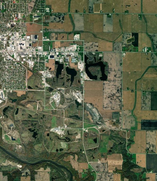
The intent of the Mineral Extraction District is to provide a location within Webster County where existing mining operations may continue with their mineral extraction as well as providing key locations for the operations to reasonably expand. The ME District has been established to protect a vital economic interest in Webster County. The basis for determining the boundaries on the future land use map was the location of existing and past operations, natural Jurassic formations, existing land holdings, and future growth plans.
• Mining operations
• Crop production on non-mined or reclaimed property
• Manufacturing facilities in association with the mining operations
• Transportation facilities and businesses in association with the mining operations
• Parks and Recreational facilities
• Residential subdivisions when proposed as part of a reclamation program
• Subdivisions shall meet the following:
ᴏ Subject to either the RE or UR standards
ᴏ Amendments to the Future Land Use Plan and Zoning Map must be completed prior to any residential construction commencing
ᴏ Construction of new residential dwelling units will not be allowed within 600 feet of the mining area or any production facility
• Residential developments unless otherwise provided
• Larger retail businesses, including large commercial developments such as shopping centers and strip malls
• Mobile homes as a dwelling unit unless associated with an approved mobile home park
These special policies are a guide for the County, the County Planning Commission, neighboring applicants with properties and regard to the development and expansion of Mineral Extraction Operations.
• New residential developments or subdivisions must have a minimum of 1,320 feet between the perimeter lines of the development and the ME district boundary.
• Production sites, within a ME District, within the county may be granted when these minimum standards are met:
ᴏ Area is under ownership of the mining operation or mineral are in their control or there is an option to purchase the property (land and/or mineral rights).
ᴏ Roads to and from the site are adequate to handle the required truck and machinery traffic or the applicant agrees to finance the required upgrades and to pay for future maintenance of the road.
ᴏ The mining operation holds a current state mining license.
ᴏ When within 600 feet of an existing residential development, or primary highway, the mining operation will be required to provide a screened area between the operation and the development. The screen may be either a man-made, natural or a combination of both.
ᴏ All screens are intended to provide a visual barrier not a noise or dust barrier, or the operator must provide evidence that the company maintains ownership of said residence or development.
ᴏ Other conditions that may be valuable for consideration, but not required:
• Proof that the location was previously mined through another methodology.
• Requests for new ME Land Use Districts within the County may be considered when any or all of the following items are present.
ᴏ The applicant demonstrates that the new location is either:
• In the company’s ownership
• The company has mineral rights on the property
• The company has an option to purchase the property
ᴏ The applicant holds a current state mining license.
ᴏ The operation meets the minimum state regulations for separation from any boundary lines not on the operator’s property.
ᴏ Roads to and from the proposed location are adequate to handle the required truck and machinery traffic or the applicant has signed an agreement with the County to finance the upgrades and to pay any future maintenance of the road.
ᴏ The area falls within the natural Jurassic formation as indicated on state geology maps, OR if outside the identified boundaries, the applicant can demonstrate the geologic presence of the materials.
• Other items that may be considered, but are not necessary for amending the Future Land Use Map.
ᴏ Proof that the location was previously mined through another technology.
The intent of the Public Use District is to provide areas for large scale public use areas within Webster County.

• Row crops, including corn, soybeans, sorghum
• Residences in association with farming operation
• Public facilities
ᴏ Schools
ᴏ County maintenance facilities
ᴏ Fire stations
ᴏ Emergency management facilities
ᴏ Airports
ᴏ Similar uses
• Maximum residential density = N/A.
• Minimum lot area = N/A.
• Corn Suitability Ratio = N/A.
• Manufacturing uses
• Residential developments
• Single-family dwelling not in association with a farming operation
• Larger retail businesses, including large commercial developments such as shopping centers and strip malls
• Mobile homes as a dwelling unit unless associated with an approved mobile home park
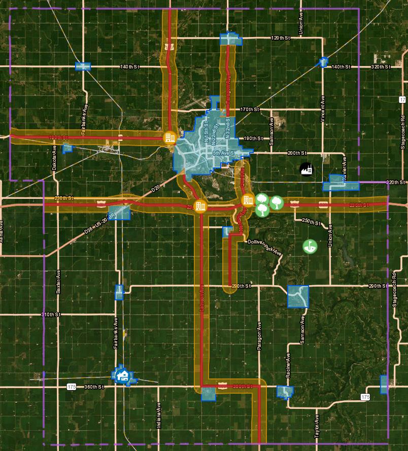
Webster County Boundary
Corridors of Focus
Corridor Development Zones
Municipalities
Land Use Categories Agriculture
The Future Land Use Map establishes the proposed long-range distribution and general use of the property within the county. The following table shall be used to determine consistency of future land use designations and zoning districts to identify compatible zoning districts.
WEBSTER
Goal 1: Protect environmental resources, maintain and increase land values, and guide future growth and development in a healthy, sustainable manner.
Strategy A
Direct development into areas that can support land uses based upon the availability and cost-effective expansion of public infrastructure.
Strategy B
Support development that is congruent with the Webster County Future Land Use Plan and those of municipalities within the County.
Goal 2: Promote the preservation of prime farmland and agricultural activities within the County.
Strategy A
Designate “Prime Farmland” areas and adopt preservation techniques to protect these assets.
Strategy B
Support agricultural businesses through land use regulations that allow for agricultural-related activities within agricultural districts.
Goal 3: Work with communities and other stakeholders to increase the number of commercial establishments throughout the county.
Strategy A
Require landscaping and architectural standards for all new commercial construction and expansion to existing operations.
Strategy B
Limit the extent of commercial development to areas as designated on the Future Land Use Map and along major transportation corridors.
Goal 4: Ensure the Future Land Use Plan places residential land uses in areas which will not hinder agricultural production, gypsum mining operations, or other opportunities for economic development in the future.
Strategy A
Promote inclusive housing options that cater to the needs of all residents in Webster County, irrespective of income level or physical capability.
Strategy B
Develop subdivision regulations that provide for high-quality living conditions while minimizing the need for costly and inefficient expansions of public infrastructure.
Goal 5: Establish a strong relationship with existing industries, identify new industrial opportunities, and eliminate obstacles in order to promote increased industrial growth.
Strategy A
Provide appropriate buffer spaces around industrial districts to facilitate industrial growth while safeguarding the health and safety of the County.
Strategy B
Promote redevelopment of vacated industrial properties, as well as remediation of large industrial sites prior to abandonment or closure.
Strategy C Consider areas appropriate for planned unit developments.

A transportation network ties communities together as well as provides a link to the outside world. Adequate circulation systems are essential for the safe and efficient flow of vehicles and pedestrians, and accessibility to all parts of the county. The Transportation Plan identifies existing conditions as well as future improvements planned to provide safe and efficient circulation of vehicles within Webster County.
Land use and transportation create the pattern for future development. An improved or new transportation route generates a greater level of accessibility and determines how adjacent land may be utilized in the future. In the short term, land use shapes the demand for transportation. However, new or improved roads, as well as, county and state highways may change land values, thus altering the potential demand for certain land uses.
In general, the greater the transportation needs of a particular land use, the greater its preference for a site near major transportation facilities. Commercial activities are most sensitive to accessibility, since their survival often depends upon the convenience within which potential consumers can travel to this location. Therefore, commercial land uses are generally located near the center of their market area along highways or at the intersection of arterial streets.
Industrial uses are also highly dependent on transportation access, but in a different way. For example, visibility is not as critical for a manufacturer as it is for a retail store. Industrial uses often need access to more specialized transportation facilities, which is why industrial sites tend to be located near railroad lines or highways to suit individual industrial uses.
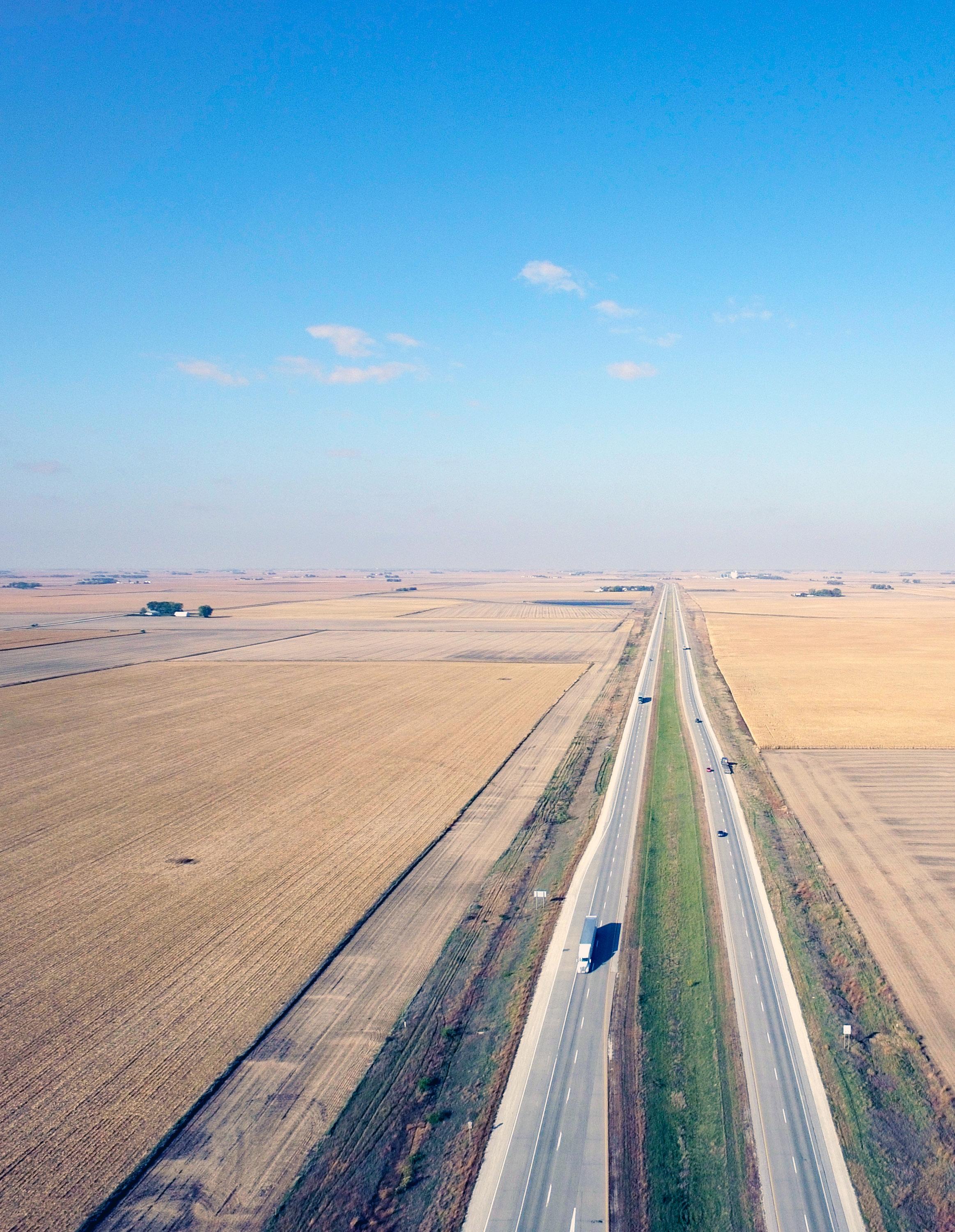
Transportation planning is largely influenced by the Iowa Department of Transportation (IDOT). The IDOT maintains primary roads, including Highway 20 that passes through Webster County. To assess eligibility for certain funding sources, the IDOT also maintains regular schedules of analyses including traffic counts and roadway conditions. Additionally, the IDOT annually establishes a FiveYear Transportation Improvement Program. The Five-Year Transportation Improvement Program is developed to inform Iowa citizens of the planned investments in aviation, railroad, trails, and highway improvements. Annual meetings held around the state provide citizen input to the transportation planning process. The program is established based on existing federal and state programs, taking into account estimates of funds expected to be available and estimated costs for construction, maintenance, and other work proposed to be accomplished. In the context of the five-year program, the term “road” or “street” encompasses the entire width between property lines through private property or the designated width through public property. This applies to any pathway or area, regardless of its nature, as long as it is available to the public for vehicular traffic as a matter of right.
Webster County’s road system is comprised of approximately 1,181 miles of roadway and experiences the fourth largest daily vehicle miles of travel in the state. The Webster County Engineer is responsible for all secondary roads within the county including their planning, design, maintenance, and construction.
Webster County maintains a total of 144 bridges, with approximately 37% classified as being in a state of poor condition— meaning that certain load-bearing elements have experienced damage or deterioration, although it is important to note that being in poor condition does not necessarily mean they are unsafe. The bridges undergo inspections either annually or every two years. Any structures deemed unsafe are required to be closed.
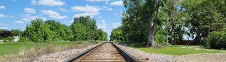
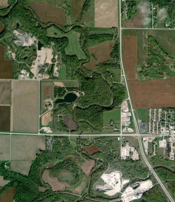
Webster County is rich in railways. Although the railways are privately owned and within the jurisdiction of the Federal Railroad Administration, they are an economic asset to the county. Two major rail companies utilize the facilities located in Webster County: Union Pacific, and CN. Webster County is a major hub in the western portion of the state’s rail system, as seen on the state railroad map to the right.

The Fort Dodge Regional Airport is arguably one of the best airports of its size in the Midwest. Commuter service is provided by United Express Airline with daily flights. The airport is not located close to a railroad corridor, which may be seen as a drawback, but the presence of sanitary sewer and water mains enhances its potential as an air industrial park.
Webster County offers many alternative methods of transportation, whether for passengers or cargo. The most obvious transportation route is the road system throughout the county. The road system includes US Highway 20, US Highway 169, Iowa Highways 7 and 175, and Webster County Route D43. In addition to these major highways, approximately 1,144 other county roads provide Webster County residents transportation routes throughout the entire county.
The Iowa Legislature has defined several road classifications (Iowa Code Ann. § 306.3) and their jurisdictional responsibility (Iowa Code Ann. § 306.4). The road system classifications prominent in Webster County and the pertinent jurisdictional responsibility are identified below.
Area service/area service system: secondary roads that are not part of the farm-to-market road system.
County conservation parkways: are parkways located wholly within the boundaries of county lands operated as parks, forests, or public access areas.
Farm-to-market roads: county jurisdiction roads which serve principal traffic generating areas and connect such areas to other farm-to-market roads and primary roads. This includes county jurisdiction roads providing service for short-distance, intra-county and inter-county traffic, or providing connections between farm-to-market roads and area service roads, and includes secondary roads which are federal aid eligible.
Interstate roads: are roads and streets of the primary road system that are designated by the Secretary of the United States Department of Transportation as the national system of interstate and defense highways in Iowa.
Primary roads: are roads and streets both inside and outside the boundaries of municipalities which are under department jurisdiction.
Public road right-of-way: an area of land, the right to possession of which is secured or reserved by the state or a governmental subdivision for roadway purposes. The right-of-way for all secondary roads is sixty-six feet in width, unless otherwise specified by the county board of supervisors of the respective counties.
Secondary roads/secondary road system: roads under county jurisdiction.
State park, state institution, and other state land road system: roads and streets wholly within the boundaries of state lands operated as parks, or on which institutions or other state governmental agencies are located.
Iowa Code states that, “Secondary roadways fall under the jurisdiction of the County Board of Supervisors.”
Roads and streets within any state land (including parks), or within county parks, are within the jurisdiction of the government agency that exercises control over such land. However, any roadway that is an extension of a primary or secondary road, which both enters and exits the state land or county park at separate points, will come within the concurrent jurisdiction of the controlling agency and agency that exercises control over jurisdiction over the primary or secondary road.
Travel patterns may impact various elements of land use planning including appropriate uses, economic development opportunities, and funding.
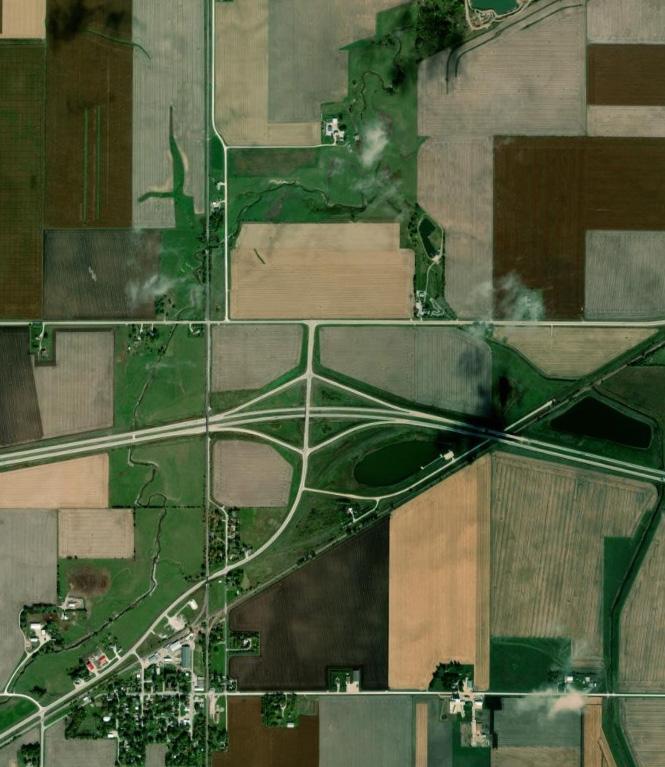
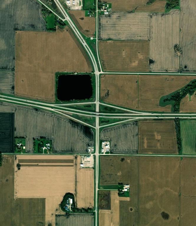
The most heavily traveled roads in Webster County are Highway 20 and Highway 169 north of Fort Dodge to Humboldt County. The Annual Average Daily Traffic (AADT) of Highway 20 through Webster County ranges by road segment and averages approximately 7,625 vehicles per day and 2,173 trucks per day. The AADT for the northern portion of Highway 169 averages approximately 5,527 vehicles per day and 925 trucks per day.


A zoning overlay district envelops additional regulations over the existing zoning regulations to address specific needs for particular conditions. Overlay districts allow for implementation of additional or alternative uses in specific areas without requiring the process of regulatory amendments to allow for these additional or alternative uses.
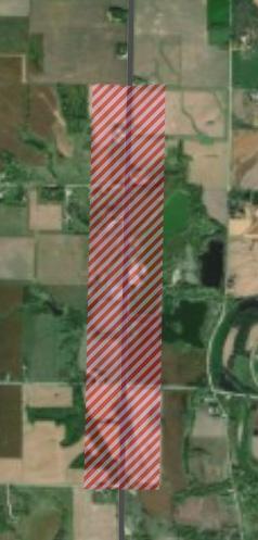
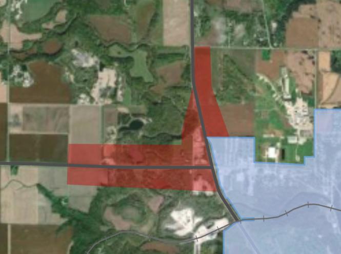
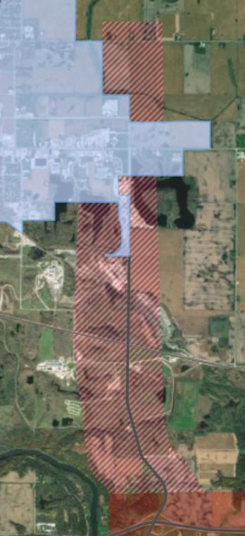
The implementation of a Transportation Overlay District in Webster County was initiated in response to the expressed desire of participants of the planning process to provide commercial and industrial opportunities along major transportation corridors where appropriate. The Transportation Plan’s Steering Committee identified prominent nodes along Highway 20, Highway 169, Highway 7, and Highway 175 that may foster these opportunities within a reasonable vicinity to existing similar land uses without impeding upon the rural character of Webster County. The Transportation Overlay District, like the entirety of the Future Land Use Plan, is intended to suit the needs of the county, and should be amended as needed.
Definitions
Corridor Overlay District (COD): areas of land designated by Webster County to provide commercial and light industrial development opportunities in specified nodes along major transportation arterials throughout the County.
Corridor Overlay Zone (COZ): the geographic area within the COD where land use regulations are enforced.
Description
The intent of the Corridor Overlay District (COD) is to ensure the safety, accessibility, usability, and aesthetic quality of development nodes of the major transportation corridors in Webster County by regulating development opportunities and standards.
It is the intent of Webster County that a Mixed-Use Development Overlay District be created for nodes along the Highway 20 Transportation Corridor and the other major transportation corridors as indicated on the zoning map that will provide for a combination of permitted uses, including commercial and light industrial uses in a “traditional” development pattern. This overlay district is intended to supplement the base zone regulations within the overlay district boundaries with the following objectives: preserving existing agricultural uses, enhancing the Highway 20 Transportation Corridor, encouraging orderly and compatible new commercial and light industrial development (including mixed commercial and light industrial use development), facilitating appropriate redevelopment and/or adaptive reuse of existing structures, preserving the County’s historical resources, protecting the environment, maintaining and enhancing a sense of place, and addressing the unique development needs of the areas of the County impacted by proximity to the Highway 20 Transportation Corridor, and the other major transportation corridors as indicated on the Transportation Overlay Map.
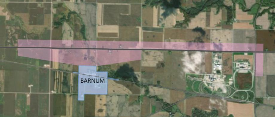
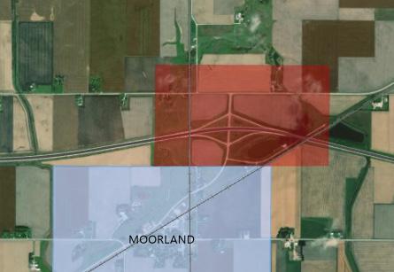
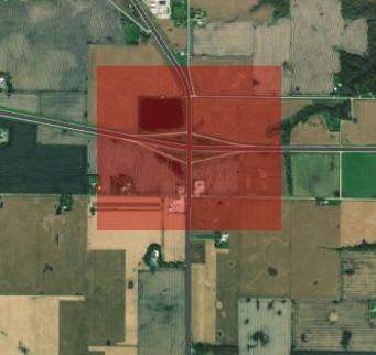
20 & 169 Corridor


Goal 1: Provide a safe, efficient, multi-modal, and well-maintained transportation network for all residents and visitors.
Strategy A
Strategy B
Manage the access and design of the transportation network in order to effectively maintain the safe and functional integrity of roads and bridges within the County’s jurisdiction.
Coordinate transportation projects with Webster County’s municipalities, adjacent counties, Mid-Iowa Development Association (MIDAS), and the Iowa Department of Transportation (IDOT).
Strategy C
Enhance multi-modal opportunities for regional travel for Webster County residents and visitors.
Goal 2: Prioritize accessibility for industry vehicles essential to the well-being of the County including agricultural and emergency vehicles.
Strategy A
Develop and maintain Webster County’s transportation network at a level of service that accommodates emergency vehicles.
Strategy B Support the connectivity of existing and future roadways to ensure accessibility for general users and emergency vehicles.
The implementation matrix is a tool to help Webster County implement the goals and strategies identified in this plan. Each strategy is broken down into action items with a priority rating to indicate when it should be addressed. Potential funding opportunities are indicated for strategies, though there may be additional funding opportunities. The table below describes the features included in the implementation matrix.
Goals: the object of a person’s ambition or effort; an aim or desired result.
Strategies
Action
Strategies identify a course of action to achieve the overall goal. The strategies that were identified in Chapter 3 will be reiterated here.
Partners that may help with implementation can be found here. A list of potential partners are included below.
An action is the process of doing something to achieve a goal. Actions are measurable and will be categorized by their level of immediacy in the priority column to the right.
A guide for priority level indicators is located below.
• Webster County Conservation: Manages 24 parks, memorial sites, wildlife areas, prairies, and outdoor recreation spaces across the County.
• Webster County Engineer: Oversees the planning, design, and supervision of all construction and maintenance work performed on the County’s roads, bridges, and culverts.
• Webster County Planning & Zoning: Manages all current and long-range planning functions, such as enforcing the County Ordinances and Comprehensive Plan through conditional use permits, re-zonings, text amendments, and other land use review processes.
• Webster County Emergency Management: Coordinates responses to natural, civil, and technological emergencies that reduce or eliminate injuries/fatalities, property damage, and economic hardship.
• Iowa Department of Transportation (IDOT): Responsible for the organization, construction, and maintenance of the State’s primary highway system.
• Iowa Department of Natural Resources (DNR): Manages fish and wildlife programs, recreational opportunities at state parks, and health of Iowa’s natural environments.
Urgent (1-3 years) Short-term (3-10 years) Long-term (10-20 years) Ongoing
Responsibility for implementing this plan lies primarily with the Webster County Board of Supervisors, Planning and Zoning Commission, and County Staff.
The Board of Supervisors sets priorities, approves budgets, and often has the final say on key aspects of public and private development projects. The value and legitimacy of this plan is directly related to the degree to which Supervisors are aware of the plan and expect County actions to be consistent with this plan. Each Supervisor should have a copy of this plan and be familiar with the major goals and objectives described herein. The Board of Supervisors should expect and require that staff recommendations and actions both reference and remain consistent with this plan, or that the plan is amended as needed to fit changing conditions.
Land use and development recommendations are a core component of this plan, and the Planning and Zoning Commission has a major role in guiding those decisions. Planning and Zoning Commission members shall each have a copy of this plan and shall be familiar with the content. It is generally the responsibility of the Planning and Zoning Commission to determine whether proposed projects are consistent with this plan, and to make decisions and recommendations that are consistent with this plan. In cases where actions that are inconsistent with this plan are deemed to be in the best interest of the County, the Planning and Zoning Commission should initiate efforts to amend the plan to better reflect County interests. This will help to reinforce the legitimacy of the plan as an important tool in guiding County decision making.
County staff have a significant influence on the selection and completion of all kinds of capital and operational projects. It is imperative that County staff know about, support, and actively work to implement the various strategies and actions in this plan.
Specifically, the following people should consult and reference the Comprehensive Plan during goal-setting processes, annual budgeting, planning for major public projects, and in the review of private development projects:
• County Admin
• Community Development Staff
• County Engineer
These key staff members are expected to know and track the various goals, strategies, and vision laid out in this plan, and to reference that content as appropriate in communications with residents, business owners, and elected and appointed officials. All other staff members should be aware of the plan and the connections between the plan and County projects. The purpose of this extra effort is to strengthen staff recommendations and reinforce the plan as a relevant tool integral to County functions and decision making.
The development of sanitary sewer systems will be supported where such systems conform to all applicable federal and state standards pertinent to the collection, treatment, and final disposal of effluent.
Encourage the dedication of major drainage-ways such as wetlands, swales, intermittent creek basins and roadside depressions for the purpose of non-structural storm water collection.
and
Support consolidation of city, county, and state administrative offices, public health, safety and welfare buildings, and community cultural facilities as opportunities that will promote energy conservation, provide convenient, centralized services and attractive building and open space groupings.
Assist in the organization of special purpose districts such as sanitary districts, sanitary authorities, and county service districts which would be able to utilize federal and state funds to build collection and treatment facilities and provide the necessary services to their respective communities or clientele. The County will work to ensure that these districts are created in a manner that promotes planned growth patterns in communities within and surrounding the County.
Support any consolidation of water and sewer facilities to secure the potential economies of scale and organizations, provided their potential environmental impacts are consistent with existing land-use plans, related urban growth goals and policies, established water quality standards, and where separate local facilities are shown to be more expensive.
Continue to provide new recreational opportunities and enhance existing facilities for the residents of Webster County, visitors, and the all of Iowa.
Goal 3: Guide development in a manner that protects and enhances environmental and water resources of Webster County.
Support zoning regulations and design standards that protect the environmental and natural resources of Webster County through the encouragement of preservation and conservation practices in environmentally sensitive areas.
Coordinate with and support city, regional, state and federal water-quality plans and programs so that high water quality will be achieved in the cities of the County, that sound watershed management practices will take place, and that improved treatment of point and non-point sources of water pollution will be achieved.
Continue coordinating with area communities and adjacent counties to implement a joint economic development strategy that supports existing businesses, promotes new businesses in coming to the area (including industrial), and seeks to develop new attractions and amenities for the public on a local and regional level.
the incorporation of safe and health-conscious building materials, clean indoor air systems, pest-free environments, energy and water efficiency measures, as well as inclusive design that prevents injuries and ensures universal accessibility for people of all abilities, in new residential constructions or retrofit projects.
Coordinate transportation projects with Webster County’s municipalities, adjacent counties, Mid-Iowa Development Association (MIDAS), and the Iowa Department of Transportation (IDOT).
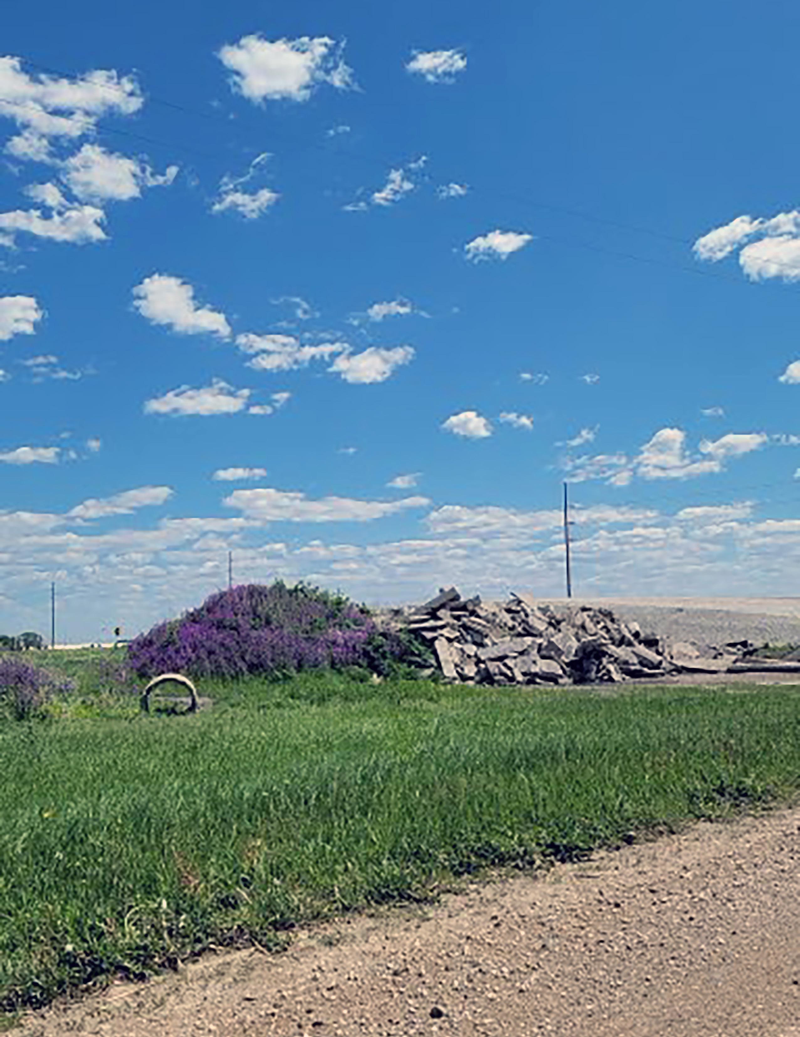

The Community Profile is a summary of current conditions and recent trends in Webster County based on the best available data from Webster County, Iowa Department of Natural Resources, Iowa Department of Transportation, United States Department of Agriculture, National Resources Conservation Services, ESRI Business Analyst, United State Census Department, and other applicable resources.
The purpose of the Community Profile is to enable readers of the plan to identify current conditions in Webster County and utilize that information make informed choices about the future of the community. This report is included as an appendix to the Webster County 2042 Comprehensive Plan so that it may be easily updated from time to time as new data becomes available.
The Webster County Comprehensive Development Plan 2008 was a coordinated effort between the Webster County Board of Supervisors, Webster County Staff, Webster County Planning and Zoning Commission, and the Webster County Board of Zoning Adjustments. The document was designed to advise reasonable growth and development for the county by providing land use guidelines to help local leaders make informed decisions about the future of the County.
Contents:
• Introduction
• Profile Webster County
County Assessment
County Facilities
Existing Land Use
Environmental Conditions
• Envision Webster County
Town Hall Meetings
Goals and Policies
• Achieve Webster County
County and Land Use
Management Plan
Future Land Use
Transportation Plan
• Webster County Plan
Implementation
Action Agenda
Comprehensive Plan
Maintenance
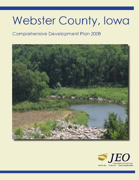


Pocahontas County is adjacent to Webster County to the northwest. The two counties share approximately six miles of border, along which County Highway P19 runs for the majority of the shared perimeter. The boundary is also crossed by Pocahontas Creek, a tributary to the Des Moines River that flows through Webster County. The adjacent land is zoned agricultural or agricultural/ residential.
Wright County shares a northeast border with Webster County for approximately six miles. Wright County most recently updated the Wright County Zoning Map in 2012. Wright County is primarily agriculturally zoned, including the land adjacent to Webster County.


Boone County
Boone County abuts Webster County to the southeast. Boone County most recently updated the Boone County Future Land Use Map in 2007. Boone County is zoned as agriculture and conservation along it’s northern border shared with Webster County.


Greene County shares a southwest border with Webster County for approximately twelve miles. Greene County is primarily agriculturally zoned, including the land adjacent to Webster County. Greene County
Calhoun County abuts Webster County to the west. The two counties share approximately twentysix miles of frontier. Calhoun County is primarily agriculturally zoned, including the land adjacent to Webster County.
Webster County is lined along the north by Humboldt County. The majority of the eastern edge of Webster County is adjacent to Hamilton County. Hamilton County, to the east, does not currently have zoning in unincorporated areas. Humboldt County utilized a county zoning ordinance, however, there in not an existing zoning or land use map available for the county.
The population was 522 at the time of the 2020 U.S. Census. The town got its name from Badger Creek, which itself got its name when a group of soldiers from Fort Dodge in the early 1850s saw a badger for the first time.
Barnum lies at the southeastern margin (rim) of Manson crater, an impact structure buried by glacial till and out-wash. The population was 175 at the time of the 2020 U.S. Census.
The population was 368 at the time of the 2020 U.S. Census. Originally named Kesho, Callender was renamed in 1875 in honor of Agnes and James Callender.
The population was 136 at the time of the 2020 U.S. Census. Clare was settled circa 1882 by immigrants from Clare County, Ireland.
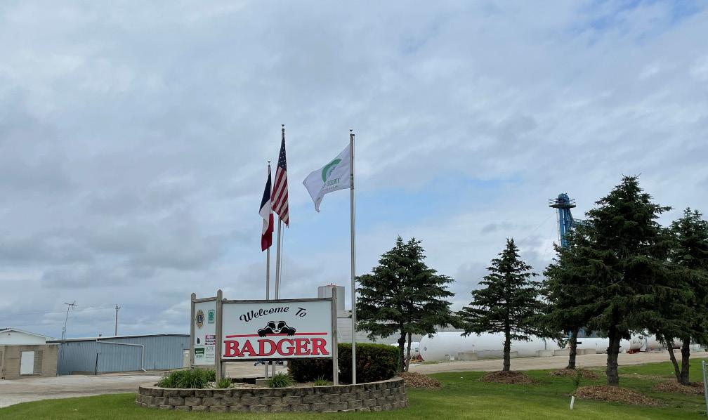
The population was 772 at the time of the 2020 U.S. Census. The city was named after Dayton, Ohio.
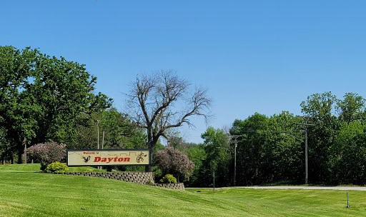
Duncombe is named for Hon. J. F. Duncombe. The population was 381 at the time of the 2020 U.S. Census.
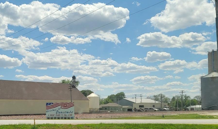
The population was 24,871 at the time of the 2020 U.S. Census. It was named after Henry Dodge, a governor of Wisconsin Territory. It was founded in 1869.
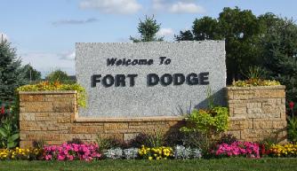
Fort Dodge updated their Comprehensive Plan back in 2014 and is intended to guide the City through 2030.
The population was 952 at the time of the 2020 U.S. Census. The city was named after Gowrie, in Scotland.
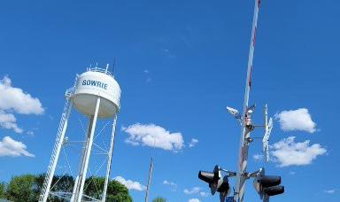
The population was 264 at the time of the 2020 U.S. Census. It was platted in 1881 and named for William Vernon Harcourt, a British statesman.
The population was 395 at the time of the 2020 U.S. Census. Located in a valley, Lehigh is divided in two by the Des Moines River, which is uncommon for such a small town.
The population was 168 at the time of the 2020 U.S. Census. The current post office, built in 1991 under President George H. W. Bush, is the only federal government building located in the city boundaries.
The population was 429 at the time of the 2020 U.S. Census. Otho is located within the Fort Dodge Community School District.
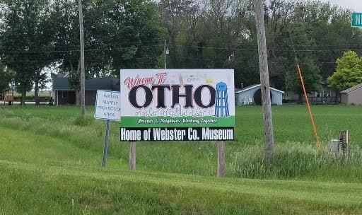
The population was 707 at the time of the 2020 U.S. Census. It was named after Stratford-uponAvon, in England.
The population was 130 at the time of the 2020 U.S. Census. According to the United States Census Bureau, the city has a total area of 0.26 square miles (0.67 km2), all land.


Total Households:

17,056

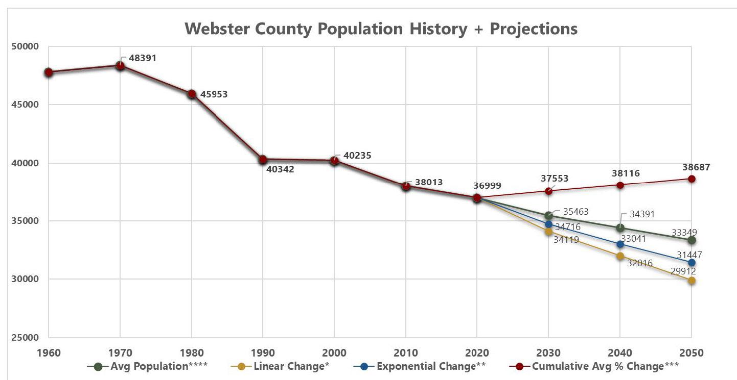
Webster County is a hub to major transportation corridors for the State of Iowa. Highway 20 is the most highly traveled corridor in Webster County with an average daily traffic county of 10,000 at its most traveled section which is located southeast of the City of Fort Dodge between Swallow Avenue and Union Avenue. Other primary transportation corridors in the county include Highway 169, Highway 7, and County Road P59.

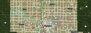
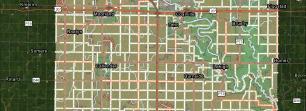
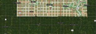
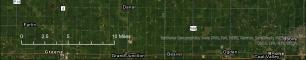
The first recorded visit of European Americans is credited to the U.S. Dragoon led by Nathaniel Boone.
The land that is now Webster County was occupied by moundbuilding Native Americans, including the Woodland and Oneota cultures. The predominant tribes included the Winnebago, Sac and Fox, and Sioux.
The first settlers arrive in the Webster County area.
A military post was established at the site of the City of Fort Dodge.
The last of the treaties ceding land from the Sioux was signed.
Citizens of both Yell and Risley county petitioned to combine the two counties. The merge occurred in December and the County was named after American Statesman, Daniel Webster.
The county seat location was chosen in Homer. The military post at Fort Dodge was abandoned.
The City of Fort Dodge was platted.
The federal Land Office was located in the city of Fort Dodge. The great land speculation boom of 1855 to 1857 played a key role in the growth of the city.
The county seat was moved to Fort Dodge. Illegal voting, ballot-box stuffing, and other disputes occurred over this decision.
The cornerstone for the Webster County Courthouse was laid on May 8th.
Fort Dodge became a key rail center after the completion of two railways.
Webster County became Iowa’s primary producer of clay products (brick, tile, and stoneware crockery) as well as a leader in the processing of gypsum.
First National Bank Building opened for business in Fort Dodge. Pioneers’ Day established. St. Joseph’s Mercy Hospital built in 1908.
Current Webster County Courthouse officially dedicated.
Bennett Viaduct constructed to connect two sections of Fort Dodge.
The construction of the Gypsum Products Company plant in Fort Dodge begins. Quaker Oats purchases Heath Mill in Fort Dodge. Mining and factories attracted farmers to cities.
Tobin Packing Company established in Fort Dodge.
Fort Dodge Army Air Base established as a training facility for bomber crews during WWII. Dodger Stadium completed.
Industrial growth continues, with companies like The Hormel Institute becoming a prominent employer and contributing to advancements in medical research.
Brushy Creek State Recreation Area established.
Crossroads Mall in Fort Dodge opened.
The Farm Crisis of the 1980s brought a severe economic downturn for the agricultural industry, impacting Webster County’s farming community.
City OHV Park in Fort Dodge open to the public.
Greater Fort Dodge Growth Alliance formed.
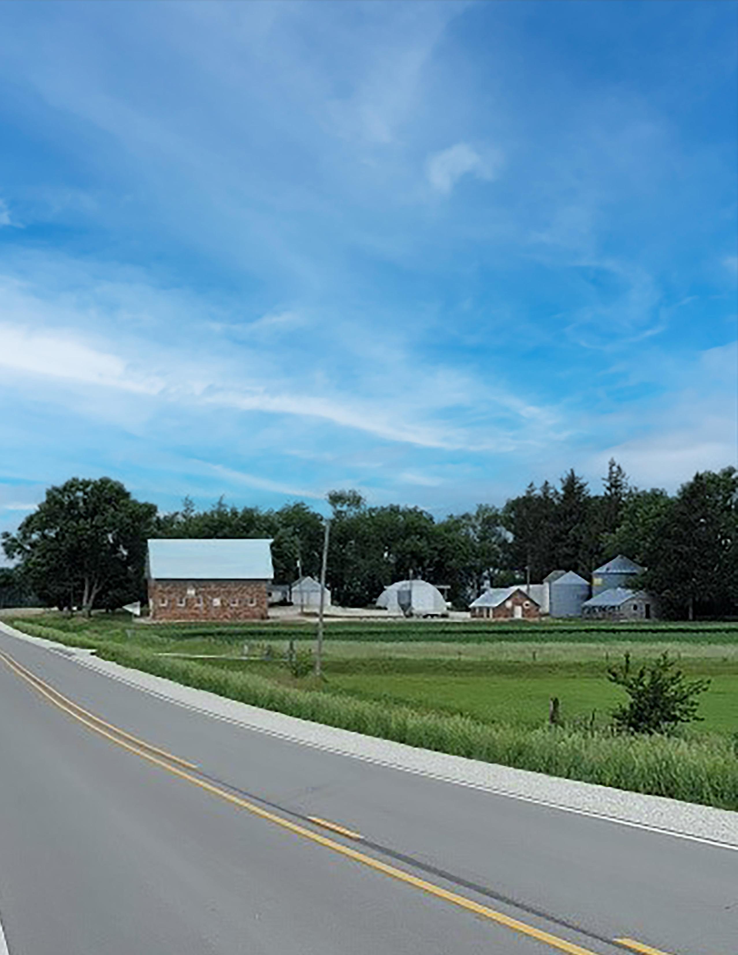
How long have you lived in Webster County?
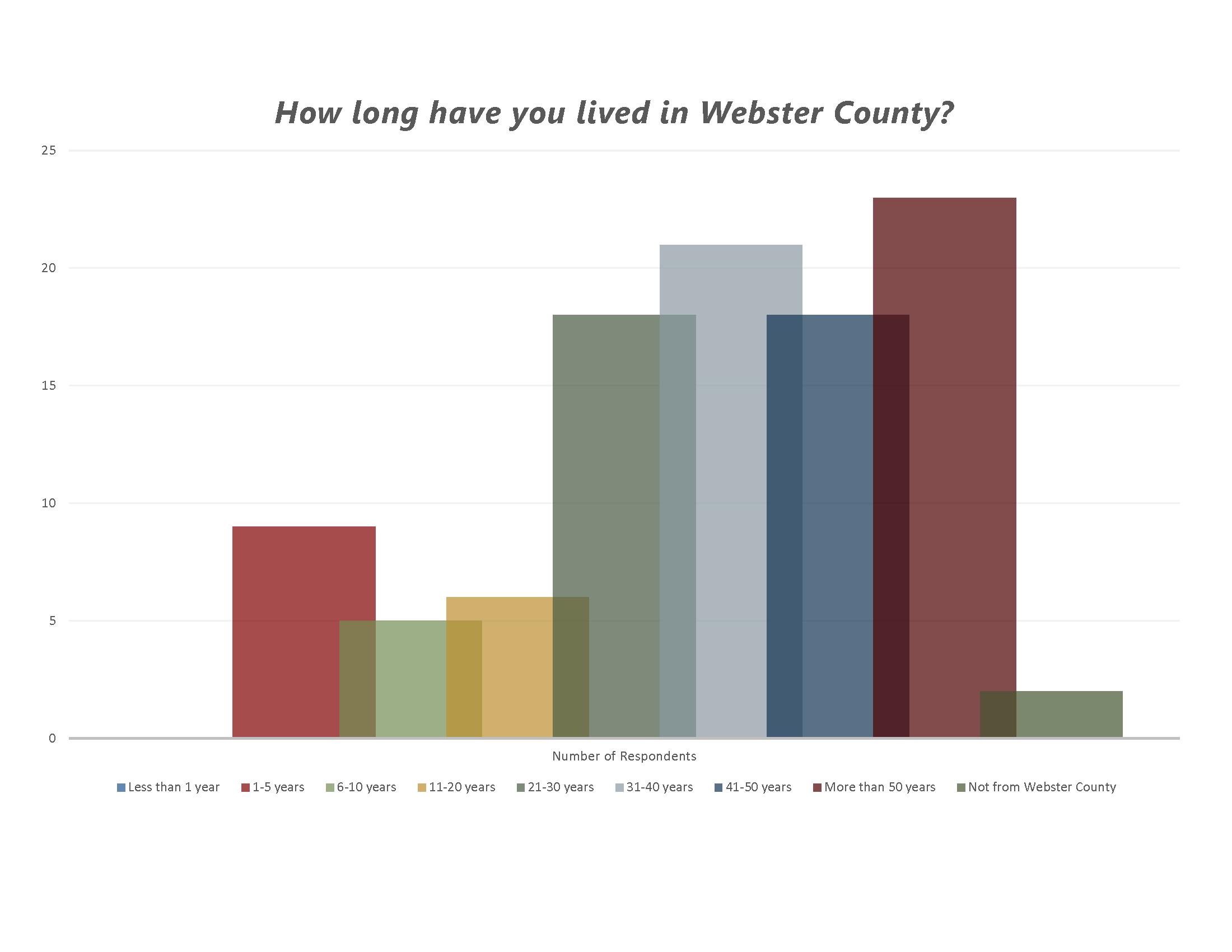
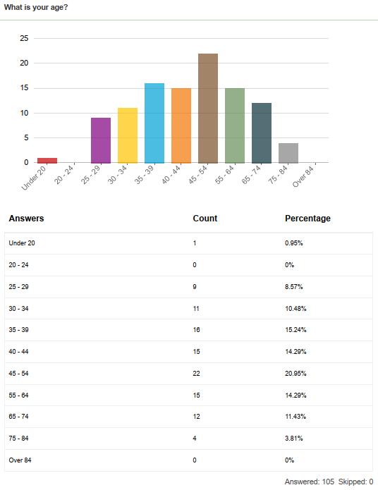
What brought you to Webster County?
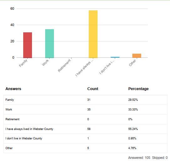
What are the top three reasons you want to live, work, and relax in Webster County?
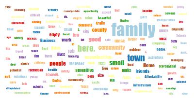
Please select the top three changes you think would have the greatest impact on improving the quality of life in Webster County in the future.
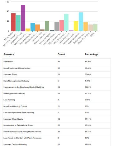

What are some challenges to developing new homes and business in rural Webster County?
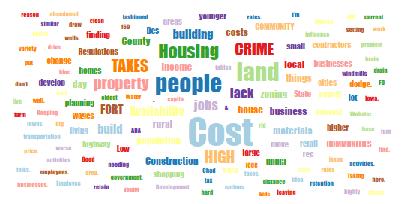
What are some challenges to mobility in rural Webster County?
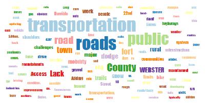
What are some challenges to improving quality of life in rural Webster County?
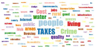
What are some strengths and/or opportunities for developing new homes and businesses in rural Webster County?
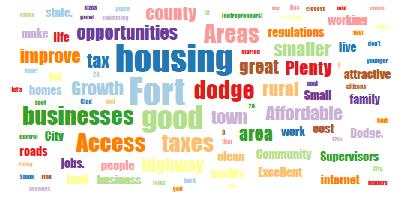
What are some strengths and/or opportunities for increasing mobility in rural Webster County?
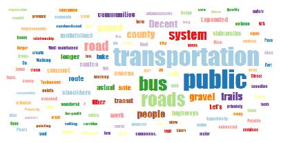
What are some strengths and/or opportunities for improving quality of life for people in rural Webster County?
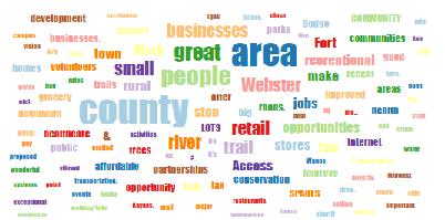
How would you currently rate the safety of the Webster County’s primary transportation corridors?
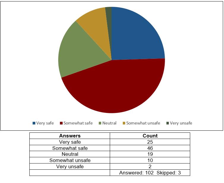
How would you currently rate the accessibility of Webster County’s primary transportation corridors?
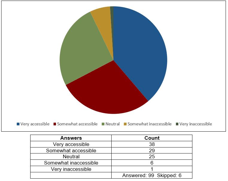
How would you currently rate the aesthetics of Webster County’s primary transportation corridors?
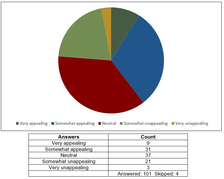
How important to you is improving the safety of travelers using these major corridors in Webster County?
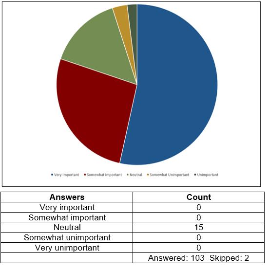
How important to you is improving the aesthetics along with development along these major corridors in Webster County?
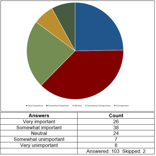
How important to you is improving accessibility along these major corridors in Webster County?
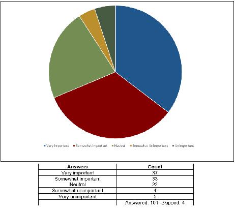
Do you support the adoption of minimum design standards on major transportation corridors?
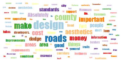
What else would you like to have considered in the Webster County Transportation Corridor Plan?
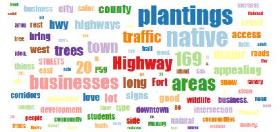
How do you prefer to hear about Webster County’s news, events, and announcements?