SMOKIES VISITING THE

• HIKING THE SMOKIES
• RIVER RAFTING
• TRAIL MAPS / CAMPING
• FISHING IN THE SMOKY MOUNTAINS
• BIRDS, BEARS AND MORE u


• HIKING THE SMOKIES
• RIVER RAFTING
• TRAIL MAPS / CAMPING
• FISHING IN THE SMOKY MOUNTAINS
• BIRDS, BEARS AND MORE u

is published by The Newport Plain Talk 145 East Broadway | Newport, TN 37821 423-623-6171
DUANE UHLS
Publisher
DAVE RUTHENBERG
Managing Editor
KATHY BARNES
Writer/Photographer
JAKE NICHOLS
Writer/Photographer
ANGEL DYKES
Account Executive
MAHLIA GONZALES
Account Executive
ABBY SWEARINGEN
Account Executive
PENNY WEBB
Account Executive
ANGIE CAMPISE
Creative Services/Production
Copyright: 2024 Visiting The Smokies, The Newport Plain Talk. No part of this publication may be reproduced without written permission of the newspaper management. Reproduction of advertising and design work is strictly prohibited due to the use of licensed art services and agency agreement.
Hiking the Smokies
Ober’s ‘year-round experience’ includes rafting and zip lining 4 7 12 14 16 20 21 24 27 28 30 33 35
Bringing ‘Good Vibes’ to rafting on French Broad River
Smoky Mountain Trail Maps
Parking in Great Smoky Mountain National Park
Hot Springs Trail Map
Cherokee National Forest offers adventure and opportunity
Campsites abound in the Smokies and surrounding area
Fishing in the Smoky Mountains
Chasing waterfalls
Weaver’s Bend and Allen Branch Pond offer history, fishing, camping, birdwatching and more
Birds, bears and more in biodiverse Smokies
Hot Springs offers a variety of activities
When reading the word “Ober,” visitors to the Smoky Mountains may think of the adventure park and ski area in Gatlinburg. But just under an hour from an institution that was established in 1962, there is a newer branch to the company in nearby Hartford, located at 3565 Hartford Road.
This one focuses on whitewater rafting and zip lining.
“Ultimately, we’re trying to create a year-round activity experience,” said Lacy Bramlett, the general manager at Ober since its opening in 2023. “When new ownership bought Ober in the fall of 2022, they wanted to integrate a summertime activity. So on the mountain, they did that by introducing mountain biking, and they built a zip line up there.
“Two of the owners are local, from Sevierville, and one of them has a friend who owns a company here. So they’re influenced by this community, and they chose to come to Hartford and purchase a whitewater rafting company.”
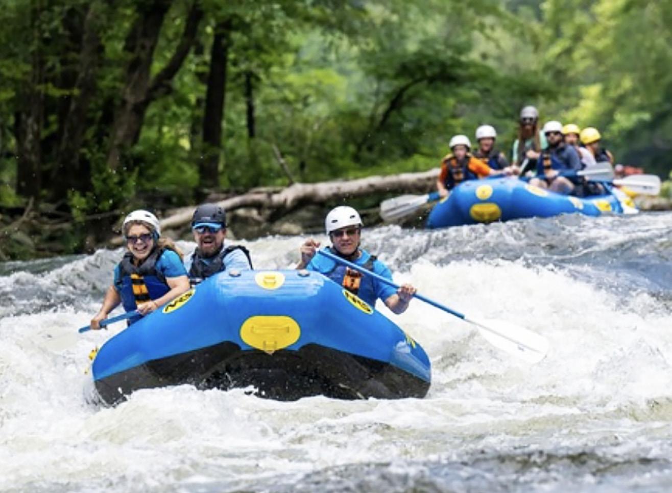
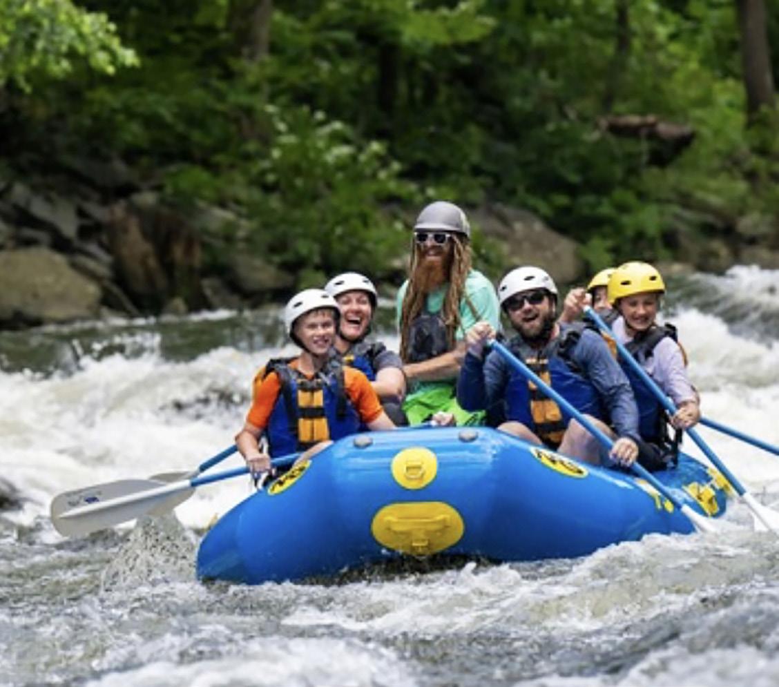
The rafting ranges from a splashy two-hour upper river trip with 15 rapids between Class II and Class IV to the lower trip, which is a five-mile stretch that allows rafters as young as 3 years old.
No whitewater experience is needed for either venture, and visitors can experience the river from May 25 through Sept. 1 each
year by calling (865) 436-5423.
“It’s a very family-friendly river, very starter-friendly, and the guide quality is what lends to it being a fun and safe trip,” said Bramlett. “We fortunately have a great staff, and I can say that for most companies in town.”
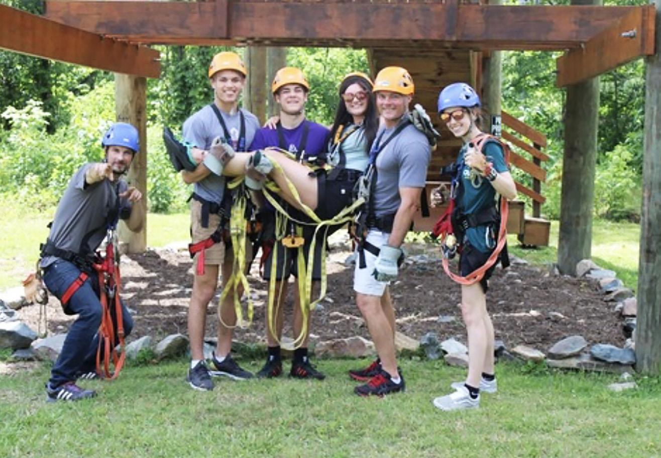
The zip lining includes a choice between the river express — which goes across the Pigeon River and back at speeds up to 22 mph — and the canopy tour, which involves sky bridges and a billet spool through a rabbit hole with a few more zip lines.
The outpost is open Tuesday, Thursday and Saturday from 10 a.m. to 6 p.m.
Since the company’s footprint in the area is new, Bramlett mentioned that her experience in Hartford has been helpful.
“I’ve been in Hartford since 2010 and have been a river guide since then,” she said. “I have very strong relationships with most of the owners since I worked for Outdoor Adventures for 14 years. When I came in, the integration really helped a tremendous amount. It allowed me to ease other people’s minds because they knew me and what I have to offer.“
Bramlett wants to see the company bring in visitors from all over.


Bramlett said they are looking to have more events on their wide property with a hammock garden and space in the back.
“We have such a great location between Asheville and Knoxville, and we’d love to start doing more events out here,” she said. “Fall festivals, concerts, weddings, anything we can do to make this more of a year-round destination. There’s lots of things we want to work toward.”
Those plans remain in the future, though.
For now, Bramlett emphasized that they are focused on building up what they already have in preparation for future growth.
“Right now, we’re just focused on the whitewater rafting and zip lining,” she said, “so we can move into those things in the future.”


More than 14 million people visit Sevier County annually. They head to Great Smoky Mountains National Park to enjoy breathtaking views and reconnect with nature.
Step from your car, walk a few yards down a leaf-covered path. Suddenly the noise of the traffic, even the warmth of the sun, is gone.
In their place — quiet, cool.
You’re on a trail in Great Smoky Mountains National Park.
In the nation’s most-visited park, there is solitude, even isolation. For those not accustomed to the wilderness offered by following some trails, there are easy walks that offer glimpses of the primeval forest. For other more adventurous, or experienced, hikers, there are challenging trails that lead to some of the most dramatic views the Park has to offer.
The Smokies’ 800 miles of trails range from wide pathways, which served as the thoroughfares for the mountain dwellers of pre-1930, to steep, well-trodden portions of the Appalachian Trail. There has been much public and private investment in trail maintenance in recent years.
In 2012, Friends of the Smokies established the Trails Forever endowment thanks to a matching gift from the Aslan Foundation in Knoxville. Today, the $5 million endowment funds a full-time trail crew in Great Smoky Mountains National Park to reconstruct and rehabilitate some of the Park’s most impacted trails.
Since 2008, our $5 million Trails Forever endowment has helped fund rehabilitation projects on Jakes Creek, Forney Ridge, Ramsey Cascades, Chimney Tops and now Alum Cave trails. The hard work this crew does and the fact that these improvements will last 75-plus years is truly incredible. These are some of the Park’s most heavily traveled trails so it just made sense to give back and take care of the hiking trails.
The three-year effort to rehabilitate the Chimney Tops
Trail ended in 2014. In 2015, Great Smoky Mountains National Park celebrated the recent completion of the Chimney Tops Trail restoration project. More than 1,000 volunteers provided more
than 14,000 hours of labor on the project.
The popular Alum Cave Trail in Great Smoky Mountains National Park is now undergoing full-scale restoration. The Trails Forever crew will focus restoration efforts on several targeted locations along the 5-mile trail to improve visitor safety and stabilize eroding trail sections. The restoration work will require temporary trail closures throughout the two-year process.
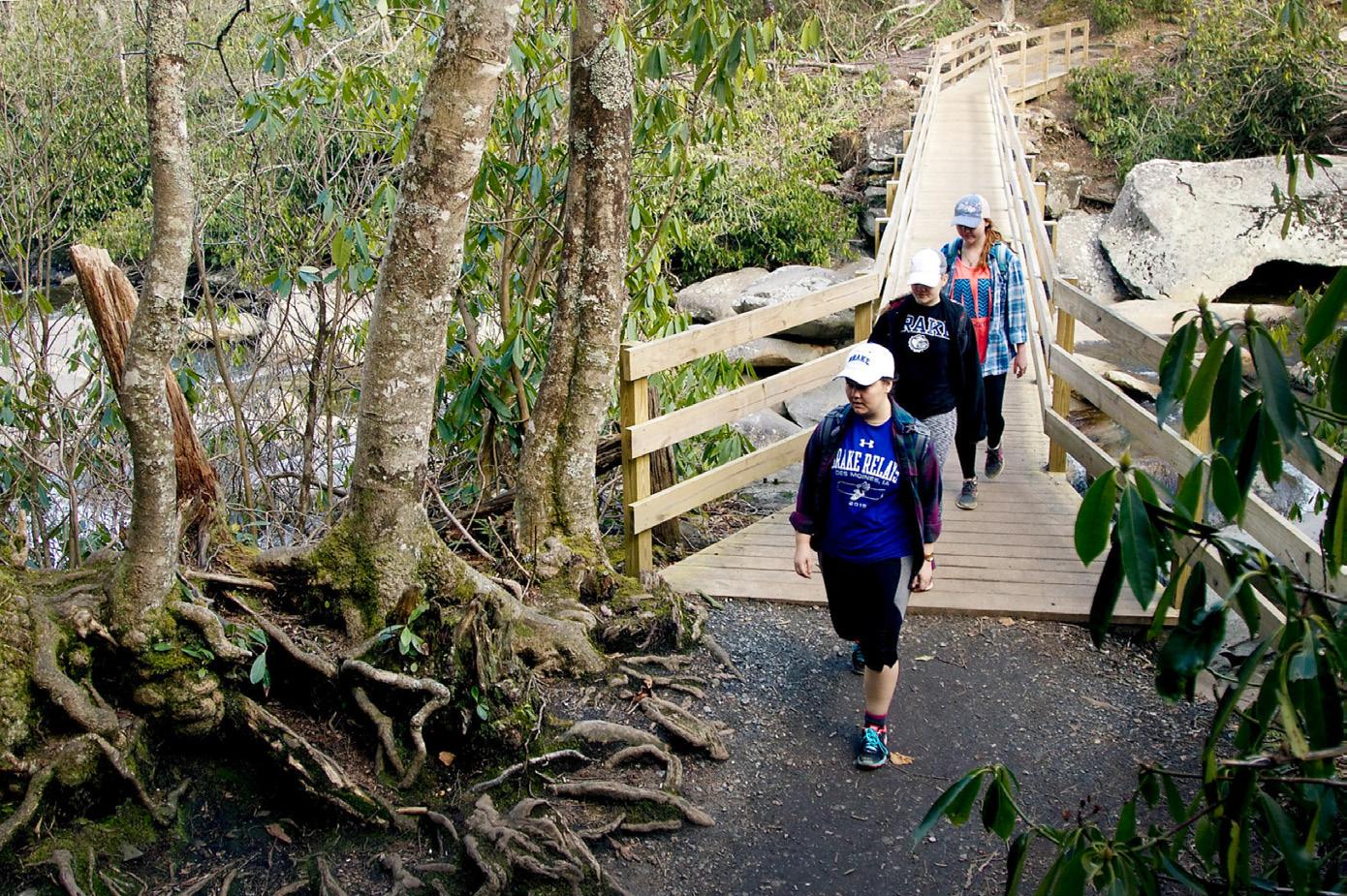
For the beginning hiker, shorter, less-strenuous day hikes are plentiful throughout the Park. These, like the longer trails that work their way through the backcountry, offer many miles of nature walks and self-guiding trails to Park visitors. These trails are usually no longer than 1 mile (round-trip) and many serve as educational guides to the Park and surrounding area. Along the way are scattered resting places, usually with a spectacular view for extra measure.
The Sugarlands Trail, which begins behind the Sugarlands Visitors Center (2 miles south of Gatlinburg on U.S. 441), gives an introduction to the natural history of the area, as well as history about its human inhabitants.
Elkmont, Smokemont and Cosby are some, but not all, of the self-guiding nature trails that give visitors a chance to see and learn more about the mountains than they would just riding through them in a car. One at the Chimneys Picnic Area is a favorite for wildflower enthusiasts in the spring.
Several spots along Laurel Creek Road from the Townsend entrance to Cades Cove serve as entrances to trails and nature walks that offer strolls or workouts. In one spot, at the beginning of the Bote Mountain Trail, those with a bit more physical conditioning can walk up the road bed (it’s to the left) while others can simply wander up Schoolhouse Gap Road beside a quiet mountain stream (across the bridge and to the right where the larger parking area is located).
Farther up Laurel Creek Road, just down from Crib Gap, is the beginning of several trails, some easy, others more vertical. One of the trails offers a 2-mile “short-cut” to the higher reaches of Bote Mountain Trail, which offers a workout without exhaustion.
Andrews Bald, Abrams Falls and Laurel Falls get you into the
8 Visiting The Smokies Summer 2024
wilderness, but not too far. These fairly easy trails range in length from 2 to 6 miles and do have some spots where more-thanaverage energy will be expended.
Some hikes — Deep Creek, Shuckstack and Snake Den Trail, to name just a few — challenge all but the most adventurous hiker. These climb up (or down depending on your direction) 4,000 feet or more.
The more difficult trails have their own rewards — walking through virgin forests, passing into the clouds, being enveloped in the mists swirling around the highest of the Smokies ’ peaks, walking on new-fallen snow or through blooming blackberry bushes still dripping with morning dew.
Area residents have their own favorites among difficult trails. There is the 5-mile hike to Spence Field, one of the Smokies ’ famous and mysterious balds. Those still able to breathe normally after that last push to the top may continue on to Rocky Top, which lent its name to the song popular with the Tennessee Volunteers.
From there you can continue on to the other two peaks of Thunderhead, the dominant mountain on the skyline in the distance when approaching Maryville by U.S. 129 from Knoxville.
There is Mount LeConte, available by several trails. Entrances to trails leading to LeConte (which is topped with a lodge and shelter) are on transmountain U.S. 441 (the Alum Cave Trail) which leads to Cherokee, N.C., and off the Roaring Fork motor trail off Airport Road in Gatlinburg at Cherokee Orchard (Rainbow Falls and the Bullhead).
Rainbow Falls is worth a hike itself with its views from the log bridges approaching the high spill. The Bullhead features quick altitude and good views of Gatlinburg.
If you wish to go to the high country without having to climb there, try Andrews Bald trail, which starts at the Clingmans Dome parking lot. Or turn the other way, paralleling the paved trail to the dome’s tower and walk along the crest of the Smokies, through high-altitude forests as though you were in Canada.
On parts of the trail you can gaze from both sides into the mountains and valleys as far as the eye can see.
If a step into history is more your cup of tea, try some walks just out of Townsend. There is the popular hike to the Walker Sisters cabin where five sisters lived — first with their father, then alone — and became almost totally self-sufficient.
Reaching the trailhead is probably the hardest part of this walk. From Townsend, go into the Park, turn left at the “Y” toward Elkmont and Gatlinburg. At Metcalf Bottoms go straight through the picnic area, across the ridge and onto the gravel road.
Turn right at the Little Greenbrier School road and park at the schoolhouse. The trail is the road with the gate. About a mile from that gate stands the homestead. The house where the sisters lived and worked is still there with its charred stone fireplaces.
Just inside Cades Cove, on the right past the parking area and scenic overlook with display, is one of the paths to Rich Mountain. Once again, a brief walk on a well-worn trail can lead you up beside a mountain stream, complete with cascade, if there is enough water.
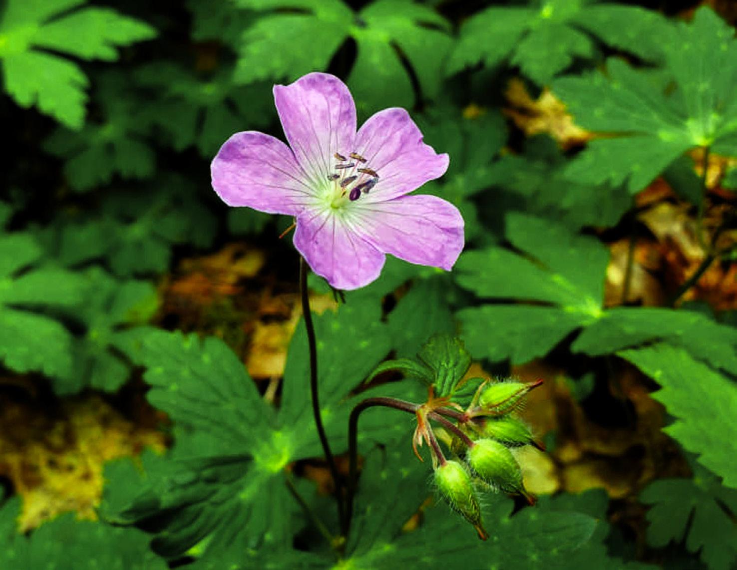
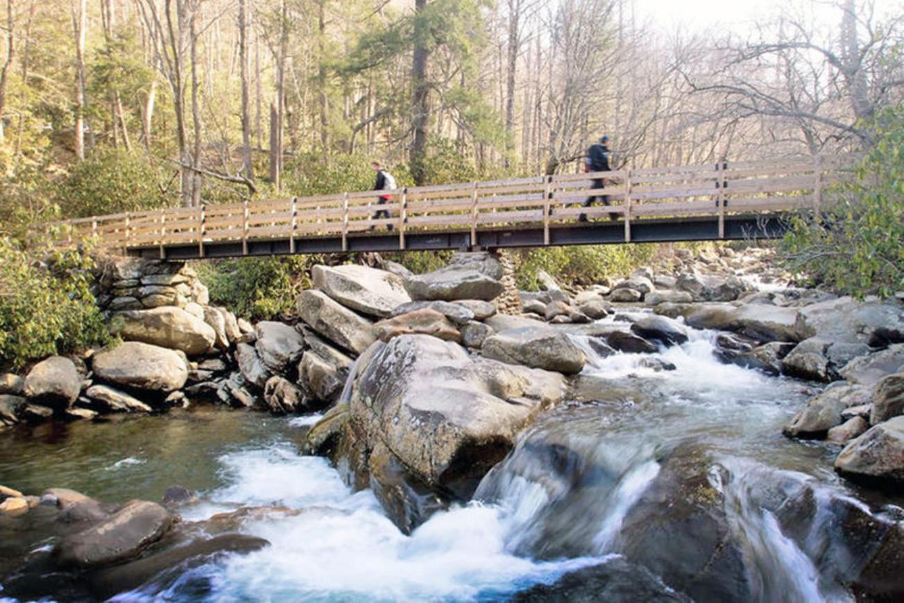
Get up close with nature on your next adventure in the Great Smoky Mountains National Park. Summer is one of the best times to hit the trails to see all that the park has to offer.
This trail is steep in places but well, if not heavily, traveled.
One switchback has a spectacular view of Cades Cove below, well worth the exertion once you get there.
At the top, the trail joins the road to a spot where one of the Smokies ’ fire towers used to sit. The National Park Service sold most of the towers and the Rich Mountain tower is no longer.
The trail follows the ridgeline a ways and then heads back down to the Cove. The trail comes out by Elijah Oliver’s cabin, one of the cove’s many scenic spots, and then returns to the parking lot through the gently rolling forest floor.
If you have only a few hours, not the whole day, try the Chestnut Top Trail just inside the Park boundary near Townsend. The trail begins just at the “Y” intersection. Don’t be dismayed by the steepness of the trail at the very beginning; this is the only really hard climbing you will have to do.
During the spring and summer, slowpokes climbing will have an added bonus. The mountainside is filled with wildflowers, many just at eye level. You don’t even have to stoop over to see them.
Once you reach the top of the hill, you walk through pine forest, across bright green mosses, into deciduous forests. Listen to Laurel Creek far below. There is wildlife along this trail, particularly birds. You can walk as far as you desire, then turn around and return to your car.
At about 4 miles, the trail intersects with the Schoolhouse Gap Trail.
For a day-trip into the wilderness where you are never far from “civilization” but probably will see few people, take the Foothills Parkway to Abrams Creek ranger station.
Go to Walland on Lamar Alexander Parkway (U.S. 321) and turn right onto the parkway. At the end of the finished section, Chilhowee Lake will be in front of you. Turn left and then take another immediate left. Travel through Happy Valley, one of the most picturesque residential communities in Blount County. Watch CONTINUED ON NEXT PAGE u
11 miles). But take a side trip, which will take a bit of scrambling, if you’re even the least bit adventuresome.
At Campsite No. 1, turn right and go up and over the mountain to Abrams Creek. This man way (it isn’t big enough to be a real trail by Park standards) goes up and down beside one of the Smokies ’ most scenic rivers. There is a campsite about 2 miles along this walkway that provides a swimming hole just a few feet away.
Another interesting walk begins across from the ranger station. You will cross Abrams Creek on a log bridge and enter a meadow where houses once stood.
If you have a full day, try traveling by car along the Foothills Parkway to Chilhowee Lake and then turn left onto Calderwood Highway (U.S. 129).
This very crooked road will eventually lead you to the Twenty-

Mile Creek ranger station and, a bit farther on, Fontana Lake.
From the ranger station there are several hiking trails and some of the most picturesque streams. You’ll cross a lot of them on most of the trails here.
What is locally known as the North Shore can be reached across Fontana Lake by strolling across the dam or by renting a boat.
Here, too, there is a possibility of seeing some of the Park’s wildest wildlife. Otters have been reintroduced into the Park in this area. There are also beavers and bears, even the possibility of a bobcat.
Many of the trails in this area are really old roads that settlers on the North Shore trail used. There is also a new shore trail that winds alongside Fontana Lake, a welcome walk during hot days.
Few of the trails, even on the traditionally crowded Fourth of July and Labor Day, are really crowded. There will still be (with the possible exception of Alum Cave Trail) long moments of strolling alone in the midst of verdant foliage.
There will still be moments of wonder at the wildlife, which can suddenly dart from the forest across the trail.
Be you a beginning hiker, an experienced one, or everything in between, there are trails in the Park that will let you experience the real Smokies.






Yesterday,Today and Tomorrow
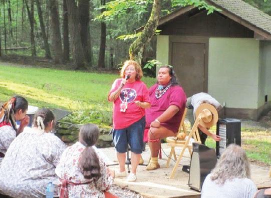
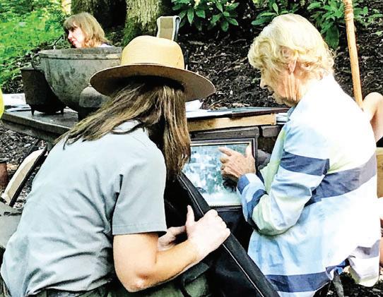
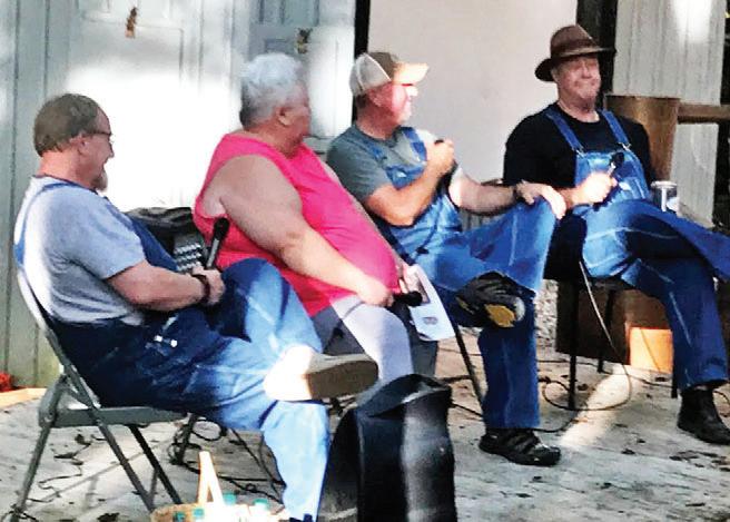
Honoring the rich cultural and natural history of the Cosby area through music, storytelling, and history walks.
CosbyCampground Amphitheater*
*In the event of rain, “Celebrating Cosby” programs will move to the covered picnic pavilion adjacent to Cosby Campground. Fridays, June 21st -July 19th,2024
June 21, 7:00 p.m.to8:00 p.m. Mountain EdgeBand
Enjoy traditional bluegrass music and the stories of Cosby families during this musical night! Featuring musicians: Judge Carter Moore (guitar and vocals), Andy Williams (mandolin and vocals), Kurry Cody (banjo and vocals), and Carty McSween (bass).
June 28, 7:00 p.m.to8:00 p.m. Cherokee Storytelling and Dance
Learn about Cherokee culture and stories through dance, music, and storytelling. Featuring members of the Eastern Band of Cherokee People, including Daniel Tramper, Dustin Tramper,and Sonny Ledford.
July 5, 7:00 p.m.to8:00 p.m. Honoring Those Who Serve
Honoring those who served and aPresentation of Quilts of Valor.Join Park stafftolearn aboutcommunity member ’s role in the military and public service, yesterday and today!
July 12, 12:00 p.m. to 2:00 p.m. Cosby Homecoming
Take astep back in time and learn from the locals about what daily life with like working and living in the Cosby community and Great Smoky Mountains National Park. Learn directly from families connected with the land.
July 19, 7:00 p.m. to 8:00 p.m.Moonshiners
White lightning, mountain dew,moonshine! Come distill myth from fact as you learn details of making moonshine in the mountains from Moonshine Legends, Mark Ramsey, Sally Clark, Digger Manes, and Kelly Williamson.






Debuting in 1967, the Beach Boys’ song “Good Vibrations” grew to fame.
Five decades later, it has remained popular for its catchiness and happy feelings.
Similar emotions arise for James Peifer and Scot Zalewski in whitewater rafting.
“Stress, bills — that stuff fades away,” said Peifer with a smile. “You’re breathing differently as you start paddling. It’s meditative.”
Fueled by their emotions, Peifer and Zalewski have founded Good Vibes Rafting and Tubing LLC — a new rafting opportunity on the French Broad River.
Visitors can register by phone at (865) 823-RAFT, or drop by the check-in building at 1650 East Highway 25-70 in Newport.
The co-owners’ friendship originated when they met in North Carolina, as Peifer — then a raft guide for Huck Finn Adventures — worked next to a shop that Zelweger owned.
“He’s always known that was my passion,” said Peifer. “We always discussed doing this.”
“What came together was having the land available and having
access to the river,” added Zelweger.
When land became available, they capitalized.
They are far from the first group to run trips on the French Broad, but they are the first company in Cocke County to have permits to run commercially.
“There are no regulations for the French Broad, so we are working with the county to draft plans,” said Zelweger. “Because they only have plans for the Pigeon River right now.”
“It’s really interesting,” added Peifer, a 16-year veteran guide. “So we’re going above and beyond to make sure this is a commercially viable spot so other companies can come here too.”
For their company, they are operating in a tamer part of the river than the Section 9 rapids that flow across the state line.
“We’re Class I and II,” said Peifer. “Class II involves a bit of a hazard that you have to avoid, but on our escort trips — no guide in the raft, but you’re being escorted by a guide in another raft — we’re doing the upper six, so nothing more than a rock to avoid or getting stuck for a minute.
“Perfect for entry-level beginners. It’s more fun, if anything, if you mess up, because you’ve got to problem-solve.”
The rafter weight minimum is 50 pounds, so children
u
 (Photo via Scot Zalewski)
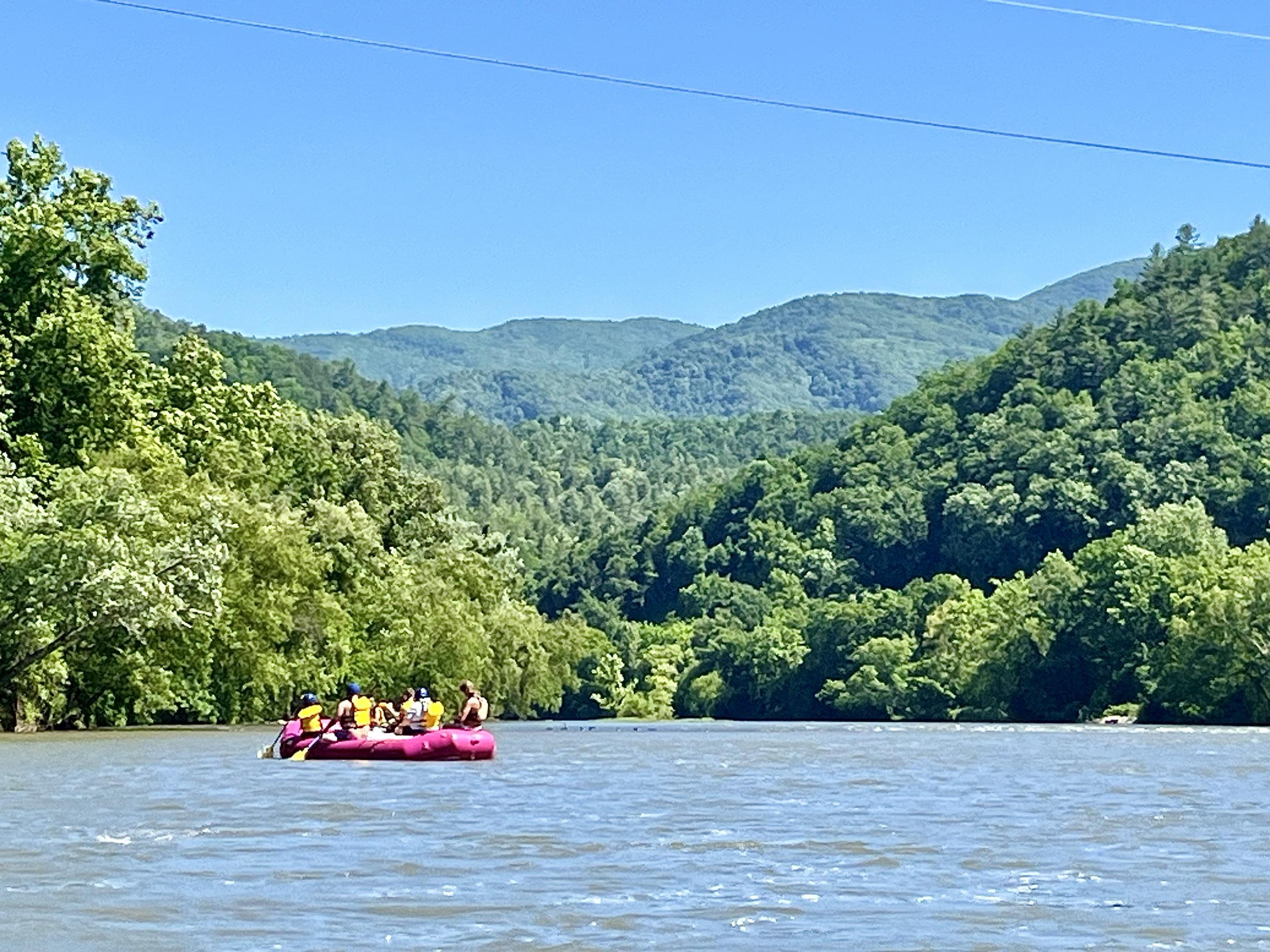
A Good Vibes rafting trip floats down the French Broad River in Newport.
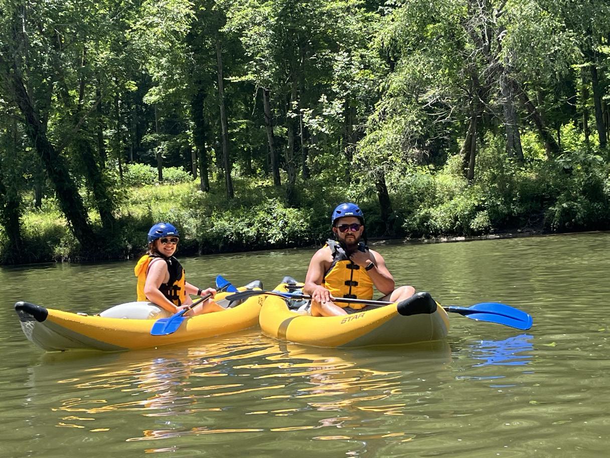
(Photo via Scot Zalewski) Kayakers enjoy a peaceful afternoon on the French Broad River, paddling in kayaks from the Good Vibes Rafting and Kayaking company in Cocke County.
(Photo via Scot Zalewski)
A Good Vibes rafting trip floats down the French Broad River in Newport.
(Photo via Scot Zalewski) Kayakers enjoy a peaceful afternoon on the French Broad River, paddling in kayaks from the Good Vibes Rafting and Kayaking company in Cocke County.

Vibes rafting guide James Peifer, top, stands and waves his arms during a trip down the rapids of the
approximately 7 years or older, and there is a maximum weight of 375 pounds.
Customers can ride in new rafts that run up to 14 feet, allowing up to 11 people including children in the middle.
Or they can rent rafts or kayaks and guide themselves with Peifer or another guide with more than a decade of experience serving as an escort.
“By starting smaller, our guides have had all our training, made all our mistakes,” said Peifer. “You’re getting super experienced guides. You won’t get that with a big company. It’s just not possible.“
“And it’s really hard to buy a raft, but you can rent one for $180 and get the chance to fall in love with the sport,” he added. “There’s no other companies in this area where you can rent a raft.”


In their first few weeks of running the river, Peifer and Zelweger have welcomed guests from Texas, Ohio and Florida.
But they want to cater to the local market too, offering a 15% discount to Cocke Countians.
“We want to come across that it’s a familyfriendly section of river, we’re a familyfriendly company,” said Peifer. “We’re hoping this is an entry point for people to fall in love with this.”


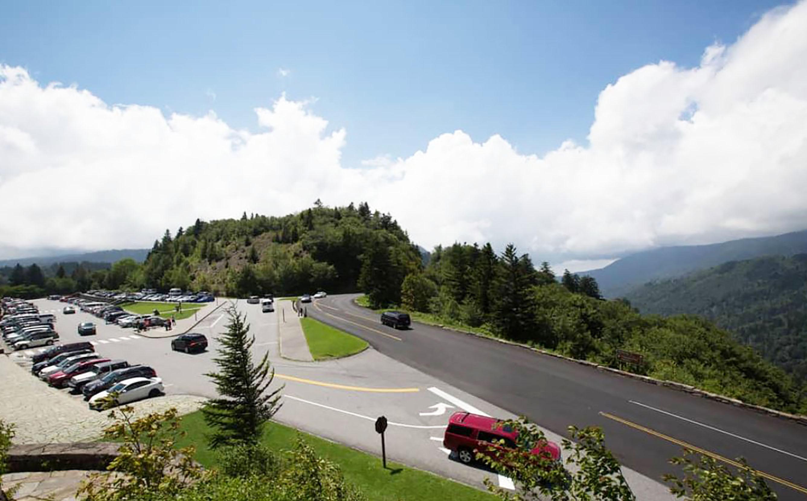
There are three parking tag durations available for purchase. A daily pass is $5, a weekly pass can be purchased for $15, and an annual parking tag is $40. The prices are the same for all vehicle types and sizes.
• Physical parking tags must be displayed in the vehicle, and digital tags will not be accepted.
• Each tag is only valid for a single vehicle and it must include the license plate number of the vehicle it is displayed in.
• Parking tags may be purchased online and onsite at locations within the park.
• Parking tags will be required anywhere within the boundaries of the Great Smoky Mountains National Park for vehicles parked for more than 15 minutes.
• Parking tags will not be replaceable, refundable, transferable, or upgradeable.
• Annual parking tags must be displayed in the front, lower passenger side windshield.
• Daily and weekly tags must be placed face-up on the lower side of the passenger side dashboard.
There will be a variety of options for those who are looking to purchase their parking tags, including:
• Purchasing an annual parking tag through Great Smoky Mountains Association and having it shipped straight to your door.
• Purchasing both daily and weekly parking tags through recreation.gov and printing them off at home. Note that the park will not be able to print your parking tag for you.
• Purchasing all variations of parking tags onsite at welcome and visitor centers across the national park. The locations where you can purchase your parking tag in person include the Gatlinburg Welcome Center, Sugarlands Visitor Center, Townsend Visitor Center, Cades Cove Visitor Center, Great Smoky Mountains Institute at Tremont Store, Clingmans Dome Visitor Center, Oconaluftee Visitor Center, Swain County Visitor Center, and Visit NC Smokies Visitor Center.
CONTINUED ON NEXT PAGE u
• Daily and weekly parking tags are available for purchase by credit card from automated machines available throughout the park. Guests will be able to access machines year-round, 24 hours a day.
Do parking tags guarantee a parking spot?
No, parking tags will not guarantee a parking spot at a specific location or for a specific time.
What are the consequences of failing to purchase a parking tag?
Failure to comply with the parking tag guidelines may result in a warning, citation, or your vehicle being towed at your expense.
When do daily and weekly tags expire?
Daily and weekly parking tags will expire at 11:59 pm ET on the date that is listed on the tag.
Are vehicles with disabled parking placards exempt?
Yes, visitors with valid, state-issued disabled tags are exempt from having to purchase a parking tag.
How are proceeds from the parking tags being used?

All revenue generated from the parking tags is being directly put back into the operational costs for managing and improving services for guests, including trail maintenance, trash removal, and staffing increases.
Will there be a limit on the number of parking tags sold?
No, the park does not limit the number of parking tags sold on any given day or week.


Alot goes into aSubaruvehicle .We build in our de dication to safety and theindustr y-leadingbreakthroughs it inspires .Weassemble all our preciselyengine ered designsto deliverconfident capabilit ynomatter theweather or road conditions— or if there’sany road at all. Andweput in thecareand qualit ythatmakes a Subaru vehicle avaluethatlasts mile aftermile. It ’s whyyou’llfind so much to love inside ever ySubaruvehicle we make .


:info@graysonauto.




Divided into the southern and northern sections by the Great Smoky Mountains National Park, the Cherokee National Forest is the largest tract of public land in Tennessee consisting of 650,000 acres. It joins other national forests in Georgia, North Carolina and Virginia.
There are more than 700 miles of trails and 30 developed campgrounds, several picnic areas and 30 developed campgrounds

in the national forest. The Pigeon River Area, which is between the French Broad and Pigeon Rivers, offers Cherokee National Forest land in backcountry pockets nestled against rural Cocke County.
Round Mountain in Del Rio is continuously ranked as the top tent camping campground in Tennessee. You can hike a section of the Appalachian Trail in the area, or you can spend the day fishing or rafting. There are also opportunities for horseback riding as well.
Visitors can enjoy an amazing sunrise atop Rocky Top Mountain, which requires a high clearance vehicle to travel scenic Forest Road 402. A hike across Snowbird Mountain between Max Patch and the Pigeon River on the Appalachian National Scenic Trail offers beautiful views.
A five-mile multi-use loop option is available to hikers, bikers and equestrian use an includes Stone Mountain Trail No. 9 and Mill Creek Road.
The part of the Pigeon River known as Pebble Beach is home to a variety of birds, such as kingfishers and herons. Birdwatchers can see yellow-breasted chats and prairie warblers along the dry piney ridges in the area. Trout fishing is popular in Brown Gap Creek and Gulf Fork.
Round Mountain Recreation Area, which is in the vicinity of Wolf Creek, is a campground at one of the higher elevations
CONTINUED ON NEXT PAGE u



22 Visiting The Smokies Summer 2024
in Cherokee National Forest. At that altitude, there are dense rhododendrons, magnificent hardwoods and a small mountain stream, all of which contribute to cooler temperatures even during the hot summers.
There are 16 campsites that include fire rings, lantern posts, picnic tables, potable water and a vault toilet at Round Mountain Recreation Area. Because access is remote and visitors must travel along curvy gravel roads, only tent camping and small camping trailers are recommended. Nearby in the Great Smoky Mountains National Park visitors can camp at Big Creek. Big Creek also has equestrian facilities.
The French Broad River is the third oldest river in the world, and

is one of the original rivers included in the 1968 Tennessee Scenic Rivers Act. History buffs, anglers, birdwatchers, boaters, kayakers and nature lovers all can enjoy what the river and its banks have to offer. The river is inviting to both kayaking and canoeing.
Commercial rafting operations are from Hot Springs, North Carolina, to Del Rio with rapids ranging from class I to class III. There are 13 miles of commercial rafting in the vicinity. If you have your own boat or kayak, river access is available at Weaver’s Bend and the French Broad boat launch, which is near Wolf Creek off Highway 25-70.
The river is home to smallmouth bass, catfish, blue gill, carp, rock bass, crappie and sauger. The French Broad River has many tributaries that support trout. Nature and wildlife viewing sites are available at French Broad Fields and at Weaver’s Bend. .
 The French Broad River boat launch is located off Highway 25-70 near Wolf Creek.
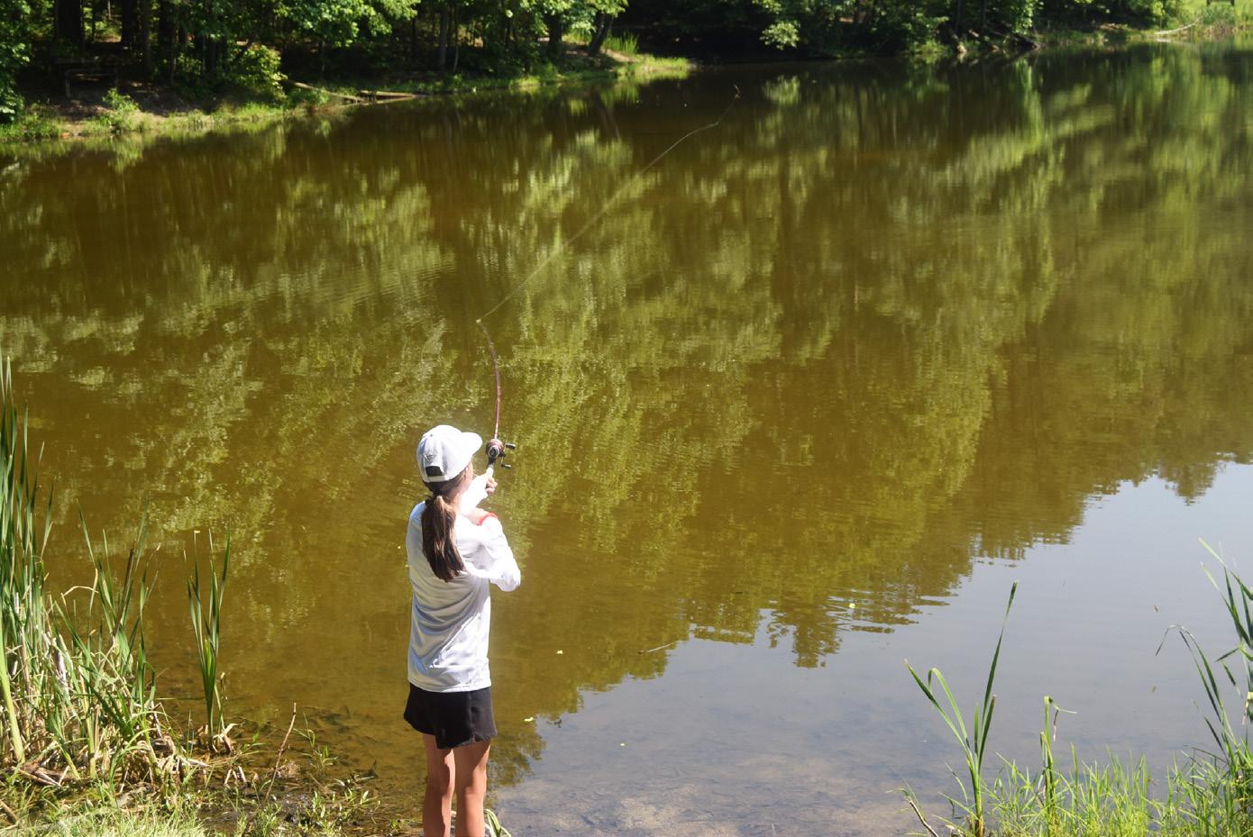
Jesslyn Ashby is shown fishing. Fishing is popular in the area with many rivers, lakes, ponds and streams available.


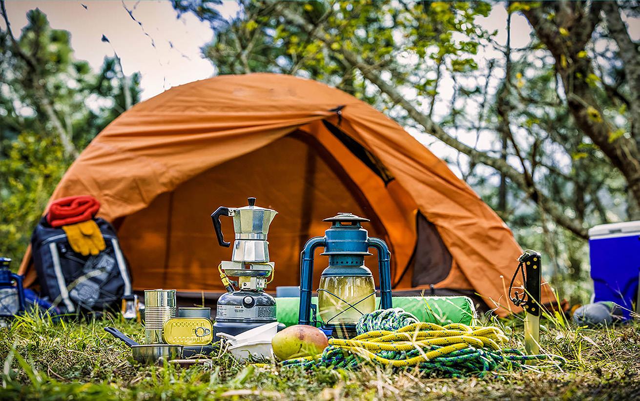
The Great Smoky Mountains National Park offers several different types of campsites: Backcountry, for backpackers, which requires hiking several miles to a site located in the park’s backcountry. Front country camping near your car in a developed campground that has restrooms with cold running water and flush toilets.
Each individual campsite has a fire grate and picnic table. Group Campgrounds are large campsites suitable for groups of eight people or more and are located in front country campgrounds. Horse Camps-Small campgrounds, accessible by vehicle, which offer hitch racks for horses and primitive camping facilities.
Campground facilities and the procedures for obtaining a site in each type are different, and in many cases, reservations are required.
For more information on camping in the Great Smoky Mountains National Park, visit their web site at www.nps.gov/ grsm, or call visitor information at (865) 436-1200.
CHEROKEE DAM CAMPGROUND
This is a self-service campground. (800) 882-5263. Forty-two campsites with water and electric hookups, restrooms with heated showers and flush toilets, dump station, children’s play equipment, picnic tables and grills, group pavilion available by reservation, swimming beach, boat ramps above dam and below dam, lake and river fishing, paved walking trail and bird watching.
BIG RIDGE STATE PARK
Big Ridge has 50 campsites on or near Norris Lake to accommodate RV’s, trailers, and tent campers. RV campsites have a paved slip and a soft gravel pad and can accommodate a unit up to 35 feet. Each site has water and 50-amp electrical hookups, picnic table and grill. A dumping station is provided, as well as three bathhouses with restrooms and hot shower facilities. Bathhouses #2 and #3 are closed during the off-season from November 1 to March 31.
Address: Big Ridge State Park, 1015 Big Ridge RoadMaynardville, Tennessee
Contact 800-471-5305 or 865-992-5523 at the Park Office for more information.
COSBY CAMPGROUND
The 157-site Cosby Campground is located in Great Smoky Mountains National Park and approximately 5 miles south of Cosby in Cocke County.
Only 26 sites in the Cosby campground are available by reservation while the remaining sites are available only on a first come, first served basis. Except on holiday weekends, there are
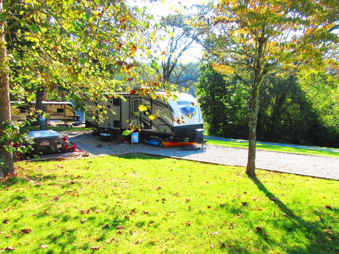
Directions: From Cosby, proceed south on TN 32 about 1.5 miles south of the junction with US 321. Turn right at Cosby sign. Campground is another 2 miles.
The Cove Lake visitor is served with 106 campsites. All sites are equipped with water and electrical hookups, and most with grills and tables. A dump station is available, as are two modern bathhouses containing hot showers, commodes, and lavatories. Stay limit is two weeks. Tents are allowed on all the campsites.
Rates: $20
Taxes and fees are not included. Rates are subject to change. $3 reservation fee per site is non-refundable.
Address: Cove Lake State Park, 110 Cove Lake LaneCaryville, Tennessee 37714
For more information about Cove Lake State Park contact 423566-9701.
DOUGLAS DAM HEADWATER CAMPGROUND
This is a self-service campground (800) 882-5263. Sixtyfive campsites, 61 with water and electric hookup and two handicapped-accessible sites. Restrooms with heated showers and flush toilets, dump station, picnic tables, swimming beach, boat ramp, walking trail, wildlife viewing area, bird-watching.
Trotter Bluff Small Wild Area features walking trails through 30 acres of mature hardwood forest, limestone sinkholes, spring wildflowers and vistas of the dam and tailwaters. Directions: 1680 Boat Launch Road, Sevierville, TN 37876. Near Sevierville, Pigeon Forge, and Gatlinburg. From Interstate 40 take exit 407. Go south on Highway 66 then 3.5 miles east on Highway 139, then 2.5 miles south on Highway 338, then follow signs 1 mile north to campground.
DOUGLAS DAM TAIL WATER CAMPGROUND
This is a self-service campground (800) 882-5263. Sixty-two campsites with water and electric hookup and two handicappedaccessible sites. Restrooms with heated showers and flush toilets, dump station, children’s play equipment, picnic tables and grills, group pavilion available by reservation, boat ramp, river fishing with fishing pier, bait and tackle shop, wildlife viewing area, birdwatching
829 Riverview Way, Sevierville, TN 37876
Near Sevierville and Pigeon Forge/Gatlinburg. From Interstate 40 take exit 407. Go south on Highway 66, then 3.5 miles east on Highway 139, then 0.5 miles south on Highway 338 to campground.
The park has 222 campsites in five different areas. All sites have tables, grills, water, and electricity and are served by six bathhouses. 92 sites have sewer connections. Some sites will accommodate an RV up to 45 feet in length. Ice and firewood may be purchased year-round. In addition to the 222 campsites there are 16 primitive sites, 9 are walk in the other 7 are park on. There are 3 backcountry sites on the overnight backpacking trails. Most campgrounds are accessible by persons with a disability.
Rates: $11 — $25: Taxes and fees are not included. Rates are subject to change. $3 reservation fee per site is non-refundable.
Address: Fall Creek Falls State Park, 2009 Village Camp RoadSpencer, Tennessee 38585
Contact 1-800-250-8611 for camping Information & Reservations.
The Hiwassee State Scenic Rivers’ Gee Creek campground is a haven and a home-away-from-home to many river users. Campsites are more tent-friendly than most. Some of the campsites are close enough to the river to be lulled to sleep each night by the sound of rushing water. An easy walk will lead you along the rivers edge for fishing, nature walks or a brisk dip in the cold waters.
Gee Creek primitive campground has 47 sites, each with a table, fire ring and a grill. There is a fee for their use and the stay limit is two weeks. Public water and a bathhouse containing sinks, commodes, and hot showers are located near the center of the campground. The bathhouse is available to campers at no additional charge.
Gee Creek offers a Group Camp field with 8 separate group campsites. These sites vary in size.
Rates: $12 — $80
Taxes and fees are not included. Rates are subject to change. $3 reservation fee per site is non-refundable.
Address: Hiwassee / Ocoee State Park, 404 Spring Creek Road Delano, Tennessee 37325
Contact 423-263-0050 for more information.
Indian Mountain is a popular camping park. There are 47 sites with paved pads to serve both tent and RV campers. The sites have water, electricity with 30-amp breakers and a dump station. All sites have picnic tables and grills, which are located throughout the camping area. A modern bathhouse with restrooms and showers is available to campers. Indian Mountain’s campground is open
year-round. The campground is winterized (all water including bath-house is turned off) from November 1 — March 31.
Rates: $17 — $20
Taxes and fees are not included. Rates are subject to change. $3 reservation fee per site is non-refundable.
For information about Indian Mountain State Park contact 423784-7958.
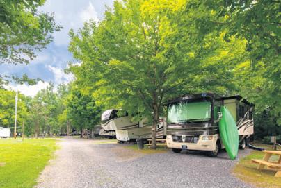
The KOA campground in Newport, TN provides a unique camping experience with the many amenities that it offers.
The campgrounds have electrical hookups, Wi-Fi, Cable TV, Snack Bar, Pool and Pavilion. Firewood and Propane are available for purchase as well.
Directions: From I-40: Take Exit 432-B to 25W-70, then 1.6 miles to KOA on right. From I-81: Take Exit 8 to 25E south for 12 miles, then right on 25W-70 to KOA 1/3 mile on left.
The Cherokee National Forest surrounds Martha Sundquist Forest on three sides and is just a short drive for visitors in Tennessee and North Carolina. There are six campsites along the graveled road that runs through the forest. A permit is not needed to stay at any of the campsites, but there is a 14-day maximum to allow others the chance to enjoy the area.
Directions: From downtown Hartford, TN follow Big Creek road onto Gulf Road 8.8 miles to the entrance of Martha Sundquist State Forest. The campsites are spaced out generously along two gravel roads.
The park has two campgrounds. A dump station is located at each campground. All sites have a table, grill and fire pit. A bathhouse is centrally located in each campground, open during the in-season. A laundromat is located next to the park office,

Visiting The Smokies Summer 2024
open seasonally. The maximum stay during in-season is 14 nights, and during off-season is 28 nights. The East side has 25 sites with water and electric hook-up and 10 primitive sites for tents only, with no water and electric hook-up. The west side has 50 sites with water and electric hook-up. The west side also has three paved sites suitable for persons with disabilities. If reserved, proper identification will be required upon check-in.
Rates: $8 — $20
Taxes and fees are not included. Rates are subject to change. $3 reservation fee per site is non-refundable.
Address: Norris Dam State Park, 125 Village Green Circle Rocky Top, Tennessee 37769
For information contact 865-426-7461.
PIGEON RIVER CAMPGROUND
3375 Hartford Road, Hartford, Tennessee, 37753
Next door to Smoky Mountain Outdoors White Water Rafting
Cabins on the river, RV hookups, Tent camping, Swimming pool and Adventure packages available.
For Reservations call 1-844-766-2267.
CAMPGROUND
Camping and picnicking are on a first-come, first-served basis.
Located on the banks of Paint Creek, the campground offers18 single sites and two double sites each equipped with grill/fire ring.
Camping fee is $10 per night for single site or $20 for a double site. Cherokee National Forest: Lower Paint Creek Rd Greeneville, TN 37743.
All of the park’s 107 family campsites have a grill and picnic table and are located near a bathhouse with hot showers. A dump station is located at the campground check-in.
The campground has 87 RV sites with water and electric hookups and 20 tent sites, each with water. The tent camping area does not have electric hookups.
Four group sites, which will accommodate approximately 25 people each, are available to non-profit groups. These four sites may be reserved up to two years in advance.
Rates: $11 — $27.50
Taxes and fees are not included. Rates are subject to change. $3 reservation fee per site is non-refundable.
Address: Roan Mountain State Park, 1015 Hwy 143Roan Mountain, Tennessee 37687
For more information about Roan Mountain State Park contact 423-722-0190.
The Tana-See Campground provides the opportunity to turn your weekend into a special memory.
Tana-See is located off I-40 near exit 432B in Newport. It’s only 45 minutes to Pigeon Forge and Gatlinburg.
The new owners have upgraded several of the amenities on the property.
The campground boasts upgraded electrical services, laundry, remodeled bathhouses, and an overall improved grounds.
Tana-See has everything your family will need to enjoy their next camping experience.
Play horseshoes, putt-putt golf, or on the playground. The pool also provides cooling relief of hot summer days.
The campsites are pet friendly and are available for special events.
Tana-See Campground is located at 112 Carson Springs Road. For more information call 423-415-5000, or visit www. tanaseecampground.com.
Triple Creek Campground is a family owned and operated campground surrounded by the beautiful mountain creeks of the Great Smoky Mountains. They are a short drive from Pigeon
Forge and Gatlinburg. Most of their campsites are located creekside with large shade trees. Some of the things you will find at the campground are RV, camper and tent camping sites, camper nightly rentals, a camp store, tubing, fishing, outdoor games, kids’ playground, outdoor live music, special events, and more. Located around you will find some of the best home style restaurants, like Carver’s, The Woodshed and Janice’s. There are also hiking trails like Mt. Cammerer and Greenbrier. The Foothillls Parkway, whitewater rafting, Douglas Lake, Chattahoochee Valley, Asheville, NC, Maggie Valley, Cherokee, NC, Hot Springs and many other places are located close by. So come let us help you make the most of your family camping experience. Triple Creek Campground looks forward to seeing you this year.
Located at: 141 Lower Bogard Rd. Newport, TN 37821
Visit: www.triplecreekcampground.com for more information.
TVA operates 80 public recreation areas throughout the TVA region, including campgrounds, day-use areas and boat launching ramps. TVAs 11 seasonal campgrounds on reservoirs throughout the Tennessee River Valley will open for the 2011 recreation season on Friday, March 18. The campground season runs through Nov. 14.
In response to stakeholder input, three sites will remain open through Dec. 12: Douglas Dam Headwater Campground, Douglas Dam Tailwater Campground and Pickwick Dam Tailwater Campground.
Camping with campfires is a traditional way of enjoying the outdoors. However, moving firewood from county to county can spread pest infestations that kill trees. TVA recommends buying firewood that was cut locally; preferably within the same county where it will be burned.
With water and/or electric hookups: $20.
With water, electric and sewer service: $24; with out hookups: $16.
For Picnic Pavilion Reservations call our toll free number, (866) 494-7186. There is a flat fee of $50 for pavilion use.
The park has 134 campsites, all with tables and grills, and 94 are equipped with water and electric hookups.
The other 40 sites are located in the overflow campground, which is only open from Memorial Day — Labor Day. Modern bathhouses provide hot showers and lavatories. Renovations to the men’s bathhouse were completed in 2015. There are 2 dumping stations available for self-contained RV’s and Trailer rigs. Length of stay is two weeks year around. The campground check-in station is located near the campground entrance.
Rates: $11 — $20
Taxes and fees are not included. Rates are subject to change. $3 reservation fee per site is non-refundable.
Address: Warriors’ Path State Park, 490 Hemlock RoadKingsport, Tennessee 37663
For more information contact 423-239-8531.

There are nearly 600 miles of fishable streams in Great Smoky Mountains National Park. Every stream in the Park is open for fishing and harvest year round; the waters are clean and clear and hold lots of fish, mainly brook, rainbow and brown trout. Smallmouth bass are found in the lower elevations of the Park, around 2,500-feet elevation. Catch-and-release is not required anywhere in the Park, and you are encouraged to keep and enjoy your catches.
Before you go fishing, be sure to thoroughly clean shoes, waders and all equipment that touch the water to prevent the transportation of invasive species to the pristine waters of the Park.
Licenses: The Park does not issue its own license for fishing, but a valid state license is required from Tennessee (ages 13 and older) or North Carolina (ages 16 and older). Supplemental trout stamps are not required. The Park does not sell licenses, but they are available at many retail stores. Tennessee regulations allow ages 12 and under to fish without a license and take a full limit.
Tennessee Residents: A regular annual hunt/fish license is $34; supplemental annual trout-only license (outside the Park) is $22. A one-day license for all fish (includes trout) is $11.50. Ages 13-15 can get an annual junior fishing license (includes trout) for $10; Non-resident license, no trout outside the Park: Ages 13-15, junior hunt/fish $11; annual fishing $50; three-day permit, $20.50; 10-day permit $30.50.
Non-Resident license, all fish allowed in and out of the Park: Annual fishing $99; three-day permit $40.50; 10-day permit $61.50.
Gatlinburg: Additional special permits are required for trout in the Gatlinburg city limits, residents and nonresidents, ages 13-64. For more information call 800-568-4748.
Fishing Times: Fishing is permitted year-round from a half-hour before sunrise to a half-hour after sunset.
Daily Possession Limit: Five fish in any combination of trout and smallmouth bass. Possession includes fresh fish, those stored on ice or otherwise preserved. An additional 20 rock bass are allowed in possession. Anglers must not harm fish when releasing them and must stop fishing as soon as the limit is reached.
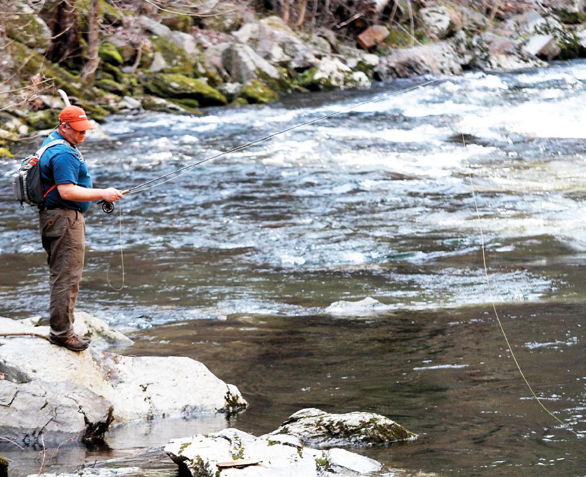
Dave Coena from Wisconsin spends the day fishing in the Great Smoky Mountains.
Size Limits: Brook, brown and rainbow trout and smallmouth bass have a minimum limit of seven inches. Rock bass has no size limit.
Lures, Bait and Equipment: Only one hand-held rod is allowed per person. Only artificial lures or flies with a single hook are allowed, with up to two flies per leader. Use or possession of any form of fish bait or liquid scent is not allowed; a partial list includes: minnows live or preserved, worms, corn, cheese, bread, salmon eggs, pork rinds or natural baits found locally.
For more information go to www.nps.gov/grsm/planyourvisit/fishing.


The Great Smoky Mountains abound with the two ingredients essential for waterfalls — ample rainfall and an elevation gradient.
Every year more than 200,000 visitors hike well-worn trails to view Grotto, Laurel, Abrams, Rainbow and other popular waterfalls in Great Smoky Mountains National Park. Large waterfalls attract the crowds, but smaller cascades and falls can be found on nearly every river and stream.
According to the Park website, “The Great Smoky Mountains abound with the two ingredients essential for waterfalls — ample rainfall and an elevation gradient. In the Smokies high country, over 85 inches of rain falls on average each year.
During wet years, peaks like Mount LeConte and Clingmans Dome receive over eight feet of rain. This abundant rainfall trickles and rushes down the mountain sides, from high elevation to low, sometimes dropping a mile in elevation from the high peaks to the foothills at the Park’s boundary.”
Park officials caution the public not to climb on rocks near the waterfalls. Over the years, several people have fallen to their deaths and many others have suffered serious injuries from climbing on rocks near waterfalls or along the riverbanks. These rocks are slippery due to mist and algae.
The area’s mixture of steep terrain and streams make for an abundance of waterfalls. Some of the waterfalls in the Smokies are particularly beautiful and perfect getaways for a day of relaxation, and Spruce Flats Falls in the Tremont Area of Great Smoky
Spruce Flats is known as the hidden gem of the southern end of the Park by local hikers and can only be found in guidebooks. The hike to the falls is short, around 1.3 miles, and moderate with a small climb in the beginning, but worth the walk.
The trail leads from the Institute at Tremont directly to the bottom plunge pool of the roughly 30-foot falls following a small cascade. The area around the pools of the falls and cascade makes an excellent spot for lunch or to hang a hammock for the day to relax.
Not far from Spruce Flats, there is another hidden beauty known as Indian Flats Falls. It is yet another perfect location for a picnic lunch and some hang time in a hammock. The Middle Prong Trail at the end
of Tremont Road is the access trail to reach the falls and is another moderate hike. There is not as much of a climb, but the hike is longer at around 3.8 miles from the trailhead to the falls.
Rhododendron thickly covers the surrounding area of the falls
and helps hold in the cool, damp air chilled by Lynn Camp Prong tumbling over the falls. What Indian Flats lacks in height it makes up for in pure beauty and is a must see if there is enough time during a visit to the Smokies.
Tremont is a well-kept secret and a very spectacular place, but is not the only locale in the Park that offers excellent waterfall viewing. The Greenbrier area of the Smokies contains another beautiful sight in the Ramsey Cascades.
The hike to the falls is scenic with beautiful old growth forest sections along the trail, but is challenging and considered strenuous in difficulty as it gains 2,000 feet in elevation in four miles.
Ramsey Cascades is over 100 feet in height and is a little grander in appearance. The quickly falling water generates a refreshingly cool, damp breeze that can be enjoyed from the rocks below.
One final waterfall that should not be missed is the Lower Falls on Slickrock Creek in North Carolina. This waterfall is located in the Cherokee National Forest and takes extra effort to reach. The access, trail No. 42 on the National Geographic Map 781, is a moderate walk but on the longer side at around five miles from the trailhead to the falls.
The drive is where the effort comes in because it is located just across Calderwood Lake at the end of “The Dragon” on U.S. 129. Directly across the lake at the end of the ridge there is a gravel
parking area where the trail begins. The hike follows the lake and then abruptly turns to follow the creek. Slickrock is one of the most beautiful creeks throughout the Southern Appalachians and offers numerous swimming opportunities well before the falls.
Once at the waterfall, Slickrock Creek roles over about a 20foot drop into an incredible deep, blue swimming hole with frigid water, even in August!
Instead of packing into a water or amusement park or fooling with a lukewarm lake, think outside the box this summer and venture out to someplace new and cool; waterfalls are just the beginning.




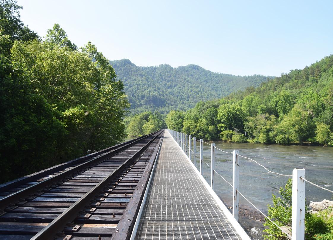
There is a large railroad bridge that crosses the French Broad River at Weaver’s Bend. The bridge goes from Tennessee to North Carolina.
Traveling east from Newport, Tennessee toward Hot Springs, North Carolina, along Highway 25-70, you will come to Del Rio, Tennessee. As you pass through Del Rio, about 11 miles from Newport, you will see a brown national forest sign on the left of the roadway indicating Allen’s Branch Pond and Weavers Bend.
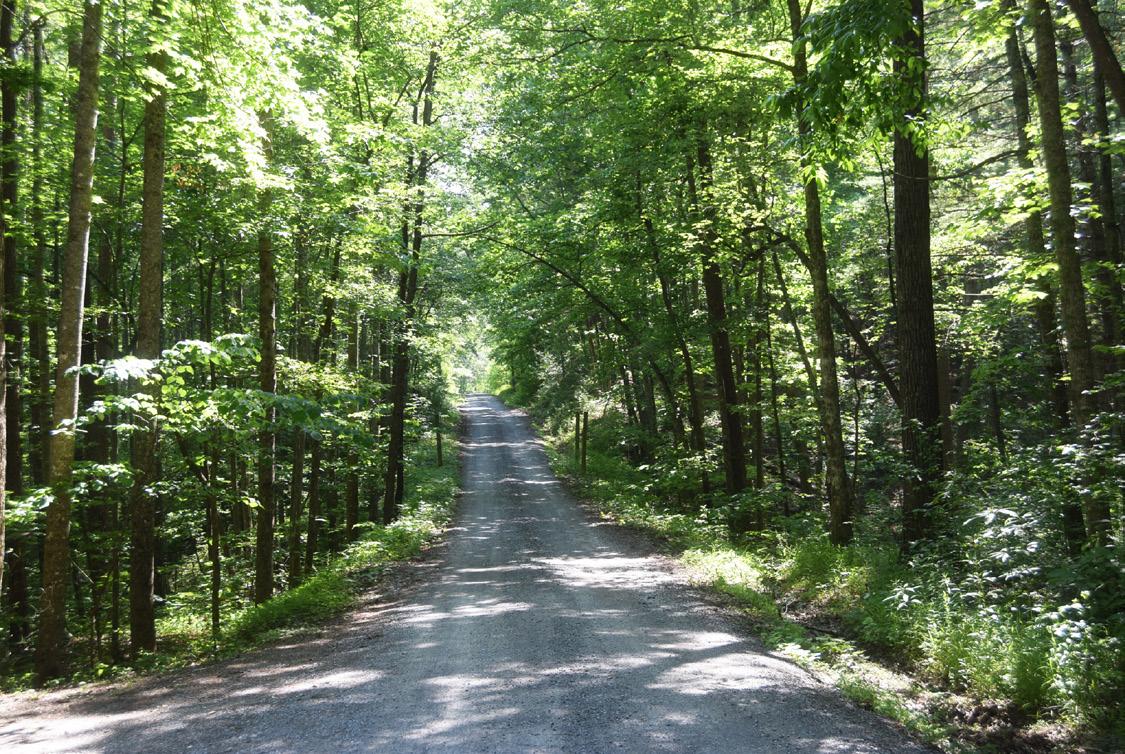
Turn left at the sign onto the well-maintained gravel road. There are pullover spots in the event there is oncoming traffic, so keep a lookout ahead because the roadway is narrow. You will travel about three miles before reaching Allen’s Branch Pond, which is on the right of the roadway. There is a small parking area that will accommodate four or five vehicles. Additional cars can park alongside the road.
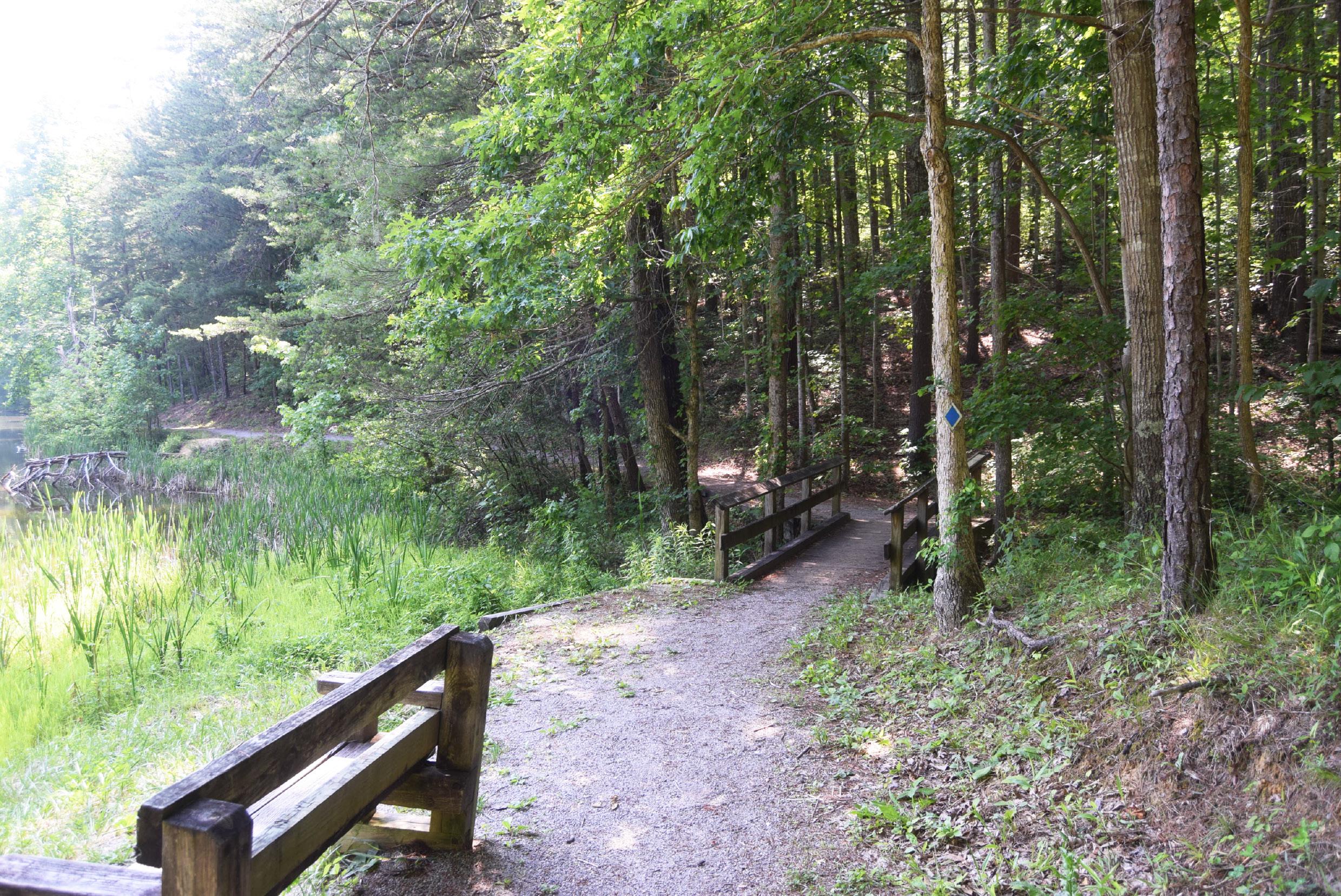
The two-and-a-half acre pond is well-stocked with bass, catfish and bluegill. There is a one-half mile interpretive trail that completely goes around the pond, and there are small fishing piers. Flora and fauna surround the pond, creating a warm-water ecosystem.
Turtles, frogs, deer and other animals can be seen around the pond area as well. Tennessee state fishing regulations do apply to fishing at Allen Branch Pond.
Travel farther past the pond on the gravel roadway - about three more miles - and you will come to Weaver’s Bend. Weaver’s Bend Road runs from its intersection with Brush Creek to the French
Broad River. The roadway transitions from a gravel road to a dirt road. Along the road are several marked campsites, and many of them are riverside. There is a 14-day maximum stay at any campsite at Weaver Bend.
When you get near the end of the roadway at Weaver’s Bend, you will cross the railroad tracks. This is an active Norfolk-Southern rail line. On the right hand side of the crossing is the Lower Twin Bridge, which is bridge number two across the French Broad River between the Morristown Junction and Asheville, NC. This bridge was constructed in 1927 by the Virginia Bridge and Iron Company. The four-span bridge consists of Baltimore through trusses, and it is only one of two bridges in Tennessee that are of the Baltimore truss style. Each span is 110 feet long, and all have been skewed positively 30% because of how the bridge approaches
CONTINUED ON NEXT PAGE u
A Baltimore truss design makes up a railroad bridge that is located at Weaver’s Bend. This through truss bridge was built in 1927 to replace a bridge that had been built in the 1880s in the same spot
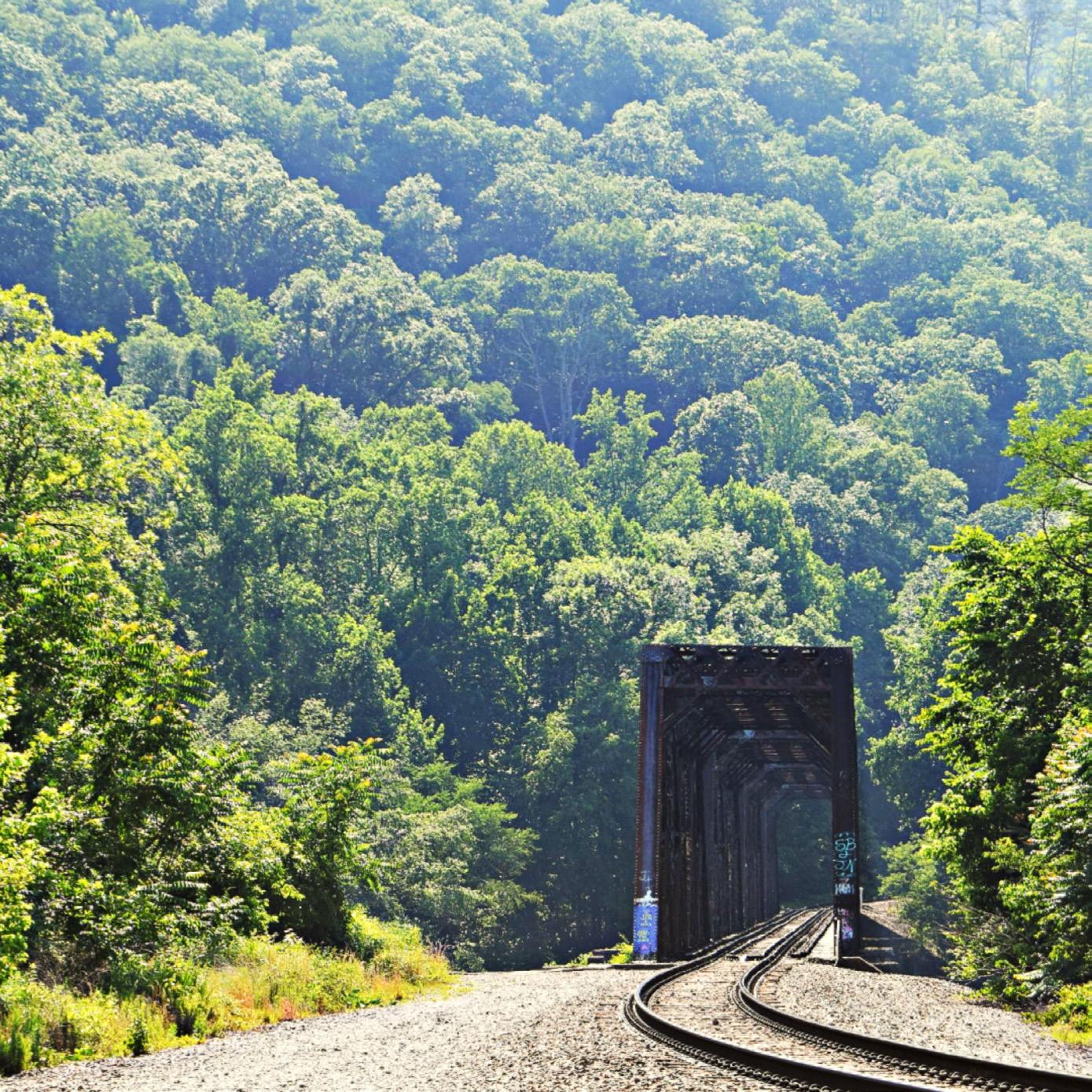
approaches the riverbanks’ curves. The bridge has a total length of 541 feet.
Newer concrete piers on the bridge are attached to the older stone piers, which gives indication that the bridge served as a replacement of an original bridge, which was set on the stone piers. The original bridge that sat in the same spot was built in the 1880s to connect the old East Tennessee, Virginia and Georgia Railroad and the Western Carolina Railroad.
There is a second train bridge to the left of the crossing, and it reaches into North Carolina. The S-line does run this route, so
CONTINUED ON NEXT PAGE u



so remember to stay clear of the tracks and use caution when crossing the railroad tracks.
There is river access for fishing at Weaver’s Bend. The French Broad River is also a popular area for canoeing and kayaking.
When you leave Weaver’s Bend, you can turn back toward Highway 25-70 and pass Allen’s Branch Pond again, or you can turn right onto the paved roadway and head toward Highway 107. You will come out near Paint Creek and Houston Valley. Houston Valley Recreational Area and Campground are closed because of extensive damage caused by flooding.
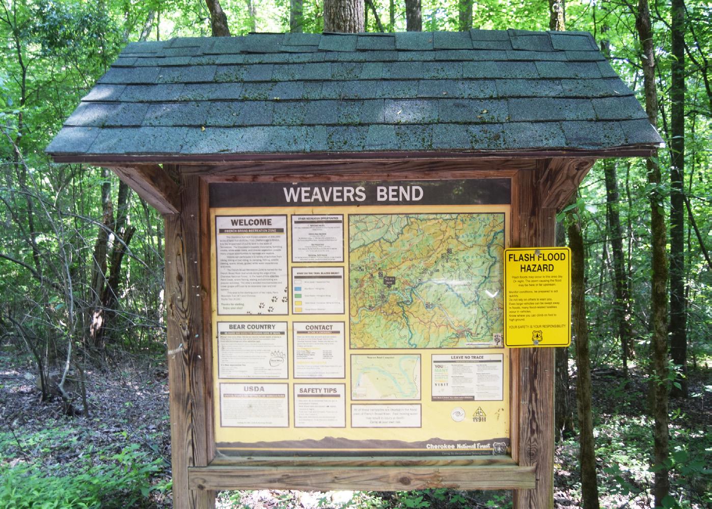
Weaver’s Bend, Paint Creek and Houston Valley have all suffered damage in the past because of flash flooding, so visitors are urged to use caution in the event of a storm or heavy rain.
Paint Creek, which is located in Greene County, has a picnic area and campground. The family-oriented campground, which
is tucked away in a mountain cove, has closed in the past because of bear activity. Before visiting the area, check to make sure that it is open. Tent camping and camping trailers are welcome with a fee charged for some activities. Camping spots are available on a firstcome, first-served basis for $10. The group size is limited to five people with two vehicles allowed per site.
Reservations are accepted by visiting https://www.recreation.gov/camping/campgrounds/10056245.




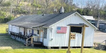
The Carolina Wren is just one of about 200 types of birds in the area, though it is more often heard than seen.
During your time in the Smokies, you’re more than likely to see some wildlife, especially within the Great Smoky Mountains National Park. While the area is widely known for American black bears, elk, and other furry critters, there are also dozens of species of fish, reptiles, and amphibians and over 200 documented species of birds that make their home within the park, whether permanently or just for the season. So, while you’re exploring the vast acreage of the GSMNP, keep a keen eye on the ground, in the trees, in the streams, and in the sky to see just how diverse the wildlife is!
According to NPS, a total of 65 unique species of mammals call GSMNP their home. From the same whitetail deer and raccoons you might see in your own backyard to elk and beavers, the ground is full of mammals. The elk in the park today are Manitoban Elk, which were introduced to the park in the early 2000’s to replace the Eastern Elk that had been hunted to extinction in the 19th century.

extinction in the 19th century. As of 2021, the elk population in the area was recorded to be 150-200 individuals. Visitors may also see skunks, foxes, and opossums, as well as a host of rodents, from mice to woodchucks.
Mammals aren’t the only animals on the floor of the park, though, not by a long shot. GSMNP is known as “The Salamander Capital of the World,” home to 30 species of highly populous salamanders. According to NPS, “the great majority of vertebrate (backboned) animals, including human visitors, in the park on any given day are salamanders.”
Notable species include the Hellbender salamander, which is the largest species of salamander in the park, and the red salamander. While you’re looking down, be sure to also keep an eye out for the eight species of turtles, nine species of lizards, and 23 species of snakes that roam the park’s more than 500,000 acres.
Between glances at the ground in front of you, take time to look up into the trees to catch a glimpse at some of the over 200 unique species of birds in the park. The vast range of elevation in
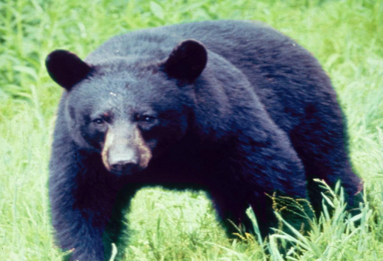
The American Black Bear is likely the most iconic resident of the Great Smoky Mountains National Park.
the park allows for an incredible variety of microclimates for the birds. Visitors can see northern birds such as the Golden-crowned Kinglet in higher elevations, and a mix of northern and southern birds, such as the Carolina Wren and the American Goldfinch in middle and lower elevations. Birding is it’s own adventure, and visitors are encouraged to bring binoculars to get a better look at the variety of birds, which changes with the seasons.


Also in the trees, be on the lookout for red and gray squirrels, chipmunks, and even amphibians like the Cope’s gray tree frog.
GSMNP contains over 2,100 miles of streams holding 67 unique species of fish, including brook trout, which are the only native trout to the area. There are several federally protected fish in the park, including the Citico Darter, the Smoky Madtom, and the Yellowfin Madtom. Efforts are in place to reintroduce these species into Abrams Creek. In addition to the fish, the park’s streams are home to unique insects, reptiles, and even occasionally Ross’ Geese.
Fishing is allowed in the park with proper licensing and permission, though there are limits to how many fish a visitor may catch per day. Smallmouth bass, rainbow and brown trout, and rock bass are the most popular among anglers, though trout and smallmouth shorter than seven inches must be immediately released. For more details about fishing regulations, visit the NPS website.
While observing the wildlife of the park can be exciting, there are a few things to keep in mind. Primarily, it’s always important to remember that the animals are wild and unpredictable. While NPS considers you a visitor of the park, the animals consider you a stranger in their habitat.
With regards to all animals, but bears and elk especially, it is incredibly important for the safety of the visitors and animals

It’s likely you’ll see a Whitetail Deer on your visit to the Smokies, though fawns like this are normally born in late spring.
alike that a safe distance is maintained. Even if an animal does not pose an immediate threat, any action that leads to the animal becoming more comfortable with humans could be dangerous in the long term. Note that it is illegal to willfully approach within 50 yards of a bear or an elk, or within any distance that disturbs or displaces the animal. More detailed instructions for handling encounters with these animals are available on the NPS website. As always, “ Take nothing but pictures and memories, and leave only your footprints.”


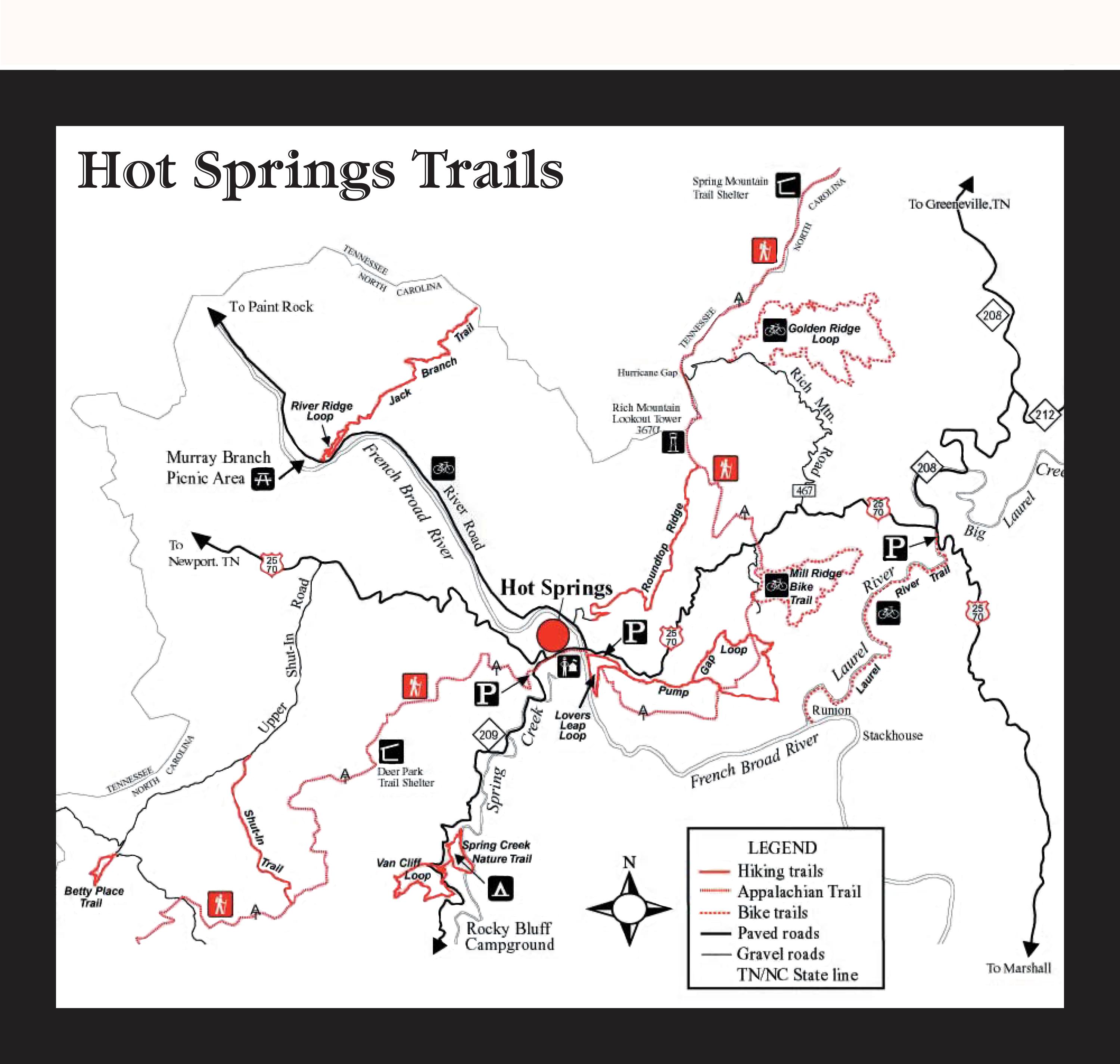
Travel east on Highway 25-70 out of Newport and you will enter Madison County, North Carolina. Hot Springs is a town in Madison County and is considered part of the Asheville Metropolitan Statistical Area.
Hot Springs is a small town in the mountains of Western North Carolina that has much to offer visitors. The town’s population was 528 as of 2021. Shopping, artwork, food, music, hiking, fishing and the hot springs spa are all ready and waiting for guests to enjoy.
The naturally warmed mineral waters of Hot Springs have been appreciated for centuries. The hot springs were first discovered by Native Americans who believed the warm waters possessed healing powers. Signs of a Native American presence in the area dates back at least 5,000 years with pictographs on Paint Rock, which researchers believe was a stopping point for meditation and prayer

which researchers believe was a stopping point for meditation and prayer on the way to the springs.
Both Broadwing Farms and Hot Springs Resort and Spa offer access to the hot mineral springs. There are numerous hot tubs available for soaking by the hour at The Resort. Broadwing Farms has private hot tubs available for those who book one of their cabins for a stay.
There is a visitor center in Hot Springs. Stop in there to get information to help you on your visit or to plan your stay in the area.
Madison County also is an area filled with history. The county has a population of more than 25,000 people and other towns include Marshall, Mars Hill, Spring Creek, Joe, Trust, Luck, Walnut and Whiterock.
On a backroad outside of Hot Springs is a historical marker for
the Shelton Laurel Massacre. The massacre involved the killing of several men and boys who were suspected of Unionist sympathies in 1863. The massacre led to the county’s moniker “Bloody Madison.”
The area has a folk tradition, and in 1916, English folklorist Cecil Sharp visited the area to collect ballads. The musical traditions are based on the Scotch-Irish customers of the settlers. There are music and art festivals held in the area throughout the year.
Madison County, which was established in 1851 from Buncombe and Yancey counties, consists of 449.57 square miles.


