

There are nearly 600 miles of fishable streams in Great Smoky Mountains National Park. Every streamin the Parkis open for fishing and harvest year round; the waters are clean and clear and hold lots of fish, mainly brook, rainbow and brown trout. Smallmouth bass are found in the lower elevations of the Park, around 2,500-feet elevation. Catch-and-release is not required anywhere in the Park, and you are encouraged to keep and enjoy your catches.
Before you go fishing, be sure to thoroughly clean shoes, wadersand all equipment that touch the water to prevent the transportation of invasive species to the pristine waters of the Park.
Licenses: The Park does not issue its own license for fishing, but a valid state license is required from Tennessee (ages 13and older) or North Carolina (ages 16 and older). Supplemental trout stamps are not required. The Park does not sell licenses, but they are available at many retail stores. Tennessee regulations allow ages 12 and under to fish without a license and take a full limit.
Tennessee Residents: A regular annual hunt/fish license is $34; supplemental annual trout-only license (outsidethe Park) is $22. A one-day license for all fish (includes trout) is $11.50. Ages 13-15 can get an annual junior fishing license (includes trout) for $10; Non-resident license, no trout outside the Park: Ages 13-15, junior hunt/fish $11; annual fishing $50; threeday permit, $20.50; 10-day permit $30.50.
Non-Resident license,all fish allowed in and out of
the Park: Annual fishing $99; three-day permit $40.50; 10-day permit $61.50.
Gatlinburg: Additional special permits are required for trout in the Gatlinburg city limits, residents and nonresidents, ages 13-64. For more information call 800-568-4748.
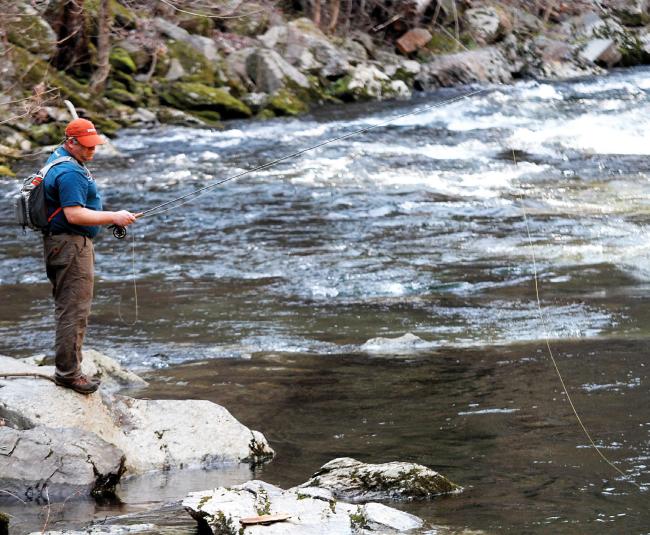
Fishing Times: Fishing is permitted year-round from a half-hour before sunrise to a half-hour after sunset. Daily Possession Limit: Five fish in any combination of trout and smallmouth bass. Possession includes fresh fish, those stored on ice or otherwise preserved. An additional 20 rock bass are allowed in possession. Anglers must not harm fish when releasing them and must stop fishing as soon as the limit is reached.
Size Limits: Brook, brown and rainbow trout and smallmouth bass have a minimumlimit of seven inches. Rock bass has no size limit.
Lures, Bait and Equipment: Only one hand-held rod is allowed per person. Only artificial lures or flies with a single hook are allowed,with upto two flies per leader. Use or possession of anyform of fish bait or liquid scent is not allowed; a partiallist includes: minnows live or preserved, worms, corn, cheese, bread, salmon eggs, pork rinds or natural baits found locally. For more information go to www.nps.gov/grsm/planyourvisit/fishing.
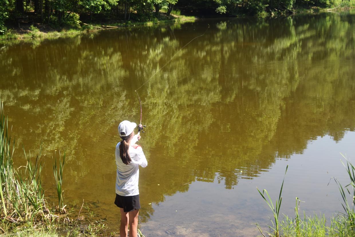
Dave Coena from Wisconsin spends the day fishing in the Great Smoky Mountains.


From page 8

are encouraged to bring binoculars to get a better look at the variety of birds, which changes with the seasons. Also in the trees, be on the lookout for red and gray squirrels, chipmunks, and even amphibians like the Cope’s gray tree frog.


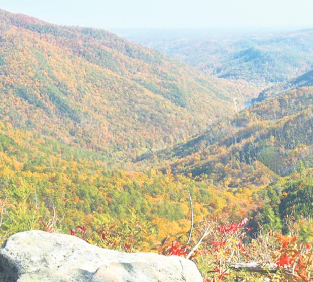

Look in the Streams!


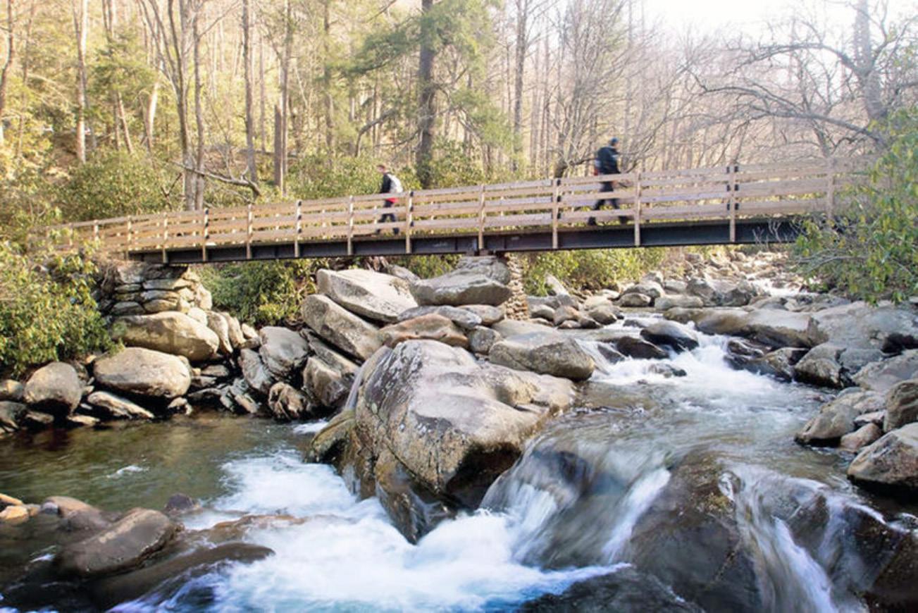
GSMNP contains over 2,100 miles of streams holding 67 unique species of fish, including brook trout, which are the only native trout to the area. There are several federally protected fish in the park, including the Citico Darter, the Smoky Madtom, and the Yellowfin Madtom. Efforts are in place to reintroduce these species into Abrams Creek. In addition to the fish, the park’s streams are home to unique insects, reptiles, and even occasionally Ross’ Geese. Fishingis allowed in the park with proper licensing and permission, though there are limits to how many fish a visitor may catch per day. Smallmouth bass, rainbow and brown trout, and rock bass are the most popular among anglers, though trout and smallmouth shorter than sev-

it is incredibly important for the safety of the visitors and animals alike that a safe distance is maintained. Even if an animal does not pose an immediate threat, any action that leads to the animal becoming more comfortable with humans could be dangerous in the long term. Note that it is illegal to willfully approach within 50 yards of a bear or an elk, or within any distance that disturbs or displaces the animal. More detailed instructions for handling encounters with these animals are available on the NPS website. As always, “ Take nothing but pictures and memories, and leave only your footprints.”
Found all across the eastern US, the Eastern Box Turtle is the most common turtle in the park. Unlike other turtles in the park, it is almost entirely terrestrial.

en inches must be immediately released. For more details about fishing regulations, visit the NPS website.


Look Out!

While observing the wildlife of the park can be exciting, there are a few things to keep in mind. Primarily, it’s always important to remember that the animals are wild and unpredictable. While NPS considers you a visitor of the park, the animals consider you a stranger in their habitat. With regards to all animals, but bears and elk especially,

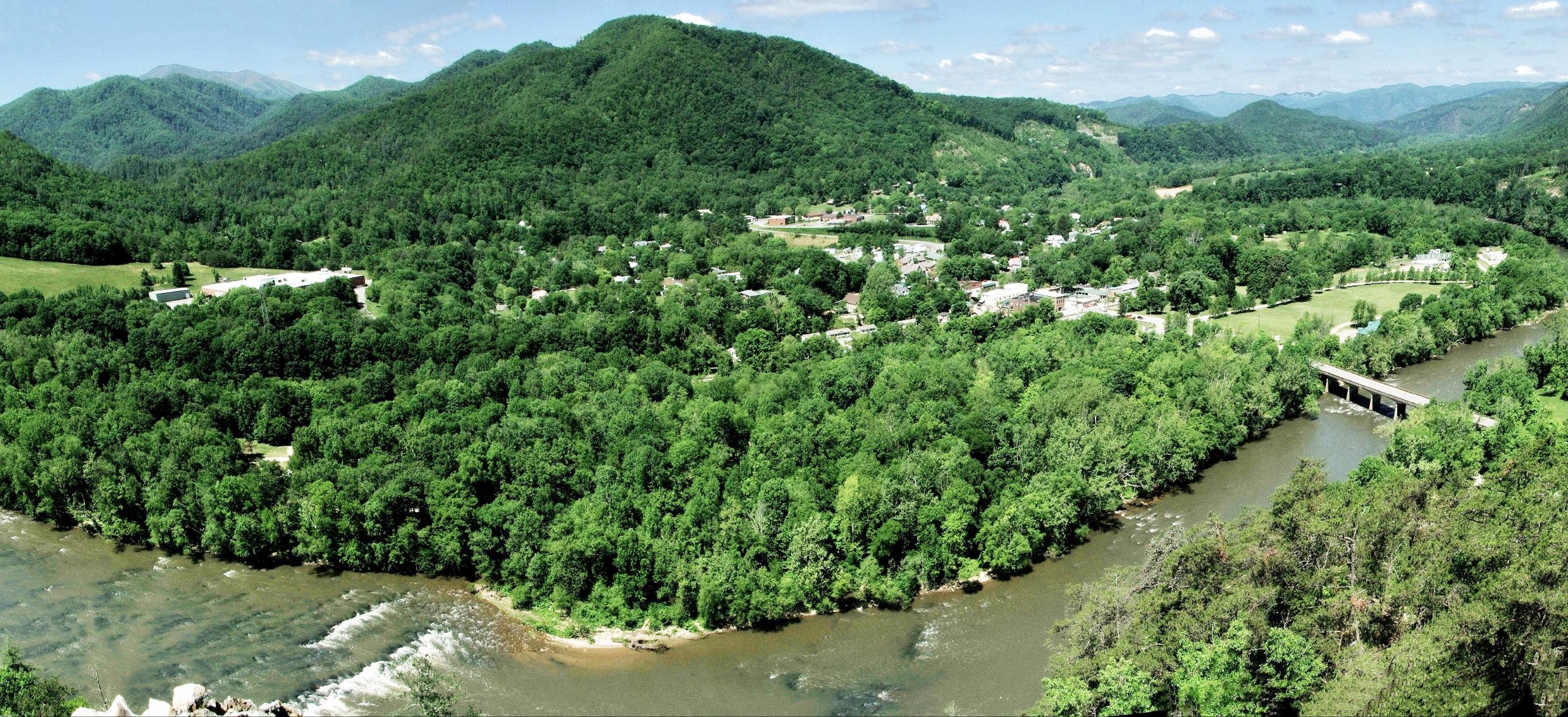
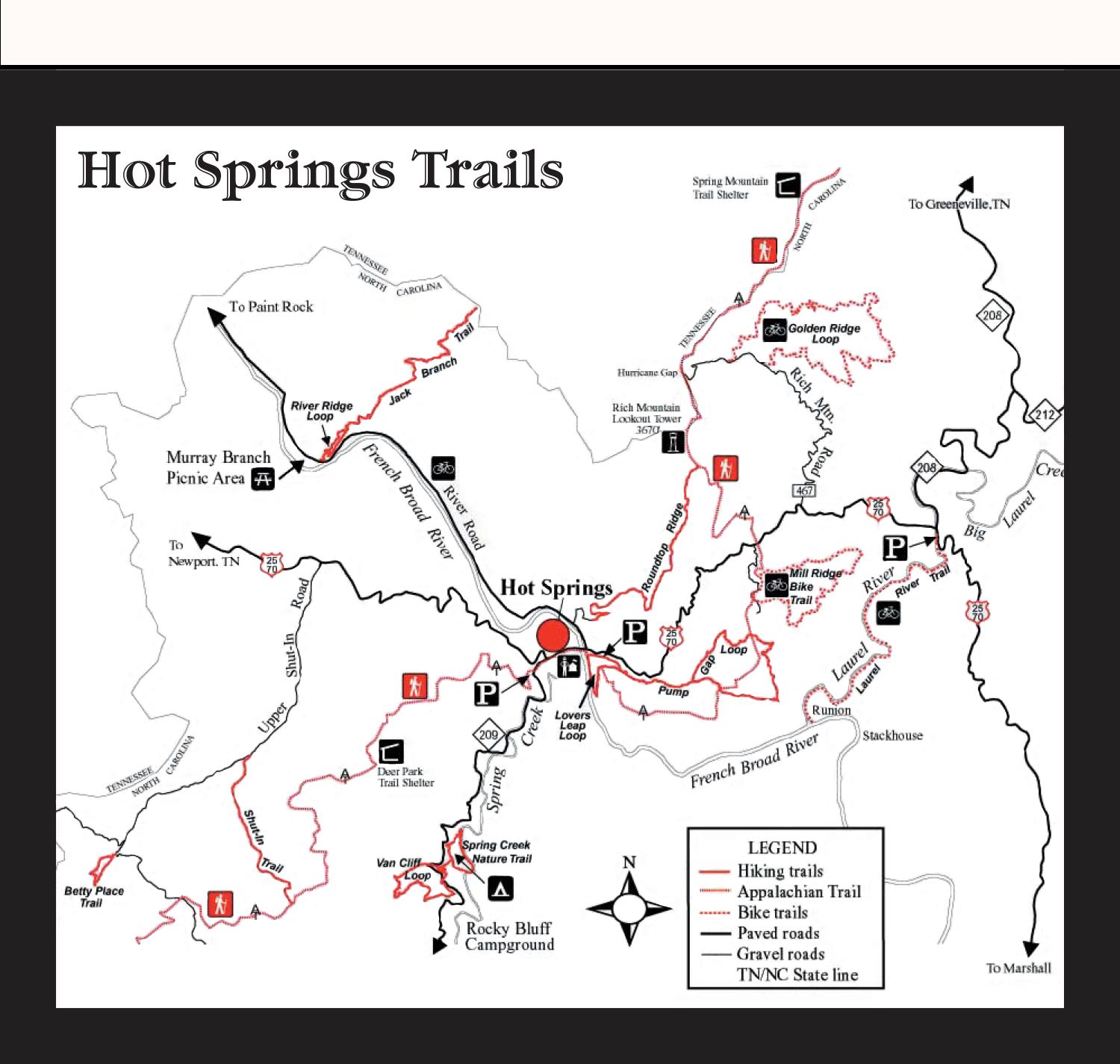
Travel east on Highway 25-70 out of Newport and you will enter Madison County, North Carolina. Hot Springs is a town in Madison County and is considered part of the Asheville Metropolitan Statistical Area.
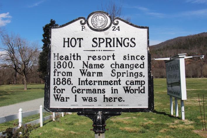
Hot Springs is a small town in the mountains of Western North Carolina that has much to offer visitors. The town’s population was 528 as of 2021. Shopping, artwork, food, music, hiking, fishing and the hot springs spa are all ready and waiting for guests to enjoy. The naturally warmed mineral waters of Hot Springs have been appreciated for centuries. The hot springs were first discovered by Native Americans who believed the warm waters possessed healing powers. Signs of a Native American presence in the area dates
Continue to page 11
Downtown Hot Springs and the French Broad River as seen from an Appalachian Trail viewing point. (Photo credit: Hot Springs Tourism and Welcome Center)back at least 5,000 years with pictographs on Paint Rock, which researchers believe was a stopping point for meditation and prayer on the way to the springs. Both Broadwing Farms and Hot Springs Resort and


Continue from page 11
There is a visitor center in Hot Springs. Stop in there to get information to help youon your visit or to plan your stay in the area.
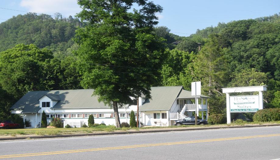
Madison County also is an area filled with history. The county has a population of more than 25,000 people and other towns include Marshall, Mars Hill, Spring Creek, Joe, Trust, Luck, Walnut and Whiterock.
On a backroad outside of Hot Springs is a historical marker for the Shelton Laurel Massacre. The massacre involved the killing of several men and boys who were suspected of Unionist sympathies in 1863. The massacre led to the county’s moniker “Bloody Madison.”

The area has a folk tradition, and in 1916, English folklorist Cecil Sharp visited the area to collect ballads. The musical traditions are based on the Scotch-Irish customers of the settlers. There are music and art festivals held in the area throughout the year.
Madison County, which was established in 1851 from Buncombe and Yancey counties, consists of 449.57 square miles.

one of two places visitors can access the hot mineral springs in Hot Springs, NorthCarolina.An unusual rock memorial in Fairview Methodist Church Cemetery in Hot Springs is in honor of Dr. Edward J. Peck, who was born in 1859 and died in 1928. The mountains of Madison County arevisible from Hot Springs, North Carolina.

Smoky Mountain Fan Fest is set for Aug. 11-12 at the Sevierville Convention Center with more than 40 celebrity guests slated to attend. While the lineup is subject to change, those expected to be in attendance include:
• Billy Redden, who portrayed Lonnie i Deliverance
• Carel Struycken, who played Lurch on the Addams Family movies
• Phillip Glasser who was the voice of Fievel Mousekewitz in An American Tail
• Dave Sheridan who portrayed Officer Doofy in Scary Movie
• Felissa Rose who starred as Angela in Sleepaway Camp
• Brett Wagner who was Lost Leatherface in the Texas Chainsaw Massacre
• Gray Delise Griffin who was a voice actor in Fairly Oddparents and Scooby Doo
• Scott Innes who was the voice of Scooby-Doo
• Roger Bumpass, the voice of Squidward on Spongebob Squarepants
• Karyn Parsons, who starred as Hilary Banks in the Fresh Prince of Bel Air

• Joey Fatone of NSYNC

• Grace Van Dien who starred as Chrissy Cunningham in Stranger Things

Tickets are available online at smokymountainfanfest.com.


Ticket options include one-day tickets,
Grace Van Dien, who starred as Chrissy Cunningham in “Stranger Things” will be appearing at Smoky Mountain Fan Fest in August. I also tossed in their logo if that is needed.
Karyn Parsons, who starred as Hilary Banks in the “Fresh Prince of Bel Air.” is among those slated to appear at Smoky Mountain Fan Fest in August.
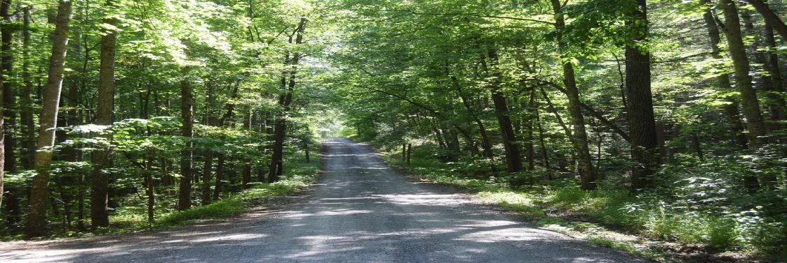
Traveling east from Newport, Tennessee toward Hot Springs, North Carolina, along Highway 25-70, you will come to Del Rio, Tennessee. As you pass through Del Rio, about 11 miles from Newport, you will see a brown national forest sign on the left of the roadway indicating Allen’s Branch Pond and Weavers Bend. Turnleft at the sign onto the well-maintained gravel road. There are pullover spots in the event there is
oncoming traffic, so keep a lookout ahead because the roadway is narrow. You will travel about three miles before reaching Allen’s Branch Pond,which is on the right of the roadway. There is a small parking area that will accommodatefour or five vehicles. Additional cars can park alongside the road.
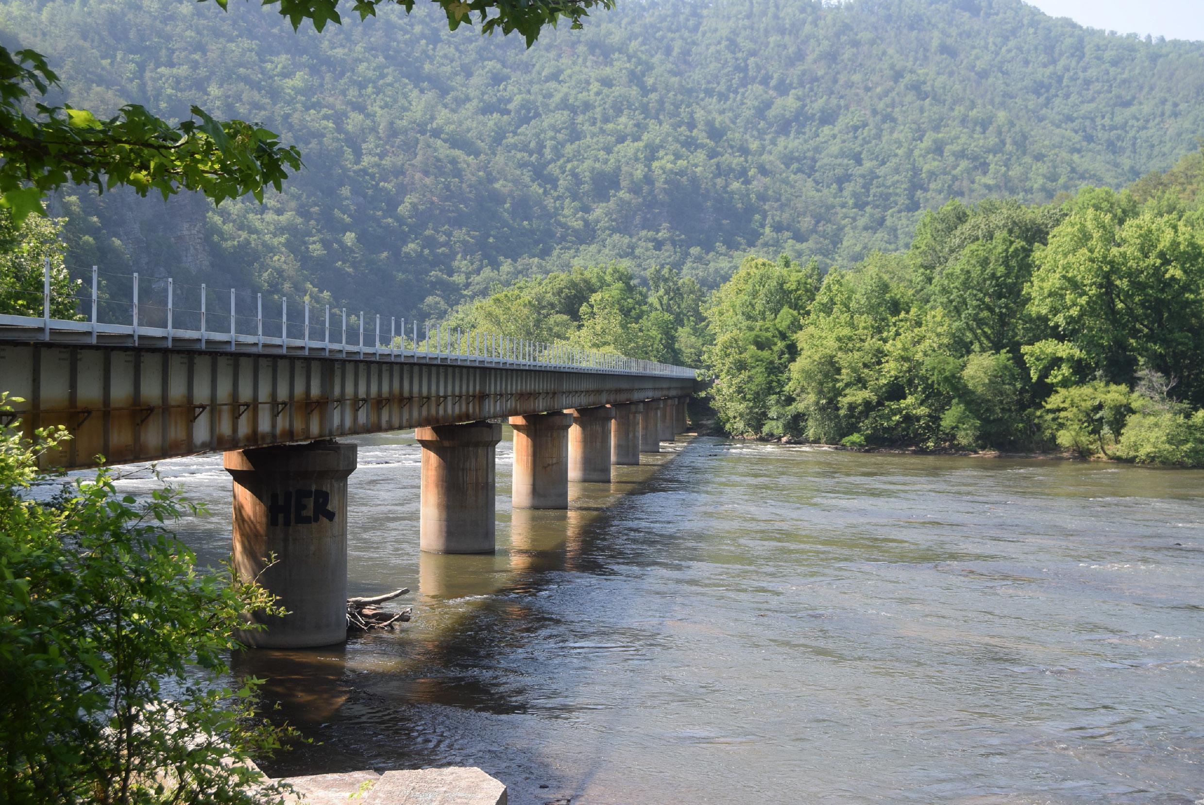
From page 14


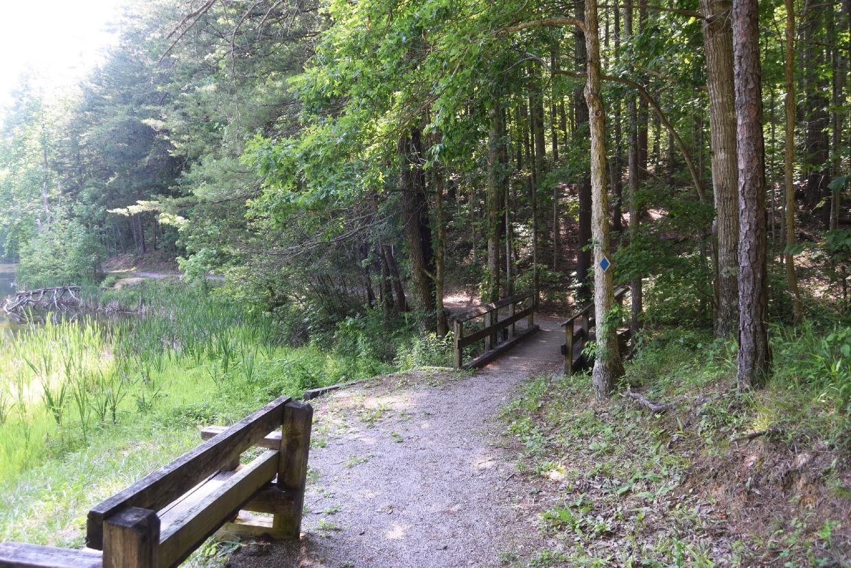
The two-and-a-half acre pond is well-stocked with bass, catfish and bluegill. There is a one-half mile interpretive trail that completely goes around the pond, andtherearesmallfishingpiers.Floraandfaunasurround the pond, creatinga warm-water ecosystem. Turtles, frogs, deer and other animals can be seen around the pondarea as well. Tennessee state fishing regulations do apply to fishing at Allen Branch Pond. Travel farther past the pond on the gravel roadwayabout three more miles - and you will come to Weaver’s Bend. Weaver’s Bend Road runs from its intersection with Brush Creek to the French Broad River.
From page 15
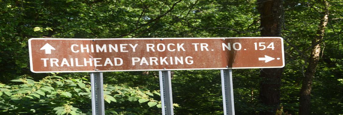
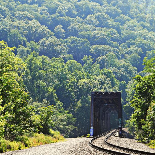
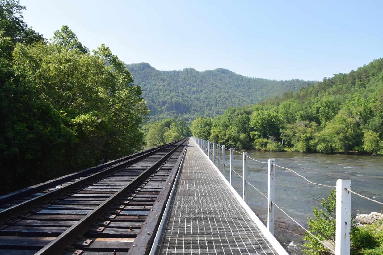
The roadway transitions from a gravel road to a dirt road. Along the road are several marked campsites, and many of them are riverside. There is a 14-day maximum stay at any campsite at Weaver Bend. When you get near the end of the roadway at Weaver’s Bend, you will cross the railroad tracks. This is an active Norfolk-Southern rail line. On the right hand side of the crossing is the Lower Twin Bridge, which isbridge number two across the French Broad River between the Morristown Junction and Asheville, NC. This bridge wasconstructed in 1927 by the Virginia Bridge and Iron Company. The four-span bridge
Continue to page 17
Above: The road that leads to Allen’s Branch Pond then on to Weaver’s Bend is well-maintained gravel.

Below: Benches and fishing piers are availableat Allen’s Branch Pond. It is a great place for wildlife viewing as well as seeing the different flora and fauna that grow in the area.

Here a train bridge is shown crossing the French Broad River.
From page 16 consists of Baltimore through trusses, and it is only one of two bridges in Tennessee that are of the Baltimore truss style. Each span is 110 feet long, and all have been skewed positively 30% because of how the bridge approaches the riverbanks’ curves. The bridge has a total length of 541 feet.
Newer concrete piers on the bridge are attached to the older stone piers, which gives indication that the bridge served as a replacement of an original bridge, which was set on the stone piers. The original bridge that sat in the same spot was built in the 1880s to connect the old East Tennessee, Virginia and Georgia Railroad and the Western Carolina Railroad. There is a second train bridge to the left of the
crossing, and it reaches into North Carolina. The S-line does run this route, so remember to stay clear of the tracks and use caution when crossingthe railroad tracks.
There is river access for fishing at Weaver’s Bend. The French Broad River is also a popular area for canoeing and kayaking.
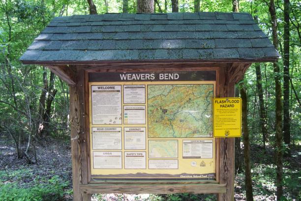
When you leave Weaver’s Bend, you can turn back toward Highway 25-70 and pass Allen’s Branch Pond again, or you can turn right onto the paved roadway and head toward Highway 107. You will come out near Paint Creek and Houston Valley. Houston Valley Recreational Area and Campground are closed because of extensive damage caused by flooding. Weaver’s Bend, Paint Creek and Houston Valley have all suffered damage in the past because of flash flooding, so visitors are urged to use caution in the event of a storm or heavy rain.
Paint Creek, which is located in Greene County,has a picnic area and campground. The family-oriented campground, which is tucked away in a mountain cove, has closed in the past because of bear activity. Beforevisiting the area, check to make sure that it is open. Tent camping and camping trailers are welcome with a fee charged for some activities. Camping spots are available on a first-come, first-served basis for $10. The group size is limited to five people with two vehicles allowed per site. Reservations are accepted by visiting https://www.recreation.gov/ camping/campgrounds/10056245.
AsignwelcomesvisitorstoWeaver’sBend.Theareaoffershiking trails, fishing and campsites.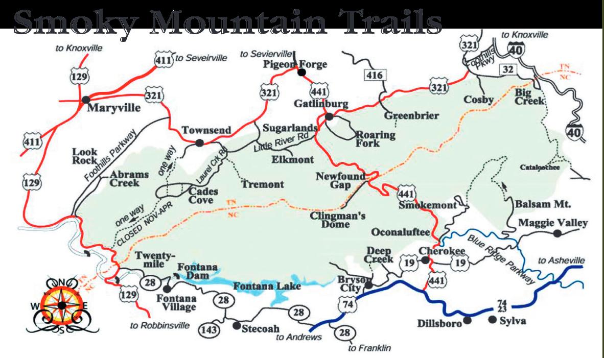



From page 21

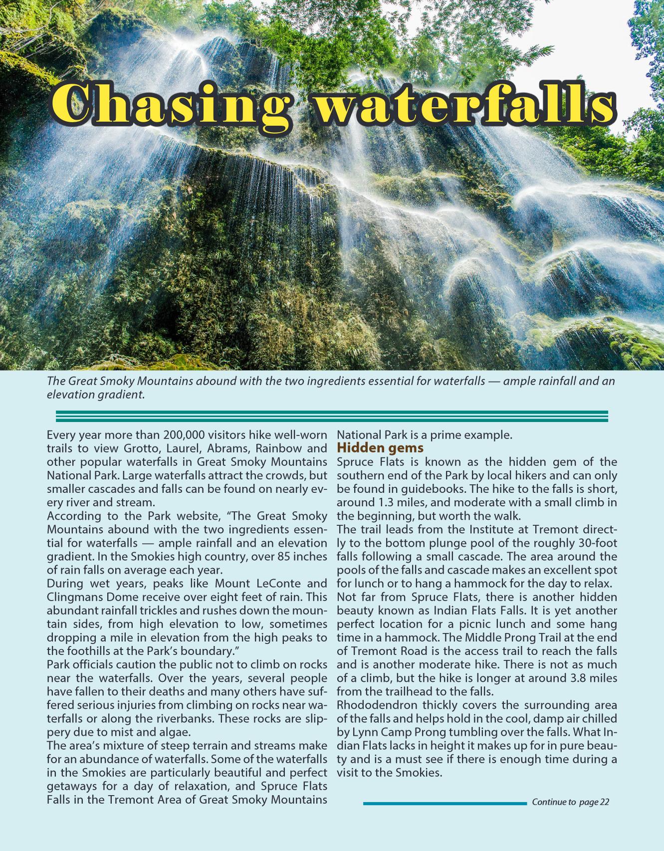
Tremontisawell-keptsecretandaveryspectacular place, but is not the only locale in the Park that offers excellent waterfall viewing. The Greenbrier area of the Smokies contains another beautiful sightin the Ramsey Cascades.
The hike to the falls is scenic with beautiful old growth forest sections along the trail, but is challenging and considered strenuous in difficulty as it gains 2,000 feet in elevation in fourmiles.
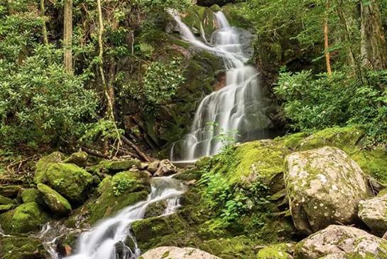
Ramsey Cascades is over 100 feet in height and is a little grander in appearance. The quickly falling water generates a refreshingly cool, damp breeze that can beenjoyedfromtherocksbelow.
One final waterfall that should not be missed is the Lower Falls on Slickrock Creek in North Carolina. This waterfall is located in the Cherokee National Forest and takes extraeffort to reach. The access, trail No. 42 on the National Geographic Map 781, is a moderate walk but on the longer side at around five miles from the trailhead to the falls.
The drive is where the effort comes in because it is located just across Calderwood Lake at the end of “The Dragon” on U.S. 129. Directly across the lake at the endoftheridgethereisagravelparkingareawhere the trail begins. The hike follows the lake and then


abruptly turnsto follow the creek. Slickrock is one of the most beautiful creeks throughout the Southern Appalachians and offers numerous swimming opportunities well before the falls.
Once at the waterfall, Slickrock Creek roles overabout a 20-foot drop into an incredible deep, blue swimming hole with frigid water, even in August!
Instead of packing into a water or amusement park or fooling with a lukewarm lake, think outside the box this summer and venture out to someplace new and cool; waterfalls are just the beginning.


From page 23
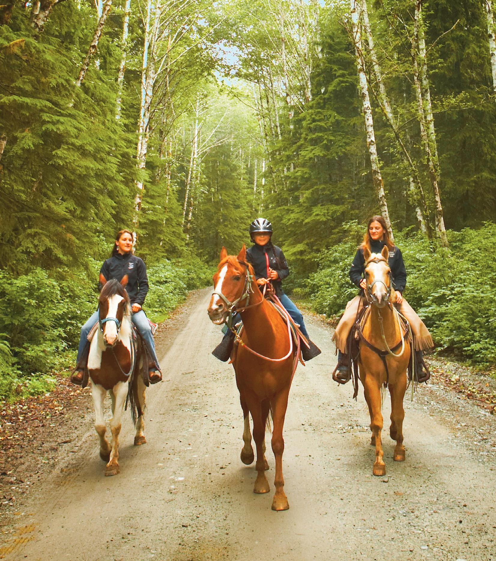
There are 16 campsites that include fire rings, lantern posts, picnic tables, potable water and a vault toilet at Round Mountain Recreation Area. Because access isremote and visitors must travel along curvygravel roads, only tent camping and small camping trailers are recommended. Nearby in the Great Smoky Mountains National Park visitors can camp at Big Creek. Big Creek also has equestrian facilities.
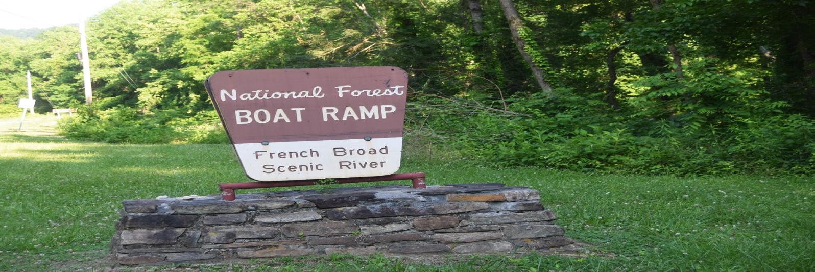
The French Broad River is the third oldest river in the world, and is one of the original rivers included in the 1968 Tennessee Scenic Rivers Act. History buffs, anglers, birdwatchers, boaters, kayakers and nature lovers all can enjoy whatthe river and its banks have to offer. The river is inviting to both kayaking and canoeing.
Commercial rafting operations are from Hot Springs, North Carolina, to Del Rio with rapids ranging from class I to class III. There are 13 miles of commercial raftingin the vicinity. If you have your own boat or kayak, river access is available at Weaver’s Bend and the French Broad boat launch, which is near Wolf Creek off Highway 25-70.
The river is home to smallmouth bass, catfish, blue gill, carp, rock bass, crappieand sauger.The French
Broad River has many tributaries that support trout. Nature and wildlife viewing sites are available at French Broad Fields and at Weaver’s Bend.
Step from your car, walk a few yards down a leaf-covered path.
Suddenly the noise of the traffic, even the warmth of the sun, is gone.
In their place — quiet, cool.
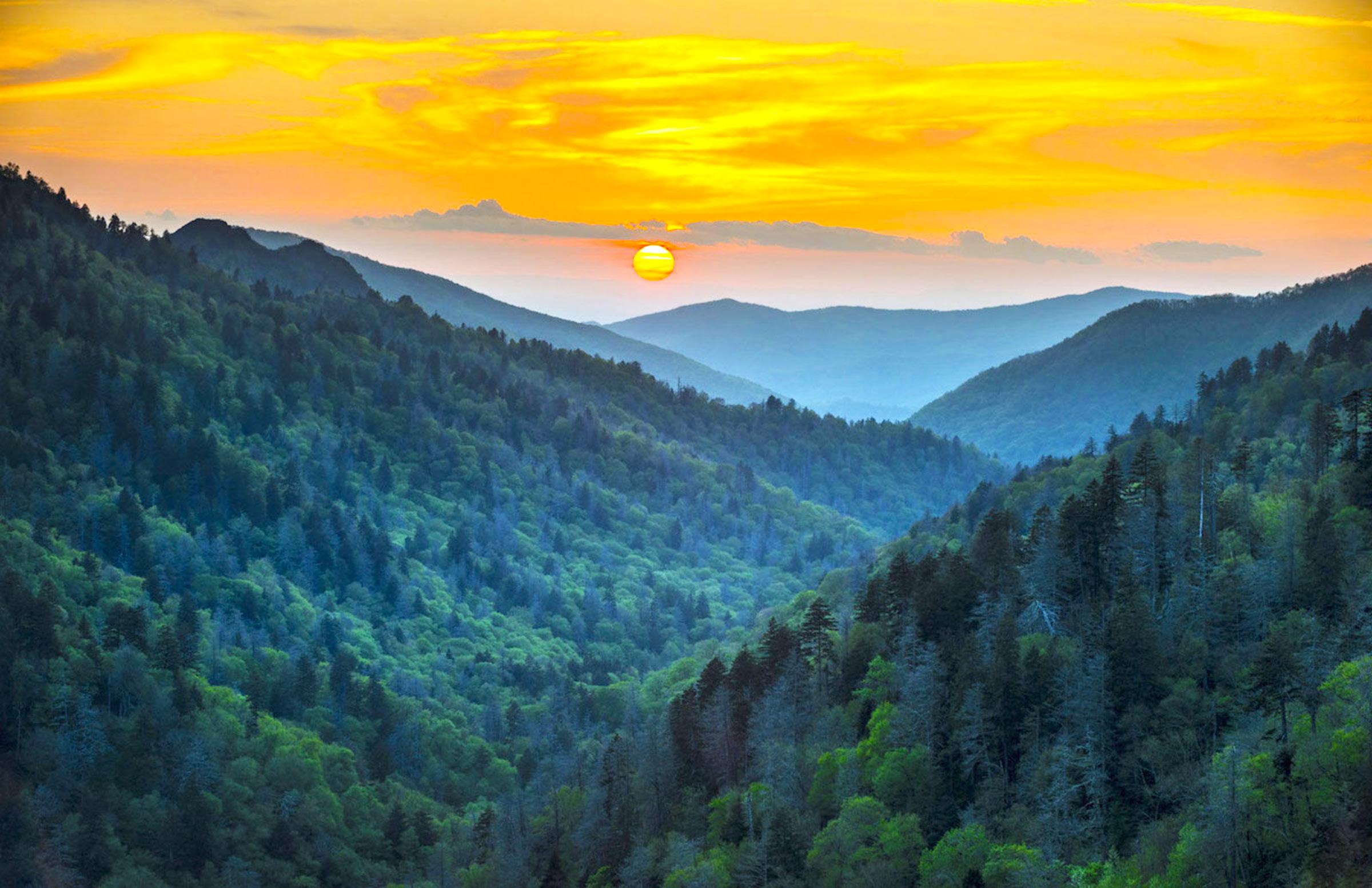
You’re on a trail in Great Smoky Mountains National Park.
In thenation’s most-visited park, there is solitude, even isolation. For those not accustomed to the wilderness offered by following some trails, thereare easywalks that offer glimpses of the primeval forest. For other more adventurous, or experienced, hikers, there are challenging trails that lead to some of the most dramatic views the Park hasto offer.
The Smokies’ 800 miles of trails range from wide pathways, which served as the thoroughfares for the mountain dwellers of pre-1930, to steep, well-troddenportions of the Appalachian Trail. Therehas been
much public and private investment in trail maintenance in recent years.
In 2012, Friends of the Smokies established the Trails Forever endowment thanks to a matching gift from the Aslan Foundation in Knoxville. Today, the $5 million endowment funds a full-time trail crew in Great Smoky Mountains National Park to reconstruct and rehabilitate some of the Park’s most impacted trails. Since 2008, our $5 million Trails Foreverendowment has helped fund rehabilitation projects on Jakes Creek, ForneyRidge, Ramsey Cascades, Chimney Tops and now Alum Cave trails. The hard work this crew does and the fact that these improvements will last 75-plus years is truly incredible. These are some of the Park’s mostheavily traveled trails so it just made sense to give back and take care of the hiking trails. The three-year effort to rehabilitate the Chimney Tops


From page 25
Trail ended in 2014. In 2015, Great Smoky Mountains National Park celebrated the recent completion of the Chimney Tops Trail restoration project. More than 1,000 volunteers provided more than 14,000 hours of labor on the project.
The popular Alum Cave Trail in Great Smoky Mountains National Park is now undergoing full-scale restoration. The Trails Forever crew will focus restoration efforts on several targeted locations along the 5-mile trail to improve visitor safety and stabilize eroding trail sections. The restoration work will requiretemporary trail closures throughout thetwo-year process.
For the beginning hiker, shorter, less-strenuous day hikes are plentiful throughout the Park. These, like the longer trails that work their way through the backcountry, offer many miles of nature walks and self-guiding trails to Park visitors. These trails are usually no longer than 1 mile (round-trip) and many serve as educational guides to the Park and surrounding area. Along the
way are scattered resting places, usually with a spectacular view for extra measure.
The Sugarlands Trail, which begins behind the Sugarlands Visitors Center (2 miles south of Gatlinburg on U.S. 441), gives an introduction to the natural history of the area, as well as history about its human inhabita nts.
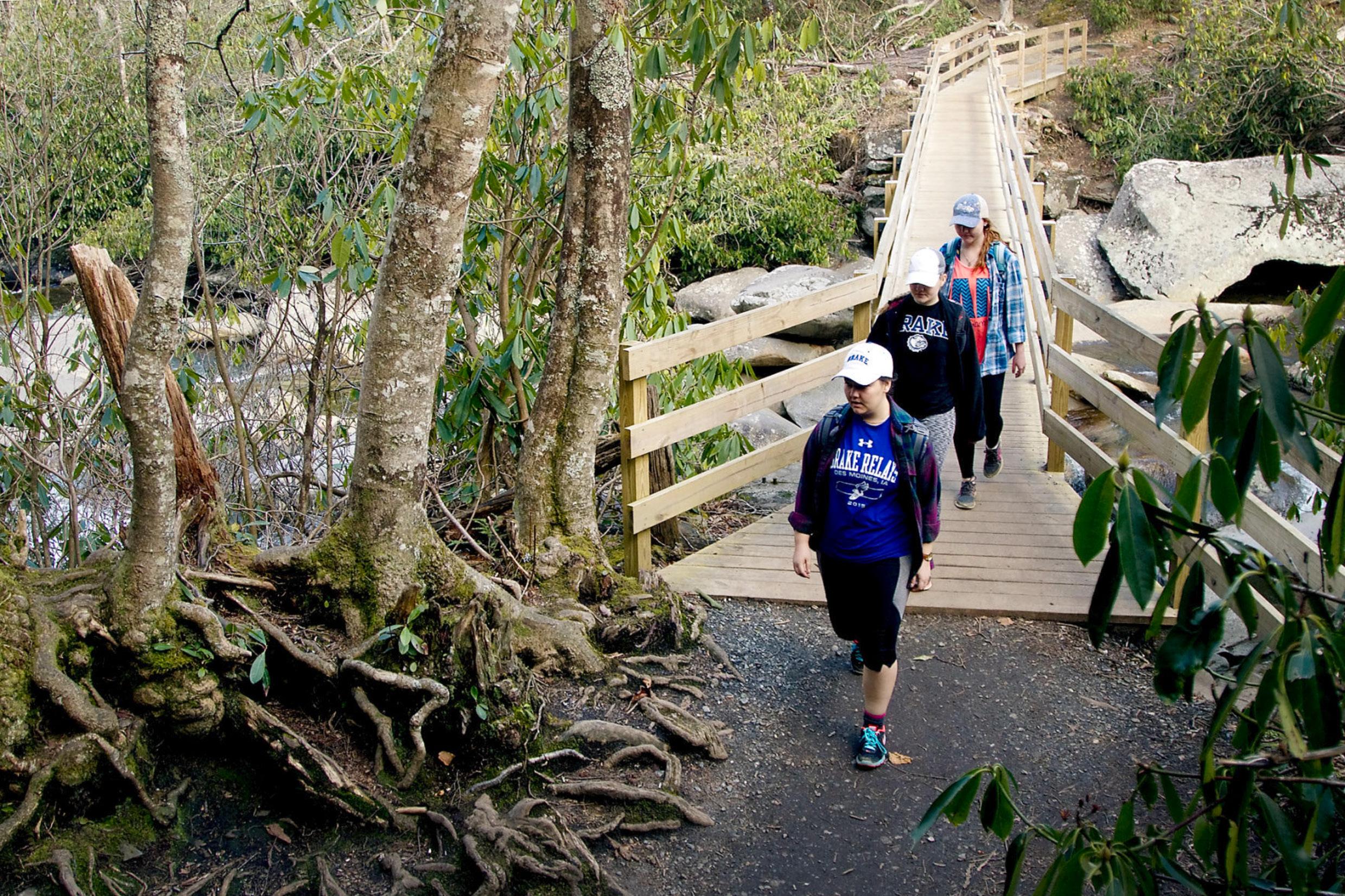
Elkmont, Smokemont and Cosby are some, but not all, of the self-guiding nature trails that give visitors a chance to see and learn more about the mountains than they would just riding through them in a car. One at the Chimneys Picnic Area is a favorite for wildflower enthusiasts in the spring.
Several spots along Laurel Creek Road from the Townsend entrance to Cades Cove serve as entrances to trails and nature walks that offer strolls or workouts. In one spot, at the beginning of the Bote Mountain Trail, those with a bit more physical conditioning can walk up the road bed (it’s to the left) while others can simply wander up Schoolhouse Gap Road beside a quiet mountain stream (across the bridge and to the right
From page 27
where the larger parking area is located). Farther up Laurel Creek Road, just down from Crib Gap, is the beginning of several trails, some easy, others more vertical. One of the trails offers a 2-mile “short-cut” to the higher reaches of Bote Mountain Trail, which offers a workout without exhaustion. Andrews Bald, Abrams Falls and Laurel Falls get you into the wilderness, but not too far. These fairly easy trails range in length from 2 to 6 miles and do have some spotswhere more-than-average energy will be expended.
Some hikes — Deep Creek, Shuckstack and Snake Den Trail, to name just a few — challenge all but the most adventurous hiker. These climb up (or down depending on your direction) 4,000 feet or more. The more difficult trails have their own rewards —walking through virgin forests, passing into the clouds, being enveloped in the mists swirling around the highest of the Smokies ’ peaks, walking on new-fallen snow or throughblooming blackberry bushes still dripping with morning dew. Area residents have their own favorites among difficult trails. There is the 5-mile hike to Spence Field, one ofthe Smokies ’ famousand mysterious balds. Those still able to breathe normally after that last push tothe top may continue on to Rocky Top,which lent its name to the song popular with the Tennessee Volunteers.
From there you can continue on to the other two peaks of Thunderhead, the dominant mountain on the skyline in the distance when approaching Maryville by U.S. 129 from Knoxville.
There is Mount LeConte, available by several trails. Entrances to trails leading to LeConte (which is topped with a lodge and shelter) are on transmountain U.S. 441 (the Alum Cave Trail) which leads to Cherokee, N.C., and off the Roaring Fork motor trail off Airport Road in Gatlinburg at Cherokee Orchard (Rainbow Falls and the Bullhead).
Rainbow Falls is worth a hike itself with its views from the log bridges approaching the high spill. The Bullhead features quick altitude and good views of Gatlinburg.
If you wish to go to thehigh country without having to climb there, try Andrews Bald trail, which starts at the Clingmans Dome parking lot. Or turn the other way, paralleling the paved trail to the dome’s tower and walk along the crest of the Smokies, through high-altitudeforests as though you were in Canada. On parts of the trail you can gaze from both sidesinto the mountains and valleys as far as the eye can see.
If a step into history is more your cup of tea, try some walks just out of Townsend. There is the popular hike to the Walker Sisters cabinwhere five sisters lived — first with their father, then alone — and became almost totally self-sufficient.
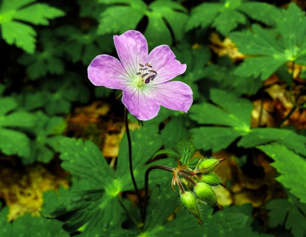
Reaching the trailhead is probably thehardest part of this walk. From Townsend, go into the Park, turn left at the “Y” toward Elkmont and Gatlinburg. At Metcalf Bottoms go straight through the picnic area, across the ridge and onto the gravelroad.
Turn right at the Little Greenbrier School road and park at the schoolhouse. The trail is the road with the gate. About a mile from that gate stands the homestead. The house wherethe sisters lived and worked is still there withits charred stone fireplaces.
Just inside Cades Cove,on the right past the parking area and scenic overlook with display, is one of the paths to Rich Mountain. Once again, a brief walk on a well-worn trail can lead you up beside a mountain stream, complete with cascade, if there is enough water.
This trail is steep in places but well, if not heavily, traveled.
One switchback has aspectacular view of Cades Cove below, well worth the exertion once you get there. At the top, the trail joins the road to a spot where one of the Smokies ’ fire towersused to sit. The National Park Service sold most of the towers and the Rich Mountain tower is no longer.
The trail follows the ridgeline a ways and then heads back down to the Cove. The trail comes out by Elijah Oliver’s cabin, one of the cove’s many scenic spots,
Get up close with nature on your next adventure in the Great Smoky Mountains National Park. Summer is one of the best times to hit the trails to see all that the park has to offer.
From page 28
and then returns to the parking lot through the gently rolling forest floor.
If you have only a few hours,not the whole day, try the Chestnut Top Trail just inside the Park boundary near Townsend. The trail begins just at the “Y” intersection. Don’t be dismayed by the steepness of the trail at the verybeginning; this is the only really hard climbing you will have to do.
During the spring and summer, slowpokes climbing will have an added bonus. The mountainside is filled with wildflowers, many just at eye level. You don’t even have to stoop over to see them.
Once youreach the top of the hill, you walk through pine forest, across bright green mosses, into deciduous forests. Listen to Laurel Creek far below. There iswildlife along this trail, particularly birds. You can walk as far as you desire, then turn around andreturn to your car.
At about 4miles, the trail intersects with the SchoolhouseGapTrail.
For a day-trip into the wilderness where you are never far from “civilization” but probably will see few people, take the Foothills Parkway to Abrams Creek ranger station.
Go to Walland on Lamar Alexander Parkway (U.S. 321) and turn right onto the parkway. At the end of the finished section,Chilhowee Lake will be in frontof you. Turnleft and then takeanother immediate left. Travel through Happy Valley, one of the most picturesque residentialcommunitiesinBlountCounty.Watchfor the sign to the ranger station.
Parkjust beyond the ranger station — a little shed nearby can provide you with brochures, which will explain much about the Park.
You have two directions you can now take. Go through the campground and up Cooper Road, one of the major roadways into Cades Cove before the Parkwas established. This is a nice stroll and can take those with stamina all the way to Cades Cove (about 11 miles). But take a side trip, which will take a bit of scrambling, ifyou’re even the least bit adventuresome.
At Campsite No. 1, turn right and go up and over the mountain to Abrams Creek. This man way (it isn’t big enoughto be a real trail by Park standards) goes up and down beside one of the Smokies ’ most scenic rivers. There is a campsite about 2 miles along this walkway that provides a swimming hole just a few feet away.
Another interesting walk begins across from the ranger station. You will cross Abrams Creek on a log bridge
and enter a meadow where houses once stood.
Calderwood Highway
If you have a full day, try traveling by car along the Foothills Parkway to Chilhowee Lake and then turn leftonto Calderwood Highway (U.S. 129).
This very crooked road will eventually lead you to the Twenty-Mile Creek rangerstation and, a bit farther on, Fontana Lake.
From the ranger station there are several hiking trails and some of the most picturesque streams. You’ll cross alot of them onmost of the trails here.
What is locally known as the North Shore can be reached across Fontana Lake by strolling across the dam or by renting a boat.
Here, too, there is a possibility of seeing some of the Park’s wildest wildlife. Otters have been reintroduced into the Park in this area. There are also beavers and bears, even the possibility of a bobcat.
Many of thetrails in this area are really old roads that settlers on the North Shore trail used. There is also a new shore trail that winds alongside Fontana Lake, a welcome walk during hot days.
Few of the trails, even on the traditionally crowded Fourth of July and Labor Day, are really crowded. There will still be (with the possible exception of Alum Cave Trail) long moments of strolling alone in the midst of verdant foliage.
There willstill be moments of wonder at the wildlife, which can suddenly dart from the forest across the trail.
Be you a beginning hiker, an experienced one, or everything in between, there are trails in the Park that will let you experience the real Smokies.
