CITY PARK Master Plan Update
City and County of Denver, Parks and Recreation Department
Historic Denver, Inc.


City and County of Denver, Parks and Recreation Department
Historic Denver, Inc.

(page intentionally left blank)

(page intentionally left blank)
City and County of Denver
Department of Parks and Recreation (DPR)
Allegra “Happy” Haynes, Executive Director
Gordon Robertson, Director Park Planning, Design & Construction
Kelly Ream, Project Manager, East Denver Parks Planner
Adam Smith, Superintendent
Historic Denver, Inc.
Annie Levinsky, Executive Director
History Colorado - State Historical Fund
Anne McCleave, Historic Preservation Specialist
Consultant Team
Mundus Bishop
Tina Bishop, PLA, ASLA, Principal
Rachel Scarborough, PLA, Landscape Architect
Josh Spinner, ASLA, Landscape Designer
Shelby Scharen, Landscape Historian
Anderson Hallas Architects
Nan Anderson, FAIA, Historical Architect
Andy Duckett-Emke, AIA, Architect
Muller Engineering Corporation
Karl Buchholz, PE, Transportation Engineer
Technical Review Team
City and County of Denver
DPR Operations
Joe Renteria, City Park Operations Supervisor
Doug Woods, Parks Director
DPR Planning Design and Construction
Kathleen LeVeque, Assistant Director of Parks Planning
Cincere Eades, Natural Resource Planner
Kent Sondgerath, Landscape Design & Construction Supervisor
Adrienne Burton, District Planner
DPR Natural Resources Division
Rob Davis, City Forester
Mike Swanson, Forestry Superintendent
Kelly Uhing, City Naturalist
Vicki Vargas-Madrid, Wildlife Program Administrator
Public Works
Scott Burton, Senior City Planner
Dan Raine, Senior City Planner
Community Planning and Development
Caryn Champine, Director
Jennifer Cappetto, Landmark Preservation Supervisor
Stakeholder Working Group
Patrick Brown, Kick In For A Cause (KIFAC)
Karen Collier, Whittier Neighborhood
Greg Davis, City Park Alliance
Peggy Day, Denver Museum of Nature & Science (DMNS)
Megan Deffner, Denver Zoo
Mike Fernandez, City Park Alliance
Georgia Garnsey, City Park Friends and Neighbors (CPFANS)
Matthew Gullicksrud, Cole Neighborhood
Libby Kaiser, Mayor’s Bicycle Advisory Committee
Emily Lapel, City Council District 9
Jacqui Lansing, City Park Friends and Neighbors (CPFANS)
Brande Micheau, Parks & Recreation Advisory Board
Paul Nihara, Soka Gakkai International (SGI-USA)
Liz Orr, City Park Master Plan Exploratory Committee
Dawnisha Penny, Skyland Neighborhood
George Pond, Denver Zoo
Andrew Rowan, Denver Zoo
Andy Sense, City Park Neighborhood Advisory Committee (CPNAC)
Darrel Watson, Game Plan Task Force
Jeff Williams, Mayor’s Pedestrian Advisory Committee
Ellen Yu, City Park Racquet Club
(page intentionally left blank)
City Park is a crown jewel in Denver’s City Beautiful park and parkway system. It is ‘the People’s Park’ with a 120-year legacy as one of the city’s most important and largest public spaces. The park’s historical and architectural significance is recognized by its listing in the National Register of Historic Places.
City Park’s distinct spatial patterns of large open meadows and lakes are defined by mature forested groves, curving roads and paths, and allees of trees. Living collections and gardens, gateways, monuments, and buildings create the park’s characteristic entries, views, and park experiences. A broad range of offerings from tranquil walks to play and biking, to outings at the zoo and museum makes City Park a place of diverse users and experiences with a special place for everyone.
The future of ‘the People’s Park,’ as named by pioneer planner Charles Robinson in 1906, is guided by this Master Plan Update. This plan was developed through an inclusive planning process involving neighbors, users, and the community. It builds upon the park’s 120-year legacy and provides actions for its preservation and evolving use. The year-long planning process engaged multiple stakeholders. Community outreach offered many opportunities for individual, community, and partner involvement.
City Park Master Plan Update provides a vision to guide the preservation and improvement of City Park. The plan identifies repair and improvement to facilities, access, circulation, and infrastructure in balance with the continuity of park character. It addresses recreational and facility needs, and provides policy and implementation strategies to address short- and longterm priorities.
“City Park is a place of serene beauty composed of pastoral open meadows, stately trees and graceful lakes. It is a place where enduring traditions of contemplative recreation continue alongside the activities and pursuits of contemporary urban life.”
During the Master Plan Update process more than 350 people participated in open houses & special events, and more than 700 participated online. Participants shared these aspirations for City Park:
Ӱ a “people-centered park”— inclusive and welcoming for all
Ӱ a renewed urban forest for the next 100 years
Ӱ preservation of the park’s legacy
Ӱ protection of natural features and tranquility
Ӱ balance of active and passive uses
Ӱ a topnotch road, bicycle, and pedestrian system with connection to park destinations
Ӱ holistic and integrated park with a balance of uses, events and institutions
The purpose of the Master Plan Update and Design Guidelines is to take a comprehensive look at City Park to create clear guidance for its future through a process that engaged neighbors, park users, and regional visitors. The process identified challenges and opportunities and established recommendations to ensure City Park evolves to meet contemporary needs while remaining the historic jewel of Denver’s Park and Parkway system.
Several recommendations from the 2001 City Park Master Plan, the last major plan for City Park, have been addressed but some remain. This Master Plan Update acknowledges the significant changes in the city and neighborhoods surrounding the park since 2001. Changes in population, demographics, and recreational needs and interests continue to influence the use and character of City Park. This Master Plan Update builds upon the 2001 plan and reconciles other recently completed studies. The plan addresses a range of pressing issues from user needs to infrastructure improvements to protecting the park’s historic integrity. Identified community needs include physical infrastructure upgrades, improved circulation and wayfinding, preservation of historic features, vegetation management, and updated recreational amenities for all ages and abilities.1
This Master Plan Update is the comprehensive planning and decision-making framework that will guide the long-term physical improvement, use, and management of City Park. The update provides goals, principles, recommendations, and an implementation strategy to guide the efforts of the City and County of Denver and its partners. Together the City Park Master Plan Update and City Park Design Guidelines provide a vision and clear guidance to manage City Park’s future evolution in balance with its historic character.
1 The Master Plan Update and Design Guidelines build upon the 2001 Revitalizing the Legacy of City Park, and supersede the 2010 Circulation and Use Plan for Denver’s City Park.

City Park is Denver’s premiere regional park located two miles east of downtown Denver. The park encompasses 320 acres. It is bounded by York Street on the west, Colorado Boulevard on the east, East 23rd Avenue on the north, and East 17th Avenue on the south. Two civic institutions within the park—Denver Zoo and Denver Museum of Nature & Science—attract more than three million visitors annually.
City Park attracts a diversity of parks users from nearby neighbors to regional users from Denver’s metropolitan area. It is an important neighborhood and community park providing recreation and respite to the region and its eight adjacent neighborhoods. The park is connected with Denver’s renowned parkway and boulevard system via City Park Esplanade, Colorado Boulevard, Montview Boulevard, and East 17th Avenue Parkway. Several bicycle routes connect the park with all parts of the city.
The future of ‘the People’s Park,’ as named by pioneer planner Charles Robinson in 1906, is guided by this comprehensive Master Plan Update. Developed through an engaging community process, this plan:
Ӱ Identifies changes in the park, its neighborhoods and the city since the 2001 Master Plan;
Ӱ Identifies significant resources to be protected and actions to preserve the special character of Denver’s largest urban park while guiding improvements and managing change;
Ӱ Identifies current and future park uses and needs and establishes a framework and shared vision for City Park.
City Park Master Plan Update and Design Guidelines were developed through a collaborative process involving city staff and the community over a 12-month period. A comprehensive outreach process, supported by a 21-member Stakeholder Working Group (SWG), provided opportunities for community engagement and involvement. The SWG, consisting of a broad range of interests including neighbors, park institutions, user groups, and others, represented individual communities / groups and shared information.
Three open houses, an online community forum on Denver Parks website, special events including an ice cream social, and two preference surveys engaged the community. Use and behavior observations were conducted to understand the range of activities and times people use City Park. Intercept surveys of park users helped define preferences and use. Open houses introduced the planning effort, solicited input on challenges, opportunities, and desires, presented ideas and concepts for park improvements, and proposed recommendations, implementation priorities, and an improved project review process.
City Park Master Plan Update informs and guides the work of Denver Parks and its partners in the repair, improvement, and preservation of City Park. This Master Plan Update provides detailed recommendations for projects, planning, and research to assist in managing change in thoughtful ways that ensure the ‘the People’s Park’ remains a beloved icon and refuge for decades to come.
Recommendations are organized according to six topics: park composition; circulation; vegetation and ecology; water; buildings, structures and objects; and park use and experiences. This Master Plan Update brings forward recommendations from the 2001 plan that remain relevant today, and identifies additional needed improvements. These include projects initiated by other City agencies or partners. Maintenance and day-to-day operations are not addressed.
• Proposed projects will be guided and evaluated by this Master Plan Update and City Park Design Guidelines through an improved City process. Review by a new advisory committee to ensure projects adhere to this Master Plan Update and the Design Guidelines will be included. The committee will review projects and provide recommendations to the Department of Parks and Recreation Manager, as well as offer a forum for community input.
• General recommendations are included for Denver Zoo (the Zoo), Denver Museum of Nature & Science (the Museum), and East 23rd Avenue. These are presented as separate sections.
City Park Master Plan Update:
Ӱ provides a vision to guide the preservation and improvement of City Park;
Ӱ builds upon City Park’s 120year legacy;
Ӱ identifies repair and improvements of facilities, access, circulation and infrastructure in balance with continuity of historic character;
Ӱ addresses recreational and use needs and facilities, and;
Ӱ addresses policy and implementation strategy for the short- and long-term.
City Park Design Guidelines:
Ӱ provide criteria for evaluating proposed improvements, and;
Ӱ provide guidance for new additions (location, mass, scale, form), use of materials, compatible uses, and measures to protect and repair historic features.
Park
aligns with Denver’s Game Plan Principles & Goals, in particular:
Ӱ protecting water quality and managing water use
Ӱ protecting and expanding the urban forest
Ӱ recognizing parks as vital elements of the city’s urban infrastructure
Ӱ providing quality programs and places that respond to Denver’s evolving needs
Ӱ highlighting and protecting city’s park system’s historic, social and cultural resources
Several past and current planning efforts include recommendations for City Park. Efforts that address City Park exclusively include the 2001 Revitalizing City Park Plan, the 2010 Transportation Study for City Park, and the Event Park Plan for City Park. Currently the city is updating several citywide plans through Denveright: the city-wide process to update Denver’s Game Plan, Blueprint Denver, and Denver Moves. The Platte to Park Hill: Stormwater Systems program also influences City Park.
Revitalizing City Park is the most recent master plan prepared for City Park, completed in 2001. The plan provided “a comprehensive strategy for preserving and enhancing. . .” City Park. It is composed of two parts: the Historic Site Assessment and Preservation Plan, and the Land Use and Circulation Plan. The goal of the plan was to “fully understand City Park’s historical development and significance, and to use preservation planning as the basis for informing implementation recommendations. Since 2001, more than $60 million on 50+ projects has been completed. This investment includes rehabilitation projects, park repair projects, roads and circulation improvements, additional park facilities such as restroom upgrades, and urban forest replenishment.
The 2010 Circulation and Use Plan for Denver’s City Park was prepared as a supplement to the 2001 Revitalizing City Park plan. The 2010 plan specifically provided recommendations for improved and safe multi-modal access for as many users and user types as practical within City Park, and for improved park infrastructure to meet current needs. The Master Plan Update, presented in this document, supersedes the 2010 plan by integrating relevant recommendations and by updating or eliminating others.
In 2011, Denver Parks completed a planning process to define special events within the city’s parks including those within City Park. The Event Parking Plan for City Park was developed during this process to provide staff and event organizers information on “availability and location of on-street and off-street public parking with City Park, as well as locations of additional off-street parking near the park.” The plan encourages event organizers to adopt a good neighbor policy by enacting plans to minimize the number of event attendees using onstreet parking in neighborhoods. This topic is not part of the Master Plan Update and Design Guidelines, however, needs related to event use such as trail or road upgrades are addressed.
Denver’s Parks and Recreation 2018 Game Plan is the update to the city’s 2003 Game Plan. The updated plan is currently in progress. Once completed, it will define new park and recreation offerings, identify relevant programs, and address how existing assets are maintained and enhanced. Constraints such as financial limitations, climate change, changing demographics, and increases in use have been evaluated, and four principles and 19 goals identified. All principles and most goals apply to City Park. Recommendations are anticipated in late 2018.
Denver Moves is the city’s adopted plan for improving non-motorized transportation within Denver. Making walking a primary mode for people to move around the city comfortably and safely is a key goal. So is creating a bicycling and walking network where every household is within a 1/4 mile of a high ease of use trail or bicycle route. The plan identifies citywide needs and defines priorities for improving and connecting bicycle and pedestrian trails. These include improvements for roadway crossings into City Park. Denver Moves offers guidance for enhanced bicycle lanes along East 23rd Avenue, shared roadways, roadway crossings, and bicycle treatments at intersections.
City Park Golf Course redesign is one of four components of the Platte to Park Hill Comprehensive Storm Water Management Plan. This project addresses flood protection for several Denver neighborhoods, and also improves water quality. Although this Master Plan Update does not address the golf course specifically, it addresses the relationship between City Park and the golf course. City Park Golf Course is being rebuilt to accommodate stormwater detention with an updated course design including a new club house and maintenance facility, improved course playability, and modifications to East 23rd Avenue.
The 2004 study for Denver’s system of designated parkways and boulevards provided an assessment and specific recommendations for the preservation and repair of each. The study included recommendations and design guidelines for East 17th Avenue and Montview Boulevard that begin at City Park’s east edge; Colorado Boulevard that defines the park’s east boundary; and the park’s south entrance, City Park Esplanade. Consult Denver’s Designated Parkways and Boulevards: Assessment and Management Recommendations for these parkways and boulevards.
Introduction
(page intentionally left blank)
City Park is ‘the People’s Park’ with a 120-year legacy as Denver’s most loved public space. The park’s distinct spatial patterns of large open meadows and lakes are defined by mature forested groves, curving park roads and paths, and allees of trees. Living collections and gardens, gateways, monuments, and buildings and structures create entries, views, and park experiences. These characteristics express ‘the People’s Park’ where experiences are offered for all from tranquil walks, to play and biking, to outings to the Zoo and Museum.
Five goals guide the repair and improvement of City Park. These goals ensure park character will be preserved and contemporary use addressed through a balanced approach.
■ Re-connect the community with City Park—physically, visually, and socially;
■ Preserve City Park’s historic features and patterns while integrating new compatible elements;
■ Follow an integrated approach—considering aesthetics, historical integrity, ecological function and performance, and visitor experience—in designing new improvements;
■ Improve ecological function and environmental performance for City Park;
■ Improve the condition of City Park including park infrastructure, vegetation, and features while recognizing the operational needs of the park and institutions.
Goals and Guiding Principles
Six guiding principles provide the framework for the Master Plan Update recommendations.
Park Composition: Protect and enhance City Park’s distinct composition of spaces along with views, topography, and individual features that define these spaces.
Circulation: Establish a comprehensive circulation system with improved connections and access to, and within, the park for all modes that builds upon City Park’s character.
Vegetation and Ecology: Protect and preserve City Park’s established tree and vegetation patterns, plant species, and significant and notable trees to preserve character, enhance the urban tree canopy, provide wildlife and bird habitat or other ecological benefits, and to enhance biological diversity.
Water: Protect constructed water features to preserve park character and to enhance water quality and ecological function.
Buildings and Structures: Preserve contributing buildings and structures, ensure new buildings and structures are consistent with park character, and provide opportunities for compatible park uses.
Park Uses and Experiences: Maintain a balance of uses and experiences that are integrated with the park’s character and composition.
(page intentionally left blank)
The development of City Park was inspired by national city beautification movements and the efforts of early Denver leaders and residents. Denver’s early park movement, documented as the 1878 Sopris and Lee Plan, envisioned Denver’s future park system as a series of parks connected by tree-lined parkways and boulevards. City Park was to be the “east city park” with Sloan’s Lake as the “west city park.” Park lands for City Park were purchased from the state of Colorado in 1878. By 1882 city civil engineer Henry Meryweather’s first park design was built. His romantic arrangement of looped roads and walks augmented by lakes and meadows created a distinctive variety of views and vistas.
After 1900 and into the 1920s City Park became a grand park linked to the city’s developing system of parks, parkways, and boulevards. The park was beautified over this period with monumental statues, gateways, buildings, and fountains. Denver Museum of Nature & Science, designed by architect Frederick J. Sterner and built in 1901 on a site designed by city landscape architect Reinhard Schuetze, was set on the park’s eastern high point originally defined by Meryweather. The Olmsted Brothers’ 1914 plan created the organizing structure for City Park with delineated open spaces framed by tree masses, circulation, and monumental entries. City Park Golf Course was built in 1913 and expanded to an 18-hole course in 1918, and to its current configuration in 1925. East 23rd Avenue was built after 1920.
Between 1920 and the late 1950s modifications were led by city landscape architect S.R. DeBoer. In 1952 Denver’s first Botanic Garden was built in the park featuring a diverse palette of plant species in several individual gardens. City Park Greenhouse / Park Nursery, tennis courts and restroom, and athletic fields were added, and the Museum expanded. From 1960 through the 1980s Denver Zoo and Denver Museum of Nature & Science grew in size and visitation.
City Park is part of the Denver Park and Parkway System. It is listed in the National Register of Historic Places and is significant for its role in the community development of Denver and for landscape architecture. The NRHP’s period of significance (1880 to 1936) captures the early development but does not address all design within City Park. The recommended period of significance for City Park is 1882 to 1957 to reflect its continued design and historical development. Contributing features–buildings, monuments, features, spaces and vegetation–are those that individually and collectively contribute to park character.1
City Park is historically significant as a component of the Denver Park and Parkway System, and is listed in the National Register of Historic Places.
Ӱ City Park is significant for its role in community development of the city of Denver and for its landscape architecture.
Ӱ The recommended period of significance for City Park is 1882 to 1957 to reflect its continued design and historical development.
Ӱ Contributing features are those features present during the period of significance that possess historical or architectural integrity, and that add to the architectural qualities for which City Park is significant.
Recommended Period of Significance for City Park
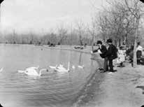


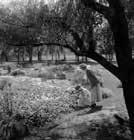
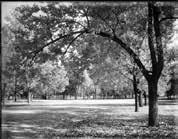

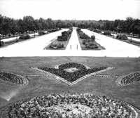
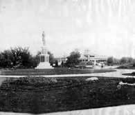
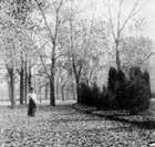

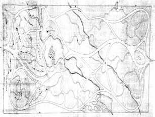
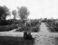
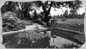

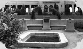
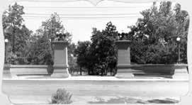

City Park is composed of significant features that individually and collectively contribute to the park character. Contributing features are those features present during the Period of Significance that possess historical or architectural integrity.


City Park is a premier regional park destination for the Denver metropolitan area. It is also the neighborhood and community park for eight Denver neighborhoods: Skyland, North Park Hill, South Park Hill, City Park, Congress Park, Hale, City Park West, and Whittier. The park’s central location in east Denver is close to major highways and thoroughfares, and to many Denver residents, 85% reside within a 5-mile radius of the park. Two of Denver’s cultural institutions have been part of City Park since the early 1900s: Denver Zoo and Denver Museum of Nature & Science. Together these institutions attract more than 3 million visitors annually.
City Park is two miles south of I-70 and connected by Colorado Boulevard, the city’s busiest arterial street. The park is two miles east of downtown Denver. Dedicated bike routes, bus service, city streets, and pedestrian routes connect the park to adjacent neighborhoods and the broader city. City Park Esplanade and Colorado Boulevard connect City Park to Denver’s Parks and Parkway system. City Park Golf Course is the northern edge of City Park, across East 23rd Avenue. Together these two public spaces encompass 456 acres of park and open space.
City Park’s historical and architectural significance, beautiful natural setting, and variety of recreational and cultural offerings draw thousands of visitors each year. The park is popular for active and passive park uses including organized and informal activities. The 320-acre park provides more than 13 miles of trails; 10 sports fields—some within park meadows; two playgrounds; picnicking; 24 courts for tennis, handball and horseshoes; and athletic fields in the topographic bowl of a historic racetrack. Recent surveys indicate that 56% of park users visit City Park several times a week, many with family and friends.
85% of Denver residents are within a 5-mile radius of City Park.


Ӱ City Park is a premiere regional designation and serves eight neighborhoods as their neighborhood / community park. Ӱ City Park and City Park Golf Course together encompass 456 acres of park and open space.
(page intentionally left blank)
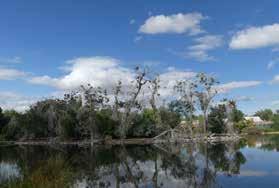
City Park will be preserved and improved according to recommendations presented in this Master Plan Update and as guided by Design Guidelines. Recommendations will protect historical and environmental resources including the urban forest and park features and spaces. Road and trail improvements will offer access for park users and all modes of transportation. Park facility enhancements and a few additions will meet community needs. Recommendations will be implemented with a multi-year strategy to ensure improvements, use, and management follow priorities and available funding.
An improved review process will integrate the city’s existing Engineering, Regulatory, Analytics (ERA) and Public Engagement, Communication and Notification (PECAN) processes. This improved process will add design review provided by a new design advisory committee to ensure proposed modifications are consistent with the Master Plan Update and Design Guidelines. This committee will consist of design professionals, park advocates, neighbors, and park users who will review projects / priorities, and provide recommendations to the department’s Executive Director. The improved project review process will be open to the public with community input at project milestones.
City Park’s composition will be preserved by protecting and enhancing the park’s significant spaces, features, and relationships, and by managing the urban forest for longevity and rejuvenation. The park’s variety of small and large spaces of meadows and lakes defined by forested groves and tree-lined winding roads will remain and be improved. Views and vistas and features that contribute to park character will remain. New features will be placed with respect to the park composition.
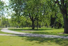
A comprehensive system of movement and connection will improve circulation. It will be of a cohesive aesthetic, easy to navigate, offer experiences and access for all users, and be safe for all modes. Upgrades to physical infrastructure will build upon City Park’s characteristic hierarchy of roads and trails and provide a consistency in materials. Park roads will be upgraded along established alignments. Existing trails will be improved, and new trails added to access park destinations and follow missing historic routes. The south road will become a park promenade for shared use by pedestrians, bicycles, and park users. North Park Road will be redesigned to a park-like aesthetic with narrow travel lanes for shared bicycle and vehicular travel.
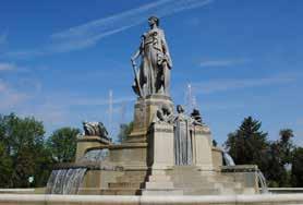
Small roundabouts and raised pedestrian crossings will ensure safe pedestrian / bicycle travel. City Park’s diverse trees, meadows, and gardens will be improved and managed for historic integrity, aesthetics, tree health, and ecological diversity. A successional approach will be implemented to reestablish historic spatial and vegetation patterns while protecting established, significant, and notable trees. Living collections and gardens will be repaired and select new gardens added. Plantings along lake edges and in the park’s southeast corner will provide bird, aquatic, and wildlife habitat; increase biological diversity; and ensure an ecologically functional landscape.
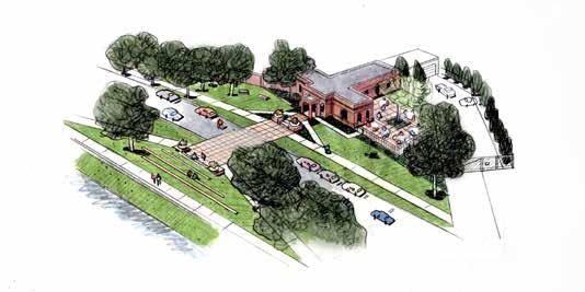
City Park’s park buildings and structures will be preserved and repaired. City Park Pavilion, Graham / Bible House and Barn, Elephant House, and Bungalow Fire Station will be preserved and repaired for possible park-related community use. New park buildings and structures will be added in select locations to accommodate park uses, i.e., public restrooms, gathering spaces, and picnic facilities. All will be designed to complement, and be subordinate to, existing park buildings and structures. Existing structures and gateways will be repaired, and new gateways added at key entrances into City Park from East 23rd Avenue. New gateways will continue the tradition of accentuating primary park entrances. A maintenance building will be added for improved park operations.
The interface of the Zoo with City Park will be improved. It will be designed as a cohesive aesthetic that reflects the Zoo’s location within City Park and acknowledges its importance as an institution. The improved Zoo edge will have some variety but will be designed as a composition that addresses views, conditions, and experiences. Within the Zoo’s boundaries, new ‘zooconic’ buildings and exhibits, as viewed from City Park and East 23rd Avenue, will be expressive and identifiable as Zoo features.
City Park’s current variety and balance of passive and active uses and experiences will continue and be enhanced. All uses and experiences will be designed to be integrated with the park. Existing park facilities, features, and spaces will be improved, and a few new features added. Improved roads and trails will offer safer and more enjoyable walking, running, and bicycling. Improvements to play spaces and consideration of future new amenities will enhance active use. Improvements to picnicking, fishing access, and wildlife viewing will enhance passive use. As habitat is improved, more opportunities for viewing wildlife will occur. Improved circulation will better accommodate park users and those who visit each institution. Basic amenities including lighting, drinking fountains, seating, bicycle parking, and trash and recycling receptacles will be improved.
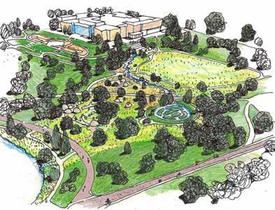
South Meadow and the park’s southeast corner will be enhanced to be a more ecologically diverse landscape. Naturalistic features and exploratory park experiences will respect the park composition. This area will become more naturalized in a setting compatible with the park’s established forested groves and meadows. A more balanced inside/outside connection will be made with the Museum, and new experiences will be integrated with Box Canyon Waterway, the Pinetum, and Lily Pond. South Meadow will become a unified experience where ecology, biological diversity, play, and passive use are accommodated in a variety of linked spaces.
The park’s northwest corner will be improved for enhanced play, court sports, and passive uses. A new restroom will replace the outdated structure. Park maintenance and operations will be relocated to a new building and site. Dustin Redd Playground will be replaced with new play experiences, integrated with the surrounding meadow, and improved park roads. New open-air shade pavilions will provide respite and shade.
East 23rd Avenue will be improved to have a more park-like character with park gateways at York Street and Colorado Boulevard. The upgrades will accommodate all travel modes, improve wayfinding at park entrances, provide grand and welcoming gateways, and enhance the road’s character by adding trees and accentuating views. The improved aesthetic will provide visual and physical connectivity between City Park and City Park Golf Course.
Recommendations will be implemented according to priorities and available funding. The implementation strategy presented in this document directly addresses needs and desires expressed by the community, Stakeholder Working Group (SWG), and DPR staff. Projects were weighed relative to one another, and are presented as Priority #1, #2 or #3. Projects include deferred maintenance, 2001 Master Plan actions that have yet to be implemented, and new projects identified by this planning process to meet evolving needs and preserve park character. The implementation strategy addresses the community’s desire for all projects, no matter the scale or scope, to reflect the character of City Park. To achieve this, the implementation strategy will be used in tandem with the Design Guidelines and the improved design review process.
City Park’s distinct composition will be maintained by managing the urban forest, and by preserving and enhancing the spaces, features, and relationships that it creates. The park’s variety of small and large spaces of meadows and lakes defined by forested groves and tree-lined winding roads will be preserved and enhanced. Views and vistas and features that contribute to the park character will remain. New features will be placed with respect to the park composition.
Principle: Protect and enhance City Park’s distinct composition of spaces along with views, topography, and individual features that define these spaces.
■ Respect established and historic patterns, sequences, openings and enclosures, spaces and relationships, and topography.
• Preserve historic spaces and relationships.
• Place new vegetation, or selectively thin or remove vegetation, to complete missing or diminished historic patterns, and to repair views or vistas that link park spaces or movement.
• Place new park buildings and structures, vegetation, or features to enhance the park composition and views.
■ Repair the established and historic pattern and variety of park spaces through vegetation management and placement of features.
• Restore views at roundabouts by selective thinning, pruning, removing select trees, or adding new trees.
• Repair the relationship between tree-lined winding roads and park spaces by replacing missing trees in established tree allees along park roads and by opening views between spaces.
• Define the park edges with new tree plantings to enhance the park as a refuge from the busy city and surrounding neighborhoods.
• Preserve and repair existing park features that contribute to the definition of park spaces.
■ Respect the vista point on the west side of the Museum as an important view towards the Rocky Mountains.
• Place new vegetation along the edges of this viewshed to enhance and frame the vista.
• Preserve the topography and park features that create the vista point and viewshed.
■ Preserve historic views within and to City Park, including the following.
• between City Park Pavilion and Martin Luther King Jr. Monument
• Ferril Lake view
• between Ferril Lake and Elephant House
• between City Park Pavilion and Elephant House
• between Burns Garden and Duck Lake
• into North Meadow from East 22nd Avenue, East 23rd Avenue, and Colorado Boulevard
• into 1950s Botanic Garden from North Park Road
• into the park at East 21st Avenue from York Street at McLellan Gateway
• into the park at Sopris Gateway from East 17th Avenue
■ Repair missing historic views within and to City Park.
• Repair missing views into the park from York Street, East 17th Avenue and Colorado Boulevard by selective thinning, pruning, removing select trees, and planting new trees where necessary to frame views.
• Repair missing views to Box Canyon Waterway, at Steele Street entrance, and the Pinetum by selective thinning, pruning, removing select trees, and planting new trees where necessary to frame views.
Circulation for all modes within City Park will be enhanced to provide a comprehensive system of movement and connection in a consistent aesthetic compatible with the park character. The improved system will be easy to navigate, offer experiences and access for all users to park destinations, and be safe for all modes. Upgrades to the park’s physical infrastructure will reestablish the park’s hierarchy of roads and trails and provide consistency in use of materials. Park roads will be modified along established alignments. Existing trails will be improved, and new trails added to access park destinations and along missing historic routes. The south road will be formalized as a park promenade for shared pedestrian and bicycle use.
Principle: Establish a comprehensive circulation system with improved connections and access to, and within, the park for all modes that builds upon City Park’s character.
Improvements to roads and trails will be supported by an intuitive wayfinding system to reduce conflicts and for ease of access.
■ Establish a hierarchy of trails to provide a range of park experiences, access park destinations, and connect to surrounding neighborhoods.
■ Modify vehicular flow on west park roads to reduce conflicts and provide access to park destinations.
• Consider a combined one-way and two-way flow pattern for west park roads.
• Consider implementing a pilot project to study vehicular flows, including regulatory signage, prior to physical infrastructure improvements.
■ Provide a consistent signage system for directional, information, and identification to improve wayfinding for all modes.
• Consider an interpretive signage program to tell the story of City Park.
• Locate wayfinding elements at key points along park roads, trails, and park promenade.
• Develop a consistent system of regulatory signage to improve wayfinding.
• Implement a regulatory sign placement plan to reduce signs throughout the park and to establish clear and consistent messaging.
Access to City Park from Colorado Boulevard will be improved at key intersections for vehicular, bicycle and pedestrian safety and ease of access. Colorado Boulevard is one of Denver’s designated parkways and boulevards. The edge along City Park is one of its most important features.
■ Improve the intersection of East 23rd Avenue as a park gateway and for improved bicycle and pedestrian access
■ Improve the intersections of Montview Boulevard and East 17th Avenue for improved bicycle and pedestrian access.
■ Consult previous studies for Denver’s parkway and boulevard system for recommendations for preservation and repair.
Access to City Park from East 17th Avenue, a major city arterial, will be improved for safer pedestrian and bicycle crossing into the park. A pilot program should be explored to evaluate access and additional parking for all users to the south side of City Park.
■ Improve the intersections of City Park Esplanade and Steele Street for improved pedestrian and bicycle access.
■ Consider methods to slow traffic and provide safe refuge and crossing for pedestrians and bicycles.
• Coordinate with Public Works on implementing a pedestrian / bicycle crossing at Garfield Street and East 17th Avenue to safely connect the D-8 bicycle route.
• Consider other locations for similar crossing.
• Consider a feasibility study or pilot program to assess implementing a parking lane along the north side of East 17th Avenue during weekend and holiday hours.
Access to City Park will be improved for vehicular, bicycle and pedestrian safety, and ease of access. This entrance is a key park gateway and major park access for all modes.
■ Improve the intersection and park gateway for safer access for vehicles, bicycles, and pedestrians.
■ Consider methods to slow traffic and provide safe refuge and crossing for pedestrians and bicycles.
■ Consult previous studies for Denver’s parkway and boulevard system for recommendations for preservation and repair.
Park entrance roads will be preserved along original alignments and improved to enhance access into City Park and to park destinations. Recommendations for park entrance roads are for York Street, East 17th Avenue, Colorado Boulevard, and City Park Esplanade. East 23rd Avenue recommendations are presented in a separate section.
■ Provide two-way vehicular travel into and from City Park at East 21st Avenue and York Street.
• Modify the park entrance road to improve access for all modes, while preserving the road’s original alignment.
• Reduce the roadway width to two travel lanes with shared bicycle use.
• Provide pedestrian access through the McLellan Gateway portals.
• Modify the park road to include parallel parking on both sides between McLellan Gateway and the roundabout.
■ Provide traffic control gates at park entrance roads to manage vehicular use.
• Design a simple gate in a color and material compatible with park character.
• Ensure each gate provides safe access for pedestrians and bicycles and are visible to vehicles when gates are closed.
■ Provide raised crossings where pedestrian trails cross park entrance roads for safer pedestrian and bicycle use.
■ Modify park entrance roads to improve access for all modes to all park destinations.
• Improve the Zoo / City Park Golf Course intersection at East 23rd Avenue.
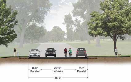
• Eliminate vehicular exit between the Zoo / City Park Golf Course intersection and the Zoo / Museum / Park entrance road.
• Improve the park entrance road for the Zoo / Museum / Park.
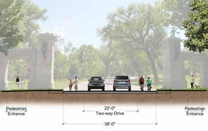
Park roads will be improved to provide better park experiences and to improve ease of access and navigation. Established alignments will be preserved as park roads are repaired to create a consistent aesthetic and alleviate deferred maintenance.
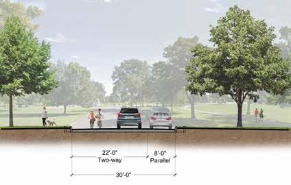

■ Modify park roads to provide narrow travel lanes with shared bicycle travel and parallel parking.
■ Consider implementing a combined one-way and two-way vehicular flow for west park roads.
• Consider a pilot project to study vehicular flows prior to physical infrastructure improvements.
• Reduce pavement widths based on vehicular flow and location of parallel parking.
ӽ One-way roads with parallel parking on one side to be a 30-foot width.
ӽ One-way roads with parallel parking on both sides to be a 32-foot width.
ӽ Two-way roads with parallel parking on both sides to be a 38-foot width.
■ Consider raised crossings for safer pedestrian and bicycle use where pedestrian trails cross park roads at potential conflict points.
• Thatcher Fountain roundabout
• McLellan Gateway roundabout
• Duck Luck roundabout / controlled intersection at North Park Road and west park roads
• Roundabout / controlled intersection at the intersection of the Zoo and Museum parking
■ Eliminate parking at roundabouts.
■ Repair road edges with rolled curbs where needed to accommodate parking and drainage.
North Park Road will be improved to be a more park-like aesthetic. Modifications will provide better experiences for all modes and users, and a more compatible edge along the Zoo.
■ Modify road to improve access for all modes within the existing alignment. Provide two-way vehicular travel with narrow travel lanes, shared bicycle travel, and parallel parking on both sides. Provide a separate pedestrian trail.
■ East Section:
• Modify the road cross section for two-way vehicular flow and parallel parking on both sides.
• Provide a pedestrian trail, tree allee, and lawn on the north.
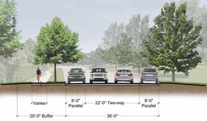
■ Center and West Section:
• Modify the road cross section for two-way vehicular flow and parallel parking on the north.
• Provide a pedestrian trail on the north and pedestrian connections between Elephant House and Ferril Lake.

■ Improve the connection of North Park Road to North Meadow with a new small roundabout or a controlled intersection. Locate this where the Zoo and Museum parking connect to avoid impacts to North Meadow.
■ Improve the connection of North Park Road with the west park roads at the intersection west of Duck Lake. Provide a small roundabout or a controlled intersection.
■ Provide raised crossings where pedestrian trails cross North Park Road for safe pedestrian and bicycle use including these locations.
• between Ferril Lake and Duck Lake
• Elephant House
• pedestrian promenade
• pedestrian trail between the Museum and the Zoo
Existing trails will be improved and new trails added to access park destinations and reestablish missing historic routes. A hierarchy of trails will be provided for a broad variety of experiences.
■ Repair existing pavement surfaces.
■ Provide a consistent aesthetic and width for existing and new trails.
■ Determine trail width and surfacing based on use and location.
■ Provide new trails along select routes. Connect pedestrians with park destinations, and provide additional experiences using historic routes.
■ West Park—new trails and missing trails along historic routes:
• East 22nd Avenue to tennis courts
• From McLellan Gateway to the roundabout and north along the west park road
• Roundabout at McLellan Gateway through the meadow to North Park Road
• Graham / Bible House to new picnic area at non-extant greenhouse site
• Thatcher Memorial and along the non-extant park road to connect with park promenade
• Martin Luther King, Jr. Monument to City Park Pavilion parking, adjacent to 5280 Trail
Pedestrian Trail
■ East Park—new trails and missing trails along historic routes:
• Trails connecting the Museum to Box Canyon Waterway, Pinetum and South Meadow
• Trails on the north and south of Benedict Garden creating a looped trail
• Trail around perimeter of North Meadow
■ Repair the existing sandstone trail along East 17th Avenue. Where feasible or necessary, consider new trail segments that connect to existing trails and are integrated with the forested groves, and tree allees.
■ Provide new pedestrian trails through the portals of McLellan Gateway on both sides of the gateway and the park entrance road.
■ Provide a new pedestrian trail through City Park Golf Course to connect the Skyland Neighborhood to City Park.
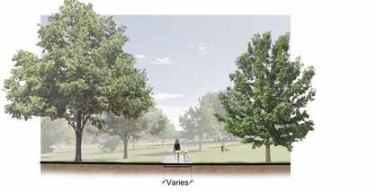
City-designated bicycle routes including D-8 route within City Park and bicycle lanes along East 23rd Avenue will remain. Recreational bicycling within the park will be along shared routes on park roads and park promenades. Trails on the park’s east and west edges will be shared pedestrian and bicycle use.
■ Provide pavement markings at entrances and key decision points. Provide wayfinding and directional signage at road and bicycle route intersections.
■ Improve bicycle connections from surrounding streets and routes to improve navigation and safety to and within the park.
• East 17th Avenue: at Garfield Street, Steele Street, Detroit Street, and City Park Esplanade.
• York Street: at East 21st Avenue and East 23rd Avenue.
• Colorado Boulevard: at East 23rd Avenue, Montview Boulevard, and East 17th Avenue.
■ Modify the park road entrance at Steele Street and East 17th Avenue to be a park promenade.

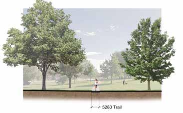
• Evaluate the crossing on East 17th Avenue for improved connectivity and safety for bicycles and pedestrians.
• Improve the physical connection to the bus stop west of the park entrance and provide an accessible route.
■ Improve the connection from the signalized crossing at Fillmore Street to Sopris Gateway and provide an accessible route.
■ Evaluate the intersections at East 17th Avenue and East 18th Avenue, and Josephine and York streets for improved bicycle / pedestrian safety.
■ Evaluate bicycle and pedestrian access into the park at York Street and East 22nd Avenue for improved connectivity / safety. Consider pedestrian-activated traffic signals and painted crossing markings.
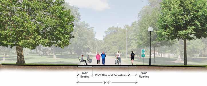
Two existing routes will be improved as park promenades: the south park road and east trail at Ferril Lake. Both will follow existing established alignments. Widths and surfacing will be modified to accommodate pedestrians, bicycles, and park spaces and experiences.
■ Provide a park promenade for a shared pedestrian, bicycle, and park user experience.
■ Modify routes with the same continuous 24-foot width, consistent aesthetic, and use of materials.
• Provide a shared zone for pedestrian and bicycles, a seating area, and soft surface running trail.
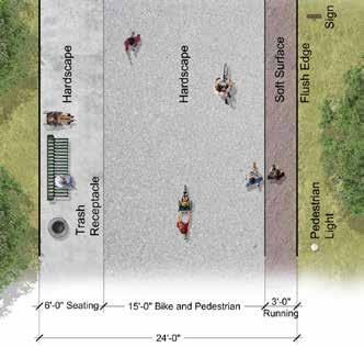
• Materials may include hardscape and soft surfacing.
■ Include the park entrance at Steele Street and East 17th Avenue as a park promenade. Consider bollards to deter vehicular access and provide safe access for bicycles and pedestrians.
City Park’s diverse trees, meadows, and gardens will be improved and managed for historic integrity, aesthetics, tree health, and ecological diversity. The urban forest will be managed with a successional approach to reestablish historic patterns while protecting and preserving established significant and notable trees. Repairs will be made to gardens and living collections, and new gardens will be added. Plantings that provide habitat and increase the park’s biological diversity will be added along lake edges and in the park’s southeast corner.
Principle: Protect and preserve City Park’s established tree and vegetation patterns, plant species, and significant and notable trees to preserve character, enhance the urban tree canopy, provide wildlife and bird habitat or other ecological benefits, and to enhance biological diversity.
City Park’s urban forest will be managed to protect significant and notable trees and to continue its legacy as an important urban forest. The park’s 3,700 trees are a remarkable diversity of 157 species with extant trees from each period of development in the park’s history. Many were planted with the park’s early construction from the late 1890s through the 1920s or are in-kind replacements. Arranged as forested groves and tree allees, they create park spaces and experiences, and are valued for horticultural qualities, aesthetics, environmental benefits, and interpretive opportunities.
■ Develop a park-wide planting plan to assist in defining locations for new and replacement trees and potential tree removals.
• Coordinate with the city’s GIS database / tree management system (TreeKeeper).
■ Follow a successional approach to preserve significant, notable and historic trees, and to facilitate infill and new tree plantings to ensure the longevity of the urban forest.
• Protect significant, notable, and historic trees by managing for longevity using sound horticultural practices.
ӽ Replace trees when they become hazards or die. Plant infill trees as a proactive approach to reestablish forested groves and tree allees and replenish the urban forest.
ӽ Consider each tree’s role when removing, thinning or pruning, and in replacement.
City Park has 3,700 trees representing 157 species. The park’s 10 most common trees are:
Ӱ Green Ash
Ӱ American Linden
Ӱ Blue Spruce
Ӱ Hawthorn
Ӱ Crabapple
Ӱ Austrian Pine
Ӱ Cottonwood
Ӱ Honeylocust
Ӱ Ponderosa Pine
Ӱ Bur Oak
• Plant new trees to repair established or historic patterns, allowing new replacements near mature trees.
• Consider new hardy species as in-kind replacements that are similar in character to significant, notable, or historic trees in form, color, and flower.
ӽ Follow each vegetation pattern’s mix of species and composition to determine appropriateness of new species.
ӽ Consider increasing City Park’s number of trees, extent of canopy, and diversity of species.
■ Repair City Park’s variety of species and patterns that define the park composition, spatial relationships, views, and experiences.
• Replace vegetation where missing or diminished to retain or reestablish openings and enclosures.
• Repair forested groves and tree allees in a holistic manner that considers the nuances of each individual grove or allee, and their role in the park.
ӽ Manage forested groves as a mixture of evergreen and deciduous shade trees or groupings of individual species that assist in defining park spaces and experiences. Consider individual nuances of each forested grove when planting new trees to retain the pattern and composition.
ӽ Locate new and infill trees to define meadows, establish views, and to replace missing trees.
ӽ Manage tree allees as deciduous shade trees within their distinct patterns to preserve their role in defining the character of park roads. Consider individual nuances of each tree allee when planting new, i.e., arrangement, species mix, and relationship to park roads. Ensure modifications to park roads also respect and enhance established and historic tree allees.
ӽ Consider additional horticultural measures such as use of potable water for irrigation to ensure the longevity of sensitive conifer groves.
ӽ Evaluate the long-term health of established trees prior to irrigation modifications.
• Add trees in select areas to define spaces and views.
• Consider native grasses and plantings in South Meadow and the space surrounding the Lily Pond.
■ Retain bluegrass in forested groves under established trees. The lawn and trees have a compatibility that conserves water use and preserves tree canopy.
• Maintain irrigated bluegrass within forested groves as passive park spaces per the City of Denver’s Bluegrass Forested landscape typology.

Seven distinct meadows, defined by forested groves and tree allees, assist in creating park character. Meadows will be preserved by protecting significant, notable, and historic trees and topography, by relocating trees, and by planting new trees to reinforce the composition of each meadow. Meadow spaces and views between meadows will be reestablished.
■ Protect and preserve established trees that assist in defining meadow spaces.
• Manage extant trees for longevity following appropriate horticultural practices.
• Replace trees when they become hazards or die. Infill trees in anticipation of removal of aging trees.
• Consider time of year and each tree’s role when removing, thinning or pruning, and in replacement.
• Plant new trees to repair established patterns and reinforce meadows as park spaces.
■ Repair the lawns and herbaceous vegetation of each meadow.
■ North Meadow:
• Preserve established trees and topography that reinforce North Meadow as a park space.
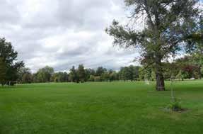
• Consider new tree plantings to define or orient views both into the meadow and towards the Museum.
■ Big Meadow:
• Preserve established trees and topography that reinforce Big Meadow as a park space.
• Consider new tree plantings to assist in creating a human-scale to the meadow and to better orient views toward the Rocky Mountains.
■ West Meadows:
• Preserve established trees and topography that reinforce each meadow as a park space.
• Consider new tree plantings to reestablish the spatial quality of each meadow.
The southeast corner of City Park will provide exploratory and experiential park uses and experiences. A naturalistic aesthetic will be developed holistically, and will be integrated with the established park composition.
• Preserve established trees and topography that reinforce South Meadow as a park space.
• Respect South Meadow’s established and historic park composition when adding new features or modifying spaces, trees, or plantings.
ӽ Preserve established and historic spatial patterns including the meadow, forested groves, tree allees, and living collections.
ӽ Protect and preserve established, significant, and notable trees.
ӽ Protect the meadow’s established spatial patterns, form, size, and scale when modifying vegetation.
• Consider integrating new resilient plantings and native plant species.
• Consider modifying the bluegrass lawn into a native grass meadow.
ӽ Consider adding cool and warm season grasses and wildflowers consisting of native and hardy species in South Meadow.
ӽ Consider plant species that provide habitat for pollinators, wildlife, and birds.
• Evaluate the long-term health of established trees prior to irrigation modifications and conversion to native meadow.
City Park will be improved to provide a more diverse and ecologically functioning landscape. Modifications or additions will respect park character, provide conservation measures, and improve bird and wildlife habitat.
■ Provide a naturalistic setting for selected lake edges and specific park spaces for improved habitat for birds, aquatic species, and urban wildlife.
• Improve lake edges through topographic modifications and new native and/or hardy plant species that provide habitat and angler access points.
• Retain existing dead trees as habitat and remove invasive or noxious vegetation species.
• Improve rookeries in Ferril Lake and Duck Lake through successional plantings. Consider establishing man-made elements that are naturalized in appearance to provide nesting habitat as vegetation matures.
• Consider man-made fish habitat structures to improve aquatic habitat.
■ Continue the park’s role in the city-wide stormwater system in which stormwater flows through Little Lake (Sediment Pond) and Ferril Lake.
■ Provide measures to assist in regulating local temperature, managing stormwater runoff from park spaces, and providing water conservation.
• Manage the urban forest to provide shade for roads, trails, and impervious surfaces.
• Direct stormwater runoff to vegetated areas to improve the quality of runoff.
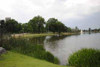
• Reduce impervious surfaces where possible by narrowing park roads and allowing pervious surfaces where appropriate.
■ Enhance water quality and environmental benefits of Ferril Lake, Duck Lake, and Little Lake.
■ Consider enhancing City Park’s southeast corner to include naturalized meadow and landscape.
■ Preserve ecologically functional vegetation.
■ Provide renewed biological diversity for both plant and wildlife habitat at lake edges and within the park’s southeast corner.
City Park will continue to be a garden showcase. Established and historic gardens and living collections will be repaired and new gardens added. Individualized setting, spatial arrangements, features, and plantings of each garden and living collection will be preserved and repaired. A successional approach will preserve significant and notable trees and shrubs and new plantings of hardy species. The diversity of existing species will be preserved and additional species of interest provided.
City Park’s gardens were designed as commemorative installations, formal flowerbeds, or picturesque settings. They include Box Canyon Waterway, Kessler Plaza / Benedict Garden, Burns Garden, Sopris Garden, and City Park Esplanade. The city’s first Botanic Garden was built in the 1950s and remains in City Park on the park’s east side.
Living collections are groupings of plants that showcase a single species or several similar species. Most are vestiges of the 1950s Botanic Garden or are features of park gateways. They include the Pinetum, Lilac Hedge, Sopris Gateway, and the Cottonwood Grove.
■ Protect and preserve significant and notable trees and manage them for longevity according to appropriate horticultural practices.
■ Provide additional horticultural measures, i.e., potable water supply for irrigation of conifer trees or other salt sensitive species to ensure the health and longevity of gardens and living collections.
■ Preserve extant features of the 1950s Botanic Garden including trees and shrubs, garden spaces and relationships, and topography.
• Manage plantings to preserve longevity and add new plantings of compatible species.
• Create a detailed plan of individual plantings documenting existing conditions, species, variety, size, and form.
■ Plant new trees to repair established or historic patterns, allowing new replacements near mature trees.
• Allow new hardy and experimental species as in-kind replacements that are similar in character in form, color, and flower to established or historic trees and shrubs.
• Consider new trees or shrubs of horticultural interest integrated with established patterns.
Gardens are commemorative installations, formal flowerbeds, or picturesque settings.
Burns Garden (1896)
City Park Esplanade (1907 / 1918)
Kessler Plaza & Benedict Garden (1909 / 1911)
Sopris Garden (1925)
Botanic Garden (1952 to 1960)
Box Canyon Waterway (1957)
Rock Garden (1990s)
Living collections are groupings of plants that showcase a single species or several similar species.
Cottonwood Grove (1890s)
Sopris Gateway (1911)
Lilac Hedge (1953)
Pinetum (1953)
Many trees, shrubs and spaces remain from the 1950s Botanic Garden set on the park’s east side including lilacs, cherries, and the pines of the Pinetum.
1950s Botanic Garden
Denver’s first Botanic Garden was built in the early 1950s on City Park’s east side. S.R. DeBoer created early planning documents from which several designs were implemented— the Pinetum, Box Canyon Waterway, Lilac Hedge, and Rainbow Iris Garden. Miscellaneous plantings including cherry and crabapple trees and nearly 180 trees remain from these original plantings. Exceptions are the Iris Garden and tulip plantings.
■ Preserve extant features of the 1950s Botanic Garden including trees, shrubs, garden spaces, relationships, and topography.
■ Manage plantings to preserve longevity. Add new plantings of compatible species.
• Create a detailed plan of individual plantings documenting existing condition, species, variety, size, and form.
• Provide additional field work and research to determine the extent of the 1950s Botanic Garden and remaining features. Ensure proper documentation, management, and care.
• Consider increased or specialized arborist and horticulturist care to better manage gardens as specialized plant collections.
• Consider a potable water source / supply for all gardens.
Box Canyon Waterway
The 1957 Box Canyon Waterway, designed by S.R. DeBoer will be repaired. The design is an interpretation of a mountain stream cascading over large boulders and smaller stone drops. It is bordered by native plants and grasses and terminates at the Lily Pond.
■ Replace missing boulder outcrops, repair stone drop structures, and add new hardy and native plantings.
• Repair stone drop structures by removing excessive and inappropriate mortar and replace missing stones.
• Repair the form, grade, and topography of water basins of each drop structure.
• Add new plantings of hardy or native species similar in character to original plantings.
• Continue the water quality role of the waterway in filtering sediment and debris.
■ Consider integrating an interactive nature play element as a hardscape surface and recirculating water.
■ Provide new pedestrian trails to access and interact with Box Canyon Waterway.
The 1907 / 1908 Kessler Plaza occupies the vista point as designed in Meryweather’s 1882 plan. This grand space was built as a viewing plaza for both pedestrians and vehicles to enjoy breathtaking views of the Rocky Mountains and, later downtown Denver. Below Kessler Plaza is the 1911 Benedict Garden designed by the Olmsted Brothers. It has been altered but retains its historic form of 1911 with a central fountain and symmetrical gardens. The vista point will be preserved, and the gardens repaired to more fully reflect the original space and design.
■ Consider modifying or replacing the existing 1999 H2Odyssey water feature that reflects the scale, character, and intent of the original reflecting pool.
■ Add evergreen trees or other compatible trees on the north and south hillsides to better define Benedict Garden. Enhance the garden with additional plantings.
■ Protect and preserve the topographic landform of Kessler Plaza and Benedict Garden.
The 1896 Burns Garden by Reinhardt Schuetze dates to the park’s early development. Designed in the French broderie manner with elaborate flowerbeds, it is a small formal garden encircled by evergreen and deciduous trees. Three Naval cannons are west, north, and southeast of the flowerbeds. The bronze statue of Robert Burns, added in 1904 in the center of the garden, replaced an earlier Spanish-American memorial. Burns Garden will be preserved and repaired to reflect its original design.
■ Restore the three canons and bronze statue of Robert Burns.
The 1925 Sopris Garden is west of City Park Pavilion. It consists of Elizabeth Ellen Sopris Memorial, formal flower beds, Colonial Dames sundial (1906), a Civil War Memorial short column, and Sons of Colorado Flagpole (1906). Japanese Tree Lilacs, added in 1990, assist in defining the space. The garden and features will be repaired.
■ Repair the pool and replace the missing bronze drinking fountains with new, in-kind fountains.
■ Retain the Japanese Tree Lilacs enclosing the garden on the west side. Replace the trees as needed for longevity.
City Park Esplanade is one of the park’s primary entrances and connects the park with East High School. The 1907 design by George Kessler is a French-inspired grand promenade with a grand monument at each end. A broad central lawn is lined by tree allees on the Esplande’s east and west road edges. This ceremonial entrance to City Park includes Sullivan Gateway on the south and Thatcher Memorial at its terminus on the north. City Park Esplanade will be repaired.
■ Repair the backdrop of juniper trees north of Thatcher Memorial with new plantings of the same or in-kind species.
■ Repair Thatcher Memorial. Consider a comprehensive study to evaluate and recommend a preservation / rehabilitation approach to repairing the formal composition and materials of City Park Esplanande, including vegetation.
■ Add new traffic control gates at East 17th Avenue.
■ Repair the garden plantings and garden bed forms to reflect the original design.
■ Repair the tree allee and tree patterns of City Park Esplanade. Allow new replacement trees near mature trees.
The 1990s Rock Garden is an informal flower bed of ornamental grasses and perennials adjacent to South Meadow and Lily Pond.
■ Enhance Rock Garden with additional planting.
■ Consider integrating new resilient plantings and native plant species complementary to other plantings within South Meadow.
■ Consider plant species that provide habitat for pollinators, wildlife, and birds.
New gardens will be added in select locations to continue the legacy of City Park as the city’s garden showcase.
■ Expand and enhance gardens at City Park Greenhouse.
• Expand the garden to the west to include plants with rich horticultural interest.
• Open views into the gardens and the Work Progress Administration portion of City Park Greenhouse.
• Remove portions of the chain link fence and evergreen shrubs on the west side.
• Remove the portable toilet / trash enclosure on the north side along East 23rd Avenue.
■ Add a new garden at the East 22nd Avenue pedestrian trail near York Street.
■ Add a new garden south of Graham / Bible House in the location of the non-extant greenhouse.
• Add a pedestrian trail along the missing historic route to access the garden.
• Consider integrating the new garden and new picnic site as one park space.
The 1953 Pinetum will be repaired and enhanced. Set on the south side of the Museum, the Pinetum is a mature grove of conifer trees set on sloping terrain. The tree plantings and grading were laid out in a hilly labyrinth as part of the 1950s Botanic Garden designed by S.R. DeBoer. Planting design was by Robert E. More and grading was designed by Ed Wallace.
■ Repair the Pinetum to improve its physical and visual connection with the Museum, South Meadow, and Lily Pond.
■ Preserve the original features of the Pinetum including topography and trees.
■ Plant new trees to reestablish missing patterns. Allow new conifer species to expand the diversity, educational value, and aesthetics of the collection.
■ Remove the crabapples at the perimeter of the Pinetum. These recent additions are not compatible with the conifer planting.
The Lilac Hedge that defines the north edge of Big Meadow will be repaired. Originally planted in 1953 as part of the Botanic Garden, it is a series of parallel rows with a pedestrian trail at the center.
■ Preserve original features of the Lilac Hedge including shrubs and topography.
■ Manage plantings to preserve longevity. Add new plantings of lilacs of the same, similar, or in-kind species as older shrubs die to maintain the diversity and aesthetics of the collection.
The cottonwood tree grove in the northwest corner of City Park near McLellan Gateway will be preserved and enhanced. Many trees date from the early development of the park between 1886 and 1890.
■ Follow a successional approach to preserve mature trees and facilitate infill and new tree plantings.
■ Protect significant and notable trees and manage them for longevity according to appropriate horticultural practices.
■ Plant new cottonwood trees to retain the unique identity of the grove, allowing new replacements to be planted near mature trees.
The 1911 / 1912 Sopris Gateway was built as a trolley stop and pedestrian gateway into City Park. The gateway is framed by a mass planting of Austrian and Ponderosa pine, juniper, catalpa, and crabapple trees. The trees frame the view into the park and provide a backdrop for the monument. The trees will be maintained and replanted when needed.
■ Follow a successional approach to preserve significant and notable trees and facilitate infill and new tree plantings.
• Protect established trees and manage them for longevity according to appropriate horticultural practices.
• Plant new trees of the same or similar species to retain the unique identity of the living collections, allowing new replacements to be planted near mature trees.
• Consider additional horticultural measures such as use of potable water for irrigation to ensure the longevity of sensitive conifer trees.
City Park’s constructed water features are important historic features, and key components of the park’s ecosystem. As such, they will be improved and managed for historic integrity, aesthetics, and biological diversity. Views to and across the lakes and water features will be repaired. Improvements to topography and vegetation will provide naturalized areas and improved bird and wildlife habitat.
Principle: Protect constructed water features to preserve park character and to enhance water quality and ecological function.
Ferril Lake
Ferril Lake will be preserved and enhanced as a more ecologically diverse water body. Designed by Reinhard Schuetze in 1896, it was envisioned as a significant component of City Park in Meryweather’s 1882 park plan. Schuetze sited the lake and designed its form, topography, and size to offer prominent views of the mountains beyond. The lake’s open mirror of water reflecting the sky provides open vistas, recreation, and entertainment.
■ Enhance lake edges with topographic modifications and planting improvements using native and adaptive riparian plantings to create a naturalized appearance and habitat for wildlife and birds.
■ Continue to provide angler access and to stock the lake for fishing.
• Provide areas at select locations near the lake edge.
• Provide areas for universally accessible fishing.
■ Improve rookeries in Ferril Lake through vegetation replacement or other measures to provide habitat.
■ Consider man-made fish habitat structures to improve aquatic habitat.
■ Continue to allow non-motorized public uses on Ferril Lake.
Three man-made lakes with mature trees and rookeries provide habitat for a wide variety of birds and wildlife including black-crowned night herons, double-crested cormorants, and many duck species.
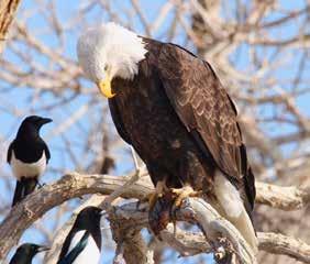
City Ditch predates the development of City Park. It flows into City Park from East 17th Avenue where it joins the City’s stormwater sewer system, and the combined flow enters the park. Ferril Lake, Duck Lake, and Little Lake are fed from City Ditch.
■ Preserve City Ditch’s flow of water into City Park as a water source for the lakes.
Duck Lake, built in 1887 and featured in Meryweather’s 1882 plan, will be preserved and enhanced. Duck Lake will continue as a bird refuge with the central island and lake improved to provide breeding and nesting areas.
■ Enhance lake edges with topographic modifications and plantings of native and adaptive riparian species to create a naturalized edge.
■ Improve rookeries in Duck Lake through vegetation replacement or other measures to provide habitat.
■ Consider man-made fish habitat structures to improve aquatic habitat.
The 1999 H2Odyssey fountain is the center of Kessler Plaza, west of the original reflecting pool that was removed many years ago. The water feature is a series of shooting fountainheads set in a circular plaza.
Consider modifying or replacing the existing water feature with an interactive water feature that reflects the scale, character, and intent of the original reflecting pool.
Featured in Meryweather’s 1882 plan, Little Lake was known as Lilly Lake early in the park’s history. The lake’s original design, a series of water bodies along the line of natural drainage within the park, was reminiscent of Monet’s paintings of Giverny of still water, weeping willows, and lilies.
■ Maintain Little Lake’s function in the stormwater management system including water quality.
■ Enhance lake edges with topographic modifications and plantings of native and adaptive riparian species to create a naturalized area.
■ Consider improvements to the plantings to reflect the original design intent.
■ Continue to provide angler access, and to stock the lake for fishing.
• Provide areas at select locations near the lake edge.
• Provide areas for universally accessible fishing.
S.R. DeBoer’s Lily Pond of 1925 is circular in form. It is built of rustic sandstone walls that divide the larger outer pool into a series of smaller pools to hold water lilies. A rustic stone headwall on the east provides an overlook. Lily Pond will be repaired, and new plantings added.
■ Repair the water delivery system and stone walls, and add new plantings.
■ Repair rustic stone walls and stone headwall using compatible mortar, replace stones to match the original, and repair pond liner.
■ Replace missing features including the wall cap and parapet wall.
Graham / Bible House and Barn (1893)
Elephant House (1906)
Bungalow Fire Station (1912)
City Park Pavilion (1929)
City Park Greenhouse (1941)
City Park’s buildings, structures and objects will be preserved and repaired. Several new structures will be added to accommodate park use. A maintenance building will be added for improved park operations. City Park Pavilion, Graham / Bible House and Barn, Elephant House, and Bungalow Fire Station will be repaired to facilitate community park use. Existing structures and gateways will be repaired, and new gateways will be added.
Principle: Preserve contributing buildings and structures, ensure new buildings and structures are consistent with park character, and provide opportunities for compatible park use.
McLellan Gateway (1904)
Electric Prismatic Fountain (1908)
Sopris Gateway (1911)
Children’s Fountain (1912)
Monti Gateway (1917)
Grizzly’s Last Stand (1930)
Bandstand (1984)
MLK Jr., Monument (2002)
The section addresses park buildings that serve City Park and park operations. General recommendations for all park buildings and structures are presented first, followed by recommendations for individual features. This section concludes with recommendations for new buildings and structures within the park. Recommendations for buildings with the Zoo and for the Museum are presented in separate sections.
■ Provide regular maintenance and repair for all park buildings and structures.
The 1929 City Park Pavilion, designed by William Fisher and John Humphreys, has an iconic setting on Ferril Lake with views of the mountains to the west and the Museum to the east. City Park Pavilion will be repaired and the setting improved.
■ Consider improvements to better accommodate food and beverage facilities, public restrooms, and community space.
■ Improve the setting of City Park Pavilion by repairing Sopris Garden to the west and the pedestrian plaza to the east.
Elephant House was built 1906 / 1908, and was previously known as Parks Maintenance Building. It contains the pumping station for the park irrigation system and Electric Prismatic Fountain, and the park maintenance and operations equipment and shop. Elephant House will be preserved and repaired. The building’s central location on North Park Road and directly across Ferril Lake provides an opportunity for adaptive reuse for community park use.
Retain maintenance and operations related to the park’s irrigation pump and mechanical infrastructure. Consider relocating other operations to the park’s
Consider nominating Elephant House for local historic designation to acknowledge its historical and architectural significance.
Consider a community use in Elephant House and in portions of the site. Allow interior modifications of the front two portions of the building for food and beverage and park use, i.e., small restaurant or café, community room, or public

Consider modifying portions of the maintenance yard as an outdoor gathering space. Preserve significant and notable trees and incorporate them into a usable
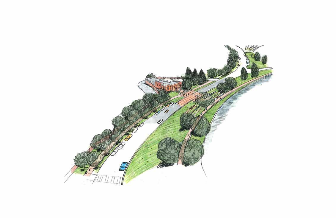
Provide a raised pedestrian crossing across North Park Road to connect with
Consider terraced seating along Ferril Lake to accommodate park users on an every day basis and during park events.
Graham / Bible House and Barn were built in 1892 as the park superintendent’s home. The non-extant original park greenhouse and nurseries were built to the south. The modest two-story cross-gable house and its matching gable end-barn were repaired in 2017 / 2018. Repair included foundations, windows and doors, deck, mechanical, plumbing and electrical, and interior improvements.
■ Consider a community use for the building, barn, and site. Allow interior modifications to provide public restrooms, a community room, and/or seasonal concessions.
■ Improve the site to provide universal accessibility and a service access to the building and barn. Ensure improvements respect established and historic patterns.
■ Remove plantings scattered near the building and barn. Develop a planting plan that respects historic patterns, and defines locations for new and replacement trees and potential tree removals.
■ Add a new garden and permitted picnicking in the location of the non-extant greenhouse.
City Park Greenhouse, built in 1941, continues to function as the greenhouse for Denver Parks and Recreation Department. City Park Greenhouse will be preserved and repaired. The portion built during the Work Progress Administration (WPA) program offers an opportunity for park community use.
■ Consider nominating the WPA portion of City Park Greenhouse for local historic designation to acknowledge its historical and architectural significance.
■ Retain park maintenance operations in the building. Retain the greenhouses.
■ Consider a community space, public restrooms, and/or interpretation / exhibit spaces within the WPA portion of City Park Greenhouse.
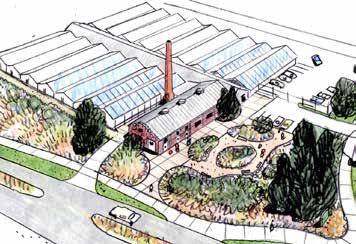
Bungalow Fire Station will be considered for future repair and adaptive reuse for a community use. Fire Station No. 18, designed by E.H. Moorman and built in 1912, is currently used by the Denver Police Department.
■ Consider a community, non-profit, or park function that complements park use for the building.
■ Repair the setting by organizing parking and improving the building entry.
■ Add new tree plantings, set in patterns and an aesthetic similar to those of North Meadow.
McLellan Gateway will be preserved and its setting and pedestrian trails enhanced. The gateway was built in 1903, and moved to its present location at York Street and East 21st Avenue in 1957. It is a pair of solid square granite piers on either side of the park road that creates a formal entrance. Two portals, scaled for pedestrians, are set within wings that end in smaller matching piers buttressed by simple volutes on the outward side.
■ Preserve the gateway’s simple stone base, entablature, moldings, and outward-facing French Gothic inspired lamps.
■ Consider nominating McLellan Gateway for local historic designation to acknowledge its historical and architectural significance.
■ Reestablish the pedestrian trails to extend through the gateway portals on each side.
■ Improve the setting by replacing missing tree allees.
Monti Gateway will be preserved, and its setting enhanced. This gateway at Colorado Boulevard and Montview Boulevard, designed by Richard Phillips and built in 1917, provides a formal entrance into City Park and the Museum from the Park Hill neighborhood and east Denver.
■ Preserve the gateway’s pair of pink Platte Canyon granite structures, including the simple piers with base and capital that are topped with a granite spheres and curved granite benches.
■ Consider nominating Monti Gateway for local historic designation to acknowledge its historical and architectural significance.
Sopris Gateway will be preserved and its setting enhanced. The gateway, built in 1911 / 1912, was originally designed as a trolley stop, but has functioned as a pedestrian entrance for many years. It is built of sandstone quarried in Colorado Springs and a red-flecked granite. The tree backdrop to the gateway is one of the park’s living collections.
■ Preserve the pair of square stone piers crowned by iron lamp standards with five globes, and the curving benches that extend from each pier terminating in shorter stone piers with slender, fluted iron Corinthian columns with a single lamp globe.
■ Consider nominating Sopris Gateway for local historic designation to acknowledge its historical and architectural significance.
■ Preserve and enhance Sopris Gateway’s trees by protecting significant and notable trees and infilling with the same or similar species.
■ Consider additional horticultural measures such as use of a potable water supply / source for irrigation to ensure the longevity of the conifer trees.
Children’s Fountain will be preserved and repaired. The white marble fountain, designed by sculptor Max Blondet, was originally installed in 1912 and moved to its present location in 1917.
■ Repair the Children’s Fountain.
■ Enhance the setting with new plantings to create a private space while also allowing for visibility for safety.
Electric Prismatic Fountain, designed by electrical engineer F.W. Darlington, was dedicated on Memorial Day 1908. The fountain originally pumped 4,400 gallons of water per minute through 2,100 jets to create 125 different water formations and was illuminated at night in nine colors. It will be preserved.
■ Preserve the existing structure, providing regular maintenance and repair.
The Bandstand was built in 1984 as a reconstruction of the park’s earlier 1924 bandstand. The Boat Dock was repaired in 2002 and serves as a location for water sports rentals.
■ Retain the existing bandstand and boat dock structures, providing regular maintenance and repair.
The MLK, Jr. Monument by Ed Dwight was commissioned by the City of Denver in 2002. It features a central sculpture of Dr. King surrounded by bronze sculptures of Rosa Parks, Gandhi, Frederick Douglas, and Sojourner Truth. Granite panels around the perimeter highlight historic dates and facts on the history of African Americans and the Civil Rights Movement.
■ Preserve MLK, Jr. Monument, providing regular maintenance and repair.
Grizzly’s Last Stand is owned by the Museum. This bronze sculpture of a mother grizzly bear protecting her two cubs adorns the northwest edge of the Museum overlooking Benedict Garden. It was sculpted in 1930 by Louis Paul Jones and donated to the Museum the same year. The sculpture’s inscription reads, “When the grizzly is gone / We shall have lost the / Most sublime specimens / Of wildlife that exalts / The western wilderness.”
■ Preserve the sculpture, providing regular maintenance and repair.
New park buildings and structures will provide facilities to better accommodate everyday park and user needs. New facilities will include restrooms, gathering spaces, and picnic spaces. New features will be designed to complement, and be subordinate, to existing park buildings and structures. New park buildings and park structures will be designed with the same care and consideration as the park’s historic buildings and structures.
■ Consider a new open-air shade pavilion and restroom in the northwest corner near court sports.
■ Relocate some maintenance and operations from Elephant House to the small parking area in northwest corner near the tennis courts. Add a park maintenance building and secured storage yard.
■ Consider a new open-air shade pavilion near Little Lake.
■ Consider a new open-air shade pavilion on the north side of North Meadow at the top of the existing ballfields.
■ Consider a new open-air shade pavilion near the new picnic site and Dustin Redd playground in the park’s northwest corner.
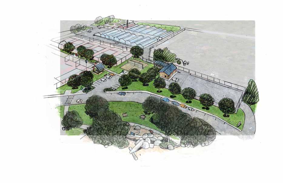
New park gateways will continue the tradition of accentuating City Park’s primary park entrances as grand and monumental features. New park entrances will identify additional vehicular entrances to specific destinations, and primarily be landscape settings.
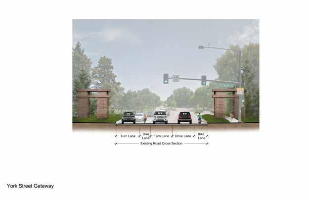
■ Consider new park gateways at the York Street and Colorado Boulevard intersections with East 23rd Avenue.
• New park gateways will have a grandeur and scale similar to historic park gateways but will be of a compatible contemporary design.
• They will have a setting, artistic grandeur, and a scale that complements, and is subordinate to, City Park’s existing monumental gateways.
• The York Street gateway will serve as a primary entry into the park from the City Park West and Whittier neighborhoods and west Denver.
• Colorado Boulevard gateway will serve as a primary entry into the park from Park Hill and South Park Hill neighborhoods and east Denver.
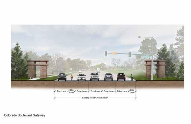
• Consider incorporating monumentation with integrated park signage, human-scale pedestrian access, backdrop of groves of specialty trees and low understory plantings, orchestrated views, and public art.
■ Consider new or enhanced park entrances at the Zoo / Museum / City Park, the Zoo / City Park Golf Course, and near City Park Greenhouse.
Park entrances will identify vehicular entrances into specific destinations and will provide clear access and wayfinding in a landscape setting.
■ Design park entrances as landscape-focused spaces of topography and plantings with minimal signage.
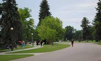
City Park’s current variety of passive and active uses and experiences will continue and be enhanced. Improvements to existing park facilities, features and spaces, and the addition of a few new features will provide better facilities and connections for all City Park users. Accommodating a balance of uses and experiences integrated with the park landscape will ensure City Park remains Denver’s most beloved public space and regional park.
Improved roads and trails will provide safer and more enjoyable walking, running, and bicycling experiences. Passive experiences will be enhanced with improvements to existing play areas, and new picnicking and fishing spots. Habitat will be improved, offering more opportunities for viewing wildlife. Informal and permitted sports will continue in the meadows, and South Meadow will become more naturalized. Improved circulation will better accommodate park users and those who visit each institution. Basic amenities will include lighting, drinking fountains, seating, bicycle parking, and trash and recycling receptacles.
Select areas will be improved for enhanced recreation. The park’s northwest corner will be improved with a gathering area and new restroom. Park maintenance and operations will be relocated (a portion will remain in Elephant House) to the existing parking area. Dustin Redd playground will be replaced with new play experiences integrated with the meadow. The park’s southeast corner will become more naturalized, in a setting compatible with the park’s established forested groves and meadows.
Principle: Maintain a balance of uses and experiences that are integrated with the park’s character and composition.
Ӱ Improved park roads will assist in better wayfinding and ease of access to park destinations. Shared routes for bicycles and cars will provide better driving and bicycling experiences and to easier access for all park users to destinations.
Ӱ Improved trails and new trails will provide better park experiences for walkers, runners, and those strolling in the park on a variety of trail types.
Ӱ Park promenades will offer improved connections for pedestrians and bicycles while creating a unique park space that encourages passive use along the park’s south edge.
■ Improve park facilities, spaces, and features to better support City Park’s uses and experiences.
• Design improvements and upgrades using practices that protect park character.
• Ensure the current variety of passive and active uses remain and are accommodated.
■ Provide basic amenities in select locations.
• Consider lighting, drinking fountains, seating, bicycle parking, and trash and recycling receptacles.
• Consider new restrooms, food and beverage, and community access for select park buildings and structures.
■ Ensure new facilities or features are designed to respect the architectural scale of City Park’s historic features.
■ Retain and enhance established park spaces associated with park buildings and structures including gardens and use areas.
■ Consider new areas at select locations at the lake edges of Ferril Lake and Little Lake for fishing and universally accessible fishing.
■ Provide resources and opportunities for visitor contact at park facilities. Highlight recreation amenities, historic and natural features, the park’s history, and park programming and special events.
■ Improve park roads for better wayfinding and ease of access to park destinations. Improve trails and provide new trails for better park experiences for walkers, runners, and those strolling in the park by providing a variety of trail types.
The southeast corner will provide exploratory and experiential park experiences in a natural setting that respects the park composition. Existing spaces will be improved to be more ecologically diverse and for an inside/outside connection to the Museum. New experiences will be integrated with Box Canyon Waterway, Pinetum, and Lily Pond. South Meadow and the southeast corner will be a unified dynamic experience where ecology, biological diversity, play, and passive uses are accommodated in a variety of linked spaces.
■ Provide physically and visually linked spaces of naturalistic plantings and features integrated with the patterns of established forested groves, living collections, and South Meadow.
■ Provide a better physical connection between the Museum and the park with improved trails and small plaza or steps.
■ Integrate new resilient plantings or native and hardy species within South Meadow, around the Lily Pond, and at Ferril Lake and Little Lake’s edges.
• Design new plantings and meadows to respect the park composition.

• Preserve established spaces and spatial patterns including meadows, forested groves, tree allees, and living collections.
■ Provide unified experiences integrated with the park composition.
• Consider native grasses and plantings to facilitate creative play.
• Improve Box Canyon Waterway as an interactive play experience and naturalistic feature.
• Improve play by removing the existing playgrounds and providing improved play experiences.
• Improve picnicking and the permitted picnic area.
• Provide an open-air shade pavilion similar to the size and scale of the nonextant historic pergola that once graced the eastern edge of Little Lake.
■ Improve Lily Pond as a centerpiece of the southeast corner and expand its setting as a garden.
■ Modify South Meadow by planting a naturalistic meadow with cool and warm season grasses and wildflowers of native and hardy species.
The northwest corner will continue to provide active park uses, primarily related to court sports and play. Improved facilities and better pedestrian connections will balance active use, play, and a new pavilion and picnic areas.

■ Improve the tennis courts by repairing surfacing, fencing, and lighting, and by adding gathering spaces.
• Consider tables and shade adjacent to tennis courts.
• Consider replacing the north fence with a new fence to provide screening in a design that is more compatible with park character.
■ Provide a new structure to accommodate accessible restrooms and an open-air shade pavilion.
• Design all features concurrently with design of the improved park maintenance and operations building and access.
• Consider a combined park maintenance and operations building and accessible public restroom or a new or repaired accessible restroom as a separate structure from park operations.
• Consider a new open-air shade pavilion.
■ Provide a new play experience to replace Dustin Redd Playground for similar age groups that meet community needs.
• Consider discovery, exploratory, imaginative or fantasy play and a variety of play experiences in a setting with features that respect City Park’s character.
• Integrate play spaces and features within the patterns of established forested groves, the meadow, and significant and notable trees.
• Consider a variety of play experiences to minimize impacts to existing vegetation and to maximize the play experience.
■ Design new plantings to respect the established park composition of the meadow while integrating the play area and related spaces.
• Preserve established spatial patterns including the meadow, forested groves, and tree allees.
■ Integrate a picnic area near the playground.
■ Provide an open-air shade pavilion near the playground.
North Meadow will continue to provide active uses including field sports and will be improved with a new trail and park pavilion. The use of this area will continue as part of the city’s stormwater system that provides detention during storms events.
■ Preserve the established topography and groupings of trees surrounding the meadow.
■ Consider modifying the use of the meadow for varied active field sports with modifications to field layout to better fit the sports within the historic racetrack topography and vegetation.
■ Ensure the meadow and topography continue to provide the function of stormwater detention.
■ Provide an open-air shade pavilion north of the meadow adjacent to the parking.
■ Improve the connectivity of North Meadow to other areas of the park.
• Provide a pedestrian trail around the perimeter of the meadow to connect to the park, East 23rd Avenue, and Colorado Boulevard.
Denver Zoo (the Zoo) encompasses 93-acres within City Park. The Zoo has been an important park experience since 1918 when the revolutionary Bear Mountain exhibit was built for visitors to view animals without bars or fences. The Zoo continues to evolve to meet its mission of securing a better world for animals through human understanding. Their work is guided by a current master plan and building plan, approved by City Council. The Zoo is managed by the Denver Zoological Foundation, Inc. in cooperation with the Denver Parks and Recreation Department under a Cooperative Agreement. Denver Parks and Recreation controls all fixed property related to the Zoo and is responsible for reviewing and approving most modifications to the Zoo.
City Park Master Plan Update recommendations for the Zoo, presented in this document, supplement the Zoo’s most current approved plans by providing guidance for the improved physical and visual connectivity of the Zoo and City Park. These recommendations assume improvements within the Zoo will comply with USDA and accrediting body (Association of Zoos and Aquariums) regulations and be implemented in accordance with the Zoo’s current planning priorities.
A series of views to the Zoo will enhance the experiences of Zoo visitors and park users and more fully connect the Zoo with the park. Views should range from glimpses at street level towards specific exhibits to views of taller iconic or ‘zooconic’ buildings or features. Screening of maintenance areas and service drives will provide an enhanced park-like experience along Zoo edges.
■ Consider improving select views towards historic, iconic or ‘zooconic’ buildings, or features within the Zoo through vegetation thinning, transparent fencing, and other methods that assist in highlighting specific features.
• Select views could include the Zoo Operations Center, new ‘zooconic’ buildings, and buildings on the Zoo boundary including those on East 23rd Avenue.
■ Screen maintenance and operations areas and service drives adjacent to City Park including trash and recycling areas.
■ Consider improving select views from City Park into the Zoo including at Elephant House within City Park and from City Park Pavilion and Ferril Lake promenade.
The interface of the Zoo environs with City Park will be improved to reflect the Zoo’s location within City Park and acknowledge its importance as an institution.
■ Provide a cohesive design for the entire boundary that identifies and protects the Zoo while addressing the variety of uses and conditions adjacent to the boundary.
• Design a cohesive composition of buildings, walls, fences, openings, and vegetation in a subdued color palette with a limited variety of vertical barriers for screening and openings, using a simple palette of materials.
• Locate features (walls, fences, openings, vegetation) to address specific conditions, i.e., plantings at entries, fencing for street-level views into the Zoo, buildings that meet the boundary, opening views above barriers for visual access to select buildings (Zoo Operations).
• Design gates for operational access points as part of the composition, using similar materials, and colors and providing additional screening.
• Consider providing variety in the composition to address views, conditions, and experiences.
■ Acceptable materials for the boundary composition includes:
• Existing Zoo approved features; i.e., walls and railing in conjunction with new compatible features.
• Precast panels in a subdued color palette with more consistency in color between columns and panels.
• Architectural or artistic metalwork for fencing, fence top features, or gates, preferably in one compatible color.
• Architectural metal fencing for select openings at views and gates.
■ Consider modifying select maintenance and operations buildings and features to be more inconspicuous as viewed from City Park and to function as background features.
• Consider modifications that would simplify facades and minimize large openings.
• Ensure the 2018 public art project is an artistic expression for the waste management building at Gate 15.
The Zoo’s current planning envisions new features and exhibits, some of which may be visible from City Park and from East 23rd Avenue. The design of these new features will consider views from City Park and East 23rd Avenue and the park composition and spatial character in their design. Design will be in accordance with the Zoo’s most current approved plans.
■ Ensure facades and visible components of new ‘zooconic’ buildings and structures are expressive and are identifiable as Zoo features when viewed from City Park or East 23rd Avenue.
■ Design new maintenance / operations buildings and structures to be inconspicuous ‘background’ features.
The Zoo’s current master plan and building plan, approved by City Council, will provide primary visitor access through three portals on the Zoo’s northeast edges. The existing entrance will remain, and an east and west portal added for Zoo events and for a school entrance. Visitors will continue to park in the surface lot east of the Zoo entrance and in the existing parking structure. A proposed parking structure within the Zoo boundary will provide additional parking near the new east entrance.
■ Consider an additional pedestrian Zoo entrance / exit within City Park, possibly located near Elephant House or near the tennis courts.
■ Consider modifications to the existing surface lots to improve vehicular flow and provide access for all modes while retaining significant and notable trees and established patterns.
■ Improve access for pedestrians, bicycles, and bus riders.
• Consider a pedestrian trail along the full length of the east edge of the Zoo boundary for improved pedestrian access.
• Continue providing bike share stations near Zoo entrances.
■ Continue to promote and encourage all modes of transportation for visitors and staff.
Denver Museum of Nature & Science (the Museum) anchors the east edge of City Park. The Museum was officially established in 1900. It opened to the public in 1908 in a neoclassical building designed by Frederick J. Sterner, set on the park’s eastern high point with a panoramic view to the Rocky Mountains. The Museum has been expanded and upgraded many times to meet its mission. The Museum is an independent, non-profit institution, accredited by the American Alliance of Museums and is a Smithsonian Institution affiliate.
City Park Master Plan recommendations for the Museum, presented in this document, provide guidance for the improved physical and visual connectivity of the Museum and City Park.
These recommendations assume improvements associated with the Museum will be implemented in accordance with the Museum’s current planning priorities. Modifications may include improvements to the Museum’s entrance, parking and plazas, revisions to the existing building or facilities required by code for upgrades, and addition of new features to improve connections between the Museum and the park.
The iconic vista from the Museum’s west façade and Kessler Plaza will be protected. Historic views towards the Museum from surrounding streets and from within City Park will be reestablished. Better visual connections will link the Museum with park spaces to the north and south.
■ Comply with the City Park View Plane Ordinance (Municipal Code, Chapter 10, Article IV, Sec. 10-62) from the Museum and Kessler Plaza.
■ Improve select views towards the Museum from East 23rd Avenue and Colorado Boulevard (Denver Forestry).
■ Improve visual connections between the Museum and South Meadow.
■ Screen maintenance and operations areas including trash and recycling areas to ensure an enhanced park-like setting around the Museum.
The Museum building has evolved to continue to meet its mission with the most recent addition completed in 2014 on the south side. No major additions or modifications are planned.
■ Consider enhancing the existing Museum building, if an opportunity arises, to assist in bringing a human-scale to the building.
■ In coordination with Denver Parks & Recreation, continue improvements to the north entrance and North Park Road to be more consistent in aesthetics to park character.
The Museum’s setting of plantings and features at the base of the building and near pedestrian areas will remain. These will be augmented with additional improvements by the Museum on the building’s south side.
Improvements will be made by Denver Parks to the park’s southeast corner, Kessler Plaza, H2Odyssey Fountain, Benedict Garden, and the 1950s Botanic Garden. These will be coordinated with the Museum for an integrated indoor / outdoor experience.
■ Collaborate with Denver Parks & Recreation on improving the physical and visual connection between the Museum and City Park at the Museum’s south entrance and terrace.
• Consider improvements to make the south entrance readily accessible to pedestrians and connected to City Park.
The Museum’s primary visitor access is on the building’s north side with one main portal. School groups enter on the south. Entrances on the east and west are open for special events and programs. The existing north entrance will remain as the primary visitor access and the Museum will explore the potential to open other entrances. Visitors will continue to park in the existing surface lots and existing below-grade parking structure. Improved pedestrian routes will better connect the Museum with the park.
■ The Museum may consider modifications to the Museum’s primary vehicular entrance to surface lots and underground garage on its north side to more clearly delineate the vehicular entrance.
• If so, the Museum will coordinate the entrance design with Denver Parks and Recreation to ensure a holistic design that includes North Park Road and Bungalow Fire Station on East 22nd Avenue.
• Consider adding improved pedestrian routes to access the Museum’s primary building entrance.
■ Collaborate with Denver Parks & Recreation to improve North Park Road including providing traffic control and shared use while ensuring adequate access to the Museum.
■ Improve access for pedestrians, bicycles, and bus riders.
■ Continue providing bike share stations near Museum entrances.
■ Continue to promote and encourage all modes of transportation for visitors and staff.
East 23rd Avenue will be improved to a more park-like aesthetic to enhance mobility, user experience, and visual connectivity to City Park. New park gateways at York Street and Colorado Boulevard will identify East 23rd Avenue as a primary entrance into City Park, the Zoo, the Museum, and City Park Golf Course. The road and its edges will be improved for a safe and pleasant experience for all travel modes including park users, those visiting institutions, and for everyday commuters.
The north edge, City Park Golf Course, will continue to provide an undulating landscape with topography, tree groupings, and sweeping views of the course, the Rocky Mountains, and downtown Denver. The south edge will provide pedestrian trails and select views into City Park and Denver Zoo.
The spatial composition of East 23rd Avenue will be enhanced by accentuating the significant spaces, vegetation, views, and features of its north and south edges. The original alignment of the road will remain, as will established and historic spaces, vegetation, topography, and views into City Park and City Park Golf Course. New park gateways will define the entry experience. New features and plantings will highlight and frame important views. The north edge’s characteristic topography and vegetation patterns will remain and be enhanced. The south edge will be improved to accentuate its variety of park and Zoo spaces.
■ Respect and enhance East 23rd Avenue’s established and historic patterns, sequences, openings and enclosures, and topography.
■ North Edge: Preserve and enhance the north edge’s established vegetation and topography that provide its characteristic pattern of open and enclosed spaces. Enhance these patterns with new tree plantings to frame, and screen, views into City Park Golf Course.
• Provide an undulating space along the north edge with topography and forested groves that define openings and enclosures.
• Enhance views into City Park Golf Course to highlight the new clubhouse or other key features or spaces.
• Screen maintenance and operations and service drives adjacent to East 23rd Avenue.
• Minimize walls or other features in the landscape to ensure a park-like aesthetic. Remove existing low walls and replace these with compatible features.
■ South Edge: Preserve and enhance the south edge’s established pattern and diversity of park and Zoo spaces.
• Preserve established spaces, vegetation, topography and views into City Park, including views towards the Museum and North Meadow.
• Provide a cohesive design for the Zoo boundary that also recognizes its presence on East 23rd Avenue. Refer to Denver Zoo for specific recommendations.
• Enhance views into the Zoo to offer glimpses at street level and to highlight features above the Zoo edge such as ‘zooconic’ buildings or vegetation, e.g., the Primate exhibit. Refer to Denver Zoo for specific recommendations.
• Screen maintenance and operations features including entrances and service drives.
East 23rd Avenue Views
■ Preserve and enhance established and historic views and vistas from East 23rd Avenue including the following.
• toward downtown Denver
• to the Rocky Mountains, especially from the intersection with Colorado Boulevard and from the Zoo / City Park Golf Course entrance
• toward Saint Ignatius Loyola Catholic Church
• into City Park, the Zoo, and City Park Golf Course
• toward the Zoo’s tree groves, ‘zooconic’ buildings or other notable features
■ Place new park gateways, vegetation, signage or other features to enhance and not detract from views.
■ Provide clear and open views into the new Zoo / City Park Golf Course entrance.
East 23rd Avenue will be improved as a cohesive circulation system. New park gateways and park entrances will define points of access, and enhancements will improve bus, pedestrian, and bicycle connectivity. Safe travel and improved wayfinding will assist all modes.
■ Improve wayfinding to reduce sign clutter and to ensure users are directed to destinations.
• Provide a consistent signage system for directional, informational, and identification to assist in wayfinding for all modes.
• Ensure consistency with City Park’s signage system to provide a cohesive aesthetic with a clear, consistent message. Allow for some individualized expression for the Zoo, Museum, and City Park Golf Course.
• Implement an evaluation of existing regulatory signage and provide a placement plan to reduce sign clutter.
■ Provide a hierarchy of park gateways and park entrances with integrated signage to direct users to destinations.
• Allow wayfinding signage or elements, visible for all modes, for park entrances near City Park Greenhouse, Zoo / City Park Golf Course entrance, and City Park / Zoo / Museum entrance.
• Consider removing the existing entrance / exit between the Zoo / Museum / City Park entrance and the Zoo / City Park Golf Course entrance. Reestablish this area as a landscaped setting.
■ Modify East 23rd Avenue to improve its aesthetic and function in collaboration with Denver Public Works.
• Consider a narrow or reduced road pavement width and potential removal of medians in select sections to provide improved bicycle and pedestrian routes.
ӽ Consider moving the south curb to the north to provide a wider landscape and pedestrian space.
ӽ Consider methods to slow traffic, such as raised or signed crossings, to provide a better pedestrian and bicycle experience.
■ Provide bicycle lanes on the north and south edges of East 23rd Avenue along designated bicycle routes.
• Consider improving the bicycle lanes to raised enhanced bikeways. Avoid flex posts, armadillos, and curbs along East 23rd Avenue.
• Provide pavement markings at entrances and key decision points, and wayfinding and directional signage at key intersections.
■ Improve pedestrian circulation and safety by repairing existing trails, adding new trails, and providing select road crossings and clear routes into City Park, City Park Golf Course, and institutions.
• Provide enhanced mid-block crossings at existing and proposed bus stops for pedestrian and bicycle safety and connectivity.
ӽ Provide universally accessible crossings with curb cuts, either raised or as pavement markings.
ӽ Consider pedestrian activated signals near bus stop crossings.
• Enhance pedestrian crossings at park gateways and entrances.
• Provide signed or marked crossings where pedestrian routes intersect service drives, park entrances, or entrances / exits into the park or institutions. These may include the park entrance west of City Park Greenhouse, City Park Greenhouse’s service drive, the Zoo Operations Center service drive, the Zoo garage exit, and park entrances into the Zoo, City Park Golf Course, and City Park / the Zoo / Museum.
• Provide a pedestrian trail through City Park Golf Course to connect the Skyland Neighborhood on the north to City Park.
■ Locate bus stops in proximity to City Park, City Park Golf Course, and institutions for ease of access. Improve bus stops using a consistent aesthetic that enhances East 23rd Avenue. Provide basic amenities such as benches, and trash and recycling receptacles. Consider installing bus shelters. Provide a consistent ramp type.
New park gateways will accentuate City Park’s primary park entrances. Park gateways will be grand, monumental expressions. Entrances will be landscape settings of topography and plantings. All new park gateways and park entrances will identify vehicular entrances to specific destinations.
■ Consider new park gateways on East 23rd Avenue at Colorado Boulevard and at York Street.
• East 23rd Avenue and York Street to serve as a primary entry into the park from the City Park West and Whittier neighborhoods and west Denver.
• East 23rd Avenue and Colorado Boulevard to serve as a primary entry into the park from Park Hill and South Park Hill neighborhoods and east Denver.
■ New park gateways will have a grandeur and scale similar to historic park gateways but will be of a compatible contemporary design. They will have a setting, artistic grandeur, and a scale that complements, and is subordinate to, City Park’s existing monumental gateways.
■ Consider incorporating monumentation with integrated park signage, human-scale pedestrian access, a backdrop of groves of specialty tree, low understory plantings, orchestrated views, and public art.
East 23rd Avenue Park Gateways and Park Entrances
■ Consider new or enhanced park entrances at the Zoo / Museum / City Park, the Zoo / City Park Golf Course, and near City Park Greenhouse.
• Design park entrances as landscape-focused spaces of topography and plantings with minimal signage.
• Provide clear access and wayfinding with signage integrated with plantings and views.
• Preserve established forested tree groves and tree plantings and integrate these into new landscape designs.
• Provide a backdrop of conifer trees, some decidious trees, and a foreground of low understory plantings. Use massings of one single, or a few, species in the understory plantings.
East 23rd Avenue’s individual trees, forested groves, and landscaped edges will be protected and enhanced. They will be managed as part of City Park’s urban forest following a successional approach. Established patterns will be protected, significant and notable trees preserved, and new vegetation added to frame and define views, vistas, and entrances.
■ Protect established trees and forested groves along East 23rd Avenue.
• Protect significant and notable trees and manage them for longevity through sound horticultural practices.
• Replace trees when they become hazards or die. Plant infill trees in anticipation of removal of aging trees.
• Consider new hardy species as in-kind replacements that are similar in character to significant or notable trees.
■ Enhance East 23rd Avenue’s north edge by repairing vegetation patterns to reinforce views and vistas.
• Locate new, and infill, vegetation to frame and define views, and to create an undulating series of openings and enclosures.
• Continue the existing vegetation pattern by adding new plantings of evergreen and deciduous shade trees clustered as forested groves.
• Consider a variety of new evergreen tree species to reestablish the ‘arboretum’ character historically associated with City Park Golf Course.
• Consider plantings of new hardy species or native drought-tolerant species that require low to moderate water use.
• Consider a potable water source for irrigation to trees along road edges to allow for a broader selection of evergreen tree species.
■ Enhance East 23rd Avenue’s south edge by repairing vegetation patterns to reinforce views and vistas.
• Protect significant and notable trees within City Park and the Zoo. Manage them for longevity through sound horticultural practices.
• Continue the existing vegetation pattern along City Park edges by adding new plantings of evergreen and deciduous shade trees clustered as forested groves.
• Consider additional tree plantings in association with the Zoo boundary.
• Consider new hardy species as in-kind replacements that are similar in character to significant or notable trees.
• Consider the species selection, i.e., thornless, fruitless, mature width, etc. when adjacent to pedestrian routes.
• Consider a potable water source for irrigation to trees along road edges to allow for a broader selection of tree species.
■ Provide a landscape setting for each park entrance.
• Preserve established forested groves and tree plantings at each park entrance. Integrate these into new landscape settings.
• Define park entrances with groupings and backdrops of trees with a foreground of low understory plantings. Use massings of one single, or a few, species in the understory plantings.
• Consider plantings of new hardy species or native drought-tolerant species that require low to moderate water use.
• Consider the species selection, i.e., thornless, fruitless, mature width, etc. when adjacent to pedestrian routes.
These trees should be considered for planting within forested groves on East 23rd Avenue.
Abies concolor White Fir
Picea abies Norway Spruce
Picea glauca White Spruce
Picea omorika Serbian Spruce
Picea pungens Blue Spruce
Pinus flexilis Limber Pine
Pinus heldreichii Bosnian Pine
Pinus monticola Western White Pine
Pinus nigra Austrian Pine
Pinus ponderosa Ponderosa Pine
Pinus strobus Eastern White Pine
Pinus sylvestris Scotch Pine
Celtis occidentalis Hackberry
Crataegus species Hawthorn
Malus species Crabapple
Populus sargentii Plains Cottonwood
Quercus bicolor Swamp White Oak
Quercus muehlenbergii Chinkapin Oak
Quercus shumardii Shumard Red Oak
(page intentionally left blank)
This Master Plan Update provides a framework to address deferred maintenance, park preservation, and improvements for the next 20-30 years. The following suggests implementation priorities for the short-, mid- and long-term. In coming years, these priorities may shift to reflect park and user needs, safety and maintenance concerns, or opportunities to leverage partnerships and funding for implementation.
On a city-wide scale, DPR is challenged to balance fiscal, social, and physical impacts and expectations. This Master Plan Update recommends Operations and Planning staff continue to collaborate to evaluate, monitor, and act to address evolving priorities. A proactive approach to allocating both operational and CIP funds is recommended to address deferred or on-going maintenance and amenity upgrades. On-going maintenance projects are not identified on the prioritization framework but encompass the general categories of landscape, hardscape, buildings and structures, and trees. This approach will ensure that, alongside the named Master Plan Update priorities, the overall condition of park infrastructure is recognized as an on-going priority.
CIP and General Obligation Bond funds have been allocated for design of Dustin Redd Playground and the South Meadow / Southeast Corner. In conjunction with these early action projects, a pilot City Park Design Advisory Committee will be implemented.
In the absence of an alternative and additional funding source, the draft 2018 Game Plan recommends DPR model best practices in fiscal and resource management to ensure the longterm economic and operational health of the system. The plan highlights the following strategies to reinvest in Denver’s parks and recreation resources.
■ Explore alternative funding strategies to address unmet standards and expand and enhance Department services.
■ Develop and support a department-wide foundation to help promote and fund park and recreation improvements.
■ Upgrade operation and user facilities to meet baseline standards.
■ Work with partners, concessionaires, and sponsors to invest in park facilities and programs.
This Master Plan Update identifies recommendations that range from deferred maintenance to 2001 Master Plan projects that have yet to be implemented to new projects. The community indicated support for this range of recommendations, but expressed a desire that all projects, no matter the scale or scope, reflect the character of City Park. To achieve this, this document establishes an improved design review process.
The improved review process will integrate the existing ERA and Public Engagement, Communication and Notification (PECAN) processes with City Park advisory committee reviews. These will be open to the public and timed to project milestones when input has the most benefit.
The design advisory committee will be independent, effective, and empowered. To achieve this, Denver Parks & Recreation will implement a pilot committee for the duration of early implementation projects. The pilot committee will further refine the group’s composition by identifying perspectives or technical expertise that are lacking and define committee functions and operations such as term limits, meeting frequency, process for providing recommendations, etc. Throughout the pilot phase, Denver Parks & Recreation will provide operational support necessary to form and further define the group. After the pilot phase, the group is envisioned to operate independently.
Denver Zoo and Denver Museum of Nature & Science currently have no expansion plans. This Master Plan Update does not propose or authorize expansion beyond any existing territory. All proposals, regardless of whether they include an expansion, require City approval subject to the cooperative agreement, charter, code, and rules and regulations. Partners are not authorized to build beyond their territory without specific written approval from the City, and only after diligent vetting and public process.
City Park Esplanade plantings
Rock Garden plantings
City Park Greenhouse new gardens
East 22nd Avenue new gardens
Graham / Bible House new gardens
Ferril Lake, Duck Lake and Lily Lake (see ecological diversity priorities)
Lily Pond Lily Pond
enhanced garden setting
(page intentionally left blank)
City and County of Denver, Parks and Recreation Department

Historic Denver, Inc.
September 2018
“This project was paid for in part by a History Colorado–State Historical Fund grant. The contents and opinions contained herein do not necessarily reflect the views or policies of History Colorado.”
SHF Grant #2016-01-020