6 minute read
Coniston Old Man
Viewpoint 2 – Troutbeck Village
The village is really a collection of tiny hamlets that have gradually joined up over time. This is a very well kept Lakeland village with many listed houses dating back to the 17th century. The village tea room sells a ‘Discover Troutbeck’ self-guided walking map highlighting the fascinating heritage, vernacular architecture, features and some of the spectacular views. The walking tour of about a mile starts at Townend Barn, a traditional farmhouse looked after by the National Trust. If you time it right you could witness the annual pancake race, duck race or the pets blessing event. Refresh yourself in either of the two 17th century pubs: the Mortal Man or the Queens Head.
Advertisement
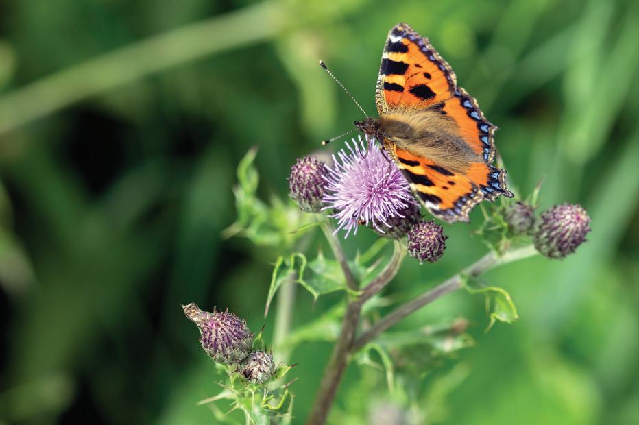
Tortoiseshell butterfly in the Troutbeck Valley. Canon 5D MkIV, 100–400 at 400mm, ISO 200, 1/200s at f/10. July.
Viewpoint 3 – The valley
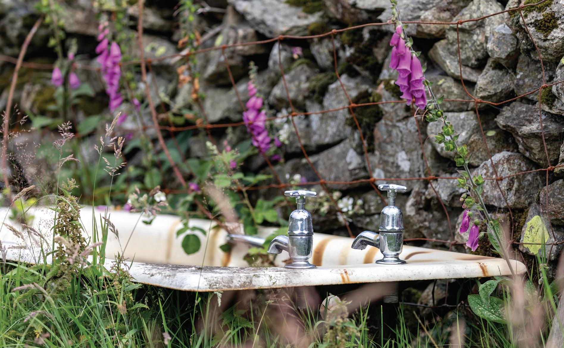
Access to Troutbeck Valley is limited to local traffic, there is no parking in the valley. This means you have to walk or use a bicycle for access which is good for spotting compositions. I use a bicycle for access from Troutbeck Village itself where there are various lay-bys and places to park. Access to the valley is from Town Head via Ing Lane (NY 414 038), below the Queen’s Head pub, which leads downhill and along the valley past the bathtub barn. Alternatively below the church (NY 412 026) and follow the small road and track through Limefitt Holiday Park.
There are no definitive viewpoints, it’s just a beautiful place to wander taking pot shots at whatever takes your fancy depending on the conditions of the day. The lanes in the valley are a joy to amble along any time in any season. On a warm summer day butterflies flit from one flower to the next, the farmers are busy making hay, it’s an idyllic scene and, apart from the modern farm machinery, one that has changed little in hundreds of years.
At the end of the tarmac road you will see the white-painted farmhouse of Troutbeck Park. From here you have a few options: continue past the farmhouse on a footpath leading to waterfalls in Trout Beck and an interesting stone slab bridge. By taking the footpath to the right across the field you follow Hagg Gill to another beautiful stone barn or climb up to The Tongue, the hill in the middle of the valley, for an overview looking south.
How to get here
The first location on Kirkstone Pass is described in the chapter. Troutbeck Village is located 3.5 miles from Windermere train station or 4.8 miles from Ambleside.
From Ambleside follow the A591 for 1.8 miles to a sharp left turn 100m past the Low Wood Bay Resort and watersports area. Follow the narrow but very scenic road all the way to the strung out village of Troutbeck which starts after 2 miles.
Queens Head Hotel
Lat/Long: 54.425706, -2.9047747 what3words: ///archduke.poppy.discusses Grid Ref: NY 413 037 Postcode: LA23 1PW
Accessibility
Accessibility is very easy with flat walking mainly on roads. You have the choice to explore beyond the road end on trails which are the usual rocky fell paths. Walk as far or as little as you like.
The quiet road up the valley is wheelchair-friendly. The only issues will be access, it’s a bit hilly from the parking areas in Troutbeck village. Also the road is narrow single track and passing places are few and far between so it could be an issue if a tractor or car want to get past.
Best time of year/day
The valley is picturesque so suitable at any time of year. For me late spring to the end of summer is the best when the hedgerows and fields are full of flowers and blossom with butterflies flying between. The Kirkstone barn is best when the bracken has died back in autumn. Cold winter mornings can yield some good scenes with frosty hedges and snow on the fells.
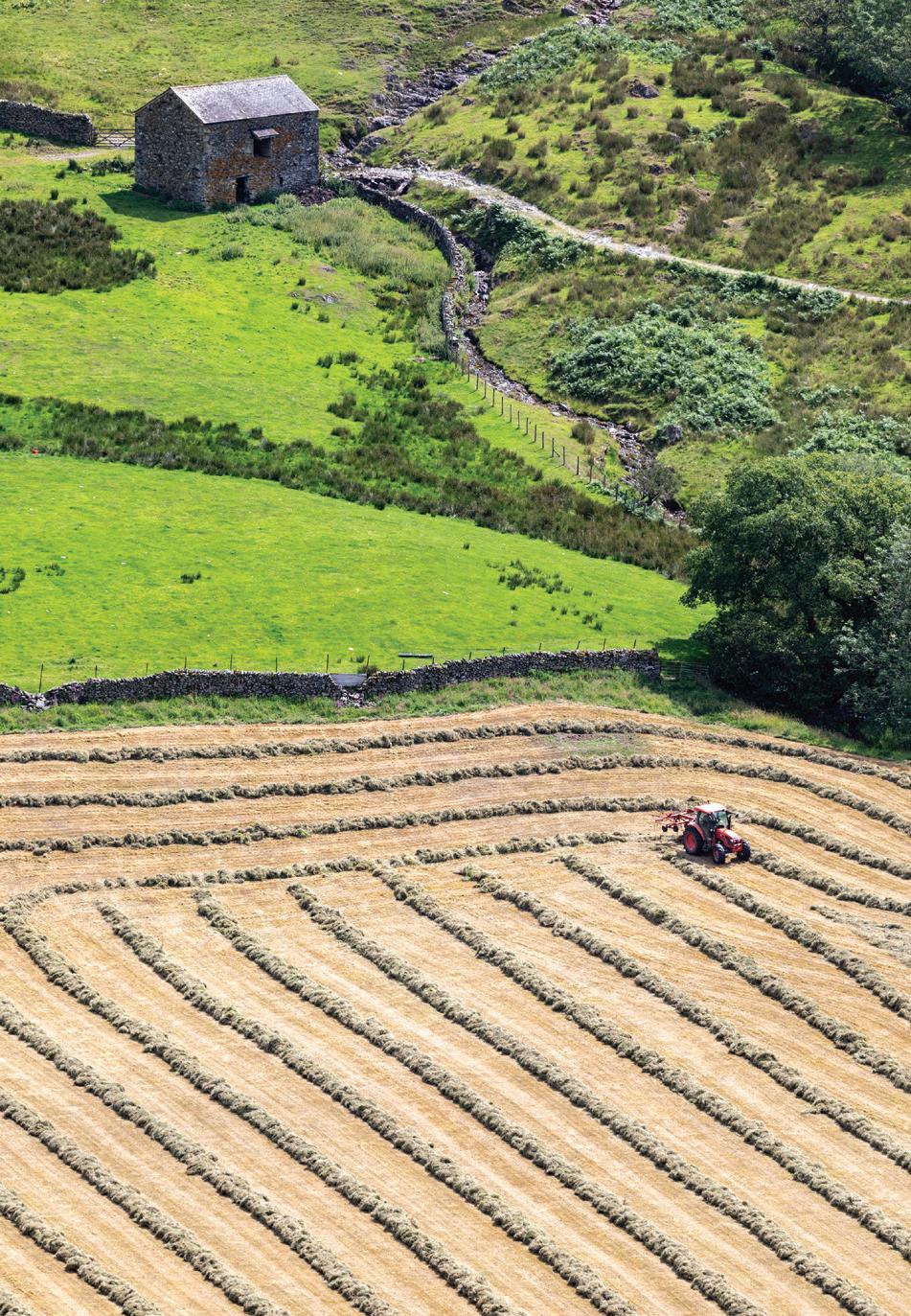
Hay making in the Troutbeck Valley from the Kirkstone road. Canon 5D MkIV, 100–400 at 286mm, ISO 100, 1/640s at f/5. July. Field barn in the Troutbeck Valley. Canon 5D MkIV, 17–40 at 19mm, ISO 100, 1/40s at f/16. July.
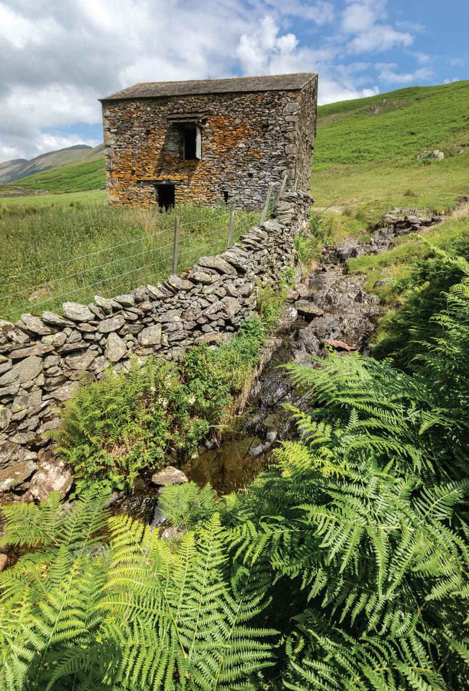
It’s time for your bath. Canon 5D MkIV, 100–400 at 182mm, ISO 100, 1/320s at f/5. July.
Grizedale Forest consists of over two thousand hectares of woodland managed by the Forestry Commission. Seen one Forestry Commission forest, seen ‘em all right? Wrong! What sets Grizedale Forest apart, beyond its lovely setting, is that since 1977 it has collaborated with internationally renowned artists to produce a sculpture park within the woodland. Sculptures are made using natural materials such as wood and stone and can make interesting subjects set amongst the trees and landscape.
What to shoot and viewpoints
On the road to the visitor centre you pass a number of parking spots and trail heads where it is perfectly possible just to wander off into the vast expanse of forest. Take a map and a compass and know how to navigate or you may find yourself lost in the labyrinthine network of forest tracks. The first parking spot you come across is Moor Top which gives access to Juniper Tarn and Goosey Foot Tarn, neither of which are named on OS maps but are on the Grizedale Walks map available from the visitor centre.
The visitor centre in the valley bottom is a good place to start your exploration. There is usually an artist in residence here. Pick up a copy of their trail map highlighting a number of marked trails ranging from easy 1km to strenuous 16km hikes with all the main sculptures marked. The staff here are extremely helpful and can point you in the direction of specific highlights or suggest walks depending on time, fitness and ability. Another possibility is to come armed with a mountain bike, or you can rent one here, which will give quicker access to many of the sculptures and viewpoints. You won’t necessarily be able to follow all the walking trails on a bike however. The visitor centre has a cafe and toilet facilities.
The bottom of the valley is largely dry stone wallenclosed fields with grazing sheep and a few beautiful specimen trees. The forest above the valley is primarily coniferous but with lots of mixed and deciduous areas too. There are areas of larch that turn golden yellow in autumn. Typically the lower areas are deciduous or mixed with the conifers on the higher ground. A stream runs along the valley bottom which can look lovely with autumn colours around. In spring there are patches of bluebells.
The sculptures themselves are widely distributed and well marked with numbered locations on the trail map, there are currently 52 marked on the map. The numbered sculptures are also useful for locating yourself on the map. There is a concentration of sculptures around the visitor centre which are easily accessible. Keep your eyes peeled for squirrels, both red and grey.
Whilst Grizedale is mostly about the immediate interest with the sculptures, the trees and forest, the bracken, lichen, mosses, funghi, etc. There are also wider vistas of the surrounding fells from a number of places. One such is Carron Crag which is reached via the red 5km trail. Carron Crag is 314m and gives very good views of Coniston Old Man, Dow Crag, the Helvellyn and Fairfield ranges, out to the Howgill fells and south to the estuary sands of Morecambe Bay.
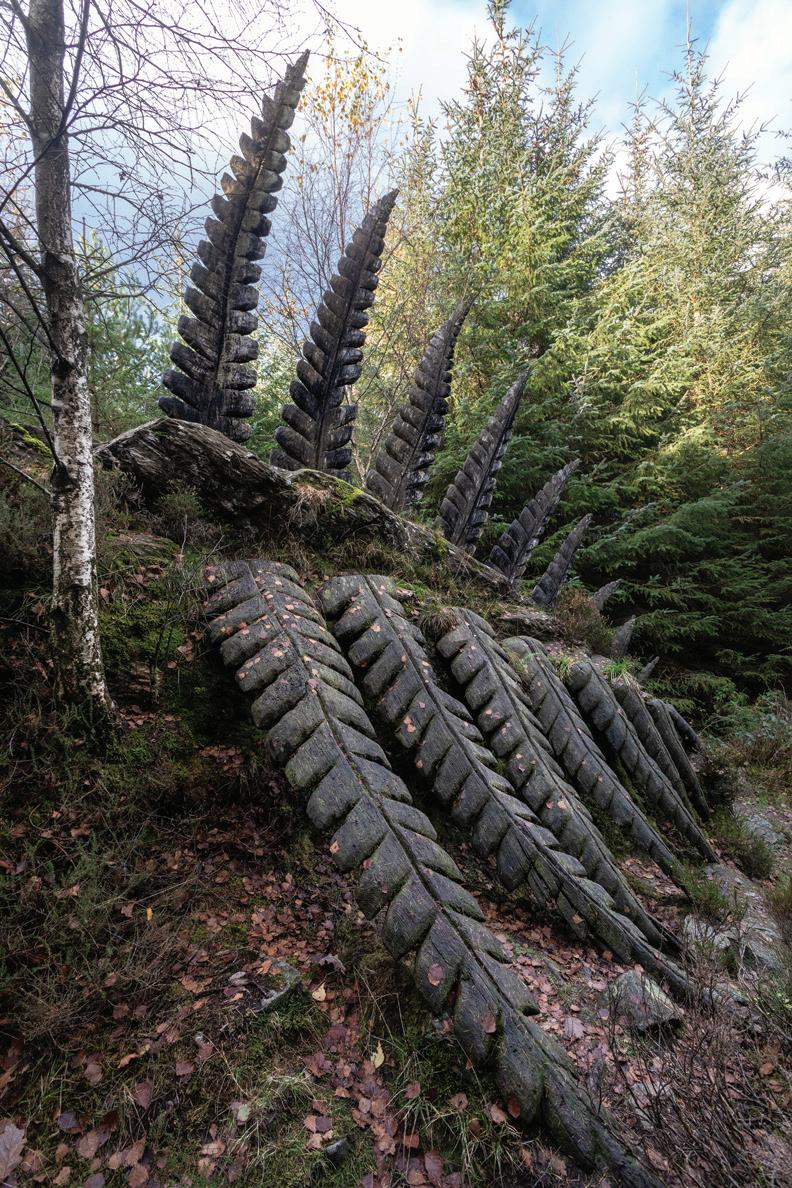
‘Some Fern’ by Kerry Morrison. HDR +/-2 stops. Canon 5D MkIV, 17–40 at 17mm, ISO 500, 1/30s at f/13, tripod. Nov.
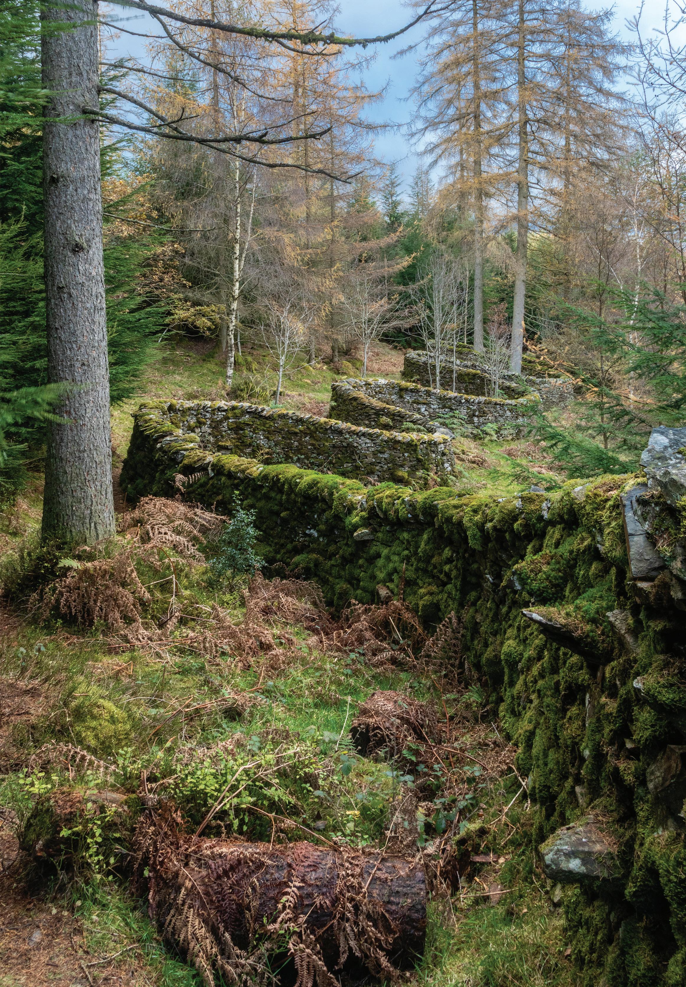
Opposite: ‘Taking a wall for a walk’ by Andy Goldsworthy. Canon 5D MkIV, 24–105 at 24mm, ISO 500, 0.3s at f/22, tripod. Nov.
