SELECTED WORKS 2019- 2023
K. ANJANA NANDAN
ARCHITECTURE
I am an architecture student, an enthusiast and an avid traveler who is keen in understanding “People” their “Lives” and “Architecture.”
Architecture has always been a means for me to understand people in better ways, though architecture had always dealt with spaces it always interests me to analyze how the user and the space influence each other and evolve into something new and very fascinating. I rather carry a strong interest in documenting and understanding what role they carry in each other’s life.
In the finite life of infinite knowledge what we as humans could endlessly learn about are Humans themselves. With the passing times we have evolved everyday and shaping architecture arccordingly in its unique ways. Hence I strongly believe in the acts of
Preserving what we have made, Cherishing what we do, & Building for what we vision.
Hence, I have set forth to the journey of exploring the limitless and unveiling Architecture and its People.
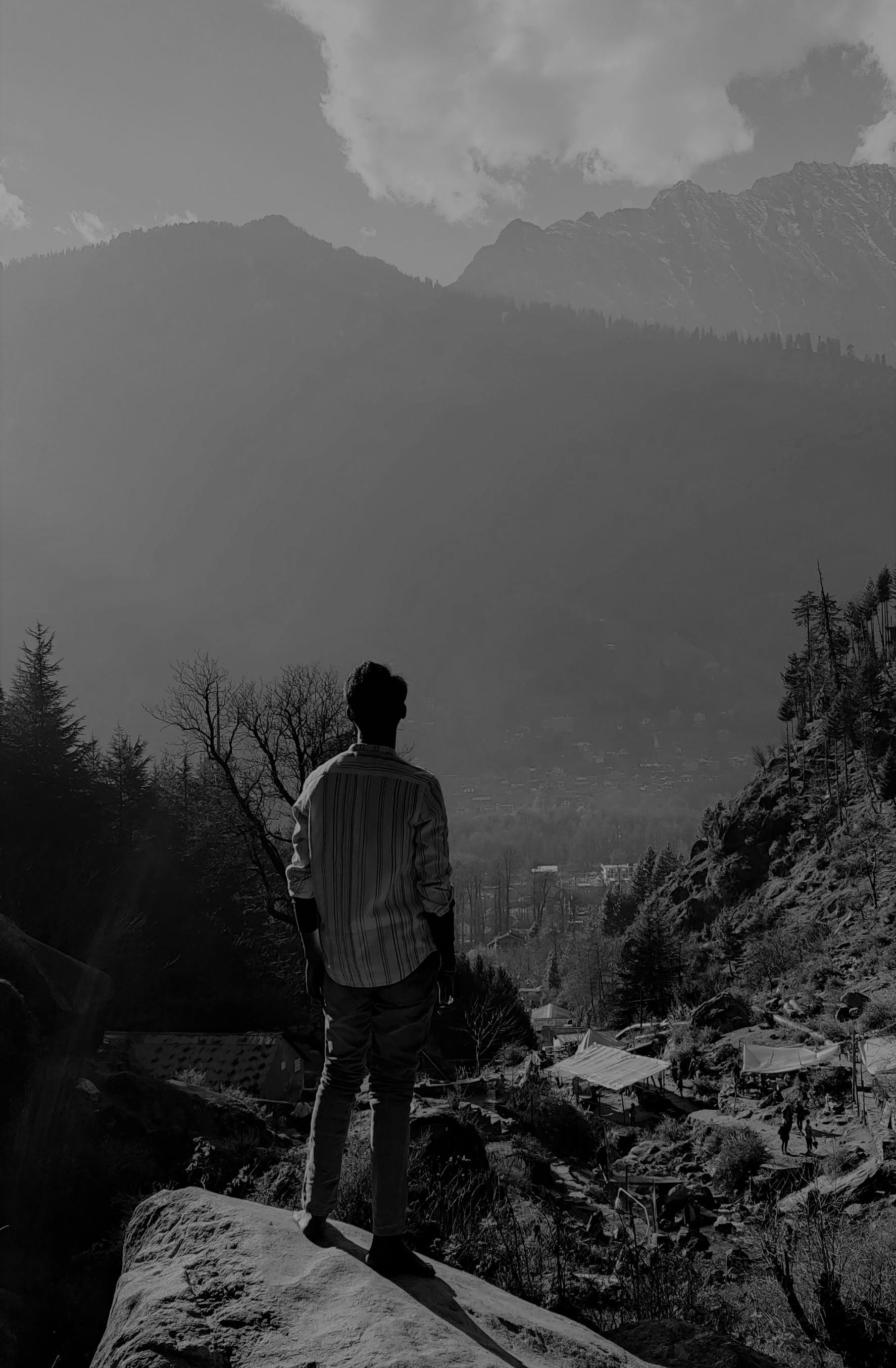 - K. Anjana Nandan ( Student Of Architecture)
K . ANJANA NANDAN
19 MAY, 2002
+91 9951120998
nandan190502@gmail.com
KPHB Colony, Kukatpally, Hyderabad, Telangana - 500085
https://www.linkedin.com/in/nandan-karri-838479202
EDUCATION
Bachelor of Architecture
2019 - Present | JBR Architecture College, Moinabad, Hyderabad.
Higher Secondary Education
2017 - 2019|P. Obul Reddy Public School, Jubliee Hills, Hyderabad.
Secondary Education
2014 - 2017|Sri Vidyanjali High School, Kukatpally, Hyderabad.
EVENTS, WORKSHOPS & COMPETITIONS LANGUAGES
English - Fluent & Proficient
Telugu - Native
Hindi - Fluent in speech
DIGITAL SKILLS
AUTOCAD -


SKETCH UP -
REVIT -
ADOBE PHOTOSHOP -
ADOBE ILLUSTRATOR -
ADOBE INDESIGN -
ADOBE PREMIERE PRO -
ENSCAPE -
EXPERINCE
Unit Designee

2020-2021 | National Association of Students of Architecture, India
NASA Day Co-ordinator
2021 | Giving back to fraternity, Zone-5
Unit Secratary
2021 - 2022 | National Association of Students of Architecture, India
Zonal NASA Convention Coordinator (ZNC Convener)
2022 | National Association of Students of Architecture, India
LETS TALK - Event Coordinator
2023 | Talk session with Ar. Biju Kuriakose & Ar. Peter Rich at JBR Architecture College
ANDC 2020 | NASA, India

ANDC 2021 | Mention in Top 100 | NASA, India
HUDCO 2021 | NASA, India
64th Year Annual NASA Convention
2022 | National Association of Students of Architecture, India
Kalavahini, Art Week
2022 | JBR Architecture College
Writing Architecture Trophy 2022 | NASA, India
Li- Dha (Wattle & Daub Workshop)
2022 | JBR Architecture College
Himalayan Architecture Program

2022 | NASA India x Live North
Vernacular Architecture Program
2023 | NASA India x AABHAT, Hunnarshala
65th Year Annual NASA Convention
2023 | National Association of Students of Architecture, India
INTERESTS & SKILLS
Traveling | Photography | Writing | Sketching |
Journaling | Event Management | Research & Documentation
CONTENTS
A R C H I T E C T U R A L P O R T F O L I O 1 2 3 4 5 6 7 8 MUSEUM DESIGN ANNUAL NASA DESIGN COMPETITION HIGHWAY RESTAURANT HIMALAYAN ARCHITECTURE CRAFT DOCUMENTATION KUTCH VERNACULAR DOCUMENTATION GANDIKOTA DOCUMENTATION MISCELLANEOUS
ACADEMIC-DESIGN
O1
HIGHWAY-RESTAURANT
HIGHWAY RESTAURANT
ACADEMIC WORK | OCTOBER - 2021 | SEMESTER - III
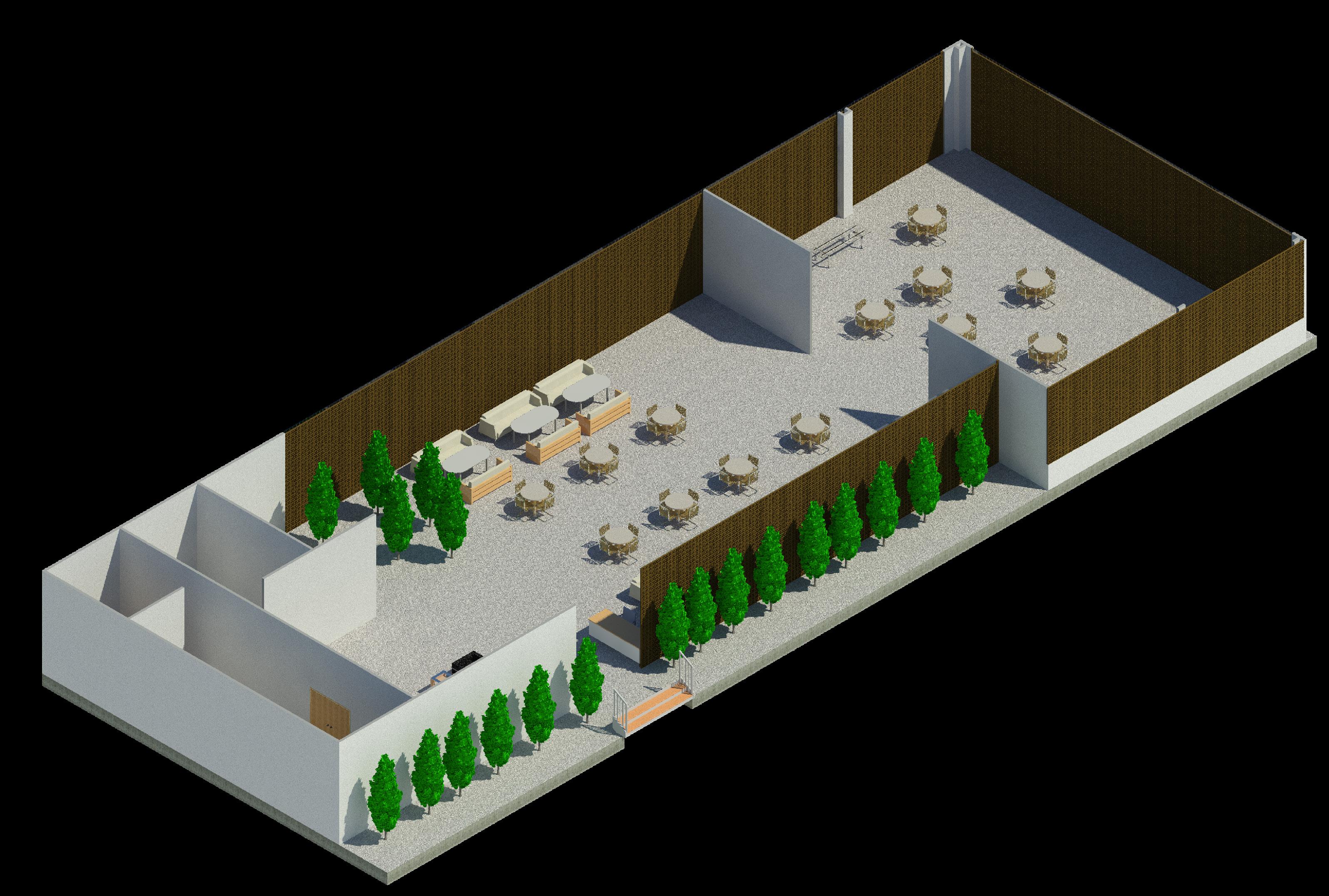
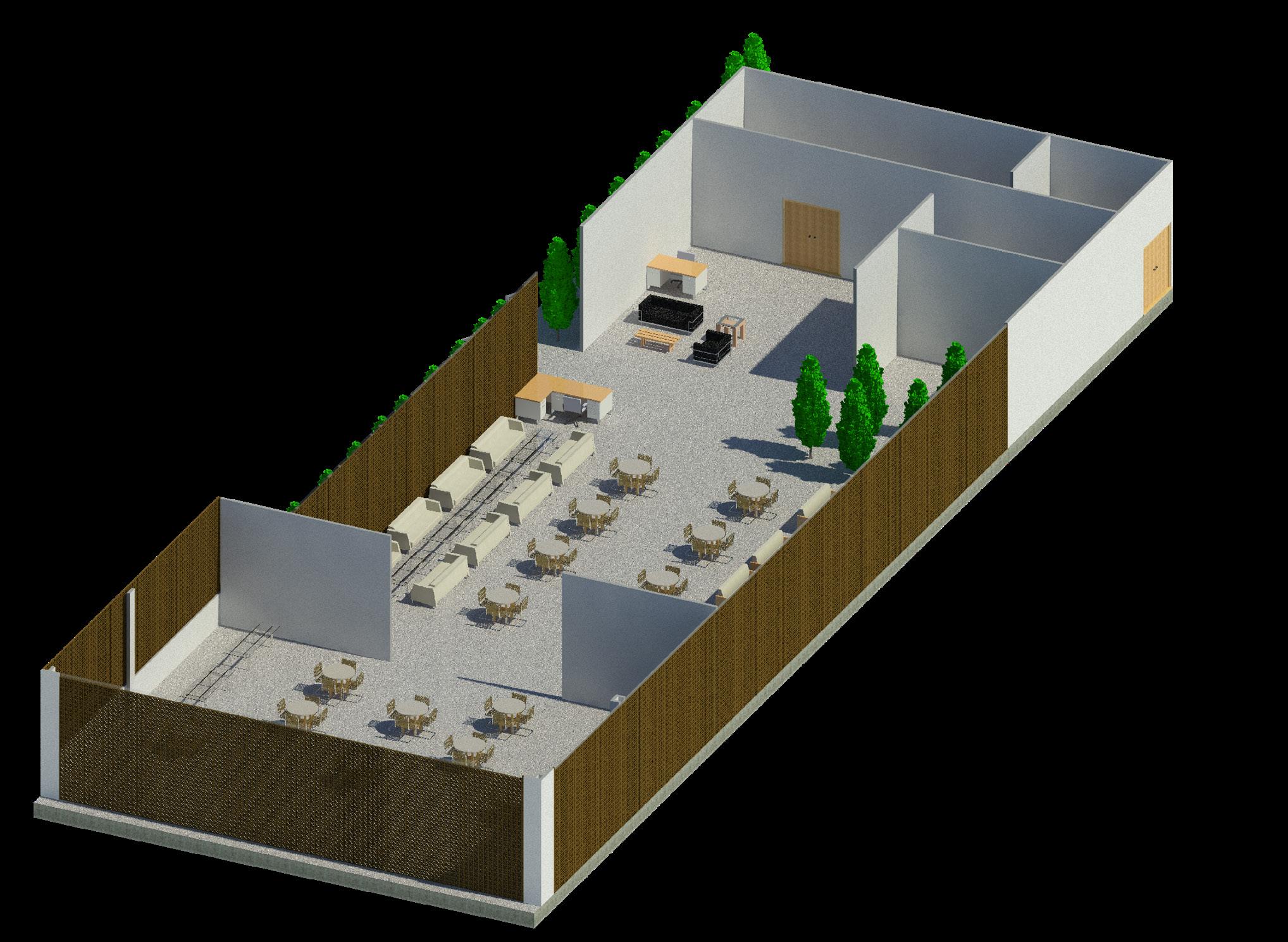
The Highway Restaurant acts as a restaurant on highways, serving meals for travellers. The restaurant would be an ideal space for meals, rest up or any other essential requirements for all means of travellers. The design has evolved from the requirements of the user and the usage of local terracota Jali that keeps the user bound and secure inside and also gives access and a view to the outside “Environment.”
CONCEPTUAL DEVELOPMENT
The highway restaurant is located on the highway running towards Chevella Road.
The highway is an express highway and highway restaurants are on high demand due to limited quality and reliable places for travellers.
The highway restaurant aims at giving a natural and free space after a cramped journey. Along with the same the site also has stalls and kiosks to meet the needs of the travellers.
Jali wall is raisen ro the height of the ceiling. There is green vegetation and small water channel right beside the Jali for passive cooling technique. For passive cooling of site in South - West. The jali, vegetation and all other materials are locally procured in Telangana for a sustainable aproach towards the Design.
INDOOR VEGETATION
TOILETS
STORAGE
KITCHEN
Terracotta can be locally procured in Hyderabad, Telangana and few other local materials can be used.
OPEN AIR OUTDOOR SEATING INDOOR SEATING
JALI WALL
Jali walls allow controlled Air & Light into the interior of the restaurant space. The pattern of jali also throws a patterned light to add to the aesthetics of the space. The space is divided into 2 spaces indoor and outdoor where whole of it is enclosed in a jali open air seating rather has an open ceiling with a Pargola.
A BASIC 2D RECTANGLE EXTRUDING THE 2D RECTANGLE INTO A CUBOIDAL SOLID
REMOVING THE 3 SOLID WALLS
REPLACE THE REMOVED WALLS WITH TERRACOTTA JALI WALLS
TERRACOTTA JALI
SITE PLANNING:
SITE AREA : 35M X 50M
BUILT UP AREA : 15M X 42M

STALL AREA : 2M X 2M ( 4 UNITS)
CAR PARKING : 10 (2.5M X 5M)
BIKE PARKING : 5 ( 1.25M X 2.5M)
WEST ELEVATION
NORTH 0M 2M 5M 10M
VERTICAL SECTION
VIEW
HORIZONTAL SECTION
3D
ACADEMIC-DESIGN
O2
MUSEUM
ARCHEOLOGICAL MUSEUM
ACADEMIC WORK | JULY - 2022 | SEMESTER - VI
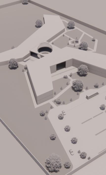
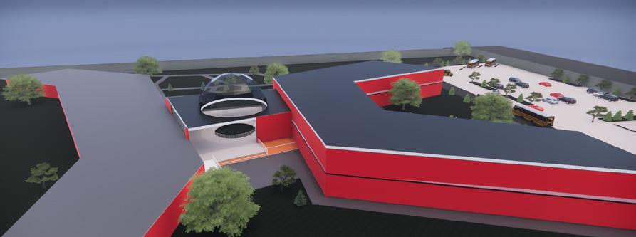
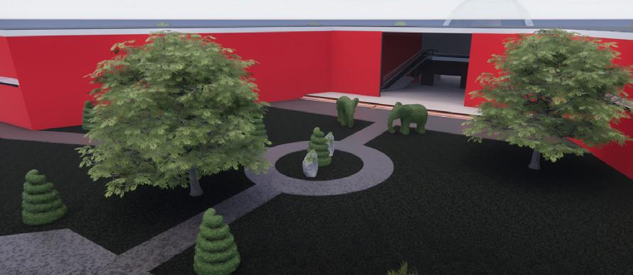
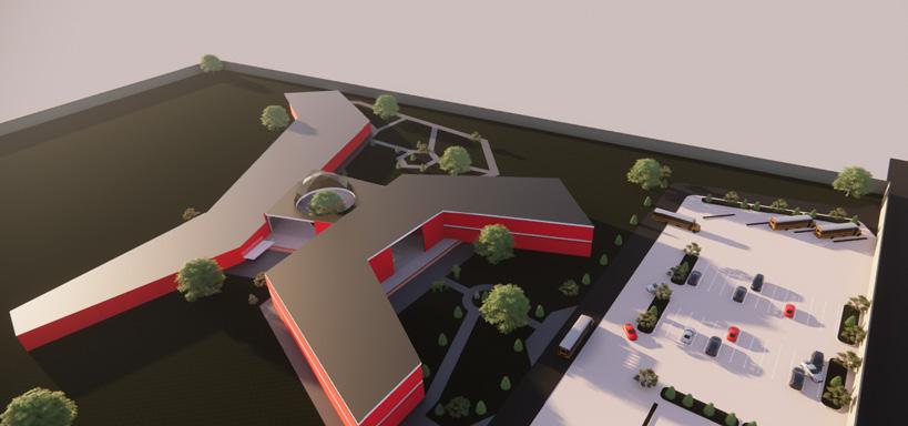
A museum is a not-for-profit, public institution made to serve the society and act as a place of spreading knowledge, researches, collects, conserves, interprets and exhibits tangible and intangible heritage. The design evolves from the context of Durgam Cheruvu, Hi-Tech city -Hyderabad, its people and the city itself “The City Of Pearls”.
CONCEPTUAL DEVELOPMENT
The site is located on the west of Durgam Cheruvu lake, situated near Hi-Tech city the IT hub of hyderabad the context of the site drastically varies to that of the main city.
The concept was evolved from the Pearls and the Clamp for which Hyderabad was once well known. It helps rather create a form that responds better with the site and the climate.
SITE
SITE CONTEXT
FUTURE EXPANSION

`
MUSEUM BLOCK SCUULPTURE GARDEN CENTRAL LOBBY ART BLOCK PARKING MAIN ENTRANCE
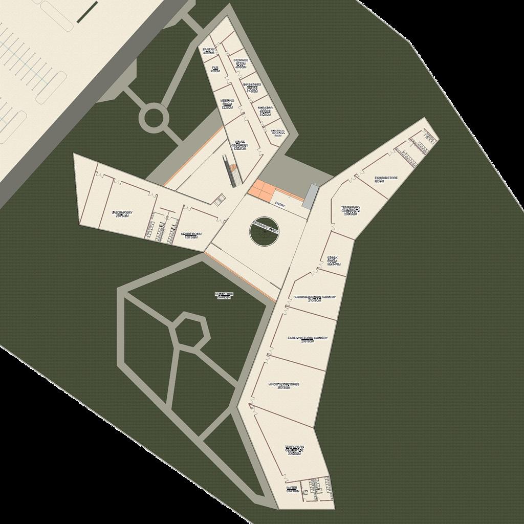
GROUND FLOOR PLAN
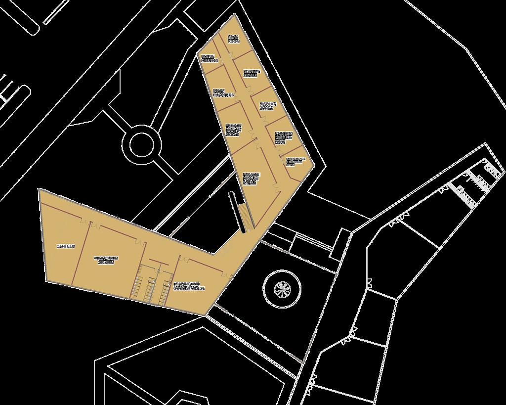
FIRST FLOOR PLAN
AREA STATEMENT: -
GROUND FLOOR:
Cloak Room - 90sqm
Temporary Gallery - 298sqm
Exhibit Store - 186sqm
Buddha & Jain Gallery - 210sqm
Early Historic Gallery - 298sqm
Hindu Sculptures - 360sqm
Temporary Gallery - 306sqm
Laboratory - 230sqm
Store Room - 150sqm
Staff Quarters - 134sqm
Meeting Room - 72sqm
File room - 58sqm
Pantry - 43sqm
Storage Room - 48sqm
Directors Room - 47sqm
Curator Office - 51sqm
Electrical room - 48sqm
FIRST FLOOR:
Loading & Goods storage - 150sqm
Auditorium - 230sqm
Canteen - 120sqm
Private Display Area 1 - 134sqm
Private Display Area 2 - 72sqm
Staff Quarters - 56sqm
House keeping - 43sqm
Gallery Display Zone - 51sqm
Gallery Display Zone 2 - 47sqm
Painting Display Zone 3 - 48sqm
Surveilance room - 48sqm
NORTH ELEVATION
HORIZONTAL SECTION
EAST ELEVATION
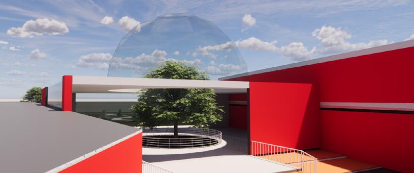
3D RENDERS
VERTICAL SECTION
NORTH
`
0M 10M 20M 50M
DESIGN-COMPETITION O3
NASA-ANDC
INTRODUCTION & SITE DOCUMENTATION


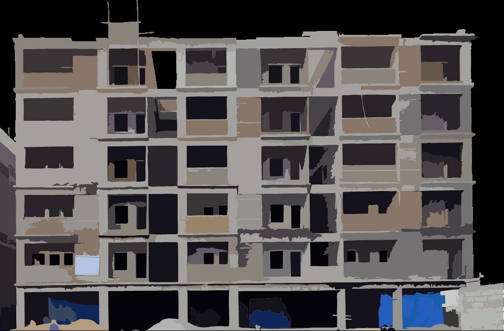
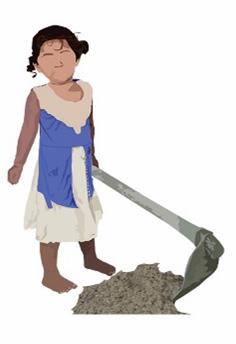
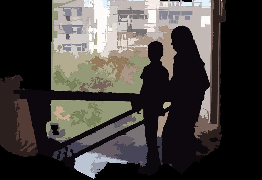
India is a developing country where a new project emerges every day. The quality of construction gets better, bigger projects are being developed but the backbone of the industry, the laborer’s and their lifestyle is neglected. They become the marginalized section of the society who migrate long distances to earn a living yet their shelters and settlements are generally excluded in the government’s slum initiatives and many are frequently subjected to eviction threats and displacement. Across India, construction workers’ housing is inadequate and subjected to harsh weather conditions and pests. They use poles and tie tarpaulin or use tin sheets as a shelter. Some of the local workers’ build small semi-pucca houses made of brick and tin sheets.
EXISTING CONDITIONS

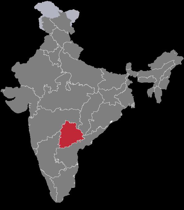
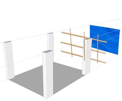
The site of construction is located in Hyderabad, (Telangana, India) at which the laborer shelters are temporary, and are provided by the site authority. They used stilt floor as their shelter area. They have also used casuarina poles and tarpaulin to wrap around their structure. The washing area and bathrooms are located in the open, a little away from their habitable spaces. the shelter units are arranged in various sizes, 2.5m x 5m, 3m x 5m.
Usually, these kinds of spaces grow organically. Initially these spaces are just few blocks, later they slowly emerge into gathering spaces and temporary shacks. Now that the workers have been in these type of spaces for a while, it feels like a part of them. They build their shelters with whatever is available around them and survive through the harsh conditions with the utmost emotional and physical support of the fellow workers. In the far-off places without enough support from the government, the only ones who understand them are the fellow workers who must live through an equally vulnerable stage of life. As a part of the construction industry, the least we can do is to develop temporary or mobile housing for these workers and community so they can live in better conditions and are ready to move to another place with confidence.
COLLAPSIBLE HOUSING DESIGN
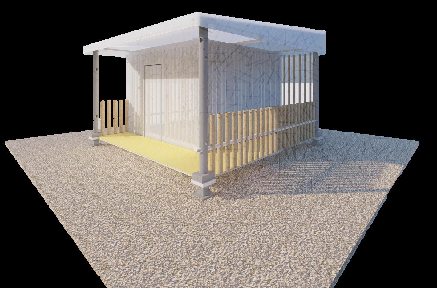
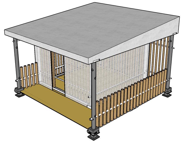
- Aim is to provide dwelling units that are flexible enough to move quickly from one place to another place and assemble quickly.
- These units are easy to assemble with familiar joinery that are an abstract from their previous living shelters.


- Each dwelling unit is provided with a semi-open multi-functional space which is meant for activities like cooking.
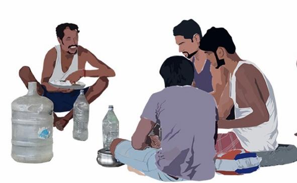
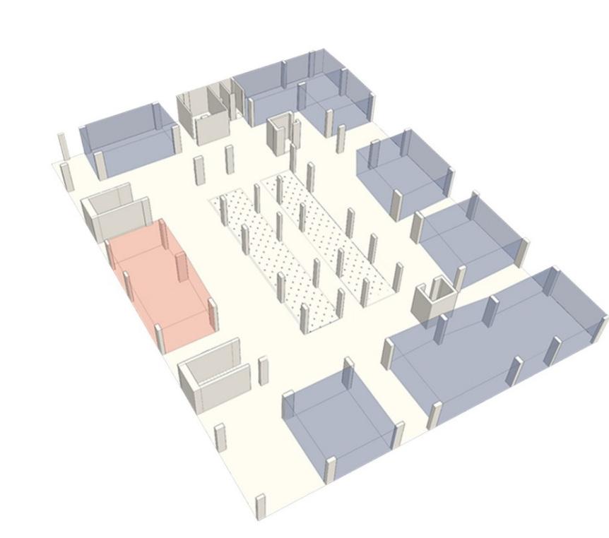
- Provided dwelling units can be arranged in any manner and would still have scope of forming gathering and resting spaces in and between the units.
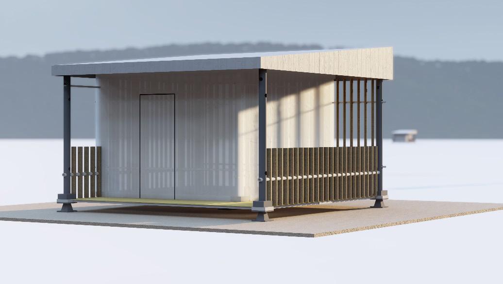


- There’s only one door which can be rolled open after unzipping. The material is tensile fabric.


- The base has a rise from the ground which prevents water, insects, rats and snakes from directly entering the unit.


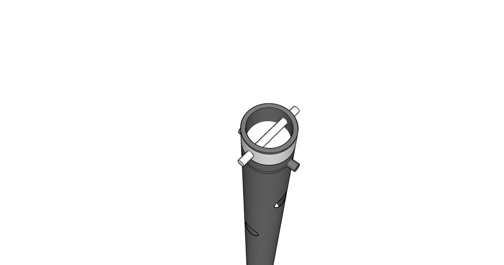
- The cardboard tubes and pvc pipe components can be related to the casuarina poles which used to be the structural skeleton where as the tarpaulin sheets which is enveloped is now the tensile fabric.

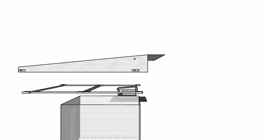
- As far as safety and privacy are concerned, the idea of window is eliminated and ventilation is managed by the ventilator which comes out from the advantage of adjustable roof panel.
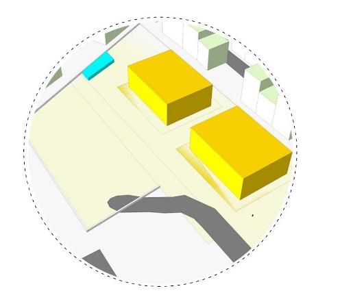
LABOUR HOUSING UNIT RESIDENTIAL APARTMENT UNDER CONSTRUCTION LABORER SHELTERS AERIAL View OF THE VICINITY Location https://maps.app.goo.gl/ogsPyfveStxv3fEh7 STILT FLOOR part plan : the residential building constructions and laborer toilets INDIA MAP
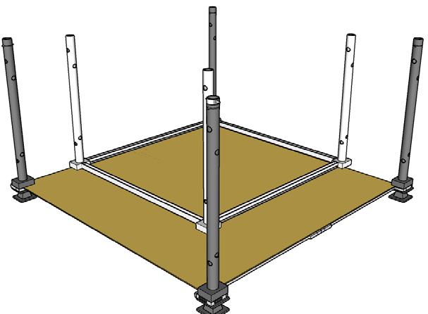
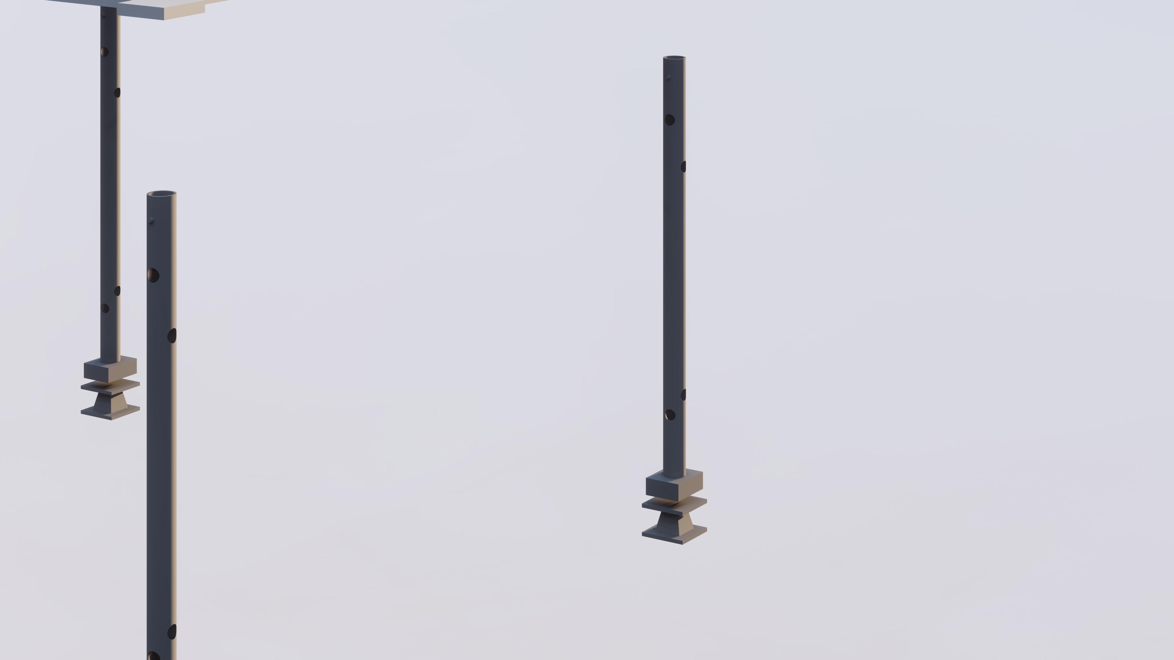
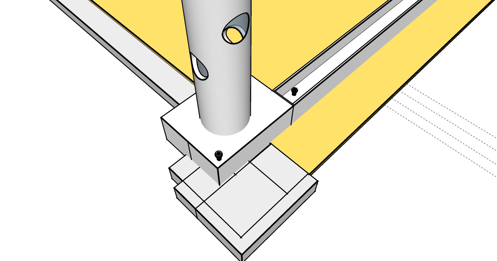
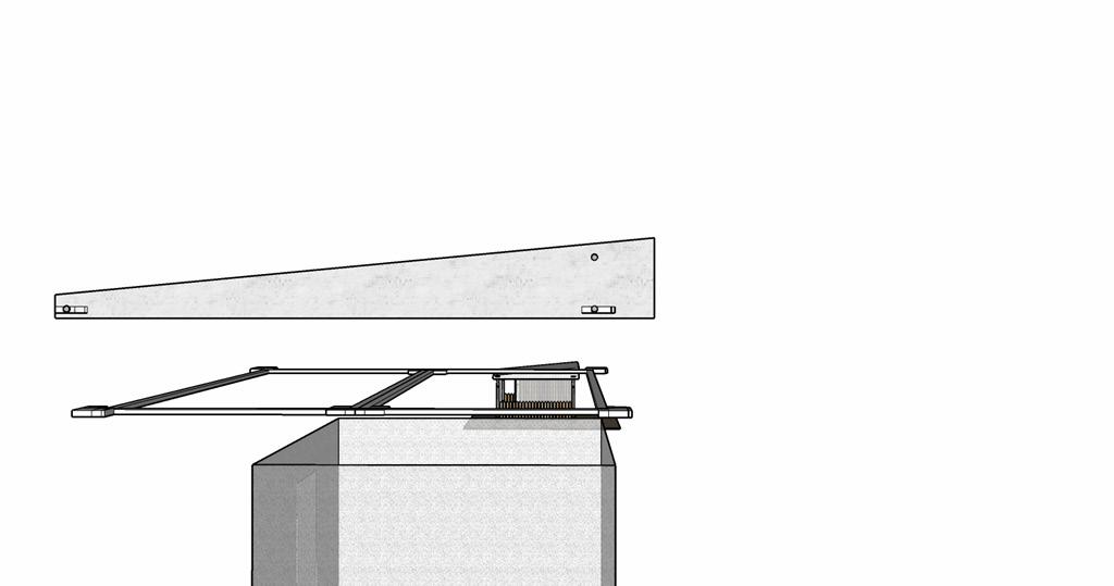
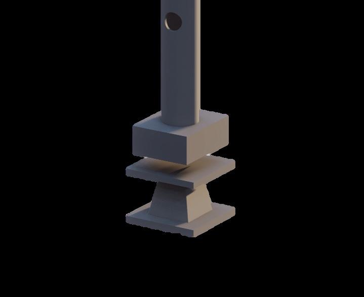
STEP – 1 : Arrange the 4 Steel Jack units at a distance of 4.25m from Each other. These act as the basic units that functions as structural Supports holding the components of the unit.
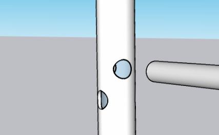
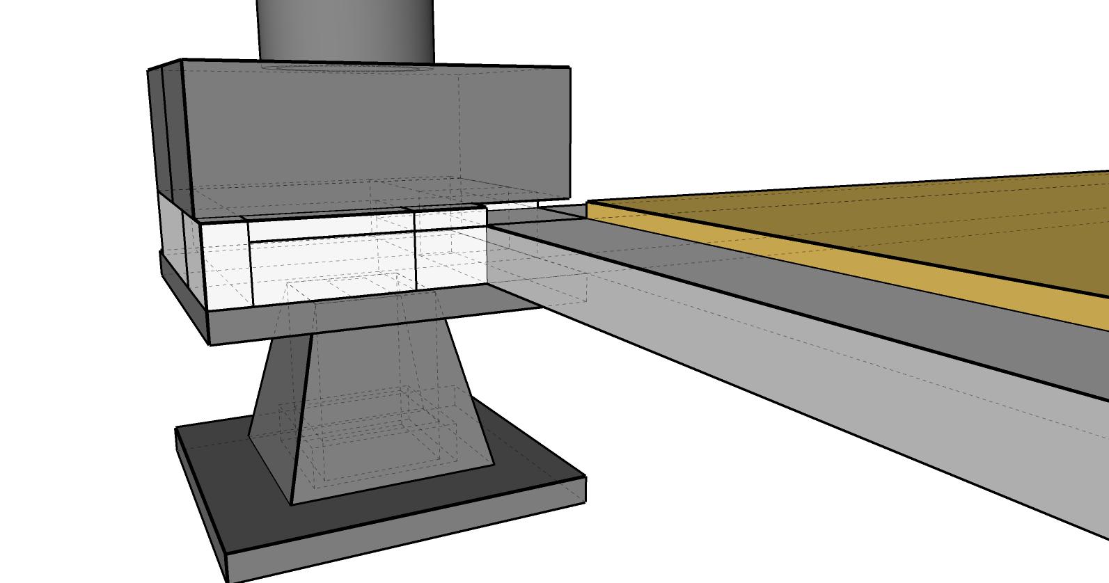
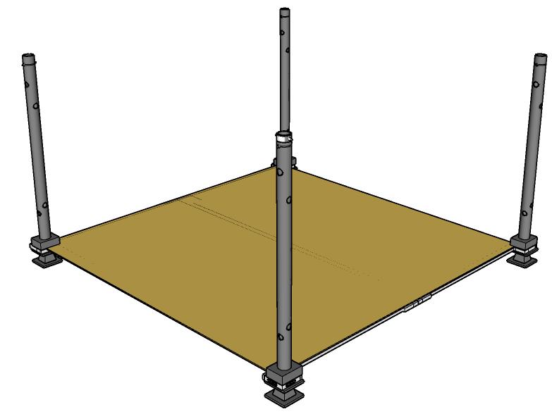
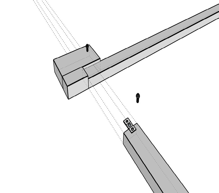
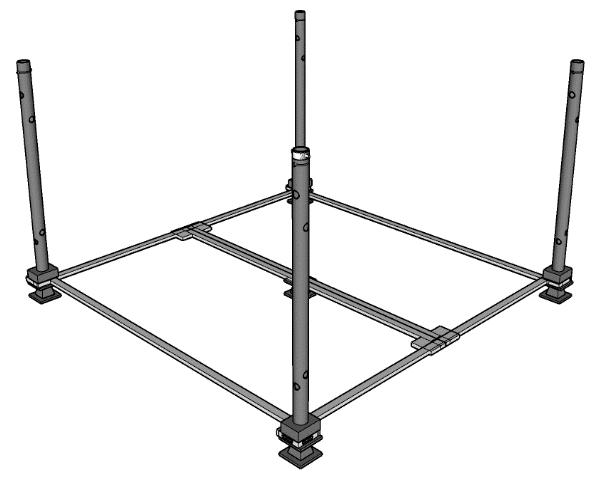
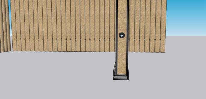
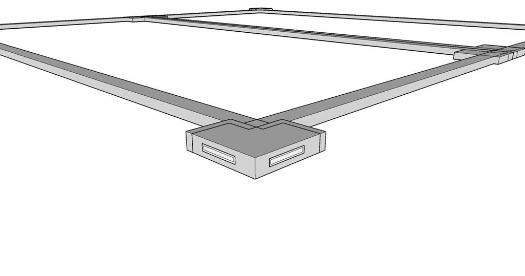
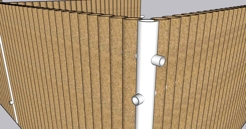
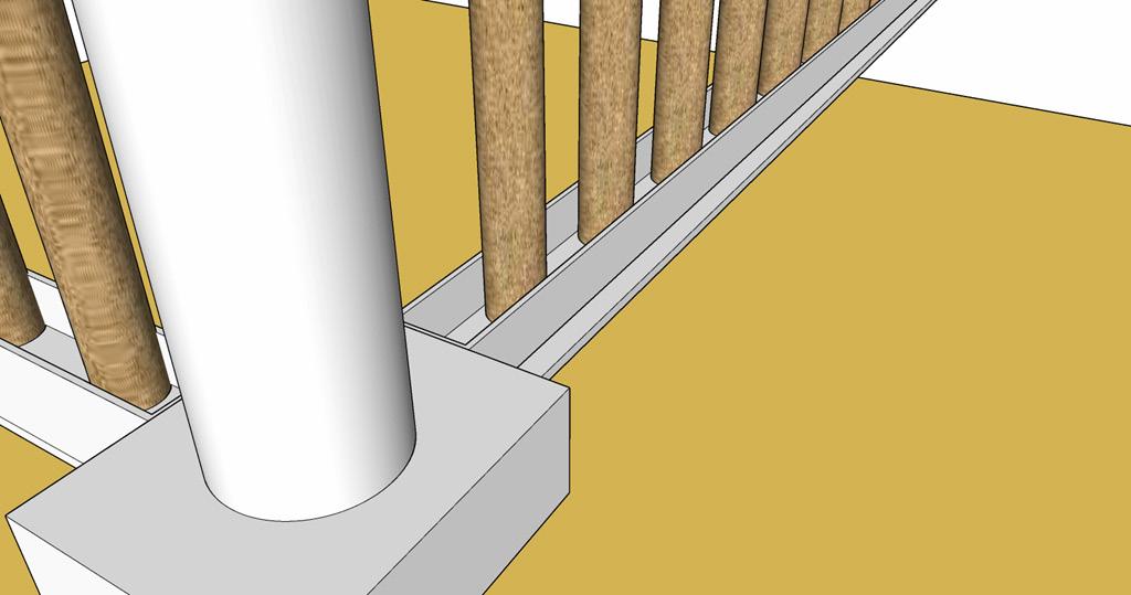
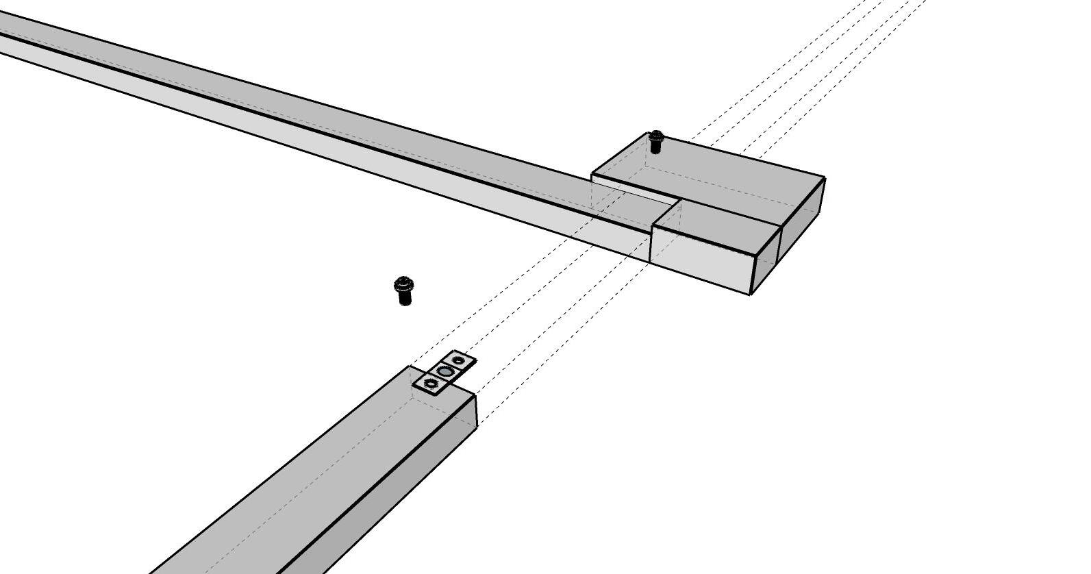
STEP – 4 : Fixing the channels to the wpc floor using fasteners. The channels are connected with pvc pipes that forms the core frame for the walls have holes that are passage of another pipe which holds the cardboard tubes together.
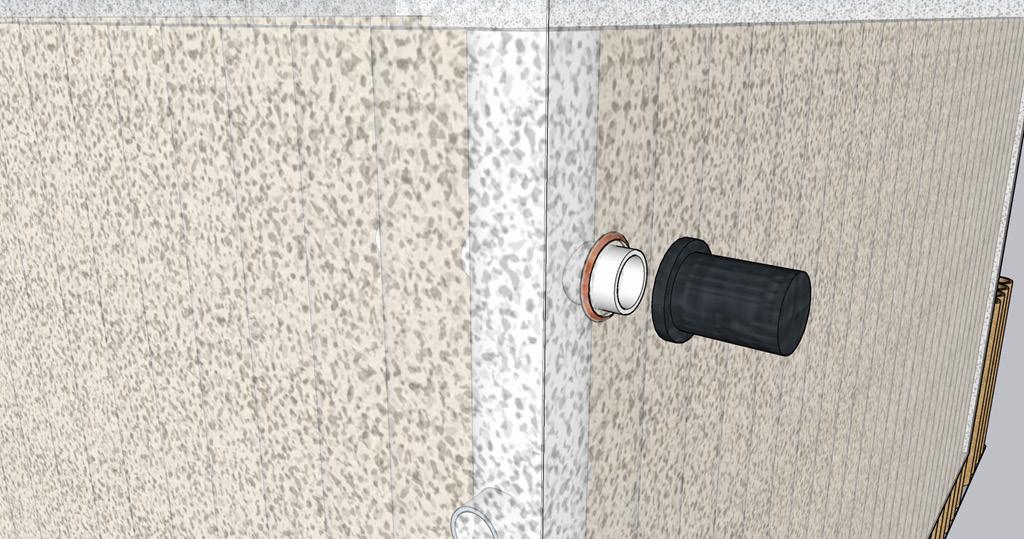
STEP – 2 : Insert the m.s steel base frames into these steel jacks using fasteners. This makes a stable frame that can withstand loads and support the floor of the unit.
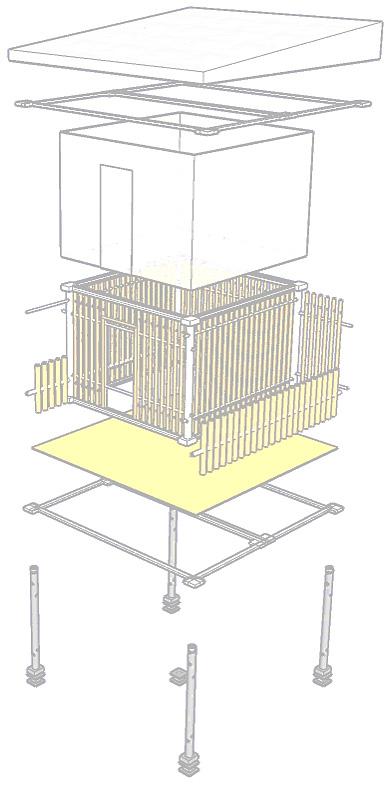
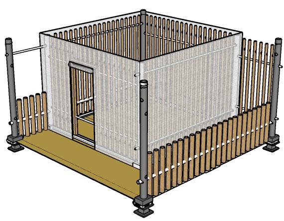
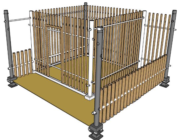
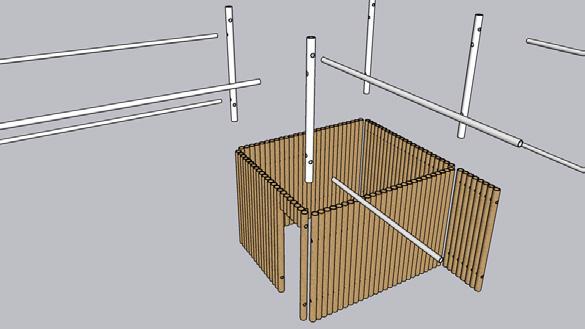
STEP – 5 : Installing the cardboard tube panels into the pvc channels and after the installation a thin pvc pipe is inserted through the hole provisions and adding a clamp to the ends to fix it with the pvc pipes later.
STEP – 3 : Insert the w.p.c panels into the corner grooves formed by the attachment of base frame to the steel jacks. This forms the floor it is joined using fasteners with clamps.
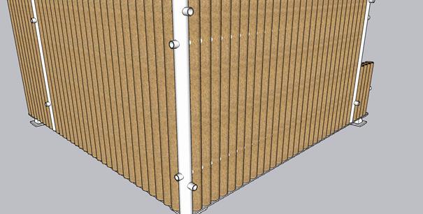
STEP – 6 : Wrapping the unit with tensile fabric which has the holes made to comply with the pvc pipes and then the clamp is joined to close the pvc pipe and also to hold the fabric envelope.
EXPLODED
JOINERY DETAILS OF THE CONSTRUCTION
ASSEMBLED OUTLOOK

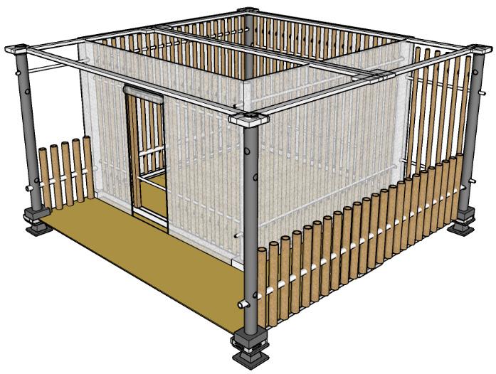


EXPLODED VIEW OF THE DWELLING UNIT
Please scan the QR Code to view full project.
1. ROOF
Fixture for wall & columns
Fixture for flooring
7. FRAME
8. COLUMNS
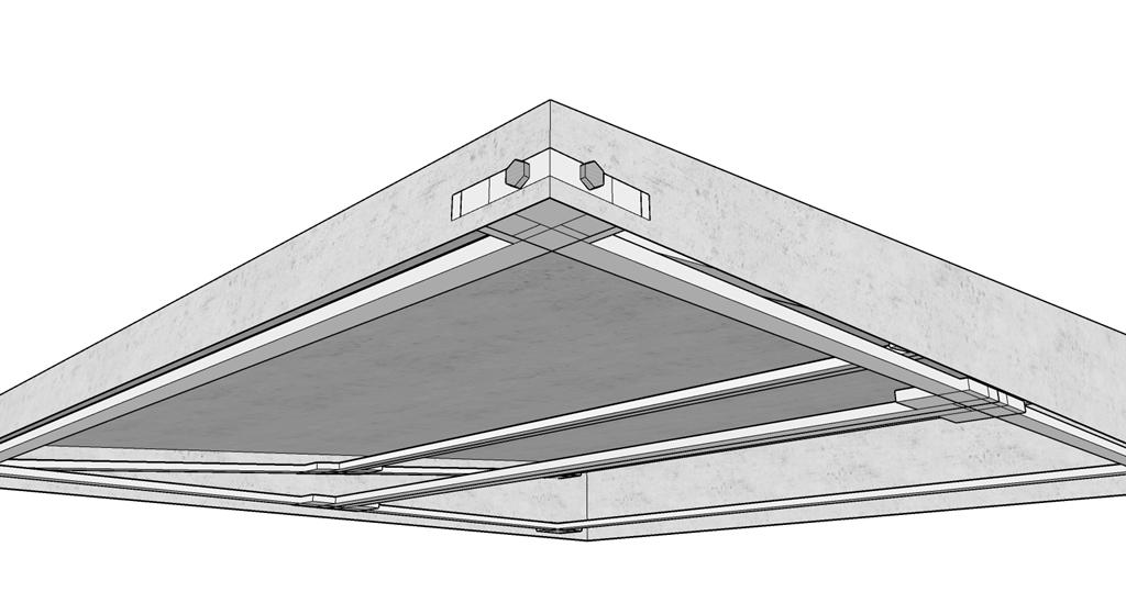
STEP – 7 : Fixing the ms steel frame to the corner steel jacks for the roof. These are joined using angular joints that are bolted.
Fixing the gypsum roof boards to the metal frame using bolts and then the roof can be adjusted which creates a ventilator.

RESEARCH&ANALYSIS O4
URBAN-DESIGN
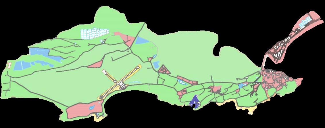
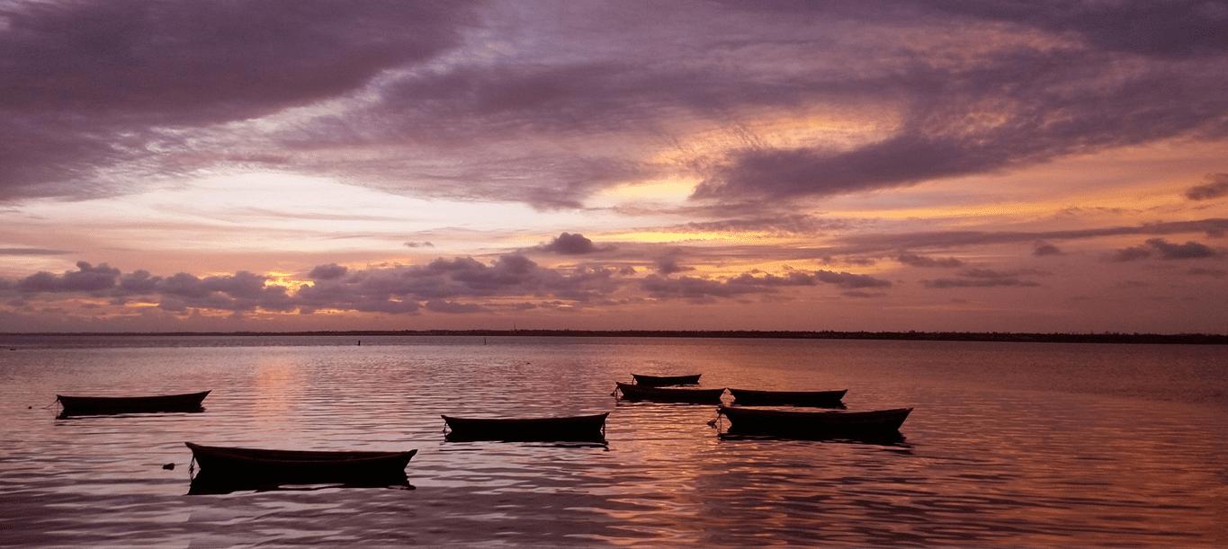
DIU is a tiny island slightly off the coast of Kathiawar near Gujarat. Diu is known for its exquisite beauty and exotic attractions. It is a perfect getaway for those intending to spend some quality time in solitude away from the maddening city crowd. Tourism is thus a major contributor to Diu’s economy. Owing to its proximity to the sea, fishing is a major occupation practiced by the people in Diu. Also contribute to the economy of Diu. Diu is rightly called the ‘island of sea, sand and serenity’. It is home to several popular beaches.
TIME LINE OF EVENTS
Maurya Rule (c. 322-220 B. C.)
Girnar village near Junagadh was the local headquarters in the empire
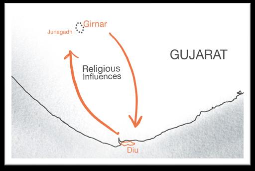
The Jain traditions from Diu seem to belong to this period.
Gupta Dynasty (50 AD - 488 AD)
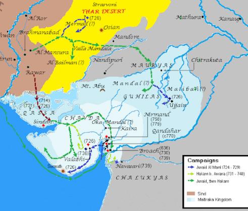
Expansion of Trade.
Cultural Flourishing: They patronized the arts, literature, and Buddhist religion.
Calukya & Chavda Dynasty(1064 AD - 1296AD)
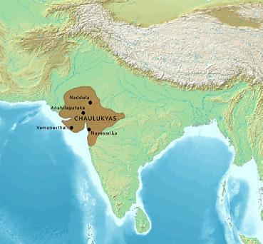
Chalukyas patronized art, architecture, and literature. They also encouraged trade and commerce.
Fort of Panikota (1297 AD)
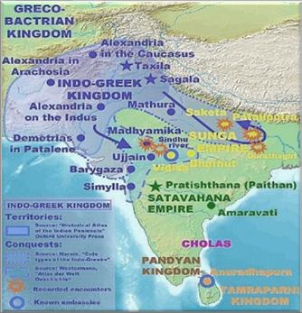
Indo Greek Empire (171 AD- 50 BC)
The Indo-Greeks did have some cultural and economic exchange with the regions that were within their sphere of influence, including Gujarat.
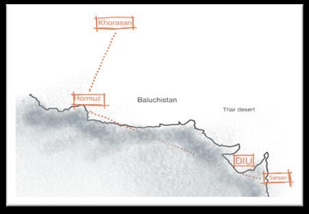
Persian Zoroastrian ( 936 AD )
The spread of the Persian language and culture. Support of trade and commerce helped to further develop the region’s economy and infrastructure.
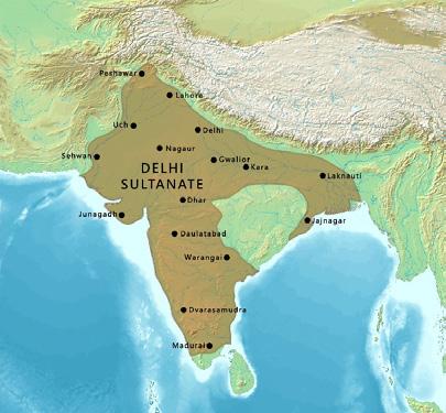
Delhi Sultanate (1297 AD)
Fortress of Panikotha
WHY DIU?
Diu was chosen as the place of study for an Urban design studio project due to its interesting yet contrasting history, and the relation between the people and the place. The most significant factor to consider would be the lack of interaction spaces for locals as well as tourists, the lack of individuality in these spaces, and the gap in amenities that can be improved upon. With increasing tourism on the island, we worked towards the first step in better understanding a space and interpersonal relations between people and spaces to know the gap and find a way to fulfill the needs without imposing, always leaving space for individual creativity to blossom, which is this case would be giving enough amenities for the locals and tourists while considering the emotions and culture of the locals, giving them the freedom to define these spaces.
MORPHOLOGY
Urban morphology is the study of the form of human settlements and the process of their formation and transformation. The study seeks to understand the spatial structure and character of a metropolitan area, city, town or village by examining the patterns of its component parts and the ownership or control and occupation. Typically, analysis of physical form focuses on street pattern, plot pattern and building pattern, sometimes referred to collectively as urban grain
A tower structure was made alongside and a long metal chain connected the tower and coastline so create barricades pushing the coastline to the inner northern end.
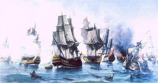
Battle of DIU (1509 AD)
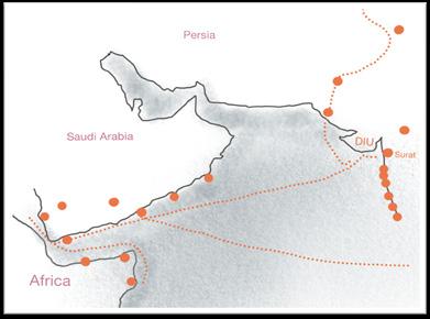
The battle was fought over control of the spice and textile trade
Fought between: Gujarat Sultanate + Egypt + Vietnam + Cochin fought over Portuguese.
Served as entry post to control entry movements of ships entering Diu for trading Indian spices.
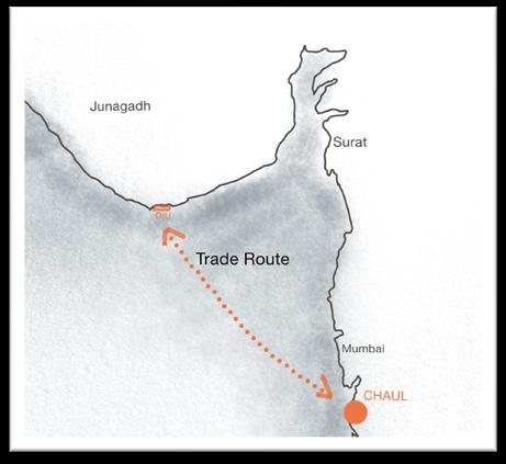
Battle Of Chaul ( 1508 AD )
The Portuguese sailed into Chaul, fought for two days, and lost the battle. The Portuguese later attacked the fleet in harbour of Diu, leading to victory and marking the beginning of the “Battle of Diu”
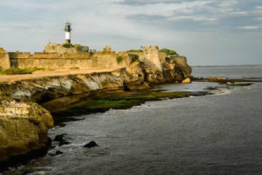
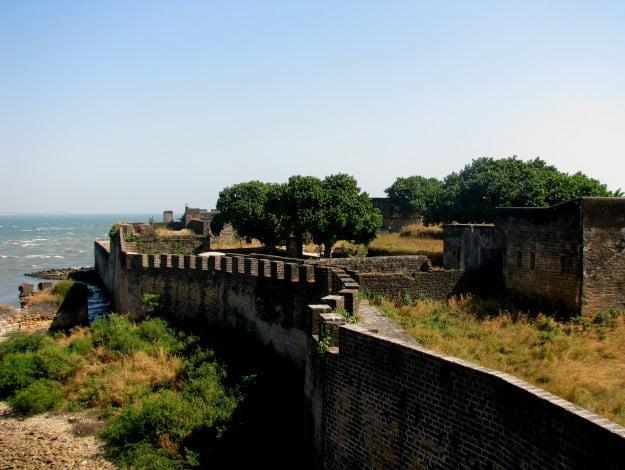
DIU Fort Construction ( 1535 AD )
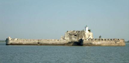
The construction of the fort helped to provide defence and security.
Diu Airport (1955 )
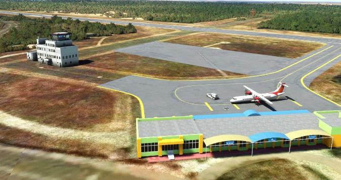
Transportes Aéreos da Índia Portuguesa (TAIP) commenced operations to Diu on 16 August 1955. The airline linked Diu with Goa, Daman and Karachi until December 1961, when the Indian air force bombed the airfield
The presence of the fort helped to spur the growth and expansion of the town of Diu. The fort served as a hub of economic activity, with a market and port located nearby. It had devoloped a western trade route.
DIU Independence ( Dec, 1967 )
Daman and Diu survived as outposts of Portuguese overseas territory until 1961 when they became part of india with Goa.
DIU -
INTRODUCTION
DIU TOWN - ANALYSIS
LOCATION : DIU TOWN
20.7144° N, 70.9874° E
- It is a prominent and very dense town in diu.
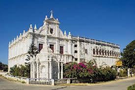
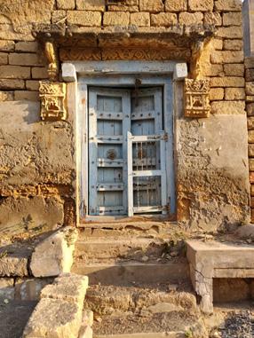
- Major occupation is fishing and hospitality in this town
- Most of the civic body buildings are located here
- It is also known as a walled city
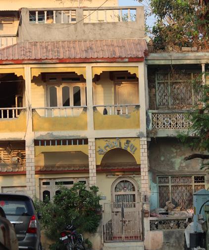
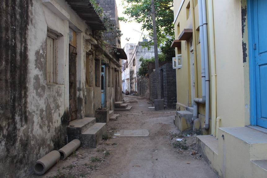
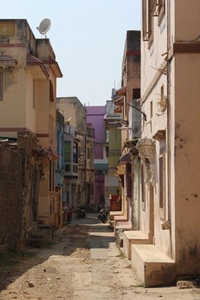
- Diu town also vibrant buildings which are closed aligned creating a small neighborhood within a stack of buildings.
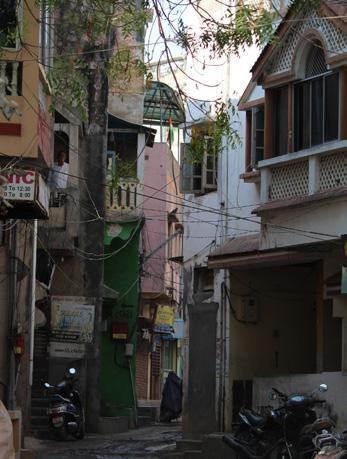
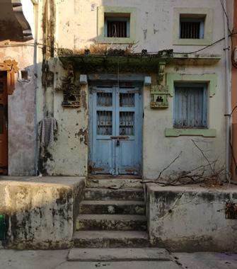
- It is a packed settlement with narrow roads inside considered to be access roads. Influence of the Portuguese are observed in old building and heritage sites that are in the town.
DIU TOWN - MAJOR LANDMARKS
DIU TOWN - CHARACTERISTICS
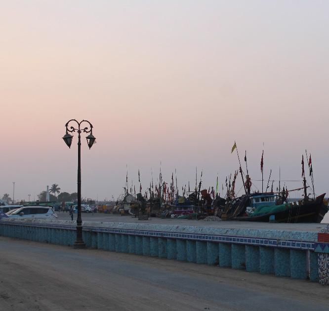
BUILDING FACADES
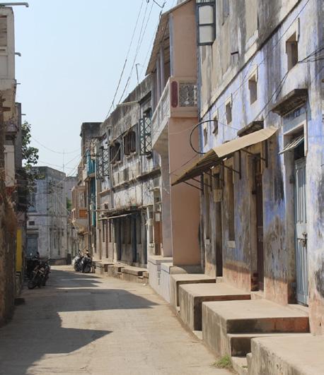
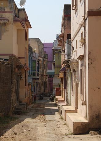
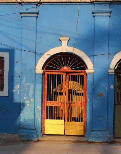
Vibrant colours are observed with tiles on facades. Residential buildings are mostly g+1 floors.
STREETING LIGHTING
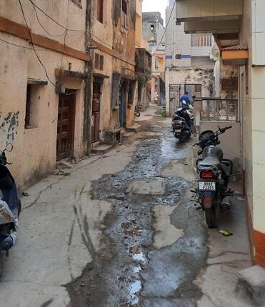
Seen on the primary roads. Lack of street lighting in access roads of the residential area.
DRAINAGE
It is a prominent landmark but has very minimal activity. It also located in low density residential area.
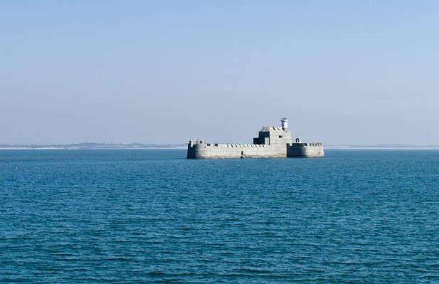
Panikota Fort
Panikota is a landmark and tourist location situation near Diu Fort. it is accessible only though the sea. During low tides during summer season a sand path comes up and its accessible from diu town and fort through a walk.

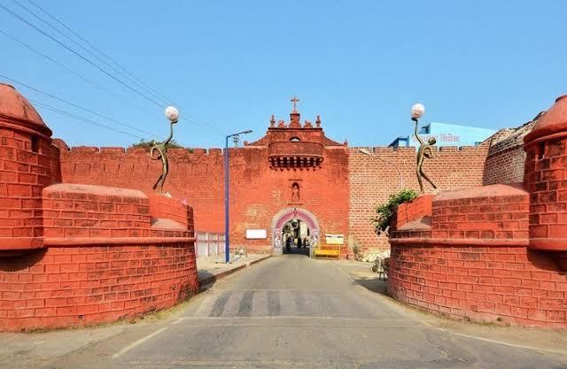
St. Pauls Church
It is one of the entrances into the walled city. This street is a collector road acting as tertiary road in the town consists of mixed use buildings on either sides. Hence it acts as a commercial spot and a nodal point . it is considered as an activity generated dur to its buiding typologies.
Zampa Gate
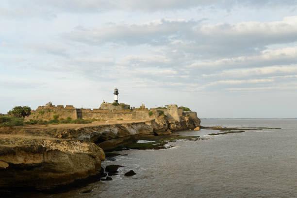
DIU Fort Jalandhar Beach
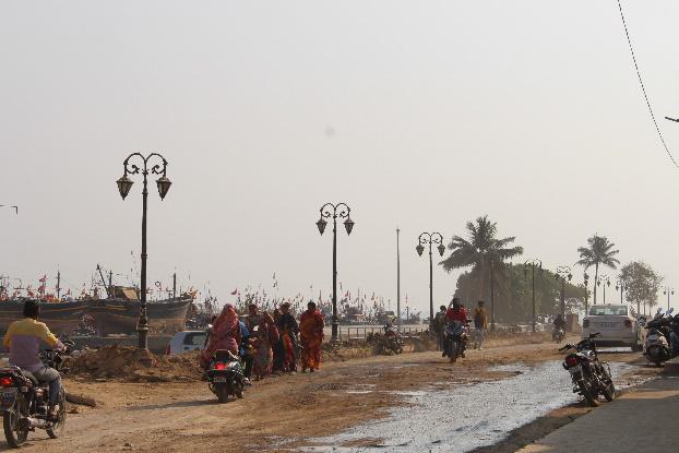
Diu fort is the biggest landmark and tourist location of the island. Outside at street level of the fort, street vendors occupy the footpath area. Opposite to it is an ample space for parking for the visitors for both 4 wheeker and also buses separately.
Central drainage system in diu town with manholes. No over floating of drainage is observed.
ROAD TYPES
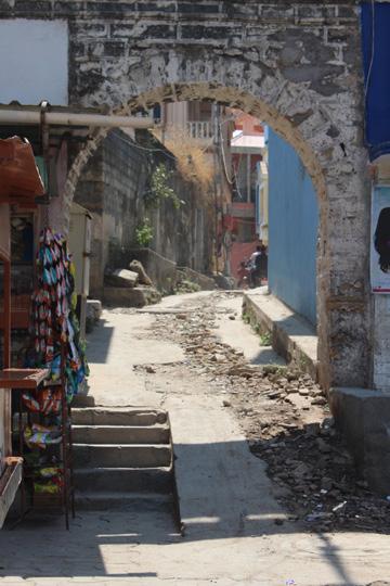
Tetiary raods accupy the major percenatage of a type of raod seen inside the diu town. These raods are narrow and form a network of connectio through out the city. These streets are very narrow and have a width between 3m – 1m. They are flanked by residences on either sides. On street parking is seen in few residential araes. Can be difficult for 4 wheelers
SHADING
Streets does not have much of vegetation. Though they are considered shady because of the buildings that act as shading devices on streets.
STREET FURNITURE & CONTOURS
Every street within the town have seating spaces outside their homes
It is a beach located at the south western falnk of the island. it isnt very popular among the tourists and is still untouched from most visitors. it is mostly accessed by locals for a calm and undisturbed beach experince.
The streets lying on the varying contours in the diu town doesn’t have vehicular access. These streets with different contour levels are constructed as stairs with only pedestrian access.
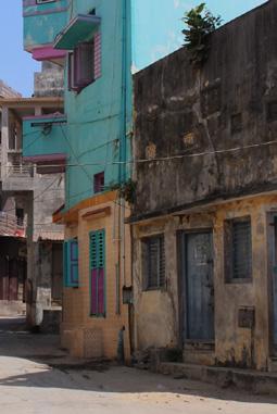
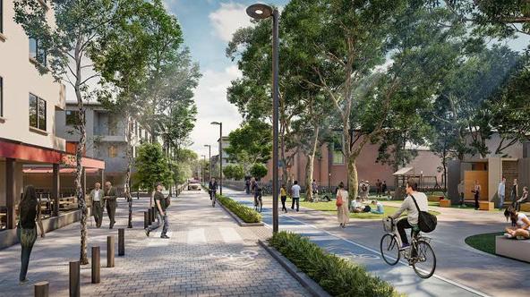
DIU PROPOSALS - HERITAGE STREET
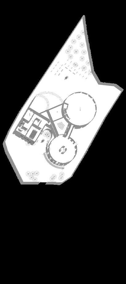
“DIU - Dissemination and Imaging in Urban Context of Diu, with strong ties to Portuguese culture. This urban design initiative encompasses 3 parts, namely Part A, Part B and Part C which include the development of an Interpretation Centre, a Heritage Street, and a Public Plaza respectively. By connecting three significant heritage structures in Diu town, namely the Diu Museum, St. Paul’s Church, and the Diu Fort, the proposal offers a comprehensive heritage walk for visitors and locals alike.
PRESENT CONDITION AND PROBLEMS IDENTIFIED:
Deficient Road Widths - Diu Town’s compact roads and by-lanes are insufficient for vehicular traffic, with widths ranging from 1-3 meters. Despite Portuguese architecture, there is insufficient guidance and connectivity to attract tourists. The town’s history is neglected, as there is no convenient street for exploring the town.
Inactivity at St. Paul’s Churchminimal foot traffic during the day. Despite being connected to accessible streets and parking, it lacks appeal. Despite being within walking distance of the Diu Fort, which has significant foot traffic, it is not prominent in the area.

Diu Fort Activity Center - Diu Fort, the most significant heritage building in the island, is situated on the eastern tip and connected to the main fort road. However, street vendors have taken over the main entry area, causing congestion and detracting from the fort’s atmosphere. Both locals and visitors use the area, but the situation detracts from the overall atmosphere.
SOLUTIONS:
PROPOSALS & ITS BENEFITS
Interpretation Center gives a one-place destination for the tourists to learn about the heritage of Diu while also acting as an orientation point, guiding the tourists along Heritage sites to be visited.
The Heritage Street is a pedestrianized access route that joins major heritage sites in Diu with the interpretation center providing an immersive experience for visitors to observe the Portuguese architecture style.
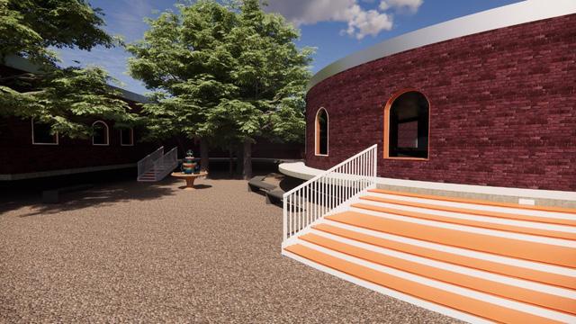
INTERPRETATION CENTER
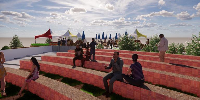
The Public Plaza serves as a social hub for cultural events, performances, and festivities, featuring seating areas, green spaces, and interactive elements. It integrates local vendors and food stalls to create a vibrant atmosphere and support the local economy, attracting visitors and supporting small-scale businesses.
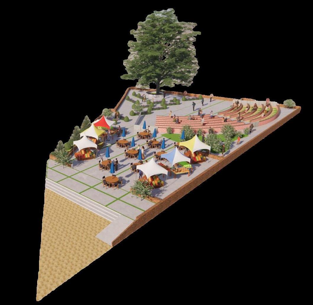
Public Plaza, located at the entrance of the Diu Fort acts as a gathering space and social hub. It will aim to accommodate cultural and social events, festivals celebrations and performances, while also integrating local vendors.
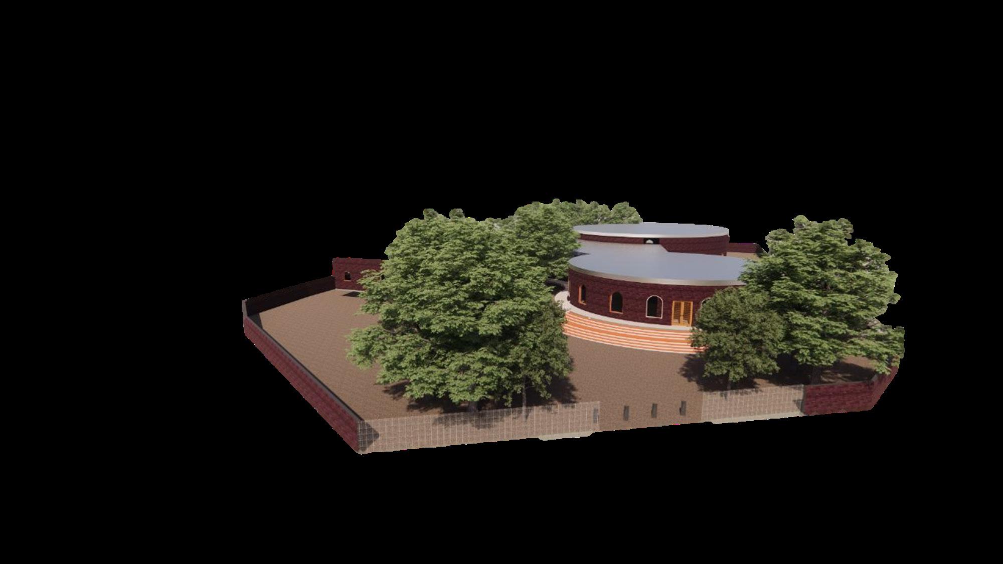
The Interpretation Centre is the hub of the proposal, guiding visitors to Diu’s heritage through modern and Portuguese-inspired architecture. It features exhibition spaces, libraries, audio-visual rooms, and discussion areas, promoting education, community engagement, and celebrating local traditions. The center offers interactive displays and historical context, and serves as an orientation point for the heritage walk.
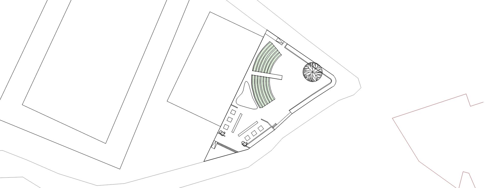
Heritage Street connects the Interpretation Centre, Diu Museum, St. Paul’s Church, and Diu Fort, ensuring pedestrian safety, accessibility, and a pleasant walking experience. It features traditional paving materials, street furniture, and lighting fixtures, as well as interpretive signage and markers to enrich visitors’ experience.
 HERITAGE STREET
PUBLIC PLAZA
PRESERVATION OF HERITAGE CULTURAL EDUCATION TOURISM BOOST SOCIAL ENGAGEMENT
DOCUMENTATION O5 HIMALAYAN-CRAFT
THE CRAFT
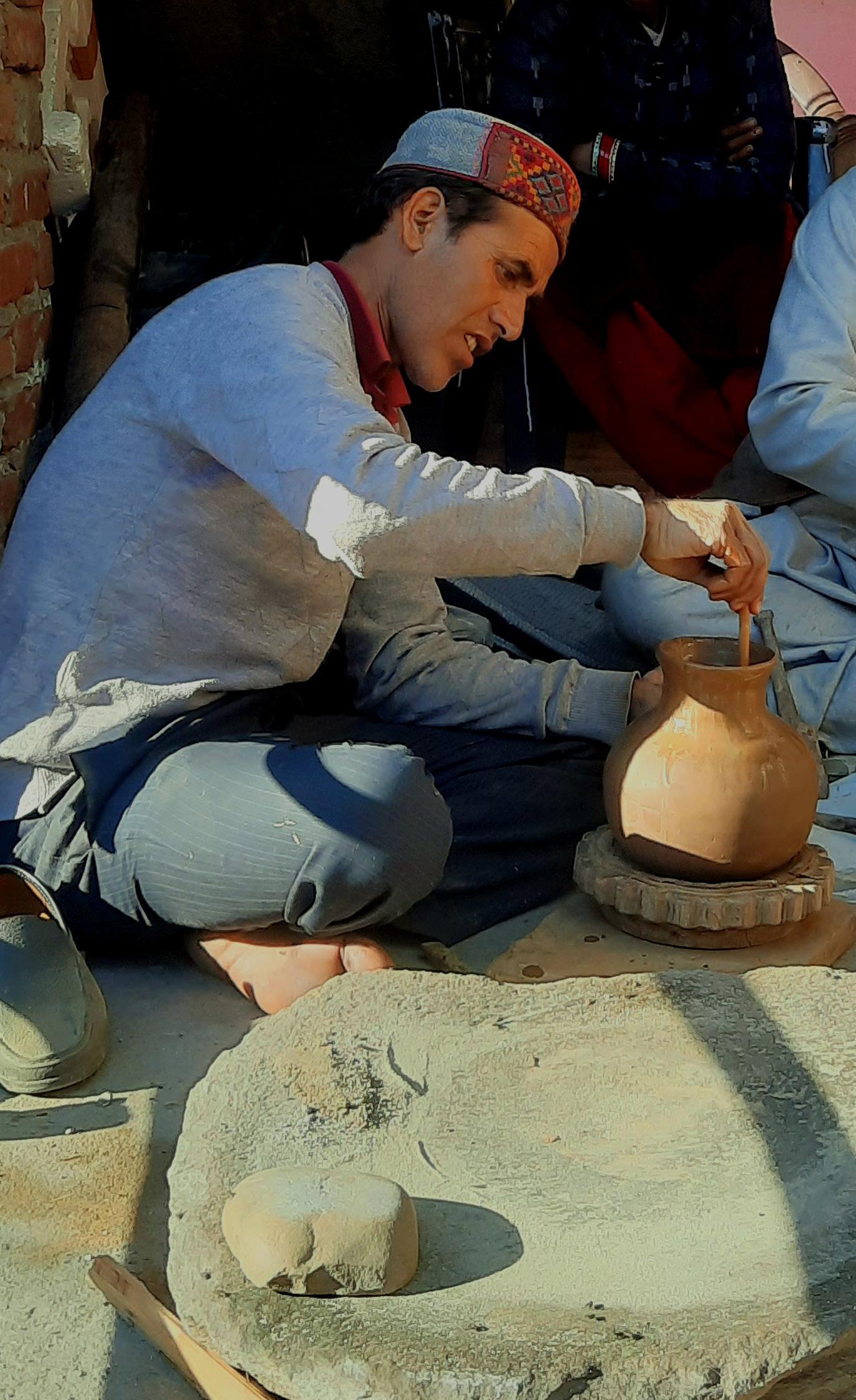
With a ton of unanswered questions, began the quest to understand the people of FARYADI - the `potter’s village” and their origin, we set out to interact with the villagers to understand the history in the words of the sthanivasi (localites). The villagers, Giri-Sthanivasis (localities from the mountains), learnt various ways of living and made themselves a life in the valleys. The locals claimed that their origins went back to the Kangra Kingdom and as per records, during the early 1900s, the village came under the Kullu KIngdom. The localites continued by sharing that the village had the buzurghs (the elderly ancestors) who were once known as the kalakars (craftsmen), introduced their skill which transitioned over generations. The profound skill sets were never taught by any specific gurus but were instead a pride that only specific families carried.
The distinct feature of this art form included the use of a spinning bowl instead of the conventional pottery wheel. The use of pottery wheel was considered inauspicious, as it was believed that using the thread was equivalent to cutting their bonds with the Gods. Instead of the wheel, the craftsmen used a spinning bowl known as a koshya, with a cushion made out of cloth that spins on a marble inserted on a base-plate known as the phatta.
Despite being a unique kala (art form), it has lost its prominence over the course of time due to various reasons, one of them being the high risk this pot-making process carries. This process of pot-making involved heavy labor for transporting chikni mitti (clay soil) from places like Brelga and Belida since it required refined fresh clay that didn’t contain any moisture. Once the pots were made, they needed to be burnt in a bhatta (kiln) overnight and the potters often carried the risk of waking up to broken pots in the kiln. In addition to this, the crafts were never valued in the market and that’s what has caused the kala to recede to the point of extinction, where fewer than few villagers possess the required skill set to practice this kala. Seeking for answers, we have realized we have yet another quest and a set of unanswered questions waiting for us all. The questions aren’t directed to just us but to every reader who has come across this report and traveled along with our story. The most important question still stands - Who is responsible for the dying art? Who takes the blame for this? The modernization or the industrialization? Our ignorance towards such art forms? Or ignorance of the government bodies?
The research was set to investigate the indigenous pottery culture in the valleys of Tirthan, to understand the practices & cultures of the locals living in Faryadi Village.
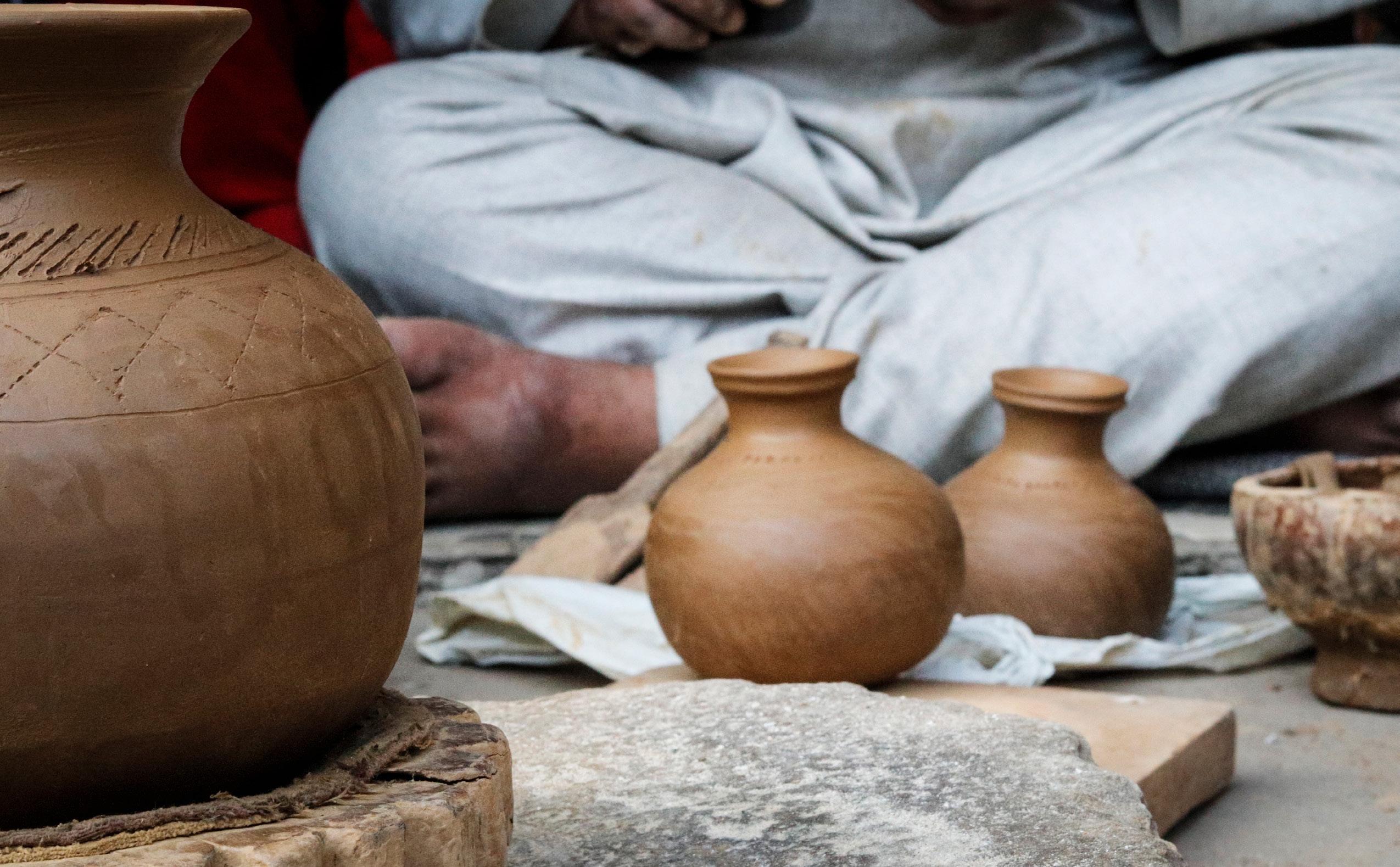
The research involved understanding the narrative of the kalakars through their perspective. The study involved attempts to not just understand the artform and its origins, but also the people of the village coexisting in it and making their living in varied fields. It is quite important to understand that the knowledge of this kala has been passed down through generations of the kalakar families.

As time and generations have flown by, the significance of the artform has faded, forcing the craftsmen to find alternative fields of occupation which has led this rare art form to move towards redundancy. The reasons might range from modernisation to corruption to negligence towards the art-form, resulting in the numbers of kalakari population to go down drastically.
This raises the need to answer the 3 questions,
WHAT
CAN WE DO?
HOW DO WE ACHIEVE IT?
WHO CAN HELP THEM?

India being a greater part of the World Trade Organization (WTO) has always helped revive such dying art forms. Government initiatives towards the same is one of the most efficient means of protecting the craft. As the readers of this book; students, employees, homemakers and entrepreneurs should acknowledge the learnings from the craft and the authenticity it carries. Since assimilation of these crafts form an identity to this world which truly makes it ours.
“Crafts are vessels of vernacular identity, where each of these make a whole of us; bits of us left in the past, pushes our identity to be lost”
The booklet is the result of a collaboration between organizations like NASA India x NORTH to make an intiative towards connecting students of Architecture to dying crafts and its people. The assimilation of the same is a group work done by 19 students from across india who came together for a cause.

project.

INDIA NORTH National Association of Students of Architecture India Himachal Pradesh Craftsmanship
De-
X
NASA
and
sign Innovation Institute, Naggar
Please scan the QR Code to view full
DOCUMENTATION O6 KUTCH-VERNACULAR
KUTCH - VERNACULAR ARCHITECTURE
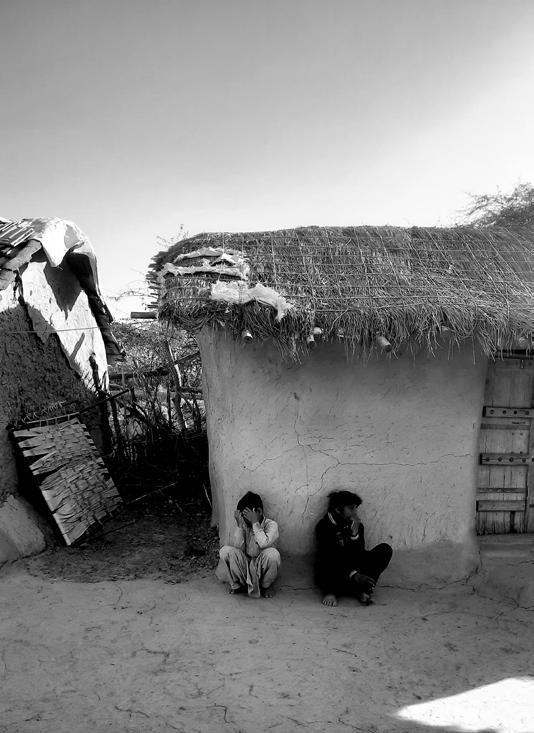
Travelling all different corners of the country we all landed in Kutch. Unfamiliar faces alien lands and cultures and people we never experienced. With hesitation at least our curious souls had finally stepped on the lands of Kutch, Gujarat. People in India practise a variety of religious practises; similarly, this area believes in Pastoralism or Nomadism.
The local Pastoral communities here are known as ‘The Maldharies’ or ‘The Rabari’. These communities had travelled for centuries and carried their homes along with their cattle on their journey. They have committed their entire lives to animal husbandry and believe that, to flourish and expand, their society must keep travelling to learn new information and pass it on. Somewhere in the middle of Kutch, In the dusty air, sandy grasslands and a place of beautiful sunsets began the search for understanding the Communities of Kutch. The encounters at the community were no less than a wonder where we realized, though we lived on the same lands, our worlds stayed miles apart.
Through our explorations we stumbled upon their unique houses known as Bhungas. These houses were round and rectangular in shape completely made from mud. It was said after the 2001 Gujarat Earthquake Bungas were the only structures that stood and survived the calamity.

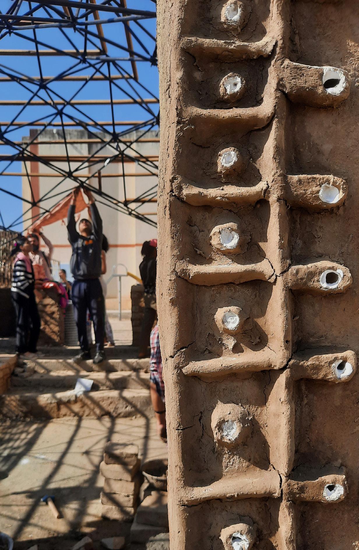
As we dovumented we come across the unique crafts of the women - Kutchi Embroidery locally known as the Bharat Kaam. Kutchi Embroidery being the craft of the needles and colorful threads is an art form of the mahilaye who knitted the threads of their daily life.
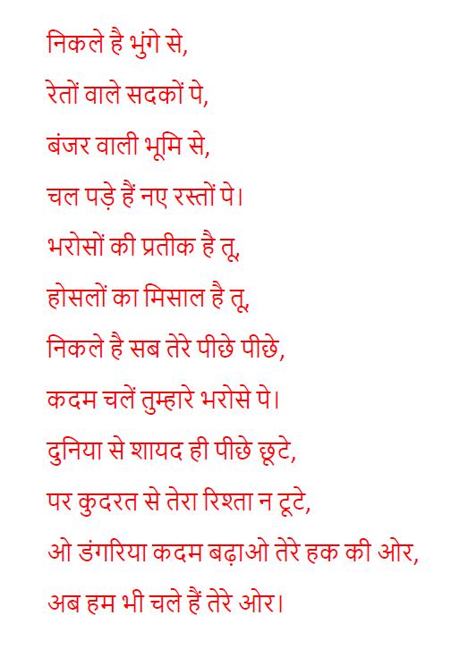
The women who were limited to their houses in the sands; Bharat Kaam added life to them, where all they knew to do was to stitch in their free time. This form of art dates back to centuries when the West came to Sindh and the craft was known as Sindhi kaam.
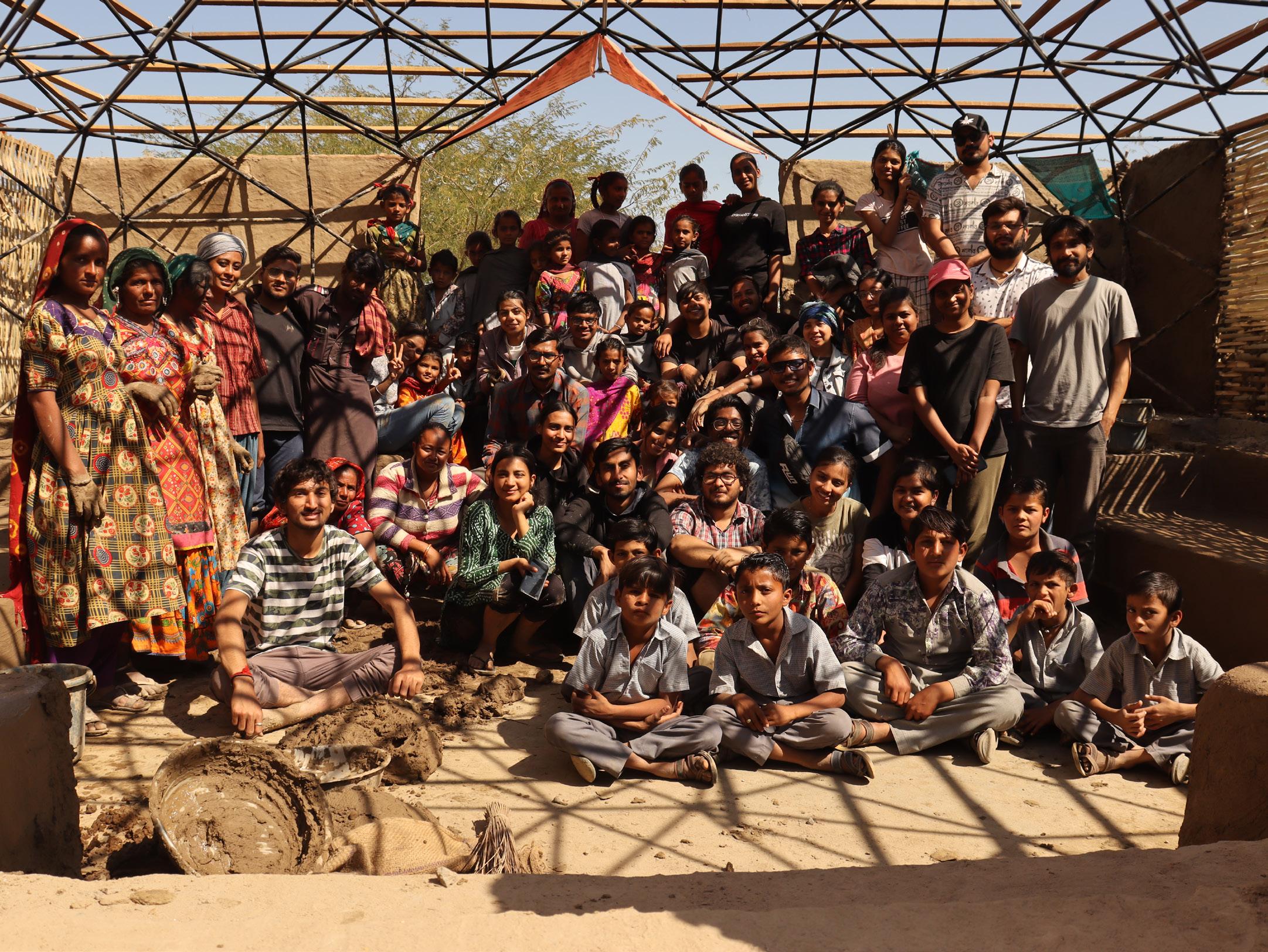
After all our explorations, we finally come to settle in Berdo at a primary school run and managed by Vishnu Bhai the sutradhar to our mission. We as architecture students had finally come together on a mission for a social cause, to aid a primary school by giving a built form to a learning and play space the kids always wished for.
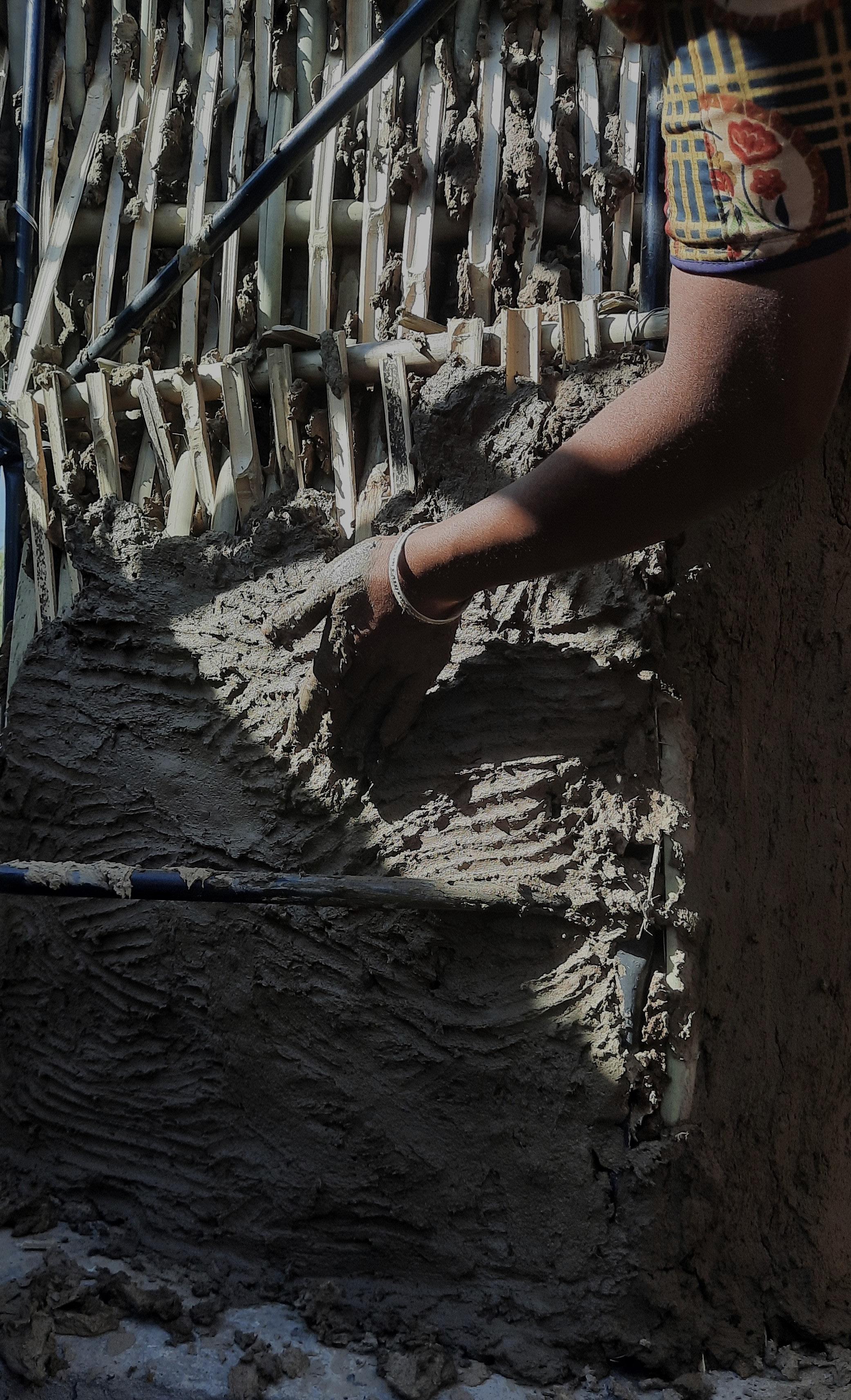
Ever since then we meticulously worked on understanding the wattle and daub technique, where bamboo was essentially used for the wattle where it was intertwined and then daubed with mud.

The mud composition used for daubing was pugged manually using a mixture of cow dung, locally available soil and water. These were some of the activities that were loved both by kids and adults. We who were outsiders to them hesitated and wondered how the kids would welcome us but pugging was that one means that broke down the barrier and helped us all connect to each other.
Each of us came down with various ideas to be executed on-site in the best way possible and after 3 days of meticulous efforts with the help of all the Maasis, we finally understood the techniques behind the unique skills they possess. Though we were miles away from mastering it yet we were all happy to be able to bring this one idea into reality. An idea that started from one man, Vishnu Bhai as a vision and we succeeded.
NASA INDIA HUNNARSHALA
X
National Association of Students of Architecture India Aabhat, Hunnarshala Foundation, Bhuj, Gujarat, India.
The booklet for the same is yet to be published. This was result of a collaboration between organizations like NASA India x Aabhat, Hunnarshala foundation, to bing architecture students a step closer to the life in KUTCH.
~K. Anjana Nandan
DOCUMENTATION O7 GANDIKOTA
GANDIKOTA - INTRODUCTION
Gandikota is a small village located in the Kadapa district of the Indian state of Andhra Pradesh. It is known for its beautiful gorges, ancient fort ruins, and stunning natural scenery.
The name Gandikota means “gorge fort” in Telugu, and it is believed that the village was named after the gorge formed by the Pennar River, which runs through the region.The village is also called the “Grand Canyon of India” due to its striking resemblance to the Grand Canyon in the United States.
The village is home to rich culture & a number of ancient structures that include:
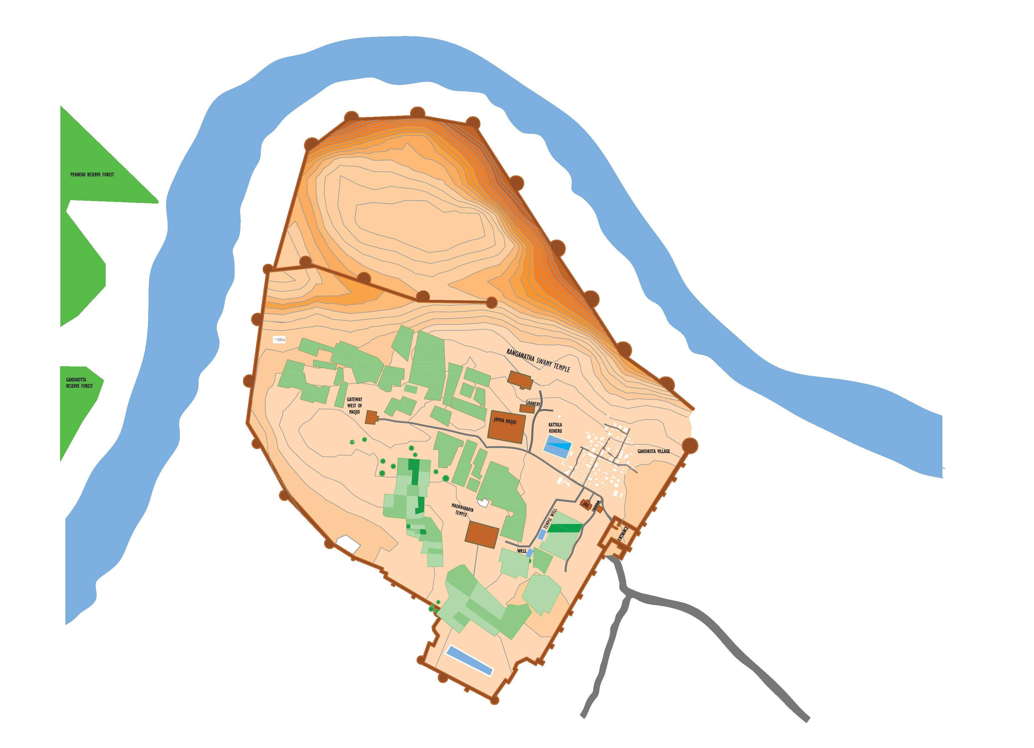
Madhavaraya Temple
Ranganatha Swamy Temple
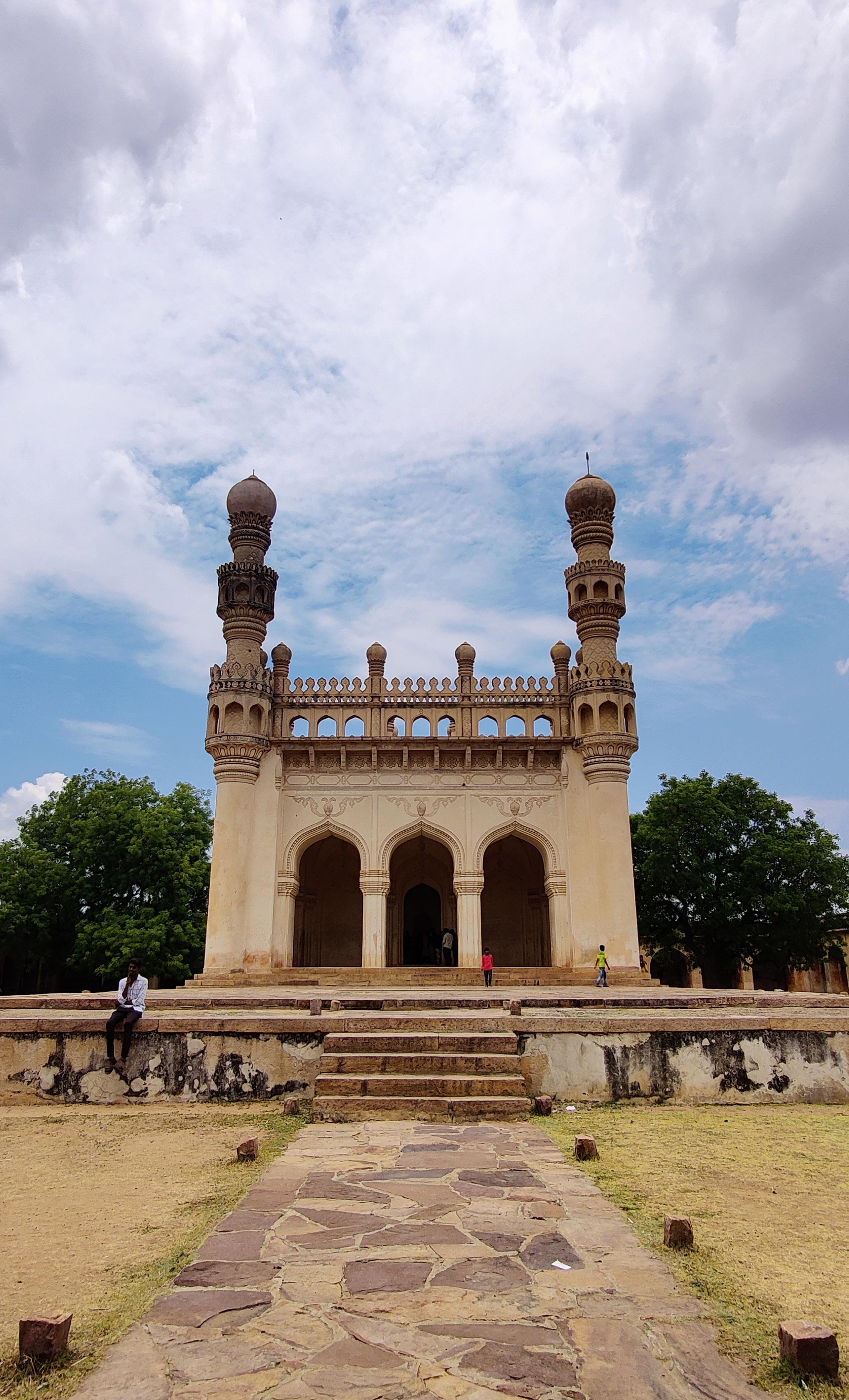
Jamia Masjid
Charminar
Jail And Granary.
GRANARY DOCUMENTATION
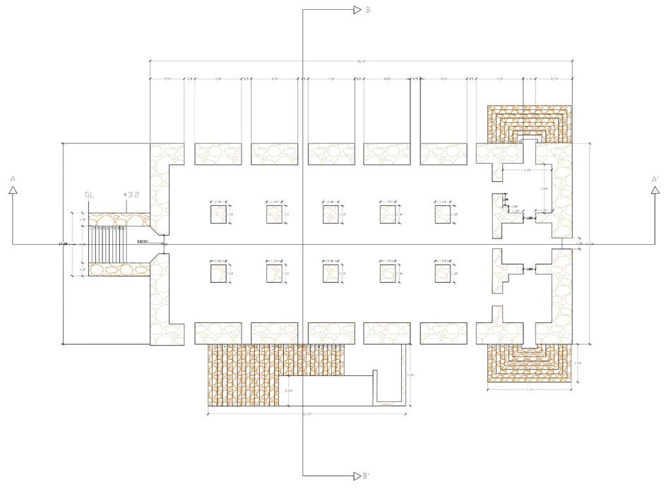
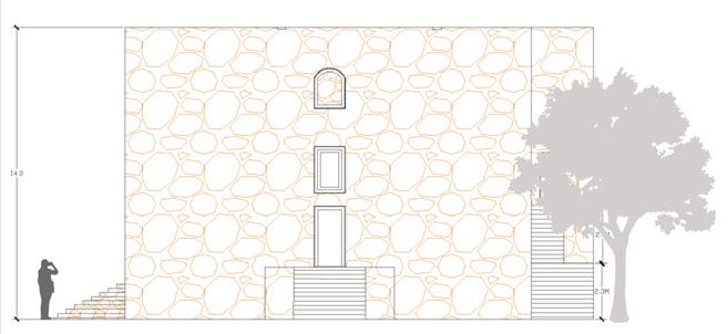
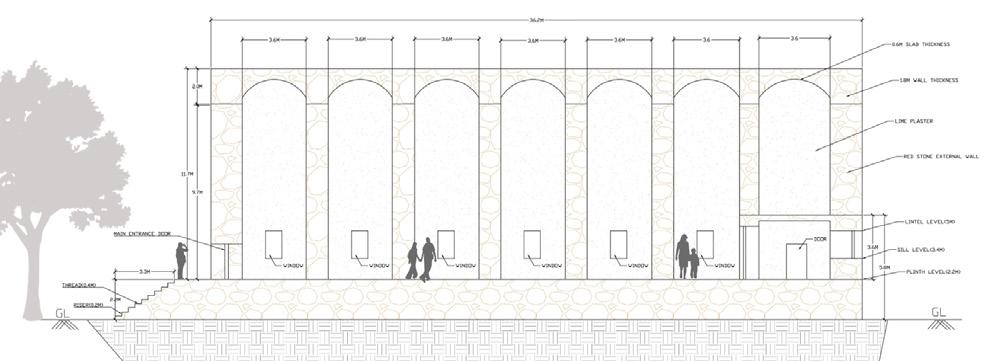
A granary is a place where food is stored. It is the massive stone building on the North-east flank of the Jumma Masjid.
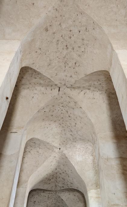
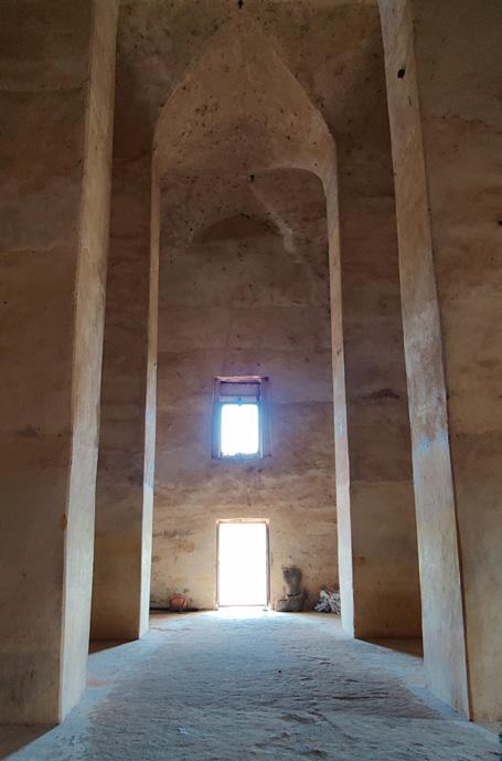
The edifice may be dated to the Qutb Shahi era based on its construction elements. It was later modified in the British Era as per their conveniences and requirements of the structure. Various Indian kingdoms built granaries as a component of their governmental and economic structures during the mediaeval era.
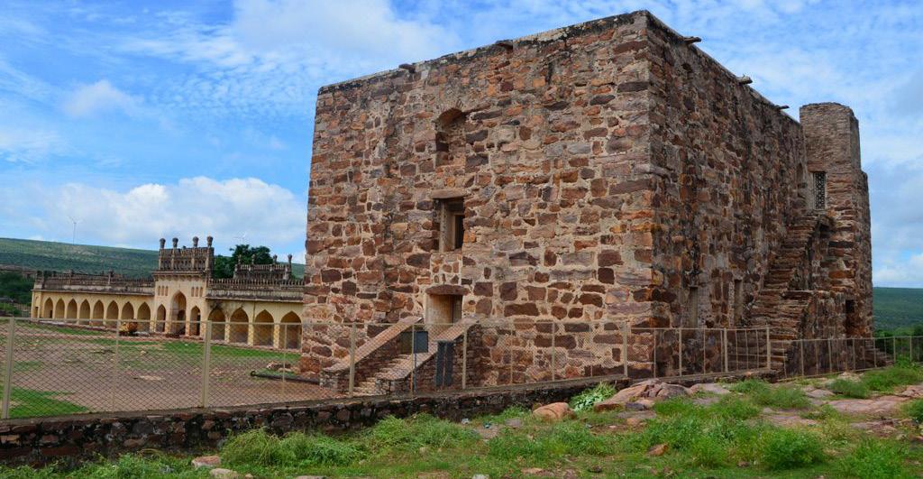
The Mughal Empire (1526–1857) also possessed a sophisticated system of granaries. These people were referred to as “kotharis” or “gole khanas.” To make grain storage, distribution, and trading easier, these granaries were frequently situated close to marketplaces or trade routes. The storage areas in the Mughal granaries included raised floors, ventilation systems, and sturdy doors for safety.Granaries were still crucial buildings for storing grain throughout the colonial era of British authority.
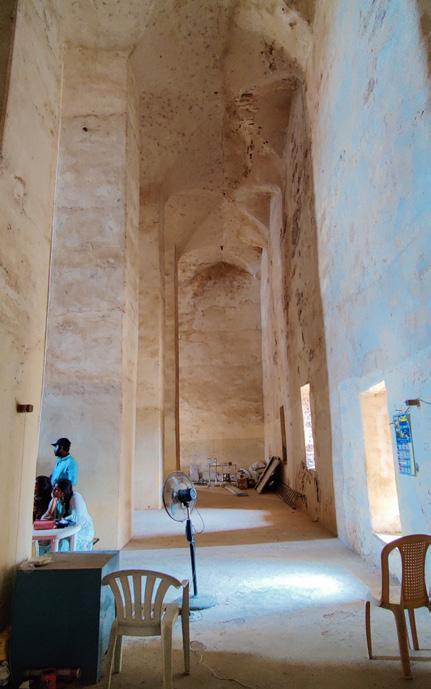
WHY GANDIKOTA?
Documentation is subject to analyse and understanding of buildings and settlements. Gandikota is a small village in the district of Kadapa in the state of Andhra Pradesh with rich history and beautiful views of nature. The Grand Canyon of South India, the temples, and the boulder-formed river Penna are the region’s most well-known attractions. The mosque and temples inside the fort serve as symbols of the location’s historical significance. The dwellings created inside the site prevented Gandikota from receiving a UNESCO certification even though it has a rich heritage and numerous monumental features. Gandikota was unsuccessful in getting the designation of a UNESCO Heritage Site since it was stated that no permanent settlement should be created inside a heritage structure to acquire a UNESCO Certificate.
Upon sensitivity analysis the structure was damaged and required action in regards to:
Cracks and spalling
Spalling and breaks in the floor Lime finish restoration
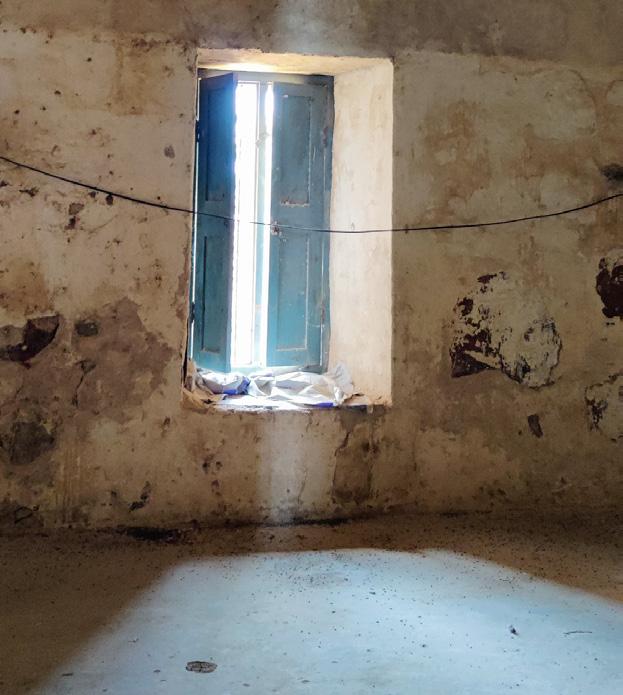
Foul Smell
Unwanted vegetation
Please scan the QR Code to view full project.

PLAN ELEVATION SECTION Red sandstone is used to construct the 14-meter-tall Gandikota granary. Columns are built using stone masonry, plaster, and lime & mortar. The structure stands on a plinth of approximately 1.2 - 1.3 Meters tall and stands alone on 12 columns. Each of the walls the around 1M thick and is completely made of stone and plastered with lime on it.
O8 MISCELLANEOUS
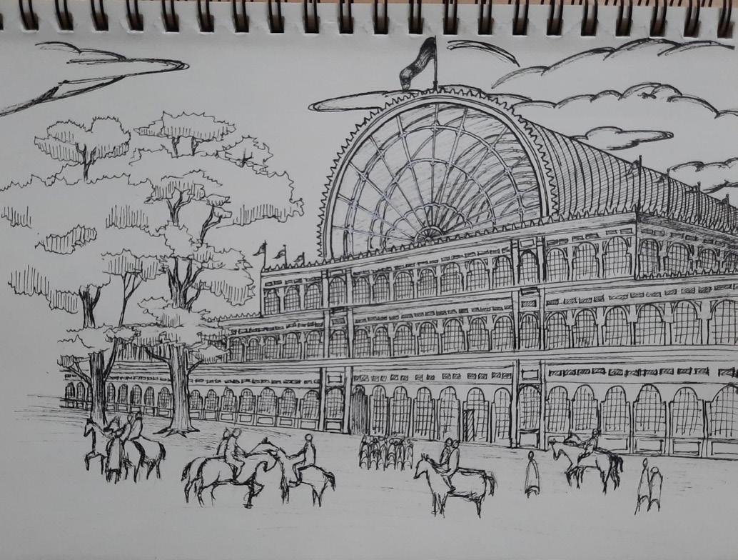
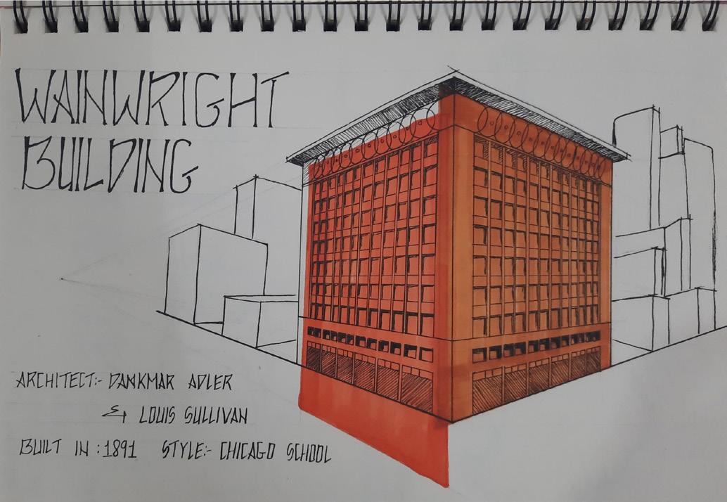
LOGO DESIGN SKETCHING
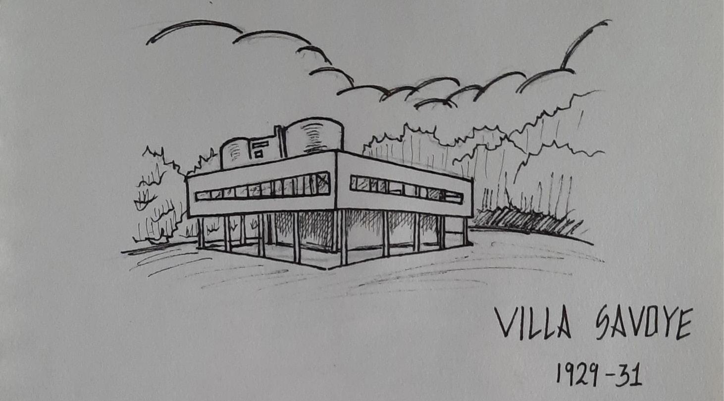
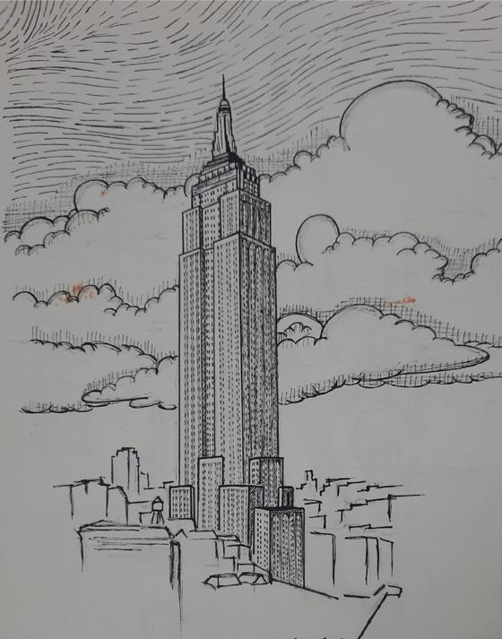
The studio of urban design required for a logo that would act as a branding tool representing the “Semester - 8 DIU - Urban Design” studio. It stood as a symbol for identiy and representation in all forms of media which included the sheets presented & the digital means like social media platforms.


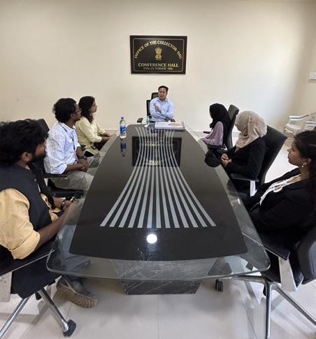
The logo was recognised by the DIU Collectorate during the presentation of the Diu Analysis work.
ELEMENTS
PALETTE
A light house representing the popular port, fort and lighthouse located at the island.


Since DIU was popular for its serene beach sunsets on the west coast an element of it is added.

After all graphic representation the lettering is added indicating the title of the location DIU.

 COLOUR
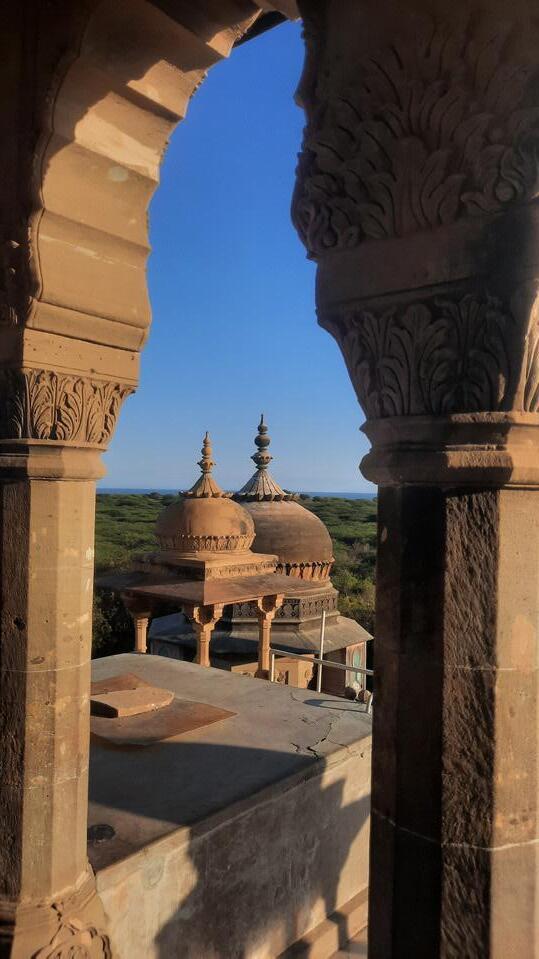
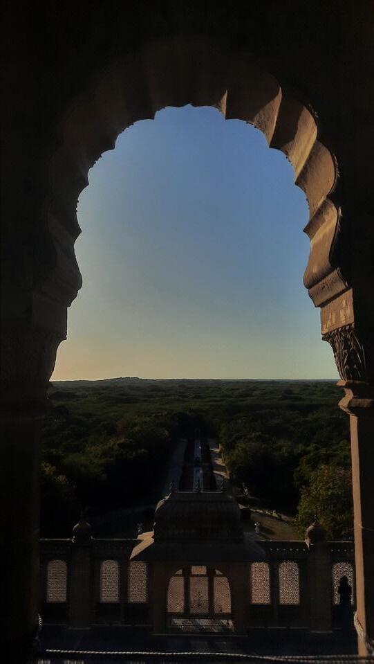
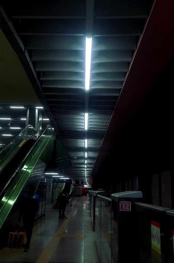
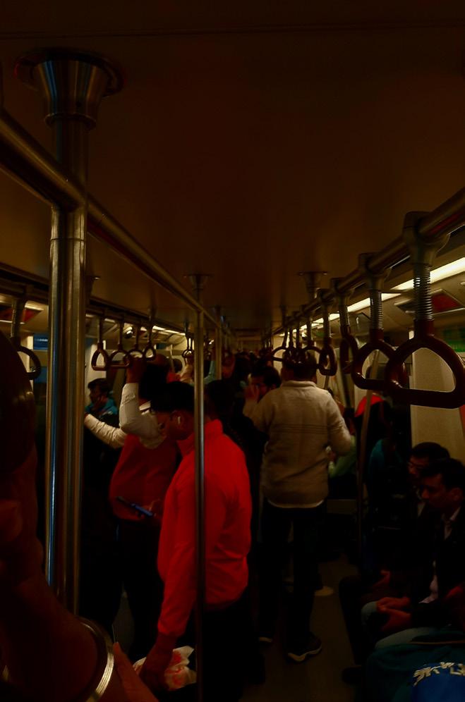
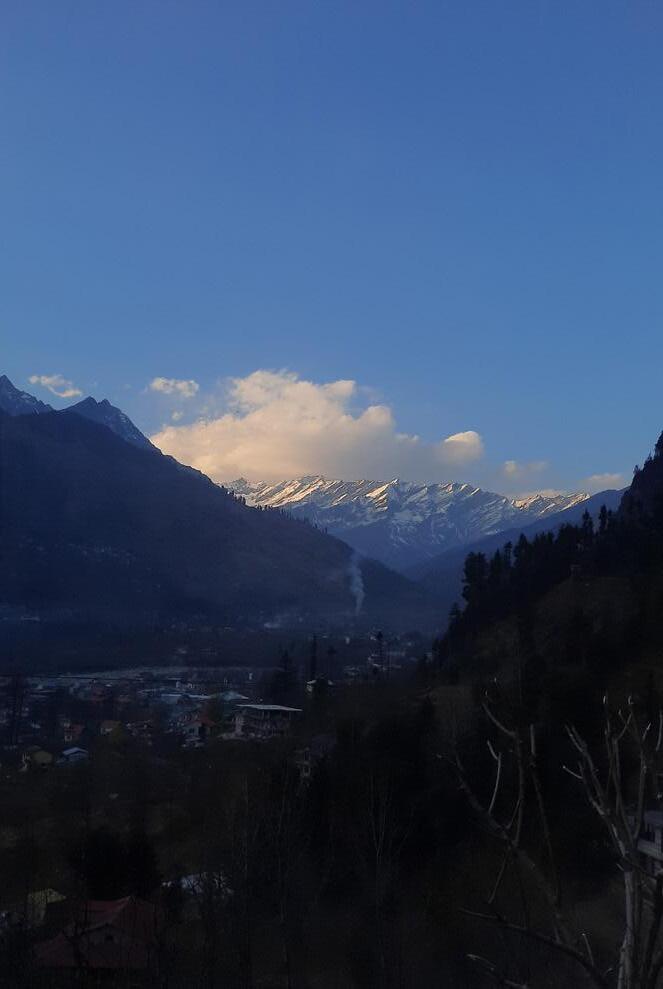
TRAVEL PHOTOGRAPHY


WRITING
I have started writing articles and books from December 2022 at Himalayan Architecture & Craft Documentation program hosted by NASA India. Ever since then I have been wiritng short experinces, poems etc. As a part of the same I have contributed to Re-Thinking The Future (RTF) as a writer for 2 articles namely “ Human Civilization Without Architecture” which talks of an imaginery narrative how human cicilization would have evolved over ther centuries without Architecture and my 2nd artcile talks of Arizona battle ship, which can be found on the website titled as “Lost in time: USS Arizona (BB-39)”.


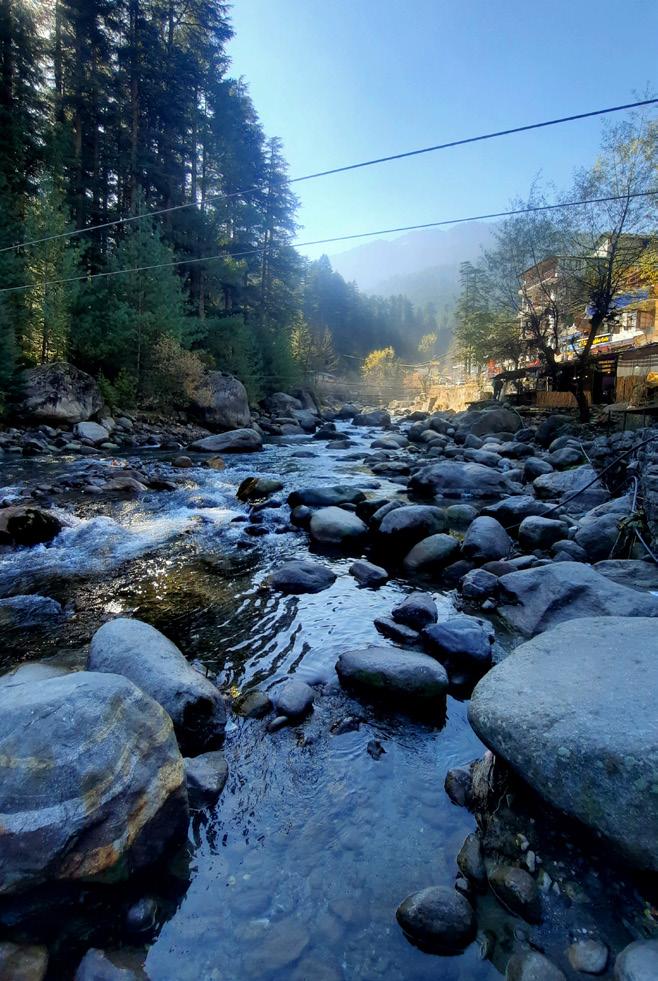
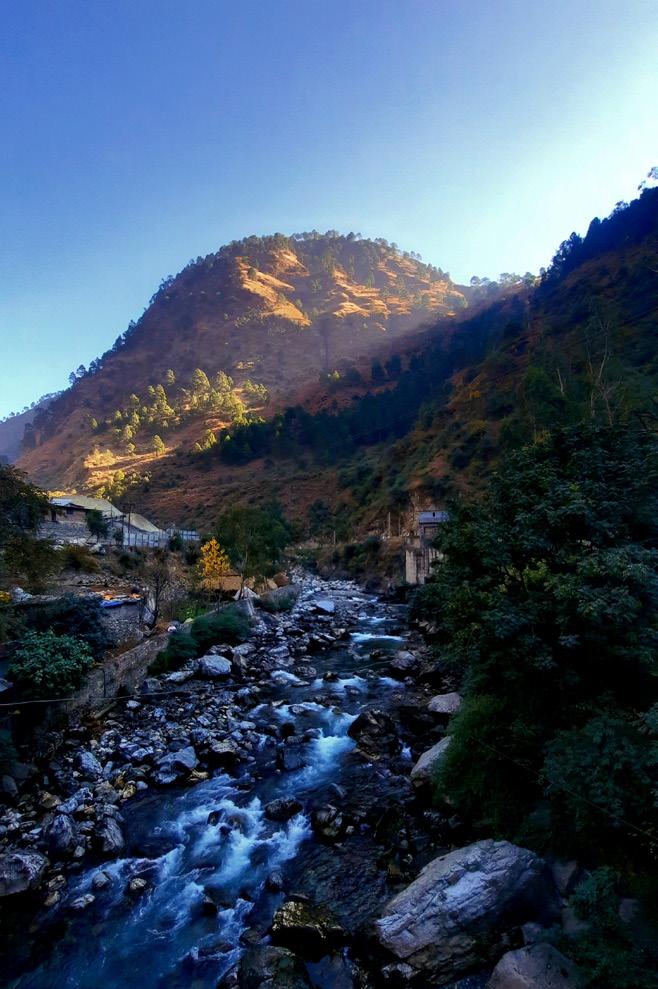
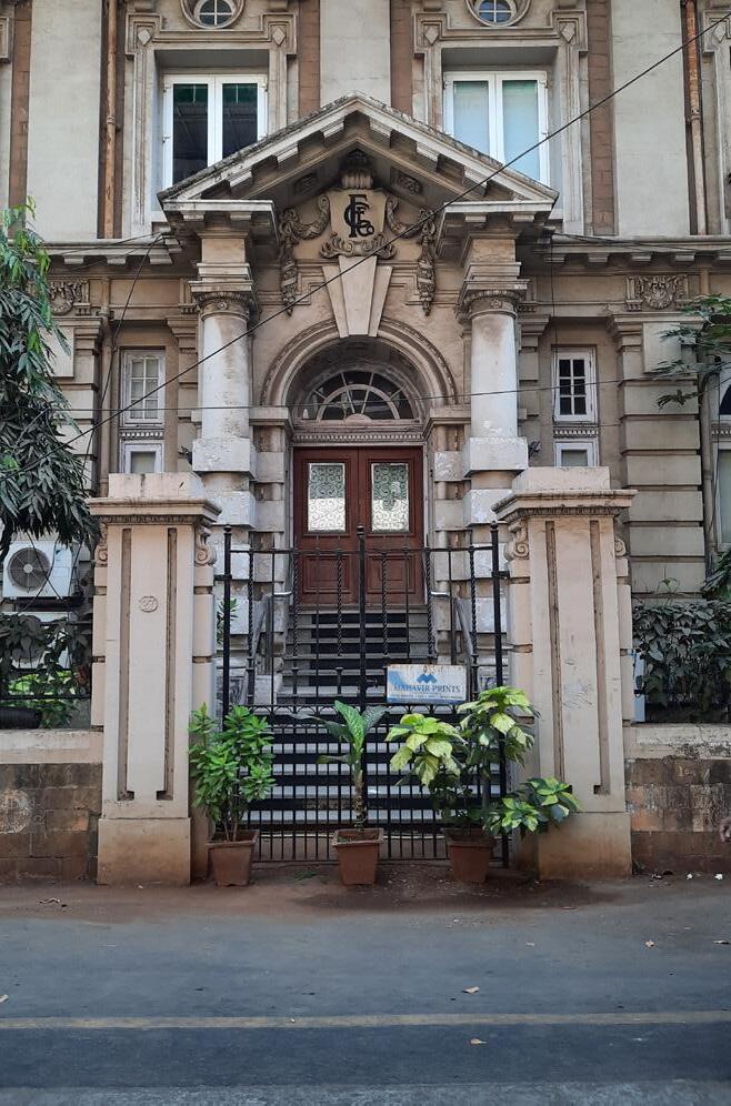
 Please scan the QR Code to view profile on the website.
K. ANJANA NANDAN (IND) +91 9951120998 nandan190502 @gmail.com
 - K. Anjana Nandan ( Student Of Architecture)


 HERITAGE STREET
PUBLIC PLAZA
PRESERVATION OF HERITAGE CULTURAL EDUCATION TOURISM BOOST SOCIAL ENGAGEMENT


 COLOUR


 Please scan the QR Code to view profile on the website.