CASEVAC In Country By Maj. Tom Dolan, USMC and Maj. Martin Schubert, USMC
T
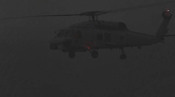
he Air Boss at our forward-operating base (FOB) just had alerted us of an urgent, casualtyevacuation (CasEvac) mission. It was an early February morning in western Irag when we began the information-gathering process. Our standard CasEvac package is a section of aircraft, consisting of one UH-60 Dustoff aircraft and one AH-1W Super Cobra to escort the CasEvac aircraft. Our escort crew had two majors, a pilot in command (PIC) with 2,400 hours and a copilot with 1,900 hours. Both pilots had essentially the same qualifications and designations. We were based near the Syrian border and had been flying in that part of the area of operations (AO) for almost seven weeks; we were very familiar with the routine. Our higher headquarters just had finished their transfer of authority (TOA), so we continued to work with the new headquarters on how to conduct business; it takes time to build the situational awareness of all those new to the tasking process. We also were on the backside of a few days of bad weather that had restricted flight operations. At 3 a.m., the Air Boss entered our ready room to update us on the urgent CasEvac. The drop-off location was to-be-determined (TBD). We expected to make the normal 65-mile flight to Al Asad air base, the traditional CasEvac transfer point for patients requiring follow-on movement to a higher-level medical facility. The local weather looked good, with high clouds covering about half the sky, and no moon, making it a low-light-level night. At the midnight shift-change pass down, the off-going crew also mentioned some low-level fog about halfway to Al Asad. The Air Boss passed information to the H-60 crew (call sign Leatherneck), who would fly the mission with us. We copied the information, but one thing was different this time: The destination was Tikrit, not Al Asad. We asked the Air Boss to confirm the destination with the tactical-air-command-center (TACC) battle captain; the Leatherneck pilots also checked through their medical channels. We broke out the map and spotted Tikrit in the upper right corner. We breathed a sigh of relief that at least 12
we had found it on a map; no one in the flight ever had been there before. In the next few minutes, we confirmed with base that the destination was correct, and we gathered as much weather information as possible. The map of Tikrit indicated several airfields, and we needed to confirm which one was correct before we launched. We then were passed a grid of the Tikrit FOB where we would deliver the patient and plugged it into the GPS. Showing 126 miles, we instantly assumed about a one-hour flight. The frontseat pilot again opened the map and did a quick route study. The route had a large lake along our direct course, with no towns, cities, or other marked hazards. We requested weather for the Tikrit area, which called for broken at 3,000 and 5,000 feet, overcast at 12,000 feet, with visibility fiveto-six miles and haze. We learned the patient, a Marine, was having heart problems and needed to see a cardiologist; the nearest one was in Tikrit. We talked among ourselves and with the Leatherneck pilots to determine the best course of action. We had a list of unknowns ahead of us to work through. First, we were leaving the Marine AO and venturing into an Army AO and FOB. We did not have an airfield diagram or any other information about the controlling agencies, such as approach control and the direct-air-support center (DASC). These agencies normally would be in a pilot-tocontroller handbook. We had the weather for takeoff and at our destination, but what about the en route weather? We were essentially chasing the storm that just had rolled through our area the previous day. It took about 30 minutes to confirm the destination. We topped off on fuel in case we couldn’t find the FOB, or if the FOB didn’t have available fuel. The closest divert was 45 miles to the south at Balad. We took off and joined on Leatherneck, who had an airfield card delivered to their aircraft just before takeoff. We talked briefly on the radio, got the tower frequency, and headed across the desert to Tikrit at 500 feet AGL . Fifteen minutes later, we checked out with DASC and switched to the next DASC frequency. Static Approach