


PARK STAFF:
John Fullwood, Acting Director
Brian Strong, Deputy Director of Planning and Natural Resources
Carol Tingley, Deputy Director
Sean McElhone, Interim Deputy Director of Operations
Jay Greenwood, South District Superintendent
Dave Head, Planning Program Manager
Christy Rosas, Park Planner
Smith Raynor, State Trails Planner
Scott Crocker, State Trails Program Manager
Jerry Howerton, Engineering and Construction Manager
George Norris, Land Protection Program Manager
John Amoroso, Regional GIS
Bob Taber, Coastal Regional Trail Specialist
John Blanchard, Natural Resources Program Manager
James Sasser, Coastal Regional Biologist
Katie Harville- NC State Historic Preservation
LUMBER RIVER STATE PARK STAFF:
Lane Garner, Park Superintendent III
Brannon Bryson, Park Ranger II
Dern Crilley, Park Ranger II
Brett Godwin, Park Ranger I
Zachary Lunn, Park Ranger I
Yolanda Sinclair, Administrative Associate II
Tommy Walters Maintenance/Construction Tech II
James Baxley- Maintenance/Construction Tech II
PARK ADVISORY COMMITTEE:
James Sessoms
Roylin Hammonds
Bob Gaddy
Marshall Thompson
Omer Register
PROJECT PARTNERS:
office Citizen participants from the project area
City of Clinton, Planning & Development
City of Lumberton
Columbus County Board of Commissioners
Columbus County Parks & Recreation
Department
Harnett County Parks & Recreation Department
Harvey Godwin Jr., Lumbee Tribal Chairman
Hoke County Board of Commissioners
Hoke County Planning Department
Jeff Marlowe, Canoe/Kayak Vendor
Laurinburg Scotland County Chamber of Commerce
Lumberton Planning & Neighborhood Services Department
Lumber Riverkeeper
Lumber River Campground
Lumber River Conservancy
Lumber River Park Advisory Committee
Lumber River Rural Transportation Planning Organization
Lumberton Visitors Bureau
Robeson County Board of Commissioners
Robeson County Parks & Recreation Department
Scotland County Board of Commissioners
Scotland County Parks & Recreation Department
Scotland County Tourism Development Authority
Town of Boardman
Town of Fair Bluff
Town of Fairmont
Town of Maxton
Town of Orrum
Town of Pembroke
Town of Pembroke Parks & Recreation Department
Town of Wagram
CONSULTANT TEAM:
SageDesign, Lead Consultant
CIII Associates
ALTA Planning + Design, Inc.
This page is intentionally left blank
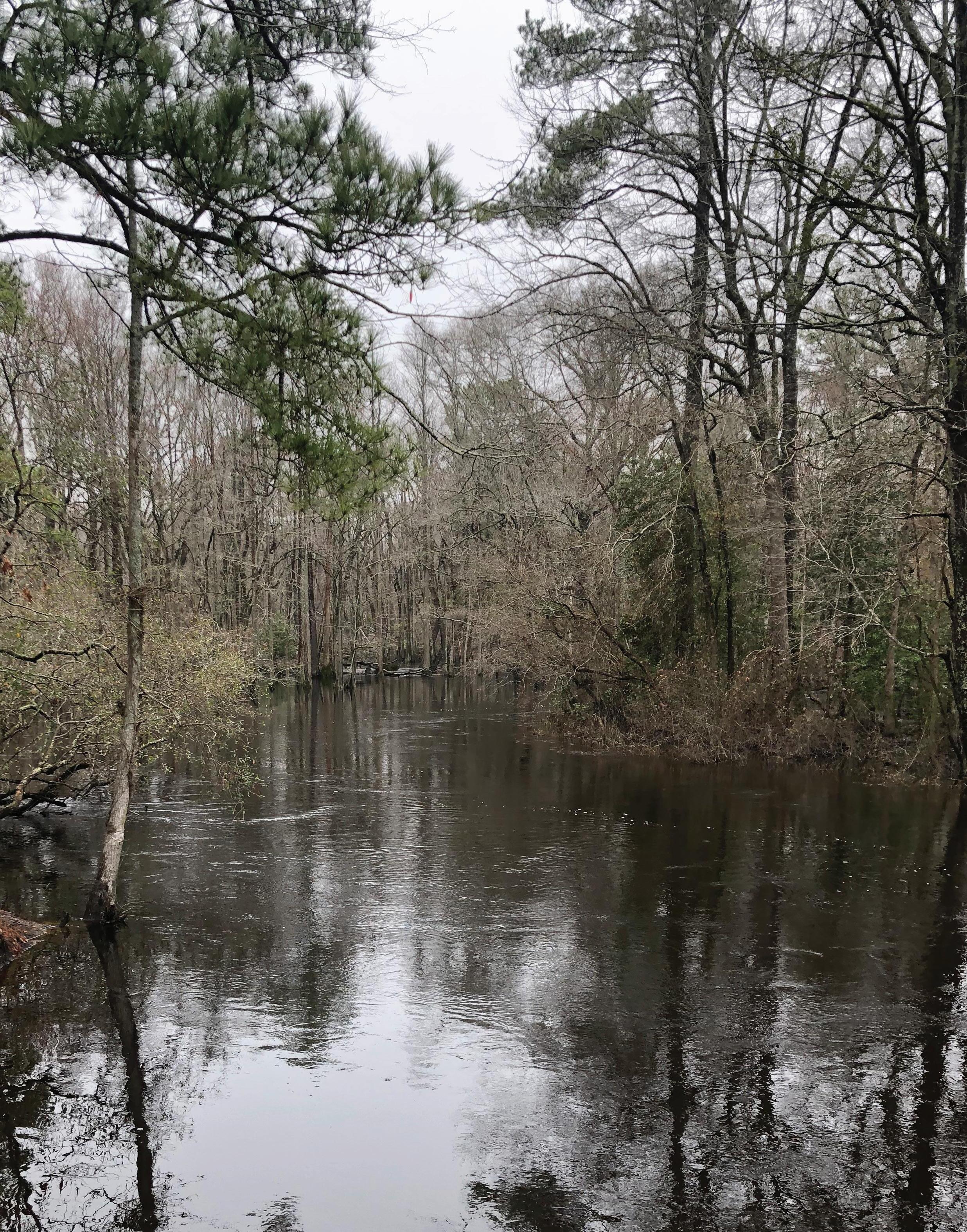
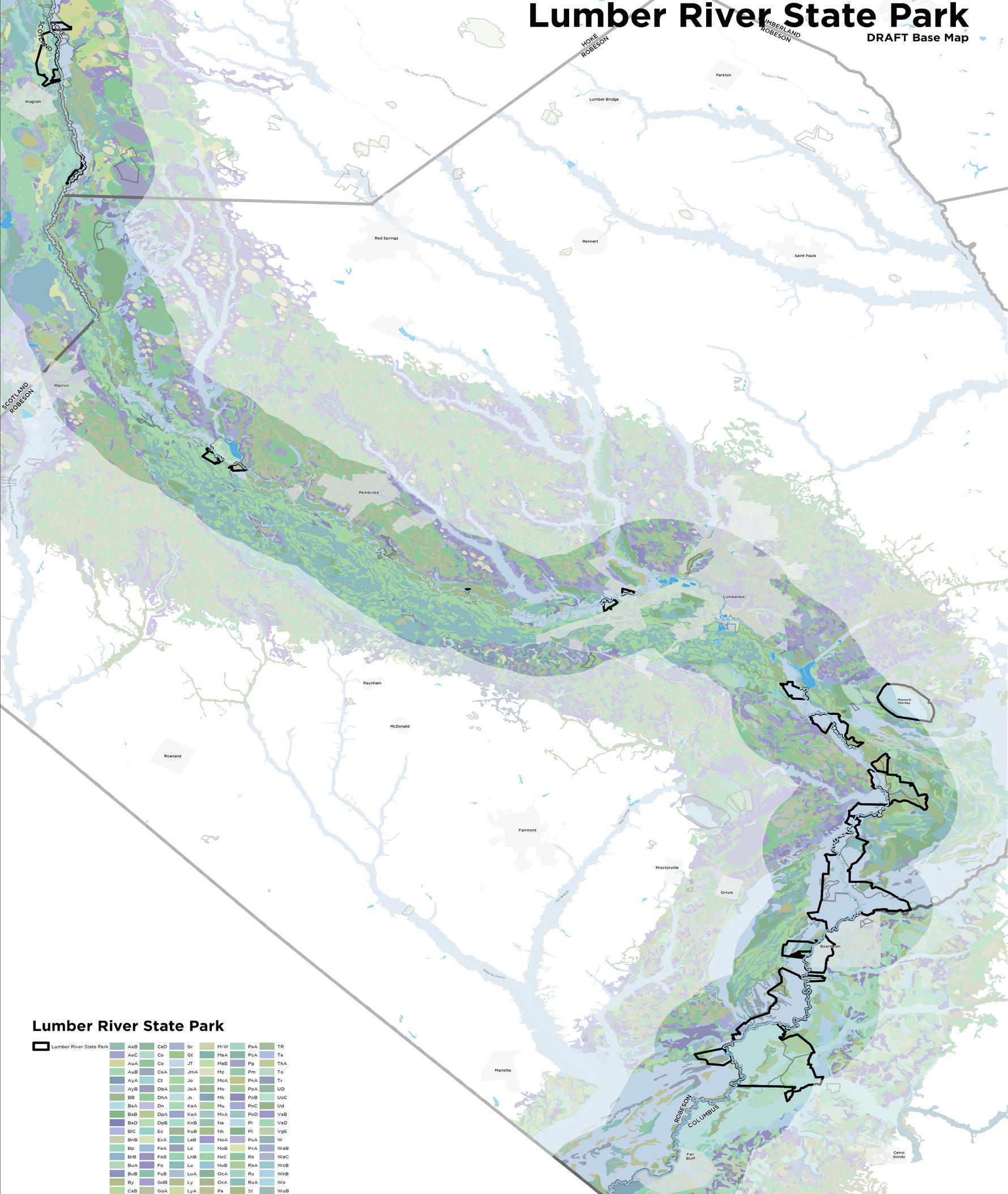
Lumber River State Park contains approximately 14,000 acres of land along the Lumber River within four counties: Scotland, Hoke, Robeson and Columbus. The name Lumber River, formerly known as ‘Drowning Creek’, came from the extensive timber harvesting and transporting done in the 1700’s. The park land is located along the 115-mile stretch of the Lumber River which remains one of the longest unobstructed rivers in North Carolina.
Located in North Carolina’s Coastal Plain, the park was established in 1989 as both a state park and designated as a “Natural and Scenic River” by the North Carolina General Assembly. The upper section of the river was designated as a State Recreational Water Trail in 1978 and the lower section of the river was designated as a State Canoe Trail in 1984, both highlighted as recreational resources. In addition, it is the only blackwater river in North Carolina to be designated as a National Wild and Scenic River by the Department of the Interior.
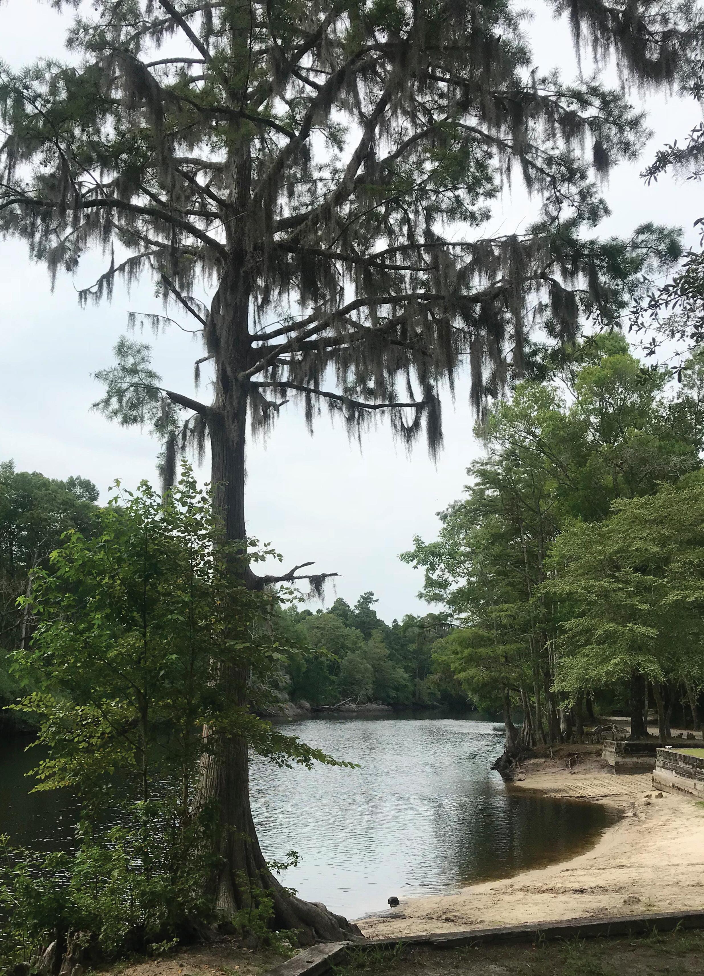
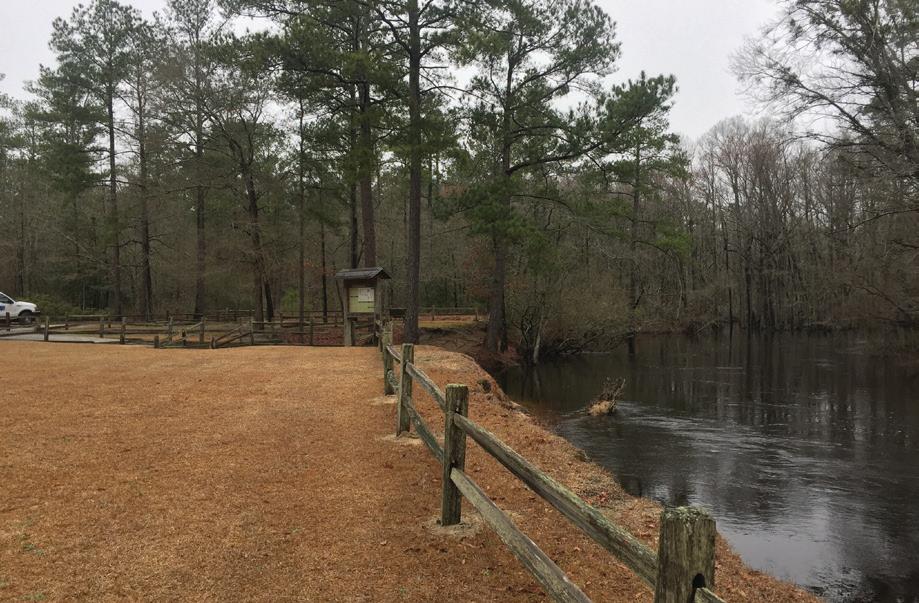
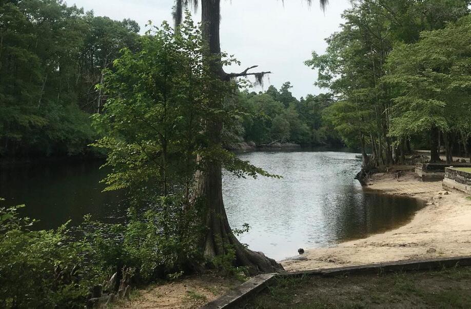
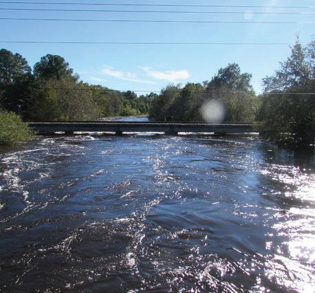
The park is headquartered at the Princess Ann Landing in southeastern Robeson County near the towns of Orrum and Fair Bluff. The river ends in South Carolina, where it joins the Little Pee Dee River about 8 miles south of the state line. Lumber River State Park offers a unique blackwater experience including paddling, camping, fishing and exquisite scenery. The Princess Ann and Chalk Banks access areas anchor two ends of the riverine park, with tent-friendly campgrounds, group campsites, picnicking and short hiking trails at both.
The purpose of this Master Plan is to understand the needs of Lumber River State Park, to identify the opportunities and constraints of the property within it, and to make recommendations for the future of the park based upon the findings during this process. This shall be done through a thorough planning process and following the State Park Mission:


• Conservation: To conserve and protect representative examples of North Carolina’s natural beauty, ecological features, recreational and cultural resources within the state parks system;
• Recreation: To provide and promote safe, healthy and enjoyable outdoor recreational opportunities throughout the state; and
• Education: To provide educational opportunities that promote stewardship of the state’s natural and cultural heritage.
Study Area
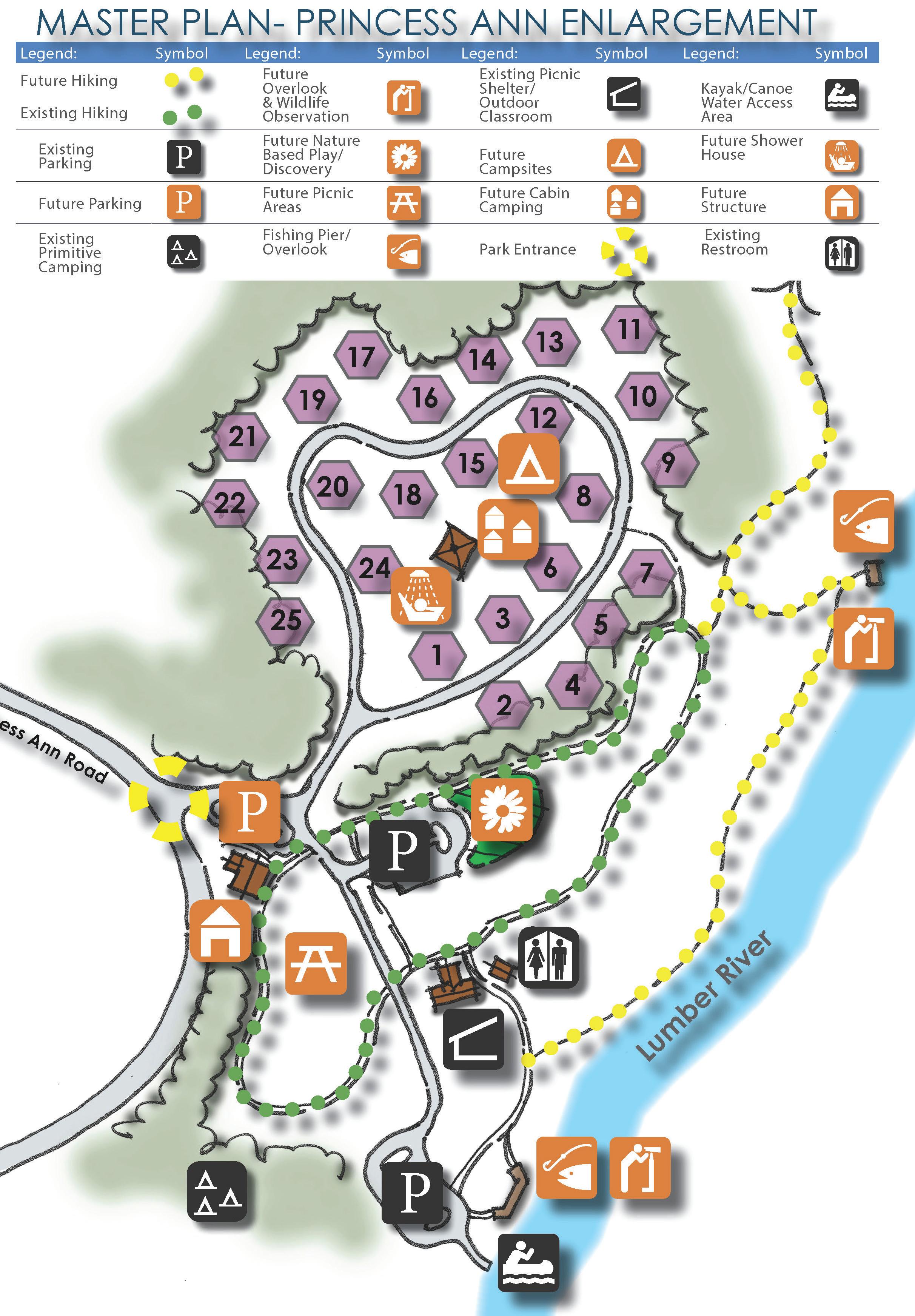
Lumber River State Park Map
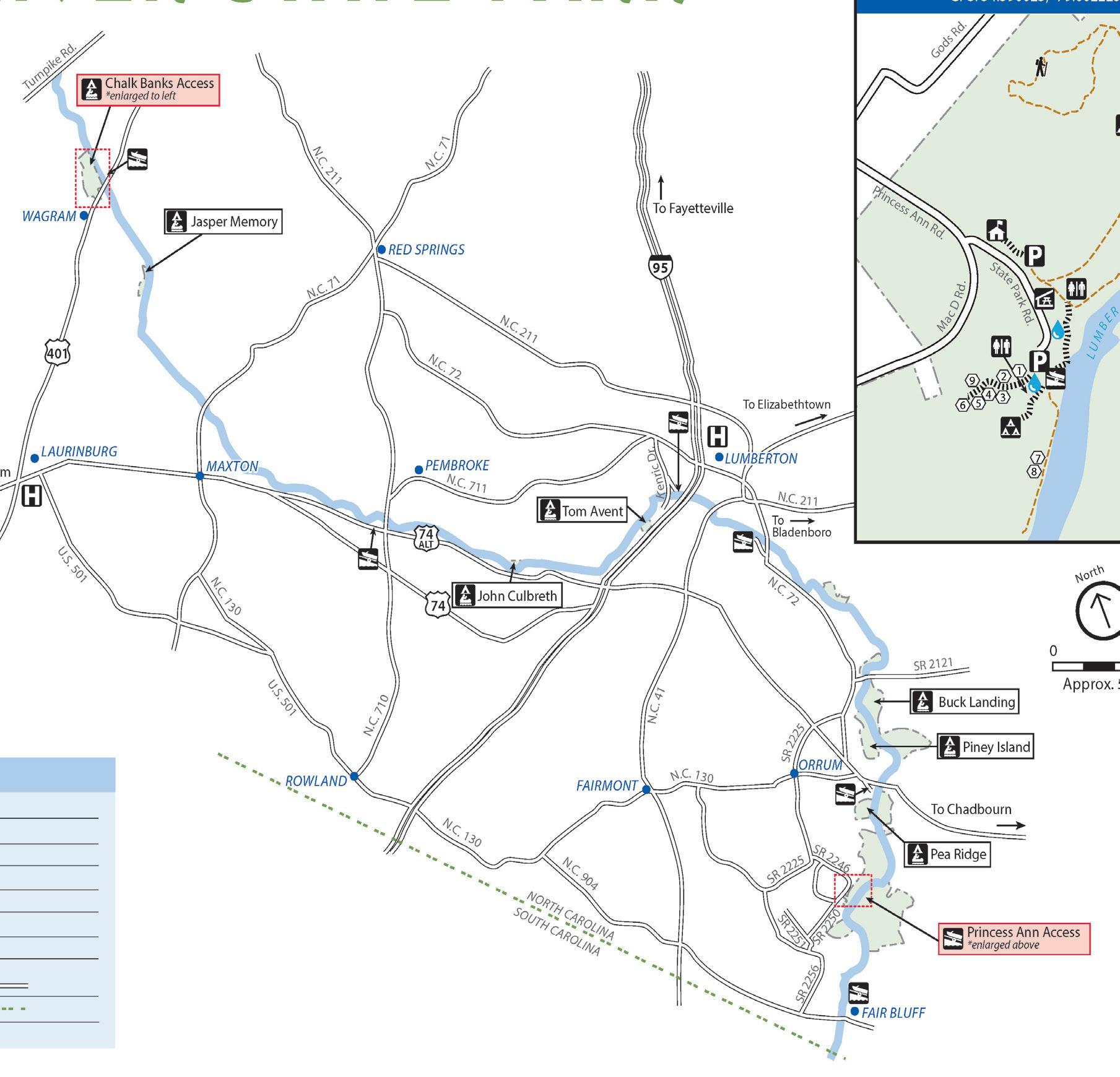
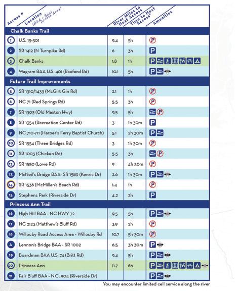
Facilities at Chalk Banks Features
Picnic
Paddle Trail (from launch to hwy. 401)
1.8 Miles/ 1 Hour
* This area had flooding east of the park access road and in the central part of the site during recent flood events
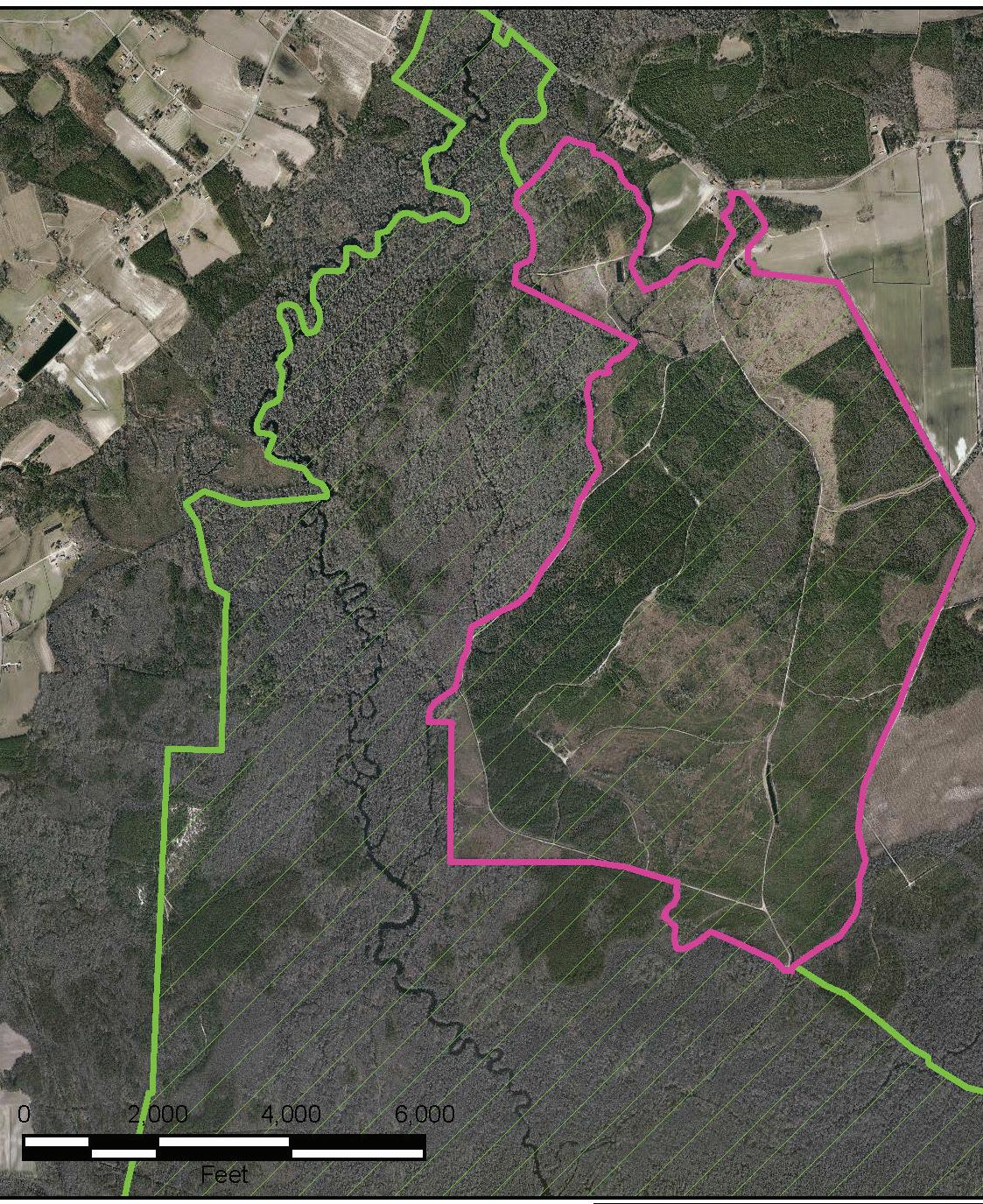
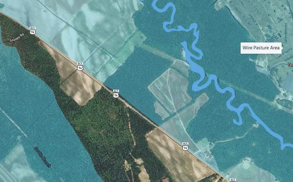
Wire Pasture
Features
Undeveloped Acreage only - no current access to River 91.52 AC
Recreation Center Road Access
Unimproved access area; no formal parking or features

30 AC
* Both of these areas have been subjected to severe flooding during recent flood events.
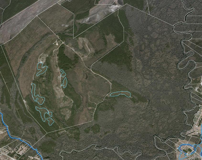
Quantity
Undeveloped Acreagesignificant opportunity for trail development and access to the River. Site contains large acreage of wetlands.
1323 AC
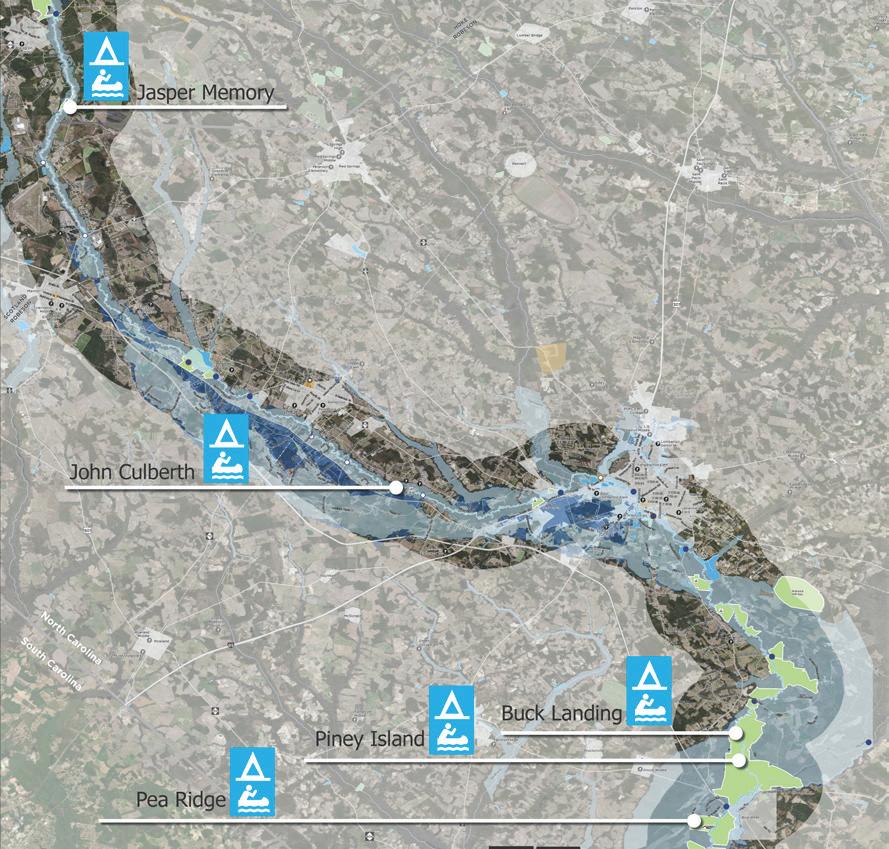
Jasper Memory
John Culbreth
Buck Landing
Piney Island
Pea Ridge
These are Primitive unimproved Paddle to camp sites only. A few are very difficult to get to and removed from the primary park locations. Some contain picnic tables & trash receptacles.
Quantity
Undeveloped Acreagesignificant opportunity for trail development and access to the River. Site contains large acreage of wetlands.
1050.39 AC
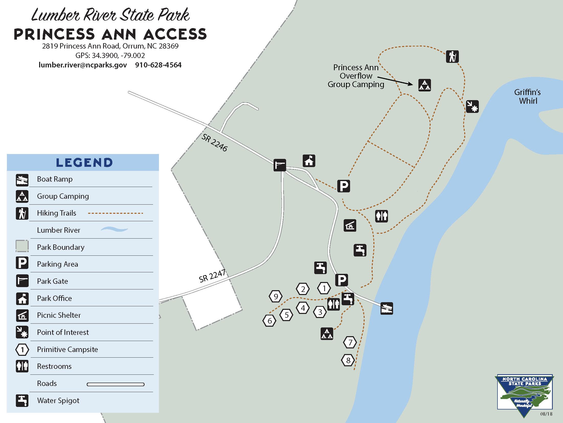
Facilities at Princess Ann
Fishing Pier 1
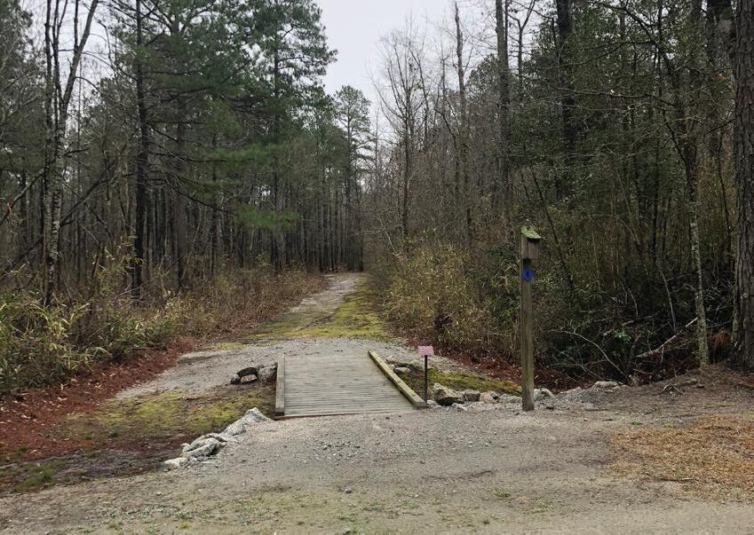
Hiking Trails
TRAK Trail 1/2 Mile
Princess Ann Trail 1.5 Mile (One Way)
Paddle Trail Segments 9.4 Miles from Highway 74 to Princess Ann - 5hrs.
11.7 Miles from Princess Ann to Fairbluff- 6 hours
* This area has not had flooding impact on the majority of the site.
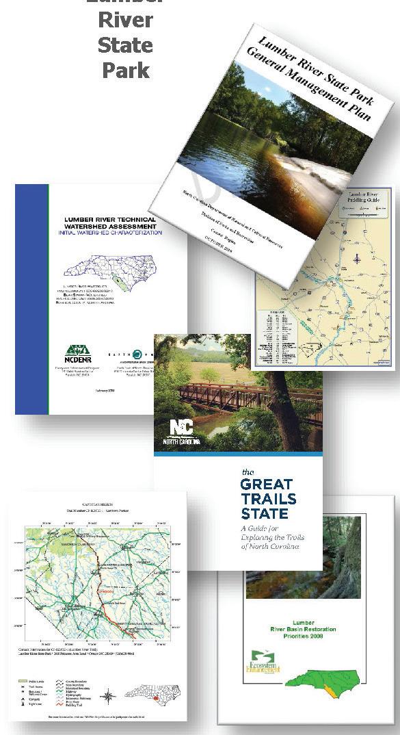
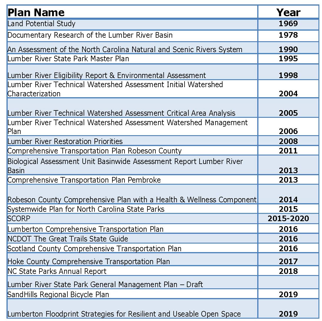
As a part of the review and analysis for the Lumber River State Park Master plan past planning efforts were reviewed. Below is the listing of plans reviewed. A listing of goals and recommendations was created in order to understand which plans had executed recommendations presented and which plans still had outstanding goals and recommendations. In addition to understanding individual plan recommendations, a summary of similar findings was created so that common themes and needs in the region could be identified.
2018
From Past Master Plan(s) & General Management Plan
Contact station(s), support services: restrooms, Hook-ups, Power, Ranger Residence(s), hiking, varied camping, river activities, and day use activities (play and picnic)
Local Plan Highlights:
Access to recreation for improved Health , Improved Connectivity (river and to Parks)
Use of parks for resilience planning and flood management
Environmental Education and Special Events , Nature Trails and Recreation Tourism Better Wayfinding
Systemwide Plan for North Carolina State Parks:
Support Local Economic Development, Health and Wellness- Strong tie due to current health and wellness statistics
Improve Natural & Cultural Resources Stewardship
Statewide Comprehensive Outdoor Recreation Plan (SCORP):
Public Health , Outdoor Recreation Economy, Conservation
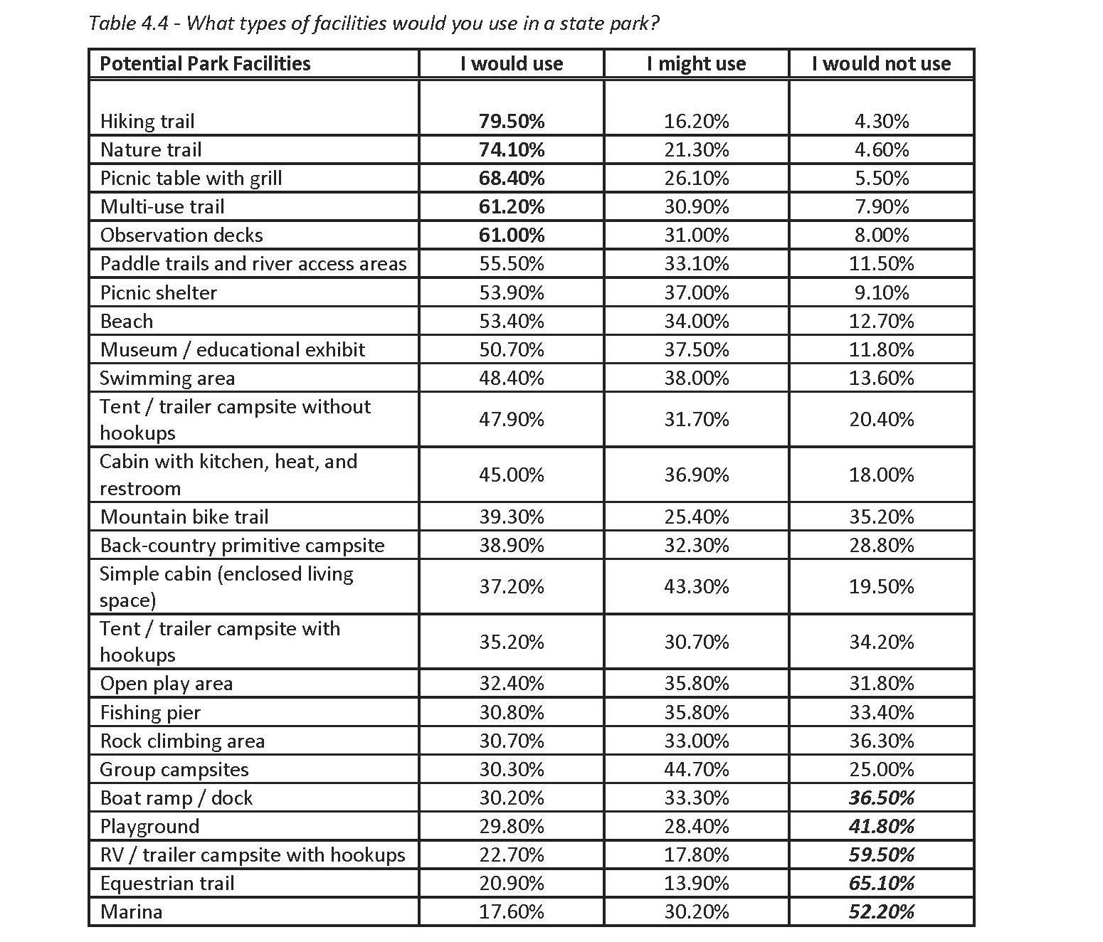
Top Facility Needs in SCORP:
The Lumber River starts northwest of Wagram and the headwaters are commonly referenced as “Drowning Creek”. The Lumber River extends from the Scotland County-Hoke County border flowing southeast 115 miles downstream to the North Carolina-South Carolina border. After crossing into South Carolina, the Lumber River flows into the Little Pee Dee River, which eventually flows into the Great Pee Dee River and on into Winyah Bay and the Atlantic Ocean.
In addition to National Wild and Scenic River designation, the Lumber River is also part of the North Carolina Natural and Scenic River System (it was added in 1989). The North Carolina Natural and Scenic Rivers Act (NCNSRA) was passed to preserve, protect and maintain selected free-flowing rivers and adjacent land for their outstanding natural, scenic, educational, geological, recreational, historic, fish and wildlife, scientific and cultural values. These rivers and the parkland associated with it are protected for the present and future benefit of the people of North Carolina. The State and National designations are referenced on the map on page 15.
In 1998, an 81 mile segment of the Lumber River was designated as a state-managed national wild and scenic river under Section 2(a)(ii) of the national Wild and Scenic Rivers Act as part of the National Wild and Scenic Rivers System.
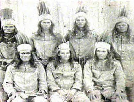
The Lumber River has long been a source of transportation and subsistence by the Native Americans, spanning four counties in North Carolina. The earliest settlements, many along the river banks, are recorded as early as 20,000 B.C., and consisted of Nomadic cultures that gathered food and hunted. Upon European exploration and settlement, the river and the surrounding region was inhabited by four Native American groups – Siouan, Iroquoian, Algonkian, and Mukogegan. The river was a valuable source of agriculture, trading, fishing, and hunting for each of the tribes. While much archaeological history has not been preserved a few sites have been found along the high ground of the river containing Native American artifacts, fossils, and a dugout canoe. By the 18th century, the Waccamaw Tribe and ancestors of the Lumbee Tribe had settled along the river banks of the Lumber River in Robeson County.
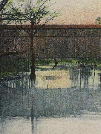
Scottish immigrants settled along the Lumber River (areas known today as Scotland County) in the 1730’s. Princess Ann, where the current park headquarters is located, was one of the earliest rural communities and was chartered in 1796 as the second town in Robeson County, chosen for its bluff location and river access. Much of the land in this area is considered inhabitable due to annual flooding and vast amounts of swamp land but was rich in pine forests valuable for timber, tar, pitch and turpentine in the 18th century. By the late 18th and 19th centuries, much of the land surrounding the river had been disturbed by agricultural and forestry practices and lumbering and naval stores were the main sources of commerce. The river was a means for transporting lumber downstream. In 1809, the name “Lumber River” was officially designated by legislative action, due to its role in the lumber industry. At this time, Lumberton was known for turpentine and timber but unfortunately no historical structures related to these industries exist today.
Today, the Lumber River in Robeson County is known as the ancestral home of the Lumbee Tribe of North Carolina and the Tuscarora Tribe. The Lumbee Tribe officially adopted their name, “Lumbee” in 1953 stemming from the Indian name for the Lumber River, meaning “black water”. Farming the sandy uplands along the river has been the backbone to Lumbee culture for generations for both income and subsistence. Corn, cotton, tobacco and other cash crops have been grown by the tribe and yellow perch and sunfish are often fished for year-round from the Lumber River. As transportation methods improved, Lumbee farmers had the ability to export their crops, mainly tobacco to outside markets around the state. This was a staple to the Lumbee culture until the 1990’s. As agricultural practices were changing, industrial production of hogs and poultry dominated the Lumber River region, significantly impacting the tribe.
To date, approximately 20 sites along the river have been nominated to the National Register of Historic Places. Updated resources and mapping information can be found on the NC State Historic Preservation Office website and GIS database. While there are known archeological resources in this corridor, many of the known sites have not had their National Register eligibilty assessed. Recreationally, the Lumber River is prized by paddlers, fisherman and nature lovers as a valuable and prized black water corridor. From 19781989 efforts were underway to establish national and state level canoe trail designations for the river. North Carolina recognized the significance of the history and heritage of the Lumber River by establishing a state park along the river corridor in 1989. In 1991 the first parkland was acquired for what is known today as the Lumber River State Park and by 1998 Princess Ann became the first park facilities established with the a picnic area, campsites, and trails. Many groups including the Lumber River Conservancy, the Clean Water Management Trust Fund, and the Natural Heritage Trust Fund have been crucial to the conservation and acquisition of parkland along the river corridor. In 1998, the National Wild and Scenic River designation was bestowed upon the Lumber River, giving the river further notoriety and a federal status for protection and use.
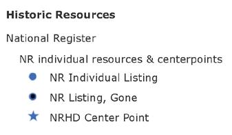
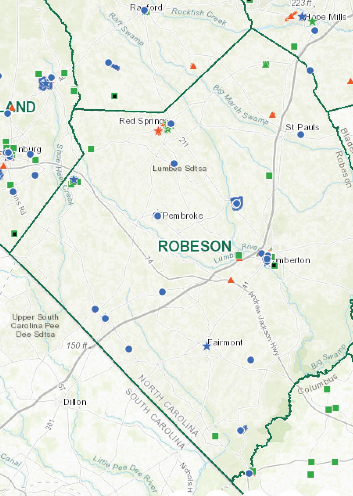
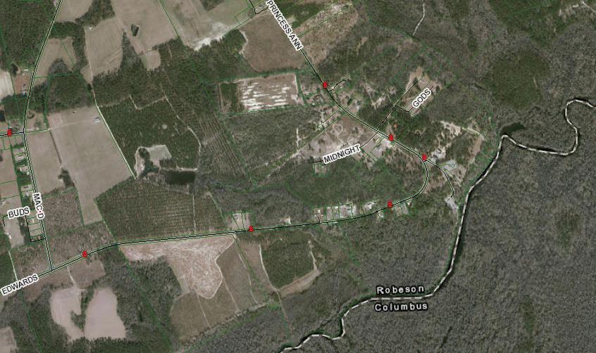
Blue dots indicate National Historic Resources along the Corridor.
Data from: https://www.ncdcr.gov/ about/history/division-historical-resources/ nc-state-historic-preservation-office
Hurricane Matthew devastated the Lumber River basin in October of 2016. A combination of saturated soils and large amounts of rainfall caused unprecedented regional flooding. Many of the towns along the Lumber River, including Fair Bluff and Lumberton were under water. Two years later, Hurricane Florence flooded the region again in September of 2018. While flooding is not new to this river or this region, it is changing the history and the culture of the area each time it occurs.
References used for history: Lumber River Conservancy, National Wild and Scenic River System, NC Pedia, Genealogy Trail Robeson County, NC, Water in the Lumbee World.
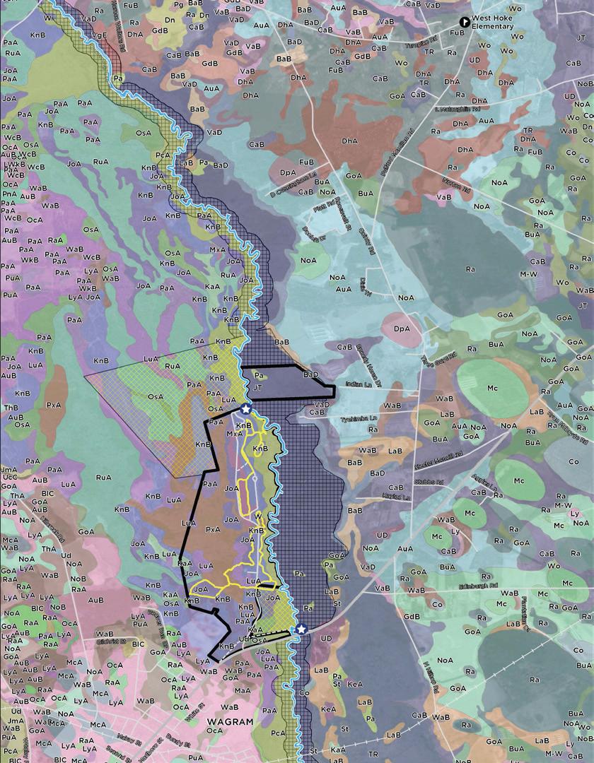
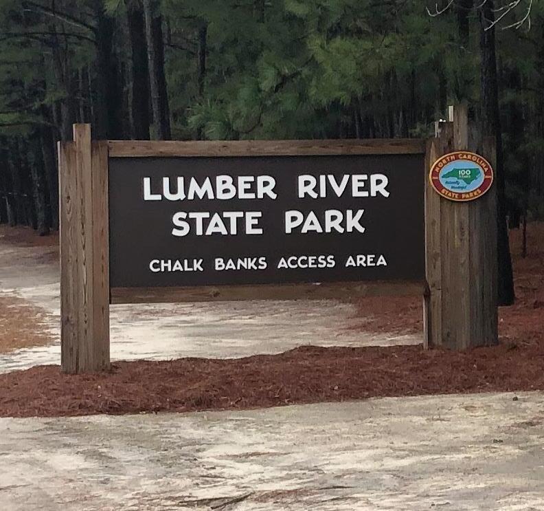
Chalk Banks
Wagram

Scenic Section
Lumber River Wild and Scenic River Designations
North Carolina
Natural and Scenic River System
National Wild and Scenic River System
Transition in Classification Type
Scenic Section
Recreational Section
Princess Ann
Recreational Section
City of Lumberton
Town of Fair Bluff
Natural Section
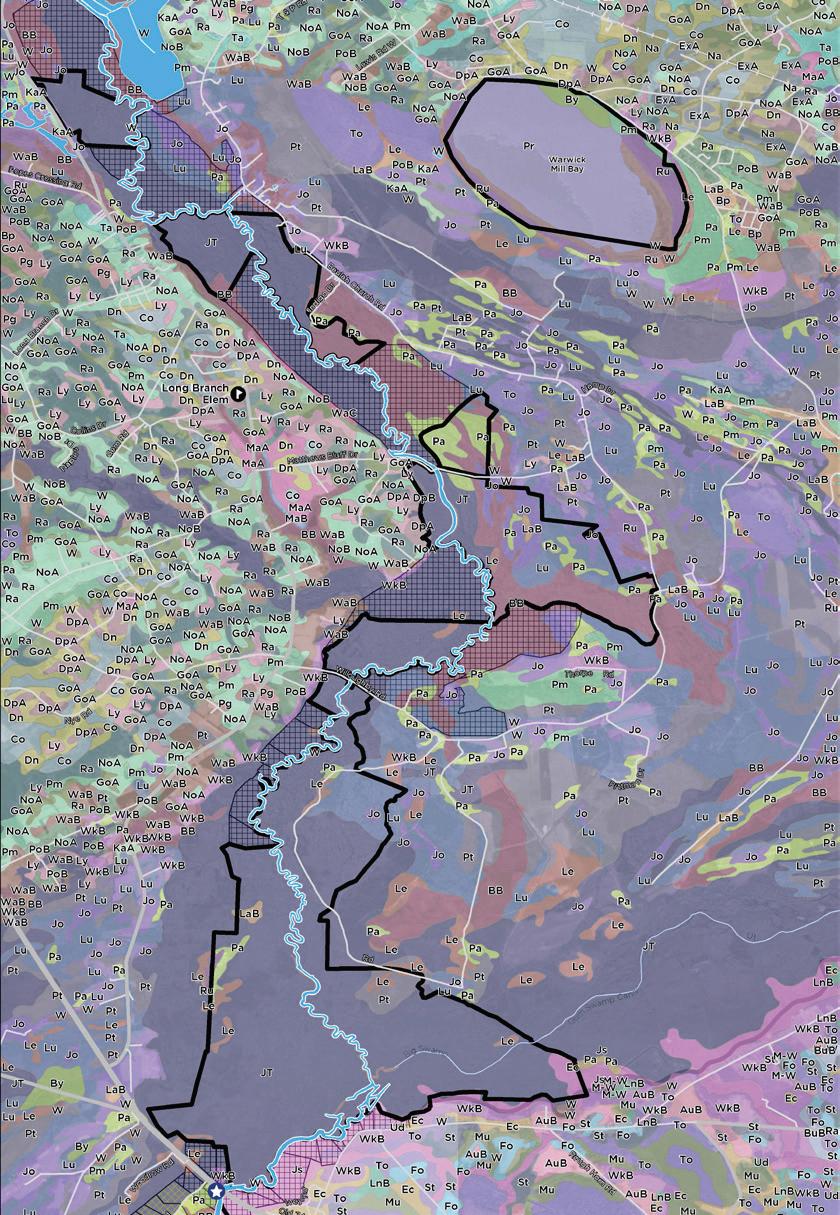
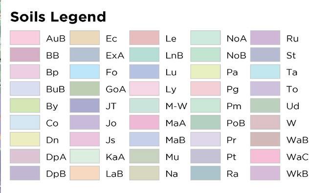
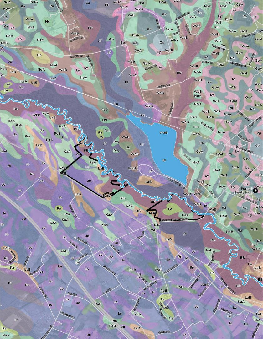
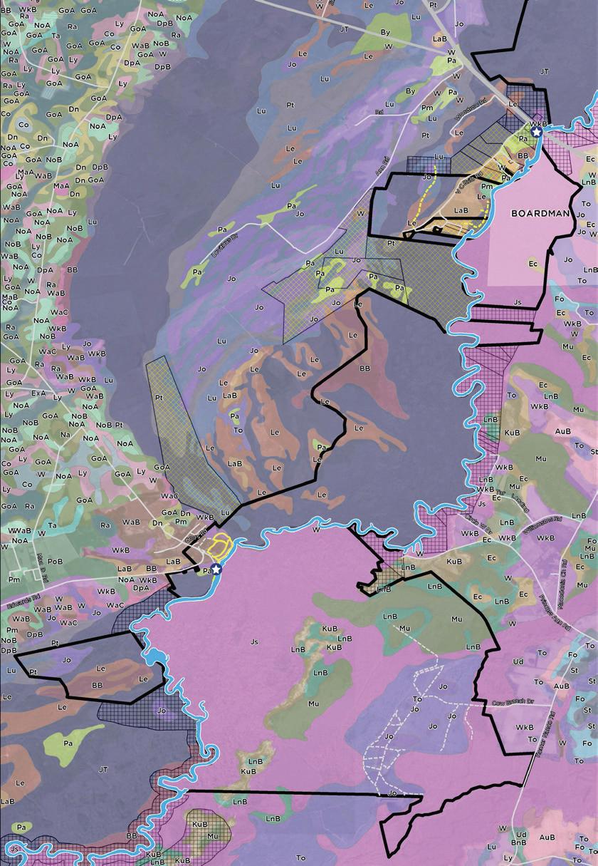
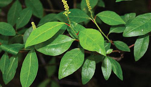
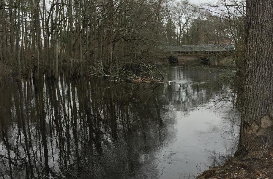
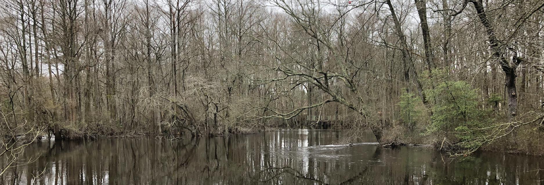
The Lumber River transitions from the sand hills to the coastal plain. The river and its soils, flora, and fauna are typical of a Coastal Plain blackwater river, with tannin-stained waters having fairly low turbidity. Much of the sediment transported is sand, rather than clay. A rich diversity of plants is found in and along the Lumber River including mountain laurel, wild azalea, swamp mallow, spider lily and native wisteria can be seen from the river. Bald cypress, tulip poplar, river birch and water elm are found in the swamp forest. As a part of the planning process environmental review was conducted including: vegetation, soils, hydrology, flooding and flood events, historic sites, and community data.
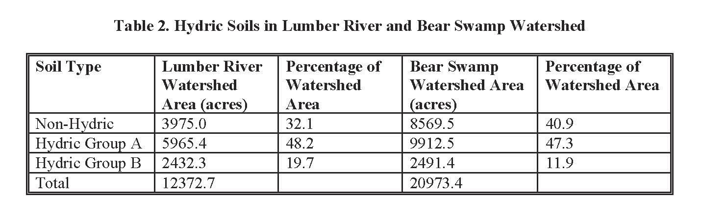
Generally, well-drained soils occupy the broad outer rims of the higher land on the outer part of the drainageways, and the more poorly drained, nearly level soils are nearer to the drainageways, in the floodplains of streams, and in Carolina bays. Textures range from loams (typically further from the river) to sand (closer to and within the river).
Hydric soils make up a large percentage (over 60 percent) of the Lumber River Basin. Hydric soils are one indicator of the potential presence (current or historic) of wetlands and can also indicate areas of frequent flooding.
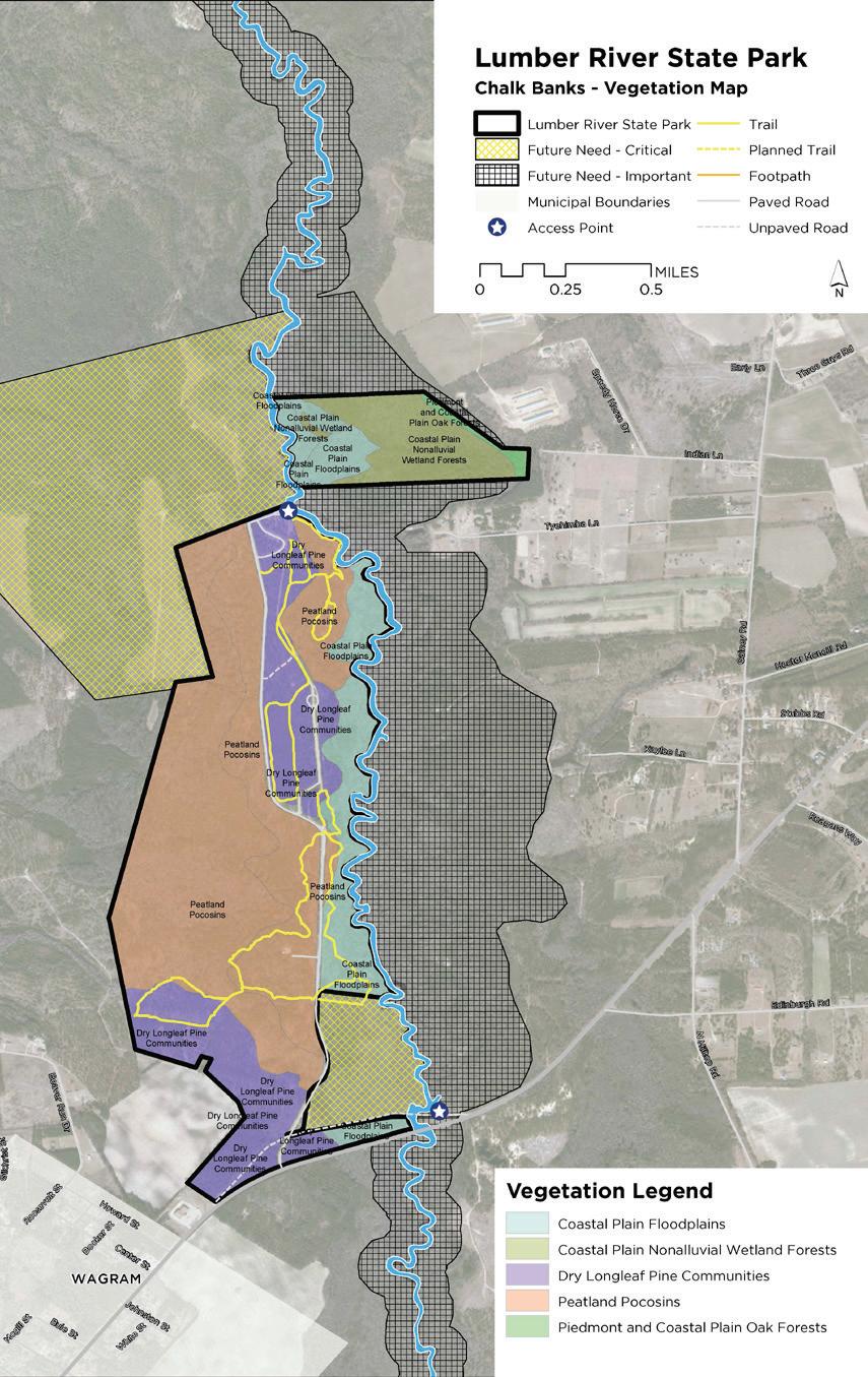
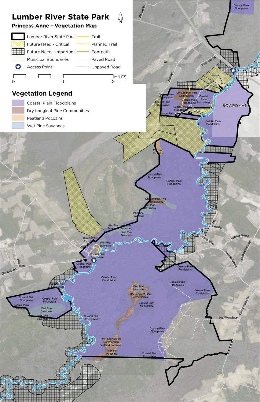
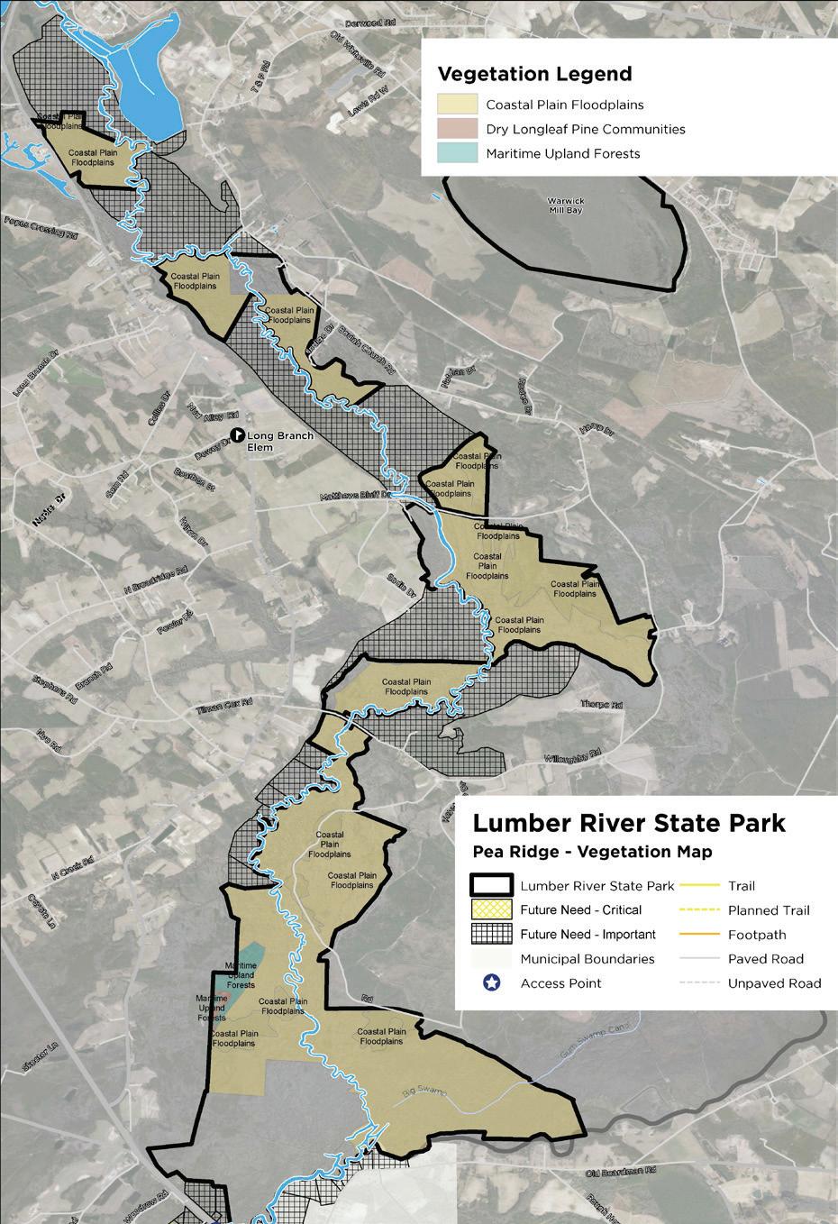
According to the extensive site investigation completed for the wild and scenic River Study there are rich and diverse plant communities that exist along the corridor. These unique and mostly pristine areas provide incredible opportunity for wildlife observation, habitat for the park, and create the setting that makes the Lumber River so unique within the State.
The findings in the Scenic River Study show: “much of the floodplain consists of old channel segments, natural levee ridges, and point bar deposits. The lower-lying areas are Cypress–Gum Swamp communities, dominated by swamp black gum (Nyssa biflora), water tupelo (Nyssa aquatica), and bald cypress (Taxodium distichum). The rare sarvis holly (Ilex amelanchier) occurs in the swamps as well as on the river banks. A few old channel segments have wider, permanent water and are classified as Oxbow Lakes.
Higher Floodplain Blackwater Bottomland Hardwoods (high subtype communities) dominated by:
Laurel Oak Quercus laurifolia
Water Oak Quercus nigra
Sweetgum Liquidambar styraciflua
Loblloly Pine Pinus taeda
Somewhat lower areas contain the (Low Subtype or Swamp Transition Subtype), dominated by:
Laurel Oak Quercus laurifolia
Overcup Oak Quercus lyrata
Bald Cypress Taxodium distichum
Blackwater Bottomland Hardwoods often have a well-developed shrub layer of:
Cane Arundinaria tecta
Mayberry Vaccinium elliottii
Titi Cyrilla racemiflora
Sweet Pepperbush Clethra alnifolia
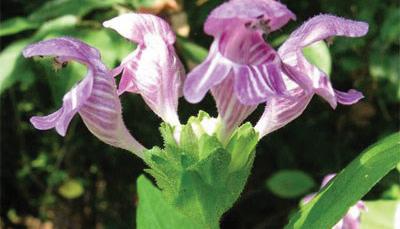
A population of the very rare Carolina bogmint (Macbridea caroliniana) occurs along a forest road in the Bottomland Hardwoods at Piney Island.
Also of note in the portion south of NC 904 is Sebastian bush (Sebastiana fruticosa), the only location in the State for this southern species.
Adjacent to the floodplain are higher terraces that no longer flood. Most dramatic is Big Sandy Ridge, a large expanse where the sand of the terrace was formed into dunes by winds in the past. Though the dunes are now stabilized, the deep sand supports a Sand Barren community that is the most extensive example of its kind in the North Carolina. It has a sparse canopy of both longleaf pine (Pinus palustris) and loblolly pine, and very open ground cover with much bare sand. Woody goldenrod (Chrysoma pauciflosculosa) is abundant, forming the largest population in North Carolina of this rare species.
Other parts of the higher terraces have nearly flat sandy surfaces that range from dry to wet. The terrace north of Princess Anne Landing supports Wet Pine Flatwoods communities, and small patches of typical Xeric Sandhill Scrub. Both communities are dominated by longleaf pine. The Xeric Sandhill Scrub has an open understory of turkey oak (Quercus laevis), and a ground cover dominated by wiregrass (Aristida stricta) and a variety of herbs and low shrubs. Wet Pine Flatwoods has no understory, and has a dense ground cover of low shrubs and wiregrass.”
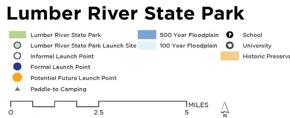
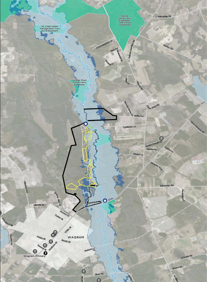
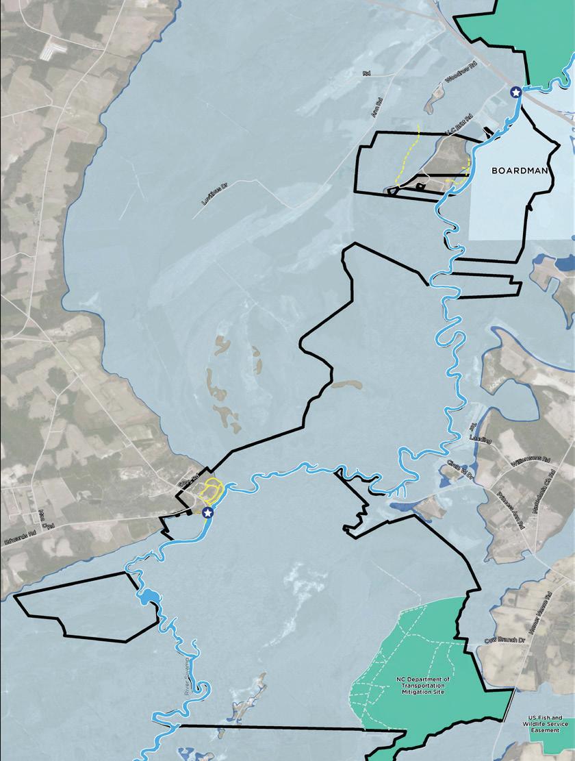
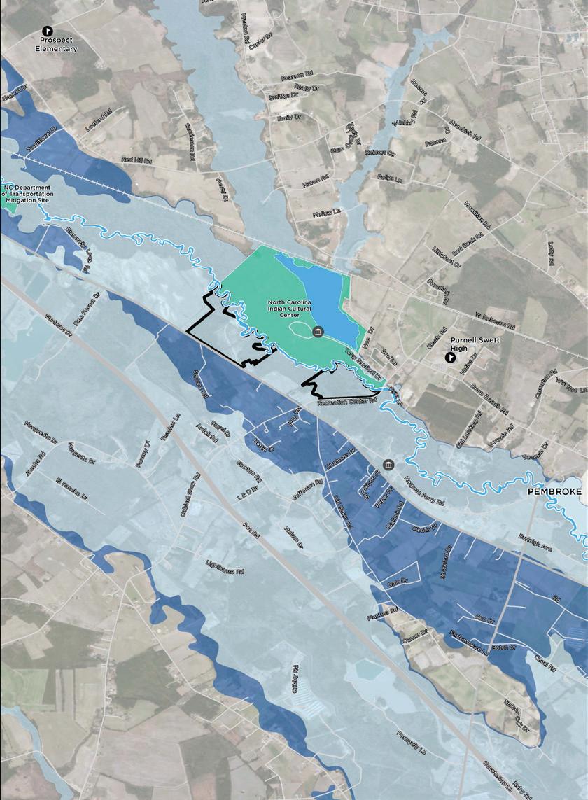
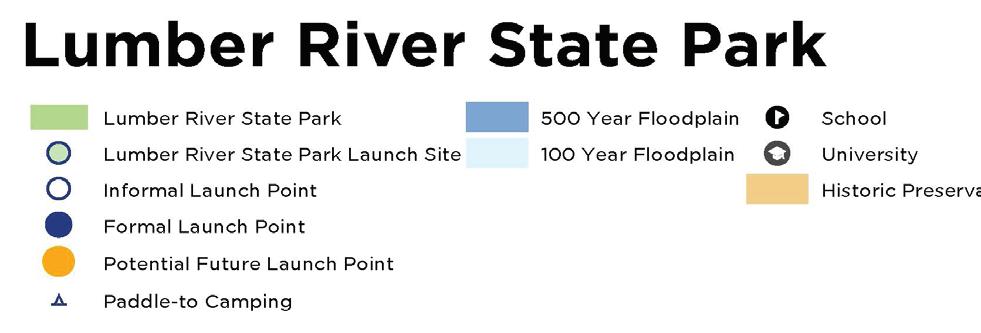
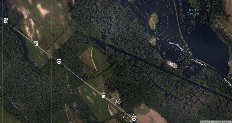
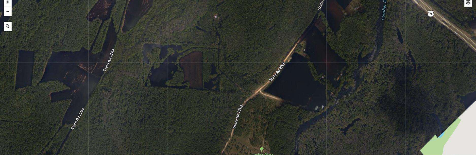
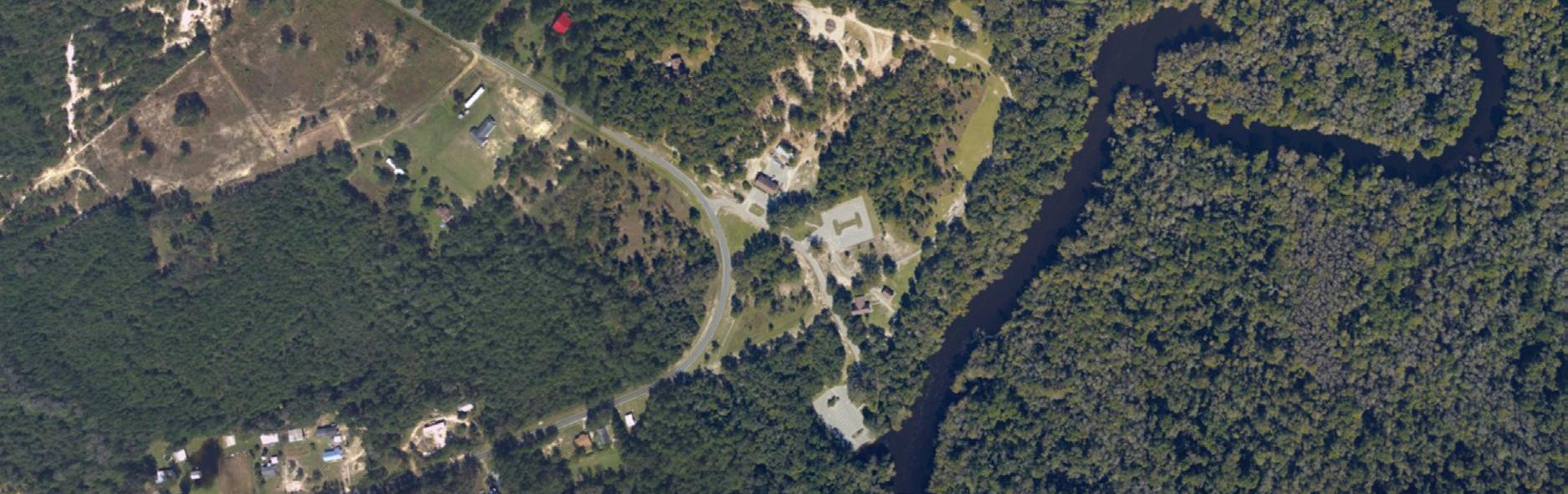
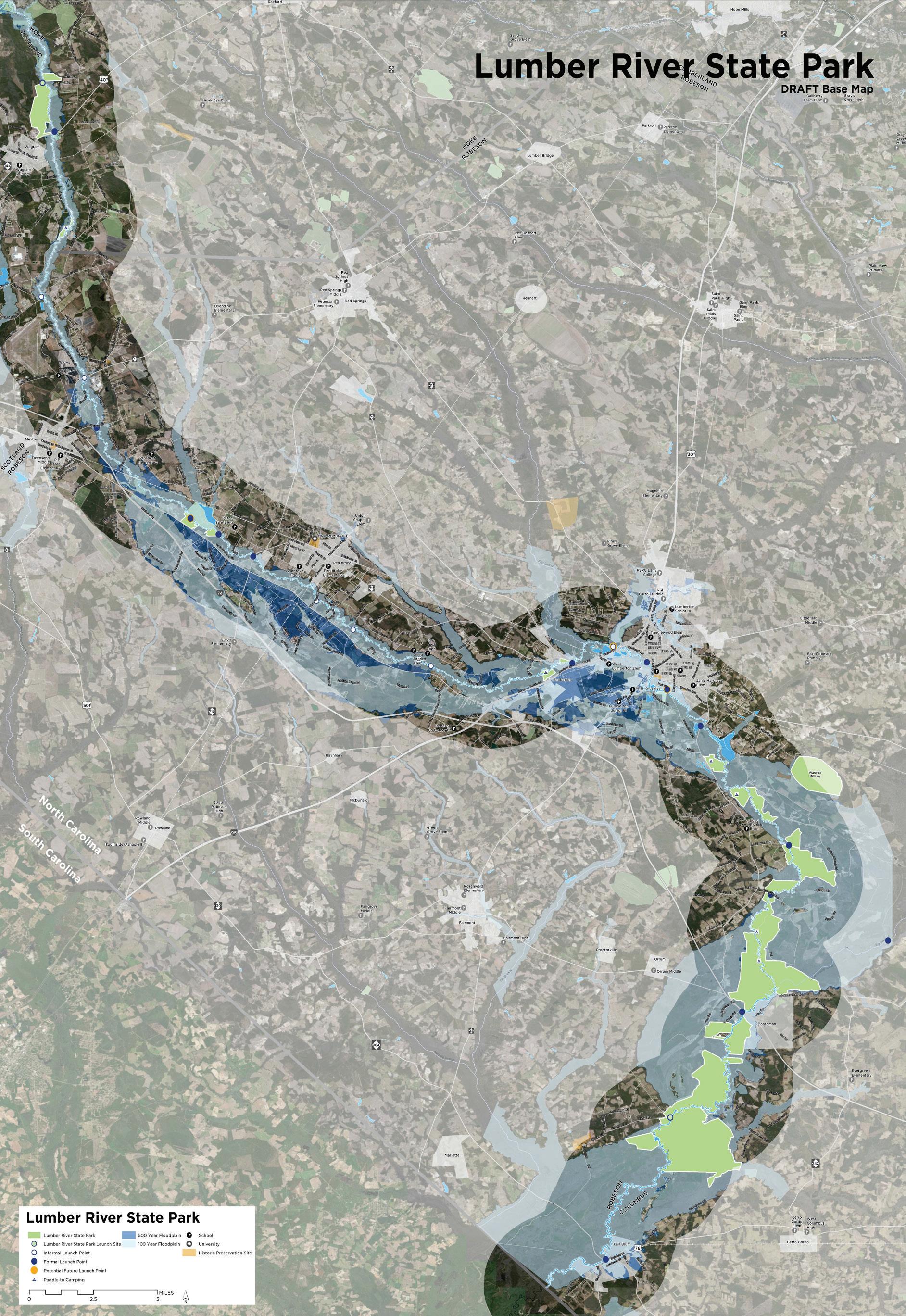
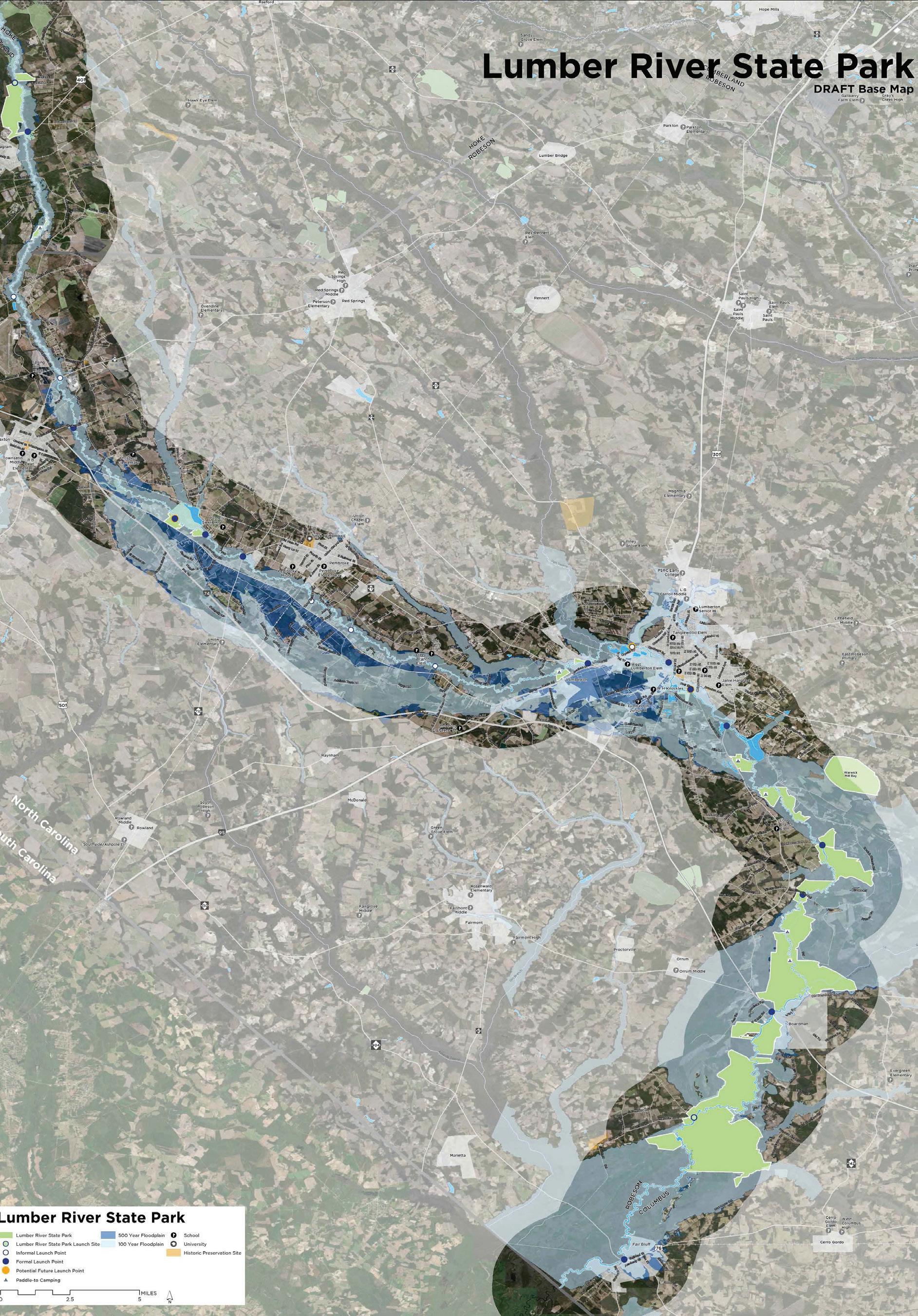
The hydrology of the Lumber River is an integral part of park from the rivers’ history to the current impacts from flooding, the river and the surrounding areas prone to flooding are all a part of this parks system. To better understand the Park and region an evaluation of the floodplain zones was evaluated in relationship the park property. The Dark Blue area depicts the 500 year Floodplain and the Lighter Blue depicts the 100 year Floodplain; The majority of the river corridor and adjacent lands fall into these categories.
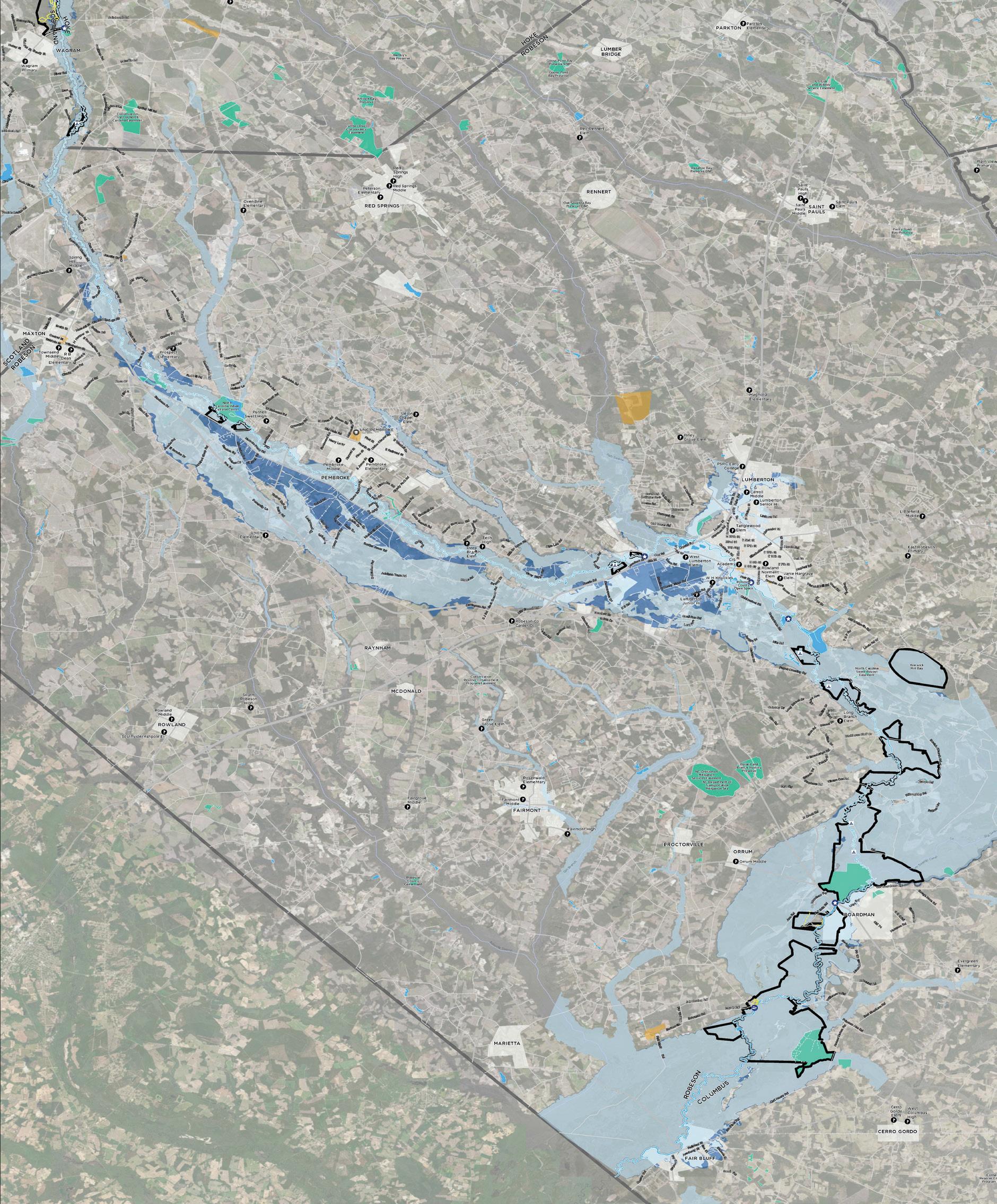
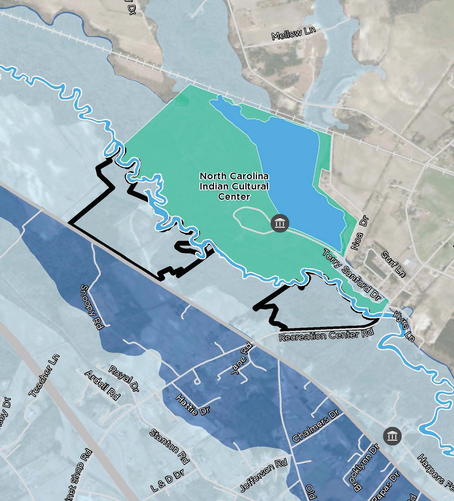
The park serves as an incredible regional resource with over 14,000 acres now in the Lumber River State Park system. These land assets serve all of the State Park Missions: Conservation, Recreation, and Education. Very importantly, the value of the conservation land to hold floodwaters has been an invaluable resource to surrounding communities. Below are enlargements of parkland resources within the floodplain which serve as wetland filters and floodwater storage during large rain events.
The Lumber River and the counties and communities that lie along the river have been faced with several flooding events and drought over the last 100 years. The river fluctuation and water levels are one of the things that makes this black water system unique.
Recent hurricanes have challenged the region with how to deal with flooding impacts, including the park. While portions of the 14,000 acre park land serve as a valuable regional tool for flood storage and filtration, it is critical the park also plans for resilience from these events. As a part of this effort for future planning it is critical to examine flood history, land located outside of the floodplain, and how to provide recreational and educational access in a way that plans for future events that may occur.
Where available, flood images from Hurricane Matthew and Florence were compared to 100 year and 500 year floodplain data to evaluate developed park areas and/or areas to be developed and how they fared during these floods. It is incredibly important to balance out the land acquired for resource protection to help mitigate flooding in the region, but also examine land out of the floodplain and near to the river for recreation resource use.
Boardman 155
Fair Bluff 896
Fairmont 2,612
Fayetteville 209,889
Laurinburg 15,156
Lumberton 21,040
Maxton 2,426
Orrum 91
Pembroke 2,973
Raleigh 464,758
Wagram 777
Wilmington 119,045
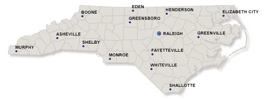
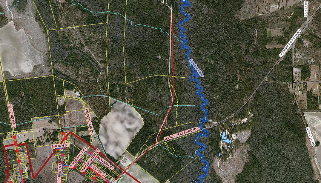
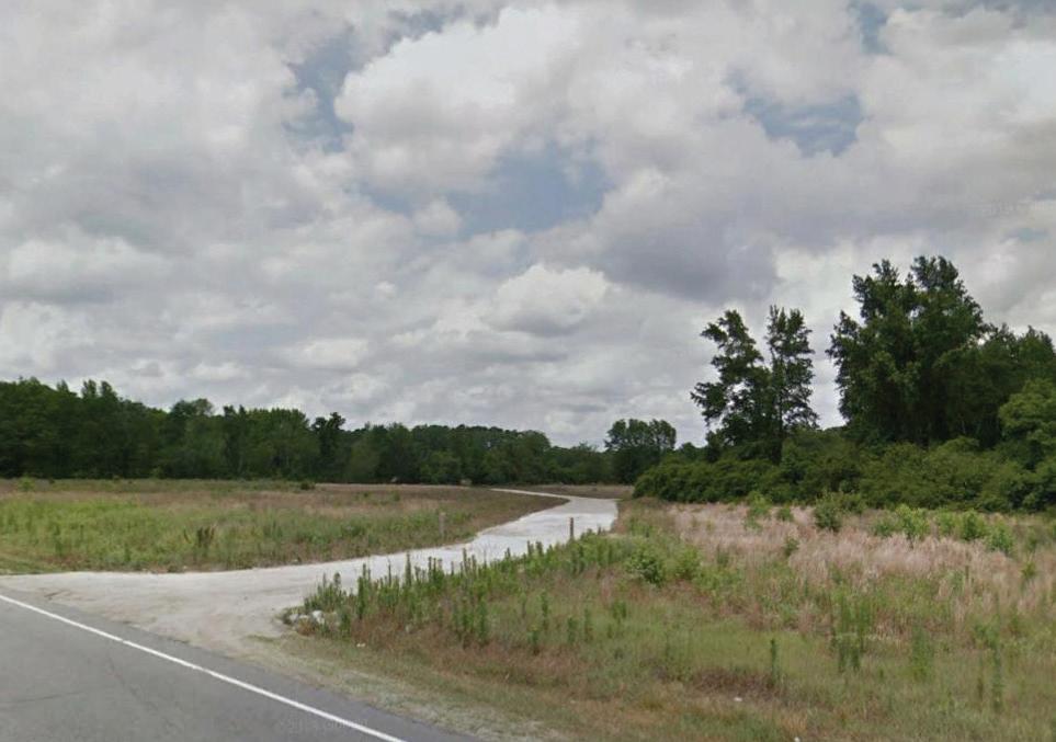
The park is located adjacent to and runs through four counties servicing southeastern, NC. The primary park access areas are easily accessed from highway 401 near Wagram, NC (Chalk Banks Access), or from highway 74/76 to the Princess Ann Access near Orrum, NC.
The park is close to many larger NC communities such as Raleigh which is only 1.5 hours from Chalk Banks Access, and Fayetteville which is less than an hour away. Princess Ann Access is less than an hour from Wilmington. In addition to the nearby larger communities, there are several smaller towns and communities that have access to the park such as Lumberton, Laurinburg, and Pembroke.
Highway 74/76 serves as an east west connection across the state and links many visitors via 95, creating a wonderful opportunity to teach visitors about the southeastern and sandhills regions of North Carolina.
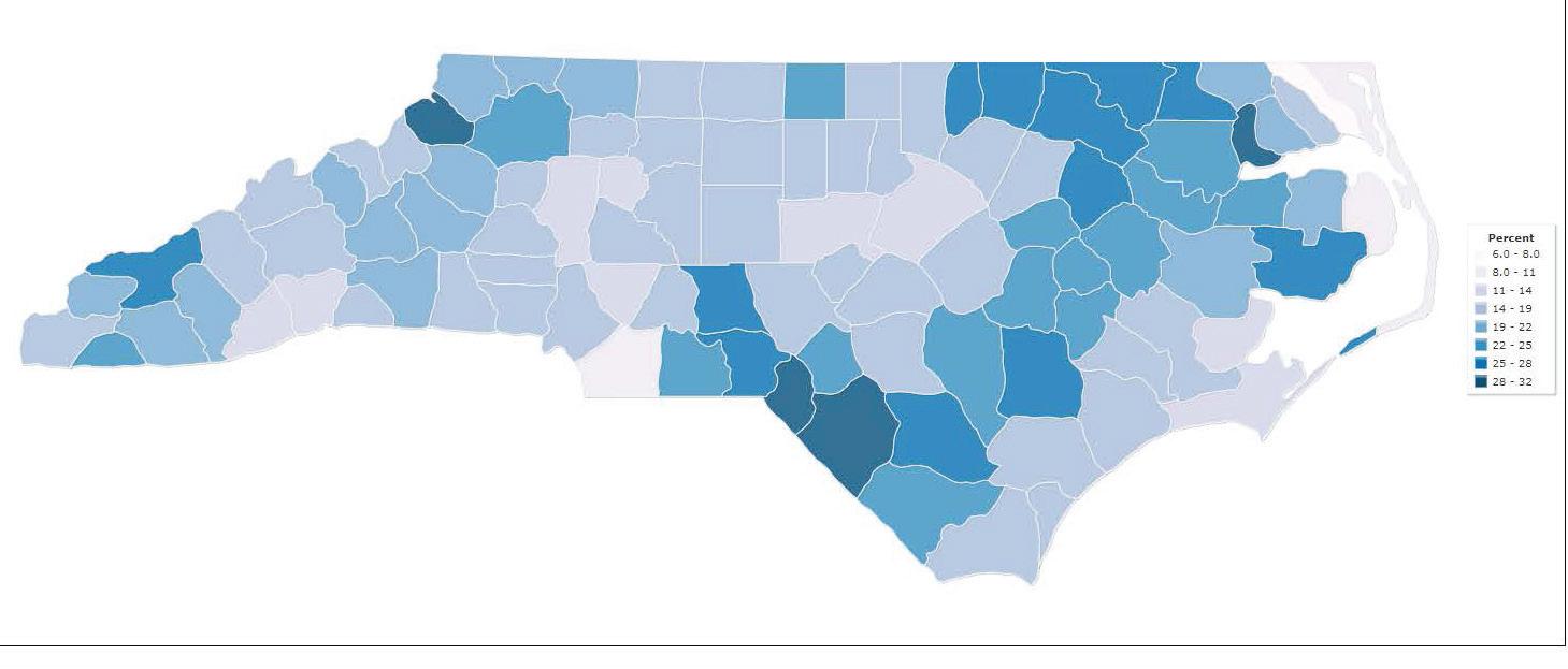
In a 2016 Report” Documenting Poverty in NC,” Robeson and Scotland County ranked as having the highest percentages of persons living below poverty level. This data is extracted from the 2009-2013 US Census data and updated annual. According to the 2017 data, Scotland and Robeson still have the highest percentage of poverty, with Hoke and Columbus falling between 22-25 percent of their counties population living below the poverty level. http://factfinder2.census.gov
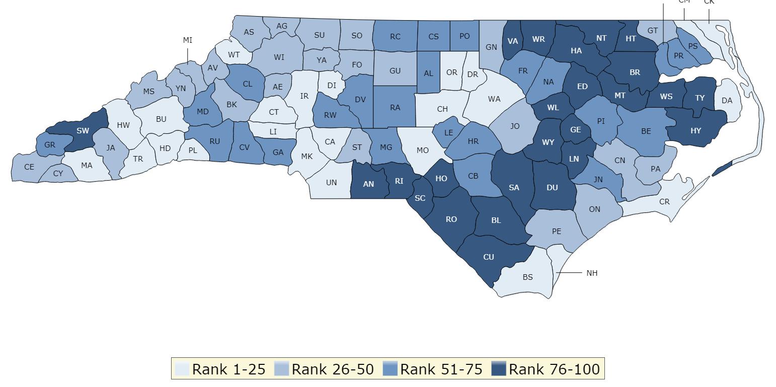
According to The County Healthy Ranking report, the study factors represent the focus areas that drive how long and how well we live, including health behaviors (tobacco use, diet & exercise, alcohol & drug use, sexual activity), clinical care (access to care, quality of care), social and economic factors (education, employment, income, family & social support, community safety), and the physical environment (air & water quality, housing & transit). The 2019 report found that Robeson County remains the least healthy county in NC with the remaining three counties in the park corridor (Hoke, Scotland, and Columbus) all ranking as some of the least healthy counties in the state ranking in the lowest quarter of 76-100 and shown in dark blue below.
Both of these key regional issues point to a greater need for community partnership and increased opportunities for day use activities within the Lumber River State Park system.
Based upon available utility data, both the north access (Chalk Banks) and the south Lumber River access (Princess Ann) each location have access to water. Based upon available utility data, the Chalk Banks is in proximity to sewer, but currently 1200 linear feet to the entrance with additional distance to get into the site. As the adjacent properties develop and create access to sewer consideration should be given to connecting to the west or through the entrance should it come closer to the park.
There is currently no access to sewer at the Princess Ann location, however, a large portion of this access remains out of the floodplain and floodprone areas with soils that support on-site treatment as camping and additional facilities are brought on line.
Both locations have access to power and should seek to extend electricity access into the property, specifically camping sites. Additional access would improve events, camping, and day use activities.
Digital Communication and telecommunication infrastructure need improving at Chalk Banks and Princess Ann. This will not only help with park safety, but enhanced cellular and wifi will aid in better operations communication and open opportunities for educational access.
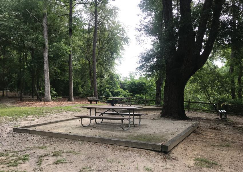
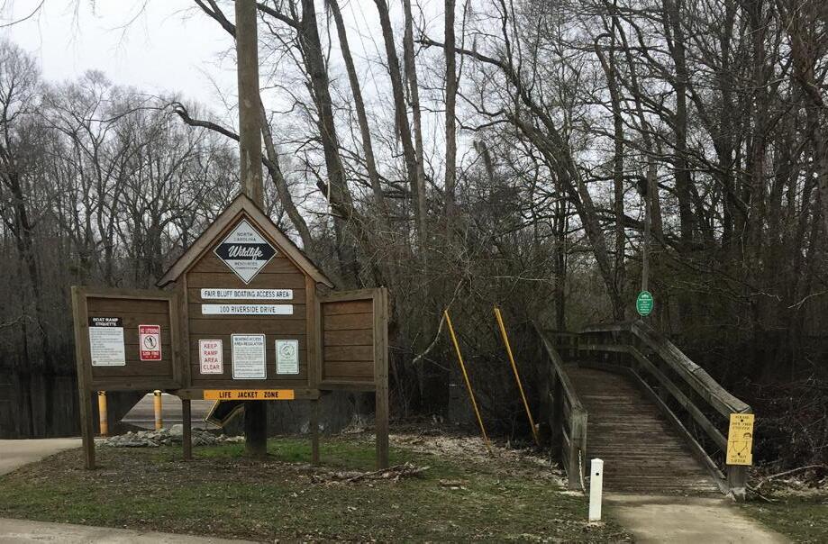
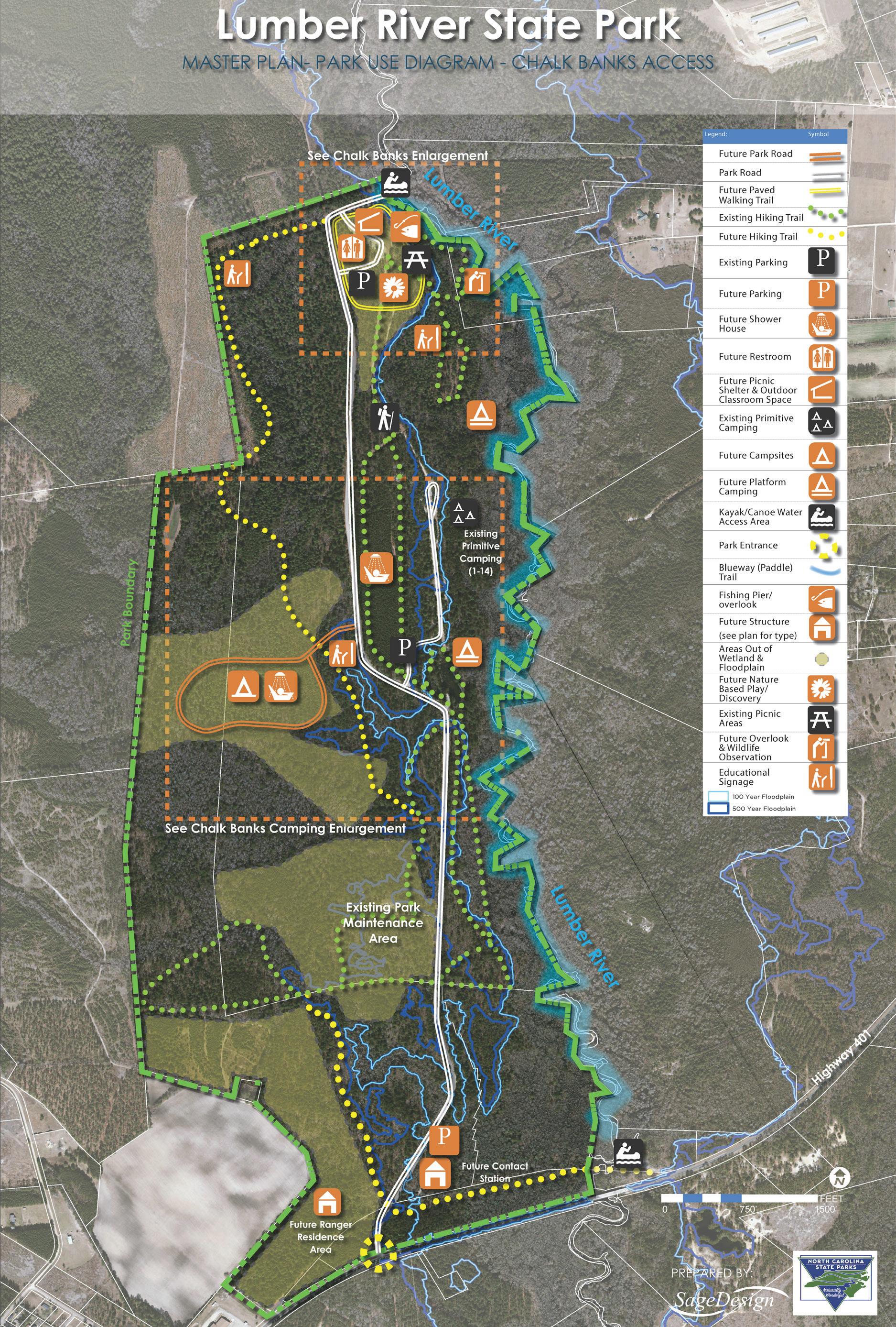
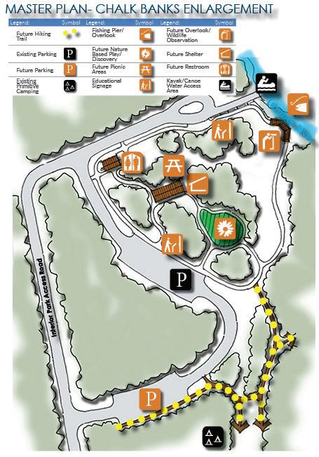
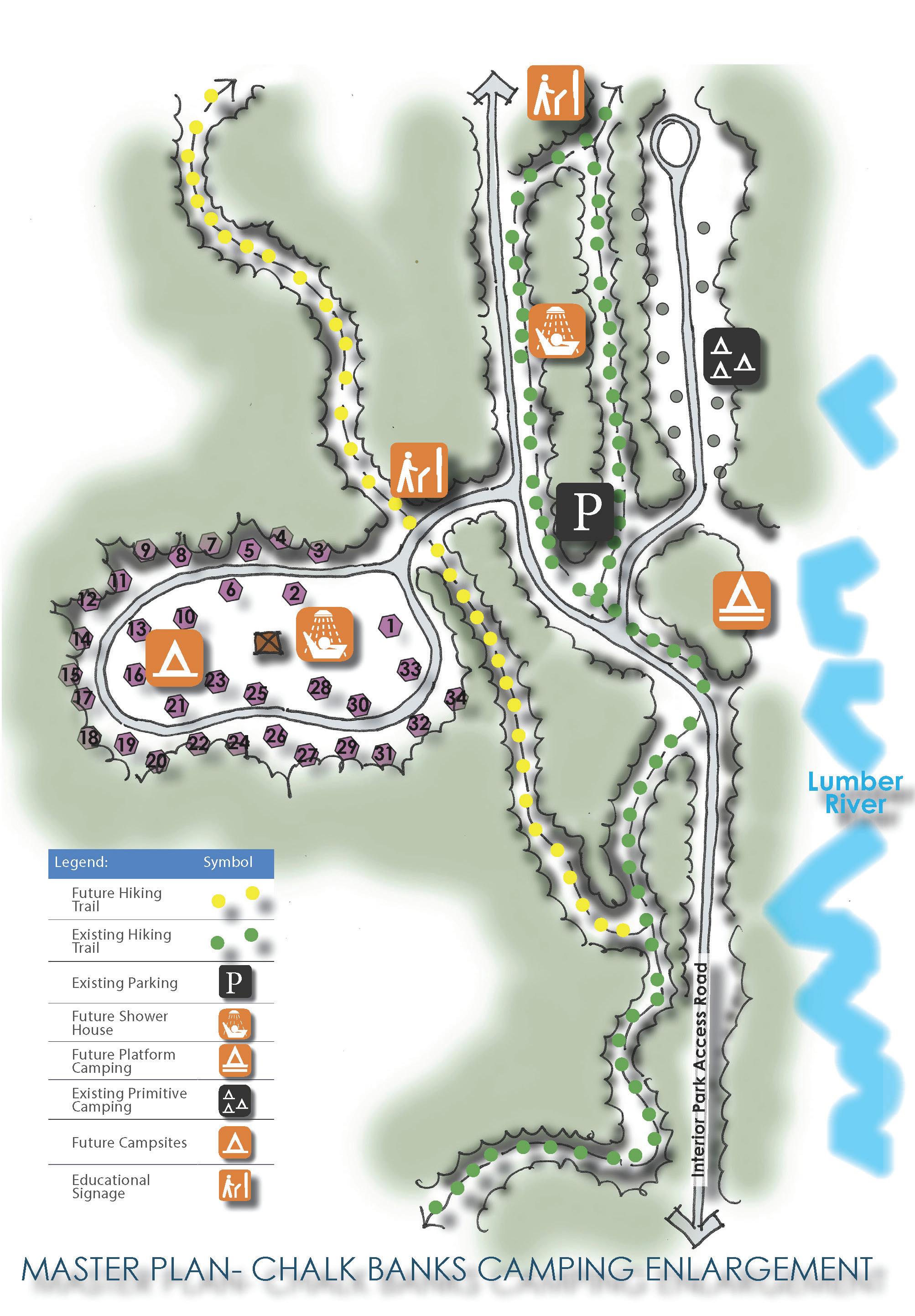
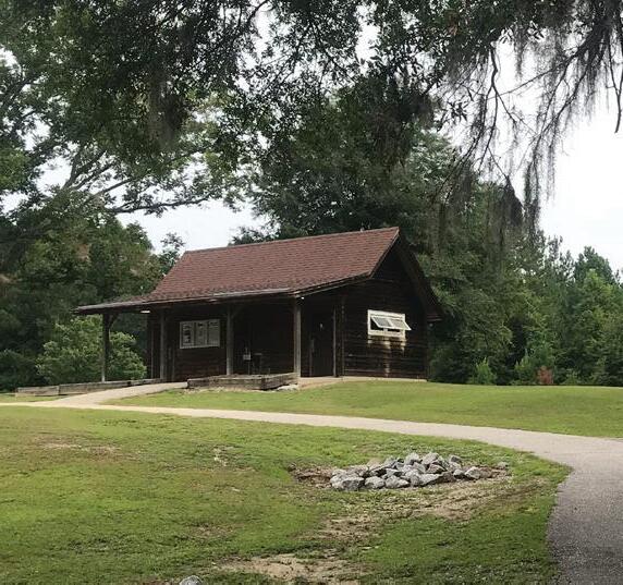
The Princess Ann and Chalk Banks access areas anchor two ends of the riverine park. The Chalk Banks Access Area located off of highway 401 near Wagram, NC offers primitive tent-friendly campsites, group campsites, picnic area, short hiking trails, and bank fishing. Possibilities for kayaking and canoeing are extraordinary, but require careful planning due to fluctuating water levels and hazards and coordination for put-in and take-out sites.
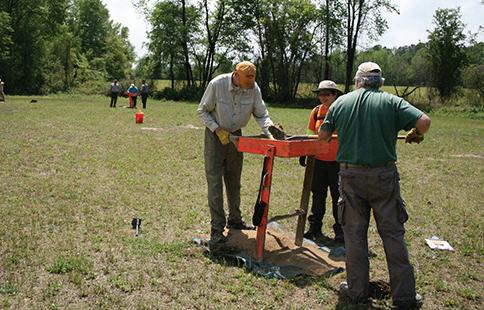
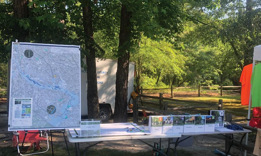
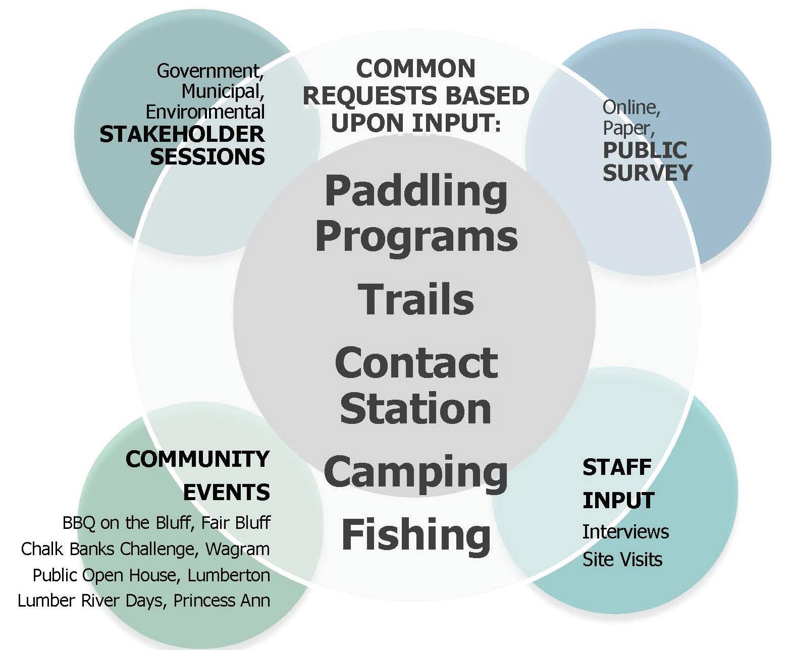
Public involvement is important to the success of a park planning process. Because this corridor includes many communities and stretches 115 miles from top to bottom, it was important to utilize several methods of input and evaluation throughout the duration of this planning process. Input was gathered in person and online to for Lumber River State Park. The community involvement process not only served as an opportunity for community outreach, engagement, and education to highlight the existing park features and programs, but also provided an opportunity for the Master Plan team to hear about needs and ideas for the Park. The master plan efforts solicited input through hard copy and online surveys, phone interviews, in person input, and participation in community events to help identify need. Stakeholder groups were also identified to serve as project partners and to give insight to specific group needs. Past and related planning efforts were also reviewed and referenced including recent statewide surveys, the Statewide Comprehensive Outdoor Recreation Plan (SCORP) 2015-2020, the 2018 NC Parks Systemwide Update Public input, and guidance from the Lumber River Park Advisory Committee (PAC). Each outreach and input method contributed to determining the needs for entire Park.
The project team and steering committee met throughout the Lumber River State Park Master plan process. The steering committee included the consultant team (SageDesign + Alta) along with the State Parks staff with representation from all program areas of the North Carolina Division of Parks and Recreation including: Administration, Operations, Park Planning, Natural Resources, Land Protection/ Acquisition, Trails Program, engineering and construction, and Lumber River State Park Staff. Initial meetings established points of contact, stakeholders, past plans, site data and mapping review, and later meetings included greater detail such as staff interviews to address site specific ideas and concerns, program needs, and operational input. Current and former Lumber River State Park staff were interviewed between April and May of 2019 as a part of the planning efforts. Fifteen (15) contacts were given to the consultant team of which twelve (12) participated in the interview process. Findings from the planning process were presented throughout for review and comment in the following ways:
Project Kick-Off - December 5, 2018
Nature Research Center Environmental Education Library
April 2, 2019 - Project Team Progress Meeting
Nature Research Center Environmental Education Library
April - May 2019- Lumber River State Park Staff Interviews- Via Phone
August 28, 2019 - Project Team Progress Meeting
Nature Research Center Environmental Education Library
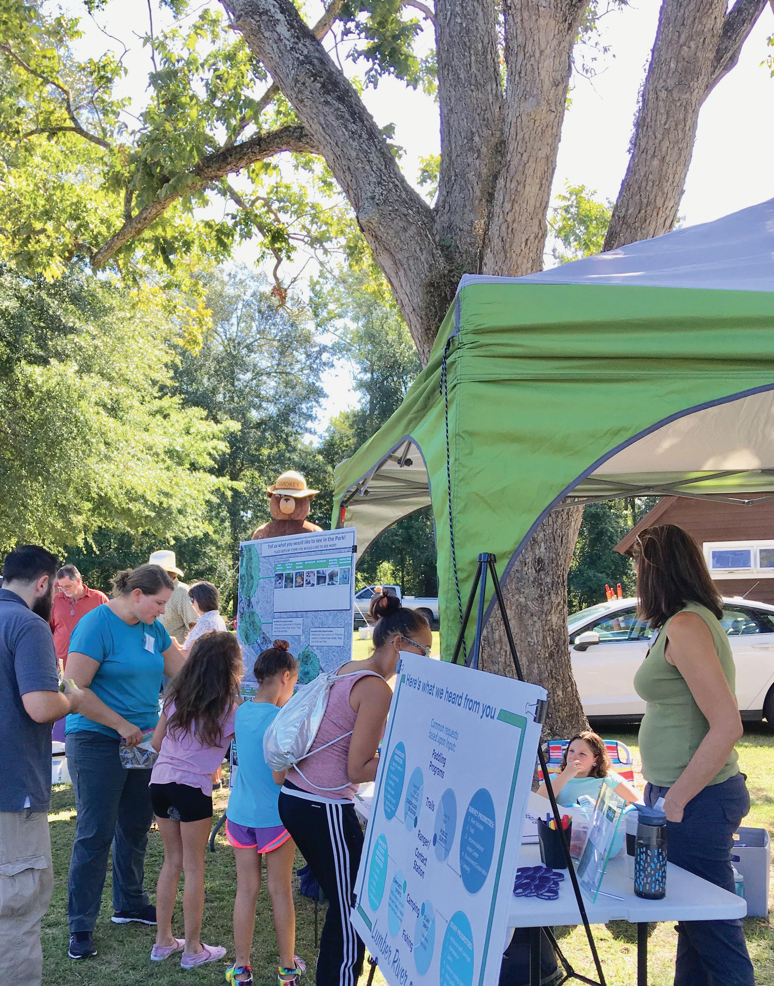
#1- April 26, 2019 Barbecue on the Bluff- Fair Bluff, NC
Approximately 75 people attended the booth at the Barbecue on the Bluff event in Fair Bluff in which the consultant team and park staff attended to inform the community about the project and solicit input. There were opportunities to comment on the park map, fill out the survey, and to vote on ideas and improvements for the park.
The following comments were added to the board ‘What would you add to Lumber River State Park’ by the public:
• State Park presence in Fair Bluff
• Acquire ‘Watermelon Bluff’ and include it into NC/SC Park system
• GPS coordinates posted online
• Mark main channels as there is no signage
• Trim main channels, Clean up river along banks, logging on Lumber River needs to happen
• Duck hunting
• Bring in eco-tourism in all areas
• 3 factions need to work togetherlocal towns, state and county
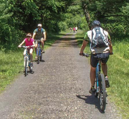
• Biking opportunities
• GPS coordinates for certain destinations
• Young people need activities
• Free fishing/rentable fishing gear
• Lumber River Keeper-contact
Results of activity preference (each given 3 coins to vote; 6 possible items to choose from):
1. Camping- (33 votes)
2. Fishing- (24 votes)
3. Paddling- (23 votes)
4. Hiking- (18 votes)
5. Picnicking- (16 votes)
6. Education and Interpretation- (11 votes)
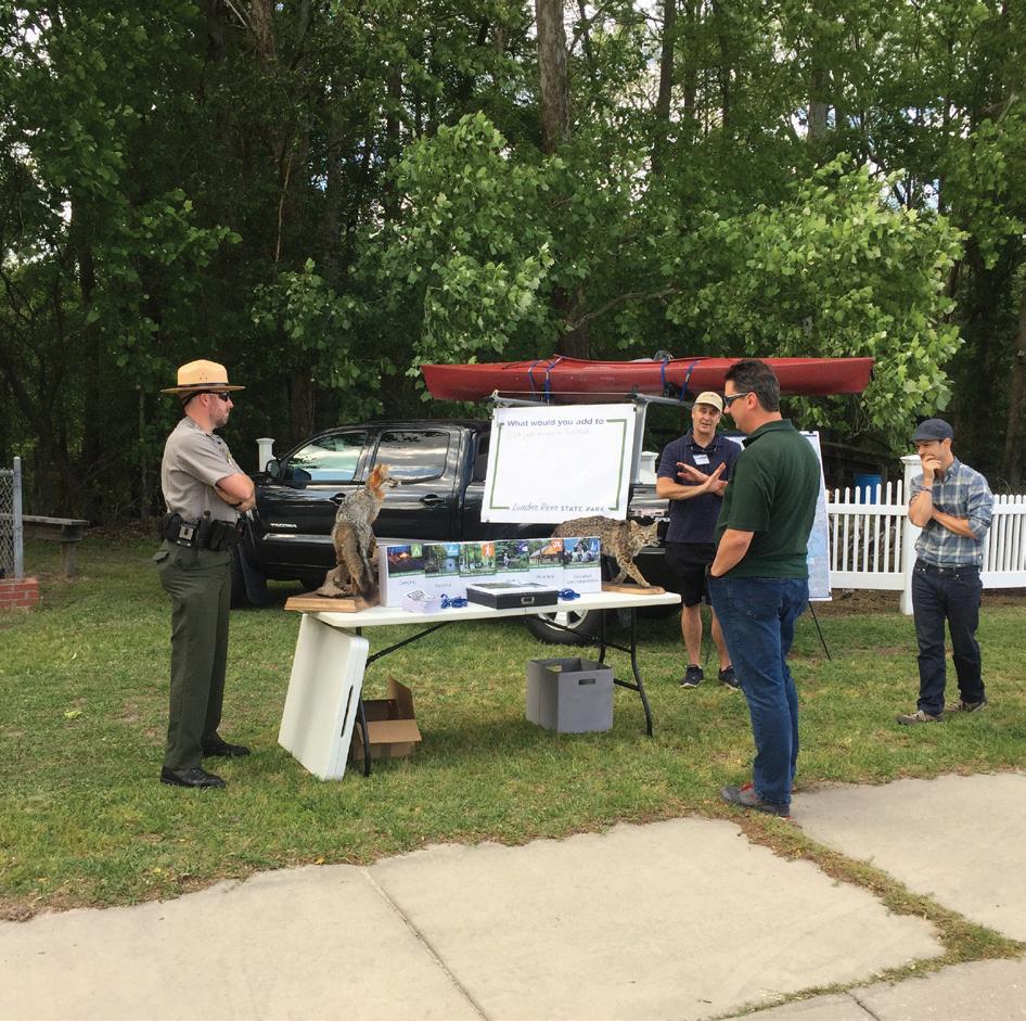
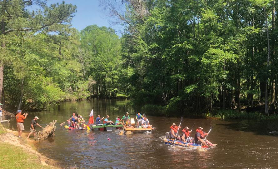
#2- May 18, 2019 Chalk Bank Challenge- Chalk Banks Lumber River State Park
On May 18th the Consultant team and Park Staff attended the Chalk Bank Challenge at the Chalks Bank Access. The team was able to have contact with approximately 50-75 people at the event and engage many of those to participate in the survey, comment board, and activity preference voting.
The following comments were added to the board ‘What would you add to Lumber River State Park’ by the public:
• Disc Golf
• Swimming (mentioned 3x)
• More activity-events, programmed activity (tours), something to do
• Mini golf
• Channel markers
• Mountain bike trails
• Paddle boat cradles
• Sand landing/ramp for paddle boats (not concrete)
• Manned visitor center (mentioned 5x)
Results of activity preference (each given 3 coins to vote; 6 possible items to choose from):
1. Paddling- (26 votes)
2. Camping- (25 votes)
3. Hiking- (22 votes)
4. Fishing- (14 votes)
5. Education and Interpretation- (13 votes)
6. Picnicking- (10 votes)
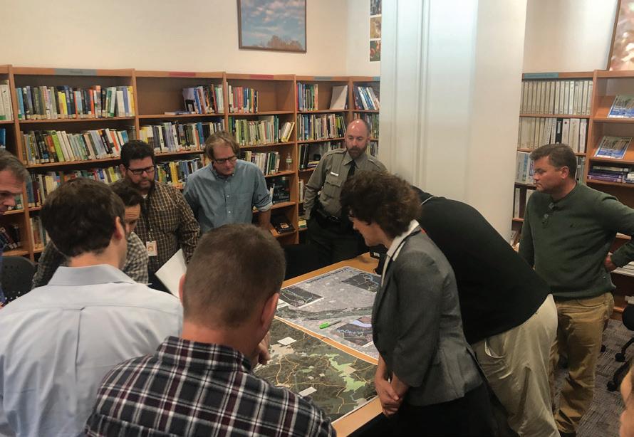
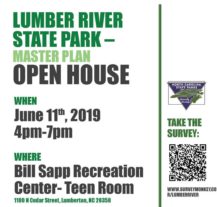
#3- June 11, 2019 Public Open House- Lumberton, Bill Sapp Recreation Center
A Public Open House was hosted by the consultant team and park staff in a central location to the project corridor at the Bill Sapp Recreation Center in Lumberton. It was lightly attended. Those who attended participated in the survey, comment board, and activity preference voting.
The following comments were added to the board ‘What would you add to Lumber River State Park’ by the public:
• Bring facilities at the park up to date and current
• Possible camp sites at Recreation Center Road or McMillan’s Beach
• Electricity at Chalk Banks
• Snag/clear river
• Testing should be done in all swimming location- Robeson County water quality is of concern
• Long range park access at Highway 74
• Staffing- Need additional rangers
• Park headquarters
• Educational events, Social events, Races and runs
• Cycling
• Boating outfitters
• Hiking & Off-road biking trails on Big McQueen
• More canoe-in campsites
• Backcountry camping on Big McQueen
• If they can get control of the site at Wire Pasture it should be moved forward otherwise it is not worth opening at all
• It was suggested to look at area near meat packing plant in Lumberton (possible land acquisition)
Results of activity preference (each given 3 coins to vote; 6 possible items to choose from):
1. Paddling- (8 votes)
2. Hiking- (5 votes)
3. Camping- (4 votes)
4. Fishing- (4 votes)
5. Picnicking- (4 votes)
6. Education and Interpretation- (2 votes)
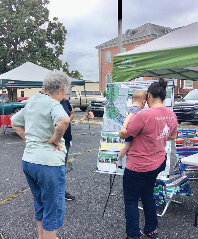
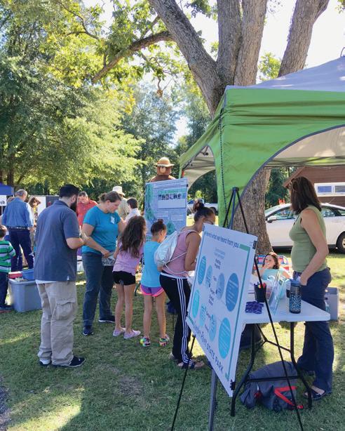
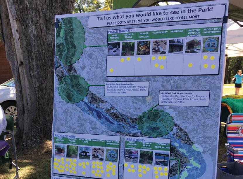
The consultant team and DPR staff attended the Saturday morning farmers market to get response to findings and draft recommendations to date. There was good attendance of over 60 people and general support for recommendations shown. Participants expressed a need for more educational outreach and park access through alternative transportation identified at this event. Participants were asked to identify which recommendations they supported the most and list anything they felt were missing from the recommendations:
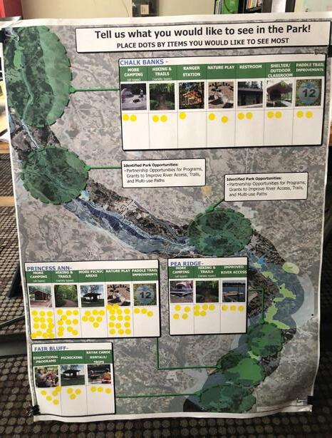
What participants Liked the most:
Chalk Banks:
• Contact Station
• Restroom
• More Camping and Hiking
Fair Bluff:
• Educational Programs
• Picnicking
• Paddle Events and vendors
What participants felt should be added:
Princess Ann:
• More Camping
• Nature Play
• More Hiking
Pea Ridge:
• Hiking and Trails
• More Camping
• Improved River Access
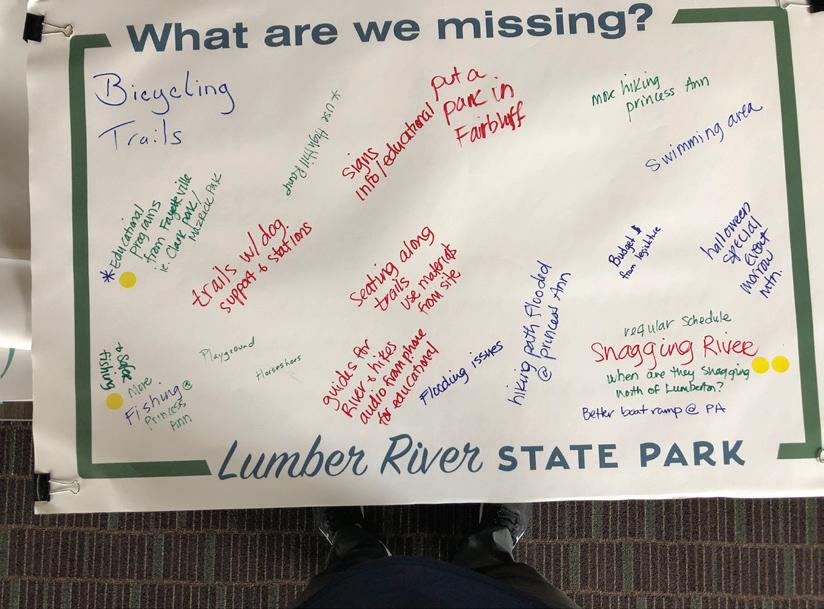
Addition of bicycling trails and connections to the park
More educational programs for students/visitors from Fayetteville (i.e. J. Bayard Clark Park and Nature Center/Mazarick Park) (Mentioned 4x’s or more)
Trails with dog support and stations
Playground options for children (can be nature play, not just traditional playgrounds)
Horseshoes
More fishing (safer) options (Mentioned 3x’s or more)
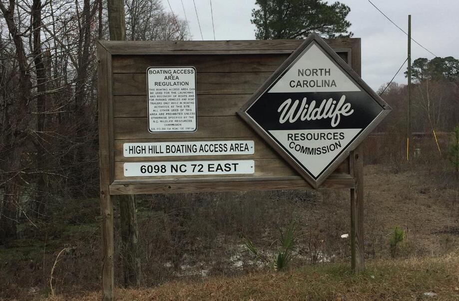
Utilize High Hill Boat ramp in Lumberton as a connection to park
Additional wayfinding and educational signage needed
Establish a park in Fair Bluff
Natural seating along the trails (use fallen materials from the site)
Guides for the river and hiking (some sort of audio for educational purposes)
Flooding issues (are there parts of the park that don’t flood out and can still be used when needed)
More hiking at Princess Ann (trails aren’t long enough to get in a good hike)
A public swimming area within the park in the river
Halloween Special event (I.E. Morrow Mountain) or other special events during the year
Hiking path at Princess Ann floods (no flooding path)
Regular snagging schedule for the river (Mentioned 4x’s or more)
Better boat ramp at Princess Ann
The consultant and park staff attended the 2019 Lumber River Day. The team continued outreach and informational efforts as well as solicited input on draft recommendations and ideas. The team made contact with over 75 participants and was able to gain valuable input listed below.
• Drinking water near group camping (especially important with younger scout groups)
• Junior Ranger program expansion
• More educational and entertainment events at Princess Ann year round
• A few children thought a waterslide to slide into the river (also talked about a rope swing or tire swing)
• Visitors center/welcome center
• Improve signage to park (via car or bike) (Mentioned 5x’s or more)
• Add additional rangers to the staff
• Electricity in the Chalk Banks location
• Many love the Lumber River and would like to see it honored by caring for it as a valuable natural resource (keeping it clean, teaching others to respect the land, etc.)
• More hiking at all of the locations-longer hikes desired
• More canoeing options/outfitters for those that don’t have their own equipment
• More fun events at the park (guided hikes, movies, etc.)
• Add outfitters for a variety of items to give visitors options
• Options for RV camping closer to 74, including hookups (Mentioned 3x’s or more)
• Swings for mom’s with small kids at the shallow part of the river
• Improve ranger communication both in the office and in their trucks-they should have computers in their vehicles and access to communication at all times
Chalk Banks:
• Nature Play
• Restroom
• Ranger Station
Fair Bluff:
• Educational Programs
• Picnicking
• Canoe and Kayak Rental Trips
Princess Ann:
• More Camping
• Nature Play
• More Hiking
Pea Ridge:
• Hiking and Trails
• More Camping
• Improved River Access
As a part of the planning process several local groups were identified by staff as a community or organization that has interest in Lumber River State Park. These groups were listed and prioritized to either invite to local public meetings, conduct phone interviews, or host a separate stakeholder sessions. Stakeholders were invited to various events and representatives from stakeholder groups attended or responded with comment via phone call or email. The input intent was to hear stakeholder ideas for the Park, how the park and future elements may support a group or organization, and to identify what plans, projects, or studies may exist that could have influence on Lumber River State Park.
June 11, 2019 - Bill Sapp Recreation Center- Lumberton Municipal Groups and Representatives
This was an inter-agency meeting hosted in a central location to the entire corridor with representatives from surrounding COGS, Counties, towns, and cities invited for participation. Agency representatives reviewed existing conditions and identified areas of concern for the planning and potential development of future park features.
June 11, 2019 - Bill Sapp Recreation Center- Lumberton Community Groups, Organizations, and Non-Profits
The consultant team invited several community groups from non-profits, local tribal groups, and organizations identified at the outset. Representatives from the Lumber River Keeper and the Lumbee tribe participated in a stakeholder session to gain greater insight on specific needs. The NC Indian Cultural Center was identified for improving partnerships and programs with the Lumber River State Park system. It was also noted that history, wildlife, and people of the Lumber River are what makes it unique and there is a desire to have more taught about this aspect of the river.
Lumber River State Park Parks and Recreation Advisory Committee (PAC)September 24, 2019
The consultant team presented to the PAC at the Princess Ann location of Lumber River State Park. The PAC reviewed findings to date including site visit information and public survey and input findings. They were in support of findings and wanted to make it clear the importance of implementation and updates within the park resulting from the Master Plan. They stressed many of these needs have been in place for over 20 years and the needs have only grown, so not only are they deficit of bringing the park up to date with system standards but also are behind with newly identified needs.
Public Input Survey - The public survey was conducted from April 2019- July 2019 and remained open for a period of approximately 90 days
A participation survey was created with the assistance of Park Planning Staff and placed online, distributed at community events and by staff and stakeholders, and available at the Chalk Banks and Princess Ann location. Questions included user preference, open ended comments, and interests and concerns for the future use of the park.
The survey was placed on the Park Website and a link was distributed to several stakeholder and interest groups including: local businesses, DPR staff, COGS, surrounding communities (Counties, city’s, and towns, environmental non-profit groups, outdoor recreation providers and vendors, the Park Advisory Committee (PAC), and through local news outlets.
The survey instrument only allowed participants one response per computer and provided opportunity for map input at the conclusion of the survey.
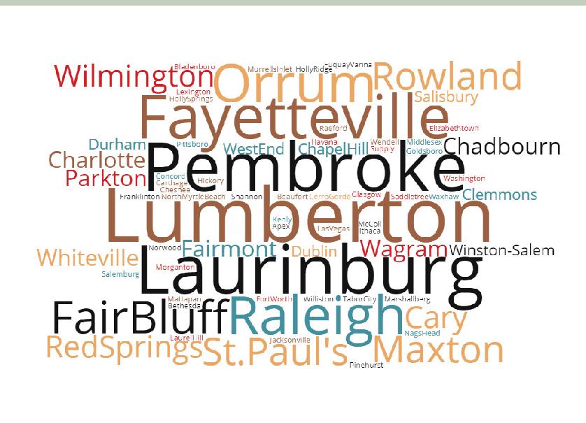
Where are visitors from:
When asked where participants were from the majority were from North Carolina (94.1%) with the remaining respondents from a variety of states. The majority of respondents were between the ages of 45-64 (44.5%) with the fewest age range represented being under 17 (1.38%).
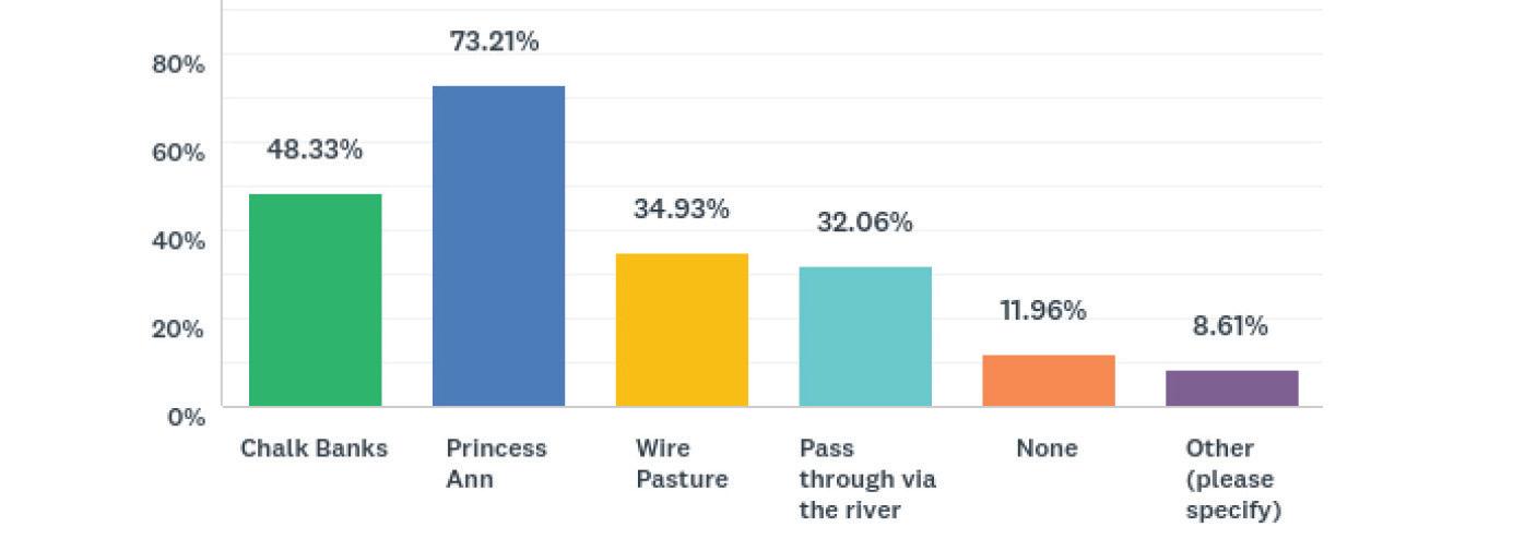
Over 80% of survey respondents had visited Lumber River State Park between 0-5 times a year. In addition to that most had also visited another North Carolina State Park (84.55%).The most visited Park Access location was Princess Ann (73.21%) followed by Chalk Banks (48.33%) and then Wire Pasture (34.93%).
Most visitors came to these parks to hike (24.20%), attend a special event (16.44%) or to kayak/Canoe (16.44%). Other responses also included visiting the park for family time, enjoying nature, relaxing, and that the park serves as a site for research related endeavors.
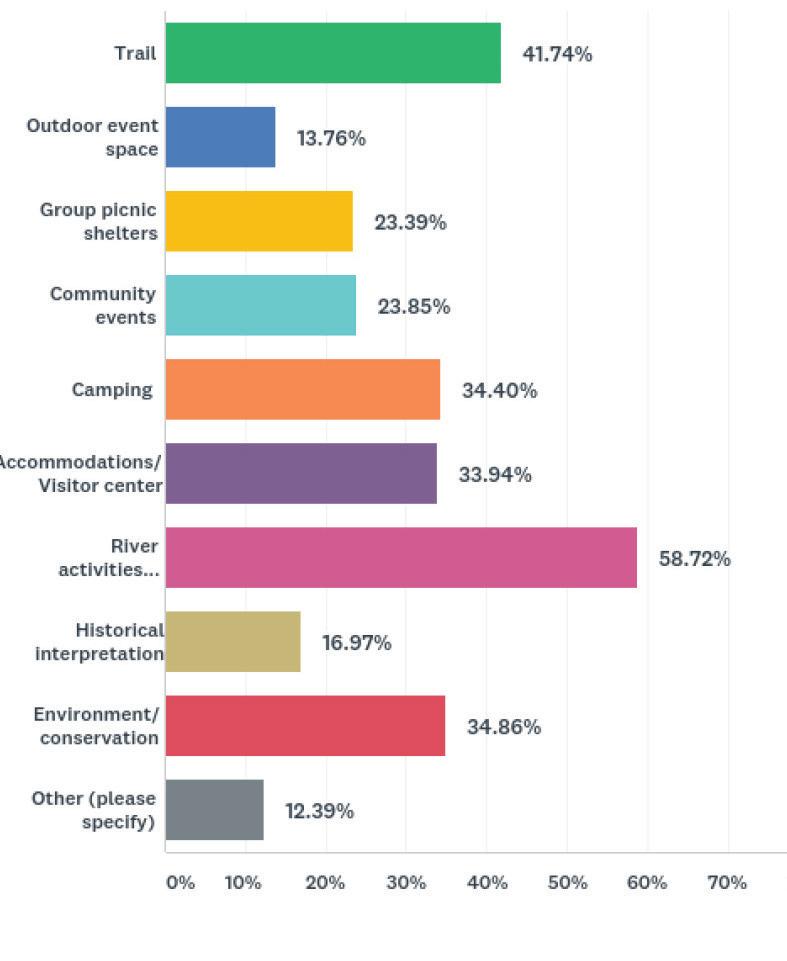
As seen on the adjacent chart, trails and hiking ranked the highest for recreational participation (61.19%), followed by kayaking/ canoeing (42.47%), and camping (40.64%).
The five most important features identified in the survey as needs at Lumber River State Park were:
1. River Activities
2. Trails
3. Environment and Conservation
4. Contact Station/Visitor Center
5. Camping
There were several other needs identified not listed such as clearing the river of debris, more camping, a children’s playground, and more opportunities for cultural interpretation teaching about the Lumbee and Tuscarora people.
Types of Trails participants would like to have at the Park:
Trails ranked highest as the activity people participate in the most. In order to understand demand participants were asked to identify the preferred trail type:
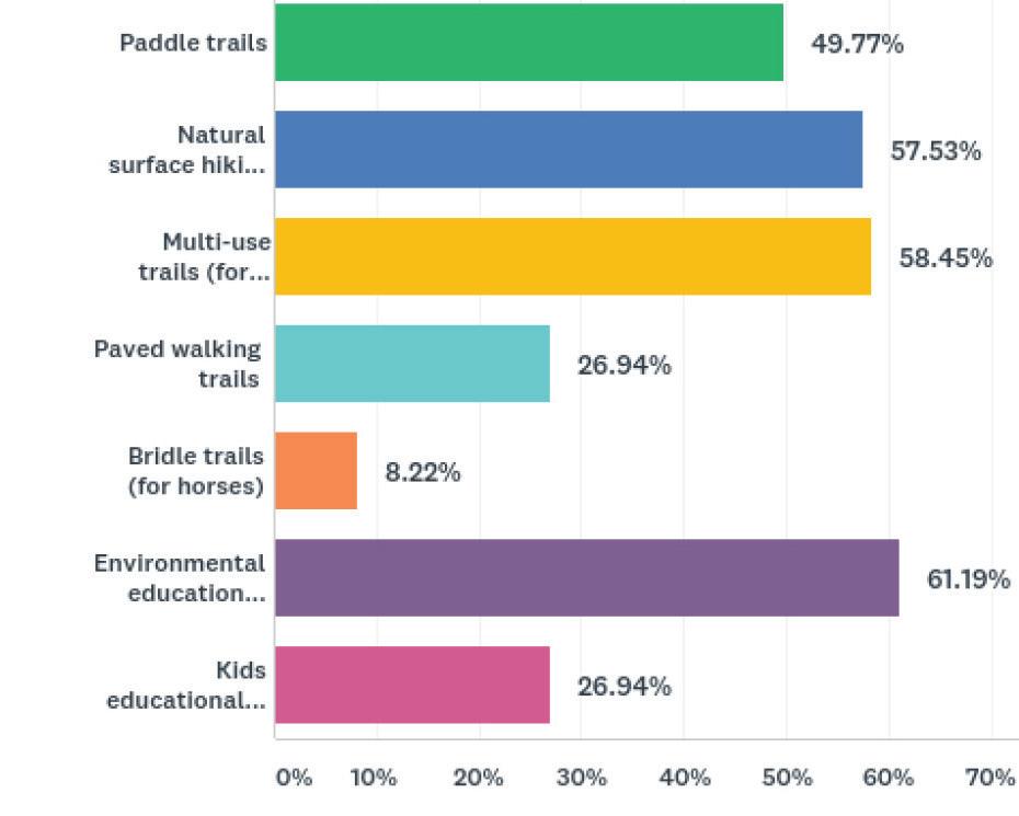
1. Environmental Education
2. Multi-Use Trails
3. Natural Surface Trails
4. Paddle Trails
5. Paved Walking Trails & Kids Educational Trails
Demand for Camping:
There is strong interest in having more camping opportunities at Lumber River State Park (77.36% of respondents) stated they would like to have more camping and they would like to have access to camping from the land side of the park and not just river and primitive camping. Interest in Cabin camping (27.8 %), Tent Sites (24.04%), paddle in (21.3%), and RV (13.11%) were all identified as desired camping types for the Lumber River State Park.
Cultural History has also been identified as a part of the need for Lumber River State Park to help discuss the area. Most participants would like to see more interpretive displays in the park (49.77%) in addition seeing artifacts (35.35%) and participating in interpretive programs (34.88%). There were also program ideas presented to have more group hikes, co-events with local tribes, and partnership programs (ie. tribes and Lumber River Keeper Program).
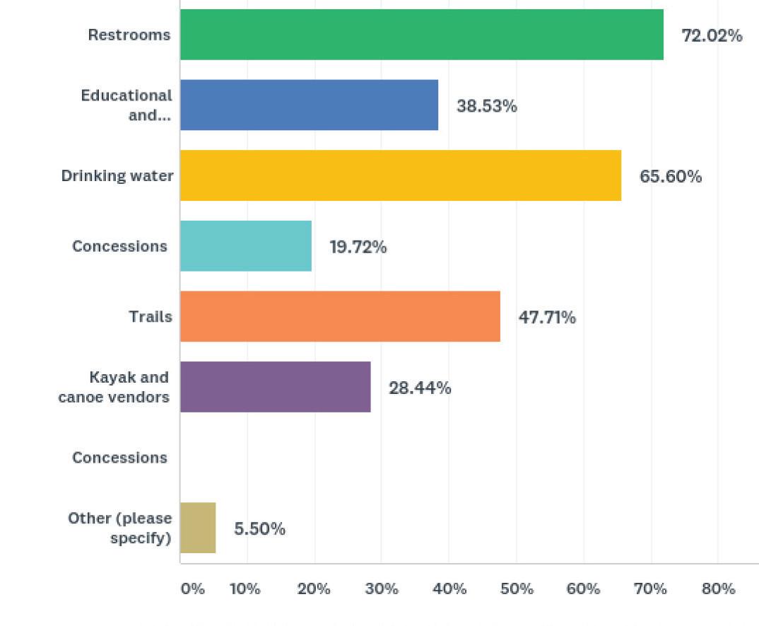
The River and participation in river activities in it are key components of the park. Users would like to see more support features at the river access locations such as Restrooms (72.02%), Access to Drinking water (65.6%), and trails.
Desired Amenities at River Access Locations:
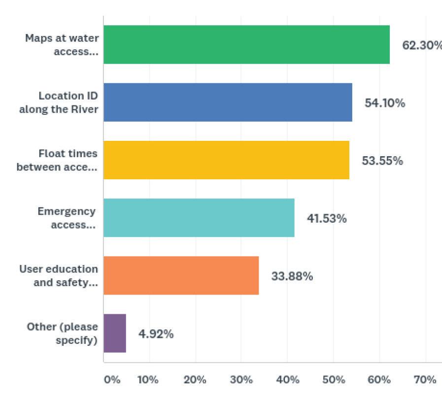
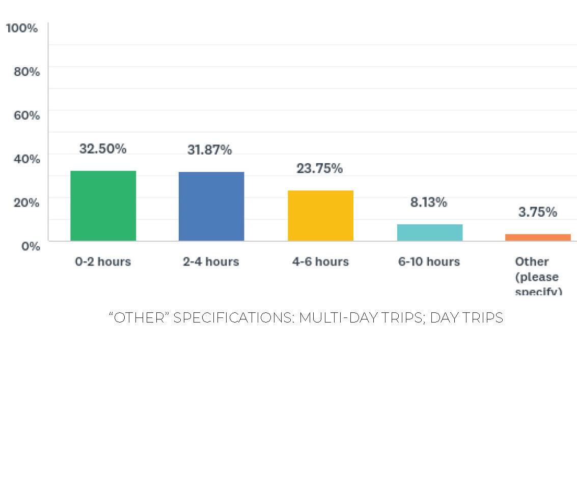
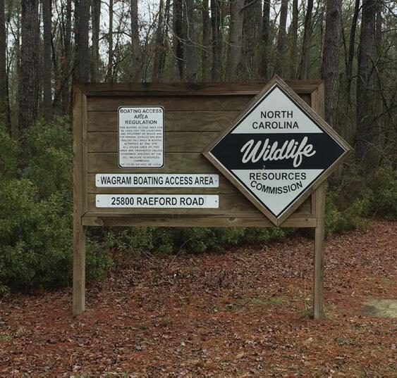
Approximately half (48.17%) respondents participate in boating activities on the Lumber River with the majority of them spending 0-2 hours (32.50%) or 2-4 hours (31.87%) on the River. Princess Ann and Fair Bluff are the most common entry and exit points along the river (14.9% and 32.8% respectively) followed by Chalk Banks and Wildlife Resources Commission Wagram boating access at Highway 401. Respondents would like to see additional support facilities at these locations including informational maps at the put-in’s and take-outs, ID along the river, more information regarding float times, and more information regarding what is at the access locations.
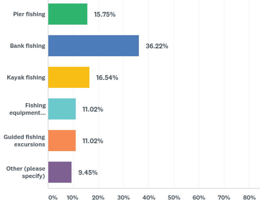
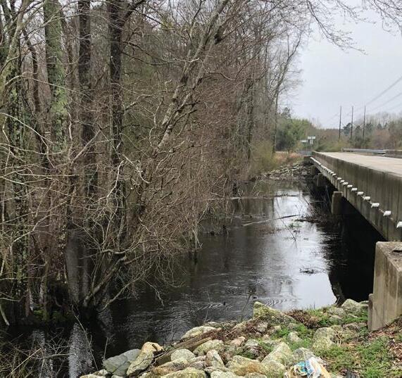
Less than half of respondents fish at the Lumber River State Park (33.18%) but respondents would like greater access to fishing at the park with Princess Ann (62.92%) and NCDOT bridge access points currently serving as the most popular locations for fishing. Bank fishing improvements ranked highest (36.22%) followed by a desire for increased kayak fishing opportunities (16.54%) and Pier Fishing (15.75%)
Additional Comments:
General comments about Lumber River State Park highlight the helpfulness and friendliness of the park rangers. Some respondents note that the park has limited hours due to staffing limits and indicate the need for increased staff for the purposes of assistance, safety, and regular events.
Many comments point to the natural beauty as its primary asset and stress the importance of keeping the park as natural as possible in order to preserve its nature. Those who access the park via the River indicate wayfinding on the River and clearing out of storm debris as top needs.
Many overnight visitors who camp at the park point out the need for additional raised canoe campsites, picnicking, and running water. Those who camp by trailer/tent or RV indicate the need for electrical hookups. Both overnight visitors and day visitors to the park would like to see a formal hiking/biking trail established in the park. Respondents would like to see more programming at the park to include cultural and natural history events and lectures, outdoor education, and guided hiking, fishing, and kayak/canoe tours. Some comments suggest collaboration or partnering with the local Lumbee and Tuscarora tribes or the Lumber and Waccamaw Riverkeepers to co-sponsor events and build awareness about the park and history of the area.
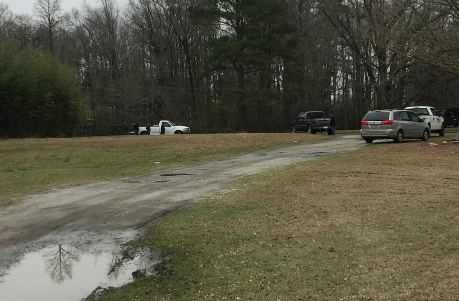
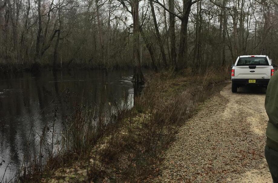
Finally, there are comments that indicate the condition of the Wire Pasture area and its current use as gathering spot for alcohol and drug use. A few comments indicated the danger associated with accessing the River from that location, including a vehicle break-in.
Overall, respondents enjoy visiting and using the Lumber River State Park because of its natural beauty and scenic views, and many appreciate the cleanliness of the park, with the exception of a few access points, and the professionalism of the park rangers.
The 2015 SCORP (Statewide Comprehensive Outdoor Recreation Plan) and the 2018 NC Parks Systemwide Update give guidance to the overall NC State Parks system and key objectives not only important to the system on a whole but also to the park sites within the system, including the Lumber River State Park. These statewide reports were compared to public involvement findings to identify commonalities and discrepancies which offers opportunity to further evaluation in these two variables.
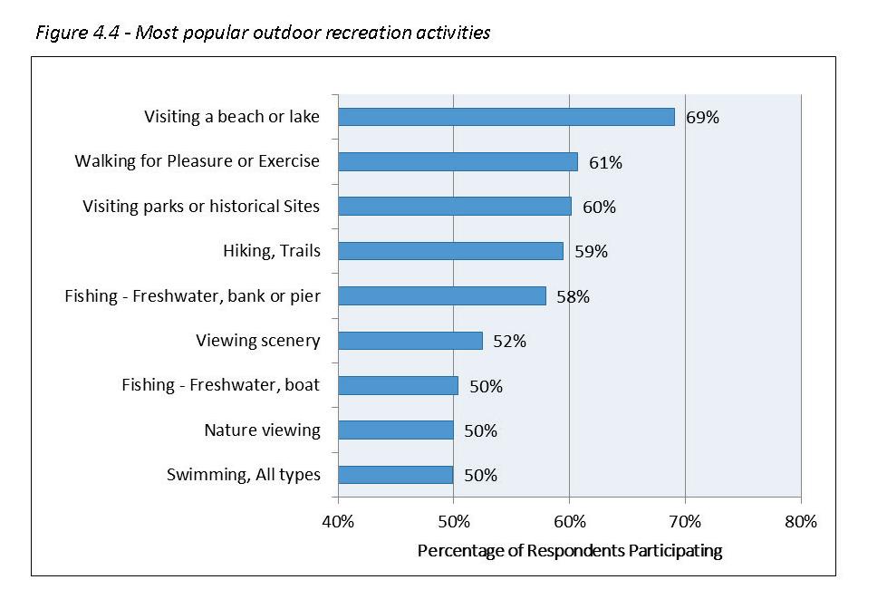
The team reviewed public input results conducted during the 2015 Statewide Comprehensive Outdoor Recreation Planning efforts (SCORP). Public response for this project was compared to SCORP input. The online SCORP survey yielded 17,000 responses. The needs identified during the master plan are consistent with the statewide needs identified: Access to water, walking for pleasure or exercise, hiking, trails, Fishing, and viewing scenery and nature,.
SCORP highlights the following needs:
The Systemwide Plan is a five-year guidance document that provides a record of recent activities and accomplishments and offers strategic direction for the future of North Carolina’s state parks
The document creates a vision and plan for meeting the needs of current visitors and those of the next generation of park users. The state parks system would not be what it is without the active participation, support, advocacy, and advice of park visitors, legislators, local governments, land trusts, friend’s groups, businesses, scientists, educators, environmentalists, and many other partners.
The following figure and findings highlight findings related to the planning efforts at Lumber River State Park:
All of the study findings and information presented in this report have contributed to the analysis and recommendations. Existing conditions, Environmental conditions, History, Past Plans, Community Involvement, and Staff involvement, and review have helped formulate the recommendations. In order to help identify common factors all information was placed on the existing conditions map to help highlight site opportunities and constraints. A data summary was compiled highlighting past plans and findings, and input results were charted to identify common needs throughout the planning process. All of the factors contributed to the draft program features.
During the inventory process, the consultant team worked with the client to identify related reports and past plans. Each study was read and reviewed to understand common action items and priorities. Lumber River State Park (LURI) is a state resource so it is important to ensure findings and recommendations are consistent with the system priorities and SCORP. The summary in the inventory contributed to identified need during the analysis. For Lumber River State Park this proved to be a very critical piece of analysis for park recommendations. Past reports as far back as the late 1990’s have identified many of the features identified by the public during this planning process, many are still an identified need. This is important to this process because rather than discovering there is a long list of new needs, most of the items have been in demand for over 25 years.
Site existing conditions information was placed into one Map used for planning, review, and input. The map data contained environmental features, public input comments, and site conditions that may be an opportunity or constraint for future park use and management. The following are some of the features included on the Existing Conditions Map during the opportunities and constraints site review:
• Wetlands
• Floodplain information
• Soils
• Vegetation
• Topography
• River Access Locations and time from each location
• Pedestrian and bicycle plan information
• Regional roadways
• Areas already impacted or previous developed
• Existing park development and infrastructure
• Park program needs
• Overall park acreage, land use, and park user access and circulation
• Site history
• Existing park boundary/ buffers
• Camping locations and type (paddle to or primitive)
• Land not prone to flooding
• Areas with identified needs
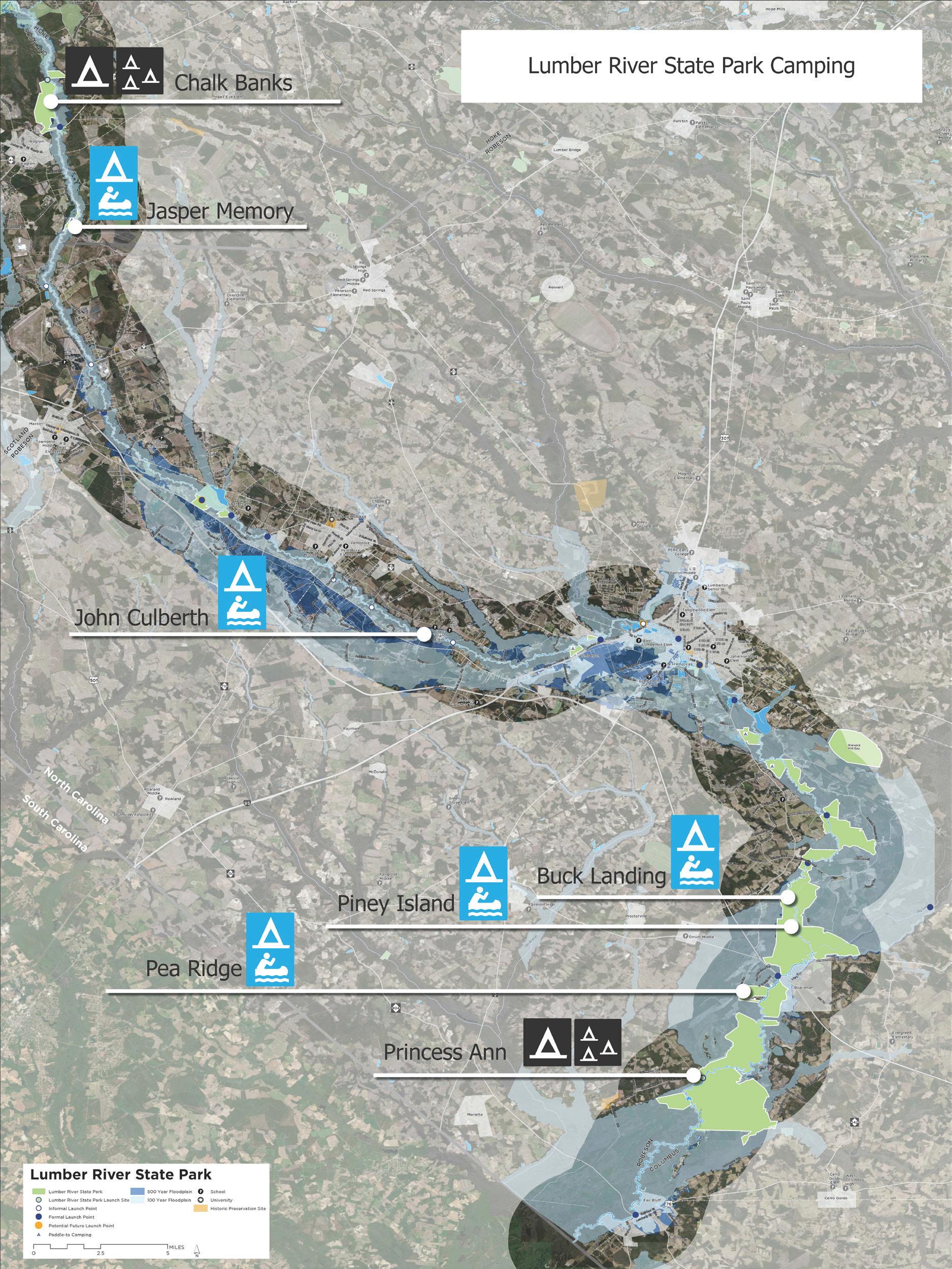
Blue symbols reflect Campsites that are Paddle to Only, The symbols shown in Black are campsites that can be accessed by land, currently all camping is primitive
This reflects evaluation of all of the current access locations and what features exist at each: parking, ramps, support facilities, etc.
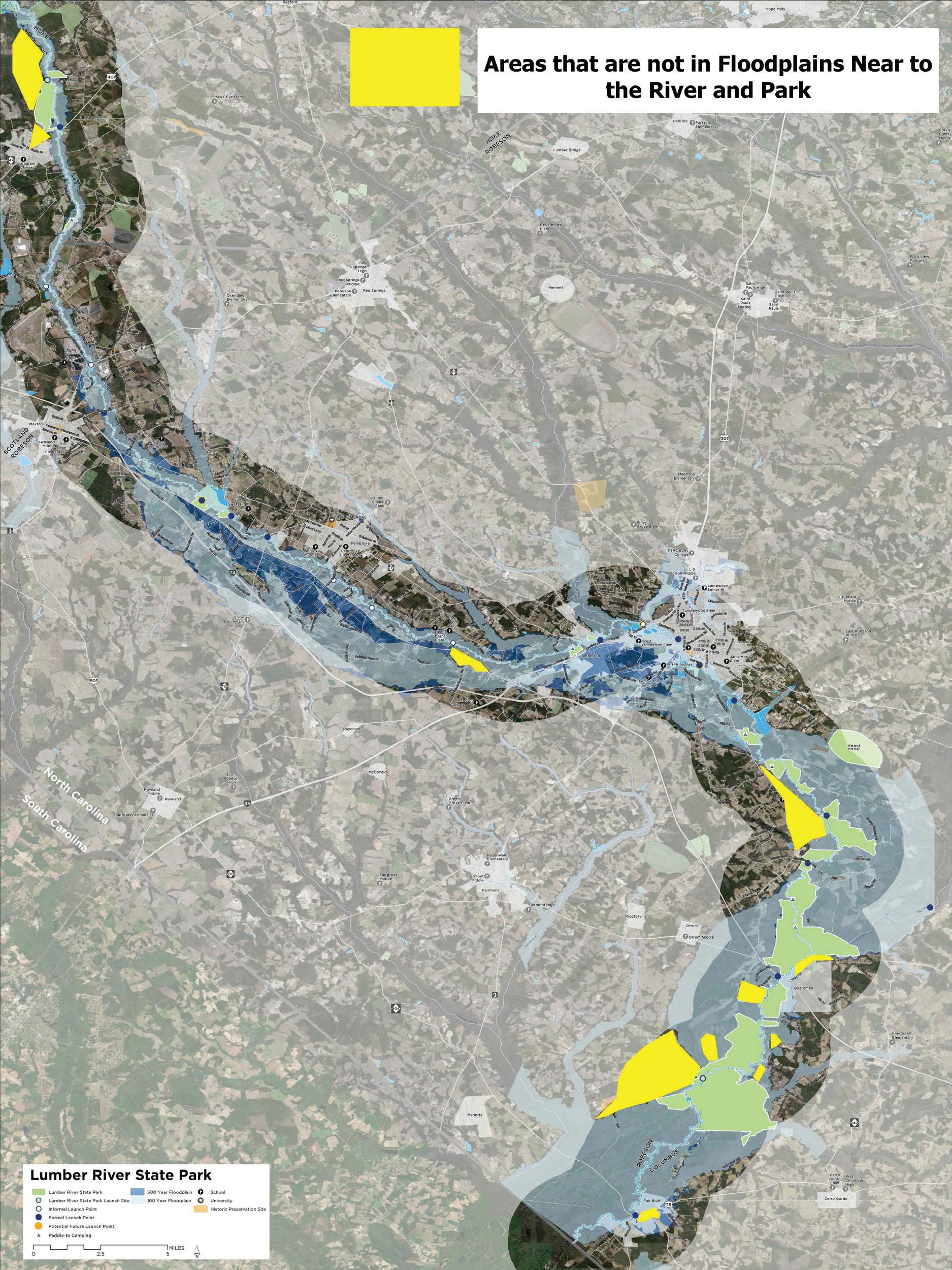
This is a highlight of the areas that are not in the floodplain and/or have not had the historic flooding from recent events. These areas are very limited within the corridor.
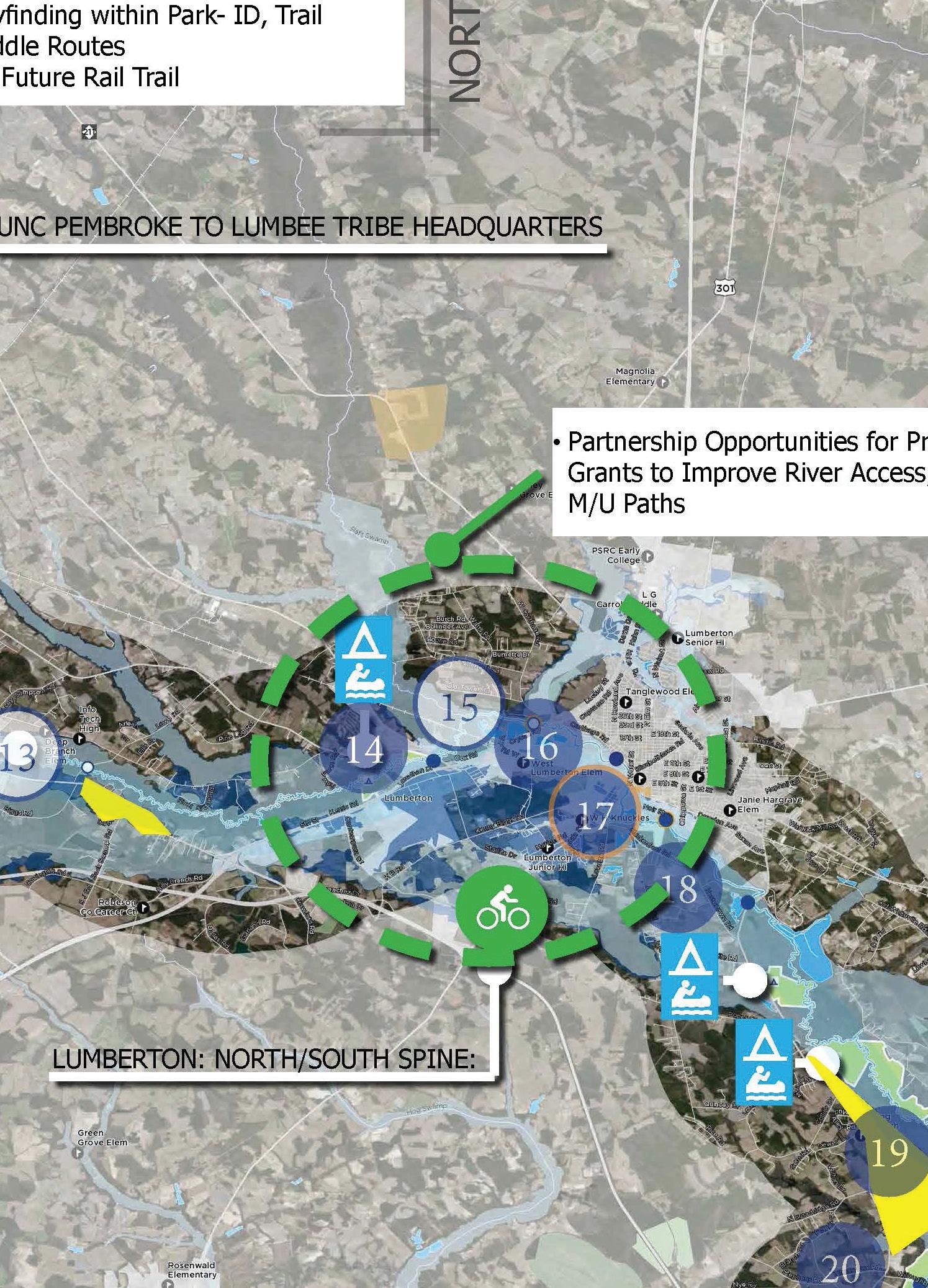
Sandhills Bicycle Plan Priority Projects within the Lumber River State Park Corridor
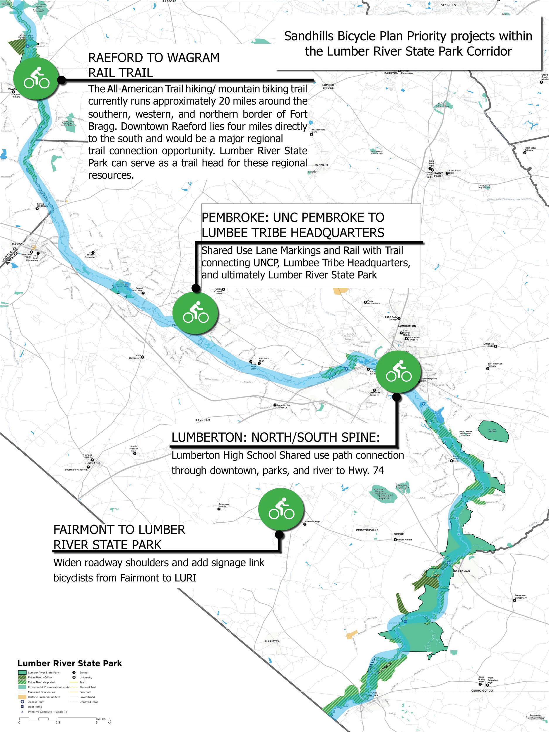
These are Bicycle routes identified in Area Plans that have connection to, or are nearby the Lumber River State Park Properties
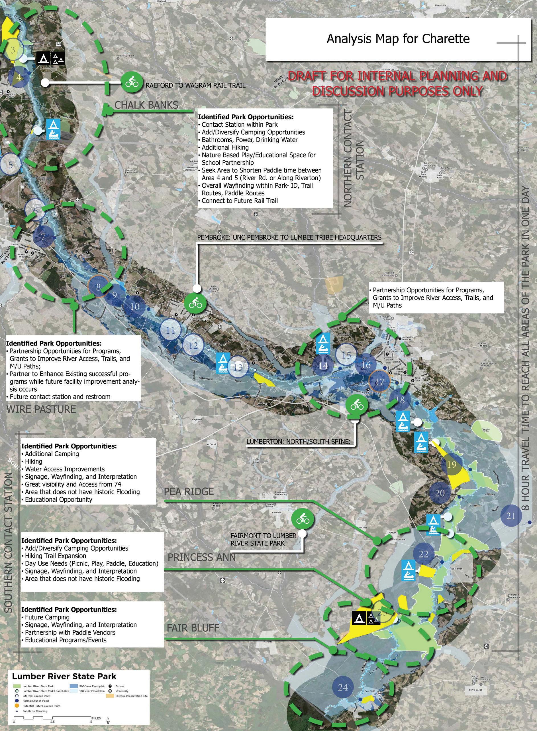
This is the compilation of all of the map and input findings during the process to conduct full analysis of existing conditions and needs
Enlargement OneChalk Banks
Area to Focus on Recreation
Area to Focus on Education
Area to Focus on Conservation
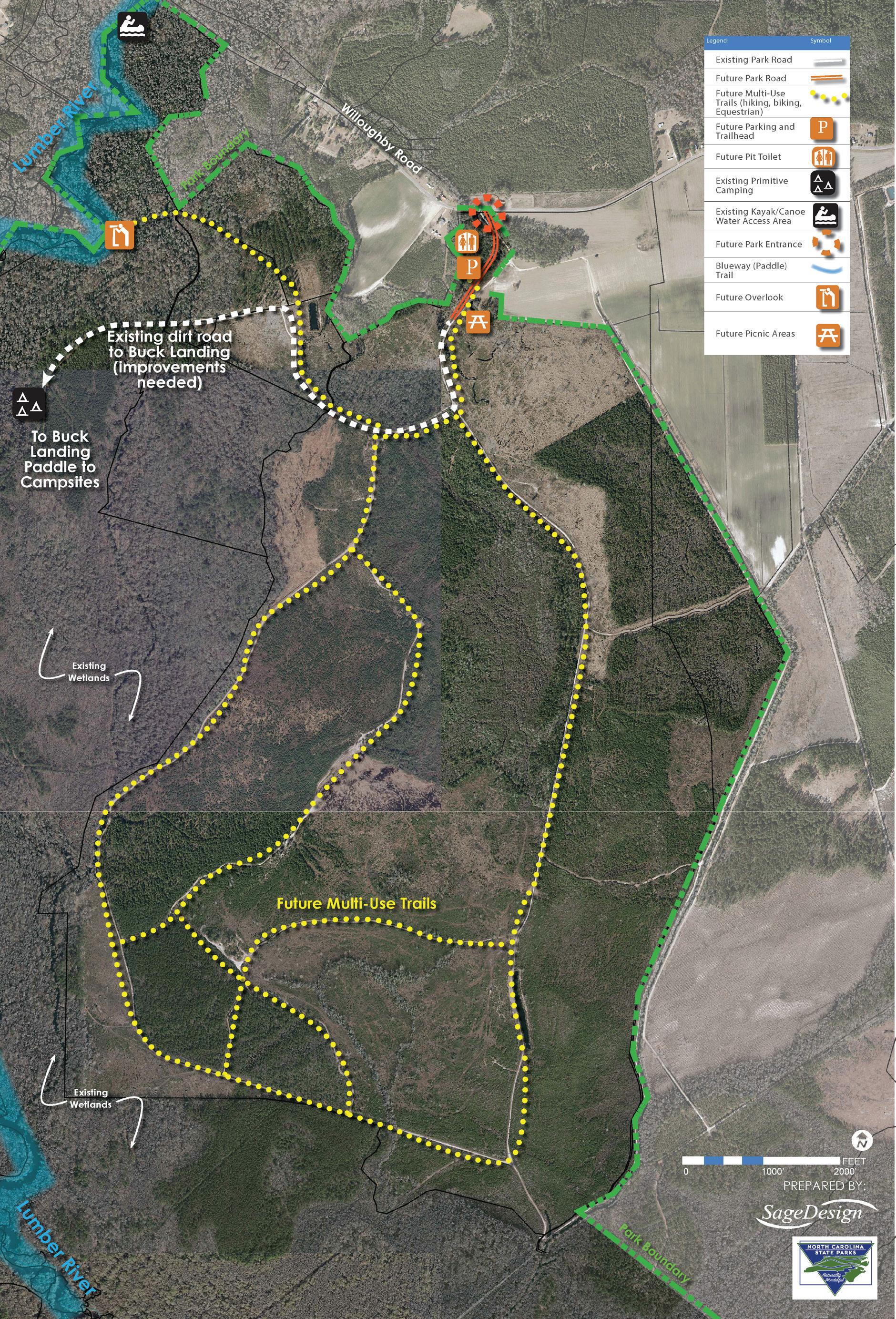
Enlargement TwoBuck Landing Access Expansion
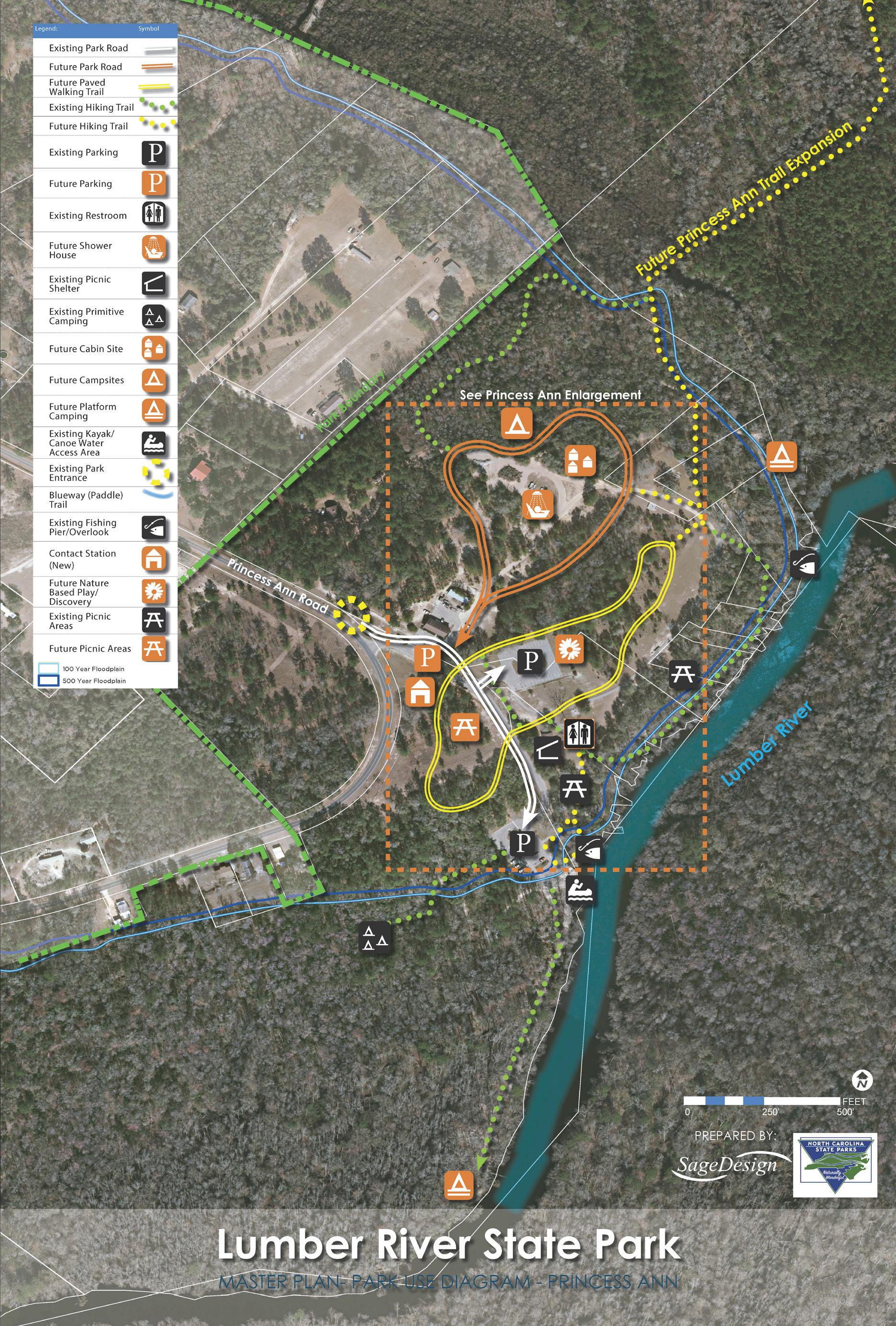
Enlargement ThreePrincess Ann
The following recommendations and associated action items are a result of the compiled information during the planning process. Each point of analysis and discovery contributed to plan recommendations. It is important to consider each component of the Park due to the large geographic region it covers. One of the biggest challenges has been the 115 mile distance between primary locations and the time it takes to conduct Park Operations. Each site, and future sites have needs that have been in place for a long time. These needs are identified as immediate needs.
Summarized recommendations can be found on the Master Plan graphic and a more detailed outline of findings are listed in the recommendations and action item chart. Prioritization is listed in Near Term (0-5 years); Mid-term (5-10 years); and Long Term (10-20 years). Facilities and Program Actions are broken down by area referenced on the map graphic, and Policy/Management and Staffing are listed for the overall Lumber River State Park.
• Camping- Variety of Types
• Trails- Variety of Types
• Opportunities to Paddle
• Shelters
• Improved and Expanded Signage
• More Opportunities for Day Use Activities
• Special Events
• Educational Programs
• Support Features like Restrooms, Electricity, and Showerhouses
• Ranger Station/ Contact Station
• Nature Based Play
• Educational Programming at Schools or Schools to Parks
• Kayak and Canoe Vendors at All locations in addition to Fair Bluff
All of the Analysis findings were used to create Park Use Diagrams for staff and Public Input. Park Use Diagrams illustrate the program features identified during the input process. Input received helped to determine preferences for program feature location, connectivity, and identify features that may be desired and were not shown.
The following are recommendations that apply to all sites within the Lumber River State Park Corridor:
The Lumber River Corridor is an incredible resource and offers opportunity to fulfill all areas of the State Park Mission: Conservation, Education, and Recreation. Having access to the Park at each end has open access to different parts of the River. While this presents opportunity, it has also presented many operational and identity challenges. Many users register to camp online and do not understand the locations are over 100 miles apart, likewise, visitors come for events and do not always realize an event may be at the other site. In order to improve user communication and Park identity it is recommended the park either separate as different park resources, or at the very least, change the name to identify the site first “Chalk Banks along the Lumber River” or “Princess Ann Park along the Lumber River” versus both sites be referenced as Lumber River State Park.
As weather patterns are evolving and flooding becoming a more frequent occurrence in this region, it is important to have an understanding of the potential impacts the Lumber River has on the park and the surrounding corridor. Best Management Practices (BMP’s) need to be coordinated with local, state, and federal agencies to promote resilient design practices within the State Park corridor in hopes of minimizing the impact from future flooding events. BMP’s can also help promote and preserve the water quality of the Lumber River as a natural resource. The large land holdings in place (over 14,000 Acres) serves as an aid to maintaining water quality and provide flood storage in the corridor. In addition to land protection strategies, future park development should minimize impacts of stormwater runoff, provide park structures that are designed and built to withstand flooding, and present the placement of permanent structures in areas that historically have limited flooding and impact to wetlands.
Communication is key in a park that spans four counties and more than 100 river miles. Park users and staff need the ability to access information about the park, for purposes of navigation both on the river and on land, and to communicate in the event of an emergency. Providing digital communication for staff is critical to the success of the park and the efficiency in which it is managed. Update and supply park offices and rangers with the digital equipment and work stations to improve their ability to perform daily tasks.
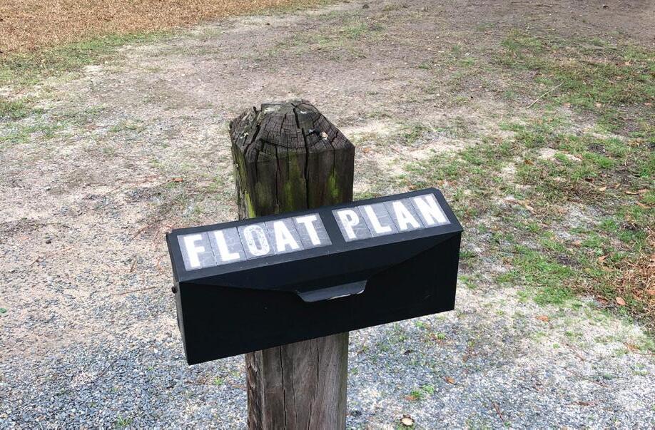
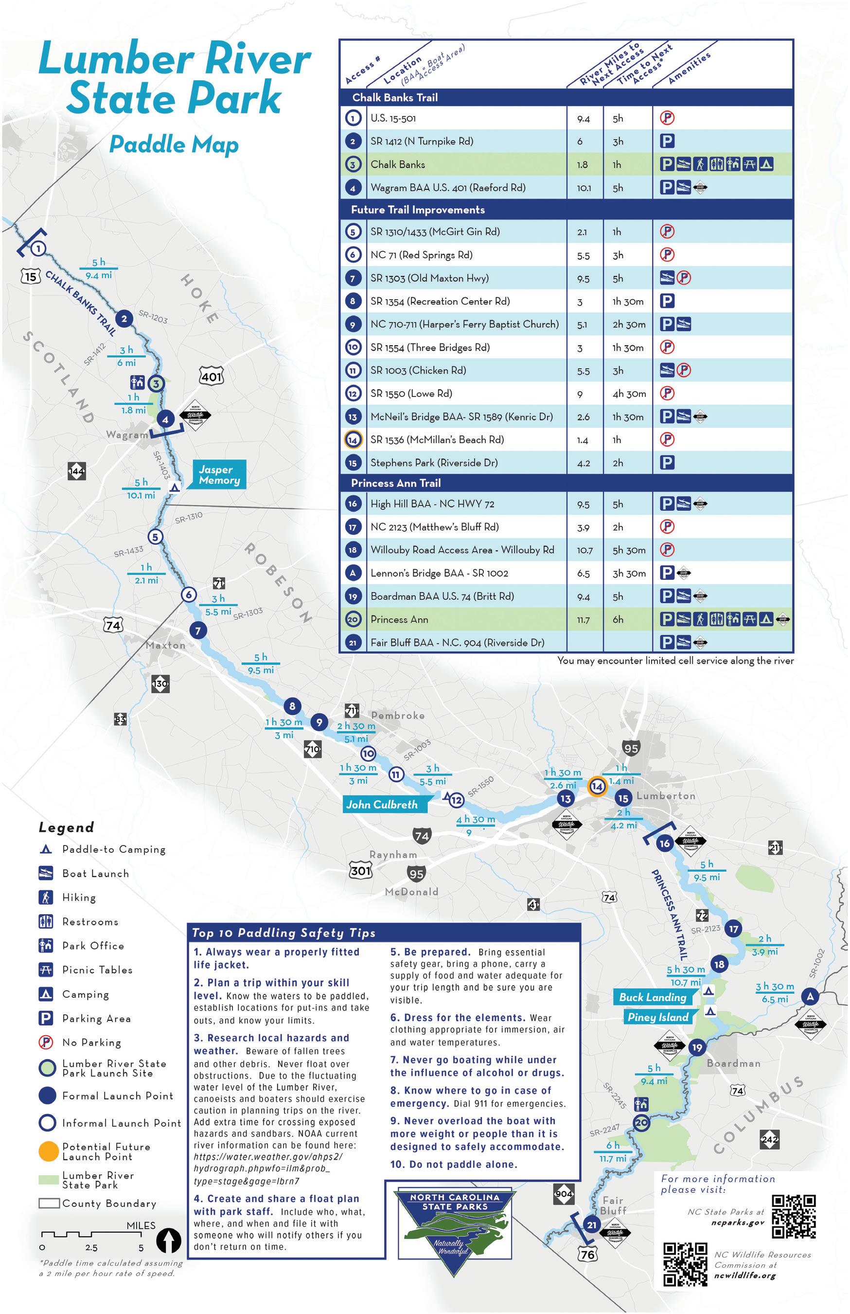
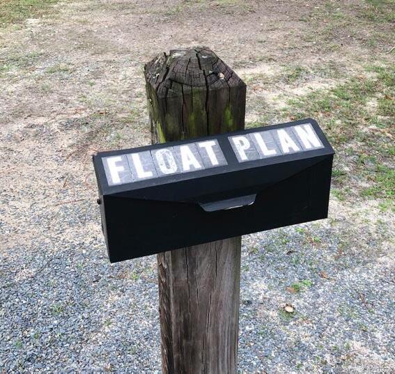
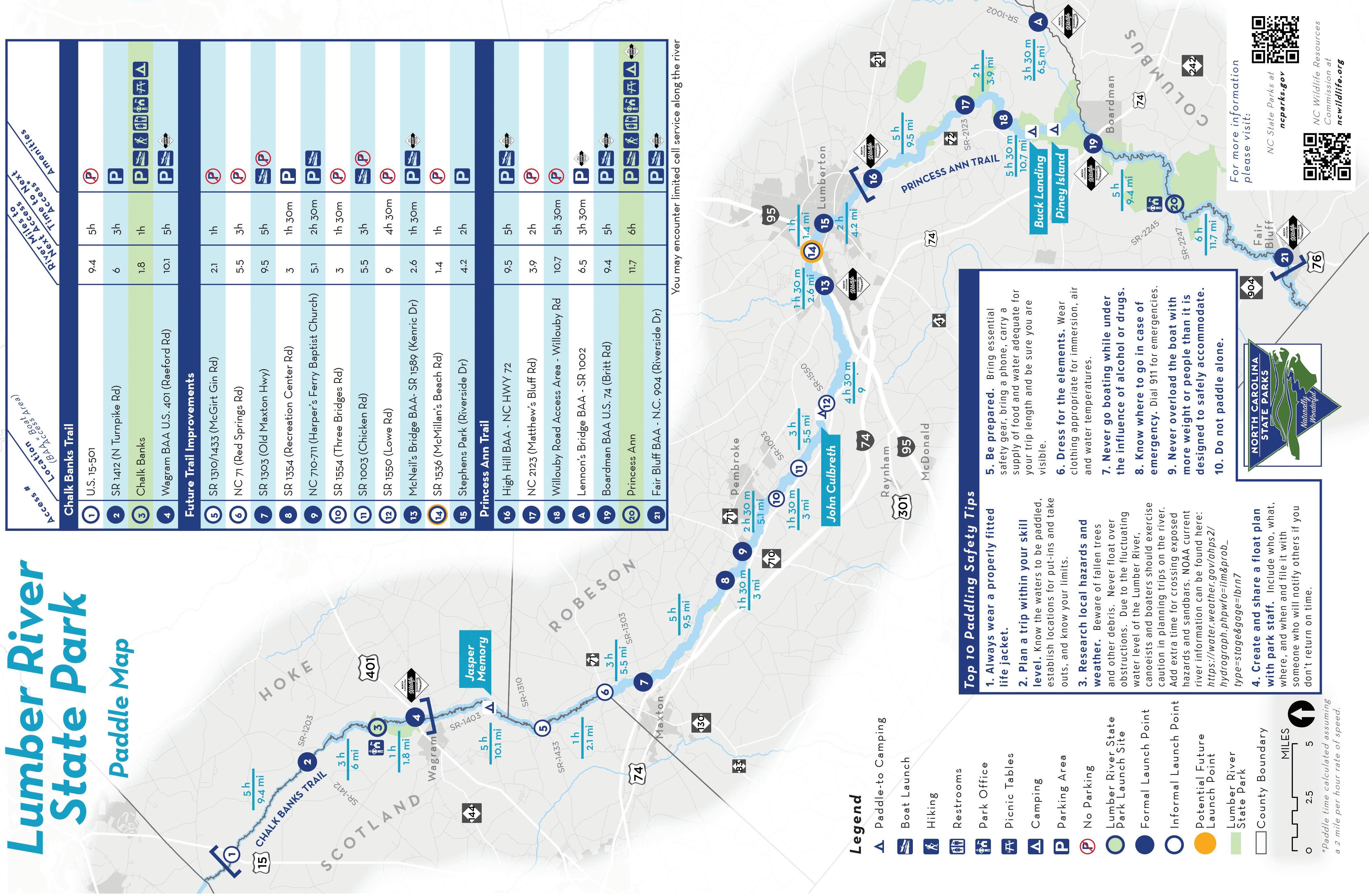
Provide an updated paddle map and an online information that can be utilized by visitors. The format should be easy to use and contain up to date and accurate information about the access points, river conditions and safety tips. The online paddle map should incorporate images of the site/access points as well as forms/paddle plans that can be entered and submitted online.
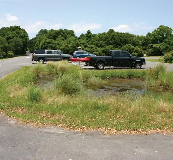
Use of Bioretention as infiltration in parking areas - similar to Hammocks Beach State Park
Provide Safety information and Times for paddle routes along the Lumber River
The majority of survey respondents that participate in river activities spend 0-2 hours (32.50%) or 2-4 hours (31.87%) on the River. Additional locations for river access should be provided near Princess Ann Access and Chalk Banks access to provide shorter excursions on the river (2-4 hours) to and from these locations. New access locations should provide signage, parking, and access from land and not just water.
Utilities
Power
Electricity is needed to perform basic tasks and maintenance in and around the existing Chalk Banks site and beyond, including existing campsites. Patrons expect electricity to be provided in some capacity at each of the main branches of the Lumber River State Park. Current connections to public utility systems should be tied into where available.
Wifi
Digital communication is a standard tool in today’s society. The ability to access information via phone is crucial and an important component of how people live, work and play. While it is acceptable to be out of range in some locations, it is anticipated that contact stations would be equipped with such technology for visitors, staff and the use of varying devices.
Water
It is necessary to have access to clean water sources within the main park facilities and the surrounding campsites. Water should be available in the form of bathrooms, drinking fountains, and hose bibs.
Sewer
It is necessary to have septic or sewer connections within the main park facilities for the operation of restrooms and bath houses. Current connections to public utility systems should be tied into where available. If no connections are available then septic systems should be considered in locations deemed appropriate.
Provide parking and access to the River nearer to Chalk Banks and Princess Ann from the land
Provide Restrooms and showerhouse at each location
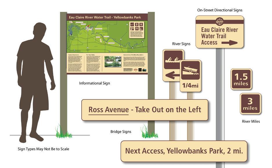
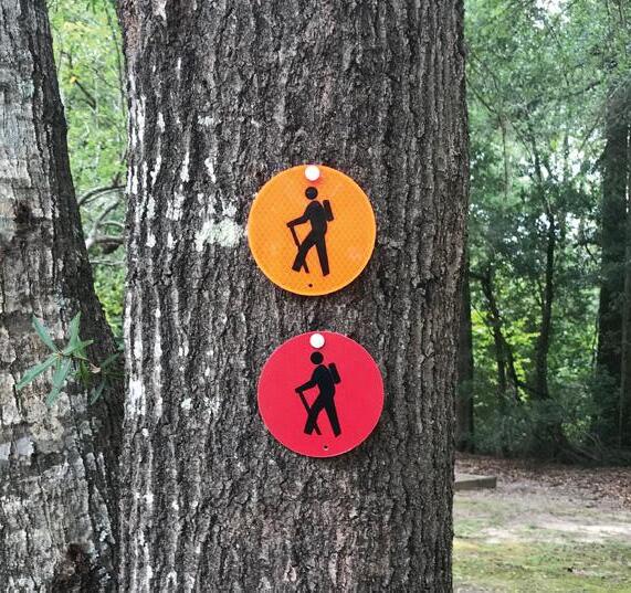
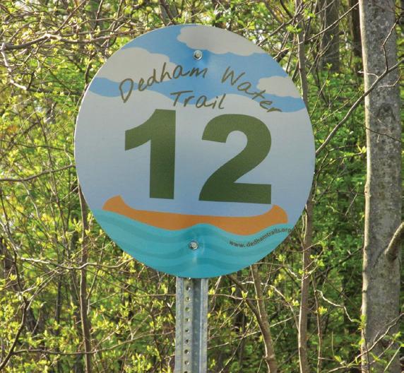
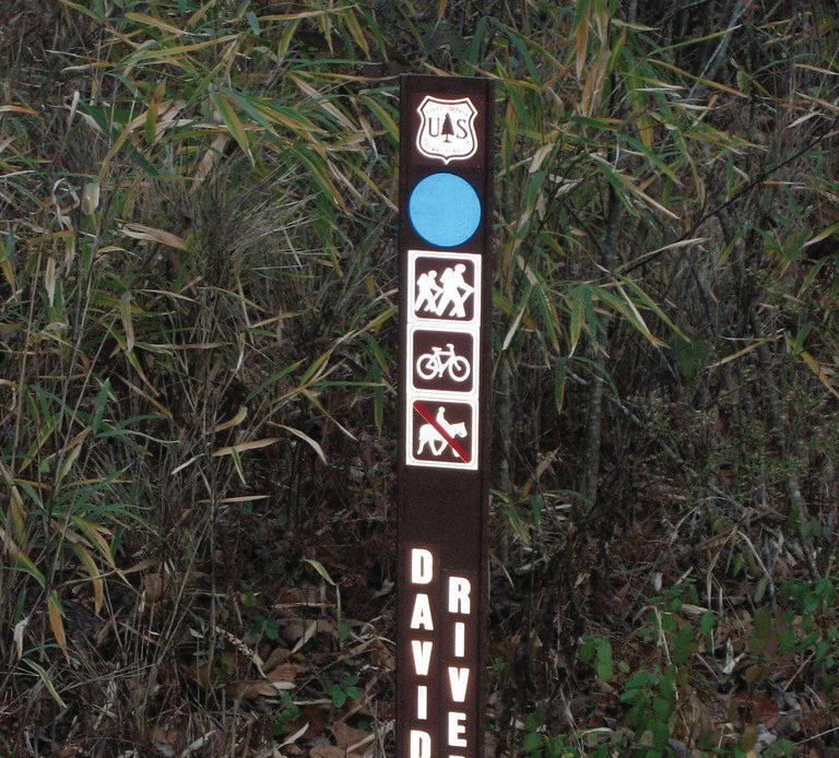
One of the key elements identified by first time and repeat visitors is the need for improved signage and wayfinding to the park sites. Improving identification of key features and how to find them will improve access to the park. Messaging and wayfinding to the park, within the park, and from and along the river not only inform users of everything the park has to offer but can also make the experience more interesting, easy to use, and safer to navigate. It is important for a park user to clearly identify and recognize park features and safety information via signage. Lumber River State Park needs to develop a master signage and communication plan for the park both on land and on the river. Updated sign types shall include: vehicular signage along highways or major routes, entry identification signage (all locations-vehicular), identification signage at a pedestrian level (trails, paddle trails, campsites and other amenities), kiosks (pull up car and pedestrian), directional (vehicle and bike/ped), loop/trail maps, buildings/special features, educational signage, pavement markings, mile markers, trail blazes, navigational tags, river identification and educational/interpretative messaging and signage.
A color palette and suite of symbols that are easy to use and improve access should be presented, utilized and coordinated through out the park that is consistent with the State Park branding and messaging in place.
Vehicular signage should indicate where to park, where the center or “starting point” can be found, and major attractions within the park.
Pedestrian signs should be placed to capture those arriving from outside the park, as well as provide information for those approaching from parking areas. This signage should indicate distance, average time for travel, and level of difficulty.
All trailheads should have kiosks with accurate maps of the trail system, level of difficulty, anticipated user experience time, and safety information including shade, carrying water, and potential hazards.
All loop trails should include mile markers for safety and fitness tracking.
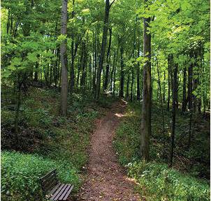
The trails at Lumber River State Park are one of the highlighted features from users and providing a diversity of trail types and increased length will provide greater access. Expanding the trail network will make the trails more accessible to a variety of user groups. Trail improvements such as connections to proposed and existing bike routes, paved access to key park features, providing extended hiking for greater opportunity to explore natural resources, creating key blueway routes from main park access locations, and improving trail communication (routes, difficulty, and length/time) are all items that can be done to improve user experience.
Paved: Users expressed interested in having a primary route multi-use paved trail to link key park features and make the park core area more accessible to a diverse skill level and user groups. Recommended Primary Trail Width is a 10’ minimum paved trail with 2’ shoulders on each side of the trail.
Unpaved Trail: This primary natural surface trail shall connect important features within the park. The primary natural trail shall have a wide enough clear zone to accommodate park maintenance vehicles. Having a wider clear zone also provides a hiking experience for those not experienced in hiking or being outdoors.
There are trails already identified within and along the LURI corridor. Natural Surface Trails such as mulch, sand, pine straw, or crushed stone should be provided to allow access to hiking in the natural environment. These trails shall be clearly marked with safety information at trail head, routes, distance/time, and key features to help park users navigate the trail system.
In key park areas where a primary multi-use trail is not provided, it is recommended that additional paved sidewalks with shorter distance loops be provided to link key features making them accessible to a variety of skill levels and users groups.
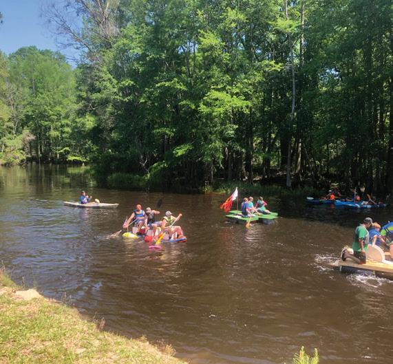
Lumber River State Park already has a paddle trail system in place, with multiple paddle to sites. Future access locations near each end of the park access locations should be considered to enhance the visitor experience and promote day trips along the river. It is recommended LURI work with local vendors to encourage site visits, day trips, and participation in park educational programs. In order to encourage this, LURI should incorporate support features such as vendor stations, paddle lockers, restrooms, and vending or access to drinking water. A critical component to improving the blueway and paddling experience along the Lumber River is to update access to route data including: online float plan registration & notification, safety information, paddle access sites and route information (including times), signs and markers identifying the primary route in the river for users, and property markers showing park access sites from the river.
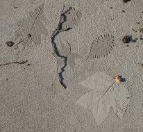
Integrate paved sidewalks with nature imprints for education
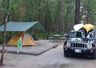
There is need for additional camping at Lumber River State Park. Currently, most of the camping offered is primitive or “paddle to” only limiting access to the camping experience to those users groups. In order to provide greater access to camping for a variety of user groups Lumber River State Park should offer multiple camping facility types to accommodate different skill levels. Camping should be provided both along the river corridor and from land within the primary access locations, Chalk Banks and Princess Ann.
Currently the only type of camping at each location is primitive camping. This follows the “pack in pack out” philosophy. These sites typically provide a cleared area for camping, and no support facilities. These still remain desired locations for camping at Lumber River State Park but can be enhanced by providing platform sites in the areas along the river to provide greater access during rainy periods and minimize impact.
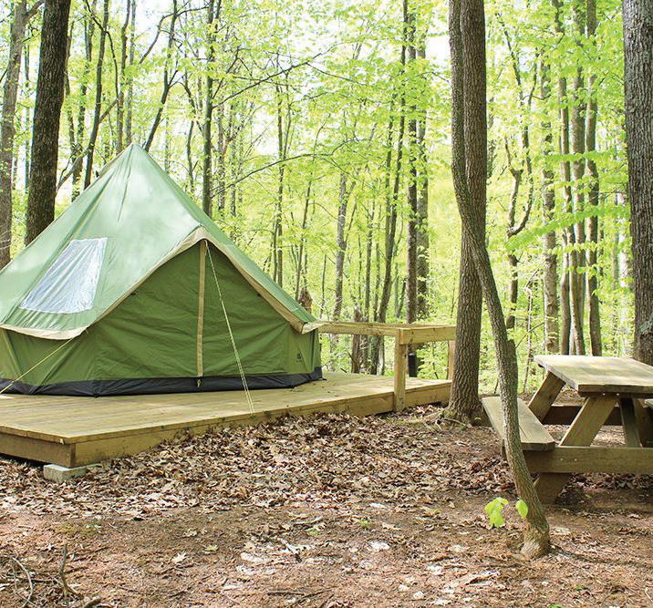
Platform camping minimizes impact to the ground in an area subject to flooding or erosion. These small decks can be constructed to accommodate a standard 4 person tent, exit area, and kayak or canoe pull up. The platform/kayak canoe area can also provide a fire ring/fire pit and a hiking trail to the central park area.
There are currently only drive to primitive sites located at Chalk Banks. It is recommended drive to campsites be added to both locations, Chalk Banks and Princess Ann (30+ sites at each location). During the site planning process it shall be determined what each site can accommodate and how much capacity staff can manage. These sites should provide wheelchair-accessible site(s). It is recommended that 5-9 of these sites be multi-use at the end of the camping area with full hook-ups (water, electric and sewer). Each drive to site should be equipped with a picnic table and grill/fire ring. There should be a centrally developed camp area with access to drinking water, restrooms, and shower facility nearby.
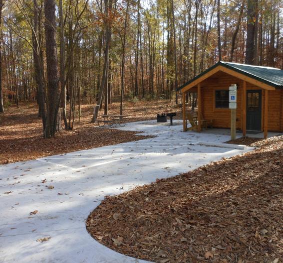
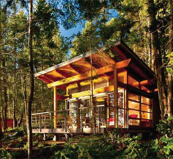
Camper Cabins have grown in popularity and provide access to camping for user groups not comfortable or experienced with tent camping. These camping cabins should be constructed in a way that reflect the architectural style of the Lumber River and sleep up to six (6). Each cabin should have access to electricity and provide a heating and air-conditioning unit, picnic table, charcoal grill, and a fire ring. These should be located near the family camping for access to drinking water, restrooms, and showers. It is recommended a minimum of 3 cabins be included as part of the camp expansion at each location.
There is currently primitive group camping at Chalk Banks and Princess Ann. Additional group camping should be provided at each site and accommodate 30- 40 people, have support features such as picnic tables, grills/fire rings, access to toilets, water, and shower facilities.
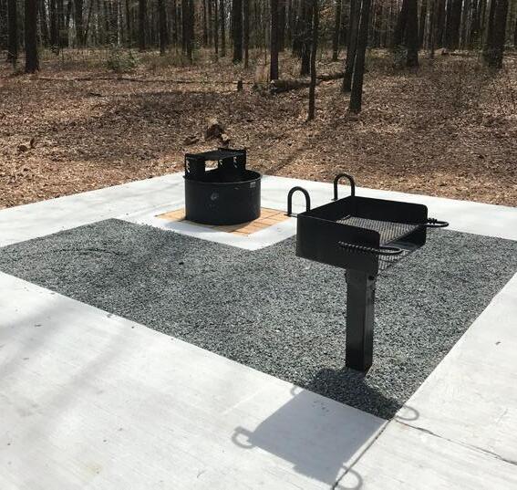
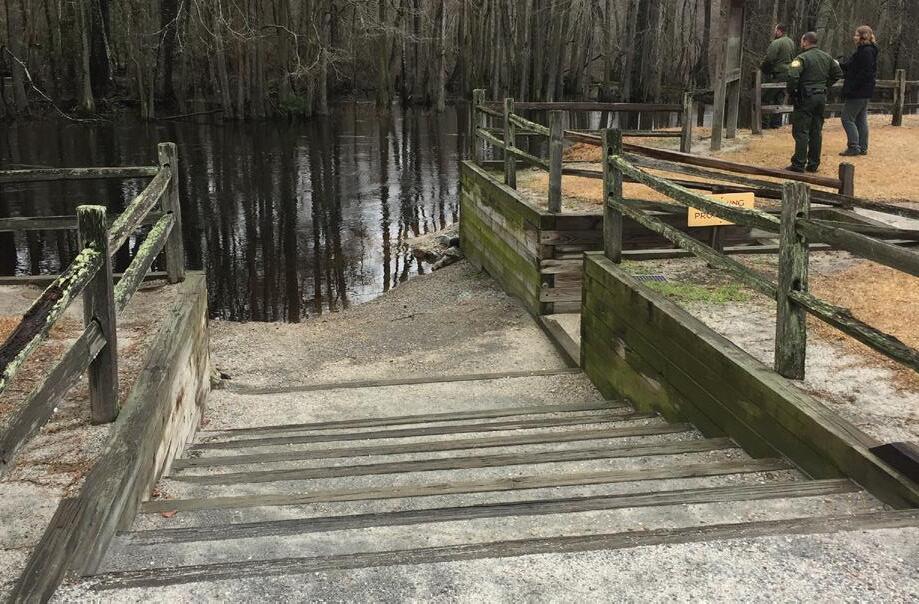
Visitors would like to see support facilities at drive to campsites such as this accessible site at Cliffs of the Neuse
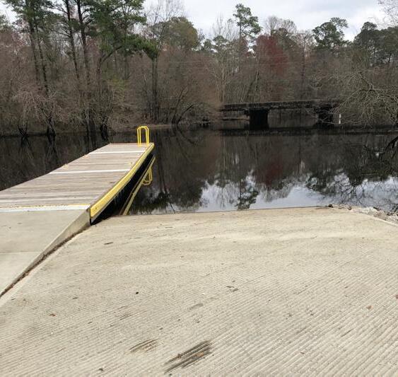
There are several areas along the Lumber River that allow access to and from the river. However, very few of these sites are improved sites that include parking, signage, or a ramp to and from the river. It is recommended State Parks focus on the areas above and below primary park access locations at Chalk Banks and Princess Ann to improve user experience and amenities in these corridors including: river ID signage, picnicking, and parking. The desired paddle trips were experiences of 0-2 hours and 2-4 hours.
Improvements shall be constructed in a way that they provide ease of use and access to park visitors, but also minimize the impact of shoreline erosion and can withstand flooding events. Consideration should not only be given to the park visitor experience arriving from land and partaking in water events, but also for those visiting the park from the river. All current access locations should be included in the park paddle trail map and amenities at each access point should be identified accurately. The main park locations serve as destinations by area boaters and paddlers and the proper support facilities such as kayak and canoe hook ups, rinse down areas, access to drinking water, restrooms and signage and wayfinding are key park features that should be considered near the access locations.
An outreach and educational program should be provided at selected access locations through educational signage, programming, and a canoe/kayaking/boating vending rental company to teach users about natural features such as: currents, black water rivers, river conditions and paddle safety, conservation efforts and potential wildlife a user may encounter. It also can serve as an educational setting to learn more about resilience planning and the impact flood waters have on the surrounding areas.
As a part of this plan, a Paddle map has been updated to reflect access locations and the features present at each location. Safety information is also included to educate users on using the river.
One of the major attractions to the Lumber River State Park is the ability to paddle down the river. Not everyone who visits owns a kayak or canoe and many would like the opportunity to be able to rent equipment for their water adventure. Providing vendors or vendor information in various locations would allow for a park user to have access to equipment and training as well as plan their trip in advance. This also allows for guided tours or other group events which has the chance to make LURI more of a destination for recreation.
Provide support features such as parking and ramps
The Lumber River rapidly changes and conditions are not always ideal. It is important to display and discuss river safety within the park. In addition to information that is available in the park, users should also be able to access river safety information online in preparation for a visit. The following were the river safety recommendations this park:
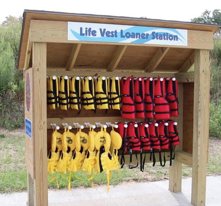
1. Always wear a properly fitted lifejacket
2. Plan a trip within your skill level. Know the waters to be paddled, establish locations for put-ins and take outs, and know your limits.
3. Research local hazards and weather. Beware of fallen trees and other debris. Never float over obstructions. Due to the fluctuating water level of the Lumber River, canoeists and boaters should exercise caution in planning trips on the river. Add extra time for crossing exposed hazards and sandbars. NOAA current river information can be found here:
https://water.weather.gov/ahps2/hydrograph. php?wfo=ilm&prob_type=stage&gage=lbrn7
4. Create and share a float plan with park staff. Include who, what, where, and when and file it with someone who will notify others if you don’t return on time.
5. Be prepared. Bring essential safety gear, bring a phone, carry a supply of food and water adequate for your trip length and be sure you are visible.
6. Dress for the elements. Wear clothing appropriate for immersion, air and water temperatures.
7. Never go boating while under the influence of alcohol or drugs
8. Know where to go in case of emergency
9. Never overload the boat with more weight or people than it is designed to safely accommodate
10. Do not paddle alone
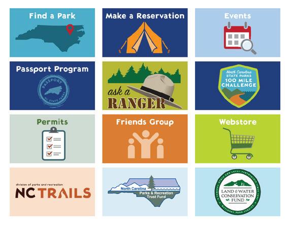
It is important to keep up to date information located on data available on the website as this is commonly used by the public to get information about the park. Critical information such as access closures, flooded areas or weather/safety information should be updated regularly and available to the public in real time. If a source is no longer valid or relevant it is better to remove it so that misinformation is not online.
Programming is critical to the success of how a park is used. Whether it is special events that occur annually or one time only, it is important to incorporate and plan for such events at Lumber River. It is also critical to think about the amenities that are offered to the guests in attendance. This is a mechanism for bringing the community together in support for the park and giving the public the chance to experience the park more than how they typically would.
Lumber River State Park has acquired multiple parcels of property along the river corridor with diverse natural and cultural history that can expand the existing education and interpretive programs for the park. When looking at historical elements, the Lumbee Tribe and the Tuscarora Tribe share a history with the Lumber River that is part of their culture. Other historical elements, such as flooding and the past use of the river for naval stores and transport are important aspects of the site history and should be identified when educating park visitors. Providing educational messages while relaying the importance of preserving and protecting the history, culture, and natural resources of the park site will enhance the overall user experience.
There are opportunities for expanded special events, programs, and updating and incorporating exhibit space either in a visitor center or contact station setting. Educational signage should be displayed in prominent locations throughout the park with additional information should be provided online. The more diverse the offerings provided the better served the park user groups will be.
Events at the park were requested and enjoyed by those that attend what the park currently has to offer. Some of the current events include: Lumber River Days, Chalk Banks Challenge, Scout events, family reunions, and other special occasions. LURI should consider adding events throughout the year to enhance the current schedule such as: Halloween/Holiday events, Community festivals, Health and wellness events, River cleanup days, and Corporate events.
It is important to develop partnerships and educational outreach programs with the local school systems in the surrounding counties and with local universities. Junior Ranger programs can be incorporated into curriculum in the classroom in the field study and field trips. University partnerships could allow for research opportunities in one of the many subjects including life science, geography, history, forestry, and water quality. These partnerships may allow for additional events to be held at the park, in turn, hopefully creating more exposure and awareness of the Lumber River State Park from tourists and other users. There is demand for educational program partnerships in the four County area, either hosting schools at the park sites or having rangers visit schools within the Park corridor. As such, support facilities in the parks such as restrooms, shade, and shelters will enhance the ability for students to learn in a State Park Setting.
Community outreach is very important in the counties that surround the park. Many teachers mentioned that the park was inaccessible to them due to lack of education funding for field trips, distance, or the ability to cross into another County. One way to combat this issue is to provide a State Park mobile education unit that can travel to various schools within the area that provides information about the Lumber River State Park and educational programs appropriate for a variety of school levels and course curriculum. This mobile unit could also be used for larger events within the area to help promote the state parks mission as well as gain exposure for Lumber River State Park.
As the park areas add features for visitors, park staff will need to have a presence at both chalk Banks and Princess Ann for maintenance access and park operations. As site plans for these features develop, a location for ranger presence should be identified.
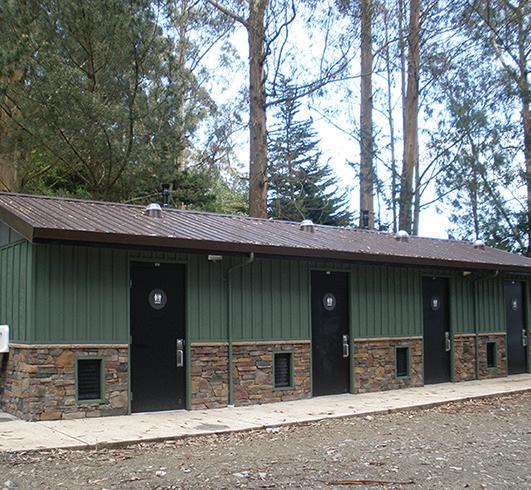
Accessible shower houses should be added to Chalk Banks and Princess Ann for camper use. Each shower house should have shower facilities and restrooms. It is suggested that dishwashing sinks and rinse stations be available on the outside of each facility.
Currently, neither park site has adequate restroom facilities to accommodate larger groups or bathrooms that are easily accessible. Restroom facilities should be accessible and be able to accommodate day use visitors, large groups, and campers at Chalk Banks and Princess Ann. Other properties where trails and day use will be incorporated should consider the addition of single stall vault toilets for public use. Any amenities added such as this should be in an area that is easily accessible to staff so that maintenance can occur regularly.
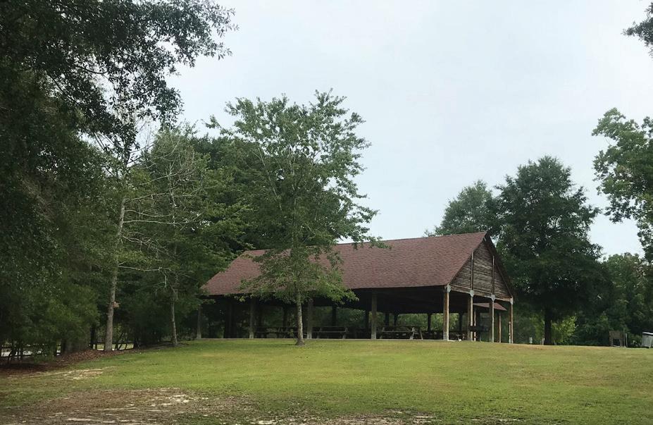
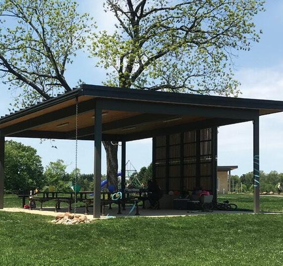
Throughout the public input process, education and the need for gathering locations or shelters were identified. Each park area should include at least one large rentable accessible shelter to accommodate bigger groups and events, and should be reservable online. Each site should also contain multiple non-reservable shelter spaces. These may be smaller and would be available on a first come first serve basis.
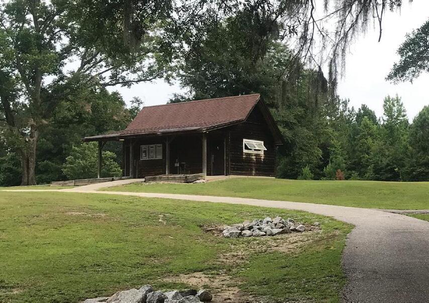
It is important to have a presence of staff on the park property readily available to talk with visitors during park hours to guide them with the options of what the park offers. A contact station would allow for interaction and provide the visitor with useful information for their visit. The contact station should be in a visible location and easily identified.
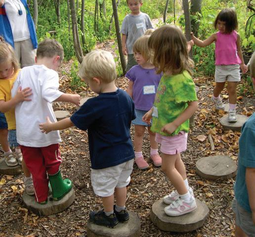
Both primary locations of the Lumber River State Park are located in a regional area with limited local natural park resources. Most of the local park resources provided are programmed and developed sports fields. Visitors are seeking a non-traditional play spaces that promotes play and exercise with children. To help young visitors have an introduction to nature, play spaces should be added to each location. Providing a nature based play area not only can educate users on natural resources present, but also provide another means of engagement. It can help transition young park users from a more developed area and encourage interest and engagement in things like camping, hiking, wildlife observation, and plant and animal identification.
Incorporate
Provide
Rename Park Access locations as two separate designations: Chalk Banks along the Lumber River and Princess Ann along the Lumber River to help users recognize there are two different primary access locations (north and south).
Consider separating the parks for operations and management of the sites to increase staff resources at each and expand programs
Future facilities designed and developed within LURI shall consider using current low impact design, BMP's (Best Management Practices), and resilience during the design process to withstand future flood events. Not only should floodway and floodplain data be utilized, but also reference to historic flood event data that is available.
Digital Communication- Update Princess Ann and Chalk Banks with Wifi/digital access for improved outreach, community engagement, improved park management, and emergency services communication. Basic services are a challenge without adequate power, wifi, and/or staff/ranger computer work stations.
Place Paddle Map as an interactive user map on the LURI Park Website that Illustrates overall Paddle opportunities and provides an image of access existing conditions. As a start, place static map on website.
Update Signage and Communication Plan for LURI including wayfinding to the Park and within the Park. Update all levels of signage: Vehicular, Kiosk, Trail, identification, education, and safety. Updating signage to the primary park access locations (Chalk Banks and Princess Ann) and providing Kiosks at Primary Park use areas and water access locations were identified as the highest needs.
Create mile marker/ River identification system for users within the river in partnership with Emergency Services in each County. Work with NCDOT to sign the bridges of river crossings so they are visible and identifiable to river users.
Support local community efforts for future bicycle routes and facilities identified in this report that connect to the park.
Jasper Memory Paddle to Site- Convert Jasper Memory site from a Paddle to Only to provide access from the Land. This will help expand day trips from Chalk Banks by offering reduced Paddle time options from Chalk Banks with an interim stopping point. Currently the next available point from Chalk Banks/401 site is 10.1 miles (5 hours) to an unimproved roadway access at McGirts bridge. Improving Jasper Memory would create a 2.5 hour take out option at 5.5 miles.
Parking and Access Improvements to Access 17 or 18
(Matthews Bluff or Lennon’s Bridge) to provide Access. This would allow for shorter paddles to Town of Boardman and eventually Princess Ann access to expand paddle trip options near existing resources.
Access to decrease Paddle Time- Look for opportunity to add an access location for put in / take out south of Princess Ann approximately mid-way between Princess Ann and the Town of Fair Bluff
All pArK ItEms
Contact Station- Add a contact station to Chalk Banks. With increased and improved amenities at this site higher visitation can be expected. A contact station will increase park safety, ranger visibility and educational opportunities. Currently the office is located in downtown Wagram in a rented space which is 2 miles from the entrance of Chalk Banks to Downtown Wagram
Signage- This site is visible from Highway 401 with a visible park ID sign, however, once you enter the park vehicular signs, kiosk, trail signage, and paddle and safety signage need to be added for user convenience and safety that show distances to features and clearly illustrates where they are, specifically from the entrance to the river.
Trails- Add trails to the trail system within this access location including a primary paved trail that connect the primary park features such as kayaking, fishing/viewing, and the picnic area; provide additional hiking trails, and a small paddle trail to and from this site highlighting easy access locations. Having a paved primary accessible trail will improve access to user groups.
Fishing- Provide a structured overlook and fishing area away from the access ramp that allows for ADA access for fishing near the primary use area and to help minimize further bank erosion
Ranger Residence- Look for property at or near the Chalk Banks Access location out of the floodplain, floodway, and areas that have had historic flooding during major events to serve as Ranger residence. If the park and/or staff is separated for improved operations this becomes more of a Near term need.
Utility Access- This site needs access to basic services to aid in park expansion including: water, sewer, and power. Providing this to the park will not only aid in park facility expansion but also daily maintenance needs that exist. Power provided at the park should be connected to the maintenance area.
dAy usE ItEms
Bathrooms- This is a high priority facility need at this site near the day use facilities. This site serves in educational partnership with Scotland, Robeson, and Hoke County Schools and cannot serve a high number of students without a bathroom facility.
Nature Based Play- Provide a nature base play and “discovery zone” area that will meet the needs of those that utilize the park and support current programs. This shall be a non-traditional nature based play space that allows visitors to discover, interact, explore, and climb natural features they may see within the park.
Shelter- Provide a covered space that can serve as a group shelter and/or outdoor classroom space that can withstand flooding (slab or deck built)
c AmpIng ItEms
Existing Camping- Existing primitive camping should be improved by adding electricity to each of the sites and a showerhouse (located out of the floodprone area).
Future Camping- This is a valuable resource for Chalk Banks and this site could serve more users by adding different camping types to the offerings including: RV, Platform, Primitive, and Camper Cabins.
Showerhouse- Add showerhouses at existing camping and at new campsite area as site is expanded. Structures need to be placed out of the floodplain/floodprone areas and near the campsites.
Development on the wire pasture site should remain on hold unless resolution on land ownership along the river occurs. This, in addition to two recent flood events (Matthew and Florence) with higher than normal flood levels, makes development on this land difficult. Development on this site will require additional staffing be allocated for safety, maintenance, and operations to occur.
Recreation Center Drive should formalize access (parking, signage, and river access) and maintain visual clearance. This site received significant flooding in Matthew and Florence so any development that occurs should be able to withstand flooding between 12’-14’ above flood level.
Add Day use features to the Buck Landing site including: parking, pit toilet, signage, and Multi-Use Trails (hiking, equestrian, biking) to allow for expanded day use opportunities in this portion of the corridor. This will also serve as another river access opportunity for operations.
Pea Ridge
Picnicking- This is an easily accessed site but not visible from the roadway. Once visibility and access are improved add more picnicking facilities on this site for day use to serve as a stopping points upstream from this site on the way to Princess Ann.
All pArK ItEms
Trails- Expand Hiking Opportunities from Princess Ann so that visitors coming to Princess Ann have greater day use hours on-site. A pedestrian bridge and/or culvert crossing will be needed to access this site.
Signage- Provide educational and wayfinding signage on this site as trails become open to the public.
Overlook- There is an opportunity for wildlife observation and overlook along the wetland area west of the River
c AmpIng ItEms
Group Camping- Provide Group Camping Opportunities on the Expansion Tract with support features such as camping, campfire, nearby bathrooms/showerhouse, and picnicking
All pArK ItEms
Trails- Princess Ann currently serves as the Park headquarters and has the potential to serve as a greater local and regional resource. With the addition of adjacent property there is an opportunity to add trails/mileage to the trail system. Visitors would like a paved primary access trail and additional hiking trails.
Signage- This site is visible from Princess Ann Road but visitors have stated this is difficult to find. Provide more wayfinding from Highway 74 and once you enter the park, vehicular signs, kiosks (2 total - one at trail entry near parking and one near boat ramp), trail signage, and paddle and safety signage need to be added for user convenience and safety that show distances to features and clearly illustrates where they are.
Paddle Vendor Station- Work with local and nearby groups to offer educational days trips that support the mission of the park: Education, Recreation, Conservation
Contact Station- Either retrofit the existing building or provide a new facility to serve as the contact station for Princess Ann that welcomes visitors and can serve as a meeting point for the public. The current meeting location is the river shelter.
dAy usE ItEms
Nature Based Play- Work with Lumber River State Park staff to determine a suitable nature base play and “discovery zone” area that will meet the needs of those that utilize the park and support current programs. This shall be a non-traditional nature based play space that allows visitors to discover, interact, explore, and climb natural features they may see within the park.
c AmpIng ItEms
Camping- This is a valuable resource for Princess Ann and this site could serve more users by adding different camping types to the offerings including: RV, Platform, and Cabins to the sites already offered.
Showerhouse- A showerhouse would help serve as a support facility for users at campsites. This needs to be placed out of the floodplain/floodprone areas.
All pArK ItEms
Work with the Town of Fair Bluff to determine where land is available for future park amenities and sharing of operational responsibilities.
Paddle Vendor Station- Work with local and nearby groups to offer educational days trips that support the mission of the park: Education, Recreation, Conservation
Shelter- Provide a covered space that can serve as a group shelter and/or outdoor classroom space and also serve as a coordination area for paddle groups and vendors at put-in/ take-out.
c AmpIng ItEms
Future Camping- Whether with State Parks or through a private facility look for an opportunity to provide unique camping area (platform camping, treehouses, etc.) to serve as a regional draw and ending point for the paddle trail.
Parkwide *
Special Events- Look for additional Special Events at Each Site (Chalk Banks and Princess Ann, and participation in a Fair Bluff Community Event). They are desired by the surrounding communities and have the potential to serve as a larger draw for nearby communities.
School Partnerships- Expand school visitation to the park sites with each of the County School systems (Hoke, Scotland, Robeson, and Columbus). Consider ranger visitation to schools or a mobile education unit to the communities that may not be able to have participation or transportation to a park site.
Education Programs- Expand educational program offerings. There is a desire for greater program offerings at each site including: special Programs, led hikes, more signage, paddle trips, and the potential for program offerings in nearby communities (Fair Bluff, Lumberton, and Pembroke). Consider use of digital education programs, online information, or digital information stations or educational displays that could be in a community building(s) in various locations.
Paddle Vendor - Add a paddle vendor station on site and update list of paddle vendors offering guided trips on the river that support the park mission of education, recreation, and conservation.
University Partnerships- strengthen the partnerships with universities that may want to conduct research and discovery within the corridor.
River Safety- Provide online and Kiosk information to expand river and user safety education along the Lumber River.
* As these programs are developed staff will need to increase to provide program services
Update the Lumber River State Park General Management Plan.
Revise Operations Plan to separate the LURI into different parks as part of the Lumber River Basin and State Park System with Chalk Banks Serving as one Park and Princess Ann Serving as the other. Look at partnerships with State Educational and Outreach Staff to help serve the Community for additional educational programs.
Focus on Snagging the high use areas of the River that are close to the primary park access locations: Chalk Banks and Princess Ann, with intervals between Lumberton and Boardman. Create a regular schedule for patrolling these areas for the need for removal and clearing. As a part of this effort have a boat available at Chalk Banks and one available at Princess Ann. This is not only for maintenance evaluation of the river but for safety of river users as well.
Re-establish the Park Advisory Committee (PAC) so that it is an active and engaged review board that may include a resident, town staff or official, a county staff representative or official, an elected official, park staff member, and/or a park volunteer. This will help with community outreach and coordination for park programs, events, and future facility development.
Re-Establish the Friends Group once the PAC has been further activated. If the Parks are successfully separated, create a Chalk Banks PAC with greater participation from Hoke and Scotland County and a Princess Ann PAC with greater participation from Robeson and Columbus County.
The 115 Mile length and over 14,000 Acres of the Lumber River presents unique challenges to park management and operations . This linear system is comprised of a significant portion of wetland acres not accessible by land. Several paddle to camp sites and much of the river itself are only accessible by water; the primary park sites Chalk Banks and Princess Ann are separated about 50 miles which takes on average an hour to get from top to bottom. While this plan is addressing the park master plan efforts, these recommendations have direct observations and implications on staffing. Staff has had to contend with travel between the locations to perform job duties. Many of the basic duties related to management and maintenance of the park utilize much of the man hours allocated to staff resulting in significant overtime hours of rangers, this also can have direct impact on park safety and operations. in addition to operations, there is demand for educational programs & not currently enough staff resources to perform all of the duties. These circumstances should be considered for park designations as separate facilities specifically when evaluating staffing needs. The current park staff is split between two locations and includes: 1 Park Superintendent III, 2 Park Ranger II positions, 2 Park Ranger I positions, and 1 Maintenance and Construction Technician I and 1 II positions, 1 Administrative Assistant III, and 4 contractual general utility workers. It is recommended a thorough staffing evaluation be conducted to have a full cross section of services at each location. Each one of these park units (Princess Ann and Chalk Banks) need to be operated as separate park units. Though each one are connected to the Lumber River, each unit has there own separate needs and visited and used by different interest groups. The staff from each separate unit could assist each other during emergencies, high visitation, and special events. If the Park is divided into two units the above staff should be allocated for each location. Additional staff allocation should occur if additional park property is brought online, new facilities are added, and as the park expands and is made available to the public. The past master plan recommended approximately 26 staff members prior to the additional acreage that currently exists. Each location now essentially serves as a park unit, utilizing the staff structure of one park unit.
The following outline is a Master Plan level Understanding of Development Costs (25%). Understanding of Cost is presented by area. Understanding of cost should be updated throughout each stage of the Planning Process as material decisions, placement, and site discoveries are made:
• Design Development (50%)
• Site Plan Development (70%)
• Construction Documents (90%)
In addition to that, Design and permit fees, and contingency and inflation allocation should be made to these prices as time progresses through implementation. Recent bid pricing for Public Sector projects has increased at a high rate with 2019 bids having an approximate 25% increase in cost inflation due to demands for labor and the impact from recent storm events including Matthew and Florence. These factors, along with design fees, permitting, and environmental site analysis costs should be included in the phasing and implementation for each of the projects. This cost summary does not reflect the demand for additional programs that was identified during the planning process. Funding allocation for program staff should be included in future operation budgets or through program partnerships with statewide program staff.
These estimates are considered to be conservative and include a 25% contingency. More accurate estimates and costs will be determined as part of the design process based on site specific and detailed existing conditions information. Other costs typically associated with construction that are not covered by these estimates include:
• Geotechnical/ soils investigation
• Contaminated soils remediation
• Rock Removal
• Surveying
• Mobilization
• Permitting (environmental, building, erosion control, etc.)
• Archeological investigation
• Percolation Tests
• Removal or Abandonment of existing septic
• Cost Adjustments for inflation are included but shall be continued and adjusted at each stage of the design
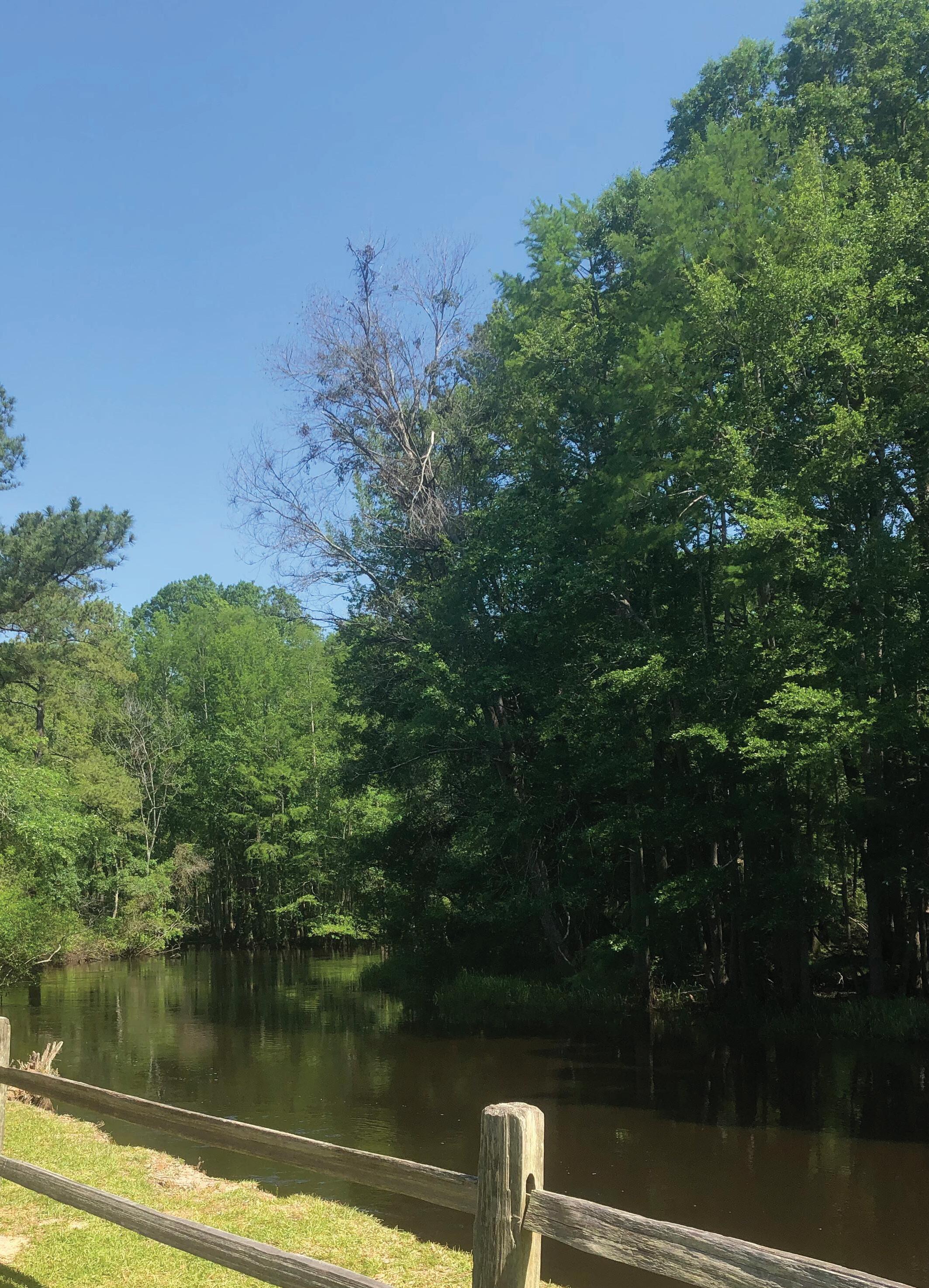
The draft plan was submitted to the NC State Historic Preservation Office for review on May 15, 2020. Comments were received on July 22, 2020 and are noted below. It should be noted that before any project is undertaken that would cause the earth to be disturbed in the areas noted the Division will coordinate with the Historic Preservation Office through the Division’s Environmental Review Coordinator.
From: Head, David M
To: DCR - Environmental_Review
Cc: Katie Harville - NC SHPO; Jon D Blanchard (jon.blanchard@ncparks.gov); Strong, Brian; Rosas, Christy
Bcc: Head, David M
Subject: Draft Lumber River Master Plan
Date: Friday, May 15, 2020 10:08:00 AM
Attachments: image001.png
LUMBER RIVER MASTER PLAN_DRAFT_051520.pdf
All, please find attached the draft Lumber River State Park Master Plan for your review and comment. I have reduced the file size of the attached file. If you need a higher resolution file, please let me know and I will arrange to get the file to you.
The file is still large, so please let me know that this was received.
If you have any questions, please let me know.
Thanx
D
Dave Head Planning Program Manager
NC Division of Parks and Recreation
1615 MSC Raleigh, NC 27699-1615
Email: dave.head@ncparks.gov
Phone: (919) 707-9310
Email correspondence to and from this address may be subject to the NC Public Records Law and may be disclosed to third parties.
“We have not been given this earth from our parents to do with what we will. We have borrowed it from our children and we must be careful to use it in their interests as well as our own.” – Moses Henry Cass
State Historic Preservation Office
Ramona M. Bartos, Administrator
July 22, 2020
MEMORANDUM
TO: Dave Head
Planning Program Manager
North Carolina Division of Parks and Recreation
FROM: Ramona M. Bartos

Deputy State Historic Preservation Officer
NC Department of Natural and Cultural Resources
dave.head@ncparks.gov
Thank you for your email of May 15, 2020, transmitting the draft of the Lumber River State Park Master Plan. We have reviewed your submittal and offer the following comments. We apologize for the delay in our response and any inconvenience it may have caused.
As your submission notes, the Lumber River State Park Master Plan includes a substantial portion of the Lumber River that includes several different park sites within the overall park. Based on our records, there are a multitude of archaeological resources within this area, some of which have been determined eligible, potentially eligible, or are listed on the National Register of Historic Places. However, most of the known sites have not had their National Register eligibility assessed. While we are aware of numerous archaeologically sensitive areas within the county, much of the park area has not been systematically surveyed. We expect additional archaeological sites could be present.
Unfortunately, without knowing what the proposed project plans will be and precisely where they will be located, we cannot offer specific guidance regarding archaeological resources and historic properties. We ask that as specific Lumber River State Park projects are developed and prior to the initiation of any ground disturbing activities within the project ar ea, you continue to consult with us.
We note that the master plan is in development and that proposed action items outlined within are subject to change. Review of the areas of potential effect located at Chalk Banks, Buck Landing, and Princess Ann s ites resulted in a finding of no properties listed on the National Register of Historic Places. Thus, there will be no historic structures or districts affected by the proposed improvements.
However, we note the presence of a barn structure located at the Buck landing site, situated between the proposed picnic and parking areas. This structure is likely to 50 years of age or older. As always, we strongly encourage the NC Division of Parks and Recreation to survey and evaluate resources on park property to ensure that historic properties are identified and maintained accordingly.
We look forward to continuing to consult with your office as the development of the master plan progresses.
These comments are made in accord with G.S. 121-12(a). If you have an y questions regarding these comments, please contact Renee Gledhill -Earley, environmental review coordinator, at 919-814-6579. In all future communication concerning this project, please cite the above -referenced tracking number.
The following notice for public input was poseted from July28, 2020 through August 12, 2020 on the Division Website.
https://www.ncparks.gov/lumber-river-state-park/future-development
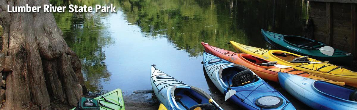
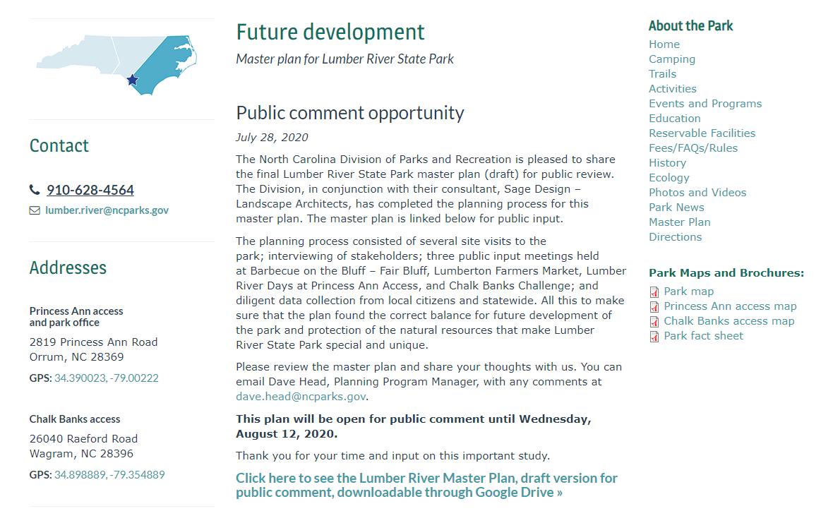
During the comment period three comments were received regarding the Lumber River Master Plan. These all were regarding the City of Lumberton Project at the Scottish Meat Packing Plant in the City. The Comments are below. A-4
From: Travis Klondike
To: Head, David M
Cc: Andrew Fox; Love, Brandon; Holman, Bill
Subject: [External] Lumber River State Park Master Plan: Additional Potential Future Launch Point
Date: Friday, August 7, 2020 2:15:40 PM
Attachments: Scottish Packing Exhibit_LRSP_August 2020.pdf
CAUTION: External email. Do not click links or open attachments unless you verify. Send all suspicious email as an attachment to report.spam@nc.gov
Mr. Head:
I'm writing to request the addition of a "Potential Future Launch Point" location to the Paddle Map as part of the draft Lumber River State Park Master Plan. The requested site is the former 11.76-acre Scottish Packing property just south of downtown Lumberton located at 512 Kinlaw Street.
Since 2017, the NC State University Coastal Dynamics Design Lab (CDDL), the City of Lumberton, and The Conservation Fund have been working together with local stakeholders and the property owner of the Scottish Packing site to assess the feasibility of conversion to a public park with water access to the Lumber River (as part of the broader "Lumberton Loop" Master Plan).
Recently, there have been significant advancements for selling the property and donating its assets to support this vision - which we believe merit inclusion of the property in the Lumber River State Park Master Plan reporting. Furthermore, the project team has pending grant applications in excess of $590,000 to complete acquisition, deconstruction, and boat ramp installation activities on site. Collectively we believe that these improvements would further advance many of the recommendations in the draft report, such as: more opportunities for day use activities, educational programming, and kayak/canoe vendors to name a few.
Attached to this email is a PDF exhibit that illustrates the Lumberton Loop plan, site photos, and a proposed schematic plan for the 11.76-acre property.
If possible, we would like to set up a brief (15-20 minute) video conference meeting next week prior to the end of the public comment period for the Lumber RIver State Park Master Plan on August 12th to discuss this further. Please let us know if a certain date and time work best for you.
Thank you.
Travis Klondike and Andy Fox (NC State University), Brandon Love (City of Lumberton), and Bill Holman (The Conservation Fund)
-Travis Klondike Assistant Research ProfessorCoastal Dynamics Design Lab + Department of Landscape Architecture and Environmental Planning College of Design
North Carolina State University
From: Bill Holman
To: Head, David M
Cc: Brandon Love (blove@ci.lumberton.nc.us); Andrew Fox; Travis Klondike
Subject: [External] Comments on Lumber River State Park Master Plan
Date: Wednesday, August 12, 2020 11:58:02 AM
CAUTION: External email. Do not click links or open attachments unless you verify. Send all suspicious email as an attachment to report.spam@nc.gov
Dave:
I’m writing to provide comments on the draft final Lumber River State Park Master Plan.
I have a long history with the Lumber River. I paddled it before there was a state park. I’m proud to say that I worked with local conservationists and local legislators to establish the State Park and designate the Lumber as a State Natural & Scenic River in 1989. We’ve come a long way in 30 years! I’m impressed that NC State Parks has grown the park to 14,000 acres and has improved public access to the river. I’m pleased the Conservation Fund could assist NC State Parks with the acquisition of Warwick Mill Bay in Robeson County.
Overall NC State Parks and its consultants have done an excellent job on the master plan.
The master plan notes the severe flooding in the Lumber River Basin during Hurricane Matthew in 2016 and Hurricane Florence in 2020 and the important role the parkland plays in storing and filtering water. It also wisely notes that future facilities should be designed to take resiliency and flood risk into account.
The master plan also notes the high rates of poverty and poor health outcomes in Scotland & Robeson Counties. Investments in state and local parks will strengthen local economies and improve health outcomes.
The Conservation Fund supports the master plan’s recommendations to invest in new facilities at Chalk Banks, Wire Pasture, Buck Landing, Princess Ann and other places.
The Fund respectfully recommends that NC State Parks expand the master plan to strengthen the partnerships between State Parks and Lumberton, Robeson County, Fair Bluff and other communities. The master plan provides an opportunity to integrate state and local efforts to increase public access to the Lumber River, to provide quality outdoor experiences, to protect water quality and natural resources and to boost local economies.
I appreciate the efforts NC State Parks and its consultants, Alta & Sage, made to reach out to citizens and communities in the development of the plan. I also appreciate the acknowledgement of the Floodprint developed by the Coastal Dynamics Lab at NC State University and adopted by the City of Lumberton, in the master plan. The Fund is working with Lumberton and NC State on implementation of the Floodprint. One of the objectives of the Floodprint is to establish the Lumberton Loop, a system of greenways and trails to connect neighborhoods in Lumberton to each
other and to the Lumber River. The City and Lumber River Conservancy already own many of the properties. Like the Lumber River State Park Master Plan the Floodprint plans for future flooding and makes the City more resilient in the future.
The Floodprint identified key properties to complete the Lumberton Loop. The Fund is working with the City to acquire one of the key properties, the former Scottish Packing site on the Lumber River. This property would be ideal for many of the updated program features set out on page 54 of the master plan that people would like to see more of, such as opportunities for short paddle trips, day use, educational programs and vendors to rent canoes & kayaks.
The Scottish Packing site is just one example where NC State Parks and local governments could partner and better integrate our system of state and local parks, trails and greenways. I believe Fair Bluff and other Lumber River communities would also like to partner with NC State Parks.
Thank you for your consideration. Please contact us if you need more information.
Bill
Bill Holman
North Carolina State Director
The Conservation Fund
77 Vilcom Center Drive, Suite 340
Chapel Hill, NC 27514
Office number: (919) 948-6189
Mobile number: (919) 224-9312
Email address: bholman@conservationfund.org
www.conservationfund.org
Making Conservation Work For America
From: Love, Brandon
To: Head, David M
Cc: Horne, Wayne; Moore, Holt; Bill Holman; Travis Klondike; Andrew Fox
Subject: [External] Lumber River State Park Master Plan
Date: Wednesday, August 12, 2020 2:46:09 PM
CAUTION: External email. Do not click links or open attachments unless you verify. Send all suspicious email as an attachment to report.spam@nc.gov
Good afternoon Mr. Head,
Please accept the following comments and recommendations from the City of Lumberton regarding the draft Lumber River State Park Master Plan. In short, we are recommending that the former Scottish Packing plant in Lumberton be included in the master plan as a future launch point and recreational/educational amenity. Listed below are the planning goals as enumerated on your website and with each of these goals we have presented the city’s reasoning as to why the Scottish Packing property meets each one of those goals.
1. Expand the park to further conserve important surrounding landscapes. This includes sensitive and priority habitats and lands that support the Division's goals: Conservation, Recreation and Education. The Scottish Packing site lies between the Lumber River and the City of Lumberton’s protective levee, thus exposing it to frequent river flooding. Removal of the existing packing plant and restoration of the site to a more natural state would significantly conserve and protect this sensitive area. Furthermore, establishment of an educational component for describing the NC Parks’ efforts to preserve the river and its associated habitats would serve as an anchor to the overall Lumber River State park system, falling roughly halfway between Chalk Banks and Princess Ann.
2. Connect the park to surrounding communities. Create a connection between the park and the surrounding coastal communities, both physically and through outreach and collaboration. Bring the community into the park by providing gathering spaces, event programming, and celebration of the local people and Lumbee Indian heritage.
Through the multiple stakeholders meetings conducted by the Coastal Dynamics Lab at NCSU, the public overwhelmingly chose education as its primary focus for the redeveloped Scottish Packing site. Additionally, Knuckles Elementary School lies at the opposite end of Campbell Street from the site, a mere 1,200 ft walk for school children, providing immediate access for outdoor classroom activities. Also recommended by the focus groups were the addition of outdoor gathering spaces along the river, which could easily be accommodated by this generously sized site.
3. Celebrate and preserve the natural, cultural, and river corridor resources. Habitat is conserved for the rare and endangered species. Cultural resources are conserved. Important river corridors are conserved as one of the most important assets of the park.
The City of Lumberton currently owns adjacent property to Scottish Packing and has recently
acquired additional acreage immediately across the river, all of which could be included in this expansion of the Lumber River State Park and further conserve/re-establish sensitive habitat along the river.
4. Improve the park user's experience through facilities. Increase the experience by providing contact facilities and restrooms that will provide expanded education and research opportunities, heritage learning, and interpretation, all contained in environmentally conscious facility design. Currently the Lumber River State Park has major components or “nodes” located along the river, most notably are those facilities at Chalk Banks and Princess Ann. Aside from the NC72 boat ramp, Lumberton does not currently have a major node along the park’s length. The Scottish Packing site would serve as a central destination point along the river trail which could house both educational and recreational amenities. A portion of the existing structure could be repurposed into an outdoor pavilion with restroom facilities, a boat launch, canoe and kayak rental opportunities, and various outdoor learning centers.
5. Increase recreation access and connectivity, and enhance the unique existing opportunities. Incorporate hiking trails and elevate unique recreation activities such as short- and long-distance paddle trails Provide overnight accommodation at paddle-in and family campgrounds at both Princess Ann and Chalk Banks for visitors. The City of Lumberton maintains an extensive walking and biking trail lying atop the protective levee, which passes immediately adjacent to the Scottish packing site. This levee trail connects to both Luther Britt Park (complete with two lakes, fishing, boating and beach access) and our historic downtown. Also, the City is currently working with NCWRC to establish a canoe/kayak launch and fishing pier just upstream at Stevens Park. In addition, we are partnered with NCDOT to create a bike/ped access across the Lumber River at 5th Street in order to further connect the levee trail to our newly installed Downtown Riverwalk (Phase I). As you can see, the Scottish Packing site would play an integral role in linking all of these preexisting recreational opportunities together.
I trust that this explanation conveys the City’s support for the Lumber River State Park and the inclusion of the Scottish Packing site in the new master plan. We will endeavor to support this action through our continued partnerships with the NCSU - Coastal Dynamics Lab, the Conservation Trust Fund, the NC Wildlife Resources Commission and the NC Department of Transportation. Thank you for your attention and please do not hesitate to contact me should you have any questions or if you would like a personal tour of all of the exciting things we have going on in Lumberton.
With many regards,
M.Brandon Love, AIA Deputy City ManagerP.O. Box 1388
Lumberton, NC 28359
(910)671-3805
 Lumber
Below is the Division response to the three commentors that submitted comments on the Lumber River Draft Master Plan.
Governor Roy Cooper
November 13, 2020
Secretary Susi H. Hamilton
Brandon Love, Deputy City Manager
City of Lumberton
500 North Cedar Street Lumberton, NC 28358
Dear Mr. Love:
Thank you for your comments on the Lumber River State Park Master Plan. You noted the desire to partner with the NC Division of State Parks (Division) on the Scottish Meat Packing Plant Site (Site) in the City of Lumberton.
At this point, it would be important to meet via video conference to review the plans and discuss virtually. The Division understands you have developed a sound plan for the loop trail and the local community and visitors will benefit from the opportunity We discussed this location during the public comment period, however, we have not had an opportunity to review any specific plans related to the site.
With the Lumber River State Park (LURI) spanning over 100 miles along the Lumber River it is difficult for the division to add new areas that need to be actively managed. It is essential that we partner with our local stakeholders to meet the recreational opportunities along the river. The staff at Lumber River State Park are stretched thin with the currently managed locations and the proposed addition at the Wire Grass area will further challenge staffing.
There are three possible paddle access locations within in the vicinity of the City, these are McNeil’s Bridge (SR 1589) and High Hill BAA (NC Hwy 72)which are WRC ramps and the abilitytoput in canoes and kayaks at Stephens Park. These accesses create opportunities to paddle the Lumber River from 1to2 hours, which is the ideal paddle time for most paddlers. Because of the river accesses in the area the Division, as noted in the Master Plan, has decided to use its limited resources to look forotherareas that need river access in order tocreate the type of river access networkyou already have in thevicinity of the City.
A-10
The Division always looks for opportunities to partner with both local and statewide communities to work towards common goals of protecting resources thatare important to the area, state, and nation. As staffing allows, the Lumber River StatePark staff work towards educating visitorson the
local stakeholders to meet the recreational opportunities along the river. The staff at Lumber River State Park are stretched thinwith the currently managed locationsand the proposed addition at the Wire Grass area willfurther challenge staffing.
There are three possible paddle access locations within in the vicinity of the City, these are McNeil’s Bridge (SR 1589) and High Hill BAA (NC Hwy 72) which are WRC ramps and the ability to put in canoes and kayaks at Stephens Park. These accesses create opportunities to paddle the Lumber River from 1 to 2 hours, which is the ideal paddle time for most paddlers. Because of the river accesses in the area the Division, as noted in the Master Plan, has decided to use its limited resources to look for other areas that need river access in order to create the type of river access network you already have in the vicinity of the City.
The Division always looks for opportunities to partner with both local and statewide communities to work towards common goals of protecting resources that are important to the area, state, and nation. As staffing allows, the Lumber River State Park staff work towards educating visitors on the importance of the Lumber River and the over 13,000 acres that the Division already manages along the river. We would be glad to provide input on the planning for the Lumber Loop and the Site as the Division has in depth knowledge of what park facilities work along river’s edges throughout North Carolina.
We look forward to meeting with you and discussing the Scottish Meat Packing site and how we can work cooperatively along the Lumber River to enhance this amazing asset. We believe the Master Plan has laid out a great plan to move us all forward in this direction.
Sincerely,

Cc: Travis Klondike, NC State University, Coastal Dynamics Design Lab
Andy Fox, NC State University, Coastal Dynamics Design Lab
Bill Holman, The Conservation Fund
John Fullwood, Interim Director NC Division of Parks and Recreation 1615 MSC - Raleigh, NC 27699-1615 919.707.9300 / ncparks.gov