TRANSPORTATION ENGINEERING & PLANNING
Bridging the gap between planning and design


2022
BROCHURE
NV5 is a multidisciplinary Architecture and Engineering firm with more than 50 years of regional experience. We connect core engineering services with specialty expertise to address critical needs, and re-imagine infrastructure that is sustainable with a focus on quality of life. From initial site studies, to design, to construction and commissioning, we stand by our clients as technical experts throughout the development cycle. With over 100 offices and 4,000 technical professionals, we bring together planners, engineers, architects, program managers and construction managers to deliver high-performance infrastructure for the communities we live and work in. Our offices are our link to the communities we serve. We take pride in helping our clients build cost-effective, sustainable projects that serve the needs of and add value to the communities in which we live and work. In New York, NV5 prides itself as the firm that provides extensive Traffic engineering services, bridging the gap between transportation planning and design within the urban realm. We believe that this approach streamlines the design process and results in successfully implemented projects that balance the many constraints and demands of the urban environment. Our portfolio of work in the northeast includes extensive corridor and traffic impact analyses, numerous complete street and pedestrian safety projects, and multimodal planning studies connecting transit, bicycle, pedestrian and automobile modes. We maintain excellent relationships with the State and City Departments of Transportation, NYC Department of Design and Construction, and regional municipalities such as Nassau County Department of Public Works, Suffolk County Department of Public Works, and many other local regulatory agencies with jurisdiction in our region. Nationally we draw on a think tank of transportation professionals and collaborate with complimentary environmental and engineering disciplines, showcasing an integrated approach and social responsibility which has earned us the trust of local municipalities, government agencies, and commercial clients around the country. Every project faces unique challenges -- many are fluid and we take pride in being adaptive and developing inspired, sustainable solutions, some of which are showcased on the following pages.
 Cover Image: Adobe Stock


CONTENTS Corridor & Neighborhood Transportation Studies E-Commerce Operations Design Safety Engineering Traffic Impact Studies & Alternative Analysis Street Design Transit Planning 6 28 14 32 22 36
JOHN KARNOWSKI, PE, AICP TRAFFIC SERVICES NATIONAL DIRECTOR

John is NV5’s National Practice lead for the Traffic/ Transportation Division, overseeing the traffic engineering practice across the company. John has helped city, state and local agencies and communities solve diverse and complex transportation problems. He has acquired experience in virtually all areas of traffic and transportation engineering, including traffic engineering, safety audits, signal design and timing, communication design, ITS, incident management, highway corridor studies, intersection design, traffic control plans, ramp metering, and performance measures. As Director of the National Practice, he has created a collaborative environment to share, support and learn, ensuring our clients receive the latest innovative thinking.


JUSTIN
 IWINSKI, PE, PTOE DIRECTOR OF NEW YORK TRAFFIC GROUP
Justin is the Director of Traffic/Transportation Engineering in our New York office. With extensive experience in the transportation field, he brings a dynamic mix of expertise, innovative ideas and creative thinking to transportation challenges. His recent work has focused on corridor studies in New York and Connecticut, as well as dozens of traffic impact studies and assessments across the United States. Justin has a detailed understanding of traffic and pedestrian analyses, trip generation and travel demand forecasting, traffic calming and complete street design, site access and circulation design, and parking demand forecasting. His unique background as a civil engineer focused on highways, streets, and transportation corridor design brings a unique perspective to planning, mobility, modeling and traffic studies, bridging the gap from planning into design.
4
OUR TEAM
ALYSSA KANTOR, PE
SENIOR TRANSPORTATION ENGINEER


Alyssa is a senior transportation engineer with experience in the areas of Traffic Engineering, Transportation Planning, Design and Program Management. This includes design and analysis of transportation systems involving all aspects of traffic, parking, transit, pedestrian and safety analyses on major traffic, transit, and terminal projects, including airport program management at John F. Kennedy International Airport. She has extensive experience as a lead project coordinator between design teams, contractors, agency clients, and key stakeholders to ensure projects are running efficiently, on time and on budget. Alyssa brings agency-specific knowledge for the Port Authority of New York and New Jersey (PANYNJ), New Jersey Department of Transportation (NJDOT), New York State Department of Transportation (NYSDOT), and New York City Department of Transportation (NYCDOT).
BETTINA ZIMNY, AICP, PP NATIONAL PLANNING PRACTICE LEAD
As Director of Planning, Bettina oversees corporatewide planning efforts throughout the Northeast and Mid-Atlantic regions. Her career has focused on transportation planning and facilities design, community planning, downtown revitalization, public outreach, transit access, and strategic visioning and policy plans.


She has focused on the development of multi-modal, human-scale planning solutions, successfully integrating mobility, context, diversity, and a sense of place for a wide range of communities.
CHRIS LUCAS, AICP, LEED AP ND PRINCIPAL PLANNER
Working with communities of all sizes, Bettina balances traffic needs with other community goals for public space, pedestrian amenities and transit ridership, as defined by project stakeholders.
Chris has extensive experience planning projects, with a focus on bicycle facilities, traffic calming, greenway trails, surface transit, and pedestrian amenities. He has also managed and designed the implementation of progressive bicycle facilities, which include on-street separated bicycle paths and high-profile projects throughout New York City. Once successfully implemented and studied, much of his work has been adopted as national standards in the National Association of City Transportation Officials (NACTO) bicycle, street and transit design guides. Chris is a LEED Accredited Professional in the Neighborhood Development specialty, and he is certified as an instructor for NACTO, the National Complete Streets Coalition, and FHWA’s National Safe Routes to School program workshops. Chris is a cyclist and enjoys working with communities to solve mobility issues and to rethink the use of public spaces.
5
Corridor & Neighborhood Transportation Studies
Mobility and Your Community

SUSTAINABILITY
The quality of our transportation systems are undoubtedly bound to the vitality of our neighborhoods and communities. While automobile travel is crucial to mobility in the United States, a dependency on single occupancy vehicle trips has had unintended impacts to social equity and environmental sustainability. According to EPA’s Inventory of Greenhouse Gas Emissions, in 2017, the transportation sector represented the largest source of carbon dioxide emissions from fossil fuel combustion. Roughly 17 percent of U.S. Greenhouse gas emissions comes from cars and light-duty trucks (pick-ups, SUVs, and minivans). In terms of equity, low income residents of automobile dependent communities tend to spend significantly more of their income on transport than residents of more multimodal transportation systems.




TRANSPORTATION PLANNING

The many decades of transportation planning focused solely on vehicular mobility shifted focus to developing systems that seek to balance all transportation modes by enhancing pedestrian, bicycle, and transit mobility, and providing more transportation options for our communities. With experience working in the largest urban areas in the northeast, our firm understands how projects in the public realm can not only create great spaces in the public right-of-way, but encourage incremental shifts in mode choice to support shared environmental and equitable goals.
COMMUNITY ENGAGEMENT
Community engagement is especially crucial to corridor and neighborhood wide planning studies. Regions, towns, and neighborhoods can have diverse needs, and an effective outreach campaign can be the key in determining context sensitive solutions for a community. NV5 continues to focus on transportation studies that consider the movement of traffic as well as vehicles, finding the solutions that allow the neighborhoods and communities we work in to thrive.
TERMS The trapping the sun’s warmth planet’s lower atmosphere greater transparency Monitored and projected changes Significant changes global temperature, PLANTED DUNES Methods directing rainfall, wastewater from buildings, floodwaters away from area DRAINAGE SEA WALLS GROINS GREENHOUSE EFFECT GLOBAL CLIMATE CHANGE SEA LEVEL RISE such floodwalls reduce wave impacts. BERMS LEVEES especially sea level. ELEVATION IRRIGATION area low-lying land flooded MARSHES Soft edges are gradual transitions—the kind one sand. They are permeable surface—before impermeable—surface street. ”SOFT EDGES“ plant adapted living saline environment. Examples include Blanket Flower, Daylily, Lantana, Prickly Pear Cactus, Lavender Cotton, SALT TOLERANT PLANTS OYSTER REEFS JETTIES Jetties are large, man-made piles boulders concrete that built either coastal inlet. Whereas groins are built change effects beach erosion, jetties are built that channel ocean RED HOOK COASTAL RESI LI ENCY WWW.NYC.GOV/RHCR
COASTAL RESILIENCY
7
RED HOOK COASTAL RESILIENCY TRANSPORTATION & FREIGHT STUDY BROOKLYN, NY
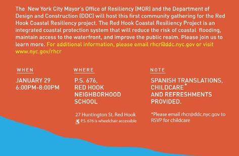
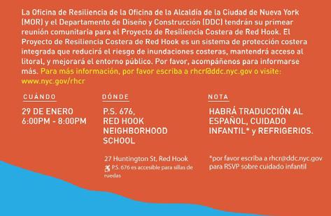
When Hurricane Sandy made landfall near New York City on October 29, 2012, the Red Hook community experienced severe coastal storm surge flooding, causing significant damage and economic losses for businesses and residential properties. Topographically, Red Hook is categorized as Zone A: a low-lying, coastal area with the greatest risk of flooding in hurricane strength storms. Despite flooding from Hurricane Irene the previous year, many properties were unprepared for a storm of this magnitude-hundreds of residents were displaced from their homes, and thousands lost critical utilities in the aftermath. Businesses were severely affected and unable to operate with regularity. In some cases, floodwater compromised the structural integrity of buildings and infrastructure, and mechanical systems were rendered dysfunctional and unable to support habitable spaces.
A study area of 40 intersections and 40 pedestrian analysis locations are proposed to be analyzed for a comprehensive transportation study that will provide neighborhood transforming designs with input from the community to determine the future landscape of Red Hook.
NV5 also reviewed the Emergency Operations Plan (EOP) and the NYCEM General Plan to evaluate evacuation routes. We provided recommendations for changes to the plans as it relates to circulation with the fully deployed Flood Protection System.

9 BAY COLUMBIA VANBRUNT BUSH B Q E MILL HICKS COFFEY IMLAY DWIGHT DIKEMAN CLINTON KING LORRAINE WOLCOTT BEARD VANDYKE HENRY COURT CONOVER SULLIVAN FERRIS VERONA SMITH UNION PIONEER SUMMIT HAMILTON BOWNE OTSEGO BKLYN BTRY COMMERCE DELEVAN SACKETT IKEAGREENWAY NELSON CARROLL CENTREMALL CREAMER SEABRING COLUMBIA STREET HUNTINGTON PRESIDENT BARNELL REED COMMERCIAL WHARF BRYANT WOODHULL GOE LUQUER ALLEY CENTRE RICHARD VISITATION CLINTONWHARF SIGOURNEY HALLECK DRIVEWAY COLES BROOKLYN WATERFRONT GREENWAY RAPELYEA IKEABUSTERMINAL BROOKLYN-BATTERY HALLECK CREAMER BKLYN BTRY SIGOURNEY COLUMBIA ALLEY HAMILTON COURT HICKS HAMILTON RICHARD Sources: Esri, HERE, Garmin, Intermap, increment Corp., GEBCO, USGS, FAO, NPS, NRCAN, GeoBase, IGN, Kadaster NL, Ordnance Survey, Esri Japan, METI, Esri China (Hong Kong), (c) OpenStreetMap contributors, and the GIS User Community Legend 0 FT 1 FT 2 FT 3 FT 4 FT 5 FT 6 FT 7 FT 8 FT 9 FT 10 FT > 10FT 9 BAY COLUMBIA VANBRUNT BUSH B Q E MILL HICKS COFFEY IMLAY DWIGHT DIKEMAN CLINTON KING LORRAINE WOLCOTT BEARD VANDYKE HENRY COURT CONOVER SULLIVAN FERRIS VERONA SMITH UNION PIONEER SUMMIT HAMILTON BOWNE OTSEGO BKLYN BTRY COMMERCE DELEVAN SACKETT IKEAGREENWAY NELSON CARROLL CENTREMALL CREAMER SEABRING COLUMBIA STREET HUNTINGTON PRESIDENT BARNELL REED COMMERCIAL WHARF BRYANT WOODHULL GOE LUQUER ALLEY CENTRE RICHARD VISITATION CLINTONWHARF SIGOURNEY HALLECK DRIVEWAY COLES BROOKLYN WATERFRONT GREENWAY RAPELYEA IKEABUSTERMINAL BROOKLYN-BATTERY HALLECK CREAMER BKLYN BTRY SIGOURNEY COLUMBIA ALLEY HAMILTON COURT HICKS HAMILTON RICHARD Sources: Esri, HERE, Garmin, Intermap, increment Corp., GEBCO, USGS, FAO, NPS, NRCAN, GeoBase, IGN, Kadaster NL, Ordnance Survey, Esri Japan, METI, Esri China (Hong Kong), (c) OpenStreetMap contributors, and the GIS User Community Legend 0 FT 1 FT 2 FT 3 FT 4 FT 5 FT 6 FT 7 FT 8 FT 9 FT 10 FT > 10FT
8

 RED HOOK COASTAL RESILIENCY TRANSPORTATION & FREIGHT STUDY BROOKLYN, NY
WESTPORT MAIN TO TRAIN CORRIDOR STUDY

WESTPORT, CT
Westport’s downtown is located near the center of town along the Saugatuck River, while its Metro-North Rail station is located approximately two miles south. The purpose of the Westport Main to Train Study is to identify improvements to vehicular, bicycle, and pedestrian safety and circulation along Post Road (Route 1) and Riverside Avenue (Route 33).

NV5 conducted traffic analysis and examined a range of improvements, including bicycle and transit accommodations, pedestrian crossing enhancements, ADA compliance, traffic calming interventions, traffic signal infrastructure and timing adjustments, modifications to lane configurations, access management and curb cuts, and changes to curbside regulations. NV5 took recommendations from concept to preliminary design for a variety of improvements.
DOWNTOWN HICKSVILLE COMPLETE STREETS PROJECT HICKSVILLE, NY
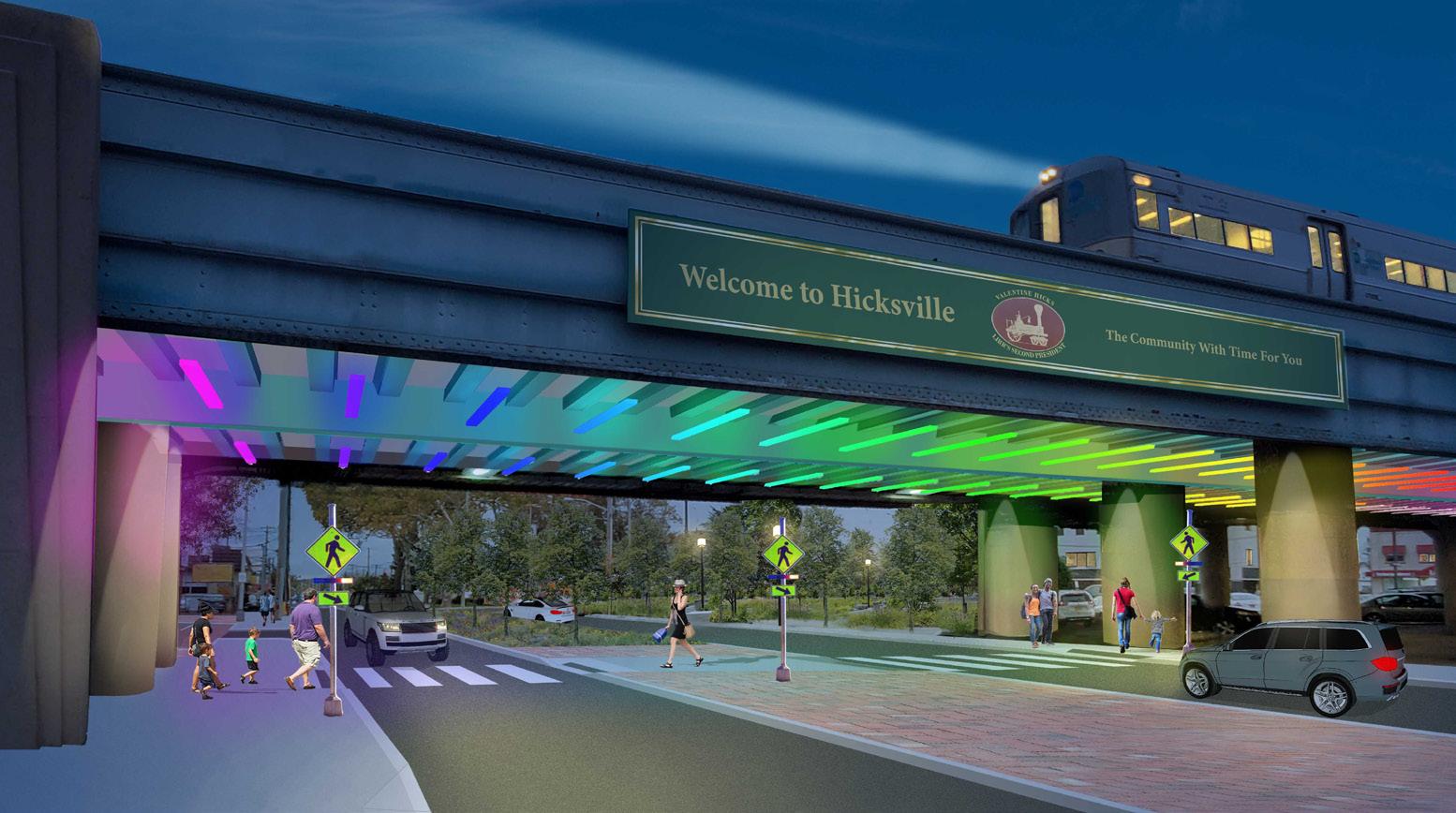

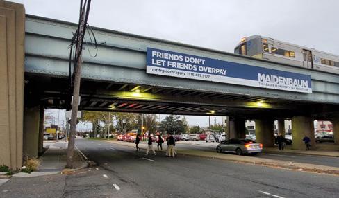
The Hicksville Long Island Railroad station is the busiest in the region, attracting commuters by all modes of transportation. The roadway system is designed mostly for vehicles, which leaves few options for others to safely navigate within the vicinity of the station. NV5 conducted a comprehensive existing conditions analysis including a traffic study, on-the-ground observations, and analysis of current government regulations. NV5 identified potential design, technological, and operational measures for improving the travel safety, convenience, comfort, and access in the study area.
A project website was developed, featuring a mapping tool for public input and sitespecific opportunities to improve safety.
10
GRAND CONCOURSE RECONSTRUCTION: PHASE 5
BRONX, NY
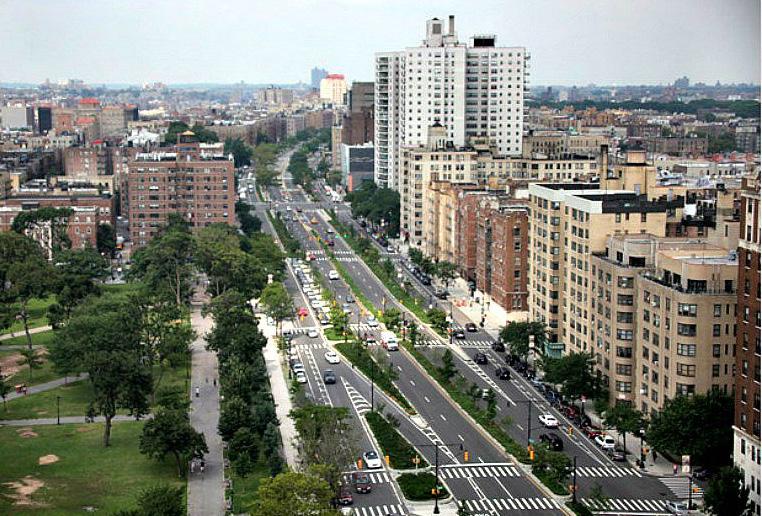
The Grand Concourse is one of the Bronx’s busiest and most iconic roadways. As currently constructed, the street’s intersection geometries and roadway widths combine to create undesirable safety conditions for pedestrians, cyclists, and drivers traveling this corridor. A traffic study was prepared to evaluate multiple proposed improvement alternatives’ impacts on current traffic operations, as well as to identify further potential improvements to the corridor related to traffic congestion and operations. In addition, an evaluation of bus stop and route relocation along the Mainline was conducted, which included changes to traffic flow of slip lanes between the Grand Concourse Service Roads and the Mainline. This required complex forecasting of diverted traffic in the study area. Lastly, bus queue jump lanes and a modified transit signal priority (TSP) study was conducted at the intersection of East Kingsbridge Road and Grand Concourse, as a way to give buses a head start and improve operations of the Bx9, Bx22, and Bx28 lines in the eastbound and westbound approaches of the intersection.

MARKET STREET TRANSFORMATION STUDY
PHILADELPHIA, PA
The Old City District of Philadelphia asked NV5 to develop Vision2026 as a framework to enhance the quality of life for businesses and the community. NV5 developed a concept for re-imagining the 200 block of Market Street as a shared space station plaza for the Market-Frankford subway, Philadelphia’s busiest transit line. This initial concept proposes reconfiguring the street to accommodate parking-protected bicycle lanes, establish a median space to facilitate midblock pedestrian crossing, and replace the existing opaque subway headhouses. NV5 gathered traffic data with Miovision cameras along the corridor to study existing traffic conditions and then modeled the effects of a road diet, including protected bicycle lanes and pedestrian zones. The study determined a road diet with protected bicycle lanes between 2nd Street and 6th Street was feasible and would not create insurmountable traffic impacts. The road diet approach also lays the groundwork for a future shared space on the 200 block of Market Street. Following the publication of the Mobility Study, NV5 assisted the client with an engineered concept plan and construction cost estimate used for obtaining grant funding.
11
MAMARONECK BUILD OUT ANALYSIS AND IMPACTS ASSESSMENT
MAMARONECK, NY
The Village of Mamaroneck selected NV5 to review an “infill housing provision” adopted in the 1980s to promote middle-income housing in commercial areas. The Board of Trustees, concerned that the development permitted by this zoning provision will create excessive traffic and congestion, overtax infrastructure, exacerbate overcrowding in schools and, potentially, change the character of the Village, passed a moratorium on multifamily development and certain residential subdivisions.
NV5, working with Urban Partners/UP Development Planning LLC, conducted a wide-ranging impact assessment that involved analyzing the redevelopment potential of every parcel in the moratorium area and assessing potential impacts on the Village’s finances, school district enrollment and budgets, traffic, water, sewer, stormwater, affordability and socioeconomics. The fiscal impacts of residential subdivisions were also assessed. NV5 produced a presentation of findings summarizing and clearly explaining all of the potential impacts to the general public. NV5 then produced a character-based decision-making framework for helping the Board of Trustees decide how to modify the “infill housing provision”.
PORT CHESTER DOWNTOWN MOBILITY & PARKING ACTION PLAN


PORT CHESTER, NY
NV5 studied the thriving downtown section of this Westchester County community to assess and enhance the mobility of all modes of transportation. With a Metro North train station, a thriving evening and weekend economy, and several new developments underway, the Village wanted to ensure that its downtown can accommodate all modes of travel and that parking is adequately supplied and managed. Recommendations included a range of short- and long-term circulation and parking strategies and a comprehensive plan of action for all modes of transportation. The bicycle plan leverages the East Coast Greenway (ECG), which runs through downtown. The final action plan also included a wayfinding concept plan for downtown and a Complete Streets policy for the Village.
12
WATERBURY ACTIVE TRANSPORTATION & ECONOMIC RESURGENCE PROJECT WATERBURY, CT
NV5 developed an ambitious urban waterfront and downtown revitalization plan for this Connecticut city, which was submitted to USDOT/FHWA for a 2014 TIGER grant. Along with a 30-page application, NV5 produced renderings, illustrations, preliminary design plans, construction cost estimates, environmental screening, traffic study and economic analysis. The work supported a proposed $19.5 million award for a planned $30 million capital project to build the second phase of a waterfront greenway trail and several strategic inland infrastructure upgrades. These include reconstructed “complete streets” and a new bridge for pedestrians and bicycles. Waterbury was awarded the TIGER grant, after which NV5 started final design, NEPA analysis, and construction administration related for the transformation of streets in the waterfront and downtown.


13

Safety For The Most Vulnerable Road Users
Safety Engineering Improving
As transportation professionals, safety is of the utmost importance in roadway planning and design. However, the most vulnerable roadway users continue to bear the brunt of the negative impacts of current roadway designs including severe injury or death. Loss of life occurring as a result of people’s daily activities on our neighborhoods’ and communities’ streets should be considered unacceptable. Policy makers in New York City and 40 other cities across the US agree, and have made a commitment to Vision Zero, defined as a strategy to eliminate all traffic fatalities and severe injuries, while increasing safe, healthy, equitable mobility for all. In New York City, over 460 safety and engineering projects have been completed over a 6-year period to support the initiative.
TRAFFIC CALMING

NV5 has been providing expertise on traffic calming and pedestrian safety projects in New York, New Jersey, and beyond for many decades. With our combination of transportation planning and engineering staff and continuing support on Safe Routes to Schools for NYC DOT, NV5 is well versed in the latest safety improvements to protect our most vulnerable road users.
Designing for the safety of our most vulnerable road users creates safe streets for all road users.
Traffic calming is a key part of the Vision Zero puzzle, with its primary function to reduce vehicle speeds to improve safety for both motorized and non-motorized road users. Vehicular speeds are directly connected to pedestrian safety - pedestrians typically have a 90 percent chance of surviving a crash when the car speed is 20 mph. However, the rate of survival decreases to 55 percent for speeds of 40 mph. This statistic is significantly worse for pedestrians 70 years old. The traffic calming toolbox that NV5 developed contains a multitude of effective options including engineering, education, enforcement, and maintenance solutions to reduce traffic speeds as well as improve the quality of life.
15
SCHOOL SAFETY ENGINEERING PROGRAM
CITYWIDE, NYC
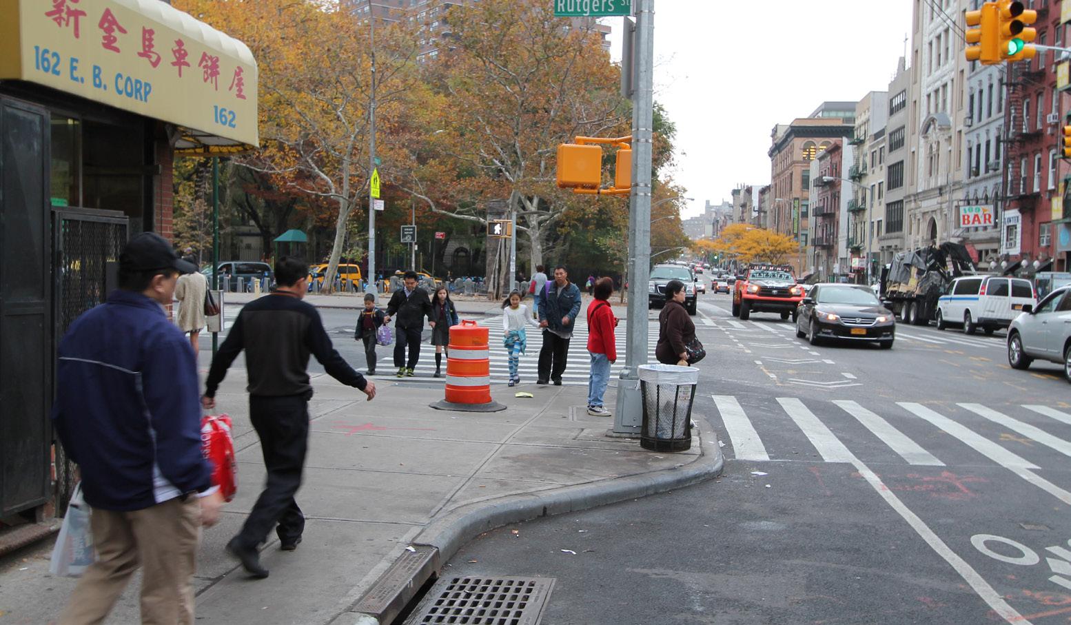
Since 2002, NV5 has been conducting school assessments and engineering designs for NYCDOT’s School Safety Engineering Division. New York City has one of the largest school districts in the country, with over 1,470 elementary and middle schools citywide. The School Safety Engineering Project seeks to improve pedestrian safety in the vicinity of New York City schools using engineering measures. Objectives of the Project began with ranking all 1,470 schools from a traffic safety standpoint, then identifying potential improvements for groups of 60-75 schools per phase through site visits, meetings with school staff and discussions with crossing guards in addition to data review.

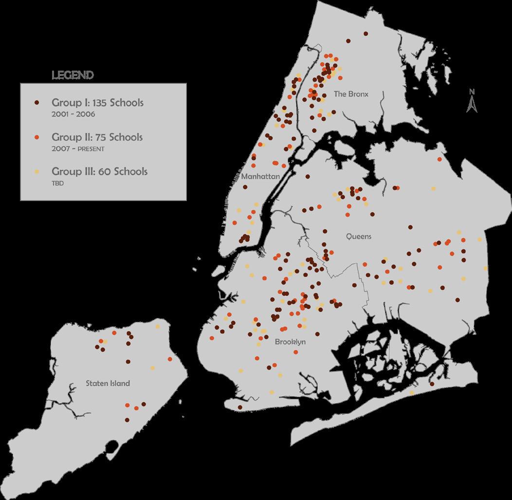
NV5 also developed engineering designs for 32 schools scheduled for capital improvements. Under Contract 2, NV5 is assessing an additional 75 priority schools, and is preparing designs for an additional 53 Capital Schools.
16
SAFE ROUTES TO TRANSIT

CITYWIDE, NYC
The NYCDOT has an on-going Safe Routes to Transit Program to evaluate and improve the safety of the walking routes in the vicinity of various NYCT facilities. DOT’s goal is to improve pedestrian and motor vehicle movement around subway entrances and bus stops to make accessing mass transit easier and more convenient. As the lead consultant firm, NV5 conducted the traffic study, and prepared the final design and construction documents for multiple intersections in the vicinity of 31st Street and Broadway in Astoria, Queens. This location is a highly utilized subway and bus transit intermodal point identified under the Safe Routes to Transit Program for intersection improvements. A detailed traffic study investigated pedestrian crossing times as well as signal progressions Proposed work included a variety of capital improvements including bus bulb-outs as well as general intersection improvements such as curb extensions, neckdowns, blockbusters, ADA pedestrian ramps, pavement markings, signage, improved drainage, traffic signals and street lighting improvements.

SENIOR SAFETY PEDESTRIAN FOCUS AREAS
CITYWIDE, NYC
While New York’s seniors make up only twelve percent of the population in New York City, they still comprise thirty-nine percent of pedestrian fatalities. The disproportionate representation of the senior population among severe pedestrian injuries and fatalities led to the development of the NYCDOT’s Safe Streets for Seniors (SSS) Program. NYCDOT identified twenty-five Senior Pedestrian Focus Areas (SPFAs) throughout New York City based on the density of senior pedestrian crashes resulting in fatalities or severe injuries. NV5 analyzed a group of five SPFAs by examining crash history and traffic conditions at selected intersections and corridors within each SPFA to develop short-term, low-cost and longer-term capital improvement measures to reduce pedestrian crashes for seniors, as well as improve safety and traffic operations for all users. NV5 collected and analyzed traffic and pedestrian data, as necessary, to develop recommendations and prepare engineering and design schematics for capital improvements.

17
DREAM CHARTER SCHOOL ROADWAY IMPROVEMENTS
BRONX, NY
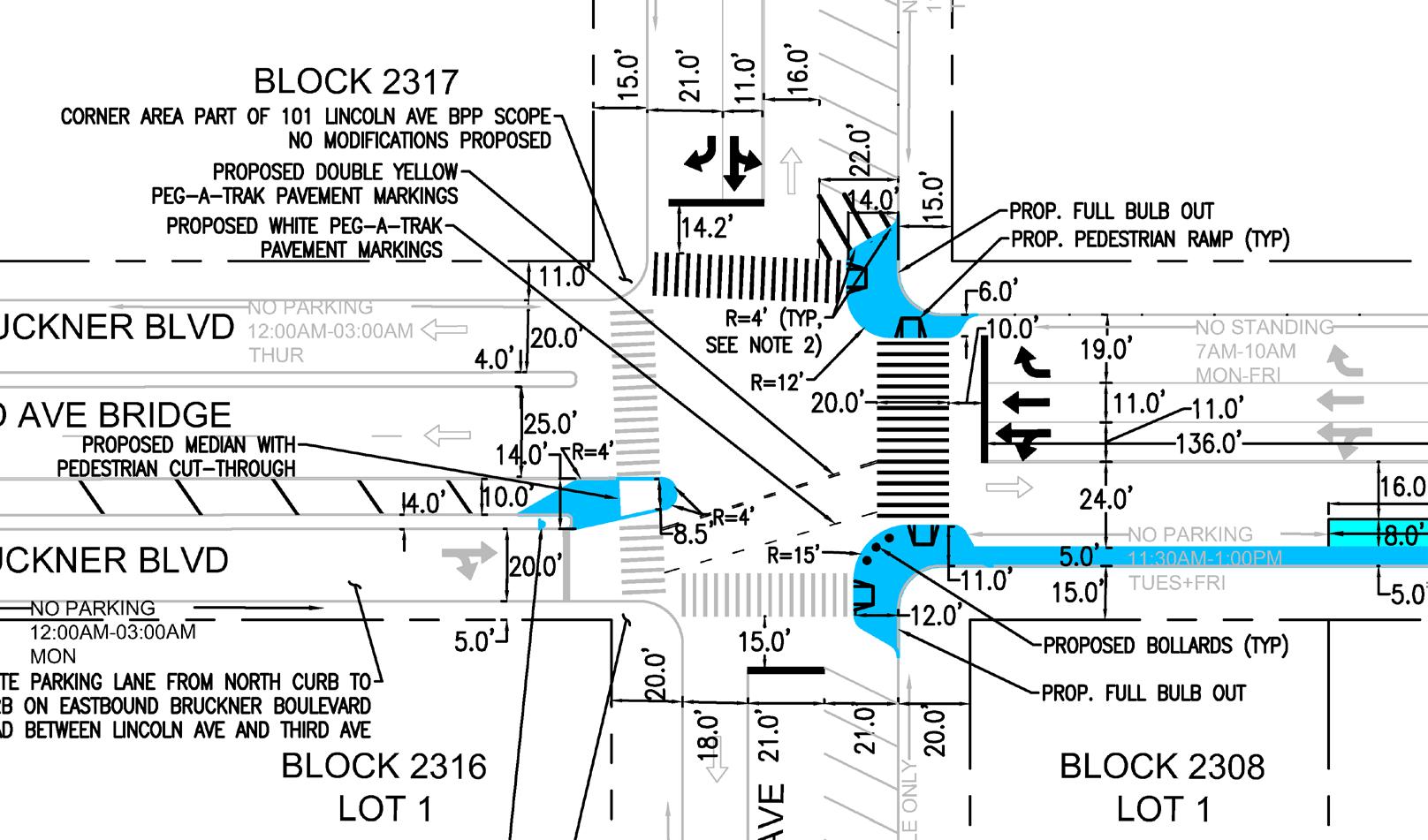
Bruckner Boulevard in the Bronx is a high volume road, serving as one of the primary conduits providing local access into Manhattan via the Third Avenue Bridge. A new 1,400 student charter school proposed on Bruckner Boulevard would bring new life and pedestrian activity to an area previously dominated by traffic. NV5 was tasked to perform a traffic and pedestrian study to identify pedestrian safety and traffic calming improvements at intersections in the vicinity of the school. Detailed analysis of traffic and pedestrian conditions included traffic and pedestrian counts and observations, and forecasting of future vehicular and pedestrian trips to the school to guide roadway improvements. The development of multiple alternative designs was extensively coordinated with NYC DOT, and included sidewalk extensions and widened crosswalks, a sidewalk widening to provide pedestrian queuing areas, and traffic signal timing adjustments.
18 ROUTE 22 PEDESTRIAN SAFETY AUDIT SOMERSET COUNTY, NJ
A portion of the Route 22 Corridor in Somerset County was identified by NJDOT’s Pedestrian Safety Management System (PSMS) as a high pedestrian crash corridor. NV5 was selected to conduct a Pedestrian Road Safety Audit (PRSA) to address pedestrian and bicycle safety issues within the corridor. The project team, in consultation with NJDOT, established a Safety Impact Team (SIT) comprised of stakeholders with both technical expertise and local insight.
Following data collection and analysis, the Road Safety Audit was conducted. A Corridor Improvement Plan with conceptual recommendation was prepared, including a corridor-wide and site-specific recommendations matrix with potential engineering, education, enforcement, and maintenance solutions. The three signalized intersections were identified as focus areas as most pedestrian and bicyclist crashes occurred at these locations. The matrix included corridor-wide measures, as well as measures for the three focus areas.

NYSDOT PEDESTRIAN SAFETY ACTION PLAN (PSAP)
REGIONS 8 & 10, NY
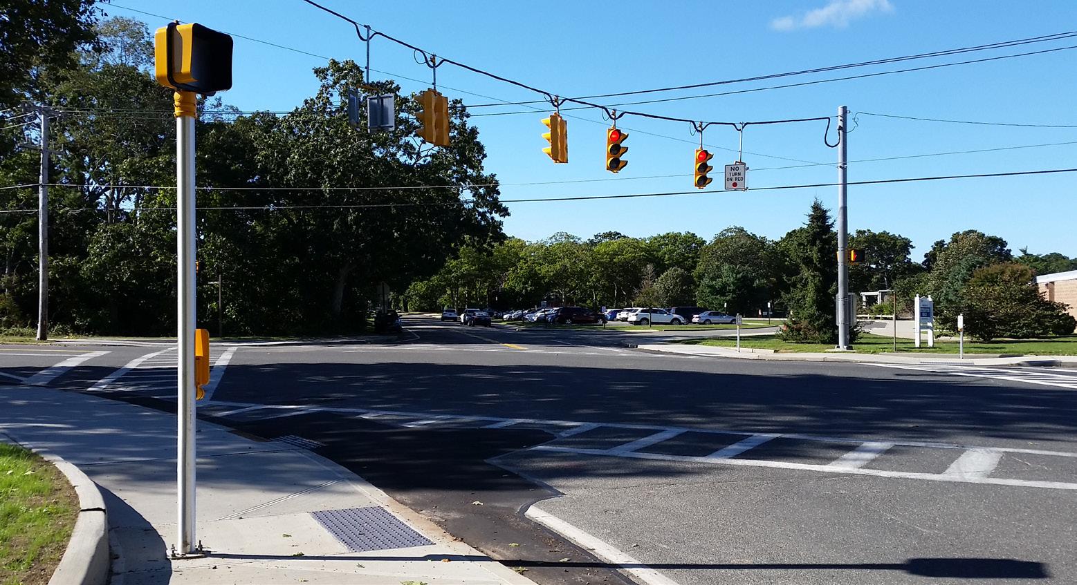
Safety design is perhaps most critical at intersections, where roadway users mix and movements are less predictable. NV5 has performed hundreds of assessments of controlled and uncontrolled pedestrian crossings on State Roads throughout the Lower Hudson Valley (Region 8) and Long Island (Region 10). NV5’s work involves a the implementation of safety improvements through field inventories, compliance and condition assessments, and deign recommendations for over 500 locations. NV5 was subsequently awarded a comprehensive traffic signal assessment of critical NYSDOT arterials. Following a similar process of field inventory through design, NV5 is updating the NYSDOT intersection database for almost 400 signalized intersections. Coming into this project NV5 was well versed in the requirements for intersection design, including MUTCD and ADA compliance for sidewalks, pedestrian ramps, tactile strips, crosswalks markings, regulatory and warning signs, push button locations, signal locations, and signal timings including pedestrian crossing times.
SUFFOLK COUNTY PEDESTRIAN SAFETY ACTION PLAN

SUFFOLK COUNTY, NY
Suffolk County Department of Public Works (SCDPW) was awarded $6.9 million in grant funding from the New York State Department of Transportation (NYSDOT) in response to the Local Call for Pedestrian Safety Action Plan (PSAP) projects competing for Federal Highway Safety Improvement Program (HSIP) funding. NV5 was selected to undertake the design phase of this federally funded project, which consists of upgrading 125 signalized intersections to improve pedestrian safety along various County roadways throughout the County. Proposed improvements include upgrades to pedestrian countdown signals, replacement or installation of corresponding push button assemblies and signs, replacement or refreshing of crosswalk markings, limited/localized replacement of sidewalk ramps, where necessary, to coincide with the proposed signal work, limited ancillary work, as required, including related drainage modifications, sign relocations, and site restoration. Over 125 traffic signal plans were developed through Final Design to NYSDOT and Suffolk County design standards.
19
MONMOUTH COUNTY VISION ZERO ACTION PLAN


MIDDLESEX COUNTY, NJ
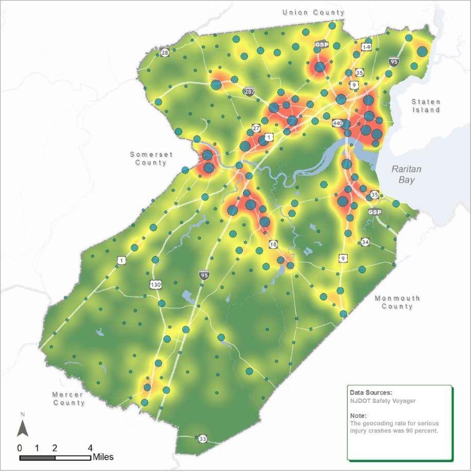
NV5 provided a Vision Zero Action Plan for Monmouth County to make all county roads safer and eliminate preventable traffic deaths and injuries by 2040. The working group was a partnership between the County and its 25 municipalities.

NV5 used a data-driven approach to this countywide Vision Zero Action Plan. Starting with a crash analysis (top left) our team used a weighted ranking to develop the High Injury Network (top right) for all modes. These corridors will remain on the County’s priority list for future study and design improvements to address safety conditions. However, the more vulnerable roadway users are disproportionately represented, which led to the stratification of the High Injury Network around pedestrians and cyclists (bottom right).

Digging Deeper Into Crash Types
Between 2010 and 2019, there were 291,440 recorded crashes in the County, resulting in 466 fatalities and 964 suspected serious injury crashes. Although bicyclists and pedestrians comprised only 1.7 percent of the County’s collisions between 2010 and 2019, they accounted for approximately one-quarter (24 percent) of its high-severity crashes.
20
Monmouth County Crash Types from 2010-2019

21
SPRING GARDEN CONNECTOR STREETSCAPE PHILADELPHIA, PA
Street Design Streets are Places
BALANCE, INCLUSIVE, VIBRANT, CONTEXTUAL, SAFE
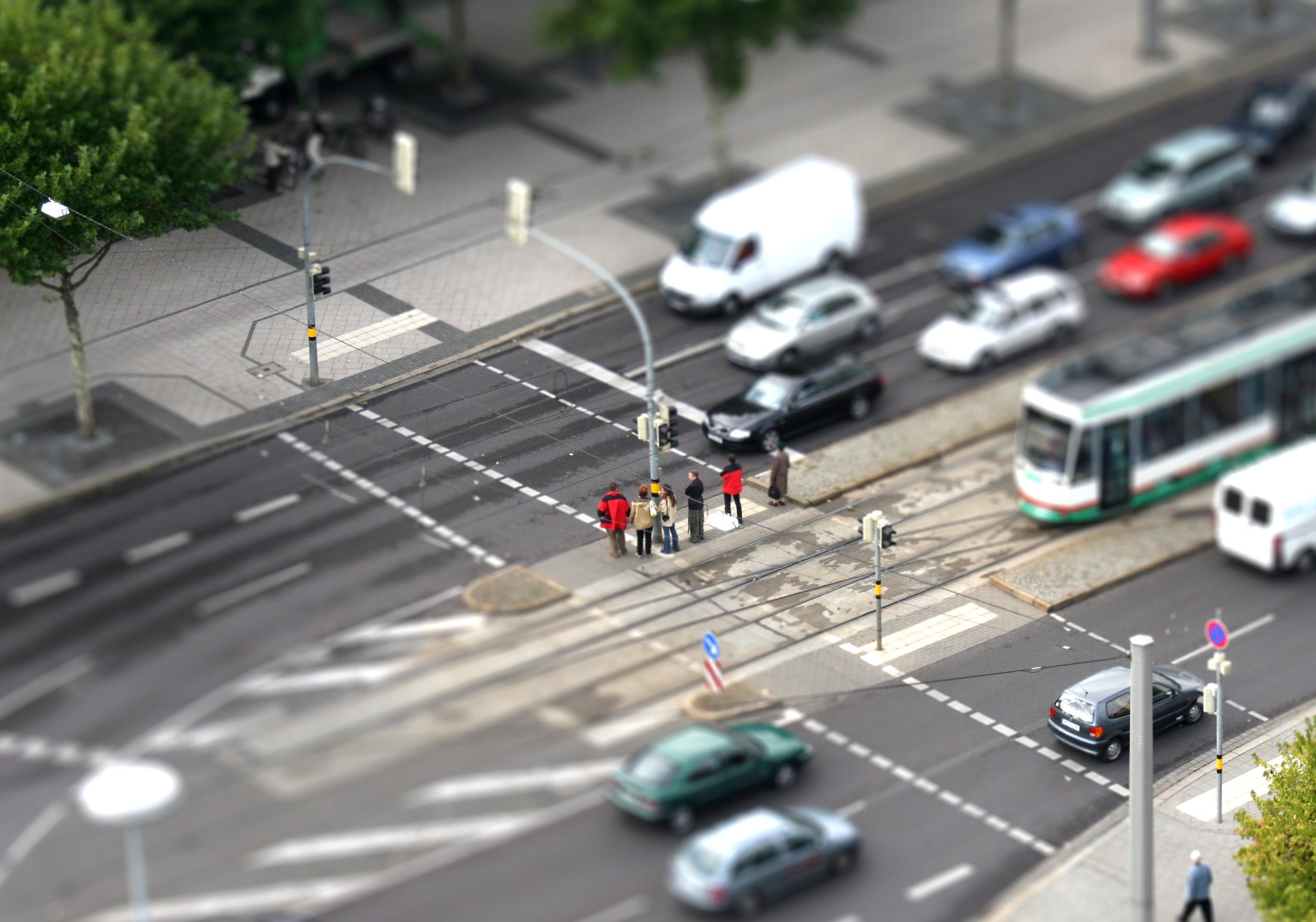
In urban settings, people spend considerable time in the public realm, interacting with streets, sidewalks, and public open space. While streets may serve as a conduit for commuting they are also important spaces for social interactions, so the quality of a street’s infrastructure has a great impact on the surrounding community. In 2014, NYC DOT performed a study to determine the economic benefits of sustainable street design and expand the metrics of evaluation beyond transportation benefits alone. The data analysis showed that developing a more welcoming street environment with improved accessibility caused retail sales at local businesses to increase. While not the only factor in economic vitality, complete street design can contribute to the economic well-being of a neighborhood, no matter the composition or demographics.
In cities across the country, more than 25% of public open space is streets. Municipalities should think of streets as places.
STREETS
At NV5, we focus on the journey and not simply the destination, rethinking streets as entities which move fluidly through a series of quality public spaces. With NV5’s roots in livable urban cities, we understand the ways that big cities, like New York, can be transformed by world-class, innovative street design. This philosophy can affect public policy to ensure that the public right-of-way is designed with both the community and environment in mind.
Safety also has economic value, considering the cost of crashes nationwide totals in billions of dollars every year. In the case of dozens of projects evaluated in a study by Smart Growth America, the majority of crash rates and injuries declined after complete street projects were constructed.

Buildings and Parking Lots Streets Parks, Cemeteries and Other Open Space Airport, Other Transportation Facilities and Miscelaneous Vacant Land
23
COMPLETE
QUEENS BOULEVARD VISION ZERO QUEENS, NY

The Borough of Queens is in the middle of a transformation. As many parts of Queens continue to grow across all sectors, the transportation network has been designed piecemeal over time. The results are an overburdened transit system, several wide dangerous urban corridors, lack of open spaces, and insufficient alternate modes of transportation infrastructure. NV5 is leading the Conceptual Engineering and Urban Design for the six mile long corridor once labeled “Boulevard of Death”, working closely with the Transportation Model being developed for the corridor. The design is focused on specific principals and goals, with Vision Zero principles at the core of each decision:
1. Calm traffic along the service roads
2. Connect to as much as possible
3. Express the specific character of Queens
4. Protect a wide range of uses and activities
5. Protect a productive urban ecology
In New York City, under-utilized street space is being re-purposed into public spaces that serve the local community. NV5 supports this trend and has designed multiple award-winning public plazas. This is a watershed moment for civic leaders to rethink what a public space is. NV5 can provide the tools to help leaders make informed decisions on what is possible through design.

24
BRIDGEPORT COMPLETE STREETS DESIGN MANUAL BRIDGEPORT, CT
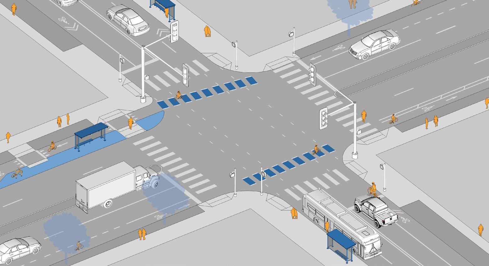
NV5 developed the Complete Streets Design Manual for the city of Bridgeport, an urban street design guide to improve traffic safety and pedestrian and bicycle infrastructure for public and private entities working within the public right-of-way. A combination of street typologies to classify corridors based on their land uses and transportation functions, and nodes to provide design guidance for intersections, serve as the basis for providing design and maintenance standards unique to the City’s street network. Design variations provide flexibility to respond to surrounding context. All of the recommended design treatments are MUTCD compliant and in accordance with best practices for multi-modal transportation policy and design. To fully include conditions specific to Bridgeport, the Design Guide also addressed utility lanes, smart city technology, and accommodations for healthy tree growth beneath the streets and sidewalks.
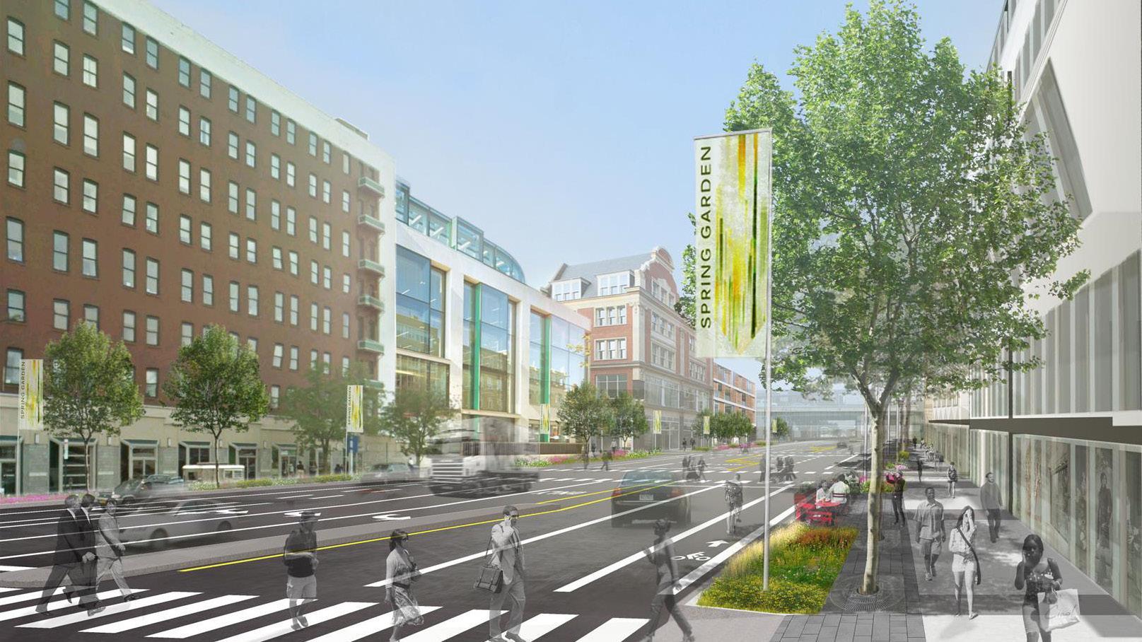
DESIGN OF THE SPRING GARDEN STREET CONNECTOR PHILADELPHIA, PA
The Delaware River Waterfront Master Plan identified critical streets that connect people to the waterfront that merit special treatment. One of these “connector” streets is Spring Garden Street. NV5 designed streetscape improvements to this street between 2nd Street and Columbus Boulevard. The design widens sidewalks and introduces street trees, attractive pavement materials, benches, decorative lighting elements with flags and banners, and wayfinding signs. Decorative architectural lighting was also added under the highway overpass, where there is a SEPTA Transit Station entrance.
25
ESSEX COUNTY COMPLETE STREETS IMPLEMENTATION PLAN
ESSEX COUNTY, NJ
NV5 was selected to lead efforts for the implementation of Essex County’s recently adopted Complete Streets Policy. Key to the success of the project was a thorough understanding of the County’s travel needs, street network, planning, design, operations and maintenance procedures, transportation/ land use priorities and municipal context.
NV5 collaborated with NJTPA, Essex County and key stakeholders to develop and implement specific, action-oriented strategies which advanced the goals of the County, and enabled Essex County and its constituent municipalities to achieve pre-eminence in Complete Streets implementation in New Jersey. Major work elements included training workshops, analysis and updates to County plans, policies, guidelines and procedures, along with a demonstration pilot Complete Streets project, in addition to a Final Implementation Plan for making Essex County’s streets more complete.
MONTCLAIR SAFE/COMPLETE STREETS IMPLEMENTATION PLAN

MONTCLAIR, NJ
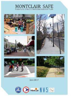
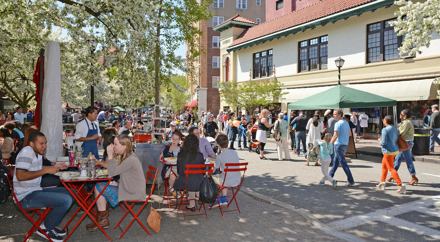
The Montclair SAFE (Streets Are For Everyone) Complete Streets Implementation Plan provides a road map for improving the walking and bicycling environment. The plan provides guidance towards ensuring that Montclair’s streets are designed to encourage safe driving, bicycling and walking and to advance the Township’s SAFE/Complete Streets philosophy.
Montclair, a Bronze-Level Bicycle-Friendly community and a Silver Walk Friendly community, is ahead of most municipalities in improving multi-modal travel within the Township. Recommendations for implementing a SAFE CS network in Montclair includes pedestrian and bicycle improvements identified for six street typologies.
26
COMPLETE STREETS - COMPREHENSIVE PROGRAM SUPPORT SERVICES
NATIONWIDE
NV5 has served non-profits (such as Smart Growth America), State DOTs, Regional MPOs, County and Municipal Planning Departments, and local DPWs to provide training and design solutions for Complete Street Programs.
Taking into account nationwide best practices, some of which have been developed by members of NV5’s team over the past three decades, NV5 has led various types of Complete Streets projects, including:
- Training on Complete Street Program Overview, Policy Development, and Implementation in NJ, NY, MA, TN, IL, TX
- NJDOT’s Complete Streets Policy

- NJ’s first Statewide Complete Streets Summit (2010)
- Complete Streets Resource Materials for NJ Communities
- NJDOT Complete Streets Checklist

COMPLETE STREET REDESIGN OF WASHINGTON STREET HOBOKEN, NJ
The City of Hoboken envisioned a redesign of their main street, Washington Street, with the goal of maintaining and preserving the elements that make the 1.3 mile corridor into a “Great Street” and enhancing its functionality and aesthetics to create a state of the art “Complete Street”. NV5 collaborated with the City to define and advance this vision through the creation of a concept plan that addresses civic, safety, economic, and cultural goals as defined by the community, key stakeholders, and local advisory groups. This year-long design process features concept designs and solutions related to a range of issues, including pedestrian safety, multimodal transportation, parking, commercial loading, wayfinding, lighting, streetscape furnishing, green infrastructure, and smart technologies.
27
E-Commerce Operations Design
The Future of Parcel Delivery

RELOCATION, CONVERSION, FLEXIBILITY

The boom of E-commerce retail has led to a historic change in how and where consumers obtain goods. In 2019, Amazon alone delivered about 2.5 billion packages in the United States, an estimated 20 packages for every household. In August of 2021, it was estimated that the number of households using e-commerce ordering services to either schedule deliveries, or pick-up grocery themselves reached 69 million. The surge of e-commerce deliveries has only been accelerated by the COVID-19 pandemic. These impacts can be seen in today’s streets with increasing congestion from local delivery traffic coupled with a lack of facilities or systems to support this new dynamic. Curbside space for delivery vehicles (physical space and duration of use) is a key factor in delivery logistics, as unsupported delivery stops can congest our streets and create potentially unsafe conditions.

Delivery service providers and local municipalities are exploring a number of ways to solve these issues and minimize their transportation impact. UPS has launched e-bike and e-trike pilot delivery programs in Portland, OR, Pittsburgh, PA, Seattle, Washington, and Washington D.C., an attempt to reduce vehicle emissions, improve utilization of curb side space, and subsequently improve delivery operations in urban centers. University of Washington’s Urban Freight Lab is currently testing parcel lockers located within buildings and at curbside, as an effort to reduce the amount of time a delivery vehicle may park on the street and increase efficiency of deliveries. Municipalities such as the City of Aspen have implemented pilot programs for smart phone app based loading zone management systems, which provide services to delivery providers by directing them to open loading zones, reducing dwell time at loading zones by pricing meters higher at peak times, and providing data to the operating municipality to better serve delivery needs.
These are just a few examples of the many emerging technological applications that can contribute to the solution transportation users, professionals and policy makers are all striving for: safe and efficient transportation of goods and people. NV5 encourages the consideration of innovative proposals to better serve communities and clients alike. NV5 has been providing a major retail operator with traffic engineering and planning services including providing assessments and analyses to ensure the operators, mobility and access needs are met, while minimizing the impact to the surrounding transportations system.
Image:
Adobe Stock
29
LARGE RETAIL OPERATOR TRANSPORTATION PLANNING & ENGINEERING NORTH AMERICA
For any large retail operator in the United States, coordination and logistics of employees and trucks is critical. NV5 has been retained by one of the largest e-commerce companies to provide traffic and planning services on an on-going basis.
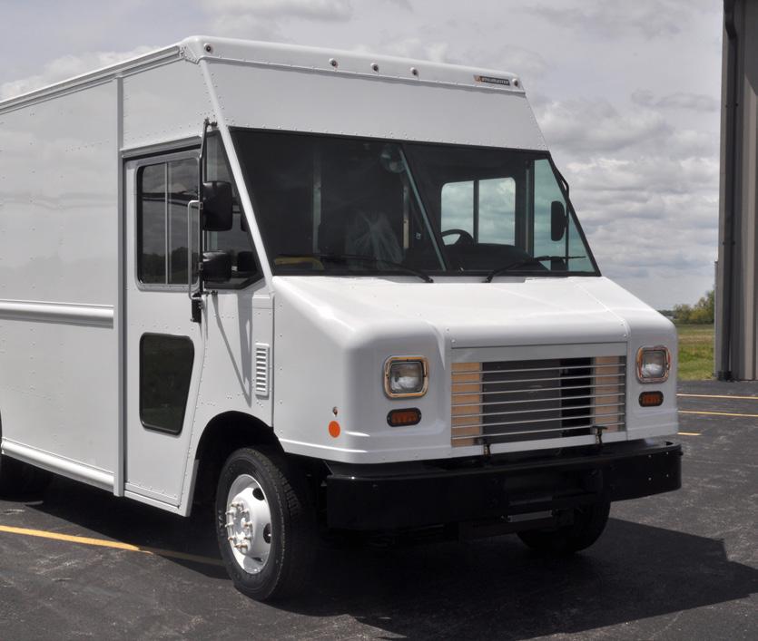
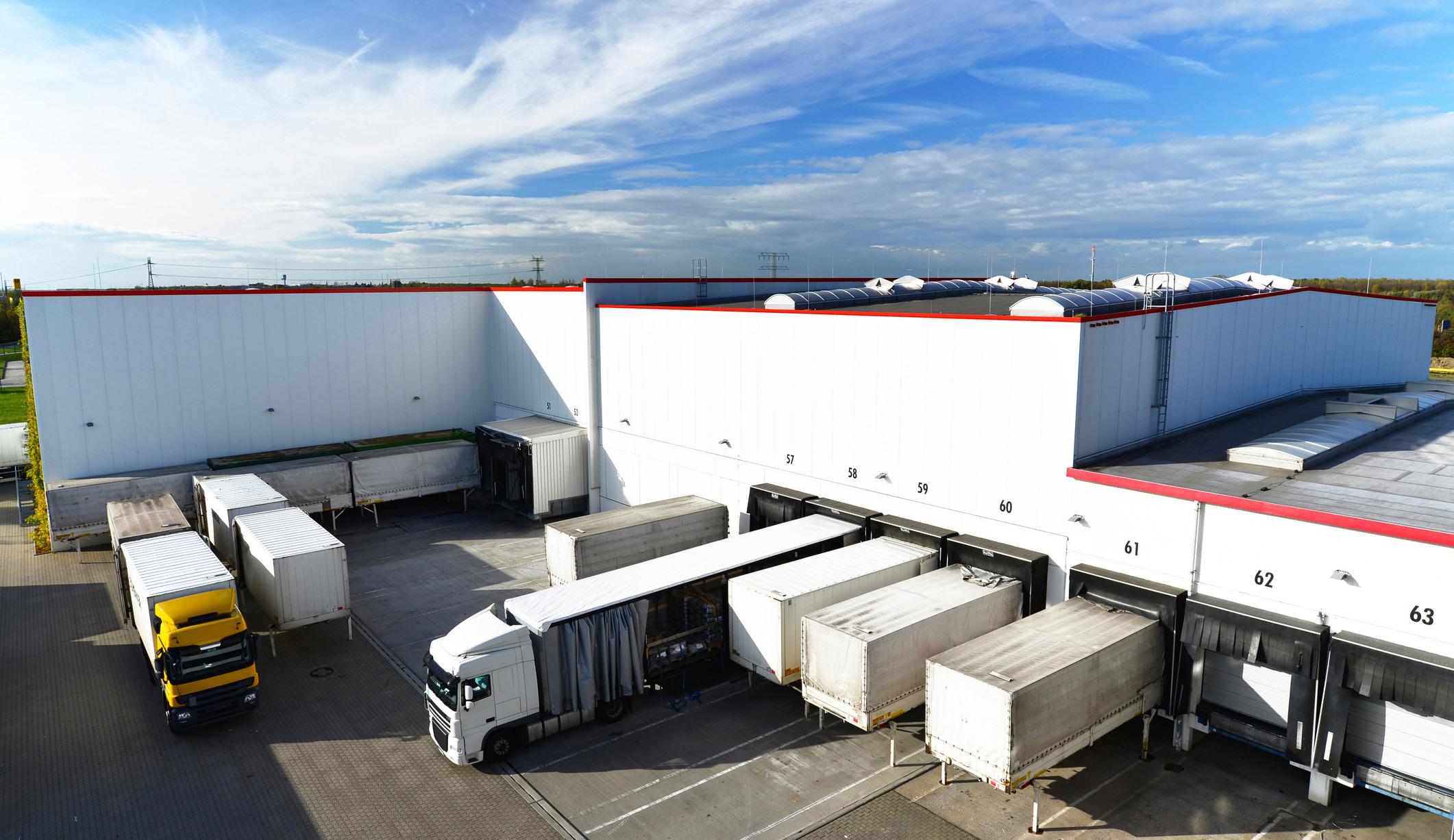
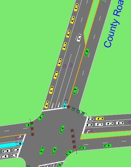
Studies developed during our on-going contract include traffic assessments, traffic impact studies, circulation studies, truck route planning, noise studies, and other engineering services, followed by recommendations on further action or analysis. Traffic impact studies (TIS) developed by NV5 typically provide a more in-depth analysis, including detailed traffic analysis at key intersections that could be impacted by project-generated traffic. Each TIS includes a traffic safety analysis to identify crash trends and determine if improvements at study area intersections could be made to reduce or eliminate future crashes. Potential impacts of site generated traffic are identified and, if necessary, mitigation measures are proposed to alleviate traffic congestion or safety concerns induced by the proposed project. NV5 has completed over 500 of such studies since 2018 at locations throughout North America and Australia; we have worked in 40 states, including over a dozen studies in New York.
30
RED HOOK TRUCK ROUTE STUDY

BROOKLYN, NY


As stated in the Corridor and Neighborhood Planning Studies section, the transportation study being completed for the Red Hook Coastal Resiliency project encompasses multiple factors across the transportation system including traffic and pedestrian operations, non-motorized user safety and accessibility, and truck travel patterns and operations. The movement of trucks through the neighborhood is an important issue for residents
Trucks typically travel on designated truck routes, and must remain on them until arriving as close as possible to their ultimate destination. Residents of Red Hook specifically have concerns of truck traffic on Van Brunt Street, which is a designated truck route but truck traffic is seen as disruptive to this prominent commercial corridor of the neighborhood. Additionally, there has been a recent influx of new development including e-commerce warehouses that will increase traffic and truck activity within the neighborhood. Although the developments can be completed without public review, they will have a combined impact to traffic and truck volumes on truck routes and other streets in the neighborhood.
As part of NV5’s transportation study, NV5 is exploring a complete rethinking of truck travel patterns on designated truck routes through the neighborhood of Red Hook to meet its current and future needs. This includes modifications to the existing truck route system by relocating truck routes onto roadways, better serving existing and future truck generating uses. Relocating truck routes requires careful consideration of the new circulation patterns trucks would take to reach their destinations off designated truck routes, magnitude of volumes being displaced from the existing route to future routes that could impact traffic operations and pedestrian safety, and the efficient movement of manufactured goods.
31
Traffic Impact Studies & Alternative Analysis
 Smart Street Systems
CONNECTED VEHICLES
Connected Vehicles (CV) systems are rapidly evolving technologies that are likely to revolutionize the way intersections operate. CV technology utilizing Vehicle to Vehicle (V2V), Vehicle to Infrastructure (V2I), and Vehicle to Everything (V2X) communication systems will exchange data between both vehicles, infrastructure, and other elements within the intersection to operate adaptively and reduce or eliminate conflicts with other road users. While the concept may seem far-fetched or long to be implemented, the American Association of State Highway and Transportation Officials (AASHTO) predicts that 90% of light vehicles will be equipped with V2V technologies by 2040. AASHTO also estimates that by 2025, 20% of signalized intersections will be capable of V2I communication, and that will expand to 80% by 2040. Connected Vehicle Pilot programs sponsored by USDOT, to explore connected vehicle systems, have already been awarded to public agencies such as NYC DOT, Tampa Hillsborough Expressway Authority (THEA) and Wyoming DOT.

Traditionally, the two most common types of traffic signal control are pre-timed (pre-defined signal plan) and actuated (triggered signal control), in which the latter mainly relies on physical infrastructure such as loop detectors or video cameras to detect traffic approaching an intersection. With V2X communication, adaptable signal control systems using wireless communication systems can be implemented that respond based on real time data inputs to alleviate unforeseen congested conditions. V2X communication systems can collect volume, speed and fuel consumption parameters in real time, and then process that data instantaneously to optimize timing at an intersection to minimize delay, number of stopping vehicles and air quality impacts. Warning systems in vehicles as well as physical infrastructure can identify potential unsafe conditions or conflicts and alert the at-risk roadway users.
NV5 has extensive experience in traffic impact studies and alternative intersection design analysis including modeling and optimizing traffic signal operations. In our firm’s experience, we can see the limitations of existing signal equipment and the potential alternative solutions that can be provided by CV technology. NV5 encourages the further study and development of these technologies and stands ready to provide services supporting their implementation.
33
JENNA CONCRETE REDEVELOPMENT PROJECT
BRONX, NY
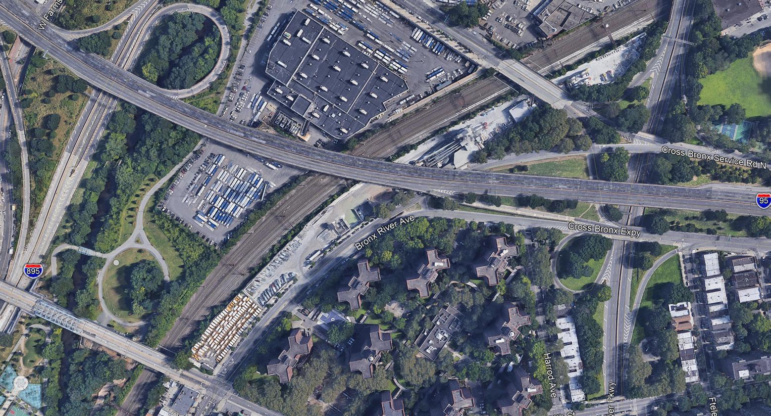
The Jenna Concrete site, a narrow strip of land located between Bronx River Avenue and CSX Railroad property, is proposed to be rezoned and redeveloped into a 1 million square foot mixed use development with green space.
The site’s width, topography, as well as proximity to overpasses serving the Cross Bronx Expressway (I-95) and E 177th Street, present numerous design challenges to overcome including site development, traffic access and on-site circulation, stormwater management and federal, state and city agency coordination.
UNIONPORT BRIDGE RECONSTRUCTION TRAFFIC STUDY
BRONX, NY
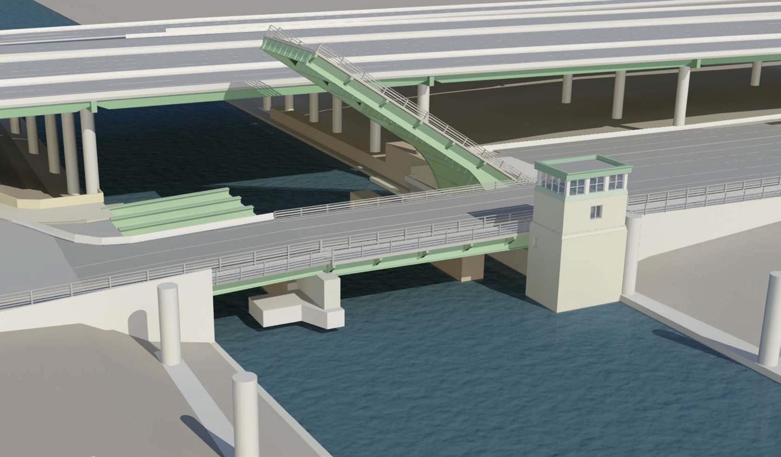
NV5 is responsible for preparing a traffic study that addresses traffic operational and safety issues within the vicinity of the Bridge to help alleviate traffic congestion. Components of the traffic study include data collection, crash analysis, and a traffic analysis using Synchro traffic signal coordination software.
As part of the data collection program, NV5 deployed over twenty Automatic Traffic Recorders (ATRs), used video traffic counting technology to obtain Turning Movement Counts (TMCs) at another twenty locations. Additional analysis included pedestrian counts, field reconnaissance, delay studies, and an extensive Origin-Destination (O-D) study of eleven origins and ten destinations using state of the art video recognition technology called Automatic License Plate Reader (ALPR). This was chosen among various techniques to handle the heavily congested area in the Bronx.
34
GOETHALS BRIDGE MANAGED USE LANE STUDY


NJ/ NY

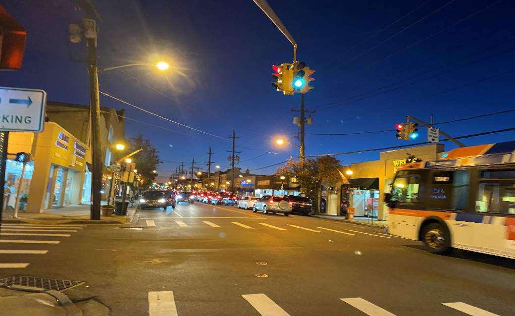
As part of NV5’s various traffic and transportation engineering services for PANYNJ, NV5 prepared a freeway traffic study and alternatives analysis for the potential implementation of a Managed Use Lane (MUL) on the Goethals Bridge spanning between Elizabeth, NJ and Staten Island, NY. The goal of the study was to evaluate alternative MUL lanes that could manage travel demands and mitigate potential traffic impacts identified in an environmental impact statement for the replacement of the Goethals Bridge structure. Two of the alternative MULs included truck only and truck restriction lanes. Origin and destination patterns of all passenger cars and trucks were determined using a combination of Miovision cameras, GPS and cell phone signal trackers, which provided detailed traffic information essential for analyzing weaving traffic flows on the bridge. Detailed freeway analyses were conducted for each MUL, as well as an evaluation of feasibility from an operational and enforcement perspective, to provide PANYNJ with a final recommendation.
WILLOW VIEW ESTATES DEIS PEER REVIEW
NASSAU COUNTY, NY
As part of an on-call contract with Nassau County Department of Public Works (NCDPW), NV5 was tasked with providing a peer review of the Draft Environmental Impact Statement (DEIS) of the proposed Willow View Estates development. NV5 conducted an in depth review of the traffic impact study containing 28 analysis locations. Our team reviewed and analyzed high level assumptions and trip forecasts as well as traffic volumes and travel factors in the micro simulation provided. In addition, traffic observations were conducted to confirm existing conditions presented in the traffic impact study, and discrepancies were documented. Review of the stormwater management found the subdivision did not meet the stormwater criteria required by Nassau County DPW, and identified several issues and needs for clarification on the assumptions and design proposed in the Willow View Estates stormwater management plan. Both reviews were summarized in technical memorandums provided to Nassau County DPW.
Eastbound Approach
35
Rockaway Turnpike and Central Avenue Westbound Approach (Looking East) Spruce
Street and Central Avenue Eastbound Approach
Transit Planning

Bridging The Gap - First/Last Mile Transit Accessibility
TRANSIT PLANNING - BRIDGING THE GAP
FIRST/LAST MILE TRANSIT ACCESSIBILITY
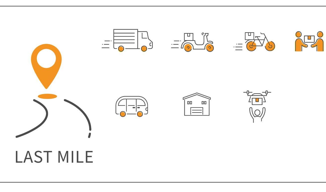
Accessibility to transit facilities has largely been limited to single occupant vehicles, which continue to present physical constraints, environmental and equitable issues, as well as strain to existing roadway and parking infrastructure. Alternative mobility services from residences to transit facilities, also known as first/last mile connections, seek to make transit more readily accessible by focusing on complete trips, from door to door instead of station to station. The landscape of mobility services has rapidly evolved over the past decade, with emerging technology supporting bike shares, e-scooters, microtransit services like Uber Pool or Lyft Line, and even Autonomous Vehicles in limited applications. Impacts on transit utilization in the post COVID-19 pandemic environment is not fully known, but is anticipated to contribute to a dire need to develop strategies to address post-COVID-19 ridership reduction. This will include opportunities to innovate and connect users to first/last mile mobility options. Many municipalities have recognized the need to evaluate and determine the need to accommodate emerging mobility technology and trends. As mobility services are not necessarily a ‘one-size fits all’ solution, cities and municipalities have developed first and last mile mobility toolkits to provide information to stakeholders. These tools will allow decision makers and communities to make informed decisions about what set of mobility services works best in their environment.
NV5 has conducted numerous pedestrian and bicycle transit accessibility projects, supporting transit providers such as NJ Transit, as well as municipalities along the Metro North and LIRR commuter rail lines. With our wealth of experience in this field, we are well equipped to provide planning services that incorporate the mobility services and technologies of tomorrow.
37
NJ TRANSIT BICYCLE & PEDESTRIAN ACCESS STUDY
STATEWIDE, NJ
The purpose of this study is to identify, evaluate and address the physical barriers limiting pedestrian and bicycle access to six NJ TRANSIT stations: Irvington Bus Terminal and Madison, Red Bank, Rutherford, Summit, and Woodbridge Train Stations. The study produced a series of conceptual design enhancements at targeted locations to improve station access and safety for bicyclists, pedestrians, and people with disabilities. The concepts emphasize design treatments that are inexpensive and simple to implement. Each design concept includes cost estimates and recommendations for implementation, phasing and funding sources. An innovative approach to data collection and existing conditions assessment produced customized GIS layers that local municipalities can easily update to track improvements over time.

NOROTON HEIGHTS STATION AREA STUDY NOROTON HEIGHTS, CT
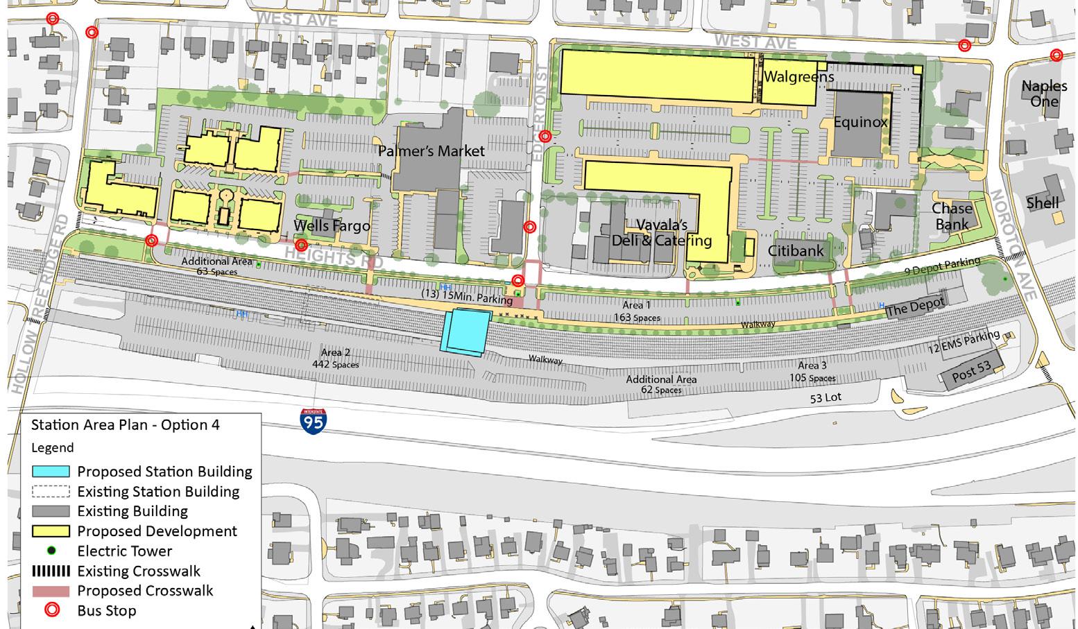
In collaboration with the Town of Noroton Heights and WestCOG, NV5 prepared a multi-faceted plan for mobility and parking improvements, station relocation, and transit-oriented development (TOD) in and around the station area. Throughout the process NV5 worked with a Technical Committee of professionals from various public agencies and led a community engagement process involving commuters and other local residents in the planning process.
NV5 inventoried existing mobility and parking conditions in the study area and also studied the station facility to develop specific recommendations for physical and operational improvements. These improvements address existing deficiencies and meet the projected demand of future growth from developments in proximity to the station at the time of the study.
38
WESTPORT RAIL STATIONS ACCESS & PARKING STUDY
WESTPORT, CT
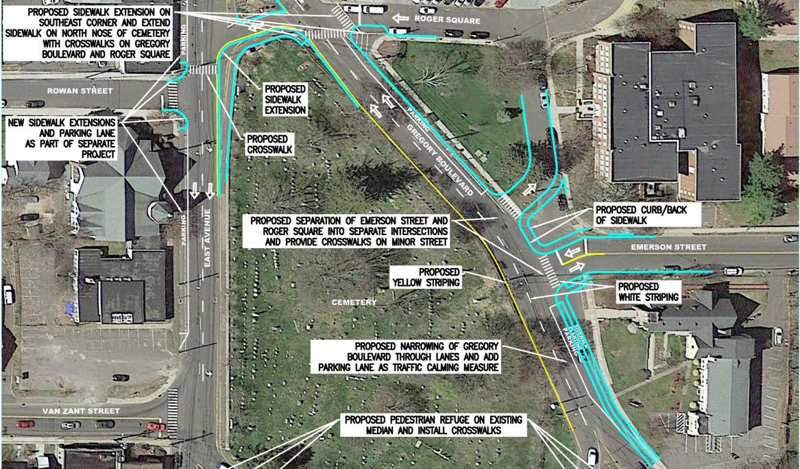
NV5 produced a comprehensive plan and strategy for improving access and parking at the two Metro-North stations in Westport.

After an in-depth review of existing conditions, our team identified issues and looked at alternatives based on extensive input from the public and the Technical Committee. Turning movements and pedestrian and cyclist volumes were counted and analyzed to inform the strategies and implementation guidance in three categories: Parking Management, Parking Improvements, and Mobility Improvements.
Among the mobility improvements were curb extensions with turn prohibitions at key locations with high pedestrian volumes and short crossing times. Other considerations based on traffic analysis included the removal of a travel lane in a low volume area to create a bicycle connection between residential areas to the station.
EAST NORWALK TOD STUDY
NORWALK, CT
While the City of Norwalk, CT has been experiencing significant development around its South Norwalk and Merritt 7 stations, the area around the East Norwalk station has not received much reinvestment. NV5 served as a transportation and infrastructure subconsultant on an initiative to engage the East Norwalk neighborhood to plan for the future of the station area.
NV5 conducted an inventory and existing conditions analysis of traffic, parking, pedestrian and bicycle infrastructure, and traveler behavior. The observations and data collected during this phase informed the recommendations. These recommendations included elements on local streets such as mini traffic circles, modifying curb geometry to reduce crossing distances, adding sidewalks and crosswalks along pedestrian desire lines, reducing roadway widths simplifying intersection geometries to reduce the number of vehicular turning conflicts, and rehabilitating and widening sidewalks on local streets to improve walkability.
39
NJ TRANSIT STATION ACCESS SITE PLANNING

MONMOUTH COUNTY, NJ
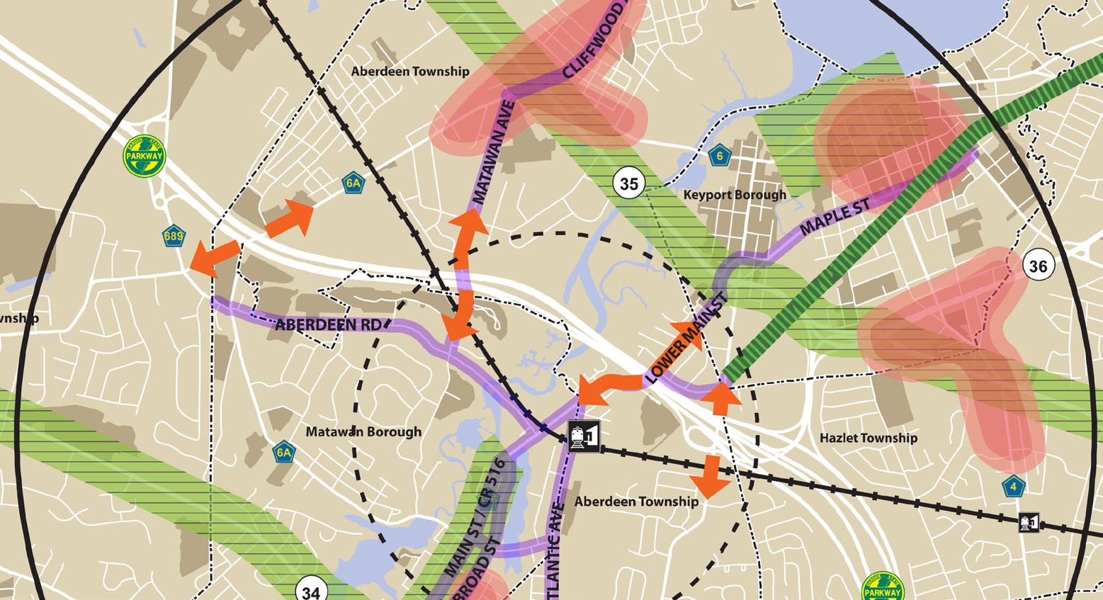
NV5 has been assisting NJ TRANSIT to enhance bicycle and pedestrian access to and around transit stations and neighborhoods served by transit. These efforts range from Complete Streets to developing targeted station access concepts. Pilot station area concepts were prepared for three stations in Monmouth County along the North Jersey Coast Line: Aberdeen/Matawan, Hazlet and Middletown. The goal of this project is to identify both specific, targeted enhancements as well as general, wide-ranging improvements to increase non-motorized train station access, thereby increasing bicycling and walking to the stations, decreasing congestion and improving quality of life in the area surrounding NJ TRANSIT rail stations.
NJ TRANSIT ON-CALL CONTRACT STATEWIDE, NJ
NV5 has served as prime consultant for several NJ TRANSIT On-Call contracts and currently serves as the Programmatic Lead for NJ TRANSIT’s TransitFriendly Planning, Land Use and Development Program (TFPLUD) TOC agreements, providing familiarity and value-added expertise related to the TFPLUD program, and oversight of other consultant teams.
Recent Transit-Friendly Planning contract task orders have addressed parking, circulation and bicycle and pedestrian access to six existing NJ TRANSIT rail stations and transit facilities. Current assignments include the assessment and update of the NJ TRANSIT Transit-Friendly Planning, Land Use and Development (TFPLUD) Program, the update of the Transit Friendly Planning (TFP) Handbook, and the development of a Transit-Friendly Planning screening tool to assess and rank transit facilities statewide.
40
NEW YORK 32 Old Slip, Suite 401 New York, NY 10005 212.741.8090
LONG ISLAND 40 Marcus Drive, Suite 201 Melville, NY 11747 631.891.3200
NEW JERSEY 800 Lanidex Plaza, Suite 300 Parsippany, NJ 07054 973.946.5600
CONNECTICUT 1000 Lafayette Boulevard Bridgeport, CT 06604 203.683.5948
PHILADELPHIA
1315 Walnut Street Suite 900 Philadelphia, PA 19107 215.751.1133

42 42


 Cover Image: Adobe Stock


 IWINSKI, PE, PTOE DIRECTOR OF NEW YORK TRAFFIC GROUP


 RED HOOK COASTAL RESILIENCY TRANSPORTATION & FREIGHT STUDY BROOKLYN, NY


 Smart Street Systems


