CARSTEN KRIEGER Ireland Wild
A NATURE JOURNEY FROM SHORE TO PEAK


CARSTEN KRIEGER is a photographer, author and environmentalist based on the west coast of Ireland. He has published numerous books on Ireland’s landscape, nature and heritage including Ireland’s Coast, The River Shannon and the popular Ireland’s Wild Atlantic Way. Carsten is also working as editor for the Crossbill Guides Foundation and project manager for AstonECO. He is also an AnTaisce Climate Ambassador and a Green Sod Ireland Biodiversity Ambassador. carstenkrieger.com

For Michael O’Brien
I hope they have books where you are
First published 2023 by The O’Brien Press Ltd.,
12 Terenure Road East, Rathgar, Dublin 6, D06 HD27, Ireland. Tel: +353 1 4923333. Fax: +353 1 4922777
Email: books@obrien.ie. Website: obrien.ie
The O’Brien Press is a member of Publishing Ireland.
ISBN 978-1-78849-317-8
Text and photographs © Carsten Krieger 2023
The moral rights of the author have been asserted.
Copyright for typesetting, layout, editing, design © The O’Brien Press Ltd
Cover and internal design by Emma Byrne.
Quote on p9 by Baba Dioum from a paper presented in New Delhi, India, 1968, at the triennial meeting of the General Assembly of the International Union for the Conservation of Nature and Natural Resources (IUCN). iucn.org
All rights reserved. No part of this publication may be reproduced or utilised in any form or by any means, electronic or mechanical, including photocopying, recording or any information storage system without permission in writing from the publisher.
1 3 5 7 9 10 8 6 4 2 23 25 27 26 24
Printed by EDELVIVES, Spain.
The
I have been mesmerised by the natural world since my early childhood in Germany. I remember sitting by the kitchen window on cold winter mornings, watching the birds at the feeder outside, and chasing butterflies around the garden on hot summer evenings. I devoured books like Bernhard Grzimek’s Serengeti darf nicht sterben (Serengeti Shall Not Die) and was glued to the TV every time Expeditionen ins Tierreich with Heinz Sielmann – who was the German equivalent to David Attenborough – came on.
Part of this early interest was simple childish curiosity: Why is the goldfinch so colourful? Why does the caterpillar turn into a butterfly? How does the bee get the nectar out of the flower (and how does the nectar get into the flower in the first place)? Another part was the fact that I felt very comfortable in the company of wild things … more comfortable than with most humans.
A few years later, an obsession with photography came into the mix, and soon after
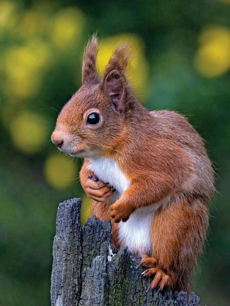
Opposite: Red squirrel, County Laois.
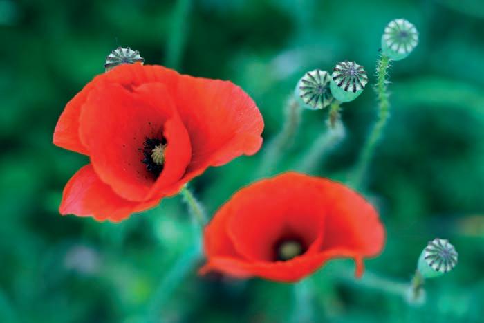
Below: Common poppy, County Meath.
it was clear to me that I wanted to spend my life as a photographer and work in nature conservation.
But life had other plans. I was a lazy student and pretty much flunked all subjects apart from biology. After leaving school, I took some detours and ended up training and subsequently working as a paediatric nurse.
Some dreams, however, die hard, and after a decade in nursing, I moved to Ireland for a new beginning and to pursue photography and nature conservation as a career. By pure chance, I ended up living on the Loop Head Peninsula in County Clare, which turned out to be a treasure chest for someone like me: bottlenose dolphins, seabird colonies and rocky shores teeming with all kinds of wildlife were on my doorstep, waiting to be explored. On top of that, the Burren – a landscape I started exploring on my holiday trips to Ireland and had very much fallen in love with – was only a short drive away.
Unfortunately for me, it was difficult to make a living from nature and conservation photography alone, so I started shooting pretty landscapes and happy people for the tourism sector. This became my day job, and I worked mostly as a volunteer for various conservation
groups on the side. But a change was coming. The terms ‘climate change’, ‘biodiversity loss’ and ‘mass extinction’ entered the public domain, and more and more people started to show an interest in the natural world and the threats it is facing.
David Attenborough summed it up when he said, ‘We moved from being a part of nature to being apart from nature.’ We are now at a point in history where we must re-evaluate and change our perception and relationship with the natural world. We are beginning to understand that we are merely one part of a vast global network that connects all living beings – and that, within this network, actions (our actions) have consequences.
This new understanding of our place in the structure of the planet should begin at home, on the small grassy patch outside our front door, the pasture down the road, the stretch of coast or the forest where we take our daily walks. In these places, we can experience the workings of the natural network at first hand.
Baba Dioum, a Senegalese forestry engineer, wrote in 1968, ‘In the end we will conserve only what we love, we will love only what we understand, and we will understand only what we are taught’, and his words are truer now than ever. I strongly believe that education is the key to bringing us back to a state where we are a part of nature again.
I don’t consider myself an expert, but I have been exploring and learning about the natural world for most of my life, and I hope that this book will help you to understand, love and conserve our wild Ireland.
A thick blanket of fog covers the wintry landscape. The path, carved by countless feet into the shallow layer of dirt that covers the limestone, is barely visible. The damp air is swirling around me, at times lifting for the blink of an eye to allow a brief glance of wet limestone slabs and the vague outline of shrubs. Suddenly the lake emerges out of the grey wall of mist, its surface motionless, its extent hidden. It is winter solstice day, and even though it is almost lunchtime, it feels like early morning. I am on my way to the summit of Mullach Mór, the iconic flat-topped hill that sits in the heart of the Burren National Park, a limestone karst area that has mesmerised visitors and locals for millennia.
I am losing sight of the lake, but the stile in a dry-stone wall shows me that I am on the right track. A few steps further and another waymark, a small stand of hazel, becomes just
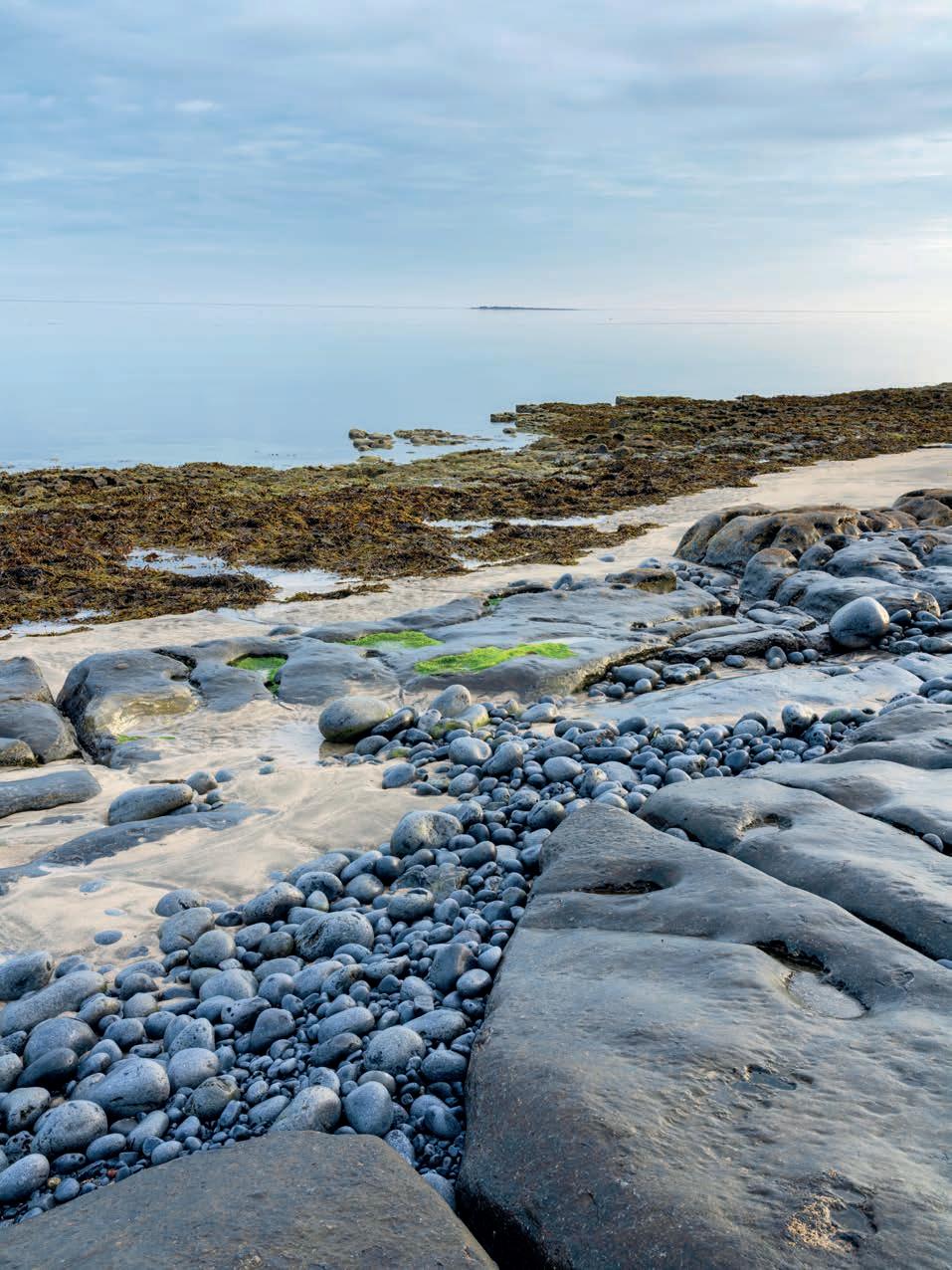
Opposite: Rine Peninsula and Ballyvaughan Bay, the Burren, County Clare.
Below: Limestone pavement at Rock Forest.

about visible to my left. Soon after, a number of natural steps in the limestone bring me onto the first plateau of Mullach Mór.
Any landmarks and way markers are now completely hidden in the fog, which is thicker than ever. The path has disappeared, and the limestone at my feet doesn’t keep any memories of previous travellers. I am stranded, and all I can do is sit and wait. Time goes by, the cold and damp slowly making its way through layers of clothing.
Then, all of a sudden, it seems to be getting brighter. I can see a bit further; the curtain is lifting enough to wander on. Patches of blue appear in the sky above me, and the mountainscape of the Burren is revealing itself all around: Poulnalour and Slievenaglasha to my left, Slieve Roe and Knockanes ahead of me, and the lowlands of Clare and Galway to my right. The skeletons of the hazel scrubs glow in gentle brown and yellow tones, the wet limestone is glistening in the light, and the only sound is the hushing of the wind. This is the Burren.
Most of Ireland’s bedrock is made from limestone, but only in a few places has this rock come to the surface to become the landscape. It does so in counties Fermanagh and Cavan and a few odd spots in the midlands, but Ireland’s ultimate limestone landscape, the Burren, lies in the northern half of County Clare and spills over into southern County Galway. The first impression of this area is one of gloomy desolation. From a distance, the first features to catch the eye are terraced, raggy and seemingly bare hills. A closer look reveals polished rock pavements that are traversed by deep fissures and strewn with rocks known as erratics.
On dry, sunny days, the rock presents itself in a bright, almost blinding, grey. After a downpour, the landscape changes to a dark grey, almost black, and glimmers with a blueish tint. And on those soft days that are so typical for Ireland, when a constant fine drizzle drenches the land, it is almost impossible to tell where the dark, grey landscape of the Burren ends and the sky begins.
The name derives from the Irish word boireann, meaning ‘large rock’ or ‘rocky district’. The English politician and military leader General Edmund Ludlow, while passing through on a military campaign in 1659, described the Burren as ‘a country where there is not enough water to drown a man, wood enough to hang one, nor earth enough to bury him’.
In the following centuries, the Burren has been described variously as a moonscape and
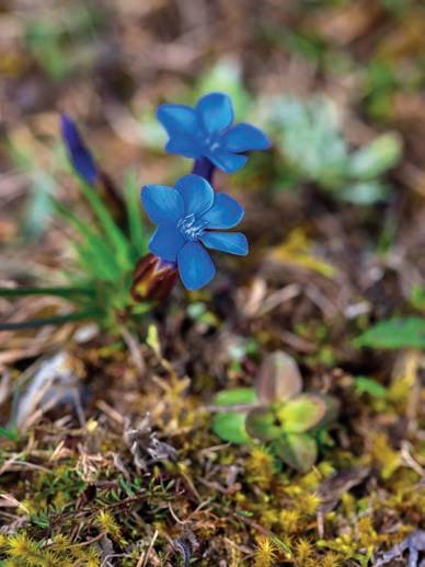
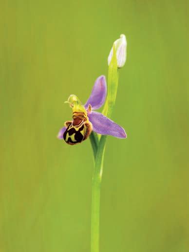
Opposite top left: Spring gentian.
Opposite top right: Bee orchid.
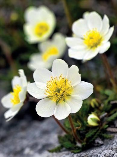
Opposite bottom left: Mountain avens.
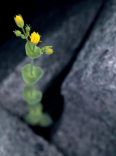
Opposite bottom right: Yellow wort.
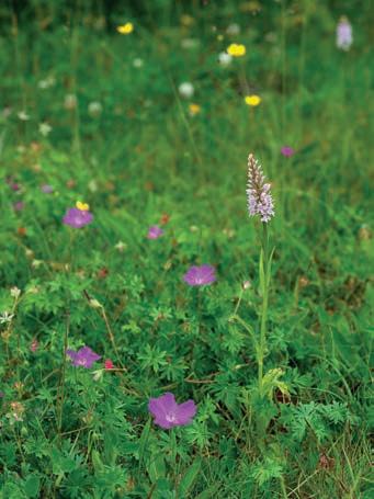
Above: Bloody crane’s bill and common spotted orchid.
Right: Dense-flowered orchid.
Below: Irish saxifrage.
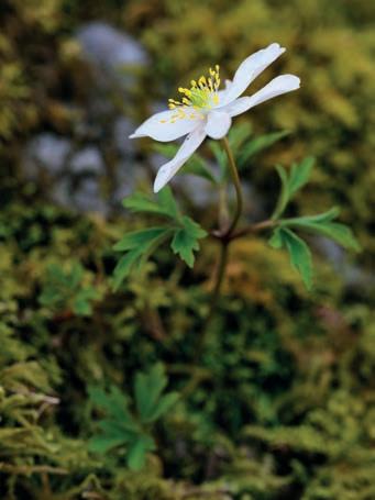
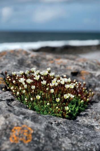
Below right: Wood avens.

a fertile rock; songwriter Luka Bloom sang about the ‘flowering desert’, and for botanist Charles Nelson, the Burren was a ‘limestone wilderness’. Whatever you would like to call it, the Burren is a landscape that captures the imagination; it is cherished and respected by its people and known to leave a deep impact on its visitors. The Burren seems to exist on another plane, not quite part of the real world, timeless in one way but also laden with the burden of history. There is just no other place like it.
The Burren is a limestone karst landscape. Its foundations were laid during the Lower Carboniferous period some 350 million years ago, far away from its current location on the west coast of Ireland. Imagine a shallow ocean in a tropical climate just south of the equator. Some of the inhabitants of this ocean were the ancestors of our snails, mussels and corals, all of which shared one feature: a shell made of the minerals calcite and aragonite. Once the inhabitants of these shells met their end, the shells sank to the seafloor. There, they accumulated, layer after layer, and over a period of some twenty million years, they hardened into limestone, which eventually reached a thickness of up to eight hundred metres. Periodic outwashes of mud, sand and clay from adjacent river estuaries added bands of shale and other deposits that in places separated the limestone beds. During the Upper Carboniferous period, these fluvial outwashes became more dominant, and as a result shale and sandstone built up over the limestone and, in time, completely covered the older rock.
Time passed, continents moved, and Ireland took its current place on the map. The earth’s climate oscillated, cooling and warming in cycles. The colder periods saw vast glaciers advancing from the poles, covering much of Europe, including Ireland and the area of the future Burren. Once the temperatures started to rise, the ice would retreat northward for a while, releasing the land from its icy grip. This process went on for thousands of years, and the back and forth and back again movement of these immense masses of ice, several hundred metres thick and weighing many tons, sculpted the landscape. In some places the glaciers cut deep valleys in the rock; in the Burren, they completely removed the top layers of shale and sandstone,
The Burren seems to exist on another plane, timeless in one way but also laden with history
exposing some 250 square kilometres of the underlaying limestone. The best place to see the transition from limestone to shale and sandstone is to the south-east of Doolin Harbour. Here, the limestone disappears under the sandstone cliffs that rise further south to form the Cliffs of Moher.
The glaciers carried vast amounts of rock, gravel, sand and silt with them. Once the temperatures rose and the ice began to melt, this luggage was dropped on the landscape. Drumlins – small, elongated hills of silt, gravel and rocks – are a common sight all over Ireland. In the Burren, drumlins mainly appear along the southern and eastern borders. Erratics, however – from the Latin errare, ‘to wander’ – are obvious all over the Burren, from the coast to the mountaintops. Most of these wandering rocks are made of limestone, but sandstone and granite erratics, which originated further north in Connemara and were transported by the glaciers to their current resting place, can also be found.
The bleak landscape of the Burren that we see today is not an entirely natural phenomenon. After the end of the last glaciation, about ten thousand years ago, the Burren didn’t look very much different to the rest of Ireland at the time. After the ice had disappeared, a tundra-like landscape developed; with a warming climate, shrubs and trees established themselves, and over time, vast pine and oak forests took over the land.
It is possible that the limestone here never had a very deep soil cover and was more susceptible to erosion than other areas, but the first Burren farmers and the following generations certainly sped the erosion process along by clearing land for crops and livestock. The early settlers also left their mark on the landscape in other ways. The Burren has one of the highest concentrations of ancient monuments in Ireland, many dating back to the stone age. Cooking places known as fulachtaí fiadh, portal and wedge tombs, cairns, ring barrows and stone forts, early Christian monasteries, medieval tower-houses and the ubiquitous dry-stone walls are by no means natural but have all become an integral part of the Burren landscape.
Another factor that had significant influence on the juvenile Burren, even before the arrival of man, was water. Rainwater contains liquified carbon dioxide, which makes it slightly acidic; this acidic solution converts the calcite in the limestone into calcium bicarbonate, which dissolves in the water and is washed away. It is this process that shaped and sculpted the Burren to its unique appearance: smooth limestone blocks, or clints, that are separated by deep fissures known as scalps (from the Irish word scailp, meaning
The Burren has one of the highest concentrations of ancient monuments in Ireland, many dating back to the stone age
‘fissure’ or ‘cleft’), as well as grykes, runnels and flutes, terraced hills, sinkholes and vast cave systems. To date, some sixty kilometres of cave passages have been explored, but the true extent of the Burren cave system is believed to be a multitude of that.
The exploration of this underworld brought some unexpected glimpses into the Burren’s past. At Aillwee Cave, one of the two show caves of the Burren, the skull of a brown bear was found and dated to be 10,400 years old. A bear patella, discovered in another cave, shows parallel cut marks that were likely caused by a stone knife some 12,500 years ago. The presence of a top predator like the brown bear and signs that it was hunted by men suggest that a diversified flora and fauna already existed in the Burren towards the end of the last glaciation, before the complete disappearance of the ice. The second show cave of the Burren, Poll-an-Ionain, today better known as the Doolin Cave, features the Great Stalactite. With a length of 7.3 metres, this is the biggest free-hanging stalactite in Europe.
Most of the Burren’s cave systems have been formed by streams and rivers. The majority of these water courses stay underground; the only stream that runs its complete course on the surface is the Caher River, which has its source beneath Slieve Elva and enters the sea at the
