P o r t f o l i o
Ofir Bouba | Bezalel Academy Of Art & Design
O F I R B O U B A
Motza 9 About me:
OfirBouba1@gmail.com +972 - 054 - 8155875 Ramat Gan, Israel Im Ofir, originally from Hod-Hasharon and currently living in Ramat Gan. I am interested in design & technology, and i enjoy exploring different materials and techniques and incorporate them in my projects.

Experience Skills + Ilan Ramon High School | Hod Hasharon + John Bryce College Automating Administration with windows PowerShell Configuring, managing & maintaining Windows server 4th year student in the architecture department Second place winner at the “Dariah innovation challenge”, Dublin university Irland Exchange semester at BAS, Norway + Bezalel Academy Of Arts and Design + The IDF Academy Of Computing And Cyber Defense + Elbit Systems Revit, Autocad 2022, rhino 7, QGIS, Adobe Programs: Illustrator, Photoshop, Indesign & Premier Enscape, V-ray CNC, 3D printing, Hand drafting/modeling Python, PowerShell, System, Microsoft environment, Networking, VMware, Qc environment Commander in system administration course Commanding on 40 soldiers Accompanying leading projects from the testing planning stage at home & abroad Developing classes in networking and system Qa engineer, Radio Devision 2011-2014 2016 2014-2016 2016-2018 Deisgn Rendering Fabrication Programming 2019-2022
Education Military Service
S e l e c t e d P r o j e c t s
| | |
| | | | Other work
Terminal V, Dariah Innovation Challenge
Layer 2.0, Liebling house
Appartment
Exchange semester, Norway 2022 2022 2021 2022 2021 2022 2020
Off grid - On premise The Quilt
12 8 22 24 16 18 4
Eco-Booster Exchange semester
Explorations in ocean space
Studio by Nancy Couling, Bas architecture school, Norway
Together with Sophie wenderoth & Ronja Mina Zender
Concept:
Inspired by the project “Porsangerfjorden 3.0” created by the local sami community in the north of norway around Porsangerfjord, we decided to critically reflect upon their ideas and take a step further by applying architectural practices. In comparison to their project where all interventions are currently planned to be located in two locations only (Olderfjord and Holmfjord), we called for numerous interventions on a small scale but spread all over the fjord.
04
Research stage
On the field trip a local initiative “Porsangerfjorden back to life” caught our attention.
At what point does the disrepair of Porsangerfjord require intervention of revitalization efforts? What are the key species in the fjord and how are they interlinked?
This question was answered in the mid-term exhibition. Seven main species (Cod, Salmon, King Crab, Seal, Eider Duck and Sea Urchin) and their role in the ecosystem as well as their relation to the human were researched. Each species is then summarized in a booklet. All species including the human and 24 secondary species were placed around a table and connected with threads illustrating crucial relationships in a complex web. The table was illuminated by a lamp consisting of a timeline pointing out key events in history affecting the ecosystem. To better understand the movement and physical interaction of the species in the fjord, a cross section and an animation showing the seasonal movement of each species were created.
After having gained more knowledge about the marine life in the fjord we finally understood the full scope of issues connected to the dynamics in the sea, therefore affecting the Sami lifestyle. The Sami people have always had an intimate relation with the sea as a resource base. However, as economical and environmental changes impacted the sea life and important local species started to disappear, the relation between the Sami and the sea changed. Roads were built and people started to drive to centers with large supermarkets to buy farmed fish. This development raises questions, which are highly debated between the locals. How did it get so far? What were economical and environmental factors leading to the current situation? We researched fishing activities since the turn of the last century and combined it with findings from the mid-term exhibition.
The aim of this studio was to familiarize with seascapes in the north of Norway as an important resource base and cultural backbone of the indigenous Sami community. How can Architects approach indigenous environments shaped by colonial heritage?
When dealing with such sensitive topics it is important to overcome the romanticized image of an almost untouched arctic landscape inhabited by traditional Sami reindeer herders. The North of Norway has been urbanized over a long period of time according to western standards. On our field trip to Porsangerfjord (east of the Northcap) we got in touch with local Sami. Many Sami people came across completely westernized however, listening carefully to their stories and worldviews is the only way to really understand their perspective. Researching their history and reflecting upon it with Sami artists have helped create a better understanding for the discussions currently held in Sami communities. The Sami community as a whole is reworking through their history to reconnect with lost pieces of their culture and reinforce the different contemporary Sami identities. This process has gained more attention since the foundation of the Sami parliament in 1989.
05
We researched fishing activities since the turn of the last century and combined it with findings from the mid-term exhibition. Together this resulted in a 1.5m hand drawing showing fishing activities in the Porsangerfjord since 1900. It illustrates how fishing technology developed from passive fishing gear to active fishing gear, and from using rowing and sail boats to fully motorized vessels. The drawing also points out the consequences of overfishing and related cascade effects. This development can be traced back to governmental failures and strongly influenced the Samis’ relationship with the sea.
The Eco-Boosters


KELP FARM
In comparison to the project Porsangerfjorden 3.0 where all interventions are currently planned to be located in two locations only (Olderfjord and Holmfjord), Aldo van Eyck’s strategy calls for numerous interventions on a small scale but spread all over the fjord.
How can this strategy be adapted to the situation in the Porsangerfjord? We started with meticulous research and interviewing experts to back up information which then led to the project named ECO-BOOSTERS. The project aims to BOOST the marine ECOsystem and reconnect the Sami with the sea by creating alternative ECOnomies. A revitalized fjord and diverse job opportunity in all of Porsanger increases local resilience but also reduces people from moving to larger urban centers. The core of our project consists of FIVE BOOSTERS which guarantee success and at the same time are easy to implement.
Accordingly a “Do it yourself” manual was created and maps showing all possible sites for each booster. The booklets contained all of the information we had and instractions on how to implement the different interventions.
COD SPWANING CAGE
06
Action Plan
The application of our ECO-BOOSTERS is in line with indigenous practices, where locallyc available human and material resources are targeted. The low tech solutions encourage bottom up initiatives. If a few people come together they can easily place some boosters in the fjord in close proximity to their homes. Most boosters require a one time installation consisting of ropes, buoys and weights. This can be done by hand with simple boats already used in the fjord today. Maintenance and harvesting are very simple and can be carried out with the same resources. All boosters are adjustable in size and numbers however, the biggest effect is reached when more boosters are spread in the fjord. With the creation of new business opportunities and enhancing the connection between the Sami and the sea, communities around the Porsangerfjord can participate in the revitalization effort.
07
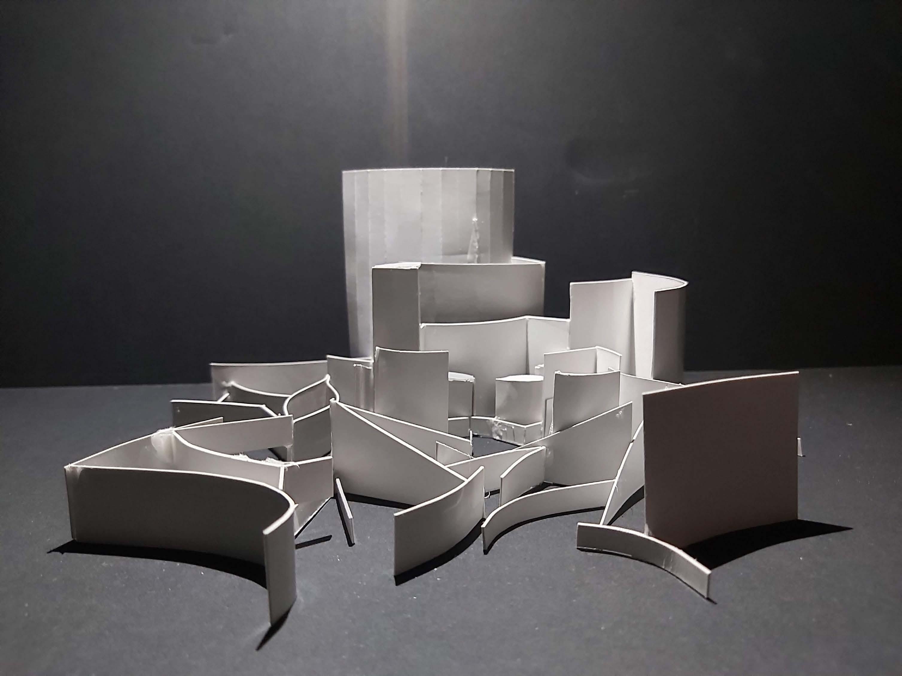
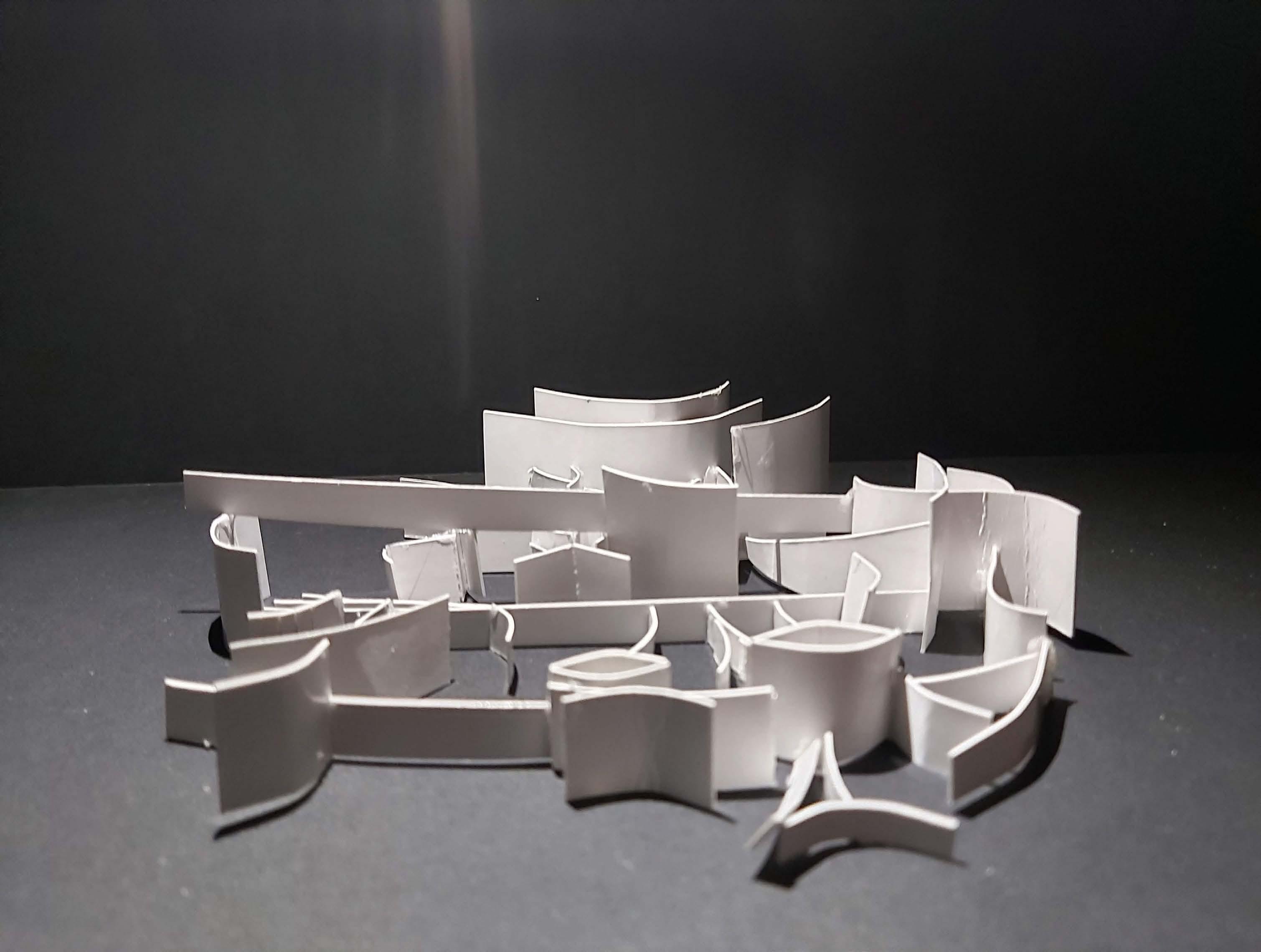
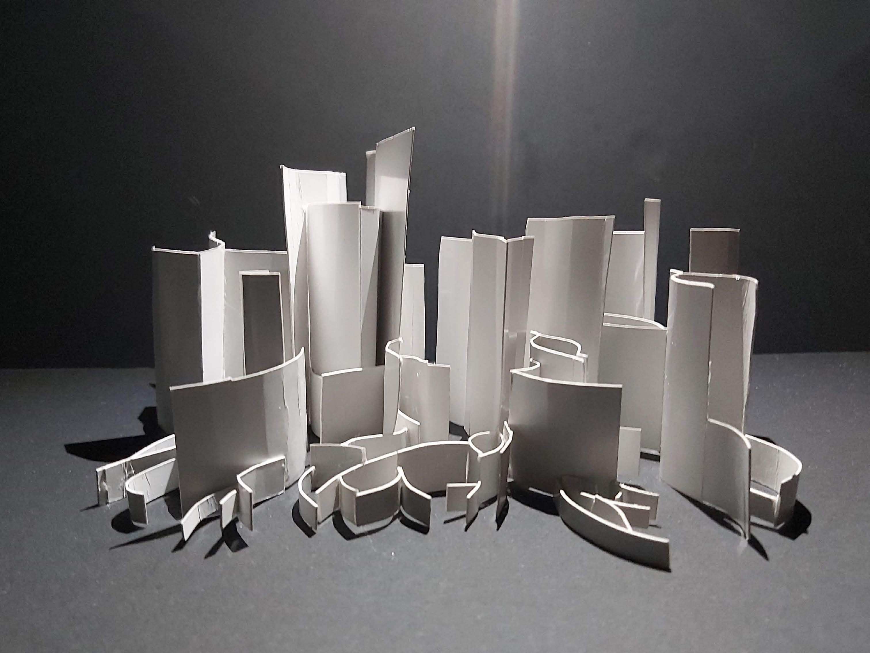
Terminal V Competition
Second place, DARIAH Innovation Challenge Guided by Dan Hasson & Dor schindler Together with Gil Sharabi
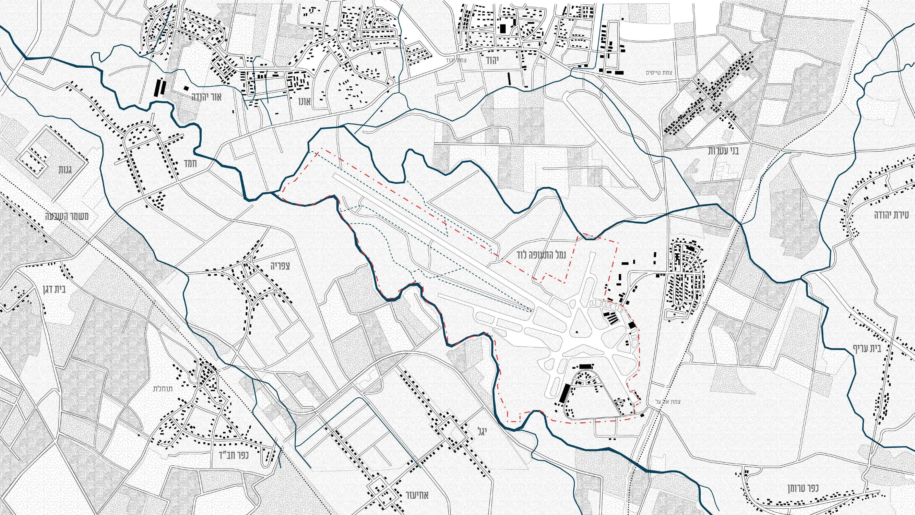
Concept: Our project examines the spatial changes that have taken place at Ben Gurion Airport since its establishment and proposes a model for its future expansion through densification and utilization of existing areas.
08
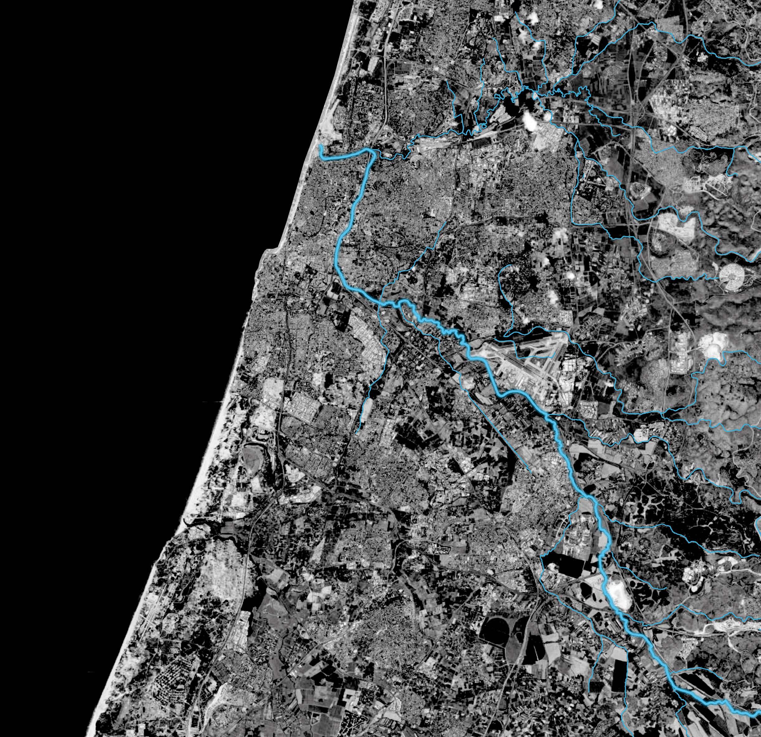
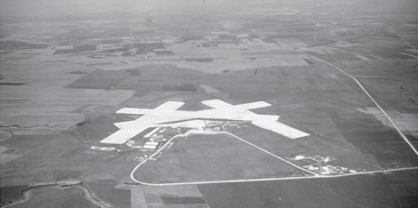
For centuries the Ben Gurion Airport area was an agricultural area, the flat topography and the stream whose floods brought alluvial soils created an ideal environment for agriculture. The planar surface was also suitable for aviation needs, so when the British occupied the area they chose it for the construction of the “Lida” airport in 1936, which would later become Terminal 1.
The construction of the airport involved the evacuation of the fields. Over the years, and with the development of aviation technologies, the airport has expanded at the expense of the agricultural fields that were owned by the residents of the area.
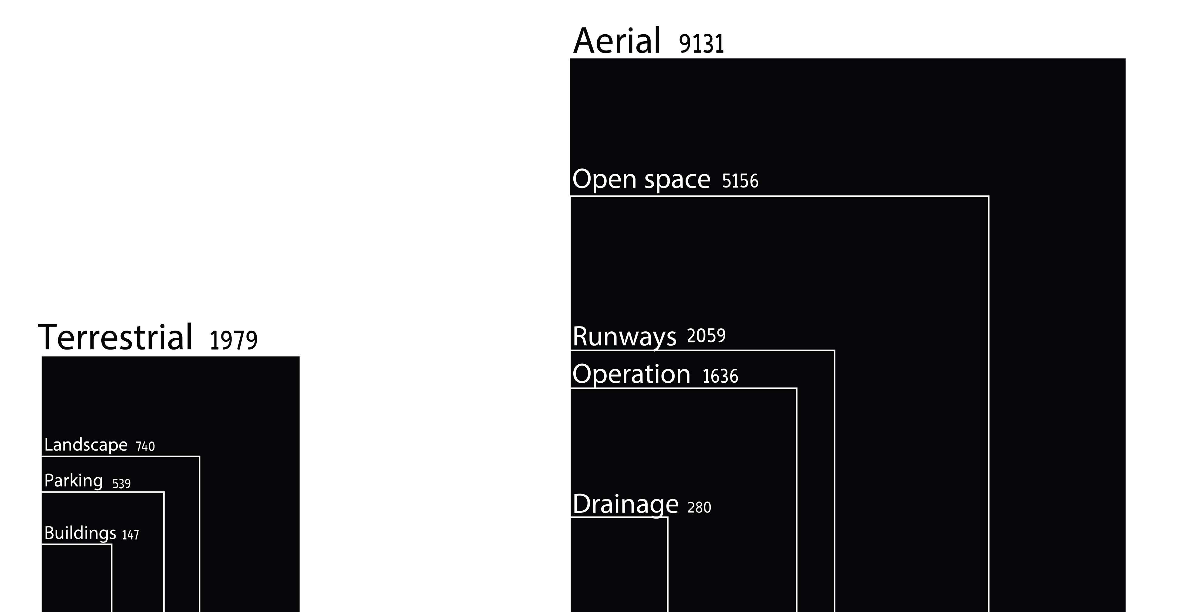
The large area occupied by Ben Gurion Airport is almost inaccessible to the public at all, and in order to get from place to place you have to go through fences, checkpoints, inspections and borders) And aerial (accessible only to operations crews).

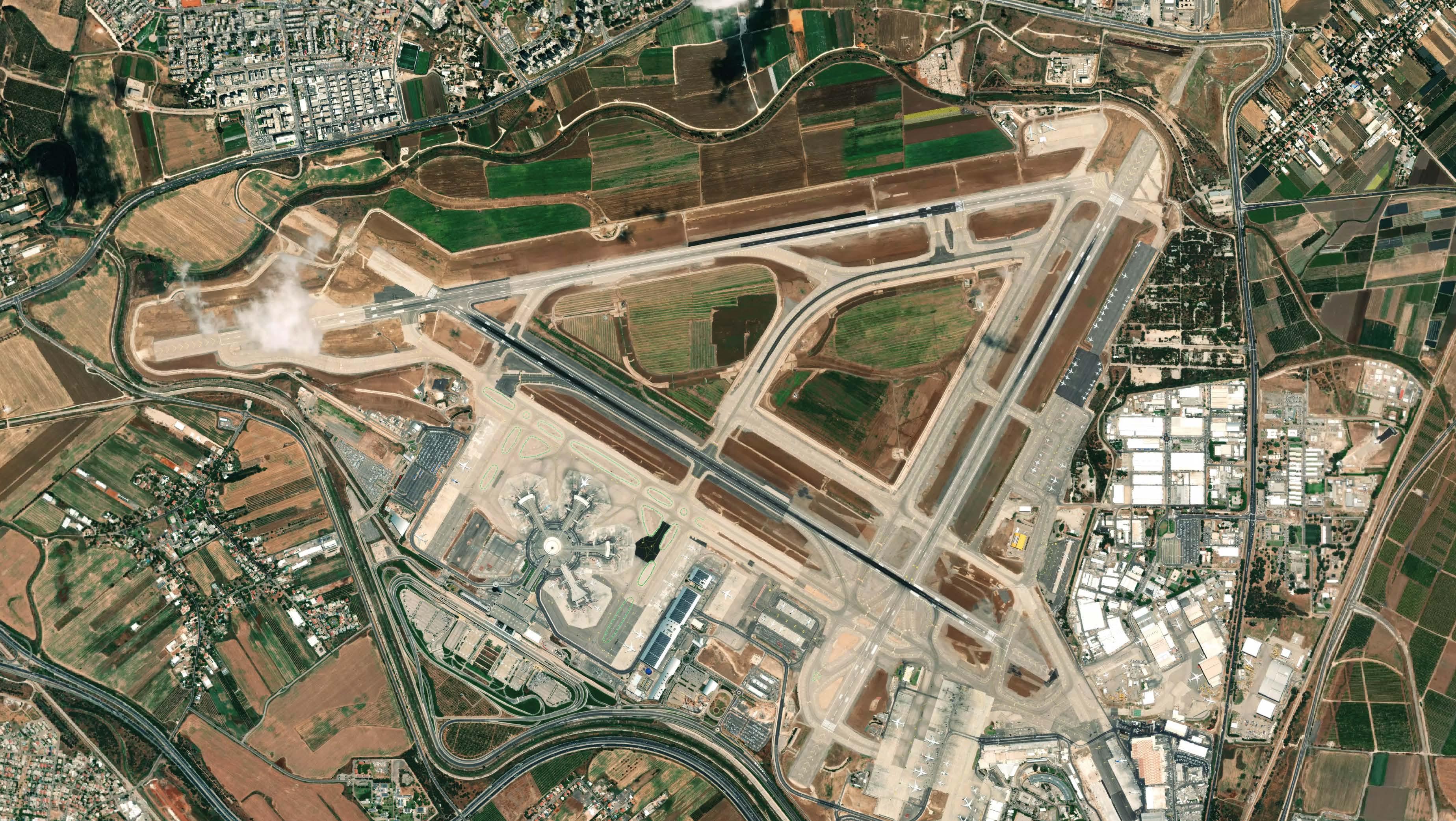
The mainland occupies 18% of the total area at Ben Gurion Airport, and contains the landscape design, roads, parking lots, and buildings (according to their respective sizes). In practice, the public only stays in the terminal buildings and most of the land is not used.
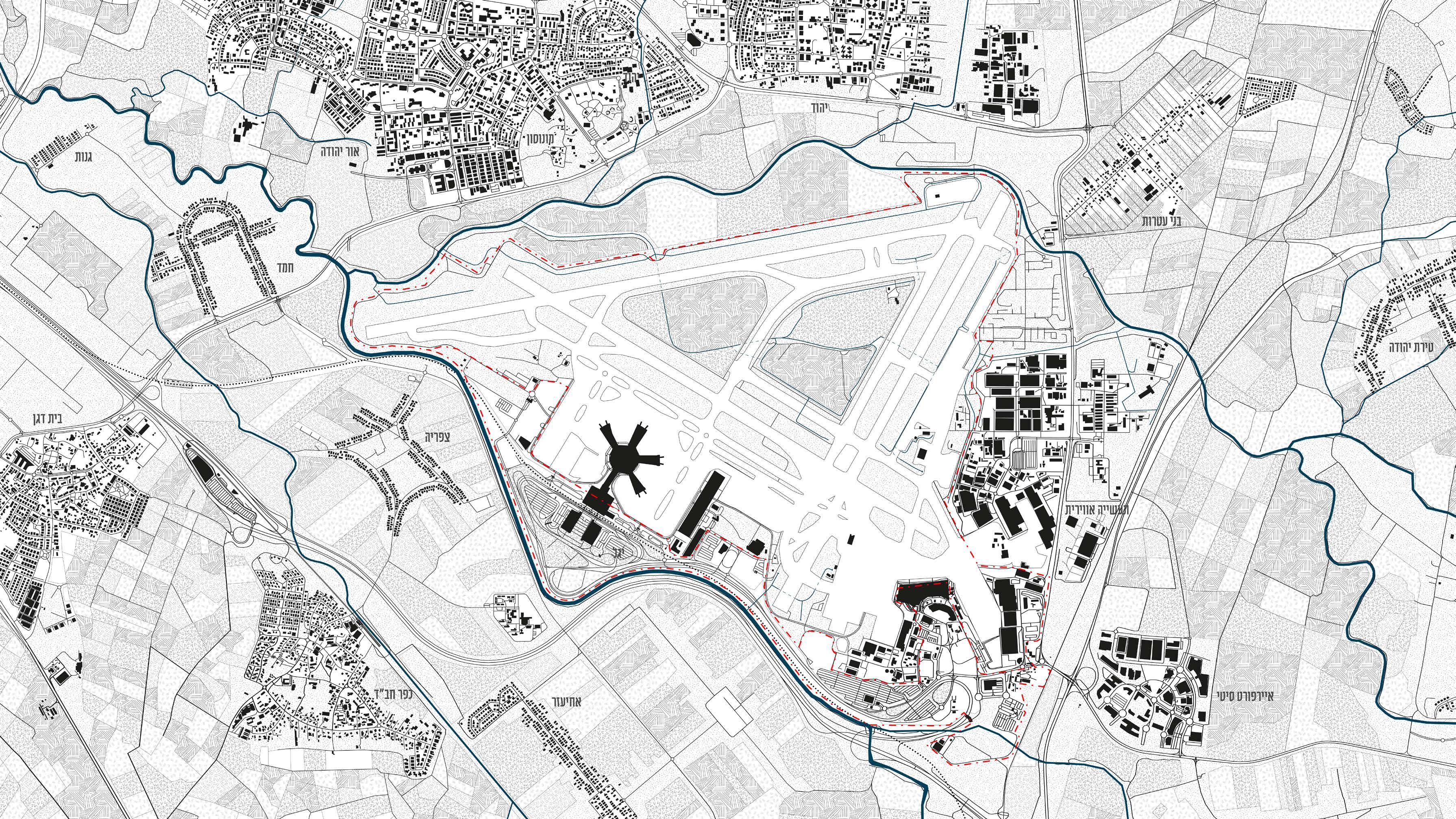
Another significant stage in the expansion of Ben Gurion Airport was the “Ben Gurion Airport 2000” project, in which Terminal 3 was built - the main terminal for international flights. In order to enable its construction, additional areas were needed and therefore the Ayalon River diversion project was carried out. Concrete ditches were laid out, changing the course of the creek and clearing more space in favor of the airport.
The airspace includes the remaining 82%, and is composed mostly of asphalt surfaces used for aircraft traffic, operation, and flight paths.
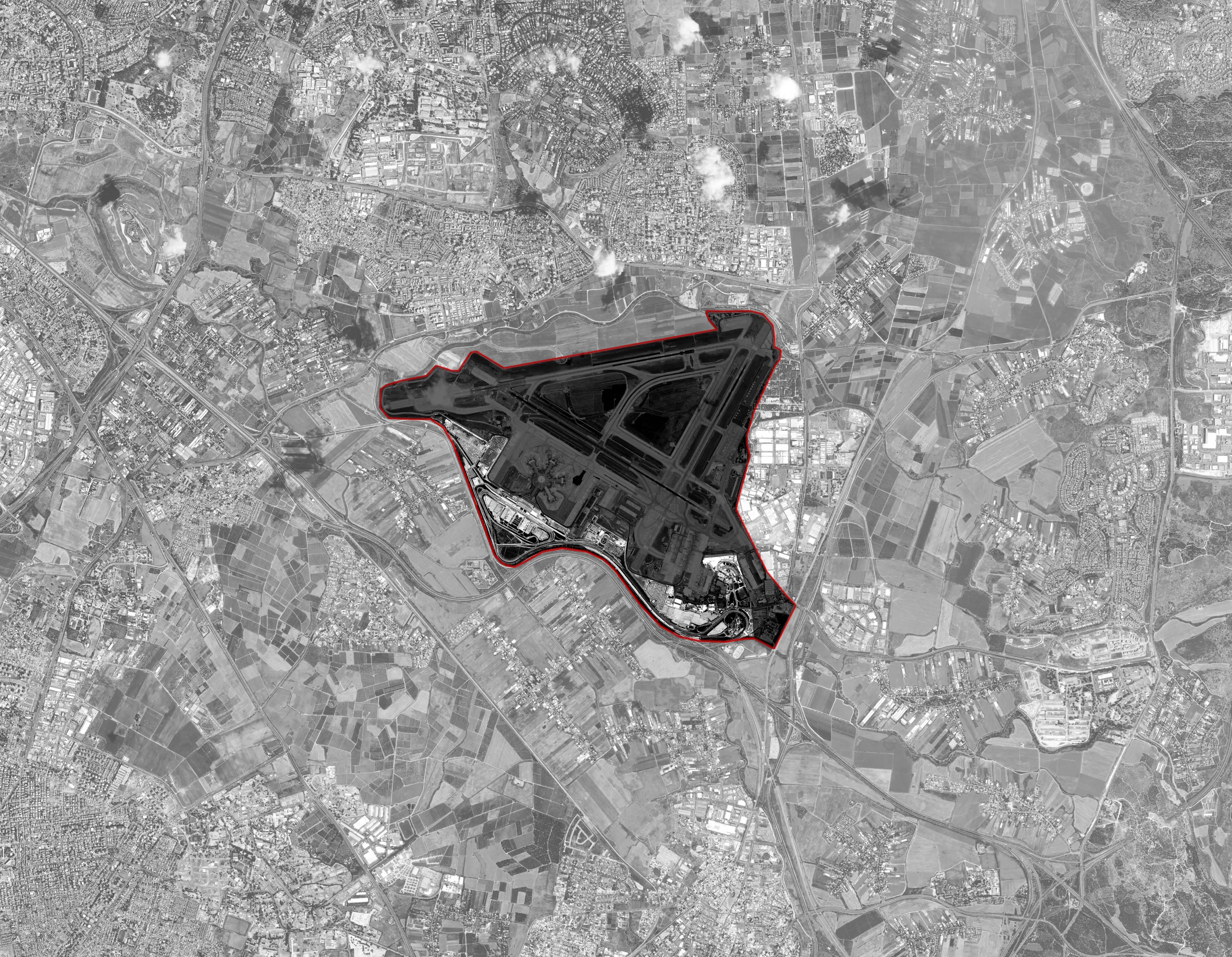
 Ben Gurion Airport is spread over an area of about 11,110 dunams, the size of a small town. The view of the airport is very different from its surroundings, with agricultural fields surrounding it and it itself covers a large area with a large percentage of it covered with asphalt.
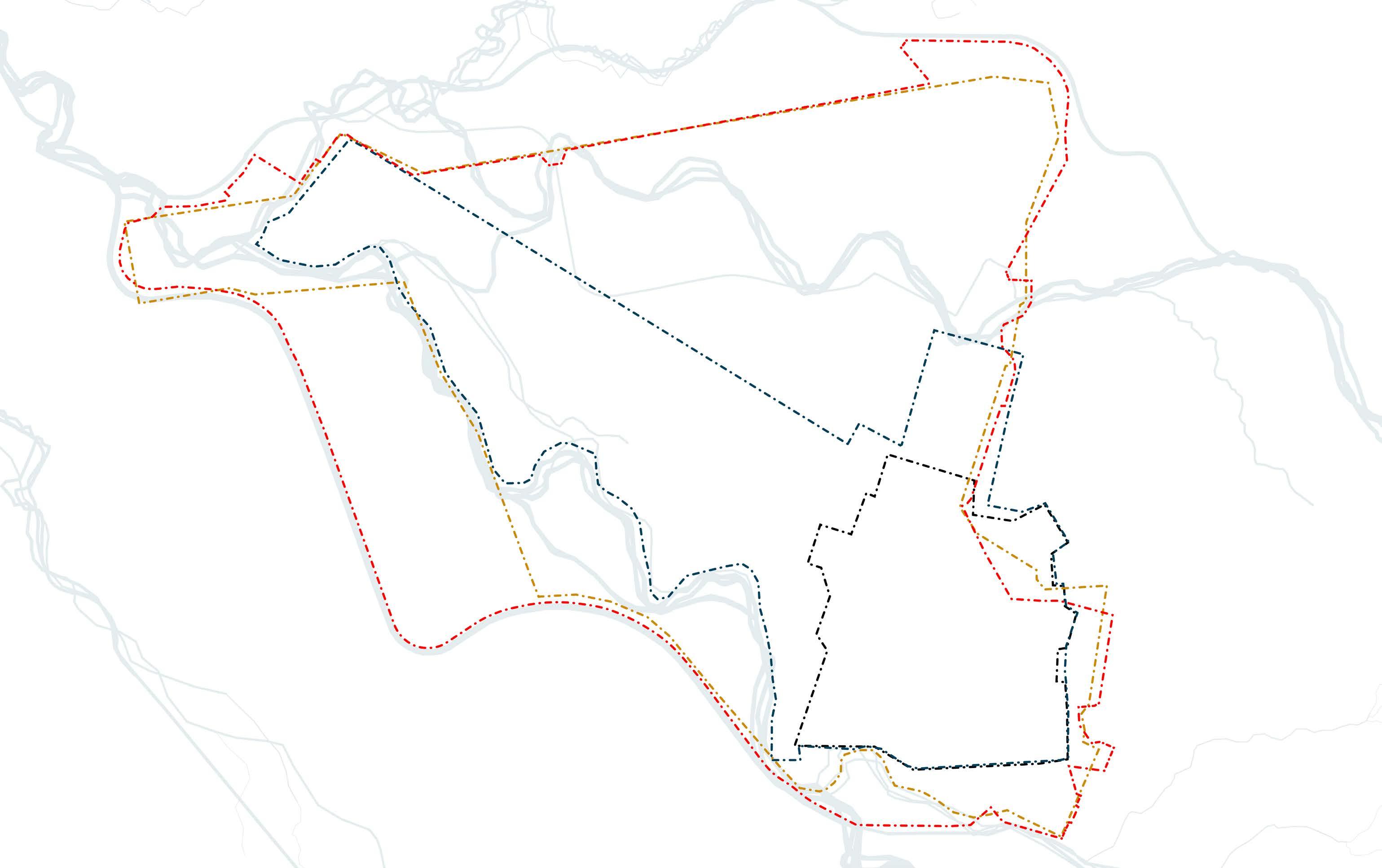
From a feasibility study - diversion of the Ayalon River in accordance with the needs of Ben Gurion Airport
Ben Gurion Airport’s boundaries over the years
Ben Gurion Airport is spread over an area of about 11,110 dunams, the size of a small town. The view of the airport is very different from its surroundings, with agricultural fields surrounding it and it itself covers a large area with a large percentage of it covered with asphalt.
From a feasibility study - diversion of the Ayalon River in accordance with the needs of Ben Gurion Airport
Ben Gurion Airport’s boundaries over the years
Unused areas: Terrestrial Aerial 09
Ben Gurion Airport and its surroundings:
Aircraft operation requires a lot of ground resources adapted to an inhuman scale. The movement of aircraft requires safety margins on the sides of the runways, and in addition the need for a direct line of observation along their entire length causes a large area to remain empty and flat. In addition, the runways produce a sterile space that tramples the ecosystem that was there before (animals, plants and the creek), and also the human-social one. Since there is currently no technology to replace that of the aircraft, we understand that the airport is here to stay, so it is important to crowd the programs and maintain the existing open spaces.
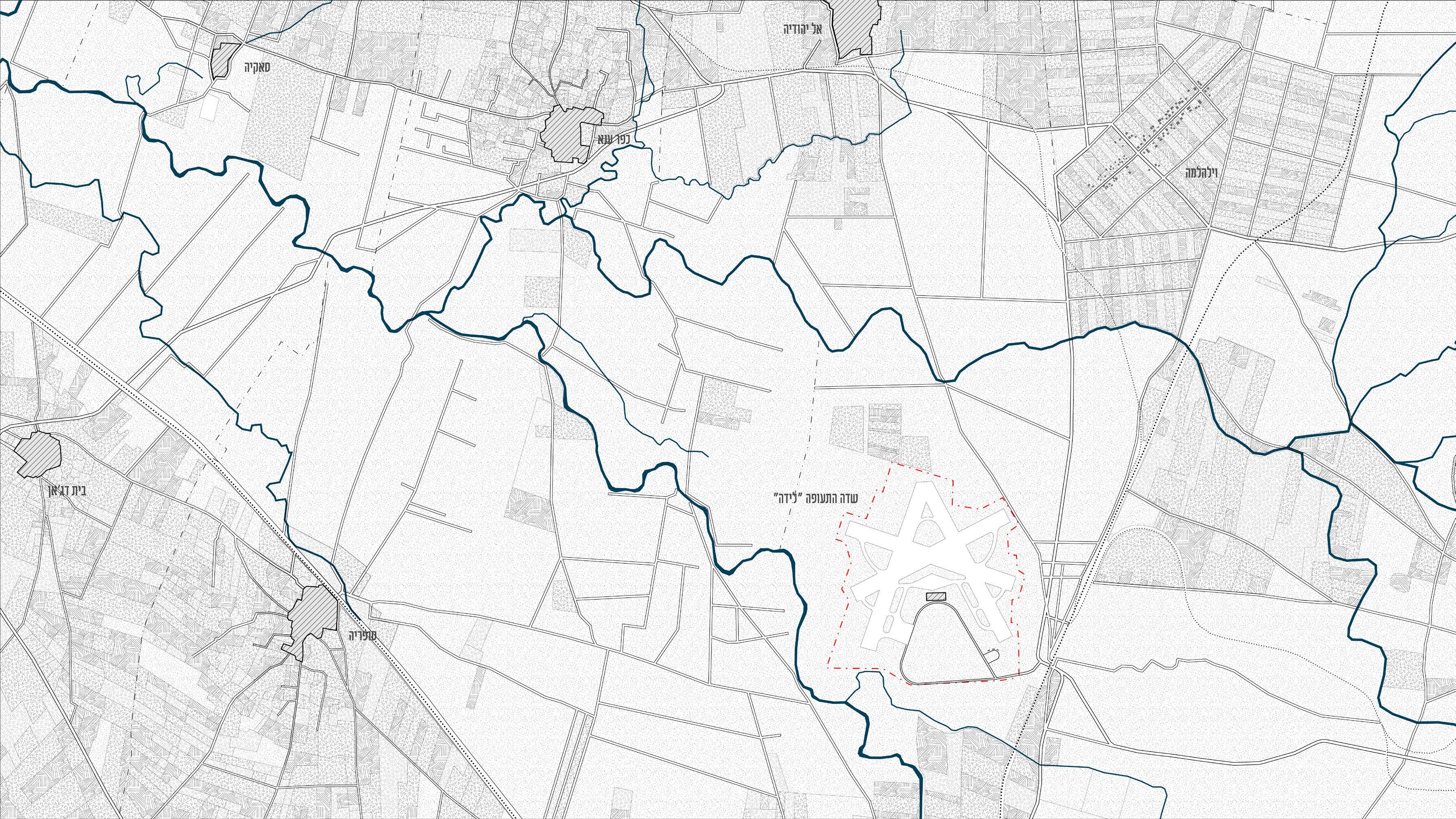
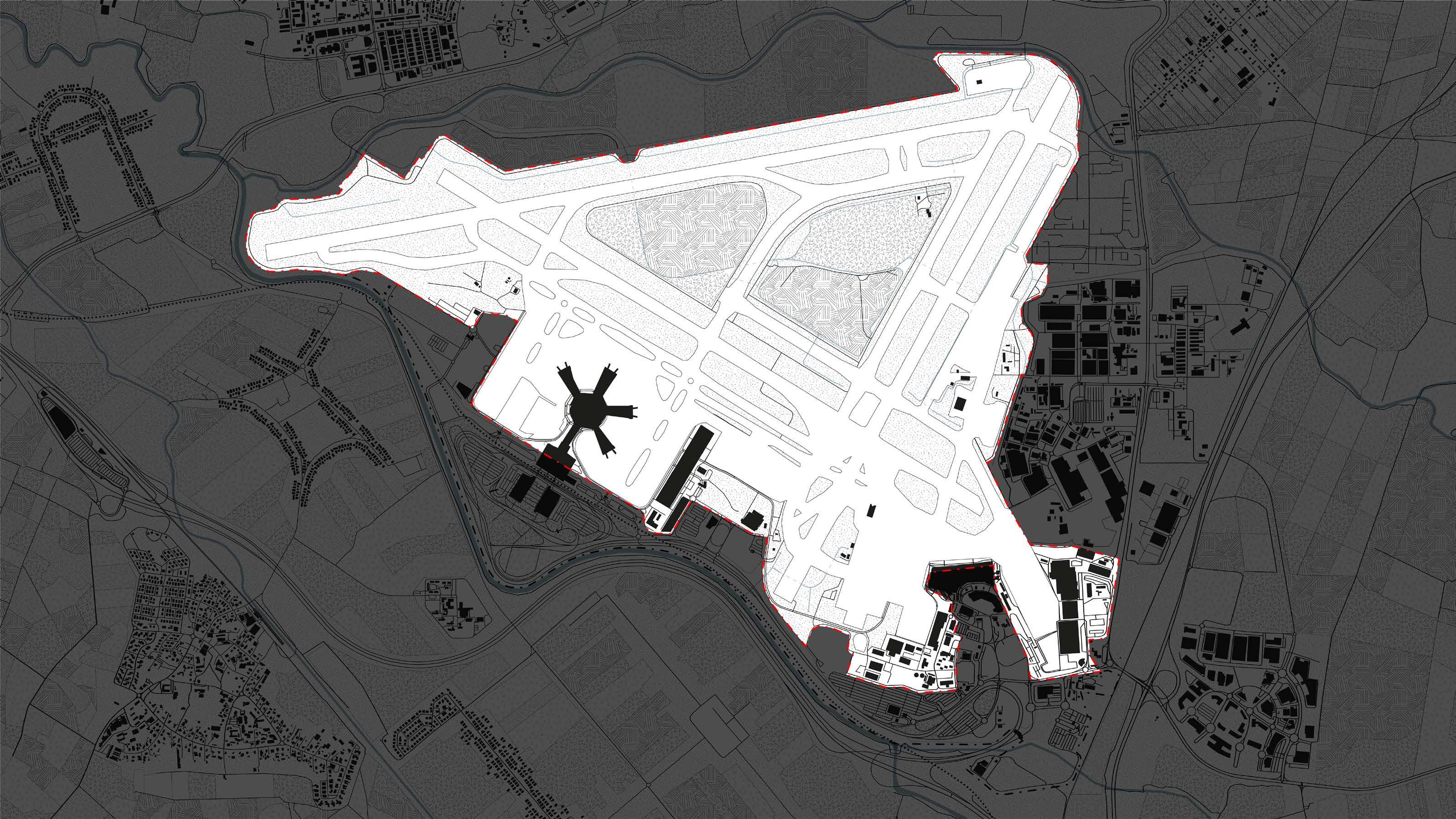
 Another expansion project is currently planned at Ben Gurion Airport, which includes the construction of a new cargo unloading terminal on agricultural areas located in the northern part of the complex. In the imprisoned area.
10
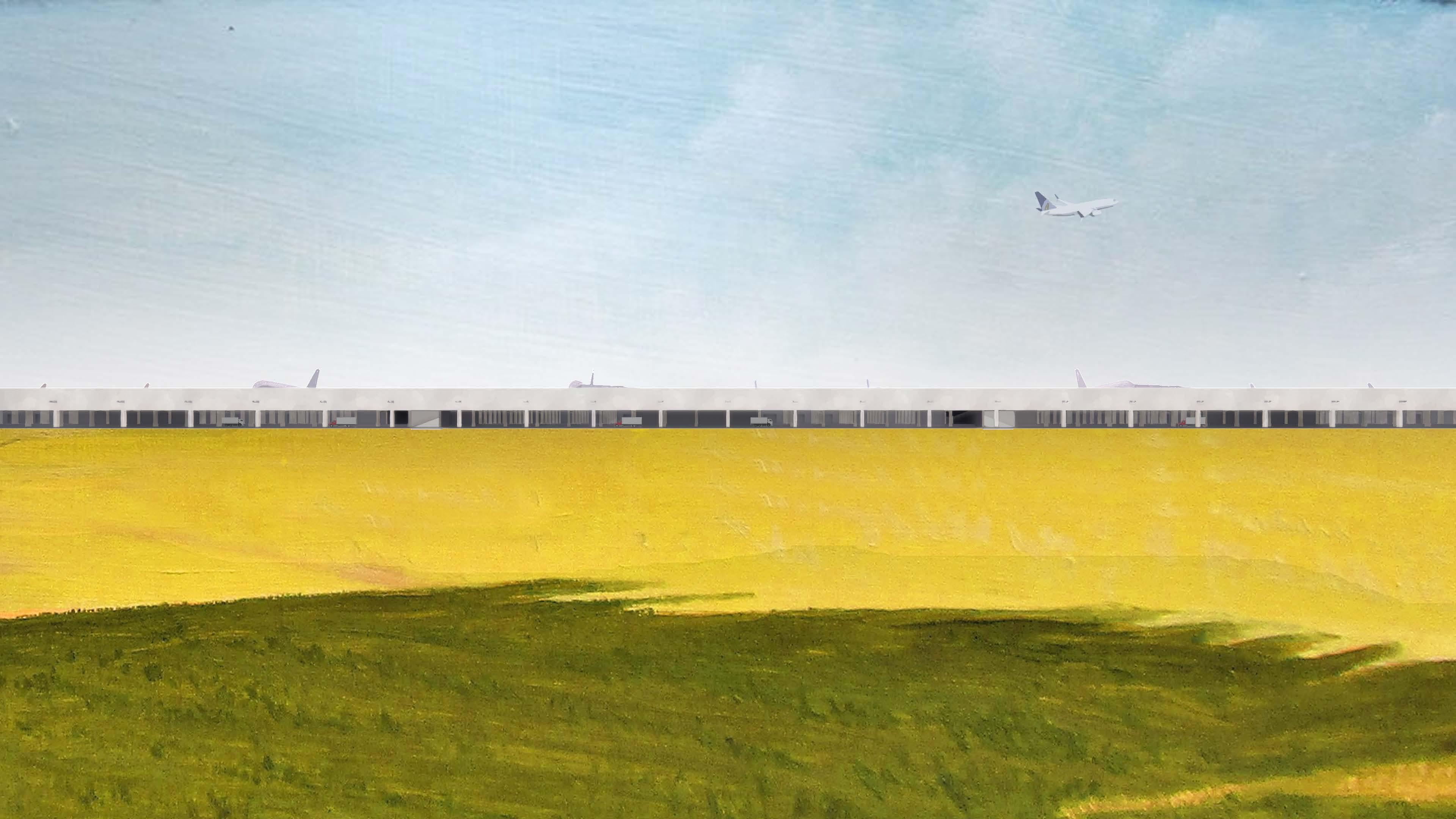
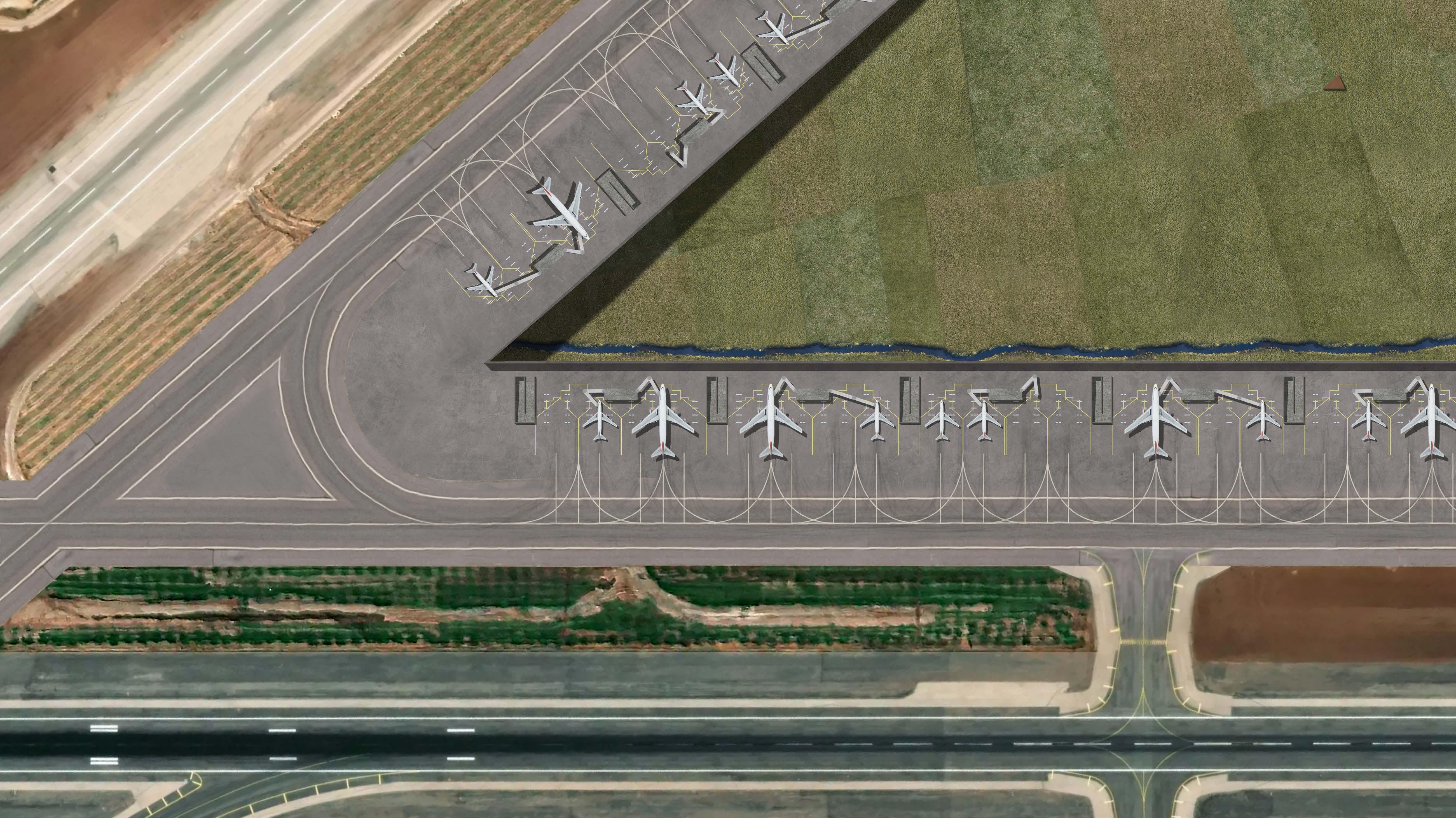
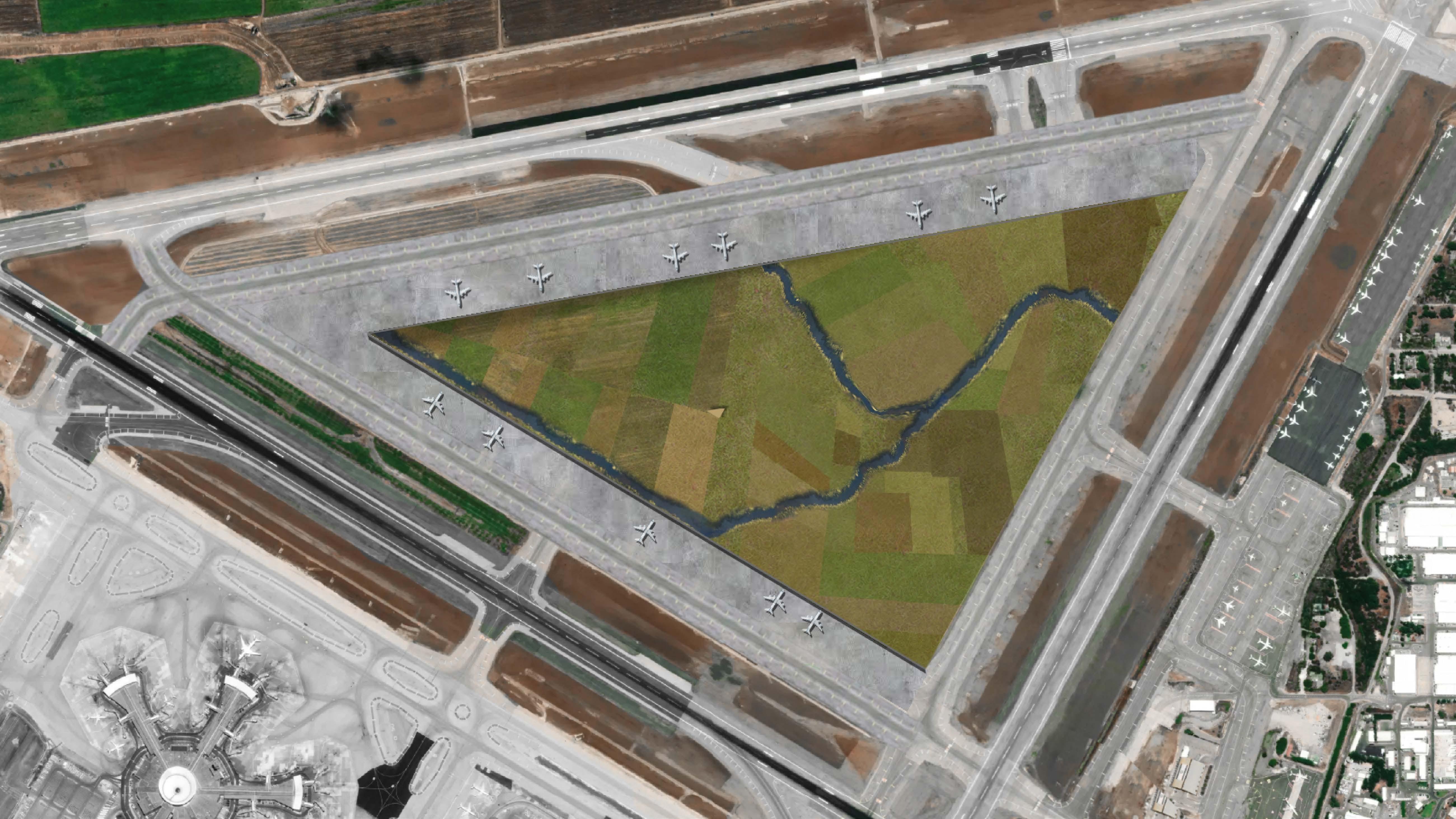
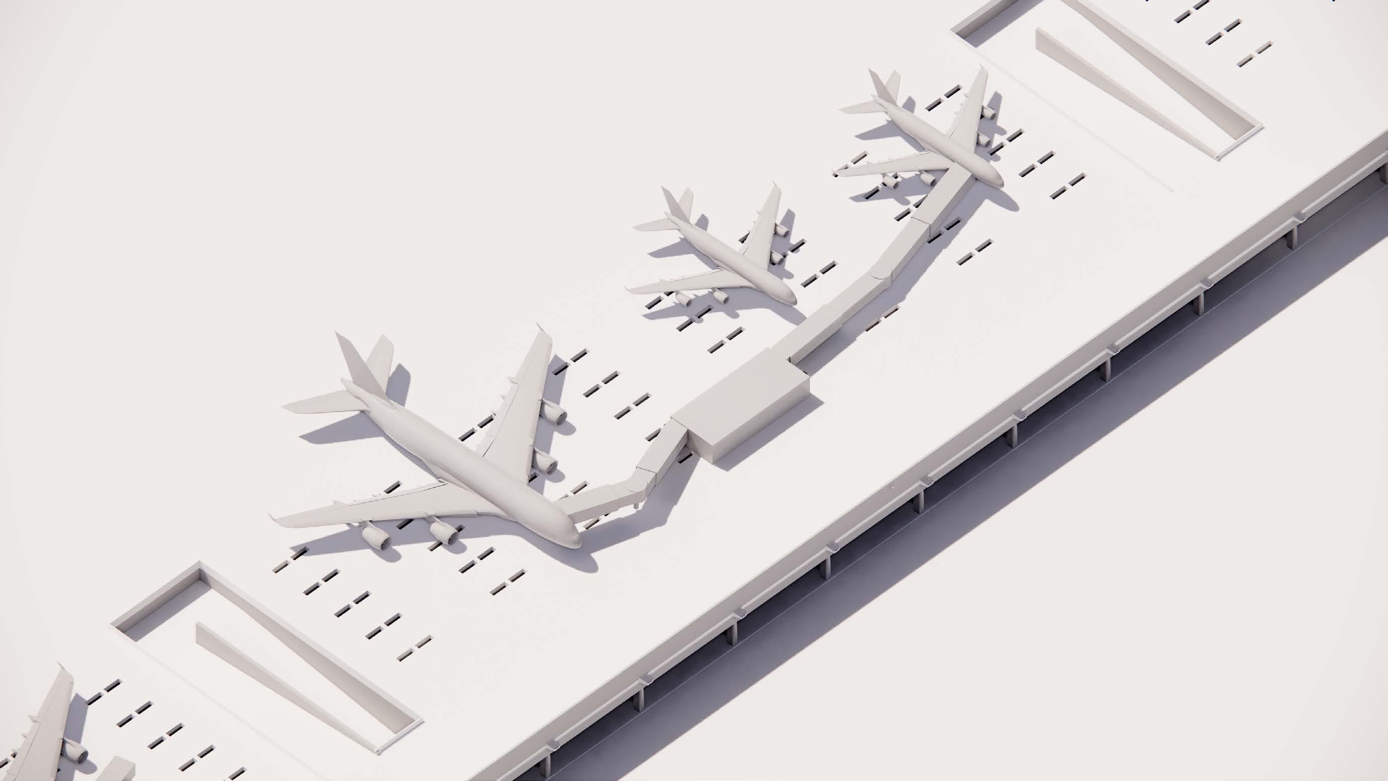
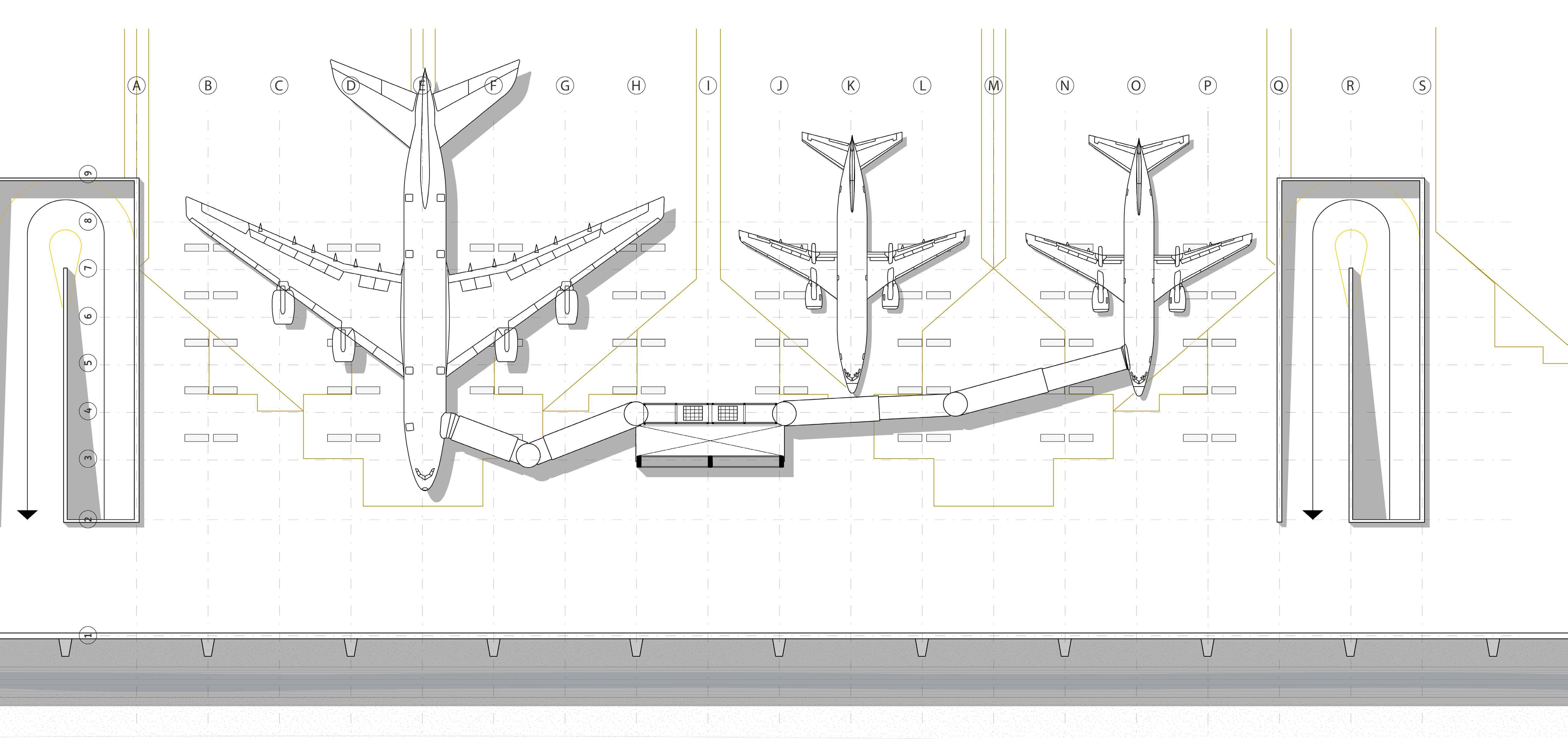
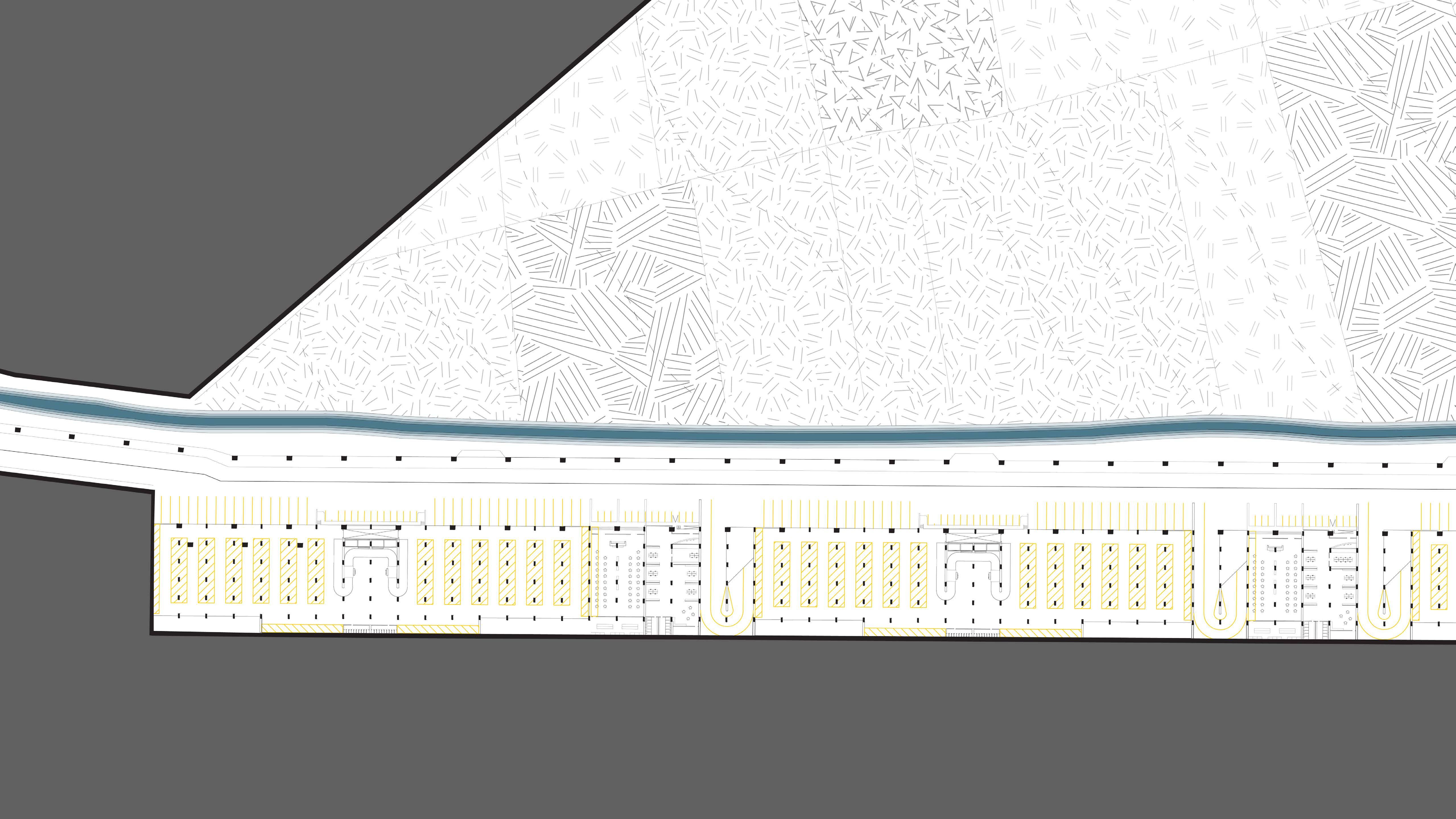
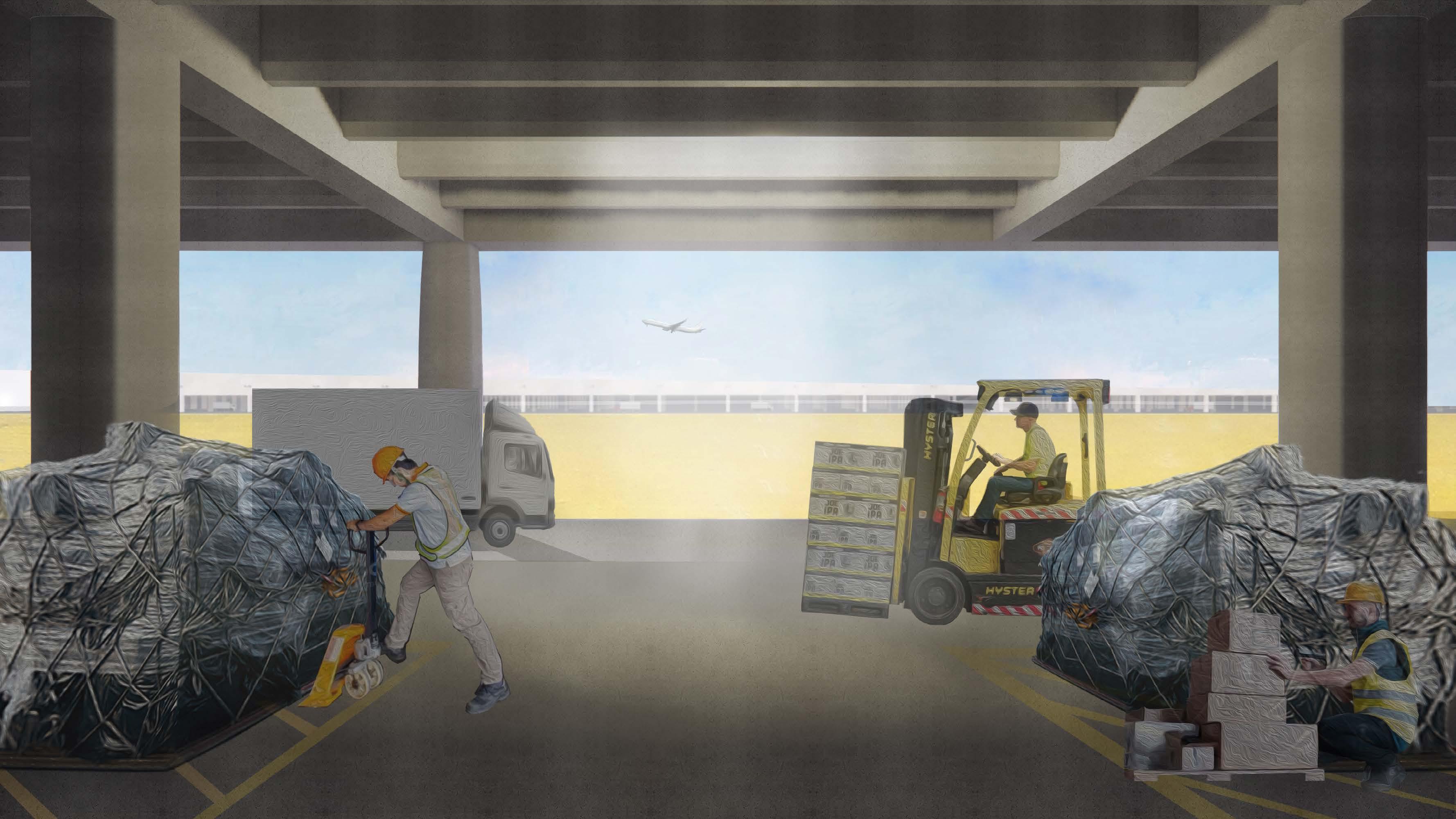
We chose to focus on a cargo terminal because the need to transport cargo is growing (an increase of 80% only in the last year) and as the only field in the country through which goods are transported, it must provide a solution to this need. The proposal includes the design of the goods terminal within the triangle trapped between the runways.
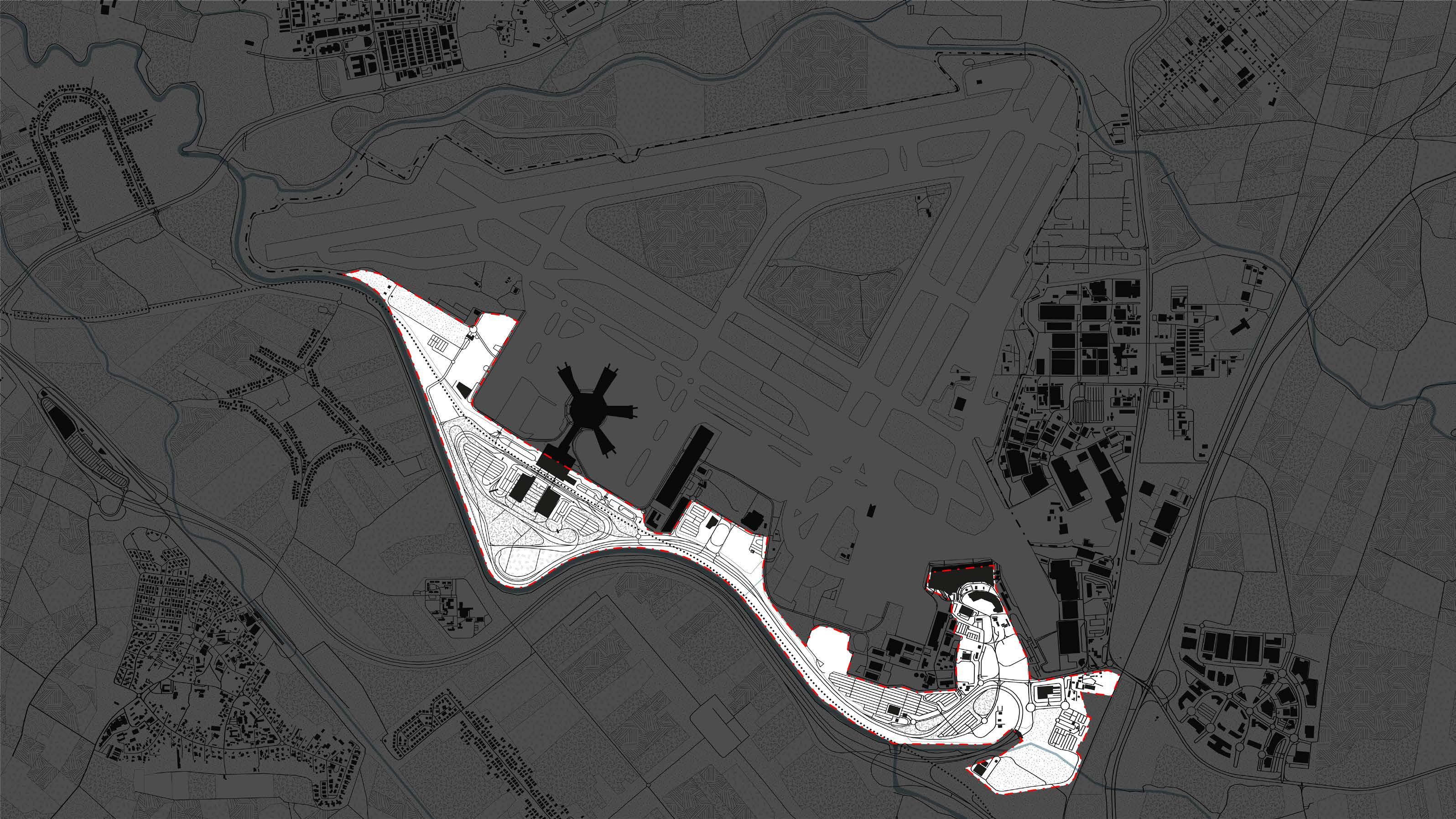
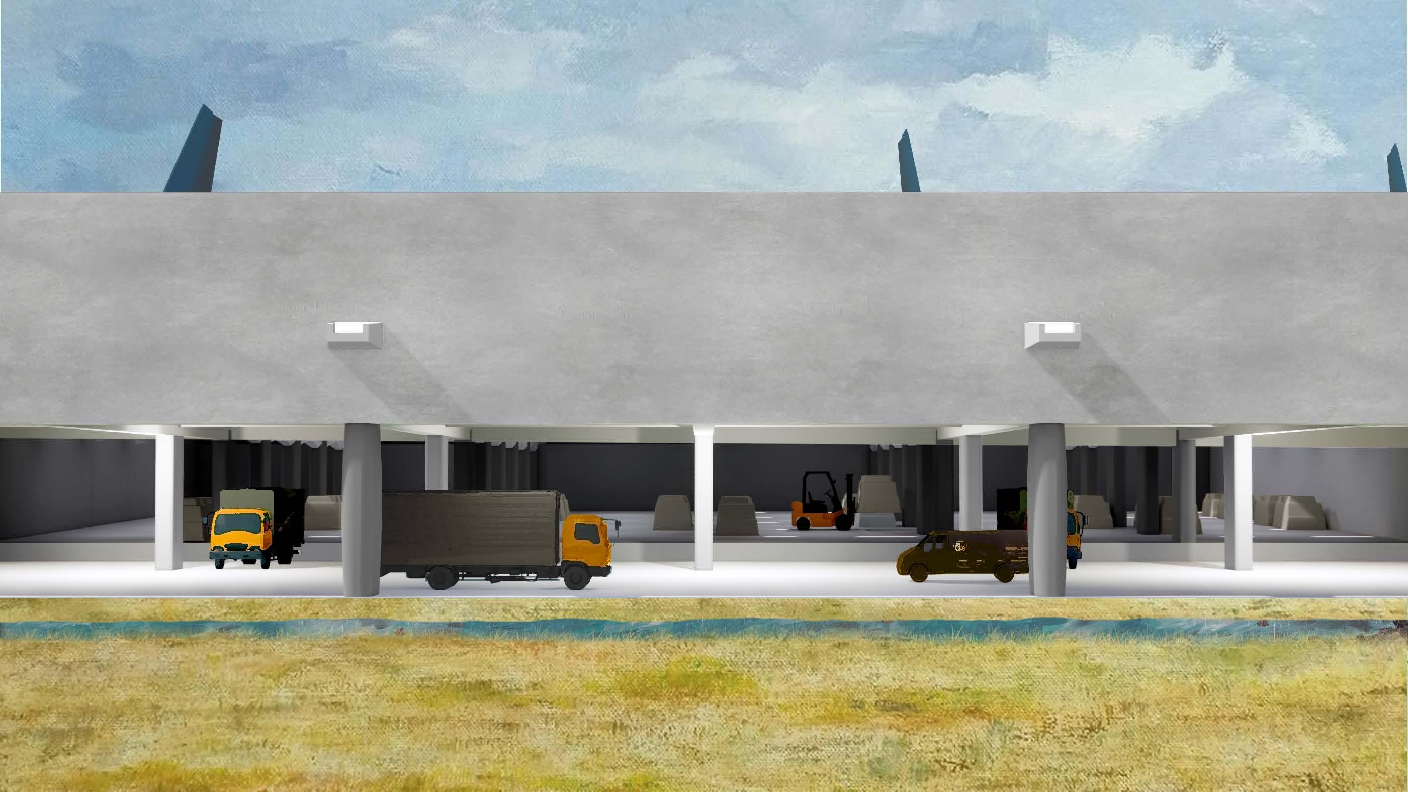
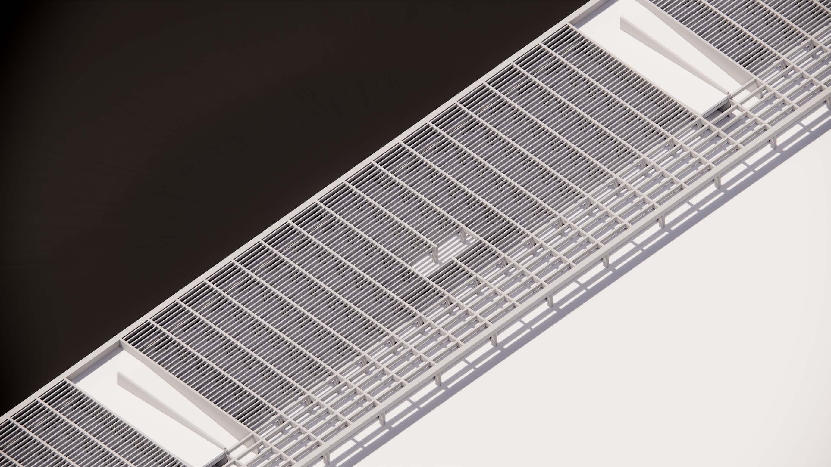
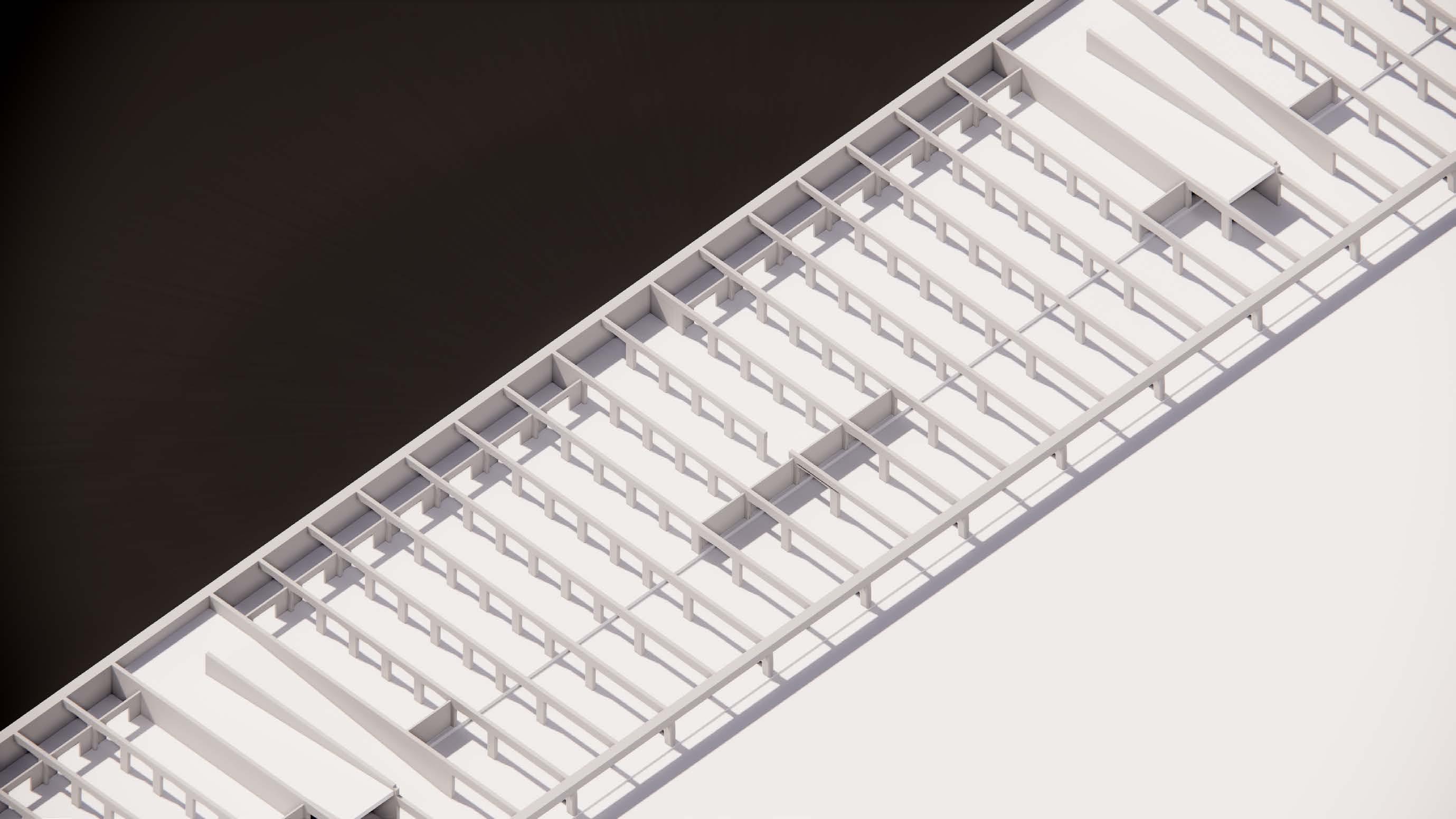
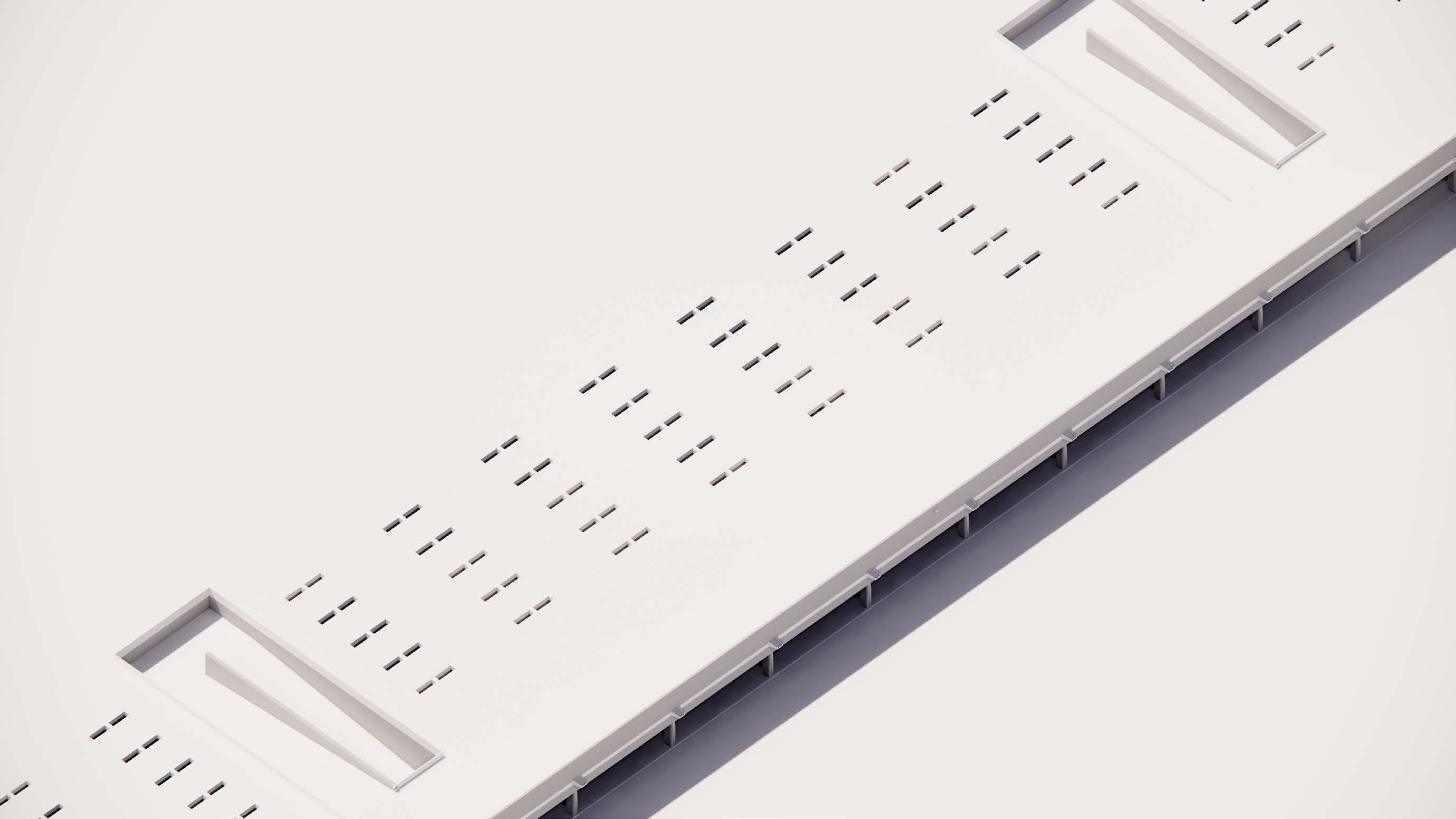
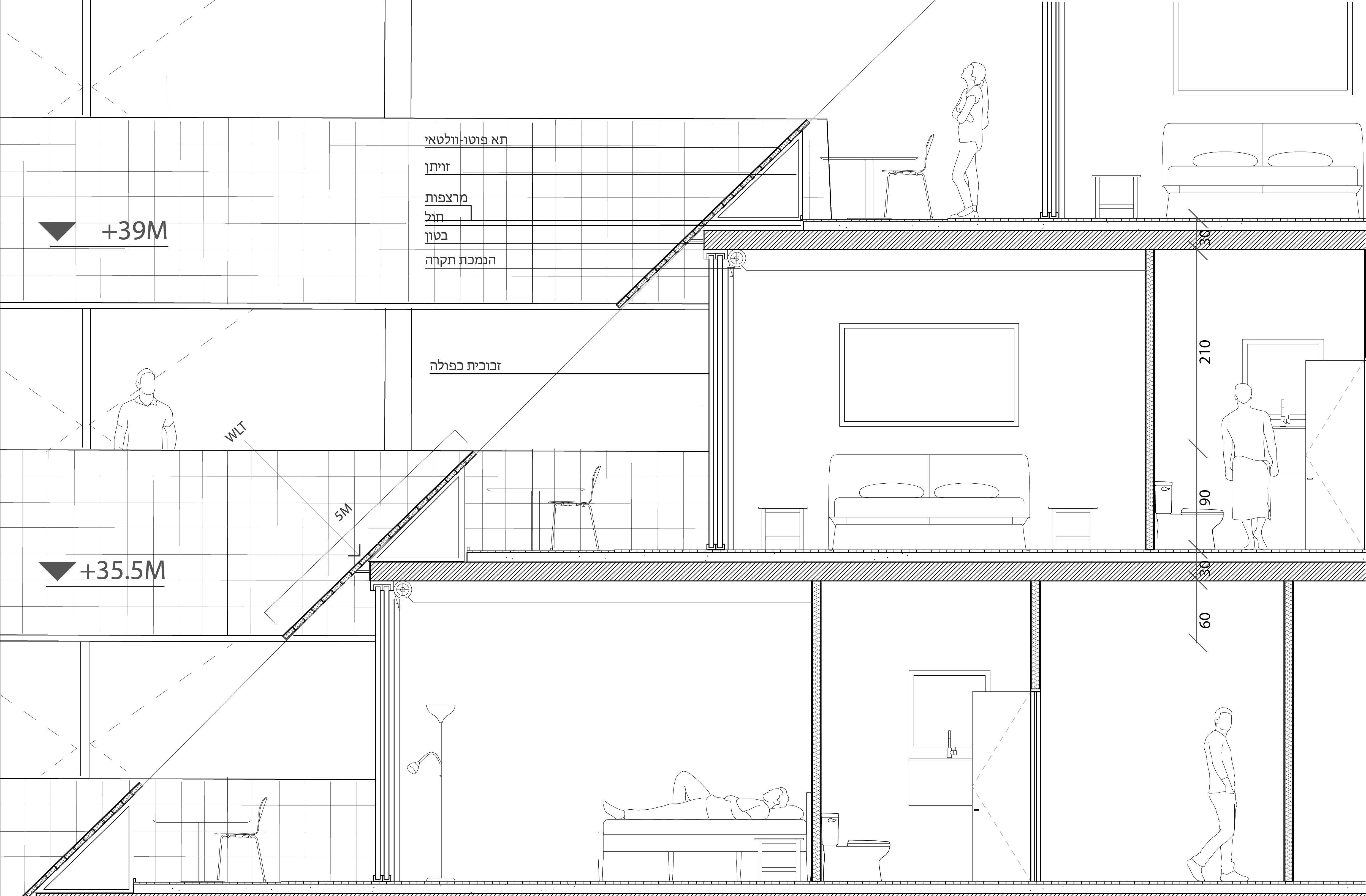
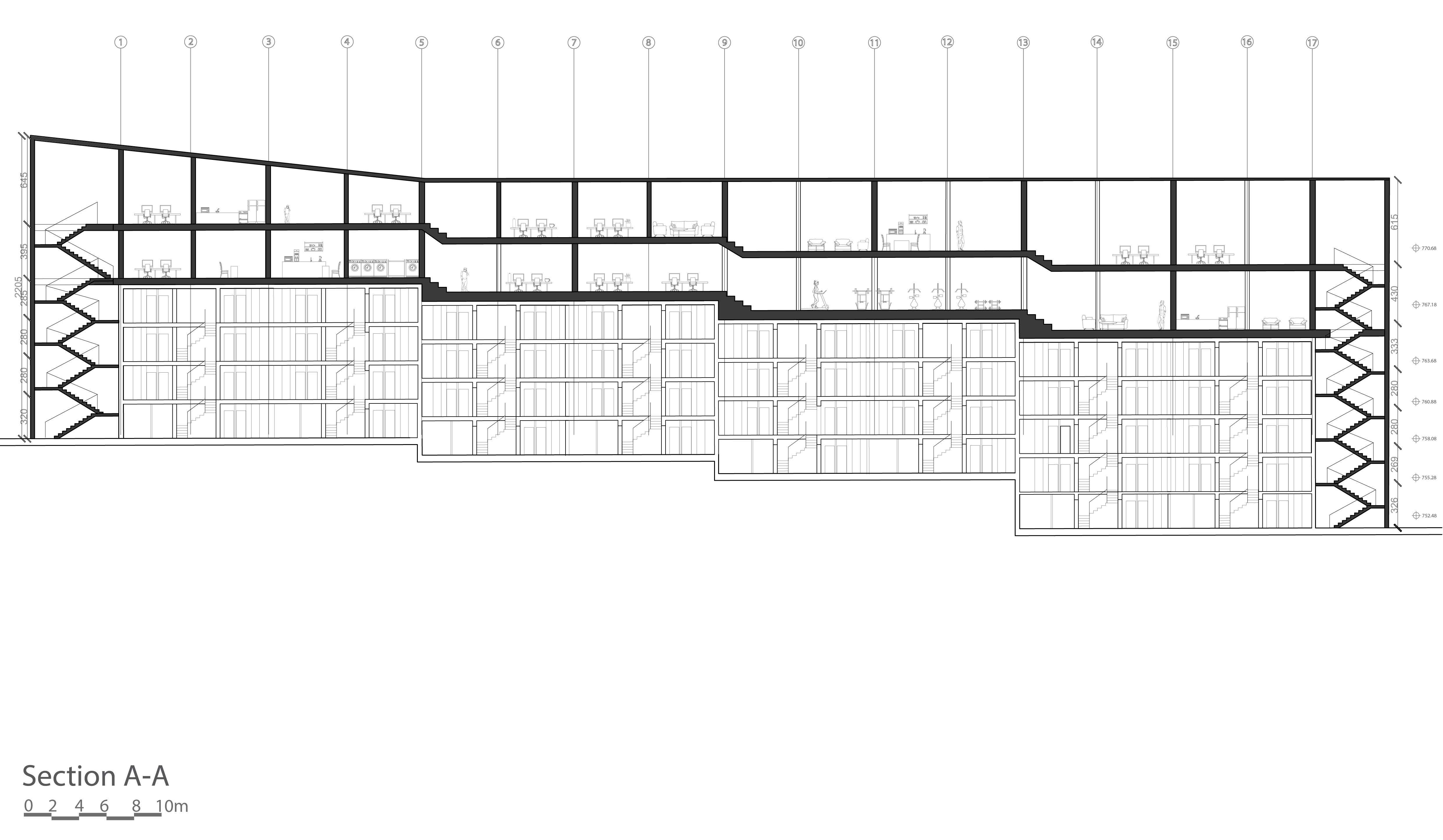
The terminal will be built under the runways so that it does not block the view of the runway control tower, the underground construction will save space and streamline the unloading processes. The triangle, which until now was closed and unused, will become an active place with a human presence. The opening of the triangle will create a new kind of landscape, which will expose both the terminal staff and the top view from the planes landing and taking off, thus allowing “access” of people to a place that was previously closed.
Section
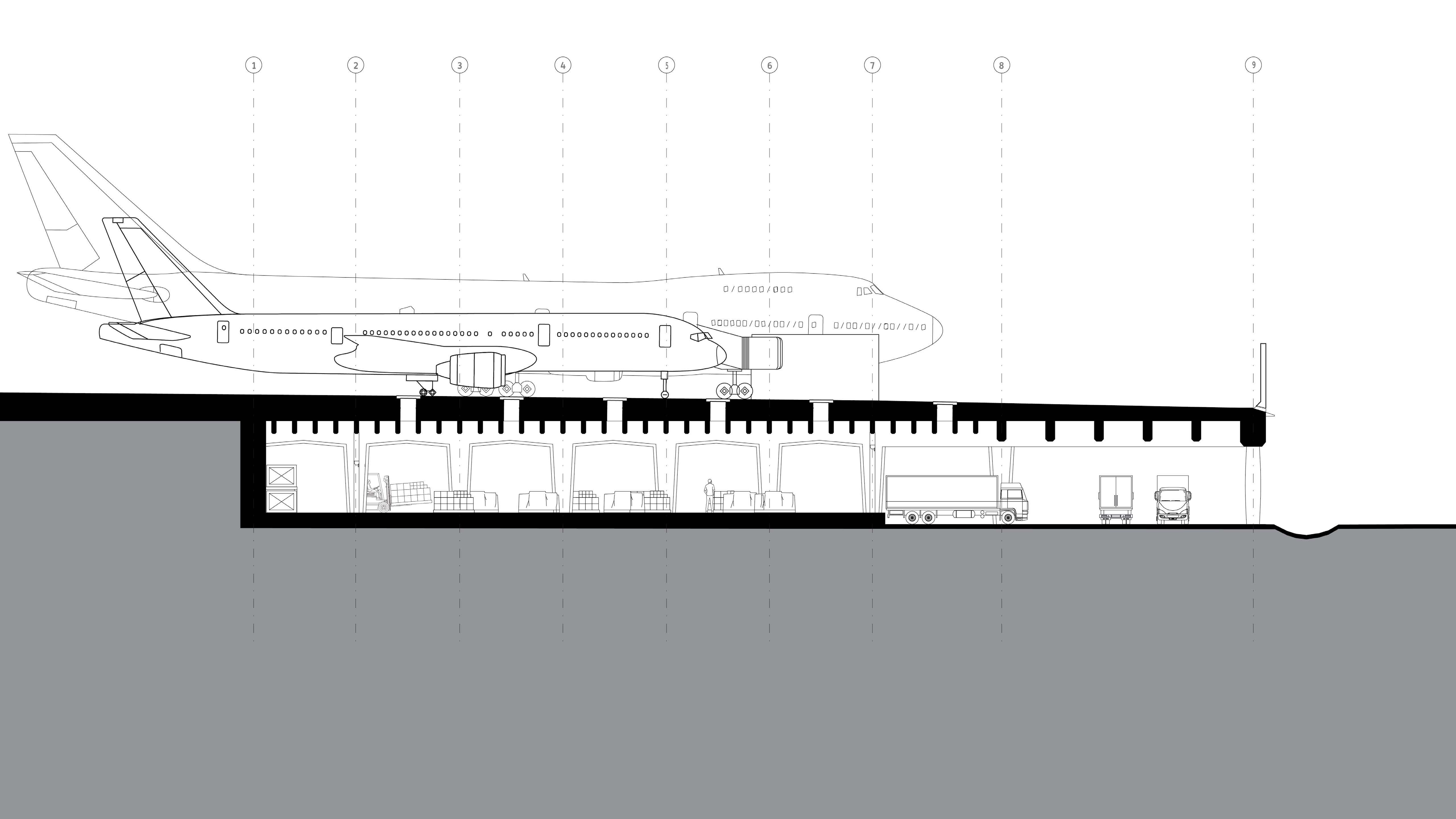
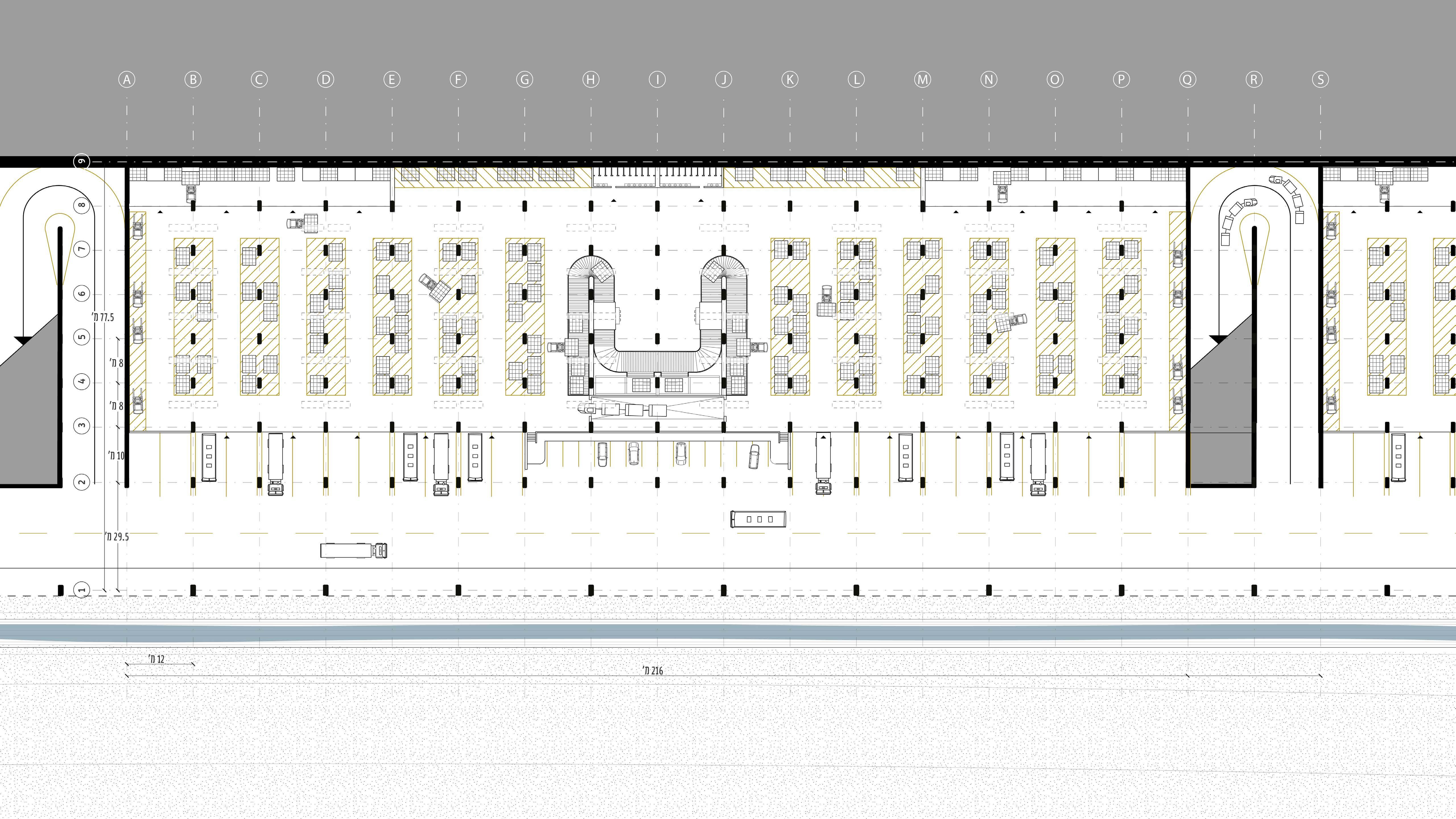
Ground floor - cargo area
Top floor- Aircraft parking
Construction:
Inside view:
Location in the triangle:
Front view:
Off grid - On premise Studio 4
by Omri Levi & Matan Gal
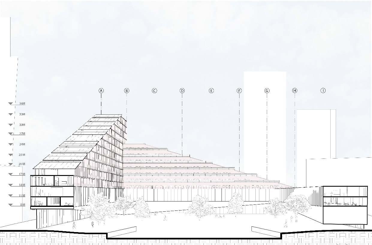
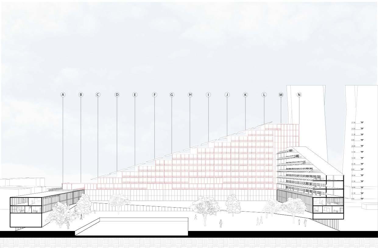
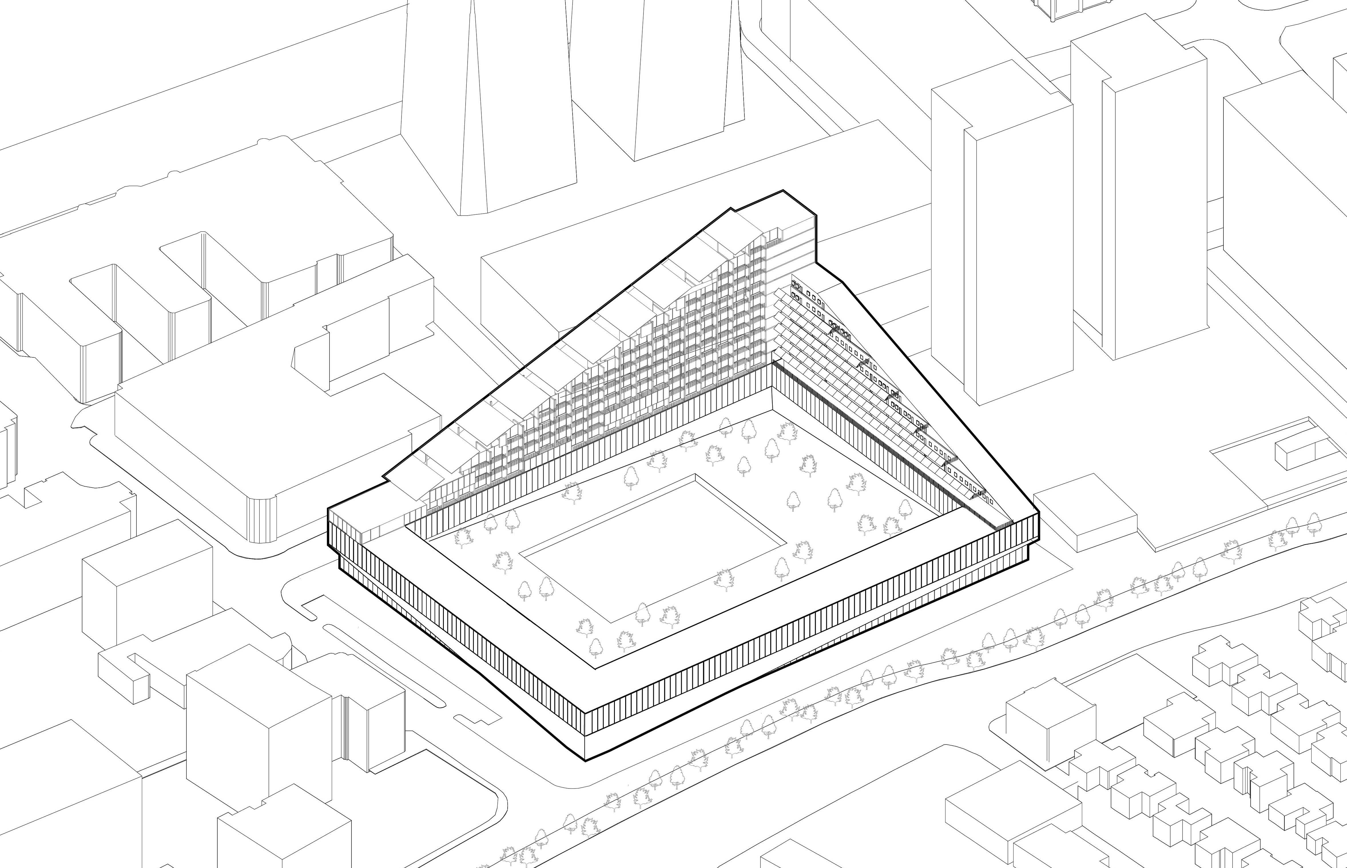
Concept: The IEC (Israeli electricity company) is considered a monopoly in Israel in its field, and by virtue of being such, it is exposed to much public criticism. In my project, I am re-planning the structure of the IEC in Tel Aviv, and by that trying to reduce the criticism directed at the company while preserving its assets.
12
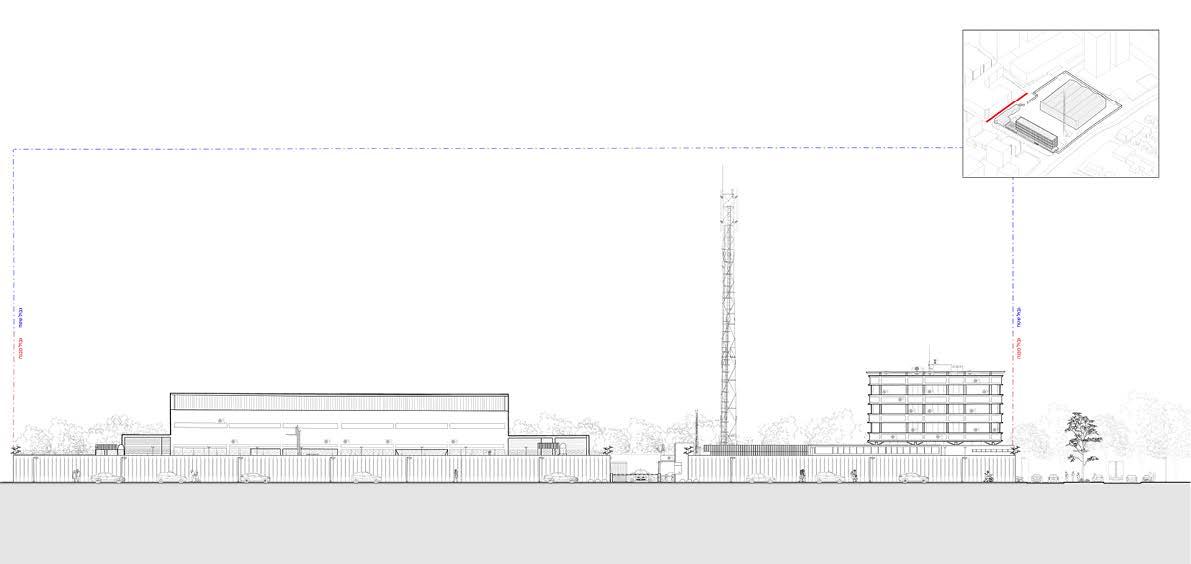
Complex Building Studio
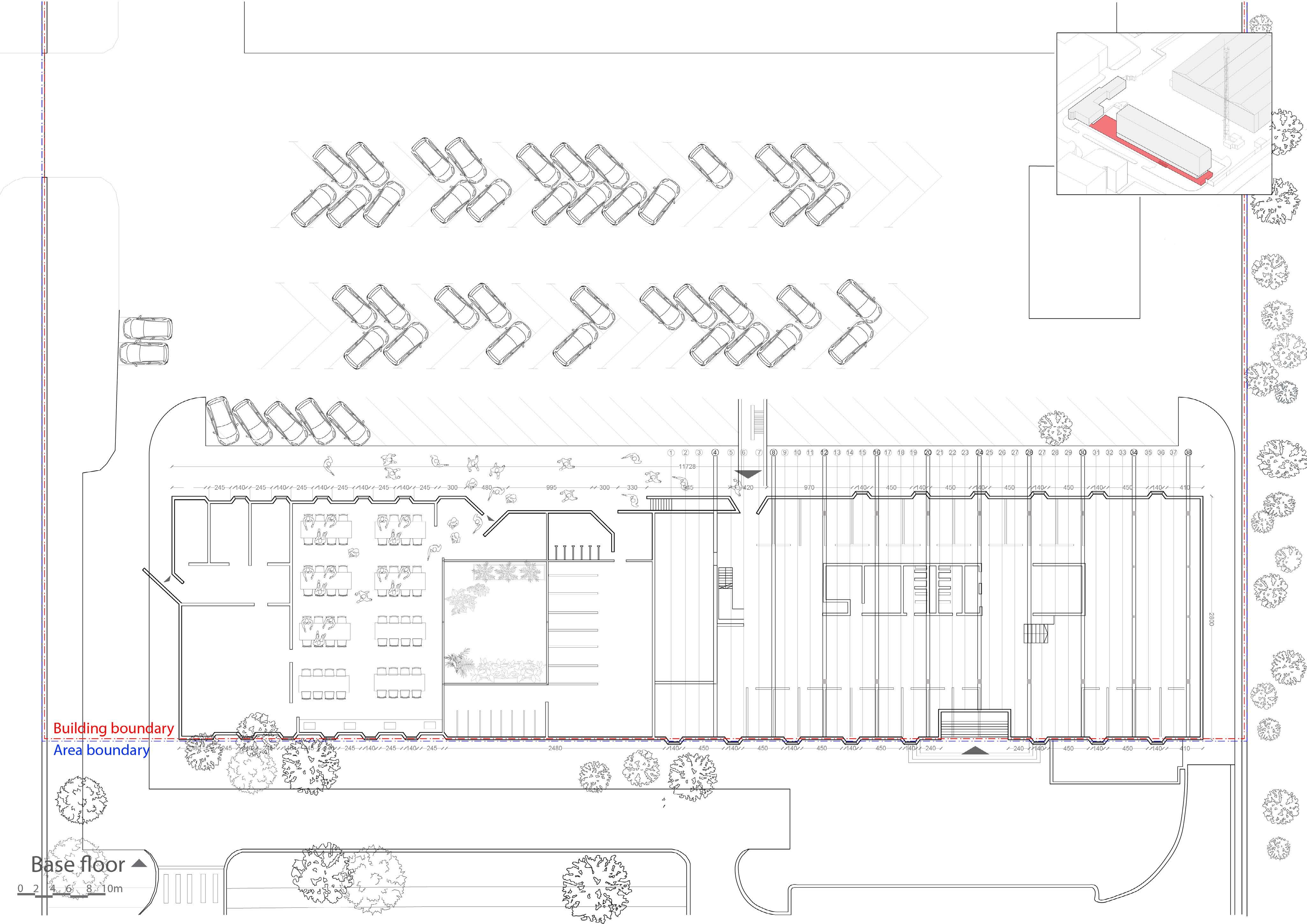
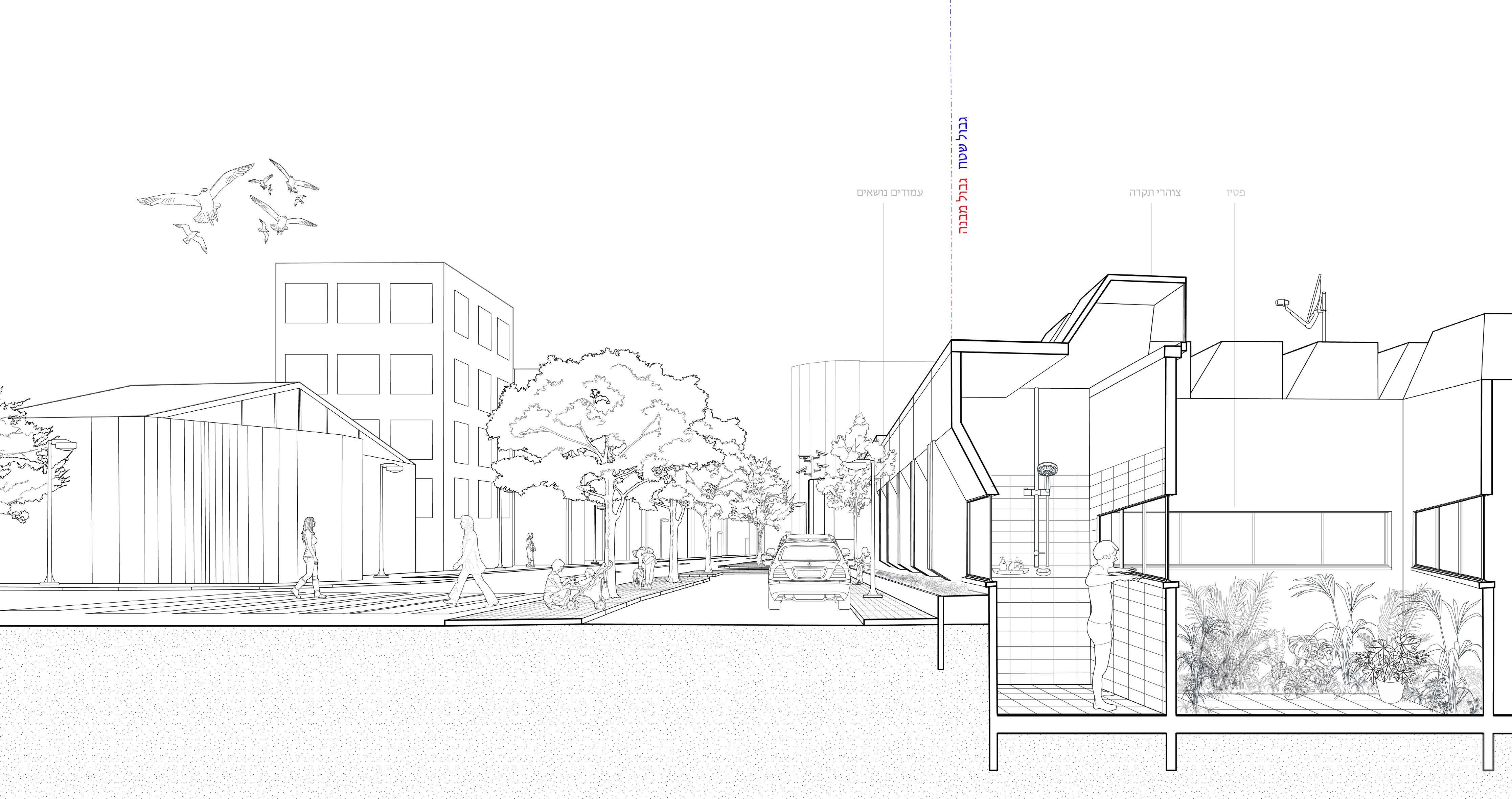
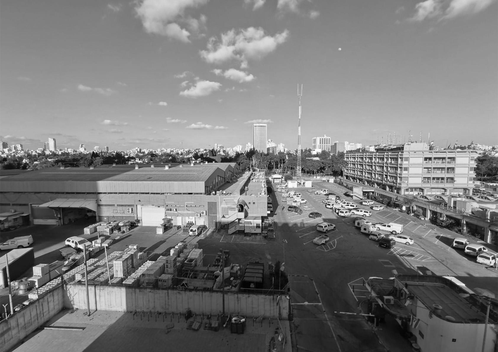
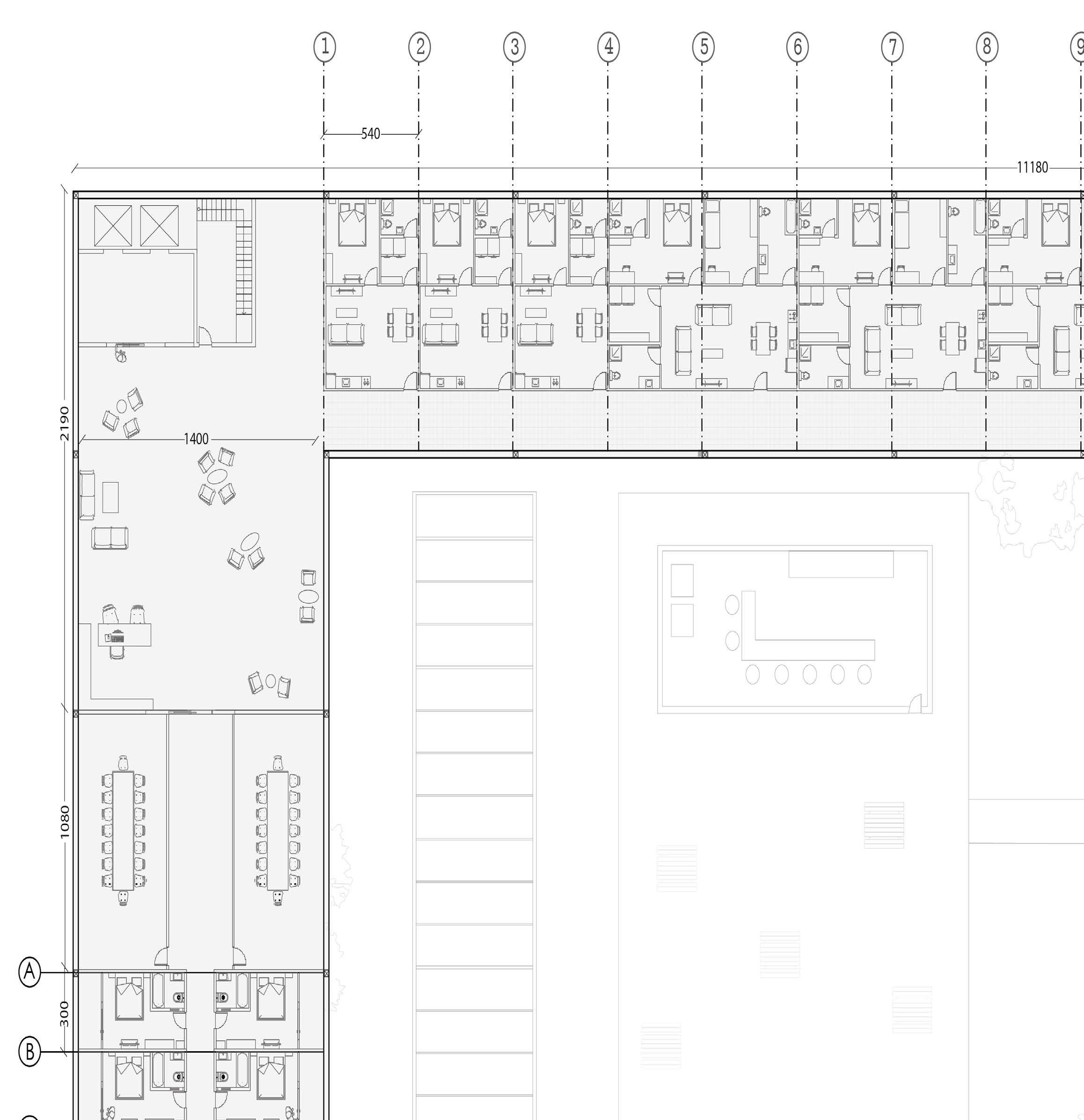
building is located on the eastern side of Ayalon Road, and covers an area of 21 dunams. It is divided into two buildings - an office building and a logistics warehouse.
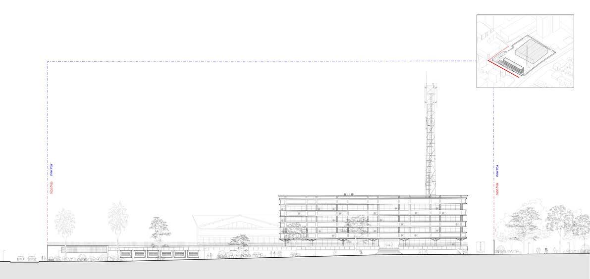
The office building is adjacent to the border of the area so that it actually integrates with the wall and becomes part of it. A situation has arisen in which the fence contains programs - on one side you see a street and on the other side showers.
Site analyzis
The building is fenced on all sides and allows only a few entrances for licensees, except for one public entrance through the street to the office building.
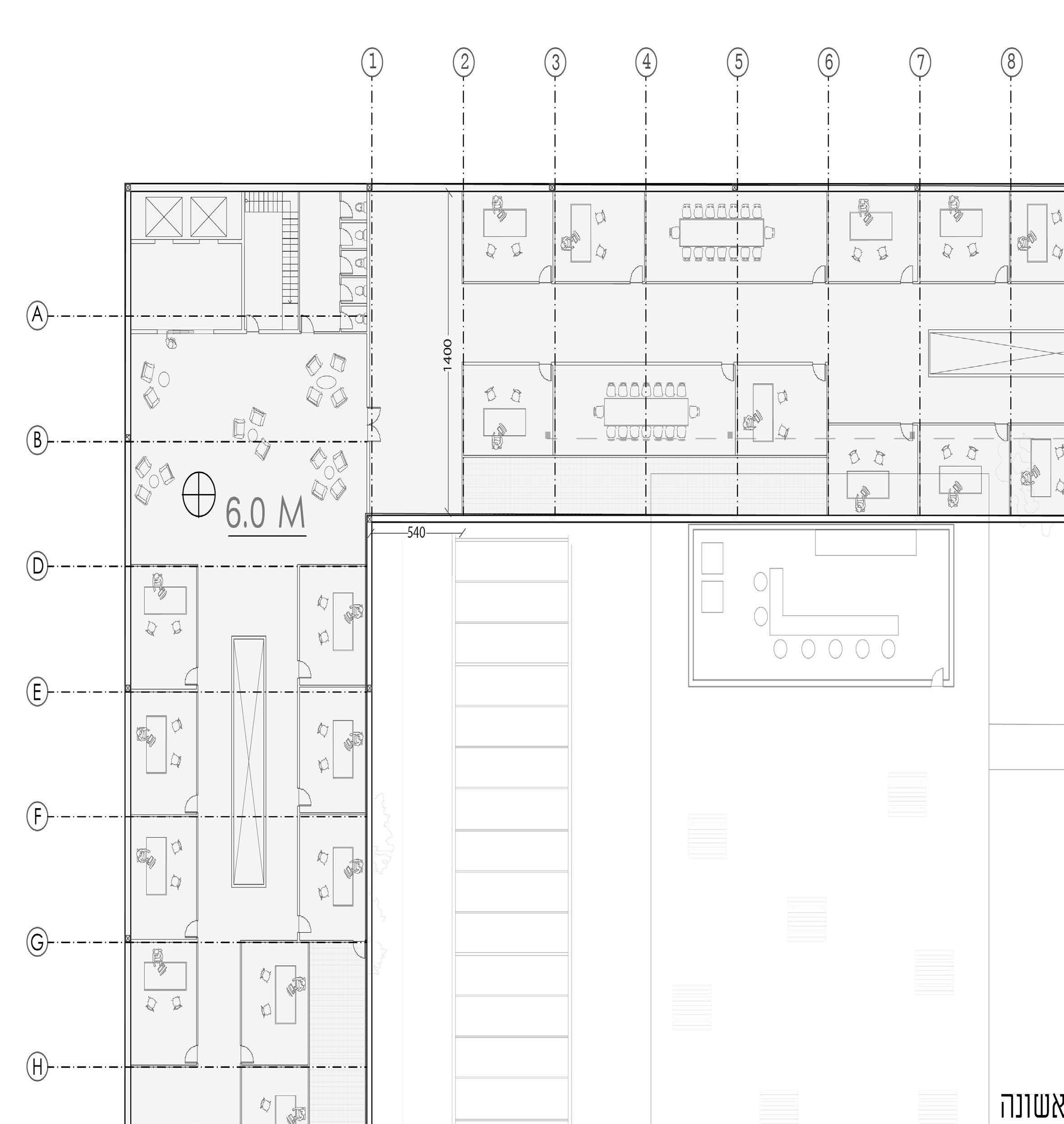
Although the total area of the complex is very large, in practice the area built in it constitutes only about 44% - with the available area currently used as a parking lot and additional storage space.
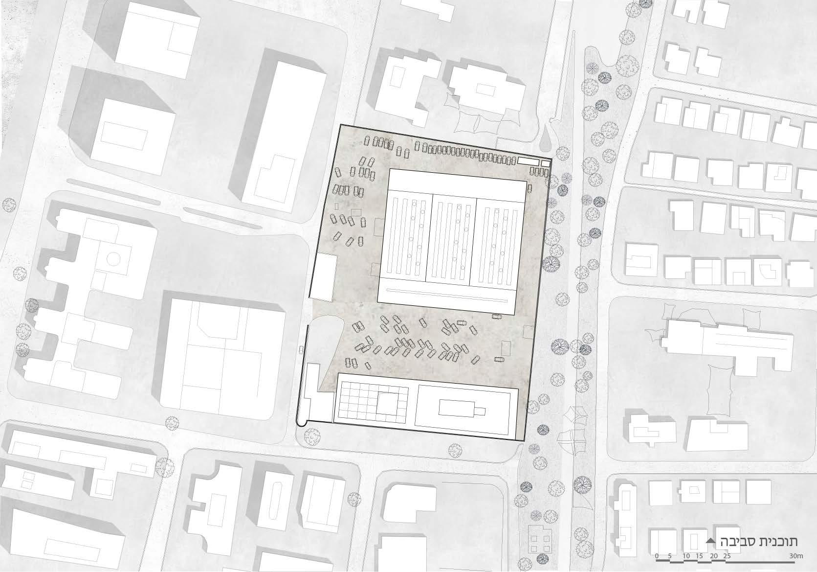
The first floor is used mostly for office space, and the base floor contains a food hall as well as showers and locker rooms.
 The
The
The IEC- Israel’s Electricity Company
13
IEC facilities are spread all over the country, with the help of stations and power lines. The facilities IEC uses are many and only her employees have access to them. A lot of space goes to the company. I offer the company to enter the real estate market, similar to other companies that exist in its vicinity.
The reduction will be due to the fact that the occupants of the building will benefit from a reduced electricity bill thanks to the solar infrastructure that will be worn on the sloping roof of the building.
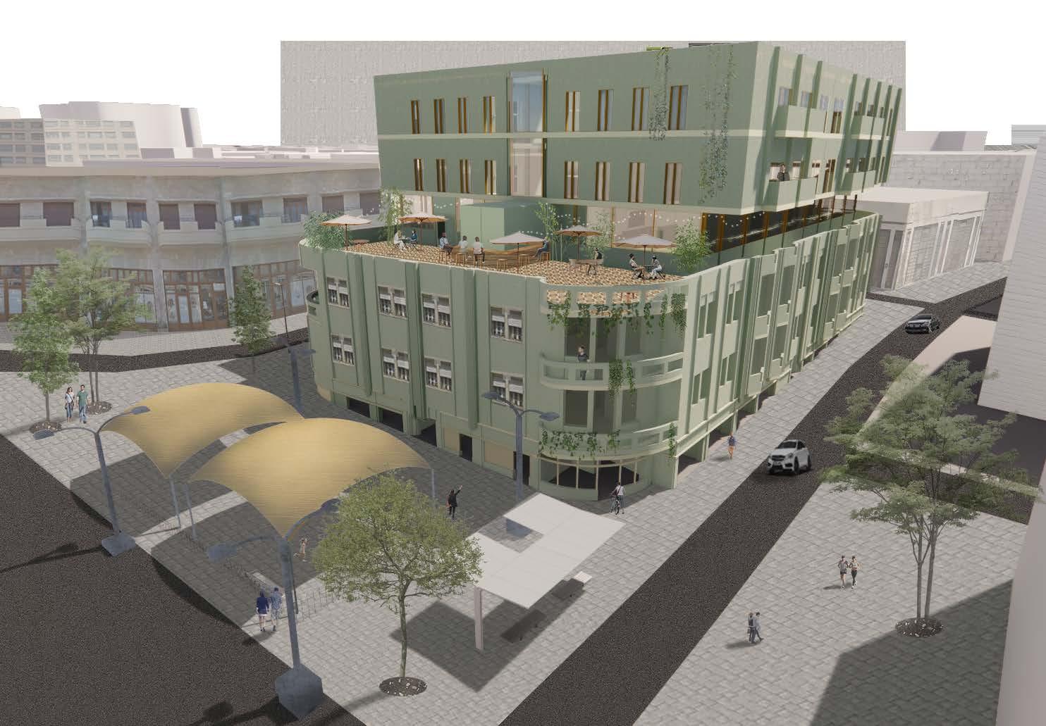
The upper building will be split in two - one will be a business hotel that will bring the company more profit, the other will go to the public and be used for discounted housing.
14
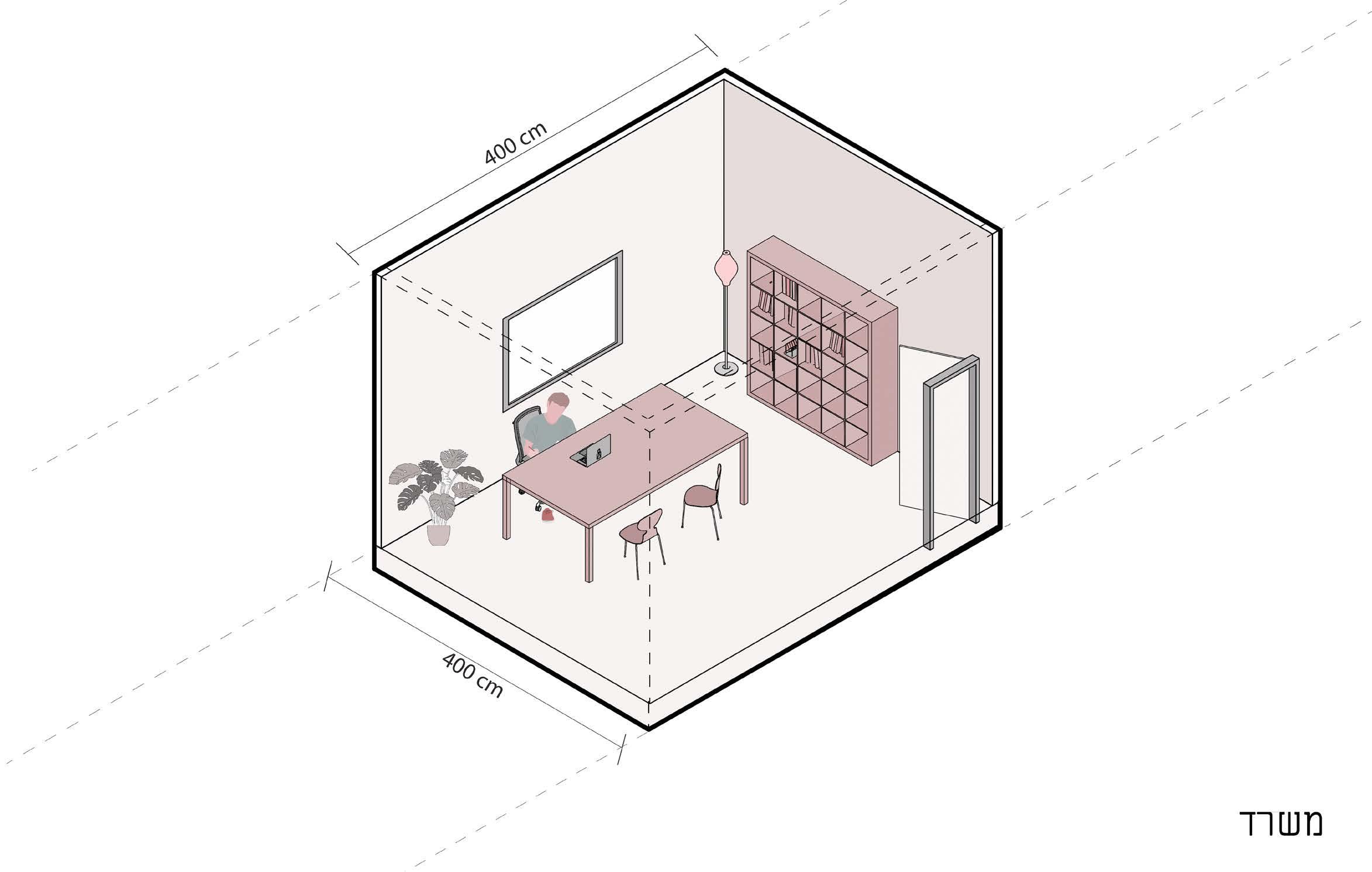
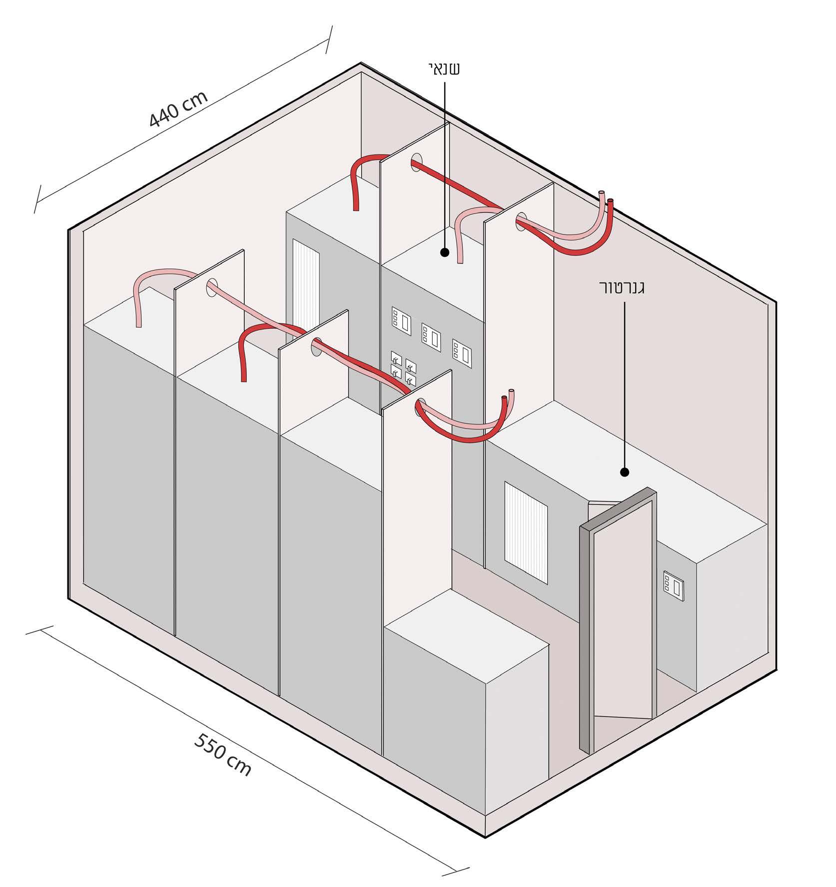
On the office floor, the programs that currently exist in the IEC building are organized - private offices, shared offices, equipment warehouses, the dining room and the showers.
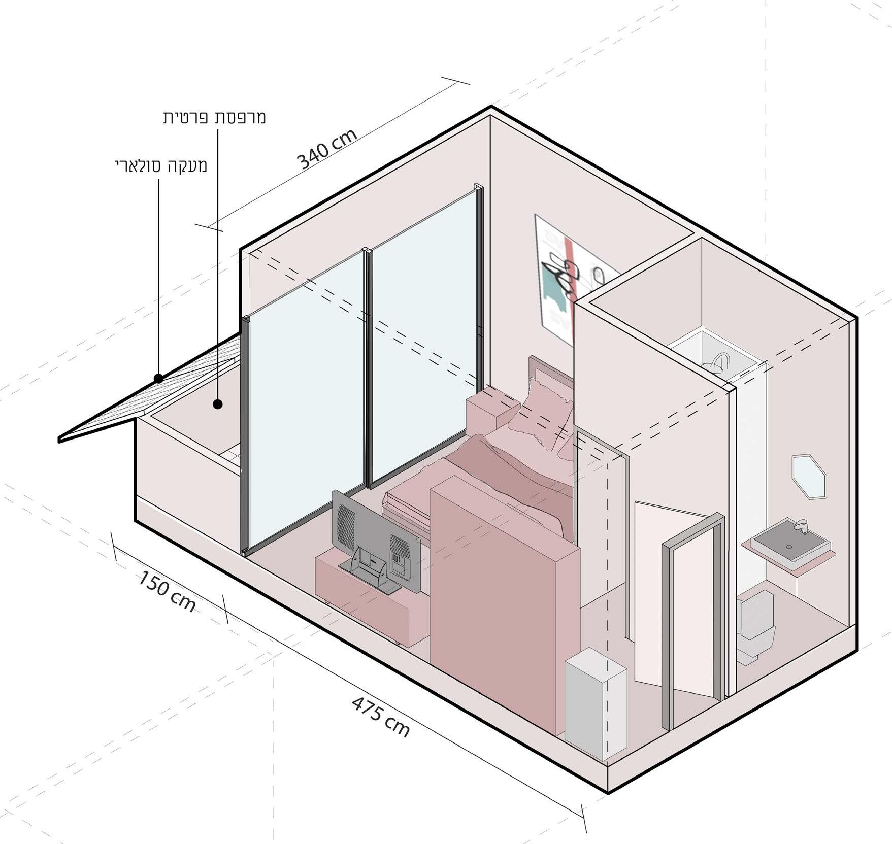
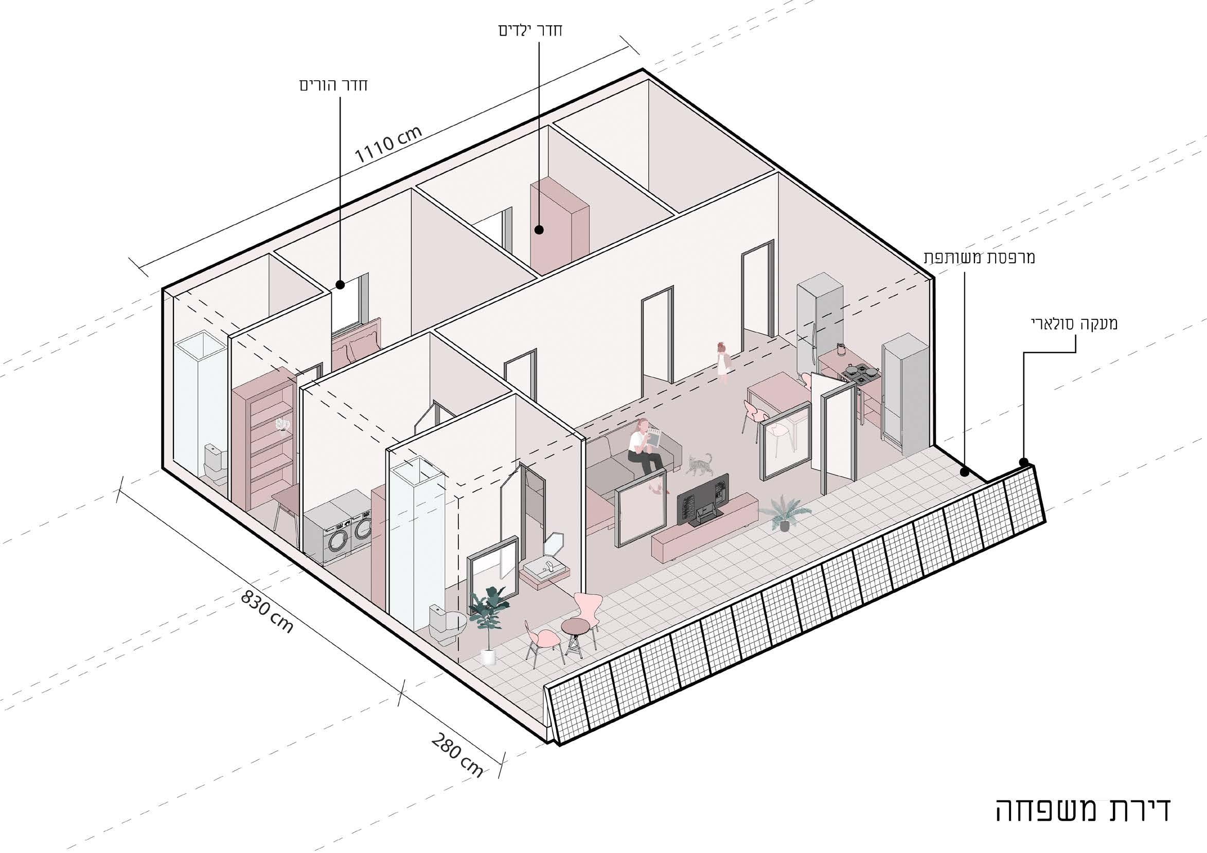
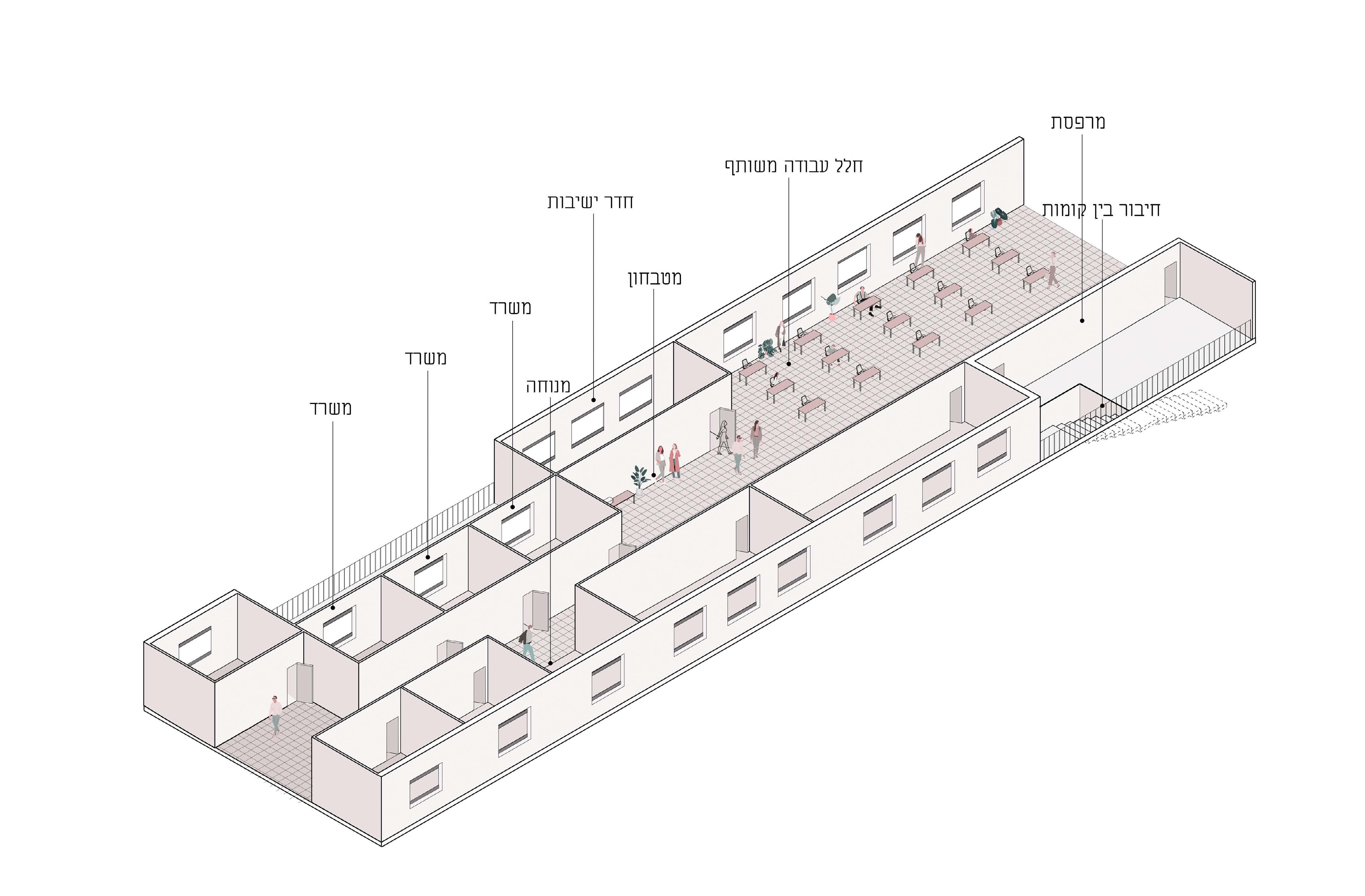
The residential building and the hotel connect together on the lobby floor, with the hotel rooms being relatively small, and the apartments allowing for accommodation in a number of different configurations.
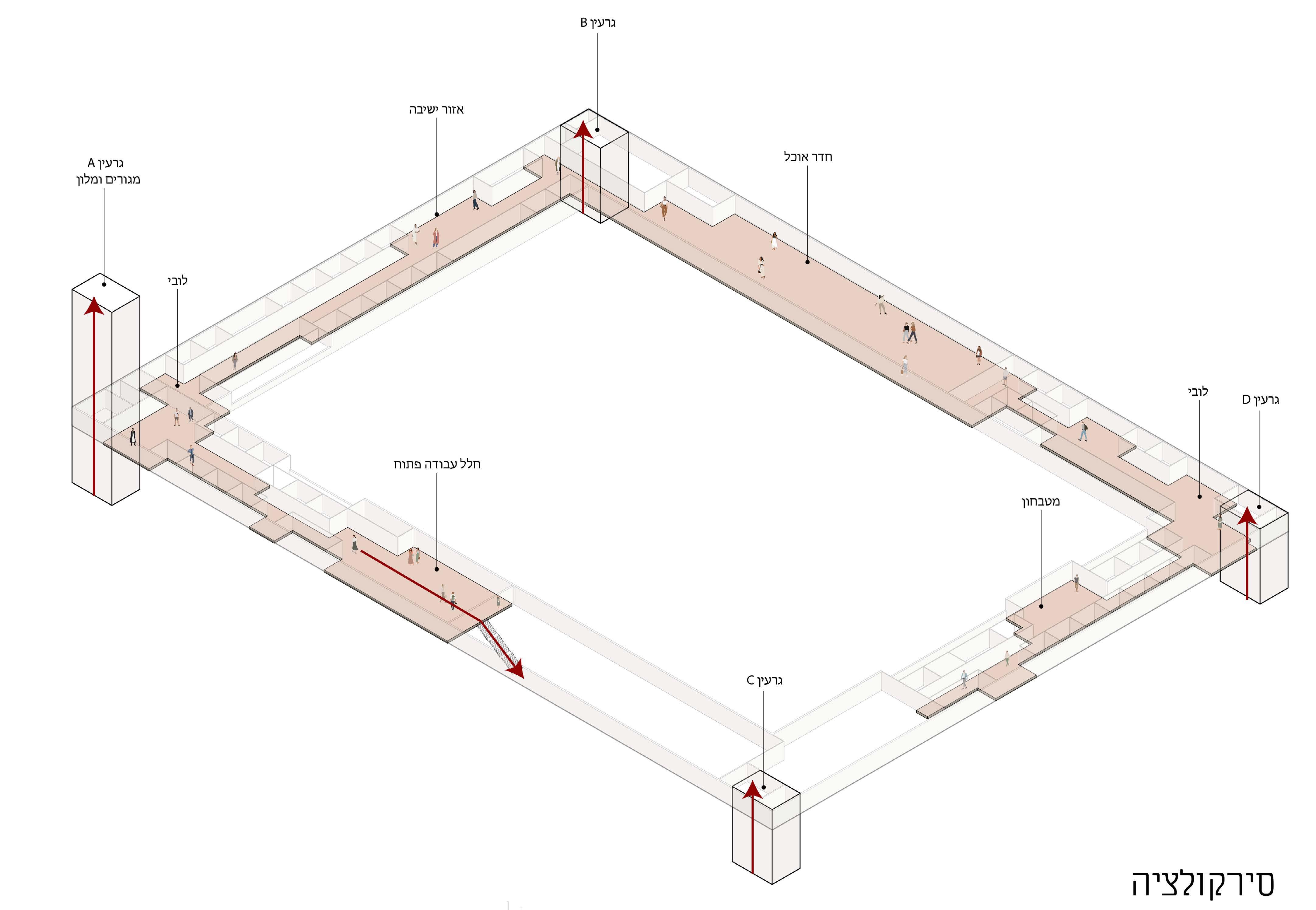
Core A Living & Hotel Core B Core C Core D
Circulation Hallway
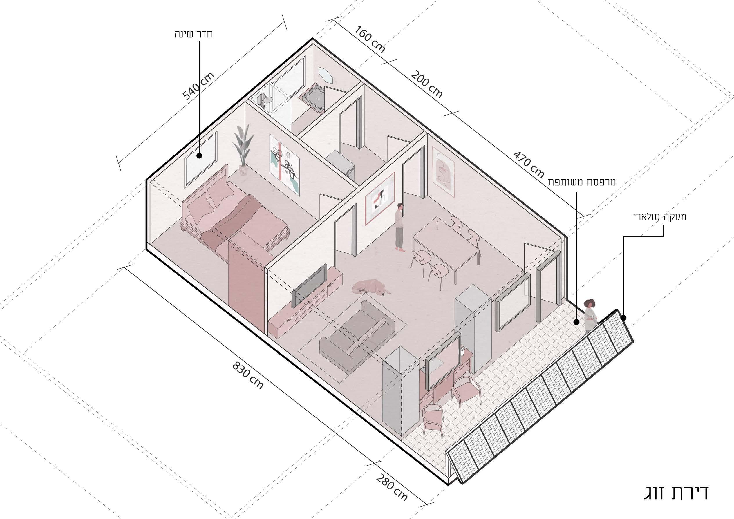
Couple apartment
Three rooms apartment
15
Hotel room Machines room Office
Layer 2.0
Liebling Haus Together with Shahak Azran & Oneg Yehuda Altshuler
Competition
Concept: “The Green Palace”, the beating heart of Noga Complex in Yafo, located between the streets of Segula, Nechama, Rouchama and Nitzana, has gone through many incarnations over the years, and now stands tired and weary in a young and evolving environment, characterized by artists’ galleries, workshops and studio spaces.
We offer a design that operates on several levels: Restoring the building to its glorious past with a clear separation between new and old, empowering its role as the neighborhood’s public-social heart, with an economic foundation and diverse residential options suitable for the unique variety of people in the area.
16
Designing decorative elements such as mosaic tiles and pilasters that create for the new addition an affinity for the old existing structure, and maintaining the morphology represented in the Art Deco style - the “Arab Bauhaus,” according to the architect Ibrahim Haggar. Mosaic tiles – Continue the ornamental line of mosaic tiles already existing in the building, and celebrate the past of the area and of Jaffa as an area that used to be rich with orange orchards. Pilasters - Continue the existing decorative element, with a clear separation between old and new.
On the residential floors we planned a wide arsenal of residential scenarios: From 4-room family apartments to small studios. In doing so, we seek to preserve the human diversity that is so important in this vibrant region.
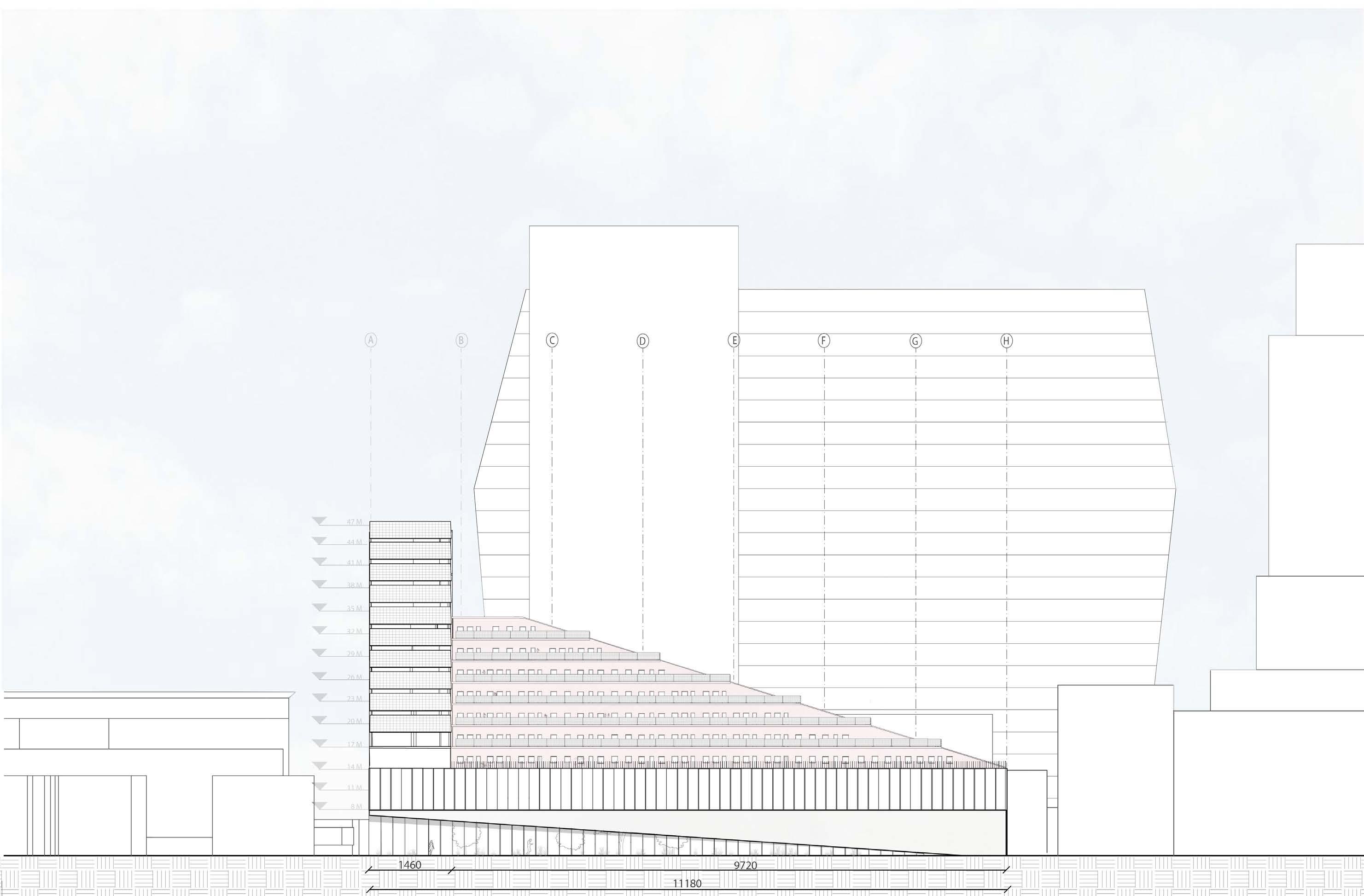
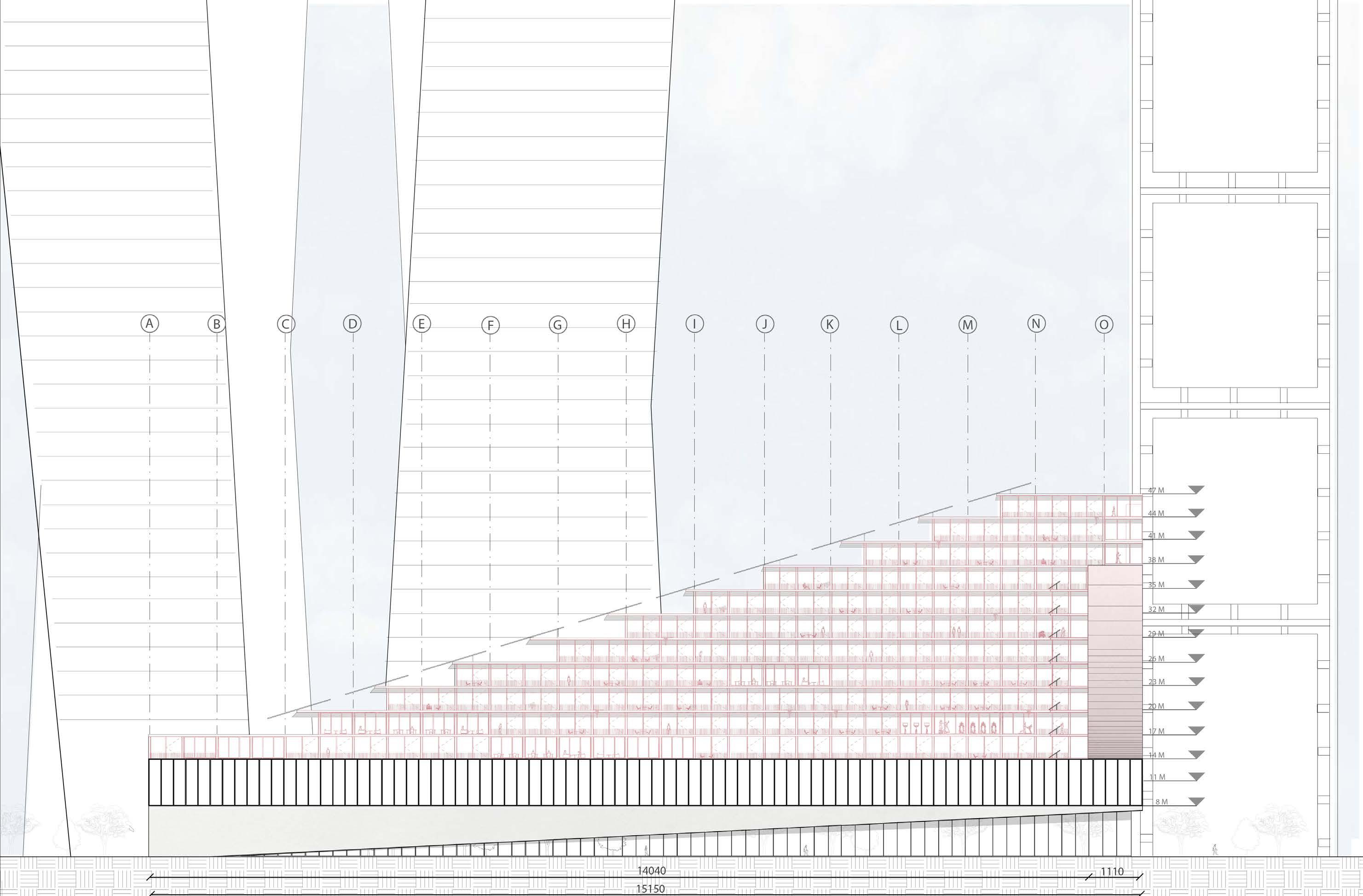
In honor of the original building, we separated it from the new addition by a mezzanine that gives a “floating” feeling to the addition and allows the structure to grow and rise according to the needs.
On the new floors we made a regression in order to keep a wide-open skyline in the public square at the front of the building on the street level, which is essential to the entire neighborhood, and on the roof terrace we placed a bar/café that communicates with the street square, so that 3 “stages” are created: the main “stage” at Segula square, an upper stage on the roof terrace, and an internal “stage” at the building’s inner courtyard. The additional floors sit on a new constructive system that has been planted behind the pilasters, allowing growth of the construction in the future if needed.
XL L S M B C c1 D d1 E S M XL L L S S S S M M S S S M S S S XL S S S M XL L S S S S S
1 2 3 4 5 6 7 8 9 B C c1 D d1 E S M XL L S S S M XL L S S A 1 2 3 4 5 6 7 8 9 B C c1 D d1 E F Outdoor bar Restaurant / bar Open studio Open studio Dining area studio Storage studio studio Segula Square Roof Terrace Inner Courtyard 3 “Stages”: Residence Residence Commerce NewAddition Old Building $$$ Pilasters “Renewing the Past”
90 sqm 45 sqm 110 sqm 30 sqm
17
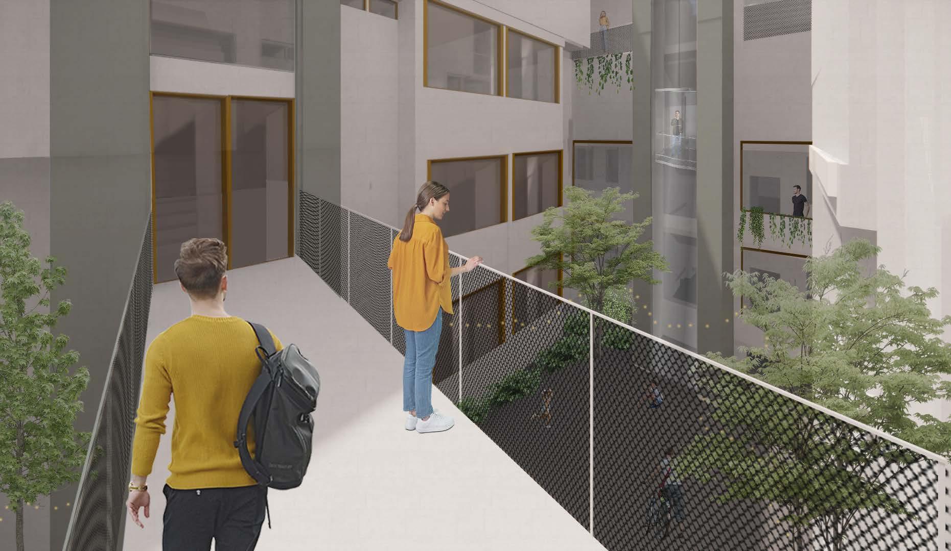
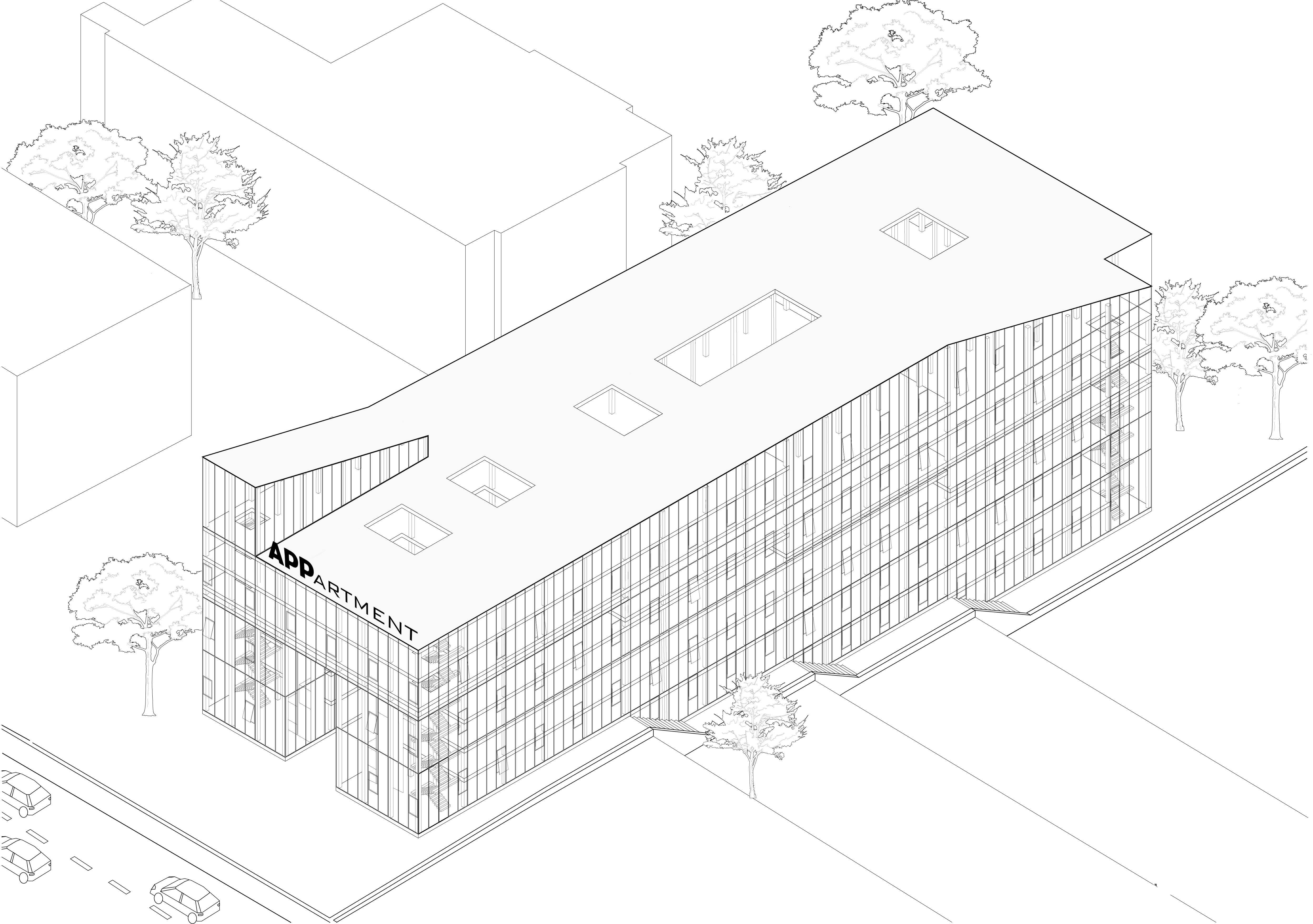
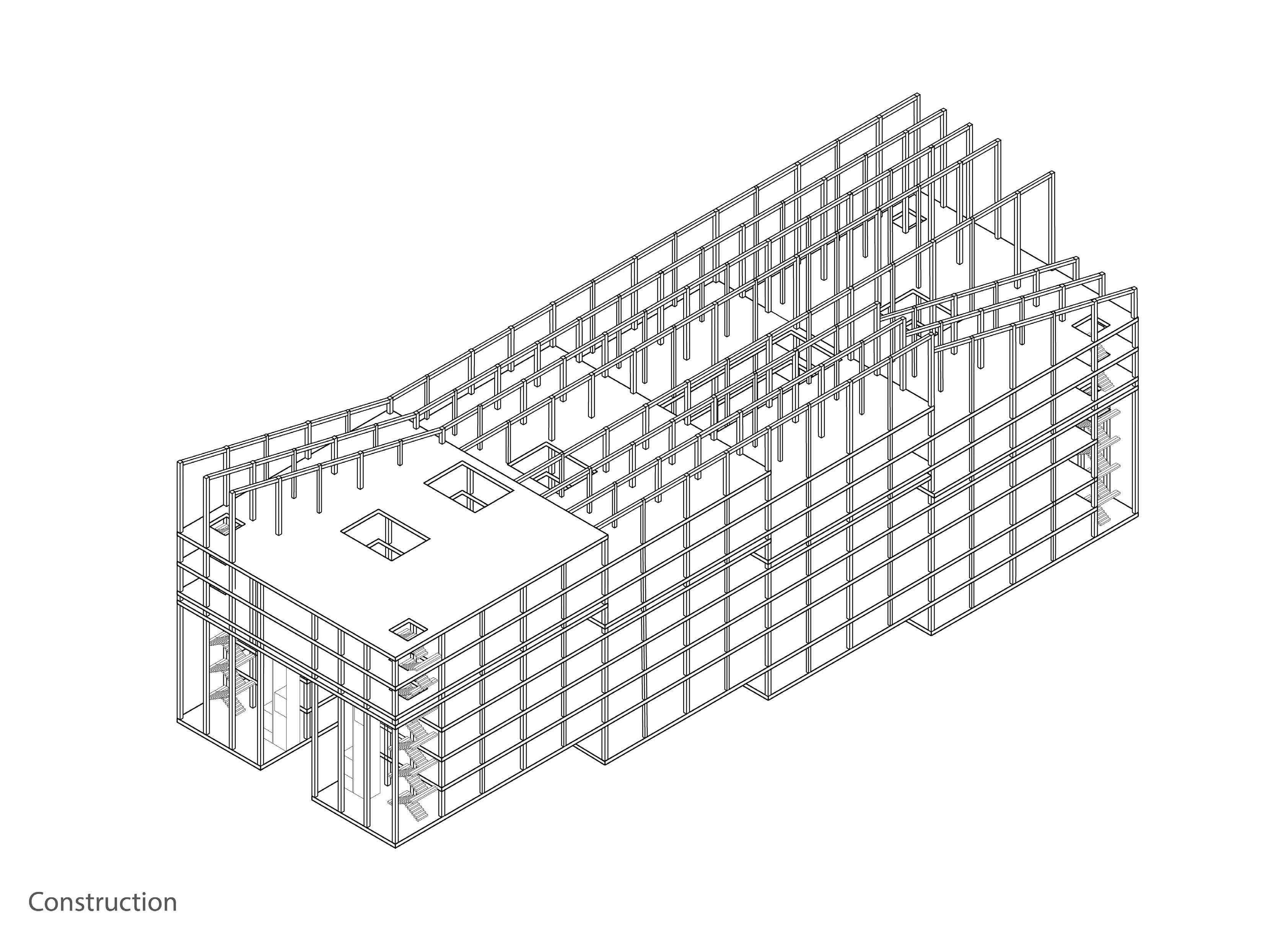
APPartment Studio 3
The
by Alon Sarig & Daniel Finkelstein
Concept:
This project deals with a high-tech company that offers its employees limited housing within the office, and the joint activities are incorporated around the public space. Today we spend more time at work or getting there than at home, and the combination of living close to the office will allow more private time, and will create a cohesive community life between the people with whom we spend most of our time.
18
Block Studio
I started by looking at my home space, and noticed that there is a separation between two main parts of my house - the part that serves me where the uses are located
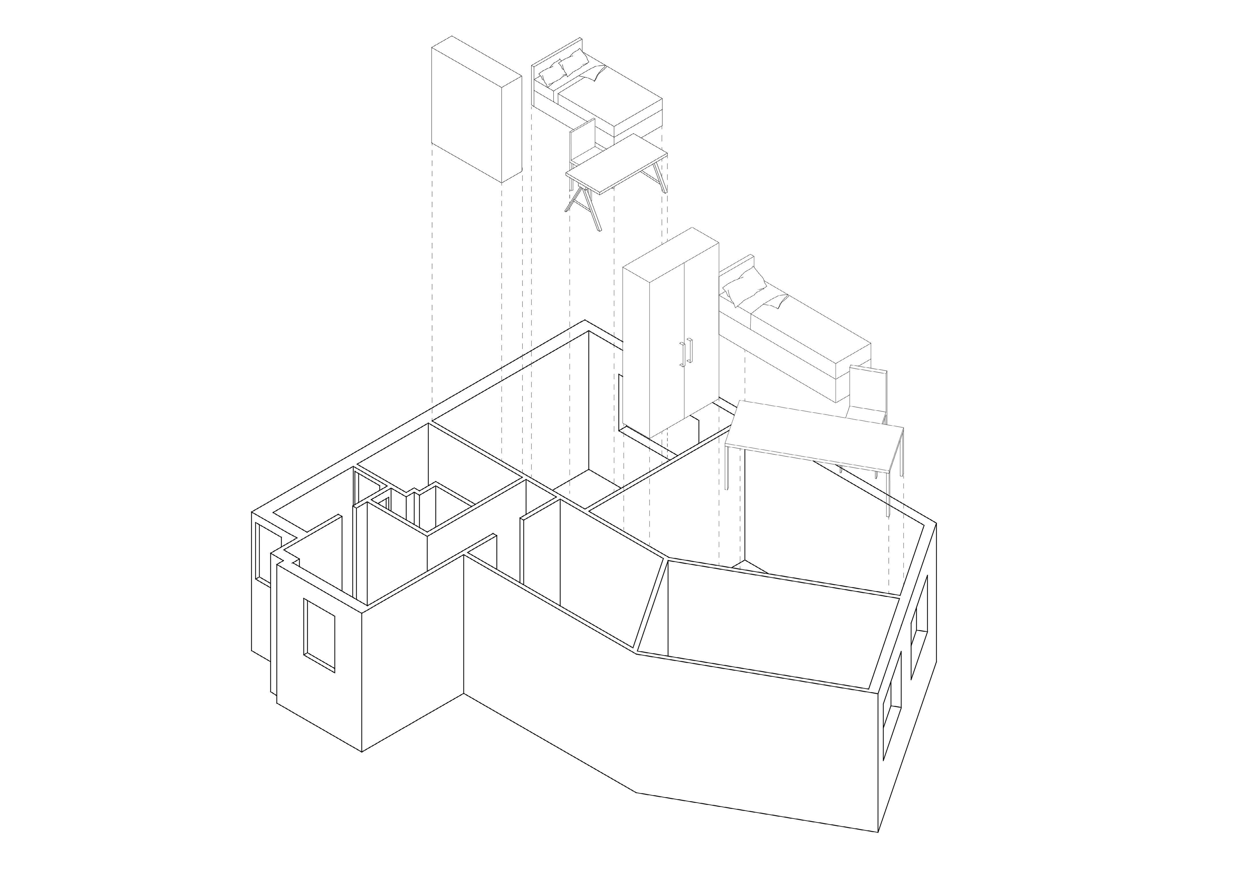
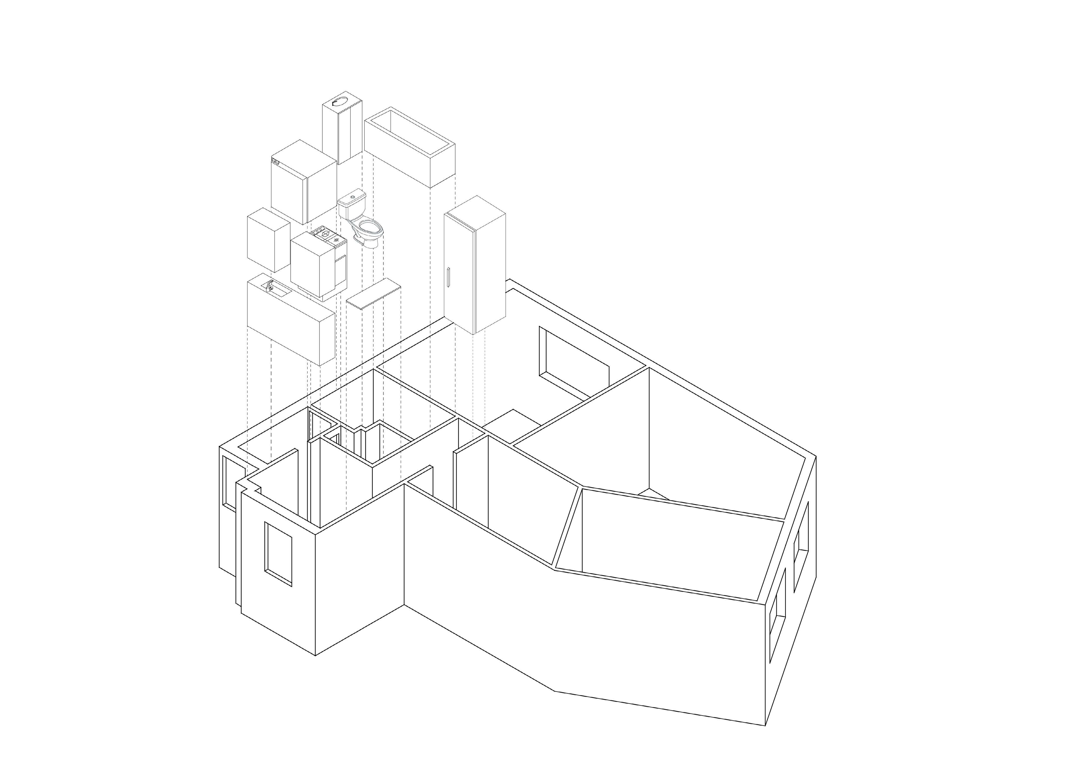
(shower, kitchen, toilet, laundry room), and the part where I live, who serve me- the bedroom.
The serving parts are limited and concentrated at one end of the house in complete separation from the served parts.
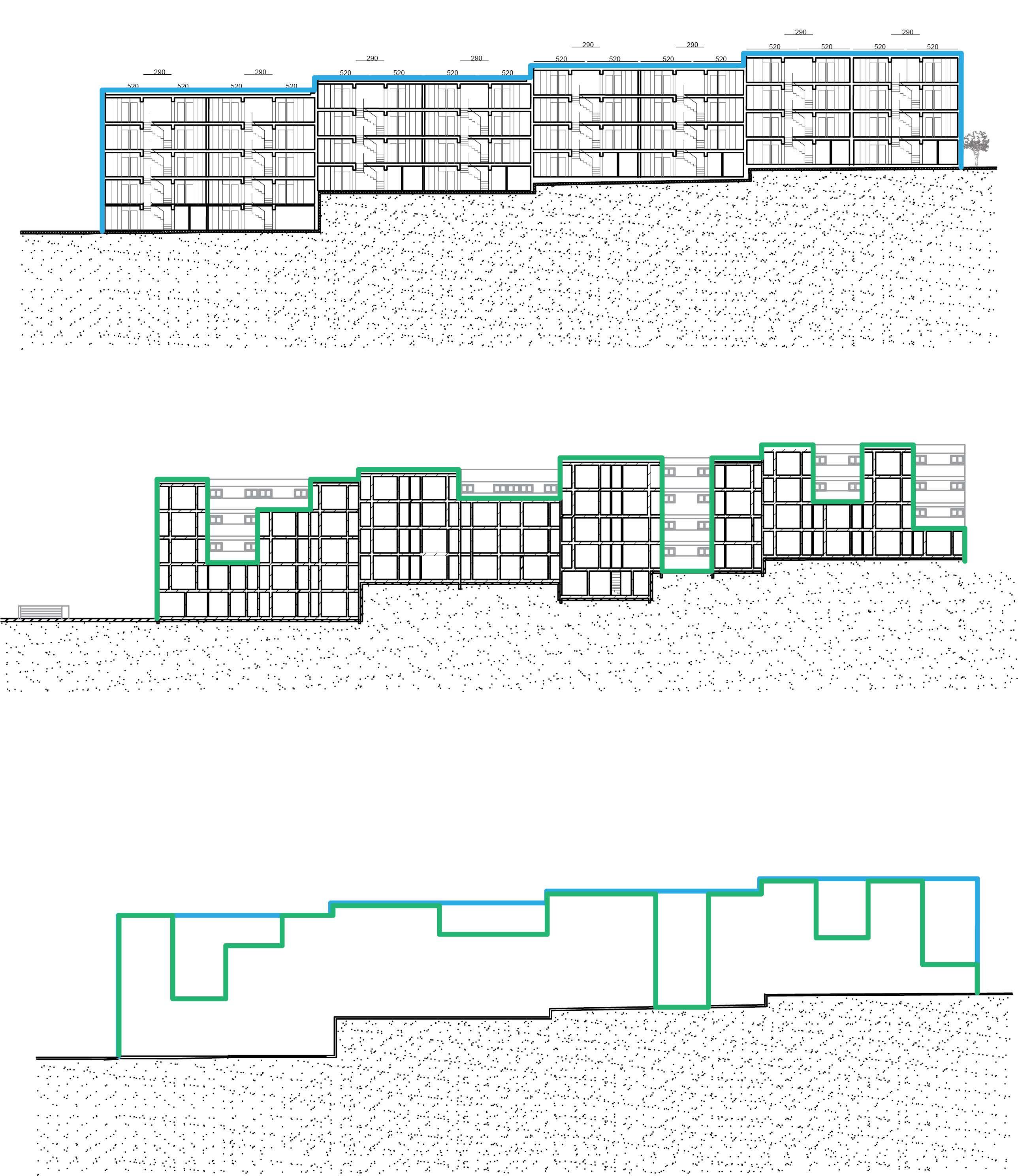
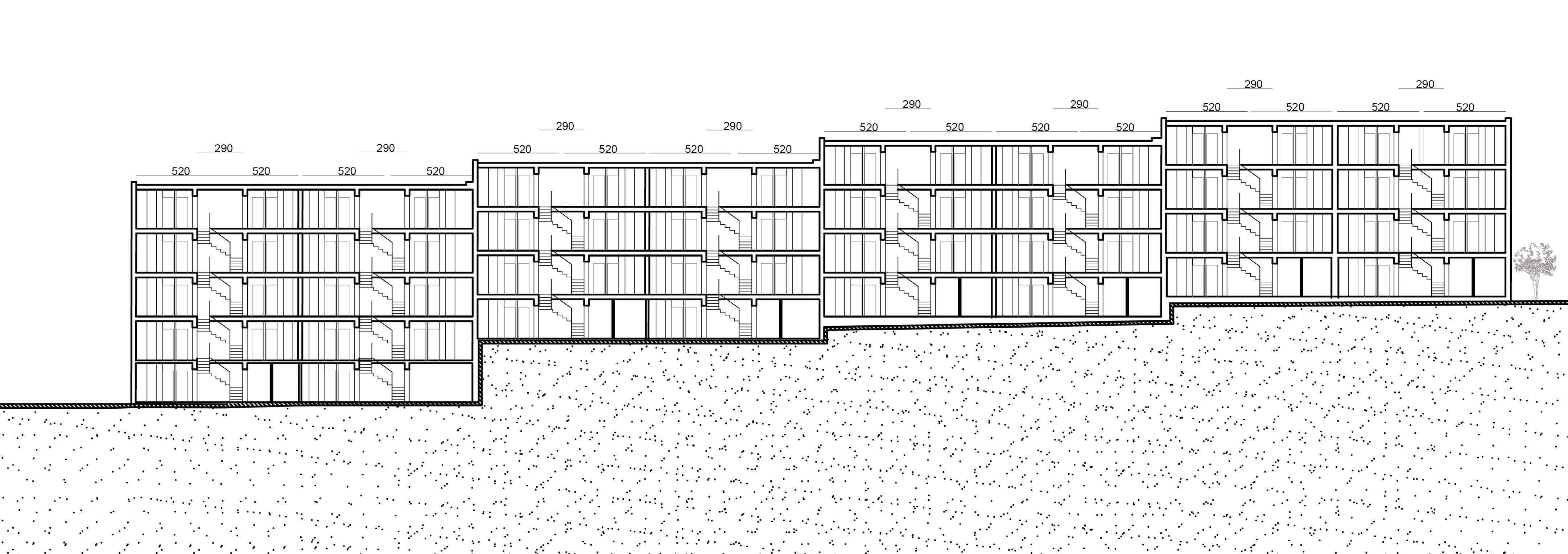
The building i chose to analyze is a railway structure built on a topography, and consists of one building that is duplicated four times. It is located in a residential block in the industrial area of Jerusalem
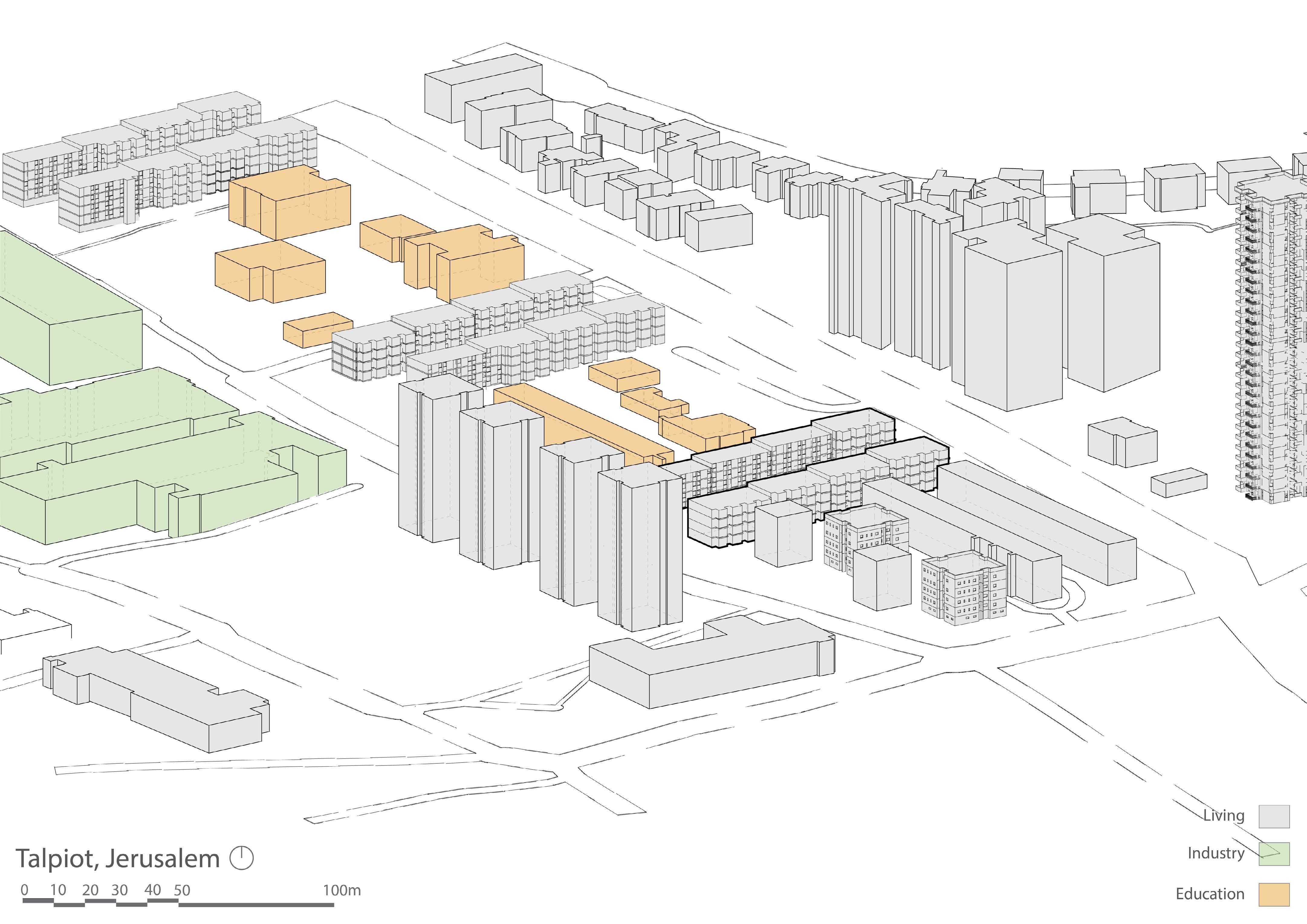
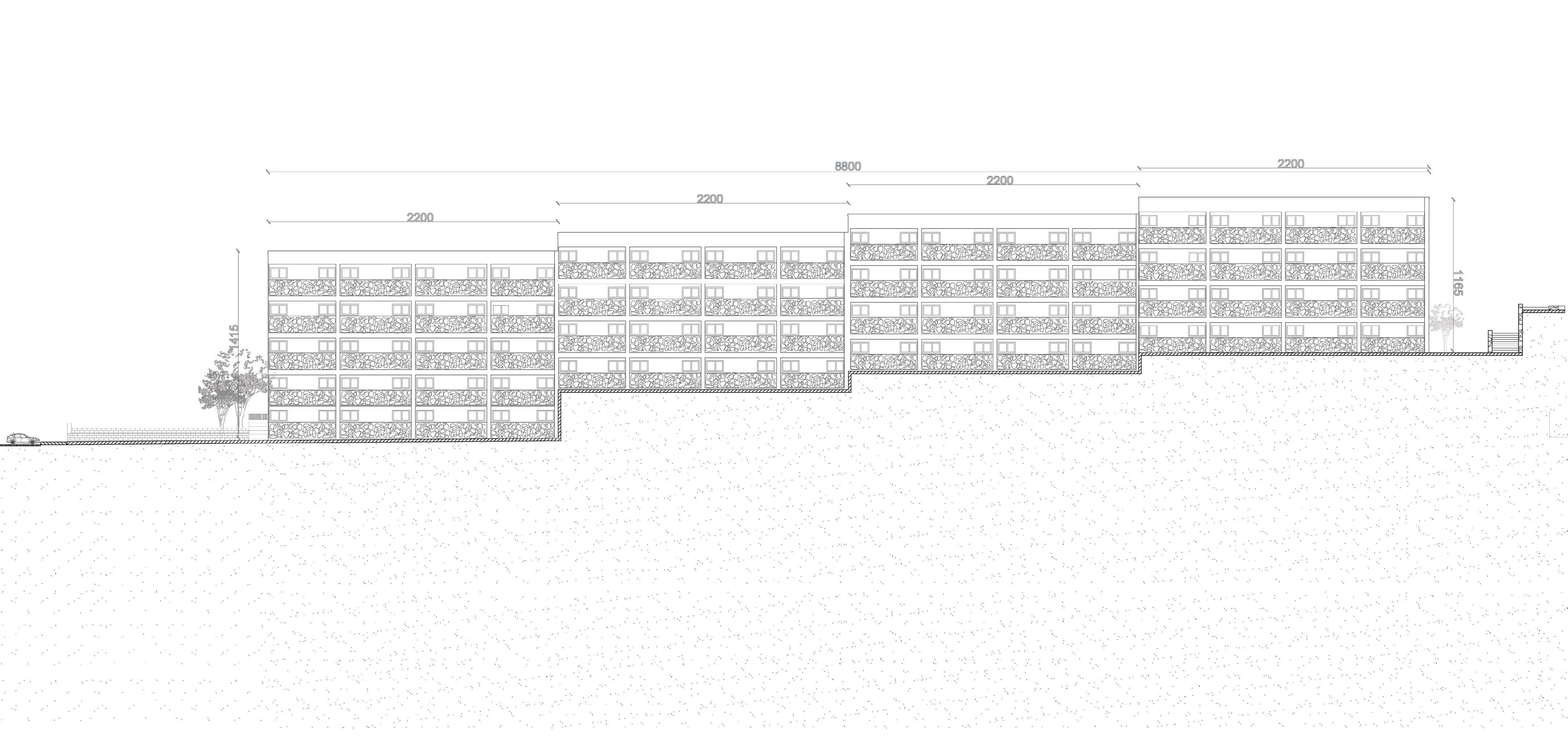
From there I continued to analyze the block that is located in Talpiot neighborhood and borders the Bethlehem Road and the Hebron Road.
The block consists mainly of residential and industrial buildings, so I decided to focus on hightech offices - a growing industry, which will lead to the development of the area, and will include a young and affluent population.
19
Serving Served
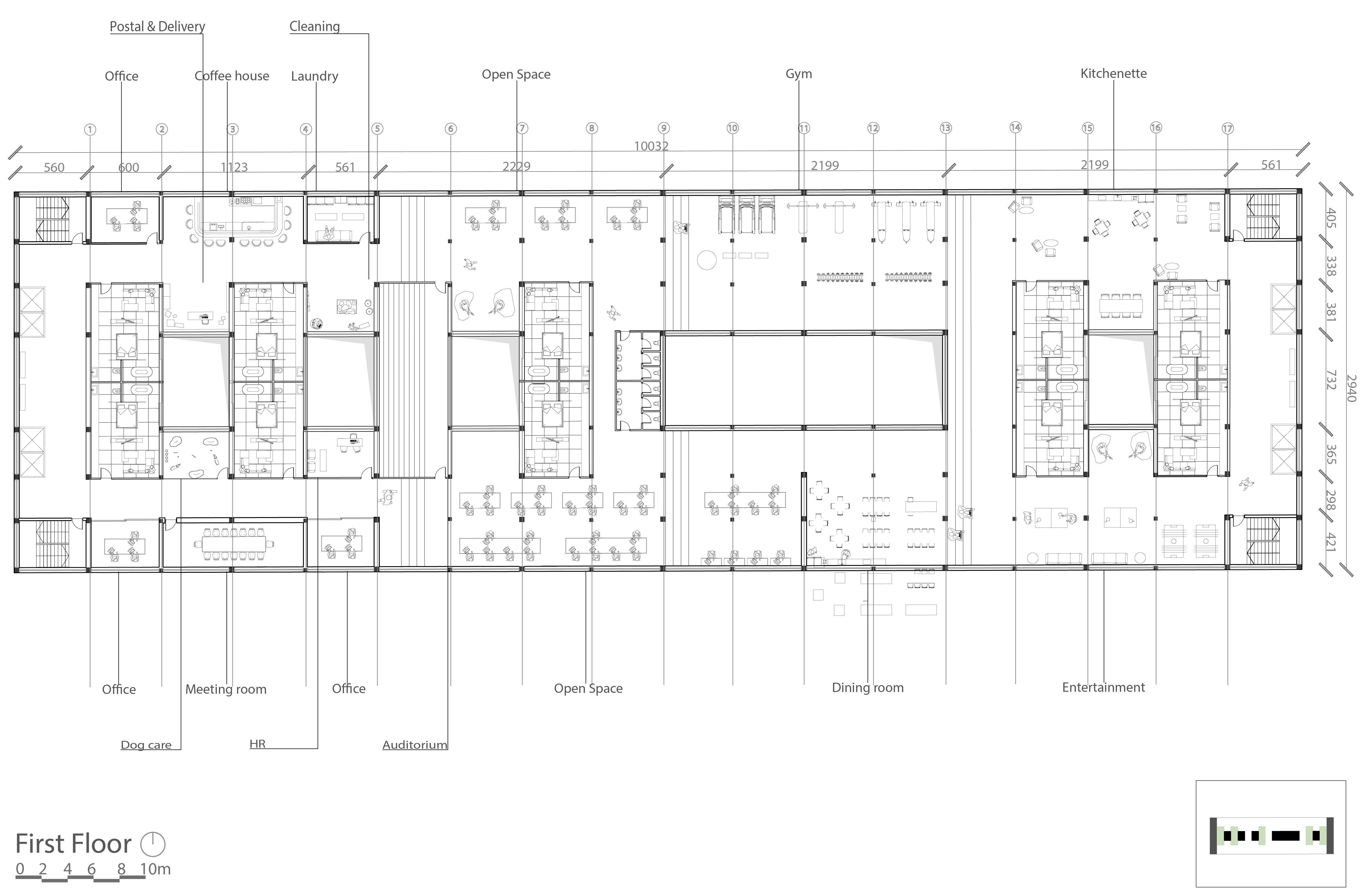
For the design of the structure I used the principle I initially identified, but instead of separating the “served” space from the “servant” space, I combine them. The living spaces will be integrated in the center of the building to allow for privacy, and the various programs of the office and the common spaces will be integrated around. Since these are high-tech offices, there will be many programs throughout the floor in addition to offices that meet the needs of the employees, such as a dining room, kitchenette and cafe, laundry room for the benefit of the employees, leisure rooms and more. This creates a situation where programs such as kitchen, laundry room, computer corner, and leisure are not required for the private spaces and the living space is reduced accordingly.
The unit is built in one move without walls, and in a limited way that contains a bed, a storage closet, a small seating area and a shower. The connection of the apartment to the office is made of smart glass so that during the working day the apartment is transparent, and when the tenants want privacy the apartment can be sealed by gas at the push of a button. The connection between the apartments on the other side is made of channel glass.
ץע ילגרס הטימ בג דומע לע היזיוולט תבלשומ תורגנ תדיחי ריקה ךרואל ןורא NCAP PDLC גוסמ המכח תיכוכז Channel glass תיסופיט הדיחי 1 0 2 4 3 5 10m
20
The ground floor of the building remains the same - the buildings remain as they are, but access roads are added on both sides, a lobby leading to the stairs and lifts, and a path connecting the two sides in the center.
Since the existing building gets an addition of two new floors, I decided to use a lightweight steel construction that would not weigh down the existing concrete construction and will be quick to build.
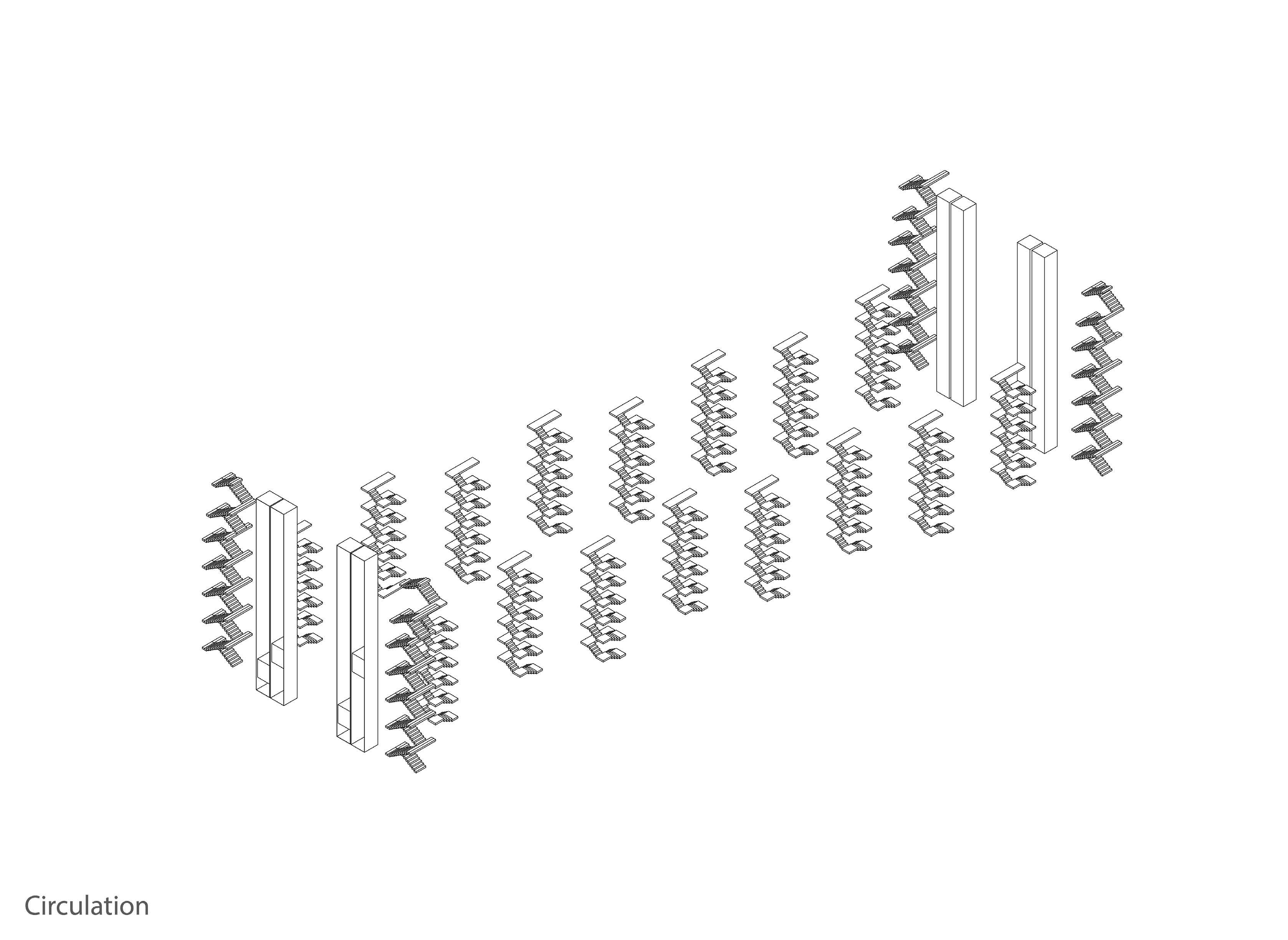
Construction Circulation
Envelope
The construction of the building is built according to the old column grid on which the first building is built.
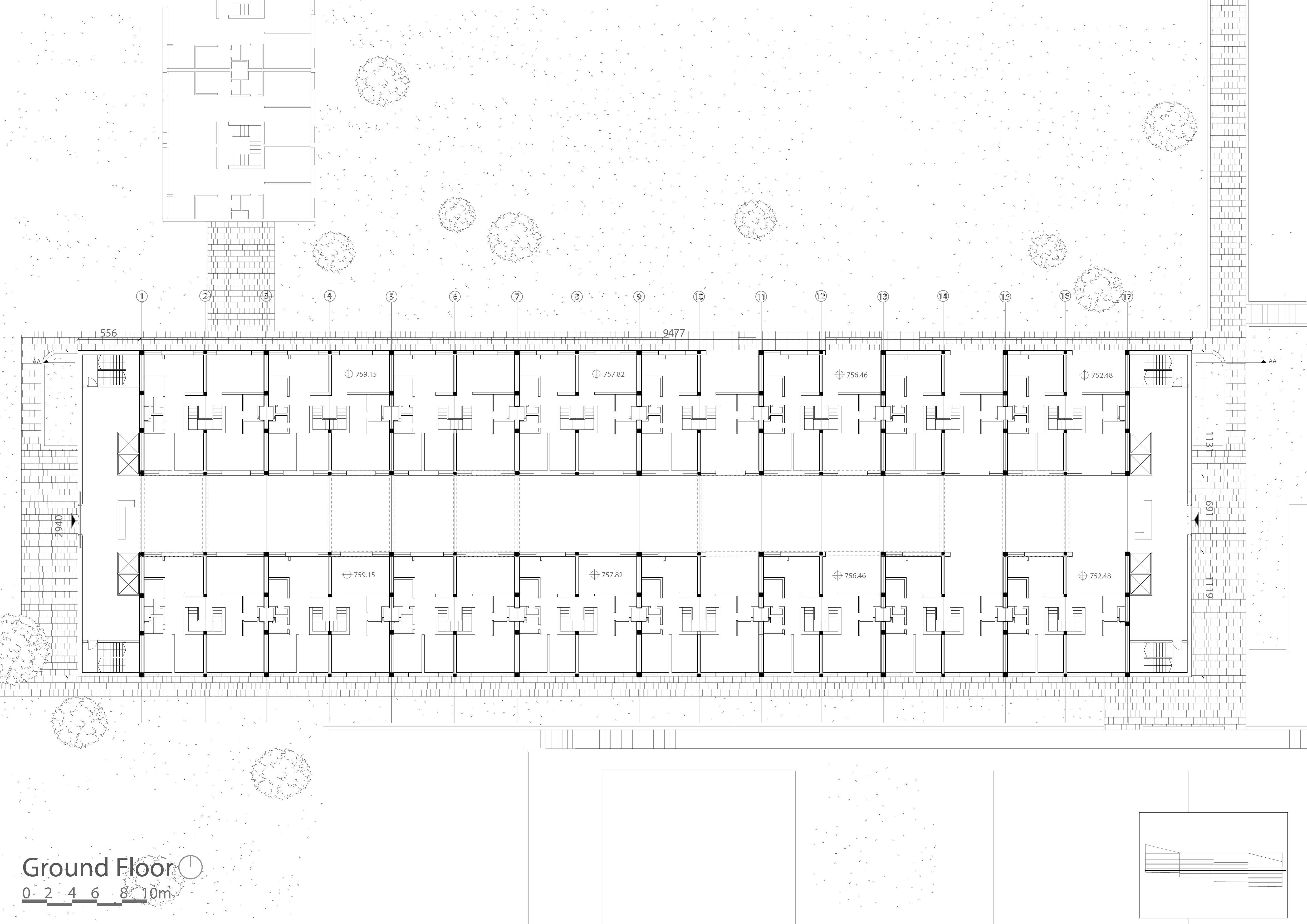
The old circulation remains as it is, and the new circulation is added from the sides.
The building envelope is built as a curtain wall and the glass frames work according to the grid of the construction
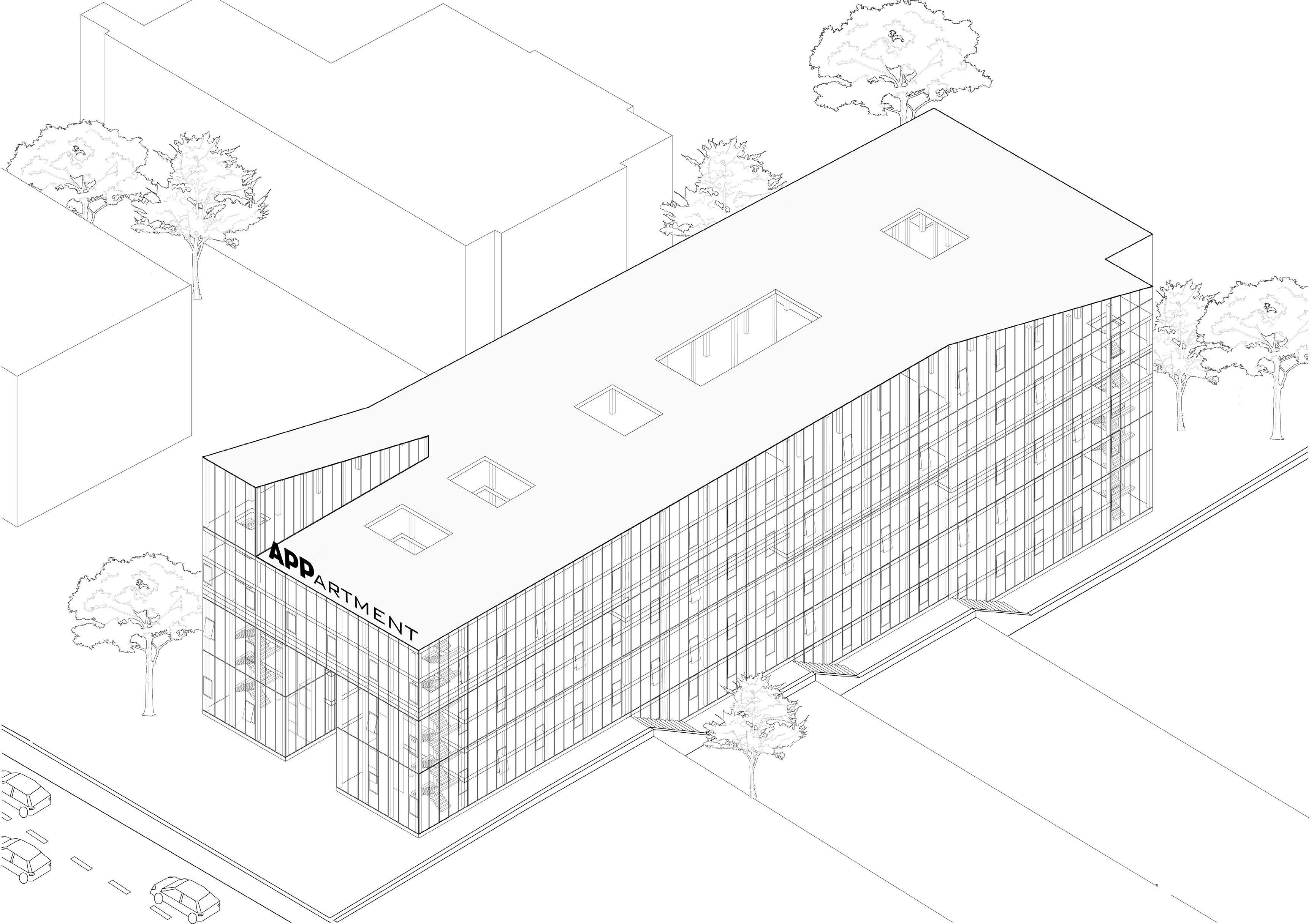
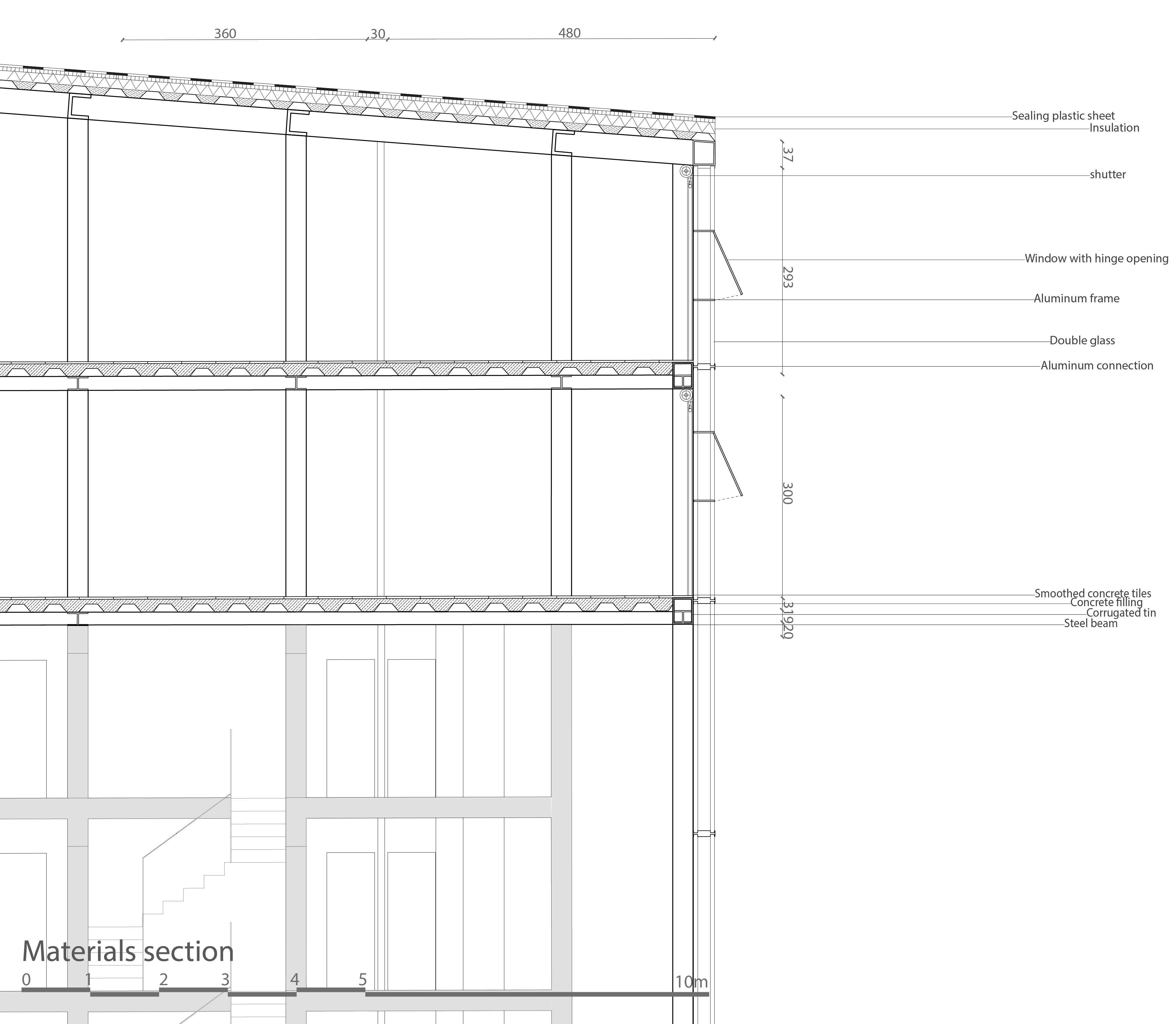
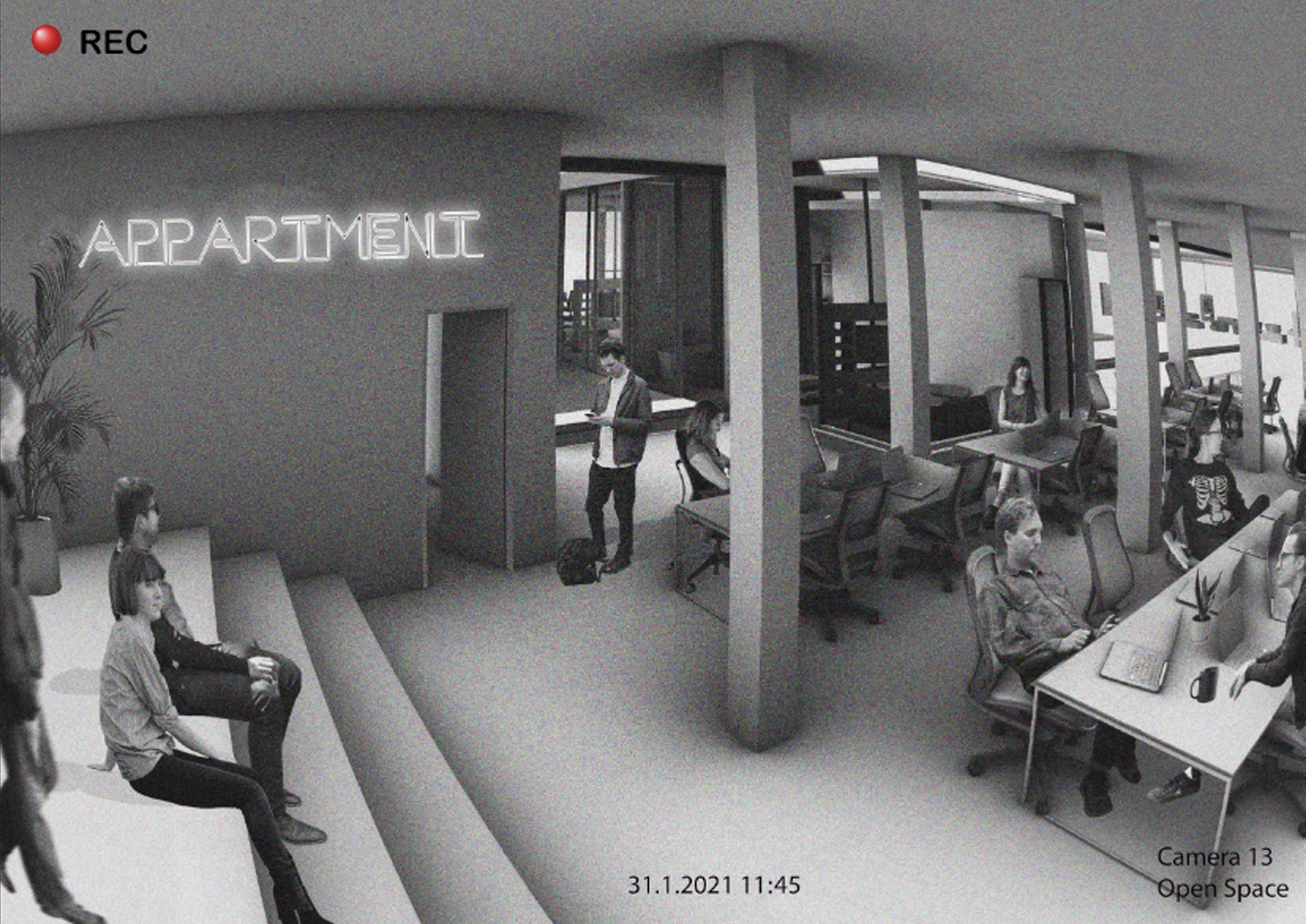
 View from the security camera towards the open space
21
The Quilt Studio 6
Concept:
A quilted blanket is made out of many smaller, different pieces of fabric, and is then sewn together to create a new pattern. The same can be said of “Ir Ganim”: we need to identify where the seams are, and what materials the different patches consists. Our approach for the project is to preserve and enhance the quilted nature of the neighborhood. There are different ways of doing this: We can add our own patch to the quilt, cut out a piece of the blanket and make a completely new part, or remake the blanket with the already existing parts.
22
The architectural action Studio by Michael Van Der & Together with Lars Hakon & Aharon Magidovich
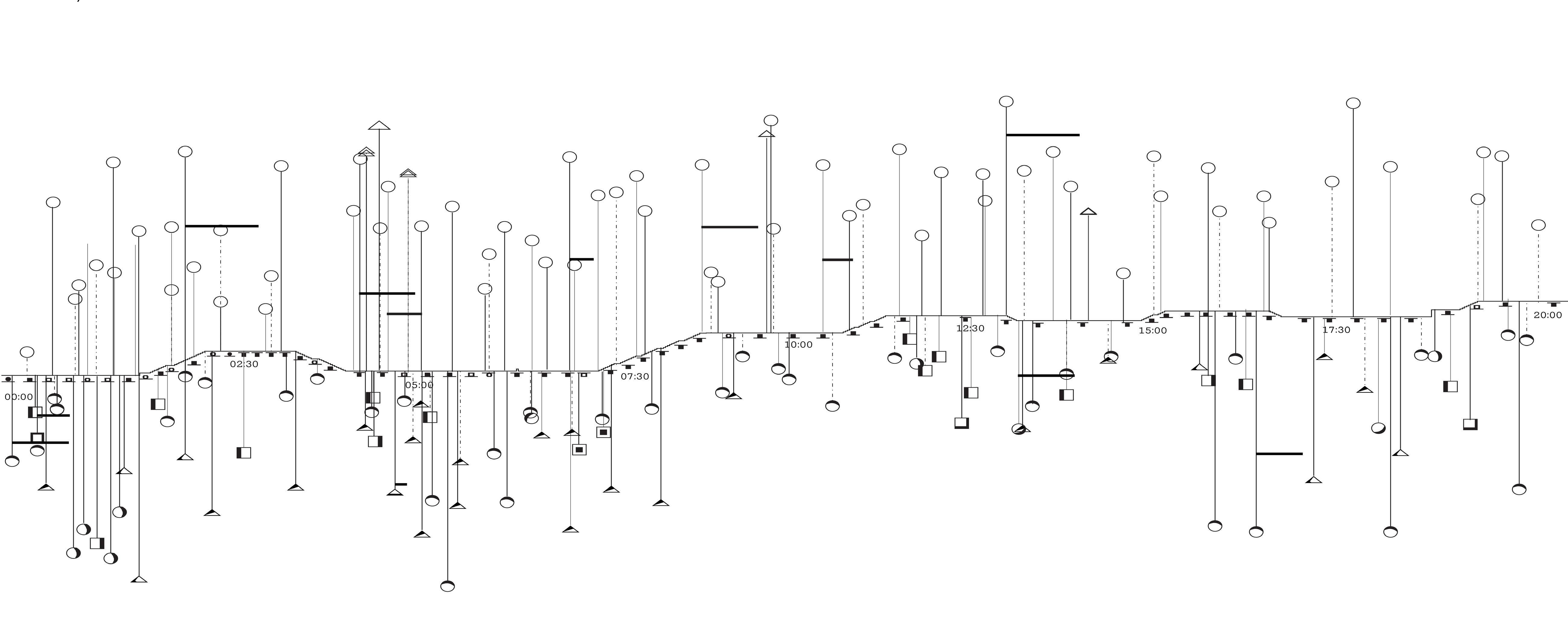
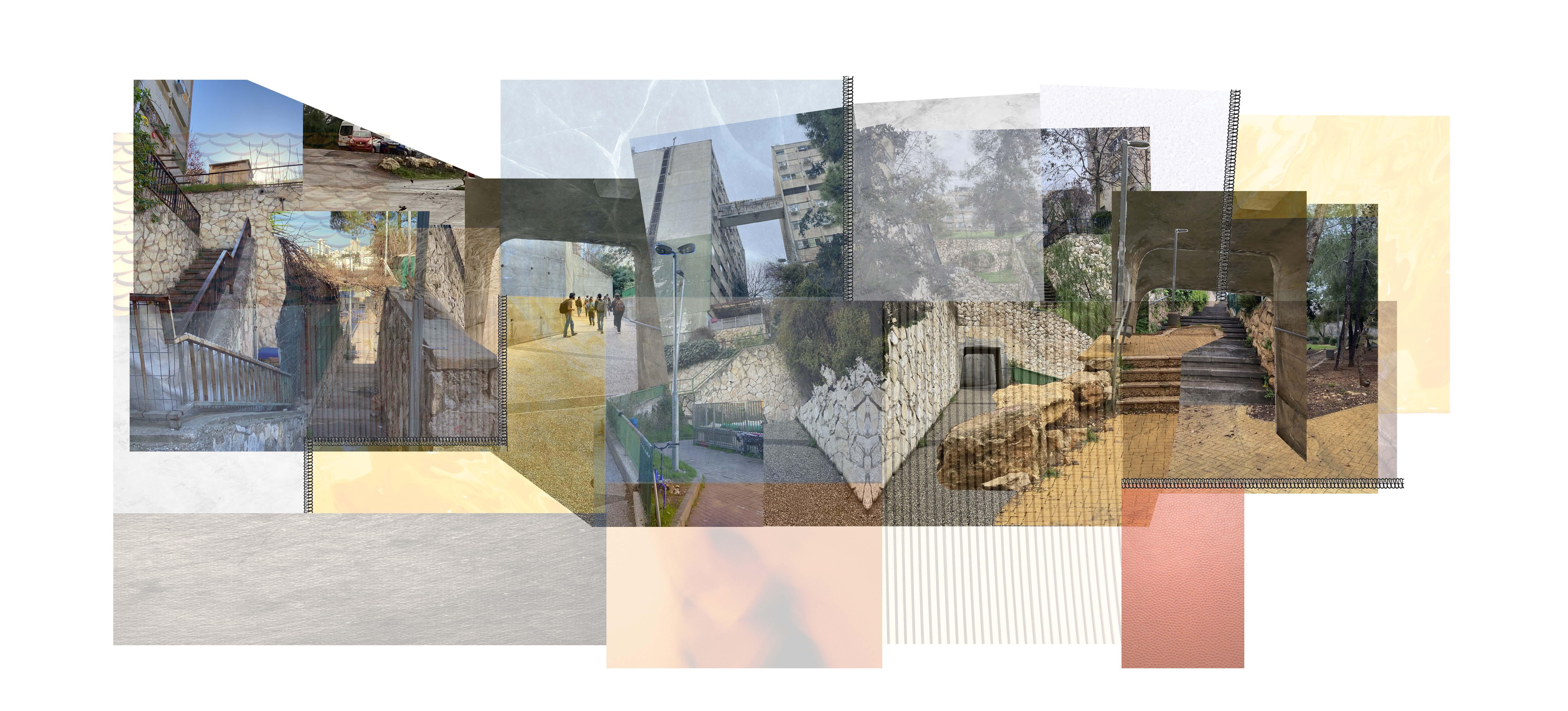
Sound & MaterialIr-Ganim
When we were walking around the nighborhood “Ir Ganim” we noticed the building in this area is random, patched, sawn together and spontanious.
This reminded us of a quilt- a blanket made out of diffrent patches that are swan to each other without stricks rules and planning.
Planning stage
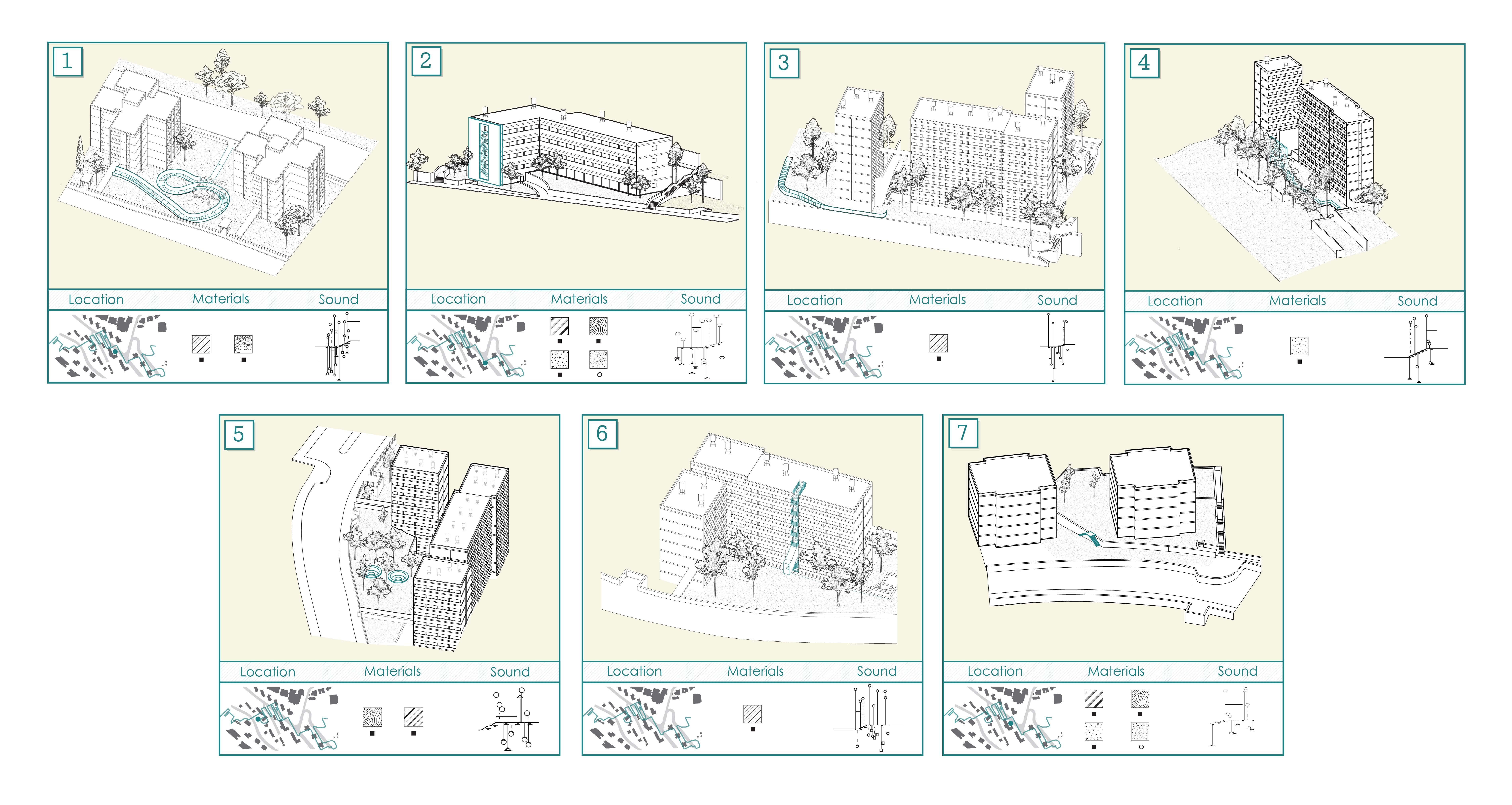
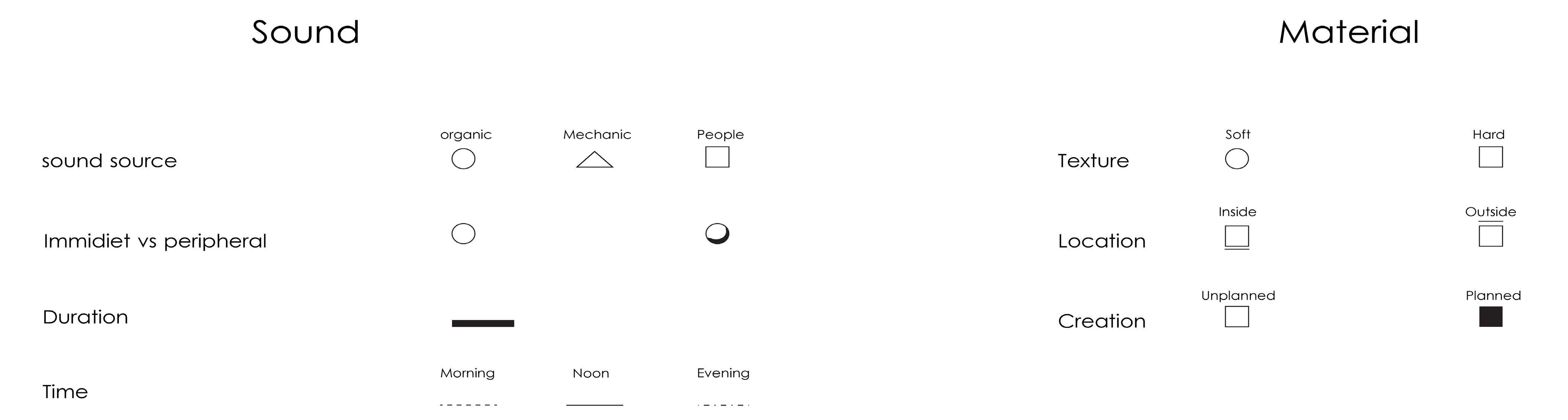
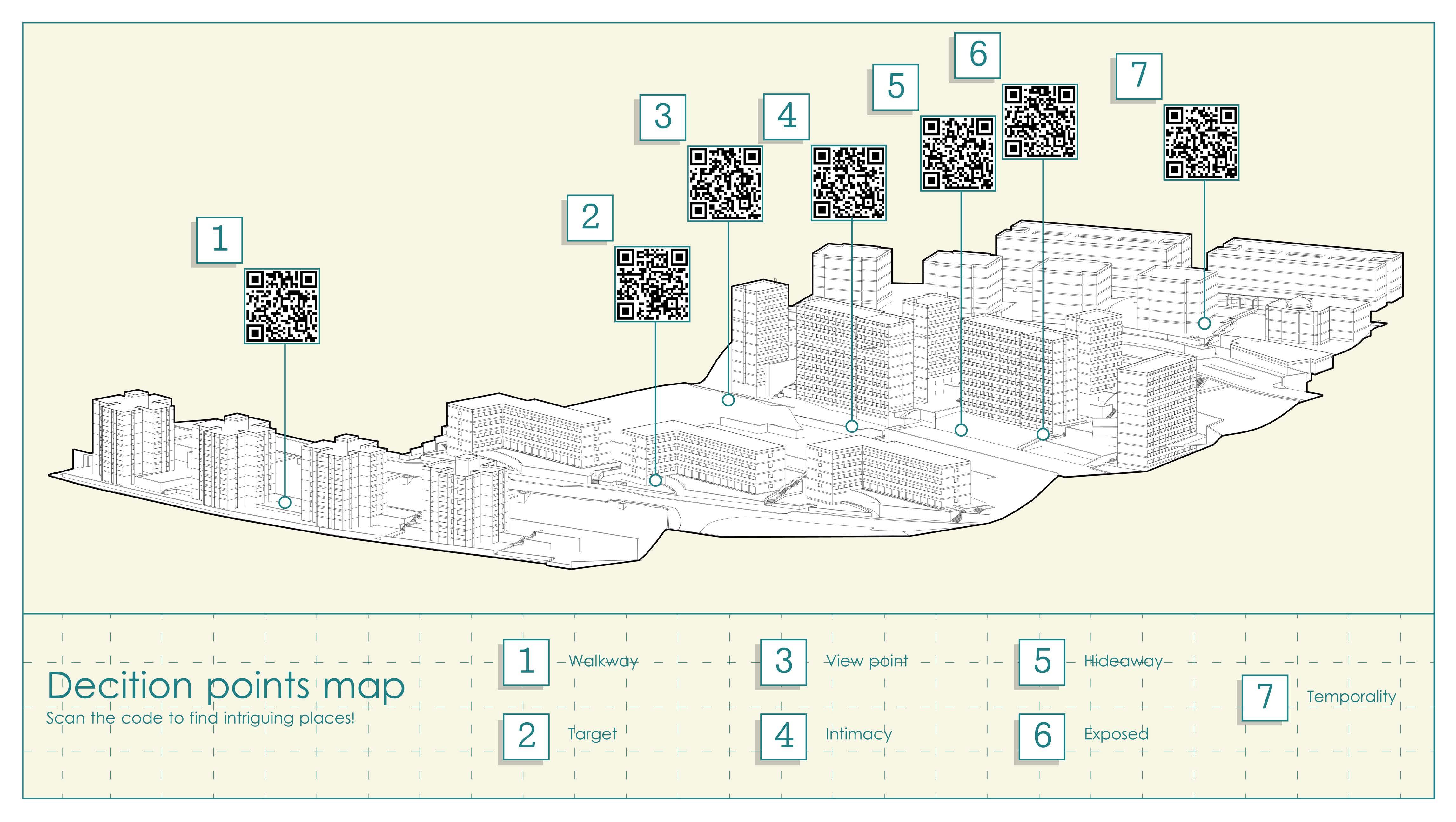
we recorded the sound in a specific route we chose in different times of day, and assigned a sign to each sound by a table of sounds we created. We placed this analyziz on a section to which we added the materials symols we analyzed before that. We chose points on the maps to add our own interventions, to create more options for people to wonder around the nighborhood and discover new and interesting paths to walk.
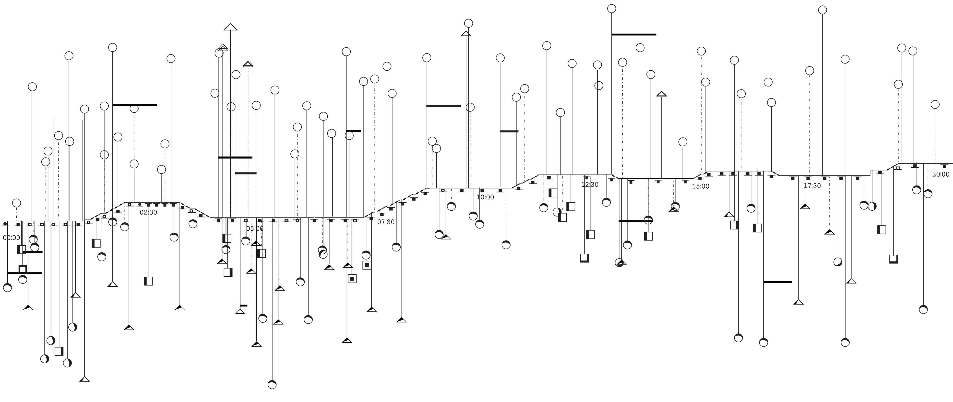
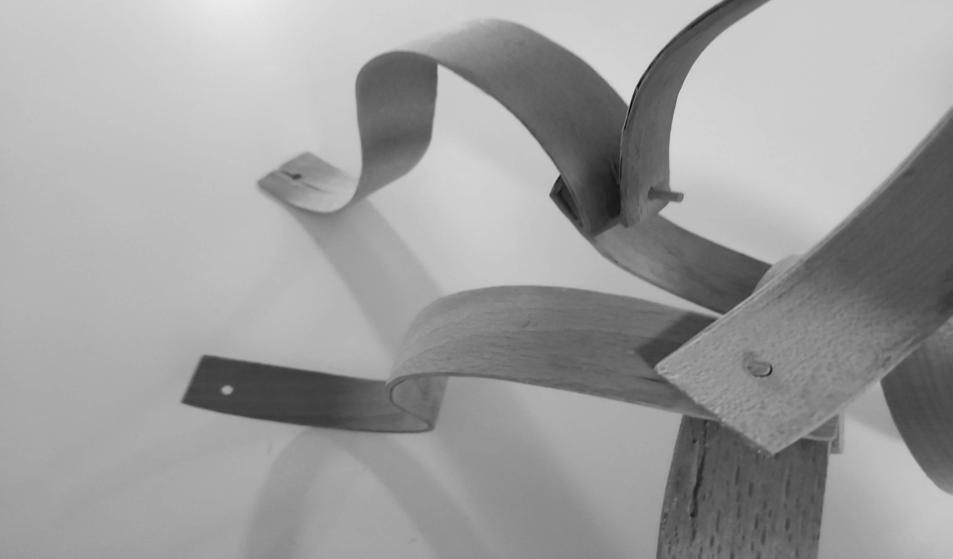
All the interventions we made are minimal, and easy to remove, change, or replace.
Those interventions make place for people to stay and listen, create new walking routs, or are just an interesting point that catches the eye and attract people to come and walk in a different route.
22
Other work
Courses from the last three years
About: physical modeling, fabrication, hand drafting & digital tools.
24
24
Studio 2, guided by Talia Davidi & Keren Mendjul
25
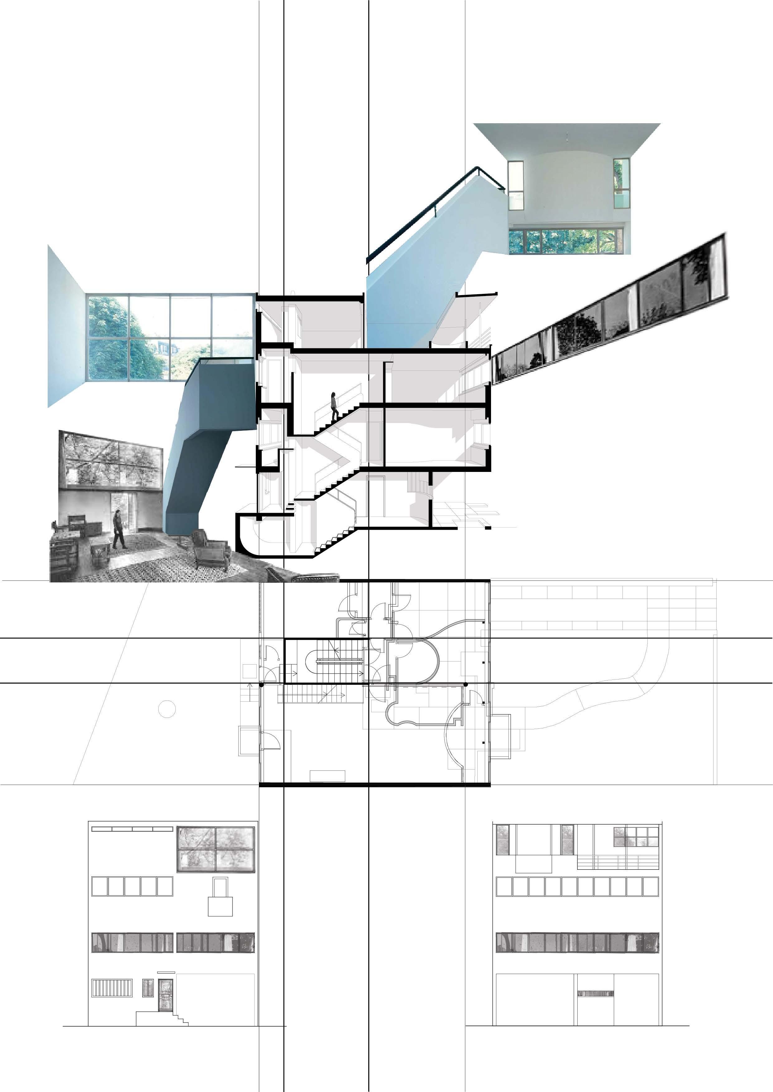
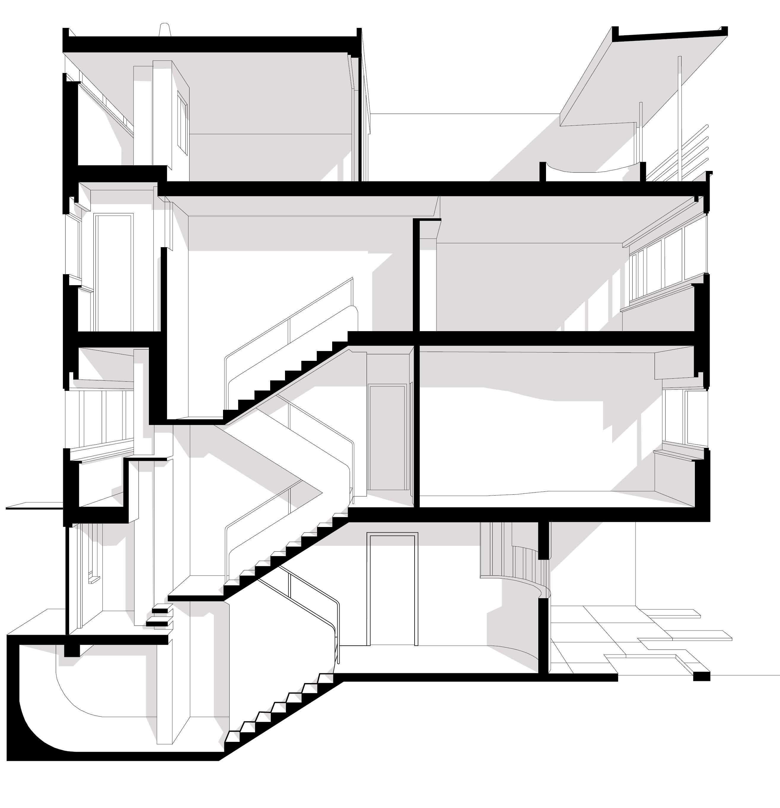
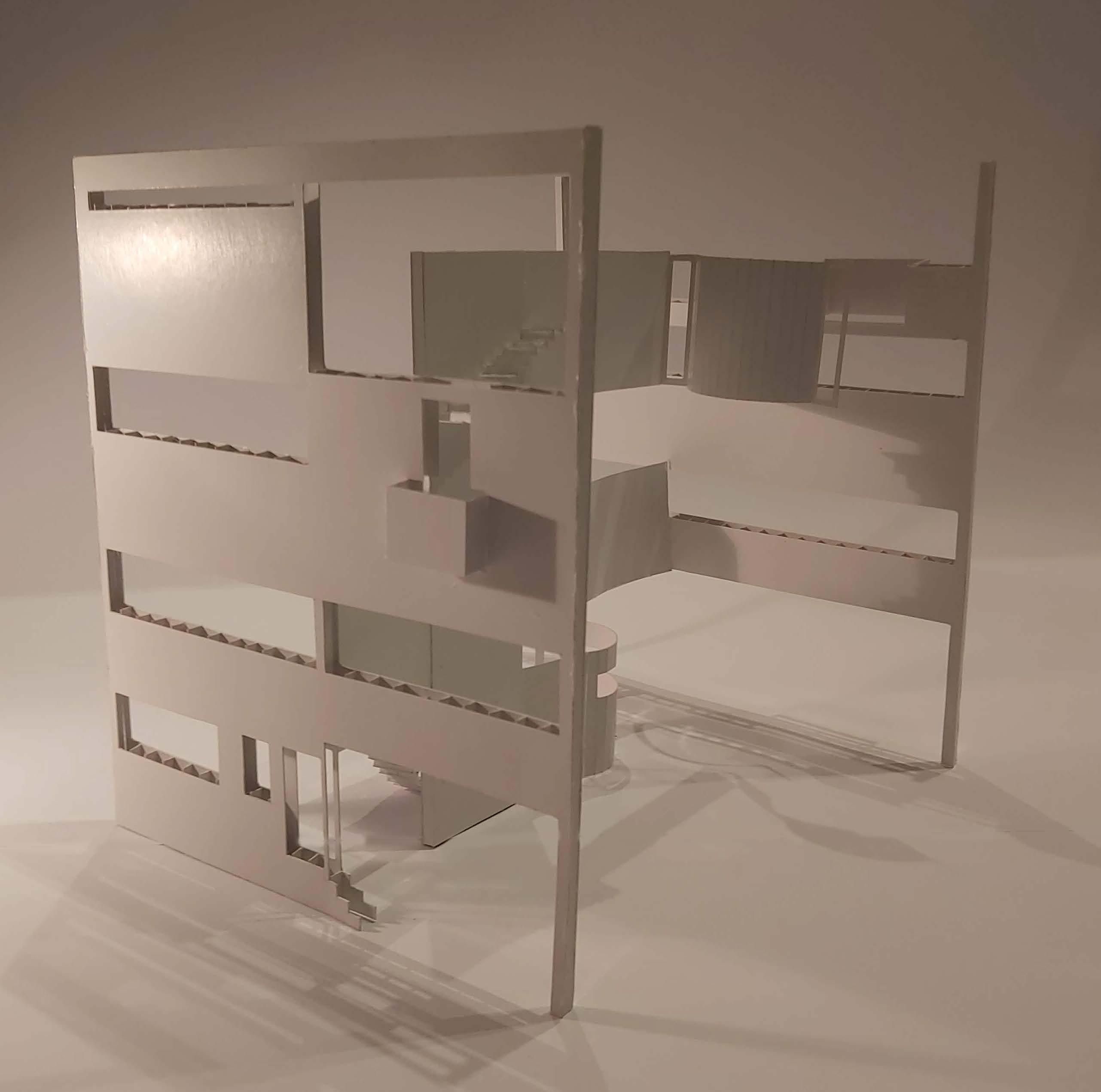
Building analyzis, Villa Cook
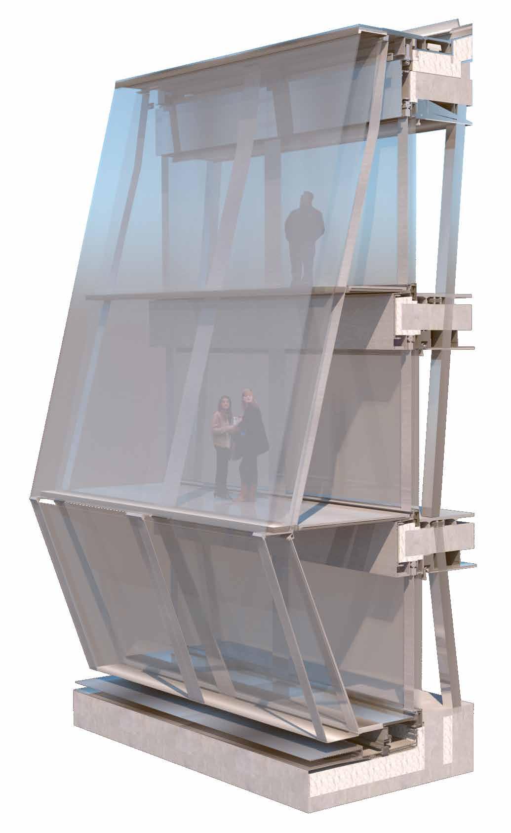
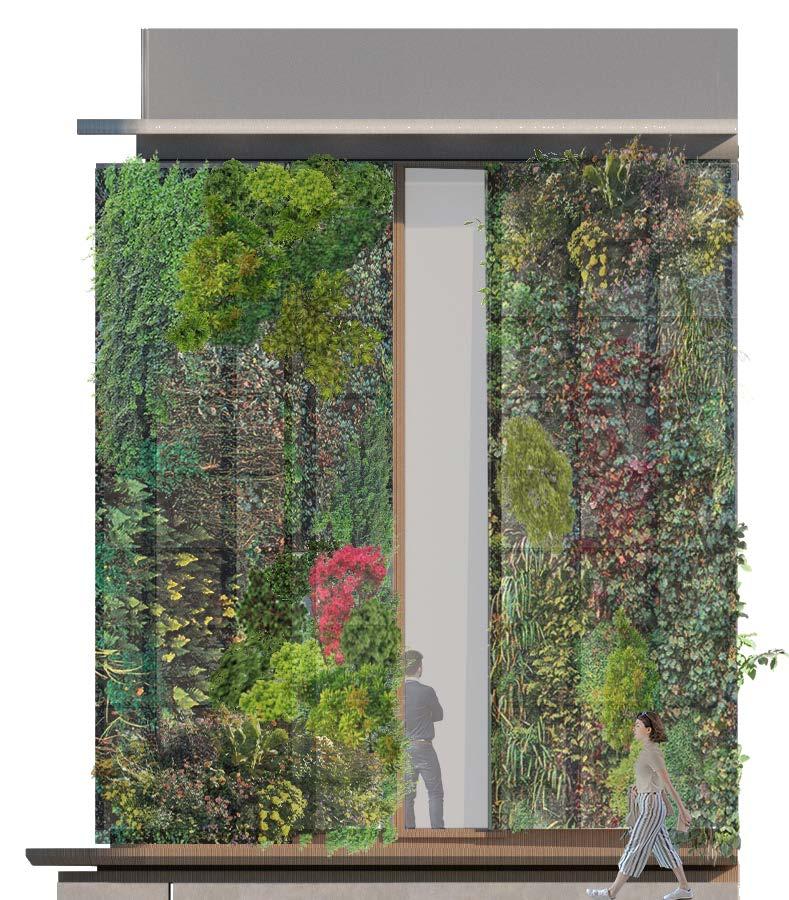
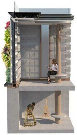
24 םוינימולא דומע םוינימולא תעוצר הלופכ תיכוכז ןוטב ןוטב ימרת דודיב םוינימולא ליפורפ 3 mm sheet aluminium 17,5 mm lam. safety glass adhesively bonded to 32/70 mm alum. h profile 30 mm metal grating on 60/30/8 mm steel h profie triple thermal glazing 8 mm + 14 mm cavity + 6 mm + 14 mm cavity 25,3 mm lam. safety glass with vertical silicone caulk joint anti-glare roller blind 350 mm pre-stressed reinforced concrete ceiling slab 200/120/16 mm steel RHS column 500/1200 mm reinforced concreate isolation BIOFILTER AIR 8 9 13 2-hydrophonic plants 9-concrete 11-Connectors 13-aluminium ventilation sheet 15-isolation CO
Evelope, Building technology | San Telmo museum
Building technology, BIOFILTER
Evelope, Building technology | Olympic house Lausanne
Ofir Bouba | Bezalel Academy Of Art & Design
