Wine Tasting in the Heart of Southern Oregon Wine Country ......
Pages 71-72
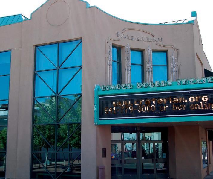
Craterian Theater at the Collier Center 71
Rogue Valley Family Fun Center ......... 72
Medford Railroad Park .......................... 72
ASHLAND
Pages 73-75 96 Pilot Rock ................................................. 73
Emigrant Lake ......................................... 73
Oregon Chocolate Festival .................. 74
Experience A Naturally Alkaline Healing Mineral Hotsprings 74 100 Oregon Shakespeare Festival............. 74
101 Historic Lithia Park ................................ 75
OUTSIDE THE AREA
Pages 76-84
Humboldt County, CA ........................ 76-77 Mendocino County, CA ............................ 78 Western Oregon and the Coast ............... 79
PROUDLY PRINTED BY Northwest O set Spokane, Washington Volume 39 No. 10 • 2024 PO
CONTRIBUTING PHOTOGRAPHERS Brian Anderson, Susan Comisky, Burt Codispoti, Chris Jetton, Steve Hammons, Gregg Gardiner, Tracy McCormack, Courtney Ramos & Bobby Stricker
elcome to the Southern Oregon/Del Norte California 101 Things To Do® publication.
This publication covers four counties and is your opportunity to see some of the most scenic roads and visit some of the most extraordinary places anywhere on the West Coast. If you just take the time to review this publication, it should be easier to navigate through this wonderland. The magazine is divided into three easily identifiable sections. Color coded bars at the top of each page correspond with the colored major highways on this map.
The BLUE coastal section runs south to north on Hwy 101, from Klamath, CA to north of Port Orford, OR, and along Hwy 199 from Crescent City, CA to the Oregon border (see pages 10-43).
The GREEN section runs north and east, from the Oregon border to Crater Lake National Park, Oregon (see pages 44-64).
The RED section starts in Jacksonville, then runs north to south on I-5, from Medford through Ashland, to the California border (see pages 65-75).
This publication describes what you can see and do in these areas, and where you can stop for dining, lodging, or just for supplies. Take the time to review these pages to fi nd out everything this area has to o er. More importantly, take the time to stop and visit for yourself. One can’t help be excited about this incredible area. And remember...
SOUTHERN OREGON WINERIES
Illinois Valley
Applegate Valley Rogue Valley
GRANTS
OldSams Valley TO
Bayer Estate
Kriselle
Cliff Creek (McDonough) (Ramsey)
Del Rio (NRiver)
Agate Ridge (Nick Young)
Crater Lake
Butte FallsHwy
LaBrasseur (Cobleigh)
Ledger David
Hummingbird Estate
Rellik Winery pg. 65
South Stage (South 3rd)
Remotion Winery(W Main)
SStage Pine Old Stage Hanley
RoxyAnn (Hillcrest)
Parkhurst
EJackson EMain 8th
Padigan
Daisy Creek (Shafer Ln) EdenVale (Voorhies)
CarpenterHill
Pebblestone (Camp Baker) Stone River (Pioneer)
Colver Payne ERapp CreekColeman
Trium (Rapp Ln)
JACKSO N COU NTY
Paschal (Suncrest)
Grizzly Peak (E.Nevada) Dana Cambell (N. Mountain)
Eliana (GaerkyCreek) Pompadour Oak
Naumes Suncrest Irvine & Roberts
Dead Indian Memorial
Belle Fiore o (Belle Fire)
Ashland (E.Main) Weisinger’s
S OUTHERN OREGON WINERIES
Tasting Room Listing with Available Varietals
— T after the winery name denotes tours available, call for details. (Area codes are 541 unless otherwise noted) We strive to make these listings accurate but information is subject to change. Please email any discrepancies or changes to bobby@101things.com
APPELLATIONS WHYALLTHE C OLOR?
This chart is color coded to match the appellation color zones on our wine map
ILLINOIS VALLEY APPLEGATE VALLEY ROGUE VALLEY
Winery
F3: Padigan Wines - T 2335 N. Phoenix Rd., Medford 779-9463 • Padigan.com
C3: Academy of Wine - T 18200 Hwy 238, Grants Pass 846-6817
F2: Agate Ridge Vineyard - T 1098 Nick Young Rd., Eagle Point 830-3050 • AgateRidgeVineyard.com
G4: Ashland Vineyards & Winery
2775 E. Main St., Ashland 488-0088 • Winenet.com
G4: Belle Fiore Winery - T 100 Belle Fiore Ln., Ashland 552-4900 • BelleFioreWine.com
BSB, C, CF, CS, G, M, Mal, Mar, P, PN, R, RB, SB, Sy, T, Vi
CENTRAL COAST - Lincoln City / Depoe Bay ALL AROUND
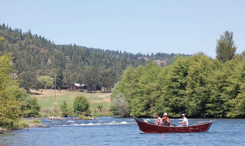
1 Jet Boat Tours
One of the best ways to experience the Wild and Scenic Rivers of the Wild Rivers Coast is by jet boat. Fun, exciting (but quite comfortable and safe), you’ll experience zipping through the cool water on a toasty summer day with family or friends, and viewing incredible scenery and iconic wildlife. You’re likely to see bears, deer and elk on shore, with eagles, hawks and ospreys soaring overhead or perching in trees by the river. You’ll also learn about the history of those who’ve lived by the river, including the local Native people. The weather on the Wild Rivers Coast is variable,the mornings and evenings tend to be cool. It’s a good idea to dress in layers when taking a jet boat tour. Also, be sure to wear a hat and sunglasses.
• SOUTHERN OREGON COAST (GOLD BEACH) : Jerry’s Rogue Jets, out of Gold Beach, was founded in 1958 and was the fi rst commercial jet boat tour company in the United States. Two of its most popular tours are the 64-mi. round trip between Gold Beach and Agness, and the 104-mi. round trip that includes an additional rocky, narrow, 20-mi. stretch of the Rogue River with whitewater rapids. WHERE: Jerry’s Rogue Jets is located a short distance from the mouth of the Rogue River in Gold Beach, OR. 29985 Harbor Way, Gold Beach, OR 97444
MORE INFO: 800-451-3645, www.RogueJets.com
• NORTHERN CALIFORNIA(KLAMATH): Klamath River Jet Boat Tours, operated by the Yurok Tribe near Klamath— will take you on a 45-mi. round trip tour on the second largest river in California (by volume of water). The Klamath is a beautiful, pristine river that fl ows into the Pacifi c Ocean in southern Del Norte County. You’ll travel in comfort on a shallow-draft boat powered by twin jets, and have plenty of chances to photograph the spectacular scenery and wildlife. WHERE: 17635 Hwy 101 S., Klamath, CA.
MORE INFO: 800-887-JETS (5387), 707-482-7775, www.JetBoatTours.com
• ROGUE VALLEY (GRANTS PASS): Hellgate Jet Boat Excursions of Grants Pass. It’s jetboat fun for everyone! Get on-board our 1-hour, 14-mile River Run Excursion! Take in the sights and sounds of nature as you glide inches above the water, and enjoy 360° spins on your way down to the mouth of the Applegate Confl uence and back to Grants Pass. RUNS DAILY May – September
WHERE: 966 SW 6th St., Grants Pass OR MORE INFO:541-479-7204 , www.hellgate.com
• ROGUE JET BOAT ADVENTURE (CENTRAL POINT): Rogue Jet Boat Adventures of Central Point. Unplug, Reset, & Get Ready to Discover Your Rogue! A Discovery Jet Boat Tour is a complete Oregon experience, packed full of spectacular scenery, meaningful history, wildlife viewing, and thrilling jet boating with 360s on the Rogue River. During the summer, Discovery Park opens up its one-of-a-kind fl oating stage for Concert at the Rocks Summer Music Series.
WHERE: Check in at Touvelle State Park 8601 Table Rock RD. Central Point, OR. MORE INFO:541-414-4182, www.roguejetadventures.com
2 S outhern Oregon Wineries
In recent years Southern Oregon has begun to make waves as a signifi cant force in the wine-making industry, garnering national and international attention with the quality of its fi ne wines.
There are three primary grape-growing regions in the area: the Applegate Valley, Rogue Valley and Illinois Valley appellations. They are home to scores of vineyards and wineries, and a surprising array of varietals. Some of the more well-known Southern Oregon wines include Pinot Noirs, Tempranillos, Malbecs, Merlots, Chardonnays, Rieslings, Pinot Grigios and Rhône Blends. Some of the area’s vineyards and wineries o er tours, and many have tasting rooms where you can sample these fi ne wines.
MORE INFO: For a list of Southern Oregon’s premier wineries and their locations, please see our Wineries section.
3 Southern Oregon Breweries
In Southern Oregon, local breweries provide opportunities for afi cionados of certain adult beverages (those with a frothy head) to observe their favorite libations being created, and to sample the fi nal product. Beer and ale, lovingly crafted from natural ingredients, often local and/or organic, are available to be enjoyed. The area’s skilled artisans have succeeded in capturing lightning in a bottle for lucky locals and visitors to take home with them. Be sure to call ahead for tasting hours and the times of tours, or to make reservations where tours are by
• Medford: Common Block Brewing Company, www. commonblockbrewing.com
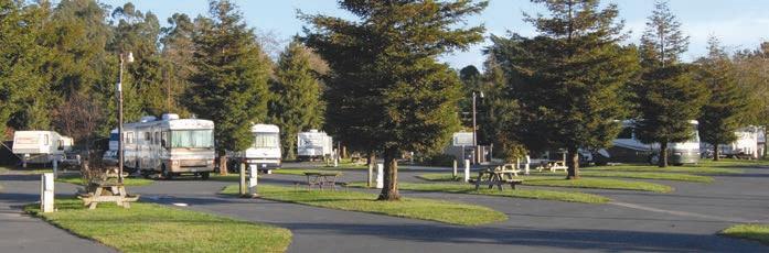
4 RV Camping
RV travel is a great way to roll through scenic Northern California and Oregon. There’s no need to make reservations at hotels; just pull into a campsite at a fraction of the cost, and slip into the back when it’s time for bed. Forget about the bother of hauling your gear into and out of a hotel; it all stays in your self-enclosed home on wheels. Furthermore, a fully equipped kitchen gives you full control of meals. Don’t forget the social benefi ts of RVing, as you’re bound to meet a lot of like-minded folks when you set up camp. There are plenty of great RV campgrounds to choose from throughout the area. RV traveling also o ers motorists freedom. If you pull into an area that doesn’t appeal to you, there’s no need to stay. If you fi nd a place you absolutely love, then put her in park and stick around a while. When the open road is calling, RV travel may be just what you need. Here are Some Great RV Parks to Check Out:
• KLAMATH: Mystic Forest RV Park, 707-482-4901, MysticForestRV.com
• CRESCENT CITY: Crescent City Redwoods KOA
• CRESCENT CITY: Village Camper Inn RV Park, 800-470-3544, VillageCamperInn.com
• BROOKINGS: Driftwood RV Park, 541-469-9089, DriftwoodRVPark.com
• GOLD BEACH: Turtle Rock RV Resort, 541-247-9203, TurtleRockResorts.com
• GOLD BEACH: Rogue River Landing Resort and RV, 541-247-4920, Rogueriverlanding.com
• AGNESS: Agness Rogue River RV Park, 541-247-2813 , www.agnessrvpark.com
5 The Oregon Coast Trail
Depending on who you ask, the Oregon Coast Trail is either 382 or 425 miles long. The di erence depends on what you do when encountering bays, inlets, estuaries and rivers: do you go across, or around? Many creeks and rivers can be crossed only at low tide during the dry season, and require hikers to either take a boat over the water, or hike the long way around the rest of the time.
The Oregon Coast Trail runs the entire length of the Oregon coast. It is a work in progress, part of the Oregon state park system. Most of it is completed, but there are still some gaps between existing segments waiting to be fi lled. It runs as close as possible to the ocean the entire way; almost half of it right along the beach, in the sand — a real legkiller if you haven’t trained ahead of time.
Along the Southern Oregon coast, the most pristine segment of the trail runs between Bandon and Port Orford. The character of the coast changes dramatically over the course of the trail. In addition to beaches there are sections that run along the shoulders of roadways, and hiking paths across headlands and ridges as along the Samuel Boardman Scenic Corridor. Some of it runs through small towns.
To hike the entire trail from one end to the other usually takes about a month. Most people hike only part of it. The best time to do it is between June and September, because of the heavy rains that occur during the rest of the year. However, from March to September is also snowy plover nesting season, meaning certain restrictions are in place, such as no dogs and no camping on the beach near snowy plover habitat. Campgrounds can also be found in state parks along the way, as can water, toilets and showers. The Oregon Coast Trail is considered one of the most beautiful hikes in the world.
MORE INFO: 800-551-6949. www.stateparks.oregon.gov
Cape Ferrelo north of Brookings, photo by Steve Hammons
KLAMATH
The town of Klamath, at the southern end of Del Norte County, is a favorite getaway for campers, hikers, fi shermen and other visitors. Named after the adjacent river, the town at one time was a stopping-o point for steamers out of San Francisco that supplied mines up the river. Today Klamath is known for its diverse recreational opportunities and unique natural beauty. Located in the center of Redwood National and State Parks at the mouth of the mighty Klamath River and less than a mile from the Pacifi c Ocean, the town has lots of activities available for any outdoor enthusiast. There are services and lodging available with cabins, motels, bed and breakfast inns, a casino/hotel, a hostel and hundreds of campsites. Some amenities include restaurants, a grocery market and a bait and tackle store.
6 Klamath River Jet Boat Tours
Set out on a two-hour, 45 mile, highspeed adventure on the pristine Klamath River, in shallow drift boat powered by twin jets. This round-trip tour operated by the local Yurok Tribe, provides a fullynarrated river tour showcasing Klamath River history, Native American culture and the area’s wildlife. View bear, osprey, hawks, eagles, black-tail deer and elk. It can be cool in the morning and evening, so wear layers that can be shed in the afternoon warmth, and wear a hat and sunglasses. Tours are given three times daily between May and September. Reservations are recommended. Personalized and group tours can be accommodated.
WHERE: 17635 Hwy 101 S., Klamath
MORE INFO: 800-887-JETS (5387), 707-482-7775, www.JetBoatTours.com
7 Klamath River Rafting
Whitewater rafting is one of the most exhilarating, heart-pounding adventures you can experience. Climb into an inflatable raft guided by an experienced whitewater rafter or guide and head down the river for the ride of a lifetime. As the rapids approach, you can help guide the boat around rocks and through the turbulent water. The Klamath River stretches from Altamont in Klamath County, Oregon, all the way to the Pacific Ocean near the town of Klamath in Del Norte County, California. This section is one of the nationally protected “Wild and Scenic” rivers and is generally regarded as the only “big water” river that can be found in the region from late June through October. Rafting trips are o ered on the upper and lower portions of the river, and range in di culty. The upper portion, known for its long rapids, is classifi ed 3-4 based on the International Rating Scale of 1-6. The Lower Klamath is more easy-going, providing mild to moderate trips. There are many rafting services in the area that can take you down either section of the river and provide gear and safety equipment. Trips vary from a few hours to several days, with camping along the shore. Most rafting tours do not require any experience.
Tackle Store • Kayaks & Paddleboard Rentals
Rogue Outdoor Sports is the go-to for kayaks, paddleboards and fishing gear for the Klamath River. We supply everything you need for your trip including kayaks, paddles, lifejackets and lessons. Just bring a camera, sunscreen, and a smile!
WHERE: Check the website below to connect with guides, and learn more!
MORE INFO: www.klamath-river.com
8 Klamath Overlook, Requa Road
The sweeping vista of the Pacifi c Coast viewed from Klamath Overlook in Redwood National Park is absolutely stunning. On a clear day you can see the Klamath River fl owing into the ocean, the long sand spit at its mouth, and the spectacular coastline to the south. Along the south bank of the river you can see the remains of an old wagon road that ran from Arcata to Crescent City in the 1890s. Bring binoculars for a chance to see whales (the best times for whale-watching are late November through January and March through May), sea lions, and a large array of birds including bald eagles, ospreys and kestrels. There is a trail from the overlook to your left as you drive in that leads down half a mile to a lower vista point with views some say are even more magnifi cent than those from higher up. Be sure to wear comfortable walking shoes and dress in layers — it can get pretty windy and chilly.
WHERE: About 1.5 mi. up Requa Road from the Historic Requa Inn, or 2.3 mi. from Hwy 101
MORE INFO: www.nps.gov
Klamath Overlook, photo by Tracy McCormack
Klamath River Jet Boat Tours. Photo by Courtney Ramos
KLAMATH
Trees of Mystery
Northern California’s redwood trees are some of the most remarkable sights in the world. A great place to enjoy them is at Trees of Mystery in Klamath. When you arrive, the o cial hosts, a towering 50 ft. Paul Bunyan and 35 ft. Babe the Blue Ox, will greet you.
One of the most popular attractions is the nearly mile-long, groomed interpretive trail that takes you through the redwoods and allows you to learn the legend of Paul Bunyan. At the end of the trail there is a Native American museum that houses one of the greatest privately-owned collections in the world.
An exciting feature of the Trees of Mystery experience is the nearly 1/3 mile journey through the forest tree tops via the unique SkyTrail gondola ride. A total of 8 Gondola Cars continuously make the approximately 8 to10 minute, 1570 ft. trip up the mountain each day, giving riders not only spectacular views of magnifi cent redwoods, but a fi ne mountaintop ocean vista from the observation deck at the summit. There are also several other trails available for exploration.
If you’re hungry, head to the Forest Café, which features fi ne food and remarkable murals. Don’t forget to stop by the gift shop and pick up a unique redwood keepsake. Accommodations are available at Motel Trees right across the street. Trees of Mystery is open daily, with hours varying from summer to winter.
WHERE: 15500 Hwy 101 N., Klamath — look for Paul Bunyan and Babe!
MORE INFO: 707-482-2251 or 800-638-3389, www.TreesOfMystery.net
10 Tour Thru Tree
Between 900 and 1,000 years ago, redwood began to grow outside Klamath. It withstood the test of time and the elements, and today stands as a healthy living redwood. However, this tree is unique. A tunnel was made through it in 1976, so today you can actually drive through this enormous giant known as the Tour Thru Tree. As you take your car through the trunk of the tree, make sure to look up to get an idea of its astounding height. The sheer size of this redwood is startling — not to mention the fact that you are actually driving through a tree! You are welcome to hop out of the car and take a picture. Picnicking is available at tables near the tree.
Close to the toll station there is a one-of-a-kind modern restroom made in a section of an eight-foot diameter redwood. Across the street from the toll station view emus, which are large Australian flightless birds.
WHERE: Take Terwer Valley o -ramp from Hwy 101, go east .25 mi. on Route 169.
SCAN ME to extend your stay with 10% OFF!
CRESCENT CITY
The crescent-shaped bay that gives Crescent City its name can be seen from a scenic vista stop just south of town on Hwy 101. From this vantage point you can see the rugged coast and lush forests that have helped shape this oceanside city’s history. Visitors enjoy the nearby Redwood National and State Parks, the Smith River National Recreation Area and Scenic Byway, as well as the magnifi cent coastline. Whether peering up at a skyscraping redwood grove, fl oating down the river or taking in a panoramic sunset over a long, empty beach, Crescent City’s natural beauty is something to experience.
Learn more about the area at the Del Norte County Historical Society’s main museum at 577 H St., and then gain even greater knowledge of the area’s history by visiting the Battery Point Lighthouse, Museum (also run by the Del Norte County Historical Society) and Lighthouse Keeper’s Residence. For more family fun, be sure to check out Crescent City’s Beachfront Park, and the ever-popular Ocean World, where you can safely pet a shark and watch trained seals and sea lions perform.
OceanWorldOnline.com
11 Ocean World Aquarium
If you are looking for an exciting family adventure, take a tour of Ocean World in Crescent City. This is one of the best privately-owned small aquariums in the United States. Go on a fully guided 45-minute tour that begins with a visit to the tide pool where kids and adults can touch the sea life. There are local fl ora, sea stars, anemones, sea slugs and more. In the main aquarium there are three environments, one of which features a rocky bottom and has 20 di erent species of rockfi sh, wolf eels and giant sea stars. The sandy bottom environment has a school of sharks, and in the open ocean environment you can watch bat rays “fl y” along with 40-pound striped bass. Don’t forget to visit the Shark Gallery, where visitors can pet live sharks. There is a show with Cora, the sea lion, and Skull, Marina and Wyatt, harbor seals, who perform tricks. A question-and-answer period with the trainers takes place afterward. Going to Ocean World is a memorable experience for people of all ages!
WHERE: 304 Hwy 101, Crescent City MORE INFO: 707-464-4900, www.OceanWorldOnline.com
Roosevelt elk on the beach, photo by Chris Jetton, CrescentBeachMotel.com
photo by Steve Hammons
photo by Brian Anderson,
EVENTS & FESTIVALS
MORE INFO: D ELN ORTE.ORG
• MARCH: Redwood Wild River Run, 707-464-3779, RWRR.org; Spring Whale Watch Week (Brother Jonathan Point)
• APRIL–DECEMBER: Live From Downtown — It’s First Friday!
• MAY: Wild Rivers Spring Symphony
• JULY: Fourth of July Celebration
• AUGUST: Del Norte County Fair, 800-350-9556 or 707-464-9556; Crescent City Triathlon, CrescentCityTriathlon.com
• OCTOBER: Sea Cruise Car Show, 707-464-3174, NorthernKnights.us
• NOVEMBER: Festival of the Trees, 707-464-9019
• NOVEMBER–DECEMBER: Holiday Fair, Del Norte County Fairgrounds
• DECEMBER: Wild Rivers Winter Symphony; Candlelight Walk in the Ancient Redwoods, 707-464-9150
CRESCENT CITY
Beachfront Park
Whether you’re stopping over in Crescent City or just passing through, Beachfront Park is a great place to stretch your legs, get some fresh air, and have some fun. Located right along the water’s edge, Beachfront Park o ers large grassy spaces including a disc golf course, horseshoe pits and soccer fi elds. There are also picnic tables, a dog park , and quite a bit more!
One of the highlights of Beachfront Park is Kidtown, a large gated play area with… is it a castle? Is it a fort? A gothic cathedral? Whatever it is, it looks very cool, is constructed of wood, and kids can climb on it and explore it and have a blast. There are slides and swings and all the things you’d expect to fi nd on a playground, but in a setting that looks a little like a cross between Frontierland and Fantasyland.
Another of its attractions is the Crescent City Swimming Pool, located right across Play Street from Kidtown. Besides the public pool it also features a water slide, a sauna and a spa.
Near the other end of the park you’ll fi nd the Northcoast Marine Mammal Center, where stranded or injured marine mammals are rehabilitated. The NCMMC also has a gift shop that is open to the public. (See page 18.)
Beachfront Park is also home to a memorial to the S. S. Emidio, a commercial tanker that was the fi rst casualty of Japanese submarine attacks on shipping along the California Coast. Five crew members lost their lives, and the submerged remains of the hull are still in the nearby harbor.
WHERE: Beachfront Park – Front Street and Stamps Way, Crescent City
Fred Endert Municipal Pool – 1000 Play St., Crescent City MORE INFO: www.crescentcity.org/Parks Beachfront Park – 707-464-9506 ext. 2267
Fred Endert Municipal Pool – 707-464-9503
13
Crescent Trail Rides
If you’ve always wanted to ride on horseback through majestic redwoods or along one of California’s pristine beaches, here’s your chance to take home some wonderful memories. Crescent Trail Rides o ers guided horseback rides in the Tolowa Dunes State Park and the Mill Creek area of Redwood National and State Parks. Rides range from an hour and a half to three hours in length, and are available year-round, weather permitting. Ride through old growth redwoods, meadows, sand dunes, marshes, over creeks, along the beach or up a mountain. Along the way you may see deer, elk, porcupines, skunks, geese, ducks, herons, egrets, even bald eagles.
Rides are by reservation. Long pants and closed-toe footwear are required, and it’s a good idea to dress in layers because of the cool coastal climate. Family groups are welcome, but riders must be at least 6 years old. MORE INFO: 707-951-5407, www.CrescentTrailRides.com
CRESCENT CITY
15
Northcoast Marine Mammal Center
14 Battery Point Lighthouse
This iconic structure stands on a tiny islet that connects to Battery Point by an isthmus at low tide. First lit with oil lamps in 1856, Battery Point Lighthouse remained in service until 1965, when it was replaced by a fl ashing light at the end of the nearby breakwater. In 1982 it was reactivated as a private aid to navigation by the Del Norte County Historical Society, and remains active today as a working lighthouse, museum, and lighthouse keeper’s residence. The lighthouse and its museum are open to the public for tours, and provide opportunities to look into the personal quarters of keepers and their families as well as the furniture and artifacts they’ve left behind since the 1850s. Tours include a climb into the light tower. There are displays of many maritime artifacts, photographs and documents that chronicle its history.
Visits to the Battery Point Lighthouse and island are only possible at low tides, and visitors should be on the lookout for sneaker waves when crossing the two hundred feet between the mainland and island. The lighthouse is open, tides permitting, between the hours of 10am and 4pm every day from April through September, and on weekends from October through March.
WHERE: From Hwy 101 in Crescent City, go west on Front Street until it ends at A Street, turn left onto A Street and follow it to the parking lot at its end.
MORE INFO: 707-464-3089 or Main Museum 707-464-3922, www.DelNorteHistory.org/lighthouse
When marine mammals are injured, sick or stranded along the coastline of Humboldt and Del Norte counties, the Northcoast Marine Mammal Center (NMMC) takes action. Most marine mammals rescued are rehabilitated at the Center and released back into the ocean. The most common animals you will fi nd there are California Sea Lions, Northern Elephant Seals and Pacifi c Harbor Seals. While NMMC rescues porpoises, dolphins, otters and other species of seals, they may be transported to another facility that can provide the additional care required for these animals. Whales are assisted via the Whale Disentanglement Team that includes the Center’s volunteer sta and veterinarian.
If you encounter a stranded or injured marine mammal, please stay back and keep people and pets away. These animals are in distress and can infl ict severe bites and may carry diseases that are transmissible to people and pets. Contact the NMMC on their Stranding/ Rescue line, 707-951-4722, to insure immediate help. Be prepared to describe the animal and its location. Remember that seals and sea lions sometimes rest on the beaches and should not be disturbed. Never drive any marine mammal back into the ocean. This does more harm than good in most instances. Harbor seal pups found on the beach are usually not abandoned. They are awaiting the return of feeding mothers. Watch from a distance so that your presence does not keep mothers away.
Educating people about marine mammals and the importance of the delicate marine ecosystem is ongoing. Northcoast Marine Mammal Center is sta ed by dedicated volunteers and funded by donations. When you visit, stop by the gift shop and learn how you can help in their e orts to give these marine mammals a second chance at life in the wild. WHERE: 424 Howe Dr. in Crescent City’s Beachfront Park • MORE INFO: 707-465-6265, Rescue Hotline: 707-951-4722, www.NorthCoastMMC.org
16
Brother Jonathan Park
A wonderful place in Crescent City to get out and stretch your legs while learning a bit of history from the 1800s. Brother Jonathan Cemetery and Park is home to the grave markers of those who perished on the 30th of July, 1865 during the shipwreck of the steamer known as Brother Jonathan out in St. George’s Reef. After wandering around the informative and o cial historical landmark (California Historical Landmark Number 541), you can sit comfortably in the soft grass or one of the benches and gaze out at the rough coast line where the wreckage itself took place. The views are spectacular, o ering a glance across at the rugged coastline to the south with an excellent perspective of the Battery Point Lighthouse. Because the spot is both high up and has little protection, it is windy and a bit chilly even when the weather is warmer. WHERE: at the end of 9th Street, next to Fraser Park
MORE INFO: landmarkadventures.blogspot. com/2011/03/brother-jonathan-cemetery.html?m=1
ENOTECA
Nightly Dinner Specials & Weekly Events & Live Entertainment
Enoteca is the Crescent City one-stopspot for homemade food, engaging fun, and live entertainment, with a uniquely pirate atmosphere. Enjoy a full lunch and dinner menu with nightly dinner specials starting at 5pm that include: Garlic Crusted Parmesan Prawns, Grilled Ribeye Steaks, and Grilled Salmon with fresh side dishes. Choose a frosty beverage from one of their over 35 taps and hang out with locals and visitors for hot wing night, trivia night or catch a local, regional or national musical act as they perform on the full professional stage.
960 3rd St, Crescent City, CA 95531
Facebook: Enoteca
Battery Point Lighthouse, photo by Steve Hammons
Brother Jonathan marker (on the rock), photo by Noe Hill, Wiki commons
CRESCENT CITY
17
Redwood Rides Adventure Outfitters: Whitewater Rafting, Kayaking, & Bike Trips
Redwood Rides Adventure Outfi tters are simply AMAZING at what they do. Check them out if you want to experience the outdoors by kayak, raft or bicycle using top notch gear with knowledgeable guides at reasonable rates. They o er a wide range of fully-outfi tted epic adventures on California’s Wild Rivers Coast. These are some of the premier outdoor excursions in the entire country.
Redwood Rides o ers half-day and full-day tours for everyone from beginners to experts in all sorts of water and terrain. Paddle through fun but easy Class 1 to 2 rapids amidst towering redwoods, open to families and beginners. Whitewater raft or kayak Class 3 rapids on California’s last completely undammed and free-fl owing river. Redwood Rides also o ers easy mountain bike rides in Jed Smith Redwoods State Park amongst some of the world’s largest trees. Take an intermediate bike ride on the Old Redwood Highway, showing guests a relic road from the 1930s in near solitude. Infl atable kayaks are very stable and great vessels for getting your fi rst taste of kayaking on a small or large amount of whitewater. There are many tours to choose from. All the equipment you’ll need is included in the price of the package, and the cost is very reasonable. They also o er kayak, SUP and bike rentals with included shuttle service. Whitewater rafting available in Spring and early Summer. WHERE: Most trips meet about 15 minutes from Crescent City(at the Hiouchi Hamlet Chevron station in Hiouchi). Adventure-specifi c locations in Redwood National & State Parks, Six Rivers National Forest, the Wild and Scenic Smith River and beyond! MORE INFO: 707-951-6559, RedwoodRides.com
RedwoodRides.com
18 Crescent City Area Beaches
The Crescent City area of Del Norte County is home to some of the most enchanting beaches anywhere. Just south of Crescent City lies Enderts Beach. From Hwy 101 drive south on Enderts Beach Road to an overlook some 500 ft. above the sandy beach. There you’ll fi nd a secluded paradise that’s perfect for collecting yourself and clearing your head. Crescent Beach is another beach just o Enderts Beach Road, about 2 miles south of Crescent City. Picnicking and combing its sandy beach for washed-ashore treasure are some of the more popular activities there. Just south of the Oregon border you’ll fi nd Pelican State Beach, the northernmost State Beach in California. This quiet, undeveloped and intimate beach is a great place to take a leisurely walk or go surf fishing. Whether it is skimming, swimming, windsurfi ng, picnicking or just taking a stroll at sunset, you will have a memorable time at these wonderful Del Norte County beaches. MORE INFO: Crescent City Chamber of Commerce, 707-464-3174, visitdelnortecounty.com
photo by Steve Hammons
CRESCENT CITY
PORT O’ PINTS BREWING CO
FRESH PIZZA WITH YOUR BREW!
When visiting the picturesque Northern California coastal town of Crescent City, be sure to stop by the welcoming Port O’Pints Brewing Company, an authentic Irish pub you won’t want to miss. Now under the ownership of Cynthia Parenteau, John Kirk and Master Brewer, Devin Beach this charming brewery continues to impress, surpassing 100 awards for its exceptional small-batch brews.
Savor fresh-made pizza and calzones from our spirited kitchen, and enjoy beloved classics like the Irish Red Ale-marinated Corned Beef Brewben Sandwich and Irish nachos. Port O’Pints offers more than just great food and drink; it’s a lively hub of entertainment with live music every weekend and fun weekly events including open mic comedy, trivia, and karaoke nights.
Immerse yourself in the vibrant atmosphere and enjoy a premium craft beer experience that defines the heart of Crescent City’s social scene. Port O’Pints Brewing Company—where community, craft, and celebration come together. Cheers!
1215 Northcrest Dr, Crescent City, CA 95531 portopints.com and on Facebook @Portopintsbrewingco
19
Redwood National & State Parks
Known as Redwood NSP by the National Park Service, the entire complex stretches roughly 50 miles . from near the Oregon border to south of Orick. The individual parks border and intersect one another to such an extent that they have come to be managed as if they were one entity, although di erent rules apply in the national and state-run sections. Truly one of the world’s premier natural destinations, these parks provide a wide spectrum of recreational opportunities that include both the rugged and the sedate. Outdoor activities range from hiking, kayaking, rafting, fi shing and camping to nature photography, peaceful strolls and awe-struck quiet contemplation. Many species of wildlife call these parks home. Furthermore, in addition to redwoods there are quite a few other types of trees found in the parks, and a variety of ecosystems, with areas of seacoast, river and prairie as well as densely forested zones. The rivers and streams are among the most pristine in the United States.
MORE INFO: Visitor Information Center, 1111 2nd St., Crescent City, 707-464-6101, Daily 9am to 5pm; call for shortened winter hours; www.nps.gov
• Redwood National Park
The tallest tree currently known to exist in the world was discovered here in 2006. Named “Hyperion,” it is a coastal redwood that stands over 379 ft. in height, making it about 75 ft. taller than the Statue of Liberty plus its pedestal. Scientists estimate that Hyperion is about 700 or 800 years old, but coastal redwoods can live to an astounding age of 2000 or more. The tree’s location has been kept secret to protect it from souvenir hunters. Camping in the park is permitted, but you’ll have to hike to reach the designated camping areas, which are located in the backcountry. Stays are limited to fi ve consecutive nights, and you’ll need a permit. You will need to pack your water in with you, or purify or fi lter the water that you fi nd, and you’re required to carry all your trash out with you.
MORE INFO: 707-464-6101, 707-465-7765, www.nps.gov/redw
• Jedediah Smith Redwoods State Park
This jewel of a state park protects 7% of all the old growth redwoods left in the world along with the Smith River, the last major free-fl owing river in California. Most of the park is watershed for this untamed river and Mill Creek, a major tributary. There are 20 mi. of hiking and nature trails that are excellent for exploring, along with many places to access the river for kayaking, swimming or fi shing. King salmon and steelhead trout fi shing are excellent in the fall and winter. Driving along the gravel Howland Hill Road or strolling in Stout Grove, with some of the most intense old-growth redwood habitat in the world, is a never-to-be-forgotten experience. Scenes for the 1983 Star Wars fi lm “Return of the Jedi” were fi lmed in this grove. There are also splendid campgrounds available for those who would like to spend the night. Make sure you stop at the Visitor Center; it has many exhibits which will enhance your experience of the park. The park and its campgrounds are open all year long.
WHERE: 9 mi. east of Crescent City on Hwy 199 near Hiouchi
MORE INFO:707- 464-6101, 707-458-3018, www.parks.ca.gov
• Del Norte Coast Redwoods State Park
With 8 mi. of wild, rugged coastline and acres upon acres of old-growth redwoods, Del Norte Coast Redwoods State Park is a wonderful place to spend the day. Tall trees tower above, allowing thin rays of light to shine through. Adjacent to the Pacifi c Ocean, there is a mountain range that runs north to south. The rocky coast is only accessible by Damnation Trail and Footsteps Rock Trail. Once down there, you will be able to see the cli s from a new, awe-inspiring perspective. Wilson Beach or False Klamath Cove is a half-mile sandy beach that is great for strolling at low tide. Throughout the park there are miles of biking, hiking and nature trails along with guided tours.
WHERE: 7 mi. south of Crescent City along Hwy 101
MORE INFO: 707-464-6101, www.parks.ca.gov
• Tolowa Dunes State Park and Lake Earl Wildlife Area
You’ll fi nd some of the fi nest wetland habitats on California’s northern coast in Tolowa Dunes State Park. Stroll along beaches, river banks, open and vegetated sand dunes, wildfl ower-fi lled meadows, tree-coated ridges and wetlands full of life. Two very important parts of the park are the Lake Earl Wildlife Area and the Lake Earl Coastal Lagoon. Located on the Pacifi c Flyway, you will be able to spot hundreds of species of birds including peregrine falcons, migrating ducks, geese and swans that gather by the thousands. There is excellent fi shing for cutthroat trout and starry fl ounder at Lakes Earl and Tolowa. You can pitch a tent at one of the two campgrounds, which include a ride-in horse camp and walk-in sites. The park is open year-round.
WHERE: 2 mi. north of Crescent City o Hwy 101 on Northcrest Drive and then onto Old Mill Road, or further down Northcrest Drive which becomes Lake Earl Drive. Take Lower Lake Road to Kellogg or Pala Road. MORE INFO: 707-464-6101, www.parks.ca.gov
Damnation CreekTrail, Del Norte Coast Redwoods State Park, photo by Susan Comiskey
HIOUCHI & GASQUET
20 Gasquet Raft Races
For the past half century, Gasquet American Legion Post 548 has hosted the wonderfully wacky Gasquet Raft Races on the Smith River. Always held on the 2nd Saturday of July, the 2019 races will mark the 50th anniversary of this venerable tradition. Although it isn’t required, participants are encouraged to dress in costume and decorate their rafts. As you can imagine, this being Northern California, the results are invariably highly creative and imaginative. Recent races have featured an infl atable dressed up like a giant shark and another like a tie-dye patterned Volkswagen van full of hippies, a fl oating pink fl amingo followed by little baby fl oating pink fl amingos, and participants that have included Vikings, pirates, dairy cows, bathing beauties (of course), medieval jesters, and an eye-popping blue creature with dorsal fi ns — and that’s just for starters.
Rafters put in at the confl uence of the North and Middle Forks of the Smith River by the Horace Gasquet Bridge. The fi nish line is 2.5 mi. downriver at the Mary Adams Peacock Bridge. Plaques are awarded to the winners of 10 di erent categories determined by type of craft and age of participants, and the Best Costume and Most Decorated/Unusual Raft categories are awarded an additional cash prize. After the races the festivities continue with a deep pit barbecue at the American Legion Hall. Proceeds raised by the event are used to help local veterans.
WHERE: Go to the American Legion Hall fi rst, on Gasquet Flat Road in Gasquet, CA, and follow the signs from there.
MORE INFO: 707-954-1836, GasquetRaftRace.com
21
The Wild and Scenic Smith River
The Smith River waterway is the northernmost of California’s major rivers. Its mouth is about 5 mi. south of the Oregon border and 10 mi. north of Crescent City. It is the largest free-fl owing river in the state, producing the largest steelhead and Chinook salmon. The untamed nature of this river, without a single dam along its entire length, makes it especially prized among conservationists; it is considered one of the crown jewels of the National Wild and Scenic River program. The river fl ows through some of the most beautiful scenery in California, from Six Rivers National Forest through Jedediah State Park and out to the Pacifi c Ocean.
About 8.5 mi. from the town of Gasquet towards the Oregon border, Patrick Creek Lodge sits in a beautiful spot along the river. You can hike or bike on numerous trails nearby. Fishing begins just outside the lodge doors where cutthroat trout is available throughout summer. Salmon and steelhead fi shing is available throughout the fall and winter. Fishing information and economical fi sh storage are both available at the lodge. Keep following the Smith River, as it cuts its way through the canyon, and you’ll hit the Collier Tunnel and the Oregon border. MORE INFO: Rivers.gov/rivers/smith.php, PatrickCreekLodge.com
Veer east on Hwy 199 north of Crescent City to get to the tiny hamlets of Hiouchi (hi-OO-chi) and Gasquet (GAS-key), and the northern entrances to Jedediah Smith Redwoods State Park. The Jedediah Smith Visitor Center is located on Hwy 199 in Hiouchi. Lodging, RV sites, propane, supplies and ample outdoor recreation, as well as several public river access points, are found here.
Jedediah Smith Redwoods State Park preserves a magnifi cent old-growth redwood forest and an untouched section of the Smith River. A trail through the Stout Grove section of the park (see next page) was featured in a San Francisco Chronicle article on the “Ten Great Hikes in California.” These are some of the most botanically and geologically diverse landscapes in the nation, as well as some of the most pristine and beautiful.
This area of Hwy 199 is home to the Smith River National Recreation Area, acclaimed as the cleanest watershed in the 48 contiguous United States. The road itself is a perfect example of a rural byway. Serving as the connection between California’s Crescent City at Coastal Hwy 101 and Oregon’s Grants Pass where it connects to I-5, Hwy 199 is a far-ranging adventure unto itself. No road on the West Coast can match it; it o ers access to three wilderness areas, three Wild and Scenic rivers, Redwood National and State Parks, Oregon Caves National Monument and Smith River National Recreation Area.
Gasquet Raft Races, photo courtesy of Gasquet American Legion Post 548
Smith River, photo by Steve Hammons
HIOUCHI & GASQUET
Bear Basin Butte Lookout & Smith River National Recreation Area
If you really want to get away from it all and immerse yourself in the beauty of nature, spend the night in a fi re lookout at Bear Basin Butte Lookout in the heart of the Smith River National Recreation Area. Perched atop a narrow ridge at 5,300 ft., the lookout features breathtaking 360-degree views of the Siskiyou Mountains to the east and the Pacifi c Ocean to the west. If you rent the lookout, a 1930s-style cabin comes with it, providing sleeping accommodations for up to 12 people. The lookout and cabin are available for one- to four-night stays between July 1 and September 30.
MORE INFO: Reservations are taken after January 1 at 877-444-6777 or Recreation. gov.
When traveling along Hwy 199, be sure to enjoy the Smith River National Recreation Area. Go kayaking, whitewater rafting, and swimming in the Smith River and other rivers in the area. Fishing for trout, steelhead, and salmon on the rivers is considered worldclass due to the trophy-sized catches and the challenge of landing a fi sh. There are also numerous hiking trails through the Siskiyou Wilderness, along Myrtle Creek and on the Darlingtonia interpretive trails, where you will be able to spot rare and endangered plants including wildfl owers. You can fi nd the recreation area throughout much of Del Norte County, and Hwy 199 runs right through it.
MORE INFO: 707-442-1721, www.fs.usda.gov/recarea/
23
World War II Memorial Monument
The largest World War II Memorial in the United States is located near Hiouchi, about 10 mi. from Crescent City. From the beginning of World War II until shortly after its conclusion, from all across America, donations, many as small as 10¢, poured in to buy 5,000 acres of old-growth redwoods as a living memorial to honor those who fought. Today it comprises about half of Jedediah Smith Redwoods State Park. Called the National Tribute Grove, at its dedication in 1949 a memorial stone with a bronze plaque was erected along Hwy 199, so that those driving by would see it and remember. However, as the years passed the stone became obscured by vegetation, and was lost from view and almost lost from memory.
Then in September of 2014, thanks to e orts by the Daughters of the American Revolution, the Garden Club of America and Redwood National and State Parks, the 2,000 lb. stone was relocated to the picnic area of the Jedediah Smith Redwoods State Park’s campground. Now once again people can see it, and be reminded of the sacrifi ces of those who served. The monument was unveiled by World War II veteran Robert D. Maxwell, a recipient of the Congressional Medal of Honor, at a ceremony rededicating the National Tribute Grove.
WHERE: Jedediah Smith Redwoods State Park’s campground picnic area.
24
Stout Grove, Jedediah Smith Redwoods State Park
In a region where scenic attractions are di cult to describe without an excess of superlatives, Stout Grove pulls out all the stops. Located on a fl ood plain between the Smith River and Mill Creek, the periodic fl ooding prevents the growth of an understory of tanoak, madrone, red alder and other small trees that obscure the view in other stands of redwood. As a result, you can see the trees here better than in perhaps any other redwood grove in the world. With coast redwoods towering more than 300 ft. overhead and waist-high sword ferns, you might think you’ve been transported to a fairyland. RedwoodHikes.com describes it like this: “Best seen in the late afternoon, the grove has a remarkable cathedrallike appearance, hushed and serene, with huge straight trees rising through the gloom into brilliantly backlit foliage.”
There is a fl at, wide, loop trail through the grove, about 0.6 mi. long. It’s an easy but spectacular walk. The grove is almost never crowded, because it’s a little out of the way. The parking area above the trailhead has pit restrooms, and there is a paved walkway leading down to the trail. There are no parking or entrance fees.
WHERE: 10 mi. inland from Crescent City. Follow Hwy 199 until you’ve gone about a mile and a half past Hiouchi to a sign that says South Fork Road / Howland Hill Scenic Drive / Stout Grove. Turn right onto South Fork Road and go half a mile, crossing over the Smith River and then the South Fork of the Smith. Just past the South Fork turn right onto Douglas Park Drive. After a mile and a half it runs into Howland Hill Road and becomes a hard-packed gravel road. Continue along Howland Hill Road for another mile to the parking area for Stout Grove.
MORE INFO: 707-464-6101, www.parks.ca.gov
photo courtesy of Del Norte Triplicate, Triplicate.com
Jedediah Smith Redwoods State Park, photo by Rachel Stricker
Smith River, photo by Steve Hammons
Smith River, photo by Tracy McCormack
Smith RiveR
Thirteen miles south of the Oregon border lies the quaint community of Smith River. Adjacent to Rowdy Creek near where the Smith River meets the Pacific Ocean, the area is known as the “Easter Lily Capital of the World” because it produces most of the world’s Easter lily bulbs that flower every spring. The Redwood National Park, Smith River National Recreation Area, and 10 State Parks are within 20 mi. of Smith River, making it a great place to headquarter for exploring these exciting attractions.
Sea Escape
miles of private walking beach!
25 Rowdy Creek Fish Hatchery
The Smith River, known for its trophy-size fish, is a major route for migrating fish to their native spawning grounds. When a 1964 flood destroyed much of the spawning population, a need for a fish hatchery arose. In 1968, the Kiwanis Club in the town of Smith River raised enough money to sponsor the construction and operation of the first privately owned fish hatchery in California. Today, this nonprofit hatchery is open for daily tours. The goal of the Rowdy Creek Fish Hatchery is to increase and perpetuate runs of steelhead and Chinook salmon. The hatchery operates 365 days a year, and offers free tours for visitors from 9am to 4pm weekdays. Fish are present at the hatchery year-round, but spawning season is when the hatchery is most active. Fall (usually November and December) brings busy excitement to the hatchery with the spawning of Chinook salmon. Monday and Thursday mornings, which are spawning days, offer the best chance to see the process. Steelhead return to the hatchery from January to March. The hatchery raises more than 100,000 steelhead each year. A “catch and release” fishing derby is sponsored by the hatchery every spring.
WHERE: 255 N. Fred Haight Dr., Smith River MORE INFO: 707-487-3443, RowdyCreek.com
Photo by Tracy McCormack
BROOKINGS-HARBOR
Brookings-Harbor, the southernmost community in Curry County, Oregon, is located 5 mi. north of the California border on Hwy 101. This is an area of abundant natural attractions with miles of coastline, wild scenic rivers, state and city parks, and an attractive port. The cities of Brookings and Harbor are nestled on either side of the Chetco River where it meets the sea. Brookings is an incorporated city, while Harbor is not. They are in an area often referred to as the “banana belt” of the Pacifi c Northwest, thanks to its sunny and temperate year-round climate. This makes Brookings a welcome reprieve for travelers in a region otherwise known for rain and fog. Highway 101 runs through Brookings’ commercial core, which can fi ll virtually any need a traveler may have. Over 90 percent of America’s Easter lilies are grown between BrookingsHarbor and Smith River to the south, and an early summer drive between BrookingsHarbor and Crescent City takes you through breathtaking views of fi elds of blooming lilies.
Voted Best Mexican Restaurant in Brookings!
26 Port of Brookings-Harbor
The Port of Brookings-Harbor is the gateway port to Oregon, located at the mouth of the Chetco River on the Southern Oregon Coast just over the border from California and the Redwood National Forest. The temperate climate makes The Port an ideal place to spend the day outdoors.
On the water, The Port is “considered a fi sherman’s paradise with ocean fi shing available most of the year and three world class rivers available within 25 miles”. The full-service marina is open for recreational and commercial fi shing and boating and o ers fuel, haul-out, and maintenance services. Sightseeing and fi shing charters are also available here.
O the water, The Port contains an array of retail businesses along an impressive boardwalk that overlooks two boat basins on the marina. The Boardwalk is a source of local pride that provides a beautiful, restful place for locals and visitors alike. It is lined with colorful shops and businesses o ering a wide array of merchandise and services including: books, ice cream, clothing, artwork, guided tours, and a spectacular diversity of mementos and gifts. Restaurants in the area feature everything from snacks to regional and international cuisine, including, of course, fantastic seafood.
MORE INFO: 541-469-2218, PortOfBrookingsHarbor.com
photo by Steve Hammons
BROOKINGS
27 Pirate Festival
Embark on a 3 day pirate adventure fi lled with cannon fi re, cutlasses, mates, maidens, and tall tales! A festival like no other, the Pirates of the Pacifi c festival in Brookings, celebrated its 10th anniversary in 2021. This semi-historically accurate and fun-fi lled event takes place annually in August on the Boardwalk of Brookings Harbor in Brookings, Oregon.
A celebration of the lore that is the scourge of the seas, the pirate. Live music, sword-play, cannon demonstrations, storytelling, and historical accounts and re-enactments highlight this gathering of enthusiasts. Don’t be surprised if you are called-out on the street by a patch-eyed pirate, lulled-in by the local mermaid, or caught in the middle of a rowdy drinking song. The Pirates Of The Pacifi c Festival is not to be missed and one to be participated in by everyone. Channel your inner-pirate, step out on that plank and dive in! FOR MORE: Piratesofthepacifi cfestival.net
28
Fishing in Brookings
Fishermen love Brookings. The area, known for its warm, mild climate and natural beauty, o ers superb year-round ocean and seasonal river fi shing. The Port of Brookings-Harbor has one of the safest entries to the Pacifi c Ocean on the West Coast. It is a working port that caters to sport fi shermen, sailors, pleasure boaters, and a fl eet of commercial fi shing vessels. The supporting infrastructure provides dock, electrical, fuel and sewer services. Numerous ocean-going boats are available for charter. Sportsmen may try their hand at bottom fi shing (lingcod and a variety of rockfi sh such as rock cod and Pacifi c snapper) or go after salmon, halibut, albacore, red tail perch, Dungeness crab or shark. For the more laid-back, fi shing from shore is another option. River fi shing is also a popular pastime in and around Brookings. The Chetco River, which fl ows into the Port of BrookingsHarbor, and the Winchuck River to the south both receive rave reviews for their salmon, steelhead, and cutthroat trout populations. MORE INFO: 541-469-2218, PortOfBrookingsHarbor.com
Harris Beach & Chetco Point Park
Brookings is home to several beautiful beaches. Take an afternoon to explore them, picnic on them or walk the adjacent trails. Some of these beaches boast a treasure trove of shells and stones, while others provide a glimpse into marine life through tide pools. Camping accommodations can also be found.
Harris Beach State Park, on the north side of Brookings, has an exceptional rocky coastline dotted by monolithic sea stacks and bordered by gorgeous spruce, fi r and pine trees. Sea lions, sea birds and seals are a common sight along the beaches, and in winter and spring you may see migrating gray whales. Bird Island, just o shore, is the largest island o the Oregon Coast and is a National Wildlife Sanctuary and breeding site for rare birds, including the tufted pu n. The park o ers RV hookups, showers, restrooms, tent sites, Wi-Fi access, playgrounds, and cabins, yurts and teepees. Interpretive events, tours and educational programs are all available.
MORE INFO: 800-551-6949, OregonStateParks.org
Chetco Point Park is a 9-acre beach park located half a mile west of Brookings, o Wharf Street. The park features a large play area with lush rye grass, picnic tables and horseshoe pits. If you follow the walking trail south, both Chetco and Mill Beaches at the end of the trail contain a rich supply of shells, stones, marine life and ever-changing views of the power of the sea.
MORE INFO: 541-469-1103, Brookings.or.us
Courtesy of piratesofthepacificfestival.net
photo courtesy of Tidewind Sportfishing
photo by Steve Hammons
BROOKINGS
30
Chetco River
To see the rugged and wild side of nature, take a trip along the 44.5 mi. of the Wild and Scenic Chetco River. This federally designated section of the Chetco is divided into three segments: wild, scenic and recreational. The fi rst 27.5 mi., extending from its headwaters in the Kalmiopsis Wilderness down to Mislatnah Creek, are designated wild. The next 7.5 mi., down to Eagle Creek, are designated scenic, while the last 9.5 mi., from Eagle Creek to the Rogue River-Siskiyou National Forest boundary just above Loeb State Park, are designated recreational.
Within the Kalmiopsis Wilderness the mountainous terrain is steep, sparsely vegetated and deeply cleaved by the Chetco. The river fl oor is narrow and boulder-strewn, with many rapids and falls. Leaving the wilderness, the river begins to widen but still narrows at points, crossing through rocky outcroppings where it leaves behind gigantic boulders. The dramatic Chetco River Gorge, with its abrupt sides and unique rock formations, is well worth a visit. Below it, the river continues to broaden with sandbars and raised river terraces. The river eventually empties into the Pacifi c Ocean between Brookings and Harbor, just 5 mi. north of the California border, where it is gentler, the river bottom wider and its banks covered by dense forest. Along its journey it drops 3,700 ft. in elevation.
In the summer, visitors love to go fi shing, four-wheel driving, hiking, swimming, picnicking, rafting, kayaking, camping and wildlife-viewing on the river. In the fall and winter, people enjoy excellent salmon and steelhead fi shing, and a few brave and hardy
souls go whitewater kayaking.
WHERE: The Chetco River winds through the southern part of Curry County and can be found from the Kalmiopsis Wilderness in Siskiyou National Forest to alongside North Bank Chetco River Road o Hwy 101 near Brookings.
MORE INFO: 541-247-3600, fs.usda.gov
31
Alfred A. Loeb State Park
Need to relax? Love the outdoors? Alfred A. Loeb State Park combines secluded relaxation with the natural wonders of Southern Oregon. The crisp fragrance of myrtlewood is the prevailing scent in the air; the park is nestled in groves of these marvelous 200-year-old trees. Just beyond the park, the Chetco River rushes toward the Pacifi c Ocean. Depending on the time of year, the park provides swimming or steelhead and salmon fi shing. Fishermen cast from shore or head out in drift boats, spending lazy afternoons on the water. Squirrels scampering on the shore and river otters paddling through the water are a common sight. Bird-watchers love the area because of the diverse bird population, and ospreys are extremely active at the park. No matter what time of the year, visitors enjoy the self-guided Riverview Nature Trail. The park is home to the northernmost redwood grove in the United States. Campsites and cabins are available. Take the time to enjoy the wondrous views and sights of the great Oregon outdoors.
WHERE: About 10 mi. northeast of the town of Brookings.
MORE INFO: 800-551-6949, www.OregonStateParks.org
32
Azalea City Park
In Azalea City Park you can walk among ancient native azaleas that were growing when Lewis and Clark wintered on the Oregon Coast in 1805-06. Follow the numerous trails through this 33-acre park past astonishing endangered azaleas, annuals, shrubs and through stands of enormous trees. The paths are originally part of a pack trail that was used by miners in the 1850s. This was an important segment of the coastal wagon route leading from California to the Umpqua and Willamette Valleys in Oregon. The park was dedicated in 1939, and the fi rst Azalea Festival was held there. In recent years volunteers have revitalized the park and built walkways, a play area in the northwest corner of the park called “Kidtown” that provides younger children with a chance to play among forts, bridges, slides, tires and ropes, and a “Stage Under the Stars” band shell that hosts the annual American Music Festival, a free summer concert series.
Pink azaleas in bloom, photo by Steve Hammons
photo by Steve Hammons
Alfred A. Loeb State Park along the Chetco River, photo by Steve Hammons
OTHER SAFE DRIVING TIPS
Using your phone while driving distracts you from your most important focus: the road. Remember police in Oregon can pull you over if they see you handling an electronic device, costing you hundreds of dollars. And a crash would cost you much worse. So keep your mind alert, your hands on the wheel and your eyes off the screen…and have a nice day.
• Follow posted speed limits.
• Always drive sober.
• Stay alert – don’t drive drowsy.
• Buckle everyone on every trip.
• Secure kids in a child safety seat or booster until they’re at least 4´9˝
• Share the road – watch for people on motorcycles, on bikes and on foot.
VOID DISTR CTIONS
Whenever you’re driving, keep an eye out for orange. It’s your cue to pay extra attention and avoid distractions like using your cell phone. Anything that takes your eyes off the road means even more danger in work zones because of unexpected traffic changes, uneven pavement and huge machinery. So wherever you’re headed, look for orange and pay attention. The life you save could be your own.
BROOKINGS
33 Arch Rock
Positioned roughly halfway between Gold Beach and Brookings, Arch Rock is the most well-known and easily viewed of the wave-cut natural arches and “bridges” in the Samuel Boardman Scenic Corridor. The squat, fl at-topped formation is about 500 ft. o shore and lies next to another small island. Extending to the north are a series of sea stacks that make up Mack’s Reef, a part of the Oregon Coast National Wildlife Preserve. Arch Rock is best viewed from the end of a short trail from the parking lot at the milepost 344.6 turno . The walk takes you through a meadow brightened by dazzling wildfl owers in the spring. The trail also connects with the Oregon Coast Trail, a favorite with day hikers. The Arch Rock Picnic Area is wheelchair accessible, and has a public toilet. There is no day use fee.
WHERE: About halfway between Gold Beach and Brookings. Turn o Hwy 101 at the 344.6 milepost.
MORE INFO: 800-551-6949, 541-469-2021, WEBSITE: OregonStateParks.org
34 Natural Bridges & Thunder Rock Cove
Take the turno at milepost 346 to visit Natural Bridges, one of the most popular viewpoints in the entire scenic corridor. A wooden viewing platform, easily reached by a short trail from the parking area, overlooks a wave-cut natural bridge rock formation where you can watch the surf crash through the arches. Lesser trails branch o and descend more steeply to a ord closer views of the natural bridges. The main trail connects to the Thunder Cove Loop, part of the Oregon Coastal Trail, after a quarter of a mile. That trailhead can also be accessed at the milepost 345.8 pullo . The loop itself is a mile long, and descends steadily but not too steeply. It is well-maintained. The view is dramatic, but visitors should be careful and keep a close eye on children and pets, because the trail runs along the edge of dizzying drops in places.
WHERE: About 10 mi. north of Brookings. Turn o Hwy 101 at the 346 milepost. MORE INFO: 800-551-6949, 541-469-2021, OregonStateParks.org
Arch Rock, photo by Gregg Gardiner
Natural Bridges, photo by Steve Hammons
BROOKINGS
35
Whaleshead Beach
At a mile in length, and crossed by three streams, Whaleshead Beach is the longest stretch of open, sandy beach in the Samuel Boardman Scenic Corridor. The beach takes its name from Whaleshead Island, a large rock just o shore that shoots a water spout into the air when waves hit it at a certain angle. The beach is easily accessible from a parking lot at the milepost 349.1 turno , or by a somewhat more challenging but rewarding hike along the Oregon Coast Trail from Hwy 101. There is also a breathtaking view of Whaleshead Island from a pullout at milepost 349.3. The Whaleshead area is also home to the only cluster of businesses along the corridor, including a small store, a restaurant and RV campsite. About a mile north of Whaleshead Beach along the Oregon Coast Trail, or accessible from a turno at milepost 348.6, you can see Indian Sands with its unusual sandstone formations and a spectacular view of the coastline. At the northern end of Whaleshead Beach is a picnic area with tables and a public restroom. Like the rest of the scenic corridor, there is no day use fee.
WHERE: 8 mi. north of Brookings. Turn o Hwy 101 at the 348.6 milepost.
MORE INFO: 800-551-6949, 541-469-2021, WEBSITES: OregonStateParks.org, WhalesheadResort.com
36
Lone Ranch Beach
Located at the southern end of the spectacular 11-mi. long Samuel Boardman Scenic Corridor, Lone Ranch Beach is comprised of sandy beach, rocks and close-in o shore sea stacks. At low tide, easily accessible tide pools form amid the rocks, providing the perfect opportunity for children (and grown-ups!) to safely explore these fascinating, miniature marine habitats.
The area is also a prime location for whale-watching and bird-watching. A rich variety of raptors, waterfowl and perching birds make their home there.
The beach is easily reached by a well-maintained trail from the Lone Ranch Beach Picnic Area parking lot, located at the end of the highway turno . The picnic area has picnic tables, fi re rings and a public restroom, and is handicapped accessible. Immediately north of the parking area, a half-mile trail climbs up a grassy headland to a dramatic viewpoint on the 300-ft. summit of Cape Ferrelo. From the northern end of Lone Ranch Beach you can walk around the base of the Cape at low tide, but take care to return before the tide comes back in. There is no day use fee.
WHERE: 4 mi. north of Brookings. Turn o Hwy 101 at the 352.6 milepost. MORE INFO: 800-551-6949; BrookingsHarborOregon.com/lone-ranch-beach
Whaleshead Beach, WhalesheadResort.com
Lone Ranch Beach, photo by Steve Hammons
GOLD BEACH
Discover Nature’s “Wild Side” in Gold Beach — a great escape with uncrowded beaches, pristine wide-open spaces, incredible hiking trails, vast forests and rugged mountains. Located in Oregon’s “Banana Belt,” the city has an average of 192 sunny days per year (days with an average cloud cover of 30% or less), more than almost than any other town on the Oregon or Washington coasts. This peaceful but activity-rich community rests on the banks of the Rogue River where it fl ows into the Pacifi c Ocean, and is often called “Nature’s Adventure Center.”
EVENTS & FESTIVALS
MORE INFO: Gold Beach Visitor Center, 800-525-2334, GoldBeach.org
• FEBRUARY–APRIL: Gold Beach
Glass Float Treasure Hunt
• MARCH: Rogue River Rampage (mud run)
• MAY-OCTOBER: Jet Boat Tours
• JULY: 4th of July Celebration; Curry County Fair
The Rogue River Bridge, also known as the Isaac Lee Patterson Bridge(named after Oregon’s Governor at that time), spans The Rogue River just before it spills out into the Pacifi c Ocean. At 1,898 feet long and 43 feet wide, the bridge connects the town of Wedderburn on the North bank to Gold Beach on the South bank. The elaborate and elegant design of this structure rests beautifully in contrast to the wild natural beauty surrounding it and creates an iconic backdrop for those engaged in outdoor sports and activities the mighty Rogue River provides.
To catch a great view of the bridge and to learn of its history, visit the Bridgeview Grill, located on the South-side of the bridge, about three-quarters of a mile East down Jerry’s Flat Rd. Entering the restaurant, in their main hallway and throughout the restaurant are collections of photographs that trace the bridge’s creation from the early 1920s to its dedication in 1932. These historical photographs catalog the triumphant e ort required to complete such an undertaking. While you are there at the Bridgeview Grill, be sure to enjoy a beverage or meal out on their dockside patio, watching adventure seekers, fi sh, kayak, canoe and boat along The Rogue.
WHERE: Bridgeview Grill, 94749 Jerry’s Flat Rd, Gold Beach, OR 97444
38 Hiking & Biking Trails Near Gold Beach
Some of the most majestic sights of coastal Oregon are the enormous old Douglas-fi rs. Schrader Old Growth Trail is an easy hike and home to some of the oldest trees in the area. Bring your mountain bike and ride the trails. Make sure you keep your eyes peeled for the wildlife that inhabits the forest around these 200- to 300-year-old trees (and older — Douglas-fi rs can live to 1,000 years in age, although such specimens are rare). This interpretive trail is a one-mile loop. Pick up a brochure at the trailhead and learn about the di erent plants and animals that you might see along the way. After you have looped around the Shrader Old Growth Trail, you can cross the Lobster Creek Bridge and head to the Myrtle Tree Trail. Since this trail is much shorter, about a quarter mile, you might want to try it out fi rst. The largest myrtle tree in the world can be found on this trail. This stately myrtle stands at nearly 90 ft. tall and 42 ft. around. These two trails o er excellent, short hikes for those looking to enjoy the outdoors. The Myrtle Tree and Schrader Old Growth Trails are located on either side of the Lobster Creek Bridge. To get to the bridge, follow the signs at Jerry’s Flat Road.
MORE INFO: Gold Beach Visitor Center 800-525-2334, 541-247-7526, VisitGoldBeach.com
photo
GOLD BEACH
39
Pistol River State Park
Pistol River State Park was the site of a fi erce battle in the Rogue River Indian Wars of the 1850s, but today is known primarily for its beauty, its fl ora and fauna, and the many recreational opportunities it o ers. The Pistol River carves its way past fantastic rock formations, between towering sand dunes and fi nally into the ocean. It has repeatedly changed its course, and left behind unique pothole ponds that provide waterfowl with ideal habitats, making the area very popular with bird-watchers. The park also o ers superb windsurfi ng, with conditions so ideal that the national windsurfi ng championships have been held there. Walking, swimming, hiking and boating are among the many recreational activities popular at the park. Interpretive tours are o ered and visitors are almost guaranteed to see abundant land and sea wildlife, including a wide variety of the birds who make the park their home. A horse trail is maintained there as well. WHERE: About 11 mi. south of Gold Beach just o Hwy 101. MORE INFO: 800-551-6949, OregonStateParks.org/park_76.php
40
Gold Beach Books & Art Gallery
More than a bookstore, more than a co ee shop, and more than an art gallery, this one-of-a-kind location o ers a feast for the senses. As you walk into this expansive gallery space, the scent of fresh roasted co ee and fresh-baked pastries greet you. All around your eyes catch colors, shapes, and images that make you stop and stare to take it all in. Boasting the largest display of bronze sculptures in Oregon and featuring many local, regional, and national artists and artisans, you will discover their passions expressed in jewelry, wood, stone, metal, paint, and a variety of other media. Featured artists include: Magda Druzdel, Karen Ehart, Firesmith Copper, Jason Napier, Regat Studio, Steele & Steele.
Gold Beach Books & Art Gallery is the perfect place to fi nd your next paperbound companion to join you as you nestle up to the Gold Beach waves. The main book gallery o ers new, used, and rare volumes covering all subjects and price ranges: “ we have moderately priced fi rst editions, adventure books, biographies, westerns, and a large selection of other genres. $20 might get you an armful of delicious fi ction, or perhaps you’ll choose a modern fi rst edition instead. Don’t miss seeing their rare book area which includes leather-bound sets of famous and autographed books from all over!
“Stretch your mind and indulge your senses as you experience all that Gold Beach Books has to o er”
WHERE: 29707 Ellensburg Ave Gold Beach, OR 97444
MORE INFO: goldbeachbooks.com
41 Rogue River Myrtlewood Carving Factory
Visitors are fascinated when they visit Rogue River Myrtlewood in Gold Beach. Myrtlewood, a member of the laurel family, grows only on the southern coast of Oregon and the northern coast of California. Hardwood, it is excellent for carving. Products made from it are long-lasting, and come in a wide range of colors. The Rogue River Myrtlewood Carving Factory and Shop are unique in that much of what they sell is manufactured on-site. Some visitors spend hours watching the craftsmanship in action. Tours are available anytime — just ask. In addition to seeing, learning about and feeling myrtlewood, tourists can also enjoy experiencing the local color. When visiting Rogue River Myrtlewood, be sure to check out the model lighthouses — there is a wide selection of one of a kind designs to choose from.
WHERE: 29750 Ellensburg Ave., Gold Beach MORE INFO: 541-247-2332, RogueRiverMyrtlewoodShop.com
Pistol River, photo by David Otott, DavidOtott.com
River’s End Collective
Our
GOLD BEACH
42
Jerry’s Rogue Jets
Ride with Jerry’s Rogue Jets to enjoy the most beautiful section of the Rogue River in comfort and safety. Set aside in 1968 as one of the original Wild and Scenic Rivers, the Rogue’s scenery and white water will amaze even the most seasoned travelers. Ready your camera to photograph deer, bear, osprey eagles, otters and other wildlife. Their experienced local river pilots will navigate rocky rapids and shallow waters in comfort while narrating the rich history and tall tales of the local settlers. All tours stop upriver for lunch or dinner before returning downriver to the docks at the Port of Gold Beach.
Roguejets Inc. operates under the authority of US Forest Service Special use permits for limited entry into this unique wilderness area.
WHERE: Jerry’s Rogue Jets is located a short distance from the mouth of the Rogue River in Gold Beach.
MORE INFO: 800-451-3645, RogueJets.com
GOLD BEACH
43
Prehistoric Gardens & Rainforest
Did you know there is a forest in Oregon that gets between 80 and 100 inches of rainfall a year? One of the best and certainly most unique ways to experience this amazing piece of Oregon’s landscape and beauty is to visit the Prehistoric Gardens and RainForest. This temperate rainforest exhibit is replete with life-sized re-creations of dinosaurs that kids will love. Each dinosaur is as exact a replica as possible of the real dinosaurs that walked the earth millions of years ago. This is much more than just a roadside attraction. The exhibit is enhanced by a description of the diet and habits of the dinosaurs. Visitors can linger and examine the di erent dinosaurs that are displayed in this wonderful combination of fairy tale and natural history. The more than 20 dinosaur statues are anatomically correct, although their coloration tends toward the fanciful. But don’t let yourself be mesmerized by the dinosaur exhibit alone. Remember to look around and experience this unique environment. The lush, green vegetation is abundant. Do not be discouraged if it is raining when you make your stop; the canopy of treetop branches and leaves are thick and protective, and umbrellas are o ered. Rain adds to the experience of the rainforest adventure! Children of all ages will love stopping by this wonderful area and taking in the natural beauty as well as the scientifi c and educational amusements.
WHERE: Hwy 101 between Gold Beach and Port Orford.
MORE INFO: 541-332-4463, PrehistoricGardens.com
44
Fishing the Coast & Lower Rogue
Gold Beach and Agness o er not just world-class fi shing yearround, but they o er stellar choices. From here you can fi sh the worldfamous Rogue River, or you can enjoy fi shing the waters of the Pacifi c Ocean o the Southern Oregon coast — or do both!
There is nothing like watching the spectacular views of sunrise or sunset over the ocean and mountains as you enjoy calm water fi shing on the Rogue River in the Gold Beach area. Spring Chinook (or king) salmon are caught between Gold Beach and Agness (2 to 35 mi. upriver). Similar to fall Chinook, these “springers” are in peak physical condition as they leave the cold waters of the Pacifi c and come into the Rogue system in search of their spawning grounds during springtime. Known for their mouthwatering fl avor, spring Chinook range in size from 10 to 40+ pounds.
In summer and fall you can troll the Rogue River Bay for fall Chinook salmon that, once hooked, give even the most experienced angler a challenging fi ght. These fi ne fi sh also range from 10 to 40+ pounds. In fact, one weighing over 70 pounds was landed several years ago. Summer steelhead (or half-pounders) also provide excellent fi shing during those months. December through March is a favorite time of the year for many locals because Gold Beach typically has multiple days of sunny, mild weather during this period. Steelhead fi shing reaches its peak in February, with opportunities to cast in as many as fi ve rivers within a fi ve-minute to one-hour drive from the center of town. How does a covered, heated 21-foot powerboat sound? Or an open drift boat with heater? These vessels carry two to four people, depending on conditions and fi shing method. Guides, boats, licenses and tackle are all available in Gold Beach. If you are not boating, you can also drive upstream. Locals can point out many public river access spots for good fi shing
The ocean is, of course, a di erent kettle of fi sh altogether, with a variety of fi sh available throughout the year. Gold Beach o ers the best ocean bottom fi shing opportunities on the Oregon coast. Try your luck just a few miles o shore in 40 to 125 ft. of water for a chance at great catches of excellent-eating seafood.
MORE INFO: VisitGoldBeach.com/attractions/fi shing-guidedfi shing/fi shing-guide-directory
photo by Burt Codispoti
GOLD BEACH
45
Cape Sebastian State Scenic Corridor
Cape Sebastian State Scenic Corridor o ers gorgeous panoramic vistas. There are two parking areas that provide direct access to the overlooks. The fi rst of them sits 200 ft. above sea level and o ers a view that can extend over 40 mi. north. Humbug Mountain is a dominant part of this remarkable vista.
The view to the south is even longer, spanning out for nearly 50 mi. and encompassing St. George’s Reef Lighthouse and Crescent City. Most of the park is covered by Sitka spruce. A 1.5 mi. walking trail to the cape leads to a great spot for hikers and bird-watchers. Head down to the beach and enjoy the rolling waves and foaming waters of the Pacifi c Ocean. Enjoy fi shing or watch for wildlife on land and in the water. Twice a year (late March to June and mid-December to mid-January), the park becomes the perfect place on the Oregon Coast to watch enormous gray whales migrate north for the summer or south for the winter.
WHERE: 7 mi. south of Gold Beach, just o Hwy 101. MORE INFO: 800-551-6949, OregonStateParks.org/park_73.php
46 The Wreck of the Mary D. Hume
Are you looking for a shipwreck to voyage into your imagination? Then head to Gold Beach along highway 101 to fi nd the Isaac Lee Patterson Bridge. There you will discover the retired Mary D. Hume as she slowly decomposes and returns to the sea. The vessel was built in 1881, intended to be a coastal freighter, carrying shipments of salmon and wood from Gold Beach to San Francisco. After over 100 years, in 1985, on her way to becoming a fl oating museum as an ode to her life of adventure, the Mary D. Hume sank right at the mouth of the Rogue River.
Peeking out of the calm water is the wreckage of her wheelhouse and slowly decaying deck, covered with lush green grass. Below the water the ship is home to fi sh and other sea creatures, swimming beneath the deck. Maybe you’ll spot a salmon or two as you set your gaze upon this wreckage. See what still remains on your next visit.
WHERE: Under the Isaac Lee Patterson Bridge, o Hwy 101, north of Gold Beach
MORE INFO: oceanscape-aquarium.org/life-in-ruins-the-wreck-of-themary-d-hume.html
Coast Trail, Cape Sebastian, courtesy of Oregon Parks & Recreation
The Wreck of the Mary D. Hume, photo by Noe Hill, wikicommons
STATE & NATIONAL PARKS & S CENIC A REAS
C ALIFORNIA
Del Norte County
REDWOOD NATIONAL & STATE PARKS
REDWOOD NATIONAL & STATE PARKS INFORMATION CENTERS
www.nps.gov/redw
Crescent City Information Center 1111 2nd St., Crescent City, CA 95531, 707-465-7335
Del Norte Coast Redwoods State Park
7 mi. S. of Crescent City on Hwy 101. 10 mi. of hiking trails, beach access, water access.
Jedediah Smith Redwoods State Park
9 mi. E. of Crescent City on Hwy 199. RV and tent camping in the redwoods. Hike, bike, visitor center. Reservations: ReserveCalifornia.com, 800-444-7275
Tolowa Dunes State Park
2 mi. N. of Crescent City. From Crescent City take Northcrest Dr. N. off Hwy 101. Day use only. No fee. Pelican State Beach
21 mi. N. of Crescent City on Hwy 101. Great for fishing, beachcombing, walking. Wheelchair accessible.
NATIONAL FOREST
Six Rivers National Forest 707-442-1721, www.fs.usda.gov/srnf Gasquet Ranger District/Smith River National Recreation Area 19 mi. E. of Crescent City on Hwy 199, Gasquet, CA 95543, 707-457-3131
• Big Flat Campground – 14 mi. S.E. of Hwy 199 on South Fork Road
• Grassy Flat Campground – 4.5 mi. E. of Gasquet Ranger Station on Hwy 199
• North Fork Campground – 25 mi. from Gasquet Ranger Station on Forest Road 18N28 via Hwy 199, Forest Road 17N49 and Low Divide Road
• Panther Flat Campground – 2.5 mi. E. of Gasquet Ranger Station on Hwy 199
• Patrick Creek Campground – 7.5 mi. E. of Gasquet Ranger Station on Hwy 199
OREGON
Curry, Jackson & Josephine Counties
NATIONAL PARKS
Crater Lake National Park PO Box 7, Crater Lake, OR 97604
541-594-3000, www.nps.gov/crla
Breathtaking lake in collapsed volcano, Rim Drive, campground & RV park, boat tours of lake, interpretive programs, lodging and dining, historic inn, coffee shop.
Oregon Caves National Monument 19000 Caves Hwy, Cave Junction, OR 97523
541-592-2100, www.nps.gov/orca
On Hwy 46, 20 mi. E. of Cave Junction. Spectacular caves & striking scenery. Lodging & dining in historic inn, campgrounds and RV parks nearby.
NATIONAL FORESTS
Rogue River-Siskiyou National Forest 3040 Biddle Rd., Medford, OR 97504
541-618-2200
www.fs.usda.gov/rogue-siskiyou
Umpqua National Forest 2900 N.W. Stewart Pkwy, Roseburg, OR 97471
541-957-3200, www.fs.usda.gov/umpqua
STATE PARKS AND RECREATION SITES
OREGON STATE PARKS INFORMATION CENTER
800-551-6949, www.OregonStateParks.org
Reservations: 800-452-5687
Curry County:
Alfred A. Loeb State Park
10 mi. N.E. of Brookings on the Chetco River. Year-round campsites & log cabins, day use.
Cape Blanco State Park Off Hwy 101, 9 mi. N. of Port Orford. Camping, day use & RV facilities. Beach access, lighthouse, wildlife. 541-332-6774
Cape Sebastian State Scenic Corridor Day Use. 7 mi. S. of Gold Beach. Panoramic views, walking trails, whalewatching.
Crissey Field State Recreation Site Day Use. Hwy 101, 5 mi. S. of Brookings. Beach access, visitor center. 541-469-4117
Geisel Monument State Heritage Site Day Use. Hwy 101, 7 mi. N. of Gold Beach. Secluded picnic area.
Harris Beach State Recreation Area
Located just N. of Brookings. Dramatic coastline. Popular camping, RV and day use facilities. 541-332-6774
Humbug Mountain State Park
6 mi. S. of Port Orford. Accessible campsites, day use area. Popular 3 mi. hike to summit. 541-332-6774
McVay Rock State Recreation Site Day Use. Hwy 101 S. of Brookings. Picnic area.
Otter Point State Recreation Site Day Use. Off Hwy 101, 4 mi. N. of Gold Beach. Walking and hiking trails overlooking beach.
Paradise Point State Recreation Site Day Use. Off Hwy 101, 6 mi. N. of Port Orford. Parking area, beachcombing, vistas.
Pistol River State Scenic Viewpoint Day Use. 11 mi. S. of Gold Beach. Sand dunes, birding, windsurfing.
Port Orford Heads State Park Day Use. Hwy 101, Port Orford. Important whale watching site. Picnic, hike, great views, museum.
Samuel H. Boardman State Scenic Corridor Day Use. Hwy 101, 4 mi. N. of Brookings. View 12 mi. of Oregon’s most awe-inspiring coastline. Winchuck State Recreation Site Day Use. Hwy 101, 1 mi. N. of Oregon border. Beach access.
Jackson County:
Casey State Recreation Site Day Use. Hwy 62, 29 mi. N.E. of Medford. Picnic, fish, boat on the Rogue River. Joseph Stewart State Recreation Area 541-560-3334 • Hwy 62, 35 mi. N.E. of Medford. Camping, marina, swimming, hiking trails, bike trail.
Prospect State Scenic Viewpoint Day Use. Hwy 62. Picnic, hike to Pearsony Falls and the amazing Rogue River Gorge. TouVelle State Recreation Site Day Use. Off Hwy 62, 9 mi. N. of Medford. Picnic, fish, boat, hike, watch wildlife.
Tub Springs State Wayside Day Use. Oregon Hwy 66, 18 mi. E. of Ashland.
Josephine County: Illinois River Forks State Park Day Use. S. of Cave Junction on Hwy 199. Picnic and go fishing.
Valley of the Rogue State Park 541-582-1118 • Off I-5 between Medford & Grants Pass. Camping, RV, trails, group facilities.
Wolf Creek Inn State Heritage Site 800-551-6949 • Day use site with hotel and restaurant. Room reservations: 541-866-2474
BUREAU OF LAND MANAGEMENT
Oregon-Washington State Office 503-808-6001, 1220 S.W. 3rd Ave., Portland , OR 97204
Harris Beach State Recreation Area, north of Brookings, photo by Steve Hammons
AGNESS
At the crossroads of Hwy 101 and County Road 595 (better known as Jerry’s Flat Road in Gold Beach), try this: just go east instead of north. County Road 595 is the “road less traveled.” Follow the Rogue River up into the hills about 20 mi. and the road turns into National Forest Development Road 33, also called Agness Road. There is a photo opportunity around every turn, and the unspoiled beauty is breathtaking. Giant conifers line one side of the road and the legendary Rogue River is on the other. Keep following the Rogue about 15 mi. to the small town of Agness, where the river runs right through the center of town. Agness is located where the Rogue National Wild and Scenic River area and the Illinois Wild and Scenic River area converge. The town has a “city” limits sign proclaiming “Pop: Small.” For a town its size it has so much to give. Spend some time with the locals and fi nd out for yourself.
The 35-mi. drive from Gold Beach to Agness is exceptionally scenic and enjoyable, and travelers will want to stop many times along the way. En route enjoy hiking, camping, fi shing, rafting, jet skiing and kayaking… or just head straight to Agness to get away from it all. In September The Agness-Illahe Gathering of the People Pow Wow Festival is held in Agness (visit the Confederated Tribes of the Lower Rogue Facebook page).
Rogue River on the way to Agness, photo by Gregg Gardiner
photo by Gregg Gardiner
THE COAST ~ Gold Beach,
AGNESS
47 Agness Hiking Trails
Agness is great for hikers, o ering a large network of spectacular hiking trails. Here are three popular ones:
• Lower Rogue River Trail: Hikers can enter this beautiful trail next to the Library/ Community Building at the east trailhead. The trail continues 12 mi. downriver, a wonderful day hike with lots of wildlife, going past Copper Canyon and ending at Morey Meadow.
• Upper Rogue River Trail: It’s a short drive of about 3 mi. to the trailhead at Foster Bar, the beginning of a memorable 42-mi.-long hike along the Rogue River. It goes past many historic sites including Paradise Lodge, the famous Rogue River Blossom Bar Rapids, Mule Creek Canyon and the Rogue River Ranch museum at Marial, and ends at Grave Creek.
• Illinois River Trail: Beginning at Oak Flat near Agness and ending at Silver Creek, the route will take you through the north end of the Kalmiopsis Wilderness. It is a somewhat di cult trail, especially near Bald Mountain, but o ers epic views of the rugged canyon. The trail is approximately 27 mi. long and follows the course of the river. It is considered one of the best hikes in the Rogue River-Siskiyou National Forest, and o ers spectacular wildfl owers, old-growth trees, rugged and steep river canyons and a wide variety of wildlife.
MORE INFO: FS.USDA.gov/rogue-siskiyou, Gold Beach Ranger District, 541-247-3600
48 Wild Rogue Wilderness
The Wild Rogue Wilderness is a prime example of the natural, scenic beauty that Southern Oregon is famous for. It was established as a wilderness area in 1978 to provide watershed protection for the federally designated “wild” portion of the Wild and Scenic Rogue River. This area, although accessible by car by way of a network of BLM roads, lives up to its “wild” name. Nearly vertical cli s and razor-sharp ridges provide a breathtaking backdrop for the pristine mountain creeks that ripple toward the rivers.
The region was originally settled by hunters and gold prospectors, who were drawn to the land by the prospect it held for wealth. Little gold was ever found in the area, but as you wander through you are likely to run across 150-year-old remnants of the search. Stamp mills, fl umes and trestles still speckle this otherwise undeveloped tract of land. If you are a fi sherman, you will be delighted by the tremendous steelhead and salmon fi shing. As you’d expect, the Wild Rogue Wilderness is a camper’s paradise. If you have a taste for pulse-pounding excitement, test the challenging whitewater the Rogue River has to o er. Hikers love the National Recreation Trail that runs parallel to the Rogue right through the wilderness area for about 40 mi. from Graves Creek to Illahe, including a 15-mi. stretch of hiker-only access to the Rogue River. Illahe, located on the Rogue River in the Klamath Mountains, is about 8 mi. north of Agness via the Agness-Illahe Rd. MORE INFO: FS.USDA.gov/rogue-siskiyou, Gold Beach Ranger District, 541-247-3600
49 Agness Lodging
The only way to truly experience the backcountry east of Gold Beach is to spend some time with the locals: eat, sleep, shop, see the sights and get your feet wet. Follow the Rogue River from the rugged Pacifi c Coast along what is called Jerry’s Flat Road inland to the little town called Agness and take a step back in time. Your 35-mile sojourn from the coast will take you through a slow corridor lined with giant conifers on one side and the rushing river on the other. What you will fi nd when you reach the village of Agness is a century-old riverside experience.
• Cougar Lane Lodge is a favorite stop after the drive from Hwy 101 to Agness. The Cougar Lane Lodge has it all: a full restaurant and bar, a country grocery store complete with gas and fi shing supplies, and a comfortable motel. Pack a picnic, rig your fi shin’ pole and get down to the river bar for a day you won’t forget.
MORE INFO: 541-247-7233, CougarLane.com
• The Historic Lucas Pioneer Ranch and Fishing Lodge has been operating continually since 1903. The tradition of good old-fashioned hospitality has continued at the lodge for seven generations now. Lucas Lodge is the place to “get away” and relax in a peaceful, tranquil setting. The ranch features cabins and overnight accommodations in the lodge itself, plus wonderful, home-cooked food reminiscent of days gone by.
• Singing Springs Resort o ers Rogue River visitors well-known hospitality, fi ne food, casual overnight accommodations and an escape from the hustle of everyday life. It is known for its friendly atmosphere. They feature experienced driftboat operators and fi shing guides on the Rogue.
MORE INFO: 877-330-3777, SingingSpringsResort.com
photo courtesy of Lucas Lodge
photo by Gregg Gardiner
photo courtesy of Agness Rogue River RV
photo by Steve Hammons
PORT ORFORD
50 Cape Blanco State Park
TCape Blanco is located about 9 mi. north of Port Orford along a mountainous stretch of Oregon coastline. Jutting out a mile and a half into the Pacifi c, it is a large and fairly level promontory about 200 ft. above sea level, with white, chalky cli s that face the ocean (hence its name) and jagged, rocky formations extending from its northern end. The Sixes River fl ows into the Pacifi c Ocean at the northern border of Cape Blanco State Park, and a short 2-mi. hike along the Oregon Coast Trail leads south from the park to the mouth of the Wild and Scenic Elk River.
The cape’s two most notable landmarks are the Cape Blanco Lighthouse and Hughes House. The lighthouse went online in 1870 and is still in service today. It is open to the public from April through October, and the view of the coastline from the lens room is spectacular. The Hughes ranchhouse was built in 1898, and has been completely restored. It is on the National Register of Historic Places, and is now operated as a historic house museum. There is also a nearby pioneer cemetery.
Visitors to the park can also enjoy hiking and biking, horseback riding, fi shing, picnicking, beachcombing and camping. There is a great campground with enormous, shaded campsites and amenities including water spigots, vault toilets and showers.
MORE INFO: 800-551-6949, 541-332-6774, OregonStateParks.org/park_62.php
52
Humbug Mountain State Park
Rising majestically from the crashing surf of the Pacifi c Ocean about 6 mi. south of Port Orford, Humbug Mountain is a massive headland visible from miles away, both to the north and the south. Heavily forested (much of it old growth) and o ering a variety of scenic hiking trails, it is the centerpiece of Humbug Mountain State Park and the tallest mountain directly on the Oregon coast. Abundant fl ora and fauna provide a lush environment and excellent wildlife viewing. It also has some of the warmest weather on the Oregon coast.
Although hiking is the most popular activity in the park, you can also enjoy windsurfi ng, scuba diving, fi shing in creeks, and exploring rich tide pools and sea lion caves, among other recreational activities. Children will have the chance to enjoy evening presentations and Junior Ranger activities that run from Memorial Day through Labor Day. A campground along Brush Creek in Humbug Canyon o ers 95 developed campsites for overnight stays, although the park is also open for day use. Humbug Mountain State Park is open year-round, but be prepared for heavy rains during the winter. December and January tend to be the wettest months, and July and August the sunniest. MORE INFO: 800-551-6949, 541-332-6774 ext. 0, OregonStateParks.org/park_56.php
he oldest established town site on the Oregon coast and the westernmost incorporated city in the lower 48 United States, Port Orford is a jewel-like coastal village perched on scenic blu s about 30 mi. north of Gold Beach. It is also an open-water port, with no bar to provide natural protection for moorage in the water. As a result, it’s become one of only a small handful of “dolly dock” ports in the world. Two giant cranes hoist fi shing boats into and out of the water. On the dock they set the boats down on custom-made dollies (trailers) parked in rows.
Because there is no dangerous bar to cross, ocean sport fi shermen enjoy more fi shable days per year, and good fi shing can be found just a few minutes from the dock. The Orford and Blanco reefs o er excellent bottom fi shing. These waters are also popular among divers, and kayaking and windsurfi ng have become increasingly popular there as well. The absence of a bar also means that the port’s beaches are a beachcomber’s and rockhound’s paradise, where the ocean yields up treasures of agate, driftwood, seashells and even the occasional Japanese glass fl oat.
Nearby points of interest include Cape Blanco State Park, Battle Rock Wayside Park, Humbug Mountain, Port Orford Heads State Park, and Garrison Lake, a natural freshwater lake located entirely within city limits. The town is also an anchor point for the spectacular Wild Rivers Coast Scenic Bikeway, a 60-mi. course that runs along the ocean and along the wild and scenic Elk River in the Rogue River-Siskiyou National Forest.
MORE INFO: EnjoyPortOrford.com; OregonStateParks.org
51
Port Orford Heads State Park & Battle Rock Wayside Park
Port Orford Heads State Park is a beautiful expanse of coastal land running along the western edge of Port Orford, and Battle Rock Park another, running along the town’s southeastern shore. Both are rich in natural beauty, recreational opportunities and historical signifi cance.
Port Orford Heads State Park has excellent hiking trails on the headlands a ording dramatic views up and down the Pacifi c Coast. In the park you’ll fi nd the Port Orford Lifeboat Station. From 1934 until 1970 it housed US Coast Guard members who regularly risked their lives to protect sailors in distress. Today the barracks/o ce building is on the National Register of Historic Places and has become a museum (open Wednesday–Monday, 10am to 3:30pm; admission is free). Four other historic buildings also remain on this site. There is a large resident blacktail deer population as well. Battle Rock Park is named after a large rock extending from the northern end of the beach out into the ocean. It was the site of a fi erce battle between crewmen from an old steam propeller vessel, the Sea Gull, and American Indians of the Qua-to-mah tribe in 1851. Today Battle Rock is where fi reworks are set o for Port Orford’s annual 4th of July Jubilee.
MORE INFO: Port Orford Heads State Park, 800-5516949, 541-332-6774 ext. 0, OregonStateParks.org; Battle Rock Visitor Center, 541-332-4106, PortOrford.org/ visitorcenter.html
photo Gregg Gardiner
As summer approaches, it's time to prepare your RV for those unforgettable road trips. After months in storage, your RV needs some attention to ensure a smooth and safe journey. First, give your RV a thorough inspection, checking lights, batteries, and essential systems. Remember, if you encounter any issues, Rogue Mobile RV Repair and Brother RV Repair serving the Rogue Valley are your go-to experts in Southern Oregon, ready to get you back on the road quickly and safely. Enjoy your travels and drive safely!
Batteries - Plug
Roof - Before a trip is a good opportunity to get on the roof and check for damage, degraded vent covers or skylights, and loose or cracked sealant that can lead to costly repairs later.
Sanitize
CAVE JUNCTION
53 Oregon Caves National Monument
Above ground, the Oregon Caves National Monument appears much like many other outdoor areas in Southern Oregon, with delightful scenery and enticing trails meandering through beautiful forestland. Below the earth’s surface, however, lies the vast system of caverns and caves that gives the national monument its name, and attracts thousands of visitors every year. These beautiful marble passages and chambers mystify visitors. You can take a guided tour of the caves and learn about this diverse geological area from experienced ranger-naturalists. Kids can participate in the Junior Ranger program in the summer months and learn to share the responsibilities of preserving and protecting the Monument. Be aware that the cave tours are somewhat strenuous, and require stooping and twisting, and being in good physical condition. To ensure the safety of the entire group, all visitors are asked to demonstrate the physical ability to navigate the cave tour route by crouching down to a height of 45” and taking several steps. Also dress warmly, and wear closed-toe shoes with good traction. See the park website for more important information before you go.
Tours of the caves are operated on a seasonal basis from late March through early November. However, the Oregon Caves National Monument is open year-round for outdoor activities such as hiking, biking and snowshoeing.
WHERE: Oregon Caves Visitor Center, 19000 Caves Hwy, Cave Junction; Oregon Caves National Monument, 20 mi. east of Cave Junction on Hwy 46.
MORE INFO: 541-592-2100, www.nps.gov/orca
54 Grayback Campground
Escape the hustle of modern life with a stay at Grayback Campground. Located on Hwy 46 (Caves Hwy), just 8 mi. northwest of Oregon Caves National Monument, Grayback o ers 39 campsites for tents with picnic tables and fi re pits, available on a fi rst come, fi rst served basis. Drinking water, vault toilets, garbage disposal and a campground host are available. There is a 1-mi. interpretive loop trail and a nearby swimming hole. The west campground boundary is historic Sucker Creek, where one of the fi rst gold strikes in Oregon took place. A smaller campground, Cave Creek, is located closer to Oregon Caves National Monument but o ers fewer amenities. Camping fees at Grayback are modest, and day use is free. Maximum vehicle length for parking is 35 ft.
WHERE: 12 mi. east of Cave Junction on Hwy 46
MORE INFO: Rogue River-Siskiyou National Forest Wild Rivers Ranger District, 541-592-4000
Moving north and east into Oregon along Hwy 199, you’ll encounter the town of Cave Junction, located in the heart of the Hwy 199 corridor. It sits in the basin of the Illinois River Valley and its tributaries, nestled among the Siskiyou Mountains in the Klamath Range. Scenic Cave Junction is a center for tourism, wine, retirement and small businesses. There are many shops and other amenities.
LOCATION: On Hwy 199 about 13 mi. north of the California state line GPS COORDINATES: 42° 9' 46.4076" N 123° 38' 53.2428" W POPULATION: 1,971
ELEVATION: 1342 ft.
RAINFALL: Annual 58.7 in.
VISITOR CENTER: Illinois Valley Visitors Center 201 Caves Hwy, Cave Junction, OR 97523, 541-592-4076
LIBRARY: Illinois Valley Branch Library 209 W. Palmer St., Cave Junction, OR 97523, 541-592-4778
Cave entrance, photo by David Albright
CAVE JUNCTION
55
Illinois River Forks State Park
If you need a break from driving, or just some respite from the daily grind, check out one of the delightful picnic areas here where the east and west forks of the Illinois River meet. Stretch your legs and enjoy the scenery. Keep your eyes peeled and explore the unique geological features, rare plants and beautiful animals that live in this park. There are many fantastic fi shing holes and spots along the banks of both branches of the river to fi sh from. Or if you prefer, you can strap on your binoculars and watch the wonderful birds that inhabit the forest and river’s edge. There is a short walking trail near the picnic area and a 9 hole Disc Golf Course. You’ll need to bring your own drinking water, but there are restrooms with vault toilets. The park is open year-round for day use. There is no fee.
WHERE: 1 mi. south of Cave Junction, just o Hwy 199. Follow the frontage road to the park entrance.
MORE INFO: 800-551-6949, OregonStateParks.org/park_103.php
56
Great Cats World Park
57 Eight Dollar Mountain
If you want to view some eye-catching plants specifi c to Oregon that botanists have had their sights set on since the 1800’s, visit 8 Dollar Mountain. There you will fi nd a 2,867 acre botanical area perfect for the wandering mind. Much of the marvelous blooming of the Darlingtonia fen (known as a serpentine classic, a carnivorous variety) happens in the month of April through July. The mountainous space of Eight Dollar Mountain isn’t abundant with trails, so you could catch a few burrs in your socks as you wade through the foliage.
Few animals combine power and grace like the great cats. These enormous predators are as beautiful as they are dangerous. Great Cats World Park allows you to watch as trainers work with the animals to bring out their natural predatory behavior. The park is home to one of the largest and most varied collections of wild and exotic cats on the West Coast. The athletic abilities of the more than 40 cats from 17 di erent species represented at the park will mesmerize you. They will teach you about the di erent instincts and behaviors that the cats possess and display. Every day there are demonstrations. See tigers and lions, caracals, servals and leopards, along with many others. Snow leopards, lynx and ocelots roam re-created habitats like royalty of the wilderness. Craig Wagner, the park’s director, has worked with cats for movies, magazines and much more. Visitors are encouraged to talk with and ask questions of the knowledgeable trainers. This park is educational and fun, and will delight the imaginations of children and adults. WHERE: 27919 Redwood Hwy, Cave Junction MORE INFO: 541-592-2957, GreatCatsWorldPark.com
If you prefer to see nature from the perspective of trails and boardwalks, take Forest Road 4201 to the west. There you will fi nd the Darlingtonia wetlands, with a wheel-chair accessible board-walk trail! Along the way, there will be many turnouts and a few parking areas equipped with picnic tables to have a snack at. You’ll also fi nd a restroom and pathways that lead to the river below. The drive along Eight Dollar Mountain Road (forest road 4201) goes as far as 11 miles with a bit of a thrill as you navigate the steep and windy pavement. The drive itself is not for the faint of heart, as it will feel much like you are on the edge of a mountain with a long drop below. However, it is worth riding out to see what Eight Dollar Mountain and the serpentine plants have to o er!
WHERE: Turn onto Gold Canyon Road from Highway 199 between Cave Junction and Selma.
MORE INFO: www.fs.usda.gov/recarea/rogue-siskiyou/recreation/ recarea/?recid=82875&actid=
Illinois River Forks State Park, photo by Lester Hoyle
Eight Dollar Mountain, photo by Rick Obst
KERBY & SELMA
58
Welcome to Kerby, a historic town situated along the wild Illinois River and surrounded by the forested splendor of the Siskiyou Mountains. The town of Kerby was the Josephine County seat in the mid-to-late 19th century, and the center of commerce in the heyday of the region’s gold mining past.
Today Kerby serves as a hub of creative energy, fi lled with artists and artisans who are inspired by the area’s natural beauty, wealth of resources, and unique botanical and geological character. There is something homegrown or handcrafted behind nearly every door in Kerby. You will fi nd beautiful handmade fi ne jewelry, custom cut semi-precious stones, organically grown produce, and unique fi nely crafted furniture and carvings from local and exotic woods.
The art gallery of the Southern Oregon Guild showcases the work of over 40 local and regional artists. Its constantly changing collection of functional and fi ne arts ranges from a delightful variety of wall art and ceramics to pine needle baskets, woodwork, art glass, and wearable fi ber art.
Kerbyville Museum & History Center
The Kerbyville Museum was originally founded as a host site for visitors to the nearby historic Naucke House, built in the 1880s, which is on the National Register of Historic Places. The museum houses a display of pioneer and late 19th-century items including furniture, clothing and household items. It is built on the site of the old general store next to it, and includes exhibits on Native Americans, mining, logging and pioneers, as well as some more recent history.
Schoolchildren who take fi eld trips to the Kerbyville Museum and History Center have the opportunity to stand on the porch of an original pioneer home. They get to churn butter, see an original dry goods display and open the post o ce boxes of the original settlers to their community. They examine spinning wheels, make authentic-styled pioneer rag dolls and learn about the rigors of pioneer life, like how to scrub clothing on a washboard or hammer a horseshoe. During the summer they can pan for gold right in the front yard. Call ahead before visiting; hours vary according to the availability of volunteers, but in general the Museum is open daily except Wednesdays (closed) from 11am to 3pm, April 1 through October 31.
WHERE: 24195 Redwood Hwy 199, Kerby MORE INFO: 541-592-5252, visit them on Facebook
CRYSTAL KALEIDOSCOPE
Southern Oregon Guild Gallery & Art Center
Southern Oregon Guild Gallery & Art Center
Tuesday-Saturday 10-4 (mostly) please call for current hours!
For a wide selection of regional art & fine crafts, find our sign on Hwy 199 in Kerby and visit our Gallery & Gift Shop
Kerby Belt Building 24353 Redwood Highway Kerby, OR 541-592-5019
photo by L. Pera Photography
painting by Linda Stevenson
Winter is a time for discovery in Grants Pass. From colorful shops to winter steelhead, and from riverside hiking to fireside lounging, there’s no better place to find the perfect year-round escape.
Take a new route. | visitgrantspass.com
GRANTS PASS
Grants Pass is situated on the beautiful Rogue River, which runs through its heart and provides recreation and inspiration to all. The convergence of Hwys 99, 199 and I-5 at Grants Pass plus proximity to Hwys 234 and 62 make this city a great base for exploring Crater Lake, Oregon Caves National Monument, Redwood National Park, the Oregon coast, Siskiyou National Forest and the Oregon Shakespeare Festival.
Spend time in Grants Pass to explore the scenic wineries, fi ne dining, craft breweries, unique shops, hiking and cycling trails and the downtown historic district. Stop in at one of their two Visitor Centers: Downtown Welcome Center, 198 S.W. 6th St., 541-476-7574, and Grants Pass Visitors Bureau, 1995 Vine St., 541-476-5510.
59 Grants Pass Community Market
Visiting a local community market like the Grants Pass Growers’ Market is a great way to get to know the area. It is your opportunity to meet local farmers, artists and craftspeople while at the same time mingling with local residents. From A to Z, enjoy locally produced fruits, vegetables, herbs, fl owers, jewelry, furniture, arts and crafts. Tickle your taste buds with vendor samples or feed your inner hungry bear with wood-fi red pizza, authentic tamales, fresh (made at market) donuts, cupcakes or artisan baked breads and goodies. Spicy and savory patrons can dip into unique salsas and award winning mustards. Shopping at Growers’ Market is a memorable experience with a sense of place, tradition and identity. Come home with a product or gift that refl ects the quality associated with small-scale handcrafts and reminiscent of ages gone by. Talking to the people that actually produce the products at the Grants Pass Growers’ Market is the hallmark of the market, “We make what we sell.” Authenticity is on display every Saturday in Grants Pass and is a truly unique shopping experience.
WHERE: SUMMER SEASON is every Saturday from March 20 through November 20, 9am to 1pm, 4th & F Streets. behind the downtown Post O ce. Be there early for best selection. WINTER SEASON Growers’ Market is thrilled to announce our fourth year at the Josephine County Fairgrounds, from November until mid-March every Saturday 9am to 1pm. OPEN FOR HOLIDAY WEEKENDS THIS YEAR, TOO! MORE INFO: 541-816-1144, GrowersMarket.org, marketmanager@growersmarket.org
60 Grants Pass Museum of Art
From the local to the international, Grants Pass Museum of Art provides impressive exhibitions of fi ne art for your enjoyment. Exhibitions change every six to eight weeks. A variety of media is represented, including sculpture, art quilts, paintings and drawings. The Museum hosts several art events every year including Art in the Garden which is a great tour of gardens fi lled with art to purchase that occurs early in June. Art classes are taught for both kids and adults and fi gure drawing sessions are available on a regular basis. There are even monthly concerts highlighting musicians from all over the world. Gallery One, featuring the art of 65 local artists, is on the street level. The Museum is upstairs (elevator available). The museum hours are Tuesday through Saturday from 10am to 5pm, and the fi rst Friday of each month until 8pm. Admission is free.
WHERE: 229 S.W. G St., Grants Pass MORE INFO: 541-479-3290, GPMuseum.com
VACATION RETREAT along the banks of the ROGUE RIVER
Growers’ Market, VisitGrantsPass.org
photo by Abigail Welch
GRANTS PASS
Five
The Glass Forge Gallery & Studio
Started in 1998 by Lee Wassink, Nathan Sheafor and Butch Kreuzer, The Glass Forge quickly became the “hot spot” of Grants Pass. When entering the 5,000 sq.ft. gallery and studio, viewers can almost touch the molten glass. The furnace that holds 300 pounds of molten glass is always on and running at 2000 F degrees. The blowers take their blowpipes and dip them into the glass, getting an apple-sized gather on the end. After adding color and manipulating the glass with tools whose designs date back two thousand years, the glass takes shape. The piece is then slowly cooled in a kiln-like oven.
The gallery has bowls and vases, sculptures and pendant lights. If you don’t see what you like, you can have it made specifi cally for you, sometimes even on the same day. Tours are more than welcome, and the only requirement is to call ahead with groups of 10 or more. Kids are also welcome to come and watch this ancient craft. The studio is open to the public Monday through Friday from 8am to 5pm and Saturday from 10am to 4pm. You can watch glass blowing demonstrations Monday through Friday from 8am to 4-ish pm, and most Saturdays (call ahead). Closed Sundays. On the fi rst Friday of every month, Grants Pass has an Art Walk and the artists of The Glass Forge have the chance to show o their craft from 6 to 9pm. WHERE: 501 S.W. G St., Grants Pass MORE INFO: 541-955-0815, GlassForge.com
GRANTS PASS
62 Indian Mary County Park
Located on the Rogue River only a mile from Oregon’s famous Hellgate Canyon, Indian Mary Park is the crown jewel of the Josephine County park system. The setting is gorgeous, the amenities are surprisingly lavish, and it’s “away from it all,” yet only 16 miles from Grants Pass.
Camping is available, but the campgrounds fill up early, so be sure to make your reservations well in advance, especially during the summer. Camping facilities include full and partial hookups, tent sites, furnished yurts with electricity and heat that sleep five, and a group site that accommodates up to 12 people. You’ll also find running water, toilets, and showers.
Like to raft or fish? There’s a boat ramp at Indian Mary Park where you can put in. The rafting on the Rogue is world-famous, but the fishing at Indian Mary Park is pretty phenomenal too, with salmon, steelhead and trout well-represented. There are picnic areas throughout the park with water, electricity and barbecues where you can enjoy your catch afterwards.
The park is named after an Umpqua native woman named Mary Peters, who was called “Indian Mary.” She operated a ferry across the river in the late 1800s. In 1855 her father, called Umpqua Joe, warned local settlers of an impending attack by hostile natives, averting a massacre. As a consequence, the Peters family was not relocated to the coast after the Rogue River War. In 1958 their homestead was incorporated into Josephine County and became Indian Mary Park. WHERE: 7100 Galice Rd., Merlin (16 mi. northwest of Grants Pass)
MORE INFO: 541-474-5285, www.josephinecounty.gov
63 Rainie Falls
The guidebooks call the trail that leads to Rainie Falls a moderate hike, but if you’re in decent shape, odds are you’ll fi nd it pretty easy and well worth the e ort. The scenery is spectacular, with great views of the Wild Rogue River plunging through a steep, rocky canyon and Rainie Falls at the end. Lots of wildlife, too. The hike is just under 2 mi. each way, with an elevation gain of about 400 ft., but no steep hills. The entire trek, out and back, takes about 4 hours. The trail is in good condition overall, but gets narrow and rocky in places. Dogs are welcome, but should be kept on a leash. At the end of the hike is Rainie Falls. These are low, block-style falls — more like big rapids than typical waterfalls. It’s a great place to stop and have a snack, fi sh, or watch the salmon and steelhead leaping the falls (October-November), or rafters and kayakers riding down them.
WHERE: Take Galice Road north from Merlin for 22 mi. to Graves Creek Bridge. The trailhead is on the west side of the bridge. (Warning: don’t park right next to the rock wall — falling rocks may land on your car!) If you’d rather take it easy, you can drive across Graves Creek Bridge and head west (turn left) along Mt. Reuben Road BLM 34-8-1) for 1.3 mi. to the Rainie Falls Overlook. It will be on your left.
MORE INFO: Grants Pass Inter-Agency O ce, 541-471-6500
Rainie Falls Trail, TravelOregon.com
GRANTS PASS
64
Grants Pass to Merlin, to Gold Beach Scenic Drive
This visually arresting backcountry drive follows the Rogue River and crosses the majestic mountain wilderness of the Rogue River-Siskiyou National Forest. It is the only route to the Oregon coast from I-5 between the California-Oregon border and the Rogue. From spectacular vistas of the Rogue River’s rugged canyons, over the 4,600 ft. summit at Bear Camp Overlook, and on past Agness to Gold Beach, travelers are rewarded with some of the most breathtaking views of unspoiled beauty in the Western United States.
The road is one lane wide in places and often steep and winding, with turnouts and occasional graveled stretches where the paved surface has been repaired. From the beginning of November to the end of May it is closed because of snow. During the summer, however, it is a popular route, particularly with local residents. If you are from out of town, the drive is a once in a lifetime experience. Be prepared to stop for picture-taking; the photo opportunities are numerous and incredible. It is about 87 mi. from Grants Pass to Gold Beach along this route, with an estimated drive time of a little over 3 hours.
WHERE: Take I-5 north from Grants Pass to the Merlin exit (61) and follow Merlin/Galice Road to Galice Creek Road. Here you can take a stunning but little known side trip by continuing north on the Merlin/Galice Road for 8 more mi. of magnifi cent river and canyon views to Grave Creek Bridge and then doubling back, or you can turn west at the juncture onto Galice Creek Road and continue your journey to the coast. After about 2 mi. Galice Creek Road becomes BLM Road 34-8-36. Follow it another 10 mi. to Bear Camp Road (NF-23) and continue along NF-23 for about 24.5 mi. to Agness Road (NF-33). Follow Agness Road about 19 mi. until it runs into Jerrys Flat Road, and follow it for the fi nal 10 mi. into Gold Beach.
MORE INFO: For road conditions call Rogue River-Siskiyou National Forest Wild Rivers Ranger District, Grants Pass, at 541-471-6500.
65 Wildlife Images Rehabilitation & Education Center
Wildlife Images Rehabilitation and Education Center in Grants Pass was founded in 1981 to provide for the care and treatment of sick, injured and orphaned wildlife. It has since expanded to provide educational programs on wildlife, conservation, and the environment to schools, organizations and the general public. It is located on 24 acres of land adjacent to the wild and scenic section of Oregon’s famous Rogue River. Animals treated there who have permanently disabling injuries that make them unable to live in the wild are integrated into one of its educational programs. In 2010, Wildlife Images formally opened a premier animal habitat a ectionately called “Critter Creek.” This new habitat embodies a sense of wonder that supports Wildlife Images’ goals to involve, educate and inspire every guest, allowing them to get up close and personal with bears, birds of prey, cougars, wolves and more.
Wildlife Images Rehabilitation & Education Center is open for public tours all year, rain or shine, except for some holidays. Self guided tours are available, but require advance booking. WHERE: Approximately 12 mi. west of downtown Grants Pass and 3.5 mi. from Merlin, at 11845 Lower River Rd., Grants Pass.
MORE INFO: 541-476-0222, WildlifeImages.org
66
Valley of the Rogue State Park
The beautiful Rogue River is one of Oregon’s true treasures, and Valley of the Rogue State Park is a great place to stop and experience it. The park is conveniently located just o I-5, and has a day-use picnic area and an overnight campground along 3 mi. of Rogue River shoreline.
Launch a boat and spend the day on the water. Spend an afternoon fi shing, drifting down the river, or keep your feet fi rmly planted on dry land as you cast a line and enjoy a lovely day. Take a relaxing stroll along the river, or ride the bicycle trails that crisscross the park. Camp and play right at the park, or use the campground as a place to stay while exploring all that the area has to o er. The campground is welldeveloped with full hookup sites, sites with electricity and water, tent sites, yurts, fl ush toilets, hot showers, laundry facilities and much more. Accessible to campers with disabilities.
WHERE: Located about 10 mi. south of Grants Pass o exit 45B on I-5.
MORE INFO: 800-551-6949, 541-582-3128, www.OregonStateParks.org
Courtesy of Oregon Grants Pass Visitor Center
GOLD HILL
hen a large gold nugget was found here in the early 1850s, miners looking to strike it rich came to the area and the town of Gold Hill was born. Less than 10 mi. north of Central Point, this rustic hamlet sits alongside the Wild and Scenic Rogue River.
Less than 8 miles to the west of it, the city of Rogue River also lies along the banks of the Rogue.
A great climate and friendly businesses make Gold Hill and Rogue River welcoming places to stay.
67 Go Rafting and Fishing on The Rogue River
The Rogue River is among the most renowned rivers in the West, known for its exceptional whitewater rafting and fi shing. Rogue Rafting Company o ers professionally guided whitewater rafting and fi shing trips, outfi tting guests with high-quality equipment and professional instruction ensuring you have a safe and adventurous experience. O ering Half-day, Full-day, and Multi-day trips you can truly choose your own adventure. There are a number of reasons that make the Half- Day trip a must for visitors and locals alike. The seven mile stretch of river has some of the most exciting whitewater and beautiful scenery the Rogue River has to o er. The Full-Day whitewater adventure starts with the same seven mile stretch as the Half-day whitewater trip followed by a delicious deli style lunch on the river’s edge. After lunch the trip continues down river another 6 miles on class I and II rapids that are exciting and suitable for beginner kayakers.
For a fi shing adventure, Fishin Oregon Guide Service specializes in catching Salmon, Steelhead, and Trout on the Rogue River. Their seasoned guides are experts in a variety of fi shing techniques including: fl y fi shing, spin casting, bait bouncing, and pulling plugs. All fi shing rods, tackle, bait and fl ies are furnished by the guides. For the ultimate adventure, add Ziplining and Wine Tasting on their Zip, Dip, and Sip tour (see the ad in this section).
WHERE: 404 Second Ave. Gold Hill, 97525
MORE INFO: www.rogueraftingcompany.com
Ziplining with view of Table Rocks, photo by Lindsey Rice, Rogue Valley Zipline Adventuress
Diamond Lake, Lemolo Lake
Courtesy of Redwood Rides
CENTRAL POINT
Soar Above The Trees at Rogue Valley Zipline Adventures
The city of Central Point sits nestled between the majestic Cascade and Siskiyou Mountain ranges on I-5 in the Rogue Valley just north of Medford. The settlement originated where two important wagon roads converged. O cially incorporated in 1889, the city of Central Point is fast-growing but continues to have a “small town” feel. Its central location in the heart of the Rogue Valley gives easy access to all that Jackson County o ers in recreation and entertainment.
Voted the #1 Top Attraction in Oregon for 2023 and labeled the “Most Thrilling Zipline in the Pacifi c Northwest”, Rogue Valley Zipline Adventures is the ONLY guided zipline tour along all 1,381 miles of the I-5.
Your adventure begins the minute you arrive on their beautiful mountainside location as you are greeted by some of the funnest people around…your certifi ed Zipline Guides. Your guide and new best friend will get you fi tted in your fi ve-point harness, familiarize you with rules and recommendations, and get you pumped up to maximize your fun. Then, after a quick hike up to the fi rst zipline platform, you are ready to Zip!
This 3-hour tour of 5 progressive ziplines o ers a unique and thrilling experience coupled with unforgettable scenery from above the treetops, including landmarks like: Crater Lake Rim, Mt. McLaughlin, Mt. Thielson and the Table Rocks to name a few. Finish your tour with hands-on fun in their replica Gold Mining Town and Saloon. It’s a great place for one last photo opportunity before you reluctantly head back to reality via their shuttle van.
This tour operates year-round, weather permitting, reservations are required. For the ultimate of ultimate adventures, pair your Zipline tour with guided whitewater rafting and a wine tasting on the famous Zip, Dip, and Sip Tour (reservations required). See the Zip Dip & Sip ad for more details.
WHERE: Guests meet and are shuttled from: 9450 Old Stage Rd, Central Point, OR 97502 MORE INFO: www.rvzipline.com
69 The Oregon Vortex & House of Mystery
Most of us are fairly comfortable with the way the world works. The basic rules of physics aren’t thought about so much as they just are. Then one day you stop by the Oregon Vortex and House of Mystery and suddenly your whole worldview is thrown askew. A friendly tour guide will lead you through the area on a 200 yard walking tour. You will be presented with history, evidence and theories as to the cause of the Vortex. All the while the phenomena a ect your size and your perception. Watch as the broom balances on end and people change in size along level platforms. The area of the Vortex is an anomaly that must be seen to be believed.
The Oregon Vortex and House of Mystery is one of Oregon’s most famous tourist attractions. It has been astounding the public for over 80 years. The Vortex invites you too to come and explore the mystery. Use your own levels, plumb and golf balls to double check the demonstrations. Bring your camera and take pictures of the change and measure the di erence in the photos. Then decide for yourself if it is nothing more than a carefully built man made illusion or in fact something far more inexplicable.
WHERE: 4303 Sardine Creek Left Fork Rd., Gold Hill MORE INFO: 541-855-1543, OregonVortex.com
70
Upper & Lower Table Rocks
About 12 mi. slightly north of east from Gold Hill, and maybe 7 mi. north of Central Point, stand two eye-catching buttes, Upper and Lower Table Rock. They are composed of sandstone with erosion-resistant lava caps that were deposited during an ancient Cascade eruption. Over the years, wind and water erosion wore away the exposed sandstone but not the capstone, leaving nearly vertical slabs. Their names come from their locations — Lower Table Rock is downriver from Upper Table Rock. More than 140 kinds of plants occur in the area, creating an exquisite wildfl ower display that reaches its climax in April. There are abundant lichens and mosses that grow on the lava, painting the black basalt with luxuriant greens and fl uorescent yellows during the wetter months.
The 2-mi. trail to the top of the horseshoe-shaped Lower Table Rock is a hiker’s treat. Be sure to look for the “mima mounds” or “patterned ground” that distinguishes the surface of the butte. How the mounds were formed is still a matter of scientifi c debate. The trail up Upper Table Rock is a little over a mile and steep. It’s sticky and slippery in the wet season, but a ords wonderful vistas of the Rogue River and Sams Valley to the north. There are two benches along the way — perfect places to stop, rest and savor the view.
WHERE: From I-5, take exit 33 at Central Point. Head east on East Pine Street for 1 mi. Turn north (left) on Table Rock Road. Drive 5.3 mi. to Modoc Road for Upper Table Rock; drive 8 mi. to Wheeler Road for Lower Table Rock.
MORE INFO: 541-6182200, www.BLM.gov
Photo courtesy of Rogue Jet Boat Adventures, RogueJetAdventures.com
CENTRAL POINT
71
Savor the Flavors of the Artisan Corridor
A newly designated and long-time favorite business district of Central Point is the Artisan Corridor,located on Front Street, starting about 200 yards North of the intersection of Pine Street and Front Street. Currently, comprised of four local businesses: Rogue Creamery, Lillie Belle Farms Fine Chocolates, Coquette Bakery, and Ryan Rose Wine. This informally designated area is home to some of Southern Oregon’s most delicious o erings • LILLIE BELL FARMS FINE CHOCOLATE: Chocolatier Je Shepherd of Lillie Belle Farms Handmade Chocolates was chosen as one of the top chocolatiers in North America by Dessert Professional magazine, which is awarded to the top ten North Americanbased chocolatiers whose confectionery craft exemplifi es the use of chocolate, and whose contributions have elevated the chocolate industry. The shop in Central Point has a complete exhibition kitchen in full view of the elegant tasting room. Every aspect of the unique chocolate creations made at Lillie Belle Farms can be experienced fi rst hand while munching on tasty free samples. They’re open seven days a week, but weekdays are the best time to see the chocolatiers in action.
WHERE: 211 N. Front St. (Hwy 99), Central Point, 10am-5pm, Tuesday-Saturday MORE INFO: 541-664-2815 or 888-899-2022, LillieBelleFarms.com
• ROGUE CREAMERY CHEESE SHOP: The world famous Rogue Creamery has been dedicated to making cheese for 90 years and has won numerous awards for their organic, palate-pleasing creations, including ribbons for their Rogue River Blue Cheese—named World Champion Cheese at the 2019/20 World Cheese Awards. You can watch the cheeses being made through a viewing window, then taste these handcrafted cheeses. Don’t be afraid to sample something new—you might fi nd a new favorite. Some local and regional selections include: their classic, signature Oregon Blue, fan-favorite Smokey Blue, Touvelle original recipe hard cheese, or try a cheddar infused with herbs or spices. No matter what style or taste you like, you will love the handmade creations from the Rogue Creamery.
WHERE: 311 N. Front St. (Hwy 99), Central Point, Open 10am-5pm, 7 days a week
MORE INFO: 541-200-2353, RogueCreamery.com
• COQUETTE BAKERY: A local inspiration that began by selling-out of loaves of bread at local farmers markets every weekend , Coquette Bakery has opened their European inspired bread and pastry cafe here in the Rogue Valley. Come in and enjoy fresh pastry, co ee, tea and so much more. Take home their daily, fresh made creations or order them in advance online.
WHERE: 245 N Front St, Central Point, 7am-2pm, Tuesday-Sunday
MORE INFO: www.gogetcoquette.com
• RYAN ROSE WINE: Newly opened in September 2023, Ryan Rose Wine tasting room o ers wines that “are highly-eclectic and limited in quantity.” Winemaker, Rob Folin states “Our goal is to create small batch wines that we like to drink, pair well with a variety of cuisine and are just hard enough to get that you feel special every time you open a bottle.” Folin produces Pinot Noir and Chardonnay in addition to his popular warm climate varieties, Cabernet Franc, Mourvedre, Grenache, Cabernet Sauvignon, Malbec and Tempranillo.
WHERE: 245B N Front St, Central Point, 12-6pm, Thursday-Sunday
MORE INFO: www.ryanrosewine.com
Artisan Corridor
Jak Wonderly
HWY 62
…THE S CENIC UPPER ROGUE R EGION
Highway 62 is so much more than just the road to Crater Lake National Park — it’s an adventure all its own. This scenic Upper Rogue region o ers outstanding opportunities for outdoor enthusiasts throughout hundreds of square miles of endless beauty: towering pines, mountain meadows, lakes, waterfalls, scenic views that go on forever, all teeming with wildlife. Nature lovers will love this area, with plenty of campsites and pristine hiking, bicycling and horseback trails.
For the more adventurous, 127 mi. of o -highway vehicle trails await with staging areas in Prospect. Sportsmen will fi nd ample opportunity as well with world renowned salmon and steelhead fi shing, or elk, deer and bear hunting.
The Rogue River — along with the Lost Creek Reservoir and numerous smaller creeks and lakes — provides the perfect playground for swimming, fi shing, boating and rafting. Expect to be pulling over for photo opportunities along they way; you’ll fi nd a thousand prizewinning shots on the beautiful Upper Rogue. In winter, the area becomes a snow lover’s paradise. Crater Lake provides spectacular cross-country skiing with several marked ski trails available at beginner, intermediate and advanced levels. Snow laden trees, open meadows, deep snow and pristine vistas await those who venture out onto these ungroomed wilderness trails. Take in the views at a more sedate pace with a pair of snowshoes, or add a bit of speed to your vacation with 150 mi. of well-groomed, uncluttered snowmobile trails. Local outfi tters and guide services will help to make your outdoor adventure safe and exciting. The area’s hotels and resorts provide the perfect place to relax and unwind after a long day of exploration.
Rogue River by Shady Cove, photo by Mackenzie Kincaid
EAGLE POINT
In the early 1850s, before it was even a town, Eagle Point was a center of agricultural production for much of the Rogue Valley. By 1872 it had acquired a post o ce, a grist mill, and its name, after a nearby rocky cli where eagles nested. The mill became the economic hub of the area, and roads leading to it were lined with wagons loaded with grain waiting to be ground into fl our. With the arrival of the railroad in the early 1900s, Eagle Point’s commercial district was established and included hotels, a livery stable, a blacksmith shop, and various saloons and dance halls.
Fast forward to today, and Eagle Point remains surrounded by lush fi elds of cattle and horse ranches and farms. Its population continues to grow, but the city retains its small town fl avor. Eagle Point residents have gone to great lengths to preserve their history. The grist mill, located on Butte Creek, was placed on the National Register for Historic Buildings in 1976, and had been a popular tourist attraction. It was destroyed by fi re early Christmas morning in 2015, but the town rallied and the mill has been almost completely rebuilt; it will reopen by Christmas of 2019. A covered bridge built in 1922 was relocated from Antelope Creek to Little Butte Creek in 1987, and is used today by school children, and the old Long Mountain Schoolhouse, built in 1925, has become the Eagle Point Historical Museum. The town is also home to a nationally recognized golf course and the Eagle Point National Cemetery.
Eagle Point is often referred to as the “Gateway to the Lakes.” Within an hour’s drive you’ll fi nd Crater Lake, Lost Creek Lake, Diamond Lake, Willow Lake, Fish Lake, Lake of the Woods, Fourmile Lake and Upper Klamath Lake. Within the area circumscribed by those lakes lies the gorgeous Rogue River and its tributaries, and recreational activities that include phenomenal hiking, boating, rafting, waterfall exploring and fi shing.
MORE INFO: 541-944-6925, EaglePointChamber.org
72
Catch a Buzz at the Wild Bee Honey Farm
Come on out to the Bee Barn located at the Wild Bee Honey Farm in Eagle Point. Wild Bee is Southern Oregon’s own self-serve honey stand and has been selling honey at this location since 1966. Open 365 days a year, from dawn til dusk, you can stop in for family apiary-made natural raw honey and pure beeswax candles. How sweet is that!
The Wild Bee folks are beekeepers with a passion for helping “New-Bees.” For beekeeping help and advice, please call or text (541)826-7621 to set up a time to talk to Mike the Beekeeper. He will gladly help you with all your beekeeping questions.
You can also catch Wild Bee Honey Farm at the Grower’s Market in Grants Pass and at The Rogue Valley Growers and Crafters Market in Ashland and Medford. Not able to travel with extra items? Just visit their website at www.wildbeehoneyfarm.com and they will ship directly to you!
WHERE: 14356 Hwy. 62, Eagle Point, OR 97524
MORE INFO: 541-826-7621, www.wildbeehoneyfarm.com
ACTIVITIESINTHE A REA
• Eagle Point Golf Course
• Fishing, hiking, biking, camping
• Eagle Point Museum
• Numerous parks, miles of walking paths
• Harnish Wayside Park & Visitor Center
• Scenic drives, covered bridges
73 Butte Creek Mill Antique Gallery
Adjacent to the Butte Creek Mill & Country Store in Eagle Point, which burned down in 2015 is an 1895 cheese factory that has been converted to an antique store. The store o ers an incredible collection of antiquities including toys, old-fashioned signs, country store materials and much more. Proprietor Bob Russell brought 14 truck loads of handpicked items from his personal collection of 45 years. He traveled extensively throughout the Northwest specializing in collecting the unusual, including an 8-ft. wooden barber pole he hauled home at the age of 11. Step back in time while browsing through lots of old drug store memorabilia as well as barber shop collectables. A massive 1880’s oak saloon back bar, from Placerville, CA, is complimented by a classic Wurlitzer jukebox. A 12-ft. bean counter came from an old store on S.E. Hawthorne Boulevard, and oak cabinets came from a northeast Portland pharmacy. Stop by and stretch your legs along the creek, or explore the Antique Store as if it were a museum, which in a way it is. The Antique Store is open 9am to 5pm daily and
CityOfEaglePoint.org
Welcome
Livability:
Eagle Point is nestled on beautiful Little Butte Creek, along the foothills of the Cascade Mountain Range, with access to Crater Lake, the Rogue River and many other Southern Oregon lakes and other recreation venues.
• A walkable community with many parks and miles of walking paths
• Excellent school system
Activities:
• Wide variety of housing types and needs
• Quality medical & dental facilities, major hospitals nearby
• 18 hole championship golf course designed by Robert Trent Jones, Jr.
• Golf Course Lodging, B&Bs and RV Spaces
• Numerous parks with year ’round recreation programs
• One of the best July 4th events in the region (activities all day & evening)
History:
• 1922 vintage covered bridge
• Check our website for monthly events
• 1870s working grist mill and country store
• National Veterans Cemetery
Attractions:
• Centennial Plaza
• Eagle Point Museum
• 1925 school house converted into a historical museum containing the second largest collection of historic artifacts in Jackson County
• Harnish Wayside Park & Tourist Information Center (photos below)
EAGLE POINT
Scenic Route from Eagle Point to Mt. McLoughlin
First-time visitors to Medford and Eagle Point inevitably want to know the name of the coneshaped mountain that dominates the skyline there so strikingly. It’s Mt. McLoughlin, a volcanic peak in the Cascade Range that rises to an elevation of 9,499 ft. It has a hiking trail leading to the summit, but for the less strenuously inclined there’s an enjoyable alternative, an easy drive of less than an hour to Willow Lake at its foot. En route is the delightful Butte Falls Waterfall, scarcely half a mile out of the way, that o ers memorable views of multiple side-by-side cascades.
If you want a closer look at the mountain, from Willow Lake it’s not much further to the Mt. McLoughlin Trailhead. The hike is considered di cult, but the consensus seems to be that it’s fairly easy until the fi nal push to the top. The view from the summit is amazing — on a clear day you can see Crater Lake, Mt. Shasta, Lassen Peak and the Rogue Valley from the summit. WHERE: Eagle Point to Butte Falls – From Eagle Point take Hwy 62 north about 4 mi. to Butte Falls Road, turn right, and go about 15.5 mi. to the town of Butte Falls. Just as you enter town take the fi rst left, Falls Road, for about .6 mi. to the parking area next to Butte Falls Waterfall. Butte Falls to Willow Lake – Heading east from the town of Butte Falls, the road changes name to Butte Falls-Fish Lake Road. Follow it for 7.7 mi. to Willow Lake Road, bear right and continue 1.4 mi. to Willow Lake County Park.
Willow Lake to Mt. McLoughlin Trailhead – From Willow Lake head back up Willow Lake Road to Butte Falls-Fish Lake Road, turn right and go 10.8 mi. to Hwy 140. Turn left onto it and go 3.9 mi. to FS (Forest Service) Road 3650, then turn left. It’s only another 2.8 mi. to the trailhead. Please note that FS Road 3650 is gravel, and a high clearance vehicle is recommended. Parking at the trailhead is $5/day. The trail is open from late June through the end of September.
MORE INFO: Butte Falls – Rogue River National Forest, Butte Falls Ranger District, 541-8652700, Willow Lake – Jackson County Parks, 541-774-8183, Mt. McLoughlin Trailhead –Fremont-Winema National Forest, Klamath Ranger District, 541-885-3400, 541-883-6714
76 Willow Lake
If you look at enough descriptions of Willow Lake, you’ll fi nd the word “escape” popping up again and again. It seems that Willow Lake is the perfect place to escape to, no matter what it is that you’d like to get away from. It is tranquil, picturesque, o the beaten path, and for the ardent lover of the outdoors, a whole lot of fun. Nestled at the foot of Mt. McLoughlin, the outside world seems like another planet from Willow Lake.
There is hiking, swimming, boating, camping and excellent fi shing. For those with more sedate tastes, there are cabins to accommodate an overnight stay, and plenty of opportunities to relax and take it easy. There are glamping yurts, tent sites, and RV hookups, as well as picnic tables, barbecue pits and hot showers. There really is something for everyone here. Well, almost everyone. (Sorry, no bowling alleys or petting zoos.) On the other hand, Willow Lake County Park is ideal for vacations, family reunions, romantic honeymoons, business retreats, and going fi shing with your buddies.
74
Eagle Point National Veterans Cemetery
Visiting a national cemetery a ords an opportunity to walk among headstones that chronicle American history, a chance to remember and honor the nation’s war heroes and a place to say a last farewell to family and friends. National cemeteries in the United States were introduced during the Civil War, near the battlefi elds, military hospitals and campgrounds of the war. In 1862, legislation was signed authorizing the federal government to purchase ground for use as national cemeteries “for soldiers who shall have died in the service of the country.” Up until then, the dead were hastily buried in fi elds, churchyards, or close to the hospitals or prison camps where they died. Today, there are 136 national cemeteries in all. Eagle Point National Cemetery is one of three National Cemeteries in the state of Oregon. Open daily from sunrise to sunset for visitation.
WHERE: 2763 Riley Rd., Eagle Point MORE INFO: 541-826-2511,www.cityofeaglepoint.org
Cabins and yurts and group campsites require advance reservations, which can be made by phone or online. One of the yurts is ADA accessible, as are parking and the restroom by the boat ramp. Cabins are available year-round, while yurts and campsites are seasonal. There is a $4 day use fee per vehicle. WHERE: About 30 miles east of Eagle Point via Butte Falls Highway and Fish Lake Road.
MORE INFO: Jackson County Parks, 541-774-8183, www.JacksonCountyOR.org
77 Agate Lake
A beautiful and popular recreational destination just outside of White City, Agate Lake County Park is 216 acres of natural beauty that include 3 mi. of lake frontage. It is perfect for fi shing, swimming, picnicking, agate hunting or just taking in the view of Mt. McLoughlin while enjoying a peaceful day by the lake. Black-tailed deer can be found here, and over 190 species of birds have been spotted around the lake. Largemouth bass, smallmouth bass, bluegill, catfi sh, yellow perch and crappie all thrive in the lake, which is stocked with legal and trophy-sized trout every year. Amenities include a boat ramp for non-motorized and electric motor boats only, and concrete vault restrooms. There is no parking fee. WHERE: O Hwy 140, about 5 mi. east of White City. MORE INFO: 541-774-8183
Mt. McLoughlin and Willow Lake, JacksonCountyOR.org
courtesy of Eagle Point National Veterans Cemetery
SHADY COVE
78
Trail Creek Tavern Museum
Depending on who you talk to, the old Trail Creek Tavern was the embodiment of a Wild West saloon, replete with fi stfi ghts and shootouts, or a watering hole with live music and a clientele that sometimes got a little too rowdy, or a little too loud, or both. In any event the tavern, which opened in 1934 shortly after the end of prohibition, failed to get its license renewed by the Oregon Liquor Control Commission at the end of 1996. The following spring the building was purchased by the Upper Rogue Historical Society and converted into a museum.
The Trail Creek Tavern Museum is located in the town of Trail, just north of Shady Cove on Hwy 62. Since the museum’s founding, the old Shady Cove Town Hall and Trail Post O ce were moved there and added to it. There is a blacksmith’s shop, which was built by volunteers, and three acres of outdoor displays, mostly historical logging equipment. Some of the items date as far back as the 1800s. There is also a picnic area.
And of course, there’s the fascinating collection of exhibits inside the tavern building itself. Those exhibits focus on the history of the Upper Rogue area, going back to the pioneers who founded the local communities and the indigenous native people who were there fi rst. Two exhibits in particular deserve special mention. One is a small collection of Ginger Rogers memorabilia. The famous actress and dancer lived near Shady Cove for 50 years, and her memory has become an indelible part of the local landscape. The other exhibit showcases some of the remarkable work of Carl Jantzer, a woodsman and metal sculptor from Shady Cove who passed away in 2008.
Admission is free, but donations are always welcome, and help the museum stay open. Hours are 10am to 4pm, Thursday through Sunday, with shortened winter hours (call ahead). Also open by appointment.
WHERE: 144 Old Hwy 62, Trail MORE INFO: 541-878-2835
At an elevation of 1,394 ft., Shady Cove, the “Jewel of the Upper Rogue,” is a gem of a community nestled along the majestic Rogue River. Whether you’re headed to Crater Lake National Park or looking for a rafting or fi shing adventure on the Rogue, Shady Cove is a great town to explore.
In 1940 Ginger Rogers bought a ranch on Hwy 62, 3 mi. south of Shady Cove. The movie star and dancer known for doing everything Fred Astaire did “only backwards and in high heels” (cartoonist Bob Thaves), lived there for 50 years.
No matter what the season, there is something to do in this little haven for outdoor activities, and its friendly businesses cater to your needs. The city of Shady Cove has every service you could want to enhance your vacation experience. Lodging includes a riverside motel, camping, RV parks and cabins. There are also delicious dining opportunities in and around Shady Cove, and to top things o , shopping and browsing are a must at Shady Cove’s unique shops.
79
Parks Near Shady Cove
Take the time to stop and enjoy the beauty of nature at nearby state recreation areas. Casey State Recreation Site is a day-use area that makes a perfect, relaxing stop o Hwy 62. Have a picnic among the trees. Raft the river or bring along your rod and reel and see if you can snare some salmon, steelhead or trout. Nearby, you can take yourself on a self-guided tour of the Cole M. Rivers Fish Hatchery, which raises rainbow trout, coho, spring and fall Chinook salmon, and summer and winter steelhead. The viewing room will o er you a look at the spawning area, while the observation deck o ers a good view into the collection pond and Chinook salmon holding ponds. Check out trout and steelhead in the display ponds. During authorized seasons, anglers can fi sh at Hatchery Hole for coho and Chinook.
For a longer stay, set up camp at Joseph H. Stewart State Recreation Area. This site overlooks Lost Creek Reservoir and o ers plenty of opportunities to get out on the water. The 10-mi. lake is perfect for fi shing, water skiing and boating. Over 11 mi. of paved hiking trails and bike paths wind their way through forestland thick with large conifer trees, year-round streams and wildlife. The campground o ers RV hookups, restrooms and showers, volleyball area, horseshoe pits and many other amenities. Services are o ered at the nearby marina and store.
MORE INFO: 800-551-6949, OregonStateParks.org
ACTIVITIESINTHE A REA
• Salmon fi shing on the Rogue River May through July
• Whitewater rafting, boating and excellent wildlife-watching all along the Rogue-Umpqua National Scenic Byway
• Waterfalls and great hiking trails are a short drive up the highway. Bring the bikes or take a hike in the springtime through fi elds of vibrant wildfl owers.
• Crater Lake National Park is only a 45 minute scenic drive away. In the winter months snowmobile parks o er breathtaking excitement and
EVENTS & FESTIVALS
• MAY: Wildfl ower Show
• JUNE—SEPTEMBER: Music in the Park
• AUGUST: Romancing the West
• SEPTEMBER: Music in the Mountains
Along the Rogue River in Shady Cove, photos by Mackenzie Kincaid
photo by Russell Underwood
SHADY COVE
80Explore Charming Shady Cove
Whether you are headed to Crater Lake National Park or looking for a rafting or fi shing adventure, Shady Cove is a great town to explore. No matter what season it is, there is something to do in this little haven for outdoor activities. Nestled comfortably in the Upper Rogue region, this beautiful community is surrounded by everything that makes Oregon magnifi cent.
You can take a rafting trip on the Rogue River or plan a fi shing trip for steelhead and salmon. The community celebrates several summer fi shing derby events, mainly in June. In the winter months, you’re just a short ride away from nearby snowmobile parks that o er breathtaking excitement and heart-pounding thrills. Bring the bikes or take a hike in the spring through fi elds of vibrant wildfl owers. Flower enthusiasts will enjoy the Annual Wildfl ower Show and Da odil Daze.
Shady Cove is the nearest town to Crater Lake National Park, making it the perfect base camp location exploring the many nearby activities and site. WHERE: About 20 miles o Interstate 5 on Highway 62 MORE INFO: ShadyCove.org, 541-878-2225
81
Lost Creek Lake
If you’re looking for a fun time out on the water, you should defi nitely check out Lost Creek Lake and Marina. Lost Creek Lake is an outdoor enthusiast’s paradise, and with 3,430 acres of surface area it is the largest lake in the area. The lake is a popular tubing, wakeboarding and jet skiing area, and with sturdy afternoon winds it is a popular sailing, windsurfi ng and paragliding destination as well. There is an extensive trail system around the lake designed to accommodate all levels of hikers, runners and bicyclists, whether they are looking for a low-impact stroll or an all-day adventure. When you go be sure to bring your camera, because deer, elk, osprey and bald eagles are a common sight. Lost Creek Lake is also open all year to sport anglers and boaters. The lake supports a plentiful population of rainbow/brown trout, coho/kokanee salmon and bass that are stocked regularly by Oregon Fish and Wildlife. In recent years the large and smallmouth bass fi shery has taken o , and several national bass fi shing associations sponsor multiple tournaments at the lake throughout the year.
WHERE: 35211 Hwy 62, Trail
MORE INFO: 541-560-3646, LostCreekLake.com
82 Mill Creek Drive Scenic Waterfalls
If you like waterfalls, the Upper Rogue Region is a great place to visit. Here are a few spectacular falls located o Hwy 62, in or very near Prospect:
Barr Creek Falls and Mill Creek Falls: Take Hwy 62 to Mill Creek Drive and follow it through the town of Prospect to the Mill Creek Falls Trailhead, about 1.5 mi. south of Hwy 62.A parking area on the left has a trail going down towards the falls, with vantage points from which to view them. Barr Creek Falls is multi-stepped, dropping fi rst 60 ft., then another 30 ft., and fi nally 150 ft. to the canyon fl oor. Mill Creek Falls is about 175 ft. high. The greatest amount of water fl ow is generally in the spring.
Pearsony Falls: Take Hwy 62 to Mill Creek Dr. and go for .75 mi. to a large parking area on the left side of the road (if you cross the Rogue River you’ve gone too far). Follow the trail from the north side of the parking lot for about .5 mi. to the falls. Pearsony Falls is not as high as the others, but can nevertheless carry a signifi cant amount of water, and is quite lovely in its own right.
Barr Creek Falls, photo by Steve Hammons
PROSPECT
Prospect Historic Hotel
Drop in for a fascinating tour of Crater Lake’s closest Historic Hotel Bed and Breakfast Inn, Motel and Dinner House, the Historic Prospect Hotel, a Nationally Registered historic building. Linger a while longer and book a period furnished, Historic B&B room complete with a handmade quilt and private bath. Enjoy a full, made to order gourmet breakfast prior to discovering beautiful Prospect, the Rogue River and Crater Lake. Additional lodging is available right behind the hotel in the family and pet-friendly modern motel. The hotel assists and supports a number of local events like the annual Prospect Jamboree and Timber Carnival in August. Or come for “Music in the Mountains” in September, a Prospect Hotel music festival featuring folk, country, bluegrass and Americana music. Call the hotel or go to the website for other events like the High Teas, and holiday activities. The hotel’s Dinner House Restaurant has been written up in Sunset magazine as “the best dinner house between Medford and Crater Lake.” You can’t go wrong with the “Signature Prime Rib” (available every night), the Lemon Dill Roasted Salmon, or the 19-layer, 5-cheese Prospect Lasagna, or any of the other treats. We call it “Real Food, Made by Real People”. The Dinner House is open May through October, most holidays, and for prearranged groups. Group gatherings are more than welcome and accommodated, such as reunions, motorcycle groups, car clubs, bicycle tours, weddings, anniversaries, birthdays, and cross-country ski and snowshoe clubs in the winter.
Prospect Hotel is located between national forests and wilderness areas on the banks of Mill Creek. Take a short stroll on the beautifully manicured 5+ acre grounds, and then a gentle walk to the Rogue River and three spectacular waterfalls. The area is ideally situated for hiking, biking, rafting, fi shing, birding, boating, hunting adventures, or winter snowshoeing and cross-country skiing at Crater Lake. Find adventure in the upper Rogue River region, then return to the Prospect Hotel to relax in one of the sitting parlors, warm your toes at the fi replace or unwind on the beautiful wraparound veranda porch with a local wine, beer or cocktail.
WHERE: 391 Mill Creek Dr., Prospect, just 28 mi. from Crater Lake National Park. MORE INFO: 541-560-3664, ProspectHotel.com, Facebook.com/ProspectHotel
84 Avenue of the Boulders
The Avenue of the Boulders is located on Mill Creek Drive, the scenic road that parallels Hwy 62 into the quaint town of Prospect. At this location the Rogue River drops some 75 ft. and creates truly spectacular fl uvial scenery as the water fl ows down and around these magnifi cent boulders. The Avenue can be viewed directly from the Mill Creek Drive Bridge where it crosses the Rogue River. For the slightly more adventurous, trek down the well-maintained Mill Creek Falls Trail. At the bottom of the trail turn left, and you will see the Avenue of the Boulders. If you were to turn right and travel just a short distance, you would come to Mill Creek Falls (175 ft. high) and Barr Creek Falls (over 200 ft. high). For another perspective, go back to Mill Creek Drive. Turn right, then from the parking lot across from the gas station, take the trail to Pearsony Falls (not nearly as tall as the others, but still worth seeing). Further down the trail you will come to the edge of a 100 ft. tall cli with a view of the Avenue of the Boulders from above.
The Avenue of the Boulders was created at the same time as Crater Lake was formed, after the collapse of an ancient volcano posthumously named Mt. Mazama. This volcano violently erupted approximately 7,700 years ago with a blast 42 times as powerful as the 1980 eruption of Mount St. Helens. When Mt. Mazama blew, it deposited ash in what would later be eight states and two Canadian provinces. It hurled huge, room sized boulders 20-some miles to present-day Prospect.
UNION CREEK
85
Natural Bridge & Lava Tubes, Natural Bridge
One of nature’s many wonders is found at the Natural Bridge. The mighty Wild & Scenic Rogue River disappears into a hole in volcanic rock, only to emerge some 200 ft. downstream. Your visit to the Natural Bridge provides unique opportunities for observing and interpreting one of this area’s most fascinating features.
It’s hard to believe your eyes when you stand above the inlet and watch the Rogue River vanish. The river actually fl ows into an ancient lava tube, or a natural bridge, taking some 35 seconds to travel 200 ft. to reach the tube’s outlet. Seasonal fl ooding can cause the river to cover the bridge.
Looking around, you will see “blow holes” on the surface of the Natural Bridge. These small openings hint of the turbulent nature of the hidden river below. At its peak, approximately 335,000 gallons of water rush from the Natural Bridge each minute at a speed of 6 ft. per second. And not only is it fast, but also very cold. Fed by melting snow on the slopes of Mt. Mazama (Crater Lake) in the high Cascades, the river’s temperature varies from 32 to 60 F.
The Rogue River received its name from French-Canadian trappers who originally called it La Riviere aux Coquins after local Indians whom they referred to as coquins, meaning rogues or scoundrels — this due to the less than amicable relations between them. By the middle of the 19th century, English-speaking settlers had changed its name to the Rogue River.
WHERE: Natural Bridge is located on the Upper Rogue Trail with a trailhead at the Natural Bridge day-use area a mile south of Union Creek Resort at mile marker 55. The trail, a 1-mi. round trip, starts at the end of the Natural Bridge Campground parking lot near interpretive signs.
86
Rogue River Gorge Trail
See and hear the powerful, gushing waters of the Wild & Scenic Rogue River as it thunders through a channel of basalt lava as narrow as 10 ft. across in places. It is a breathtaking, awe-inspiring sight. The Rogue River Gorge, located across Hwy 62 from Union Creek Resort, features cascading waterfalls at the head of the gorge and churning waters rushing through ancient lava tubes. The raging waters have carved these tubes into larger caves in and around the Rogue River, some of which you can see and some of which remain unseen beneath the water’s surface.
The Rogue Gorge Overlook and Interpretive Site provides a short, easy, paved trail with signs about the geological history of the area, which scientists say dates back 1.25 million years. The Gorge Overlook is also the start of the north entrance to the 3.5-mi. Rogue River Gorge Trail, a National Recreation Trail which also leads to Natural Bridge.
Even recently the Rogue River has continued to change. In the big 1996 fl ood, the Rogue River changed course just before entering the gorge. The river now runs right along the highway, making it easy to stop your car and get a great photo.
WHERE: About 11 mi. north of Prospect on Hwy 62, on the east border of the Rogue River National Forest. Just across the highway is the Historic Union Creek Resort.
87
Crater Lake National Park
On a trip to Crater Lake, Oregon’s only National Park, you will be transported into a magical wonderland with an explosive volcanic past. The deep blue lake is surrounded by sheer cli s almost 2,000 ft. high. Take a boat tour over the surface of this marvelous lake, or hike the rim of the gigantic crater that holds the water.
There are trails that meander through the park’s wilderness areas. Hike to the summit of Mount Scott, which tops out at more than 8,000 ft. With more than 500 in. of snowfall per year, much of the park is closed for the winter, but you can still enjoy cross-country skiing and weekend snowshoe hikes. There are numerous interpretive programs led by experienced and knowledgeable rangers, who make learning about the park fun for all ages. Kids can get into the Junior Ranger program and enjoy hands-on activities led by the rangers. The north entrance of Crater Lake National Park is located on Route 138, and the west entrance is located on Route 62.
WHERE: About 24 mi. east of Union Creek along Hwy 62. MORE INFO: 541-594-3000, www.nps.gov/crla
JACKSONVILLE
88 Historic Tours, Trails, and Sites
Jacksonville is an o cial historic landmark town with over 100 structures on the National Historic Register. Learn about its plethora of 1800s architecture, meaningful sites, fascinating stories, and interesting characters just by strolling through town, or stop into the Visitor Information Center for tickets to a tour.
Scheduled, guided walking tours around town, as well as tours of the perfectly preserved Beekman Bank and Beekman House Museum, are o ered by Historic Jacksonville. The Narrated History Trolley Tour is a 45-minute ride through town that revisits Jacksonville’s origins from a gold mining town to its evolution into the charming historical landmark it is today.
Jacksonville also o ers history with a view along its 16+ miles of Woodland Trails just steps from downtown. Along with trail markers, wildfl ower guides, and maps, hikers fi nd informative historical panels that tell the tales of gold miners and early settlers.
The Historic Jacksonville Cemetery is perched above town with a sweeping panoramic view of the city, its surrounding vineyards, and rolling hills. An old wagon trail circles this serene setting, leading hikers through views and seasonal wildfl owers.
MORE INFO: jacksonvilleoregon.org, historicjacksonville. org, jvwoodlands.org; friendsjvillecemetery.org
89 The Historic Jacksonville Wine Trolley
The Jacksonville Wine Trolley elevates the experience of wine tasting to the highest level of charm and ease. Wine lovers simply purchase tickets, board the trolley downtown, and within minutes of their introduction to the four downtown tasting rooms, fi nd themselves delighting in idyllic vineyard views and the rolling hills of the surrounding countryside. After savoring the wine, food, and landscape of their chosen route, the Wine Trolley delivers passengers safe and sound back into town to explore four more downtown tasting rooms and the lovely shops and restaurants of historic Jacksonville. There are 11 wineries that comprise the Jacksonville Winery Association. Seven are within a mile of town along the trolley route. Each of the four downtown wineries provides a lovely opportunity to enjoy tastings in beautiful and quaint historic landmark buildings.
WHERE: 185 North Oregon – corner of C Street & North Oregon.
MORE INFO: www.jacksonvilleoregon.org
The historic town of Jacksonville, situated amid the rolling foothills of Oregon’s Siskiyou Mountains, was designated a National Historic Landmark in 1966. A visit to Jacksonville is a step back in time and an immersion in absolute delight. While it may seem tiny, there is much to do in this former gold mining town. Rich history, unique boutique shopping, charming wine tasting rooms, fantastic restaurants, lively cafes, narrated trolley rides, and a world-class music venue are all within walking distance and perfectly situated in picture-perfect, natural beauty.
Once you arrive in Jacksonville, you can park your car and not need it for the rest of your visit. Enjoy casual strolls or extensive hikes on the surrounding Woodland Trails.
If you’d rather sit back and relax, you can ride the history trolley through town or savor beautiful views from the comfort of the Wine Trolley as it meanders through a lovely route to seven di erent wineries within a mile of downtown. Most visitors feel so welcomed that they opt to stay and make one of Jacksonville’s beautifully renovated historic homes or inns their home away from home during their many memorable adventures.
90 McKee Covered Bridge
Built in 1917 by Jason Hartman and his son, this rustic bridge spans the Applegate River. Originally used for mining and logging tra c, it was also used as a rest stop between Jacksonville and the once-prosperous Blue Ledge Copper Mine. In 1956, vehicular tra c across the bridge ceased due to safety concerns. In 1965, the shingled roof was repaired, and in 1985 and 1989, funds were raised to maintain the bridge for pedestrian tra c.
Where: 9045 McKee Bridge Road. Travel west on Highway 238 through Jacksonville to Ruch. From Ruch head south on Applegate Road for approximately 8.5 miles.
MORE INFO: www. southernoregon.com/ bridges/mckee.html
Oregon State features 50 remaining covered bridges. Of the four remaining covered bridges in Jackson County, the McKee Bridge is the tallest, oldest, and longest. The McKee Picnic Ground, a Rogue National Forest facility, is located at the west end of the bridge along the Applegate River. Other covered bridges in Jackson County include Lost Creek, Antelope, Wimer and Grave Creek.
Photo by Tara Fischer, Jacksonville.org
Photo by Tara Fischer, JacksonvilleOregon.com
Photo courtesy of Jacksonville.org
JACKSONVILLE
91
The Britt Festival & Local Live Music
The Britt Music and Arts Festival is the quintessential summer experience in Jacksonville. Originally the estate of Peter Britt, the hilltop venue is a picturesque amphitheater perched on the edge of Jacksonville’s woodlands with a Rogue Valley backdrop view. The Britt recently hosted musical icons Ringo Starr, Diana Ross, Lyle Lovett, and Bonnie Raitt. The 2024 season welcomes Willie Nelson, Michael Franti, Ziggy Marley, and Jason Mraz back for repeat performances.
From June through October, the hills of Jacksonville are fi lled with the sound of music and, most recently, movies! In 2023, the Britt screened The Princess Bride accompanied by the full Britt Festival Orchestra on stage performing the score. In 2024, wookies and droids will be welcomed with two nights of Star Wars under Jacksonville’s starry skies.
The Britt has the capacity to welcome 2,200 fans of classical, country, comedy, rock, blues, folk, pop, and reggae to each performance. Food and libations are plentiful at each performance, and concert-goers can choose from bench or lawn spots.
“The hill” isn’t the only place to fi nd talented musicians in beautiful settings. The gorgeous wineries, charming downtown tasting rooms, and lively bars host musicians nearly every day of the week. A stellar soundtrack plays all year long in historic landmark Jacksonville.
WHERE: 350 First Street, Jacksonville MORE INFO: www.brittfest.org and and jacksonvilleoregon.org
Photo courtesy of Jacksonville.org
JACKSONVILLE
92
Wine Tasting in the Heart of Southern Oregon Wine Country
Jacksonville is referred to as “the ‘Gateway to the Applegate Valley Wine Trail,’ one of Oregon’s newest wine appellations with over 18 wineries.” An exceptional choice is to spend a few days in Jacksonville immersing yourself in a wine adventure. Yes, because the wine is delicious, yes, because the weather is temperate, yes, because Jacksonville is this “1800s moment-captured-intime” small town that o ers a pristine backdrop for an ideal getaway. The ample and exceptional collection of boutique lodging sets Jacksonville apart by o ering luxury accommodations, stylish comfort, thoughtful amenities, and the ease of walkability and convenience. It is the perfect place to stay, surrounded by all the things to do, taste, see, and savor during a wine lover’s visit to Southern Oregon.
The 11 wineries of the Jacksonville Wine District are all in or within a mile of downtown. Four of the wineries also o er lodging accommodations on-site. Late spring through fall, all 11 wineries are on the Jacksonville Wine Trolley route.
Artisanal cuisine with pairing-minded menus, brunch, notable co ee, and bakeries make Jacksonville the perfect choice for a car-free, wine-fi lled, one-of-a-kind getaway. MORE INFO VISIT: jacksonvillewineries.org and applegatewinetrail.com
Hummingbird
Photo courtesy of Jacksonville.org
Photo by Bobby Stricker
NOURISH YOUR BODY
- Wholesome baked goods
- Fresh pressed juices & smoothies
- Daily food specials
MOVE YOUR BODY
- Morning & evening classes
- Heated & fundamental yoga
- Drop-ins welcome!
HEAL YOUR BODY
- Unique, locally crafted self-care items
- Immune & sleep support for travelers
- Group cooking classes
MEDFORD
93
Craterian Theater at the Collier Center
Erected in 1924, the Craterian Theater has gone through several incarnations, including vaudeville house and movie theater. Recently redesigned and rebuilt from the ground up, today it is a southern Oregon state-of-the-art community performing arts center. The facility features excellent acoustics and sightlines, an impressive array of theatrical equipment, and is operated by a professional sta . The auditorium is intimate, comfortable and seats just over 700 patrons, yet the stage can accommodate large national concert, dance and theatrical tours.
Craterian Performances is the nonprofi t organization that owns and operates the theater for the benefi t of the community. It presents outstanding arts and entertainment events, produces the Teen Musical Theater of Oregon and Next Stage Repertory Company, and provides the facility to the community as a rental venue and gathering place.
In August 2012, in gratitude for the fi nancial support of James Morrison Collier, the Craterian building was renamed the Collier Center for the Performing Arts. Within it, the Craterian Theater thrives in the heart of Medford as a vibrant facility that enhances the lives of Southern Oregon’s residents and visitors. And, since Ginger Rogers danced on the Craterian’s stage in 1926 as a 14-year-old and appeared there again in 1993 at a fundraiser for it, as well as having lived in the Rogue Valley for half a century, that stage is now named in her honor.
WHERE: 23 S. Central Ave., Medford
MORE INFO: 541-779-3000 (Box O ce), Craterian.org
Medford is a prosperous and fast-growing community. Situated on I-5, Medford lies 25 mi. southeast of Grants Pass and 10 mi. north of Ashland. It has numerous exciting facets for visitors to explore.
Medford’s past is still evident in many of its well-maintained historical buildings. A Medford Historic Walking Tour pamphlet is available through the Medford Visitors and Convention Bureau (101 E. 8th St.) One of the town’s most notable landmarks is the Craterian Theater at the Collier Center (see next page). Almost all of the original historic building has been replaced by the modern structure standing in its footprint, and the resulting state-of-the-art theater is now one of southern Oregon’s premier venues for the performing arts.
Medford is home to the new as well as the old. Set next to Lithia Motors corporate headquarters and surrounded by new retail shops and restaurants, the recently developed Commons has become a sort of public square in the heart of downtown Medford. Teeming with activity, it is home to frequent festivals that invariably include a wide range of vendors and live entertainment.
• Fishing, hiking, skiing and rafting are all available nearby. Activities mainly revolve around the Rogue River, with local outfi tters o ering exciting whitewater raft trips.
• Downtown Medford has restaurants, cafés and co ee shops for every taste; lodgings; and shopping opportunities that range from large malls to small boutiques.
MORE INFO: Medford Visitor and Convention Bureau, 800-469-6307, TravelMedford.org
photo by Mackenzie Kincaid
Bronze by Oregon sculptor Peter Helzer in Downtown Medford,photo by Mackenzie Kincaid
MEDFORD
94
Rogue Valley Family Fun Center
Are you, your friends and family looking for something fun and exciting to do? The Rogue Valley Family Fun Center is Southern Oregon’s #1 destination for family fun! The Rogue Valley Family Fun Center has the area’s largest video game arcade featuring the hottest new redemption and video games available to play. The arcade also includes Cactus Jack’s Playhouse, a 3-story soft play house with a web crawl, brand new toddler only area, slides and much more. The Rogue Valley Family Fun Center has the longest Go Kart track in the Northwest at over a quarter mile long. Challenge your friends and family on two 18-hole miniature golf courses, or cool o in our newly designed tropical themed Bumper Boat pond with boats that feature water cannons. They o er batting cages that include over seven di erent speeds in Softball and Baseball. You are sure to make memories that last a lifetime at the Rogue Valley Family Fun Center.
WHERE: 1 Peninger St., Central Point, o I-5, exit 33 next to Jackson County Fairgrounds, just north of Medford.
MORE INFO: 541-664-4263, rv c.com
95 Medford Railroad Park
Railroads and locomotives played a pivotal role in the development of the West Coast. The transcontinental railroad connected both coasts of our vast continent and allowed Oregon to grow and develop commercially, culturally and industrially. In order to really understand this area, you need to learn about the railroad, and the most enjoyable way to do it is at the Medford Railroad Park. There is so much for the family to do and see at this fun and instructive park. The main attractions are the miniature trains that you can ride, a ectionately known as “Steamers.” They loop around a mile-long track that winds through the park. The Rogue Valley Model RR Society also holds an open house at the park, where you can see models of many di erent types of trains. Watch them as they wind their way through a charming world of miniature landscapes. One of the most impressive exhibits at the Medford Railroad Park is the historic railroad equipment. There you will see life-sized, working equipment that was used by the men who made the railroads run many years ago. You can also see a demonstration of Morse code and Morse telegraphy, which helped to unite the East and West coasts. WHERE: 799 Berrydale Ave., just o Table Rock Road. The park’s picnic area is open yearround, and the train rides and model railroads are open 11am to 3pm, the second and fourth Sundays of the month, April through October. MORE INFO: 541-774-2400, Tunnel13.com/park.html. See online review websites for tons of 5-star reviews.
courtesy of City of Medford
Ashl And
97 Emigrant Lake
For a day of fun in the sun, head out to Emigrant Lake. With 1467 acres and 12 mi. of lake frontage, this popular destination offers a boatload of recreational activities. Take your pick of RV or tent camping, fishing, boating, canoeing, kayaking, waterskiing, swimming, picnicking, hiking, playing on the playground, or sliding down the exhilarating, 280-ft. twin flume water slide — and that’s just for starters! Amenities include full-hookup RV sites, individual and group campsites, boat ramps, and four covered group picnic areas with tables, electricity, barbecues, large campfire ring, horseshoe pit and nearby restrooms. These sheltered group picnic areas are perfect for large events like family reunions, company picnics and wedding receptions. The water slide area offers dressing rooms, lockers, showers, restrooms, picnic tables, and a concession stand with a full menu. The park is open year-round, although some of the attractions are seasonal. Emigrant Lake is a great place to get away from it all, yet only a short drive from Ashland or Medford.
WHERE: Approximately 6.5 mi. southeast of Ashland, on Hwy 66 MORE INFO: Jackson County Parks Dept., 541-774-8183, JacksonCountyParks.com
Emigrant Lake, 101 Photo
The lovely town of Ashland is full of great things to do. One great way to experience it is by taking a walking tour of Ashland’s many historic buildings; an informative brochure can be picked up at the plaza tourist information kiosk at North Main Street and Winburn Way, or at the Ashland Chamber of Commerce. Other places you’ll want to explore include Ashland’s many fine shops, restaurants, parks and theaters.
96
Pilot Rock
Find a breath of fresh air atop Pilot Rock, 5,910 feet above sea level in Ashland. Nestled two miles from Highway 99, off BLM Road 40-2E-33 you’ll see the Pilot Rock Trailhead. The hike itself is 3 miles out and back, with a view of the Southern Oregon Valley. Less than a mile into the hike, you will cross paths with the Pacific Crest Trail. If you have a furry friend, you are welcome to bring it along for the hike as long as your pup stays leashed. At the base of the rock perhaps you could have a snack or, if you’re the climbing type, you might climb up to the top. If you happen to be journeying during February through the end of July, you won’t be able to boulder up the rock summit itself, as it is closed for the peregrine falcons. However, in other months, if you’re feeling adventurous and the weather conditions are dry, you could climb to the top of pilot rock’s basalt surface. Beware of wetter conditions as it could get rather slippery and take a dangerous turn. If you are familiar with the Alameda Fire of 2020, this is a great place to get a full view of the burn scar from the fires that roared through Southern Oregon. WHERE: two miles from Highway 99, off BLM Road 40-2E-33
MORE INFO: alltrails.com/trail/us/oregon/pilot-rock-trail
Perfect Basecamp for Exploring Southern Oregon.
Experience epic outdoors, wine country, culinary scene, art and culture from the center of it all. Choose your hotel and start planning an unforgettable escape. From historic, European style charm, mineral soaking tubs, Wine Garden tasting room, organic spas, and farm-to-table restaurants, we have something for everyone.
Pilot Rock, photo by Bob Wick, BLM
Ashl And
98 Oregon Chocolate Festival
Every year in early March scores of chocolate companies and over 1500 chocolate lovers converge here for the Oregon Chocolate Festival. Dedicated entirely to Oregon chocolatiers and their amazing creations, chocophiles will encounter unique combinations, unexpected flavor profiles and decadent infusions. Taste truffles, bars, crunchy toffees, marshmallows, chocolate drinks, chocolate flavored cheeses, chewy cookies, cupcakes, sauces and syrups, chocolate covered nuts, ice cream and other gooey, delicious goodies. Well established and nationally recognized chocolatiers who originated in the Rogue Valley will be present along with a host of smaller but very exciting boutique companies. Past participants have included Lillie Belle Farms from Central Point and other notable confectioners from Southern Oregon. In addition to the opportunity for sampling and purchasing chocolate, the festival also offers visitors a wonderful lineup of events, and a portion of its proceeds go to charity.
WHERE: 2525 Ashland St., Ashland MORE INFO: 541-631-2004, OregonChocolateFestival.com
99
Experience A Naturally Alkaline Healing Mineral Hotsprings
The curative, mineral laden waters of Jackson Wellsprings are a result of the volcanic activity that formed the Ashland area millenia ago. Known by the native tribes and early descendents of the area as healing waters, the folks at Jackson Wellsprings have retained that sacred understanding and offer soaks and baths in this miracle water. Rich in sulfur and other minerals, these waters have been known to help the body heal from disorders of the mind, body, and spirit, from sore muscles, to indigestion, to anxiety.
The “WellSprings’ Olympic-sized swimming pool receives 80,000 gallons daily of naturally alkaline, mineral water. Situated in an oasis garden setting, the spa facility is equipped with a warm water soaking pool, private tubs, steam room, and sauna. Revitalizing massage and warm water therapies and organic gardens complete the prescription for health and vitality. WellSprings offers a variety of accommodations, including tent and car camping, teepees, and an RV Park.” Check their website for musical events, health and spiritual information, and festivals
WHERE: 2165 West Jackson Road • Ashland, Oregon 97520 MORE INFO: www.jacksonwellsprings.com
100
Oregon Shakespeare Festival
Ashland’s Oregon Shakespeare Festival was founded by an enthusiastic young teacher named Angus L. Bowmer, and was officially born on July 2, 1935 with a production of Twelfth Night. Since then the enterprise has grown considerably, and currently employs approximately 500 people.
It has also changed direction significantly in recent years. Although it is still named after the Bard of Avon, only a relatively small percentage of its performance art now consists of plays written by him, and even those few, with rare exception, have been reinvented with novel interpretations and, of course, the nontraditional costumes and sets that have become de rigueur for such productions. The 2022 season will run from October-December, and will combine virtual and in-person performances and events, including their first-ever holiday production titled O! Carol. High quality video performances of archived past productions can be accessed through their website. The 2023 Season will feature: Romeo & Juliet, Rent, The Three Musketeers, Twelfth Night, Where We Belong, Quills Fest, Theatre on Film, and To Feel a Thing.
The venue has also grown, from one stage to three (the outdoor Elizabethan Stage and the indoor Angus Bowmer Theatre and Thomas Theatre). The festival itself, originally a 4th of July event, is normally an entire season that runs from February through November, with the outdoor Elizabethan Stage open June through October.
WHERE: 15 S. Pioneer St., Ashland MORE INFO: Box office, 800-219-8161; OSFAshland.org
photo courtesy of Jackson Wellsprings
photo by T Charles Erickson
Ashl And
101
Historic Lithia Park
Lithia Park began in 1892 as 8 acres dedicated to entertainment and culture. It has grown and changed dramatically, and today comprises 93 acres, 42 of which are on the National Register. In 1910 the lower duck pond and waterfall feeding it were constructed. In 1914 John McLaren, who also designed San Francisco’s Golden Gate Park, was hired as Lithia Park’s landscape architect. His layout of the park was organic in nature, following the natural canyon of the water course. Many of the features he designed can still be seen today. Lithia Park was also the original home of the Oregon Shakespeare Festival, which began in 1935. The walls of the original theater still stand, surrounding the Elizabethan Stage. More modern features of the park include manicured lawns, tennis courts, sand pit volleyball courts, a picnic area and playground. Free concerts are frequently offered at the Butler Bandshell. Ashland Parks & Recreation offers free nature walks with trained volunteer naturalists. Visitors can also take a self-guided tour with the updated Lithia Park Trail Guide, available at the Ashland Parks & Recreation office or the Ashland Chamber of Commerce. WHERE: 340 Pioneer St., Ashland MORE INFO: 541-488-5340, www.travelashland.com
Welcome To Redwood Country
OUTSIDETHE AREA
HUMBOLDT COUNTY
Humboldt County is a haven for travelers and residents alike, featuring 160 mi. of unspoiled coastline, hundreds of thousands of acres of coastal redwood trees, wild rivers, bustling seaports, quaint farming communities and fascinating historical areas. Travelers will fi nd exquisite accommodations, fi ne restaurants, wonderful shops and numerous campgrounds there. They can explore the area’s rocky coastlines, warm inland communities and major rivers while taking advantage of exceptional local businesses.
The county is situated on the Northern California coast, 60 mi. south of the Oregon border, and its largest towns are adjacent to Hwy 101. Eureka, the county seat, is roughly halfway between San Francisco and Portland, Oregon.
Driving north into Humboldt County along Hwy 101, travelers will encounter Richardson Grove State Park with its 2,000 acres of magnificent redwoods. This is where the legendary redwood forests really begin. The state acquired the area in the early 1920s, making it one of the oldest state parks in California. A jaunt down smaller side roads that exit Hwy 101 will lead travelers to the King Range National Conservation Area and Humboldt County’s Lost Coast. This adventure leads to hamlets such as Hidden Valley and Whitethorn, and ultimately ends at the coastal town of
Trinidad, photo by Gregg Gardiner
Victorian Village of Ferndale, photo by Steve Hammons
OUTSIDETHE AREA
HUMBOLDT COUNTY
Shelter Cove. Further north on Hwy 101, after leaving the towns of Garberville and Redway, you’ll find the internationally famous Avenue of the Giants. It is a 31-mi. stretch of two-lane road, dotted with small unique towns, that runs parallel to Hwy 101. An incredible drive, it winds through huge stands of ancient redwoods along the Eel River. Humboldt Redwoods State Park is located along the Avenue, and covers more than 52,000 acres.
After leaving the Avenue of the Giants, the traveler will once again be on Hwy 101 and will pass the town of Scotia, located on a striking wooded hillside overlooking a giant bend in the Eel River, and its next door neighbor, Rio Dell. Further north is the sunny inland town of Fortuna, the jewel of the Eel River Valley. Friendly Fortuna has developed tremendous accommodations for tourists in recent years, including several hotels along the Eel River and an attractive community center. East of Fortuna, along State Hwy 36, is Grizzly Creek State Park, a favorite for hiking, camping and summer sun. Hwy 36 passes through the towns of Hydesville, Carlotta and Bridgeville, and continues to the hamlet of Mad River and to Ruth Lake. Ruth Lake, at an elevation of 2,650 ft. and bordered by ponderosas and firs, was formed in 1962 by the damming of the Mad River.
The Victorian Village of Ferndale is just northwest of Fortuna and 16 mi. south of Eureka. The entire town has been named a State Historical Landmark as a result of its strong preservation policies of commercial buildings and residences.
Eureka contains more fine examples of Victorian architecture,
particularly in the Old Town section along the city’s waterfront. Old Town is home to the extravagantly ornate Carson Mansion, one of the most photographed buildings in California.
Eureka’s population of nearly 28,000 makes it the largest coastal city between San Francisco and the Oregon border. It has a multitude of excellent restaurants, cafes, specialty shops and lodging facilities. The city is also known for its large and active arts community. In fact, Humboldt County has the distinction of having more artists per capita than any other of California’s 58 counties. Eureka is a busy seaport, and home to a large fishing fleet. A variety of activities can be found in and around the waters of Humboldt Bay, including kayaking, fishing and spotting marine wildlife. There are harbor tours aboard the M.V. Madaket, and the Woodley Island Marina is a great spot to visit to enjoy a panoramic view of the waterfront.
Seven mi. north of Eureka is Arcata, home to Humboldt State University. Arcata is also known for its unique marsh and wildlife area that serves as a natural wastewater treatment system. East of Arcata, along Hwys 299 and 96, are sunny Willow Creek and Hoopa, known for recreation along the Trinity and Klamath Rivers and their tributaries. Back along Hwy 101 the town of McKinleyville serves as the home of the Arcata-Eureka Airport, the county’s only commercial airport. In northern Humboldt County visitors can enjoy the coastal gem of Trinidad, which overlooks an enchanting sheltered harbor, and Orick, the gateway to Redwood National Park.
MORE INFO: 101Things.com/humboldt
Eureka Boardwalk, Old Town Eureka, photo by Denise Comiskey
Eureka from the Bay. Photo by Steve Hammons
OUTSIDETHE AREA
MENDOCINO COUNTY
Mendocino County, Humboldt County’s neighbor to the south, is a mix of dramatic coastline, colorful vineyards and rolling hills. Two main arteries, Hwy 101 inland and Hwy 1 along the coast, serve the county.
Pudding Creek Trestle, photo by Gregg Gardiner
Heading south along Hwy 101 from Humboldt County, the first community you’ll pass is Piercy, situated just off 101 along Hwy 271 and Red Mountain Road. The sign at the turnoff announces that there are no services in Piercy, and indeed it’s been years since the post office and coffee shop there closed down. It is a small, sleepy unincorporated community.
South of Piercy you’ll encounter Leggett, where Hwy 1 splits off from Hwy 101 and heads to the coast. The former logging town attracts campers and travelers during the summer months, and hordes of fishermen in the late fall when salmon swim upstream to spawn. Leggett’s Drive-Thru Tree Park features the Chandelier Tree as the centerpiece of 200 acres of preserved virgin redwood forest. Nearby Standish-Hickey State Recreation Area offers camping, picnicking, hiking, fishing and swimming in the south fork of the Eel River. Also in Leggett is The Peg House, the perfect pit-stop where you will find a full service deli, awesome burgers, espresso drinks, treats and groceries. For a quirky, fun experience don’t miss Confusion Hill, where seeing is believing — or not.
Next along 101 is Laytonville, set in the beautiful Long Valley, a level shelf 12 miles long and 3 miles wide, and surrounded by wooded hills. Two forks of the Eel River are close to Laytonville and provide excellent salmon, steelhead and trout fishing. The town has most of the services required by travelers, including restaurants, gas, grocery stores, motels and the Red Fox Casino.
Willits, south of Laytonville, features excellent retail stores, restaurants, lodging, and other businesses. It’s also home to the Willits depot of Mendocino County’s famous Skunk Train, a restored 19th century train that will take you on a 40-mile sightseeing adventure through scenic mountain meadows and majestic redwood forests to the coast.
Below Willits you’ll find Ukiah, the Mendocino County seat and its largest city. Ukiah has grown to become the financial, business, medical and service center of Mendocino, Lake, northern Sonoma and southern Humboldt counties. It combines the convenience of a larger city with the charm of semi-rural Northern California. Lake Mendocino is located on Hwy 20 east of Hwy 101, about 5 miles north of Ukiah. The lake is a great place for fishing, camping, wake boarding, water skiing and jet skiing.
At the southern end of Mendocino County sits the town of Hopland. Although only a few blocks long, Hopland packs a lot into its short length including winery tasting rooms in town and just outside of town. The area is also home to world-class vineyards and wineries.
Coastal Mendocino is cool, breezy and dotted with picturesque villages. Offering spectacular views of the Pacific coast and fabled romantic settings, during the summer it offers welcome relief from the sometimes torrid temperatures inland.
In southern coastal Mendocino you’ll find the towns of Gualala and Point Arena. Both have exceptional accommodations and restaurants for relaxed vacationing. Further north, after passing through the tiny hamlets of Elk and Manchester, travelers will encounter the most popular and populous section of the Mendocino coast, from the town of Albion through the towns of Little River, Mendocino and Fort Bragg. The area is rich with hiking, diving and many other recreational possibilities. Fort Bragg is home to the famous Skunk Train, the historical logging railroad that now takes travelers from a nearby coastal estuary, through the redwood-lined Noyo River Canyon, and up and over the Coastal Mountain Range to Willits.
MENDOCINO COUNTY
Pudding Creek Trestle, Fort Bragg. Photo by Gregg Gardiner
OUTSIDETHE AREA
WESTERN & COASTAL OREGON
Embark on a new adventure through the Willamette Valley and the Oregon Coast. On the coast is an area encompassing Bandon to the south and Lincoln City to the north. Inland, the lush Willamette Valley is dominated by the state capital of Salem to the north, and Eugene, Springfi eld and Roseburg to the south. Farther east are the Willamette and Umpqua National Forests.
Visitors come to these areas of Oregon for a variety of reasons, including to enjoy scenic wilderness areas, to relax at luxurious resorts and to view prolific wildlife. Whatever the reason, this area of spectacular natural beauty is sure to impress. The counties that make up the region are as diverse as the great State of Oregon. Between the mountains of the Coast Range and the much higher Cascade Range lie verdant valleys with some of the world’s most productive agricultural land, giant old-growth forests and miles of volcanic wasteland. The opportunities for fun and adventure in this area are as varied as the terrain.
Two north-south traffic corridors connect the region. Inland, I-5 bisects the fertile valleys of the Umpqua and Willamette rivers. On the coast, Hwy 101 skirts the edge of the continent between the Coast Range and the Pacific Ocean, offering visitors spectacular views of rocky coastline, lighthouses and crashing surf.
On the coast in Florence you’ll find the fascinating Sea Lion Caves. Visitors descend 208 ft. into the large cave where Steller sea lions bark, growl, fight and swim as waves wash in from the seaside opening. It is the only natural year-round sea lion habitat on the mainland.
Along Hwy 101, the Oregon Dunes National Recreation Area spans three counties. Beginning near North Bend and extending more than 40 mi. north to Florence, this area of gigantic sand dunes extends as far as 3 mi. inland in some places. A series of inland freshwater
lakes, created when the dunes dammed up small streams, provide excellent places to fish, sail or swim. There are national, state, county and private campgrounds throughout.
At Bandon, the southwestern-most town in Coos County, magnificent sea stacks stand just offshore from miles of sandy beaches. Its Historic Old Town invites strolling, and has a good variety of shops, galleries and restaurants.
Wineries throughout western Oregon are open for tours and tastings. Outdoor adventurers will find abundant opportunities for hiking, biking, camping, skiing, snowmobiling and snowboarding in western Oregon, and there are ample opportunities for hunters, anglers, and explorers. Discover beautiful scenery and bustling cities as you explore western Oregon. MORE INFO: 101Things.com/westoregon
Beach below Heceta Head Lighthouse, photo by Barb Switzer