
11 minute read
HIKING
k ing hi
FIVE GREAT Adventures in the Adirondacks Hike these trails to test your metal
Advertisement
By Nat Stone Photos by Matt Stone and Ron Arnold
“Coming down the trail on the far side of Algonquin Peak, darkness closed in. We were forced to pitch our tent on a steep rock slab on the mountain. Up at dawn, we packed everything very quickly, and continued down the trail towards Lake Colden. By noon, it was one of those merciless, still, scorching summer days. The mountains towering over us blocked every puff of wind, but soon we came to the rocky rim of Avalanche Lake. Not waiting for an invitation, I plunged into its deep, fresh waters. It was divine.” (From a backpacking log entry)

Looking for new h iking adventures? Want some real backpacking in real mountains? You’ll find paradise right now in the Adirondacks – an ancient range of extinct volcanoes, studded with bare, windswept peaks and covered from end to end with a rolling green carpet of forests. A scant 290 kilometres southeast of our capital city, New York State’s Adirondacks are a favoured haunt for many Ottawa hikers – wild, yet accessible. It’s a place for adventure in small or large doses.
The Adirondacks offer many peaks from which to choose. If you want a laid-back day hike, look at the Adirondack Mountain Club’s Guide to Adirondack Trails: High Peaks Region for suggestions (www.adk.org). If you’re seeking more challenge, try one of the
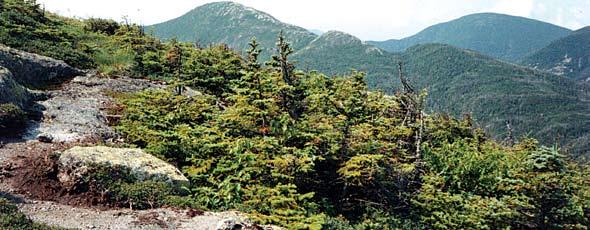
43 peaks that rise over 1,250 metres. Some of these 43 peaks have groomed trails to the top, while others don’t. Only one has a paved road. But let’s look at just five of them – my top all-time favourites that guarantee adventure.
If you’re seeking high altitude adventure in spectacular mountains, try the Adirondacks. They’re amazing!
Colden: Mountain and Lake
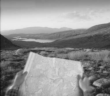
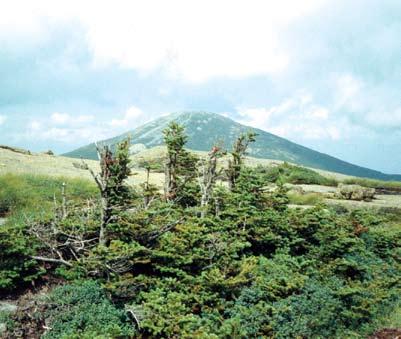
Mount Colden (1,414 metres) lies near the highest peaks (Marcy and Algonquin), but Colden’s trails are a lot quieter than those of its more famous sisters. While you can hike it in a day from the High Peaks Information Center at Heart Lake, you might want to stop the night before and camp at Marcy Lake. From Marcy Lake, follow the trail along Marcy Brook (it roars at high speed in spring), and then up and over Avalanche Pass and down to spectacular Avalanche Lake.
Towered over by mountains on both sides, Avalanche Lake has the allure of a West Coast fjord and is one of the Adirondacks’ crown jewels. Follow the trail along Avalanche Lake, and then along the east side of Lake Colden. Turn off to Mount Colden halfway down the lake. One of the steeper trails in the Adirondacks, it feels more vertical than horizontal as it whisks you to the summit, which is just above the tree line. From here, you’ll get great views on each side – of Marcy (the highest peak in the Adirondacks) and Algonquin (the second highest peak).
The Specs:
Distance: 22 kms round trip (approx.) Estimated duration: eight hours
Level of difficulty: moderately difficult Anticipate: a swim at Avalanche Lake, and summit views of Marcy and Algonquin Watch out for: coming back in the dark, everyone in your group should have a flashlight Facilities: none, come prepared
How to get there: Mount Colden from the High Peaks Information Center at Heart Lake
Follow signs to Marcy Dam. At Marcy Dam, follow signs to Avalanche Lake and Lake Colden. Follow path on the east side of Lake Colden to the summit. Algonquin and Iroquois:
How to Get to Lake Placid Information Centre from Ottawa From Ottawa, follow Highway 417 east. At Exit 58, follow Highway 138 south. At Cornwall, follow signs to the U.S. Border. After crossing the U.S. border, follow Highway 37 east to Malone. At Malone, follow Highway 30 south to Paul Smiths. At Paul Smiths, follow Highway 86 to Saranac Lake and Lake Placid. From Lake Placid, follow Highway 73 east. About four kilometres from Lake Placid, turn right onto Adirondak Loj Road and follow it until you get to the High Peaks Information Center and
The Ancient Border 2 Algonquin Peak (1,543 metres) is the second highest in the Adirondacks, and provides spectacular views of the northern and western Adirondacks. It can be completed easily in a day hike. Its close neighbour, Iroquois (1,452 metres), lies just to the south. The two peaks represented traditional boundaries of the Iroquois and Algonquin Native Peoples. The trail up Algonquin rises relentlessly, taking you quickly through different forest zones (maple-pine, birch, spruce-fir) and finally into tundra. The hike down the other side of Algonquin to Iroquois is superb. You’re always at or above the tree line, which means you can see incredible distances – almost forever.
The Specs:
Distance: Algonquin, 12.8 kms round trip (approx.); Algonquin and Iroquois, 16 kms round trip (approx.) Estimated duration: Algonquin, five hours; Algonquin and Iroquois, eight hours Level of difficulty: Algonquin, moderately difficult; Algonquin and Iroquois, moderately difficult and physically demanding Anticipate: substantial amount of trip above the tree line Watch out for: summer thunderstorms; bring rain gear; coming back in the dark, everyone in your group should have a flashlight Facilities: none; come prepared
How to get there: Algonquin and Iroquois from the High Peaks Information Center at Heart Lake
Follow signs to Algonquin Peak. At the summit of Algonquin, begin following the trail to Lake Colden. At the first trail fork, do not descend to Lake Colden, but keep to the right on the trail to Iroquois.
Basin, Saddleback and Haystack: A Very Rugged Weekend Trip
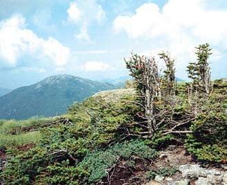
This hike offers probably the greatest adventure in the Adirondacks. Its sheer ruggedness, solitude and view of the great green Keene Valley spreading below make it the trip of the summer. But it’s not a day hike. You’ll have to backpack up through the Keene Valley to your campsite. Set aside three days for this adventure. Devote the first day to hiking in and setting up camp. The next day, you can hike Saddleback (1,354 metres) along with Basin (1,448 metres), or just Haystack (1,488 metres). Both require full day return trips.
You can do all three mountains in one arduous day. The ascents and descents of Basin and Saddleback prove very challenging. For this reason you should do a day hike from the campsite in the valley, rather than haul your backpack up and down these sisters. If you hike all three, you’ll be above the tree line a lot of the time. You’ll feel as if you’re in some mountain range in a remote corner of British Columbia. Many people consider the panorama from Haystack, with its view of Panther Gorge and the cliffs of Mount Marcy, to be the best from any Adirondack peak. Combine it with views from Saddleback and Basin for an unparalleled treat. Then, come back and do it again in winter.

The Specs:
Distance from John’s Brook campsite along Great Range Trail: round trip to Saddleback, 10 kms; round trip to Basin, 11.5 kms; round trip to Haystack, 20.5 kms
Estimated duration from John’s
Brook: Saddleback, four hours; Basin, five hours; Haystack (return by Slant Rock and Keene Valley) 10 to 12 hours. Level of difficulty: Saddleback, moderately difficult; Saddleback and Basin, difficult; Saddleback, Basin and Haystack, very difficult and very long Anticipate: substantial amount of your trip above the tree line, steep climbs and bouldering Watch out for: summer thunderstorms, bring rain gear; getting lost (you must have a map and compass); coming back in the dark, everyone in your group should have a flashlight Facilities: none, come prepared
How to get there: Basin, Saddleback and Haystack from Lake Placid
Follow Highway 73 east from Lake Placid to Keene Valley, and park at the main trailhead (also called the Garden). You and your party have the choice of camping at sites near the John’s Brook Lodge or along the Ore Bed Brook. Next day,
Ontario’s best camping solution
www.bushtukah.com 1-888-993-9947 203 Richmond Rd. Ottawa
4
Marcy, Skylight and Gray: Hiking Above the Tree line
Mount Marcy (1,603 metres), the highest point of the Adirondacks, offers great views in every direction, including all of the 42 other Adirondack peaks over 1,200 metres. But you need time and energy to get to the top; the hike from Heart Lake to Mount Marcy and return is over 22.5 kilometres, and is flat and boring in stretches. Still, the last leg of the climb involves a long walk up through alpine tundra. If you’re ambitious and fit, add Skylight to the day’s adventure. This involves going down the other side of Marcy, down below the tree line and then straight through to the summit of Skylight (1,478 metres). Return the same way.
From Marcy, you can also do Gray (1,452 metres), which has no maintained trail. You can reach it either from Lake Tear of the Clouds or directly from the summit of Marcy. (For precise instructions on how to reach Gray, see Guide to Adirondack Trails: High Peaks Region.) Only do this trip if you’re a prepared and fit hiker. It will likely take an additional three hours in high summer. One of my most memorable Adirondack outings involved hiking Marcy, Gray and Skylight all in one day. It took 14 hours in summer, but it can be done.
The Specs:
Distance: 23.5 kms roundtrip (approx.) to Marcy from High Peaks Information Center Estimated duration: Marcy, ten hours; Skylight, add two hours; Gray, add three hours Level of difficulty: Marcy, moderately difficult but long; Marcy and Skylight, longer; Marcy and Gray, difficult and very long Anticipate: substantial amount of your trip above the tree line Watch out for: summer thunderstorms, bring rain gear; getting lost (hikers must have a map and compass); coming back in the dark, everyone in the group should have a flashlight Facilities: none, come prepared
How to get there: Mount Marcy from the High Peaks Information Center at Heart Lake
From the trailhead, follow signs to Mount Marcy. There are several routes, but I recommend the route through Marcy
5Whiteface: The Civilized Mountain
Whiteface (1,460 metres) is grand, challenging and a g r e a t first hike in the Adirondacks. When you stand on its summit, you get a commanding view of Lake Placid, the long swath of the major Adirondack peaks to the south, the Champlain Valley and the Green Mountains to the east. But you’ll also have to share this peak with lots of other hikers.
The best route to the top starts on a dirt road off the Whiteface Mountain Memorial Highway. Follow the trail to the summit of Marble Mountain, take a short breather and start climbing again. You’ll soon level out on a high ridge covered with a boreal forest of spruce and fir. Here you’ll be walking in snow by Thanksgiving. A north wind whistles through the trees. You’ll feel as if you’re back in northern Quebec. The trail goes down into a wet area before heading up dramatically to the top. This last 800 metres is scenic and steep, requiring a lot of bouldering. Ignore the cars coming up the road beside you; pretend you’re in Labrador.
The Specs:
Distance: 16.5 kms round trip (approx.) Estimated duration: five hours Level of difficulty: moderately difficult, steep at the top Anticipate: summit views quite different from those from other Adirondack peaks Watch out for: crowds at the summit Facilities: restaurant at the summit
How to get there: Whiteface Trail From Lake Placid
From Lake Placid, follow Highway 73 north to Wilmington. At Wilmington, turn left onto Whiteface Mountain Memorial Highway. About one kilometre from the Wilmington turnoff, you will see on the left a dirt road with a small Department of Environmental Conservation sign. At the Town of Wilmington Reservoir, about one third of a kilometre up this road, there’s a parking area on the right. — Nat Stone has hiked the 43 high peaks of the Adirondacks in all seasons. He met his wife, Collett, on top of Cascade Mountain. Photographers Matt Stone and Ron Arnold accompanied Nat on some of his more exciting expeditions.
What to Bring For Day Hikes

Th e Guide to Adirondac k Trails: High Peaks Region (including a map), published by the Adirondack Mountain Club (www.adk.org) is a must. You can purchase it at leading outdoor equipment stores in Lake Placid or at the High Peaks Information Center.
For peaks without trails, the Guide to Adirondack Trails recommends that you bring the guidebook and the map, a compass, a flashlight with extra batteries and bulb, a first aid kit, insect repellent, matches, extra food and clothing (not 100 percent cotton) and rain gear designed to keep you warm and dry in case you have to spend the night out. (These precautions apply to all adventures described in this article.)
Bring a canteen with water; never drink straight from streams or lakes. Campers should boil or treat all water from streams or lakes.
Whiteface
Marcy, Colden, Algonquin, Iroquois
Saddleback, Basin, Haystack
Wilmington Notch (state campground) To reserve, call 1-800-456-2267
Adirondak Loj To reserve, call 1-518-523-3441 Marcy Lake (backpackers only)

John’s Brook, Ore Bed Brook (backpackers only) Follow trail marker or topo map. Left side of Highway 86 between Lake Placid and Wilmington
Follow Highway 73 2.5 miles east of Lake Placid, turn right onto Adirondak Loj Road
Follow Highway 73 east to Keene Valley. Park at the Garden


