4 minute read
Tour kayaking the Gatineau River
Kayak
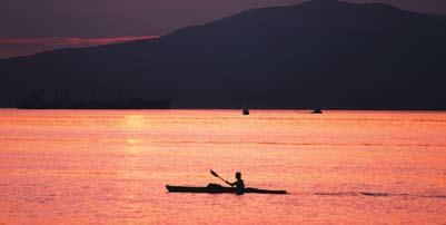
Imagine that magic moment when you finally hit the water and take your first paddle stroke of the day. All preparations are finished, and city cares seem a long way behind you. Your thoughts fill with anticipation of an enjoyable trip. You can almost smell the cool, clean air, and feel the excitement of this new river you’re poised to explore.
Advertisement
Flat-water paddlers wanting to taste a relaxing, day-long adventure a little farther from their usual haunts can find it on the Gatineau River at Low, Quebec. (See our “How to Get There” sidebar for details where to park your car and where to locate the put-in point to start your adventure.)
This stretch of river is still quite remote and undeveloped. The scarcity of cottages and road access points makes for a peaceful trip. The surrounding countryside is mostly forested, with the occasional farm tossed in to make the scene more interesting.
Because loggers used the river for log driving every spring until relatively recently, you’ll still find many deadheads poking out of the water. These are bad for fast-moving boats, but no trouble for slow-moving kayaks. Some of the deadheads are floating on the surface, some are submerged, but the most dangerous ones are jammed into the river bottom on

an angle. So keep your eyes peeled as you paddle.
What would make a nice day-trip destination? Head for Isle du Plomb. It’s about an 18-kilometre round trip. Plan to paddle for three to four hours total, depending on how fast you like to cruise. Of course, add extra time for swimming and exploring. You’ll find lots of small, interesting islands in your path. I didn’t notice any sandy beaches, but several islands have cleared public campsites – ideal for a picnic lunch and a swim if other campers aren’t already occupying them. (You may camp overnight on these sites if you want, on a first-come basis. No payment is required.)
Nosing Against the Mild Current
As you paddle away from your put-in spot you’ll pass through a 3-kilometre long bay with several islands. When you reach the main channel of the Gatineau River be sure to turn left and head upstream. Turning the other way leads you over the Paugan Hydro Dam – definitely not recommended!
If you keep close to the shore you can tuck in behind some small islands; this will make a more interesting trip. It will also provide shelter from the broader river beyond.
Several campsites and picnic spots lie scattered along your riverine route. You’ll find them at the south end of the large island on the east side of the river, at Isle du Plomb, and also on a nearby point of a small island. Some cottages lie on the western shore, hidden behind small islands.
Be sure to look to the northeast when you get to the bend in the river. You should be able to see Mont SainteMarie in the distance. At Isle du Plomb, turn your kayak’s nose around; it’s time to head back downstream for home.
Sightseeing is part of the joy of being out on the water. You’ll spot lots of wildlife. The river is home to many water birds, while you’ll find turtles and harmless water snakes in the more remote parts of the Gatineau River system.
In this area, the Gatineau is mostly undeveloped for long stretches; it gives the feeling of being very remote. You may find yourself imagining mountain men waiting in ambush for you around the next bend.
If you tackle this river in spring, expect strong currents. Later in the year the current slows to a barelynoticeable drift, due to the width of the river in this section. But watch out if you’re paddling on a windy day; then you can expect rolling waves on the open river, especially where it widens out on Paugan Bay near your parking spot.
Alternate Route
If you don’t like the idea of paddling upstream, ask someone to drop you off at the public put-in spot at Lac Sainte-Marie, further north – an
pal
re:From Ottawa, it’ll take an hour to get to your put-in spot at Low – good highway all the way. Head north on Highway 105 and pass through Wakefield, Alcove and Farrelton. As you enter Low, bear right at the first intersection. After about 500 metres, you’ll come to another intersection; go straight (the road to the right leads to the Paugan Dam). After another 400 metres take the gravel road to your right. It leads to the put-in spot (about 800 metres away) at the launch ramp. You can park for free all day in the munici
lot near the ramp. (Note: Overnight parking is prohibited. It’s also probably not a good idea anyway, since the lot is unsupervised.) If you need any last minute supplies, the stores in nearby Low will provide all your requirements.
Trail Pass and Map : Want more information about kayaking and canoeing activities in the Ottawa area? Consider joining a kayak/canoeing club. Check out the following sites: http://www.geocities.com/tk_2o/ — Touring Kayakers Ottawa/Outaouais http://www.flora.org/ncryccc/ — YMCA-YWCA Canoe Camping Club
Paddling Detail s:
Distance: 18 kilometres, but you can turn back at any time Time: Three to four hours paddling time (plus two hours for driving the round trip) Map reference: Topo map 31 G/13 Low 1:50,000
easy task if you travel with friends in two cars. Then it’s a simple, one-way, downstream trip back to Low. You’ll cover about the same distance as if you followed the other route.
The Gatineau River: it’s a wonderful

river that many people forget exists. Plan to explore it this summer. Its quiet beauty will rejuvenate you. — Ken Gullins likes to explore local rivers in a kayak with his family.


