PAFUN PALWATWICHAI
LANDSCAPE ARCHITECT
Nationality : Thai Tel. +66867860006 ploypafun@gmail.com
PROFESSIONAL EXPERIENCE
2014-2016
Integrated Field Co.,Ltd, (Bangkok) Landscape Architect
- Project: Bann Silom House
Schemetic Design, Preliminary Design, Design Development, Tender Drawing and Coordination
- Project: Coro Field Existing Site Study, Tender Drawing and Coordination
- Project: It’s Sara Cafe’ Schemetic Design, Preliminary Design, Design Development, Tender Drawing and Coordination
- Project: Beach Club Schemetic Design, Preliminary Design, Design Development, Tender Drawing and Coordination
- Project: Damnoen Kaset Existing Site Study, Schemetic Design, Preliminary Design, Design Development
- Project: Chiang Khan Argriculture Park Schemetic Design, Preliminary Design, Design Development, Tender Drawing and Coordination
EDUCATION
2009-2013
Bachelor of Landscape Architecture Department of Landscape Architecture Faculty of Architecture Chulalongkorn University (Bangkok, Thailand)
2017-2018 MSc Landscape Urbanism AALU Landscape Urbanism Architectural Association School of Architecture (London, UK)
2022 Chartered Members of the Landscape Institute (CMLI) Successfully completed Pathway to Chartership examinations in May 2022
SKILLS
Software
3D Modeling & Drafting
Autodesk Revit Proficient Autodesk Autocad Expert SketchUp Proficient Rhinoceros Competent
Rendering & Digital Image Lumion Expert Adobe Illustrator CC Competent Adobe Photoshop CS6 Expert Adobe Indesign CC Proficient
2019-2022
Townshend Landscape Architects(London) Landscape Architect
- Broad Marsh Public Realm, Nottingham Stage 3 Developed Design, Landscape drawings and documents, 3D model, Stage 3+ Tender Drawings, Monitoring and reviewing construction drawings
- Printworks Place and New Brunswick Street, Canada Water Stage 3 Planning Application, Design Studies, 3D Model
- Reel Street, Canada Water Stage 3 Planning Application, Design Studies, 3D Model
- Printworks Building, Plot H, Canada Water Stage 3 Planning Application, Design Studies, 3D Model
- Project Hub, Canada Water Stage 3 Planning Apllication, Stage 4 Tender Drawings
GIS
ArcGIS, QGIS Beginner Simulation Caesar-lisflood Beginner CEM Coastal Simulation Beginner
Scripting Processing Beginner Grasshopper Beginner Python Beginner


CORO FIELD Phase 1
Honor award in Commercial project Landscape design Type : Educational and Commercial Project Location : Suan Pheung, Ratchaburi, Thailand
Owner : Coro Brother Co,.Ltd. Architect : IF (Integrated Field Co.,Ltd.) Landscape architect : IF (Integrated Field Co.,Ltd.) Area : 8,548 sq.m. Completed : October 2016 (Phase 1) Responsibility : Design Development, Tender Drawings


CORO FIELD
Suan Pheung, Ratchaburi, ThailandLayers of Adaptation “bring the farming products and farming lifestyle from the farm to the urbanites”
Originate from the fascination of agriculture, the owner who owns an agriculture field on a vast land in Suan Phueng (Thailand scenery town) intends to bring the farming products and farming lifestyle from the farm to the urbanites. Therefore, the first phase of “Coro project” was located on the front area of the same plot with the farm to be the prototype of farming lifestyle and the Coro products display.
Due to the long-term strategy, the project extension is soon to be continued to strengthen the Coro ambition with more activities, products and experiments. This first development of the Coro project is a place for both plant and human with the design for the capability of supporting different activities responding to different circumstances.
The certain dimension of 1.50m, the proper distance of farming, defines a grid system, which connects each building layers from the open space to the enclosed. Structure, skin, services, space plan, and stuff are supporting each other to define different spaces. Moveable surfaces define different enclosure.
Modular furniture system defines different planning. Electrical outlets on the grid structure supply different activities and different adjustments. Consequently, the relationship of these layers generates the space’s resilience in order to encourage the creativity and diversity.

“ Modular Pattern”
The certain dimension of 1.50 m, the proper distance of farming, defines a grid system, which connects each building layers from the open space to the enclosed. Structure, skin, services, space plan, and stuff are supporting each other to define different spaces.


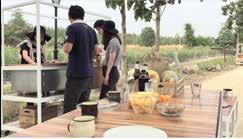
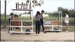
“ Modular Furniture”


This modular furniture is one of the elements that was designed based on the adaptation idea to suit with activities within different space. Electrical outlets on the grid structure supply different activities and different adjustments. It shows how each area can adapt to various circumstances which propose an idea that people can come and experience the area all year round.

More Information about the VDO please visit https://vimeo.com/155698897






More Information about the Project please visit https://www.integratedfield.com/coro-field


BEACH CLUB
Khao Lak Phang Nga

BEACH CLUB
Khao Lak, Phang Nga, Thailand
“Landscape Architect, Architect and Interior Architect works in field of integration”
Beach Club-Phang nga is situated directly on the beautiful, palm-fringed beach of Khao Lak. The resort includes two hotel buildings, located perpendicular to the beach, designed by Time Architect from Phuket, the locations of hotel buildings aimed to serve the best experience from sea view through every hotel room. While the communal spaces including gym, locker room, spa, restaurant, bar are located in the front beach parallel to the sea, called Beach Club.
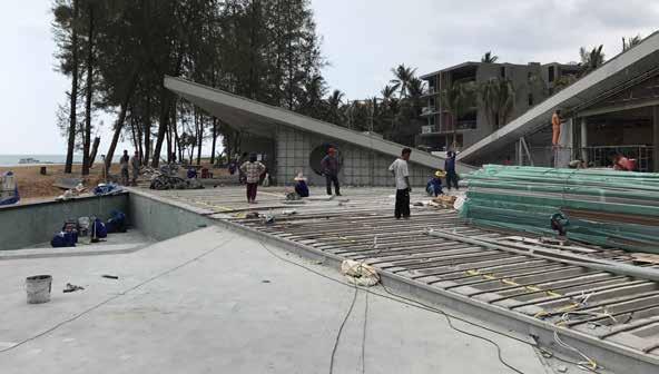
To prevent this beach club from obstructing the view from the hotel resident, we try to erase the back of the building by using the lawn on the ground continuously as a roof which make the wall seems “DISAPPEAR”. On the other side of the roof becomes space that fits in with program that link the activities and nature into the building. The shape and the space of this beach club becomes “APPEARS” to the sea. Each area under this green roof has different characters to suit its activity.
The form’s language of architecture acts as large triangle berms, to obscure any boundaries between hotel rooms behind beach club area and beach front view. With the panoramic view of the beach front as a starting point, this project was aimed to create a place that both visitors who come to dine, drink, think or chill at this place, and people who staying in the hotel rooms in the back can both enjoy themselves with this view.

Main dining area was design to feel like having a meal in your vacation home with an eclectic look represent through a long kitchen counter station while the dining space is set to be comfortably loose, opened and flexible for various activities.
The bar which located closer to the beach is designed to reflect the natural aesthetic. The glittering ocean surface and the horizon can be seen in the mirror wall which make the bar itself blending in with the surrounding as well.
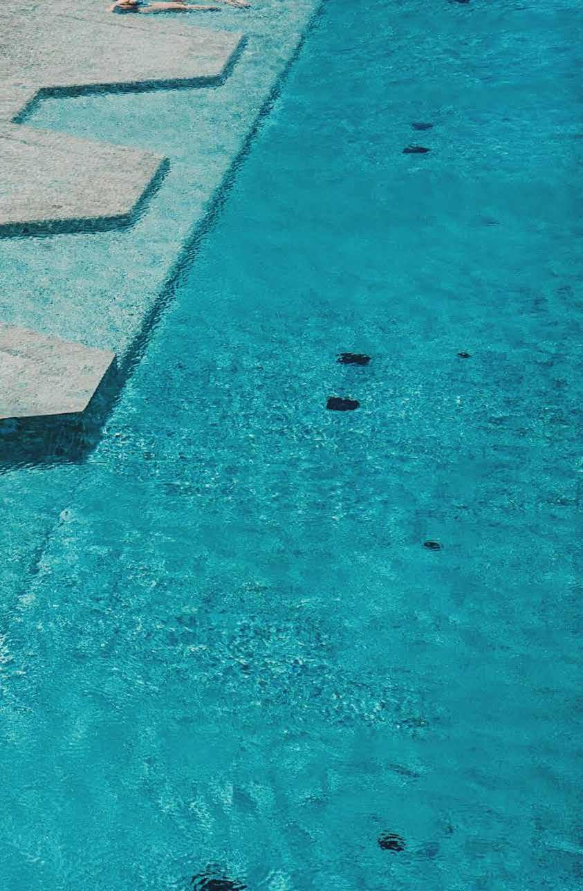
The triangular lap pool top is flatten as much as possible to be the same level as the beach which creates the seamless boundary to the ocean while swimming.
More Information about the Project please visit https://www.integratedfield.com/beach-club https://vimeo.com/256730452


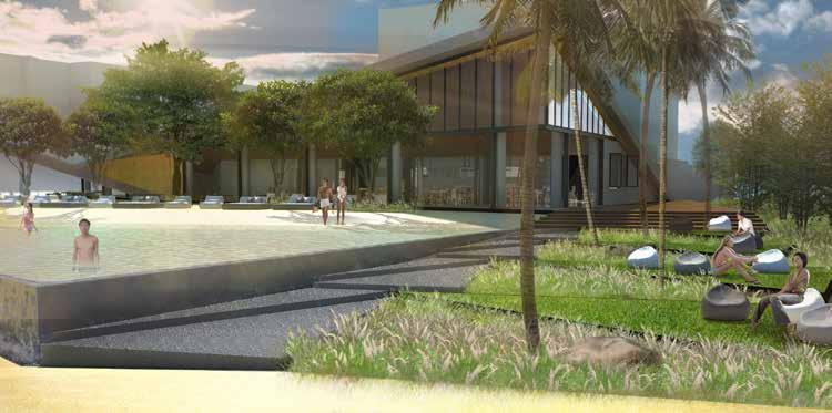
 Beach Club triangled infinity pool with the sea view.
Beach club front section

 Beach club side section
Beach Club roof is hidden and covered by lawn to blend into surrounding landscape




BROAD MARSH
Nottingham, England
“Creation of public realm space as part of a new gateway to the south of Nottingham city centre”
Broad Marsh is the public realm development that has been delivered as part of the creation of a new gateway to the south of Nottingham city centre with the demolition of Broadmarsh shopping centre and the construction of a new multi-storey car park, bus station, library and Nottingham College’s new City Hub.
The site is situated on a busy junction with existing buildings and infrastructure, which required extensive surveys to establish their structural forms. Design coordination of the public realm work has been challenging due to the number of stakeholders, contractors and designers involved in this project.
Where possible, the proposed ground was designed to fall toward the soft landscaping areas to minimise any increase of surface water run off to the existing drainage network and provide a better discharge rate. Channel drains were integrated with the paving patterns to provide a high-quality finish that avoided the requirement for any cutting on site, minimising waste.
Careful consideration has been given to the public realm and landscape scheme, with a focus on user experience and healthy communities, providing valuable greening, flexible use and important amenities. Areas linking the new buildings offer bright, tree-lined avenues with high quality granite paving, feature lighting, bespoke precast concrete and recycled timber street furniture. Rain gardens are incorporated to aid attenuation of rainwater on the road along with wildlife friendly planting, catering for pollinators while creating seasonal interest through colour, texture, and scent.


This new green, pedestrian-friendly public space for the city centre involved the most significant changes to a city centre road layout, and is being funded through the Government’s Transforming Cities Fund.


The scheme is to transform the look and feel of the area began in August 2020 to create new city centre of Nottingham City. The development also aimed to boost Nottingham City economy, creating more jobs and incomes. The road changes support plans to improve the city’s walking and cycling connectivity post-COVID pandemic, providing more routes through the city centre and better connecting the city centre to the wider Nottingham area.
The Masterplan is divided into 7 areas including Collin Street East and West, Lister Gate, Lister Square, Carrington Street, Middle Hill, and Sussex Street. The development aimed to create green, pedestrian-friendly public space for everyone especially people of Nottingham City to be able to use green public space in their everyday lives.
Collin Street East to West aimed to create linear park, celebrate the green spaces, waterways and heritage to create a unique environment which enhances ecological and biodiversity value and creates a stimulating environment which supports positive mental health. Wild gardens, woodlands, community gardens, waterways and art works will connect the development from east to west. This will form an important green space as part of the Masterplan, its animation is central to supporting the city’s recreational programmes, outdoor events calendar and community urban sports facilities.


Sustainable Urban Drainage System to help balancing the diversity in the city centre.

Meeting Point
Getting the right balance between people and nature to create socially engaging places that is great for wildlife as part of animmersive experience.


Collin Street West
C
Play Trail
Sculptural sandstone elements broadly follows the cliff line of the geological landmark to the city separating the Nottingham Castle Sandstone from Broadmarsh.
Collin Street East


The vision for Collin Street East as part of the Broad Marsh development is to provide a place that is active and spontaneous; a place that captures the imagination of children, teens and adults; whilst providing a green space for people to explore. Collin Street is not just a play space and should be a social area for the wider community, as such social spaces built into the play areas where parents can sit and watch their children play are important. Collin Street East is adjacent to the existing shopping mall, which will be demolished later stage through the development. The area of Collin Street East will be situated next to construction of existing shopping mall. We adopt the idea of a temporary hoarding line within our design, integrating social interaction activities within the hoarding including play element, green wall, and art works.
Hoarding - Art Work
The Hoarding Line is a ‘vertical’ pop-up park. The vertical park will be a vibrant linear space providing play, seating, sustainable planting and art - all on the vertical plane.


Hoarding - Play Element
Play element can be incorporated within the hoarding line, the temporary structure is also the key of Collin Street concept, to encourage young adult and children to be able to spend time within the area.


Hoarding - Green Wall
Working with specialists for adding planting and biodiversity including climbing wall, green wall, adding insect boxes.


A’
The Sussex Street area, located between Middle Hill and the new Nottingham College City Hub, has been inaccessible and unwelcoming for some time and will be transformed into a brighter, amphitheatre style space, with steps from Middle Hill to Sussex Street and an environment where people can relax and play, with new spaces for activity and exercise for young people, including skateboarding and other spaces for sport. These public spaces will be capable of hosting major events in the day and night, helping to further boost the city’s reputation for hosting top-class entertainment and activities.
Amphitheatre
The multi-functional space of amphitheatre can be used for events, exhibition, outdoor cinema, concerts and performances, and for recreation. The amphitheatre also connects the levels change between Middle Hill and Sussex Street.


Flexible Space
The centre of Sussex Street is designed to be flexible for all users. The area can be used for recreational activities such as picnic area or meeting point as well as physical activities including tennis, basketball and ping pong.

Skate Area
Towards the north of Sussex Street, skate area is being cooperated within the street to encourage teenagers and young adult to use public space in the right way.


Middle Hill, the areas are linking the new buildings offer bright, tree-lined avenues with high quality granite paving, feature lighting, bespoke precast concrete and recycled timber street furniture. Rain gardens are incorporated to aid attenuation of rainwater on the road along with wildlife friendly planting, catering for pollinators while creating seasonal interest through colour, texture, and scent.

To improve the historic frontages on Carrington Street under the City Council’s Townscape Heritage scheme has improved the facades of these buildings in time for new retail units to open on the ground floor of the Broadmarsh Car Park building on Carrington Street. Carrington Street also has been changed from the road vehicle into a pedestrian friendly walkway, the areas for locals not only to travel from north-south but also to relax including children to play, creating a better atmosphere to sit and dwell during the day.

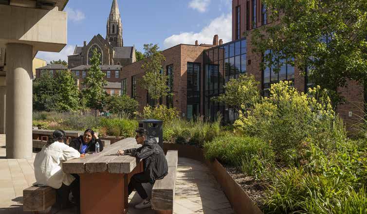 The completion of northern Sussex Street (2021)
 The completion of northern Middle Hill (2022)

PROJECT HUB Canada

PROJECT HUB
Dock Office, Canada Water, London
“The aim is to recreate the ‘spirit’ of a Victorian garden. Inspired by the legacy of the pioneering Victorian botanists and plant hunters.”
Proposals for refurbishment works to Grade II listed Former Dock Offices, and a new Canada Water Masterplan Project Hub at the Former Dock Offices is a part of Canada Water Masterplan, the 53 acre masterplan will deliver a new high street and town square. Providing new homes, workspace, a new leisure centre, with swimming pools, sports courts and gym and 35% of the masterplan will be public open space including parks and places to pause and relax. Canada Water is not only preserving but enhancing all of the local history, character and biodiversity that’s already here, it’s the UK’s most sustainable regeneration scheme.
The Canada Water, Project Hub is the first phase of Canada Water Masterplan that has been built. The area is not only important historically in terms of Dock Offices as Listed Buildings, but also the main area that will be used as Canada Water office buildings for the employee of British Land and others.
British Land has submitted a planning application and listed building consent to Southwark Council to carry out internal and external refurbishment works to the former Dock Offices(RMA application as part of Hybrid application), to preserve them as an important Grade II listed heritage asset. Some of the office space bordering Surrey Quays Road (which formally housed a business school) will also be refurbished to provide a new ‘Project Hub’ for the Canada Water Masterplan to oversee the regeneration of Canada Water into a new town centre for the local area.
Canada Water Project Hub is to be refurbished some of the Dock office space bordering Surrey Quays Road to provide a Canada Water Masterplan Project Hub. The Project Hub will contain a flexible exhibition, event space and recreational space, as well as office space for Canada Water Masterplan project staff.
Canada Water Project Hub
as part of Canada Water Masterplan


Canada Water Masterplan

“The objectives of masterplan development have been put together for the connecting routes and spaces across the Masterplan”
Design and Access Statement
The Design and Access Statement has been prepared by Townshend Landscape Architects on behalf of BL CW Holdings Ltd (a subsidiary of British Land Company Plc), the applicant and submitted in support of a Reserved Matters Application (RMA) for Project Hub, which is a part of Canada Water Masterplan.

Public Realm Vision


Place-making is at the heart of the Masterplan vision, with a Public Realm that brings together a network of carefully considered, locally distinct public squares, parks and streets, each with a distinct character, use and identity. The robust and high quality Public Realm will strengthen connections to existing neighbourhoods, and promote an urban environment where the quality of life and the quality of the environment are integral. The spaces will be animated places that people will enjoy, want to spend time and feel safe in. Canada Water will be a place of spontaneity and celebration pioneering a place to come.
Canada Water Masterplan Design Guidelines, Masterplan Public Realm


Canada Water Project Hub

Dock Managers Garden

Canada Water Project Hub/ Dock Offices


The former Dock Offices at Canada Water are Grade II listed, and British Land has submitted a stand alone planning application to carry out some restoration works to preserve this important local heritage asset. All restoration works will be carried out in line with the building’s listed status.


The Former Dock Offices to Surrey Commercial Docks built in 1893, designed by the engineer, James McConnochie for the Surrey Commercial Dock Company.
The aim is to recreate the ‘spirit’ of a Victorian garden. Inspired by the legacy of the pioneering Victorian botanists and plant hunters. The design is also to create a series of gardens that surprise and delight the visitors. The plant hunters of the Victorian era transformed British gardens, bringing back unique species and recreating gardens in which to reveal the unique character of the space. The planting is inspired by these botanical pioneers recreating a garden of treasures.

Dock Managers Garden
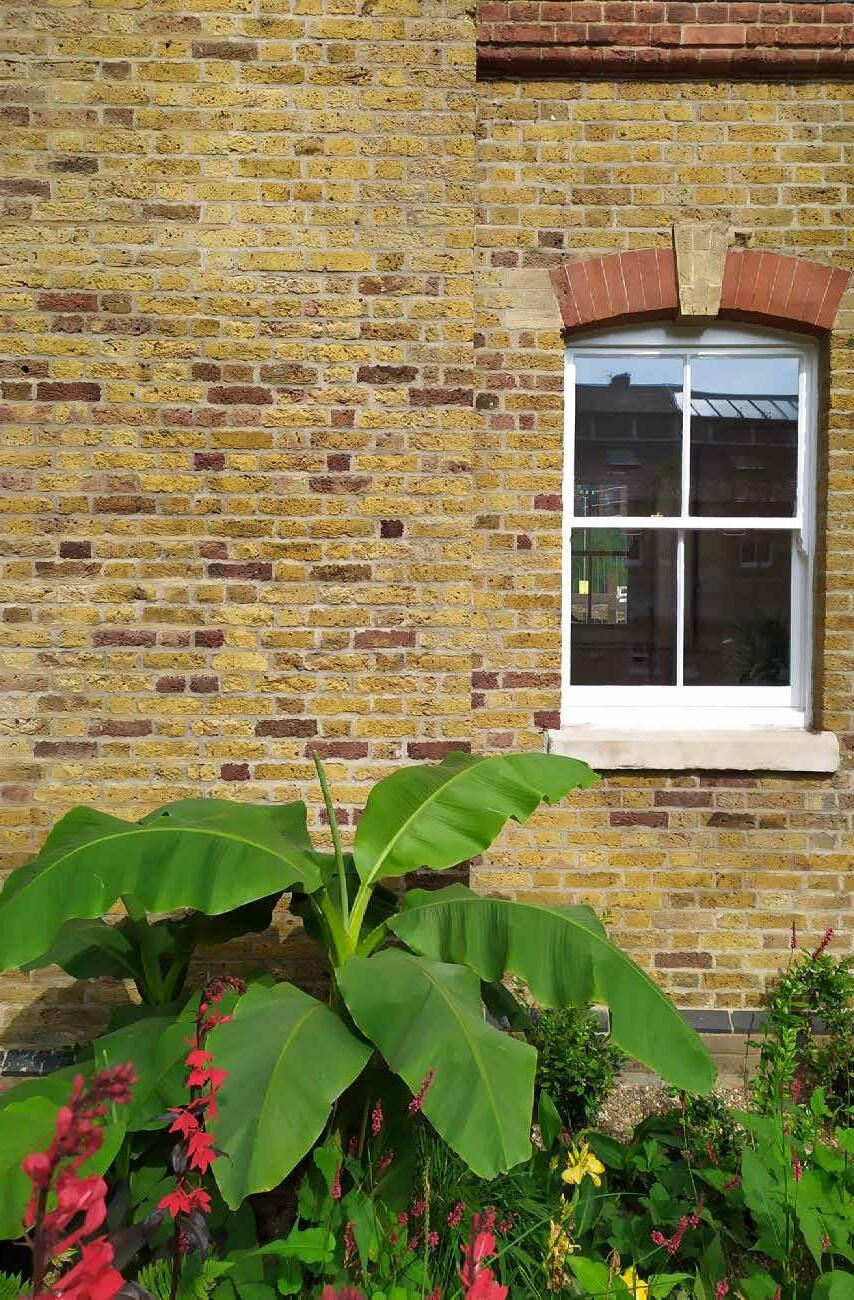
Materiality is essential within the development of Project Hub. The area is located within Dock Offices, which are registered as Listed Buildings, to preserve them as an important Grade II listed heritage asset. Some of the office space bordering Surrey Quays Road (which formally housed a business school) will also be refurbished to provide a new ‘Project Hub’ for the Canada Water Masterplan to oversee the regeneration of Canada Water into a new town centre for the local area. Within the courtyard, brick is an important key to keep the consistent touch of the buildings through the outdoor spaces.
Brick Paving Pattern Studies


Option 1 - Herringbone(Preferred option)


To bring back the history of London’s architecture. The herringbone brickwork was an extremely popular feature of houses constructed in the outer suburbs of London during the 1920s and 30s.
Option 2 - Art
Taking inspiration from the plant hunters of Victorian era. A chequered Victorian pattern with precious inserts with a collection of decorative tiles created by an artist, they will be invited and involved throughout the development process.


Option 3 - Sqaure
The idea is to keep the pattern simple with sqaure pattern with rich details, and to make the visitors feel more comfortable and relaxed when using this courtyard. Bricks will be paved with simple layout, illustrating the beauty of the craftwork on the brick itself.


Option 4 - Circle
Taking inspiration from the clock tower through evoking the geometry of the clock and the “parterre” of the garden.
Canada Water Project Hub
ZOOM IN PLAN AND ELEVATION

Canada Water Masterplan is developed through BIM coordination. The Project Hub is the first project that started using BIM system for Tender drawings.
Respond to the context Formality Respond to the formality of the building with a neat shape
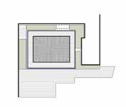


Define a rug Express the frame
Enrich a rug Characterize the rug with an elegant texture
“The design aims to create a series of gardens that surprise and delight the visitors”
Canada Water Project Hub


“BIM coordination helps facilitating the collaboration between engineers, structural engineers and architects”


 The completion of Project Hub/ Dock Offices courtyard (2022)
 The completion of Project Hub/ Dock Offices courtyard (2022)


Canada Water Masterplan

“The objectives of masterplan development have been put together for the connecting routes and spaces across the Masterplan”
Design and Access Statement
The Design and Access Statement has been prepared by Townshend Landscape Architects on behalf of BL CW Holdings Ltd (a subsidiary of British Land Company Plc), the applicant and submitted in support of a Reserved Matters Application (RMA) for Printworks Place and New Brunswick Street, which is the land adjacent to Zone F, G + H and J of the Canada Water Masterplan.

Public Realm Vision


Place-making is at the heart of the Masterplan vision, with a Public Realm that brings together a network of carefully considered, locally distinct public squares, parks and streets, each with a distinct character, use and identity. The robust and high quality Public Realm will strengthen connections to existing neighbourhoods, and promote an urban environment where the quality of life and the quality of the environment are integral. The spaces will be animated places that people will enjoy, want to spend time and feel safe in. Canada Water will be a place of spontaneity and celebration pioneering a place to come.
Canada Water Masterplan Design Guidelines, Masterplan Public Realm


 Age-friendly cities Places that feel safe
Place for community
Engaging with children and ecology

Printworks
Printworks Place Public Realm
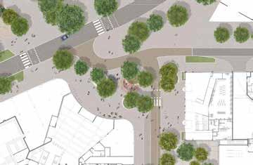
Printworks Place(PWP) is a public space which sits at the junction Development Site where Printworks Street and New Brunswick Street meet the existing Surrey Quays Road.
Printworks Place(PWP) forms part of the Masterplan’s Green Link, a strategic connection which links Southwark Park to Russia Dock Woodland. The Green Link also forms part of the route which connects two of the Masterplans key public spaces, Canada Water Dock and the Park.
The space provides a range of uses including seating, planting and cycle parking. Lighting will be designed to make Printworks Place an attractive area for people to dwell after dark and ensure the public realm remain accessible and safe to all after dark.

Pedestrian
SurreyQuaySroad
SurreyQuaySroad
SurreyQuaySroad
Place to Meet
Example of an interactive artwork or IFO by Jaques Rival at Battle Bridge Place, King Cross acts as a meeting point and land marker.

Pedestrian Movement Pedestrian and cycle crossing
One way road Pedestrian crossing
Indicative location of cycle store entrance to long stay cycle facilities within the proposed building. Exact locations will be confirmed within the Development Zones RMA’s.


On carriageway cycle route
Short stay visitor cycle parking Off carriageway cycle route Contra Flow cycle lane


 Illustrative view of Printworks Place Indicative view of seating within Printworks Place
New Brunswick Street Public Realm
New Brunswick Street is designed as a neighbourhood street, a space that will provide a sense of community by providing routes that prioritise people and are comfortable, safe and easy to use, whilst allowing for the required access and servicing requirements for each surrounding plot. The arrangement of the carriageway has been organised to slow vehicles down through creating a natural chicane arrangement that allows for tree planting.


 Illustrative views of New Brunswick Street
